|
Proper Municipality Name |
Photo Description |
Photo |
|
Photos taken
from driver's perspective appear offset from centre-line photos: |
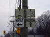
East-
Bound |
West-
Bound |
|
London to Toronto Images |
|
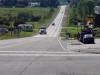
Though it is now signed and known
as the Gardiner. The Humber River marks the former Western Terminus of
the QEW.
Click here for QEW Images. |
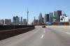
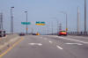
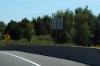
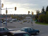
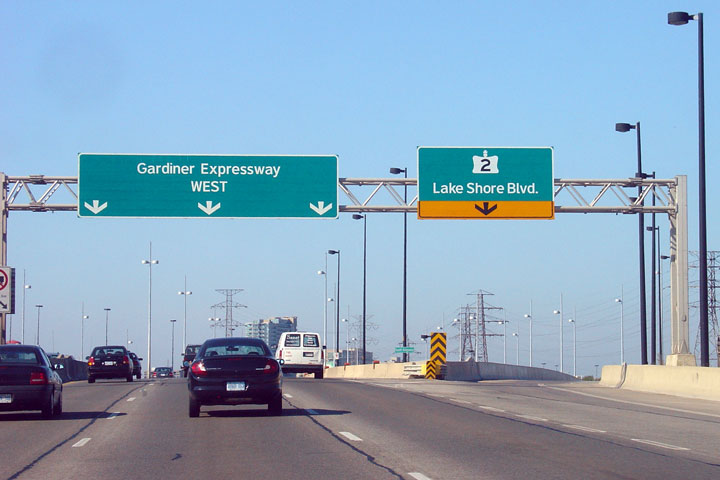
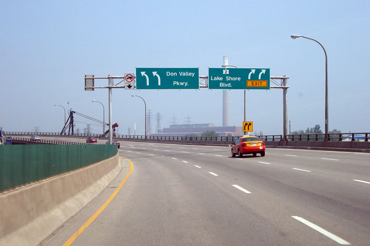
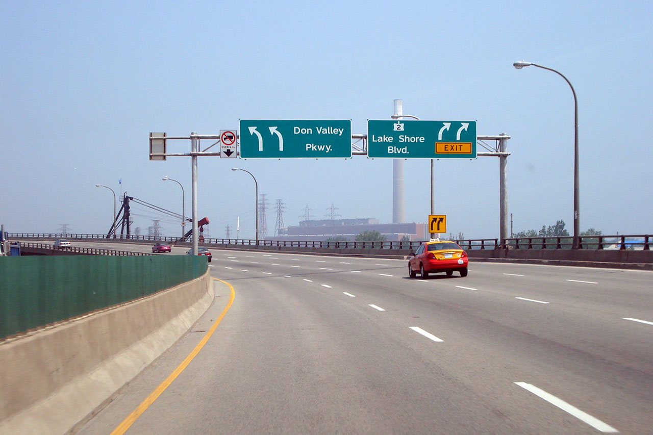
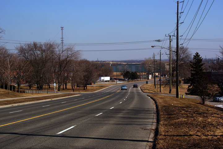
| City of Toronto |
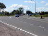
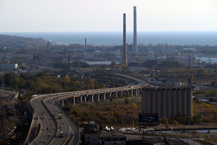
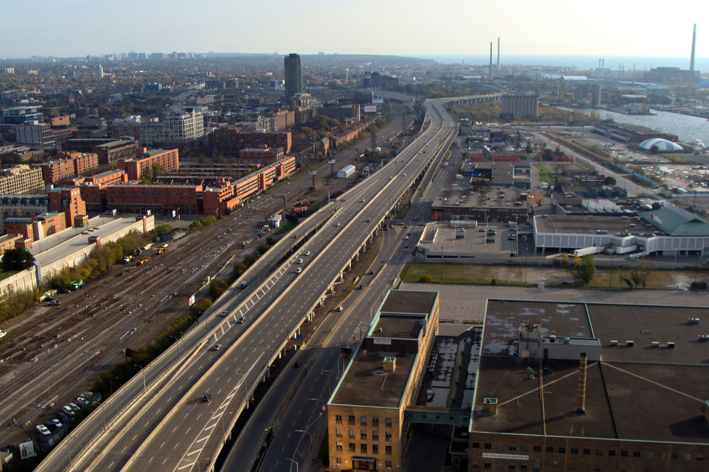
Westbound view of the Gardiner/QEW as Highway 2
departs the freeway becoming Lakeshore Boulevard. This location marks the
former Toronto terminus of the QEW. Photo taken: August 2007. |
(720x480)
(1440x960) |
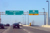
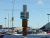
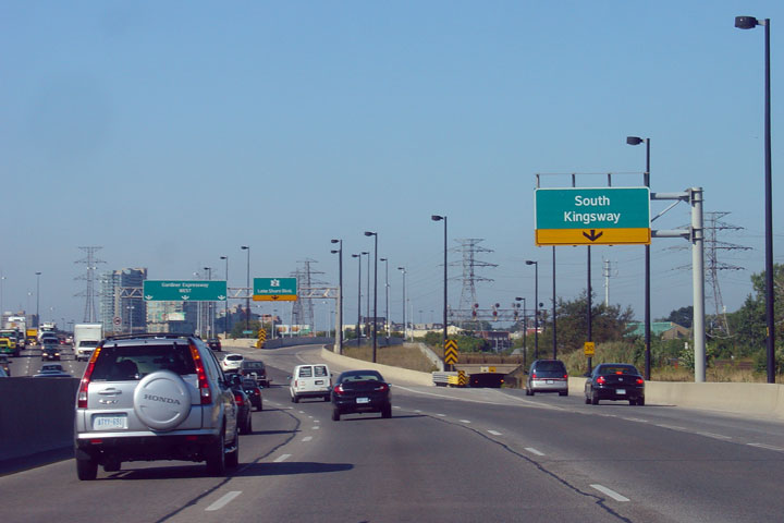
| City of Toronto |
Partial overhead guide signage for the exit to
the South Kingsway. Photo taken: August 2007. |
(720x480)
(1440x960) |
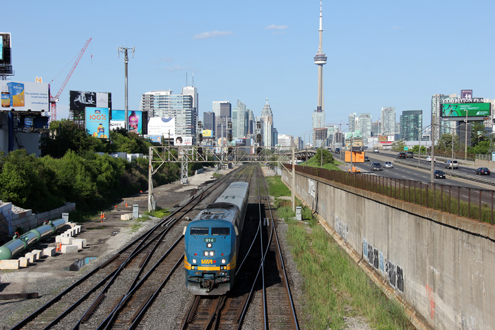
| City of Toronto |
Two views looking easterly from the Dufferin
Avenue overpass towards Downtown Toronto.
Photos taken: June 5th, 2011. |

(720x480)
(1440x960)
(2400x1600)
(720x480)
(1440x960)
(2400x1600) |
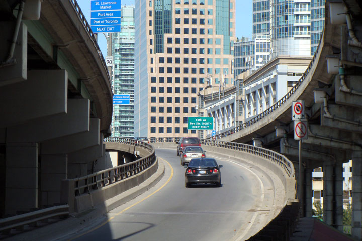
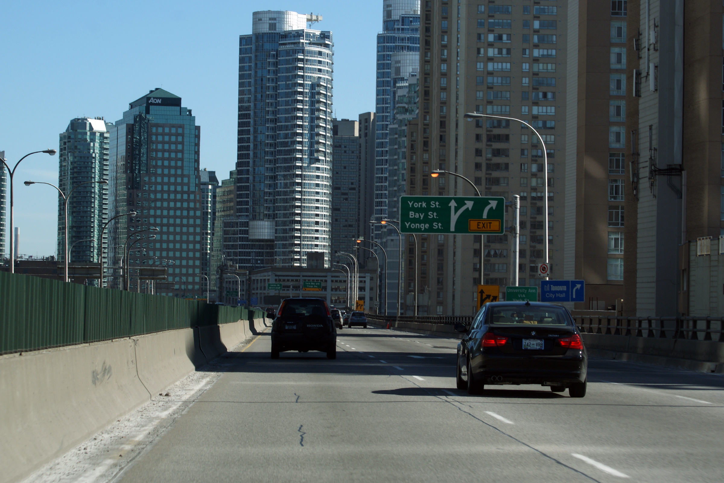
| City of Toronto |
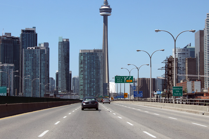
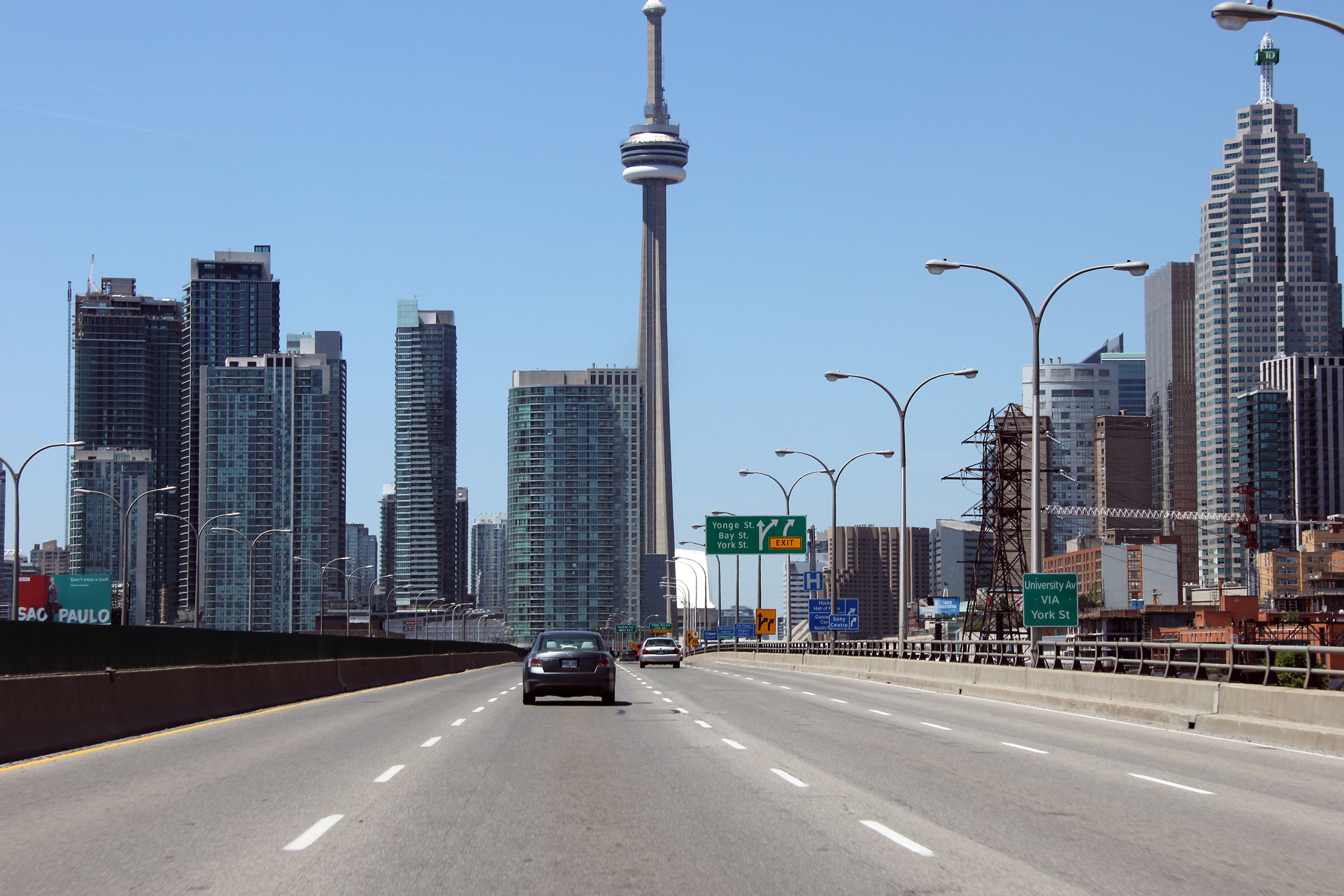
Eastbound overhead signage in advance to the
ramp to York Street, Bay Street and Yonge Street in Downtown Toronto.
Photo taken: March 6th, 2010. |
 (720x480) (720x480)
(1440x960)
(2400x1600) |
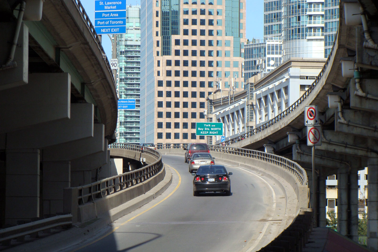
| City of Toronto |
The eastbound on-ramp to the Gardiner Expressway
from Rees Street is sandwiched between the eastbound off-ramp to York Bay
and Yonge Street, and the expressway itself.
Photo taken: May 15th, 2008. |
(720x480)
(1440x960) |
|
City of Toronto
|
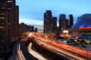
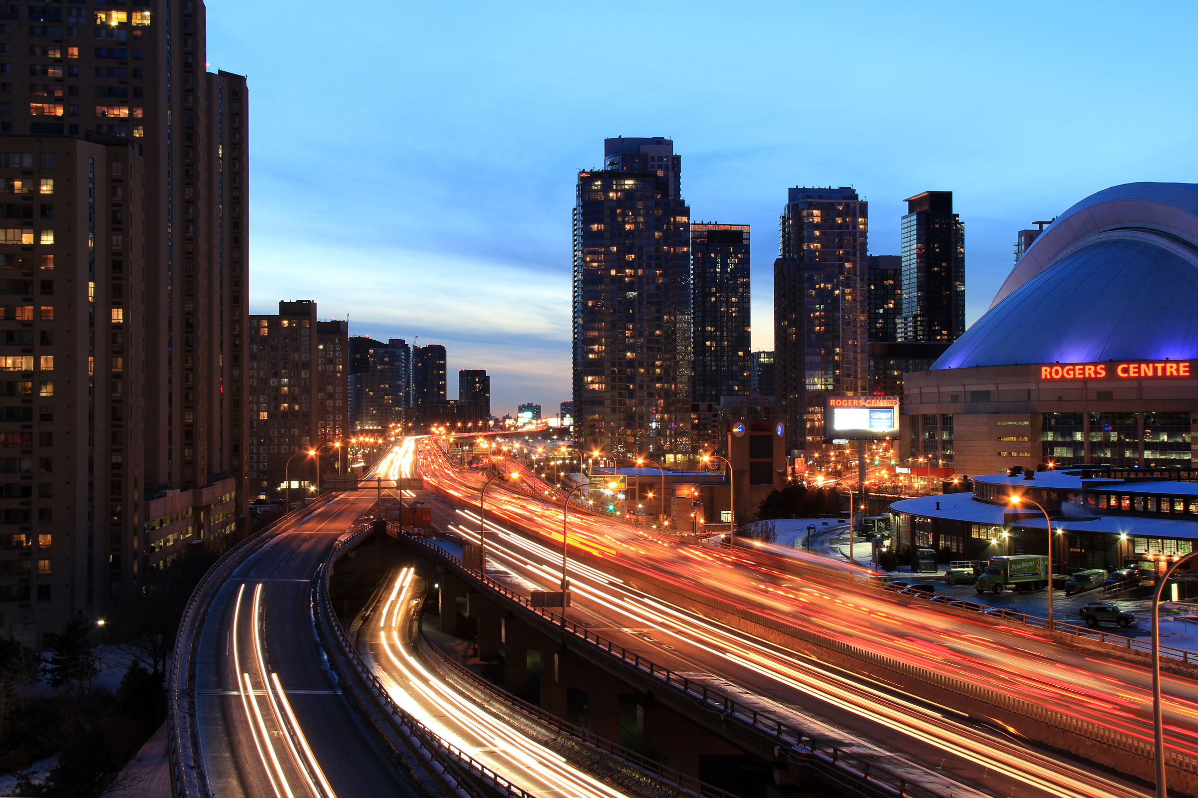
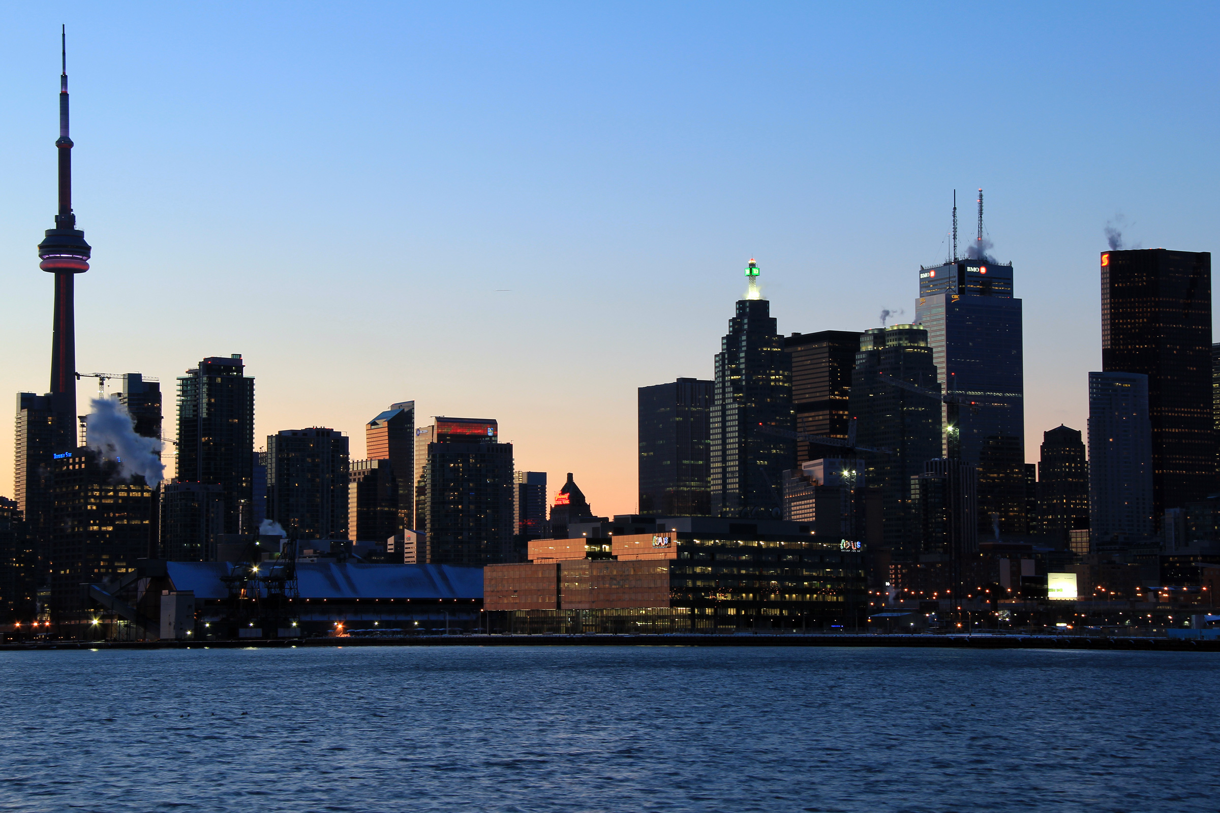
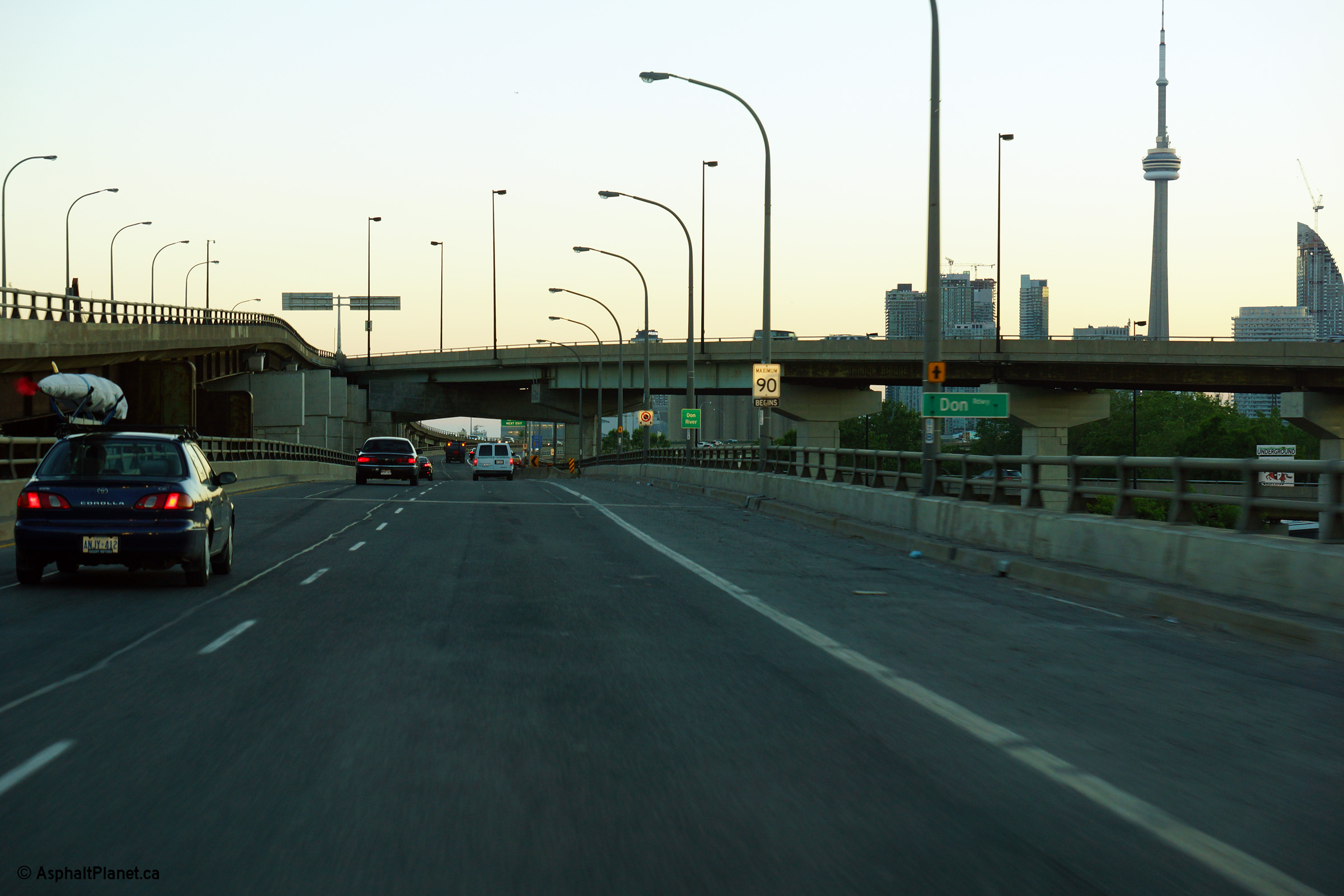
Two views looking westerly along the Gardiner
Expressway from Rees Street into the setting sun. Toronto's
condominium boom has changed the western downtown core considerably. When the
Rogers Centre (then Skydome) opened in 1989, the venue was surrounded by
derelict industrial areas. Just a decade later, the same area is
inhabited by tens of thousands of people. Toronto Planning staff are
planning a similar transition for an area of Toronto colloquially known as
the Portlands, an area that is located at the mouth of the Don River, east
of Downtown. With government mandates
such as Ontario's Greenbelt Act, there is increasing pressure to curb
residential sprawl, and redevelop 'brownfields' with new mixed use
residential and commercial developments.
Photos taken: December 27th, 2010.
|
(720x480)
(1440x960)
(2400x1600)

(720x480)
(1440x960)
(2400x1600) |
| City of Toronto |
This view is obviously not of the Gardiner Expressway, but
is from the same vantage point as both the preceding and succeeding photo.
This view looks northerly along the Simcoe Street corridor to several new
commercial and residential skyscrapers that have been constructed in recent
years.
Photo taken: December 27th, 2010. |

(720x480)
(1440x960)
(2400x1600) |
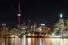
| City of Toronto |
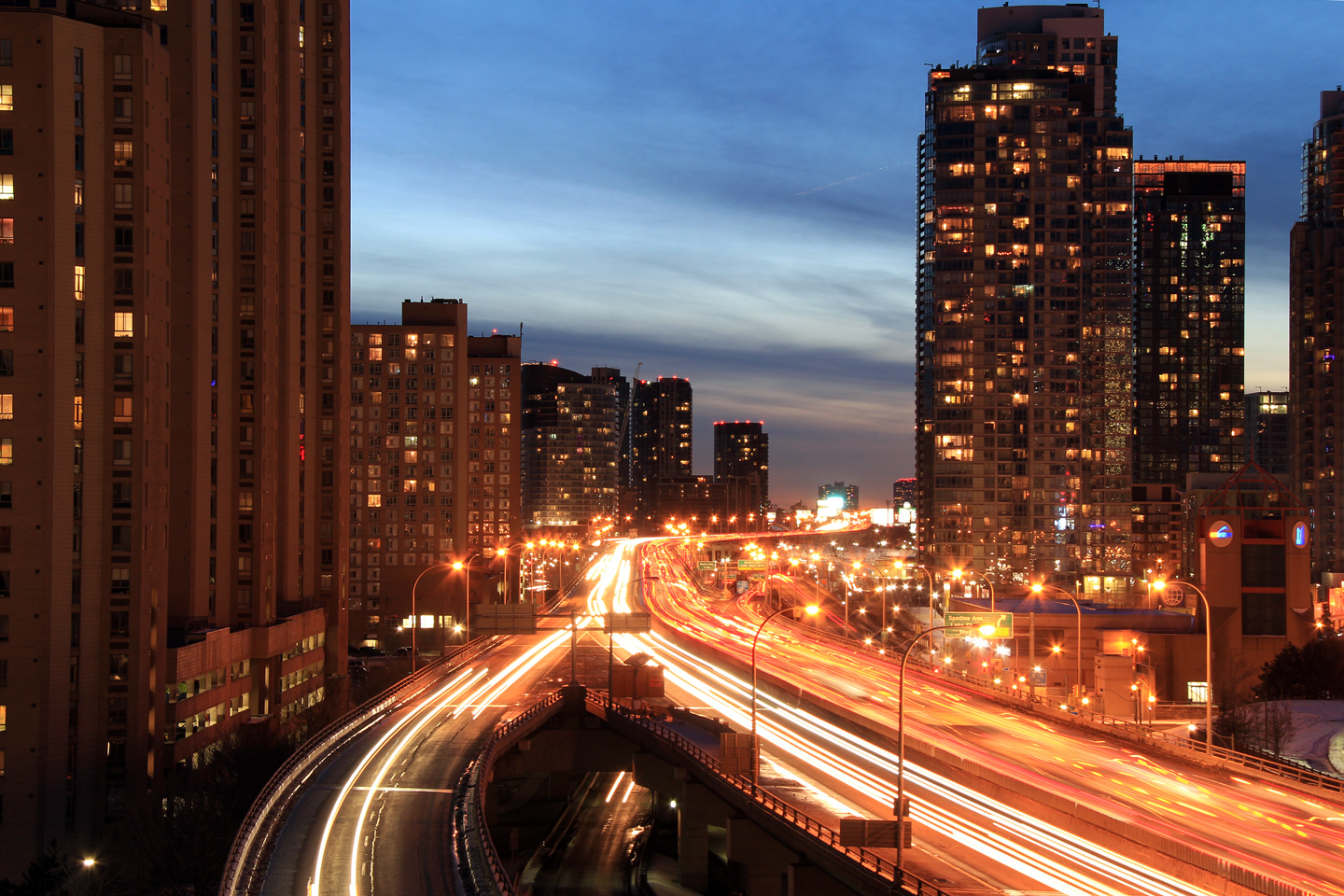
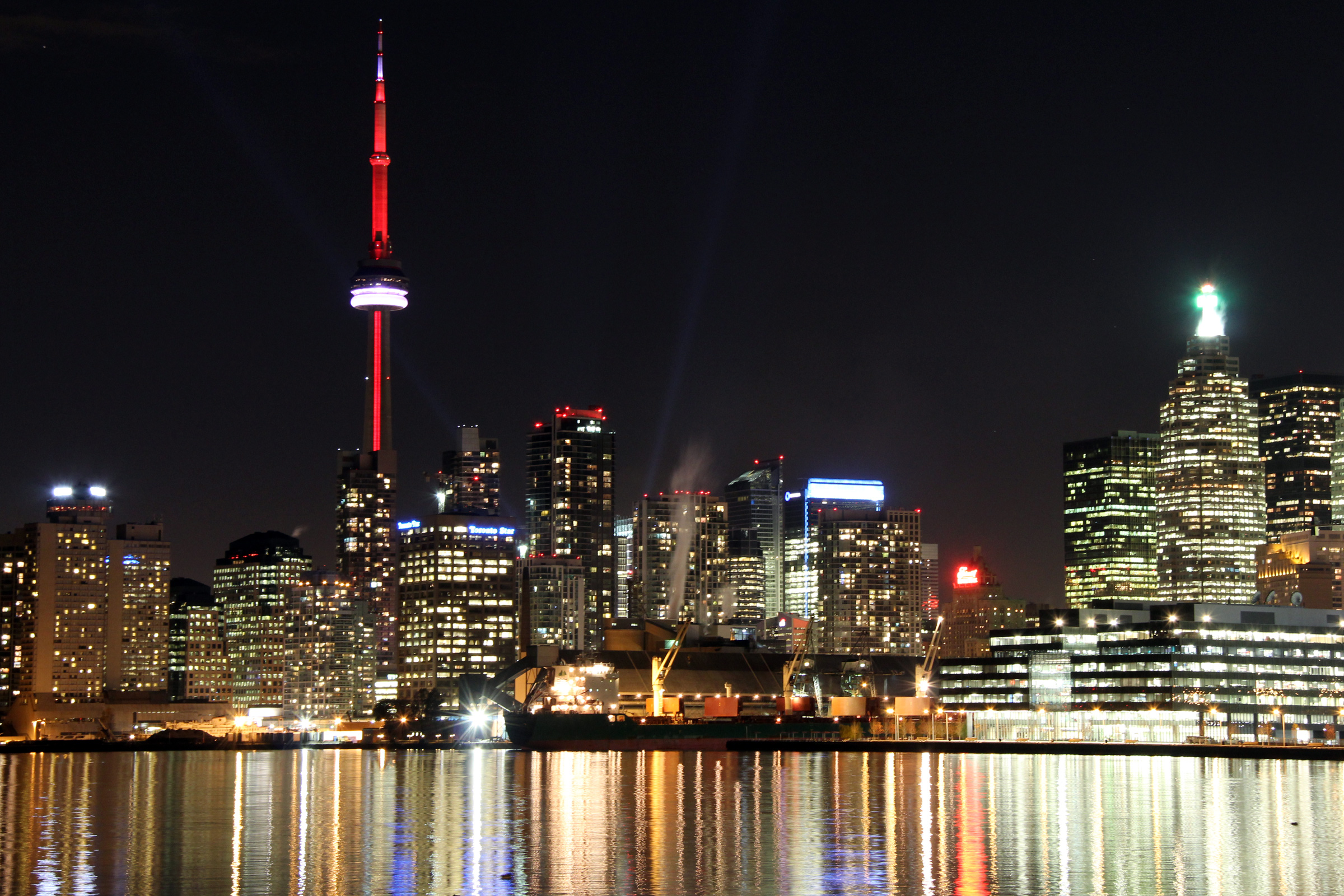
Easterly view from Rees Street along the
Gardiner Expressway at night. Drivers along the Gardiner Expressway
are presented an unrivaled view of Downtown Toronto.
Photo taken: December 27th, 2010. |
(720x480)
(1440x960)
(2400x1600) |
|
Yonge Street carried the Highway
11 designation until 1997.
Click here for Highway 11 images. |
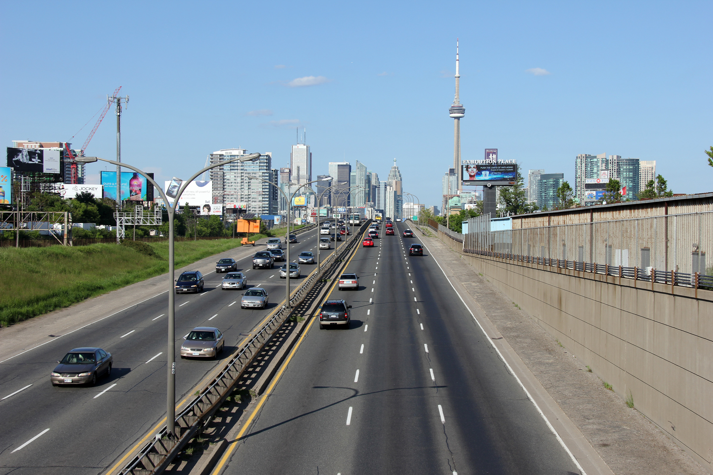
| City of Toronto |
View looking easterly overtop
of the Gardiner from high atop the foot of Yonge Street.
Photo taken: November 2008. |

(720x480)
(1440x960) |
| City of Toronto |
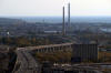
The Gardiner meets the Don
Valley Parkway in a particularly 'scenic' part of the city.
Photo taken: November 2008. |
(720x480)
(1440x960) |
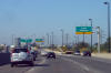
| City of Toronto |
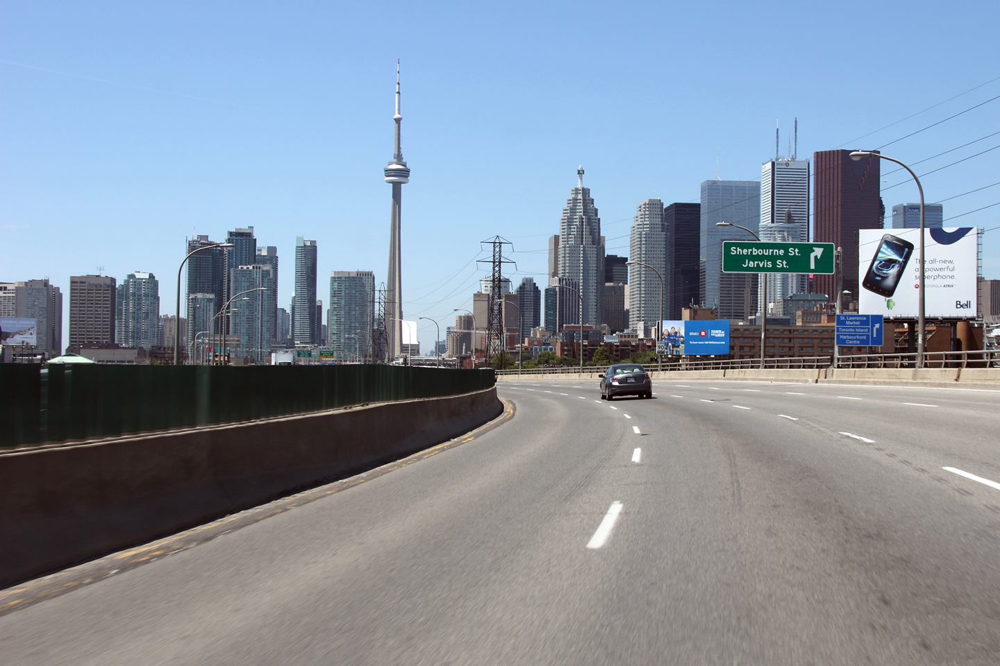
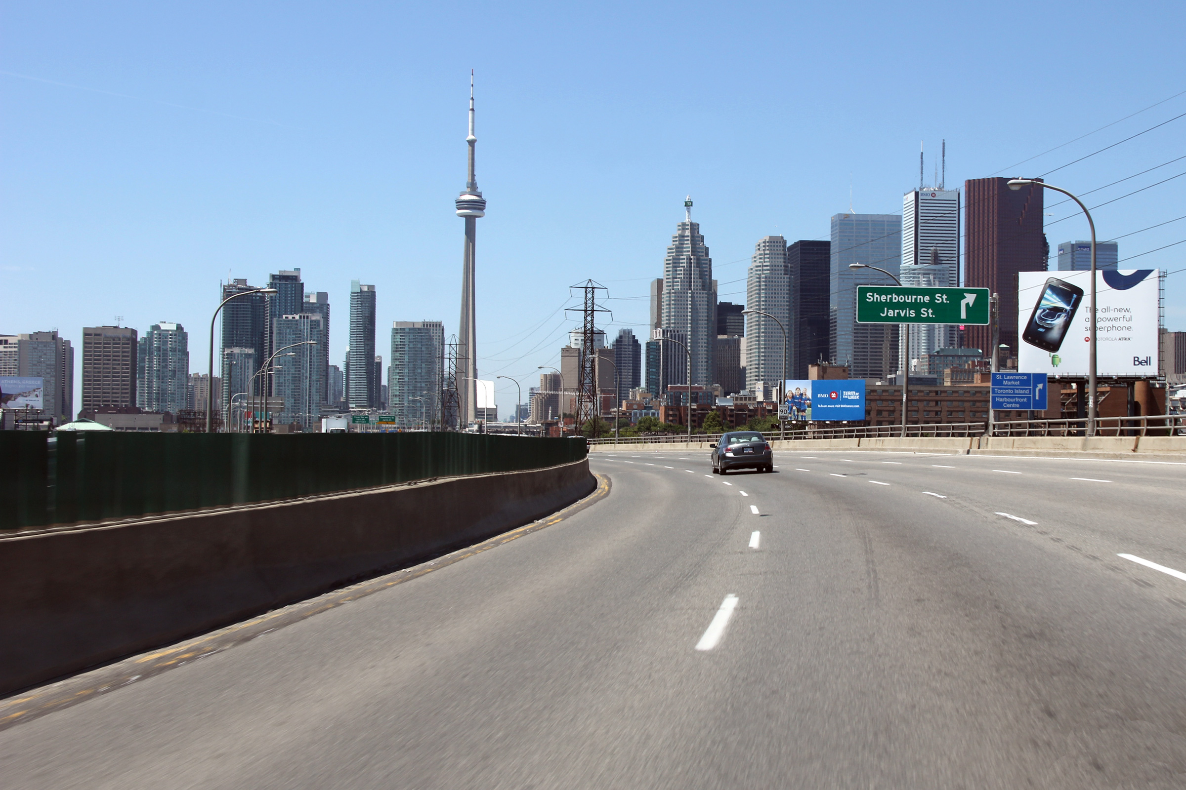
At the advanced sign for the York, Bay
and Yonge Streets interchange.
Photo taken: July 1st, 2011. |
 (720x480) (720x480)
(1440x960)
(2400x1600) |
| City of Toronto |
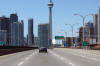
Driving westbound along the Gardiner at
the exit to Jarvis Street.
Photo taken: July 1st, 2011. |
 (720x480) (720x480)
(1440x960)
(2400x1600) |
| City of Toronto |
Rounding the curve westbound
approaching the exit to Jarvis Street.
Photo taken: July 1st, 2011. |
 (720x480) (720x480)
(1440x960)
(2400x1600) |
| City of Toronto |
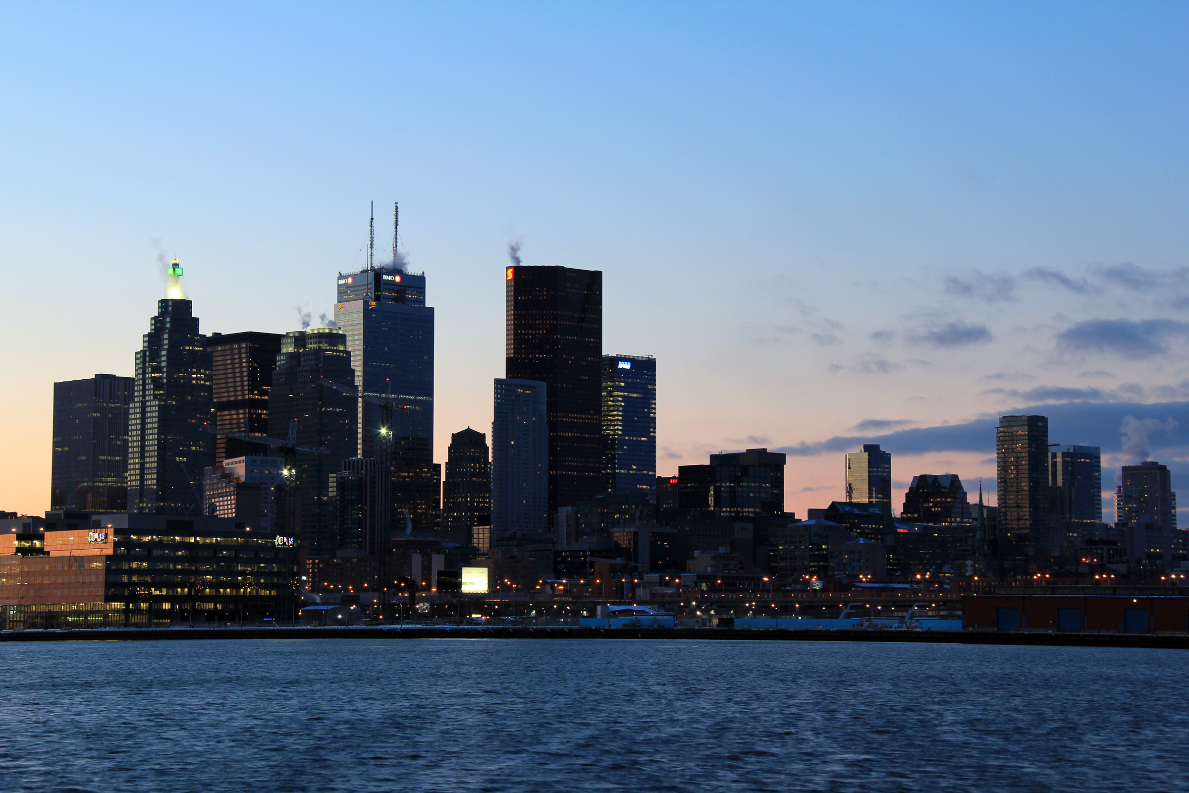
Two evening views of Downtown Toronto from the Polson Street
Pier in Downtown Toronto. During the fall of 2010, I experimented
considerably with low light exposures. Low light exposures are more
difficult to capture than a conventional exposure. Some tips that I
have learned during my trials: Use a good tripod: A flimsy tripod will
reward a photographer with a blurry photo. Weather is extremely
important: Unless a photographer is looking for a specific effect, avoid
taking photos on hazy or windy days. On a hazy day, photos don't turn out
clearly, and will appear far more grainy than they would had they been taken
on a clear day. Finally, even with a good solid tripod, a windy day
can blow at tripod around every so slightly, and can make for a blurry
photo.
Photos taken: January 2nd, 2011. |

(720x480)
(1440x960)
(2400x1600)

(720x480)
(1440x960)
(2400x1600)
|
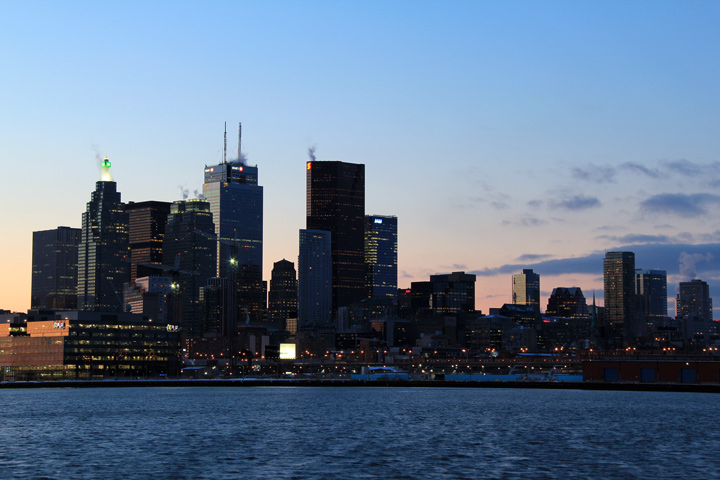
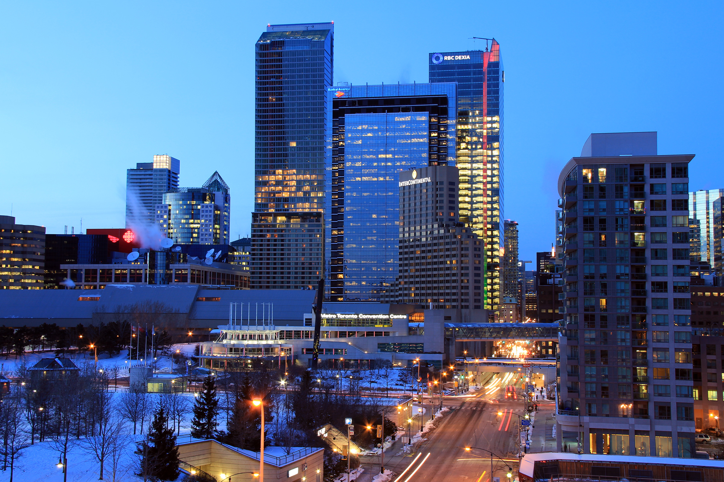
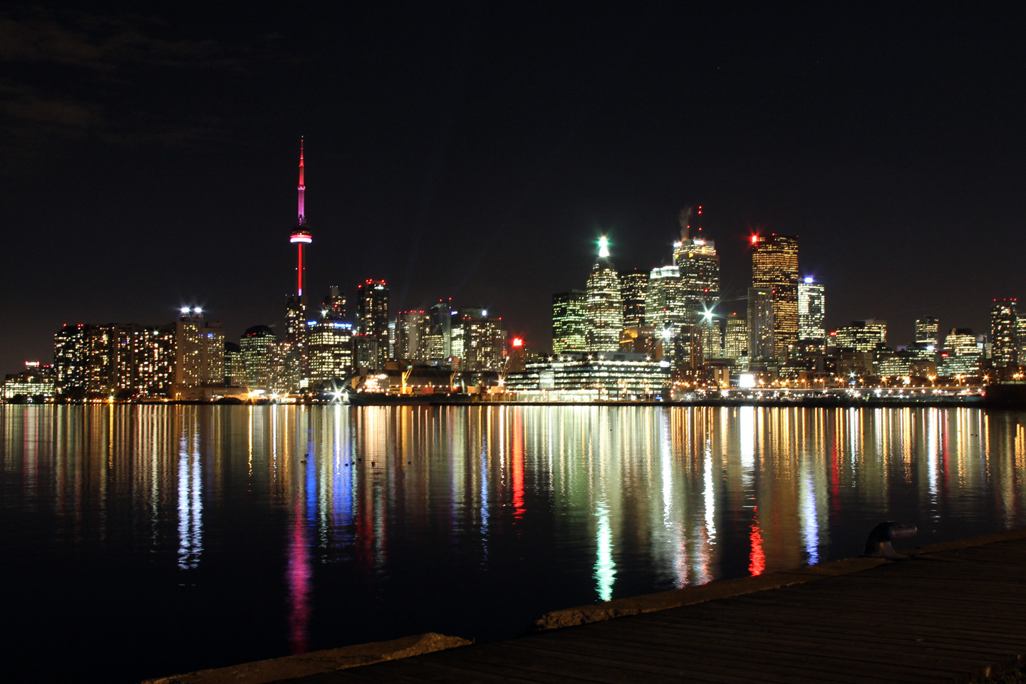
| City of Toronto |
Obviously, not directly of Highway 2, though the
Gardiner is included in this photo. This photo is of the Toronto
Skyline taken a particularly calm November evening. This vantage point
is almost the same as the previous photos.
Photos taken: November 2nd, 2010. |

(720x480)
(1440x960)
(2400x1600)
(720x480)
(1440x960)
(2400x1600) |
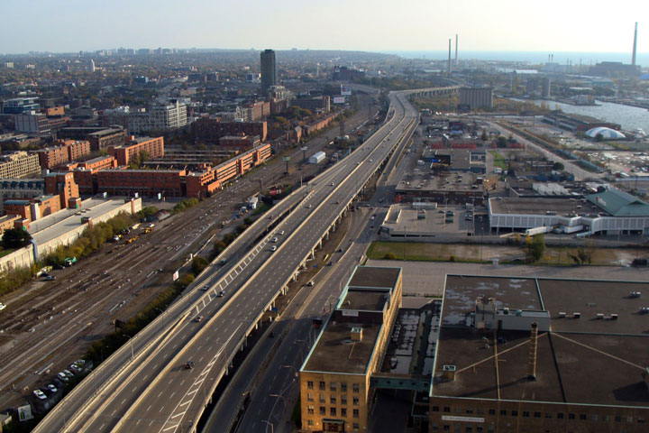
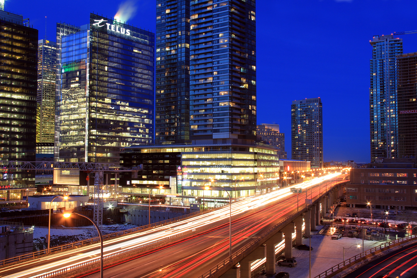
| City of Toronto |
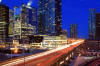
View looking westerly from
Lakeshore Boulevard towards the Toronto Dominion Centre.
Photo taken: June 5th, 2011. |
(720x480)
(1440x960)
(2400x1600) |
| City of Toronto |
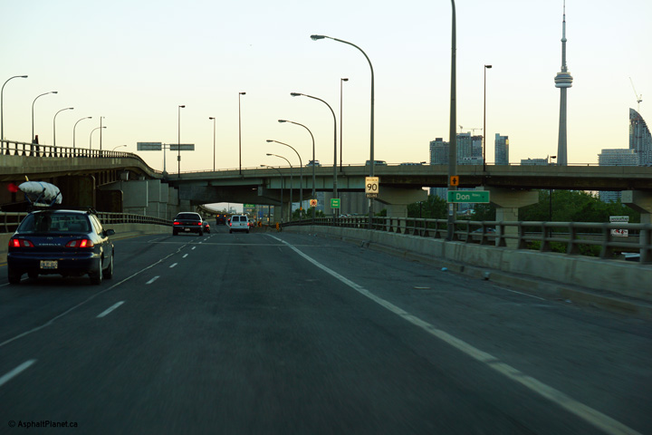
Approaching the east end of the Gardiner, this
overhead can be found for the impending split between the Don Valley Parkway
and the kilometer long ramp to Lake Shore Boulevard. Photographer: Dan
Garnell. Photo taken: July 2007. |
(720x480)
(1440x960) |
| City of Toronto |
Butterfly gantry at the ramp to the DVP from the
Gardiner. Notice the painted arrows denoting the exiting lanes.
Photographer: Dan Garnell. Photo taken: July 2007. |
(720x480)
(1440x960) |
|
The Don Valley Parkway carries
traffic between Downtown Toronto and Highways 401 and 404.
Click here
for DVP images. |
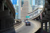
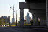
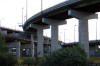
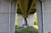
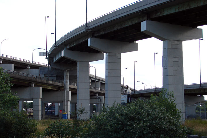
| City of Toronto |
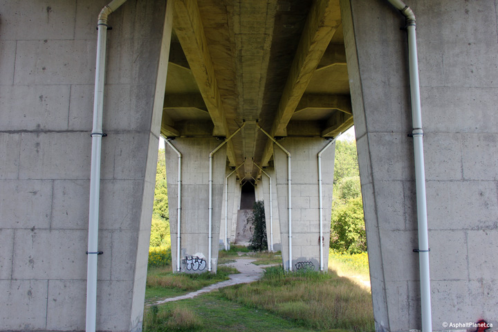
Neat view from ground level at
the towering DVP/Gardiner flyover. Photographer: Josh Anderchek. |
(720x480)
(1440x960) |
| |
View looking westerly along the Gardiner
Expressway as the westbound lanes pass beneath the flyover ramp from the
eastbound Gardiner to the northbound Don Valley Parkway. |
 (720x480) (720x480)
(1440x960)
(2400x1600) |
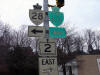
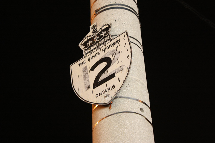
| City of Toronto |
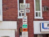
This unique sign is found in Scarborough.
It is formerly a Highway 12 shield that has been overlaid with a Highway 2
shield. Re-uses of highway signs in this manner is fairly common
practice in
Ontario.
Photographer: Josh Anderchek. |
 |
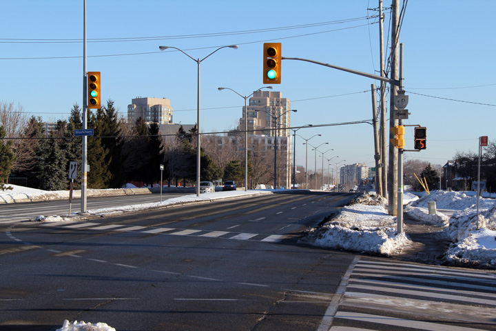
| City of Toronto |
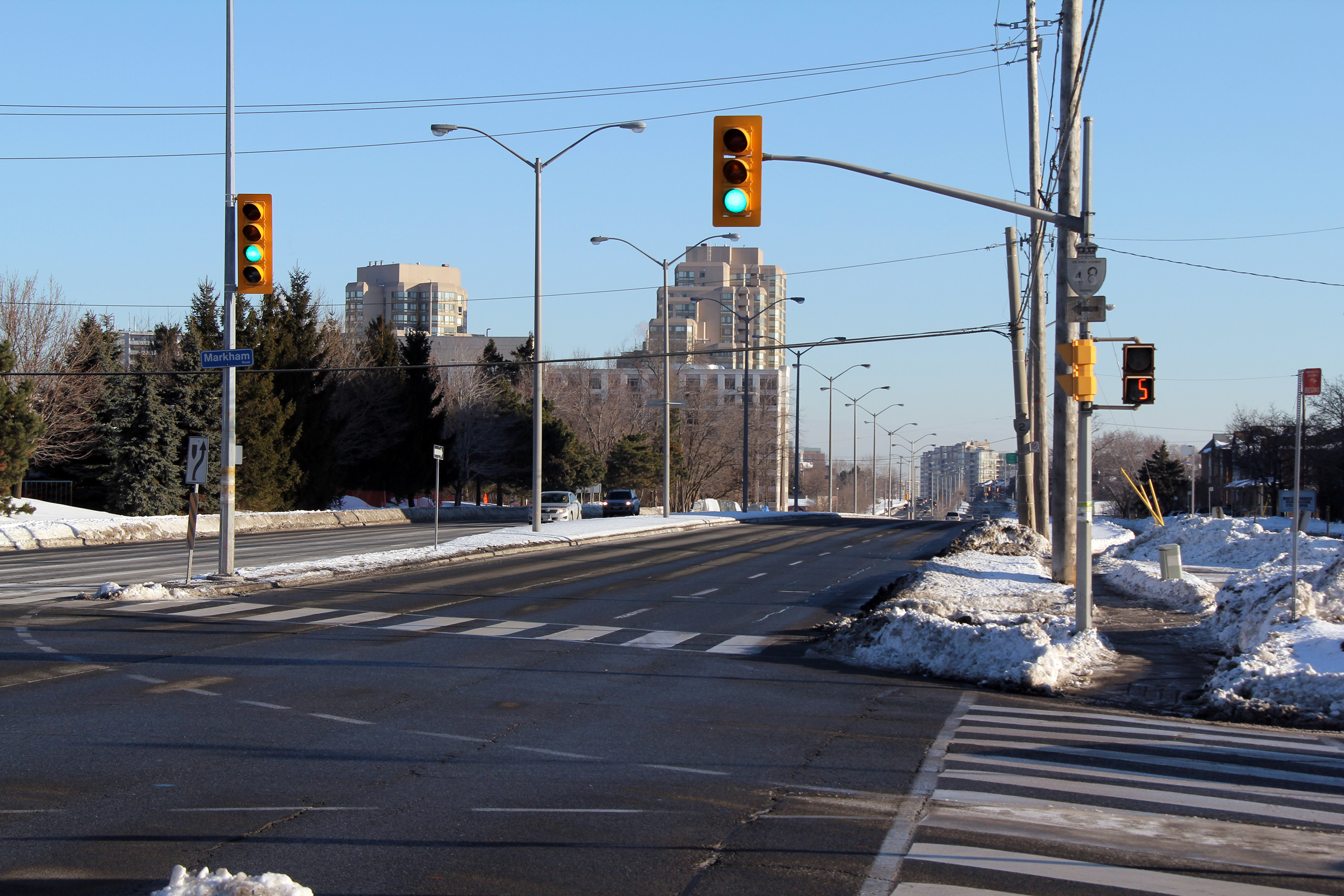
Easterly view along Kingston Road at the Markham
Road intersection. A very faint Highway 48 shield advises motorists
that Markham Road leads to Highway 48. Despite the fact
that the signage is white, Highway 48 never progressed further south than
Highway 401.
Photo taken: February 5th, 2011. |

(720x480)
(1440x960)
(2400x1600) |
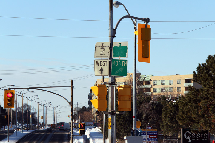
| City of Toronto |
Westbound signage at the Markham Road
intersection. The 48 lettering has almost entirely faded from this
signage.
Photo taken: February 5th, 2011. |
 (720x480) (720x480)
(1440x960) |
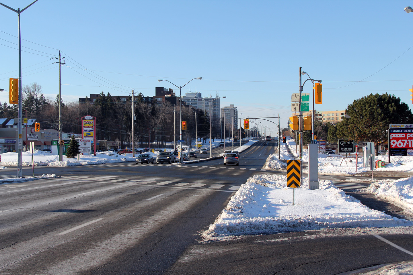
| City of Toronto |
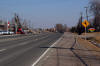
Broader view of the Kingston Road and Markham
Road intersection. Kingston Road is a fairly efficient six-lane
arterial highway through most of Scarborough.
Photo taken: February 5th, 2011. |

(720x480)
(1440x960)
(2400x1600) |
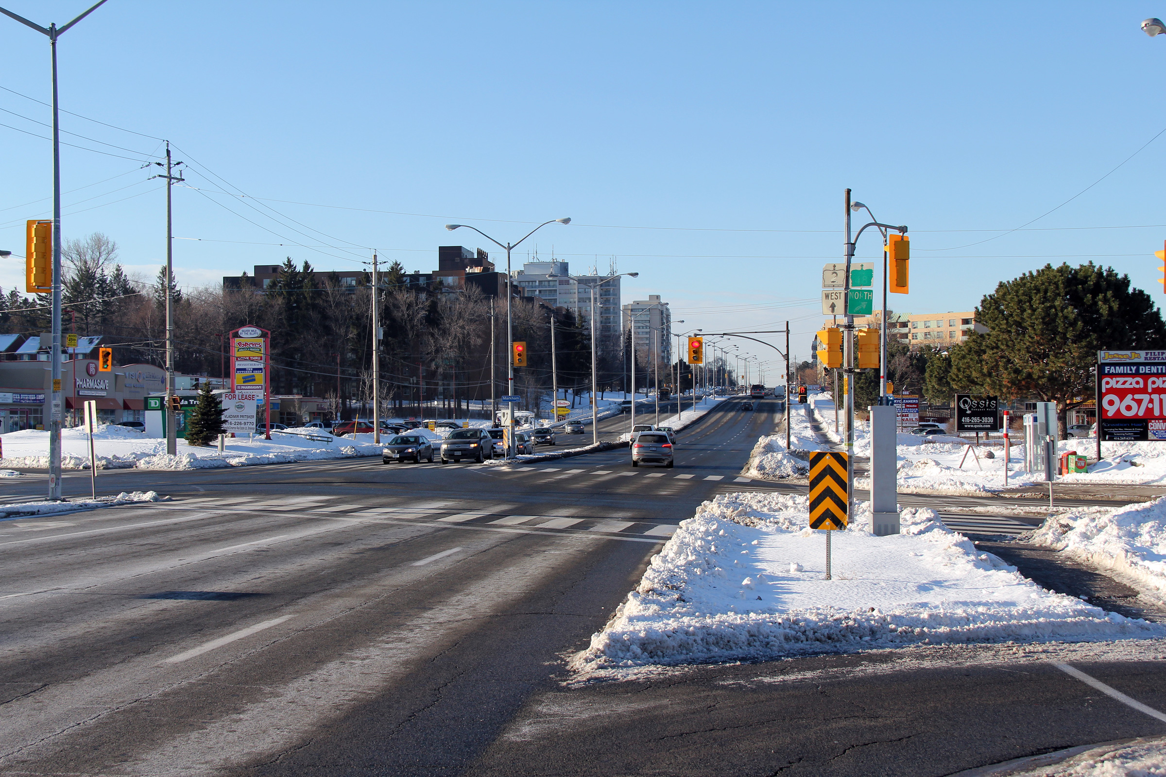
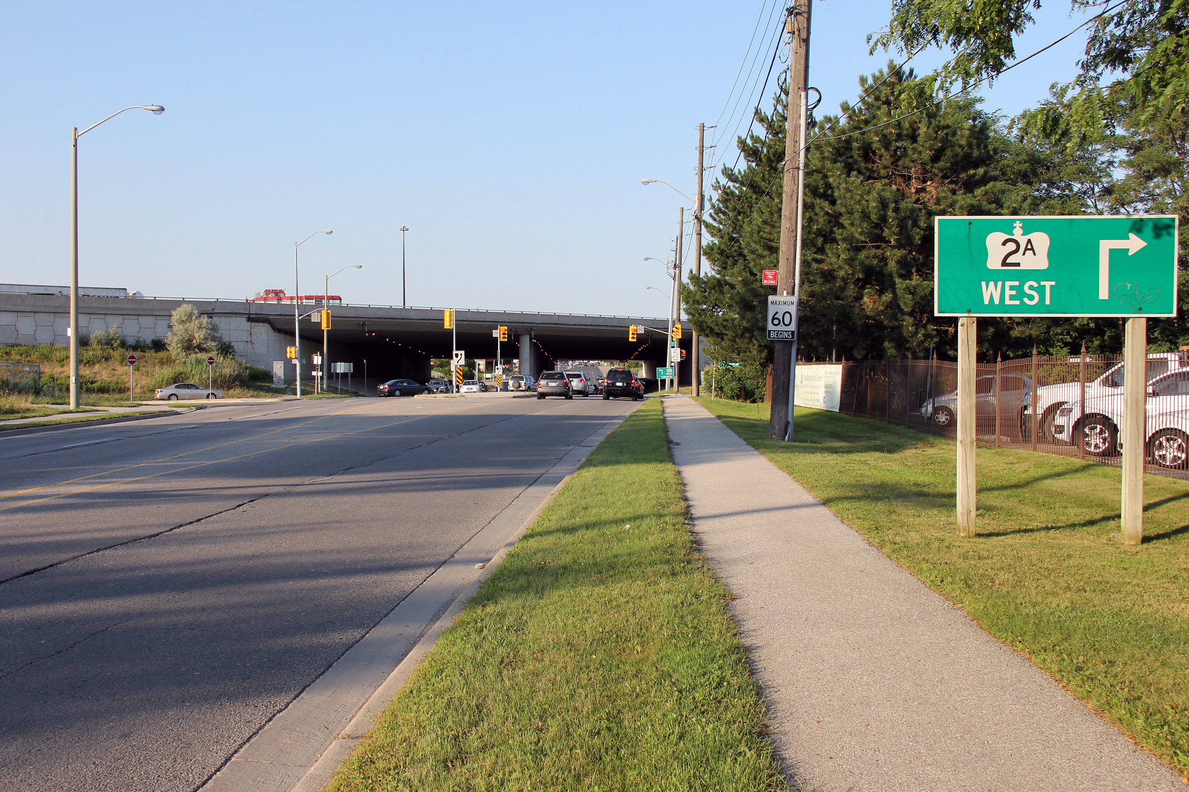
| City of Toronto |
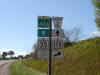
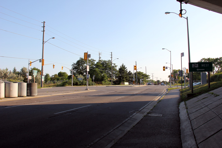
This view looks easterly along Highway 2 as
Kingston Road approaches the Highway 2A
freeway. Highway 2 traffic is directed to leave the divided highway at
Lawson Road. Straight ahead is Highway 2A which carries traffic
between Kingston Road and Highway 401.
Photo taken: February 5th, 2011. |
 (720x480) (720x480)
(1440x960)
(2400x1600) |
|
Highway 2A serves as a short
connector freeway linking Kingston Road to Highway 401 at Port Union Road.
Click here for Highway 2A images. |
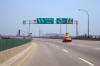
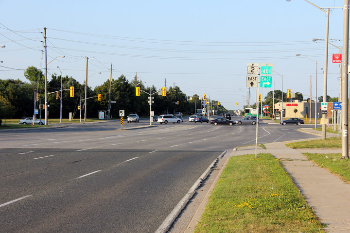
| City of Toronto |
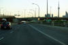
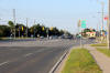
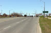
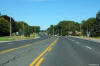
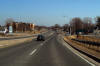
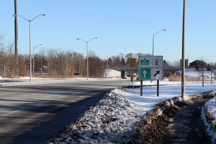
Easterly view along Kingston Road approaching
the Highway 401 interchange. At the pictured traffic lights, the off
ramp from the eastbound 401 adds a considerable volume of traffic to Highway
2 from this point easterly.
Photo taken: July 30th, 2012. |

(720x480)
(1440x960)
(2400x1600) |
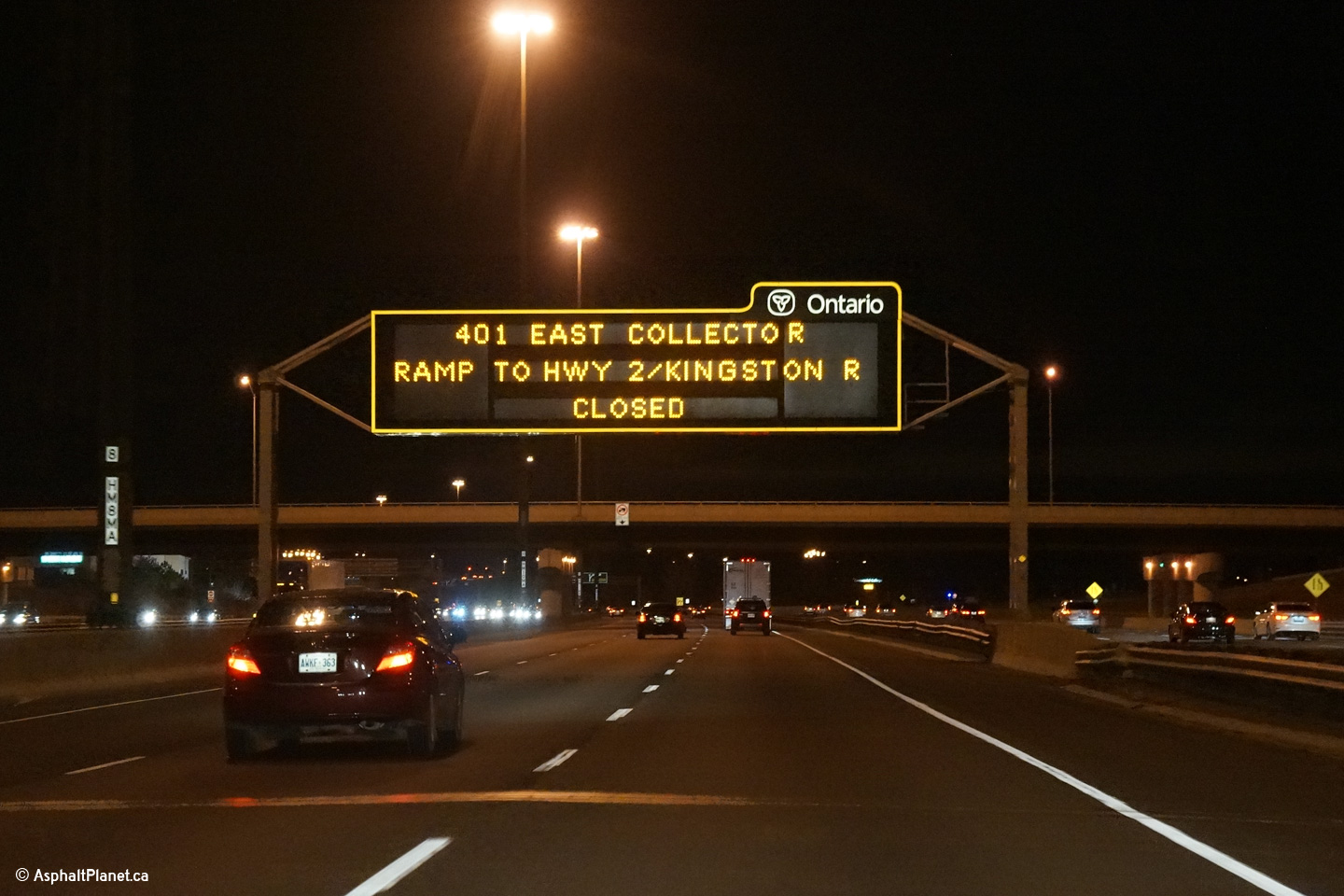
| City of Toronto |
Old habits die hard.
Despite being transferred to local jurisdiction over 15 years prior to this
ramp closure, this overhead changeable message sign still references
Kingston Road as Highway 2.
Photo taken: November 23rd, 2013. |

(720x480)
(1440x960) |
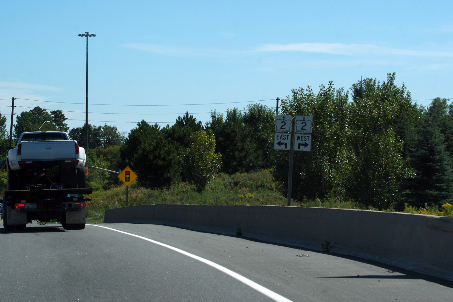
| City of Toronto |
Junction assembly for Highway 2
at the Highway 401 interchange in Scarborough.
Photo taken: September 9th, 2011. |
(720x480)
(1440x960) |
| City of Toronto |
Signage for Highway 2A underneath of the Highway
401 structure. Highway 2A was transferred to the City of Toronto in the
1990s, but has retained the Highway 2A moniker. As such the signs that
indicate the roads former provincial status have yet to be updated.
Photo taken: July 30th, 2012. |
 (720x480) (720x480)
(1440x960)
(2400x1600) |
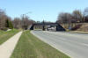
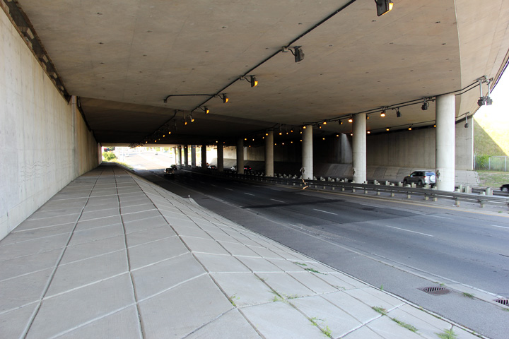
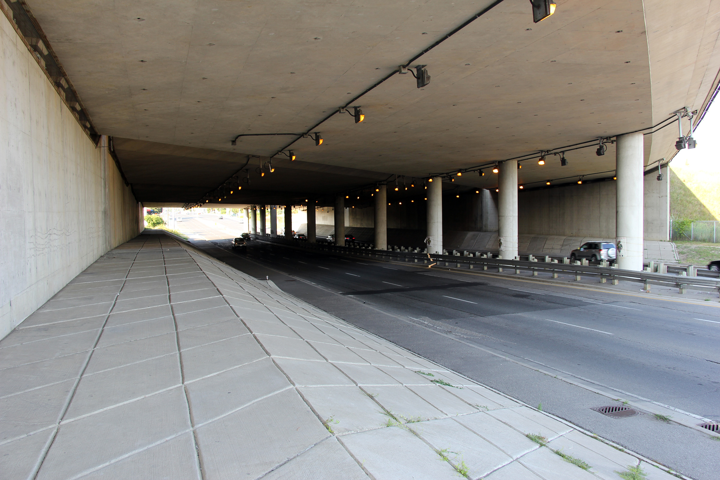
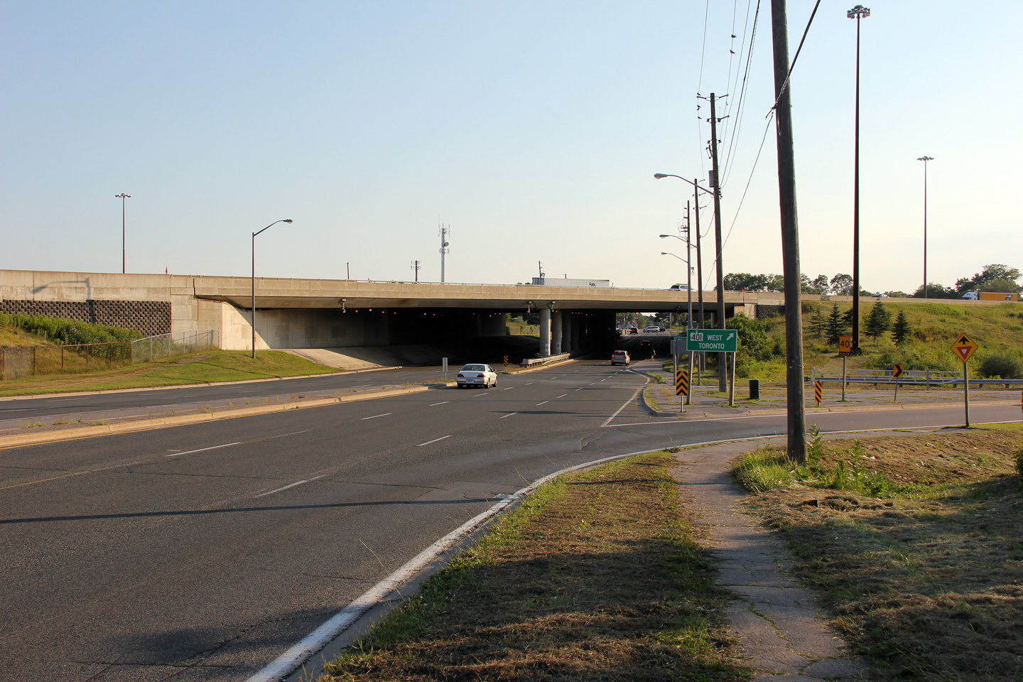
| City of Toronto |
Looking easterly along Highway 2 as it passes
underneath of its 14 lane replacement, Highway 401. The inner
structures were built in the 1970s while the two outer structures were added
twenty years later, in the mid 1990s.
Photo taken: July 30th, 2012. |
(720x480)
(1440x960)
(2400x1600) |
| City of Toronto |
Advanced turnoff signage for the ramp to Highway
2A from Kingston Road.
Photo taken: July 30th, 2012. |
 (720x480) (720x480)
(1440x960)
(2400x1600) |
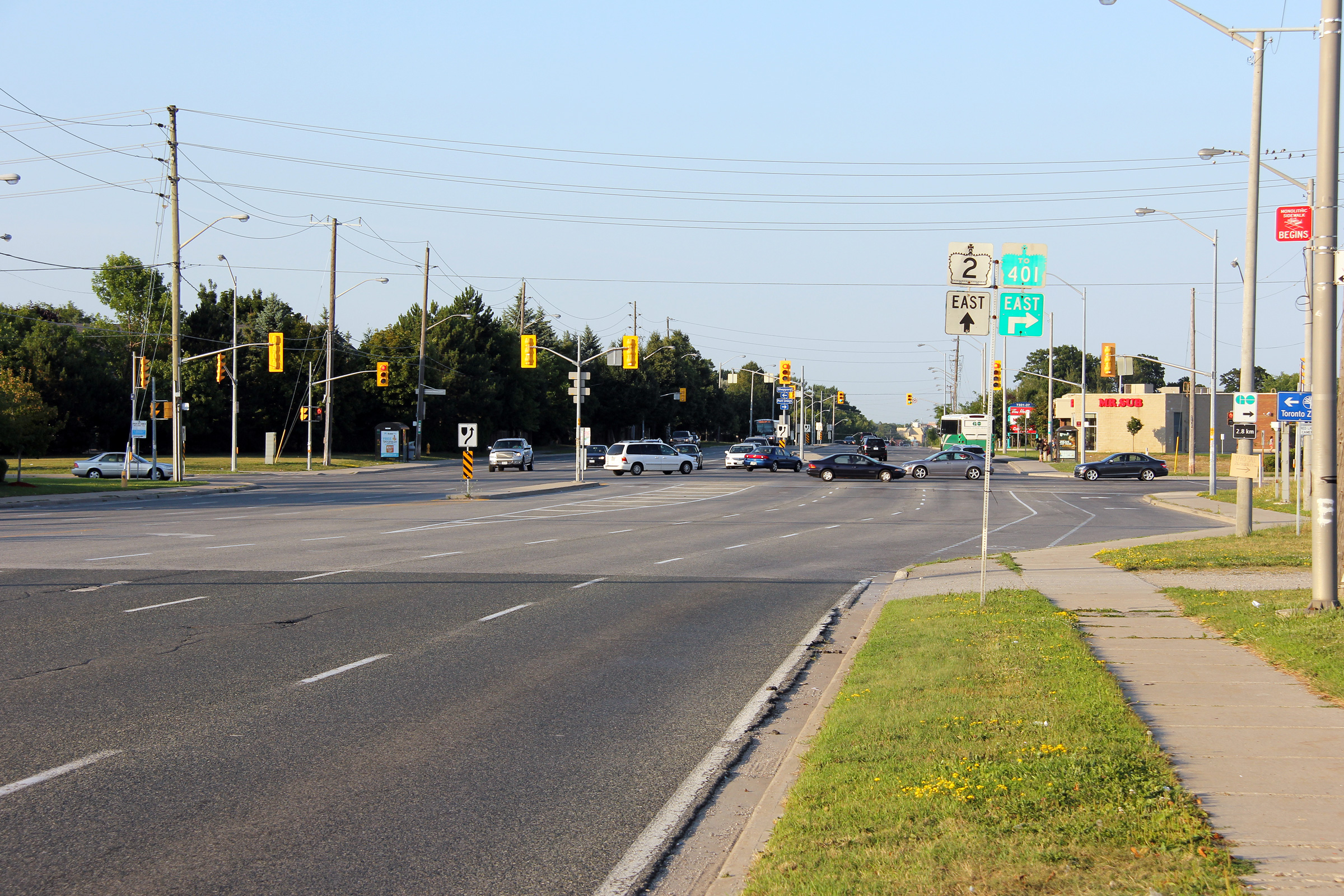
| City of Toronto |
View looking westerly along Kingston Road
towards the Highway 401 underpass. Note that the signage for the westbound
401 onramp includes Toronto as a control city despite the fact that this
interchange is located within the Toronto city limits.
Photo taken: July 30th, 2012. |
(720x480)
(1440x960)
(2400x1600) |
| City of Toronto |
View looking easterly towards the Sheppard
Avenue intersection.
Photo taken: July 30th, 2012. |
(720x480)
(1440x960)
(2400x1600) |
| City of Toronto |
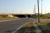
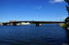
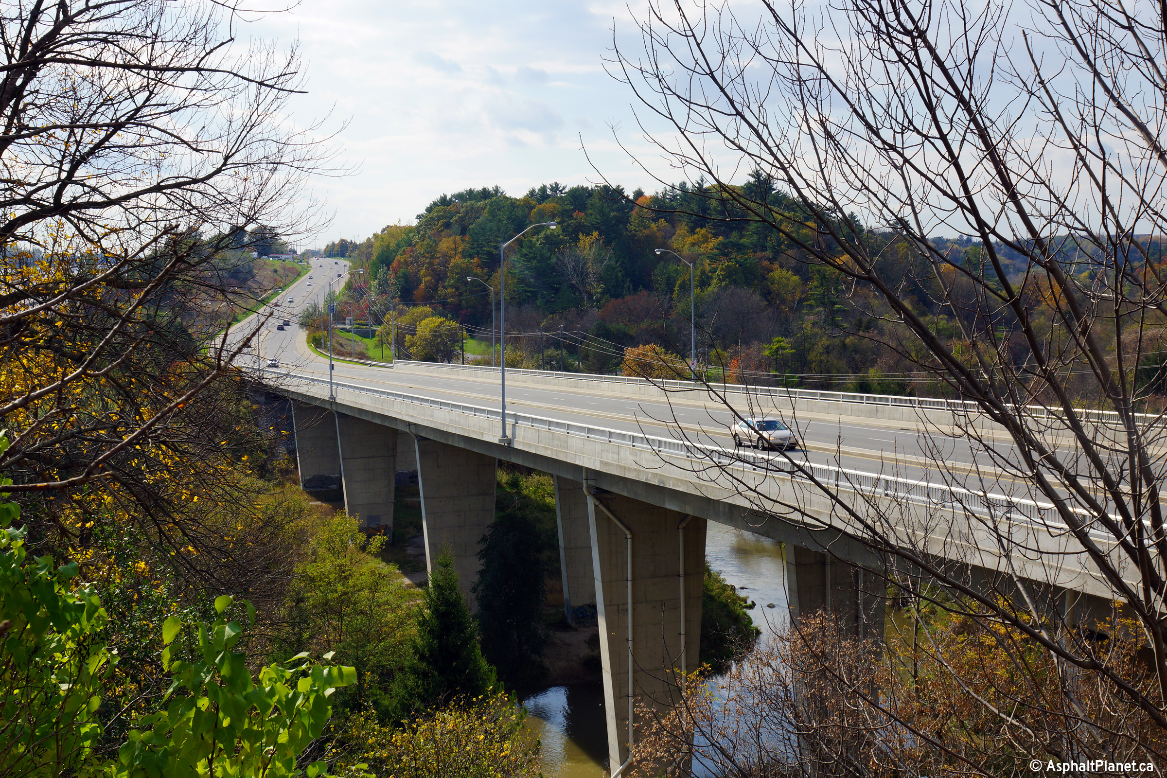
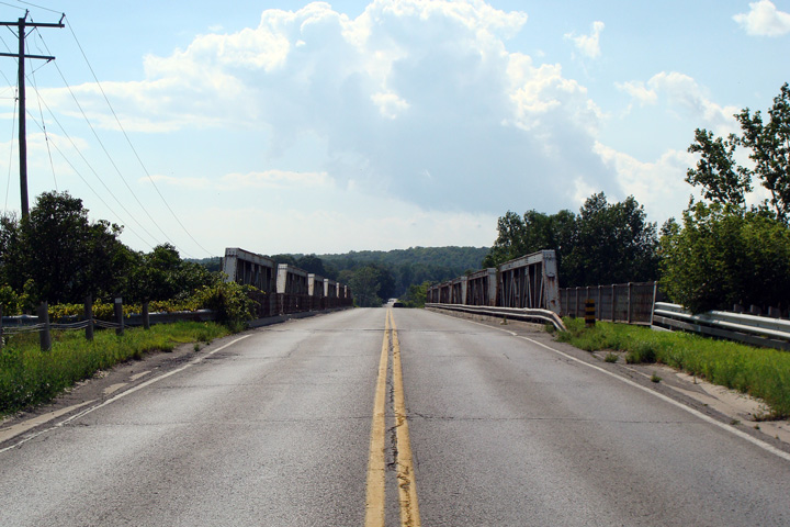
Two views looking easterly as Highway 2 crosses
the deep Rouge River Valley that marks the boundary between the City of
Toronto and the Regional Municipality of Durham. Highway 2 crosses the
valley on a high level bridge that was completed in 1967. The lower
photo highlights the close proximity in which Highway 401 was constructed to
Highway 2 through this part of the province.
Photos taken: October 18th, 2013. |
(720x480)
(1440x960)
(2400x1600)
(720x480)
(1440x960)
(2400x1600) |
| City of Toronto |
View looking easterly underneath the high level
Rouge River bridge. During a 2007 rehabilitation project, the east and
westbound structures were stitched together to form a single structure.
Photo taken: October 18th, 2013.s |
(720x480)
(1440x960)
(2400x1600) |
City of Pickering
Regional Municipality of Durham |
View looking westerly across the high level
Rouge River bridge.
Photo taken: October 18th, 2013. |

(720x480)
(1440x960)
(2400x1600) |
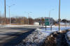
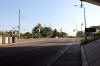
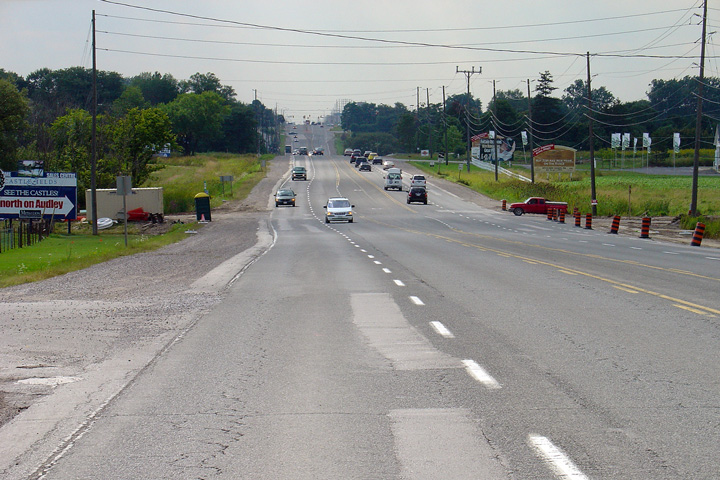
| Town of Ajax Regional
Municipality of Durham |
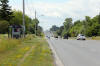
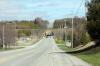
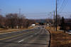
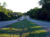
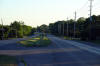
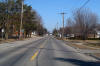
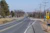
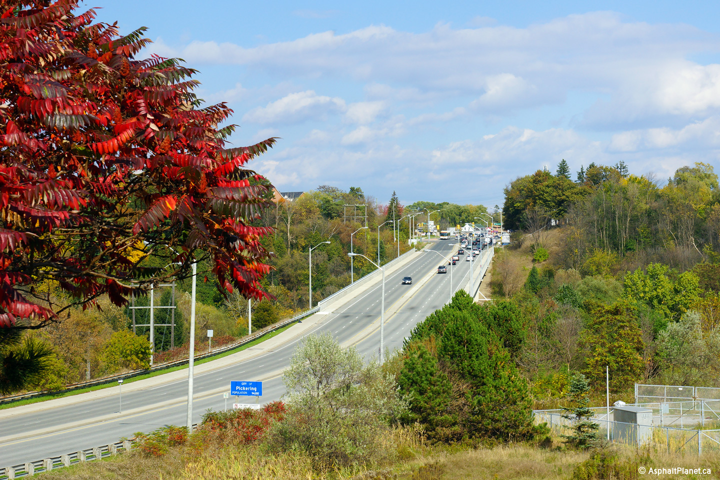
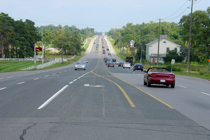
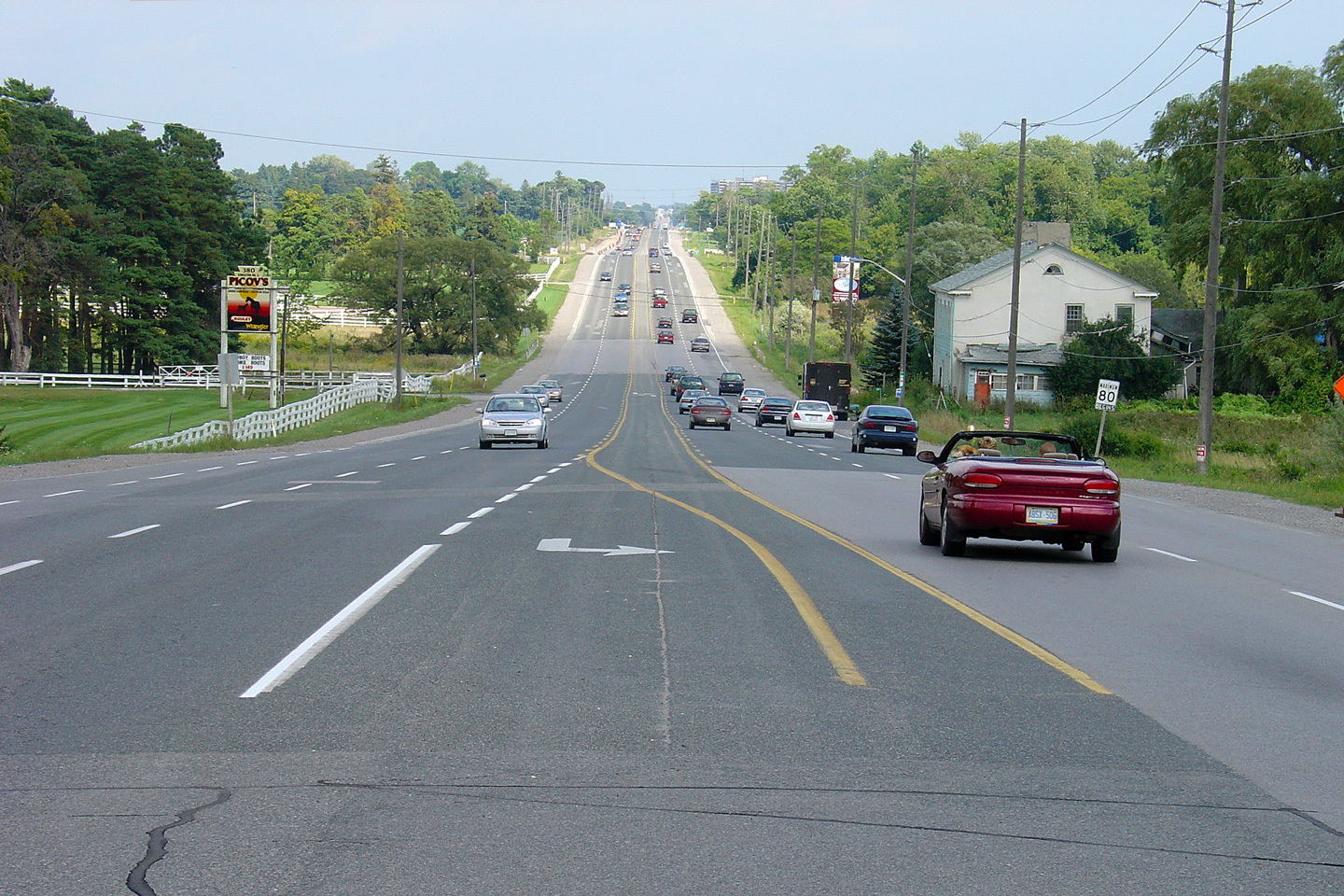
View looking easterly along Highway 2 from the
Wicks Drive intersection. Since this photo was taken in 2004, several
traffic lights have been added by the Region of Durham (who has jurisdiction
over Highway 2, since this section was downloaded in 1997) as the urban
limits of Ajax extend ever further easterly.
Photo taken: August 31st, 2004. |
|
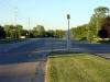
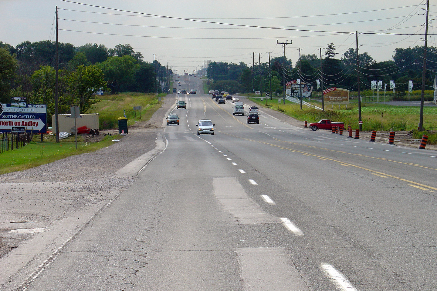
| Town of Ajax Regional
Municipality of Durham |
View looking west towards the Audley Road
intersection in Ajax. Traffic lights were installed at this
intersection in late 2004, as Audley Road was upgraded to a minor
suburban arterial. Photo taken: August 31st, 2004. |
|
Town of Whitby
Regional Municipality of Durham |
View looking west towards Lakeridge Road from
the location of the proposed West Durham Link connector highway that will
link Highway 401 to the east extension of Highway 407.
Photo taken: July 27th, 2012. |
(720x480)
(1440x960)
(2400x1600) |
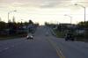
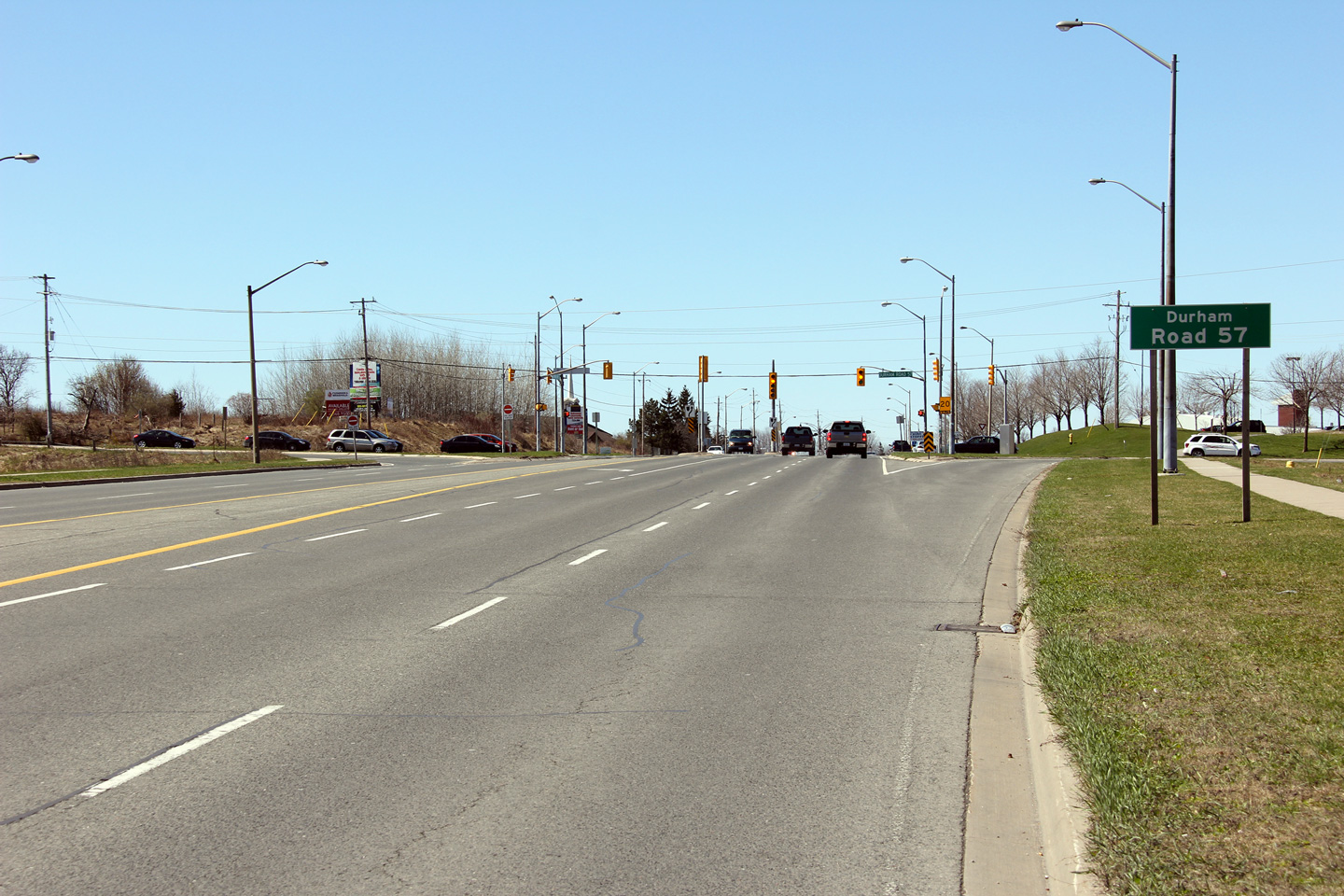
| Municipality of Clarington
Regional Municipality of Durham |
Easterly view approaching the Durham Road 57
intersection in Western Bomanville.
Photo taken: April 2nd, 2012. |

(720x480)
(1440x960)
(2400x1600) |
| Municipality of Clarington
Regional Municipality of Durham |
Two views looking westerly towards the Durham
Road 57 intersection. The intersection between Durham Road 57 and Highway 2
features right turn channels in all four intersection quadrants. When this
intersection was last reconstructed, its surroundings were far more rural
then they are today.
Photo taken: April 2nd, 2012. |

(720x480)
(1440x960)
(2400x1600)
(720x480)
(1440x960)
(2400x1600) |
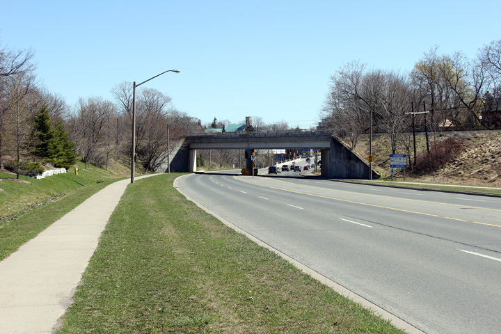
| Municipality of Clarington
Regional Municipality of Durham |
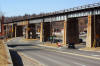
This view looks easterly towards the CP Rail
overpass in Bomanville.
Photo taken: April 2nd, 2012. |
(720x480)
(1440x960)
(2400x1600) |
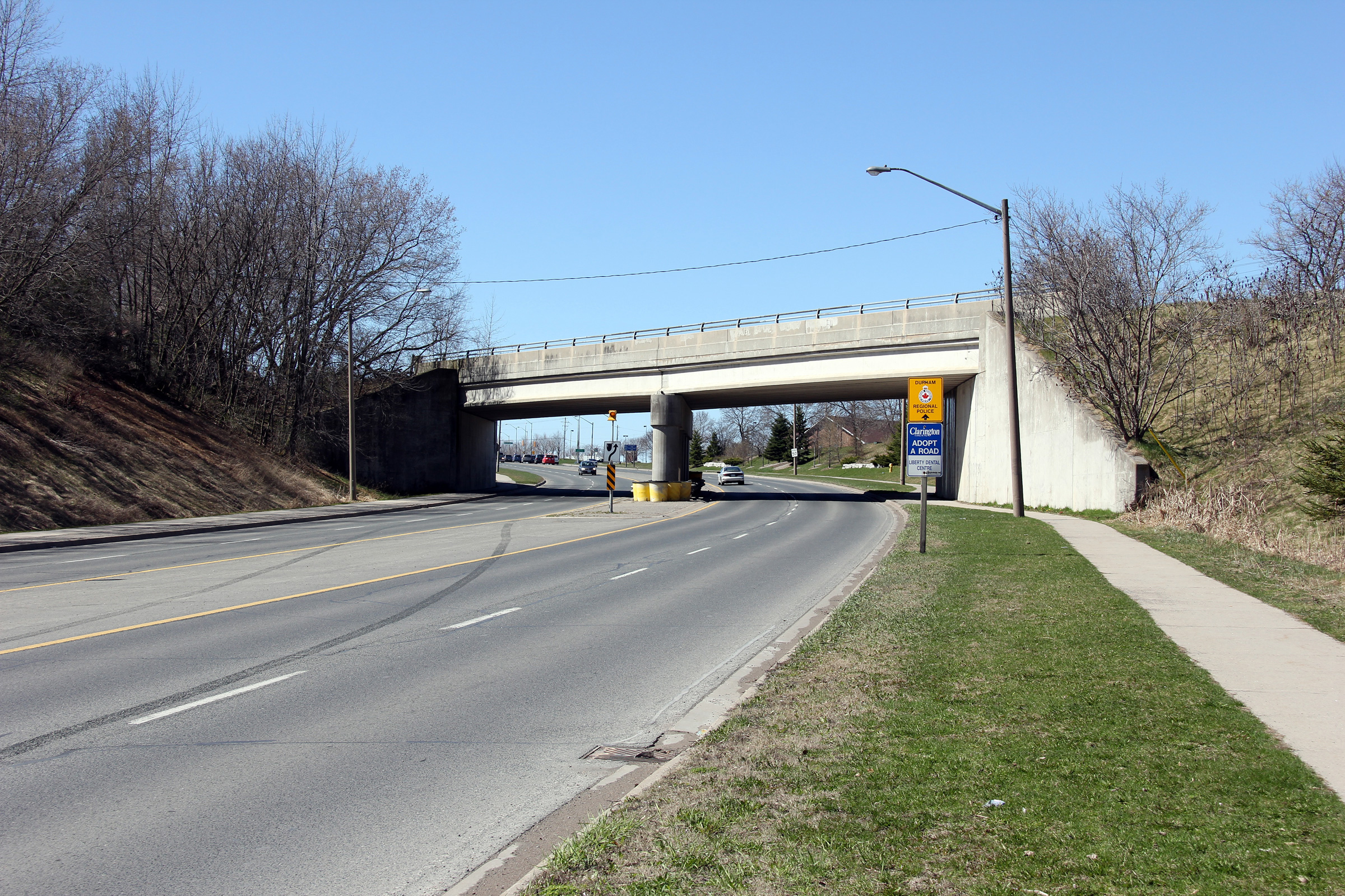
| Municipality of Clarington
Regional Municipality of Durham |
Westerly view towards the CP Rail overpass.
The streetlights along this segment of road were manufactured late in 1974
which seems indicative of when the pictured grade separation was
constructed.
Photo taken: April 2nd, 2012. |

(720x480)
(1440x960)
(2400x1600) |
| Municipality of Clarington
Regional Municipality of Durham |
Easterly view looking towards Bomanville from
just east of the CP Rail overpass. Highway 2 has only one travel lane
per direction through historic Downtown Bomanville.
Photo taken: April 2nd, 2012. |
(720x480)
(1440x960)
(2400x1600) |
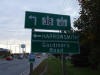
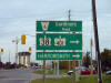
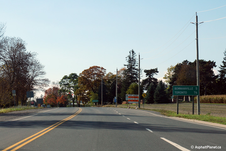
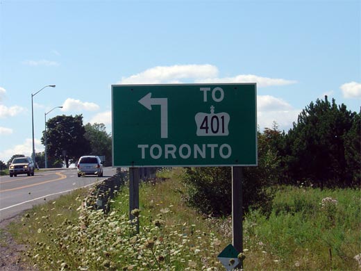
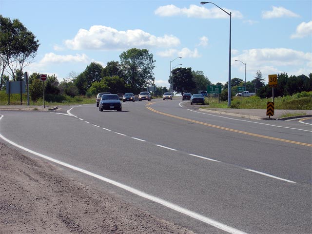
| Municipality of Clarington
Regional Municipality of Durham |
Distance signage facing westbound motorists highlighting the distance to
both Bomanville and Toronto just west of the Highway 35/115 interchange.
Photo taken: October 10th, 2013. |
 (720x480) (720x480)
(1440x960)
(2400x1600) |
| Municipality of Clarington
Regional Municipality of Durham |
Signage denoting the ramp to Highway
35/115
southbound. Because Highway 35/115
ends just a short distance south of Highway 2 at
Highway 401, signage only indicates
Highway 401 instead of Highway
35/115.
Surprisingly, all signage for Highway 401
at this interchange uses only Toronto as a control city, despite the fact
that traffic can access both east and westbound directions.
Photo taken: September 1st, 2004 |
 |
|
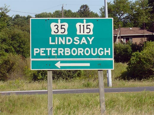
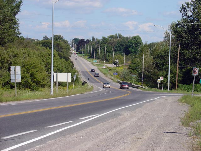
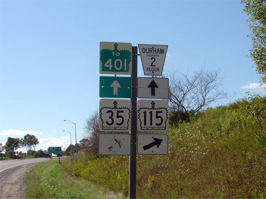
Highway 2 crosses the 35/115 between Bomanville and Newcastle. Click
here for Highway 35 images, and
here for Highway 115 images. |
| Municipality of Clarington
Regional Municipality of Durham |
Green signage denoting the northbound ramp to
Highway 35/115. Photo
taken: September 1st, 2004. |
 |
| Municipality of Clarington
Regional Municipality of Durham |
View looking westerly along Highway 2 towards
the Highway 35/115
underpass. This underpass was constructed in the mid 1950s, and
originally served Highway 401.
Highway 401 ended at this interchange for a
brief period of time between 1952 and 1960 before it was extended easterly
to Port Hope.
Photo taken: September 1st, 2004. |
(720x480)
(1440x960) |
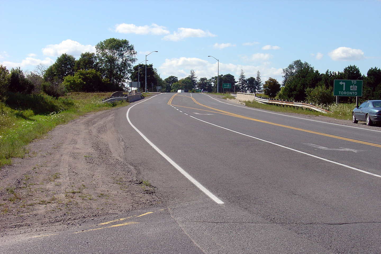
| Municipality of Clarington
Regional Municipality of Durham |
View looking west towards the Highway
35/115 interchange. Before Highway 35/115
was upgraded to a RIRO expressway in the late 1980s, Highway 2 met Highway
35/115 at a
Parclo A2 interchange. However, to accommodate 4-through lanes through
the existing structure, the interchange was converted to a diamond.
Photo taken: September 1st, 2004. |
 |
| Municipality of Clarington
Regional Municipality of Durham |
View looking east along Highway 2 from Highway
35/115 towards
Newcastle. Photo taken: September 1st, 2004 |
 |
| Municipality of Clarington
Regional Municipality of Durham |
A neutered junction assembly denoting the
Highway 35/115
interchange for westbound traffic. Photo taken: September 1st, 2004. |
 |
| Municipality of Clarington
Regional Municipality of Durham |
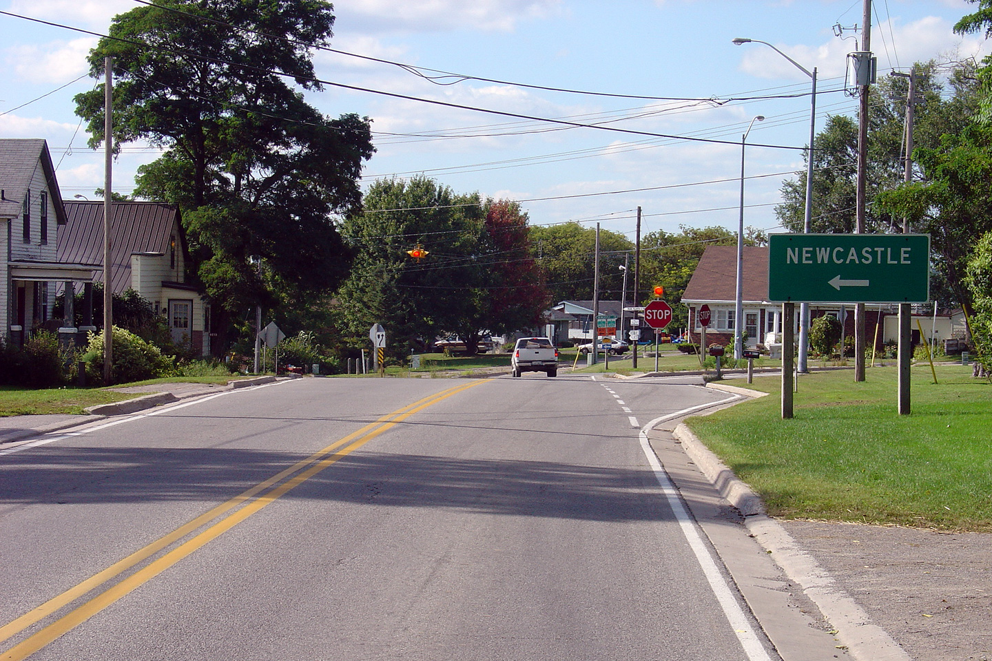
Junction signage for Highway 2 at
the exit to the Newcastle Carpool lot. The Newcastle Carpool lot is
located just east of the Highway 35/115 interchange.
Photo taken: October 10th, 2013. |
(720x480)
(1440x960) |
| Municipality of Clarington
Regional Municipality of Durham |
Easterly view from the eastern edge of Newcastle
towards the CP Railway overhead.
Photo taken: March 31st, 2012. |
(720x480)
(1440x960)
(2400x1600) |
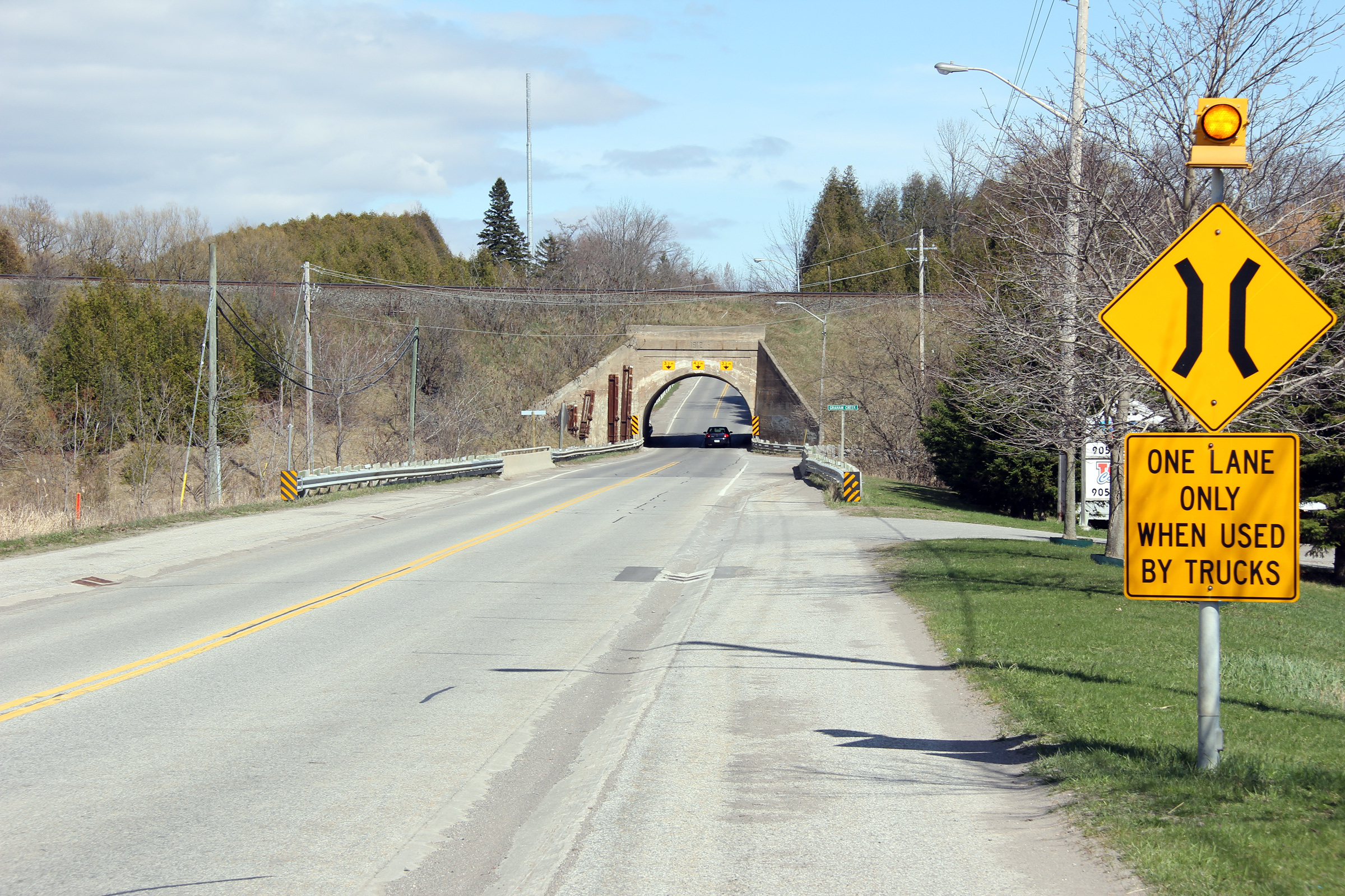
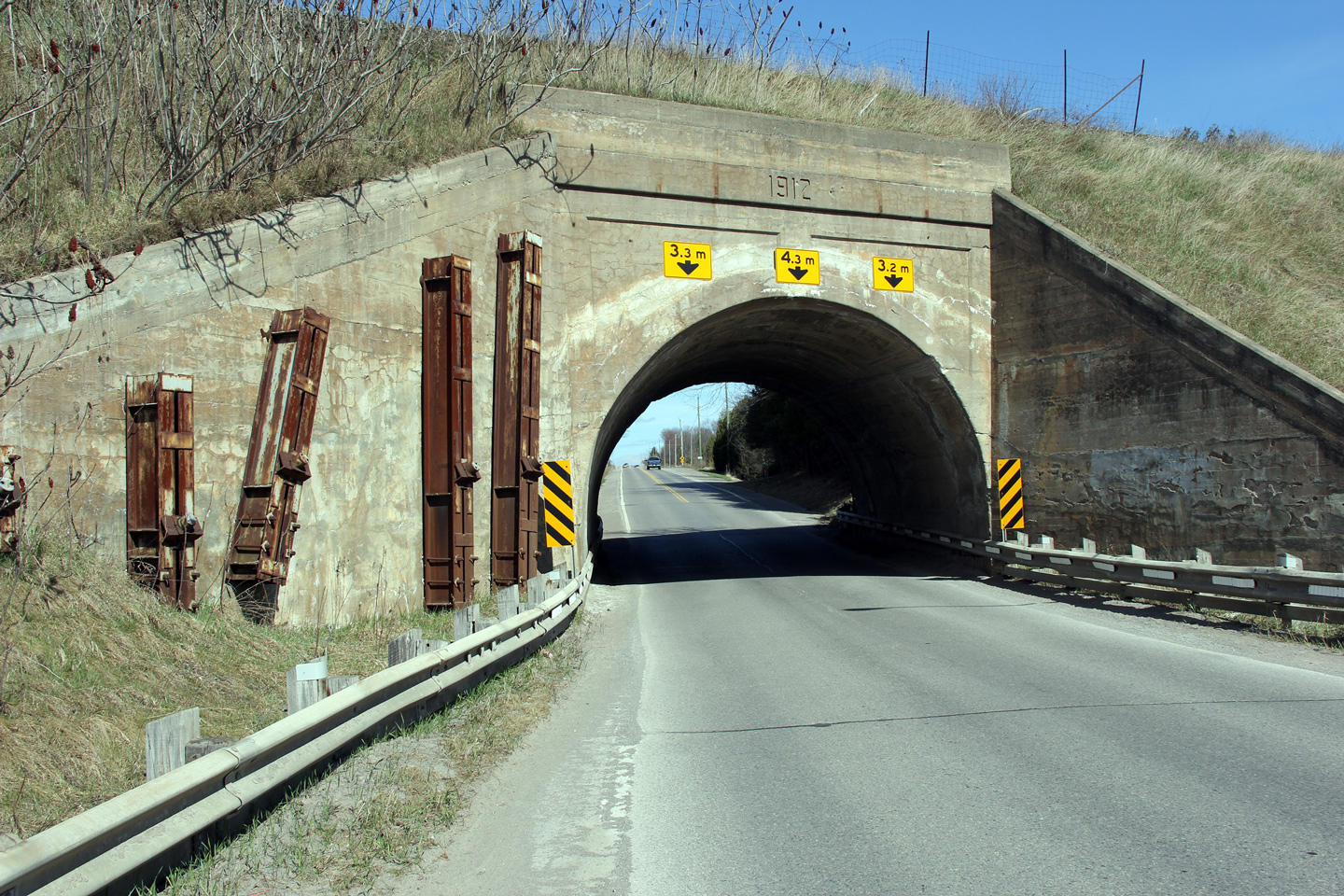
| Municipality of Clarington
Regional Municipality of Durham |
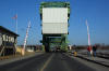
The CP Rail overhead is quite narrow, wide
vehicles must alternate through the underpass.
Photo taken: March 31st, 2012. |
(720x480)
(1440x960)
(2400x1600) |
| Municipality of Clarington
Regional Municipality of Durham |
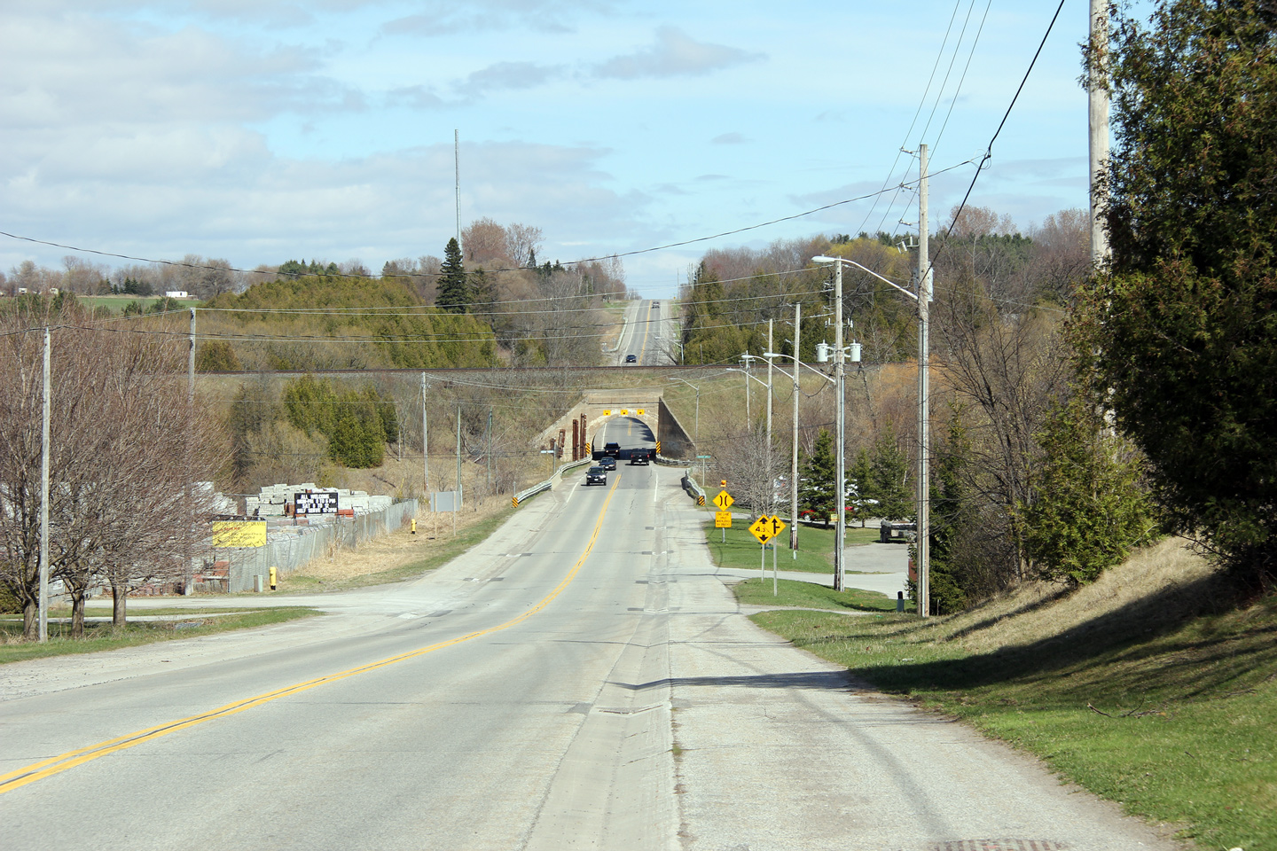
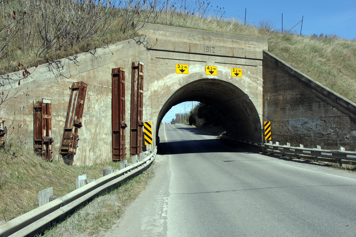
The grade separation between Highway 2 and CP
Rail was constructed in 1912, years before the Toronto-Kingston Road was
assumed as Provincial Highway 2.
Photo taken: March 31st, 2012. |
(720x480)
(1440x960)
(2400x1600) |
| Municipality of Clarington
Regional Municipality of Durham |
Easterly view towards the Newcastle underpass
along Highway 2. All traffic traversing the highway between Toronto
and Montreal was forced through this narrow underpass until nearby Highway
401 was completed to the south in 1960.
Photo taken: March 31st, 2012. |

(720x480)
(1440x960)
(2400x1600) |
| Municipality of Clarington
Regional Municipality of Durham |
View looking west into the sun in the small
community of Newtonville at the Newtonville Road intersection.
Newtonville is located about 10km east of Newcastle. Photo taken:
September 1st, 2004. |
 |
Municipality of Port Hope
County of Northumberland |
View looking easterly from just east of the
Durham/Northumberland boundary.
Photo taken: October 8th, 2013. |
(720x480)
(1440x960)
(2400x1600) |
Municipality of Port Hope
County of Northumberland |
Highway 2 trailblazer in
Northumberland County. At one time there were quite a number of
Highway 2 trailblazers in eastern Durham Region and western Northumberland
County. Very few remain.
Photo taken: October 8th, 2013. |

(720x480)
(1440x960) |
Municipality of Port Hope
County of Northumberland |
View looking westerly along Highway 2 from the
Northumberland Road 10/74 intersection. Photo taken: September 1st,
2004. |
 |
Municipality of Port Hope
County of Northumberland |
Looking west towards the Northumberland Road
10/74 intersection in Welcome. At this junction, Highway 2 turns left,
heading westerly again towards Newcastle. Photo taken: September 1st,
2004. |

(720x480)
(1440x960) |
Municipality of Port Hope
County of Northumberland |
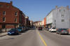
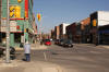
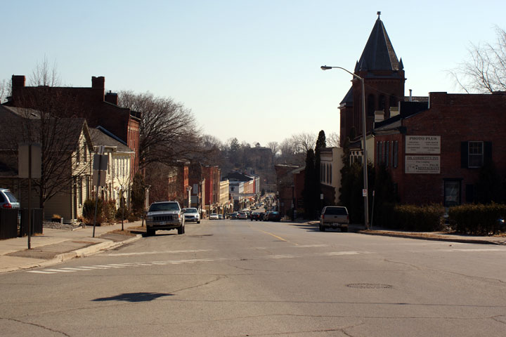
Easterly
view towards Downtown Port Hope, from Pine Street. You can tell the former importance of Port Hope by
looking at the size of the communities Downtown. Note that most of the
old buildings are three stories tall, and that they stretch for quite a
distance. Port Hope was at one point a sizeable and important port
town. Port Hope has become a bedroom community for the larger communities
to the west, as well as a tourist draw.
Photo taken: March 14th, 2009. |

(720x480)
(1440x960) |
Municipality of Port Hope
County of Northumberland |
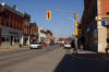
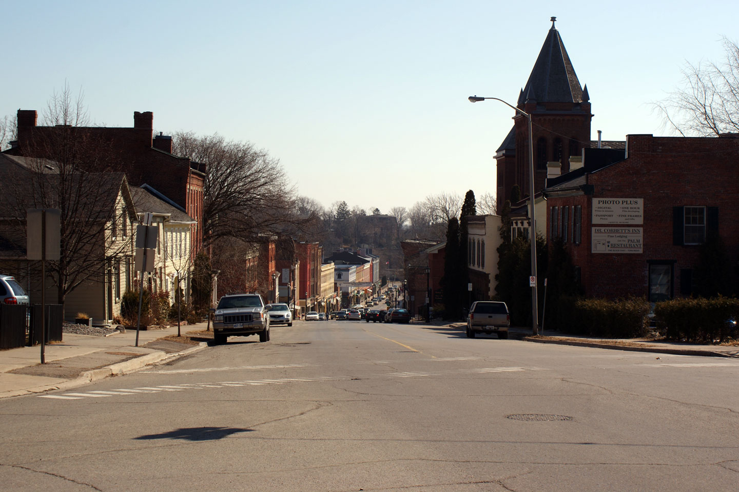
Westerly
view through Downtown Port Hope from the Ontario Street intersection.
The old historic buildings in Downtown Port Hope have generally lovingly
been cared for.
Photo taken: March 14th, 2009. |

(720x480)
(1440x960) |
Municipality of Port Hope
County of Northumberland |
Westerly view across the the Ganaraska River
into Downtown Port Hope. I really like Downtown Port Hope, it's a very
nice community; its well worth getting off of the 401 to see it.
Photo taken: March 14th, 2009. |
(720x480)
(1440x960)
(2400x1600) |
Municipality of Port Hope
County of Northumberland |
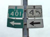
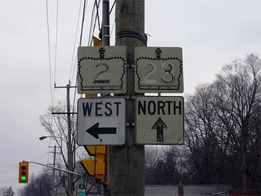
View looking easterly towards the
Highway 28
junction in Port Hope. Eastbound travelers must turn to the right
towards Lake Ontario to continue along Highway 2.
Photo taken: March 14th, 2009. |
(720x480)
(1440x960) |
Municipality of Port Hope
County of Northumberland |
Junction assembly for eastbound travelers in
Downtown Port Hope. While virtually all of the Highway 2 signage has
been removed from Port Hope, most Highway 28 signs remain. Photo size: 35kb. |
 |
|
Historically Highway 28 began in Port Hope, trekking north through
Peterborough, to Bancroft and eventually Denbigh.
Click here for
Highway 28 images. |
Municipality of Port Hope
County of Northumberland |
Worn out junction assembly for westbound traffic
along Highway 2 approaching the Highway 28
intersection. As denoted by the signage, to continue westerly along
Highway 2 at Highway 28 traffic must turn
left. This is one of three jogs that travelers must follow to follow
Highway 2 through Port Hope.
Photo taken: 35kb. |
 |
Municipality of Port Hope
County of Northumberland |
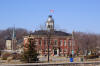
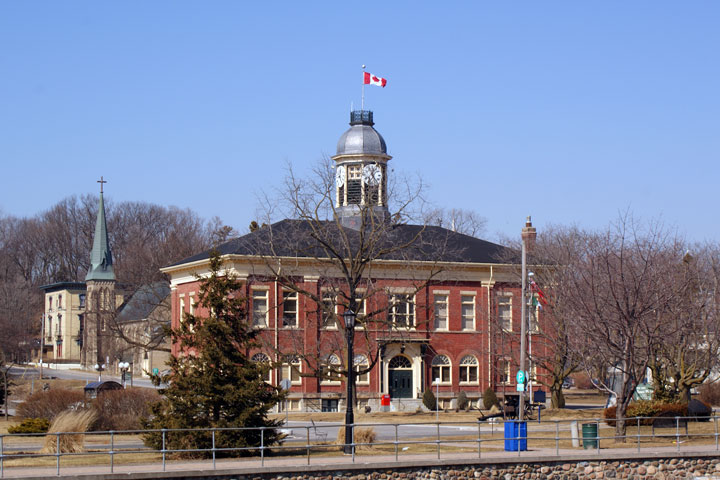
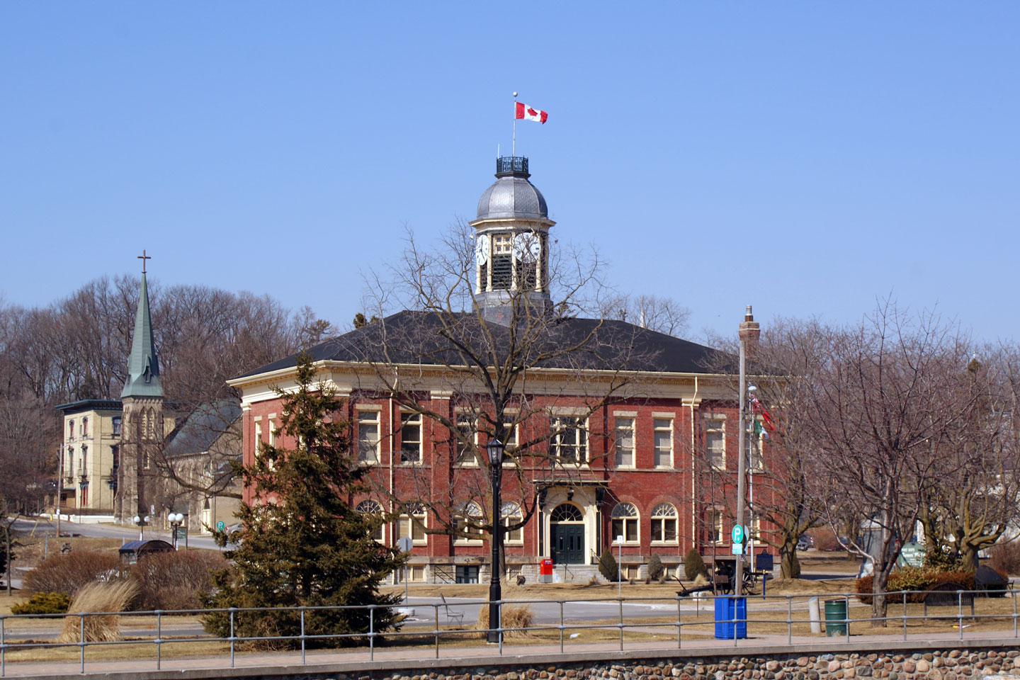
Port Hope's Town Hall is visible from Highway 2
on the west side of the Ganaraska River.
Photo taken: March 14th, 2009.
|
(720x480)
(1440x960) |
Municipality of Port Hope
County of Northumberland |
View looking westerly as Highway 2 approaches
the Ontario Street junction from the East. Highway 2 turns to the
right at this intersection, passing under the high level CP Railway
overpass.
Photo taken: March 14th, 2009. |
(720x480)
(1440x960) |
Municipality of Port Hope
County of Northumberland |
View looking easterly as Highway 2 departs Port
Hope for Cobourg. These short 4-lane segments of highway without
centre turn lanes or flush medians seem most common in eastern Ontario.
Photo taken: March 14th, 2009. |
(720x480)
(1440x960) |
Municipality of Port Hope
County of Northumberland |
View looking easterly at the eastern end of
Highway 2's 4-lane segment. The CP Railway overhead can be seen in the
distance. Highway 2 crosses the CP Railway several times between
Toronto and Belleville.
Photo taken: March 14th, 2009. |

(720x480)
(1440x960) |
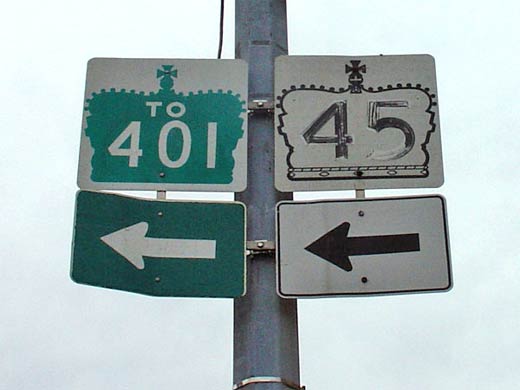
| Town of Cobourg County of
Northumberland |
Signage in Downtown Cobourg at the former
Highway 45 junction.
Highway 45 leads northeasterly from Downtown Cobourg to Hastings and
eventually meets Highway 7 at Norwood.
Photo size: 25kb. |
 |
|
Highway 45 begins its diagonal trajectory northeasterly to
the east side of Rice Lake at the Highway 2 junction in Cobourg.
Click here for Highway 45 images. |
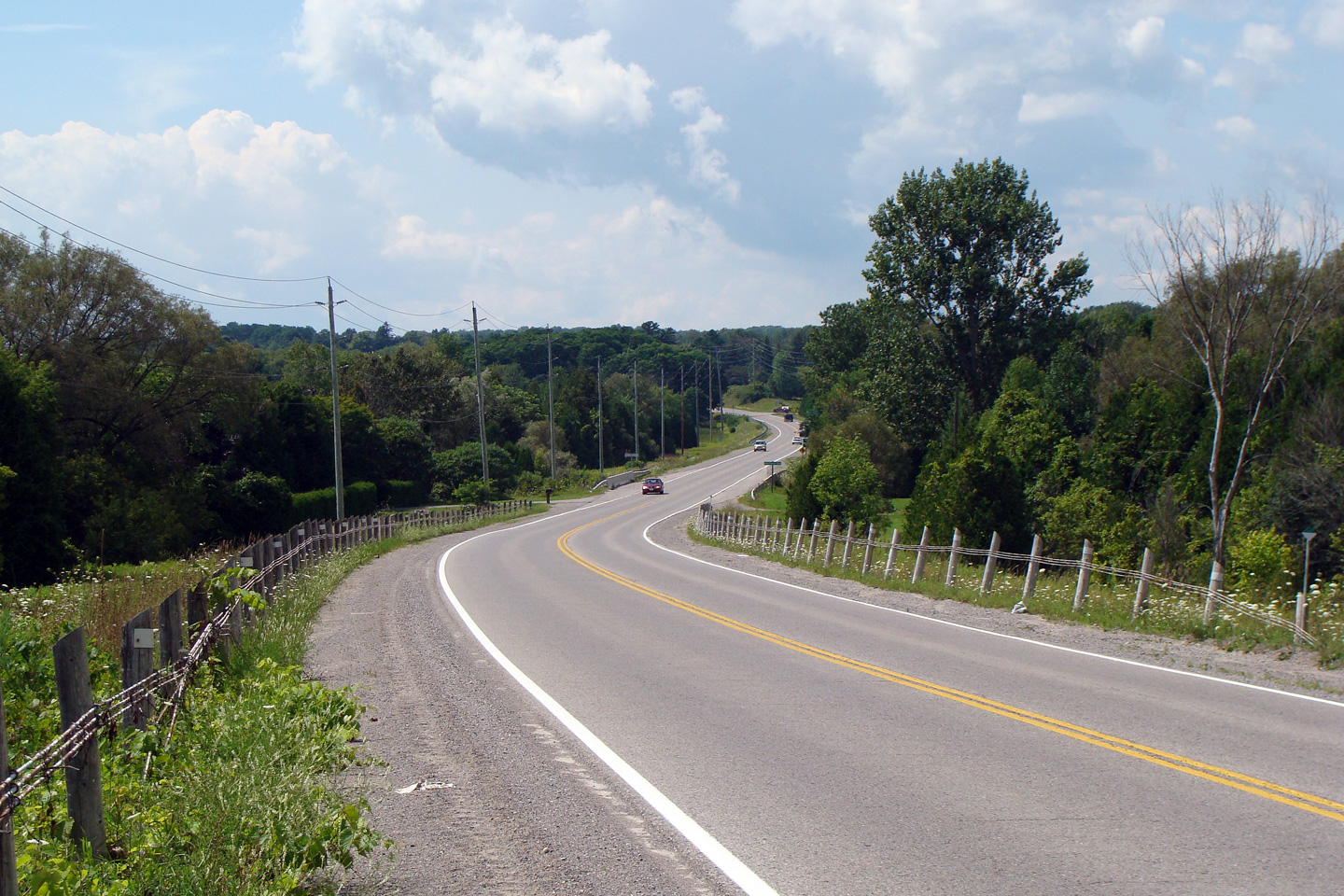
Township of Alnwick-Haldimand
County of Northumberland |
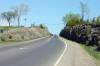
This view looks westerly towards Shelter Valley
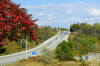
Creek along Highway 2.
Photo taken: August 16th, 2008. |
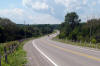
(720x480)
(1440x960) |
Township of Alnwick-Haldimand
County of Northumberland |
Easterly view from east of Wicklow as Highway 2
gracefully meanders through the undulating countryside.
Photo taken: April 2nd, 2012. |
(720x480)
(1440x960)
(2400x1600) |
Township of Cramahe
County of Northumberland |
This view looks east from east of Colborne.
The northshore of Lake Ontario is surprisingly hilly.
Photo taken: April 2nd, 2012. |
(720x480)
(1440x960)
(2400x1600) |
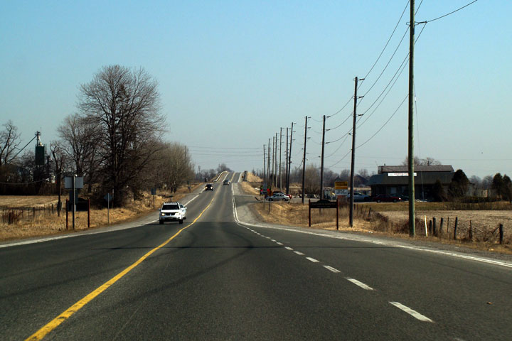
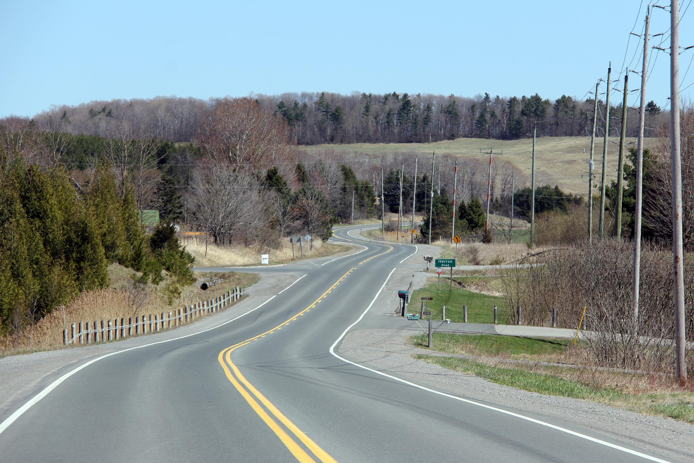
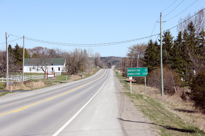
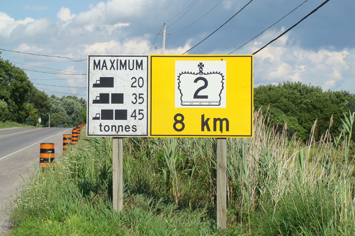
| Municipality of Brighton County
of Northumberland |
Junction assembly at the former
Highway 30
junction in Downtown Brighton. Highway 30 leads north from Brighton to Campbellford
and Havelock. Photo size: 60kb. |
 |
|
Highway 30 starts at Highway 2 in Brighton en route to Havelock via
Campbellford.
Click here for Highway 30 images. |
Municipality of Brighton
County of Northumberland |
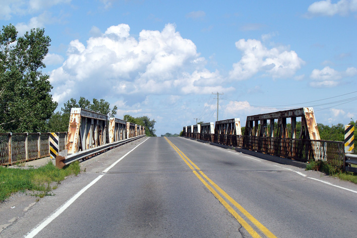
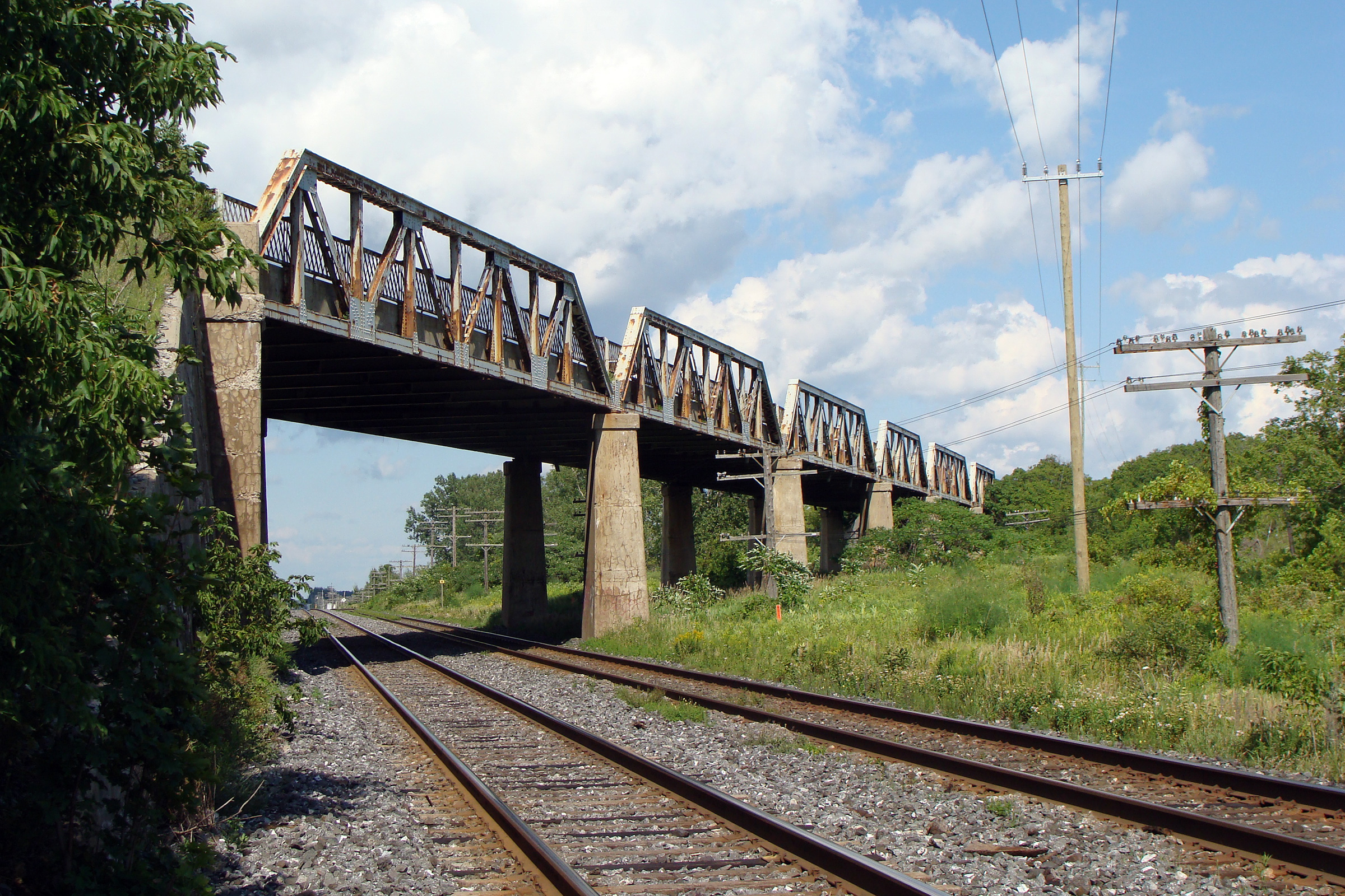
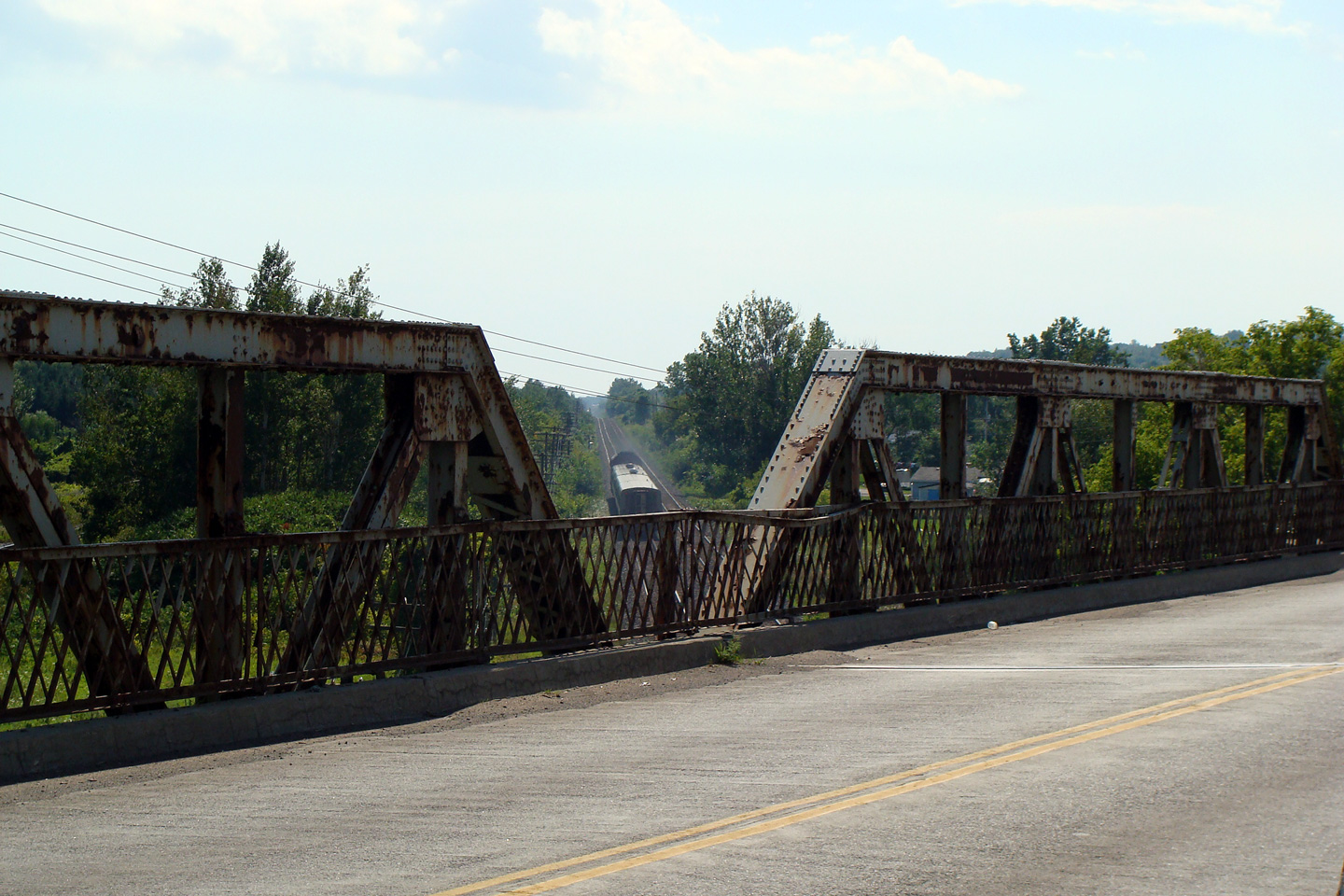
Signage departing Brighton warning of the load restriction on the old
Highway 2 truss bridge ahead. This sign was taken down once the railway
truss bridge was replaced.
Photo taken: August 16th, 2008. |
|
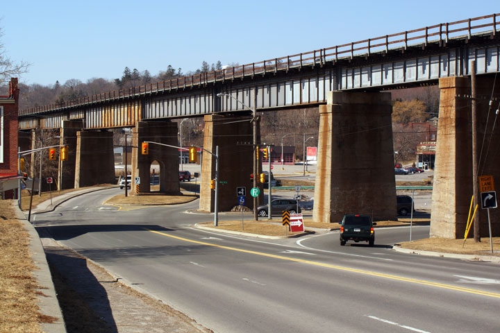
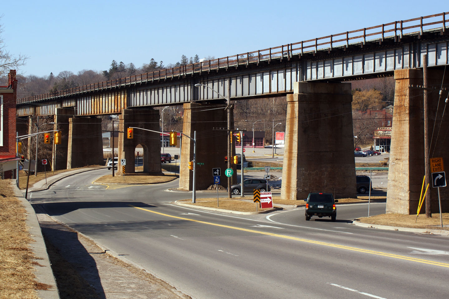
| City of Quinte West |
This view looks easterly across the now demolished Trenton overhead on
Highway 2. A new concrete structure was built immediately to the north
of the existing structure opening to traffic in 2010.
Photo taken: August 16th, 2008. |
|
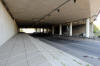
| City of Quinte West |
This is the southern side of the former Trenton overhead. The two tracks
in the foreground are CN's mainline between Toronto and Montreal. The
Highway 2 overhead also crosses CP's mainline, though it is not visible in
the photo.
Photo taken: August 16th, 2008. |
|
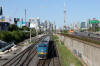
| City of Quinte West |
View from the former Highway 2 overhead as a VIA train speeds westerly
towards Toronto on CN's trackage.
Photo taken: August 16th, 2008. |
|
| City of Quinte West |
This view looks westerly across the CN and CP overhead towards Trenton.
This structure was taken out of service during the summer of 2010.
Photo taken: August 16th, 2008. |
|
| City of Quinte West |
Two views looking towards Trenton from the eastern end of the Trenton
overhead. The road to the right, Boulton Road, was part of Highway 2
prior to the completion of the Trenton overhead in 1930.
Photos taken: August 16th, 2008. |
|
|
From Trenton,
Highway 33 runs north to Stirling and then south and east through Prince
Edward County.
Click here for Highway 33 images. |
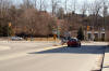
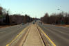
| City of Quinte West |
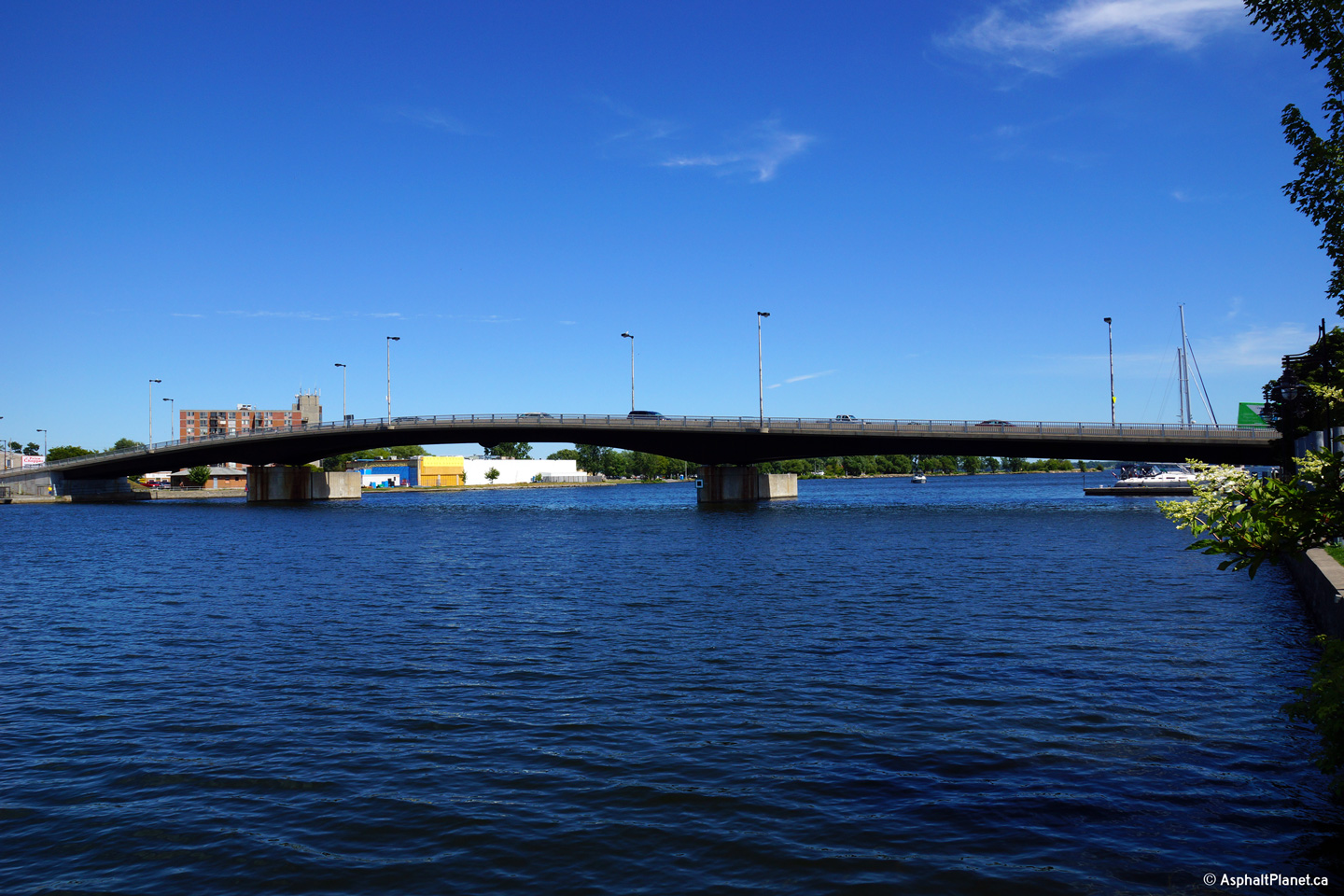
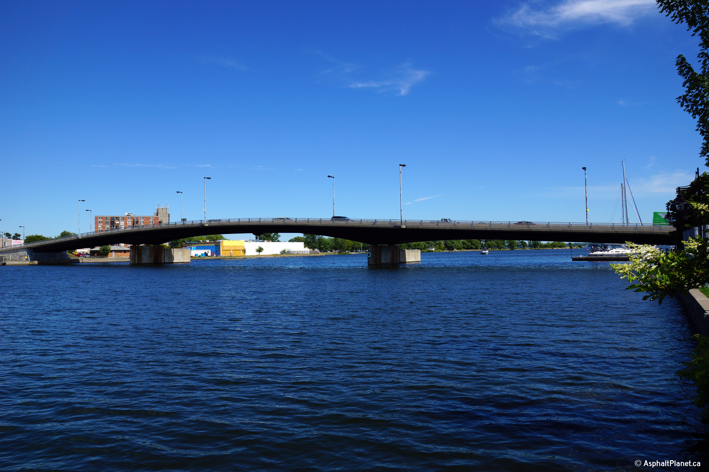
Looking southeasterly at the bridge that carries Highway 2 overtop of the
Trent River in Downtown Trenton.
Photo taken: July 26th, 2013. |
(720x480)
(1440x960)
(2400x1600) |
| City of Belleville |
This view looks easterly along Highway 2 approaching the Montrose Road
intersection between Trenton and Belleville.
Photo taken: July 26th, 2013. |
(720x480)
(1440x960)
(2400x1600) |
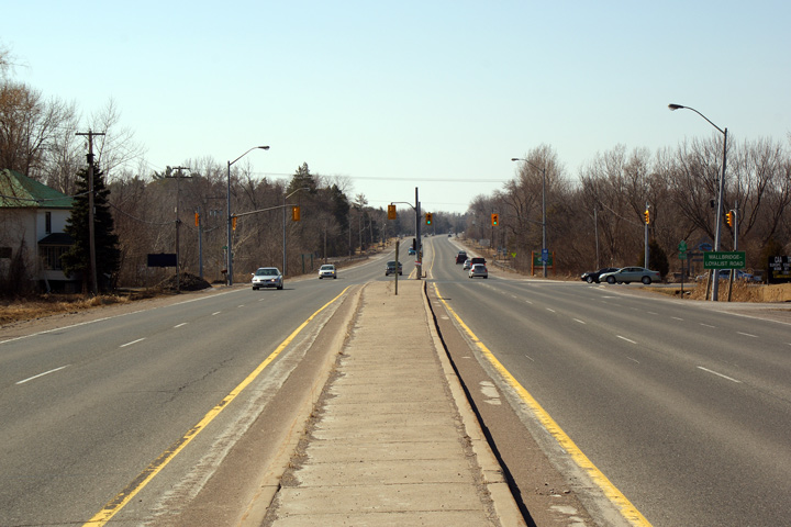
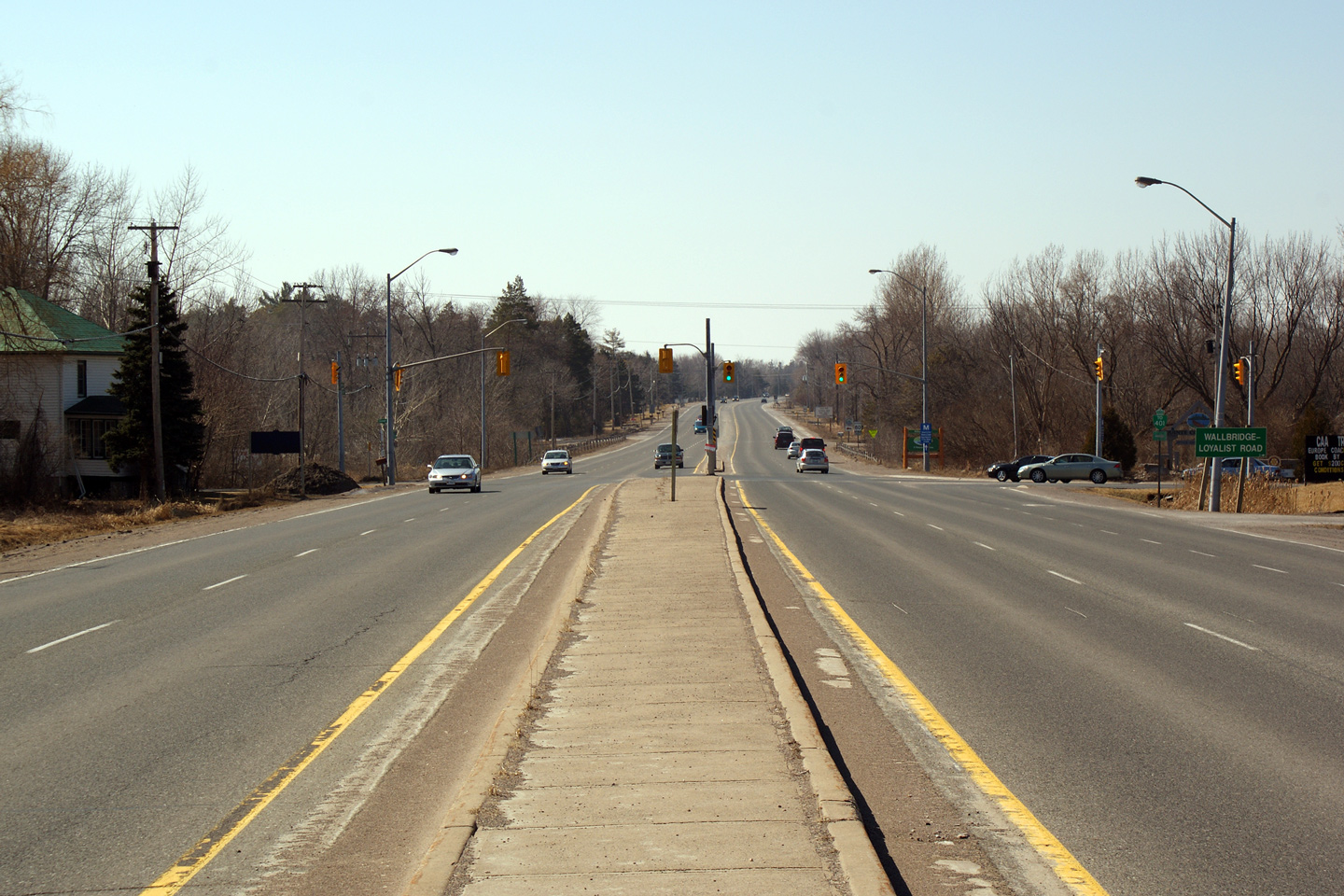
| City of Belleville |
Easterly view approaching the Walbridge-Loyalist
Road intersection. Walbridge-Loyalist Road is the most important
north-south arterial road between Trenton and Belleville.
Photo taken: March 14th, 2009. |
(720x480)
(1440x960)
(2400x1600) |
| City of Belleville |
Easterly view towards the CP Railway overhead
located just to the east of the Walbridge-Loyalist Road overpass.
Photo taken: March 14th, 2009. |
(720x480)
(1440x960) |
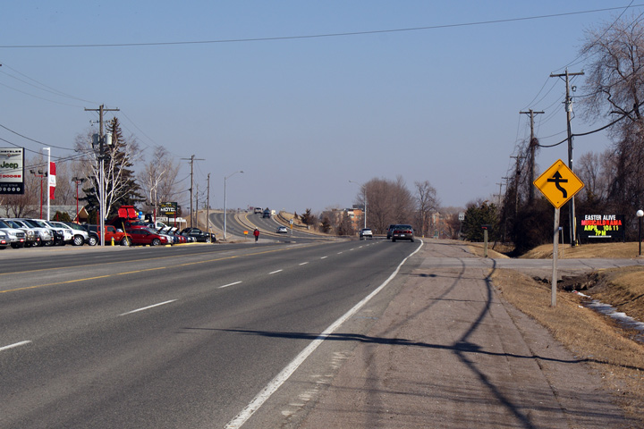
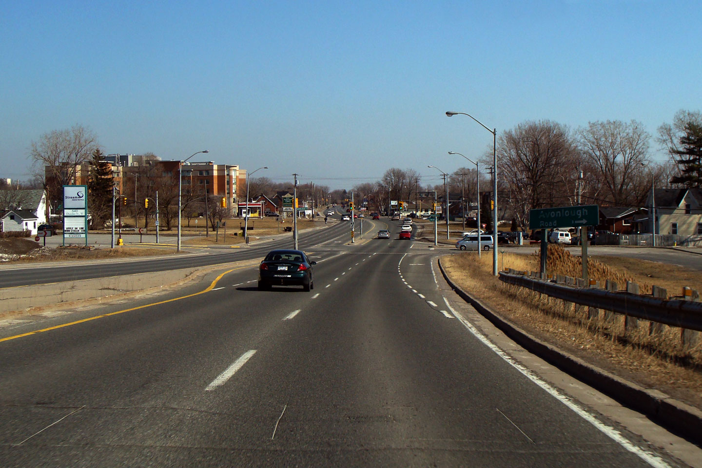
| City of Belleville |
Easterly
view from the east end of the CP Railway overhead looking towards the
Avonlough Road intersection. Avonlough Road travels a considerable
distance to the north of Highway 2, by passing underneath of the highway via
the CP Railway overhead.
Photo taken: March 14th, 2009. |
(720x480)
(1440x960) |
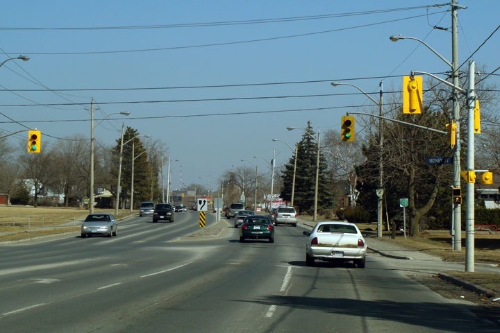
| City of Belleville |
Easterly
view through the Sidney Street intersection. Sidney Street is
Belleville's primary north-south arterial road on the west bank of the Moira
River.
Photo taken: March 14th, 2009. |

(720x480)
(1440x960) |
| City of Belleville |
This
is an impressive junction assembly in a post-download world. There are
several Highway 2 shields left in Belleville.
Photo taken: March 14th, 2009. |
 (720x480) (720x480)
(1440x960) |
| City of Belleville |
Easterly view from the Bay Bridge Road junction
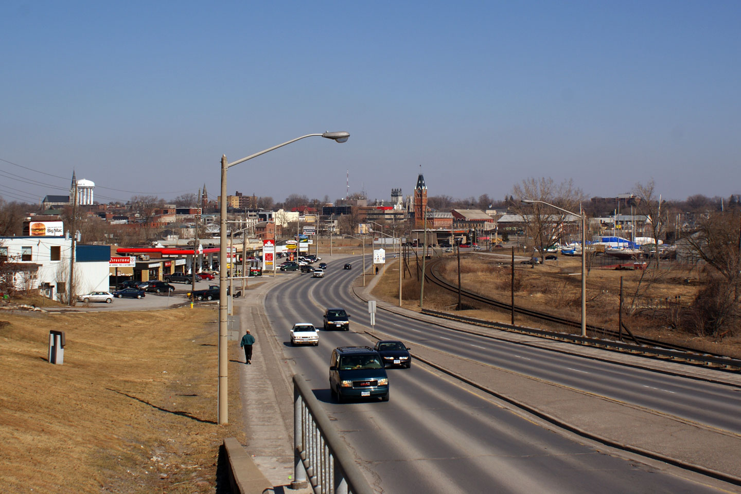
towards Downtown Belleville. Belleville is the largest City between
the GTA and Kingston, at about 45,000 residents.
Photo taken: March 14th, 2009. |

(720x480)
(1440x960) |
| City of Belleville |
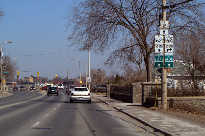
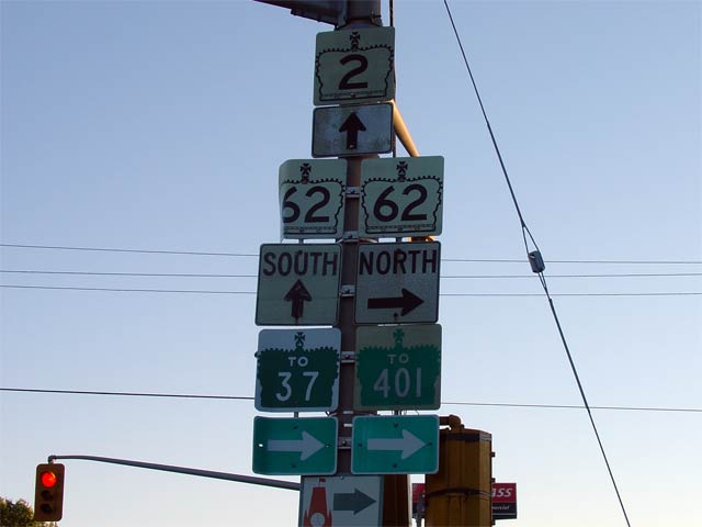
Westbound junction assembly for the eastern
Highway 62 junction in Downtown Belleville.
Photo size: 25kb. |
 |
|
Highway 62 leads northerly from Prince Edward County
towards Bancroft and beyond.
Click here for Highway 62 images. |
| City of Belleville County of
Hastings |
Looking westerly along Highway 2 from just east
of the Eastern limits of the City of Belleville. Notice the highway
converges and then diverges again at the creek crossing in the photo.
This type of treatment is very common to early divided highways designed in
the 1930s.
Photo taken: June 19th, 2004. Size: 55kb. |
 |
| City of Belleville County of
Hastings |
View looking westerly along Highway 2 from just
west of the Point Anne Lane intersection. Notice that Highway 2
crosses a small creek with two separate bridges, unlike the treatment at
Bells Creek further to the west.
Photo taken: June 19th, 2004. Size: 35kb. |
(720x480)
(1440x960) |
| City of Belleville County of
Hastings |
Looking westerly towards the Point Anne Lane
intersection. The 1930s divided highway ends at this intersection,
narrowing down to a conventional two-lane highway. Photo taken: June
19th, 2004. Size: 55kb. |
 |
Township of Tyendinaga
County of Hastings |
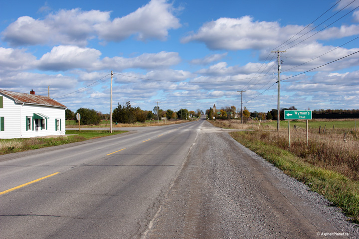
View looking easterly at the Wyman's Road
intersection. This unassuming rural intersection was the eastern
terminus of the Belleville segment of Highway 401 for half a decade
from the years of 1958 to 1963.
Photo taken: October 12th, 2012. |

(720x480)
(1440x960)
(2400x1600) |
Township of Tyendinaga
County of Hastings |
Easterly view at Marysville Junction. Now
that Highway 2 has been transferred to local jurisdiction, this intersection
is almost completely unsigned, however traffic continuing along Highway 2
must turn right at this intersection.
Photo taken: October 12th, 2012. |
(720x480)
(1440x960)
(2400x1600) |
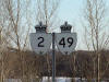
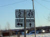
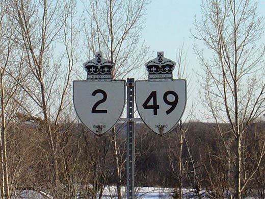
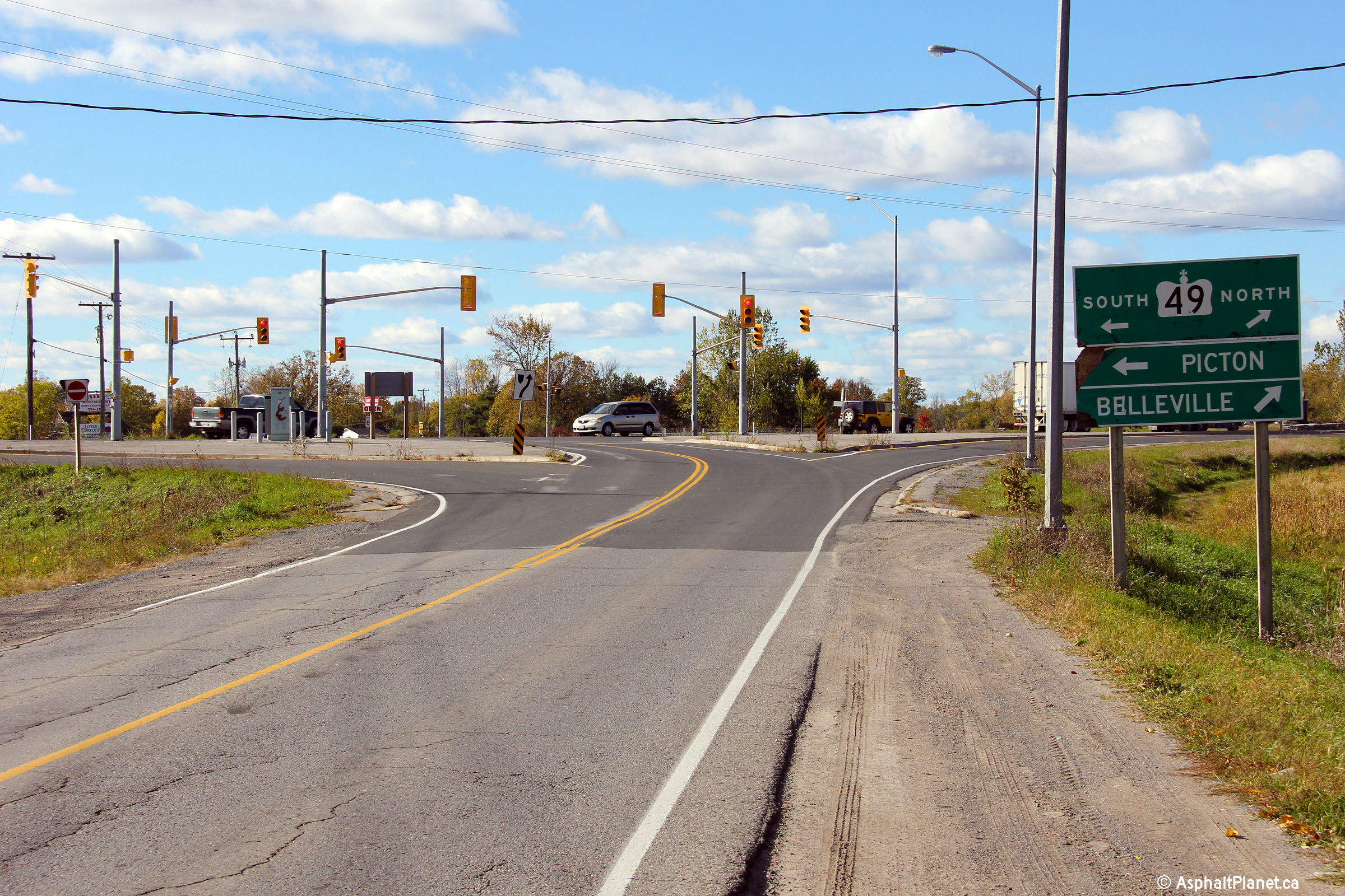
| Tyendinaga IR 38 County of
Hastings |
Signage just south of Marysville indicating both
Highway's 2 and 49. Highway 2 and
49 were co-designated for 4.2km
before Highway 2 was decommissioned in 1997. Though signage still
indicates Highway 2 following Highway 49 for much of this former multiplex,
technically (and legally) the Highway 2 designation has been removed from this section of
Highway 49.
Photo size: 55kb. |
 |
| Tyendinaga IR 38 County of
Hastings |
Advanced signage at the southern Highway 2/49
junction. At this junction, Highway 49
continues southerly across the Qunite Skyway to Prince Edward Island, while
Highway 2 turns again easterly and leads travelers to Desoronto.
Photo size: 30kb. |
 |
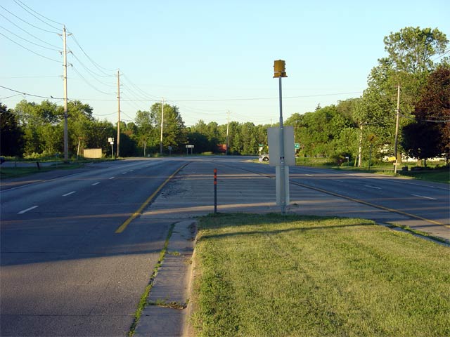
| Tyendinaga IR 38 County of
Hastings |
Looking south along Highway 49 towards the
southern Highway 2 junction.
Photo taken: June 2nd, 2005. Size: 45kb. |
 |
|
Highway 49 is a short Highway that links Highway 401 with
Prince Edward County.
Click here for Highway 49 images. |
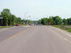
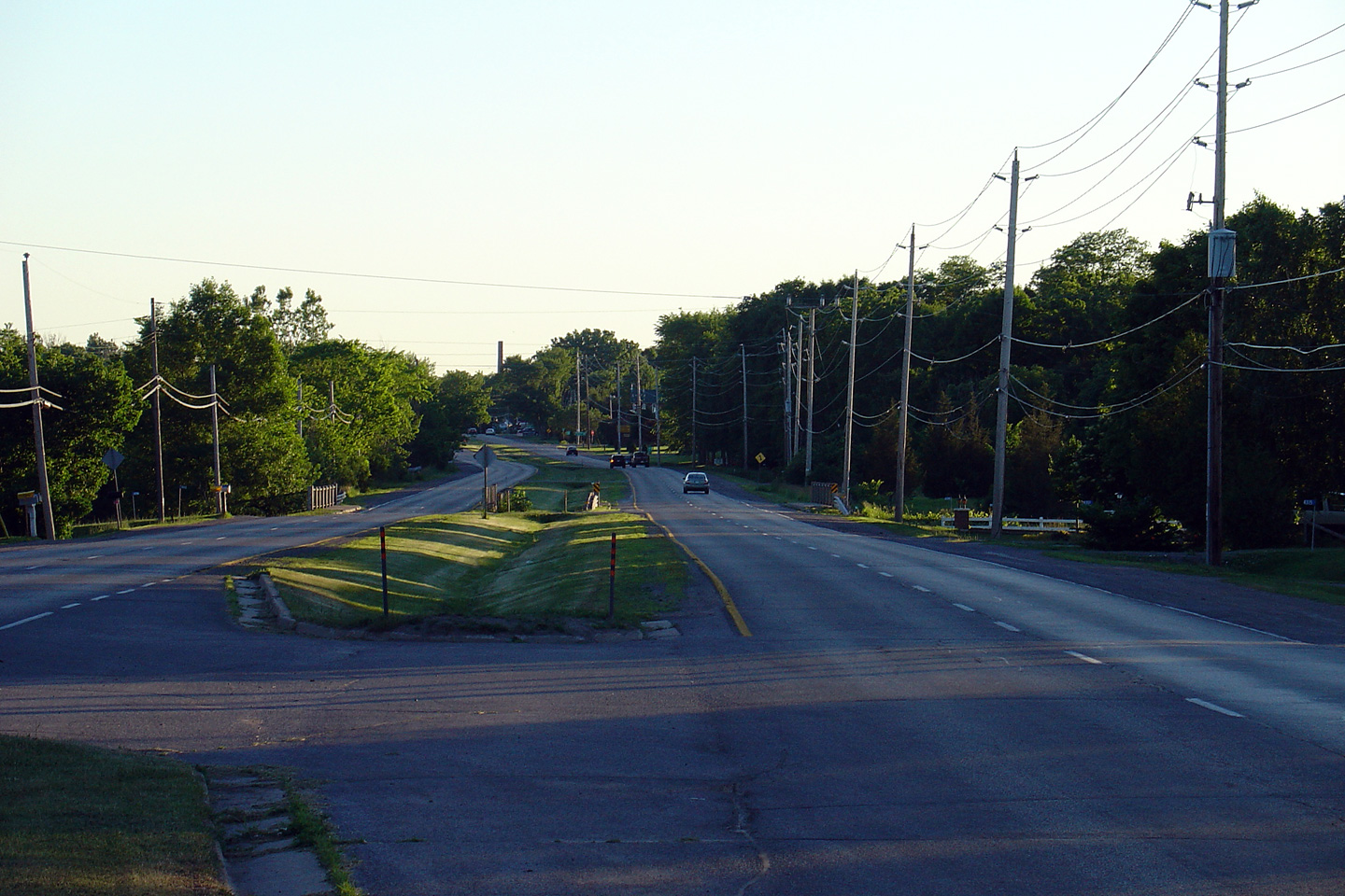
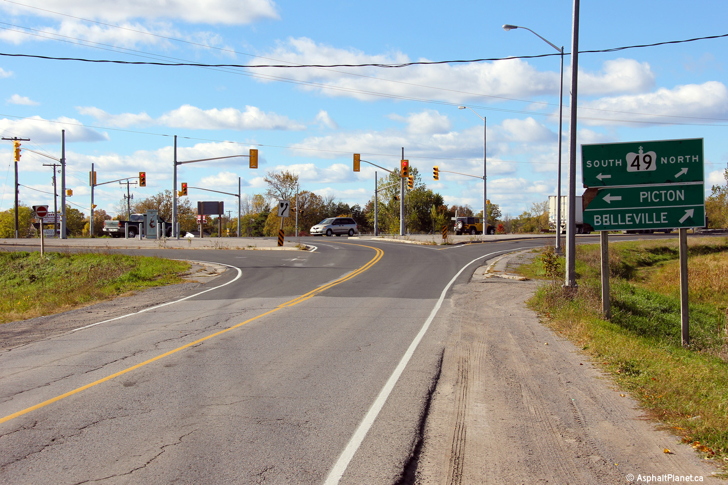
| Tyendinaga IR 38 County of
Hastings |
View looking westerly approaching the southern Highway 49 intersection.
Traffic continuing west along Highway 2 must follow the ramp to the right.
Photo taken: October 12th, 2012. |
(720x480)
(1440x960)
(2400x1600) |
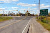
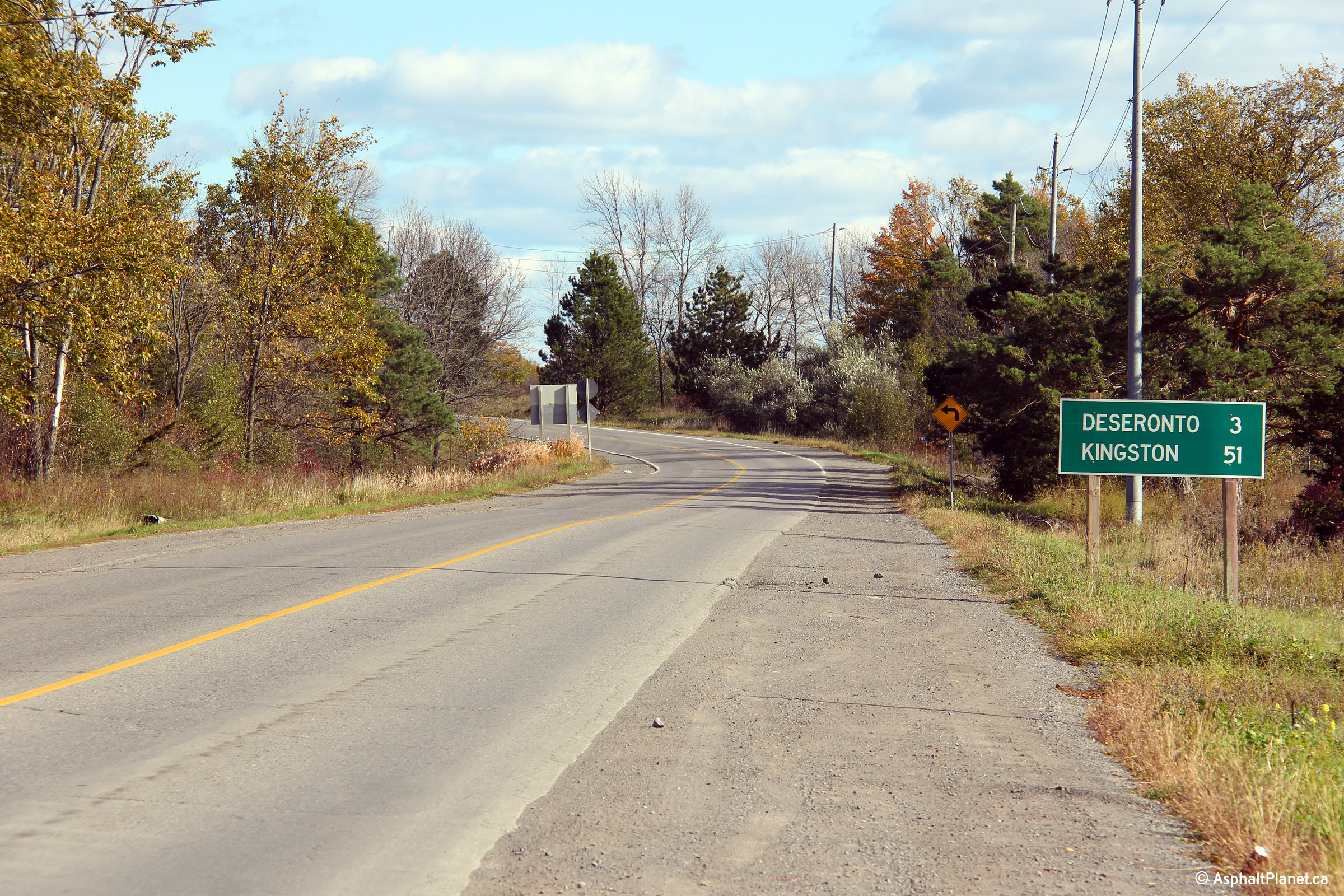
| Tyendinaga IR 38 County of
Hastings |
Distance signage including the distance to both Deseronto and Kingston
located just east of the Highway 49 junction.
Photo taken: October 12th, 2012. |
(720x480)
(1440x960)
(2400x1600) |
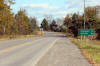
Town of Greater Napanee
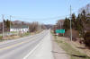
County of Lennox & Addington |
View looking easterly along Highway 2 as the
highway passes through Desoronto. I don't know the full history, but
Highway 2 passes to the north of Desoronto's business district. I have
a sneaking suspicion that Highway 2's alignment has been moved northerly in
this area due to the Shannonville Indian Reserve.
Photo taken: March 14th, 2009. |
(720x480)
(1440x960) |
Town of Greater Napanee
County of Lennox & Addington |
Easterly view towards the eastern limits of
Deseronto. The Deseronto Road intersection is seen at the bottom of
the hill.
Photo taken: March 14th, 2009. |

(720x480)
(1440x960) |
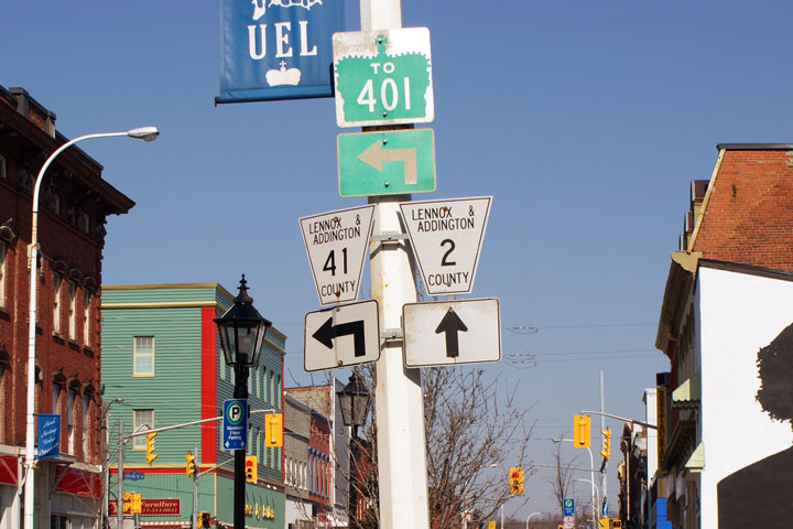
Town of Greater Napanee
County of Lennox & Addington |
View
looking easterly from the Robert Street intersection towards the
Highway 41
intersection.
Photo taken: March 14th, 2009. |

(720x480)
(1440x960) |
Town of Greater Napanee
County of Lennox & Addington |
Junction
assembly for the county roads that represent the former highways in Napanee.
Photo taken: March 14th, 2009. |
 |
Town of Greater Napanee
County of Lennox & Addington |
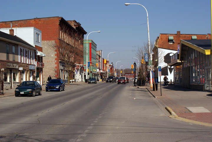
The
four corners of Napanee is located at the Highway 2 and 41 junction.
Downtown Napanee isn't anything special, but isn't particularly rundown
either.
Photo taken: March 14th, 2009. |
(720x480)
(1440x960) |
|
Highway 41 runs the long distance from Napanee northerly to
Pembroke via Kaladar and Denbigh.
Click
here Highway 41 images. |
Town of Greater Napanee
County of Lennox & Addington |
Easterly
from the John Street intersection along Dundas Street in Napanee.
Napanee is a very typical Eastern Ontario small town.
Photo taken: March 14th, 2009. |
(720x480)
(1440x960) |
Town of Greater Napanee
County of Lennox & Addington |
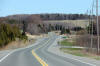
This view looks easterly as Highway 2 climbs out of the Napanee Valley.
Photo taken: May 7th, 2006. |
(720x480)
(1440x960) |
Town of Greater Napanee
County of Lennox & Addington |
View
looking easterly along Highway 2 between Napanee and Odessa.
Photo taken: March 14th, 2009. |
(720x480)
(1440x960) |
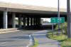
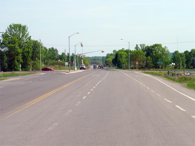
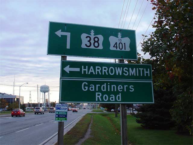
| City of Kingston |
Signage informing eastbound motorists of the
Highway 38/Gardiners Road intersection. The
lower half of this sign was erected by the City of Kingston after an errant
motorist struck the original MTO signage.
Photo size: 50kb. |
 |
|
Highway 38 begins its trek northerly to Sharbot Lake and Highway 7 at
Highway 2 in Kingston.
Click here for Highway 38 images. |
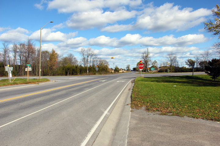
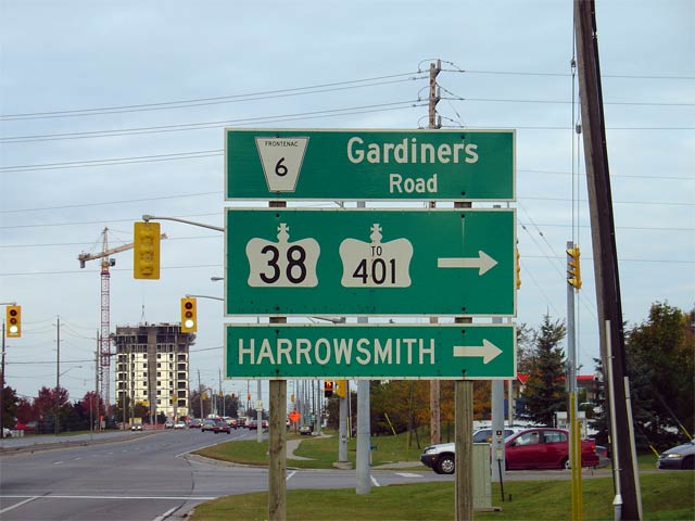
| City of Kingston |
Green signage for westbound traffic approaching
the Highway 38 intersection. Photo size: 50kb. |
 |
| City of Kingston |
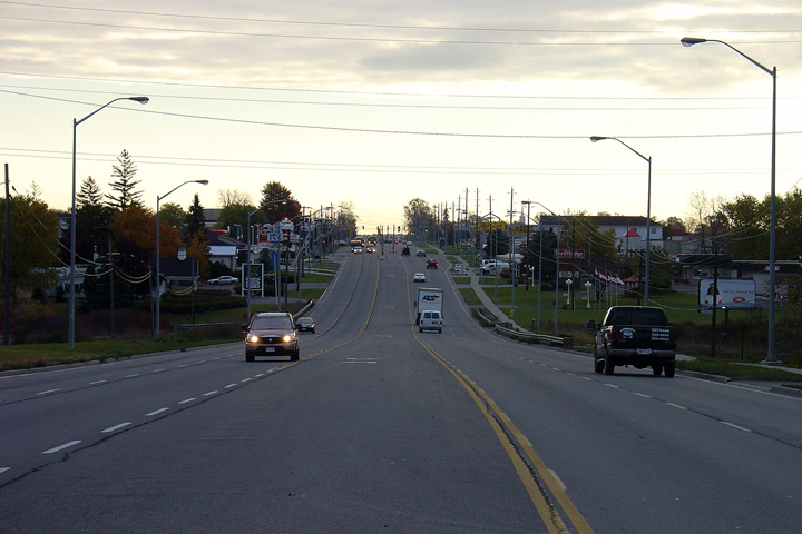
View looking easterly along Highway 2 from just
east of the Highway 38 intersection. Through western Kingston, Highway
2 has a 5-lane suburban cross-section. Photo taken: October 22nd, 2004. |
(720x480)
(1440x960) |
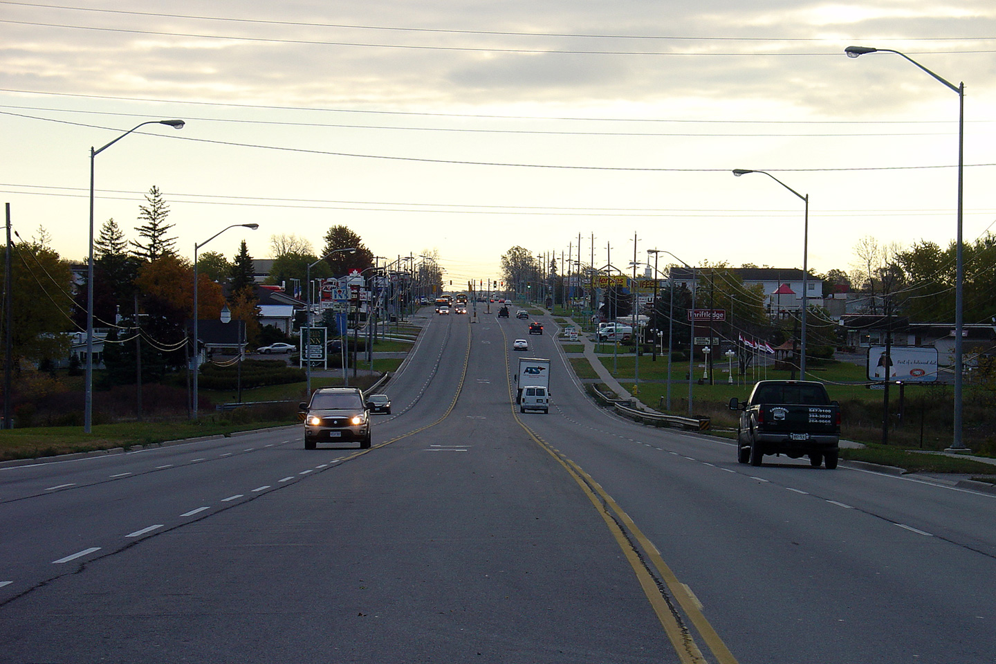
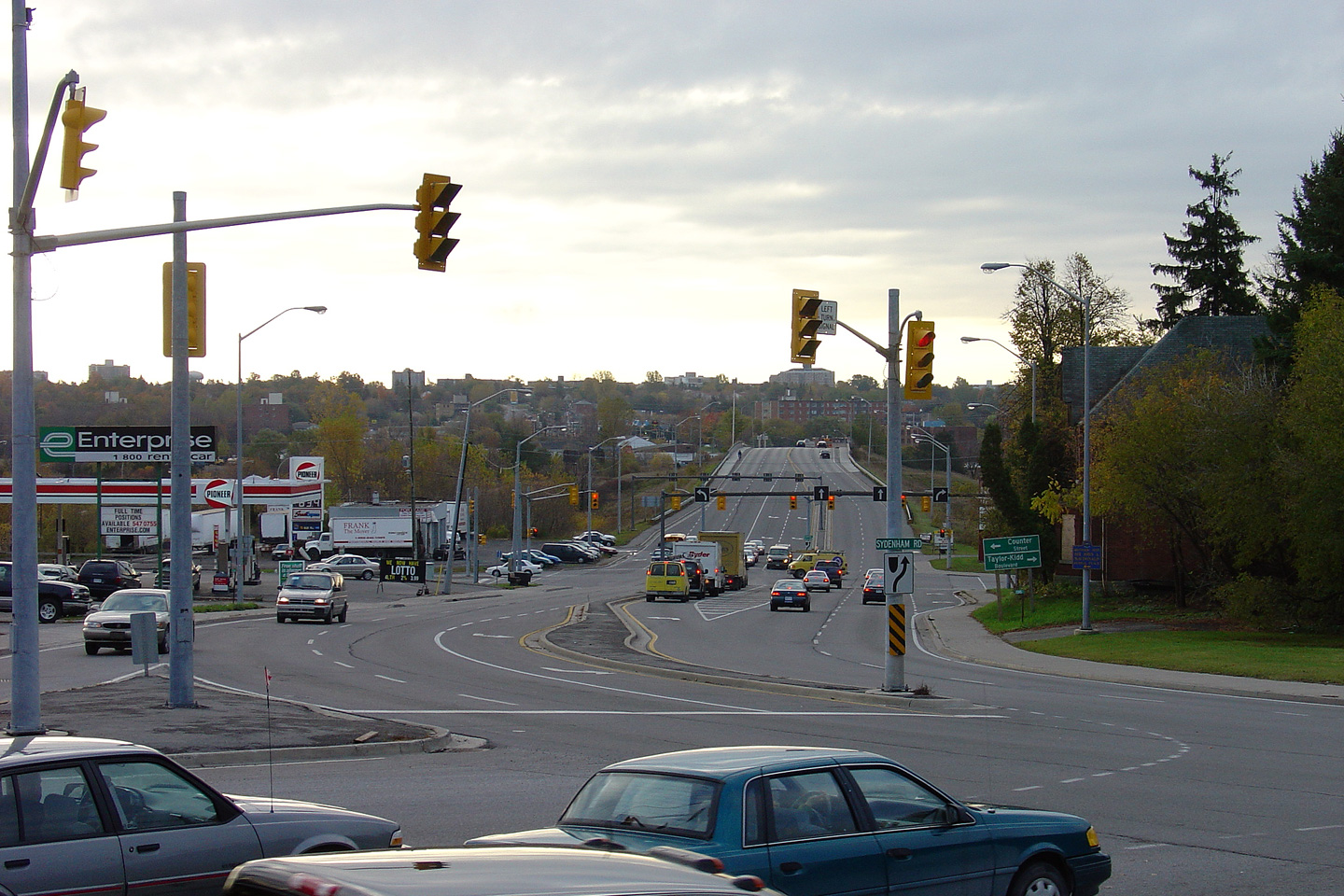
| City of Kingston |
View looking easterly along Highway 2 from the
Sydenham Road intersection. The Sydenham Road and John Counter
Boulevard
intersections are located in very close proximity to one another.
Beyond John Counter Boulevard, Highway 2 crosses the CN mainline and enters the
pre-amalgamated City of Kingston.
Photo taken: October 22nd, 2004. |
(720x480)
(1440x960) |
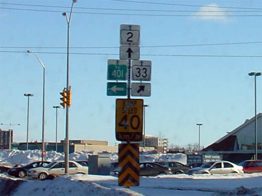
|
Highway 33 begins westerly at this intersection in Kingston, following the
northern shore of Lake Ontario closely until the Glenora Ferry.
Click
here for Highway 33 images. |
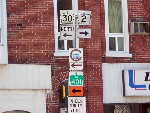
| City of Kingston |
A poor quality photo of the Highway 2 (Princess
Street) approaching the Sir John A. Macdonald Blvd intersection.
Westbound Highway 33 is signed along Sir
John A. Macdonald Blvd as a short-cut route from eastbound Highway 2 to
avoid some closely spaced traffic signals that would be encountered
following the 'true' route.
Photo size: 30kb. |
 |
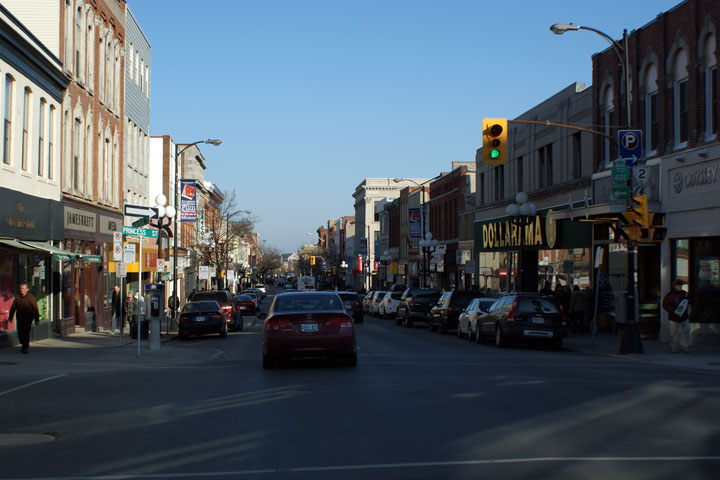
| City of Kingston |
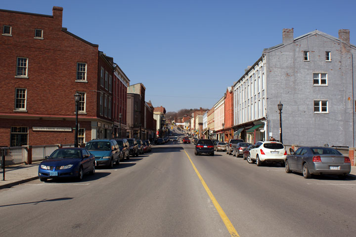
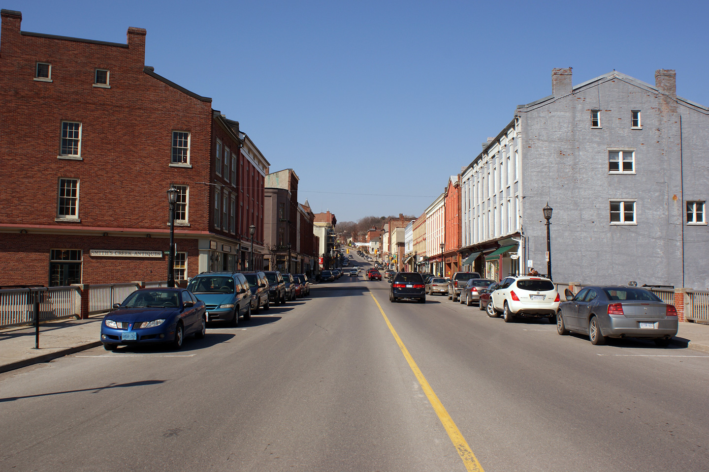
Easterly view of Princess Street in Downtown
Kingston. Princess Street is lined with trendy shops in beautifully
restored historic buildings.
Photo taken: March 14th, 2009. |
 (720x480) (720x480)
(1440x960) |
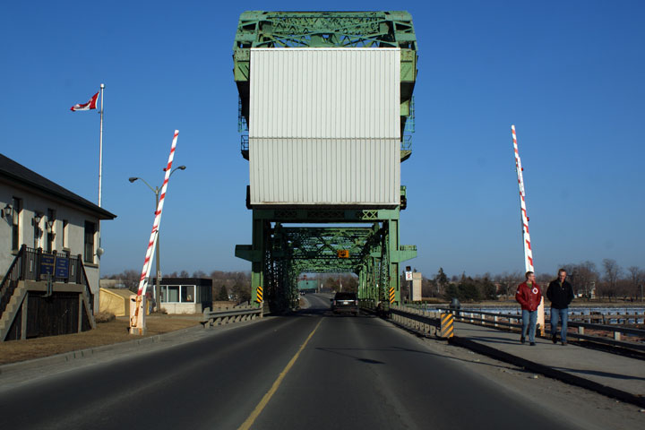
| City of Kingston |
Easterly view of Highway 2 as it crosses the
LaSalle Causeway. Historically, the LaSalle Causeway was the Eastern
Kingston City Limit. With the amalgamation of Kingston with its
surrounding townships in the early 2000s this is no longer the case.
Photo taken: March 14th, 2009. |
 (720x480) (720x480)
(1440x960) |
|
Click here for
Kingston to Lancaster Images. |


 (720x480)
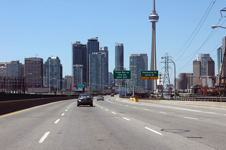 (720x480)
 (720x480)
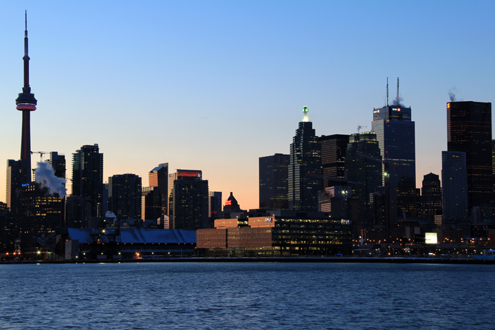


 (720x480)
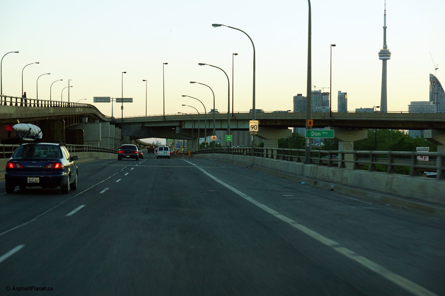
 (720x480)

 (720x480)


 (720x480)
 (720x480)
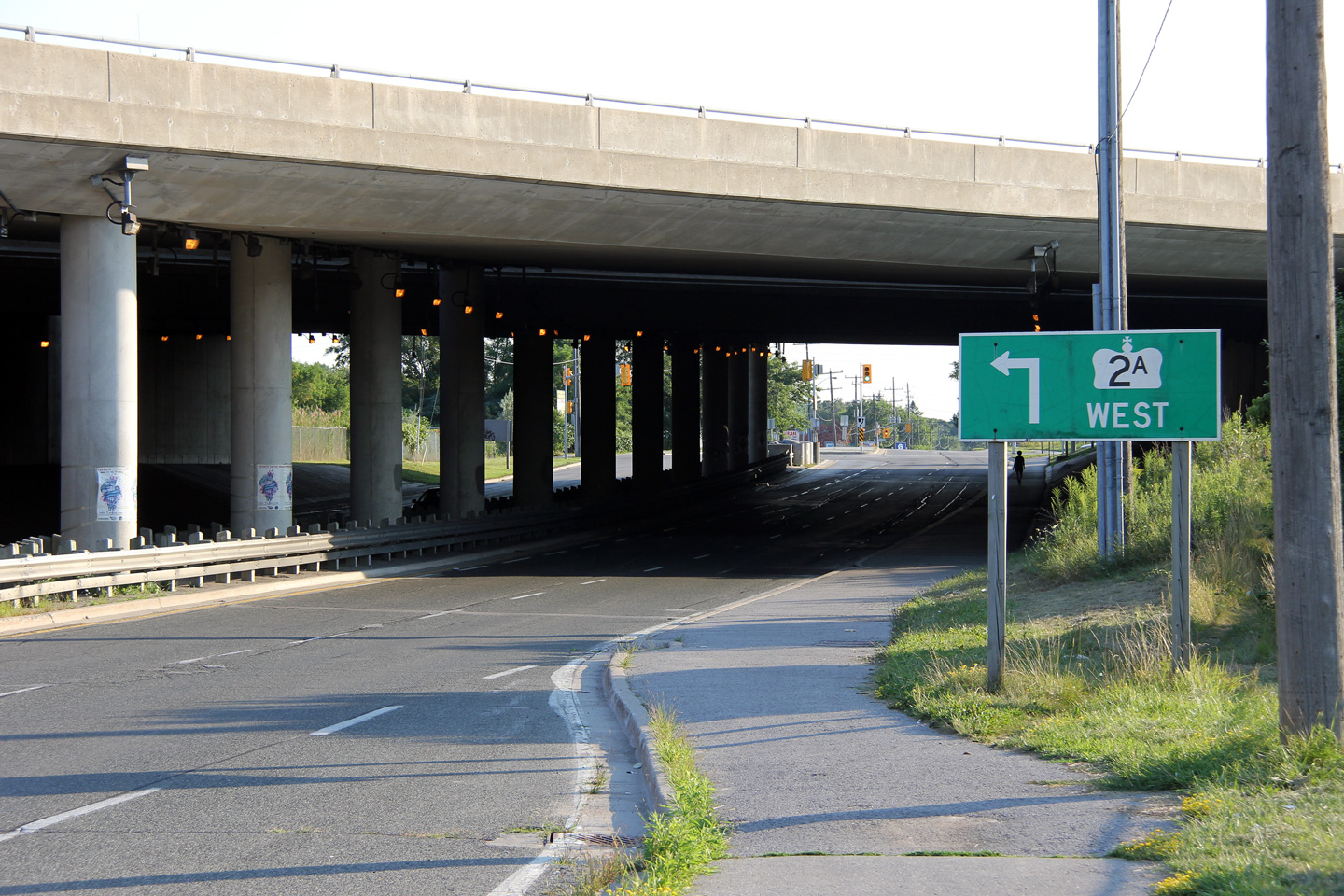


 (720x480)
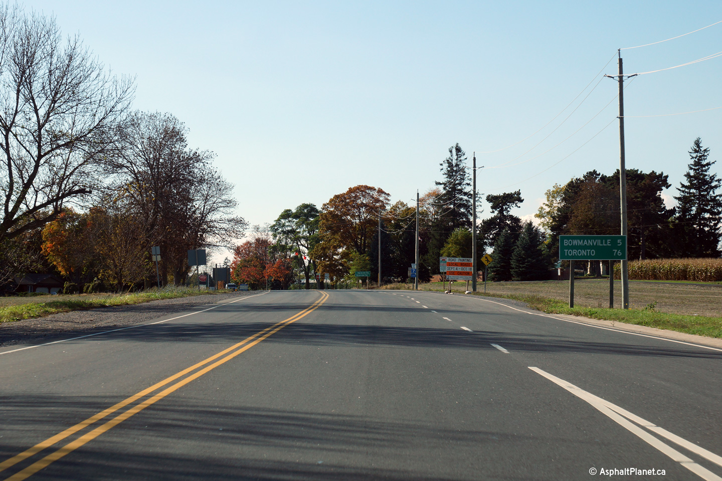


 (720x480)
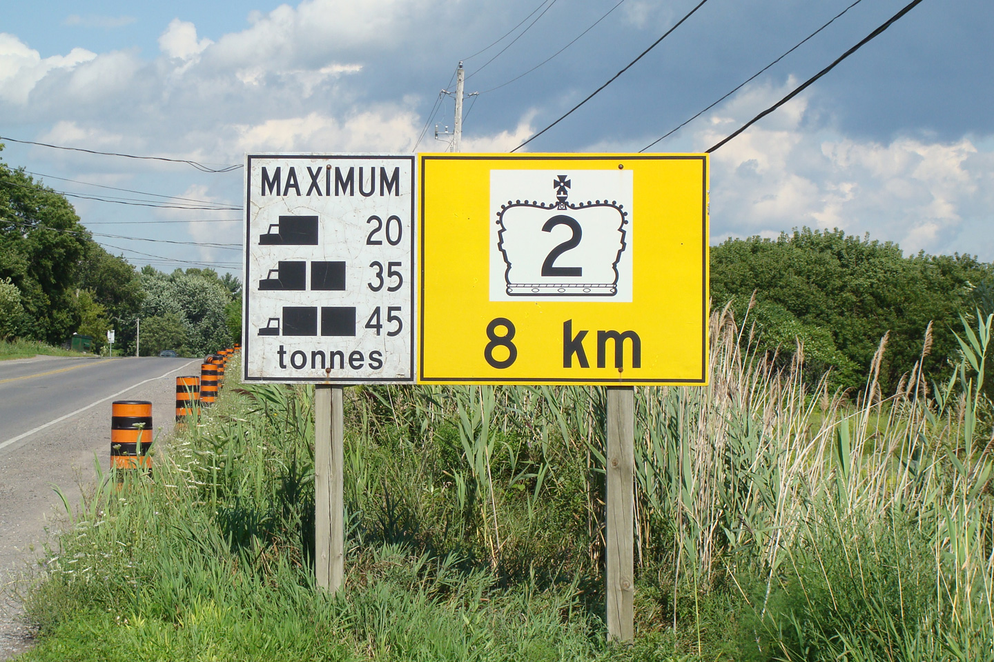


 (720x480)


 (720x480)
 (720x480)