|
Proper Municipality Name |
Photo Description |
Photo |
|
Photos taken
from driver's perspective appear offset from centre-line Photos: |
North-
bound |
South-
bound |
|
Highway 401 is Southern Ontario's
major east-west freeway.
Click here for Highway 401 images. |
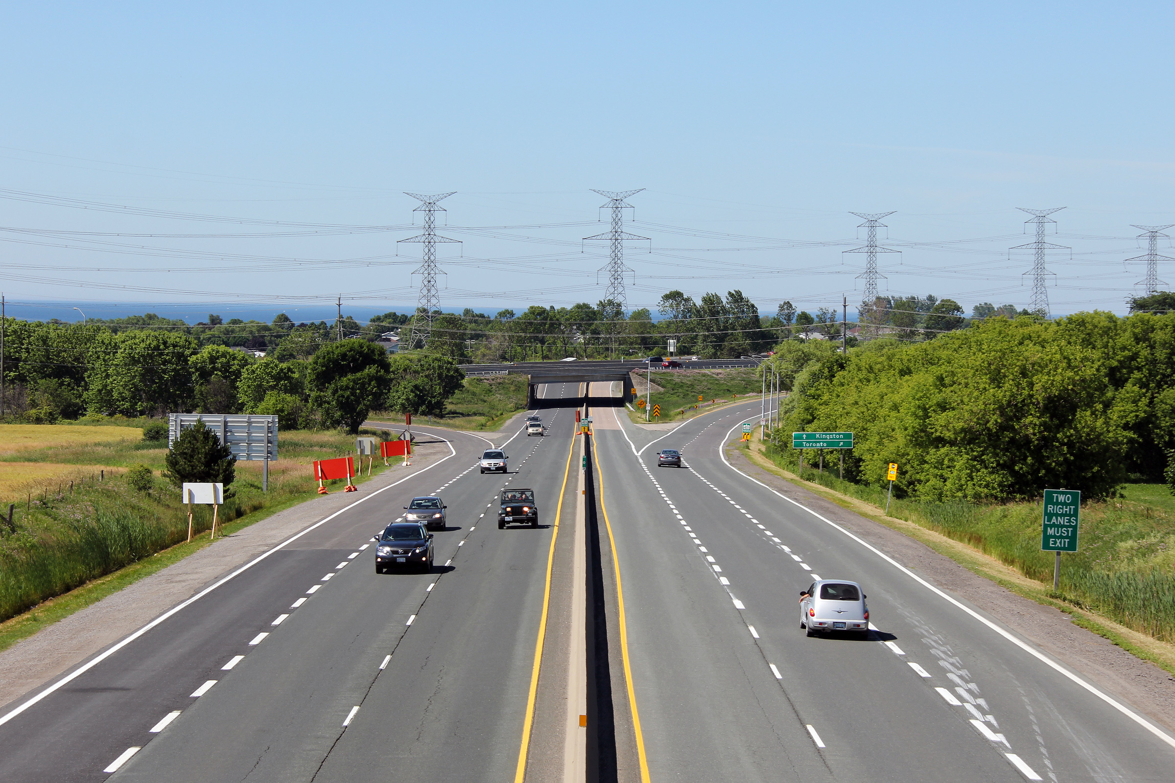
| Municipality of Clarington
Regional Municipality of Durham |
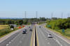
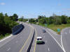
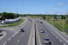
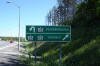
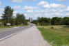
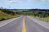
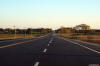
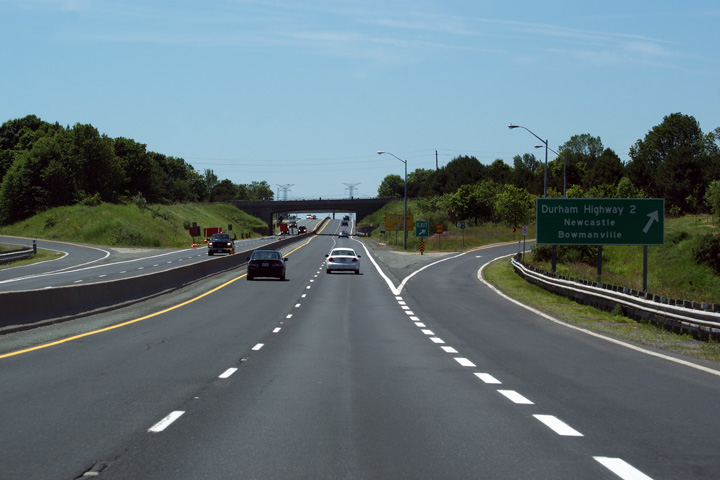
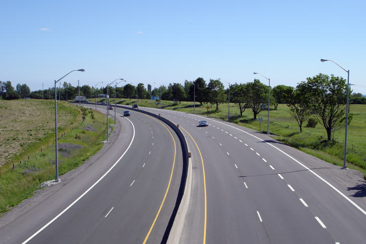
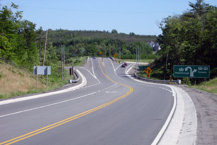
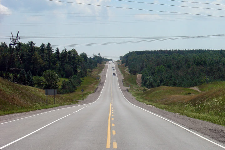
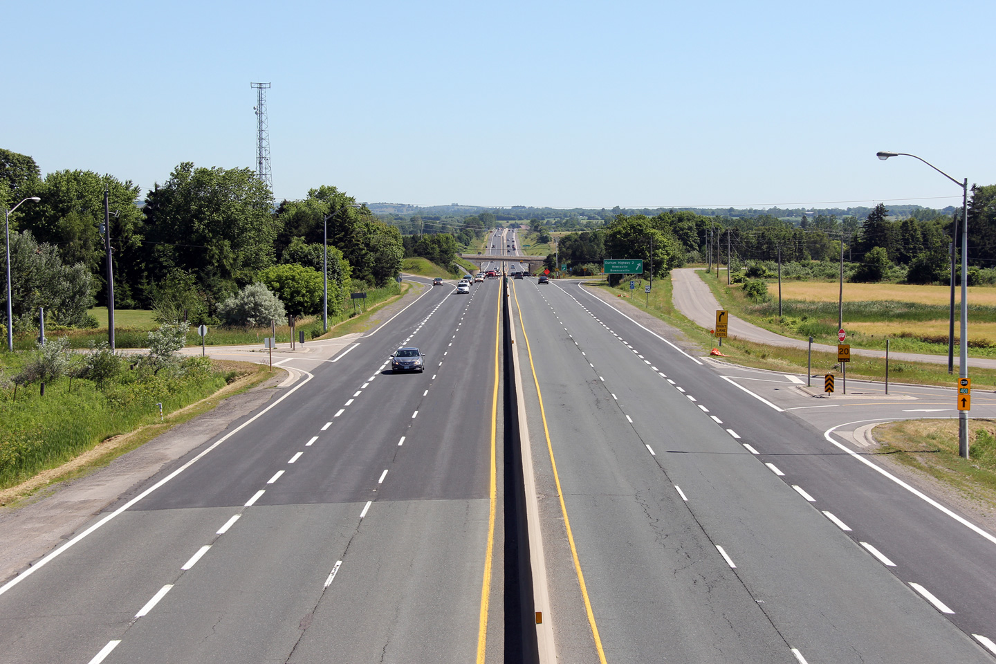
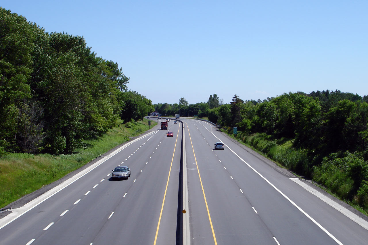
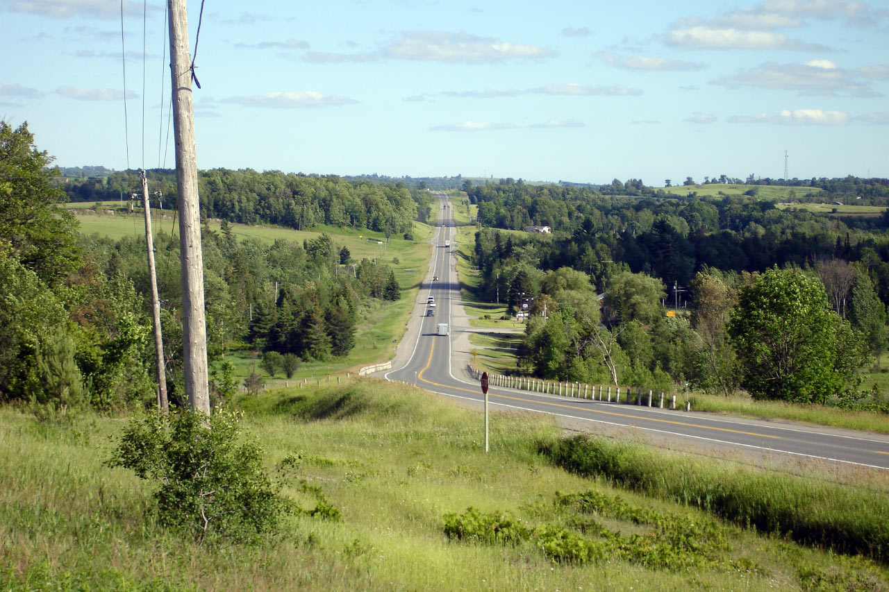
This Photo shows the southern
terminus of Both Highway 35 and 115. This section of 35/115 was
part of the original Highway 401 for a
brief period; when the 401 was extended
eastwards towards Port Hope, this section of
401 became incorporated at first into a Highway 35
extension, and later a Highway 35/115
extension.
Photo taken: July 3rd, 2011. |
(720x480)
(1440x960)
(2400x1600) |
| Municipality of Clarington
Regional Municipality of Durham |
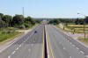
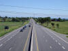
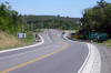
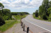
Driving south on the 35/115 at the Lovkin
Road overpass. Lovkin Road is located about 800m north of the Highway 401 interchange. As visible in the
photo, the overhead signage for
the upcoming Highway 401 interchange is affixed to the Lovkin Road overpass.
Photo taken: July 3rd, 2011. |
 (720x480) (720x480)
(1440x960)
(2400x1600) |
| Municipality of Clarington
Regional Municipality of Durham |
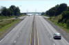
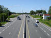
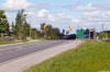
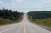
Highway 35/115 looking north from the Lovkin
Road overpass. This photo showcases the rather substandard Lovkin
Road RIRO interchange.
Photo taken: July 3rd, 2011. |
(720x480)
(1440x960)
(2400x1600) |
|
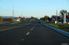
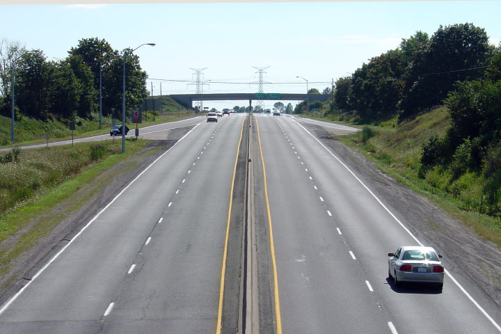
Municipality of Clarington Regional Municipality of Durham |
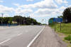
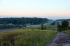
Looking south towards Highway 401 from the
Highway 2 overpass. The
Highway 2 overpass was constructed in 1952 with a very narrow span. Photo taken: September 1st, 2004.
Low-res: 50kb. |
Low-res
High-res |
|
Highway 2 follows the 401 in
close proximity through Durham and Northumberland.
Click here for Highway 2 images. |
|
Municipality of Clarington Regional Municipality of Durham |
Looking north along Highway 35/115 from the
Highway 2 overpass. Before Highway 401 was extended to just west of
Newcastle, Highway 35 ended in Downtown Newcastle following today's Mill
Street south from Orono. The diversion from Concession Road 3 to Highway 2 opened in 1956, as a limited access two-lane highway that was
later 4-laned in the 1980s.
Photo taken: September 1st, 2004. Low-res: 60kb. |

Low-res
High-res |
|
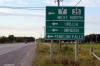
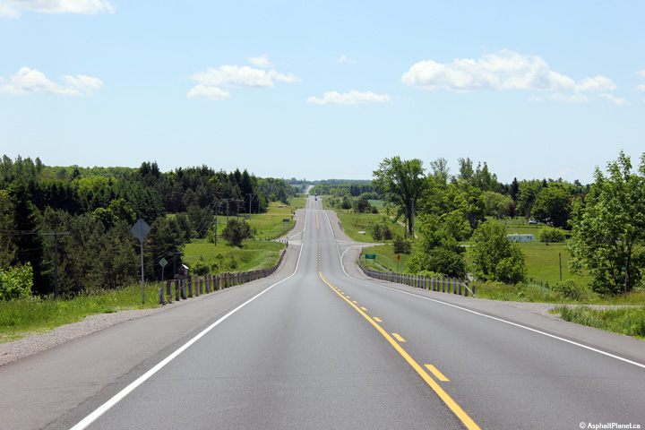
Municipality of Clarington Regional Municipality of Durham |
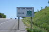
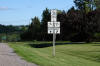
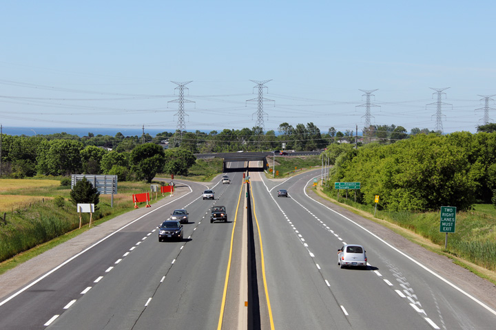
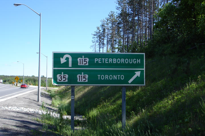
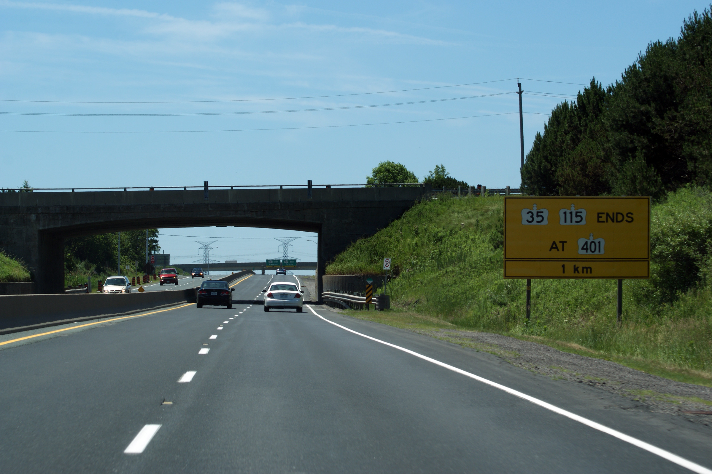
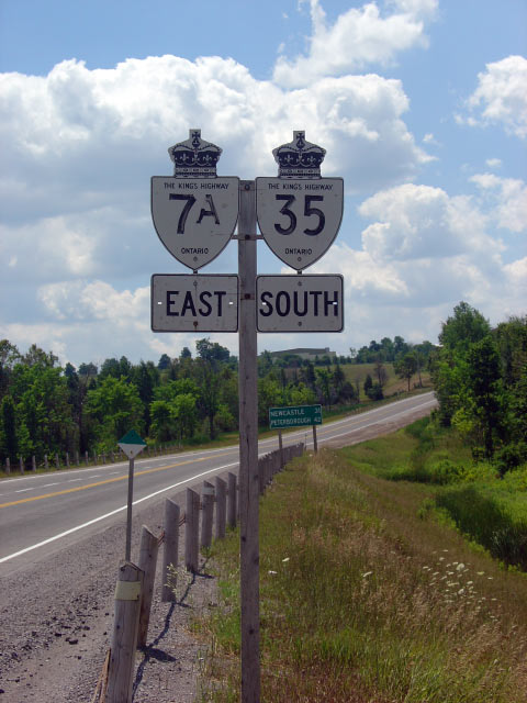
This photo shows the sign that
denotes the southern terminus of both Highway 35/115. This sign is
located just south of the
Highway 2 overpass (which is also shown in
the photo).
Photo taken: July 3rd, 2011. |
 (720x480) (720x480)
(1440x960)
(2400x1600) |
|
Municipality of Clarington Regional Municipality of Durham |
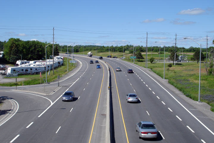
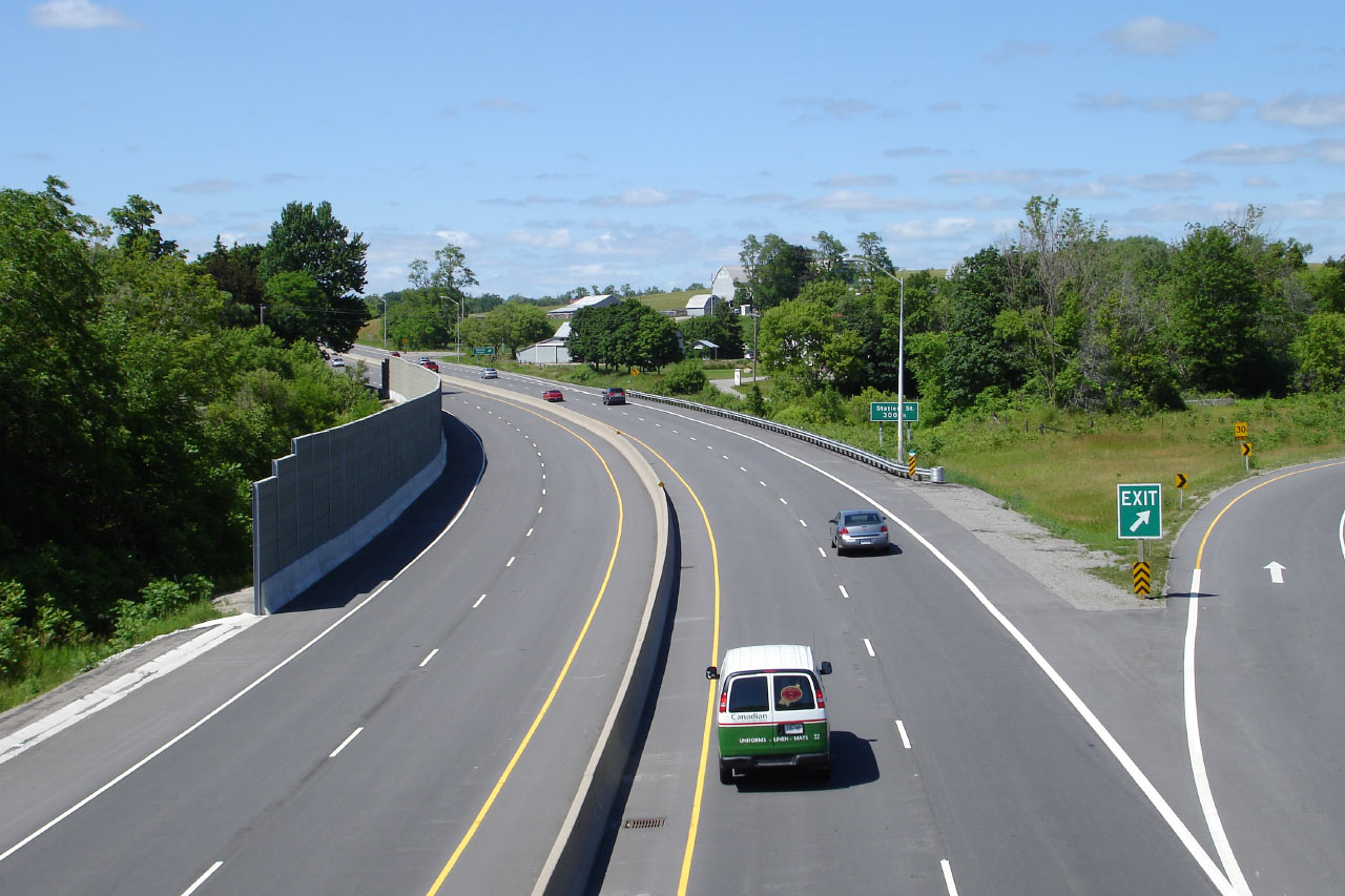
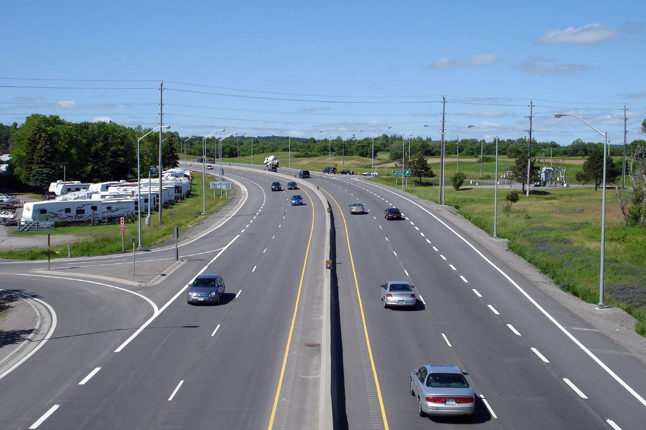
Southbound view as the ramp to
(Durham) Highway 2 leaves the RIRO expressway. The 35/115 meets
Highway 2 at a diamond interchange. A careful observation of the
interchange from ground level reveals the historical footprint of a
four-ramp parclo A2 interchange, that was likely re-incarnated into its
current diamond configuration when Highway 35/115 was widened to four lanes
in the 1980s.
Photo taken: July 3rd, 2011. |

(720x480)
(1440x960)
(2400x1600) |
|
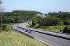
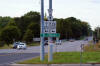
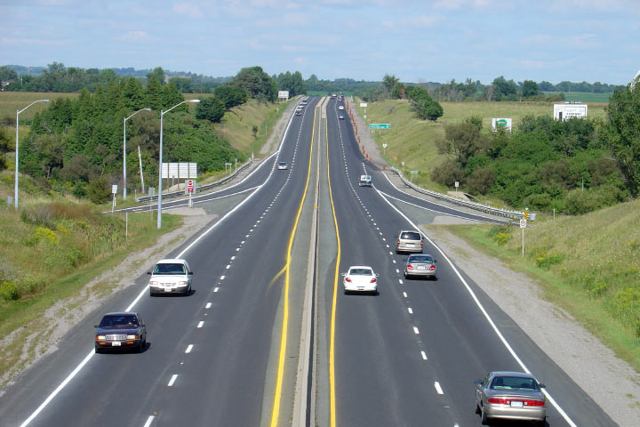
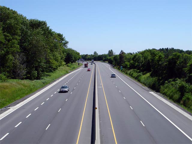
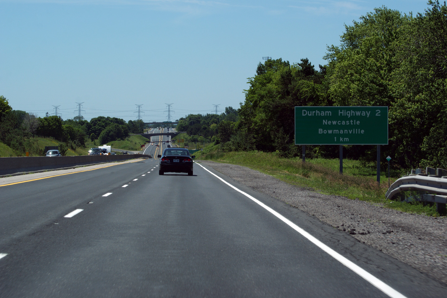
Municipality of Clarington Regional Municipality of Durham |
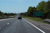
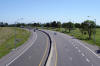
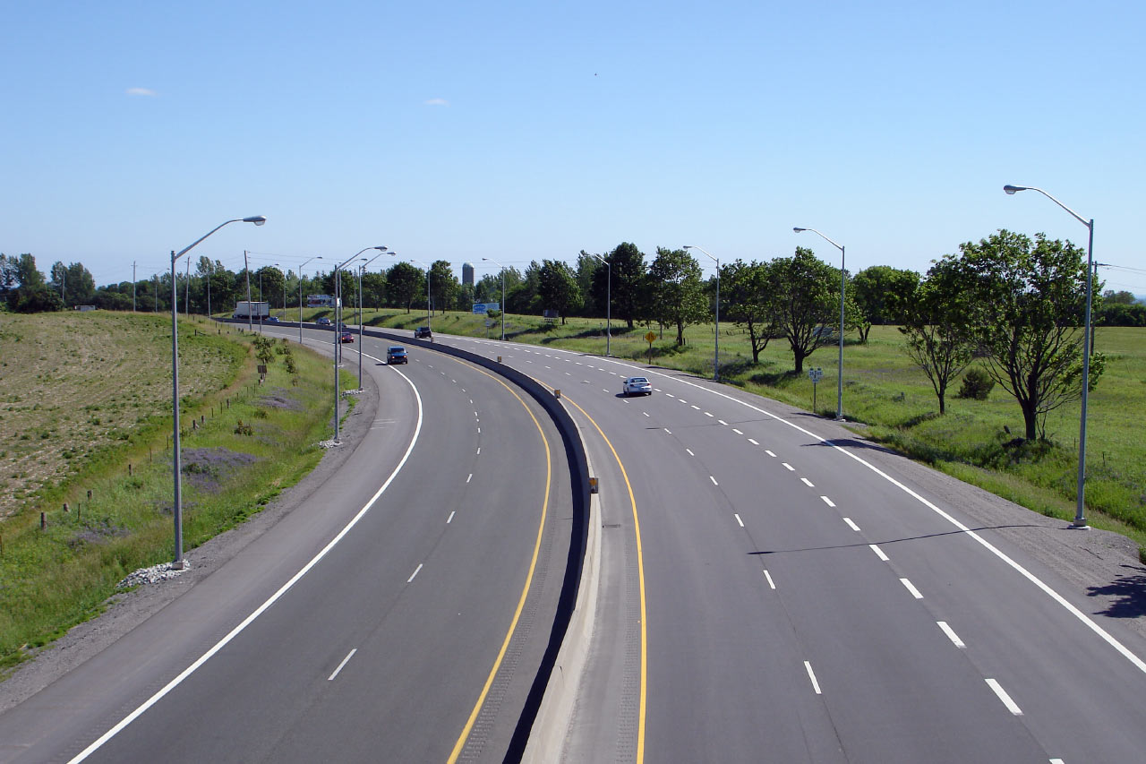
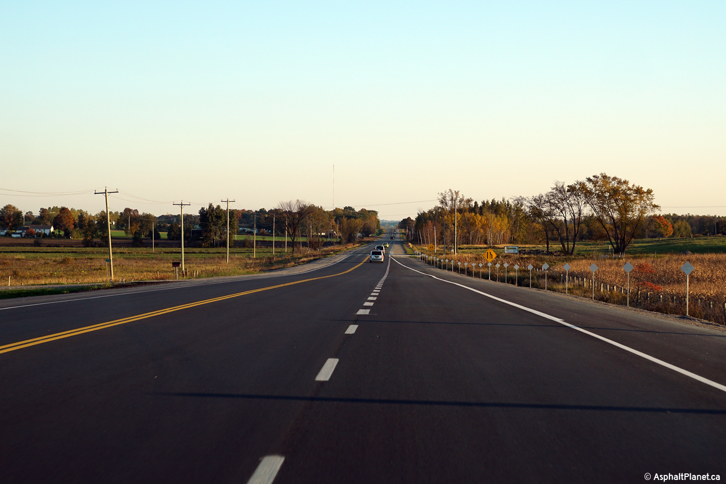
Southbound view of Highway 35/115
at the one kilometre advanced sign for Durham Highway 2.
Photo taken: July 3rd, 2011. |
 (720x480) (720x480)
(1440x960)
(2400x1600) |
|
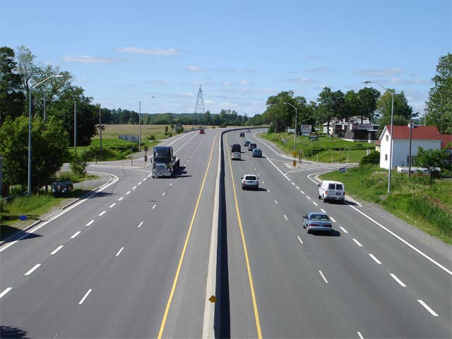
Municipality of Clarington Regional Municipality of Durham |
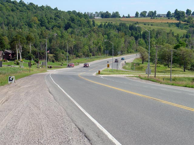
Northerly view from the Concession 4 interchange. Photo taken: June 20th, 2006.
Low-res: 45kb. High-res: 195kb. |

Low-res
High-res |
|
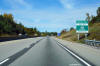
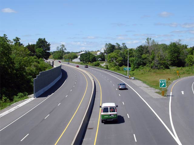
Municipality of Clarington Regional Municipality of Durham |
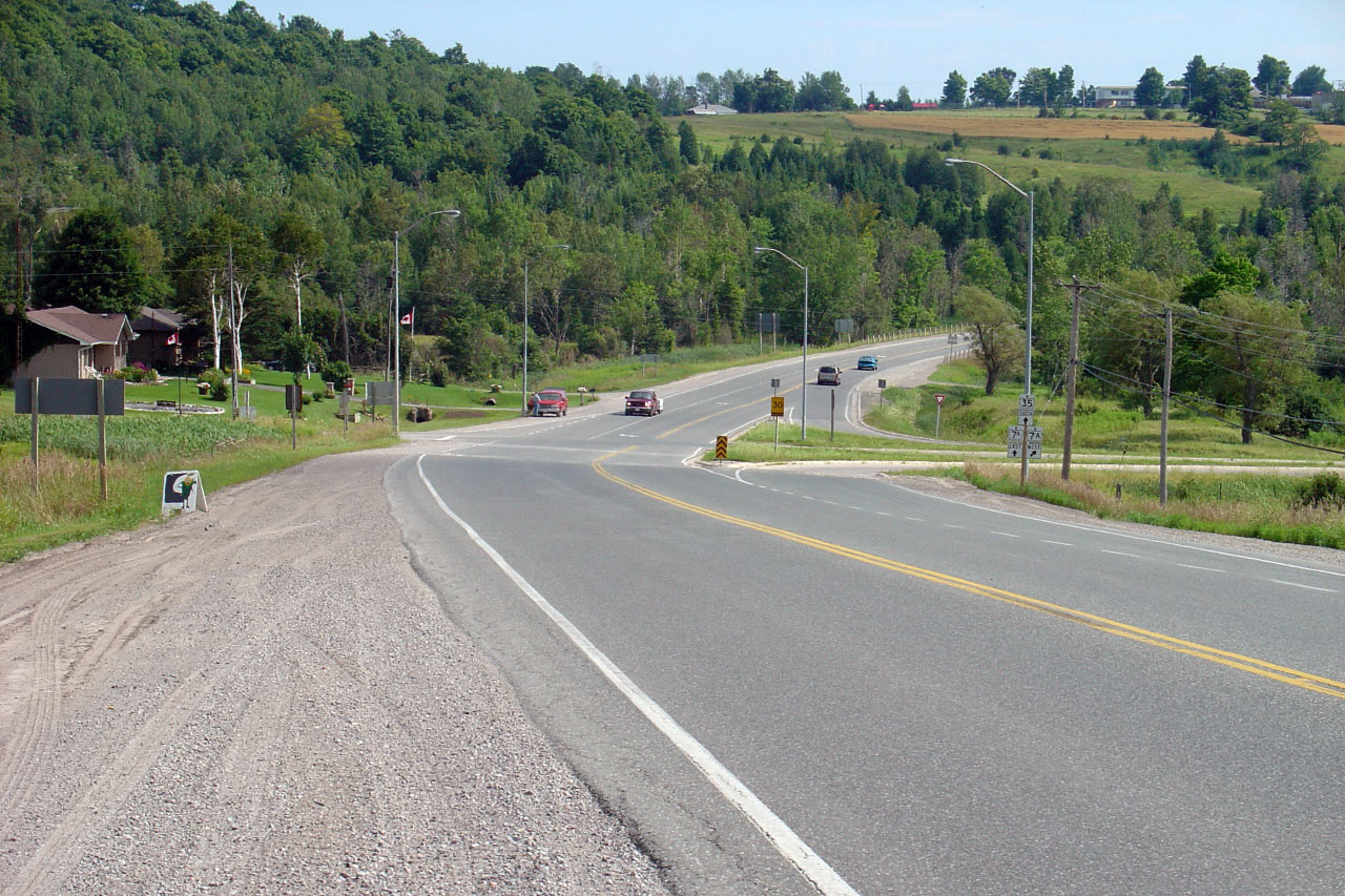
Southbound view from Clark Road 5. Photo taken: June 20th, 2006.
Low-res: 65kb. High-res: 185kb. |

Low-res
High-res |
|
Municipality of Clarington Regional Municipality of Durham |
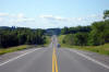
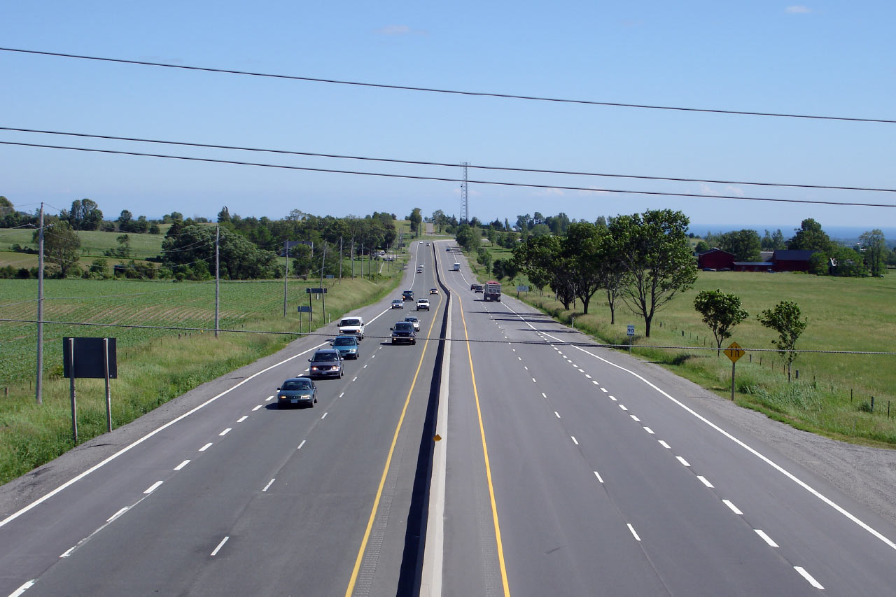
Highway 35/115 looking north from
the Clarke Road 5 overpass. Orono was bypassed years before Highway 35/115
was 4-laned.
Photo taken: June 20th, 2006.
Low-res: 45kb. High-res: 185kb. |
Low-res
High-res |
|
Municipality of Clarington Regional Municipality of Durham |
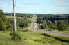
Southerly view from the Ganaraska Road overpass in Kirby Photo taken: June 20th, 2006.
Low-res: 55kb. High-res: 165kb. |
Low-res
High-res |
|
Municipality of Clarington Regional Municipality of Durham |
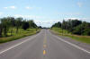
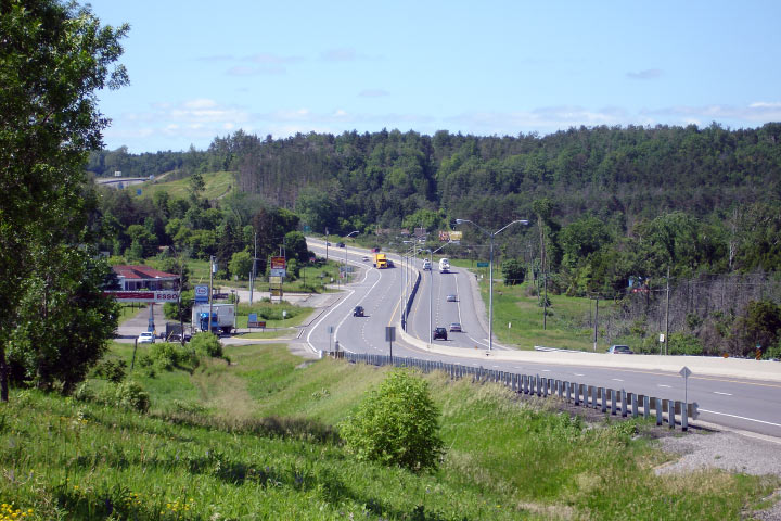
This Photo shows Highway 35/115 looking north
from the Ganaraska Road overpass in Kirby. This Photo shows a good
example of the shortcomings of a RIRO-type expressway. As you can see
from the photo, the actual 'interchanges' are very low standard, typically
having ramp speeds of 20km/h.
Photo taken: June 20th, 2006.
Low-res: 40kb. High-res: 190kb. |
Low-res
High-res |
| Municipality of Clarington Regional Municipality of Durham |
Looking south from the Concession Road 8 overpass. Photo taken: June 20th, 2006.
Low-res: 55kb. High-res: 165kb. |
Low-res
High-res |
| Municipality of Clarington Regional Municipality of Durham |
Looking north from Concession Road 8. Photo taken: June 20th, 2006.
Low-res: 65kb. High-res: 180kb. |
Low-res
High-res |
| Municipality of Clarington Regional Municipality of Durham |
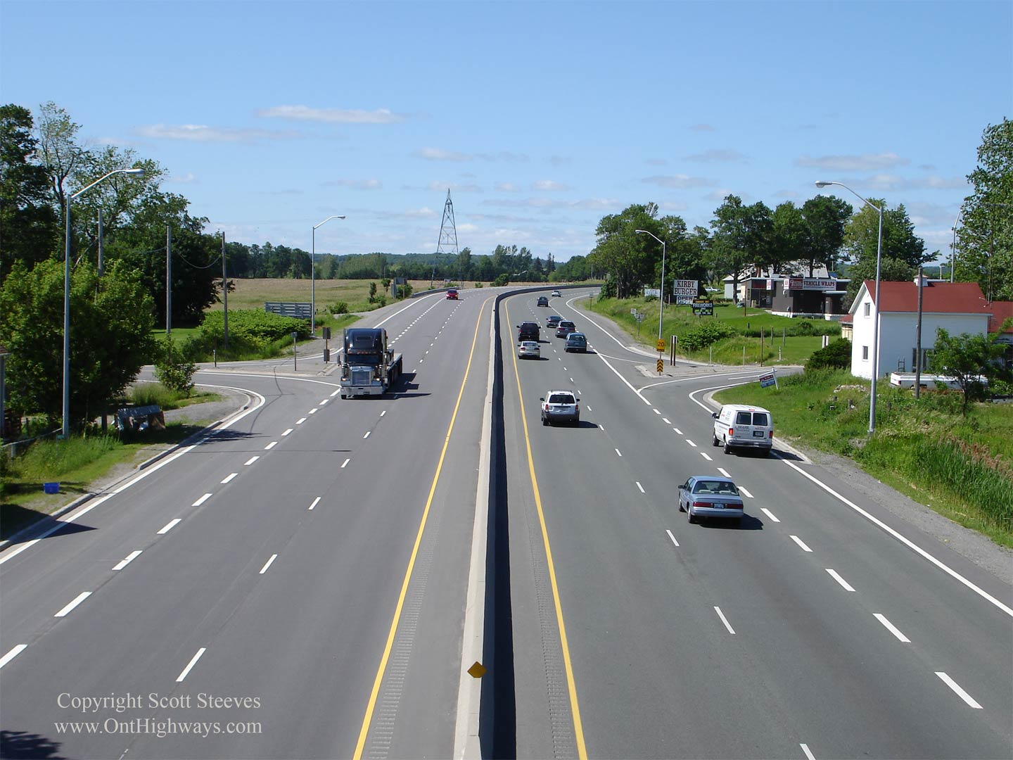
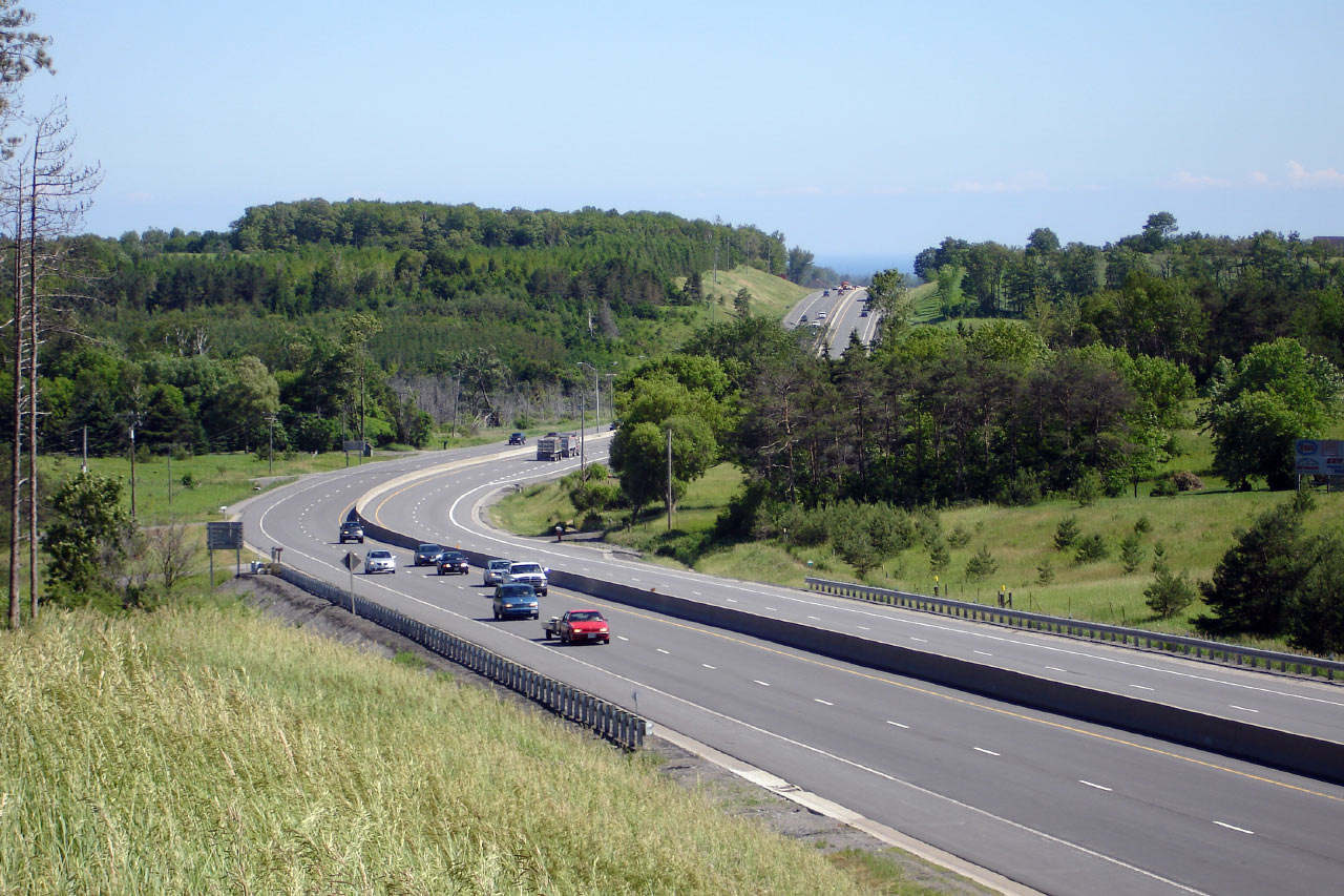
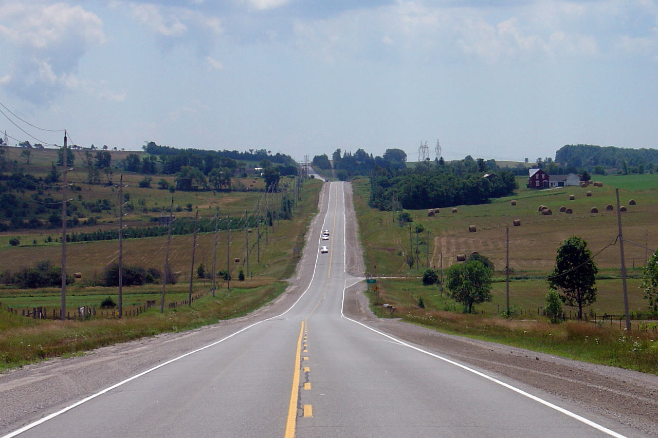
Northbound view approaching Enterprise Hill. Photo taken: June 20th, 2006.
Low-res: 100kb. High-res: 300kb. |

Low-res
High-res |
| Municipality of Clarington Regional Municipality of Durham |
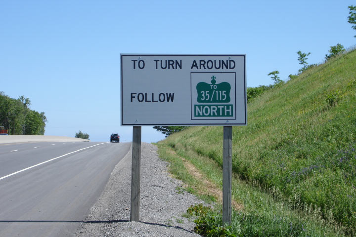
White signage directing traffic to turnarounds along the expressway. Photo taken: June 20th, 2006.
Low-res: 70kb. |
 |
| Municipality of Clarington
Regional Municipality of Durham |
Signage for the upcoming Highway 35 split
from the northbound 35/115 approaching
Enterprise Hill. Photo taken: June 20th, 2006.
Low-res: 50kb. |
 |
| Municipality of Clarington Regional Municipality of Durham |
Looking south from the top of Enterprise Hill along the expressway. Photo taken: June 20th, 2006.
Low-res: 85kb. High-res: 260kb. |
Low-res
High-res |
| Municipality of Clarington
Regional Municipality of Durham |
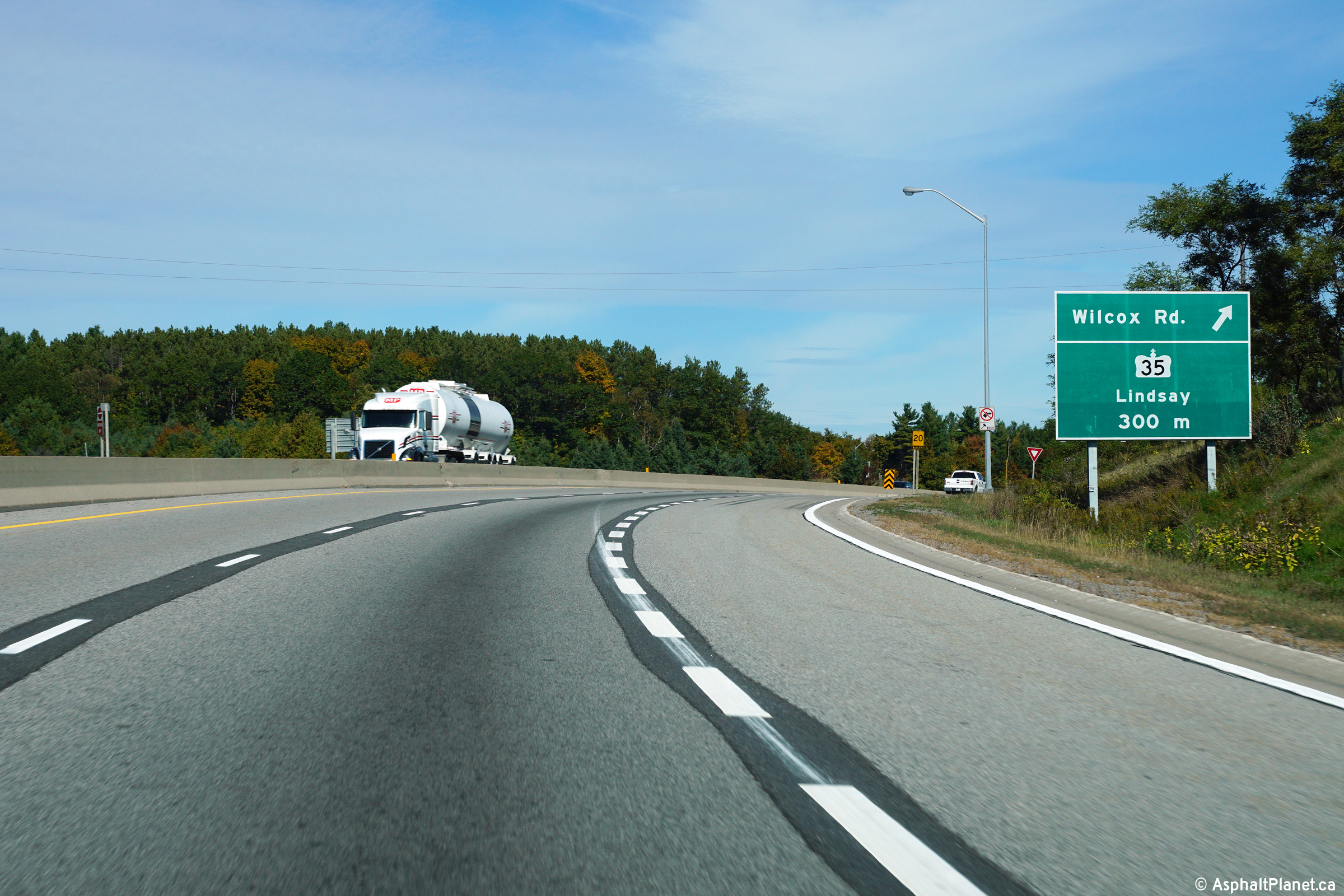
During the early autumn of 2015, signage enhancements were made to assist
motorists distinguish between the closely spaced Wilcox Road and Highway 35
interchange. Surprisingly, this signage was shortly covered up and
replaced with a much smaller median mounted advanced sign located
immediately downstream of the Wilcox Road off-ramp.
Photo taken: October 8th, 2015. |
 (720x480) (720x480)
(1440x960)
(2400x1600) |
| Municipality of Clarington
Regional Municipality of Durham |
View looking northerly at the off-ramp to Wilcox Road. Wilcox Road
does not have an alternate access point aside from its connection with
Highway 35.
Photo taken: October 8th, 2015. |
 (720x480) (720x480)
(1440x960)
(2400x1600) |
| Municipality of Clarington
Regional Municipality of Durham |
Highway 35/115
at the Enterprise Hill split. At this trumpet, Peterborough-bound
traffic stays in the through freeway lanes, where Lindsay-bound departs
around the loop ramp northwards. Unfortunately, due to the terrain
near the interchange, traffic heading NB on Highway 35 must slow to 30km/h
to navigate the loop ramp.
Upper photo taken: June 20th, 2006.
Lower photo taken: June 6th,
2015. |
|
| Municipality of Clarington
Regional Municipality of Durham |
This Photo shows Highway 35/115
looking south from the Highway 35 overpass. Traffic heading SB on
Highway 35 enters the expressway from the slip ramp shown on the right.
Photo taken: June 20th, 2006.
Low-res: 50kb. High-res: 135kb. |

Low-res
High-res |
|
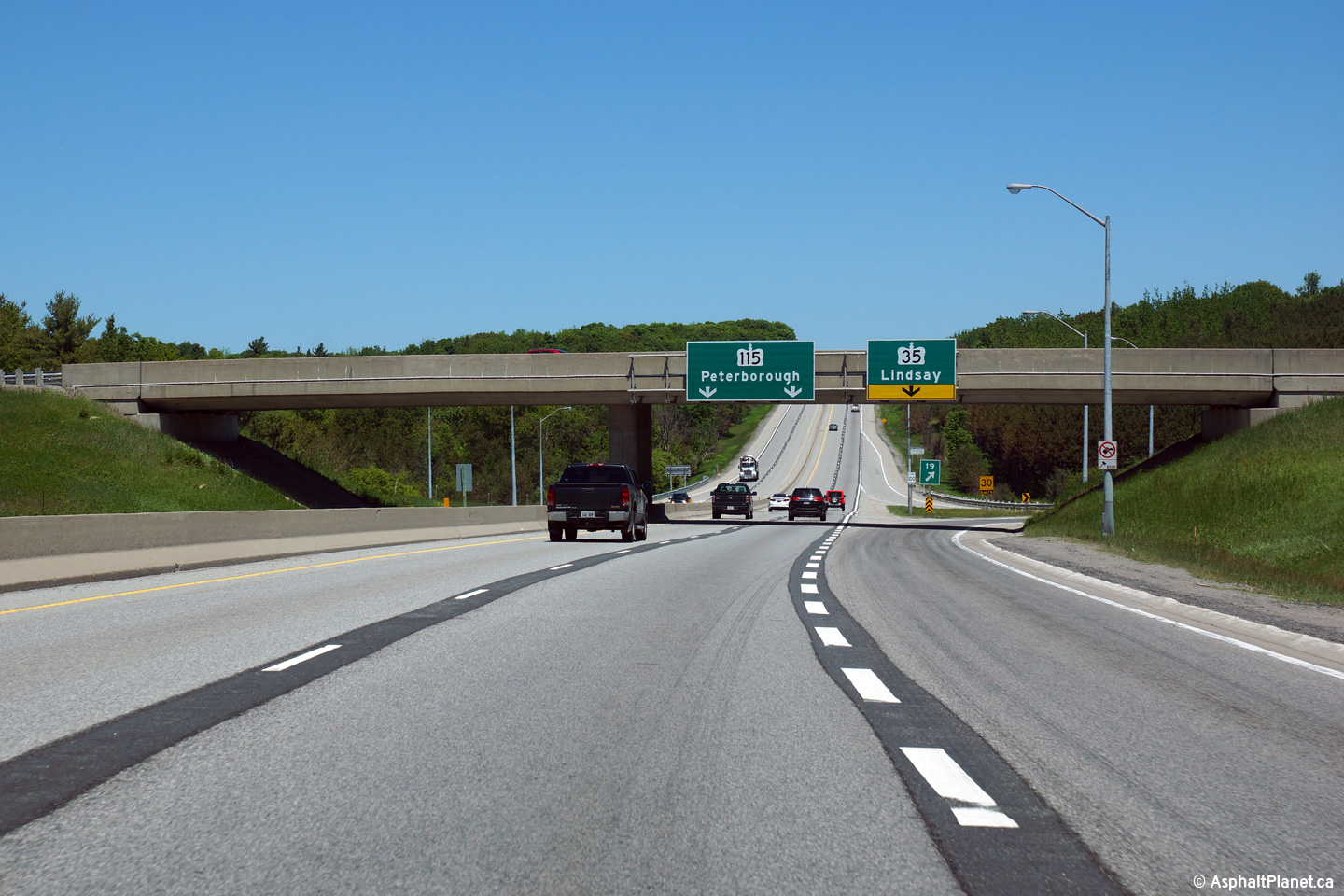
Highway 115 continues its trek as
a full freeway northeasterly to Peterborough.
Click here for Highway
115 images. |
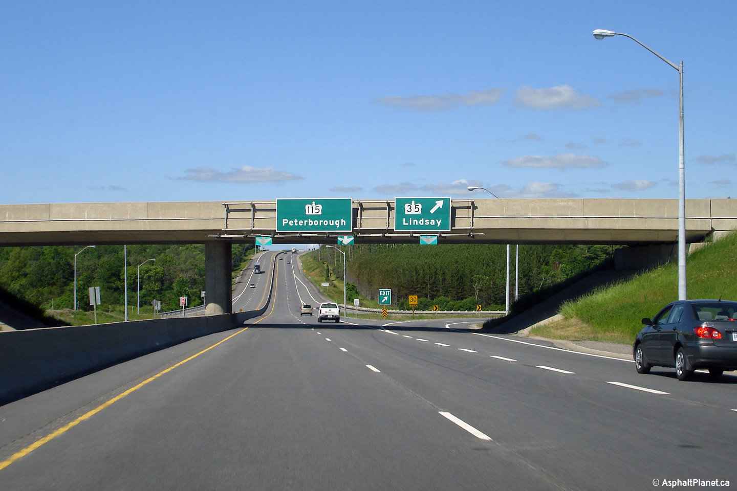
| Municipality of Clarington Regional Municipality of Durham |
Looking north along Highway 35 from the Highway 115 overpass. Photo taken: June 20th, 2006.
Low-res: 75kb. High-res: 225kb. |

Low-res
High-res |
| Municipality of Clarington Regional Municipality of Durham |
Southbound signage at the trumpet interchange to Highway 115. Photo taken: June 20th, 2006.
Low-res: 85kb. |
 |
| Municipality of Clarington Regional Municipality of Durham |
Broad southbound view approaching the Highway 115 interchange. Photo taken: June 20th, 2006.
Low-res: 75kb. High-res: 225kb. |
Low-res
High-res |
| Municipality of Clarington Regional Municipality of Durham |
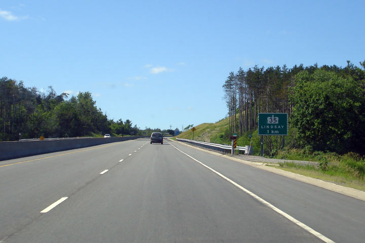
View looking northerly along Highway 35 approaching the Durham Road 20
intersection. This is the only signalized intersection along Highway
35 between Highway 115 and Lindsay.
Photo taken: May 30th, 2012. |
(720x480)
(1440x960)
(2400x1600) |
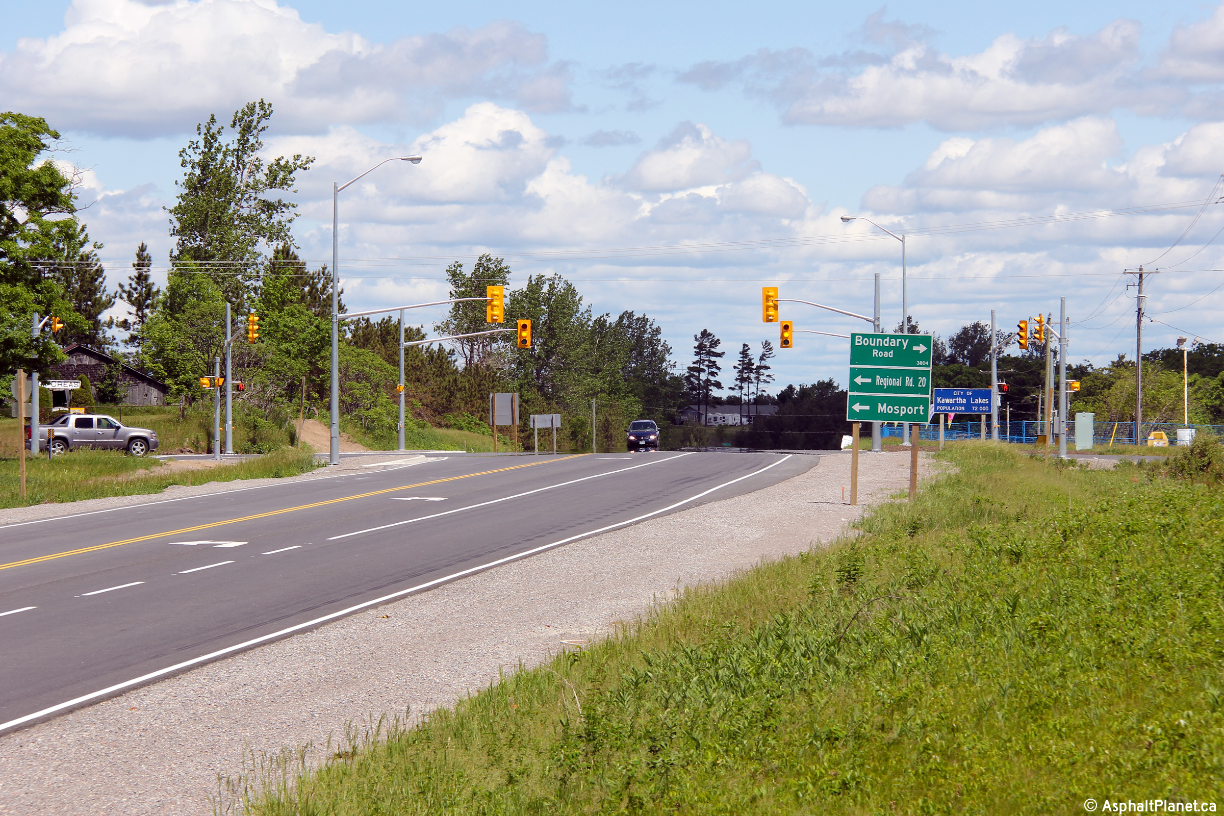
| City of Kawartha Lakes |
Two views looking southerly approaching the Durham Road 20 intersection.
Photos taken: May 30th, 2012. |

(720x480)
(1440x960)
(2400x1600)
(720x480)
(1440x960)
(2400x1600) |
| City of Kawartha Lakes |
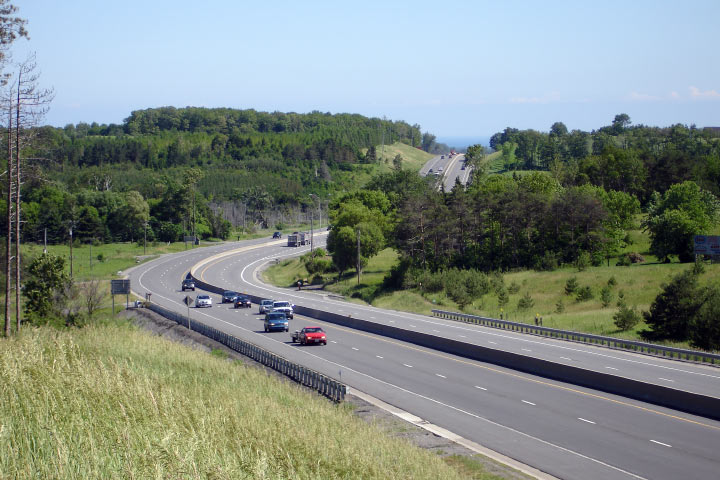
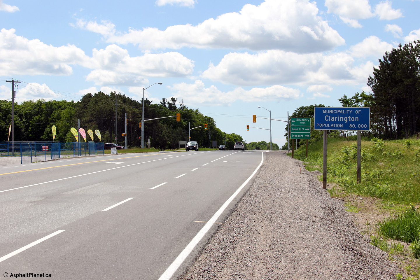
This view looks north from just north of the Boundary Road intersection.
Click here for an additional view taken
in July, 2005. Photo taken: May 30th, 2012. |
(720x480)
(1440x960)
(2400x1600) |
| City of Kawartha Lakes |
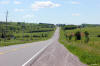
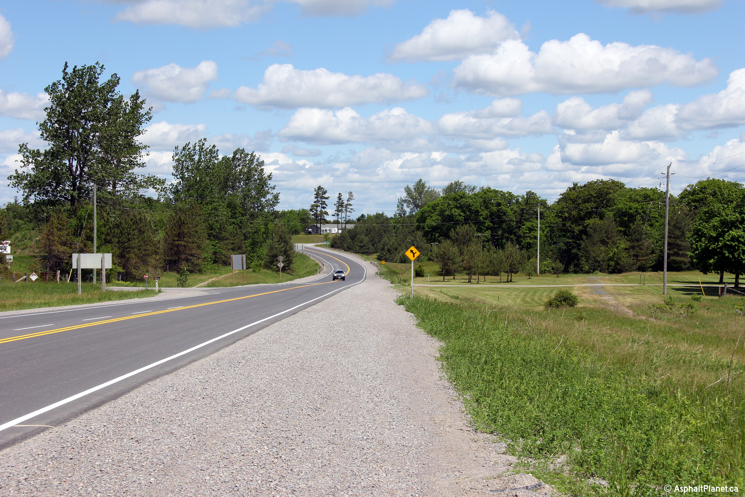
Southerly view along Highway 35 from just south of John Street in Pontypool.
A historic alignment of Highway 35 is visible to the left (west) of the
existing highway.
Photo taken: |
(720x480)
(1440x960)
(2400x1600) |
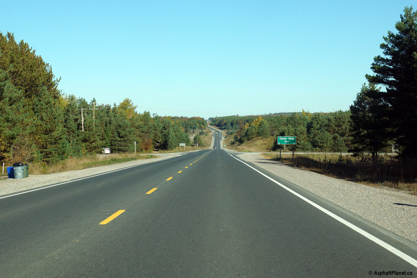
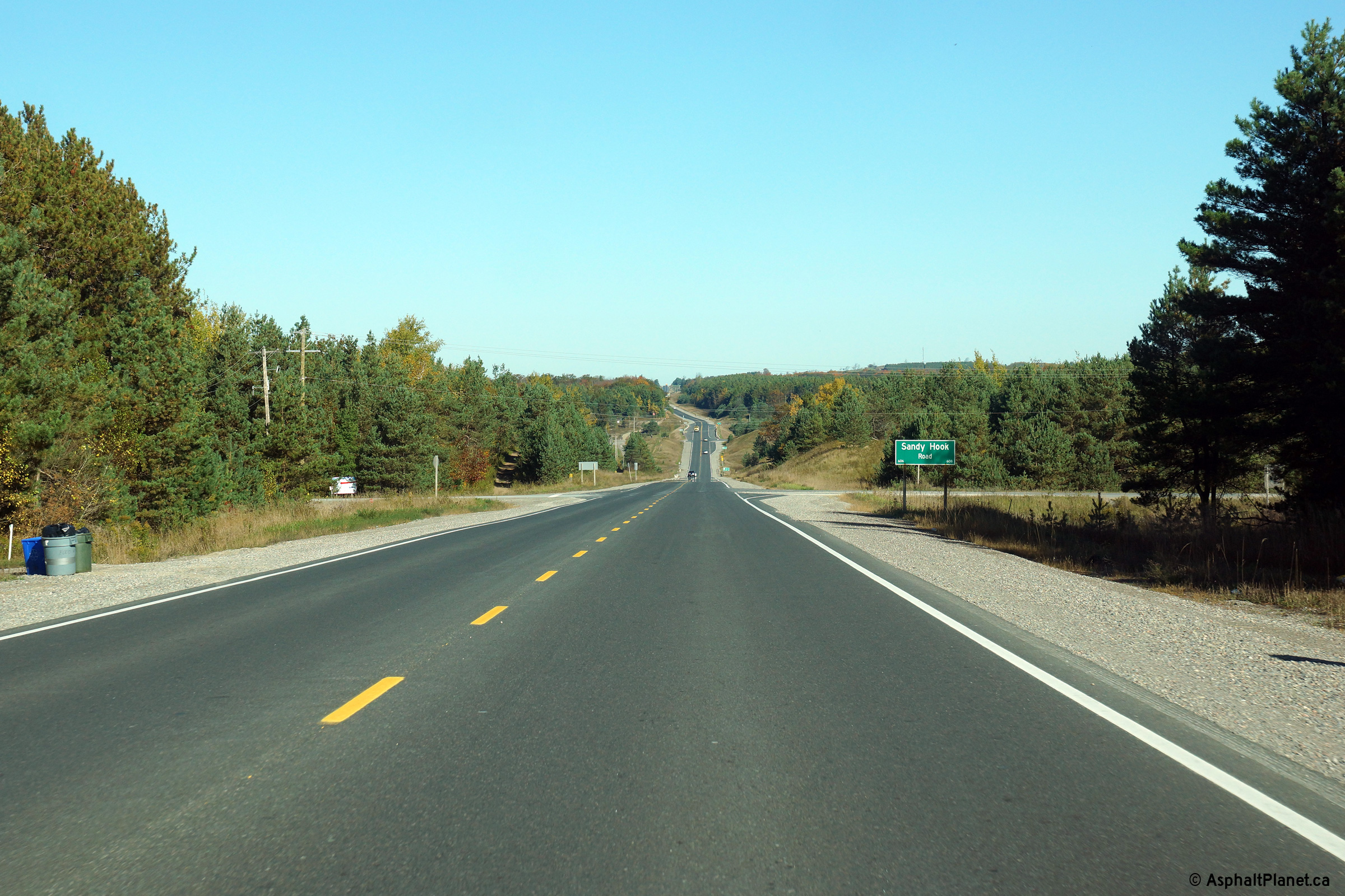
| City of Kawartha Lakes |
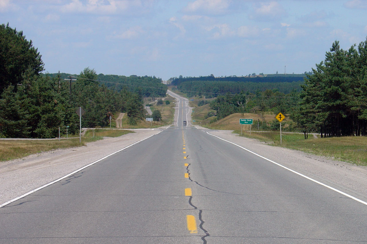
Northerly view looking towards Sandy Hook Road.
Click here for an additional view taken
in July, 2005. Photo taken: October 10th, 2013. |

(720x480)
(1440x960)
(2400x1600) |
| City of Kawartha Lakes |
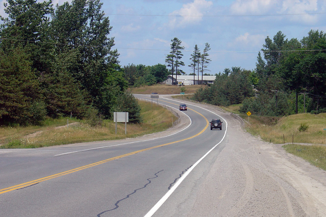
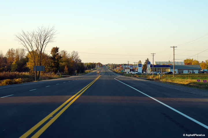
View looking south from Pontypool Road Photo taken: July 19th, 2005. |
Low-res
High-res |
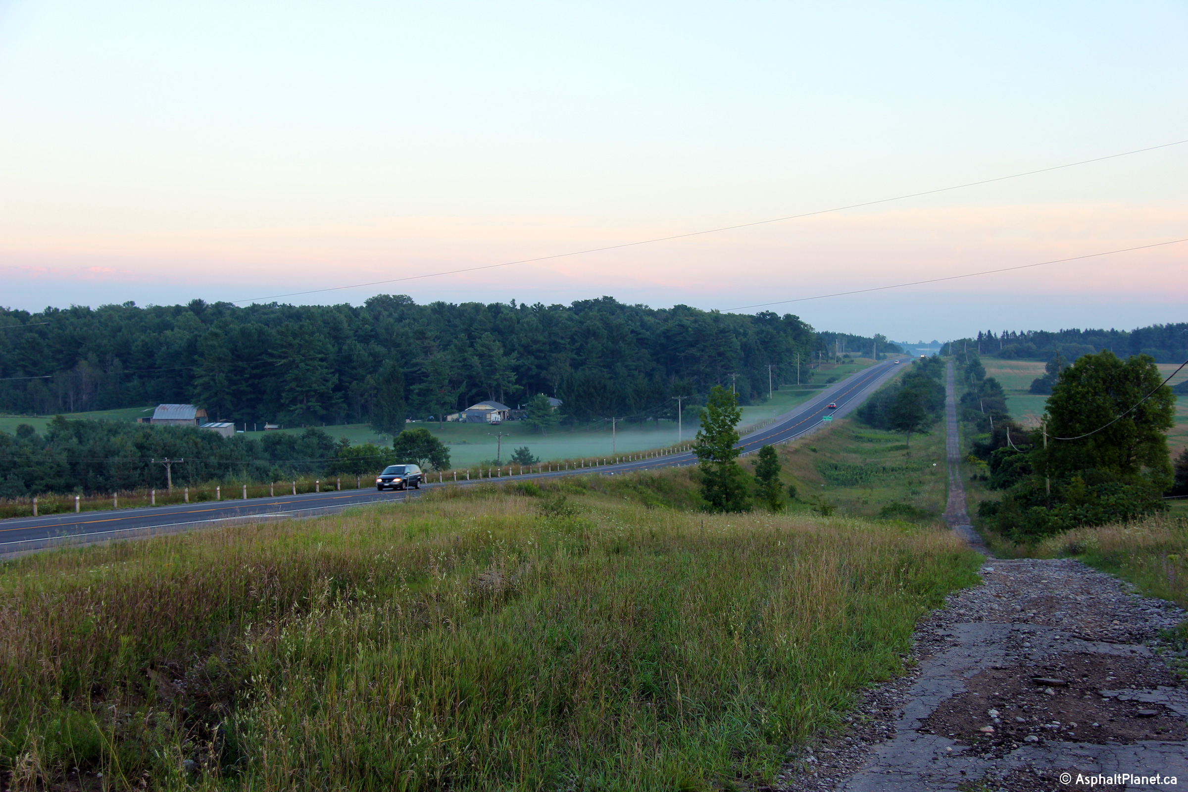
| City of Kawartha Lakes |
Two views looking southerly from just south of the Waite Road overpass
towards Pontypool. These photos were taken late in the evening in the
afterglow of a stormy day.
Photos taken: August 14th, 2012. |

(720x480)
(1440x960)
(2400x1600)
(720x480)
(1440x960)
(2400x1600) |
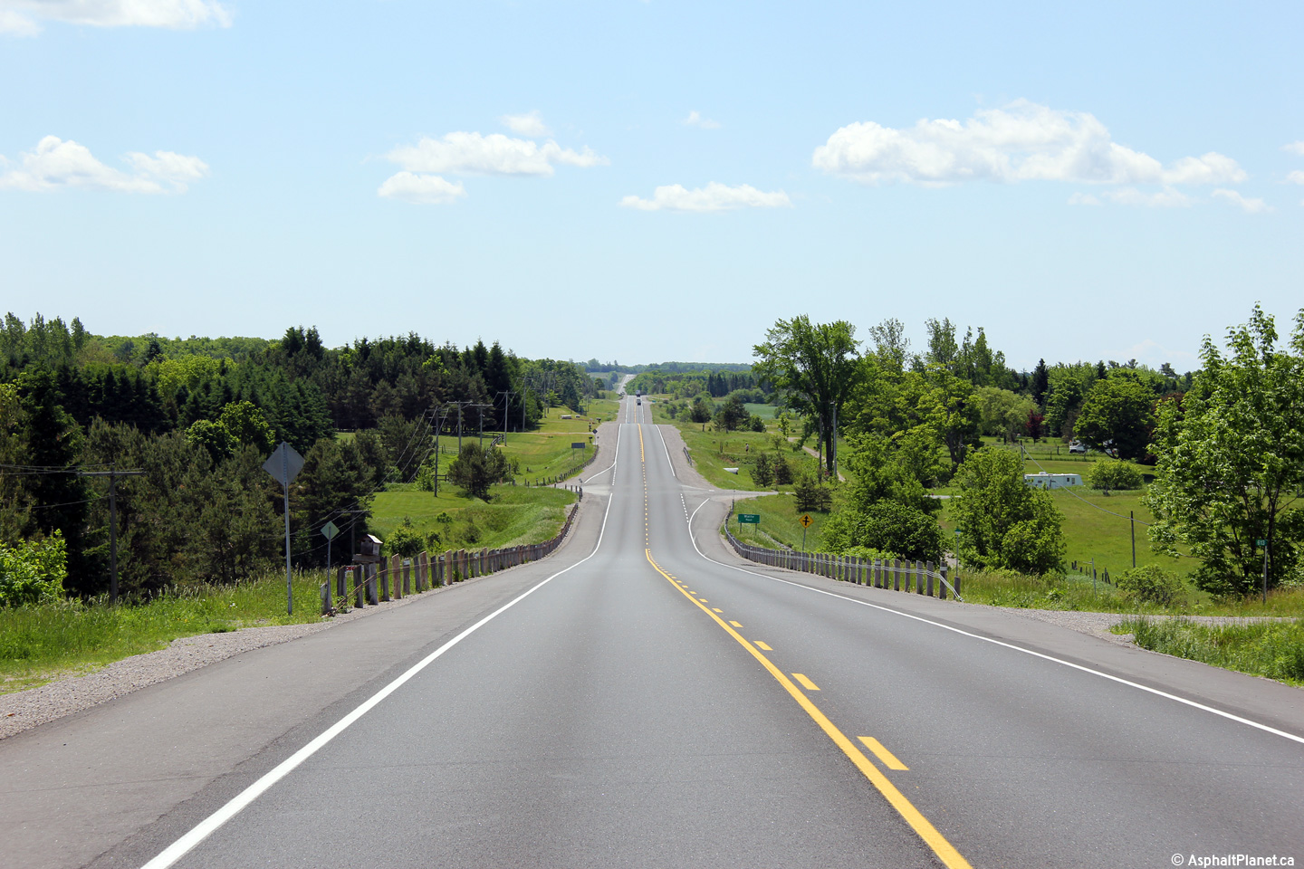
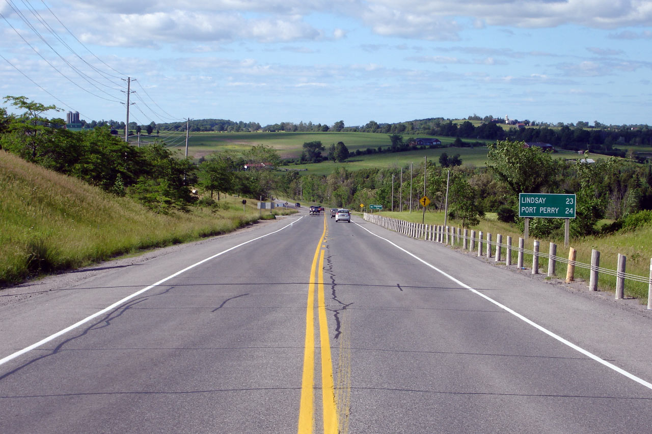
| City of Kawartha Lakes |
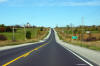
Southerly view along Highway 35 from just north of the Waite Road
intersection.
Photo taken: May 30th, 2012. |
(720x480)
(1440x960)
(2400x1600) |
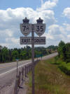
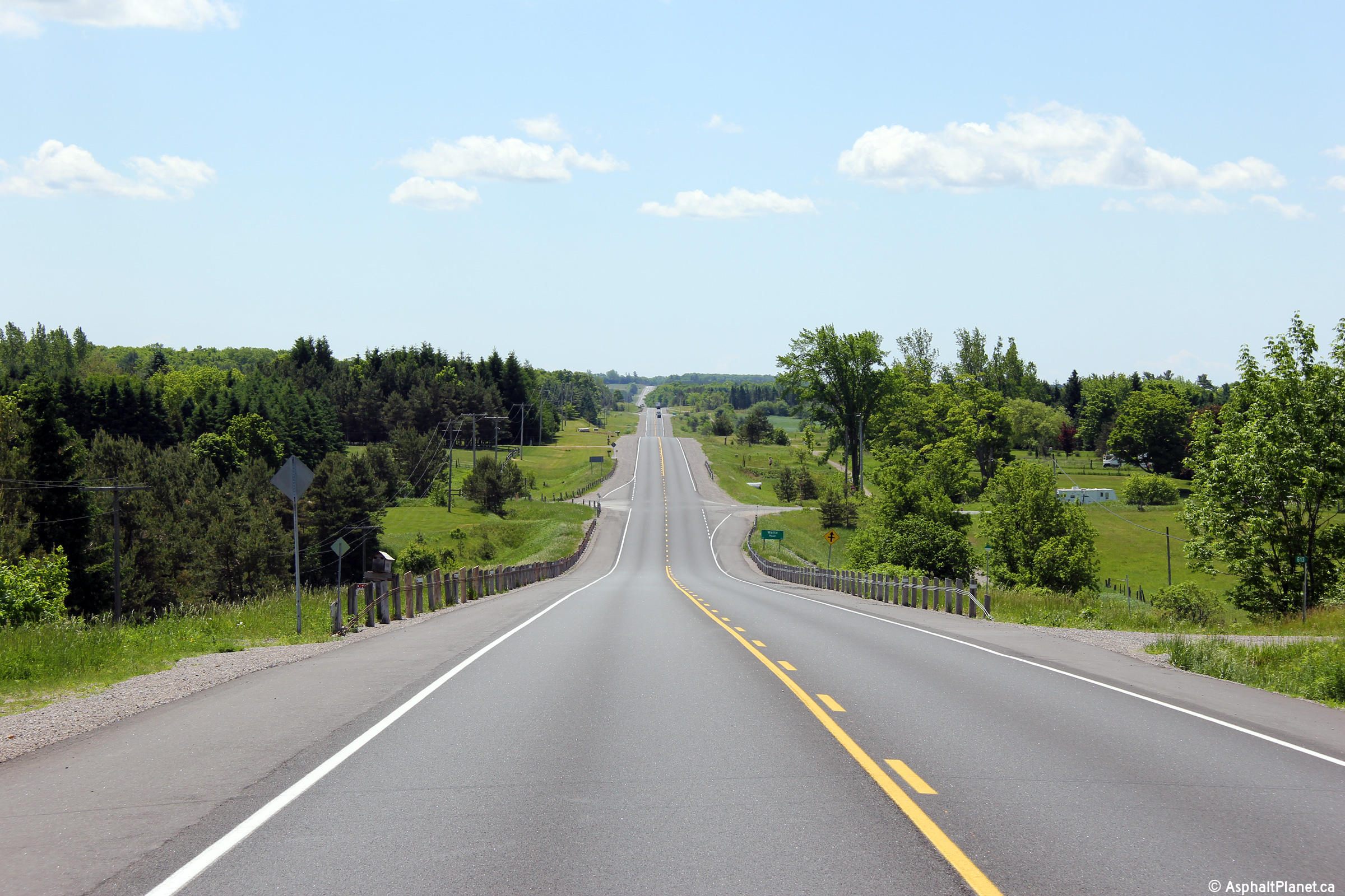
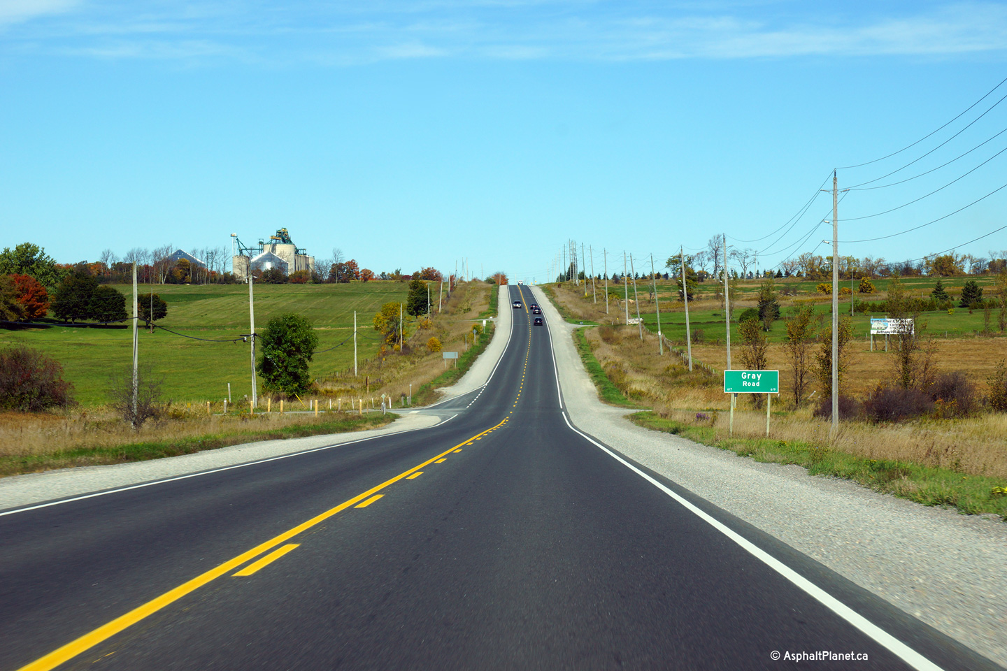
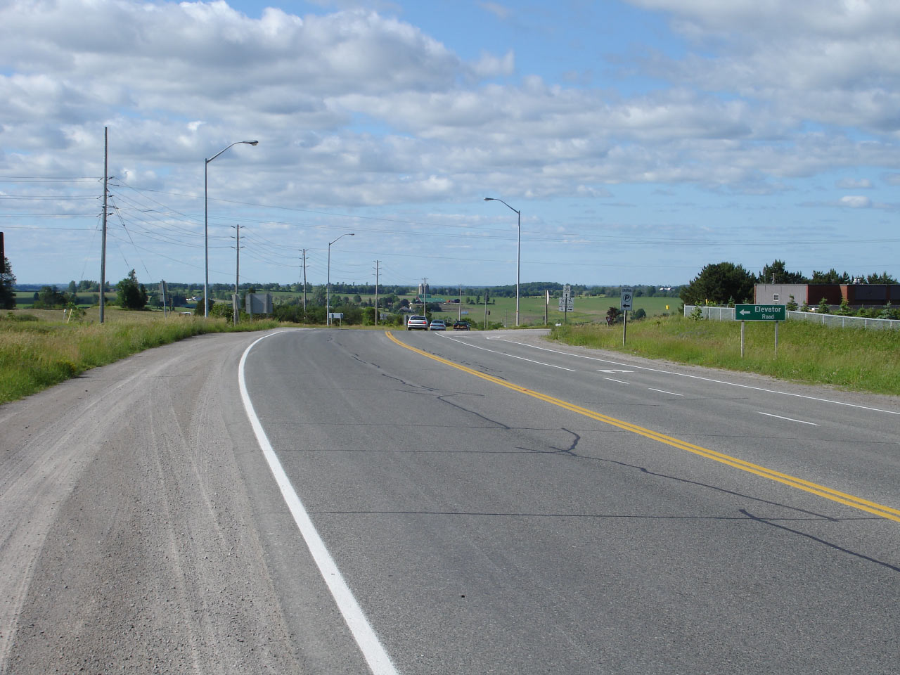
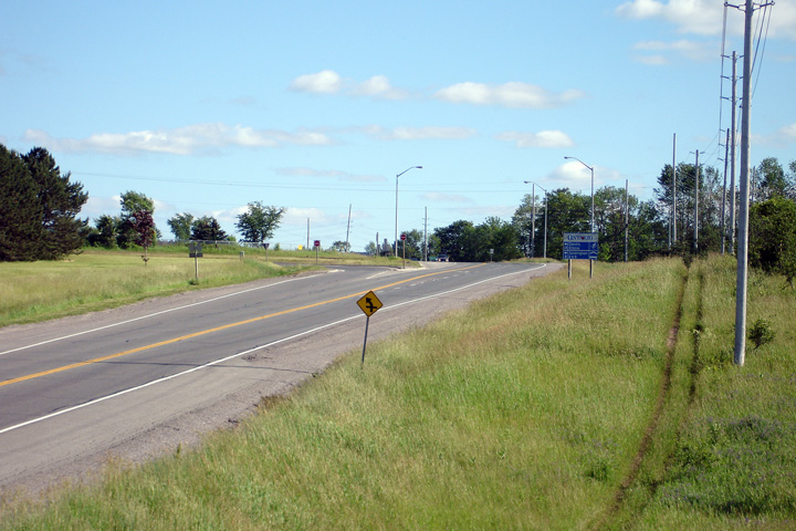
| City of Kawartha Lakes |
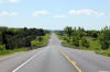
View looking northerly approaching the Gray Road intersection. The
southern Highway 7A junction is situated at the top of the pictured hill.
Photo taken: October 3rd, 2013. |
(720x480)
(1440x960)
(2400x1600) |
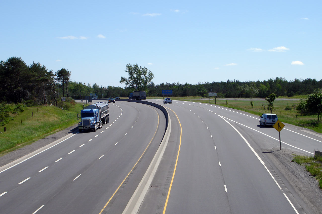
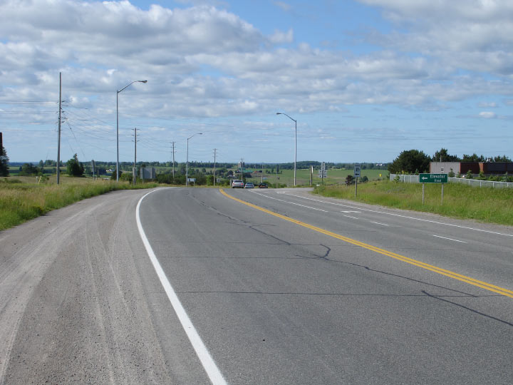
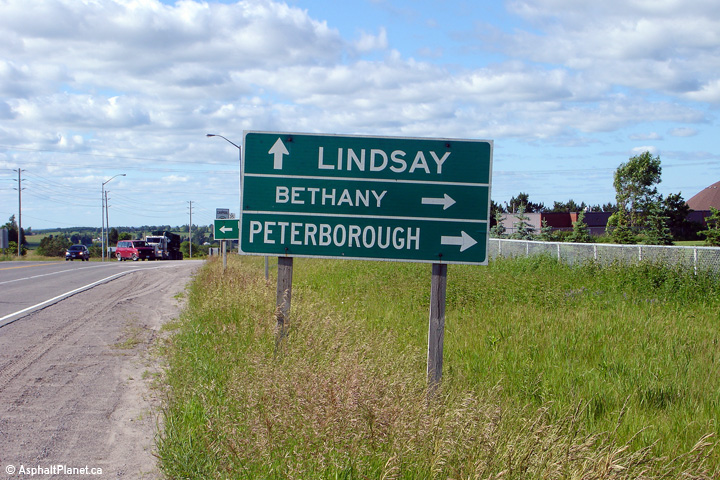
| City of Kawartha Lakes |
Southerly view from just south of the Highway 7A-East junction.
Click here for an additional view taken
in July, 2005. Photo taken: May 30th, 2012. |
(720x480)
(1440x960)
(2400x1600) |
| City of Kawartha Lakes |
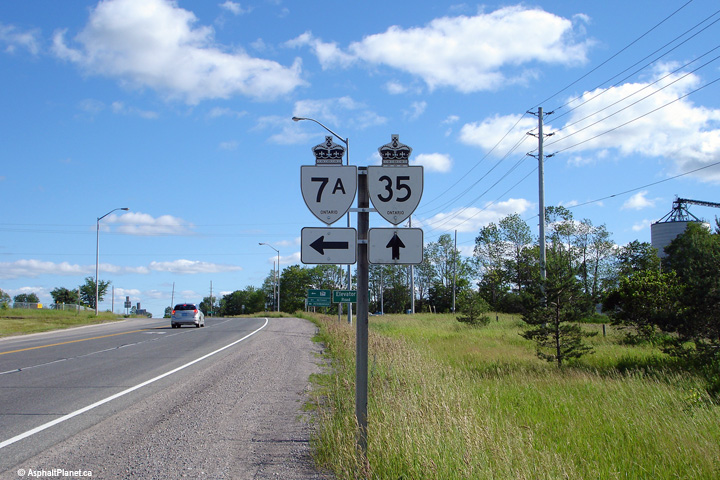
This view looks northerly along Highway 35 from the Highway 7A east
junction. Photo taken: June 20th, 2006. |
Low-res
High-res |
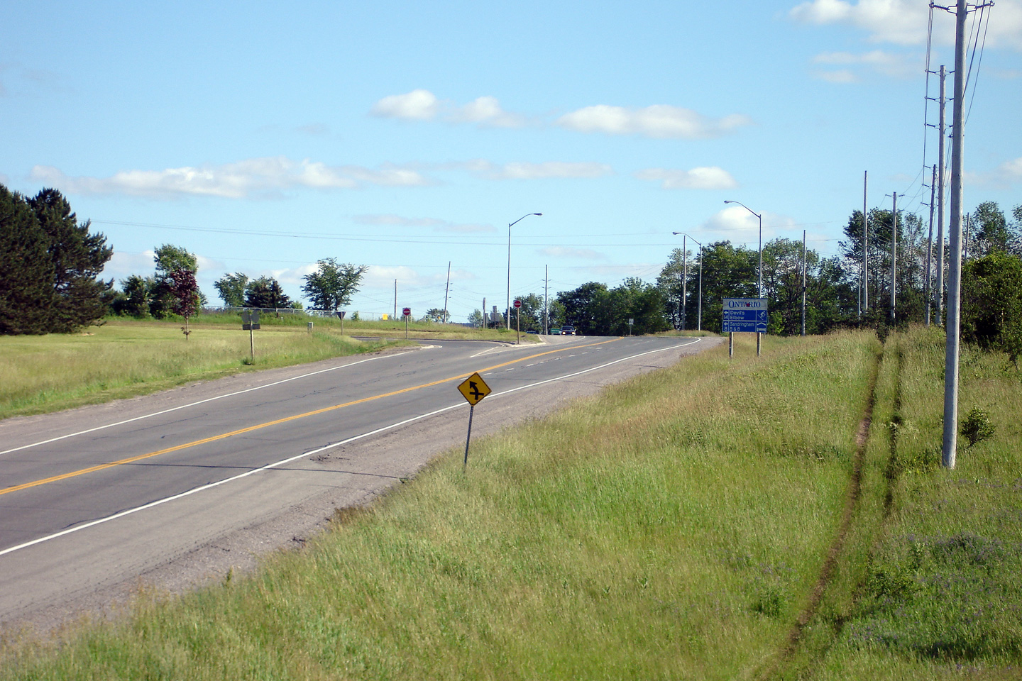
| City of Kawartha Lakes |
Green directional signage along Highway 35. Port Perry is omitted from
this signage. Photo taken: June 20th, 2006. |
 (720x480) (720x480)
(1440x960) |
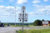
| City of Kawartha Lakes |
Northbound junction assembly at
Highway 7A east. Photo taken: June 20th, 2006. |
 (720x480) (720x480)
(1440x960) |
|
East of Highway 35 Highway 7A
heads to Peterborough.
Click here for Highway 7A images. |
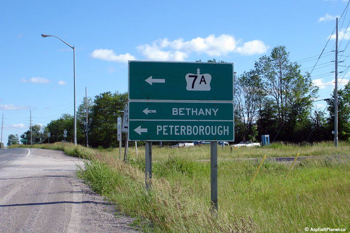
| City of Kawartha Lakes |
Signage directing southbound traffic to the eastern leg of Highway 7A.
Photo taken: June 20th, 2006. |
 (720x480) (720x480)
(1440x960) |
| City of Kawartha Lakes |
Southbound junction assembly signage for the eastern Highway 7A junction. Photo taken: June 20th, 2006.
Low-res: 95kb. |
 (720x480) (720x480)
(1440x960) |
| City of Kawartha Lakes |
Southerly view approaching the southern Highway 7A junction. Photo taken:
June 20th, 2006. |

Low-res
High-res |
| City of Kawartha Lakes |
View looking southerly along the long hill that separates the Highway 7A
junctions. Photo taken: June 20th, 2006. |
Low-res
High-res |
| City of Kawartha Lakes |
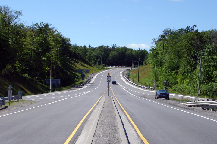
Old school junction assembly. Photo taken: July 19th, 2005. |
 |
| City of Kawartha Lakes |
Southbound view towards the Highway 7A West junction. Photo taken: July
19th, 2005. |
Low-res
High-res |
|
West of Highway 35 Highway 7A
heads to Port Perry and Highway 7/12.
Click here for Highway 7A images. |
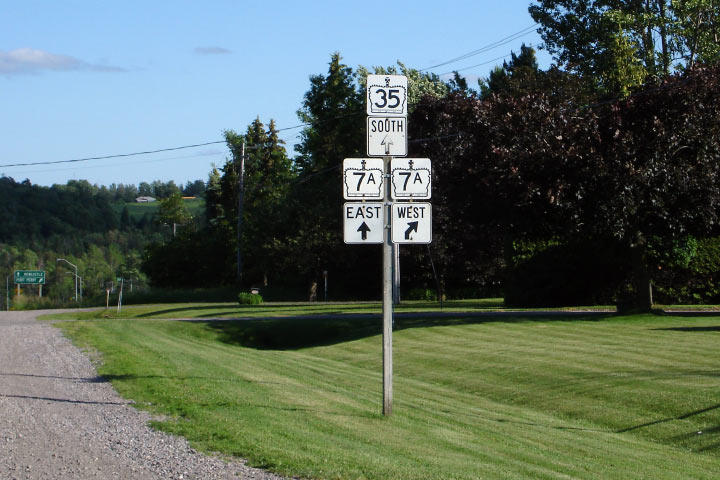
| City of Kawartha Lakes |
Looking southerly along Highway 35 towards the northern
Highway 7A junction. Photo taken: August 8th, 2004. |
Low-res
High-res |
| City of Kawartha Lakes |
Southbound junction assembly for Highway 7A. Photo taken: June 20th, 2006.
Low-res: 80kb. |
 |
| City of Kawartha Lakes |
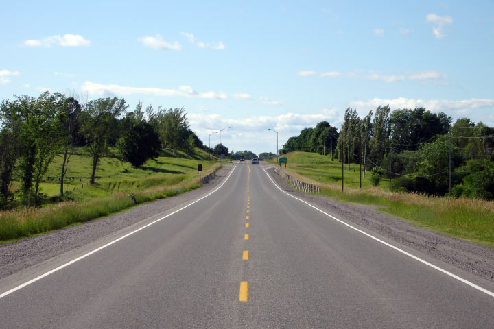
Looking north along Highway 35 from just north of Lifford Road. Photo taken: June 20th, 2006.
Low-res: 60kb. High-res: 185kb. |
Low-res
High-res |
| City of Kawartha Lakes |
View looking south from the abandoned picnic area. Photo taken: June 20th, 2006.
Low-res: 95kb. High-res: 275kb. |
Low-res
High-res |
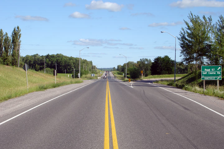
| City of Kawartha Lakes |
Northerly view towards Golf Course Road. Photo taken: June 20th, 2006.
Low-res: 60kb. High-res: 195kb. |
Low-res
High-res |
| City of Kawartha Lakes |
View looking southerly towards the Golf Course Road intersection. Photo taken: June 20th, 2006.
Low-res: 70kb. High-res: 225kb. |

Low-res
High-res |
| City of Kawartha Lakes |
Southerly view towards Newcastle along Highway 35 as the southbound passing
lane from Lindsay ends.
Photo taken: October 11th, 2015. |
(720x480)
(1440x960)
(2400x1600) |
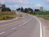
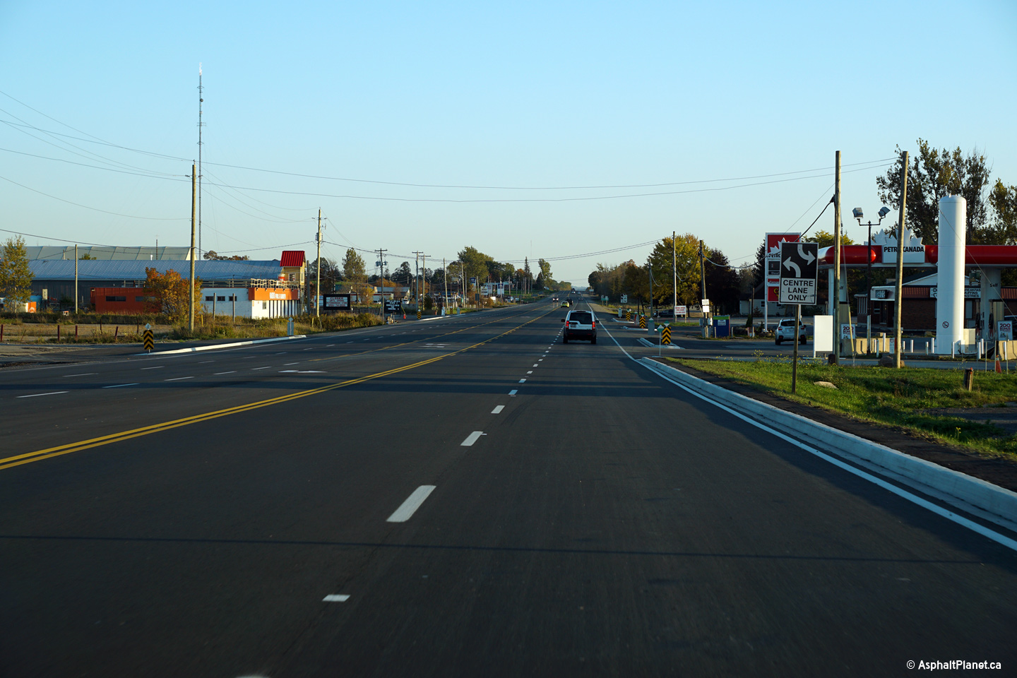
| City of Kawartha Lakes |
View looking northerly approaching the brief four lane section that extends
for about 1km south of Lindsay. Highway 35 was widened from four to
five lanes south of Lindsay in a construction contract that was completed
during the fall of 2015.
Photo taken: October 11th, 2015. |

(720x480)
(1440x960)
(2400x1600) |
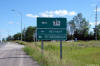
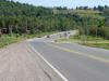
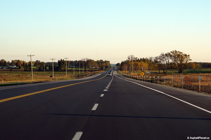
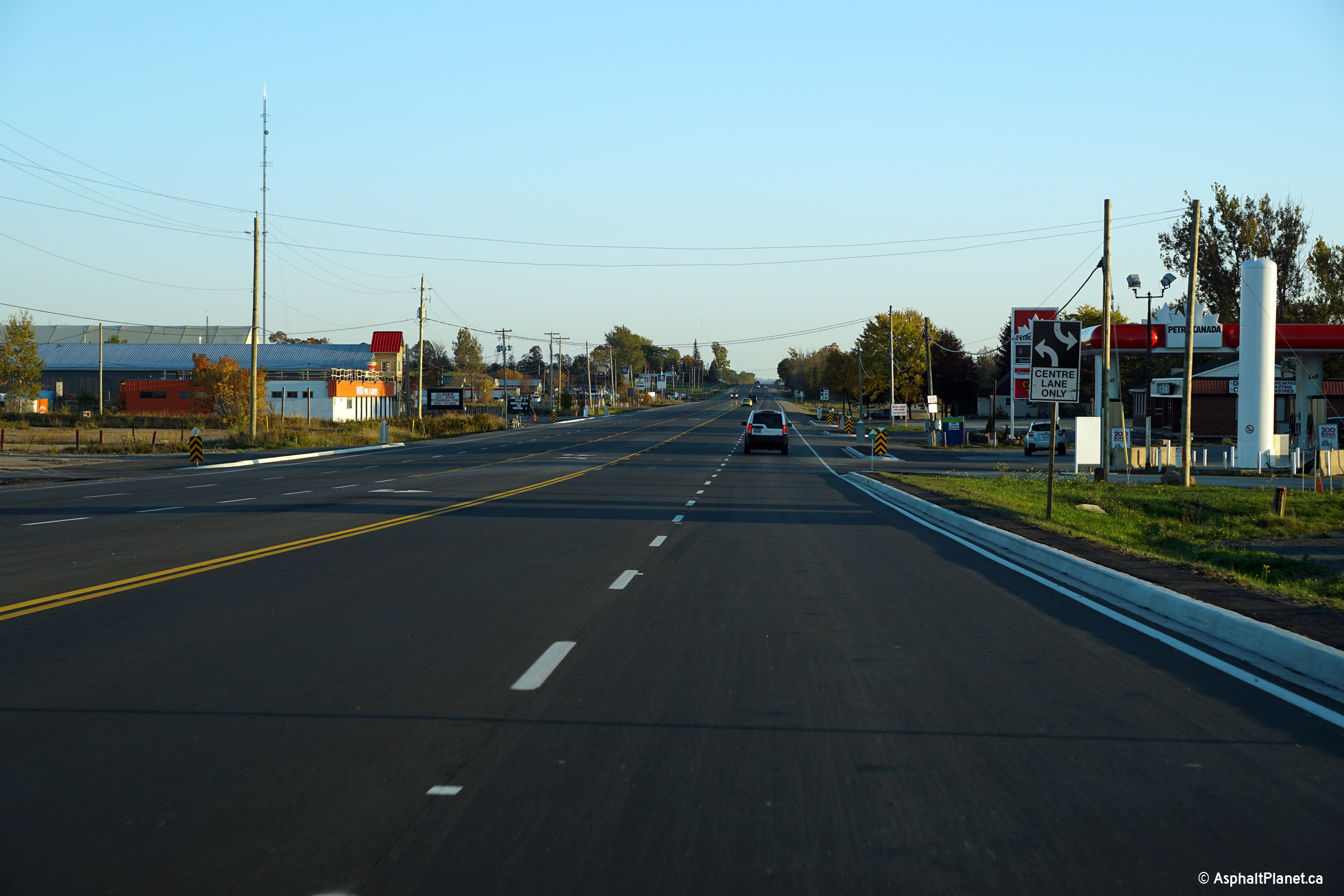
| City of Kawartha Lakes |
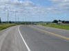
Southerly view along Highway 35 from just south of the Highway 7
intersection.
Photo taken: October 11th, 2015. |
(720x480)
(1440x960)
(2400x1600) |
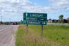
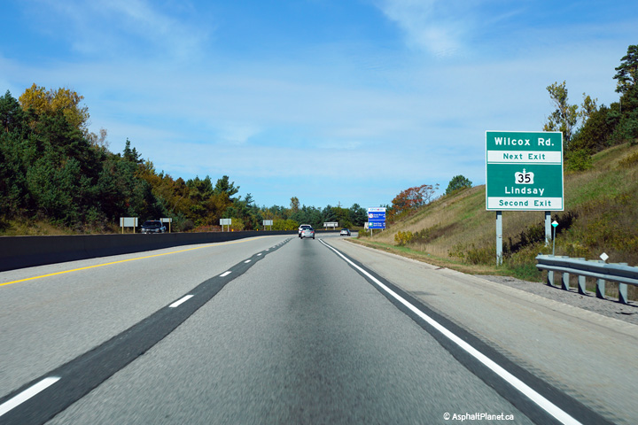
| City of Kawartha Lakes |
Northbound signage directing traffic to turn left, following Highway 7 West
to continue northerly along Highway 35.
Photo taken: September 11th, 2011. |
 (720x480) (720x480)
(1440x960) |
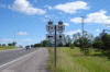
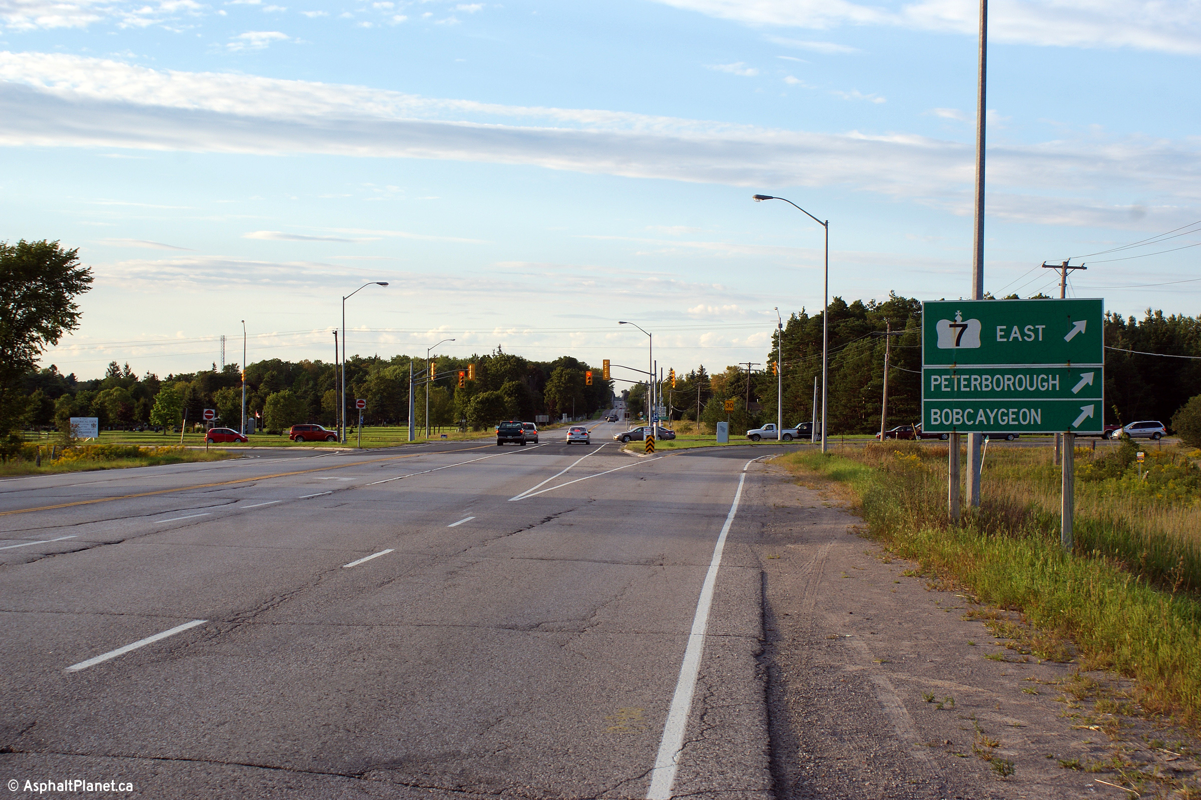
| City of Kawartha Lakes |
View looking northerly approaching the Highway 7 intersection. This
intersection was not widened as part of the construction to widen Highway 35
south of Lindsay that was completed in 2015.
Photo taken: September 11th, 2011. |

(720x480)
(1440x960)
(2400x1600) |
| City of Kawartha Lakes |
Northbound junction signage at the eastern Highway 7 junction along the
Lindsay By-pass.
Photo taken: September 11th, 2011. |
 (720x480) (720x480)
(1440x960) |
|
East of Highway 35 Highway 7 leads
to Omemee and Peterborough.
Click here for Highway 7 images and
here for Highway 7B
images. |
|
Lindsay to Norland
photos are found on Page 2. |
 (720x480)

 (720x480)
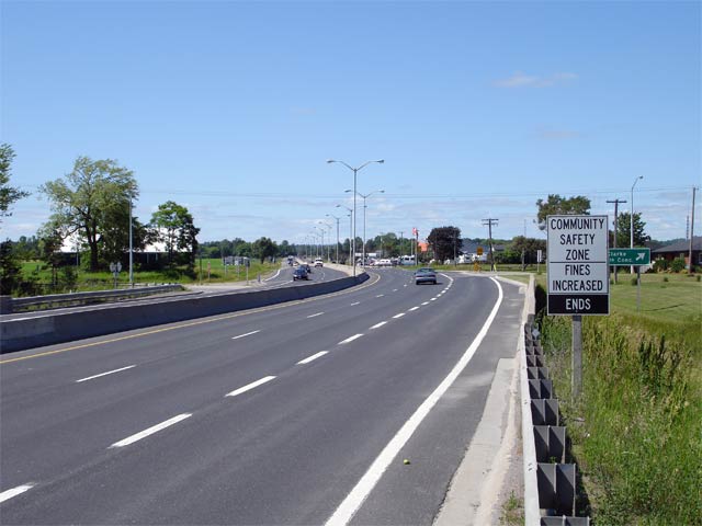

 (720x480)
 (720x480)
 (720x480)


 (720x480)
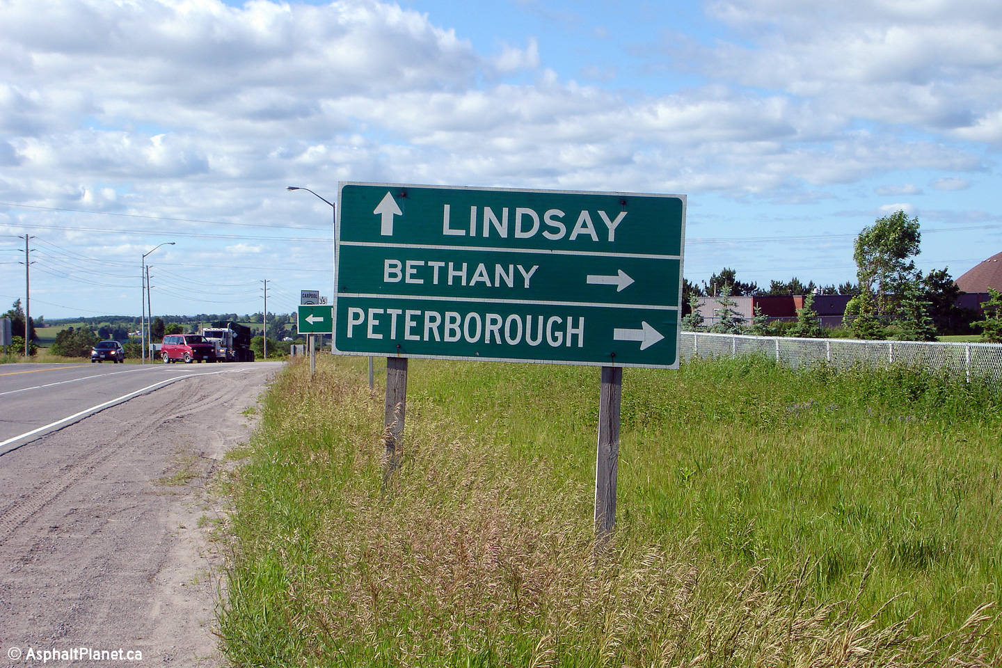
 (720x480)
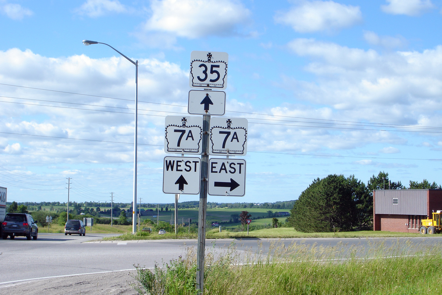
 (720x480)
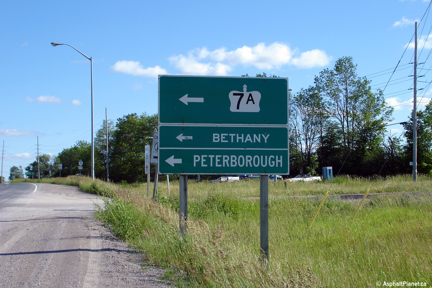
 (720x480)


 (720x480)
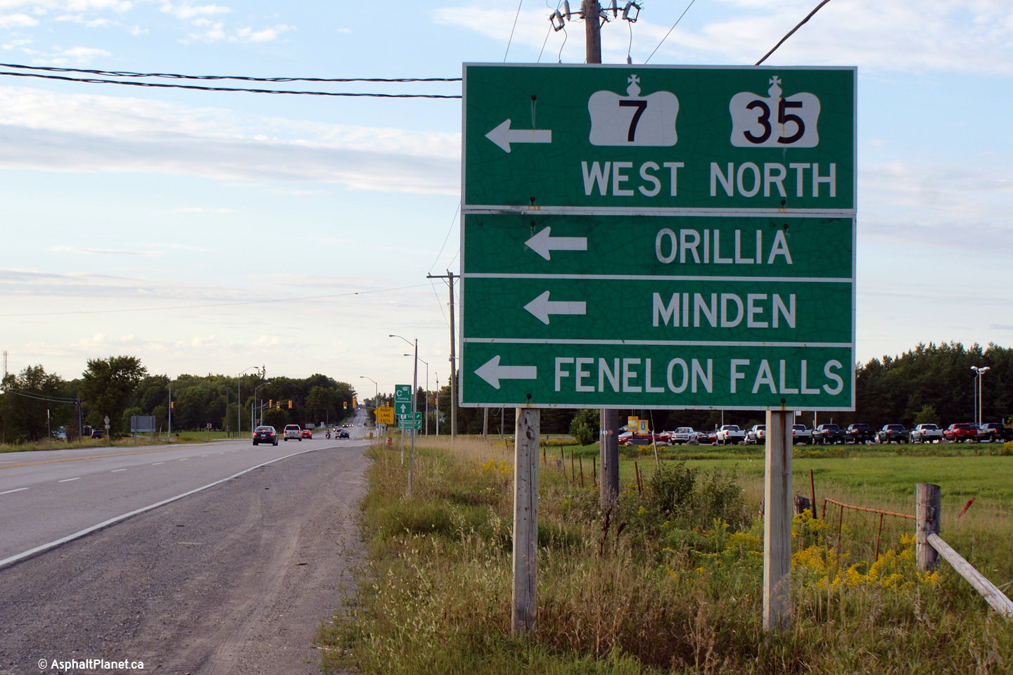

 (720x480)
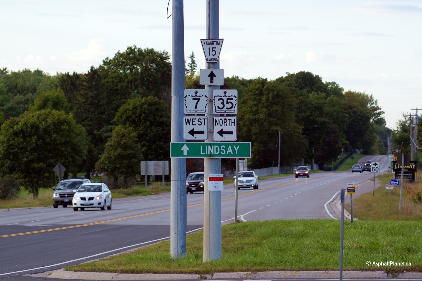