|
Proper Municipality Name |
Community Name |
Distance |
Intersecting Road |
|
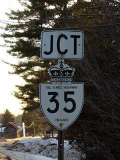
Highway 35/115 is a
RIRO highway from Highway 401 northerly to
Enterprise hill (Highway 115-North jct) |
| Municipality of Clarington |
----- |
0 km / 196.5 km |
King's Highway 401
(Autoroute Macdonald - Cartier Freeway) |
| Municipality of Clarington |
----- |
0.7 km / 195.7 km |
Lovkin Road - RIRO |
| Municipality of Clarington |
----- |
1.1 km / 195.4 km |
Highway 2 (Durham
Highway 2) - Full interchange |
| Municipality of Clarington |
----- |
4.0 km / 192.5 km |
Mill Street (Durham Road 17-South) & Clarke
3rd Concession - RIRO |
| Municipality of Clarington |
----- |
6.0 km / 190.5 km |
Clarke 4th Concession - RIRO |
| Municipality of Clarington |
Orono |
8.0 km / 188.5 km |
Main Street (Durham Road 17 North) - RIRO |
| Municipality of Clarington |
Orono |
8.5 km / 188.0 km |
Station Street - RIRO (NO TURN AROUND FOR 35/115) |
| Municipality of Clarington |
Orono |
10.0 km / 186.5 km |
Mill Street & Tamblyn Road - RIRO |
| Municipality of Clarington |
Orono |
10.6 km / 185.9 km |
Taunton Road (Durham Road 4) & Clarke 6th
Concession - RIRO |
| Municipality of Clarington |
Kirby |
13.3 km / 183.2 km |
Clarke 7th Concession & Ganaraska Road (Durham Road 9)
- RIRO |
| Municipality of Clarington |
----- |
15.2 km / 181.3 km |
Clarke 8th Concession |
| Municipality of Clarington |
----- |
17.3 km / 179.2 km |
Clarke 9th Concession - West Side RIRO
interchange (NO TURN AROUND FOR 35/115) |
| Municipality of Clarington |
----- |
20.6 km / 175. 9 km |
Wilcox Road - East Side RIRO interchange (NO TURN
AROUND FOR 35/115) |
|
At the 35/115 split: NB: Take the
Highway 35 exit to the right, be wary it is the second exit (after Wilcox
Road) after the 1km advanced sign. SB: Ramp right onto
RIRO
expressway
towards Newcastle |
| Municipality of Clarington |
----- |
20.9 km / 175.6 km |
King's Highway 115-North
- Full interchange |
| Clarington - Kawartha Lakes Boundary |
----- |
23.0 km / 173.5 km |
Boundary Road (Durham Road 20) |
| City of Kawartha Lakes |
Pontypool Bypass |
25.7 km / 170.8 km |
Pontypool Road (Kawartha Lakes Road 12) |
| City of Kawartha Lakes |
Ballyduff |
--- |
----- |
| City of Kawartha Lakes |
(Manvers) |
33.1 km / 163.4 km |
King's Highway 7A-East |
| City of Kawartha Lakes |
----- |
34.6 km / 161.9 km |
King's Highway 7A-West |
| City of Kawartha Lakes |
----- |
41.8 km / 154.7 km |
Golf Course Road (Kawartha Lakes Road 57) |
| City of Kawartha Lakes |
----- |
43.2 km / 153.3 km |
Mount Horeb Road (Kawartha Lakes Road 31) |
|
NB: At highway 7 turn left towards Fenlon
Falls. SB: Take the ramp to the right towards Newcastle |
| City of Kawartha Lakes |
Lindsay Bypass |
52.6 km / 143.9 km |
King's Highway 7-East
& Highway 7B/35B (Kawartha Lakes Road 15) |
| City of Kawartha Lakes |
Lindsay Bypass |
54.0 km / 142.5 km |
Kawartha Lakes Road 4 (Angeline Street & Little
Brittain Road) |
|
NB: Ramp Right onto Highway
35/7B (Kent Street) towards Fenlon Falls. SB: Turn Left at the traffic
lights onto Highway 7 towards Newcastle |
| City of Kawartha Lakes |
Lindsay Bypass |
58.0 km / 138.5 km |
King's Highway 7-West
& King's Highway 7B (Kent Street) |
|
NB: Turn Left off of Kent
Street at the first traffic light east of Highway 7. SB: At
Highway 7B (Kent Street) take the ramp to the right |
| City of Kawartha Lakes |
Lindsay Bypass |
58.8 km / 137.7 km |
Highway 7B-East &
Highway 35B (Kent Street) |
| City of Kawartha Lakes |
----- |
--- |
Colborne Street (Kawartha Lakes Road 17) |
| City of Kawartha Lakes |
----- |
62.0 km / 134.5 km |
Thunder Bridge Road (Kawartha Lakes Road 4) |
| City of Kawartha Lakes |
----- |
65.4 km / 131.1 km |
Killarney Bay Road (Kawartha Lakes Road 21) |
| City of Kawartha Lakes |
----- |
67.6 km / 128.9 km |
Cambray Road (Kawartha Lakes Road 9) |
| City of Kawartha Lakes |
Cameron |
69.6 km / 126.9 km |
Cameron Street (Kawartha Lakes Road 34-West) |
| City of Kawartha Lakes |
Cameron |
69.7 km / 126.8 km |
Long Beach Road (Kawartha Lakes Road 34-East) |
| City of Kawartha Lakes |
Powles Corners |
75.0 km / 121.5 km |
Highway 121
(Kawartha Lakes Road 121) |
| City of Kawartha Lakes |
----- |
79.2 km / 117.3 km |
Highway 35A (Kawartha Lakes Road 8-East) |
| City of Kawartha Lakes |
----- |
80.0 km / 116.5 km |
Glenarm Road (Kawartha Lakes Road 8-West) |
| City of Kawartha Lakes |
Isaacs Glen |
--- |
----- |
| City of Kawartha Lakes |
Rosedale |
--- |
----- |
| City of Kawartha Lakes |
----- |
--- |
7th Concession (Kawartha Lakes Road 43) |
| City of Kawartha Lakes |
Coboconk |
--- |
--- |
| City of Kawartha Lakes |
----- |
96.3 km / 100.2 km |
Highway 48
(Kawartha Lakes Road 48) |
| City of Kawartha Lakes |
Norland |
104.0 km / 92.5 km |
Highway 503 (Kawartha Lakes Road 45) |
| Township of Minden Hills |
Moore Falls |
114.3 km / 82.2 km |
Haliburton Road 2 |
| Township of Minden Hills |
Miners Bay |
117.9 km / 78.6 km |
----- |
| Township of Minden Hills |
Kilcoo Harbour |
--- |
----- |
| Township of Minden Hills |
----- |
128.6 km / 67.9 km |
Highway 121-South
(Haliburton Road 121) |
| Township of Minden Hills |
Minden |
131.0 km / 65.5 km |
Haliburton Road 16 |
| Township of Minden Hills |
Minden |
--- |
Haliburton Road 2 |
| Township of Minden Hills |
Minden |
133.1 km / 63.4 km |
Highway 121-North
(Haliburton Road 21) |
| Township of Minden Hills |
----- |
133.5 km / 63.0 km |
Horseshoe Lake Road (Haliburton Road 20) |
| Township of Minden Hills |
----- |
141.5 km / 55.0 km |
Horseshoe Lake Road (Haliburton Road 20) |
| Township of Minden Hills |
Carnarvon |
146.2 km / 39.7 km |
King's Highway 118 |
| Township of Algonquin Highlands |
Buttermilk Falls |
--- |
----- |
| Township of Algonquin Highlands |
Halls Lake |
156.8 km / 39.7 km |
Haliburton Road 13 |
| Township of Algonquin Highlands |
Ox Narrows |
163.3 km / 33.2 km |
Kushog Lake Road (Haliburton Road 11) |
| Township of Minden Hills |
Pine Springs |
--- |
----- |
| Township of Lake of Bays |
Dorset |
180.5 km / 16.0 km |
Highway 117
(Muskoka Road 117) |
| Township of Algonquin Highlands |
----- |
--- |
Main Street (Haliburton Road 39) |
| Township of Algonquin Highlands |
----- |
182.4 km / 8.4 km |
Haliburton Road 8 & Haliburton Road 12 |
| Township of Lake of Bays |
Birkendale |
--- |
----- |
| Township of Lake of Bays |
----- |
194.4 km / 2.1 km |
Muskoka Road Road 21 |
| Township of Lake of Bays |
----- |
196.5 km / 0 km |
King's Highway 60 |
|
Highway 35 ENDS |