King's Highway 7A - www.OntHighways.com

Highway 7A is a very effective alternate to Highway 7 via Lindsay.  Highway 7A passes south of Lake Scugog, via Port Perry, shaving 35km off the Manchester to Peterborough route compared to Highway 7.  Highway 7A was not downloaded in any way in 1997, or 1998 though some of the eastern most segment of highway was redesignated as Highway 7 to improve Peterborough's numbering scheme.


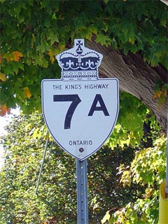
King's Highway 7A Shield


Western Terminus:  Junction King's Highway 7/12 in Manchester in the township of Scugog

Eastern Terminus:  As of Summer 2003 - Located at the (western) Interchange at King's Highway 115. 
                                      Prior to 2003:
the eastern terminus was at the King's Highway 7 junction just north of Springville

Length:  Current: 48.7km, Pre-2003: 56.7 km

Multiplexes:  2.0 km with Highway 35, (before 2003, 4.1 km with Highway 115)

Freeway: Currently: No.  Prior to 2003: 4.5km of freeway while concurrent with Highway 115

AADT  (2001):  Highest: 19 900, Water Street (East Limits of Port Perry) to Simcoe Street (Durham Road 2);

                              Lowest:  4 150, Peterborough/ Kawartha Lakes Boundary to Highway 115.

Road Info:  Highway 7A is a very busy highway through Port Perry to Island Road.  East of Island Road, the route carries its share of traffic, but is almost never congested.  Much of the highway has been reconstructed since 2000, and virtually the entire length of the highway is very smooth.  Highway 7A has a rural 80km/h speed limit..


Highway 7A information:


OntHighways.com  

Detailed Route information available below
Virtual Tour and other photos of Highway 7A


TheKingsHighway.ca   History of Highway 7A
Photographic History of Highway 7A

Communities and Major Intersections along Highway 7A from West to East:

Proper Municipality Name Community Name Distance* Intersection Name
Township of Scugog Manchester 0 km / 48.7 km, (56.7 km) King's Highway 7/12 & Durham Road 21
Township of Scugog Manchester --- Rose Street

At Queen Street:  EB:  Take the ramp to the right.  WB:  Turn Left at the traffic lights (Beer Store straight ahead)

Township of Scugog Port Perry --- Queen Street
Township of Scugog Port Perry 4.1 km / 44.6 km, (52.6 km) Simcoe Street (Durham Road 2)
Township of Scugog ----- 6.4 km / 42.3 km, (50.3 km) Island Road (Durham Road 7)
Township of Scugog ----- 13.8 km / 34.9 km, (42.1 km) Durham Road 57 South
Township of Scugog ----- --- Durham Road 57 North
Township of Scugog Nestleton --- -----
City of Kawartha Lakes Yelverton --- -----
City of Kawartha Lakes ----- 25.9 km / 22.8 km, (30.8 km) Janetville Road (Kawartha Lakes Road 5)

At Highway 35 North:  EB:  Take the ramp to the right towards Newcastle.  WB:  At the bottom of the hill turn left towards Port Perry

City of Kawartha Lakes ----- 29.4 km / 19.3 km, (27.3 km) King's Highway 35-North
At Highway 35 South:  EB:  Turn Left at the top of the Hill towards Peterborough.  WB:  Take the ramp to the right
City of Kawartha Lakes (Manvers) 31.4 km / 17.3 km, (25.3 km) King's Highway 35-South
City of Kawartha Lakes ----- --- Porter Road (Kawartha Lakes Road 32)
City of Kawartha Lakes Bethany 38.4 km / 10.3 km, (18.3 km) Ski Hill Road (Kawartha Lakes Road 38)
Township of Cavan- Milbrook - North Monaghan Cavan --- Peterborough Road 10
Township of Cavan- Milbrook - North Monaghan ----- 48.7 km / 0 km, (8.0 km) King's Highway 115 (South)

Present (After Summer 2003) End of Highway


*Current distance information is shown first, followed by pre-downloading distances in parentheses.

<- Highway 7         www.OntHighways.com - Home         Highway 7B (Lindsay) ->


Copyright (c) 2004-2010, AsphaltPlanet.ca  AsphaltPlanet@asphaltplanet.ca

Page last updated:  August 13th, 2008

Page created:  January 4th, 2004