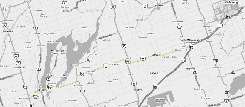
AsphaltPlanet.ca >
OntHighways > Highway 7A >
Images
King's Highway 7A - Images
Photos shown in this table are arranged from West to East:
| Proper Municipality Name | Photo Description | Photo | |
|
Pictures taken from driver's perspective appear offset from centre-line pictures: |
East- Bound |
West- Bound |
|
| Highway 7A ends at Highway 7/12 in Manchester. Click here for Highway 12 images and here for Highway 7 images | |||
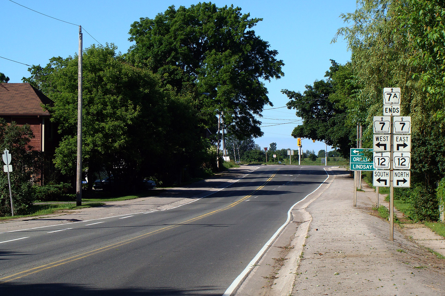
| Township of Scugog Regional Municipality of Durham |
View of the western terminus of Highway 7A at
Manchester. Durham Regional Road 21 continues straight ahead from this
junction. Regional Road 21 is a good quality road, worthy of a King's Highway designation.
It makes a
very useful connection between Highway 7A and Highway 404. Photo taken: July 5th, 2009. |
 |
|
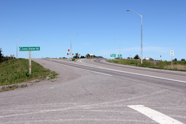
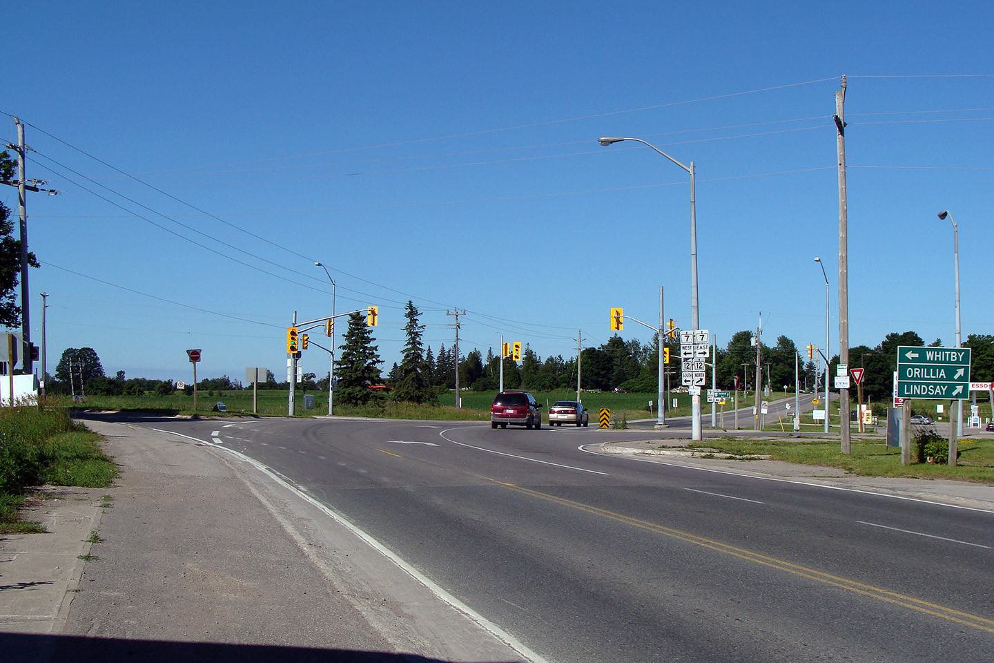
| Township of Scugog Regional Municipality of Durham |
View looking westerly in Manchester towards the
western terminal signage for Highway 7A at Highway 7 and 12. Photo taken: July 5th, 2009. |
 |
|
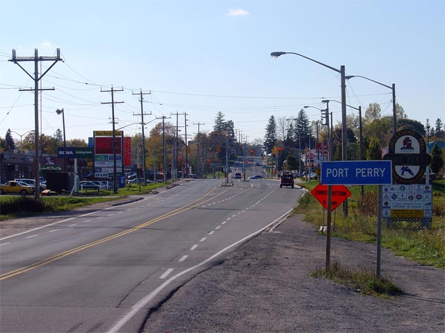
| Township of Scugog Regional Municipality of Durham |
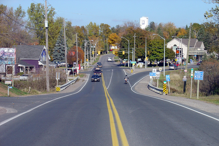
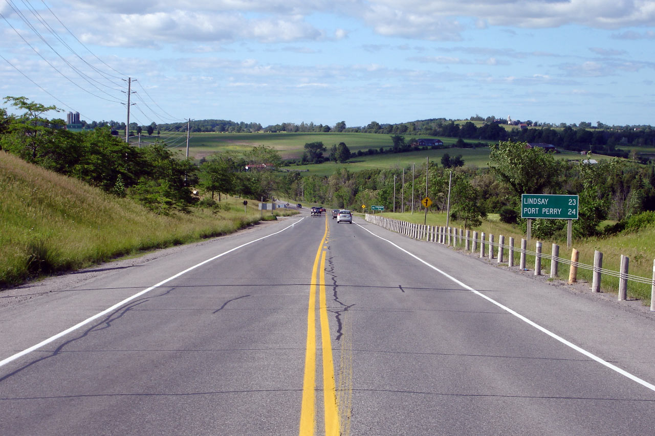
Looking east towards Port Perry along Highway
7A. At this junction, through traffic must follow the ramp to the
right. Straight ahead is Queen Street, which leads travelers into
Historic Downtown Port Perry. The Queen Street intersection is located
roughly 2km east of Highway
7/12
at Manchester Photo taken: October 29th, 2005. |
 (720x480) (1440x960) |
|
| Township of Scugog Regional Municipality of Durham |
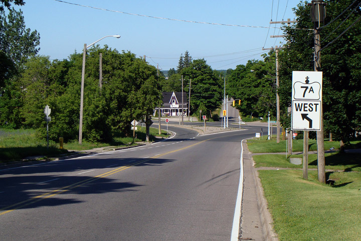
Looking west towards the signalized intersection
with Queen Street along Highway 7A. Note that the oversized junction
sign seems to direct westbound traffic the wrong way down the eastbound
ramp. Picture taken: July 5th, 2009. |
 |
|
| Township of Scugog Regional Municipality of Durham |
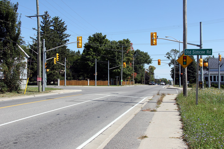
View looking easterly at the Old Simcoe Road
intersection. Long ago, Old Simcoe Road was the principle road north
from Oshawa into Scugog Township. Traffic signals were added to this
intersection in 2005 as a result of several new housing developments in the
area. Photo taken: September 2nd, 2012. |
 (720x480) (1440x960) (2400x1600) |
|
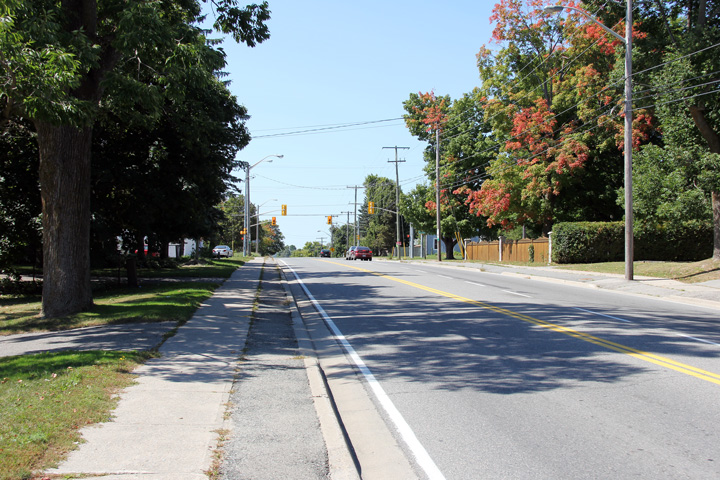
| Township of Scugog Regional Municipality of Durham |
View looking westerly towards the Old Simcoe
Road intersection. The vibrant reds of autumn have started showing on
the foliage adjacent to Highway 7A. Vibrant fall colours are
indicative of a hot summer -- the summer of 2012 was quite hot and dry. Photo taken: September 2nd, 2012. |
 (720x480) (1440x960) (2400x1600) |
|
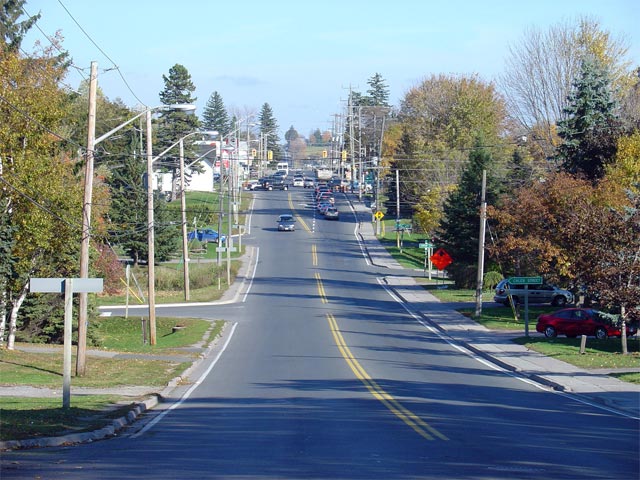
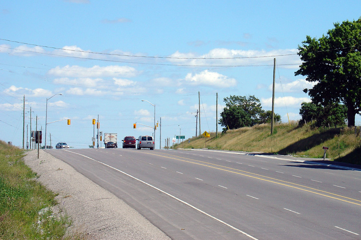
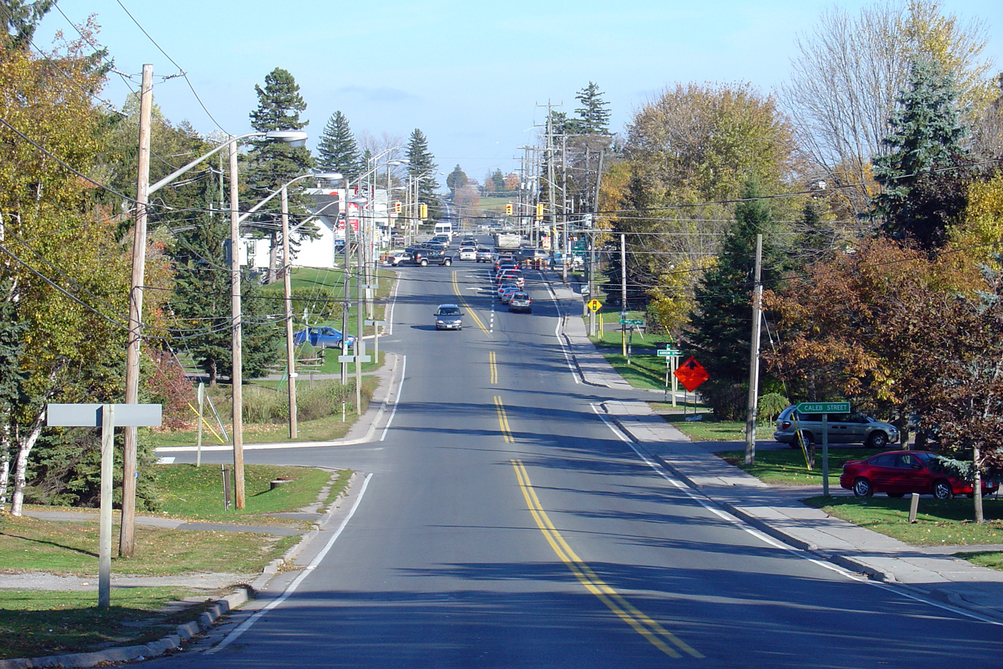
| Township of Scugog Regional Municipality of Durham |
Looking east towards the Simcoe Street
intersection from Ella Street along Highway 7A. During peak travel
times, the traffic light at Simcoe Street causes a great deal of congestion
along eastbound Highway 7A. Photo taken: October 29th, 2005. |
 |
|
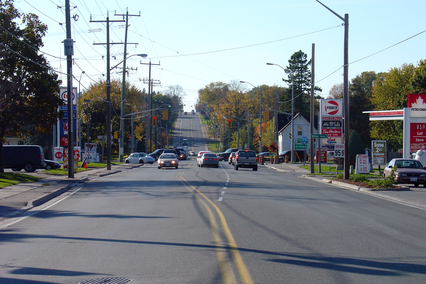
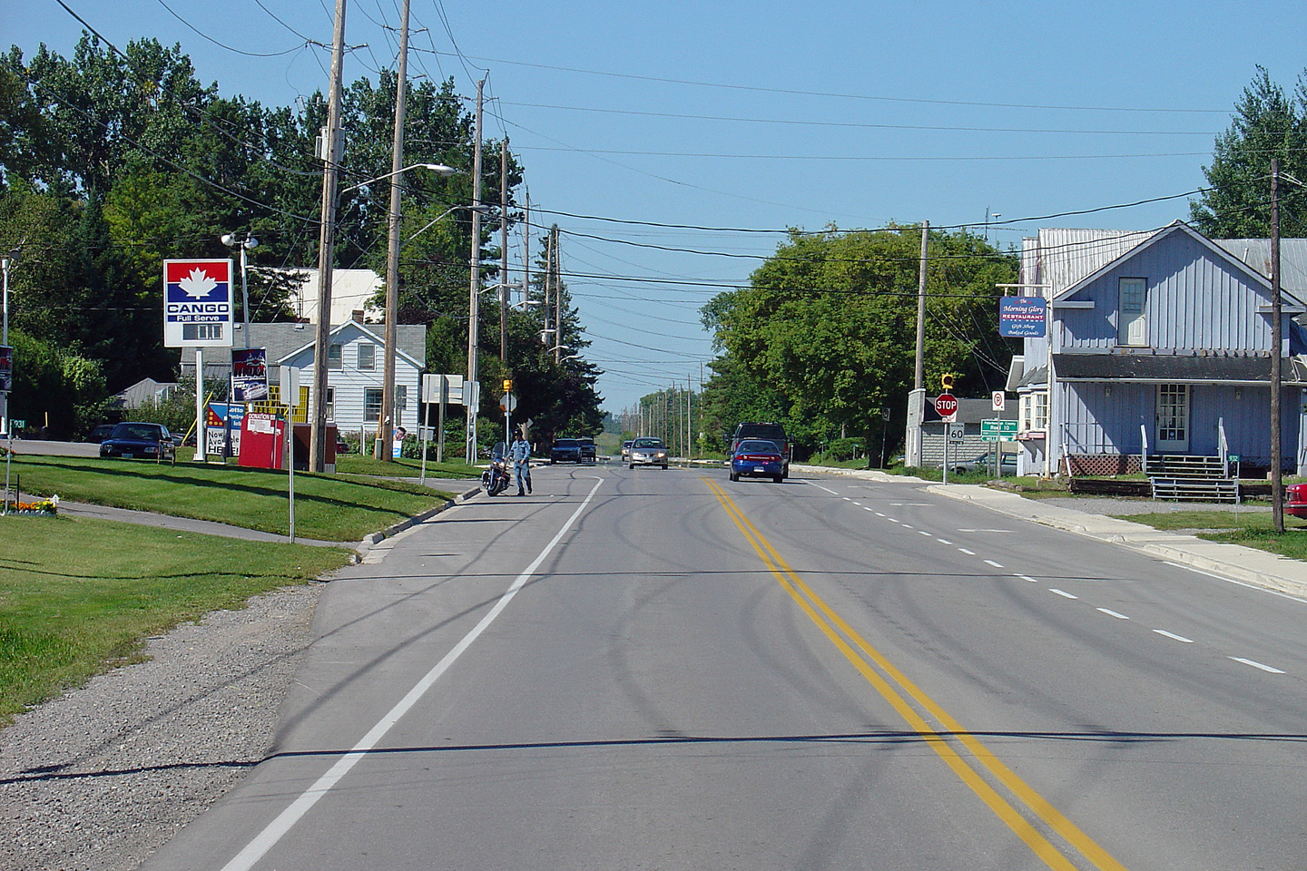
| Township of Scugog Regional Municipality of Durham |
Looking west towards the traffic light with
Simcoe Street along Highway 7A. Note the price of gas in 2005 at the
two fueling stations. Photo taken: October 29th, 2005. |
 (720x480) (1440x960) |
|
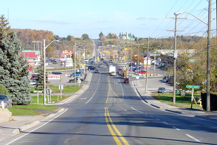
| Township of Scugog Regional Municipality of Durham |
Looking east along Highway 7A towards Port
Perry's eastern commercial district from just east of John Street.
There are two closely spaced traffic signals in this area of Port Perry.
One at Water Street, and one for a commercial plaza. Photo taken: October 29th, 2005. |
 |
|
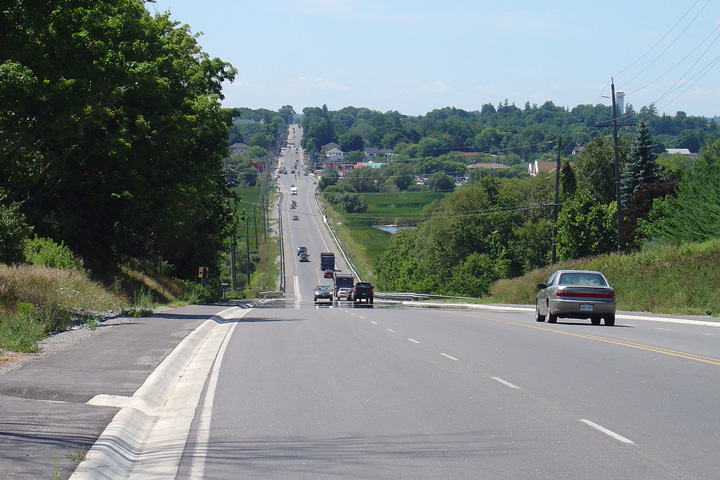
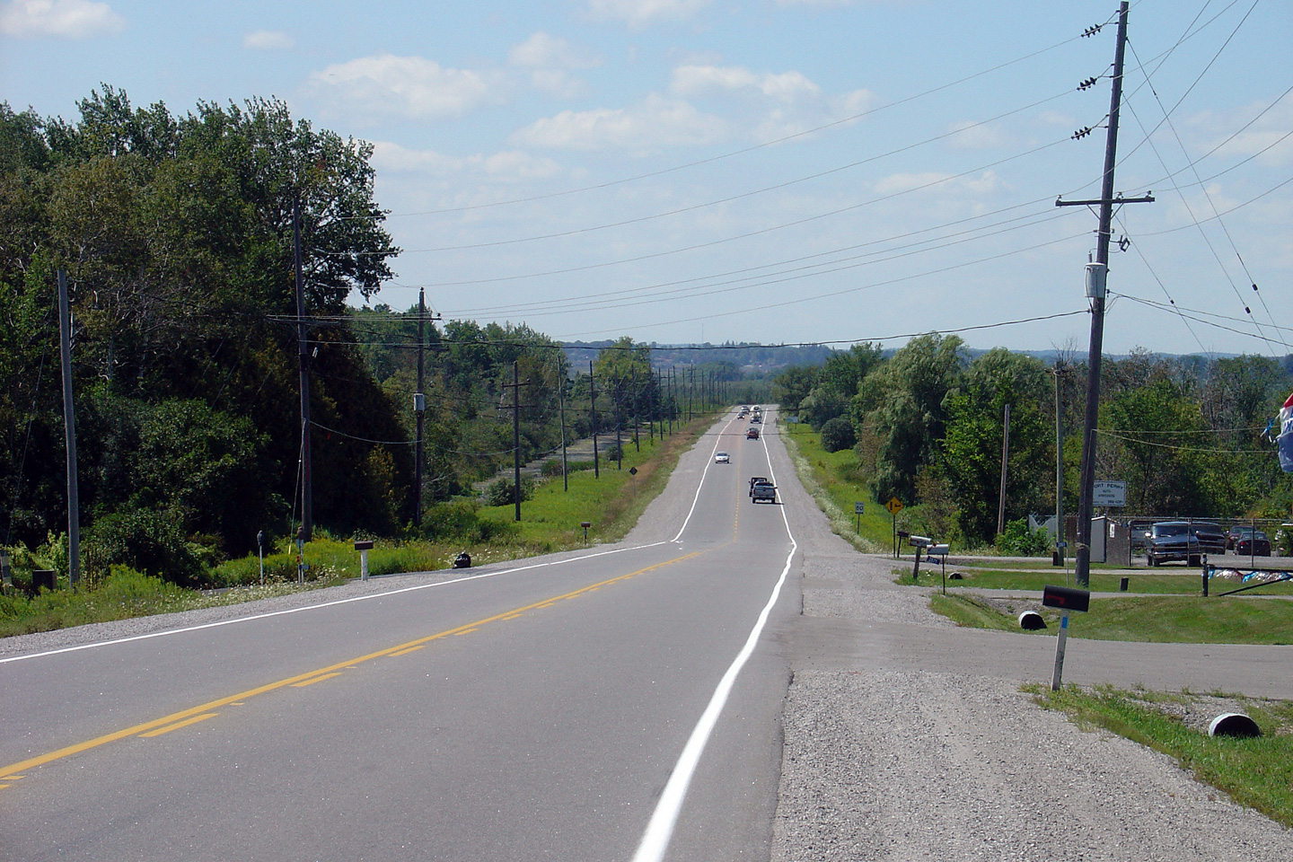
| Township of Scugog Regional Municipality of Durham |
Looking west into Port Perry from the eastern
limits of the community. There is a brief 4 lane section along Highway
7A through the east end of Port Perry where Highway 7A passes through a
commercial area. Photo taken: October 29th, 2005. |
 |
|
| Township of Scugog Regional Municipality of Durham |
Looking east across the western causeway towards
Scugog Island along Highway 7A from the eastern limits of the town of Port
Perry. Photo taken: October 29th, 2005. |
 (720x480) (1440x960) |
|
| Township of Scugog Regional Municipality of Durham |
This view looks easterly along the causeway
across Lake Scugog that links Port Perry to Scugog Island. Photo taken: October 9th, 2011. |
 |
|
| Township of Scugog Regional Municipality of Durham |
Highway 7A looking west from the Island Road
intersection towards Port Perry. Interestingly, the causeway linking
Port Perry with Scugog Island replaced a floating bridge. This
floating bridge was constructed by the county long before Highway 7A was
assumed as a provincial highway. Reportedly this floating bridge
lasted until the mid 1960s. Photo taken: August 17th, 2005. |
 (720x480) (1440x960) |
|
| Township of Scugog Regional Municipality of Durham |
Highway 7A looking east towards the intersection
with Island Road. Traffic signals were installed in 2004 when this
intersection was entirely reconstructed. During this reconstruction,
the pictured hill was deeply cut, allowing for much better sightlines at the
Island Road intersection. Photo taken: August 17th, 2005. |
 (720x480) (1440x960) |
|
| Township of Scugog Regional Municipality of Durham |
Highway 7A looking west towards the Island Road
intersection. Island Road is located about 500m west of this point.
Both the eastbound and westbound passing lanes shown in this picture extend
for about a kilometre westerly. They were constructed in 2004, and are
the only passing lanes for the entire length of Highway 7A. Photo taken: August 17th, 2005. |
 (720x480) (1440x960) |
|
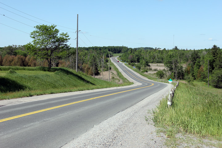
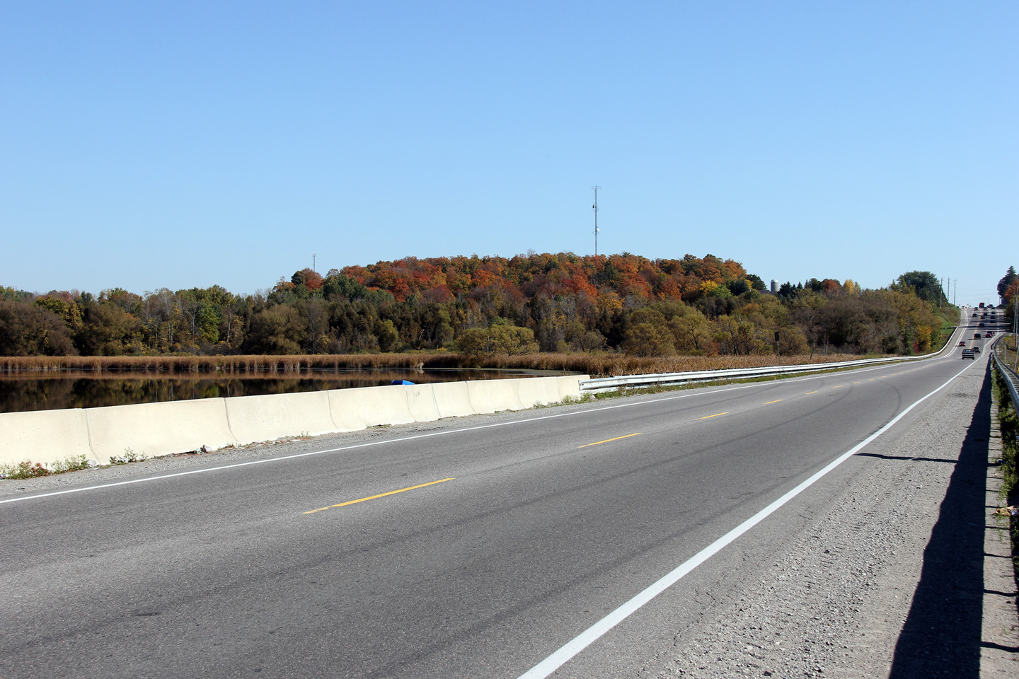
| Township of Scugog Regional Municipality of Durham |
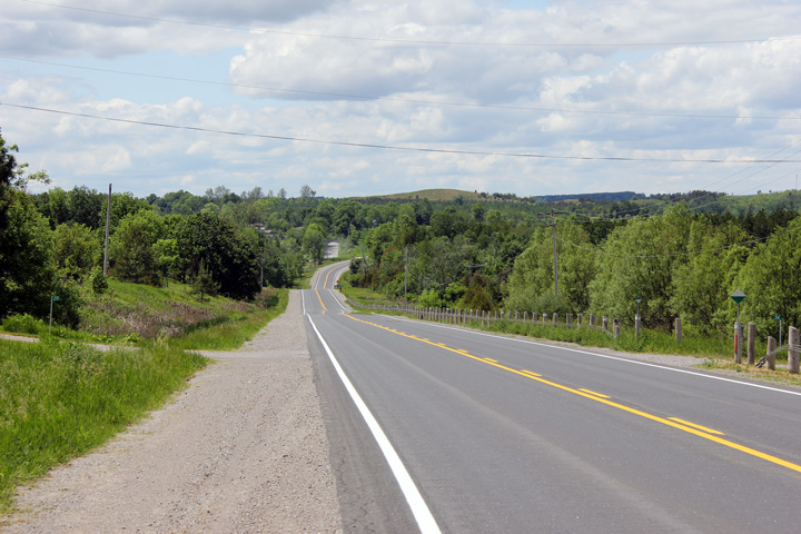
View looking westerly along Highway 7A
approaching the eastern Lake Scugog Causeway. The eastern causeway is
far less dramatic then the western causeway; the eastern causeway is
surrounded by marsh land rather then navigable waters. Photo taken: August 22nd, 2006. |
 (720x480) (1440x960) |
|
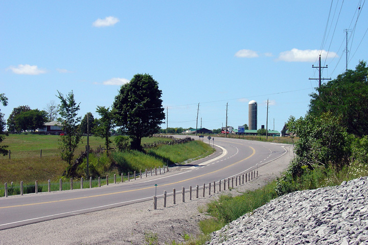
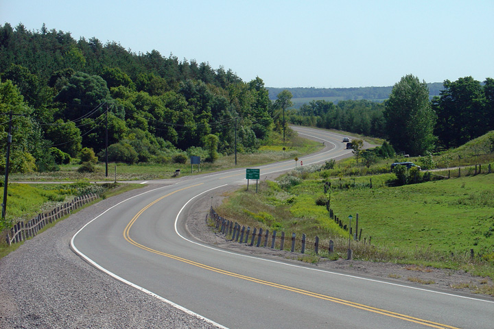
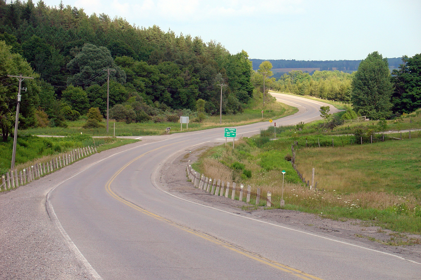
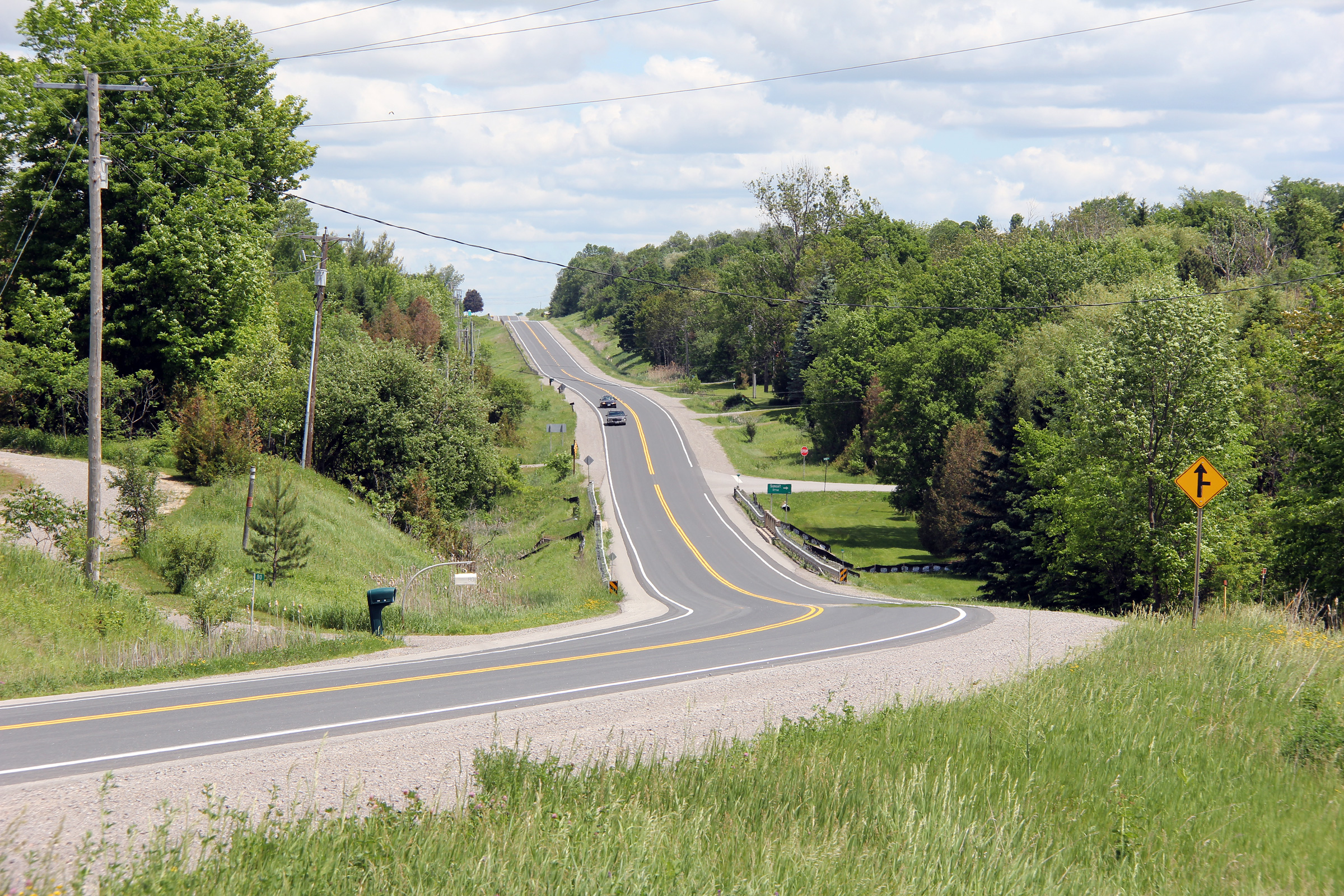
| Township of Scugog Regional Municipality of Durham |
Looking easterly along Highway 7A towards the
Cartwright West 1/4 line intersection. The left and right turn tapers
at this intersection were constructed in 2004 as part of a larger highway
reconstruction project. Photo taken: July 28th, 2012. |
 (720x480) (1440x960) (2400x1600) |
|
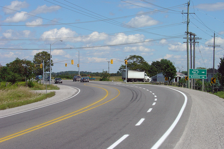
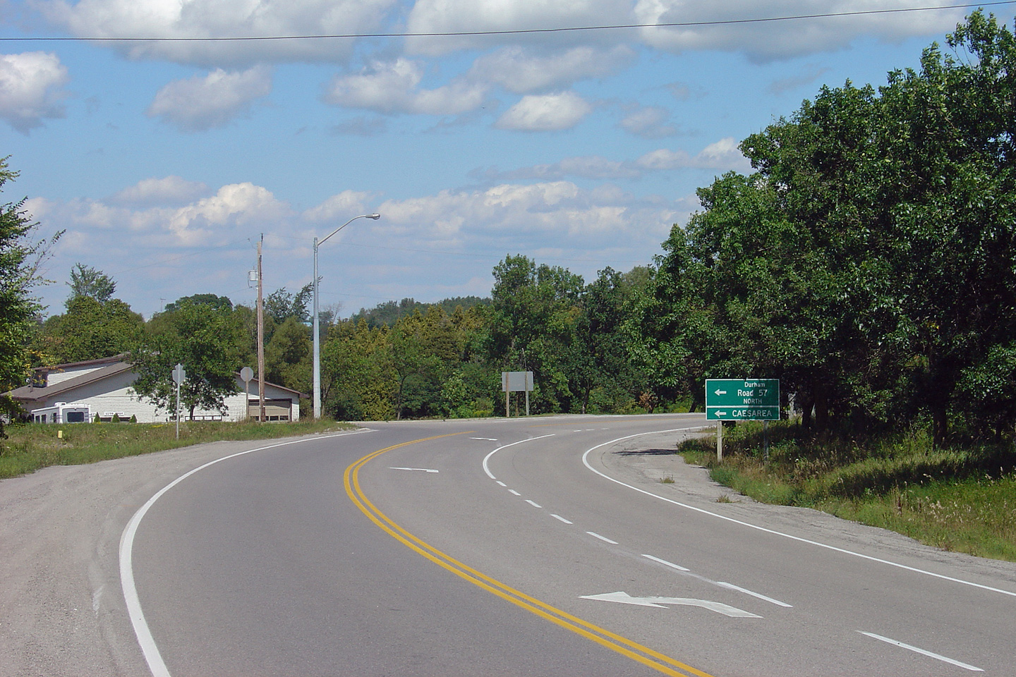
| Township of Scugog Regional Municipality of Durham |
Looking easterly along Highway 7A at Durham Road
57-South intersection. Durham Road 57 follows a new alignment
by-passing the historic 'Scugog Road' which was a provincial county road
into the 1930s. At Durham Road 57, Highway 7A abruptly curves
northerly. Photo taken: August 22nd, 2006. |
 (720x480) (1440x960) |
|
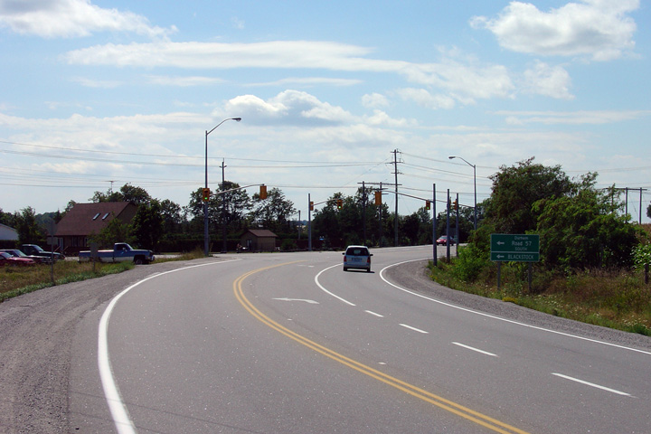
| Township of Scugog Regional Municipality of Durham |
Looking westerly towards the Durham Road
57-South intersection. This intersection is the only rural signalized
intersection east of Port Perry along Highway 7A. Photo taken: August 22nd, 2006. |
 (720x480) (1440x960) |
|
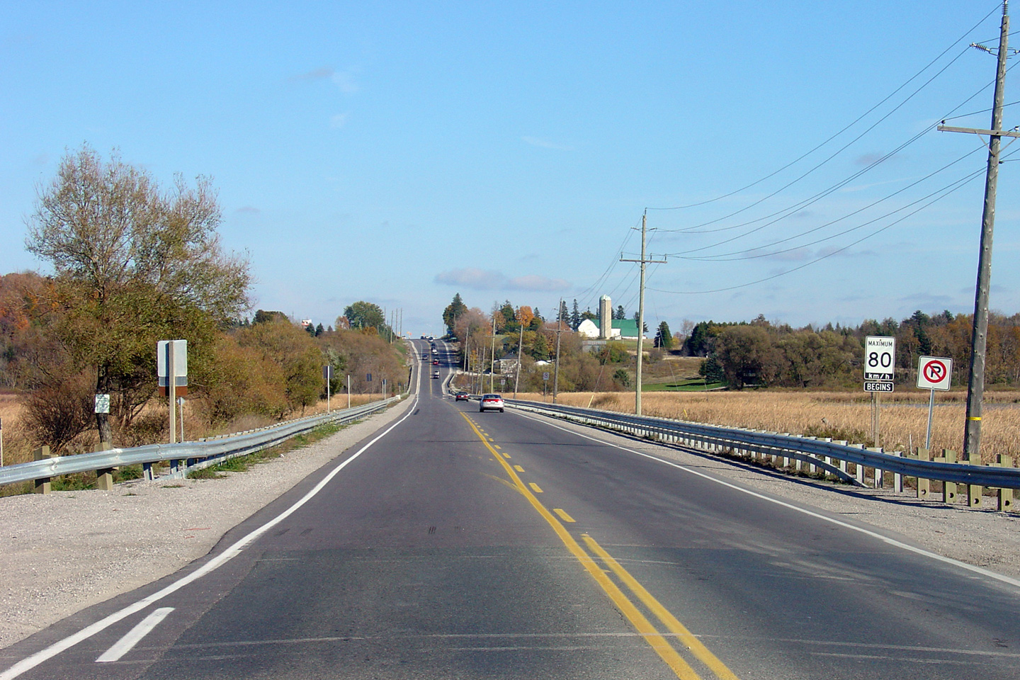
| Township of Scugog Regional Municipality of Durham |
View looking easterly along Highway 7A from just
east of the southern Durham Road 57 junction. The two Durham Road 57
junctions are located about a kilometre apart from each other, though as is
standard, Durham Road 57 is not signed along Highway 7A. Photo taken: August 22nd, 2006. |
 (720x480) (1440x960) |
|
| Township of Scugog Regional Municipality of Durham |
View looking easterly along Highway 7A
approaching the Durham Road 57-North junction. At Durham Road
57-North, Highway 7A turns again easterly in direction. Photo taken: August 22nd, 2006. |
 (720x480) (1440x960) |
|
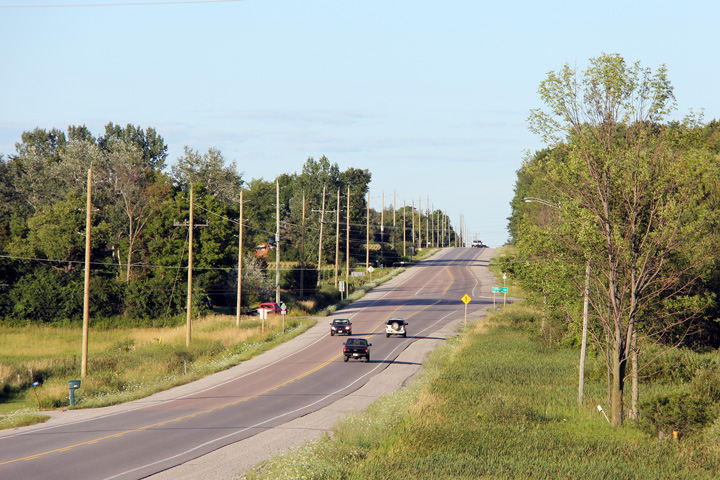
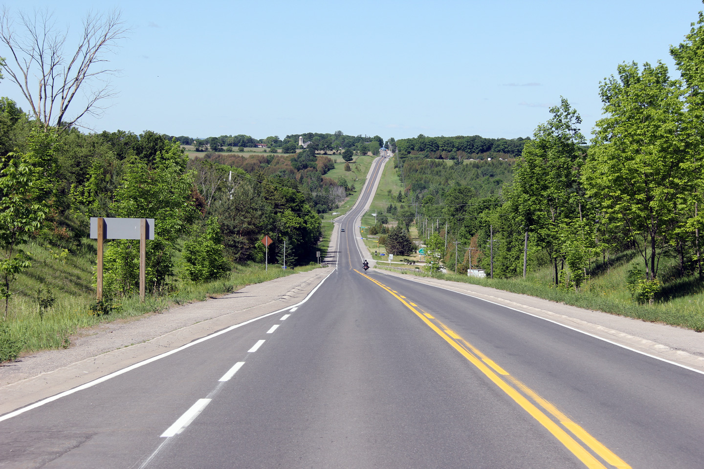
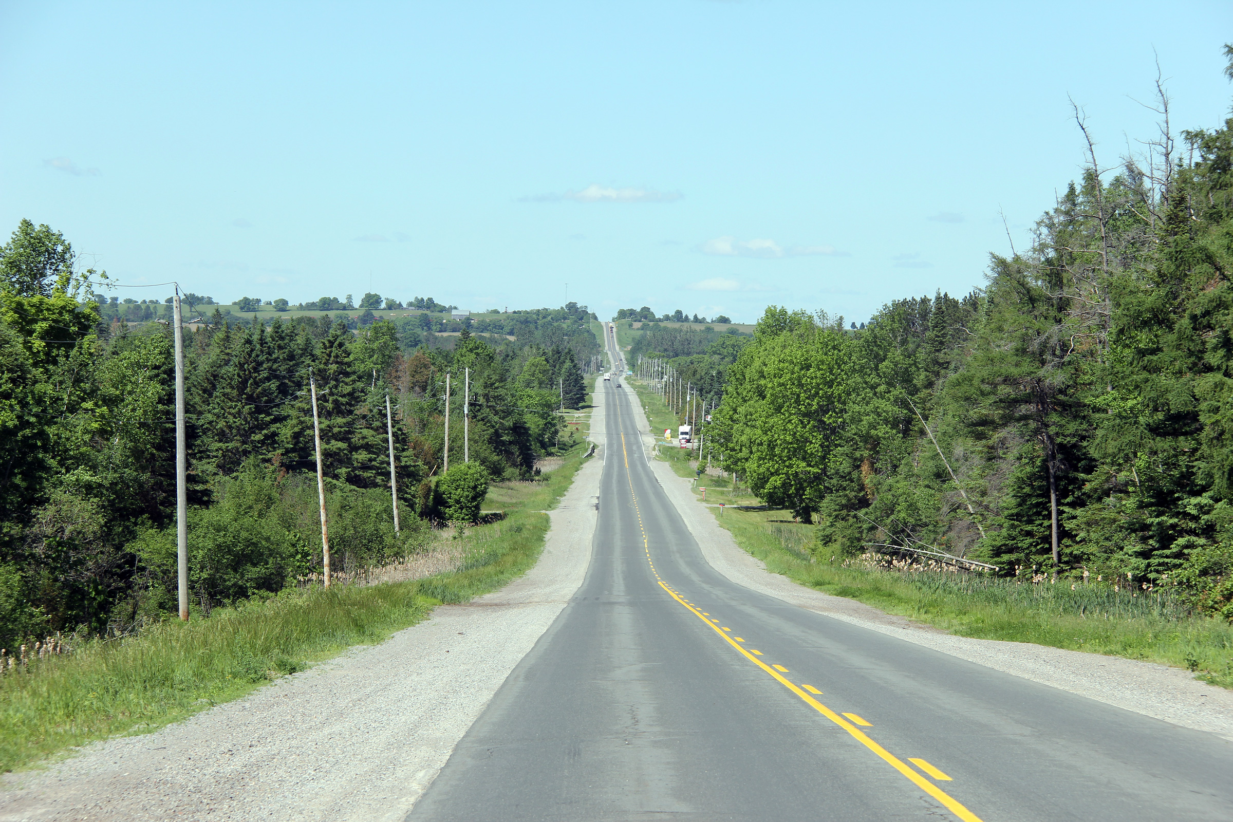
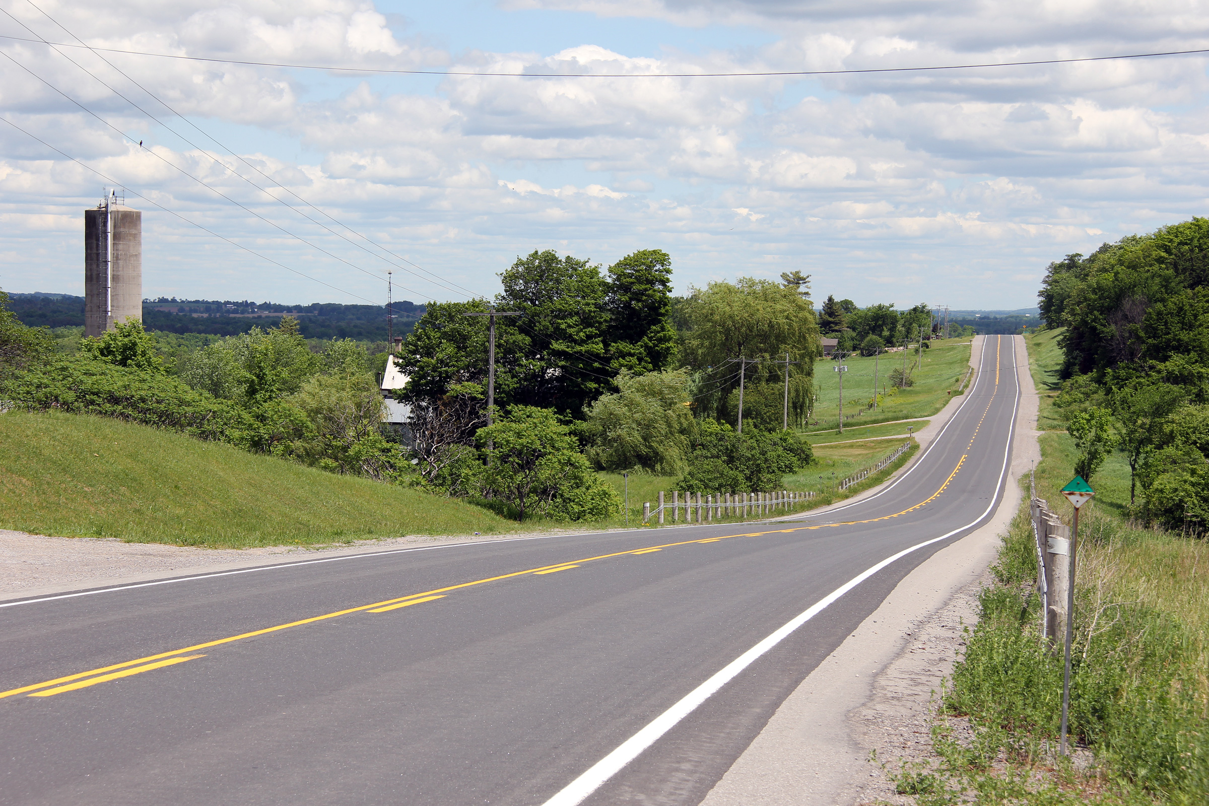
| Township of Scugog Regional Municipality of Durham |
A very pleasant evening view along Highway 7A
looking easterly towards Nestleton. Photo taken: August 19th, 2011. |
 |
|
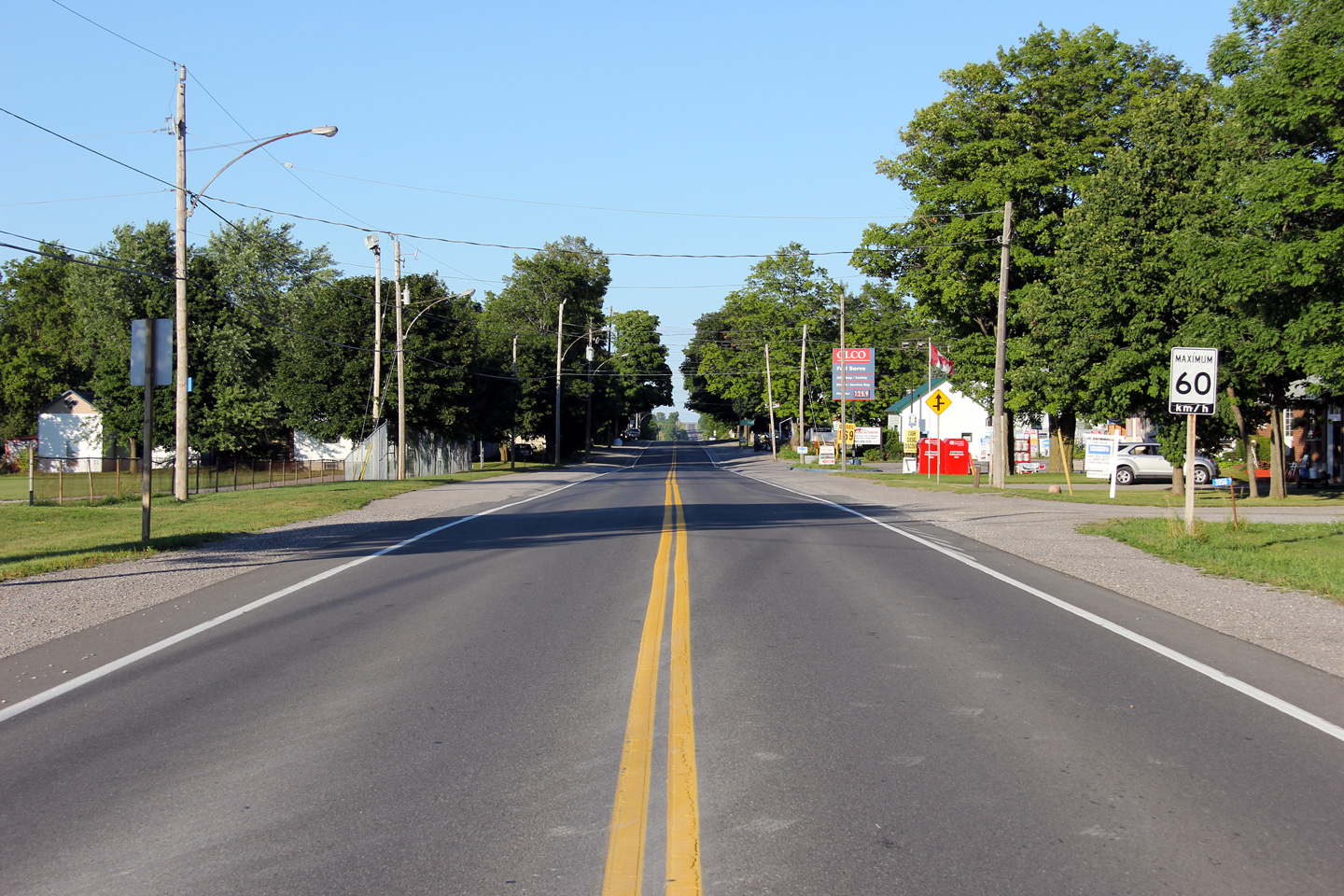
| Township of Scugog Regional Municipality of Durham |
Easterly view through the small community of
Nestleton. Photo taken: July 28th, 2012. |
 |
|
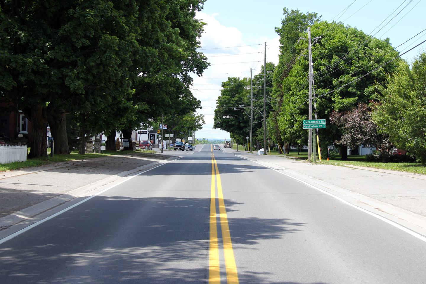
| Township of Scugog Regional Municipality of Durham |
View looking westerly through Nestleton. A
railway north-south through Nestleton until the early 1930s. The
railway ran from a wye at Burketon from CP's Havelock Subdivision northerly
through Lindsay terminating in Bobcaygeon. The former railway crossed
Highway 7A in the gap between the McLaughlin and Nestleton Road
intersections. Photo taken: June 5th, 2012. |
 |
|
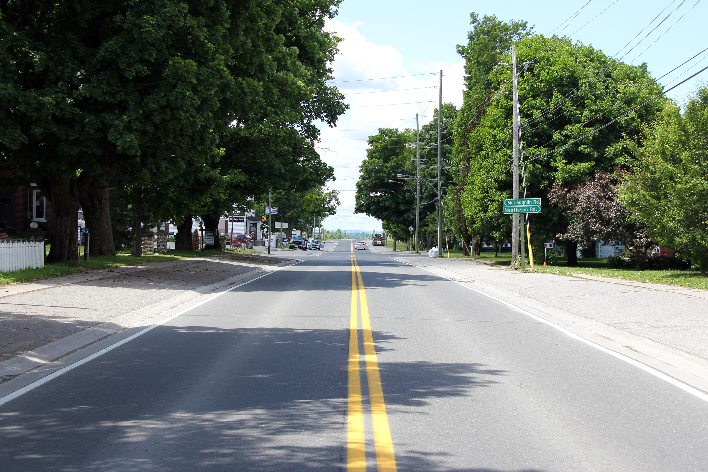
| Township of Scugog Regional Municipality of Durham |
Easterly view through Nestleton. As of the
Winter of 2013, the pictured route marker is the only sign for Highway 7A to
include the "The King's Highway" legend on it. Photo taken: June 5th, 2012. |
 |
|
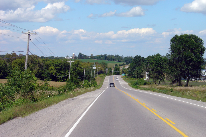
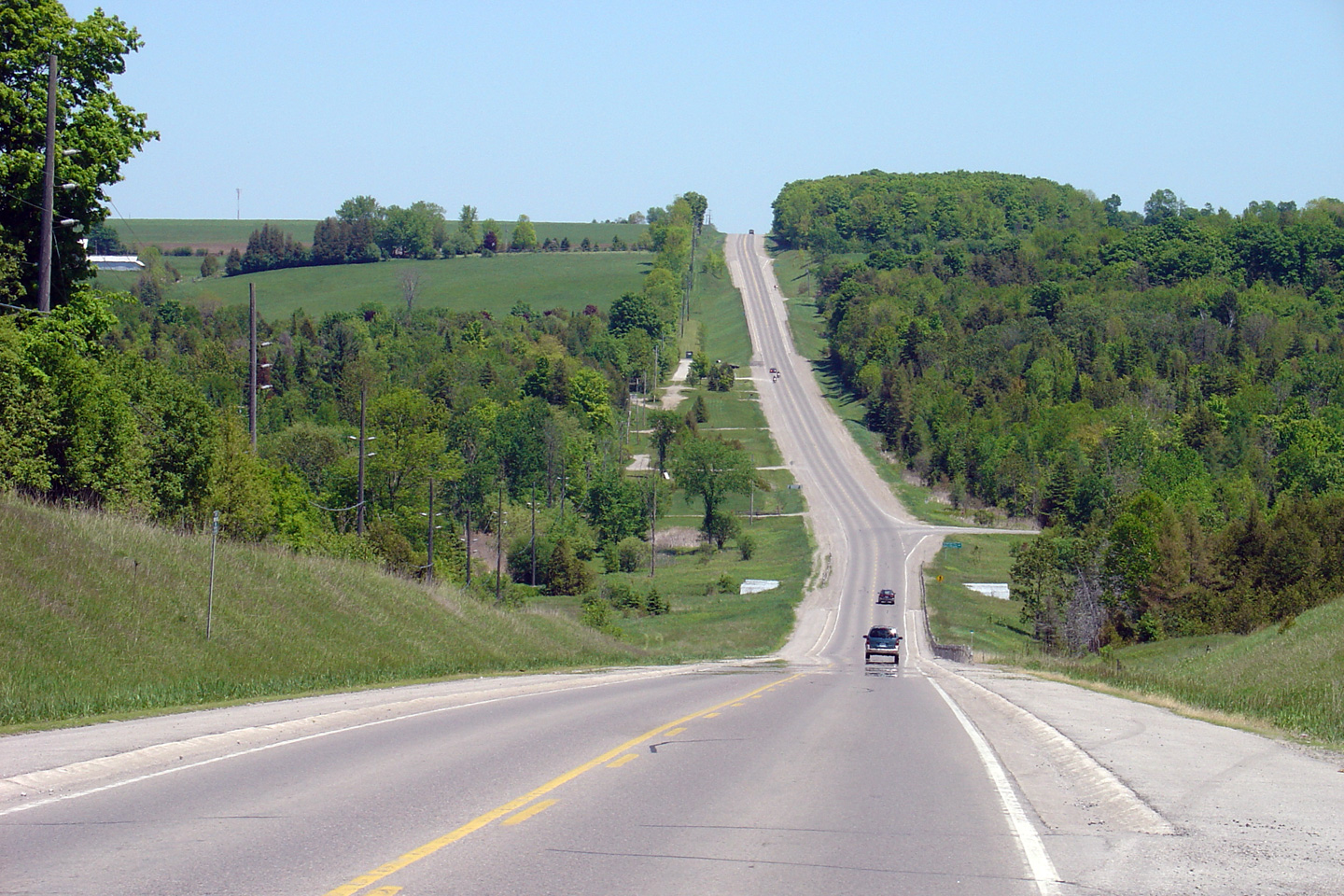
| Township of Scugog Regional Municipality of Durham |
Easterly view from just east of Nestleton as
Highway 7A drops into the Cross Creek Valley. Click
here for this same view taken in
June 2004. Photo taken: July 28th, 2012. |
 |
|
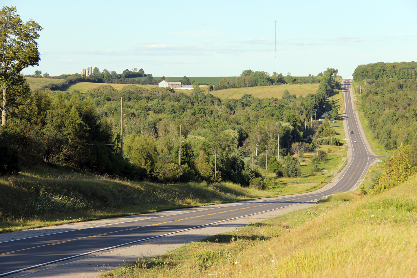
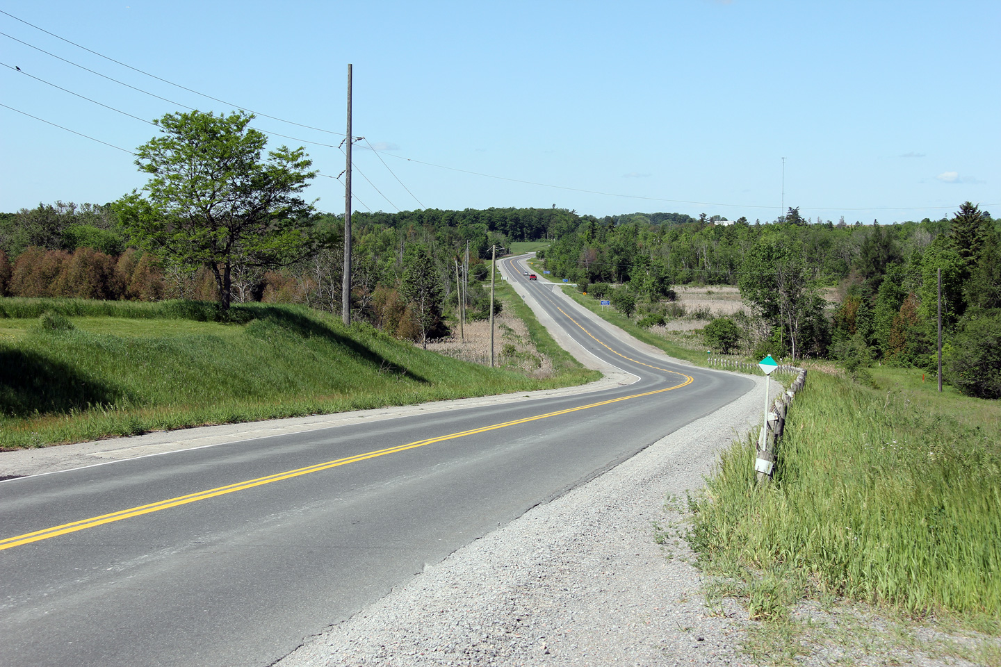
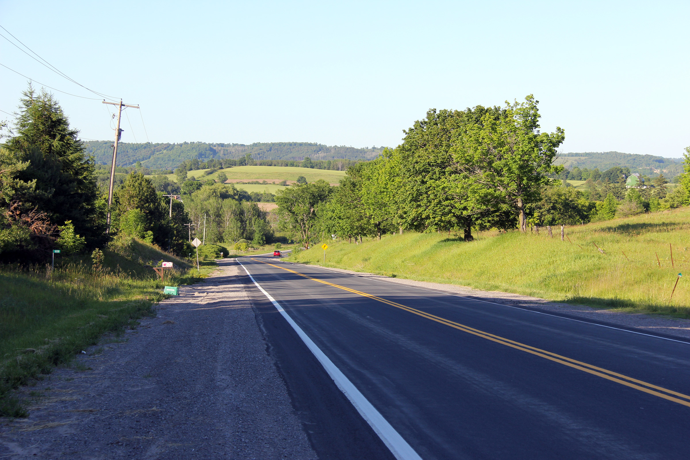
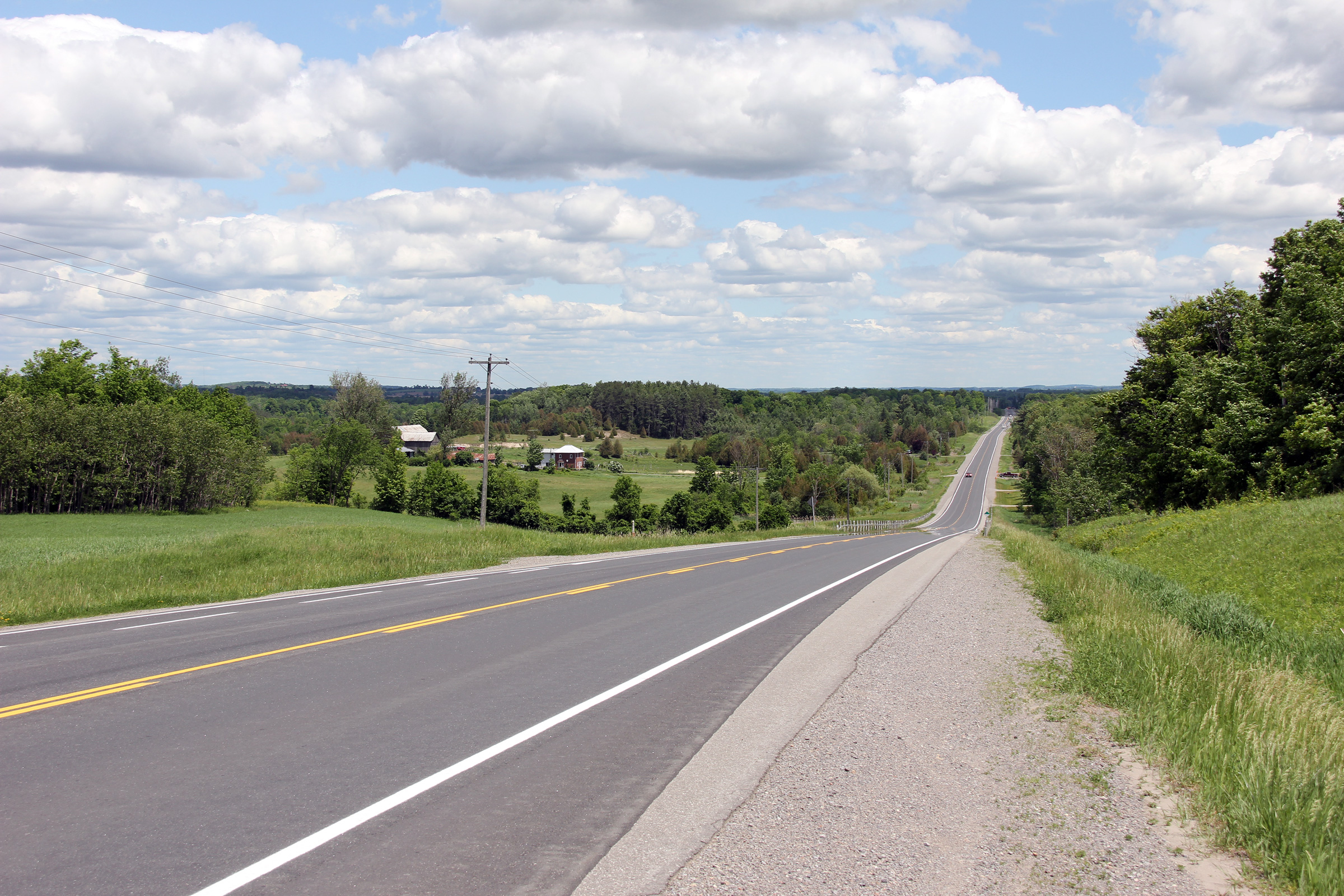
| Township of Scugog Regional Municipality of Durham |
Westerly view looking towards the Cross
Creek Valley along Highway 7A east of Nestleton. Photo taken: May 30th, 2012. |
 |
|
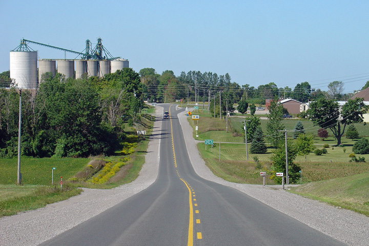
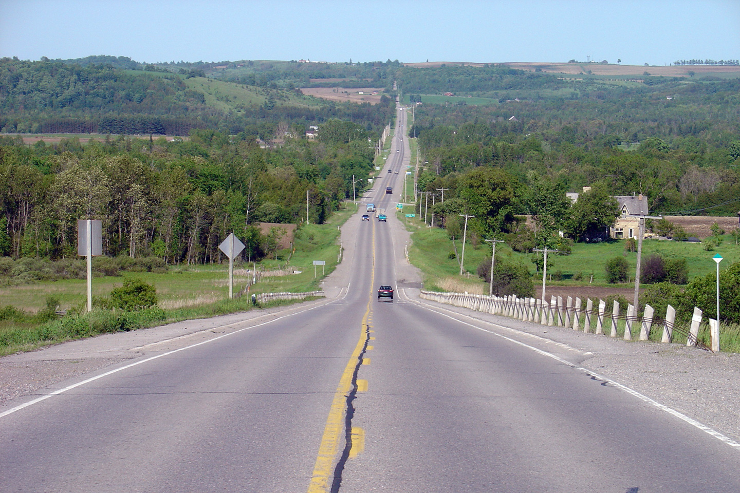
| City of Kawartha Lakes | This view looks westerly from west of Yelverton
towards the Durham / Kawartha Lakes boundary. Nesbitt Line serves as
the boundary road. Photo taken: May 30th, 2012. |
 |
|
| City of Kawartha Lakes | Easterly view from Yelverton. Click
here for this same view taken in
June 2004. Photo taken: August 19th, 2011. |
 |
|
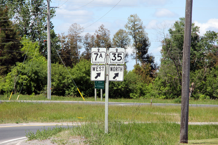
| City of Kawartha Lakes | View looking westerly towards Yelverton from
just west of the northern Highway 35 junction. Photo taken: May 30th, 2012. |
 |
|
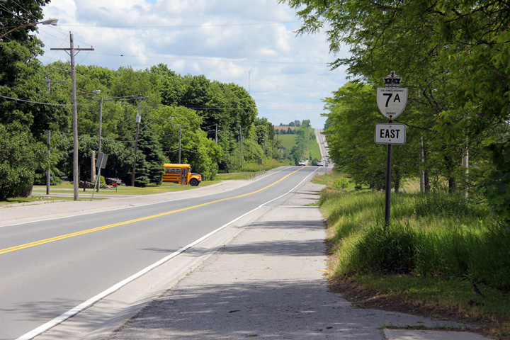
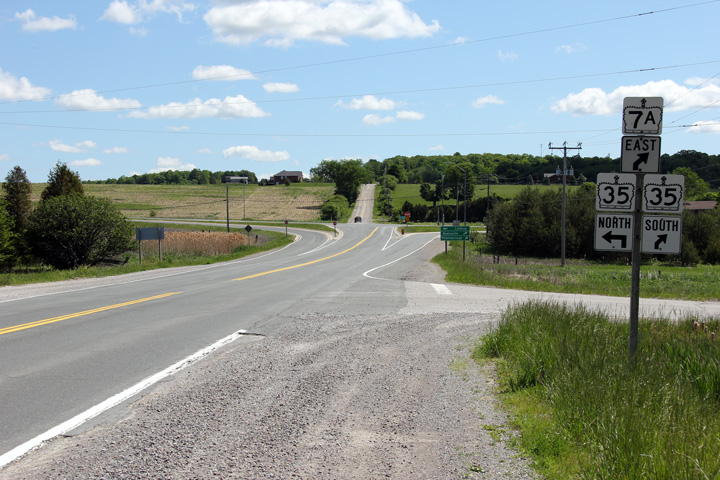
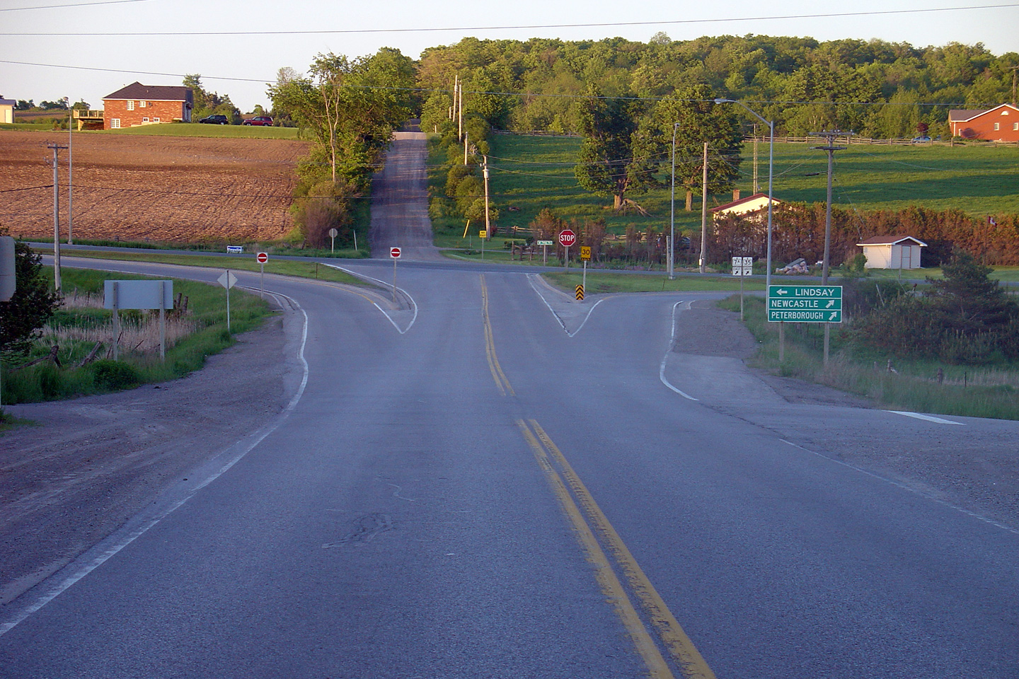
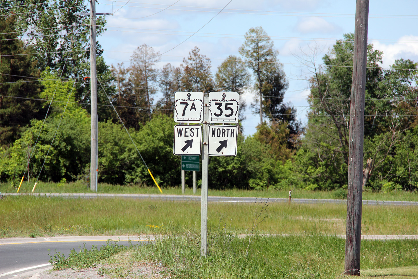
| City of Kawartha Lakes | Easterly approaching the Highway 35 north
junction. Highway 7A follows Highway 35 for approximately 2km south of
this intersection. Click here
for this same view taken in June 2004. Photo taken: May 30th, 2012. |
 |
|
| North of Highway 7A, Highway 35 runs northerly around Lindsay towards Fenelon Falls before terminating at Highway 60. Click here for Highway 35-North images. | |||
| City of Kawartha Lakes | This green signage demarking the western leg of
Highway 7A from Highway 35 has become quite weathered. Photo taken: May 30th, 2012. |
 (720x480) (720x480)(1440x960) |
|
| City of Kawartha Lakes | Northerly view approaching the western Highway
7A intersection along Highway 35 North. Photo taken: May 30th, 2012. |
 |
|
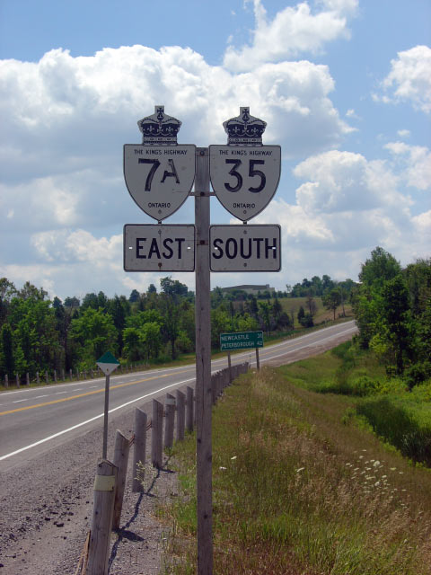
| City of Kawartha Lakes |
Old style signage along Highway 7A/35. Provincial highway signage including
the "The King's Highway" legend is becoming increasingly rare. This sign
has since been removed. Photo taken: July 19th, 2005. |
 |
|
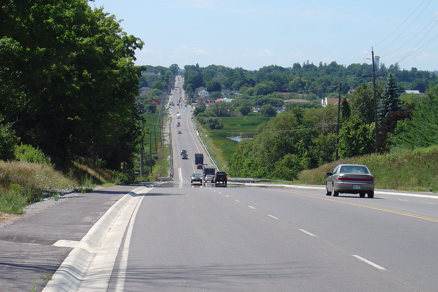
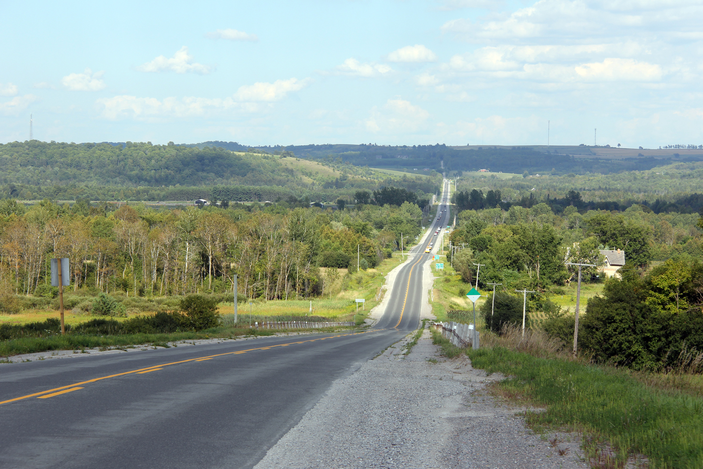
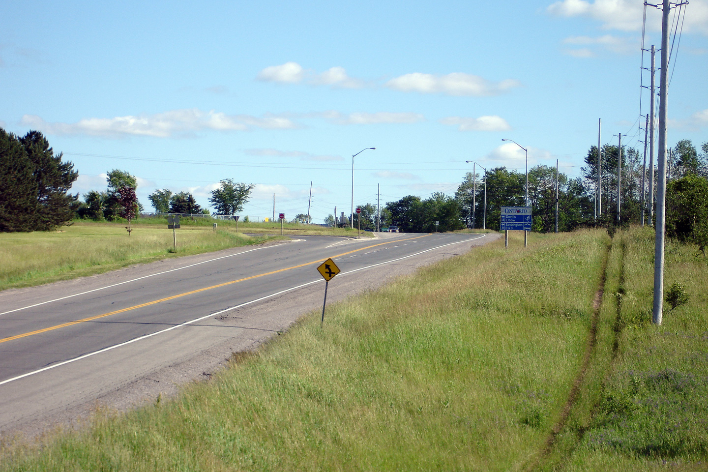
| City of Kawartha Lakes |
View looking southerly along the long hill that separates the Highway 7A
junctions. Photo taken: June 20th, 2006. |
 |
|
| City of Kawartha Lakes |
Southerly view approaching the southern Highway 35 junction. Photo taken: June 20th, 2006. |
 (720x480) (1440x960) |
|
| City of Kawartha Lakes |
Southbound junction assembly signage for the southern Highway 35 junction. Photo taken: June 20th, 2006. |
 |
|
| South of Highway 7A, Highway 35 joins Highway 115 before meeting Highway 401 at Newcastle. Click here for Highway 35-South images. | |||
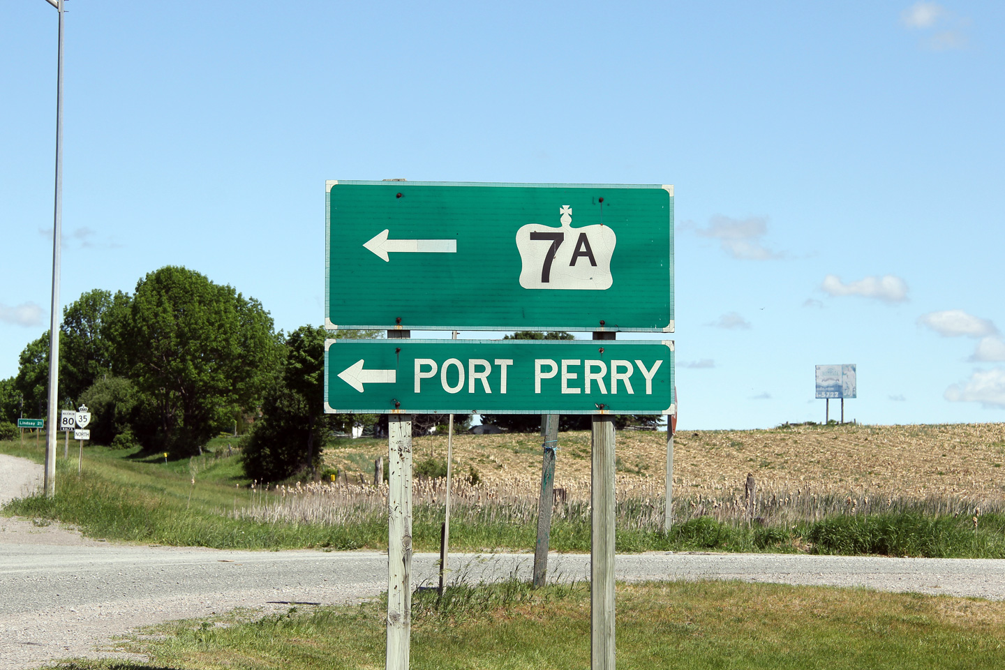
| City of Kawartha Lakes | Signage for the ramp that carries traffic bound
towards Port Perry and Lindsay. Photo taken: May 30th, 2012. |
 (720x480) (720x480)(1440x960) |
|
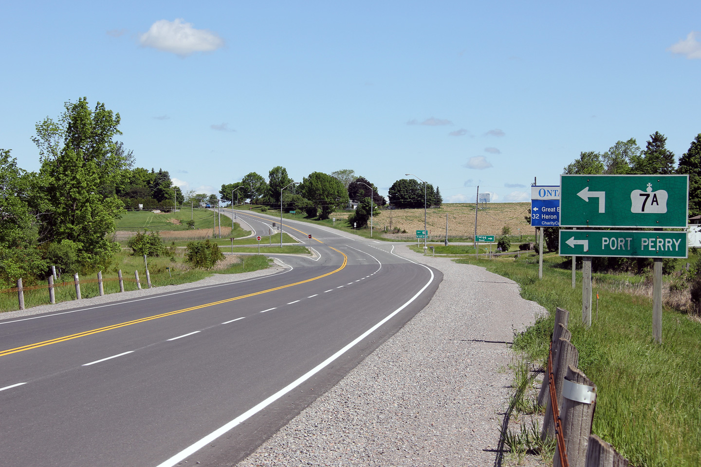
| City of Kawartha Lakes | This view looks easterly towards the southern
Highway 35 intersection. Photo taken: May 30th, 2012. |
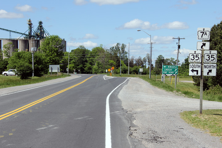 (720x480) (1440x960) (2400x1600) |
|
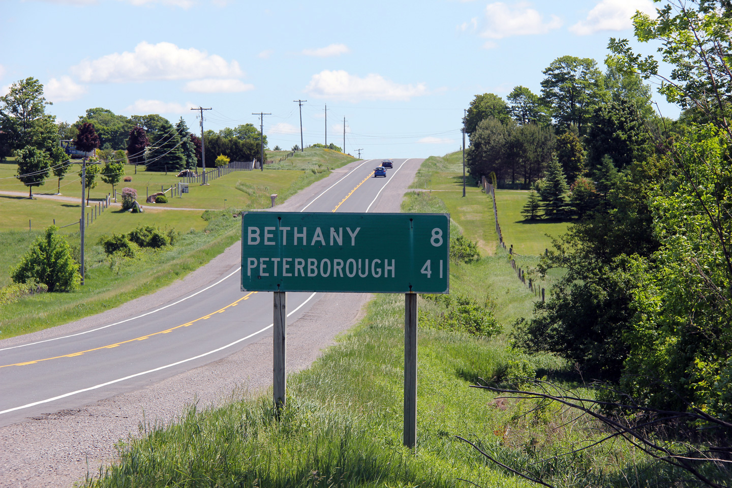
| City of Kawartha Lakes | Distance signage for Bethany and Peterborough
east of the southern Highway 35 junction. Photo taken: May 30th, 2012. |
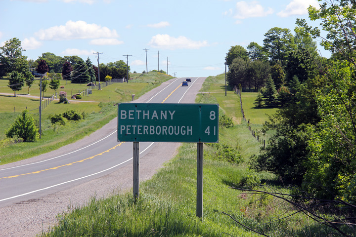 (720x480) (720x480)(1440x960) |
|
| City of Kawartha Lakes | View looking westerly towards the Southern
Highway 35 junction. Photo taken: September 2nd, 2005. |
 (720x480) (1440x960) |
|
| City of Kawartha Lakes | Looking easterly along Highway 7A at the Beers
Road intersection. Not surprisingly, the Beers Road sign seems to be
one of the more commonly stolen road signs in this part of Ontario.
Click here for this same view taken
in August 2004. Photo taken: September 2nd, 2005. |
 (720x480) (1440x960) |
|
| City of Kawartha Lakes | Evening view Highway 7A descends a long hill
east of the Beers Road curve. This photo looks to the east. Photo taken: June 14th, 2012. |
 |
|
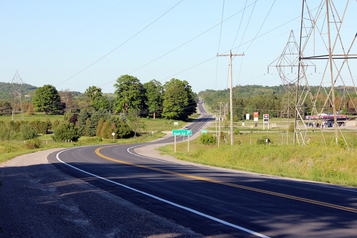
| City of Kawartha Lakes | Easterly view towards Bethany from just west of
the Porter Road (Road 32) intersection. Note the Road 32 signage in the
photo -- a major resigning contract took place along Highway 7A just before
Victoria County was amalgamated to become the City of Kawartha Lakes. When
the former county was renamed, crews simply applied green-out over the
'Victoria County' text on the signs. Photo taken: June 14th, 2012. |
 |
|
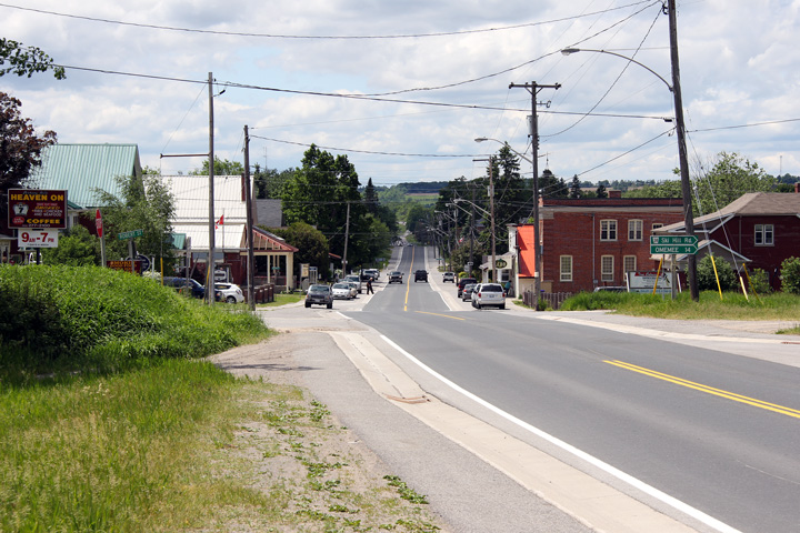
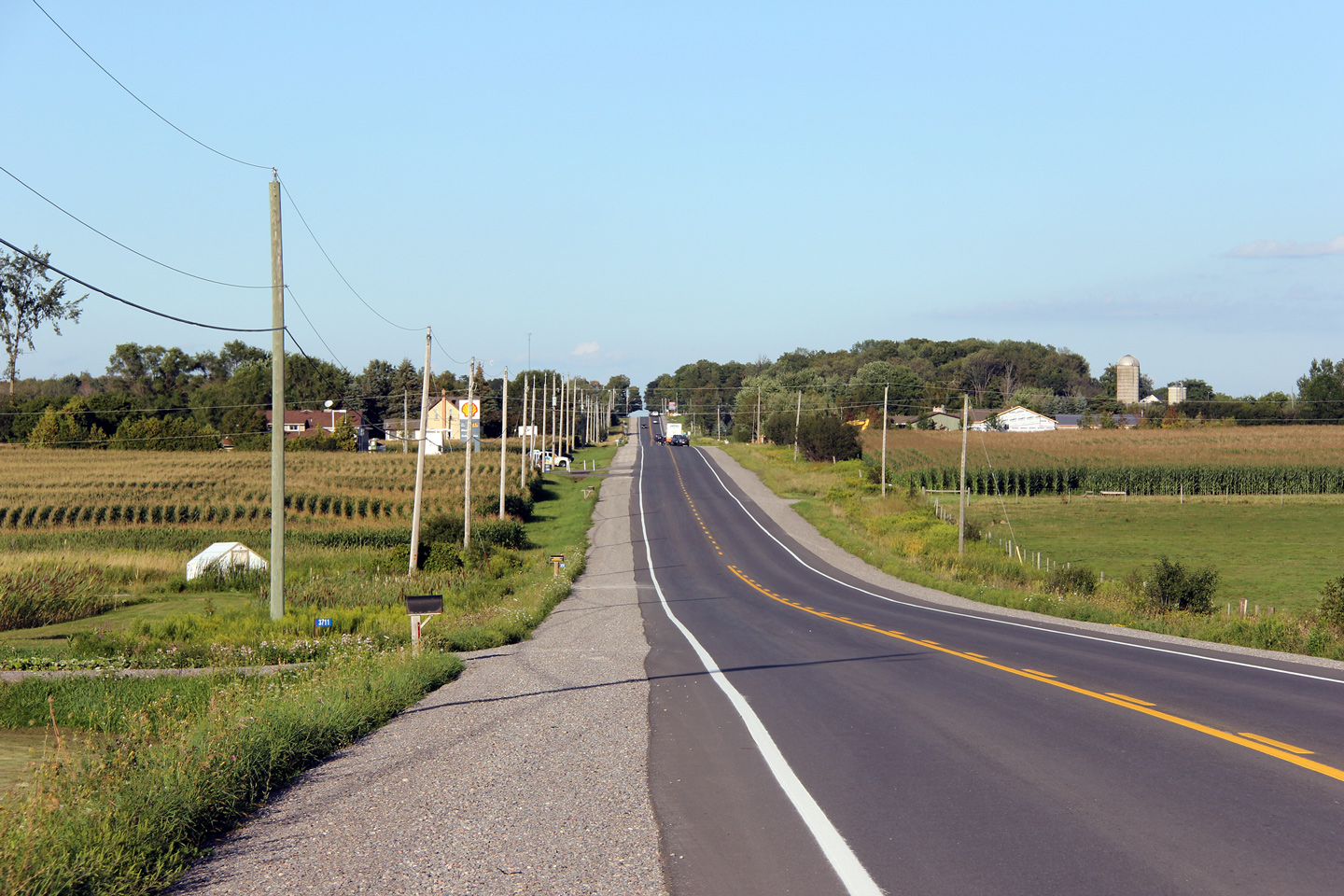
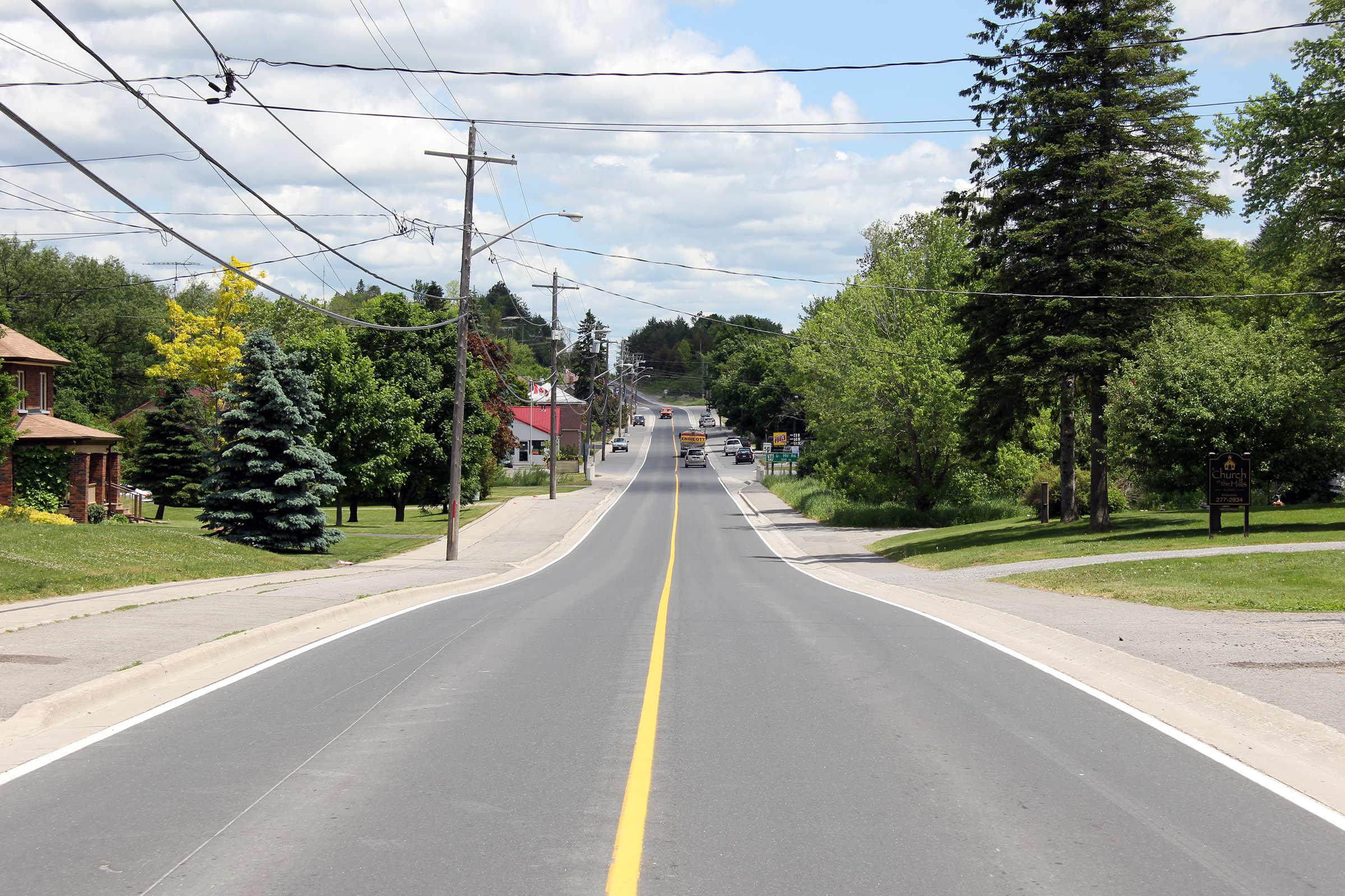
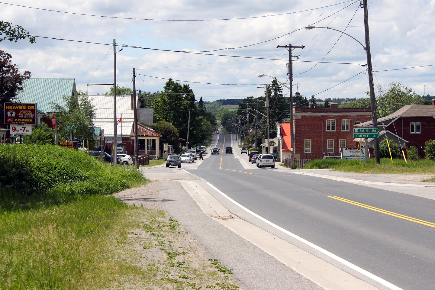
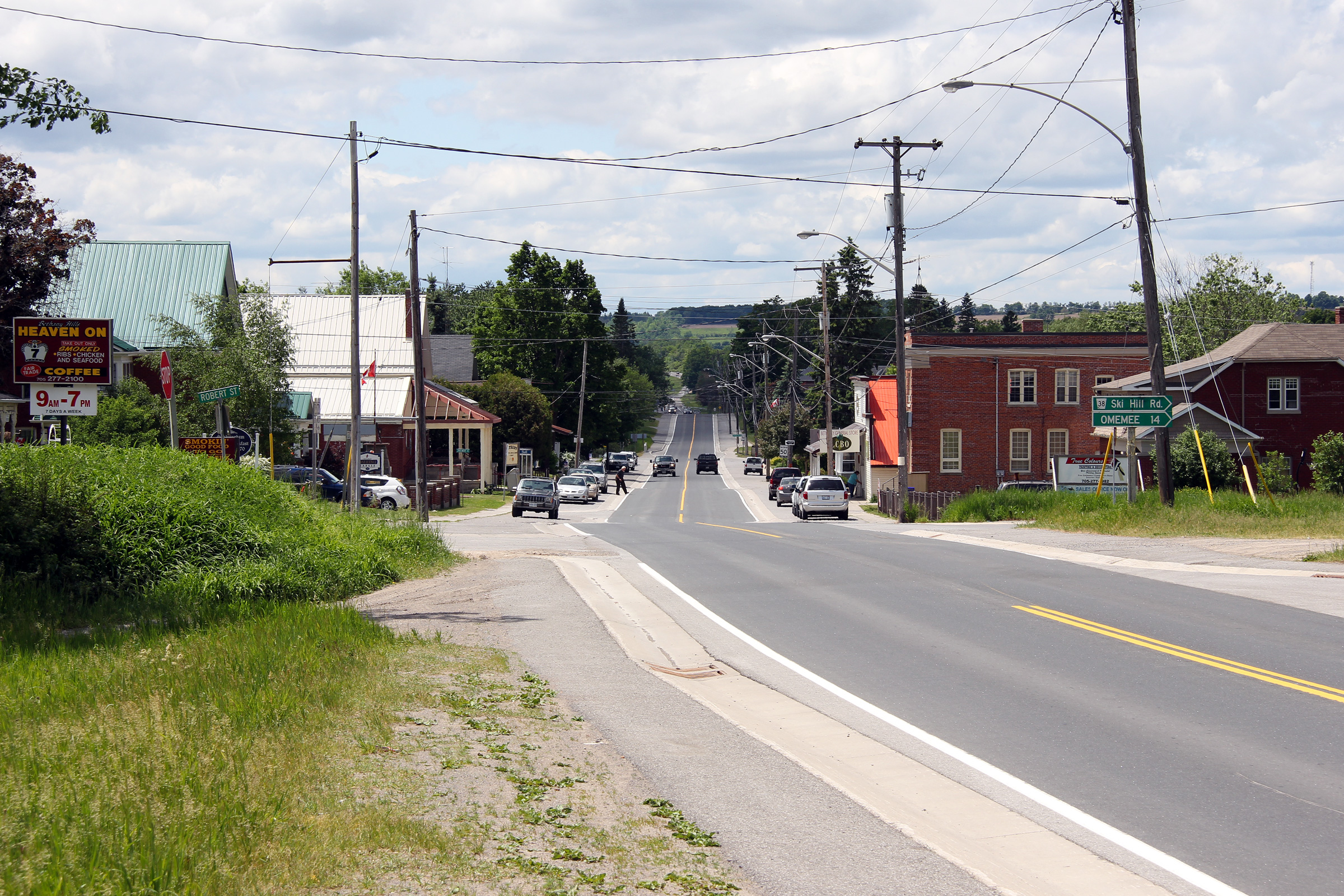
| City of Kawartha Lakes | Easterly view through the small community of
Bethany. Bethany is the largest community along Highway 7A east of the
Region of Durham. Photo taken: May 30th, 2012. |
 |
|
| City of Kawartha Lakes | Looking westerly along Highway 7A through the
small community of Bethany. The gravel trail that exists on both sides
of the highway at this location is the former alignment of the Midland
Railway. This railway ran from Port Hope to Lindsay and beyond before
the tracks were lifted in 1927. Photo taken: May 30th, 2012. |
 |
|
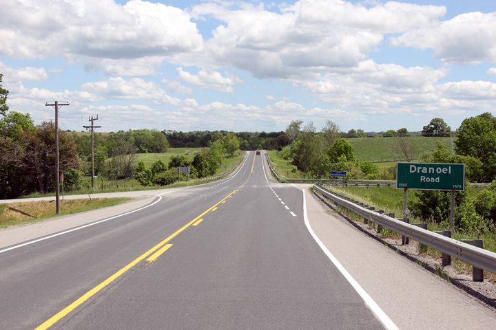
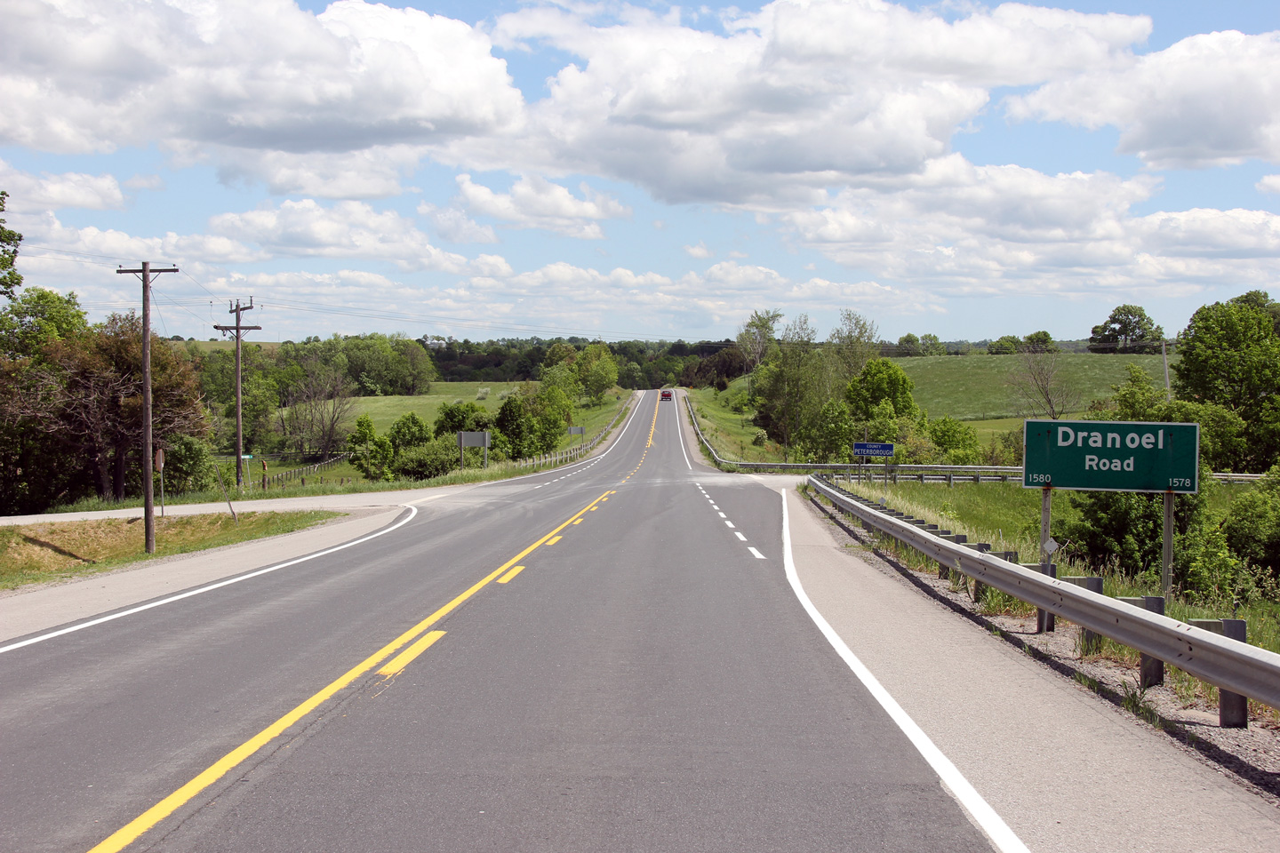
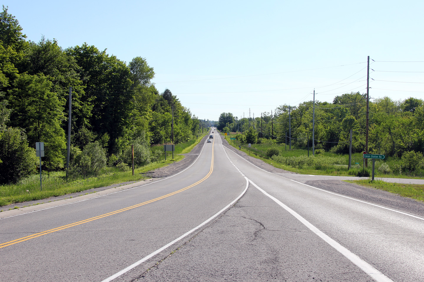
| City of Kawartha Lakes | Easterly view through the Dranoel Road
intersection east of Bethany. Dranoel Road follows the boundary
between the City of Kawartha Lakes and the County of Peterborough. Photo taken: May 30th, 2012. |
 |
|
| Township of Cavan-Millbrook-North
Monaghan County of Peterborough |
Reverse view through the Dranoel Road
intersection. Photo taken: May 30th, 2012. |
 |
|
| Township of Cavan-Millbrook-North
Monaghan County of Peterborough |
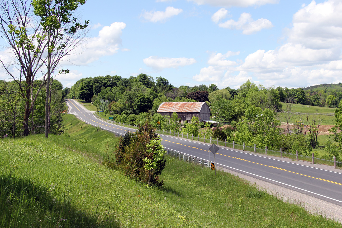
Easterly view across Cavan Creek east of
Bethany. The Cavan Creek bridge was constructed in the 1960s and was
rehabilitated during the 2012 and 2013 construction seasons. Photo taken: May 30th, 2012. |
 |
|
| Township of Cavan-Millbrook-North
Monaghan County of Peterborough |
Westerly view towards as Highway 7A descends
into the Cavan Creek valley. Photo taken: May 30th, 2012. |
 |
|
| Township of Cavan-Millbrook-North
Monaghan County of Peterborough |
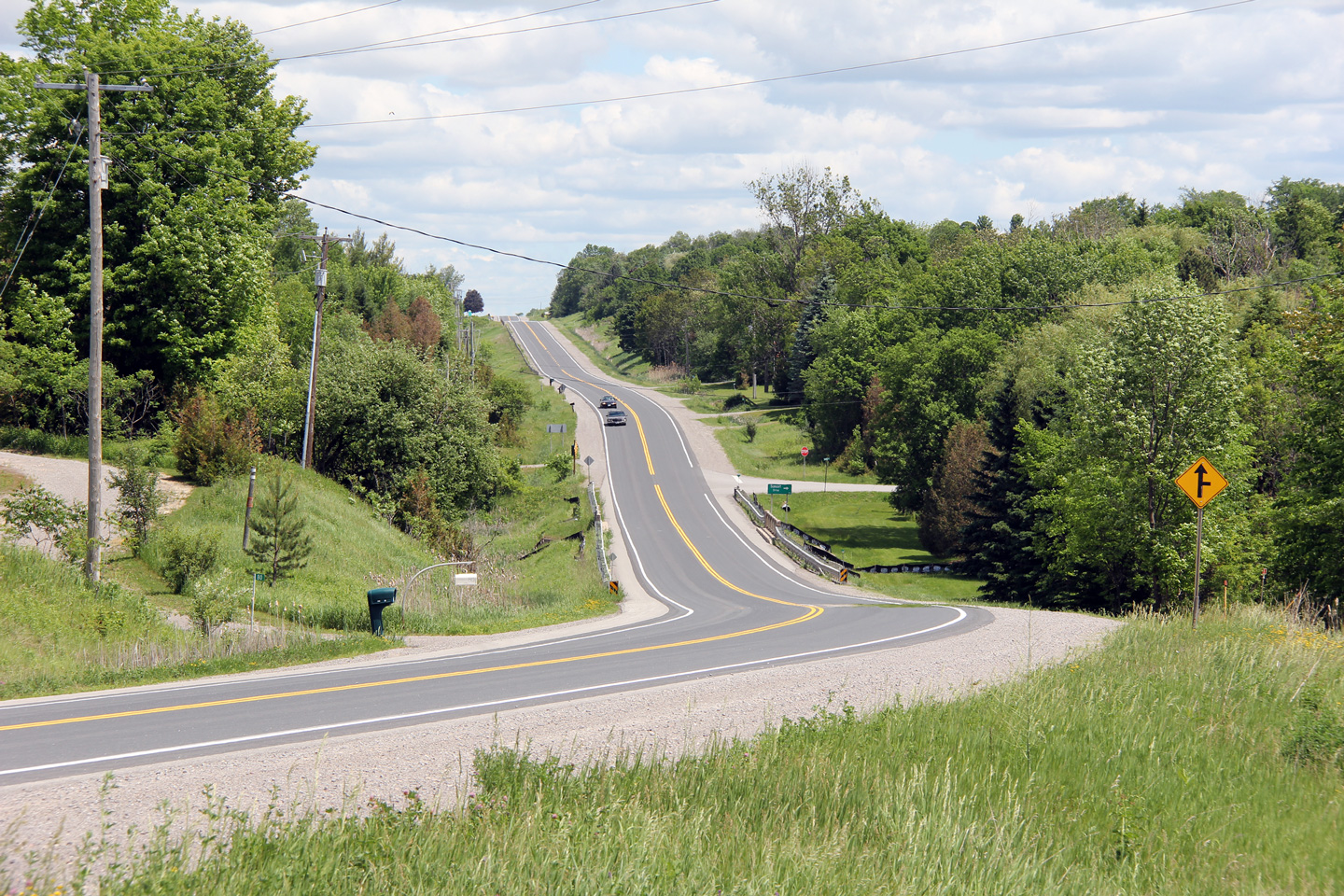
Easterly view between Cavan Creek and the Tapley
1/4 Line intersection. Highway 7A passes through a pleasant mix of
agricultural and forested land where the highway runs through the City of
Kawartha Lakes and Peterborough County. Photo taken: May 30th, 2012. |
 |
|
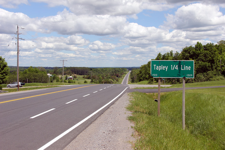
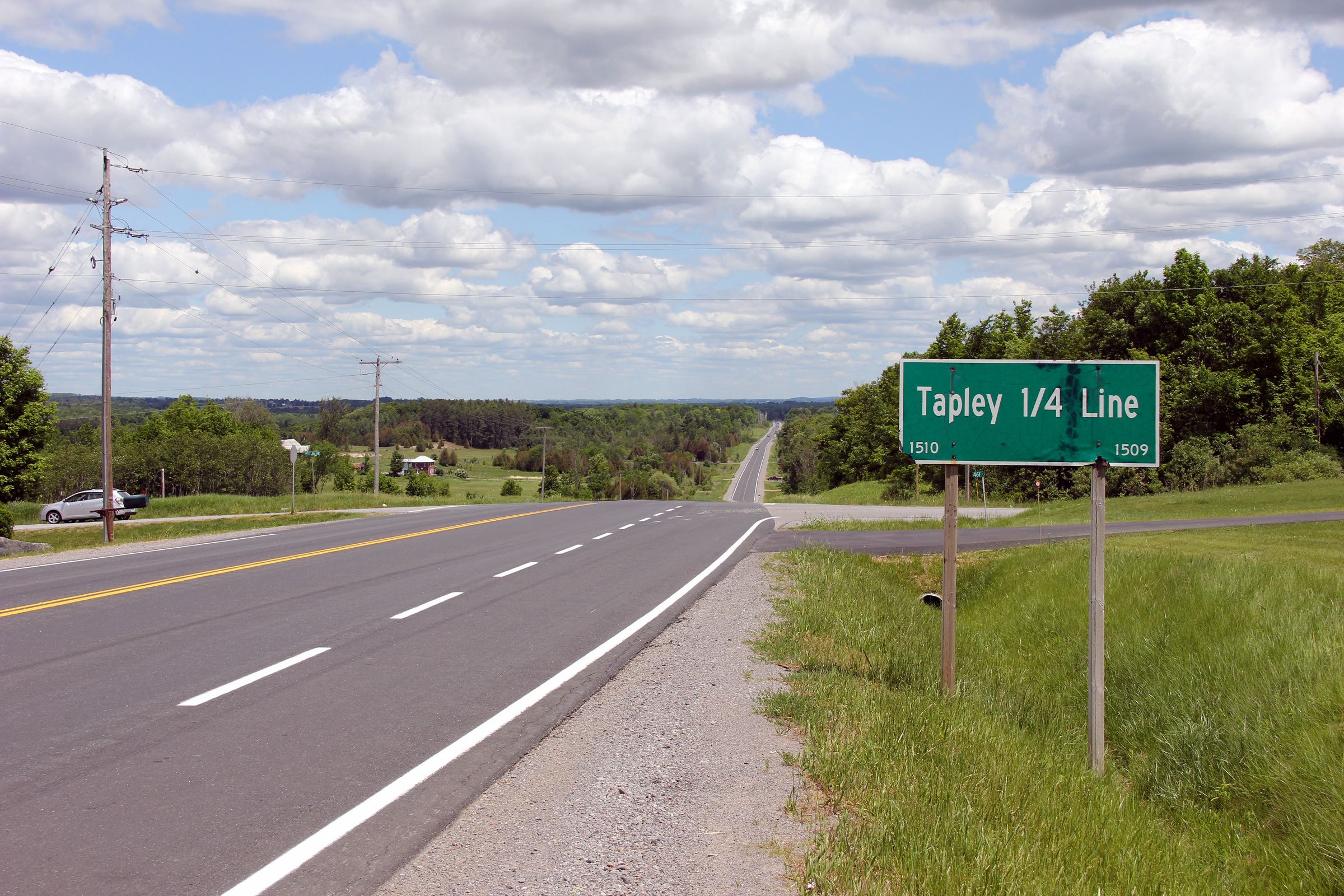
| Township of Cavan-Millbrook-North
Monaghan County of Peterborough |
A series of two views looking easterly in
the vicinity of the Tapley 1/4 Line intersection. Photos taken: May 30th, 2012. |
 (720x480) (1440x960) (2400x1600) |
|
| Township of Cavan-Millbrook-North
Monaghan County of Peterborough |
View looking easterly along Highway 7A as the
highway passes through the small community of Cavan. Photo taken: September 2nd, 2005. |
 (720x480) (1440x960) |
|
| Township of Cavan-Millbrook-North
Monaghan County of Peterborough |
Looking west through Cavan at the Peterborough
Road 10 intersection. Highway 7A meets Peterborough Road 10 at 4-way
stop sign. This is one of only two 4-way stops on mainline provincial
highways in Ontario. Photo taken: September 2nd, 2005. |
 (720x480) (1440x960) |
|
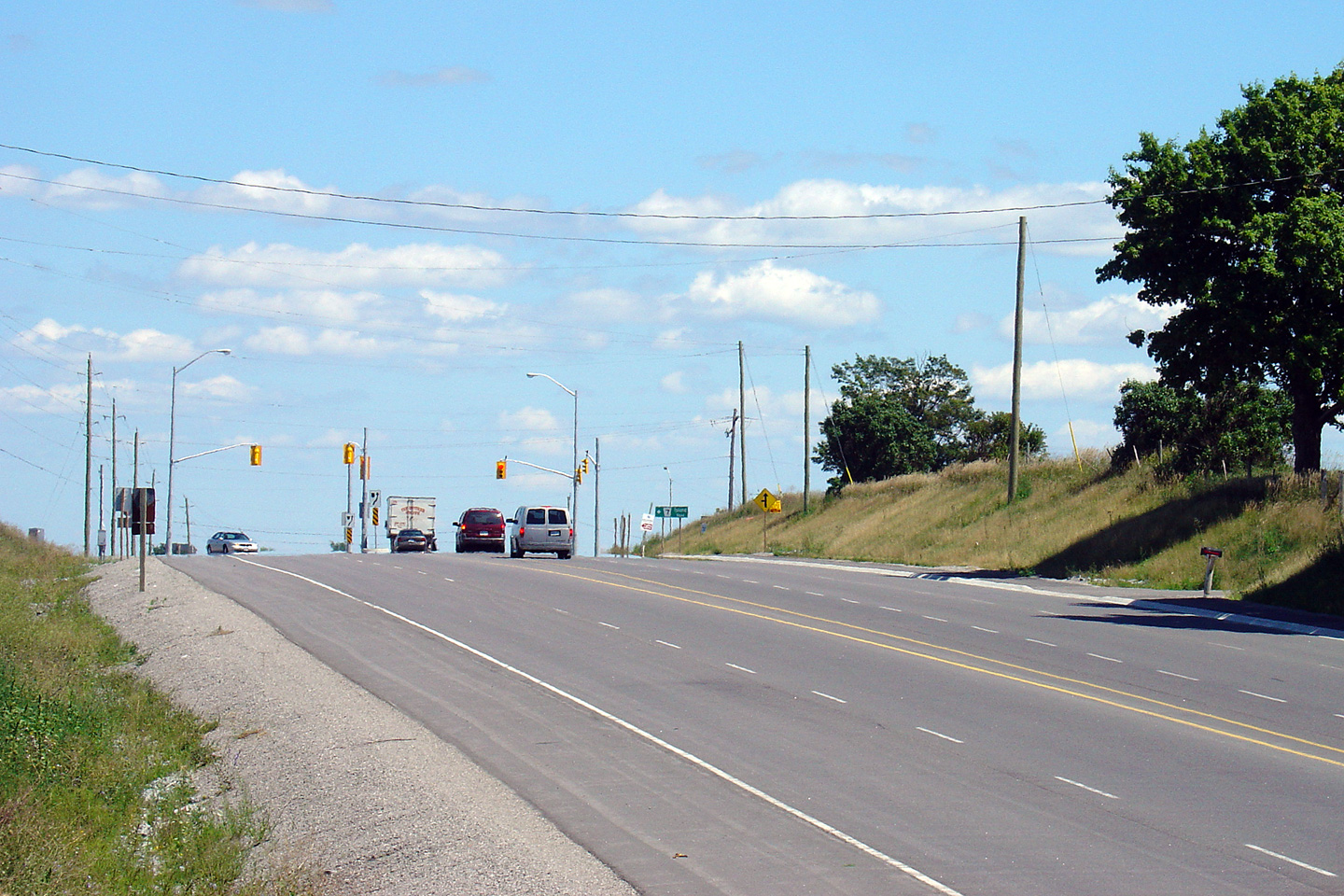
| Township of Cavan-Millbrook-North
Monaghan County of Peterborough |
Westerly view along Highway 7A from just west of
the Highway 115 interchange. Photo taken: June 14th, 2012. |
 |
|
| Township of Cavan-Millbrook-North
Monaghan County of Peterborough |
View looking easterly towards the Highway 115
interchange. Photo taken: June 14th, 2012. |
 |
|
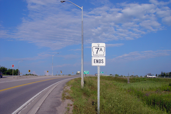
| Township of Cavan-Millbrook-North
Monaghan County of Peterborough |
Stand alone Highway 7A ends sign approaching the
Highway 115 interchange. This is the first of two signs denoting the
eastern terminus of Highway 7A. Photo taken: August 15th, 2004. |
 (720x480) (720x480)(1440x960) |
|
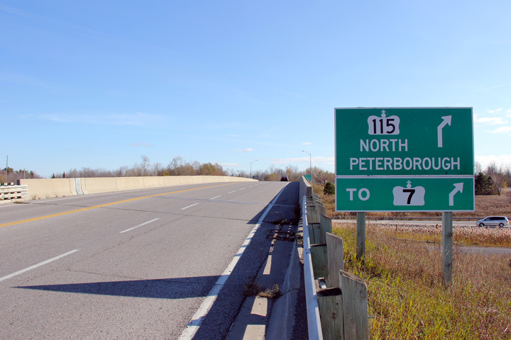
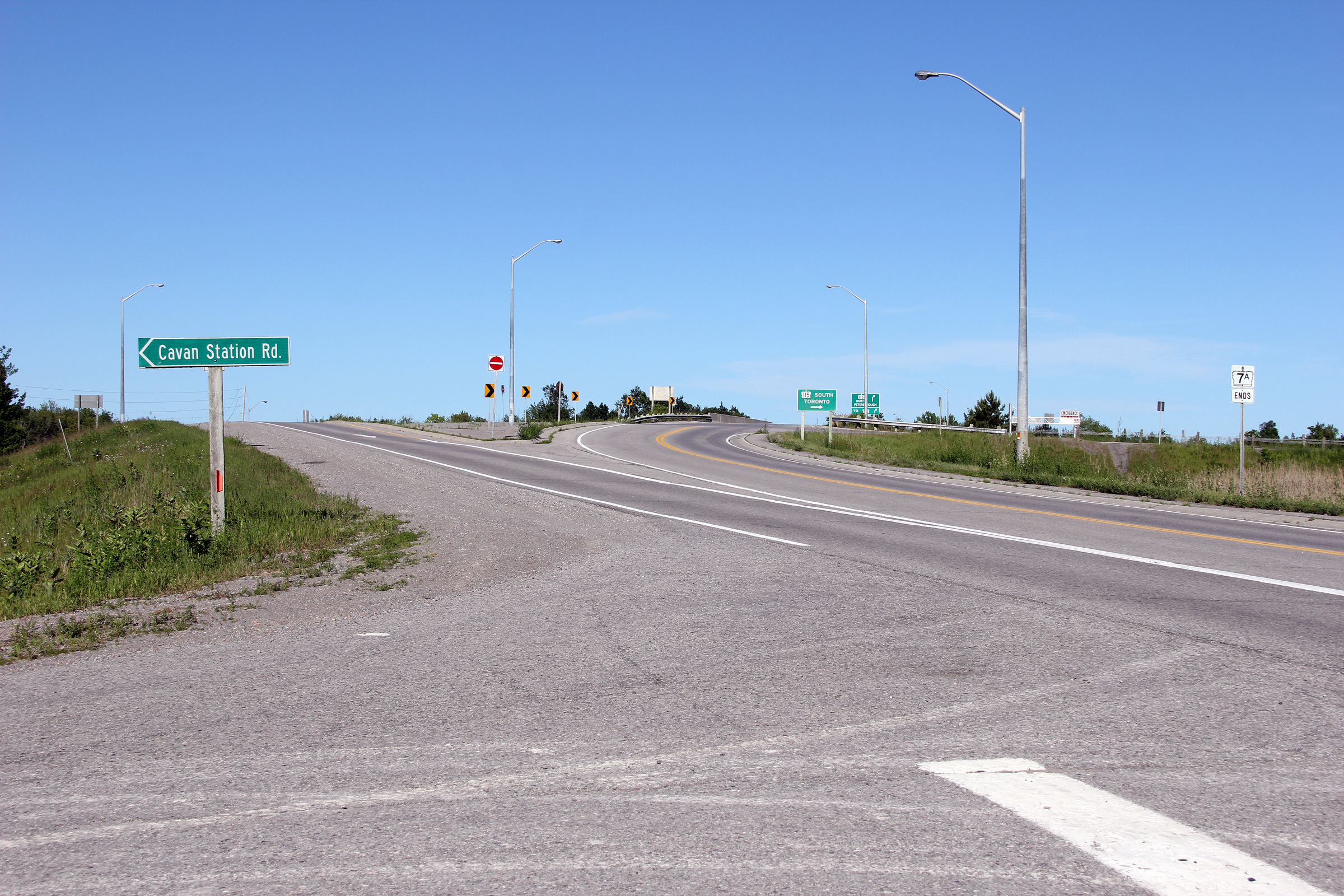
| Township of Cavan-Millbrook-North
Monaghan County of Peterborough |
Advanced signage for the ramp to Highway 115
North. The signage directing traffic to Highway 7 was added during the
Autumn of 2011. Photo taken: November 5th, 2011. |
 (720x480) (720x480)(1440x960) |
|
| Highway 115 runs between Newcastle and Peterborough. Click here for Highway 115 images. | |||
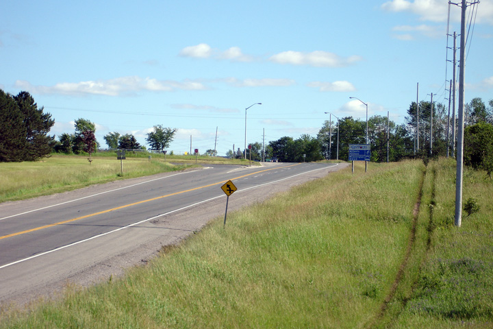
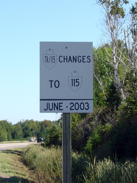
| Township of Cavan-Millbrook-North
Monaghan County of Peterborough |
White sign denoting the numbering change along
Highway 115 from Highway 7A/115. Highway 7A was truncated at the 115
interchange just east of Cavan when Highway 7 was rerouted along part of
Highway 7A's alignment between Highway 28 and Scott's Corners in 2003.
This means that Highway 7A's eastern terminus is no longer at Highway 7. Photo taken: September 2nd, 2005. |
 |
|
<- Highway 7 Images Back to Highway 7A Highway 7B (Lindsay) Images ->
Copyright (c) 2004-2013, Scott Steeves (Webmaster) AsphaltPlanet@asphaltplanet.ca
