AsphaltPlanet.ca >
OntHighways > Highway 7 >
Images > Page 2D
King's Highway 7 - Images
<- Page 2C Page 2D - Pickering to Sunderland Page 3A->
Photos shown in this table are arranged from West to East:
| Proper Municipality Name | Photo Description | Photo | |||
|
Photos taken from driver's perspective appear offset from centre-line Photos: |
East- Bound |
West- Bound |
|||
| Vaughan to Pickering Images available here | |||||
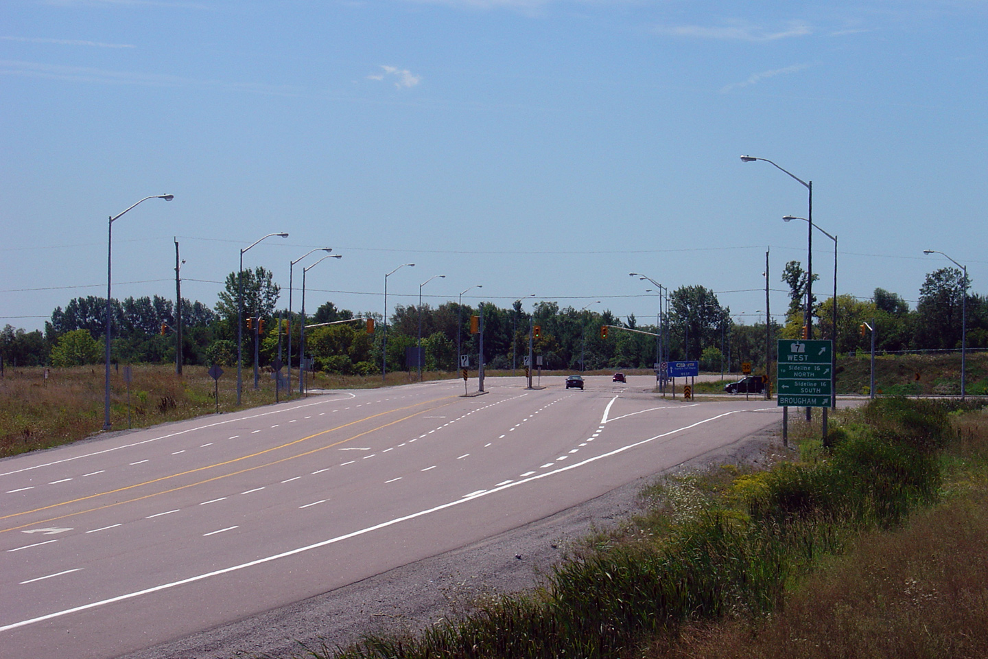
| Highway 407 begins its 108km journey across the top of the GTA at this junction. Click here for Highway 407 images. | |||||
| City of Pickering Regional Municipality of Durham |
Blue signage denoting the eastern start of Highway 407 from the Highway 7 intersection at Pickering Sideroad 16. Photo taken: August 21st, 2006. |
 |
|||
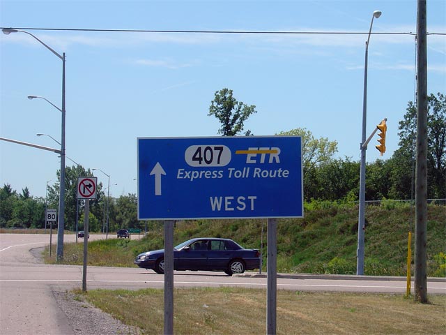
| City of Pickering Regional Municipality of Durham |
Signage directing traffic bound for Highway 7 to
take the ramp to the right at the upcoming intersection. Photo taken: August 21st, 2006. |
 |
|||
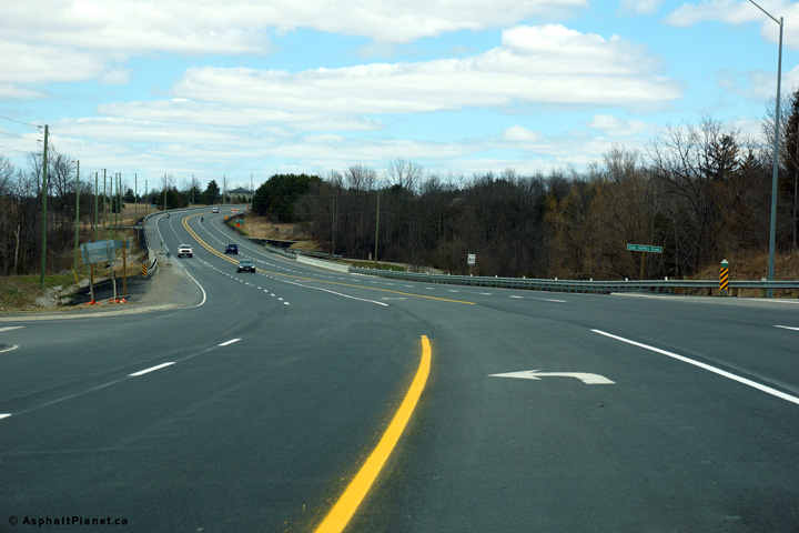
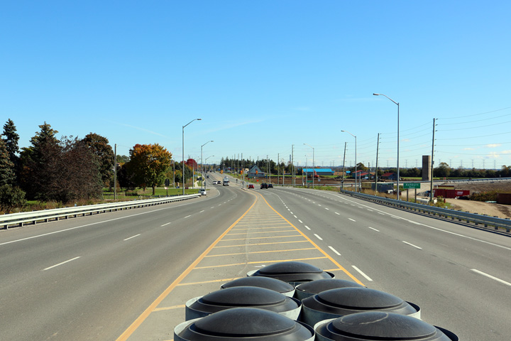
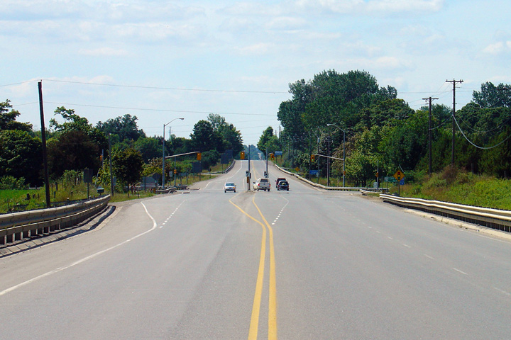
| City of Pickering Regional Municipality of Durham |
Looking westerly along Highway 7 towards the Highway 407
at-grade intersection. When Highway 407
opened to traffic in 2001, Highway 7 was realigned so that through traffic
bound for Markham would be directed directly onto Highway 407. Since
this photo was taken, Highway 7 no longer narrows to two lanes (one per
direction) east of this intersection. Photo taken: August 21st, 2006. |
|
|||
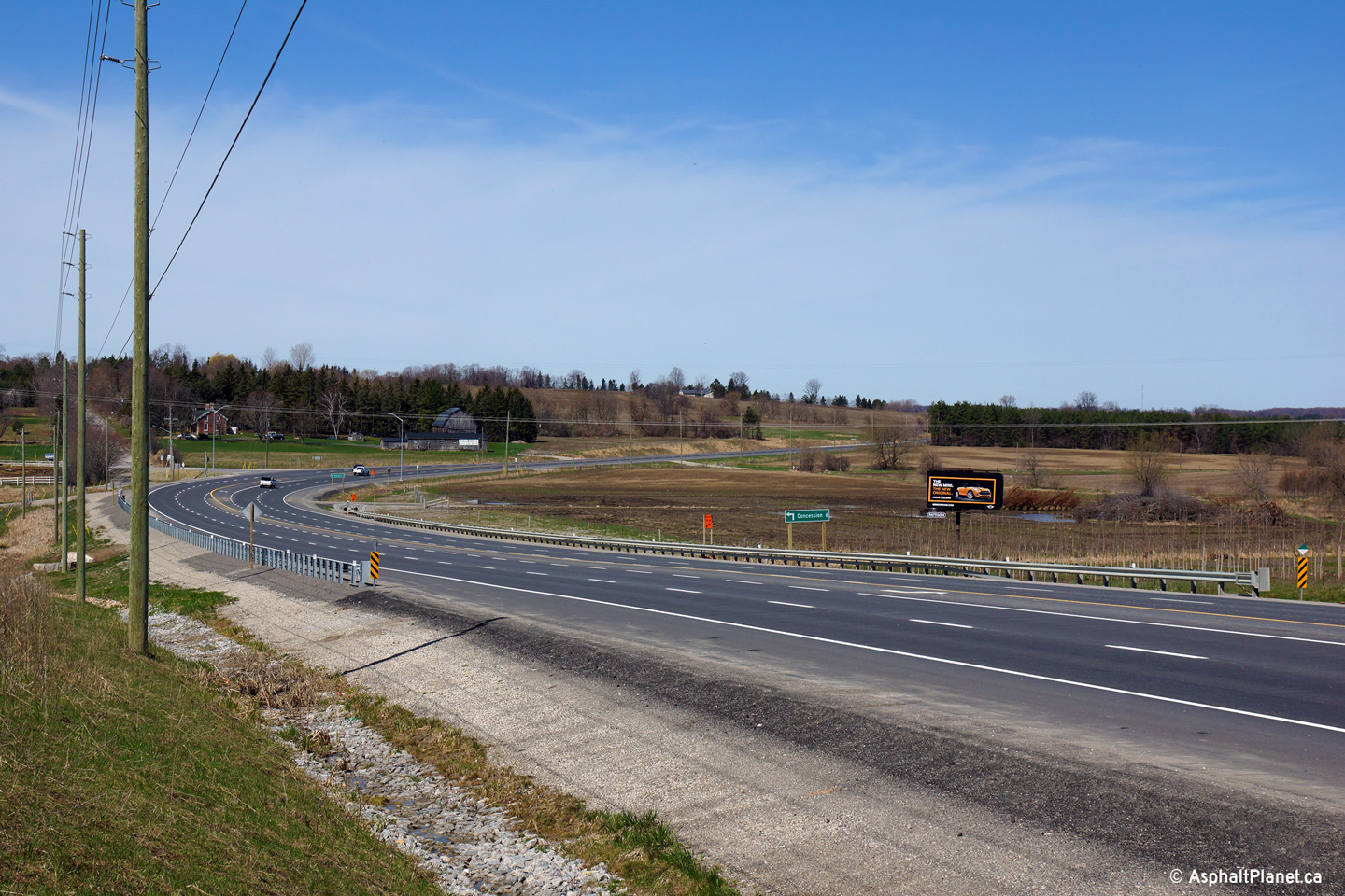
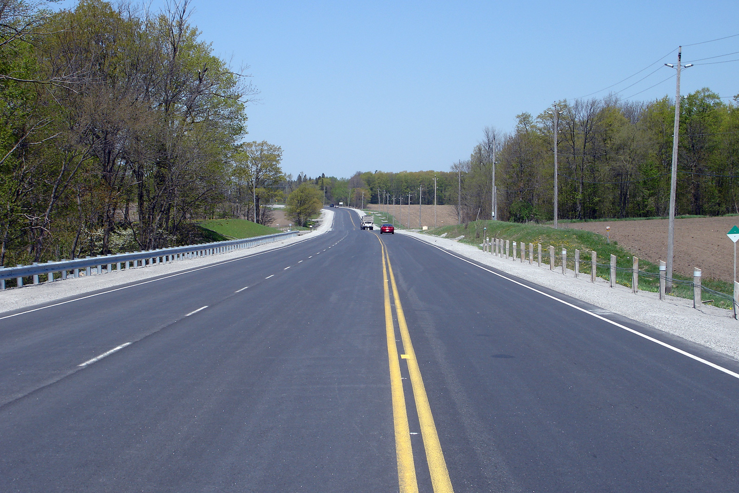
| City of Pickering Regional Municipality of Durham |
This view looks easterly from just east
of the Sideline 14 intersection. Photo taken: April 27th, 2014. |
 (720x480) (1440x960) (2400x1600) |
|||
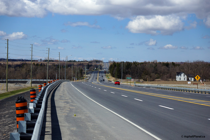
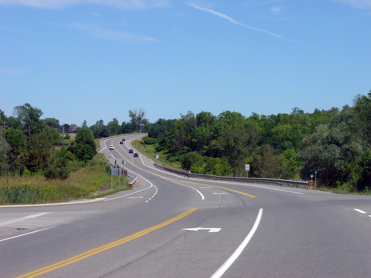
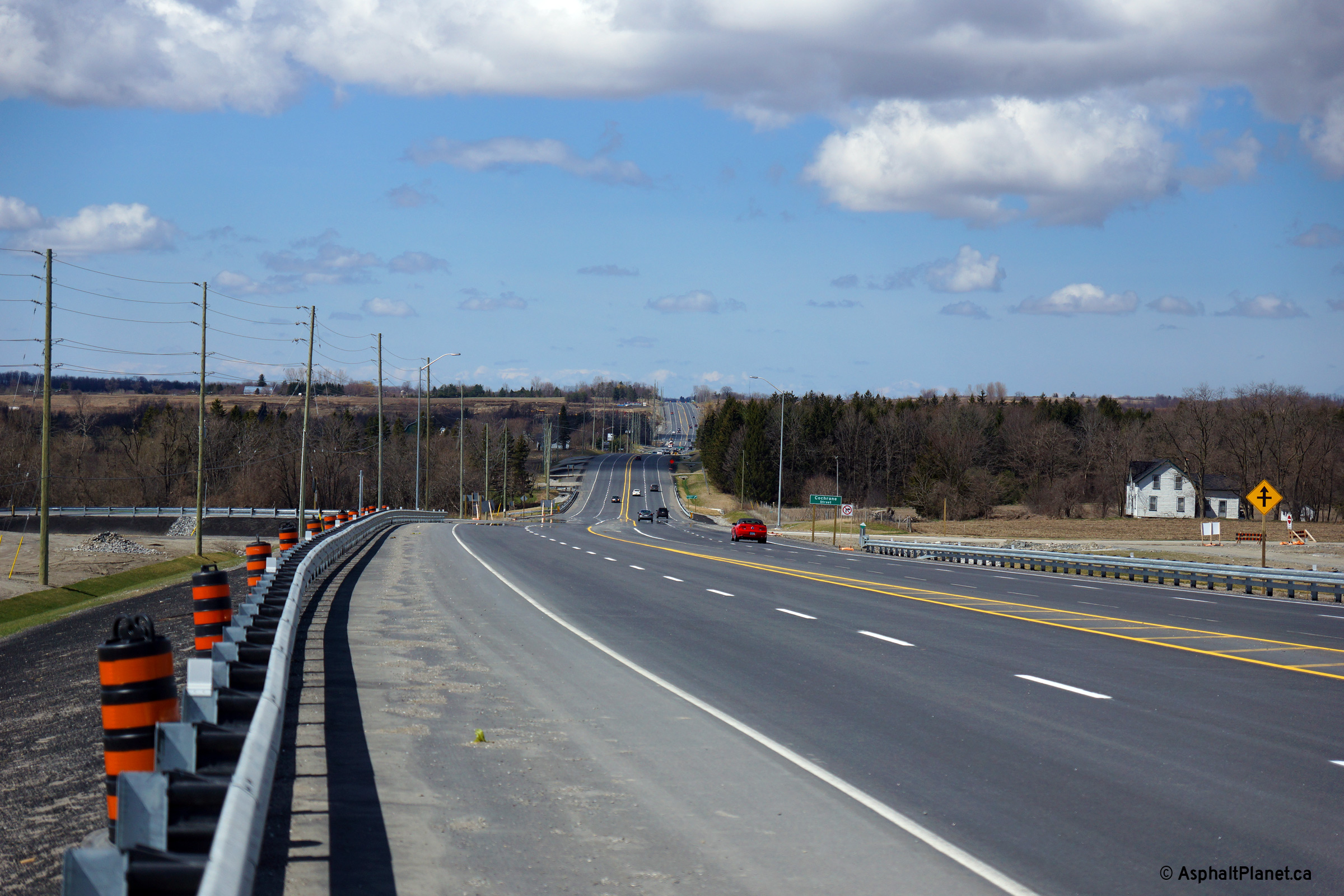
| City of Pickering Regional Municipality of Durham |
Three views looking looking easterly from
the Paddock Road intersection. The upper photo shows Highway 7 before
construction started to widen the highway to four lanes. The middle
photo shows the advanced structure that was completed at Duffins Creek.
A new two lane structure was completed to the north of the existing
alignment several years before construction started to widen the remainder
of the highway. The bridge deck of the new structure is considerably
higher than that of the old structure. The final photo was taken only
several moths after construction was completed to four lane the highway
through southern Durham Region. Upper photo taken: August 21st, 2006. Middle photo taken: June 18th, 2010. Lower photo taken: April 27th, 2014. |
 (720x480) (1440x960) (2400x1600) |
|||
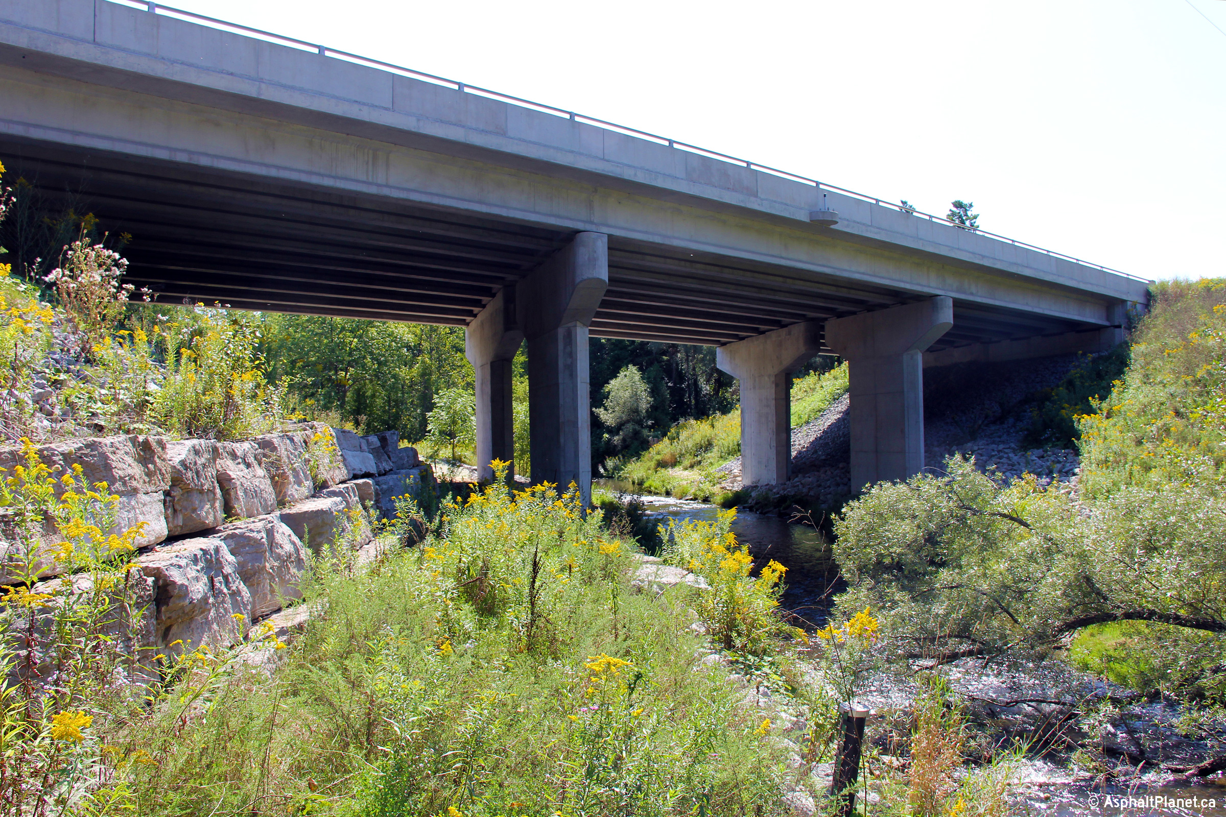
| City of Pickering Regional Municipality of Durham |
View looking southerly at the Duffins
Creek bridge. The Duffins Creek Bridge was built in two phases between
2009 and 2012. Photo taken: September 6th, 2013. |
||||
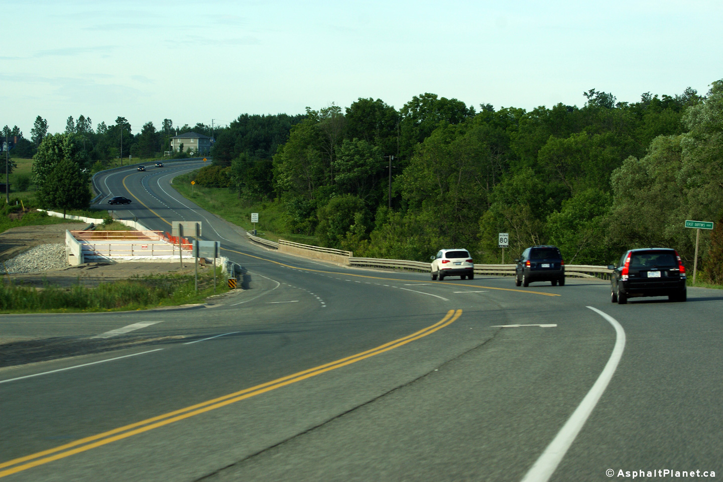
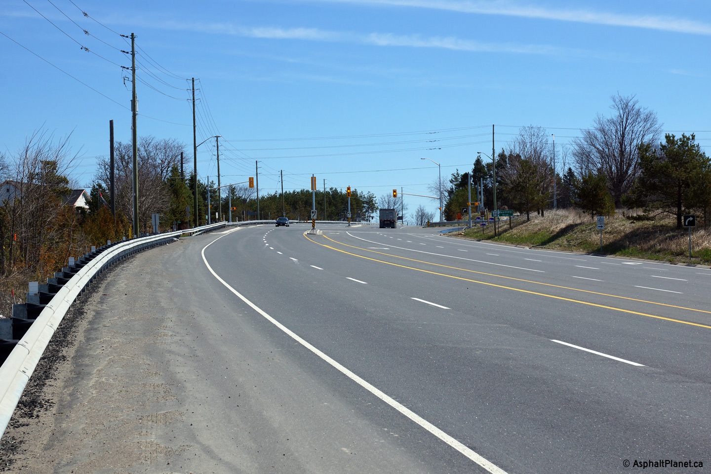
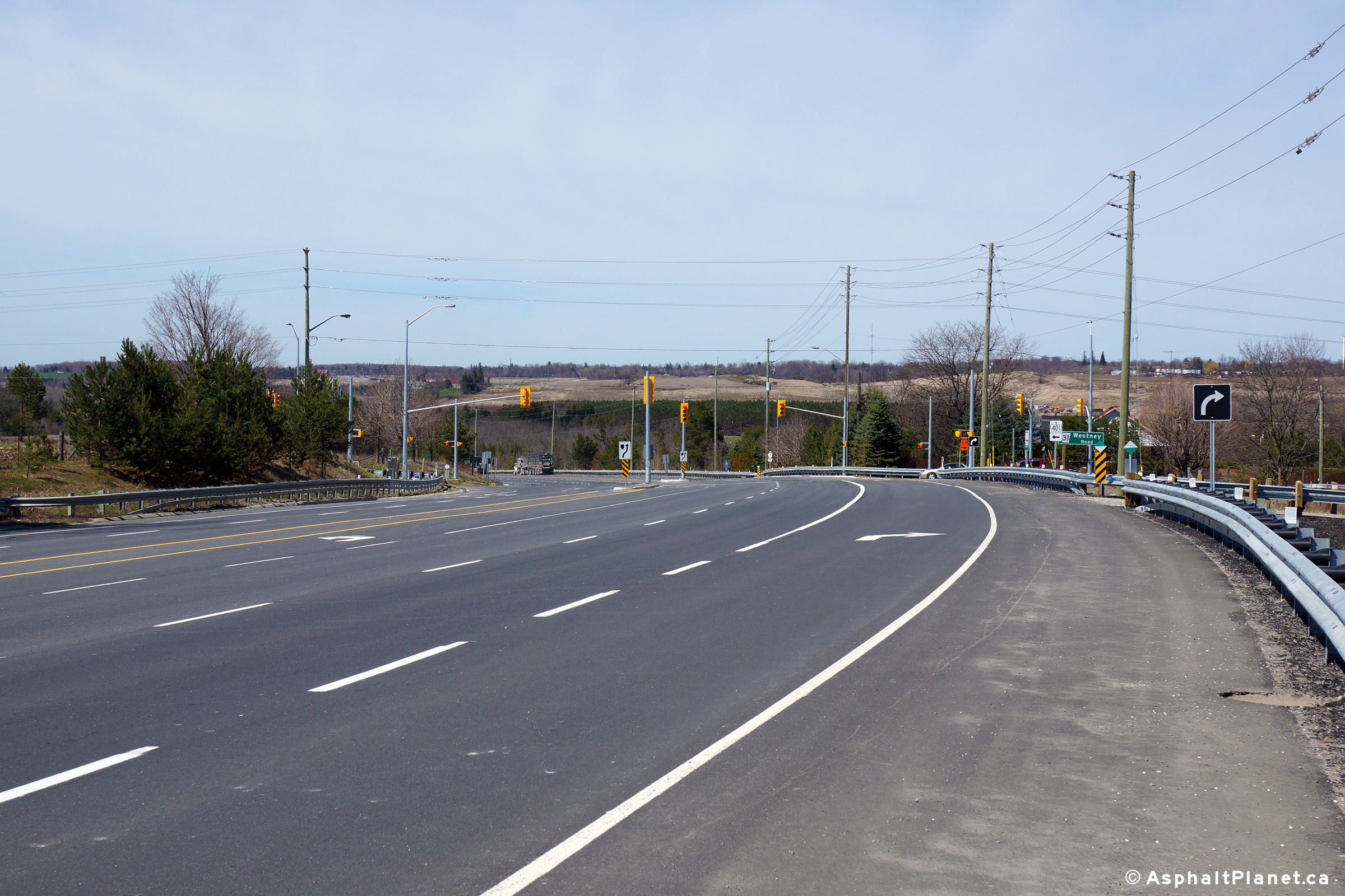
| City of Pickering Regional Municipality of Durham |
View looking easterly towards the Westney Road
intersection along Highway 7. Westney Road is the first signalized
intersection east of Highway 407. Upper photo taken: August 15th, 2005. Lower photo taken: May 5th, 2014. |
 (720x480) (1440x960) (2400x1600) |
|||
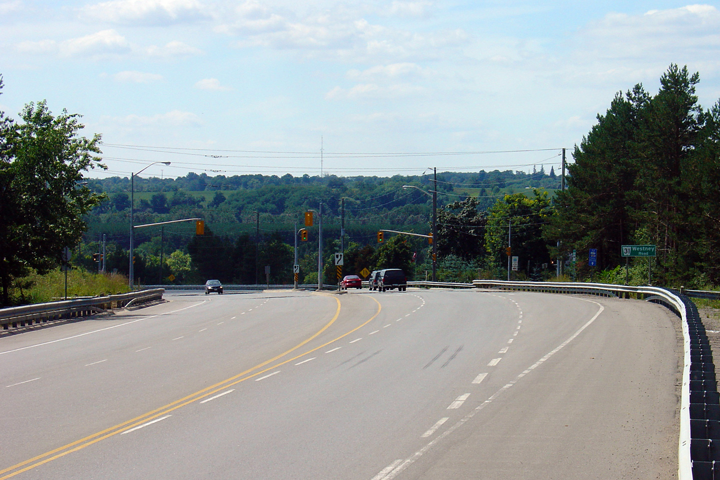
| City of Pickering Regional Municipality of Durham |
Looking west towards the Westney Road
intersection along Highway 7. Westney Road meets Highway 7 midway
around the Greenwood Bypass. Upper photo taken: August 15th, 2005. Lower photo taken: May 5th, 2014. |
 (720x480) (1440x960) (2400x1600) |
|||
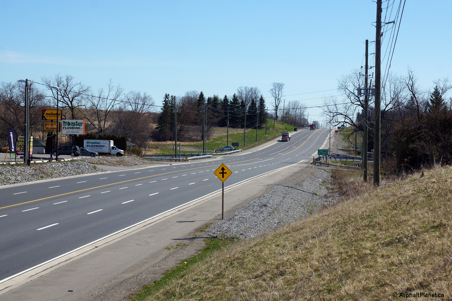
| City of Pickering Regional Municipality of Durham |
View looking west from the Salem Road
intersection towards the village (and by-pass) of Greenwood. The
Greenwood By-pass was completed in 1960, to by-pass both the village of
Greenwood, and two steep grades leading both in and out of the village. Upper photo taken: August 21st, 2006. Lower photo taken: May 5th, 2014. |
 (720x480) (1440x960) (2400x1600) |
|||
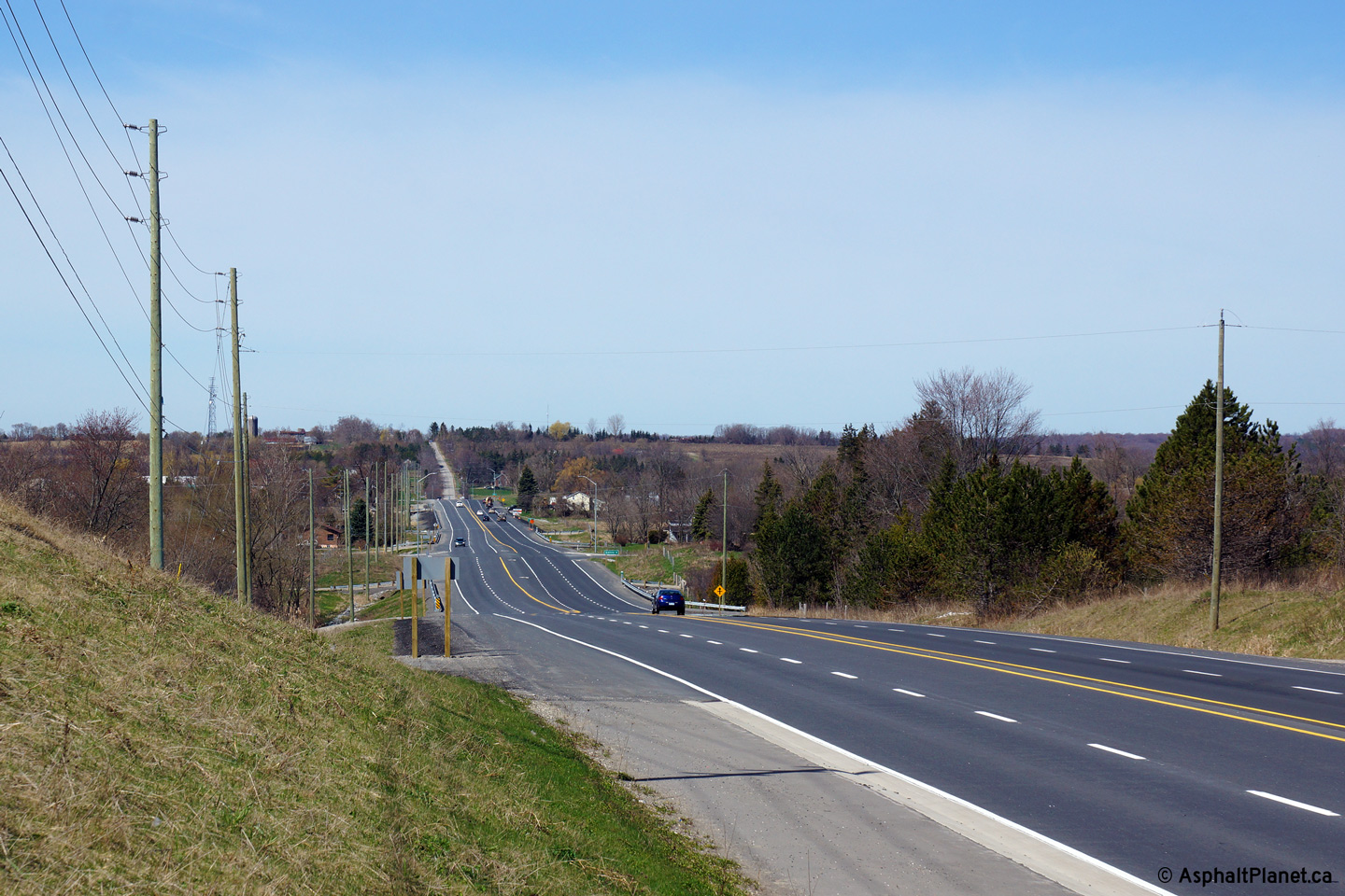
| City of Pickering Regional Municipality of Durham |
Westerly view from just west of Kinsale towards
the Sideline 4 intersection. Photo taken: May 5th, 2014. |
 (720x480) (1440x960) (2400x1600) |
|||
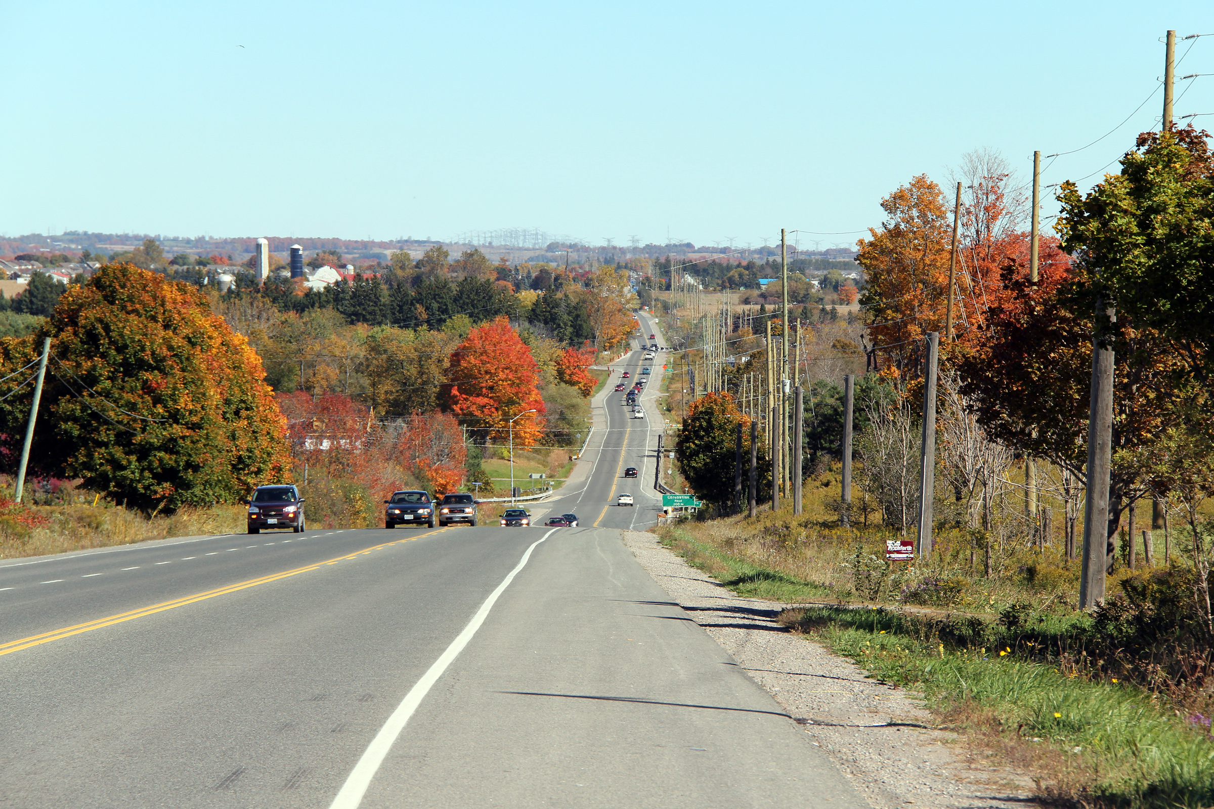
| City of Pickering Regional Municipality of Durham |
View looking easterly through Kinsale.
The profile of Highway 7 was raised considerably through Kinsale when
Highway 7 was widened to four lanes. Upper photo taken: August 21st, 2006. Lower photo taken: May 5th, 2014. |
 (720x480) (1440x960) (2400x1600) |
|||
| City of Pickering Regional Municipality of Durham |
View looking westerly through the small
community of Kinsale. Photo taken: May 5th, 2014. |
 (720x480) (1440x960) (2400x1600) |
|||
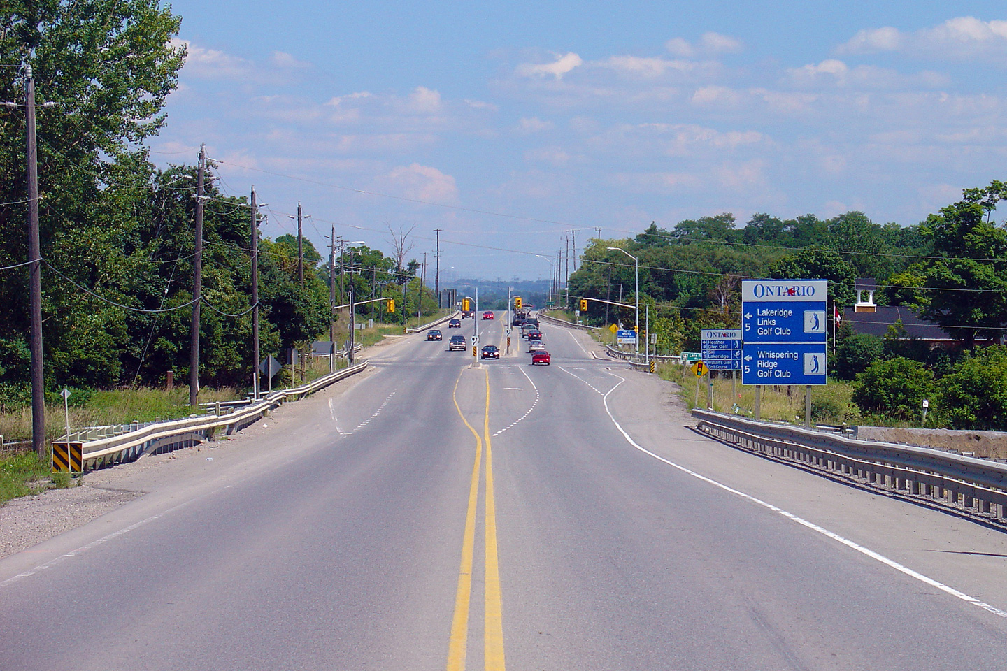
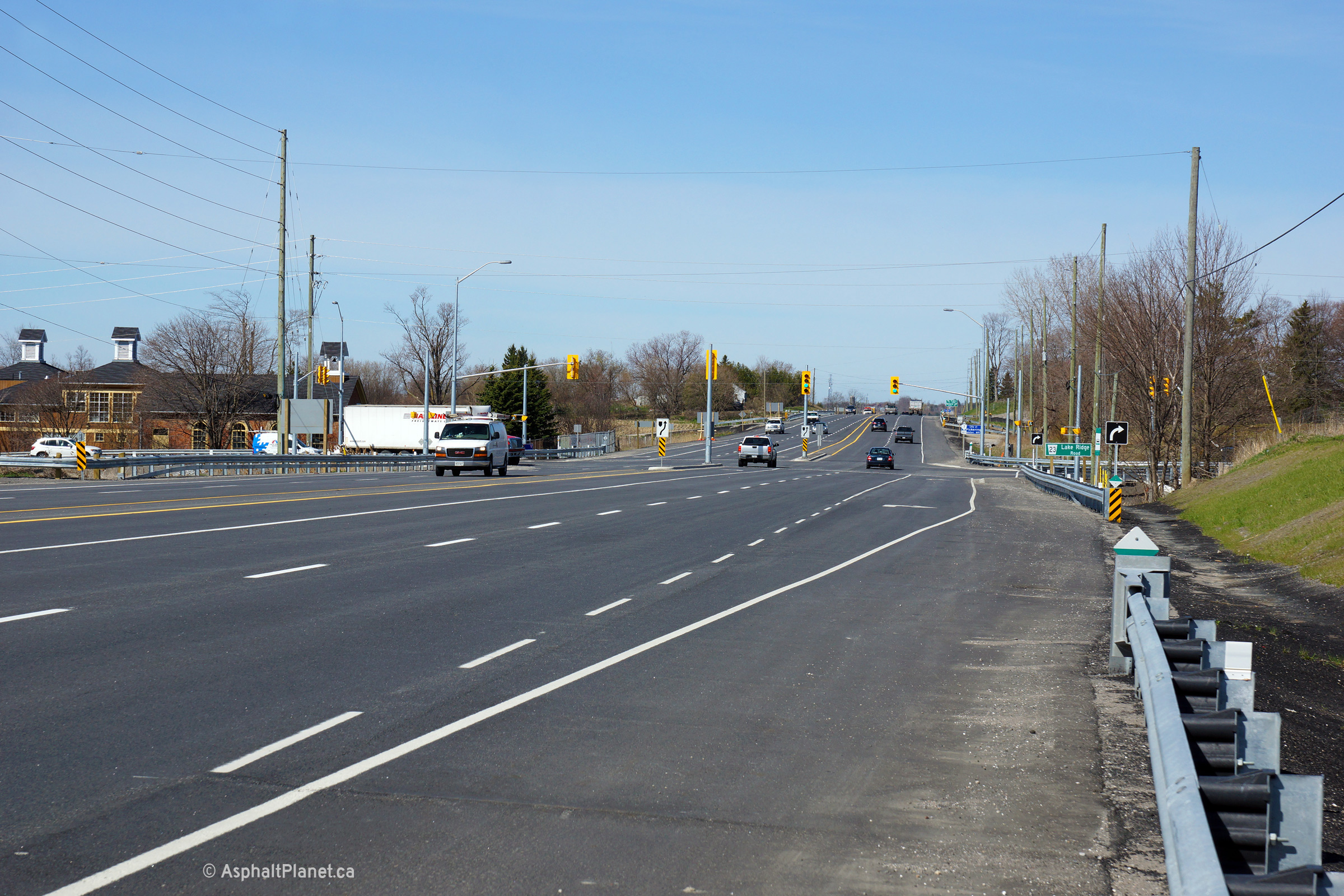
| City of Pickering Regional Municipality of Durham |
Looking east at the Lake Ridge Road signalized
intersection. The Pickering-Whitby Boundary follows Lake Ridge Road. Upper photo taken: August 15th, 2005. Lower photo taken: May 5th, 2014. |
 (720x480) (1440x960) (2400x1600) |
|||
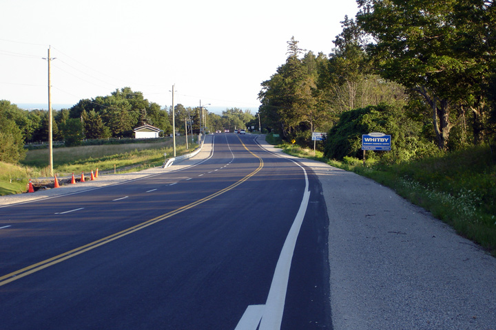
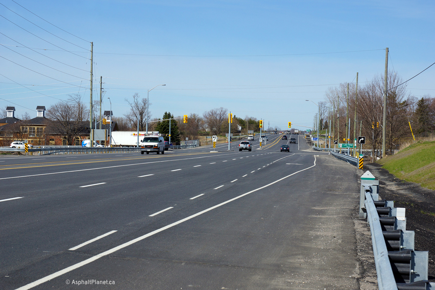
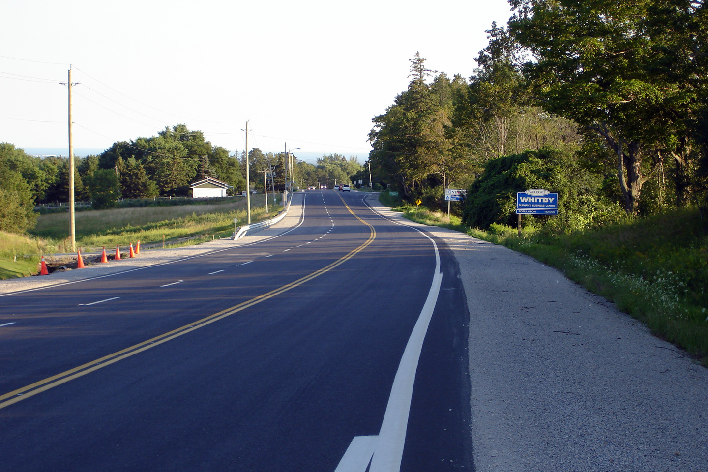
| Town of Whitby Regional Municipality of Durham |
Looking west towards the Lake Ridge Road
intersection. Upper photo taken: August 15th, 2005. Lower photo taken: May 5th, 2014. |
 (720x480) (1440x960) (2400x1600) |
|||
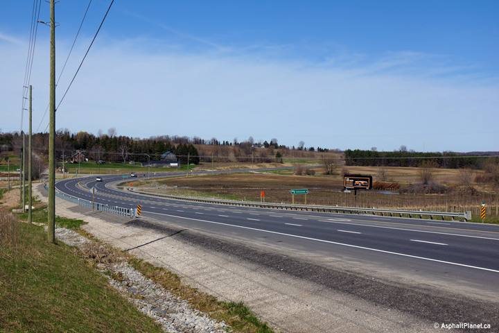
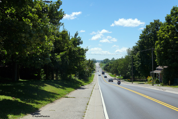
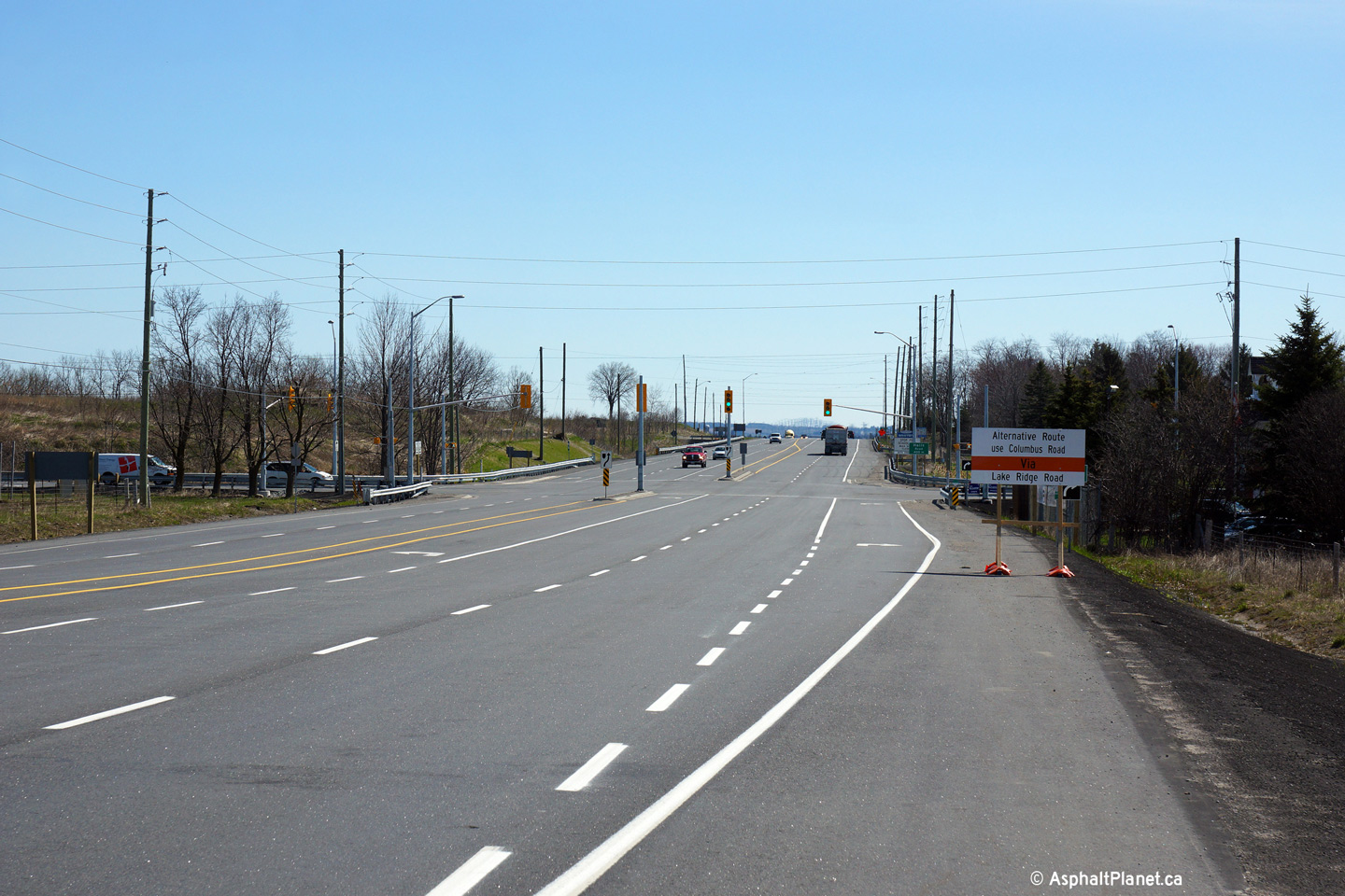
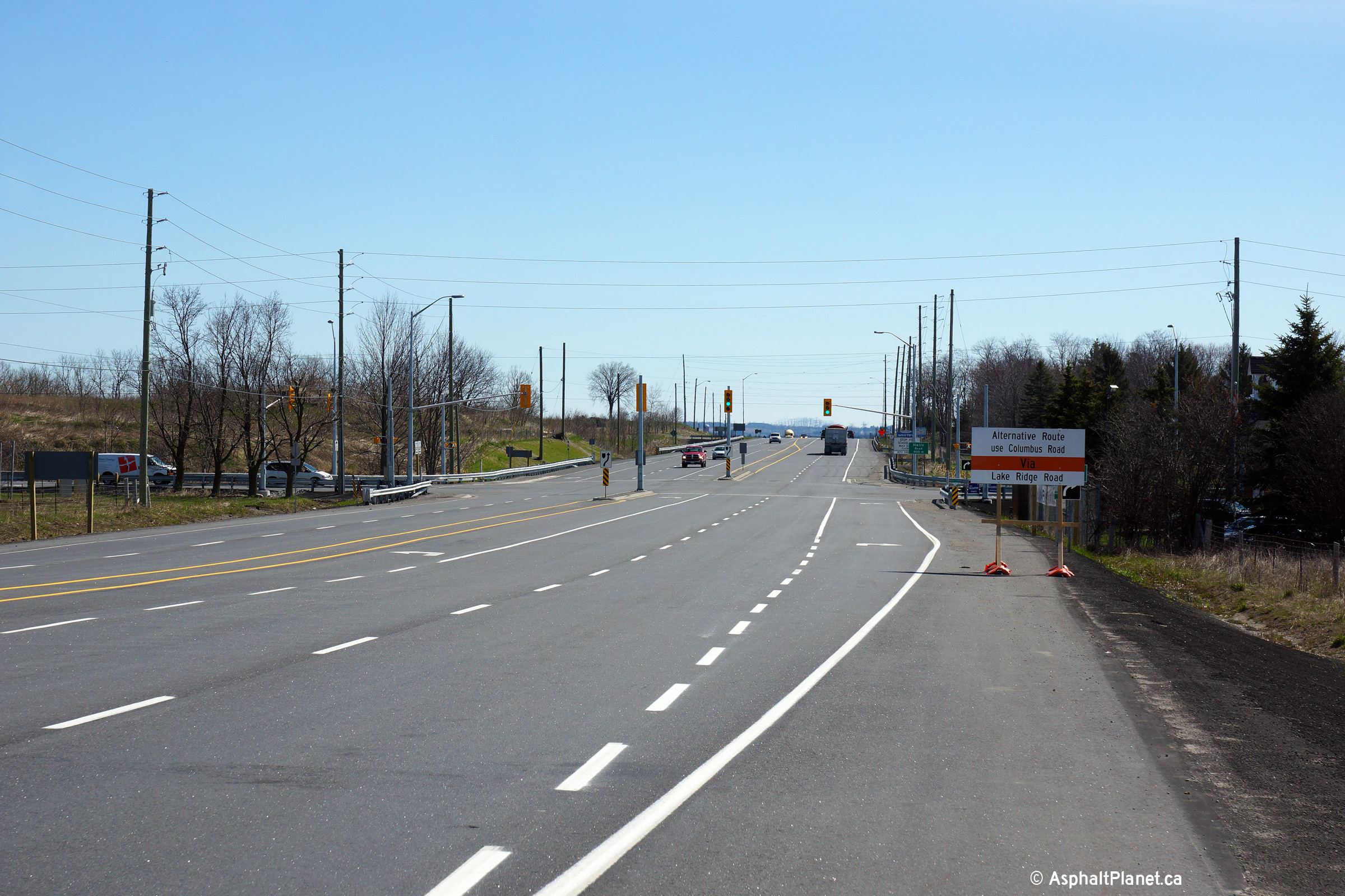
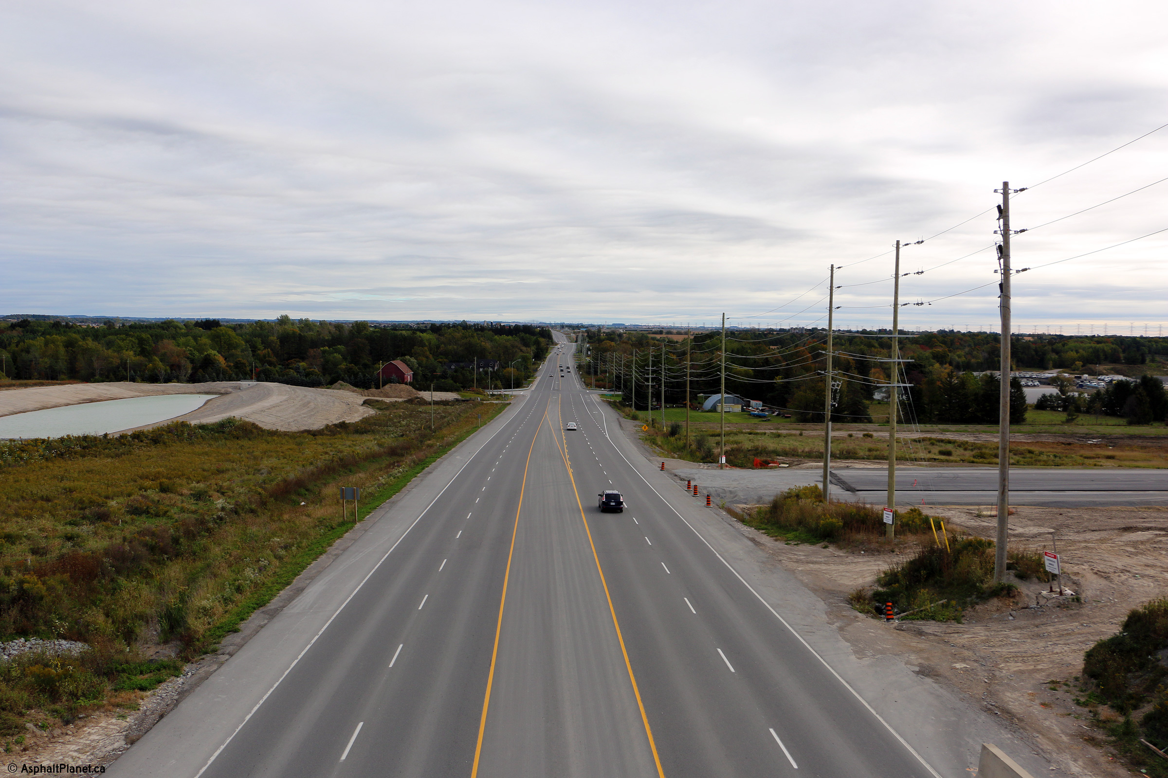
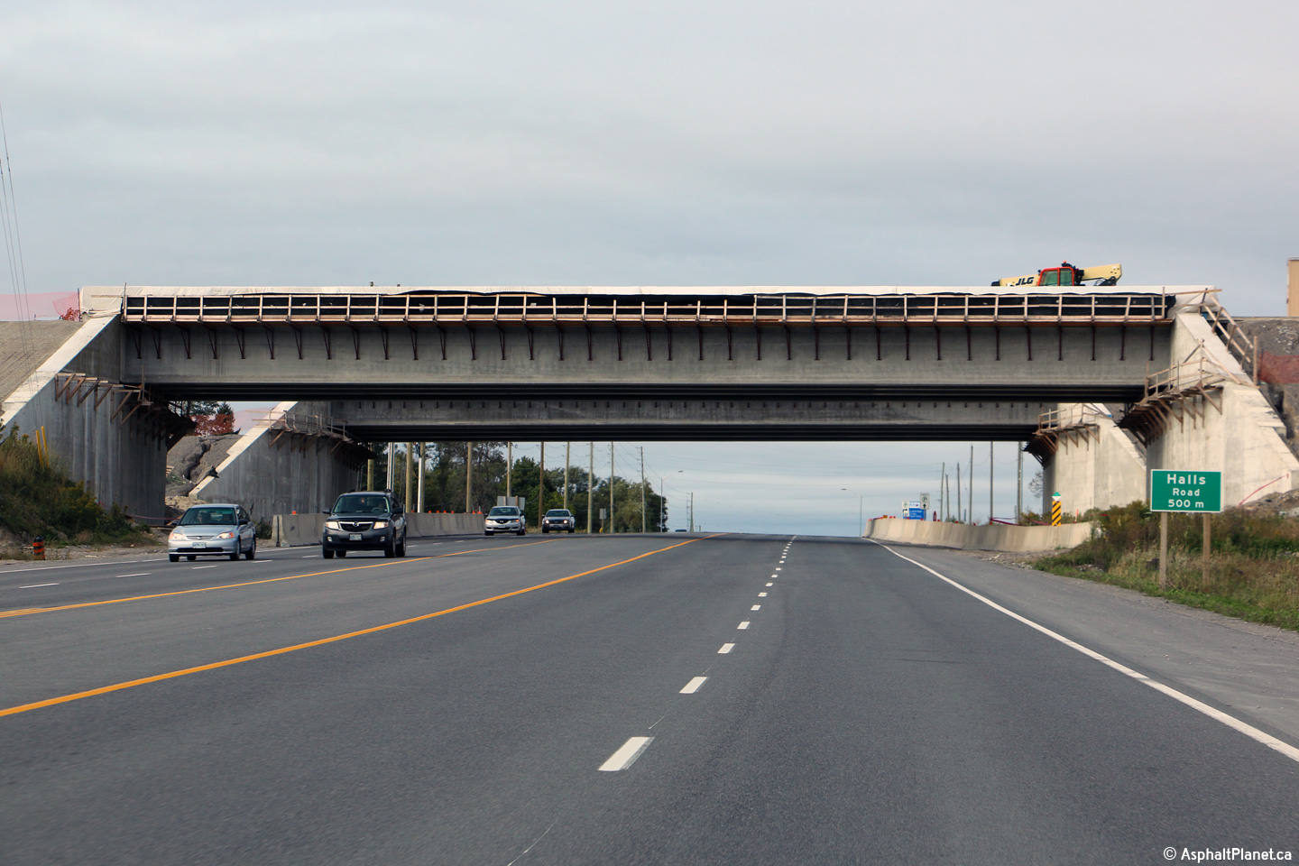
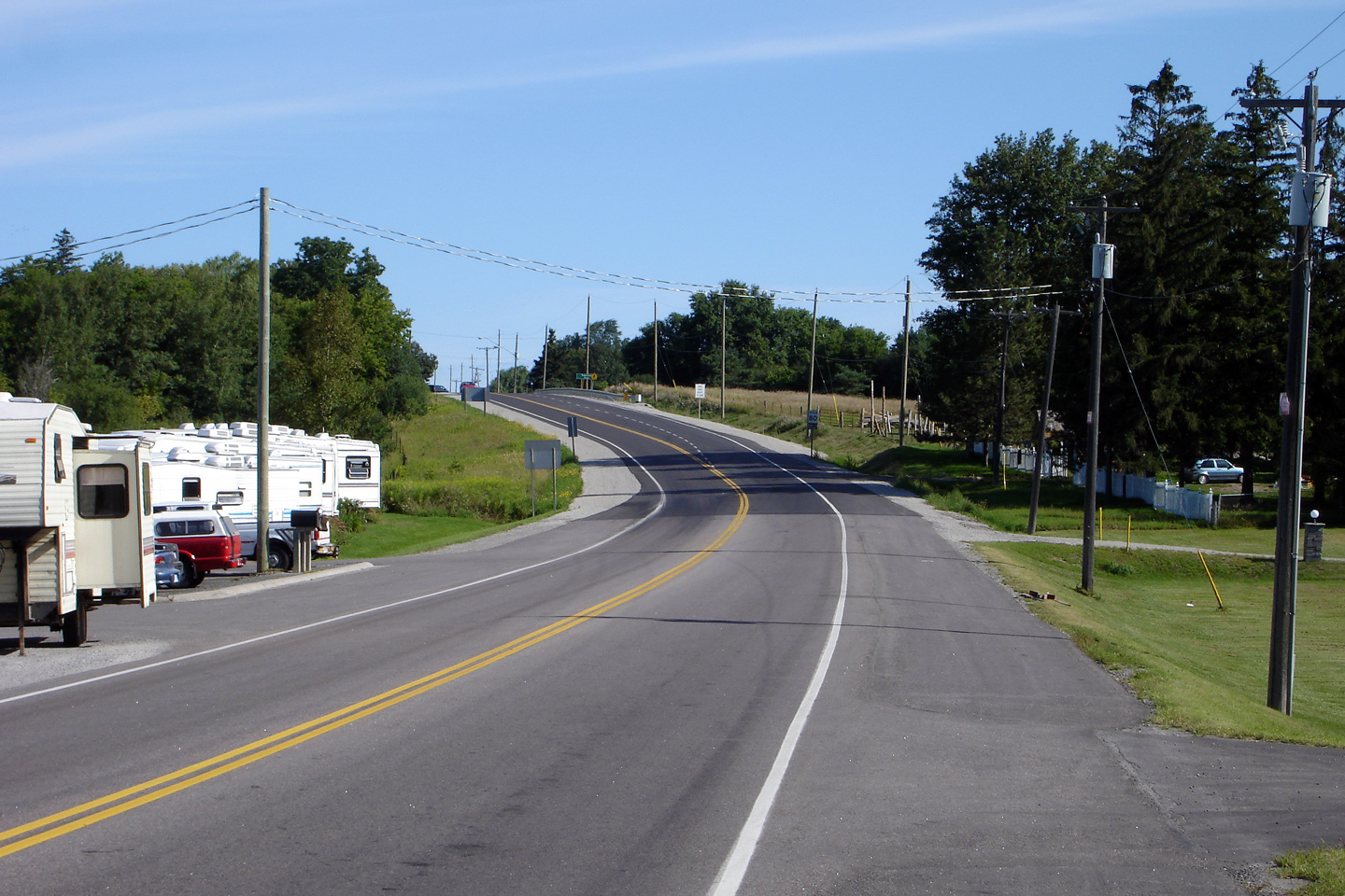
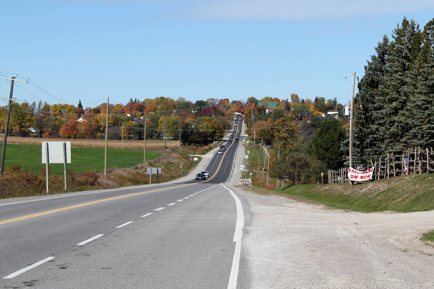
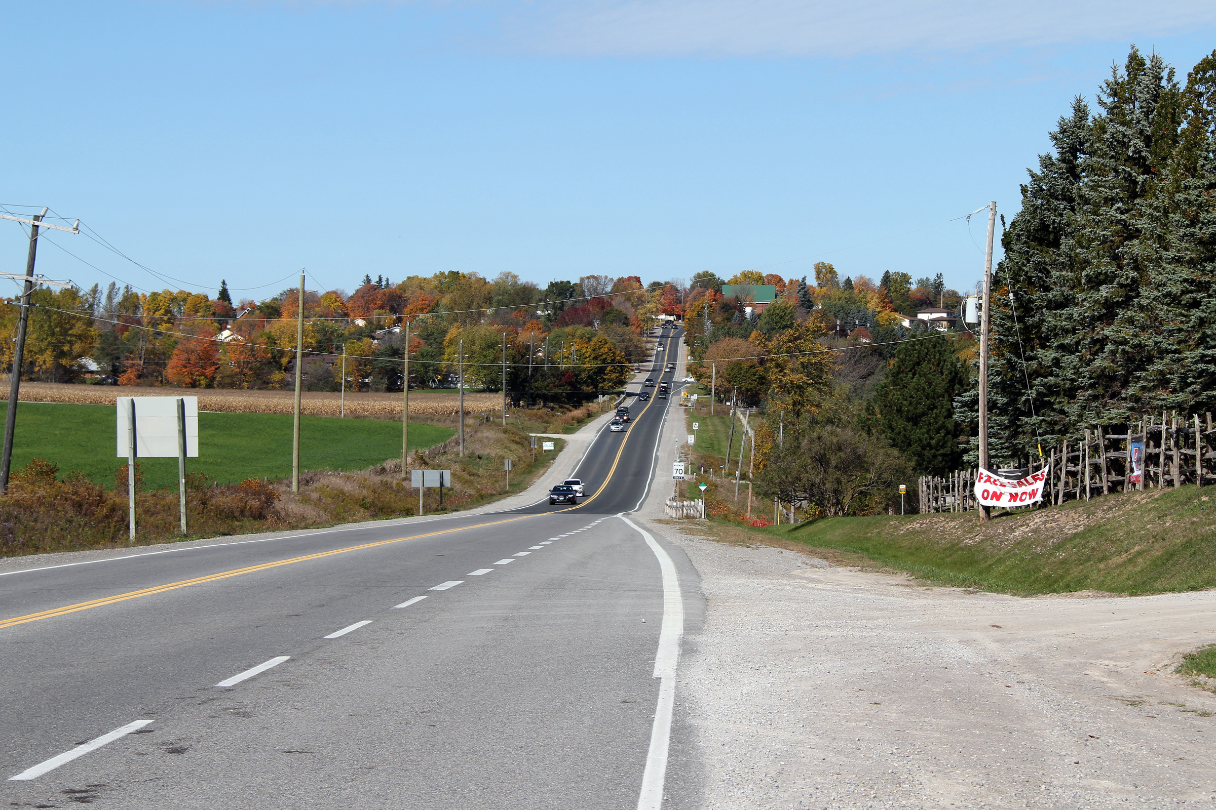
| Town of Whitby Regional Municipality of Durham |
Looking east along Highway 7 from just
east of the Lake Ridge Road intersection. A westbound climbing lane was
added up this long grade during a reconstruction project that took place in
2000/01, and the highway was subsequently widened to four lanes in 2011/13.
Two new structures are being constructed overtop of Highway 7 at this
location to carry the future West Durham Link tollway between the eastern
extension of Highway 407 and Highway 401 at this location. Since the lower
photo was taken, construction has been started, and is scheduled to
be completed before the snow flies in 2015. Upper photo taken: October 9th, 2010. Middle photo taken: April 27th, 2014. Lower photo taken: October 4th, 2015. |
 (720x480) (1440x960) (2400x1600) |
|||
| Town of Whitby Regional Municipality of Durham |
View looking westerly from the Highway
412 overpass along Highway 7. Photo taken: October 10th, 2015. |
 (720x480) (1440x960) (2400x1600) |
|||
| Town of Whitby Regional Municipality of Durham |
Easterly view along Highway 7 from the
Highway 412 overpass. The future northbound off-ramp from Highway 412
to Highway 7 is visible still under construction in this photo. Photo taken: October 4th, 2015. |
 (720x480) (1440x960) (2400x1600) |
|||
| Town of Whitby Regional Municipality of Durham |
View looking westerly towards the still
under construction Highway 412 overpasses along Highway 7. Photo taken: October 4th, 2015. |
 (720x480) (1440x960) (2400x1600) |
|||
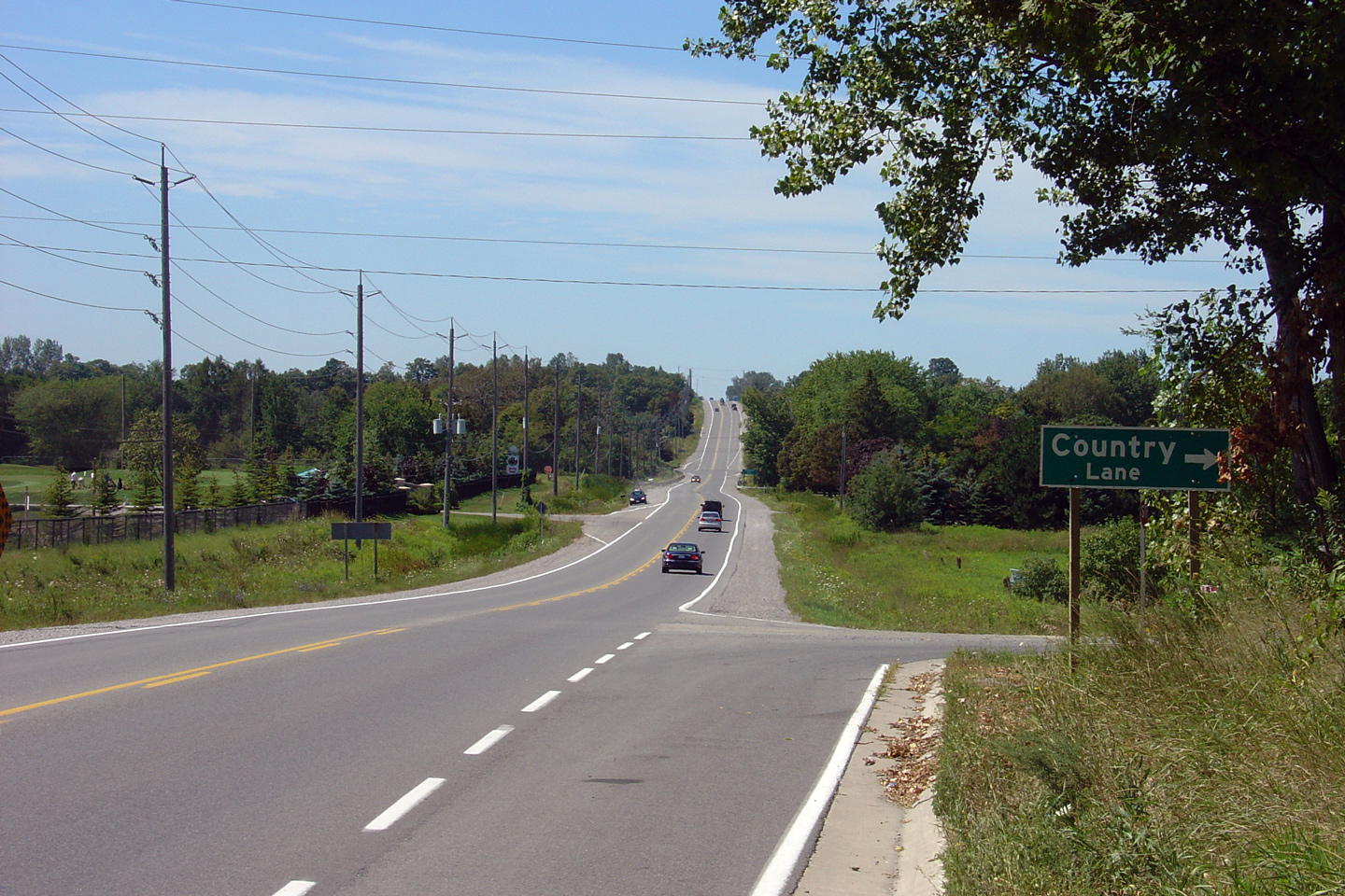
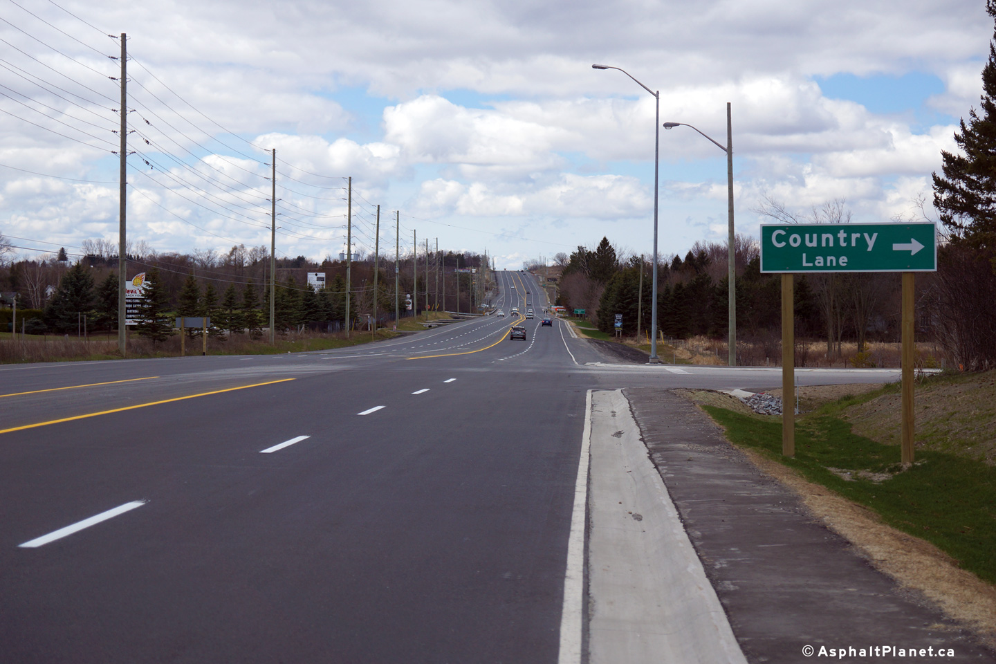
| Town of Whitby Regional Municipality of Durham |
View looking westerly along Highway 7 from
Country Lane. While it might be hard to imagine today, I doubt that
two decades from now that this intersection will still be situated in open
countryside. Both photos at this location were taken before
construction started on Highway 412. Upper photo taken: August 21st, 2006. Lower photo taken: April 27th, 2014. |
 (720x480) (1440x960) (2400x1600) |
|||
| Town of Whitby Regional Municipality of Durham |
View looking westerly from just west of
the future Highway 407 underpass. Photo taken: April 27th, 2014. |
 (720x480) (1440x960) (2400x1600) 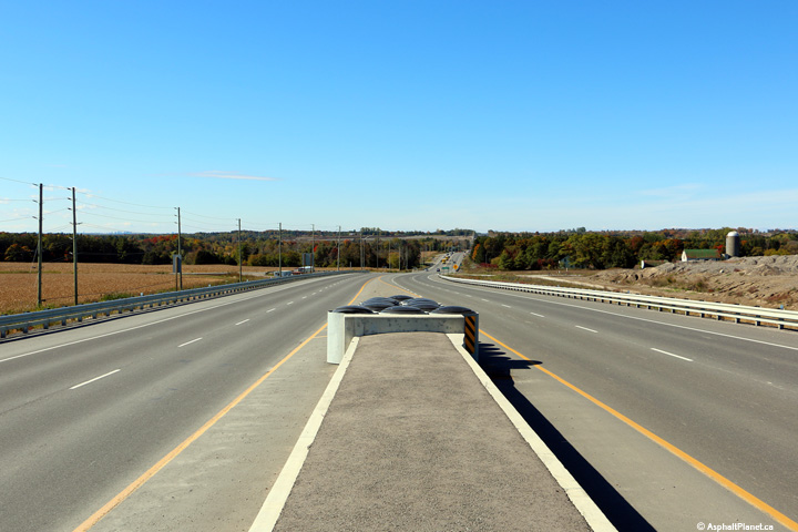 (720x480) (1440x960) (2400x1600) |
|||
| Town of Whitby Regional Municipality of Durham |
View looking easterly approaching the
twin Highway 407 underpasses. The Highway 407 underpasses are designed
to support an eventual six lane cross-section for Highway 7. Photo taken: October 10th, 2015. |
 (720x480) (1440x960) (2400x1600) |
|||
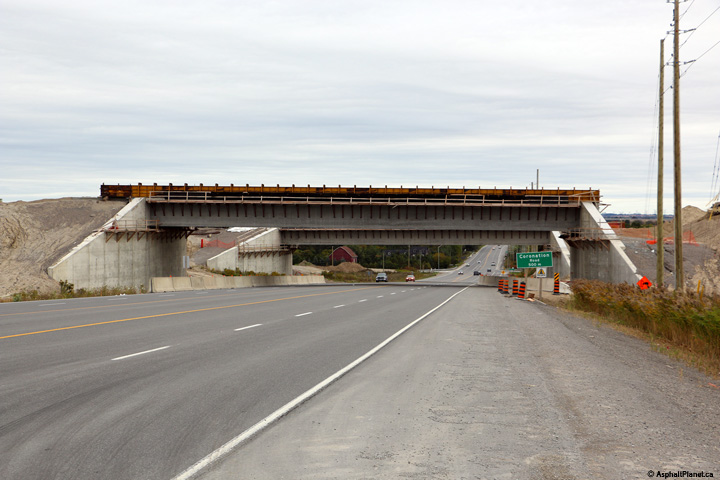
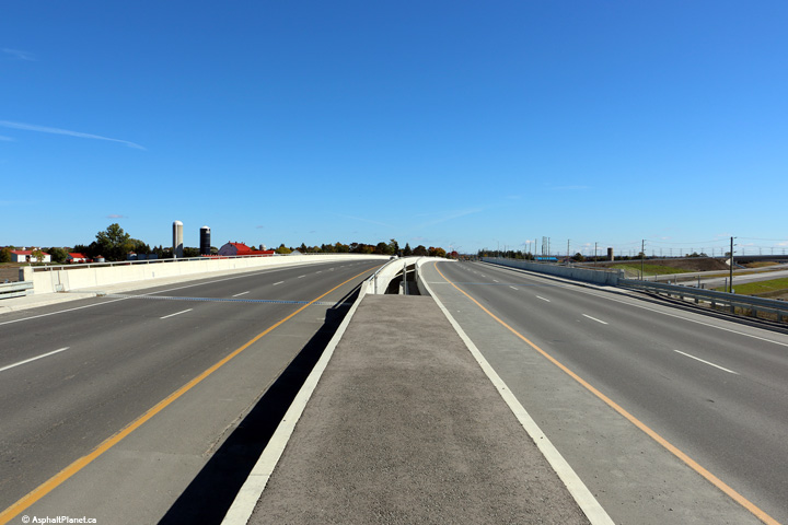
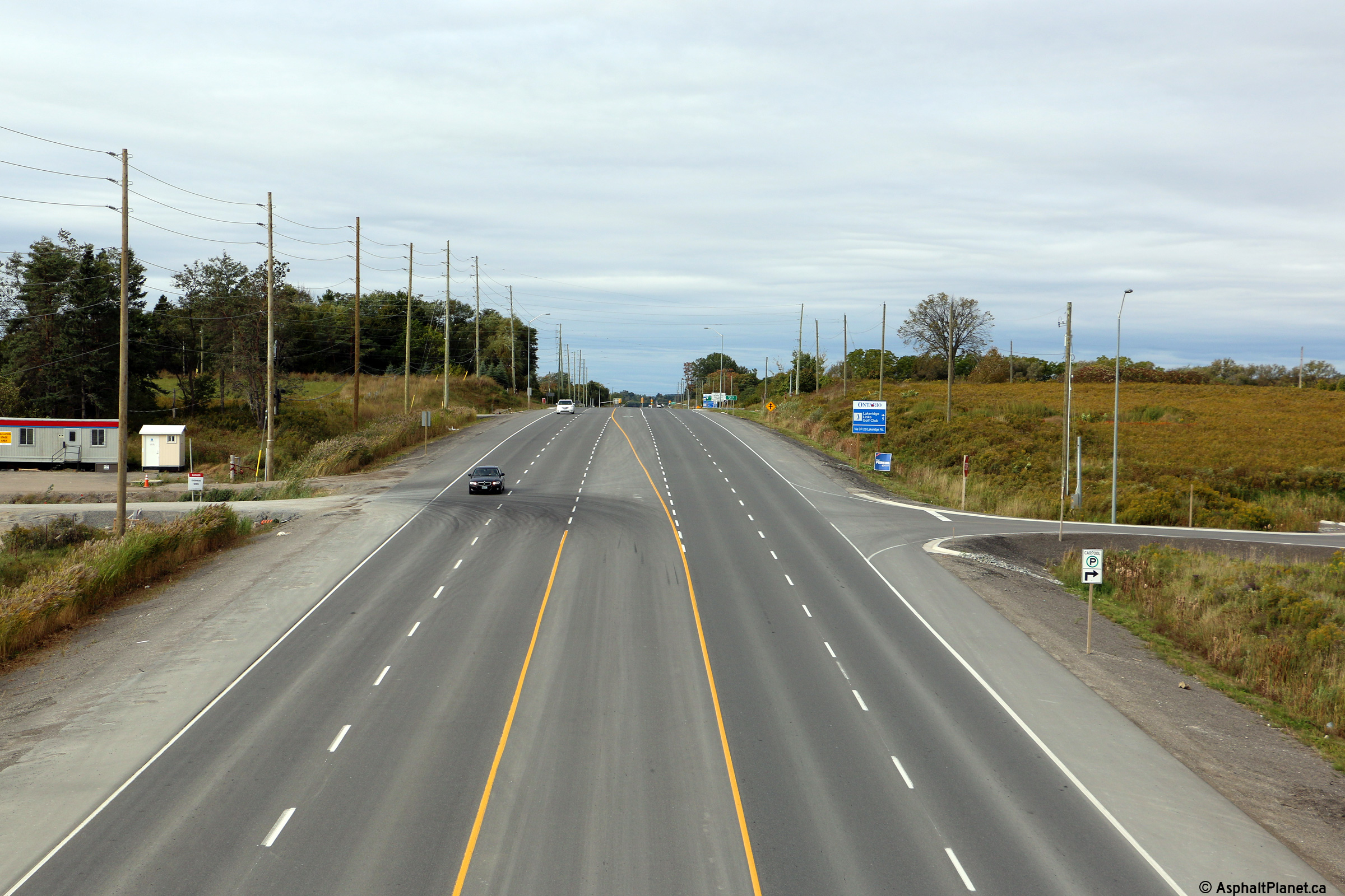
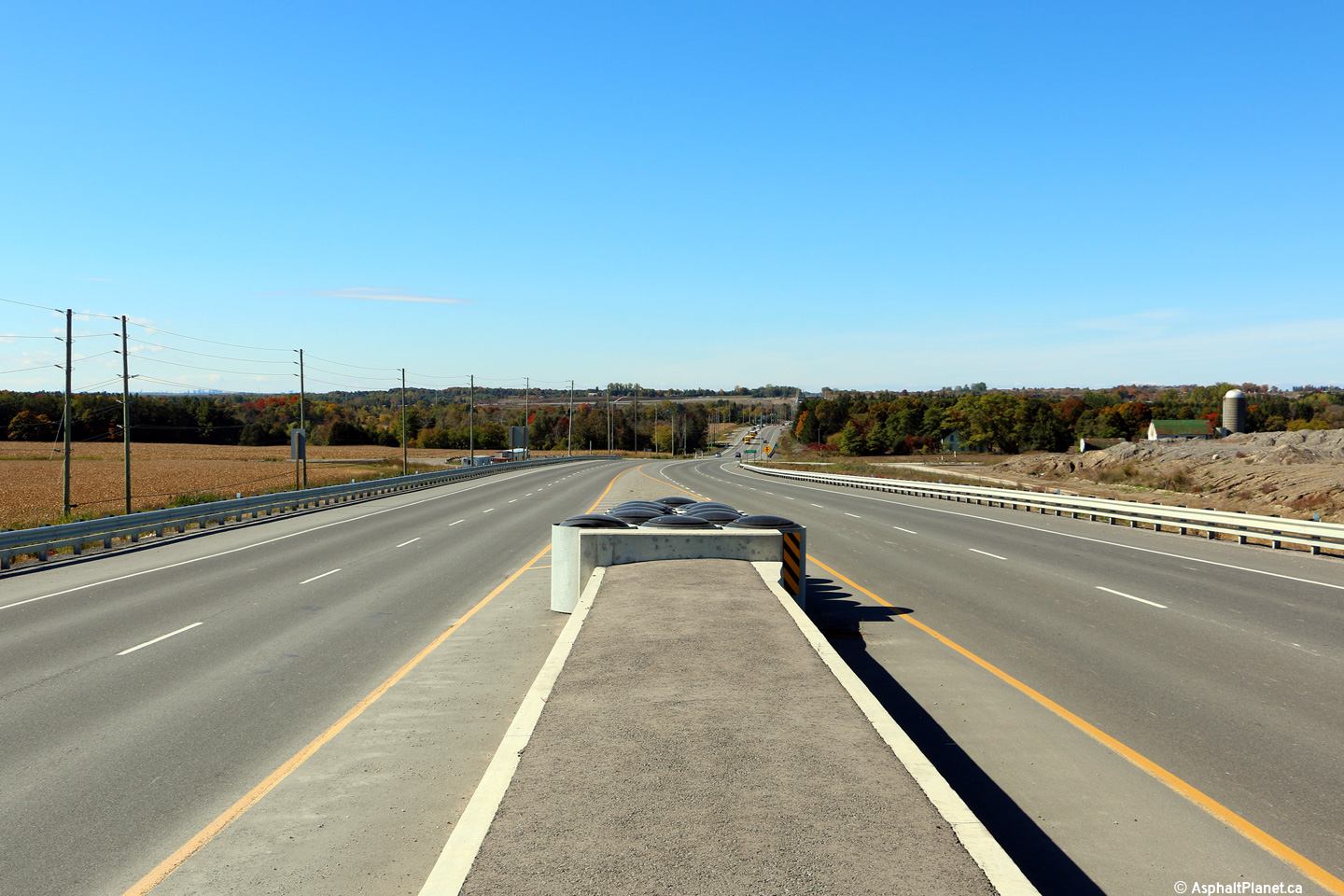
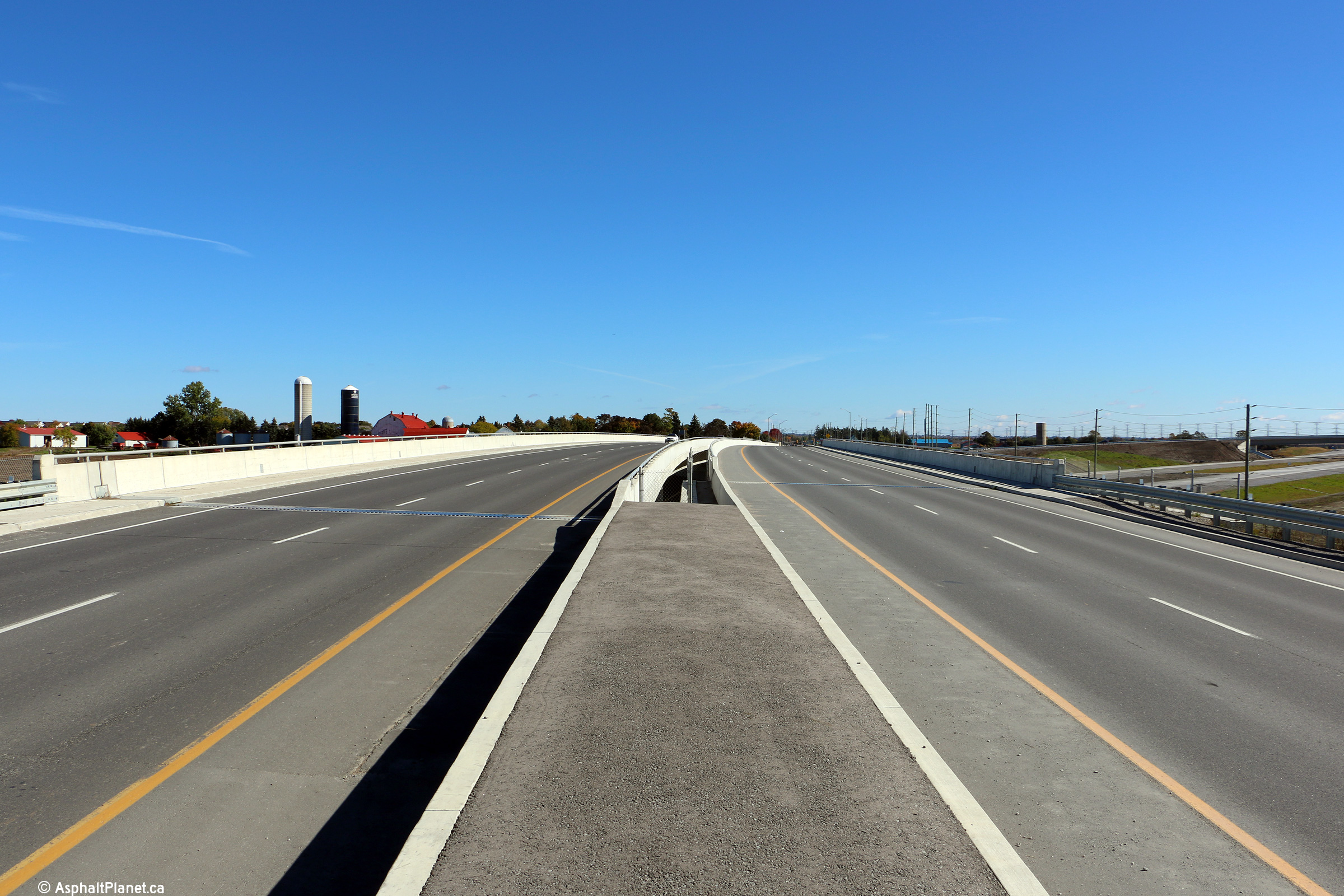
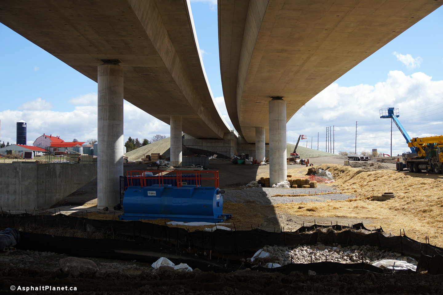
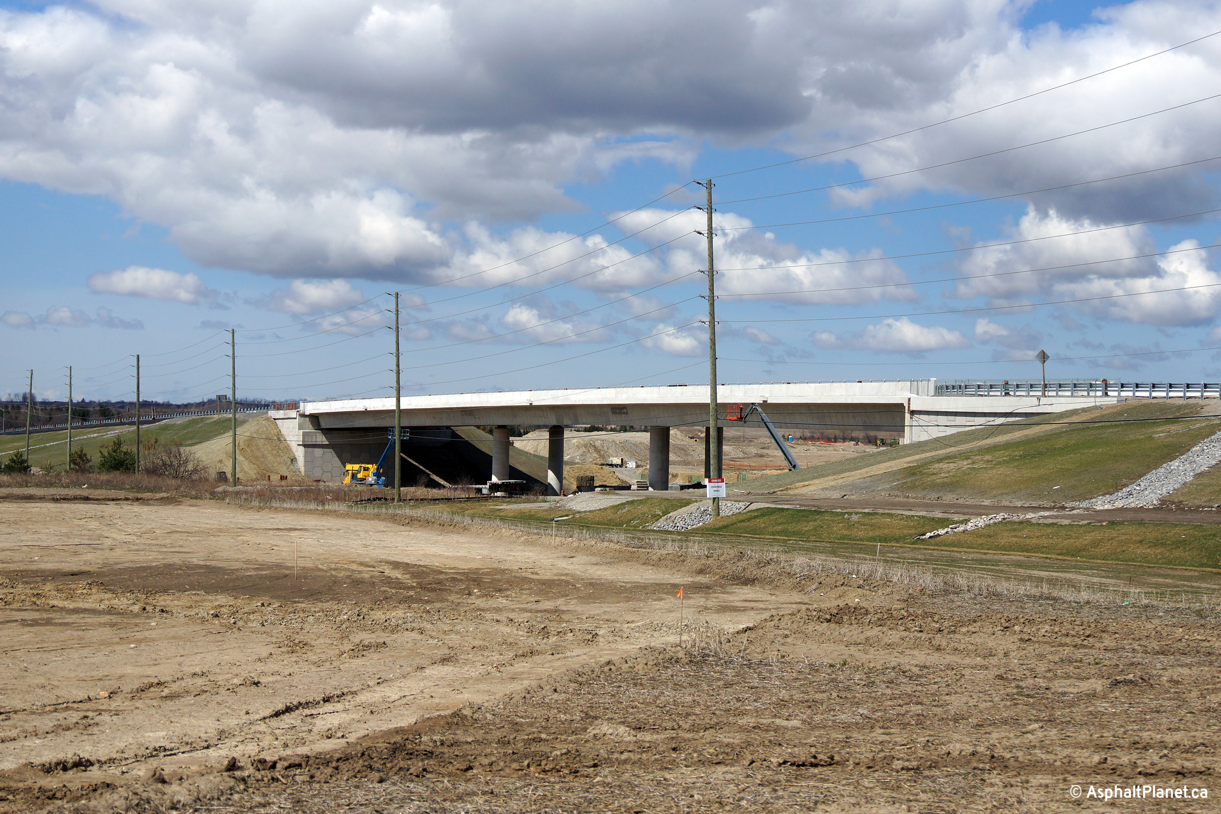
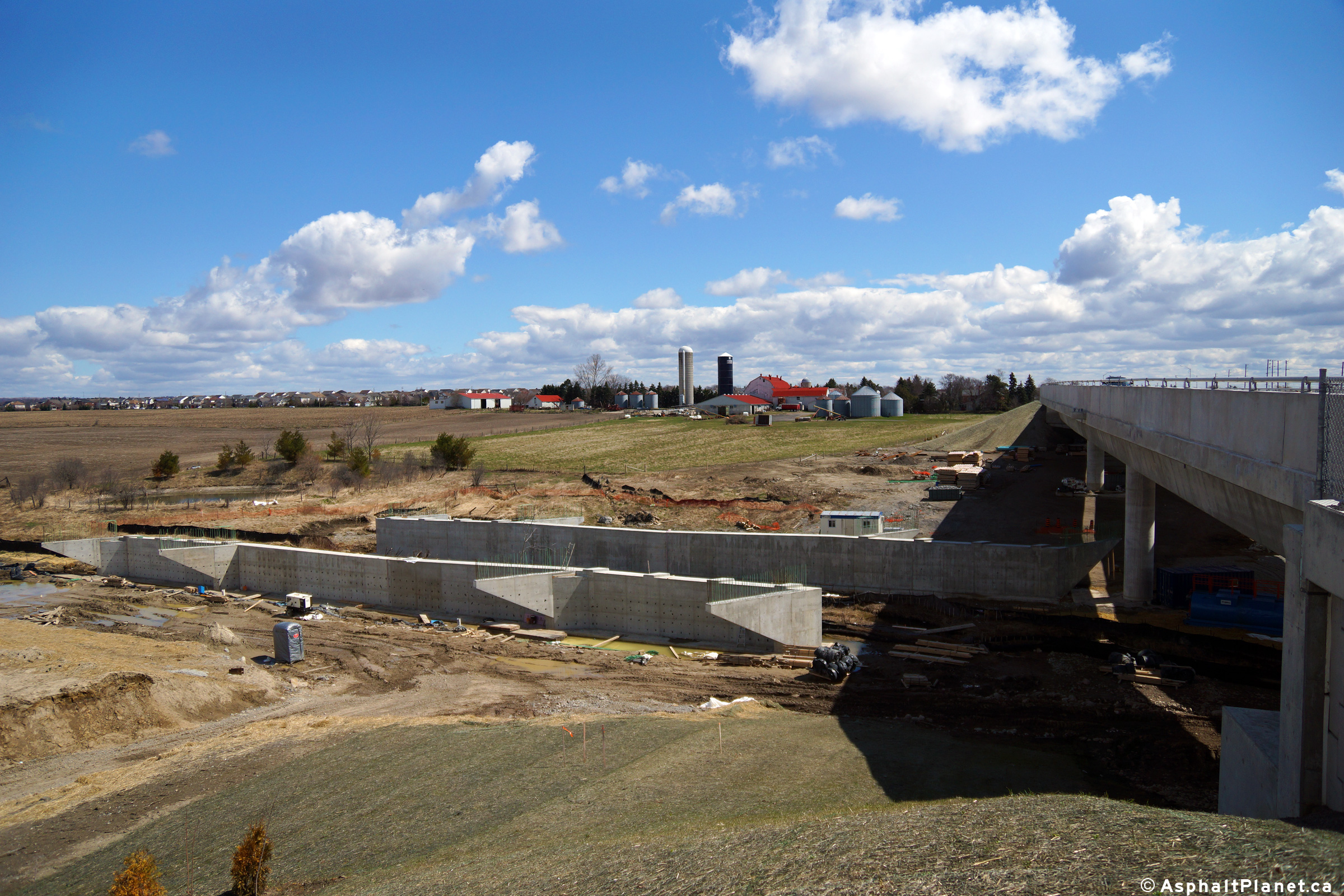
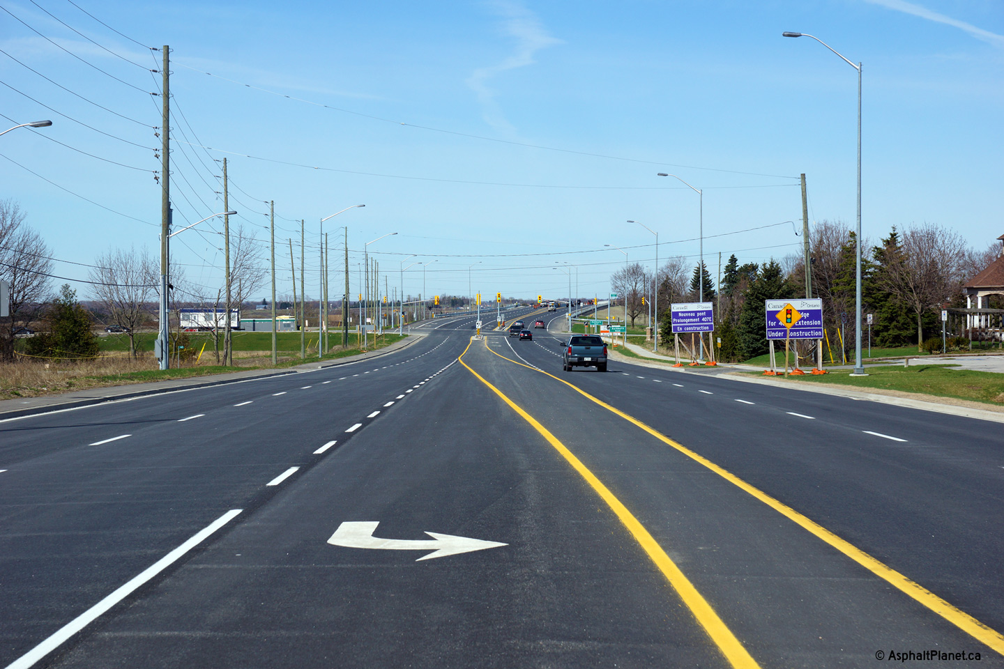
| Town of Whitby Regional Municipality of Durham |
A series of three views of the grade
separation that will carry Highway 7 overtop of the eastern extension of
Highway 407 once it has been completed. Surprisingly, the grade
separation that carries Highway 7 overtop of the future tollway is really
two grade separations. Each structure is three lanes wide, but each
have been striped only for two. The lower two photos show a side view
of the grade separations. The middle photo looks westerly towards the
southern span, while the lower photo looks easterly towards the northern
span. The abutments for the future Highway 407 structure over the
Lynde Creek tributary are visible immediately north of the future Highway
407 overpass. Photos taken: April 27th, 2014. |
 (720x480) (1440x960) (2400x1600)  (720x480) (1440x960) (2400x1600)  (720x480) (1440x960) (2400x1600) |
|||
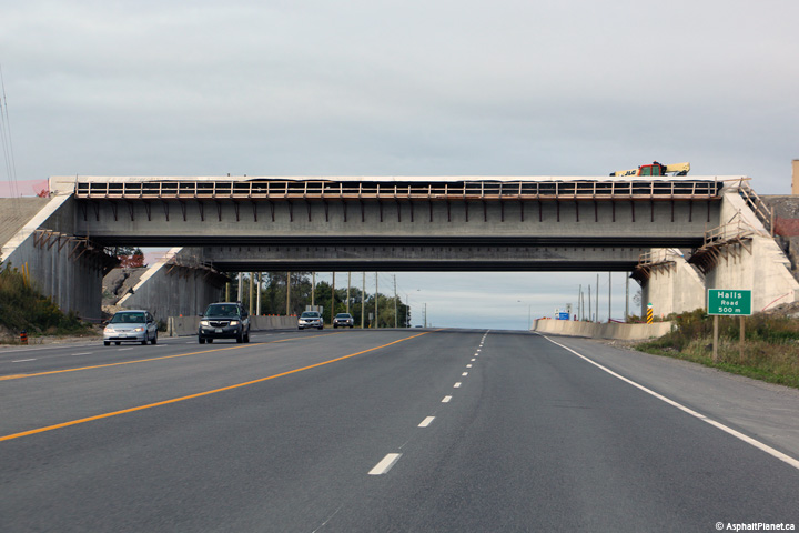
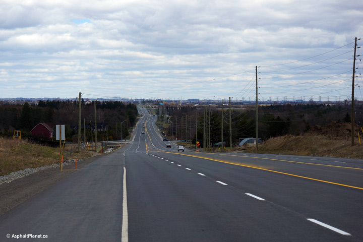
| Town of Whitby Regional Municipality of Durham |
View looking westerly along Highway 7 at
the Highway 407 underpass. Phase 1 of the eastern extension of Highway
407 through Durham Region was still under construction when this photo was
taken --
click here for photos. Photo taken: October 10th, 2015. |
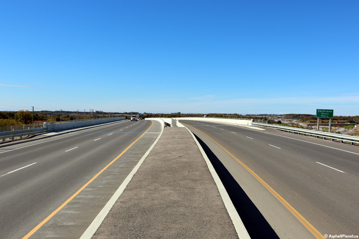 (720x480) (1440x960) (2400x1600) |
|||
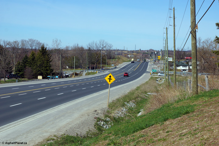
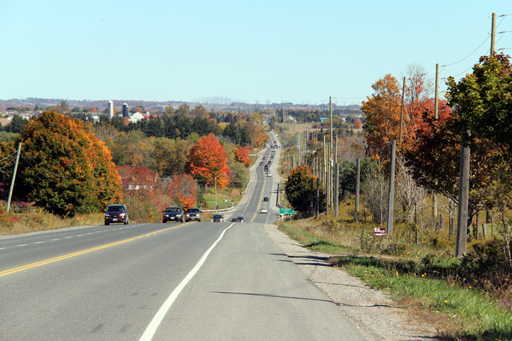
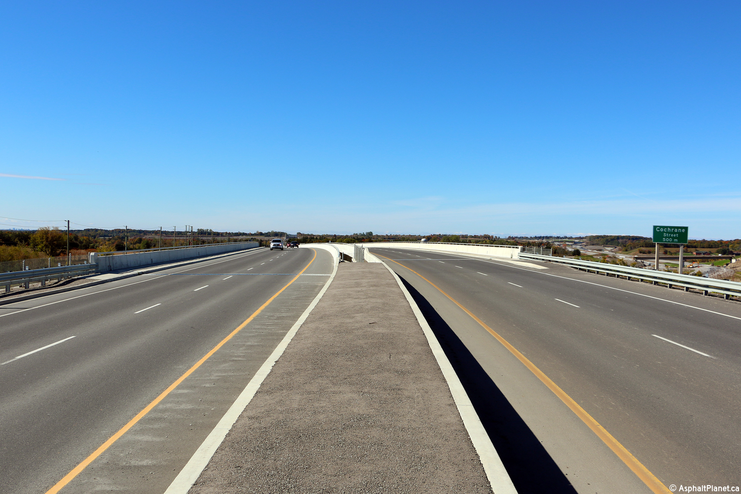
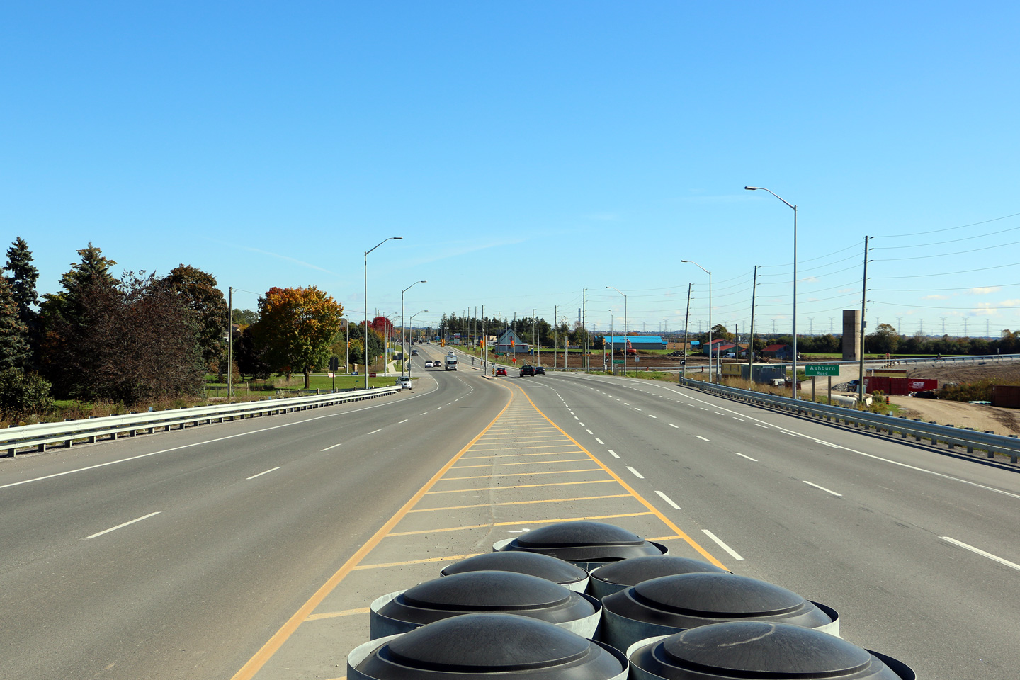
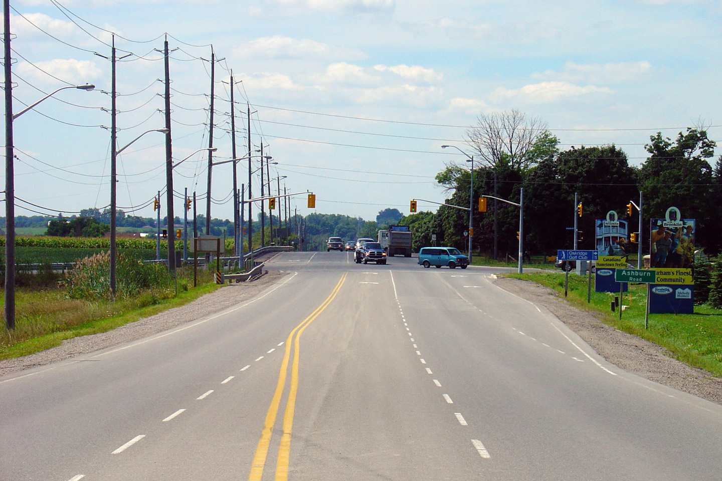
| Town of Whitby Regional Municipality of Durham |
Easterly views along Highway 7 approaching the
Ashburn Road intersection in Brooklin from the Highway 407 underpass. Upper photo taken: October 10th, 2015 Lower photo taken: April 27th, 2014. |
 (720x480) (1440x960) (2400x1600) 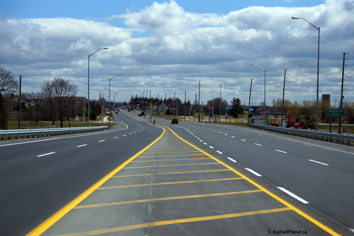 (720x480) (1440x960) (2400x1600) |
|||
| Town of Whitby Regional Municipality of Durham |
Looking west towards the Ashburn Road
intersection in Brooklin. Traffic signals were installed in 2001 at
this intersection to meet the demands of Brooklin's quickly growing
residential population. Upper photo taken: August 15th, 2005. Lower photo taken: May 5th, 2014. |
 (720x480) (1440x960) (2400x1600) |
|||
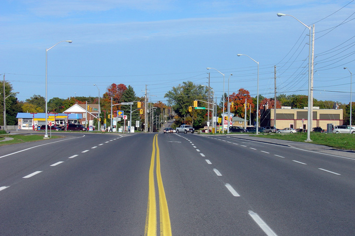
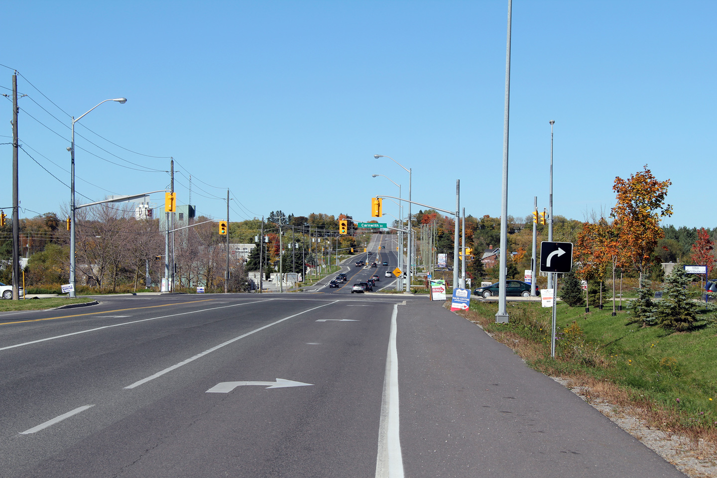
| Town of Whitby Regional Municipality of Durham |
View looking easterly towards the southern
Highway 12 junction in Brooklin. Upper photo taken: October 8th, 2005. Lower photo taken: May 5th, 2014. |
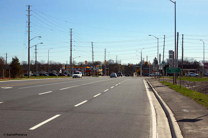 (720x480) (1440x960) (2400x1600) |
|||
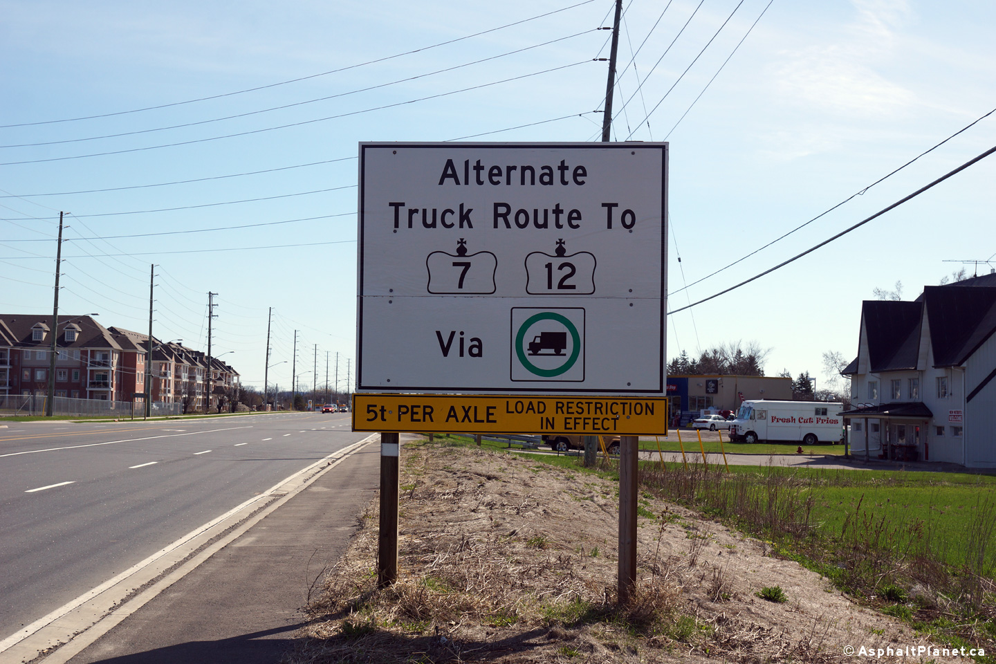
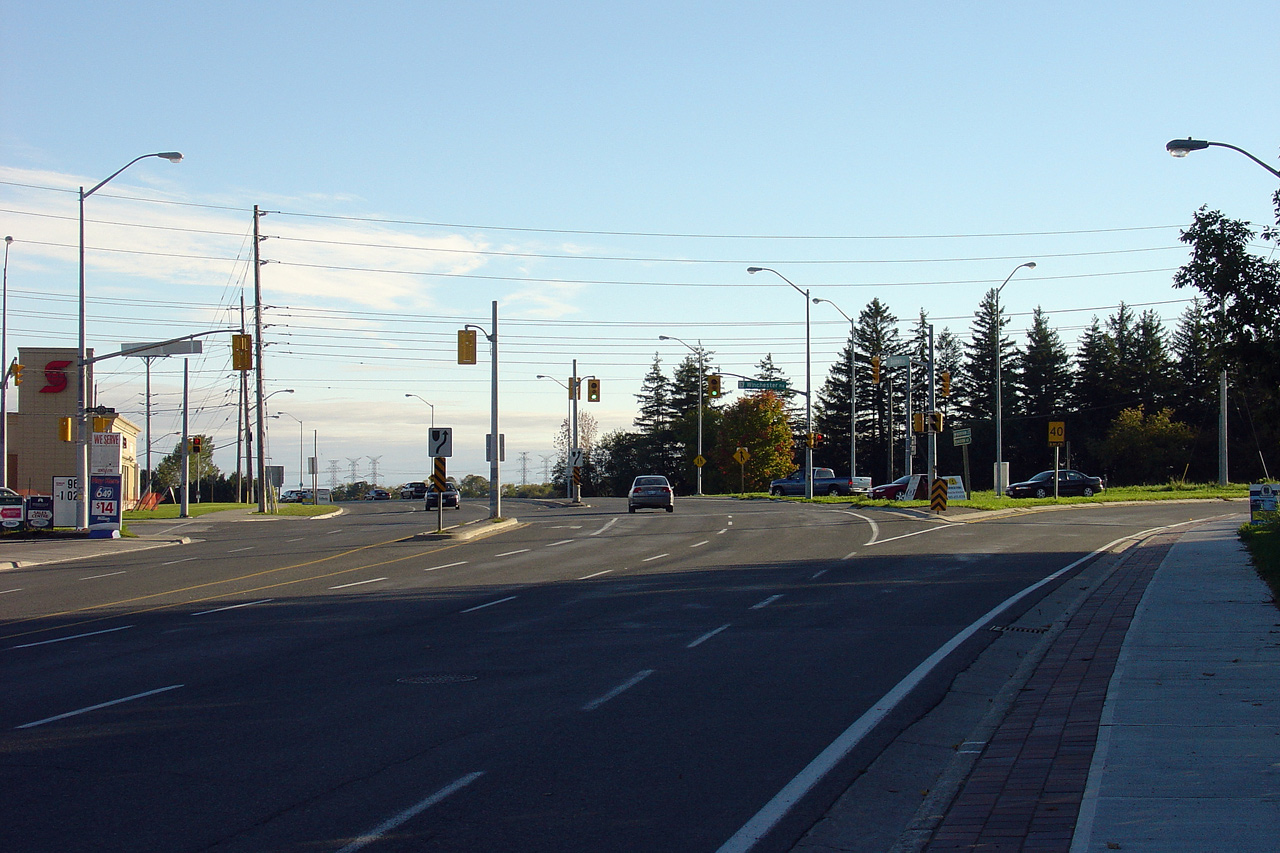
| Town of Whitby Regional Municipality of Durham |
Signage advising eastbound trucks that an
alternate route to Highway 7/12 through Downtown Brooklin is available by
following truck signage. Inconceivably however, not all portions of
the alternate truck route have been built sturdily enough to handle heavy
truck traffic during the spring thaw. The truck route follows
Winchester and Thickson Roads. Photo taken: April 27th, 2014. |
 (720x480) (720x480)(1440x960) |
|||
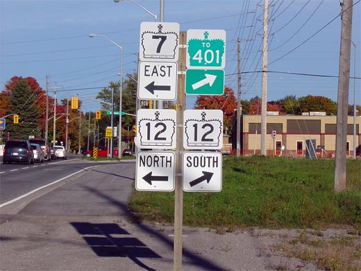
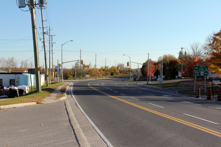
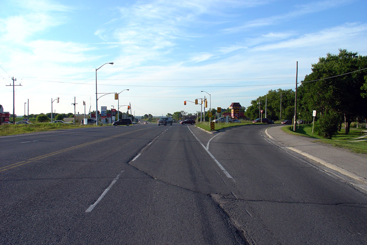
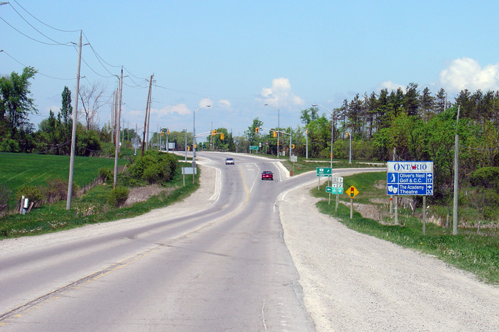
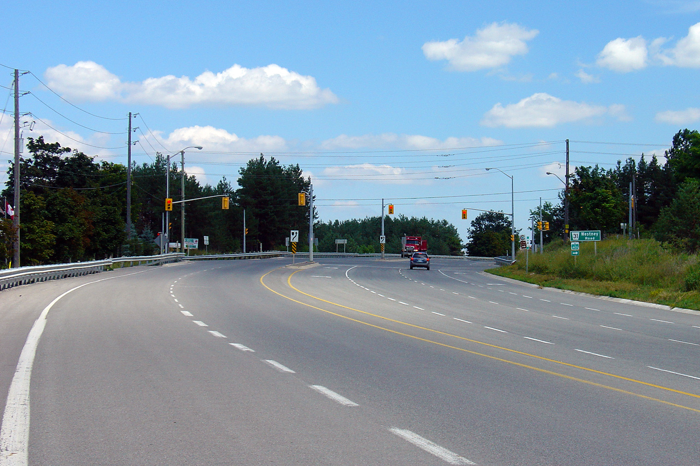
| Town of Whitby Regional Municipality of Durham |
Eastbound junction assembly denoting the
southern Highway 12 junction. At this intersection, traffic continuing
eastbound along Highway 7 must turn left following
Highway 12 northerly towards Sunderland. Photo taken: October 8th, 2005. |
 |
|||
| Highway 12 continues south from Highway 7 into Whitby. Click here for Highway 12-South images. | |||||
| Town of Whitby Regional Municipality of Durham |
Looking south along Highway 7/12 towards the southern Highway 7 junction. Through
Highway 12
traffic heads straight through the traffic lights, while traffic bound for
westbound Highway 7 must follow the ramp to the right. Photo taken: October 8th, 2005. |
 |
|||
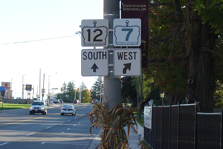
| Town of Whitby Regional Municipality of Durham |
Junction assembly for the southern Highway 7/12
split in Brooklin. Highway 7 leads travelers west from Brooklin
towards Highway 407 and eventually Markham. Photo taken: October 8th, 2005. |
 |
|||
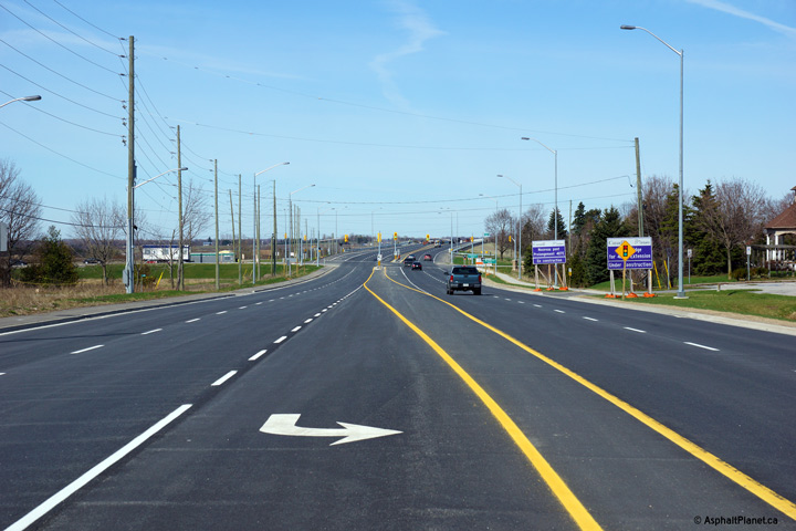
| Town of Whitby Regional Municipality of Durham |
This view looks northerly towards two recently
(as of 2011) activated traffic signals in the north end of Brooklin. Photo taken: October 9th, 2010. |
 |
|||
| Town of Whitby Regional Municipality of Durham |
View looking south towards Brooklin along
Highway 7/12. The pictured climbing lane was added late in 2005 as part of
a reconstruction project. Photo taken: October 9th, 2010. |
 |
|||
| Town of Whitby Regional Municipality of Durham |
View looking south along Highway 7/12
towards Duff's Road. The northern end of the climbing lane that is
pictured in previous photo is shown here. Photo taken: August 12th, 2006. |
 |
|||
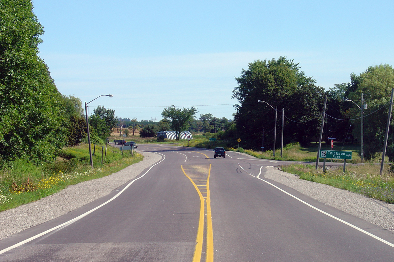
| Town of Whitby Regional Municipality of Durham |
Looking north towards the Thickson Road
intersection. This is one of the busiest intersections along Highway
12 in Durham Region, and as of the time that this photo was taken, it is not
signalized. Photo taken: August 12th, 2006. |
 |
|||
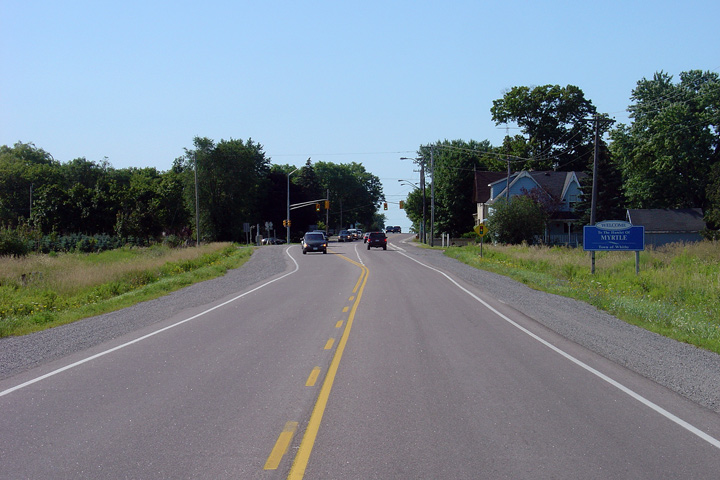
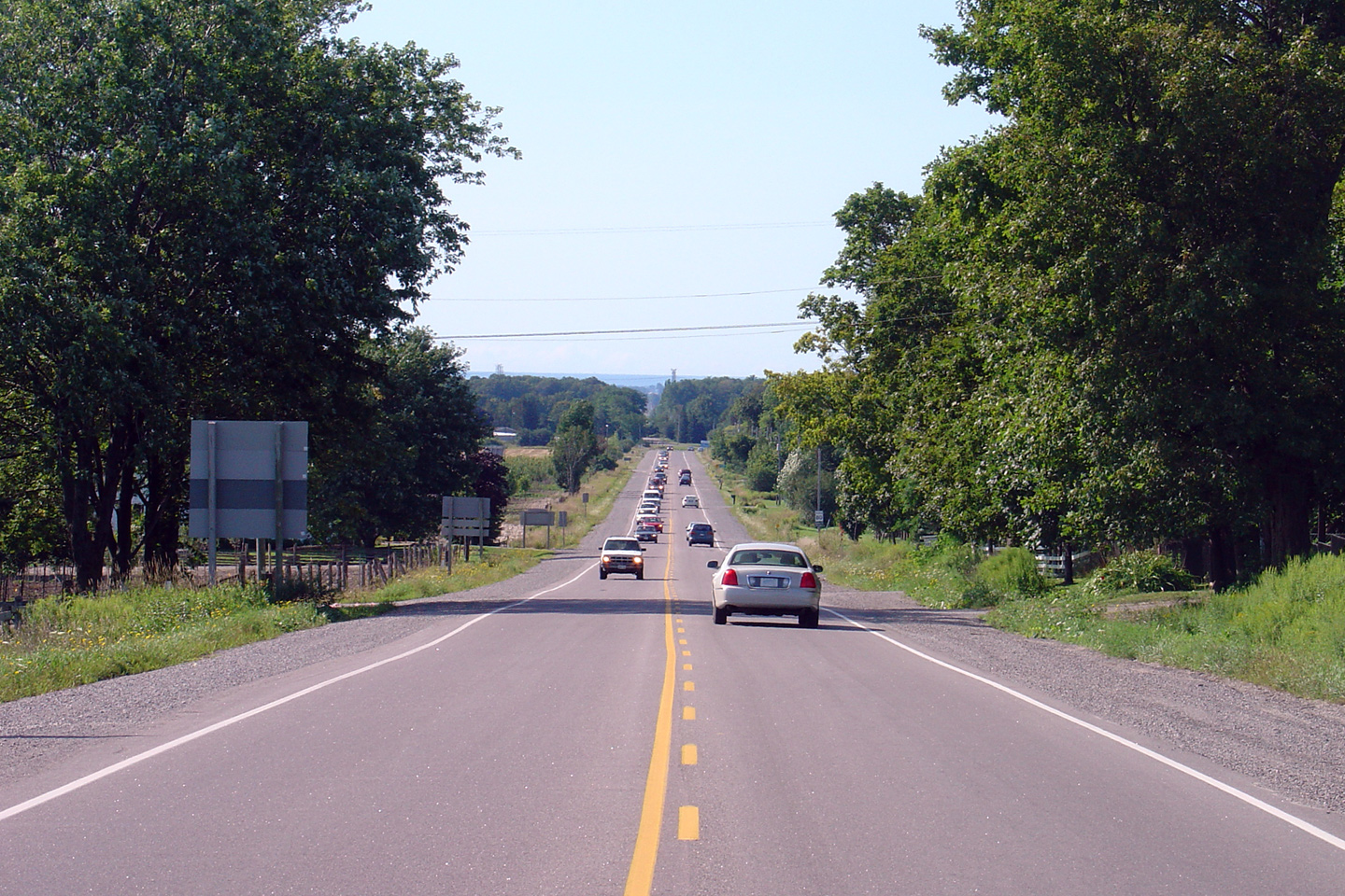
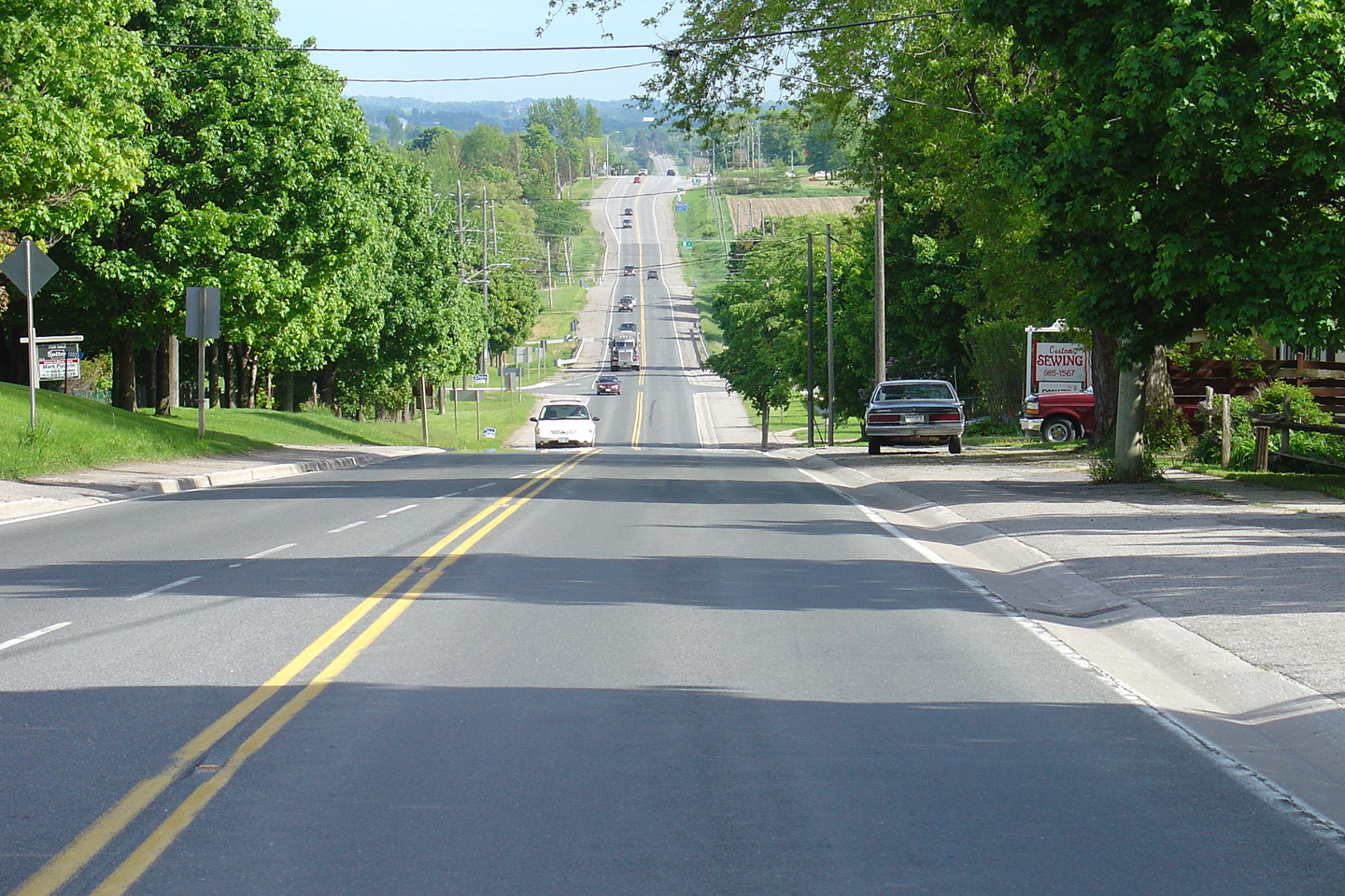
| Town of Whitby Regional Municipality of Durham |
Looking south along Highway 7/12
from Myrtle. Despite the capacity improvements recently constructed on
along Highway 7/12 between Brooklin and
Manchester, traffic still routinely bunches up during peak times. Photo taken: August 12th, 2006. |
 |
|||
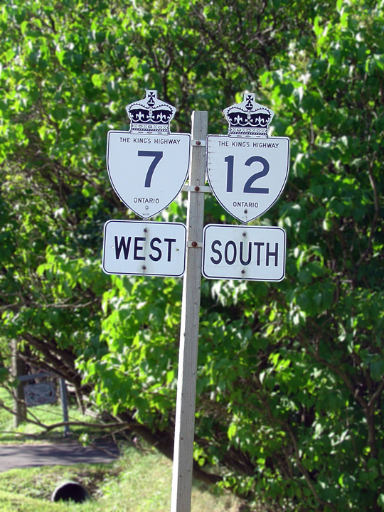
| Town of Whitby Regional Municipality of Durham |
Signage in Myrtle for Highway 7/12. This was
the last of the old school signs marked with 'The King's Highway' legend
left along the Highway 7/12 multiplex. This sign was replaced as part of
the highway construction since I took this photo. Photo taken: August 12th, 2006. |
 |
|||
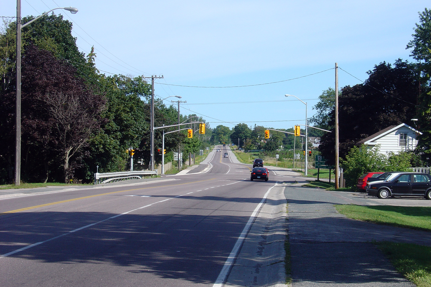
| Town of Whitby Regional Municipality of Durham |
Looking north towards the signalized
intersection with Durham Road 5 in Myrtle. Traffic signals were added
in this location during in late 2004 as part of the reconstruction project.
Click here for a view of this intersection before
traffic signals were installed. Photo taken: August 12th, 2006. |
 |
|||
| Town of Whitby Regional Municipality of Durham |
Looking south towards Myrtle and the Durham Road
5 intersection. Myrtle is located about 700m south of Myrtle Station.
Despite this rural gap between Myrtle and Myrtle Station, the speed limit
along Highway 7/12 remains at 60km/h. Photo taken: August 12th, 2006. |
 |
|||
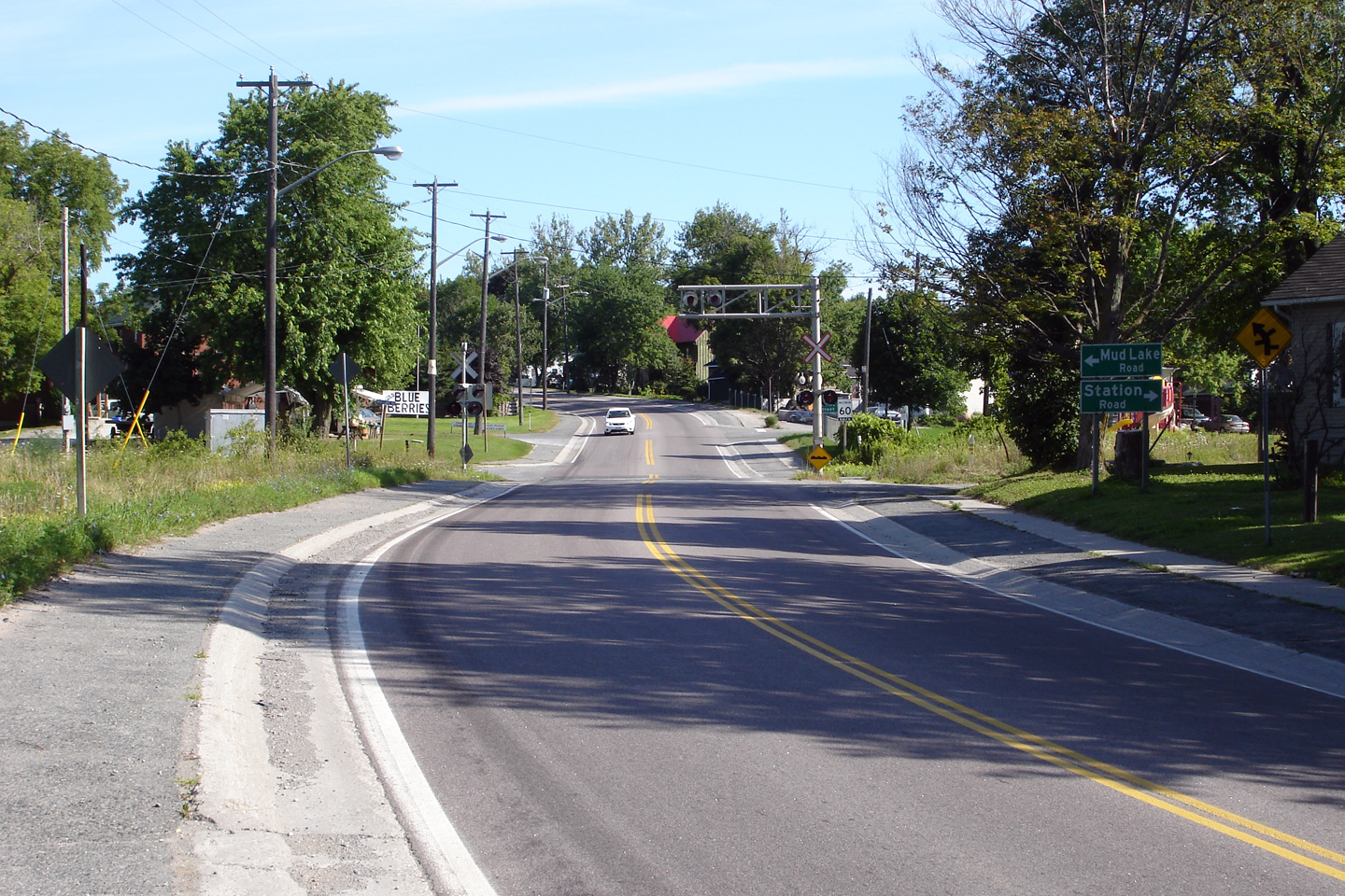
| Town of Whitby Regional Municipality of Durham |
Looking north through Myrtle Station at the
at-grade railway crossing. Photo taken: August 12th, 2006. |
 |
|||
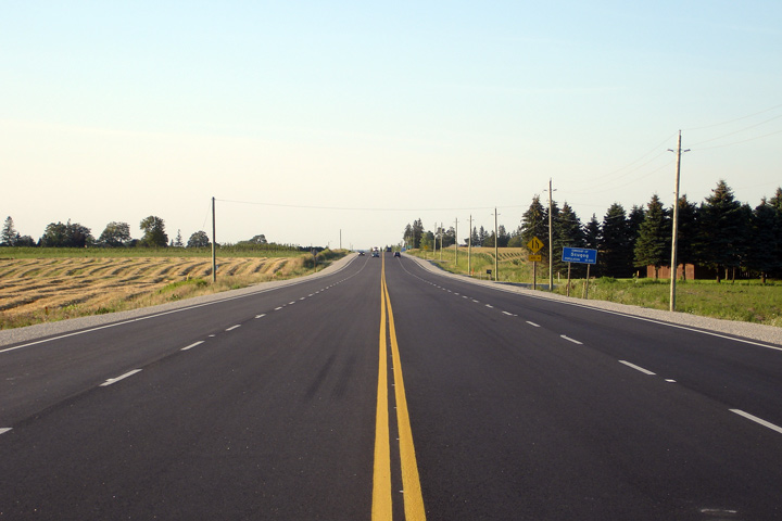
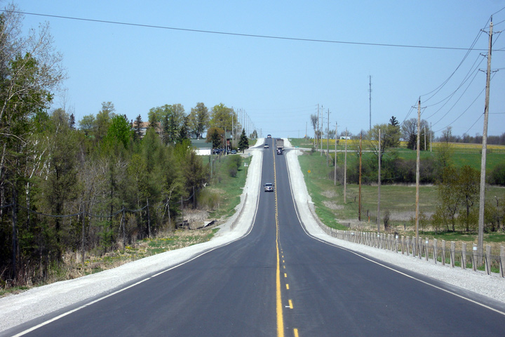
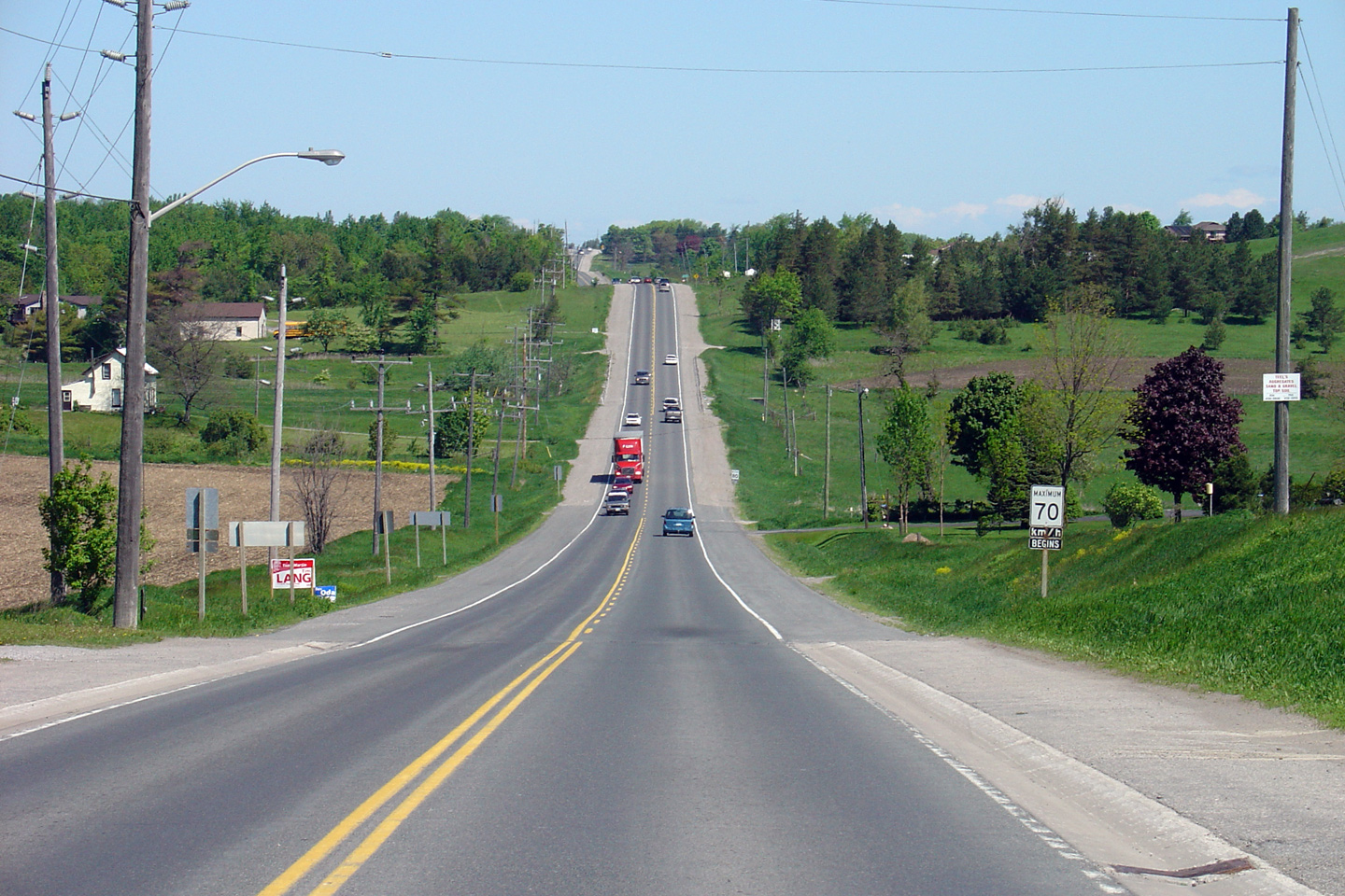
| Town of Whitby Regional Municipality of Durham |
Looking north from the north end of Myrtle
towards the start of the new northbound passing lane that leads to the top
of the Oak Ridges Moraine. Photo taken: August 12th, 2006. |
 |
|||
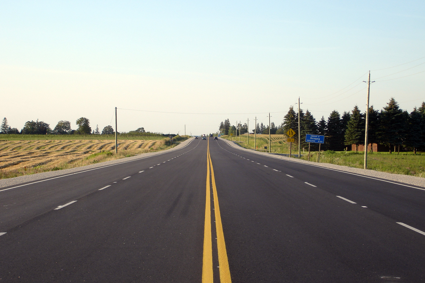
| Township of Scugog Regional Municipality of Durham |
Looking south towards Myrtle from just north of
the Whitby-Scugog Townline. Photo taken: August 9th, 2006. |
 |
|||
| Township of Scugog Regional Municipality of Durham |
View looking northerly along Highway 7/12
from just north of the Whitby-Scugog Townline. This 4-lane section was
constructed in 2005 when the existing southbound truck climbing lane from
Scugog Line 2 was extended, and a new passing lane was constructed for
northbound traffic. Photo taken: August 9th, 2006. |
 |
|||
| Township of Scugog Regional Municipality of Durham |
Looking south towards the Scugog Line 2
intersection, and the start of the southbound passing lane. Photo taken: August 9th, 2006. |
 |
|||
| Township of Scugog Regional Municipality of Durham |
View looking northerly along Highway 7/12
from just north of the Scugog Line 2 intersection. Photo taken: August 9th, 2006. |
 |
|||
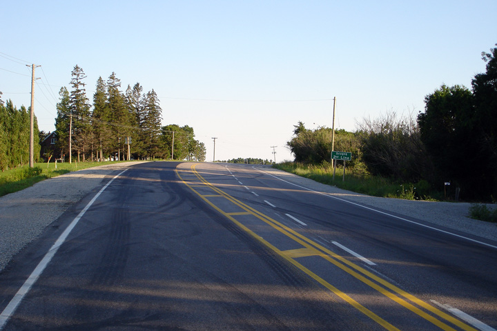
| Township of Scugog Regional Municipality of Durham |
The Medium Green Sign for
Highway 7A. Highway 7 takes a very circuitous route around Lake Scugog.
Highway 7A cuts across Lake Scugog by way of two causeways and makes for a
much more direct trip to Peterborough than Highway 7. Photo taken: August 8th, 2004. |
||||
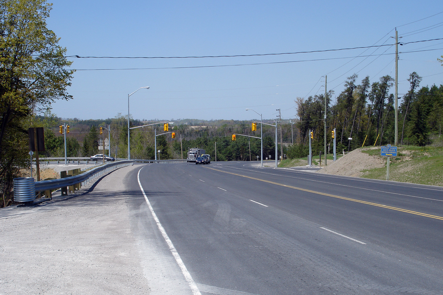
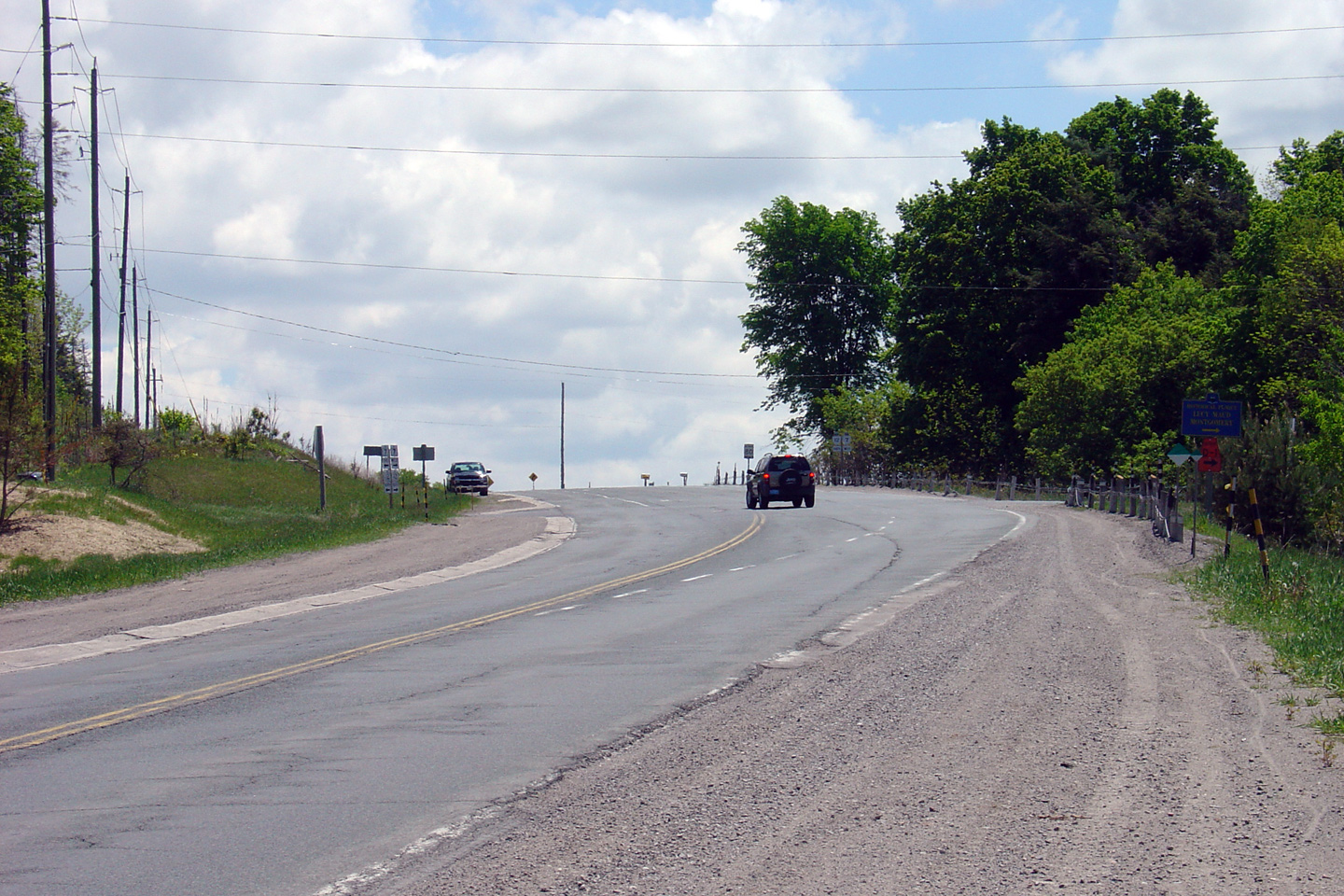
| Township of Scugog Regional Municipality of Durham |
Two views of Highway the Highway 7A intersection
in Manchester. the upper photos is the older photo. Notice that
the highway has been narrowed since 2004. A resurfacing contract was
called in 2007 that saw the auxiliary through lanes that had existed for
decades along Highway 7/12 at this intersection converted to turn lanes.
While I can appreciate that left turning vehicles were not well addressed
with the previous configuration, the opportunity for overtaking slow trucks
at the intersection is missed in the new configuration. Upper photo taken: August 8th, 2004. Lower photo taken: July 5th, 2009. |
|
|||
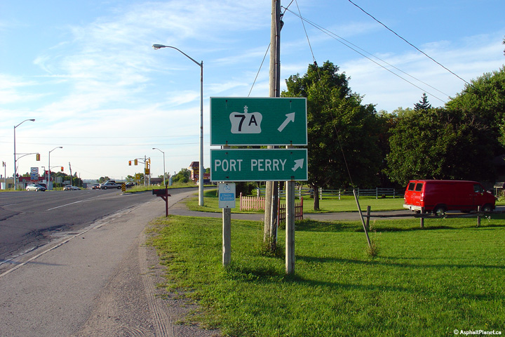
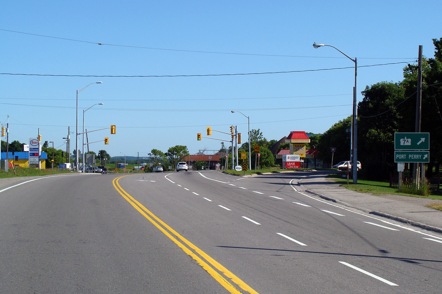
| Highway 7A departs easterly from this junction, bound for Peterborough by way of Port Perry and Bethany. Click here for Highway 7A images. | |||||
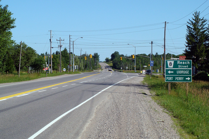
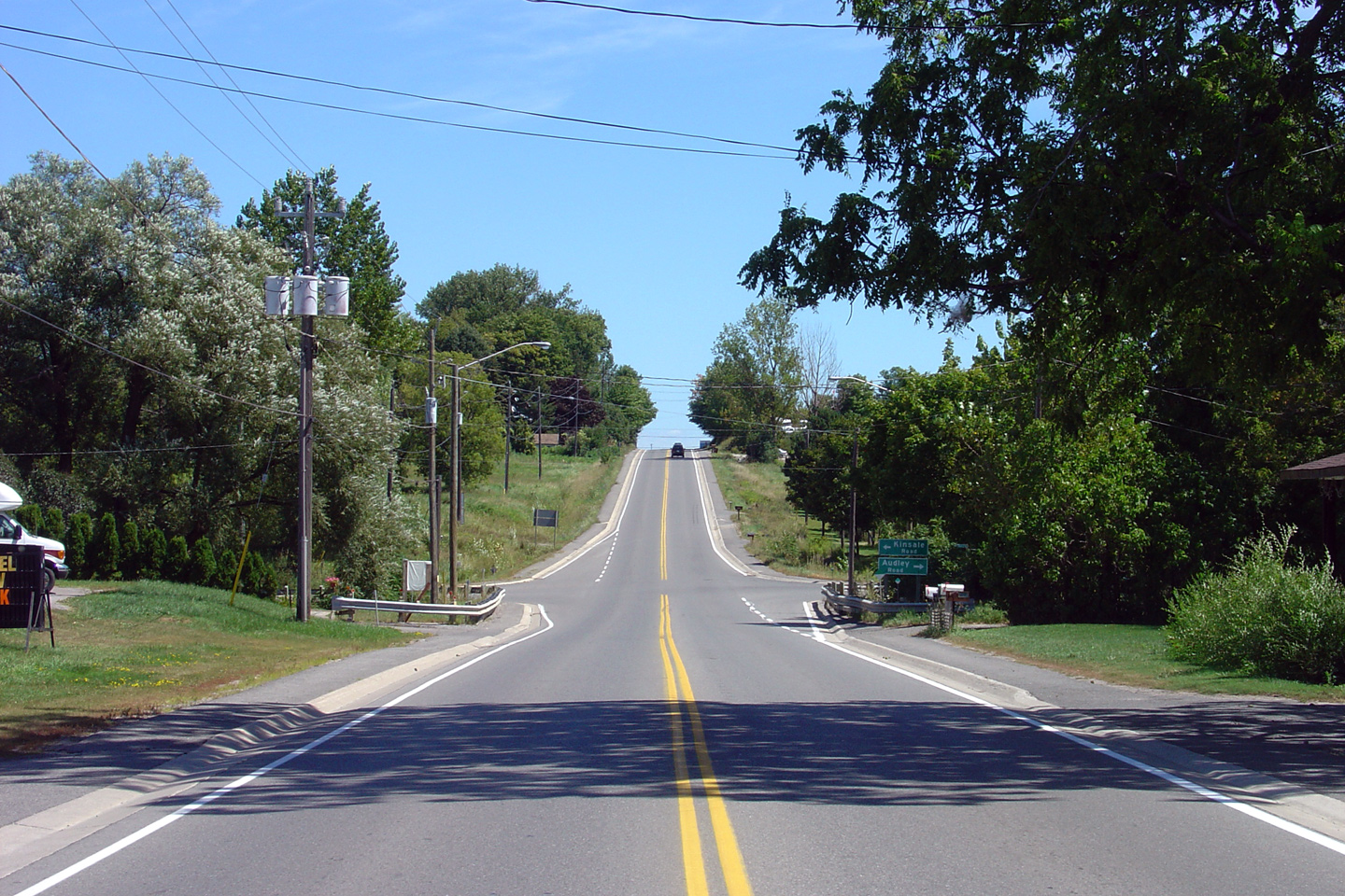
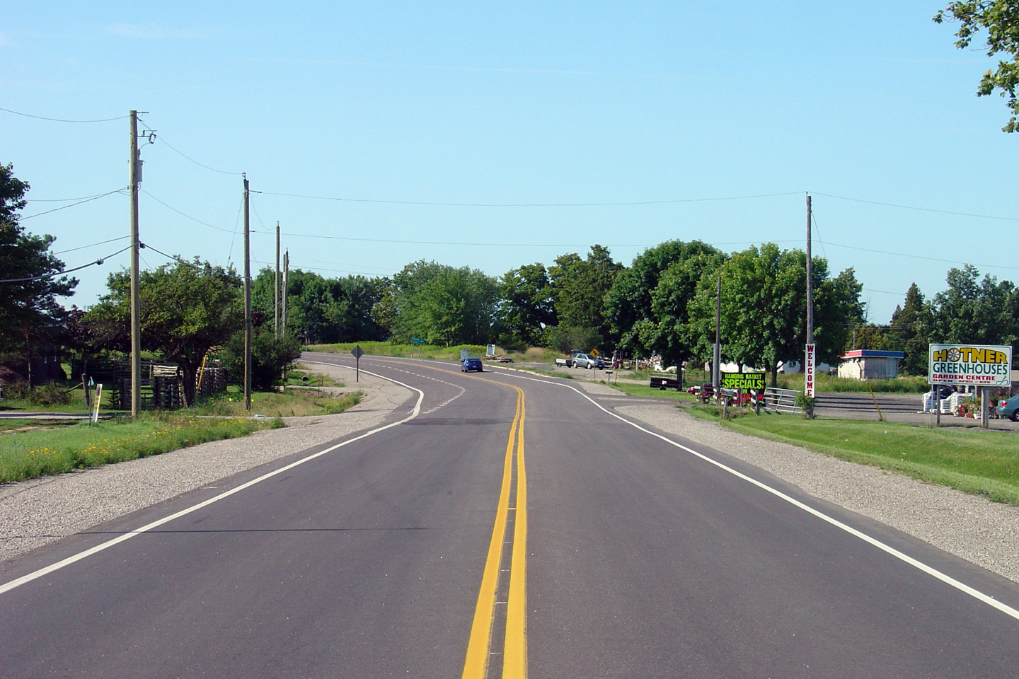
| Township of Scugog Regional Municipality of Durham |
This view looks northerly approaching the Reach
Street intersection. Reach Street links Port Perry to Uxbridge. Photo taken: July 5th, 2009. |
 |
|||
| Highway 47 departs westerly from Highway 7/12 from just south of Greenbank, bound for Uxbridge, and Stouffville. Click here for Highway 47 images. | |||||
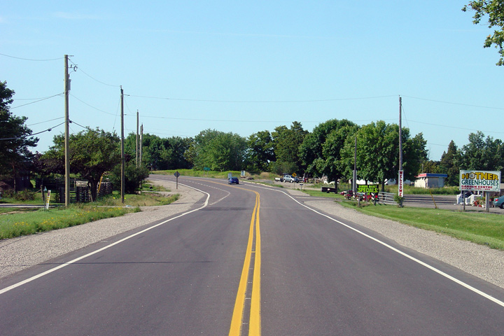
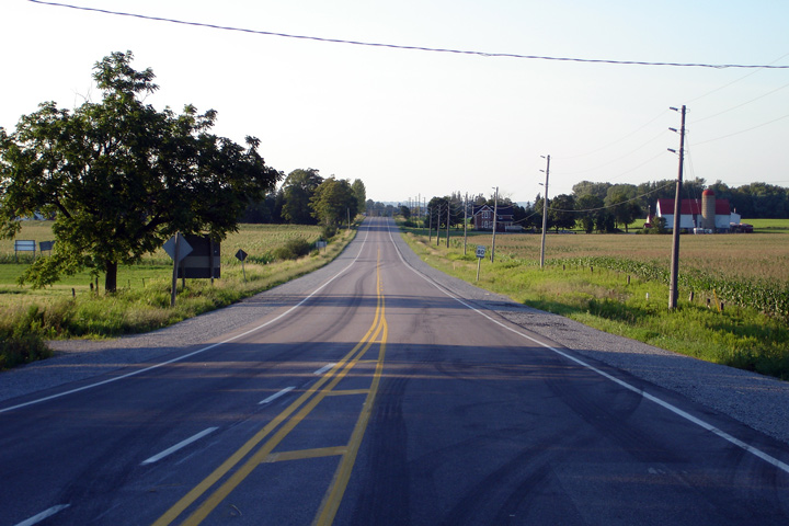
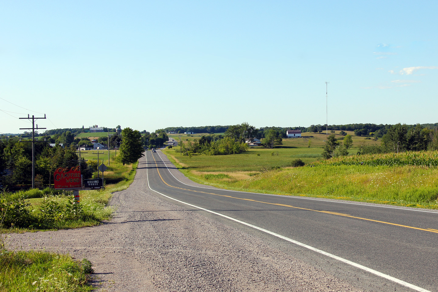
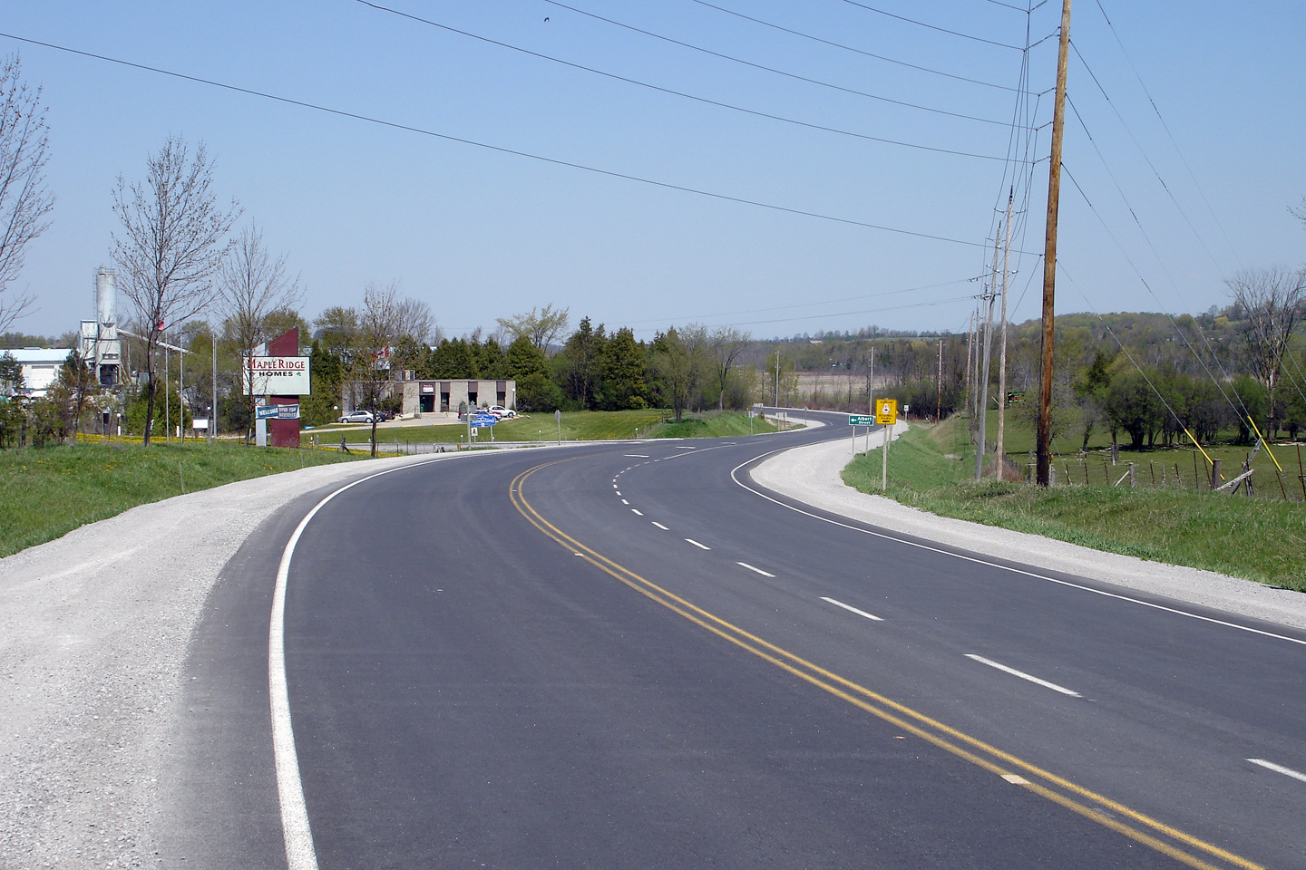
| Township of Scugog Regional Municipality of Durham |
This view looks northerly along Highway 7/12
from just north of the Highway 47 intersection into Greenbank. Photo taken: October 10th, 2010. |
 (720x480) (1440x960) (2400x1600) |
|||
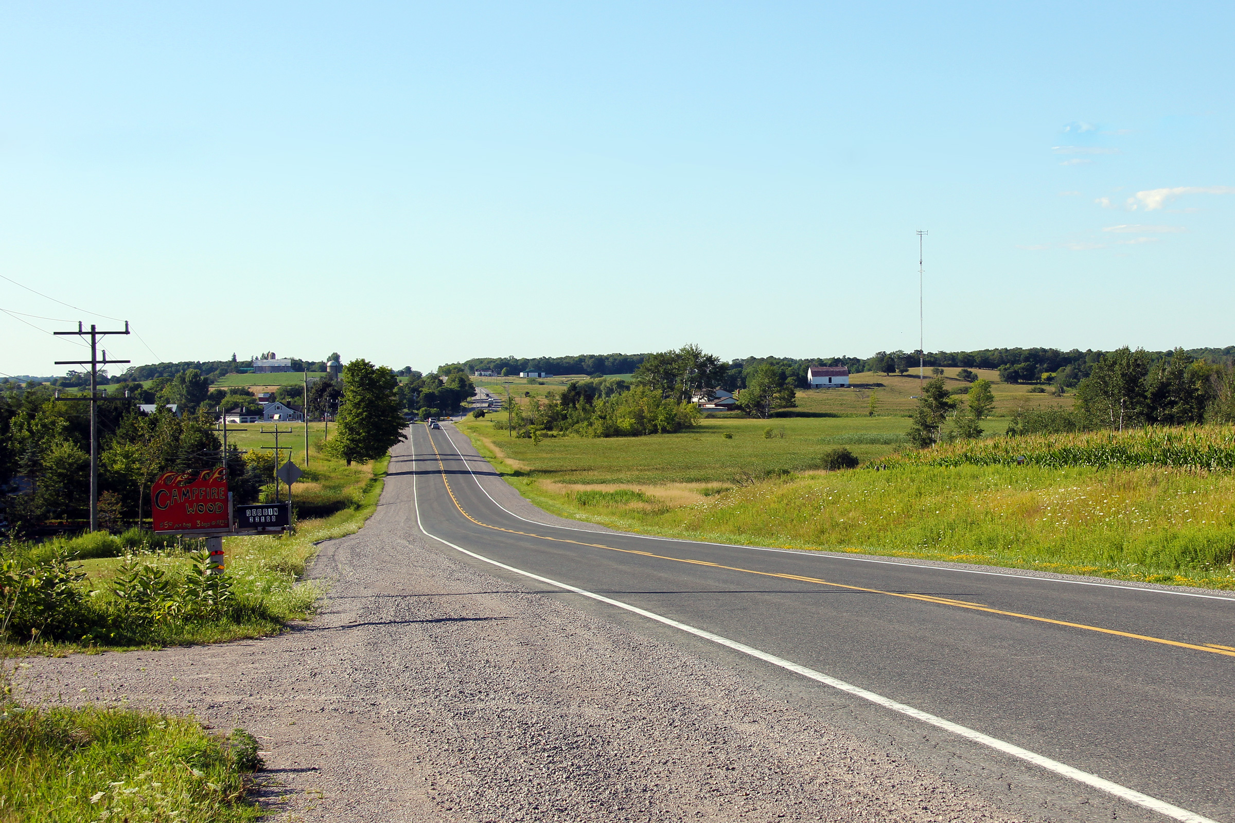
| Township of Scugog Regional Municipality of Durham |
This Photo shows Highway 7/12 looking south
from Greenbank towards the Highway 47 intersection. Click
here for this same view taken in
June, 2004. Photo taken: August 14th, 2013. |
 (720x480) (1440x960) (2400x1600) |
|||
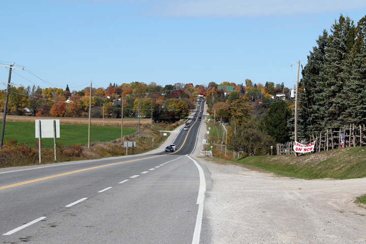
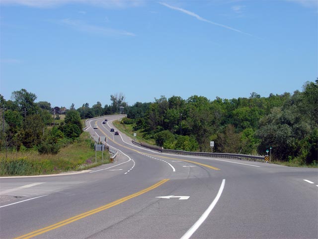
| Township of Scugog Regional Municipality of Durham |
Highway 7/12 looking north from the northern
approach to Greenbank Highway 7/12 travels
through a small moraine from Highway 47 in
the south, to Sunderland in the north. As such, this type of rolling terrain is fairly typical for the area.
Photo taken: May 29th, 2004. |
|
|||
| Township of Scugog Regional Municipality of Durham |
Northerly view approaching Saintfield from just
north of the Blue Mountain Road intersection. Photo taken: July 28th, 2012. |
 (720x480) (1440x960) (2400x1600) |
|||
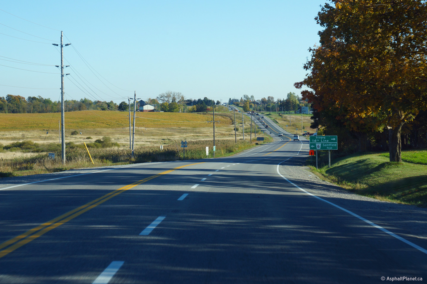
| Township of Scugog Regional Municipality of Durham |
This view looks southerly as Highway 7/12 passes
through the Saintfield Road intersection. Photo taken: September 27th, 2013. |
 (720x480) (1440x960) (2400x1600) |
|||
| Township of Scugog Regional Municipality of Durham |
This view looks southerly along Highway 7/12
towards Saintfield from just south of the Brock Concession 1 intersection. Photo taken: July 30th, 2013. |
 |
|||
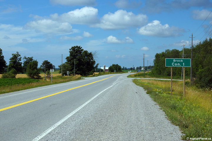
| Township of Scugog Regional Municipality of Durham |
Northerly view through the Brock Concession 1
intersection. Brock Concession 1 runs along the boundary between Brock and
Scugog townships. Photo taken: July 30th, 2013. |
 |
|||
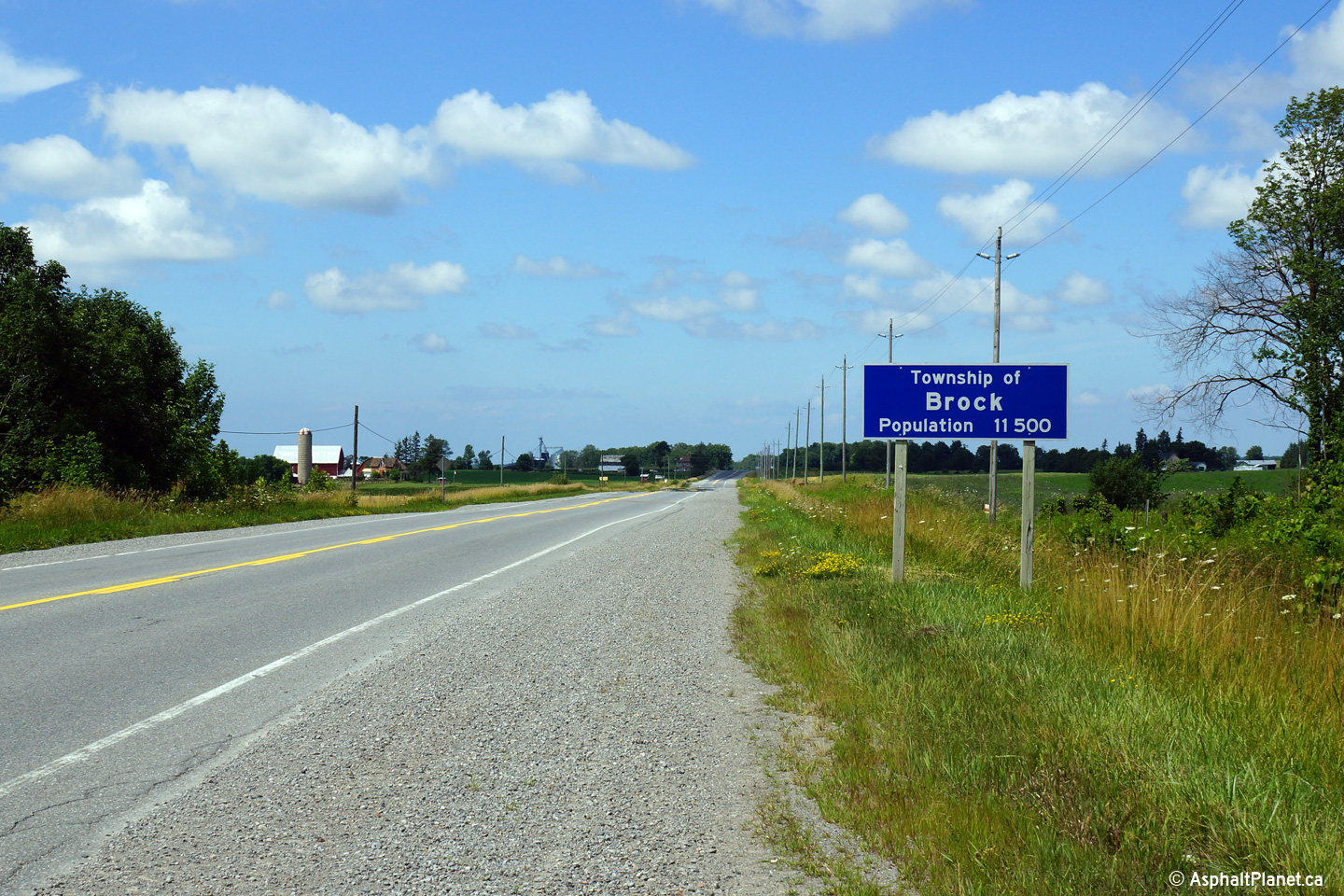
| Township of Brock Regional Municipality of Durham |
Sign advising motorists they have entered the
township of Brock. Brock has the smallest population of any
municipality in the Region of Durham. Photo taken: July 30th, 2013. |
 (720x480) (720x480)(1440x960) |
|||
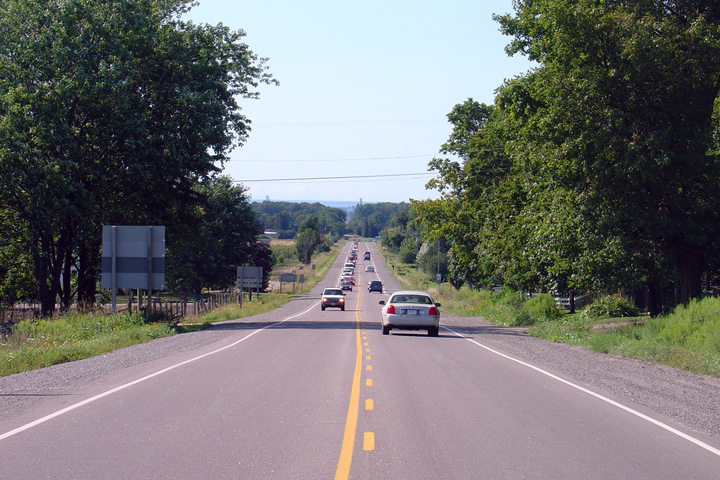
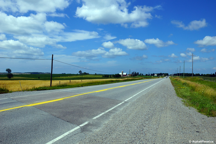
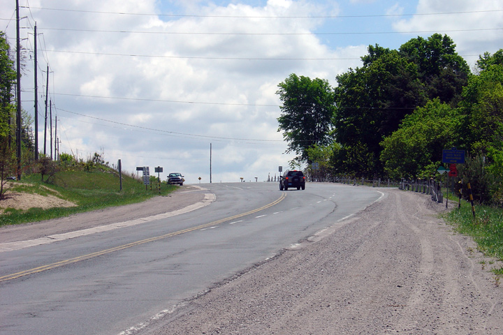
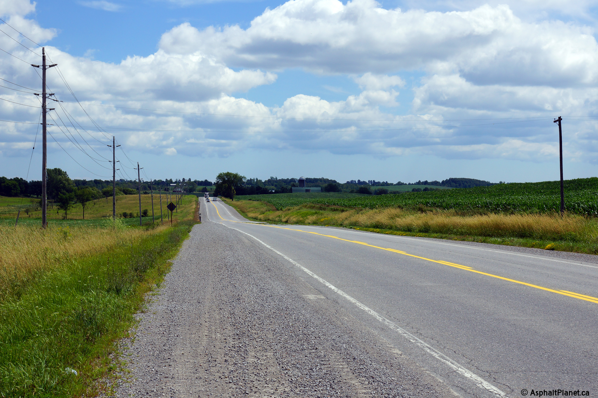
| Township of Brock Regional Municipality of Durham |
Northerly view through a particularly bucolic
landscape north of Brock Concession 1. Photo taken: July 30th, 2013. |
 |
|||
| Township of Brock Regional Municipality of Durham |
Southerly view from just south of the Brock 2nd
Concession intersection. Photo taken: July 30th, 2013. |
 |
|||
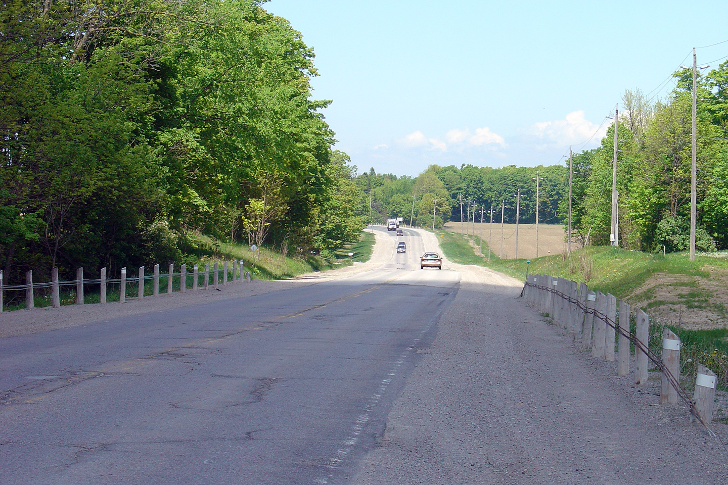
| Township of Brock Regional Municipality of Durham |
Highway 7/12
looking north from just north of Brock 2nd Line. I have included two
photos to highlight the pre- and post-reconstruction condition of the
highway. Note that a passing lane has been added to the highway in the
most recent photo. A short truck climbing lane had long existed
southerly from the Durham Road 13 intersection, however it was extended
during the 2005 reconstruction. Further, notice the state of decay
that Highway 7/12 was in prior to the 2005 reconstruction. Upper photo taken: June 1st, 2005. Lower photo taken: May 10th, 2006. |
 |
|||
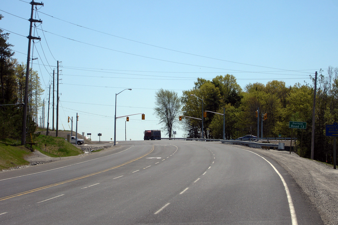
| Township of Brock Regional Municipality of Durham |
This view looks northerly approaching the Durham
Road 13 intersection. Traffic signals were added to the Durham Road 13
intersection during the 2005 reconstruction. Because of the steep
grades on both Durham Road 13 approaches a split phase signal was installed,
allowing only one direction of Regional Road 13 traffic to progress through
the intersection at a time. Photo taken: May 10th, 2006. |
 |
|||
| Township of Brock Regional Municipality of Durham |
Highway 7/12
looking north towards the intersection with Durham Road 13. The
intersection with Durham Road 13 was substantially improved as part of the
2005 construction project. Notice the wider lanes, longer
turning tapers, and turning lanes, and improved sightlines and grades along Durham Road 13. Upper photo taken: June 1st, 2005. Lower photo taken: May 10th, 2006. |
 |
|||
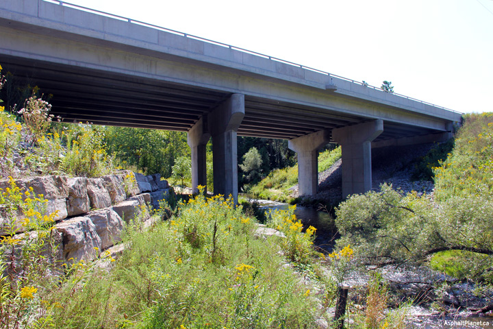
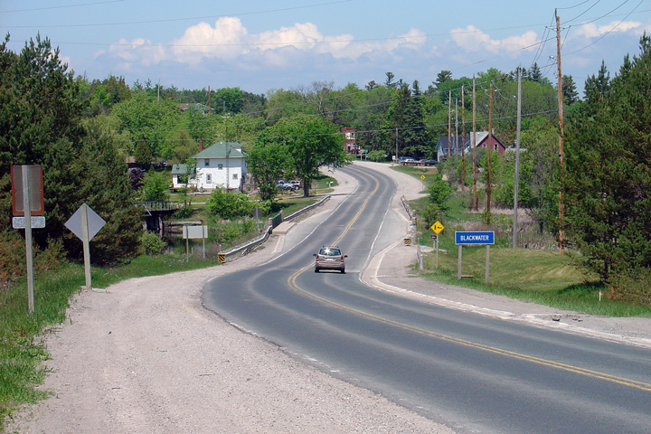
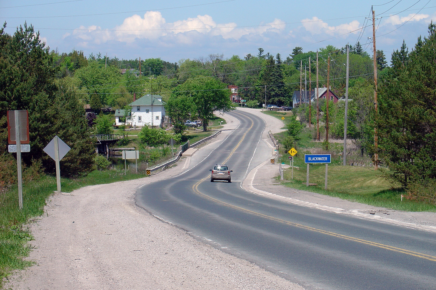
| Township of Brock Regional Municipality of Durham |
Highway 7/12 looking north through Blackwater from
just north of the Durham Road 13. Blackwater is a very small hamlet
located solely on Highway 7/12. The
bridge over the Beaver River (pictured here) was rehabilitated in
the summer of 2006. Photo taken: June 1st, 2005. |
|
|||
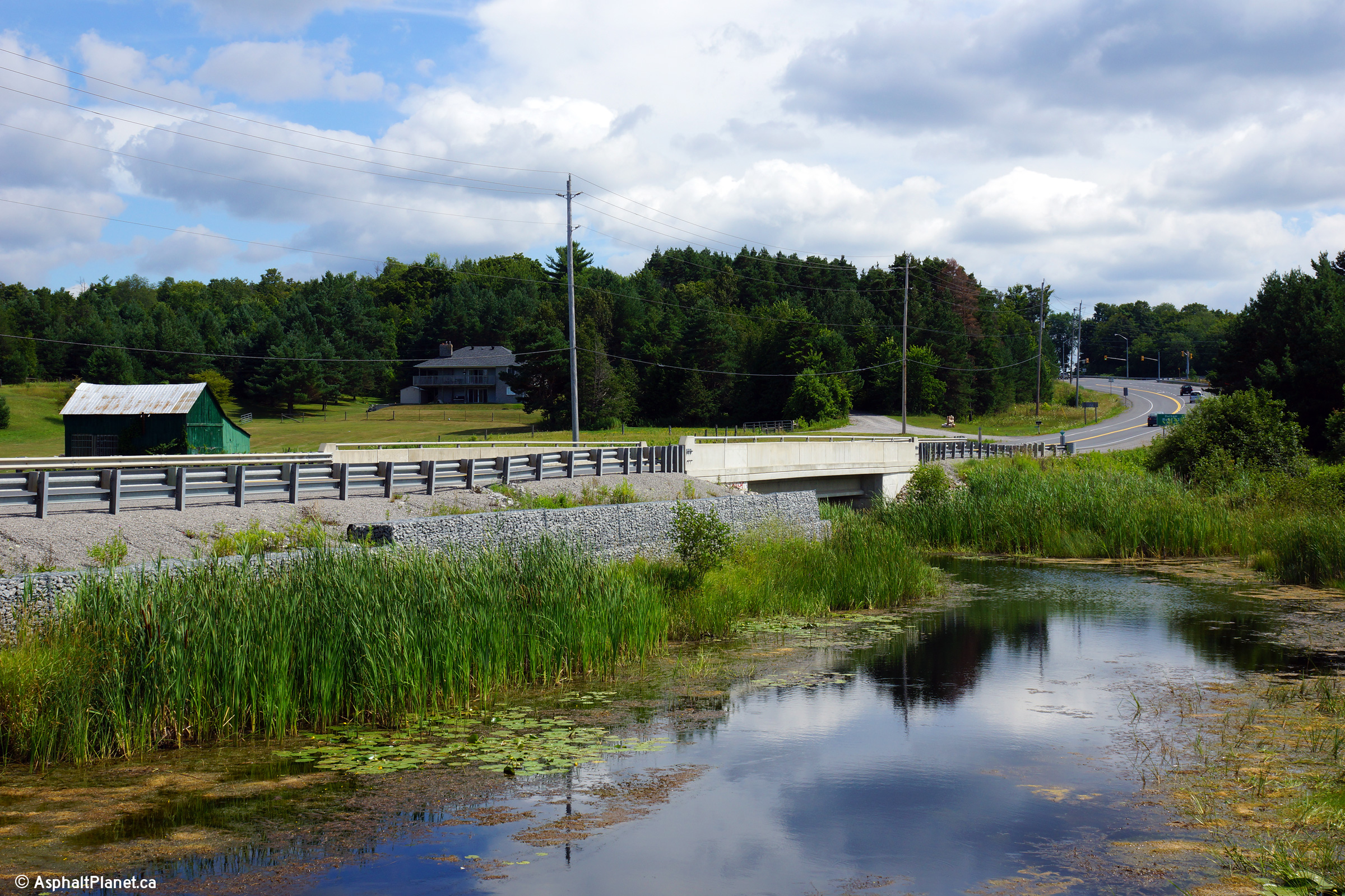
| Township of Brock Regional Municipality of Durham |
View looking easterly towards the
Beaver River bridge along Highway 7/12. Photo taken: July 30th, 2013. |
 |
|||
| Township of Brock Regional Municipality of Durham |
This view looks southerly approaching Blackwater
from the Brock 4th Concession Road intersection. Photo taken: May 10th, 2006. |
 |
|||
| Township of Brock Regional Municipality of Durham |
Northerly view along Highway 7/12 approaching
the Albert Street intersection. Albert Street is Sunderland's main
north-south street and is a former alignment of Highway 7/12. Before
the 1960s, Highway 7/12 entered Downtown Sunderland via Albert Street, and
jogged along River Street before returning to the current highway alignment
north of town. Photo taken: May 10th, 2006. |
 |
|||
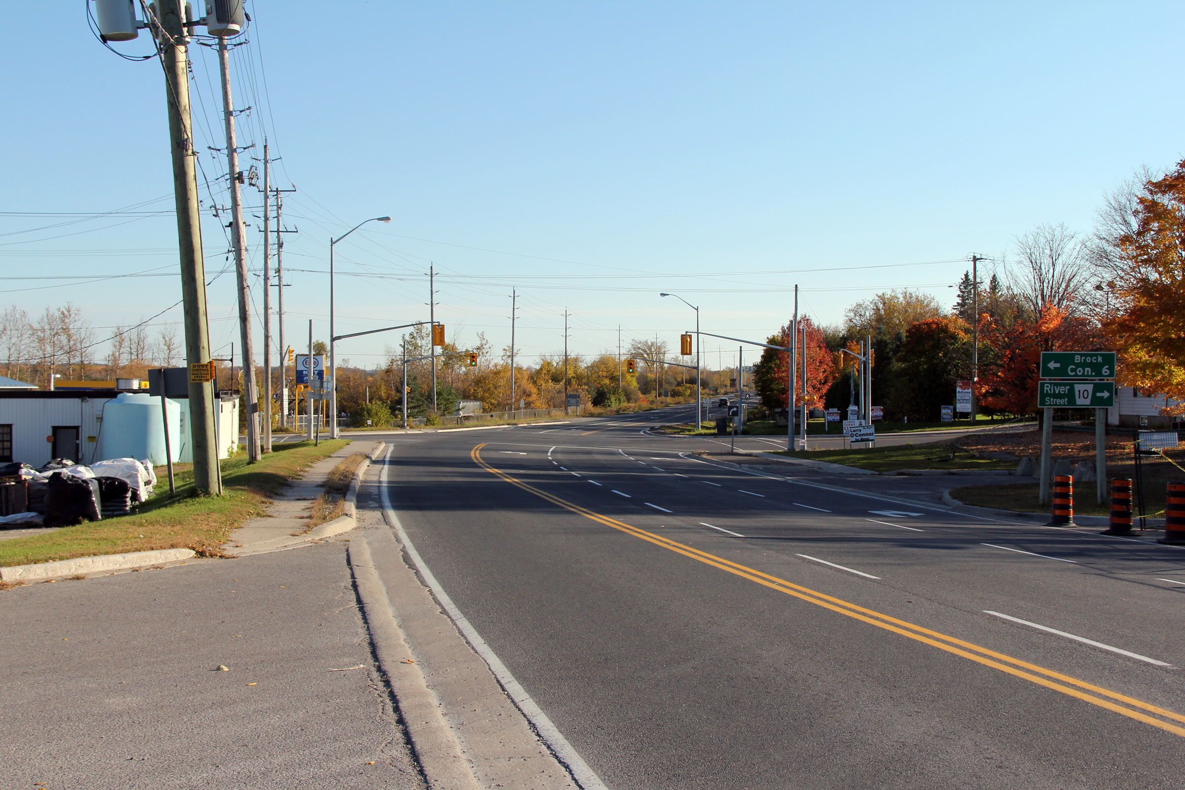
| Township of Brock Regional Municipality of Durham |
This southerly view is approaching the River
Street intersection in Sunderland. Traffic signals were added to the
River Street intersection during a 2005 reconstruction project. In
fact, the overall number of traffic signals along Highway 12 nearly doubled
in the period between the year 2000 and 2010. Photo taken: October 10th, 2010. |
 (720x480) (1440x960) (2400x1600) |
|||
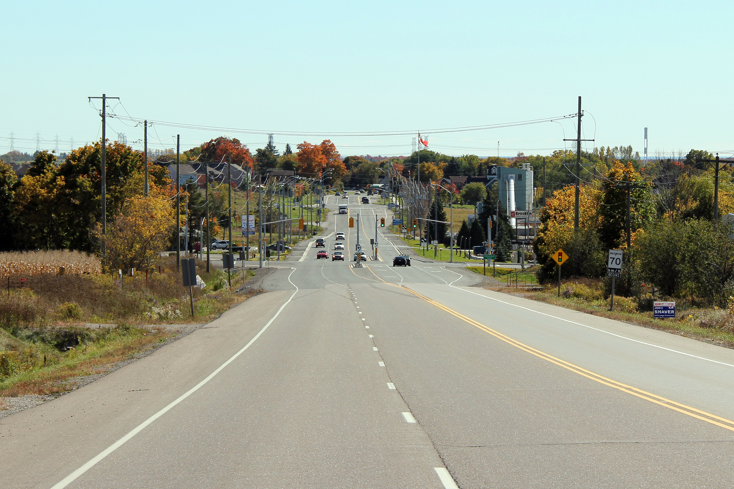
| Township of Brock Regional Municipality of Durham |
View looking northerly along Highway 7/12 from
just north of Sunderland. Note how white the 'A' gravel is within the
shoulders of this highway. Photo taken: May 10th, 2006. |
 |
|||
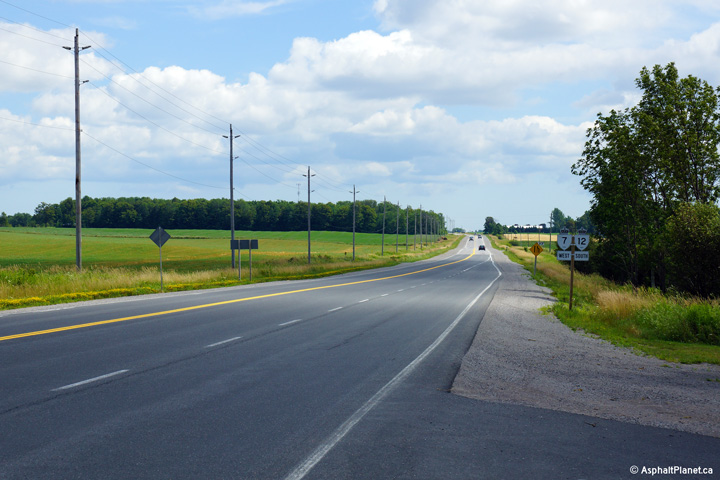
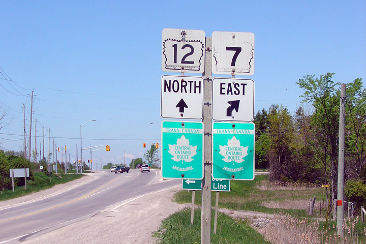
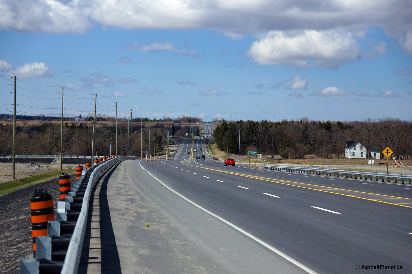
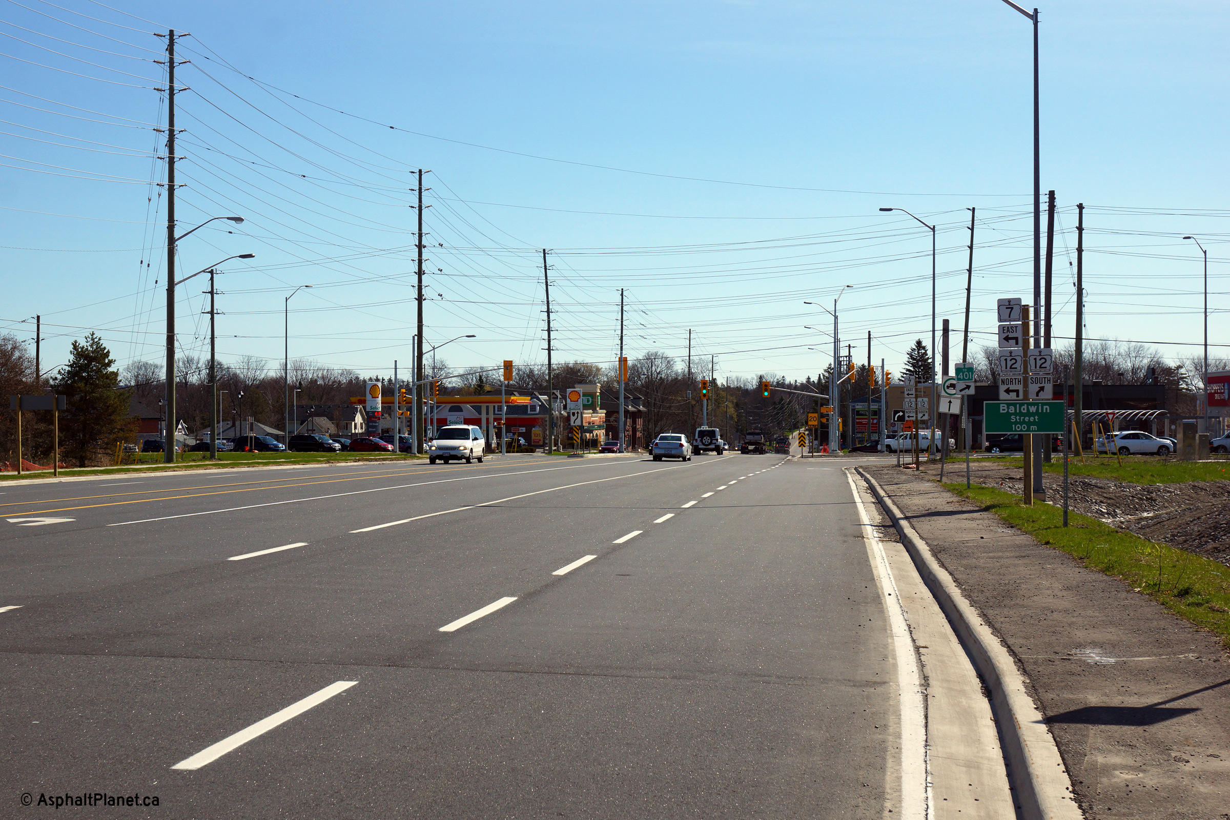
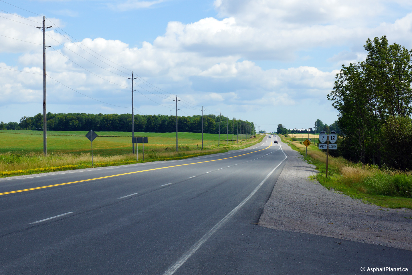
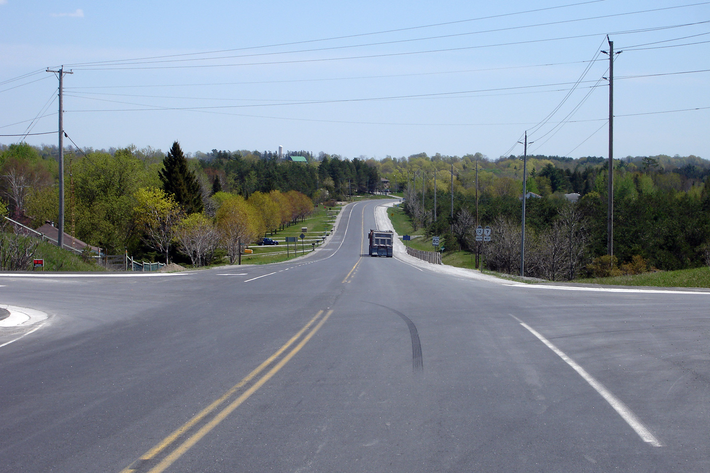
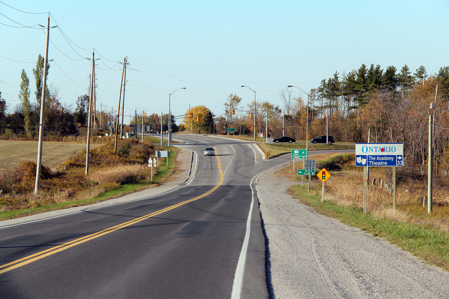
| Township of Brock Regional Municipality of Durham |
This Photo is looking north along
Highway 12
towards the northern junction of Highway 7. Highway 7 east leads traffic to
Lindsay, and is locally know as the Lindsay Highway. Upper photo taken: June 1st, 2005. Lower photo taken: October 10th, 2010. |
 (720x480) (1440x960) (2400x1600) |
|||
| Township of Brock Regional Municipality of Durham |
The junction assembly for the northern split of
Highways 7 and 12. This photo is noteworthy, as it denotes the only
example (I have seen at least) where Trans-Canada Highway shields
are shown at a junction. Typically motorists are not given any
Trans-Canada Signage at junctions, and as such can not follow when a TCH
route turns or switches highways. Photo taken: June 1st, 2010. |
|
|||
| Highway 12 continues north from Highway 7 through Beaverton into Orillia. Click here for Highway 12-North images. | |||||
| Sunderland to Peterborough Images available here | |||||
<- Page 2C Images Highway 7 Images Index Page 3A Images ->
<- Highway 6 Images Back to Highway 7 - Page 2 Highway 7A Images ->
Copyright (c) 2004-2015, Scott Steeves (Webmaster) AsphaltPlanet@asphaltplanet.ca


