AsphaltPlanet.ca >
OntHighways > Highway 7 >
Images > Page 2C
King's Highway 7 - Images
<- Page 2B Page 2C - Richmond Hill to Pickering Page 2D ->
Photos shown in this table are arranged from West to East:
| Proper Municipality Name | Photo Description | Photo | |
|
Photos taken from driver's perspective appear offset from centre-line Photos: |
East- Bound |
West- Bound |
|
| Brampton to Vaughan Images click here | |||
| Highway 404 is a short commuter highway that leads north and south from Highway 7. Click here for Highway 11 images. | |||
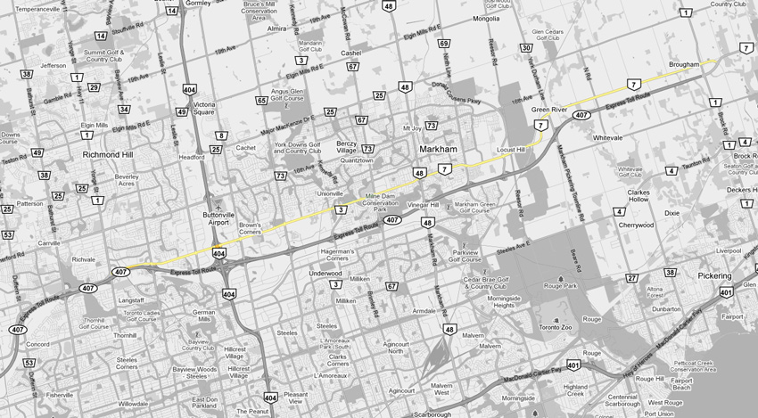
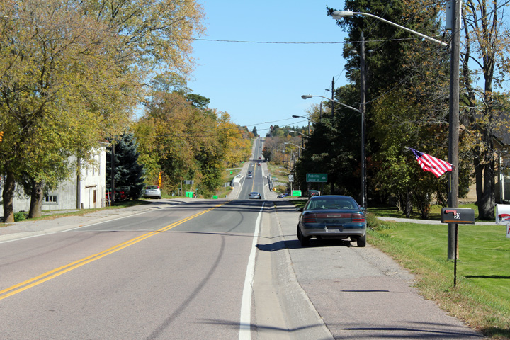
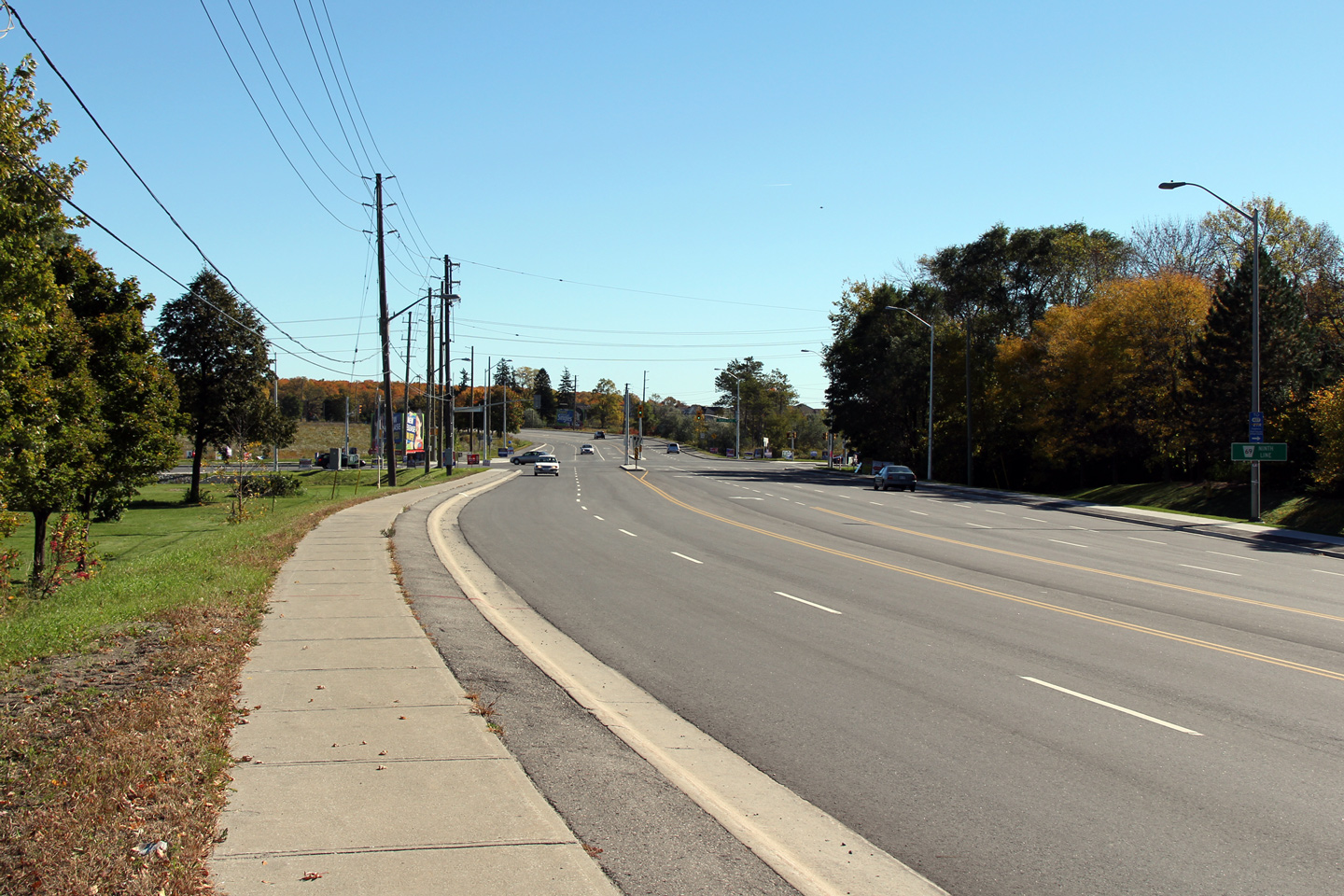
| Town of Richmond Hill Regional Municipality of York |
Westerly view along Highway 7 approaching the
connector road the links Yonge Street to Highway 7. Photo taken: October 30th, 2011. |
 (720x480) (1440x960) (2400x1600) |
|
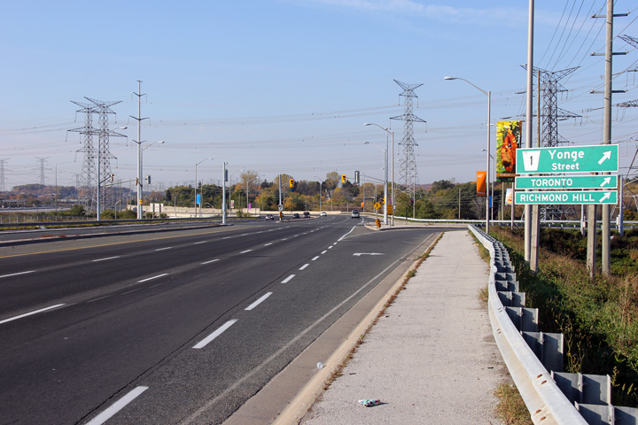
| Town of Richmond Hill Regional Municipality of York |
View looking west from the Bayview Avenue
overpass. Note the intersection with the connector ramp between
Highway 7 and Bayview Avenue. Photo taken: August 28th, 2005. |
 |
|
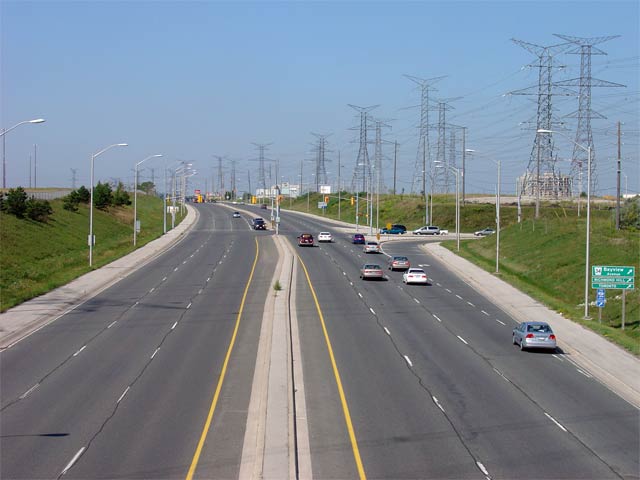
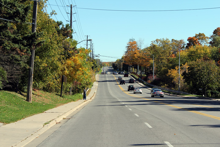
| Town of Richmond Hill Regional Municipality of York |
Looking easterly from the Bayview Avenue
overpass along Highway 7. Beyond the Photod curve, Highway 7 enters
the Beaver Creek industrial park. Through the industrial park, the
speed limit drops to 70km/h. Photo taken: August 28th, 2005. |
 |
|
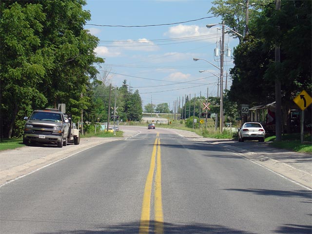
| Richmond Hill - Markham Boundary Regional Municipality of York |
A close-up view of the curve Photod above,
east of Bayview Avenue. The Beaver Creek Industrial Park has a much
more urban feel then most of Highway 7 through Richmond Hill. There
are several closely spaced traffic lights between this curve and Highway 404. Photo taken: July 6th, 2007. |
 |
|
| Richmond Hill - Markham Boundary Regional Municipality of York |
View looking eastbound along Highway 7 from the
traffic light at East Beaver Creek. The Highway 404 interchange is
visible in the photo. Photo taken: July 6th, 2007. |
 |
|
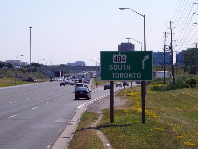
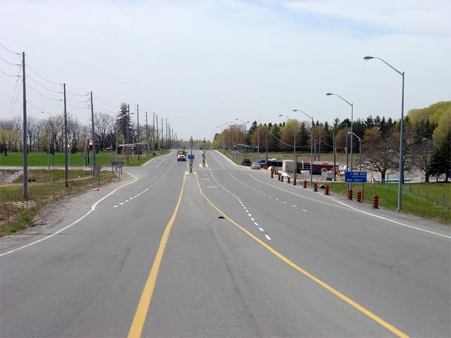
| Richmond Hill - Markham Boundary Regional Municipality of York |
Green sign in advance of the long directional
ramp to Highway 404 south from Highway 7
East. The ramp from eastbound Highway 7 converges with the westbound
ramp before passing under the Highway 404 off-ramp to Highway 407 before
joining with the freeway. Photo taken: July 6th, 2007. |
 |
|
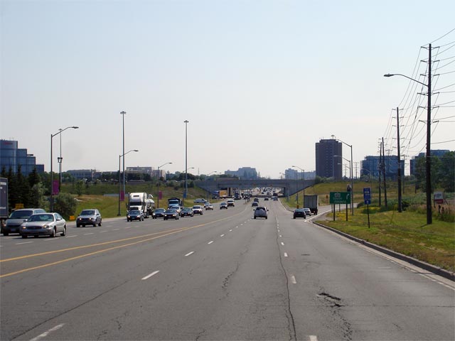
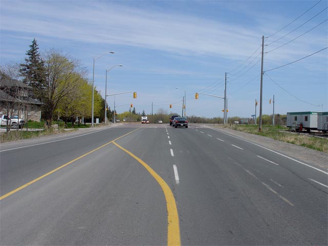
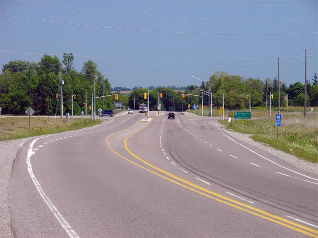
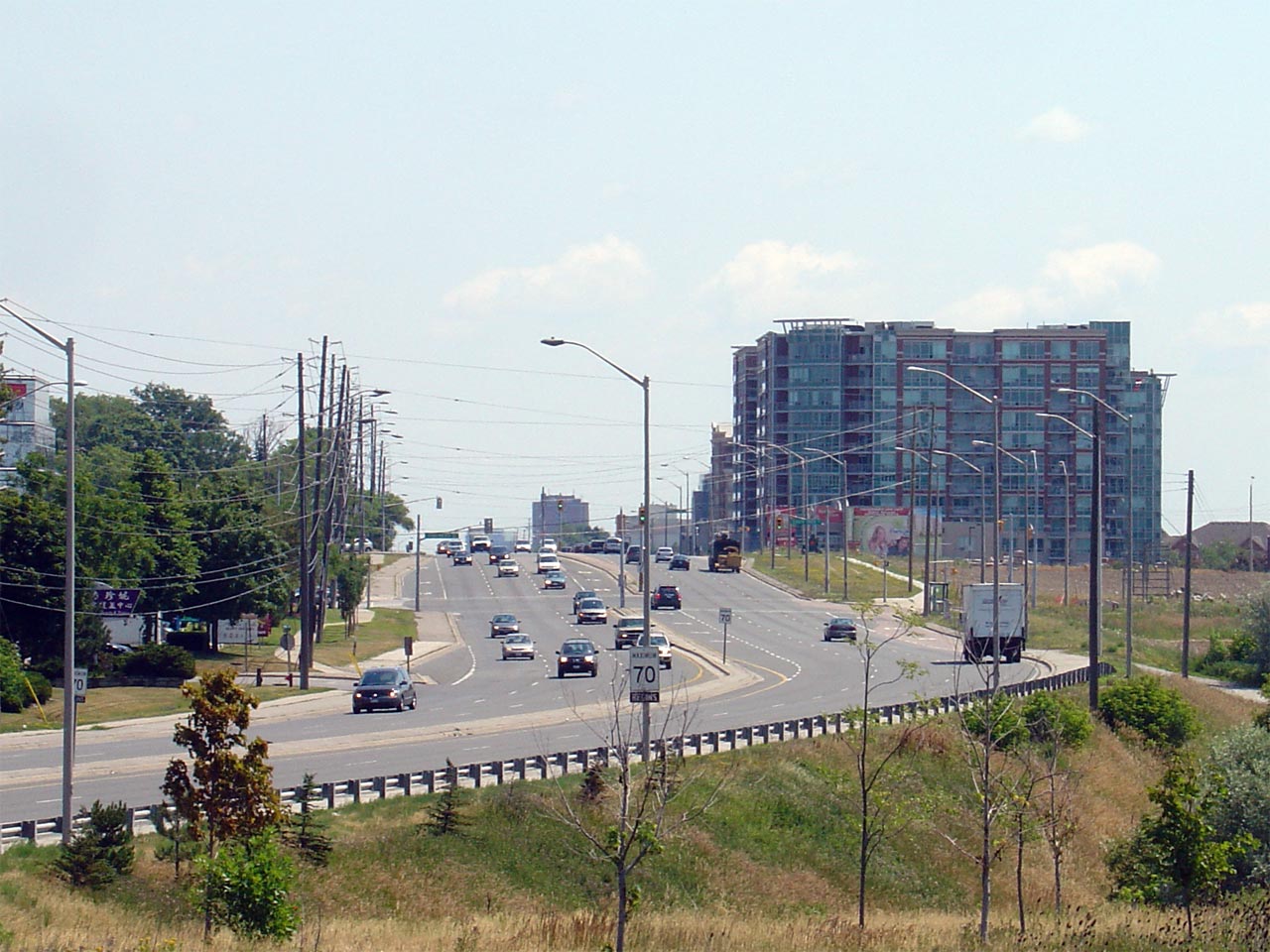
| Richmond Hill - Markham Boundary Regional Municipality of York |
View looking westerly along Highway 7 from the
Highway 404 interchange. Photo taken: July 6th, 2007. |
 |
|
| Highway 404 is a short commuter highway that leads north and south from Highway 7. Click here for Highway 404 images. | |||
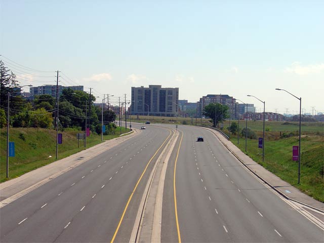
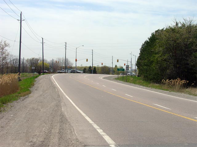
| City of Markham Regional Municipality of York |
Westerly view towards the Lunar Crescent
Intersection (the traffic signal immediately east of Woodbine Avenue). Photo taken: October 9th, 2010. |
 (720x480) (1440x960) (2400x1600) |
|
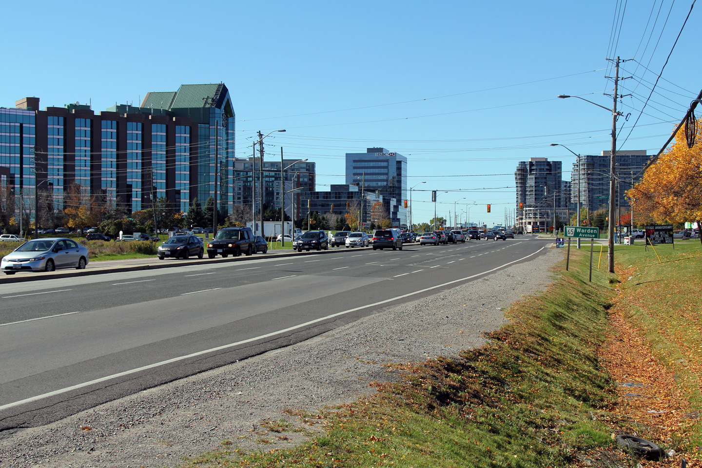
| City of Markham Regional Municipality of York |
Easterly view across the Rouge River bridge
towards the Roddick Road intersection. Markham Town Centre (the
intersection between Highway 7 and Warden Avenue) has an impressive array of
brand new (as of 2010) condominium towers. IBM has a large campus
along Warden Avenue just south of Highway 7, and Markham has a considerable
amount of high-tech industry within its borders. Photo taken: October 9th, 2010 |
 (720x480) (1440x960) (2400x1600) |
|
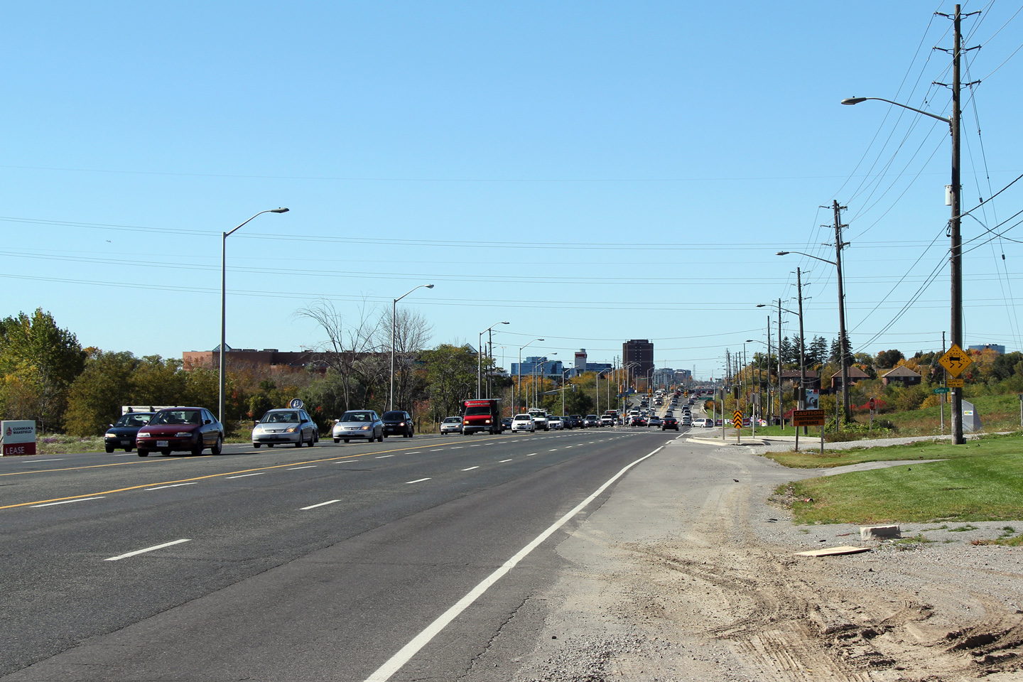
| City of Markham Regional Municipality of York |
This view looks westerly towards the Roddick
Road intersection. Roddick Road is a new north-south arterial street
in Western Markham that serves as a local alternate to Woodbine and Warden
Avenue's. A structure was built in 2008 to carry Roddick Road overtop
of Highway 407. Photo taken: October 9th, 2010. |
 (720x480) (1440x960) (2400x1600) |
|
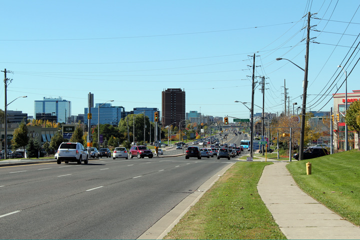
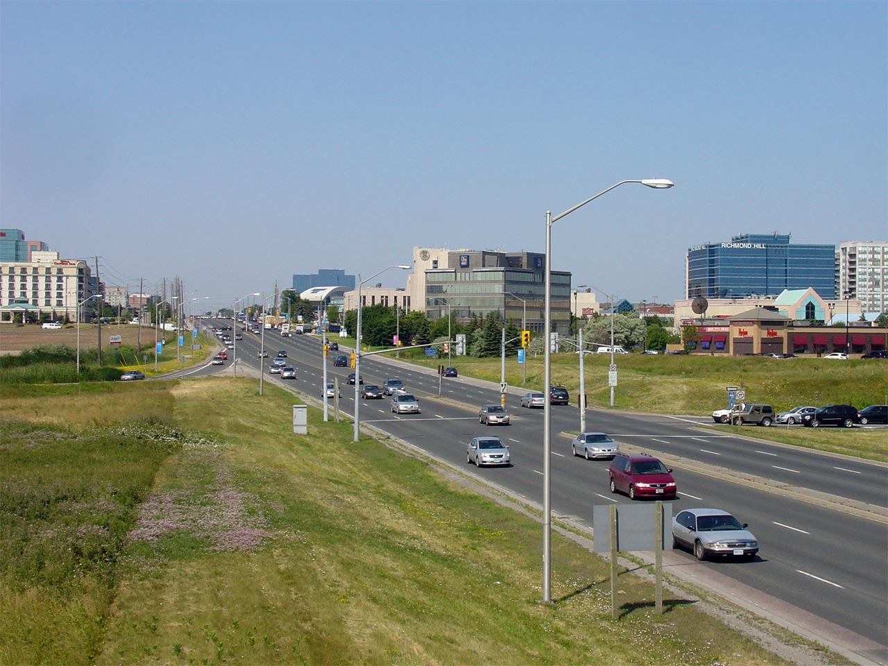
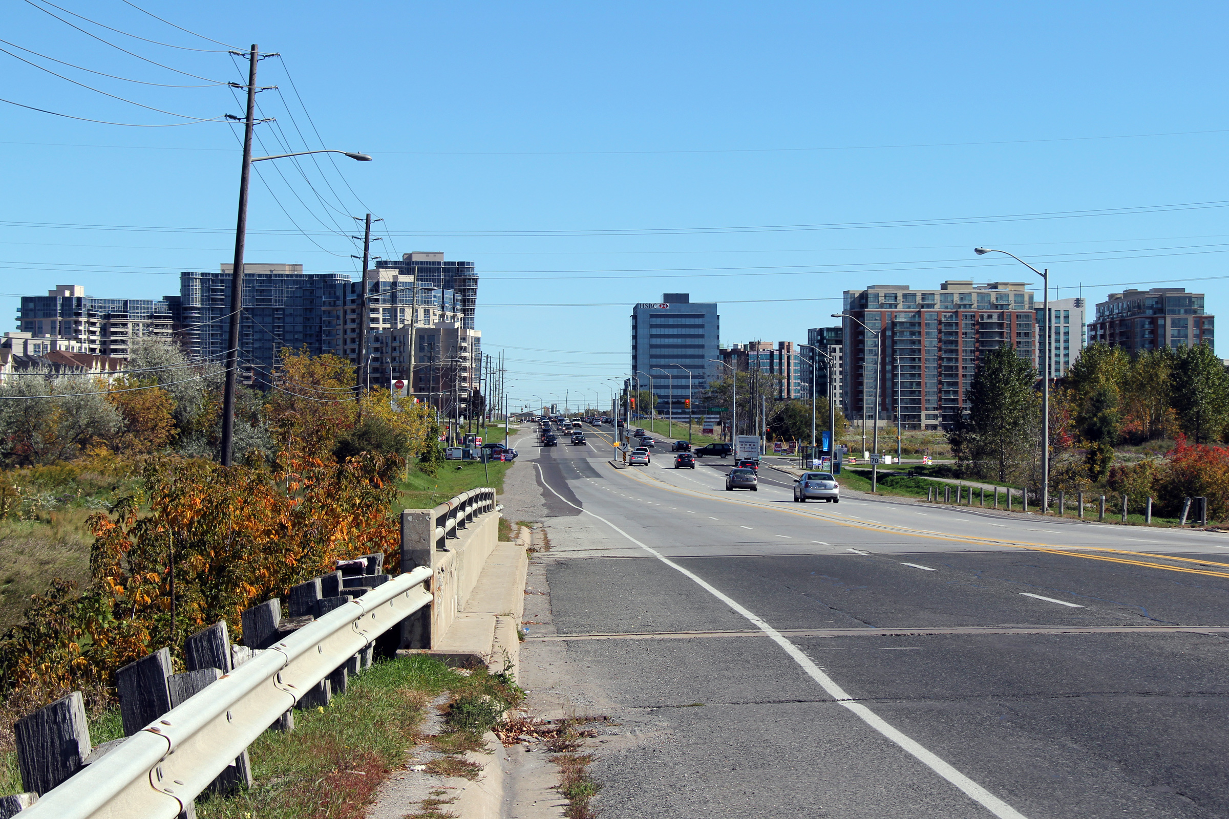
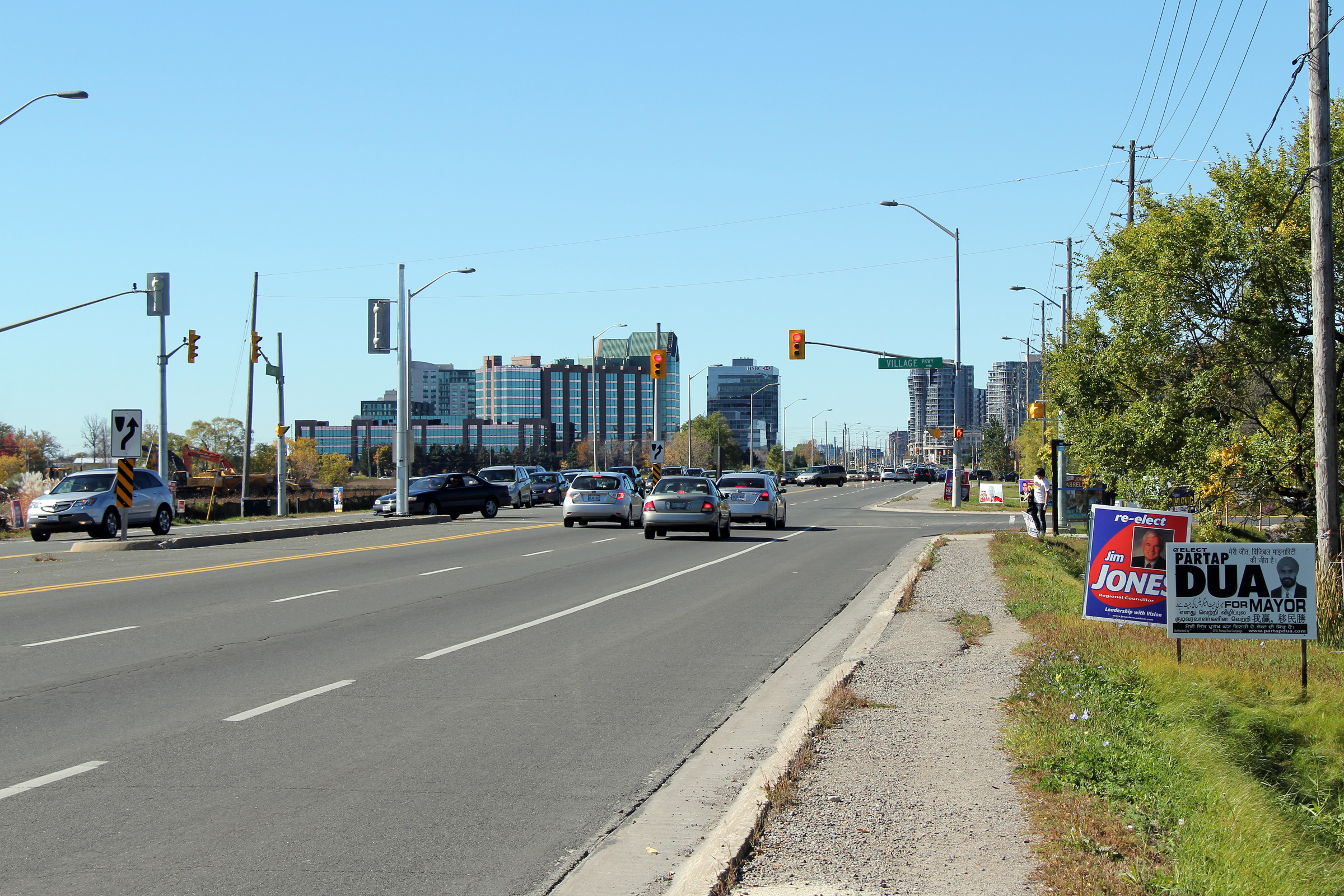
| City of Markham Regional Municipality of York |
Westerly view along Highway 7 from just west of
Warden Avenue. Despite the new urban buildings that have been erected
surrounding the Warden Avenue intersection, Highway 7 has never been
upgraded to an urban cross-section. In fact, Highway 7 even lacks
sidewalks. This cross-section does not reflect York Region's position
of trying to remake Highway 7 into a pedestrian friendly multi-use corridor. Photo taken: October 9th, 2010. |
 (720x480) (1440x960) (2400x1600) |
|
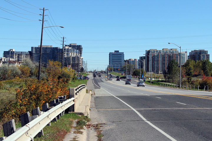
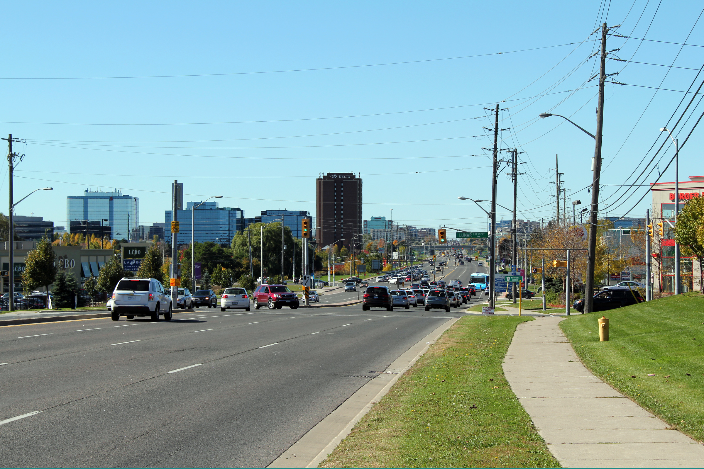
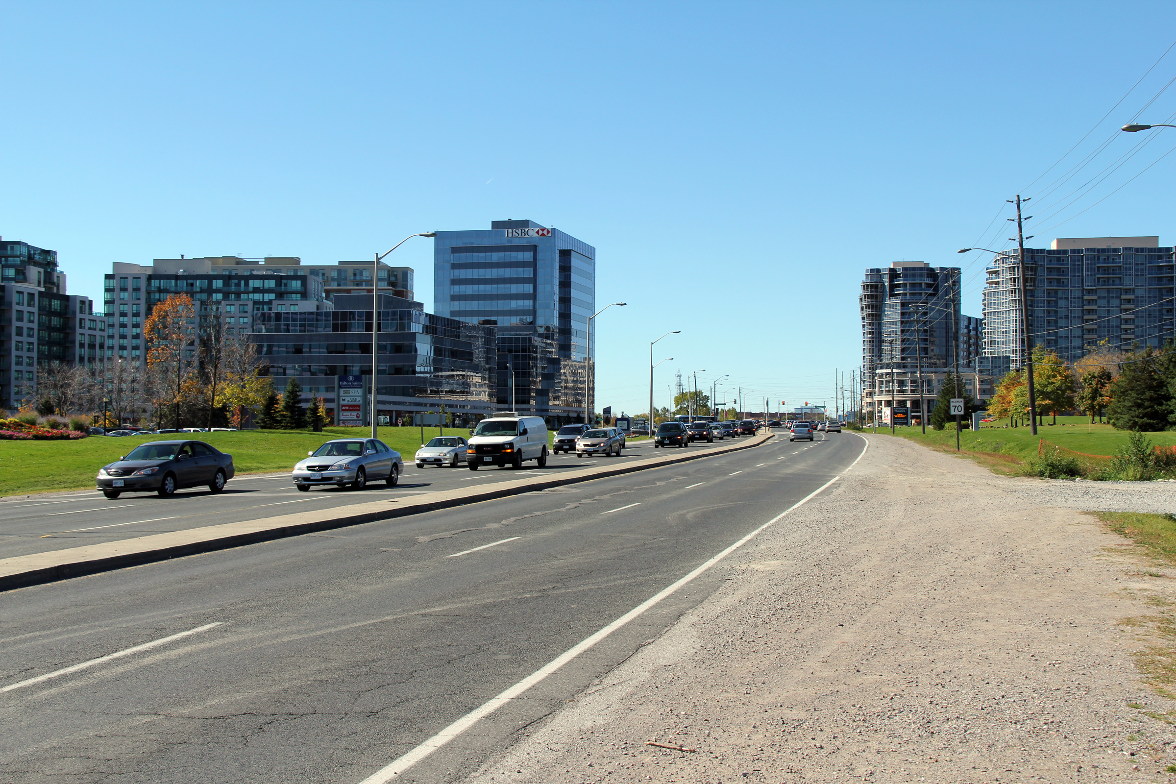
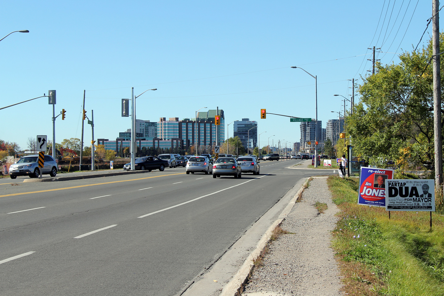
| City of Markham Regional Municipality of York |
Westerly view approaching the Warden Avenue
intersection. The intersection of Warden Avenue and Highway 7 is being
touted as Downtown Markham. Don't let the tall buildings fool you,
Downtown Markham is still very much a suburban intersection. Photo taken: October 9th, 2010. |
 (720x480) (1440x960) (2400x1600) |
|
| City of Markham Regional Municipality of York |
This view looks westerly along Highway 7
approaching the Verclair Gate intersection. Photo taken: October 9th, 2010. |
 (720x480) (1440x960) (2400x1600) |
|
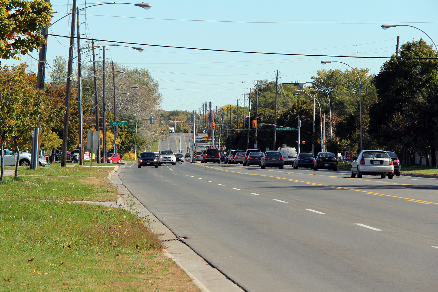
| City of Markham Regional Municipality of York |
View looking easterly along Highway 7 as it
approaches the Conservation Drive intersection. Photo taken: October 9th, 2010. |
 (720x480) (1440x960) (2400x1600) |
|
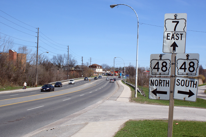
| City of Markham Regional Municipality of York |
Eastbound junction assembly for the intersection
of Highway's 7 and 48 just south of Old Markham Village. This signage
assembly has stood unaltered for as long as it has since provincial
maintenance of Highway 7 actually began easterly from the
Highway 48 intersection until 2004. Photo taken: April 10th, 2010. |
 (720x480) (720x480)(1440x960) |
|
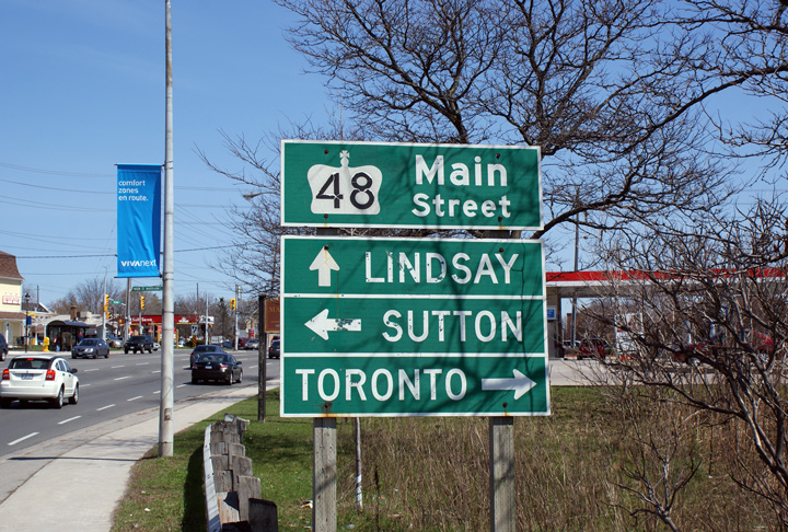
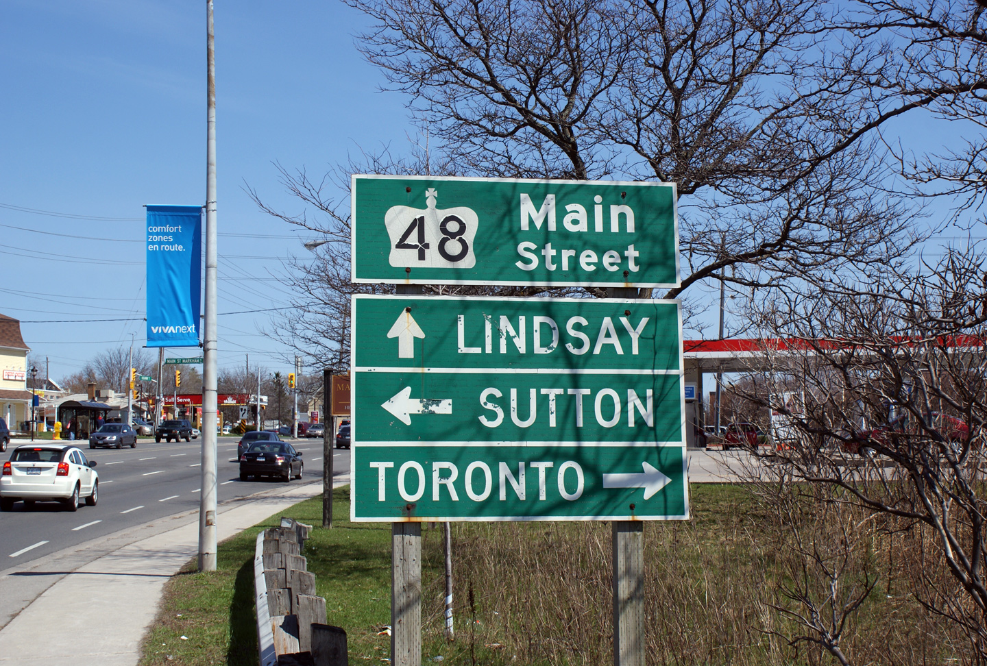
| City of Markham Regional Municipality of York |
Old Green sign denoting Markham's Main Street as
Highway 48. Highway 48 now ends several kilometres north of this sign
at the Major Mackenzie Drive intersection. Photo taken: April 10th, 2010. |
 (720x480) (720x480)(1440x960) |
|
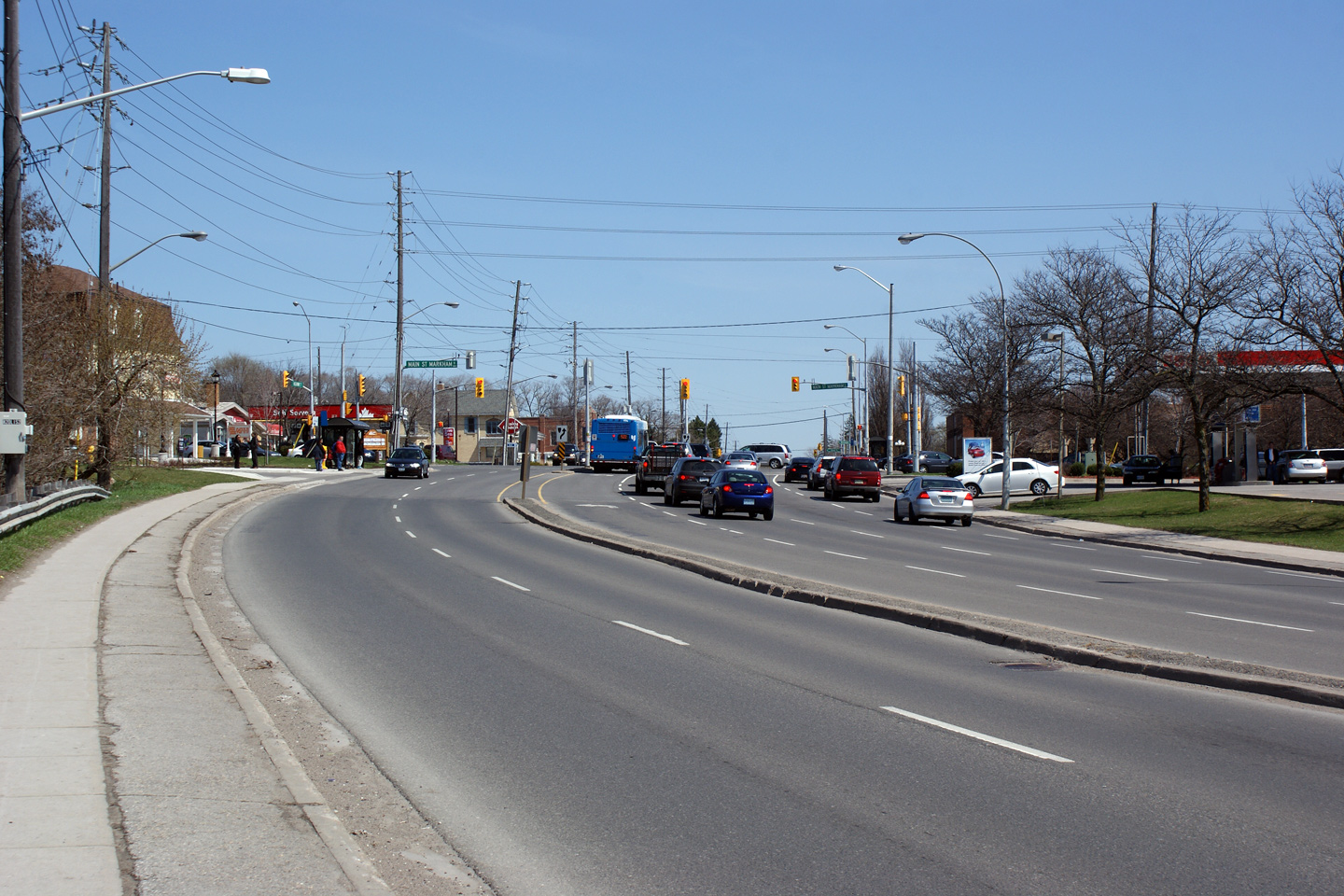
| City of Markham Regional Municipality of York |
Easterly view of Highway 7 approaching the Main
Street intersection. Note the old rounded "cobra-head" style street
light that appears on the south (right) side of the highway. This
light standard design was common on non freeway roads build in the 1960s and
early 1970s. The 1963 widened Highway 6
between Highway's 5 and 403 was lit with similar light standards before it
was reconstructed in the 2000s. Photo taken: April 10th, 2010. |
 |
|
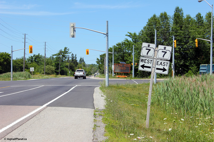
| Highway 48 is Markham's Main Street, and continues northerly bound for Sutton and Beaverton. Click here for Highway 48 images. | |||
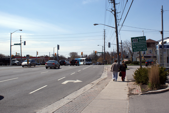
| City of Markham Regional Municipality of York |
View looking westerly approaching the Main
Street intersection. When MTO controlled this intersection, left turn
movements were controlled by a fully protected left turn. Upon
transfer of the signals to the Region of York, the fully protected left was
removed, and replaced by a permissive left turn phase. Photo taken: April 10th, 2010. |
 |
|
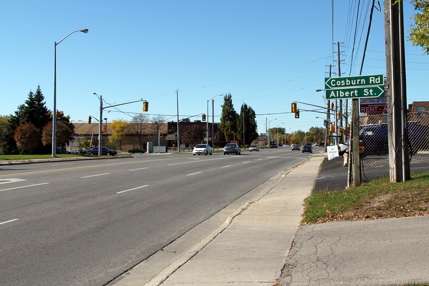
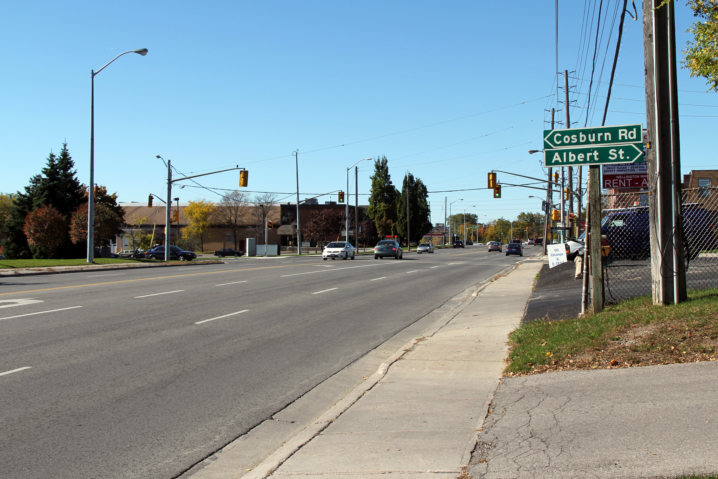
| City of Markham Regional Municipality of York |
View looking westerly towards the
Albert Street intersection. Note how much more visible the green
fingerboard signs that MTO uses are compared to traffic signal mounted signs
that York Region erects. Photo taken: October 9th, 2010. |
 (720x480) (1440x960) (2400x1600) |
|
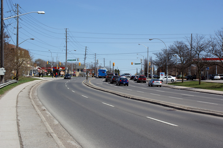
| City of Markham Regional Municipality of York |
Looking east from just east of the
Highway 48. Highway 7 narrows from
5-lanes to 4-lanes east of Highway 48 where it passes by the Elmwood
Cemetery. Photo taken: October 9th, 2010. |
 (720x480) (1440x960) (2400x1600) |
|
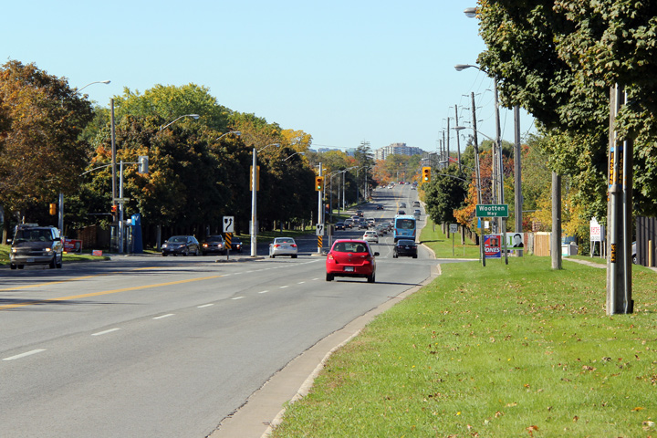
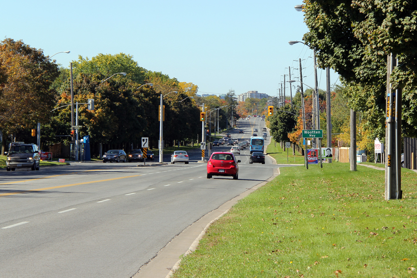
| City of Markham Regional Municipality of York |
Looking west towards the signalized intersection
with Wooten Way. Wooten Way is a minor urban connector road through
the east end of Markham. Photo taken: October 9th, 2010. |
 (720x480) (1440x960) (2400x1600) |
|
| City of Markham Regional Municipality of York |
View looking easterly along Highway 7
approaching the Ninth Line Intersection. Photo taken: October 9th, 2010. |
 (720x480) (1440x960) (2400x1600) |
|
| City of Markham Regional Municipality of York |
Looking west towards the Ninth Line
intersection. Photo taken: May 1st, 2006. |
 |
|
| City of Markham Regional Municipality of York |
View looking east from Ninth Line along Highway
7. Photo taken: May 1st, 2006. |
 (720x480) (1440x960) |
|
| City of Markham Regional Municipality of York |
View looking westerly towards the Markham
By-pass intersection. This intersection was completed in 2004 by the
Region of York when the southern leg of the Markham By-pass was connected to
Highway 407 by a new interchange. Photo taken: May 1st, 2006. |
 |
|
| City of Markham Regional Municipality of York |
Looking easterly towards the Reesor Road
intersection. Photo taken: May 1st, 2006. |
 |
|
| City of Markham Regional Municipality of York |
View looking westerly towards the Reesor Road
intersection. Reesor Road marks the current western terminus of
Highway 7-East. Photo taken: May 1st, 2006. |
 |
|
| City of Markham Regional Municipality of York |
Looking west from Locust Hill across the Rouge
River bridge. Photo taken: August 8th, 2005 |
 |
|
| City of Markham Regional Municipality of York |
View looking east through the small community of
Locust Hill. Note the at grade railway crossing with CP Havelock
Subdivision, as well as the start of the 2001 diversion to avoid the Highway
407 interchange with York/Durham Line. Photo taken: August 8th, 2005. |
 |
|
| City of Markham Regional Municipality of York |
Looking easterly along Highway 7 approaching the
York/Durham Line intersection. This intersection was completed in 2001
when about 1km of Highway 7 was realigned for the construction of Highway
407. Photo taken: August 8th, 2005. |
  (720x480) (1440x960) (2400x1600) |
|
| Markham / Pickering Boundary York / Durham Boundary |
Junction assembly for Highway 7 at the York/Durham Line intersection. These contractor made signs are a poor rendition of typical Ontario junction signage. |
 (720x480) (1440x960) |
|
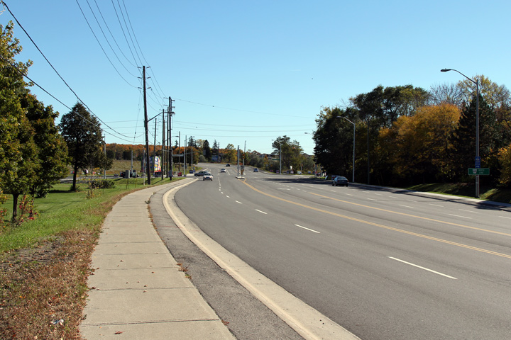
| City of Pickering Regional Municipality of Durham |
Westerly view along Highway 7 at the York/Durham
Line intersection. Photo taken: |
 |
|
| City of Pickering Regional Municipality of Durham |
View looking easterly from just east of the
York/Durham Line through the small community of Green River. Photo taken: October 9th, 2010. |
||
| City of Pickering Regional Municipality of Durham |
View looking down the hill into Green
River. Though it isn't particularly visible in this photo, the West
Duffins Creek bridge, which appears at the bottom of this large valley was
recently rehabilitated and now features steel railings, a la Northern
Ontario. To my knowledge, this is the fist instance of steel barriers being
used on a provincial bridge in Southern Ontario since the late 1960s. Photo taken: October 9th, 2010. |
 (720x480) (1440x960) (2400x1600) |
|
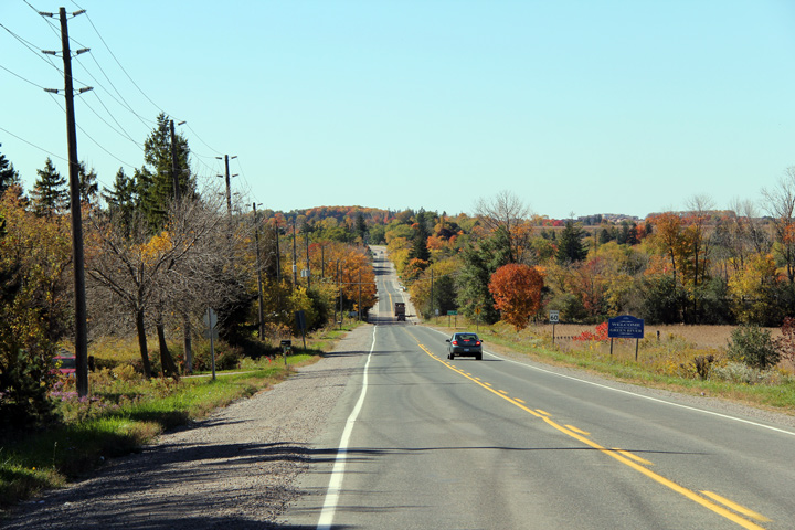
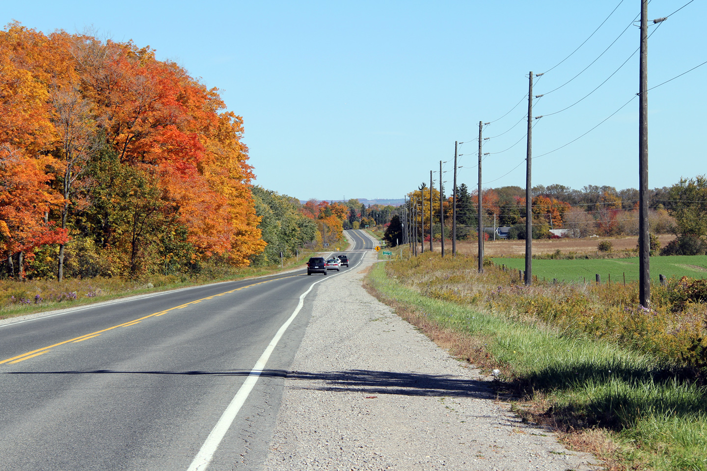
| City of Pickering Regional Municipality of Durham |
View looking easterly along Highway 7 towards
Brougham. Highway 7 is a bit of a forgotten highway between Markham and
Brougham. It is one of the few two-lane highways around the Greater Toronto
Area that wasn't downloaded in 1998; and hasn't been upgraded since the 1980s. Photo taken: October 9th, 2010. |
 (720x480) (1440x960) (2400x1600) |
|
| City of Pickering Regional Municipality of Durham |
Easterly view of the Brock Road intersection in Brougham. When the eastern extension of Highway 407 is completed in 2015, Brock Road will be moved to a new alignment to the east side of the community of Brougham, by-passing this oft congested traffic signal. |
 (720x480) (1440x960) (2400x1600) |
|
| City of Pickering Regional Municipality of Durham |
These views look westerly through the community of Brougham towards the Brock Road intersection. |
 (720x480) (1440x960) (2400x1600) |
|
| Click here for Pickering to Sunderland Images | |||
<- Page 2B Images Highway 7 Images Index Page 2D Images ->
<- Highway 6 Images Back to Highway 7 - Page 2 Highway 7A Images ->
Copyright (c) 2004-2012, AsphaltPlanet.ca AsphaltPlanet@asphaltplanet.ca