AsphaltPlanet.ca >
OntHighways > Highway 7 >
Images > Page 2D
King's Highway 7 - Images
<- Page 2A Page 2B - Brampton to Richmond Hill Page 2C ->
Photos shown in this table are arranged from West to East:
| Proper Municipality Name | Photo Description | Photo | |
|
Pictures taken from driver's perspective appear offset from centre-line pictures: |
East- Bound |
West- Bound |
|
| Guelph to Brampton Images click here | |||
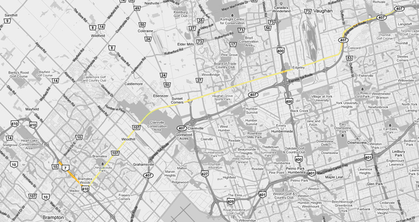
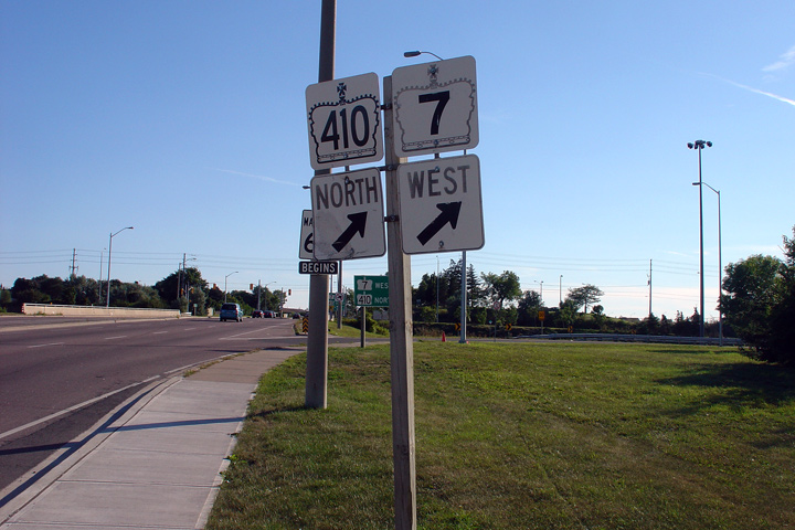
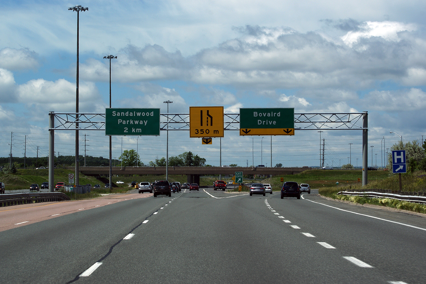
| Highway 410 leads northerly from Highway 7 (Bovaird Drive) into Caledon where it meets Highway 10 (Hurontario Street). Click here for Highway 410-North images. | |||
| City of Brampton Regional Municipality of Peel |
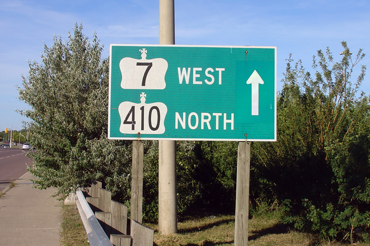
Overhead pull-through signage for the ramp to Bovaird
Drive from Highway 410 North. This was the long time northern terminus of
Highway 410 until the first phase of the extension opened in 2007. Photo taken: June 6th, 2010. |
 Low
Res Low
ResHigh Res |
|
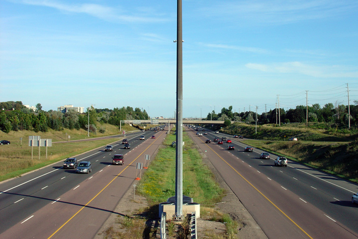
| City of Brampton Regional Municipality of Peel |
View looking northerly from the Franceschini
Drive overpass. Notice that when
this photo was taken, Highway 410 still terminated at the Bovaird Drive
interchange. Photo taken: April 10th, 2005. |
 |
|
| City of Brampton Regional Municipality of Peel |
View
looking southerly from the Franceschini Drive overpass. towards the Williams
Parkway interchange. The Franceschini Drive overpass formerly served a
gravel pit that existed along the west side of Highway 410. A
subdivision has since been built within the gravel it, and Franceschini
Drive has been converted to a pedestrian overpass. Photo taken: April 10th, 2005. |
 |
|
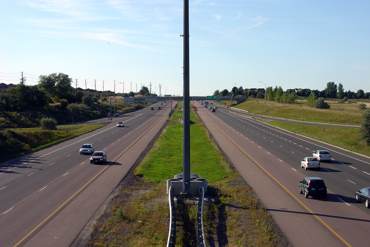
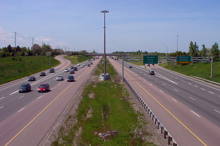
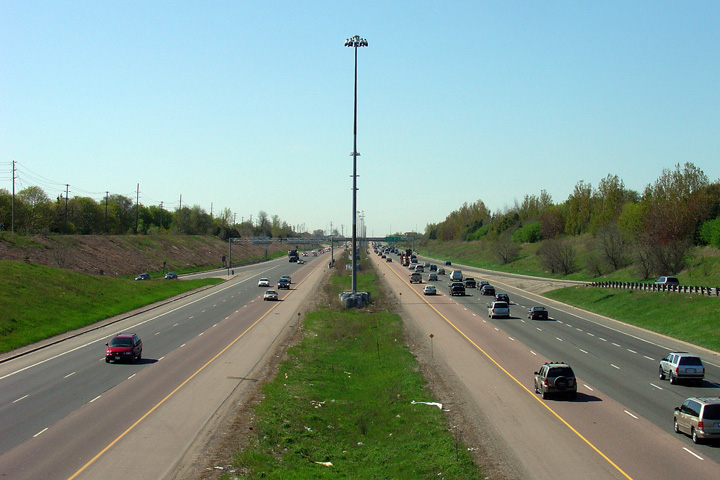
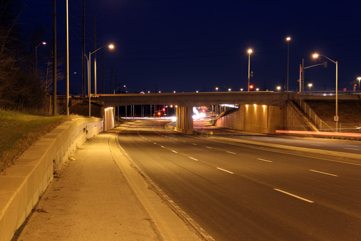
| City of Brampton Regional Municipality of Peel |
Northerly view from the Williams Parkway
overpass along Highway 7/410. Photo taken: August 14th, 2006. |
 |
|
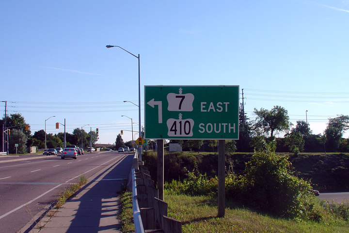
| City of Brampton Regional Municipality of Peel |
Photos of three signs that used to stand at the Williams Parkway interchange
highlighting Highway 7's concurrent routing with Highway 410 through
Brampton. As I write this caption in October of 2010, it has been nearly 13
years since Highway 7 was downloaded through much of Peel and York. To this
day I still feel this is a shame. While I definitely understand how the
local municipalities would benefit over having jurisdiction of the roadway
(after all Regional governments own the bulk of the underground services and
control the bulk of the traffic signals within a community), however I still
believe it is a shame that
no signage agreement could have been instated along the Highway 7 corridor.
After all, despite its suburban nature Highway 7 does serve as the principal
through street through Southern York and Central Peel Regions. Photos taken: August 14th, 2006. |
   |
|
| City of Brampton Regional Municipality of Peel |
This view looks south along the Brampton By-pass
from the Williams Parkway overpass. Photo taken: August 14th, 2006. |
 |
|
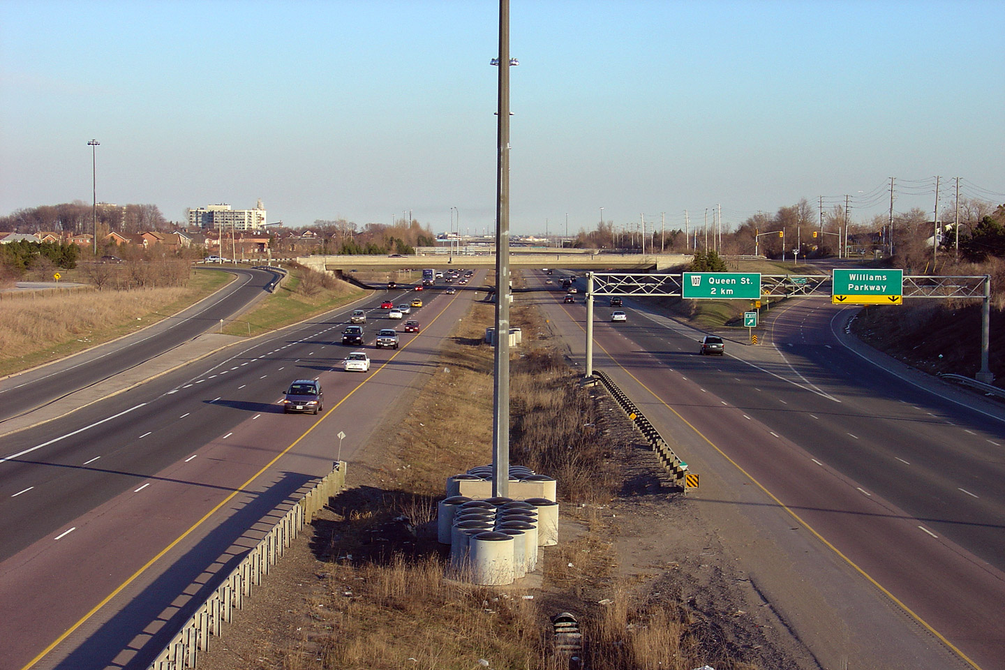
| City of Brampton Regional Municipality of Peel |
View looking northerly from Vodden Street towards the Williams Parkway
interchange. Photo taken: May 25th, 2005. |
 |
|
| City of Brampton Regional Municipality of Peel |
Southerly view from the Vodden Street overpass. Photo taken: May 25th, 2005. |
 |
|
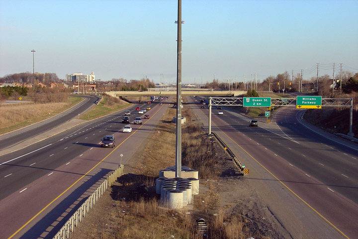
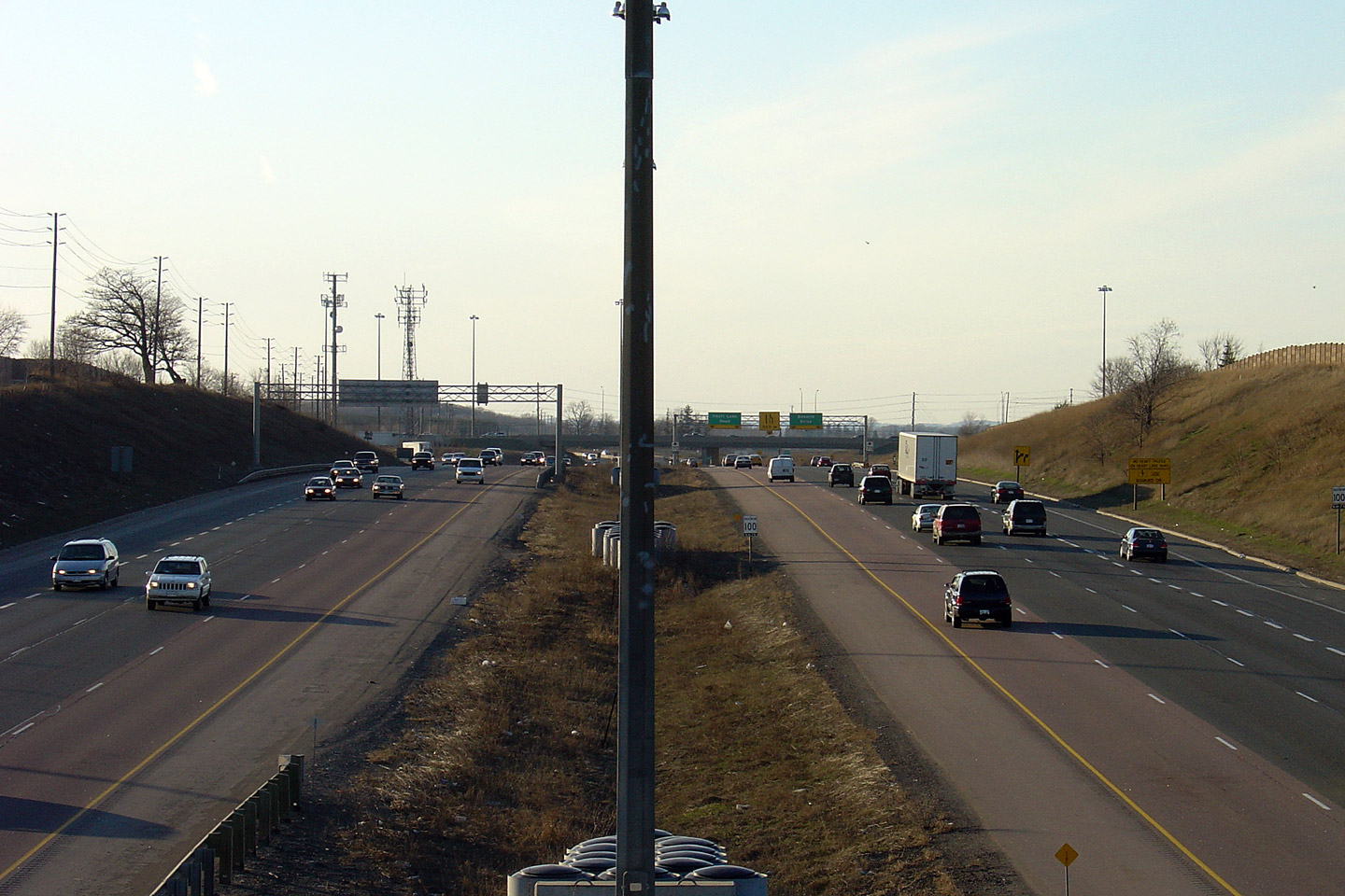
| City of Brampton Regional Municipality of Peel |
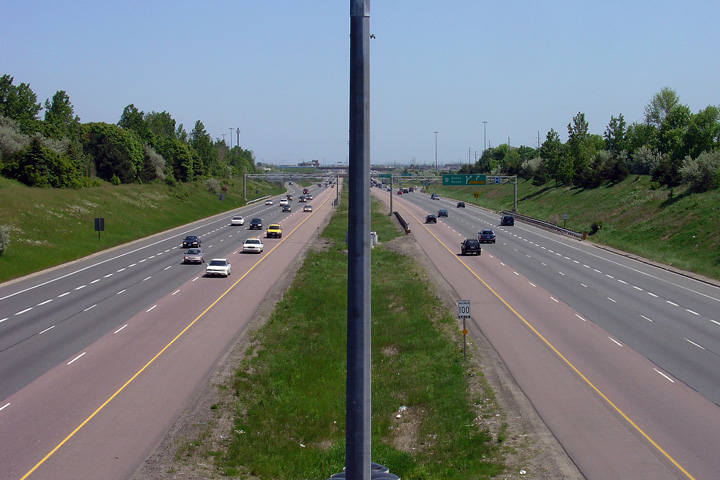
Highway 410 looking north from the Queen Street overpass. From Queen
Street northerly to Franceshini Road (a distance of about 1km) Highway 410
is depressed below grade. Presumably, the freeway is depressed to
minimize disruption to the surrounding residents. Photo taken: May 12th, 2005. |
 |
|
| Highway 410 continues south of Highway 7 through Brampton into Mississauga where it meets Highway 401 and 403. Click here for Highway 410-South images. | |||
| Highway 427 is a short 404 is a short commuter highway that leads north and south from Highway 7. Click here for Highway 427 images. | |||
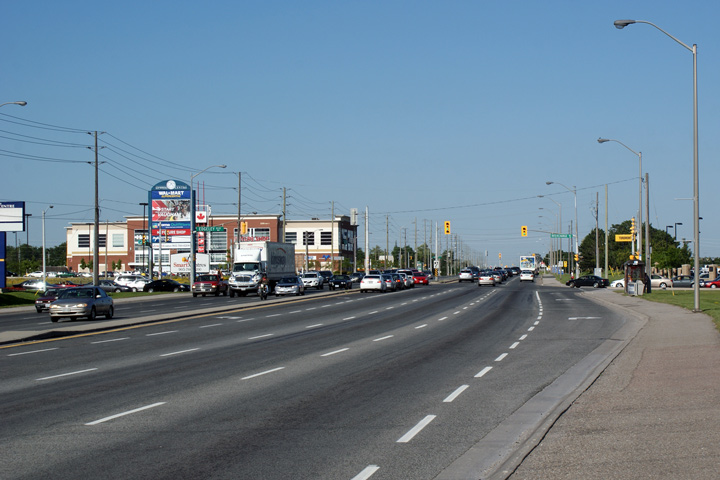
| City of Vaughan Regional Municipality of York |
This view looks easterly along Highway 7 from
the northbound Highway 427 off-ramp. Western Vaughan is predominantly
industrial in nature. Photo taken: May 29th, 2009. |
 |
|
| Highway 27 is an efficient non-freeway route between Western Toronto and Barrie. Click here for Highway 27 images. | |||
| City of Vaughan Regional Municipality of York |
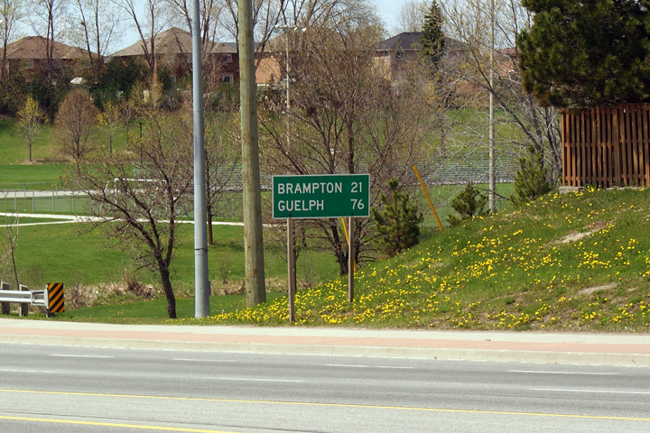
Old MTO maintained distance sign on the
outskirts of Woodbridge. Before the Region of York was created in
1971, Woodbridge was a standalone village. MTO
generally places distance signs after a highway junction, or after a defined
settlement. The second condition makes
this sign somewhat interesting, since, after 40 years of being incorporated
into the City of Vaughan, Woodbridge still has a tiny little vestige of its former
identity as a defined settlement. Photo taken: May 3rd, 2009. |
 |
|
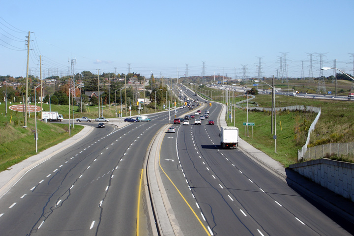
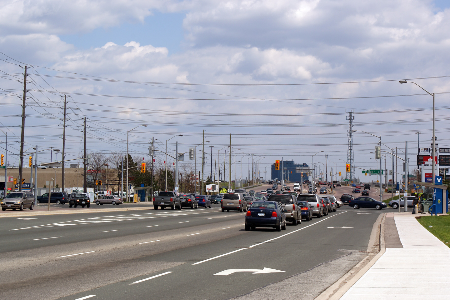
| City of Vaughan Regional Municipality of York |
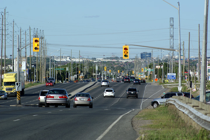
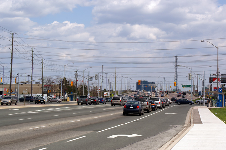
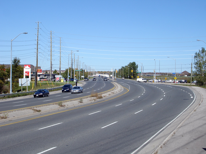
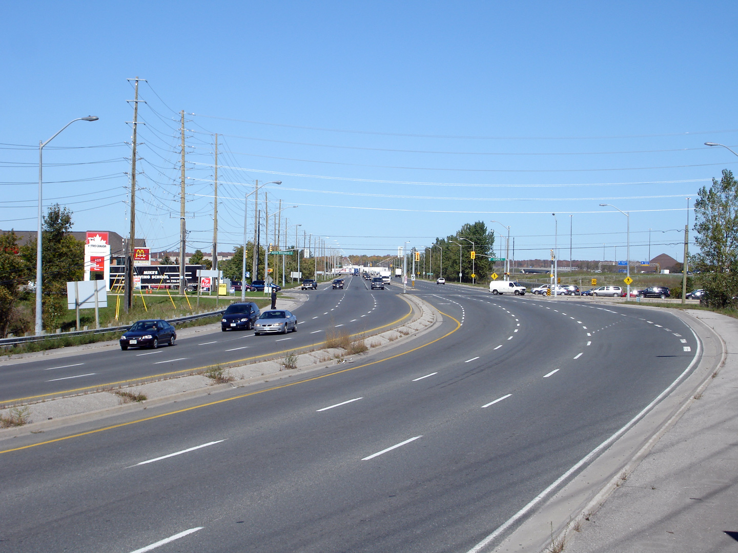
Easterly view towards the Weston Road
intersection. This is the western reaches of the 400 & 7 commercial
area -- the epitome of car culture in the Greater Toronto Area.
Through this intersection, Highway 7 alone, has 9 lanes of traffic, over 30m
of asphalt(!). Photo taken: May 3rd, 2009. |
 |
|
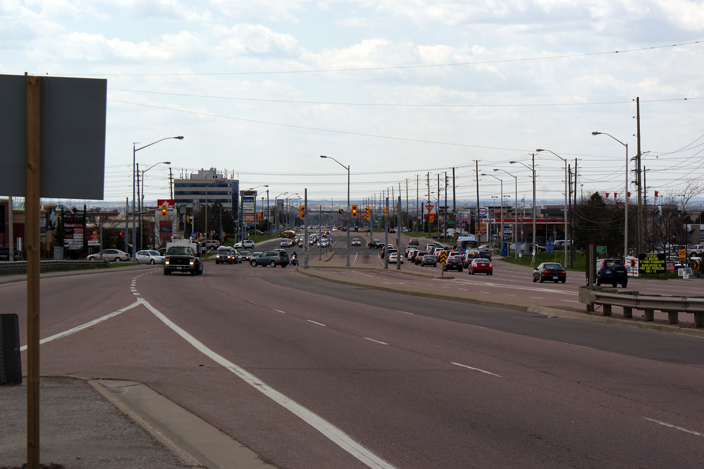
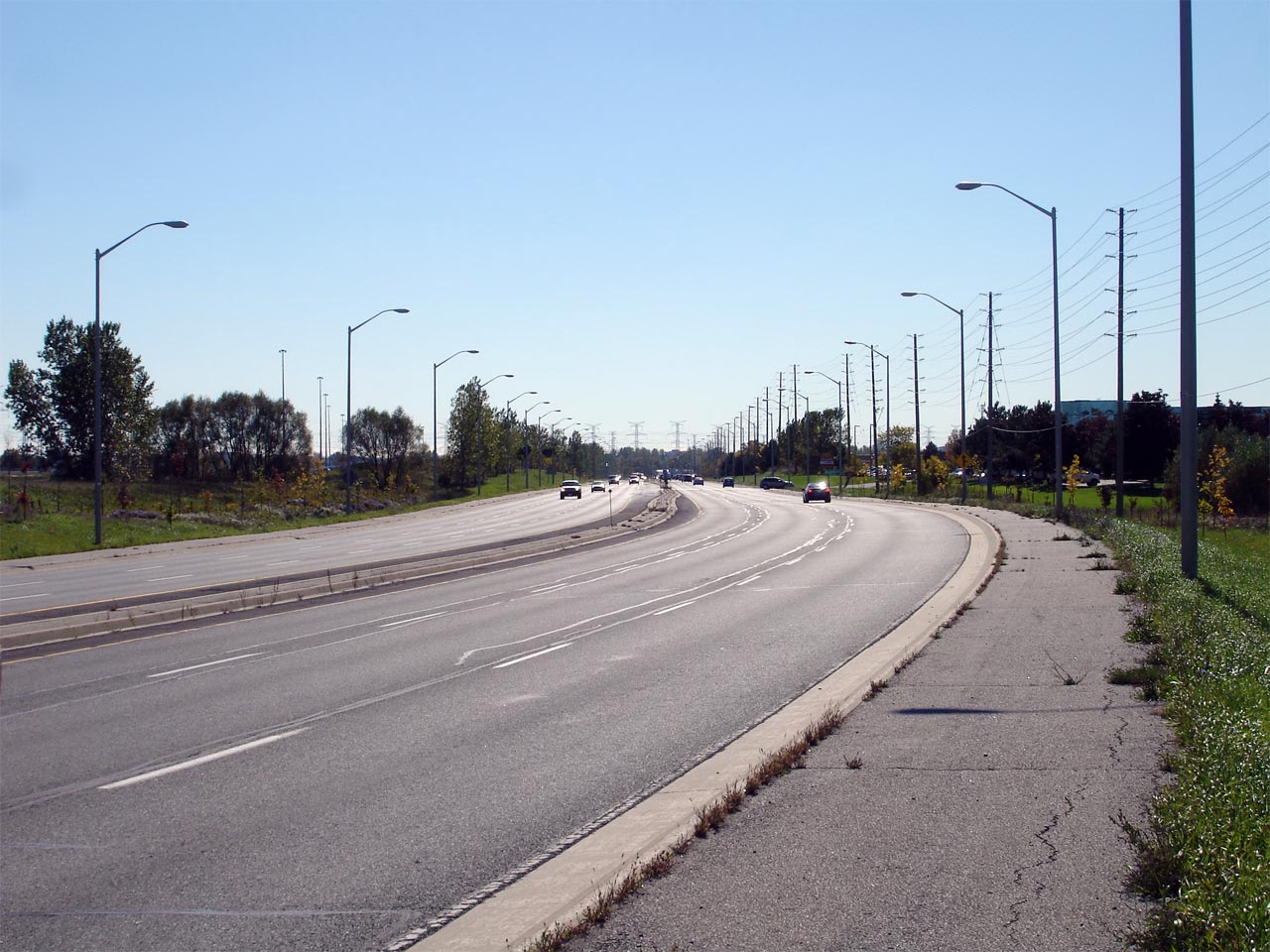
| City of Vaughan Regional Municipality of York |
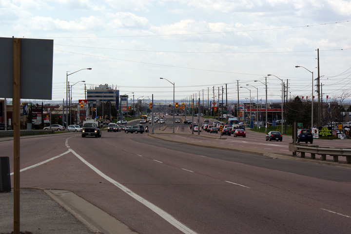
This view looks westerly towards the Weston Road
intersection from the 400 interchange. York Region desires to convert the
400 & 7 commercial area into a more pedestrian friendly environment by
introducing Bus Rapid Transit onto the Highway 7 corridor. Given the
shear distance between individual storefronts within the commercial complex,
highway 7 corridor is through York Region, I am weary of how
successful any transit system will along Highway 7 will be, . For 15 years, 400 & 7 was designed and constructed
exclusively for car culture. Photo taken: May 3rd, 2009. |
 |
|
| Highway 404 is a short commuter highway that leads north and south from Highway 7. Click here for Highway 400 images. | |||
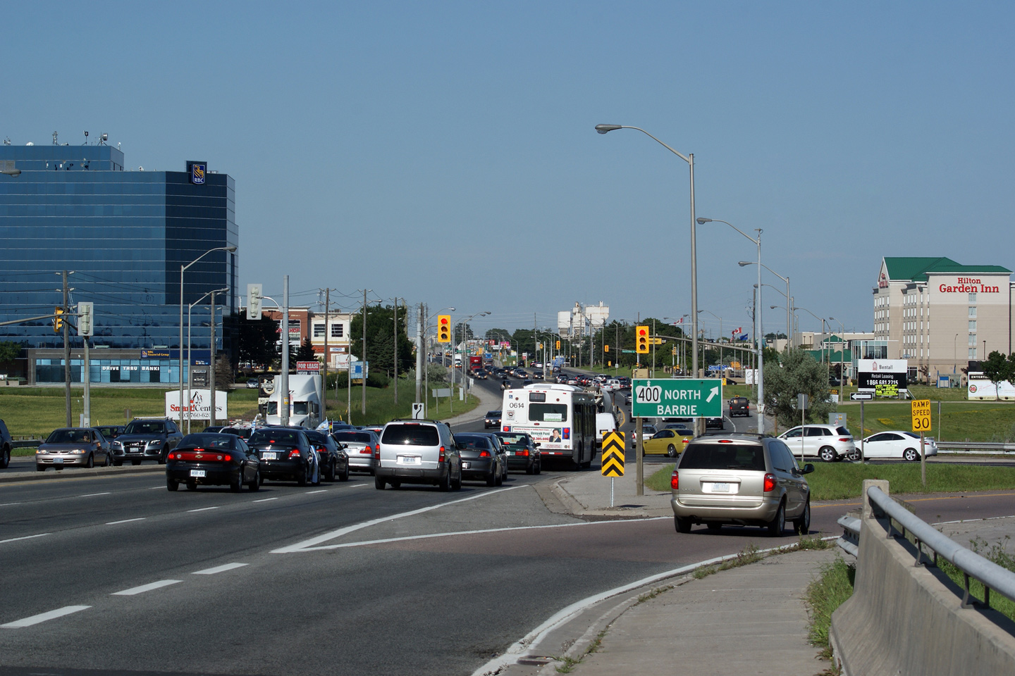
| City of Vaughan Regional Municipality of York |
View looking easterly along Highway 7 from the
Highway 400 overpass. The area immediately east of Highway 400 along
Highway 7 has been zoned to become Vaughan's Corporate Centre. The TTC
is extending The University/Spadina Line northerly into Vaughan with the
intention of terminating the line at the Vaughan Corporate Centre.
Once this happens, numerous commercial buildings will likely dot the side of
Highway 7. Photo taken: July 2nd, 2010. |
 |
|
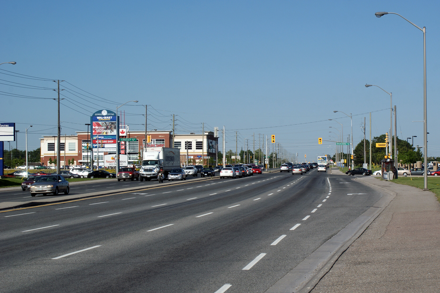
| City of Vaughan Regional Municipality of York |
View looking easterly along Highway 7 at
Interchange Way. In 2010, The Region of York and City of Vaughan
opened a new overpass over Highway 400 immediately to the north of Highway 7
in order reduce traffic congestion surrounding the Highway 400 interchange.
Note the shear volume of traffic that appears in these photos. Photo taken: July 2nd, 2010. |
 |
|
| City of Vaughan Regional Municipality of York |
View looking westerly along Highway 7 through
Concord as CN's Newmarket Subdivision crosses overtop of the
highway. Note the narrow median and lack of pedestrian facilities as
the highway passes underneath of the railway line. The railway
overpass was likely designed for a narrower cross-section than appears along
Highway 7 today. Photo taken: October 6th, 2006. |
 |
|
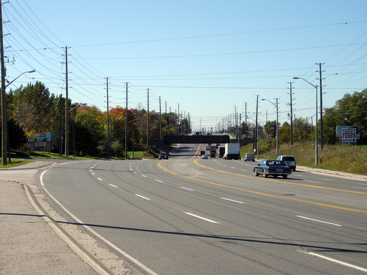
| City of Vaughan Regional Municipality of York |
Easterly view as the highway passes over the Don River bridge. This bridge was constructed in 1986, during
the first phase of Highway 7's realignment away from Centre and Bathurst
Streets onto its present alignment. Photo taken: October 6th, 2006. |
 |
|
| City of Vaughan Regional Municipality of York |
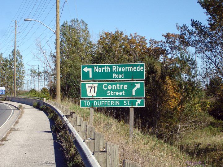
Green intersection sign appearing eastbound
along Highway 7 approaching the Centre Street intersection. One of the most
notable negative impacts of provincial highway downloading was the removal
of signs such as these. Very few counties sign junctions as clearly as the
MTO does. Photo taken: October 6th, 2006. |
 |
|
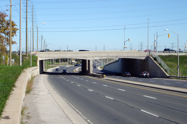
| City of Vaughan Regional Municipality of York |
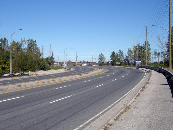
View of Highway 7 as it intersects Centre
Street. Highway 7 has an impressive cross-section through York Region.
It was constructed at a time when it wasn't yet passé to build high capacity highways
through urban and suburban areas. Photo taken: October 6th, 2006. |
 |
|
| City of Vaughan Regional Municipality of York |
View looking westerly along Highway 7 from just
west of the Dufferin Avenue overpass. Notice the unsignalized
intersection with Bostwick Drive. Picture taken: October 6th, 2006. |
 |
|
| City of Vaughan Regional Municipality of York |
View looking easterly along Highway 7 towards
the Dufferin Avenue overpass along Highway 7. The grade-separation at
Dufferin Street was the first of the grade-separations along Highway 7 to be
completed. It was first constructed in the late 1980s when Highway 7
was re-routed to this alignment away from Centre Street. Picture taken: October 6th, 2006. |
 |
|
| City of Vaughan Regional Municipality of York |
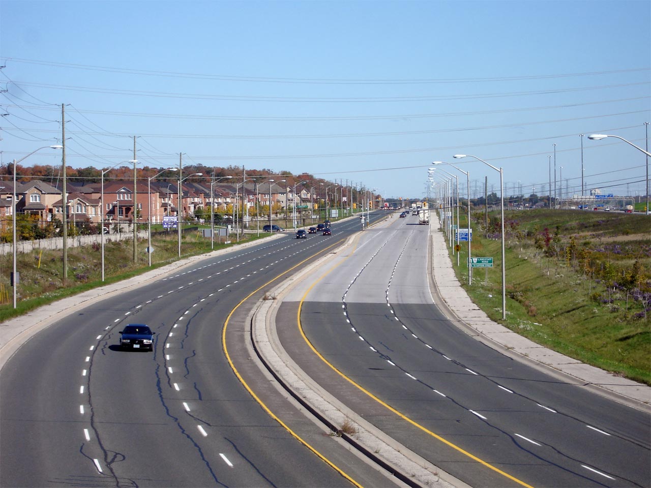
View looking east along Highway 7 from the
Dufferin Avenue overpass. The Langstaff Road intersection (which is
visible in the photo), serves as the connector road between Dufferin Street
and Highway 7. Picture taken: October 6th, 2006. |
 |
|
| City of Vaughan Regional Municipality of York |
This view looks westerly through the Dufferin
Avenue overpass. Picture taken: October 6th, 2006. |
 |
|
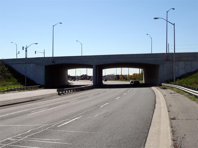
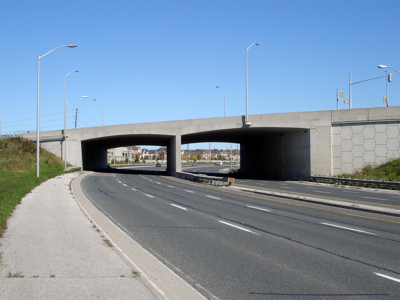
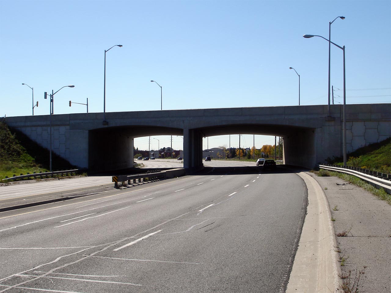
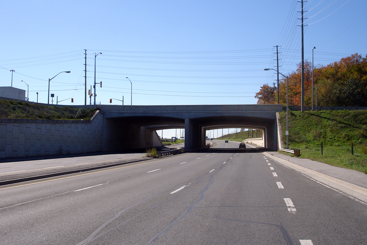
| City of Vaughan Regional Municipality of York |
This view looks easterly along Highway 7 towards
the concrete rigid frame structure that carries Bathurst Street (and a ramp
from Bathurst Street to Highway 407) overtop of Highway 7. These
structures are reminiscent of the early rigid frame structures that were
completed in the 1940s and 1950s for Highway's 400 and 401. Upper photo taken: October 6th, 2006. Lower photo taken: March 26th, 2012. |
 |
|
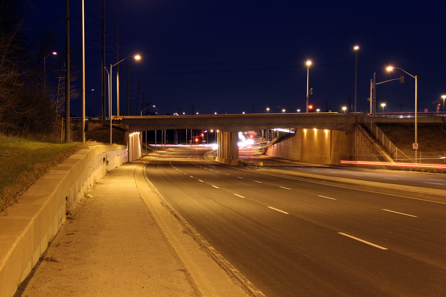
| Vaughan - Richmond Hill Boundary Regional Municipality of York |
Easterly view from the Bathurst Street overpass
looking towards the Bathurst Street connector. Photo taken: October 6th, 2006. |
 |
|
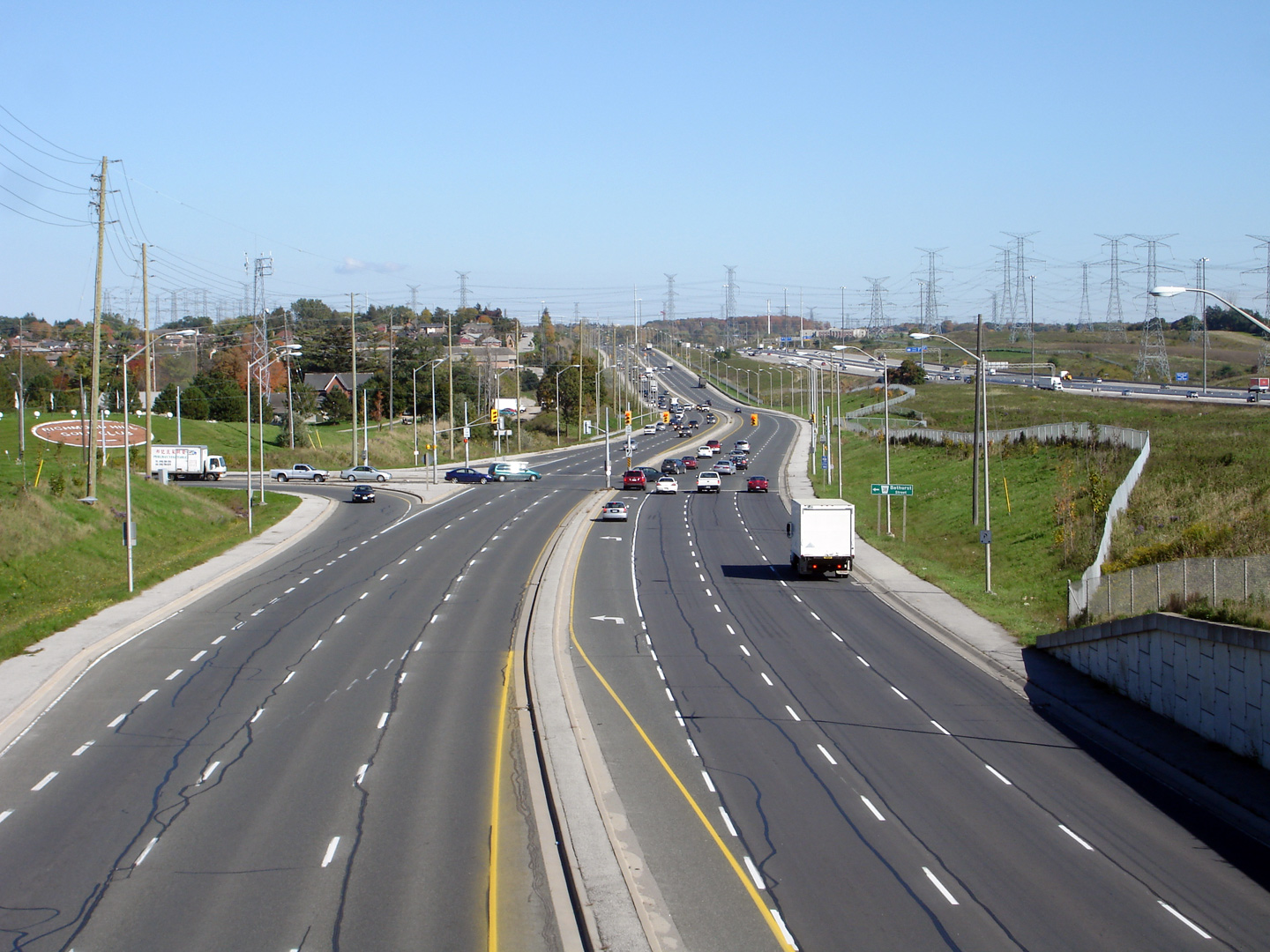
| Vaughan - Richmond Hill Boundary Regional Municipality of York |
Westerly view towards the Bathurst Street
intersection. Note the truck on the left hand side of the photo --
this truck is waiting to turn right onto Bathurst Street from the ramp
from Highway 407 West. Despite its suburban nature, the highway
designers tried to use as little space as possible for both Highway 7 and
Highway 407. Photo taken: October 6th, 2006. |
 |
|
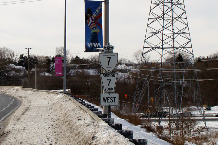
| Town of Richmond Hill Regional Municipality of York |
Westbound Highway 7 route marker co-signed with
a York Road 7 marker at Young Street. Several of these dual markers were
erected in Western York Region when Highway 7 was transferred from
provincial control on June 7, 1997. Photo taken: January 11th, 2009. |
 |
|
| Highway 11 is Yonge Street. Click here for Highway 11 images. | |||
| Click here for Richmond Hill to Pickering Images | |||
<- Page 2A Images Highway 7 Images Index Page 2C Images ->
<- Highway 6 Images Back to Highway 7 - Page 2 Highway 7A Images ->
Copyright (c) 2004-2012, AsphaltPlanet.ca AsphaltPlanet@asphaltplanet.ca