|
Proper Municipality Name |
Photo Description |
Photo |
|
Pictures taken
from driver's perspective appear offset from centre-line pictures: |
North-
Bound |
South-
Bound |
|
Highway 27 begins its trek as a
short freeway stub from the collector lanes of the 427.
Click
here for Highway 427 images. |
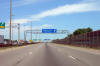
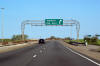
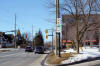
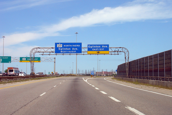
| City of Toronto |
Northbound advanced signage for the ramp to Eglinton Avenue East.
Photo taken: August 13th, 2006. |
 (720x480) (720x480)
(1440x960) |
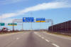
| City of Toronto |
The ramp to Eglington Avenue East departs from Highway 27, taking the
right-hand lane of the freeway along with it.
Photo taken: August 13th, 2006. |
 (720x480) (720x480)
(1440x960) |
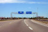
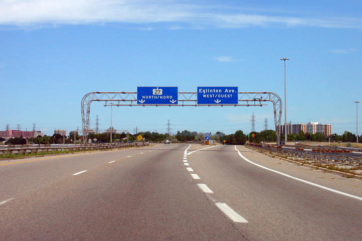
| City of Toronto |
View of the signage for the exit from Highway 27 northbound to Eglinton
Avenue West. The ramp to Eglinton Avenue West is a loop ramp and meets Eglinton Avenue at the East Mall intersection after passing underneath
of the
directional ramp to Eglinton Avenue East.
Photo taken: August 13th, 2006. |
 (720x480) (720x480)
(1440x960) |
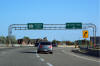
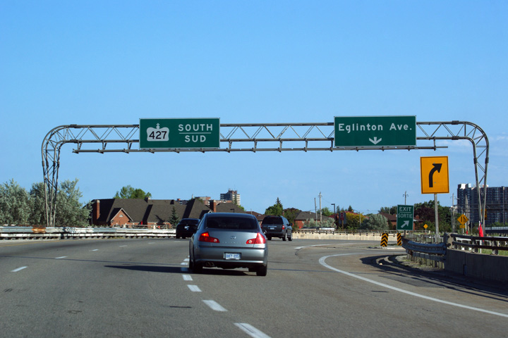
| City of Toronto |
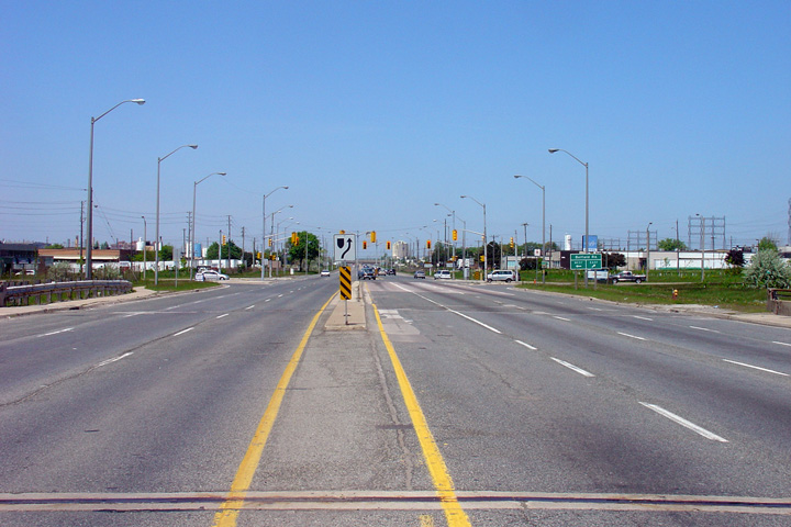
Southerly view as the ramp to Eglinton Avenue departs from Highway 27.
Highway 27 meets Eglinton Avenue at a half-cloverleaf interchange that favours
movements to the east. When the Eglinton Avenue interchange
was first constructed, it was assumed that Eglington Avenue would be
converted to the
Richview Expressway through Etobicoke.
Photo taken: June 5th, 2011. |
 (720x480) (720x480)
(1440x960)
(2400x1600) |
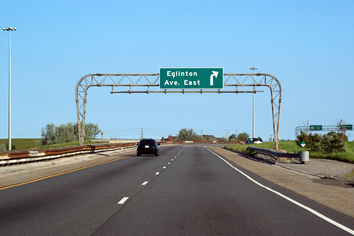
| City of Toronto |
Southbound advanced signage for the ramp to Eglinton Avenue.
Photo taken: June 5th, 2011. |
 (720x480) (720x480)
(1440x960)
(2400x1600) |
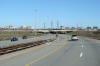
| City of Toronto |
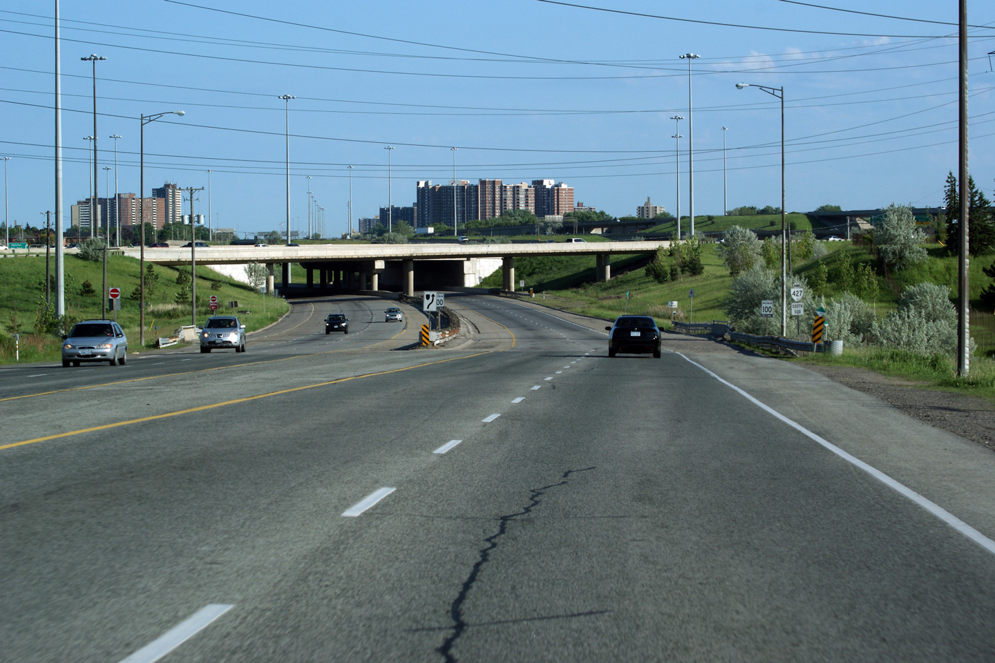
View looking north along Highway 27 approaching the Highway 401
overpass. Photographer: Josh Anderchek. Taken: April 14th, 2008. |
(720x480)
(1440x960) |
| City of Toronto |
View looking southerly from south of the Highway 401 overpass towards the
Eglinton Avenue interchange along Highway 27.
Photo taken: August 8th, 2006. |
(720x480)
(1440x960) |
| City of Toronto |
This shot of Highway 27 highlights the northern end of Highway 27's freeway
stub. Photographer: Josh Anderchek. Taken: April 14th, 2008. |
(720x480)
(1440x960) |
| City of Toronto |
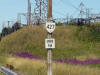
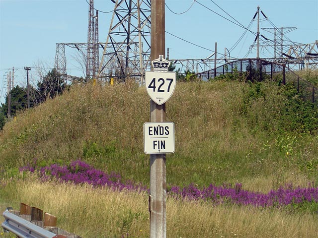
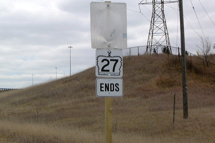
A rather odd sign denoting the northern 'terminus' of
Highway 427. Though this particular
sign was recently erected, an ends sign has existed at this location
for a number of years. This sign marks the northern end of the MTO's
jurisdiction over Highway 27.
Photo taken: August 8th, 2006. |
 |
| City of Toronto |
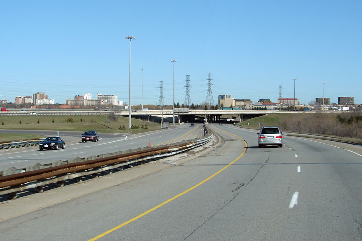
View looking southerly along Highway 27 towards the Highway 401/427
interchange. Notice the high-speed flyover that dominates the right
side of the photo. From Highway 27, only Eglinton Avenue East and the
southbound 427 collector lanes are accessible.
Photo taken: June 5th, 2011. |

(720x480)
(1440x960)
(2400x1600) |
| City of Toronto |
Old southbound Highway 27 ends assembly that once stood at the start of the
divided highway. This sign has long since been removed.
Photo taken: January 4th, 2004. |
|
| City of Toronto |
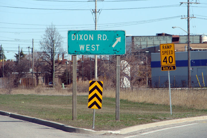
An extremely old sign for the loop ramp to Dixon Road West. Highway 27
meets Dixon Road at a three quarter cloverleaf interchange. Photographer:
Josh Anderchek. Taken: April 14th, 2008. |
 |
| City of Toronto |
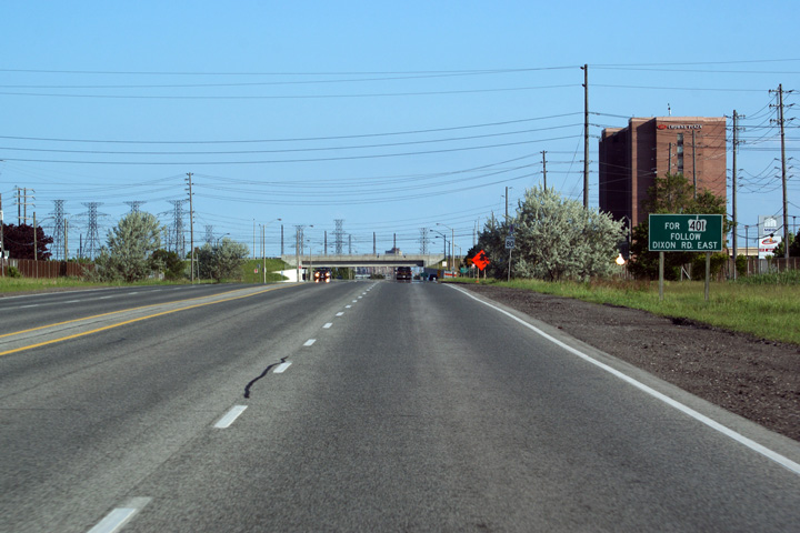
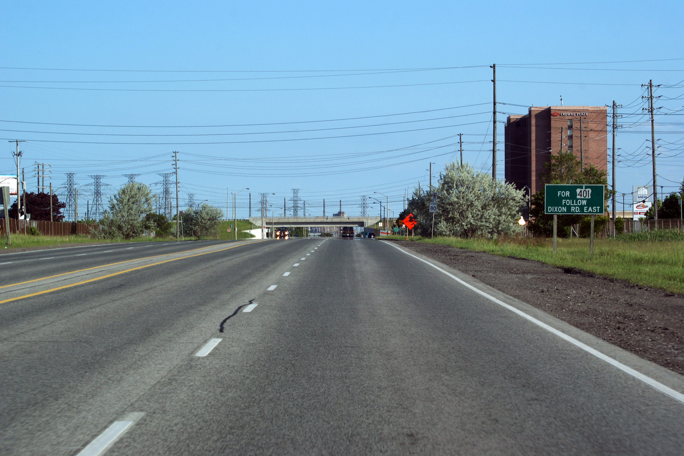
View driving southerly, past the signage directing traffic bound for Highway
401 to use Dixon Road East.
Photo taken: June 5th, 2011. |
 (720x480) (720x480)
(1440x960)
(2400x1600) |
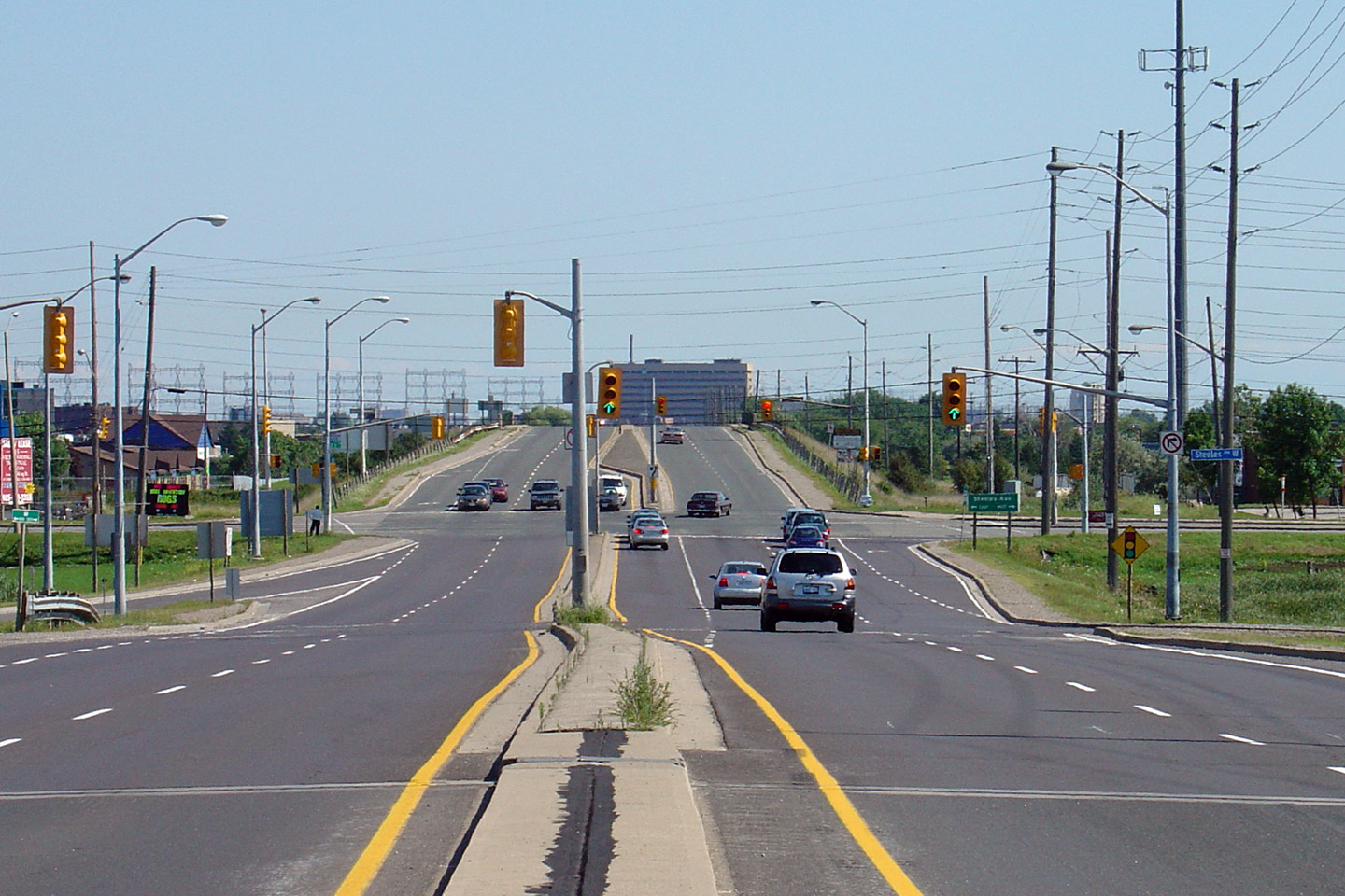
| City of Toronto |
View looking northerly along Highway 27 approaching the Belfield Road
intersection. Belfield Road is located just to the north of
Highway 409, and
is the first signalized intersection along Highway 27 north of Highway 401.
Highway 409 isn't directly accessible from
Highway 27.
Photo taken: May 27th, 2006. |
(720x480)
(1440x960) |
| City of Toronto |
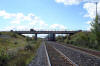
Southerly view from the CN Weston subdivision railway overpass along Highway
27. This section of Highway 27 has been rehabilitated by the City of
Toronto since it was transferred. The pink stamped concrete in the
central median is indicative of a city built roadway.
Photo taken: June 29th, 2011. |
(720x480)
(1440x960)
(2400x1600) |
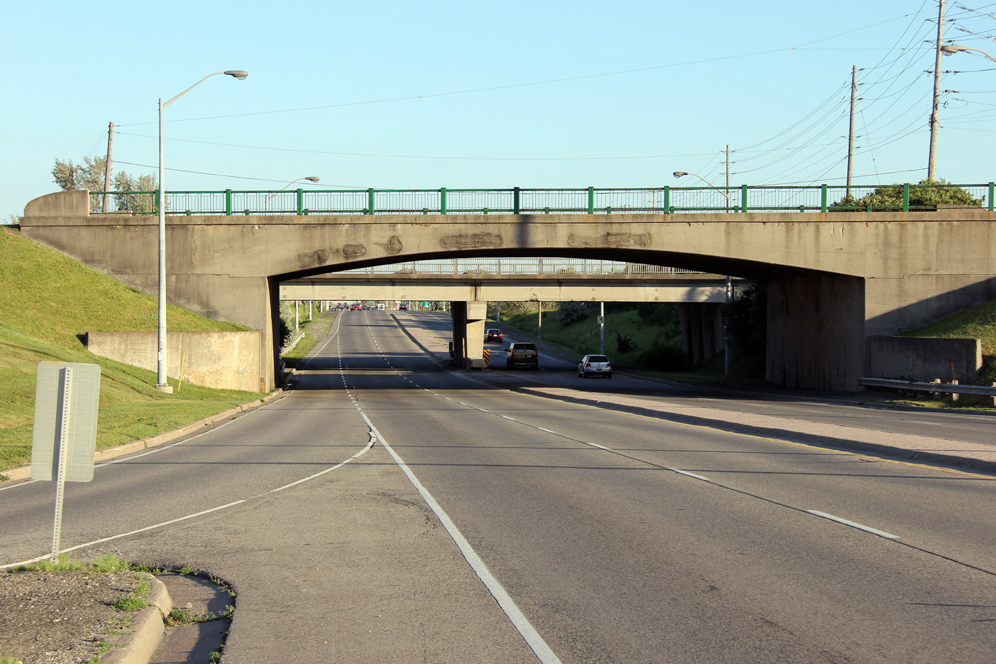
| City of Toronto |
Northerly view from CN's Weston subdivision towards the Woodbine race track
entrance overpass. This is likely the oldest overpass built by the
province still standing in Toronto.
Photo taken: June 29th, 2011. |

(720x480)
(1440x960)
(2400x1600) |
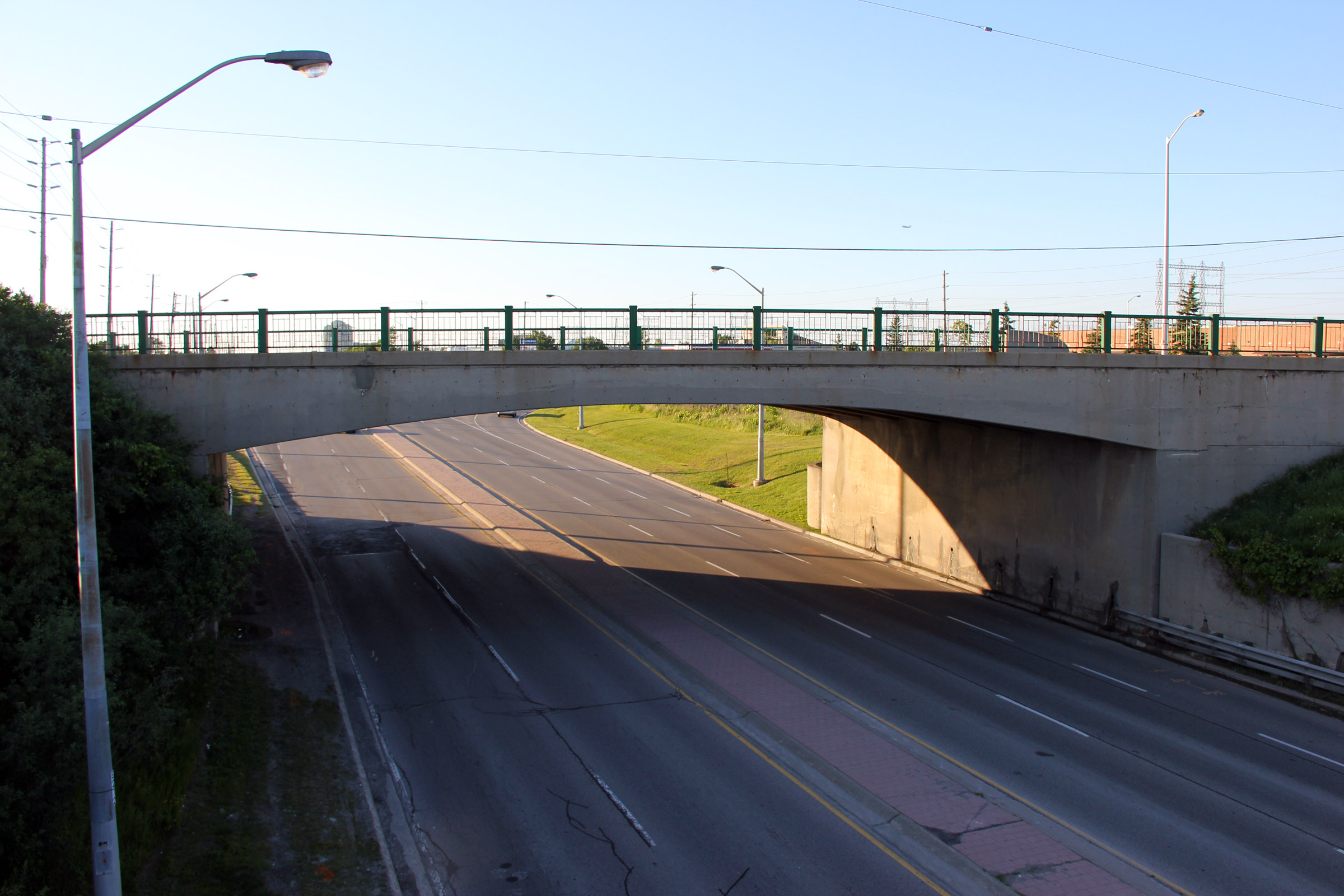
| City of Toronto |
This view looks southerly towards the Woodbine race track overpass.
Highway 27 is a controlled access highway for virtually its entire length
within the City of Toronto. This interchange, as well as the
interchange with Dixon Road have existed along the highway since the 1950s.
Given the (former) highway's high design standards and access control, I
suspect that at some point the province was planning on converting Highway
27 to a freeway along this alignment.
Photo taken: June 29th, 2011. |

(720x480)
(1440x960)
(2400x1600) |
| City of Toronto |
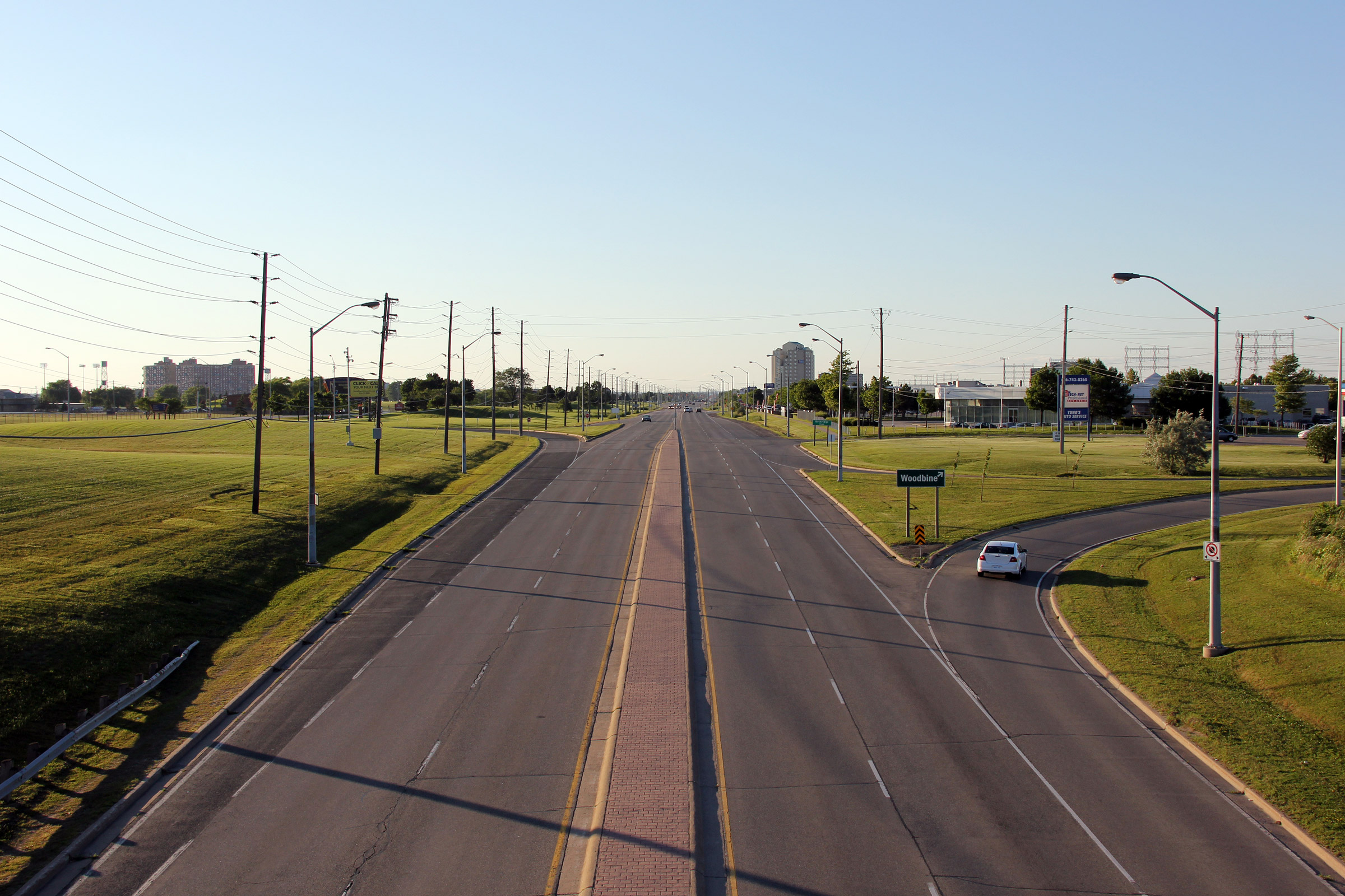
View looking northerly from the Woodbine Race Track overpass towards the
Woodbine interchange.
Photo taken: June 29th, 2011. |
(720x480)
(1440x960)
(2400x1600) |
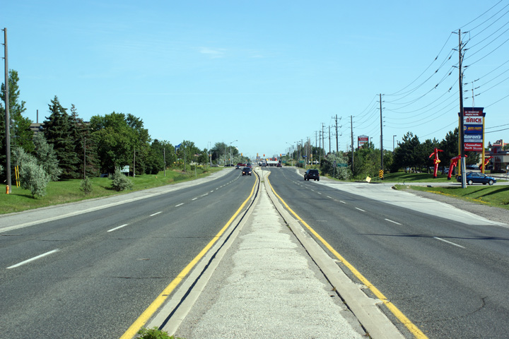
| City of Toronto |
Two views looking southerly along Highway 27 from the Carrier Drive
intersection towards Finch Avenue. As of 2011, several Highway 27
reassurance markers were still present along Highway 27 in northwest
Etobicoke.
Photos taken: July 2nd, 2010. |

(720x480)
(1440x960)
(2400x1600)

(720x480)
(1440x960)
(2400x1600) |
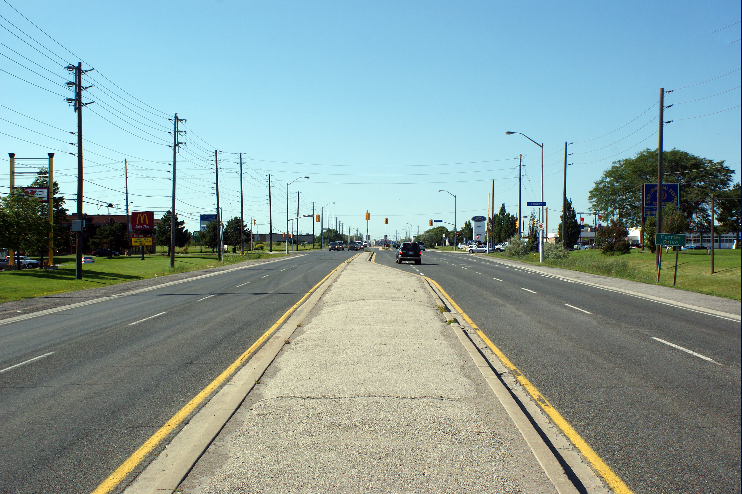
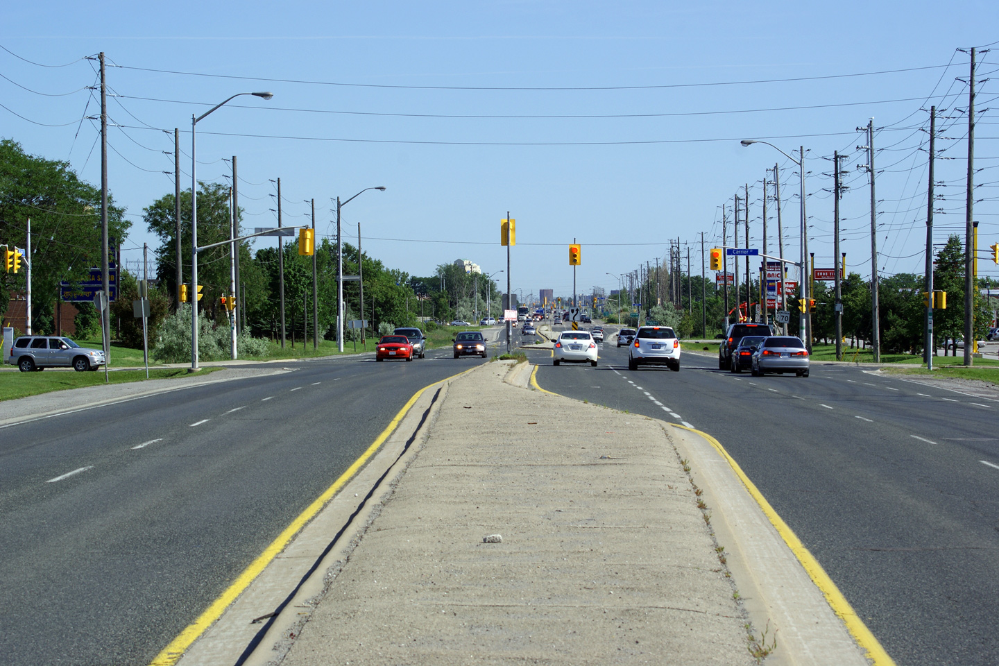
| City of Toronto |
Northerly view towards the Carrier Drive intersection.
Photo taken: July 2nd, 2010. |
(720x480)
(1440x960)
(2400x1600) |
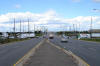
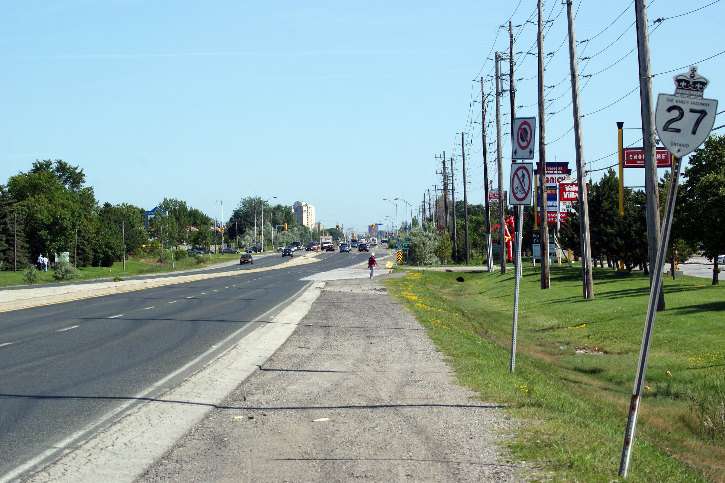
| City of Toronto |
Southerly view towards the traffic signal at Carrier Drive. I took
numerous photos of Highway 27 through northwestern Etobicoke because the
highway exhibits a unique vintage. Most
older four-lane (or wider) highways across the GTA have been reconstructed
more recently than Highway 27.
Photo taken: July 2nd, 2010. |

(720x480)
(1440x960)
(2400x1600) |
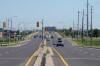
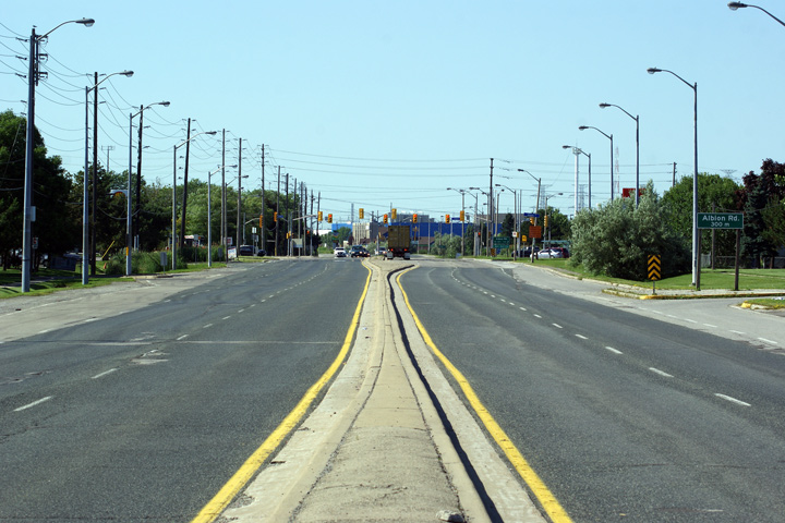
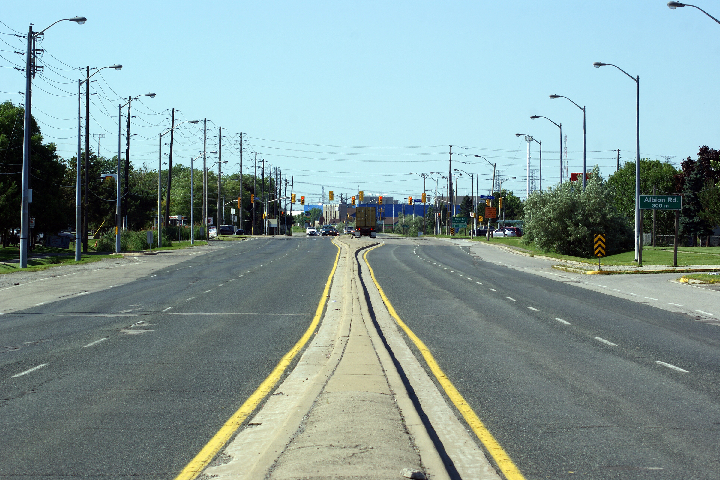
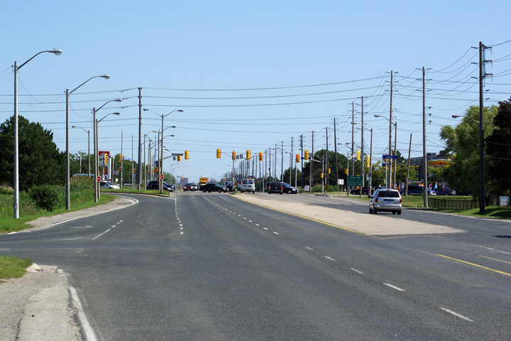
| City of Toronto |
Northerly view from Carrier Drive looking northerly to Albion Road.
This is the narrowest raised median that I have ever seen on a provincial
highway.
Photo taken: July 2nd, 2010. |
(720x480)
(1440x960)
(2400x1600) |
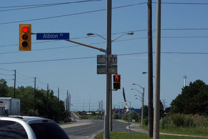
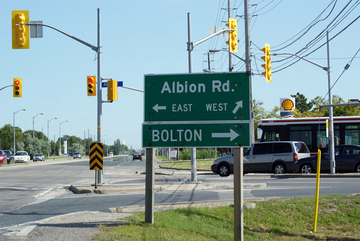
| City of Toronto |
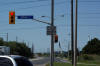
Northbound junction assembly for Highway 50 at Albion Road.
Photo taken: July 2nd, 2010. |
 (720x480) (720x480)
(1440x960) |
|
The former Highway 50 led
northwesterly from Highway 27 through Bolton bound for Highway 89.
Click here for Highway 50
images. |
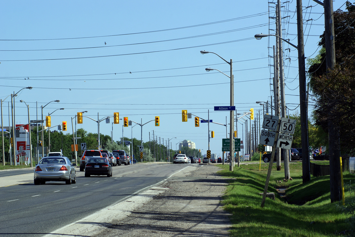
| City of Toronto |
Southbound directional signage for Albion Road along Highway 27.
Photo taken: July 2nd, 2010. |
 (720x480) (720x480)
(1440x960) |
| City of Toronto |
Two views looking southerly along Highway 27 approaching the Albion Road
intersection.
Photos taken: July 2nd, 2010. |
(720x480)
(1440x960)
(2400x1600)

(720x480)
(1440x960)
(2400x1600) |
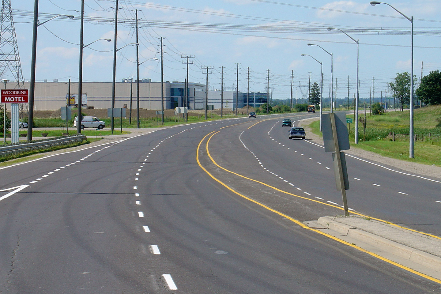
| City of Toronto |
Northerly view along Highway 27 from just north of Albion Road.
Photo taken: July 2nd, 2010. |
(720x480)
(1440x960)
(2400x1600) |
| City of Toronto |
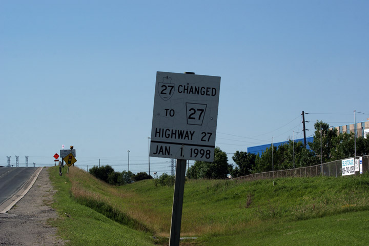
Old notice sign explaining that Highway 27 was transferred to Regional
Municipality of York on Jan. 1, 1998. Signs like this were ubiquitous
along many of Ontario's highways in the late 1990s, however few remain
today.
Photo taken: July 2nd, 2010. |
 (720x480) (720x480)
(1440x960) |
| City of Toronto |
Southerly view from the CN Railway overpass looking into the City of
Toronto.
Photos taken: September 26th, 2006. |

(720x480)
(1440x960) |
| City of Toronto |
Northerly view as Highway 27 crosses the CN's York subdivision railway.
Photos taken: September 26th, 2006. |

(720x480)
(1440x960) |
| City of Toronto |
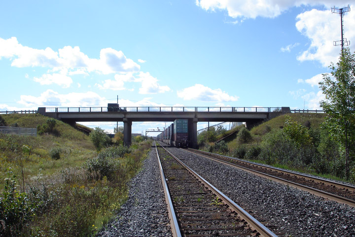
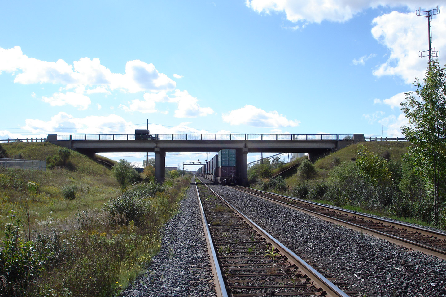
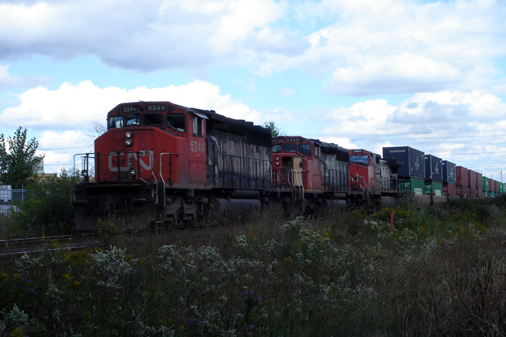
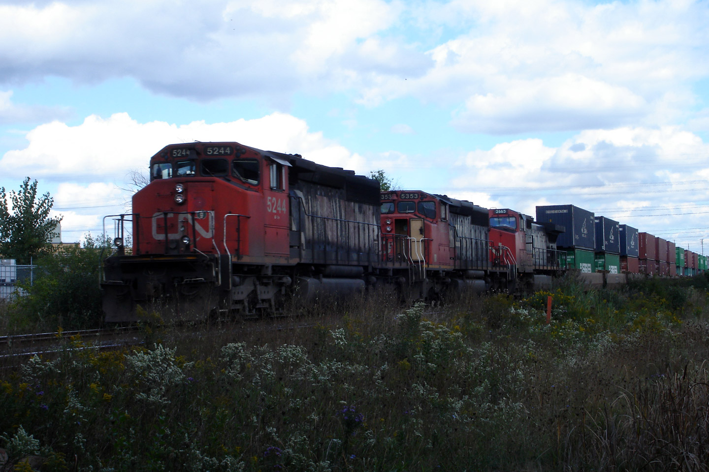
The eastern elevation of the Highway 27 overpass over the CN's York
subdivision, complete with a long CN trainset. CN's York subdivision is a
busy dual-track railway that was built in the mid-1960s in order to by-pass
CN's busy Lakeshore corridor through Downtown Toronto.
Photos taken: September 26th, 2006. |
(720x480)
(1440x960)

(720x480)
(1440x960) |
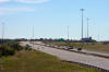
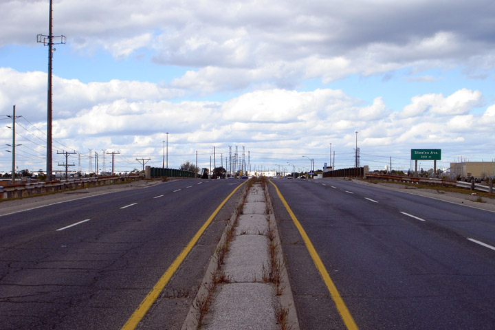
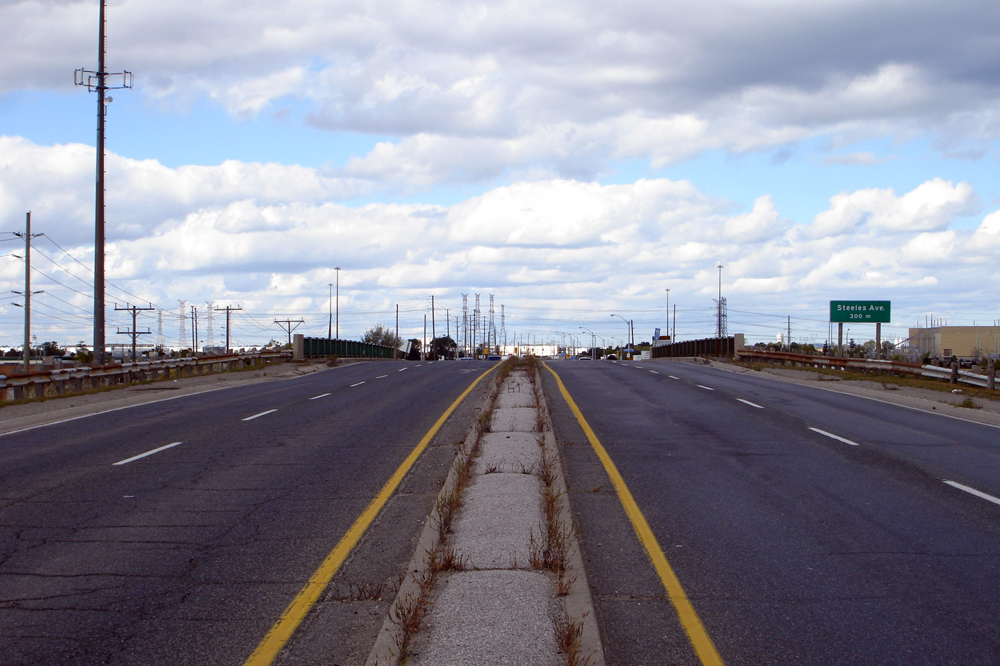
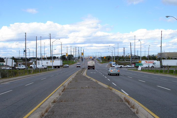
| City of Toronto |
Northerly view towards Steeles Avenue along Highway 27.
Photo taken: September 26th, 2006. |
(720x480)
(1440x960) |
|
Highway 407 is the Greater
Toronto Area's East-West Toll Route.
Click
here for Highway 407 images. |
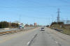
| City of Vaughan Regional
Municipality of York |
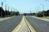
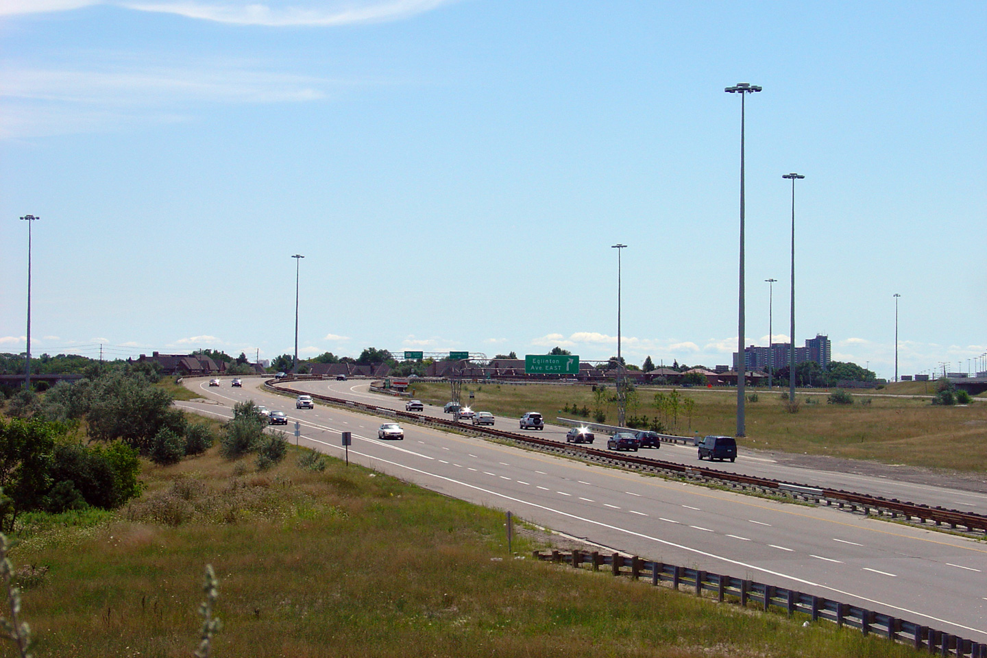
Looking south along Highway 27 from the Highway 407 overpass.
Interestingly, this overpass was built in the early 1990s, well in advance
of Highway 407's completion. This structure pre-dates the highway
being constructed with private revenue.
Picture taken: August 1st, 2004. |
(720x480)
(1440x960) |
| City of Vaughan Regional
Municipality of York |
Looking north towards Highway 7 from just north of the
Highway 407
interchange. Picture taken: August 1st, 2004. |

(720x480)
(1440x960) |
|
Highway 7 runs from Sarnia to
Ottawa and is southern York Region's main street.
Click
here for Highway 7 images. |
| City of Vaughan Regional
Municipality of York |
View looking northerly as Highway 27 crosses the Humber River, just south of
Nashville Road.
Photo taken: July 7th, 2005. |
(720x480)
(1440x960) |
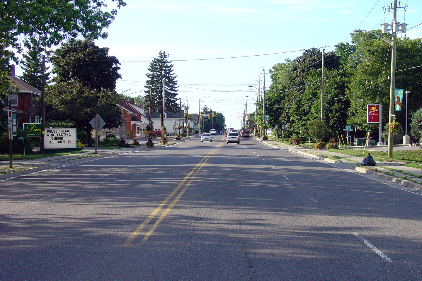
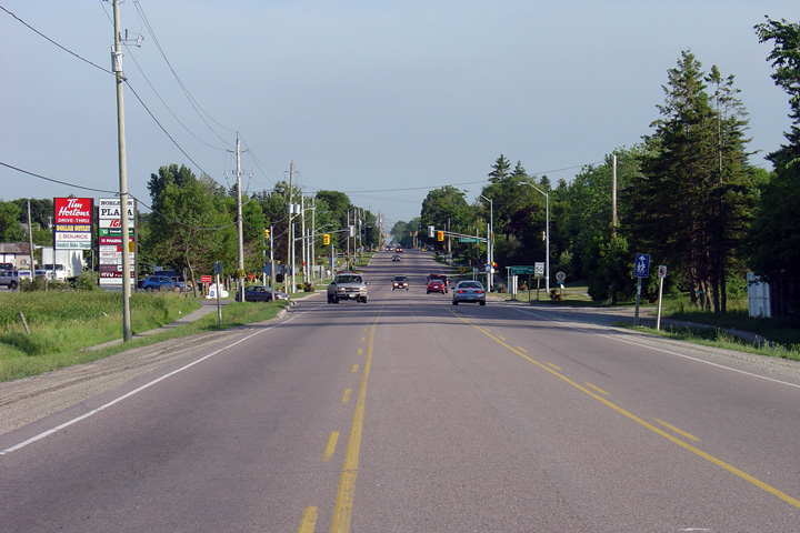
Township of King
Regional Municipality of York |
View looking northerly along Highway 27 as it passes through the small
community of Nobleton.
Photo taken: July 7th, 2005. |
(720x480)
(1440x960) |
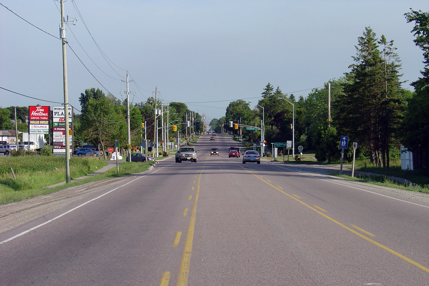
Township of King
Regional Municipality of York |
Southerly view at the northern collapse of Highway 27's four-lane segment
through Nobleton.
Photo taken: July 7th, 2005. |

(720x480)
(1440x960) |
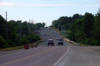
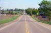
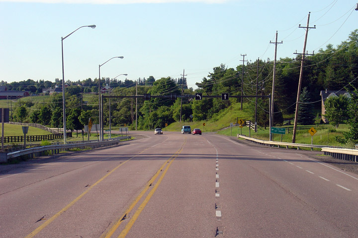
Township of King
Regional Municipality of York |
Highway 27 briefly widens to four lanes with two opposing left turn lanes at
the 16th Sideroad intersection north of Nobleton.
Photo taken: July 7th, 2005. |
(720x480)
(1440x960) |
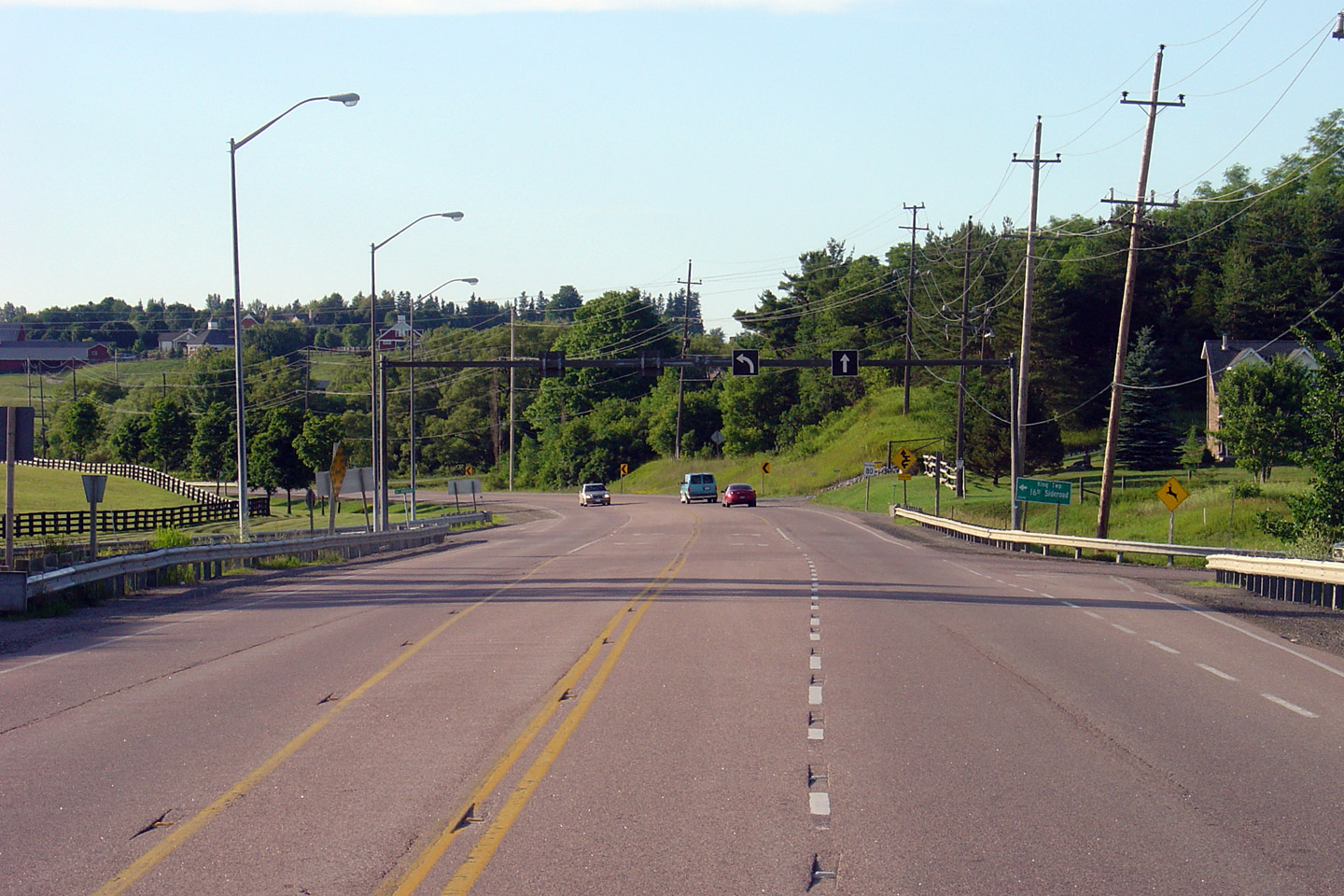
Township of King
Regional Municipality of York |
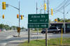
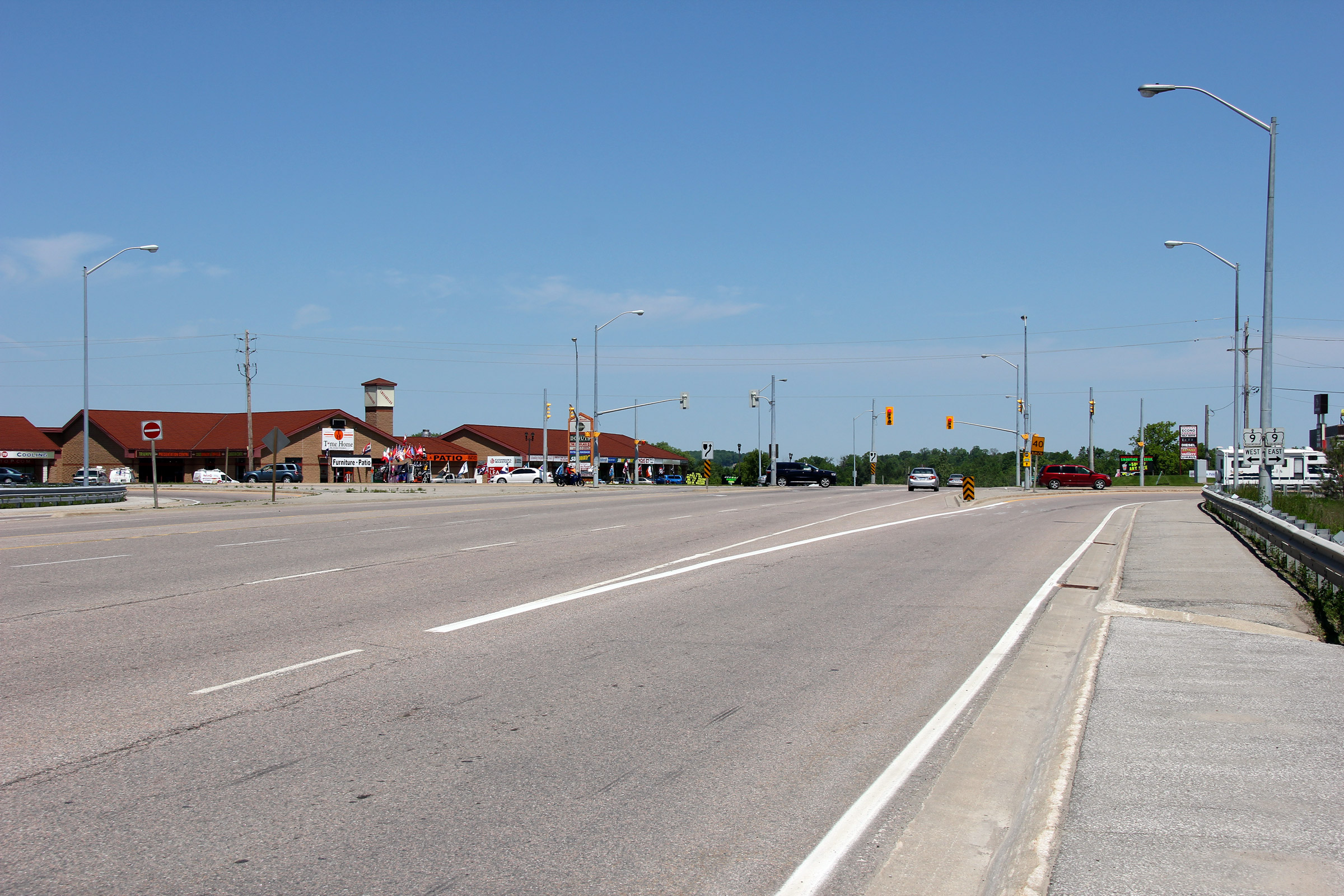
Northerly view along Highway 27 at the Highway 9 intersection.
Photo taken: June 5th, 2011. |
(720x480)
(1440x960)
(2400x1600) |
|
Highway 9 leads westerly from
Newmarket across Midwestern Ontario.
Click
here for Highway 9 images. |
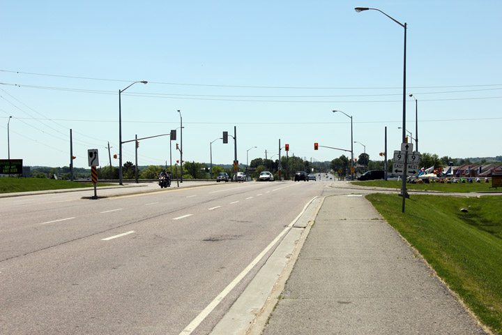
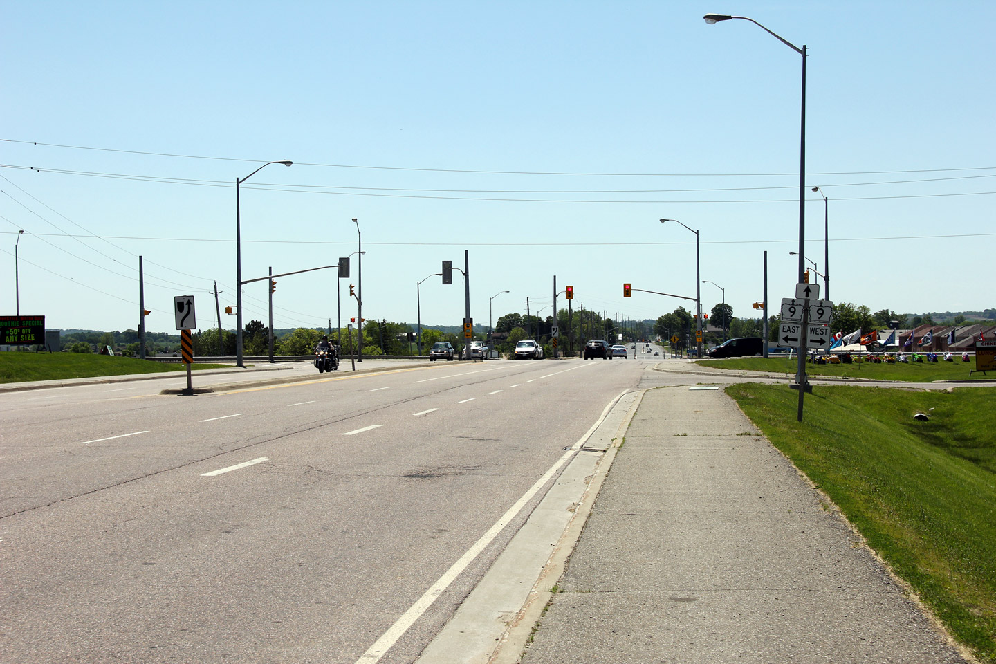
Town of New Tecumseth
County of Simcoe |
Southerly view approaching the Highway 9 intersection. Note the way in
which the Highway 27 sign was removed from the signage assembly.
Photo taken: June 5th, 2011. |
(720x480)
(1440x960)
(2400x1600) |
| Town of Bradford West Gwillimbury
County of Simcoe |
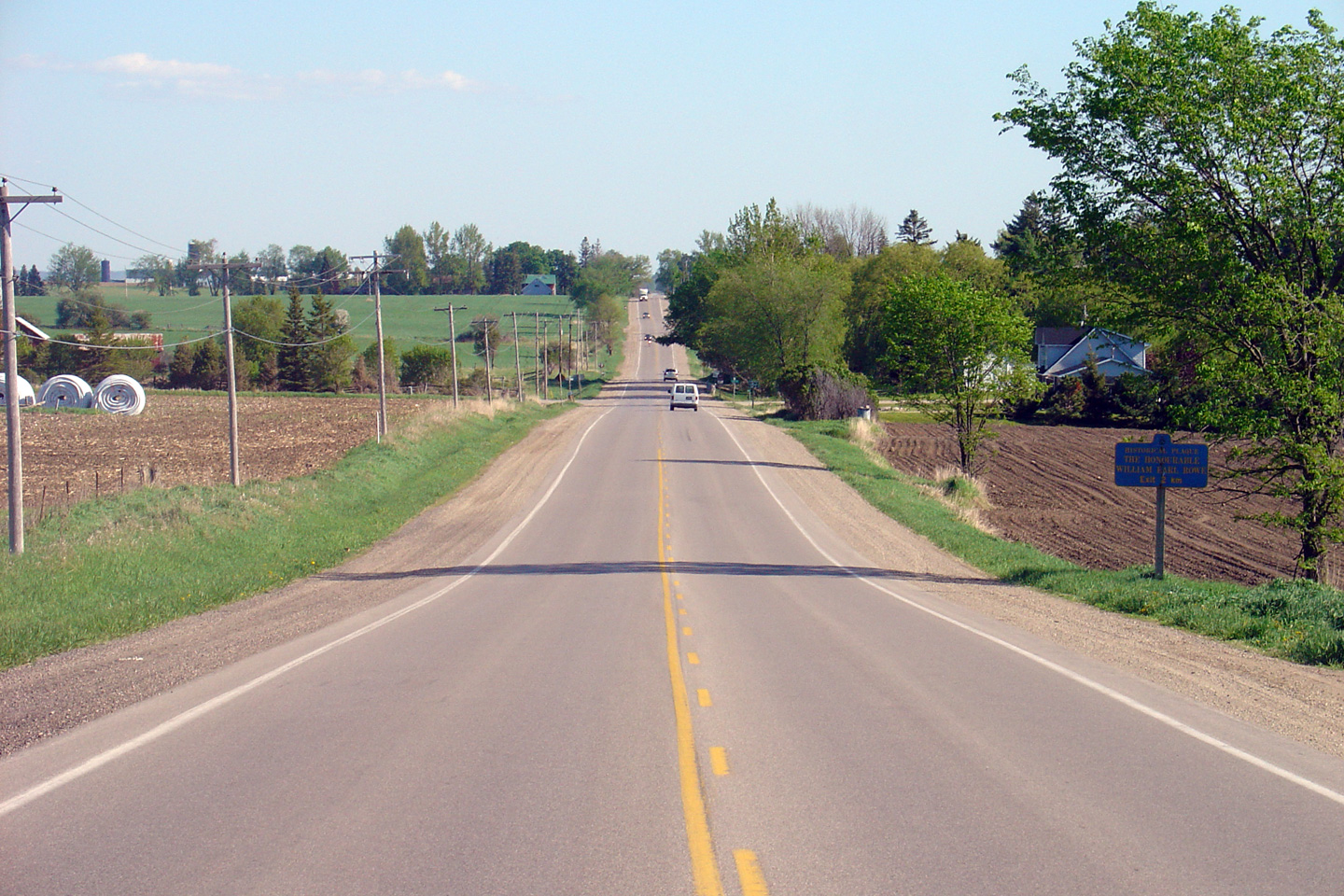
View looking southerly along Highway 27 from just north of the Line 12
intersection. Picture taken: May 25th, 2005. |
(720x480)
(1440x960) |
| Town of Bradford West Gwillimbury
County of Simcoe |
View looking north along Highway 27 from north of the Line 13 intersection.
Picture taken: May 25th, 2005. |

(720x480)
(1440x960) |
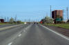
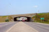
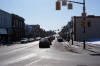
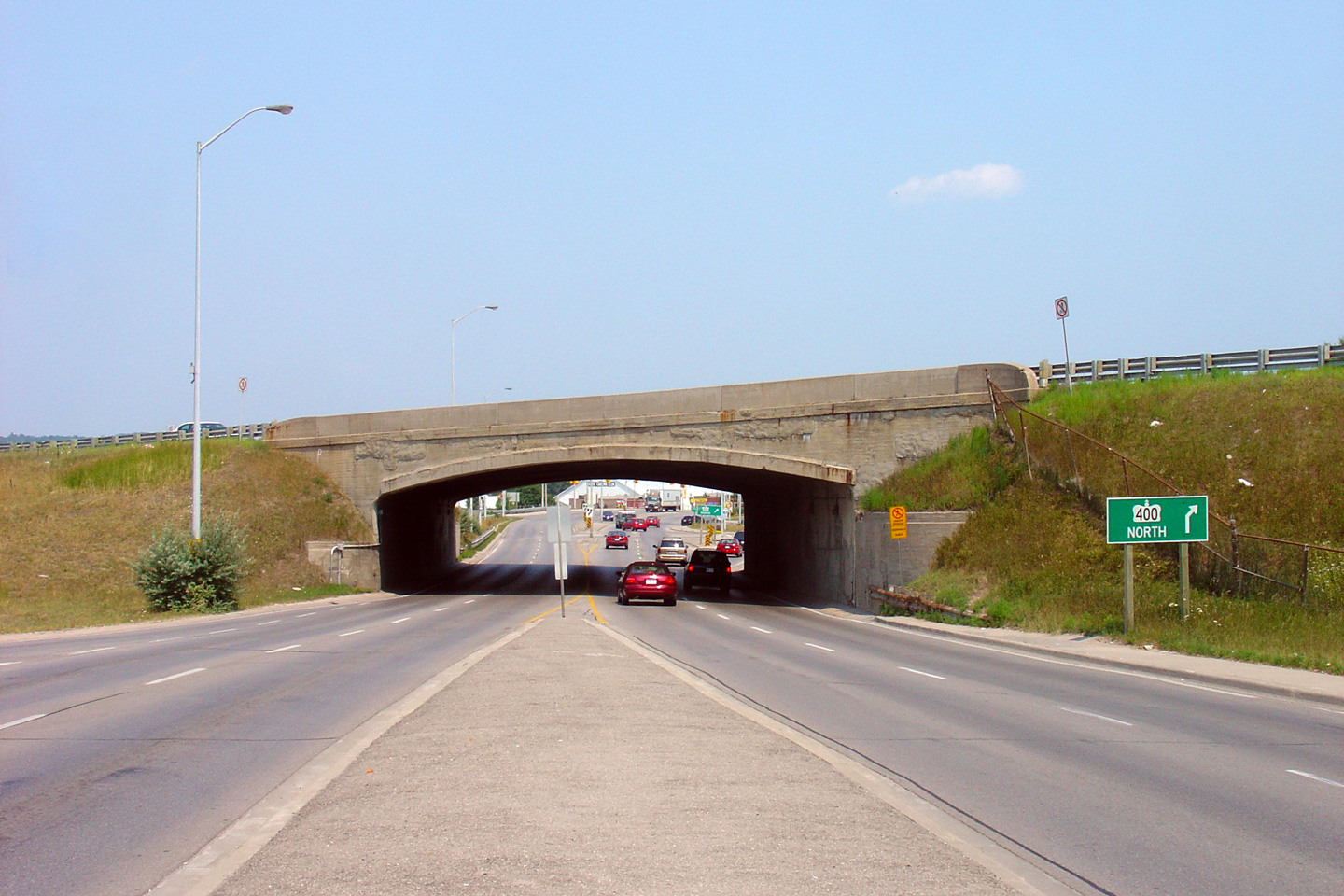
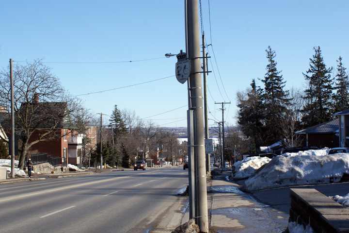
| City of Barrie |
Now in Barrie, Highway 27 passes underneath of Highway 400 via a very narrow
1950s vintage underpass.
Photo taken:
August 2nd, 2007. |
(720x480)
(1440x960) |
|
Highway 400 is southcentral
Ontario's principal north-south highway.
Click
here for Highway 400 images. |
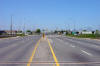
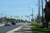
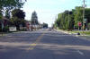
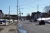
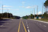
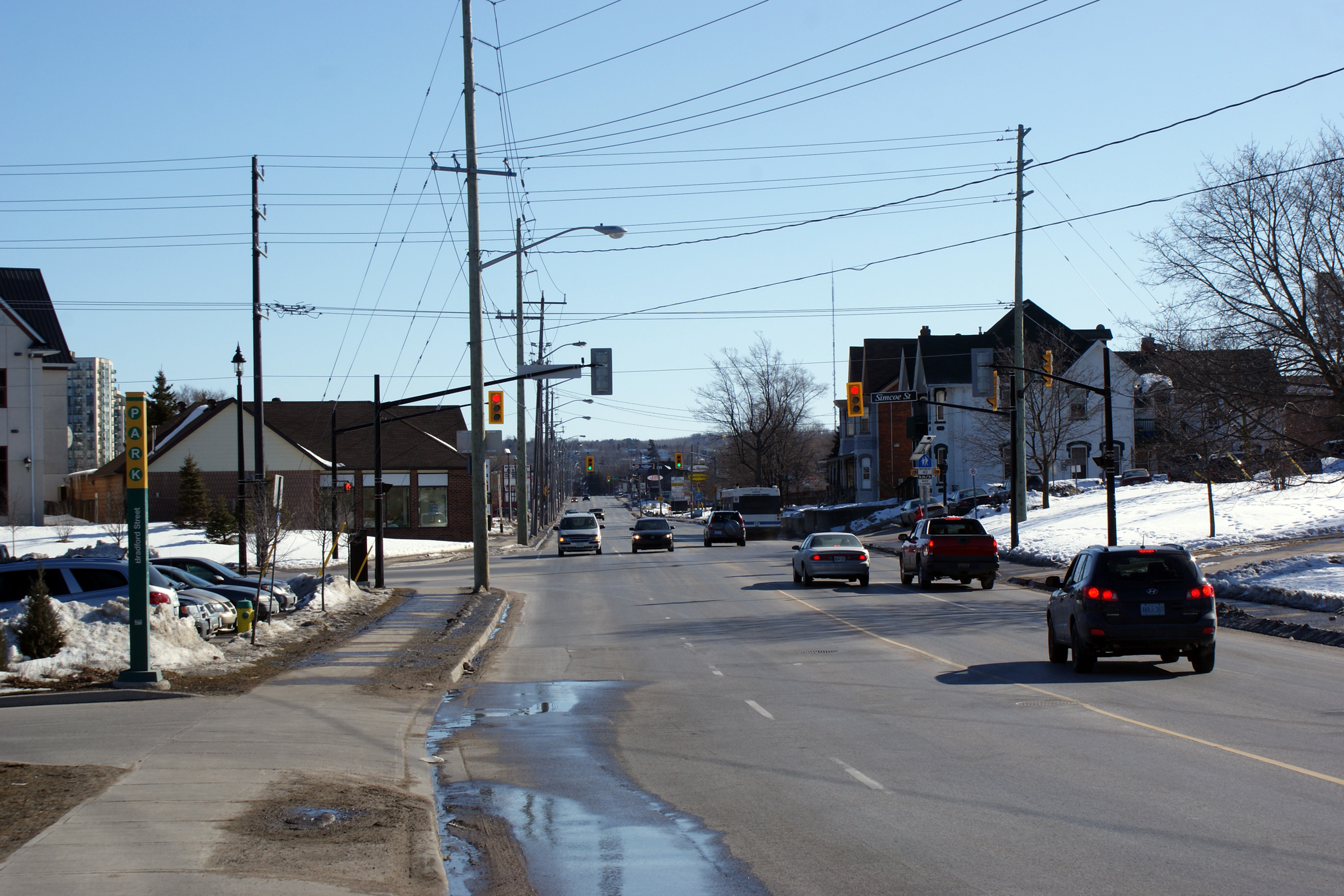
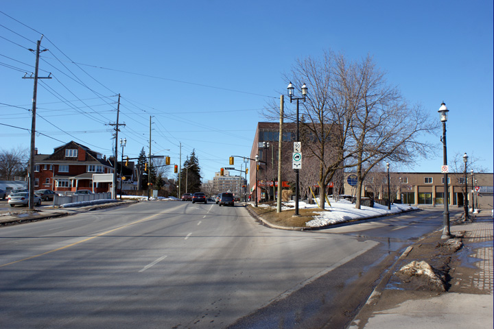
| City of Barrie |
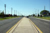
Southerly view along Bradford Street (Formerly Highway 11/27) from the
Dunlop Street intersection.
Photo taken: March 7th, 2010. |
(720x480)
(1440x960)
(2400x1600) |
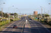
| City of Barrie |
Northerly view approaching the Dunlop Street intersection. Northbound
Highway 11/27 traffic had to turn right at this intersection.
Photo taken: March 7th, 2010. |
(720x480)
(1440x960) |
| City of Barrie |
A lone northbound junction sign is all that remains of the former Highway
90.
Photo taken: March 7th, 2010. |
 (720x480) (720x480)
(1440x960) |
|
Highway 90 led westerly from
Barrie to Angus and CFB Borden.
Click
here for Highway 90 images. |
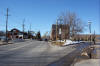
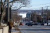
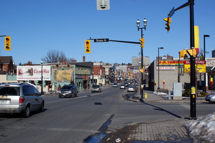
| City of Barrie |
Looking northerly along Dunlop Street on approach to Downtown Barrie.
Photo taken: March 7th, 2010. |

(720x480)
(1440x960)
(2400x1600) |
| City of Barrie |
Southerly view along Highway 11/27 from the Highway 27 intersection.
The vacant lot pictured on the right side of the photo is the former
landmark Wellington Hotel, which burned down in 2007.
Photo taken: March 7th, 2010. |
(720x480)
(1440x960)
(2400x1600) |
|
Highway 11 continues northerly
from Barrie bound to Orillia, North Bay and beyond.
Click
here for Highway 11-North images. |
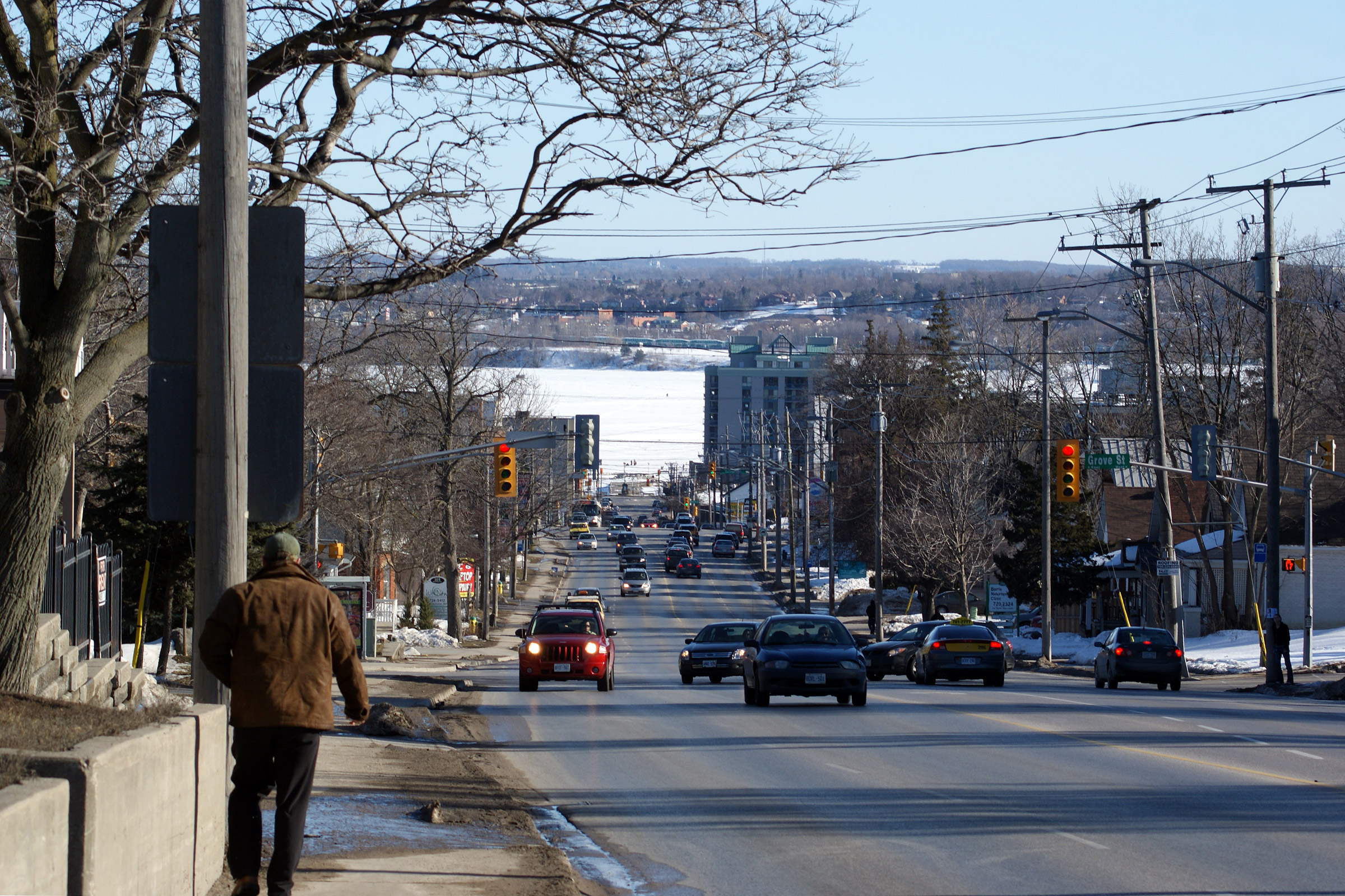
| City of Barrie |
View looking southerly along Bayfield Street towards Downtown Barrie.
Photo taken: March 7th, 2010. |
(720x480)
(1440x960)
(2400x1600) |
| City of Barrie |
This Highway 26 reassurance marker is posted on a half-empty bracket that
the sign once shared with Highway 27.
Photo taken: March 7th, 2010. |
 (720x480) (720x480)
(1440x960) |
|
Highway 400 is south-central
Ontario's principal north-south highway.
Click
here for Highway 400 images. |
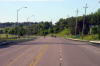
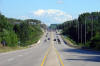
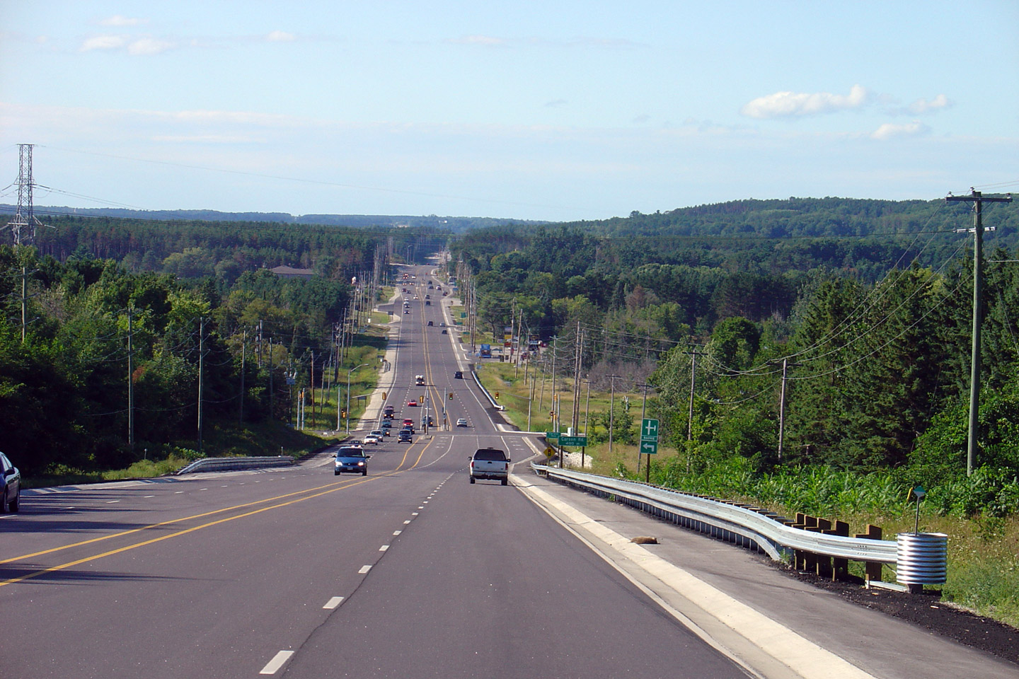
| Township of Springwater County
of Simcoe |
Highway 26/27 looking northwest from the
north limits of Barrie towards Midhurst. Highway 26/27 was originally 4-laned in 1968, having
only very recently been reconstructed. Between Barrie and the Highway 26/27
split, there are two signalized intersections at Carson Road and Snow Valley
Road.
Photo taken: August 21st, 2005. |
(720x480)
(1440x960) |
| Township of Springwater County
of Simcoe |
This sign is located northwest-bound along Highway
26/27just southeast of the Highway 26/27
junction. This sign is very odd for an Ontario highway, as its very
unusual to see multiple routes suggested for the same destination.
This sign has since been removed.
Photo taken: August 21st, 2005. |
|
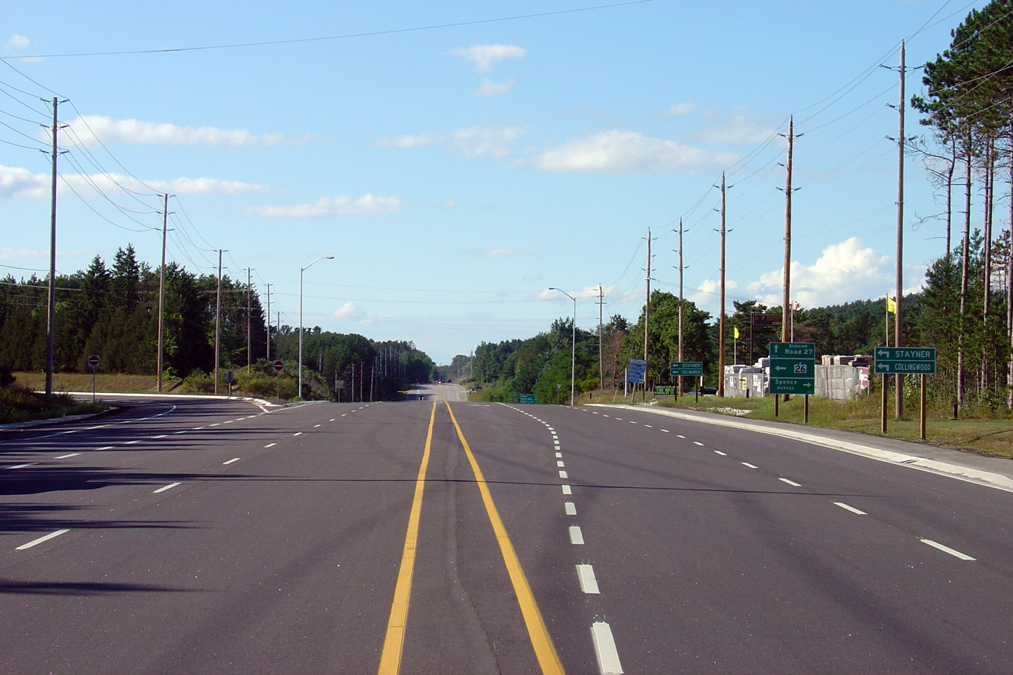
| Township of Springwater County
of Simcoe |
Highway 26/27 looking west towards the
northern Highway 26/27 junction. At
this junction, traffic continuing towards Stayner and Collingwood along
Highway 26 must turn left. Straight ahead is Highway 27, which leads
travelers towards Elmvale and Penetanguishene.
Photo taken: August 21st, 2005. |
(720x480)
(1440x960) |
|
Highway 26 departs Highway 27
bound for Collingwood just north of Barrie.
Click here for Highway
26 images. |
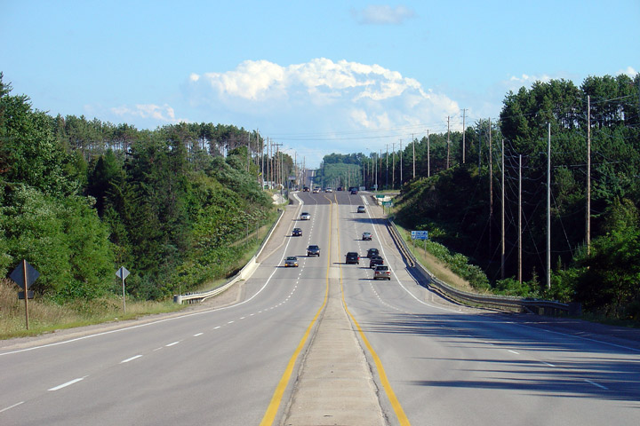
| Township of Springwater County
of Simcoe |
Southerly view looking towards Barrie and the Highway 26 intersection.
Photo taken: August 21st, 2005. |
(720x480)
(1440x960) |
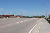
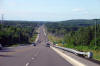
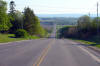
| Springwater - Tiny Boundary
County of Simcoe |
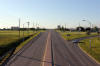
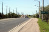
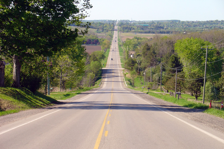
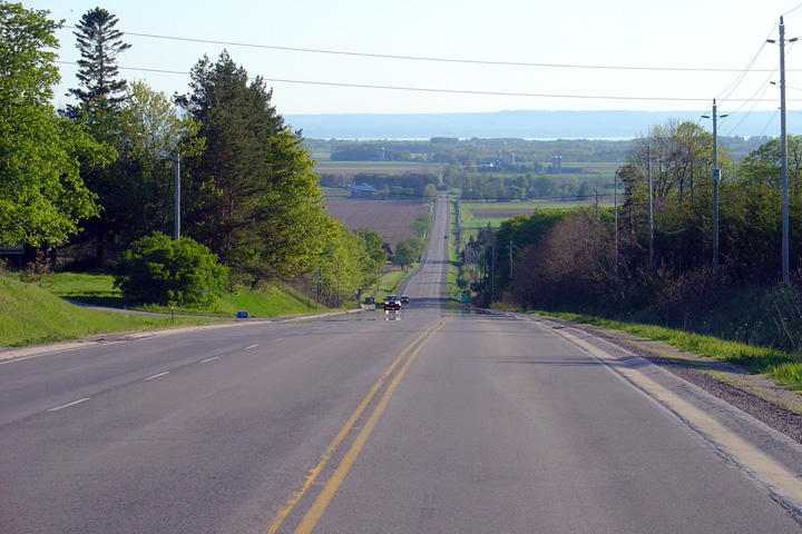
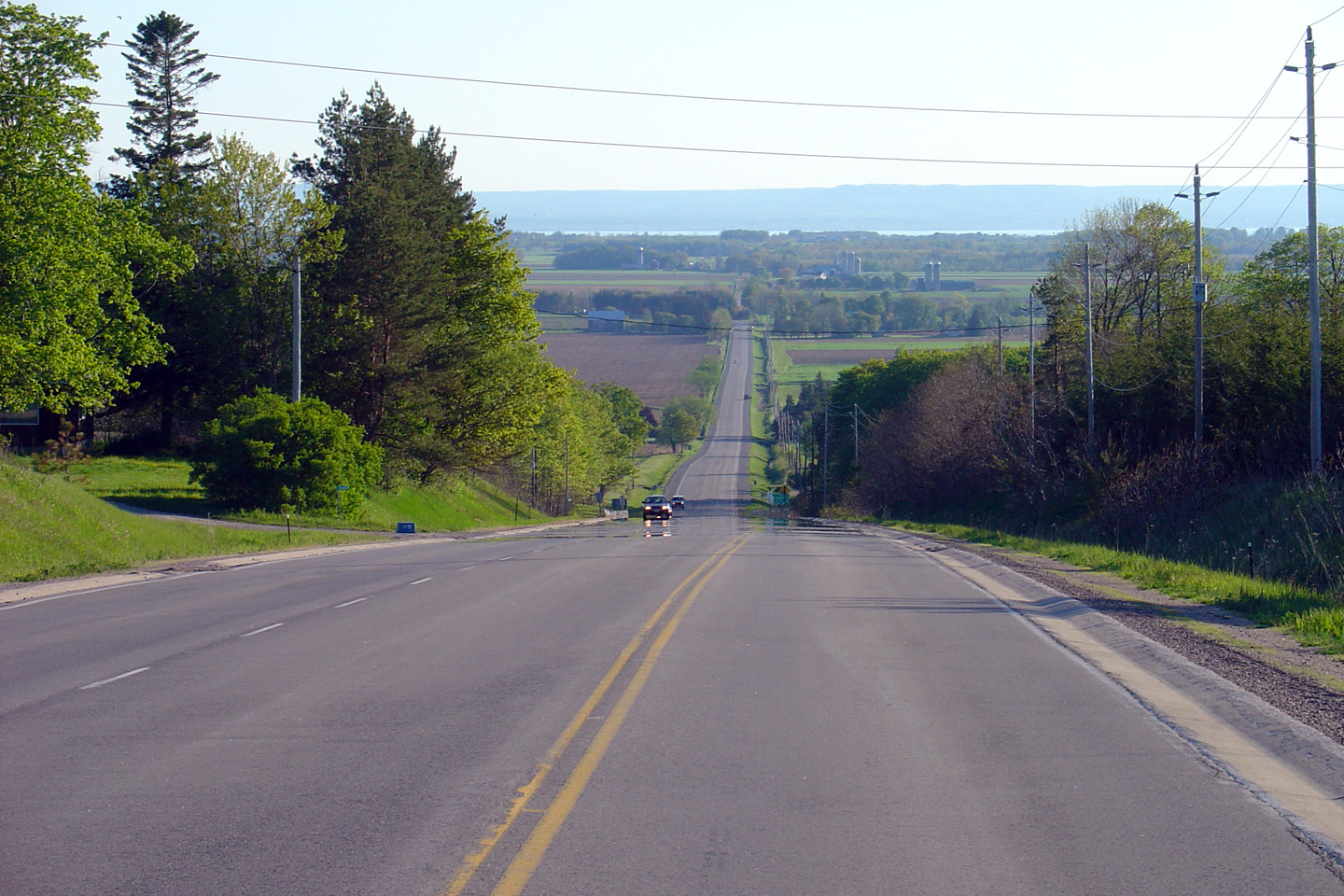
Looking south along Highway 27 towards the Highway 92 junction at Elmvale.
Georgian Bay is visible in the distance of this photo. Northern Simcoe
County has several of these large ridges that run primarily north-south in
direction, making for some very scenic countryside.
Photo taken: May 25th, 2005. |
(720x480)
(1440x960) |
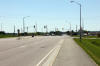
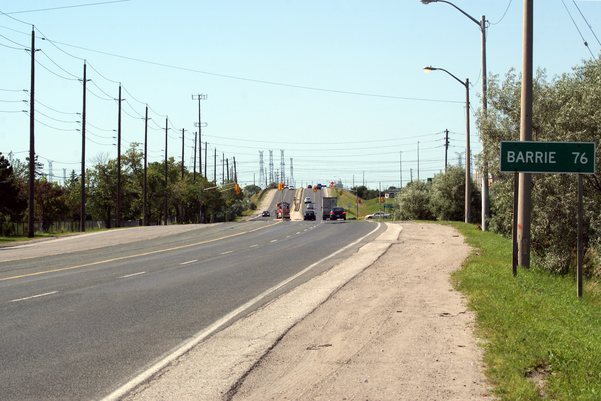
| Tiny - Tay Boundary County of
Simcoe |
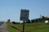
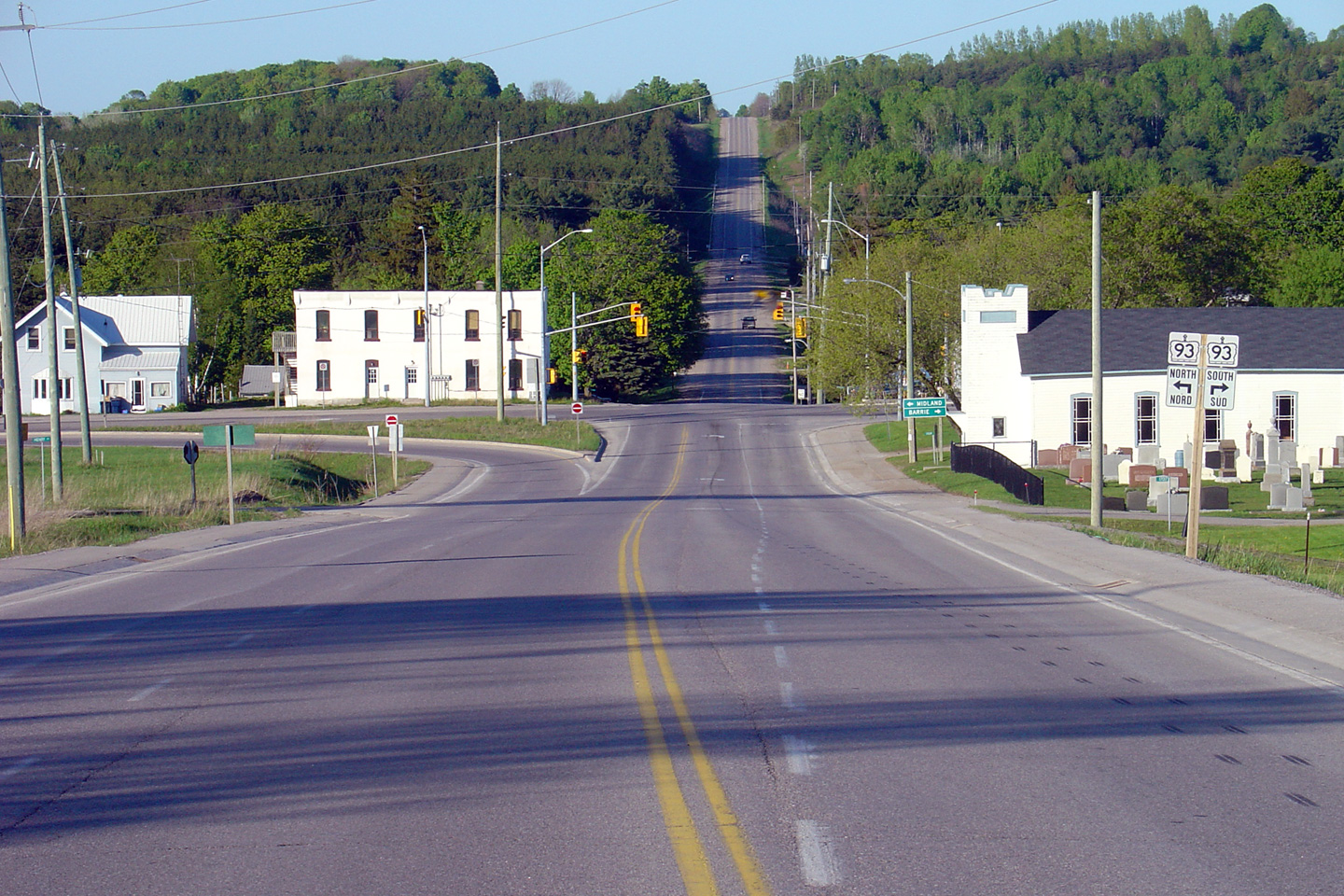
View looking northerly approaching the northern terminus of Highway 27 at
the Highway 93 junction in Waverly.
Highway 27 ends at this signalized intersection. Straight ahead is
Vassey Road which leads traffic to Highway 400
and Coldwater.
Photo taken: May 25th, 2005. |

(720x480)
(1440x960) |
|
Highway 27 ends at a rural
junction with Highway 93 in Waverly.
Click
here for Highway 93 images. |
 (720x480)
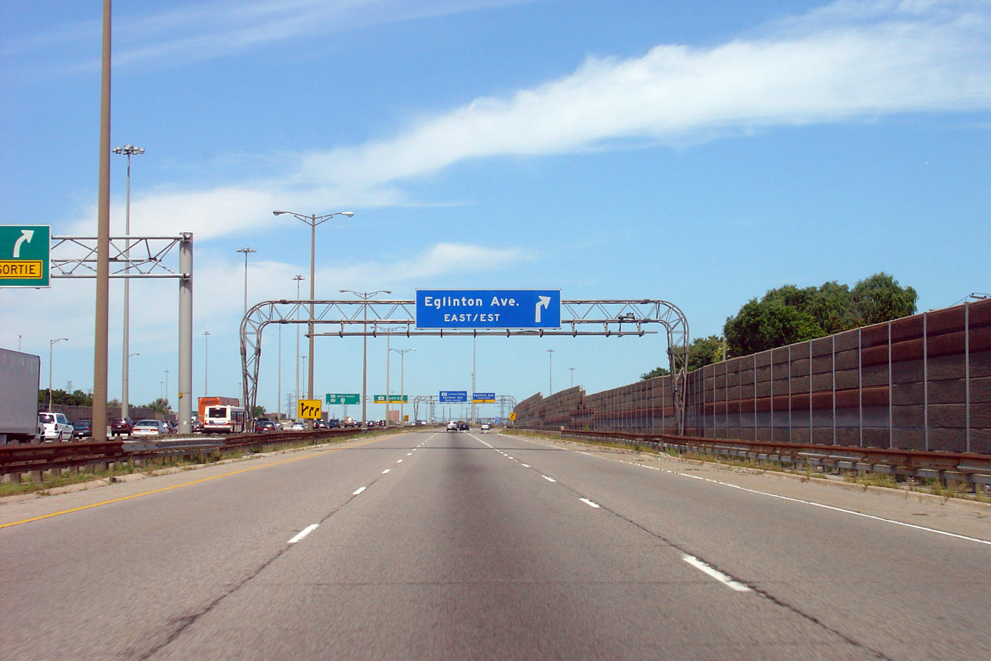
 (720x480)
 (720x480)
 (720x480)
 (720x480)


 (720x480)


 (720x480)
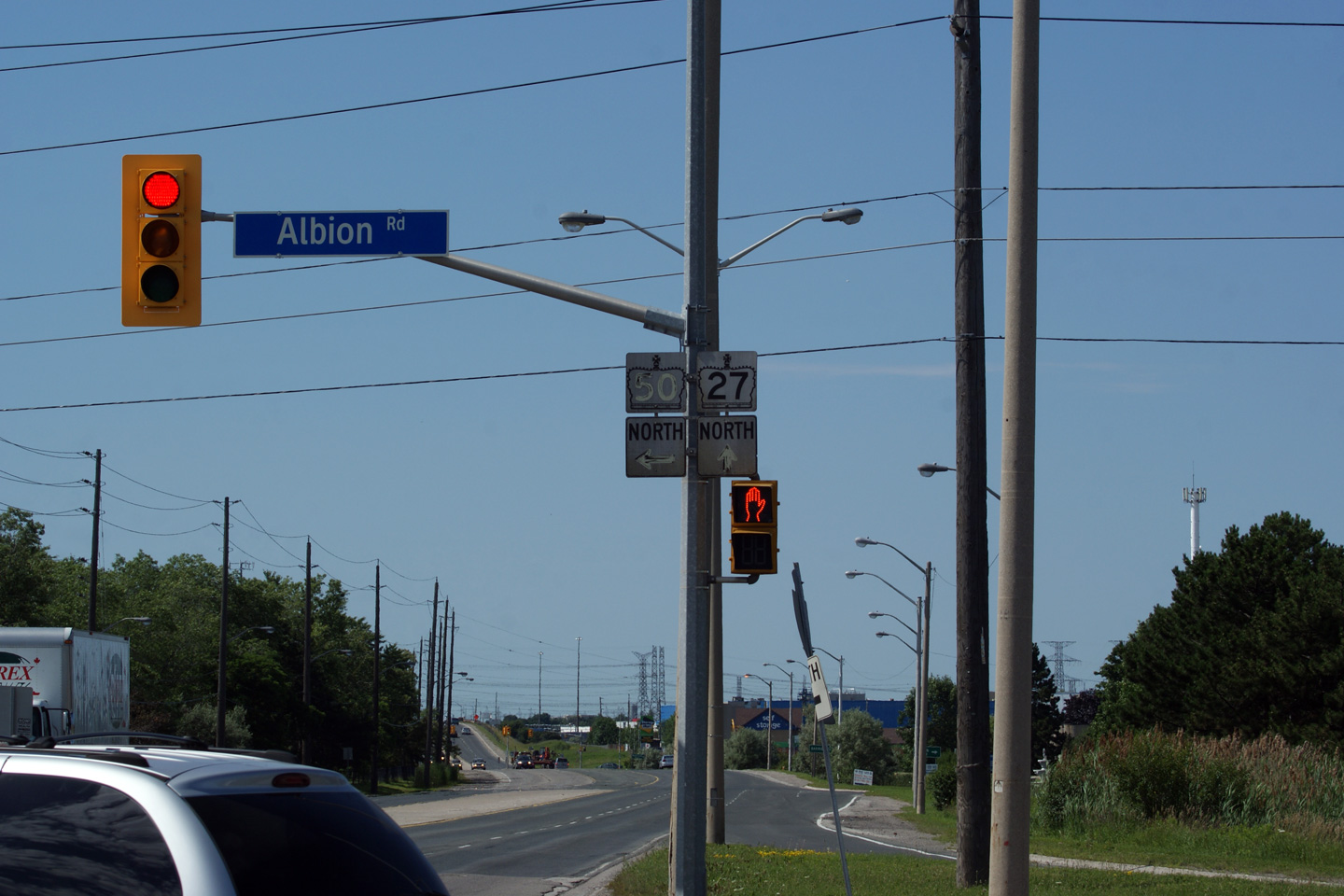
 (720x480)


 (720x480)


 (720x480)


 (720x480)

 (720x480)
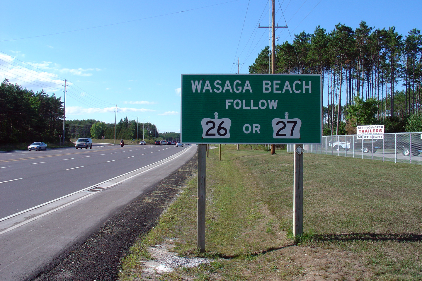

