Photo Description
Pictures taken from driver's perspective appear offset from centre-line pictures:
Bound
Bound
Photo taken: March 7th, 2010.

Photos taken: March 7th, 2010.

AsphaltPlanet.ca > OntHighways > Highway 90 > Images
King's Highway 90 - Images
Photos shown in this table are arranged from West to East:
| Proper Municipality Name |
Photo Description |
Photo | |
|
Pictures taken from driver's perspective appear offset from centre-line pictures: |
East- Bound |
West- Bound |
|
| City of Barrie |
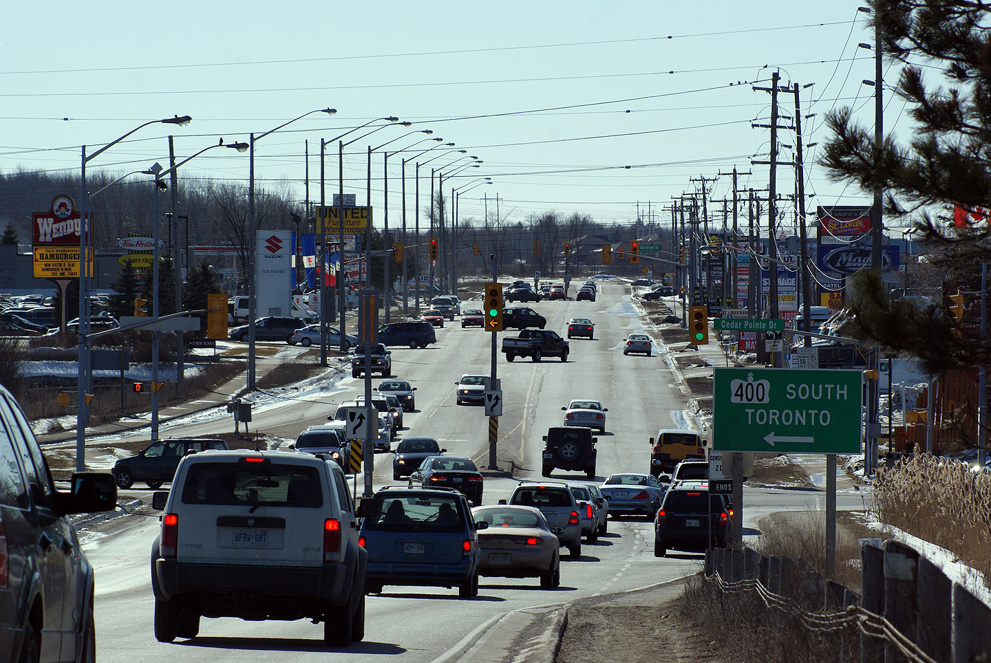
View looking westerly along Dunlop Street in Barrie from the top of the
Highway 400 overpass. Highway 90 leaves the urban area of Barrie as
the highway curves out of view in the photo. As Highway 90 leaves the
urban part of Barrie, the highway narrows to a conventional two-lane
highway. Photo taken: March 7th, 2010. |
|
|
| Highway 400 is South-central Ontario's principal north-south highway, stretching from Toronto northerly to Parry Sound. Click here for Highway 400 images. | |||
| City of Barrie |
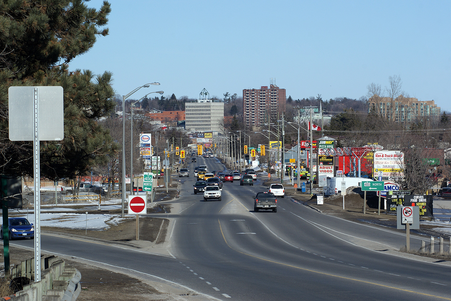
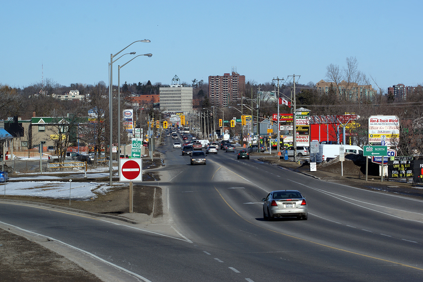
Easterly view from the Highway 400 overpass along Dunlop Street into
Downtown Barrie. The Highway 400 interchange is a considerable
bottleneck along Dunlop Street. Dunlop Street is a four-lane arterial
on either side of the Highway 400 interchange, but has, as pictured, only a
two lane structure across Highway 400. When Highway 400 was first
opened to traffic in 1952, Barrie was a much, much smaller centre than it is
today, and as such, the highway, and interchanges were not designed to
handle the high volumes of traffic that they do today. Several Highway
400 interchanges in Barrie serve as major bottlenecks to the City of
Barrie's arterial road network. Photos taken: March 7th, 2010. |
|
|
| Highway 90 ends at Highway 11/27 in Downtown Barrie. Click here for Highway 11-images, and here for Highway 27 images. | |||
<-
Highway 89 Images
Back to
Highway 90
Highway 91 Images ->
Images Index
Copyright (c) 2004-2010, Scott Steeves (Webmaster) scott@asphaltplanet.ca
