|
Proper Municipality Name |
Photo Description |
Photo |
|
Photos taken
from driver's perspective appear offset from centre-line pictures: |
East-
Bound |
West-
Bound |
|
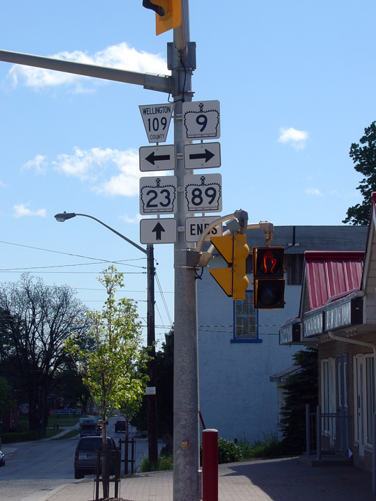
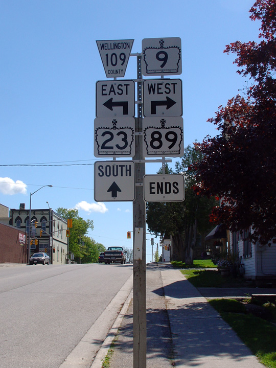
Highway 89 ends at Highway 9 and Highway 23 in Harriston.
Click here for Highway 9 images
and here for Highway
23 images. |
Town of Minto
County of Wellington |
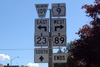
Westbound ends assembly at the Highway 9/23 junction in Downtown Harriston.
Prior to 2003, Highway 89 continued westerly along what is now Highway 23
terminating at a rural junction with Highway 23 just west of Palmerston.
Photo taken: May 20th, 2006. |
 |
Town of Minto
County of Wellington |
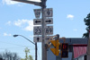
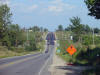
Westbound advanced signage denoting the western terminus of Highway 89.
Photo taken: May 20th, 2006. |
 |
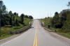
Town of Minto
County of Wellington |
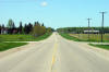
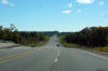
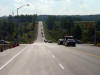
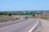
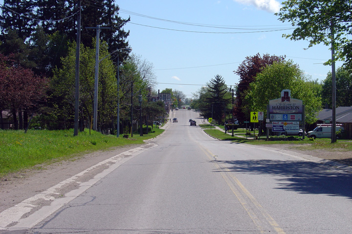
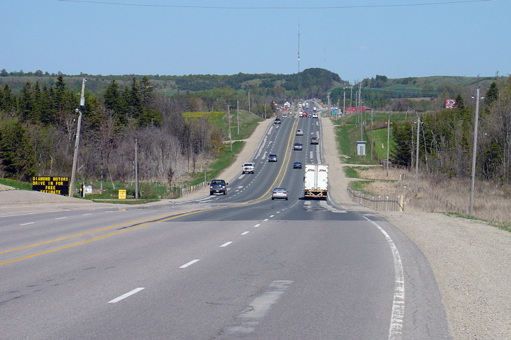
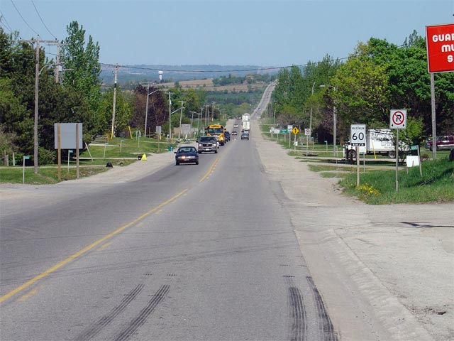
This view looks westerly as Highway 89 enters the small community of
Harriston.
Photo taken: May 20th, 2006. |

(720x480)
(1440x960) |
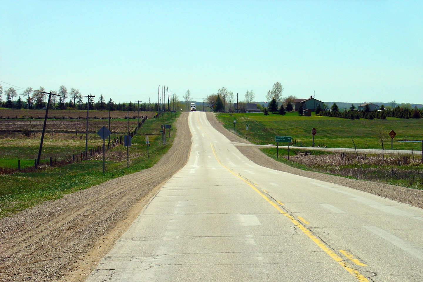
Town of Minto
County of Wellington |
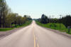
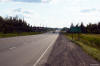
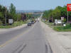
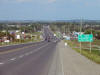
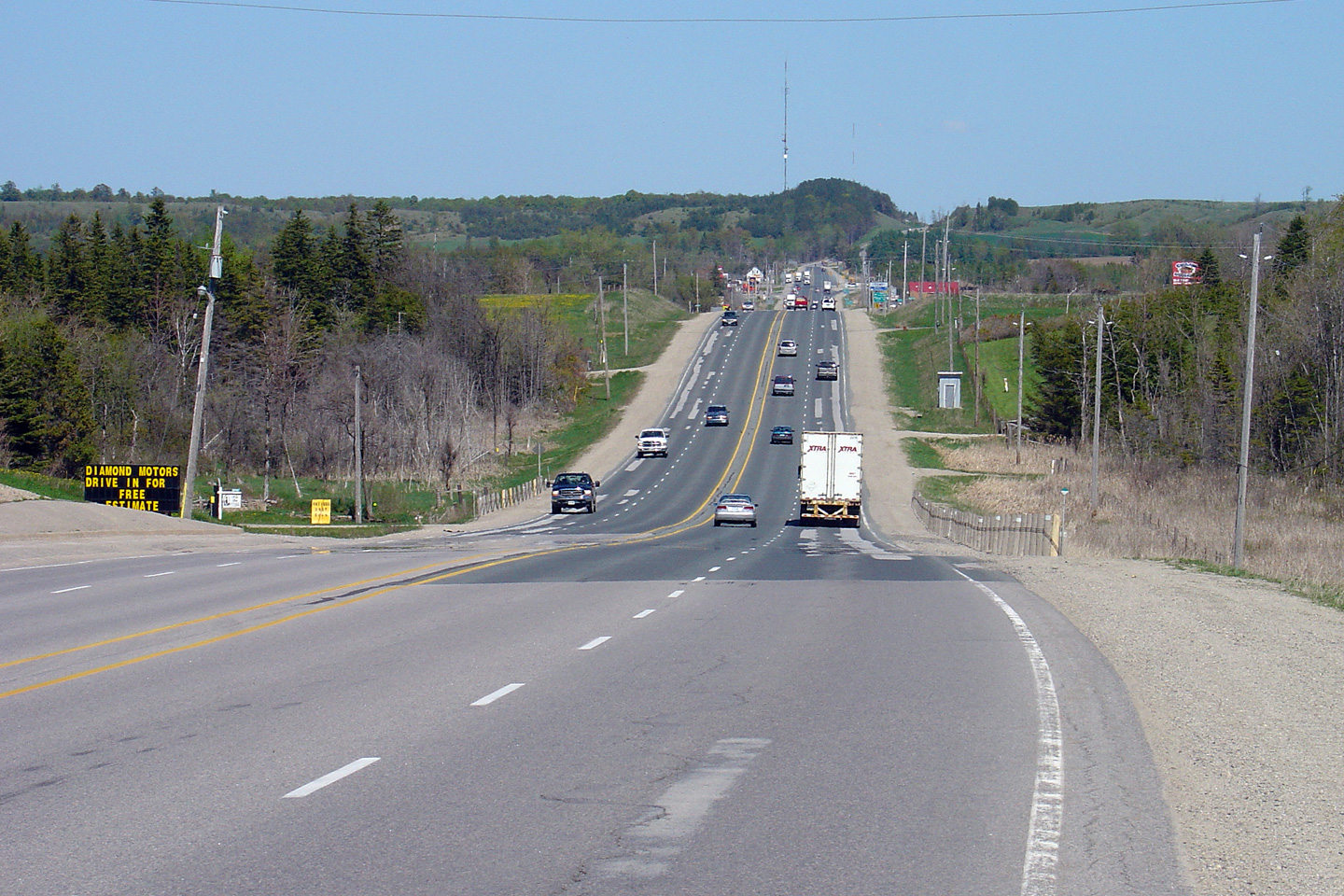
Easterly view along Highway 89 from the eastern limits of Harriston.
Photo taken: May 20th, 2006. |

(720x480)
(1440x960) |
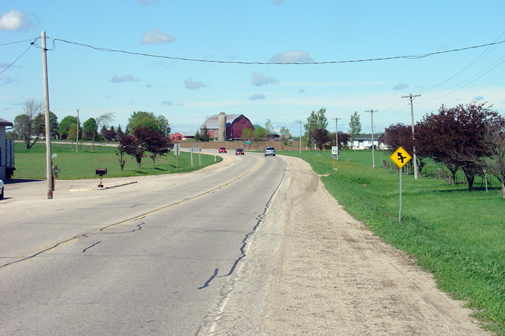
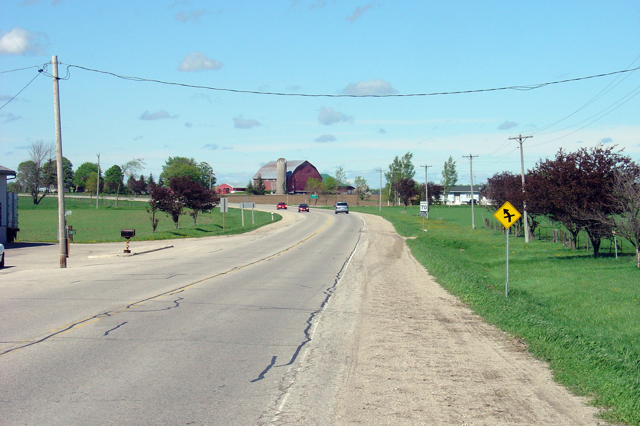
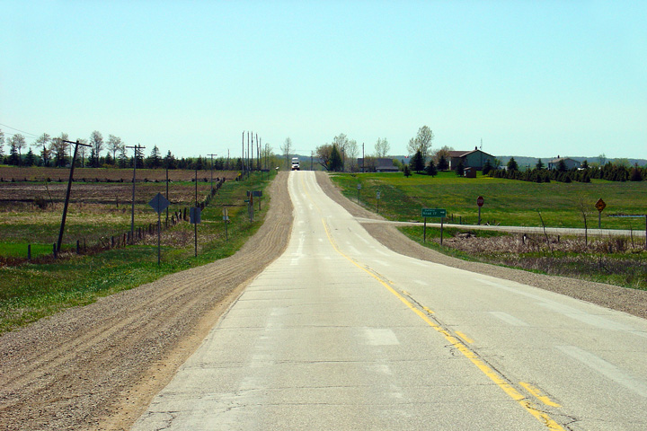
Town of Minto
County of Wellington |
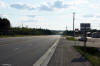
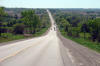
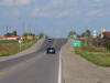
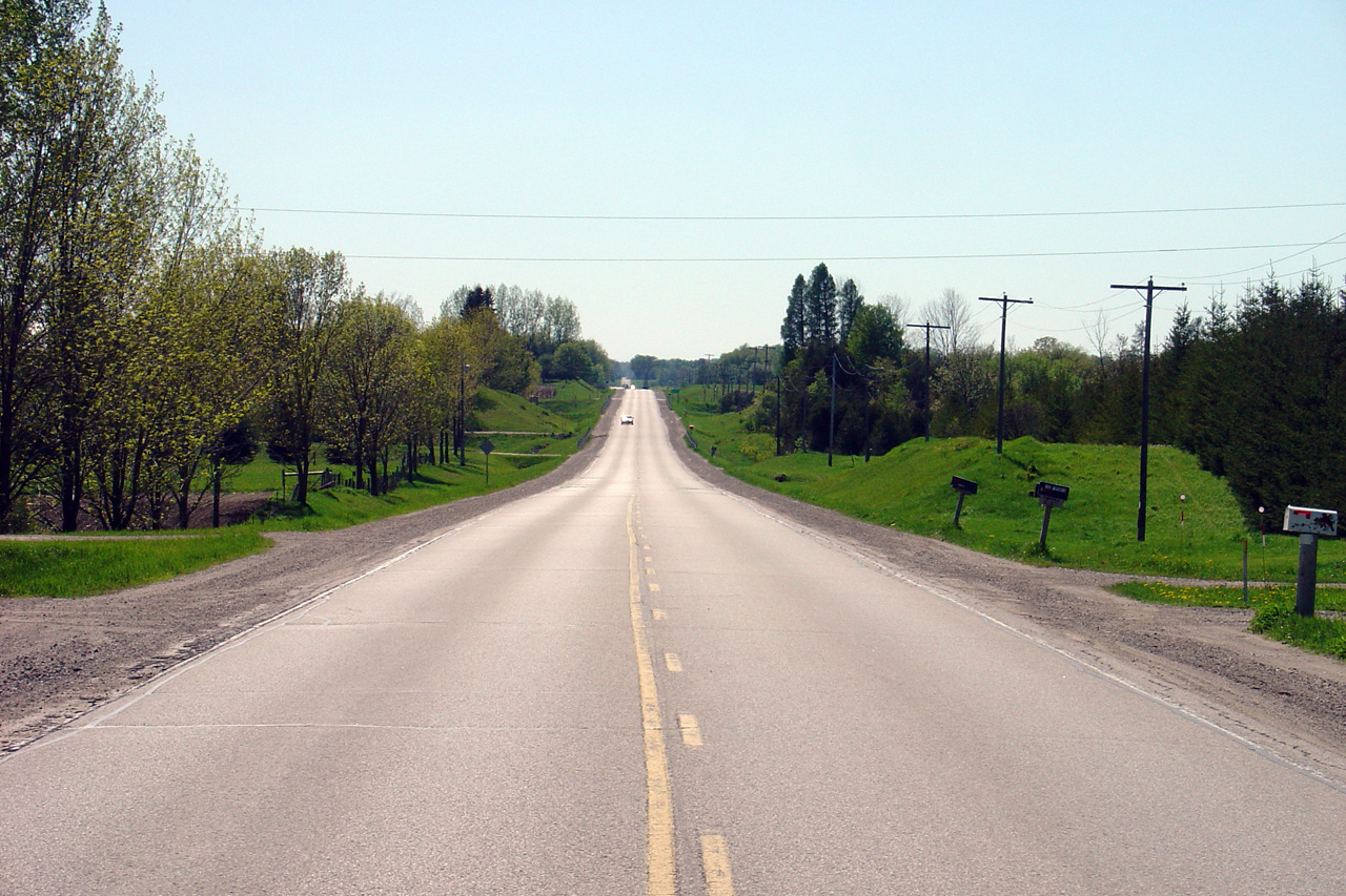
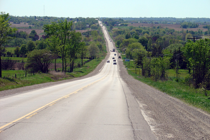
Looking easterly along Highway 89 from Minto's Tenth Line.
Photo taken: May 20th, 2006. |
(720x480)
(1440x960) |
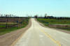
Town of Minto
County of Wellington |
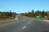
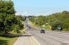
This view looks westerly into the afternoon sun from the Baseline Road
junction in the Town of Minto.
Photo taken: May 20th, 2006. |
(720x480)
(1440x960) |
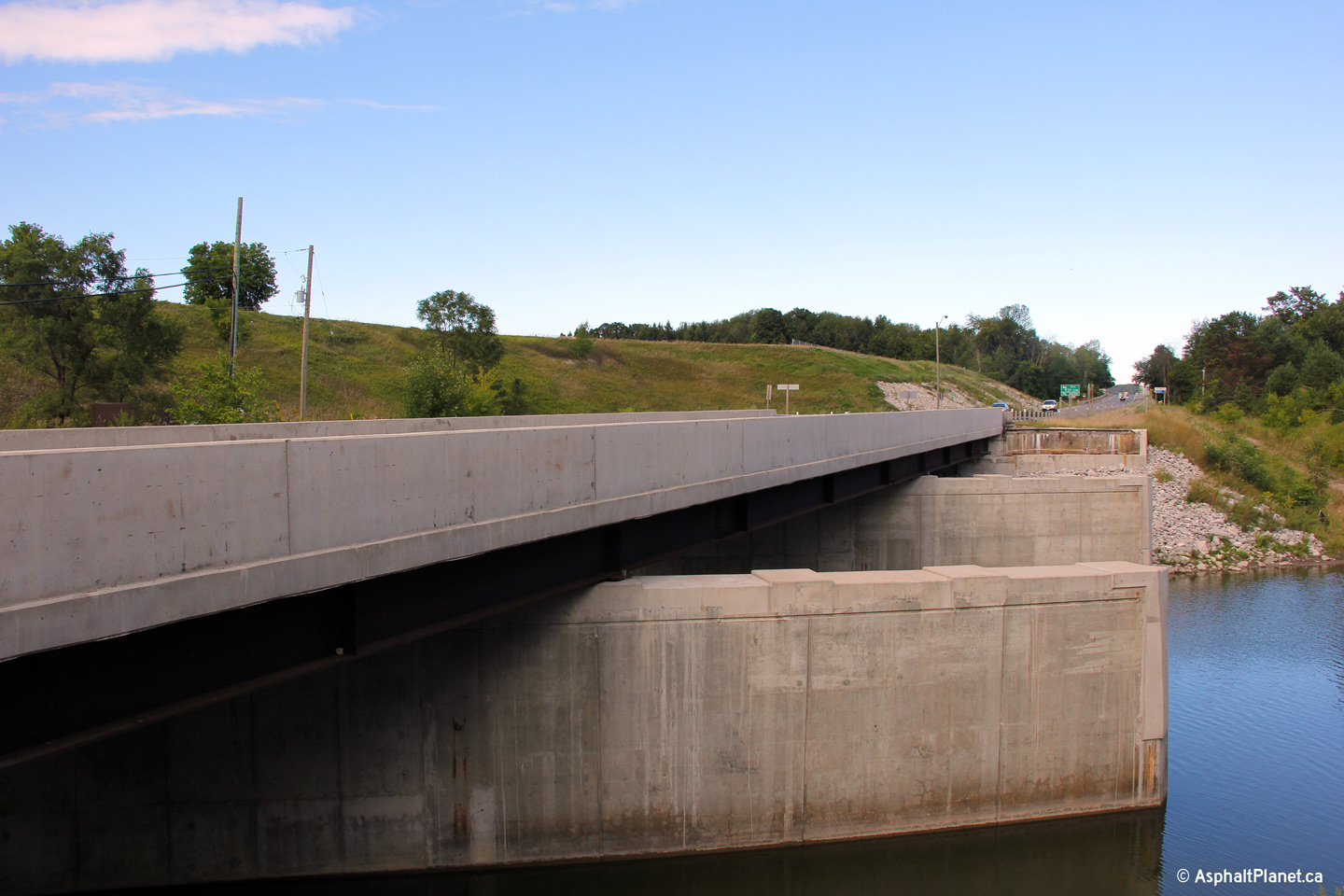
Minto - West Grey Boundary
Wellington - Grey Boundary |
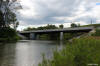
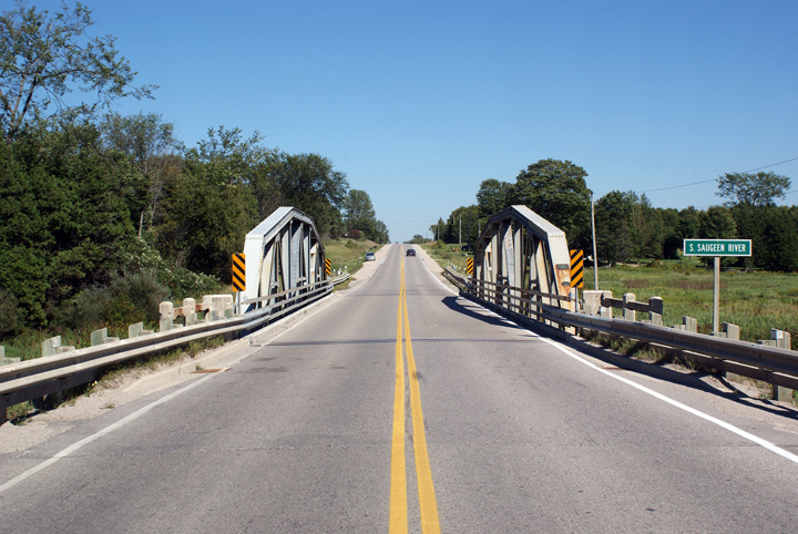
View looking easterly through the South Saugeen River bridge along Highway
89.
Photo taken: August 29th, 2010. |
(720x480)
(1440x960)
(2400x1600) |
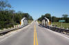
Minto - West Grey Boundary
Wellington - Grey Boundary |
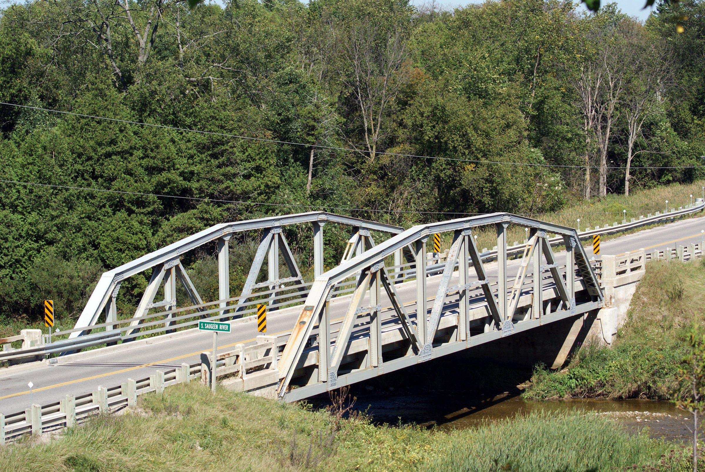
Two offset views of the narrow South Saugeen River truss bridge along
Highway 89. The truss bridge was constructed by the Hamilton Bridge
Company in 1953 and was installed for the County of Wellington. In
1953, when this bridge was built, the
Highway 89 designation did not extend west of Primrose. The South
Saugeen River truss bridge served the County of Wellington for a decade
before Highway 89 was extended to Harriston.
Photos taken: August 29th, 2010. |

(720x480)
(1440x960)
(2400x1600)
(720x480)
(1440x960)
(2400x1600) |
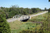
Minto - West Grey Boundary
Wellington - Grey Boundary |
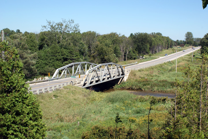
View across the South Saugeen River bridge looking westerly. The Saugeen River, and its associated branches and tributaries is one of
mid-western Ontario's more notable rivers.
Photos taken: August 29th, 2010. |
(720x480)
(1440x960)
(2400x1600) |
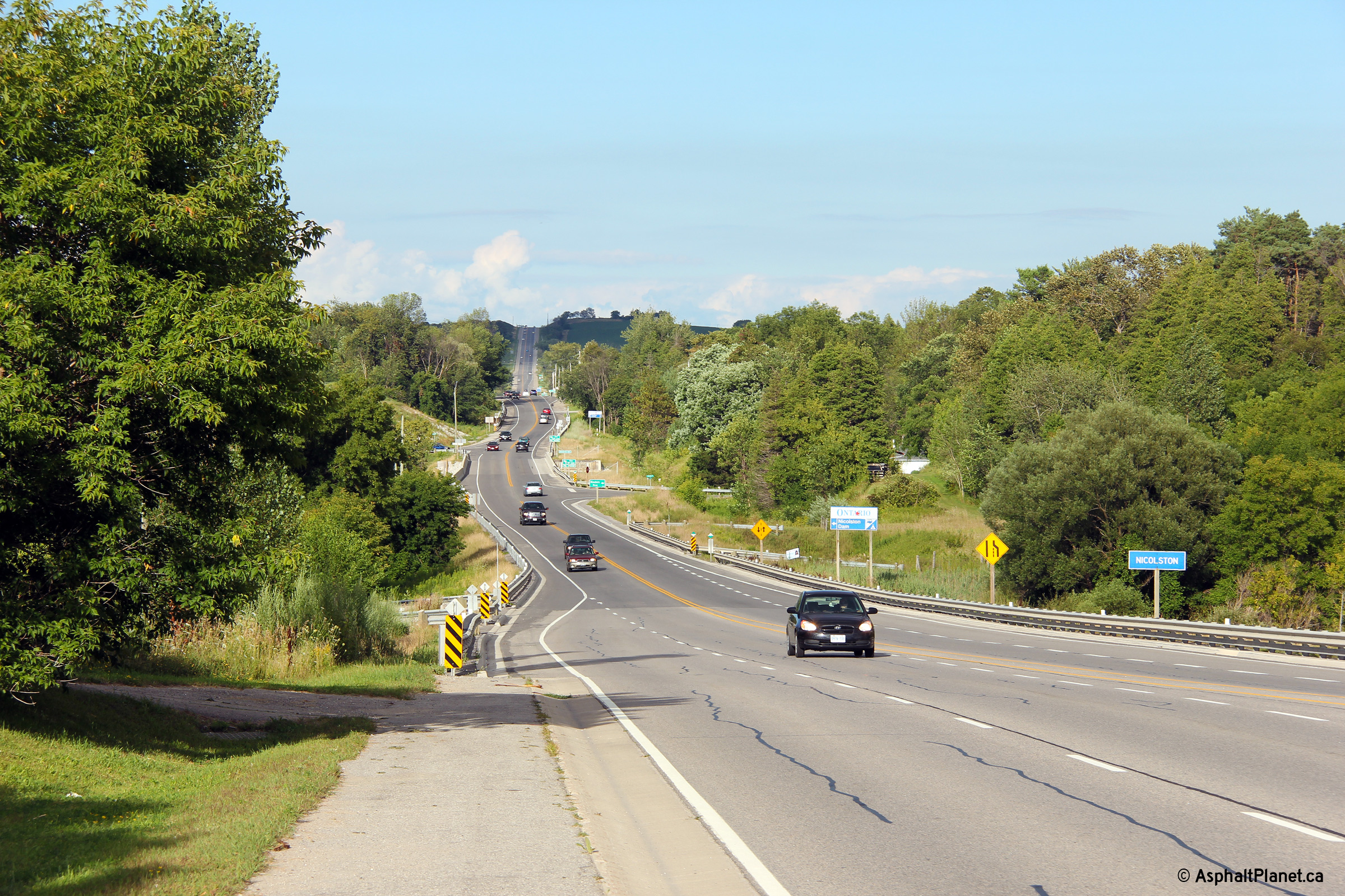
| Melancthon - Amaranth Boundary
County of Dufferin |
Westerly view at the Dufferin Road 17 intersection.
Photo taken: May 25th, 2005. |
(720x480)
(1440x960) |
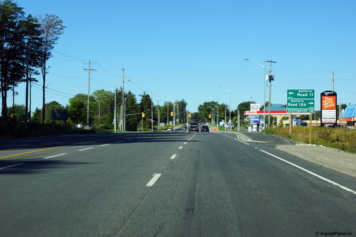
| Melancthon - Amaranth Boundary
County of Dufferin |
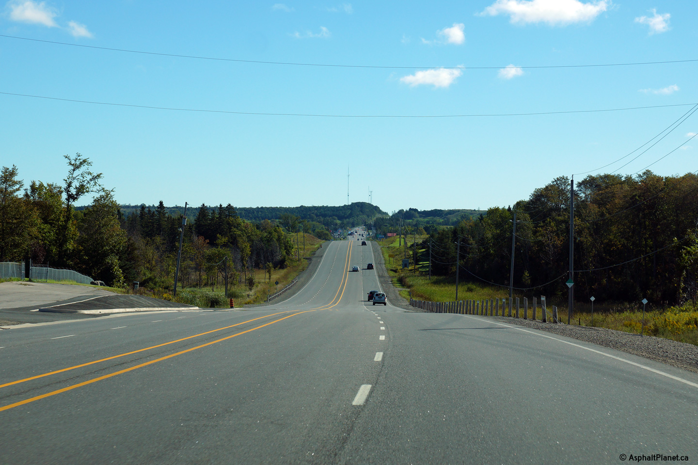
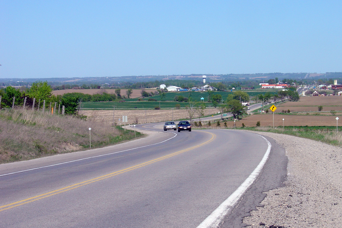
Westerly view approaching the former Highway 24-North junction. Since being
transferred to the County, the former Highway 24 has been known as County
Road 124.
Photo taken: September 17th, 2013. |

(720x480)
(1440x960)
(2400x1600) |
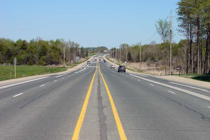
| Melancthon - Amaranth Boundary
County of Dufferin |
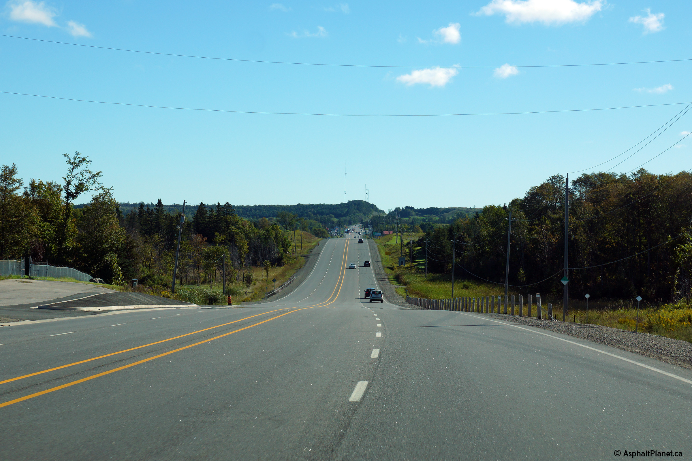
Highway 89 looking east from just east of the Highway 24 (now County
Road 124) junction at Shelburne. Highway 89 is of the pictured 4.5
lane configuration for roughly 4km between Shelburne and Primrose.
Upper photo taken: May 25th, 2005.
Lower photo taken: September 17th, 2013. |

(720x480)
(1440x960)
(2400x1600)
|
|
Mulmur - Mono Boundary County of Dufferin |
This view looks westerly as Highway 10/24/89 rounds the curve at the
Melancthon-Mulmure / Mon-Amarath Townline Road intersection.
Photo taken: September 17th, 2013. |
(720x480)
(1440x960)
(2400x1600) |
|
Mulmur - Mono Boundary County of Dufferin |
Two views looking east on Highway 10/24/89
from about halfway between Shelburne and Primrose. In the distance,
the eastern Highway 10/24/89
junction is visible. Click here
for an additional view from this vantage point, taken February, 2010.
Upper photo taken: May 25th, 2005. Lower photo taken: September 17th,
2013. |
(720x480)
(1440x960)
(2400x1600) |
|
Mulmur - Mono Boundary County of Dufferin |
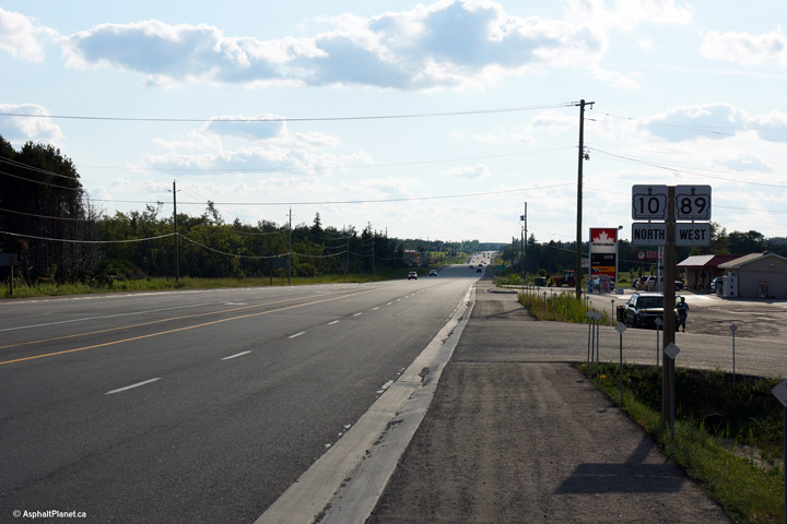
Westerly view from just west of the Primrose junction. The inclusion
of Collingwood on this distance sign is the only vestigial evidence of
Highway 24`s former existence along this stretch of highway.
Photo taken: August 24th, 2013. |
(720x480)
(1440x960)
(2400x1600) |
|
Mulmur - Mono Boundary County of Dufferin |
The highway designer has erroneously elected to sign Highway 10/89 with
junction squares instead of teardrop shields. This installation is
likely due to the former three way multiplex between Highway10/24/89.
Unlike multiplexes between two highways, three way multiplexes are typically
signed with junction squares and not teardrop shields.
Photo taken: August 24th, 2013. |
(720x480)
(1440x960)
(2400x1600) |
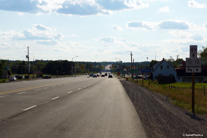
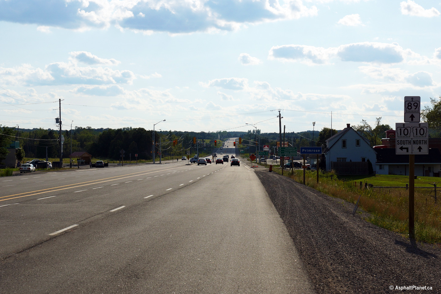
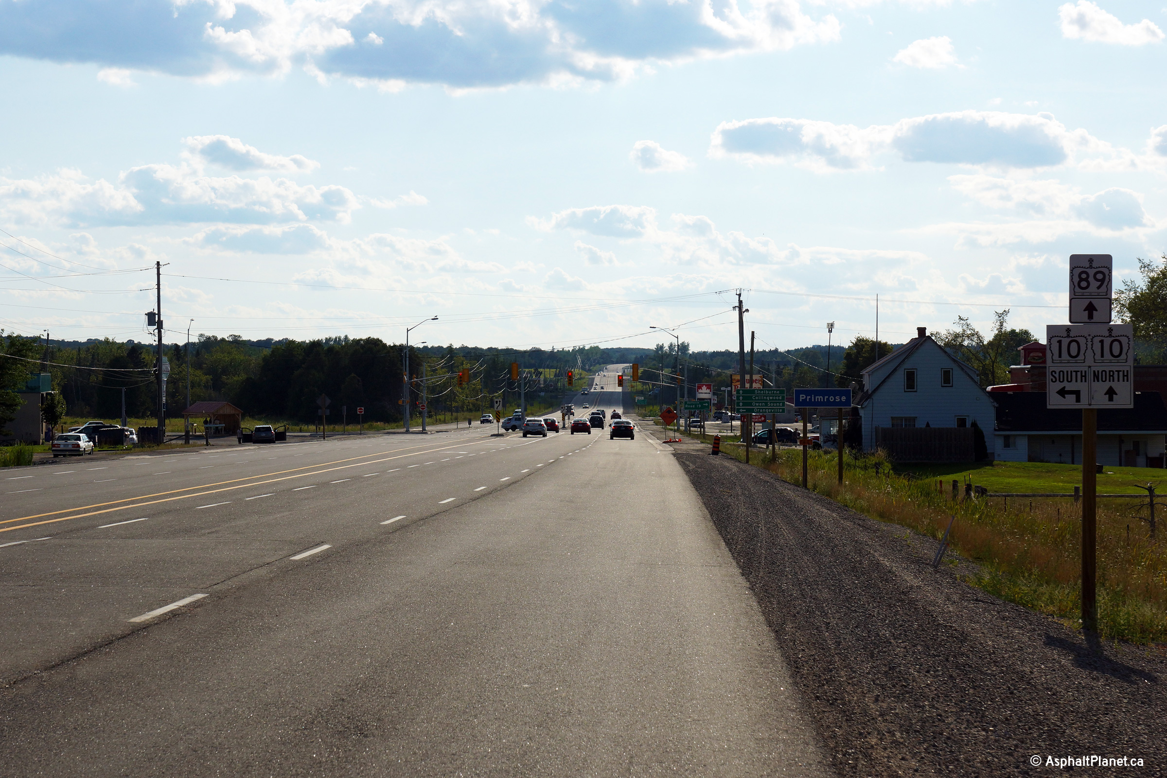
|
Mulmur - Mono Boundary County of Dufferin |
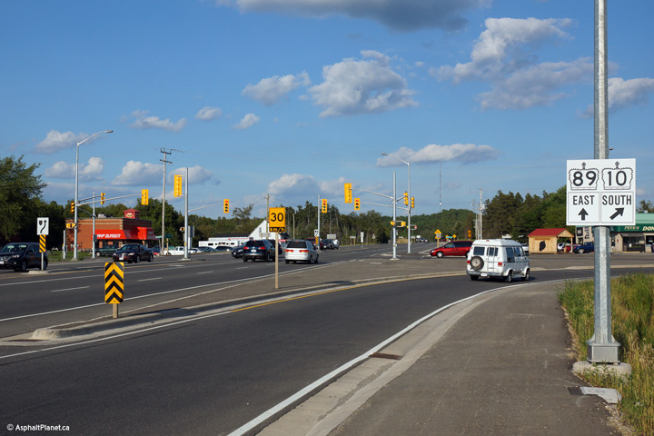
Two photos looking easterly at Primrose Junction. The upper photo
shows the destination signage at the junction, while the second sign shows
the junction assembly. At this intersection, Highway 10 (and the
former Highway 24) veer to the right at this ramp while Highway 89
continues ahead. Click here
for an additional view from this vantage point, taken February, 2010.
Photos taken: August 24th, 2013. |
(720x480)
(1440x960)
(2400x1600)

(720x480)
(1440x960)
(2400x1600) |
|
Mulmur - Mono Boundary County of Dufferin |
This picture showcases Highway 89 looking west through Primrose at the
eastern Highway 10/24 junction.
Just east of Primrose, Highway 89 narrows from the 4.5-lane configuration
pictured here to a standard 2-lane highway.
Upper photo taken: May 25th, 2005.
Lower photo taken: August 24th, 2013. |
(720x480)
(1440x960)
(2400x1600) |
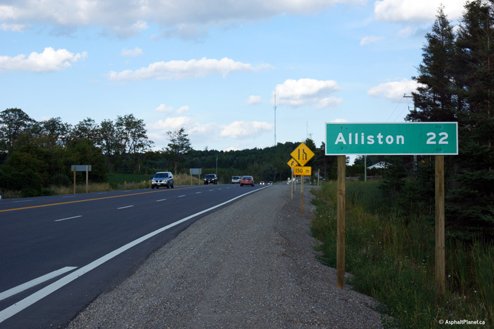
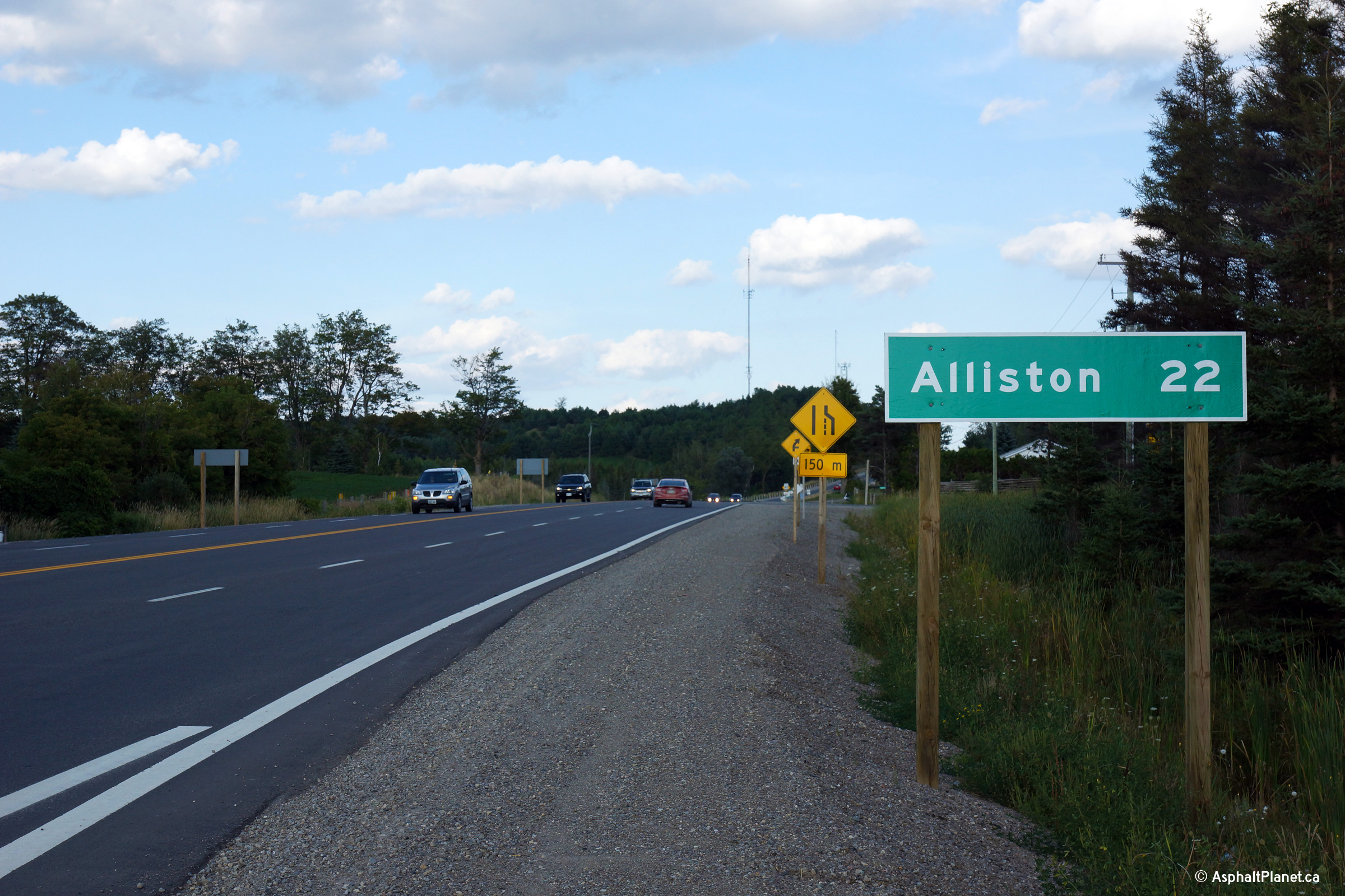
|
Mulmur - Mono Boundary County of Dufferin |
Distance signage for Alliston east of Primrose Junction.
Photo taken: August 24th, 2013. |

(720x480)
(1440x960)
(2400x1600) |
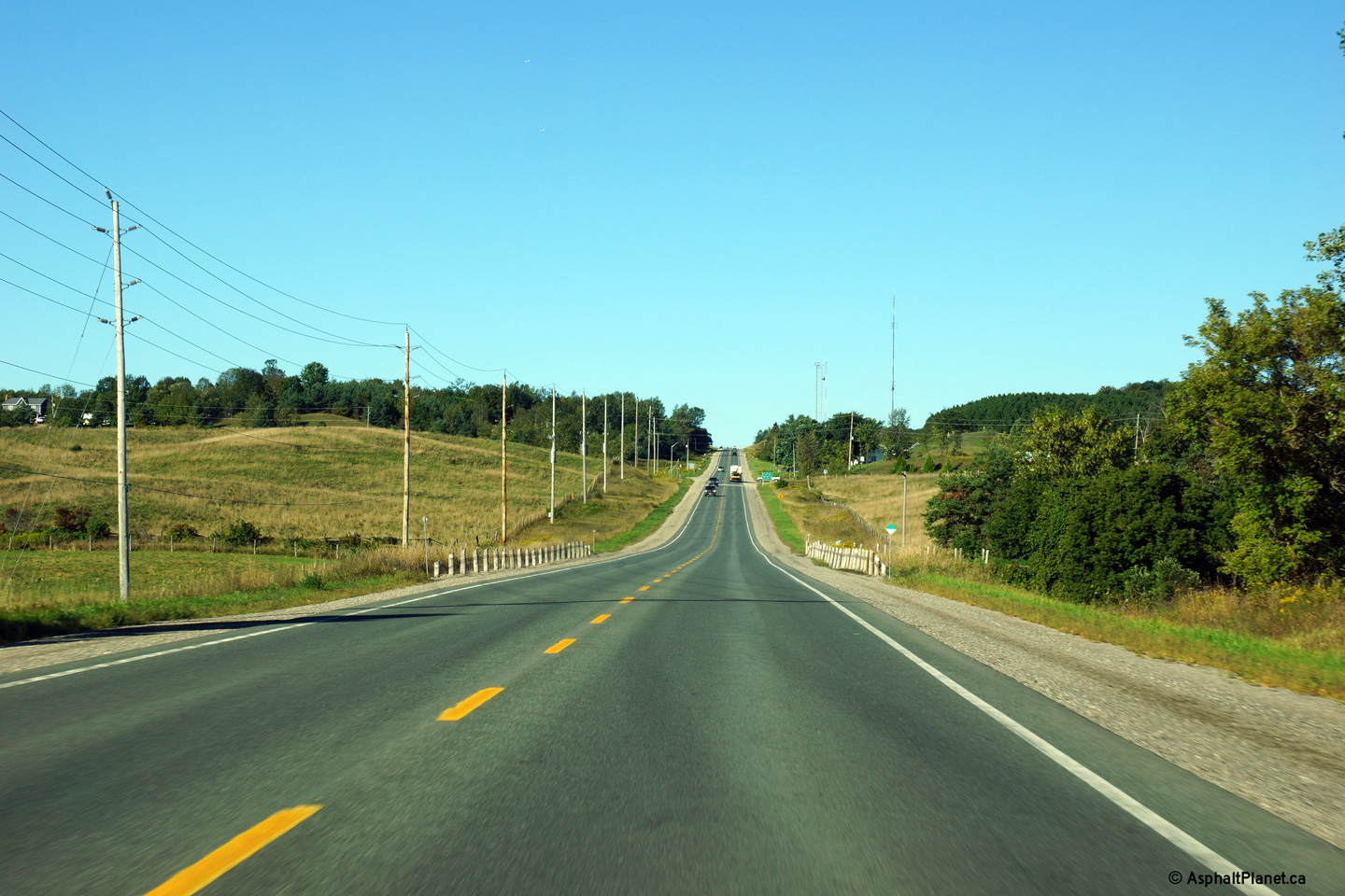
|
Mulmur - Mono Boundary County of Dufferin |
Westerly view as Highway 89 begins to descend into Primrose from the top of
a high ridge.
Photo taken: September 17th, 2013. |

(720x480)
(1440x960)
(2400x1600) |
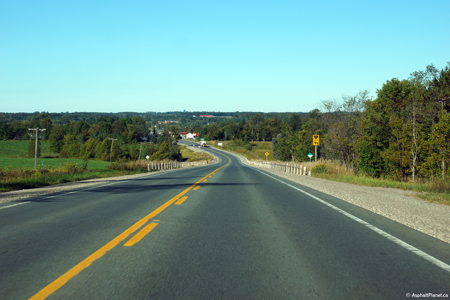
|
Mulmur - Mono Boundary County of Dufferin |
Easterly view east of Primrose as Highway 89 descends into a large valley.
Highway 89 passes through several deep valleys between Shelburne and
Alliston.
Photo taken: August 24th, 2013. |
(720x480)
(1440x960)
(2400x1600) |
|
Mulmur - Mono Boundary County of Dufferin |
Westerly view at the bottom of the a deep valley from west of the Second
Line EHS intersection.
Photo taken: September 17th, 2013. |
(720x480)
(1440x960)
(2400x1600) |
|
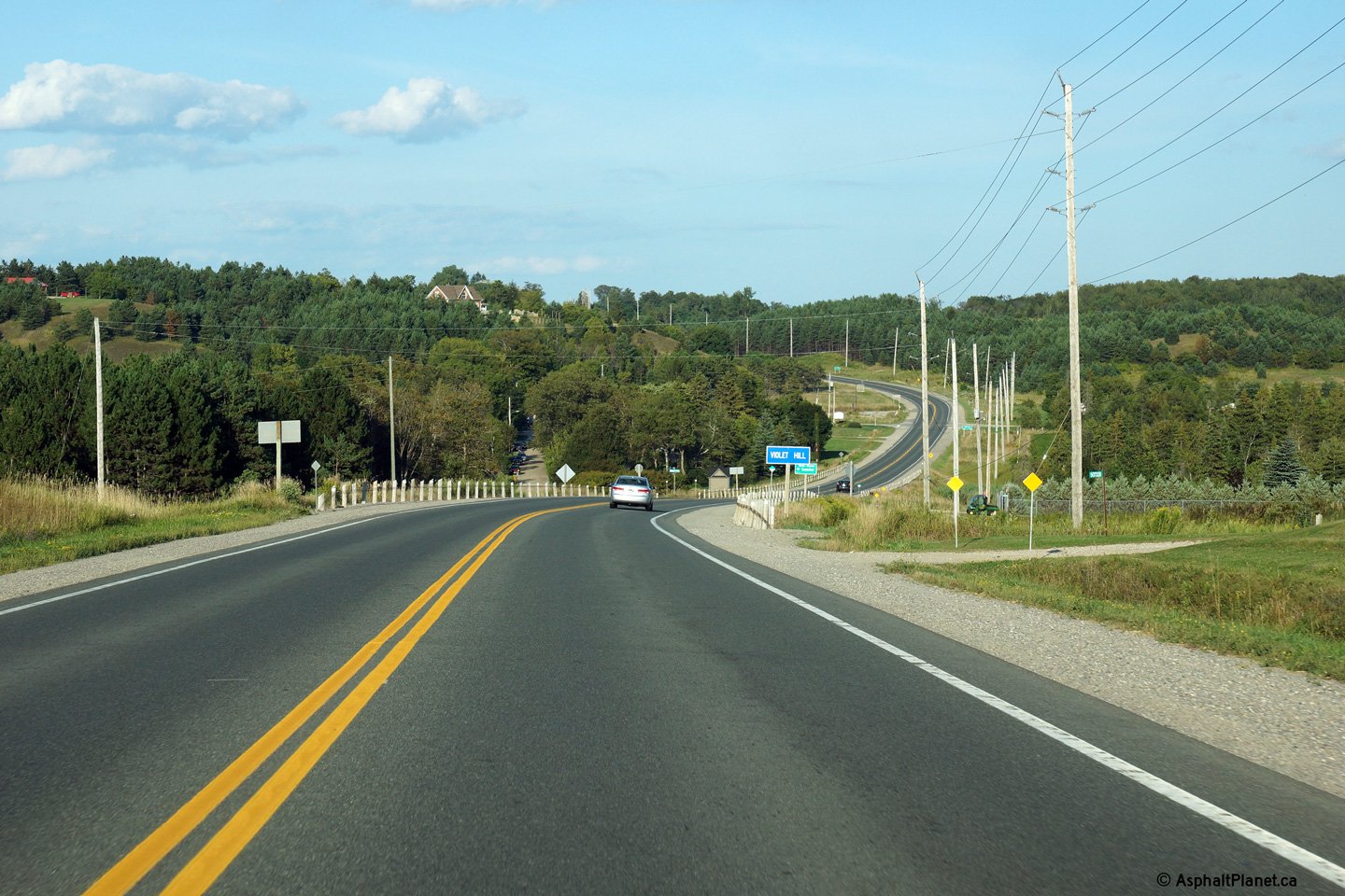
Mulmur - Mono Boundary County of Dufferin |
Easterly view along Highway 89 at Violet Hill. The alignment of Highway 89
skirts to the south through here to avoid the steep grade on the other side
of the valley.
Photo taken: August 24th, 2013. |

(720x480)
(1440x960)
(2400x1600)
|
|
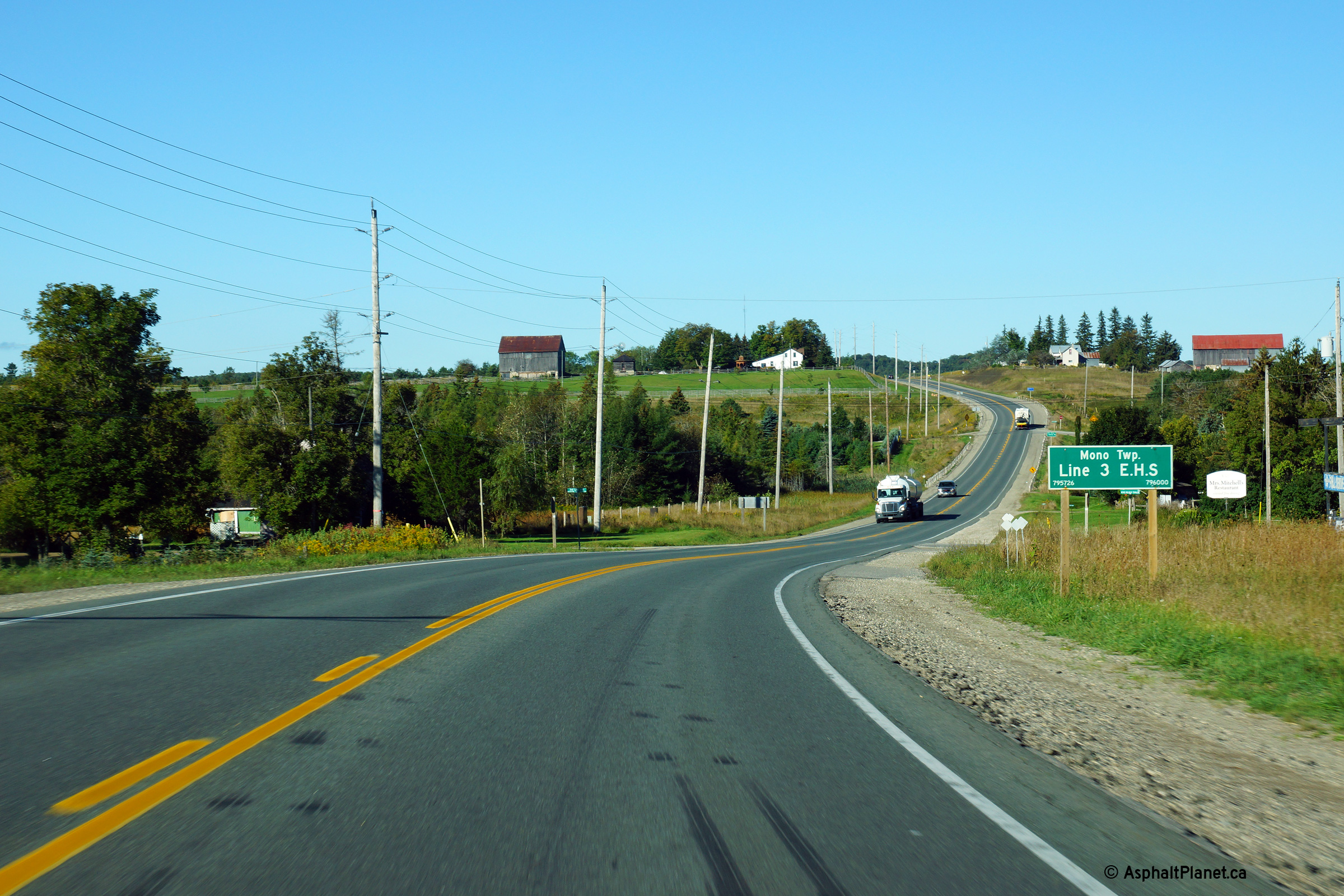
Mulmur - Mono Boundary County of Dufferin |
Westerly view at the Third Line EHS intersection in Violet Hill.
Photo taken: September 17th, 2013. |

(720x480)
(1440x960)
(2400x1600)
|
|
Mulmur - Mono Boundary County of Dufferin |
Westerly view from the top of Violet Hill.
Photo taken: September 17th, 2013 |

(720x480)
(1440x960)
(2400x1600) |
|
Mulmur - Mono Boundary County of Dufferin |
Looking easterly along Highway 89 towards the Airport Road intersection.
When this photo was taken, work was just finishing on a project that saw new
traffic signals and intersection resurfacing at the junction. There is
a very short eastbound climbing lane in the vicinity of Airport Road.
Photo taken: August 28th, 2005. |
 |
|
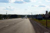
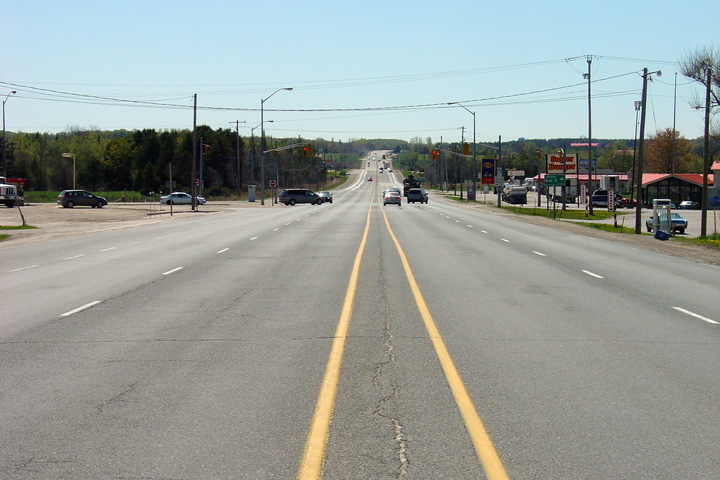
Mulmur - Mono Boundary County of Dufferin |
Looking west towards the Airport Road intersection. The signalized
intersection at Airport Road is the only signalized intersection between
Primrose and
Highway 50 along Highway 89. Photo taken: August 28th, 2005. |
 |
|
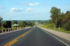
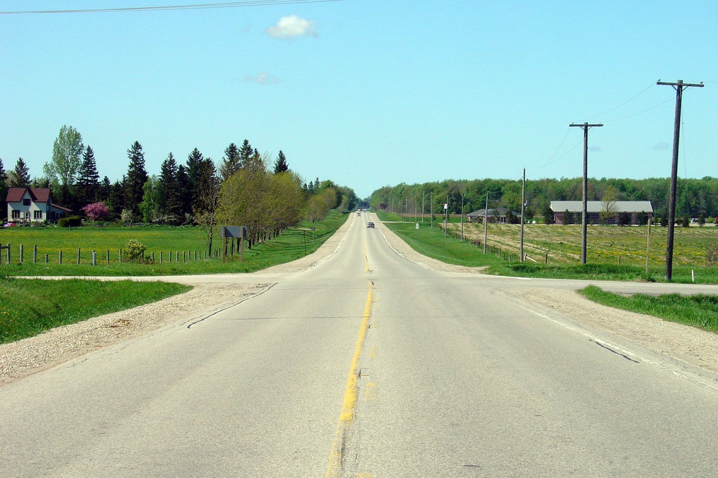
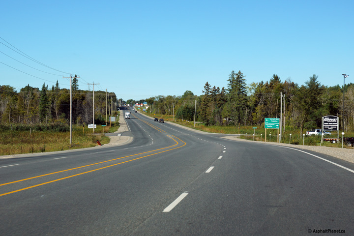
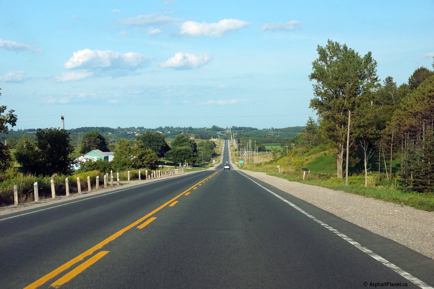
Township of Adjala - Tosorontio County of Simcoe |
Highway 89 looking east towards Alliston through the small community of
Rosemount. Rosemount is located roughly 10km west of Alliston.
Photo taken: May 25th, 2005. |
 |
|
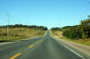
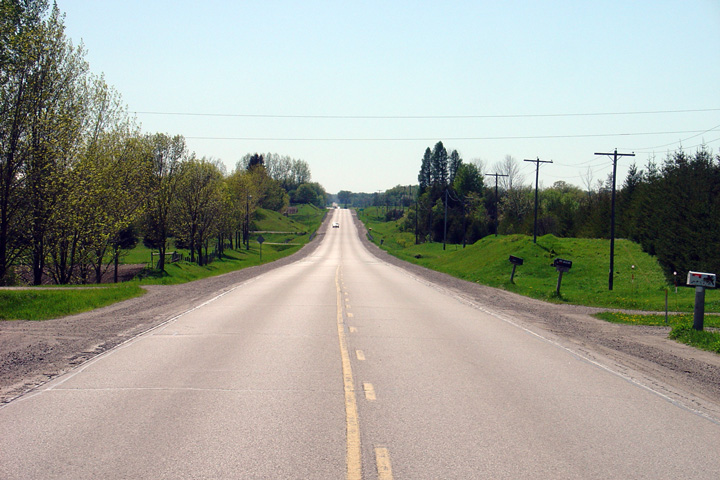
Township of Adjala - Tosorontio County of Simcoe |
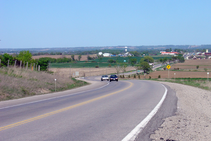
Looking west towards Shelburne from Adjala-Tosorontio Road 4. In the
distance, at the other side of this large valley is the small community of
Rosemount. Highway 89 passes through several of these large valleys
between Shelburne and Cookstown.
Photo taken: May 25th, 2005. |
(720x480)
(1440x960) |
|
Township of Adjala - Tosorontio County of Simcoe |
Highway 89 looking east towards Alliston from the Church Hill By-pass.
When originally commissioned, Highway 89 ran through Church Hill, before the
present by-pass was constructed just south of the small community.
Church Hill is located roughly 2km west of
Highway 50.
Photo taken: May 25th, 2005. |
(720x480)
(1440x960) |
|
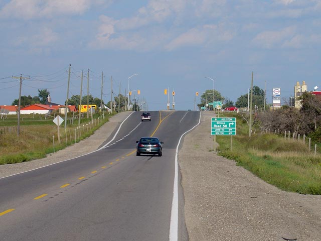
Township of Adjala - Tosorontio County of Simcoe |
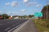
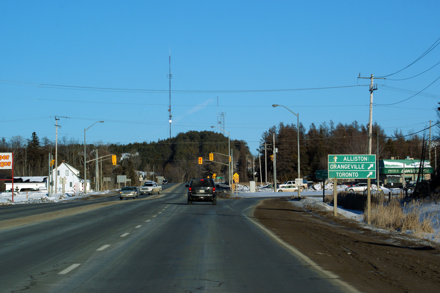
Looking east along Highway 89 towards the
Highway 50 junction.
Highway 50 is located just west of Alliston. Photo taken: August
28th, 2005. |
 |
|
Highway 50 leads south from Highway 89 in Alliston through
Mono and Bolton to Highway 27 in Toronto.
Click here for Highway 50 images. |
|
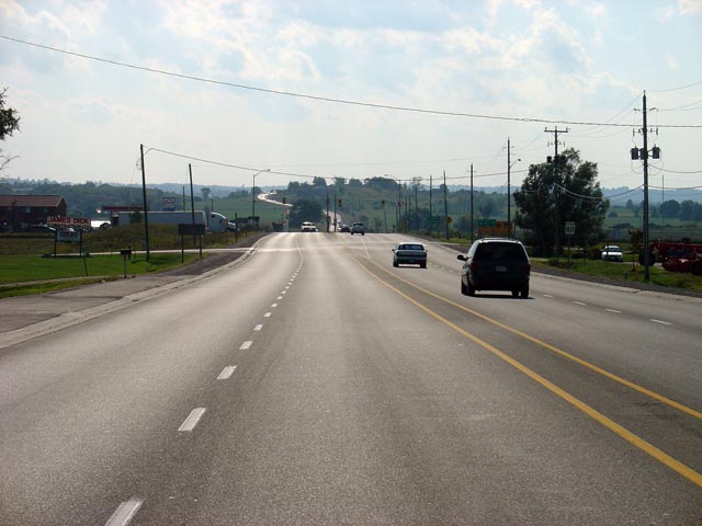
Township of Adjala - Tosorontio County of Simcoe |
Looking west along Highway 89 towards the
Highway 50 junction. Highway 89 is built to a 4.5 lane cross
section between
Highway 50 and Alliston. Photo taken: August 28th, 2005. |
 |
|
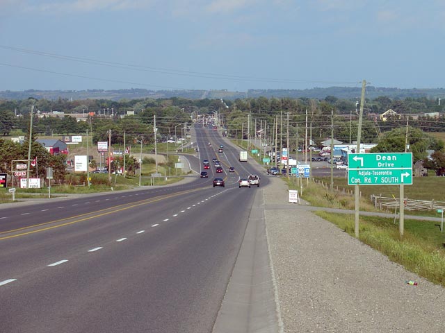
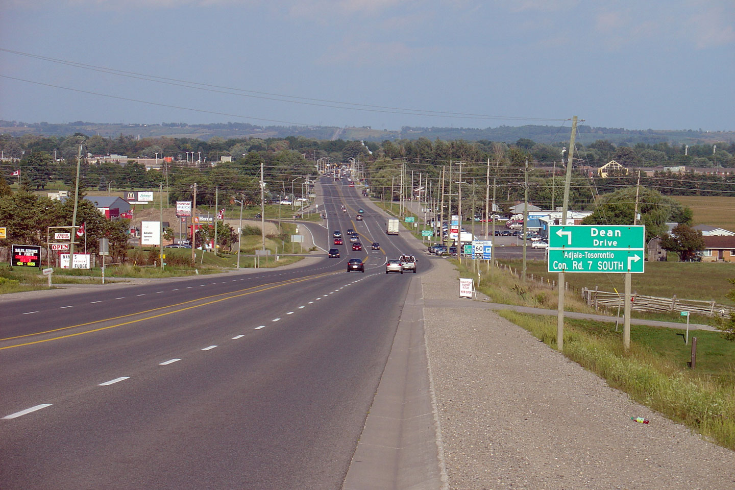
Township of Adjala - Tosorontio County of Simcoe |
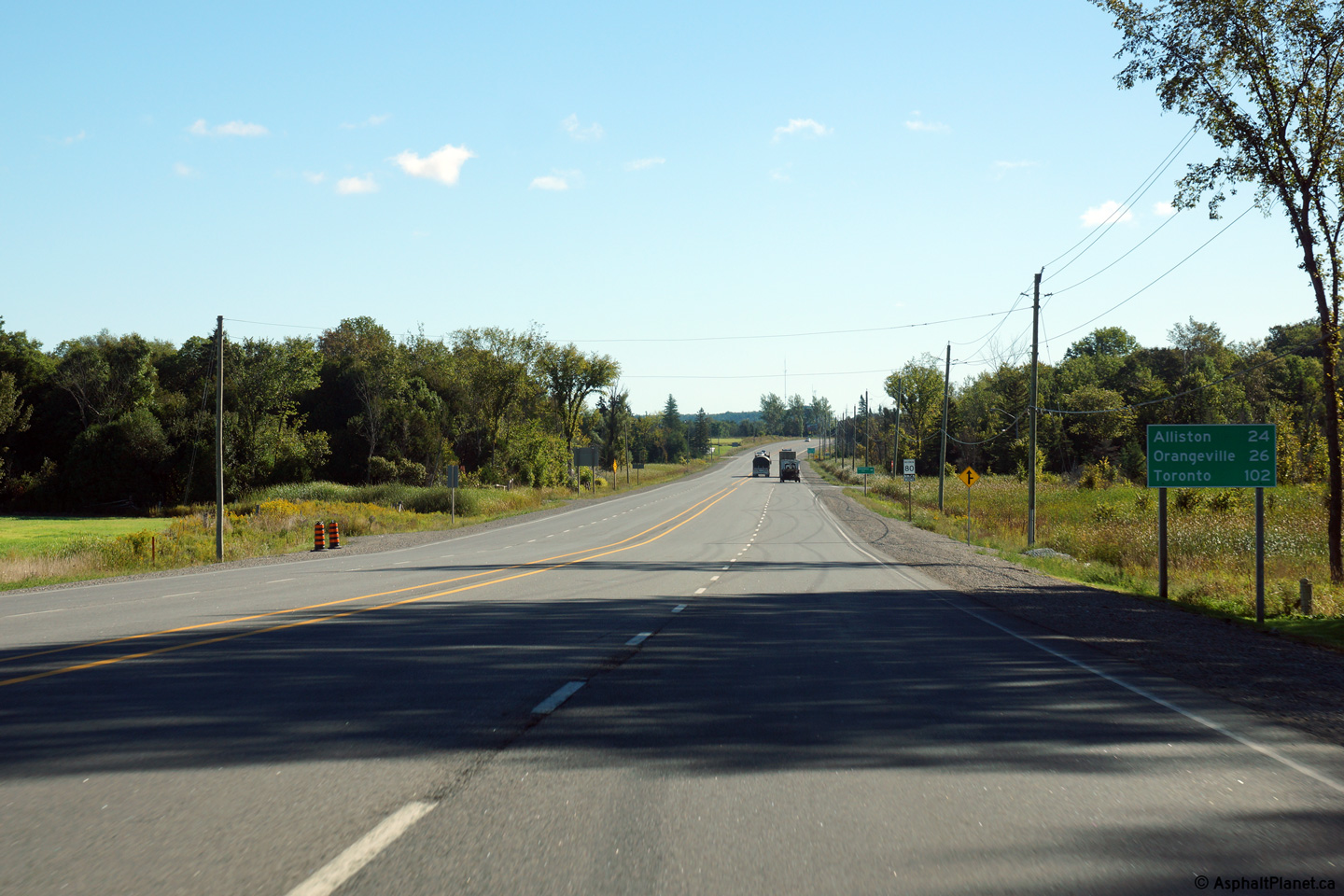
Looking east towards Alliston along Highway 89. Alliston is a long
community with an inefficient jog in Highway 89's alignment. In my
humble opinion, the MTO would be wise to consider a new Highway 89 alignment
by-passing Alliston.
Photo taken: August 28th, 2005. |
(720x480)s
(1440x960) |
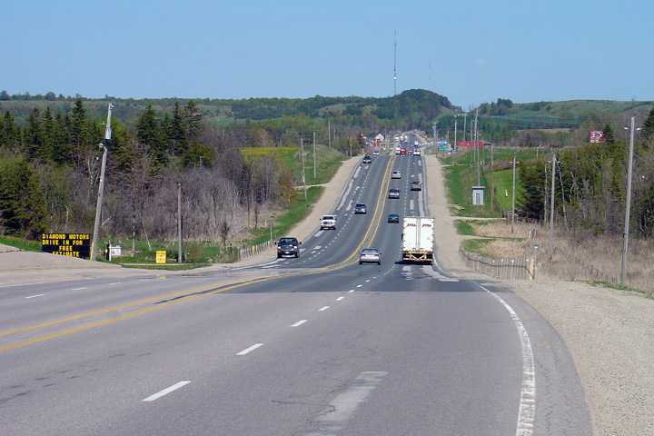
New Tecumseth - Essa Boundary
County of Simcoe |
View looking easterly as Highway 89 narrows to two lanes at the Nottawasaga
River Valley just east of Alliston.
Photo taken: August 14th, 2013. |
(720x480)
(1440x960)
(2400x1600) |
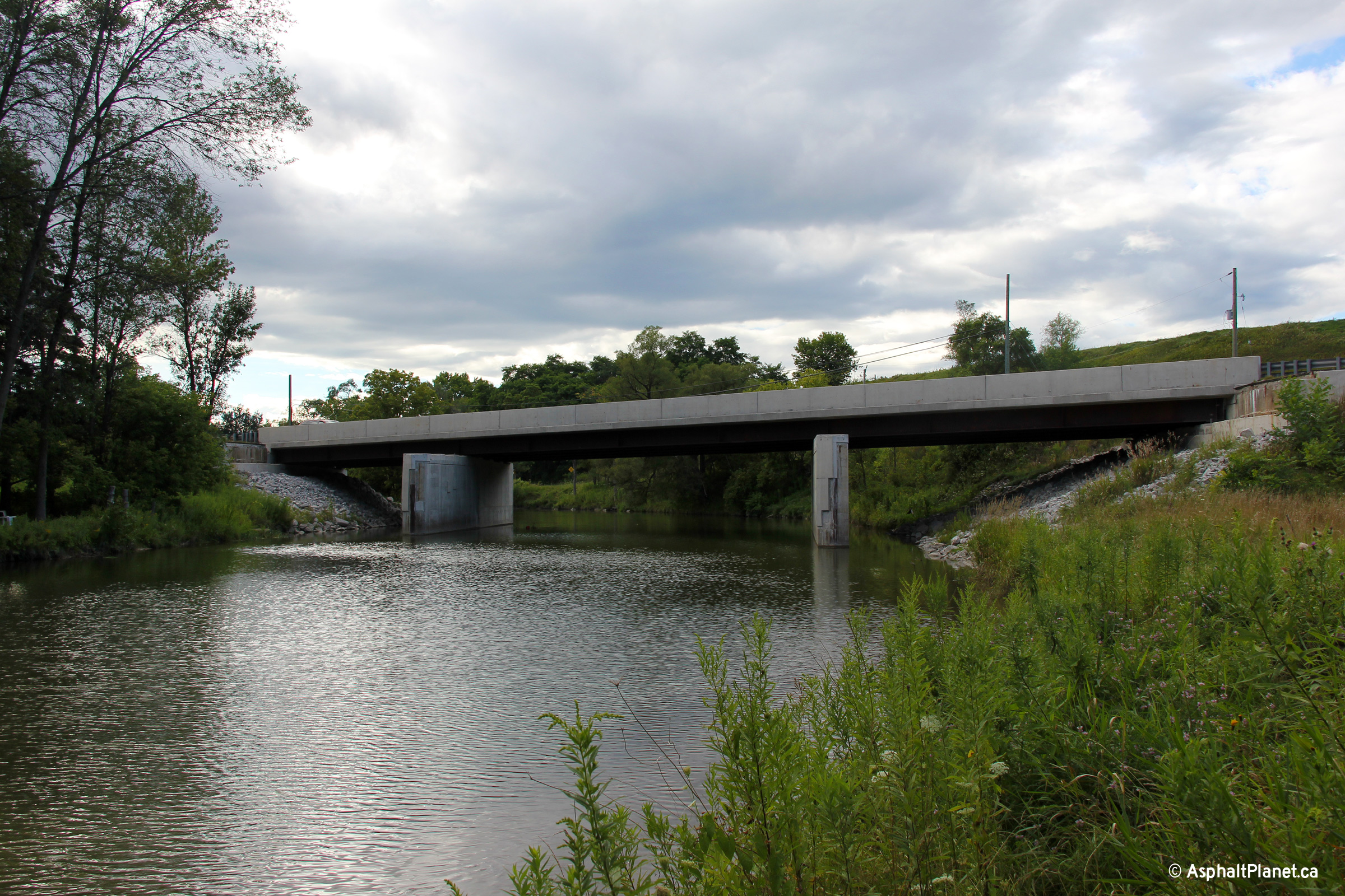
New Tecumseth - Essa Boundary
County of Simcoe |
The Nottawasaga River Bridge was replaced and widened in 2010. The
current highway deck rests on piers that were extended during the widening
project in 2010, while the older piers have been retrofitted for new
structural steel beams. The deck will be extended in a future widening
project.
Photo taken: August 14th, 2013. |

(720x480)
(1440x960)
(2400x1600) |
New Tecumseth - Essa Boundary
County of Simcoe |
Scenic view of the Nottawasa River bridge looking northerly. Solid
bridge piers in the river are typical of older (usually pre-1960s) highway
structures. Newer designs tend to use a pier with a more slender
footprint. The piers constructed as part of the 2010 extension match
and were incorporated into the pre-existing design.
Photo taken: August 14th, 2013. |
(720x480)
(1440x960)
(2400x1600) |
New Tecumseth - Essa Boundary
County of Simcoe |
View looking westerly towards the Nottawaga River bridge from a high
embankment located on the north side of Highway 89.
Photo taken: August 14th, 2013. |

(720x480)
(1440x960)
(2400x1600) |
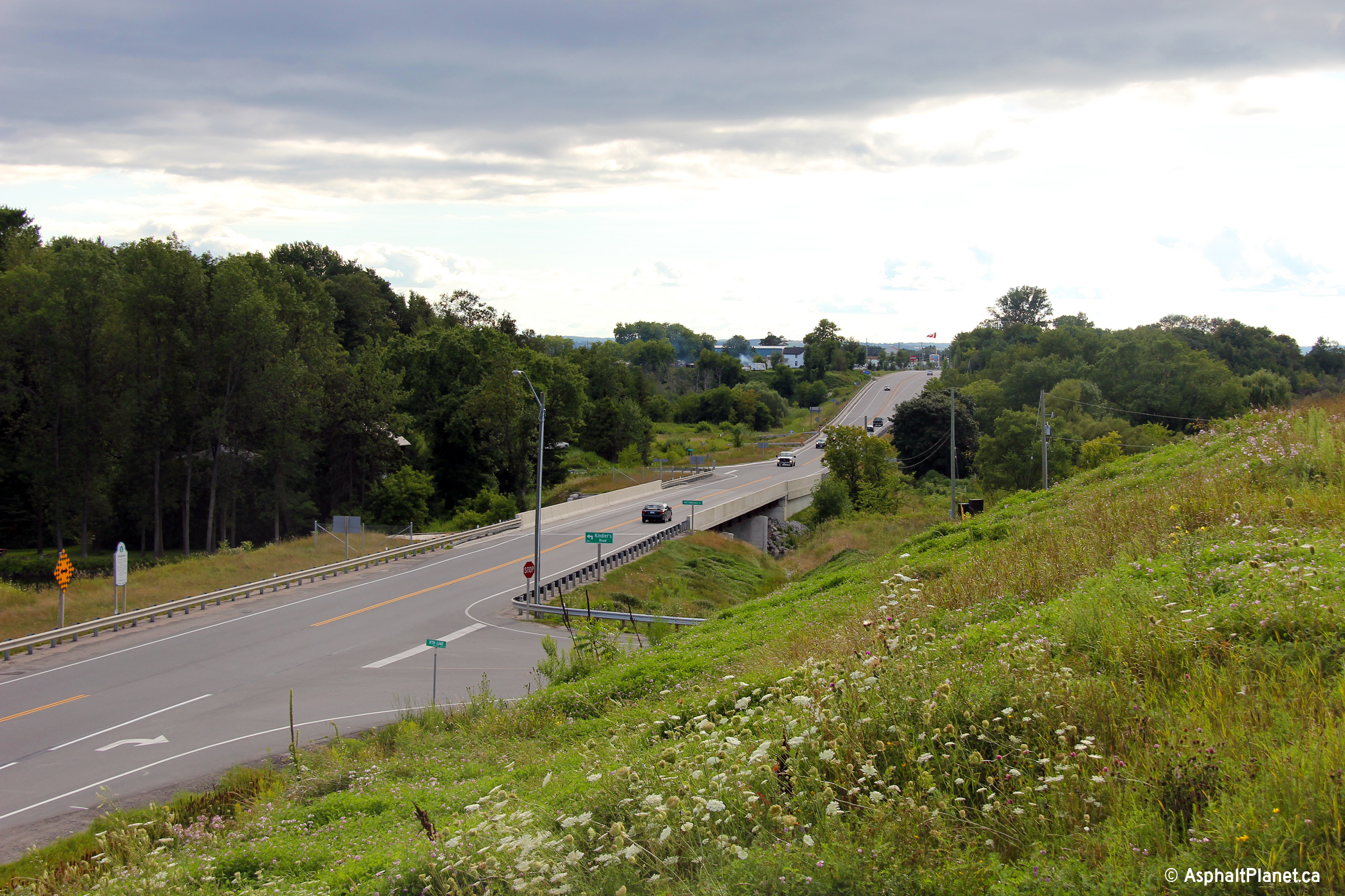
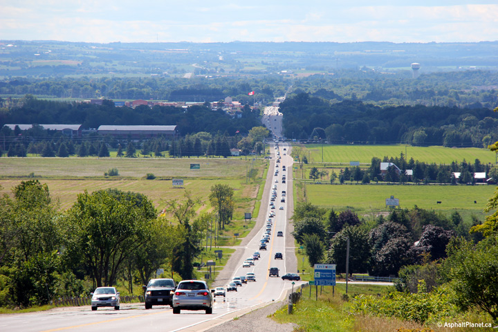
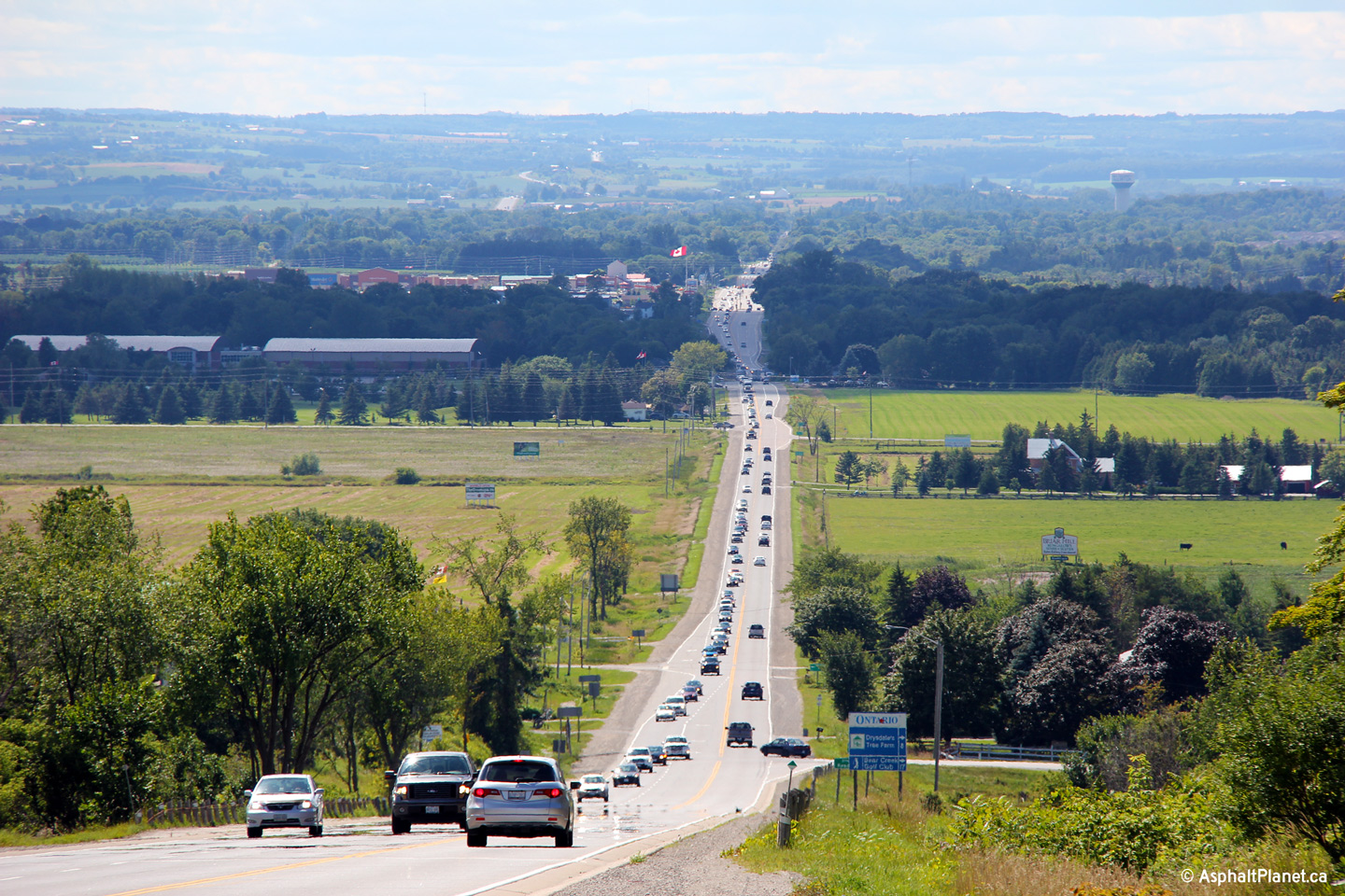
New Tecumseth - Essa Boundary
County of Simcoe |
Looking west from the New Tecumseth 15th Sideroad intersection. This
photo was taken at approximately 15:30 in the afternoon, just after shift
change at Alliston's Honda plant. Note the steady stream of cars
leaving Alliston approaching where I am standing. The line of traffic
is nearly 3km in length.
Photo taken: August 14th, 2013. |

(720x480)
(1440x960)
(2400x1600) |
|
Highway 400 runs both south and north from Highway 89
bound towards Toronto and Barrie respectively.
Click here for Highway 400 images. |


