|
Proper Municipality Name |
Photo Description |
Photo |
|
Pictures taken
from driver's perspective appear offset from centre-line pictures: |
East-
Bound |
West-
Bound |
|
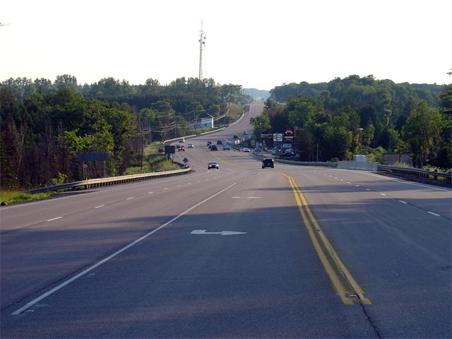
Highway 21, the Blue Water Highway is the principal route
running north-south along the eastern shore of Lake Huron.
Click here for Highway 21 images. |
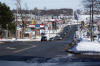
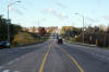
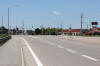
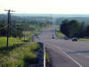
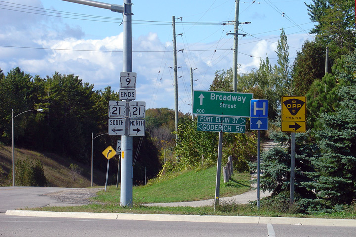
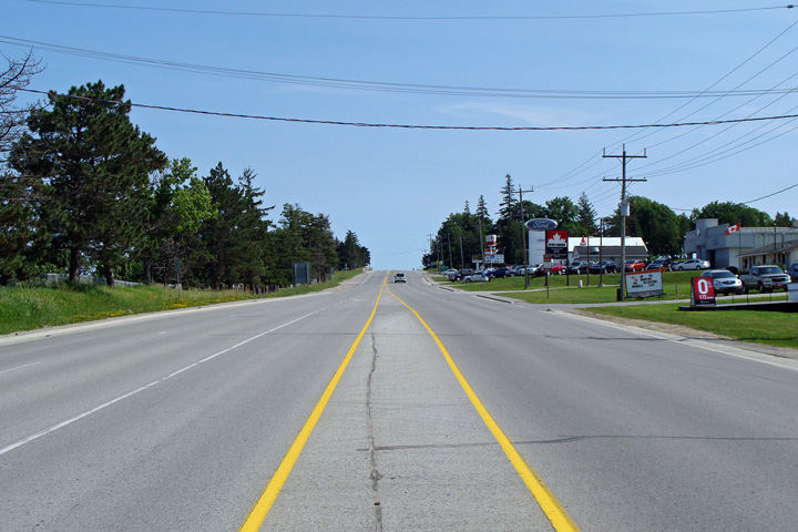
Municipality of Kincardine
County of Bruce |
Junction assembly at the western terminus of the
western leg of Highway 9 at Highway 21 in Kincardine.
Photo taken: October 15th, 2005. |
 (720x480) (720x480)
(1280x853) |
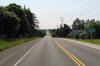
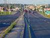
Municipality of Brockton
County of Bruce |
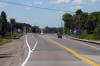
Easterly view through Riversdale approaching the
Teeswater River bridge.
Photo taken: July 1st, 2008. |
(720x480)
(1440x960) |
Municipality of Brockton
County of Bruce |
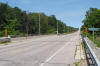
Easterly view across the Teeswater River bridge.
Photo taken: July 1st, 2008. |
(720x480)
(1440x960) |
Municipality of Brockton
County of Bruce |
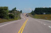
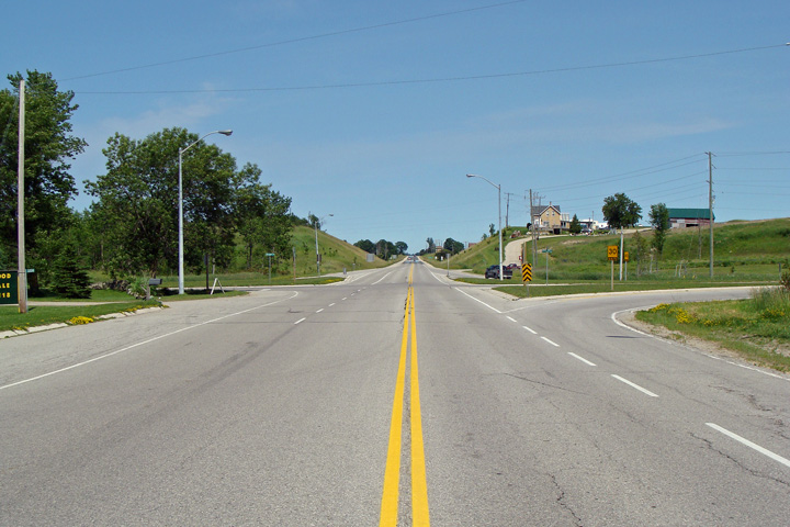
View looking easterly approaching the eastern
Highway 4 junction. Before it was transferred to county maintenance in
1998, Highway 4 ran south towards London and easterly towards Durham from
this intersection.
Photo taken: July 1st, 2008. |

(720x480)
(1440x960) |
Municipality of Brockton
County of Bruce |
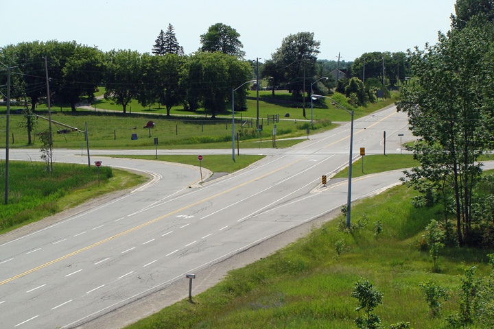
Two views looking westerly towards the western
Highway 9 and 4 junction.
Photos taken: July 1st, 2008. |

(720x480)
(1440x960)
(720x480)
(1440x960) |
Municipality of Brockton
County of Bruce |
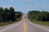
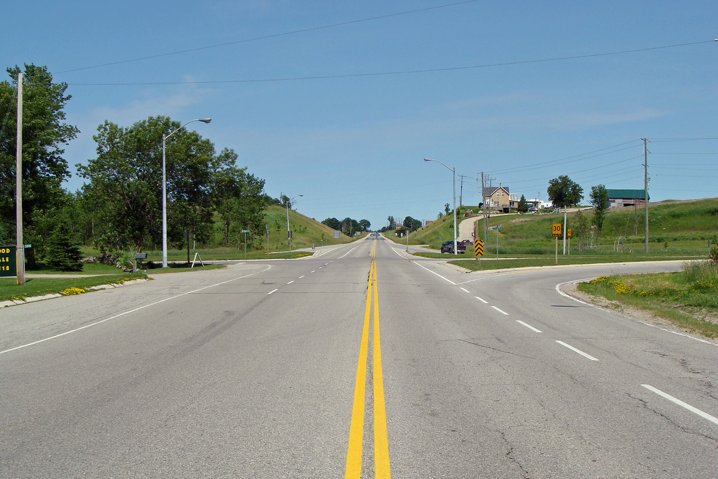
Easterly view along Highway 9 from just
east of the western Highway 4 junction.
Photo taken: July 1st, 2008. |
(720x480)
(1440x960) |
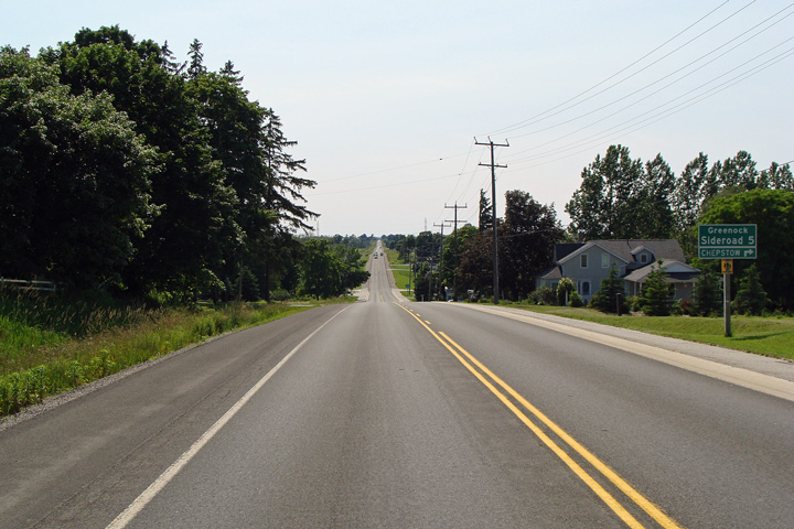
Municipality of Brockton
County of Bruce |
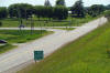
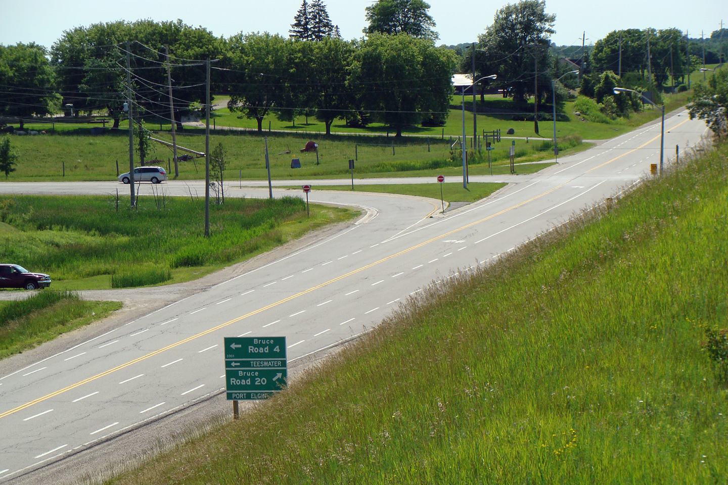
Westerly view at the Greenock Sideroad 5
intersection. Before municipal restructuring in the 1990s, this part
of the Municipality of Brockton was known as Greenock Township.
Photo taken: July 1st, 2008. |
(720x480)
(1440x960) |
Municipality of Brockton
County of Bruce |
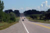
Easterly view along Highway 9 from just east of
the Greenock Sideroad 5 intersection.
Photo taken: July 1st, 2008. |
(720x480)
(1440x960) |
Municipality of Brockton
County of Bruce |
Easterly view approaching the eastern Highway 4
junction in Walkerton. Highway 9 turns to the east at this
intersection, while Highway 4 traffic must turn left following Yonge Street
into Downtown Walkerton.
Photo taken: July 1st, 2008. |
(720x480)
(1440x960) |
Municipality of Brockton
County of Bruce |
Green signage directing travelers through the
eastern Highway 9/4 intersection. Yonge Street through Walkerton is
maintained by the Municipality of Brockton, not the county. As such, the
County Road 4 designation is not included on this signage.
Photo taken: July 1st, 2008. |
 (720x480) (720x480)
(1440x960) |
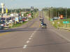
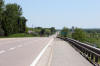
Municipality of Brockton
County of Bruce |
View looking southerly along Highway 9 from the
eastern Highway 4 junction in Walkerton. The southbound lane extends
southerly from this signalized intersection overtop of the pictured hill to
provide a short eastbound passing lane.
Photo taken: July 1st, 2008. |

(720x480)
(1440x960) |
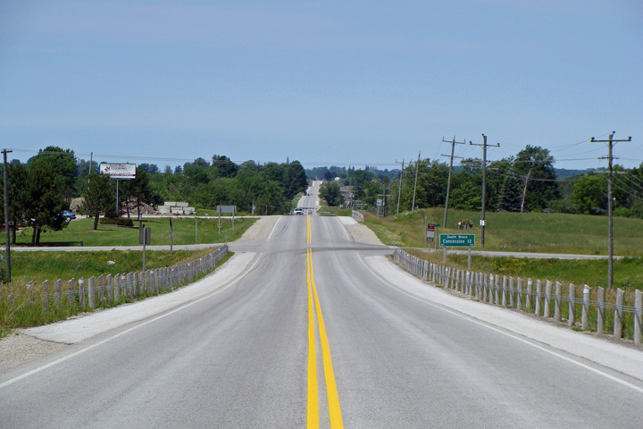
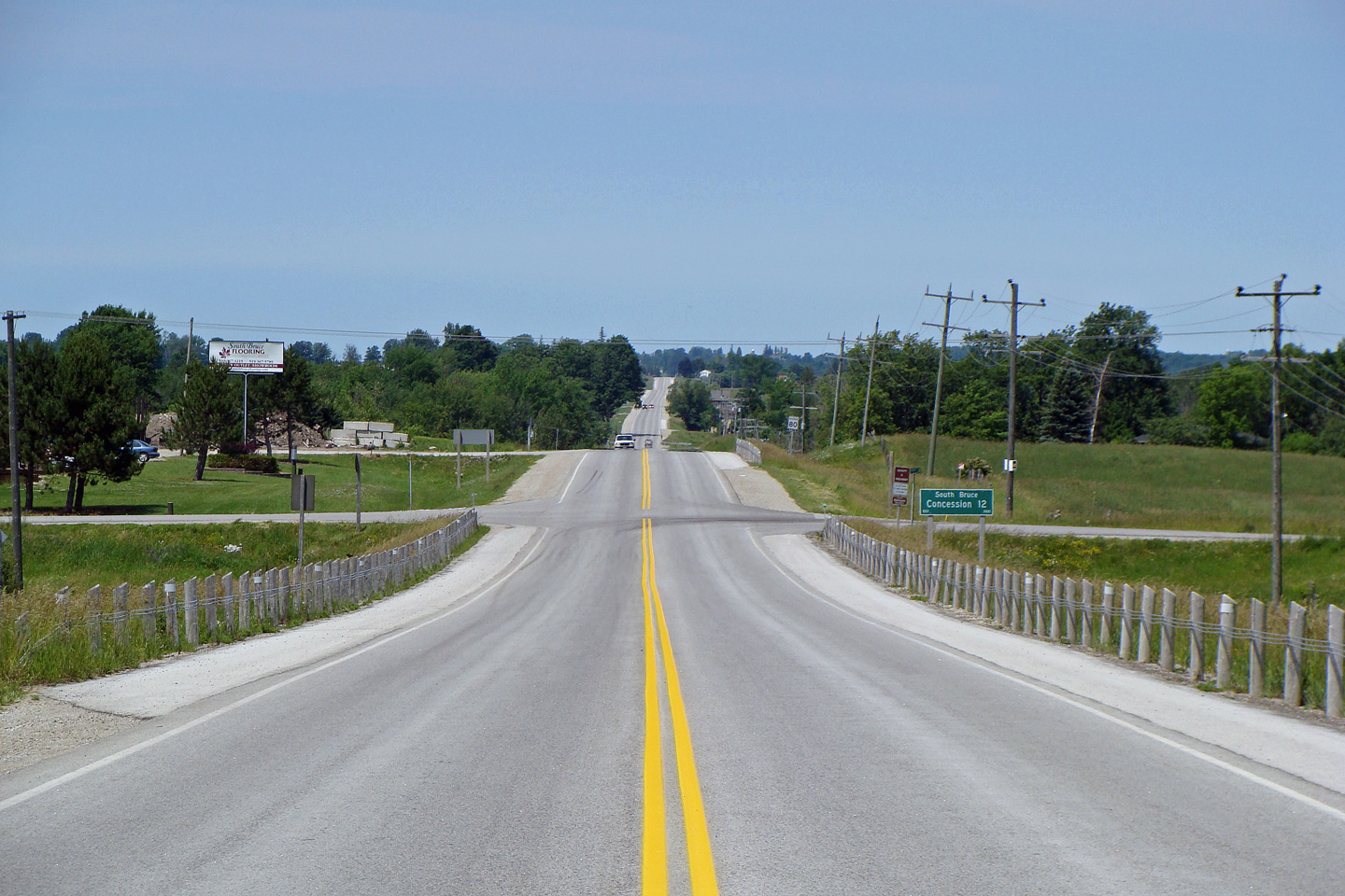
Municipality of South
Bruce
County of Bruce |
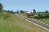
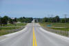
This view looks westerly approaching South Bruce
Concession 12 south of Walkerton.
Photo taken: July 1st, 2008. |
(720x480)
(1440x960) |
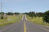
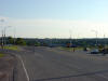
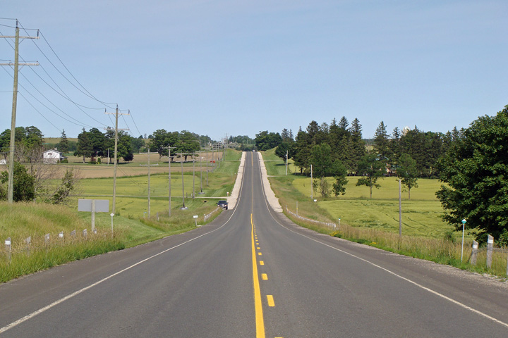
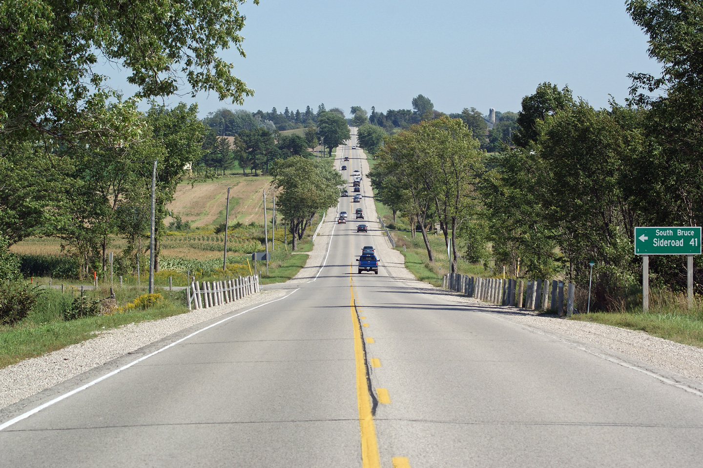
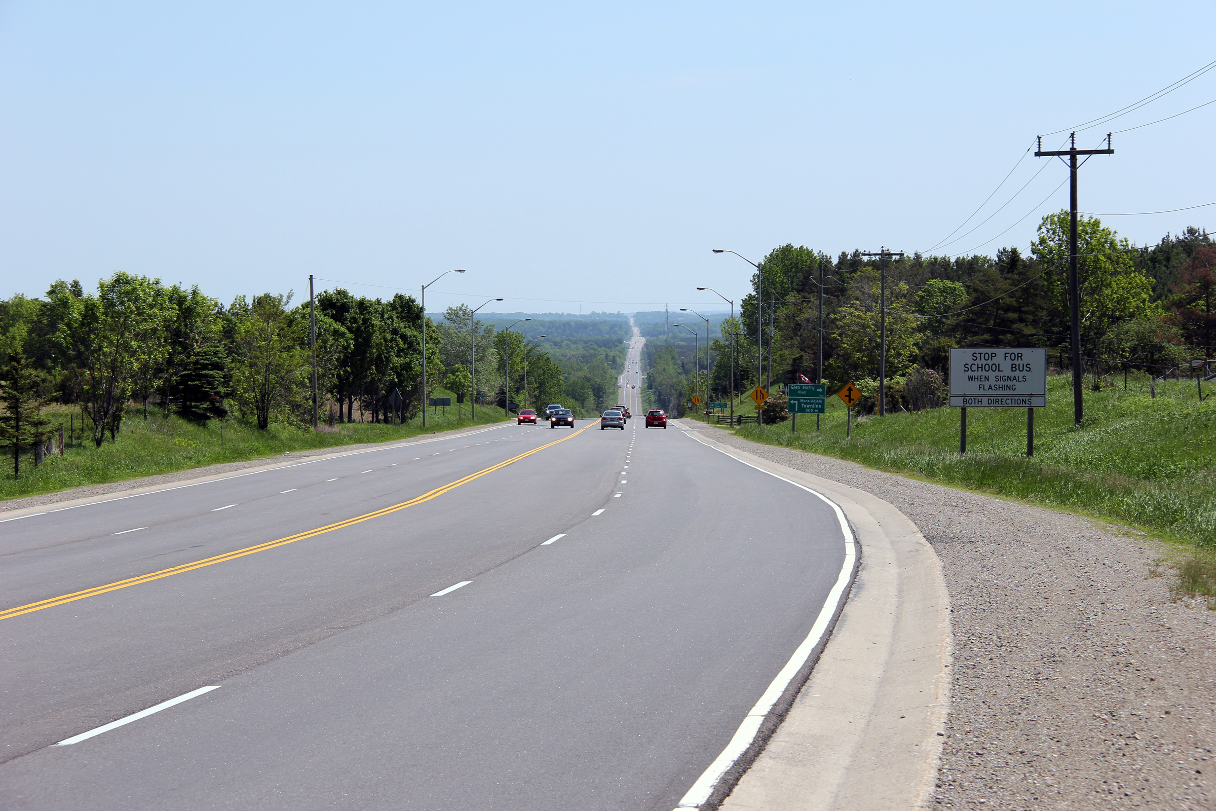
Municipality of South
Bruce
County of Bruce |
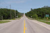
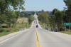
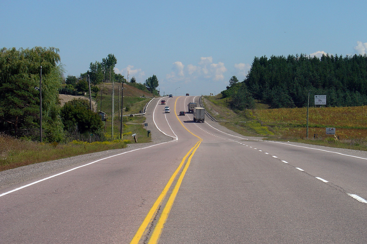
Easterly view along Highway 9 between Mildmay
and Clifford.
Photo taken: August 29th, 2010. |
(720x480)
(1440x960)
(2400x1600) |
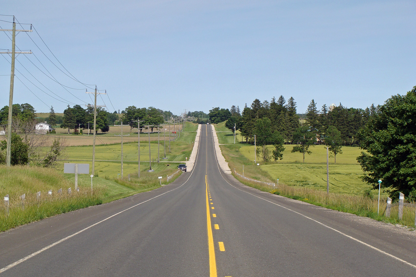
Municipality of South
Bruce
County of Bruce |
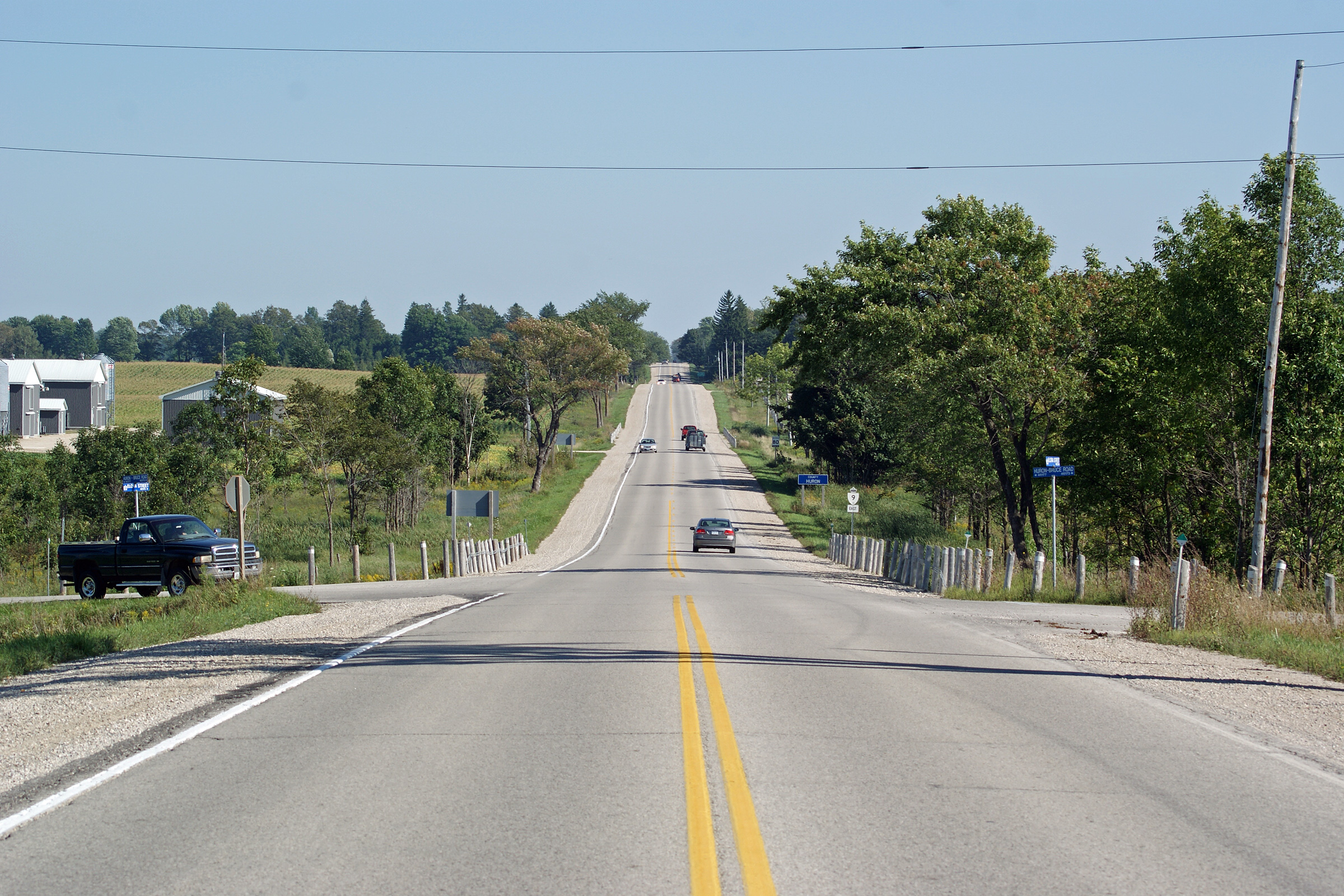
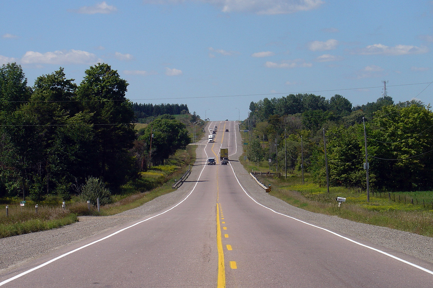
Easterly view at the Huron County Line along
Highway 9. Highway 9 enters into Huron County for about 1 km before
entering Wellington County.
Photo taken: August 29th, 2010. |

(720x480)
(1440x960)
(2400x1600) |
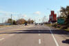
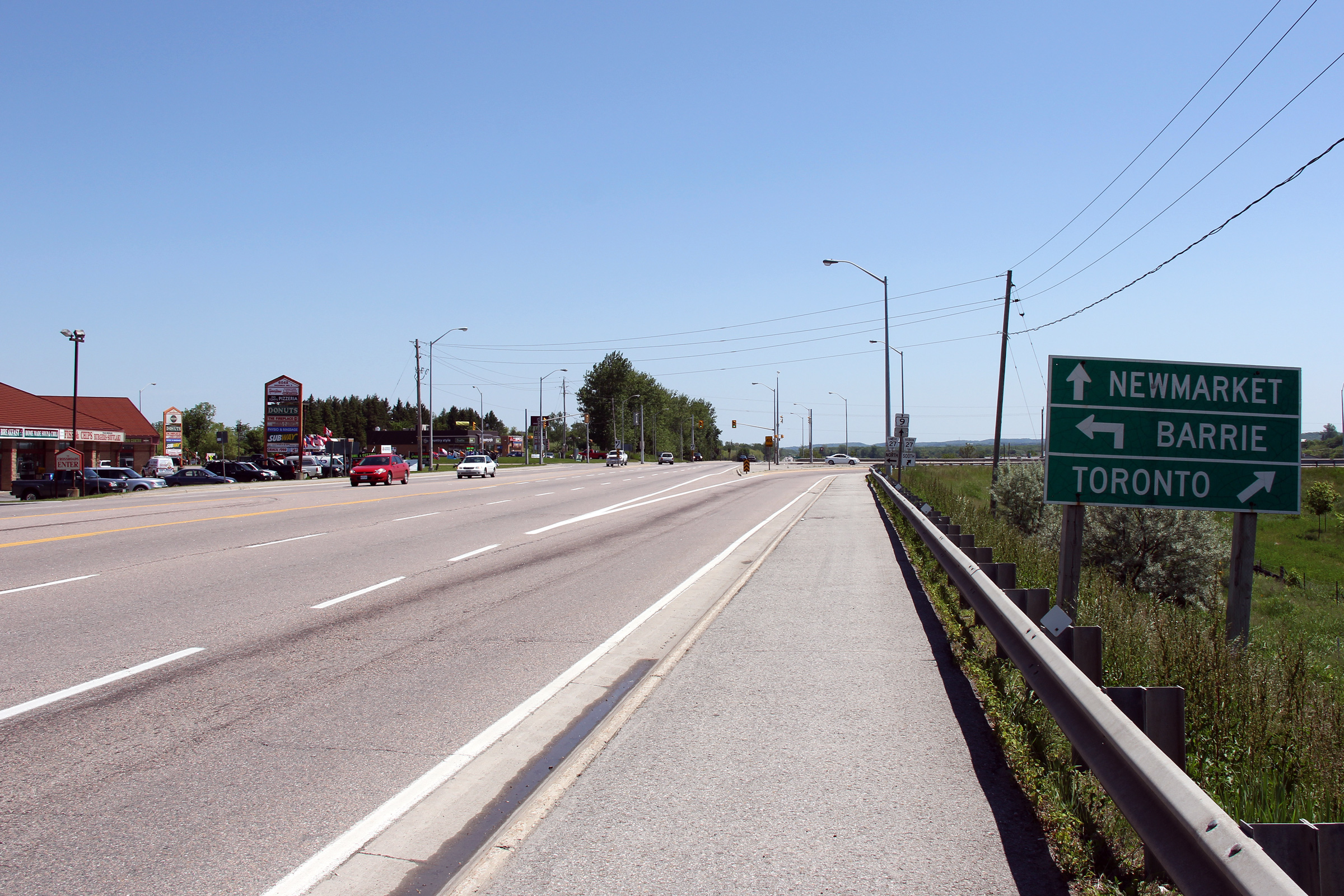
Town of Minto
County of Wellington |
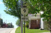
Highway 9 is signed with a north tab immediately
north of the Highway 23/89 intersection in Harriston.
Photo taken: May 20th, 2006. |
 (720x480) (720x480)
(1280x853) |
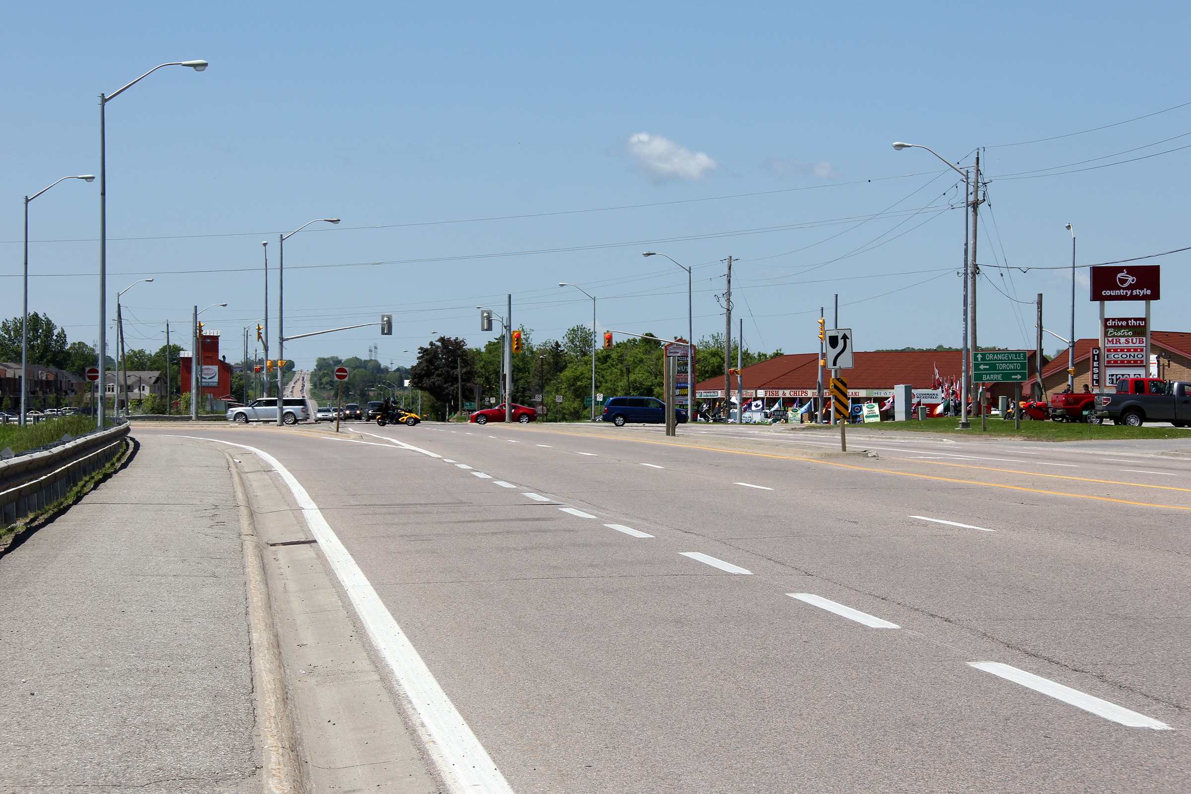
Town of Minto
County of Wellington |
Advanced signage approaching the eastern
terminus of the western leg of Highway 9 in Harriston.
Photo taken: May 20th, 2006. |
 (720x480) (720x480)
(1280x853) |
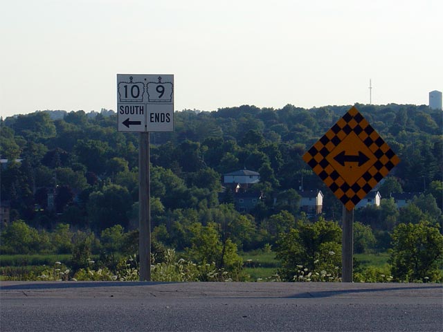
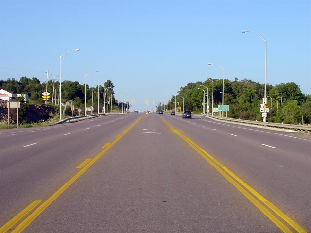
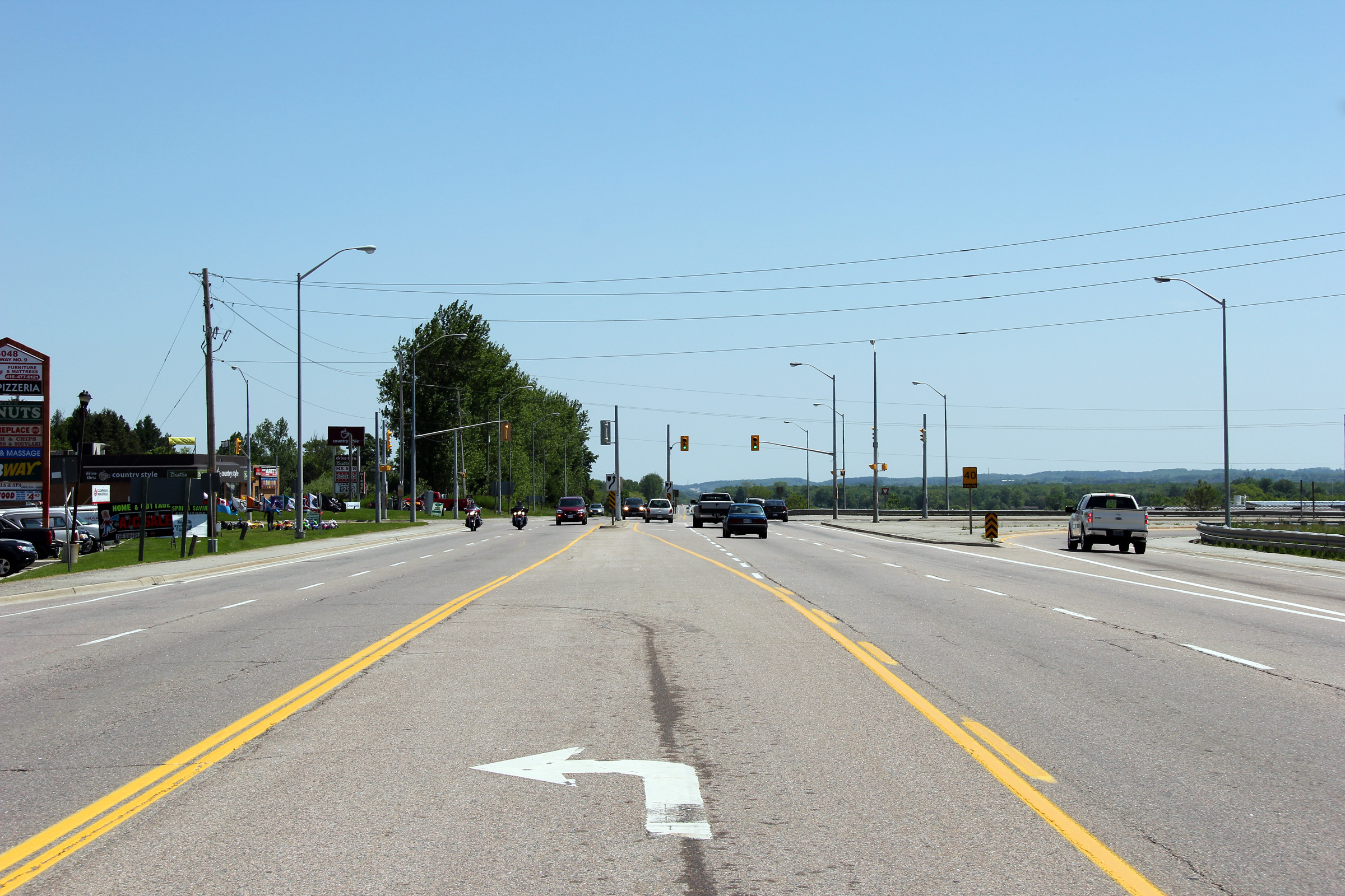
Town of Minto
County of Wellington |
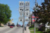
Signage at the intersection denoting the eastern
terminus of the western leg of Highway 9.
Photo taken: May 20th, 2006. |
 (720x480) (720x480)
(1280x853) |
|
In Harriston, Hwy 9 intersects both Hwys 23 and 89.
Highway 23 runs southwesterly towards London, while Highway 89 leads
easterly towards Barrie. Click
here
for Highway 23 images, and
here
for Highway 89 images. |
|
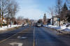
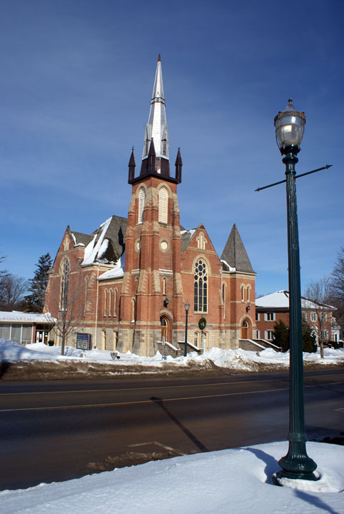
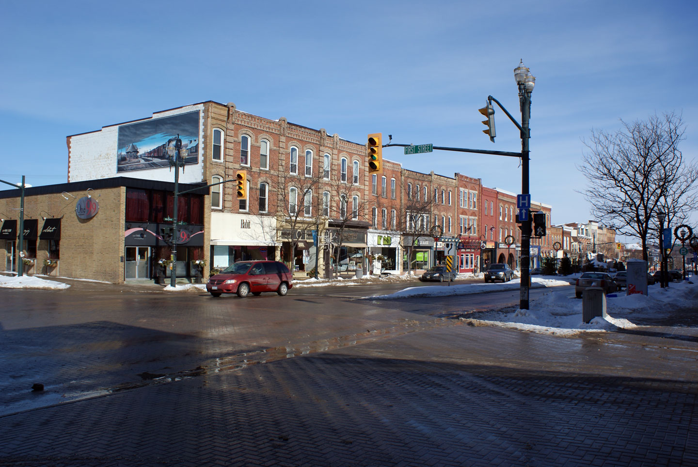
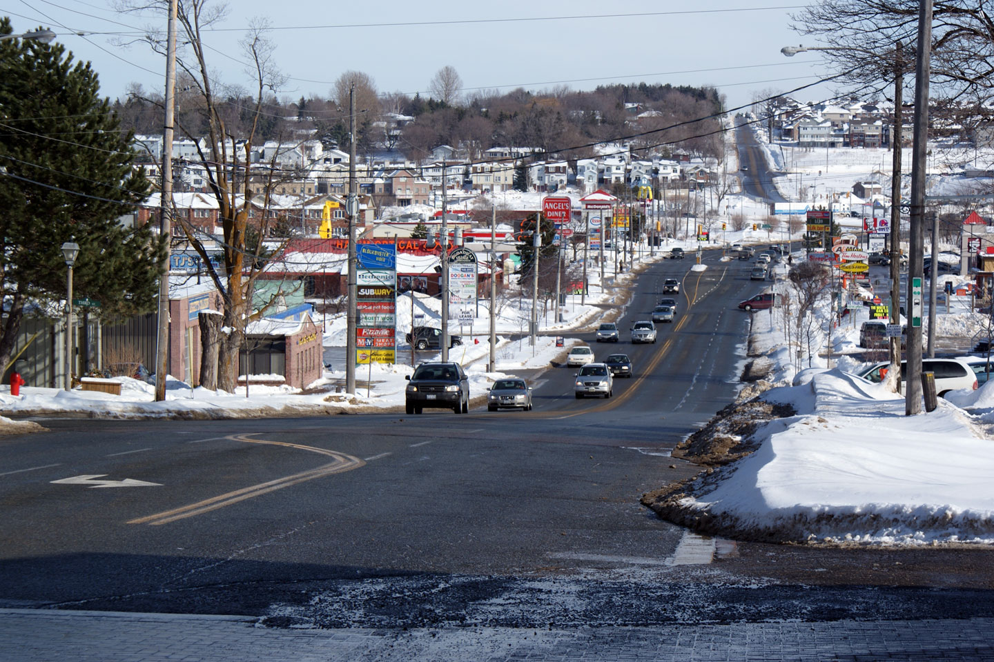
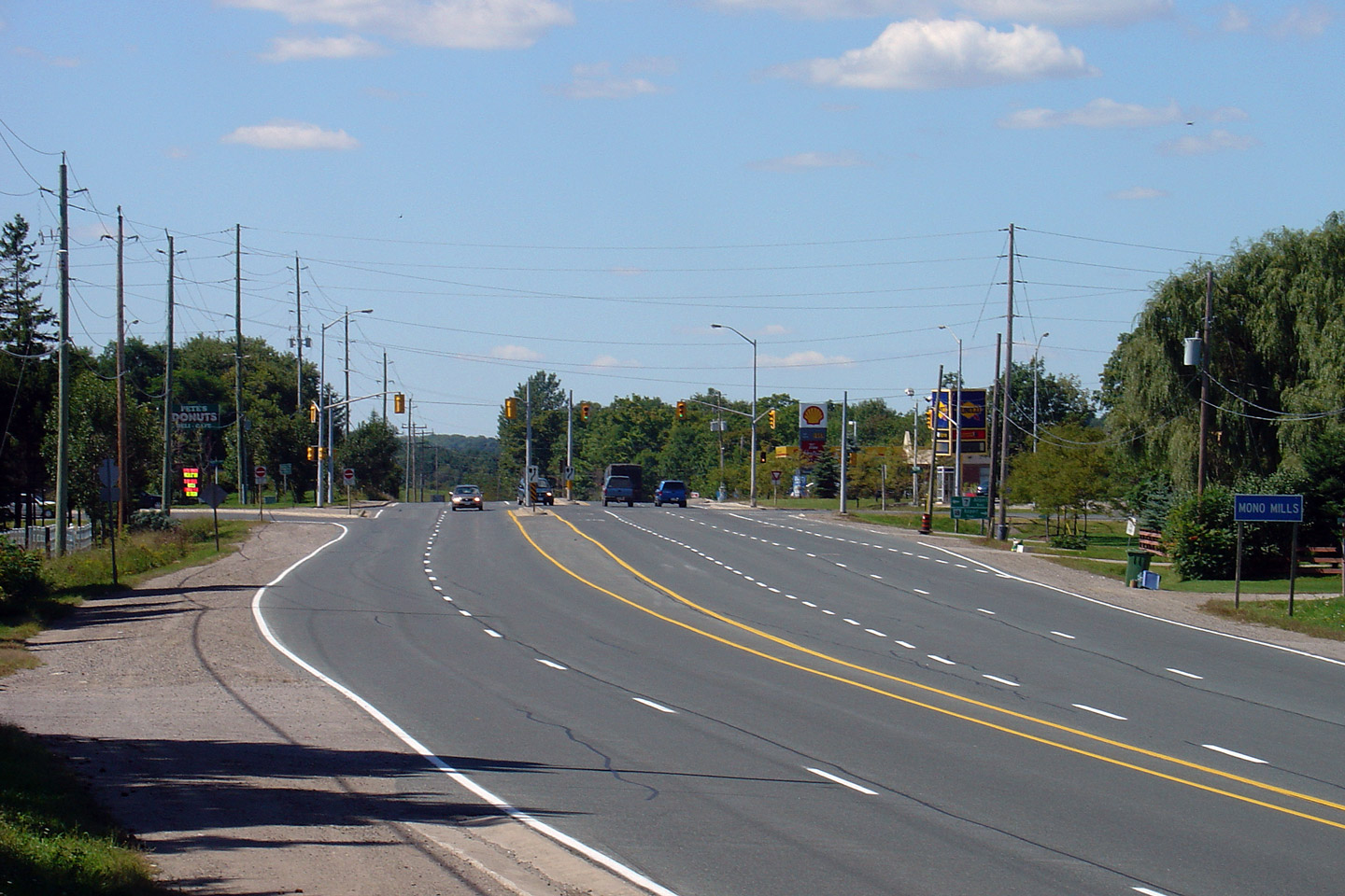
Town of Orangeville |
Obviously not a highway -- however, I have
always had a fondness for architecture. The scale of some of the
churches in Small town Ontario and Les Petite Villes du Québec are extremely
impressive.
Photo taken: January 22nd, 2009. |

(720x480)
(1440x960) |
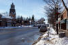
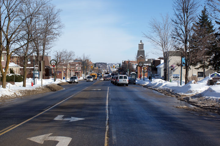
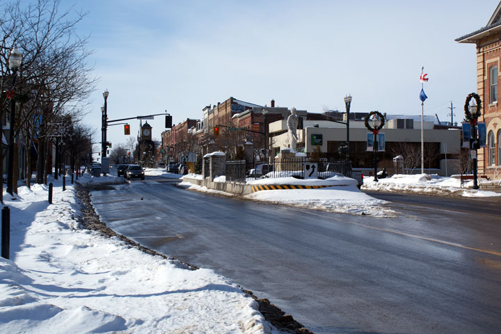
| Town of Orangeville |
View looking east along Broadway towards the
Highway 136 intersection.
Photo taken: January 22nd, 2009. |
(720x480)
(1440x960) |
| Town of Orangeville |
Westerly view towards the John Street
intersection. Without the highway crowns, its hard to believe that
this was the junction of Highway's 9 and 136.
Photo taken: January 22nd, 2009. |
(720x480)
(1440x960) |
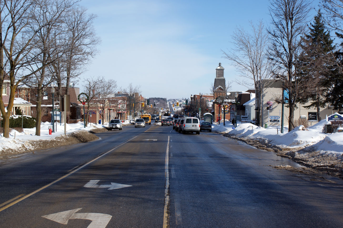
| Town of Orangeville |
Westerly view from 1st Avenue. Orangeville
should be commended for the attractive streetscape features that were
installed in the highways median.
Photo taken: January 22nd, 2009. |
(720x480)
(1440x960) |
| Town of Orangeville |
Easterly view from the 1st Avenue intersection
along Broadway. Before the Orageville By-pass was constructed, Highway
9, 10 and 24 all met at this large intersection. In the early
Nineteenth Century, all roads led to this junction in Orangeville.
Photo taken: January 22nd, 2009. |
(720x480)
(1440x960) |
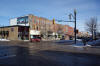
| Town of Orangeville |
View looking westerly towards the Second Street
intersection.
Photo taken: January 22nd, 2009. |

(720x480)
(1440x960) |
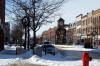
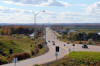
| Town of Orangeville |
View looking easterly along Broadway from the
Wellington Street intersection. Wellington Street marks the eastern
end of the historic Orangeville Downtown. Suburban main-street
development as pictured is very typical of Small-Town Ontario.
Photo taken: January 22nd, 2009. |
(720x480)
(1440x960) |
|
Highway 9 meets Highway 10 and 24 at the east end of
Orangeville. Click
here
for Highway 10 images, and
here
for Highway 24 images. |
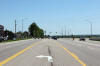
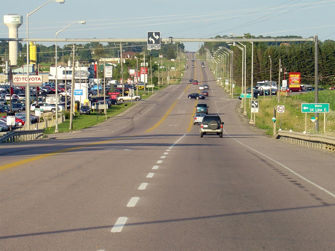
| Orangeville - Mono - Caledon
Boundary Dufferin - Peel Boundary |
Junction assembly for the Highway 9/10
intersection. This intersection marks the western end of the western
section of Highway 9. Photo taken: August 1st, 2004. |
 |
| Town of Orangeville County of
Dufferin |
Looking west towards the Southern
Highway 10
junction in the Southeast part of Orangeville. Before Highway 9 was
downloaded between Harriston and Orangeville in 1998, Highway 9 continued to
the right along Highway 10 into Downtown Orangeville at this intersection.
Photo taken: August 1st, 2004. |
(720x480)
(1440x960) |
| Mono - Caledon Boundary
Dufferin - Peel Boundary |
Looking easterly through the eastern
Orangeville, roughly 1km east of Highway 10. Highway 9 has this three
lane configuration for roughly 2km through the east end of Orangeville.
Photo taken: August 1st, 2004. |
(720x480)
(1440x960) |
| Mono - Caledon Boundary
Dufferin - Peel Boundary |
Looking easterly along Highway 9 from just west
of the St. Andrews Road intersection. Note the westbound passing lane
extending behind the photo. Photo taken: August 1st, 2004. |

(720x480)
(1440x960) |
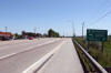
| Caledon - Adjala-Tosorontio
Boundary Peel - Simcoe Boundary |
Westerly view at Highway 9 at the Airport Road
intersection.
Photo taken: September 9th, 2005. |
(720x480)
(1440x960) |
| Caledon - Adjala-Tosorontio
Boundary Peel - Simcoe Boundary |
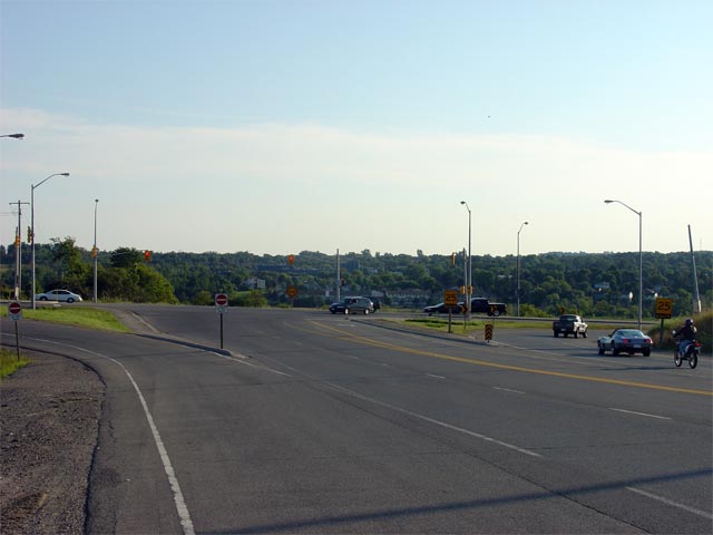
Easterly view along Highway 9 from just east of the Airport Road
intersection.
Photo taken: June 5th, 2011. |
(720x480)
(1440x960)
(2400x1600) |
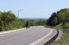
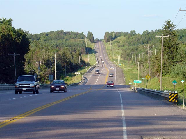
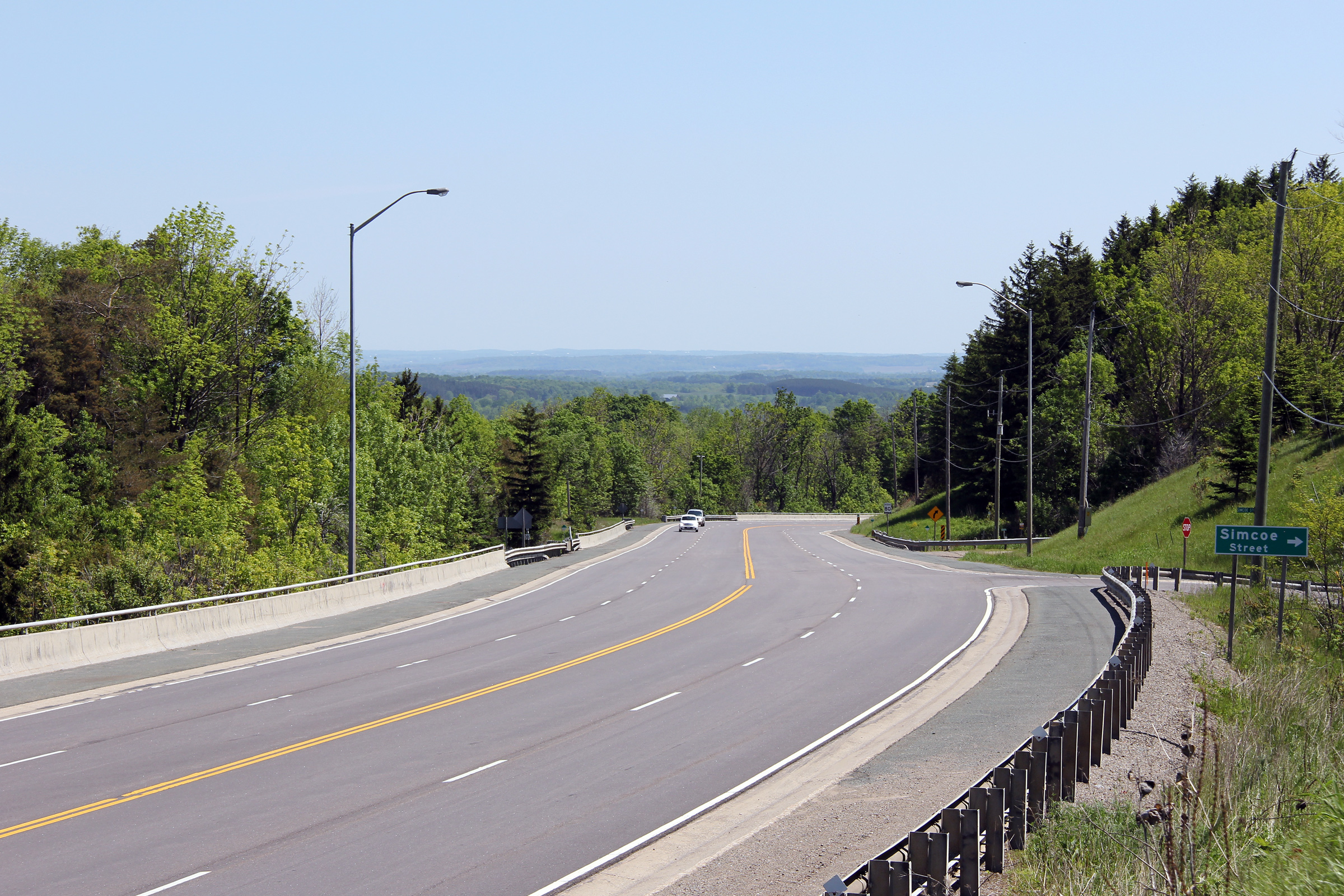
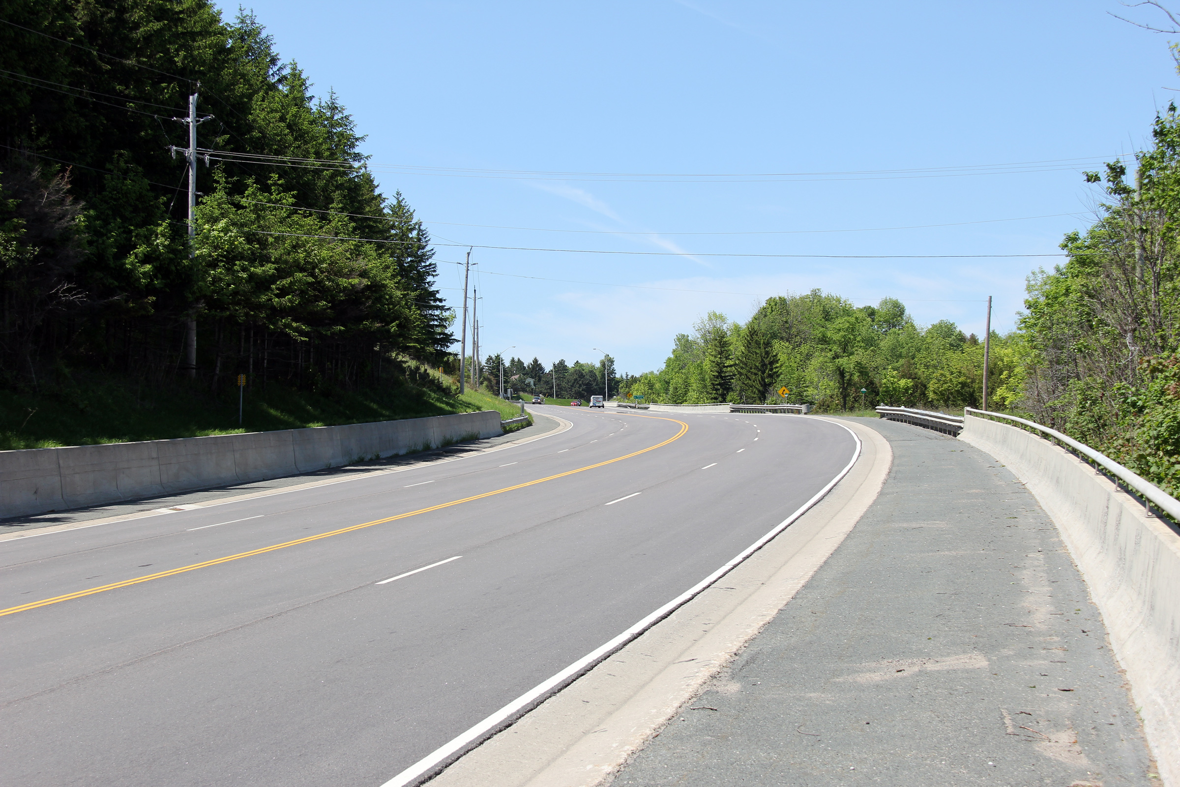
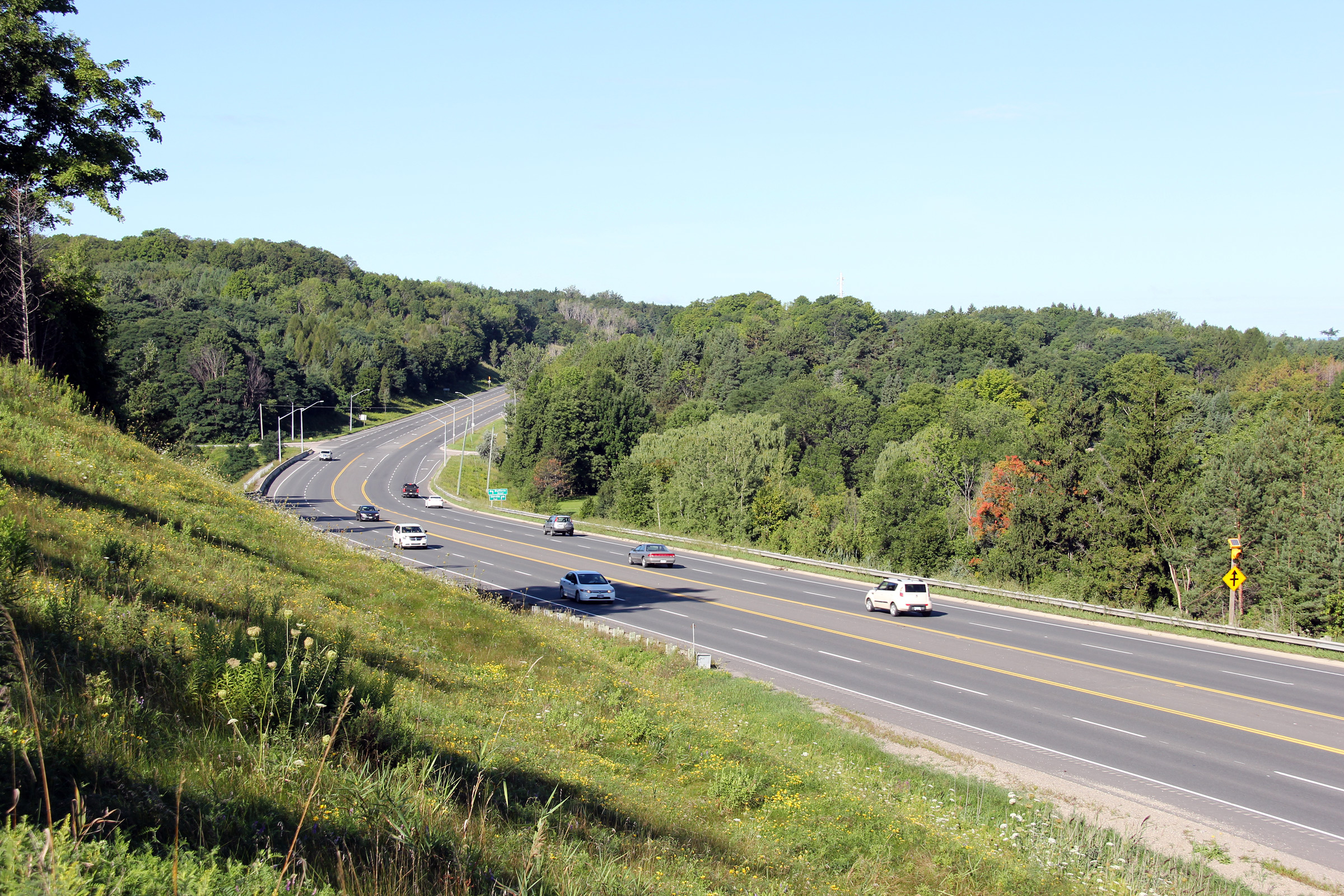
| Caledon - Adjala-Tosorontio
Boundary Peel - Simcoe Boundary |
Highway 9 runs along a fairly steep hillside east of Mono Mills. In
order for the highway to be widened to four lanes, several retaining walls
had to be constructed.
Photo taken: June 5th, 2011. |
(720x480)
(1440x960)
(2400x1600) |
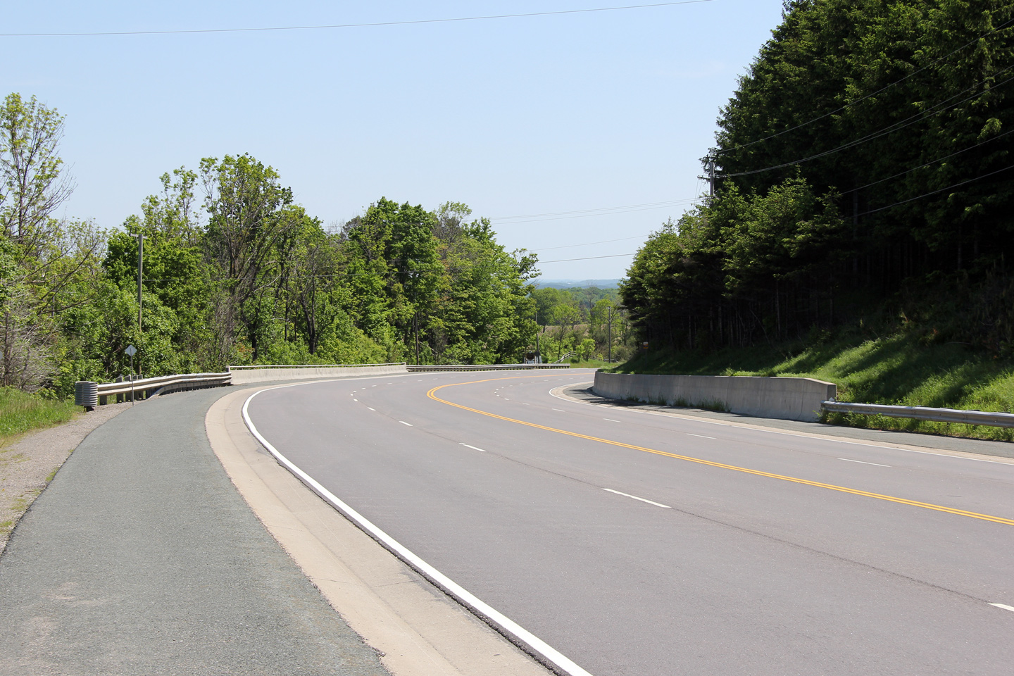
| Caledon - Adjala-Tosorontio
Boundary Peel - Simcoe Boundary |
Easterly view as Highway 9 rounds a gentle bend east of Mono Mills.
Photo taken: June 5th, 2011. |

(720x480)
(1440x960)
(2400x1600) |
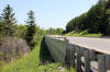
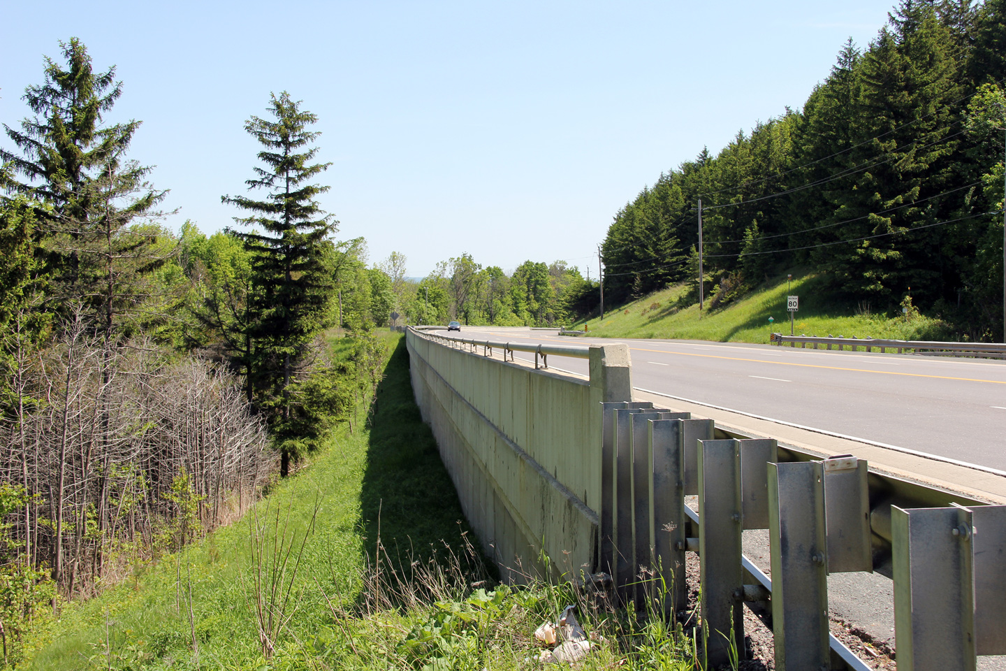
| Caledon - Adjala-Tosorontio
Boundary Peel - Simcoe Boundary |
Reverse view of the previous photo. A considerable amount of
engineering was required in order to push Highway 9 through the Niagara
Escarpment.
Photo taken: June 5th, 2011. |

(720x480)
(1440x960)
(2400x1600) |
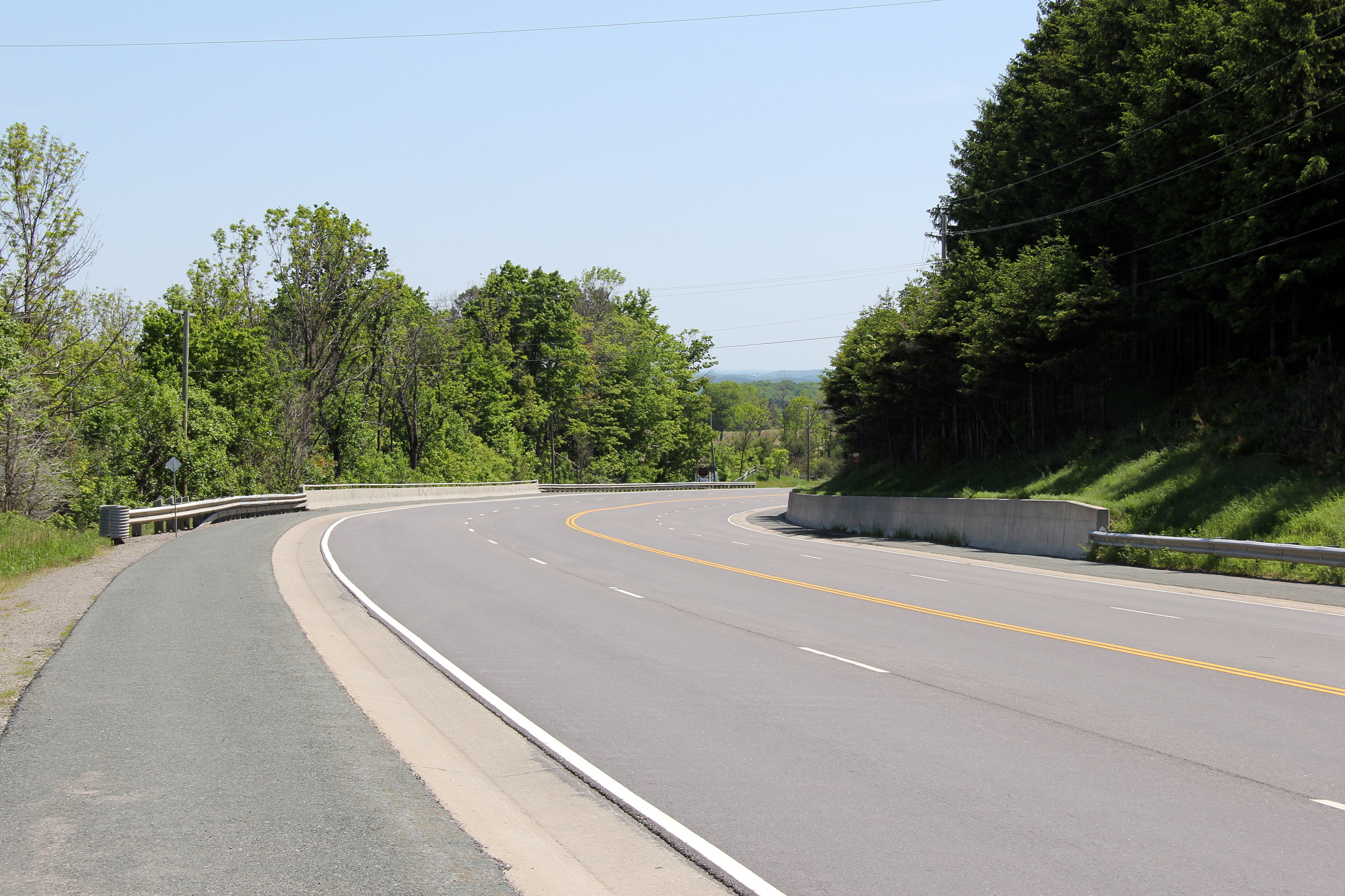
| Caledon - Adjala-Tosorontio
Boundary Peel - Simcoe Boundary |
View as Highway 9 descends the Niagara Escarpment.
Photo taken: June 5th, 2011. |

(720x480)
(1440x960)
(2400x1600) |
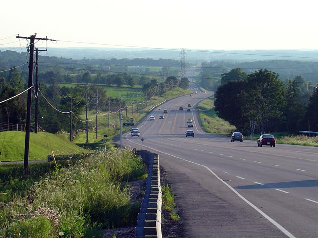
| Caledon - Adjala-Tosorontio
Boundary Peel - Simcoe Boundary |
Westerly view looking up the hill towards Mono
Mills from halfway between the Centreville Creek and Gore Road
intersections. Notice the start of the passing lane that begins at the
Centreville Creek Road intersection and continues almost 4km up the hill to
the Airport Road intersection.
Photo taken: September 9th, 2005. |
(720x480)
(1440x960) |
| Caledon - Adjala-Tosorontio
Boundary Peel - Simcoe Boundary |
This view looks easterly from the same spot as
the above picture.
Photo taken: September 9th, 2005. |
(720x480)
(1440x960) |
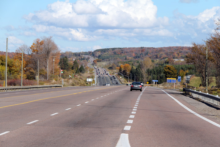
| Caledon - Adjala-Tosorontio
Boundary Peel - Simcoe Boundary |
Looking westerly along Highway 9 from just west
of the Highway 50 intersection. Highway 9 passes through some very
pleasant rolling escarpment terrain as the highway traverses the distance
between Orangeville and Newmarket.
Picture taken: August 1st, 2004. (720x480): 45kb. (1440x960): 175kb. |

(720x480)
(1440x960) |
|
Highway 50 leads south from Highway 89 in Alliston through
Mono and Bolton to Highway 27 in Toronto.
Click here for Highway 50 images. |
|
Caledon - Adjala-Tosorontio Boundary Peel - Simcoe Boundary |
Looking east along Highway 9 towards the
Highway
50 intersection north of Palgrave. Picture taken: August 1st, 2004.
Size: 40kb. |
 |
Caledon - New Tecumseth Boundary
Peel - Simcoe Boundary |
View looking westerly at the Simcoe Road 10
intersection. Simcoe Road 10 is a long road that leads northerly from
Highway 9 all the way into Wasaga Beach via Sunnidale's Corners.
Photo taken: September 9th, 2005. |
(720x480)
(1440x960) |
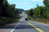
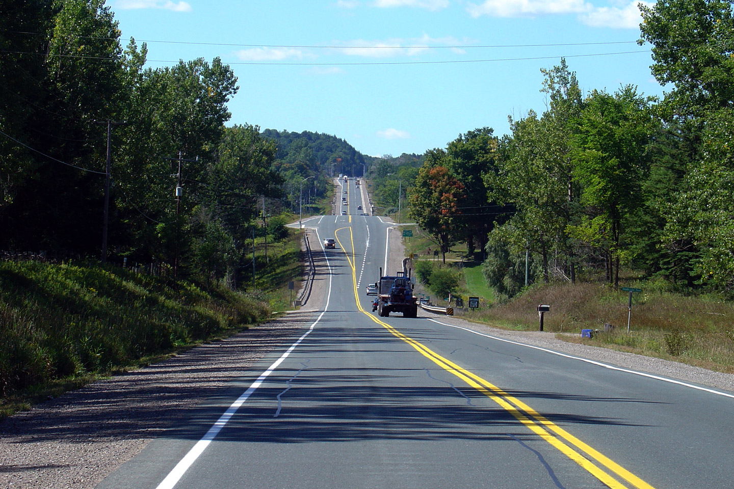
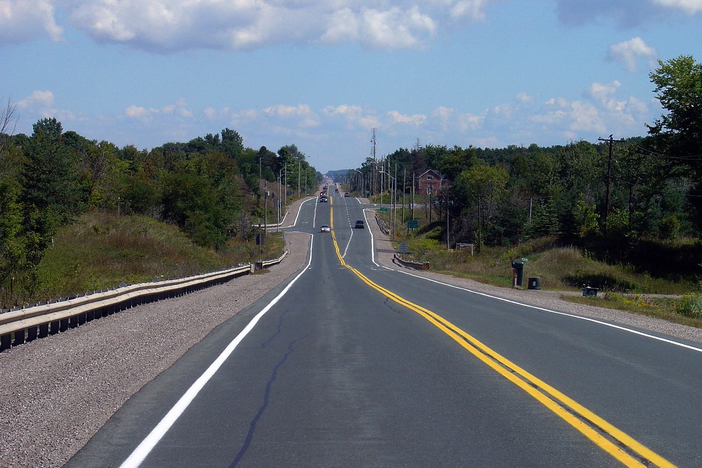
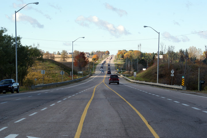
King - New Tecumseth Boundary
York - Simcoe Boundary |
Easterly view from the Caledon/King Townline
Road intersection.
Photo taken: September 9th, 2005. |
(720x480)
(1440x960) |
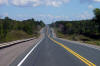
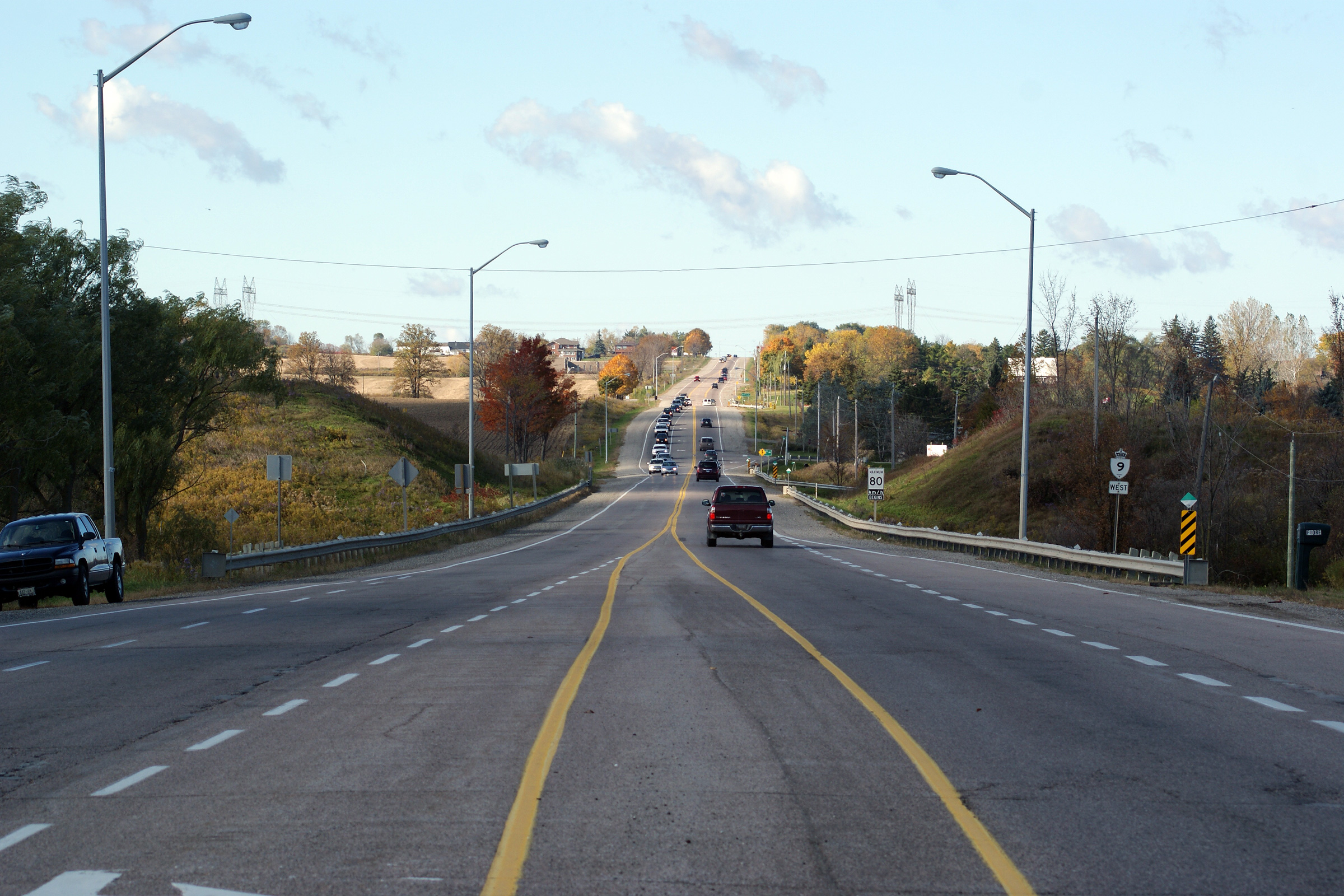
King - New Tecumseth Boundary
York - Simcoe Boundary |
View looking westerly towards the Sideroad 10
intersection. Note the scale of the intersection -- Highway 9 is a
pretty impressive two-lane highway. Aside from sections of
Trans-Canada Highway in Ontario few two-lane roads in Ontario have as many
four-lane segments and five-lane rural intersections.
Photo taken: September 9th, 2005. |
(720x480)
(1440x960) |
King - New Tecumseth Boundary
York - Simcoe Boundary |
Easterly view towards the King Concession 10
intersection.
Photo taken: September 9th, 2005. |
(720x480)
(1440x960) |
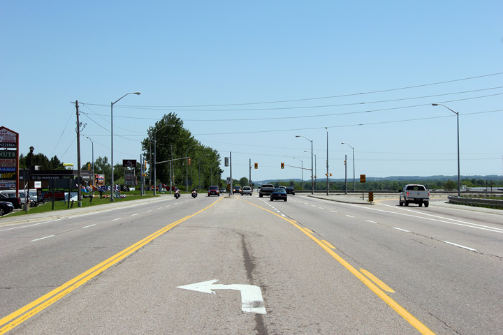
King - New Tecumseth Boundary
York - Simcoe Boundary |
This view looks westerly from Main Street in Schomberg towards Orangeville.
Photo taken: October 17th, 2012. |
(720x480)
(1440x960)
(2400x1600) |
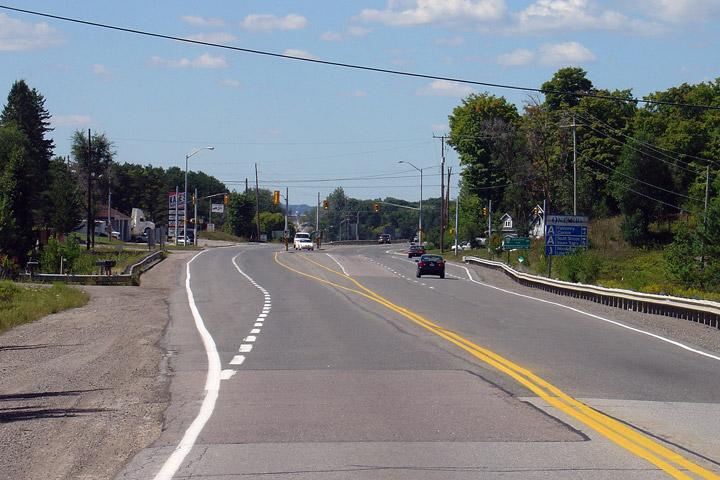
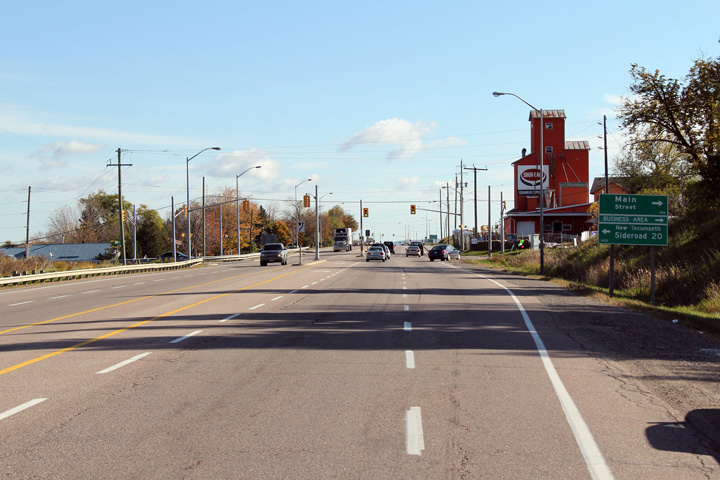
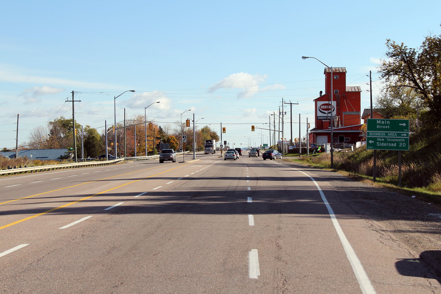
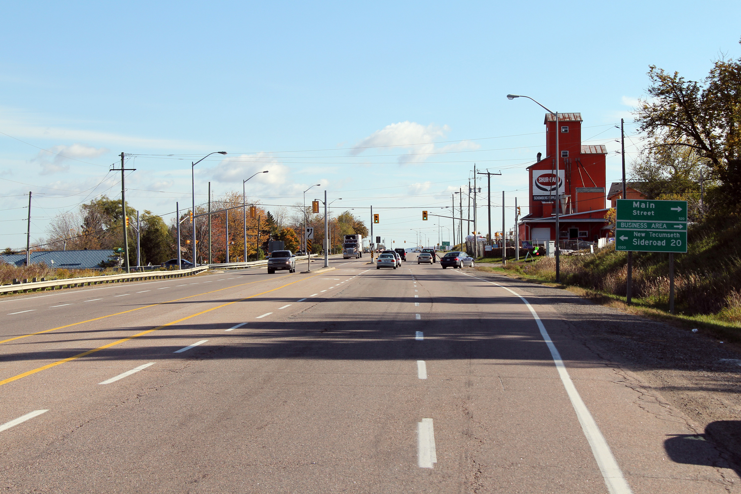
King - New Tecumseth Boundary
York - Simcoe Boundary |
Easterly view towards the Main Street intersection in Schomberg.
Schomberg's agricultural heritage is predominantly displayed via the grain
elevator on the southern side of the highway.
Photo taken: October 17th, 2012. |
(720x480)
(1440x960)
(2400x1600) |
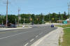
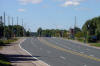
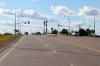
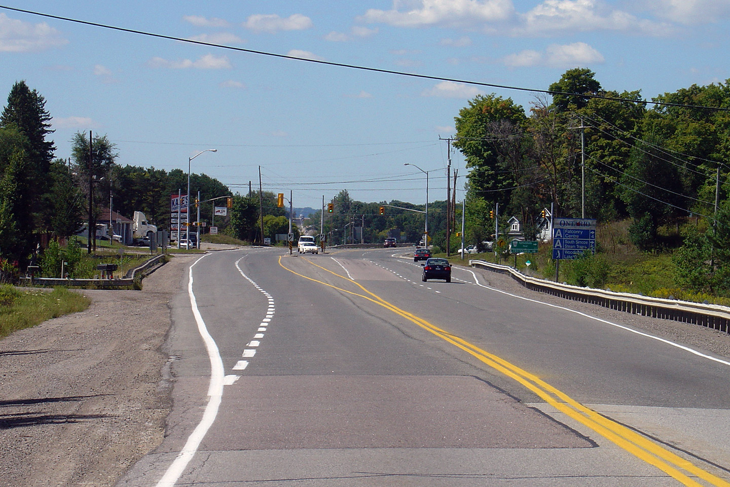
King - New Tecumseth Boundary
York - Simcoe Boundary |
Easterly view towards the Highway 27 junction. Highway 27 is a
reasonable alternative between western Toronto and Barrie instead of the
400.
Photo taken: June 5th, 2011. |
(720x480)
(1440x960)
(2400x1600) |
King - New Tecumseth Boundary
York - Simcoe Boundar |
Green directional signage for the Highway 27 junction. Motorists bound
for Toronto are directed to follow Highway 27 southerly from this junction.
In practice however, most traffic bound for Toronto would follow Highway 9
to the 400.
Photo taken: June 5th, 2011. |
(720x480)
(1440x960)
(2400x1600) |
|
Highway 27 is an important secondary route between western
Toronto and Barrie and beyond.
Click here for Highway 27 images. |
King - New Tecumseth Boundary
York - Simcoe Boundary |
This view looks westerly towards the Highway 27 intersection.
Photo taken: June 5th, 2011. |
(720x480)
(1440x960)
(2400x1600) |
King - New Tecumseth Boundary
York - Simcoe Boundary |
Easterly view along Highway 9 from the Highway 27 intersection.
Photo taken: June 5th, 2011. |
(720x480)
(1440x960)
(2400x1600) |
|
Township of King Regional Municipality of York |
View looking westerly along Highway 9 as it
passes through the Holland Marsh just west of Highway 400.
Photo taken: October 17th, 2010. |
(720x480)
(1440x960)
(2400x1600) |
|
Highway 400 is the Toronto-Barrie Highway, leading from
Toronto to north of Parry Sound. Click
here for Highway 400-South images and
here for Highway 400-Nouth images |
|
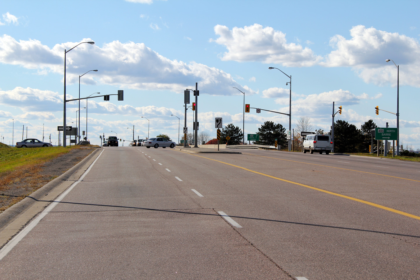
Township of King Regional Municipality of York |
This view looks west towards the northbound
off-ramp terminal from Highway 400.
Photo taken: October 17th, 2010. |
(720x480)
(1440x960)
(2400x1600) |
|
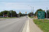
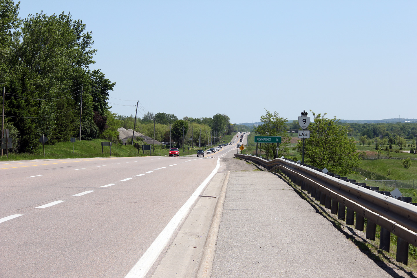
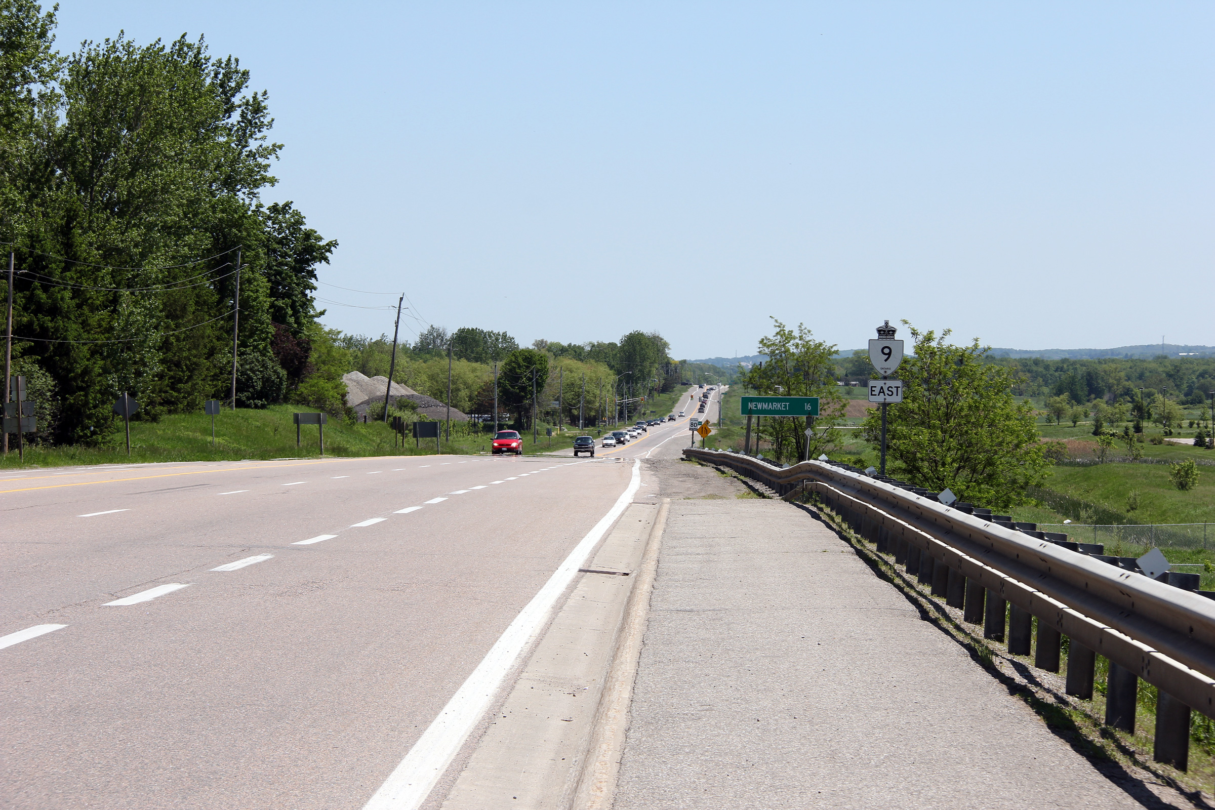
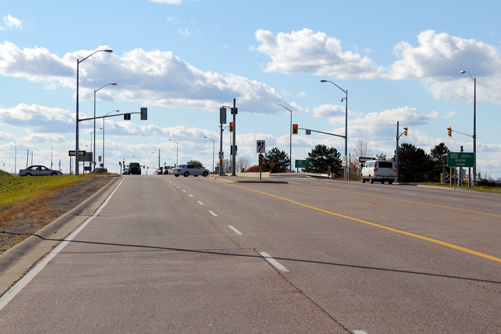
Township of King Regional Municipality of York |
View looking easterly towards Newmarket along
Highway 9 from the Highway 400 interchange.
Photo taken: October 17th, 2010. |

(720x480)
(1440x960)
(2400x1600) |
|
Township of King Regional Municipality of York |
View looking westerly along Highway 9 from just
west of the Glenville Road intersection. Highway 9 between
Highway 400
and Bathurst Street was widened to 5-lanes in 1998/1999 before all portions
of Highway 9 east of Highway 400 were transferred to the Region of York in
September of 1999.
Photo taken: August 1st, 2004. |
(720x480)
(1440x960) |
|
Township of King Regional Municipality of York |
View looking westerly towards Dufferin Street
and Glenville.
Photo taken: August 18th, 2012. |

(720x480)
(1440x960)
(2400x1600) |
|
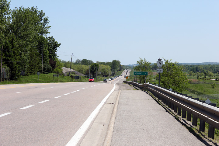
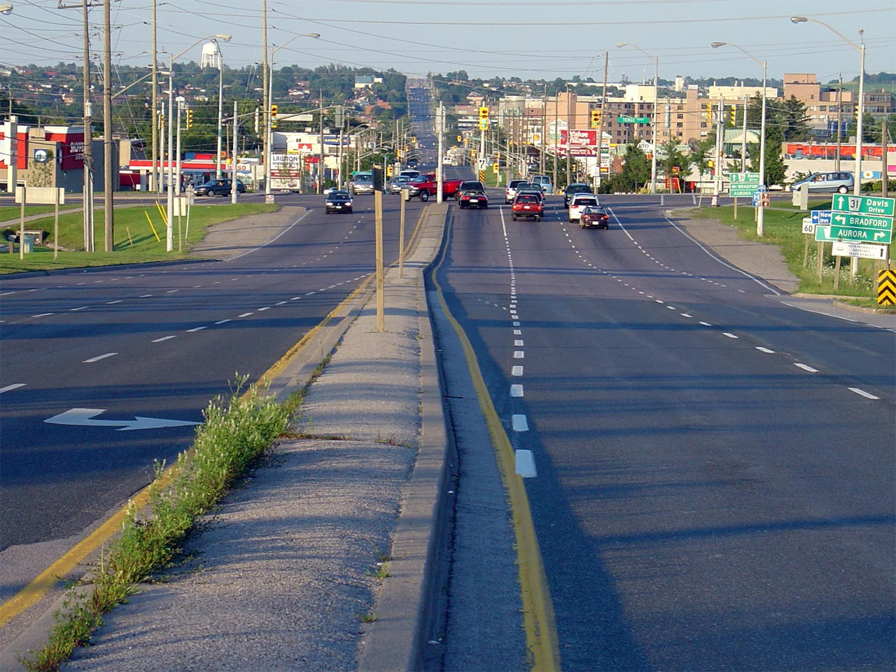
Town of Newmarket Regional Municipality of York |
View looking easterly towards the historic
eastern terminus of Highway 9 at the Highway 11 junction in Newmarket.
Davis Drive continues east of Highway 11 becoming Newmarket's major
east-west thoroughfare.
Photo taken: August 1st, 2004. |
(720x480)
(1440x960) |
 (720x480)


 (720x480)
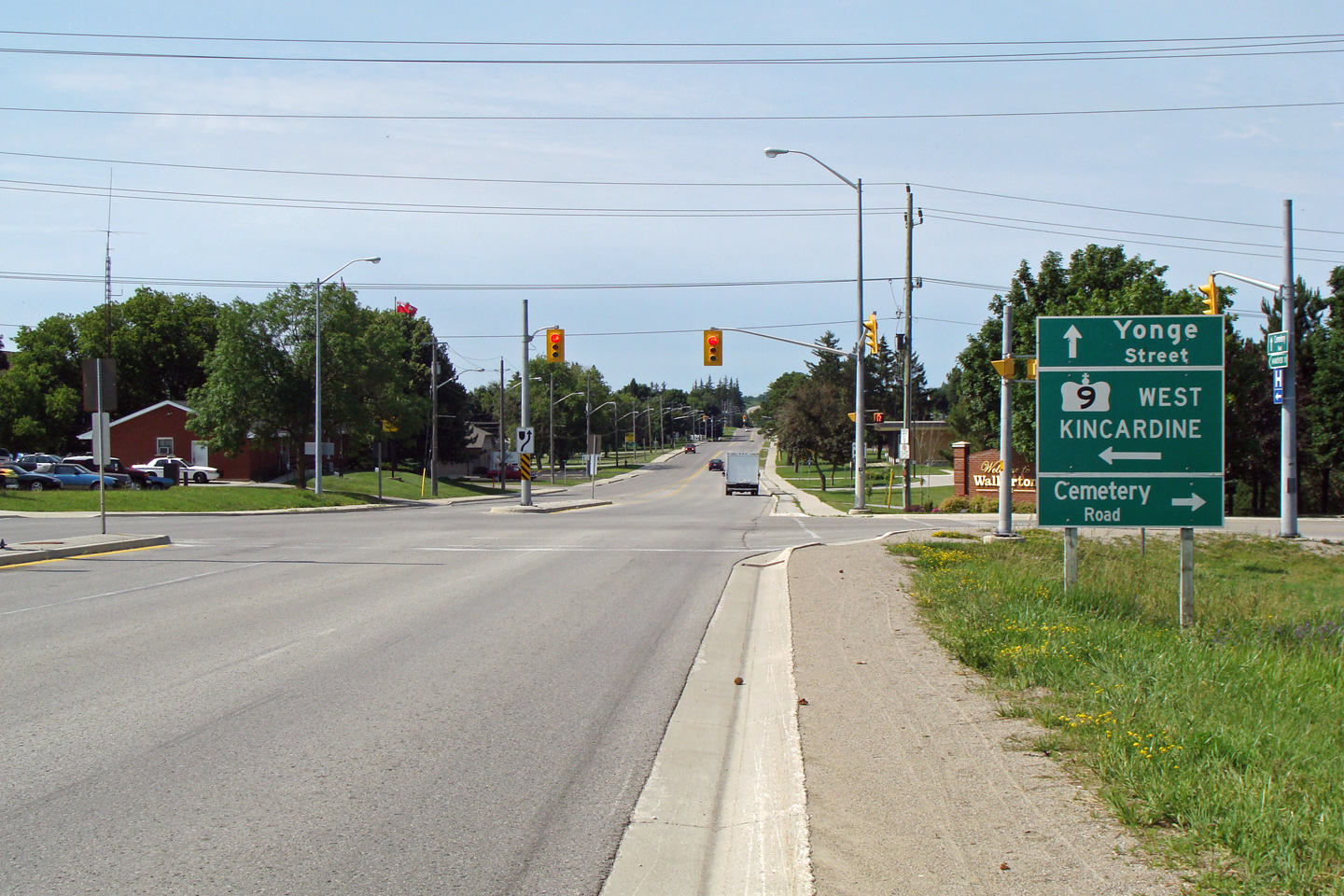


 (720x480)
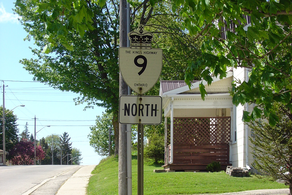
 (720x480)
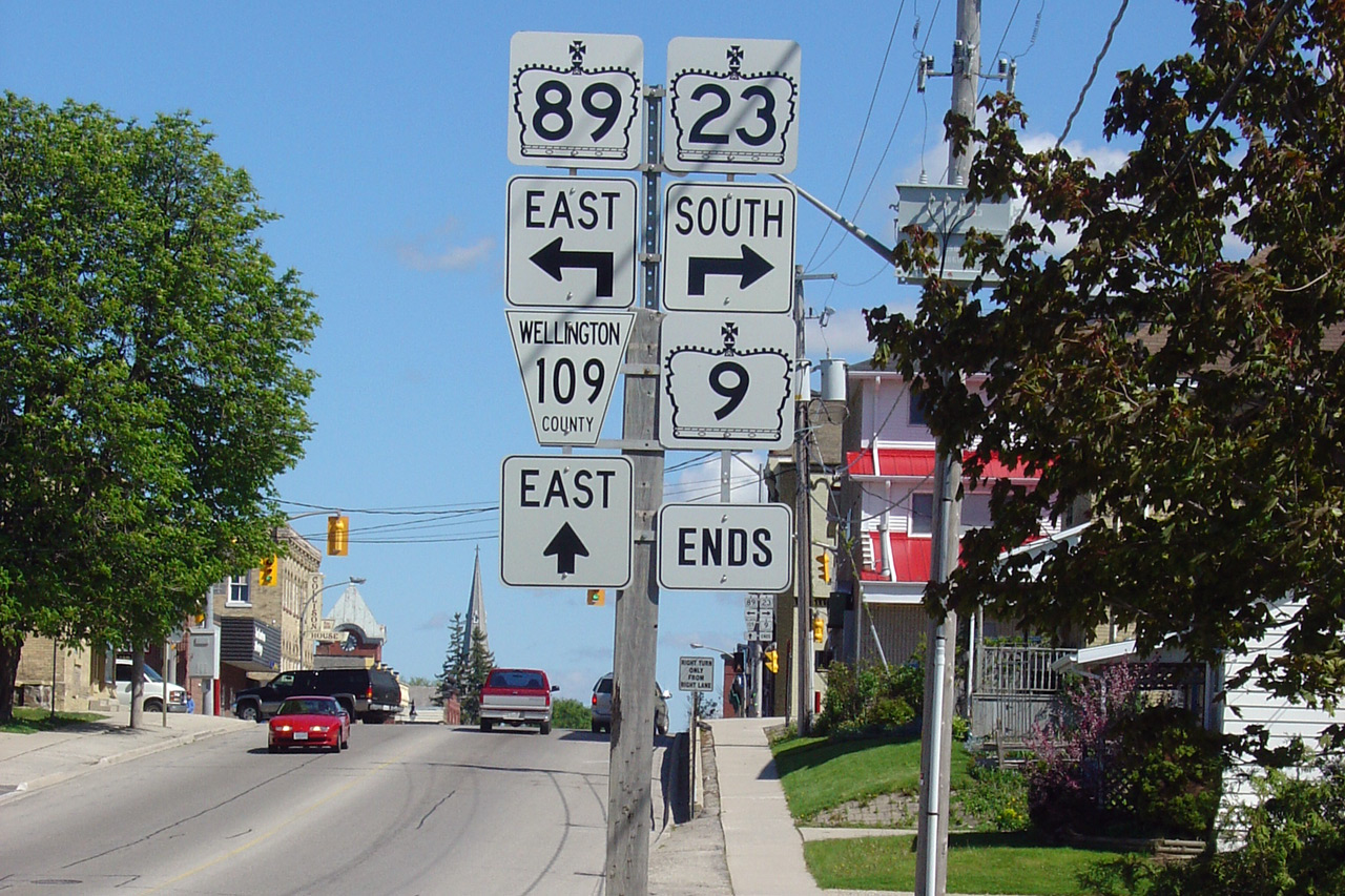
 (720x480)
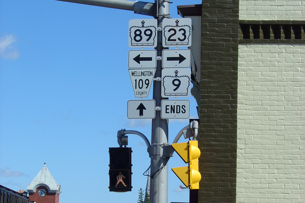


