King's Highway 50 - www.OntHighways.com

Like many other Ontario Highways, Highway 50 was downloaded in its entirety on January 1st, 1998.  Before being downloaded it lead northwest from the northwest part of Etobicoke through Bolton and eastern Caledon to Highway 89 just west of Alliston.  Though driving through Downtown Bolton can be slow during peak travel periods, the rest of Highway 50 flows quite well.


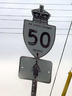
Old Style King's Highway 50 shield.


Southern Terminus:  Junction Highway 27 in the northwest corner of Etobicoke in the City of Toronto

Northern Terminus:  Junction King's Highway 89 just west of Alliston

Length:  53.6km

Multiplexes:  None

Freeway: No

AADT (1994):  Highest: 18,450 from Nashville Road northerly to Bolton;

                             Lowest: 4,400, from Simcoe Road 1 to Highway 89.

Status:  Totally downloaded in 1998.  Now known as Albion Road, Peel Road 50, and Simcoe Road 50.

Road Info:  Through the Region of Peel and the City of Toronto Highway 50 is in very good condition, having for the most part been recently reconstructed.  Through Simcoe County however, most of Highway 50 is built to an older standard, and is now in need of repair.  Traffic volumes are moderate on much of Highway 50, with the exception of south of Bolton where the road is very busy.  Highway 50 has a rural posted speed limit of 80km/h.


Highway 50 information:


OntHighways.com  

Detailed Route information available below
Virtual Tour of Highway 50


TheKingsHighway.ca   History of Highway 50
Photographic History of Highway 50

Communities and Major Intersections along Highway 50 from South to North:

Proper Municipality Name Community Name Distance Intersecting Road
Within the Toronto City Limits Highway 50 is known solely as Albion Road
City of Toronto Etobicoke --- (0km) / --- (53.5km) Highway 27

North of Steeles Avenue Highway 50 is known as Peel Road 50

Toronto - Vaughan - Brampton Boundary ----- --- (2.7km) / --- (50.9km) Steeles Avenue
Brampton -Vaughan Boundary ----- --- (3.7km) / --- (49.9km) The Gore Road (Peel Road 8)
Brampton -Vaughan Boundary Sunset Corners --- (4.8km) / --- (48.8km) Highway 7 (Peel Road 107 & York Road 7)
Brampton -Vaughan Boundary ----- --- Langstaff Road (York Road 72)
Brampton -Vaughan Boundary ----- --- Rutherford Road (York Road 73)
Brampton -Vaughan Boundary Coleraine --- Major Mackenzie Drive (York Road 25)
Brampton -Vaughan Boundary ----- --- (13.2km) / --- (40.4km) Nashville Road (York Road 49)
Brampton -Vaughan - Caledon Boundary Tormore --- (14.6km) / --- (39.1km) Mayfield Road (Peel Road 14)
Town of Caledon Bolton --- (19.5km) / --- (34.1km) King Street (Peel Road 9)
Town of Caledon Cedar Mills --- (27.0km) / --- (26.6km) Old Church Road (Peel Road 22)
Town of Caledon Palgrave --- -----

Highway 9 makes up the Peel - Simcoe Boundary, North of Highway 9 Highway 50 is known as Simcoe Road 50

Caledon - Adjala- Tosorontio Boundary ----- --- (34.0km) / --- (19.6km) King's Highway 9
Township of Adjala- Tosorontio Ballycroy --- -----
Township of Adjala- Tosorontio Cedarville --- -----
Township of Adjala- Tosorontio ----- --- (40.4km) / --- (13.2km) Simcoe Road 14
Township of Adjala- Tosorontio Athlone --- -----
Township of Adjala- Tosorontio Loretto --- (43.3km) / --- (10.3km) Simcoe Road 1
Township of Adjala- Tosorontio ----- --- (53.6km) / --- (0km) King's Highway 89
Highway 50 ENDS

<- Highway 49          www.OntHighways.com - Home          Highway 51->


Copyright (c) 2004-2010, AsphaltPlanet.ca  AsphaltPlanet@asphaltplanet.ca

Page last updated:  January 10th, 2007

Page created:  January 20th, 2004