|
Proper Municipality Name |
Community Name |
Distance |
Intersection Road |
|
City of Toronto |
Etobicoke |
0 km / 119.4 km |
King's Highway 427/401 Ramps |
|
City of Toronto |
Etobicoke |
0.6 km / 188.8 km |
Eglington Avenue |
|
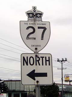
Current Northern Terminus of Highway 27 is located
between Eglinton Avenue and Dixon Road. In Toronto, Highway 27 is
known as "Highway 27" |
|
City of Toronto |
Etobicoke |
2.9 km / 116.5 km |
Dixon Road |
|
City of Toronto |
Etobicoke |
6.1 km / 113.3 km |
Rexdale Road |
|
City of Toronto |
Etobicoke |
--- |
Finch Avenue |
|
City of Toronto |
Etobicoke |
9.3 km / 110.1 km |
Highway 50 (Albion Road) & Albion Road |
|
Toronto - York Line: In Toronto,
Highway 27 is known as "Highway 27", in York Region it is known as York Road
27. |
|
Toronto - Vaughan Boundary |
----- |
10.6 km / 108.0 km |
Steeles Avenue |
|
City of Vaughan |
----- |
--- |
Highway 407 ETR |
|
City of Vaughan |
----- |
12.7 km / 106.7 km |
Highway 7 (York Road 7) |
|
City of Vaughan |
----- |
--- |
Langstaff Road (York Road 72) |
|
City of Vaughan |
Elder Mills |
--- |
Rutherford Road (York Road 73) |
|
City of Vaughan |
----- |
19.0 km / 100.4 km |
Major Mackenzie Drive (York Road 25) |
|
City of Vaughan |
Klienburg |
20.7 km / 98.7 km |
Nashville Road (York Road 49) |
|
Township of King |
Nobleton |
27.5 km / 91.9 km |
King Road (York Road 11) |
|
Township of King |
Linton |
33.7 km / 85.7 km |
York Road 15-East |
|
Township of King |
Linton |
33.8 km / 85.6 km |
York Road 15-West |
|
Township of King |
----- |
37.8 km / 81.6 km |
Lloydtown-Aurora Road (York Road 16) |
|
Township of King |
Schomberg |
38.5 km / 80.9 km |
Main Street (York Road 76) |
|
York Simcoe Line: In York
Region, Highway 27 is known as York Road 27, in Simcoe County it is known as
Simcoe Road 27 |
|
King - New Tecumseth Boundary |
Schomberg |
39.9 km / 79.5 km |
King's Highway 9 |
|
Town of Bradford West Gwillimbury |
Dunkerron |
--- |
----- |
|
Town of Bradford West Gwillimbury |
Bond Head |
49.4 km / 70.0 km |
Highway 88 (Simcoe Road 88) |
|
Town of Bradford West Gwillimbury |
----- |
50.8 km / 68.6 km |
8th Line (Simcoe Road 1) |
|
Town of Bradford West Gwillimbury |
Newton Robinson |
--- |
----- |
|
Town of Innisfil |
Cookstown |
60.9 km / 58.5 km |
King's Highway 89 |
|
Township of Essa |
Thornton |
69.7 km / 49.7 km |
Robert Street (Simcoe Road 21) |
|
Essa - Innisfil Boundary |
----- |
70.2 km / 49.2 km |
Innisfil Beach Road (Simcoe Road 21) |
|
At Highway 131: NB: Former Highway 131 is
known as Simcoe Road 27. Highway 27 is known as Simcoe Road 30
northerly to the Barrie city limits. SB: Simcoe Road 30 ends, Highway
27 is once again known as Simcoe Road 27. |
|
Essa - Innisfil Boundary |
----- |
73.1 km / 46.3 km |
Highway 131 (Simcoe Road 27-North) |
|
Barrie South Limits. NB: Highway 27 is known
only as Essa Road heading into Barrie. SB: Simcoe Road 30 starts at
the Barrie Limits. |
|
City of Barrie |
Holly |
--- |
Mapleview Drive |
|
City of Barrie |
Barrie |
80.0 km / 39.4 km |
King's Highway 400 |
|
City of Barrie |
Barrie |
80.9 km / 38.5 km |
Highway 11-South (Burton Avenue) |
|
At Tiffin Street: NB: Highway 11/27 curves to
the left, and becomes known as Bradford Street. SB: Highway 11/27
curves to the right, and is known as Essa Road |
|
City of Barrie |
Barrie |
--- |
Tiffin Street |
|
At Dunlop Street: NB: Turn
right on Dunlop Street for Highway 11/27 north. SB: Turn left onto
Bradford Street for Highway 11/27 south. |
|
City of Barrie |
Barrie |
82.9 km / 36.5 km |
Highway 90 (Dunlop Street West) |
|
At Bayfield Street: NB:
Turn left at Clapperton Street. Northbound Highway 27 has an extra jog
compared to southbound; At Collier Street turn left, and turn right onto
Bayfield Street. SB: Turn right from Bayfield street onto Dunlop
Street |
|
City of Barrie |
Barrie |
83.2 km / 36.2 km |
Highway 11-North (Dunlop Street East) |
|
City of Barrie |
Barrie |
--- |
Ross Street |
|
City of Barrie |
Barrie |
84.5 km / 34.9 km |
King's Highway 400 |
|
Barrie North Limits: North of Barrie, Highway 27 is known only as
Highway 26. SB: In Barrie, Highway 26/37 is known only as Bayfield Street |
|
Township of Springwater |
----- |
89.6 km / 29.8 km |
Snow Valley Road (Simcoe Road 43 ) |
|
North of Highway 26 Junction, Highway 27 is known (once again) as Simcoe
Road 27. South of Midhurst, Highway 27 is only designated as Highway
26. |
|
Township of Springwater |
Midhurst |
90.4 km / 29.0 km |
King's Highway 26-West |
|
Township of Springwater |
----- |
98.1 km / 21.3 km |
Horseshoe Valley Road (Simcoe Road 22) |
|
Township of Springwater |
Apto |
--- |
----- |
|
Township of Springwater |
Fergusonvale |
--- |
----- |
|
Township of Springwater |
Elmvale |
109.2 km / 10.2 km |
Highway 92 (Simcoe Road 92, Queen Street) & South Orr Lake Road (Simcoe Road
19) |
|
Township of Springwater |
----- |
111.0 km / 8.4 km |
Country Road (Simcoe Road 6) |
|
Township of Tiny |
Waverly |
119.4 km / 0 km |
King's Highway 93 |
|
Highway 27 ENDS |