|
Proper Municipality Name |
Community Name |
Distance |
Intersecting Road |
| Township of Otonabee- South Monaghan |
----- |
0 km / 160.6 km |
King's
Highway 7 |
| Township of Douro-Dummer |
----- |
6.1 km / 154.5 km |
Peterborough Road 8 |
| Township of Douro-Dummer |
----- |
6.4 km / 154.2 km |
Warsaw Road (Peterborough Road 4) |
| Township of Douro-Dummer |
----- |
12.3 km / 148.3 km |
Peterborough Road 33 |
| Township of Douro- Dummer |
----- |
15.0 km / 145.6 km |
Lakefield Road (Peterborough Road 29, Formerly
Highway 28) |
|
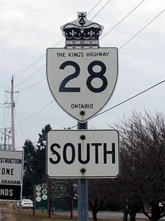
In 2003, Highway 28 absorbed all
of Highway 134's routing. Click here for Pre-1997 Highway 28
information. |
|
At Peterborough Road 29:
NB: Ramp to the right towards Bancroft. SB: Turn Left onto Former
Highway 134 towards Peterborough and Toronto |
| Township of Douro- Dummer |
----- |
16.1 km / 144.5 km |
Stoney Lake Road (Peterborough Road 6) |
| Township of Smith- Ennismore-
Lakefield |
Young's Point |
20.8 km / 139.8 km |
Young's Point Road (Peterborough Road 20) |
| Township of Smith- Ennismore-
Lakefield |
Burleigh Falls |
30.6 km / 130.0 km |
Highway 36 (Peterborough Road
36) |
| Township of North Kawartha |
Big Cedar |
--- |
----- |
| Township of North Kawartha |
Woodview |
--- |
Northey's Bay Road (Peterborough Road 56) |
| Township of North Kawartha |
Haultain |
--- |
----- |
| Township of North Kawartha |
Burleigh Centre |
--- |
----- |
| Township of North Kawartha |
Apsley |
57.2 km / 103.5 km |
Highway 504 (Peterborough Road 504) |
| Township of North Kawartha |
----- |
58.4 km / 102.2 km |
Highway 620 (Peterborough Road 620) |
| Municipality of Highlands East |
----- |
76.7 km / 83.9 km |
Dyno Road (Kawartha Road 48) |
| Municipality of Highlands East |
Upper Paudash |
--- |
----- |
| Municipality of Highlands East |
----- |
81.2 km / 79.4 km |
McGillvary Road (Halliburton Road 9) |
| Township of Faraday |
Paudash |
88.3 km / 72.3 km |
King's Highway 118 (Formerly Highway 121) |
| Township of Faraday |
Bow Lake |
--- |
Lower Faraday Road |
| Faraday - Bancroft Boundary |
Bancroft South Limits |
98.5 km / 62.1 km |
----- |
| Town of Bancroft |
Bancroft |
--- |
Monck Road |
| Town of Bancroft |
Bancroft |
100.8 km / 59.8 km |
King's Highway 62-South (Mill Street). |
| Town of Bancroft |
Bancroft |
101.0 km / 59.6 km |
King's Highway 62-North (Heritage Street). |
| Town of Bancroft |
(Former) Bancroft East
Limits |
101.8 km / 58.8 km |
----- |
| Town of Bancroft |
Bowen Corner |
--- |
Detlor Road |
| Township of Carlow/Mayo |
----- |
--- |
Fort Stewart Road |
| Township of Carlow/Mayo |
----- |
121.8 km / 38.9 km |
Bessemer Road |
| Township of Carlow/Mayo |
McArthur Mills |
--- |
Mayo Lake Road |
| Township of Carlow/Mayo |
----- |
--- |
Boulter Road |
| Township of Brudenell Lyndoch and
Raglan |
Hardwood Lake |
--- |
----- |
| Township of Brudenell Lyndoch and
Raglan |
----- |
130.7 km / 29.9 km |
----- |
|
At Highway 514: EB: Turn
Right towards Denbigh. WB: Turn Left towards Bancroft. |
| Township of Brudenell Lyndoch and
Raglan |
----- |
189.6 km / 18.4 km |
Highway 514 (Renfrew Road 514) |
| Township of Addington Highlands |
Denbigh |
--- |
----- |
| Township of Addington Highlands |
----- |
208.2 km / 0 km |
King's Highway 41 |
|
Highway 28 ENDS |