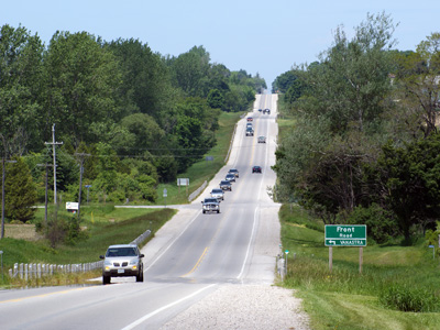
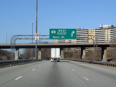
King's Highway 8 - Images

Photos shown in this table are arranged from West to East:

Proper Municipality Name Photo Description Photo

Pictures taken from driver's perspective appear offset from centre-line pictures:        

East-
Bound
West-
Bound
City of Stratford Eastbound junction assembly for Highway 7 in Stratford.

Photo taken: August 2008.
West of Stratford, Highway 7 leads to St Mary's, Elginfield and eventually Sarnia.  Click here for Highway 7-West Images.
City of Stratford View looking westerly along Highway 7/8 through Downtown Stratford.

Photo taken: July 2007

Low-res     High-res

Township of Perth East

County of Perth
Looking east from the east limits of Stratford.

Photo taken: June 10th, 2005.

Low-res     High-res

Township of Perth East

County of Perth
Highway 7/8 curves around a small lake to create this very pleasant scene.

Photo taken: June 10th, 2005.

Low-res     High-res

Township of Perth East

County of Perth
View looking west from Highway 59 in Shakespear.

Photo taken: August 1st, 2004

Low-res     High-res

Township of Perth East

County of Perth
Easterly view from Highway 59 along Highway 7/8.

Photo taken: August 1st, 2004.

Low-res     High-res

Township of Perth East

County of Perth
The drive from New Hamburg to Stratford is very pleasant, despite the long lines of traffic that drivers inevitably encounter.

Photo taken: June 10th, 2005.

Low-res     High-res

Township of Perth East

County of Perth
View of the New Hamburg CPR overhead -- looking east.

Photo taken: June 10th, 2005.

Low-res     High-res

Township of Wilmot

Regional Municipality of Waterloo
Easterly view at the western start of the New Hamburg By-pass.  Traffic signals were added to this intersection in 2007.

Photo taken: June 10th, 2005.

Low-res     High-res

Township of Wilmot

Regional Municipality of Waterloo
View looking easterly approaching the Peel Street intersection.  The New Hamburg By-pass was reconstructed during 2006 and 2007 improving the pavement condition and intersection geometry.

Photo taken: June 10th, 2005.

Low-res     High-res

Township of Wilmot

Regional Municipality of Waterloo
View looking west towards Peel Street.

Photo taken: August 1st, 2004.

Low-res     High-res

Township of Wilmot

Regional Municipality of Waterloo
Temporarily mounted traffic signals at the Bleams Road interchange.  Unlike neighbouring Michigan, traffic signals are very seldom mounted on overhead wires.

Photo taken: June 10th, 2005.

Low-res     High-res

Township of Wilmot

Regional Municipality of Waterloo
View looking westerly from Waterloo Road 5.  The New Hamburg By-pass was completed in 1957 to avoid a very awkward routing through the town.

Photo taken: June 10th, 2005.

Low-res     High-res

Township of Wilmot

Regional Municipality of Waterloo
View looking easterly at the west end of the divided highway at the eastern end of the New Hamburg By-pass.

Photo taken: June 10th, 2005.

Low-res     High-res

Township of Wilmot

Regional Municipality of Waterloo
View looking westerly from Sandhills Road towards New Hamburg and Waterloo Road 51.

Photo taken: June 10th, 2005.

Low-res     High-res

Township of Wilmot

Regional Municipality of Waterloo

View looking easterly from Sandhills Road.  Despite the high design standard, Highway 7/8 is only posted at 90km/h.

Photo taken: June 10th, 2005.

Low-res     High-res

Township of Wilmot

Regional Municipality of Waterloo

This picture is looking west off of the Waterloo Road 12 overpass west of the city of Kitchener.  Before the mid-1990s the 4-lane divided expressway ended at this interchange, only to restart as an at grade 4-lane undivided expressway a few kilometres west near New Hamburg.
Photo taken: June 10th, 2005.

Low-res     High-res

Township of Wilmot

Regional Municipality of Waterloo

View looking easterly from the Waterloo Road 12 interchange.

Photo taken: June 10th, 2005.

Low-res     High-res

City of Kitchener

Regional Municipality of Waterloo

This view looks west towards the Trussler Road interchange along Highway 7/8.

Photo taken: June 10th, 2005.

Low-res     High-res

City of Kitchener

Regional Municipality of Waterloo

Easterly view of Highway 7/8 towards the Fischer Hallman Road interchange.

Photo taken: June 10th, 2005.

Low-res     High-res

City of Kitchener

Regional Municipality of Waterloo

This photo shows Highway 7/8 looking west from the Fisher-Hallman Road overpass in Kitchener.  The carriageways split in the foreground only to rejoin a short distance later, the only reason that I can think of for why the carriages way split and rejoin in this fashion, is that in the early 1990s the divided Highway 7/8 ended here. 
Photo taken: June 10th, 2005.

Low-res     High-res

City of Kitchener

Regional Municipality of Waterloo

Easterly view of the Conestoga Parkway from Fischer Hallman Road.  The MTO is in preliminary design to widen the Parkway from Fischer Hallman Road easterly to Courtland Road.

Photo taken: June 10th, 2005.

Low-res     High-res

City of Kitchener

Regional Municipality of Waterloo

Highway 7/8 looking west towards the Courtland Avenue. interchange from the pedestrian overpass just east of Courtland Avenue.  West of Courtland Avenue, Highway 7/8 has a 4-lane cross-section westerly to New Hamburg.

Picture taken: September 18th, 2005.  Size: 45kb.

Low-res     High-res

City of Kitchener

Regional Municipality of Waterloo

Highway 7/8 looking east from the same pedestrian overpass as the previous picture.  The Highway 7/8 interchange is located about 500m east of this overpass.  Highway 7/8 has a 6-lane cross section between Courtland Avenue and Highway 8-East.
Picture taken: September 18th, 2005.  Size: 45kb.

Low-res     High-res

City of Kitchener

Regional Municipality of Waterloo

The advanced signage for the Highway 8 split from the Conestoga heading eastbound.  Highway 8 leads currently leads to Highway 401.  Before provincial downloading, Highway 8 continued eastwards through Cambridge and into Hamilton.
Picture taken: August 1st, 2004.  Size: 45kb.
City of Kitchener

Regional Municipality of Waterloo

At the eastern Highway 7/8 split the left three most lanes continue eastbound for Highway 7 (and towards Highway 85).  Highway 8 departs to the Highway 8 freeway via a directional ramp posted at 50km/h.

Picture taken: August 1st, 2004.  Size: 30kb.

Highway 7 continues easterly along the Parkway before departing for Guelph and beyond.  Click here for Highway 7 images.
City of Kitchener

Regional Municipality of Waterloo

View of the start of the Highway 8 freeway from King Street in Kitchener.

Photo taken: September 2008.

Low-res     High-res
City of Kitchener

Regional Municipality of Waterloo

Highway 8 driving west at the King Street exit.  At King Street, Highway 8 departs the current freeway alignment heading to the Conestoga Parkway via a loop ramp.  King Street leads travelers into Downtown Kitchener, and is the former route of Highway 8 before the Conestoga Parkway was constructed in the late 1960s.
Picture taken: September 18th, 2005.  Size: 45kb.
City of Kitchener

Regional Municipality of Waterloo

Signage located at the eastbound Highway 7 split from the Highway 8 freeway.

Picture taken: September 18th, 2005.  Size: 35kb.

City of Kitchener

Regional Municipality of Waterloo

Looking west along Highway 8 from the Franklin Street overpass.  This picture shows the Highway 7/8 interchange in good detail.  The Highway 7/8 interchange was extensively reconstructed as part of a multi-year construction project completed in 2004.  Before this reconstruction, this interchange was a very substandard half-clo design.
Picture taken: September 18th, 2005.  Size: 40kb.
City of Kitchener

Regional Municipality of Waterloo

Highway 8 looking east from the Franklin Street overpass.  As visible from the photo, Highway 8 has a brief depressed section at Franklin Street.  Just east of Franklin Street Highway 8 narrows from 8- to 4-lanes.  Currently, the MTO is in the planning stages of a series of projects that will  see Highway 8 to 8-laned easterly to Highway 401.
Picture taken: September 18th, 2005.  Size: 40kb.
City of Kitchener

Regional Municipality of Waterloo

Advanced signage for the upcoming Highway 7/8 interchange located just east of the Franklin Road overpass.

Picture taken: September 18th, 2005.  Size: 45kb.

City of Kitchener

Regional Municipality of Waterloo

Approaching the Highway 7 interchange along Highway 8.  This diagramical sign has to be one of the most complicated signs currently installed along an Ontario freeway.

Picture taken: September 18th, 2005.  Size: 35kb.

City of Kitchener

Regional Municipality of Waterloo
Partial overhead signs are becoming quite common along Ontario Highways.

Photo taken: July 2008.
Low Res


High Res
City of Kitchener

Regional Municipality of Waterloo
A rather sharp reversing curve greets Highway 8 travelers just west of Fairway Road.

Photo taken: July 2008.

Low-res     High-res
City of Kitchener

Regional Municipality of Waterloo
The median barrier on the new Fairway Road overpass has been embossed with a very attractive decorative pattern.

Photo taken: July 2008.

Low-res     High-res
City of Kitchener

Regional Municipality of Waterloo
Oversized junction assembly at the Fairway Driver interchange.

Photo taken: July 2008.
City of Kitchener

Regional Municipality of Waterloo

Looking west along Highway 8 across the Grand River Bridge.  The section of freeway across the Grand River between King Street and Fairway Drive is known as the Freeport Diversion.  This diversion was constructed in 1963 to by-pass the community of Freeport and a long concrete bowstring bridge, and remains virtually unaltered to this day.
Picture taken: September 24th, 2005.  Size: 65kb.
City of Kitchener

Regional Municipality of Waterloo

Driving east along Highway 8 approaching Highway 7187.  At this interchange, Highway 8 departs the freeway section and follows King Street to the 401, and into Cambridge.  Although commonly referred to as Highway 8, Highway 7187 carries freeway traffic bound for the eastbound 401.  (Travelers bound for the westbound 401 must exit the freeway here).
Picture taken: September 24th, 2005.  Size: 40kb.
City of Kitchener

Regional Municipality of Waterloo

Looking west towards Highway 8 across the Freeport Diversion.  The dual structures carrying the freeway over King Street were constructed in 1987 as part of the larger project to construct a freeway between the Freeport Diversion and Highway 401 (Hwy 7187).  Before 1987, the Freeport Diversion met King Street at an at-grade intersection.
Picture taken: September 24th, 2005.  Size: 75kb.
City of Kitchener

Regional Municipality of Waterloo

A wider angled perspective of the previous picture.  This picture shows a good portion of the Freeport Diversion, as well as a portion of King Street which carried Highway 8 before the Freeport Diversion was constructed in 1963.

Picture taken: September 24th, 2005.  Size: 85kb.
City of Kitchener

Regional Municipality of Waterloo

Overhead signage along King Street for the loop ramp to the expressway.  Westbound Highway 8 traffic must negotiate this loop ramp.

Photo taken: July 2008.
Low Res


High Res
The 401 crosses Highway 8 at the Kitchener/Cambridge boundary.  Click here for Highway 401 images.
City of Cambridge

Regional Municipality of Waterloo
Between Preston and Galt, Highway 8 is a pleasant divided parkway.

Photo taken: July 2008.

Low-res     High-res
City of Cambridge

Regional Municipality of Waterloo
There are several signals between Preston and Galt.

Photo taken: July 2008.

Low-res     High-res
Highway 8 meets Highway 24 at the Delta.  Click here for Highway 24 images.
City of Cambridge

Regional Municipality of Waterloo
View looking northerly as Highway 8 meets Highway 24 in Cambridge.  This intersection is known locally as the Delta.

Photo taken: October 2008.

Low-res     High-res
City of Cambridge

Regional Municipality of Waterloo
View looking westerly at the Maple Bush Road intersection towards Franklin Boulevard.

Photo taken: August 2008.

Low-res     High-res
City of Cambridge

Regional Municipality of Waterloo
View looking westerly from west of Branchton Road.  This 4-lane cross-section is a very old design, and is not typical of most modern king's highways.

Photo taken: August 2008.

Low-res     High-res
City of Cambridge

Regional Municipality of Waterloo
Easterly view towards Branchton Road.  MTO jurisdiction over Highway 8 begins just past the Branchton Road intersection.
Low-res     High-res
City of Hamilton View looking easterly towards the current eastern terminus of Highway 8 at the Highway 5 junction at Peters Corners.  This junction also marks the current western terminus of Highway 5.  Straight ahead, Hamilton Road 8 continues east through Dundas into Downtown Hamilton.
Picture taken: May 5th, 2005.  Size: 35kb.
Highway 8 meets Highway 5 and 52 in Peters Corners.  Click here for Highway 5 images and here for Highway 52 images.
City of Hamilton View looking easterly towards Highway 8's descent down the Niagara Escarpment into Downtown Dundas.

Picture taken: March 28th, 2007.  Size: 125kb.

City of Hamilton View closer to the mountain brow along Highway 8.  At the mountain brow, Highway 8 has a sharp curve and quickly begins to descend the escarpment via a steep access.  This curve has a posted advisory speed of 20km/h.
Picture taken: March 28th, 2007.  Low-res: 95kb.  High-res: 385kb.

Low-res     High-res
City of Hamilton View looking east from the top of the escarpment looking towards Dundas.  Note the stone wall that guide rail on the right side of the photo.  The City of Hamilton recently rehabilitated this stone wall paying careful attention to replicate the wall's ornate detailing.
Picture taken: March 28th, 2007.  Low-res: 90kb.  High-res: 380kb.

Low-res     High-res
City of Hamilton Looking east again down the escarpment access.  Highway 8 passes under the CN mainline railway halfway down the escarpment through a narrow subway.

Picture taken: March 28th, 2007.  Low-res: 90kb.  High-res: 350kb.


Low-res     High-res
City of Hamilton Another view of Highway 8 descending the escarpment access, this time showing the sharp curve traffic needs to negotiate to pass under the railway overhead.

Picture taken: March 28th, 2007.  Low-res: 90kb.  High-res: 355kb.


Low-res     High-res
City of Hamilton Eastbound view through the CN railway overhead.

Picture taken: March 28th, 2007.  Low-res: 75kb.  High-res: 320kb.


Low-res     High-res
City of Hamilton View looking west through the CN railway overhead.  Note the close proximity of the intersection to the railway overhead.  Vehicles departing this side road must do so with the utmost care.

Picture taken: March 28th, 2007.  Low-res: 100kb.  High-res: 415kb.


Low-res     High-res
City of Hamilton View of Highway 8 ascending the escarpment from the railway tracks.

Picture taken: March 28th, 2007.  Low-res: 95kb.  High-res: 385kb.


Low-res     High-res
City of Hamilton Looking east from just east of the railway overhead as Highway 8 finishes its descent down the mountain into Dundas.

Picture taken: March 28th, 2007.  Size: 85kb.

City of Hamilton Green signage for the western Highway 2/8 junction in Hamilton.  Click here for Highway 2 images (Coming Soon!).

Picture size: 40kb.

City of Hamilton Westbound signage for the Highway 2/8 intersection.  Click here for Highway 2 images (Coming Soon!).

Picture size: 25kb.

City of Hamilton Highway 2/8 signage in Westdale.  Like other Highway 2/8 shield assemblies, this sign has been replaced with a Hamilton Road 8 flowerpot.

Picture size: 30kb.

Highway 403 passes through Chedoke Valley in Hamilton.  Click here for Highway 403 images.
City of Hamilton Butterfly gantry displaying Highway 2/8 signs along with Highway 403 signage at the ramp to Highway 403 east.  This sign was replaced early in 2007, and highlight King Street as Hamilton Road 8 rather than Highway 2/8.

Picture size: 75kb.
City of Hamilton Eastbound signage for the eastern Highway 2/8 junction.  Click here for Highway 2 images. (Coming Soon!).

Picture size: 30kb.

City of Hamilton Westbound signage for the eastern Highway 2/8 junction.  Click here for Highway 2 images (Coming Soon!).

Picture size: 30kb.

City of Hamilton Main Street eastbound from just east of Queen Street in Hamilton.

Picture taken: March 9th, 2008.

Low Res


High Res

City of Hamilton View of Main Street looking east towards MacNab and James Streets.

Picture taken: March 9th, 2008.

Low Res


High Res

City of Hamilton Westerly view of Highway 8 as it nears Dewitt Road, and the suburban boundary of Stoney Creek.

Photo taken: May 2008.

Low-res     High-res
City of Hamilton View looking west towards the Fruitland Road intersection.

Photo taken: May 2008.

Low-res     High-res
City of Hamilton This forgotten stretch of Highway 8 is dwarfed by the Niagara Escarpment.

Photo taken: May 2008.

Low-res     High-res
City of Hamilton Its hard to believe that this stretch of road was a provincial highway until 1997.  This is the Fifty Road intersection.

Photo taken: May 2008.

Low-res     High-res
City of Hamilton Between 1972 and 1997 Highway 8 ended at the Niagara border.  At one time, Number 8 continued as far east as Niagara Falls.  Anyone who has driven the old route of Highway 8 between this point and Niagara Falls will understand why it was downloaded so early.
Photo taken: May 2008.

Low-res     High-res

<- Highway 7B Images          Back to Highway 8            Highway 9 Images ->
Images Index

www.OntHighways.com - Home


Copyright (c) 2004-2007, Scott Steeves (Webmaster)  webmaster@onthighways.com