|
|
Virtual Tour of Highway 427 - See Below
Other Highway 427 images: |
King's Highway 427 - Images
|
|
Virtual Tour of Highway 427 - See Below
Other Highway 427 images: |
Virtual Tour of Highway 427:
Photos shown in this table are arranged from South to North:
| Proper Municipality Name | Photo Description | Photo | |||||||||||||||||||||||||||||||||||
|
Pictures taken from driver's perspective appear offset from centre-line pictures: |
North- Bound |
South- Bound |
|||||||||||||||||||||||||||||||||||
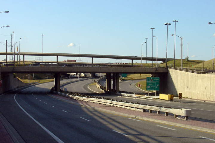
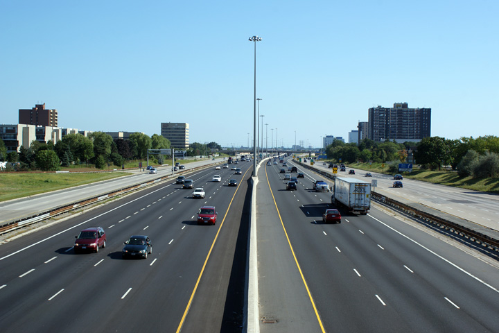
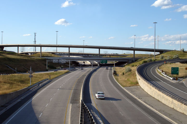
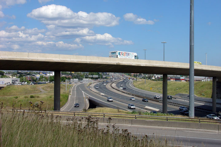
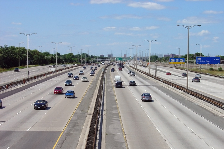
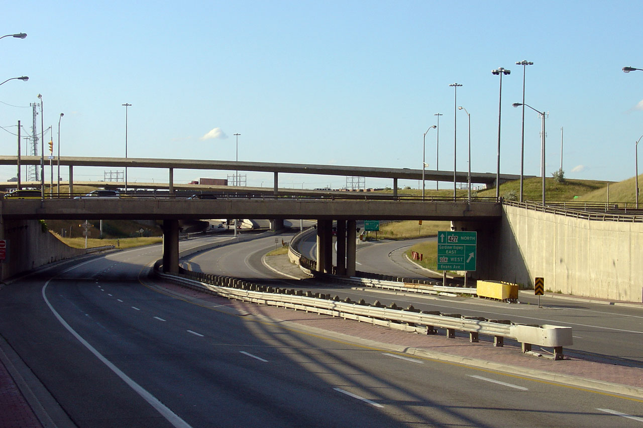
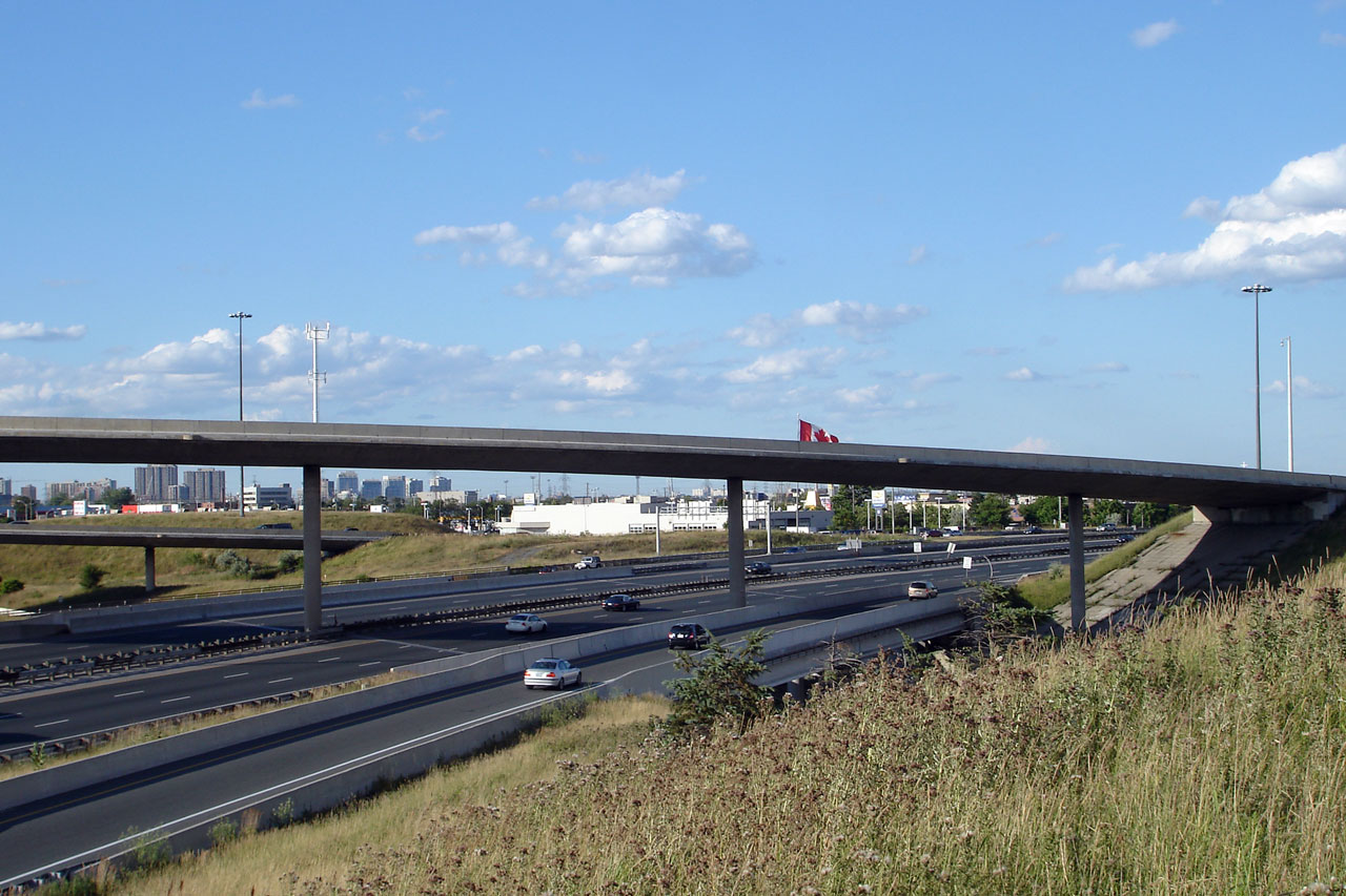
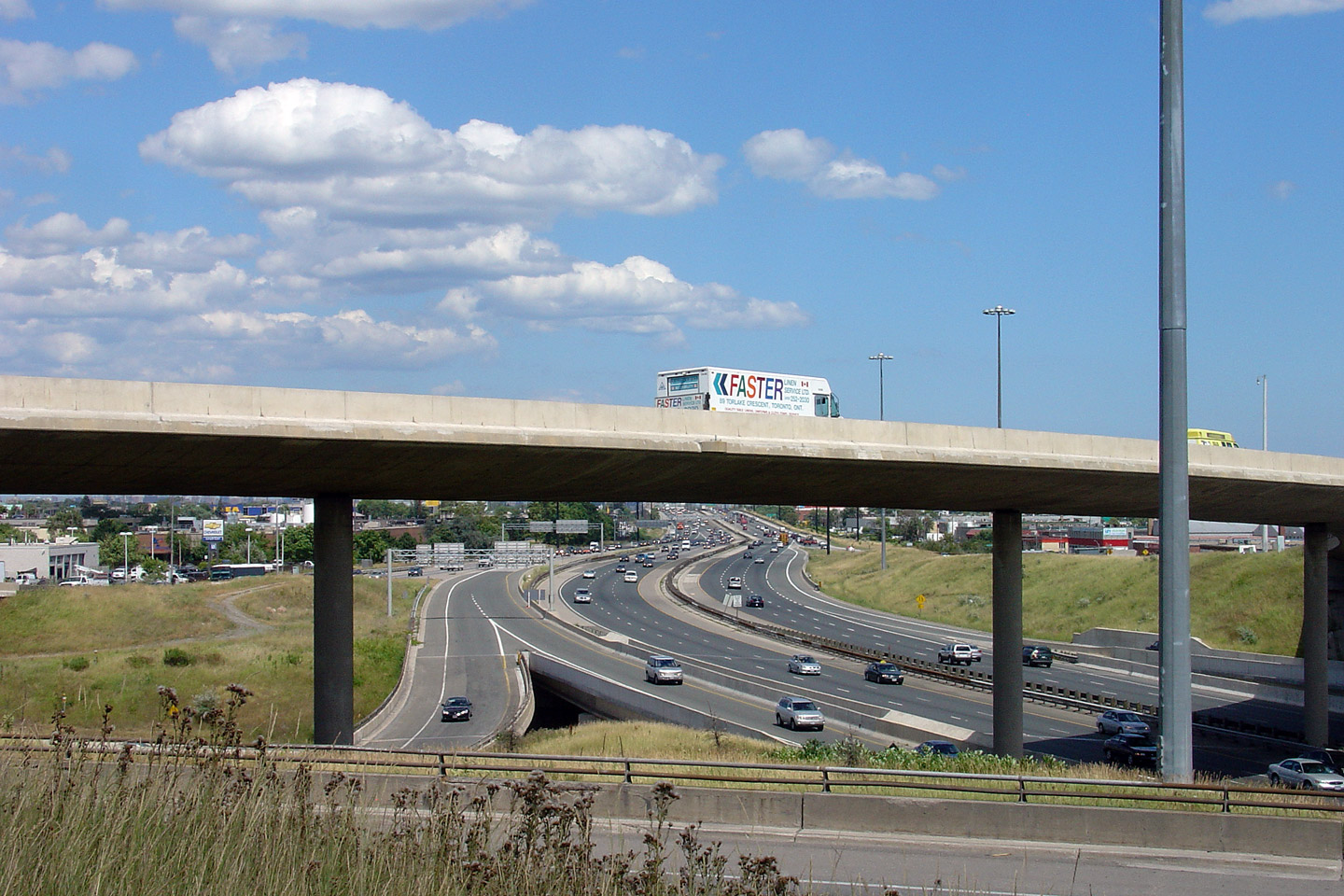
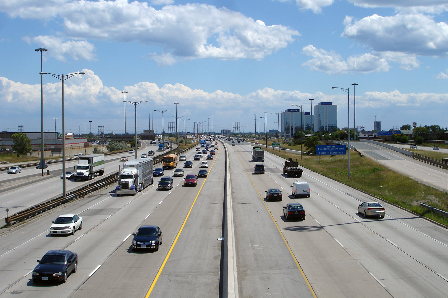
| City of Toronto | Looking north through the Evans Avenue underpass
towards the substantial QEW/427 interchange. Photo taken: July 12th, 2007. |
 (720x480) (1440x960) |
|||||||||||||||||||||||||||||||||||
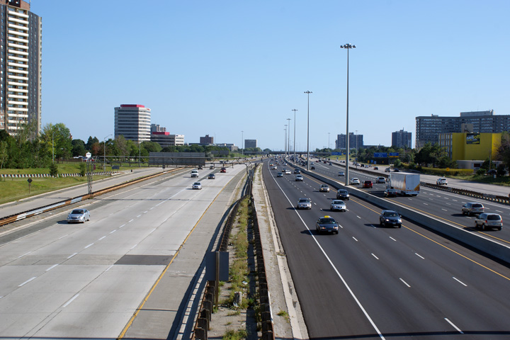
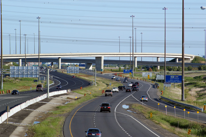
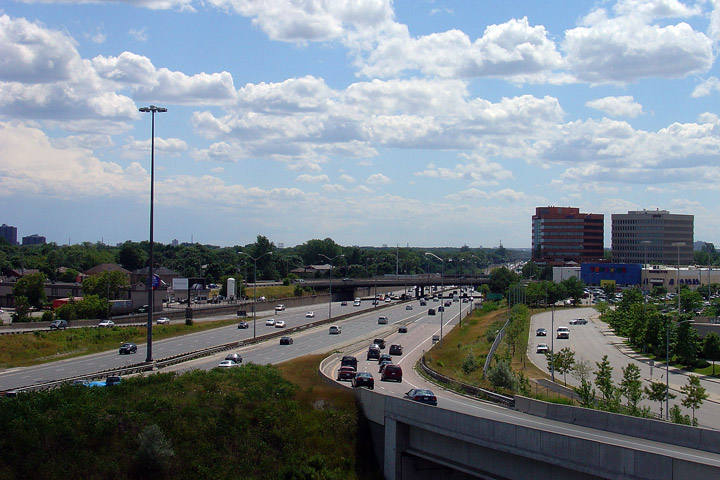
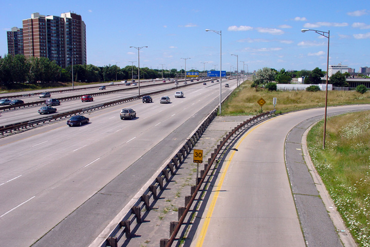
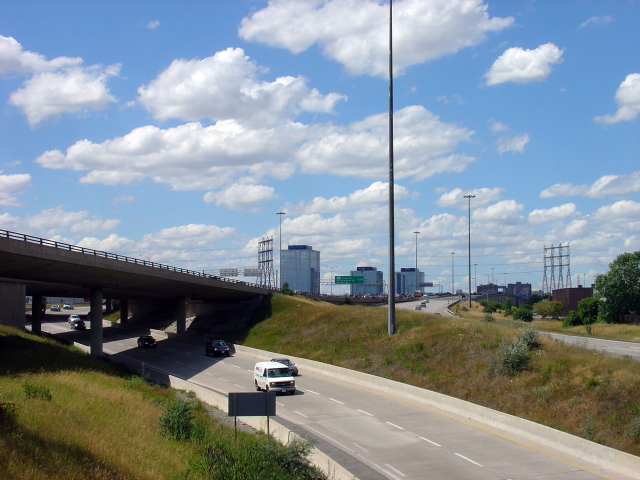
| City of Toronto | Highway 427 looking south from the Evans Avenue
Overpass. The freeway segment of Highway 427 ends just south of Evans
Avenue (as shown in the picture), though the '0-marker' for Highway 427 is
actually located a few hundred metres southerly at Coules Court. Photo taken: July 12th, 2007. |
 (720x480) (1440x960) |
|||||||||||||||||||||||||||||||||||
| Highway 427 meets the QEW near the highways southern terminus. Click here for Queen Elizabeth Way images. | |||||||||||||||||||||||||||||||||||||
|
|
|||||||||||||||||||||||||||||||||||||
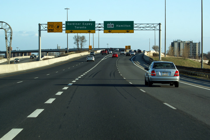
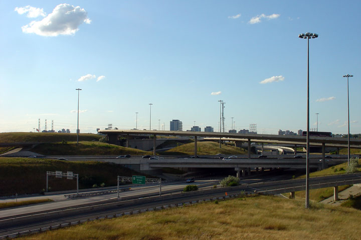
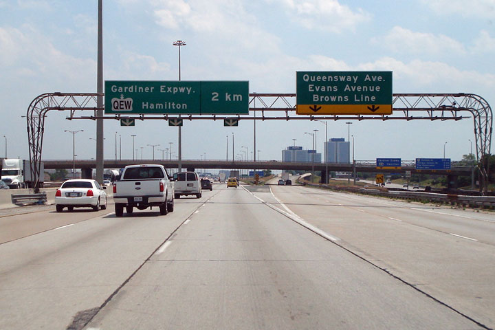
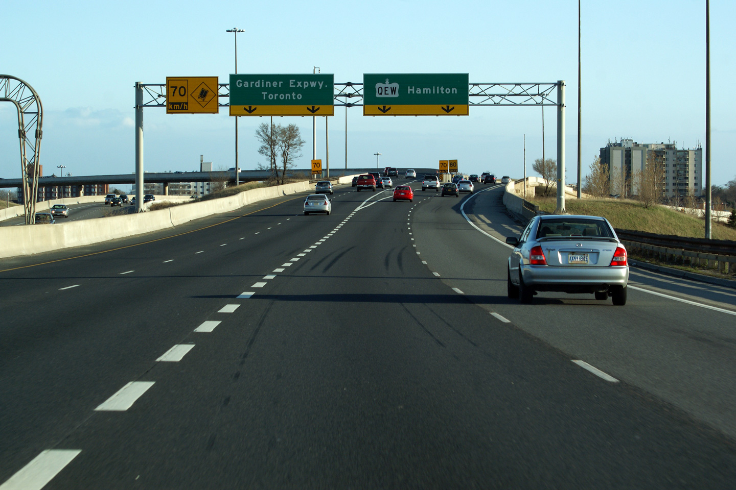
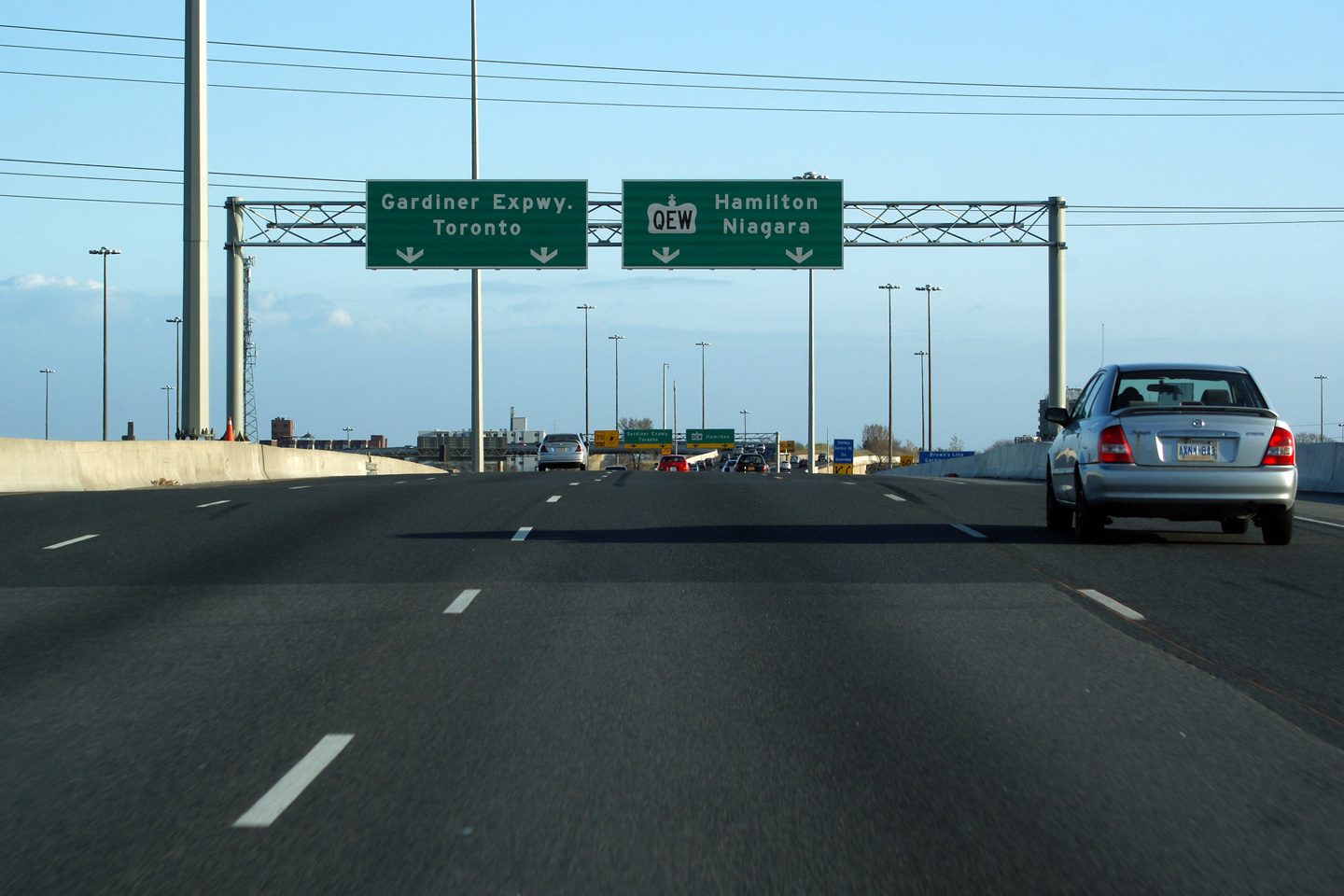
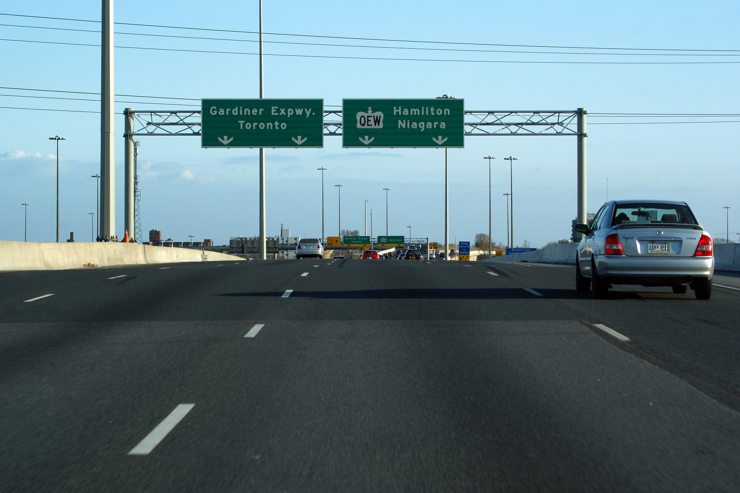
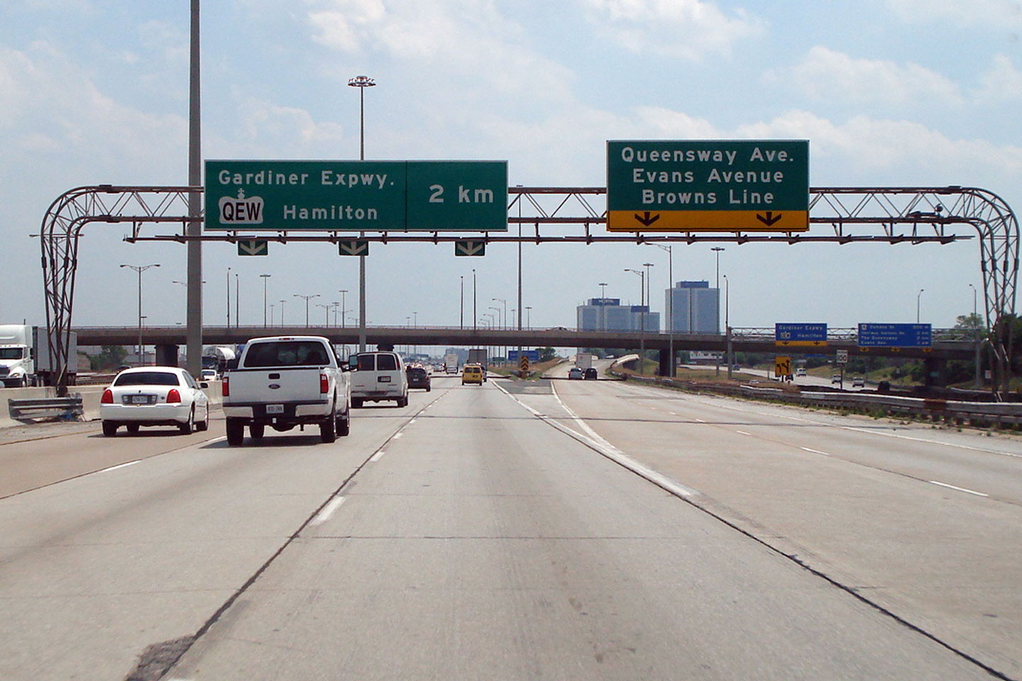
| City of Toronto |
Southbound signage at the end of Highway 427's express lanes at the
QEW and Gardiner Expressway interchange. The
collector lanes of the freeway continue southerly underneath of the large
freeway to freeway interchange providing access to Browns Line and Evans Avenue. Photo taken: March 25th, 2012. |
 (720x480) (720x480)(1440x960) (2400x1600) |
|||||||||||||||||||||||||||||||||||
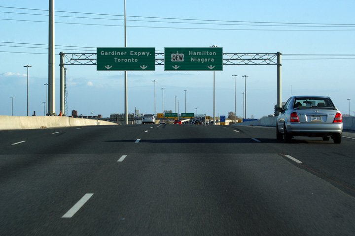
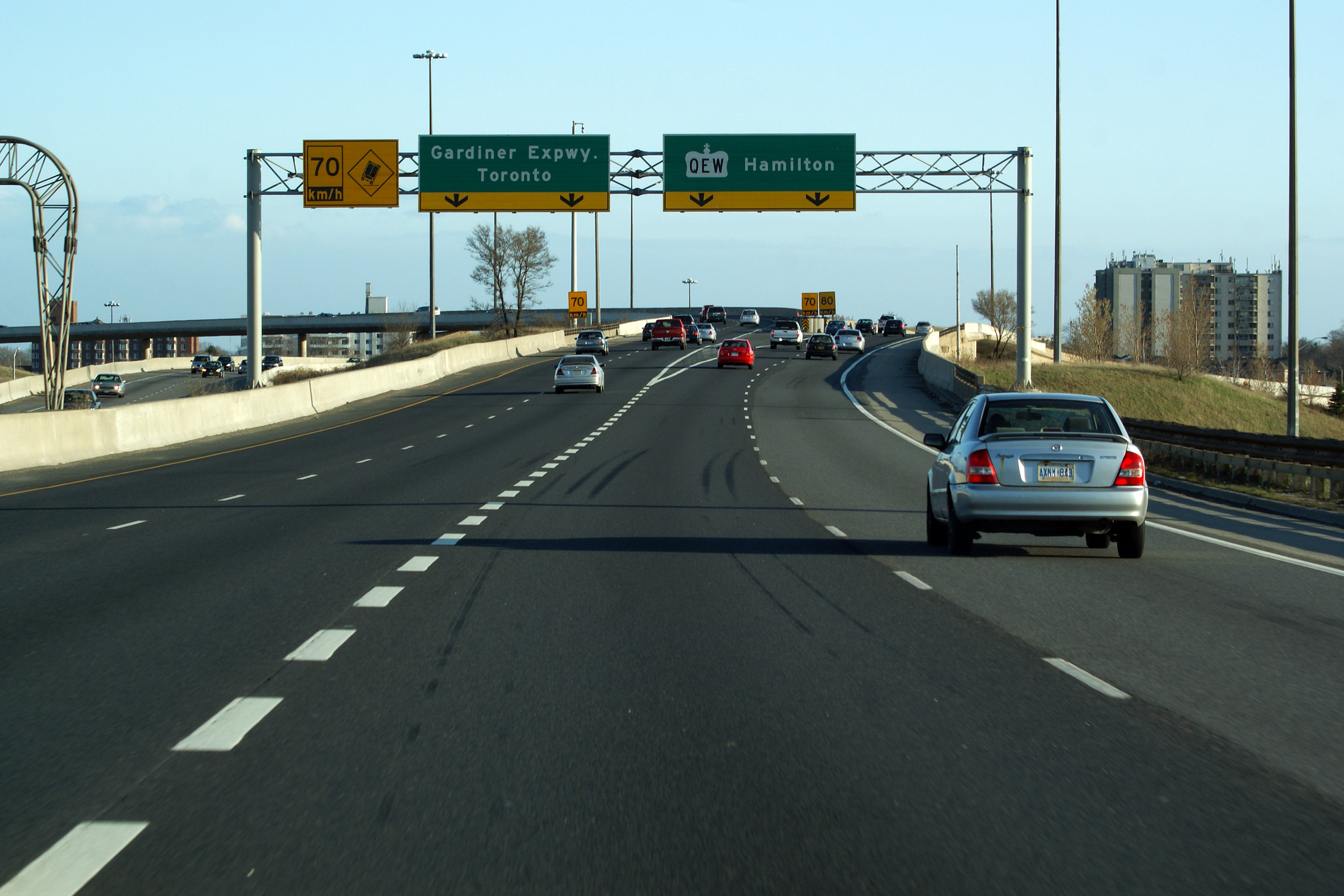
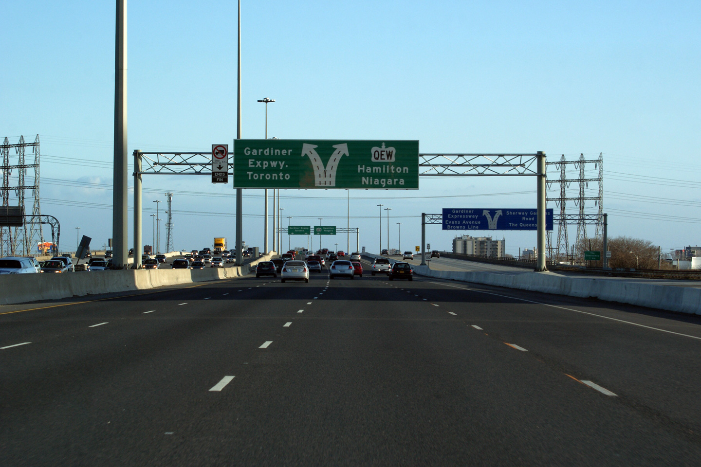
| City of Toronto |
Advanced lane assignment signage that outlines how the express lanes divide
into ramps bound for the QEW and Gardiner Expressway. Photo taken: March 25th, 2012. |
 (720x480) (720x480)(1440x960) (2400x1600) |
|||||||||||||||||||||||||||||||||||
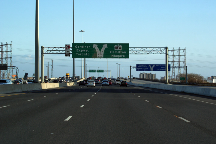
| City of Toronto |
Diagram sign denoting how the southbound express lanes dissolve into ramps
to the QEW and Gardiner Expressway. Photo taken: March 25th, 2012. |
 (720x480) (720x480)(1440x960) (2400x1600) |
|||||||||||||||||||||||||||||||||||
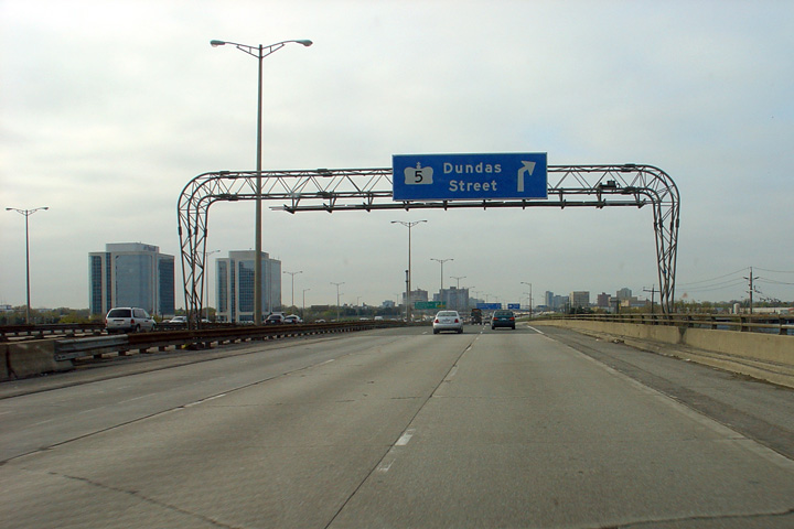
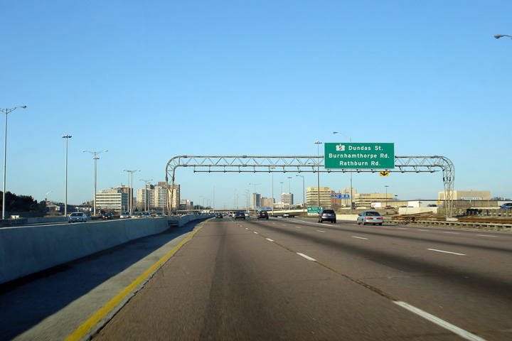
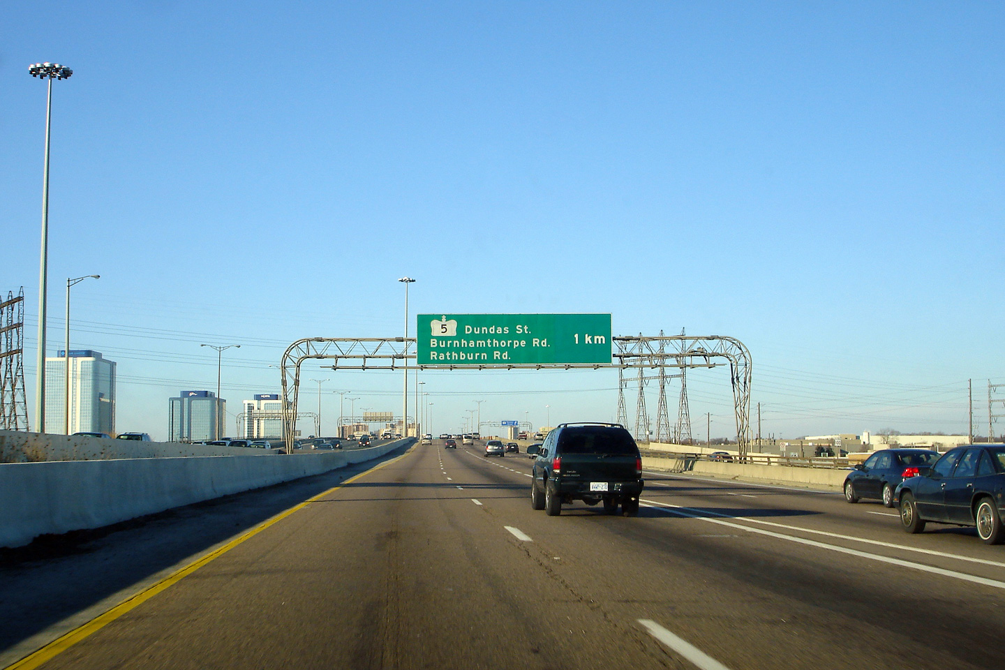
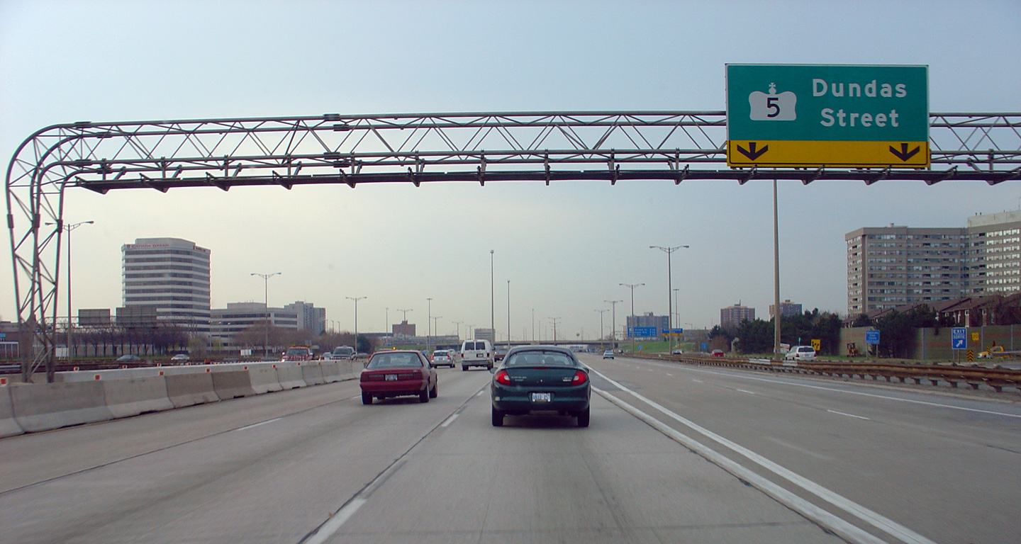
| City of Toronto |
Advanced signage for the first core to collector transfer along the
northbound lanes of Highway 427. The reference to Dundas Street as
Highway 5 has been removed from this sigh and all those that succeed it. Photo taken: December 24th, 2006. |
|
|||||||||||||||||||||||||||||||||||
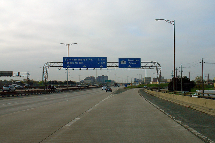
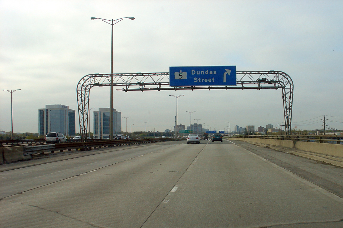
| City of Toronto |
Two views northbound, one from the express the other from the collectors,
respectively approaching the Dundas Street transfer and the collector lane exit to
Dundas Street. Upper photo taken: December 24th, 2006. Lower photo taken: May 9th, 2004. |
|
|||||||||||||||||||||||||||||||||||
| City of Toronto |
The upper photo showcases the first northbound transfer from the express to
the collector lanes at Dundas Street, while the second photo highlights the
exit to Dundas Street from the northbound collector lanes. Upper photo taken: December 24th, 2006. Lower photo taken: May 9th, 2004. |
|
|||||||||||||||||||||||||||||||||||
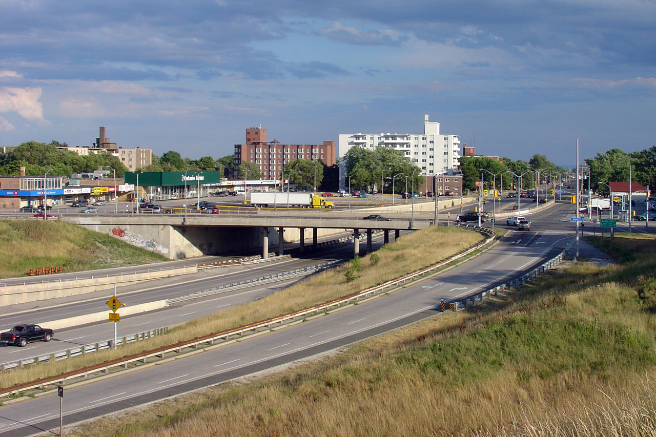
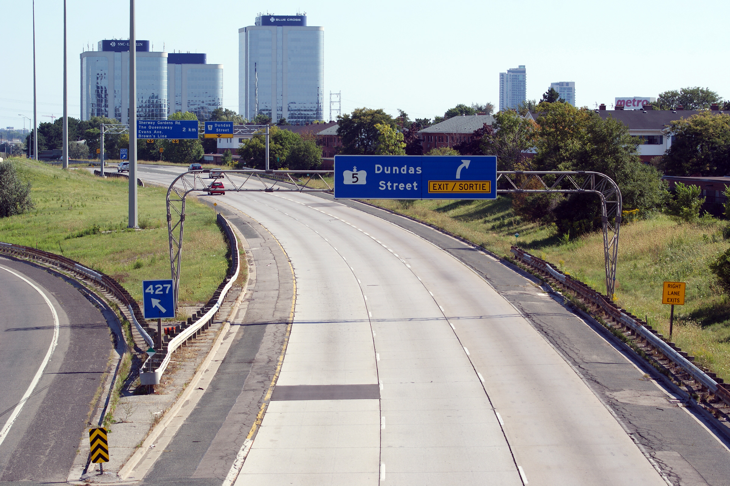
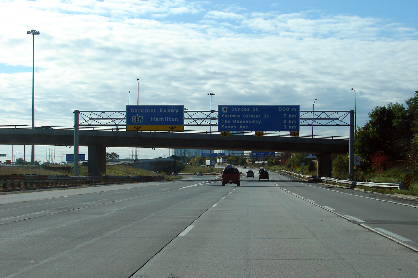
| City of Toronto | Southbound signage at the exit to Dundas Street.
The old rounded truss gantry that formerly existed here was removed several years in advance of the
reconstruction of the southbound collector lanes of Highway 427 that was
taking place in 2011-2013. Photographer: Josh Anderchek. Taken: October 10th, 2009. |
|
|||||||||||||||||||||||||||||||||||
| City of Toronto | Southbound exit from the collector lanes to
Dundas Street. This overhead sign was replaced during the winter of 2012
with a new cantilevered gantry. In the future the ramp to Dundas
Street from Highway 427 South is to be widened to two lanes. Photo taken: August 28th, 2010. |
|
|||||||||||||||||||||||||||||||||||
| Dundas Street was formerly Highway 5 stretching from Highway 2 in Paris to Highway 2 in Scarborough. Click here for Highway 5 images. | |||||||||||||||||||||||||||||||||||||
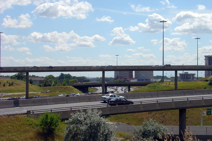
| City of Toronto | A series of views looking southerly from
the Bloor Street overpass along Highway 427. Note the basket-weave that links the core and
collector lanes. This is the southernmost transfer between the core
and collector lanes along the highway. Upper photo taken: July 12th, 2007. Lower three photos taken: August 28th, 2010. |
(720x480) (1440x960) (2400x1600) (720x480) (1440x960) (2400x1600)  (720x480) (1440x960) (2400x1600) |
|||||||||||||||||||||||||||||||||||
| City of Toronto |
Views looking northerly from the Bloor Street overpass. Upper photo taken: July 12th, 2007. Lower photos taken: August 28th, 2010. |

(720x480)
(1440x960)
(2400x1600) |
|||||||||||||||||||||||||||||||||||
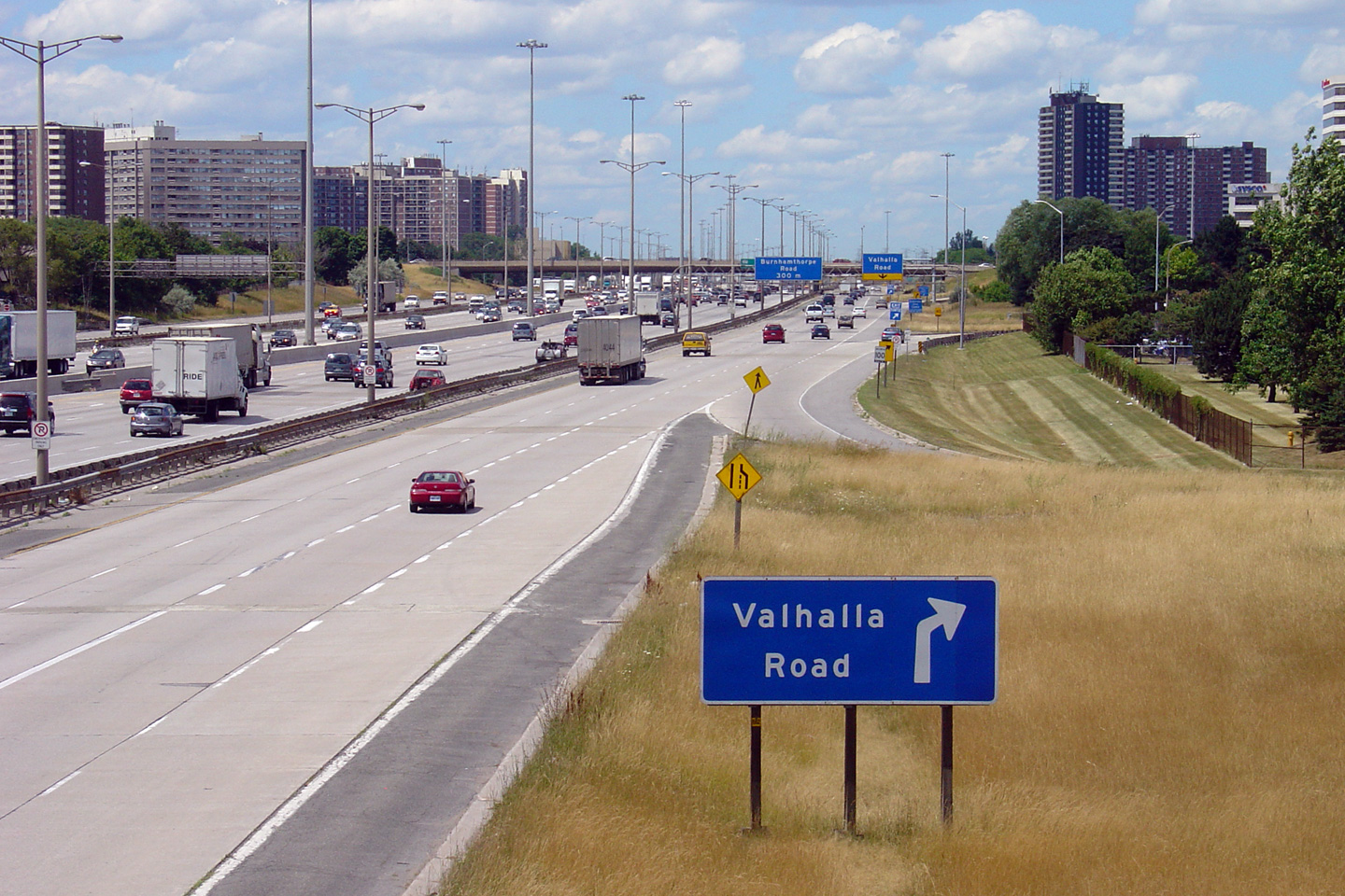
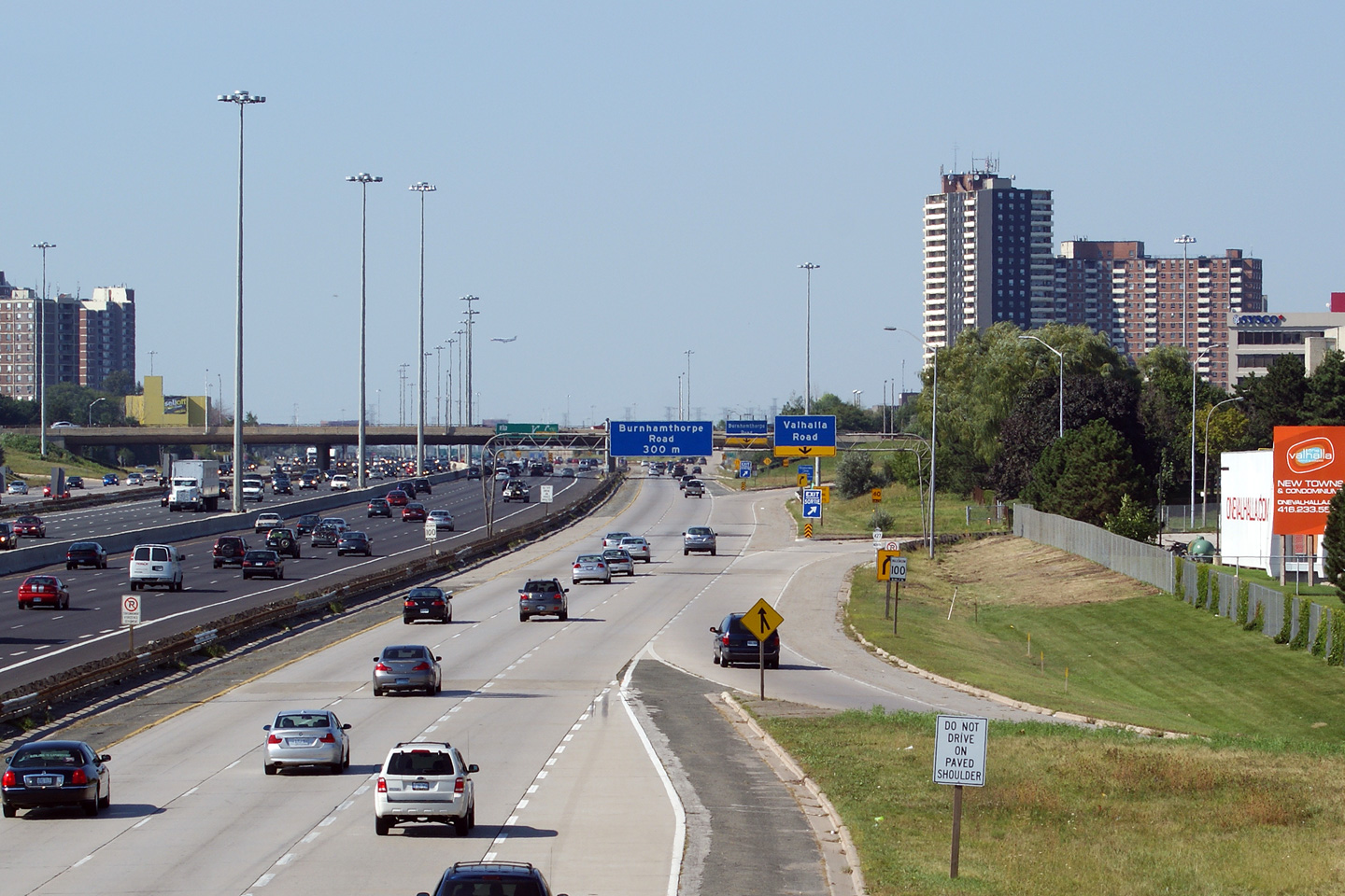
| City of Toronto |
Ground mounted northbound signage for the ramp to Valhalla Road.
Unique to the 427 compared to other GTA freeways is the connectivity between
the collector lanes of the freeway and the local roadway network. All
other 400-series freeways in the GTA have very well defined access and
egress points to and from the freeway at major arterial roads only. Photo taken: July 12th, 2007. |
|
|||||||||||||||||||||||||||||||||||
| City of Toronto |
Two views northerly as the ramp to Valhalla Road departs the northbound
collector lanes of the 427. The on-ramp from Gibbs Road enters the collector lanes only to very
abruptly slingshot back off the highway for Valhalla Road. Upper photo taken: August 28th, 2010. Lower photo taken: July 12th, 2007. |
|
|||||||||||||||||||||||||||||||||||
| City of Toronto |
Two signs from both the express and collector lanes at the final southbound
transfer point between the two sets of southbound carriageways. Beyond
this transfer, the southbound express lanes access the QEW and Gardiner
Expressway via a pair of high-speed directional ramps, while the collector
lanes continue to serve the local arterial network of southwest Etobicoke. Upper photo photographed by: Dan Garnell. Taken: June 2007. Lower photo photographed by: Josh Anderchek. Taken: October 10th, 2009. |
|
|||||||||||||||||||||||||||||||||||
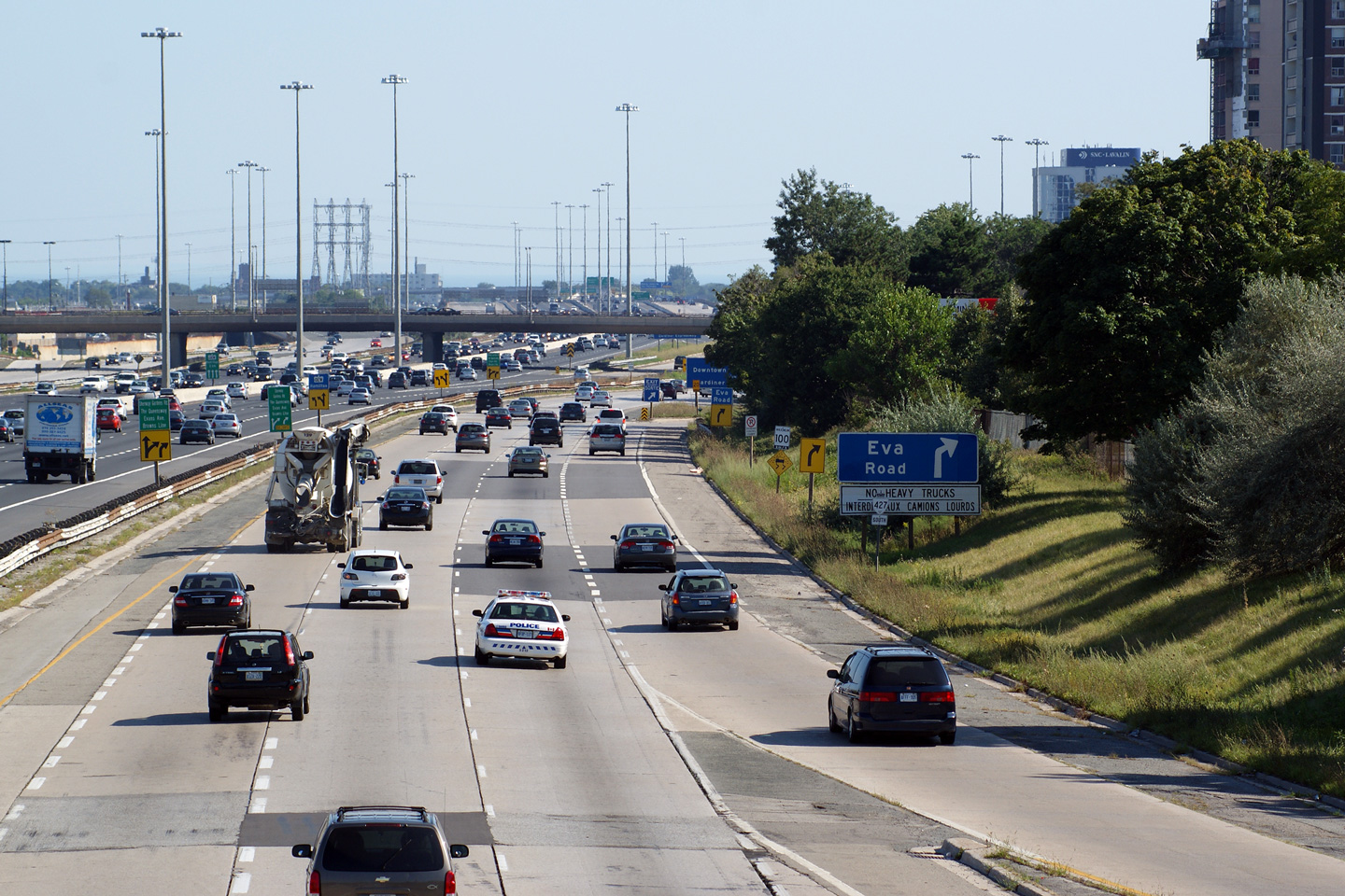
| City of Toronto |
Southerly view in the collector lanes towards the southbound off-ramp to Eva
Road. When this photo was taken a number of older rounded truss gantries
had been removed due to structural reasons -- hence the lack of an overhead
sign at the actual exit to Eva Road. Photo taken: August 28th, 2010. |
|
|||||||||||||||||||||||||||||||||||
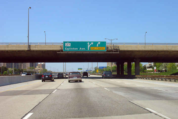
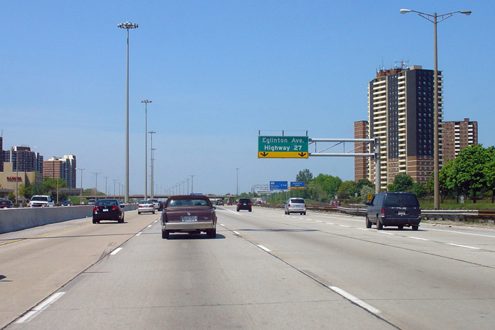
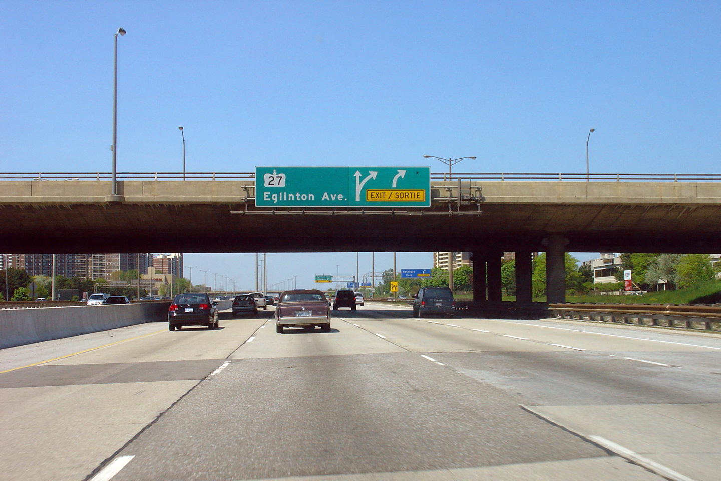
| City of Toronto |
Northbound advanced signage for the transfer to Highway 27 and Eglinton
Avenue. This is the final northbound transfer to the collector lanes
before they become Highway 27. Photo taken: May 27th, 2006. |
|
|||||||||||||||||||||||||||||||||||
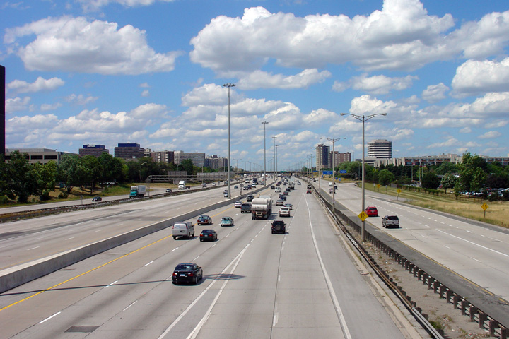
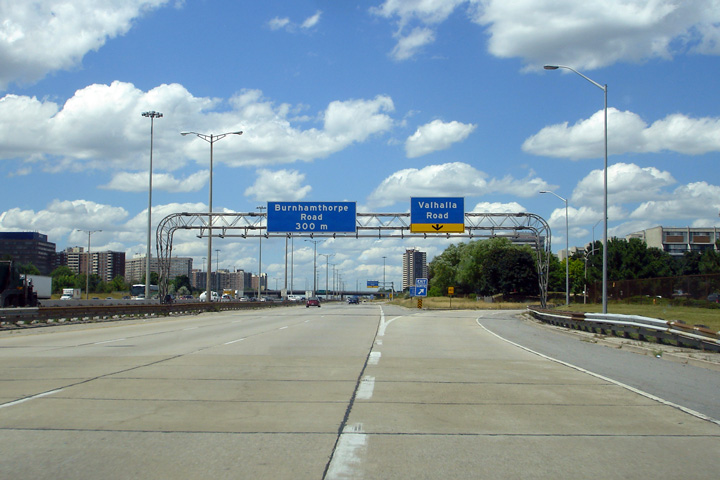
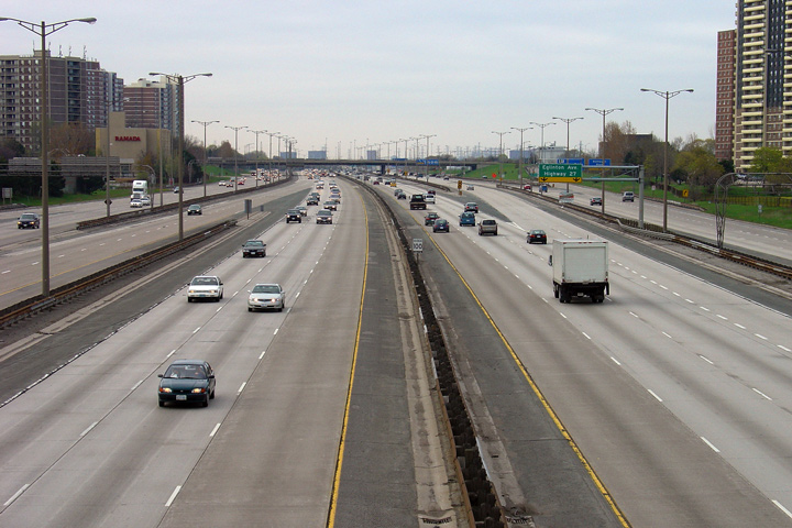
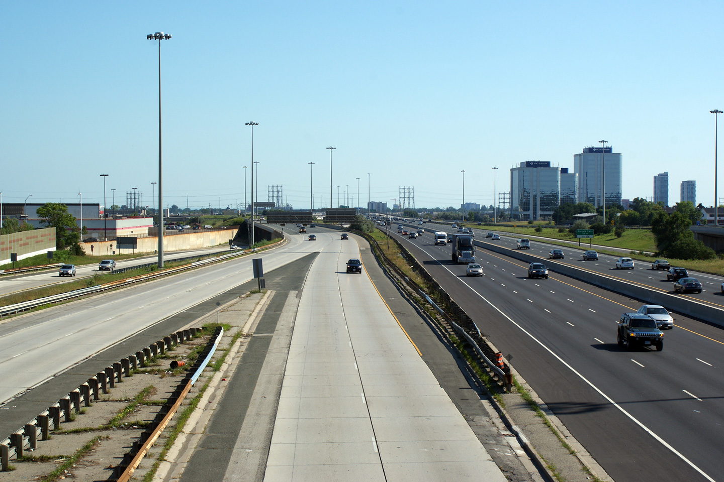
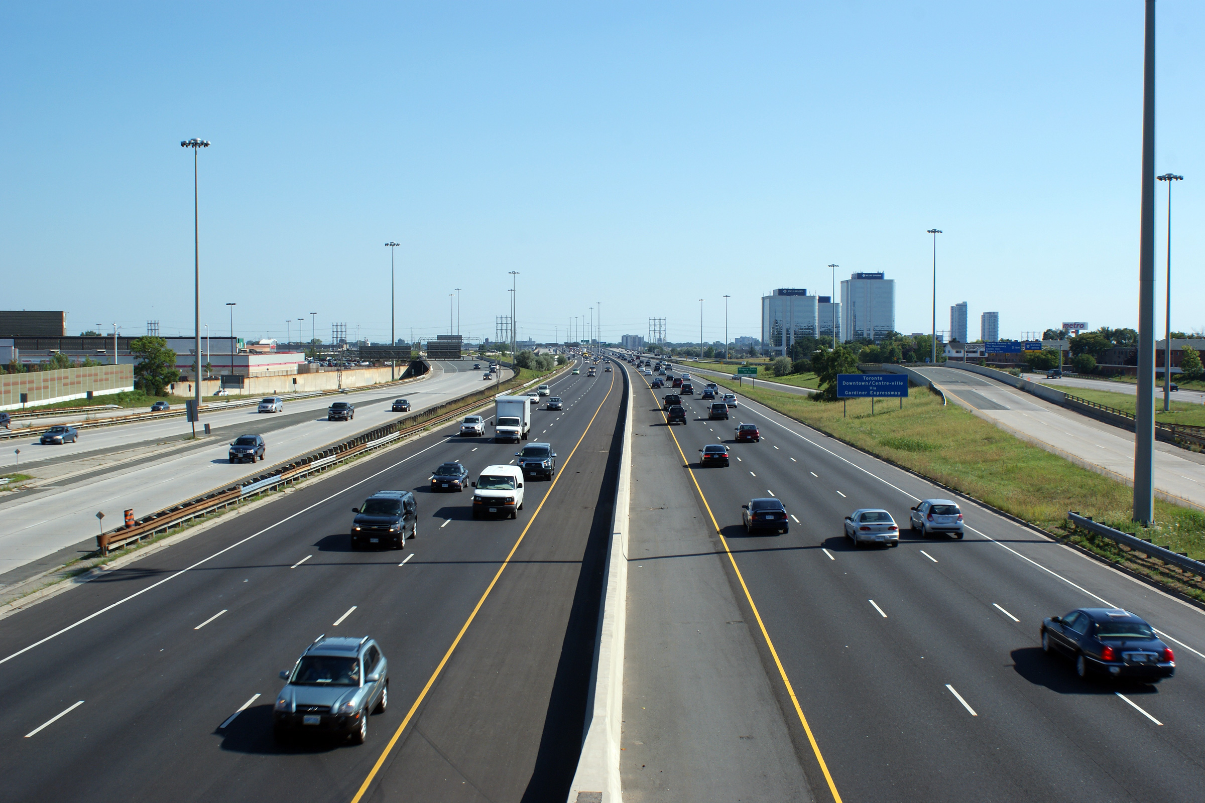
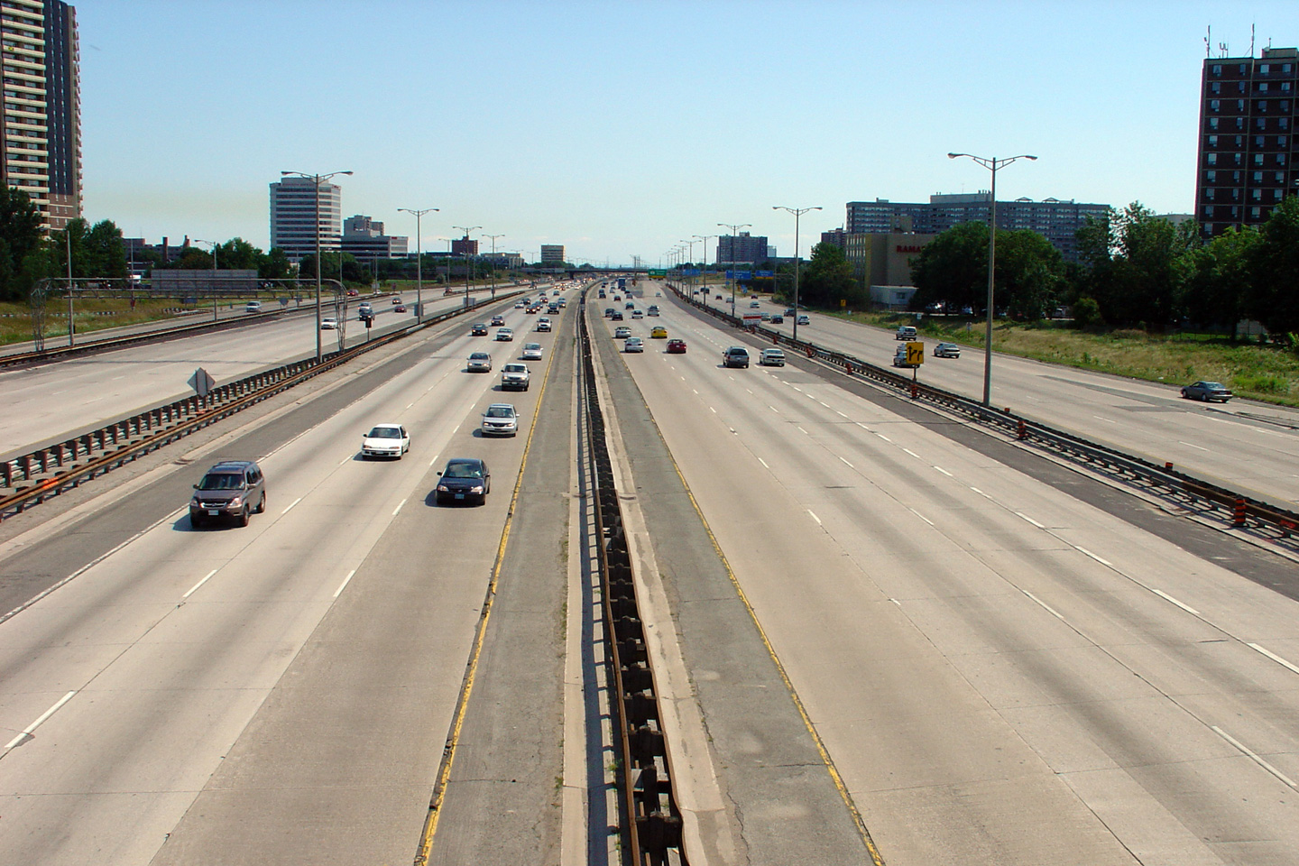
| City of Toronto |
Two views southbound from the Burnhamthorpe Road overpass along Highway 427.
The upper photo shows a nearly unaltered view of what the highway looked
like from the time of its initial conversion from a simple four lane freeway
to a complex twelve lane superhighway in the late 1960s. Starting in
2004, a series of
rehabilitation contracts have seen the highway begin to be upgraded and
modernized. The lower photo
shows the highway after both the northbound and southbound express lanes had
been rehabilitated. Upper photo taken: May 9th, 2004. Lower photo taken: August 28th, 2010. |
 |
|||||||||||||||||||||||||||||||||||
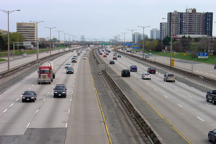
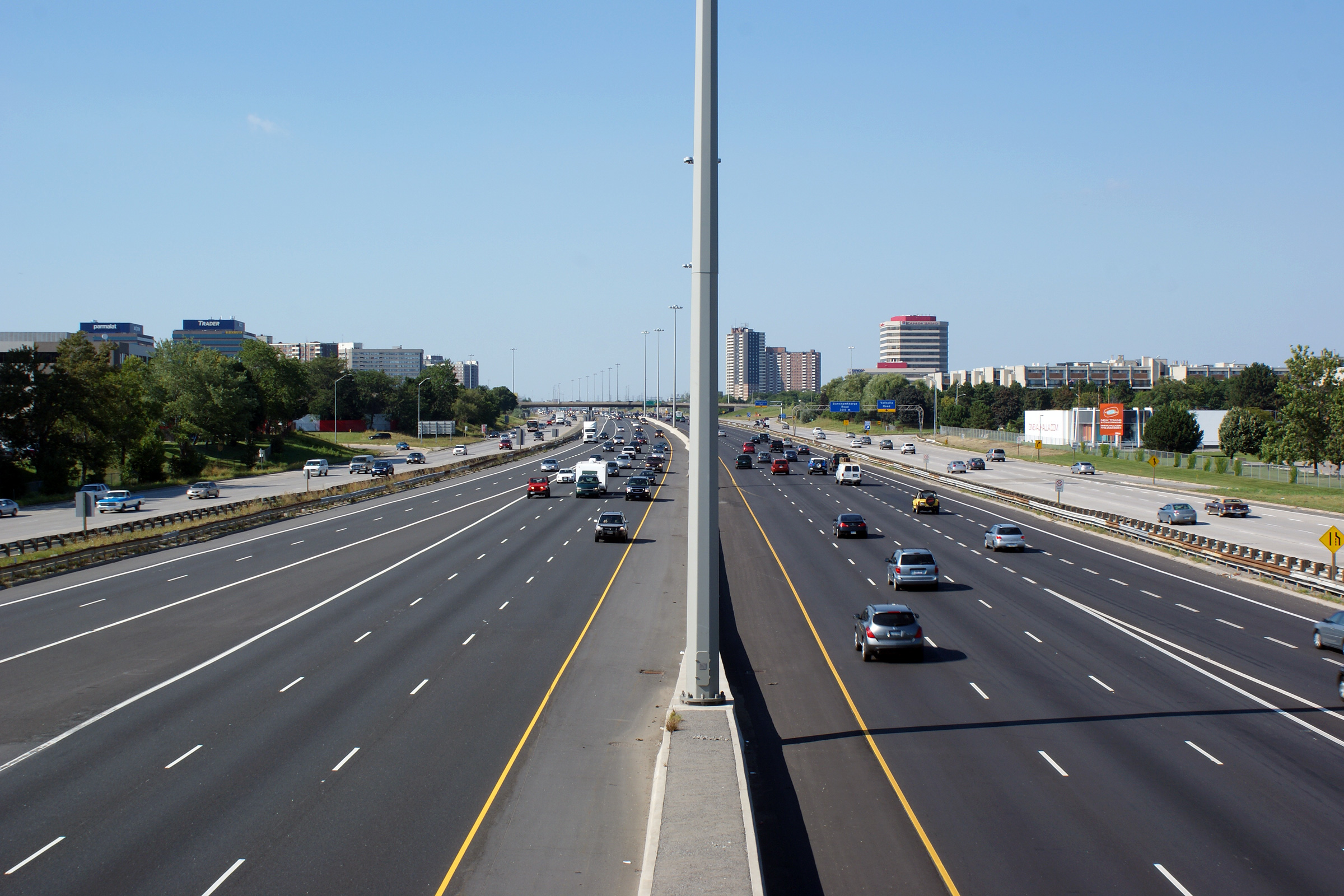
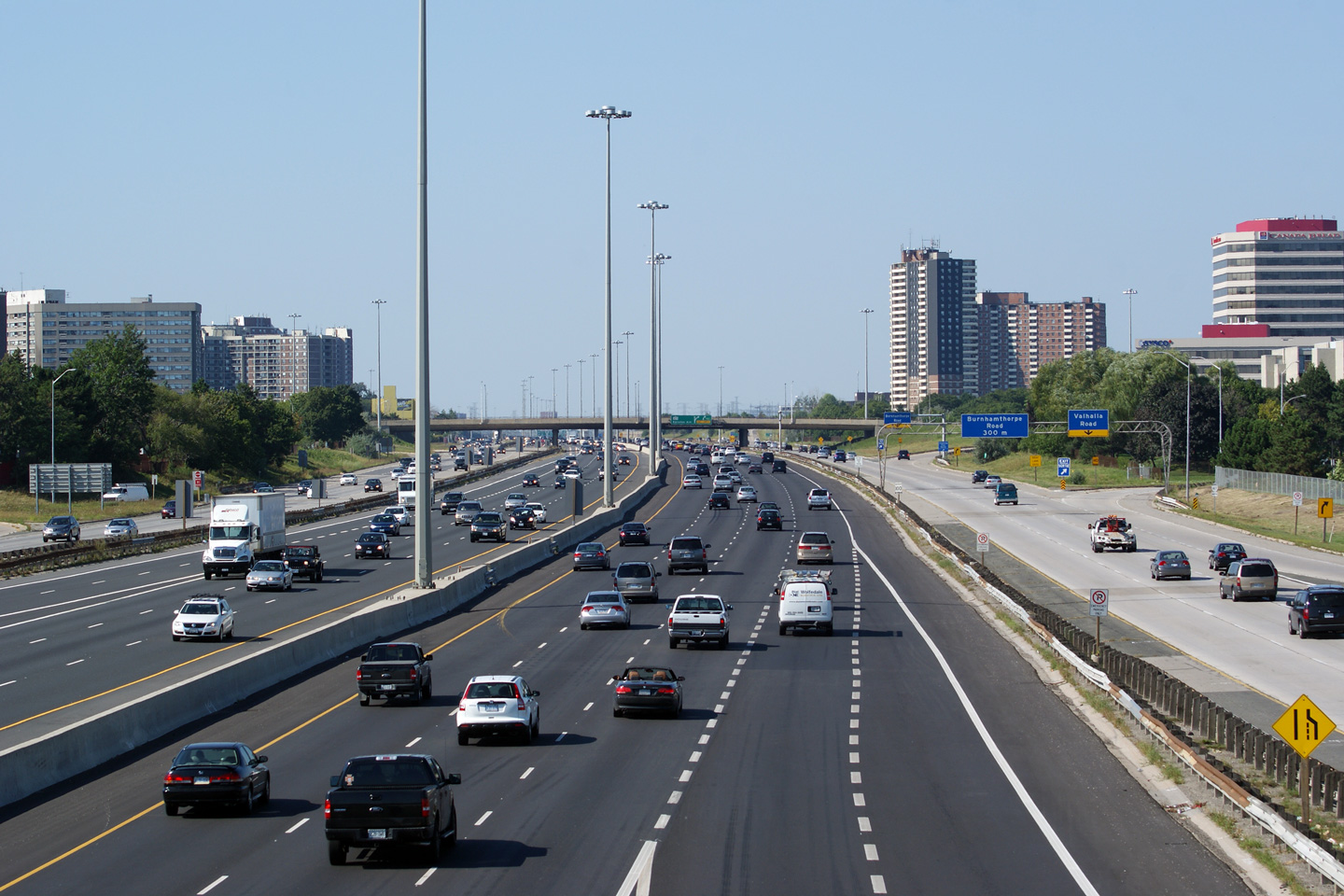
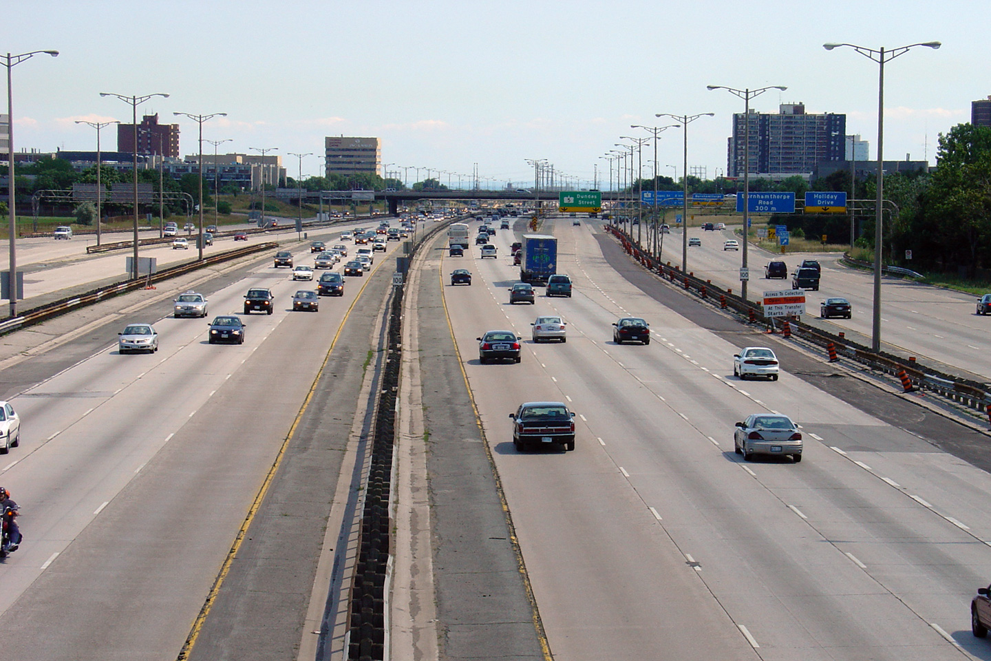
| City of Toronto |
Two views looking northerly from the Burhamthorpe Road overpass.
Interestingly, the design of express/collector lanes system along Highway
427 is not symmetrical. There is one fewer collector to core transfers
for the southbound lanes than there are for the northbound lanes. Upper photo taken: May 9th, 2004. Lower photo taken: August 28th, 2010. |
 |
|||||||||||||||||||||||||||||||||||
| City of Toronto |
Northbound view at the final transfer to the collector lanes just north of
the Burnhamthorpe Road overpass. Photo taken: May 27th, 2006. |
|
|||||||||||||||||||||||||||||||||||
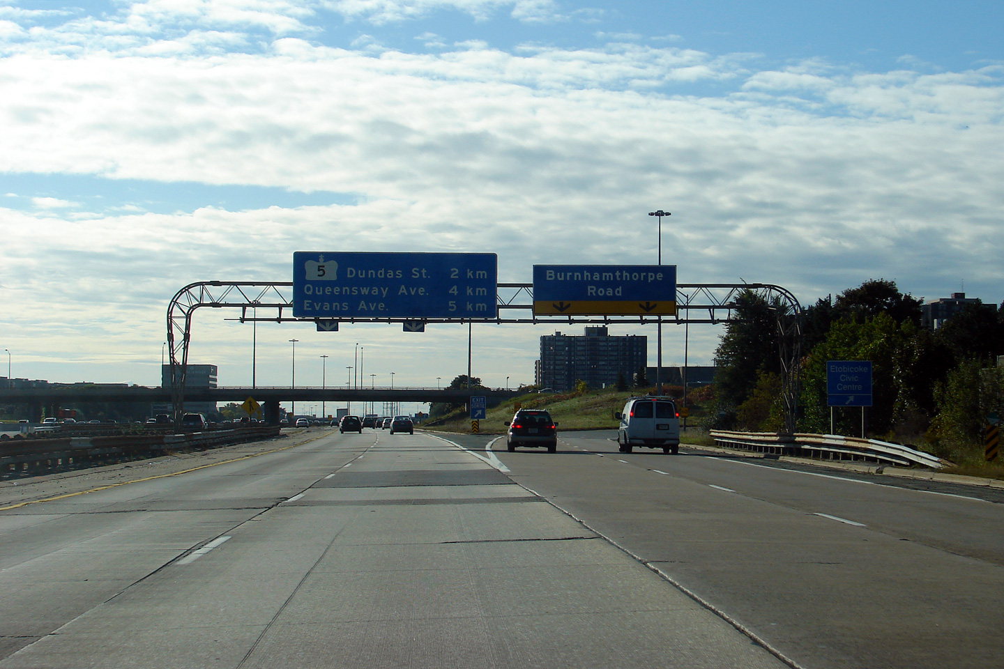
| City of Toronto |
Older signage at the southbound off-ramp to Burnhamthorpe Road from the
collector lanes. Photographer: Josh Anderchek. Taken: October 10th, 2009. |
|
|||||||||||||||||||||||||||||||||||
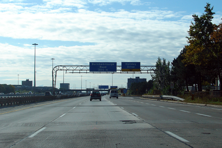
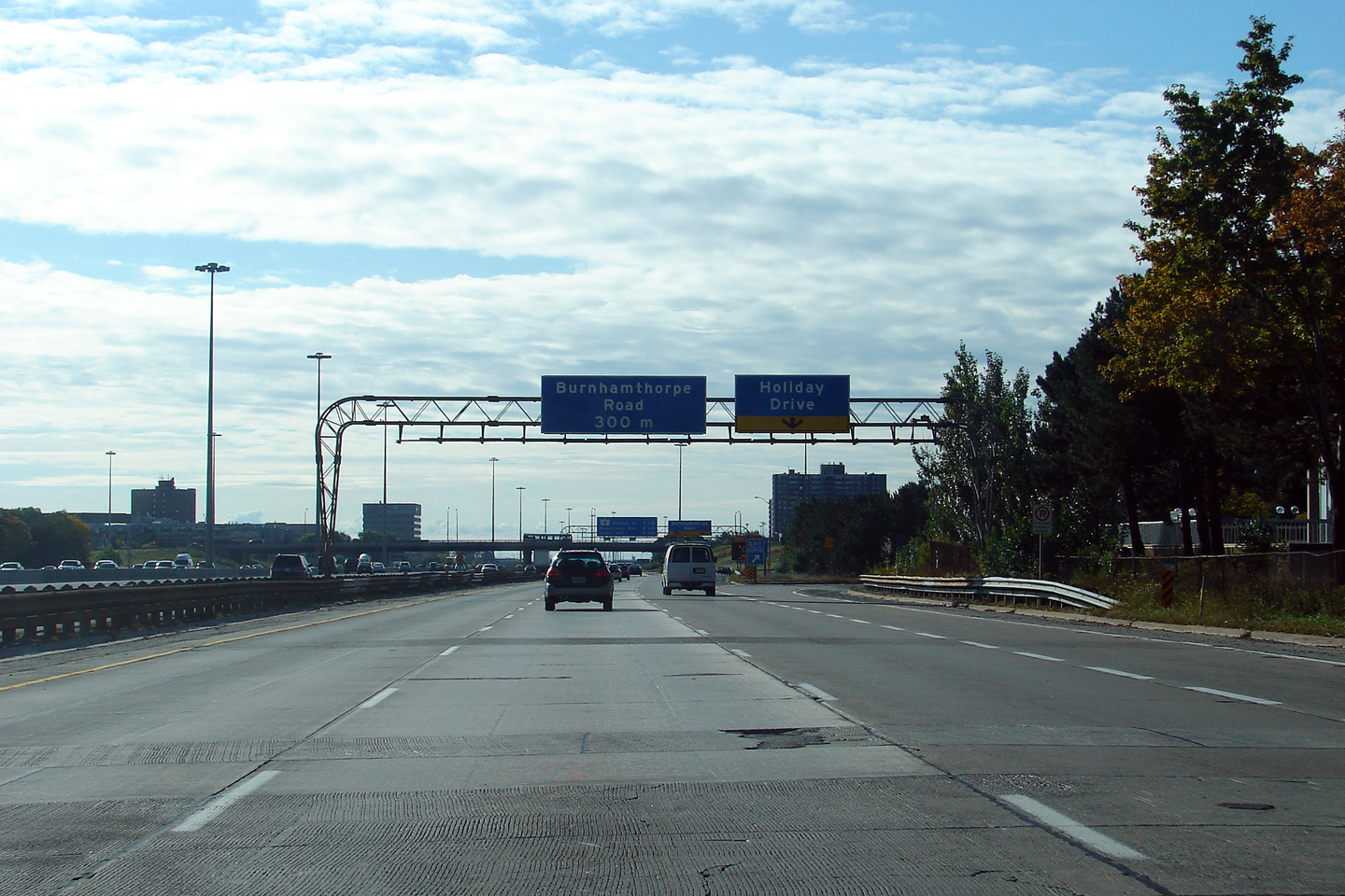
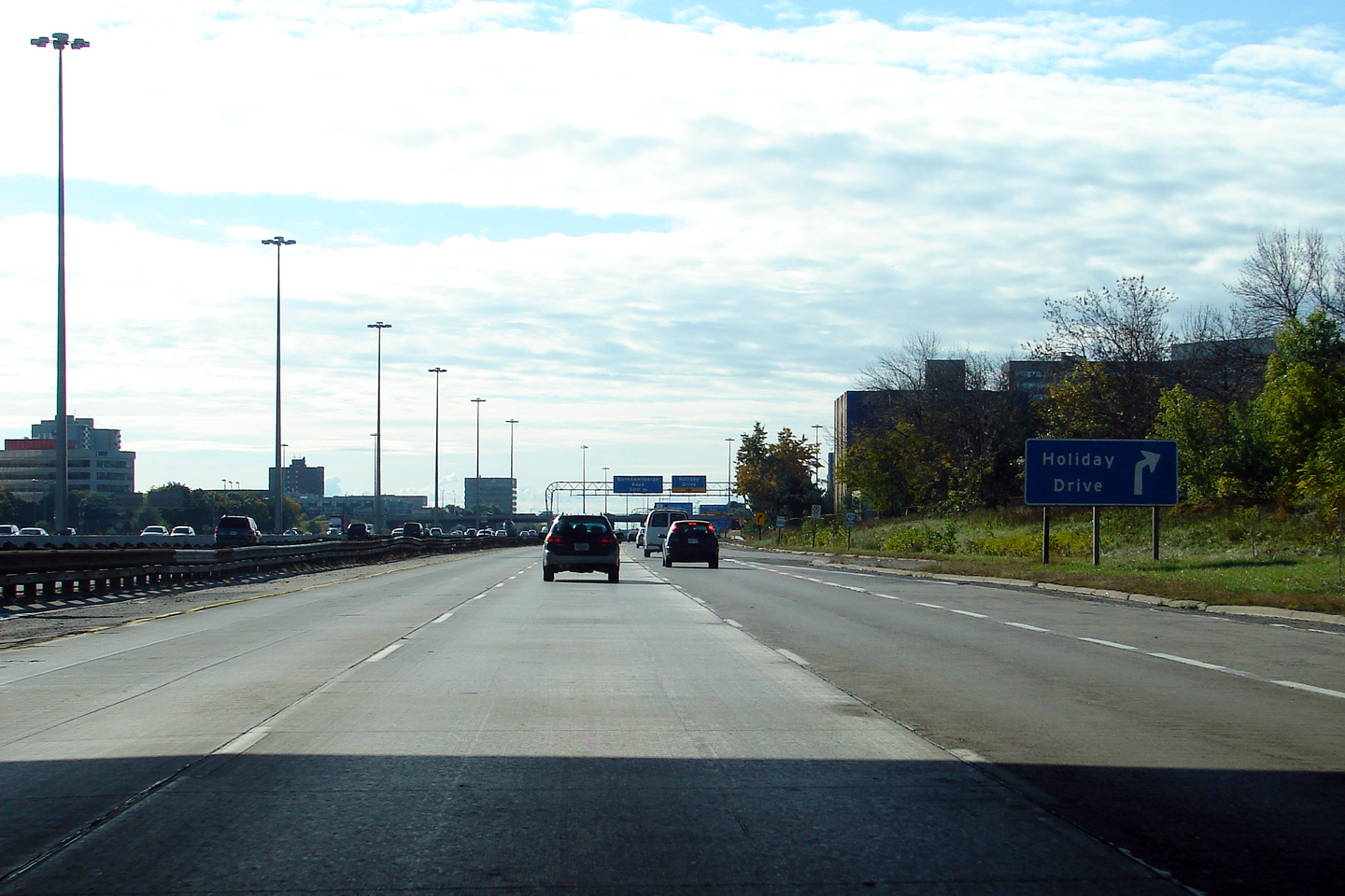
| City of Toronto |
Overhead signage for the collector lane exit to Holiday Drive. Note
the replaced concrete slabs of the collector lanes. Considerable
repair work was needed on an ongoing basis to maintain smoothly flowing
traffic along the concrete sections of Highway 427. Photographer: Josh Anderchek. Taken: October 10th, 2009. |
|
|||||||||||||||||||||||||||||||||||
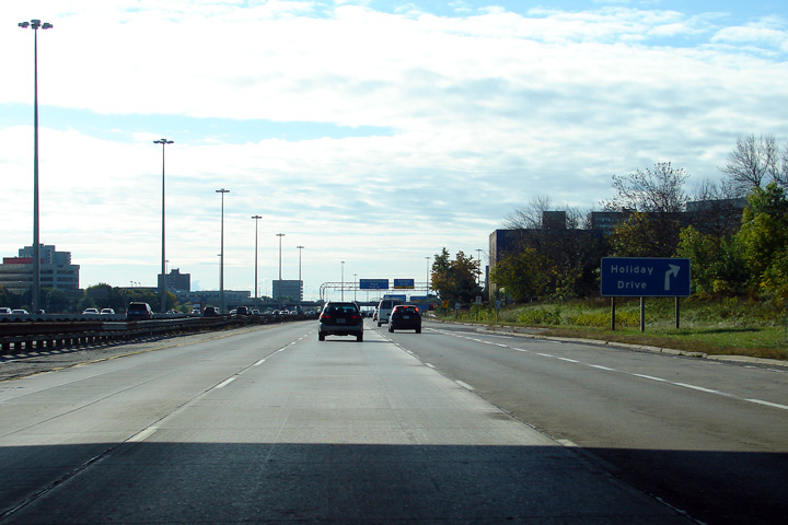
| City of Toronto |
Ground mounted advanced signage for the ramp to Holiday Drive. Holiday
Drive is a short collector road that links this ramp from the southbound 427
collector lanes to The West Mall, Highway 427's western service road. Photographer: Josh Anderchek. Taken: October 10th, 2009. |
|
|||||||||||||||||||||||||||||||||||
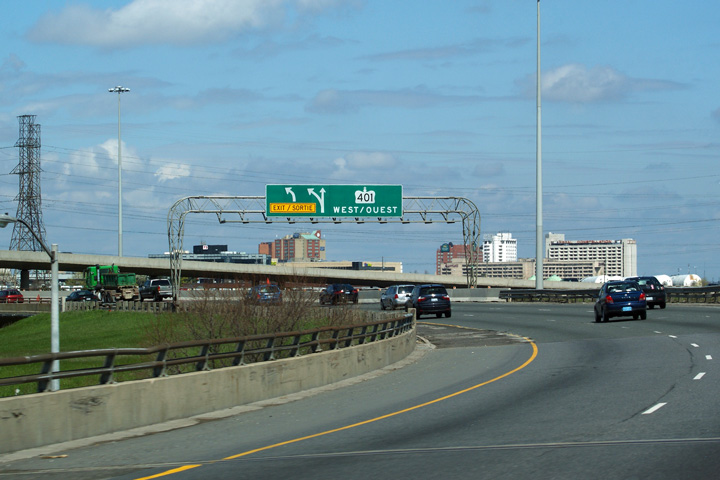
| City of Toronto |
Former overhead signage for the southbound transfer from the express lanes
to the collector lanes in advance of the Dundas Street interchange. Photo taken: May 5th, 2005. |
|
|||||||||||||||||||||||||||||||||||
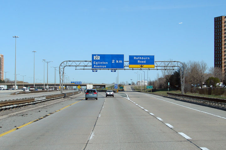
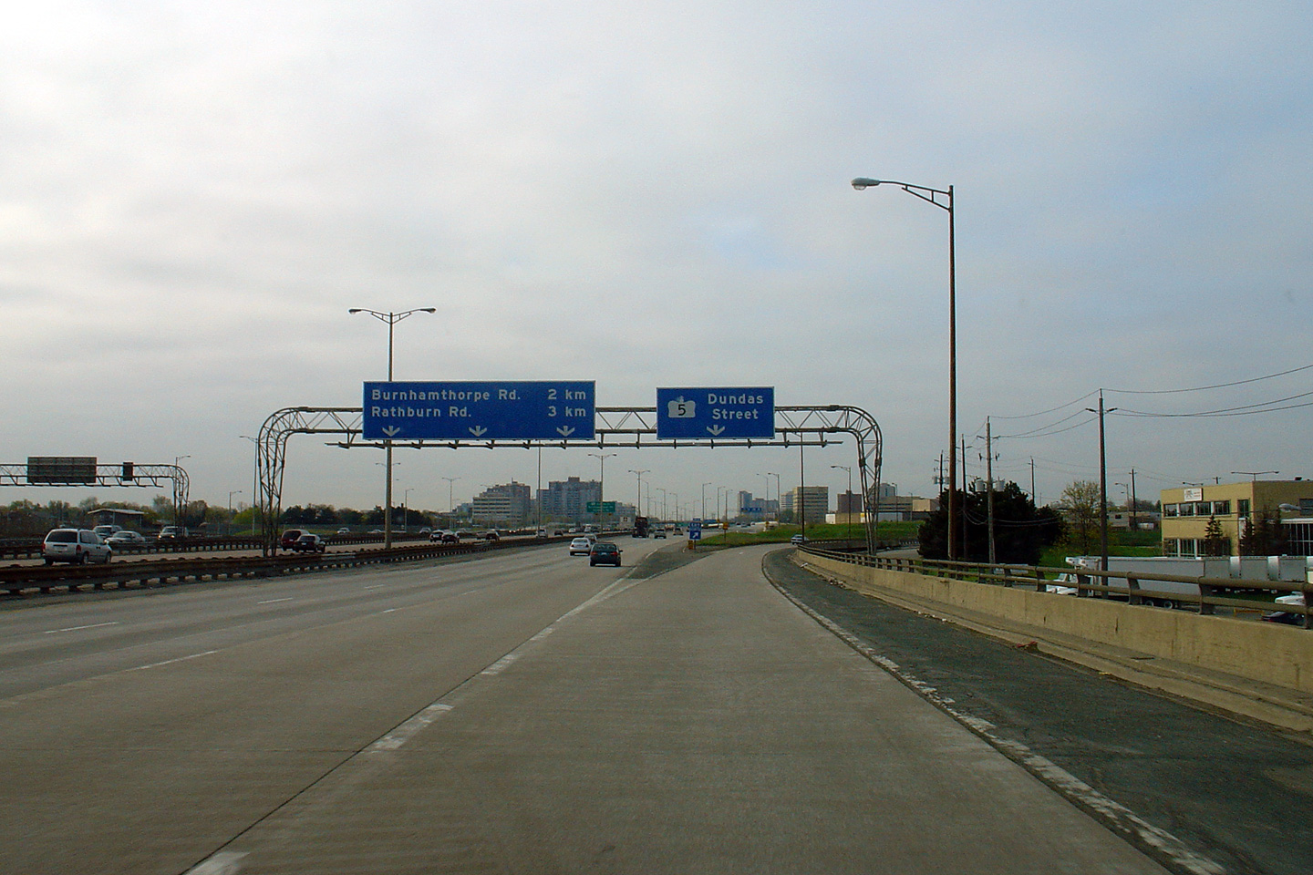
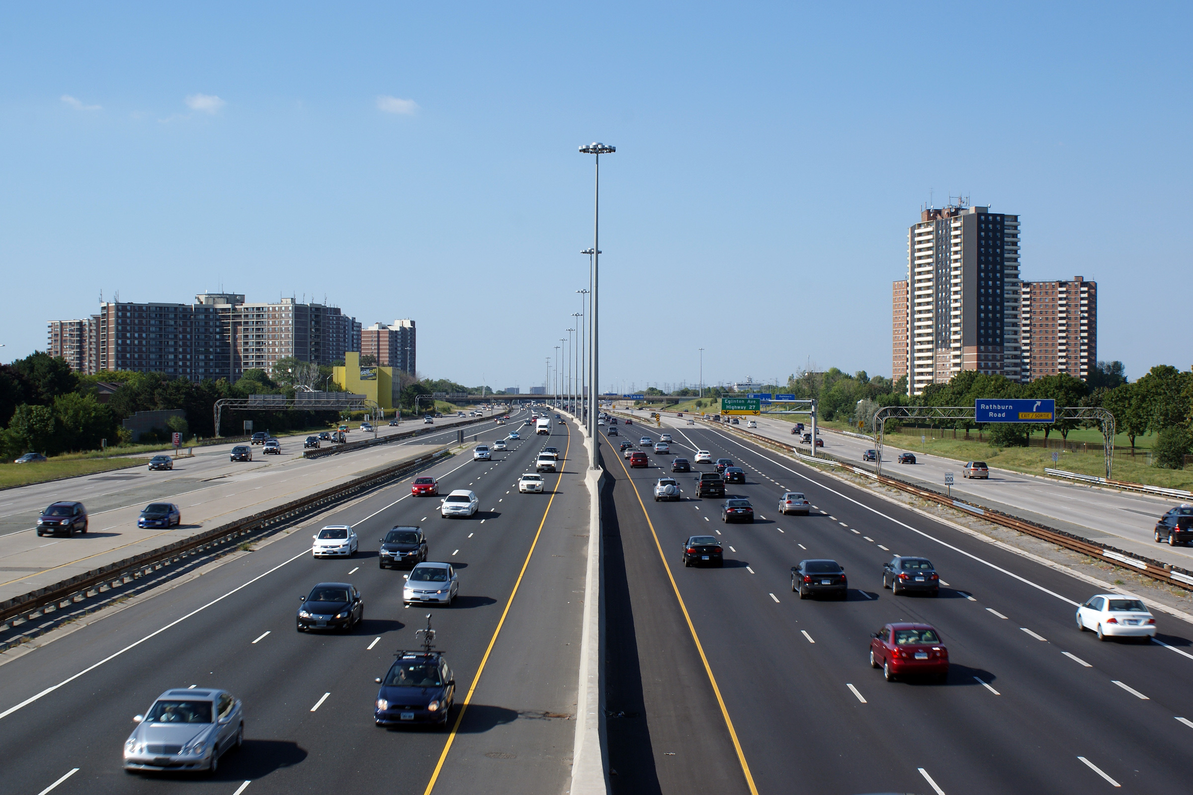
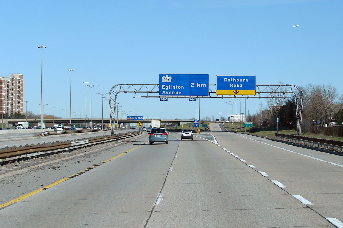
| City of Toronto |
Overhead signage in advance of the northbound
ramp to Rathburn Road. Photographer: Josh Anderchek. Taken: April 2008. |
|
|||||||||||||||||||||||||||||||||||
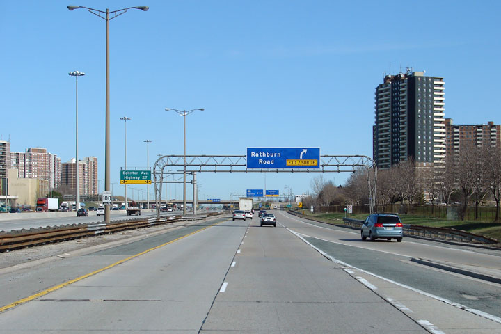
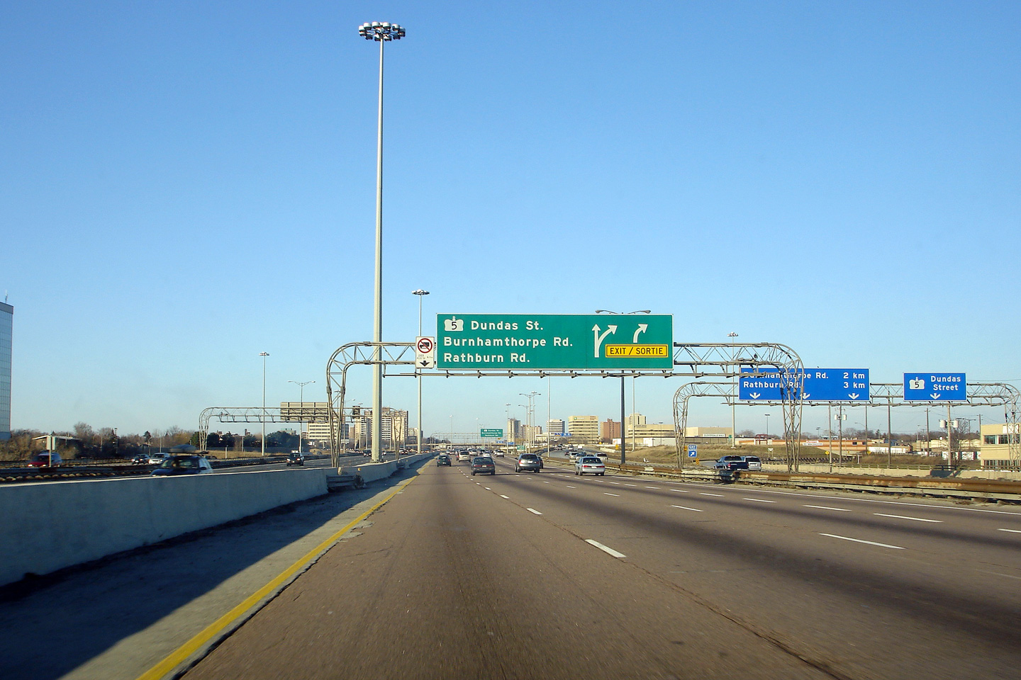
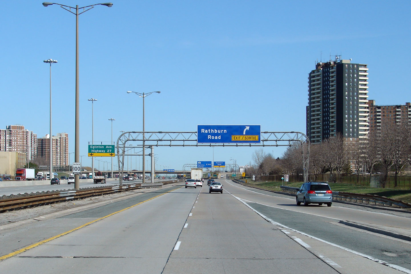
| City of Toronto |
Signage for the Rathburn Road exit from the
northbound collector lanes of Highway 427. The Rathburn Road
interchange is of a somewhat unique half-cloverleaf design. Photographer: Josh Anderchek. Taken: April 2008. |
|
|||||||||||||||||||||||||||||||||||
| City of Toronto |
Overhead signage just before Rathburn Road in advance of the final
northbound transfer to the express lanes. Photo taken: August 12th, 2006. |
|
|||||||||||||||||||||||||||||||||||
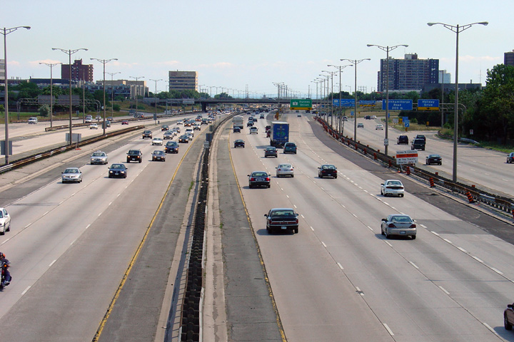
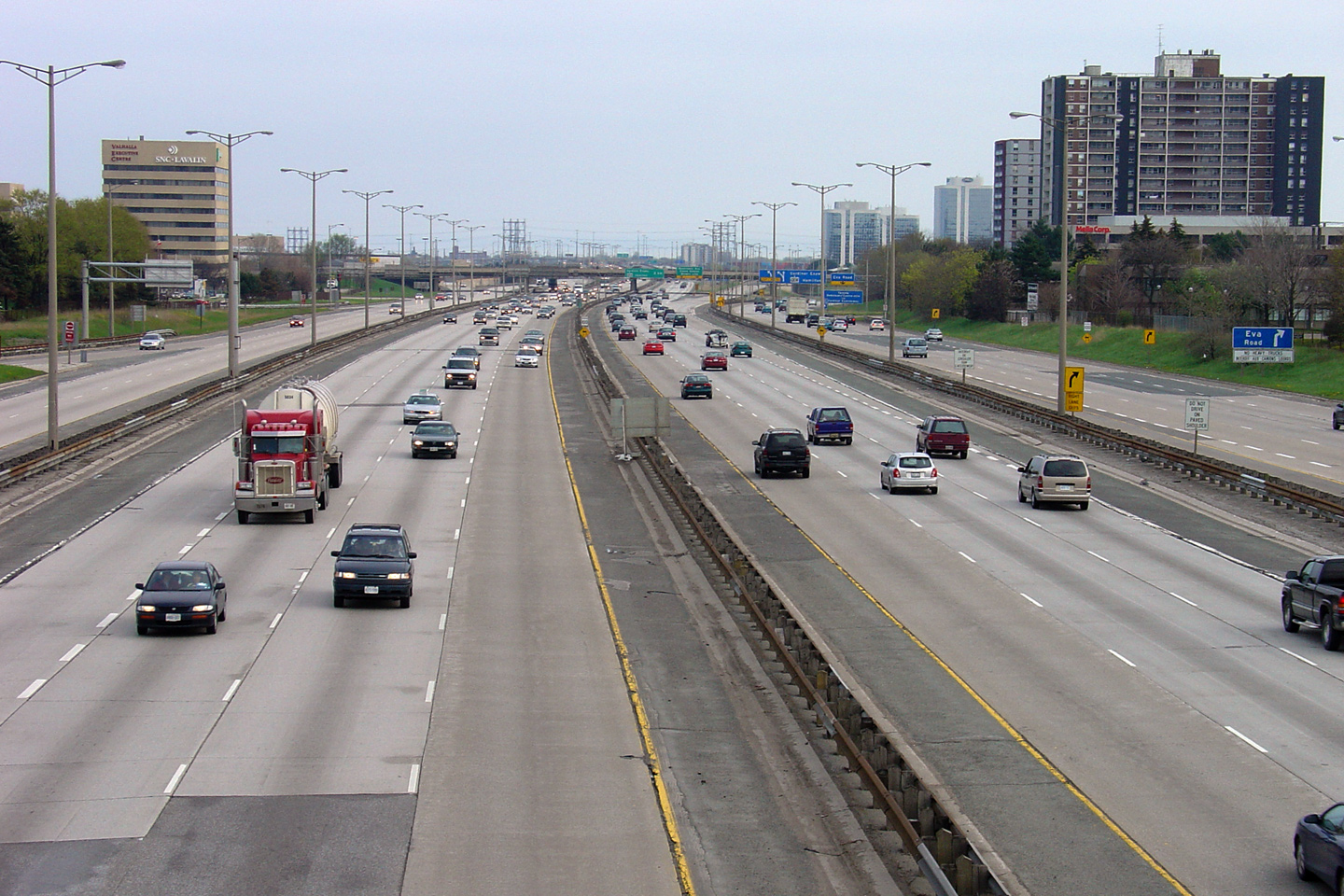
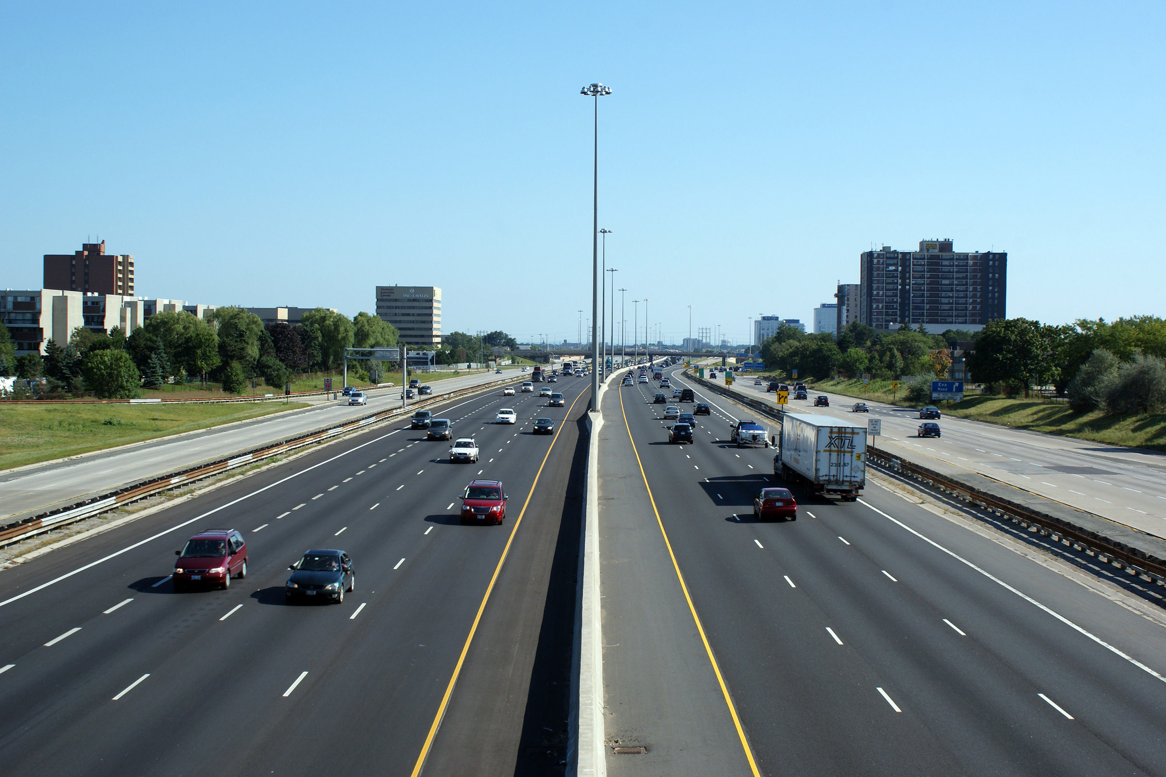
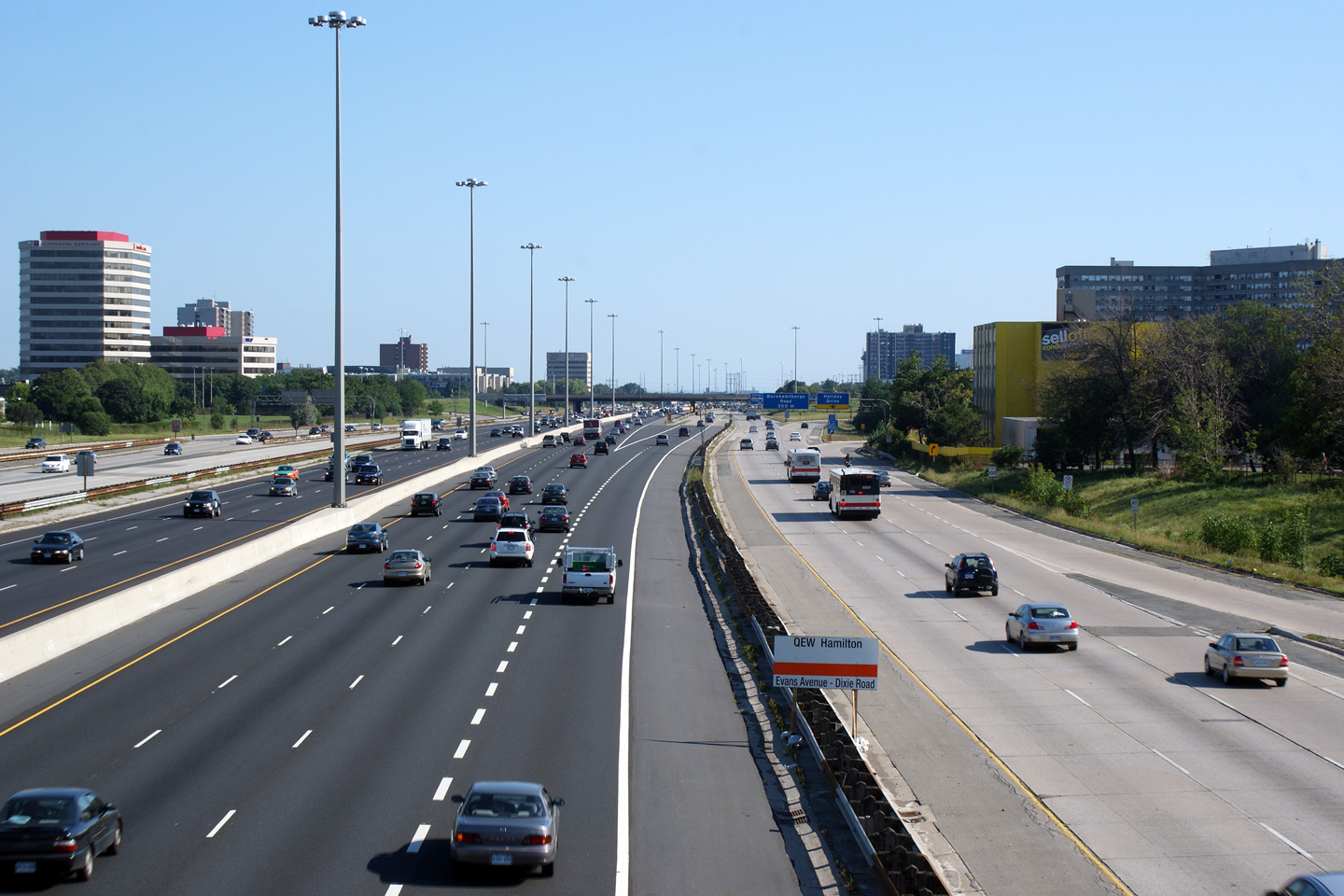
| City of Toronto |
Highway 427 looking south from the Rathburn Road
overpass in Etobicoke. The upper photos were taken just prior to the
commencement of any of the
major rehabilitation contracts that have seen Highway 427 reconstructed with
a tall wall barrier and with new asphalt lanes. In fact, in the upper
photos construction to resurface and stabilize the outside shoulder of the
southbound express lanes (on the right side of the photos) was underway.
This work was done in preparation for the lane shifts that were required for
the replacement of the central steel median with concrete. The lower
photos were taken after the express lanes in both directions had been
rehabilitated and surfaced with asphalt, but before constructed had begun to
rehabilitate either of the collector lanes. Upper photos taken: August 1st, 2004. Lower photos taken: August 28th, 2010. |
 (720x480) (1440x960) (2400x1600)
|
|||||||||||||||||||||||||||||||||||
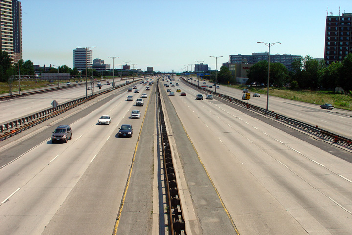
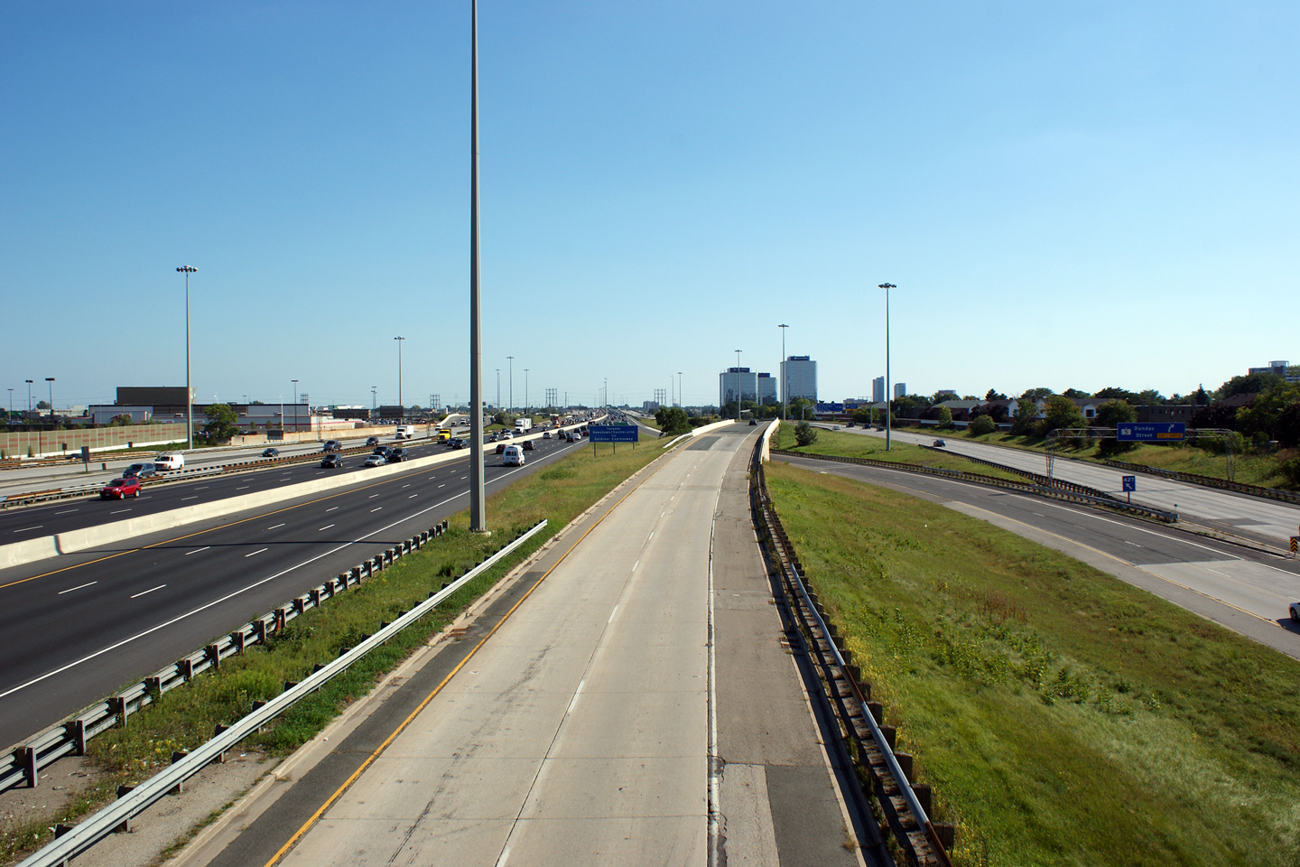
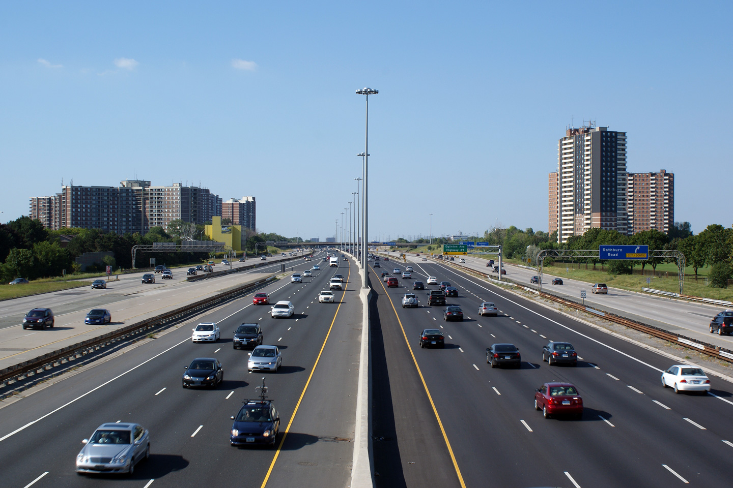
| City of Toronto | Highway 427 looking north from Rathburn Road. Upper and middle photos taken: August 1st, 2004. Lower photo taken: August 28th, 2010. |
 |
|||||||||||||||||||||||||||||||||||
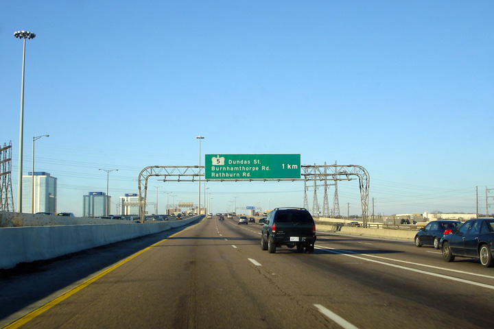
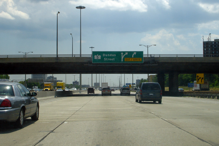
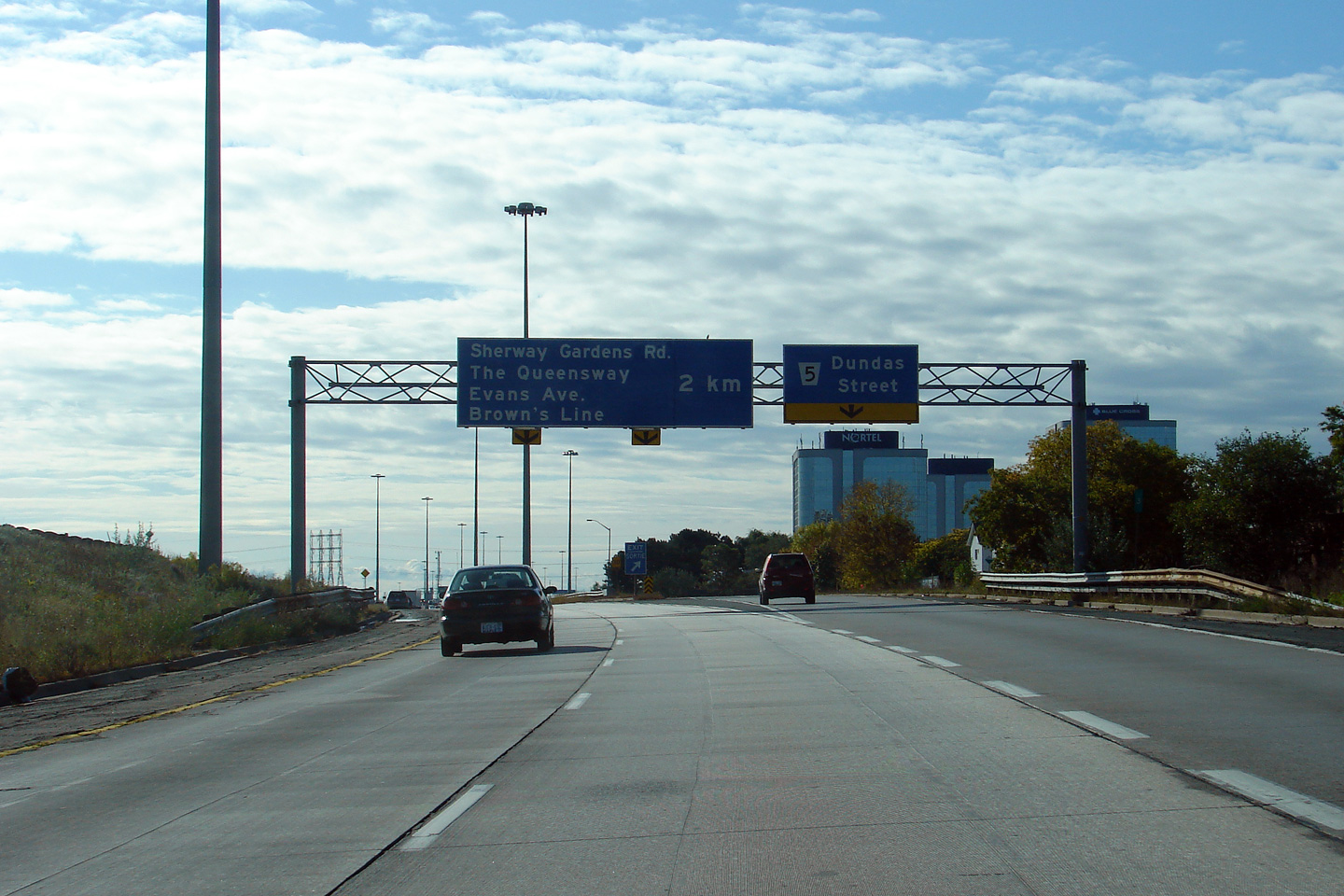
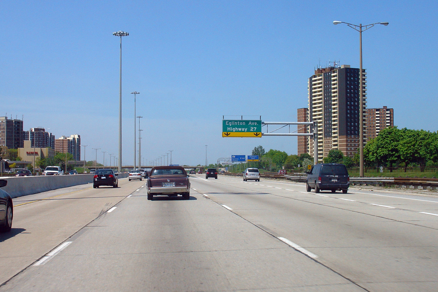
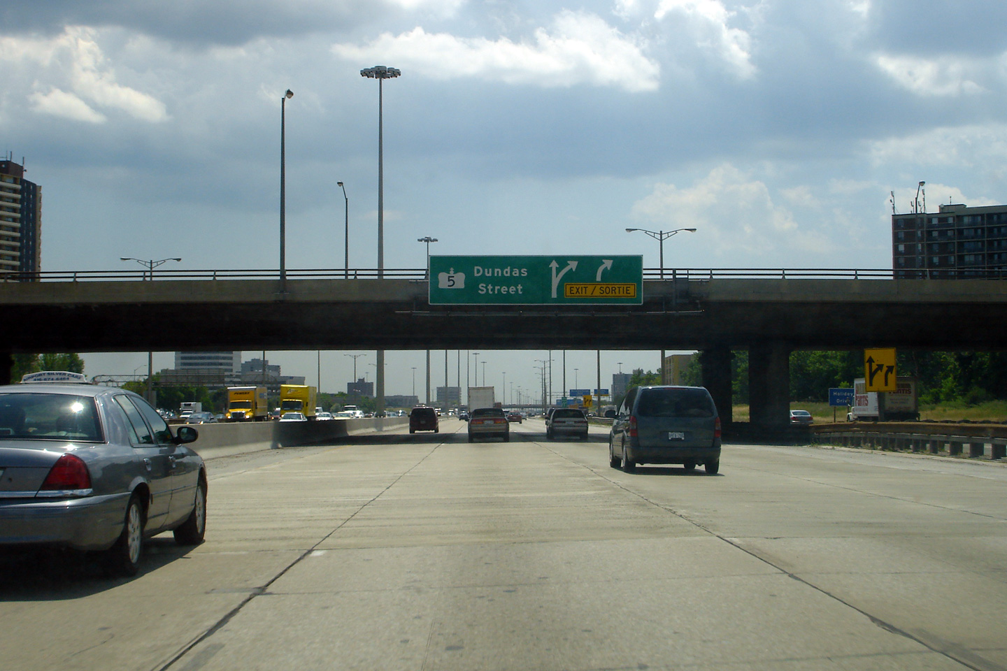
| City of Toronto |
Southbound signage in advance of the transfer to the collector lanes prior
to the Dundas Street interchange. Photo taken: July 9th, 2007. |
|
|||||||||||||||||||||||||||||||||||
| City of Toronto |
Overhead signage in the northbound collector lanes at the final northbound
collector to core transfer. Photo taken: August 12th, 2006. |
 (720x480) (720x480)(1440x960) |
|||||||||||||||||||||||||||||||||||
| The collector lanes become part of Highway 27 north of the Rathburn Road interchange. Click here for Highway 27 images. | |||||||||||||||||||||||||||||||||||||
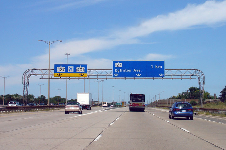
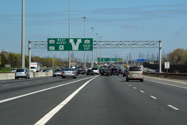
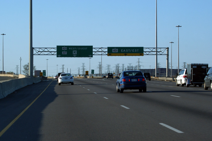
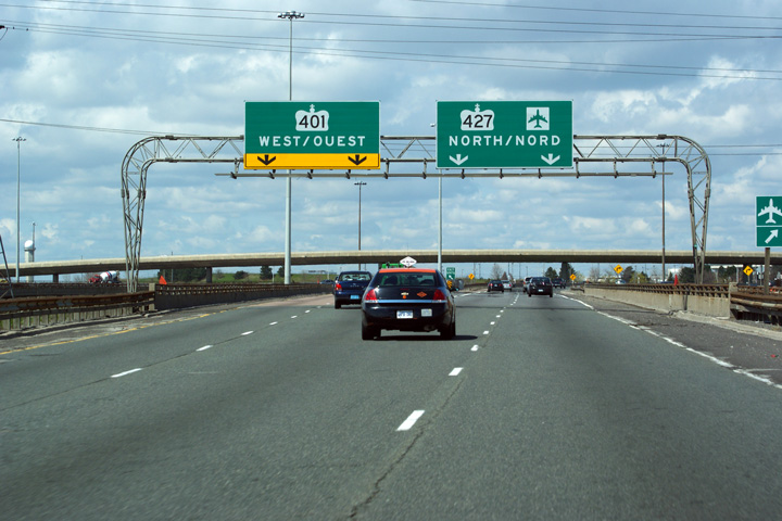
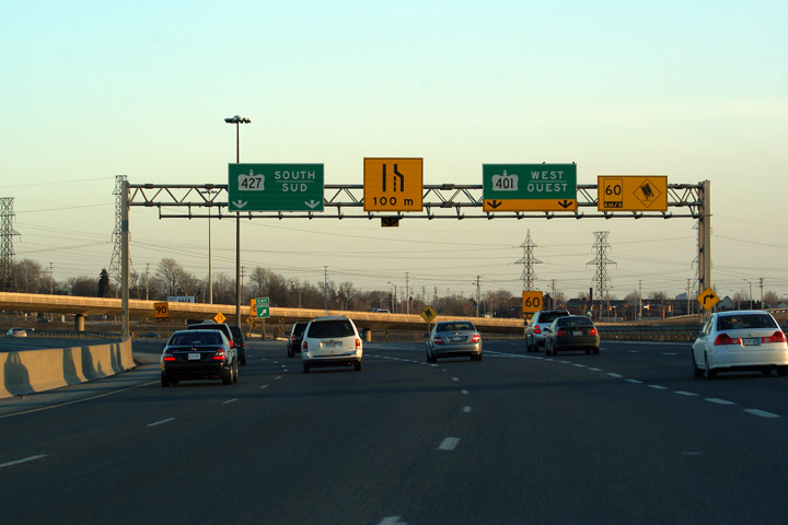
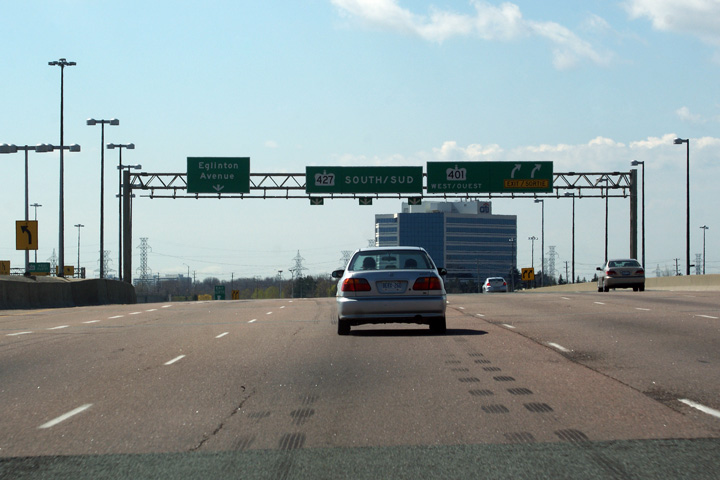
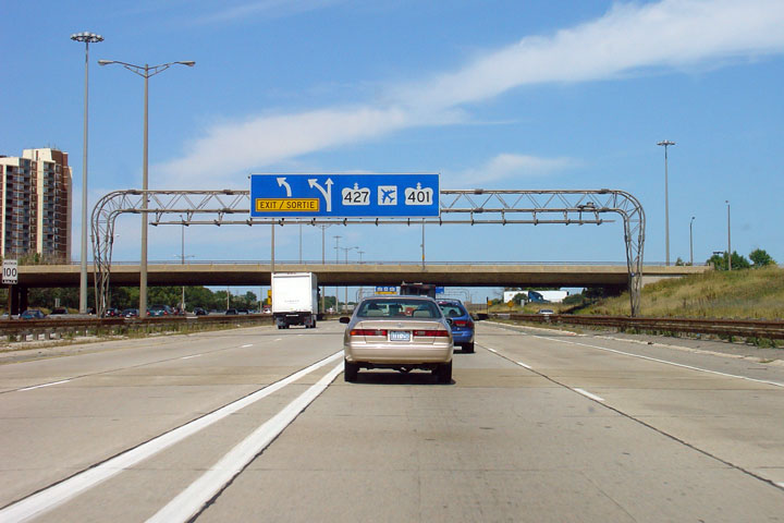
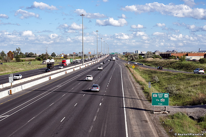
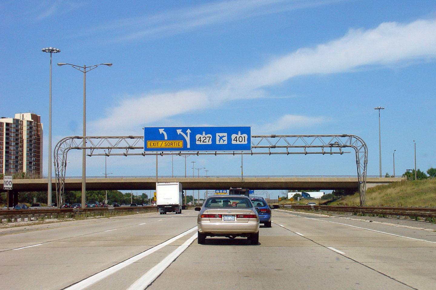
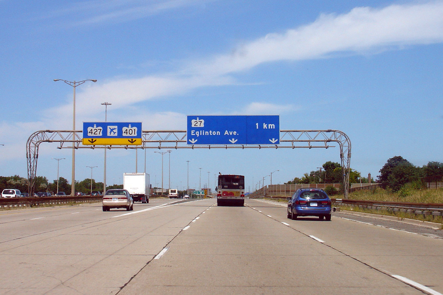
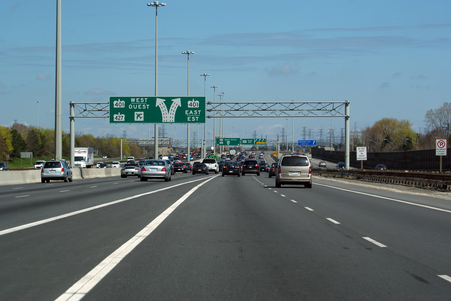
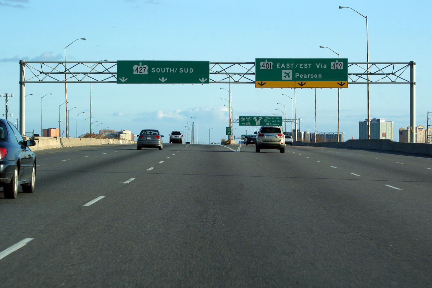
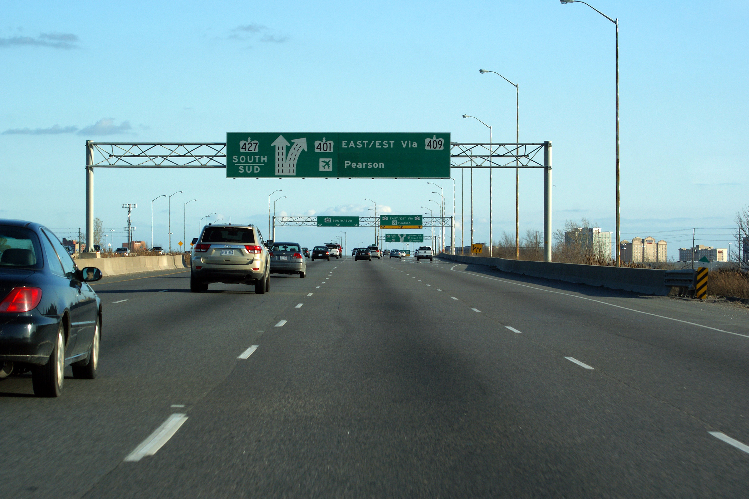
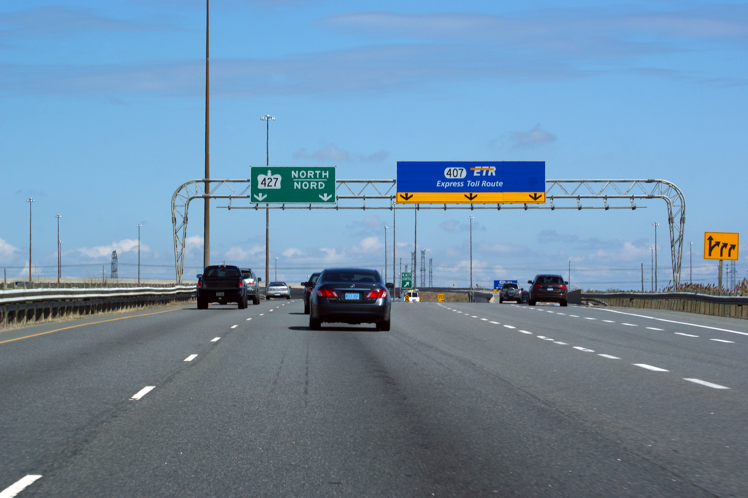
| City of Toronto |
Overhead diagramical sign denoting the upcoming
Highway 401 interchange. Highway 401
is only accessible from the 427's express lanes. The Collector lanes
simply default onto northbound Highway 27. Photo taken: May 7th, 2011. |
 (720x480) (720x480)(1440x960) (2400x1600) |
|||||||||||||||||||||||||||||||||||
| City of Toronto | Advanced exit signage for the Eastbound
Highway 401 exit. Photo taken: May 7th, 2011. |
 (720x480) (720x480)(1440x960) (2400x1600) |
|||||||||||||||||||||||||||||||||||
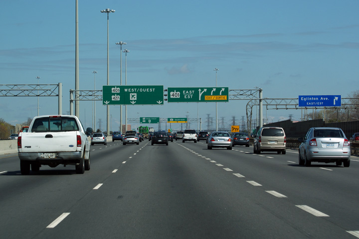
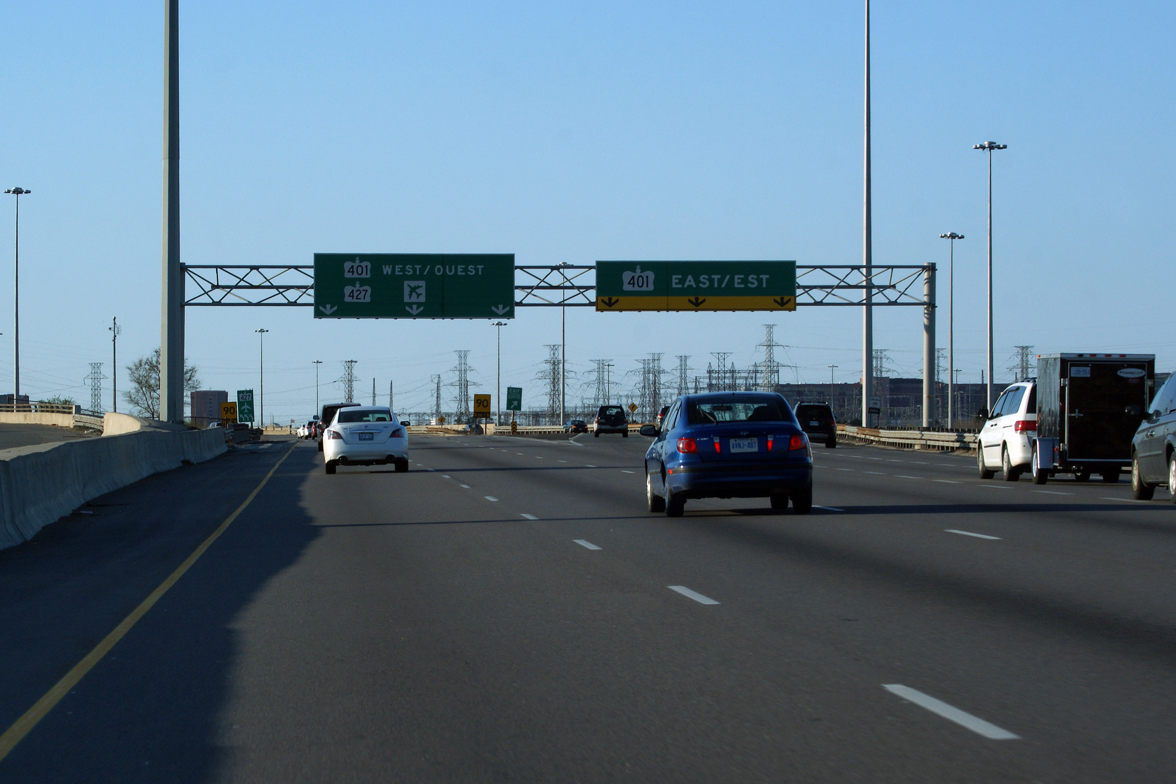
| City of Toronto | Signage denoting the northbound exit for the
eastbound 401. Past this exit, the 427 begins a series of fairly sharp
curves (the sharpest of which has an advisory speed of 70), where the
highway crosses the 401 and runs beside the airport. Photo taken: March 25th, 2012. |
 (720x480) (720x480)(1440x960) (2400x1600) |
|||||||||||||||||||||||||||||||||||
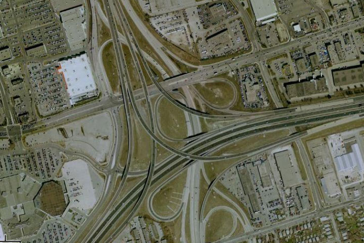
| City of Toronto | Advanced signage for the Westbound
Highway 401 exit. Due to the rather
odd geometry of the Highway 401/427
interchange, this exit logically departs from the left of the 427.
Click
here to see a satellite image of the interchange provided by
Google Maps. Photo taken: May 7th, 2011. |
 (720x480) (720x480)(1440x960) (2400x1600) |
|||||||||||||||||||||||||||||||||||
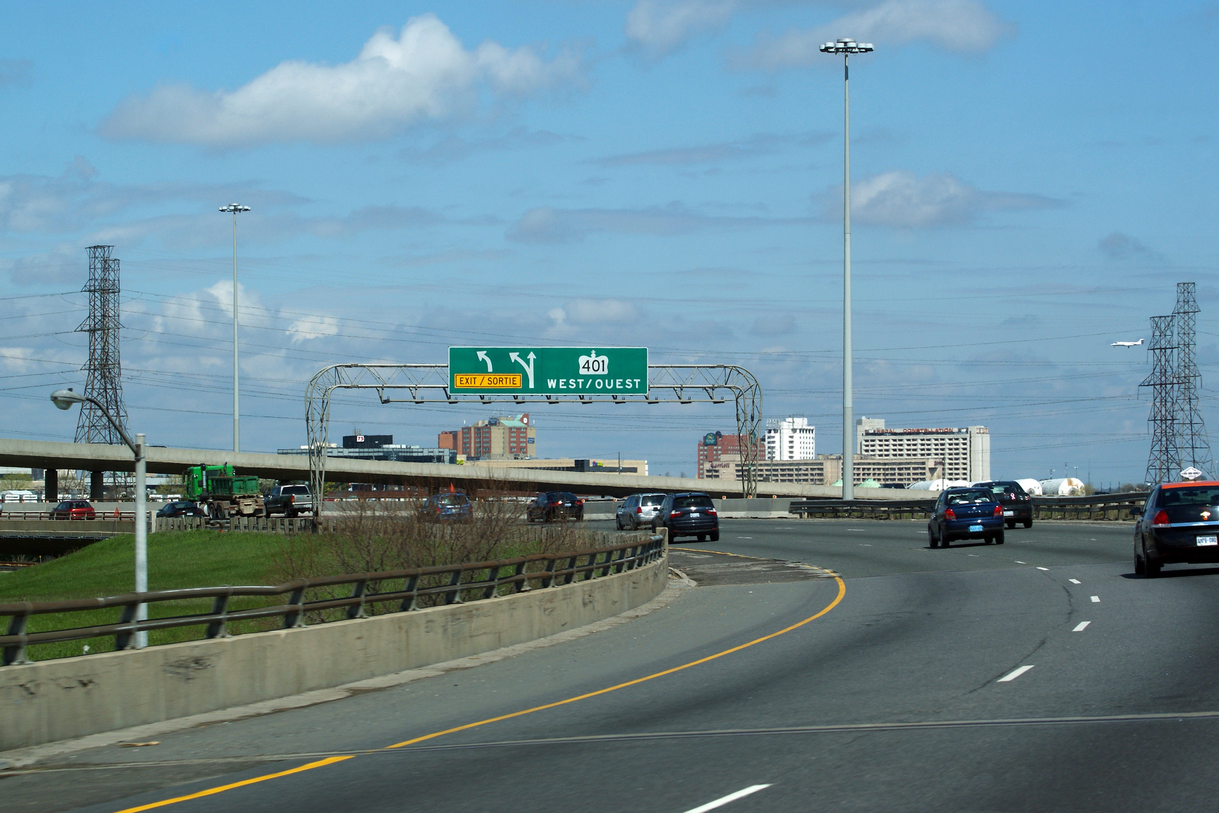
| City of Toronto | Signage denoting the exit for Westbound
Highway 401. After departing the 427,
this ramp quickly dives beneath the Southbound Highway 427 overpass and
forms the Mississauga segment of the collector lanes along the
401. Photo taken: May 7th, 2011. |
 (720x480) (720x480)(1440x960) (2400x1600) |
|||||||||||||||||||||||||||||||||||
| Highway 401 is the Macdonald-Cartier Freeway, linking Windsor to the Quebec border. Click here for Highway 401 images. | |||||||||||||||||||||||||||||||||||||
| City of Toronto | View looking southerly at the ramp to
Highway 401 East departs from the right hand side of the 427. This is
a surprisingly tight ramp -- motorists would be well advised to heed the
advisory speed. Photo taken: February 21st, 2010. |
 (720x480) (720x480)(1440x960) (2400x1600) |
|||||||||||||||||||||||||||||||||||
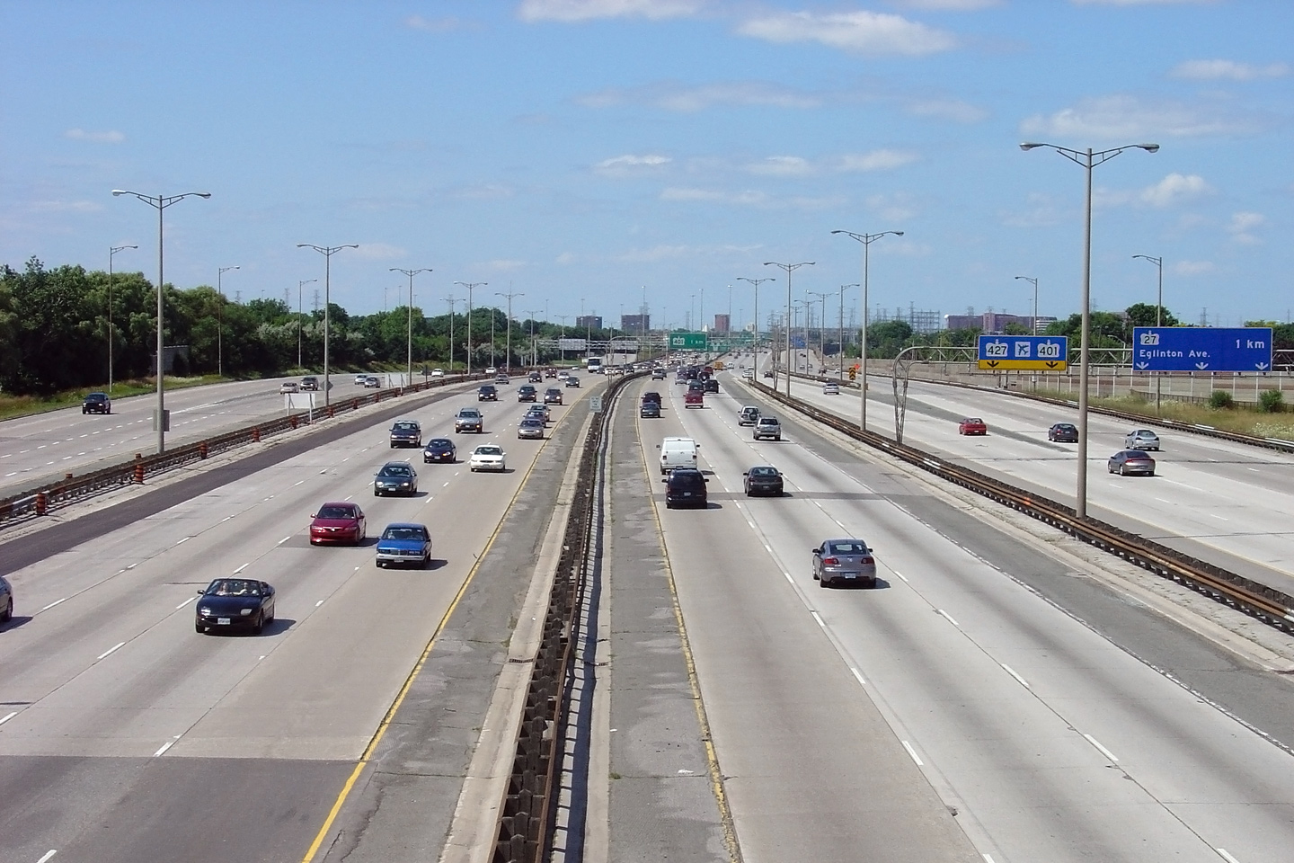
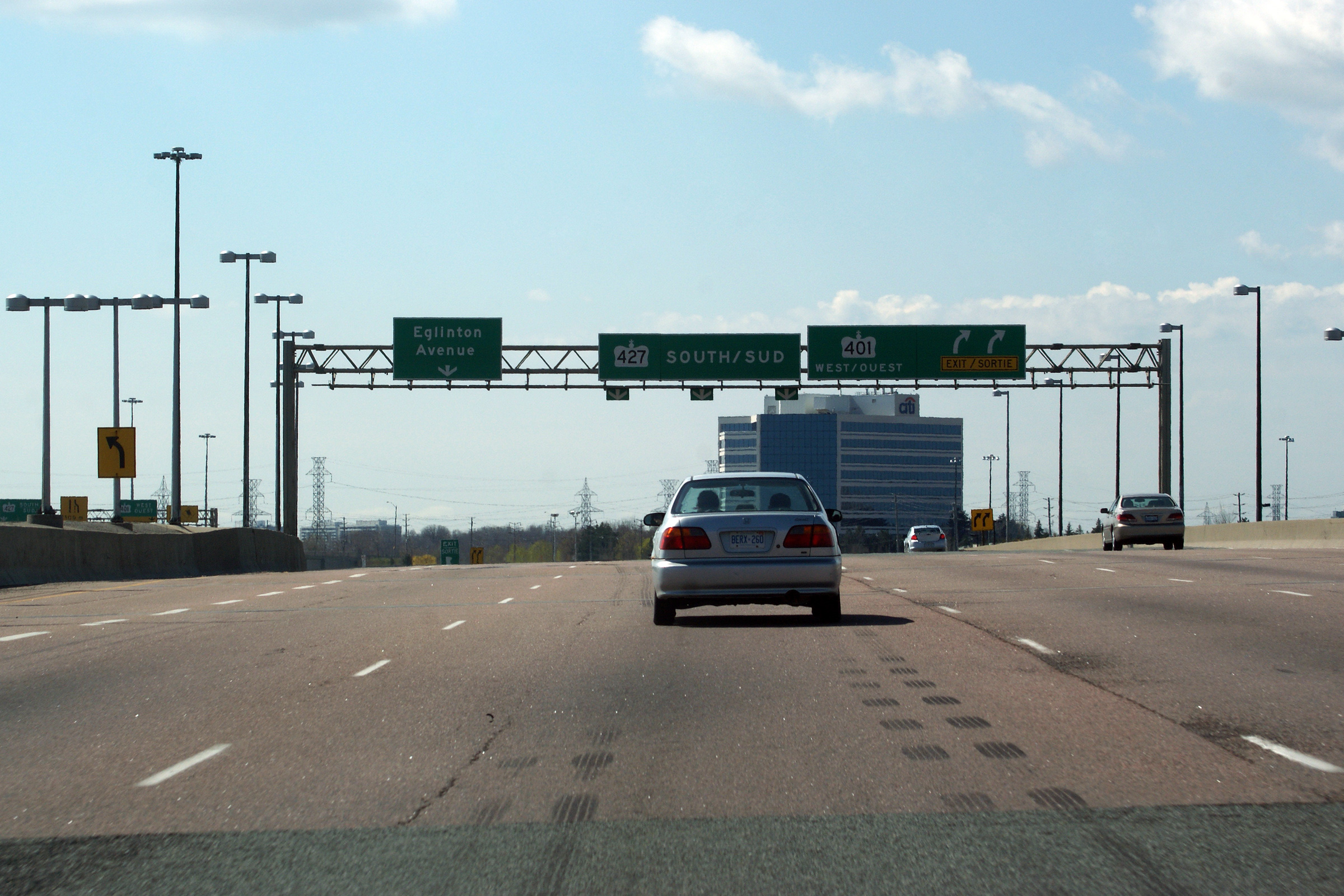
| City of Toronto | View looking southerly as the ramp to Eglinton
Avenue departs from the southbound 427. Photo taken: May 7th, 2011. |
 (720x480) (720x480)(1440x960) (2400x1600) |
|||||||||||||||||||||||||||||||||||
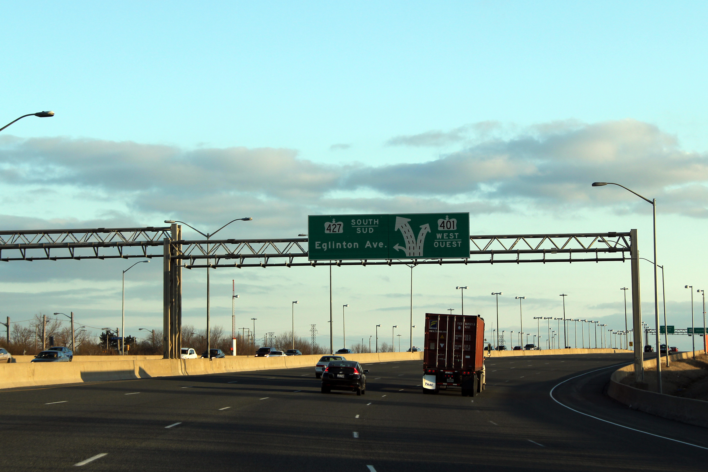
| City of Toronto | Diagrmatical sign along Highway 427 South on
approach to the Highway 401 and Eglinton Avenue interchange. Photo taken: March 19th, 2011. |
 (720x480) (720x480)(1440x960) (2400x1600) |
|||||||||||||||||||||||||||||||||||
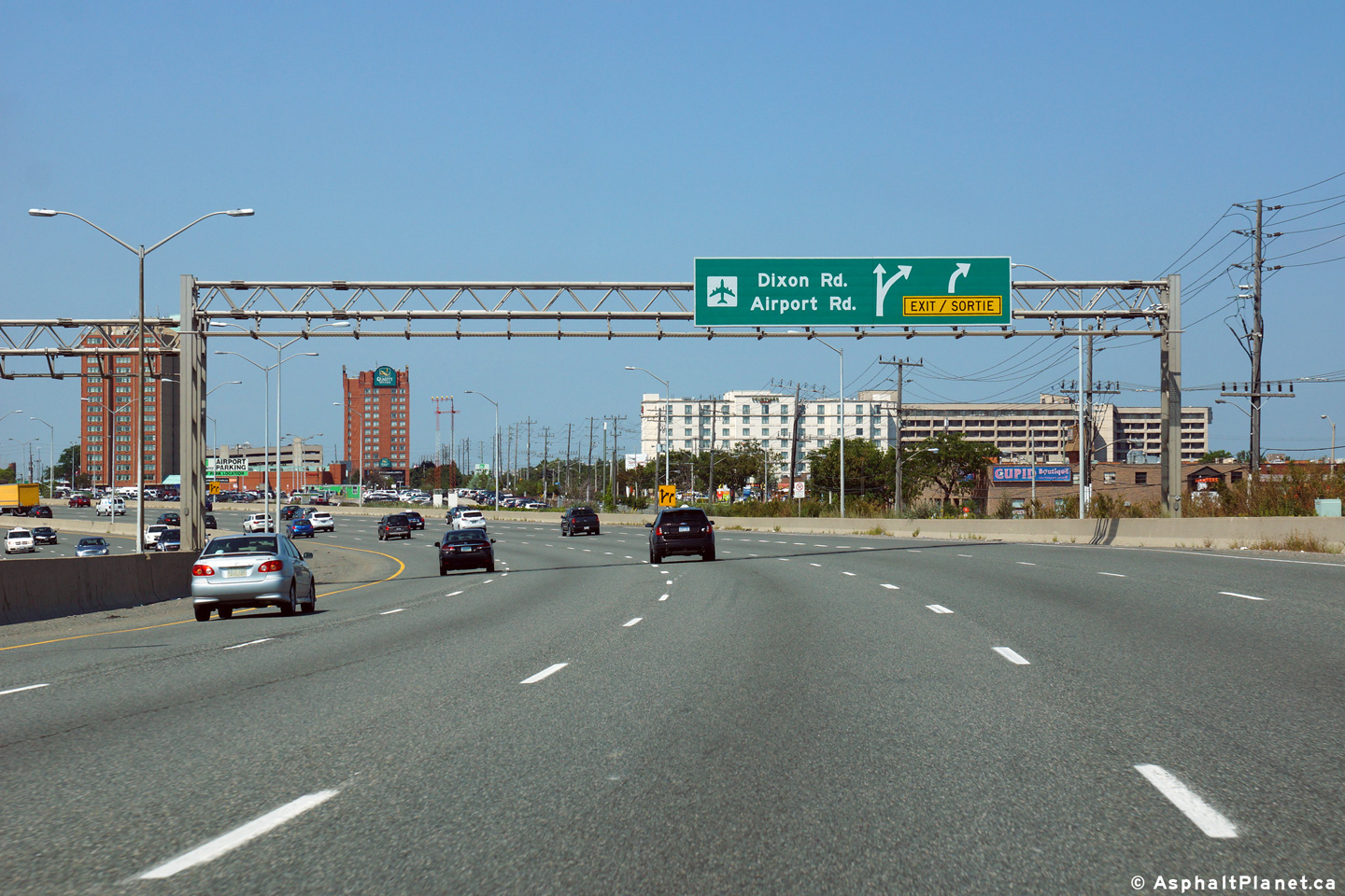
| City of Toronto | Advanced signage for the ramp to Dixon Road,
Airport Road and Pearson International Airport. Picture taken: August 19th, 2014. |
 (720x480) (720x480)(1440x960) (2400x1600) |
|||||||||||||||||||||||||||||||||||
| City of Toronto | Signage at the off-ramp to the Airport, Dixon
Road, and Airport Road. Photo taken: May 7th, 2011. |
 (720x480) (720x480)(1440x960) (2400x1600) |
|||||||||||||||||||||||||||||||||||
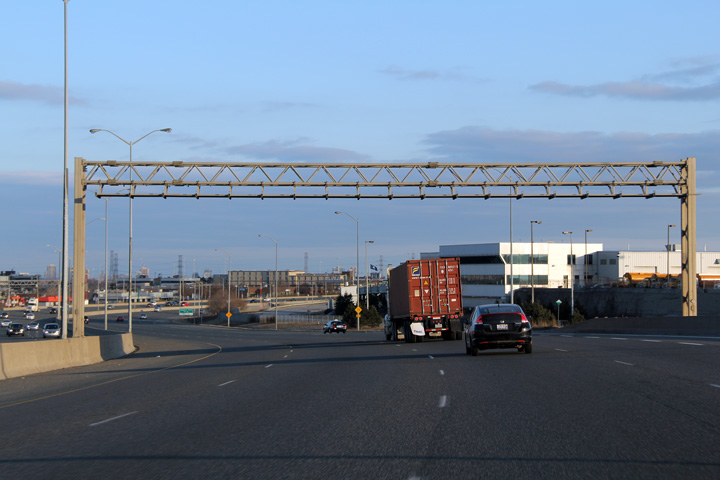
| City of Toronto | This overhead sign gantry has stood empty over
the southbound lanes of Highway 427 for over a decade. This gantry was
likely constructed for a large changeable message sign that was never
installed. Photo taken: March 19th, 2011 |
 (720x480) (720x480)(1440x960) |
|||||||||||||||||||||||||||||||||||
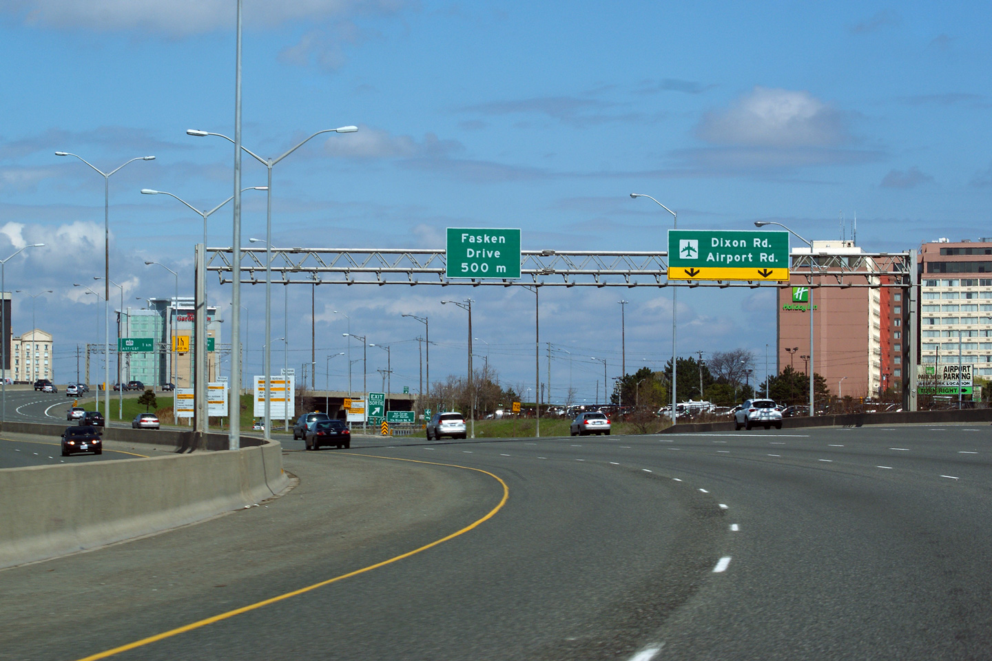
| Toronto - Mississauga Boundary | Signage at the Fasken Drive off-ramp. As
is evident in the photos, Highway 427 winds considerably between Highway 401
and Highway 409. Photo taken: May 7th, 2011. |
 (720x480) (720x480)(1440x960) (2400x1600) |
|||||||||||||||||||||||||||||||||||
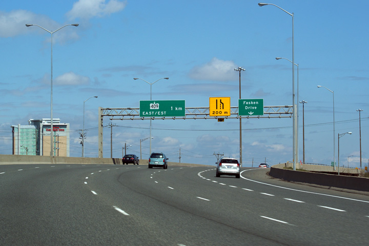
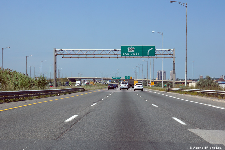
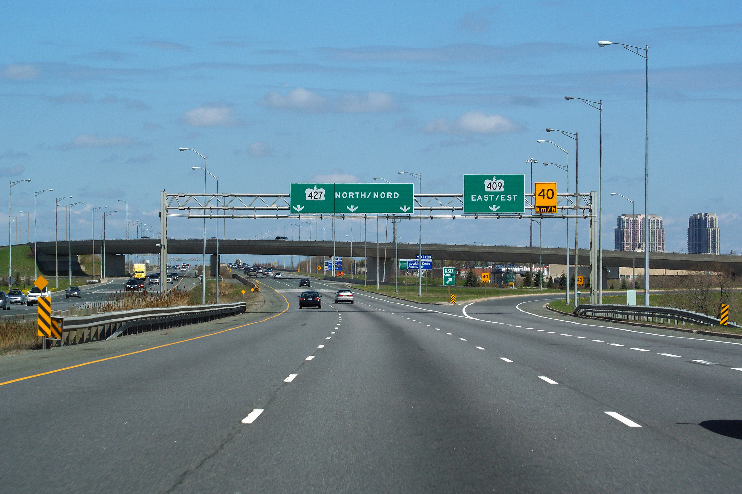
| Toronto - Mississauga Boundary | Northbound advanced signage for the ramp to
Highway 409 East. Because Highway 409 ends at Pearson Airport
immediately to the west of Highway 427, there is no need for a ramp to
Highway 409 West. Photo taken: August 19th, 2014. |
 (720x480) (720x480)(1440x960) (2400x1600) |
|||||||||||||||||||||||||||||||||||
| Toronto - Mississauga Boundary | Signage at the ramp to Highway 409 East.
The ramp to Highway 409 East has a decreasing radius throughout the ramp,
the need for the 40km/h advisory speed is not therefore apparent until
almost the end of the ramp. Picture taken: May 7th, 2011. |
 (720x480) (720x480)(1440x960) (2400x1600) |
|||||||||||||||||||||||||||||||||||
| Highway 409 is a short spur highway between Highway 401 and Pearson Airport. Click here for Highway 409 images. | |||||||||||||||||||||||||||||||||||||
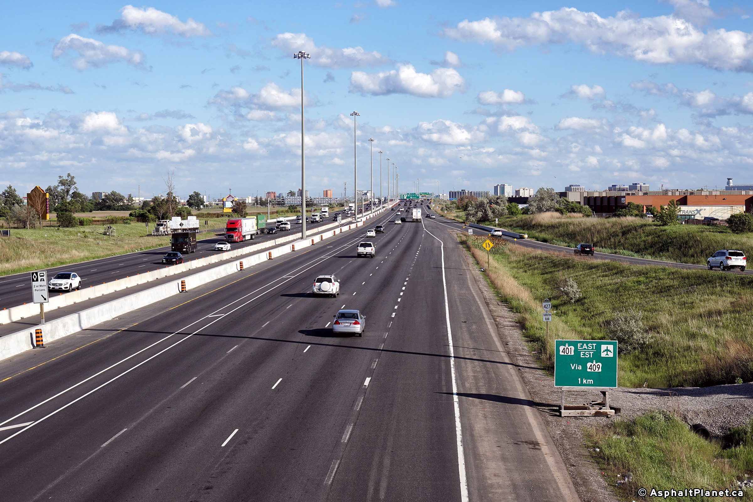
| Toronto - Mississauga Boundary | Signage at the exit for
Highway 409 and Pearson International
Airport from the southbound 427. Photo taken: March 25th, 2012. |
 (720x480) (720x480)(1440x960) (2400x1600) |
|||||||||||||||||||||||||||||||||||
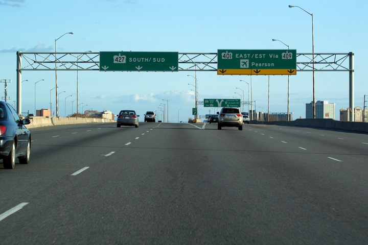
| Toronto - Mississauga Boundary | Advanced diagramical sign denoting the upcoming
southbound exit for both Highway 409, and Pearson International Airport.
The eastbound 401 is not accessible from the southbound 427, as such, the
409 serves as a 'ramp-extension' connecting the two freeways. Photo taken: March 25th, 2012. |
 (720x480) (720x480)(1440x960) (2400x1600) |
|||||||||||||||||||||||||||||||||||
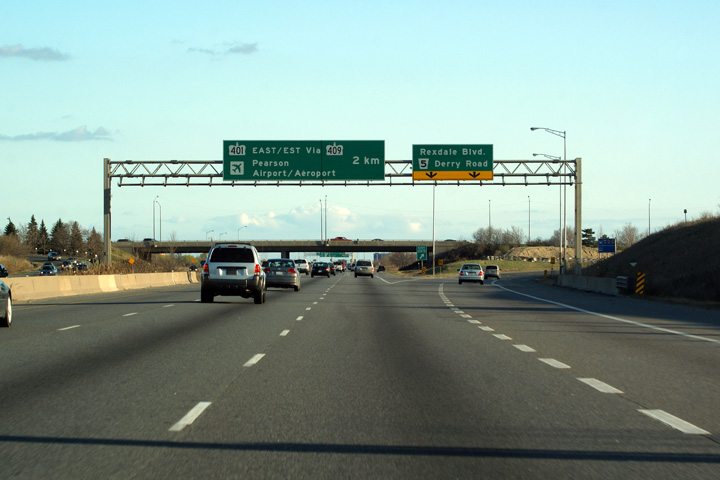
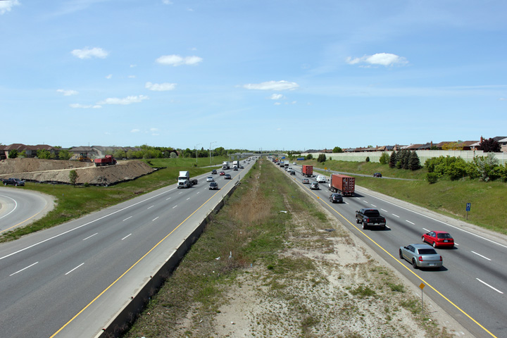
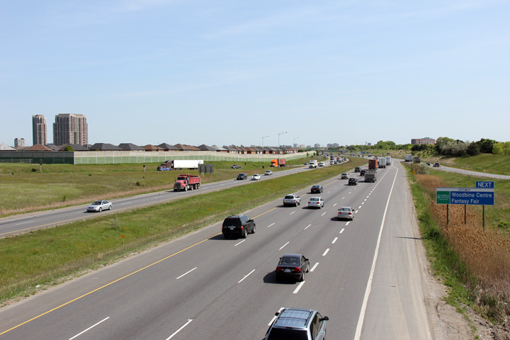
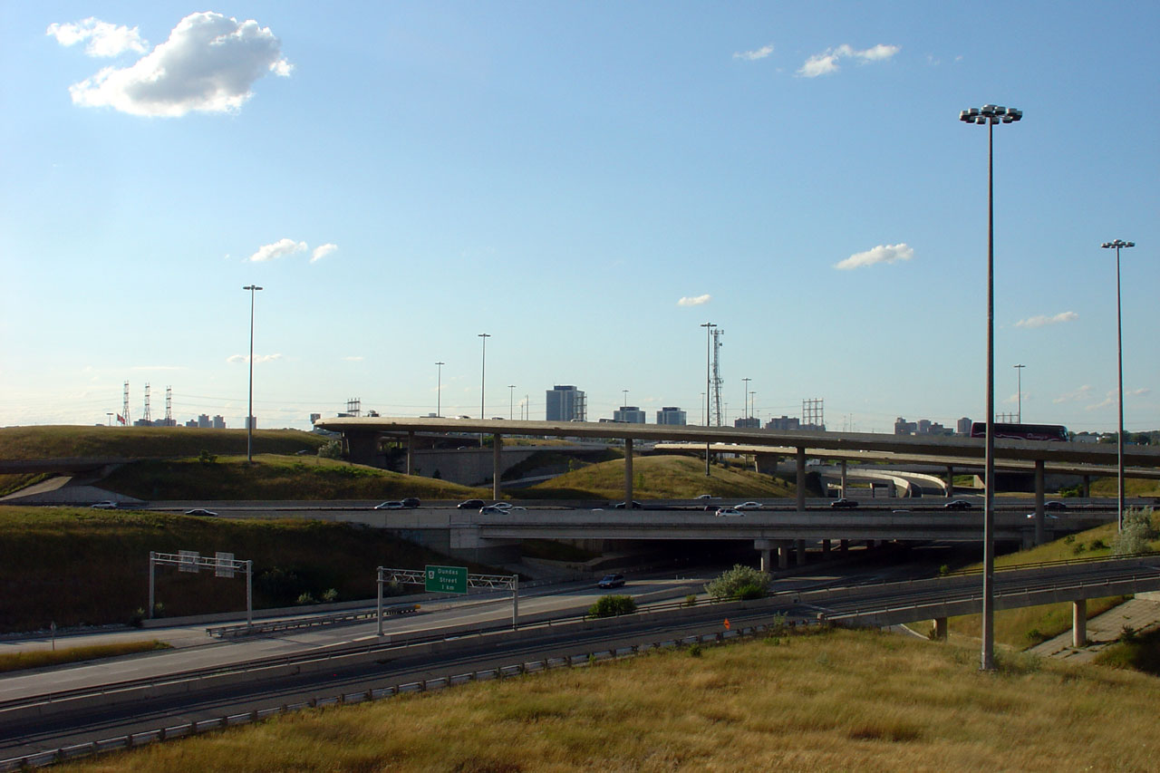
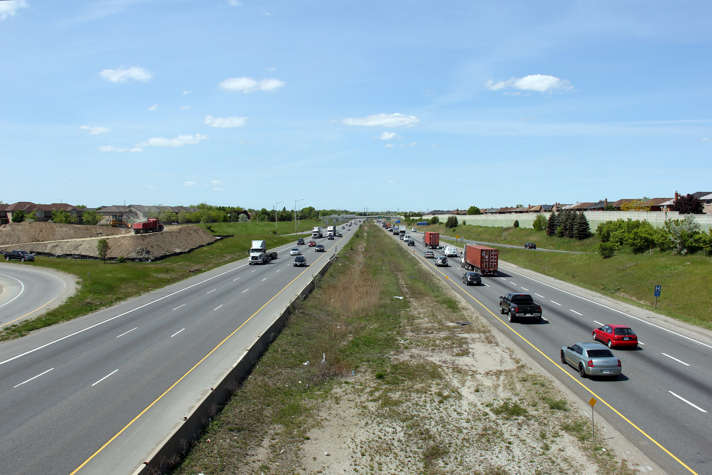
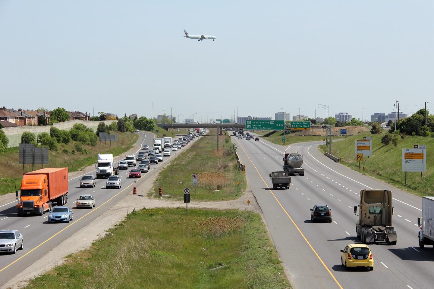
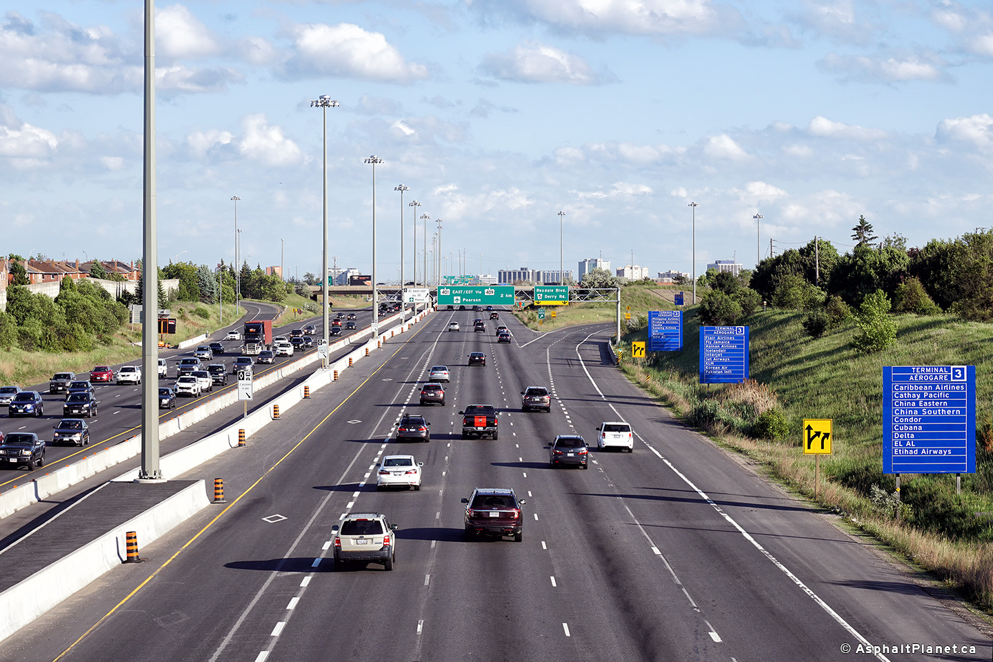
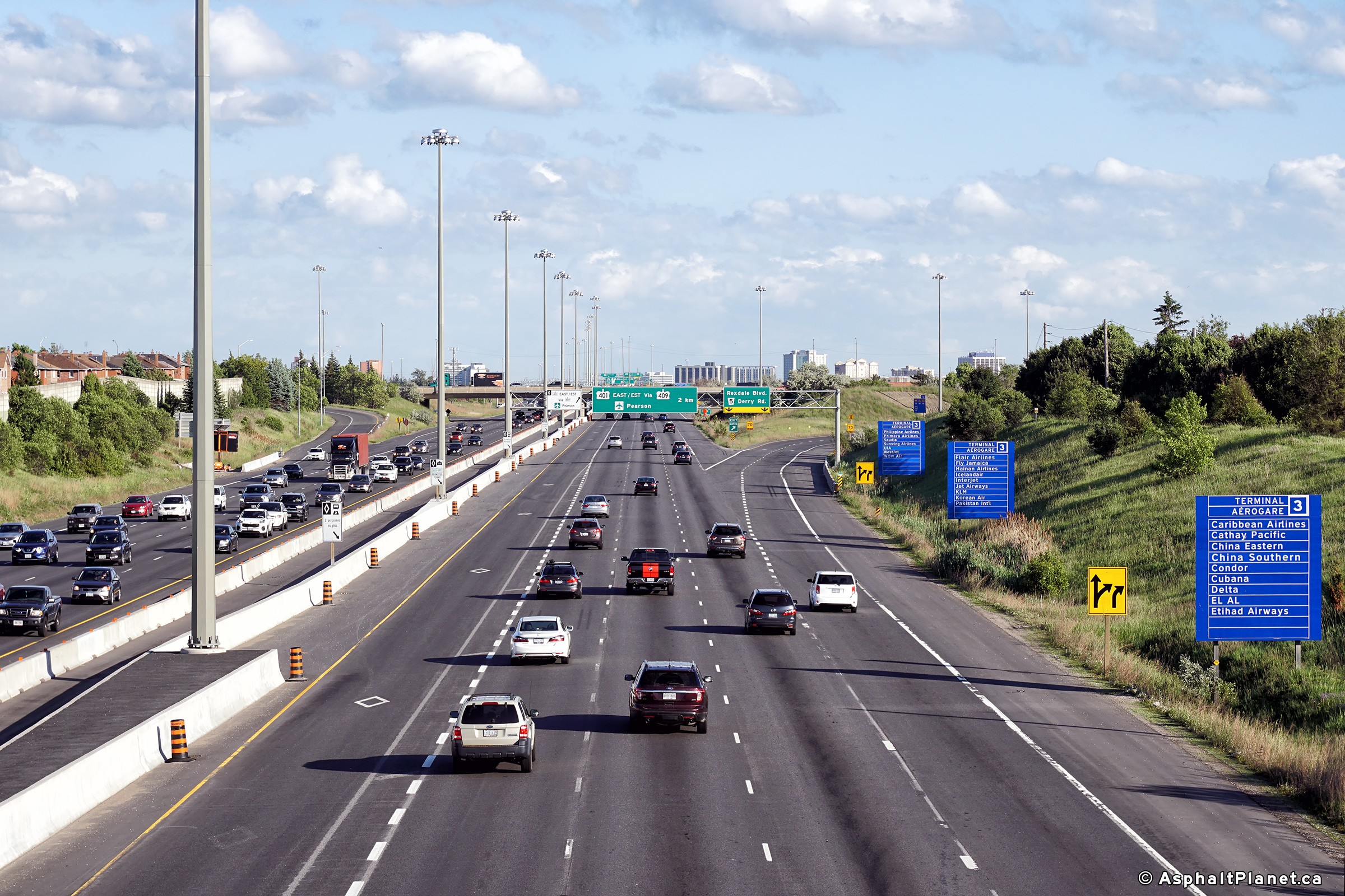
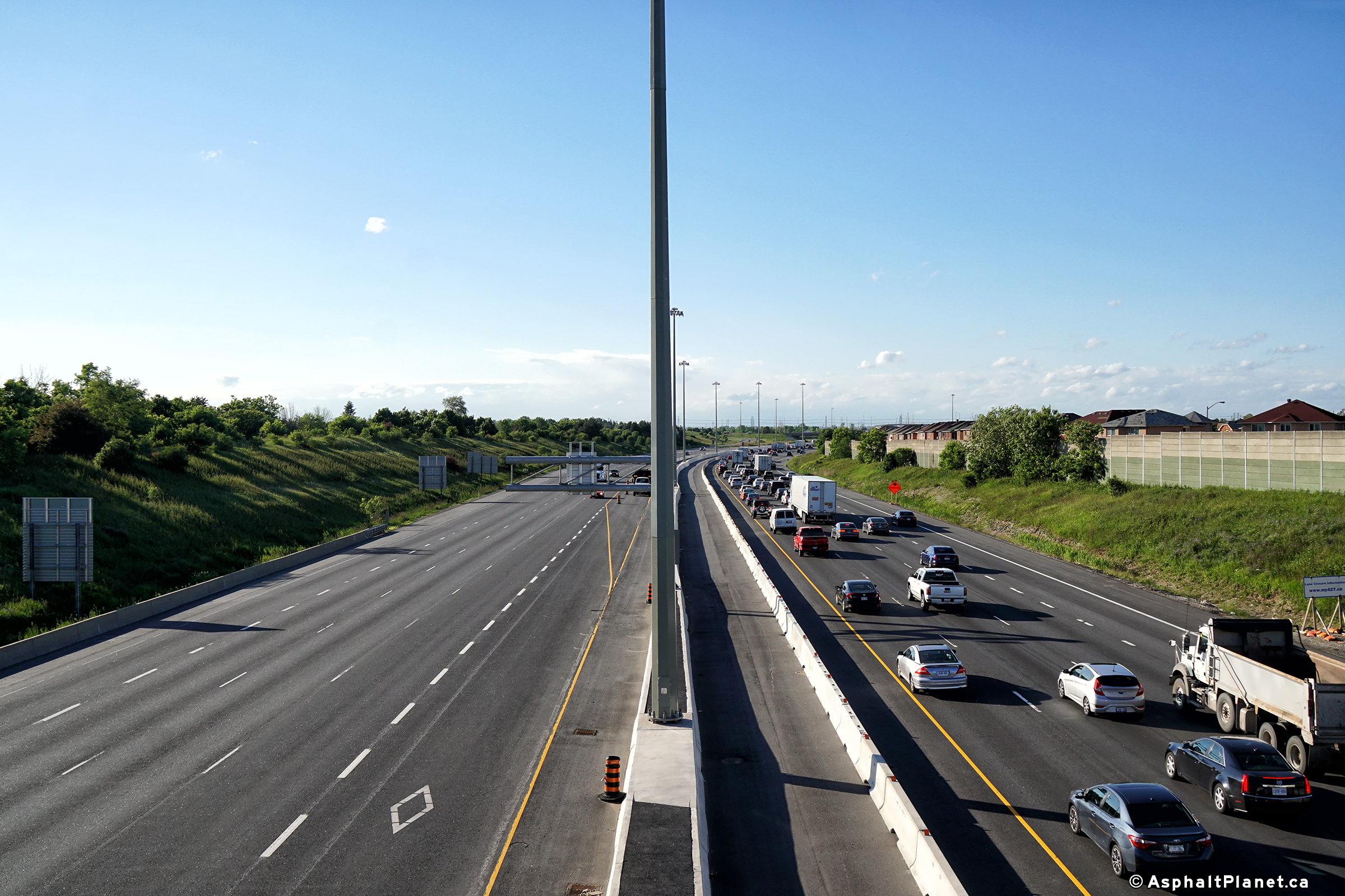
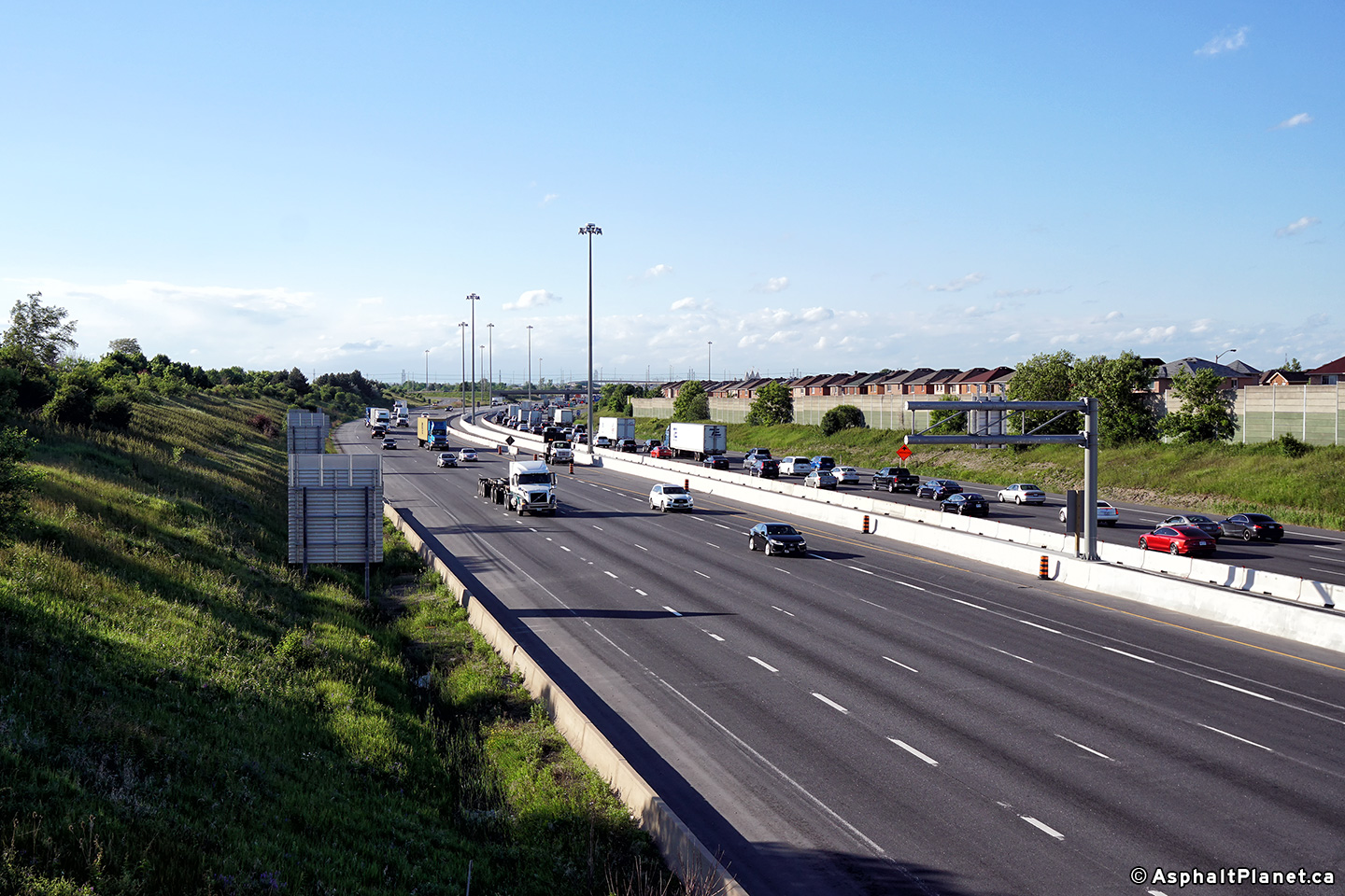
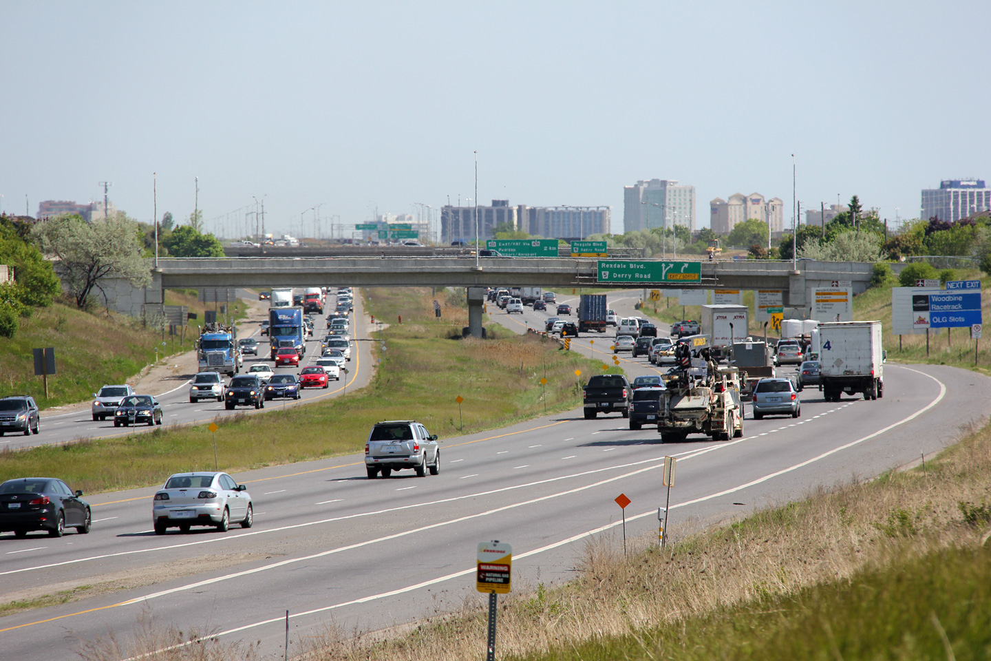
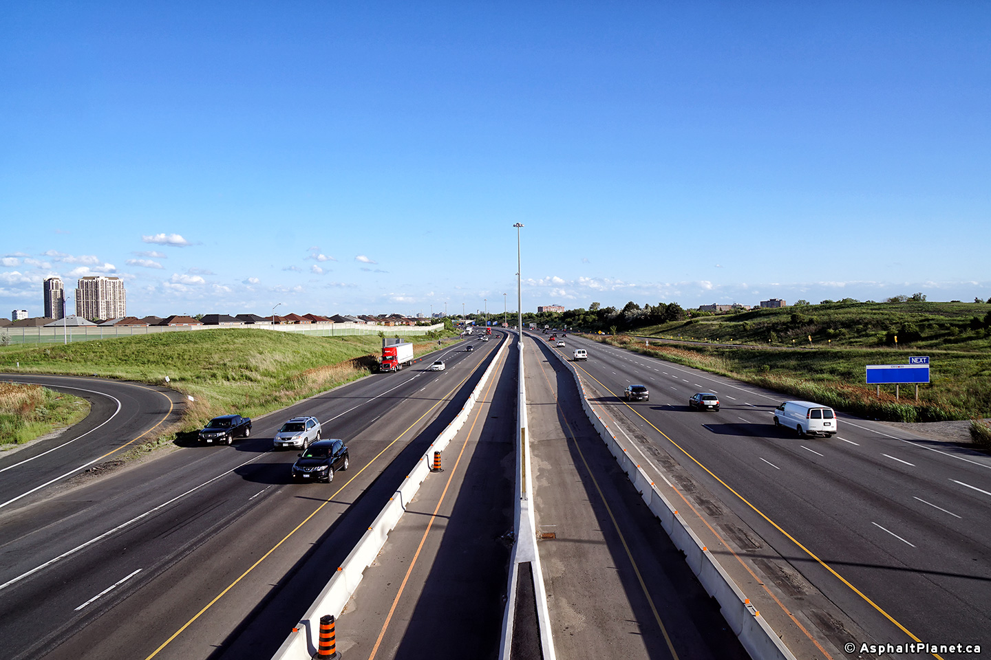
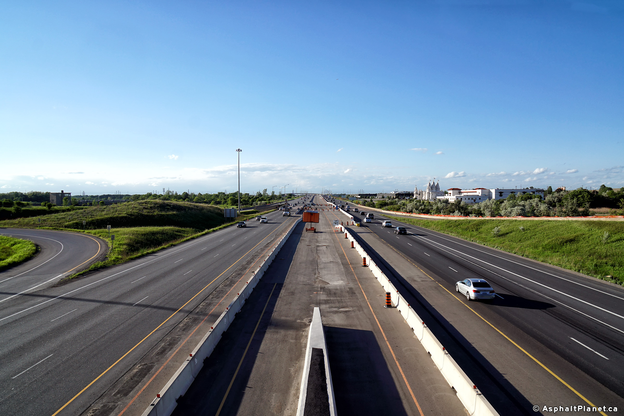
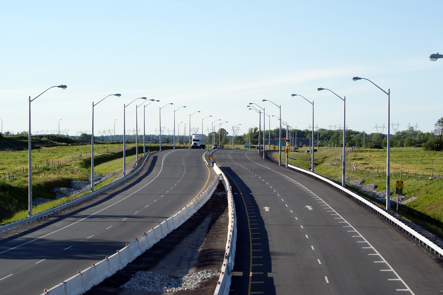
| Toronto - Mississauga Boundary | Looking south from the Rexdale Boulevard
overpass. Just out of view in this photo is the Highway 409
interchange, which is located about 2km south of Rexdale Boulevard.
Also, note that north of Highway 409, the northbound carriageway has only 2
lanes per direction whereas the southbound carriageway has been widened to
three lanes. In, 2018, a construction project that saw the median
filled in with an extra northbound general purpose lane, and a southbound
HOV lane. A northbound HOV lane will be added at a later date once the
427 has been extended to the north. Photo # 1 taken: May 17th, 2012. Photos # 2 and # 3 taken: June 4th, 2018. |
 (720x480) (1440x960) (2400x1600)
(720x480)
(1440x960)
(2400x1600) |
|||||||||||||||||||||||||||||||||||
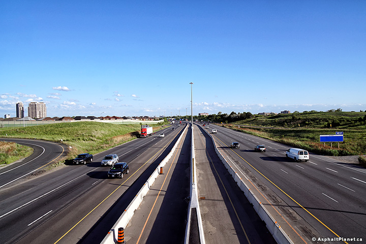
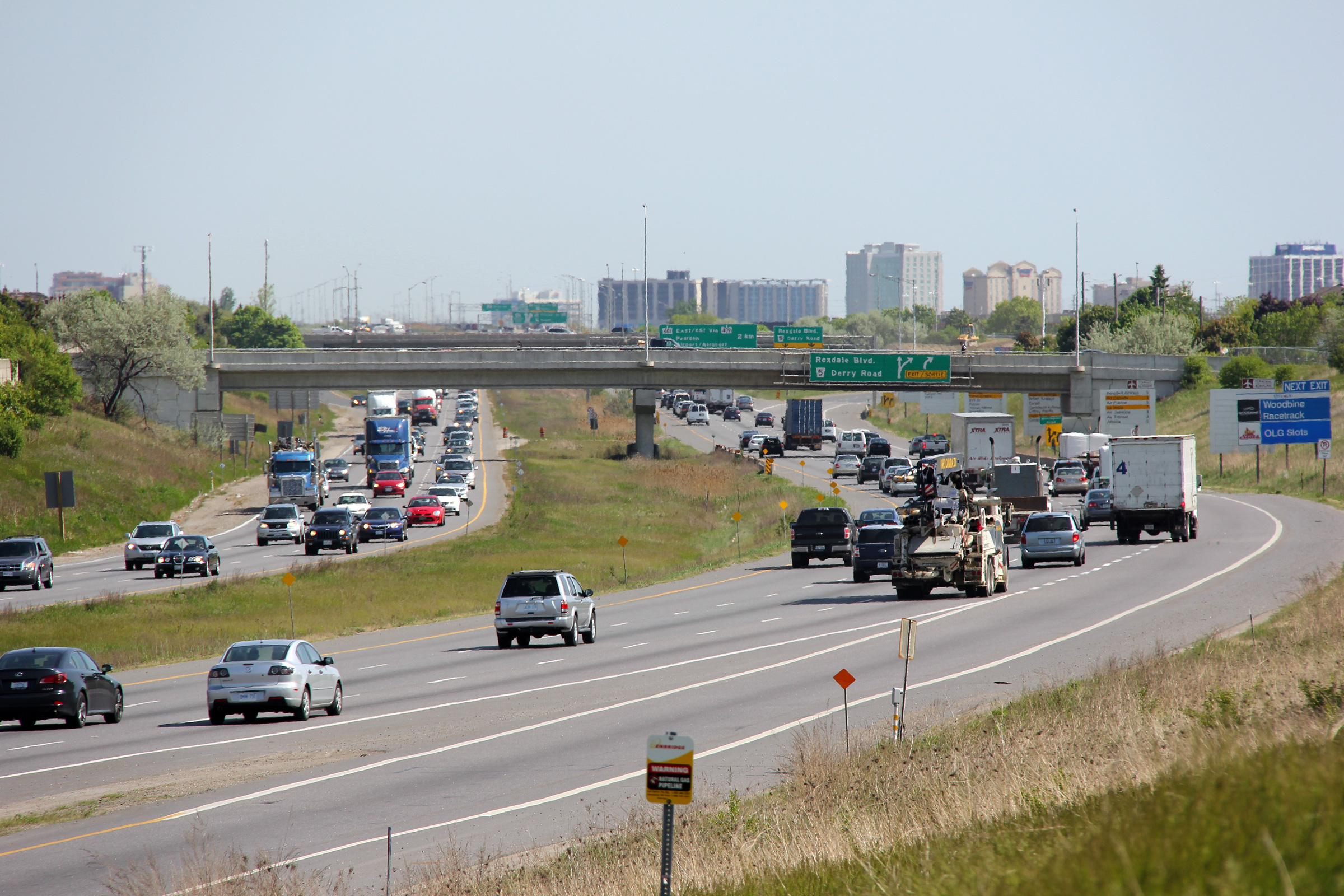
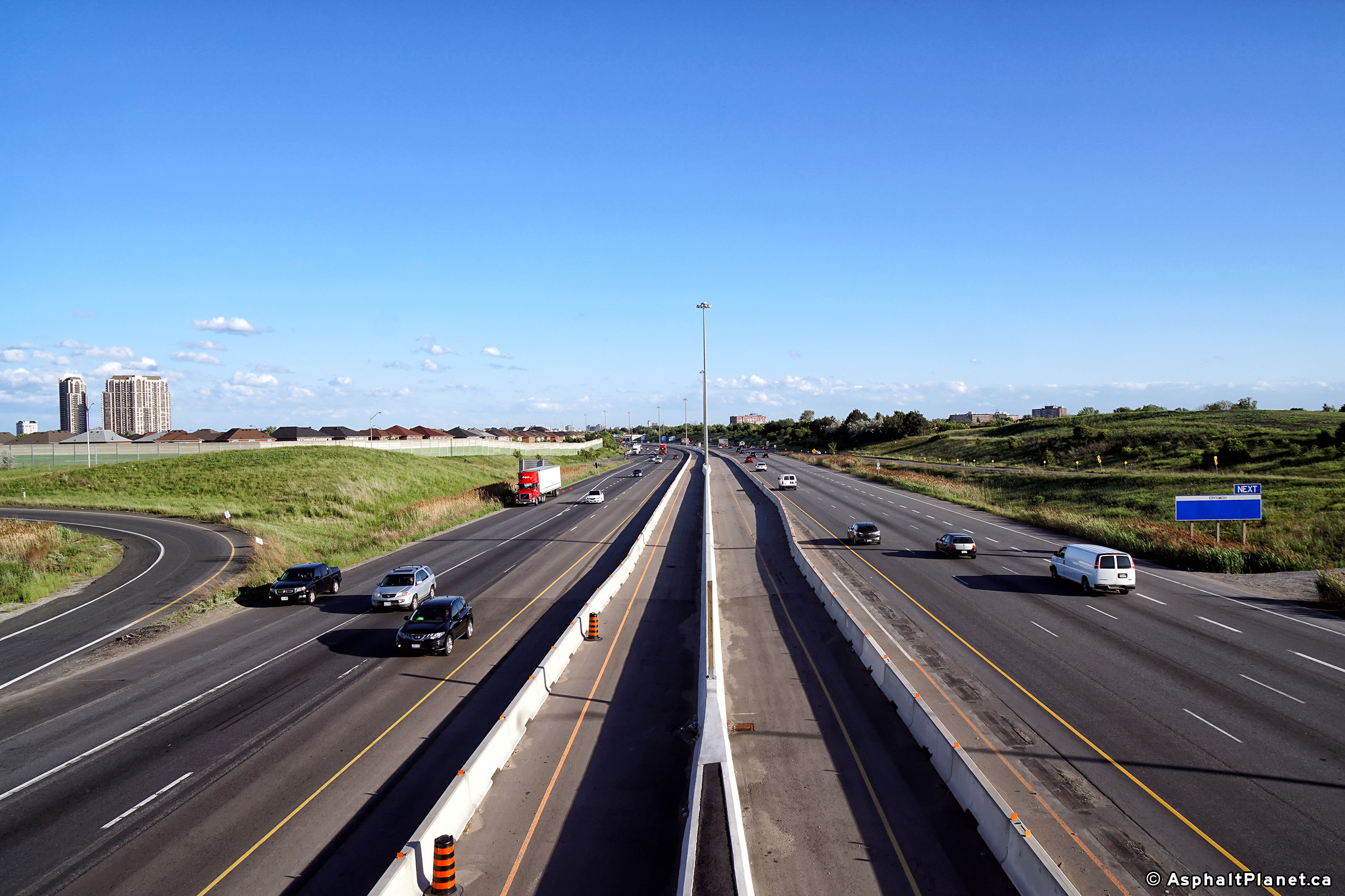
| Toronto - Mississauga Boundary | Highway 427 looking north from the Rexdale
Boulevard overpass. Photo # 1 taken: May 17th, 2012. Photos # 2 and # 3 taken: June 4th, 2018. |
 (720x480) (1440x960) (2400x1600)  (720x480) (1440x960) (2400x1600) |
|||||||||||||||||||||||||||||||||||
| Toronto - Mississauga Boundary | Southbound signage for Derry
Road. Photo taken: March 25th, 2012. |
 (720x480) (720x480)(1440x960) (2400x1600) |
|||||||||||||||||||||||||||||||||||
| Toronto - Mississauga Boundary | Looking south from the Morning Star Road
overpass. For many years, Morning Star Drive met
Highway 427 at a signalized at-grade intersection. The
intersection was located roughly
at the pictured emergency vehicle
turnaround.
The overpass I am standing upon replaced the
at-grade intersection in the early
1990s. Photo # 1 taken: May 17th, 2012. Photos # 2 and # 3 taken: June 4th, 2018. |
 (720x480) (1440x960) (2400x1600) 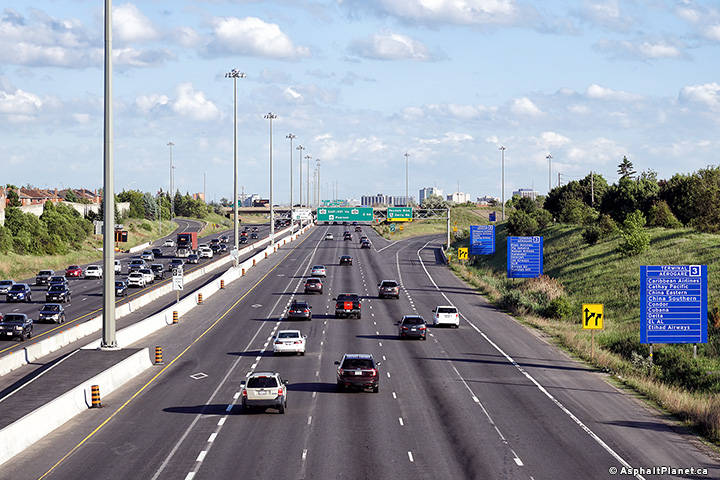 (720x480) (1440x960) (2400x1600) |
|||||||||||||||||||||||||||||||||||
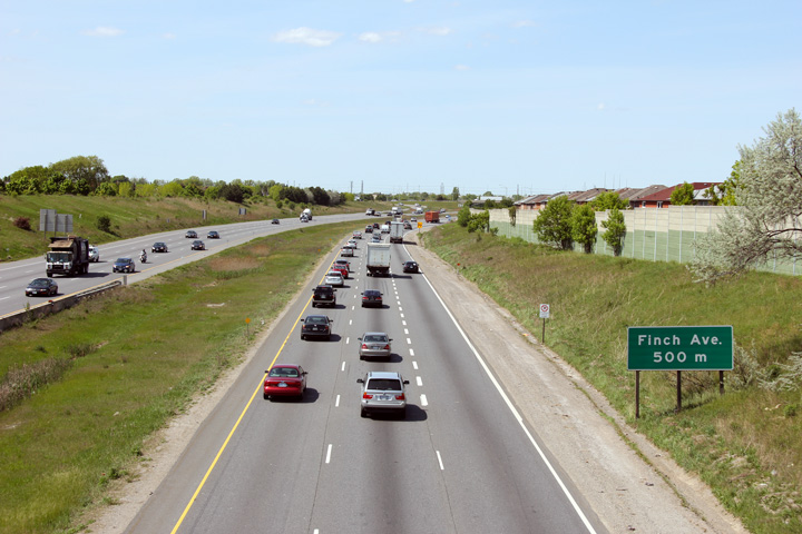
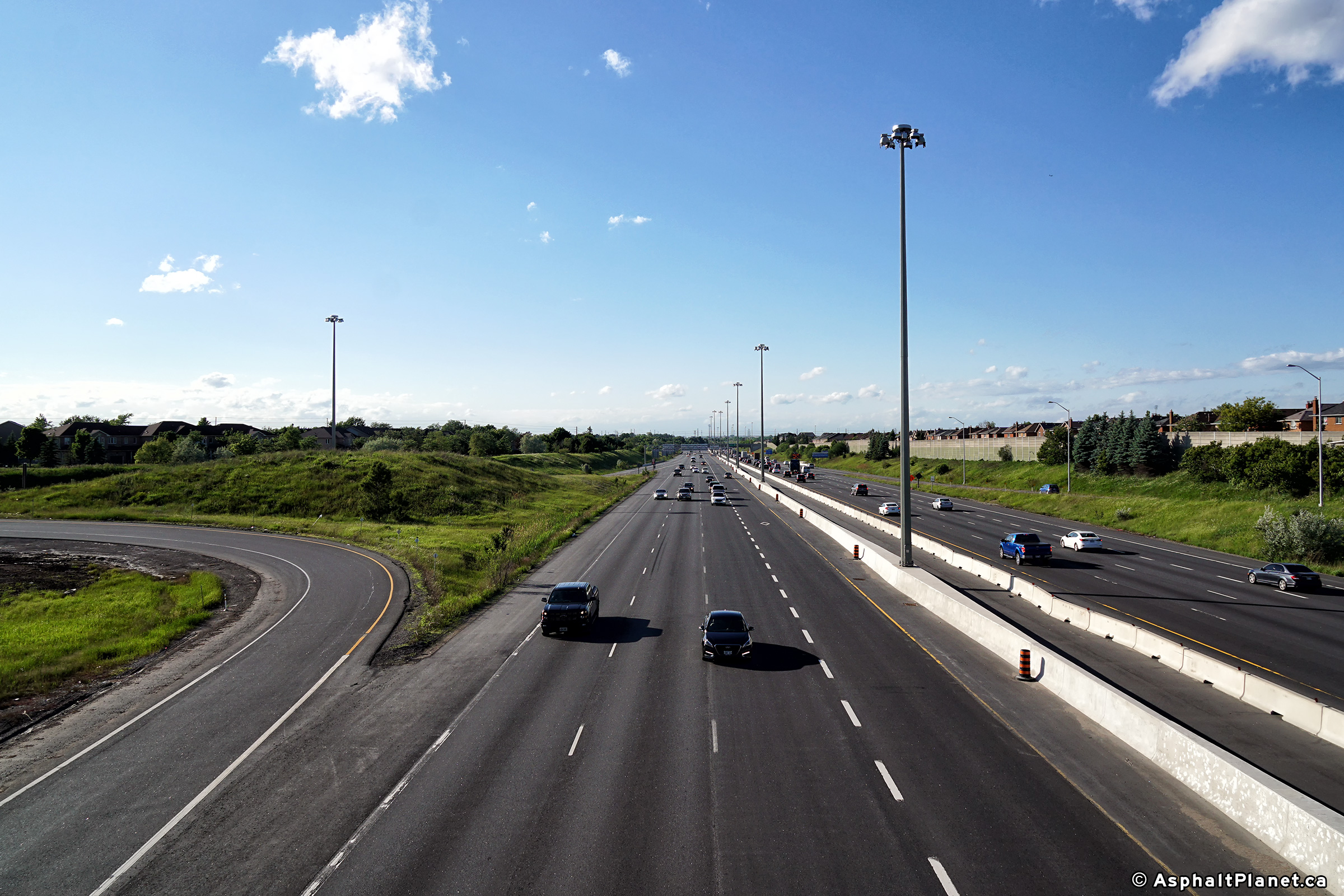
| Toronto - Mississauga Boundary | Two views towards the north along Highway 427 from the Morning
Road overpass. Morning Star Road is located roughly half way between Rexdale Boulevard and Finch Avenue. Photos # 1 and # 2 taken: May 17th, 2012. Photos # 3 and # 4 taken: June 4th, 2018. |
 (720x480) (1440x960) (2400x1600) 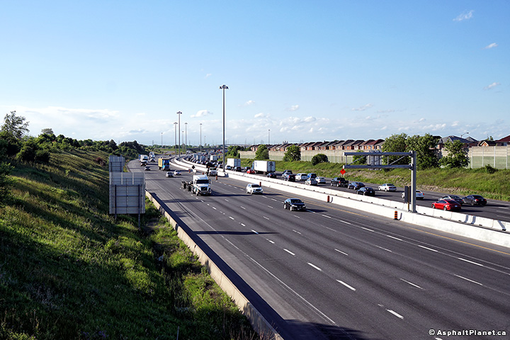 (720x480) (1440x960) (2400x1600) |
|||||||||||||||||||||||||||||||||||
| Toronto - Mississauga Boundary | Southerly view along the 427 towards the
Morning Star Boulevard overpass showing the asymmetric lane configuration
between the northbound and southbound carriageways. Photo taken: May 17th, 2012. |
|
|||||||||||||||||||||||||||||||||||
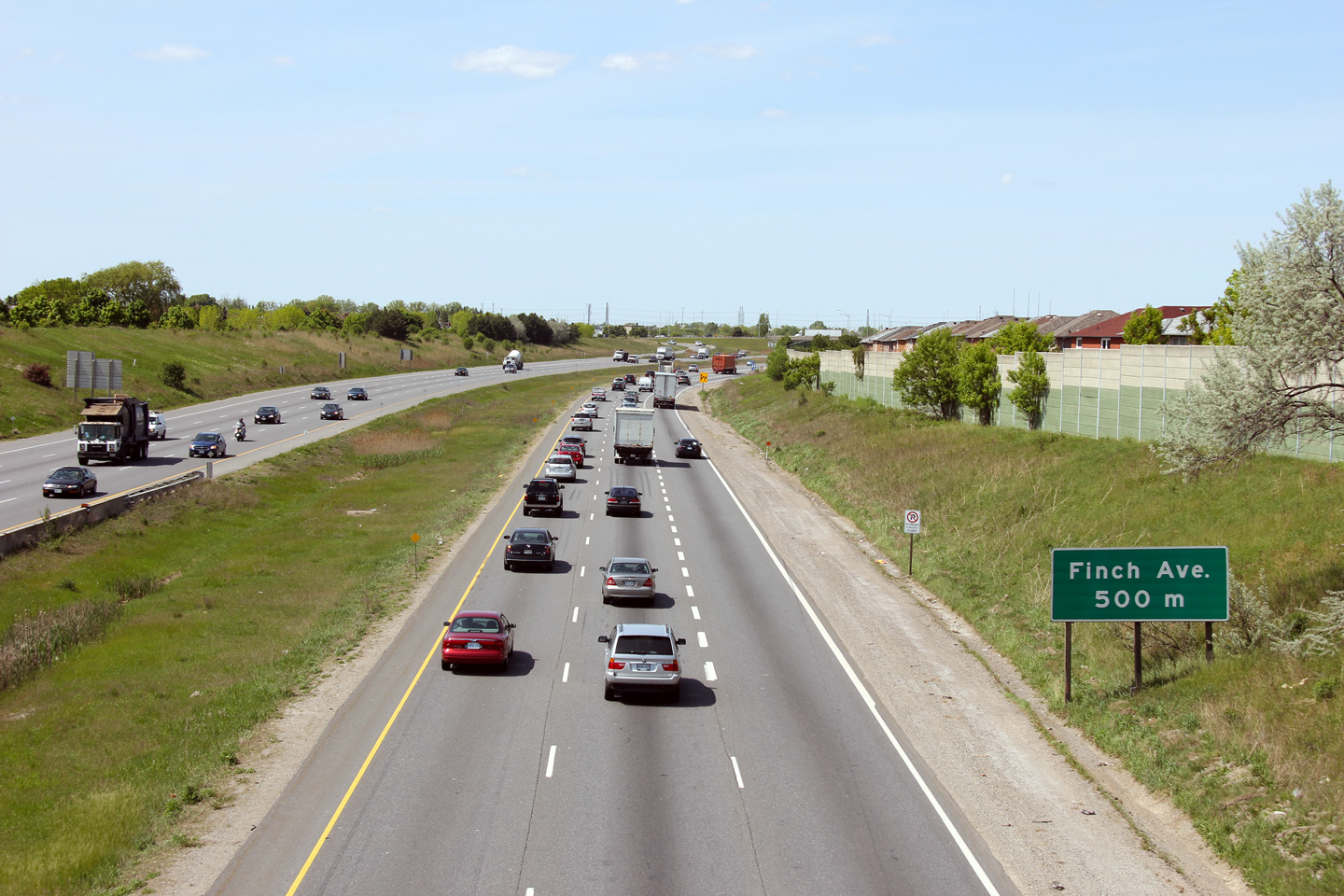
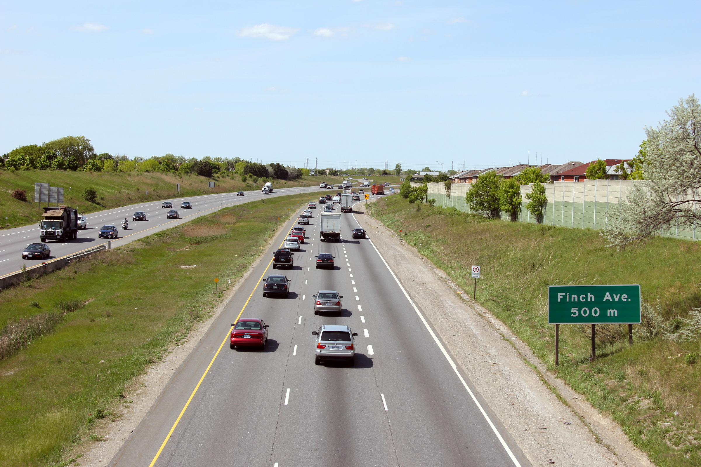
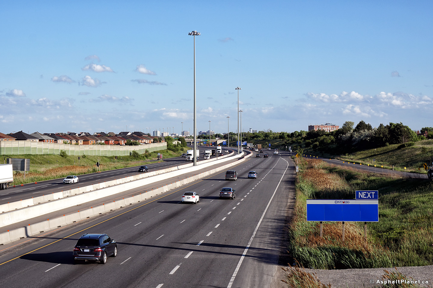
| City of Toronto | Northerly view towards the Finch Avenue
overpass. Nearly all freeway grade separations constructed between the
late 1960s and early 1990s used this pre-stressed concrete design. Photo taken: May 17th, 2012. |
|
|||||||||||||||||||||||||||||||||||
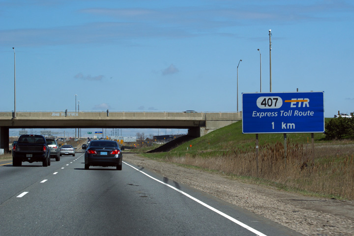
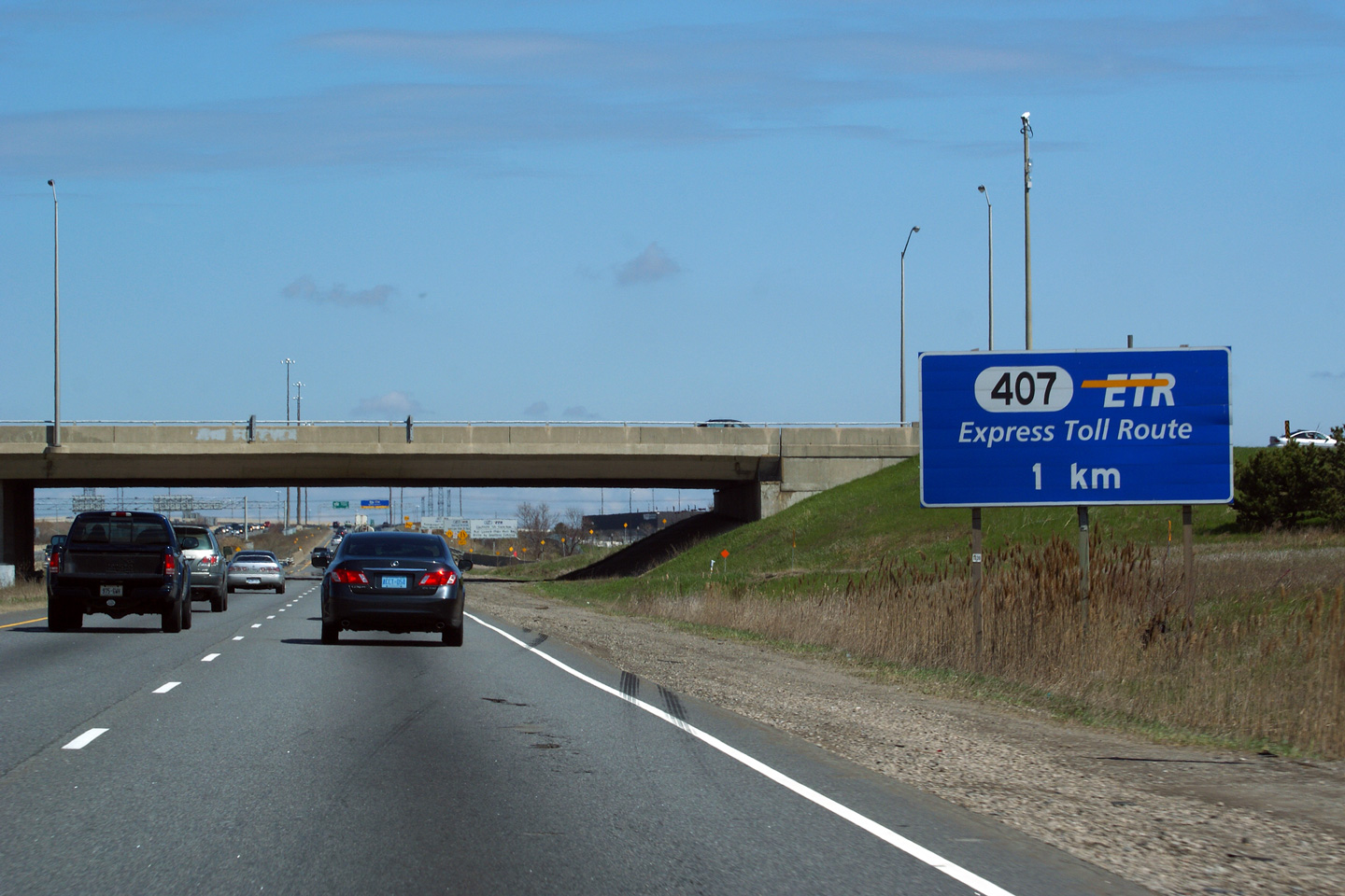
| City of Toronto | Ground mounted advanced signage for the Highway
407 ETR interchange. Photo taken: May 7th, 2011. |
 (720x480) (720x480)(1440x960) (2400x1600) |
|||||||||||||||||||||||||||||||||||
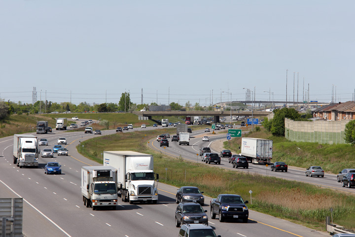
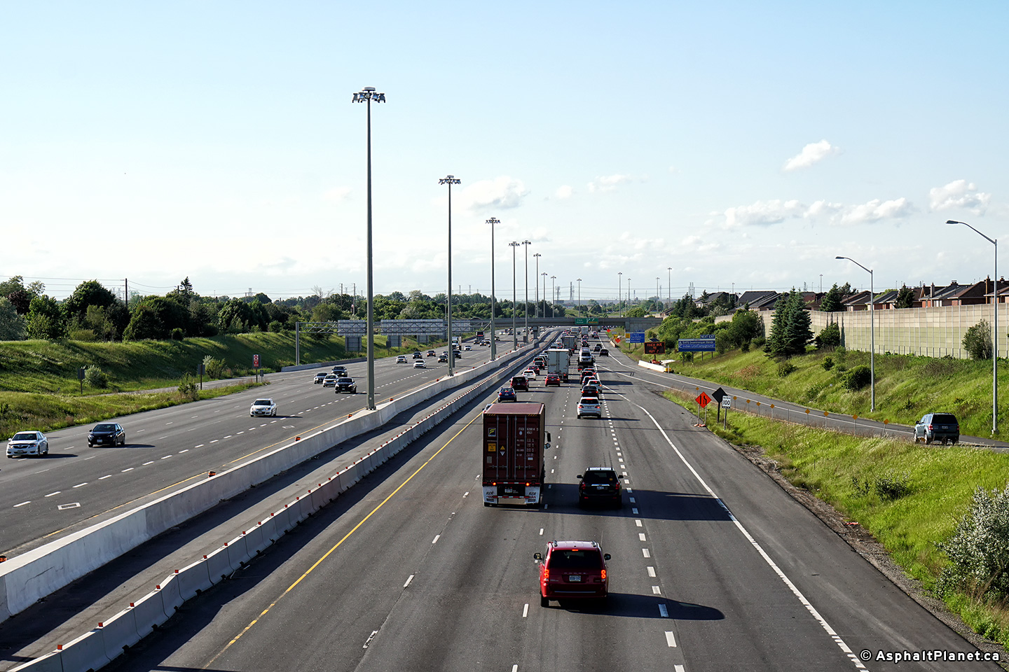
| City of Toronto | Looking south along the 427 from the Finch
Avenue overpass. Photo # 1 taken: May 17th, 2012. Photos # 2 and # 3 taken: June 4th, 2018. |
|
|||||||||||||||||||||||||||||||||||
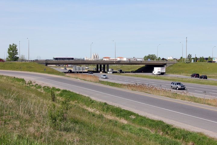
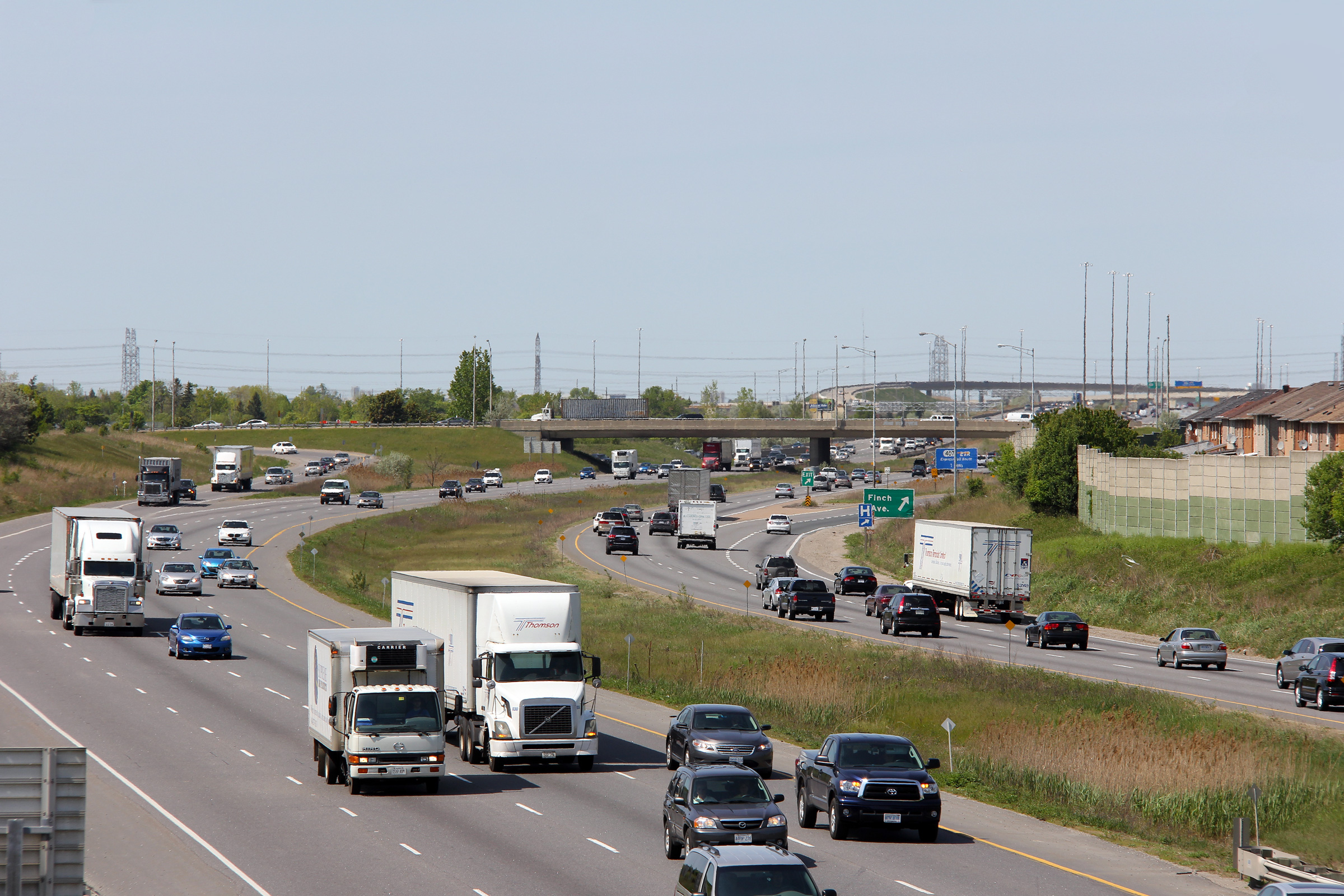
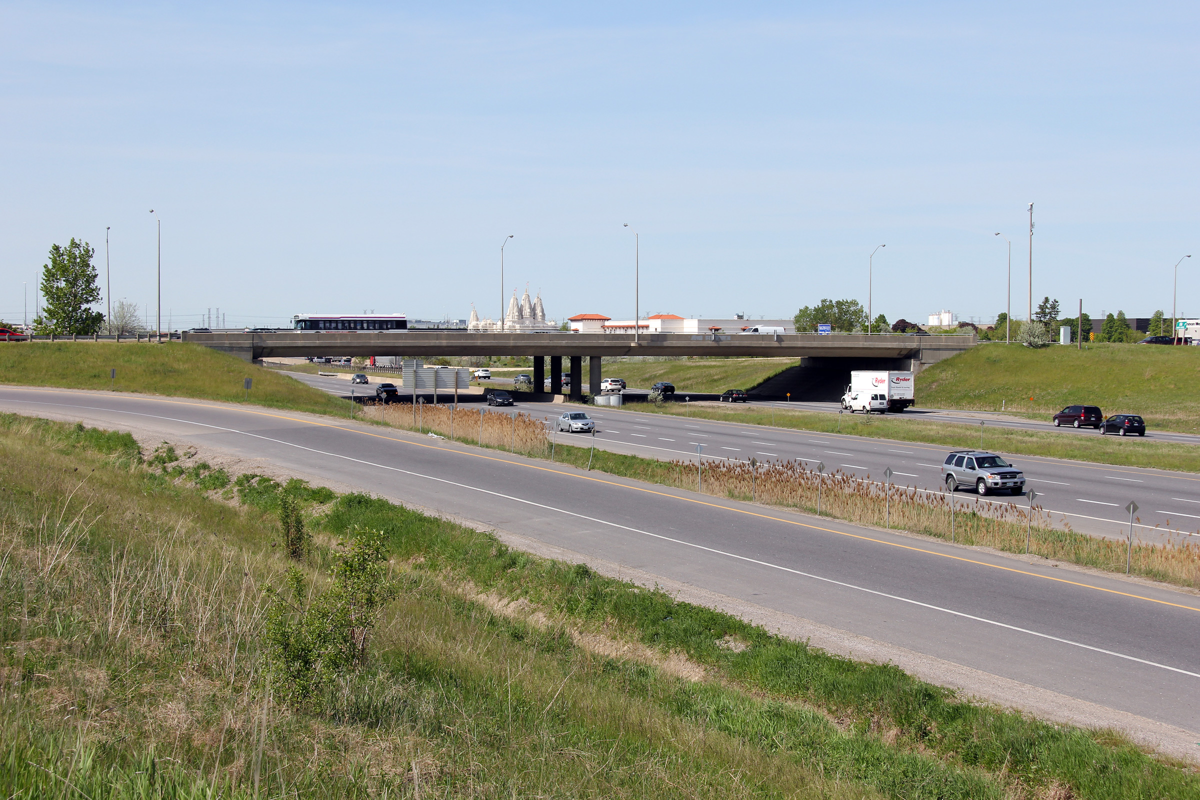
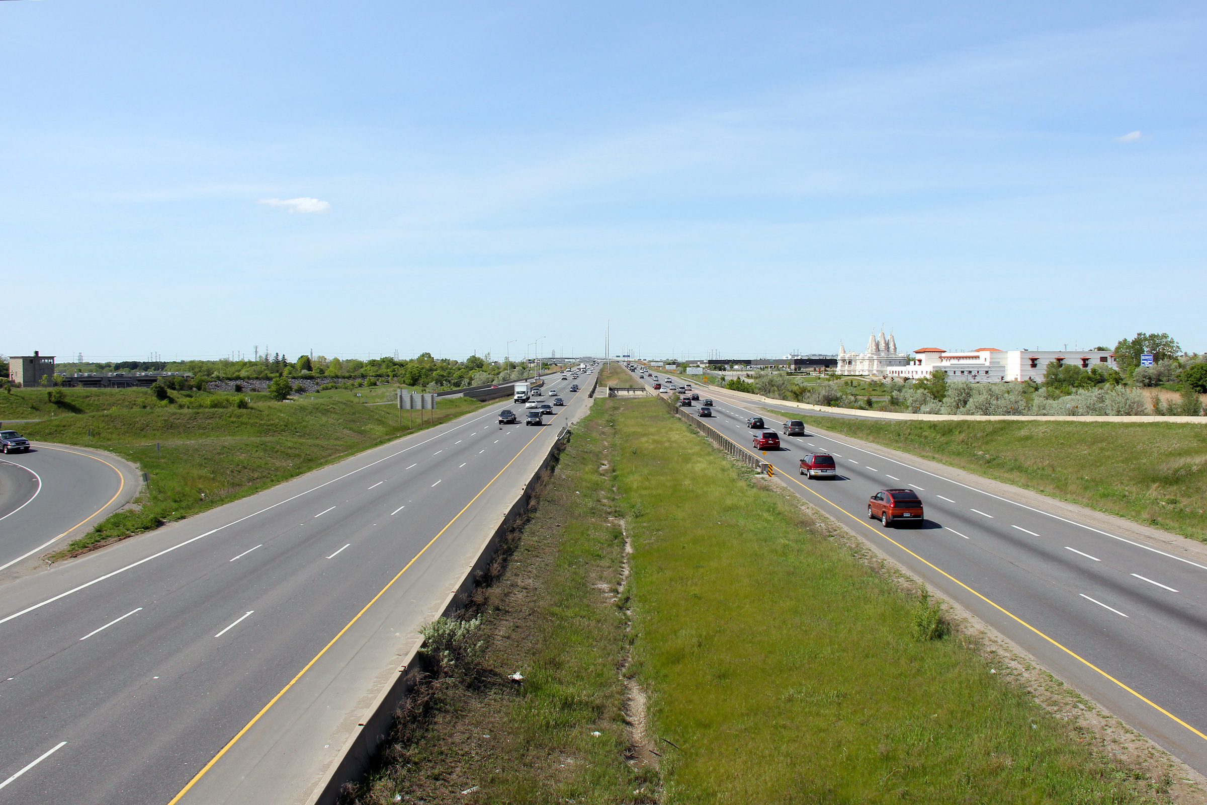
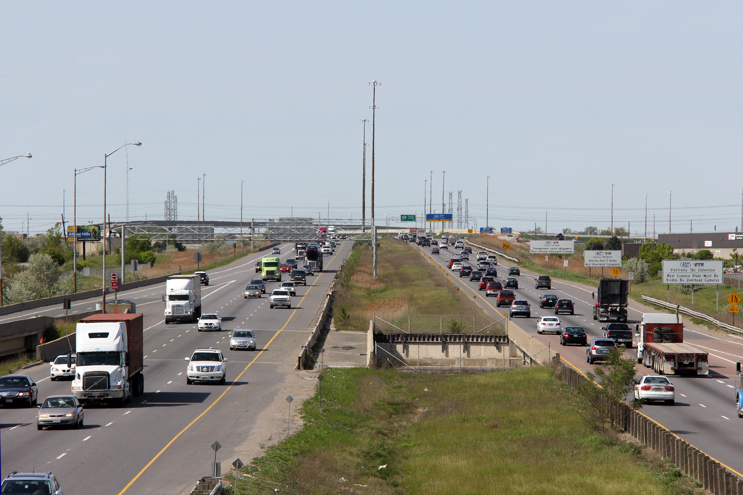
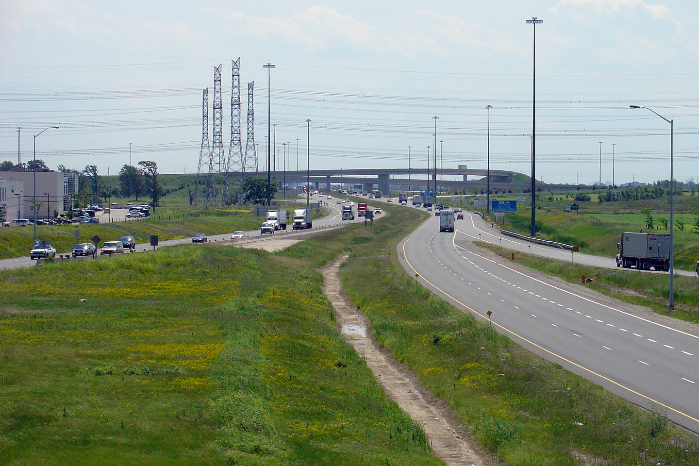
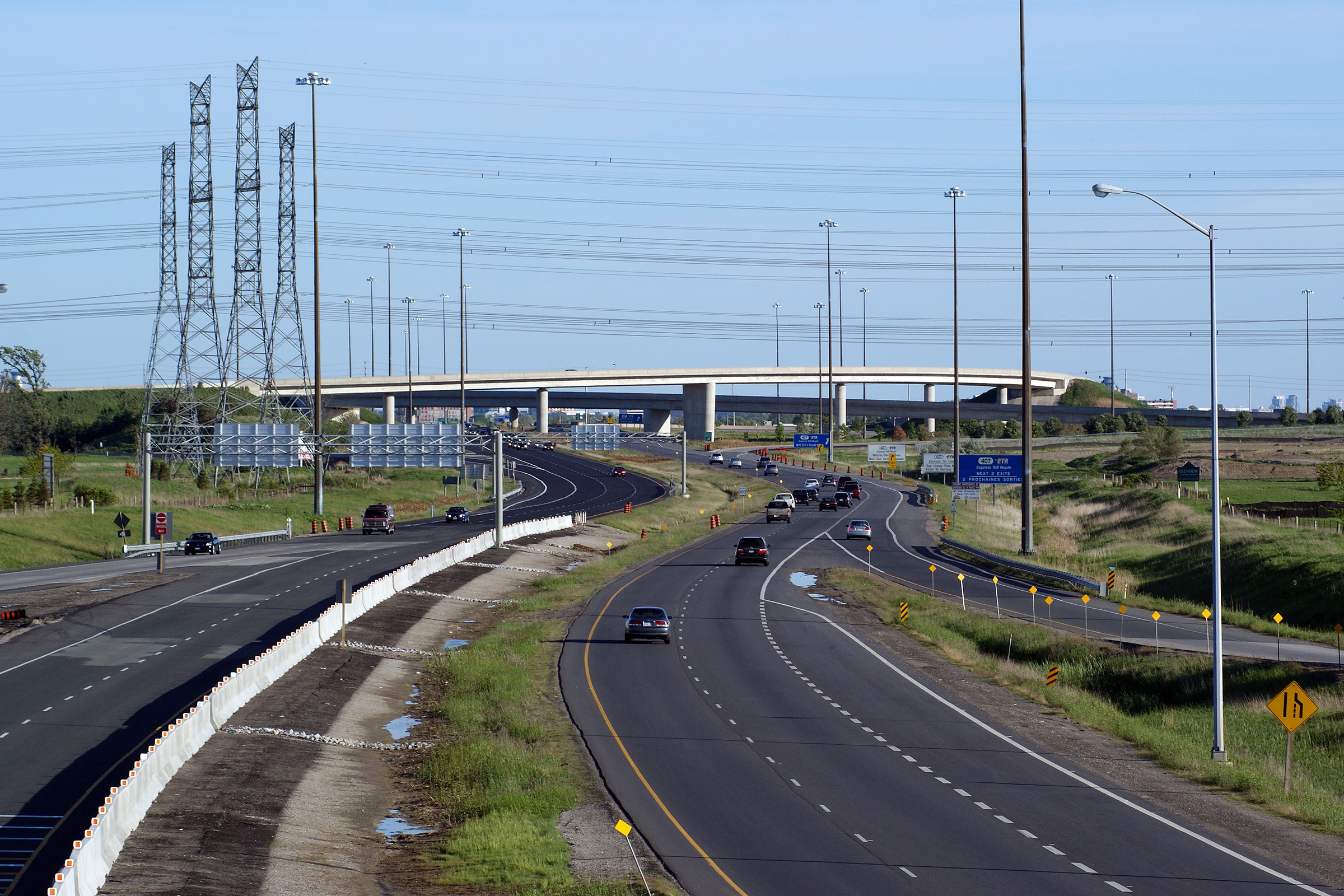
| City of Toronto | Highway 427 looking north from the Finch Avenue
overpass. The Highway 407 interchange located in the distance
of this photo. Before the early 1990s, Highway 427 terminated just
north of Finch Avenue. It was extended northerly in 1993 as a
precursor to Highway 407's construction. Photos # 1 and # 2 taken: May 17th, 2012. Photo # 3 taken: June 4th, 2018. |
 (720x480) (1440x960) (2400x1600) |
|||||||||||||||||||||||||||||||||||
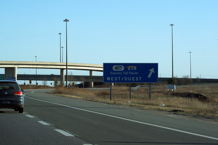
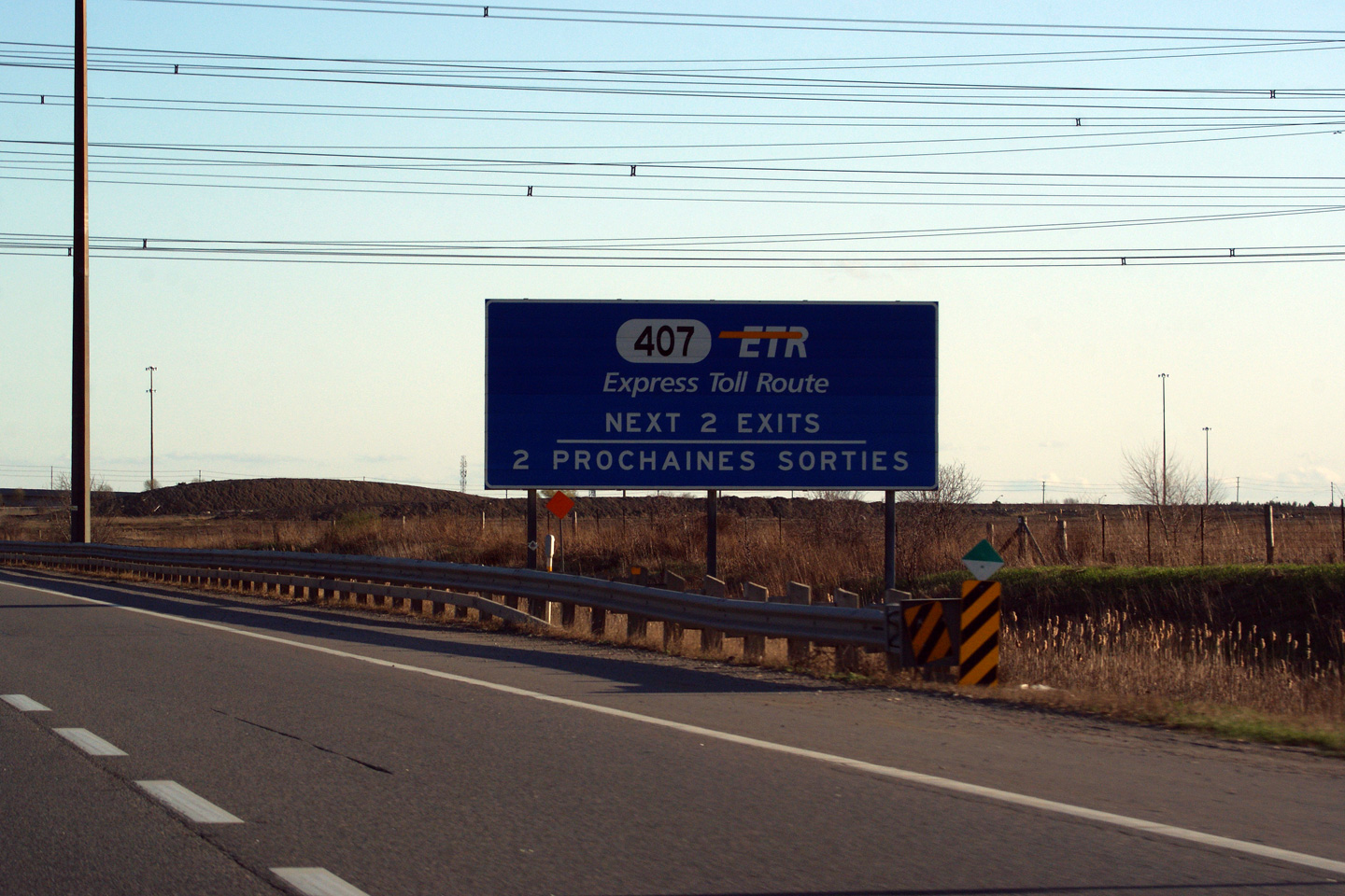
| City of Toronto | Overhead signage at the ramp to Highway 407 ETR. Photo taken: May 7th, 2011. |
 (720x480) (720x480)(1440x960) (2400x1600) |
|||||||||||||||||||||||||||||||||||
| Highway 427 meets Highway 407 near the highways northern terminus. Click here for Highway 407- West images and Click here for Highway 407- East images. | |||||||||||||||||||||||||||||||||||||
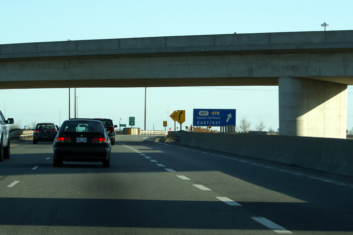
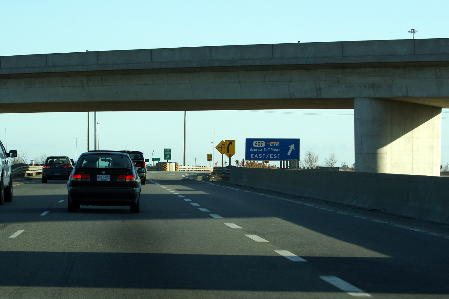
| City of Vaughan Regional Municipality of York |
Southerly view approaching the loop-ramp
to Highway 407 East. Photo taken: March 25th, 2012. |
 (720x480) (720x480)(1440x960) |
|||||||||||||||||||||||||||||||||||
| City of Vaughan Regional Municipality of York |
View approaching the directional ramp to
Highway 407 West. Photo taken: March 25th, 2012. |
 (720x480) (720x480)(1440x960) |
|||||||||||||||||||||||||||||||||||
| City of Vaughan Regional Municipality of York |
Southbound advanced signage for the Highway 407
interchange. Despite the fact that the interchange is located outside
of a designated French Language Services area, the signage at this
interchange is bilingual. Photo taken: March 25th, 2012. |
 (720x480) (720x480)(1440x960) |
|||||||||||||||||||||||||||||||||||
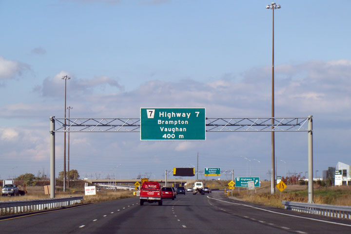
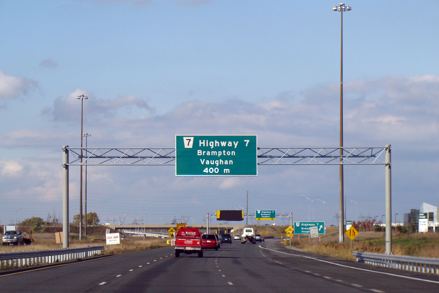
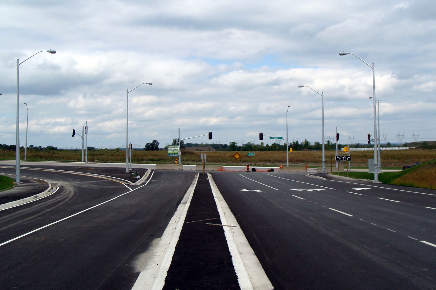
| City of Vaughan Regional Municipality of York |
Overhead signs for Highway 7
were erected as part of the Zenway Drive extension. Photo taken: November 2008. |
 (720x480) (720x480)(1440x960) |
|||||||||||||||||||||||||||||||||||
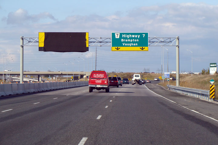
| City of Vaughan Regional Municipality of York |
Highway 7 signage at the
exit. Since this photo was taken, the Zenway Drive extension has
opened to traffic -- the ramp to Highway 7 now has but two lanes. Photo taken: November 2008. |
 (720x480) (720x480)(1440x960) |
|||||||||||||||||||||||||||||||||||
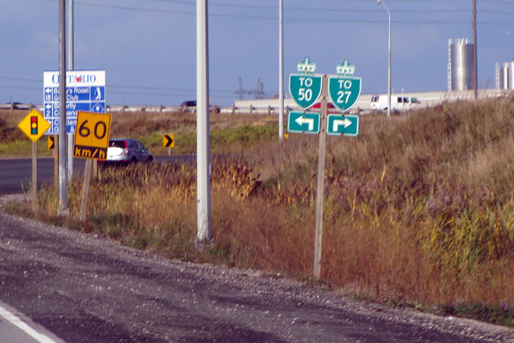
| City of Vaughan Regional Municipality of York |
A slightly
blurry photo of the trailblazers to Highway's 27 and 50 found on the ramp to
Highway 7. Photo taken: November 2008. |
 |
|||||||||||||||||||||||||||||||||||
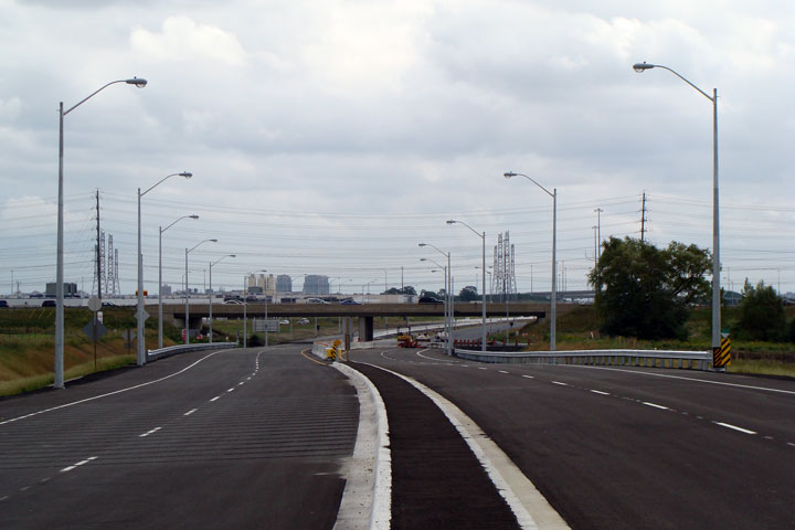
| City of Vaughan Regional Municipality of York |
Highway 427 looking south from
the
Highway 7
overpass in Vaughan. In 2008, an arterial roadway extension was opened
by the Region of York (as York Road 99) to carry Highway 427 traffic to
Zenway Boulevard, approximately 500m to the north. This was done in
order to alleviate congestion at both the Highway 27 and Highway 50
intersections along Highway 7. Upper photo taken: June 25th, 2004. Lower photos taken: May 31st, 2009. |
 (720x480) (1440x960) (2400x1600)
 (720x480) (1440x960) (2400x1600) |
|||||||||||||||||||||||||||||||||||
| Highway 407 ends at Highway 7 in Western Vaughan. Click here for Highway 7 images. | |||||||||||||||||||||||||||||||||||||
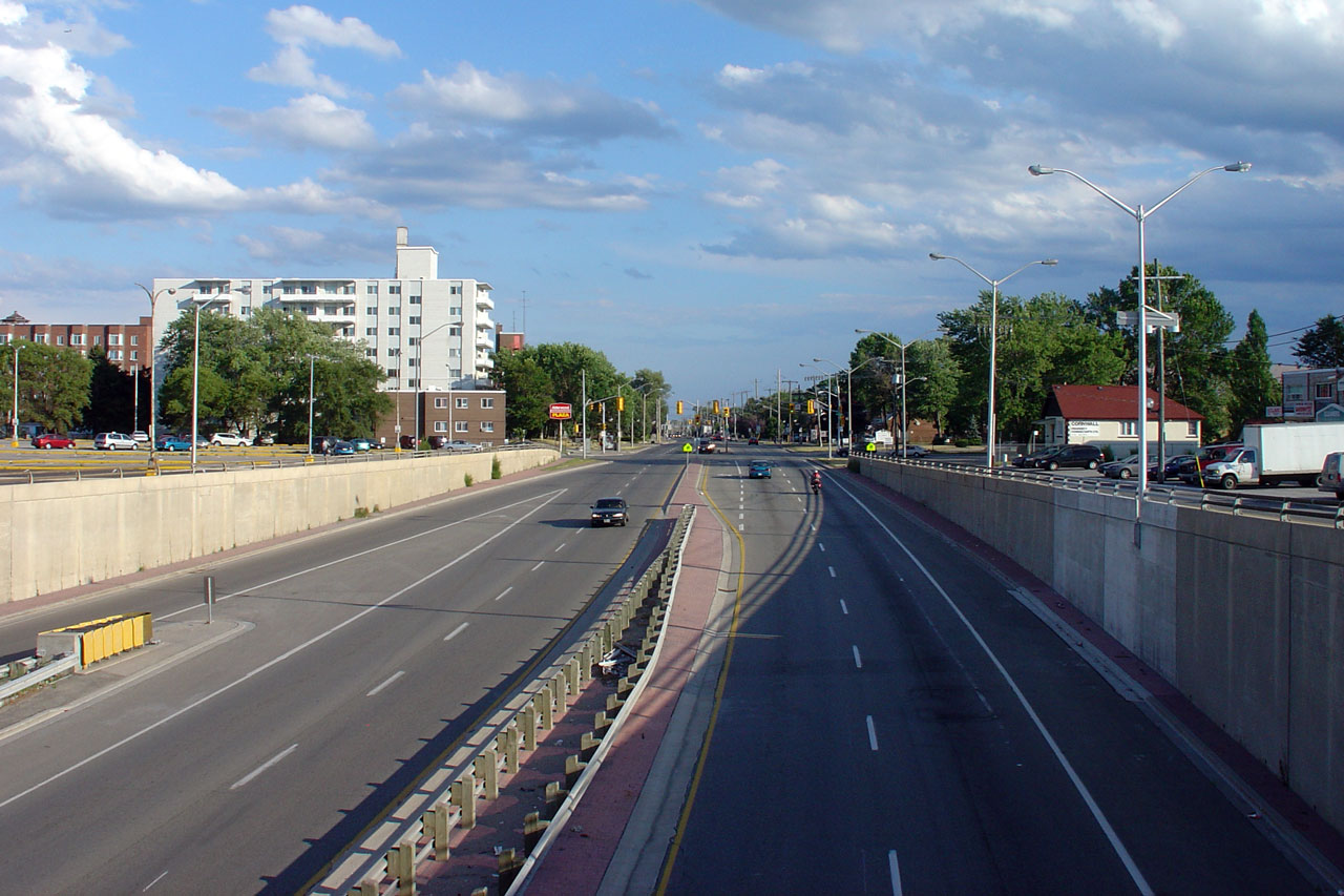
| City of Vaughan Regional Municipality of York |
View looking northerly along the arterial road
extension of Highway 427. The traffic signal at Zenway Boulevard is
visible in this photo. Photo taken: May 31st, 2009. |
 |
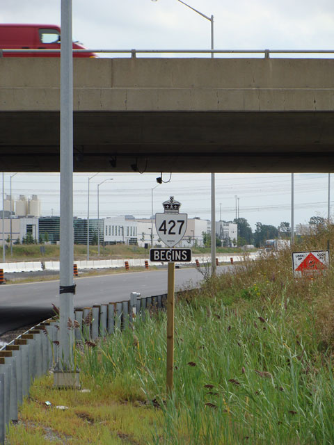
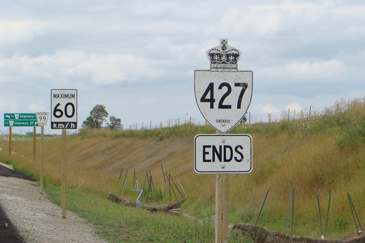
| City of Vaughan Regional Municipality of York |
Both beginning and ends signs
were erected at the Highway 7 overpass. York Region Officials
apparently want to make the jurisdictional change very apparent to
motorists. Photo taken: September 2008. |
  |
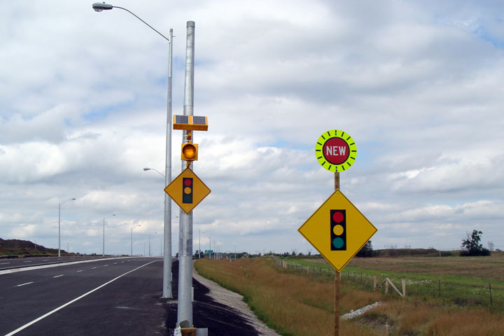
| City of Vaughan Regional Municipality of York |
There is a signal ahead.
There is a signal ahead. Photo taken: September 2008. |
 |
| City of Vaughan Regional Municipality of York |
Southbound view towards
Highway 7 along the Zenway Drive access. Photo taken: September 2008. |
 (720x480) (1440x960) |
| City of Vaughan Regional Municipality of York |
How anyone thought it was
appropriate to number a road named 'Highway 50' as Regional Road 24 is beyond me. Photo taken: September 2008. |
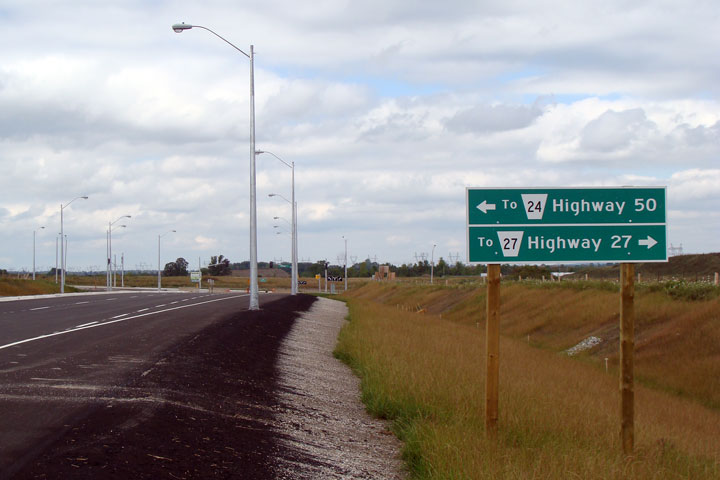 |
| City of Vaughan Regional Municipality of York |
The unassuming end to York
Region's arterial 427 extension is at Zenway Drive in Vaughan. Photo taken: September 2008. |
 (720x480) (1440x960) |
<- Highway 420 Images Back to Highway 427 Highway 502 Images ->
Copyright (c) 2004-2012, Scott Steeves (Webmaster) AsphaltPlanet@asphaltplanet.ca


 (720x480)


