Queen Elizabeth Way - Images
<- Page 4 Page 5 - Oakville to Toronto
Photos shown in this table are arranged from South (Fort Erie) to North (Toronto):
| Proper Municipality Name | Photo Description | Photo | ||
|
Photos taken from driver's perspective appear offset from centre-line Photos: |
Toronto- Bound |
Fort Erie- Bound |
||
| Continued from Burlington to Oakville Images | ||||
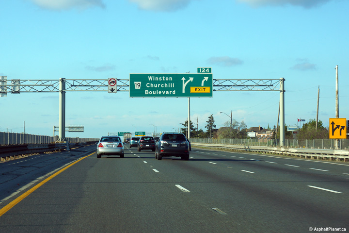
| Town of Oakville Regional Municipality of Halton |
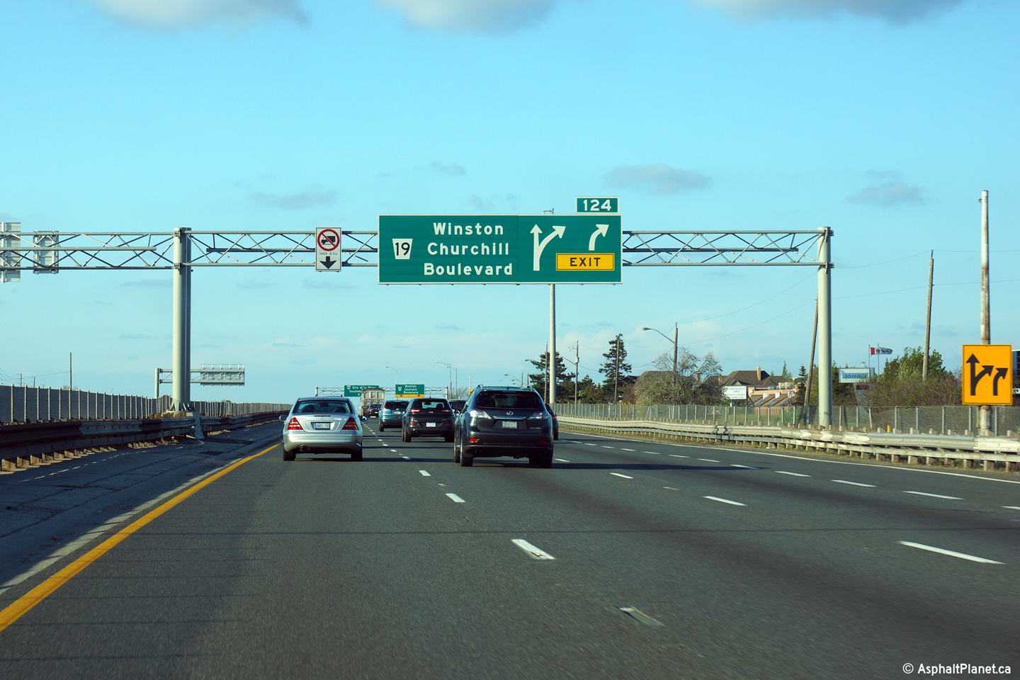
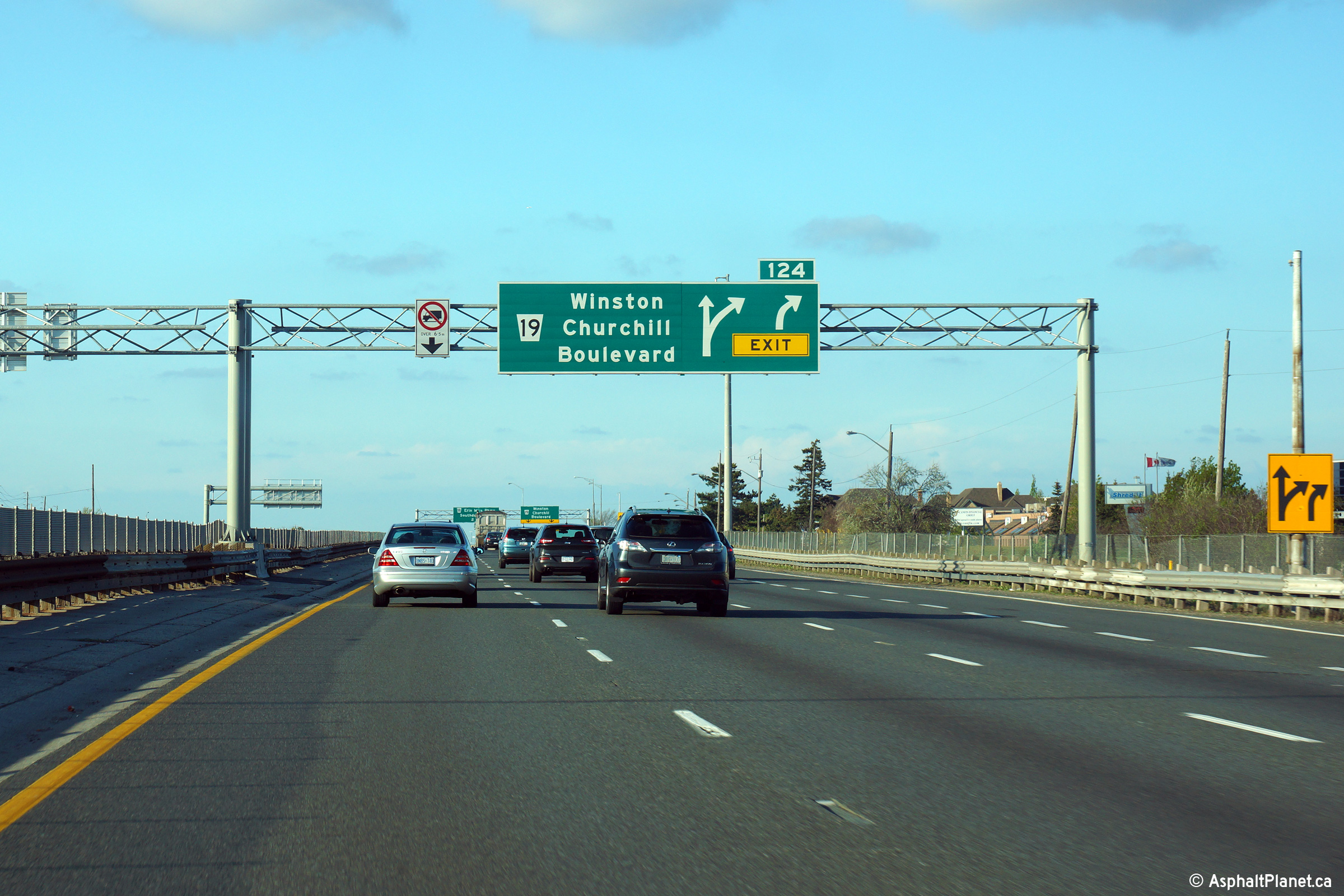
Advanced signage for the Winston Churchill Boulevard interchange.
Winston Churchill Boulevard is located just beyond the Highway 403-Oakville
interchange. Photo taken: May 22nd, 2014. |
 (720x480) (720x480)(1440x960) (2400x1600) |
||
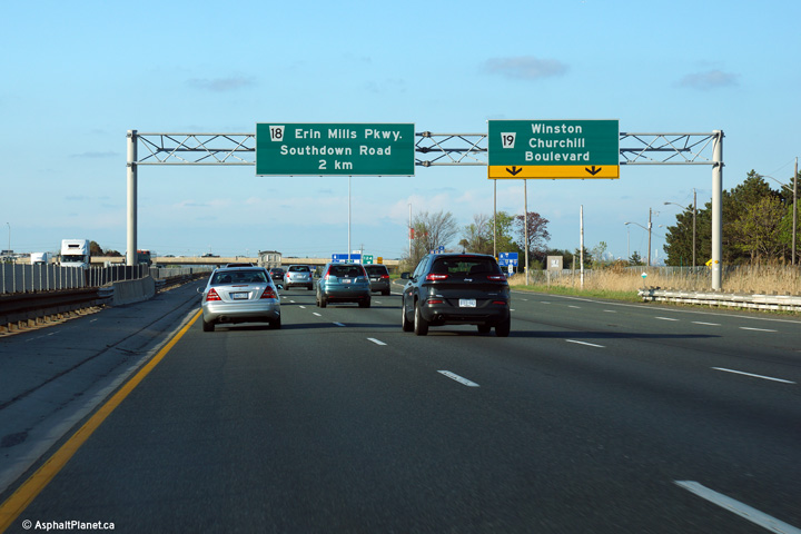
| Town of Oakville Regional Municipality of Halton |
Signage at the Toronto-bound off-ramp to Winston Churchill Boulevard. Photo taken: May 22nd, 2014. |
 (720x480) (720x480)(1440x960) (2400x1600) |
||
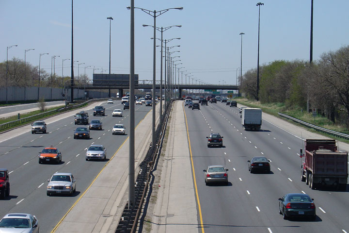
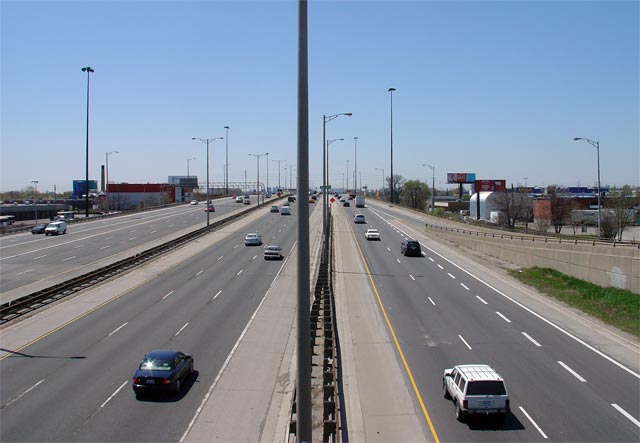
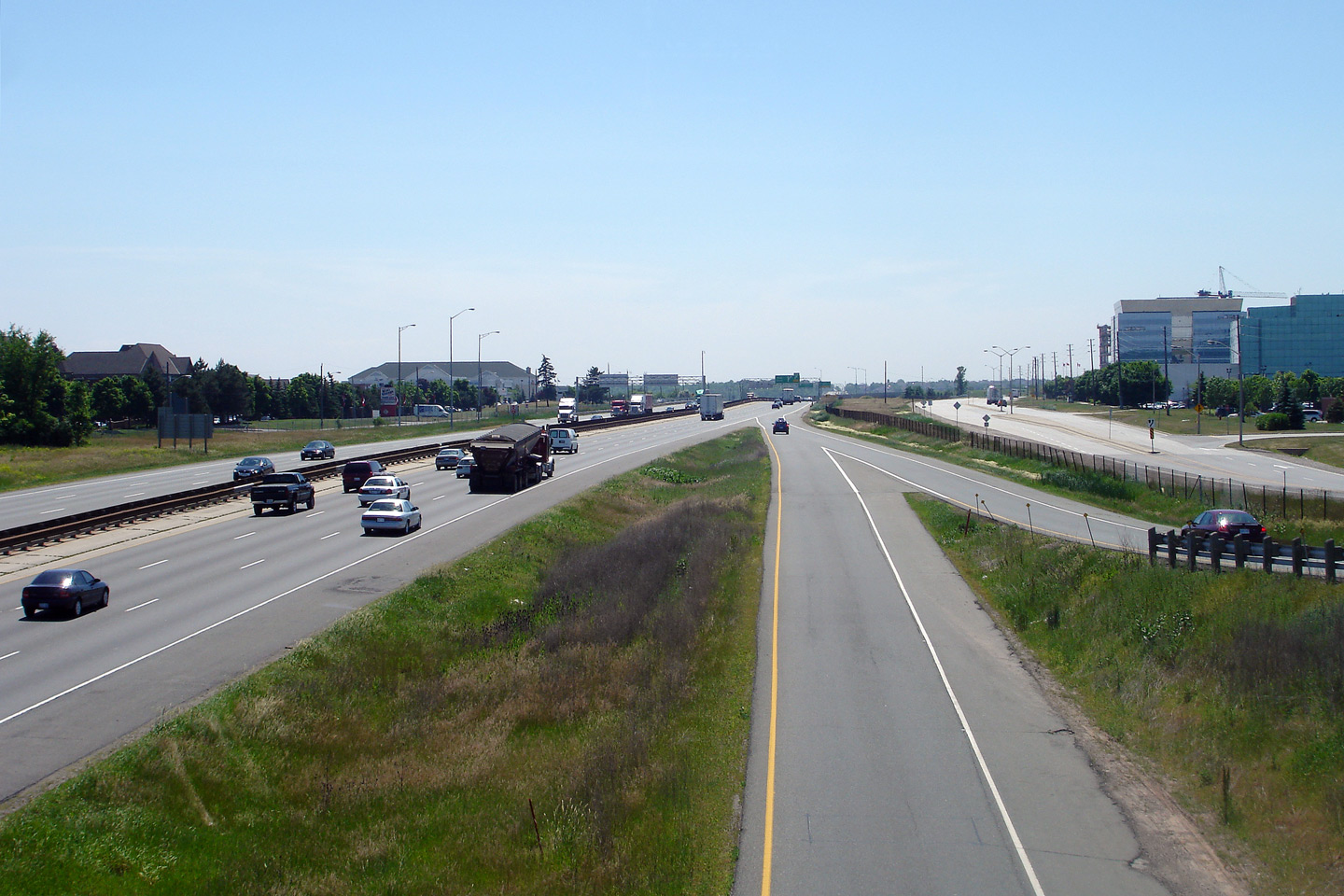
| Town of Oakville Regional Municipality of Halton |
View looking towards Hamilton along the QEW from the Winston Churchill
Boulevard overpass. The north and south service roads are a fair
distance from the mainline lanes of the QEW so there is sufficient space for
the completion of ramps between QEW Toronto and Highway 403 East. Photo taken: June 14th, 2007. |
 (720x480) (1440x960) |
||
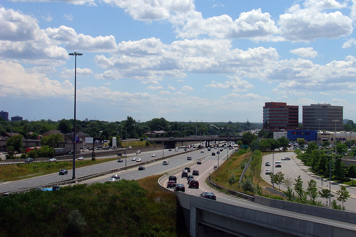
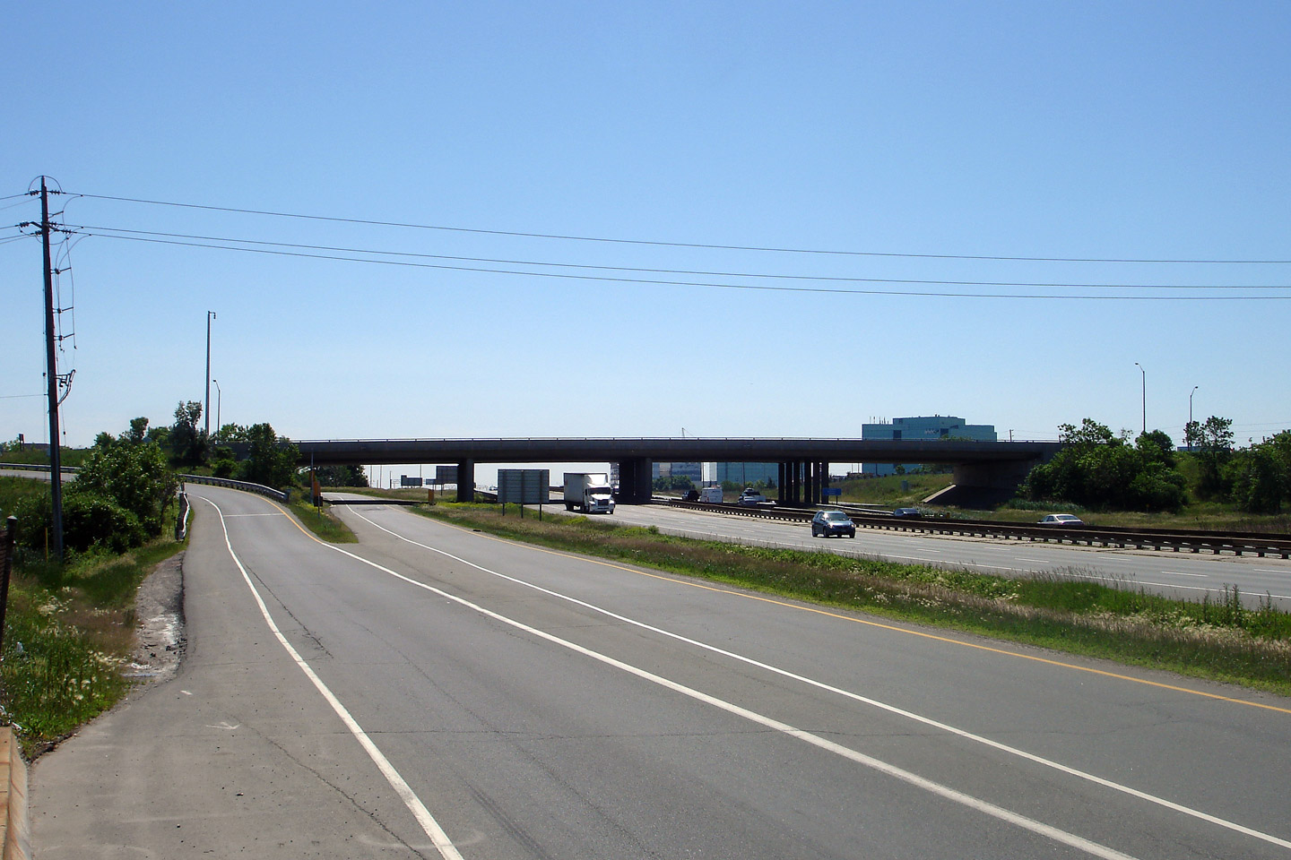
| City of Mississauga Regional Municipality of Peel |
View looking Toronto-bound from the Winston Churchill Boulevard overpass.
Note the ramp-metering visible on the Toronto-bound ramps to the highway. Photo taken: June 14th, 2007. |
 |
||
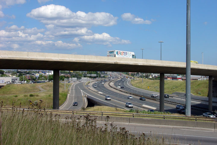
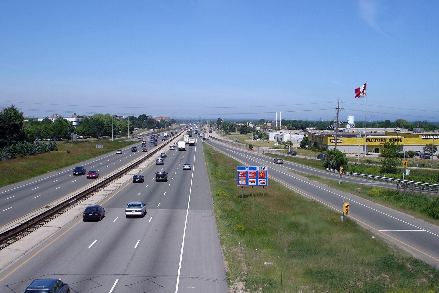
| City of Mississauga Regional Municipality of Peel |
View looking back towards Hamilton and the Winston Churchill Boulevard.
The Winston Churchill Boulevard overpass seems a little oversized for the
six-lane freeway that passes underneath of it. Photo taken: June 14th, 2007. |
 |
||
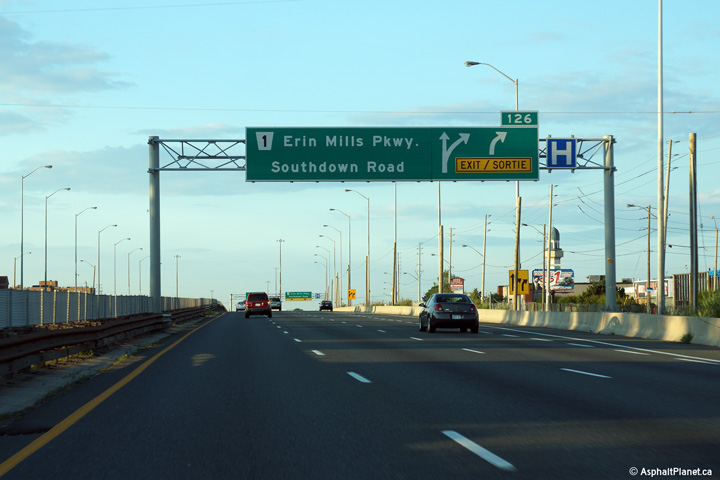
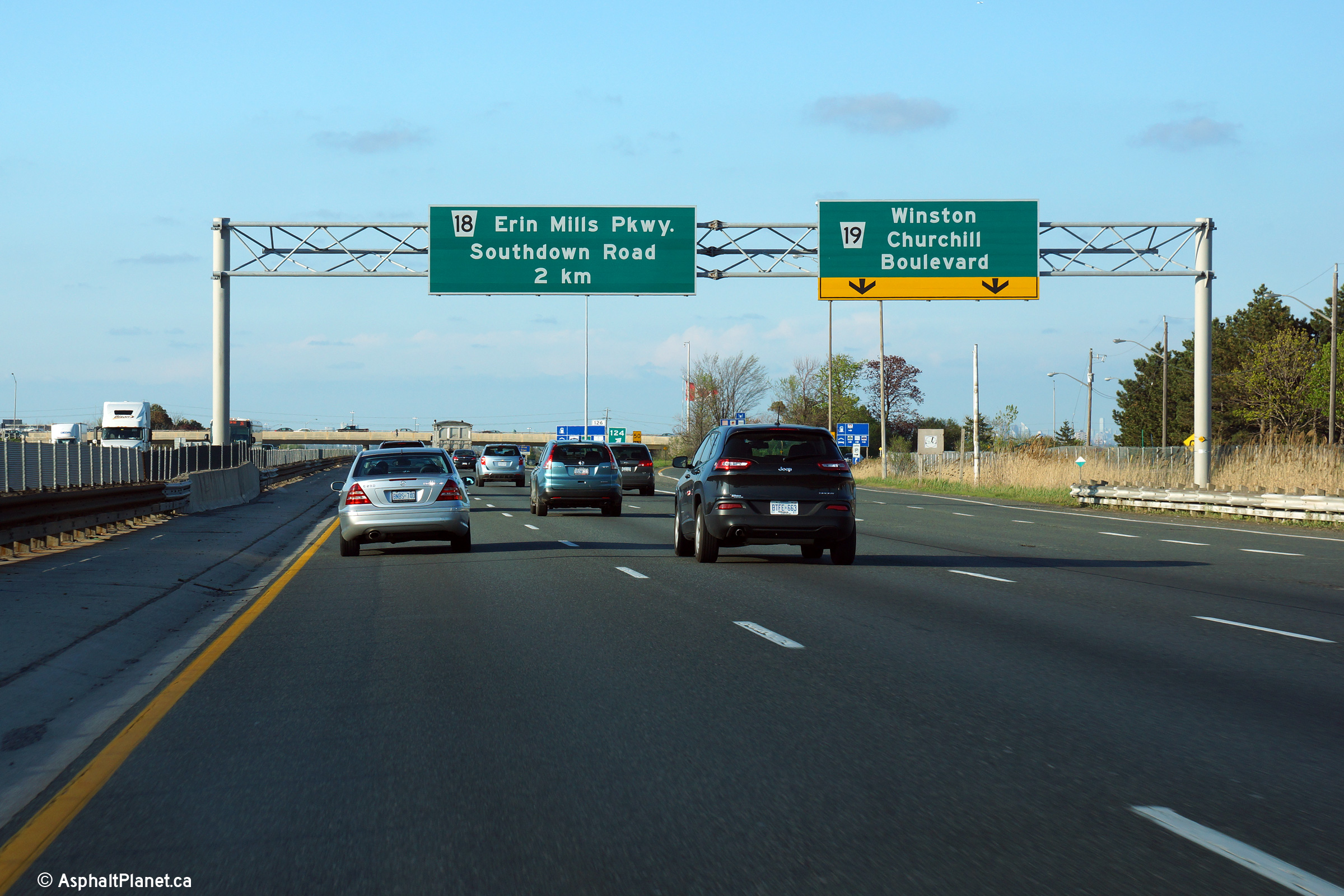
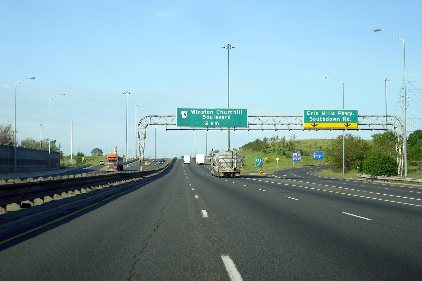
| City of Mississauga Regional Municipality of Peel |
Toronto-bound advanced signage for the Erin Mills Parkway interchange. Photo taken: July 10th, 2014. |
 (720x480) (720x480)(1440x960) (2400x1600) |
||
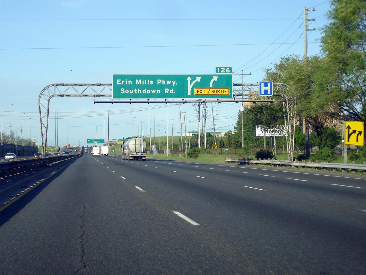
| City of Mississauga Regional Municipality of Peel |
Signage at the Toronto-bound off-ramp to the Erin Mills Parkway interchange. Photo taken: July 10th, 2014. |
 (720x480) (720x480)(1440x960) (2400x1600) |
||
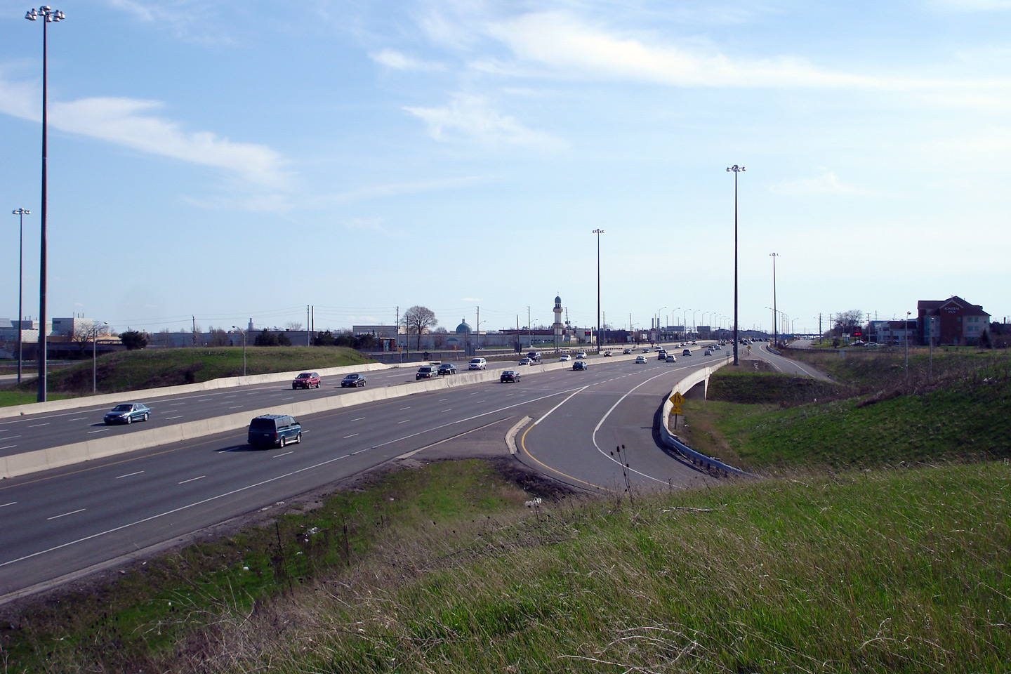
| City of Mississauga Regional Municipality of Peel |
View looking towards Hamilton at the Erin Mills Parkway interchange along
the QEW. This interchange was reconstructed from a traffic circle to a
standard parclo A4 in 2000. Photo taken: April 29th, 2007. |
 |
||
| City of Mississauga Regional Municipality of Peel |
Overhead signage at the ramp to Erin Mills Parkway from the Hamilton-bound
QEW. Surprisingly when the Erin Mills Road was reconstructed back in
2002, the Hamilton-bound overhead signage was not replaced. Photo taken: May 26th, 2007. |
|||
| City of Mississauga Regional Municipality of Peel |
Overhead advanced signage for the Erin Mills Parkway interchange.
Notice the subordinate yellow arrow signage located just before the overhead
sign. These yellow signs replaced the old 'RIGHT LANE MUST EXIT' signs
that appeared in Ontario before bilingual signage was introduced in the early 1990s. Photo taken: May 26th, 2007. |
 |
||
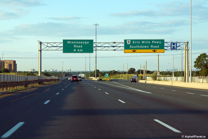
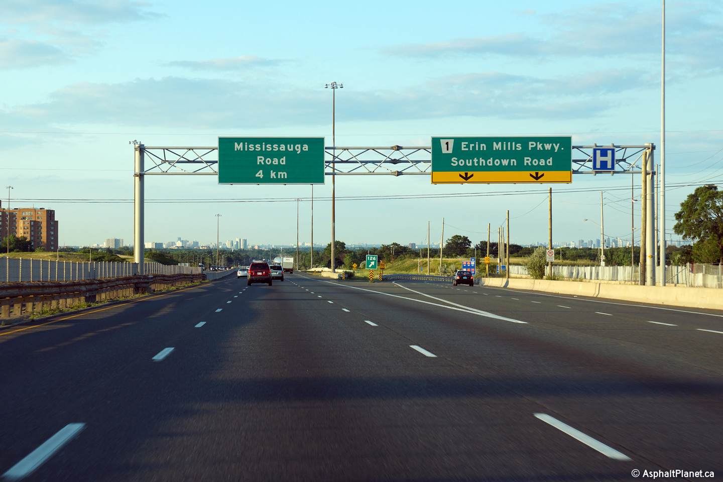
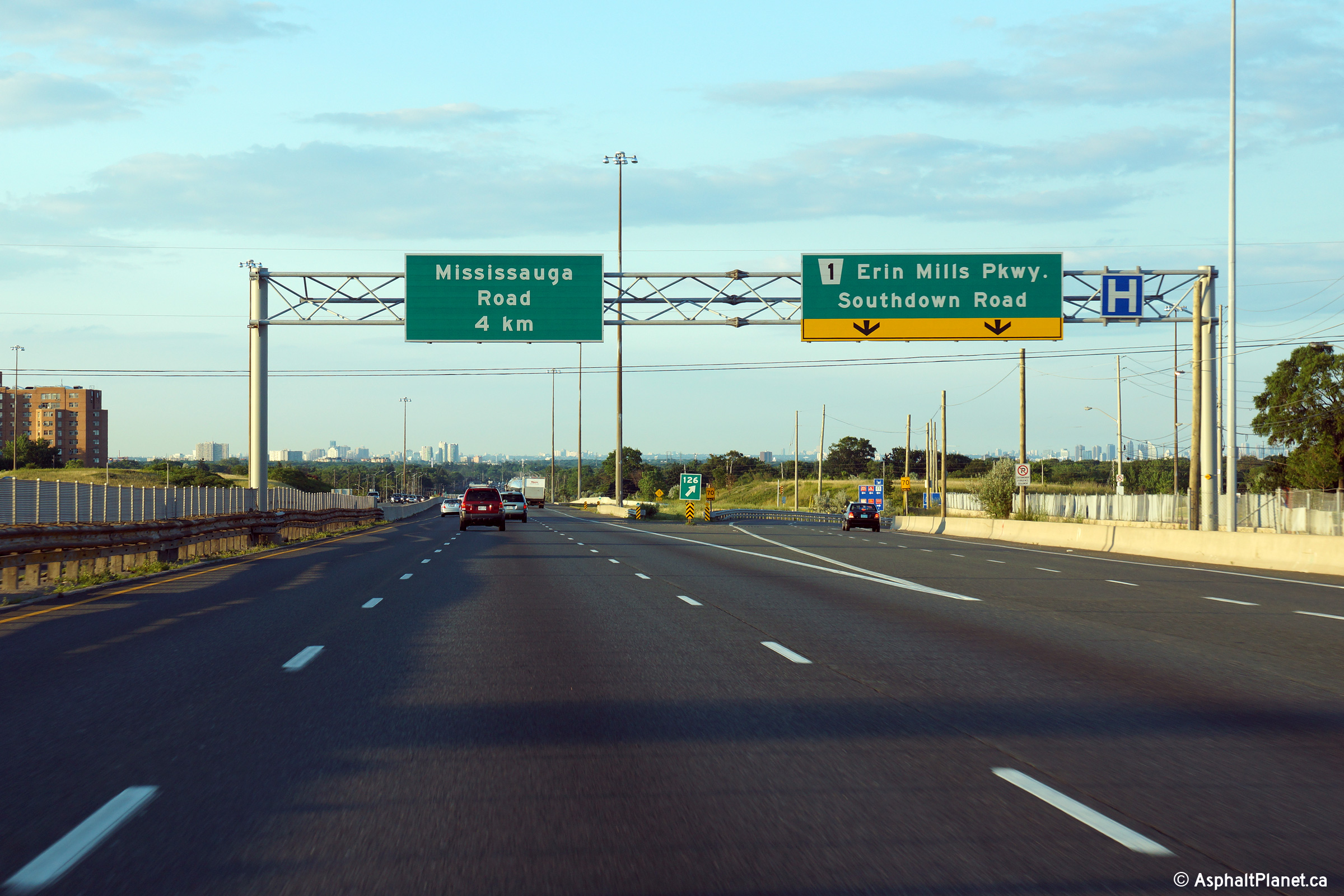
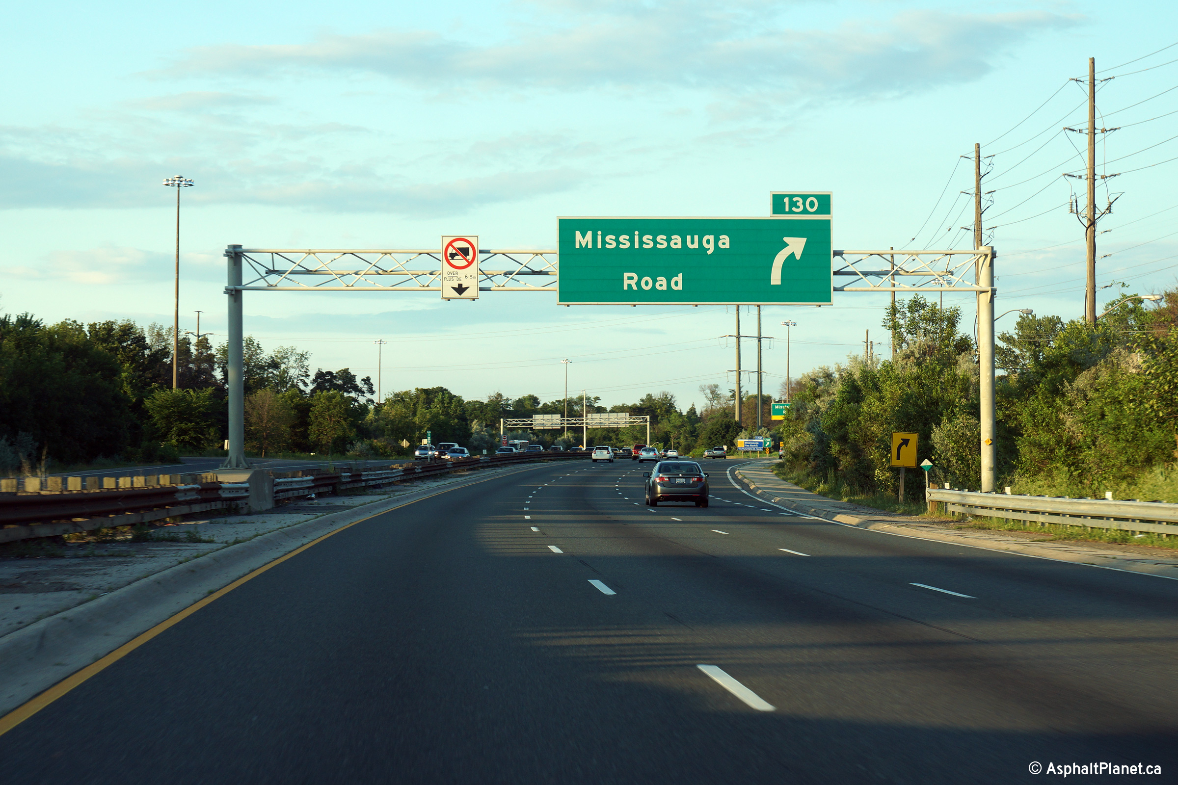
| City of Mississauga Regional Municipality of Peel |
Advanced signage for the Toronto-bound ramp to Mississauga Road. Photo taken: July 10th, 2014. |
 (720x480) (720x480)(1440x960) (2400x1600) |
||
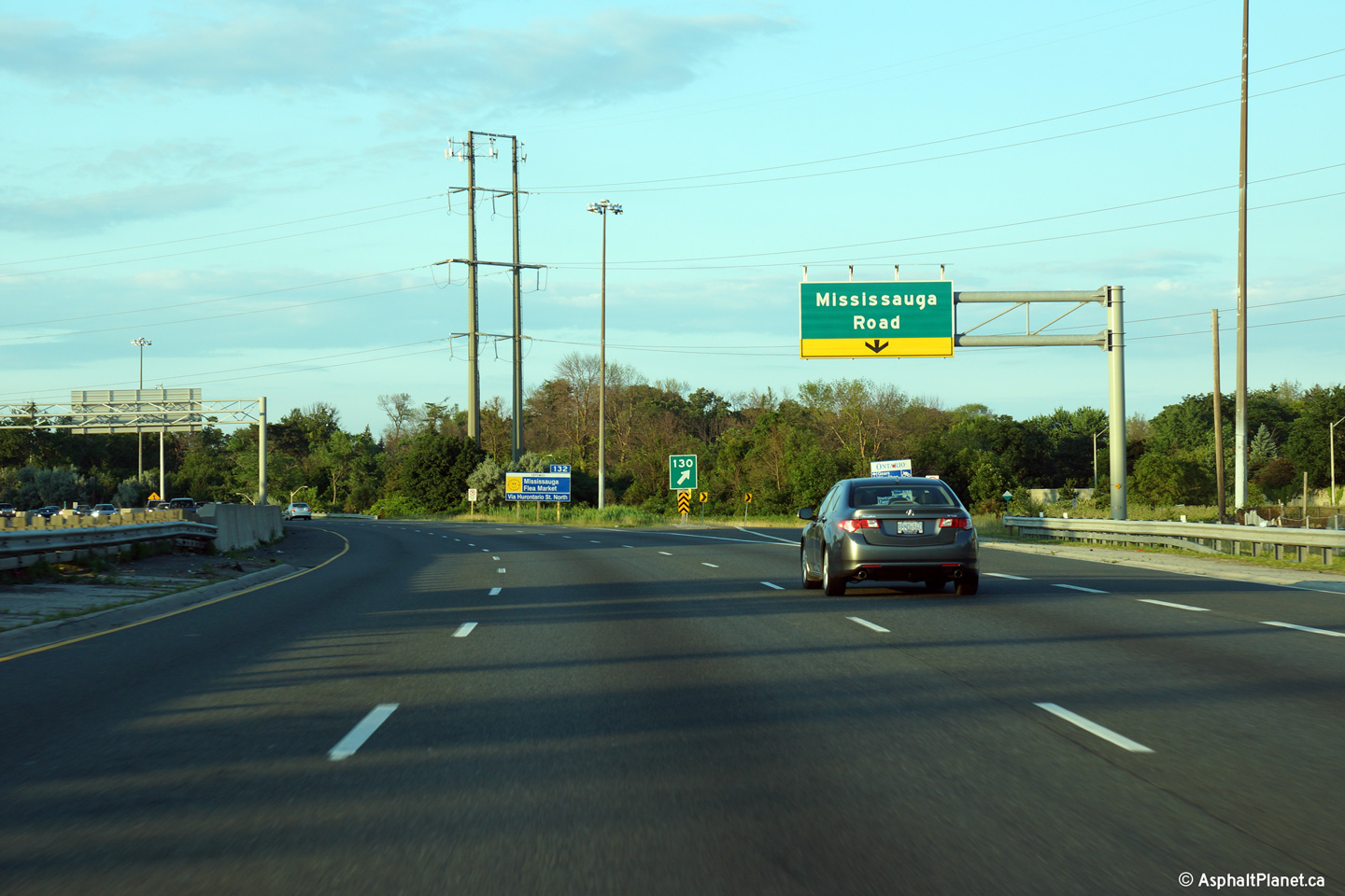
| City of Mississauga Regional Municipality of Peel |
Signage at the off-ramp to the Toronto-bound ramp to Mississauga Road.
Because a partial overhead gantry was used at this location, there is no
Toronto-bound pre-advanced signage advising motorists of the upcoming
Hurontario Street interchange. This signage replaced signage that was
formerly affixed to a butterfly gantry. Doug Kerr has a photo of the
former signage on
flickr, taken in June, 2004. Photo taken: July 10th, 2014. |
 (720x480) (720x480)(1440x960) (2400x1600) |
||
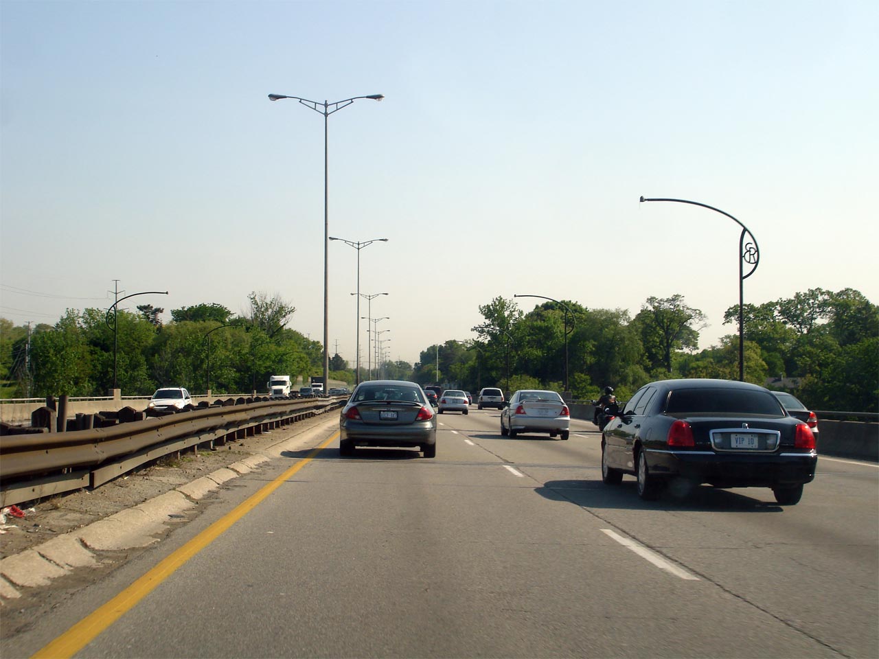
| City of Mississauga Regional Municipality of Peel |
This Photo shows the Toronto-bound QEW over the Credit River bridge in Mississauga. This photo is located roughly at kilometre marker 131. The 'ER' light standards that adorn the Credit River bridge are no longer in use, standing just for decoration. New functional 'ER' style lights have been introduced along this bridge matching those that were recently installed along both the Bronte and Sixteen Mile Creek bridges in Oakville. Photo taken: May 30th, 2007. |
 |
||
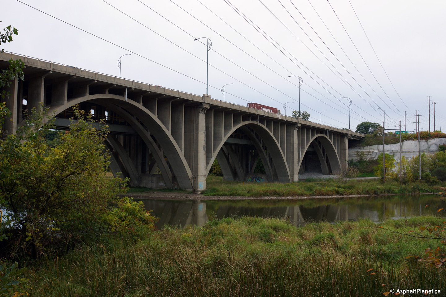
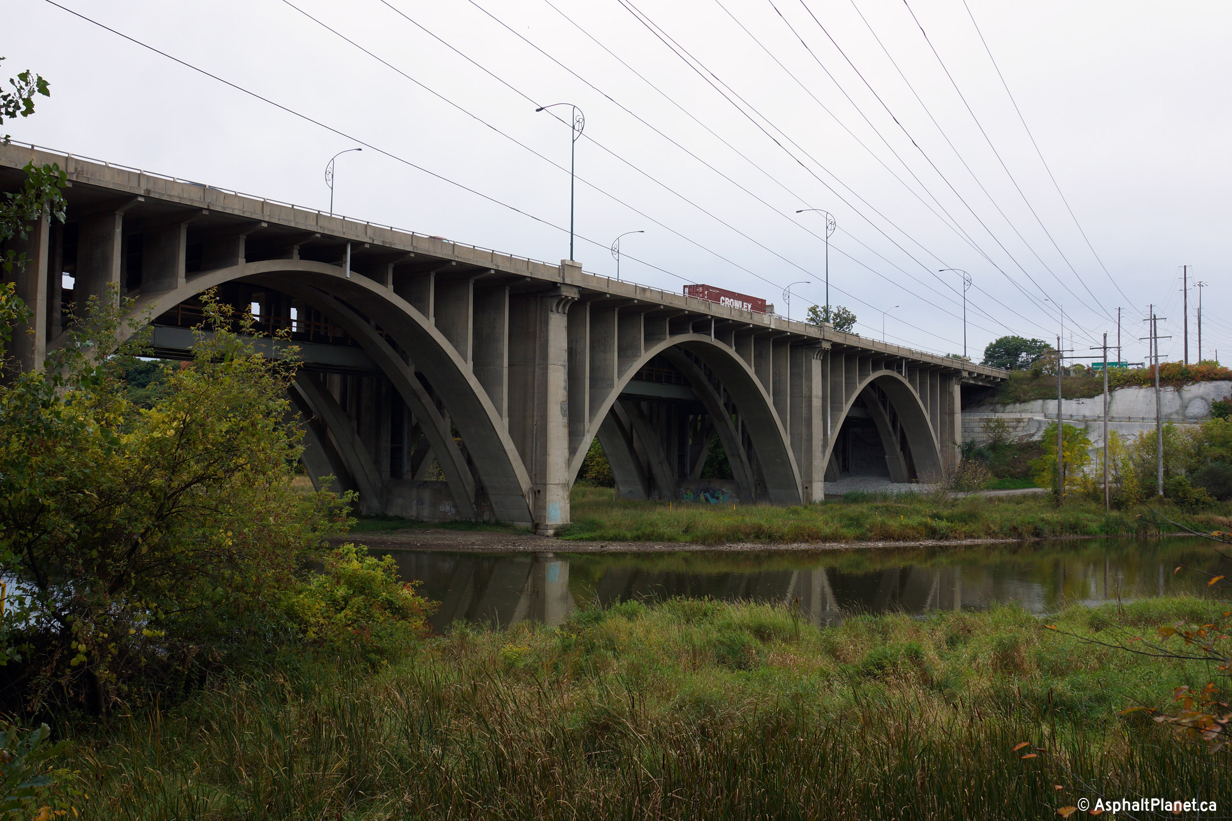
| City of Mississauga Regional Municipality of Peel |
View looking southerly towards the elegant open spandrel concrete arch
bridge that carries the QEW overtop of the Credit River in Mississauga. Photo taken: October 7th, 2014. |
 (720x480) (1440x960) (2400x1600) |
||
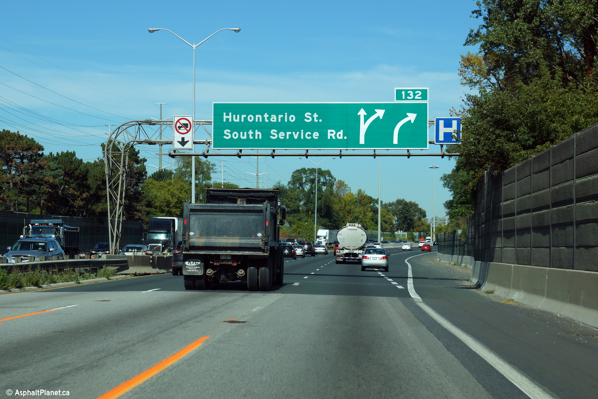
| City of Mississauga Regional Municipality of Peel |
Toronto-bound advanced signage for the ramp to Hurontario Street. It
is unusual for a sign for a right-handed exit to be mounted on a median
mounted cantilever sign support. Click
here for an earlier version of
this signage taken in September 2013, before the cantilevered sign support
was installed. Photo taken: June 10th, 2014. |
 (720x480) (720x480)(1440x960) (2400x1600) |
||
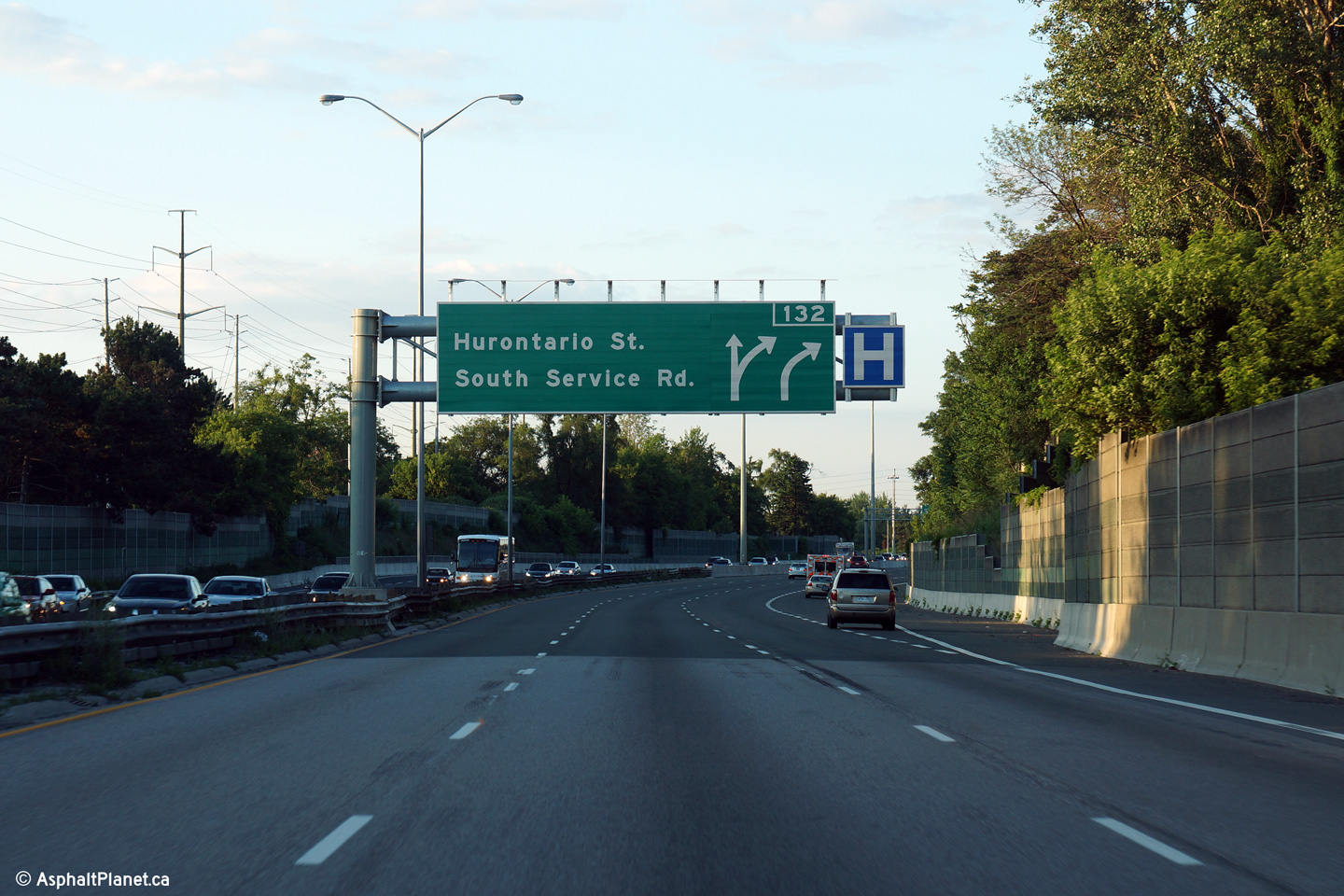
| City of Mississauga Regional Municipality of Peel |
Signage at the Toronto-bound off-ramp to Hurontario Street. This photo was
taken several years after the Hurontario cloverleaf interchange had been
converted to a more standard design. Photo taken: June 10th, 2014. |
 (720x480) (720x480)(1440x960) (2400x1600) |
||
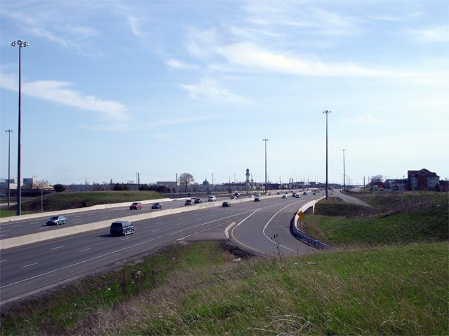
| City of Mississauga Regional Municipality of Peel |
View looking Hamilton-bound on the QEW from the Hurontario Street (Highway
10) cloverleaf interchange. The cloverleaf interchange between Highway
10 and the QEW was one of only a handful of remaining cloverleaf's in the
province. It was reconfigured as a partial parclo, partial
diamond during 2008 and 2009. Photo taken: May 30th, 2007. |
|
||
| Hurontario Street is the local name for Highway 10, which before downloading stretched from Lake Ontario to Lake Huron. Click here for Highway 10 images. | ||||
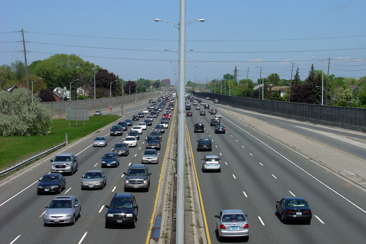
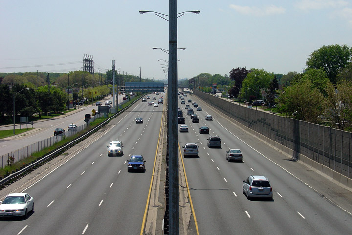
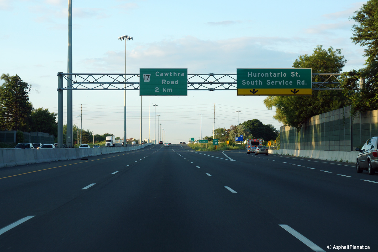
| City of Mississauga Regional Municipality of Peel |
View looking Hamilton-bound along the QEW from the Cawthra Road overpass. Photo taken: May 27th, 2006. |
 |
||
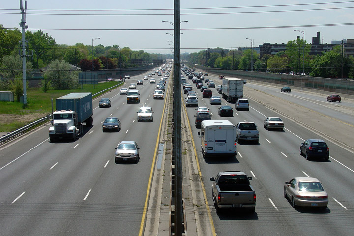
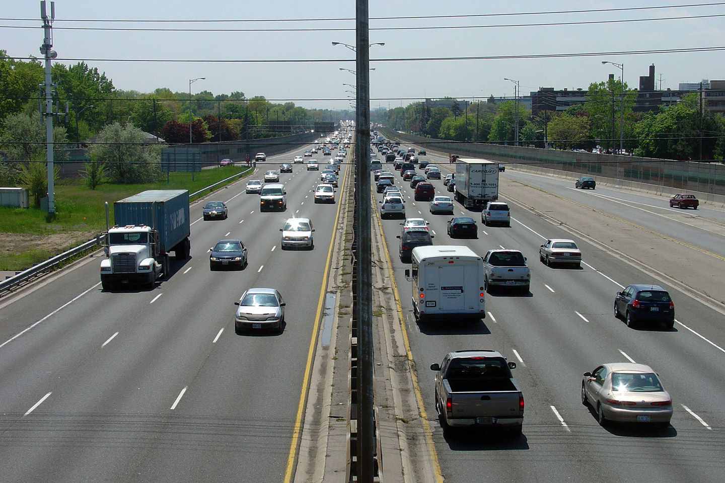
| City of Mississauga Regional Municipality of Peel |
Toronto-bound from the QEW at Cawthra Road. Notice how congested the
Hamilton-bound lanes are. Both the Cawthra Road and neighbouring Hurontario
Street are very heavy merges and can often slow mainline QEW traffic. Photo taken: May 27th, 2006. |
 |
||
| City of Mississauga Regional Municipality of Peel |
Hamilton-bound view from the Ogden Avenue pedestrian overpass. There
are surprisingly few pedestrian-exclusive overpasses in Ontario. Photo taken: May 27th, 2006. |
 |
||
| City of Mississauga Regional Municipality of Peel |
Toronto-bound view from the Ogden Avenue Pedestrian overpass. Note the
back-side of the Cawthra Road advanced overhead truss. Since this
photo was taken this truss was removed and the signage was replaced with a
new partial overhead gantry. Partial gantry's are becoming more common
on Ontario's freeways. Photo taken: May 27th, 2006. |
 |
||
| City of Mississauga Regional Municipality of Peel |
Toronto-bound view between Ogden Avenue and Dixie Street, at a very old
changeable message sign. Modern CMS' have the
Ontario logo in the upper right hand side of the signage to remind drivers
they are still in Ontario. Photo taken: September 20th, 2009. |
 |
||
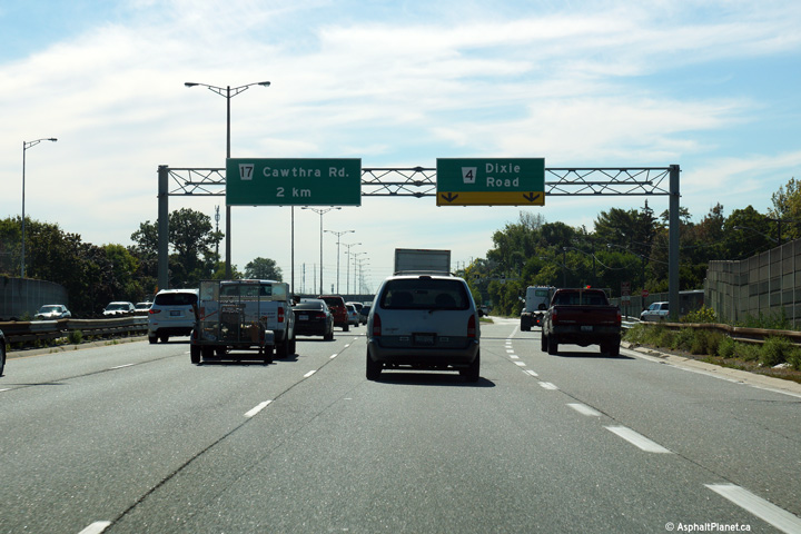
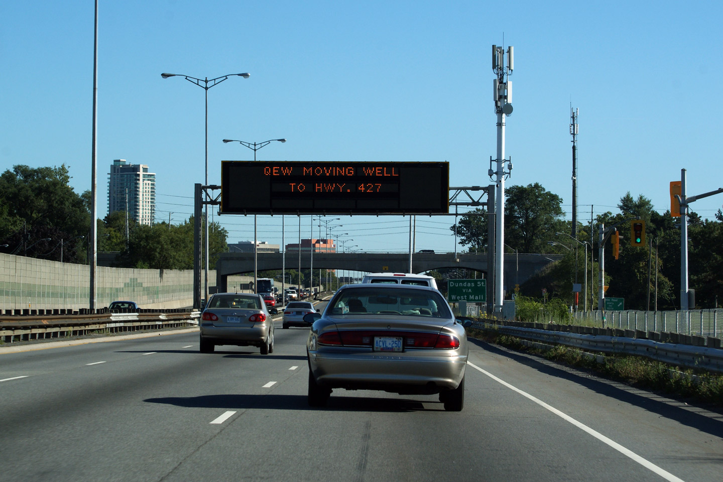
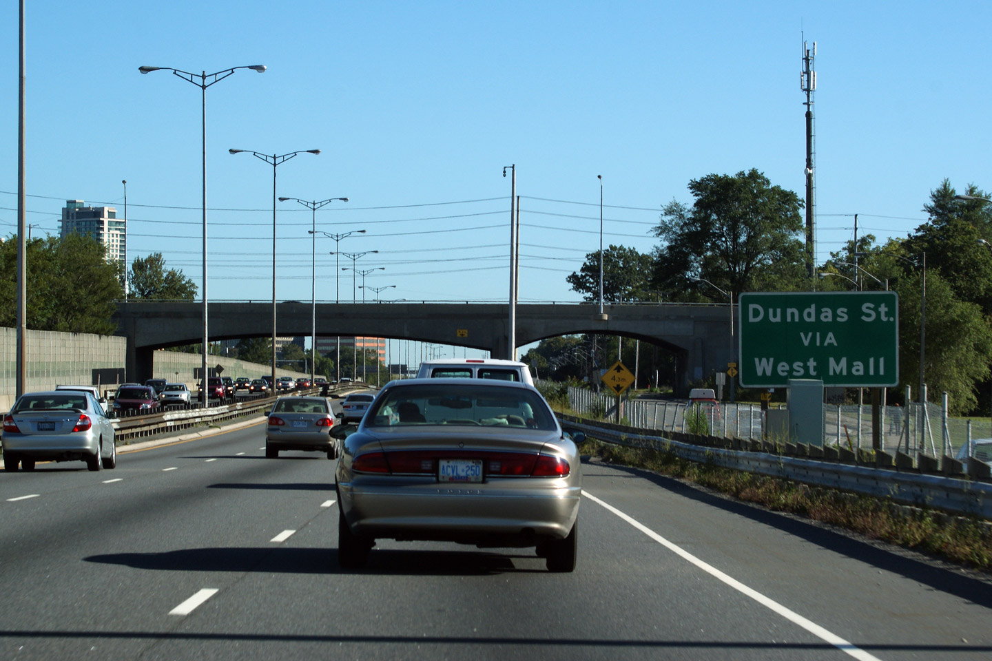
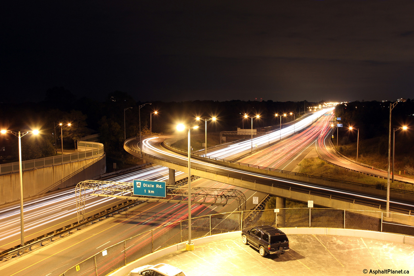
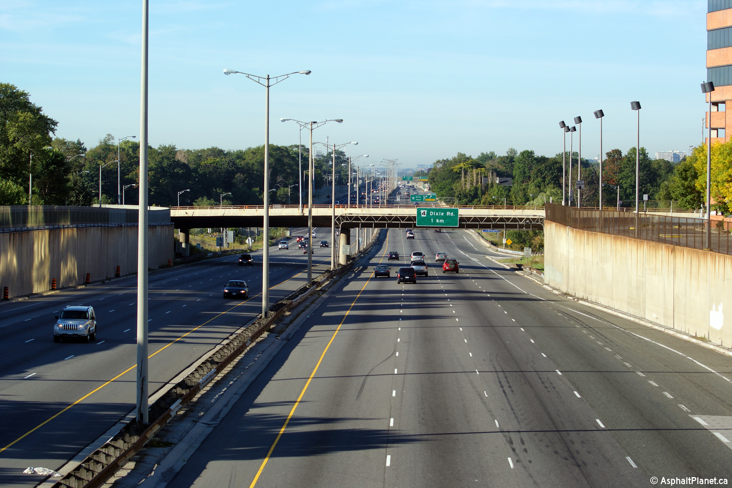
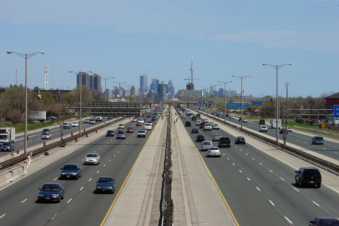
| City of Mississauga Regional Municipality of Peel |
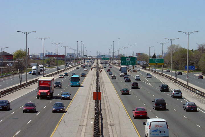
View looking Toronto-bound towards the Dixie Road overpass. Notice
that Dundas Street is signed via the West Mall. Dundas Street is not
directly accessible from the 427 Express lanes, as it is from the collector
lanes. The ramps both directions of the QEW form the express lanes of
the 427. The collector lanes are derived from Browns Line and the
Queensway. Photo taken: September 20th, 2009. |
 |
||
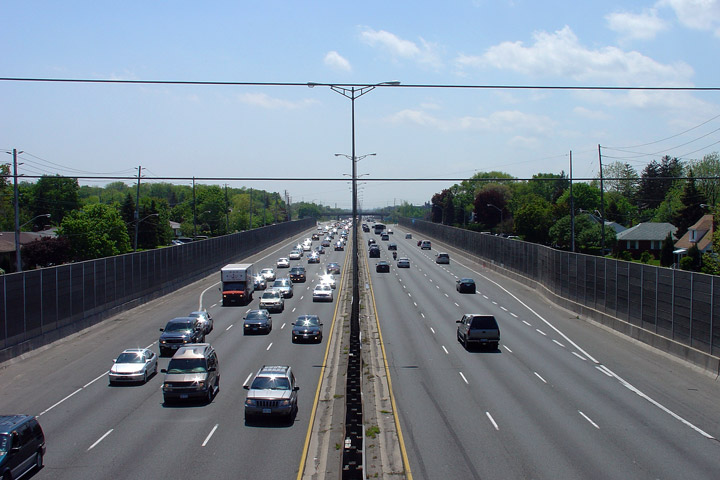
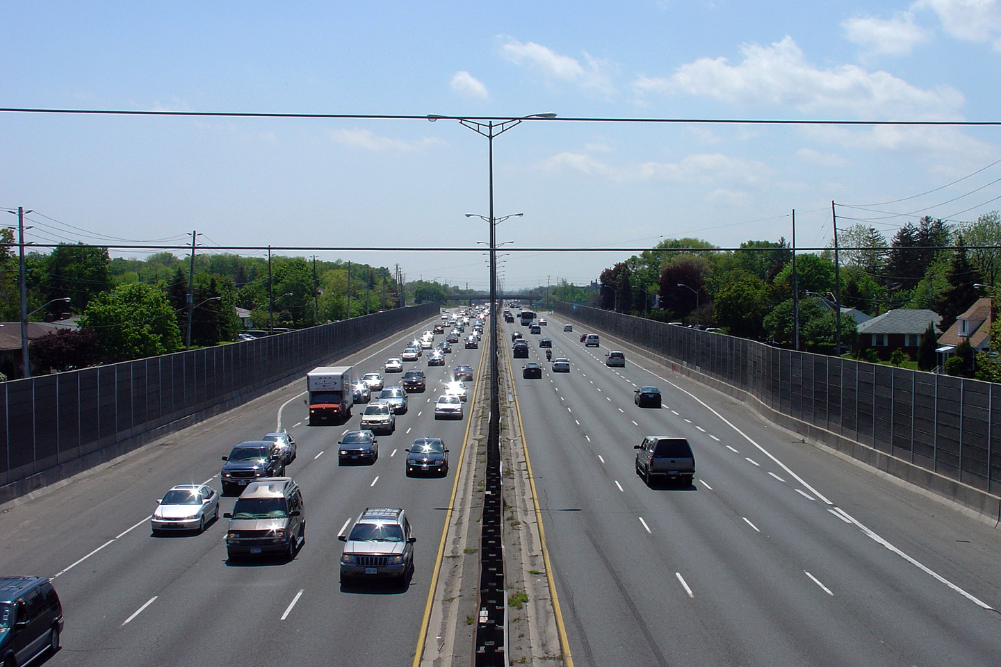
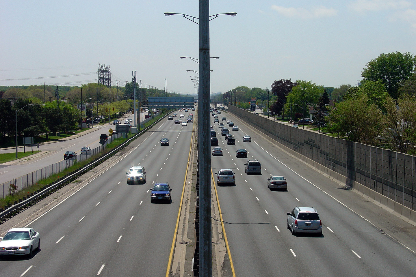
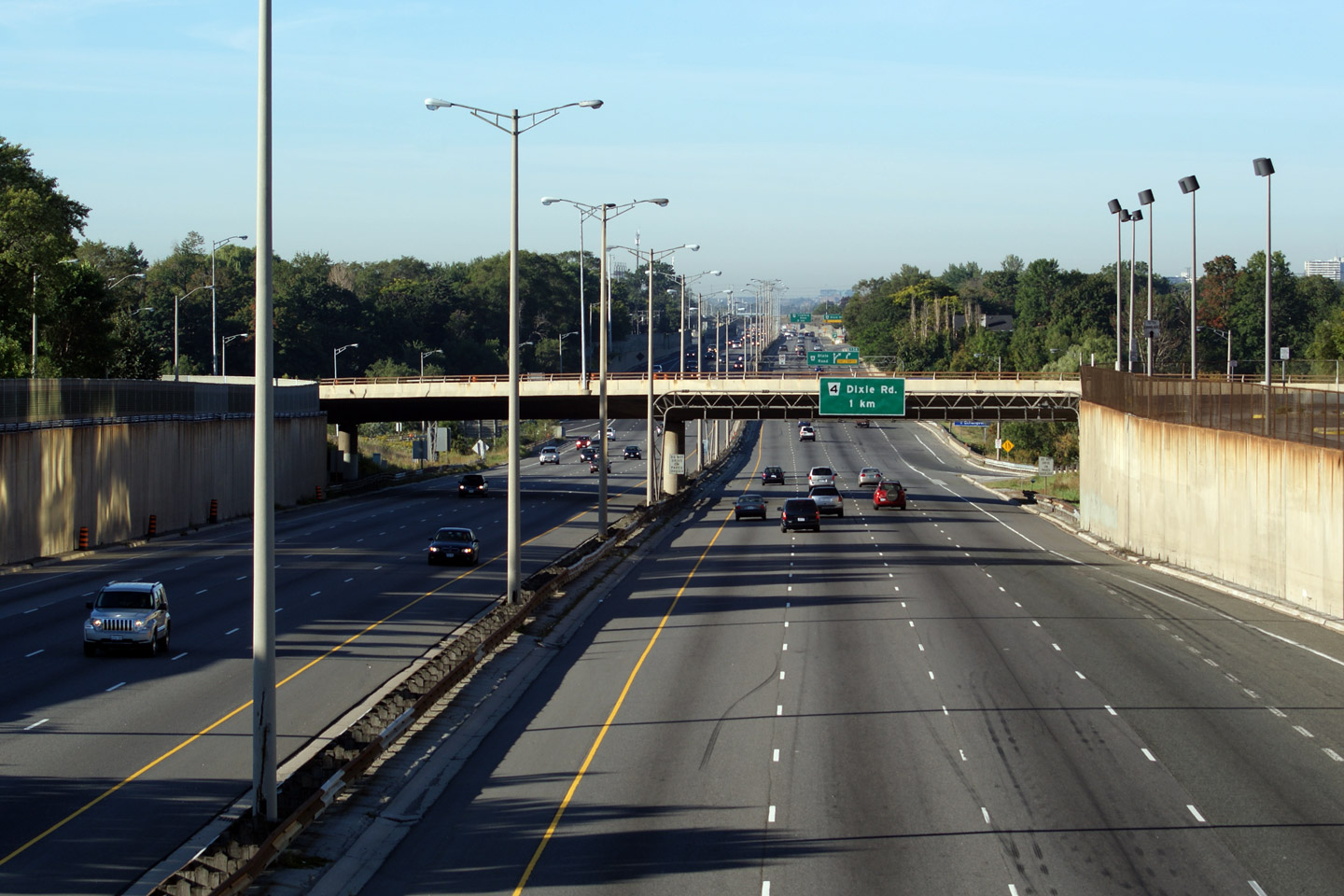
| City of Mississauga Regional Municipality of Peel |
View looking Hamilton-bound from the Dixie Road overpass. Notice just
how narrow the highway right-of-way is through Mississauga. The narrow
right-of-way, old steel guiderail, and truss lighting make the QEW through
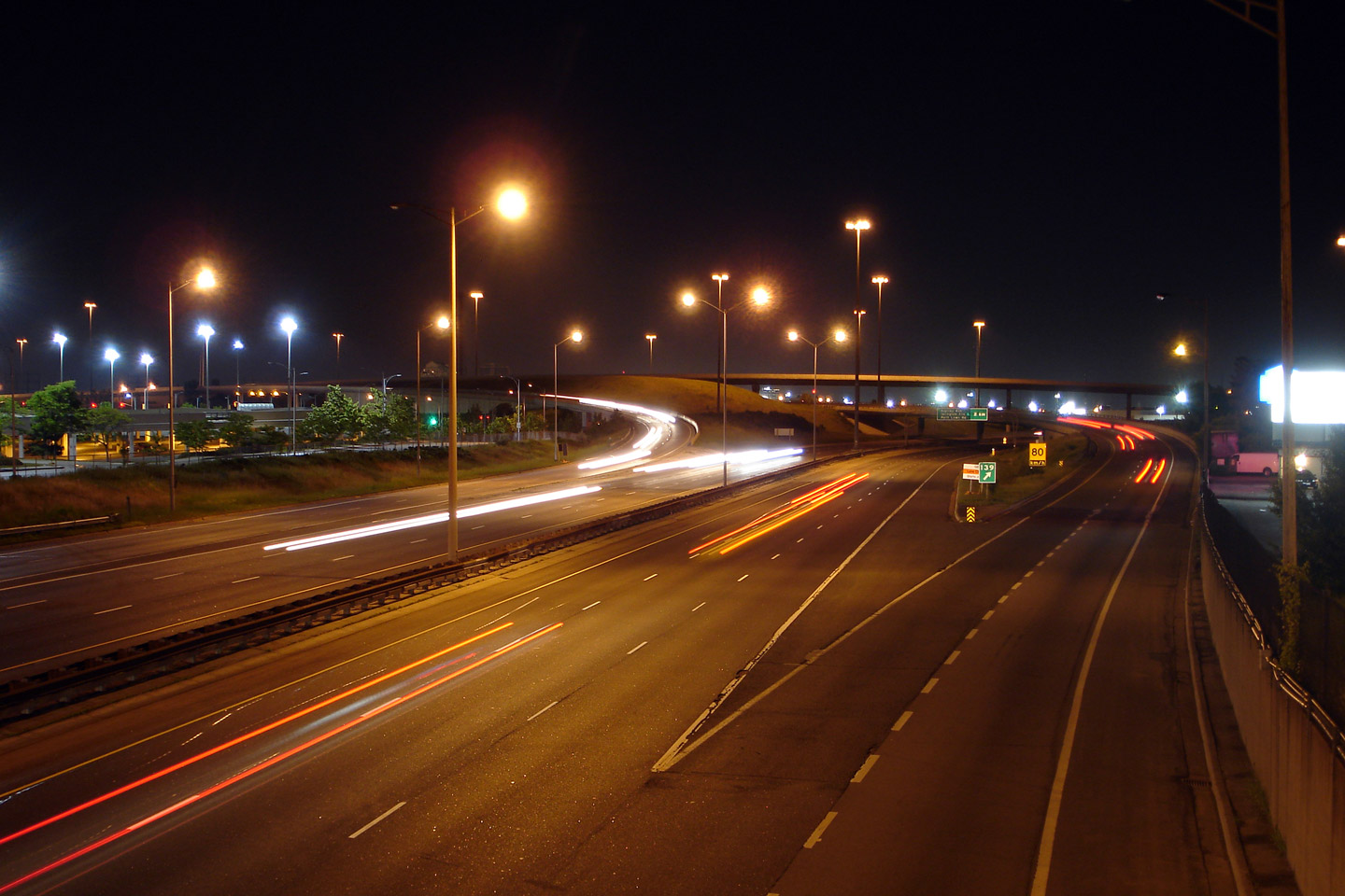
Mississauga one of Ontario's best freeway drives -- particularly at night. Photo taken: May 27th, 2006. |
 |
||
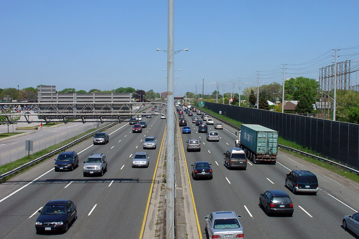
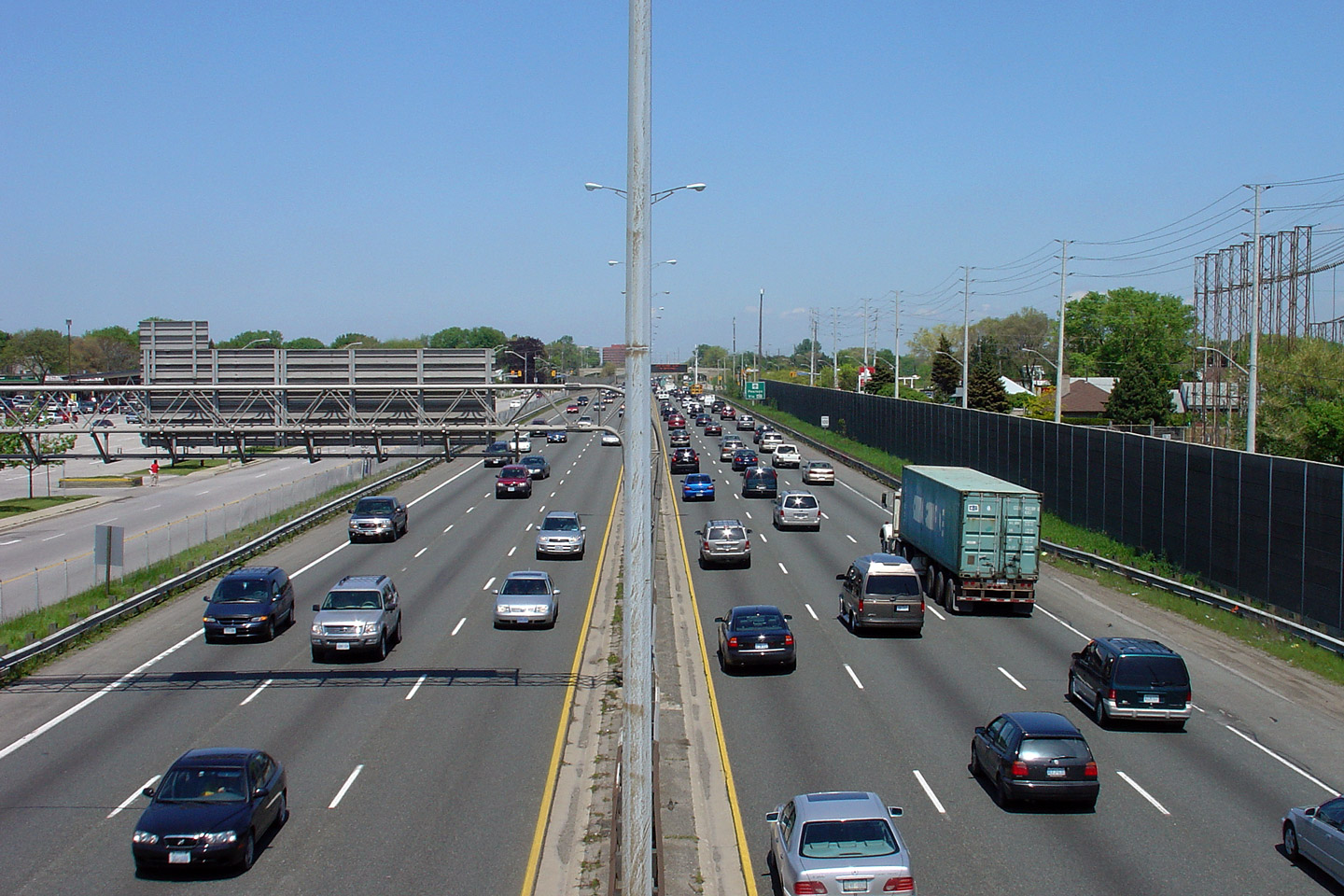
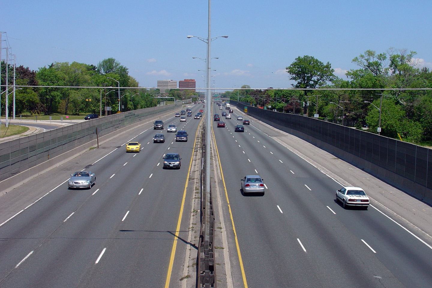
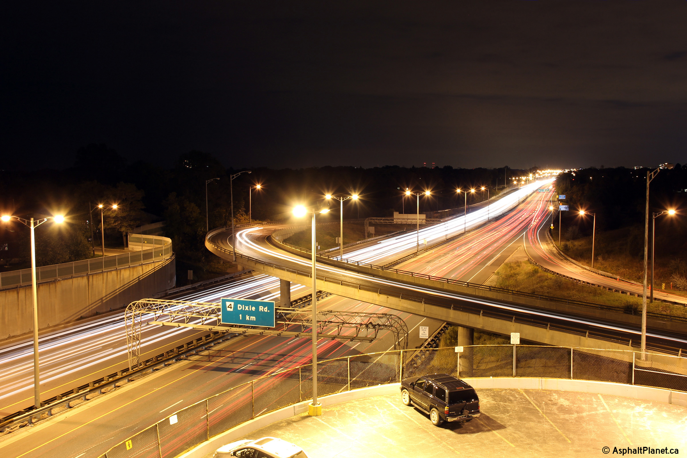
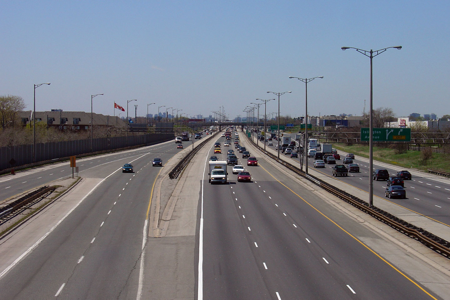
| City of Mississauga Regional Municipality of Peel |
This view looks towards Toronto from the Dixie Road overpass. Ontario's
current (2009) politicians have suggested that the QEW through Mississauga
is a good candidate for HOV lanes. I don't know where they would put the
lanes. Photo taken: May 27th, 2006. |
 |
||
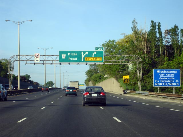
| City of Mississauga Regional Municipality of Peel |
Signage at the Hamilton-bound off-ramp to Dixie Road. The departure of
the fourth Hamilton-bound lane at this interchange is a major source of
highway congestion. Photo taken: September 25th, 2013. |
 (720x480) (720x480)(1440x960) (2400x1600) |
||
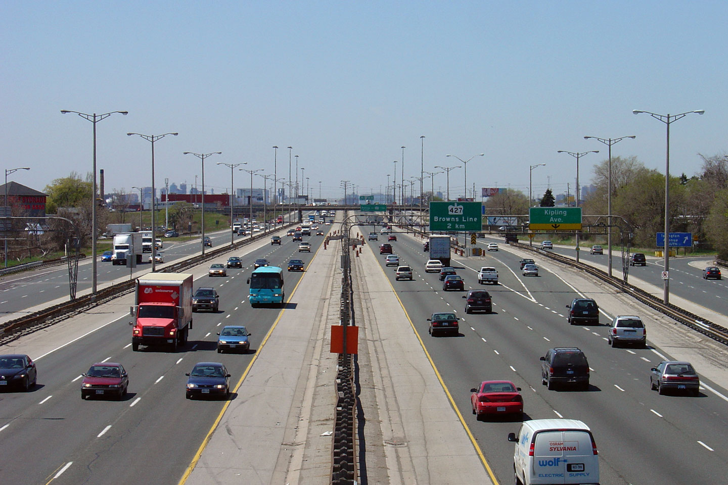
| City of Mississauga Regional Municipality of Peel |
Advanced signage for the Dixie Road partial interchange along the
Hamilton-bound QEW. The right-most lane exits the QEW at this
interchange leaving the highway with a 6-lane cross-section. The QEW
maintains this 6-lane cross-section through Mississauga until the Highway
403 interchange in Oakville. Photo taken: May 26th, 2007. |
 |
||
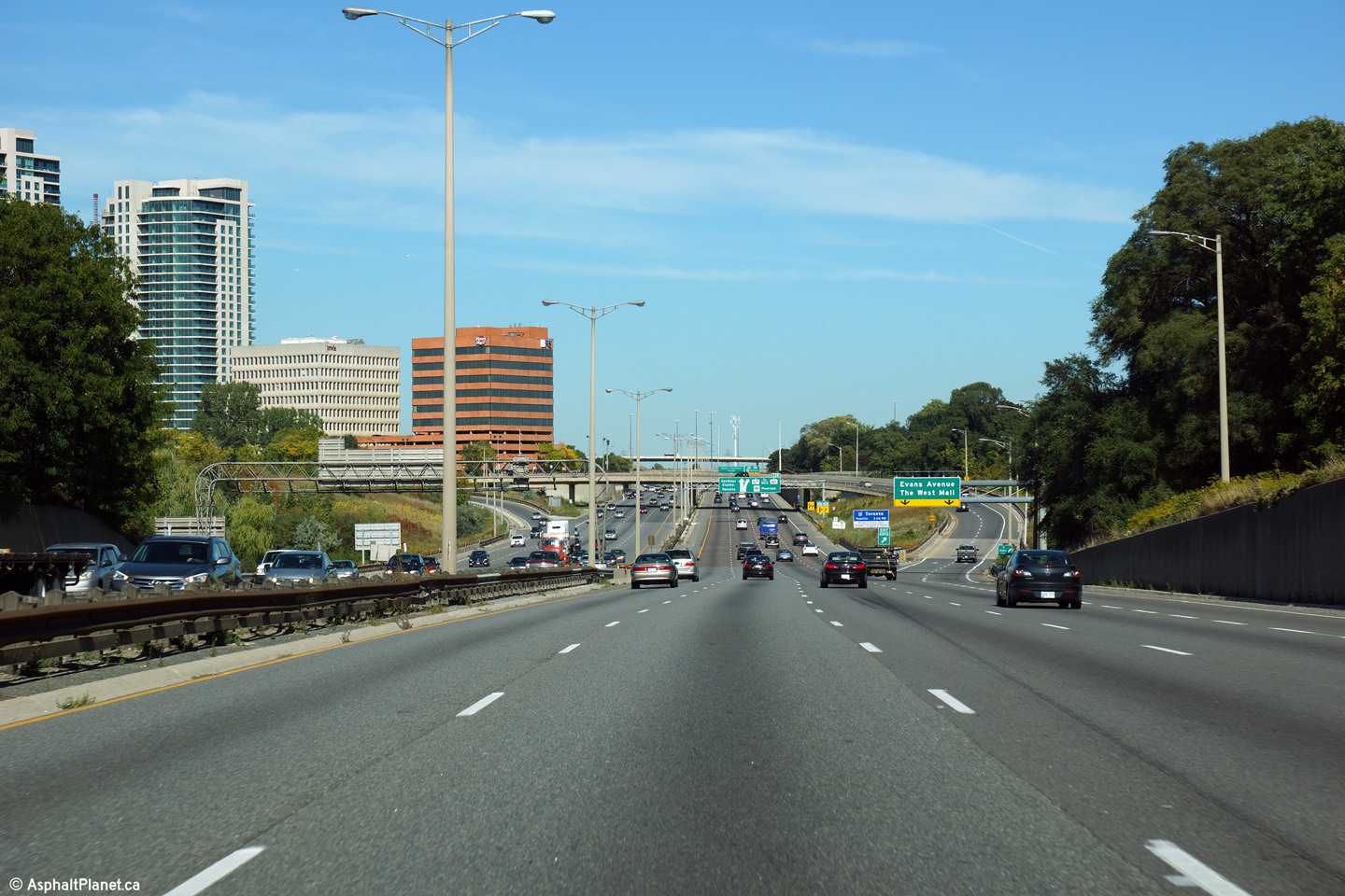
| City of Mississauga Regional Municipality of Peel |
Toronto-bound view as the QEW descends into the Etobicoke Creek Valley.
The exit to the West Mall and Evans Avenue departs the freeway mainline
immediately before the Etobicoke Valley and crosses the creek on its own
structure. Photo taken: September 25th, 2013. |
 (720x480) (720x480)(1440x960) (2400x1600) |
||
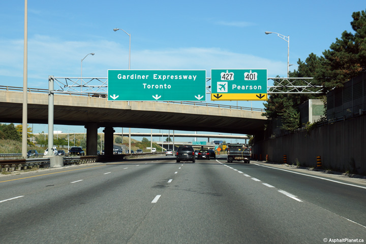
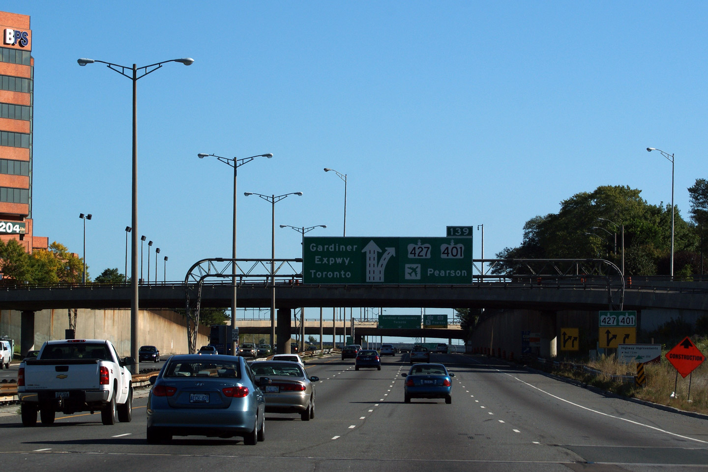
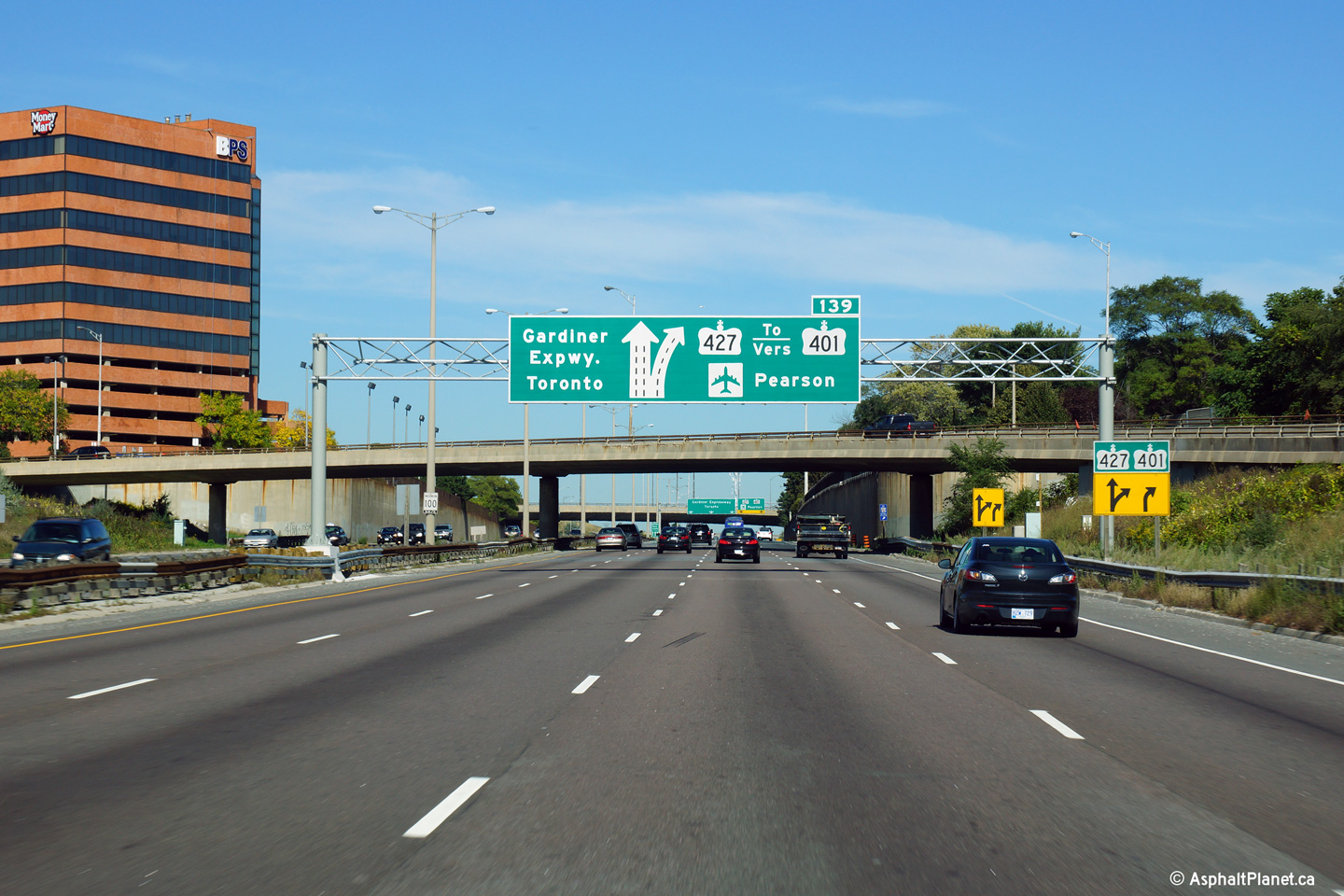
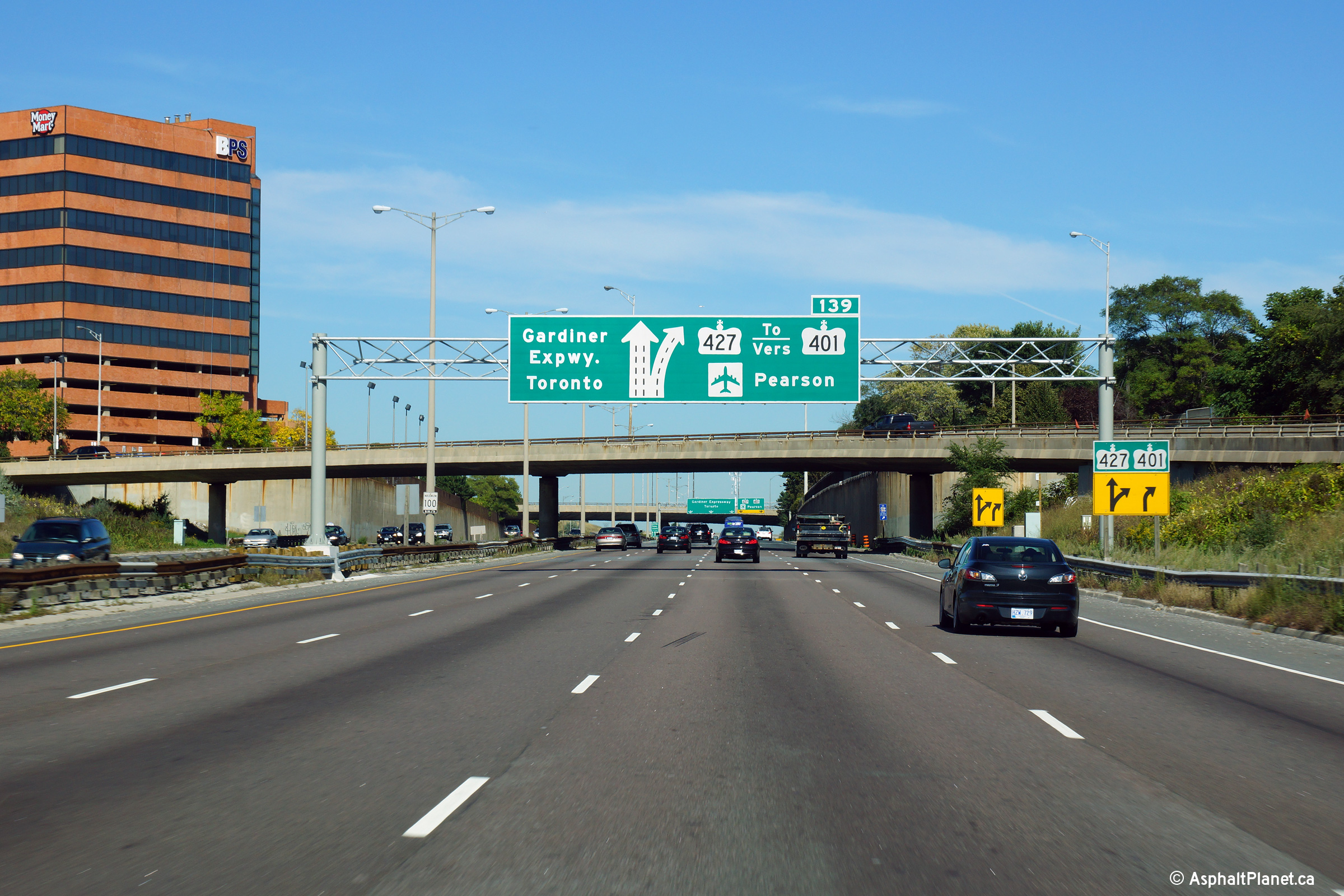
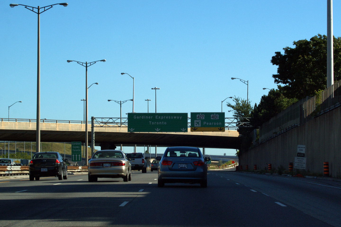
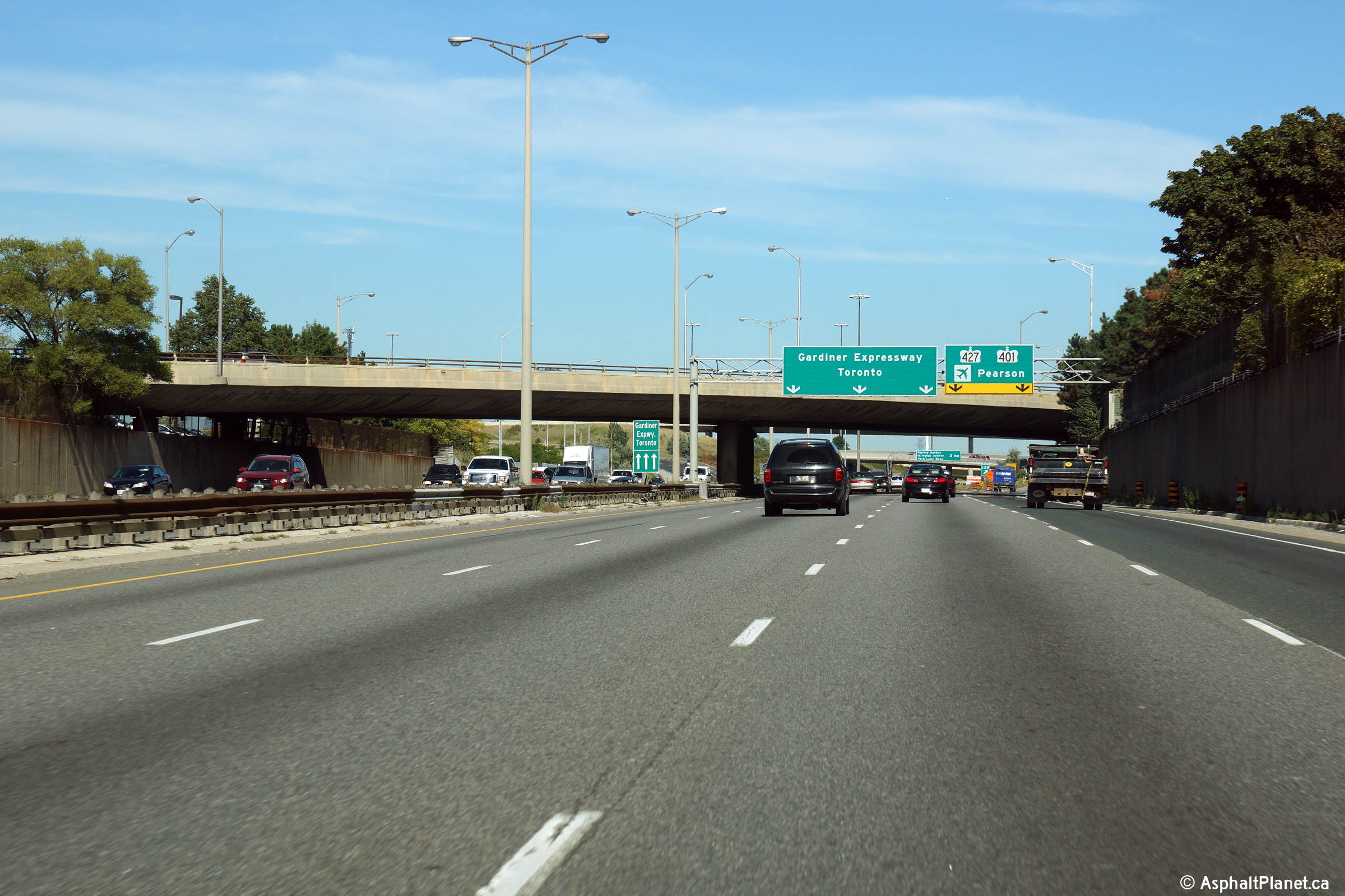
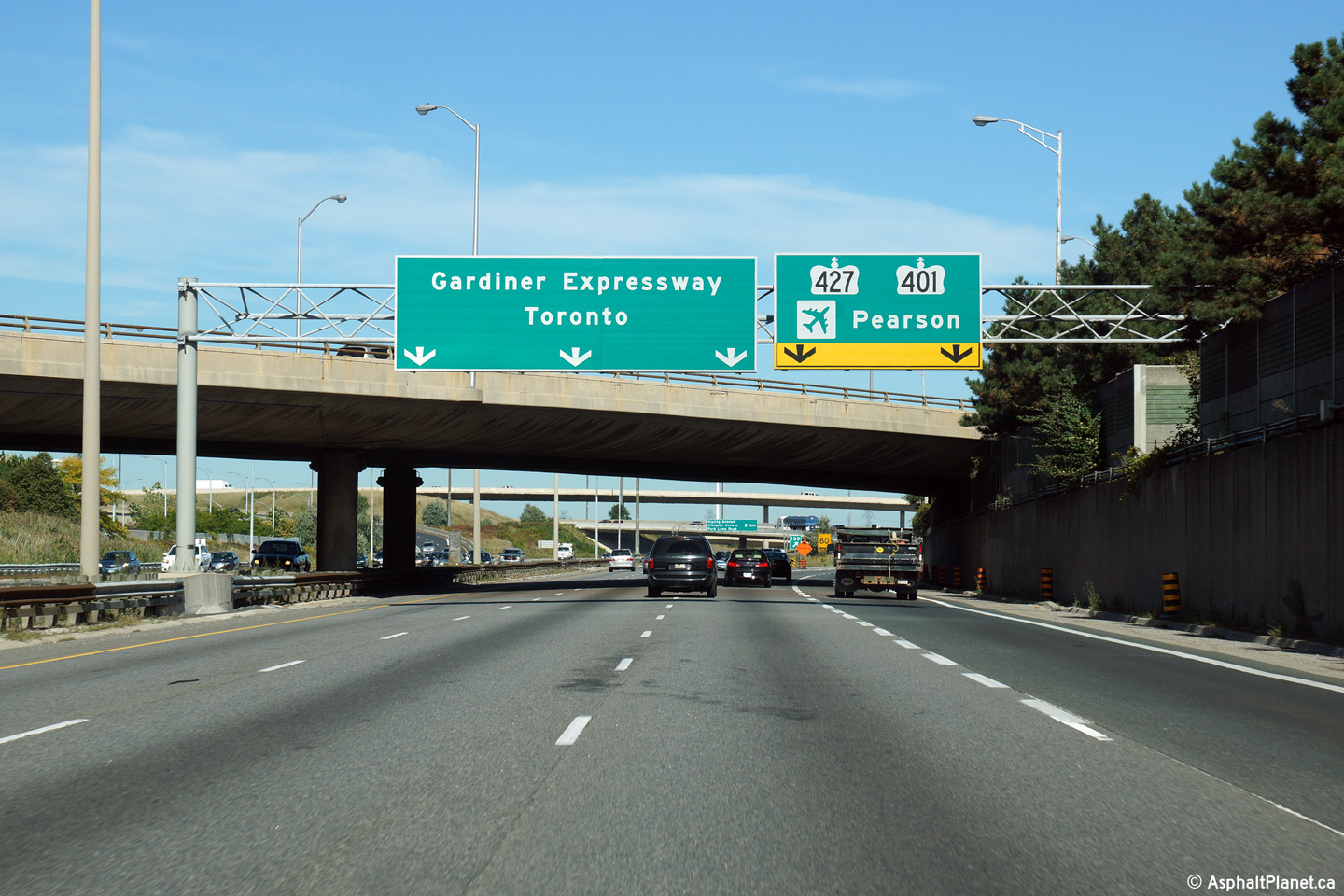
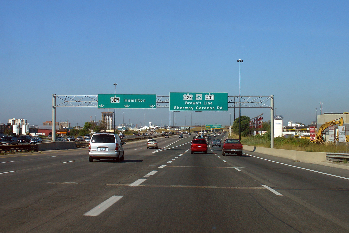
| City of Toronto |
Overhead diagram signage in advance of the Highway 427 interchange.
Interestingly, in both directions from the QEW, diagram signs are used
instead of advanced arrow signs. The pictured signage was erected
during the summer of 2013, and replaced an older style rounded truss gantry
that can be seen here (photo taken
September, 2009. Photo taken: September 25th, 2013. |
|||
| City of Toronto |
Hamilton-bound view towards the Etobicoke Creek Valley. Photo taken: October 22nd, 2011. |
 |
||
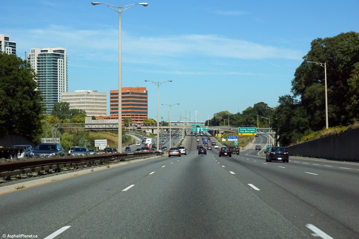
| City of Toronto |
Hamilton-bound view from the Evans Avenue overpass. The QEW quickly narrows from an eight-lane freeway with shoulders to a much narrower six-lane cross-section beyond Etobicoke Creek.
Upper photo taken: September 20th, 2009.
Lower photo taken: June 16th, 2007. |
 |
||
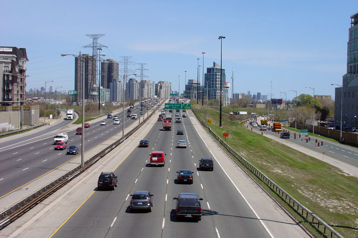
| City of Toronto |
View of the Toronto-bound QEW from the Evans avenue overpass. The QEW/427 interchange was the first four-level freeway interchange completed in the province of Ontario. The Highway 427 interchange is now the northernmost interchange on the QEW, since 1997, when the QEW was downloaded to the City of Toronto east of the 427.
Upper photo taken: September 20th, 2009.
Lower photo taken: June 16th, 2007. |
 (720x480) (1440x960) (2400x1600)  (720x480) (1440x960) |
||
| City of Toronto |
Overhead signage for the ramp to Highway 427 along the Toronto-bound QEW.
The overhead signage for the ramp to Highway 427 from the Toronto-bound QEW
is situated just before the Evans Avenue overpass. Click
here for an older photo of the same
signage, taken in September, 2009. Photo taken: September 20th, 2009. |
|||
| City of Toronto |
View looking through through the Highway 427 interchange at the overhead
sign that notes Etobicoke's exits. Really, I just wanted to include another
photo of the Highway 427 interchange. The 1971 DHO Annual Report
featured a two-page spread of the just finished QEW/427 interchange, with a
quote from the premier talking about how this interchange would improve the
life of all Ontarians. I can't imagine seeing this in a modern Annual
Report. Photo taken: September 20th, 2009. |
 (720x480) (720x480)(1440x960) |
||
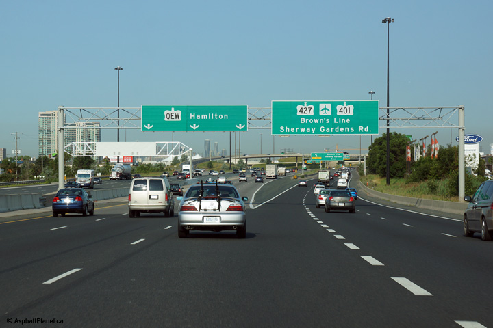
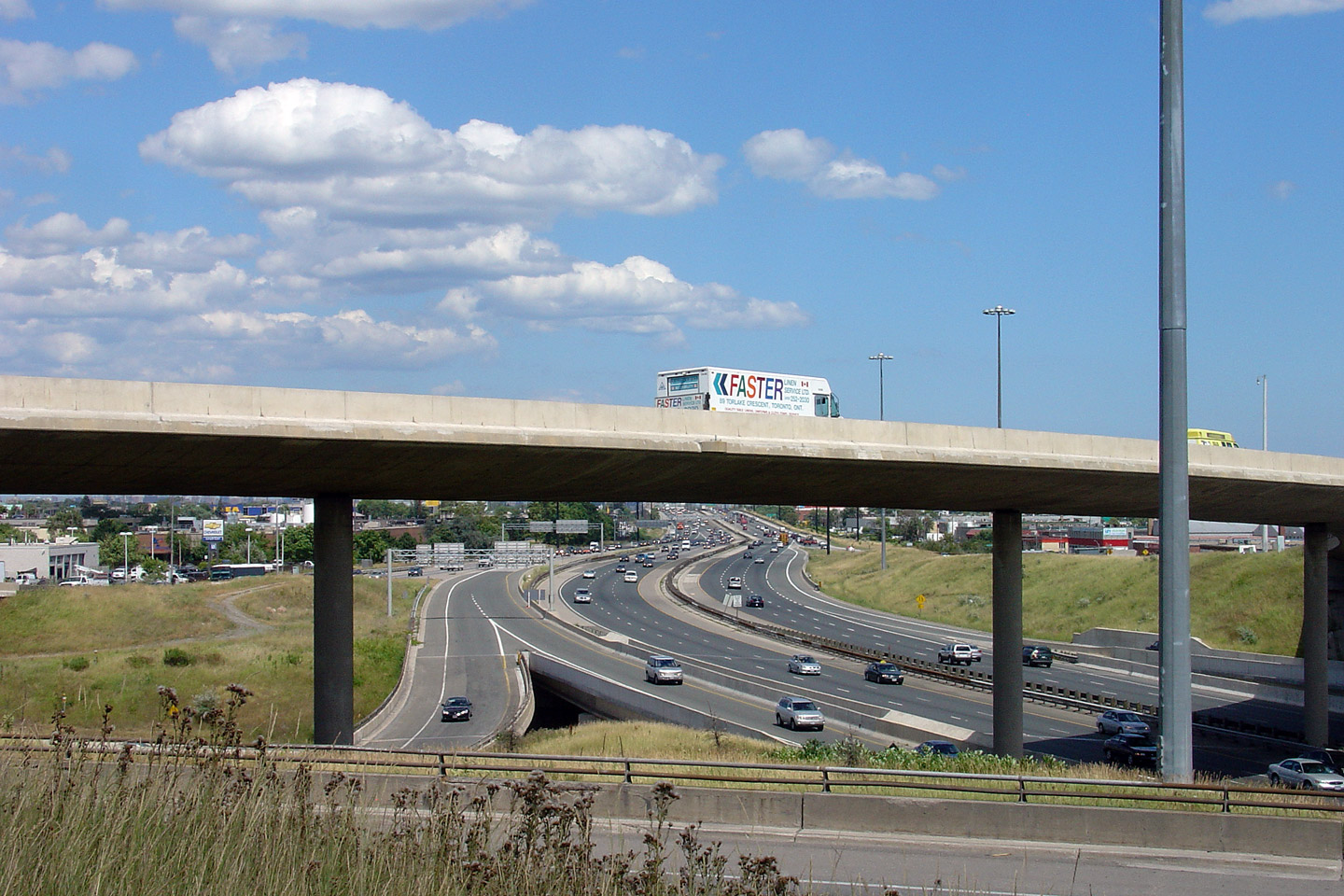
| City of Toronto |
View looking Hamilton-bound along the QEW from the 427 interchange.
Notice the high-speed ramp from Highway 427 joining the QEW in forefront.
Also notice the ramp from the QEW to Sherway Gardens Road. This ramp
was completed recently in 2002, improving local access to the QEW/Gardiner. Photo taken: July 12th, 2007. |
 |
||
| Highway 427 begins at the QEW heading north through the western edge of Toronto. Click here for Highway 427 images. | ||||
| City of Toronto |
View looking towards Toronto
on the QEW through the Highway 427 interchange. Photo taken: July 12th, 2007. |
 |
||
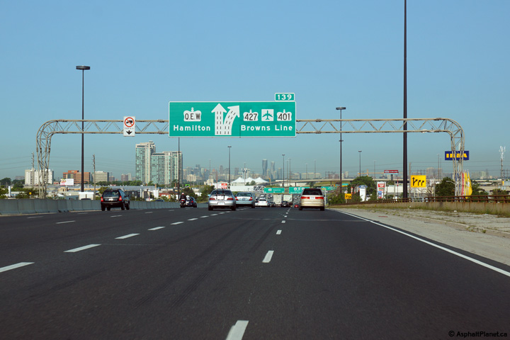
| City of Toronto |
Overhead signage for Highway 427 from the
Hamilton-bound QEW. Click here for
an earlier version of this photo, taken in 2007, when the QEW still featured
a rather deteriorated steel beam median barrier. Photo taken: August 28th, 2007. |
|||
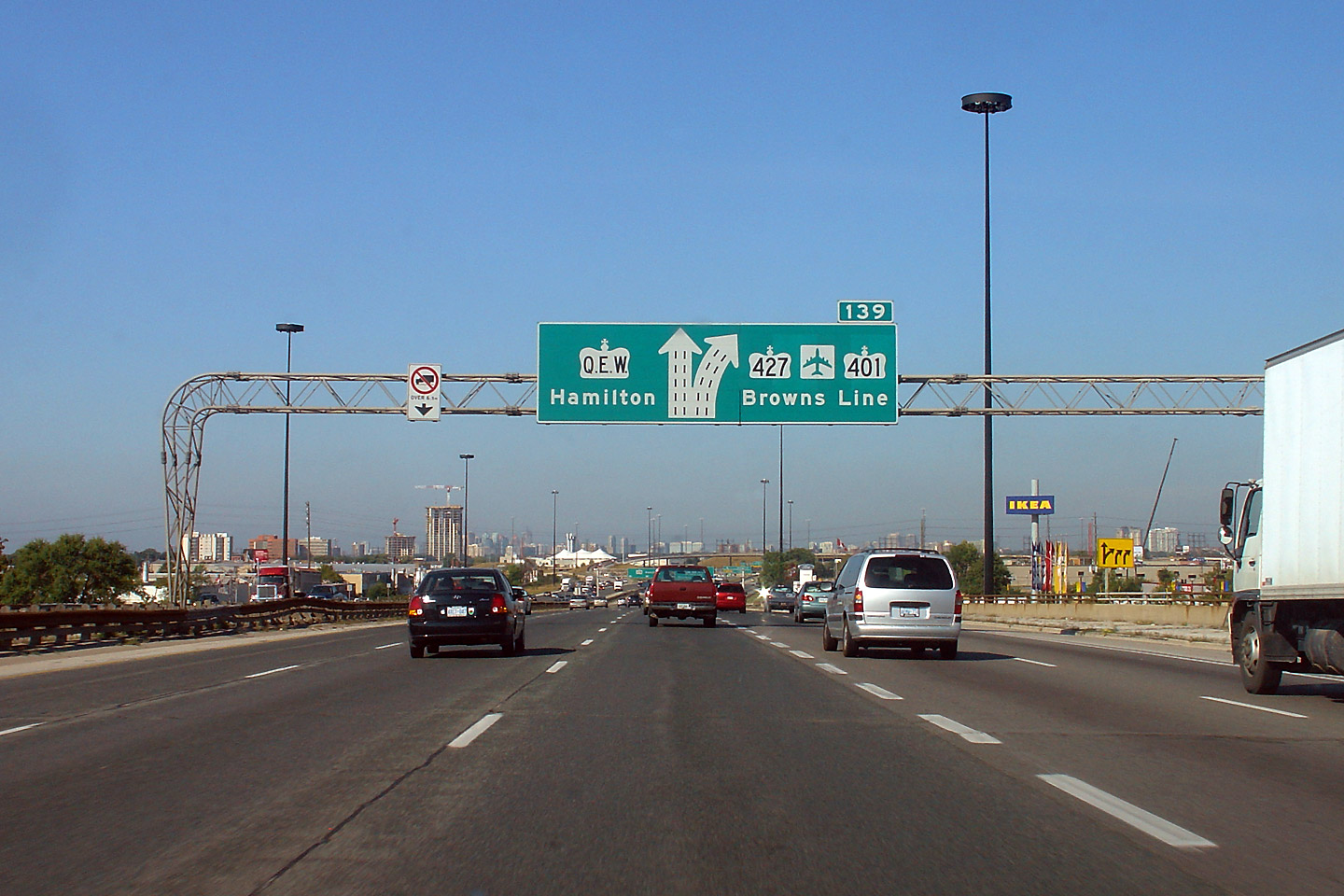
| City of Toronto |
Advanced signage for the upcoming Highway 427 interchange. Click
here for an earlier version of this
photo, taken in 2007. Photo taken: August 28th, 2007. |
|||
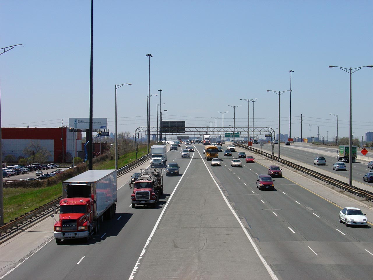
| City of Toronto |
Overhead advanced signage for the short eastbound collector lanes on the QEW
(Gardiner Expressway). A short 10-lane C-D was constructed in the
1970s to minimize disruption from three closely spaced interchanges to
high-speed mainline traffic. Photo taken: May 12th, 2005. |
 |
||
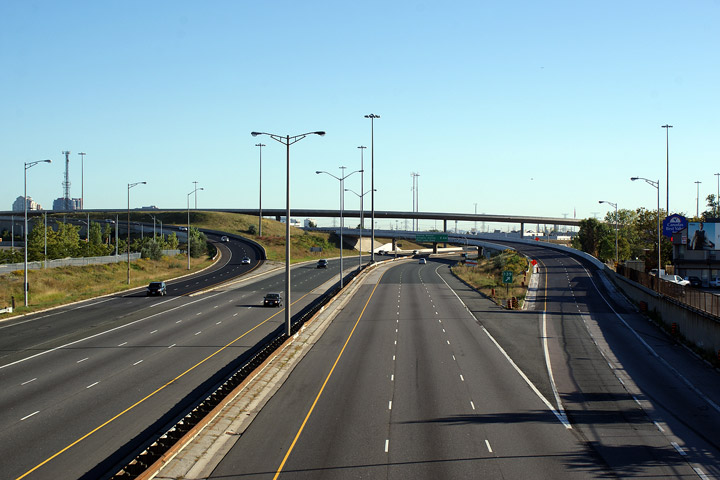
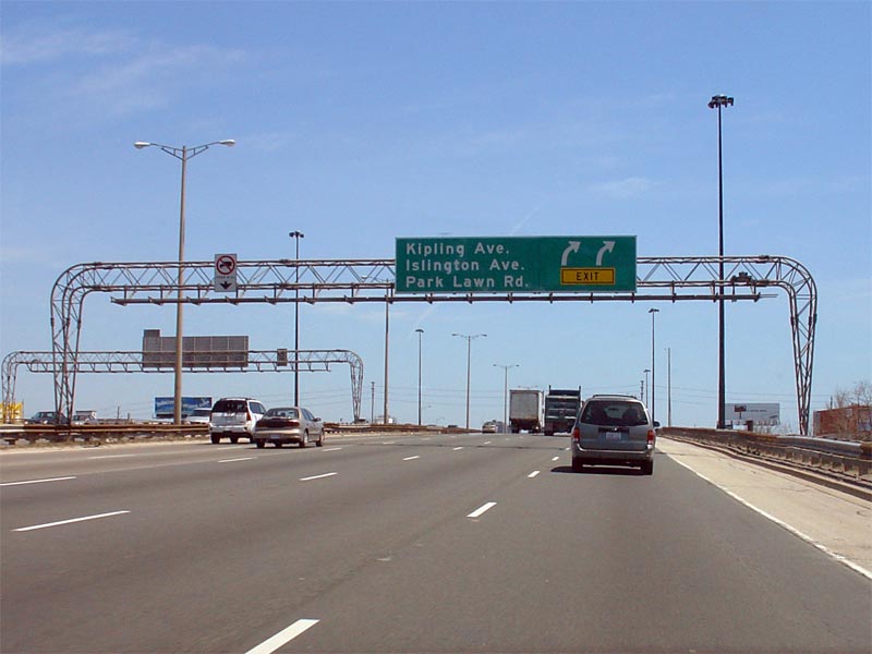
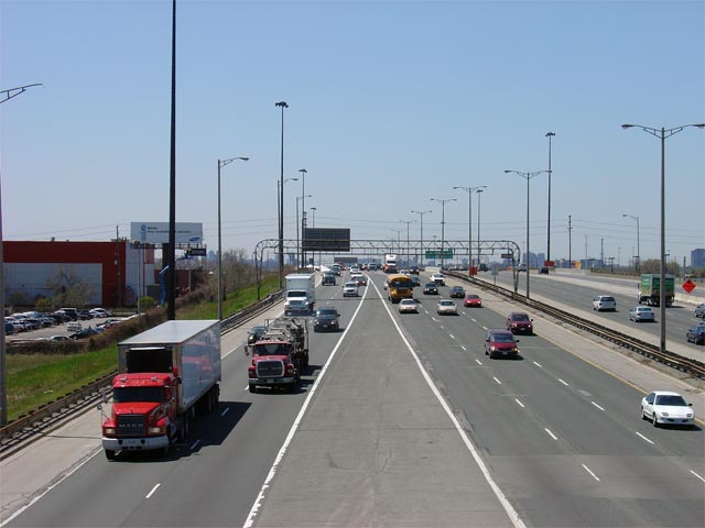
| City of Toronto |
Two views looking west towards Hamilton from the Kipling Avenue overpass.
The collector/distributor lanes end at the Kipling Avenue overpass.
West of Kipling Avenue, the QEW/Gardiner has a 10-lane cross-section until
the large
Highway 427 interchange. Photos taken: May 12th, 2005. |
|
||
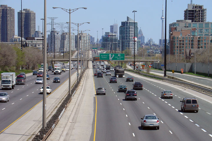
| City of Toronto |
Looking towards Downtown Toronto (east) along the QEW (now Gardiner
Expressway). Between Kipling Avenue and Royal York Road, the QEW has a
10-lane Core-Distributor (C-D) configuration. Photo taken: May 12th, 2005. |
 |
||
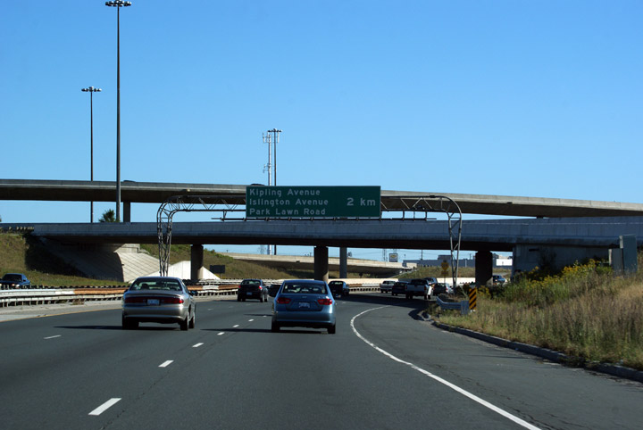
| City of Toronto |
Westerly
view of the QEW from Islington Avenue. Collector lanes were very
common during the 1970s in Ontario to separate through traffic from tightly
spaced local interchanges. Photo taken: May 12th, 2005. |
 |
||
| City of Toronto |
Easterly view of the QEW from the Islington Avenue overpass. I love this stretch of the QEW. Photo taken: May 12th, 2005. |
 |
||
| City of Toronto |
Westerly
view from the Royal York Road overpass. It always seemed
counterintuitive to me that the collector lanes on the QEW were never
extended to the 427 or Lakeshore Boulevard interchanges. Photo taken: May 12th, 2005. |
 |
||
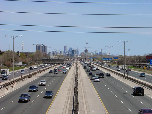
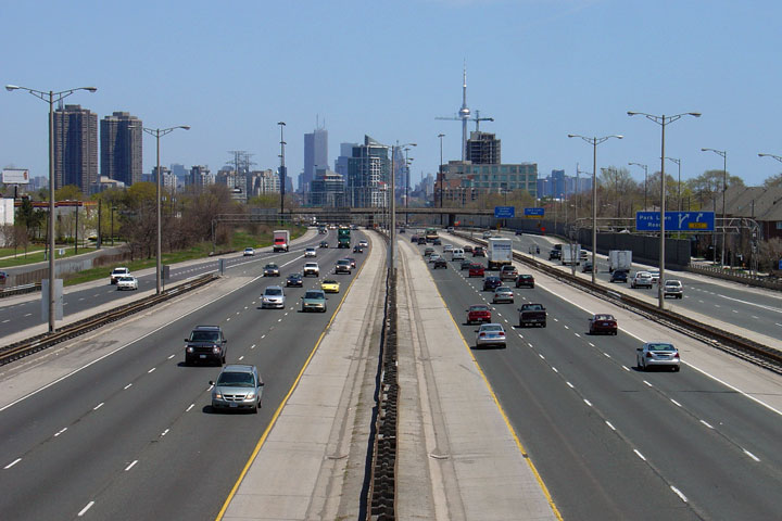
| City of Toronto |
Easterly
view from Royal York Road towards Downtown Toronto. The residential
density outside the Downtown Core of Toronto is impressive.
Considering the sprawling nature of the Cities surrounding Toronto proper,
Toronto really does attempt to be a dense and compact urban centre.
Upper photo taken: May 12th, 2005.
Lower photo taken: January 8th, 2012. |
 |
||
| City of Toronto |
View
looking westerly from the Grand Avenue overpass. Photo taken: May 12th, 2005. |
 |
||
| City of Toronto |
Easterly
view from Grand Avenue towards the Lakeshore Boulevard Interchange and the
Humber River. The QEW ends at the Lakeshore Boulevard Interchange,
becoming Highway 2 and the Gardiner Expressway. Photo taken: May 12th, 2005. |
 |
||
| The QEW Ends at the Humber River Bridge where it becomes the Gardiner Expressway and Highway 2. Click here for Highway 2 images. |
<- Page 4 Images Queen Elizabeth Way Images Index
<- Highway 812 Images Back to Queen Elizabeth Way Highway 2 Images ->
Copyright (c) 2004-2012, Scott Steeves (Webmaster) scott@asphaltplanet.ca


