|
Proper Municipality Name |
Exit # |
Intersecting Road |
North / West Control City |
South / East Control City |
|
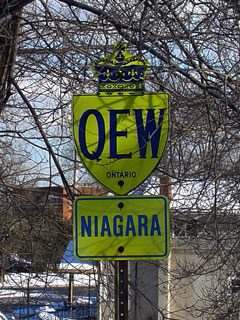
The Queen Elizabeth Way connects
to New York Interstate 190 via the Peace Bridge. |
|
Town of Fort Erie |
--- |
Highway 3 (Niagara Road 3) & Central Avenue
(Niagara Road 124) |
Town of Fort Erie
Population: 28 000 |
| Town of Fort Erie |
1 |
Concession Road |
| Town of Fort Erie |
2 |
Thompson Road (Niagara Road 122) |
| Town of Fort Erie |
5 |
Gilmore Road (Niagara Road 19) |
| Town of Fort Erie |
7 |
Bowen Road (Niagara Road 21) |
Stevensville |
|
| Fort Erie - Niagara Falls Boundary |
12 |
Netherby Road (Niagara Road 25) |
|
| City of Niagara Falls |
16 |
Sodom Road (Niagara Road 116) |
| City of Niagara Falls |
21 |
Lyons Creek Road (Niagara Road 47) |
Welland |
Chippawa |
| City of Niagara Falls |
27 |
McLeod Road (Niagara Road 49) |
City of
Niagara Falls
|
| City of Niagara Falls |
30 |
King's Highway 420 |
Niagara Falls U.S.A. |
City of Niagara Falls |
| City of Niagara Falls |
32 |
Thorold Stone Road (Niagara Road 57) |
City of Niagara Falls,
Population: 76 000 - 7 Interchanges
Downtown
via Highway 420 |
| City of Niagara Falls |
34 |
Mountain Road (Niagara Road 101) |
| Town of Niagara-on-the-Lake |
37 - Niagara Bound Partial
Interchange |
King's Highway 405 |
|
Queenston, Lewiston U.S.A. |
| Town of Niagara-on-the-Lake |
38 |
Glendale Road (Niagara Road 89) & Niagara
Stone Road (Niagara Road 55) |
Niagara-on-the-Lake |
----- |
| City of St. Catharines |
44 |
Niagara Street (Niagara Road 48) & Service Rd |
City of St. Catharines
Population: 130 000. 6 Interchanges
Downtown
via Ontario Street-Niagara Bound, Niagara
Street-Toronto Bound |
| City of St. Catharines |
46 |
Lake Street (Niagara Road 44) |
| City of St. Catharines |
47 |
Ontario Street (Niagara Road 42) |
| City of St. Catharines |
38 |
Martindale Road |
| City of St. Catharines |
49 |
King's Highway 406 |
|
Port Colborne, Thorold, Welland |
| City of St. Catharines |
51 |
Seventh Street (Niagara Road 87) |
St. Catharines |
| Town of Lincoln |
55 |
Jordan Road (Niagara Road 26) |
----- |
Jordan Station |
| Town of Lincoln |
57 |
Victoria Avenue (Niagara Road 24) |
----- |
Vineland |
| Town of Lincoln |
64 |
Ontario Street (Niagara Road 18) |
----- |
Beamsville |
| Town of Grimsby |
68 |
Bartlett Avenue (Niagara Road 14) |
|
|
| Town of Grimsby |
71 |
Maple Avenue & Christie Street & Ontario
Street (Niagara Road 12) |
|
|
| Town of Grimsby |
74 |
Casablanca Boulevard (Niagara Road 10) |
|
|
| City of Hamilton |
78 |
Fifty Road |
City of
Hamilton
Population: 550 000Downtown via Highway 403 West |
| City of Hamilton |
83 |
Fruitland Road |
| City of Hamilton |
88 |
Highway 20 (Hamilton Road 20, Centennial
Parkway) |
| City of Hamilton |
89 |
Red Hill Valley Parkway |
| City of Hamilton |
90 |
Burlington Street |
| City of Hamilton |
91 - Toronto Bound Partial
Interchange |
Eastport Drive |
| City of Burlington |
93 - Niagara Bound Partial
Interchange |
Eastport Drive |
Burlington |
| City of Burlington |
97 |
Highway 2 (North Shore Boulevard) |
| City of Burlington |
99 - Toronto Bound Partial
Interchange |
Plains Road & Fairview Street |
| City of Burlington |
100 |
King's Highway 403-West &
Highway 407 ETR |
Hamilton, Brantford via 403 |
407 does not use control cities |
| City of Burlington |
101 - Niagara Bound Partial
Interchange |
Brant Street (Halton Road 18) |
City of
Burlington
Population: 151 000
Downtown via North Shore Boulevard and Brant Street |
| City of Burlington |
102 |
Guelph Line (Halton Road 1) |
| City of Burlington |
105 |
Walkers Line |
| City of Burlington |
107 |
Appleby Line (Halton Road 20) |
| Burlington - Oakville Boundary |
109 |
Burloak Drive (Halton Road 21) |
Town of
Oakville
Population: 165 000Downtown via Dorval Drive and Kerr Street
|
| Town of Oakville |
110 - Niagara Bound Partial
Interchange |
South Service Road |
| Town of Oakville |
111 |
Highway 25 (Halton Road 25, Bronte Road) |
| Town of Oakville |
113 |
Third Line |
| Town of Oakville |
116 |
Dorval Drive (Halton Road 17) |
| Town of Oakville |
117 - Niagara Bound Partial
Interchange |
Kerr Street |
| Town of Oakville |
118 |
Trafalgar Road (Halton Road 3) |
| Town of Oakville |
119 - Toronto Bound Partial
Interchange |
Royal Windsor Drive |
| Town of Oakvile |
123 |
Ford Drive &
King's Highway 403-East |
Oakville |
Toronto via 403 |
| Oakville - Mississauga Boundary |
124 |
Winston Churchill Boulevard (Halton Road 19) |
Mississauga |
| City of Mississauga |
126 |
Southdown Road & Erin Mills Parkway (Peel Road 1) |
City of
Mississauga
Population:
624,000
5-Toronto-Bound, 6-Niagra-Bound Interchanges |
| City of Mississauga |
130 |
Mississauga Road |
| City of Mississauga |
132 |
Highway 10 (Hurontario Street) |
| City of Mississauga |
134 |
Cawthra Road (Peel Road 17) |
| City of Mississauga |
136 - Niagara Bound Partial
Interchange |
Dixie Road (Peel Road 4) |
| City of Toronto |
138 - Toronto Bound Partial
Interchange |
Evans Avenue |
City of
Toronto |
| City of Toronto |
139 |
King's Highway 427 |
|
Current (Since 1997)
Toronto Terminus of Queen Elizabeth Way. Highway known as Gardiner
Expressway from 427 easterly. |
| City of Toronto |
141 |
Kipling Avenue |
City of
Toronto
Population: 2,462,000 |
| City of Toronto |
142 |
Islington Avenue |
| City of Toronto |
144 |
Park Lawn Road |
| City of Toronto |
145 |
Highway 2 (Lakeshore Boulevard) |
| City of Toronto |
--- |
Gardiner Expressway |
|
Queen Elizabeth Way Ends. |