AsphaltPlanet.ca > OntHighways >
Highway 401 > Images
> Page 9
King's Highway 401 - Images
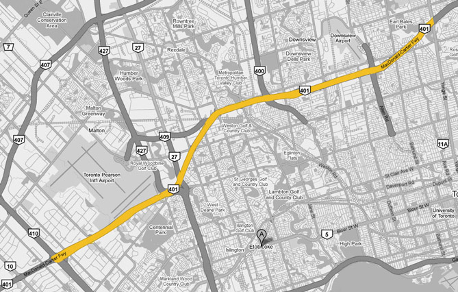
<- Page 8 Page 9 - Mississauga to North York Page 10 ->
Photos shown in this table are arranged from West to East:
| Proper Municipality Name | Photo Description | Photo | |||
|
Photos taken from driver's perspective appear offset from centre-line Photos: |
East- bound |
West- bound |
|||
| Click here for Milton to Mississauga Images | |||||
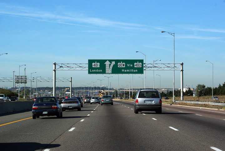
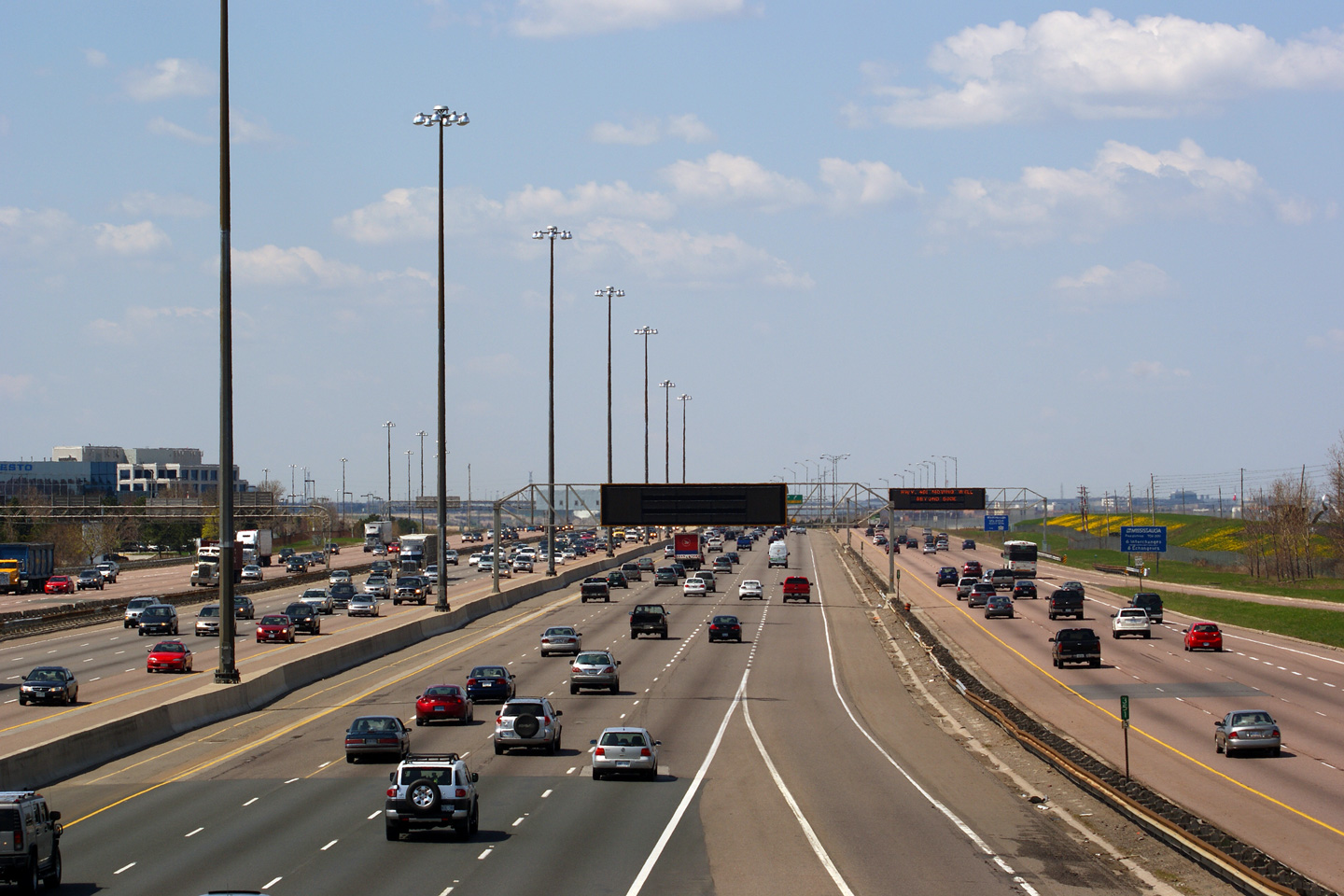
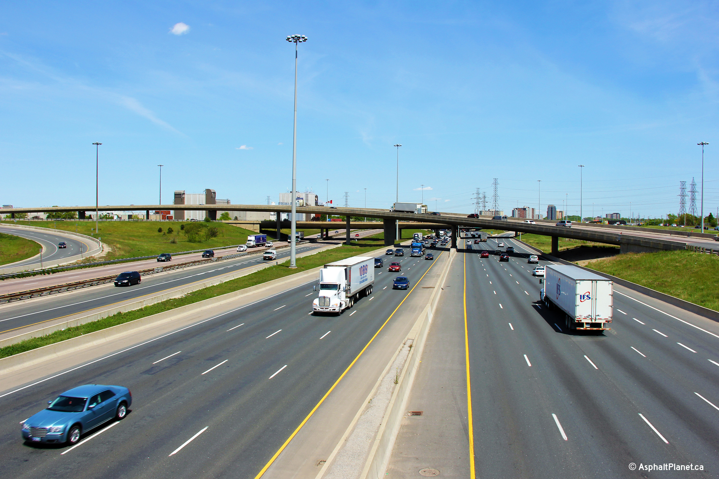
| City of Mississauga Regional Municipality of Peel |
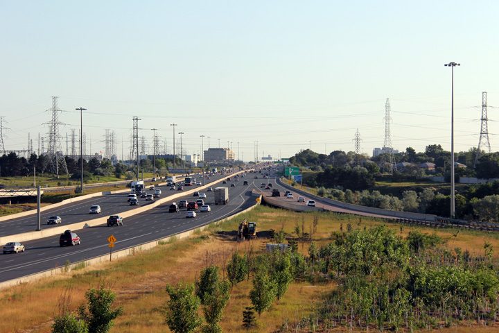
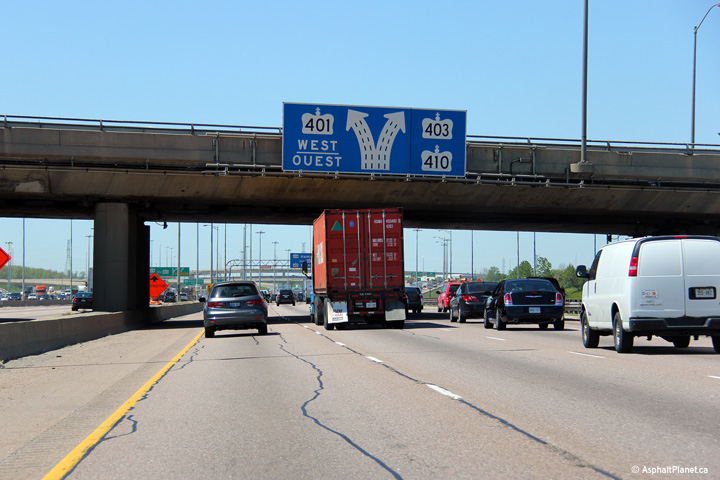
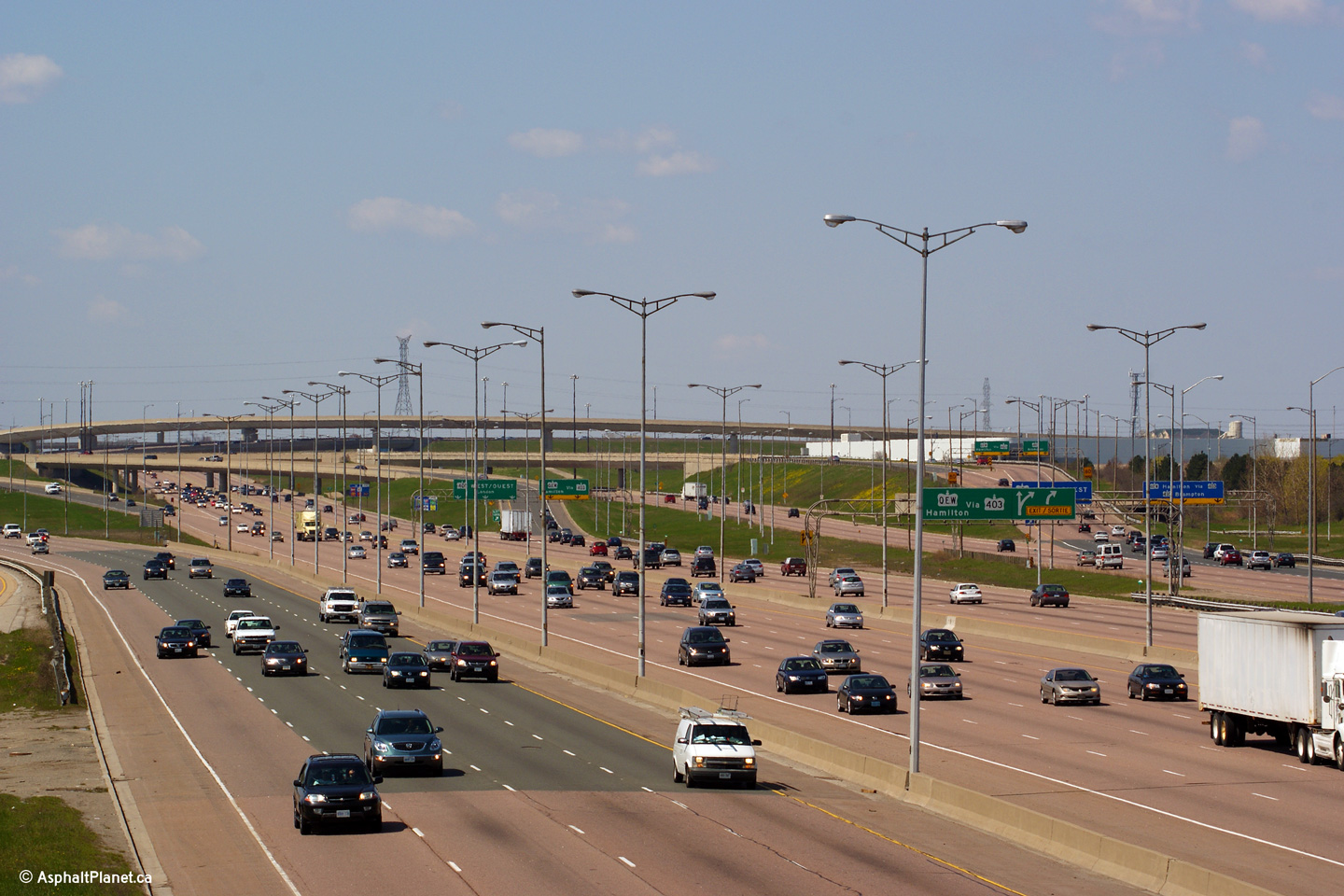
A series of views of Highway 401 looking east from Kennedy Road (Mississauga) towards the 401/403/410 interchange. In the upper photo, taken several years before the complex freeway portion of highway was extended westerly, the 18+ lane, 4 carriageway Highway 401 narrowed to a meagre, 6+ lane, two carriageway freeway just east of the Kennedy Road overpass. The lower photos were taken shortly after construction to widen the highway to twelve lanes through the Hurontario Street interchange was completed. Within the modern photos, the inner-most lane of the freeway has been barricaded off from traffic until the complex freeway is again extended to the west through the Mavis Road interchange. Once widening has been completed to the west through Mavis Road, the now closed inner express lanes will be opened as a High Occupancy Vehicle (HOV) lane, the first such lane along Highway 401 in the province. Click here to jump to the view looking westerly from the Kennedy Road overpass.
Photos #1 and #2 taken: June 24th, 2008.
Photos #3 and #4 taken: August 19th, 2014.
Photos #5-8 taken: December, 2020. |
 (720x480) (1440x960) (2400x1600) 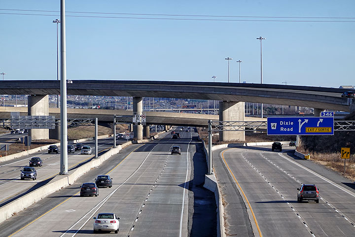 (720x480) (1440x960) (2400x1600)  (720x480) (1440x960) (2400x1600) 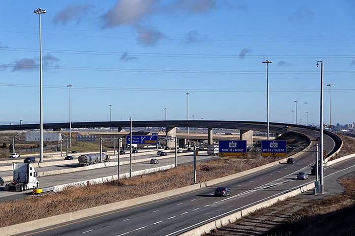 (720x480) (1440x960) (2400x1600) |
|||
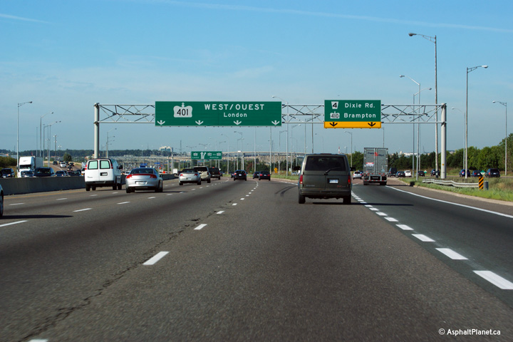
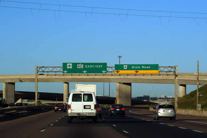
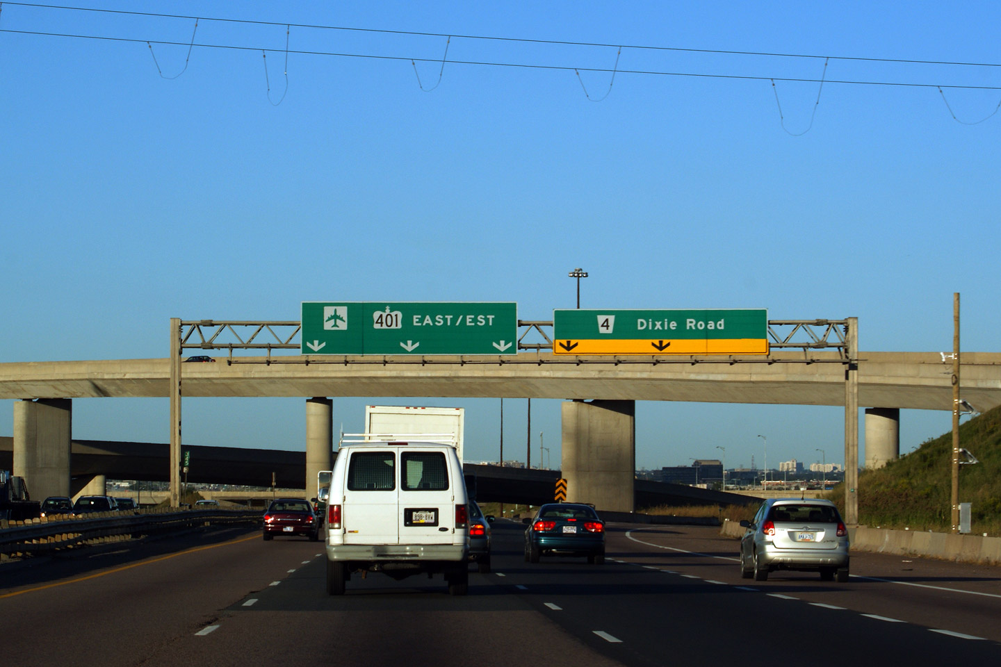
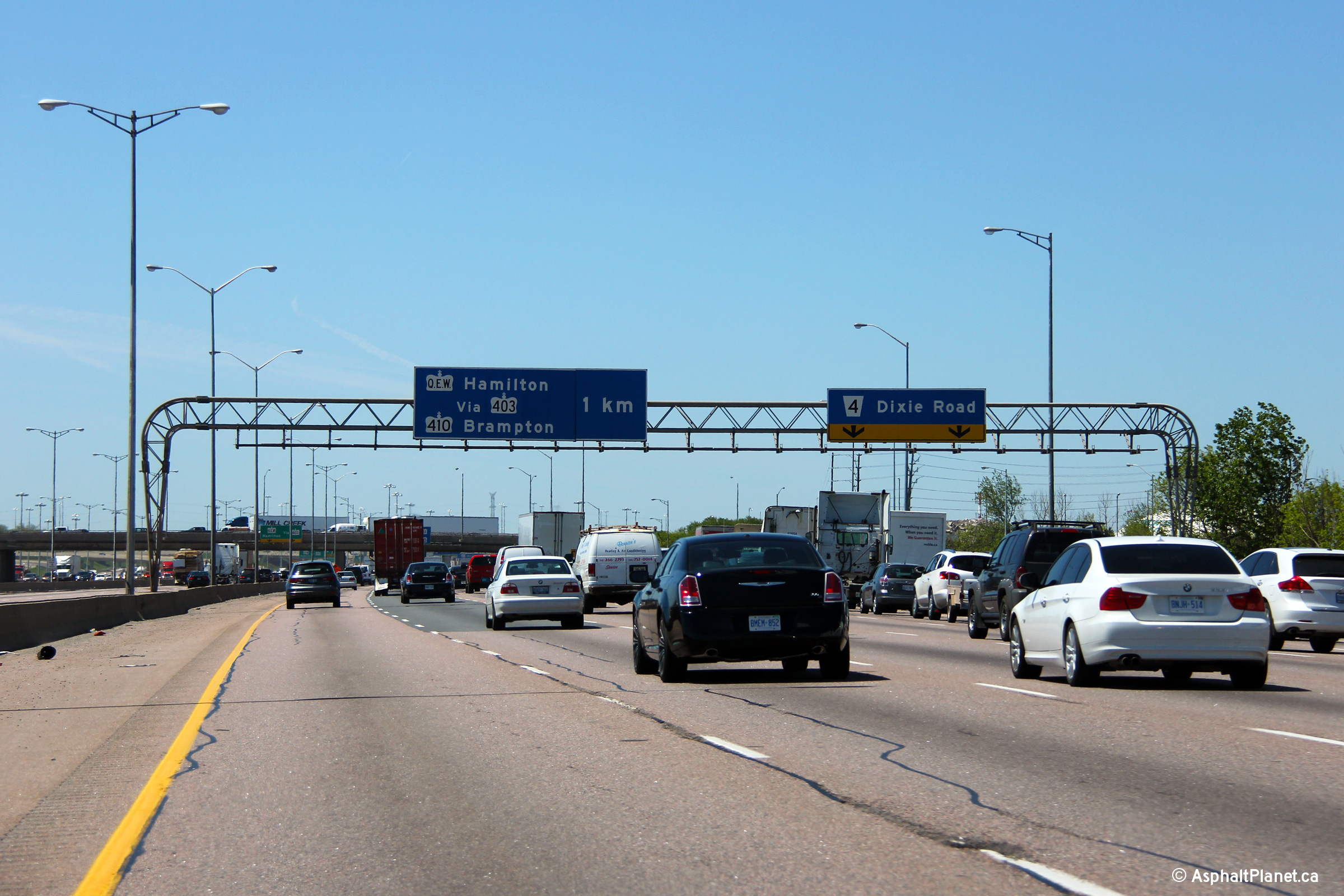
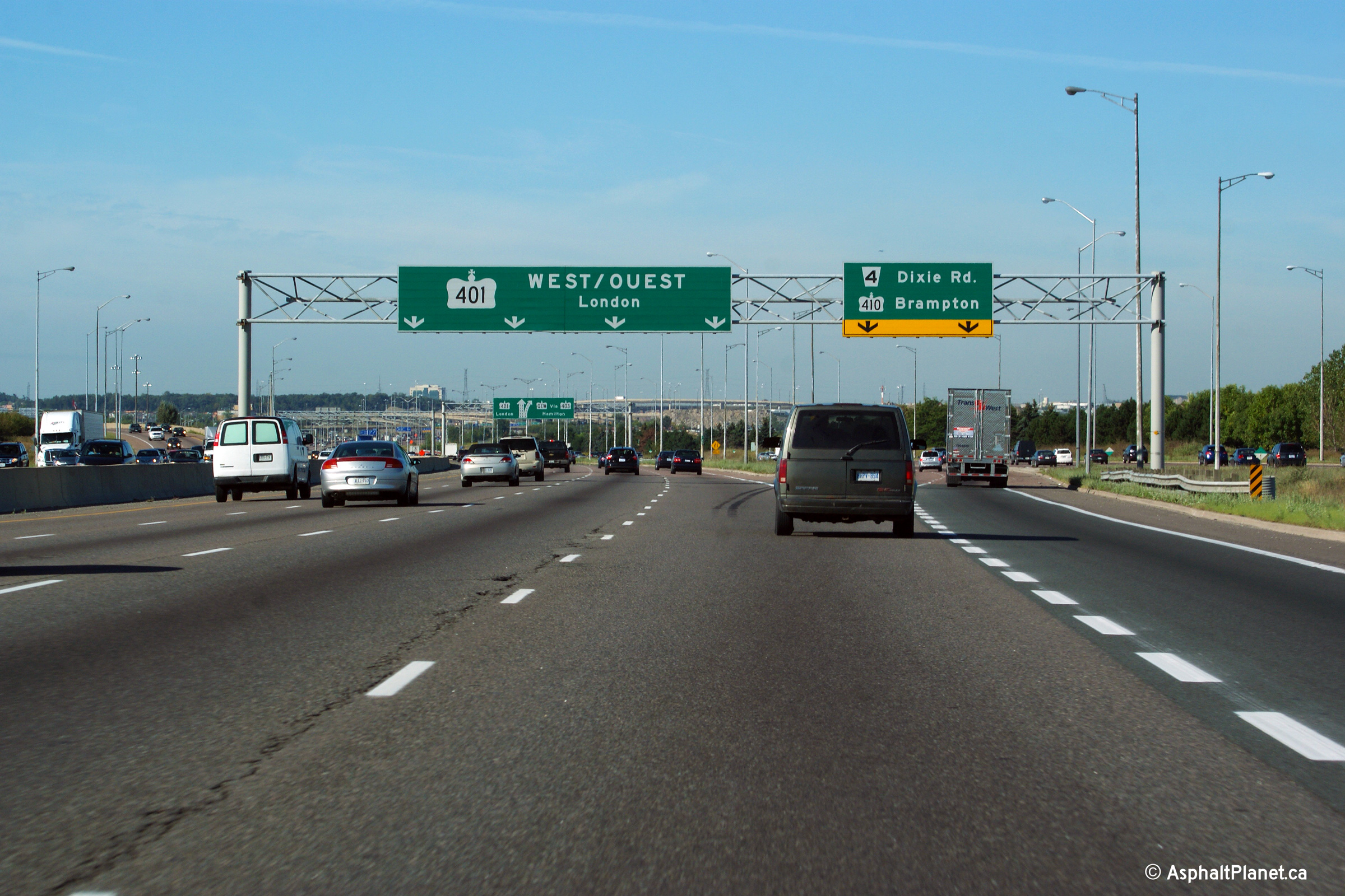
| City of Mississauga Regional Municipality of Peel |
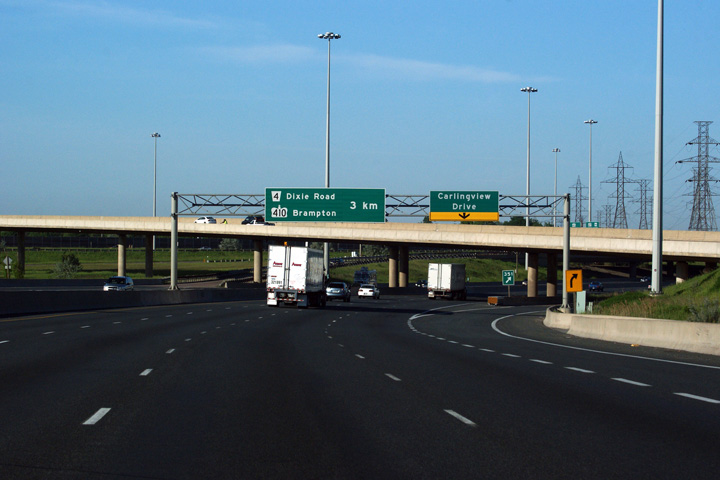
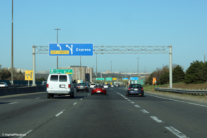
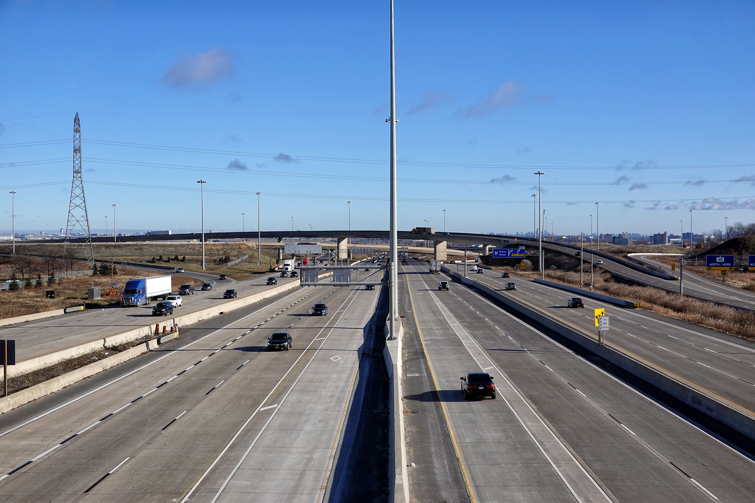
Signage for the core to collector transfer for the Dixie Road interchange.
This sign is out of date as there is no longer a transfer from the Express
Lanes to Collector Lanes at Highway 410. Photo taken: August 26th, 2009. |
|
|||
|
Highway 410 leads north of Highway 401 into Brampton. Click here for Highway 410 images. Highway 403 leads south and west of Highway 401 to Hamilton, Brantford and eventually meets Highway 401 again in Woodstock. Click here for Highway 403 images. |
|||||
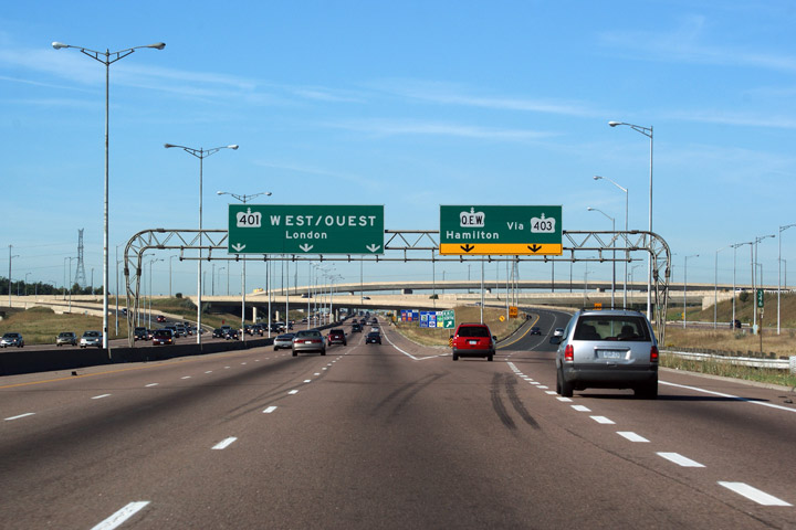
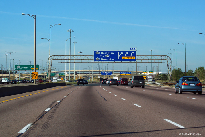
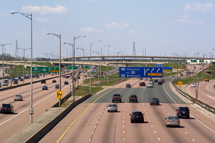
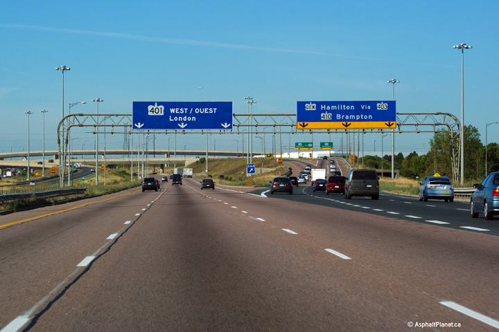
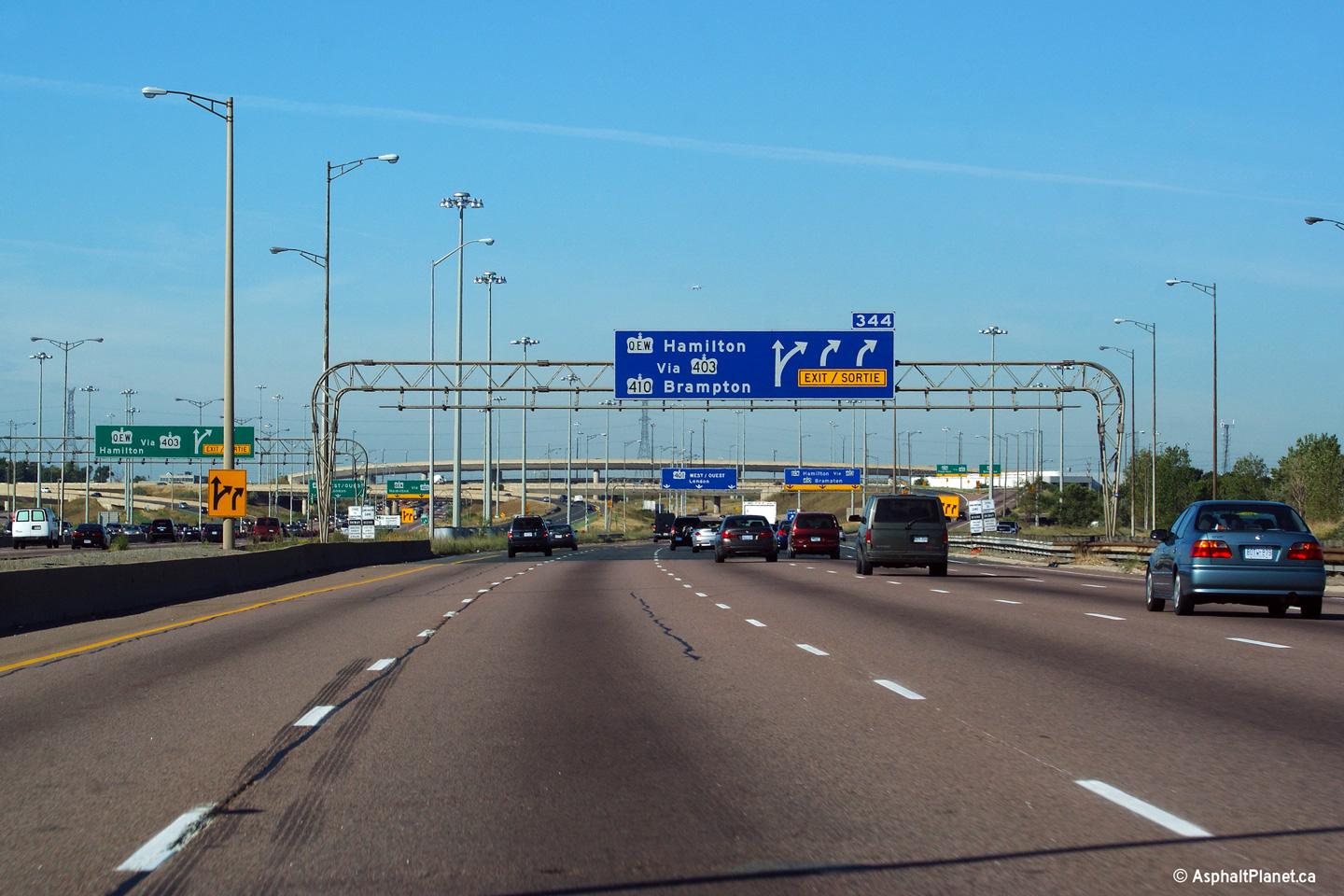
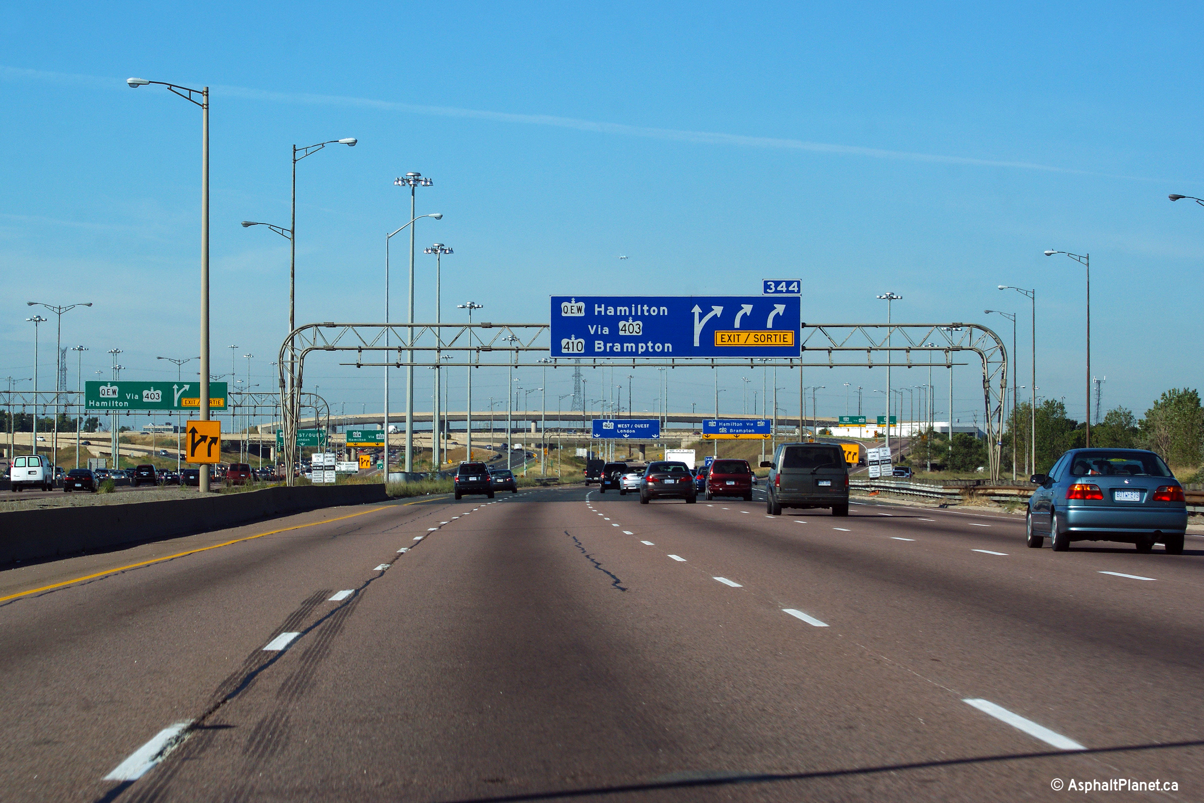
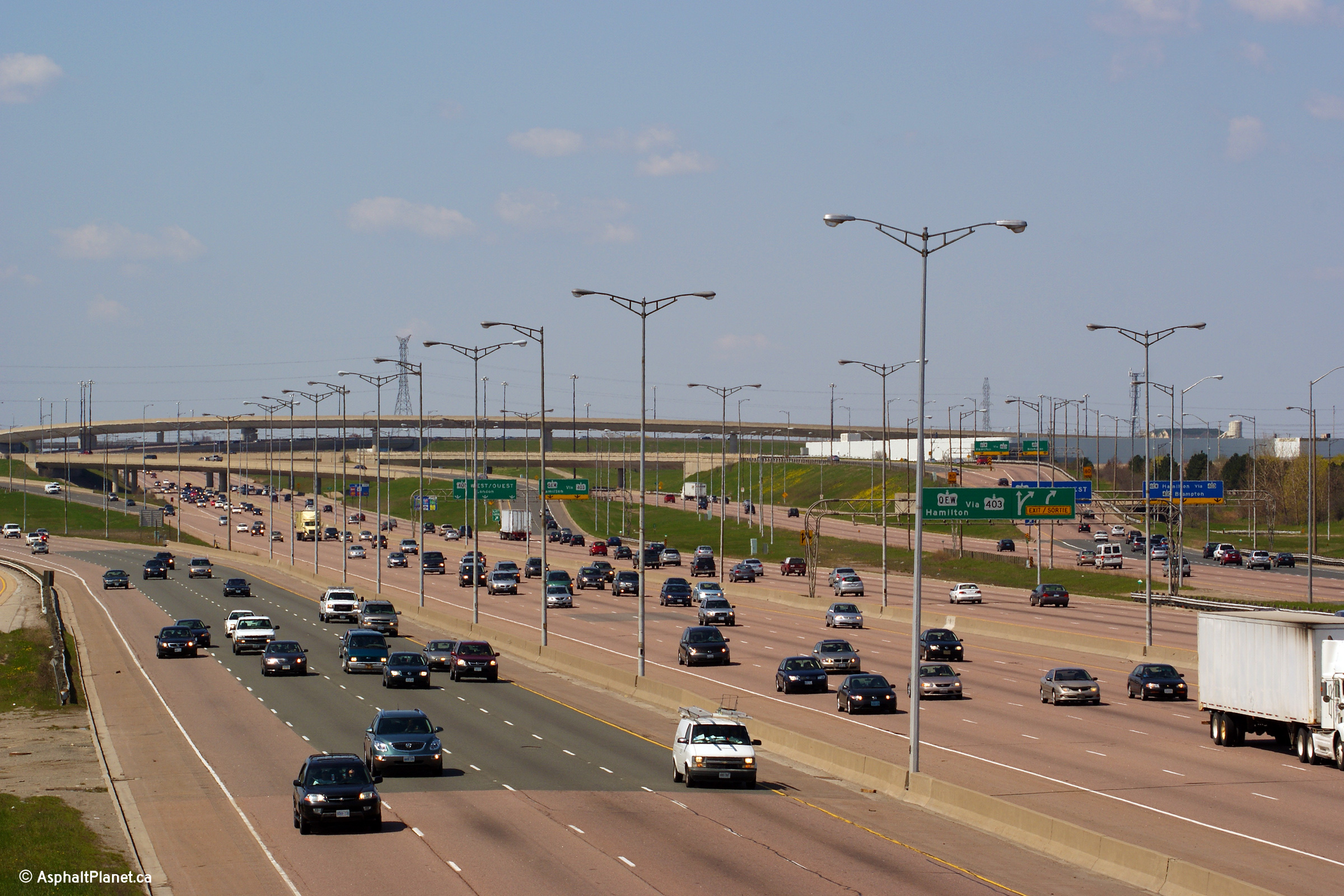
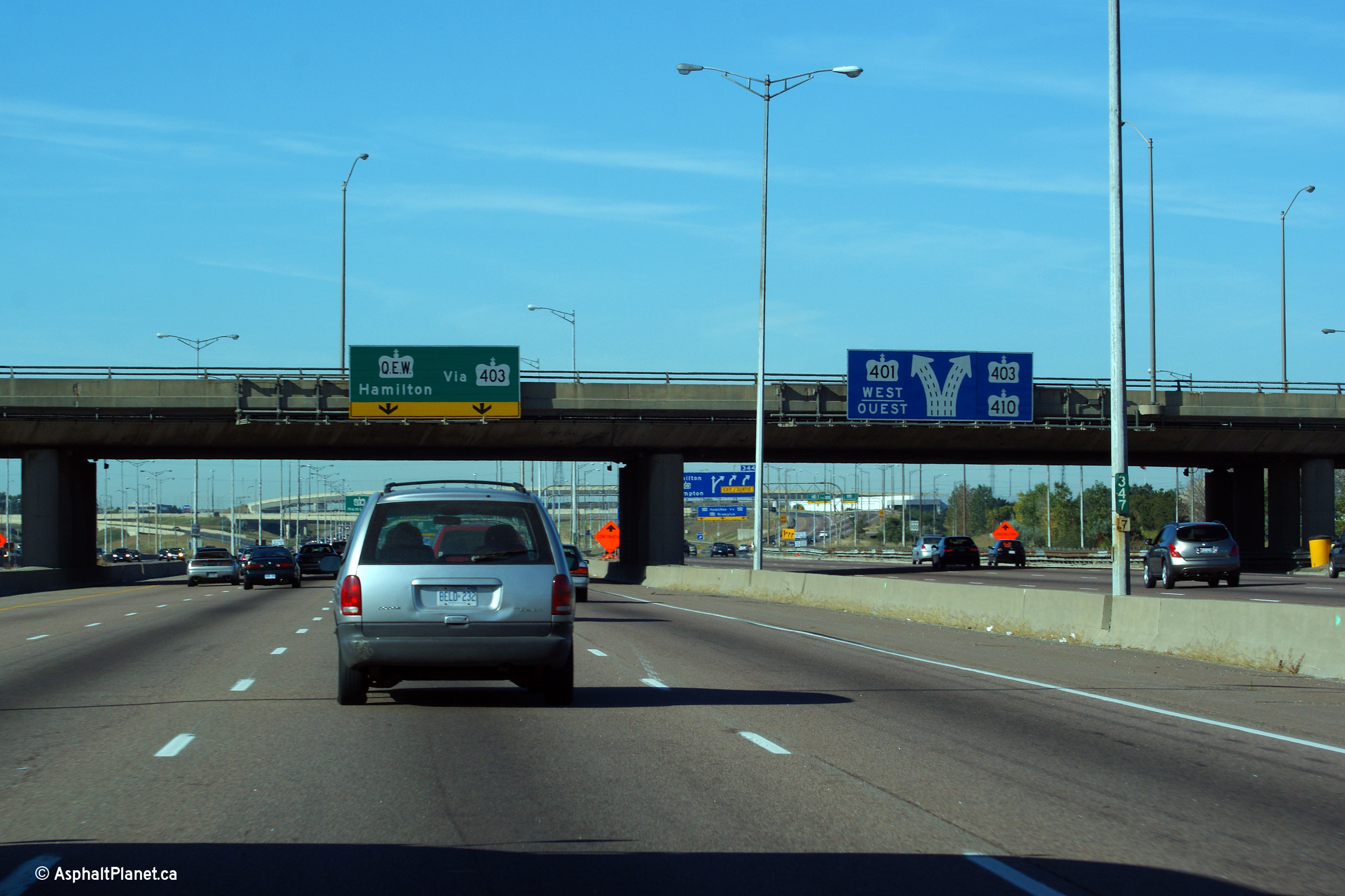
| City of Mississauga Regional Municipality of Peel |
Signage for the Highway 403 exit along the
westbound Express lanes, and for Highway 403 and
Highway 410 along the westbound Collector
Lanes This is a very major interchange -- just over
half of all westbound traffic departs the 401 for either Highway 403 or
Highway 410. Upper (Express Lanes) photo taken: September 20th, 2009. |
 |
|||
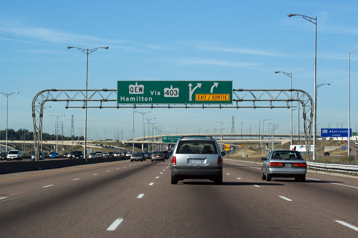
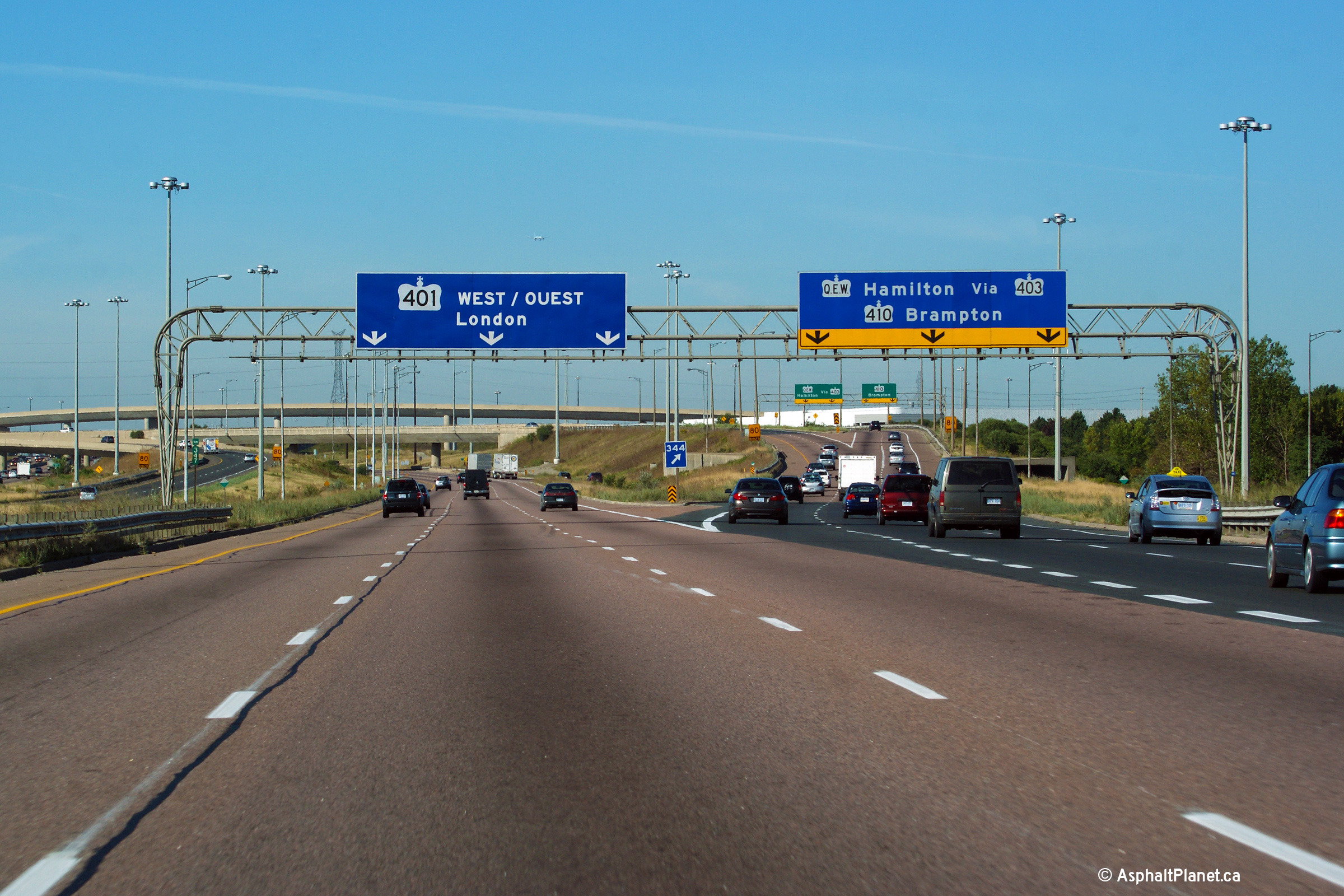
| City of Mississauga Regional Municipality of Peel |
Advanced signage in both the Express and Collector Lanes denoting the Highway 403/410 interchange. Upper (Express Lanes) photo taken: September 20th, 2009. |
 (720x480) (720x480) |
|||
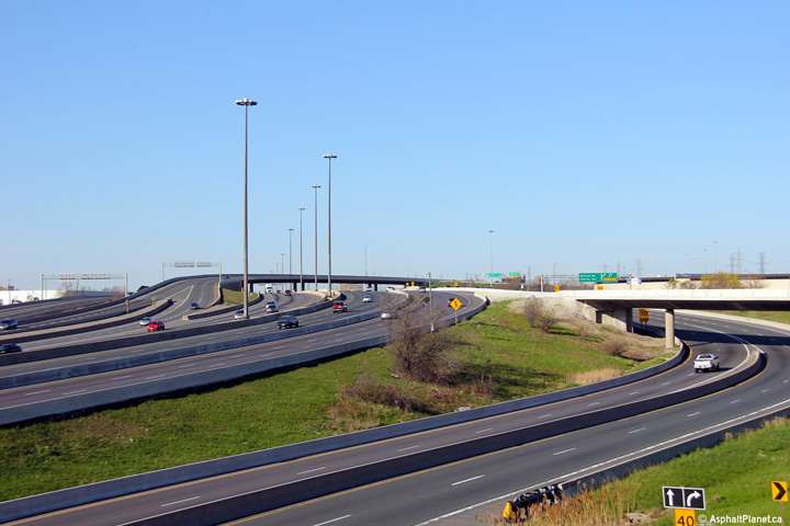
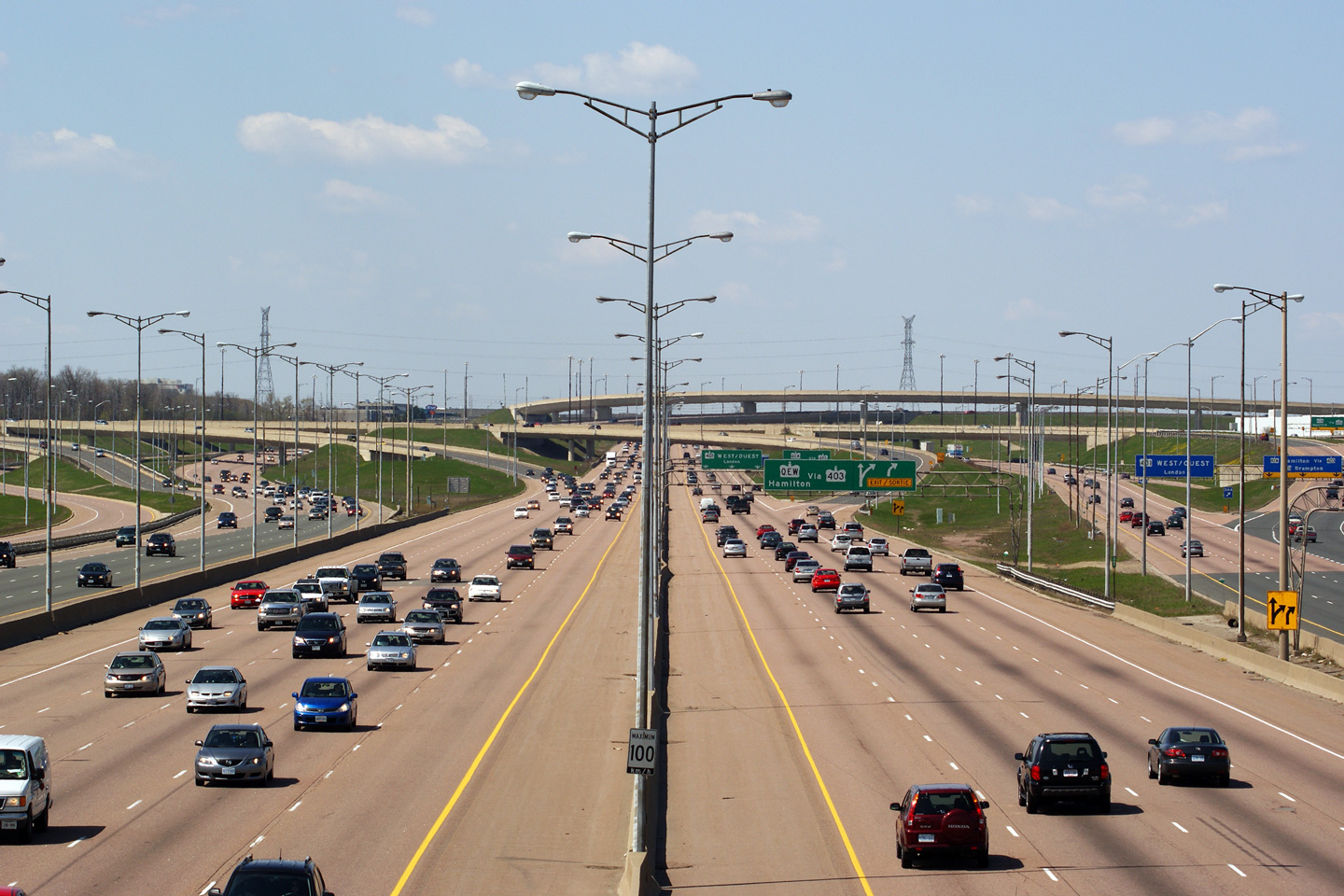
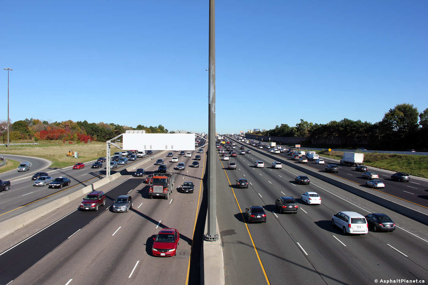
| City of Mississauga Regional Municipality of Peel |
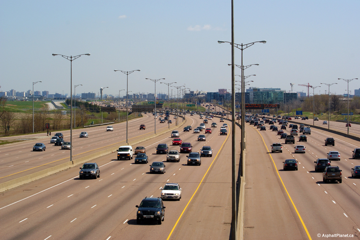
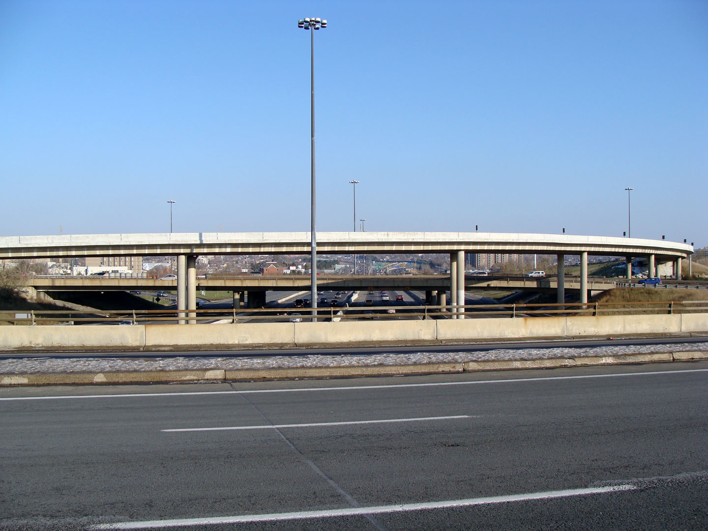
View of the 401/403/410 interchange as seen looking west from the Dixie Road overpass. The Highway 401/403/410/ interchange is 4-levels high and contains 7 high-speed flyover ramps. Geographically it is far and away the largest interchange in Canada. What's more, despite its already enormous size, this interchange is likely to get larger, as there are currently no ramps between the Toronto-bound 403 and Highway 401-West nor are there ramps between Highway 401-East and the Hamilton-bound 403. These ramps are proposed to be constructed in the future, some grading work was completed for a ramp from the westbound 401 to the Hamilton-bound 403 as part of the extension of the complex freeway to west of Hurontario Street.
Photos taken: May 3rd, 2009. |
(720x480) (1440x960) (2400x1600)
(720x480) (1440x960) (2400x1600)
|
|||
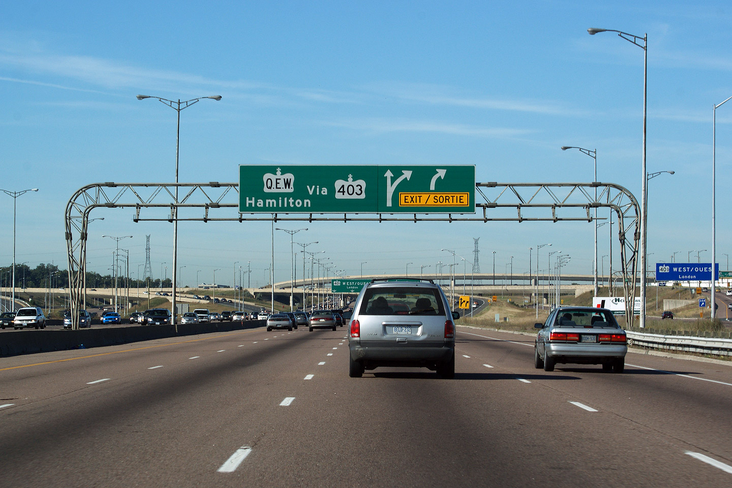
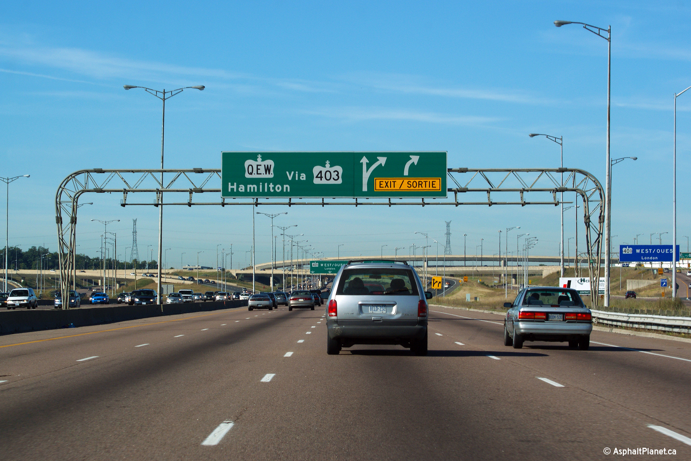
| City of Mississauga Regional Municipality of Peel |
Signage for
Highway 403/410 affixed to the Dixie Road overpass. The ramp to the 403
is located roughly 1km upstream of this sign. Upper (Express Lanes) photo
taken: September 20th, 2009. |
 (720x480) (720x480) |
|||
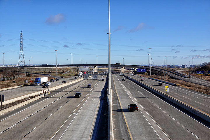
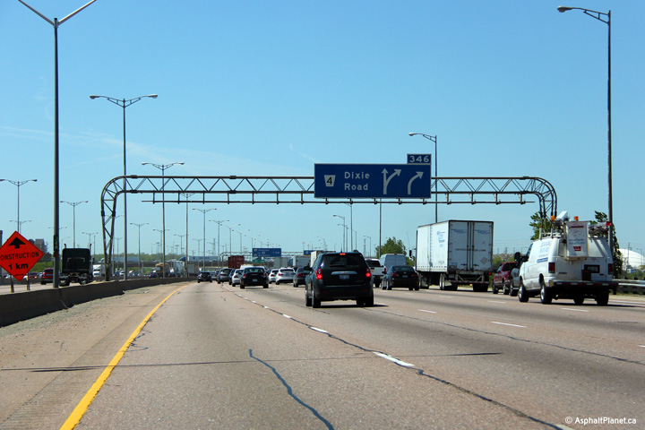
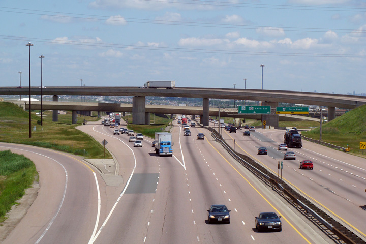
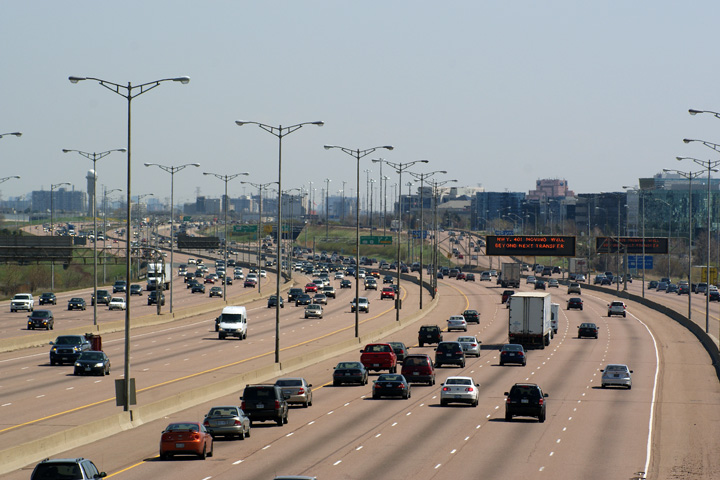
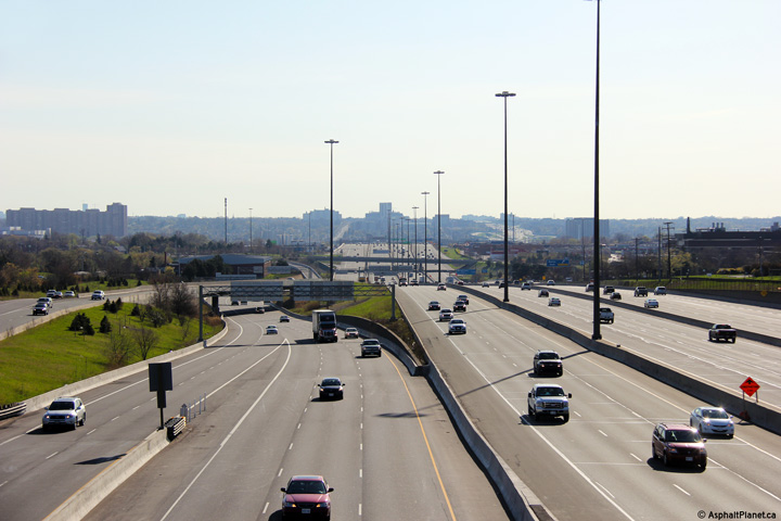
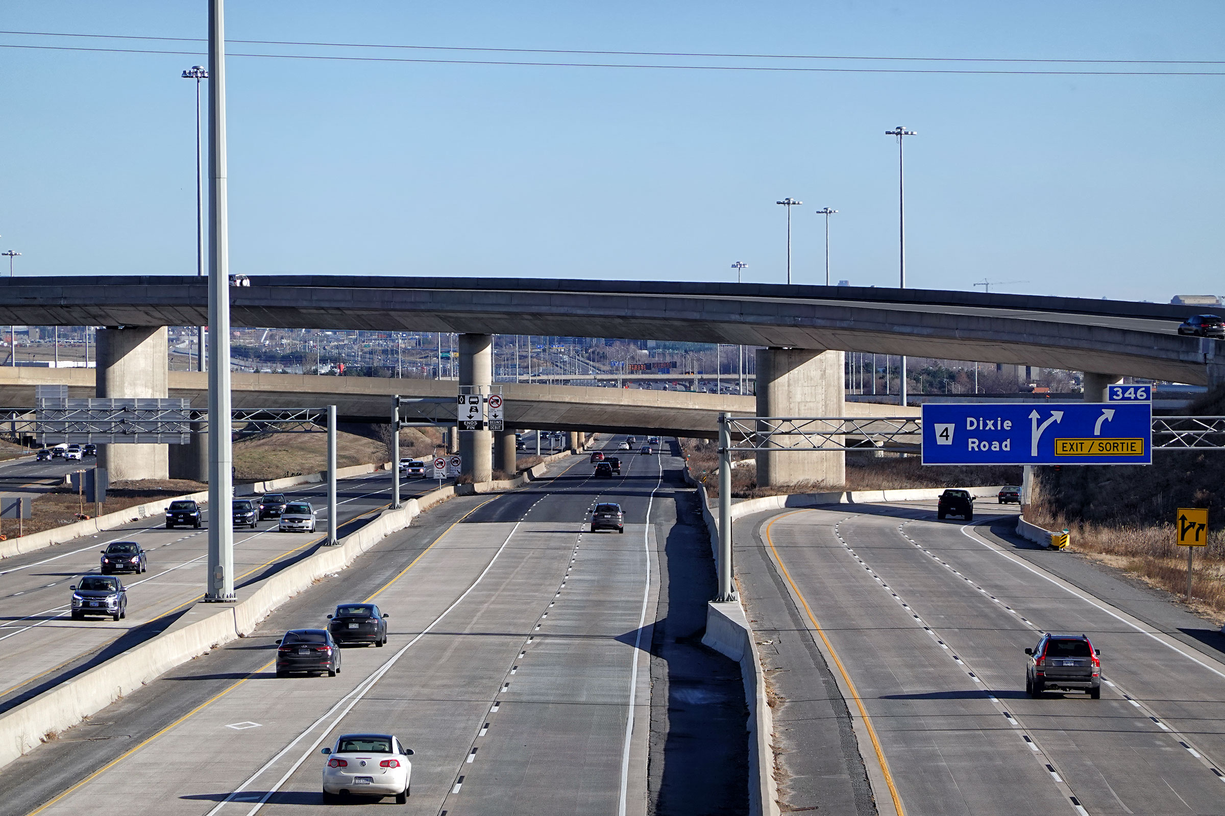
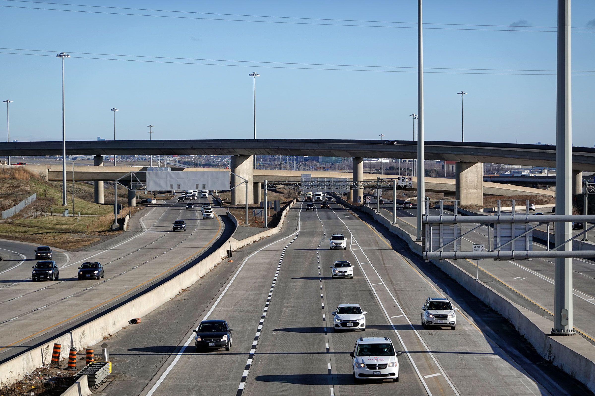
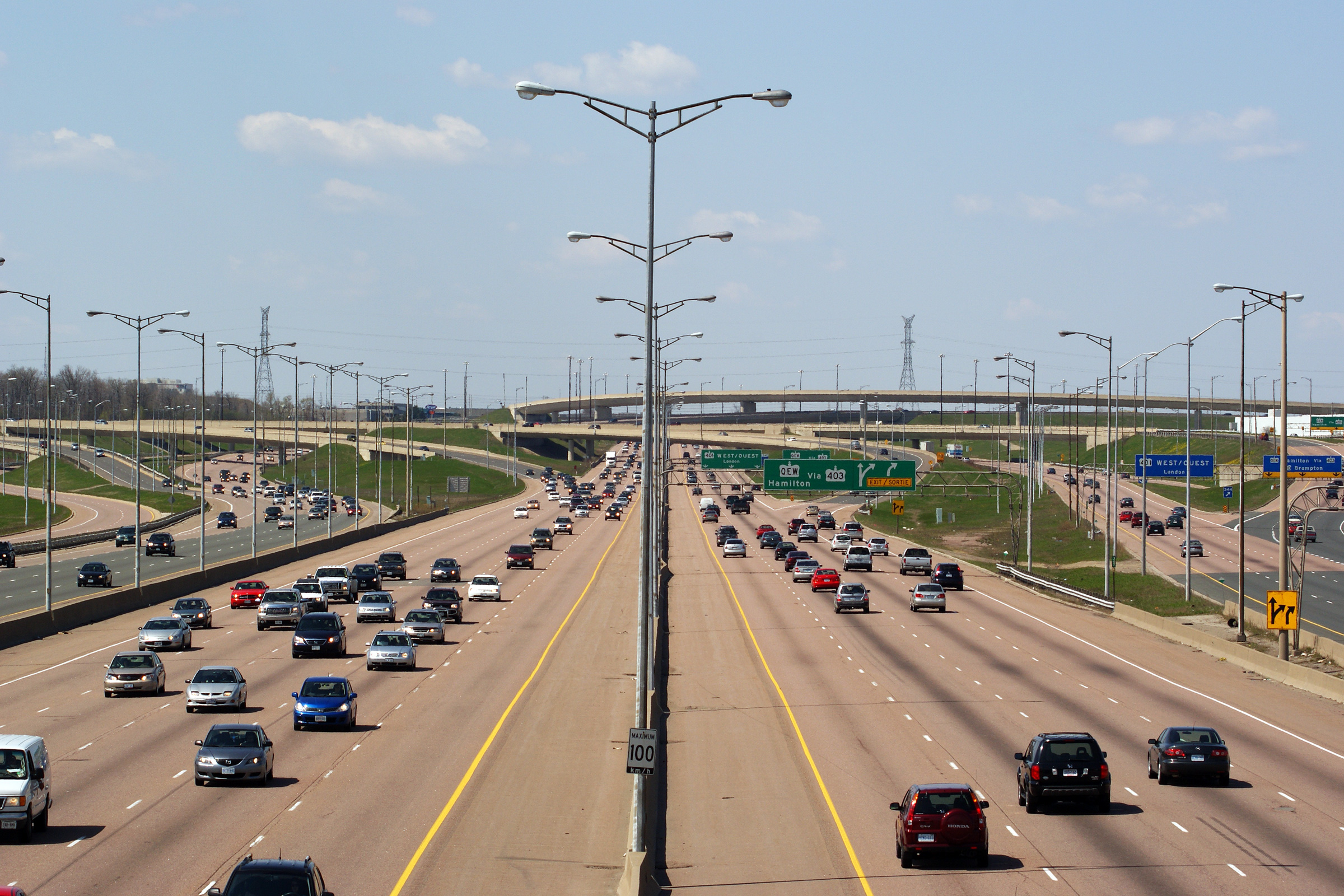
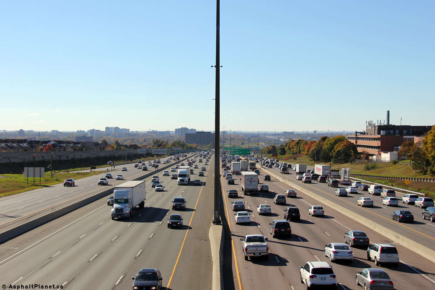
| City of Mississauga Regional Municipality of Peel |
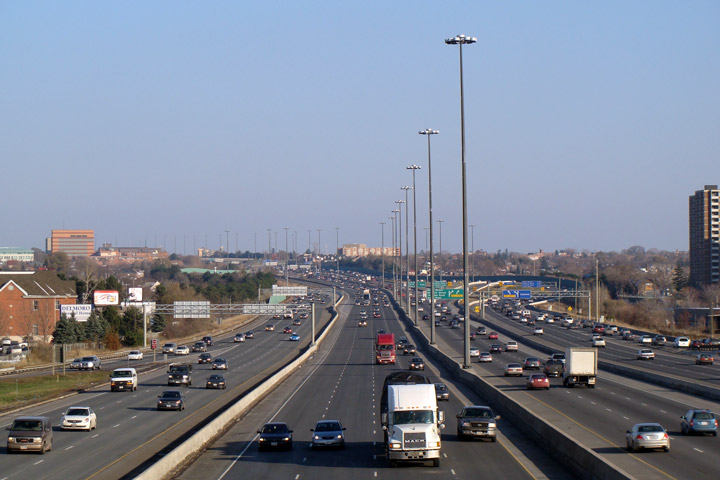
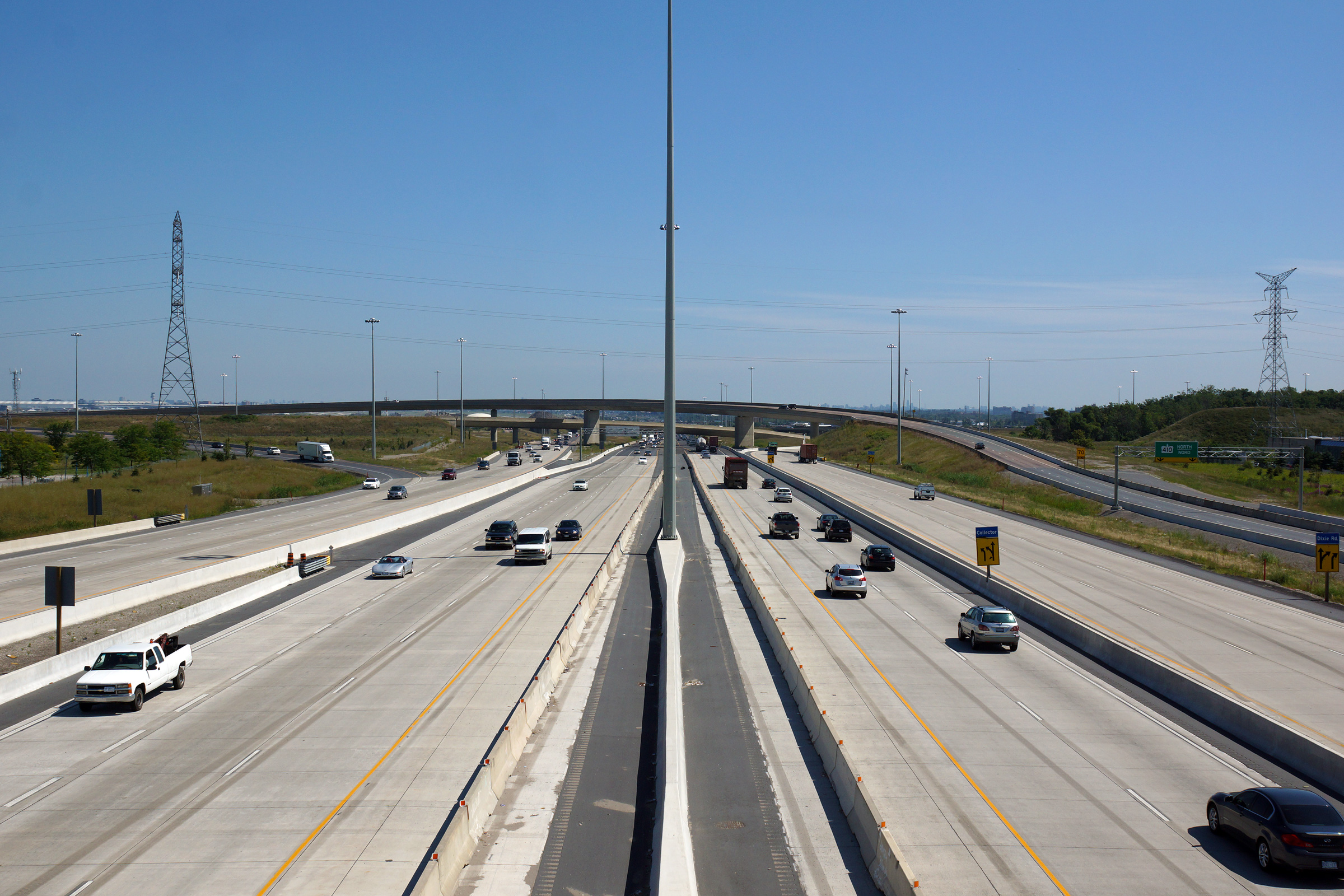
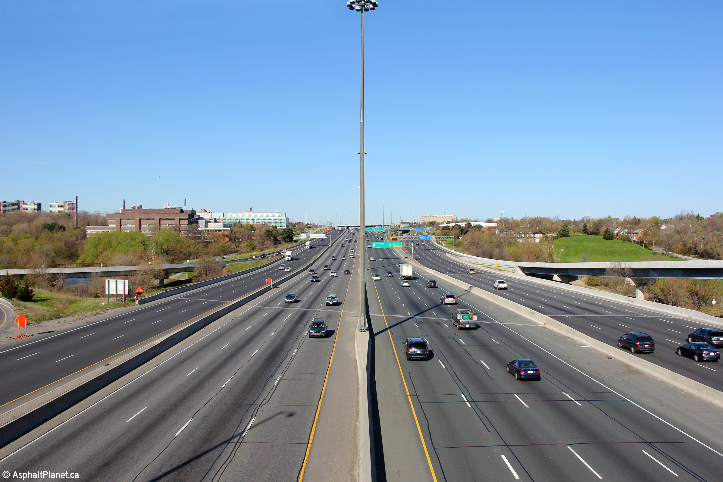
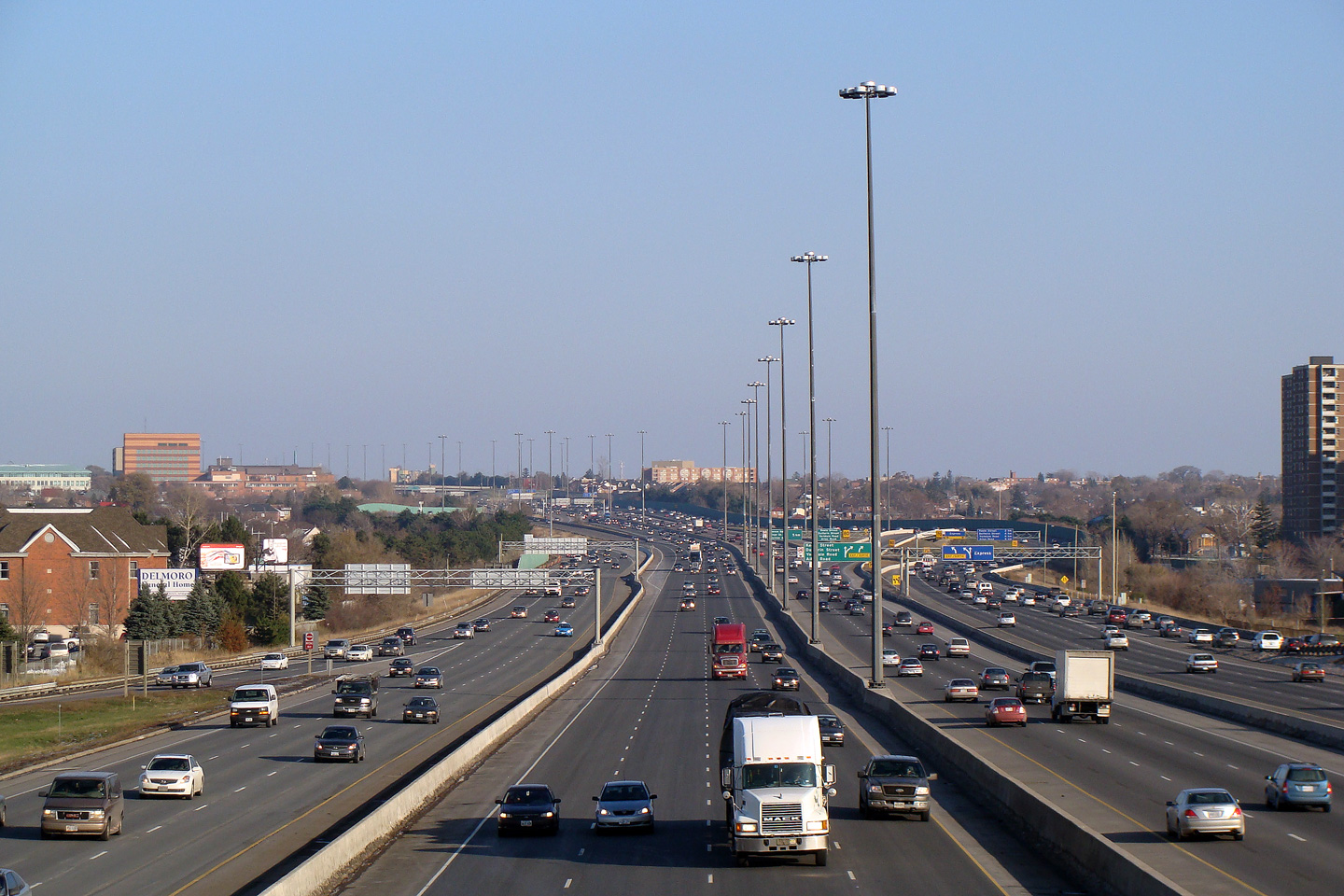
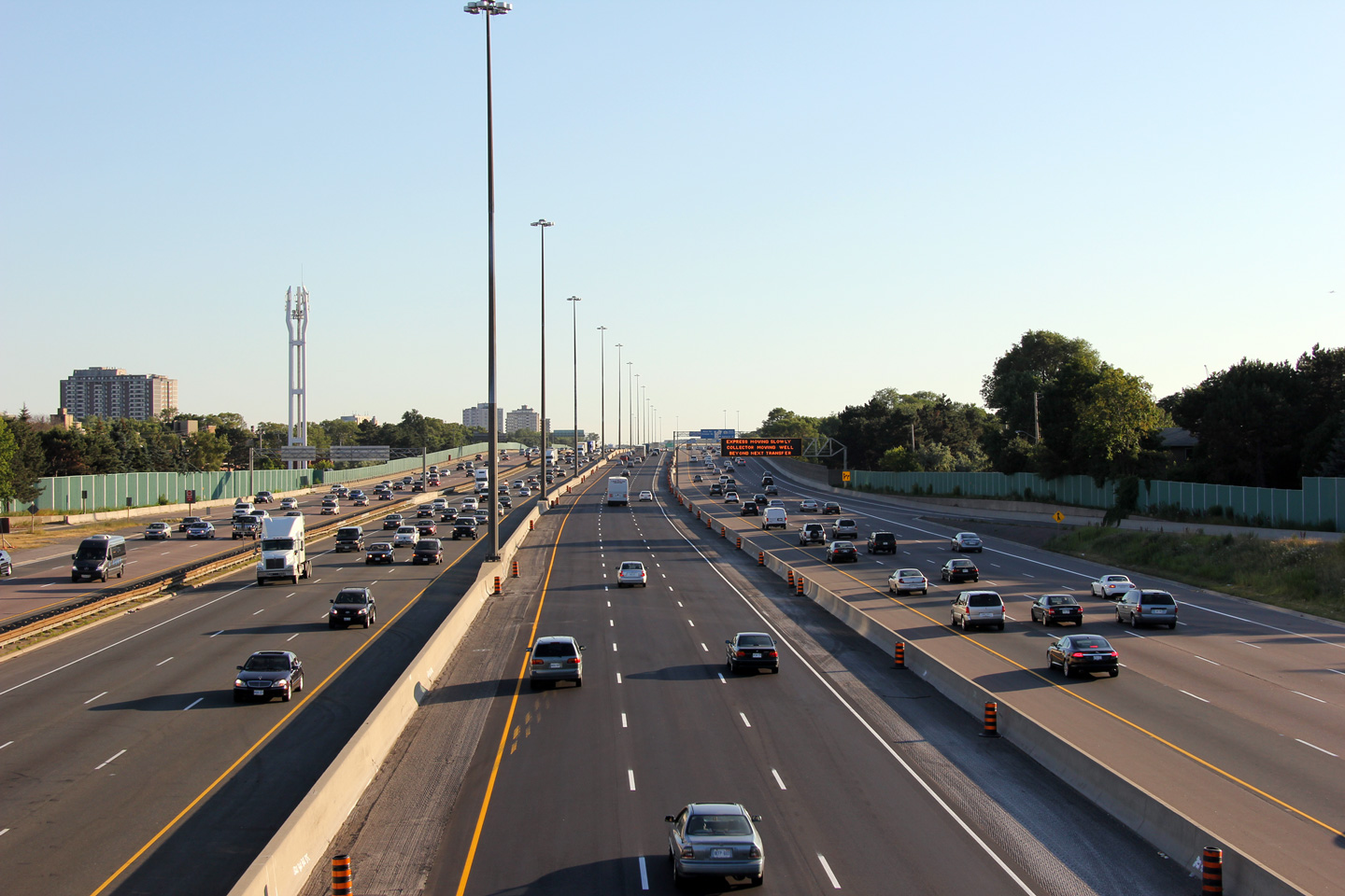
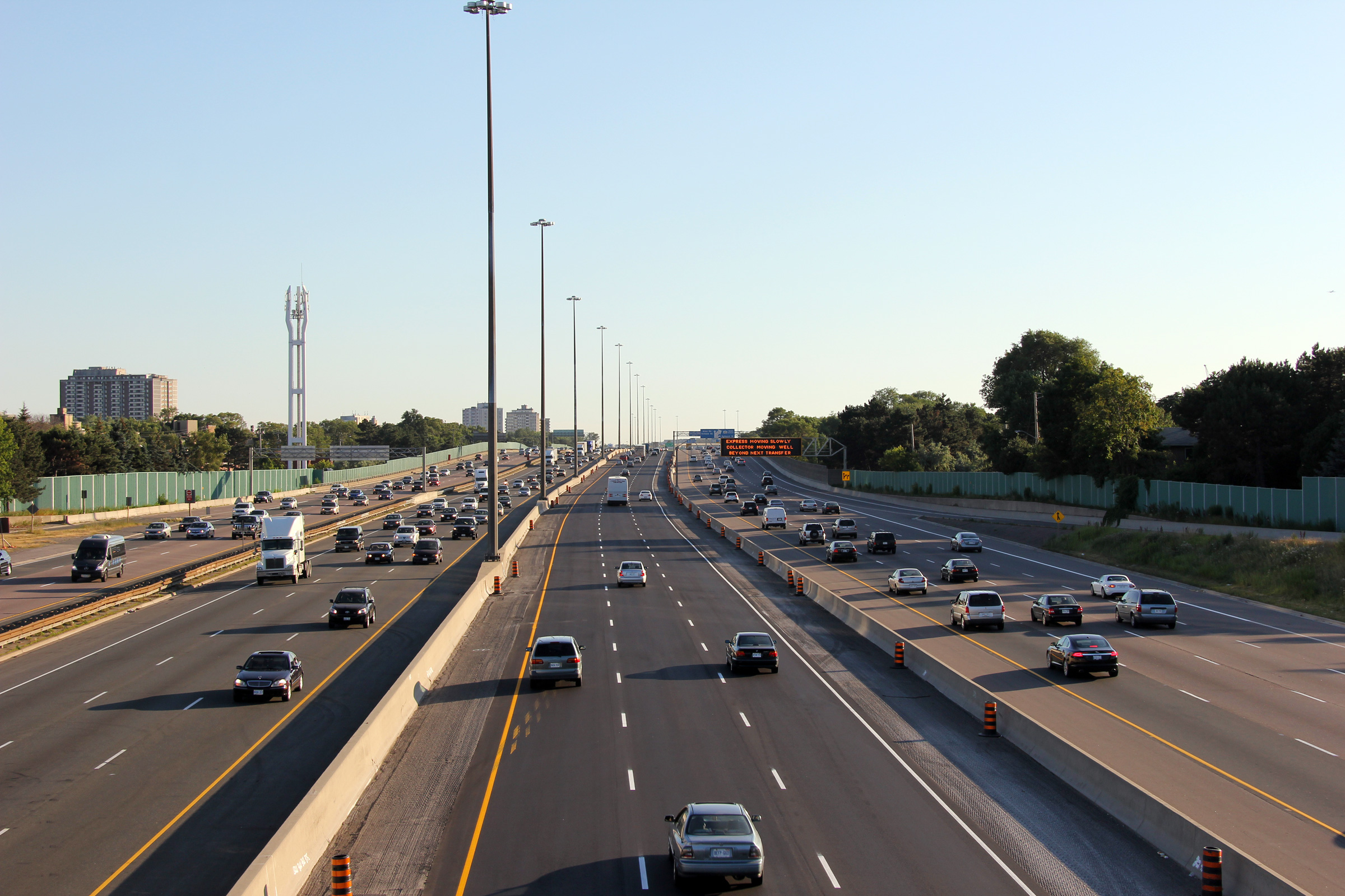
Highway 401 looking east from Dixie Road. Dixie Road is located at
kilometre marker 346. These photos showcase the widest section of
highway in Ontario. At 18-through lanes this section of Highway 401
is also the widest highway in Canada. Upper photo taken: May 3rd, 2009. Lower photo taken: June 20th, 2010. |
(720x480) (1440x960) (2400x1600)
|
|||
| City of Mississauga Regional Municipality of Peel |
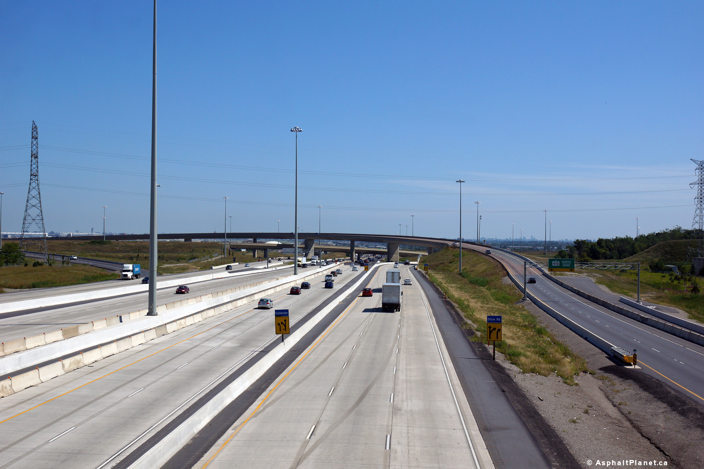
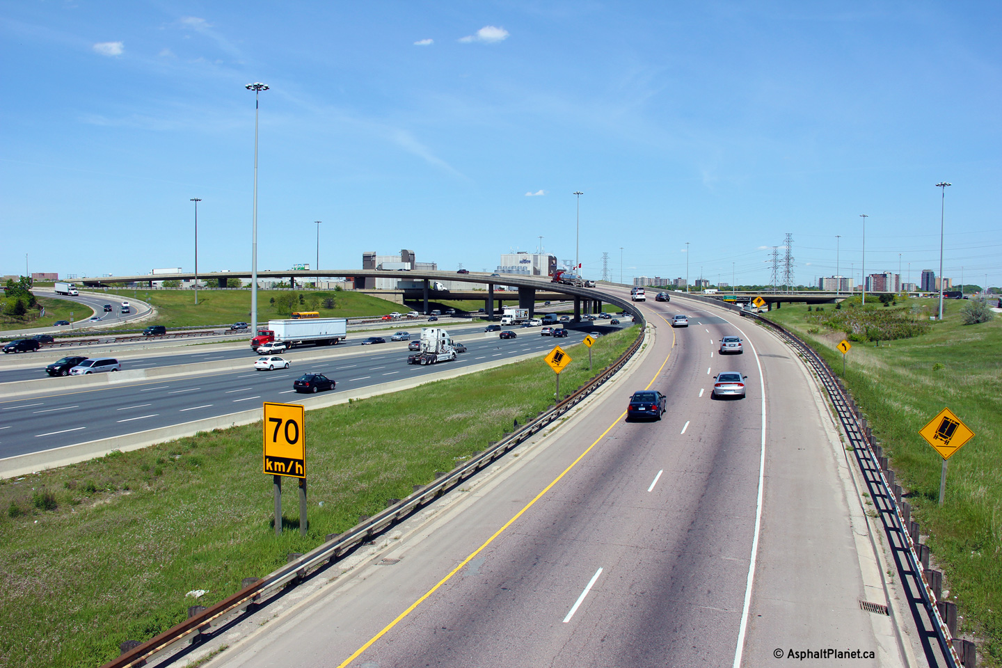
Westbound signage at the off-ramp to Dixie Road. Note the queued
traffic along the right side of the freeway for the Dixie Road off-ramp.
The westbound off-ramp to Dixie Road is often congested even during off-peak
periods such as when this photo was taken. To help alleviate
congestion, the City of Mississauga along with MTO are planning to
extend Creekbank Road overtop of Highway 401 and construct a new
westbound off-ramp from the collector lanes to the extended Creekbank Road. Photo taken: May 16th, 2013. |
 (720x480) (720x480)(1440x960) (2400x1600) |
|||
| City of Mississauga Regional Municipality of Peel |
Advanced signage for the westbound collector lane off-ramp to Dixie Road. Photo taken: May 16th, 2013. |
 (720x480) (720x480)(1440x960) (2400x1600) |
|||
| City of Mississauga Regional Municipality of Peel |
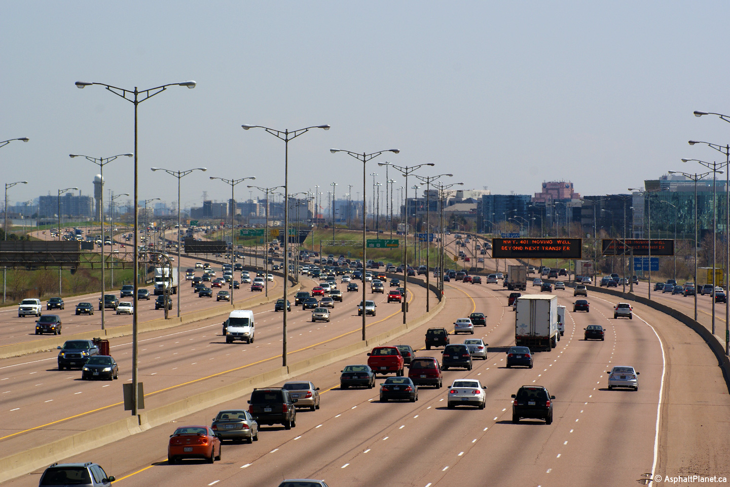
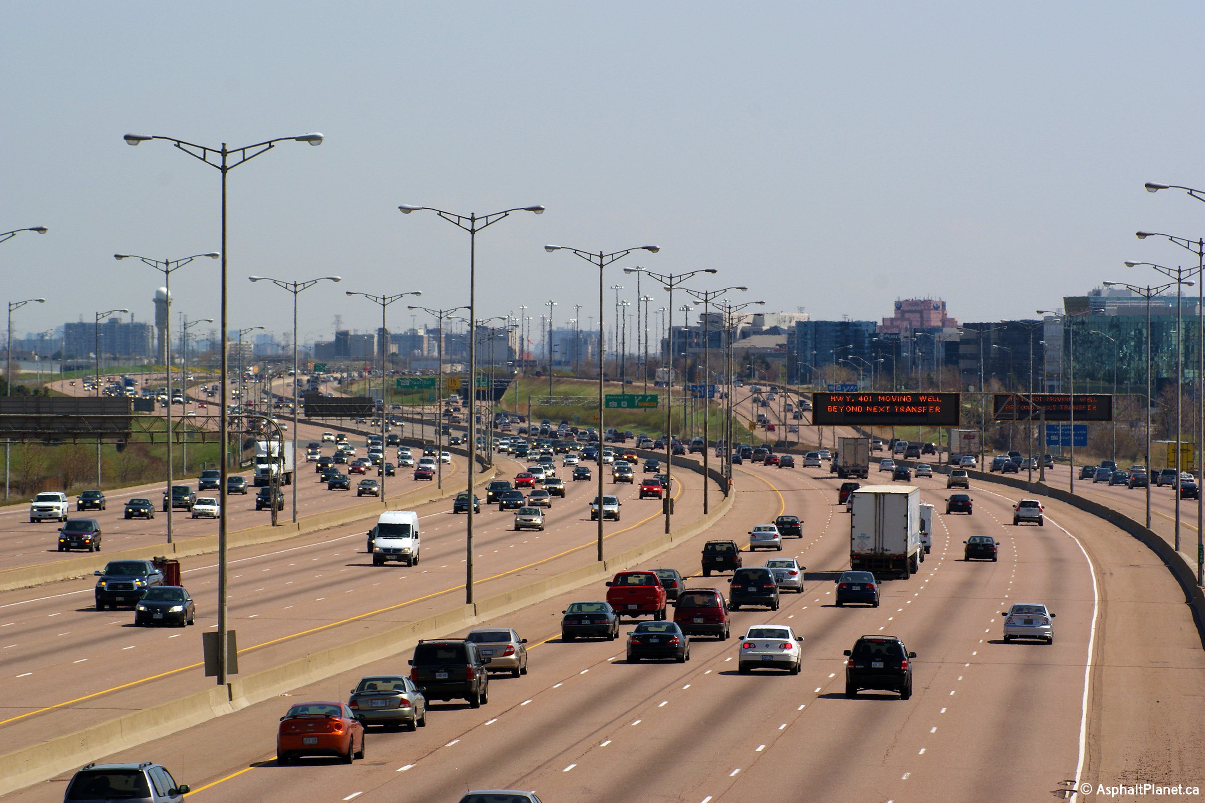
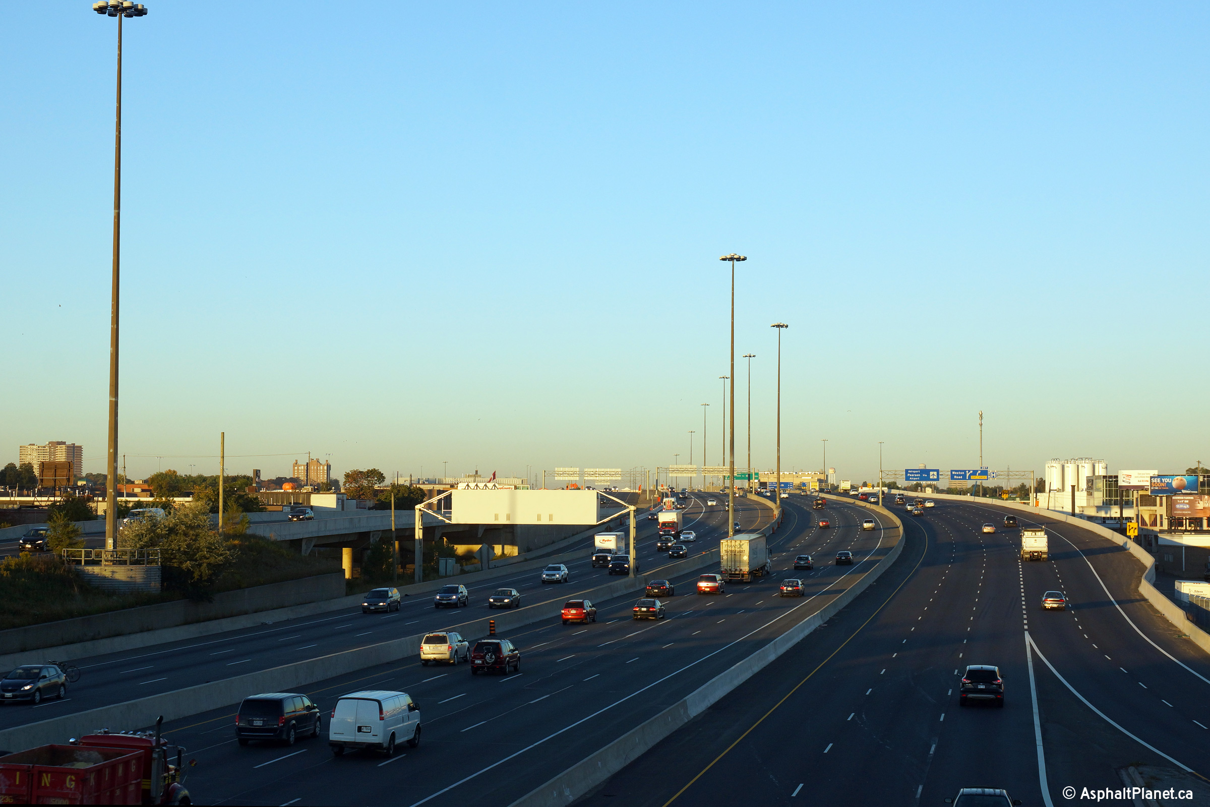
Two views along Highway 401 traveling eastbound through Mississauga at the
changeable message signs located in advance of the Airport Basketweave. During periods of light traffic, changeable message signs located in
advance of a major intersection often double as pre-advanced signage for the
interchange -- as is the case on both of the pictured signs to the right. Upper (Express Lanes) photo taken: August 26th, 2009. Lower (Collector Lanes) photo taken: March 19th, 2011. |
|
|||
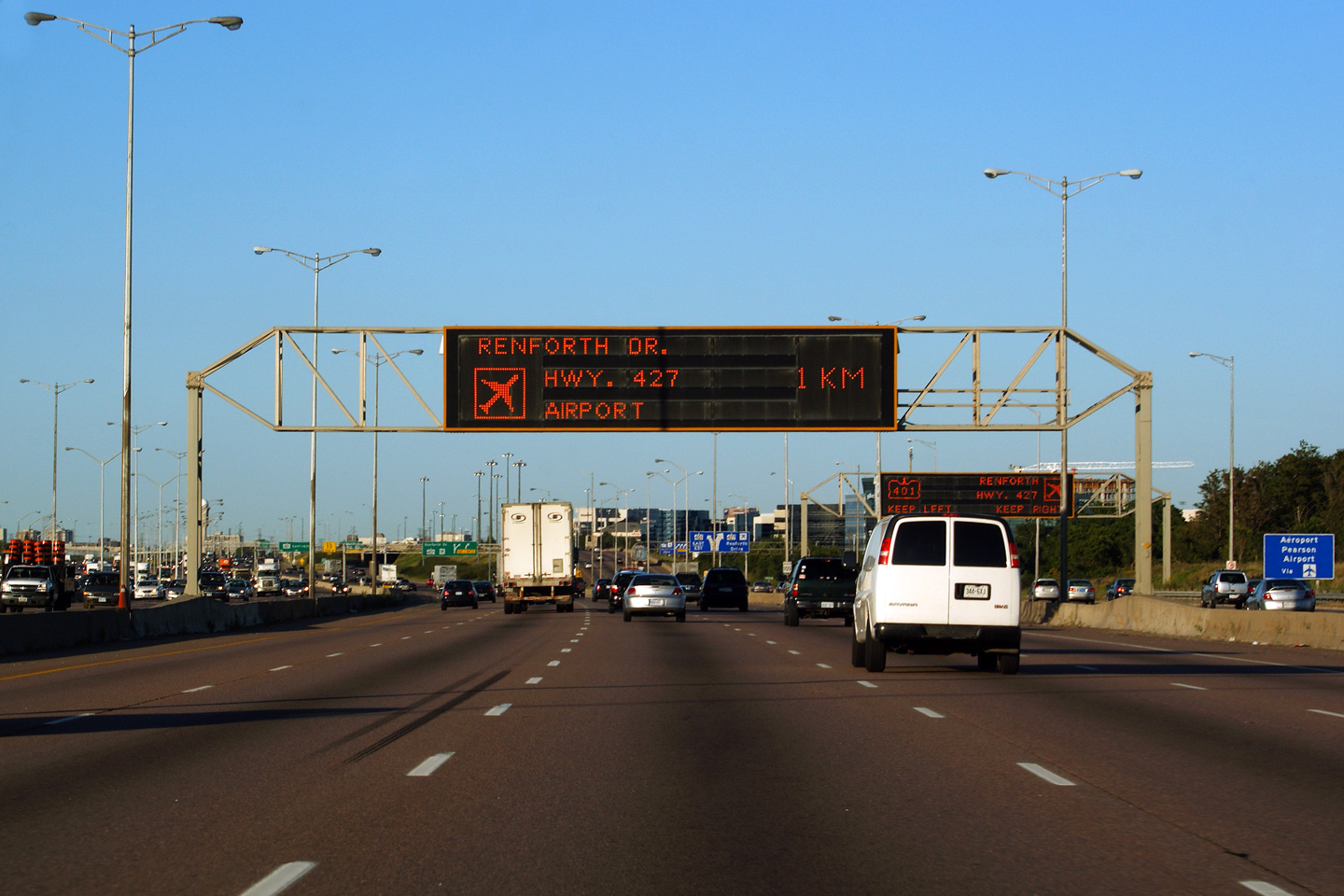
| City of Mississauga Regional Municipality of Peel |
Overhead signs located atop both the Express and
Collector Lanes in advance of the Airport Transfer. Beyond this transfer the
collector lanes become nothing more than long ramps to Highway 427 and Renforth Drive. All Eastbound Highway 401 traffic is directed into the
Express Lanes. There is a gap in the collector lanes between Highway
427 and Highway 409. Upper (Express Lanes) photo taken: May 19th, 2009 Lower (Collector Lanes) photo taken: August 26th, 2009. |
|
|||
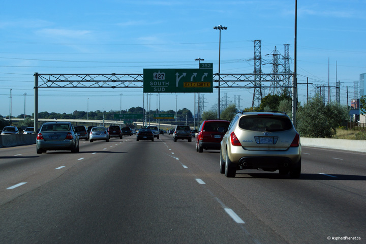
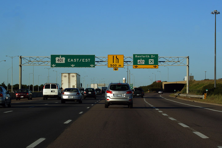
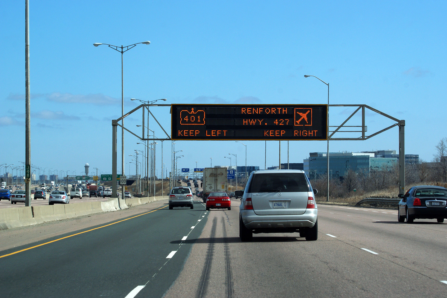
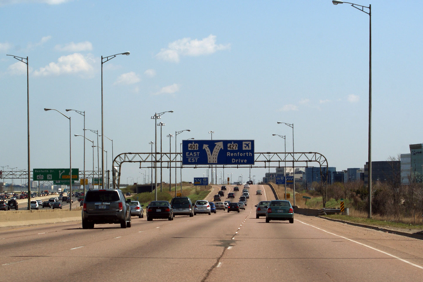
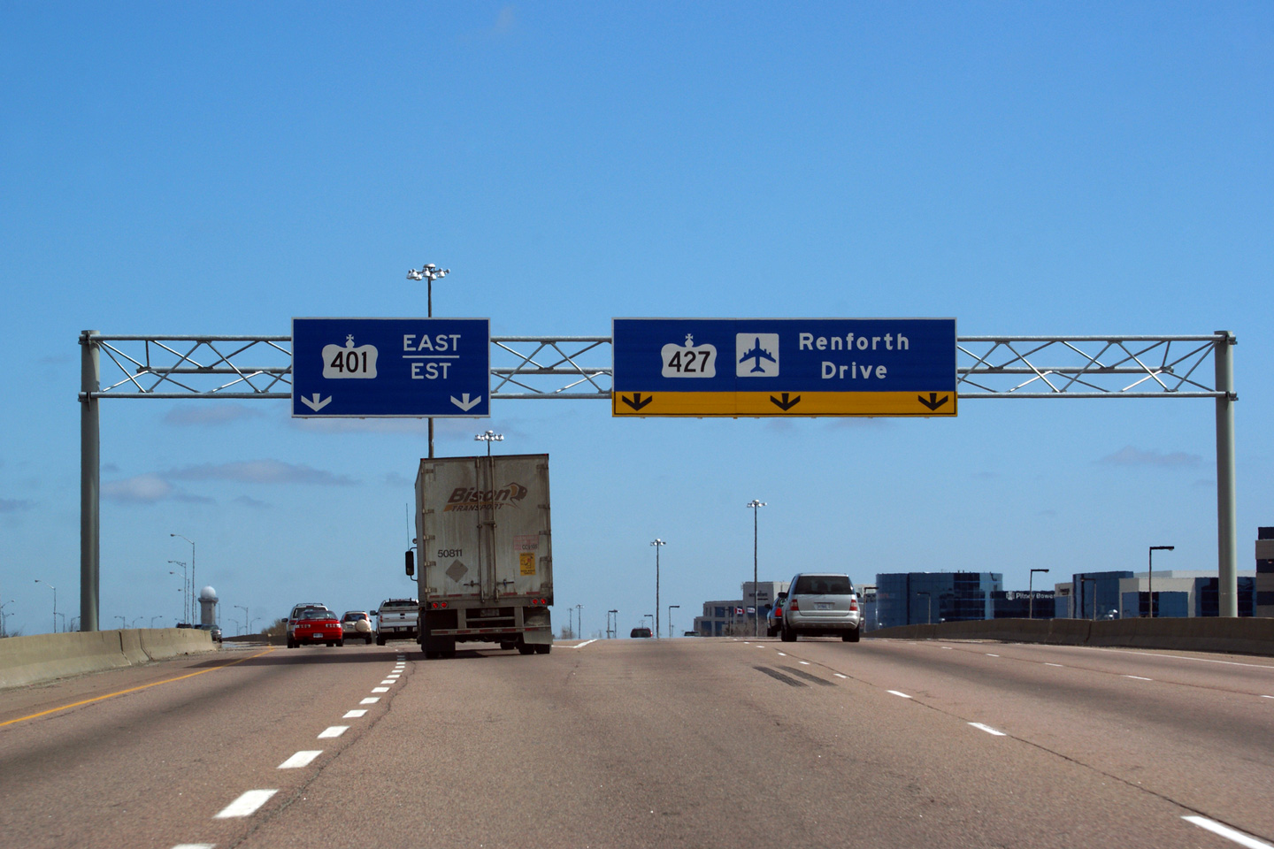
| City of Mississauga Regional Municipality of Peel |
Exit signage for the Highway 427/Renforth
Drive exit. This transfer is a basketweave; the ramp to Highway 427 and Renforth
Drive from the Express Lanes passes under the ramp from the eastbound Collector
Lanes to the Express. Beyond this transfer all through traffic must utilize the
Express Lanes, as the Collector Lanes end at Highway 427. Upper (Express Lanes) photo taken: August 26th, 2009. Lower (Collector Lanes) photo taken: March 19th, 2011. |
|
|||
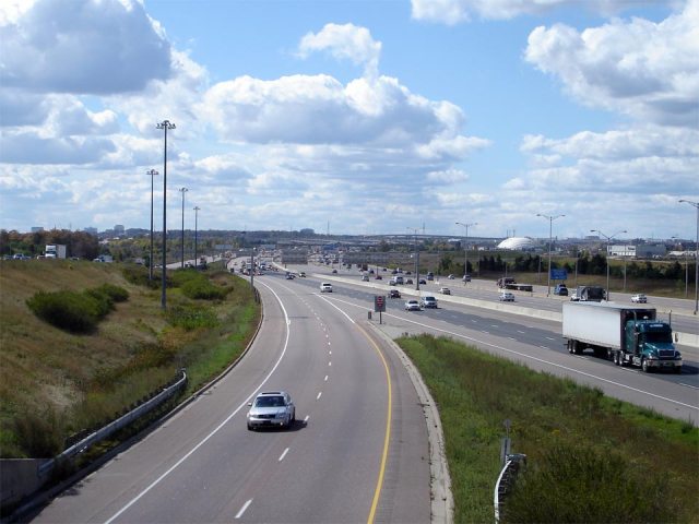
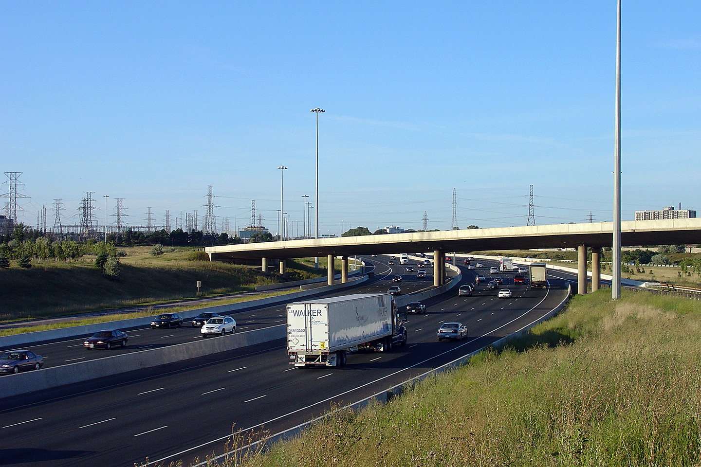
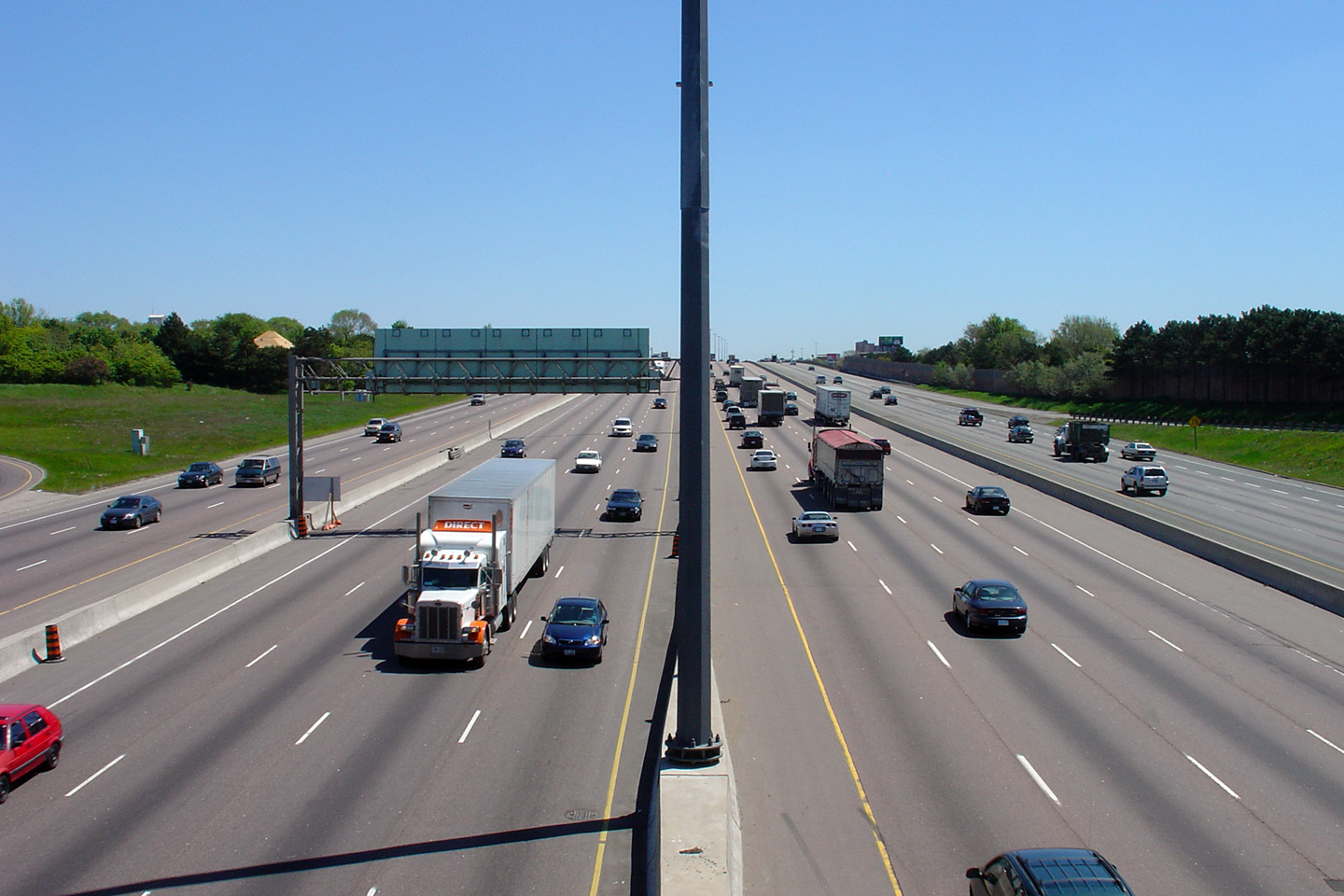
| City of Mississauga Regional Municipality of Peel |
Looking westerly along Highway 401 from roughly halfway between the Dixie
Road and Renforth Drive interchanges, south of Pearson Airport. Photo taken: September 26th, 2006. |
 |
|||
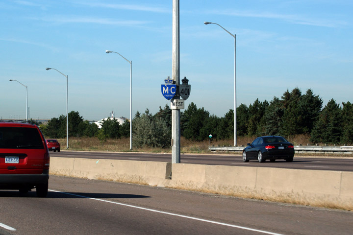
| City of Mississauga Regional Municipality of Peel |
One of the last remaining M-C Freeway signs along the 401 in the whole of
Ontario can be found in Mississauga. Macdonald-Cartier Freeway signs have
been phased out since the early 1990s. Until about 2007/08 numerous signs
existed in eastern Ontario, however with the
designation of the 401 as the Highway of Hero's between Toronto and Trenton
in 2007, M-C signs quickly disappeared. Photo taken: September 20th, 2009. |
 |
|||
| City of Mississauga Regional Municipality of Peel |
This diagram sign is located well in advance of the 403 interchange; notice
that the distance to the interchange is not shown on the signage. There are
a few diagram signs strewn across the province that don't list distances on
the signage. In fact, near Ottawa, along
Highway 416, there are several advanced exit signs that fail to list how far
the signs are from the ramp. Photo taken: September 20th, 2009. |
 (720x480) (720x480)(1440x960) |
|||
| City of Mississauga Regional Municipality of Peel |
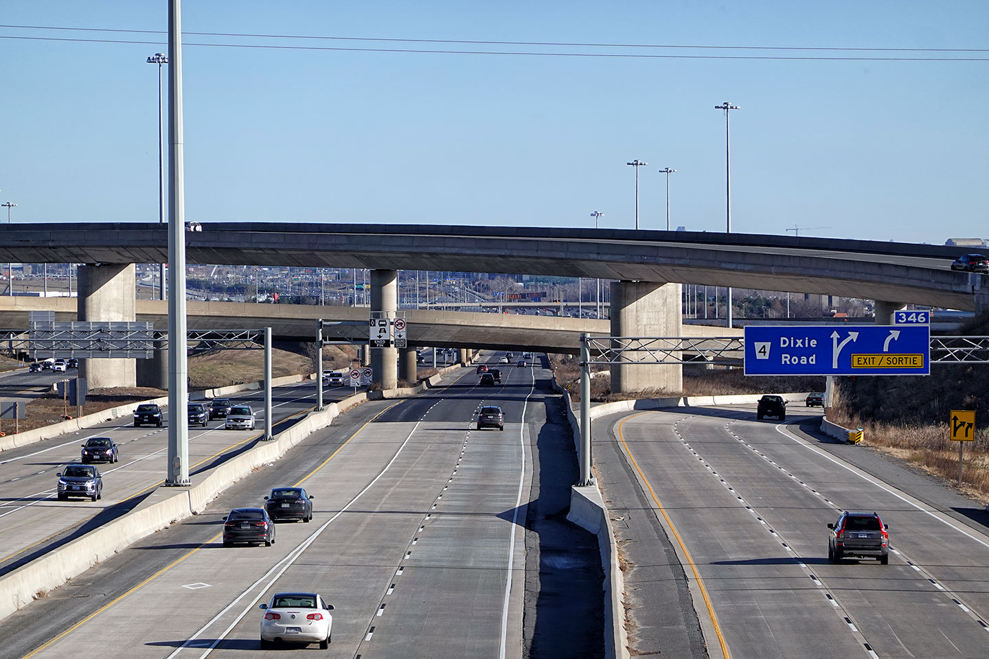
Signage for the transfer to Dixie Road and
Highway 410. Photo taken: September 10th, 2011. |
 (720x480) (720x480)(1440x960) (2400x1600) |
|||
| City of Mississauga Regional Municipality of Peel |
Advanced signage for the westbound transfer to
the collectors south of the Airport.
Highway 410 bound traffic must use the collectors beyond this point as
Highway 410 is not directly accessible from
the Express lanes. Photo taken: September 20th, 2009. |
 (720x480) (720x480)(1440x960) |
|||
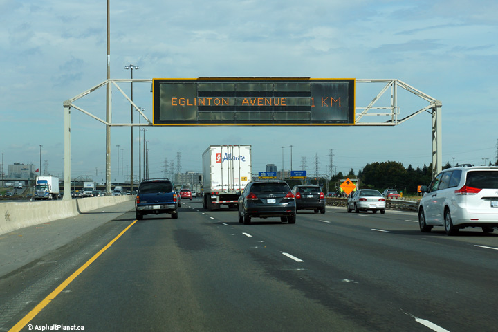
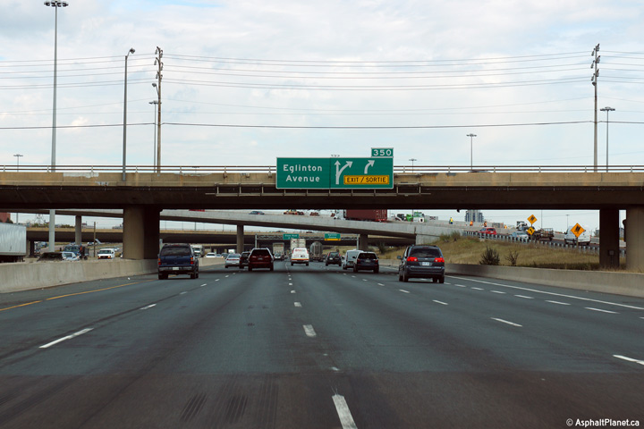
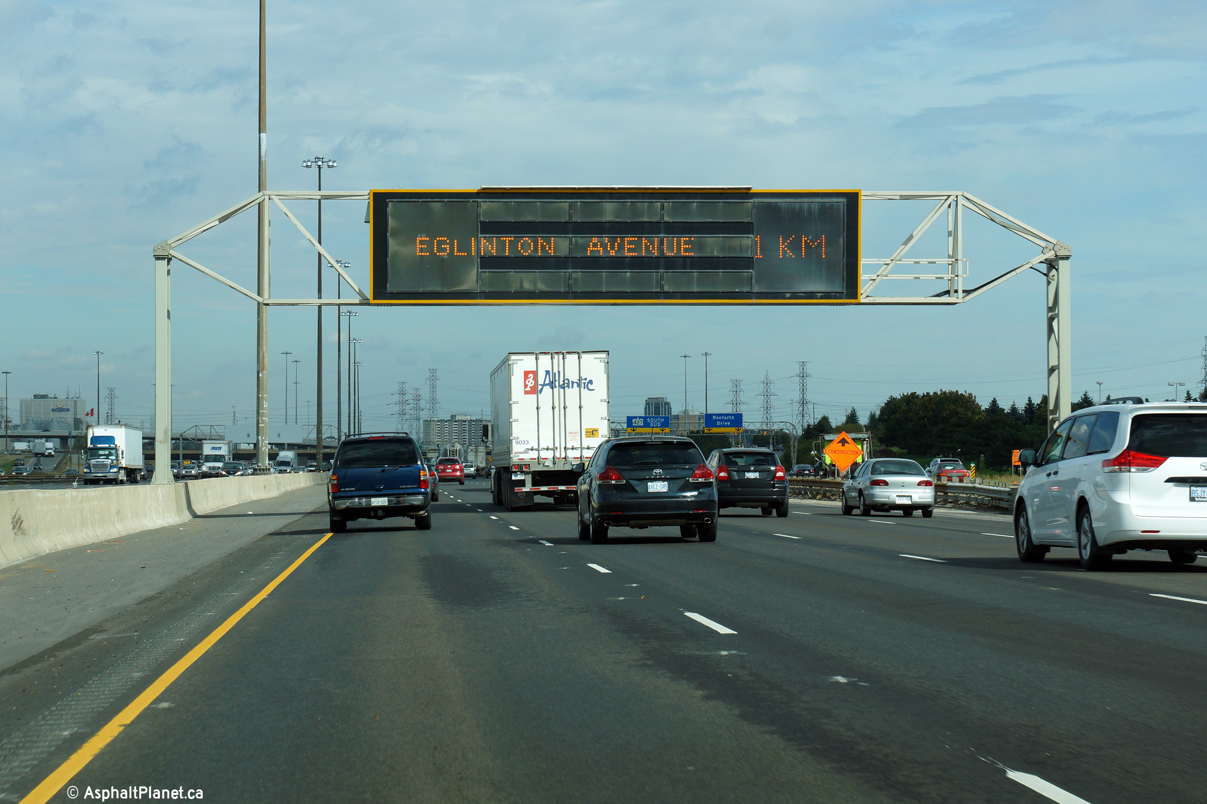
| City of Mississauga Regional Municipality of Peel |
The overhead changeable message sign in advance of the large 427 interchange
complex is doubling as a pre-advanced sign for Eglinton Avenue. Photo taken: October 7th, 2014. |
 (720x480) (720x480)(1440x960) (2400x1600) |
|||
| City of Mississauga Regional Municipality of Peel |
The advanced signage for the off-ramp to Eglinton Avenue is affixed to the
Renforth Drive overpass. An exit tab is used on the advanced signage
for Eglinton Avenue because the exiting lane has already developed beneath
the sign. For the past two decades, this has been the standard way
that exit tabs have been applied to freeways in Ontario. Photo taken: October 7th, 2014. |
 (720x480) (720x480)(1440x960) (2400x1600) |
|||
| City of Mississauga Regional Municipality of Peel |
View as the ramp to Eglinton Avenue departs the mainline lanes of Highway
401. When the Eglinton Avenue interchange was constructed, it was
envisioned that this ramp would lead to the Richview Expressway. The
Richview Expressway was an expressway that was envisioned for the Eglinton
Avenue corridor between Highway 401 and what has become Black Creek Drive.
Obviously, such an expressway was never constructed. Photo taken: October 7th, 2014. |
 (720x480) (720x480)(1440x960) (2400x1600) |
|||
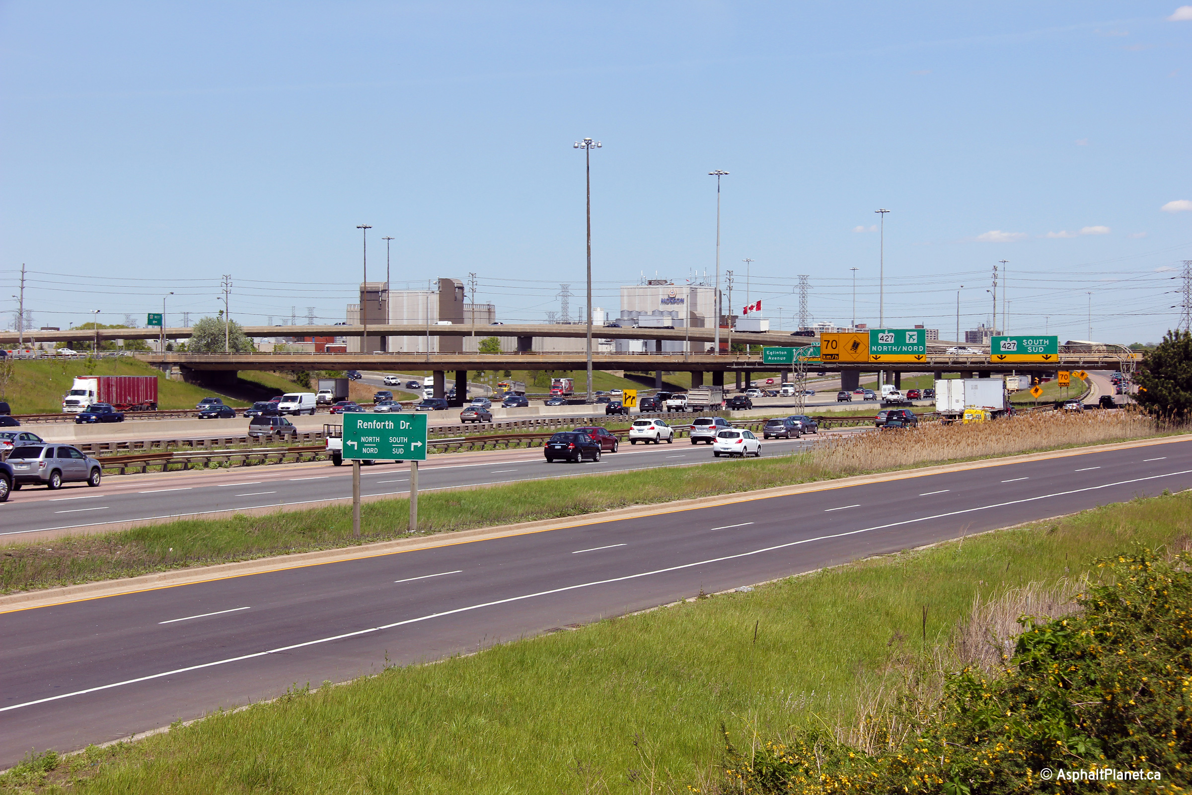
| City of Mississauga Regional Municipality of Peel |
Easterly view nearing the Renforth Drive interchange. The fly-over
ramp linking the eastbound 401 to the northbound 427 is visible behind the
Renforth Drive overpass. Photo taken: May 17th, 2012. |
 (720x480) (1440x960) (2400x1600) |
|||
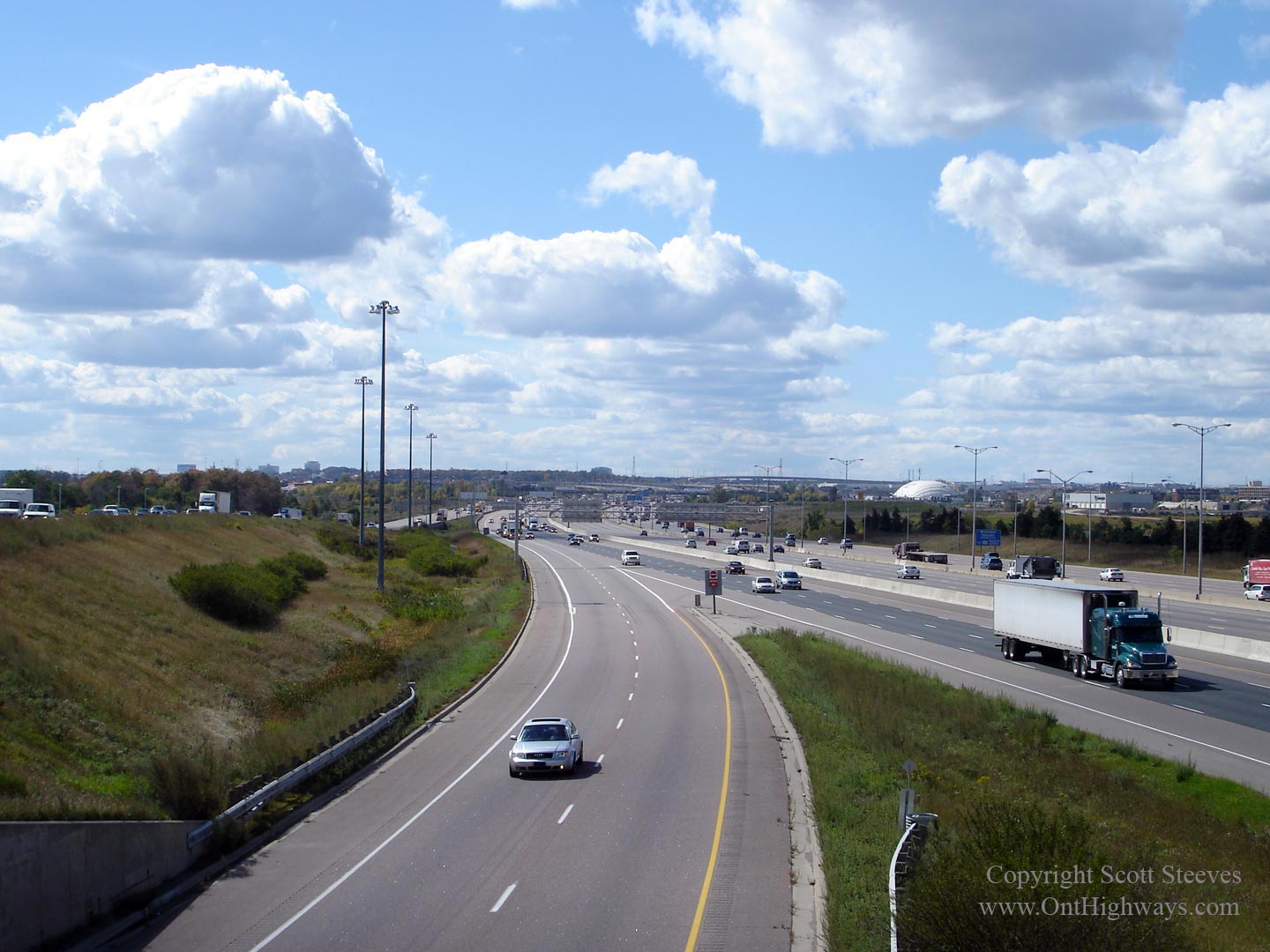
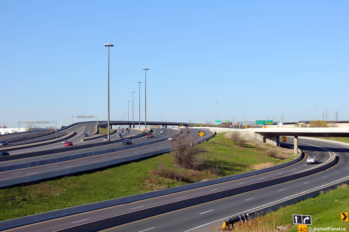
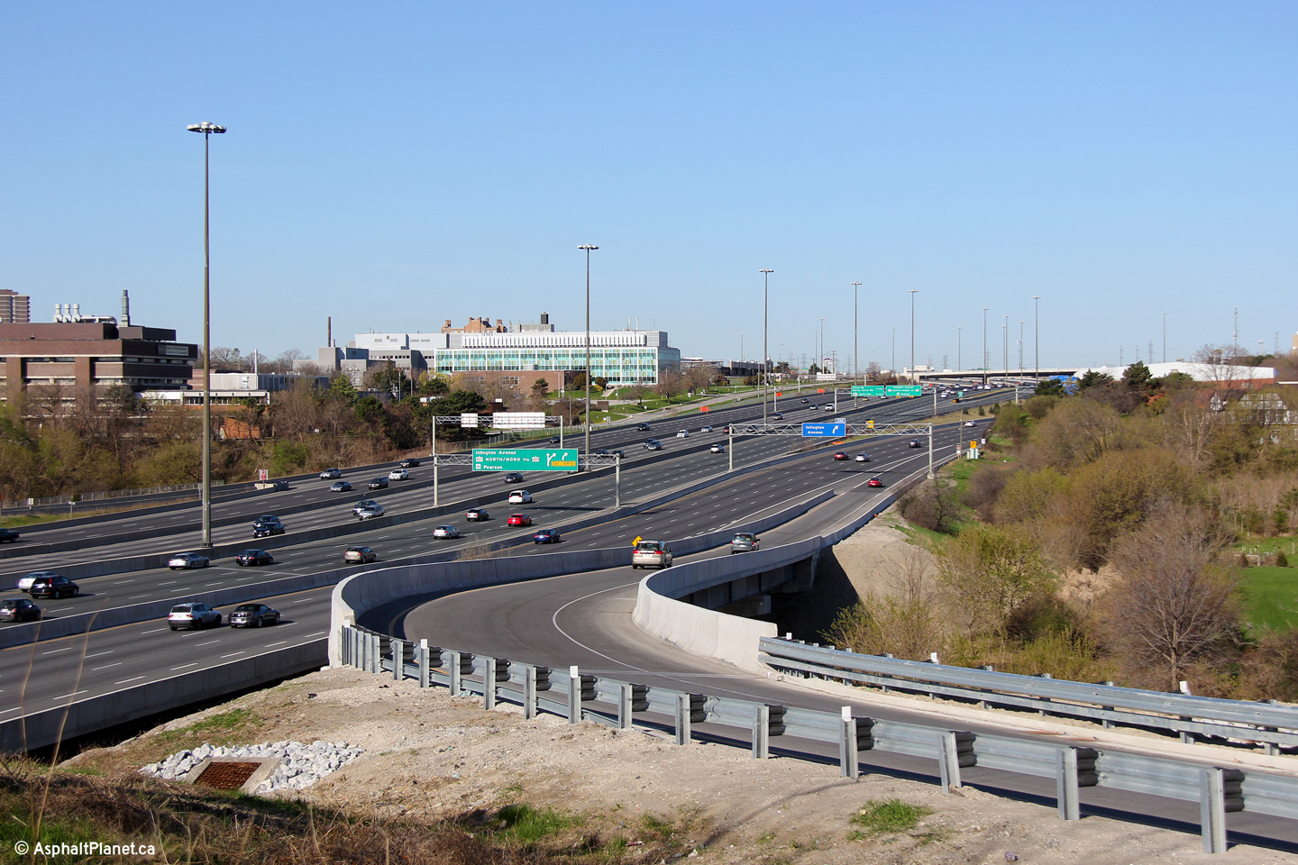
| City of Mississauga Regional Municipality of Peel |
Looking west from the Renforth Drive overpass. The complex freeway
ends at this point, as the collector lanes split and head to and from the
427. Highway 401 has 8-through lanes through the Highway 427
interchange. The complex freeway resumes at Kipling Avenue,
approximately 5km to the east. Click here for this
same view taken in May, 2009. Photo taken: May 17th, 2012. |
 (720x480) (1440x960) (2400x1600) |
|||
| City of Mississauga Regional Municipality of Peel |
View looking easterly towards the Highway 427
interchange from the Renforth Drive interchange. Highway 427 runs
parallel parallel to Highway 401 for a short distance complicating the
interchange between the two freeways. Photos taken: May 17th, 2012. |
(720x480) (1440x960) (2400x1600)
|
|||
| Highway 427 is a commuter highway running through the west end of Etobicoke. Click here for Highway 427 images. | |||||
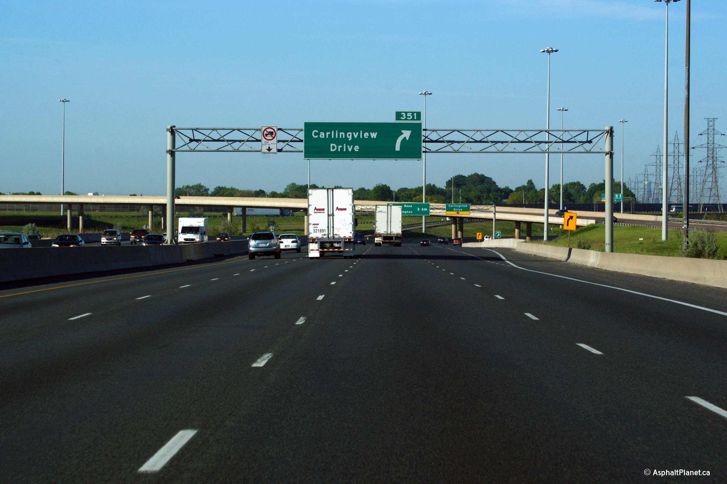
| City of Toronto | Looking easterly along Highway 401 from the
Carlingview Drive overpass. The high-speed ramp from Highway 401
westbound to the southbound 427 runs through the top of this photo. Photo taken: August 13th, 2006. |
 |
|||
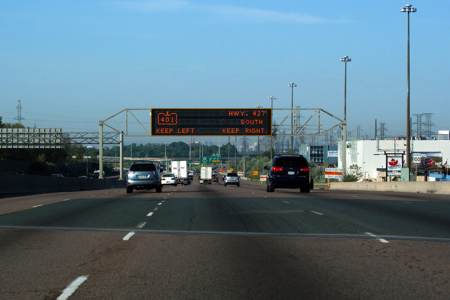
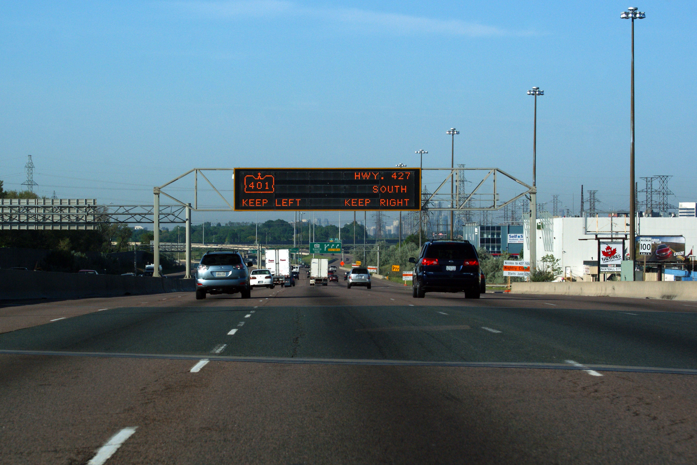
| City of Toronto | Two views looking easterly from the high-speed
flyover ramp from Highway 401 West to Highway 427 South. The three
lane entrance ramp entering the eastbound (right-hand) lanes of Highway 401
carries traffic from the northbound 427. Photos taken: July 30th, 2011. |
 (720x480) (1440x960) (2400x1600) 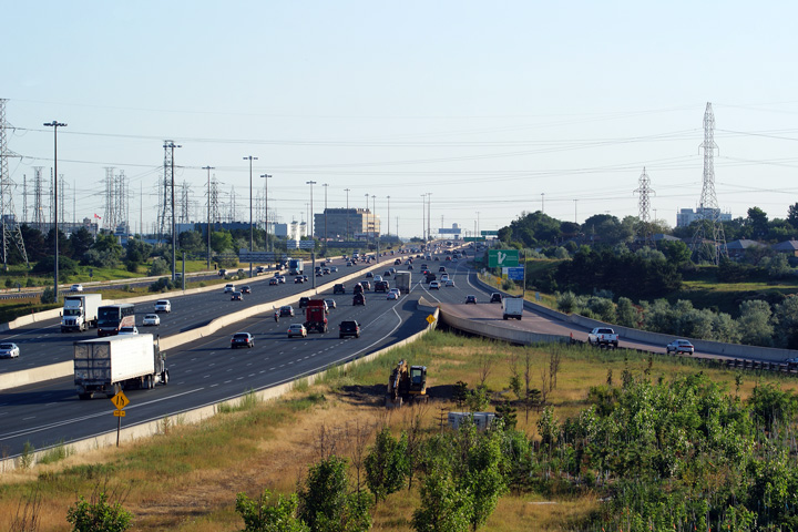 (720x480) (1440x960) (2400x1600) |
|||
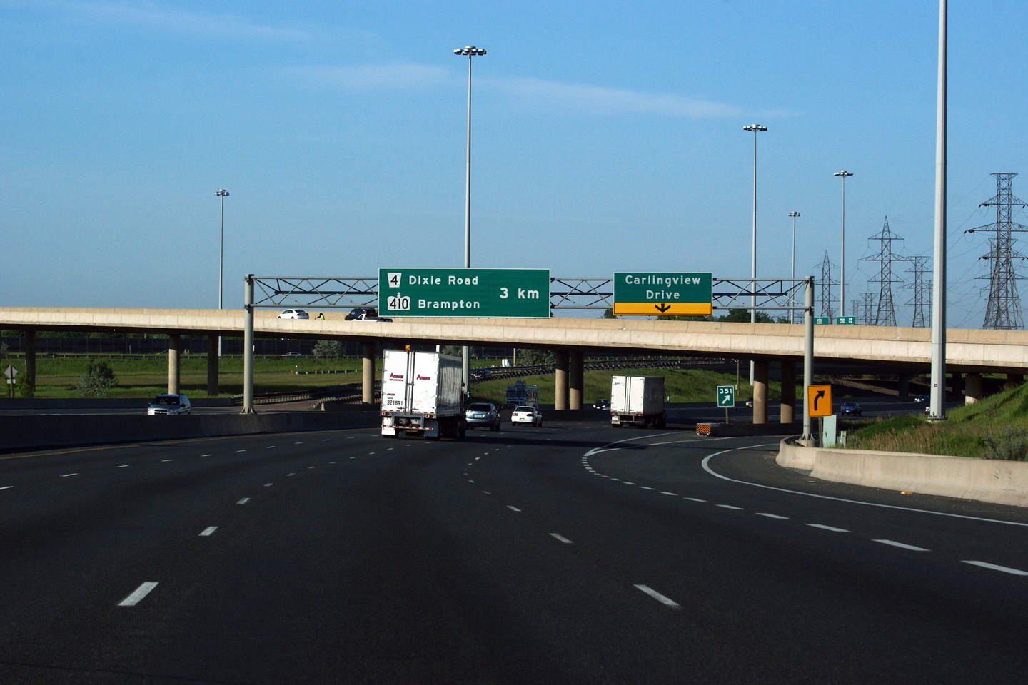
| City of Toronto | The westbound signage at the ramp to Carlingview
Drive is coupled with an advanced sign for the core to collector transfer in
advance of the Dixie Road and Highway 410 interchanges. Photo taken: June 5th, 2011. |
 (720x480) (720x480)(1440x960) (2400x1600) |
|||
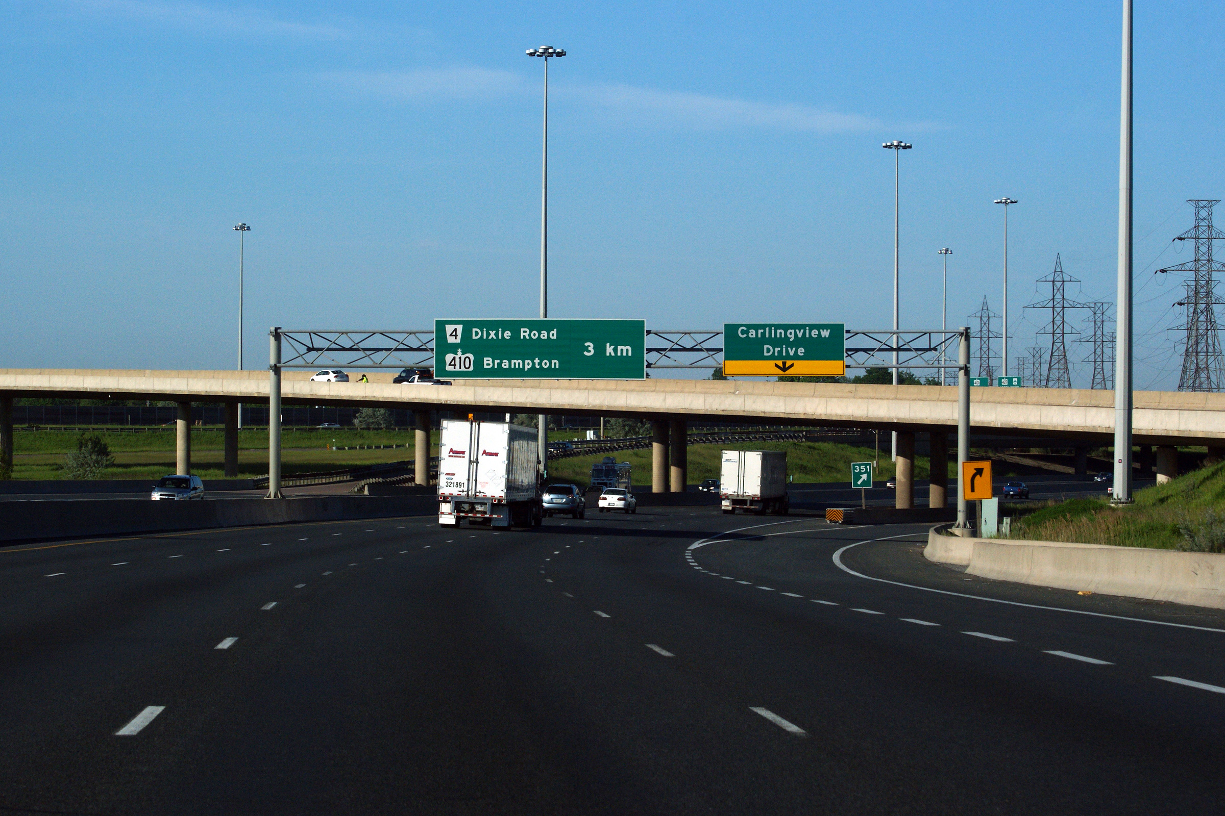
| City of Toronto | Advanced signage for the Carlingview Drive
off-ramp. Photo taken: June 5th, 2011. |
 (720x480) (720x480)(1440x960) (2400x1600) |
|||
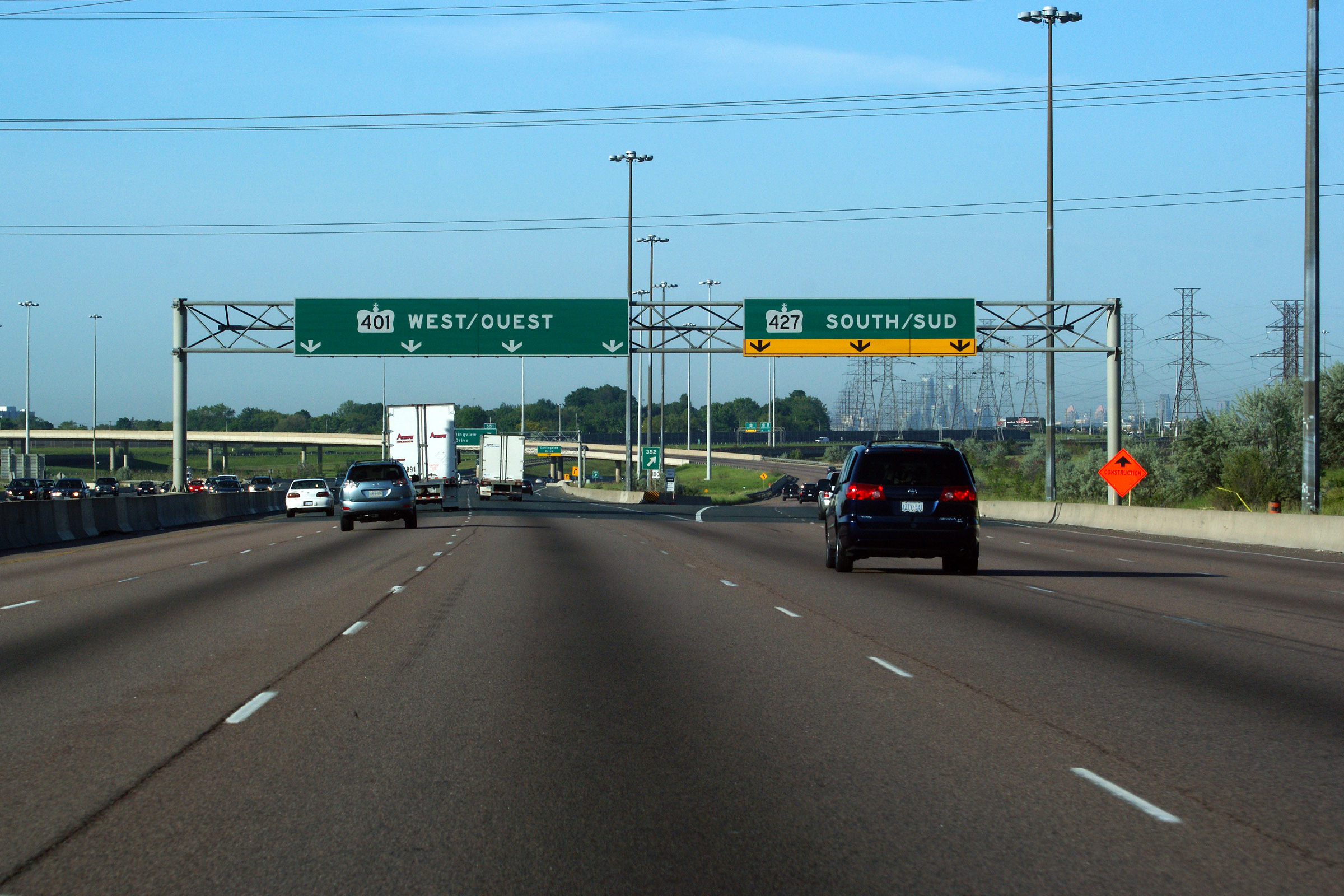
| City of Toronto | Signage approaching the westbound ramp to the
southbound 427. This high-speed ramp
is arguably Ontario's most impressive freeway flyover;
the ramp was narrowed
to two lanes during June of 2011. Photo taken: June 5th, 2011. |
 (720x480) (720x480)(1440x960) (2400x1600) |
|||
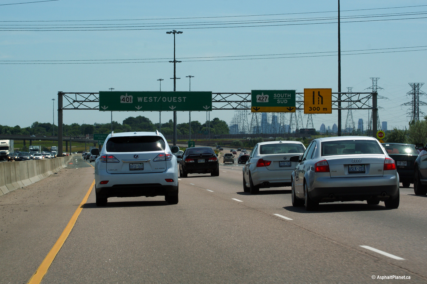
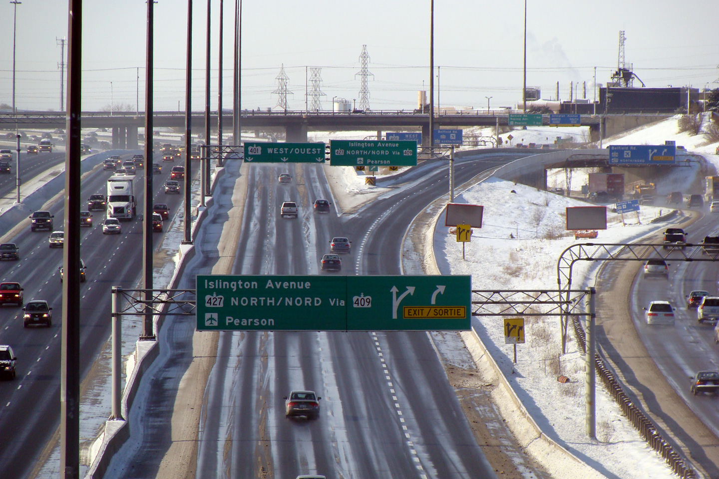
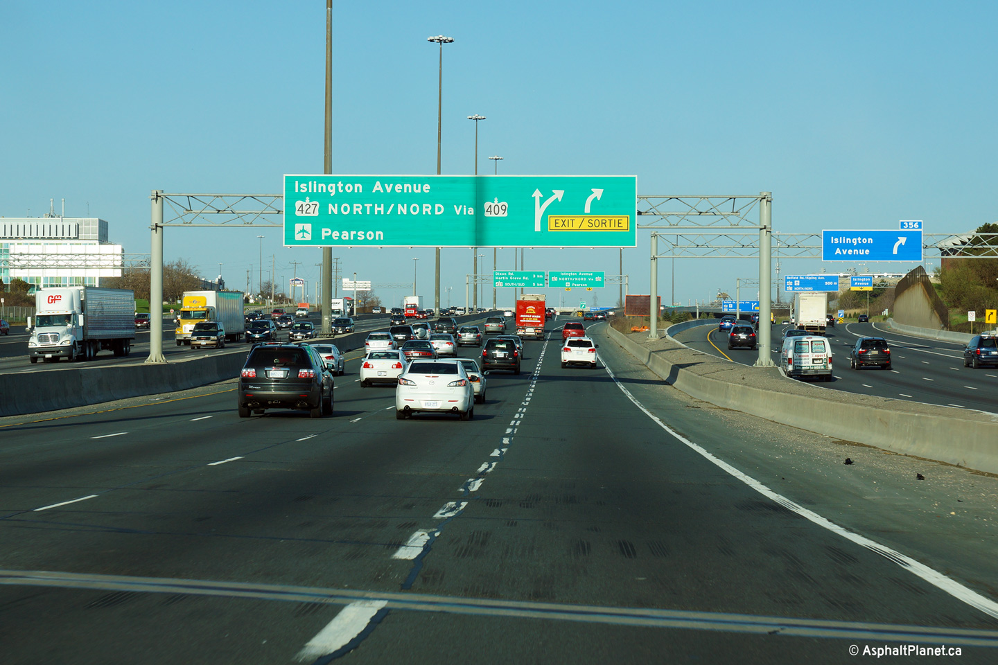
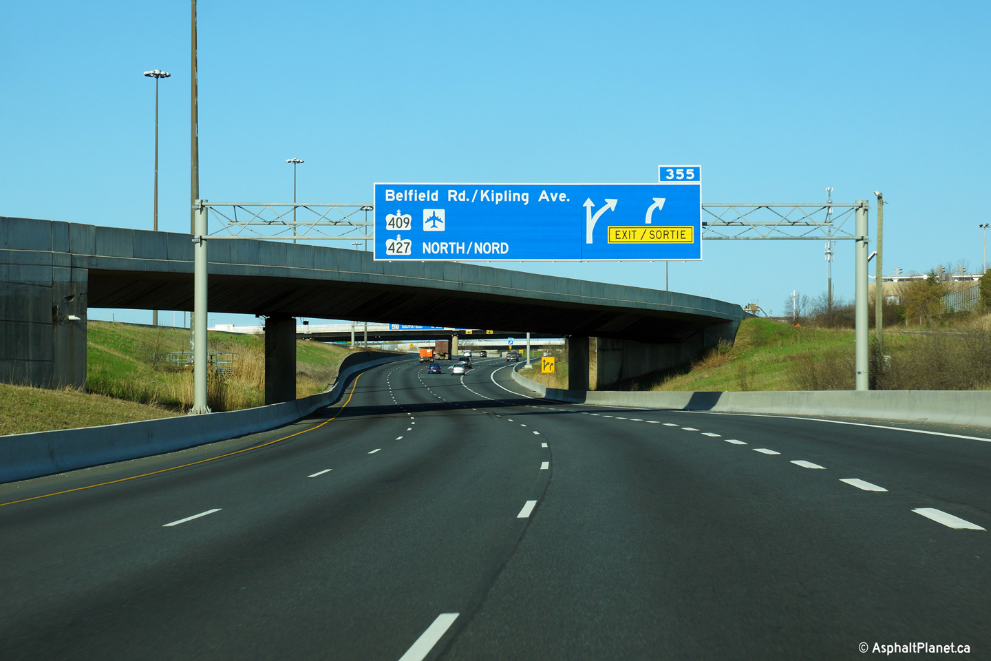
| City of Toronto |
Advanced signage for the Highway 427
interchange. There is no direct connection between the westbound 401
and Highway 427 north. Westbound
traffic must utilize the
409 to access the northbound
427. Photo taken: September 20th, 2009. |
 (720x480) (720x480)(1440x960) (2400x1600) |
|||
| City of Toronto |
Overhead changeable message sign in advance of the Highway 427 interchange. Photo taken: June 5th, 2011. |
 (720x480) (720x480)(1440x960) (2400x1600) |
|||
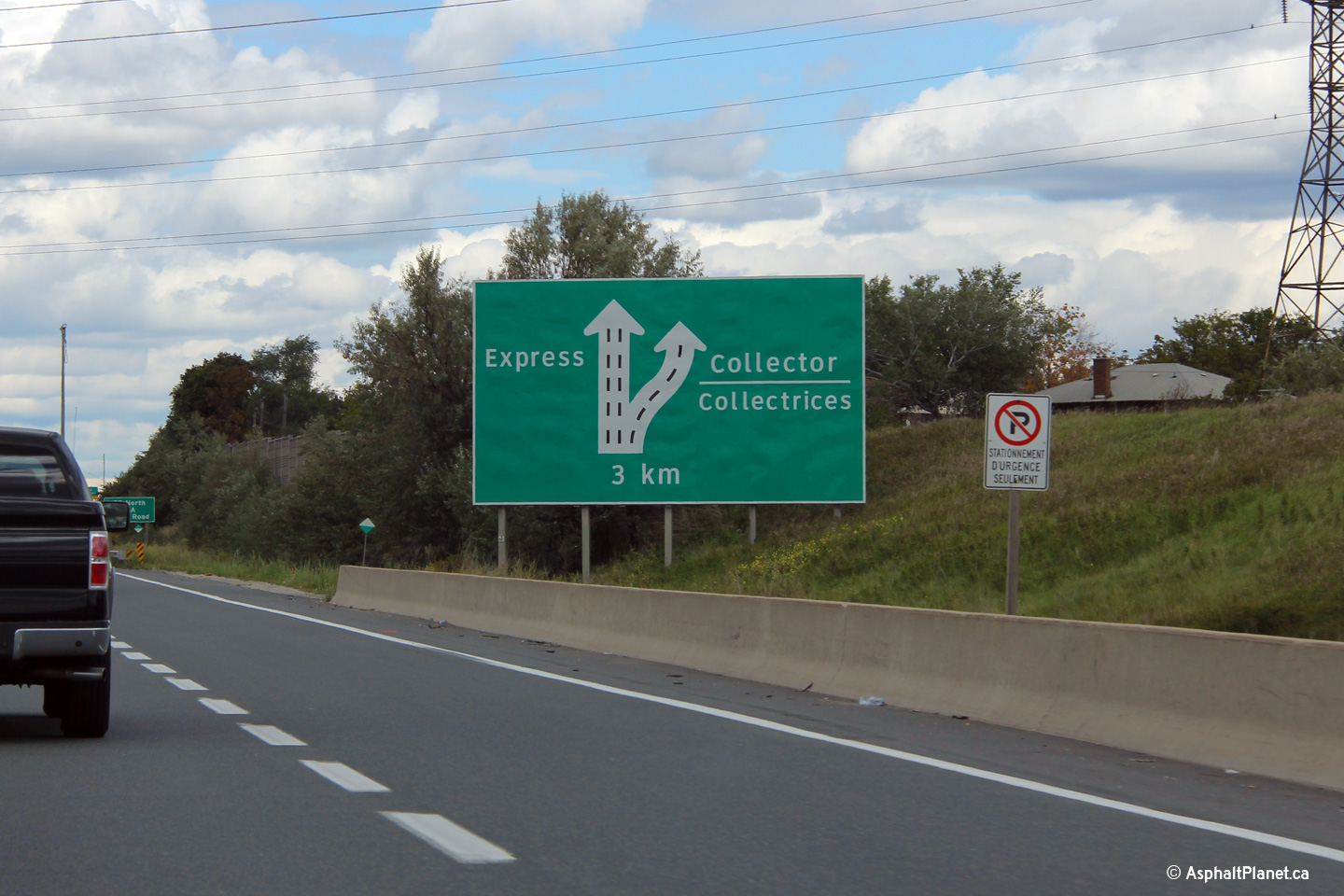
| City of Toronto |
Despite being a fairly new sign, this ground mounted sign announcing the
upcoming Express/collector lane diverge reflects an outdated lane
configuration. This sign was erected during a period when MTO was
experimenting with using clearview font on freeway guide signage. Photo taken: September 19th, 2012. |
 (720x480) (720x480)(1440x960) |
|||
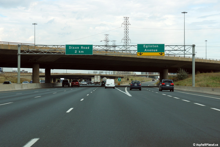
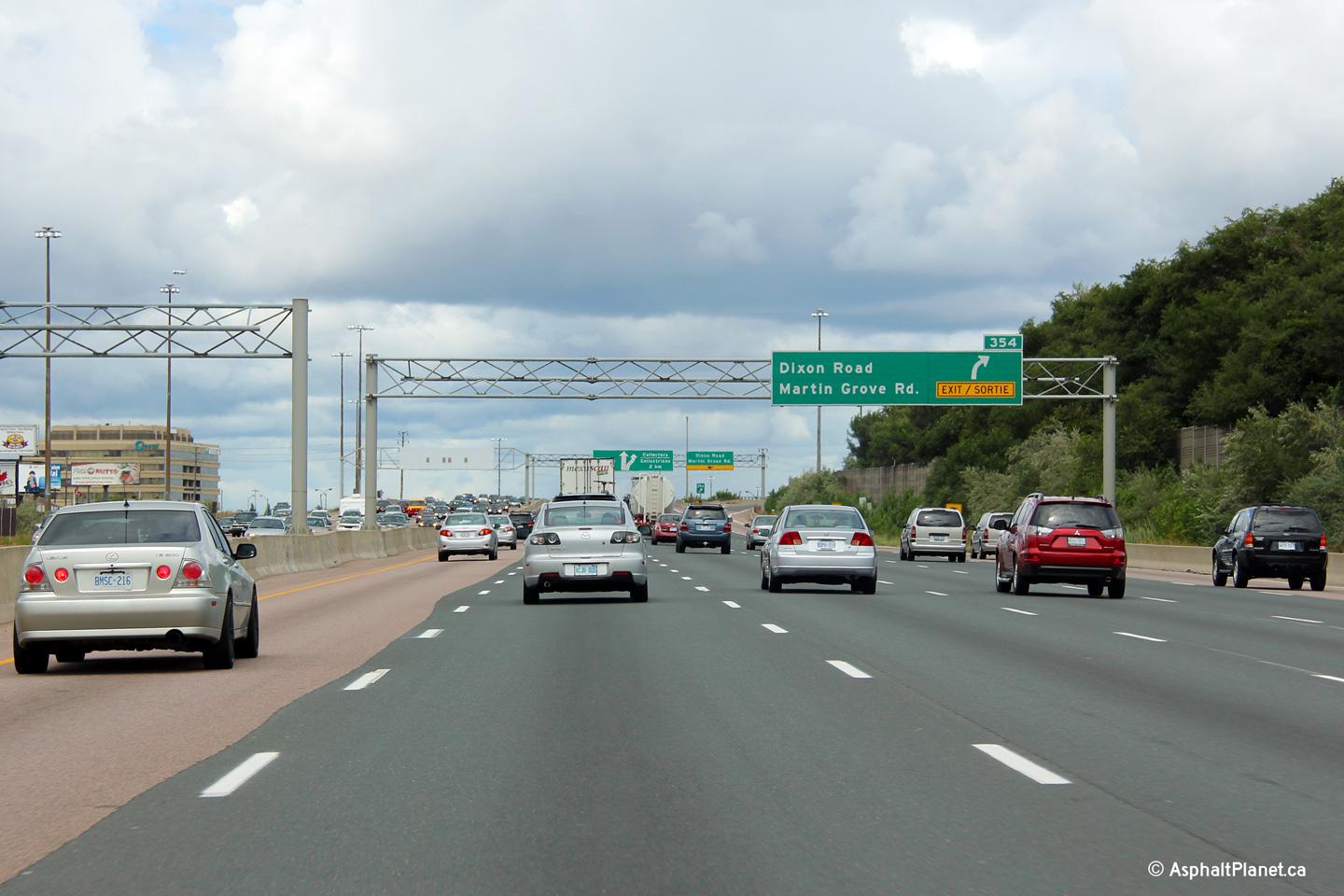
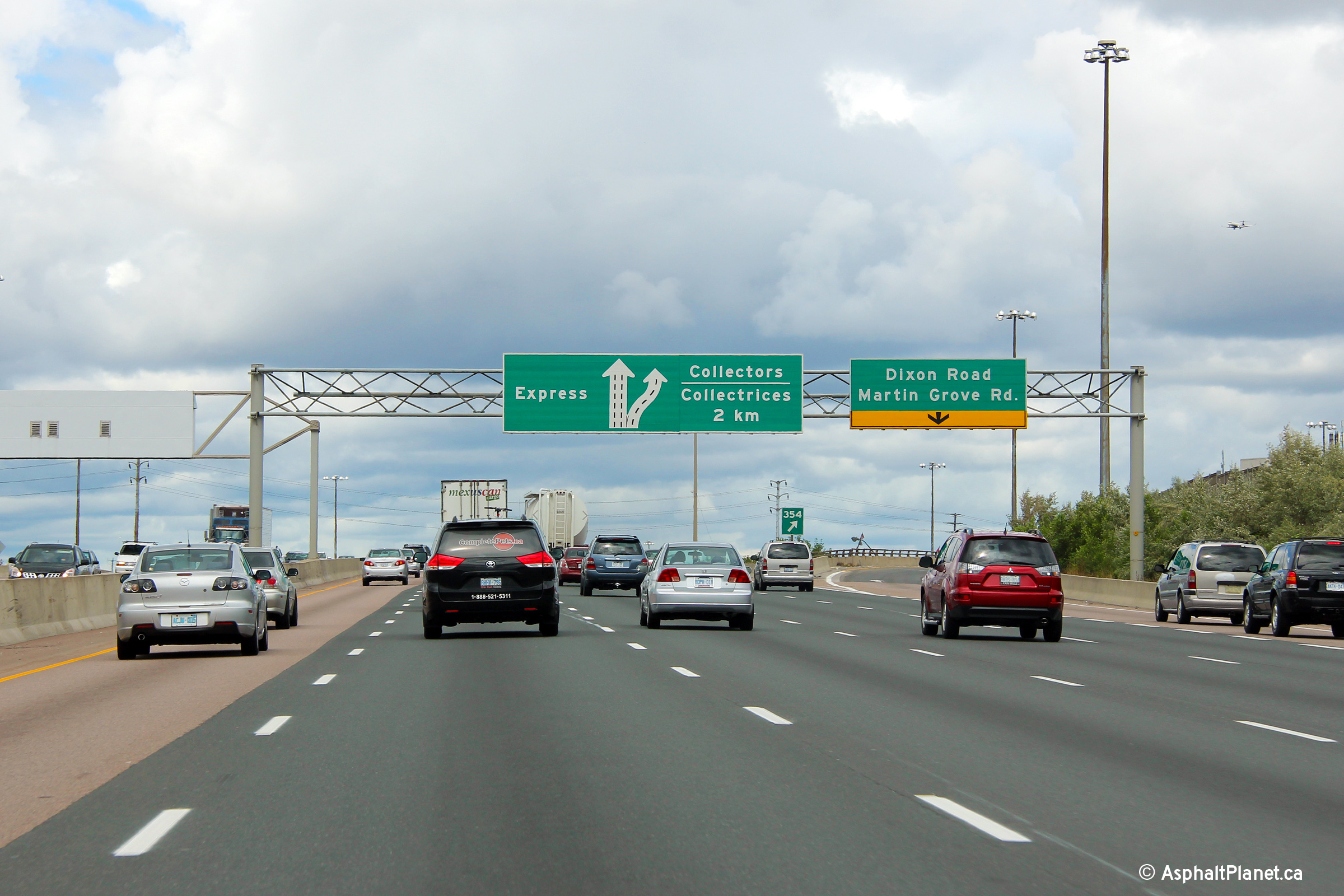
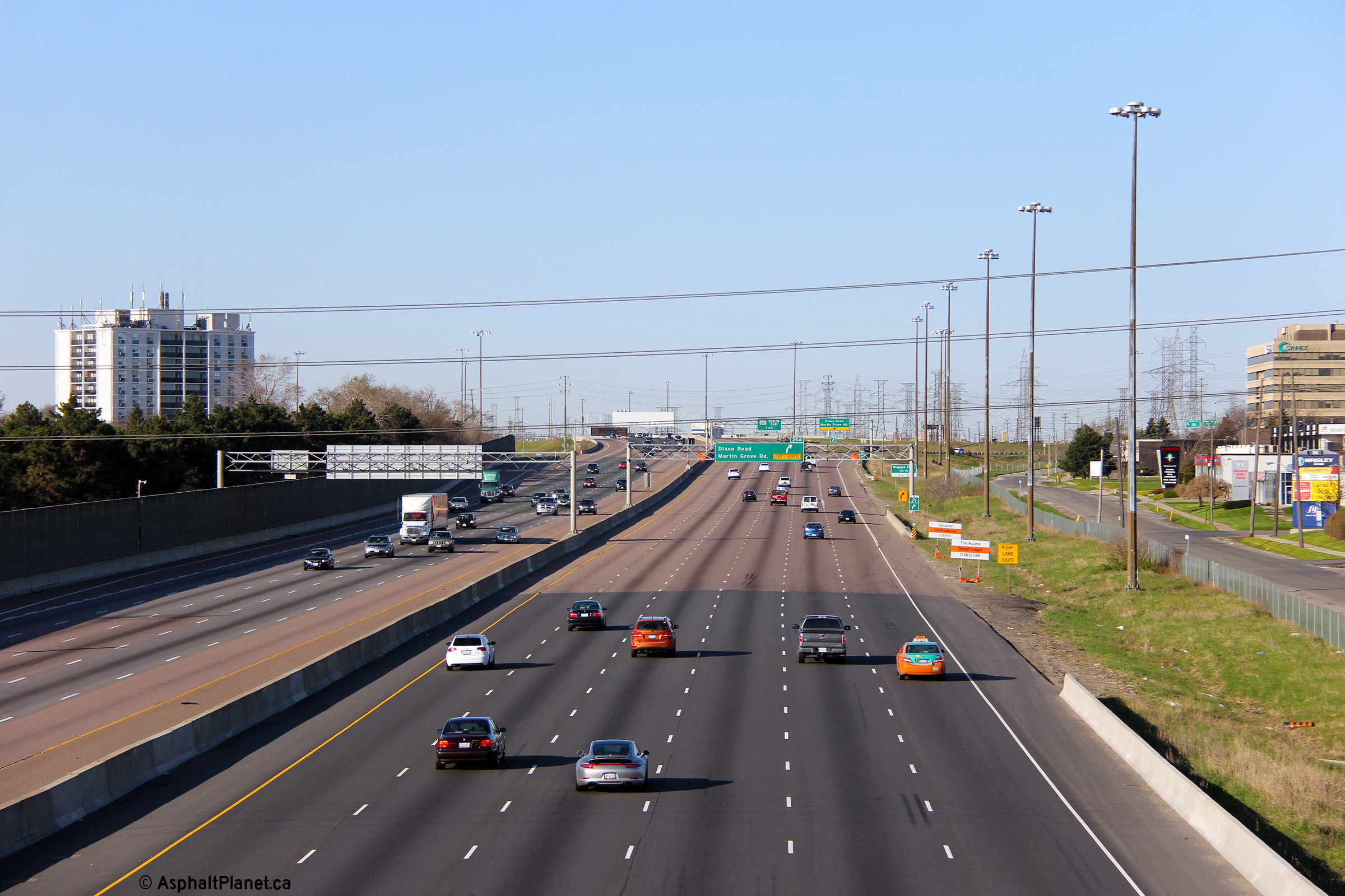
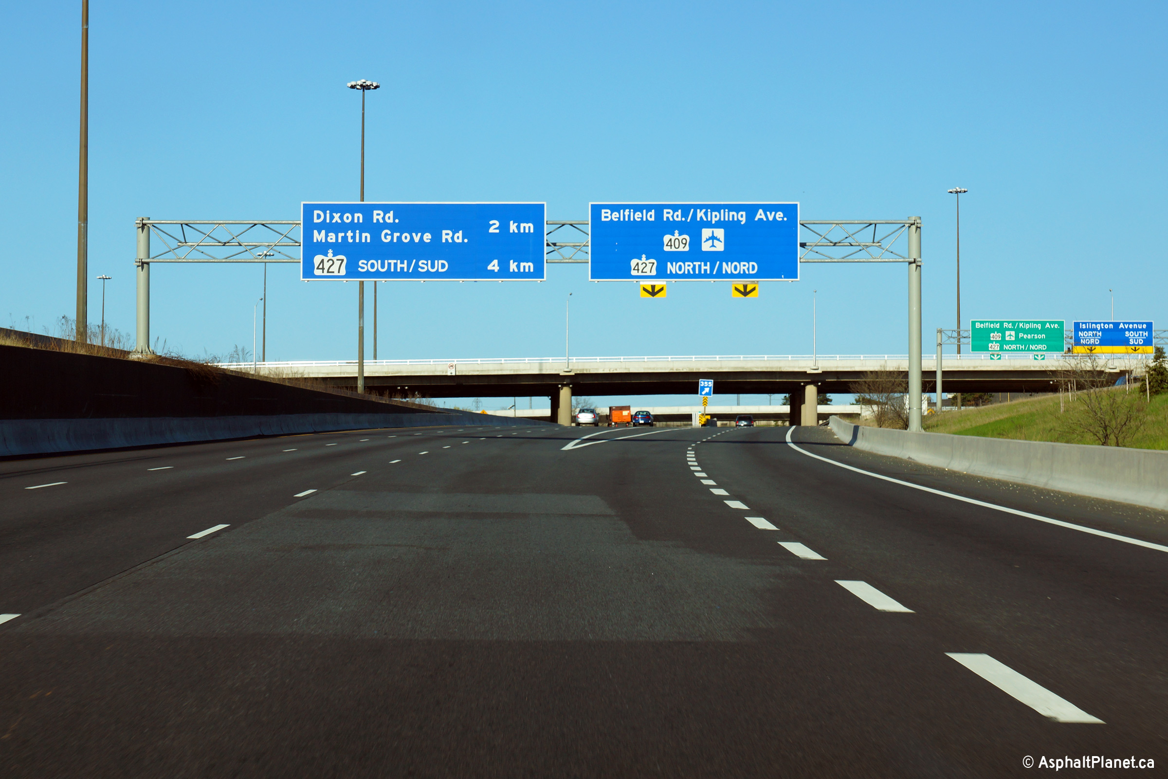
| City of Toronto |
Eastbound advanced signage for the off-ramp to Dixon and Martin Grove
Roads. The sixth eastbound lane departs the eastbound carriageway at this
exit. Photo taken: August 12th, 2012. |
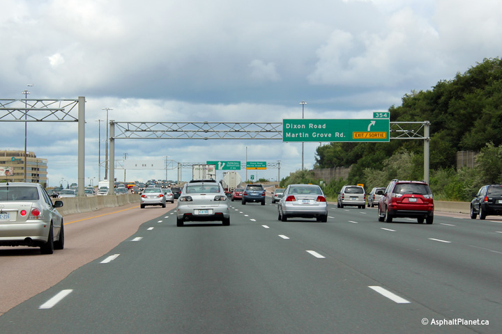 (720x480) (720x480)(1440x960) (2400x1600) |
|||
| City of Toronto |
Eastbound view at the off-ramp to Dixon and Martin Grove Roads. When
Highway 401 was first widened to an urban cross-section through western
Etobicoke during the 1960s and 70s, the highway was only eight lanes wide
overtop of the Dixon and Martin Grove Roads interchange. During a
rehabilitation and reconstruction project that took place during the late
1990s, a fifth lane was added in each direction overtop of the structures by
converting the inside left shoulder into a traveling lane. Photo taken: August 12th, 2012. |
 (720x480) (720x480)(1440x960) (2400x1600) |
|||
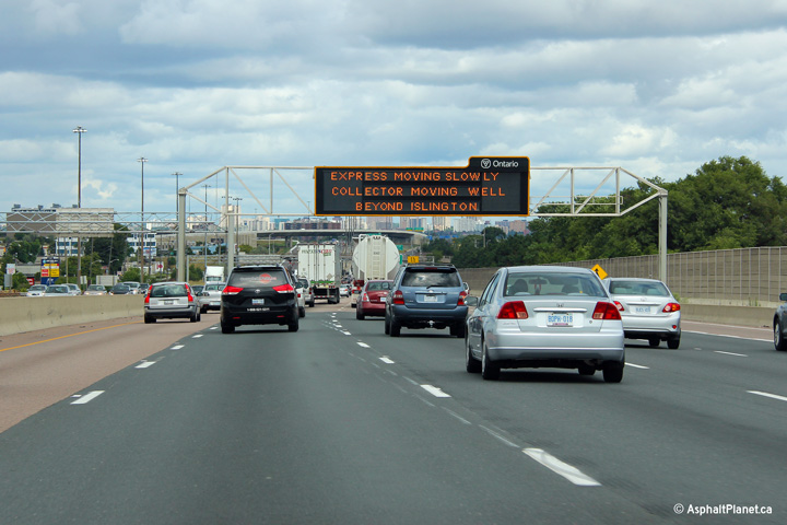
| City of Toronto |
Eastbound changeable message signage just beyond the Dixon Road underpass.
It is fitting that when this photo was taken, this CMS was indicating
congestion ahead. The eastbound lanes of Highway 401 between Highways
427 and 400 is among the most chronically congested portions of expressway
through the Greater Toronto Area. Photo taken: August 12th, 2012. |
 (720x480) (720x480)(1440x960) (2400x1600) |
|||
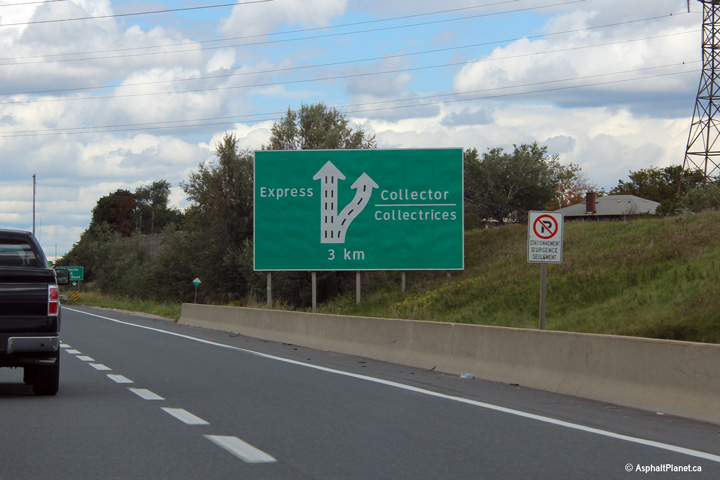
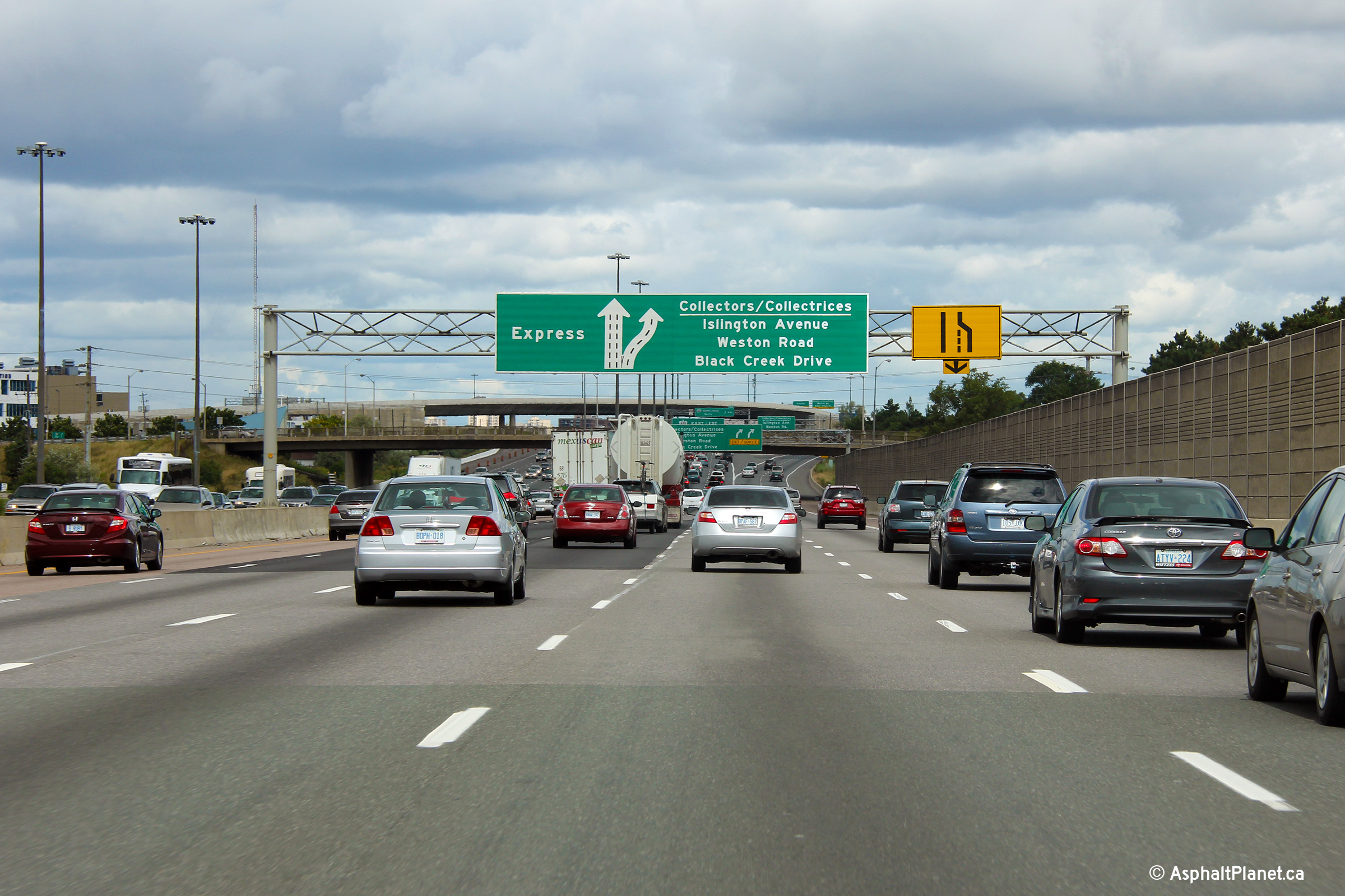
| City of Toronto |
Second overhead diagram sign outlining Etobicoke's Express and
collector split. Photo taken: August 12th, 2012. |
 (720x480) (720x480)(1440x960) (2400x1600) |
|||
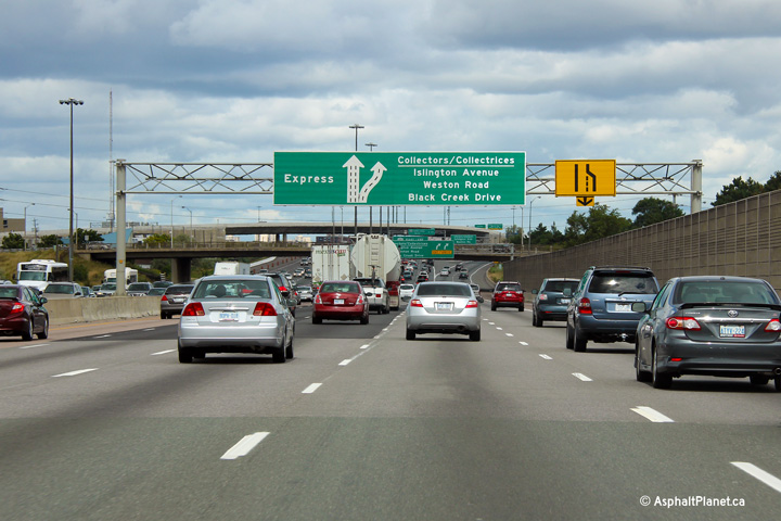
| City of Toronto |
Overhead advanced arrow signage for the Express-collector split. The
Kipling Avenue overpass hides the final pull through signage from motorists
view until almost the point where the lanes diverge. The hidden
location of the Express and Collector split causes uninformed motorists to
make last minute lane changes at the diverge, further exacerbating
congestion problems that exist along this portion of Highway 401. Photo taken: August 12th, 2012. |
 (720x480) (720x480)(1440x960) (2400x1600) |
|||
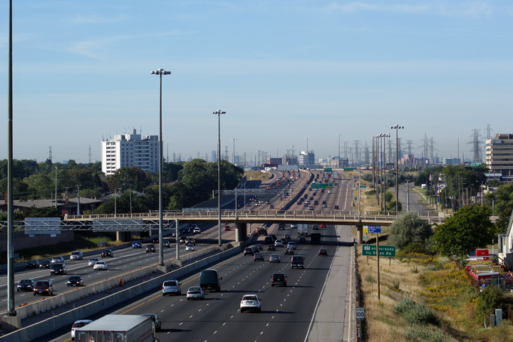
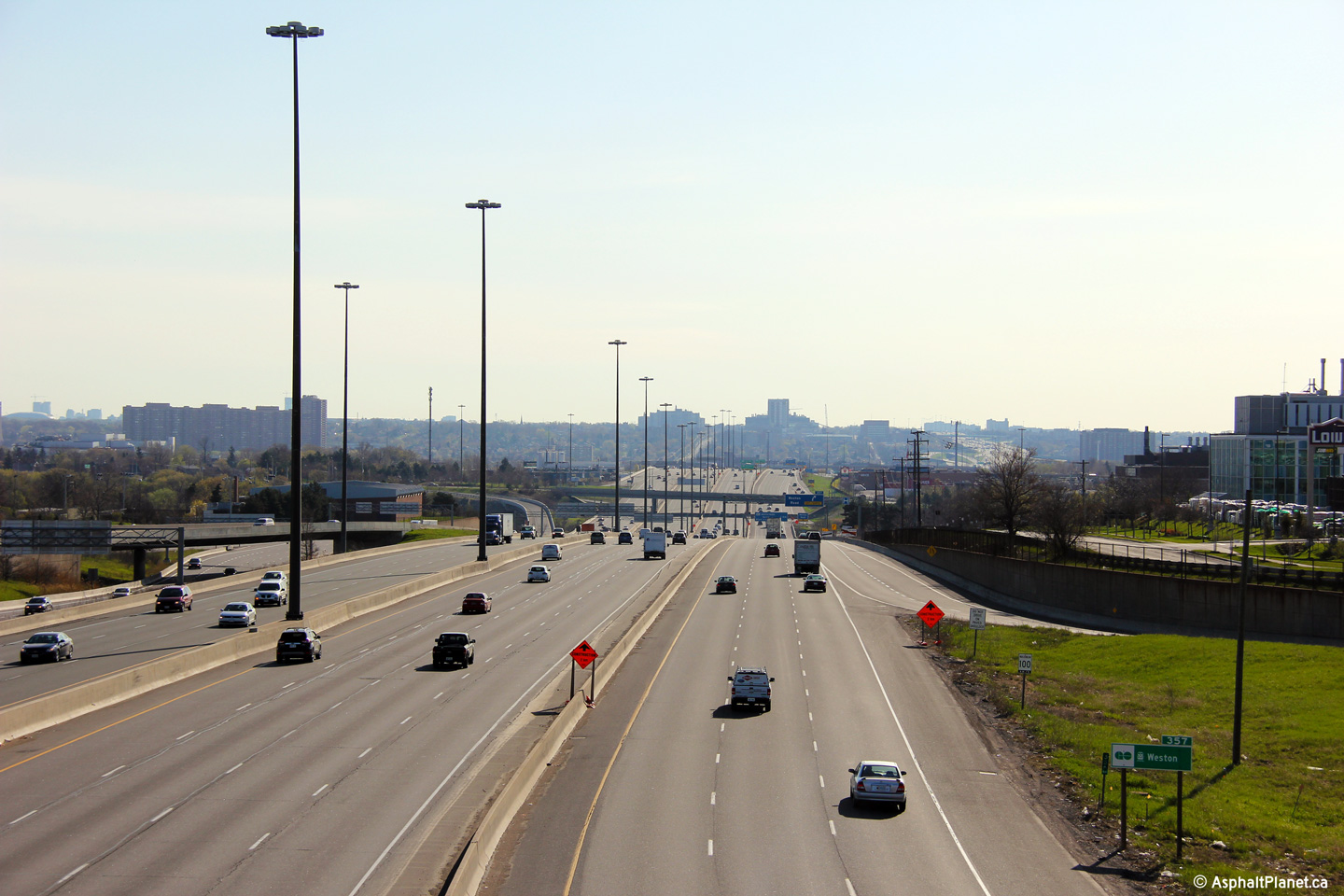
| City of Toronto |
Two views looking west upon the 401 from Kipling Avenue in Etobicoke. Highway 401 has 10 through lanes from Kipling Avenue to the Highway 427 interchange. Photo taken: May 11th, 2014. |
 (720x480) (1440x960) (2400x1600) |
|||
| City of Toronto |
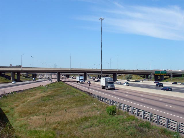
Highway 401 looking east from the Kipling Avenue overpass in Etobicoke. Highway 401 divides into a complex freeway beyond the Kipling Avenue overpass, maintaining a minimum cross-section of 12 lanes across four carriageways east from this point for over 40km to Brock Road in the City of Pickering Photos taken: May 11th, 2014. |
 (720x480) (1440x960) (2400x1600)  (720x480) (1440x960) (2400x1600) |
|||
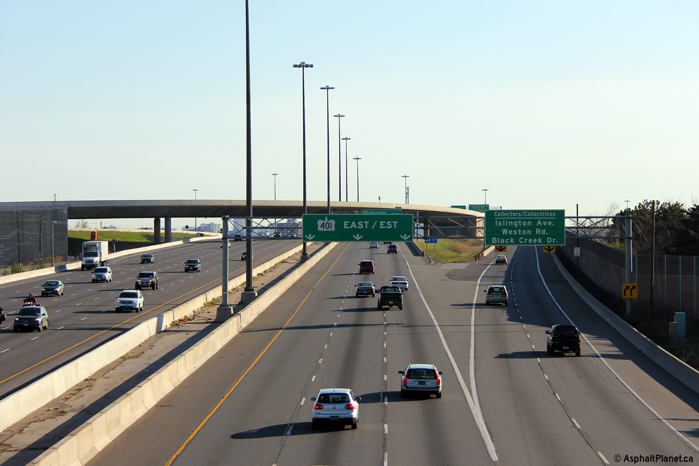
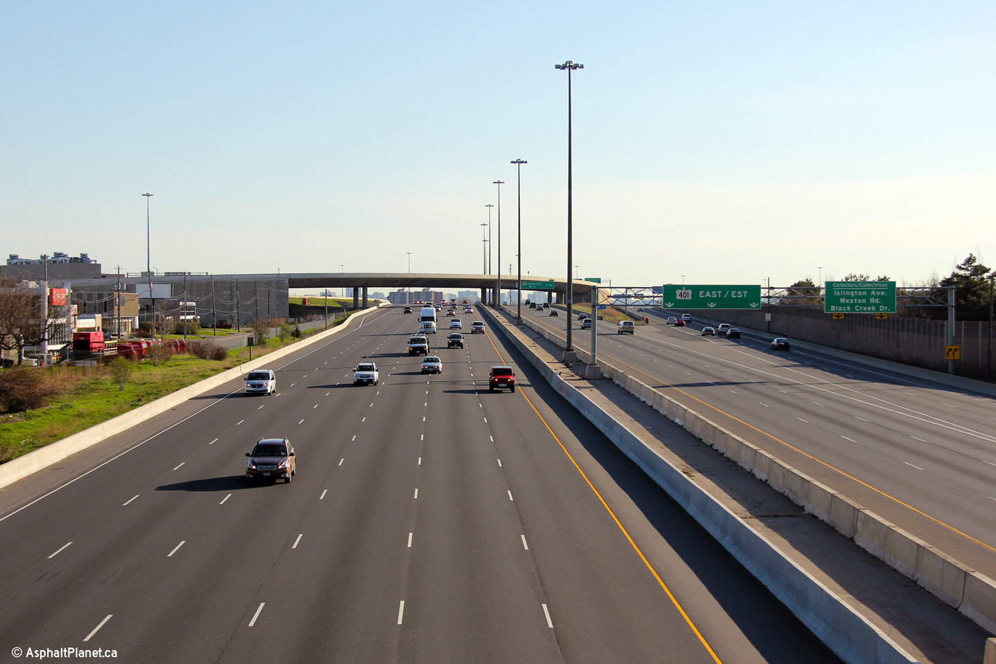
| City of Toronto |
Signage at the bull-nose of the eastbound split between the Express and
collector lanes in Etobicoke. Photo taken: May 20th, 2013. |
 (720x480) (720x480)(1440x960) (2400x1600) |
|||
| City of Toronto |
Immediately beyond the separation between the Express and collector lanes
stands this sign advising motorists of the upcoming interchange with Highway
400. This tri-chord gantry was erected during the reconstruction and
widening of the eastbound Express lanes which was completed in 2005.
Initially, this gantry supported a much smaller sign for Highway 400 (which
can be seen here, taken in April, 2006) which was quickly replaced by
the current signage. Photo taken: May 20th, 2013. |
 (720x480) (720x480)(1440x960) (2400x1600) |
|||
| City of Toronto |
View looking westerly from the Highway 409 overpass towards the Kipling
Avenue
overpass. The Kipling Avenue overpass looks as if it was designed to
be wide
enough to allow dual six-lane carriageways through the span. Since
this photo was taken, an additional westbound lane was constructed
underneath of the Kipling Avenue overpass as part of a project to add an
additional westbound collector lane between Highway 400 and Dixon Road. Photo taken: September 20th, 2009. |
|
|||
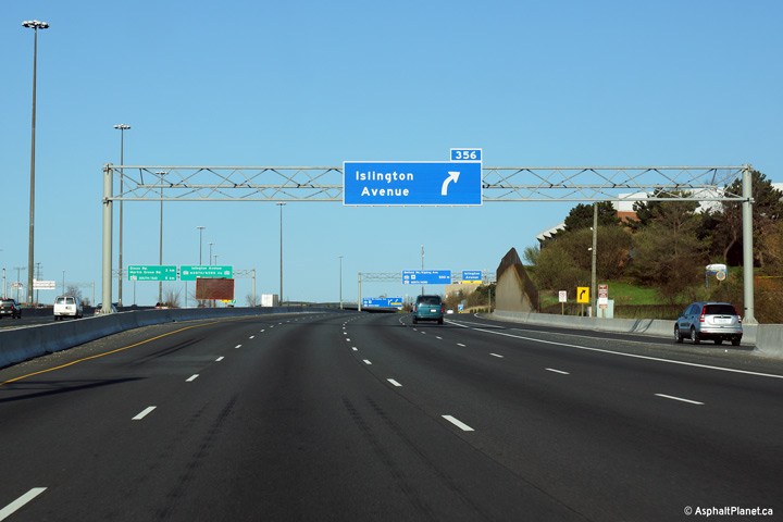
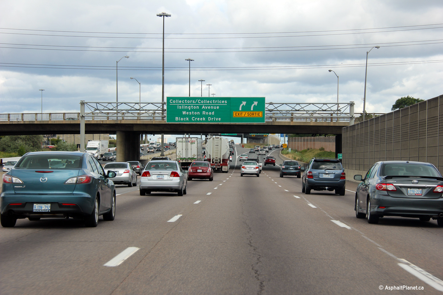
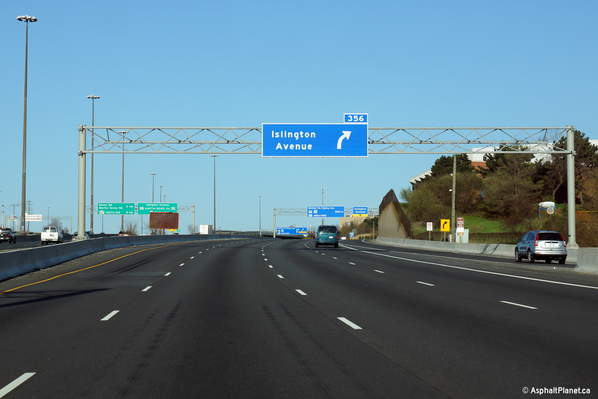
| City of Toronto |
The eastbound off-ramp to Islington Avenue is located a short distance
beyond the start of the collector lanes. Photo taken: August 12th, 2012. |
 (720x480) (720x480)(1440x960) (2400x1600) |
|||
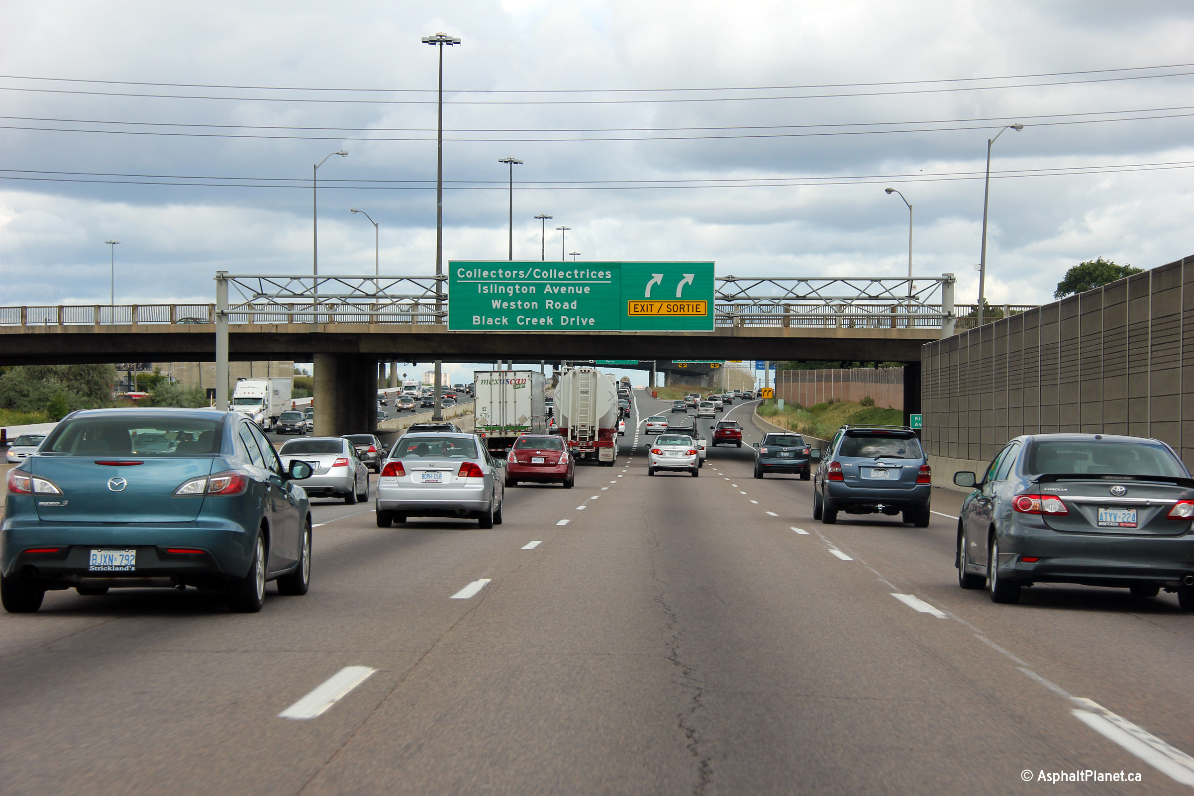
| City of Toronto |
The ramp to Islington Avenue departs the eastbound collector lanes
immediately before the ramp from the eastbound lanes of Highway 409 converge
on the left. Photo taken: August 12th, 2012. |
 (720x480) (720x480)(1440x960) (2400x1600) |
|||
| Highway 409 is a short highway connecting Highway 401 East to Highway 427 North and Pearson International Airport. Click here for Highway 409 images. | |||||
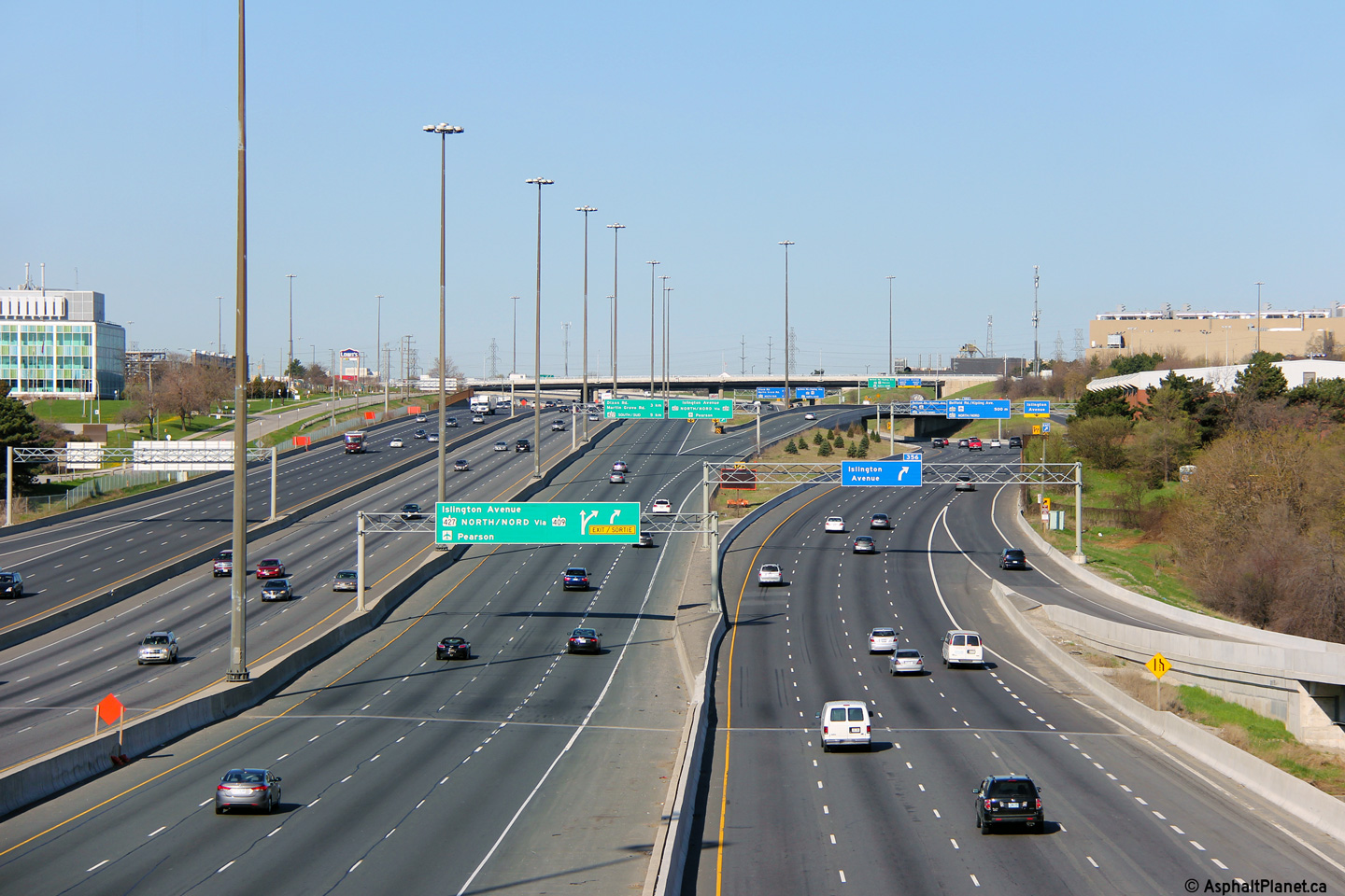
| City of Toronto |
Two views looking westerly from the Islington Avenue overpass in Etobicoke.
West of Islington Avenue, Highway 401's Collector/Express setup ends and the
highway narrows to a ten lane cross-section. At the time that these
photos were taken a contract to rehabilitate the eastbound Express Lanes was
underway. This contract saw the eastbound Express Lanes widened from
three to four lanes between Highway 409 and Highway 400. Since these
photos were taken, this contract has been completed, and as of 2011,
additional contracts to rehabilitate the eastbound collectors, and westbound
Express Lanes have been completed. Between 2010 and 2013, work is
ongoing to widen and rehabilitate the westbound collector lanes through this
area. Photos taken: May 11th, 2014. |
(720x480) (1440x960) (2400x1600)
|
|||
| City of Toronto |
View looking easterly along Highway 401 from the Islington Avenue overpass.
Notice the braded ramps on the left side of the photo (the westbound lanes),
which links the westbound 401 to Highway 409
and Islington Avenue. Photo taken: May 11th, 2014. |
(720x480) (1440x960) (2400x1600)
|
|||
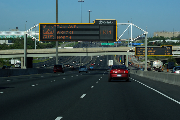
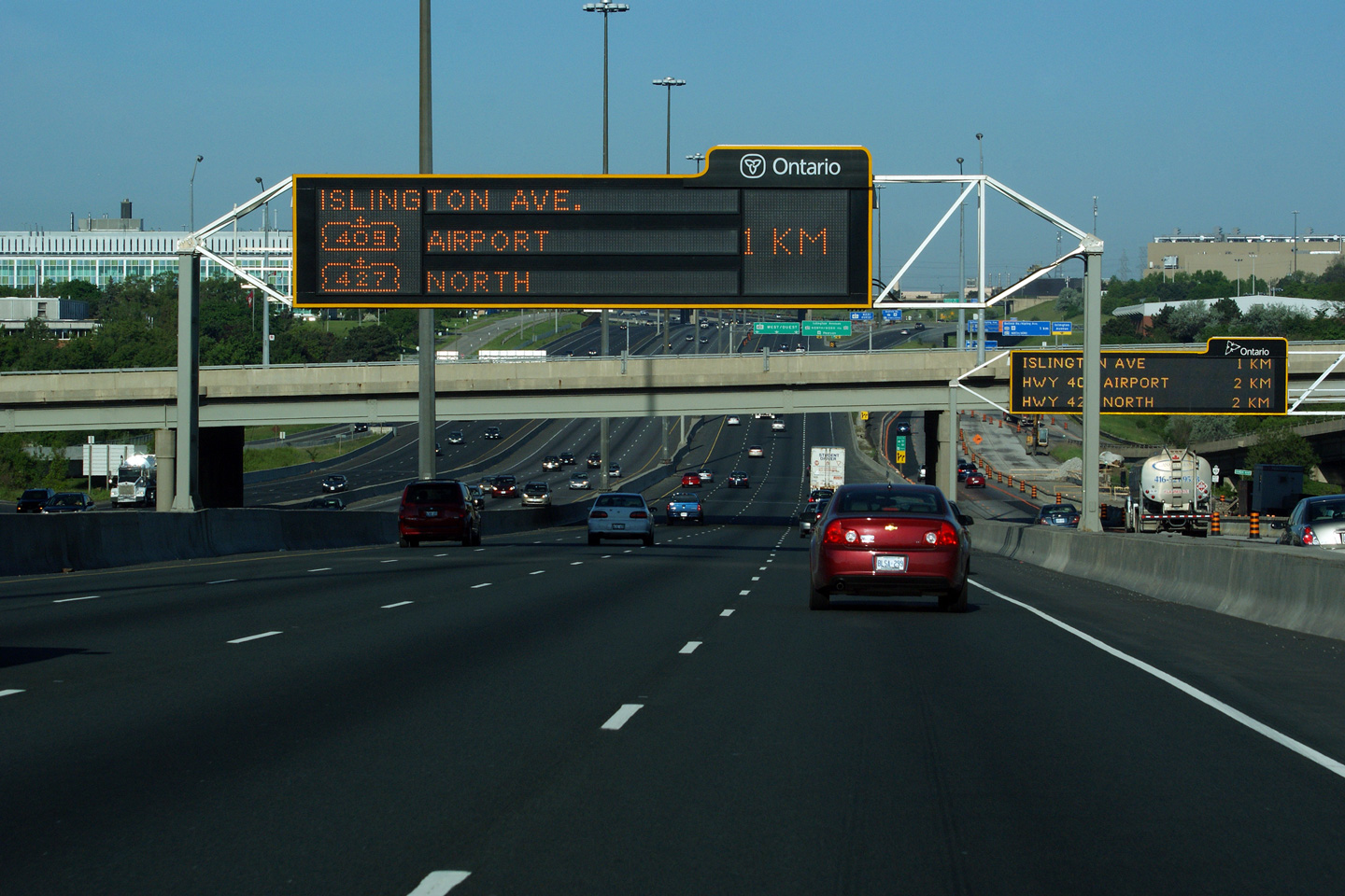
| City of Toronto |
Signage over both the westbound express and collector lanes as the ramp to
Highway 409 leaves the freeway mainline. Upper (Express Lanes) photo taken: May 10th, 2014. Lower (Collector Lanes) photo taken: May 11th, 2014. |
 (720x480) (720x480) |
|||
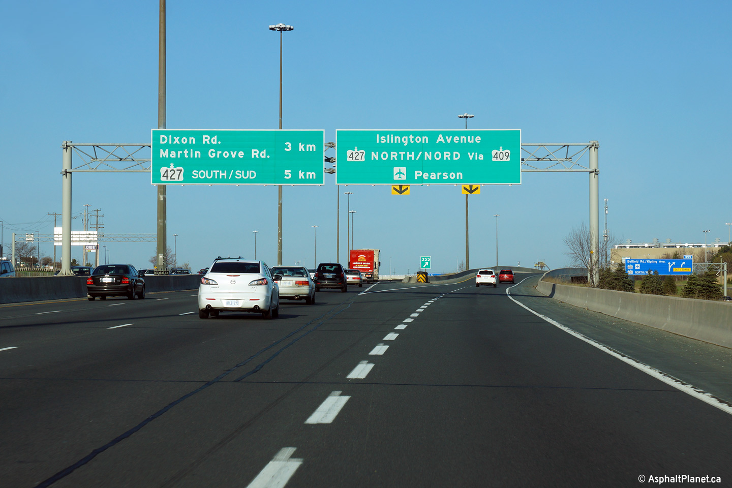
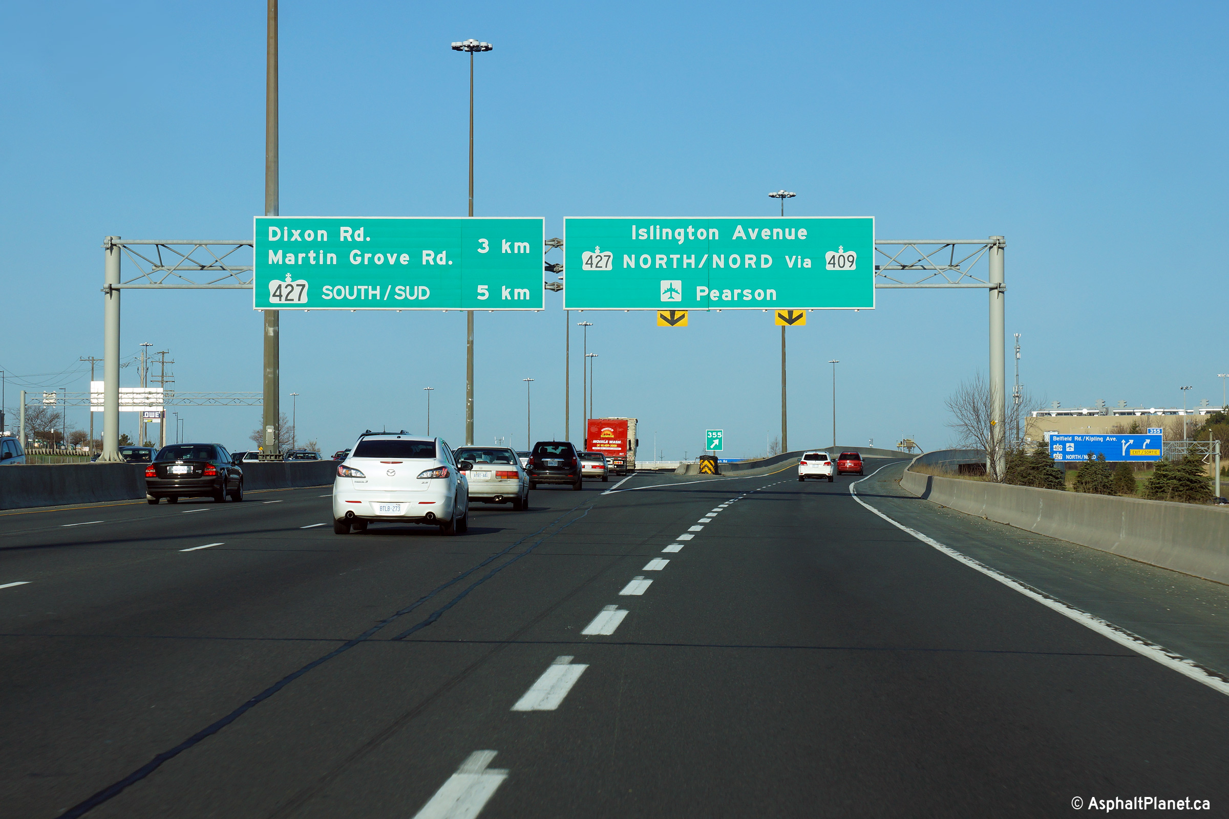
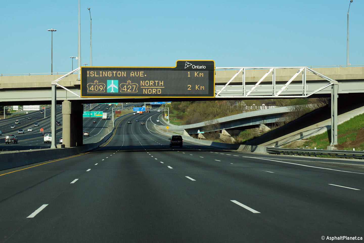
| City of Toronto |
Advanced signage from overtop of both the Express and Collector Lanes in
advance of the ramp to Highway 409. Click
here for an addition view
of the express lanes signage taken in January, 2009. Upper (Express Lanes) photo taken: May 10th, 2014. Lower (Collector Lanes) photo taken: May 11th, 2014. |
 (720x480) (720x480) |
|||
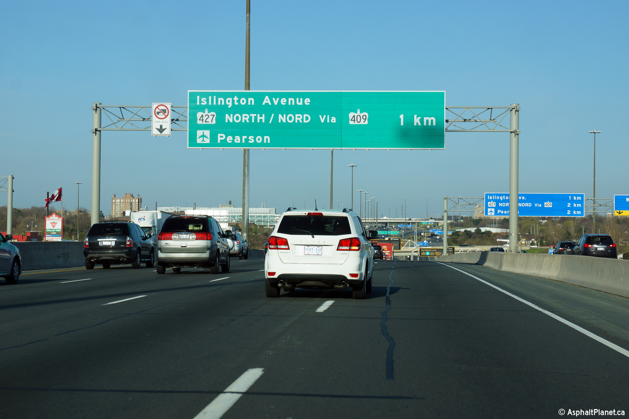
| City of Toronto |
Signage for the westbound off-ramp to Islington Avenue. Beyond the
off-ramp to Islington Avenue, the westbound express lanes pass beneath the
ramp from the westbound express lanes to Highway 409. Photo taken: May 11th, 2014 |
 (720x480) (720x480)(1440x960) (2400x1600) |
|||
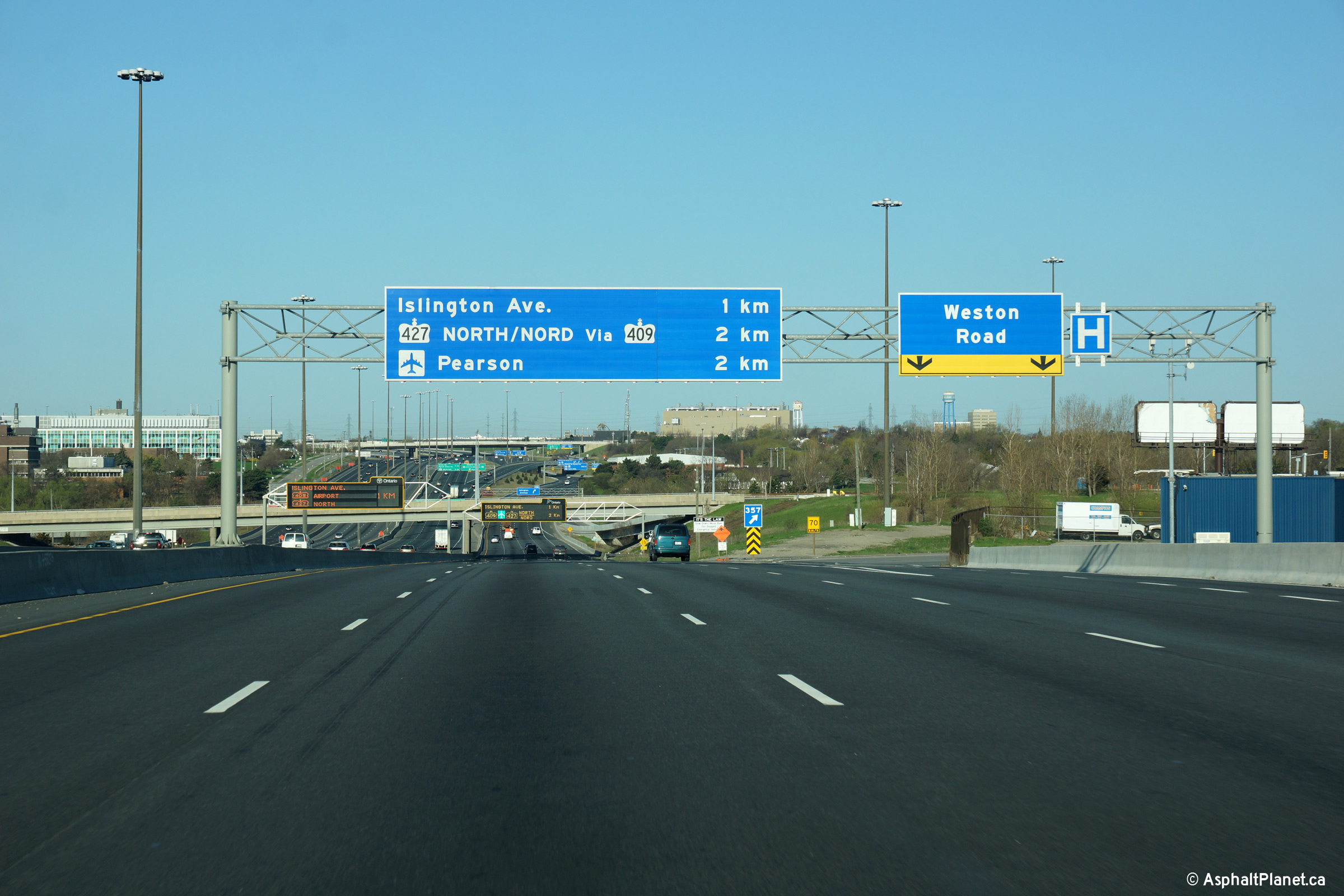
| City of Toronto |
Westbound collector lane signage in advance of the single lane off-ramp to
Islington Avenue. Additionally, Islington Avenue is directly
accessible from the express lanes via the express lane exit to Highway 409. Photo taken: May 11th, 2014 |
 (720x480) (720x480)(1440x960) (2400x1600) |
|||
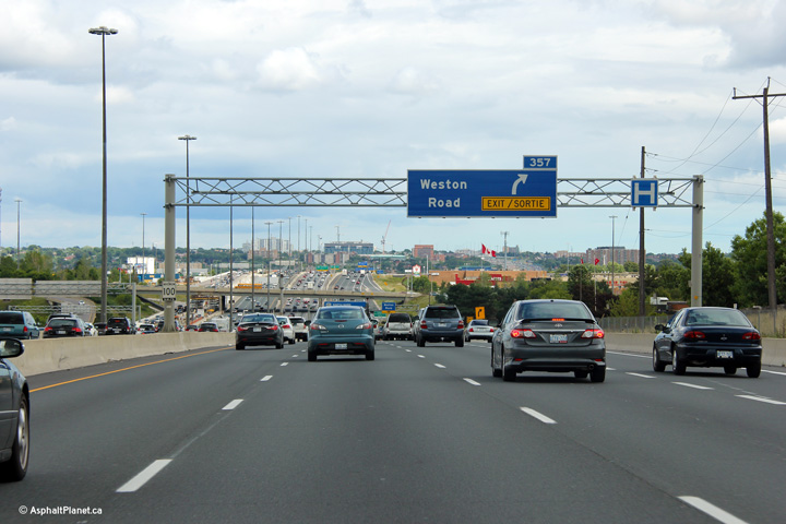
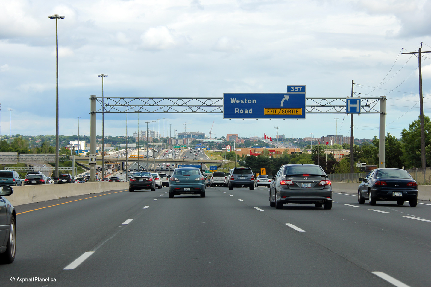
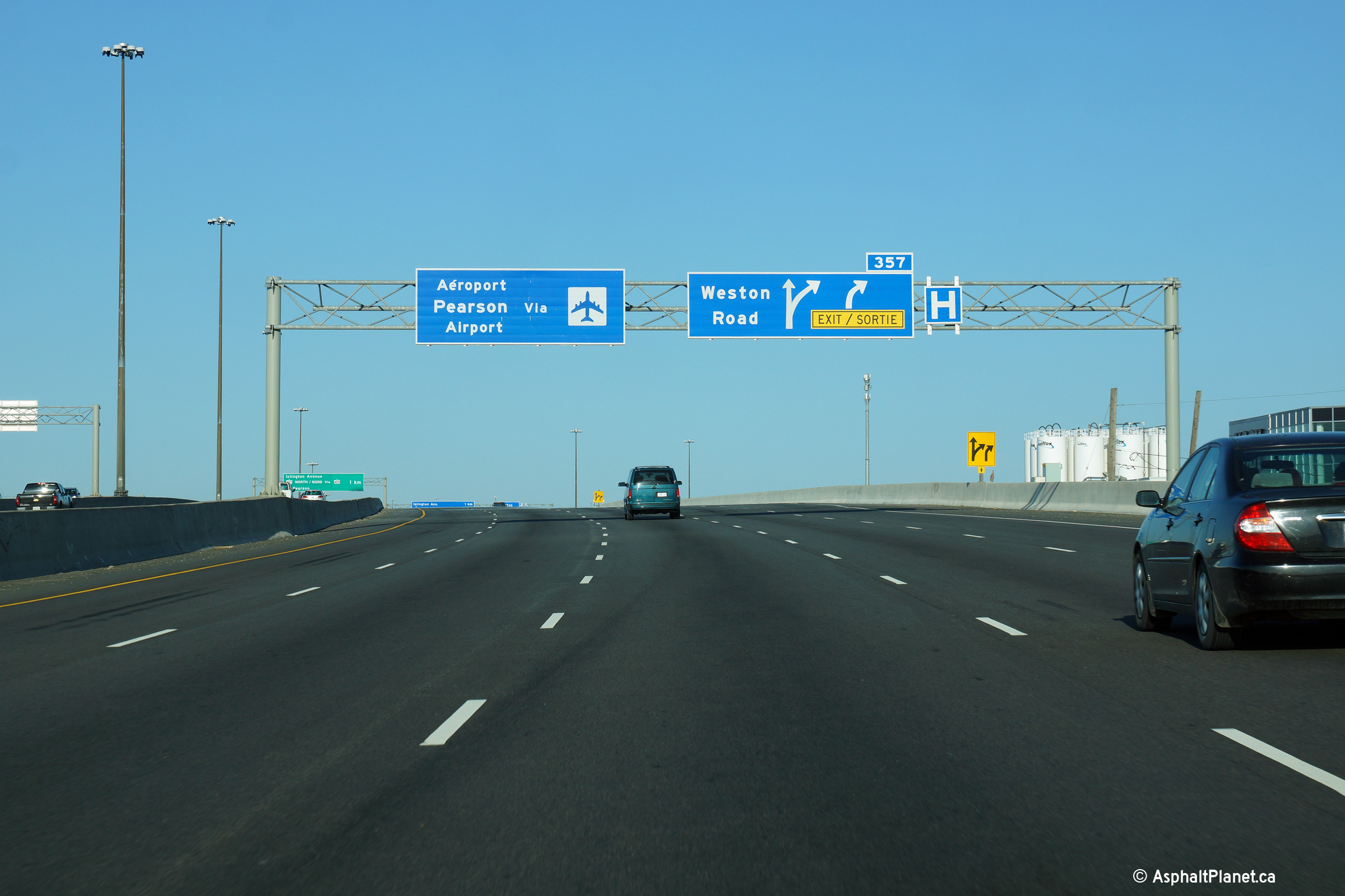
| City of Toronto |
Between the Islington Avenue and Weston Road interchanges, the eastbound
collector grows from two to four lanes. One additional lane was gained from
the on-ramp from the eastbound 409, while a second additional lane joins the
freeway from the Islington Avenue on-ramp. The additional lane from
Islington Avenue quickly departs the freeway as the off-ramp to
Weston Road. The off-ramp to Weston Road was widened to two lanes
during a 2017 construction project. Upper photo taken: August 12th, 2012. Lower photo taken: June 26th, 2018. |
 (720x480) (720x480)(1440x960) (2400x1600) |
|||
| City of Toronto |
The eastbound off-ramp curves overtop of the Humber River on its own
structure independent of the highway's mainline. Upper photo taken: August 12th, 2012. Lower photo taken: June 26th, 2018. |
 (720x480) (720x480)(1440x960) (2400x1600) |
|||
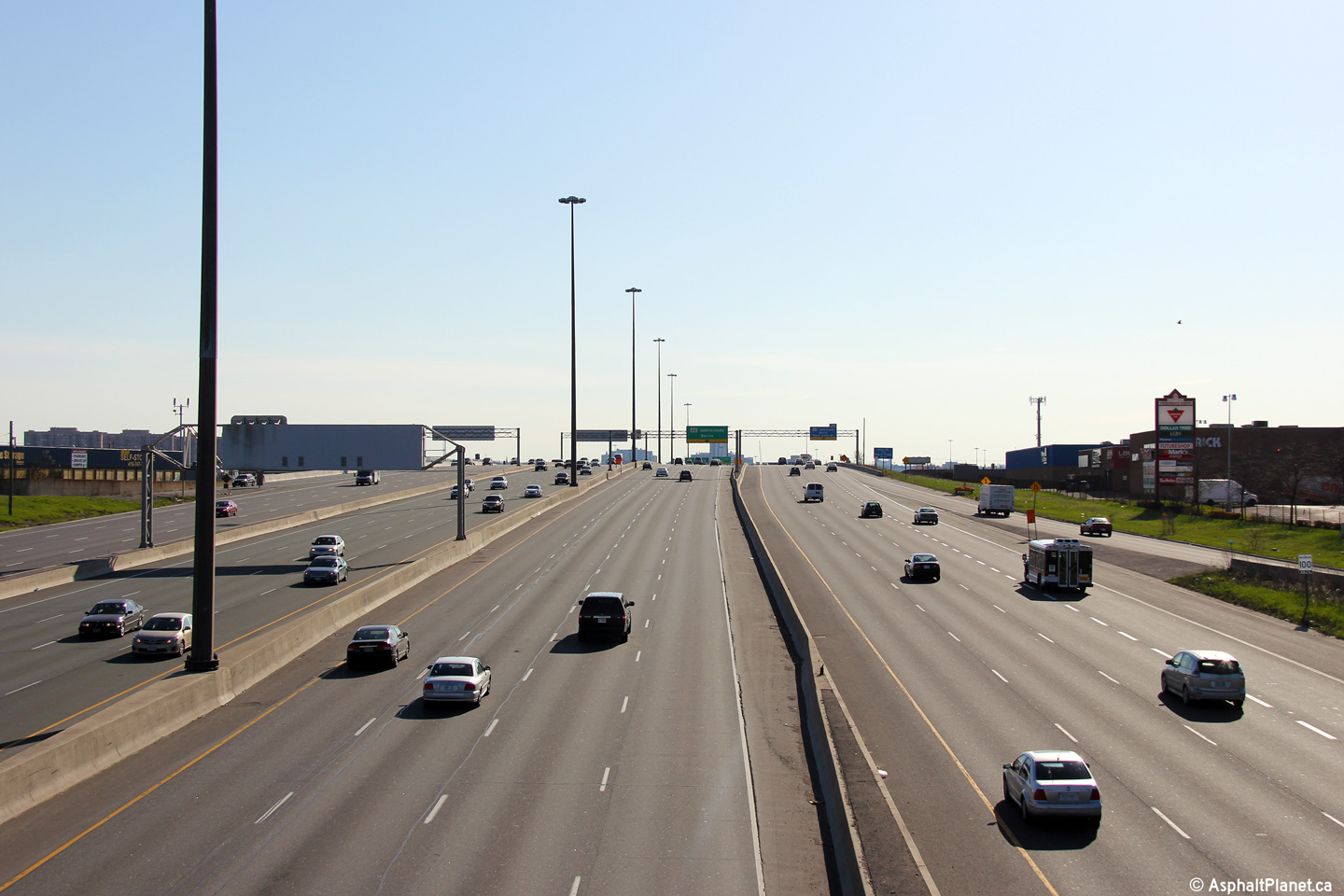
| City of Toronto |
A series of views looking westerly from the Weston Road overpass along Highway 401. The 2014 photos were taken after a series of construction contracts had wrapped up that saw Highway 401 extensively reconstructed and widened through the area. Starting with central median and lighting upgrades that took place during the late 1990s, Highway 401, between Kipling Avenue and the Basketweave has been more or less under constant construction for over a decade until work was completed to rehabilitate the westbound collector lanes in 2013. As of the writing of this commentary in 2014, only non-highway mainline construction work remains to upgrade this section of highway. For additional photos of Highway 401 taken before and during the various stages of reconstruction between Kipling Avenue and Jane Street, click here.
Photos taken: May 11th, 2014. |
(720x480) (1440x960) (2400x1600)
|
|||
| City of Toronto |
View looking easterly from the Weston Road overpass.
Photo taken: May 11th, 2014. |
|
|||
| City of Toronto |
Overhead changeable message sign along the westbound Express lanes of
Highway 401 in advance to the Express Lane ramp to Highway 409. Upper (Express Lanes) photo taken: June 5th, 2011. Lower (Collector Lanes) photo taken: May 11th, 2014. |
 (720x480) (720x480) |
|||
| City of Toronto |
Advanced signage from overtop of both the Express and Collector Lanes in
advance of the basketweave. Upper (Express Lanes) photo taken: May 10th, 2014. Lower (Collector Lanes) photo taken: May 11th, 2014. |
 (720x480) (720x480) |
|||
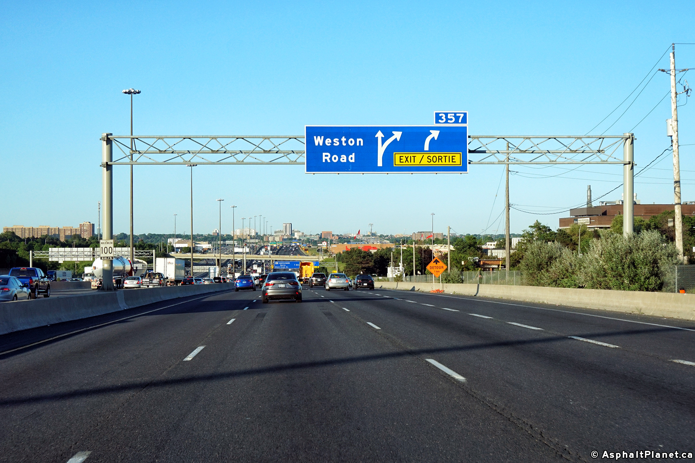
| City of Toronto |
Westbound advanced signage for the ramp to Weston Road. The fifth
westbound collector lane, (that joined the collectors from the ramp from
Highway 400 South) exits at the Weston Road interchange. Photo taken: May 11th, 2014. |
 (720x480) (720x480)(1440x960) (2400x1600) |
|||
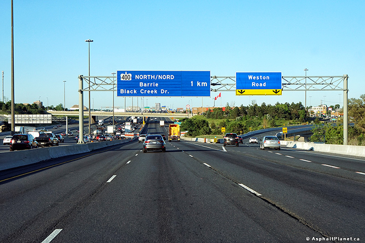
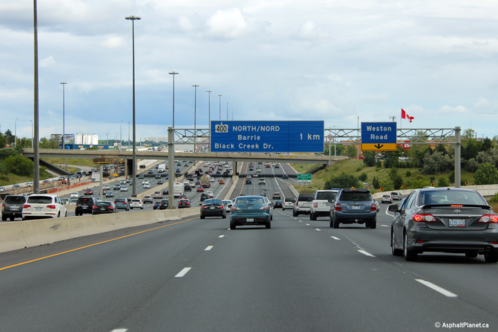
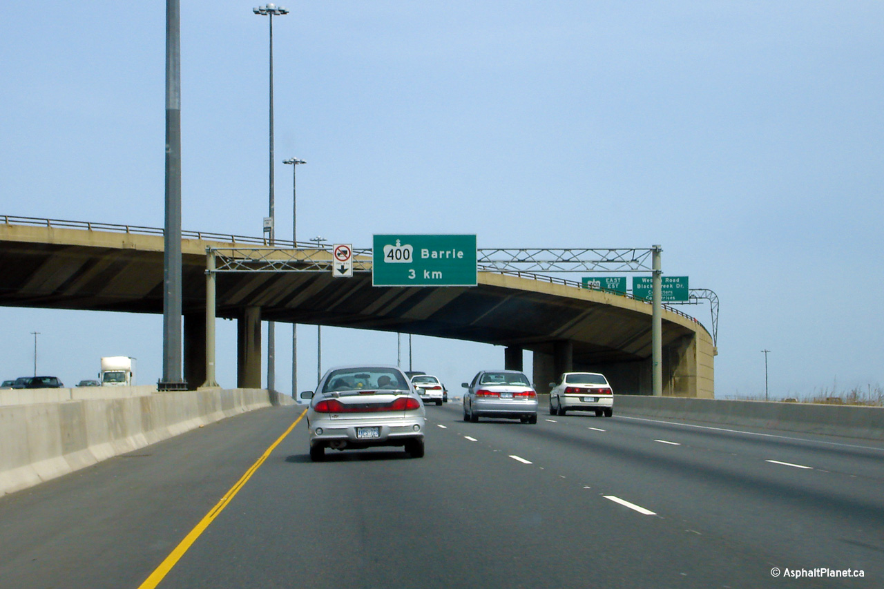
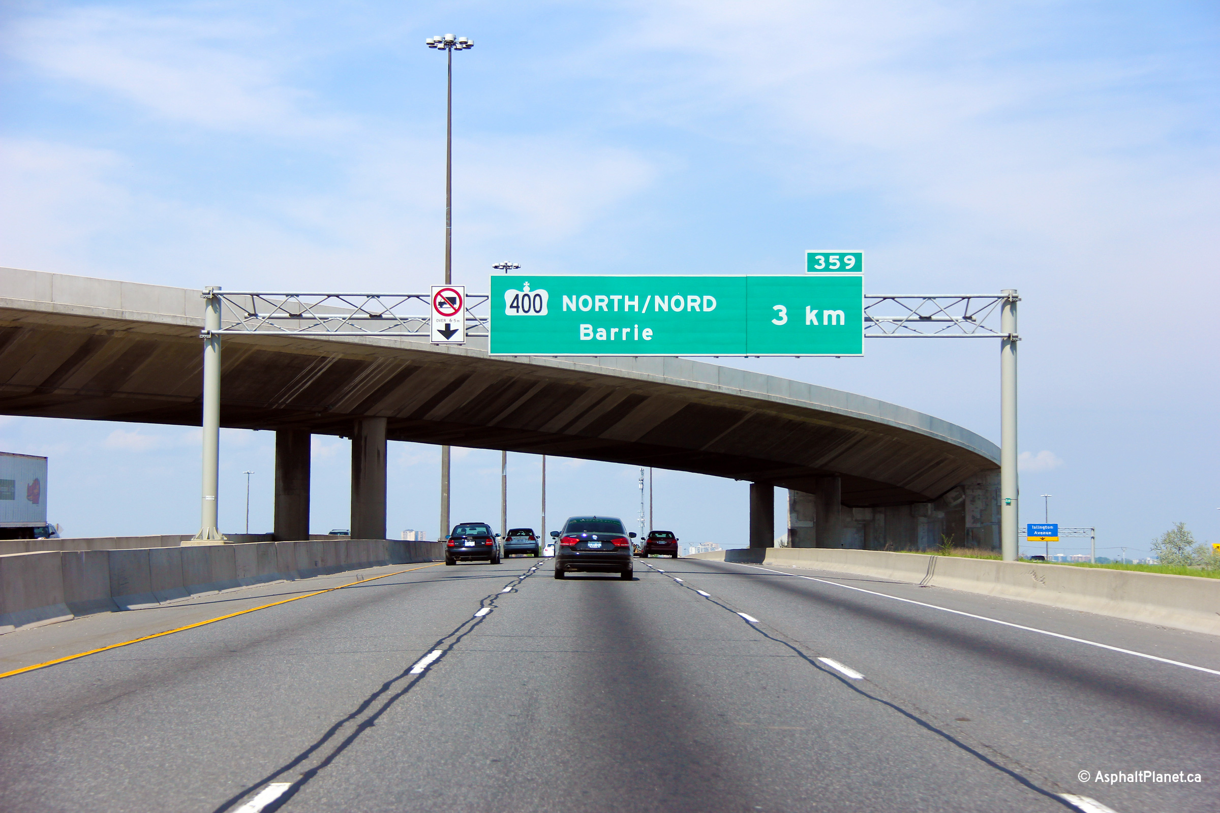
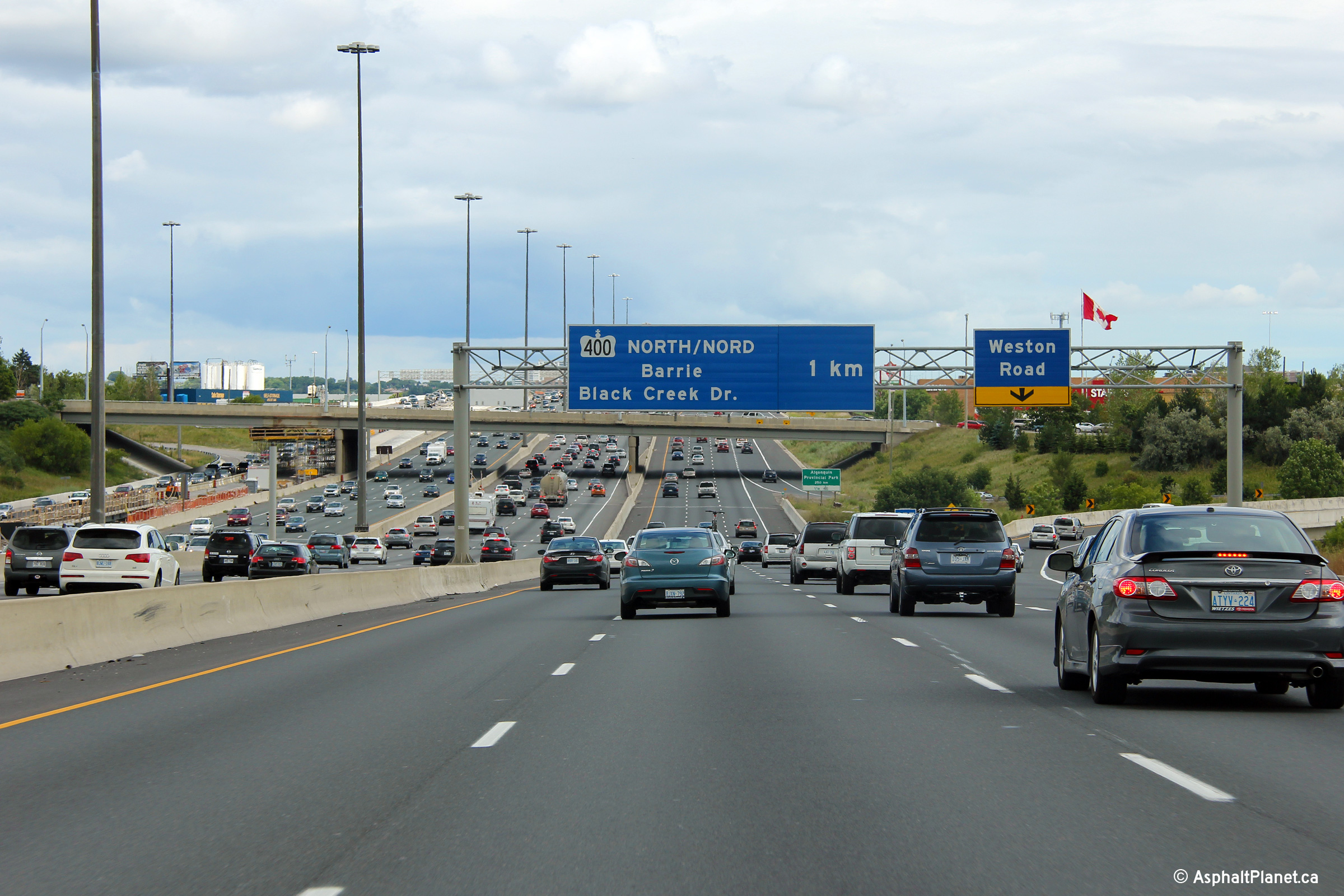
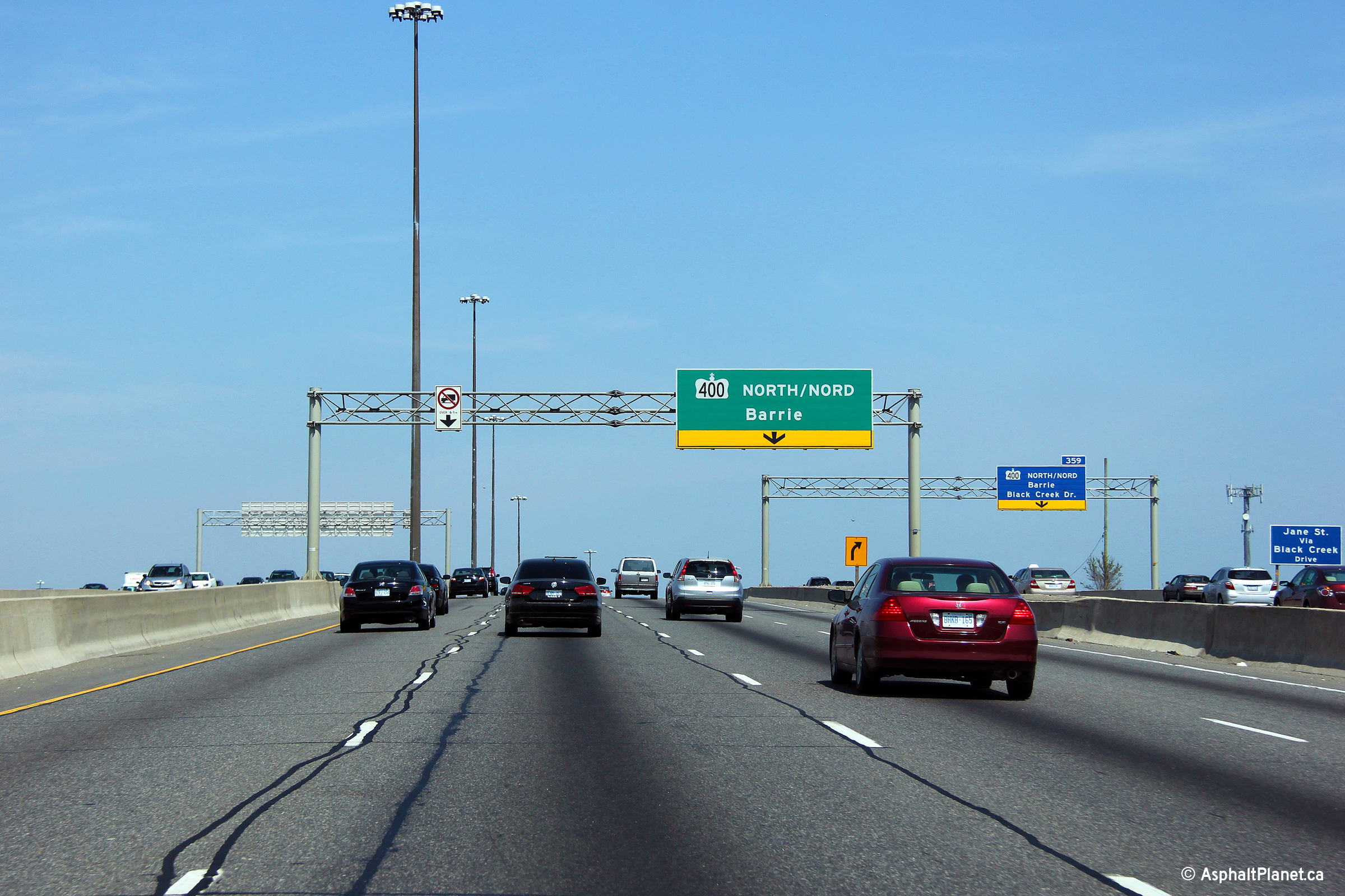
| City of Toronto |
Advanced overhead signage for the ramp to Highway 400 from both the Express
and Collector lanes. When these tri-cord signs were first erected, they
featured advanced arrow signs but were quickly replaced with what stands
now. Note the lack of an exit tab overtop of the Express Lanes sign. Upper (Express Lanes) photo taken: May 20th, 2013. Lower (Collector Lanes) photo taken: May 16th, 2013. |
 (720x480) (720x480)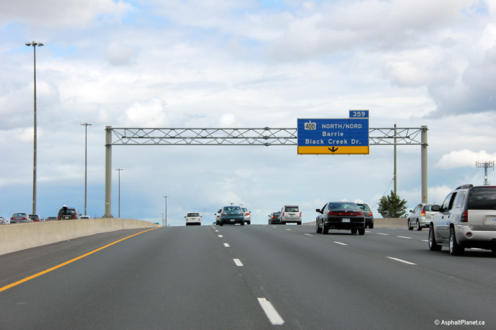 (720x480) (720x480) |
|||
| City of Toronto |
Overhead signage for both the eastbound Express and Collector lanes exit to
Highway 400. Both ramps are only a single lane wide and unfortunately
depart the freeway just over a crest of a hill. The fourth eastbound
lane in the Express Lanes departs at the Highway 400 off-ramp. Upper (Express Lanes) photo taken: May 20th, 2013. Lower (Collector Lanes) photo taken: August 12th, 2012. |
 (720x480) (720x480)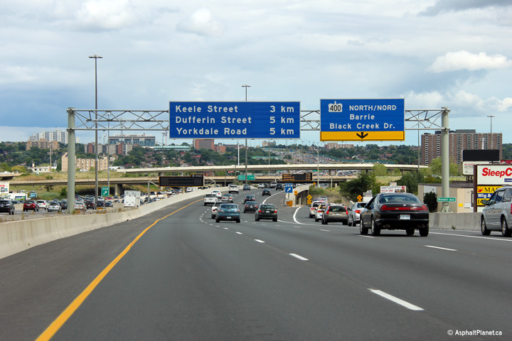 (720x480) (720x480) |
|||
| City of Toronto |
Beyond the eastbound off-ramps to Highway 400, a changeable message sign
stands overtop of both the Express and Collector lanes. Upper (Express Lanes) photo taken: May 20th, 2013. Lower (Collector Lanes) photo taken: August 12th, 2012. |
 (720x480) (720x480) (720x480) (720x480) |
|||
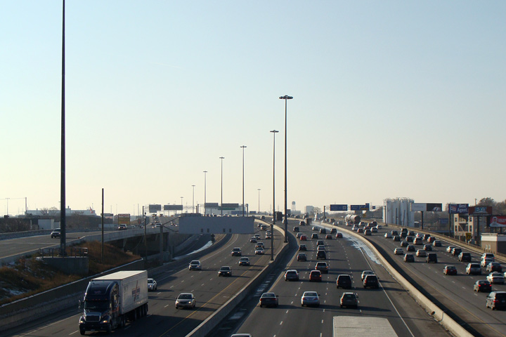
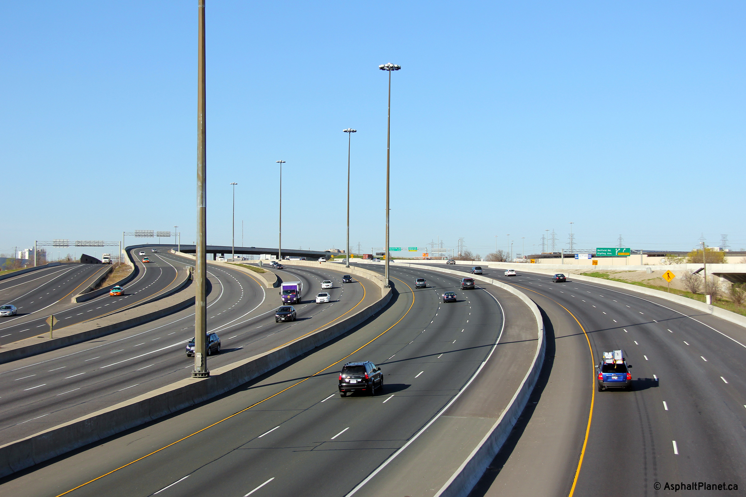
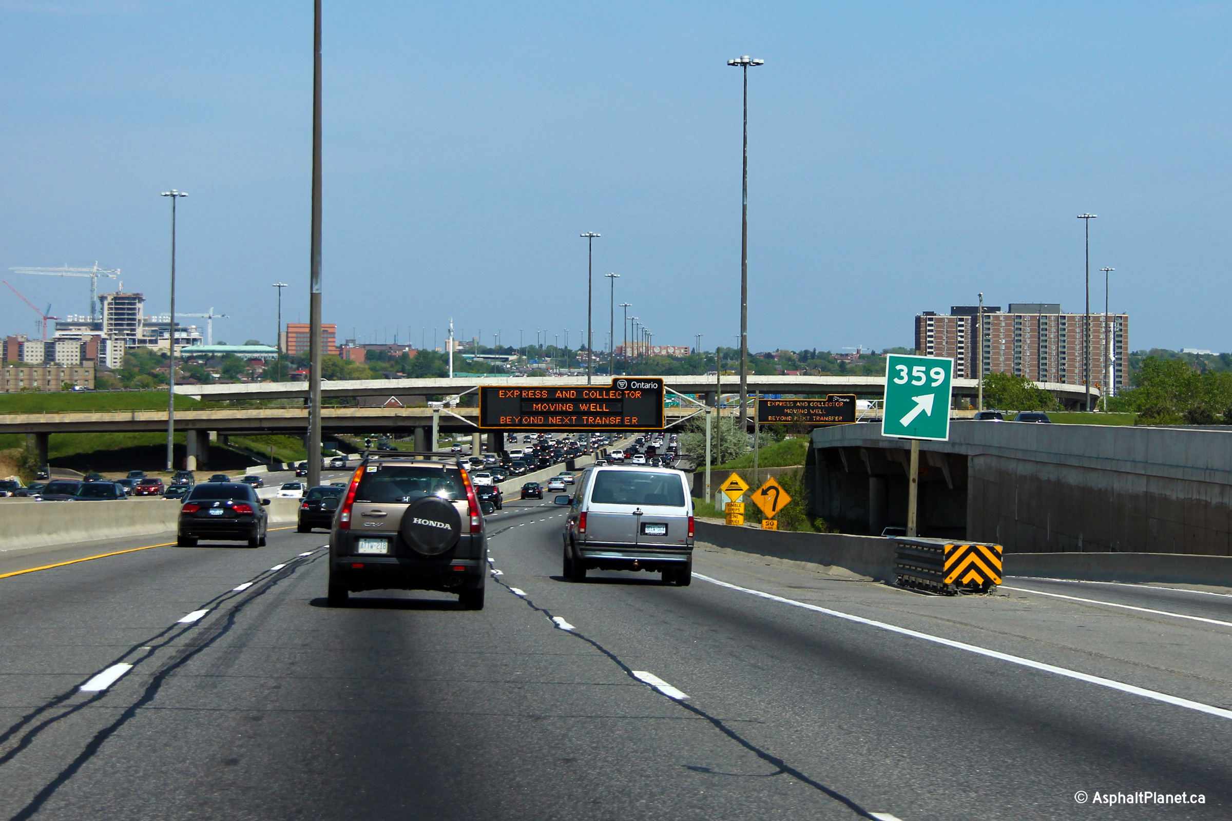
| City of Toronto |
View looking westerly from the Highway 400 southbound ramp over Highway 401.
The 401 rises quickly from underneath of the Highway 400 interchange to go
overtop of CP's MacTier Subdivision. This quick hill directly west of
the 400 is the cause of much congestion in the westbound collector lanes, as
the ramp from Highway 400 south deposits a considerable amount of slow
moving truck traffic into the right lane at the bottom of the pictured hill.
This situation was alleviated somewhat with the addition of an extra
westbound collector lane from the Highway 400 on-ramp westerly to the
off-ramp to Dixon Road. Construction was completed on this project
late in 2013. Upper photo taken: November 25th, 2007. Lower photo taken: October 12th, 2013. |
 |
|||
| City of Toronto |
View looking east from the southbound Highway 400 structure over the 401
towards the northbound structure. Notice the new jersey barriers
instead of the stylish 'double rail' barrier on the high-level flyover
between Highway 400 South and Highway 401 East. Photo taken: November 25th, 2007. |
 |
|||
| Highway 400 is Southern Ontario's major north-south freeway. It leads north from Toronto extending to Parry Sound. Click here for Highway 400 images. | |||||
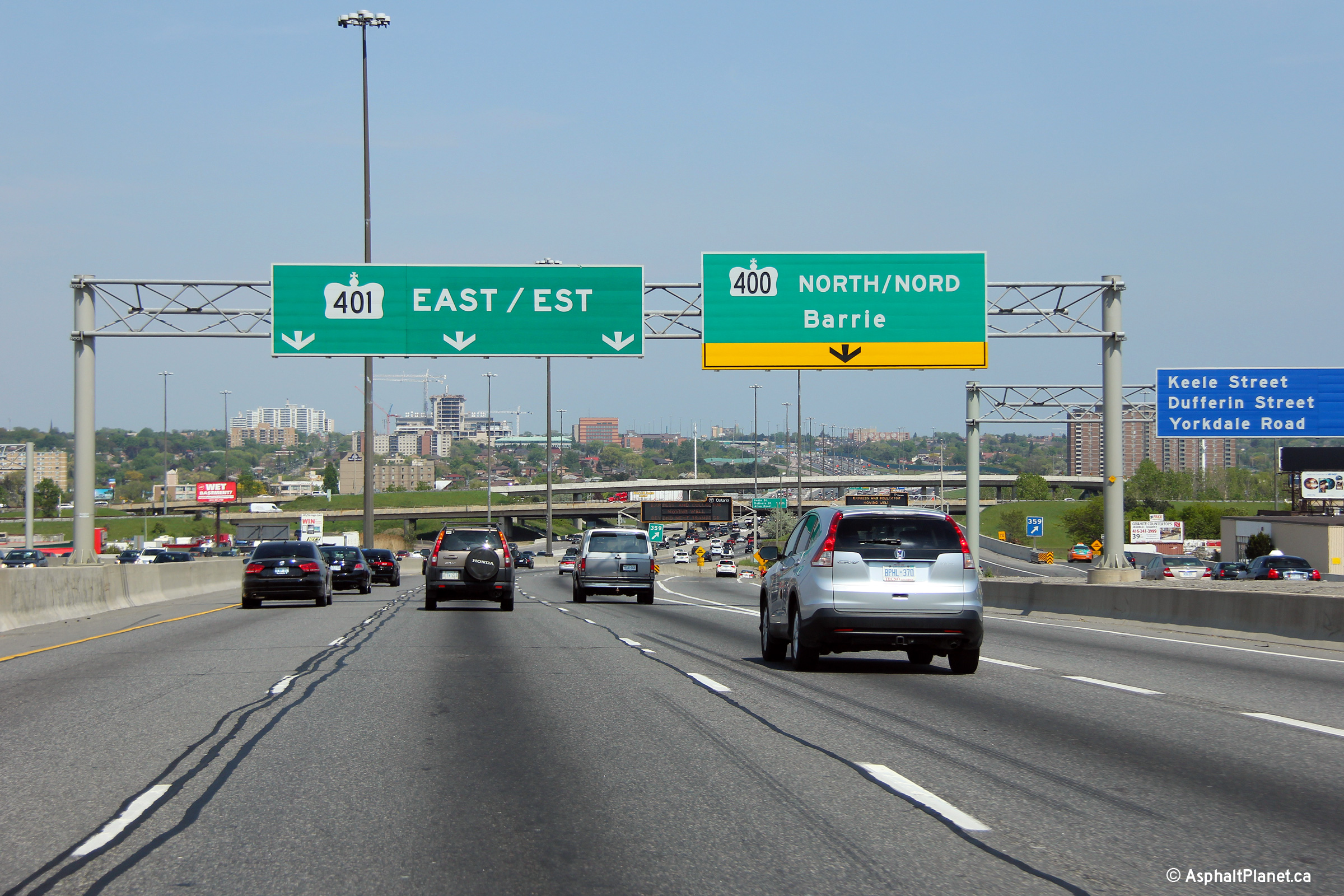
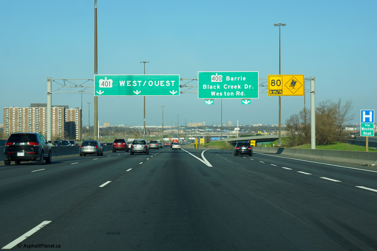
| City of Toronto |
View looking easterly along Highway 401 from the Highway 400 interchange.
This photo was taken shortly after the westbound Express Lanes were
rehabilitated and widened. in 2007, An extra westbound lane was added to the
westbound Express Lanes through the Highway 400 interchange. Photo taken: November 25th, 2007. |
 |
|||
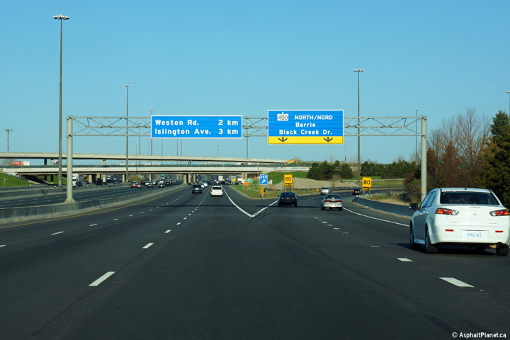
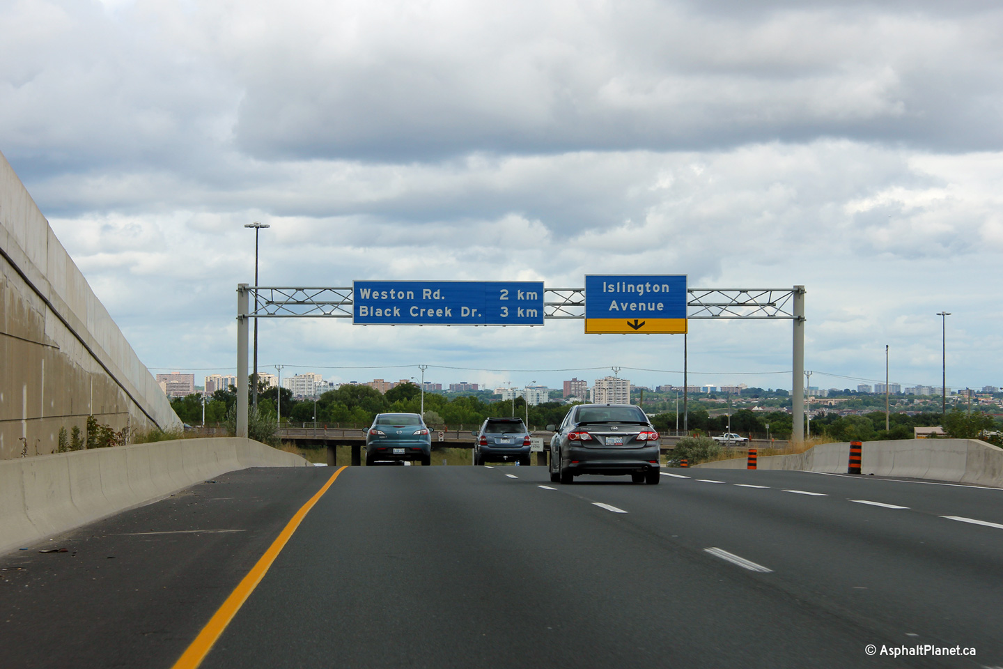
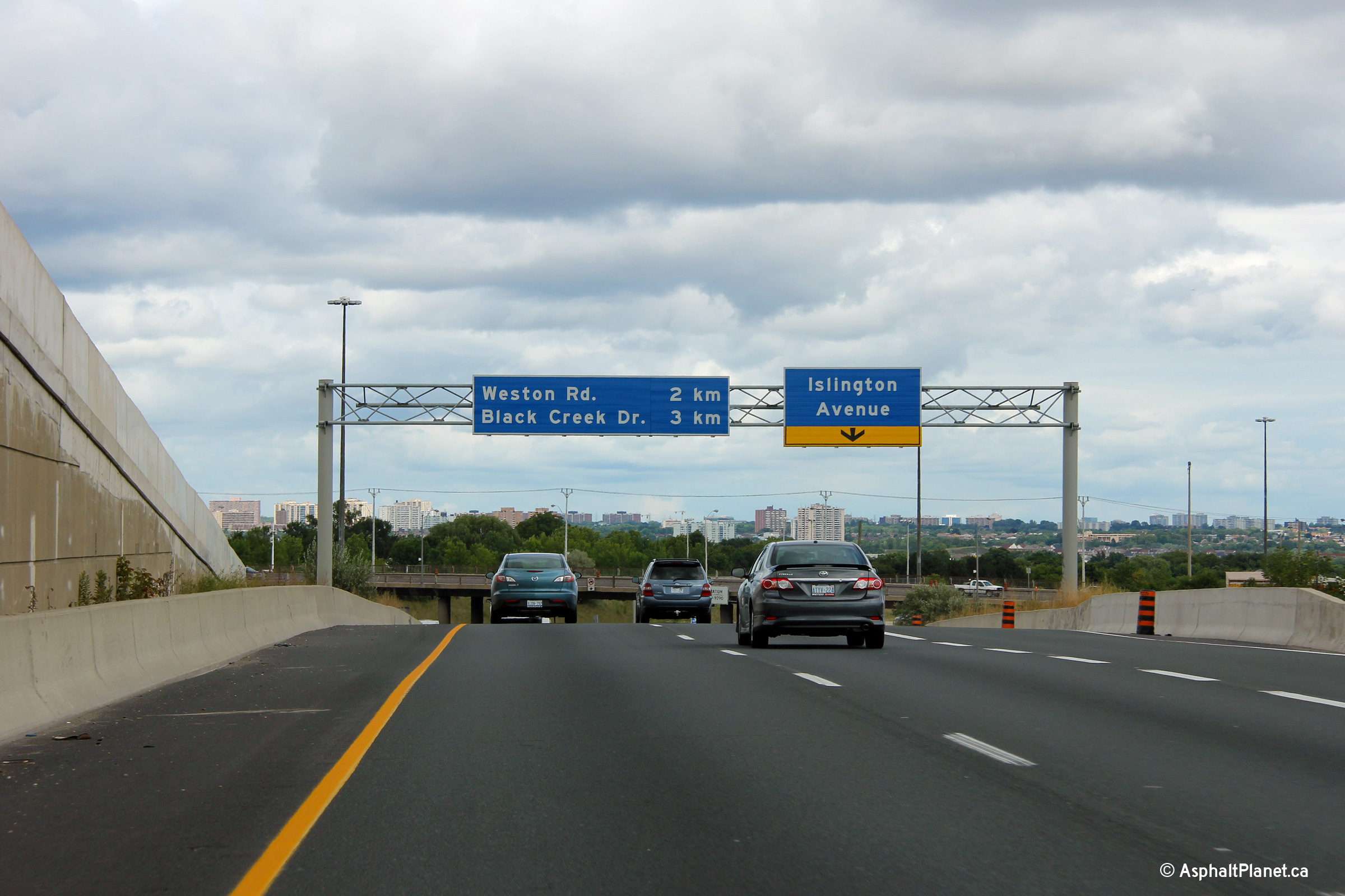
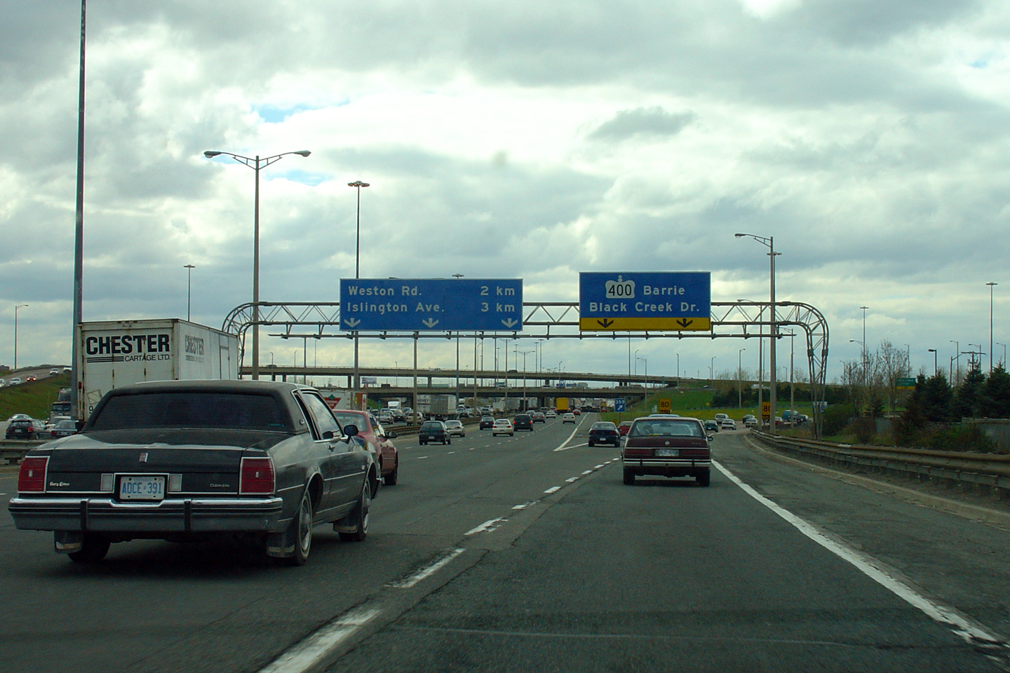
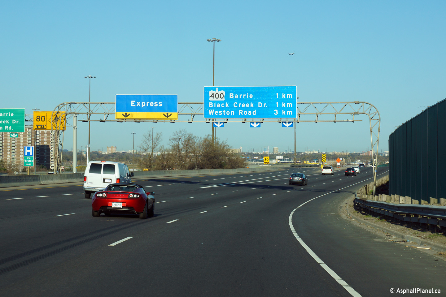
| City of Toronto |
Signage in the westbound collector lanes for the ramp to Highway 400-North
and Black Creek Drive. Click
here for an additional view of this interchange taken in May, 2004
before the westbound lanes were reconstructed. Photo taken: May 11th, 2014. |
 (720x480) (720x480)(1440x960) (2400x1600) |
|||
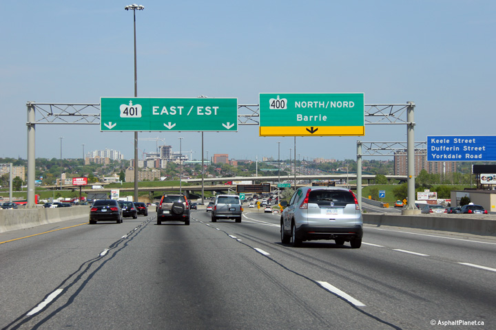
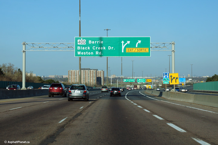
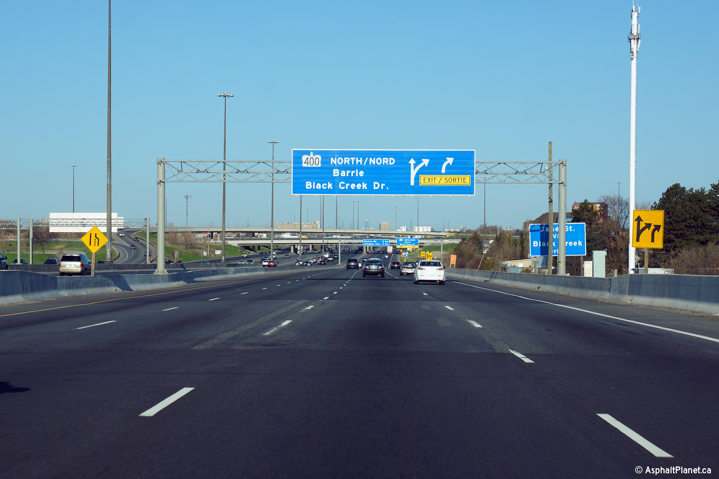
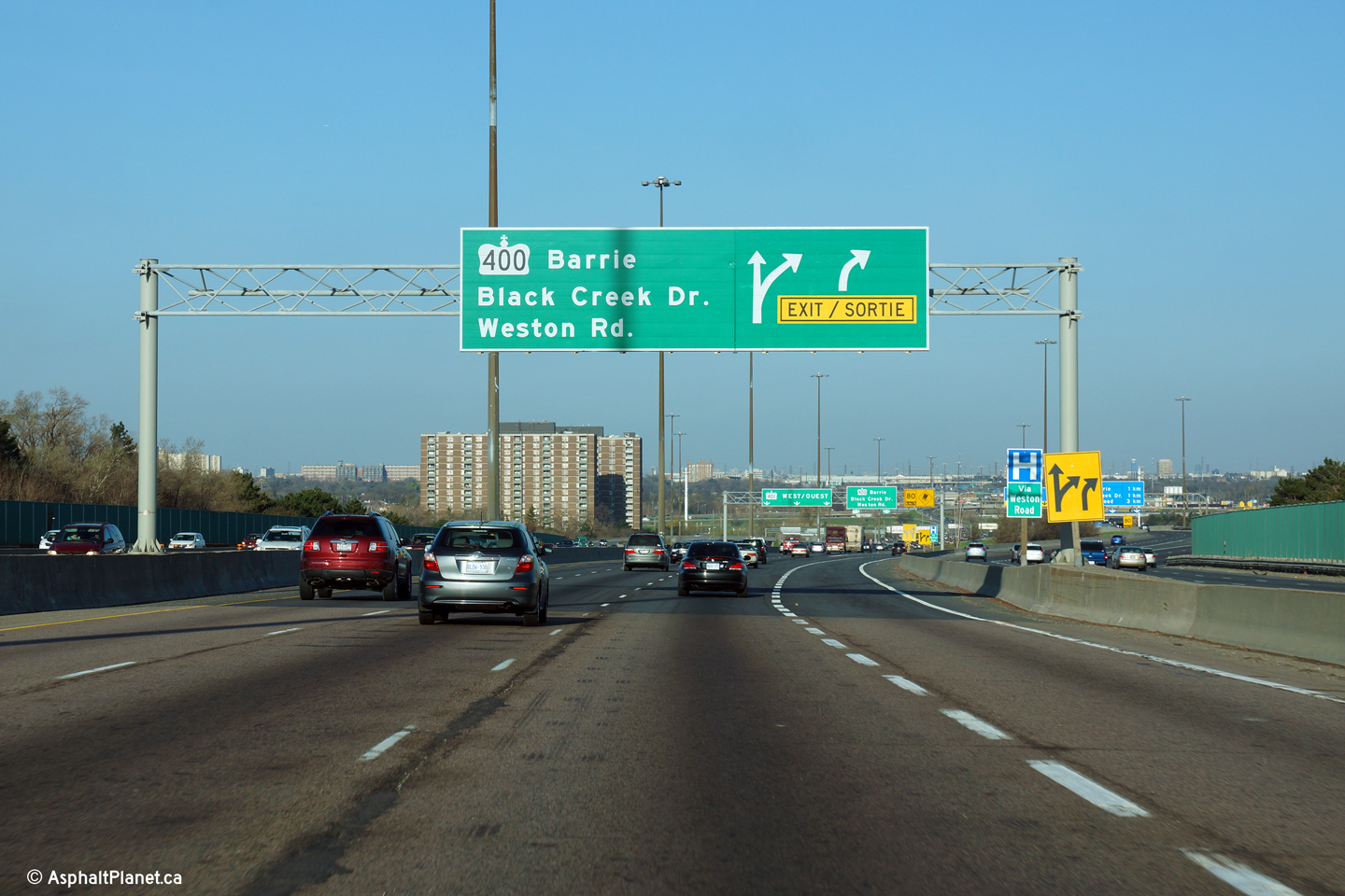
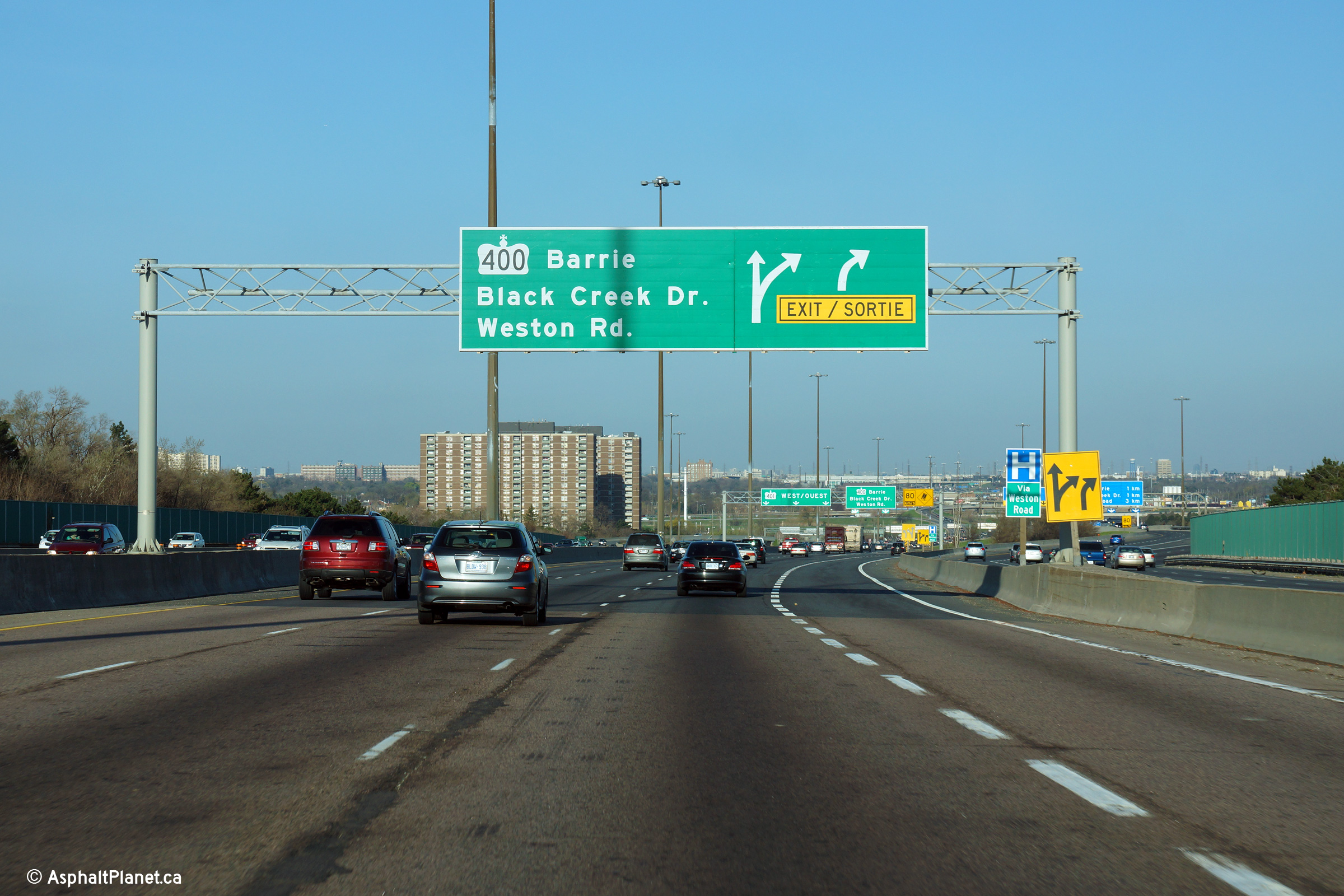
| City of Toronto |
Advanced signage for the Highway 400 interchange. The fourth westbound
collector lane departs the mainline lanes of Highway 401 at this
interchange. Unlike the eastbound off-ramp, Highway 400 is only
accessible from the collector lanes. The Basketweave was constructed as
close to the Highway 400 interchange as it is to facilitate movements
between the Express Lanes and Highway 400. With today's knowledge of
traffic operations, and today's traffic volumes, direct ramps between
Highway 400 and the Express Lanes would have been a preferable choice
instead of the Basketweave. Photo taken: May 11th, 2014. |
 (720x480) (720x480)(1440x960) (2400x1600) |
|||
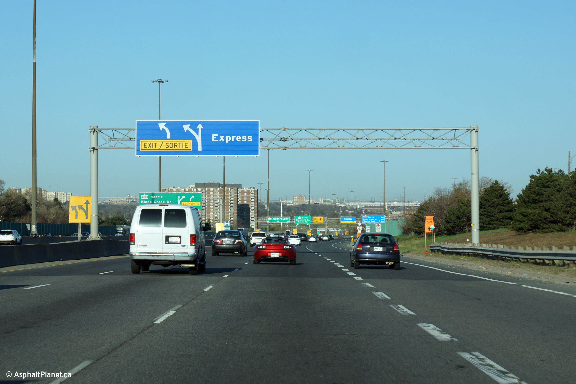
| City of Toronto |
Eastbound view approaching the Basketweave. A basketweave is
the colloquial name for a set of simultaneous ramps between the Express and
Collector Lanes that pass overtop of each other via a grade separation.
There are several locations where ramps between the Express and Collector
lanes cross in this fashion on GTA area expressways, however this is the
only location known as "the Basketweave". Upper (Express Lanes) photo taken: December 1st, 2014 Lower (Collector Lanes) photo taken: July 10th, 2014. |
 (720x480) (720x480) (720x480) (720x480) |
|||
| City of Toronto |
Eastbound signage overtop of both the express and collector lanes at the Basketweave. Upper (Express Lanes) photo taken: December 1st, 2014 Lower (Collector Lanes) photo taken: July 10th, 2014. |
 (720x480) (720x480) (720x480) (720x480) |
|||
| City of Toronto |
A morning rush hour view of Highway 401 looking west from westbound lanes of
the Basketweave. Notice the three-level Highway 400 interchange in the
background of this photo. The westbound Express Lanes through the
Highway 400 interchange were being reconstructed at the time this photo was
taken. Photo taken: July 30th, 2005. |
 |
|||
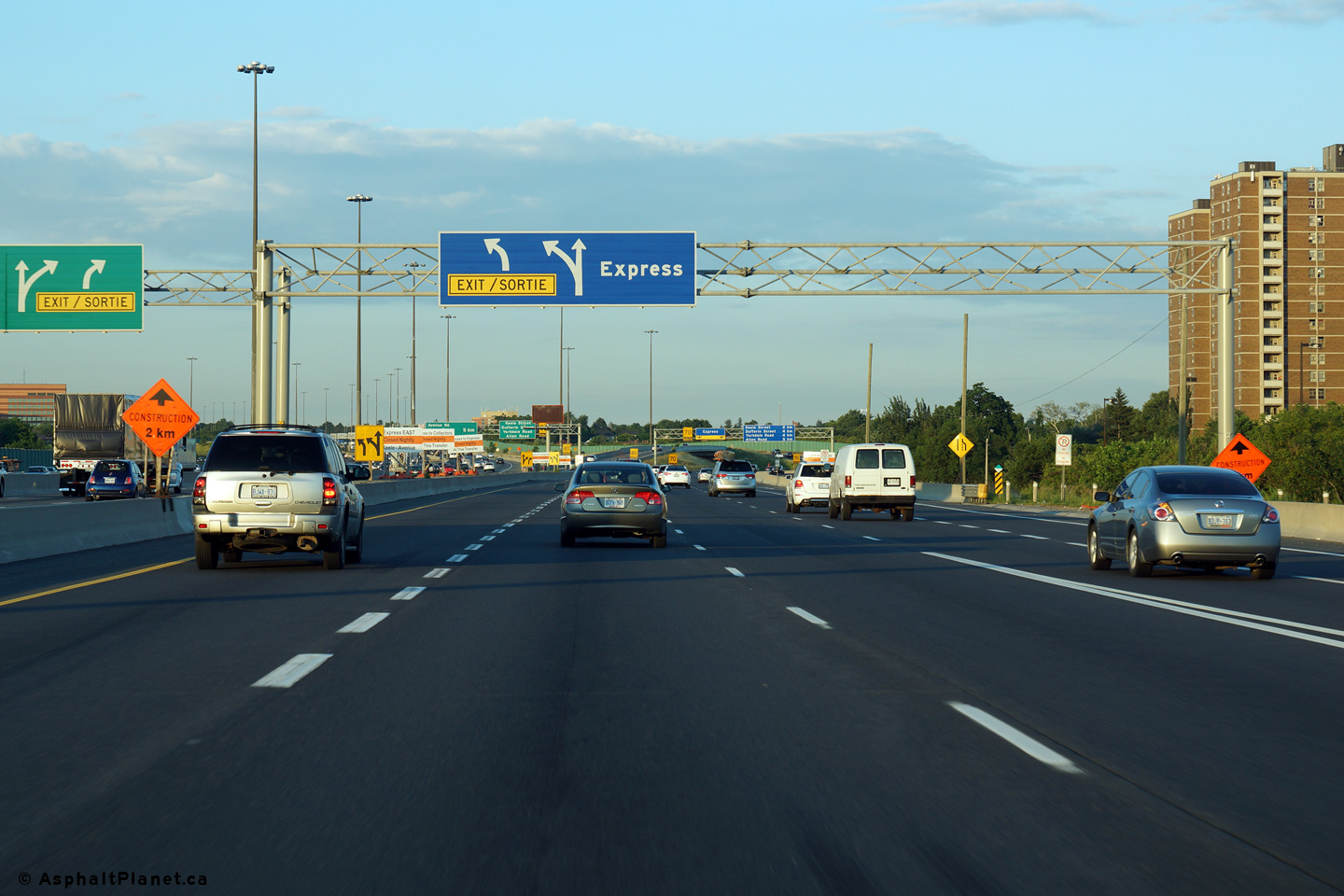
| City of Toronto |
Signage approaching the westbound Basketweave in both the Express and
Collector lanes. Unlike the eastbound direction, there is no direct
access to Highway 400 from the Express lanes. Upper (Express Lanes) photo taken: May 10th, 2014. Lower (Collector Lanes) photo taken: May 11th, 2014. |
 (720x480) (720x480) |
|||
| City of Toronto |
Advanced signage from overtop of both the Express and Collector Lanes in
advance of the basketweave. Upper (Express Lanes) photo taken: May 10th, 2014. Lower (Collector Lanes) photo taken: May 11th, 2014. |
 (720x480) (720x480) |
|||
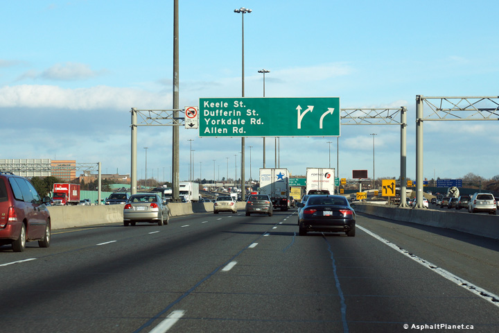
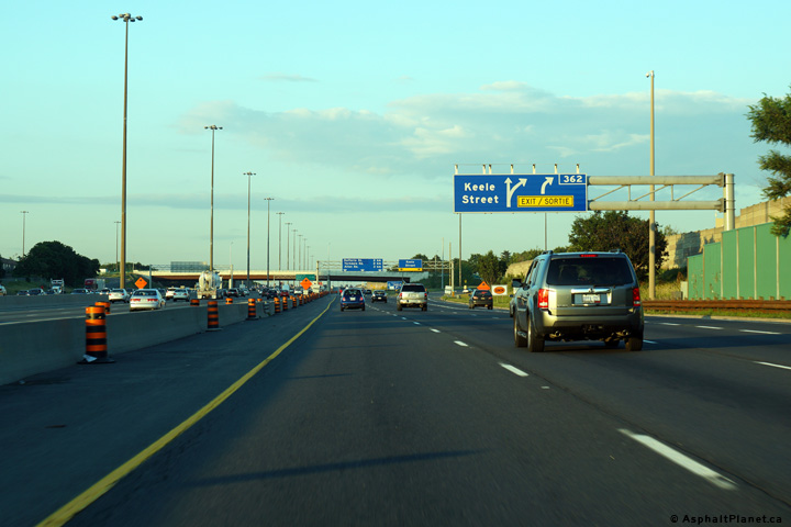
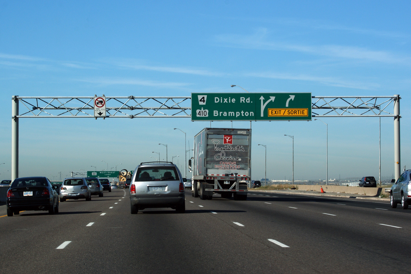
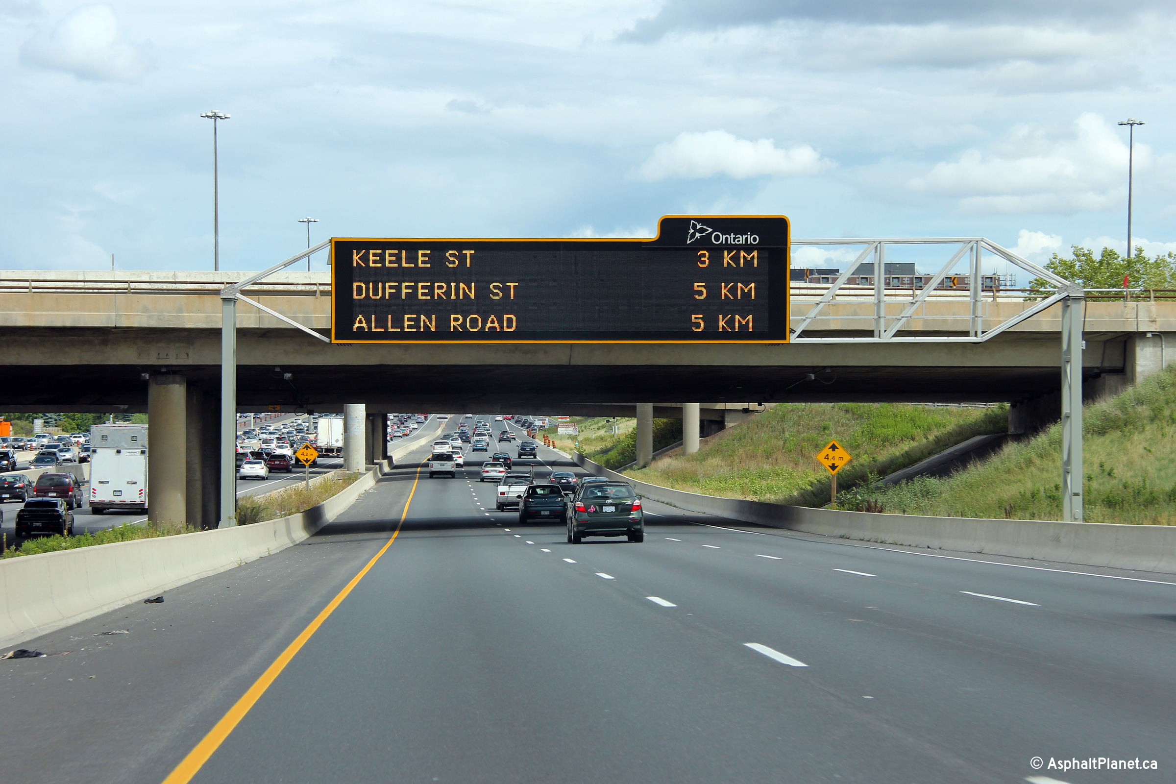
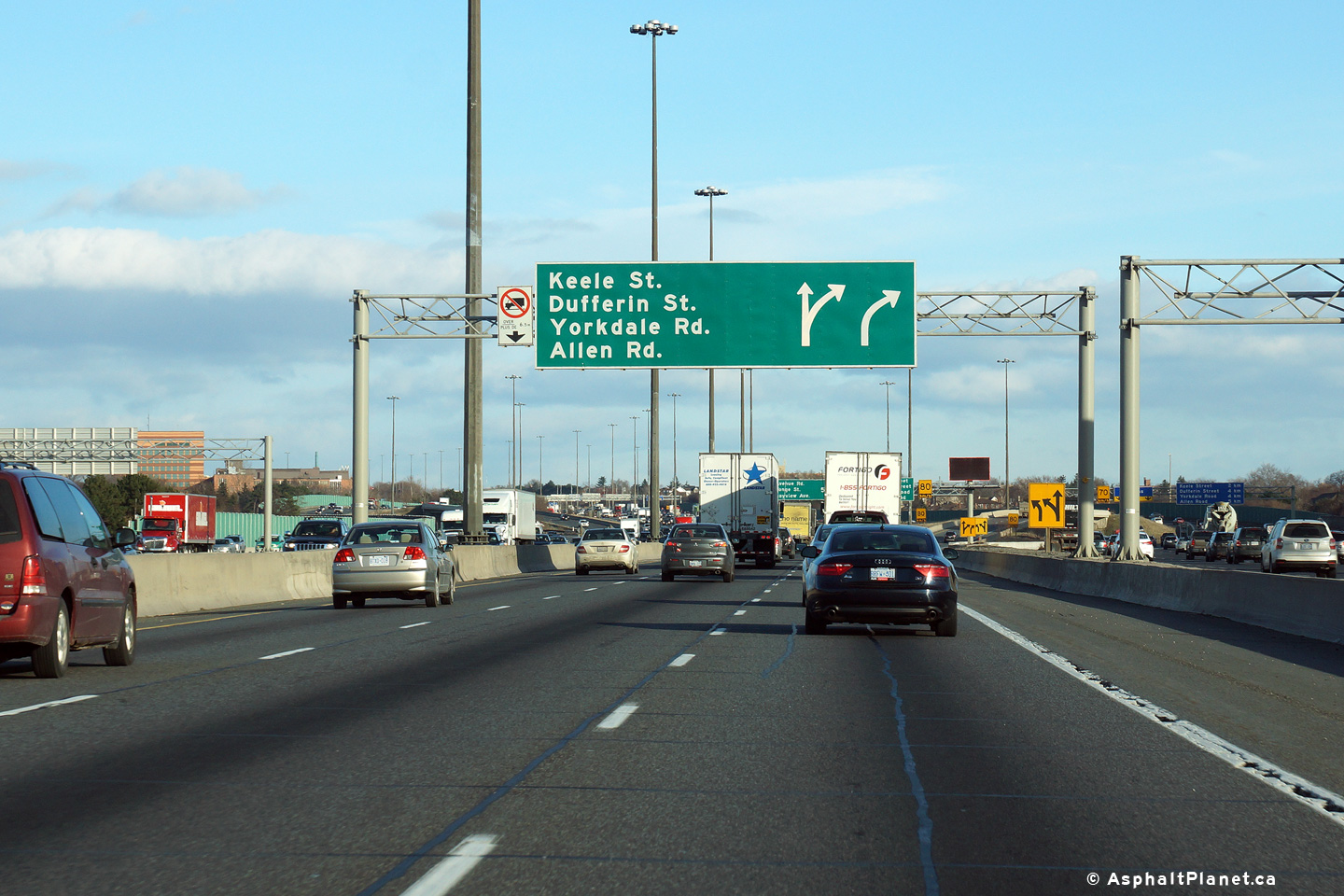
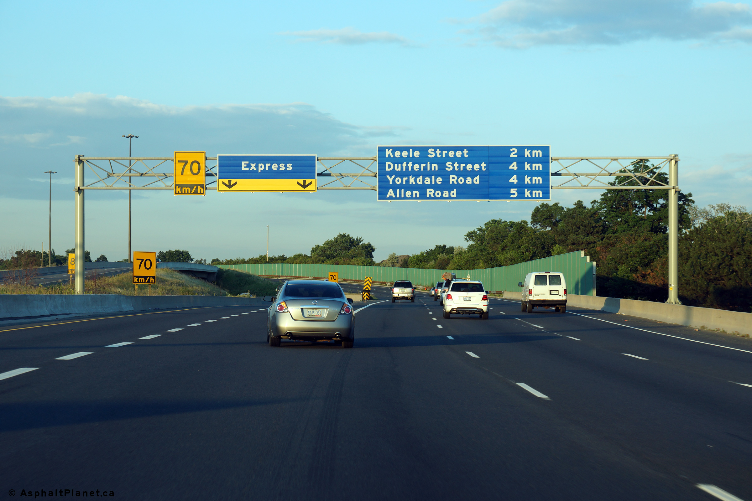
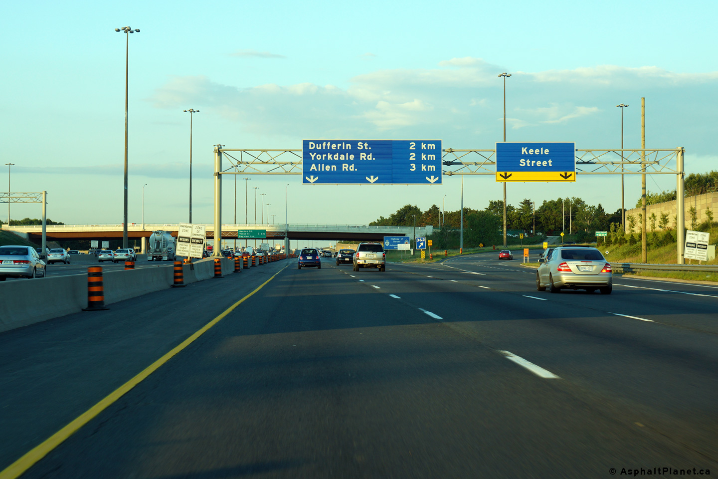
| City of Toronto |
Advanced signage for the ramp to Keele Street from the eastbound collector
lanes. The fourth eastbound collector lane exits the freeway mainline
at this interchange. Photo taken: July 10th, 2014. |
 (720x480) (720x480)(1440x960) (2400x1600) |
|||
| City of Toronto |
View of the eastbound collector lanes as the off-ramp to Keele Street
departs the freeway mainline. Photo taken: July 10th, 2014. |
 (720x480) (720x480)(1440x960) (2400x1600) |
|||
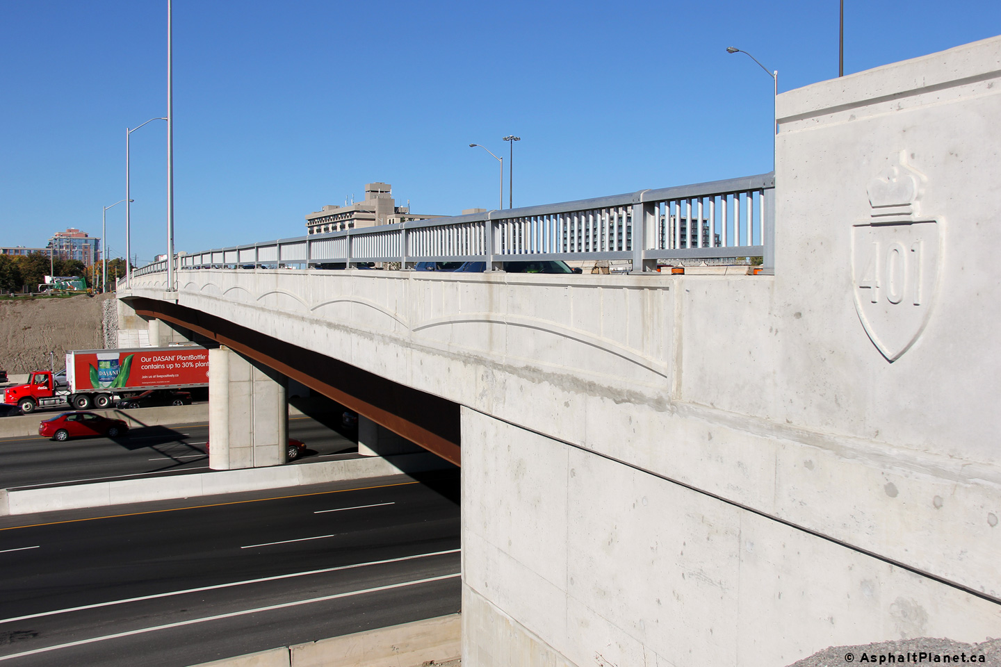
| City of Toronto |
View looking northeasterly at the western facade of the Keele Street
overpass. The Keele Street underpass was replaced during a multi-year
construction project that was completed in 2014. The new Keele Street
overpass is the first overpass to use stamped concrete parapets along the
401 in the Greater Toronto Area. Photo taken: October 23rd, 2014. |
 |
|||
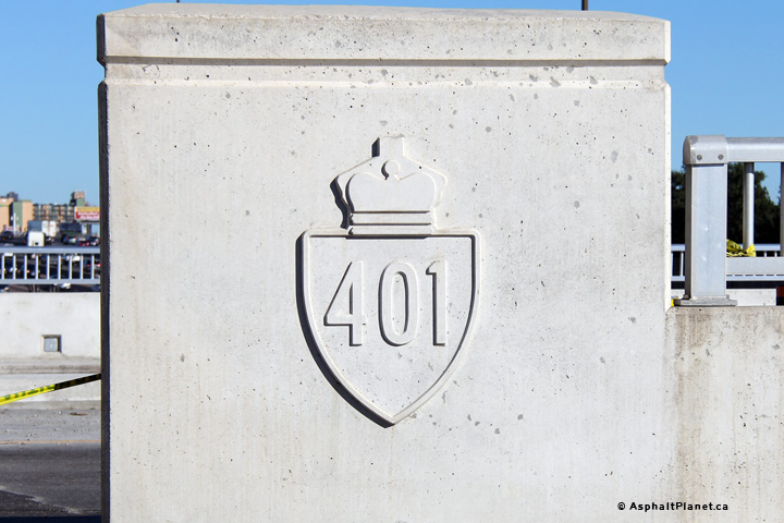
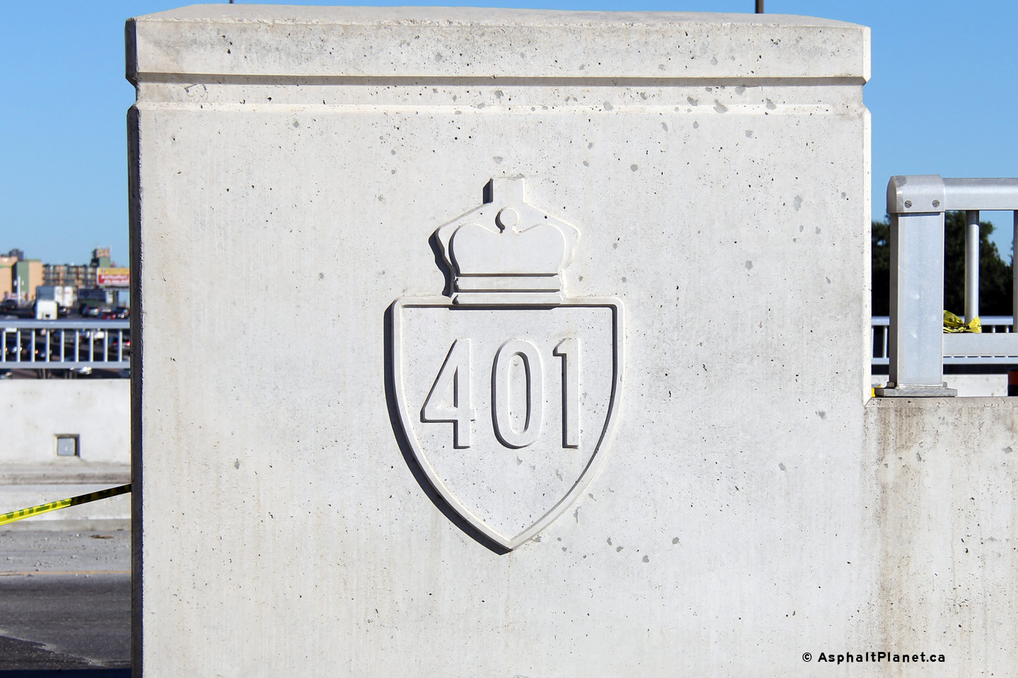
| City of Toronto |
Each of the four parapet walls of the Keele Street overpass have been
stamped with a decorative 401 shield. Photo taken: October 23rd, 2014. |
 |
|||
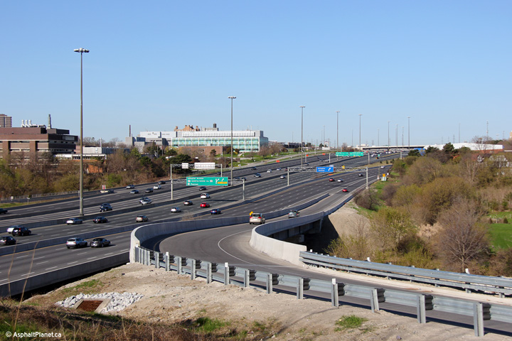
| City of Toronto |
Looking west from the Keele Street overpass. Just out of view in this
photo are both the Basketweave and the Highway 400
interchange. Click here
for an additional view from this vantage point, taken July 23rd, 2006. Photo taken: October 23rd, 2014. |
|
|||
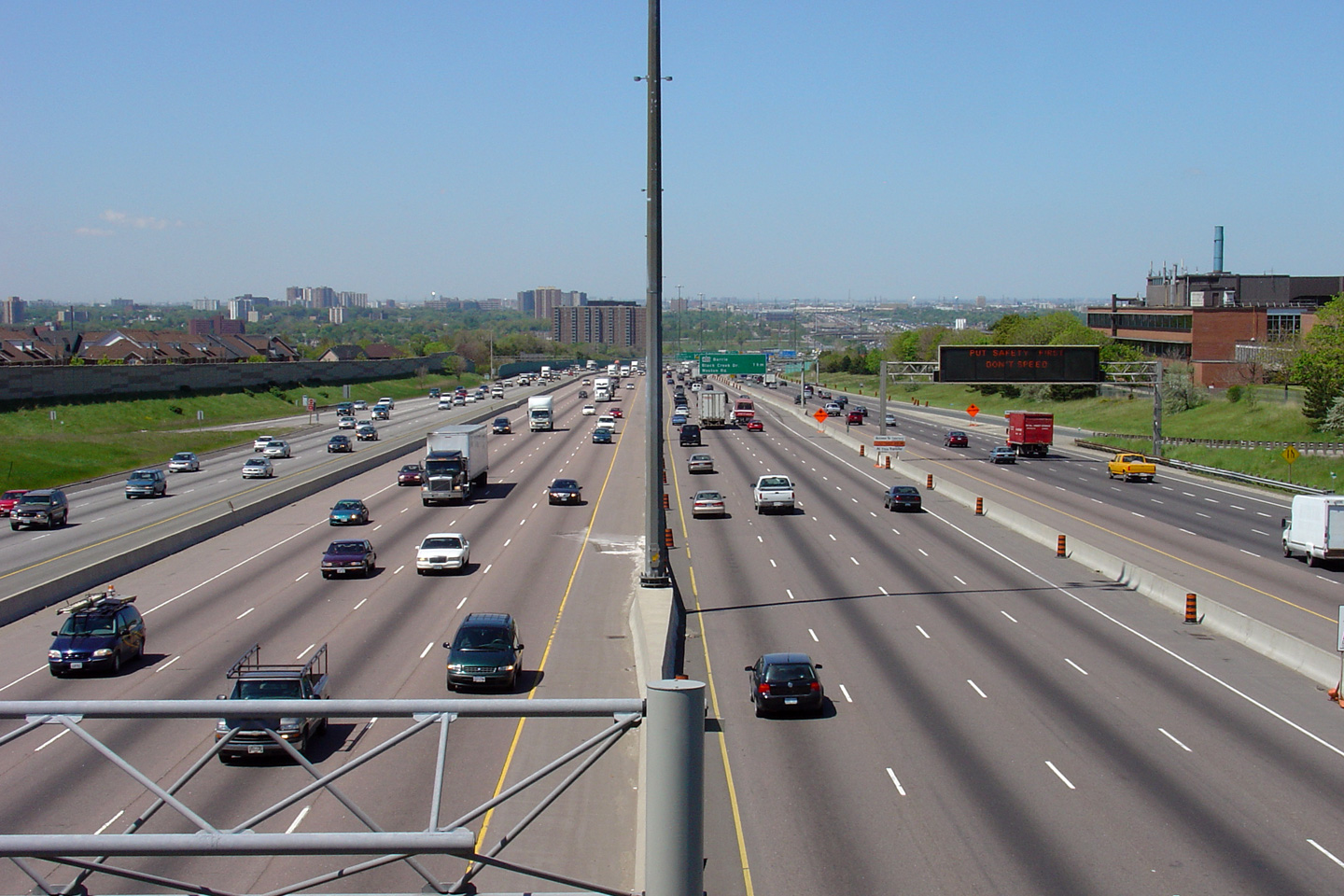
| City of Toronto |
Looking east from the Keele Street overpass along Highway 401. The
stretch of Highway 401 between the Basketweave and the Allen Road was
widened from 12 to 14 lanes over a series of contracts during the early
2000s. Click here
for an additional view from this vantage point, taken July 23rd, 2006. Photo taken: October 23rd, 2014. |
||||
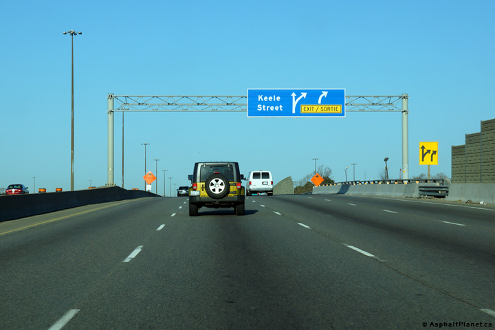
| City of Toronto |
Westbound signage at the off-ramp to Keele Street. Photo taken: May 11th, 2014. |
 (720x480) (720x480)(1440x960) (2400x1600) |
|||
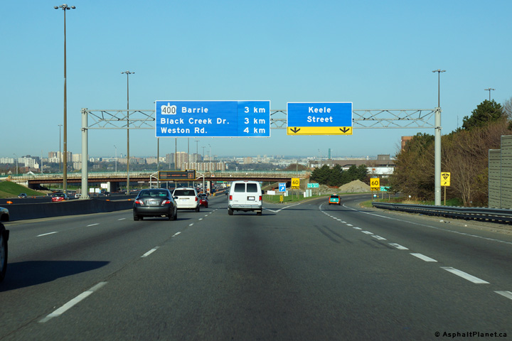
| City of Toronto |
Signage situated overtop of the westbound collector lanes in advance of the
Keele Street interchange. The fourth westbound collector lane that
entered the highway from the Allen Road interchange exits at Keele Street. Photo taken: May 11th, 2014. |
 (720x480) (720x480)(1440x960) (2400x1600) |
|||
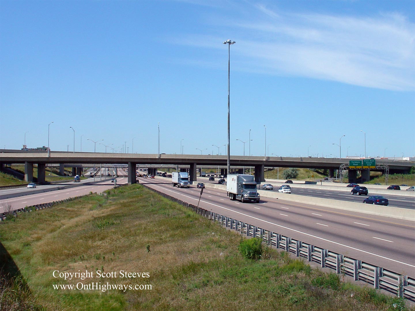
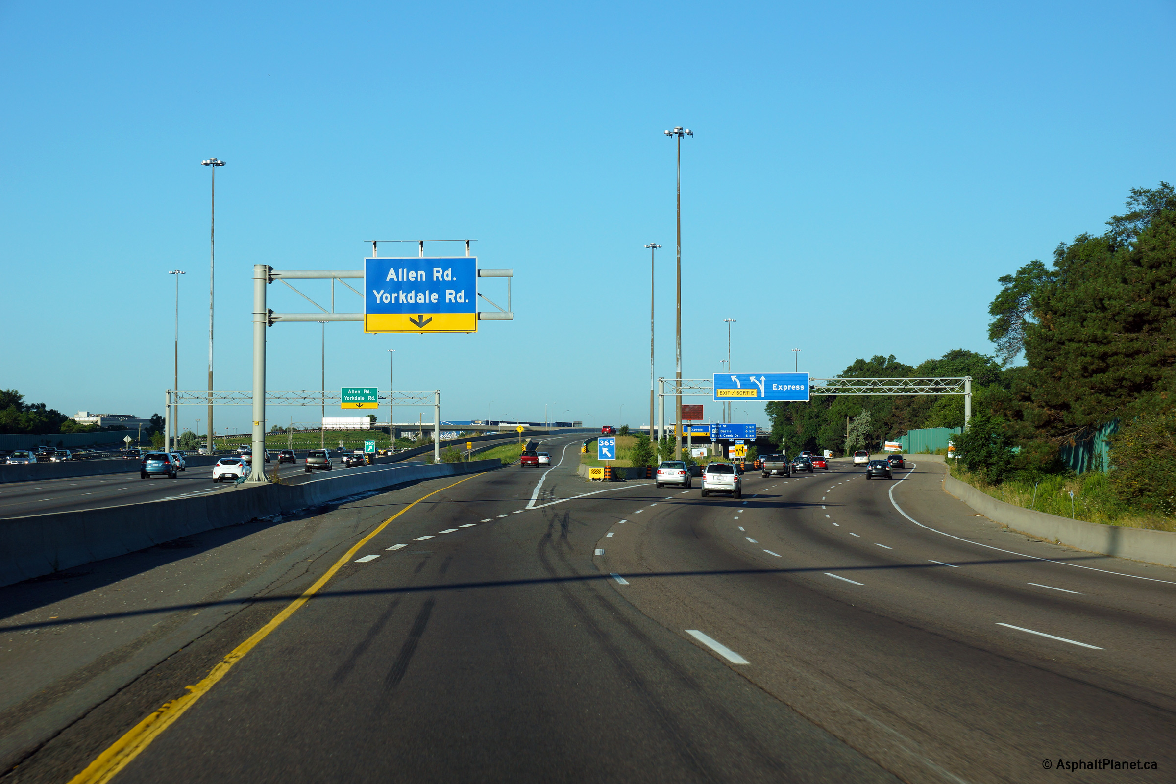
| City of Toronto | The first eastbound transfer beyond the
Basketweave is located at the Allen Road interchange. At this
location, traffic traveling in the Express Lanes is provided access to the
Collector lanes. Photo taken: May 20th, 2013. |
 (720x480) (720x480)(1440x960) (2400x1600) |
|||
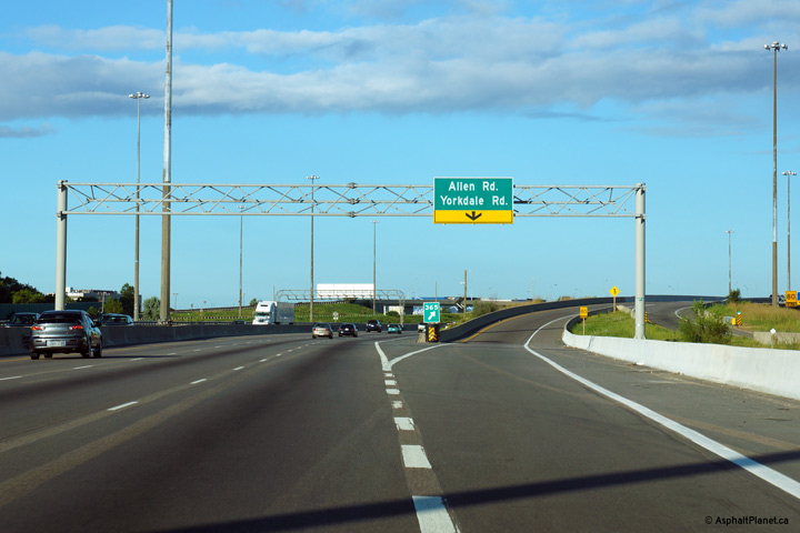
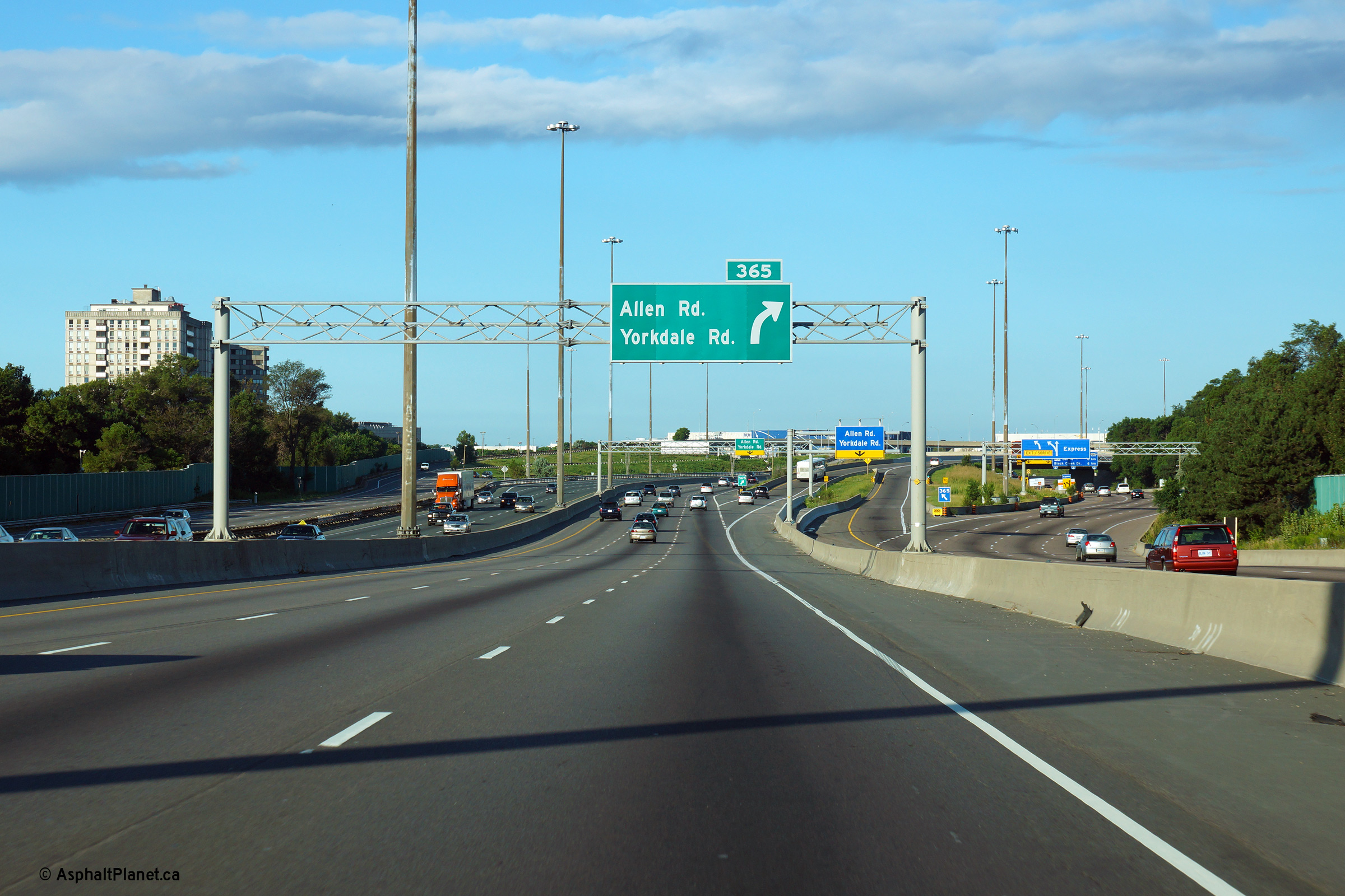
| City of Toronto | An overhead sign for the Allen Road core to
collector transfer has been affixed to the ramp from the Allen to Yorkdale
Road in advance of the bull-nose. The replaced parapet wall on the overhead
structure pictured makes this structure among the least aesthetically
pleasing overpasses along the 401 in the Greater Toronto Area. A
better parapet replacement project would have seen a false curb installed
along the outside of the parapet to mimic typical 1960s and 70s era
structure design. Photo taken: May 20th, 2013. |
 (720x480) (720x480)(1440x960) (2400x1600) |
|||
| City of Toronto | Second pull-through overhead signage for the
Allen Road transfer. From a distance, this overhead sign is obscured by the
Allen Road structures. Photo taken: May 20th, 2013. |
 (720x480) (720x480)(1440x960) (2400x1600) |
|||
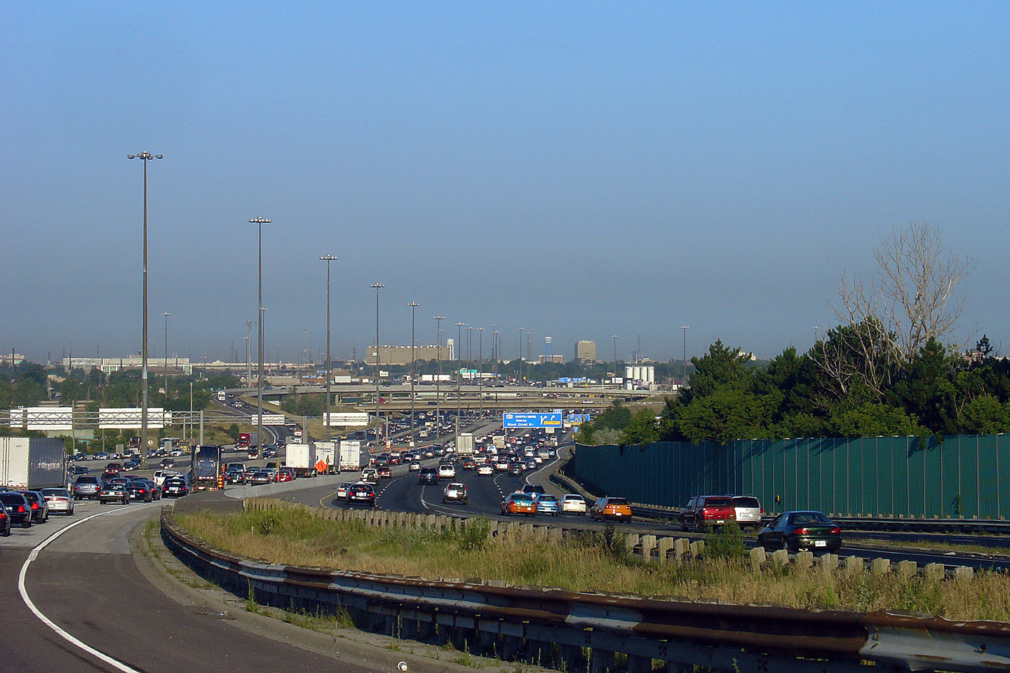
| City of Toronto | View looking westerly towards the Allen Road
interchange along Highway 401. The interchange between Highway 401 and
Allen Road (which at that point was known as the Spandina Expressway) was
the first 3-level freeway to freeway interchange completed in Ontario.
The interchange was completed in 1965. Photo taken: August 25th, 2006. |
 |
|||
| City of Toronto | Looking easterly towards Bathurst Street along
Highway 401. Notice the braided ramp that carries both the Express and
collector westbound ramps to the Allen Road interchange. There are
several direct ramp connections between Allen Road and the Express Lanes. Photo taken: August 12th, 2006. |
 |
|||
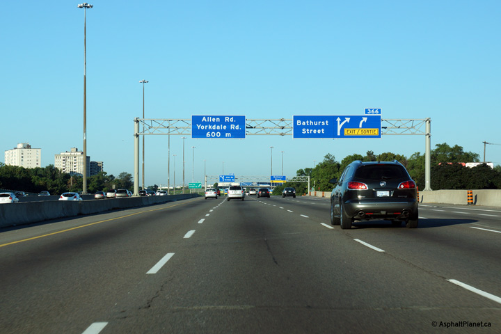
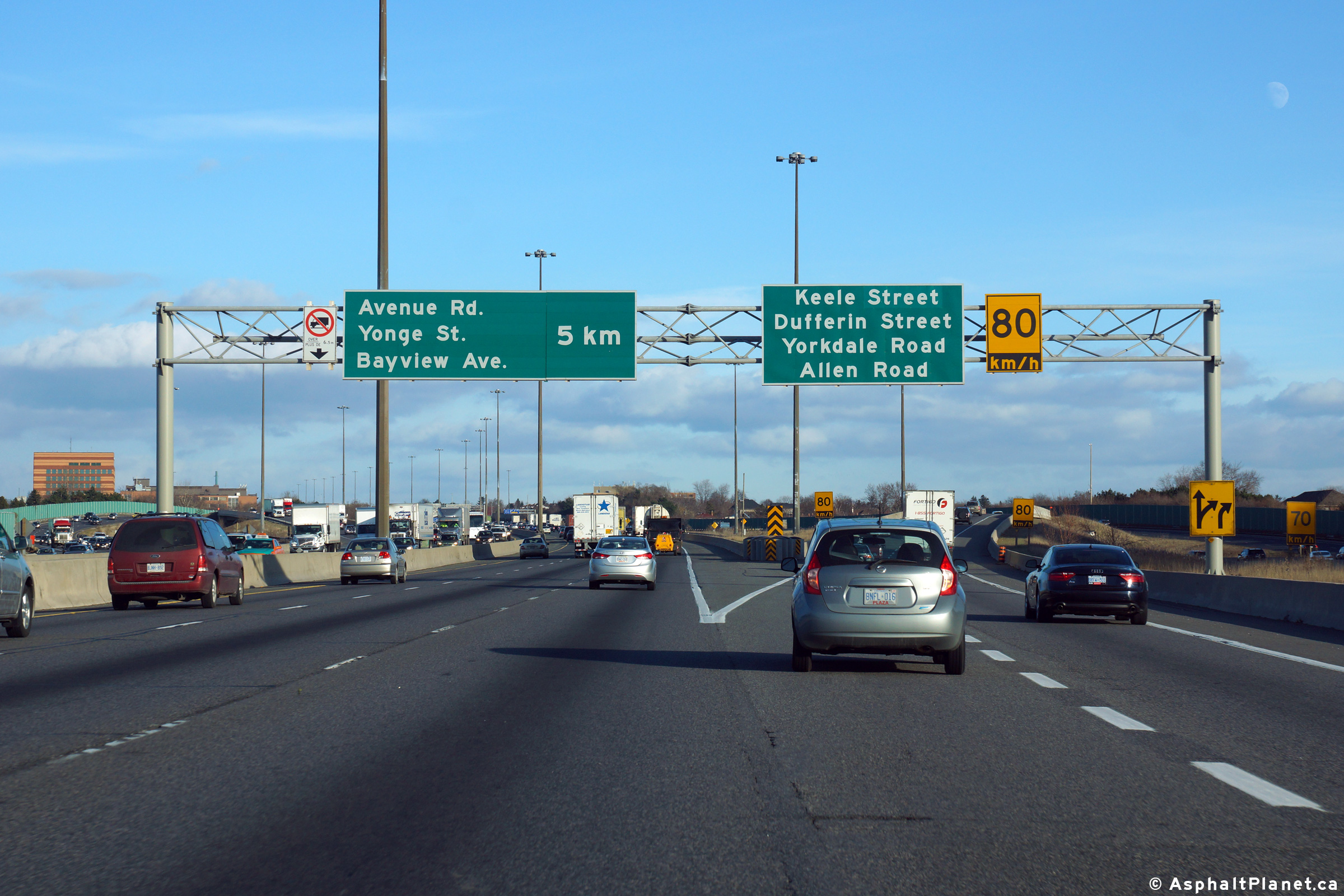
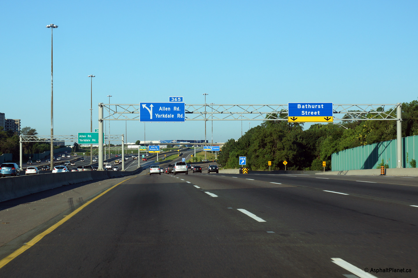
| City of Toronto |
Signage in both the westbound Express and Collector Lanes for the exit to
Allen and Yorkdale Roads. The ramps from both the Express and
Collector Lanes converge into a single ramp in between the Express and
Collector Lanes before passing overtop of the Collector lanes and splitting
into ramps to Yorkdale Road and Allen Road north and south. Upper (Express Lanes) photo taken: August 4th, 2013. Lower (Collector Lanes) photo taken: August 3rd, 2013. |
 (720x480) (720x480) |
|||
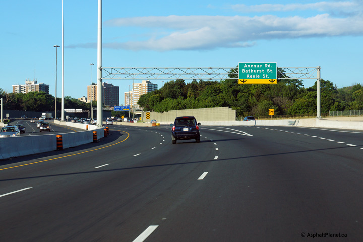
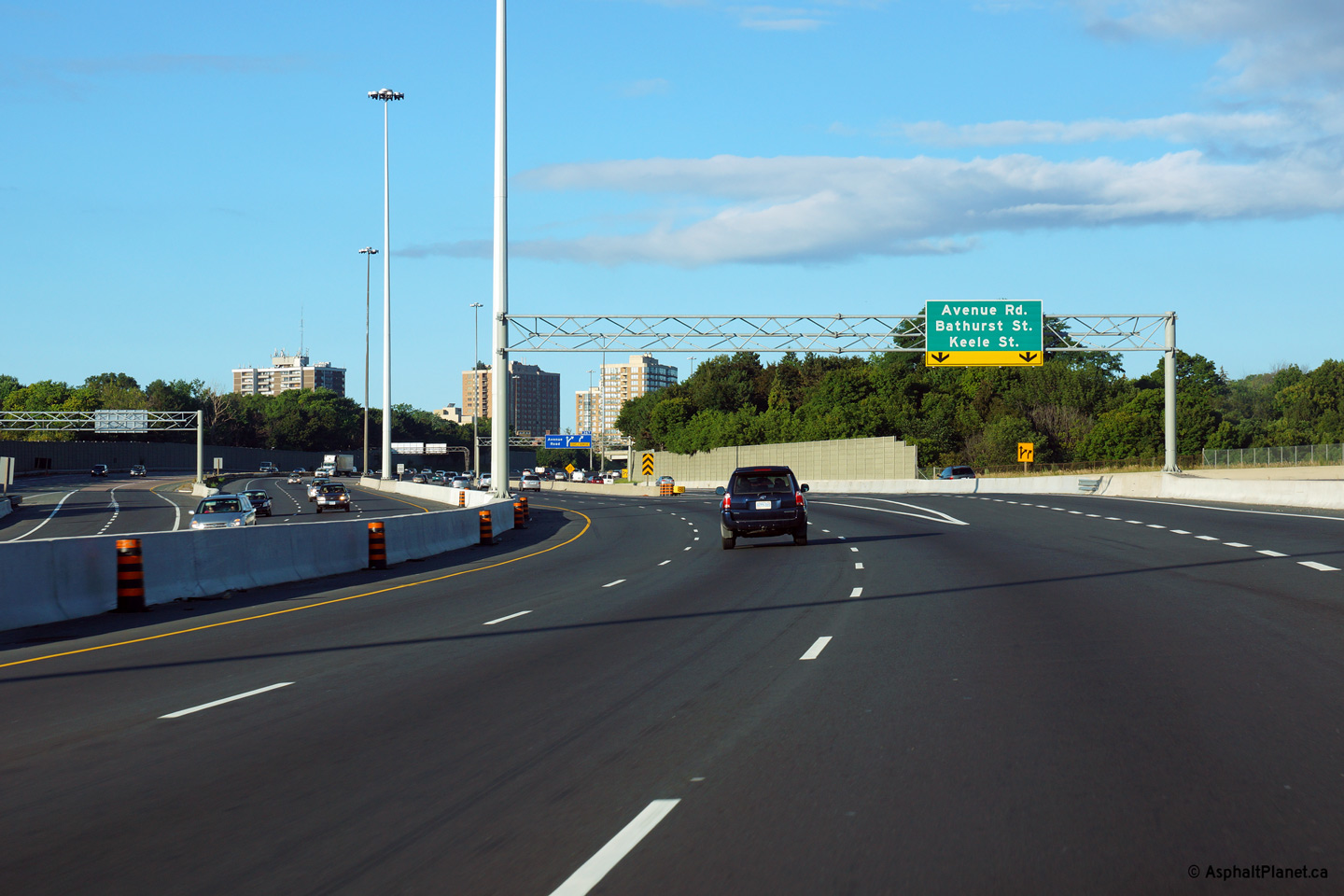
| City of Toronto | Advanced signage for the Allen and Yorkdale
Roads from both the Express and Collector Lanes. The advanced signage
for the Allen / Yorkdale Road exit from the Collector Lanes is signed at the
exit to Bathurst Street. Upper (Express Lanes) photo taken: August 4th, 2013. Lower (Collector Lanes) photo taken: August 3rd, 2013. |
 (720x480) (720x480) |
|||
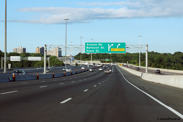
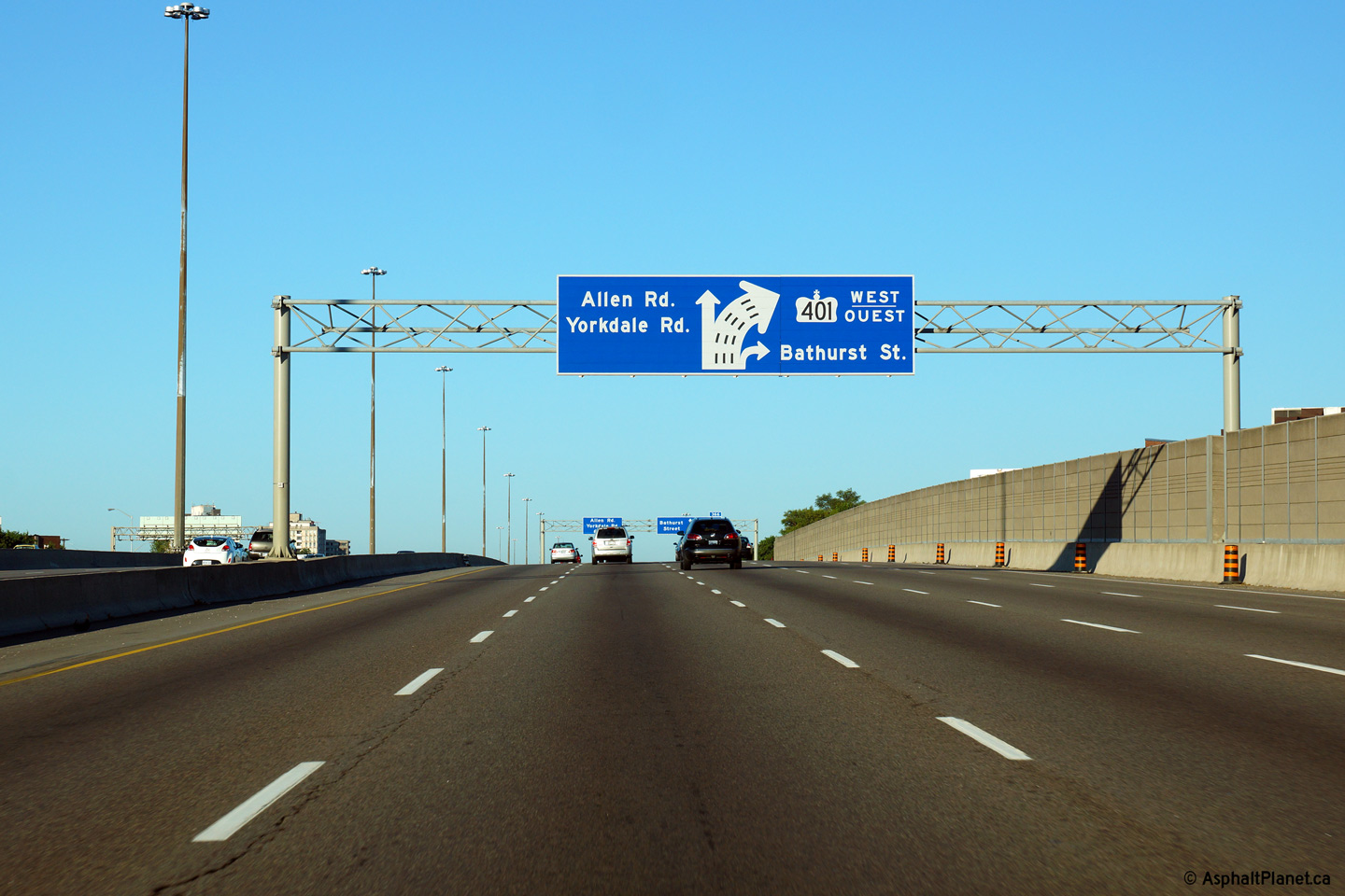
| City of Toronto |
Advanced signage for the ramps to both Allen and Yorkdale Roads as well as
for Bathurst Street. Unlike US Interstates, left exits are signed
fairly simply on Ontario's highways. Photo taken: August 4th, 2013. |
 (720x480) (720x480)(1440x960) (2400x1600) |
|||
| City of Toronto |
Westbound diagram sign in the collector lanes informing traffic of the next
two exits along the collector lanes. It is unusual for an exit ramp to
depart from the left side of the collector lanes, so extra signage was
installed to inform drivers that the ramp to the left is in fact an exit,
and not a transfer to the Express lanes. Photo taken: August 4th, 2013. |
 (720x480) (720x480)(1440x960) (2400x1600) |
|||
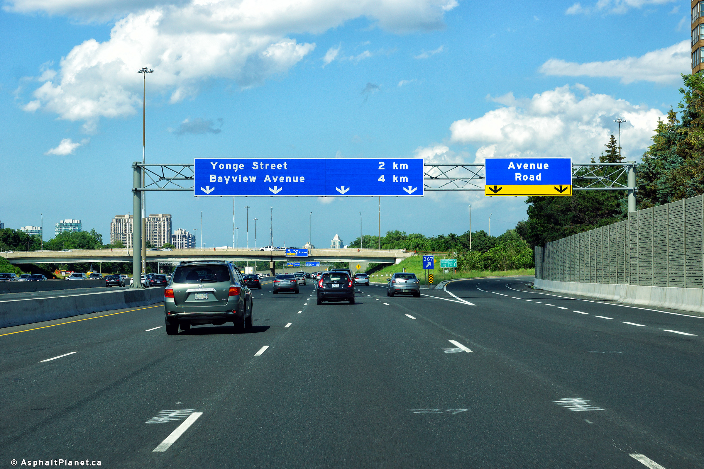
| City of Toronto |
Eastbound changeable message sign along the collector lanes of Highway 401
in advance of the Avenue Road interchange. The changeable message
signage was replaced during the contract that saw an extra eastbound
collector lane added east of Allen Road. Upper photo taken: July 21st, 2011. Lower photo taken: July 2nd, 2017. |
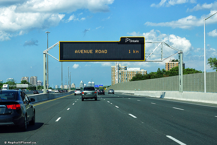 (720x480) (720x480)(1440x960) (2400x1600) |
|||
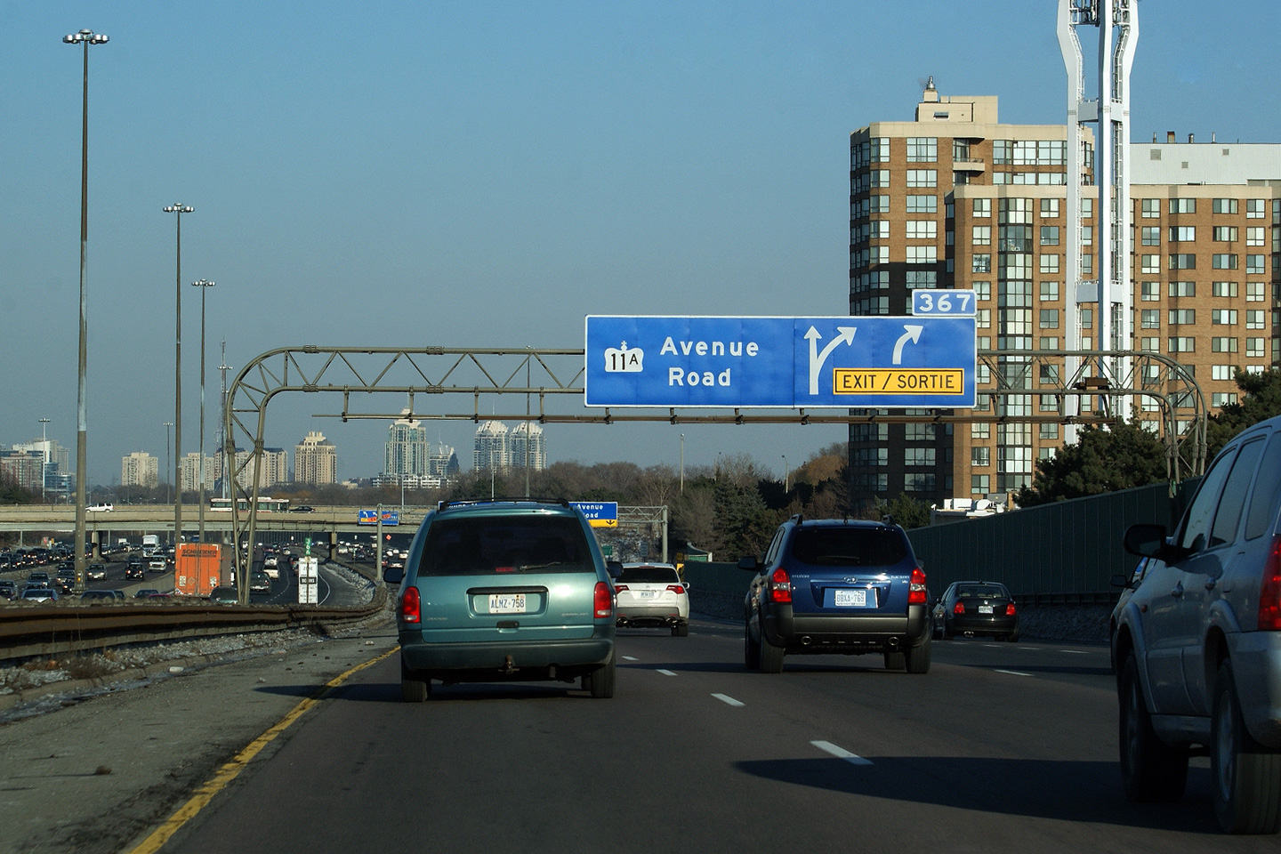
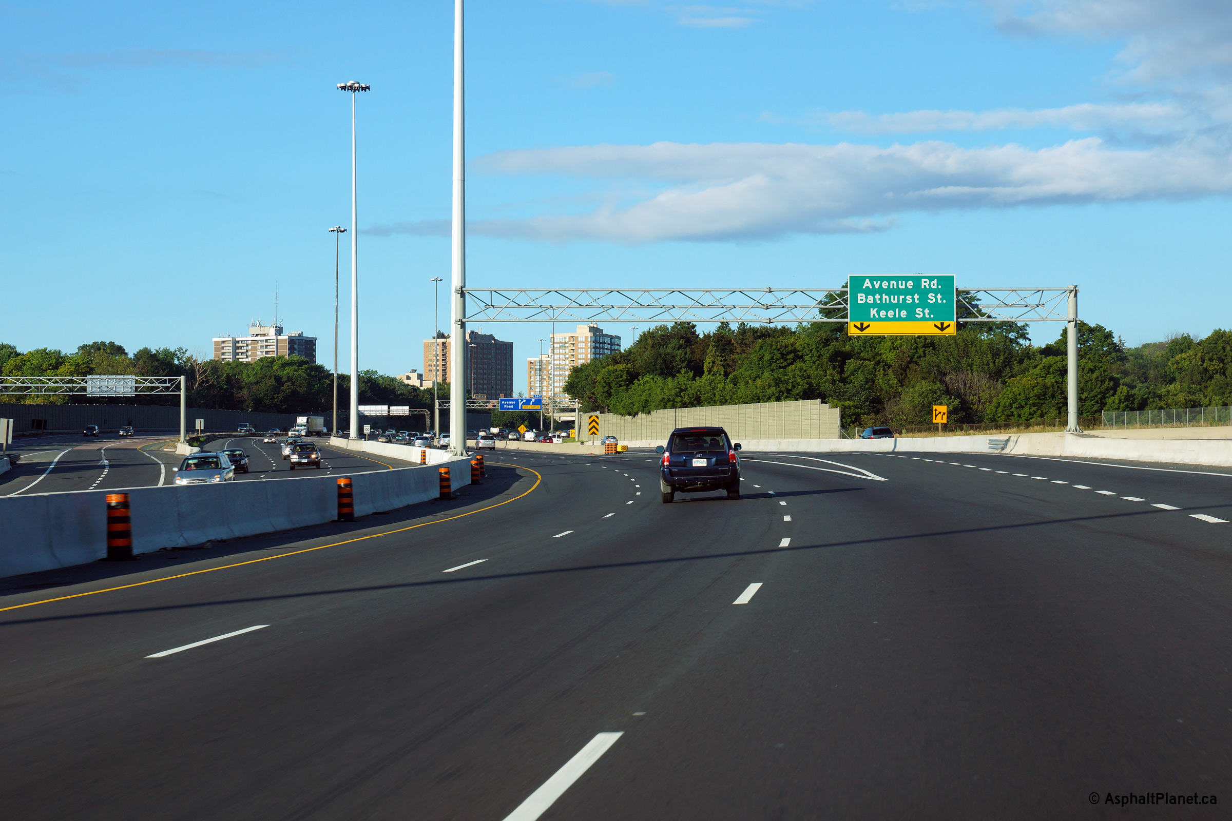
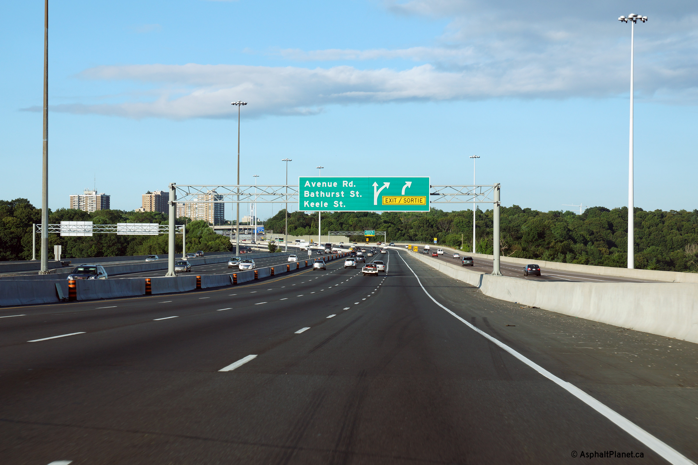
| City of Toronto |
View looking easterly in the collector lanes at what has quickly become one
of the last Highway 11A shields along the 401. Rounded truss gantries
supporting signage still featuring now defunct highway numbers (as pictured)
are quickly finding their way to the scrap piles. The rounded
truss (Type 1) gantry at this interchange was removed during a
reconstruction project that was completed late in 2016. Upper photo taken: May 19th, 2009. Lower photo taken: July 2nd, 2017. |
 (720x480) (720x480)(1440x960) (2400x1600) |
|||
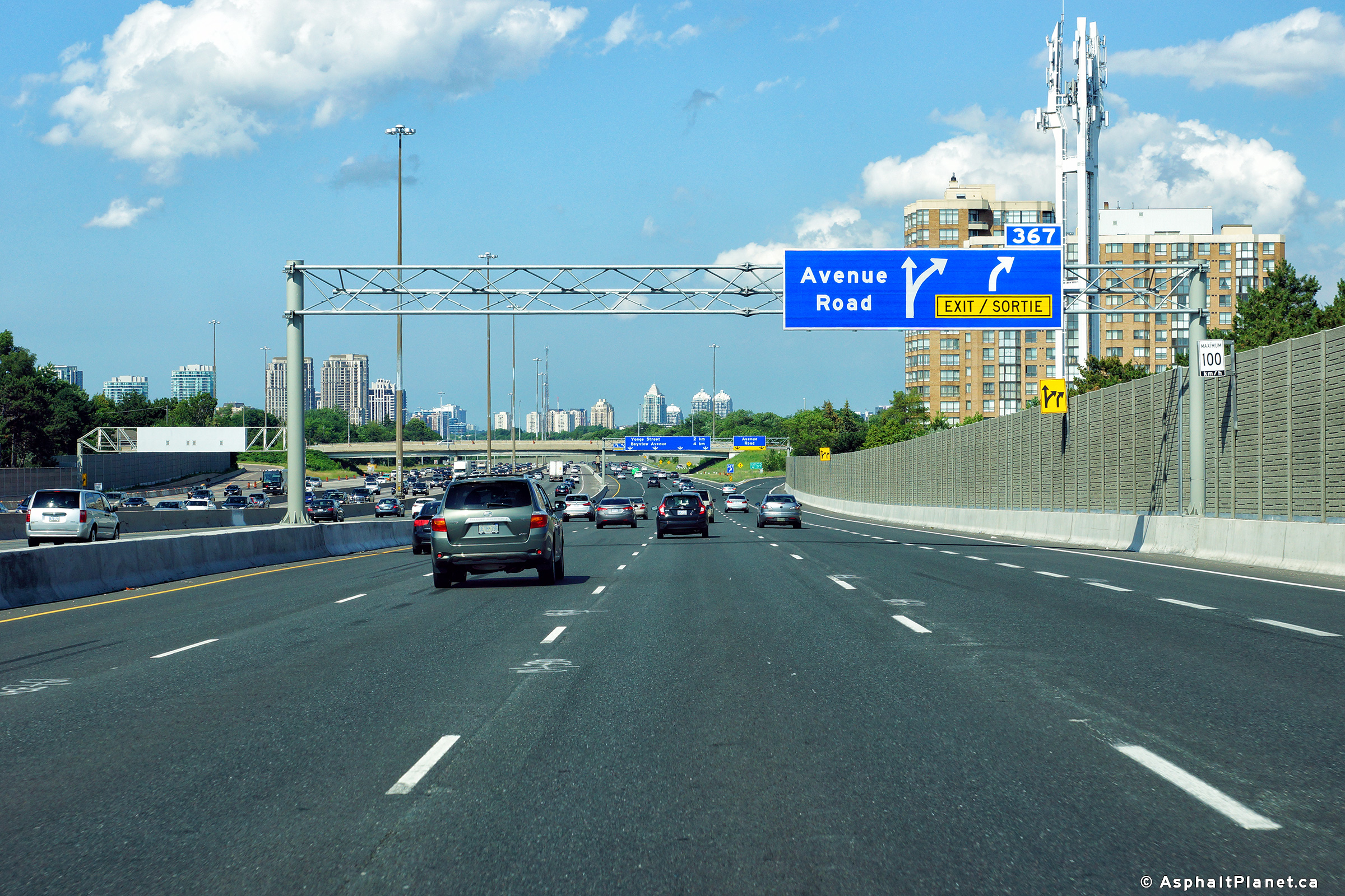
| City of Toronto |
View looking easterly in the collector lanes at the off-ramp to Avenue Road. Photo taken: July 2nd, 2017. |
 (720x480) (720x480)(1440x960) (2400x1600) |
|||
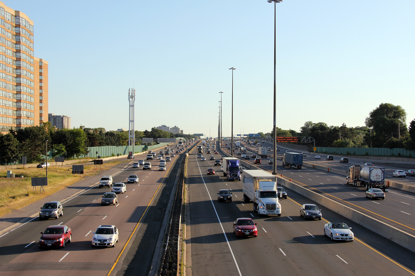
| City of Toronto |
Two photo that show Highway 401 as seen from the west side of the Avenue Road overpass in Toronto. The westbound Express lanes were being resurfaced at the time that these photos were taken.
Photos taken: July 13th, 2011. |
(720x480) (1440x960) (2400x1600)
|
|||
| Highway 11A was downloaded in 1997, but served as a useful alternate to Highway 11 into Downtown. Click here for Highway 11A images. | |||||
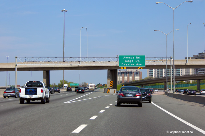
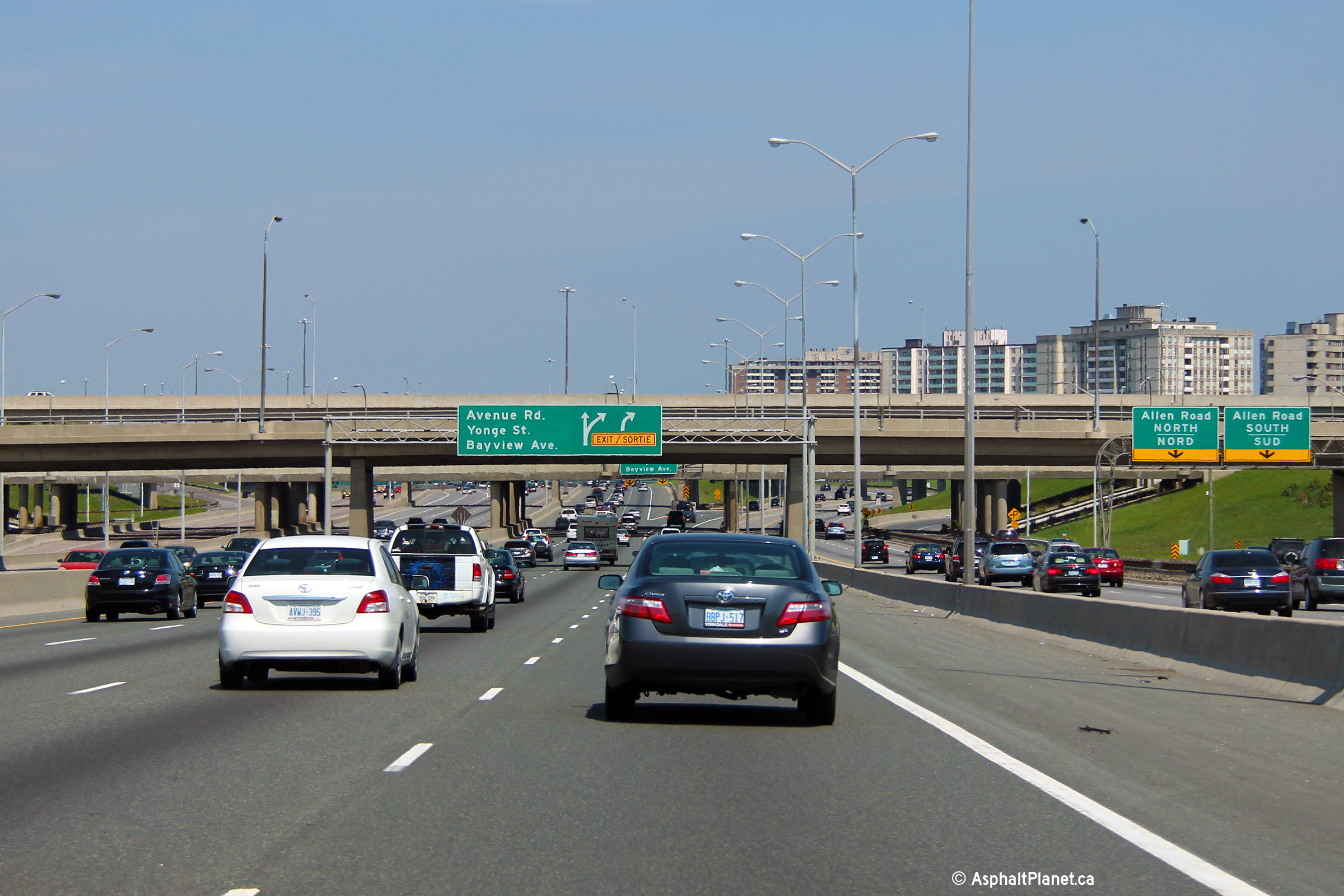
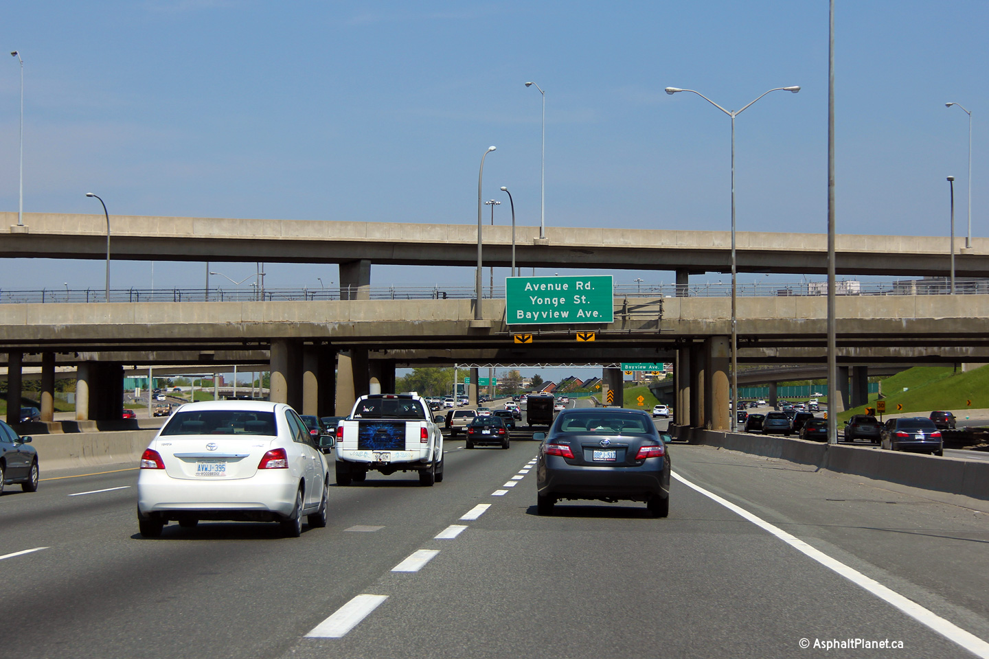
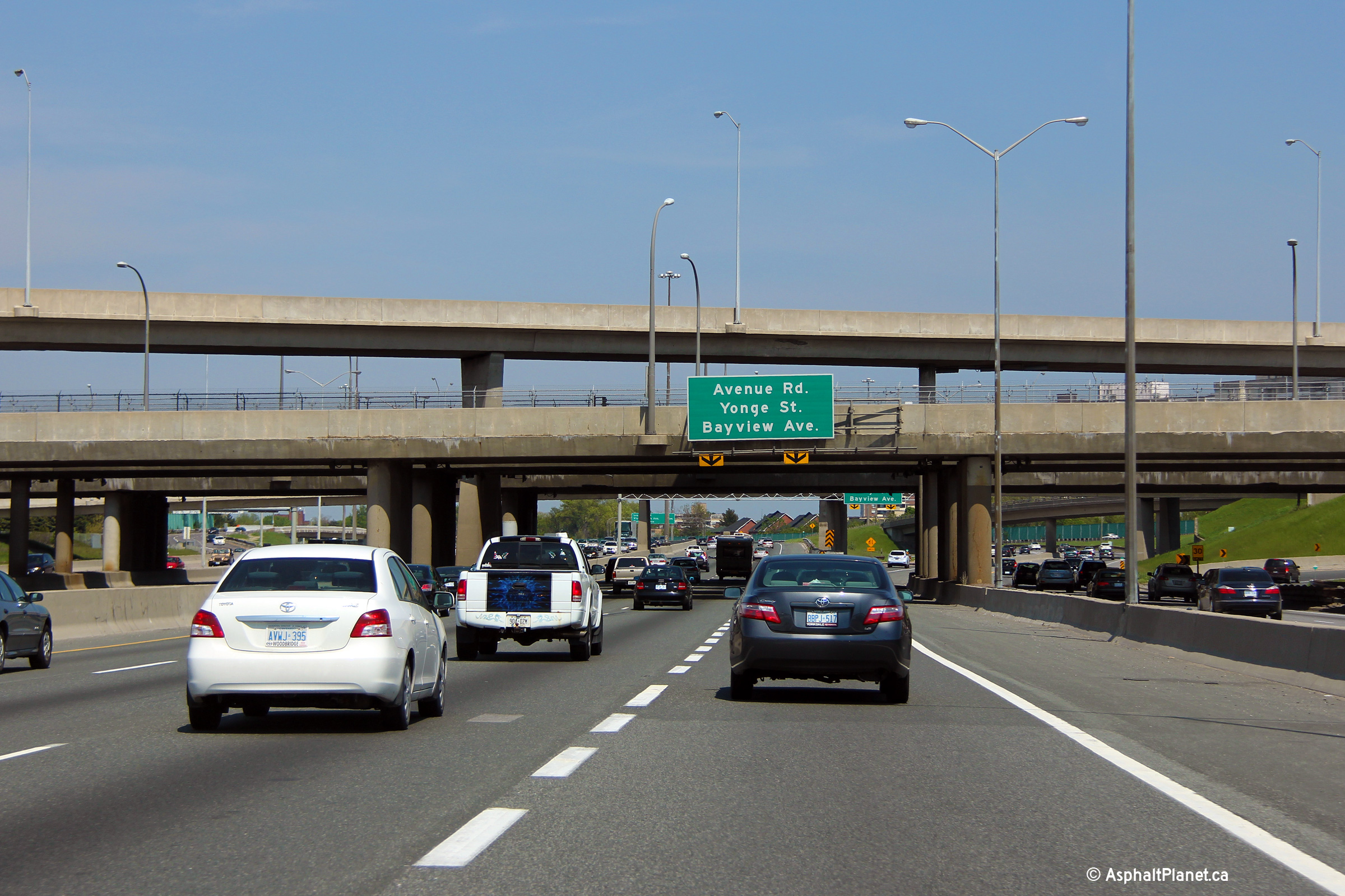
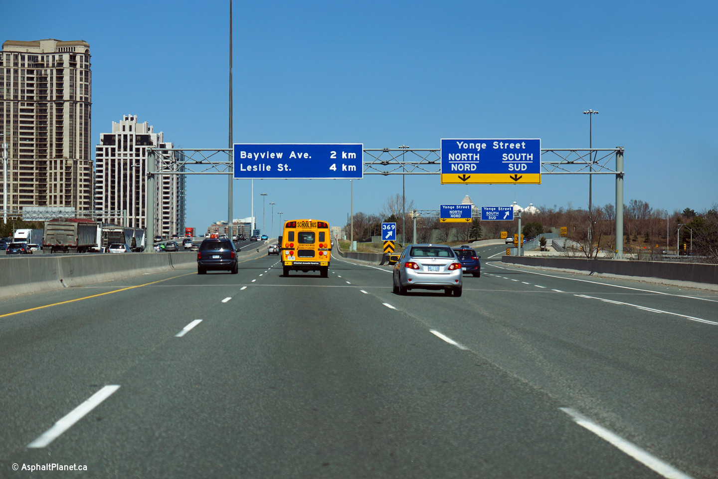
| City of Toronto |
A few photos showing Highway 401 looking east from the Avenue Road (Highway 11A) overpass in North York. The section of freeway surrounding the Avenue Road interchange has the distinction of being the first section of the Toronto By-pass to have been reconstructed as a twelve lane freeway. The 1965 Department of Highways annual report reports that approximately one-mile of new four-carriageway twelve-lane highway was completed by the fall of 1964. While the lane configuration of Highway 401 has changed very little since 1964, the view looking easterly from the Avenue Road structure has. During the 1960s, the Yonge Street corridor (which is starkly visible in today's photos) had none of the high-rise development that can be seen today. It wasn't until 1974 that the Yonge Subway line breached the 401 and was completed to Finch Station, bringing the pictured high-rise development along with it.
Lower two photos taken: March 16th, 2011. |
 (720x480) (1440x960) (2400x1600)
|
|||
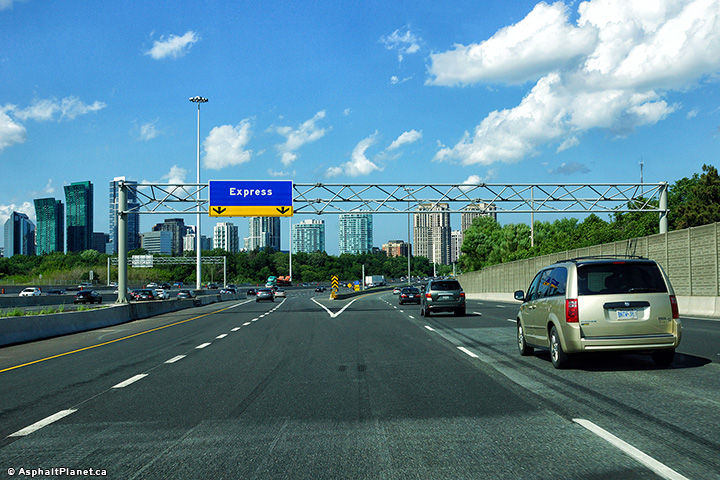
| City of Toronto |
Eastbound signage in advance of the collector to express transfer between
Avenue Road and Yonge Street. Photo taken: July 2nd, 2017. |
 (720x480) (720x480)(1440x960) (2400x1600) |
|||
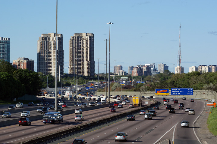
| City of Toronto |
The North York Skyline is visible beyond the overhead signage for the
transfer to the express lanes east of Avenue Road. Photo taken: July 2nd, 2017. |
 (720x480) (720x480)(1440x960) (2400x1600) |
|||
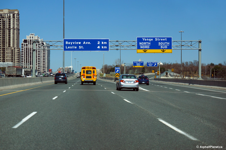
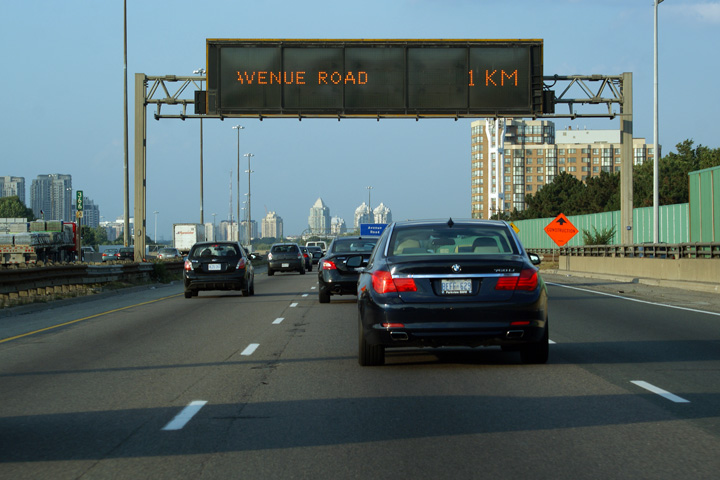
| City of Toronto |
Advanced signage for the eastbound off-ramp from the collector lanes to Yonge Street. Photo taken: July 2nd, 2010. |
 (720x480) (720x480)(1440x960) (2400x1600) |
|||
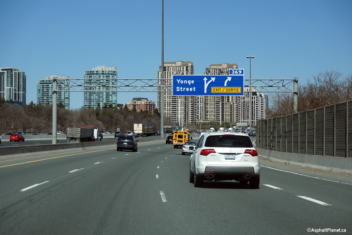
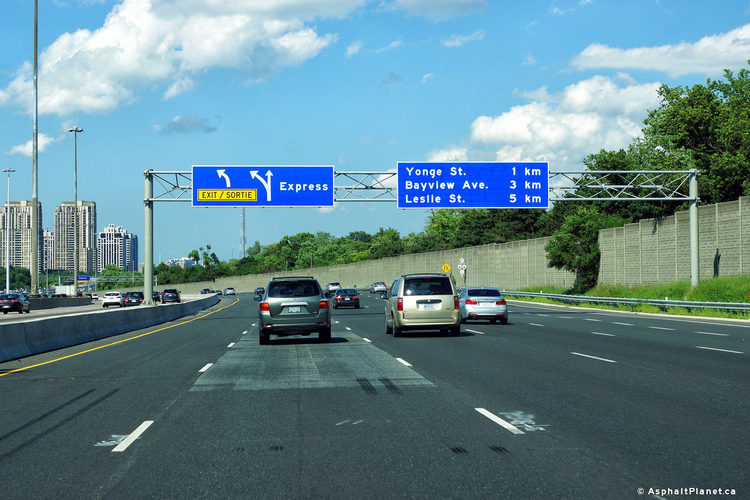
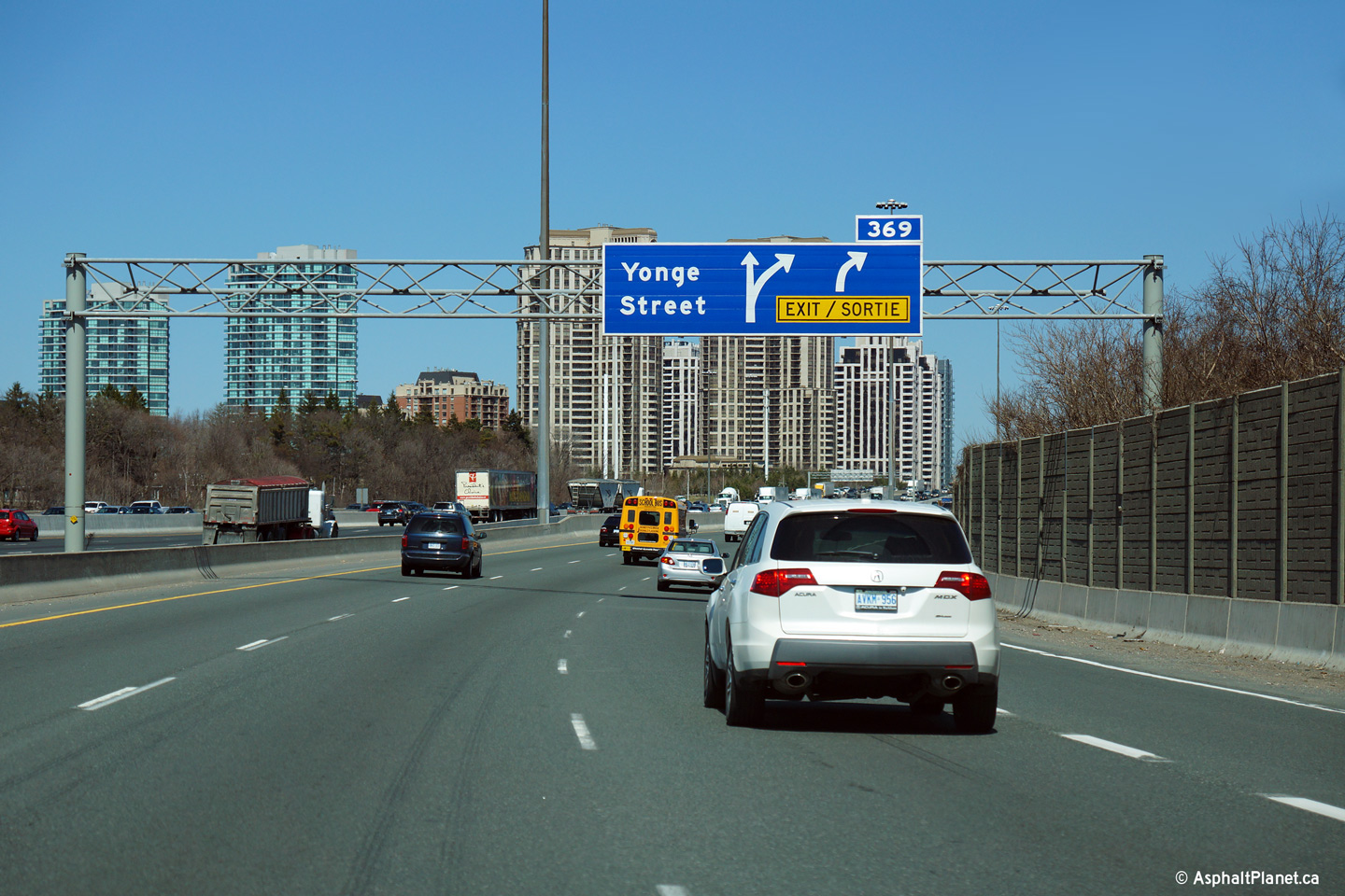
| City of Toronto |
Overhead signage for the Yonge Street exit. The 401 does not meet
Yonge Street at a standard parclo-interchange; a semi-directional ramp
carries traffic from Highway 401 east directly to northbound Yonge Street in
North York. Photo taken: July 2nd, 2010. |
 (720x480) (720x480)(1440x960) (2400x1600) |
|||
| City of Toronto | Westerly view at the Express to Collector
transfer at the western edge of the Hogg's Hollow Bridge over the Don River.
Click here for a similar view taken
from the Collector lanes in May, 2007, before construction to rehabilitate
the Hogg's Hollow Bridges had been complete; this photo shows the highway
when it still had steel beam barrier and conventional mast truss lighting. Photo taken: August 4th, 2013. |
 (720x480) (720x480)(1440x960) (2400x1600) |
|||
| City of Toronto |
Westerly view at the advanced signage for the Hogg's Hollow transfer.
This photo was taken shortly after a near decades long construction project
had been completed to rehabilitate each of the three (formerly four)
high-level structures that cross the deep ravine. Click
here for a view taken in May, 2007,
that looks west across the eastbound collector lanes during the rehab
project. Photo taken: August 4th, 2013. |
 (720x480) (720x480)(1440x960) (2400x1600) |
|||
| Before Highway 11 was truncated north of Barrie in 1997, Highway 11 followed Yonge Street through Toronto. Click here for Highway 11 images. | |||||
| Click here for North York to Scarborough Images | |||||
<- Page 8 Images Highway 401 Images Index Page 10 Images ->
<- Highway 400 Images Back to Highway 401 Highway 402 Images ->
Copyright (c) 2004-2014, AsphaltPlanet.ca AsphaltPlanet@asphaltplanet.ca


 (720x480)
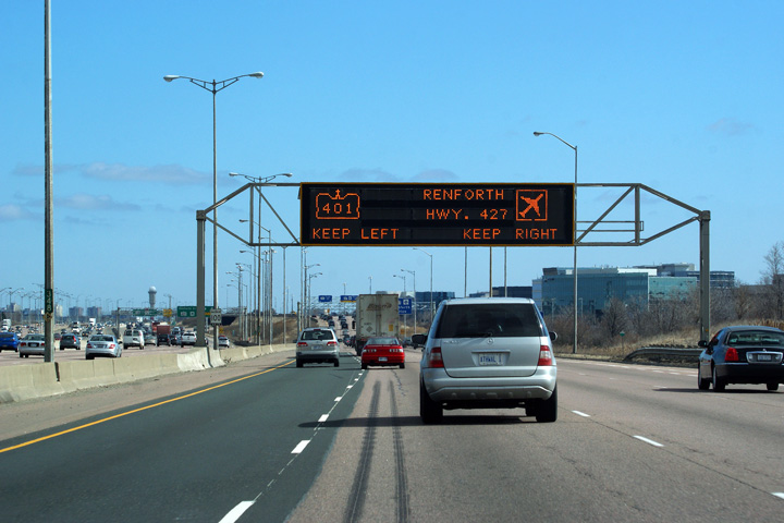 (720x480)
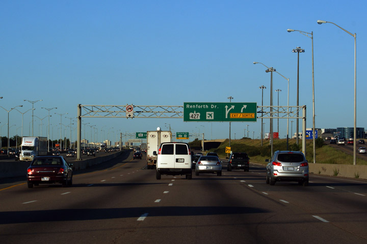


 (720x480)


