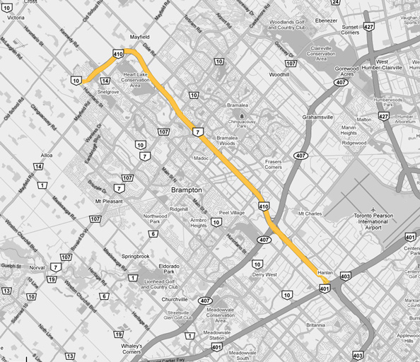
AsphaltPlanet.ca > OntHighways > Highway 410 > Images
King's Highway 410 - Images
Photos shown in this table are arranged from South to North:
| Proper Municipality Name | Photo Description | Photo | ||||
|
Photos taken from driver's perspective appear offset from centre-line Photos: |
North- Bound |
South- Bound |
||||
|
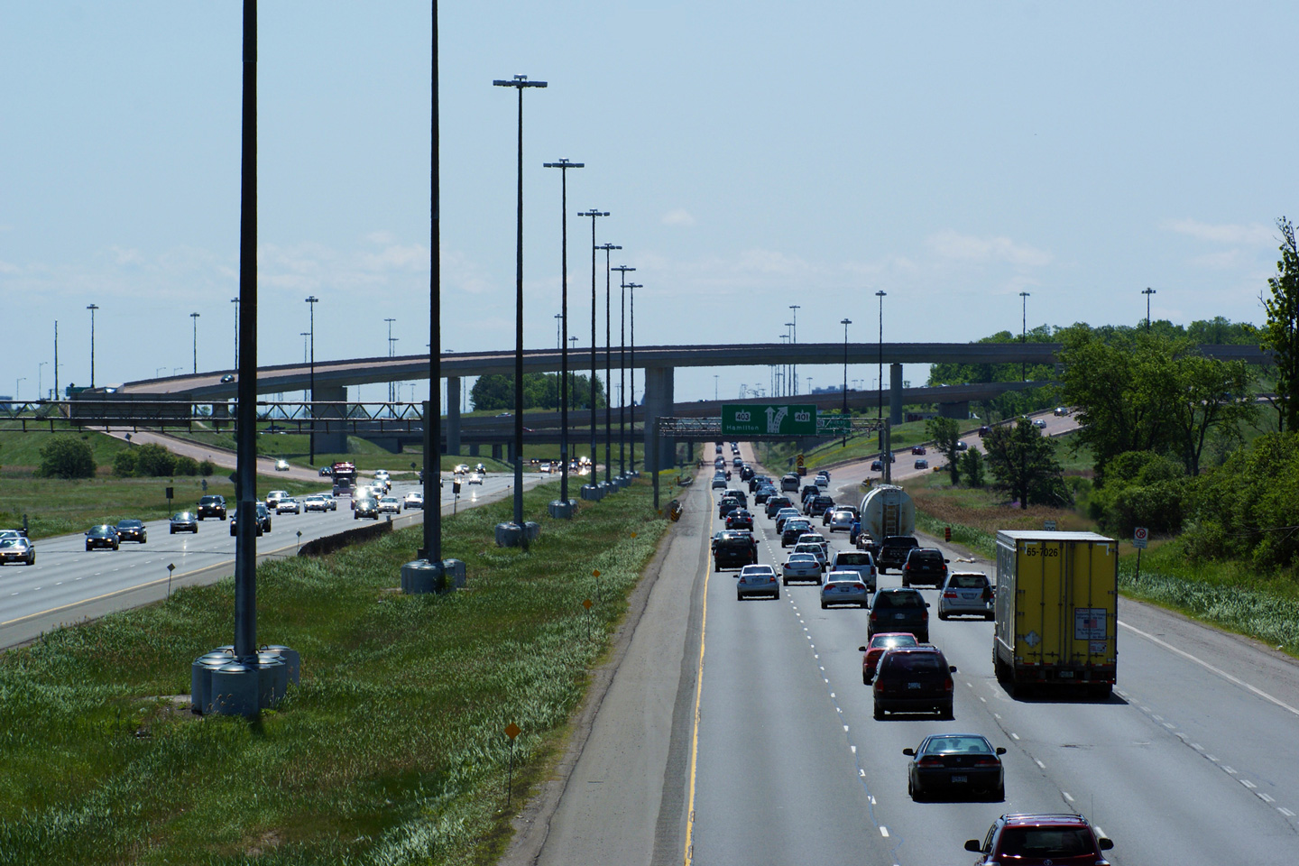
Highway 410 ends at a very large
interchange with Highway 401 and Highway 403. Click here for photos of Highway 401 West of Highway 410, and here for photos of Highway 401 east of Highway 410. Click here for Highway 403 images. |
||||||
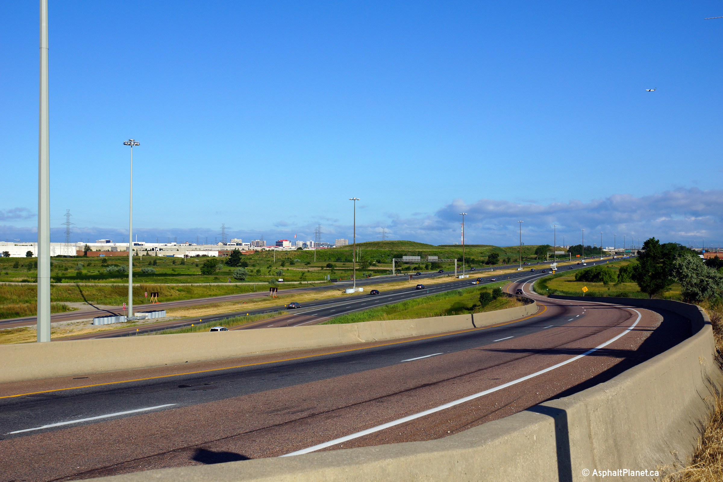
| City of Mississauga Regional Municipality of Peel |
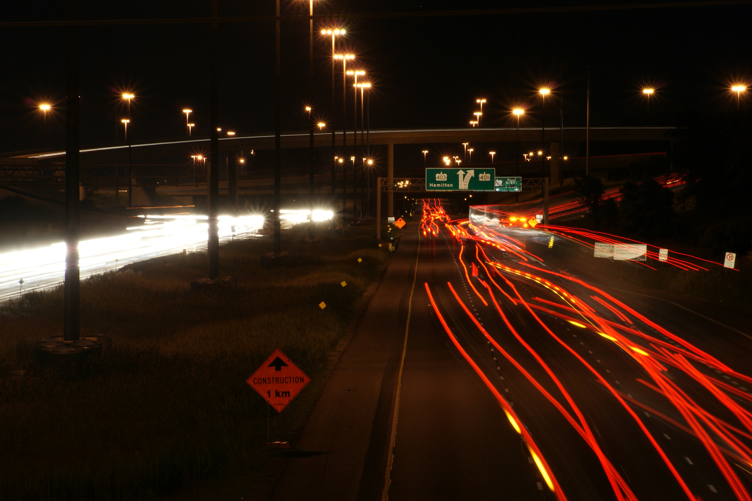
Northerly view along along Highway 410 from high atop the high-speed flyover
that carries traffic from Highway 401 eastbound to Highway 410 northbound. Photo taken: May 17th, 2012. |
 (720x480) (1440x960) (2400x1600) |
||||
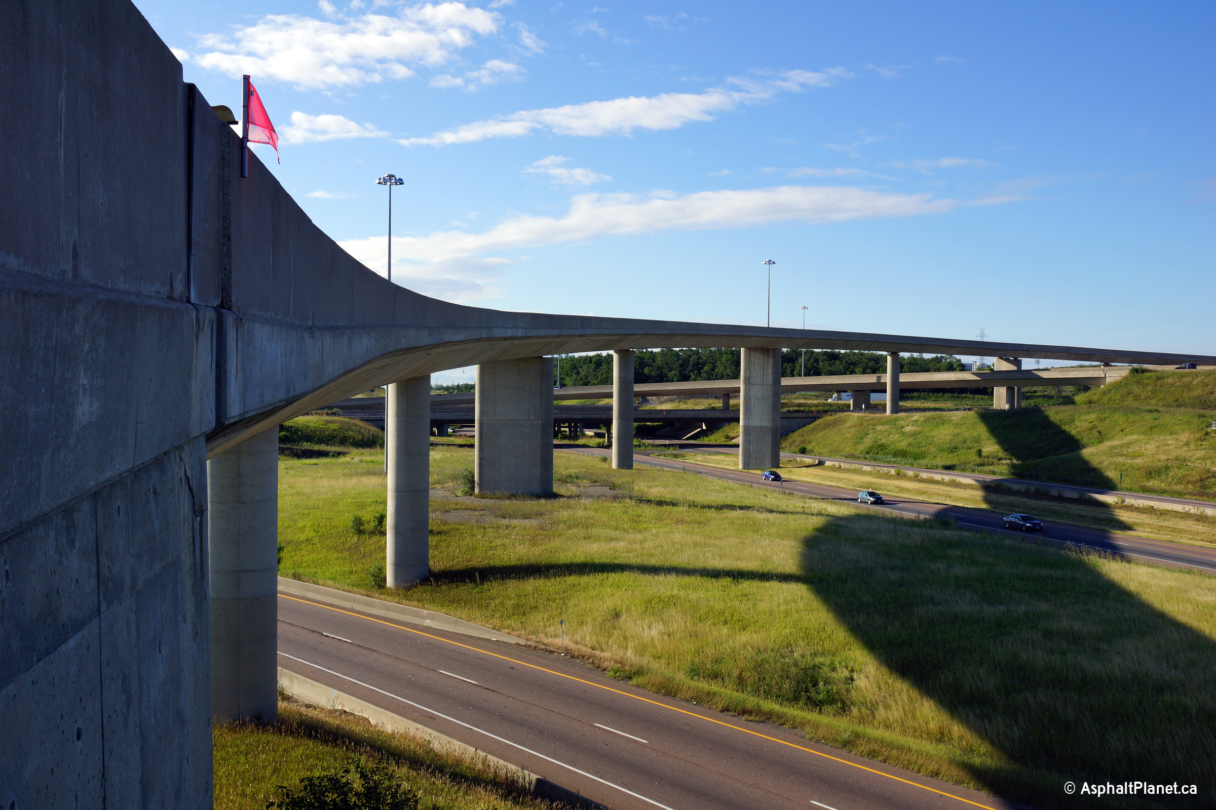
| City of Mississauga Regional Municipality of Peel |
Two views looking southerly at the high-speed flyover that carries traffic from the eastbound 401 to Highway 410 northbound. This high level structure is one of the longest elevated expressway ramps in all of Ontario. Photos taken: August 4th, 2013. |
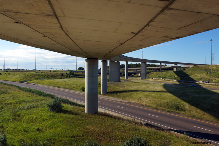 (720x480) (1440x960) (2400x1600)  (720x480) (1440x960) (2400x1600) |
||||
| City of Mississauga Regional Municipality of Peel |
Northerly view along Highway 410 from the flyover ramp that carries traffic
from the eastbound 401 to Highway 410 northbound. Photo taken: August 4th, 2013. |
 (720x480) (1440x960) (2400x1600) |
||||
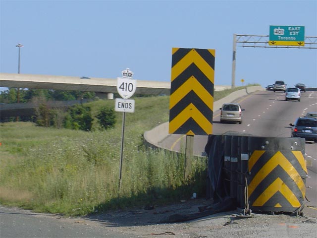
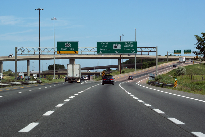
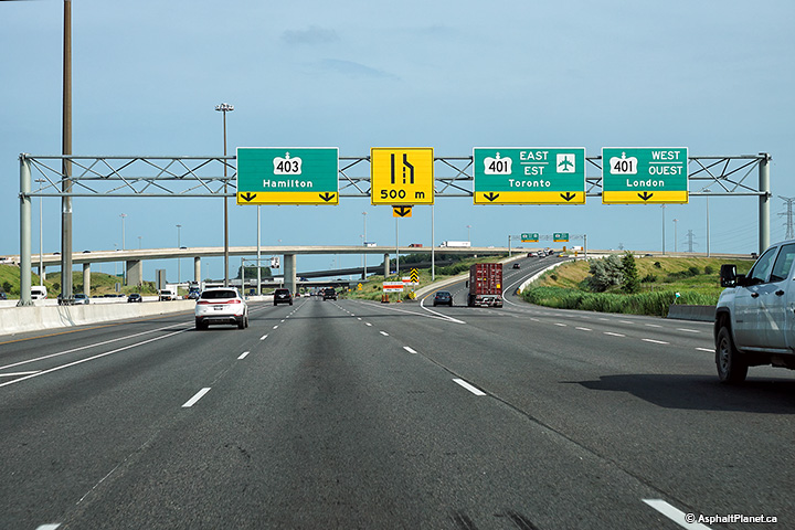
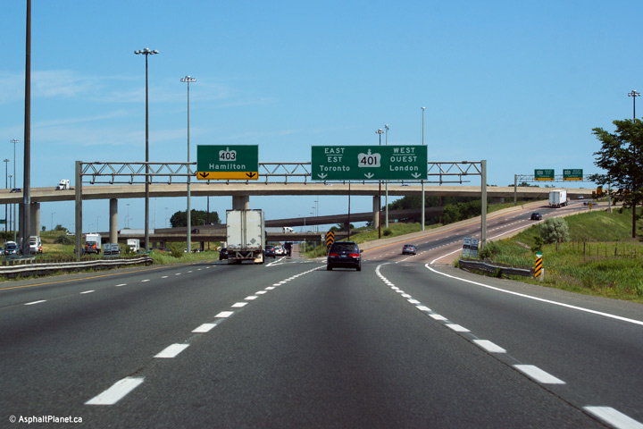
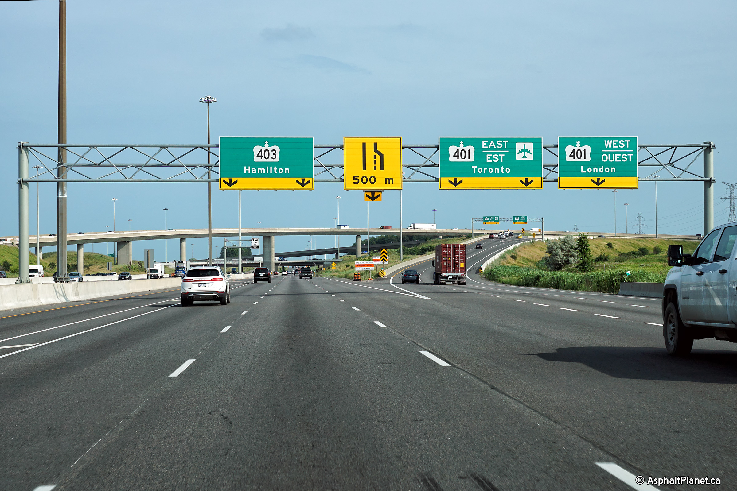
| City of Mississauga Regional Municipality of Peel |
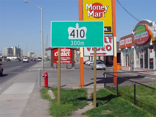
Signage denoting the southern terminus of Highway 410 at the Highway 401/403
interchange. Photo taken: August 2nd, 2004. |
 |
||||
| City of Mississauga Regional Municipality of Peel |
Signage at the southern terminus of Highway 410 at the Highway 401 interchange. This signage does an excellent job of conveying that the centre exiting lane for Highway 401 is a decision lane where motorists can access either the east or westbound lanes of Highway 401. Similar signage formerly existed along Highway 404 approaching the 401 before the HOV lane was added. Photo taken: July 2nd, 2010. |
|
||||
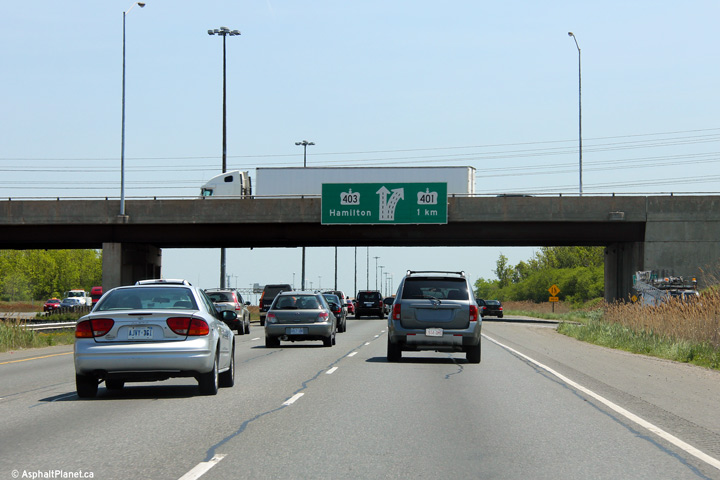
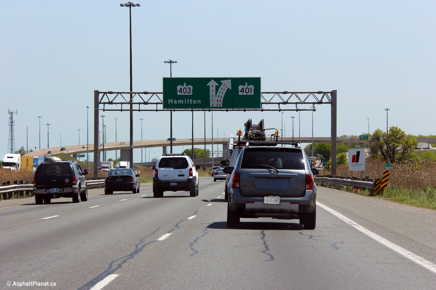
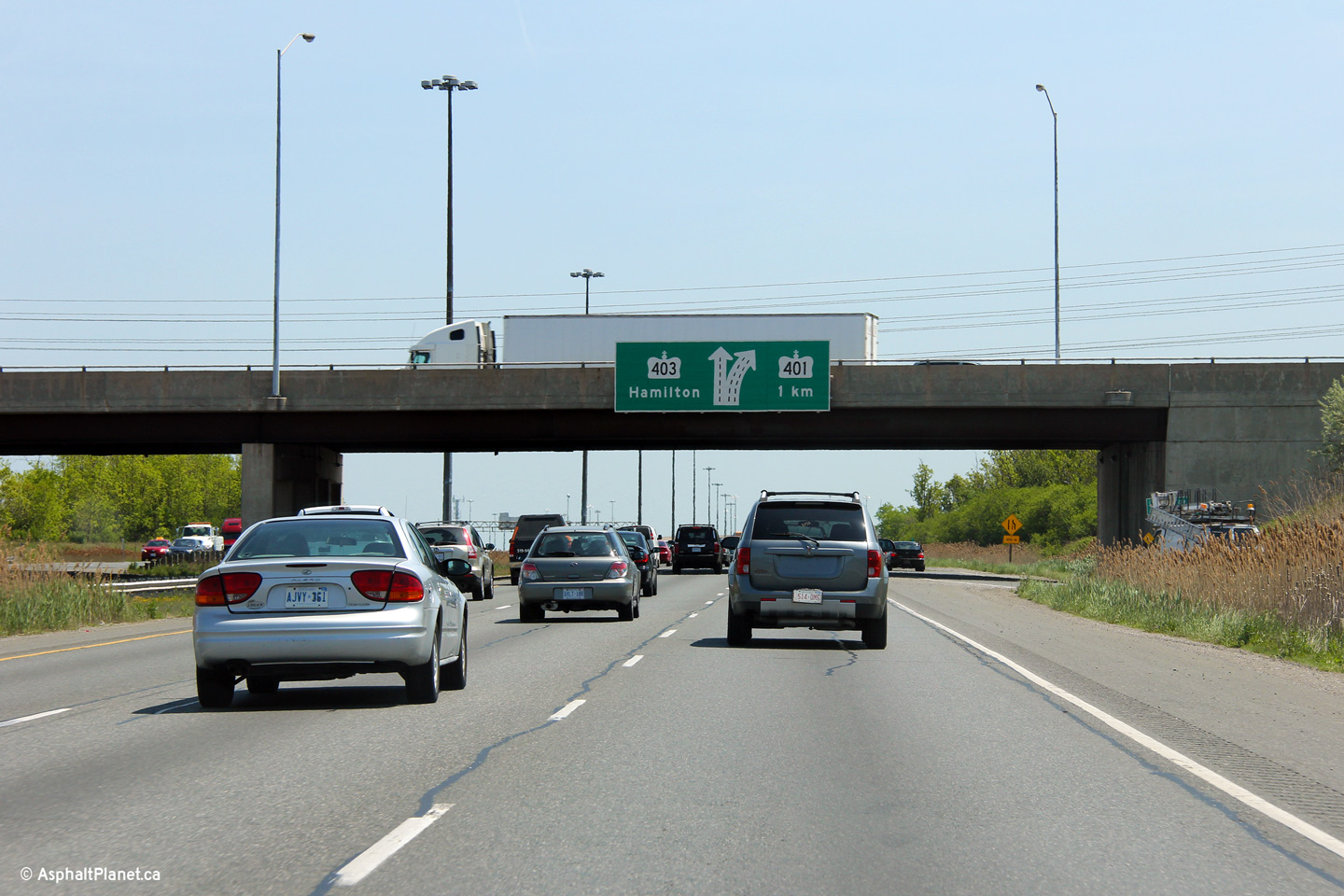
| City of Mississauga Regional Municipality of Peel |
This is the second of two southbound diagram signs denoting the lane configuration of the upcoming Highway 401/403 interchange.
Photo taken: May 17th, 2012. |
|
||||
| City of Mississauga Regional Municipality of Peel |
Two incarnations of the advanced signage for the northbound off-ramp to
Courtneypark Drive. The upper photo shows an older style angled arrow
sign, while the lower photo shows a more typical modern arrow. Upper photo taken: February 21st, 2010. Lower photo taken: August 24th, 2013. |
|
||||
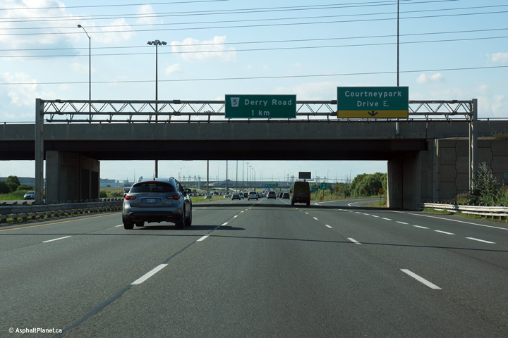
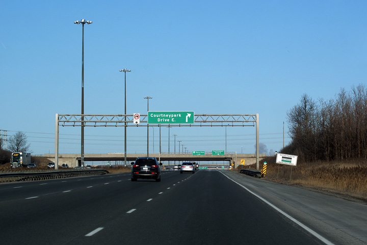
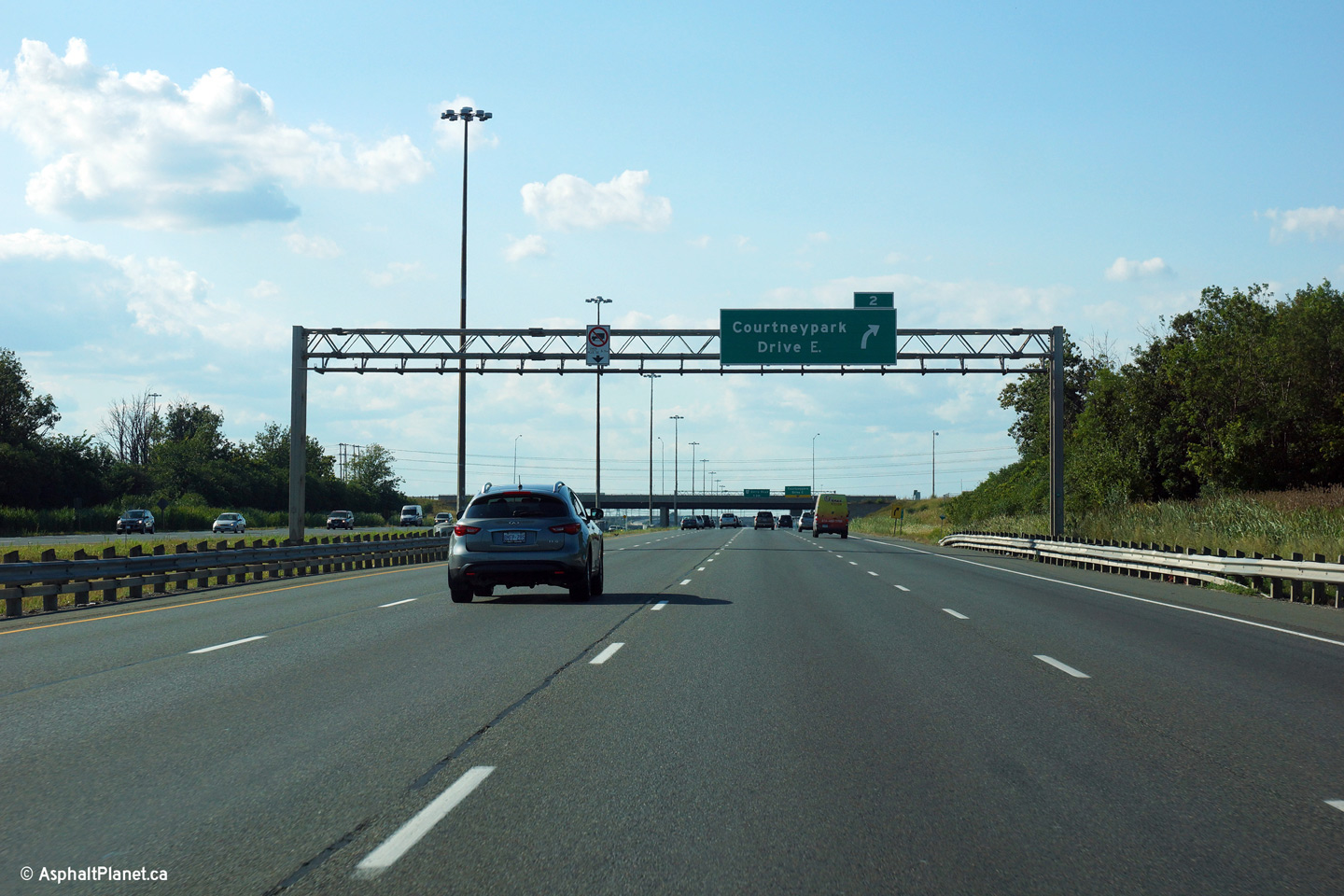
| City of Mississauga Regional Municipality of Peel |
Overhead signage at the ramp to Courtneypark Drive. Take a look at the
right-side abutment of the Courtneypark Drive overpass. This abutment
was designed in such a way that it can be converted to a central pier,
allowing an adjacent structure to be constructed. This intuitive
design would allow the MTO to construct a set of collector lanes without
replacing the existing overpass should traffic volumes warrant. Photo taken: August 24th, 2013. |
 (720x480) (720x480)(1440x960) (2400x1600) |
||||
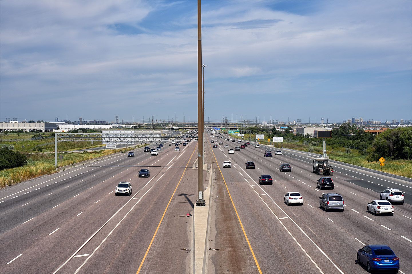
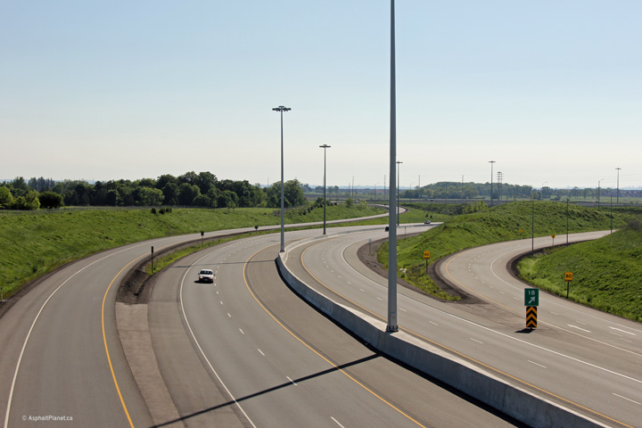
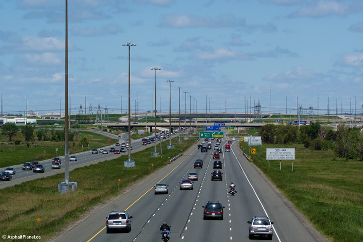
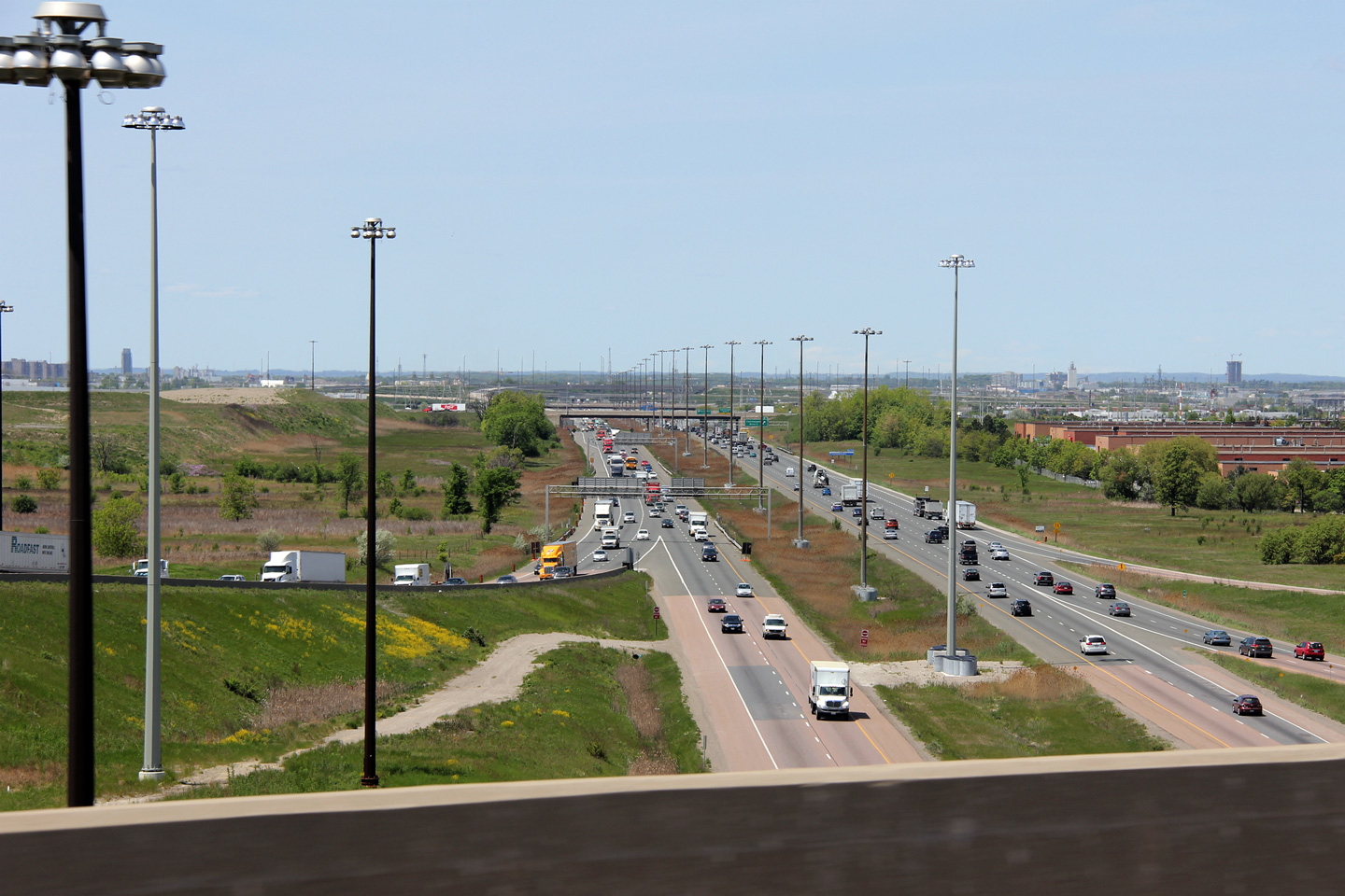
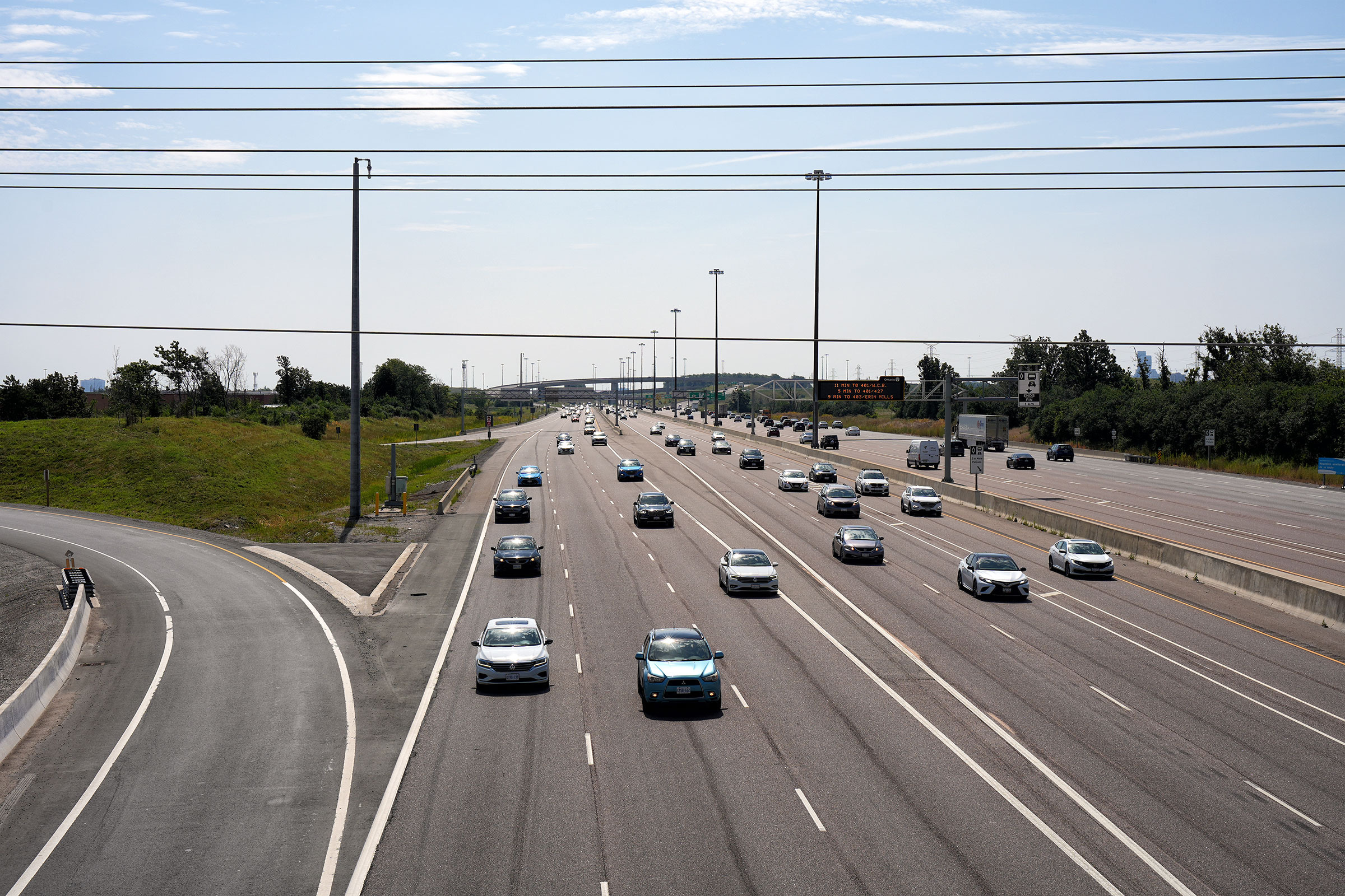
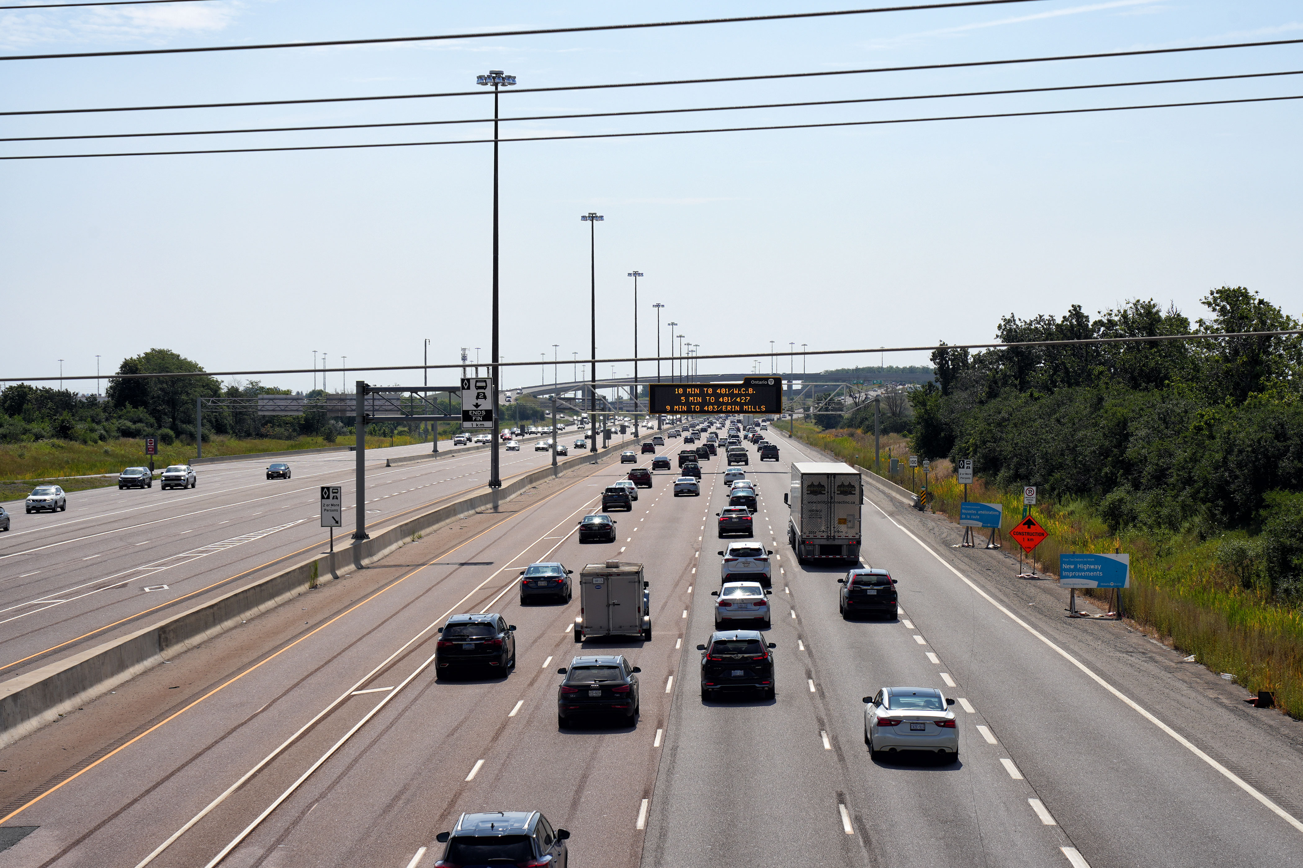
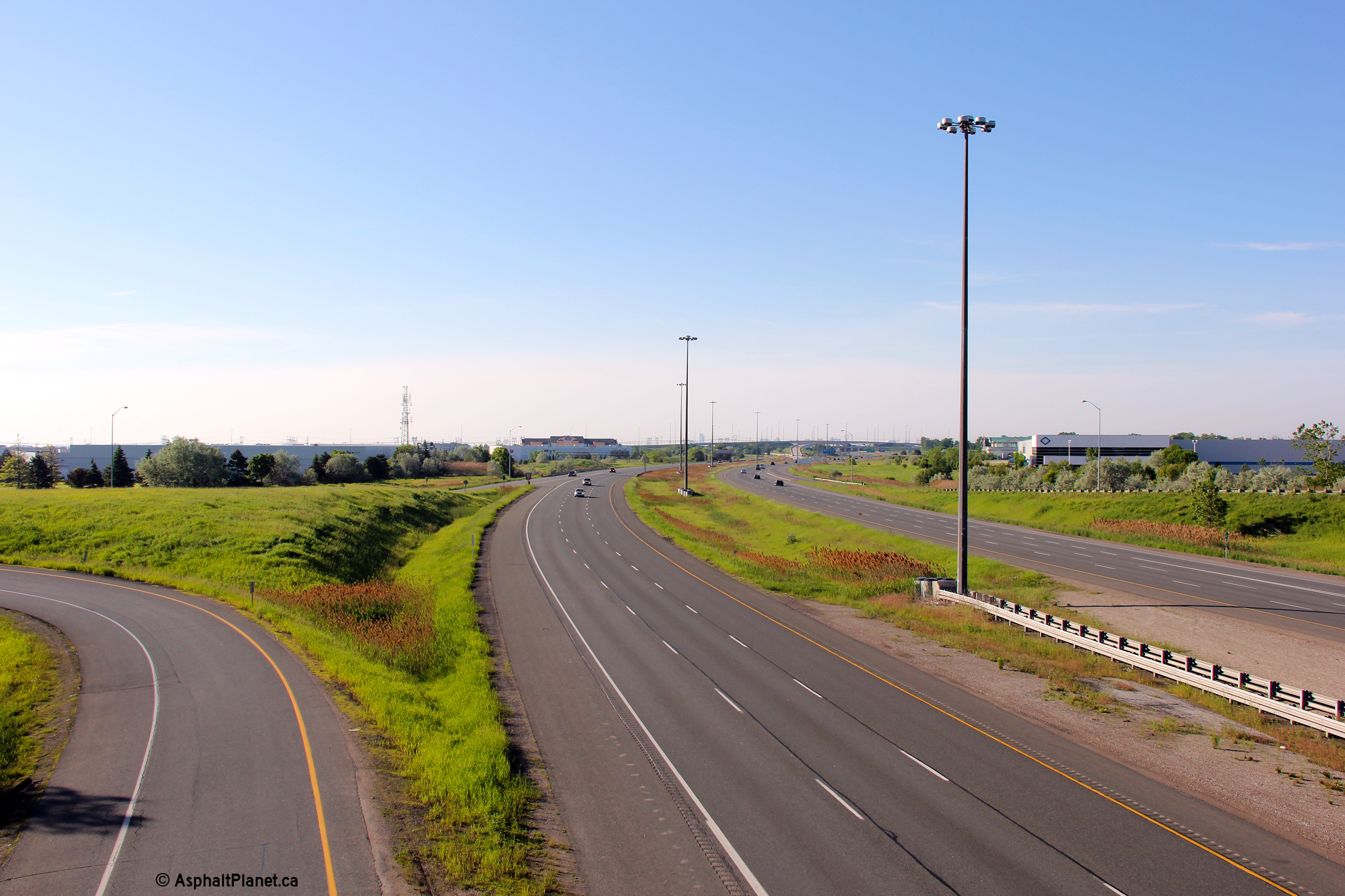
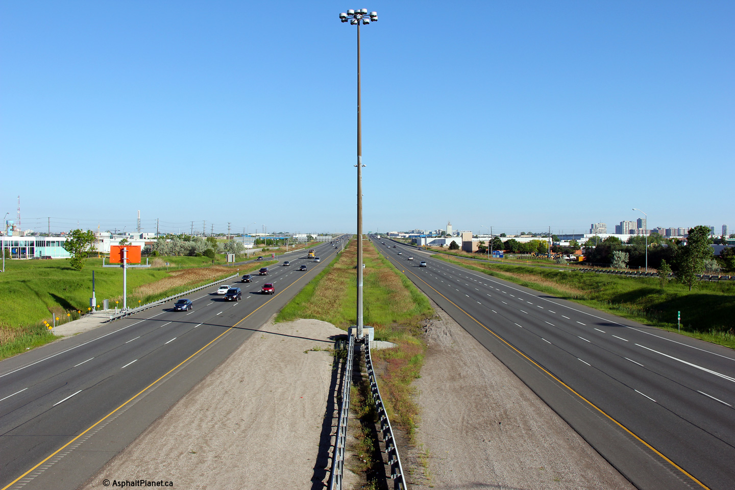
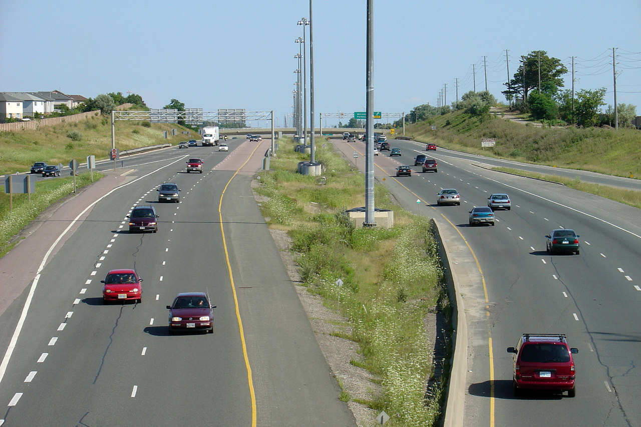
| City of Mississauga Regional Municipality of Peel |
Highway 410 looking south from the Courtneypark Road overpass. In the distance of this Photo is the 401/403/410 mega-interchange. The high level overhead from the EB 401 to the NB 410 is arguably the most impressive freeway to freeway flyover in Ontario.
Photo # 1 taken: May 29th, 2009.
Photo # 2 taken: June 20th, 2010.
Photos # 3 and # 4 taken: August 6, 2023. |
 (1440x960) (2400x1600) (4200x2800) 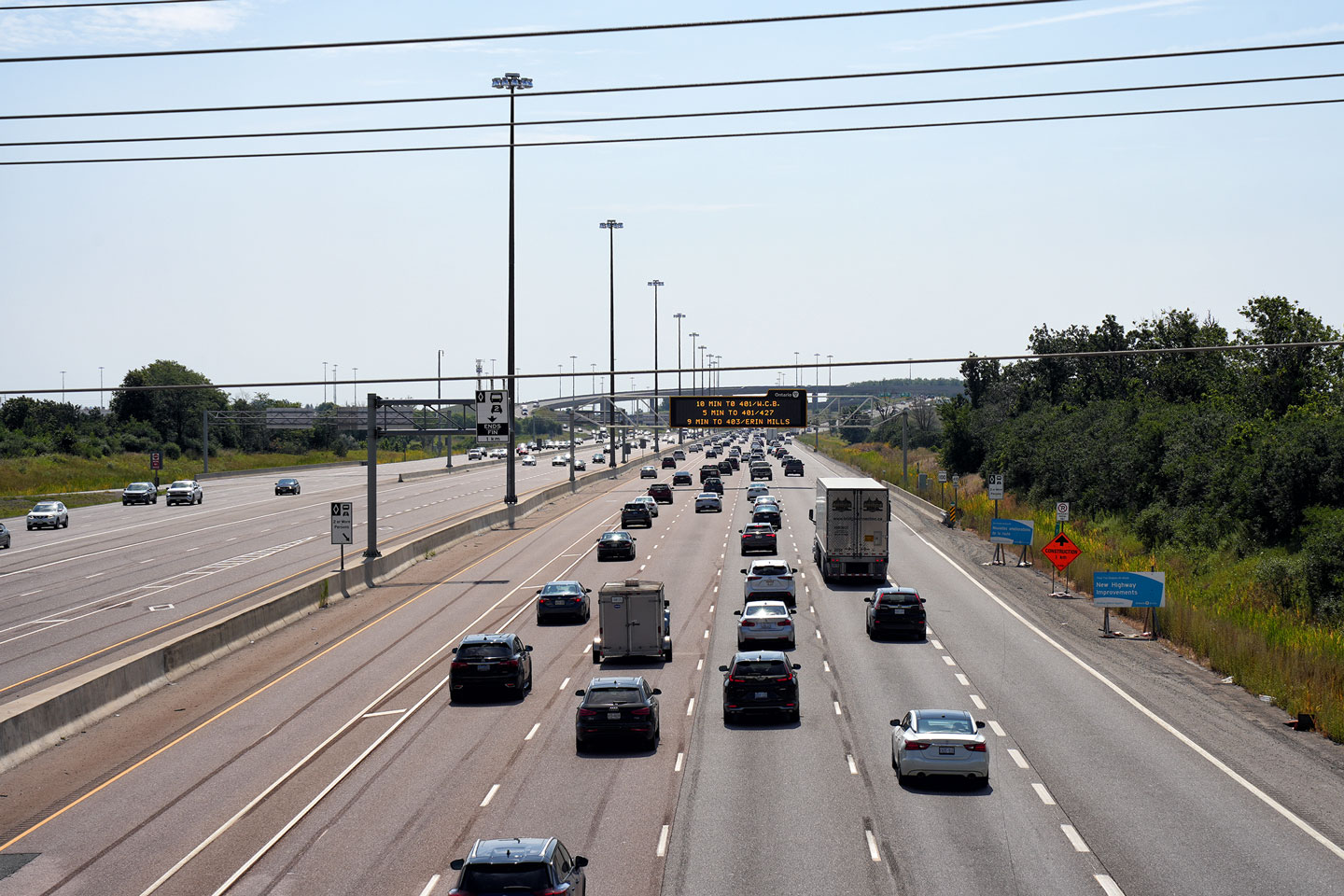 (1440x960) (2400x1600) (4200x2800) |
||||
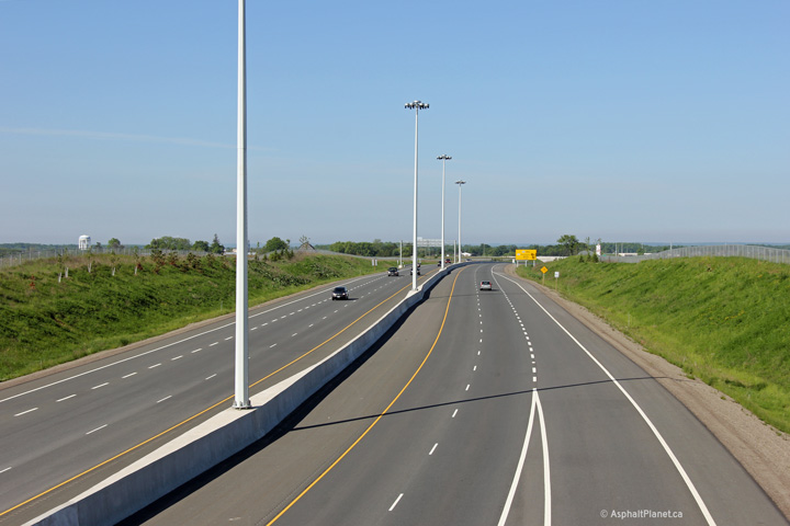
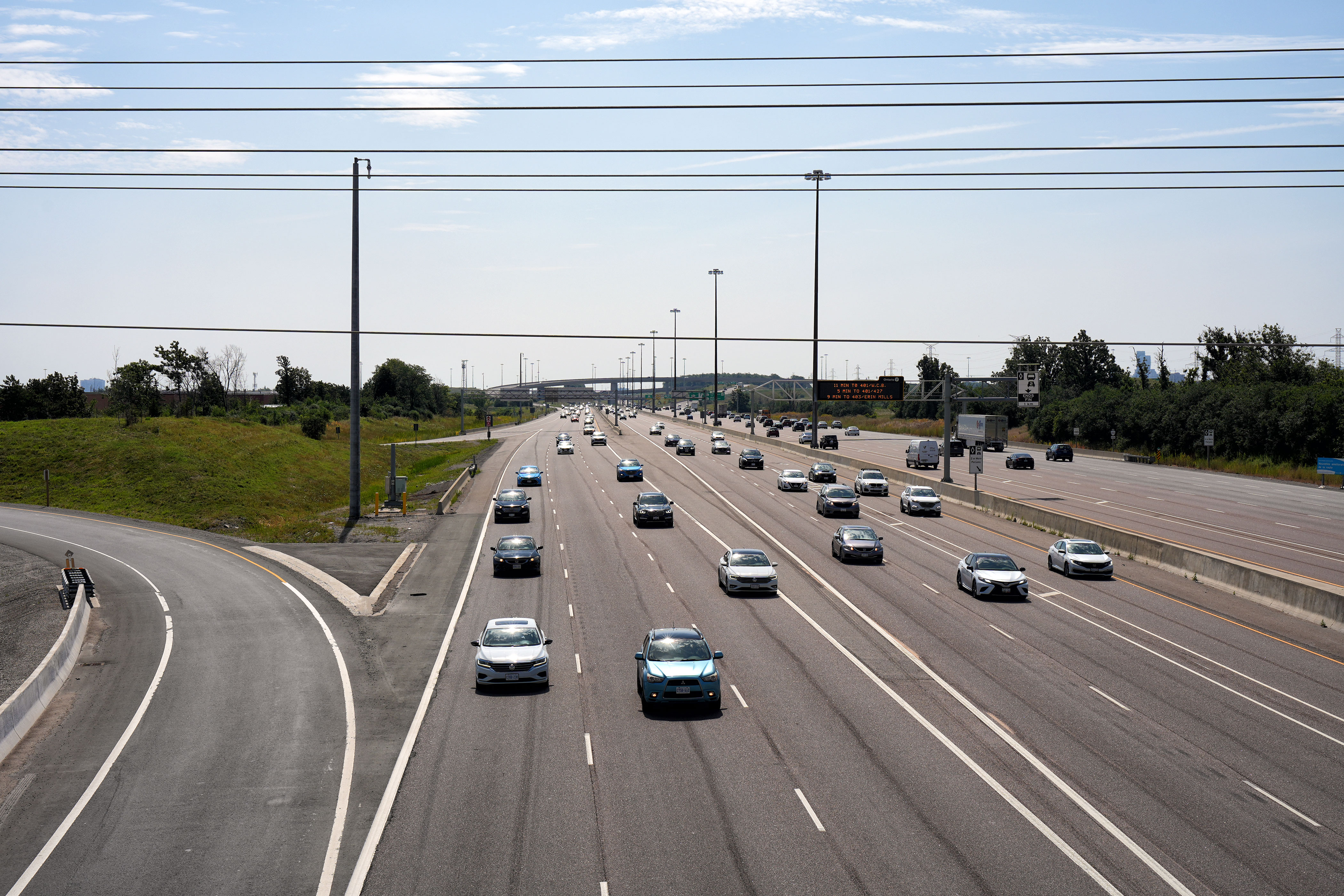
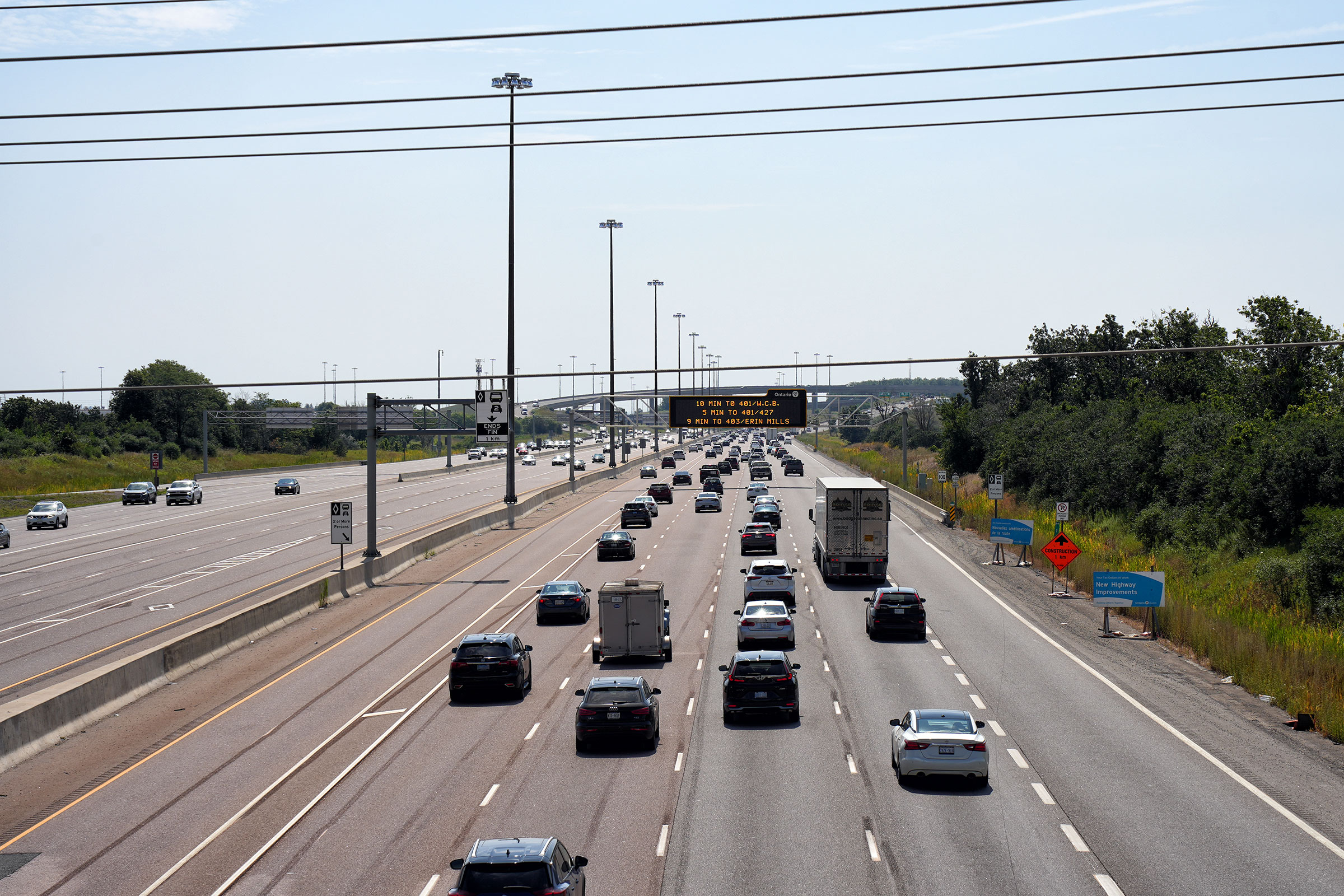
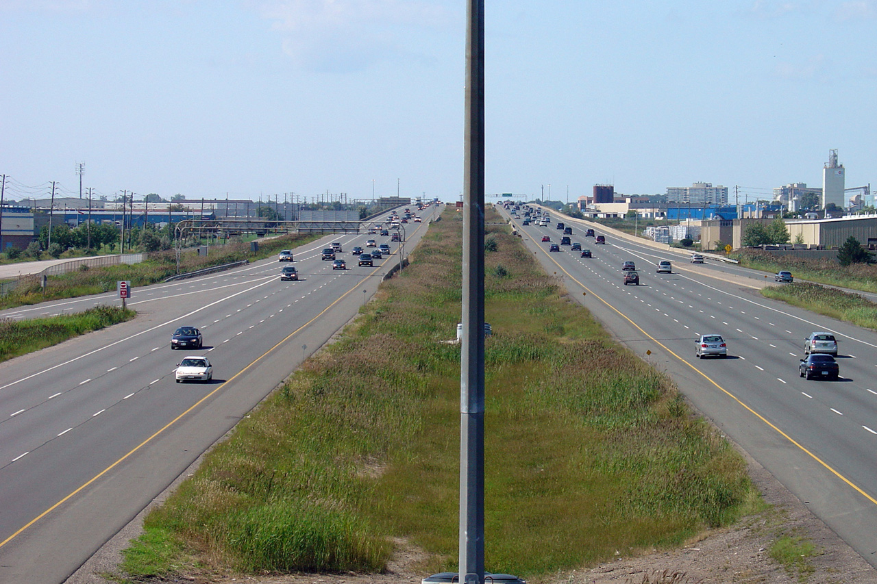
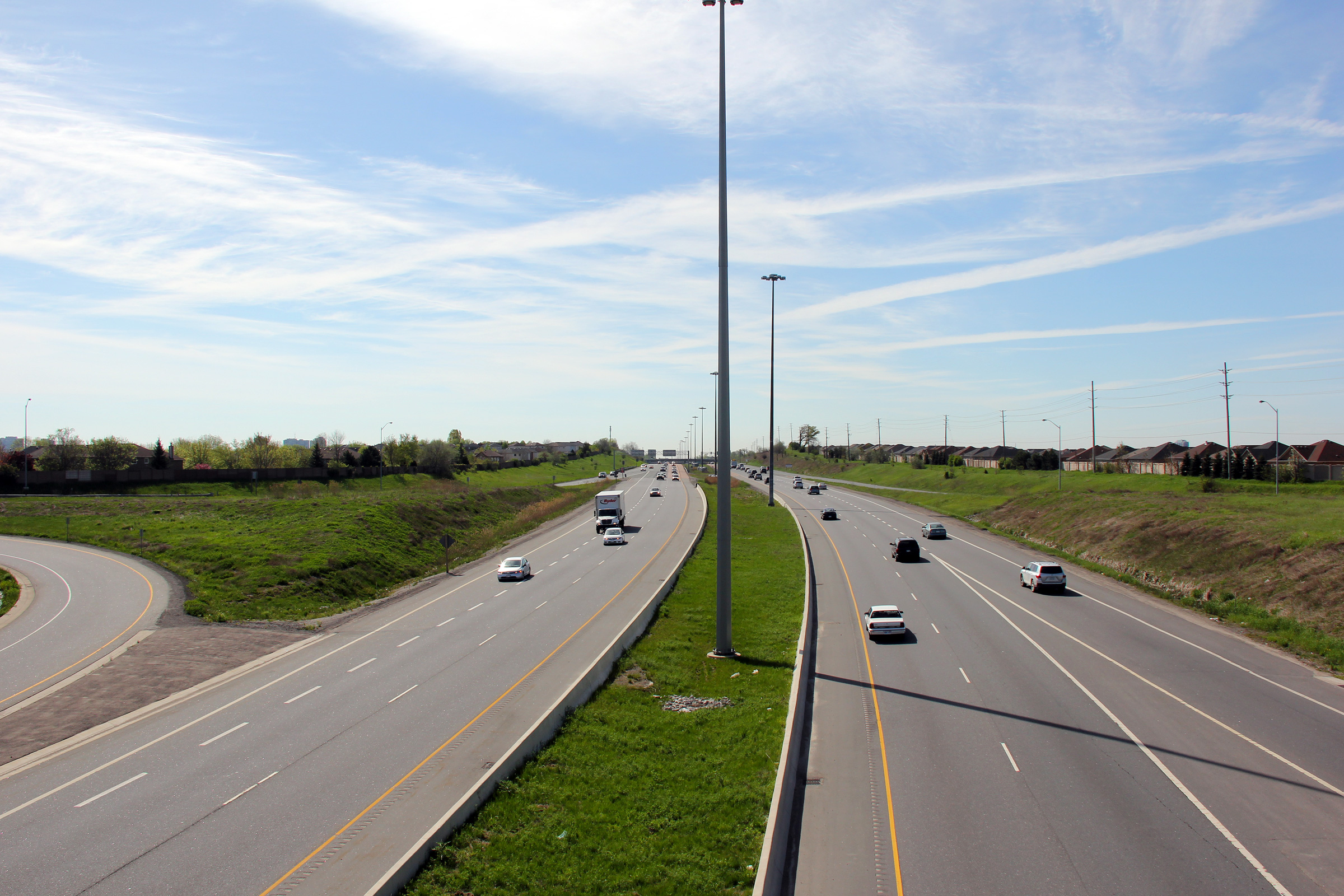
| City of Mississauga Regional Municipality of Peel |
A series of views of Highway 410 looking north from the Courtneypark Road overpass.
Photos # 1 and # 2 taken: May 29th, 2009.
Photo # 3 taken: June 20th, 2010.
Photos # 4 and # 5 taken: August 6, 2023. |
 (1440x960) (2400x1600) (4200x2800)  (1440x960) (2400x1600) (4200x2800) |
||||
| City of Mississauga Regional Municipality of Peel |
Advanced diagrammatic sign for the Highway 401 and Highway 403 interchange
affixed to the Courtneypark Drive overpass. Photo taken: May 17th, 2012. |
 (720x480) (720x480)(1440x960) (2400x1600) |
||||
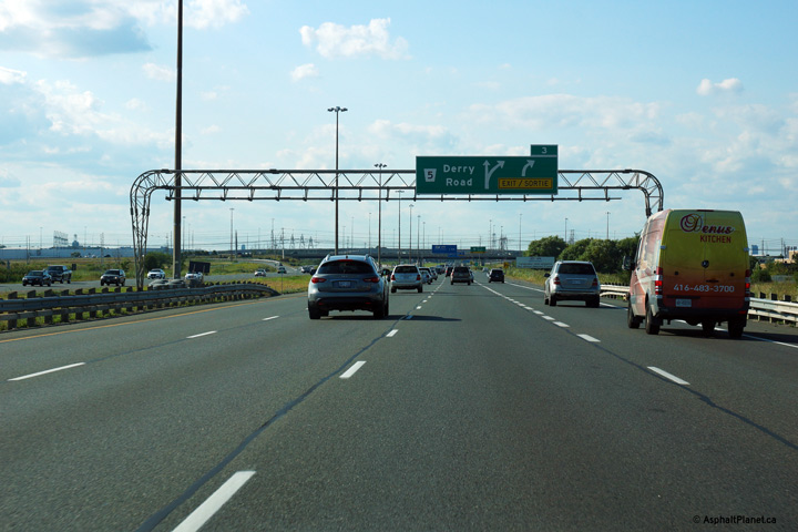
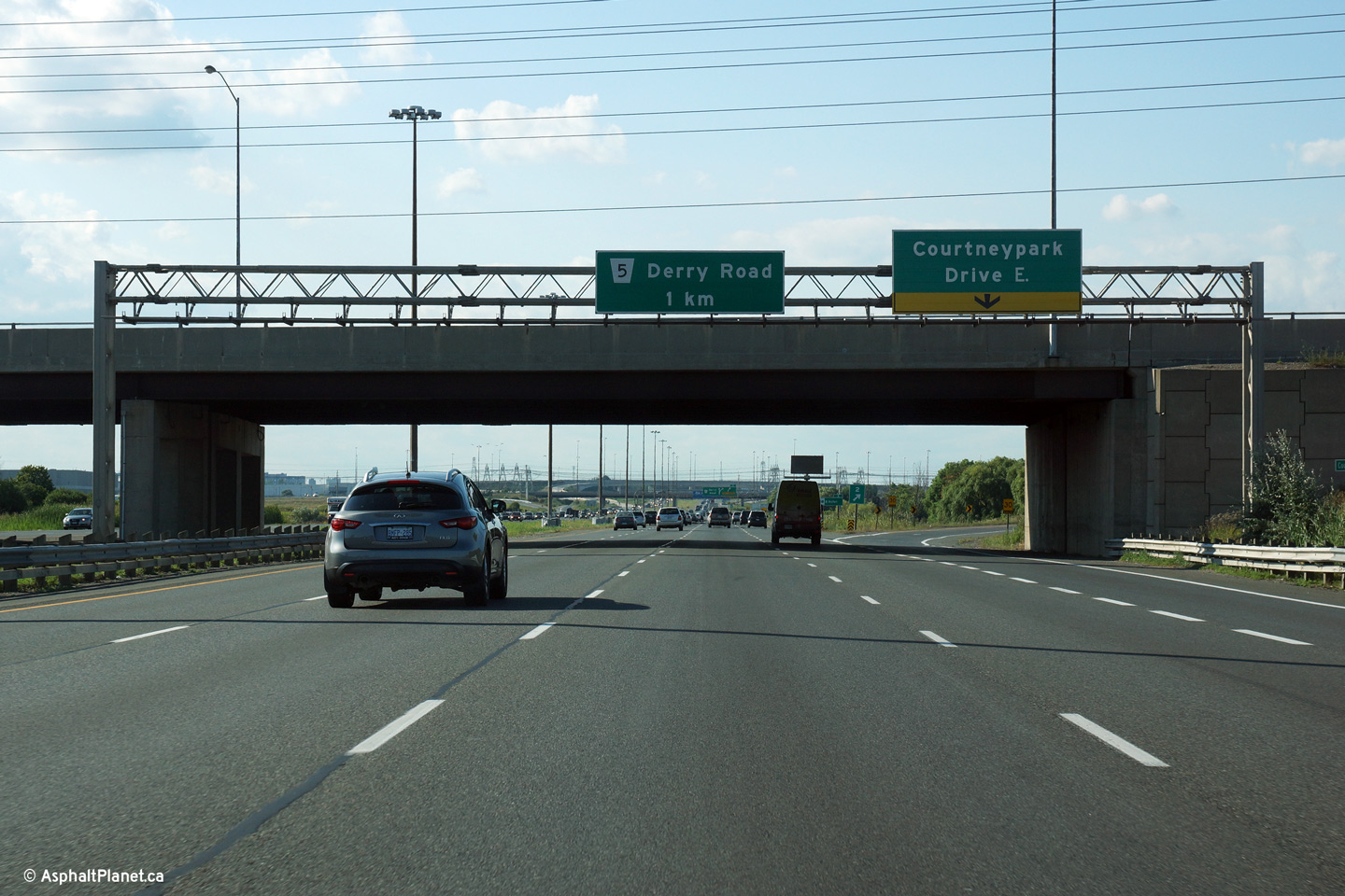
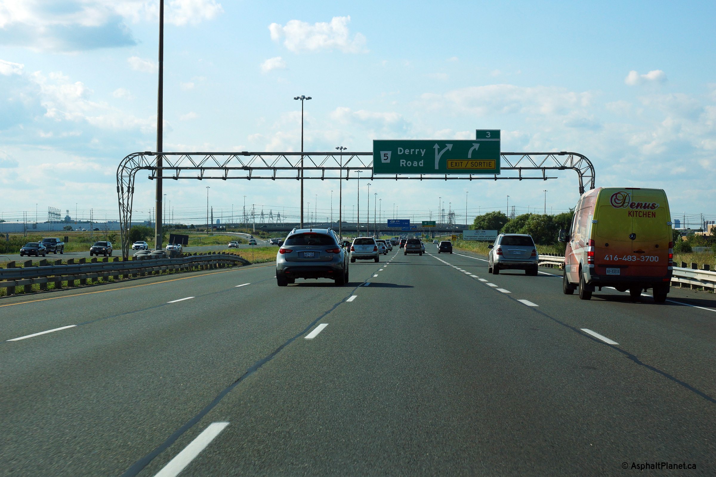
| City of Mississauga Regional Municipality of Peel |
Advanced signage for the ramp to Derry Road. The fourth northbound lane
departs Highway 410's northbound carriageway at the Derry Road interchange. Photo taken: August 24th, 2013. |
 (720x480) (720x480)(1440x960) (2400x1600) |
||||
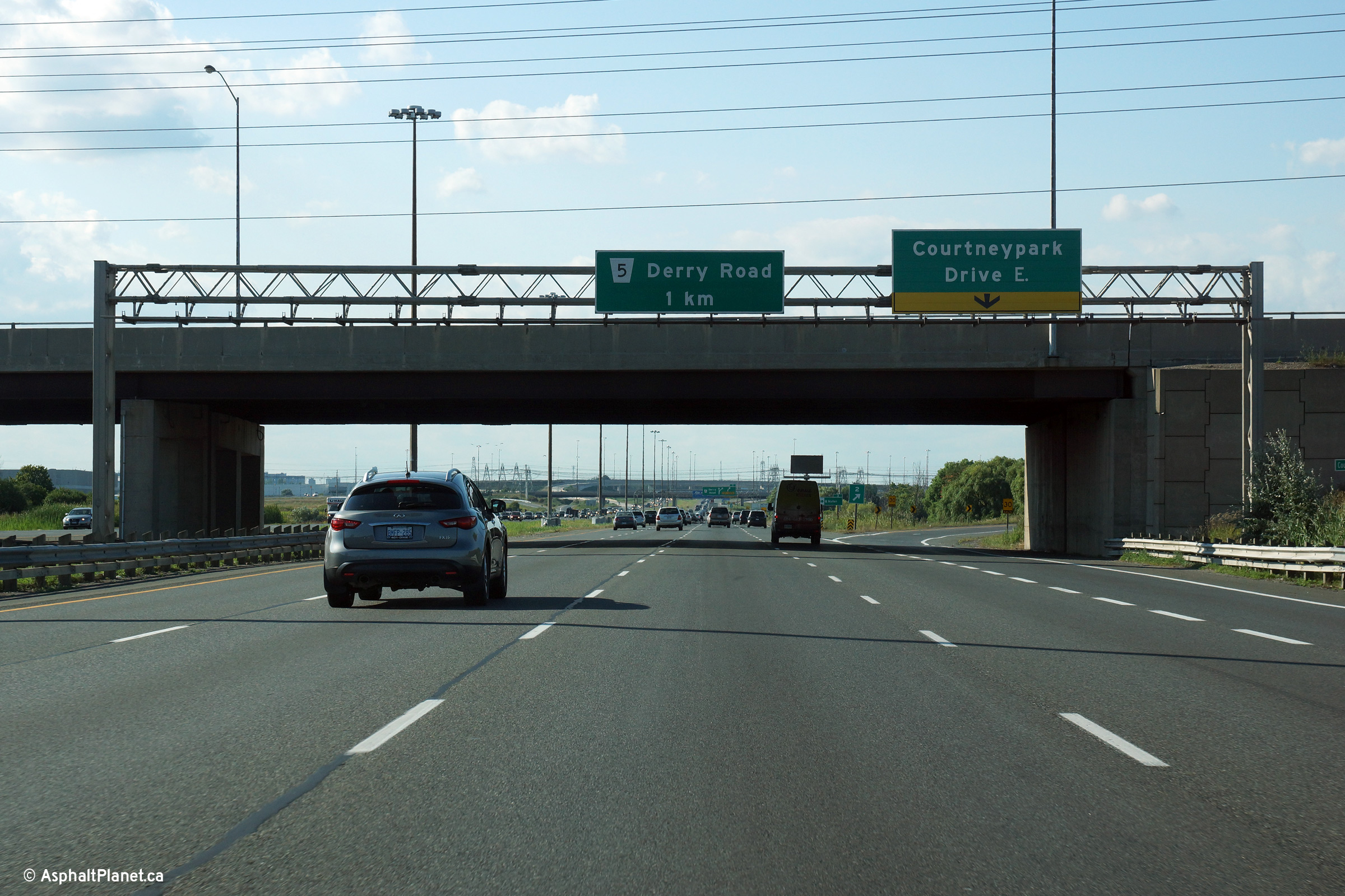
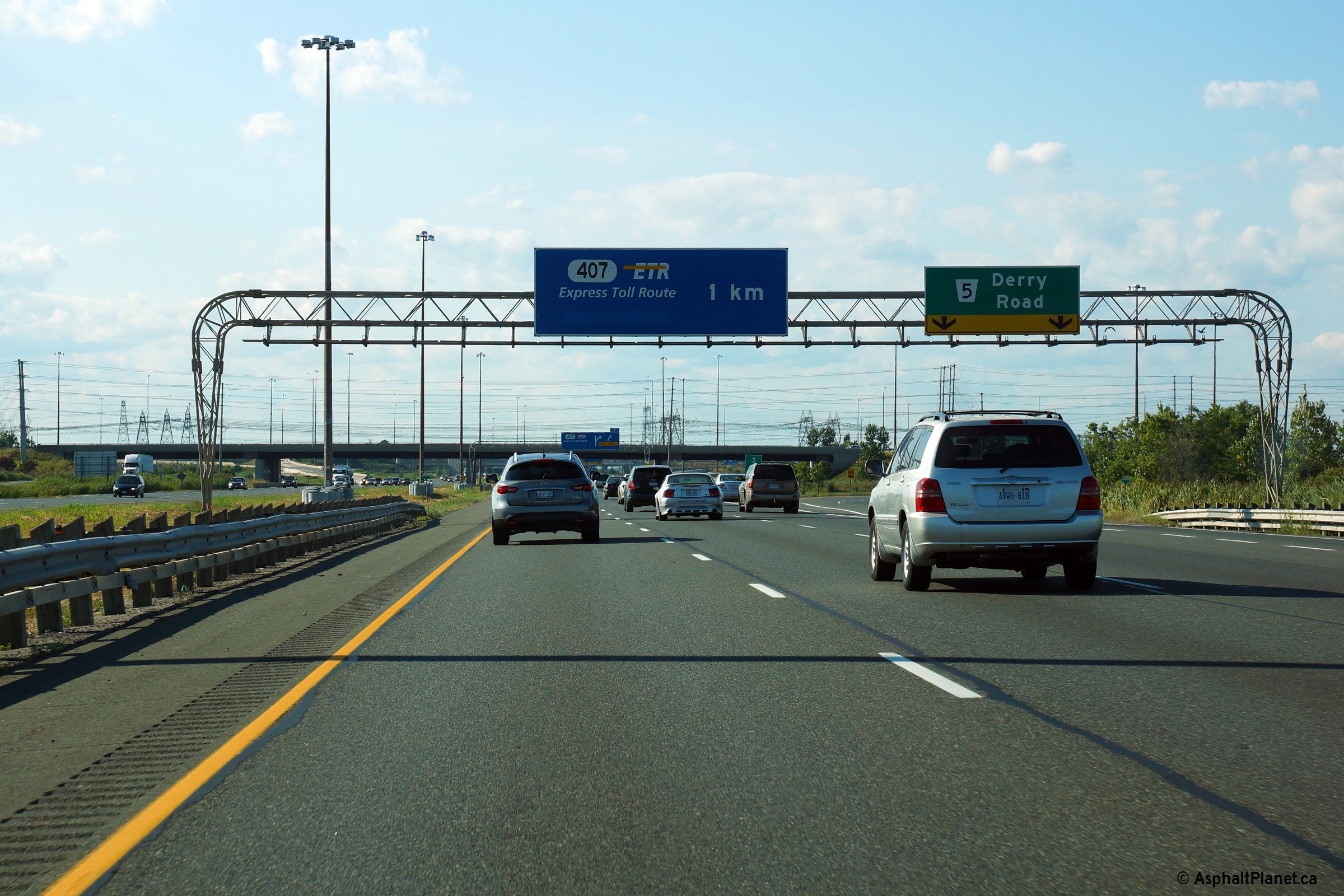
| City of Mississauga Regional Municipality of Peel |
Signage at the ramp to Derry Road. Traffic operations along Highway
410 would be improved if the fourth northbound auxiliary lane extended
beyond the Derry Road interchange for a short distance until the off-ramp to
Highway 407.. Photo taken: August 24th, 2013. |
 (720x480) (720x480)(1440x960) (2400x1600) |
||||
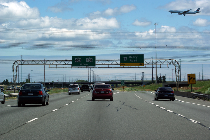
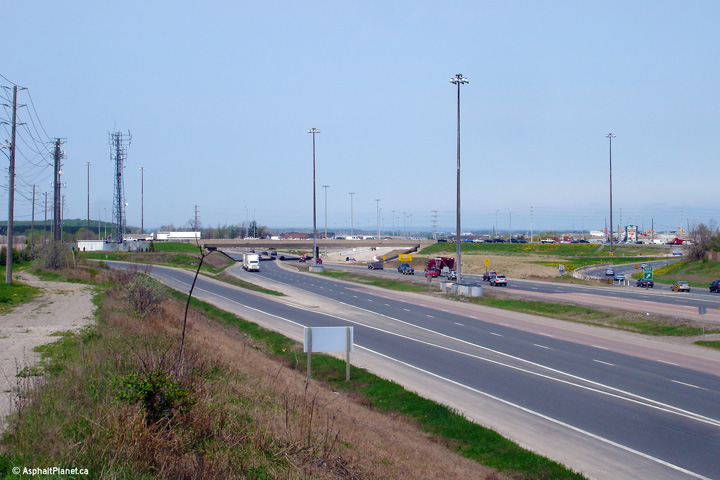
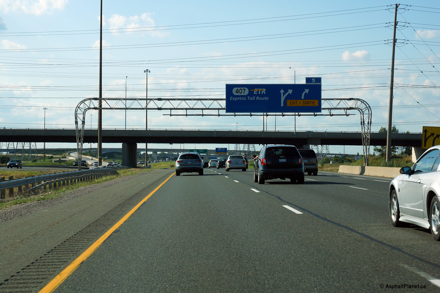
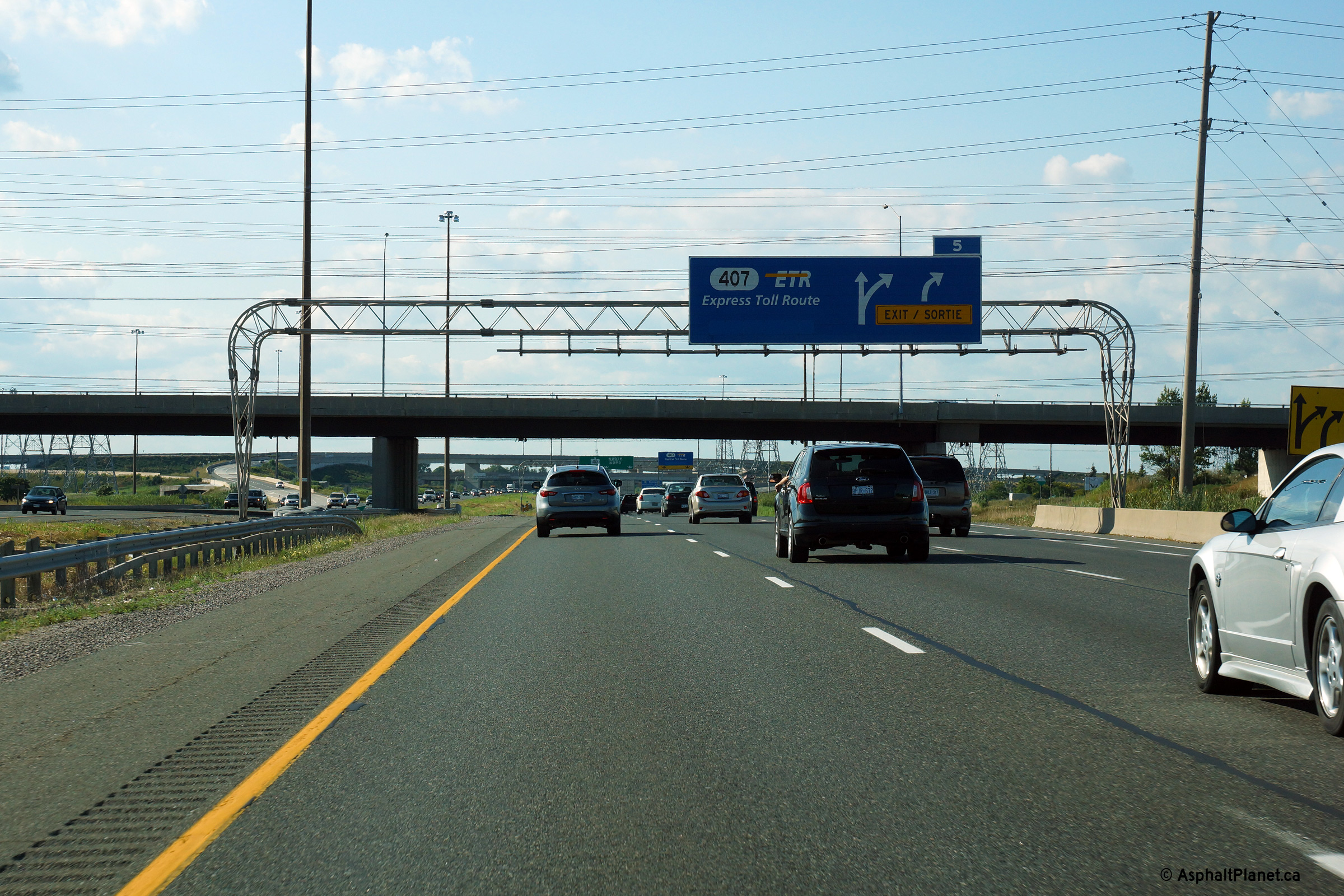
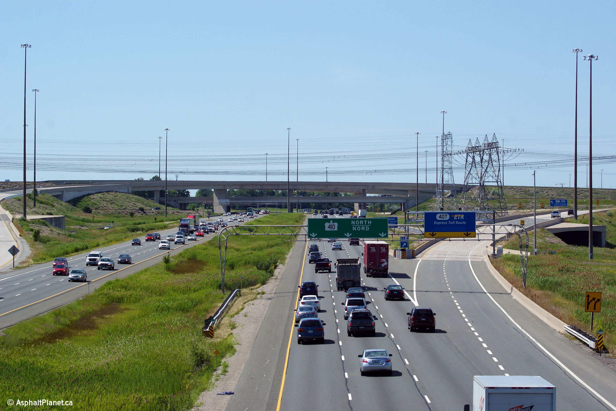
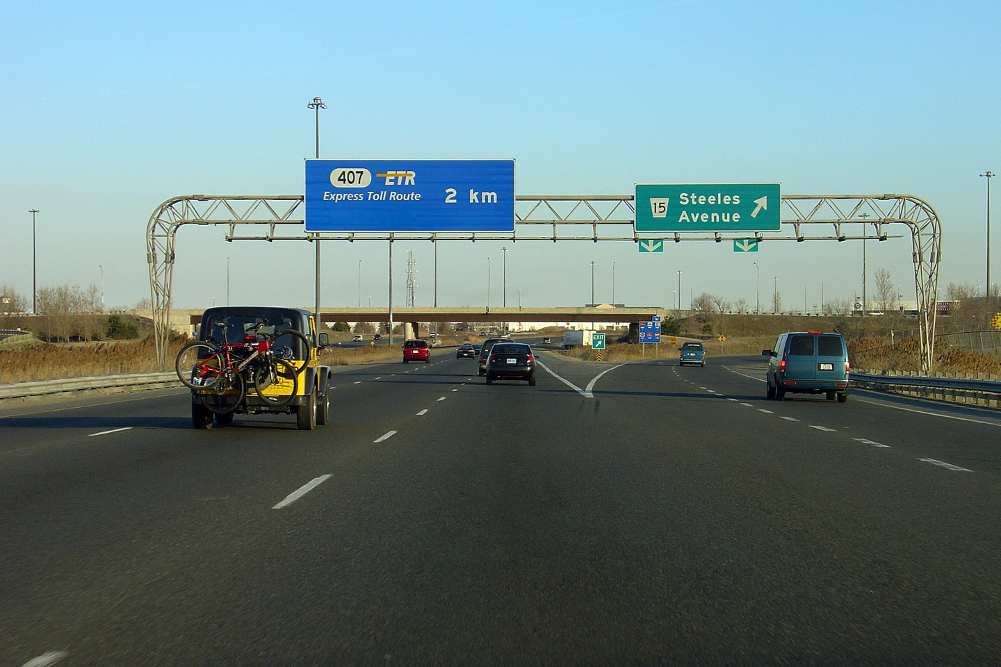
| City of Mississauga Regional Municipality of Peel |
The advanced signage for the Highway 407 interchange is situated in front of the Derry Road overpass. The
Derry Road structure, (like Courtneypark) was designed so that the
abutments could be converted to central piers. Both sides of the Derry
Road overpass were extended in 1995 to allow a pair of braided ramps to be
constructed between Highway 407 and Derry Road. Photo taken: August 24th, 2013. |
|||||
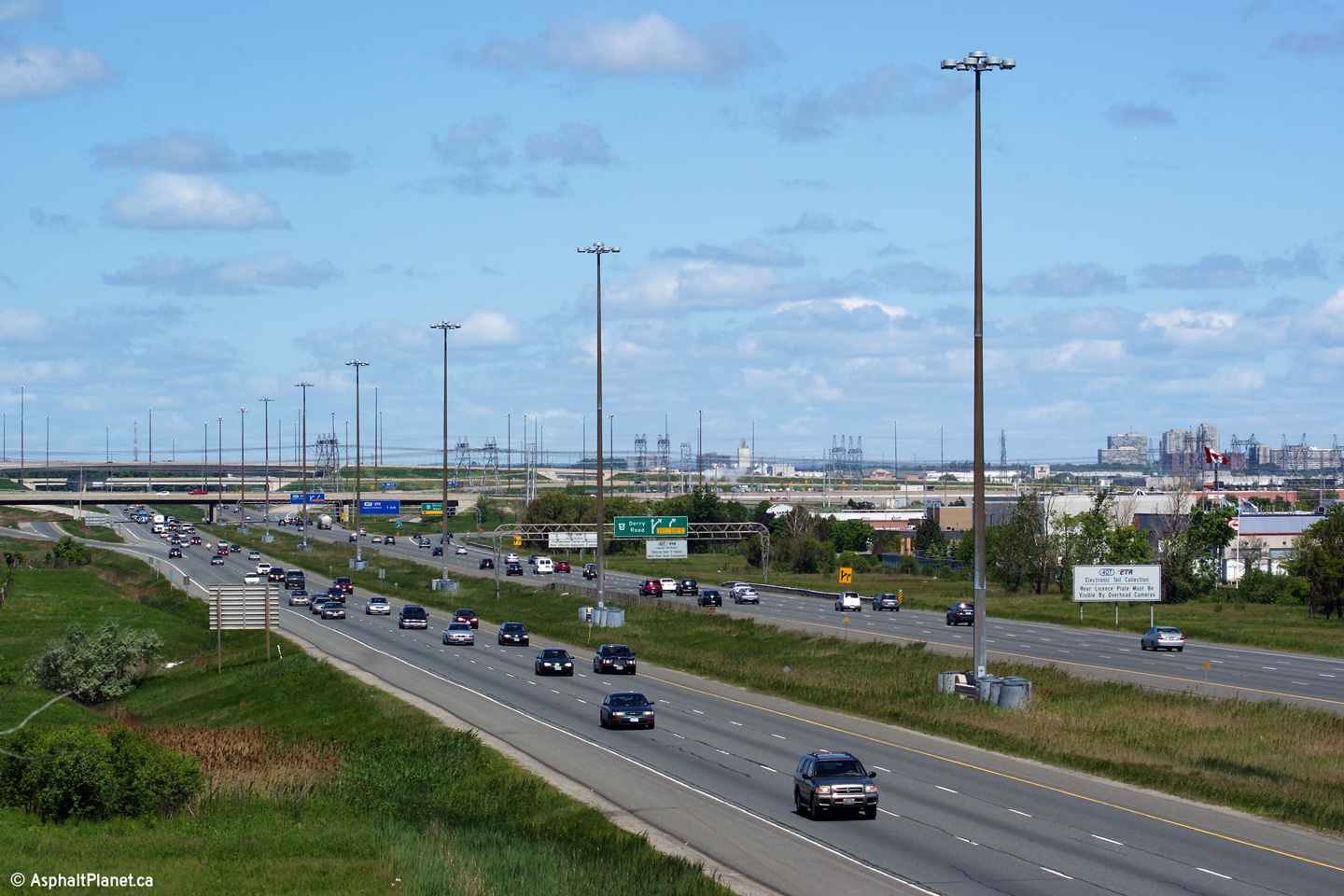
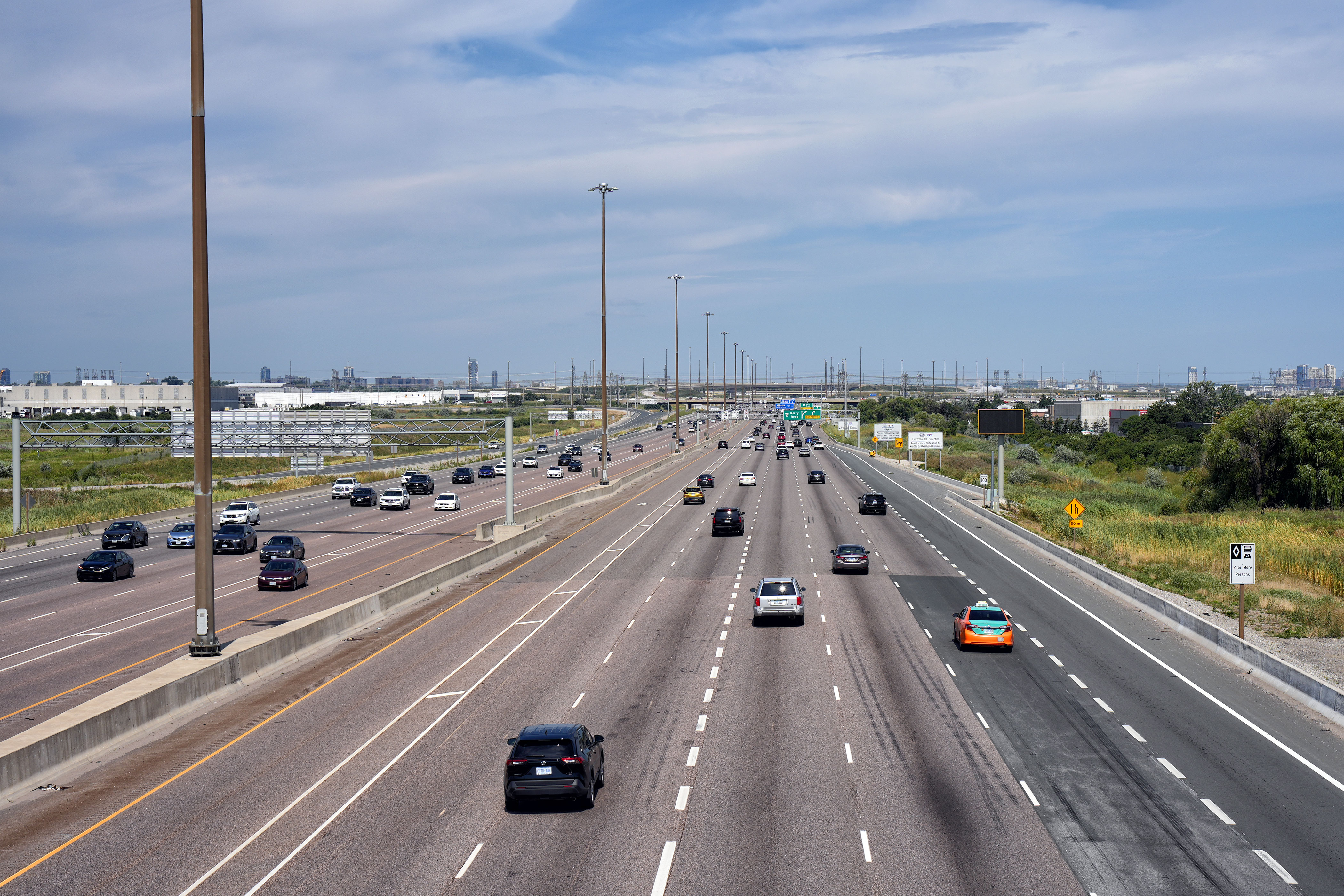
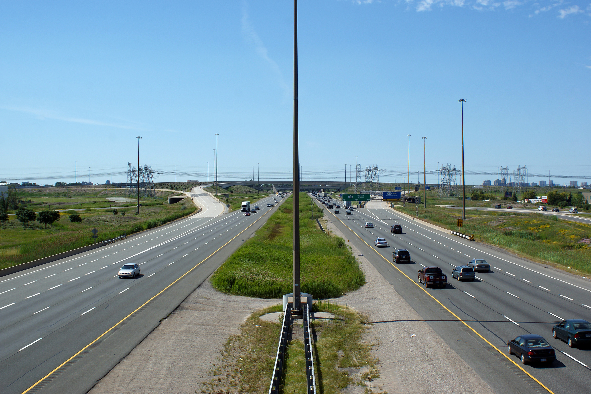
| City of Mississauga Regional Municipality of Peel |
Looking south towards Highway 401 from the Derry Road overpass in northern
Mississauga. Photo taken: July 2nd, 2010. |
 (720x480) (1440x960) (2400x1600) |
||||
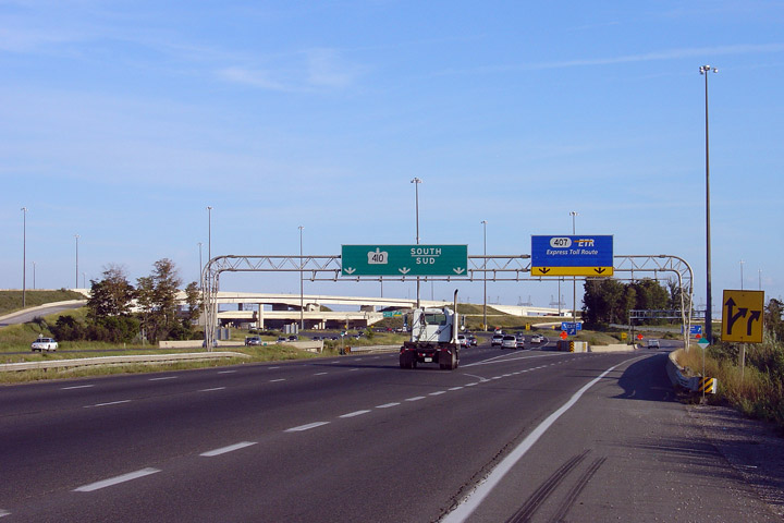
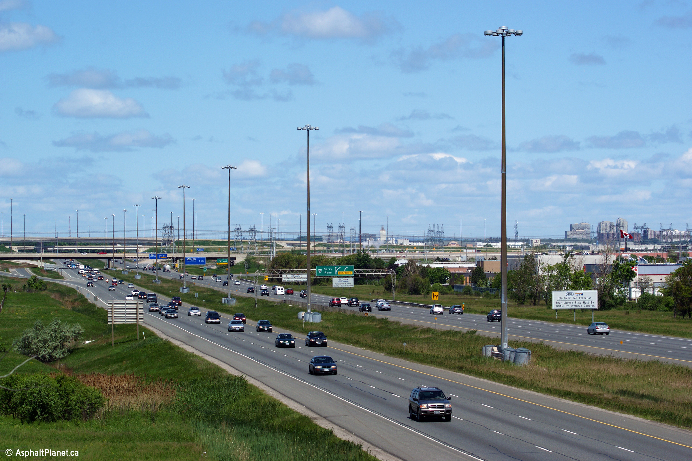
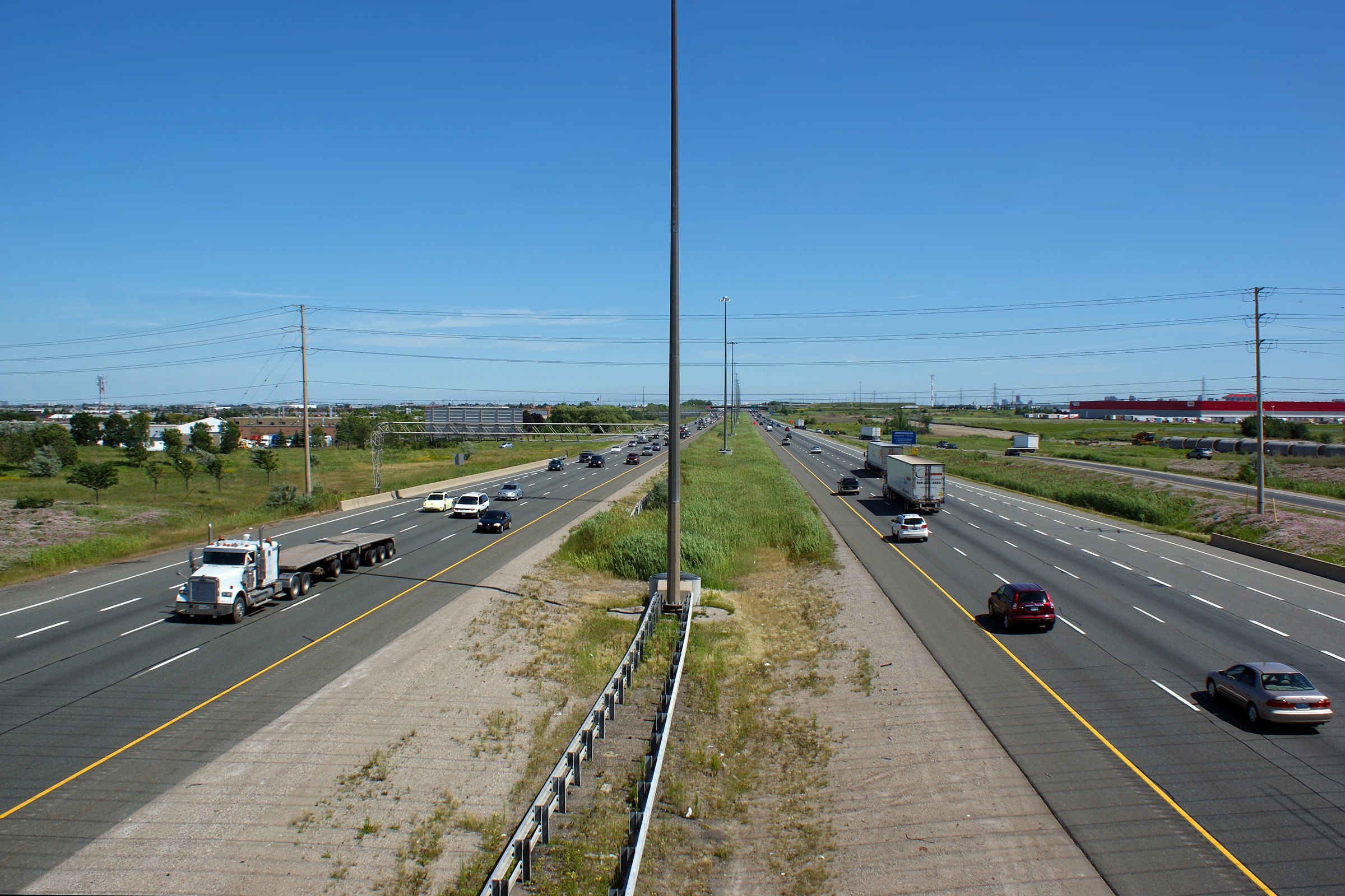
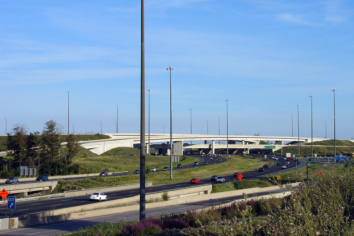
| City of Mississauga Regional Municipality of Peel |
Looking north towards the Highway 407
interchange from the Derry Road overpass. The Highway 407 interchange could
be located in such
close proximity to the Derry Road interchange because of the braided ramps
that were built to separate the Derry Road and Highway 407 interchanges.
Without ramp braiding, the close proximity of the Derry and Highway 407
interchanges would have been a major source of congestion along Highway 410. Photo taken: July 2nd, 2010. |
 (720x480) (1440x960) (2400x1600) |
||||
| City of Brampton Regional Municipality of Peel |
Overhead sign truss for the Highway 407 exit as seen from the Derry Road
overpass. Photo taken: July 2nd, 2010 |
|||||
| City of Brampton Regional Municipality of Peel |
View looking southerly approaching the Derry Road interchange. Photo taken: June 6th, 2010. |
 |
||||
| Highway 407 by-passes the 401 and QEW through much of the GTA. Click here for Highway 407 images. | ||||||
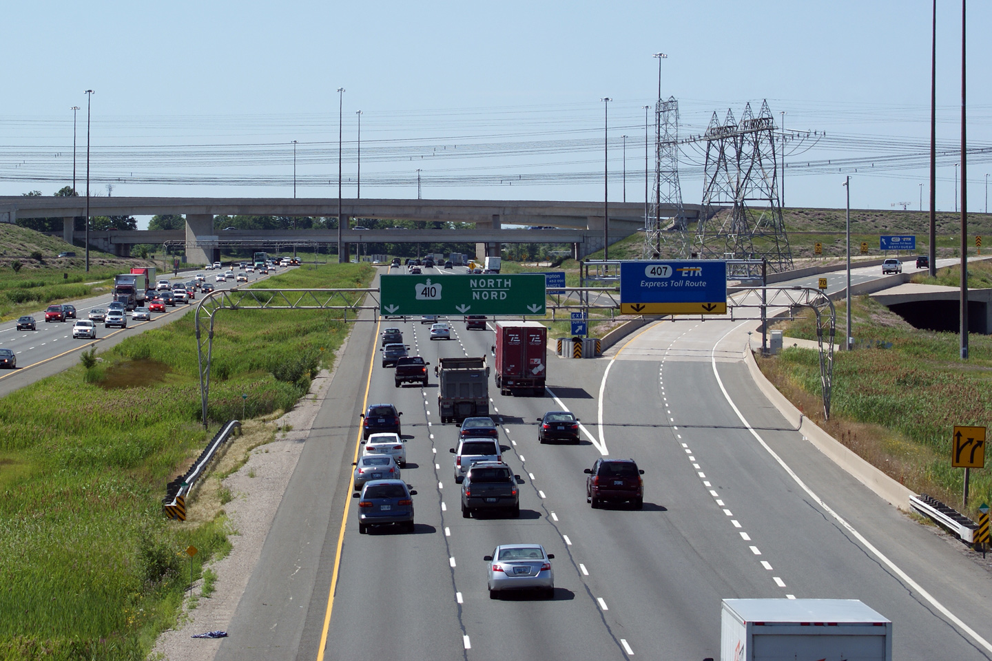
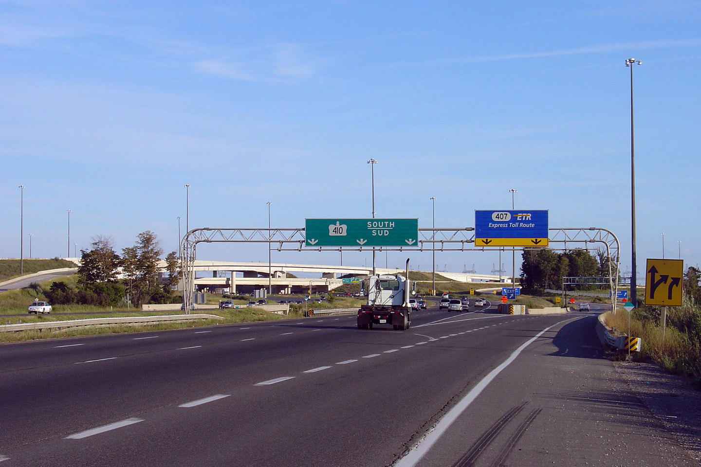
| City of Brampton Regional Municipality of Peel |
View looking southerly towards the Highway 407 interchange from Highway 410.
To get this photo, I had to park my car on the shoulder of the freeway and
then climb up a dirt stockpile. Considering how similar this photo
looks to the photo that appears below, from road level, I am not sure I
should have expended the extra effort. Photo taken: August 13th, 2006. |
 (720x480) (1440x960) |
||||
| City of Brampton Regional Municipality of Peel |
Exit signage for the southbound ramp to Highway 407 ETR. Photo taken: August 13th, 2006. |
 |
||||
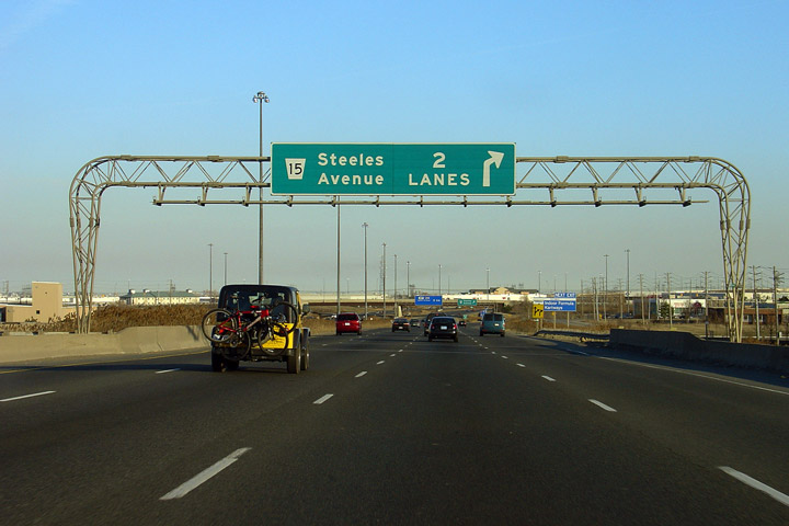
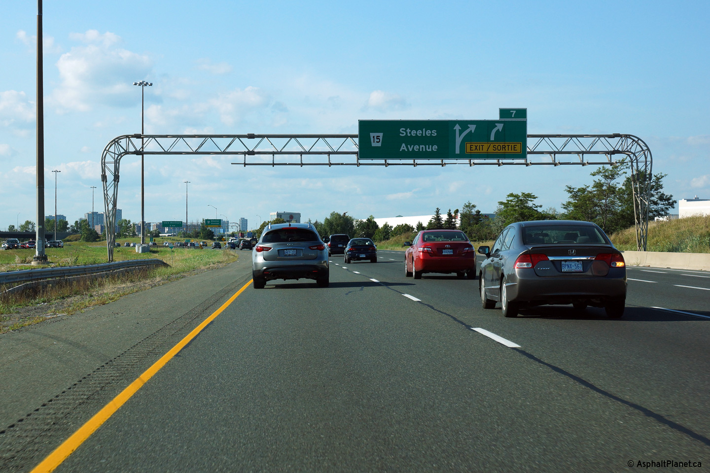
| City of Brampton Regional Municipality of Peel |
Advanced signage for the northbound ramp to Steeles Avenue. Photo taken: August 24th, 2013. |
 (720x480) (720x480)(1440x960) (2400x1600) |
||||
| City of Brampton Regional Municipality of Peel |
Overhead signage at the northbound off-ramp to Steeles Avenue. The fourth
northbound lane that joined the 410 from the on-ramp from Highway 407 exits
the freeway at this off-ramp. Click
here to see an earlier incarnation
of this signage taken in May, 2005. Photo taken: August 24th, 2013. |
 (720x480) (720x480)(1440x960) (2400x1600) |
||||
| City of Brampton Regional Municipality of Peel |
Looking south from the Steeles Avenue overpass along Highway 410.
Click here for this same view taken in
August, 2005. Photo taken: August 28th, 2005. |
 (720x480) (1440x960) (2400x1600) |
||||
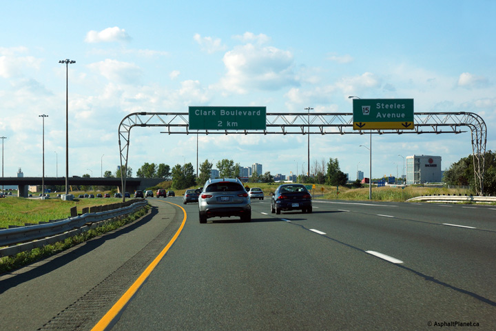
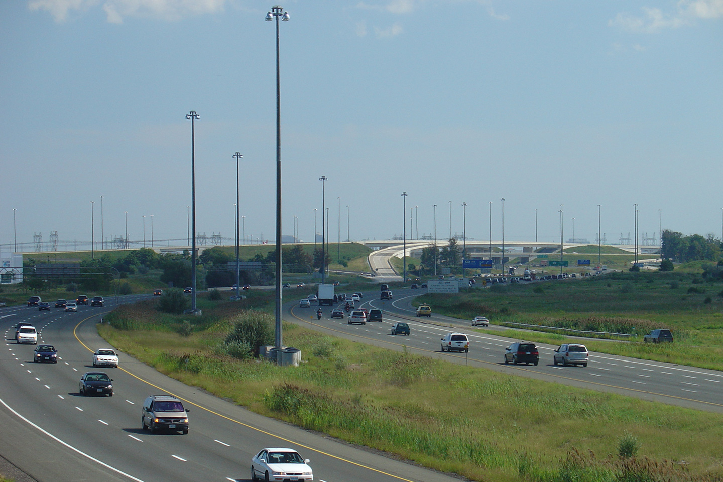
| City of Brampton Regional Municipality of Peel |
Looking north from the Steeles Avenue overpass. North of Steeles
Avenue, Highway 410 is elevated on a fill to just south of Clark Boulevard
through the heart of Brampton's industrial district. Click
here for this same view taken in
August, 2005. Photo taken: August 28th, 2005. |
 (720x480) (1440x960) (2400x1600) |
||||
| City of Brampton Regional Municipality of Peel |
Overhead guide signage for the Steeles Avenue off-ramp. The changes
that accompanied bilingual signage were more subtle on overhead exit signs
then they were on the advanced signs. No longer do arrows pointing upwards
and to the right appear on an overhead pull-through signage. Photo taken: April 10th, 2005. |
|
||||
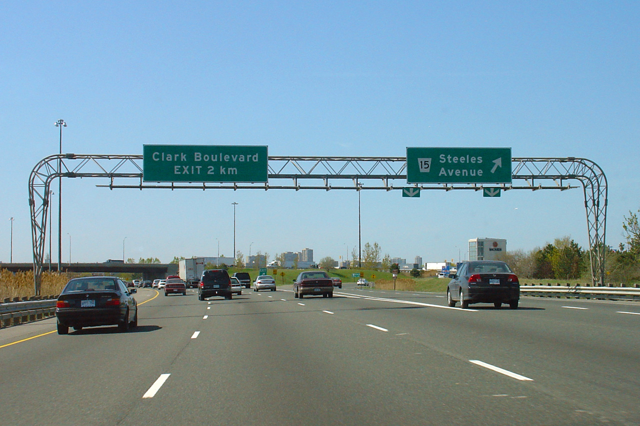
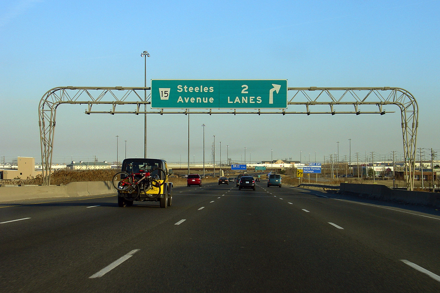
| City of Brampton Regional Municipality of Peel |
Overhead advanced signage for the southbound off-ramp to Steeles Avenue.
This sign was the last of the old "2 Lane" overhead signs to stand in
Ontario -- the sign was replaced in 2006. Photo taken: April 10th, 2005. |
|
||||
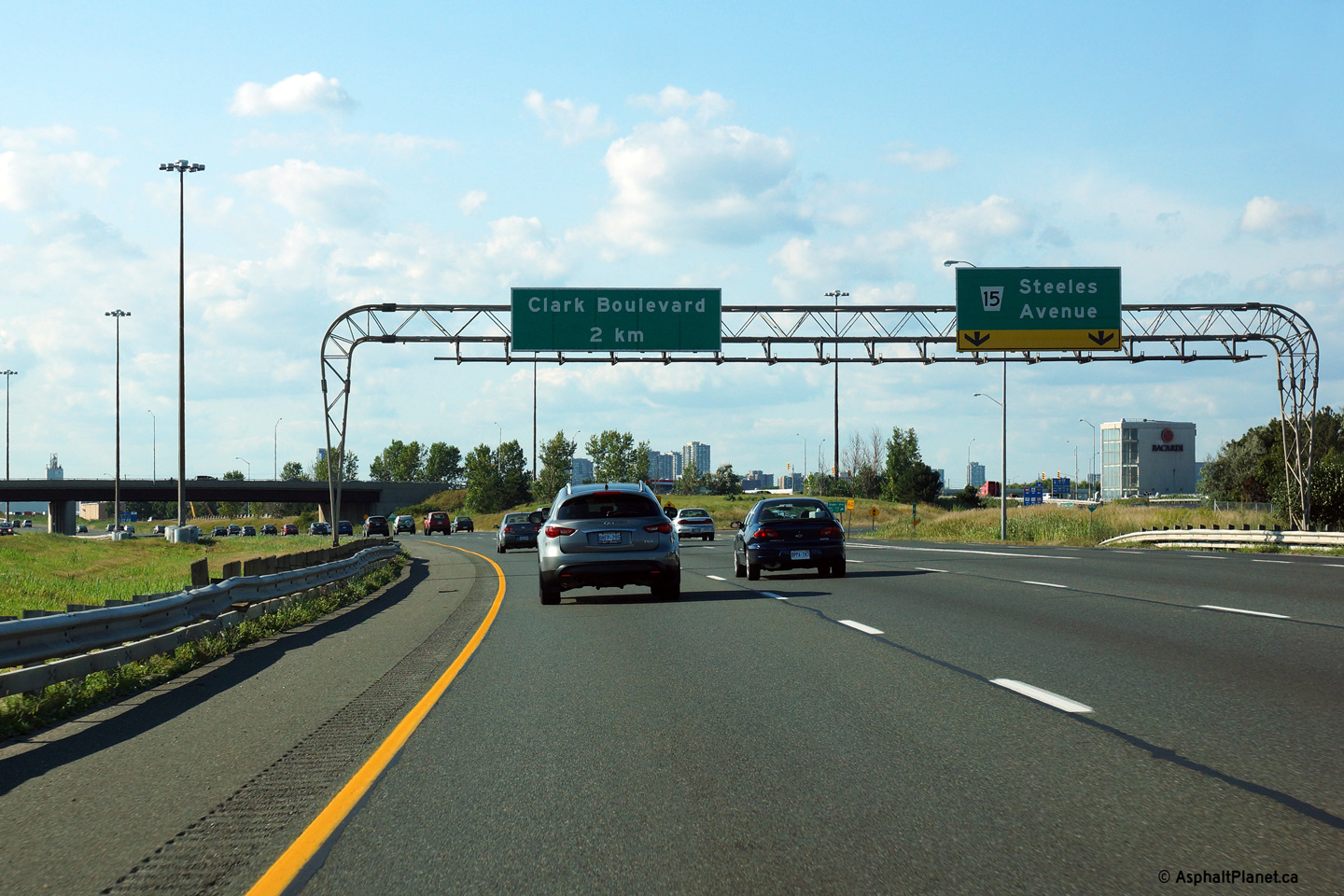
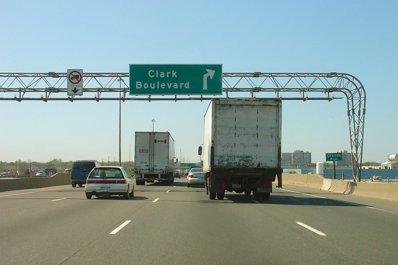
| City of Brampton Regional Municipality of Peel |
Driving northbound along Highway 410 approaching the Clark Boulevard
interchange. Highway 410 has an odd mix of auxiliary lanes between
Highway 401 and Queen Street. The northbound auxiliary lane that runs
northerly from Steeles Avenue exits at Clark Boulevard. Click
here to see an earlier
incarnation of this signage taken in May, 2005. Photo taken: June 6th, 2010. |
 (720x480) (720x480)(1440x960) (2400x1600) |
||||
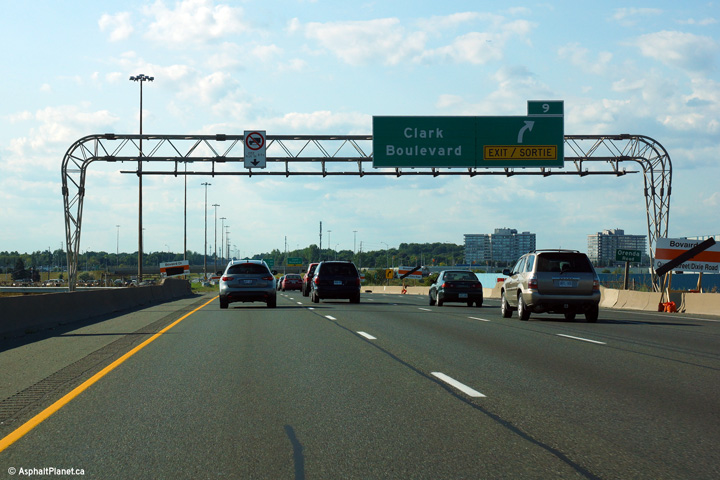
| City of Brampton Regional Municipality of Peel |
Overhead guide signage at the exit to Clark Boulevard. This is the
most-northern of the rounded truss gantries to be found along the northbound 410.
Click here to see an earlier
incarnation of this signage taken in May, 2005. Photo taken: June 6th, 2010. |
 (720x480) (720x480)(1440x960) (2400x1600) |
||||
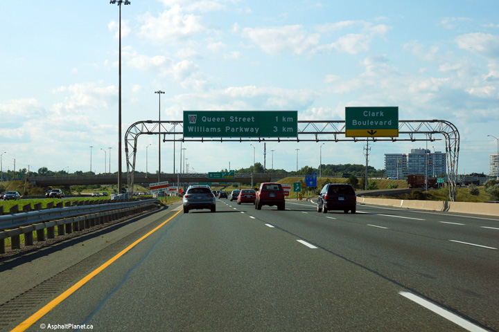
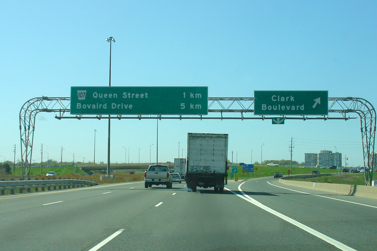
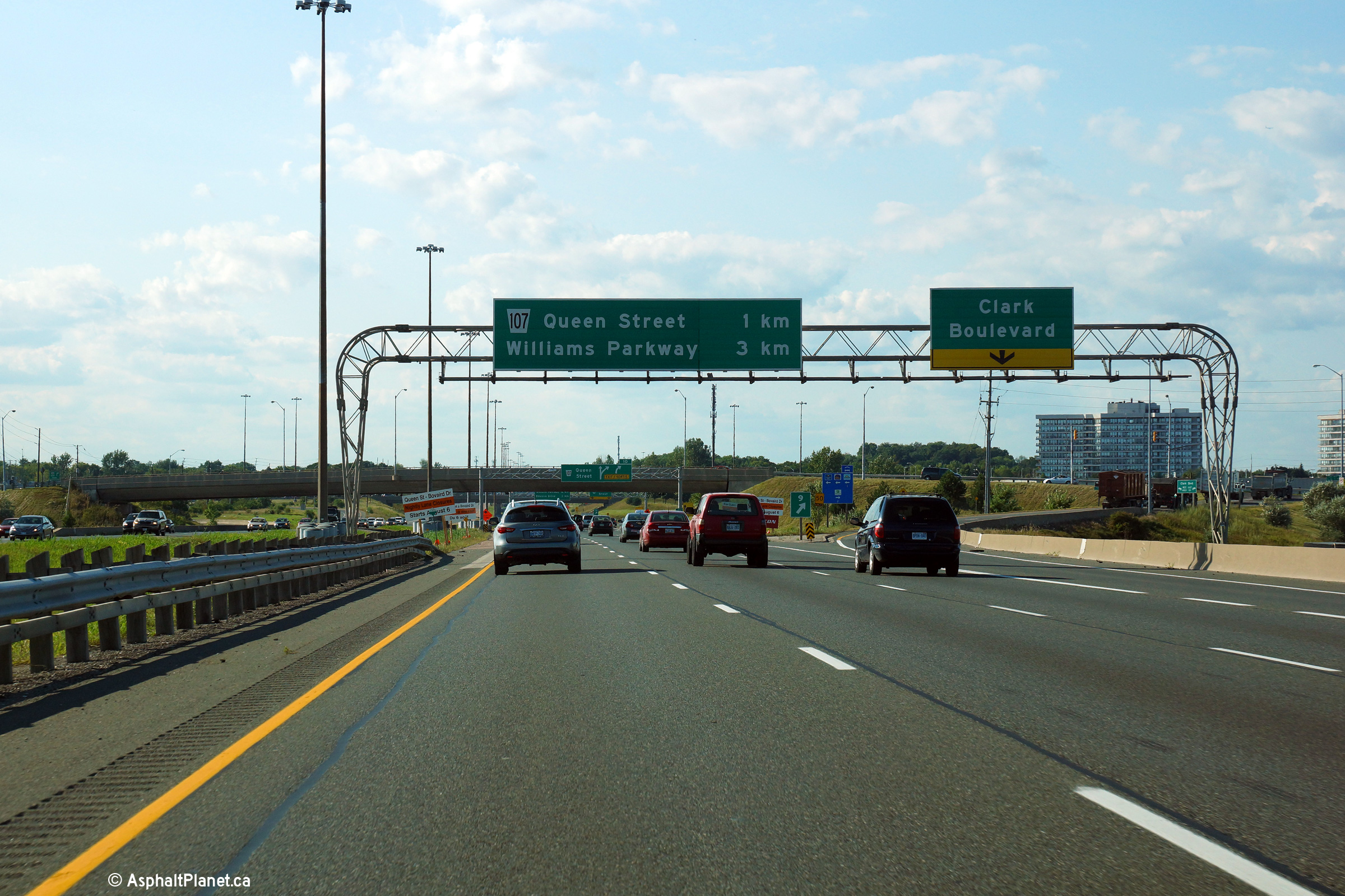
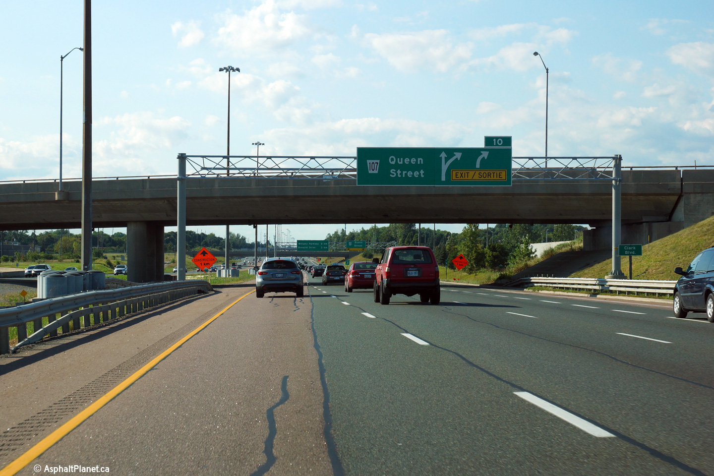
| City of Brampton Regional Municipality of Peel |
Northbound signage in advance of the Queen Street. The Clark Boulevard
overpass is situated behind the sign. Photo taken: June 6th, 2010. |
 (720x480) (720x480)(1440x960) (2400x1600) |
||||
| City of Brampton Regional Municipality of Peel |
Looking south from Clark Boulevard. Photo taken: August 28th, 2005. |
 (720x480) (1440x960) |
||||
| City of Brampton Regional Municipality of Peel |
Looking north along Highway 410 from the Clark Boulevard overpass.
Only one interchange was constructed to serve Highway 410 when it was still
a fledgling Super-2 highway. Before the 410 was twinned, the highway
resembled a two lane Highway 7 through York Region. Grade separations
were constructed to separate cross-traffic from Highway 410 traffic from
Steeles Avenue northerly. Turning traffic was directed down connector ramps
that later were incorporated into the freeways interchanges -- for more
information, find the map scans that have been included of this
configuration at the bottom of this page. Photos taken: August 28th, 2005. |
 (720x480) (1440x960) 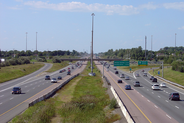 (720x480) (1440x960) |
||||
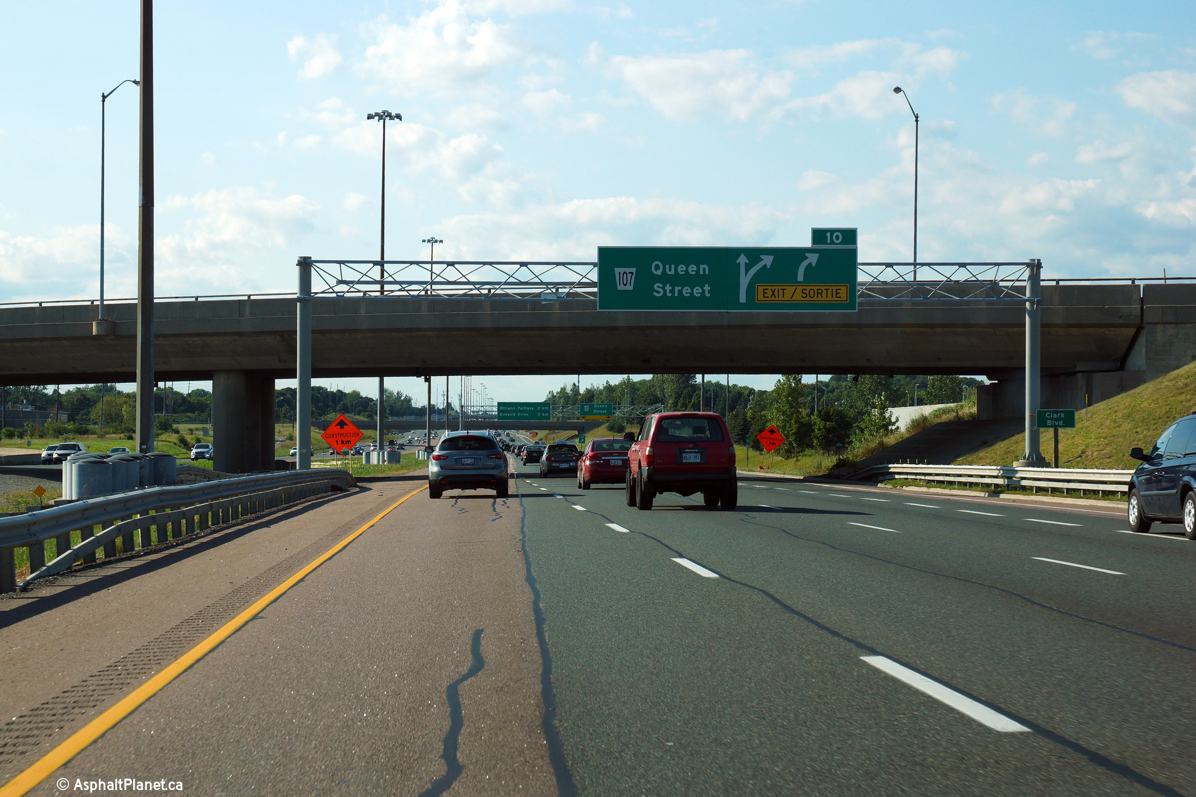
| City of Brampton Regional Municipality of Peel |
Signage at the northbound off-ramp to Queen Street. Photo taken: August 24th, 2013. |
 (720x480) (720x480)(1440x960) (2400x1600) |
||||
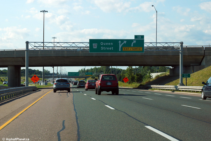
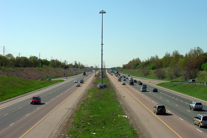
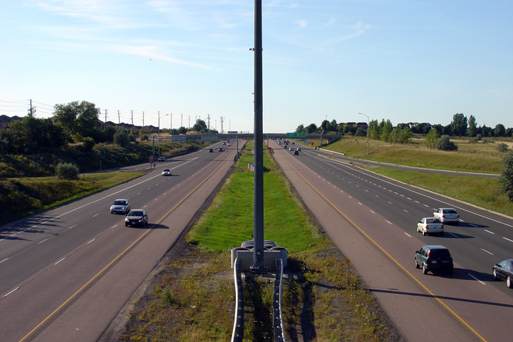
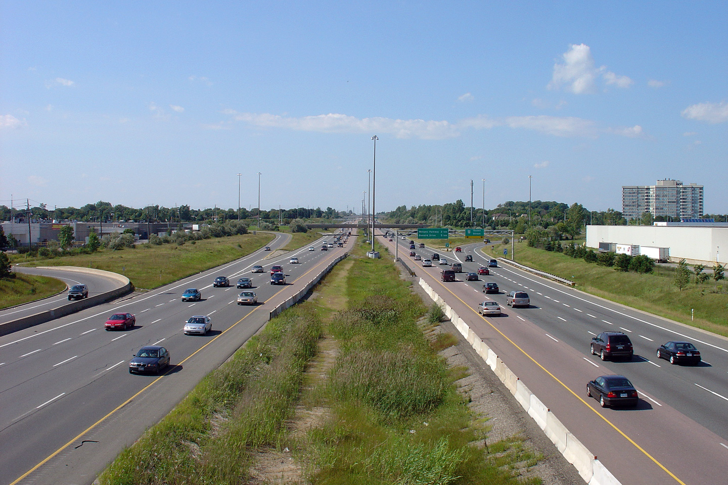
| City of Brampton Regional Municipality of Peel |
Highway 410 looking south from the Queen Street overpass. Before 1997,
Queen Street was part of Highway 7. The
Clark Boulevard overpass can be seen in the distance of this photo. Photo taken: May 12th, 2005. |
 (720x480) (1440x960) |
||||
| Highway 7 departs the 410 to the east via Brampton's Queen Street. Click here for Highway 7-East images. | ||||||
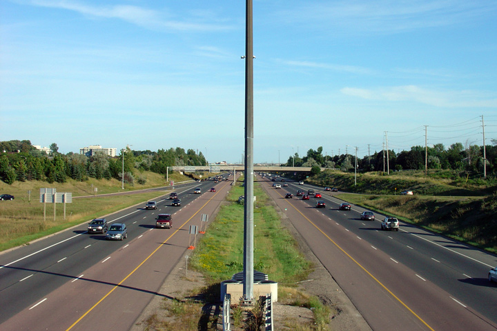
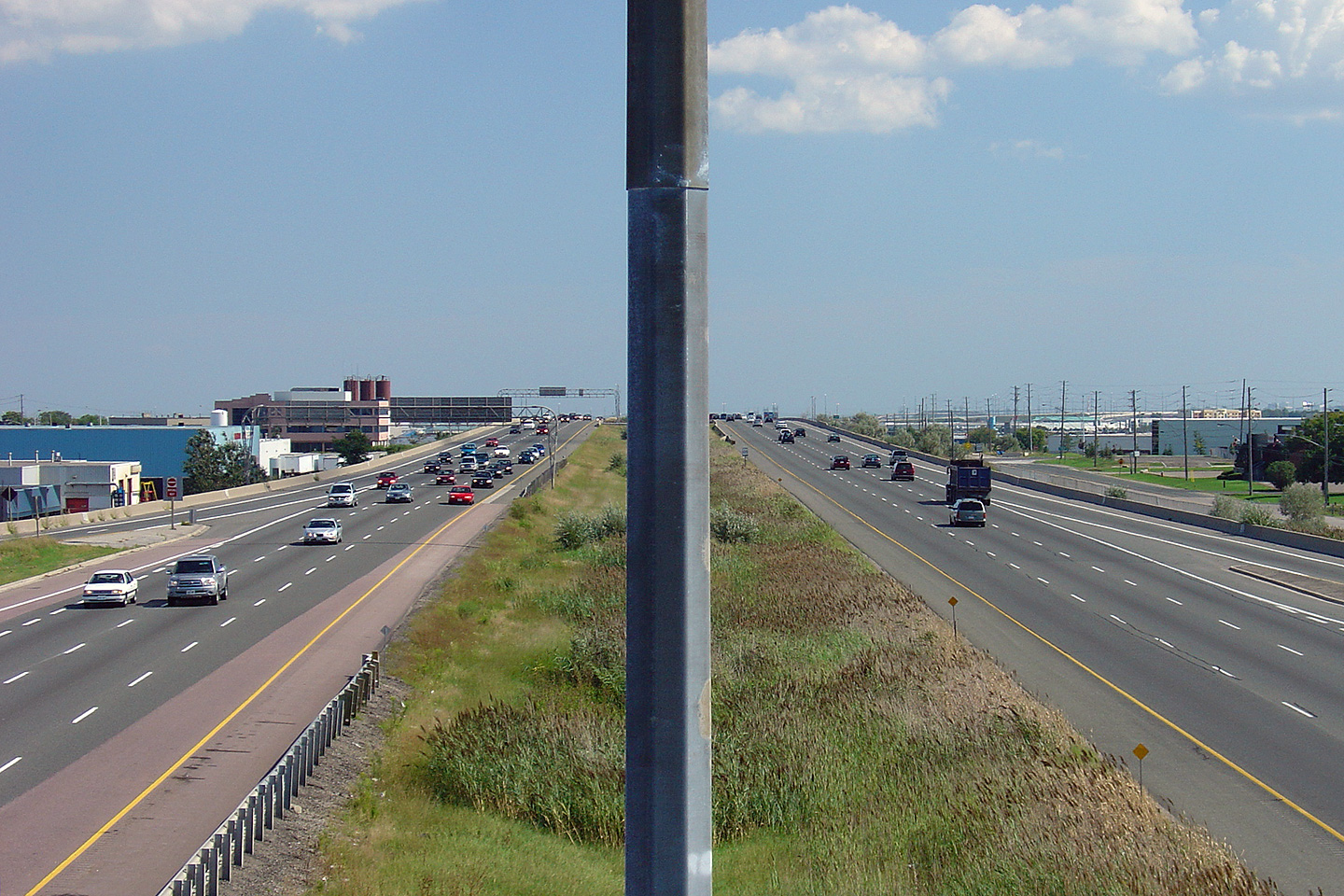
| City of Brampton Regional Municipality of Peel |
Highway 410 looking north from the Queen Street overpass. From Queen
Street northerly to Franceshini Road (a distance of about 1km) Highway 410
is depressed below grade. Presumably, the freeway is depressed to
minimize disruption to the surrounding residents. Earth berms do an
excellent job of mitigating highway noises. Photo taken: May 12th, 2005. |
 (720x480) (1440x960) |
||||
| City of Brampton Regional Municipality of Peel |
Southerly view from the Vodden Street overpass. Photo taken: May 25th, 2005. |
 (720x480) (1440x960) |
||||
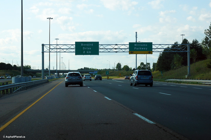
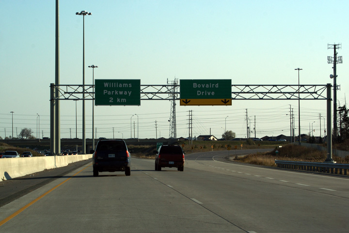
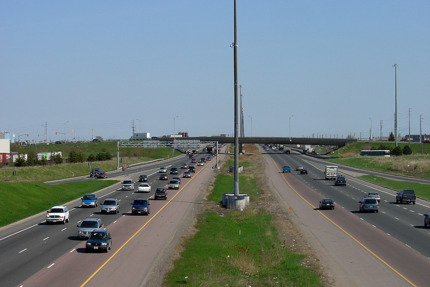
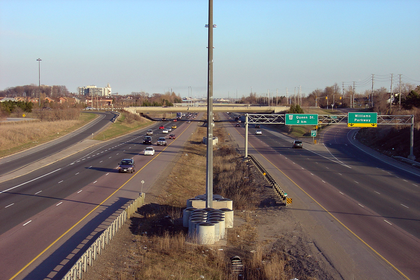
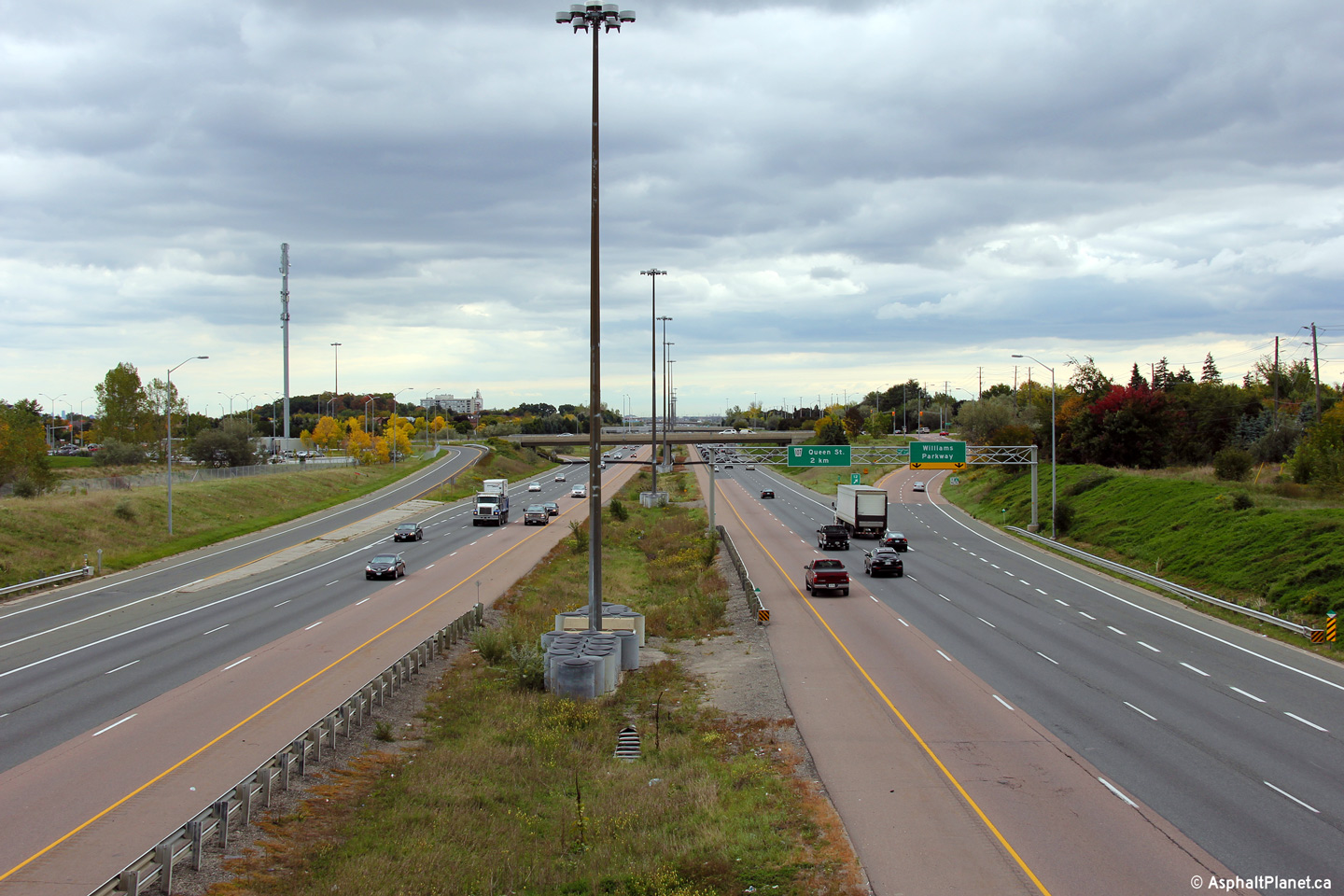
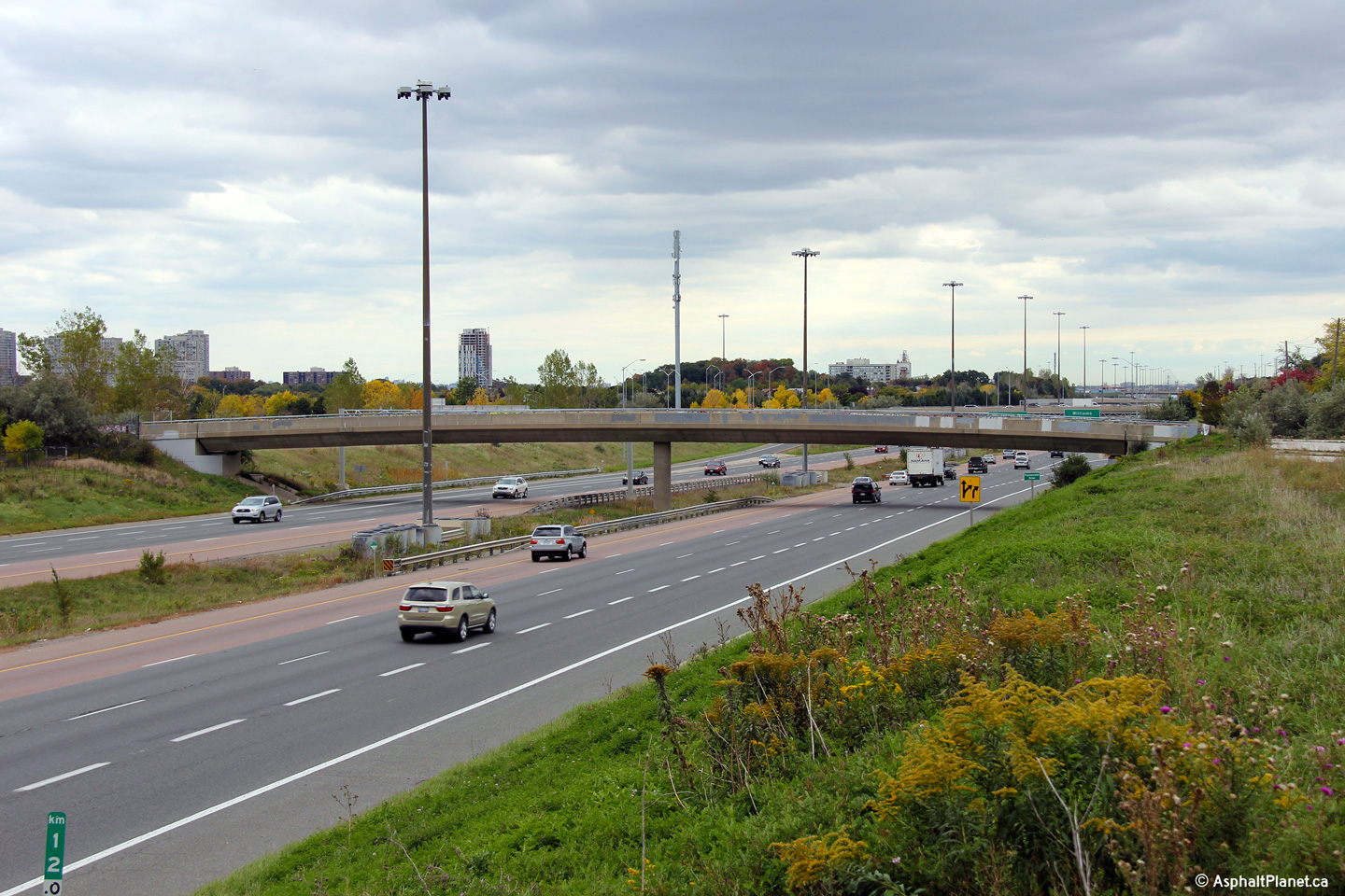
| City of Brampton Regional Municipality of Peel |
View looking northerly from Vodden Street towards the Williams Parkway
interchange. Photo taken: May 25th, 2005. |
 (720x480) (1440x960) |
||||
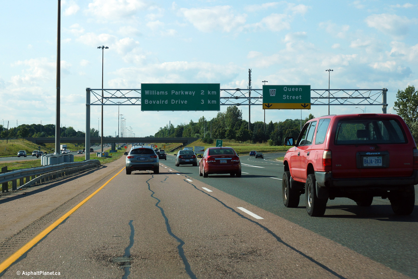
| City of Brampton Regional Municipality of Peel |
Northbound advanced signage for the Williams Parkway interchange. Photo taken: August 24th, 2013. |
 (720x480) (720x480)(1440x960) (2400x1600) |
||||
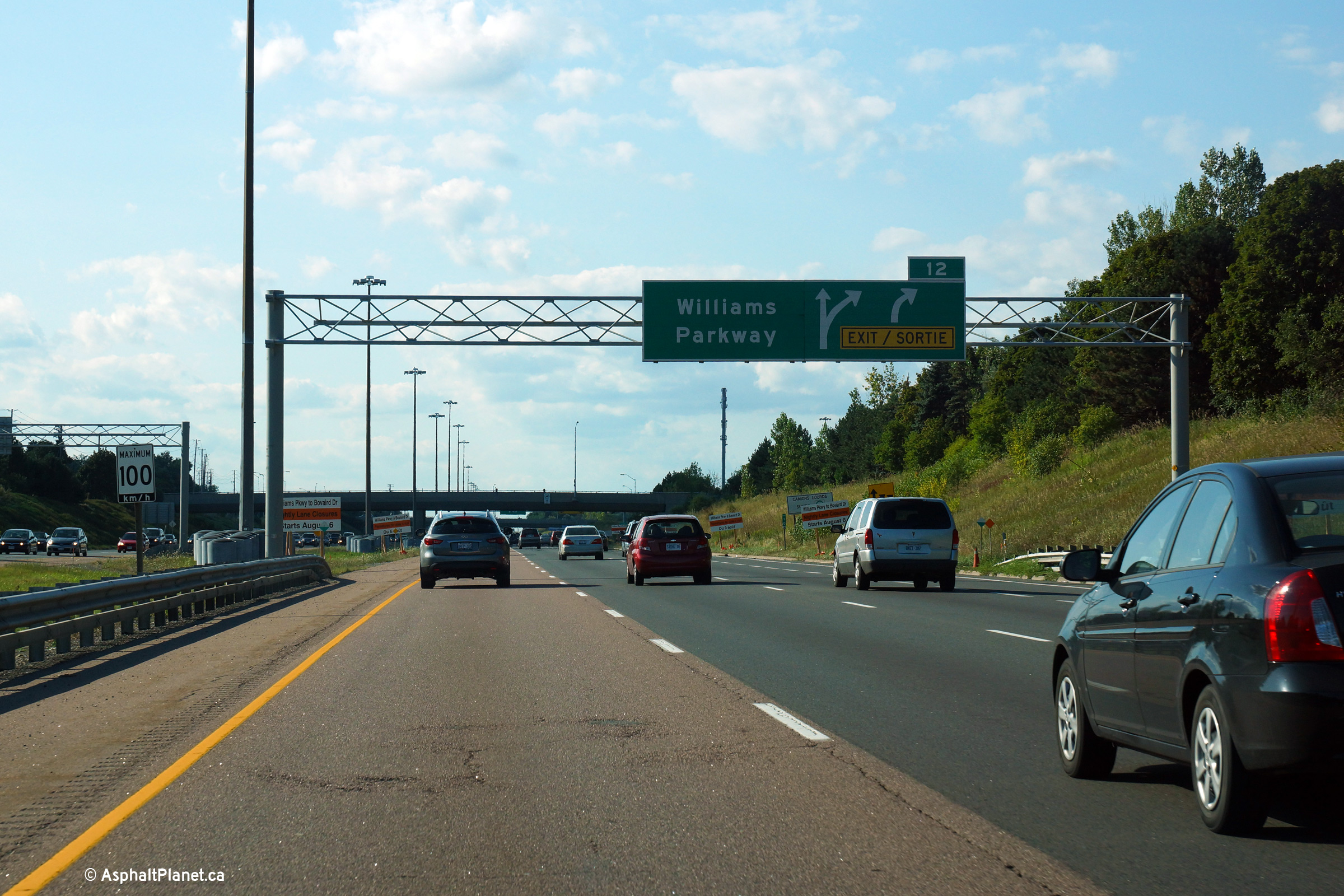
| City of Brampton Regional Municipality of Peel |
Signage for the northbound off-ramp to Williams Parkway. Photo taken: August 24th, 2013. |
 (720x480) (720x480)(1440x960) (2400x1600) |
||||
| City of Brampton Regional Municipality of Peel |
This view looks south along the Brampton By-pass
from the Williams Parkway overpass. Photo taken: August 14th, 2006. |
 (720x480) (1440x960) |
||||
| City of Brampton Regional Municipality of Peel |
Northerly view from the Williams Parkway
overpass along Highway 7/410. Photo taken: August 14th, 2006. |
 (720x480) (1440x960) |
||||
| City of Brampton Regional Municipality of Peel |
View
looking southerly from the Franceschini Drive overpass towards the Williams
Parkway interchange. The Franceschini Drive overpass formerly served a
gravel pit that existed along the west side of Highway 410. A
subdivision has since been built within the former gravel pit, and the Franceschini
Drive has been abandoned in place. Click here for this same view taken in
April, 2005.. Photo taken: April 10th, 2005. |
 (720x480) (1440x960) (2400x1600) |
||||
| City of Brampton Regional Municipality of Peel |
View looking northerly from the Franceschini Drive overpass. Click
here for this same view taken in
April, 2005. Photo taken: April 10th, 2005. |
 (720x480) (1440x960) (2400x1600) |
||||
| City of Brampton Regional Municipality of Peel |
Southerly view along Highway 410 from the Franceschini Drive overpass.
Since being disconnected from both vehicular and pedestrian traffic, the
Franceschini Drive overpass has become a trouble spot for graffiti artists. Photo taken: August 12th, 2012. |
 (720x480) (1440x960) (2400x1600) |
||||
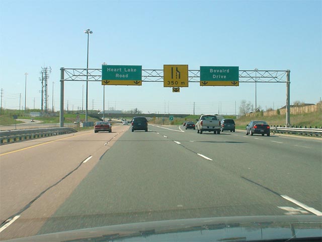
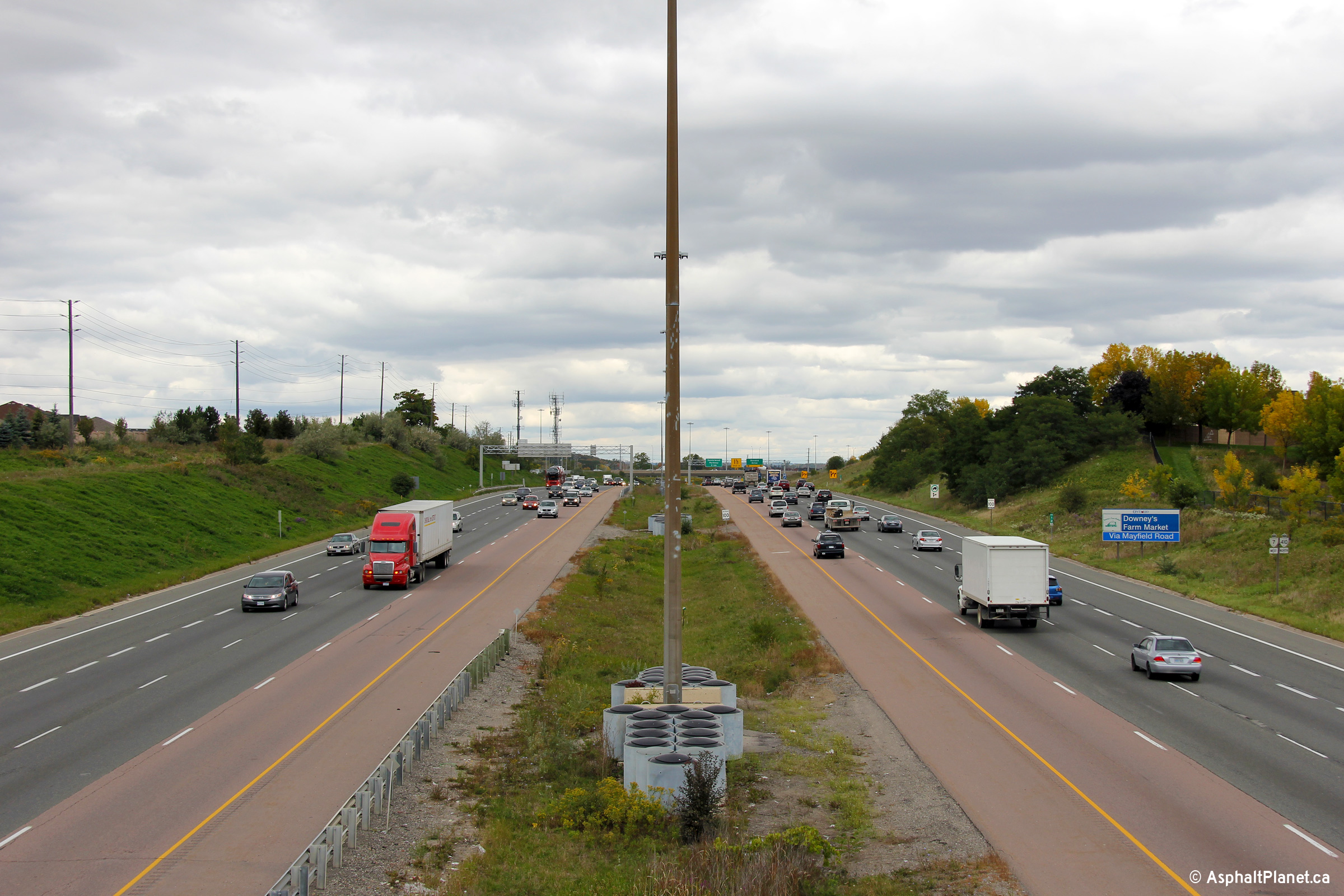
| City of Brampton Regional Municipality of Peel |
A series of three views looking northerly towards the Bovaird Drive
overpass. Contrast the upper and lower photos, the upper photo shows
Highway 410 when it ended at Bovaird Drive transitioning to Heart Lake
Road. The two lower photos show the Bovaird Drive interchange once the
410 had been extended northerly to Caledon. Upper photo taken: May 11th, 2007. Lower photos taken: August 12th, 2012. |
 (720x480) (1440x960) (2400x1600) 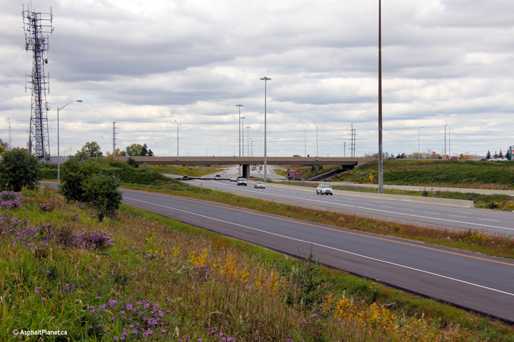 (720x480) (1440x960) (2400x1600) |
||||
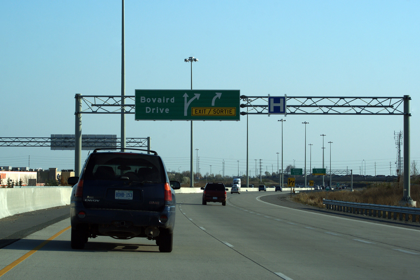
| City of Brampton Regional Municipality of Peel |
Advanced signage for the Bovaird Drive interchange. Photo taken: August 24th, 2013. |
 (720x480) (720x480)(1440x960) (2400x1600) |
||||
| City of Brampton Regional Municipality of Peel |
Overhead pull-through signage for the ramp to Bovaird Drive from Highway 410
North. This was the long time northern terminus of Highway 410 until
the first phase of the extension opened in 2007. I have included a
small subsection of Highway 410 images at the bottom of this page that
includes some photos of this signage when it marked the northern terminus of
the freeway. Photo taken: June 6th, 2010. |
 |
||||
| City of Brampton Regional Municipality of Peel |
Highway 410 looking south from the Bovaird Road (Highway 7-West) Overpass. It's difficult to imagine today, but at the time when the 410 was first constructed, it was as much of a by-pass for Highway 7 as it was for Highway 10. Prior to the completion of Highway 410, Highway 7 followed Main Street through Downtown Brampton. Again, hard to imagine today, but until the early 1990s, Highway 7 was still primarily a rural highway through most of Peel and York Regions. Upper photo taken: August 1st, 2004.
Lower photo taken: May 21st, 2011. |
 (720x480) (1440x960) (2400x1600) |
||||
| Highway 7 follows Bovaird Drive west out of Brampton, before heading to Georgetown, Acton and Guelph. Click here for Highway 7-West images. | ||||||
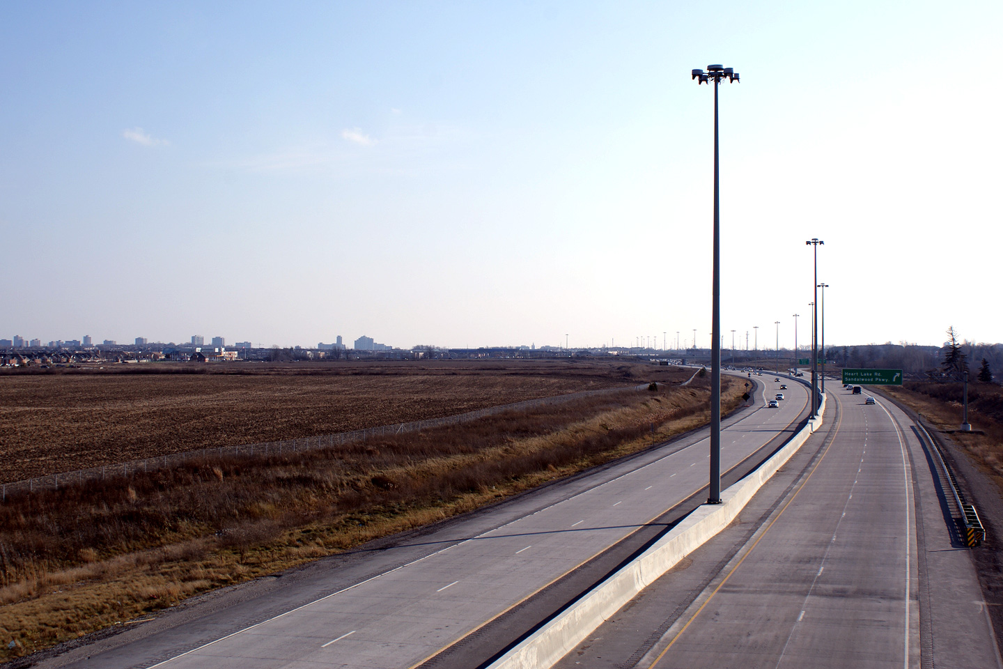
| City of Brampton Regional Municipality of Peel |
Northbound view from the Bovaird Drive overpass along Highway 410. Before
Highway 410 was extended northerly to Caledon, it linked directly to Heart
Lake Road. This photo comparison shows the various stages of Highway
410 from when it transitioned to Heart Lake Road to when the expressway
extension had been completed.. Photo #1 taken: August 1st, 2004. Photo #2 taken: May 11th, 2007 Photo #3 taken: August 28th, 2007 Photos #4 and #5 taken: June 5th, 2011. |
 (720x480) (1440x960) (2400x1600)  (720x480) (1440x960) (2400x1600) |
||||
| City of Brampton Regional Municipality of Peel |
Signage for the ramp to Bovaird Drive. Oddly, no reference is made
that Bovaird Drive is now Peel Road 107 to the west of Highway 410.
Peel Road 107 is the new number for the now defunct Highway 7 through Peel
Region. Photo taken: November 7th, 2009. |
 |
||||
| City of Brampton Regional Municipality of Peel |
Advanced signage for the southbound ramp to Bovaird Drive. Photo taken: November 7th, 2009. |
 |
||||
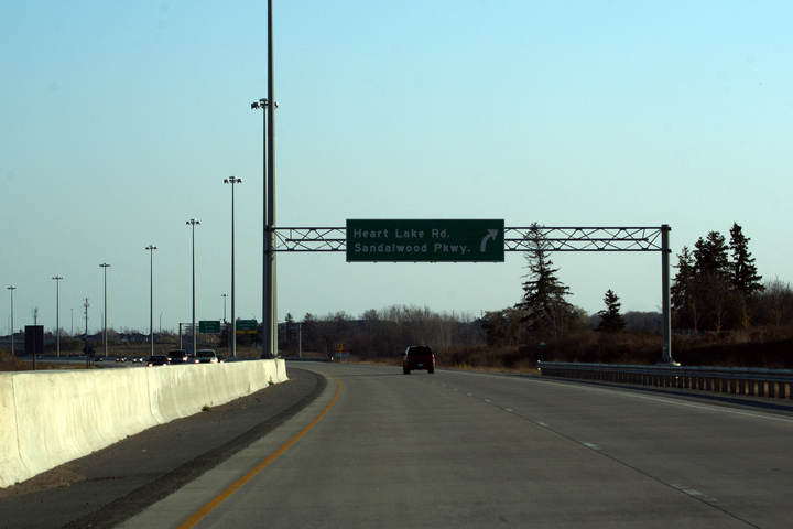
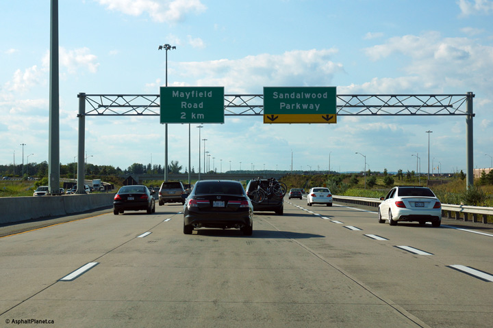
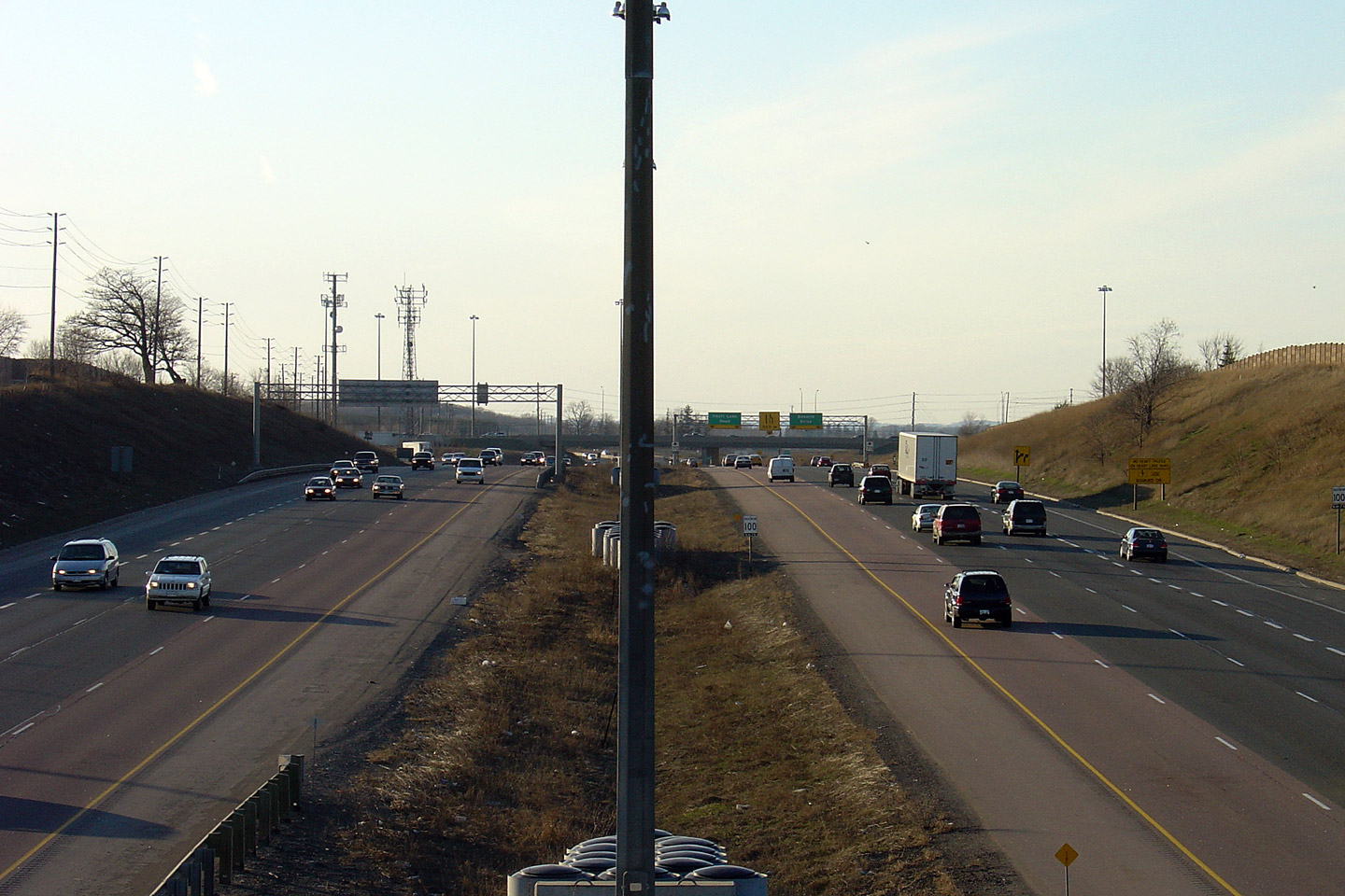
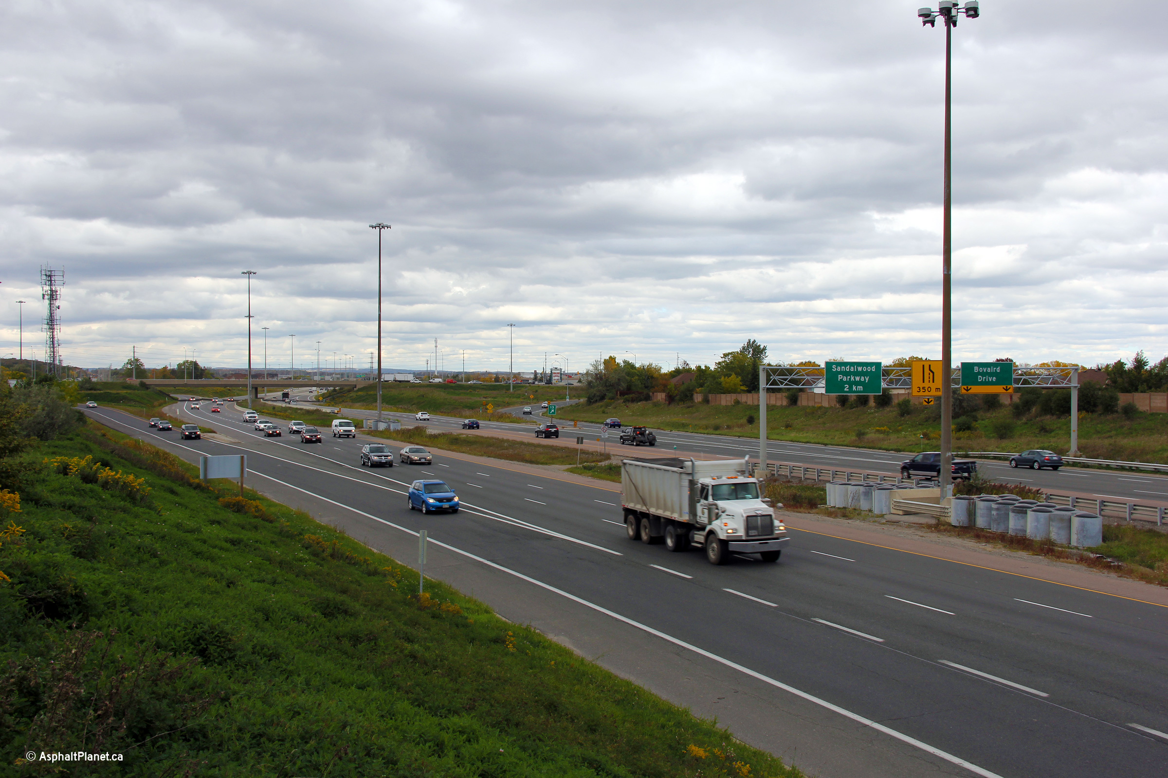
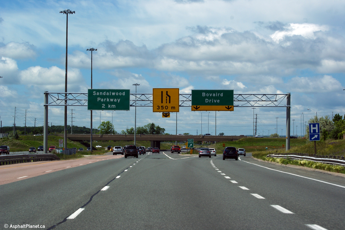
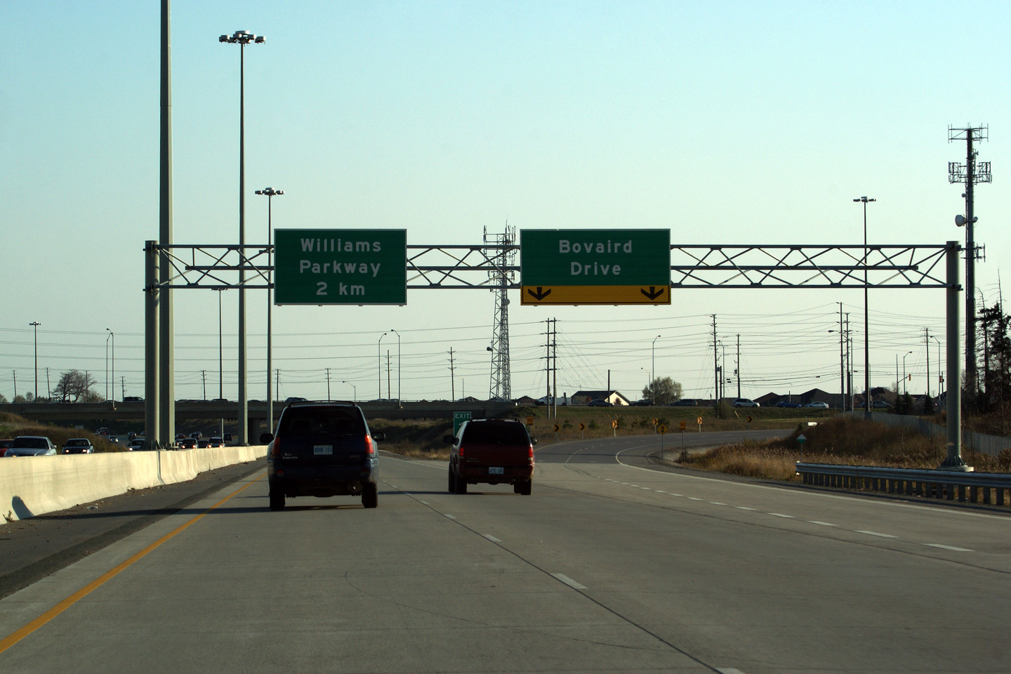
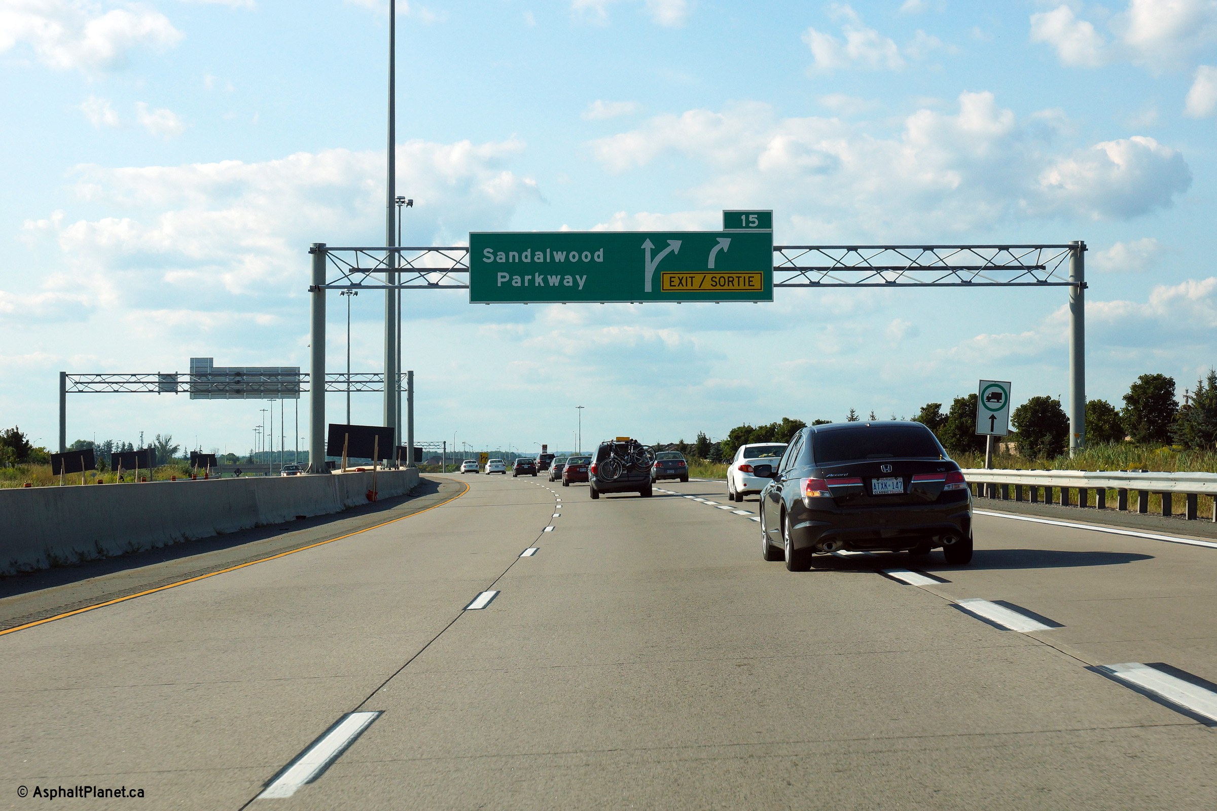
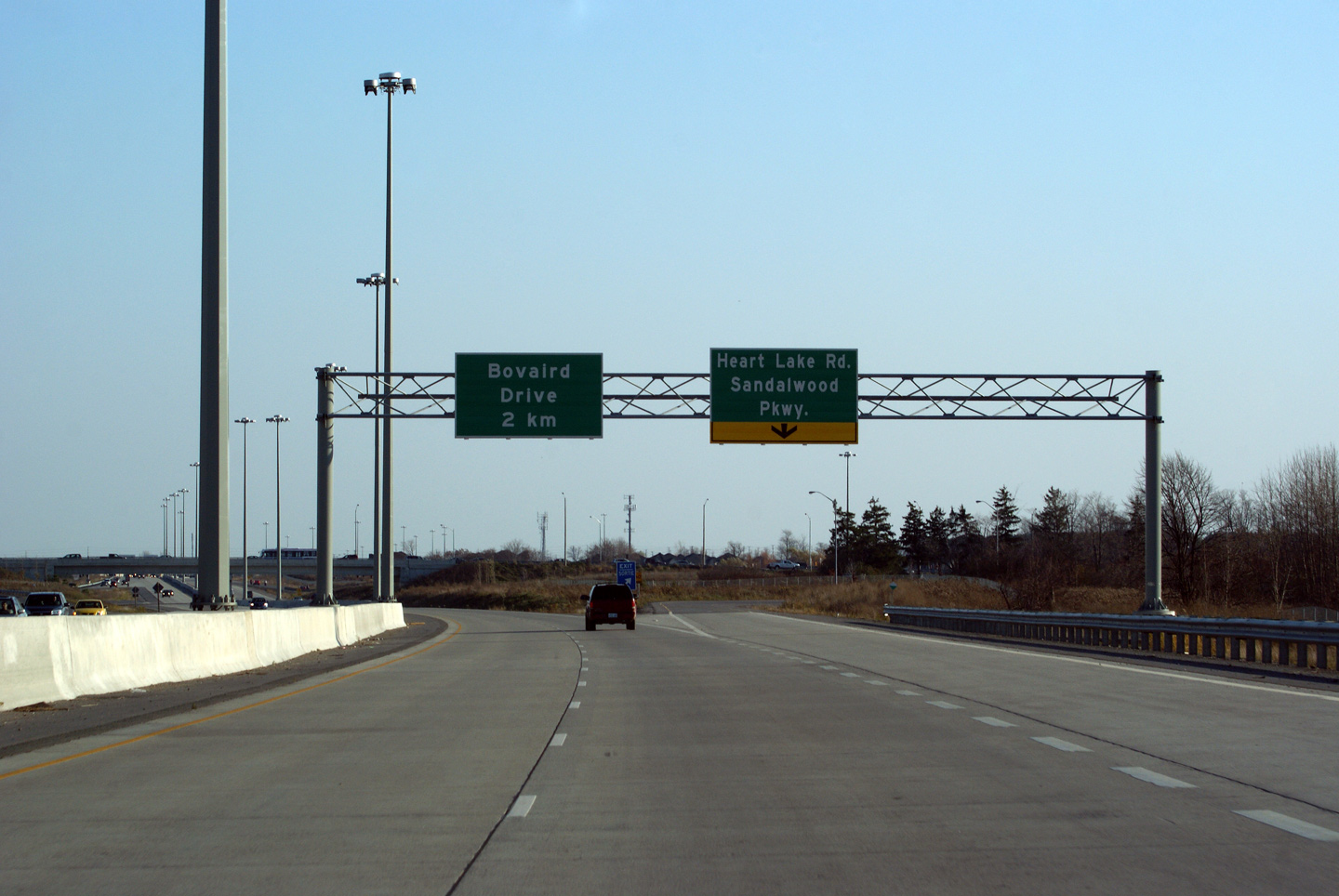
| City of Brampton Regional Municipality of Peel |
View driving northerly along Highway 410 at the advanced signage for the
Sandalwood Parkway interchange. Between Bovaird and Sandalwood there
is a northbound auxiliary lane. Photo taken: August 24th, 2013. |
|||||
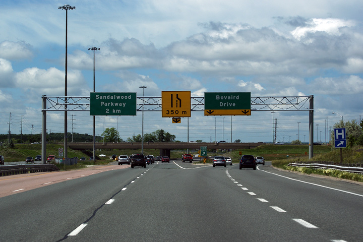
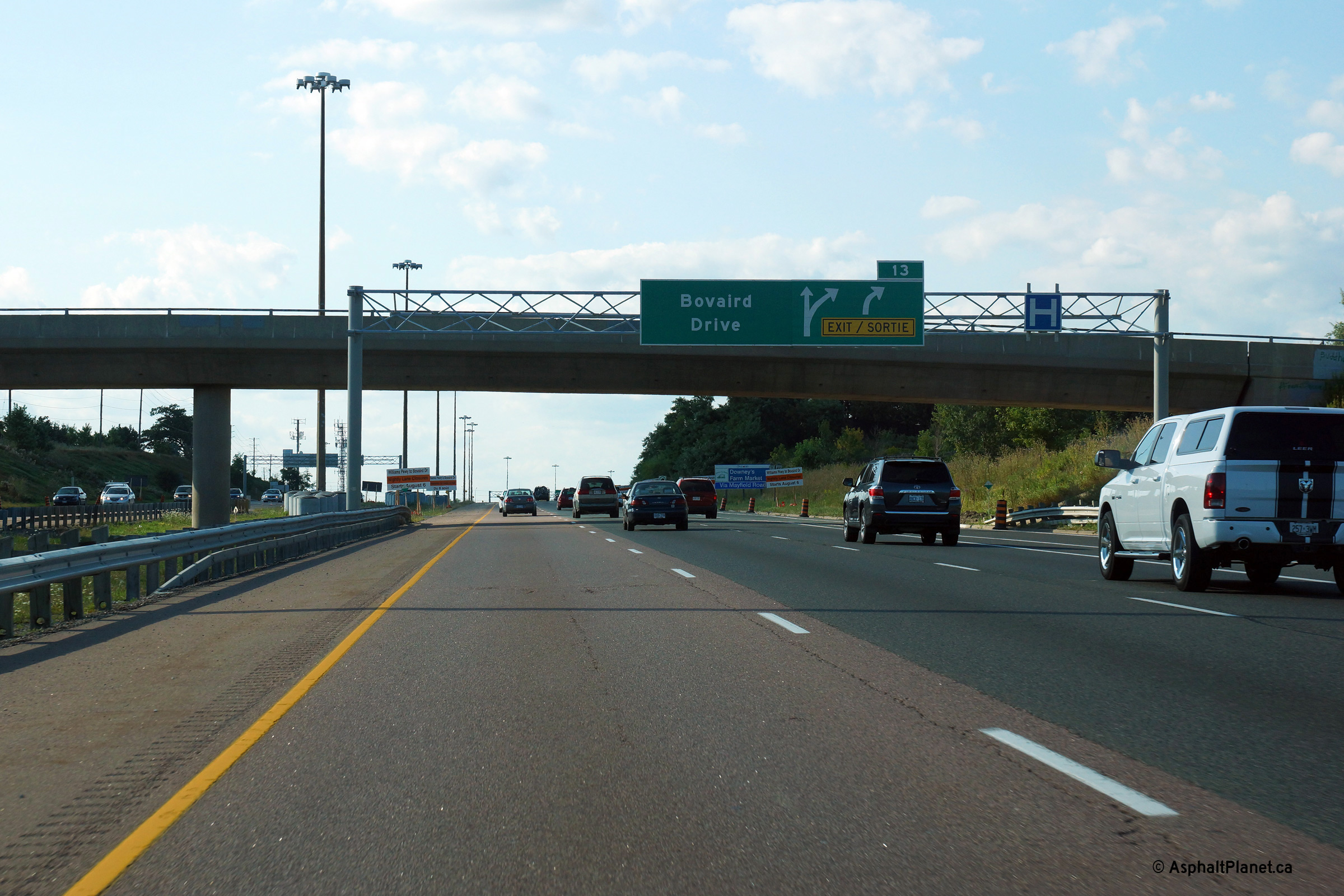
| City of Brampton Regional Municipality of Peel |
Signage at the northbound off-ramp to Sandalwood Drive. Notice all the
overhead sign supports are wide enough to support an additional through
lane. Photo taken: August 24th, 2013. |
|||||
| Highway 410 is being extended from Bovaird Drive to Highway 10 at Valleywood. Click here for more information and photos. | ||||||
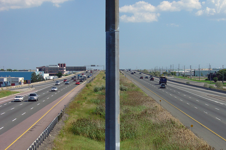
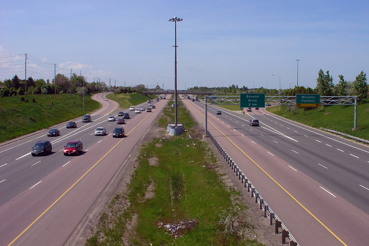
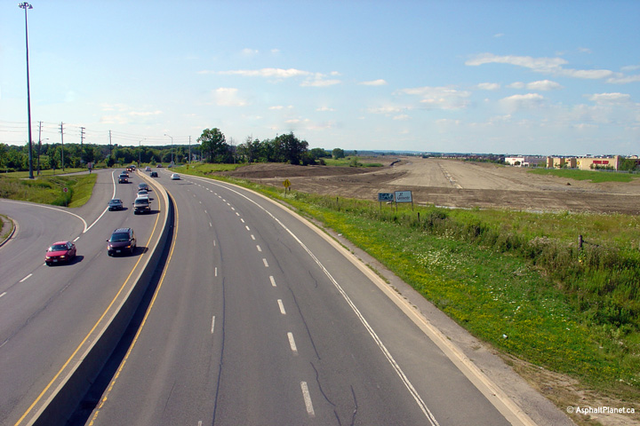
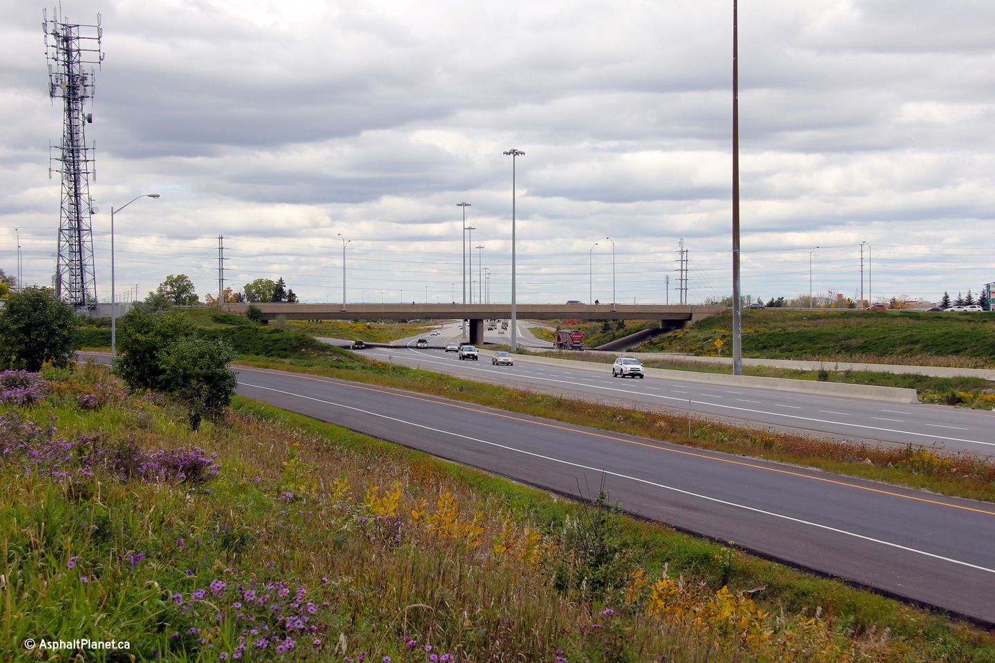
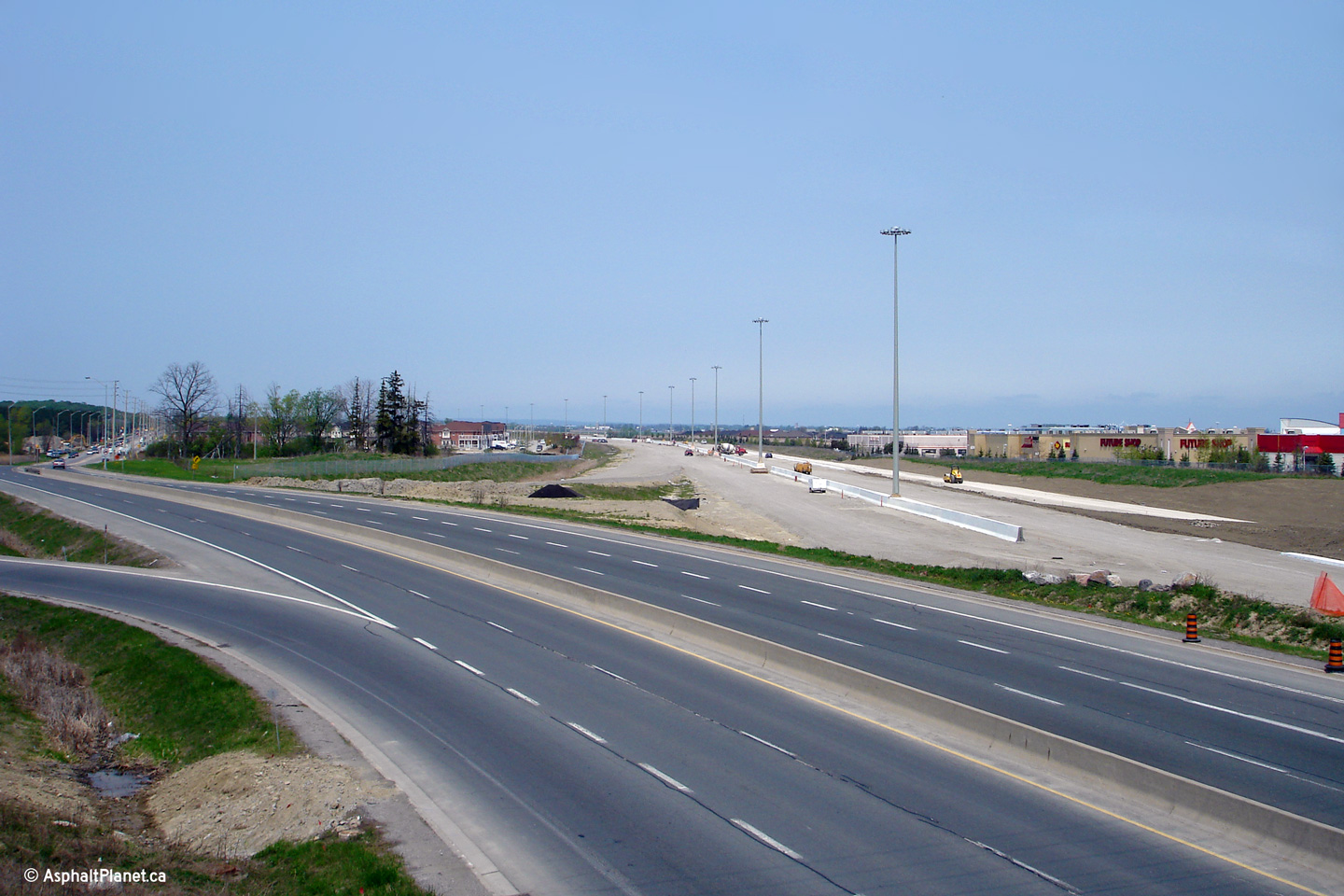
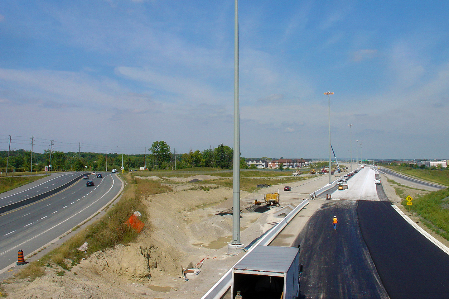
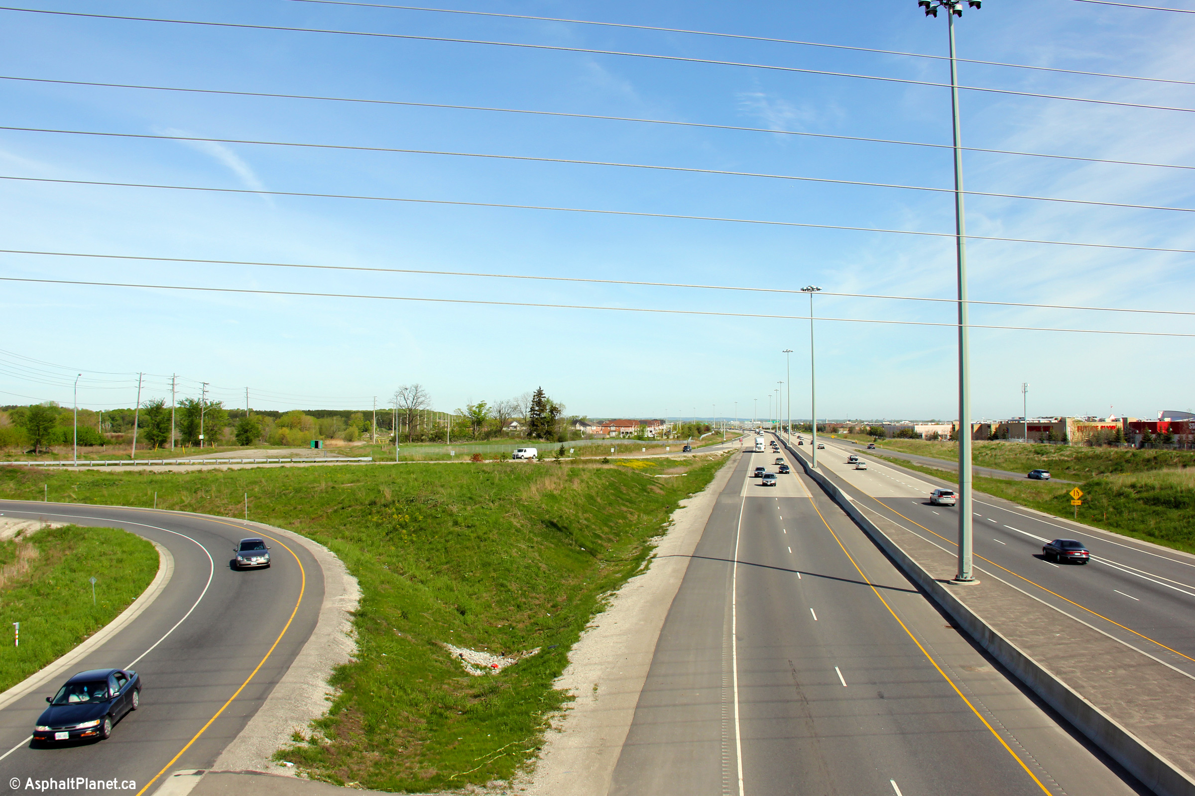
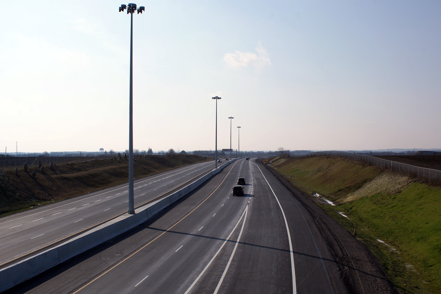
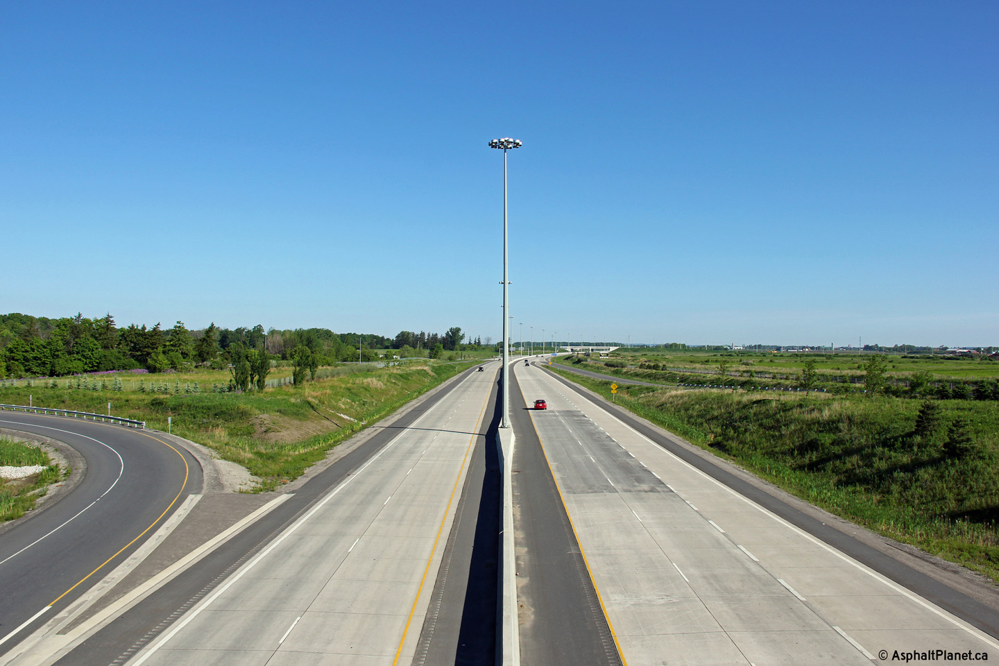
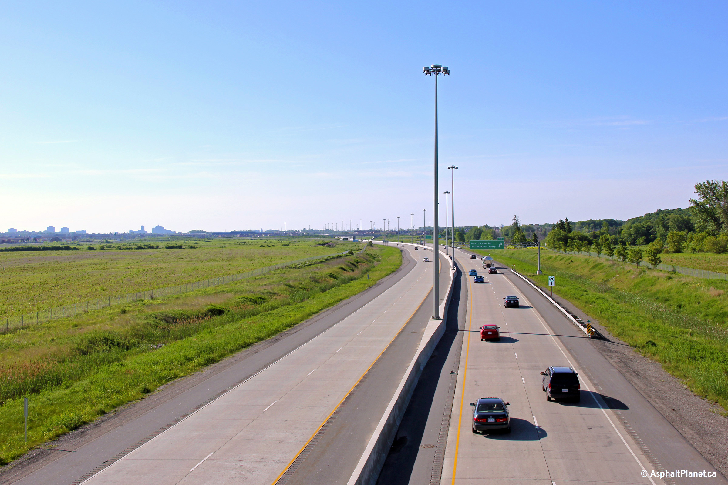
| City of Brampton Regional Municipality of Peel |
Southerly view from the Sandalwood Parkway overpass. Highway 410
was designed to be very easily widened from four to six lanes. It
would be very easy to add an extra lane of concrete to the outer sides of
each carriageway, however the impacts to the concrete gores at all ramp
entrances and exits will be significant. Click
here for this same view taken in
December, 2009. Photos taken: June 5th, 2011. |
 (720x480) (1440x960) (2400x1600) 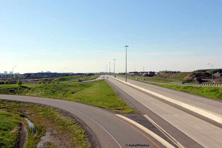 (720x480) (1440x960) (2400x1600) |
||||
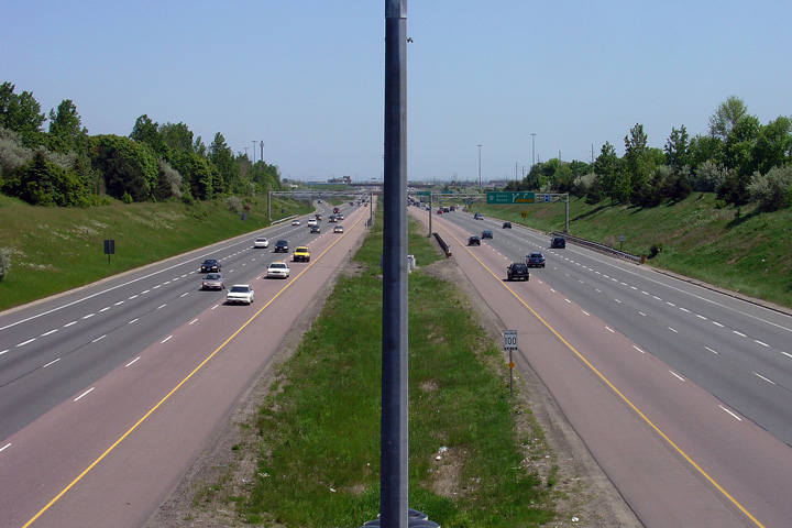
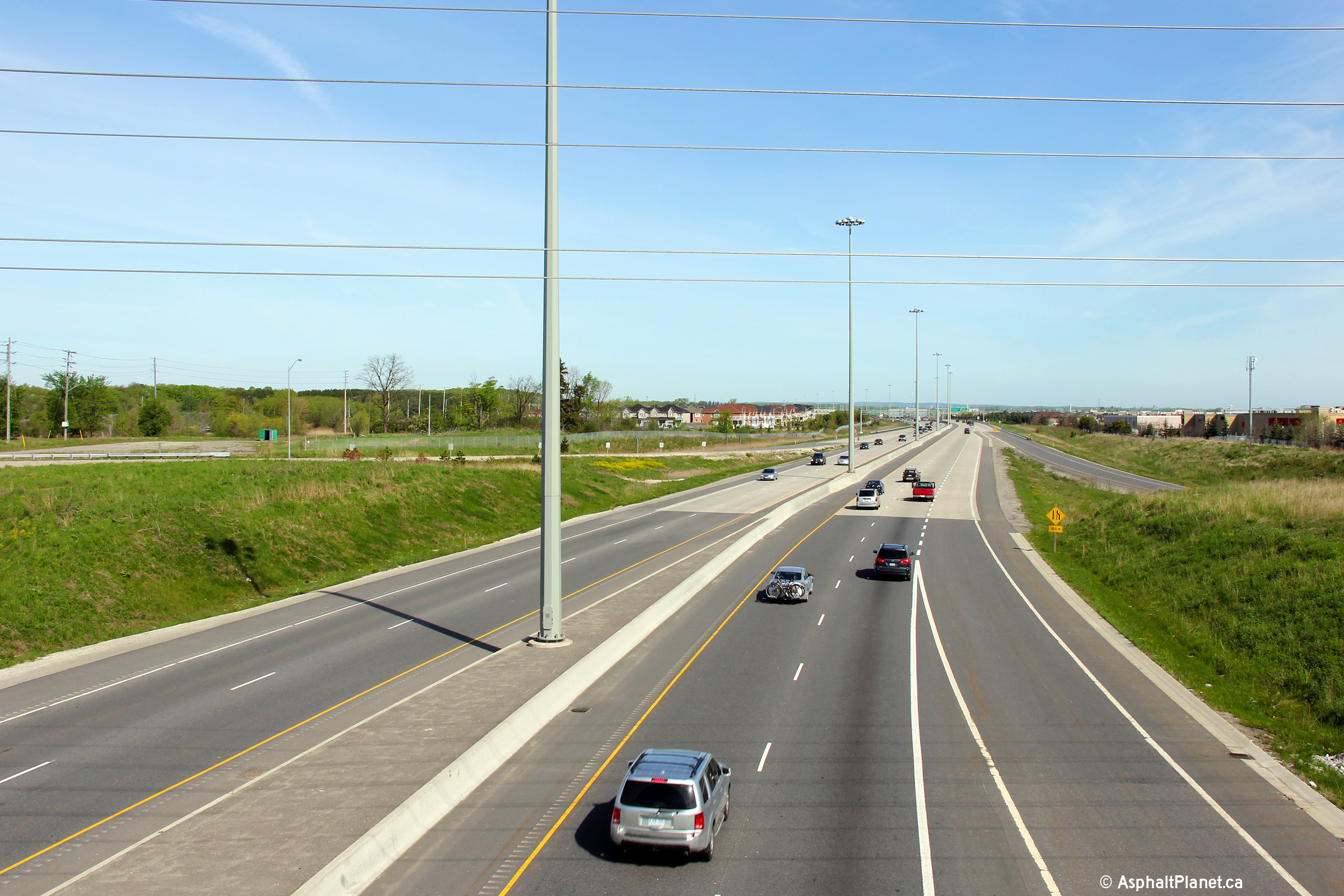
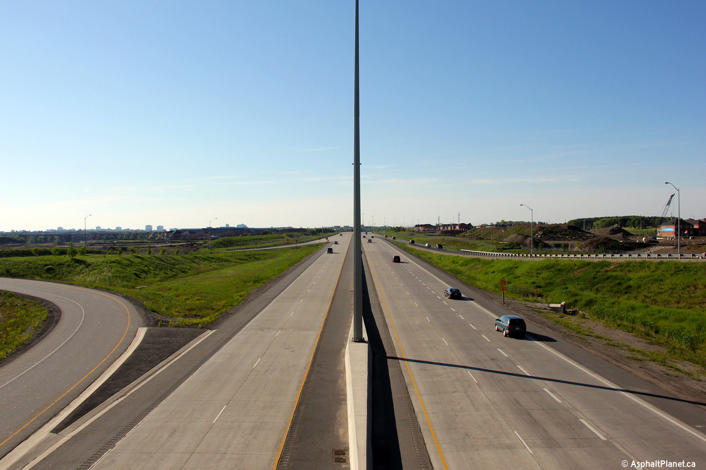
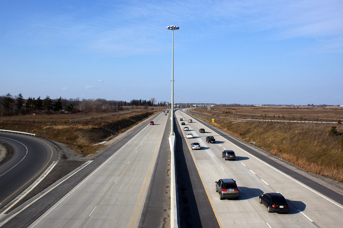
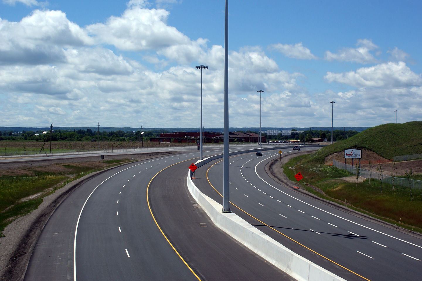
| City of Brampton Regional Municipality of Peel |
View looking northerly from the Sandalwood Parkway overpass. Note that the
concrete surface of the northbound lanes of the highway is narrower than the
concrete surface of the southbound lanes. Click
here for this same view taken in
December, 2009. Photo taken: June 5th, 2011. |
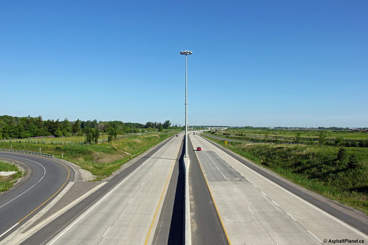 (720x480) (1440x960) (2400x1600) |
||||
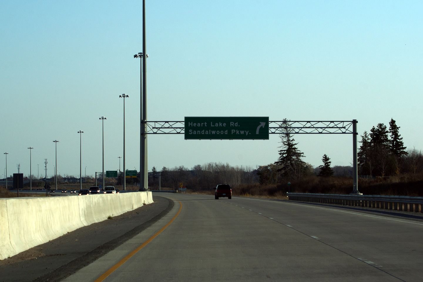
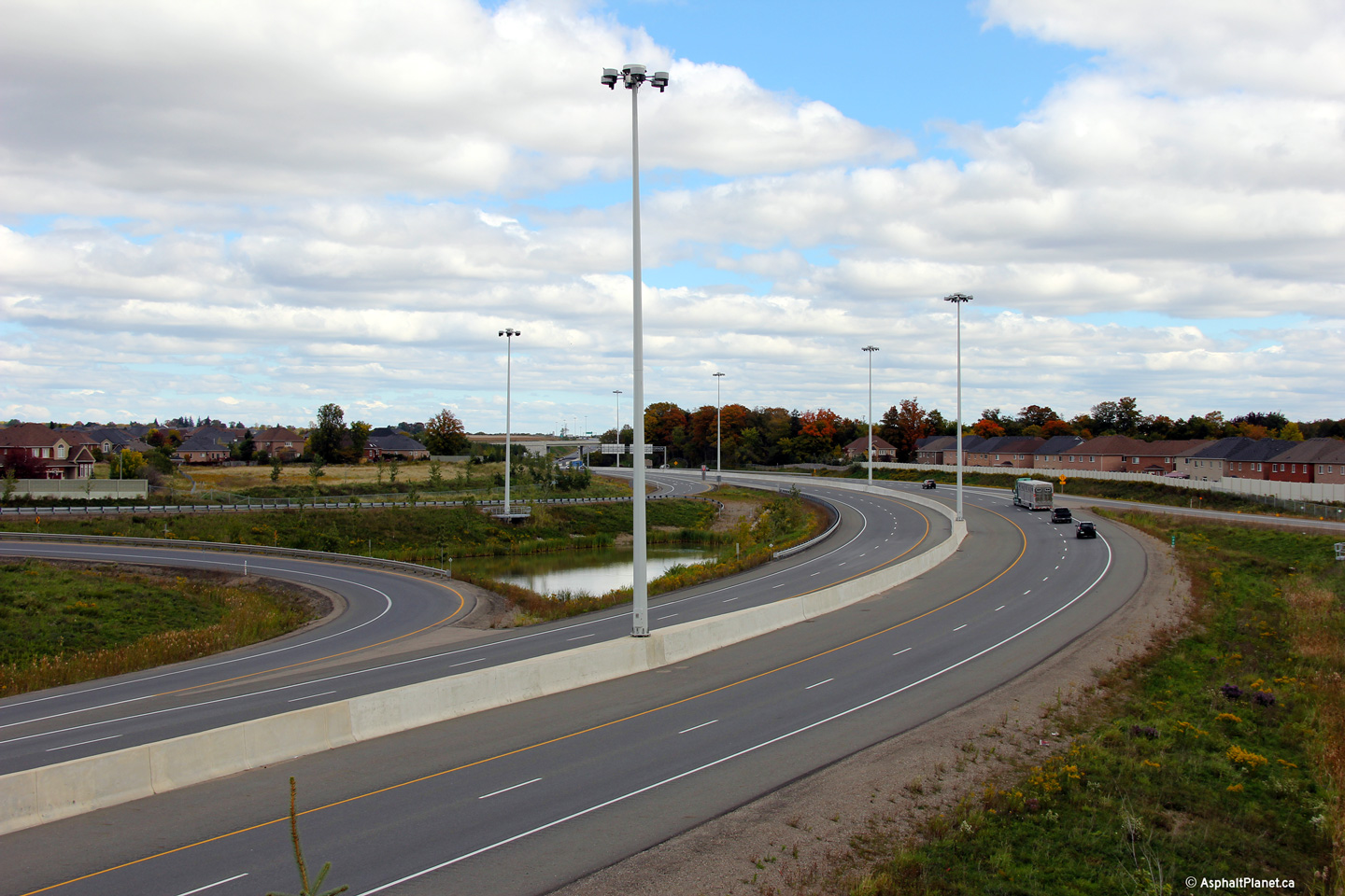
| City of Brampton Regional Municipality of Peel |
View looking southbound at the ramp from Highway 410 South to the Sandalwood
Parkway. The ramp from Highway 410-South meets Heart Lake Road instead
of connecting directly to Sandalwood Parkway due to the close proximity of
the freeway to Heart Lake. Photo taken: November 7th, 2009. |
 |
||||
| City of Brampton Regional Municipality of Peel |
Advanced guide signage for the Sandalwood Parkway interchange. Photo taken: November 7th, 2009. |
 |
||||
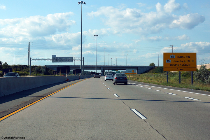
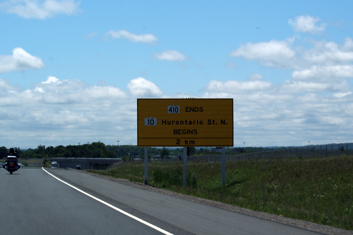
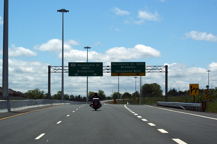
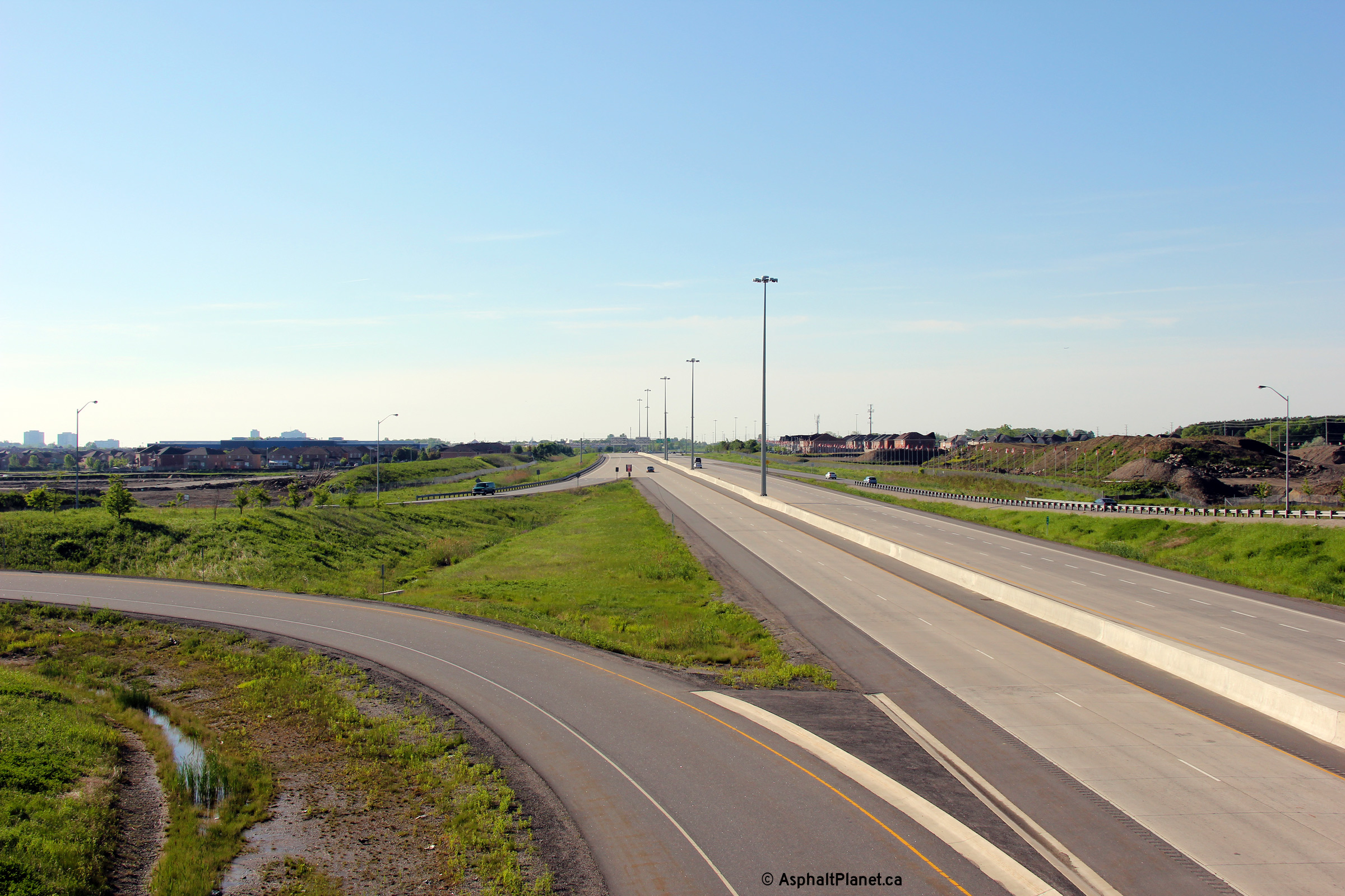
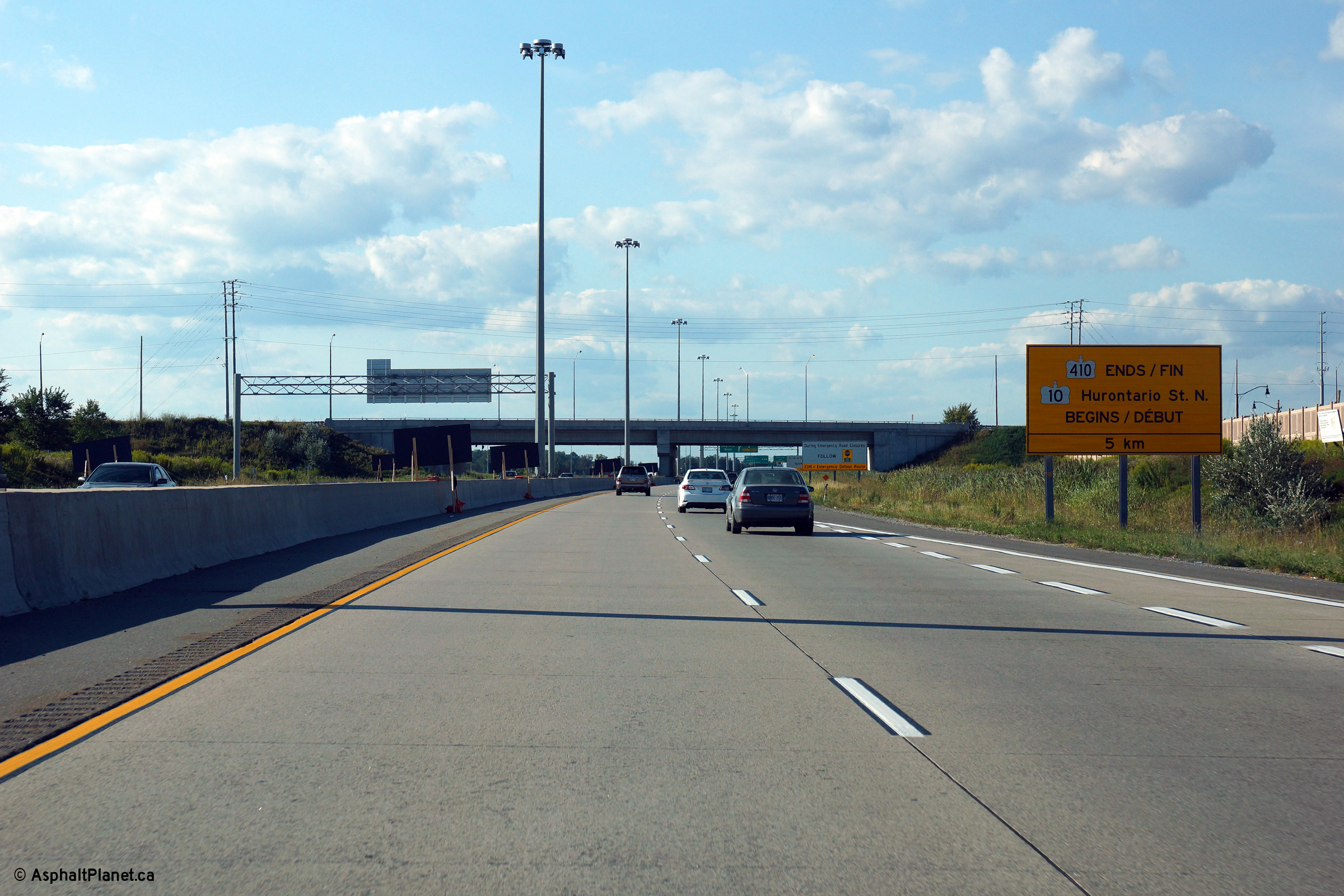
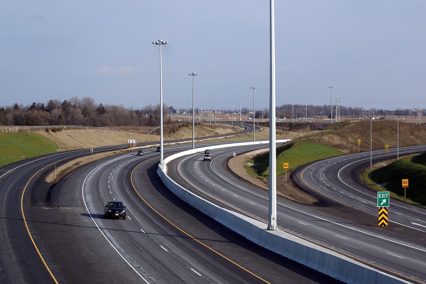
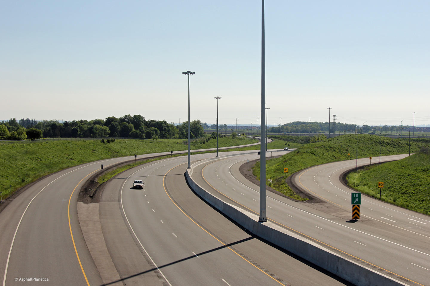
| City of Brampton Regional Municipality of Peel |
Northerly view approaching the Countryside Drive overpass. There are
two of these large signs to indicate the northern terminus of Highway 410 at
the Hurontario Street interchange. Photo taken: August 24th, 2013. |
 (720x480) (720x480)(1440x960) (2400x1600) |
||||
| City of Brampton Regional Municipality of Peel |
View looking southerly from the Countryside Drive overpass.
Countryside Drive's street name is becoming a bit of a misnomer. The
City of Brampton is quickly enveloping the countryside that the street is
named for. Click here for this same view taken in
December, 2009. Photo taken: December 6th, 2009. |
 (720x480) (1440x960) (2400x1600) |
||||
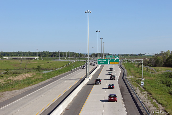
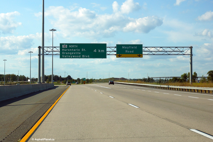
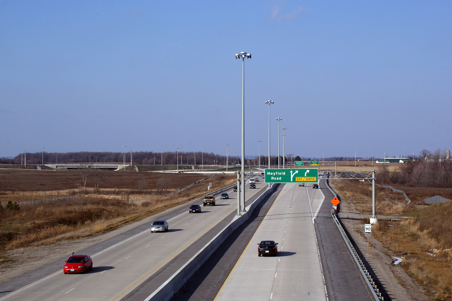
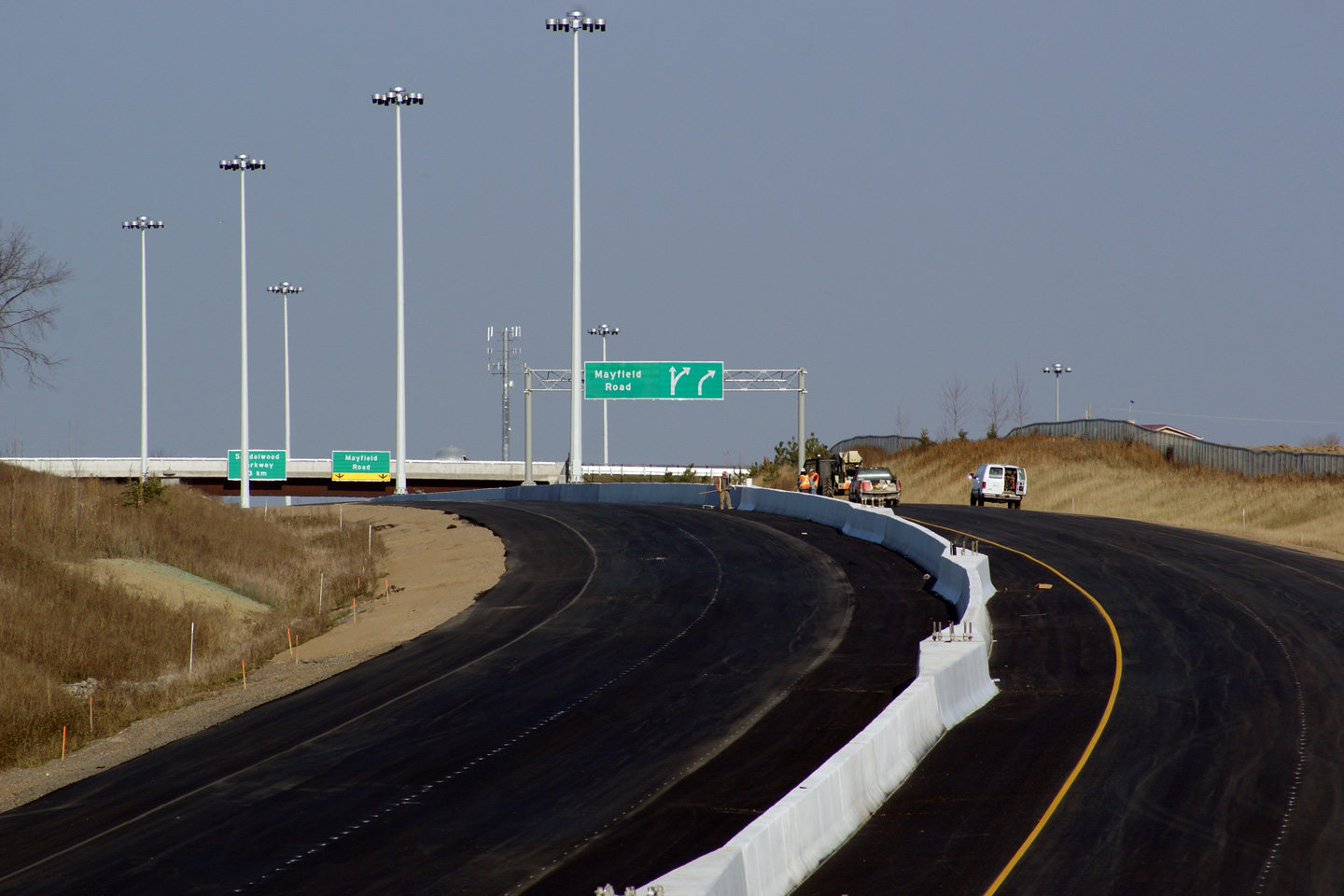
| City of Brampton Regional Municipality of Peel |
Two northerly views from the Countryside Drive overpass towards the Mayfield
Drive interchange. The upper photo shows Highway 410 just after the
northbound lanes had opened to traffic as far northerly as Mayfield Road.
Note the rather odd overhead sign for Mayfield Road pictured. The lower
photo shows the highway from the same vantage point with all lanes open to
Highway 10. In the more recent photo, take note that the speed limit along
the northern most section of Highway 410 has been reduced to ease the
transition between the expressway and the arterial road that lies ahead.
Click here for an additional modern
view, taken in
December, 2009. Photo taken: December 6th, 2009. |
 (720x480) (1440x960) (2400x1600) |
||||
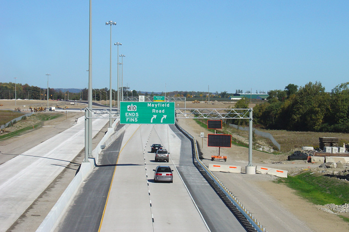
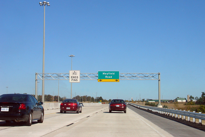
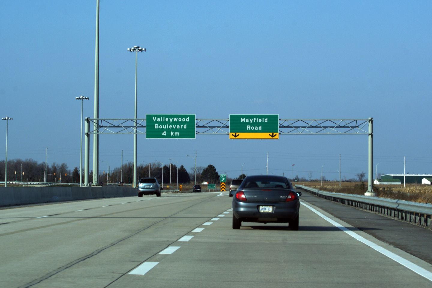
| City of Brampton Regional Municipality of Peel |
Three different overhead signs for the same interchange. The change
from the first overhead to the second overhead is pretty understandable,
seeing as the in 2007, Highway 410 actually ended at Mayfield Road.
Note the changes between the 2009 photo and the August 2013 photo however.
Evidently the initial signing plan that did not do a sufficient job at
delineating the upcoming Hurontario Street/Valleywood Boulevard interchange.
Various guidance improvements were carried out at, and in advance of the
interchange to further delineate that Hurontario Street is no longer a
through street at the Highway 410 interchange. Upper photo taken: September 23rd, 2007. Middle photo taken: December 6th, 2009. Lower photo taken: August 13th, 2013. |
|
||||
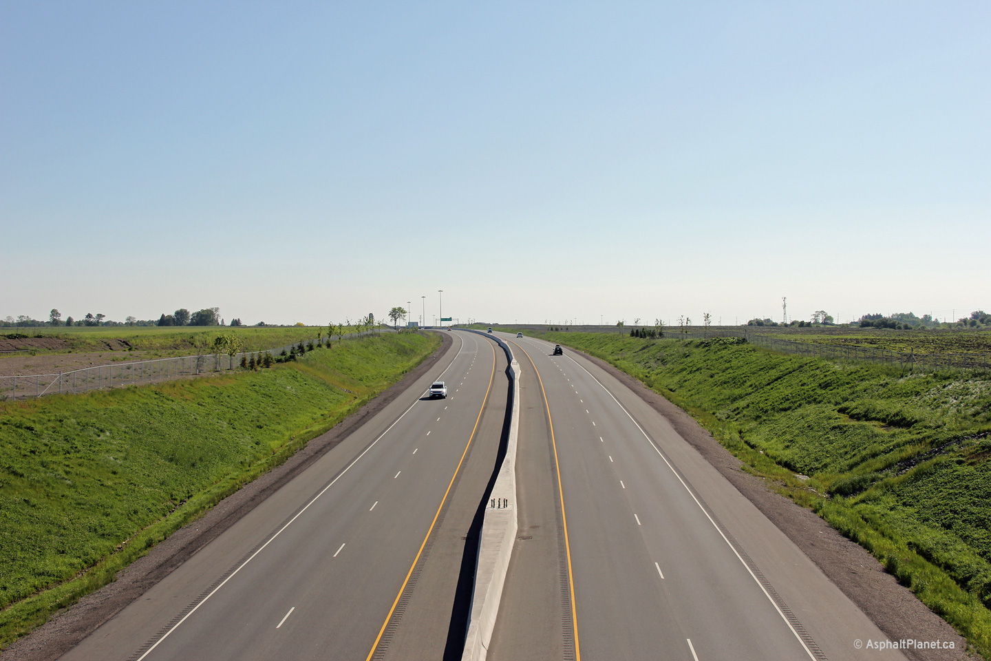
| City of Brampton Regional Municipality of Peel |
Southbound view of Highway 410 from the Mayfield Drive overpass. Note
the transition between concrete and asphalt driving surfaces. Phases I
and II (Bovaird to Mayfield) of the Highway 410 extension have been paved in concrete, while Phase III
(Mayfield to Highway 10) is paved in asphalt. Click
here for this same view taken in
December, 2009. Photo taken: December 6th, 2009. |
 (720x480) (1440x960) (2400x1600) |
||||
| Town of Caledon Regional Municipality of Peel |
Northerly view along Highway 410 from the Mayfield Drive overpass. Highway
410 swings very abruptly to the west north of Mayfield Drive to join Highway
10 directly; making Highway 410 very much a Brampton By-pass. Click
here for this same view taken in
December, 2009. Photo taken: December 6th, 2009. |
 (720x480) (1440x960) (2400x1600) |
||||
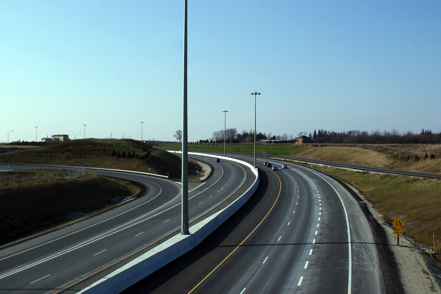
| Town of Caledon Regional Municipality of Peel |
Southerly view from the Heart Lake Road overpass towards the Mayfield Road
interchange. Click here for this same view taken in
December, 2009. Photo taken: December 6th, 2009. |
 (720x480) (1440x960) (2400x1600) |
||||
| Town of Caledon Regional Municipality of Peel |
Northbound view of Highway 410 from Heart Lake Road. Click
here for this same view taken in
December, 2009. Photo taken: December 6th, 2009. |
 (720x480) (1440x960) (2400x1600) |
||||
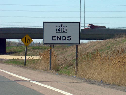
| Town of Caledon Regional Municipality of Peel |
Advanced sign advising motorists of the impending terminus of Highway 410.
Unlike the signage at Countryside Drive, this sign is located outside of the
area governed by the French Language Services Act, and is therefore
unilingual. Photo taken: June 6th, 2010. |
 (720x480) (720x480)(1440x960) |
||||
| Town of Caledon Regional Municipality of Peel |
Two views looking southerly from the Kenney Road overpass. The upper
photo was taken only nine days before the 410 was opened to traffic. Upper photo taken: November 7th, 2009. Lower photo taken: June 5th, 2011. |
 (720x480) (1440x960) (2400x1600) |
||||
| Town of Caledon Regional Municipality of Peel |
This view looks northerly along Highway 410 from the Kennedy Road overpass.
The upper photo was taken just over a week before the Highway 410 extension
was opened to traffic. The lower photo shows the completed highway. Upper photo taken: November 7th, 2009. Lower photo taken: June 5th, 2011. |
 (720x480) (1440x960) (2400x1600) |
||||
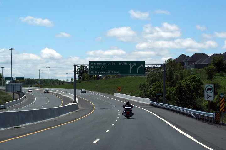
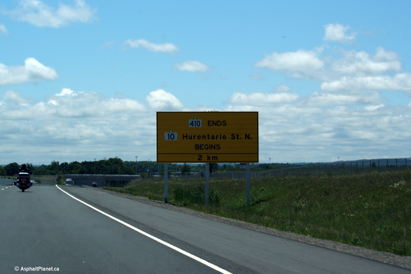
Town of Caledon Regional Municipality of Peel |
Advanced signage for the ramp from Highway 410-North to Hurontario Street
South. Note that the text on the sign has been changed from what the
sign read on opening day. Photo taken: June 6th, 2010. |
 (720x480) (720x480)(1440x960) |
||||
Town of Caledon Regional Municipality of Peel |
Exit signage at the northbound ramp to Hurontario Street South.
Highway 10 is marked as Hurontario Street on the pull-through signage. It
is very rare to see the MTO indicate a proper name for a highway that is
within ministry jurisdiction. Photo taken: June 6th, 2010. |
 |
||||
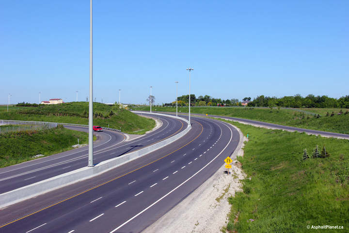
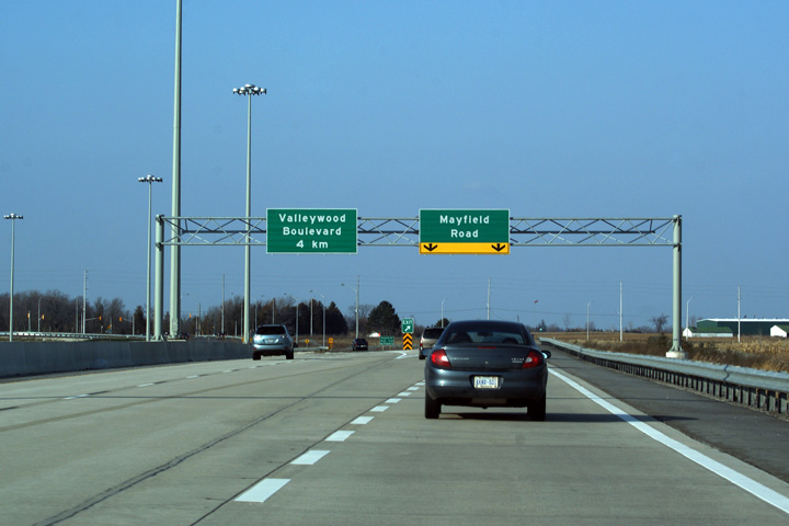
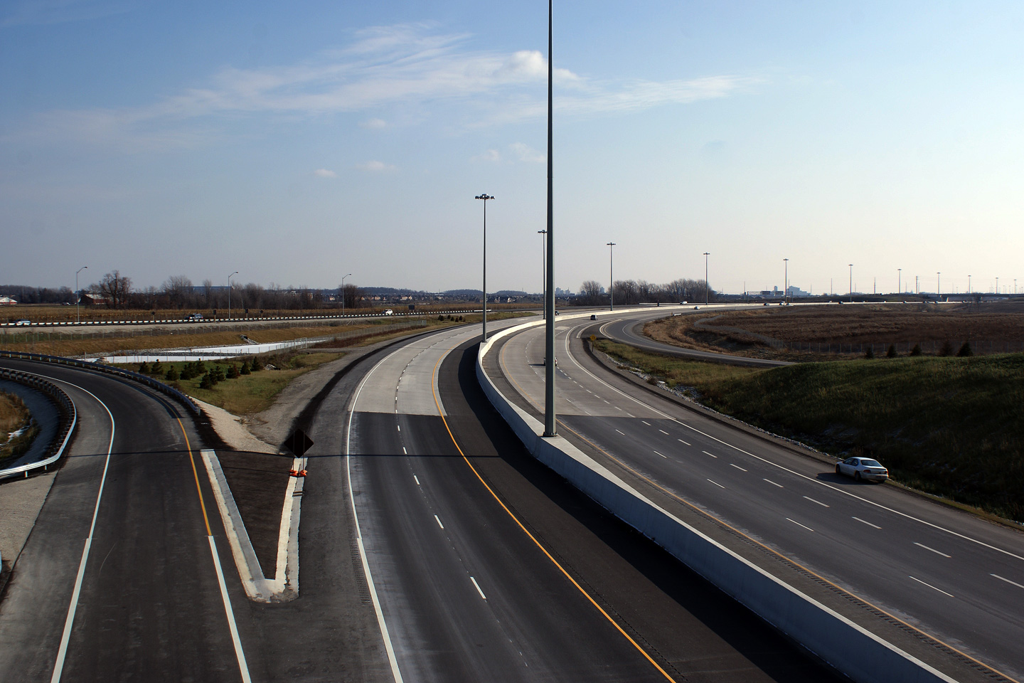
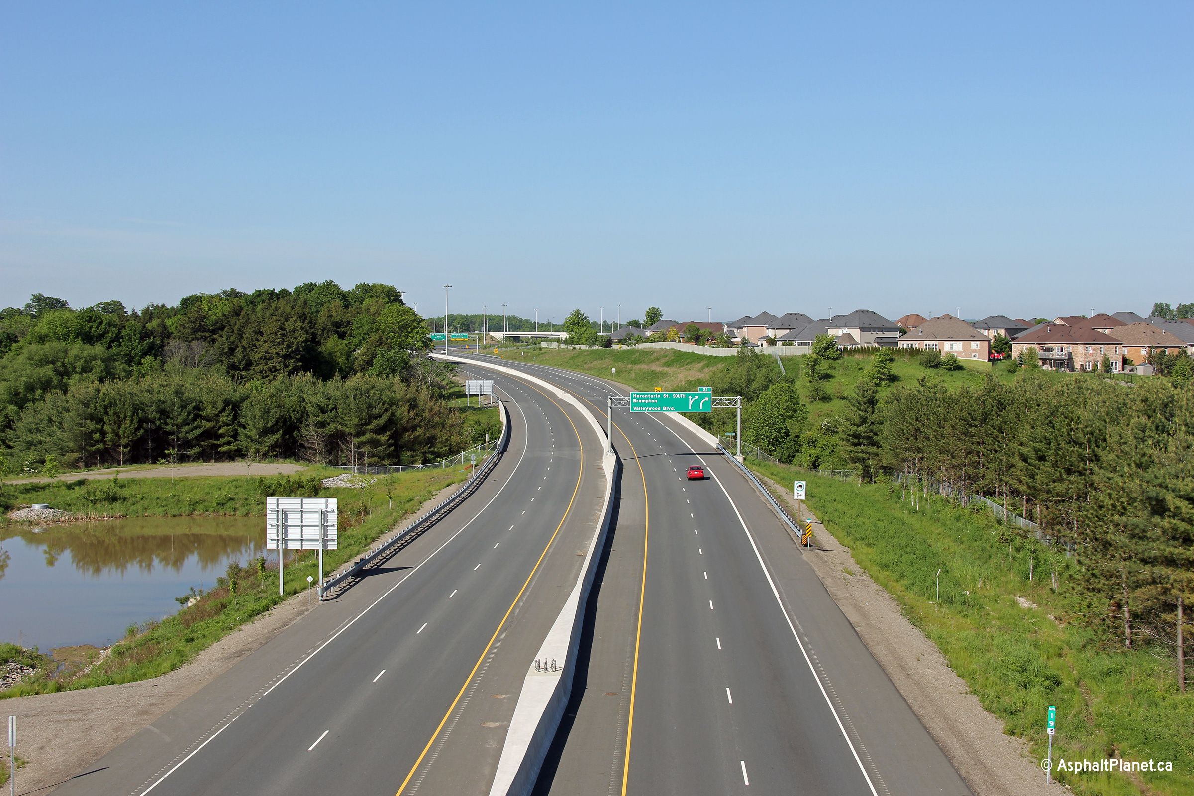
Town of Caledon Regional Municipality of Peel |
Views looking southerly from the Valleywood Boulevard overpass along
Highway 410. Click here for this same view taken in
June, 2010. Photo taken: August 12th, 2012. |
 (720x480) (1440x960) (2400x1600) |
||||
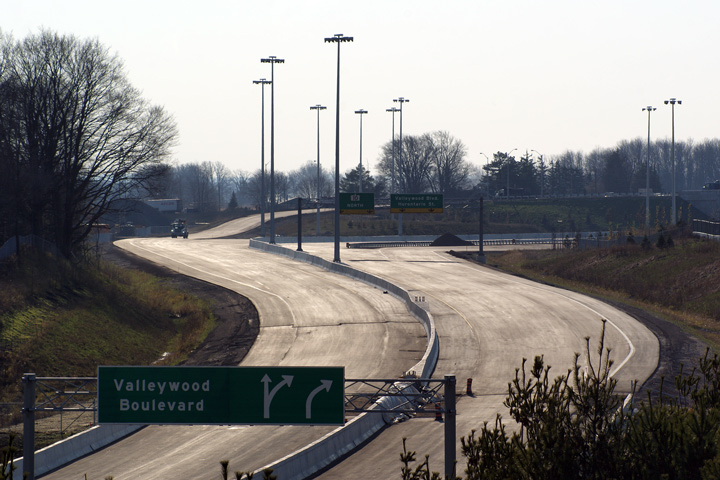
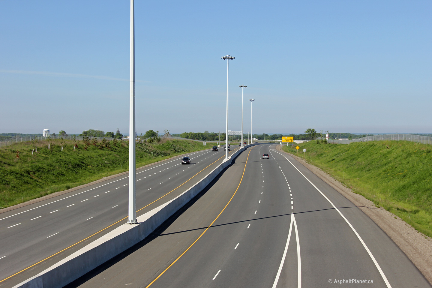
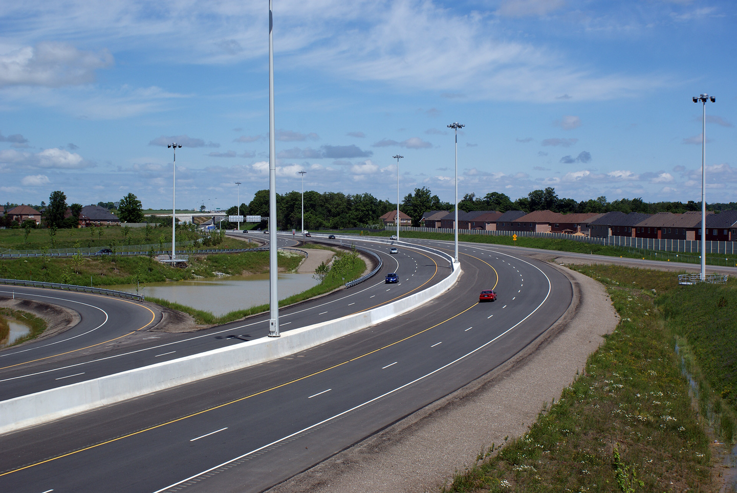
Town of Caledon Regional Municipality of Peel |
This view looks northerly from Valleywood Boulevard.
The divided highway ends around the pictured curve. At the end
of the divided highway, Highway 410 ends, becoming Highway 10. Click
here for this same view taken in
June, 2010. Photo taken: August 12th, 2012. |
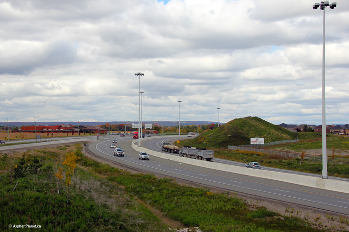 (720x480) (1440x960) (2400x1600) |
||||
| Highway 410 ends at Valleywood. Highway 10 continues northerly carrying traffic to Orangeville, Shelburne and beyond. Click here for Highway 10-North images. | ||||||
Other Images Related to Highway 410:
| Proper Municipality Name | Photo Description | Photo |
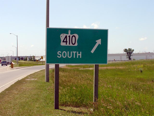
| City of Mississauga Regional Municipality of Peel |
Standard ramp signage for southbound Highway 410. With one notable
exception, control cities are not used along Highway 410. This sign is
located westbound on Courtney Park Road. Photo size: 50kb. |
 |
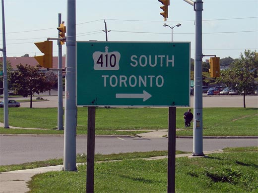
| City of Brampton Regional Municipality of Peel |
Signage along Clark Boulevard in Brampton
denotes Toronto as the southern control city along Highway 410. It is
only at this ramp that a control city is used. This sign is located
westbound on Clark Boulevard. Photo size: 45kb. |
 |
| City of Brampton Regional Municipality of Peel |
Signage for the upcoming Highway 410 interchange along Queen Street in
Brampton. This is the only time that I have seen a freeway interchange
denoted with this type of green sign. This sign is located eastbound
on Queen Street. Photo size: 45kb. |
 |
| City of Brampton Regional Municipality of Peel |
Highway 410 driving north approaching the Bovaird Drive exit. Bovaird
Drive is the last interchange on Highway 410. Currently, north of
Bovaird Drive, Highway 410 transitions to the 5-lane suburban Heart Lake
Road. When the 410-extension opens to the north, Heart Lake Road will
be diverted to meat Bovaird Drive to the west of the 410, and Highway 410
will curve slightly easterly. Photo taken: May 12th, 2005. Size: 40kb. |
 |
| City of Brampton Regional Municipality of Peel |
White sign that denoted the former northern terminus of Highway 410 at
Bovaird Drive. This sign was removed early in September 2007, when
Highway 410 was extended to Mayfield Drive. Photo size: 35kb. |
 |
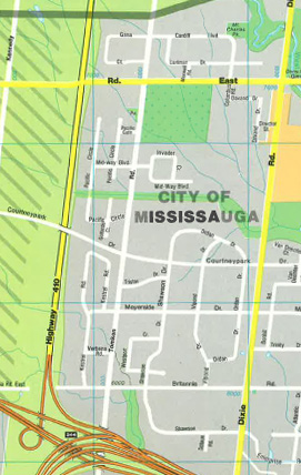
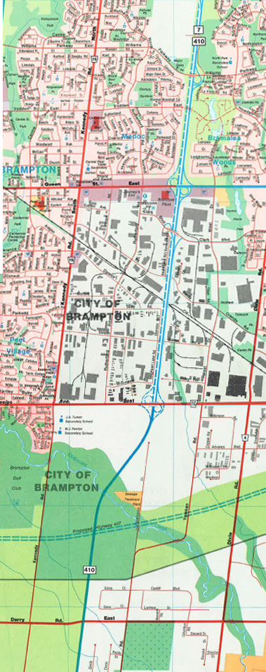
| City of Mississauga Regional Municipality of Peel |
View from the same 1988 Mapart Toronto & Area atlas of Highway 410 as
it passes through Mississauga. Note that although this scan was taken from
the same atlas as the upper scan, the cartographic style is vastly
different. Scanned from: 1988 Edition, Toronto & Area atlas, Mapart Publishing. |
 |
| City of Brampton Regional Municipality of Peel |
View of two stitched together pages from my 1988 Mapart Toronto & Area
atlas. This shows the original two lane configuration of Highway 410
through Brampton. Scanned from: 1988 Edition, Toronto & Area atlas, Mapart Publishing. |
 |
<- Highway 409 Images Back to Highway 410 Highway 416 Images ->
Copyright (c) 2004-2014, Scott Steeves (Webmaster) AsphaltPlanet@asphaltplanet.ca


