AsphaltPlanet.ca > OntHighways >
Highway 409 > Images
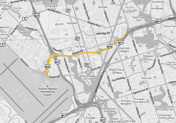
King's Highway 409 - Images
Photos shown in this table are arranged from West to East:
| Proper Municipality Name | Photo Description | Photo | |||
|
Pictures taken from driver's perspective appear offset from centre-line pictures: |
East- bound |
West- bound |
|||
| City of Mississauga Regional Municipality of Peel |
Easterly view from the Airport Road overpass. Historically, the
Airport Road interchange was the western terminus of Highway 409, with all
ramps west of Airport Road being under the jurisdiction of the Greater
Toronto Airports Authority (GTAA). In 2007, the portion of Highway 409 lying
west of the Highway 427 interchange was transferred from Ministry of
Transportation (MTO) jurisdiction to that of the GTAA. Photo taken: April 30th, 2011. |
 |
|||
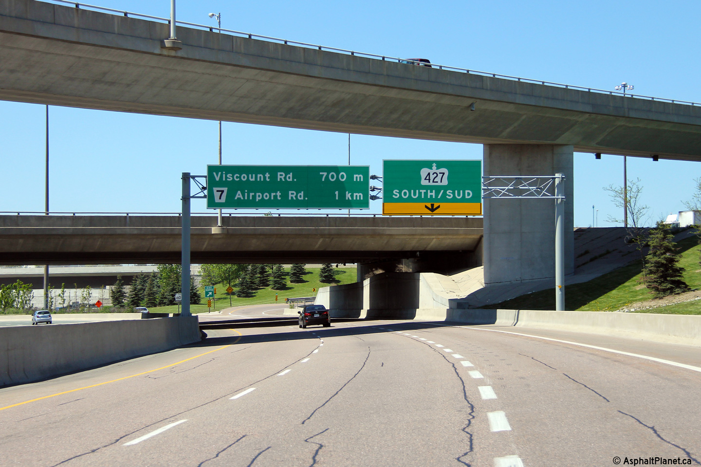
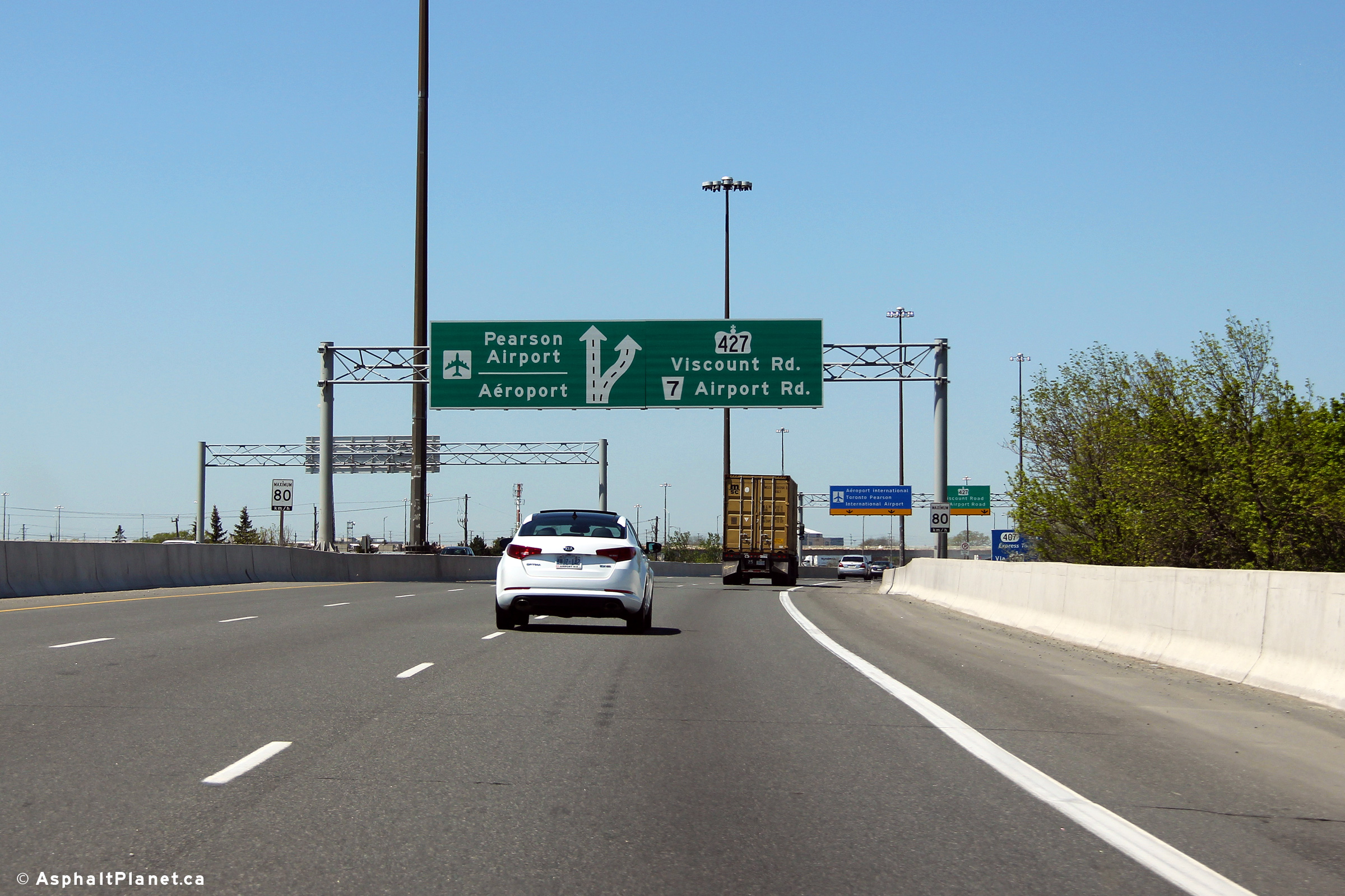
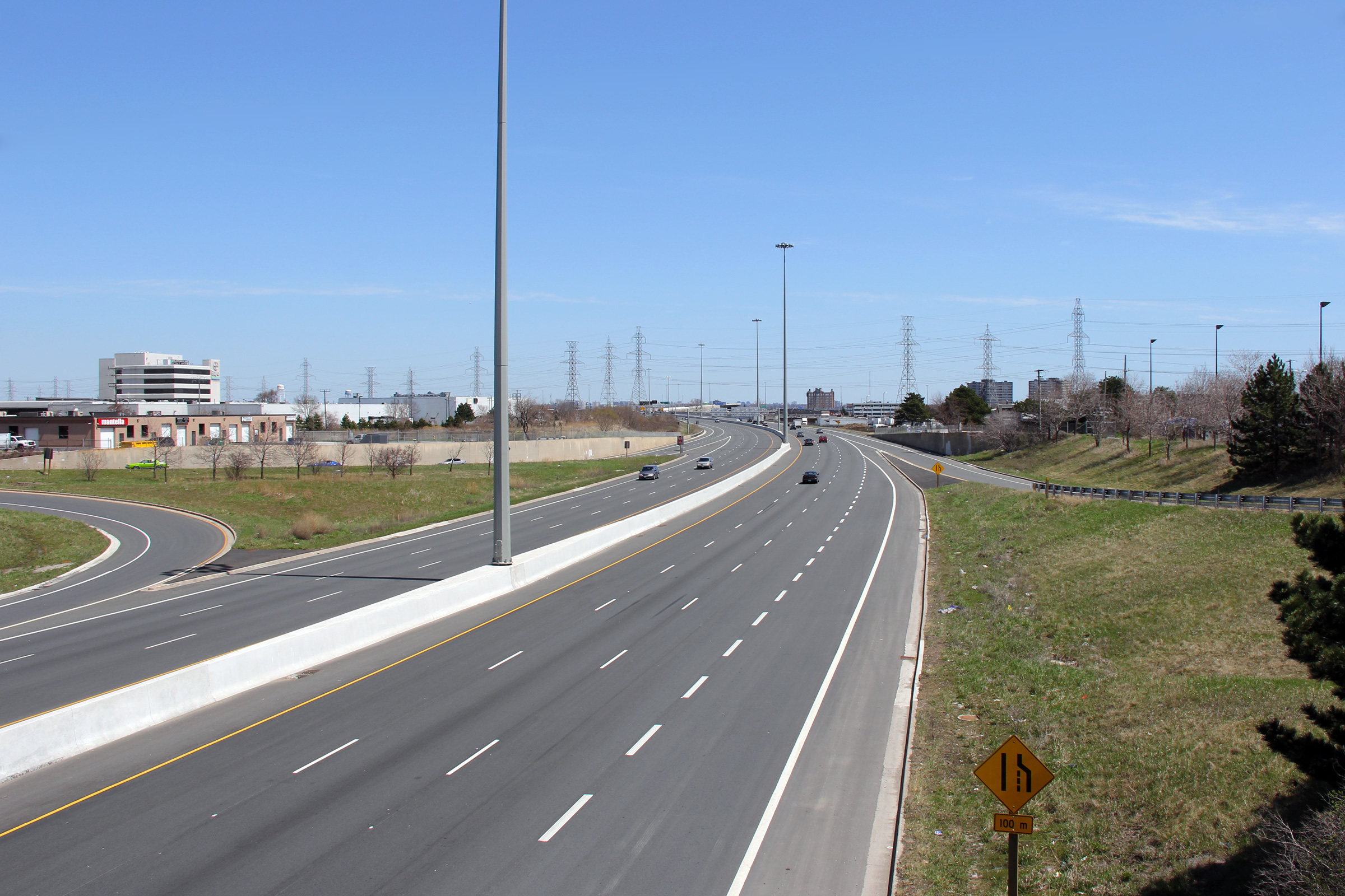
| City of Mississauga Regional Municipality of Peel |
Easterly view from the Viscount Drive overpass. The transfer of
Highway 409 to GTAA jurisdiction was completed as part of a massive roadway
upgrade to the approach to Toronto Pearson International Airport from
Highway 409. Prior to the reconstruction, Highway 409 was a simple six
lane freeway between Airport Road and Highway 427. Photo taken: April 30th, 2011. |
 |
|||
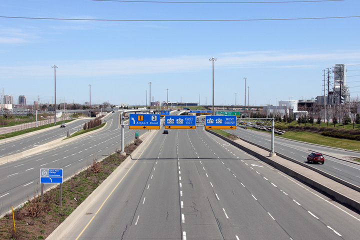
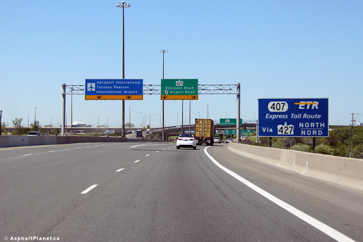
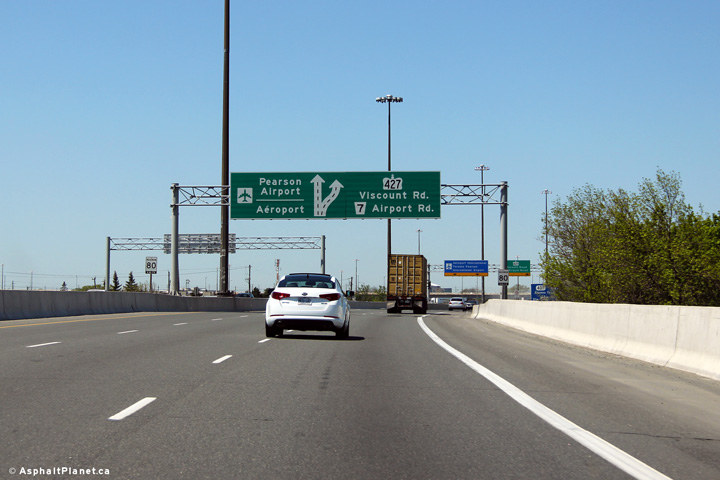
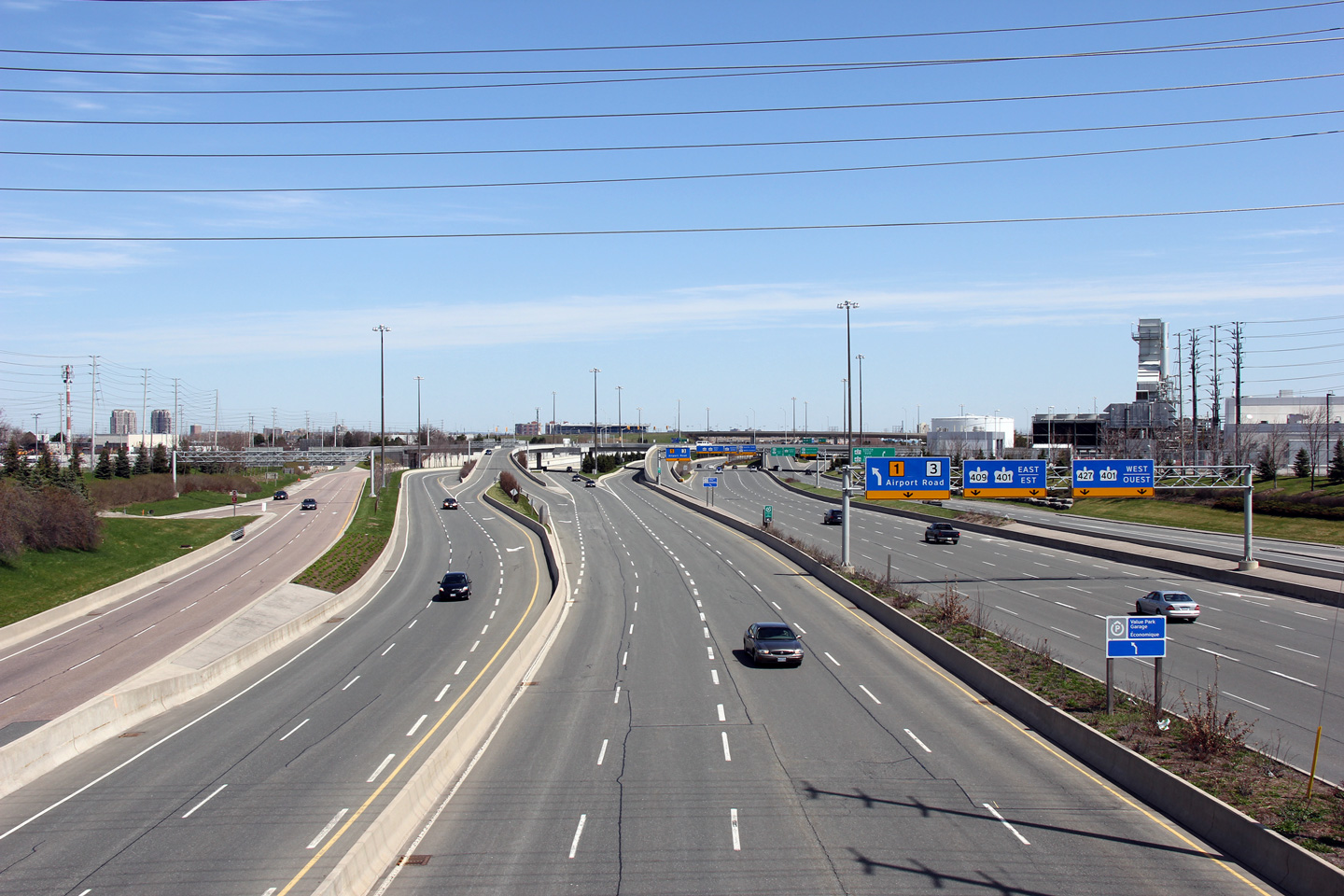
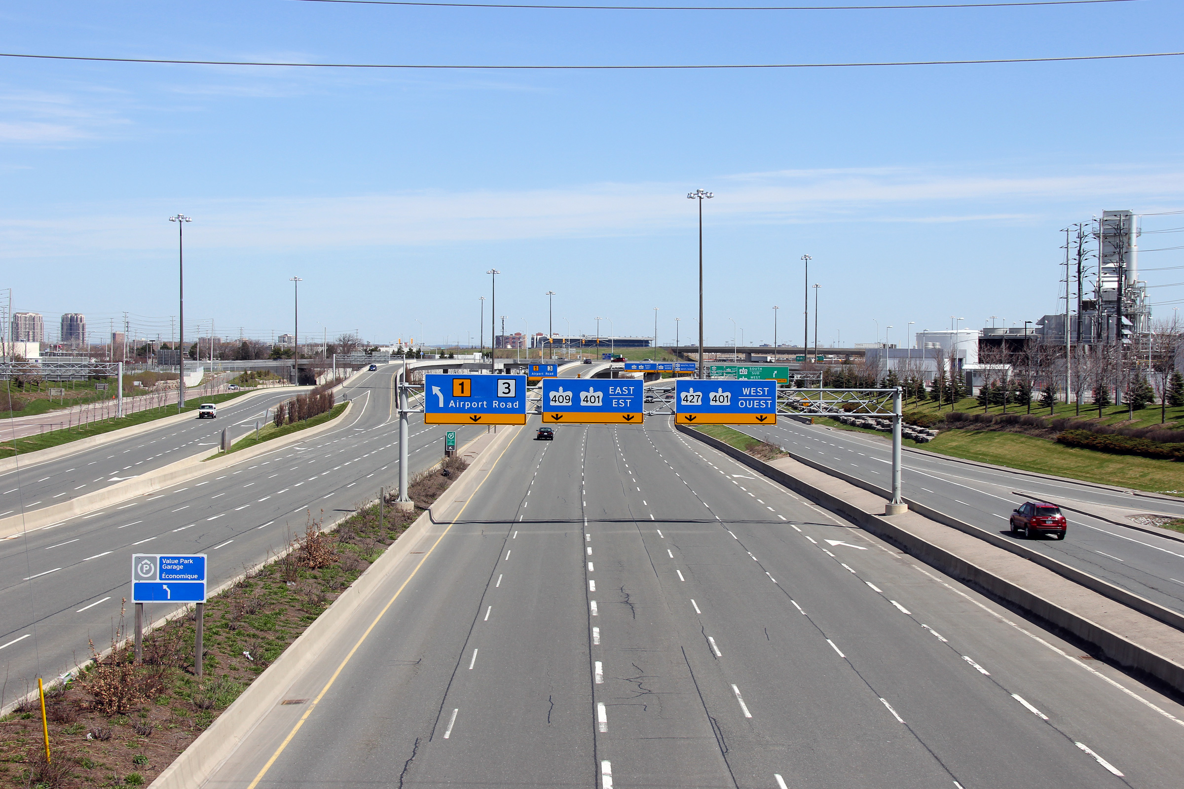
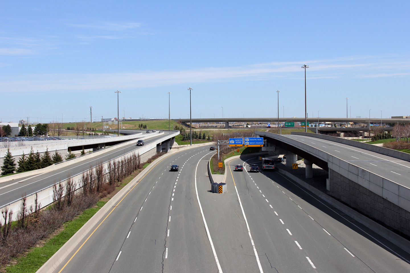
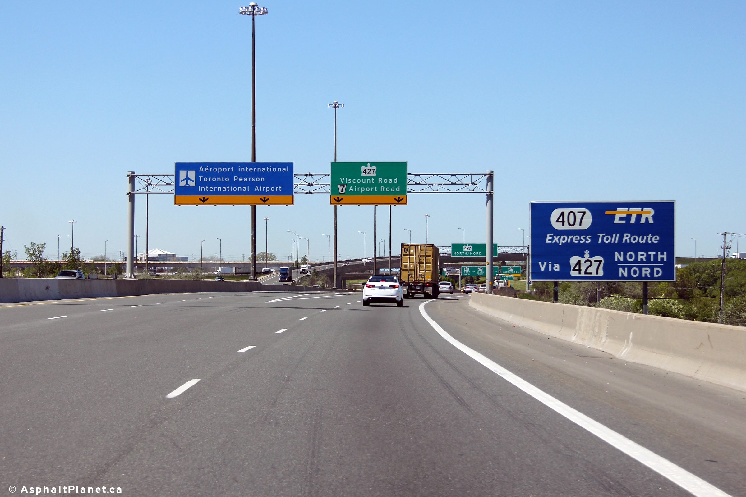
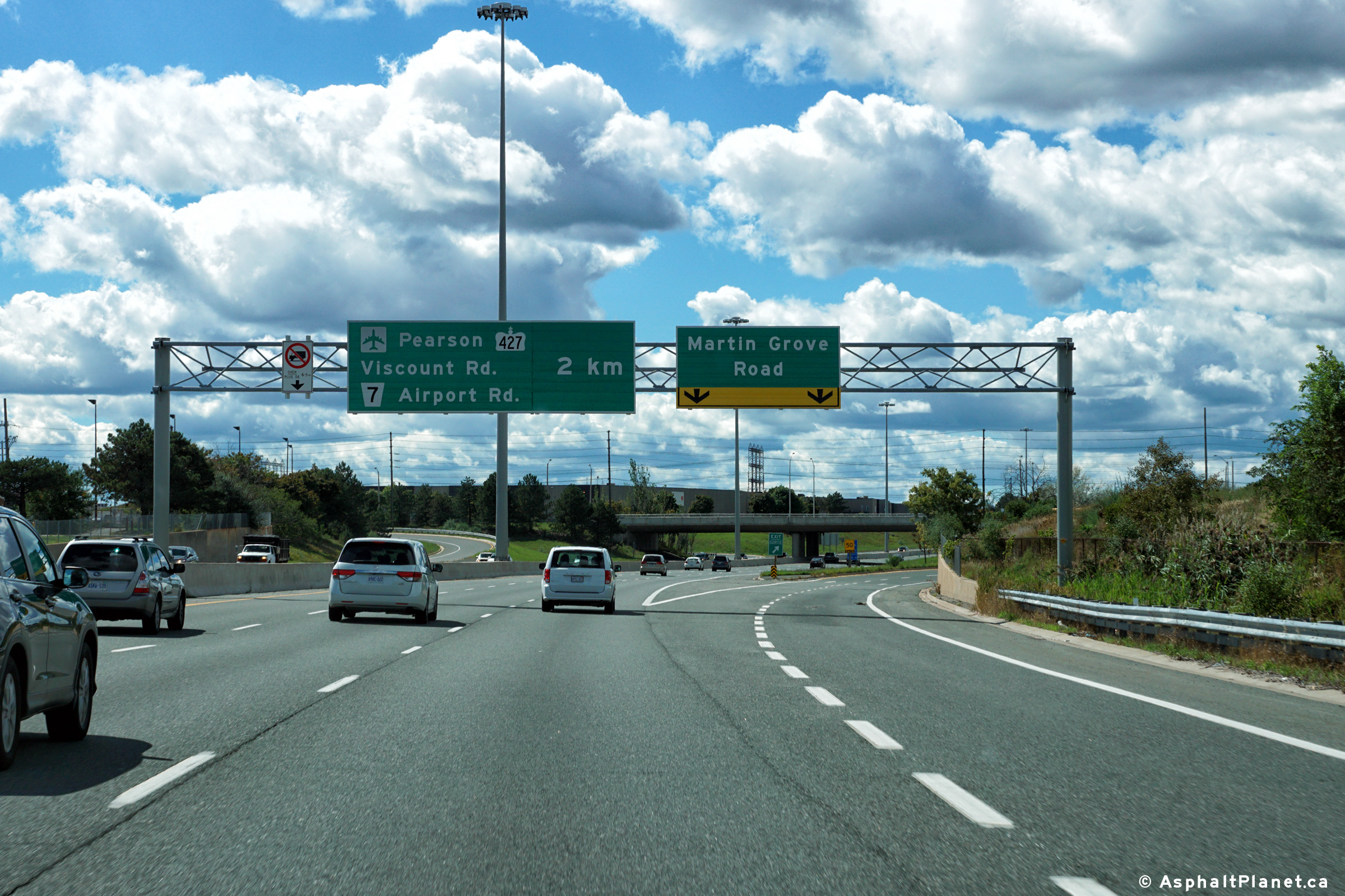
| City of Mississauga Regional Municipality of Peel |
View of the overhead signage approaching the Highway 427 interchange.
Oddly, the GTAA elected to sign the core lanes of the freeway with blue
signage, with the outer lanes signed with green. This signage standard is
the exact opposite how MTO signs its complex freeways. Photo taken: April 30th, 2011. |
 (720x480) (720x480)(1440x960) (2400x1600) |
|||
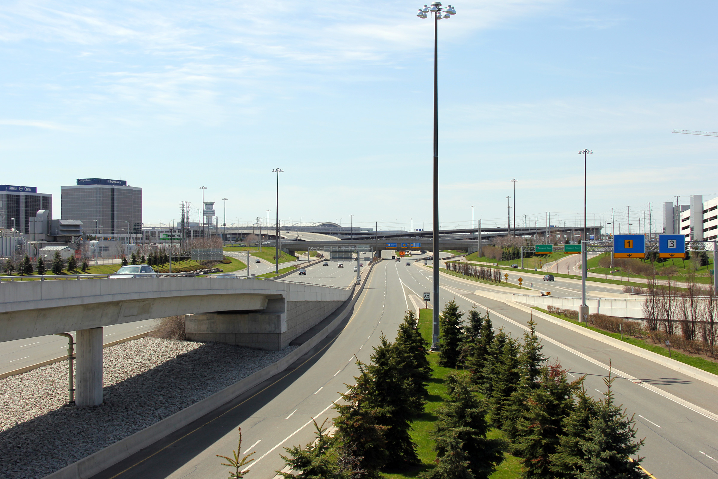
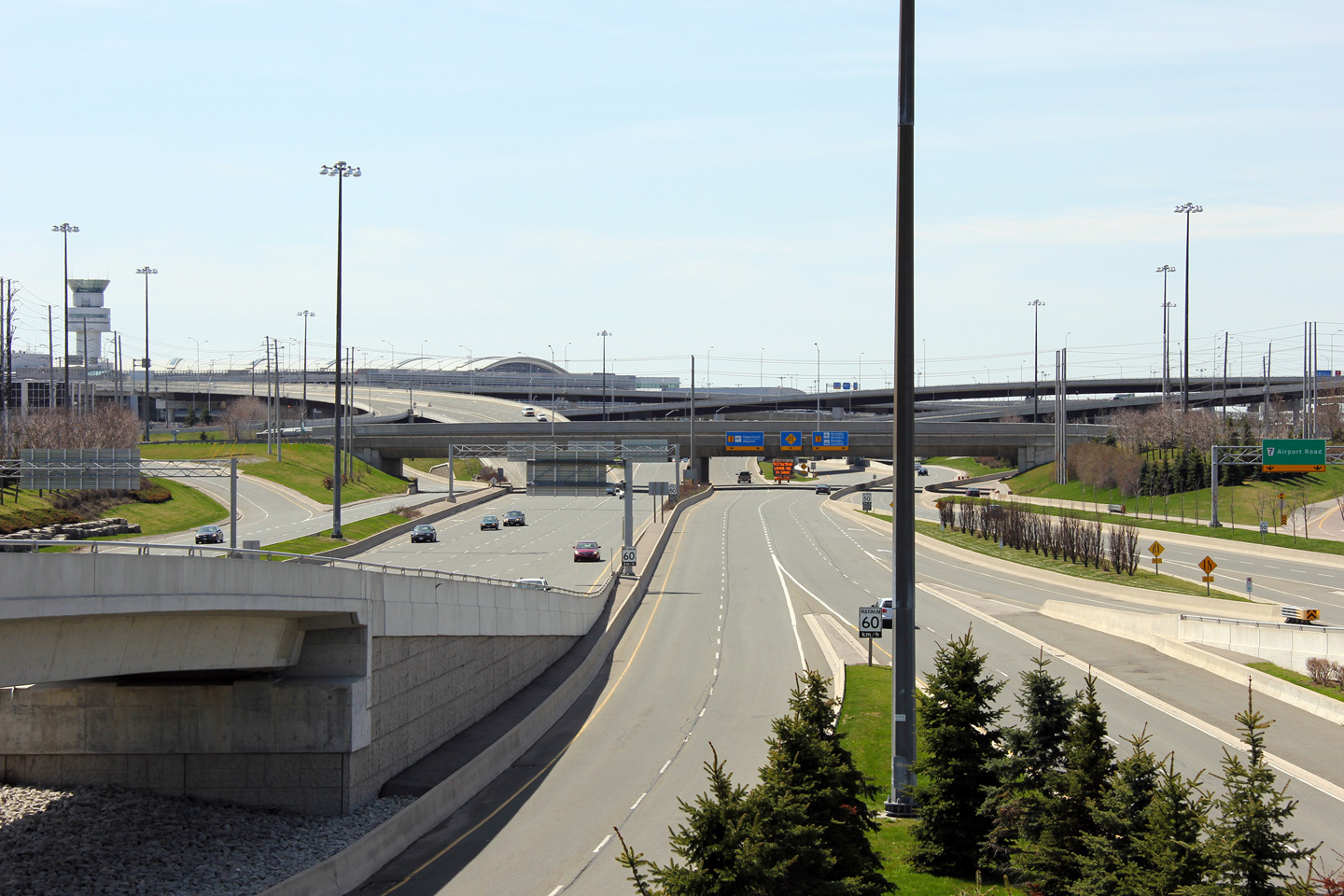
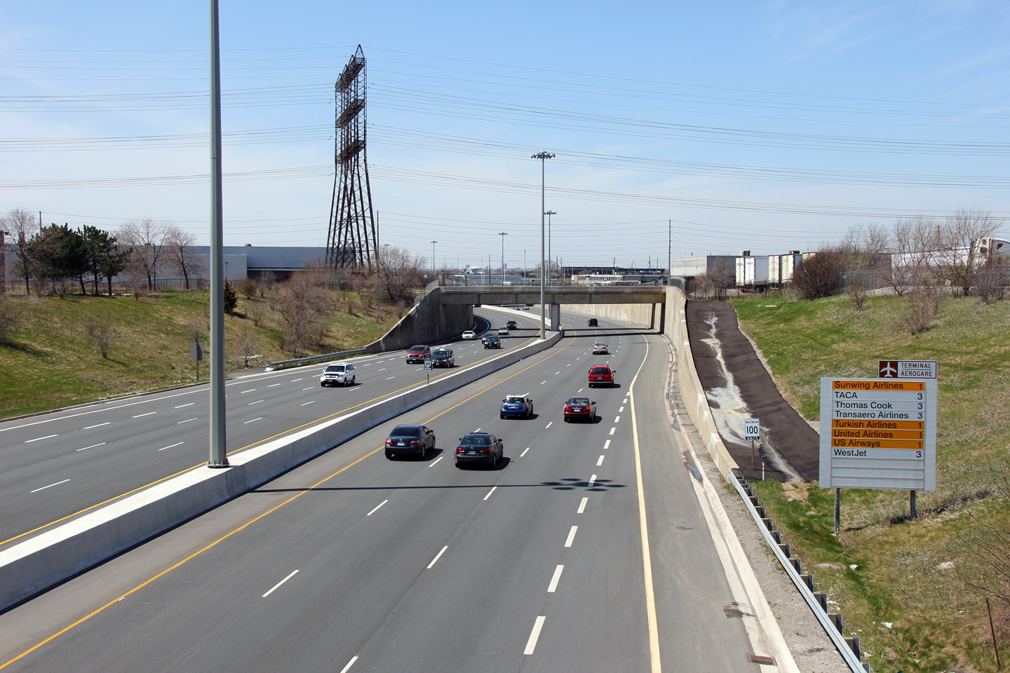
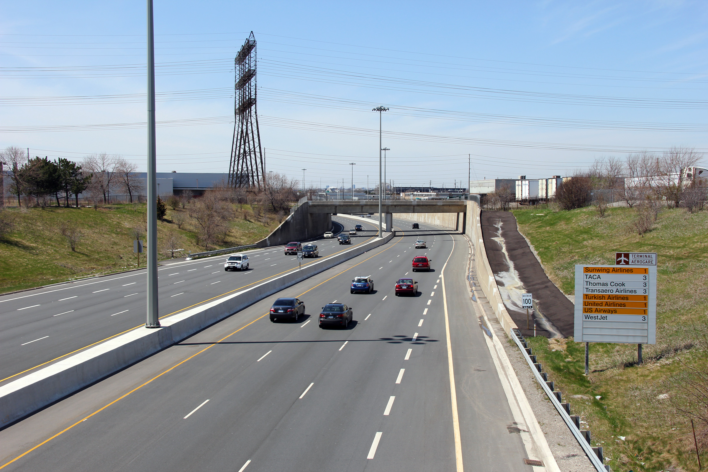
| City of Mississauga Regional Municipality of Peel |
Two westerly views looking towards Pearson Airport itself.
As is evident from the photos, the approach to Pearson Airport is of
considerable girth. The shear number of flyovers to separate traffic
bound to Terminal's 1 and 3, and the network of local roads that service
the airport is astounding. Both the arrivals and
departures levels at both Terminal's 1 and 3 are directly directly
accissible from the freeway
-- with no stopping required. Toronto's airport road network is extremely
efficient. Photos taken: April 30th, 2011. |
 (720x480) (1440x960) (2400x1600)
|
|||
| City of Mississauga Regional Municipality of Peel |
This view looks easterly from the Network Road overpass
towards the sprawling Highway 427 interchange complex. Photo taken: April 30th, 2011. |
 |
|||
| Highway 427 is a short but important highway that runs through western Toronto. Click here for Highway 427 images. | |||||
| City of Toronto |
Exit signage for the southbound Highway 427
ramp. The ramp from westbound Highway 409 to southbound Highway 427 is a
very tight loop ramp with a ramp speed of 30km/h. Photo taken: May 16th, 2013. |
 (720x480) (720x480)(1440x960) (2400x1600) |
|||
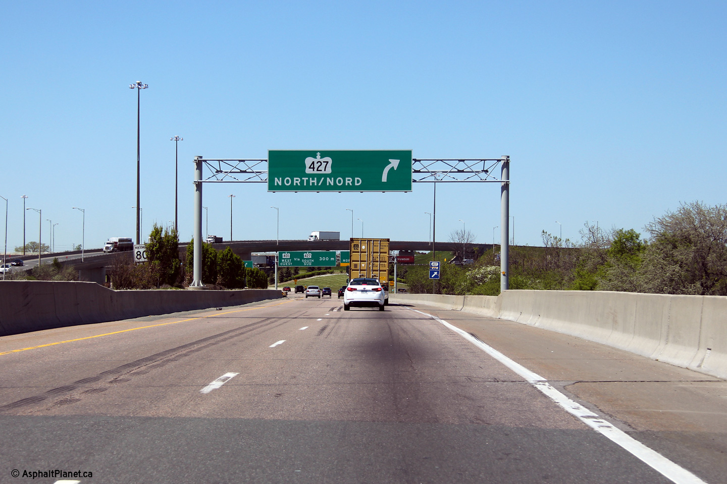
| City of Toronto |
Exit for Highway 427 northbound, and
advanced signage for the loop ramp to Highway
427 southbound. Photo taken: May 16th, 2013. |
 (720x480) (720x480)(1440x960) (2400x1600) |
|||
| City of Toronto |
Advanced signage for the northbound Highway 427
ramp. Photo taken: May 16th, 2013. |
 (720x480) (720x480)(1440x960) (2400x1600) |
|||
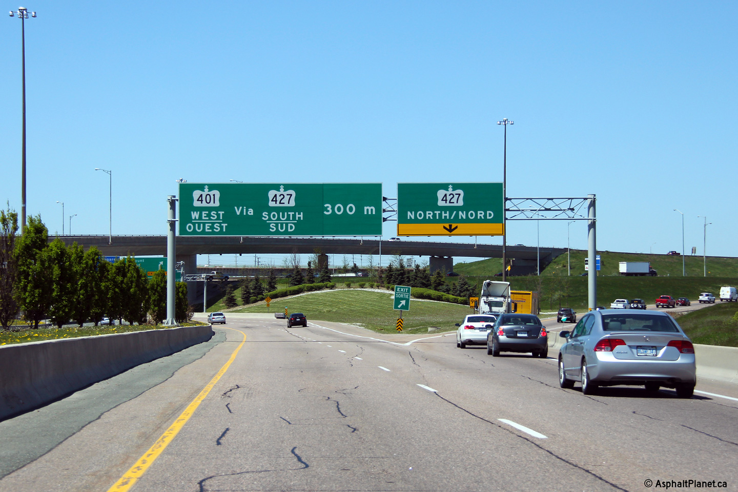
| City of Toronto |
Signage at the split for the Highway 427
interchange. This sign was erected by the GTAA who owns and maintains the mainline freeway lanes
from this point westerly to Pearson Airport. The collector lanes (leading to the
427 exit) are still under the jurisdiction
of the MTO as far west as the ramps to and from Highway
427. Photo taken: May 16th, 2013. |
 (720x480) (720x480)(1440x960) (2400x1600) |
|||
| City of Toronto |
Diagramical sign denoting the upcoming 427
interchange. This sign is located just west of the Atwell Drive
interchange. Photo taken: May 16th, 2013. |
 (720x480) (720x480)(1440x960) (2400x1600) |
|||
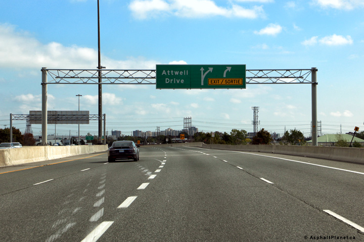
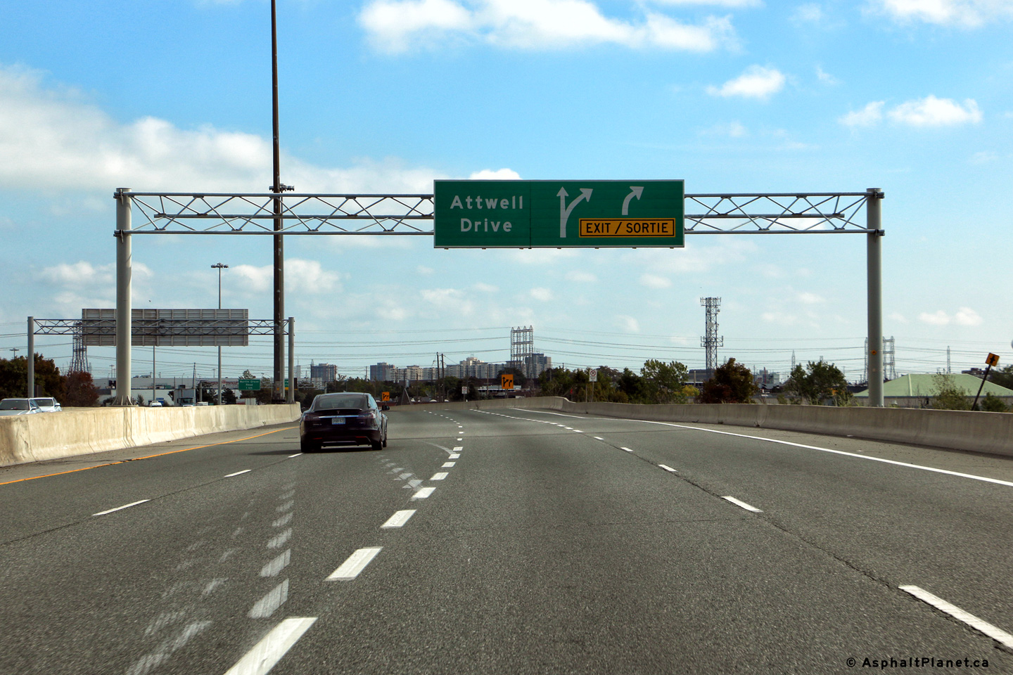
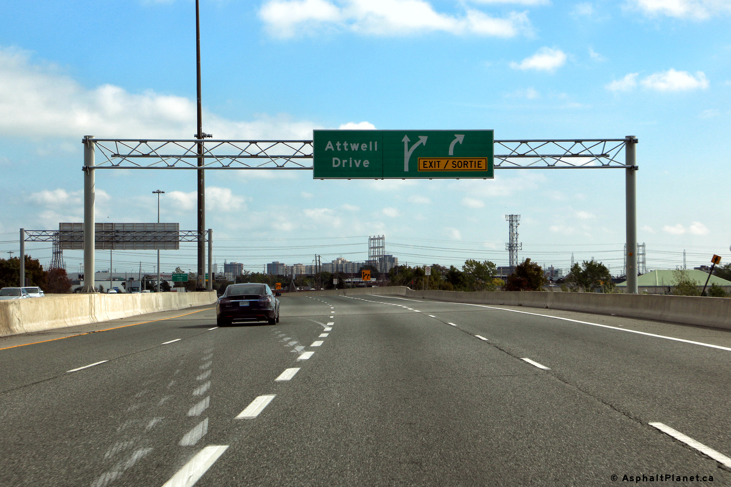
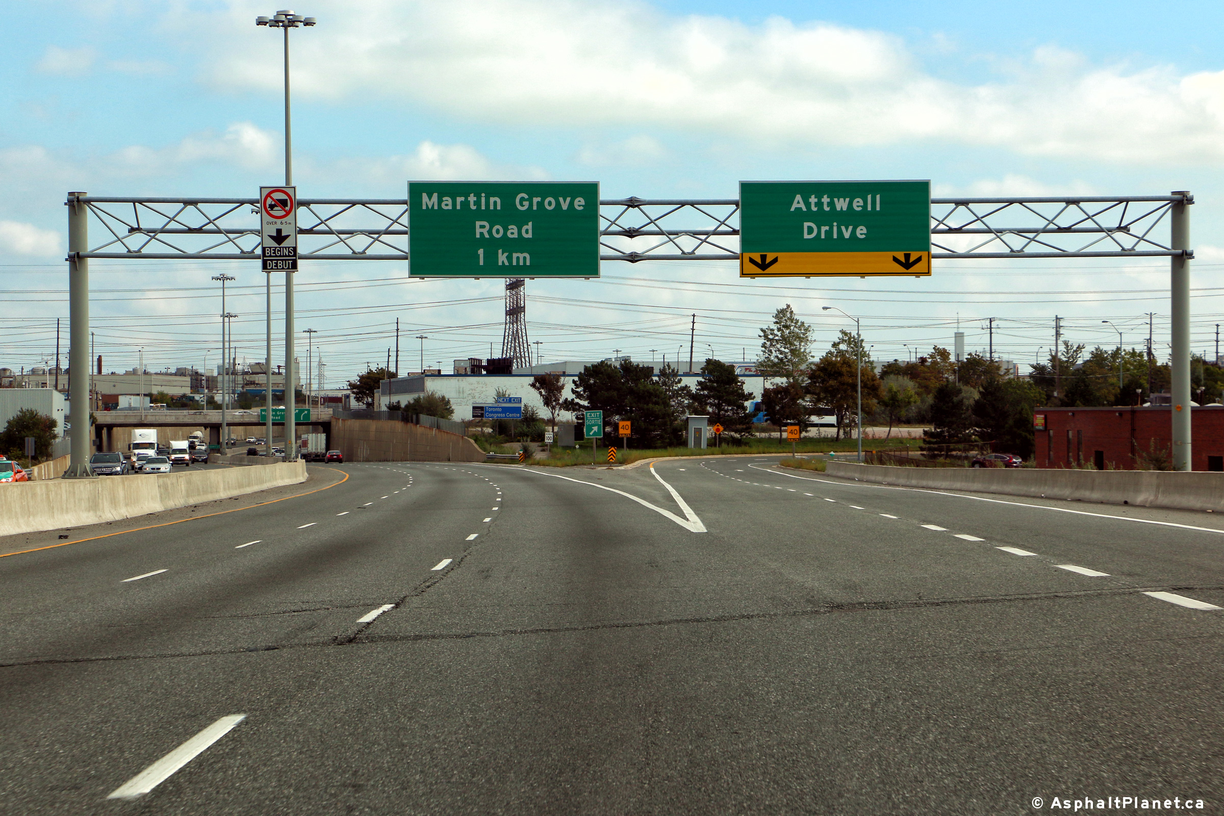
| City of Toronto |
Eastbound advanced signage for the off-ramp to Atwell Drive. The
fourth lane that joined Highway 409 from the Highway 427 interchange departs
the freeway at Atwell Drive. Photo taken: October 5th, 2016. |
 (720x480) (720x480)(1440x960) (2400x1600) |
|||
| City of Toronto |
View looking easterly at the off-ramp to Atwell Drive. Photo taken: October 5th, 2016. |
 (720x480) (720x480)(1440x960) (2400x1600) |
|||
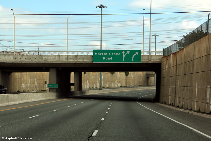
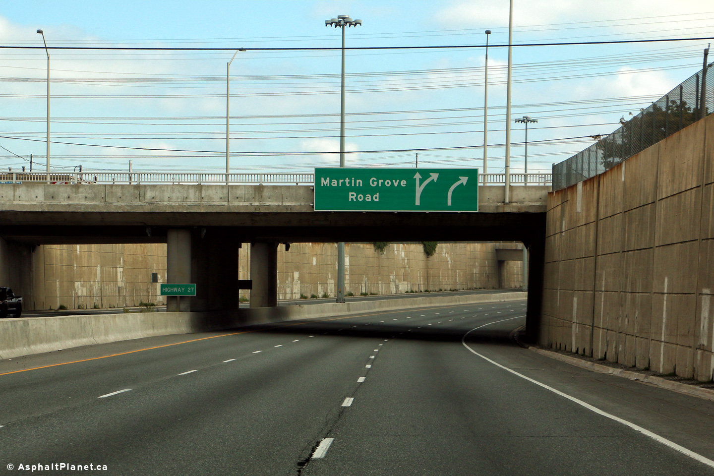
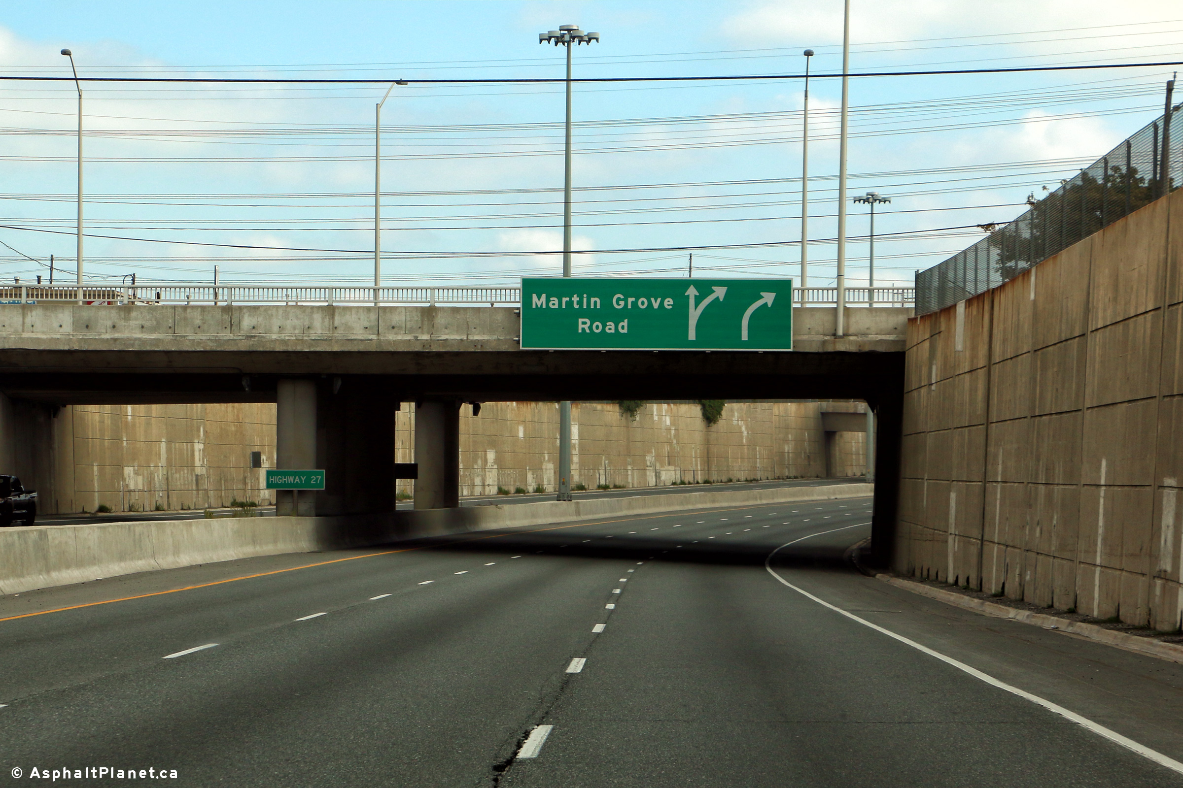
| City of Toronto |
The eastbound signage for the Martin Grove Road off-ramp is affixed to the
Highway 27 overpass. Photo taken: October 5th, 2016. |
 (720x480) (720x480)(1440x960) (2400x1600) |
|||
| City of Toronto |
Two views looking westerly from the Highway 27 overpass in the direction of
Toronto Pearson Airport. There is no interchange between Highway 27
and Highway 409. There are only a handful of examples where two
highways cross but do not intersect in the province of Ontario. Upper photo taken: May 27th, 2006. Lower photo taken: April 30th, 2011. |
 |
|||
| City of Toronto |
Looking east from the City View Drive overpass. City View Drive is
located adjacent to Highway 27, performing
the task of a east-side service road. Much of Highway 27 is a
controlled access highway through Toronto. In fact, Highway 27 has
several grade separations and interchanges along the southern sections
of the highway. Upper photo taken: May 27th, 2006. Lower photo taken: April 30th, 2011. |
 |
|||
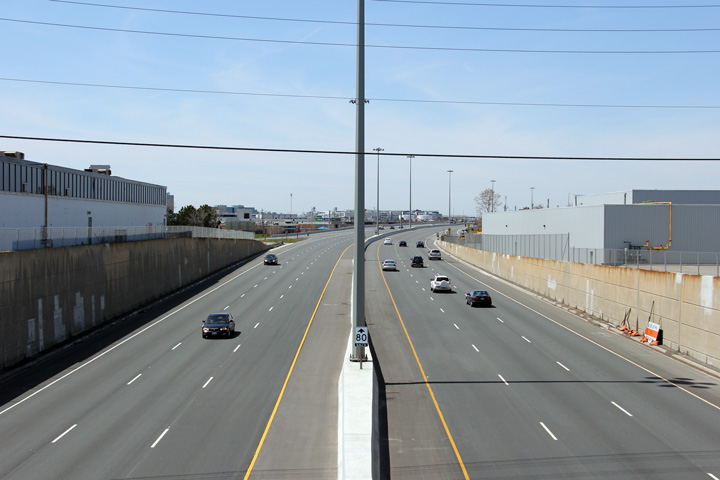
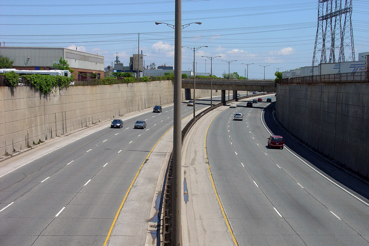
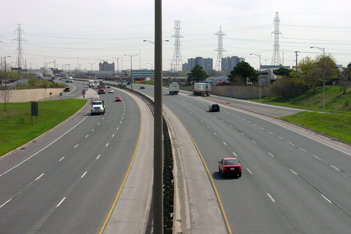
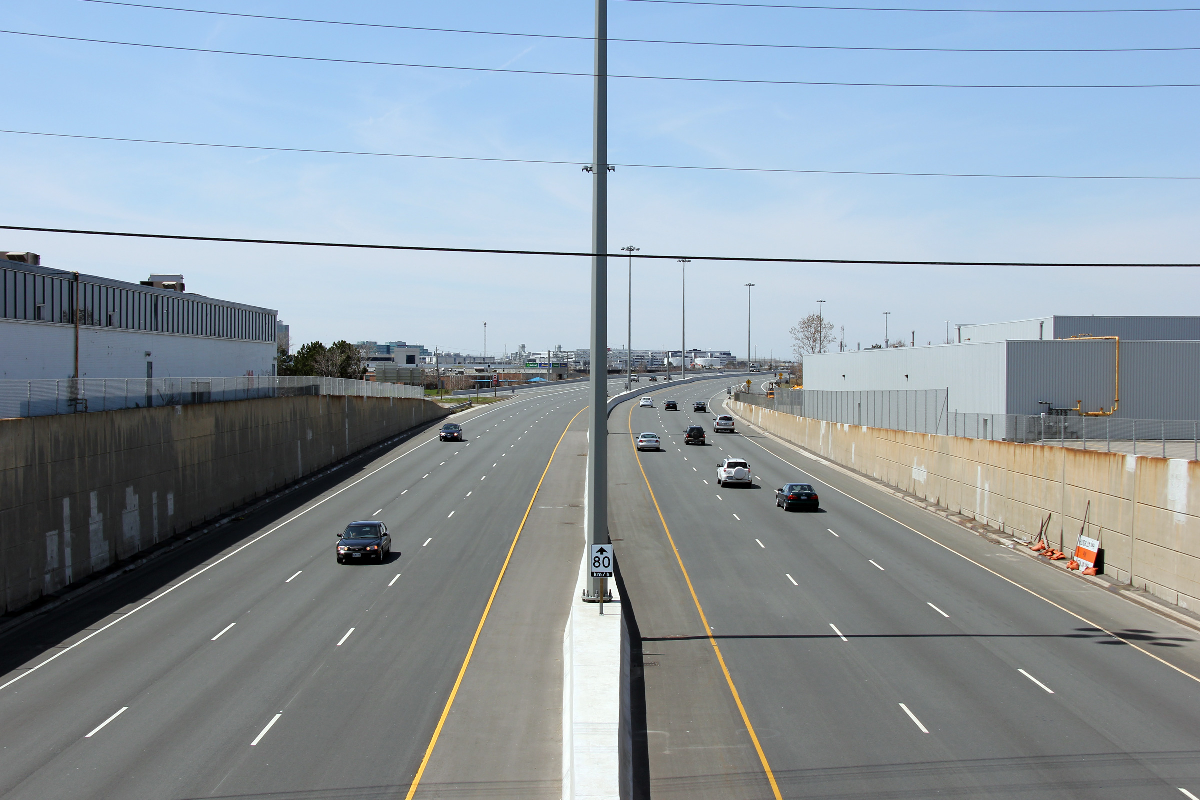
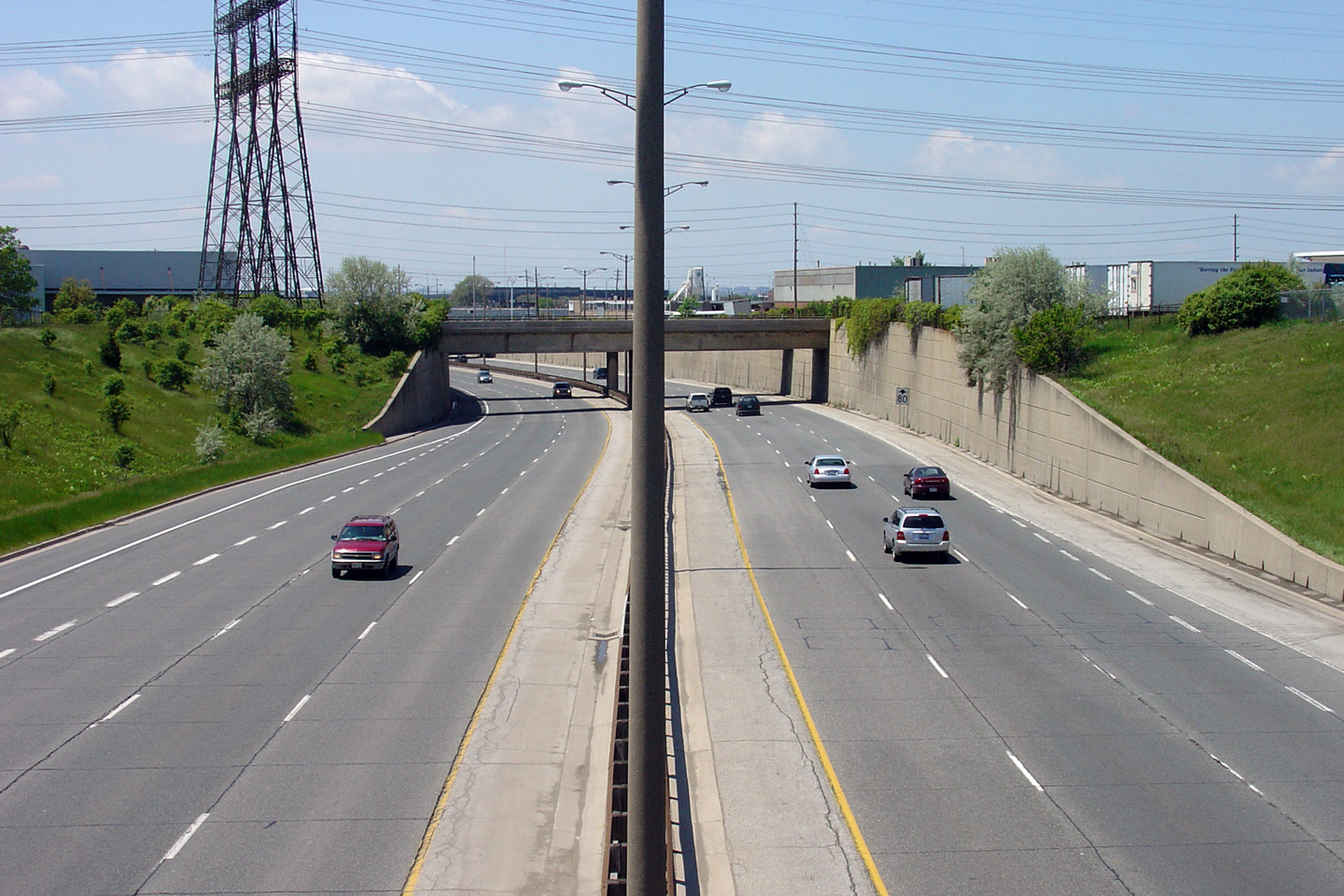
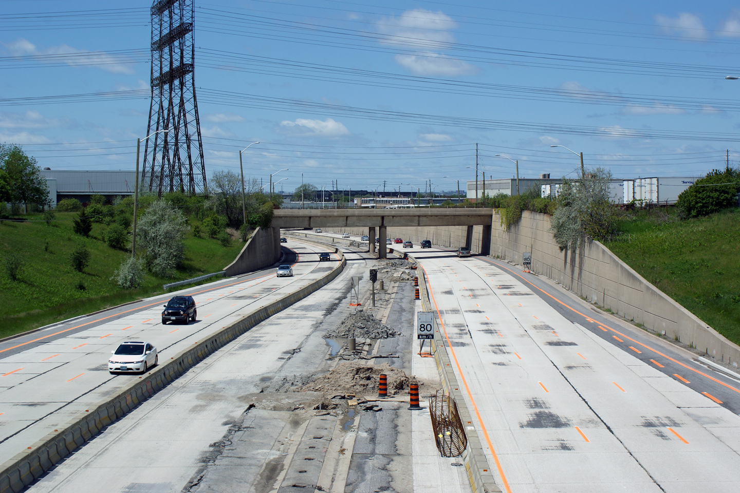
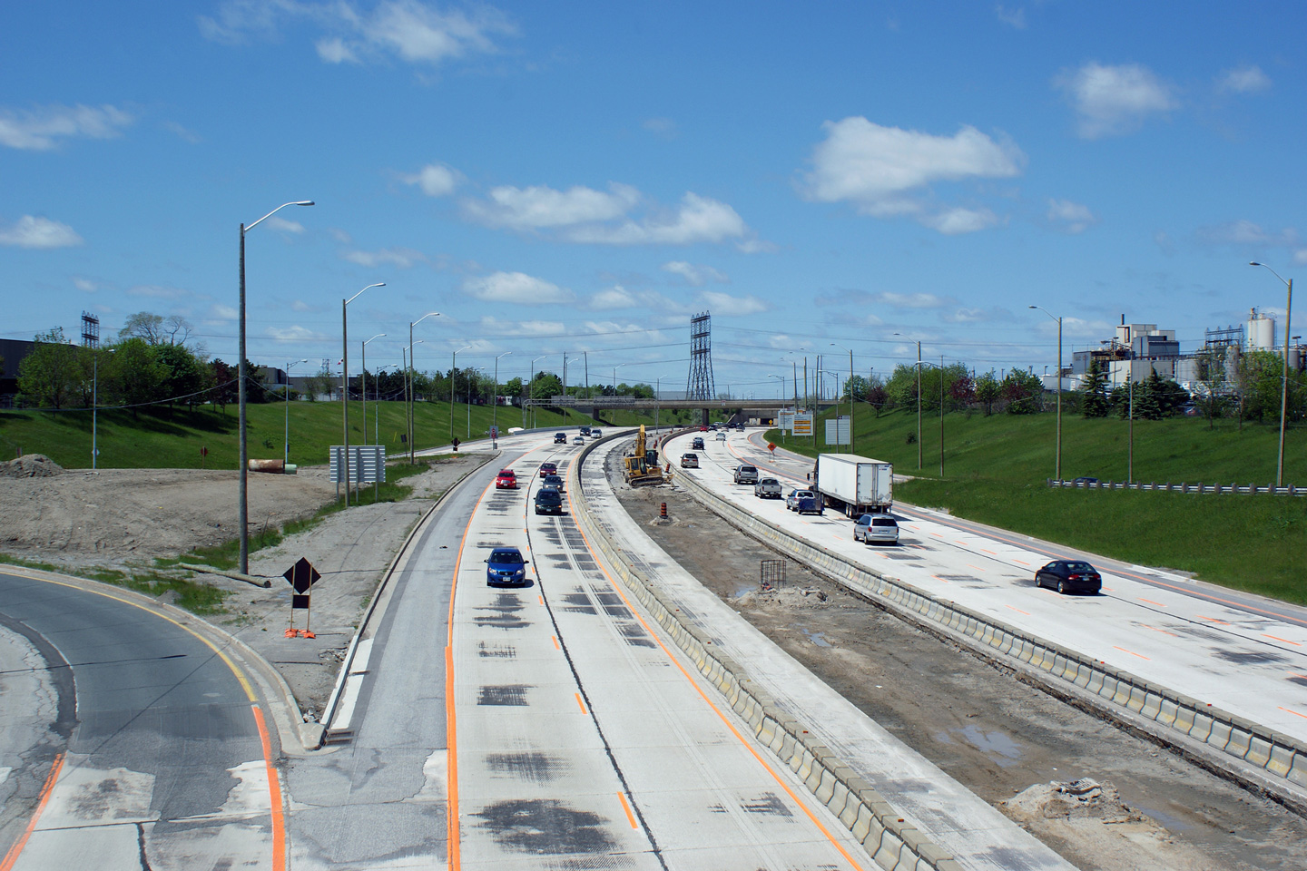
| City of Toronto |
Three views looking westerly along Highway 409 from the Iron Street
overpass. In this photo set, both the vintage and current Highway 409
design's appear for comparison purposes. Prior to 2007, the pictured
section of Highway 409 had changed very little since the highway was first
opened to traffic in the 1970s. For a period of about 25 years, from
the late 1950s onwards, steel beam median barriers,
truss-lighting and aluminum overhead sign support trusses were typical of
virtually all urban and suburban freeways constructed in the GTA. Somewhat of a
departure from highways built in the 1960s such as Highway 401 and Highway
427, was that Highway 409 was constructed with a concrete base, but was
surfaced with asphalt. Highway 404, built about the same time as
Highway 409 was likewise built with a concrete base, but surfaced in
asphalt. Both Highway 401 and Highway 427 opened as concrete surfaced
highways, and were later surfaced with asphalt as part of a rehabilitation
program. Upper photo taken: May 27th, 2006. Middle photo taken: May 29th, 2009. Lower photo taken: April 30th, 2011. |
 |
|||
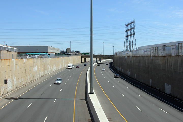
| City of Toronto |
Three views looking easterly from the Iron Street overpass towards the
Martin Grove Road interchange. Take notice of how the pull-through signage
at the Martin Grove Road interchange was changed during the 2009/10
reconstruction. No longer is the MTO reassuring traffic that it is
traveling along Highway 409 bound for Highway 401. Instead, since
there are no further easterly exits along Highway 409, the MTO has elected
to indicate only Highway 401 on the pull-through signage. Upper photo
taken: May 27th, 2006. |
|
|||
| City of Toronto |
Signage at the eastbound off-ramp to Martin Grove Road. Photo taken: October 5th, 2016. |
 (720x480) (720x480)(1440x960) (2400x1600) |
|||
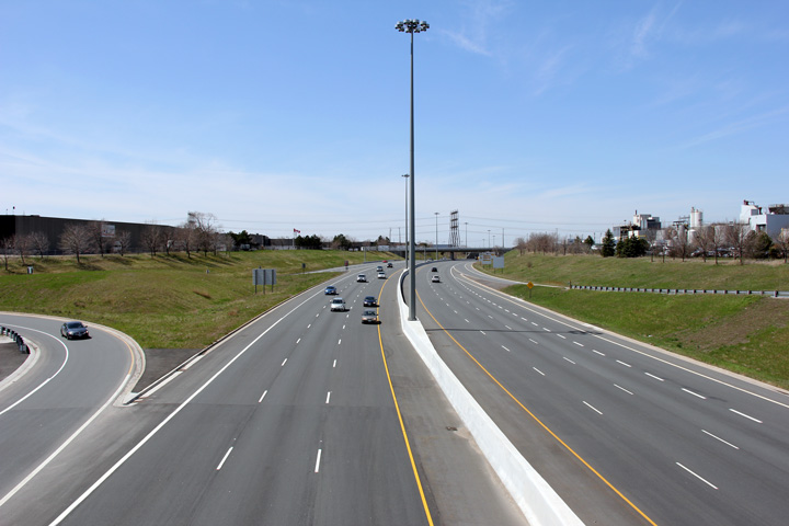
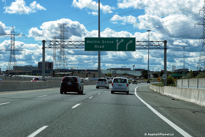
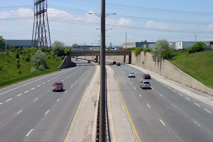
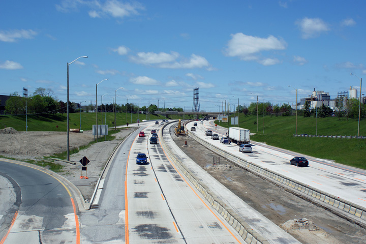
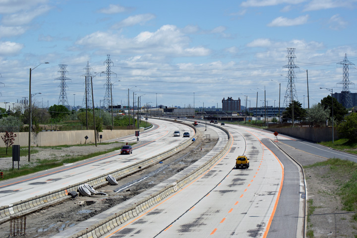
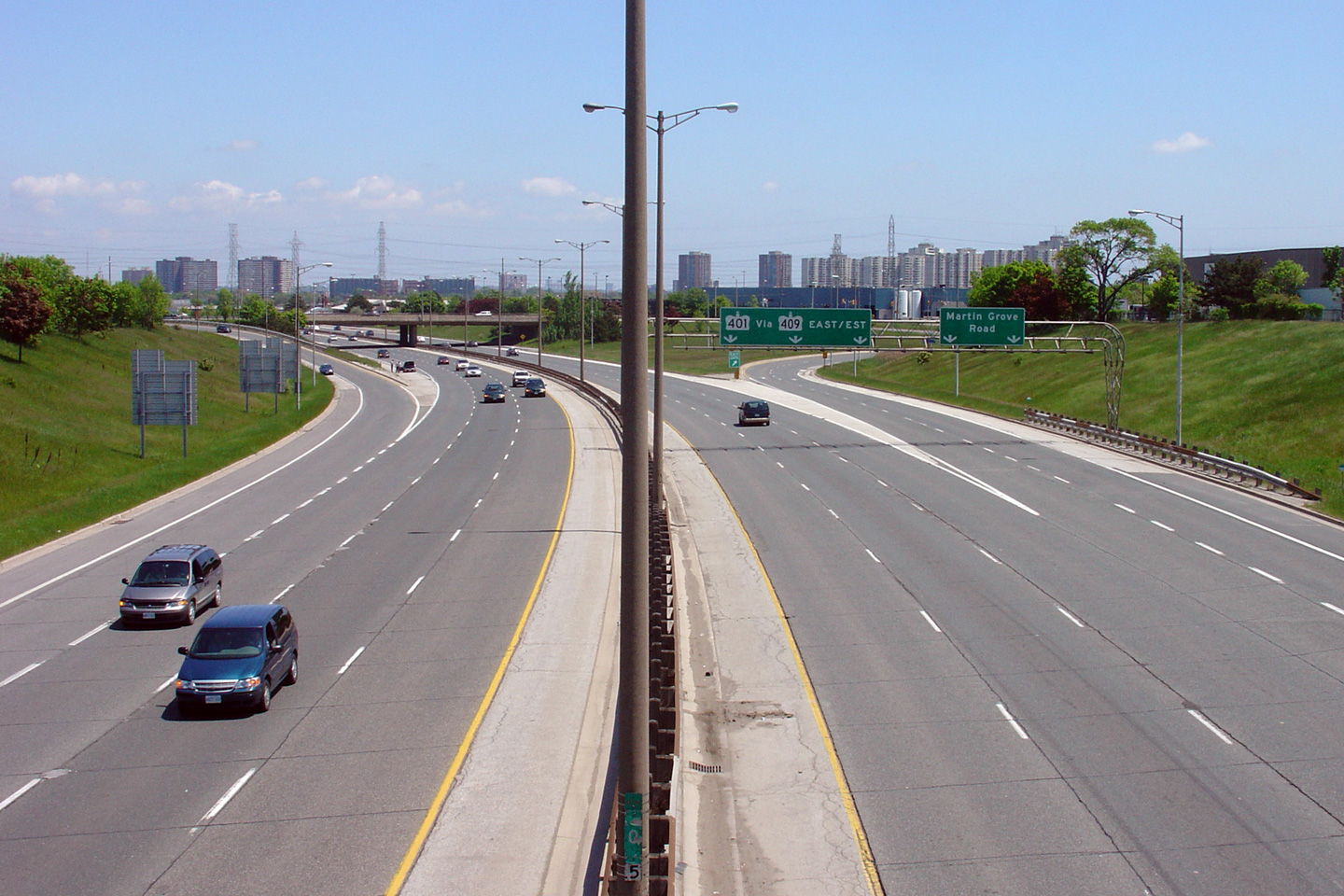
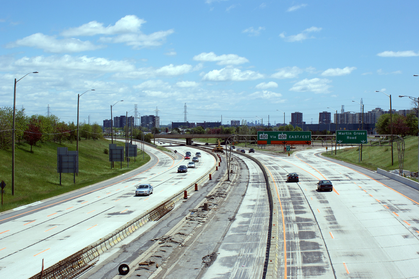
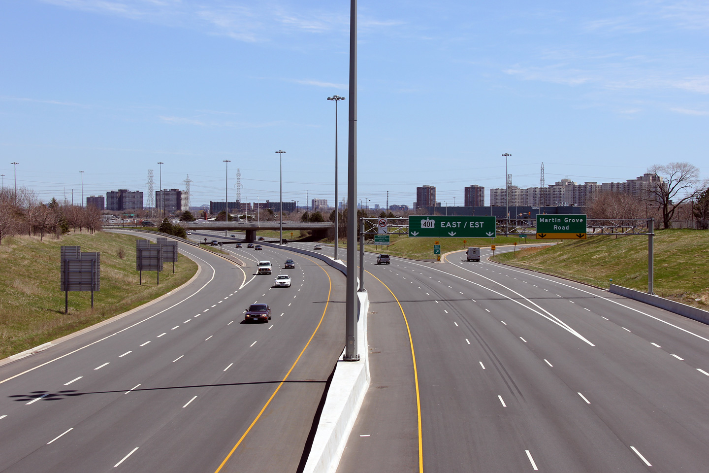
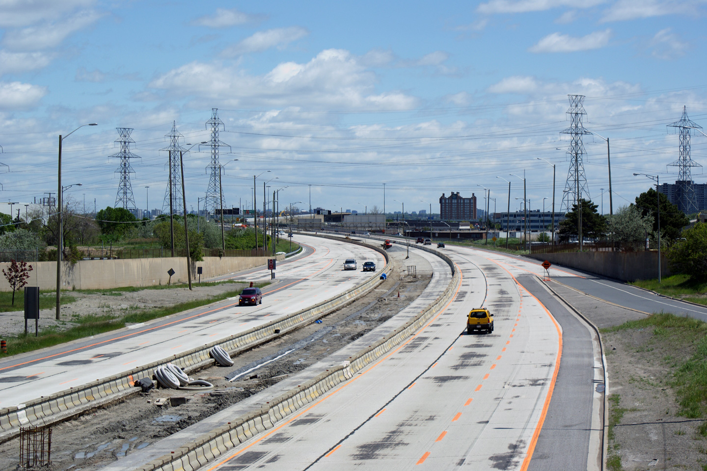
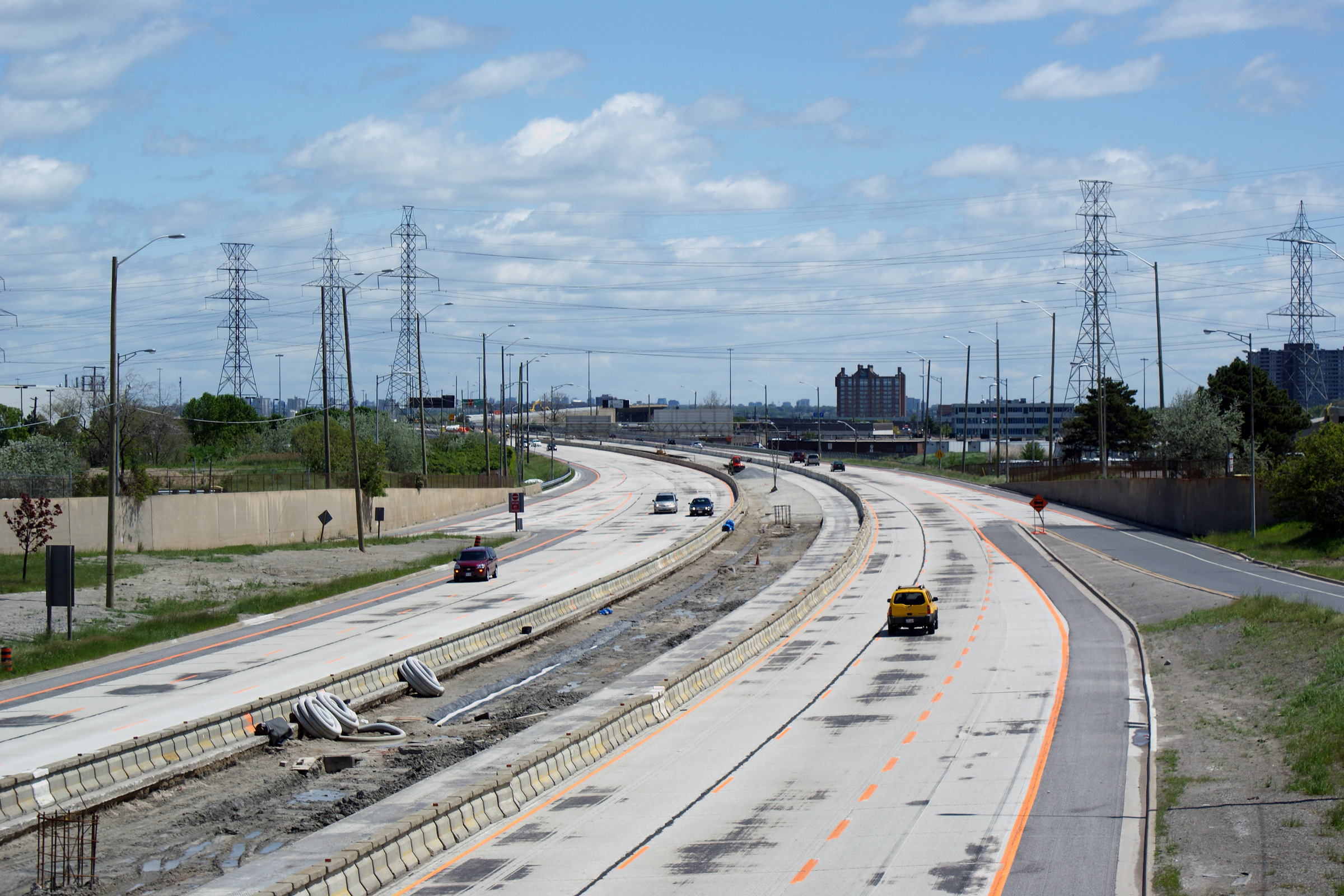
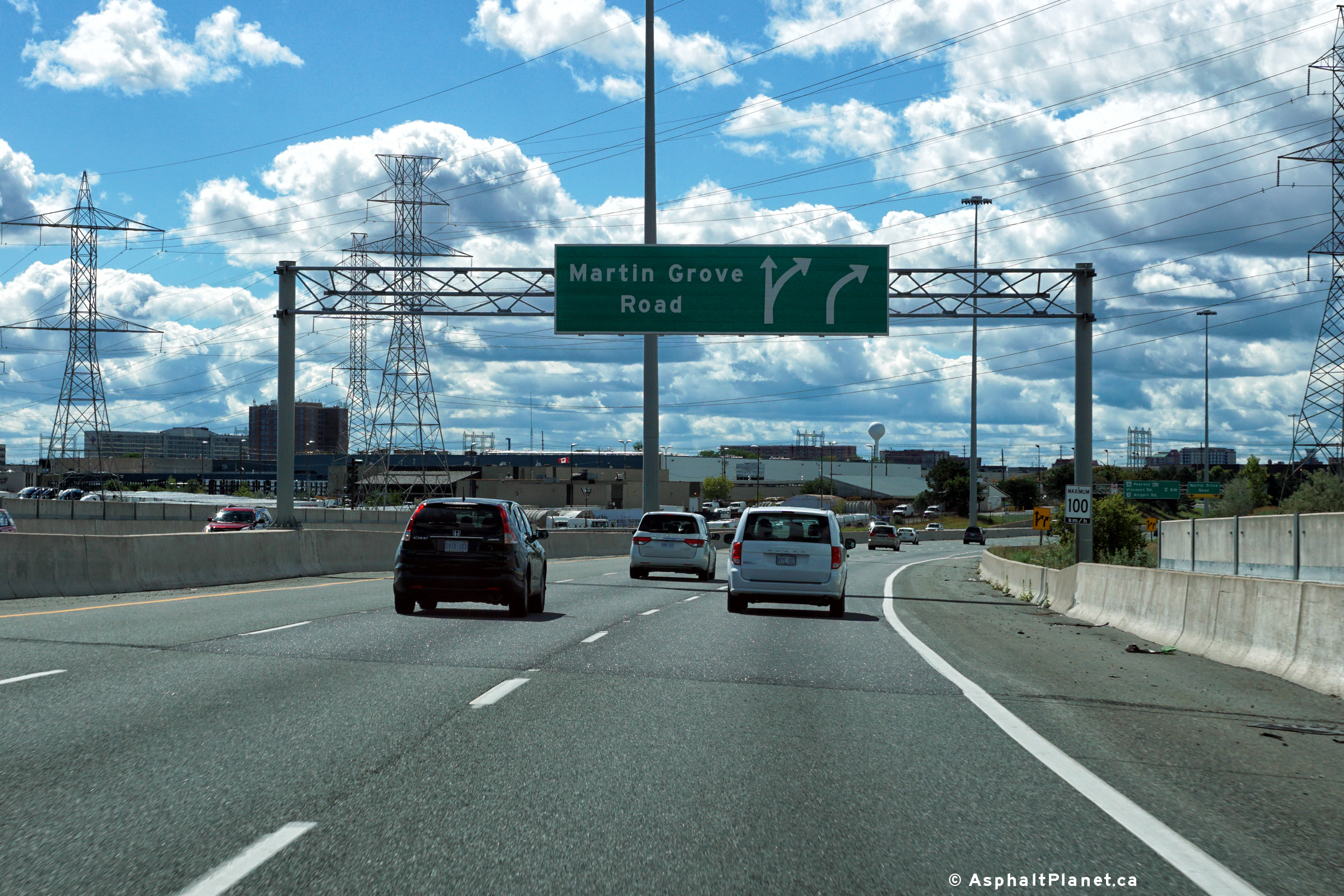
| City of Toronto |
Three views looking west from the Martin Grove Road overpass. Again,
this photo series is intended to show the stages of reconstruction of
Highway 409. The first photo highlights what the freeway looked like
prior to construction, while the middle photo is taken during heavy median
construction work. The third and final photo was taken when the
reconstruction work along Highway 409 had been completed. Note the
middle photo -- it shows that the work ongoing to remove the vintage median elements was further
advanced at the Martin Grove interchange than it was at Iron Street.
Unlike the view from Iron Street, all elements of the former curb and gutter
median
had been removed at the time this photo was taken, and a rebar support for
the future high-mast light column had been installed. Upper photo taken: May 1st, 2006. Middle photo taken: May 29th, 2009. Lower photo taken: April 30th, 2011. |
 |
|||
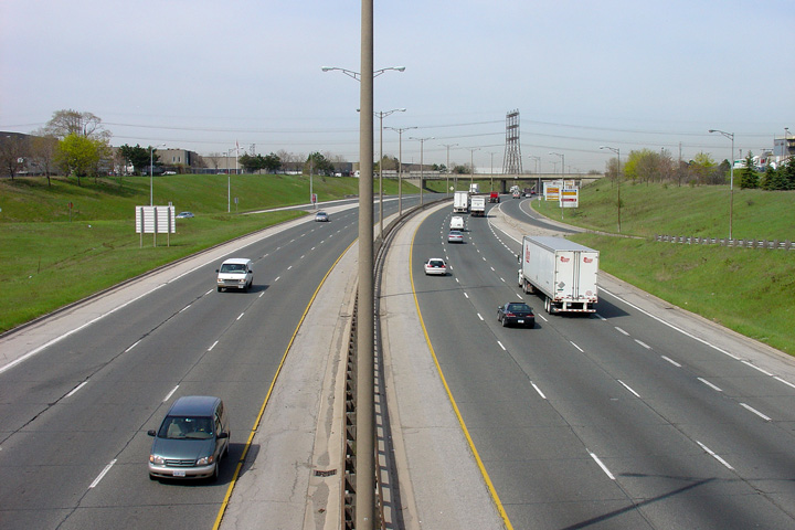
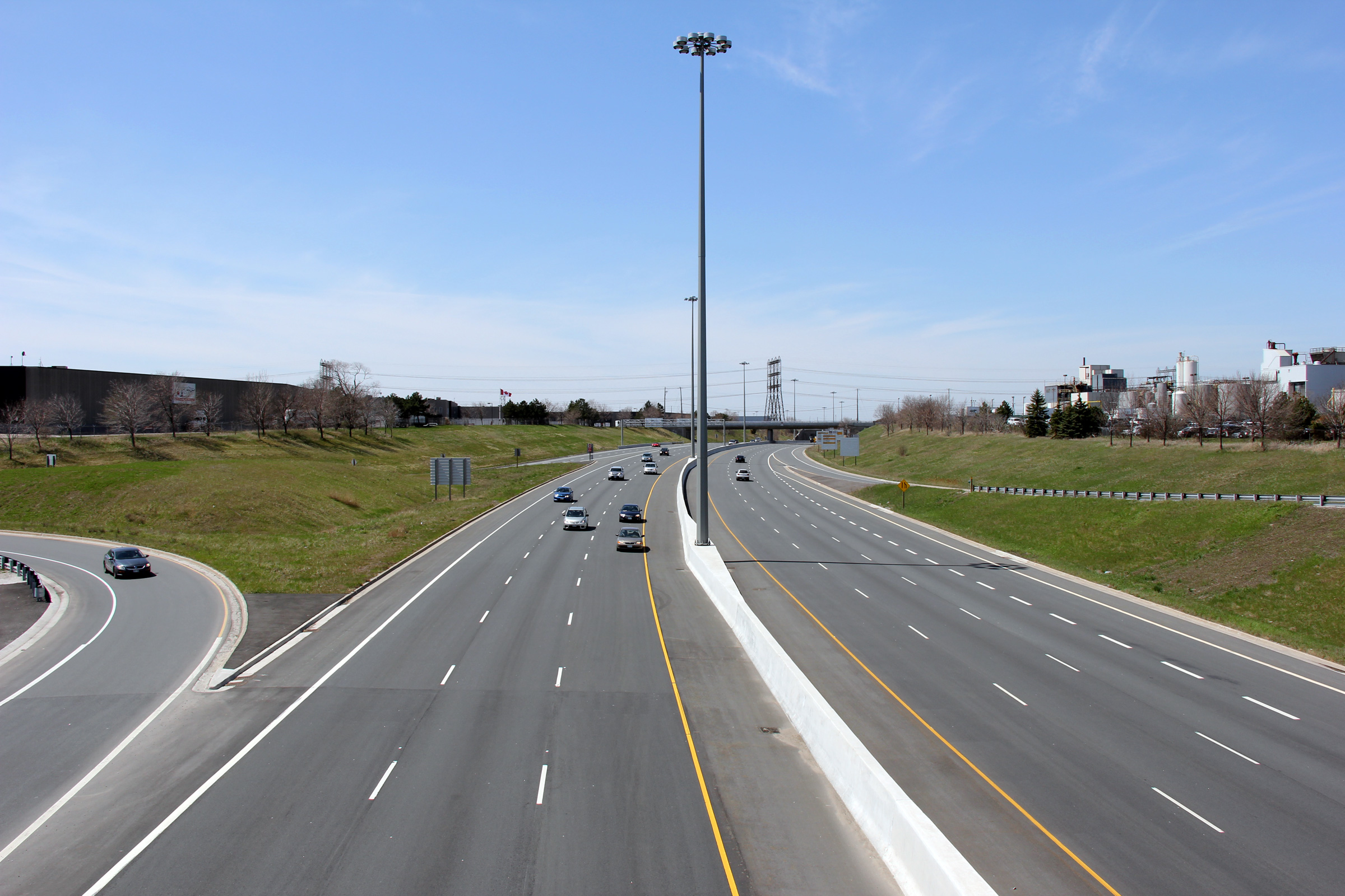
| City of Toronto |
Looking east from the Martin Grove Road overpass. Though the project
to reconstruct Highway 409 was an extensive multi-year project, aside from
lighting and median improvements, little change was made to the freeway.
Lane widths, taper lengths, lane configuration, and interchange
configuration all remained constant before and after reconstruction. Upper photo taken: May 1st, 2006. Middle photo taken: May 29th, 2009. Lower photo taken: April 30th, 2011. |
 |
|||
| City of Toronto |
Modern view looking westerly at the off-ramp to Martin Grove Road from
Highway 409. Photo taken: September 11th, 2016. |
 (720x480) (720x480)(1440x960) (2400x1600) |
|||
| City of Toronto |
View looking westerly approaching the westbound off-ramp to Martin Grove
Road. Photo taken: September 11th, 2016. |
 (720x480) (720x480)(1440x960) (2400x1600) |
|||
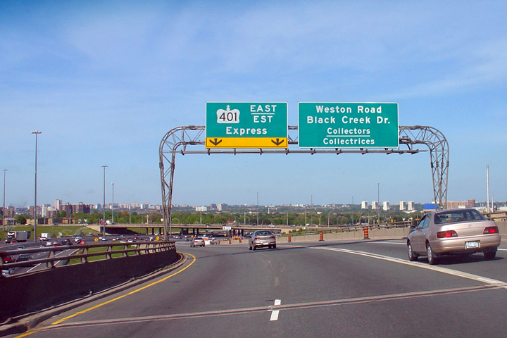
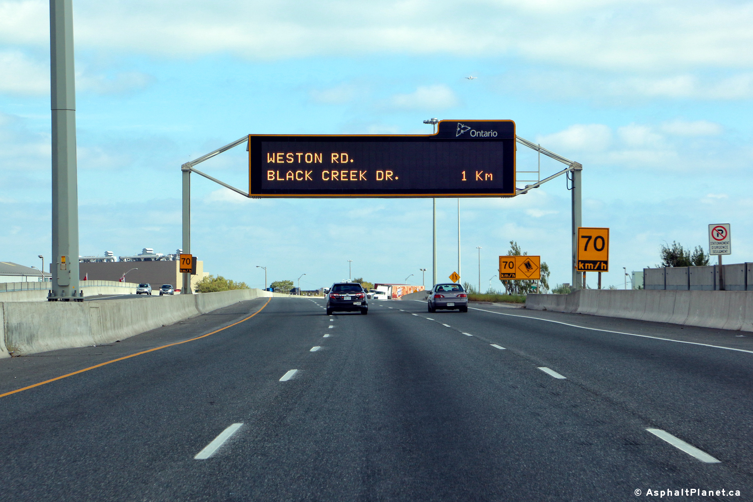
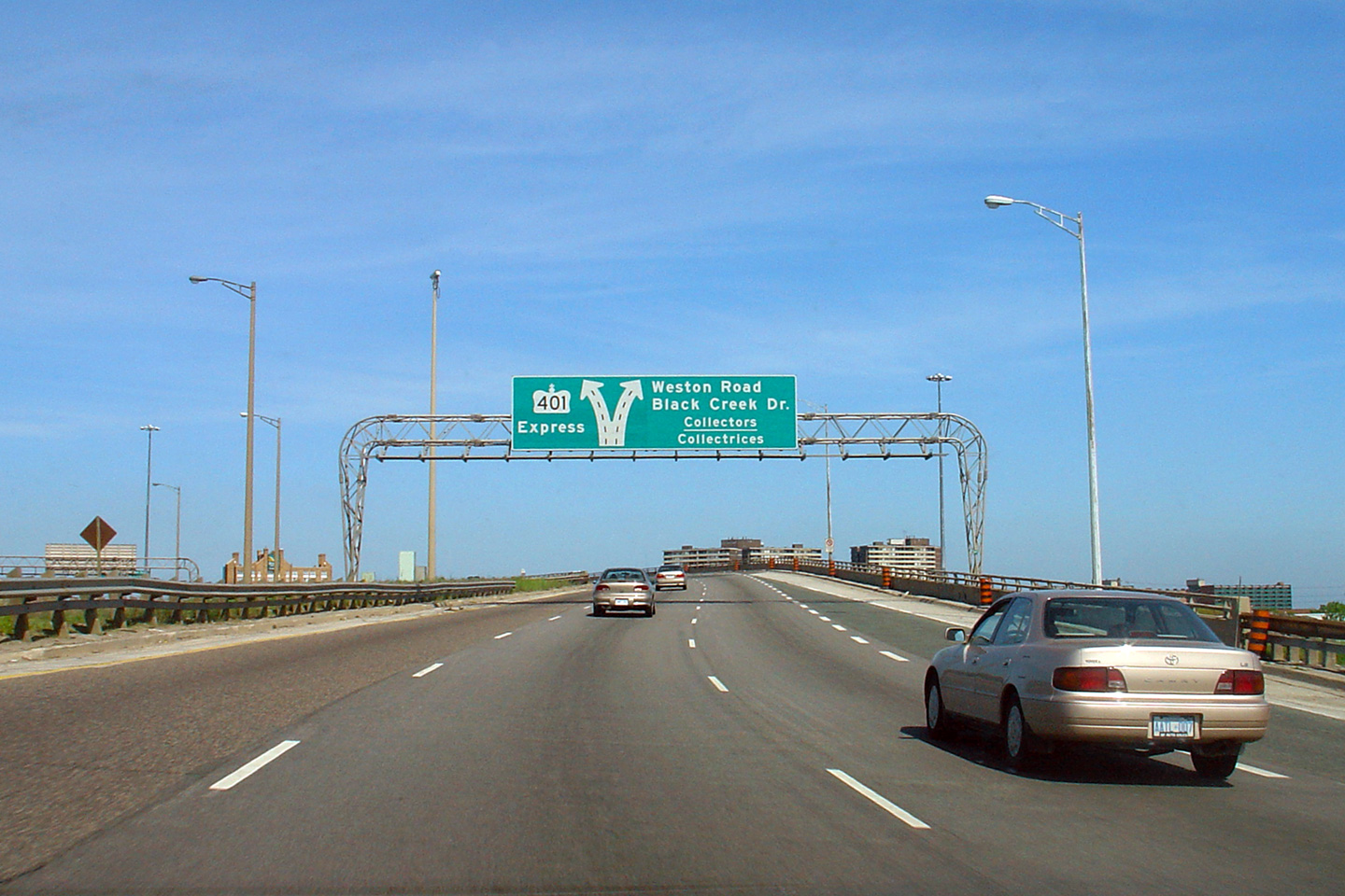
| City of Toronto |
Easterly view at the overhead changeable message sign in advance of the
Highway 401 interchange. This changeable message sign (CMS) was the
first of a series of full colour, high resolution CMS boards to be erected
by the MTO throughout the GTA's freeways. Photo taken: May 7th, 2011. |
 (720x480) (720x480)(1440x960) (2400x1600) |
|||
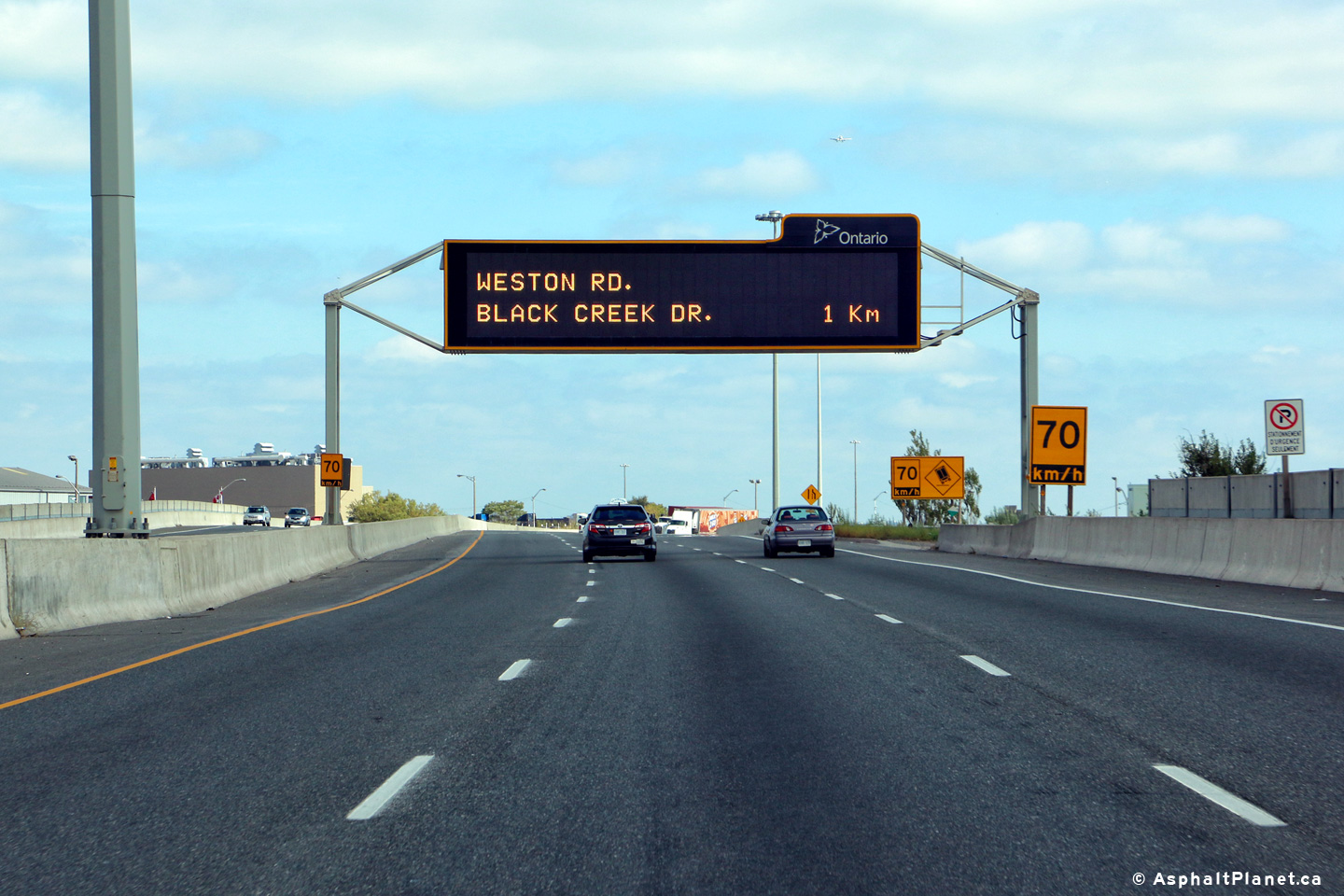
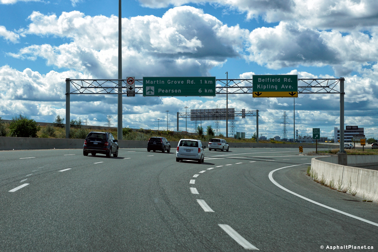
| City of Toronto |
View looking westerly at the off-ramp to Kipling Avenue and Bayfield Street.
There is not an eastbound off-ramp to Kipling Avenue from Highway 409. Photo taken: September 11th, 2016. |
 (720x480) (720x480)(1440x960) (2400x1600) |
|||
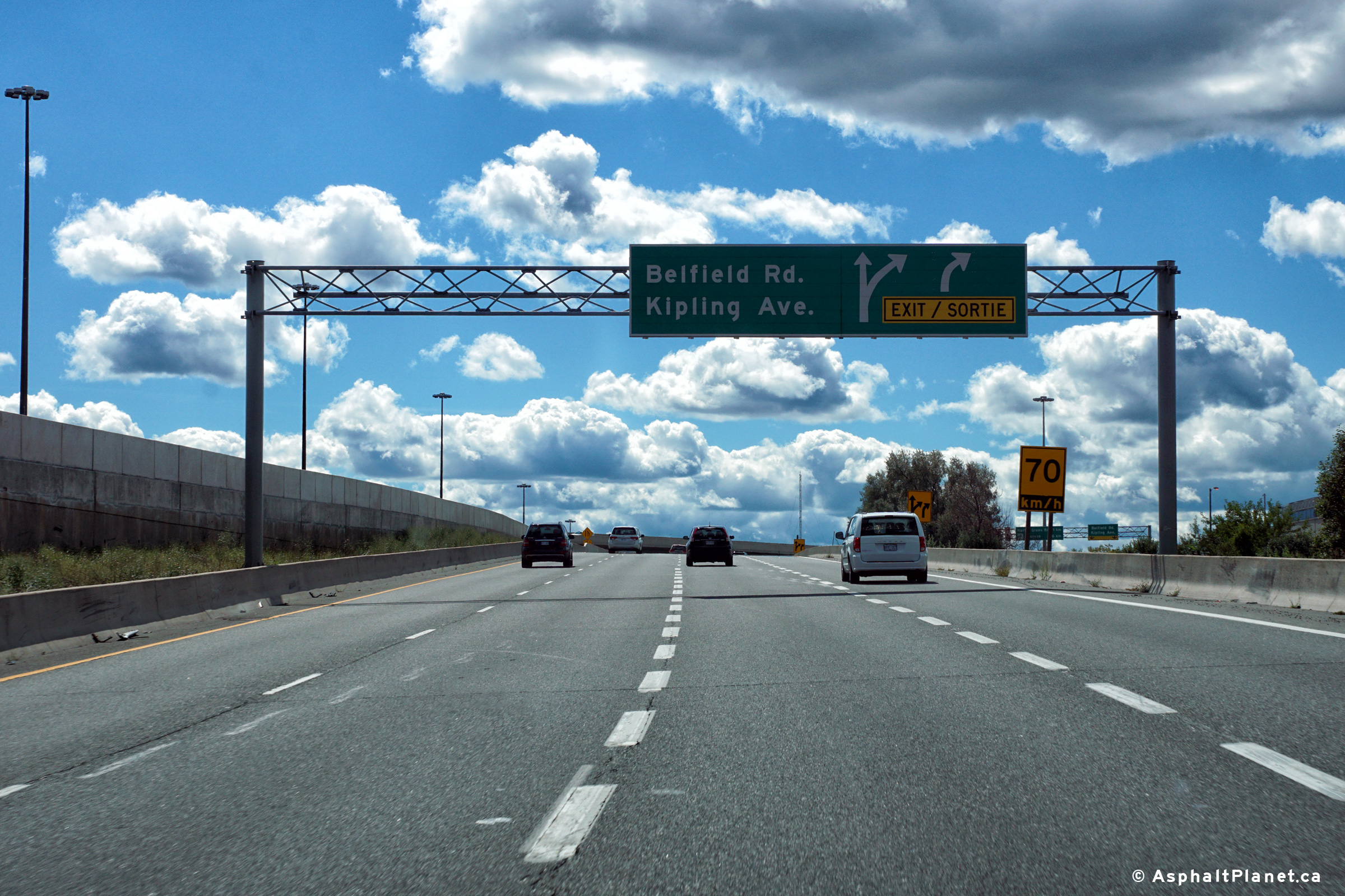
| City of Toronto |
Westbound advanced signage for the westbound off-ramp to Kipling Avenue and
Belfield Street. Photo taken: September 11th, 2016. |
 (720x480) (720x480)(1440x960) (2400x1600) |
|||
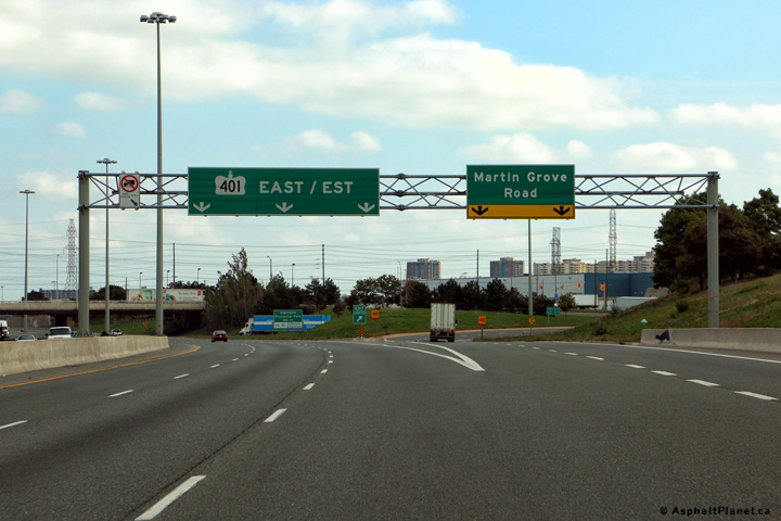
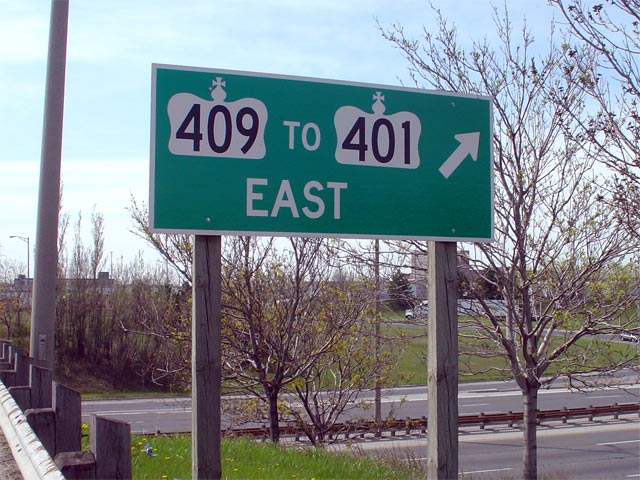
| City of Toronto |
Two incarnations of the advanced signage for the Highway 401 interchange.
Only Highway 401 East is accessible from Highway 409. During the
reconstruction of Highway 409, the MTO elected to remove the reference to
Highway 401 from this signage, instead opting to place a pull-through sign
that announces the Highway 401 interchange at the eastbound ramp to Martin
Grove Road. Upper photo taken: May 27th, 2006. Lower photo taken: October 5th, 2016. |
 (720x480) (720x480)(1440x960) (2400x1600) |
|||
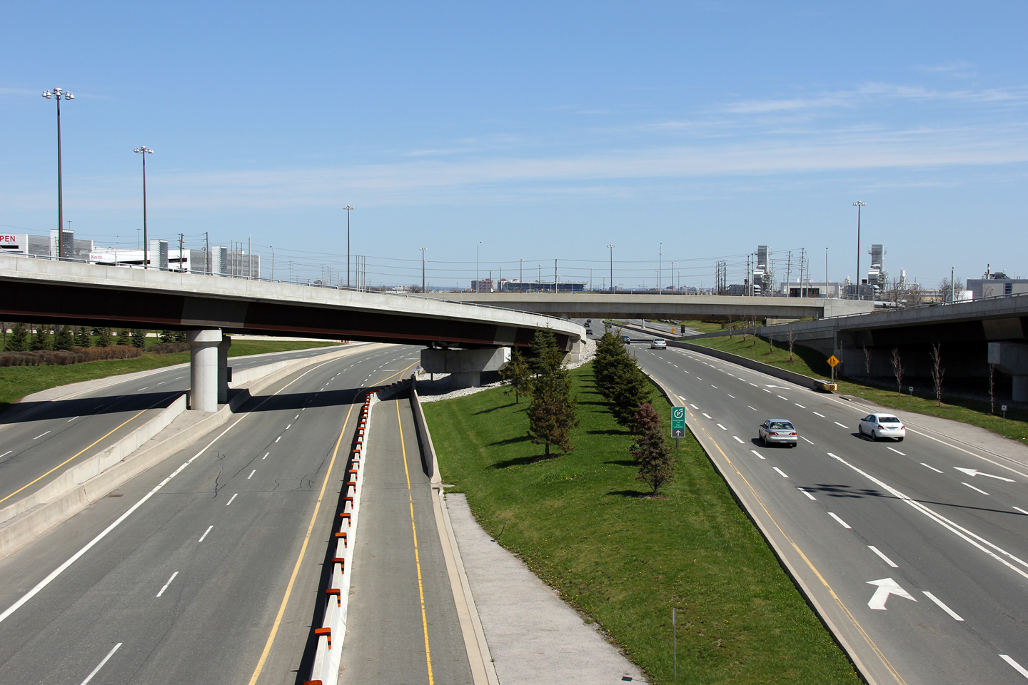
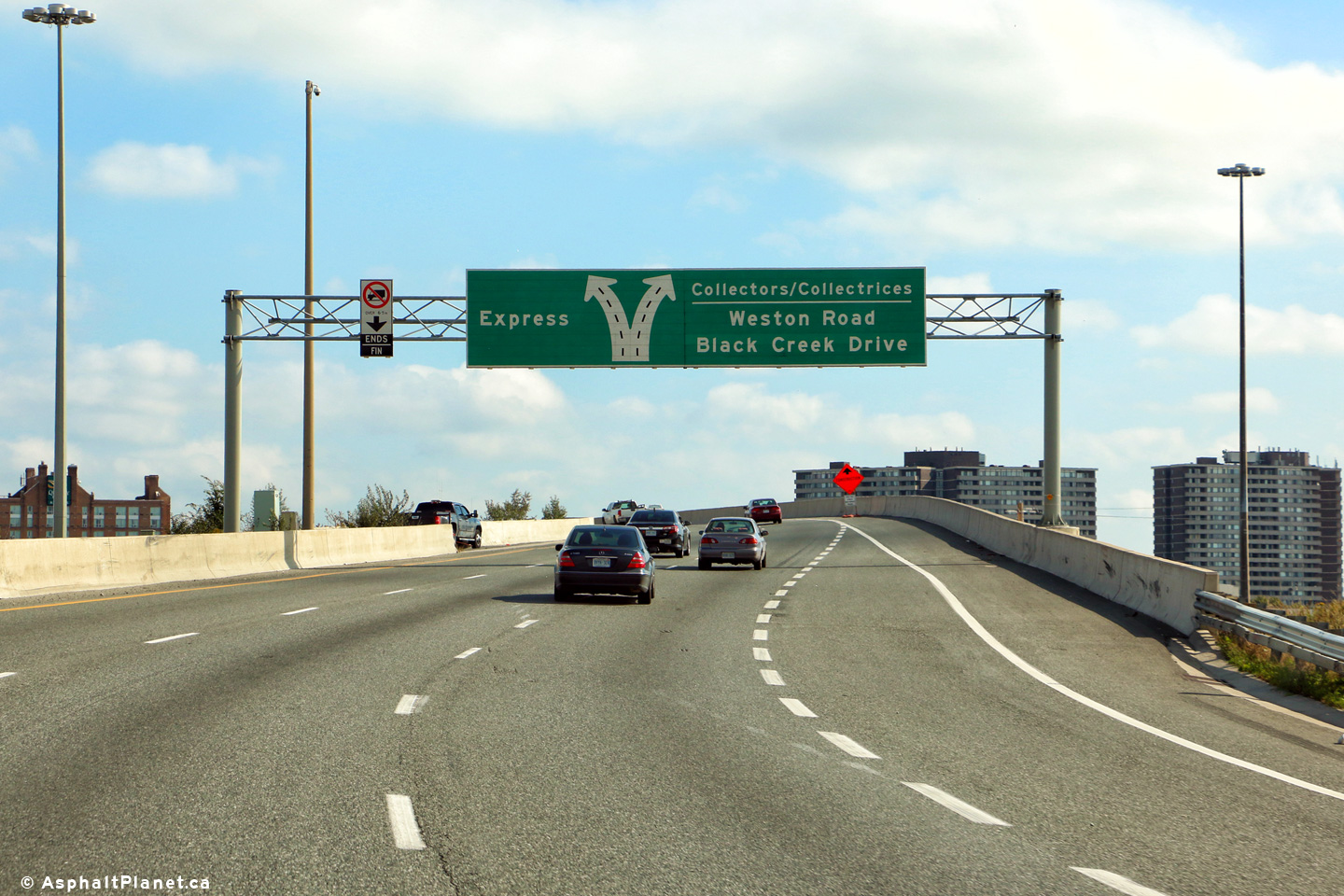
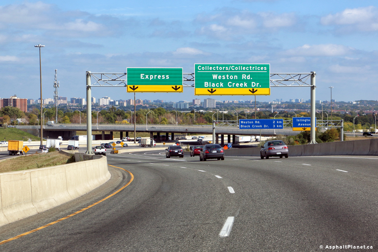
| City of Toronto |
Two views looking easterly as Highway 409 splits between the eastbound
Highway 401 express and collector lanes. Upper photo taken: May 27th, 2006. Lower photo taken: October 5th, 2016. |
|
|||
| Highway 409 defaults onto Highway 401 East at the Islington Avenue interchange. Click here for Highway 401 images. | |||||
Other Images Related to Highway 409:
| Proper Municipality Name | Photo Description | Photo |
| City of Toronto | Sign located southbound on Martin Grove Road
advising travelers towards the eastbound 401,
via Highway 409. Picture size: 80kb. |
 |
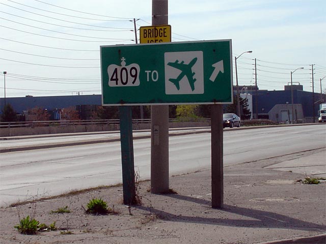
| City of Toronto | Sign located southbound on Martin Grove Road
directing travelers heading towards Pearson International Airport onto
Highway 409. Notice that a cardinal direction is not included on this
sign. Picture size: 55kb. |
 |
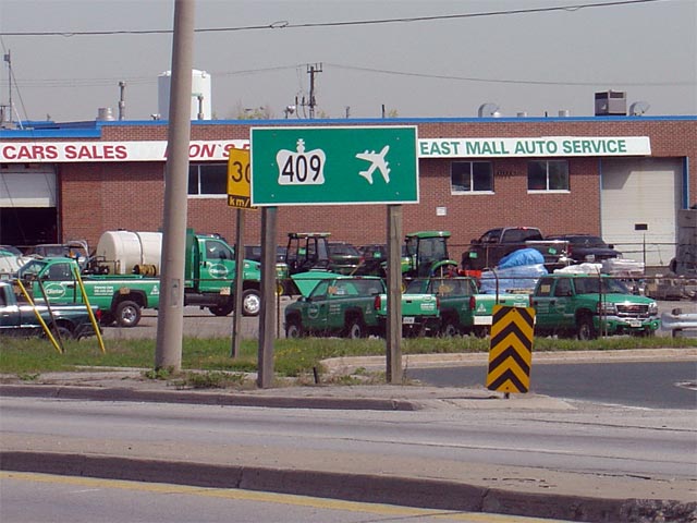
| City of Toronto |
A newer version of the above sign, this time located northbound on Martin
Grove Road. This sign is much simpler, yet likely not as clear as the
above sign. Notice that the shown airplane diagram is inverted from
the standard colour scheme. Picture size: 65kb. |
 |
<- Highway 407 Images Back to Highway 409 Highway 410 Images ->
Copyright (c) 2004-2014, AsphaltPlanet.ca AsphaltPlanet@asphaltplanet.ca


