AsphaltPlanet.ca > OntHighways >
Highway 401 > Images
> Page 10
King's Highway 401 - Images
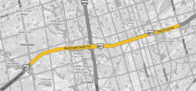
<- Page 9 Page 10 - North York To Scarborough Page 11 ->
Photos shown in this table are arranged from West to East:
| Proper Municipality Name | Photo Description | Photo | |||
|
Pictures taken from driver's perspective appear offset from centre-line pictures: |
East- |
west- |
|||
| Continued from Mississauga to North York Images | |||||
| Yonge Street was part of Highway 11, before it was truncated in Barrie, in 1997. Click here for Highway 11 images. | |||||
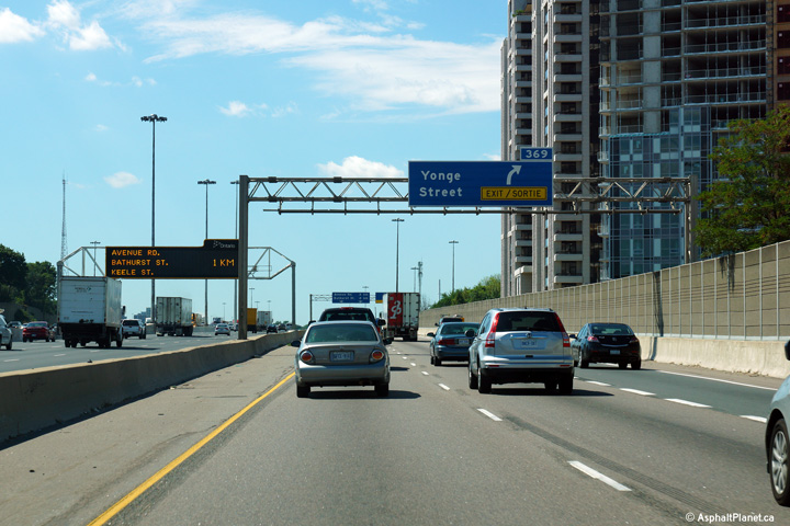
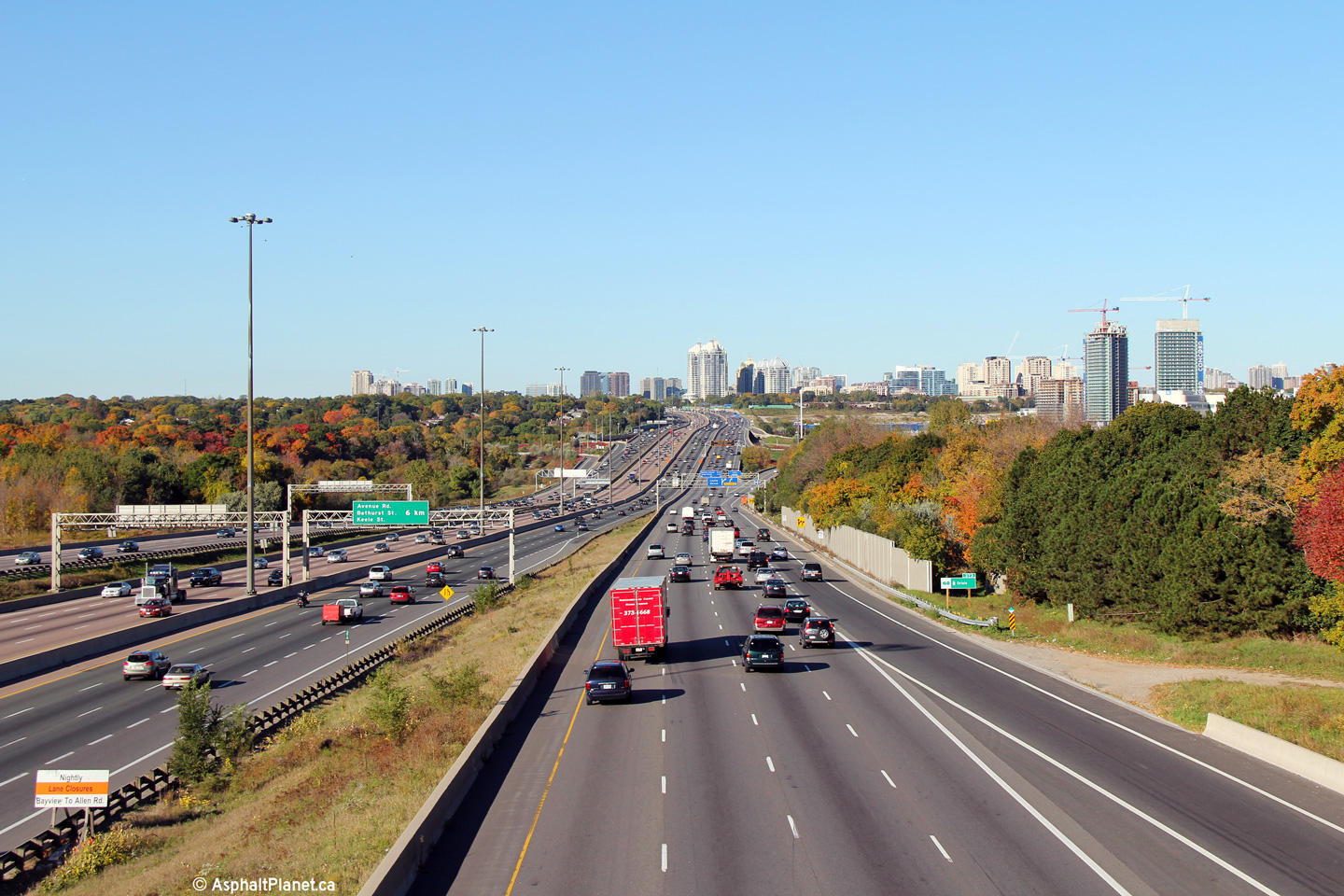
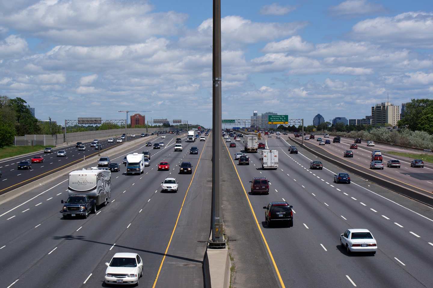
| City of Toronto |
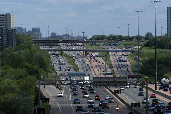
View looking westerly at the Yonge Street off-ramp from the westbound
collector lanes. The westbound collector lanes are briefly reduced
to two lanes through the Yonge Street interchange. The lack of a
third collector lane through the Yonge Street interchange is a major
source of congestion along the 401 through North York. Photo taken: September 4th, 2013. |
 (720x480) (720x480)(1440x960) (2400x1600) |
|||
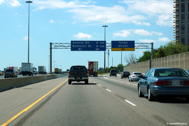
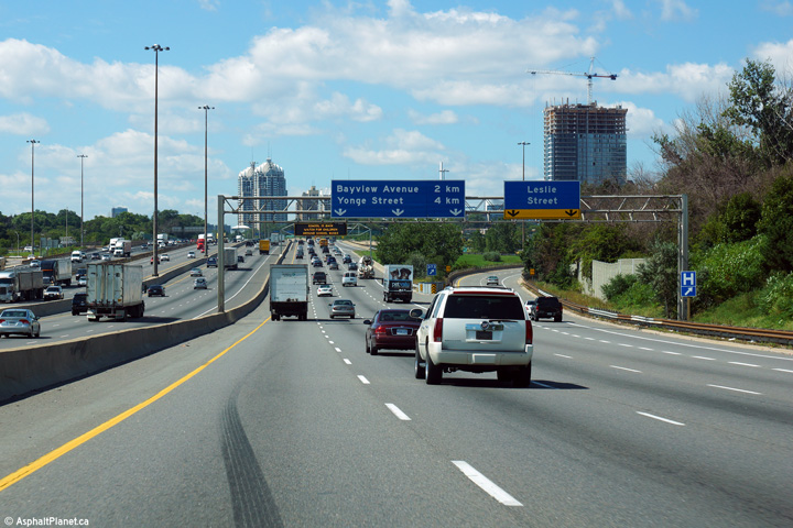
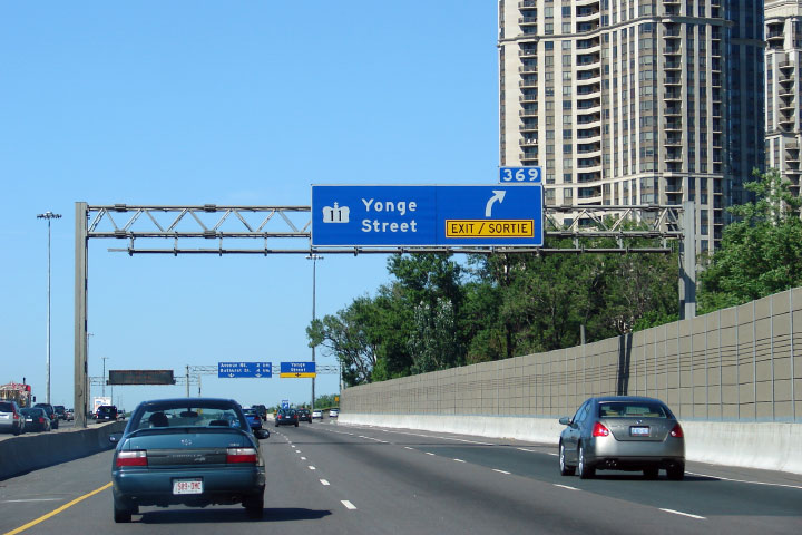
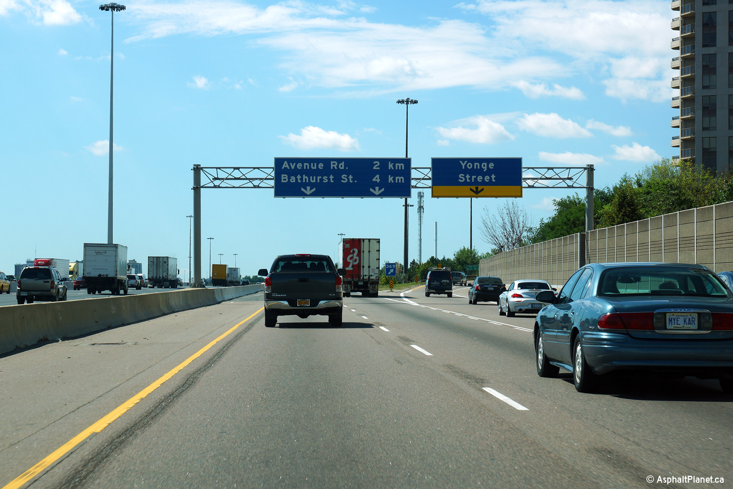
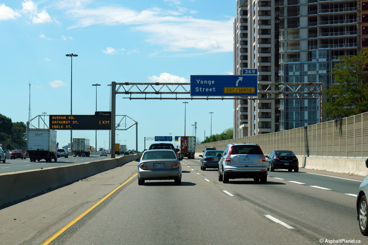
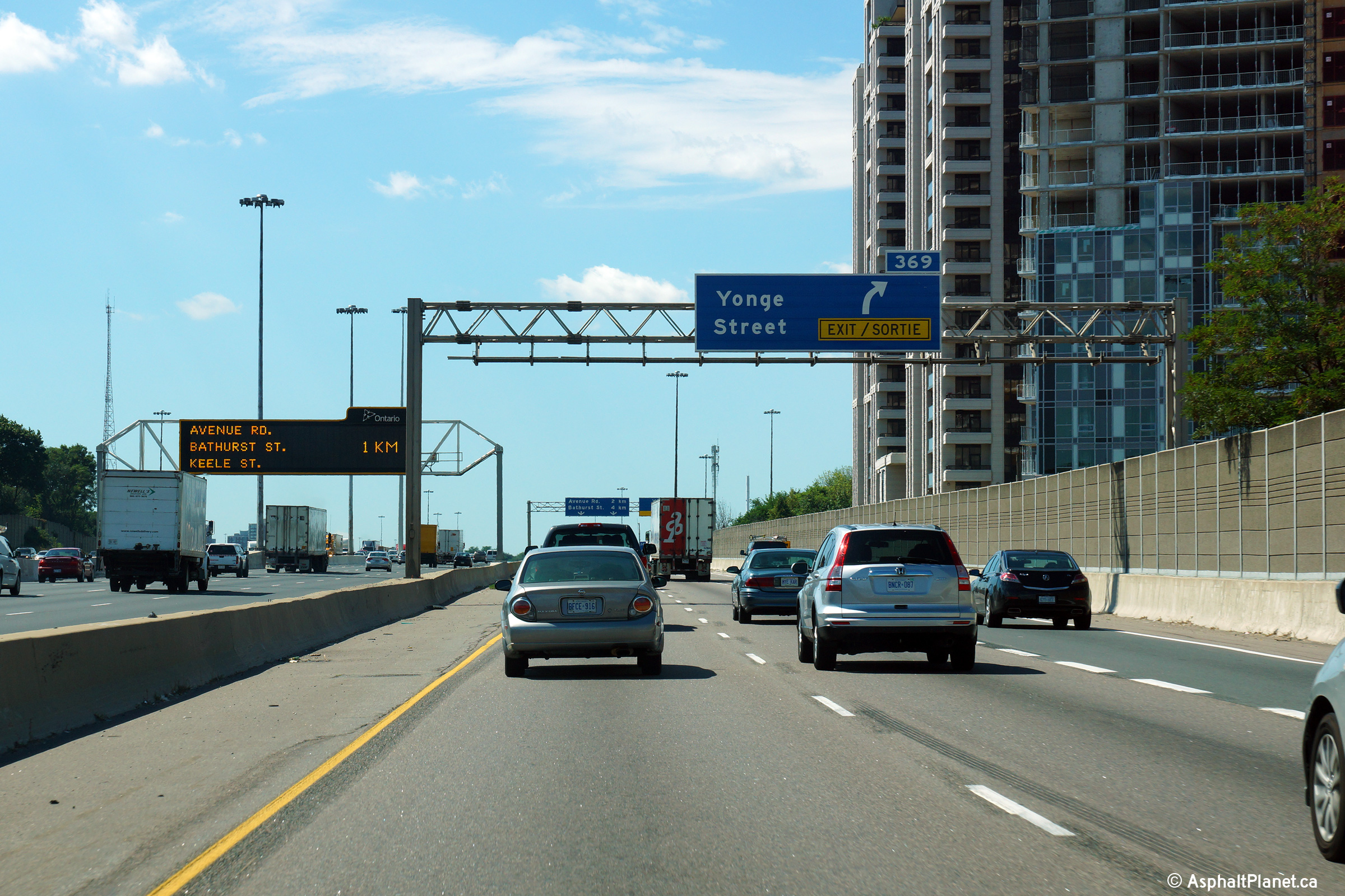
| City of Toronto |
Two versions of the westbound advanced signage for the exit to Yonge
Street. Many of the highway numbers were removed from Toronto's
overhead signage during a large resigning contract that took place over
the winter of 2010. Upper photo taken: June 9th, 2007, by Josh Anderchek. Lower photo taken: September 4th, 2013. |
 (720x480) (720x480)(1440x960) (2400x1600) |
|||
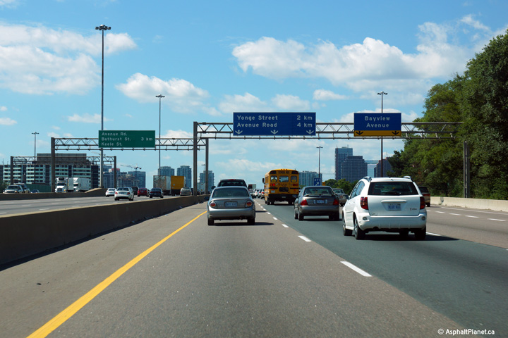
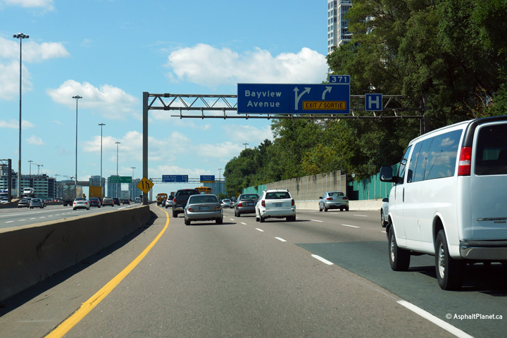
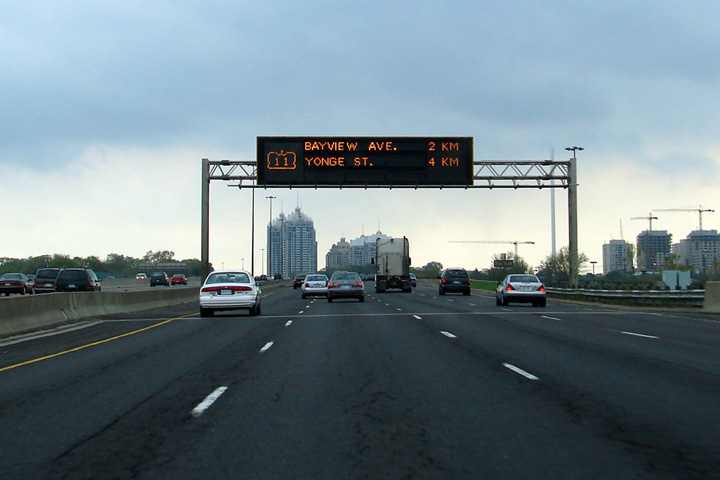
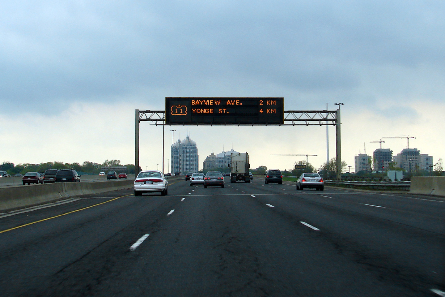
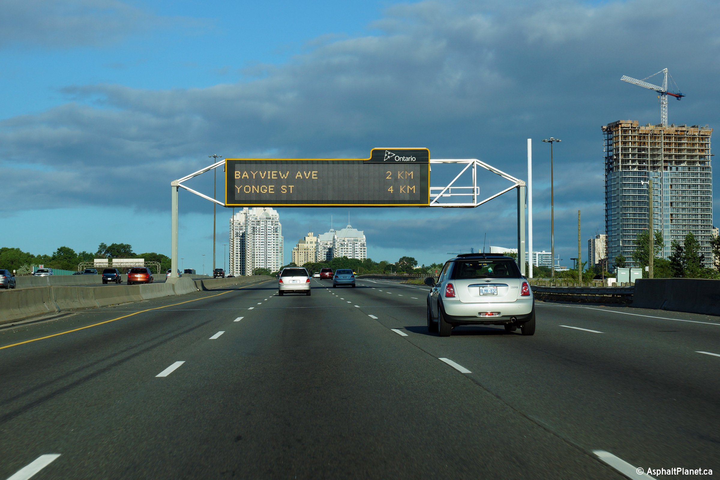
| City of Toronto |
Easterly view in the eastbound collector lanes approaching the Bayview
Avenue off-ramp. The fourth eastbound collector lane that joined the
collectors from Yonge Street on-ramp departs at Bayview Avenue. Photo taken: April 24th, 2014. |
||||
| City of Toronto |
Easterly at the off-ramp to the Bayview Avenue interchange. Photo taken: April 24th, 2014. |
||||
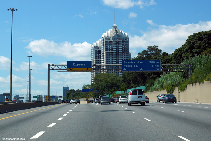
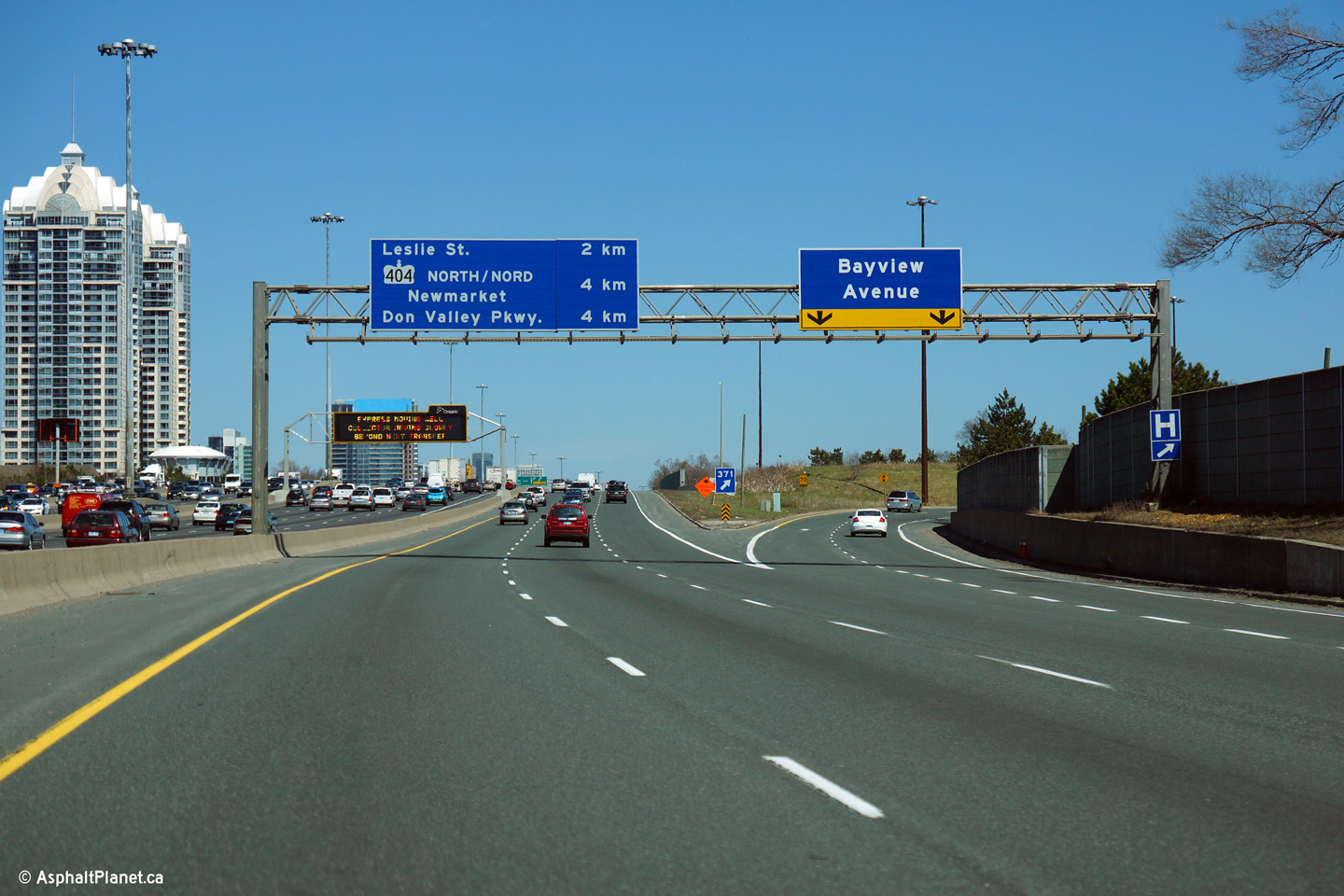
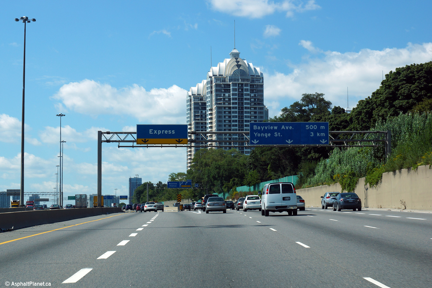
| City of Toronto |
Easterly view in the express lanes at Bayview Avenue. During 2010 new
overhead COMPASS changeable message signs (CMS) were installed along various
GTA highways including the 401. With the exception of the CMS at
Avenue Road (which will be replaced in an upcoming widening project) all of
the original COMPASS signs that were installed in the early 1990s were
replaced with newer much brighter, full colour signs. At Bayview
Avenue, the new sign was installed directly behind the existing. Photo taken: July 2nd, 2010. |
 (720x480) (720x480)(1440x960) |
|||
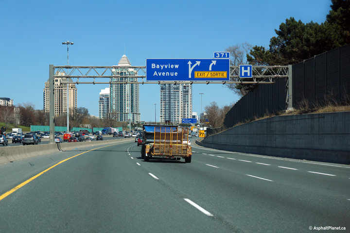
| City of Toronto |
Signage at the westbound off-ramp to Bayview Avenue. The sign featured
in the upper photo still indicated the former highway designations for Yonge
Street and Avenue Road. That signage has been replaced by the signs in
the lower photo, which is current.
Upper photo taken: June 9th, 2007, by Josh Anderchek. |
 (720x480) (720x480)(1440x960) (2400x1600) |
|||
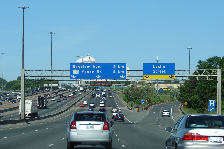
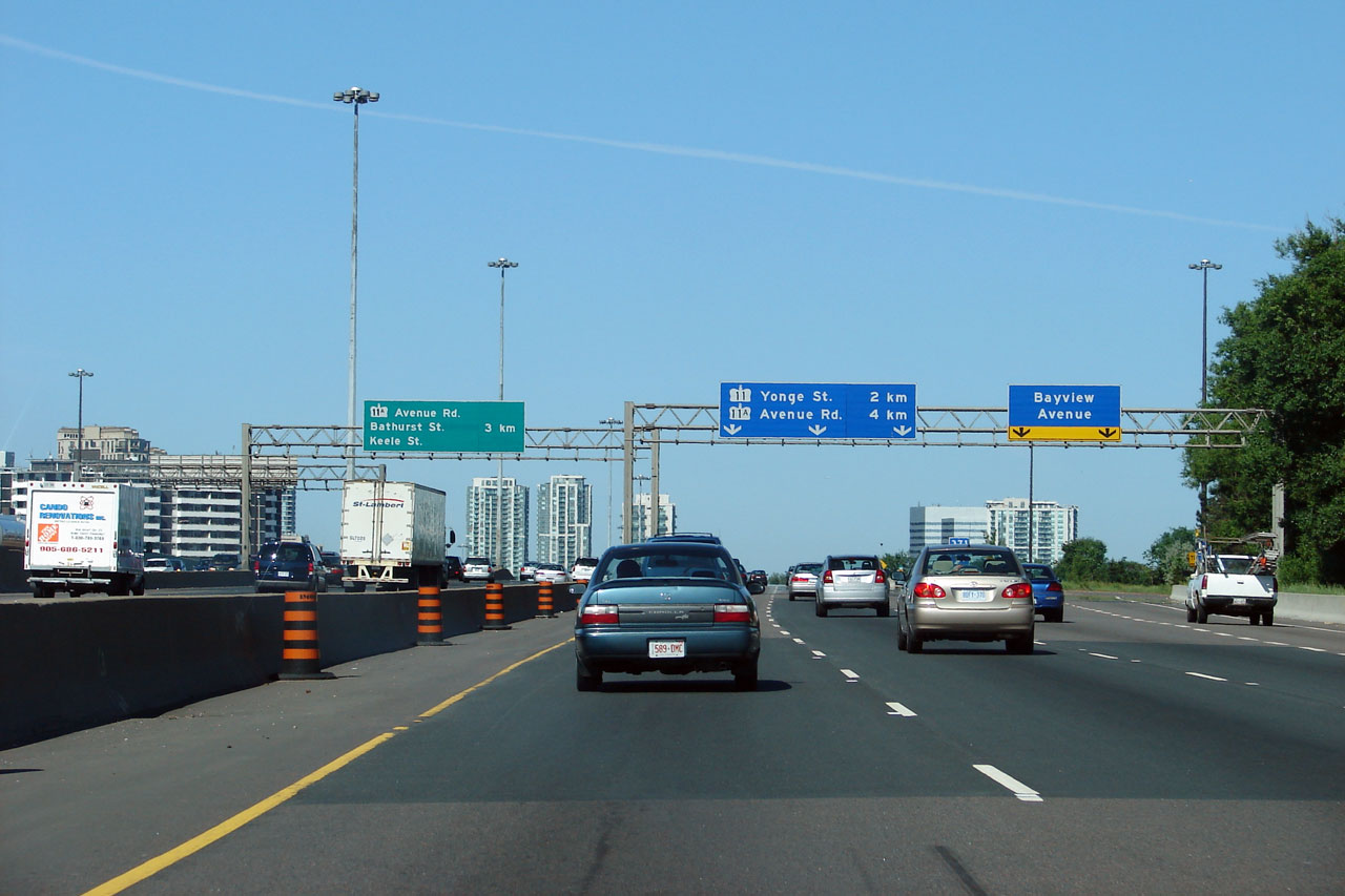
| City of Toronto |
Westbound advanced signage for the ramp to Bayview Avenue. The fourth
lane westbound collector lane that entered the highway from
Leslie Street departs at Bayview Avenue. Photo taken: September 4th, 2013. |
 (720x480) (720x480)(1440x960) (2400x1600) |
|||
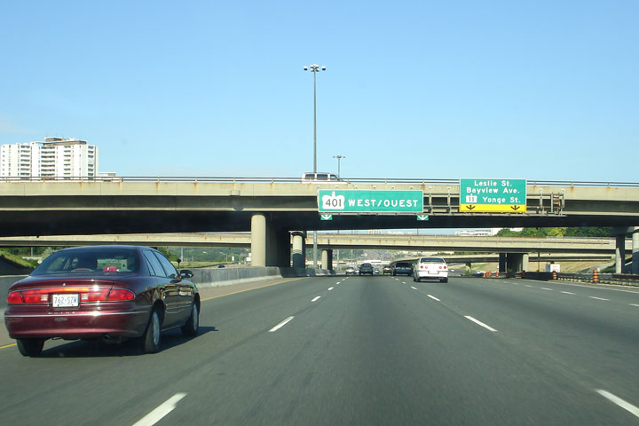
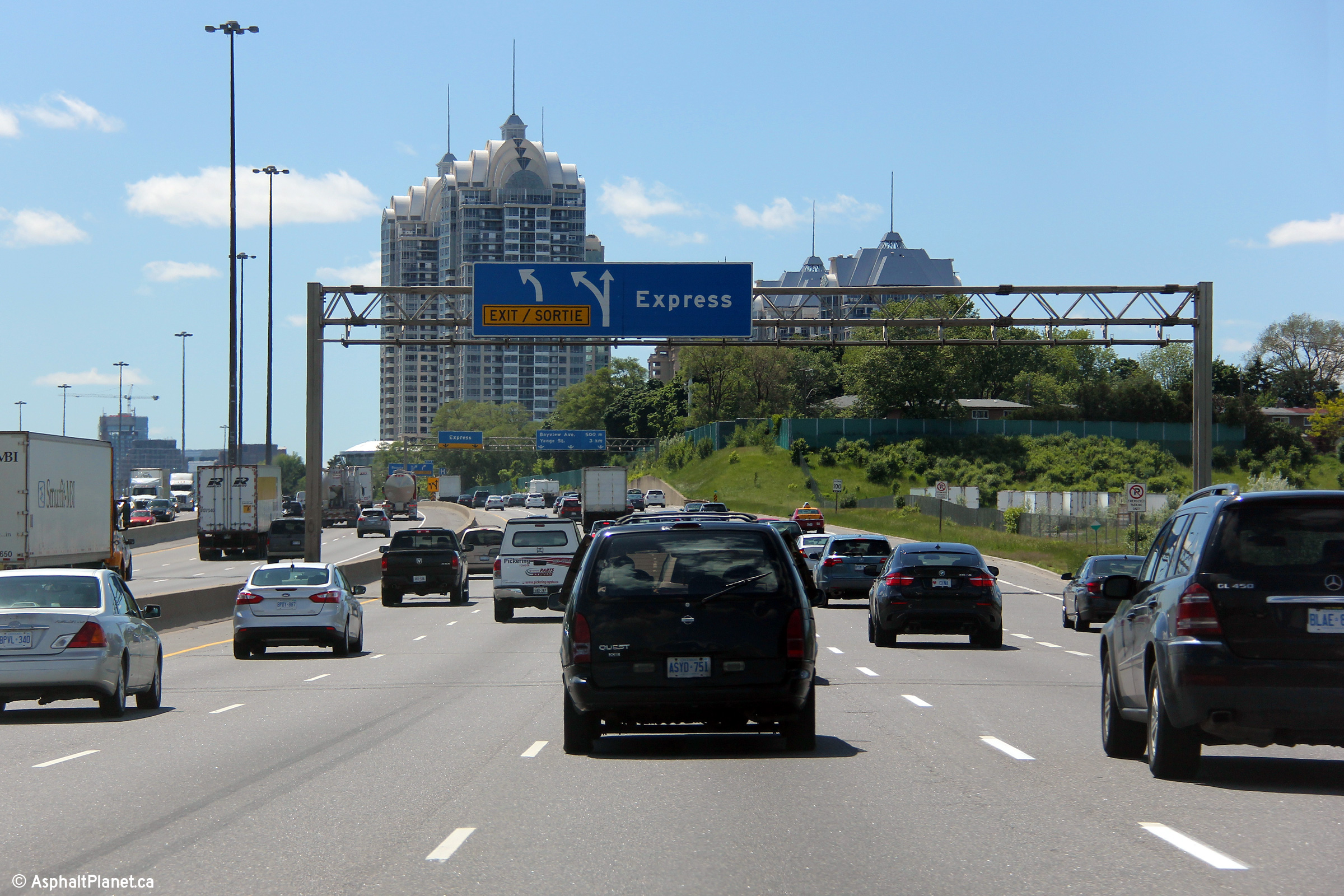
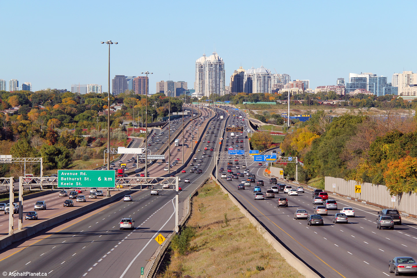
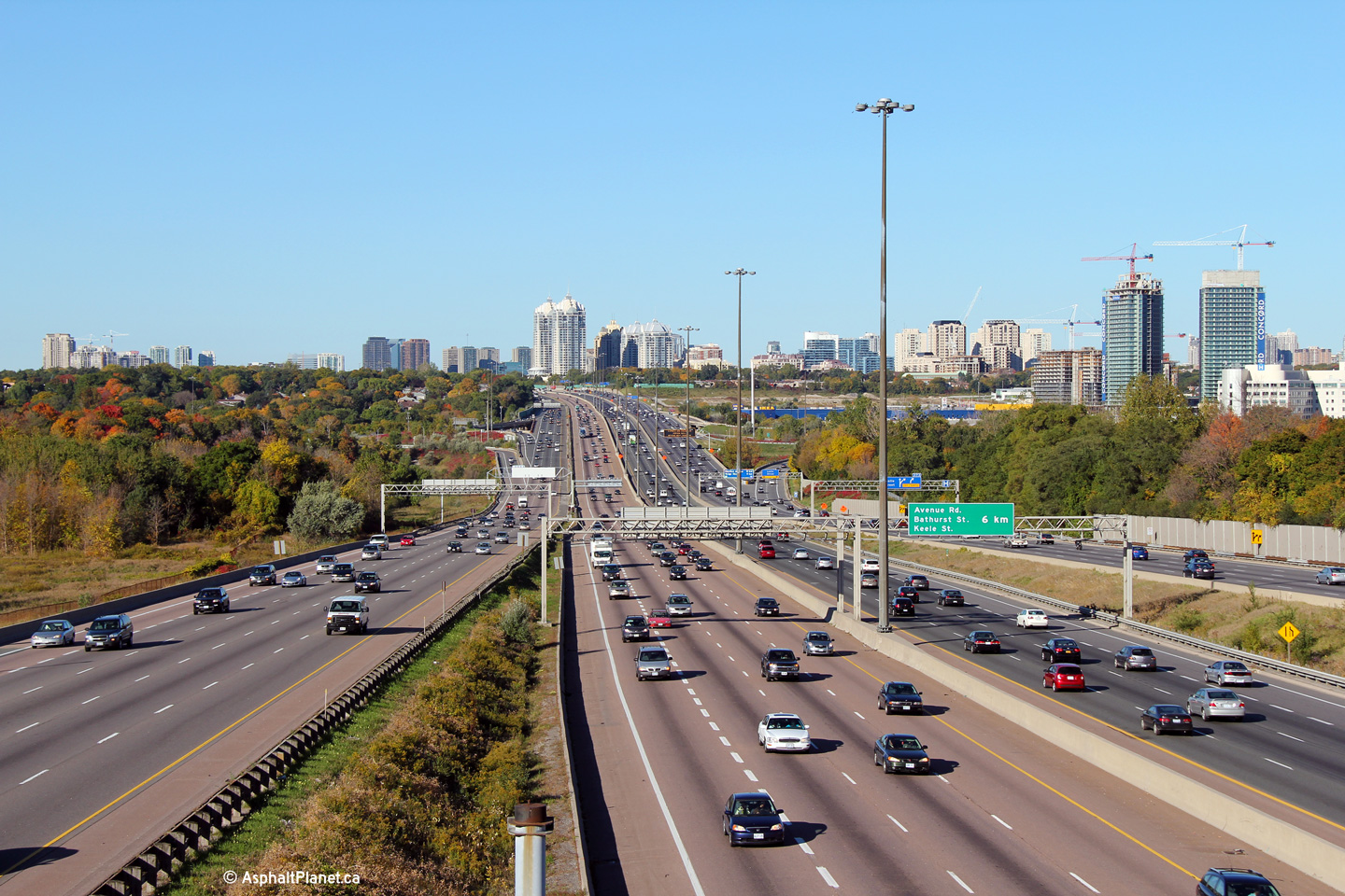
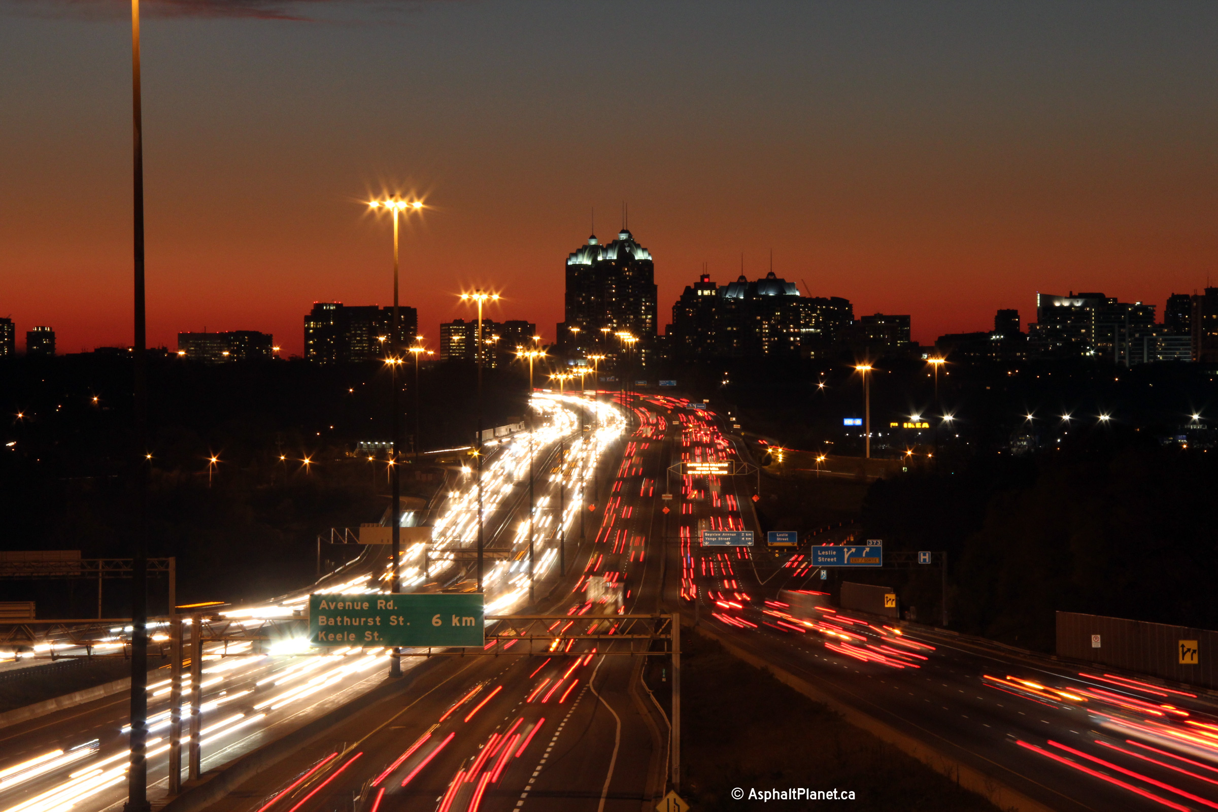
| City of Toronto |
Signage at the express lane transfer west of Leslie Street. Photo taken: September 4th, 2013. |
 (720x480) (720x480)(1440x960) (2400x1600) |
|||
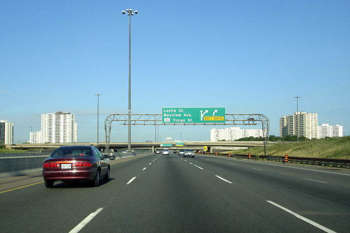
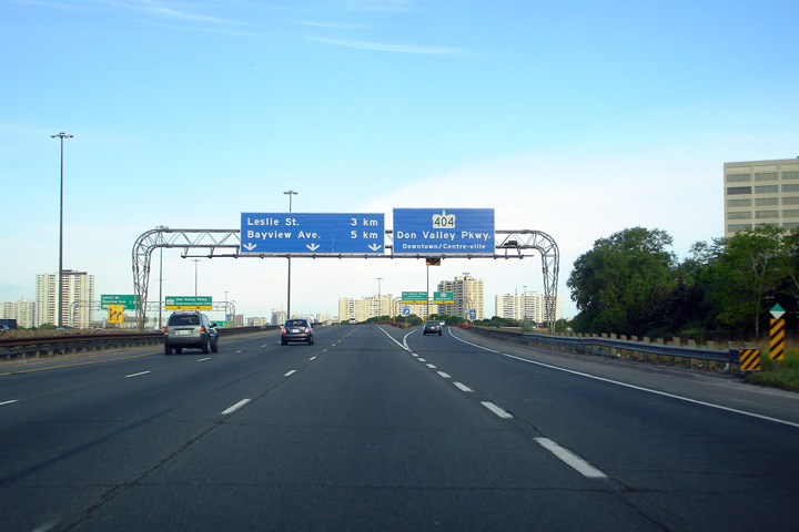
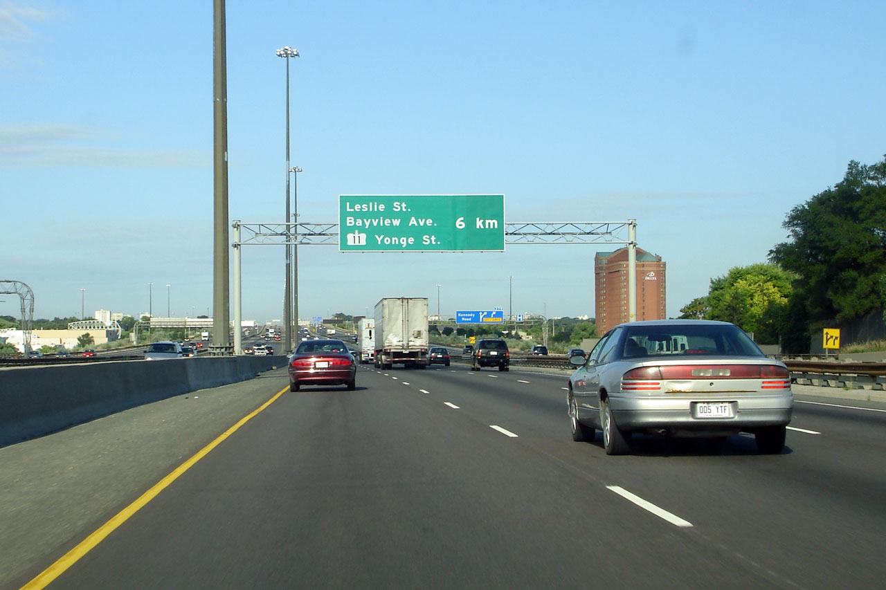
| City of Toronto |
Westbound advanced signage for the transfer to the express lanes beyond
Leslie. The transfer to the express lanes is located at the top of
a fairly significant grade. This forces slow moving trucks into
the left hand side of the collector lanes up the grade which causes
congestion. Photo taken: June 3rd, 2013. |
 (720x480) (720x480)(1440x960) (2400x1600) |
|||
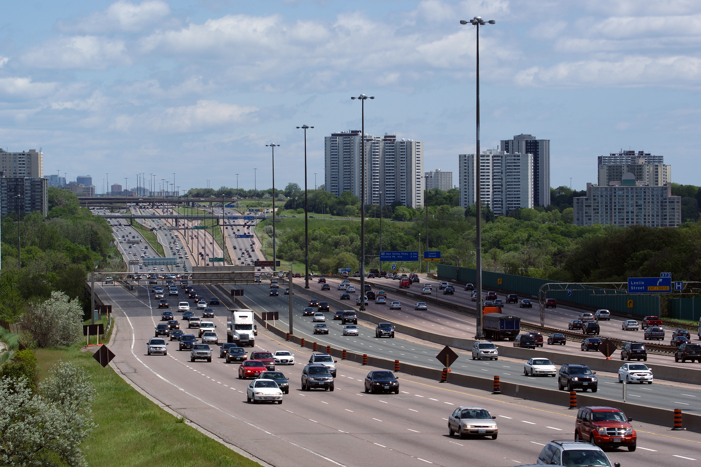
| City of Toronto |
Lanes. These views looks easterly towards the Leslie Street and
Highway 404/DVP interchanges, from just east of Bayview Avenue.
Highway 401 is actually elevated for a short distance in the vicinity of
the Leslie Street interchange. Go Transit's Oriole Train Station
and parking lot is located beneath the elevated highway structure. Photos taken: May 29th, 2009. |

(720x480)
(1440x960)
(2400x1600) |
|||
| City of Toronto |
Advanced signage for the eastbound exit to Leslie Street. Photo taken: April 24th, 2014. |
||||
| City of Toronto |
Easterly view at the off-ram to Leslie Street. The eastbound
off-ramp to Leslie Street is one of very few single lane off-ramps
from the 401 in Toronto. A multi-year reconstruction project that
is scheduled for later in the 2010s in the vicinity of the Leslie Street
interchange will see this ramp widened to two lanes.
Unfortunately, the conceptual contract drawings completed so far for
this reconstruction do not include the addition of a fourth through
collector lane through this interchange. Photo taken: April 24th, 2014. |
||||
| City of Toronto |
Easterly view towards the 404/Don Valley Parkway interchange from the
Leslie Street underpass. Photo taken: September 23rd, 2013. |
 (720x480) (1440x960) (2400x1600) |
|||
| City of Toronto |
Two incarnations of overhead changeable message signs located in the
westbound collector lanes at the Leslie Street interchange. The
upper photo shows the first generation electronic sign, that was
replaced by the sign featured in the lower photo in 2010. The
older generation of changeable message signs showed Yonge Street as
Highway 11 until the signs were decommissioned in 2010. Upper photo taken: May 17th, 2008, by Josh Anderchek. Lower photo taken: August 4th, 2013. |
 (720x480) (720x480)(1440x960) (2400x1600) |
|||
| City of Toronto |
Signage at the ramp to Leslie Street from the westbound collector lanes. The upper photo shows an earlier version of the highway signage that still showed highway shields for some of Toronto's former highway designations. Upper photo taken: June 9th, 2007, by Josh Anderchek. Lower photo taken: September 4th, 2013. |
 (720x480) (720x480)(1440x960) (2400x1600) |
|||
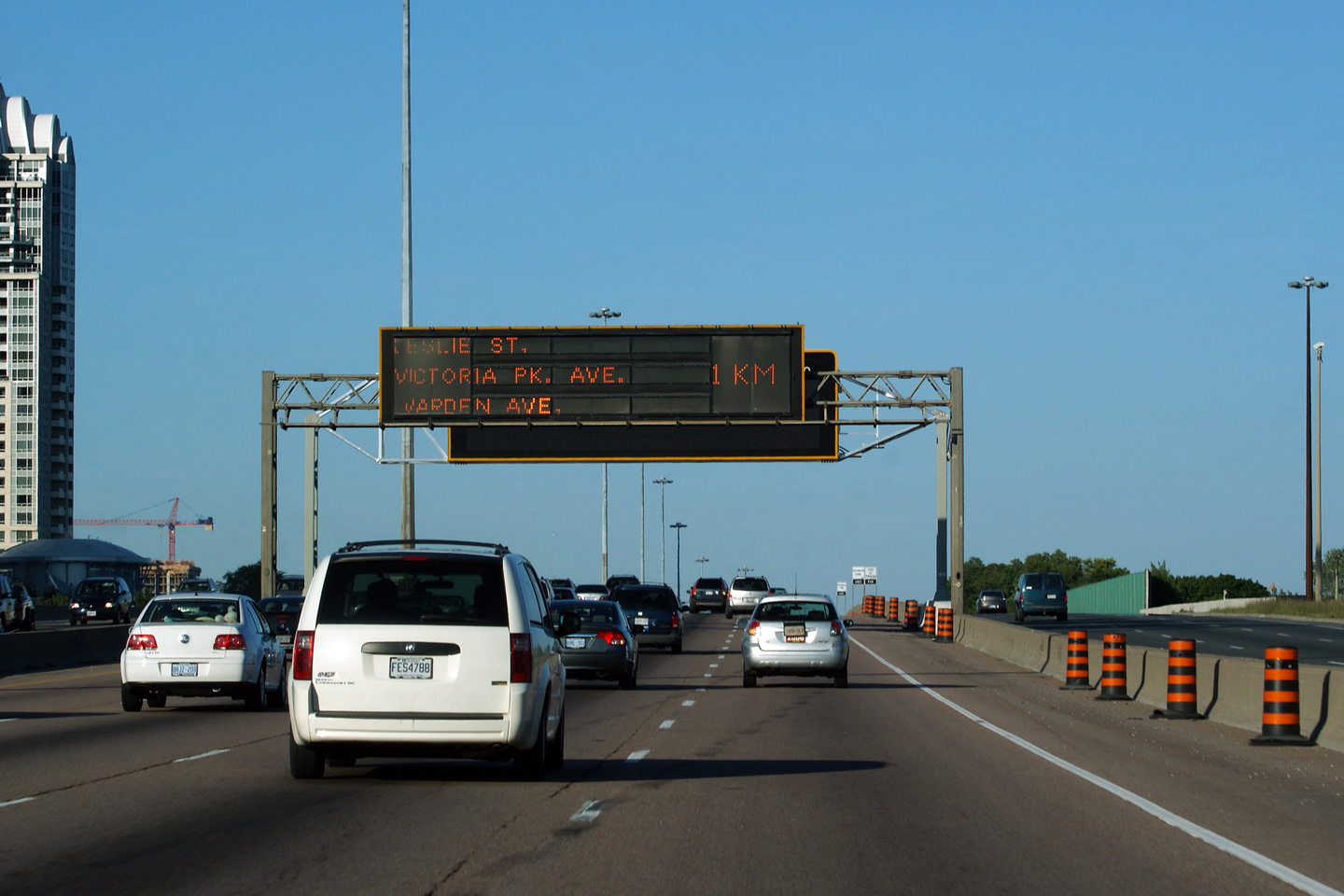
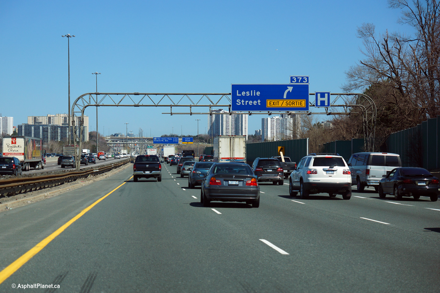
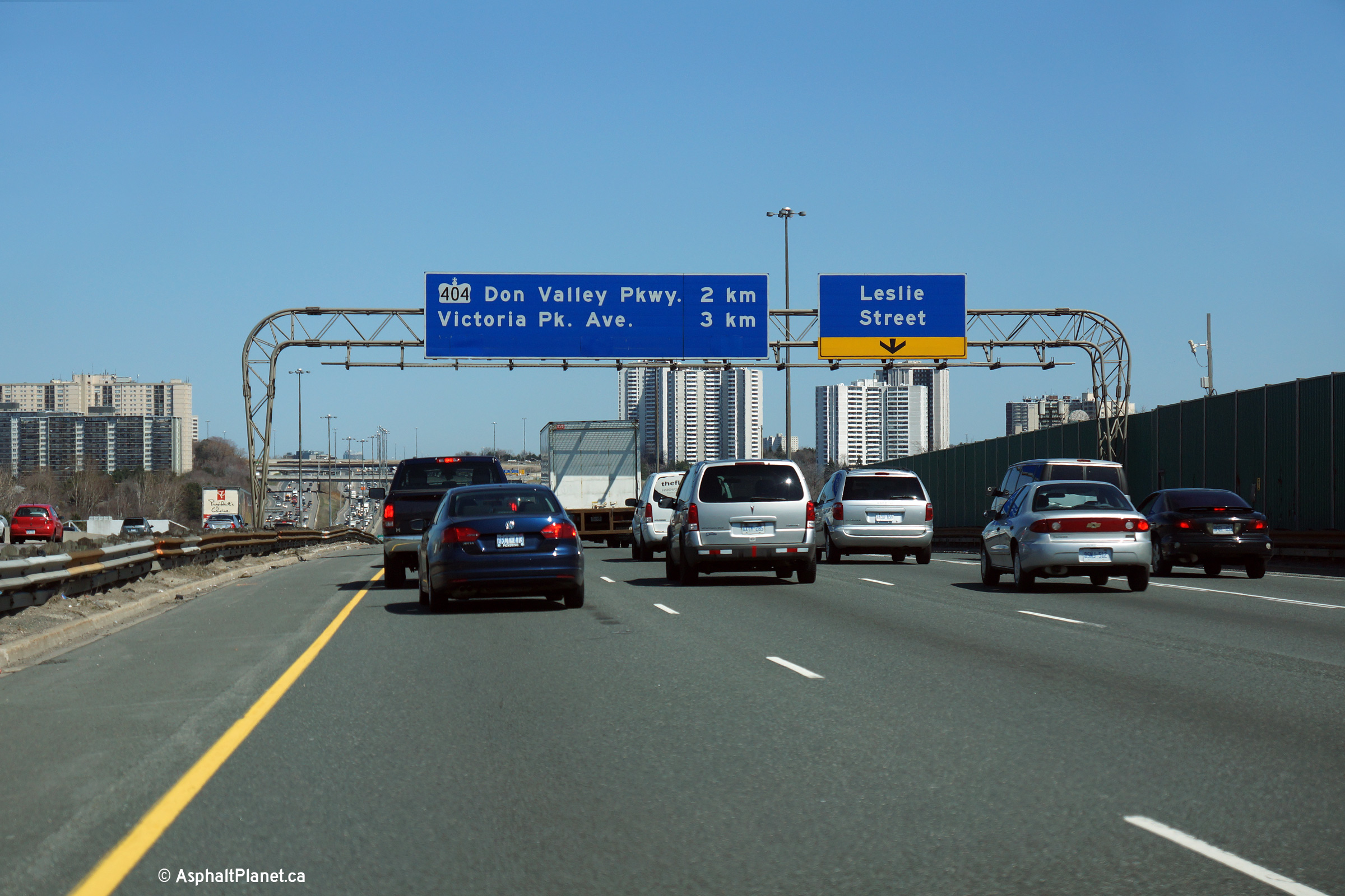
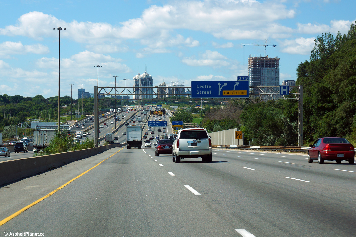
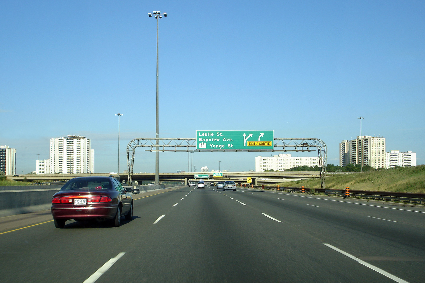
| City of Toronto |
Advanced signage for the westbound collector off-ramp to Leslie Street.
The fifth westbound collector lane that entered the highway from the 404
ramp departs at Leslie Street. Photo taken: September 4th, 2013. |
 (720x480) (720x480)(1440x960) (2400x1600) |
|||
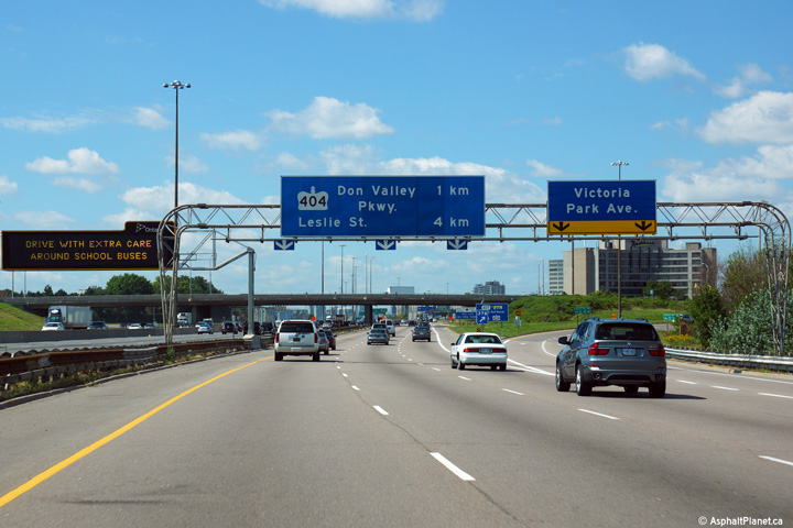
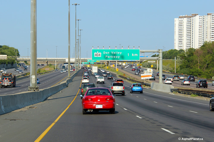
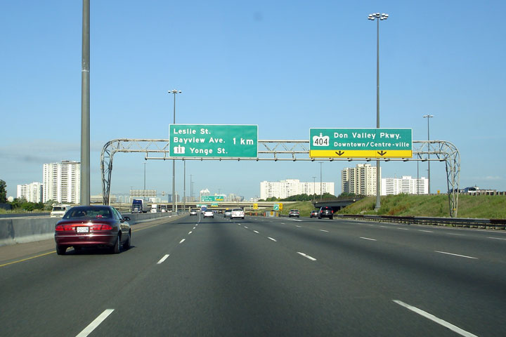
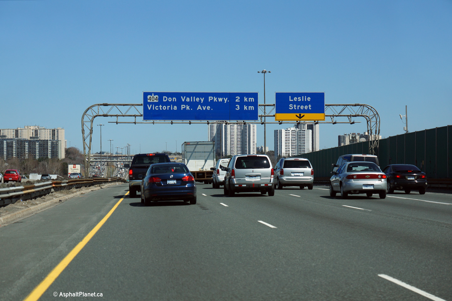
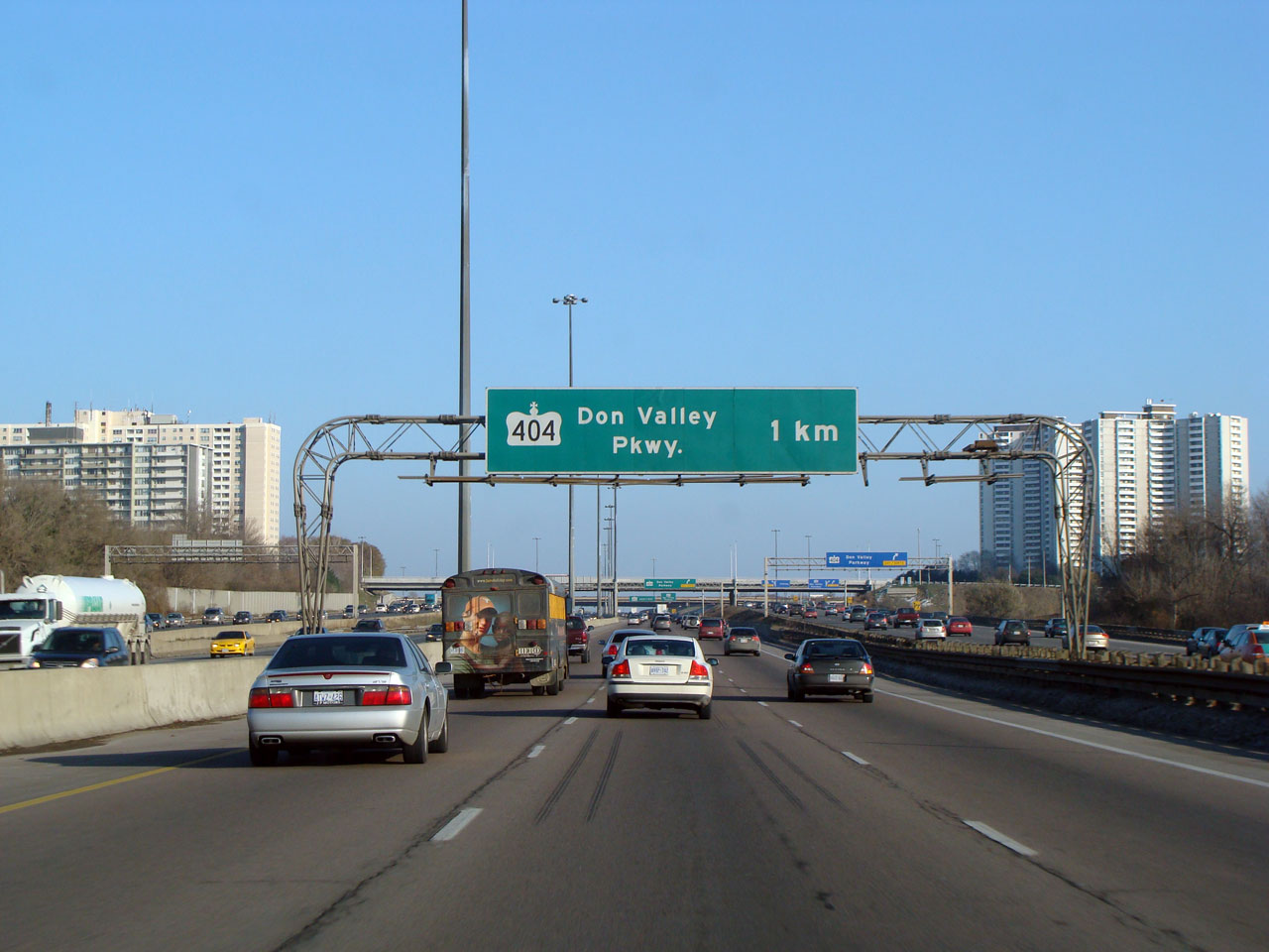
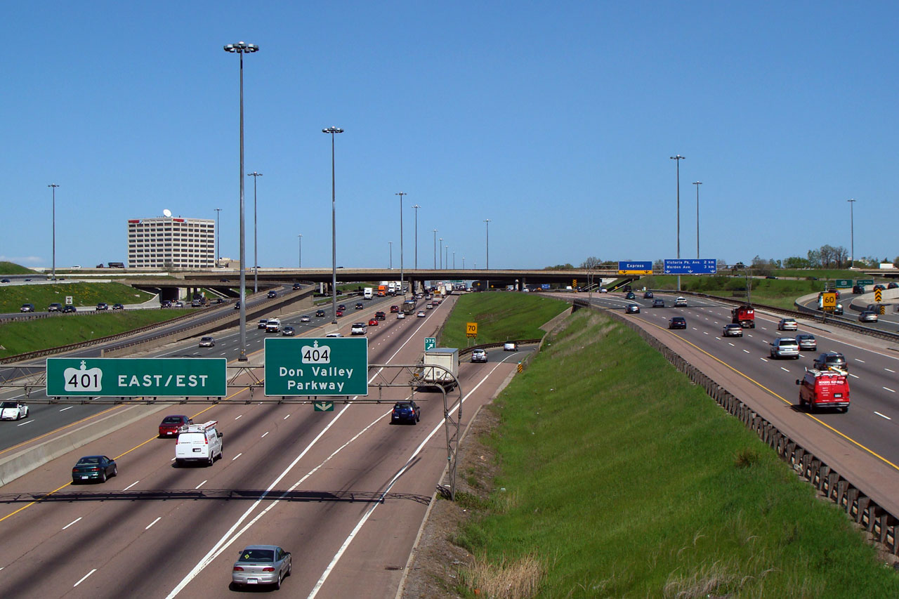
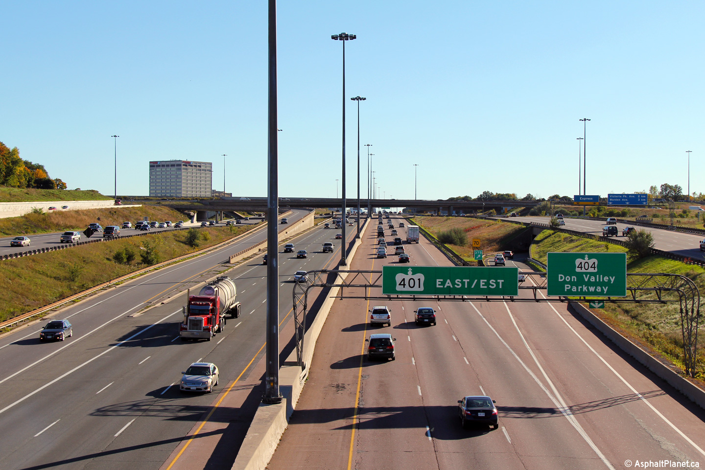
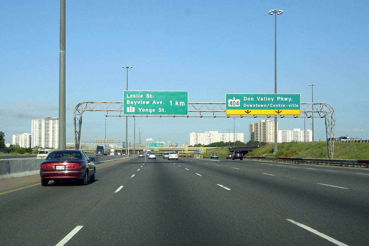
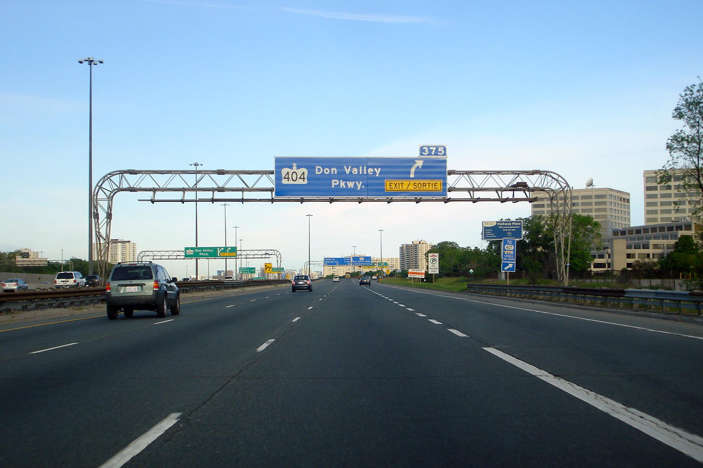
| City of Toronto |
View looking east towards the 1km advanced sign for the ramp to Highway
404 and the Don Valley Parkway. Note the lack of exit tab on this
sign. Nothing unique about this sign denotes this as an actual
exit (instead of a core to collector transfer). Click
here for an earlier version of
this signage, affixed to an older style rounded truss gantry, taken
November, 2007 Photo taken: July 30th, 2012. |
||||
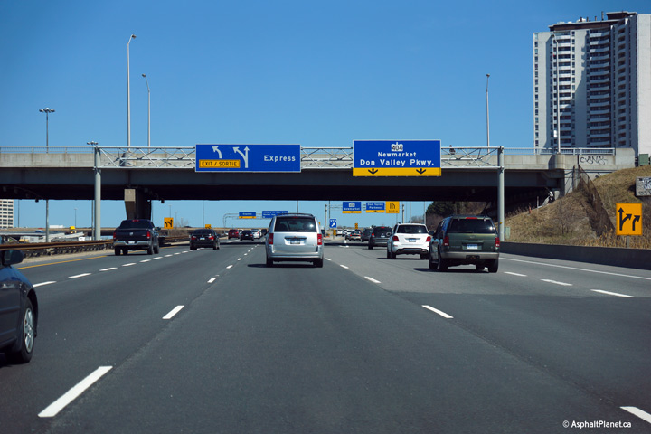
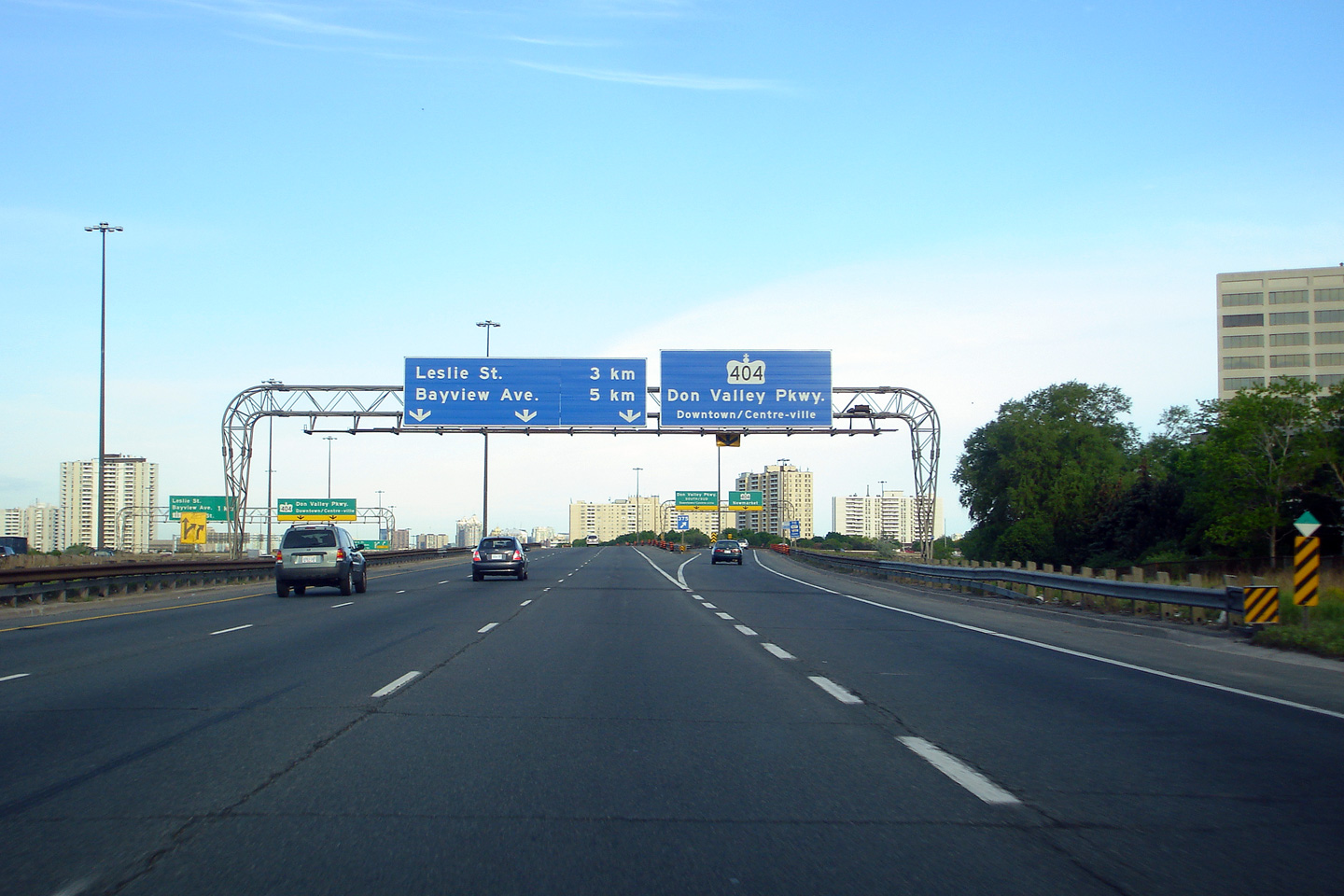
| City of Toronto |
Eastbound advanced signage overtop of both the express and collector
lanes to the 404/Don Valley Parkway interchange Upper (Express Lanes) photo taken:
July 30th, 2012. |
 (720x480) (720x480) |
|||
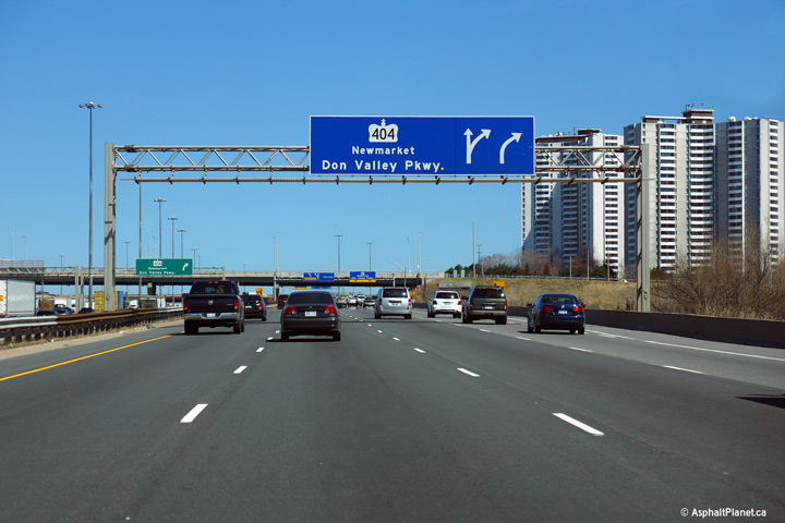
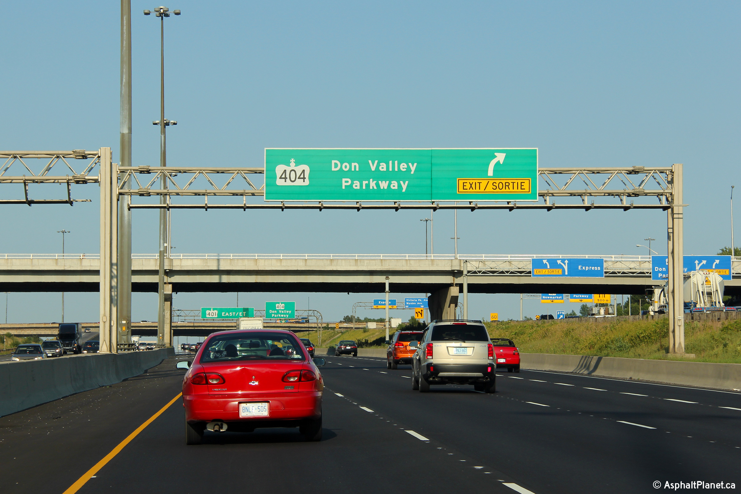
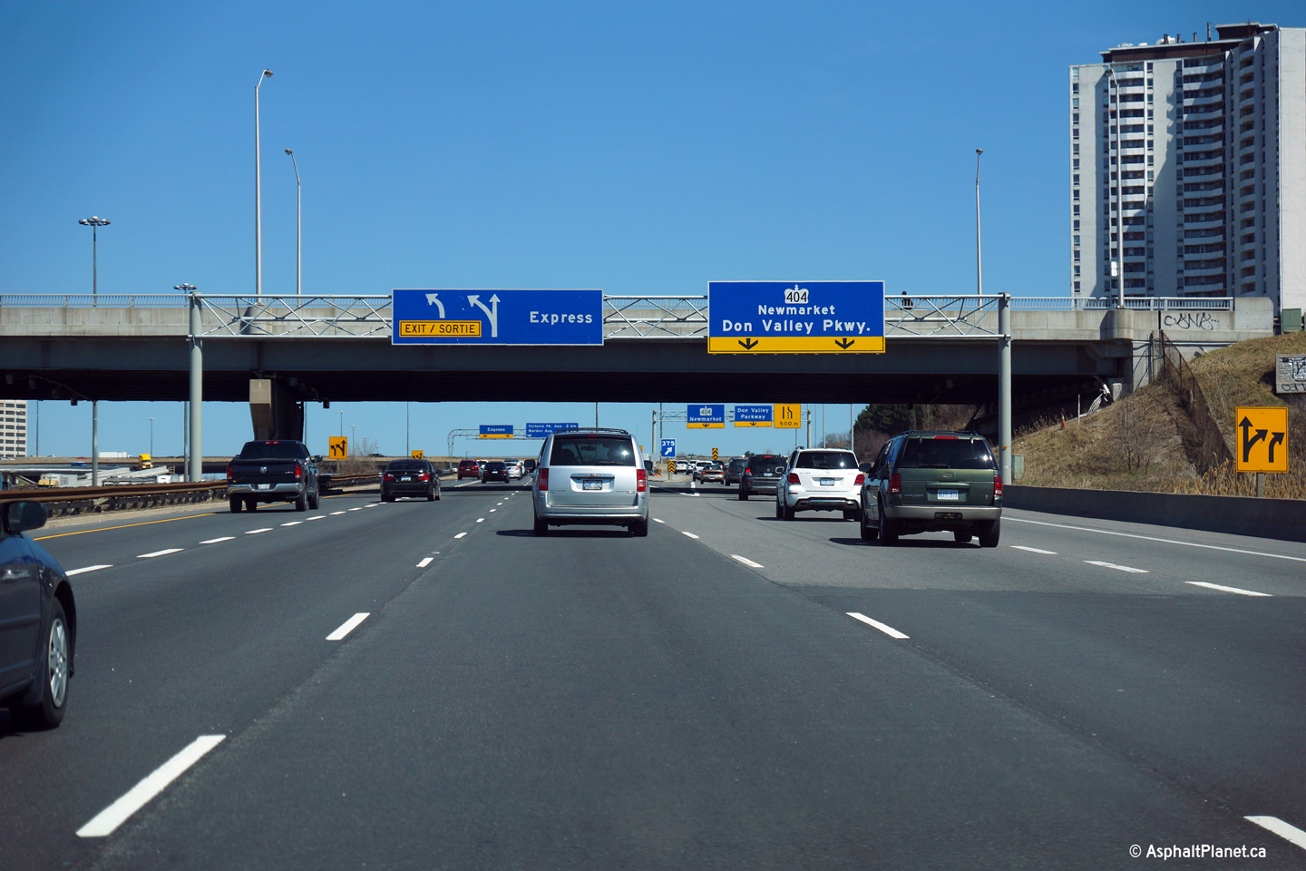
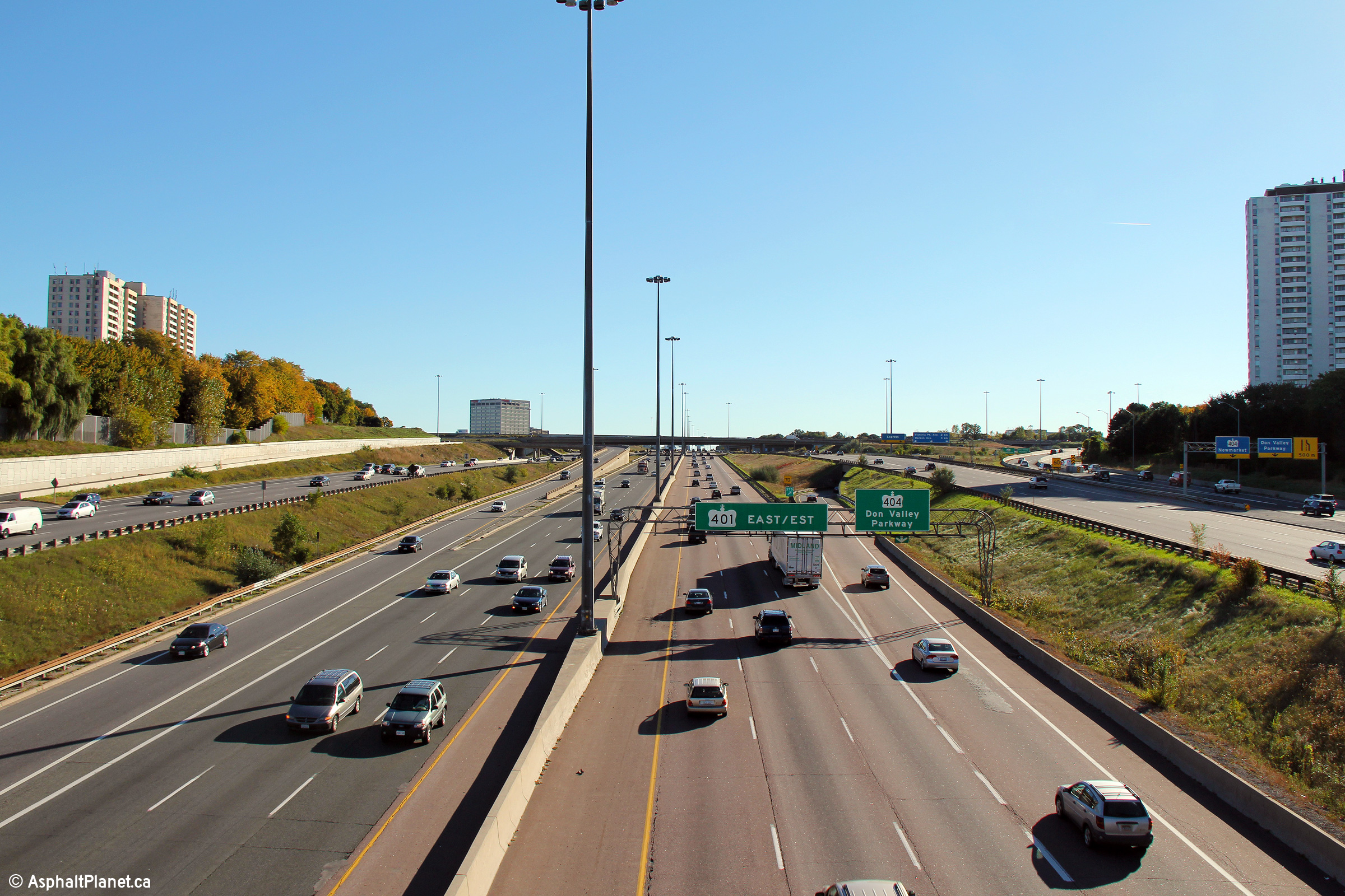
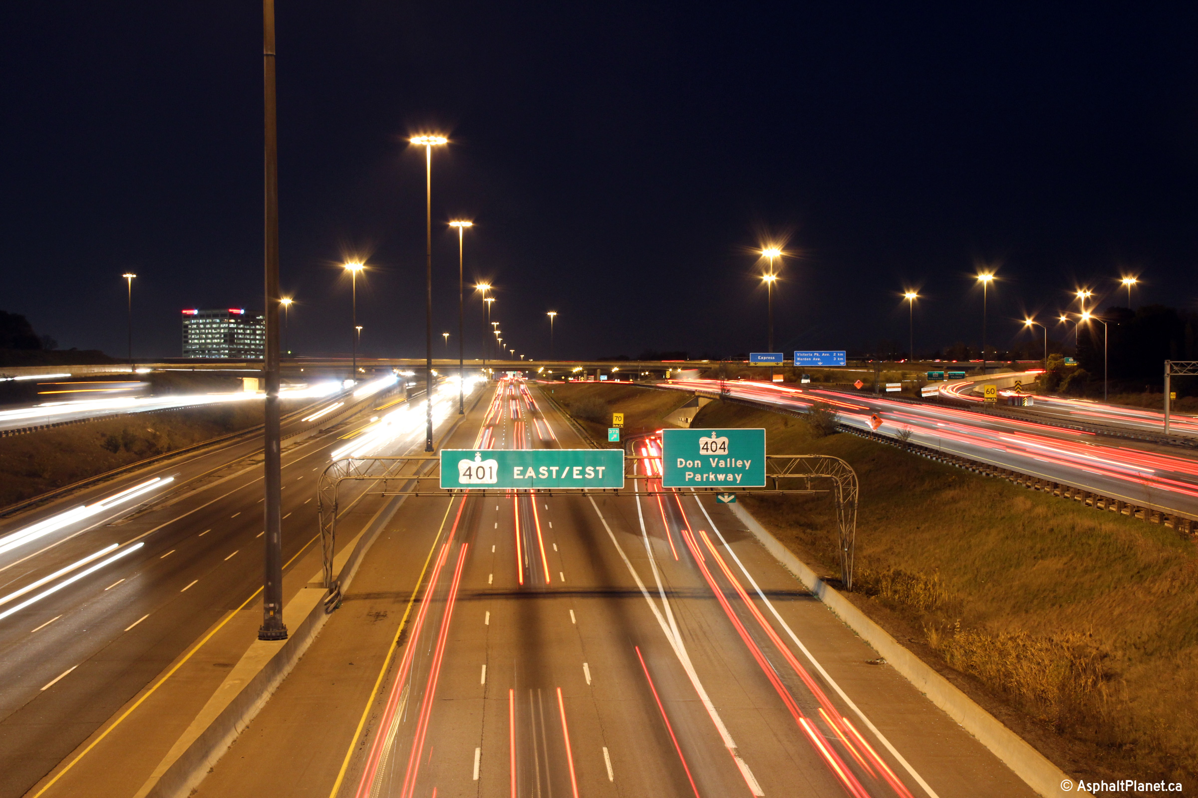
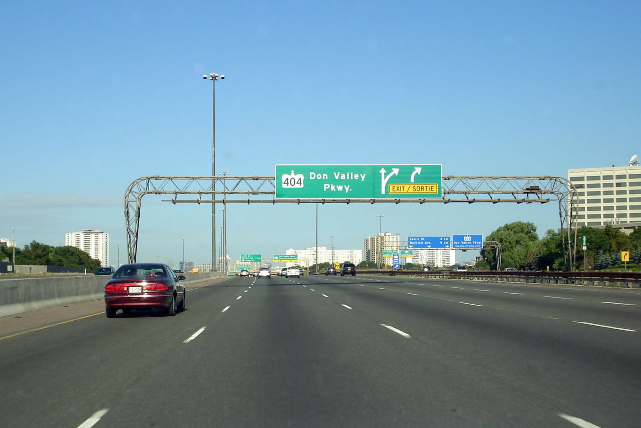
| City of Toronto |
Overhead signage for both the express and collector lane off-ramps to
Highway 404 and the Don Valley Parkway. Upper (Express Lanes) photo taken:
July 30th, 2012. |
||||
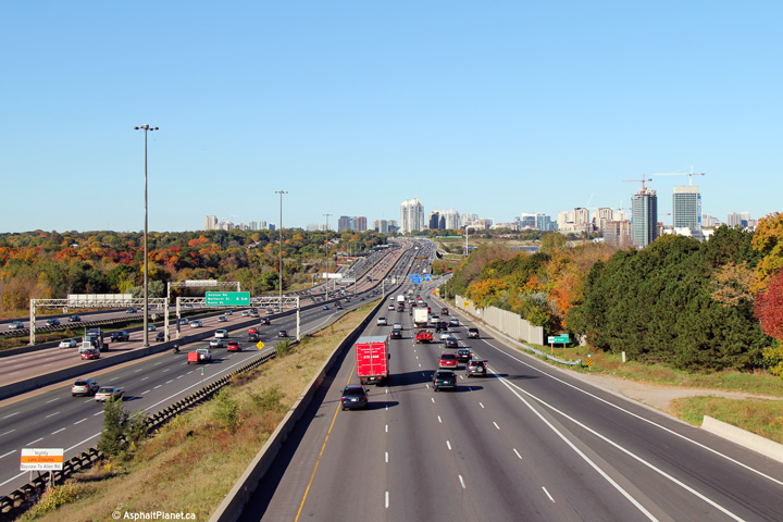
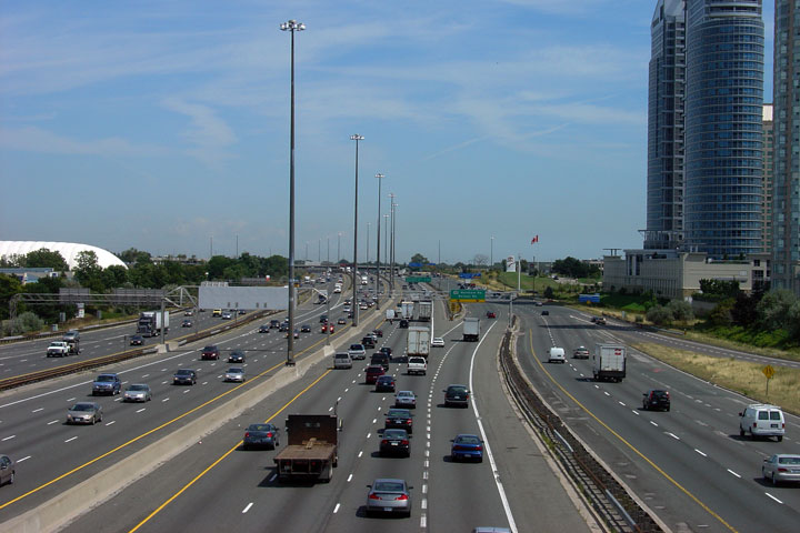
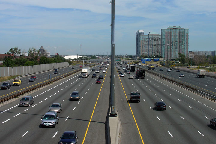
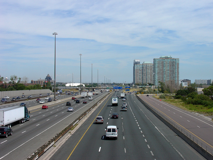
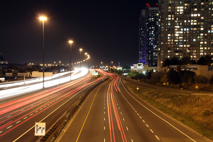
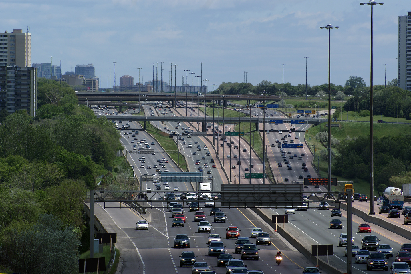
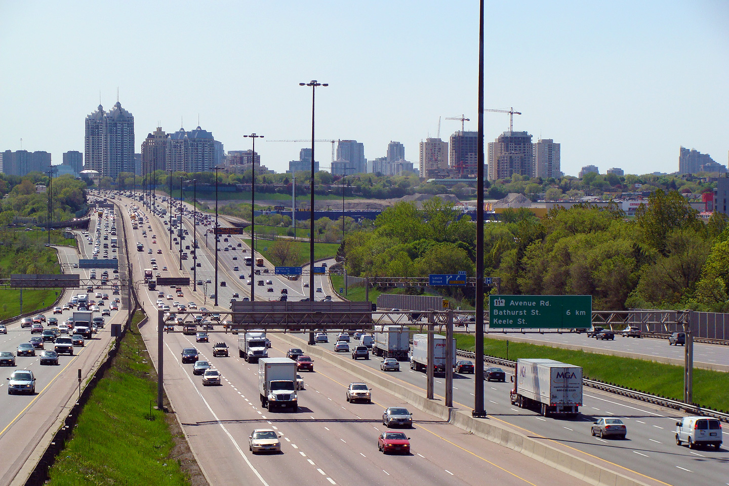
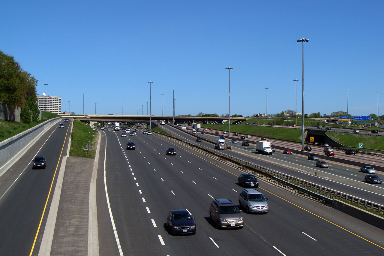
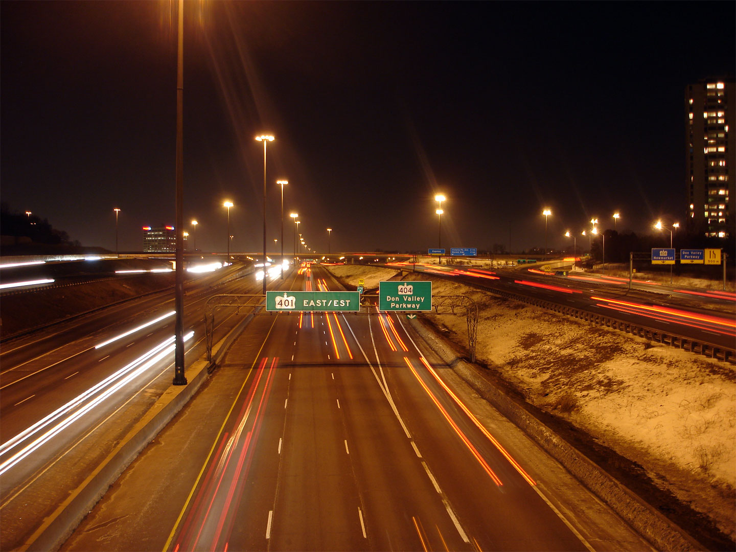
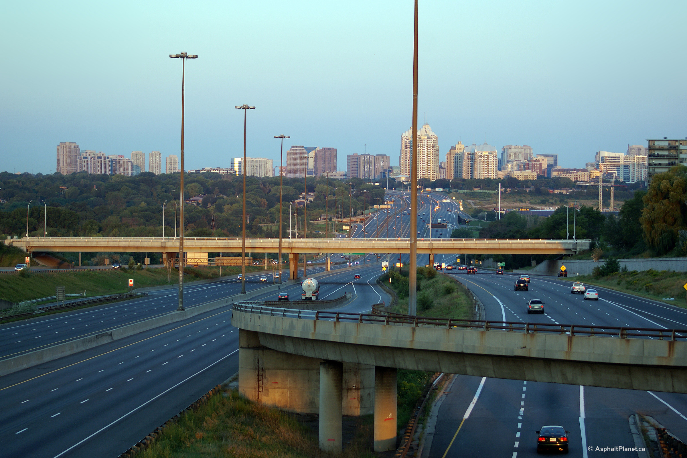
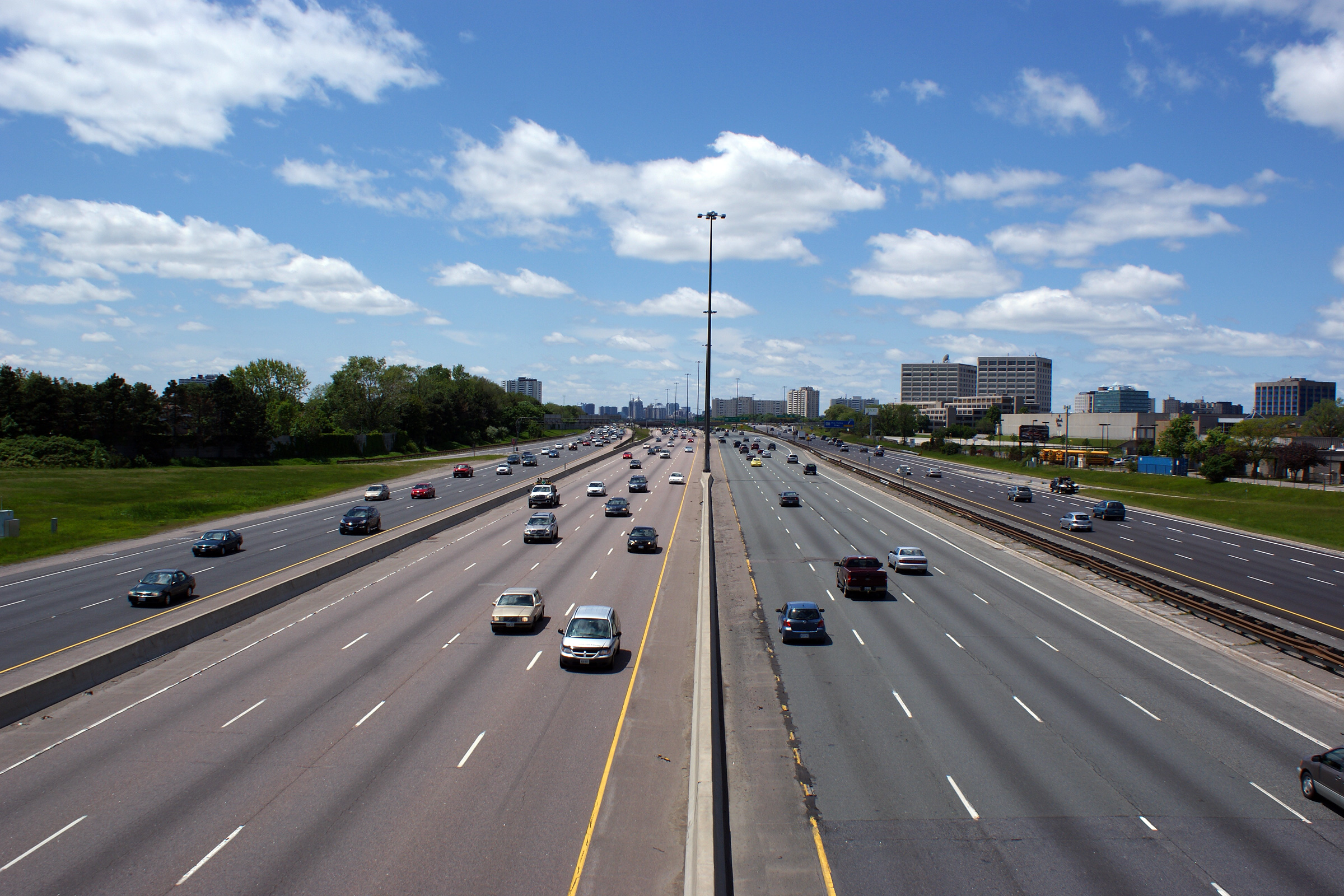
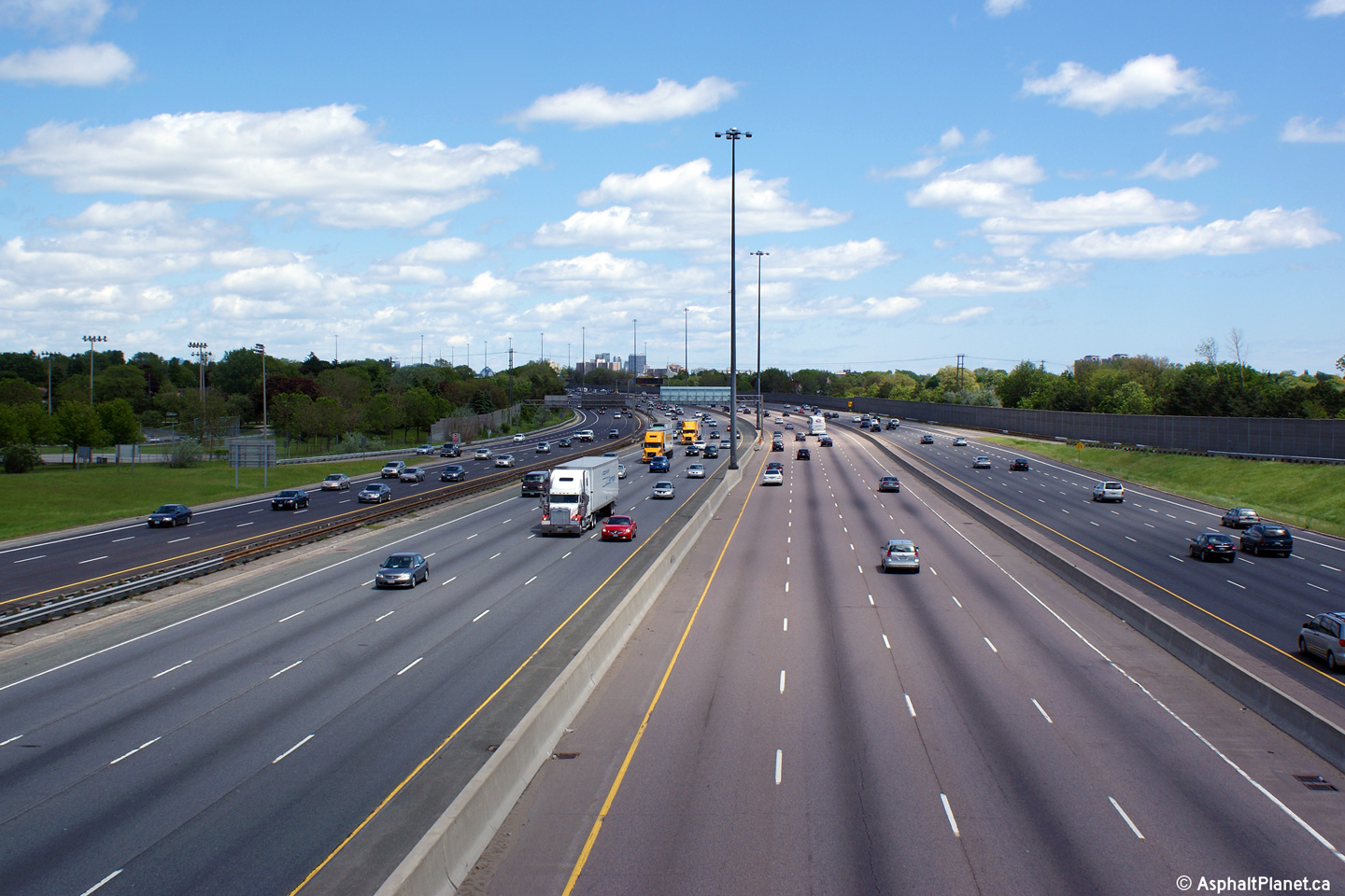
| City of Toronto |
A series of views looking westerly from the Don Mills
Road overpass as Highway 401 passes through the Don River Valley. In the coming years, a
construction project is planned to replace the elevated section of
Highway 401 in the vicinity of the Leslie Street interchange.
Unlike the majority of other structure replacement projects in Toronto,
the centreline of the highway will actually be shifted to the south for
a distance of approximately 19 metres at Leslie Street, as some of the new structures
will be built off-alignment. This construction project will take
nearly a decade to complete, and is expected to start sometime after
2015. Once construction starts on this project, the view looking
westerly from the Don Mills Road overpass will be drastically different.
Click
here for a PDF containing additional information on the project.
Click for additional summertime views over the
eastbound lanes, and
westbound lanes, taken in
May, 2008. Click here
for an additional night-time view, taken in March, 2007. Daytime photos taken: October 9, 2010. Nighttime photo taken: November 11th, 2010. |
 (720x480) (1440x960) (2400x1600)  (720x480) (1440x960) (2400x1600) 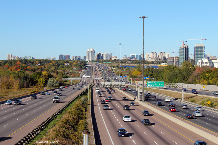 (720x480) (1440x960) (2400x1600)  |
|||
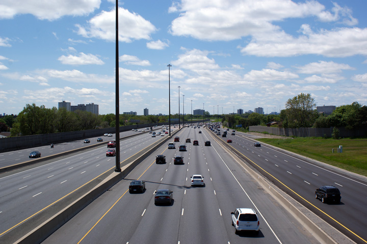
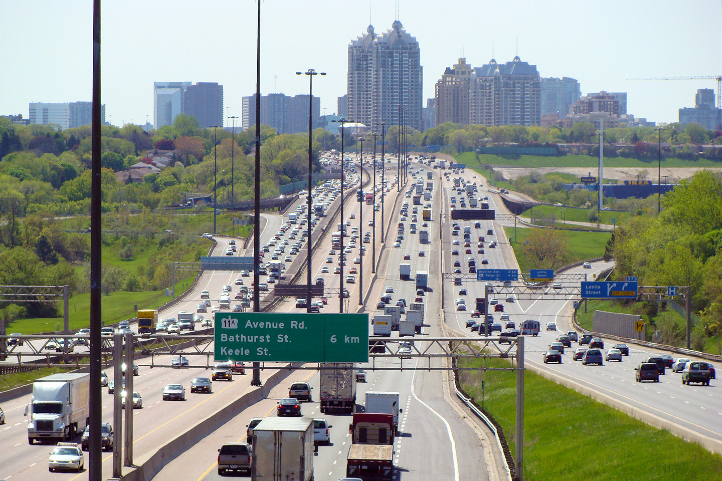
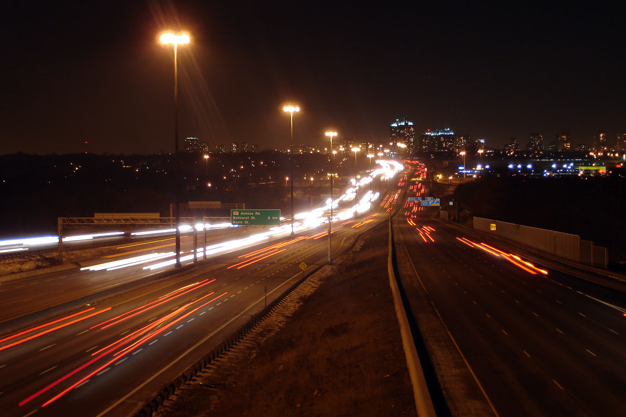
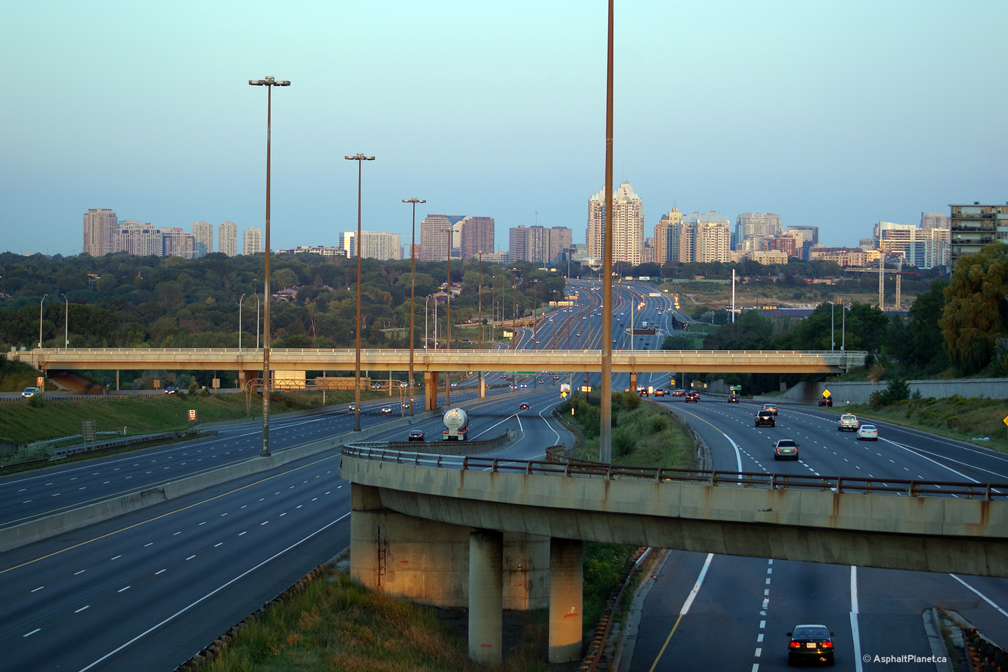
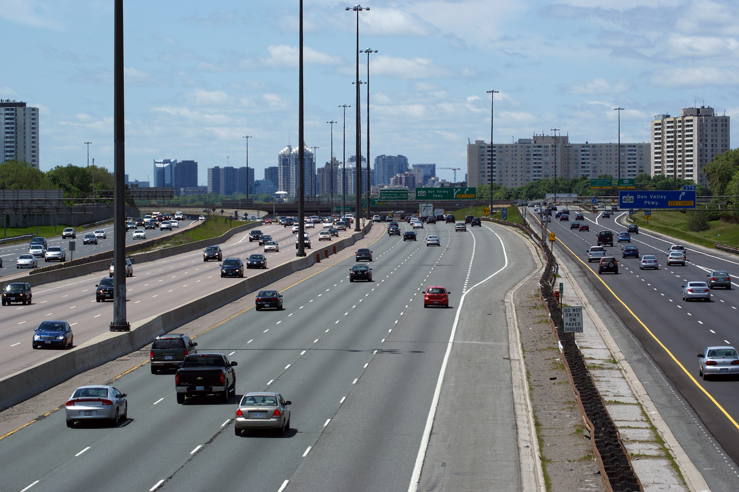
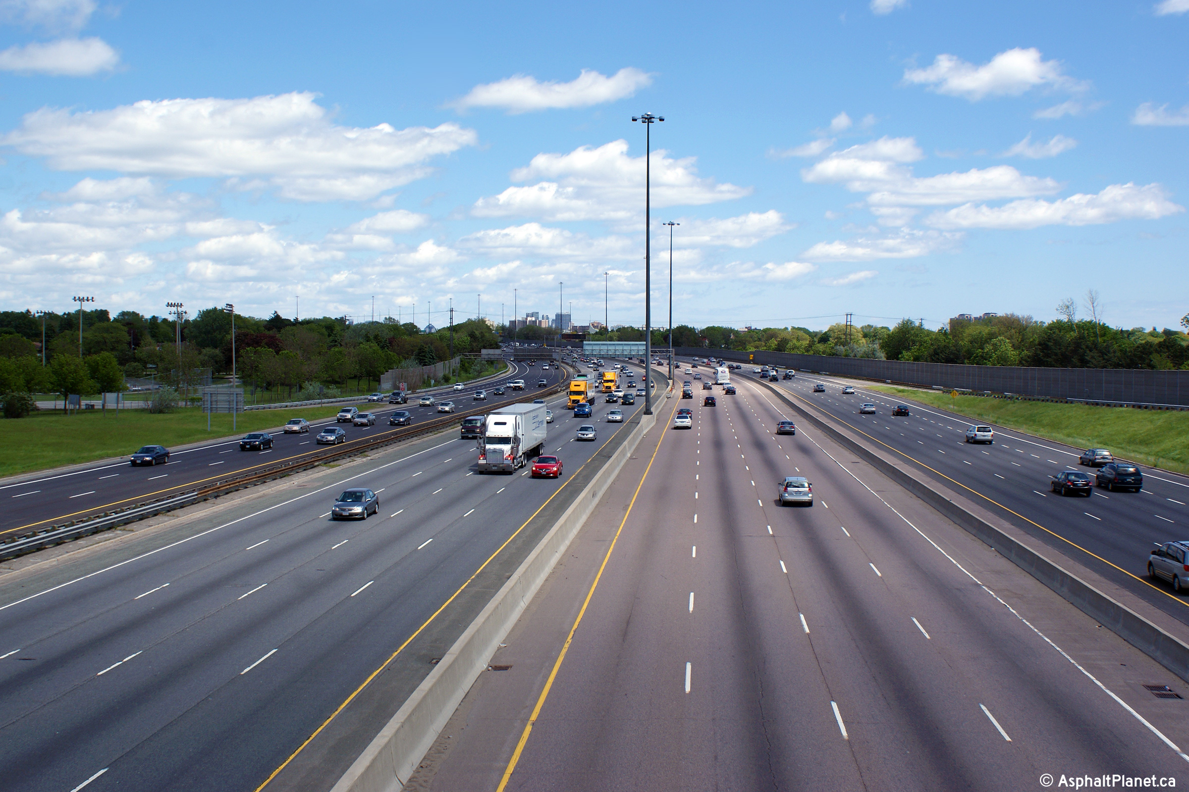
| City of Toronto |
A series of easterly views looking easterly from the
Don Mills Road overpass towards the large Highway 404/Don Valley Parkway
interchange. Click for additional summertime views over the
eastbound lanes, and
westbound lanes, taken in
May, 2008. Click here for an additional
night-time view, taken in
March, 2007. The pictured ramp from the southbound 404 to the
westbound 401 express was extensively rehabilitated during the 2013
construction season. Click
here for images
taken during the rehabilitation project. Daytime photos taken: October 9, 2010. Nighttime photos taken: November 11th, 2010. |
 (720x480) (1440x960) (2400x1600) 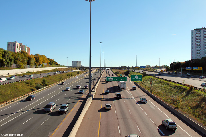 (720x480) (1440x960) (2400x1600) |
|||
| City of Toronto |
This view looks westerly as Highway 401 descends into the Don River
Valley from the Highway 404 overpass. Photo taken: September 3rd, 2012. |
 (720x480) (1440x960) (2400x1600) |
|||
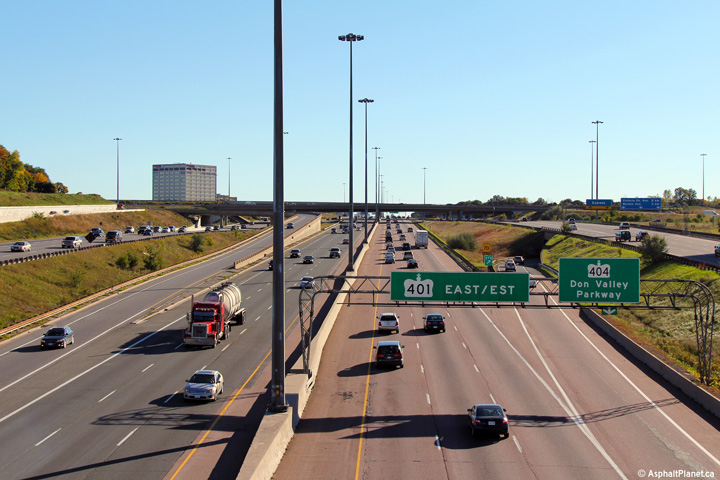
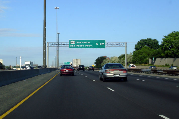
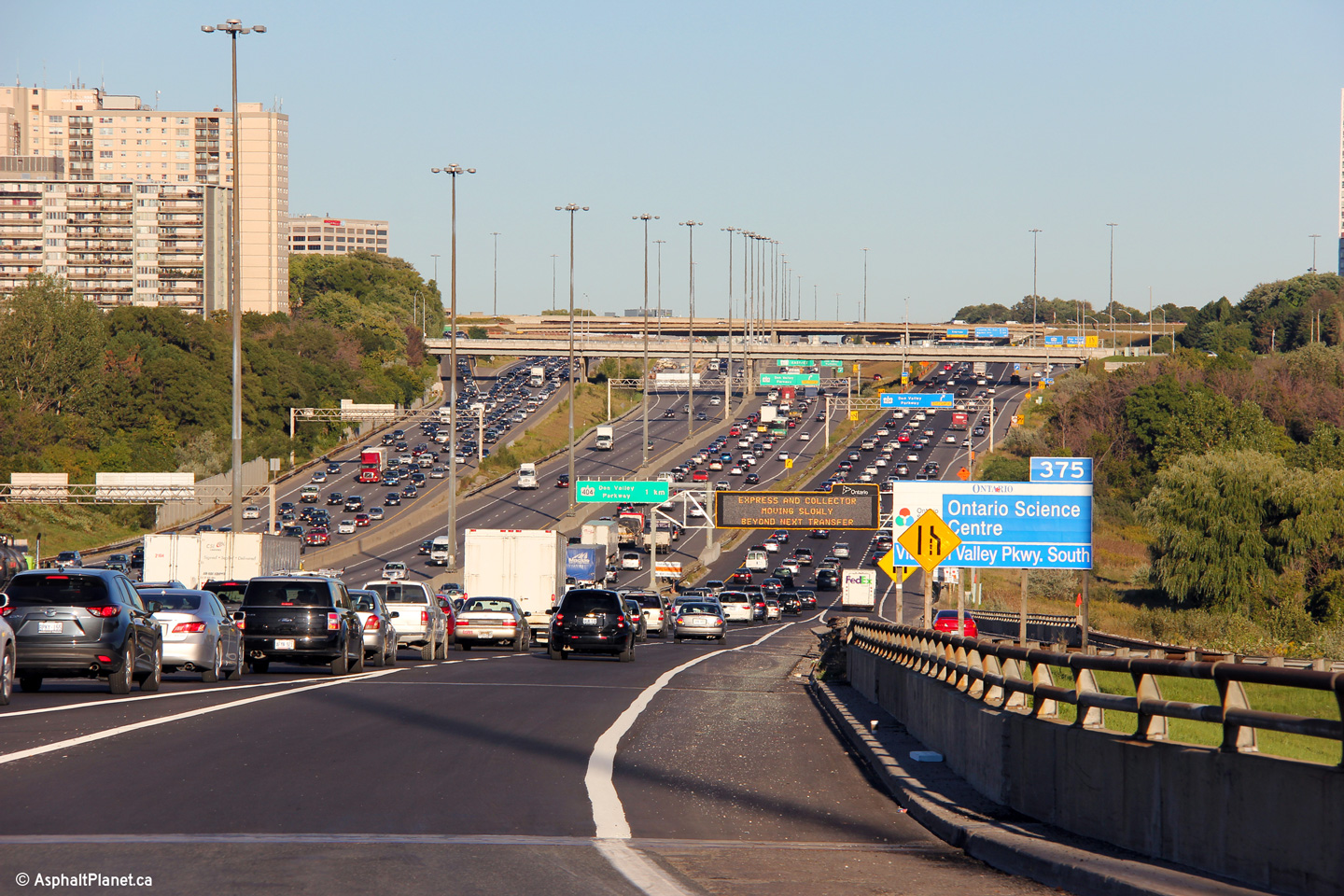
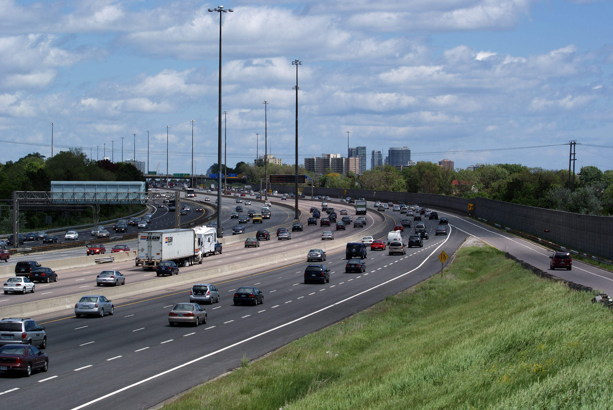
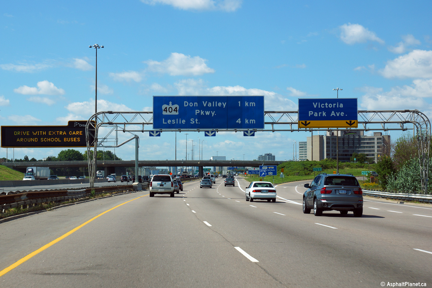
| Highway 404 heads north to Newmarket, while the Don Valley Parkway goes into Downtown Toronto. Click here for Highway 404 images, and here for DVP images. | |||||
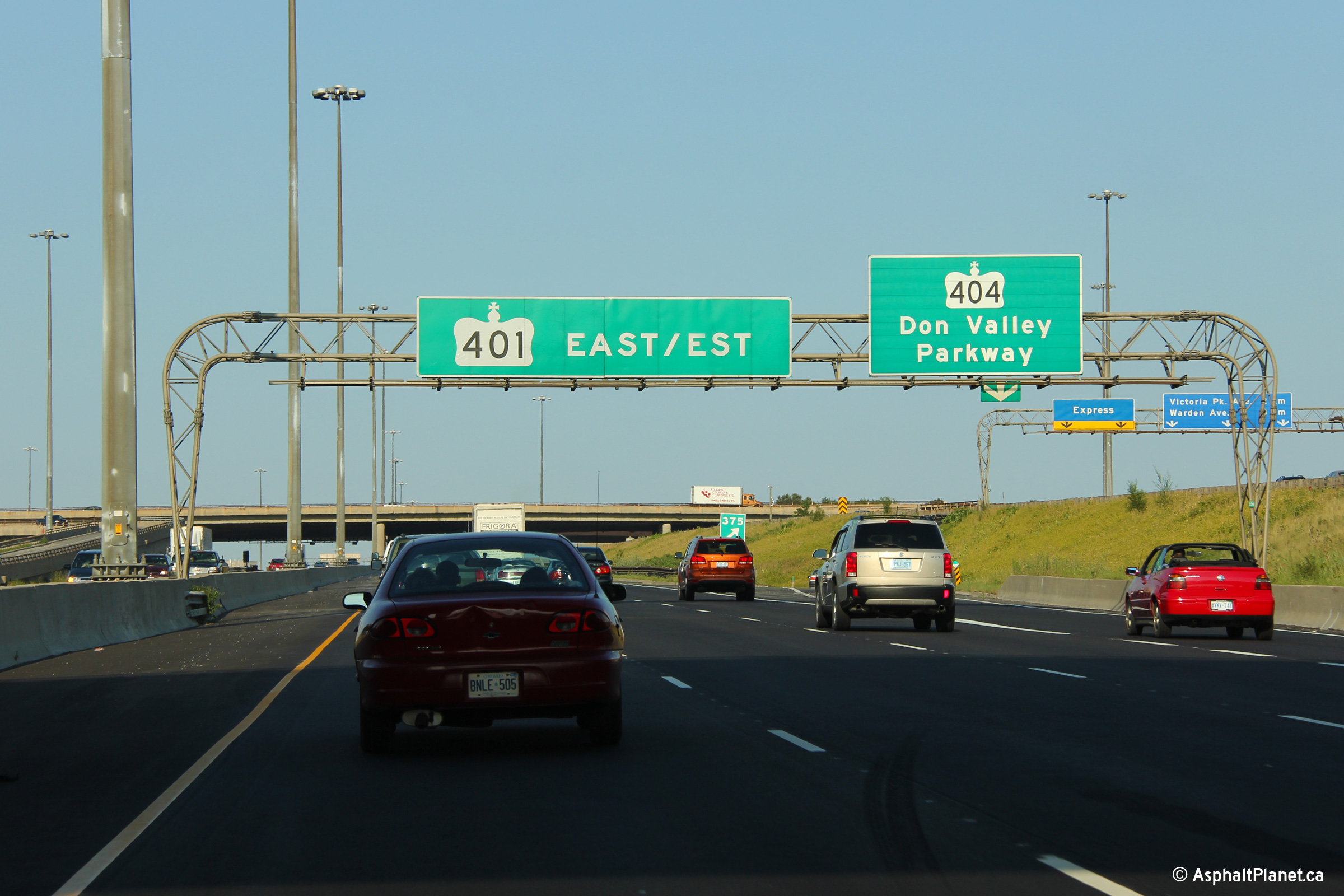
| City of Toronto |
Westbound signage at the Highway 404 transfer. Photo taken: July 23rd, 2006 |
 (720x480) (720x480)(1440x960) |
|||
| City of Toronto |
Advanced signage for the quickly approaching Highway 404 transfer. Photo taken: July 23rd, 2006 |
 (720x480) (720x480)(1440x960) |
|||
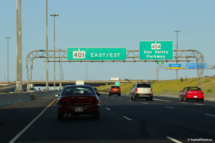
| City of Toronto |
Westbound signage for the 404/DVP from both the Collector and express
lanes of the 401. For a long time the 401/404/DVP interchange was the busiest
interchange in Canada; it serves nearly 600,000 vehicles a day. In
recent years, the 401/427 interchange in western Toronto surpassed this
interchange as the busiest in Canada. Upper photo taken: July 23rd, 2006 Lower photo taken: May 26th, 2007 |
| |||
| City of Toronto |
The two westbound advanced signs for the 404/DVP interchange. Upper photo taken: July 23rd, 2006 Lower photo taken: May 26th, 2007 |
|
|||
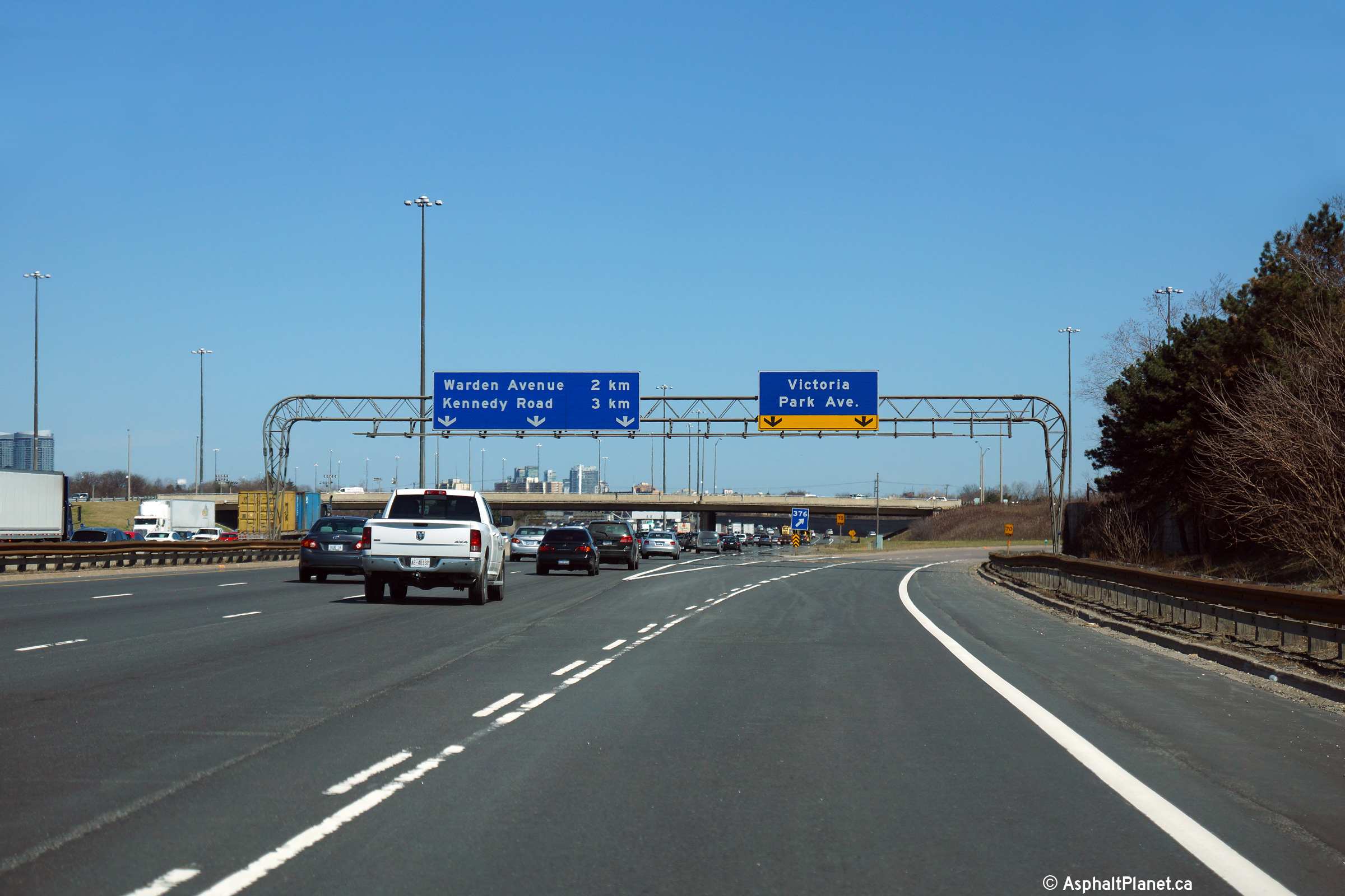
| City of Toronto |
The right hand lane of the eastbound collector lanes is forced off at
the Victoria Park Avenue interchange. The collector lanes maintain
their three general lane cross-section through the interchange by
inheriting a through lane from the Don Valley Parkway on-ramp that
enters the collector lanes on the left hand side. Photo taken: April 24th, 2014. |
||||
| City of Toronto |
Easterly view at the off-ramp to Victoria Park Avenue. This is one
of very few rounded truss gantries that remain on the 401 through
Toronto. Many were replaced by a series of contracts that took
place during the early 2010s. Photo taken: April 24th, 2014. |
||||
| City of Toronto |
View looking west from the Victoria Park Avenue overpass towards the
large Highway 404/DVP interchange. If this interchange were built
today, I would have to think that there would be basketweave structures
separating the Victoria Park Ramps from the DVP/404 ramps. Photo taken: May 31st, 2009. |
||||
| City of Toronto |
Easterly views from the Victoria Park Avenue overpass. Photo taken: May 1st, 2006. |
 (720x480) (1440x960) (2400x1600)  |
|||
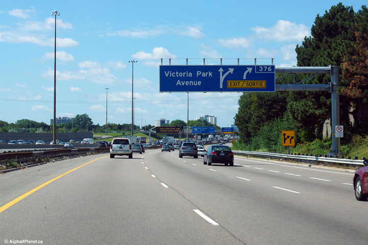
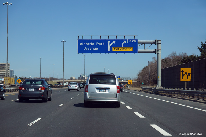
| City of Toronto |
Exit signage for the ramp from the eastbound collector lanes to Victoria
Park Avenue. The pull through signage on this gantry predates Ontario's
switch to bilingual signage. Photo taken: September 4th, 2013. |
 (720x480) (720x480)(1440x960) (2400x1600) |
|||
| City of Toronto |
Partial overhead gantry in advance of the westbound exit to Victoria
Park Avenue. There is a westbound auxiliary lane between the
Victoria Park and Warden Avenue interchanges. Photo taken: September 4th, 2013. |
 (720x480) (720x480)(1440x960) (2400x1600) |
|||
| City of Toronto |
View looking west from the Warden Avenue overpass in Toronto. Photo taken: May 1st, 2006. |
 |
|||
| City of Toronto |
Easterly view from Warden Avenue of the 401 and Warden Avenue transfers. Photo taken: May 1st, 2006. |
|
|||
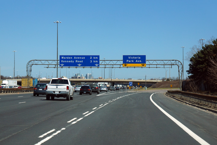
| City of Toronto |
Advanced signage 6km in advance of the Highway 404 core-collector
transfer. Within Toronto, each express-collector transfer
typically services 3 interchanges. Photo taken: July 23rd, 2006 |
 (720x480) (720x480)(1440x960) |
|||
| City of Toronto |
First westbound advanced signage for the Highway 404/DVP interchange. Photo taken: July 23rd, 2006 |
 (720x480) (720x480)(1440x960) |
|||
| City of Toronto | View looking west from the Brimley Road overpass
at the Brimley Road transfer. Photo taken: August, 21st, 2006. |
 |
|||
| City of Toronto | Two views looking eastbound off from the Brimley
Road overpass. The right-most carriageway is the long exit ramp to
Progress Avenue and the Scarborough Town Centre.
Photos taken: August, 21st, 2006. |
|
|||
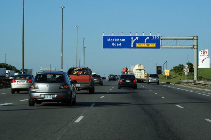
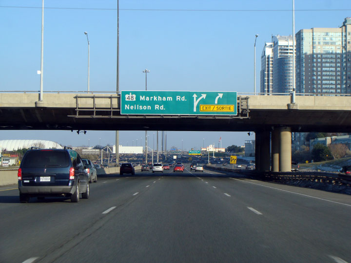
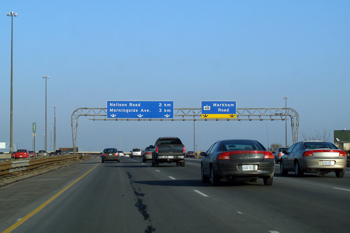
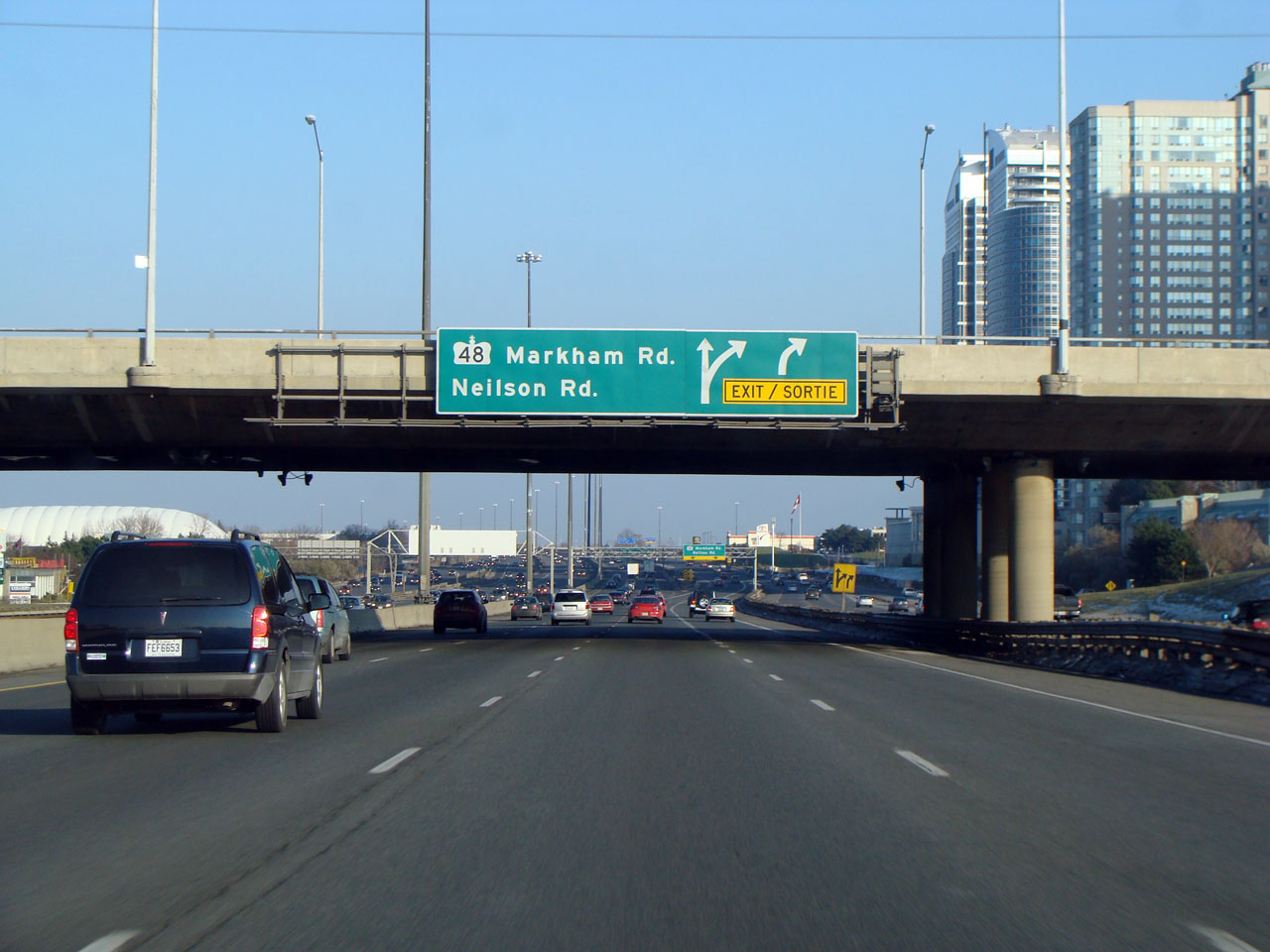
| City of Toronto | Signage affixed to the McCowan Road overpass for
the Markham Road and Nielson Road core to collector transfer. Photo taken: November 25th, 2007. |
||||
| City of Toronto |
View looking west from the McCowan Road overpass towards Brimley Road. Photo taken: August, 21st, 2006. |
 |
|||
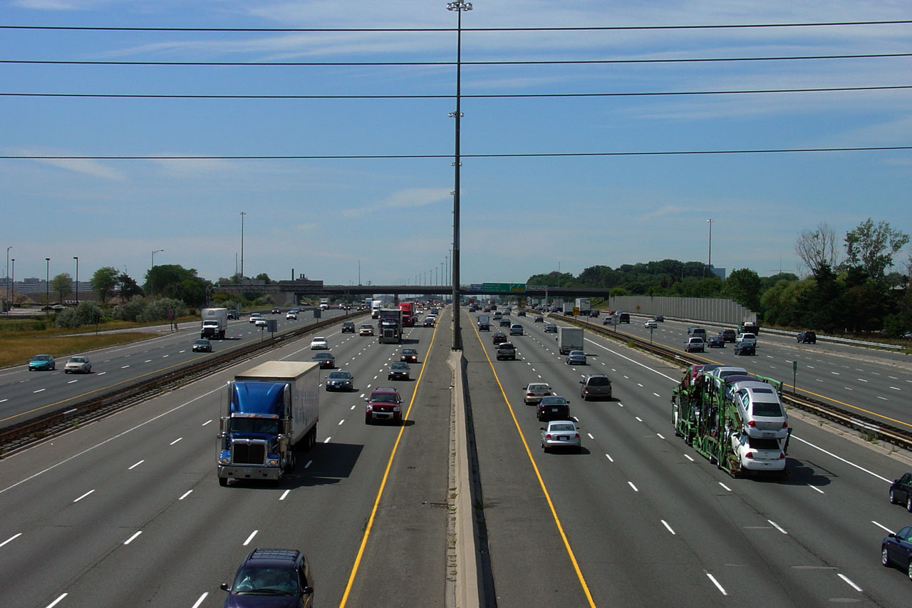
| City of Toronto |
View looking east from McCowan Road. Highway 401 passes just north
of Scarborough's City Centre, at McCowan Road.
Upper photo taken: August, 21st, 2006. Lower photo taken: October 11th, 2010. |
|
|||
| City of Toronto |
Eastbound signage at the McCowan Road transfer. This is the first
of two consecutive eastbound core to collector transfers. Photo taken: November 25th, 2007. |
 |
|||
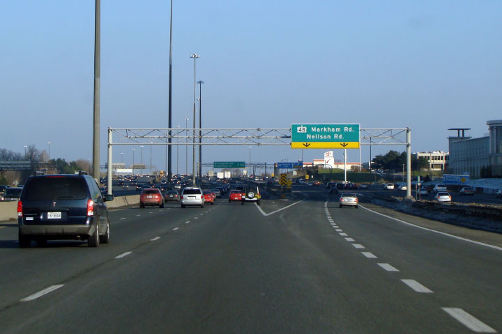
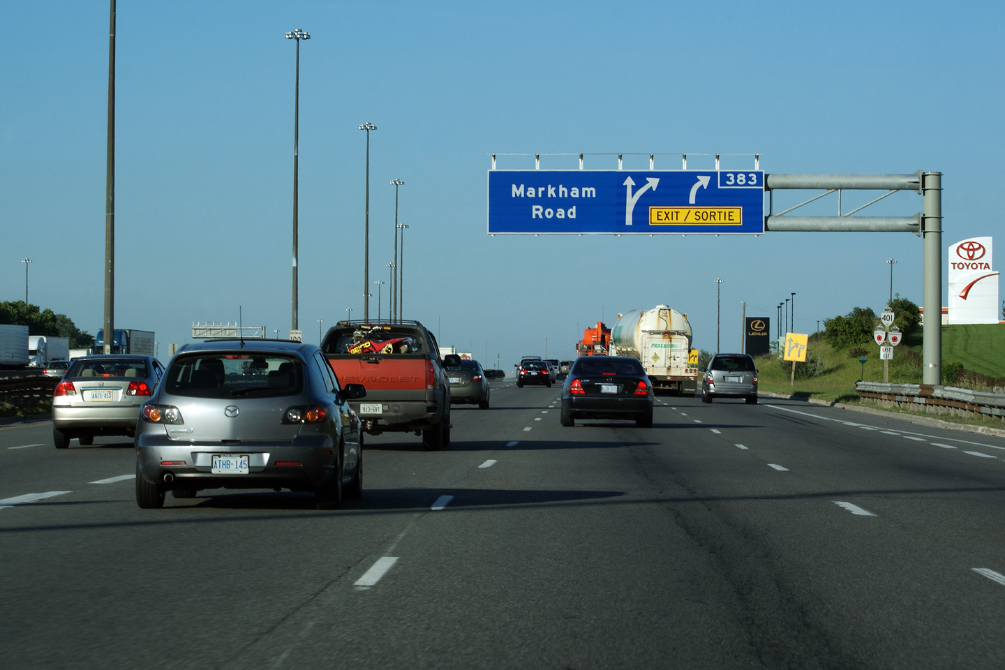
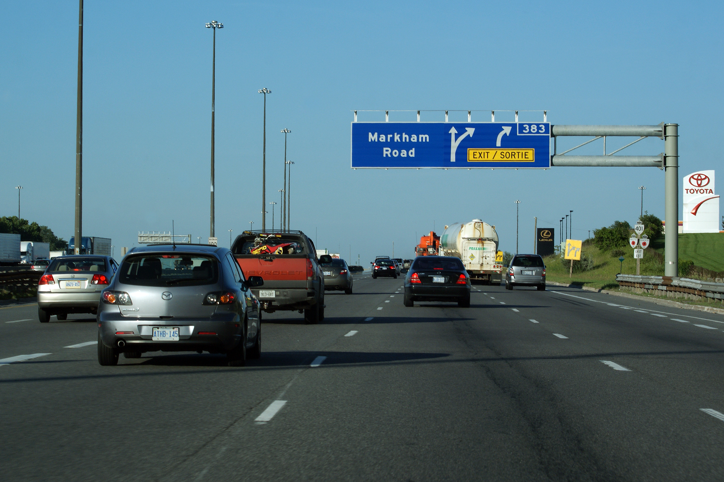
| City of Toronto | New style advanced signage for Markham Road in
the eastbound collector lanes. Partial overhead gantries started
appearing on Ontario's roadways en mass early in 2010. Note that the
sign for Markham Road no longer indicates Markham Road as Highway 48. Photo taken: July 2nd, 2010. |
 (720
x 540) (720
x 540)(1440x960) (2400x1600) |
|||
| City of Toronto | Eastbound collector lane signage for the Markham
Road interchange. This sign was removed during the Summer of 2009 due
to an apparent failure with the ~40 year old gantry it stood upon. Photo taken: November 25th, 2007. |
|
|||
| Prior to 1998, Highway 48 began its trek northerly to Lake Simcoe from the Highway 401 interchange. Click here for Highway 48 images. | |||||
| Continue east via Scarborough to Oshawa to Images | |||||
<- Page 9 Images Highway 401 Images Index Page 11 Images ->
<- Highway 400 Images Back to Highway 401 Highway 402 Images ->
Copyright (c) 2004-2014, AsphaltPlanet.ca AsphaltPlanet@asphaltplanet.ca


