|
Proper Municipality Name |
Photo Description |
Photo |
|
Pictures taken
from driver's perspective appear offset from centre-line pictures: |
North-
bound |
South-
bound |
|
Until 1997, the Gardiner Expressway
carried the Highway 2 designation.
Click here for Highway 2 images. |
| City of Toronto |
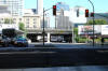
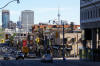
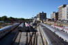
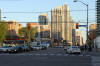
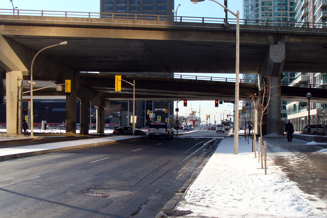
Northerly view of Yonge Street, taken from underneath the Gardiner
Expressway. Photo taken: August 2007. |
(720x480)
(1440x960) |
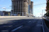
| City of Toronto |
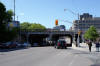
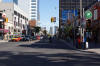
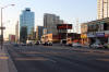
Yonge Street as it meets the Gardiner Expressway and Lake Shore Boulevard.
Picture taken: March 24th, 2008. |

(720x480)
(1440x960) |
| City of Toronto |
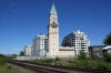
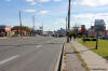
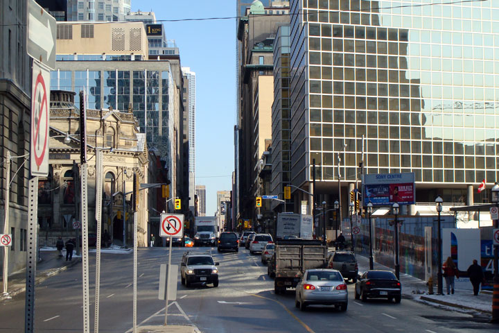
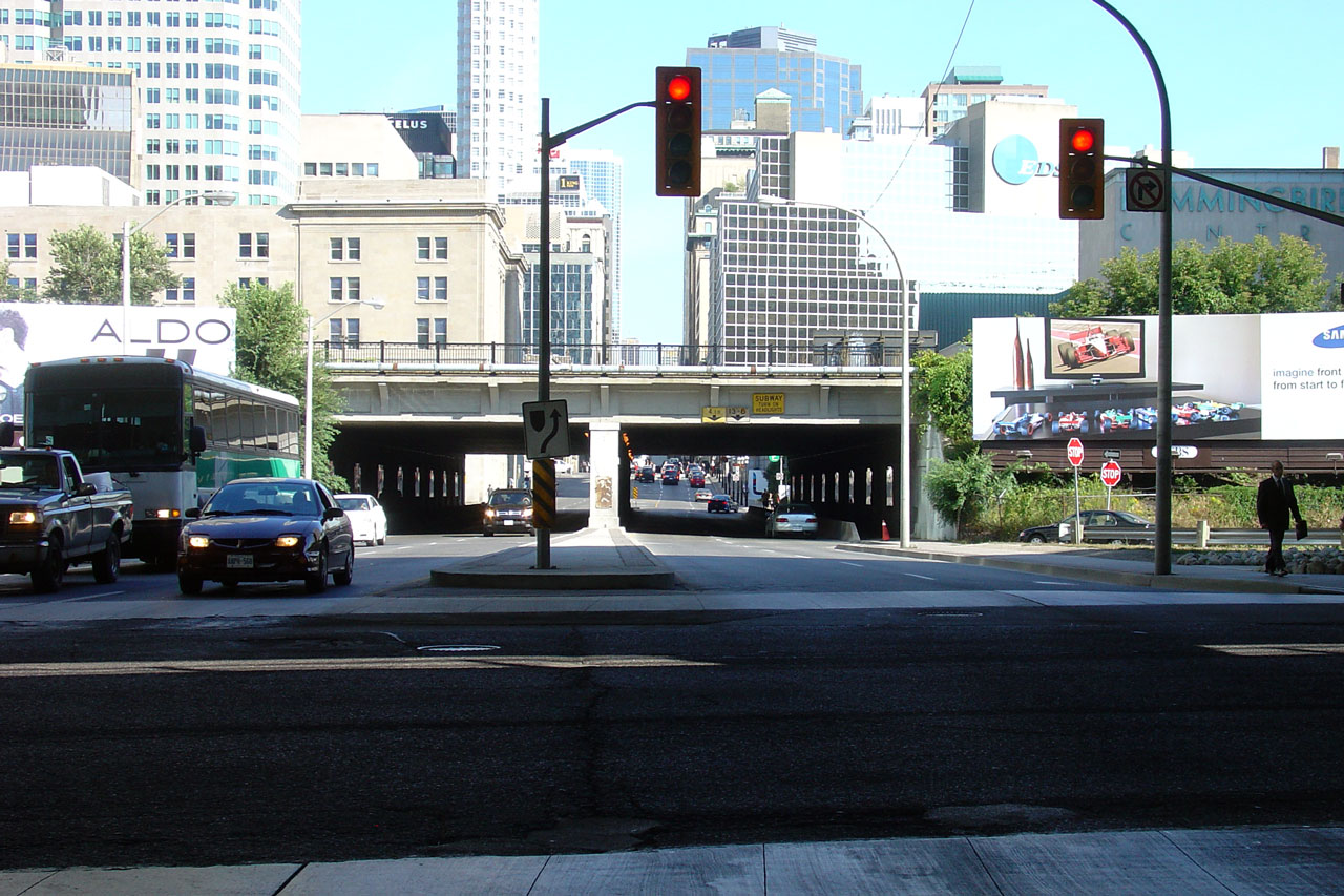
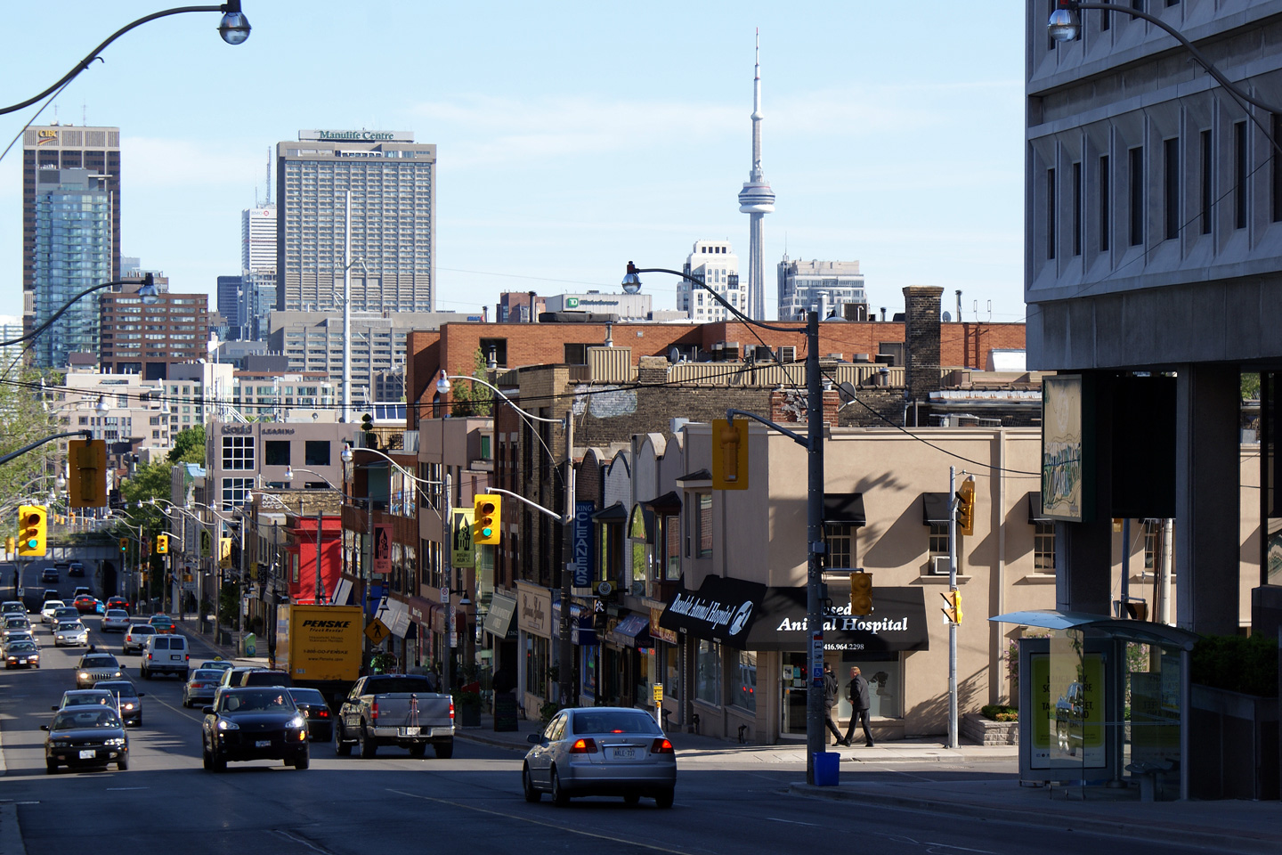
Northerly view of Yonge Street from the foot of the CN Railway overpass in
Downtown Toronto. The tall buildings leave Yonge Street in quite a
canyon. Picture taken: March 24th, 2008. |

(720x480)
(1440x960) |
|
Bloor Street carried the Highway 5
designation until 1998. Click here for Highway
5 images. |
| City of Toronto |
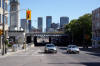
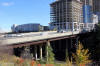
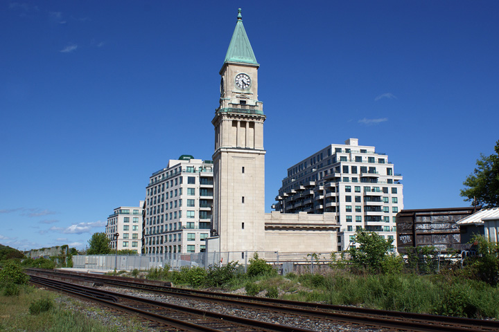
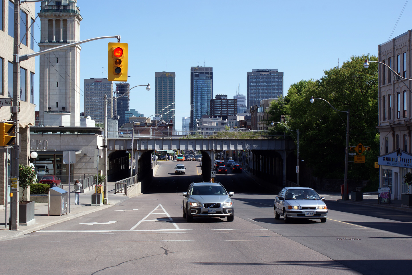
View looking northerly as Yonge Street passes under the CP Railway overhead
at Summerhill. The intersection of CP's
North Toronto Subdivision and Yonge Street is marked with an old station
house. The station was the North Toronto Station, which handled CP's
passenger traffic until it was moved to Union Station in 1930.
Photo taken: May 31st, 2009. |
(720x480)
(1440x960) |
| City of Toronto |
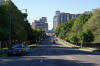
View looking southerly along Yonge Street from the top of the CP Railway
overhead in Summerhill. The tall towers pictured are located at the Bloor
Street (Highway 5) intersection.
Photo taken: May 31st, 2009. |

(720x480)
(1440x960) |
| City of Toronto |
View of the former North Toronto Station from track-level on CP's North
Toronto Subdivision. The old station has been converted to an LCBO
retail outlet. The Summerhill LCBO Outlet is the retail chain`s
flagship location.
Photo taken: May 31st, 2009. |
(720x480)
(1440x960) |
| City of Toronto |
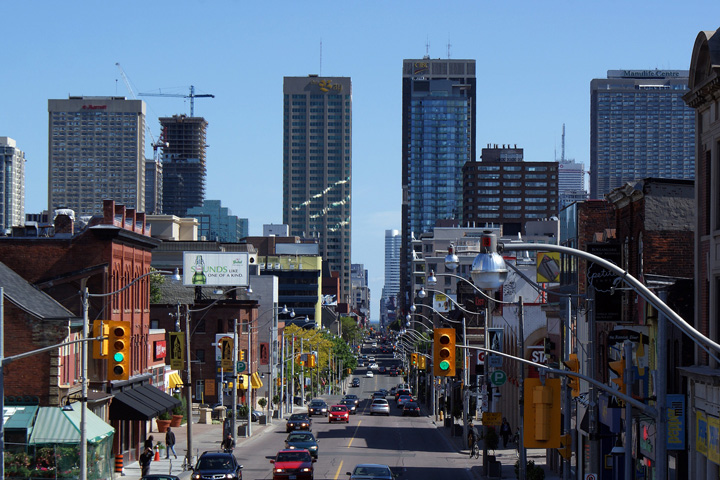
Looking northerly as Yonge Street climbs Summerhill from the CP Railway
overpass. Summerhill as the neighbourhood is called, is the historic
lake Iroquois shoreline. Toronto`s Davenport Road follows along the
bottom of this ridge.
Photo taken: May 31st, 2009. |

(720x480)
(1440x960) |
| City of Toronto |
Southerly view from Shaftesbury Avenue towards the Summerhill Railway
overhead. The Summerhill Railway overhead was constructed in 1915/16,
and is of considerable girth for the dual-track railway it carries today.
Photo taken: May 31st, 2009. |
(720x480)
(1440x960) |
| City of Toronto |
View looking south as Yonge Street descends Summerhill with some of
Toronto's most prominent buildings in the background.
Photo taken: May 31st, 2009. |
(720x480)
(1440x960) |
| City of Toronto |
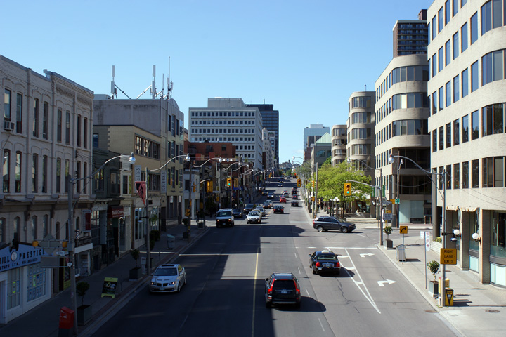
View looking southerly from Lawton Boulevard towards the St. Clair
Avenue intersection.
Photo taken: May 31st, 2009. |
(720x480)
(1440x960) |
| City of Toronto |
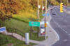
This view looks northerly from the Lawton Boulevard intersection towards
the Belt Line Trail Pedestrian Overpass. The Belt-Line Trail was a
privately run suburban radial line built to ease access to the towns of
Forest Hill, Swansea, Rosedale and Moore Park that were located just outside
of Toronto City Limits. The steel bridge was being repainted at the
time this photo was taken.
Photo taken: May 31st, 2009. |
(720x480)
(1440x960) |
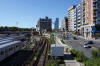
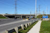
| City of Toronto |
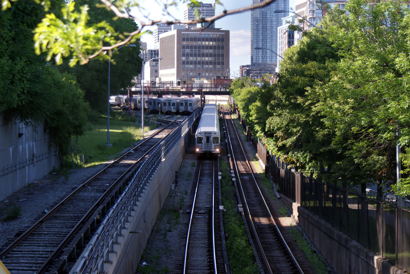
Not a highway, obviously; this photo is looking at an above ground section
of the Yonge TTC Subway line. The TTC is Toronto`s very successful
Transit Company that operates bus-lines, three subway lines and one light
rapid transit line through the City of Toronto.
Photo taken: May 31st, 2009. |

(720x480)
(1440x960) |
| City of Toronto |
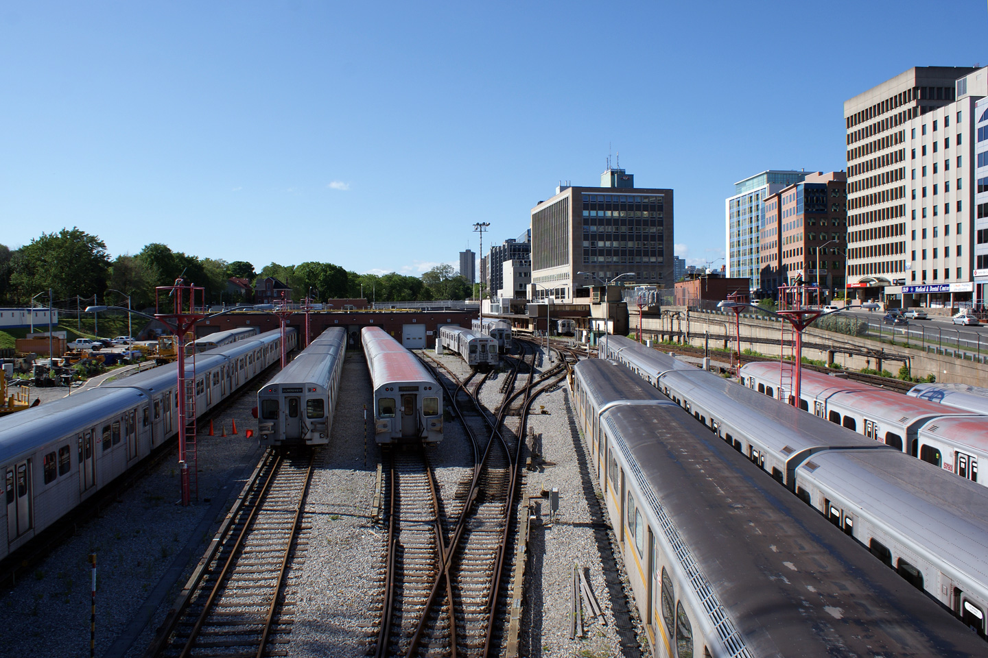
Two views looking northerly from the Belt Line Trail overpass. The
update previous to the update when these photos through Central Toronto were
taken included photos of
Highway 11 between Shabaqua Corners and
Atikokan in Northwestern Ontario. I did this to highlight both the
diversity of Highway 11 as it treks across Ontario, but also the diversity
of Ontario itself. The vast, vast majority of Ontario is uninhabited
wilderness, yet nearly 75% of the province's residents live in urban areas
such as this.
Photos taken: May 31st, 2009. |
(720x480)
(1440x960)
(720x480)
(1440x960) |
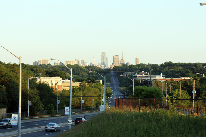
| City of Toronto |
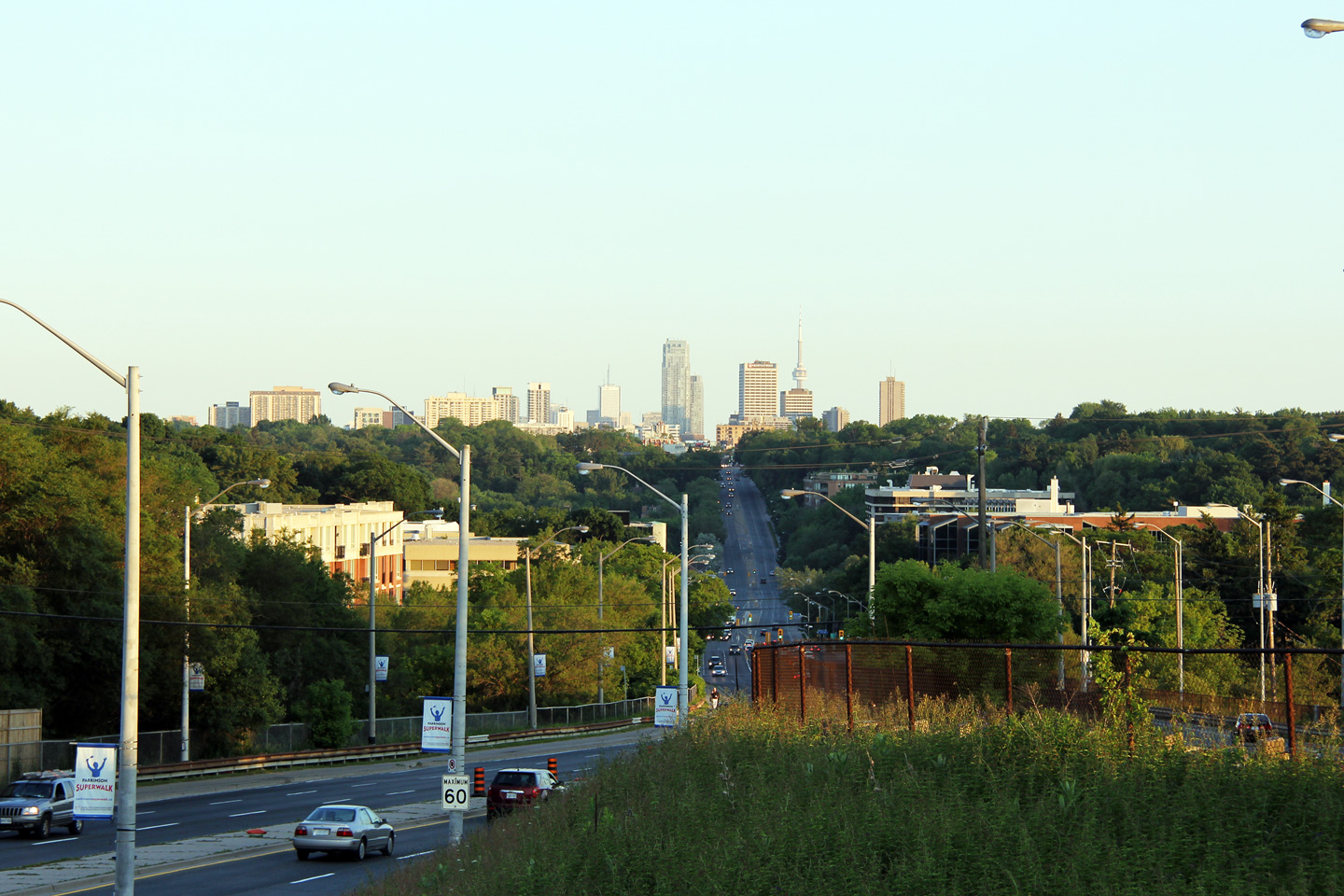
Southerly view from the Highway 401 overpass along Yonge Street as Toronto's
main street descends into the Don River Valley. Toronto's skyline is
appears in the distance in the soft evening light.
Photo taken: June 14th, 2011. |

(720x480)
(1440x960)
(2400x1600) |
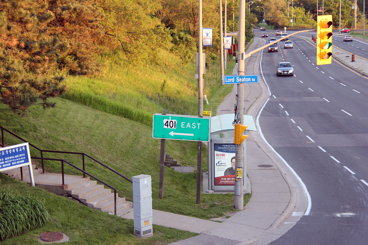
| City of Toronto |
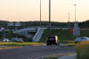
Southbound signage directing motorists to the ramp to Highway 401 East.
Photo taken: June 14th, 2011. |
 (720x480) (720x480)
(1440x960) |
| City of Toronto |
Westbound junction assembly at the intersection of Lord Seaton Road and the
westbound on-ramp to Highway 401.
Photo taken: June 14th, 2011. |
(720x480)
(1440x960) |
|
Highway 401 is Southern Ontario's
principal east-west freeway. Click
here for Highway
401-West images and
here for Highway
401-East images. |
| City of Toronto |
Southerly view from the centre of the seven lane cross-section of Yonge
Street from the Kempford Road intersection
Photo taken: June 14th, 2011. |
(720x480)
(1440x960)
(2400x1600) |
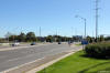
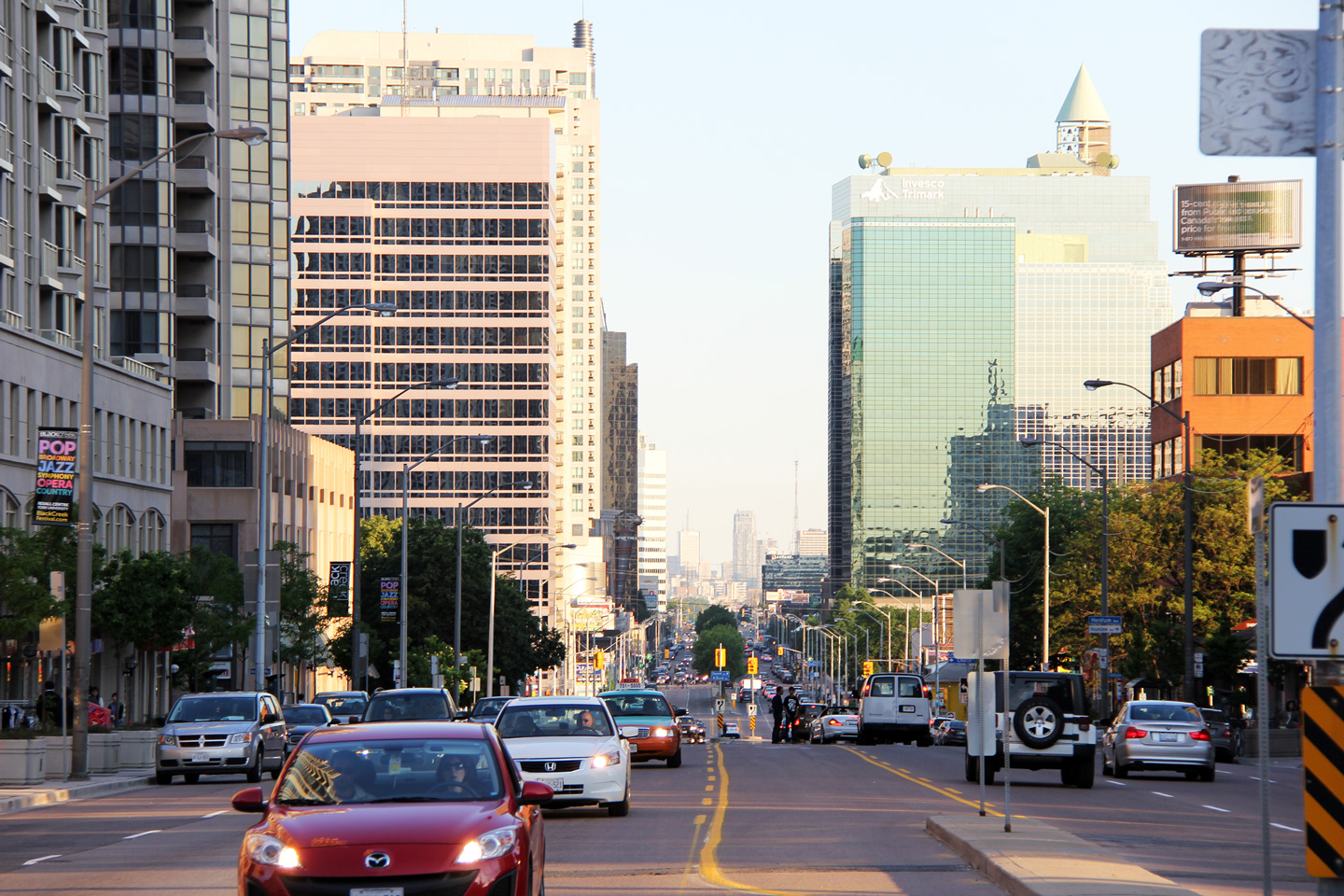
| City of Toronto |
Southerly view along Yonge Street from the Finch Avenue intersection.
Photo taken: June 14th, 2011. |
(720x480)
(1440x960)
(2400x1600) |
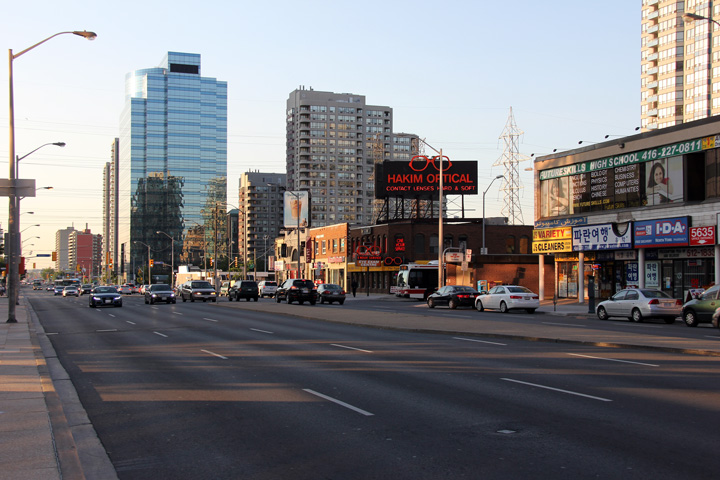
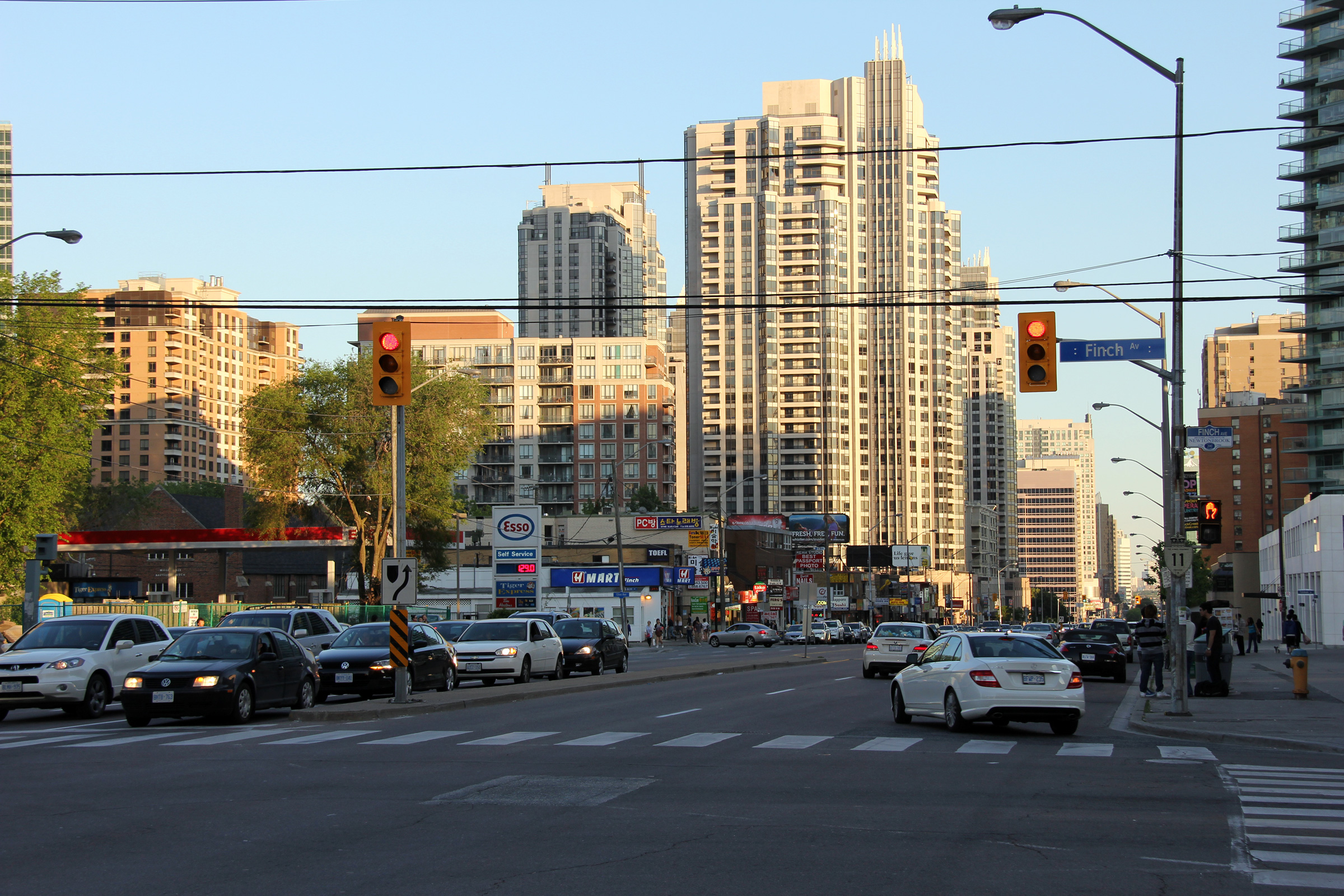
| City of Toronto |
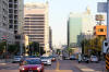
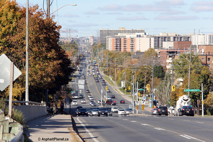
Northerly view along Yonge Street from Finch Avenue. Through North
York City Centre (the area along Yonge Street between just south of Sheppard
Avenue and just north of Finch Avenue) Yonge Street is an interesting mix of
grit and glass.
Photo taken: June 14th, 2011. |
(720x480)
(1440x960) |
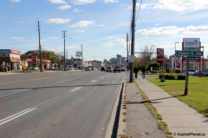
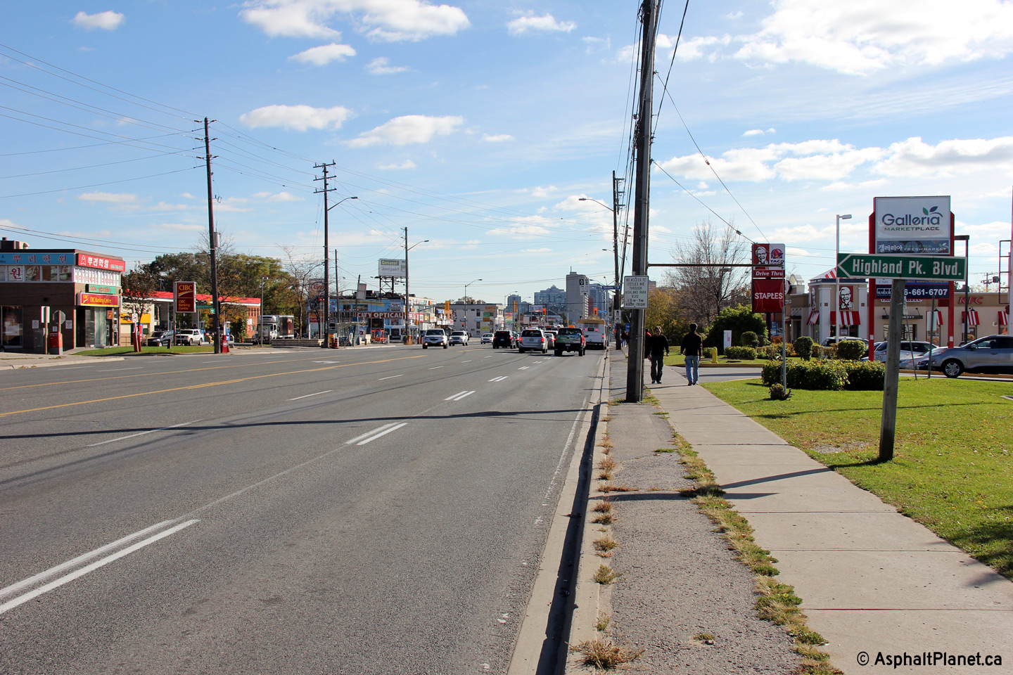
Richmond Hill / Vaughan
Boundary
Regional Municipality of York |
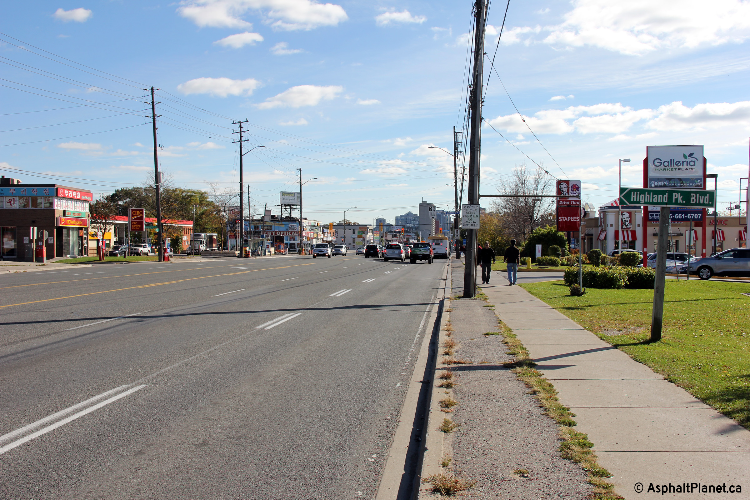
View looking southerly just north of Steeles Avenue. Note the
fingerboard sign for Highland Park Boulevard to the right of the highway.
Most MTO fingerboard signage no longer stand through Thornhill.
Photo taken: October 16th, 2012 |
(720x480)
(1440x960)
(2400x1600) |
Richmond Hill / Vaughan
Boundary
Regional Municipality of York |
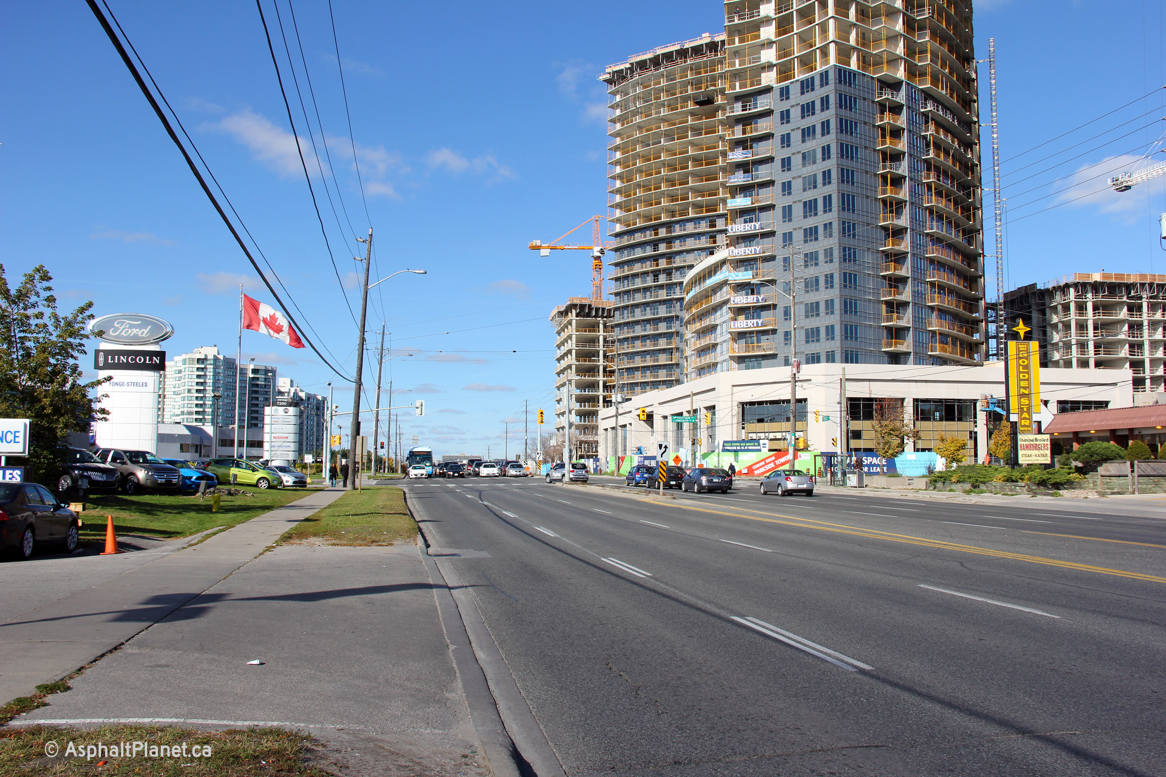
View looking northerly north of Steeles Avenue. The gargantuan World on
Yonge Condo development dominates the right side of this photo.
Photo taken: October 16th, 2012. |

(720x480)
(1440x960)
(2400x1600) |
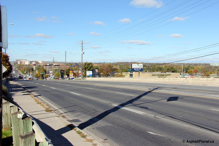
Richmond Hill / Vaughan
Boundary
Regional Municipality of York |
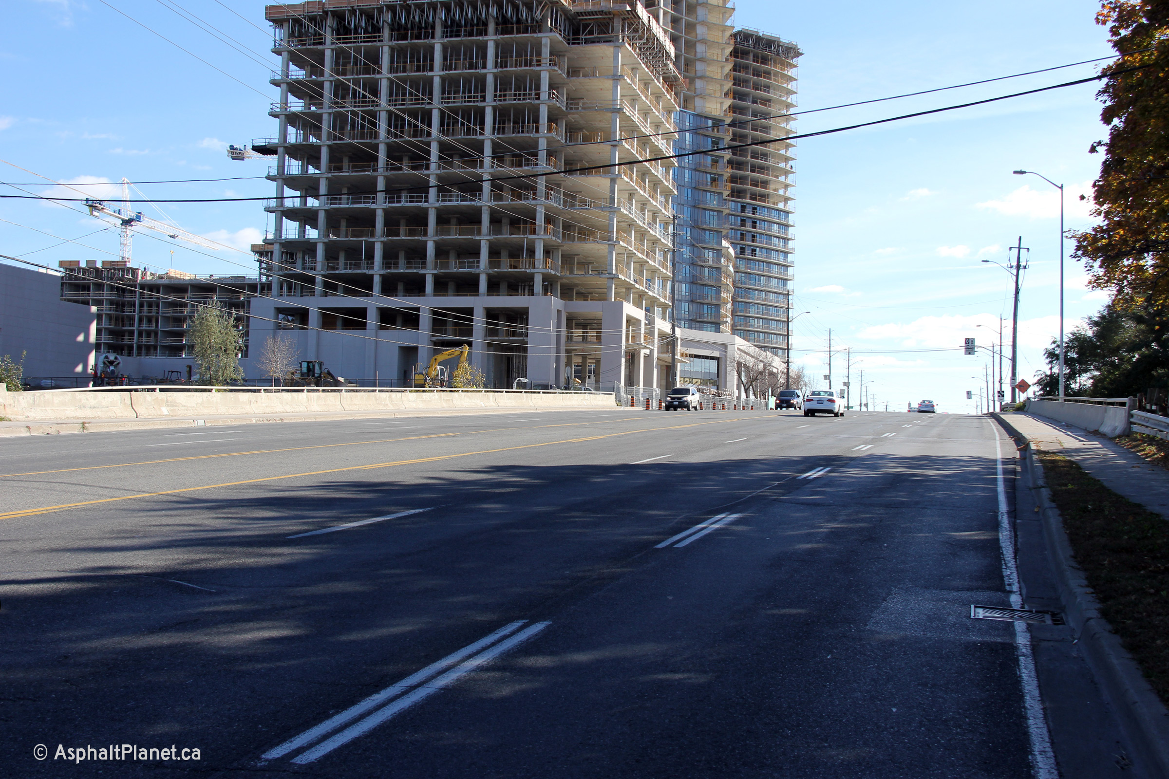
Two autumn views along Yonge Street at the CN York Subdivision underpass.
From this overpass northerly, Yonge Street descends into the East Don River
valley.
Photos taken: October 16th, 2012. |

(720x480)
(1440x960)
(2400x1600)

(720x480)
(1440x960)
(2400x1600) |
Richmond Hill / Vaughan
Boundary
Regional Municipality of York |
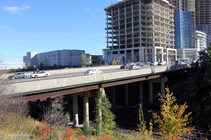
View looking easterly at the grade separation between Yonge Street and CN's
York Subdivision. This structure was constructed in the early 1960s as part
of CN's project to build a rail by-pass of Downtown Toronto. The underpass
was later widened in 1979 when Highway 11 was widened from four to six lanes
through northern Toronto.
Photo taken: October 16th, 2012. |
(720x480)
(1440x960)
(2400x1600) |
Richmond Hill / Vaughan
Boundary
Regional Municipality of York |
Northerly view across the CN Rail underpass. World on Yonge is visible
on the east side of Yonge Street beyond the railway crossing.
Photo taken: October 16th, 2012. |
(720x480)
(1440x960)
(2400x1600) |
Richmond Hill / Vaughan
Boundary
Regional Municipality of York |
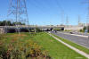
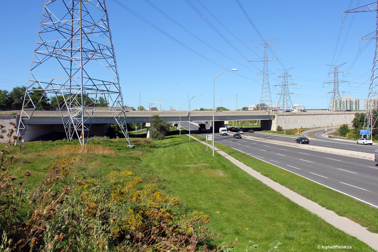
Northerly view along Yonge Street approaching the Highway 407 interchange.
Photo taken: September 24th, 2013. |
(720x480)
(1440x960)
(2400x1600) |
Richmond Hill / Vaughan
Boundary
Regional Municipality of York |
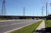
Southerly view along Yonge Street from the Highway 407 overpass.
Photo taken: September 24th, 2013. |
(720x480)
(1440x960)
(2400x1600) |
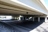
Richmond Hill / Vaughan
Boundary
Regional Municipality of York |
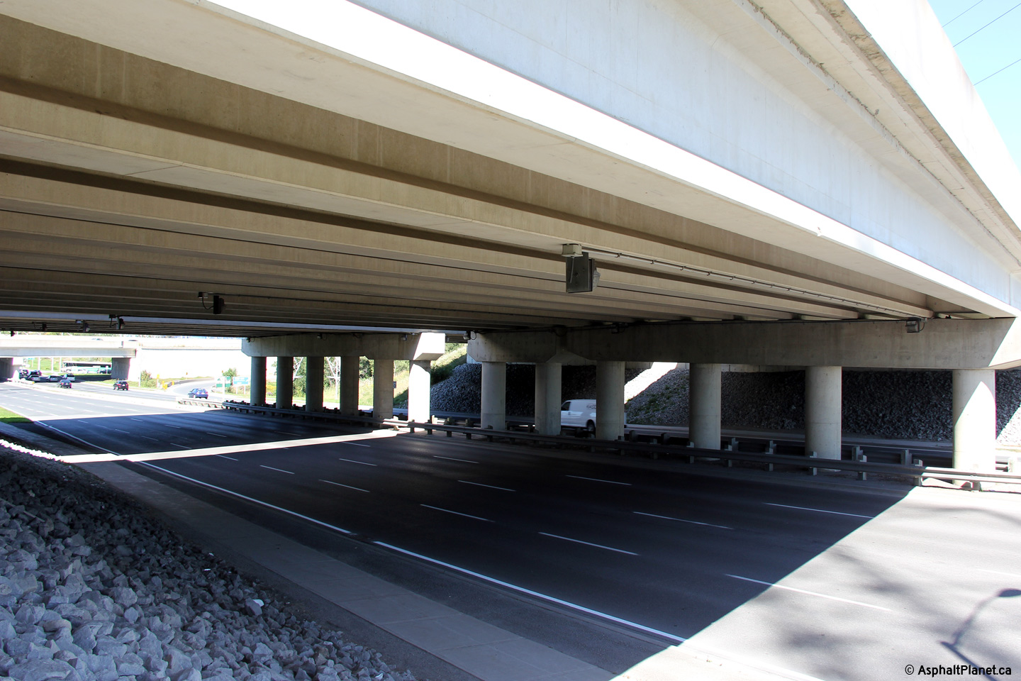
View looking northerly beneath the structure that carries Highway 407
overtop of Yonge Street. Note the two discontinuous centre piers in
the median of Yonge Street. These piers were added in 2005 in
preparation to widen Highway 407 to ten lanes. Though it may be hard
to believe now, Highway 407 was constructed with only a six lane
cross-section when it opened to traffic in 1997.
Photo taken: September 24th, 2013. |
(720x480)
(1440x960) |
|
Highway 407 ETR is an electronic
toll route that runs through southern York Region. Click here for Highway
407 ETR images. |
Richmond Hill / Vaughan
Boundary
Regional Municipality of York |
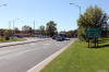
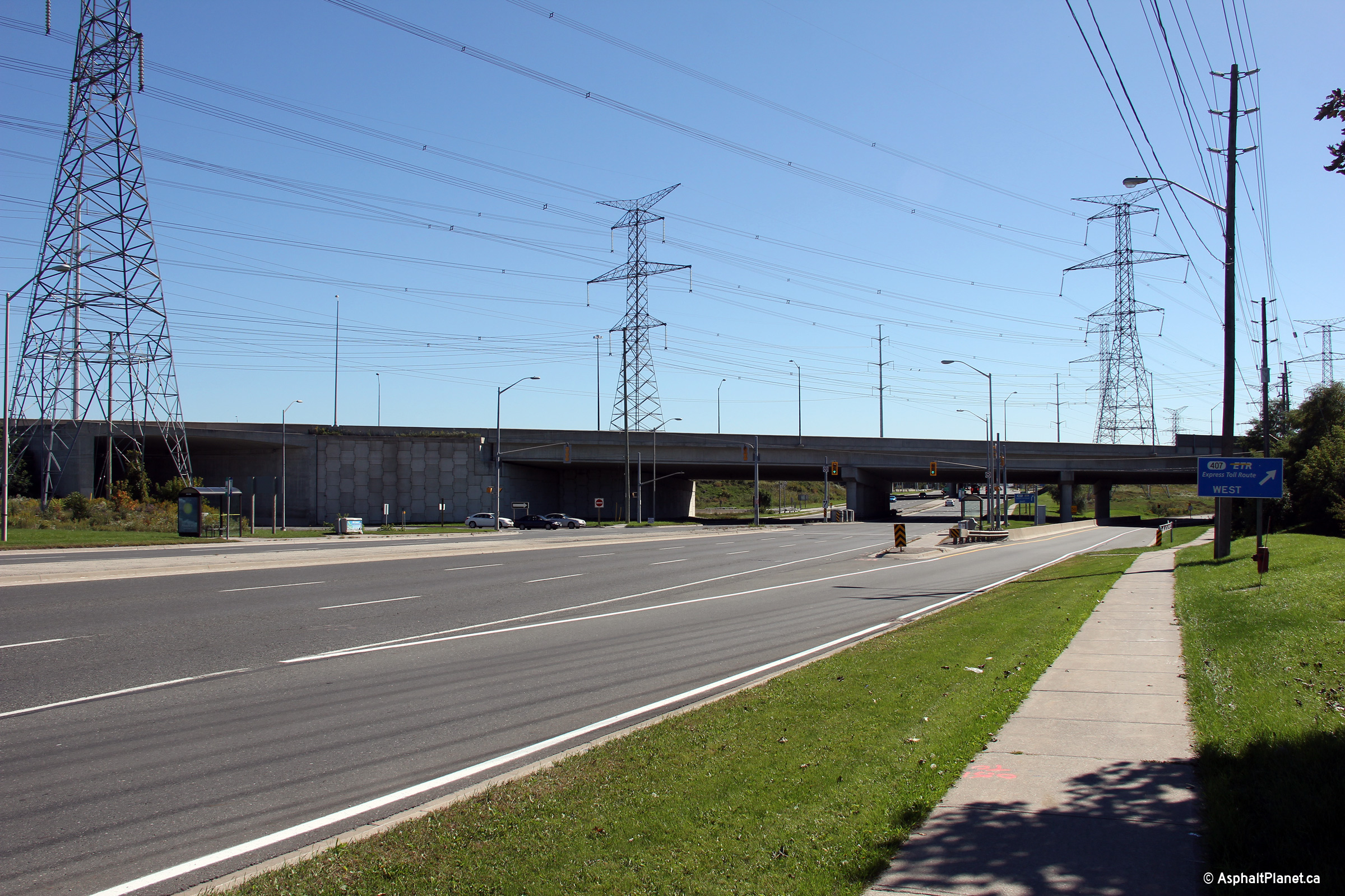
Northerly view along Yonge Street from the Highway 407 grade separation.
The pictured grade separation carries Highway 7 overtop of Yonge Street.
The Highway 7 grade separation is considerably wider than Yonge Street in
order to accommodate the on ramp from Southbound Yonge Street onto the
Westbound 407.
Photo taken: September 24th, 2013. |
(720x480)
(1440x960)
(2400x1600) |
Richmond Hill / Vaughan
Boundary
Regional Municipality of York |
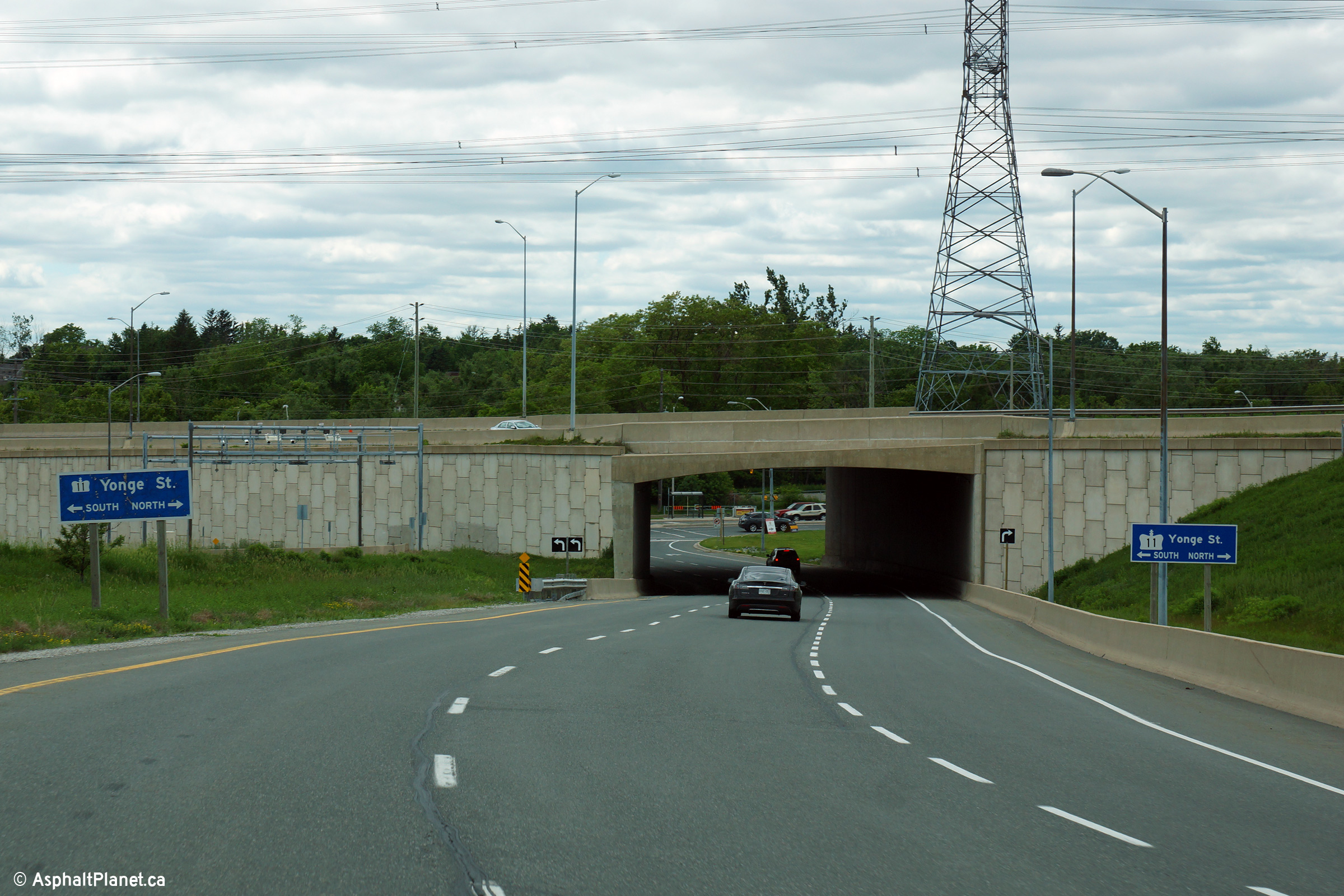
Westerly view along the off-ramp to Yonge Street from the westbound 407.
The off-ramp to Yonge Street passes beneath Highway 7 before intersecting
Yonge Street beyond the structure.
Photo taken: June 14th, 2014. |

(720x480)
(1440x960)
(2400x1600) |
Richmond Hill / Vaughan
Boundary
Regional Municipality of York |
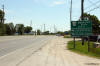
Southerly view approaching the Highway 7 underpass. The traffic
signals pictured are for the ramp terminal from the westbound Highway 407
off-ramp to Yonge Street. The off-ramp from the Westbound 407 to Yonge
Street passes beneath Highway 7 before meeting Yonge Street.
Photo taken: September 24th, 2013. |
(720x480)
(1440x960)
(2400x1600) |
Richmond Hill / Vaughan
Boundary
Regional Municipality of York |
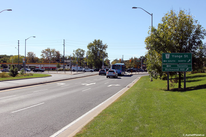
Westerly view at the end of the ramp that links Highway 7 to Yonge Street.
Highway 11 was transferred to the Regional Municipality of York several
years prior to the transfer of Highway 7. As such, the pictured Yonge
Street sign was indeed made by the MTO. (The directional signs to Richmond
Hill and Toronto, have however been replaced by the region.
Photo taken: September 24th, 2013. |
(720x480)
(1440x960)
(2400x1600) |
|
Highway 9 began west from Highway
11 leading towards Orangeville before being truncated at Highway 400 in
1999. Click here for Highway
9 images. |
Town of Newmarket
Regional Municipality of York |
Southbound junction assembly along Yonge Street at the Highway 9
intersection. This sign was removed several years ago, as both
Highways 9 and 11 have been transferred to municipal jurisdiction through
urban York Region.
Photo taken: February 8th, 2004. |
|
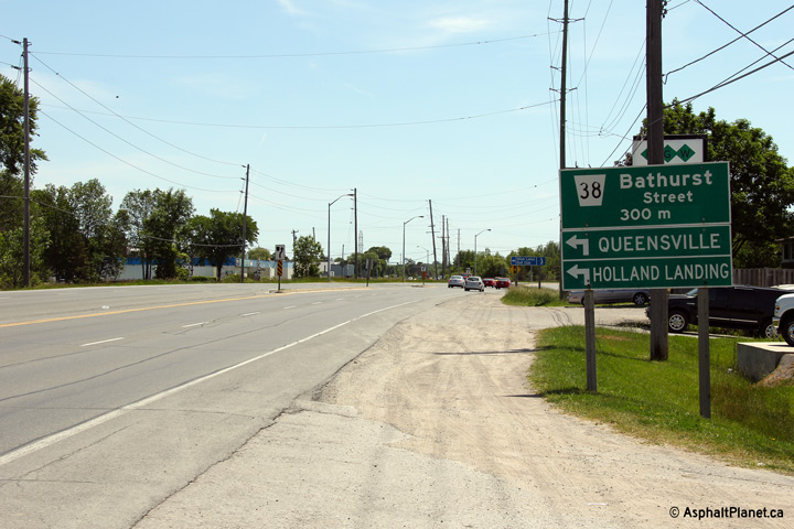
Township of King
Regional Municipality of York |
Southbound signage in advance of the Bathurst Street intersection at the
northern end of the Holland Landing By-pass.
Photo taken: June 19th, 2011. |
 (720x480) (720x480)
(1440x960)
(2400x1600) |
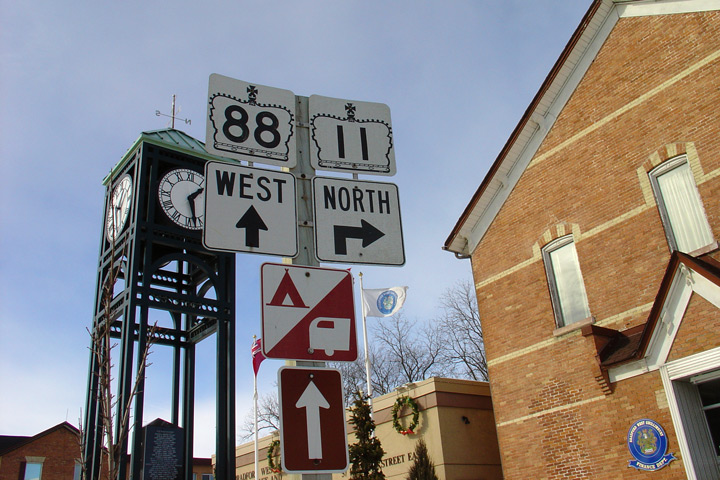
| Town of Bradford West
Gwillimbury |
Northbound junction assembly a the Highway 88 junction in Downtown Bradford.
This sign has since been removed, as neither Highway 11 nor Highway 88 are
still provincial highways through Bradford.
Photo taken: February 8th, 2004. |
|
|
Highway 88 lead west from Highway
11 at Bradford to Highway 27 at Bond Head before being decommissioned in
1998. Click here for
Highway 11 images. |
|
Continue north on Highway 11 via
Bradford to Crown Hill Images |


 (720x480)


 (720x480)
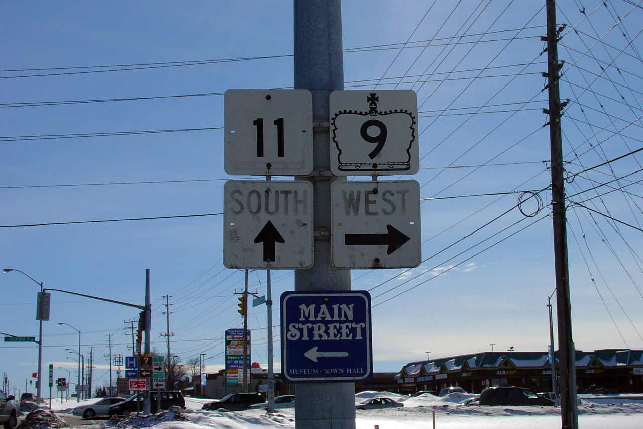
 (720x480)
 (720x480)
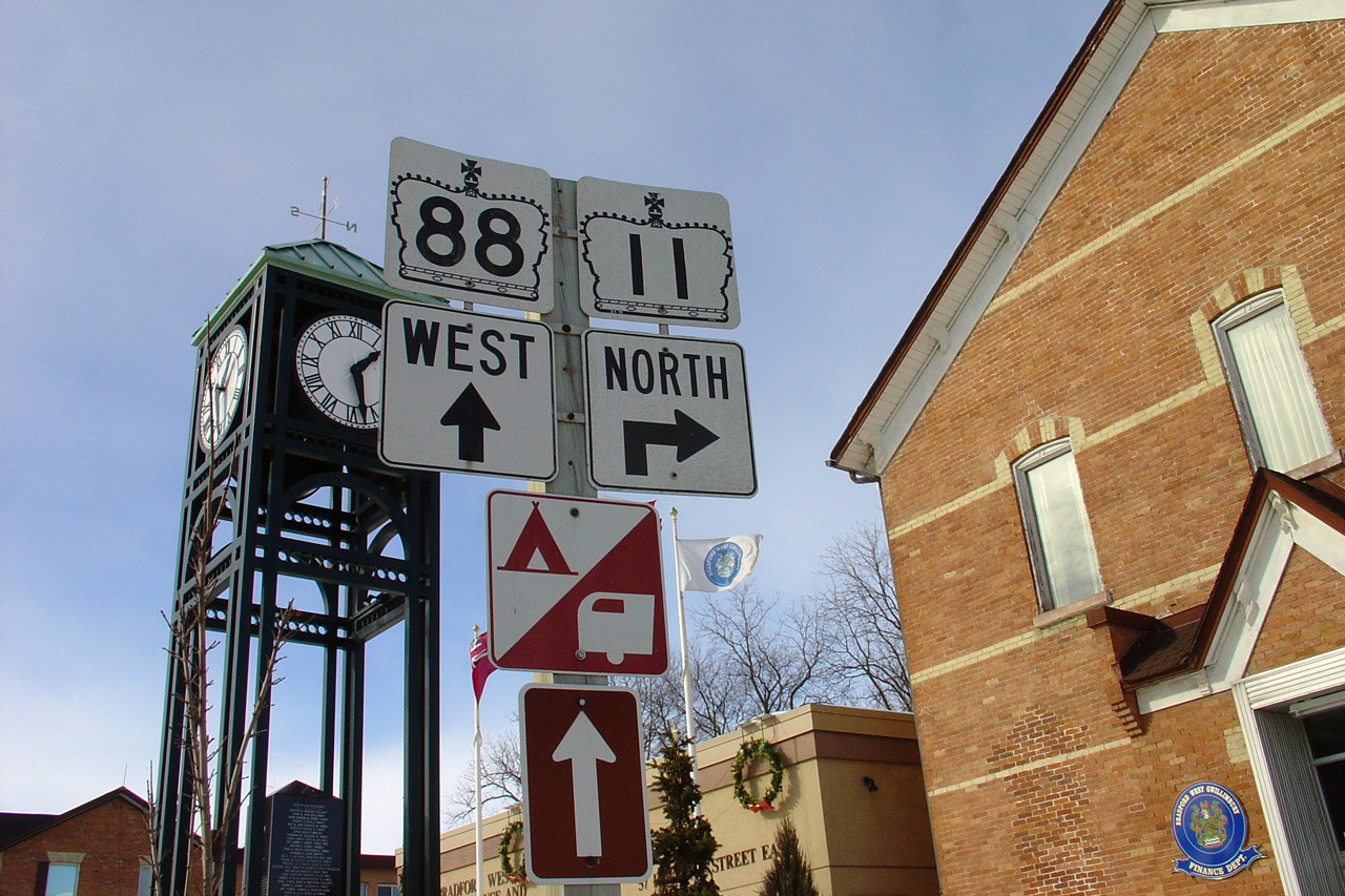