|
Proper Municipality Name |
Photo Description |
Photo |
|
Pictures taken
from driver's perspective appear offset from centre-line pictures: |
East-
Bound |
West-
Bound |
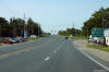
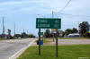
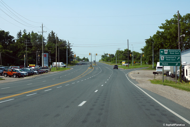
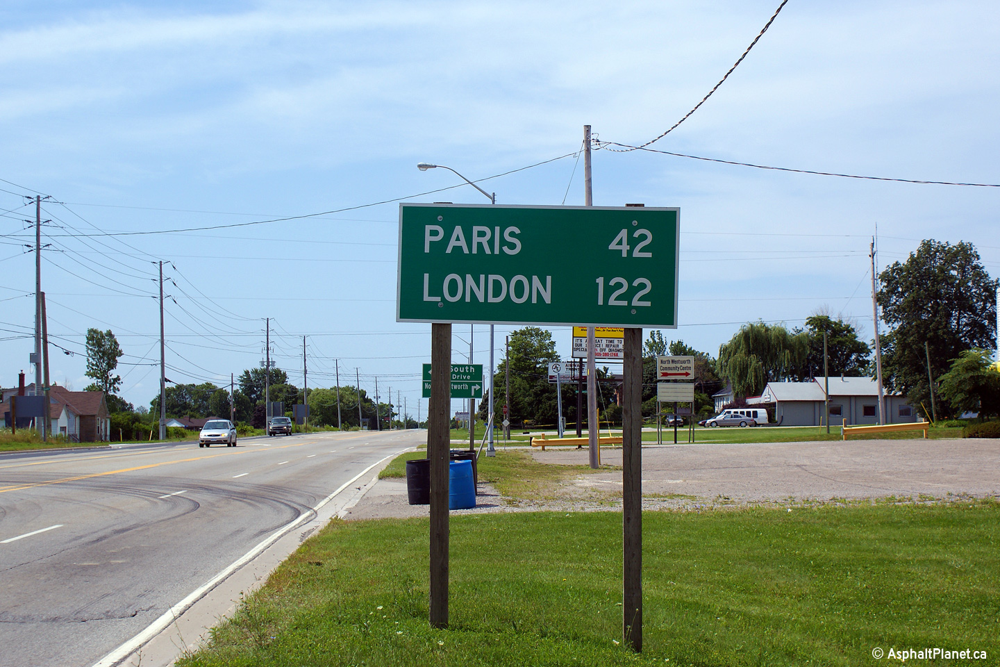
| City of Brant County |
Southerly view approaching the western Highway
24 junction at Osborne Corners.
Photo taken: July 18th, 2014. |
(720x480)
(1440x960)
(2400x1600) |
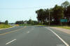
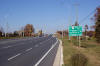
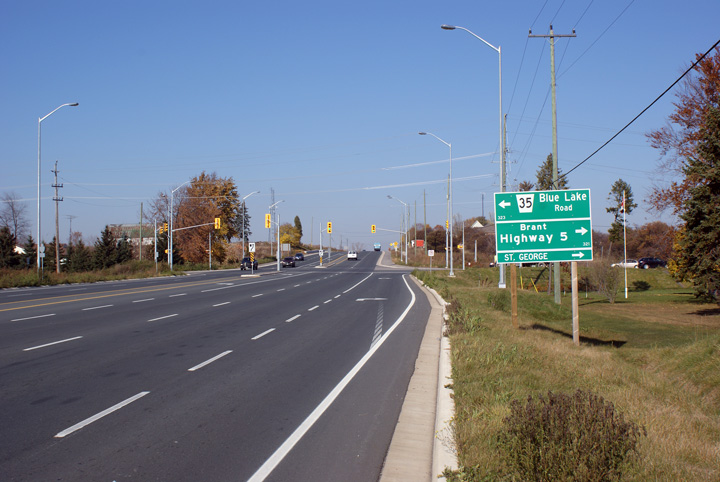
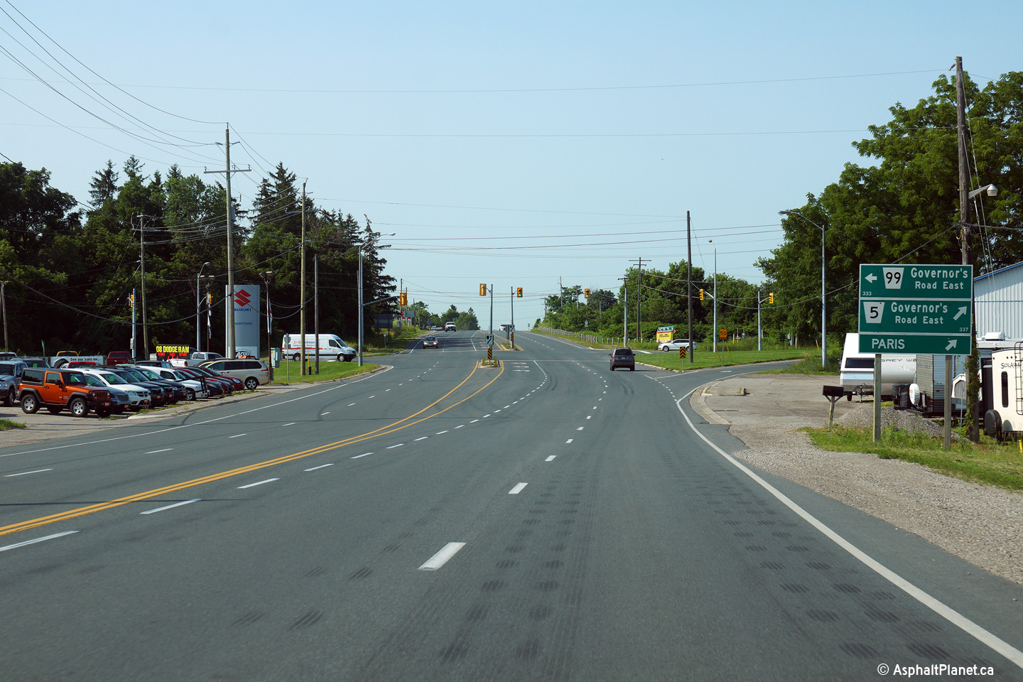
| City of Brant County |
Northerly view from just north of the western
Highway 24 junction. Note the distance sign along Highway 24 still
includes Toronto, which was Highway 5's eastern control city.
Photo taken: July 18th, 2014. |
(720x480)
(1440x960)
(2400x1600) |
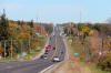
| City of Brant County |
This view looks northerly along Highway 24 where
Highway 5 ran concurrent with Highway 24. Note the rather odd
four-lane cross-section. Few rural highways in Ontario were ever built
to a four lane cross-section without a flush median to separate opposing
flows.
Photo taken: October 16th, 2010. |
(720x480)
(1440x960)
(2400x1600) |
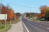
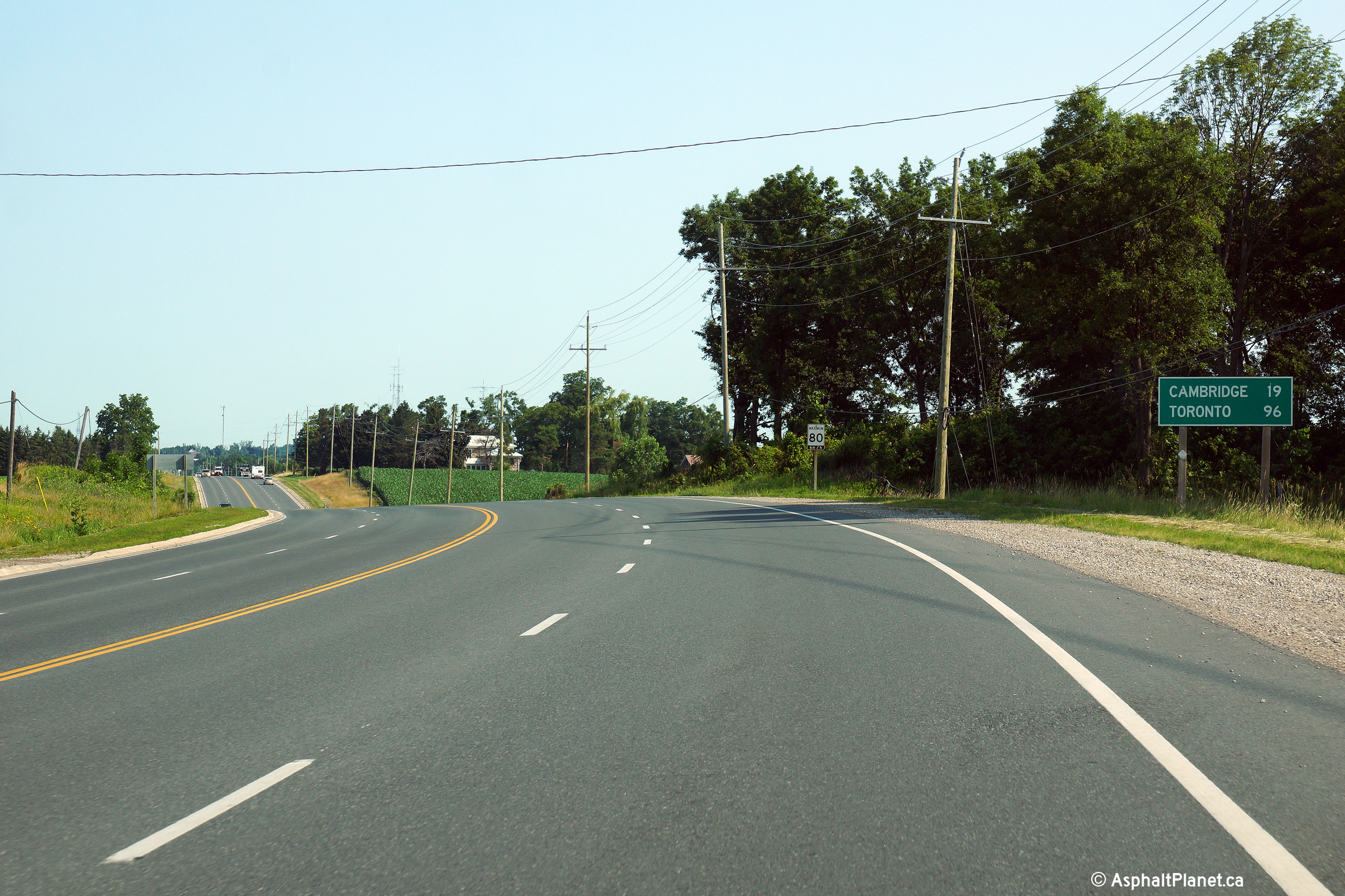
| City of Brant County |
This view looks northerly along Highway 24, from
just north of the German School Concession Road.
Photo taken: October 16th, 2010. |
(720x480)
(1440x960)
(2400x1600) |
| City of Brant County |
This view looks northerly approaching the
eastern Highway 5 junction. This junction was extensively reconstructed in
2007. A reconstruction activity that included the removal of two rather
substantial channels that formerly facilitated direct right turn movements
between Highway 5 and 24.
Photo taken: November 15th, 2008. |
(720x480)
(1440x960)
(2400x1600) |
|
Highway 24 continues northerly
from Highway 5 bound for Cambridge, Guelph and Beyond.
Click here for Highway 24 images. |
| City of Brant County |
Looking west towards the northern Highway 24
junction west of St. George. At this junction, through traffic must
turn left to continue along Highway 5. The installation of traffic
signals was a welcome addition to this intersection, however it is a shame
it came at the cost of the former northbound to eastbound channel.
Photo taken: November, 2008. |

(720x480)
(1440x960)
(2400x1600) |
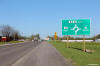
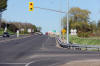
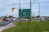
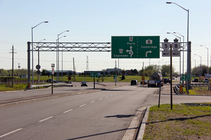
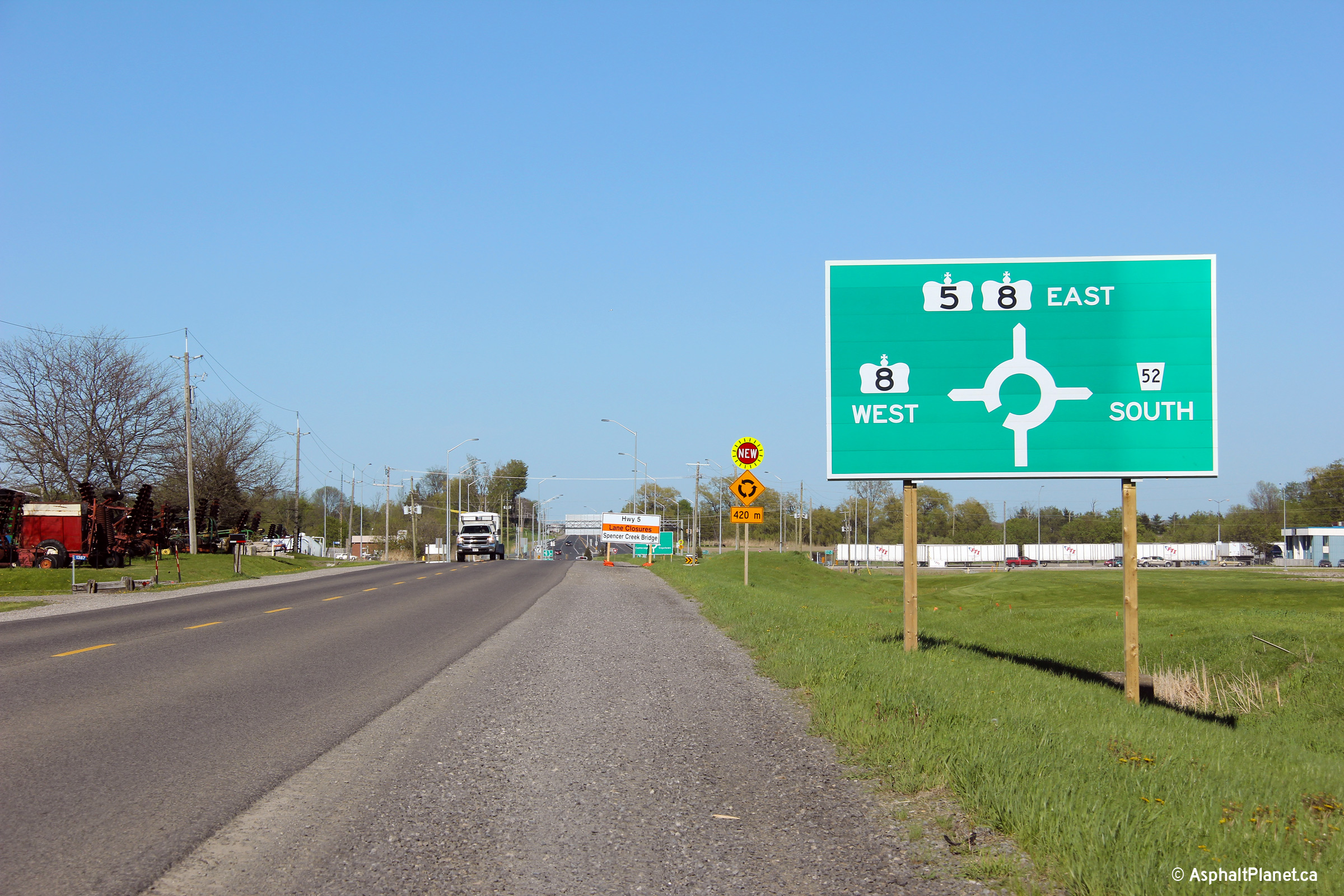
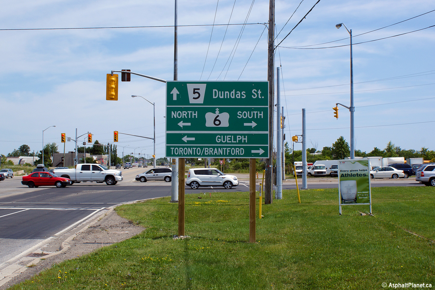
| City of Hamilton |
Green signage showing the route designations leading from the Peters Corners
roundabout ahead.
Photo taken: May 16th, 2013. |
 (720x480) (720x480)
(1440x960)
(2400x1600) |
| City of Hamilton |
Following the signage listing the route designations that radiate from the
roundabout is this sign that indicates destinations from the roundabout
ahead. It is typical at Ontario Roundabouts for destinations to be signed
independently of the route designations.
Photo taken: May 16th, 2013. |
 (720x480) (720x480)
(1440x960)
(2400x1600) |
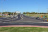
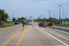
| City of Hamilton |
This view looks westerly along Highway 5 from the centre island of the
Peters Corners Roundabout.
Photo taken: May 16th, 2013. |
(720x480)
(1440x960)
(2400x1600) |
|
Highway 5 intersects Highway
8-West and the former Highway 52 at the Peters Corners Roundabout.
Click here for Highway 8-West images and
here for Highway 52 images. |
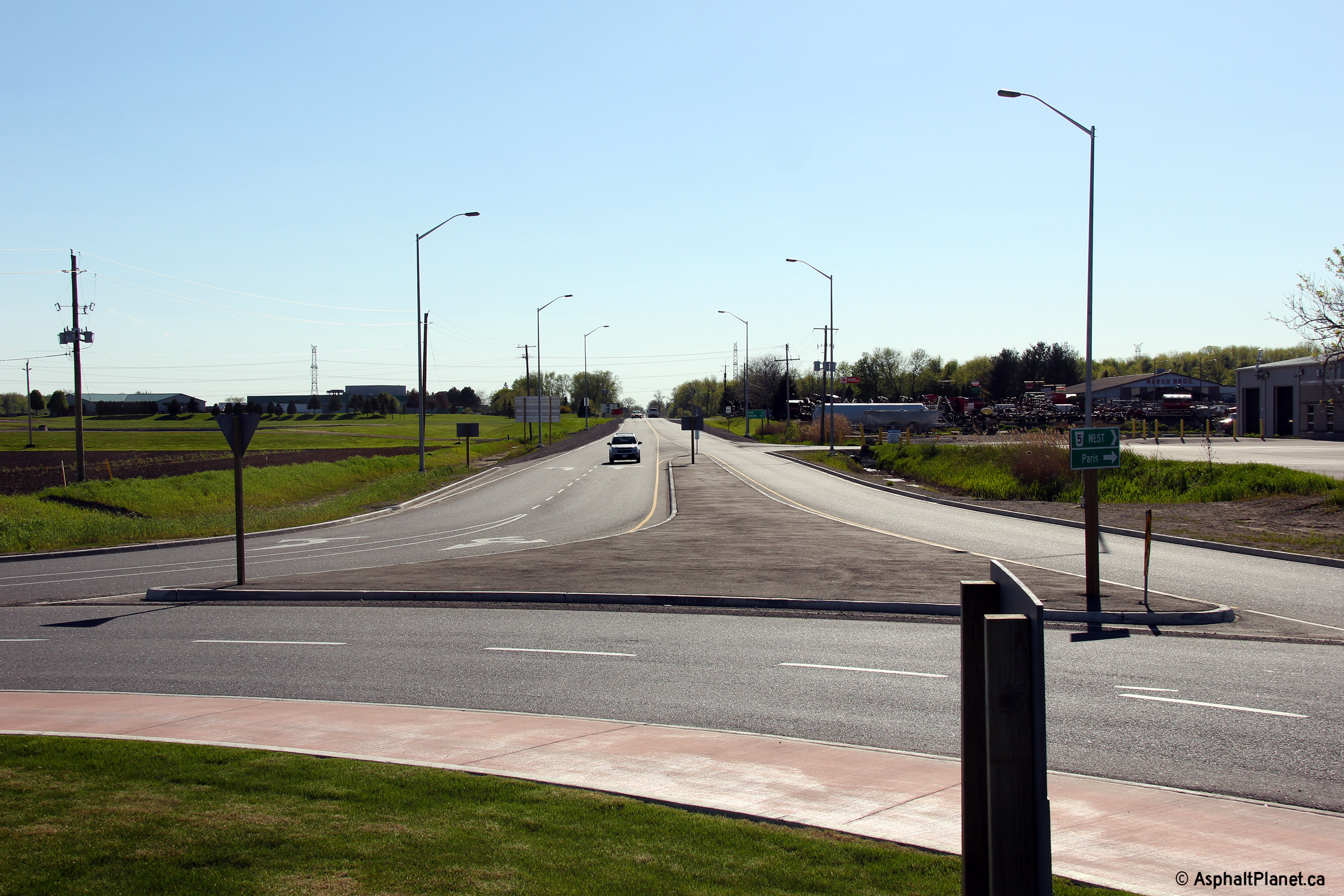
| City of Hamilton |
Easterly view along Highway 5/8 from the Peters Corners Roundabout.
The eastern spoke of the roundabout has a wider cross-section than the
western spoke.
Photo taken: May 16th, 2013. |
(720x480)
(1440x960)
(2400x1600) |
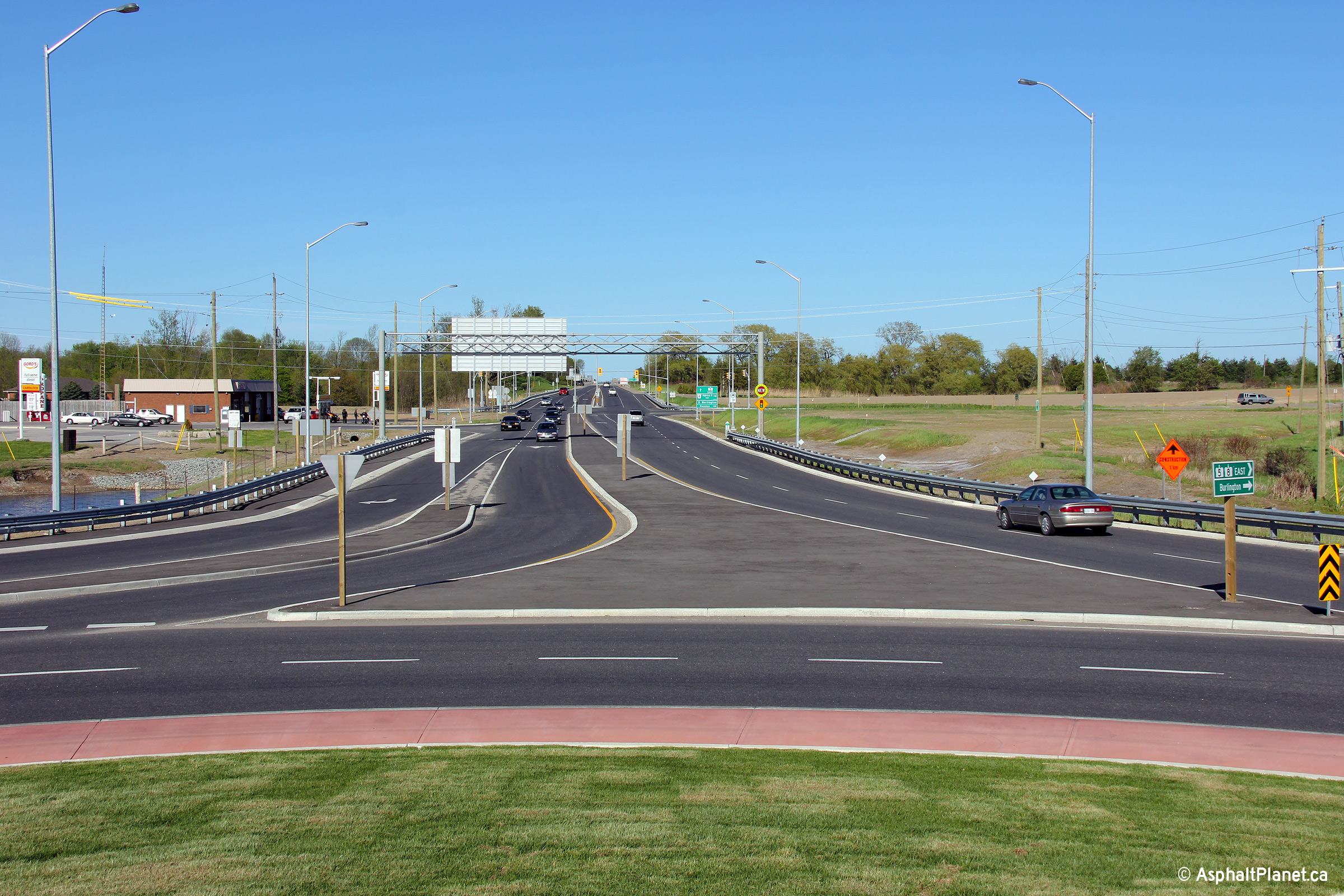
| City of Hamilton |
Due to the complex lane assignments through the roundabout, an overhead sign
has been erected for eastbound motorists on approach to the Peters Corners
Roundabout.
Photo taken: May 16th, 2013. |
(720x480)
(1440x960)
(2400x1600) |
| City of Hamilton |
Easterly view approaching the Old Highway 8 intersection located just east
of the Peters Corners Roundabout.
Photo taken: May 16th, 2013. |

(720x480)
(1440x960)
(2400x1600) |
| City of Hamilton |
An ends sign stands to delineate the eastern terminus of Highway 8 at the
far side of the Hamilton Road 8 intersection. Prior to 1998, Highway 8
extended easterly beyond Peters Corners along what has become Hamilton Road
8 into Dundas and Hamilton.
Photo taken: May 16th, 2012. |
 (720x960) (720x960)
(1440x960) |
| City of Hamilton |
A series of views looking west approaching the Highway 8 junction. The
upper photos were taken before the through lanes of Highway 8 were severed
during the construction of the Peters Corners Roundabout. The lower
photo sows the highway following the completion of the roundabout
Photo #1 taken: July 31st, 2005.
Photo #2 taken: October 16th, 2010.
Photo #3 taken: May 16th, 2013. |

(720x480)
(1440x960)
(2400x1600) |
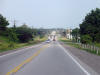
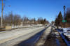
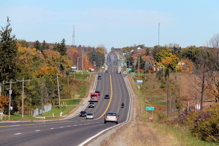
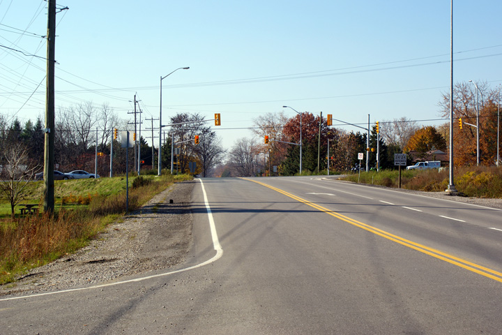
| City of Hamilton |
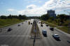
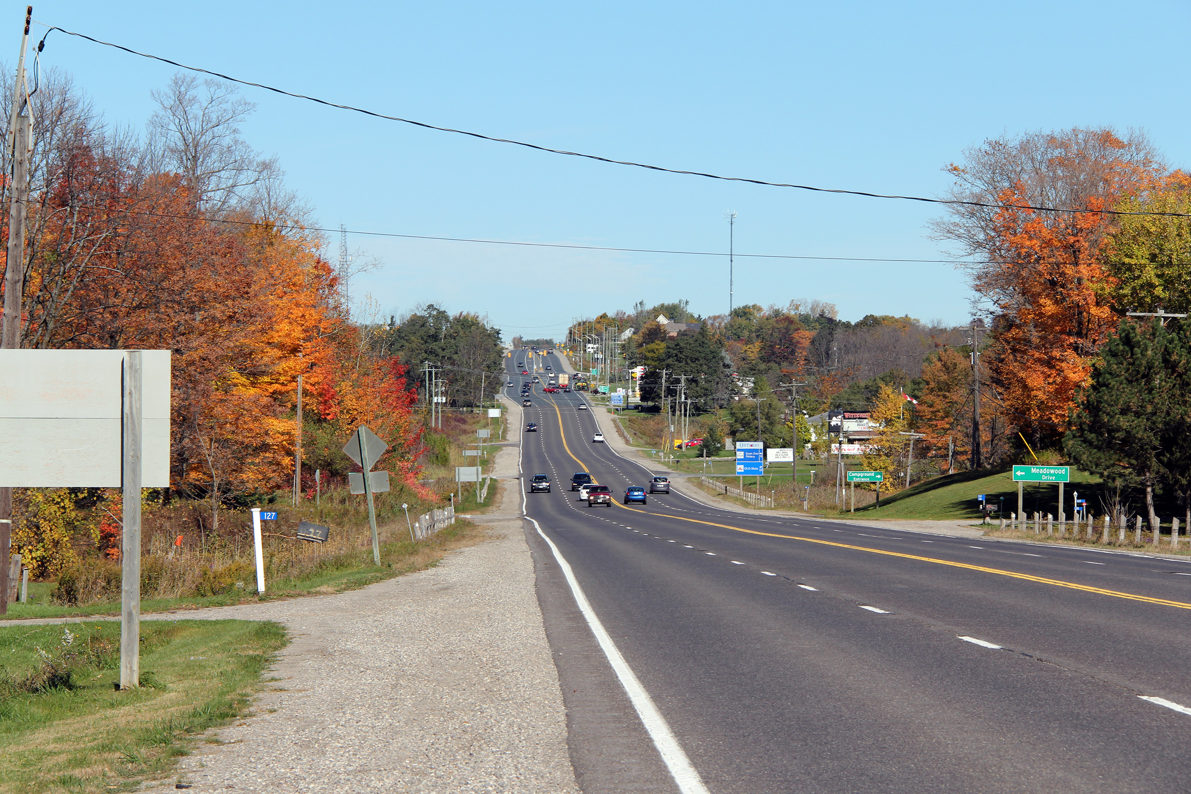
Looking east along Highway 5 towards the Sydenham Road intersection north of
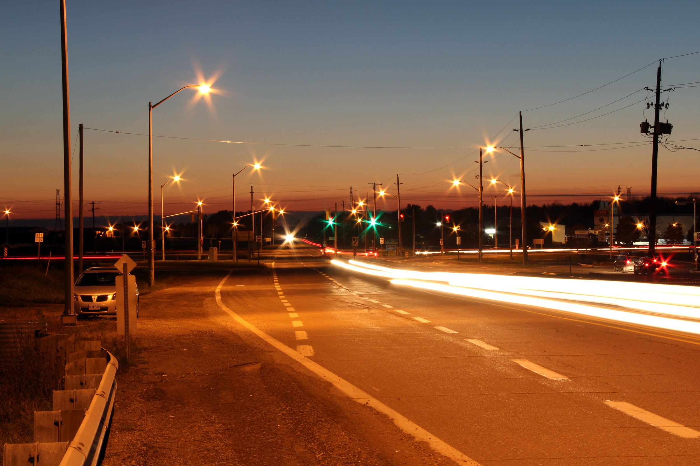
Hamilton. This is a fairly typical looking view of the very busy
Highway 5 between Peters and Clappinson's Corners. Picture taken: July
31st, 2005. Size: 45kb. |
 |
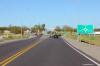
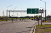
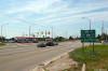
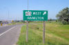
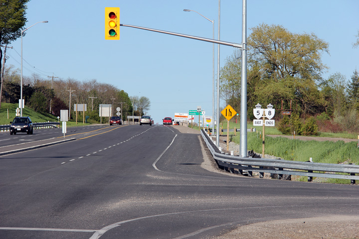
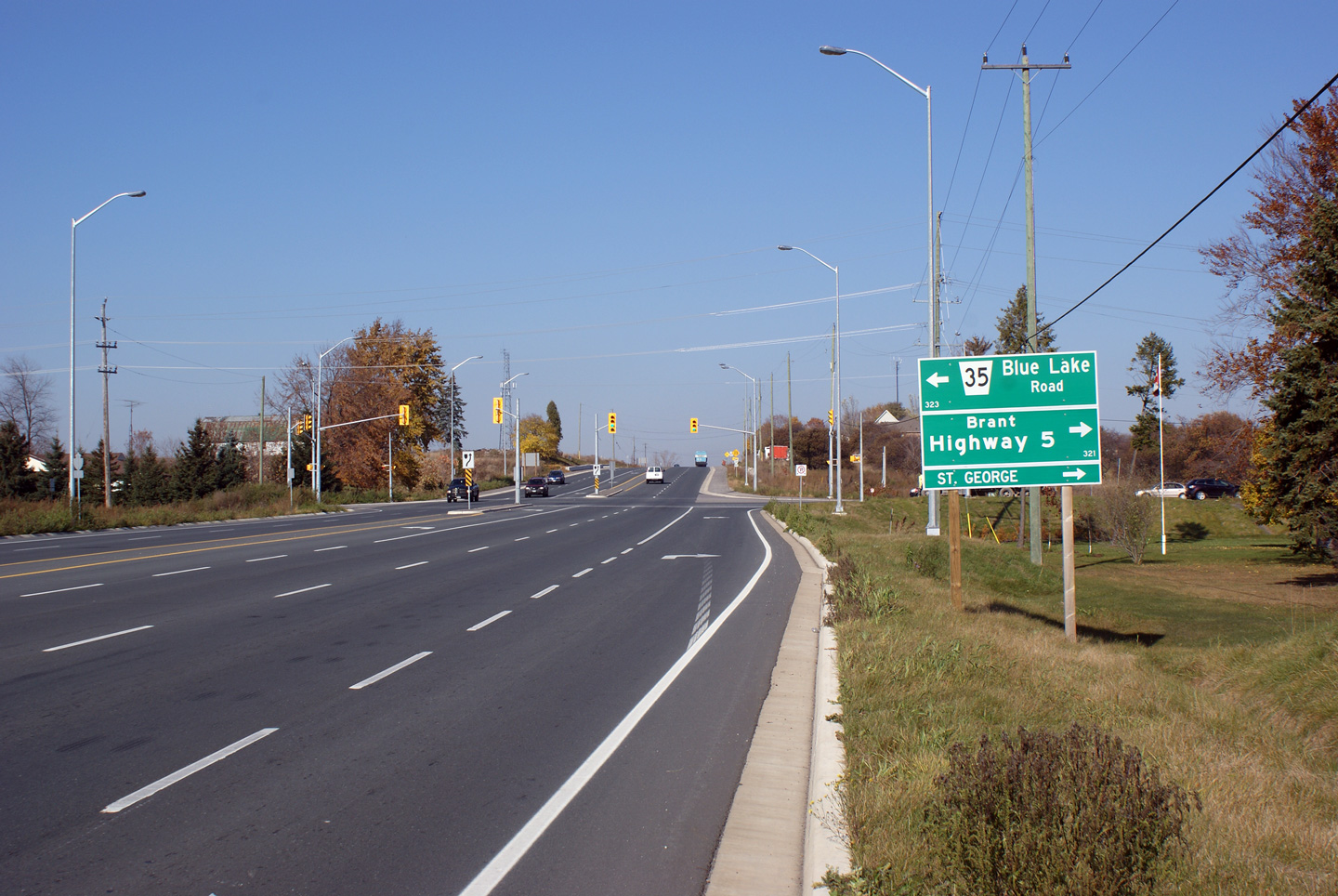
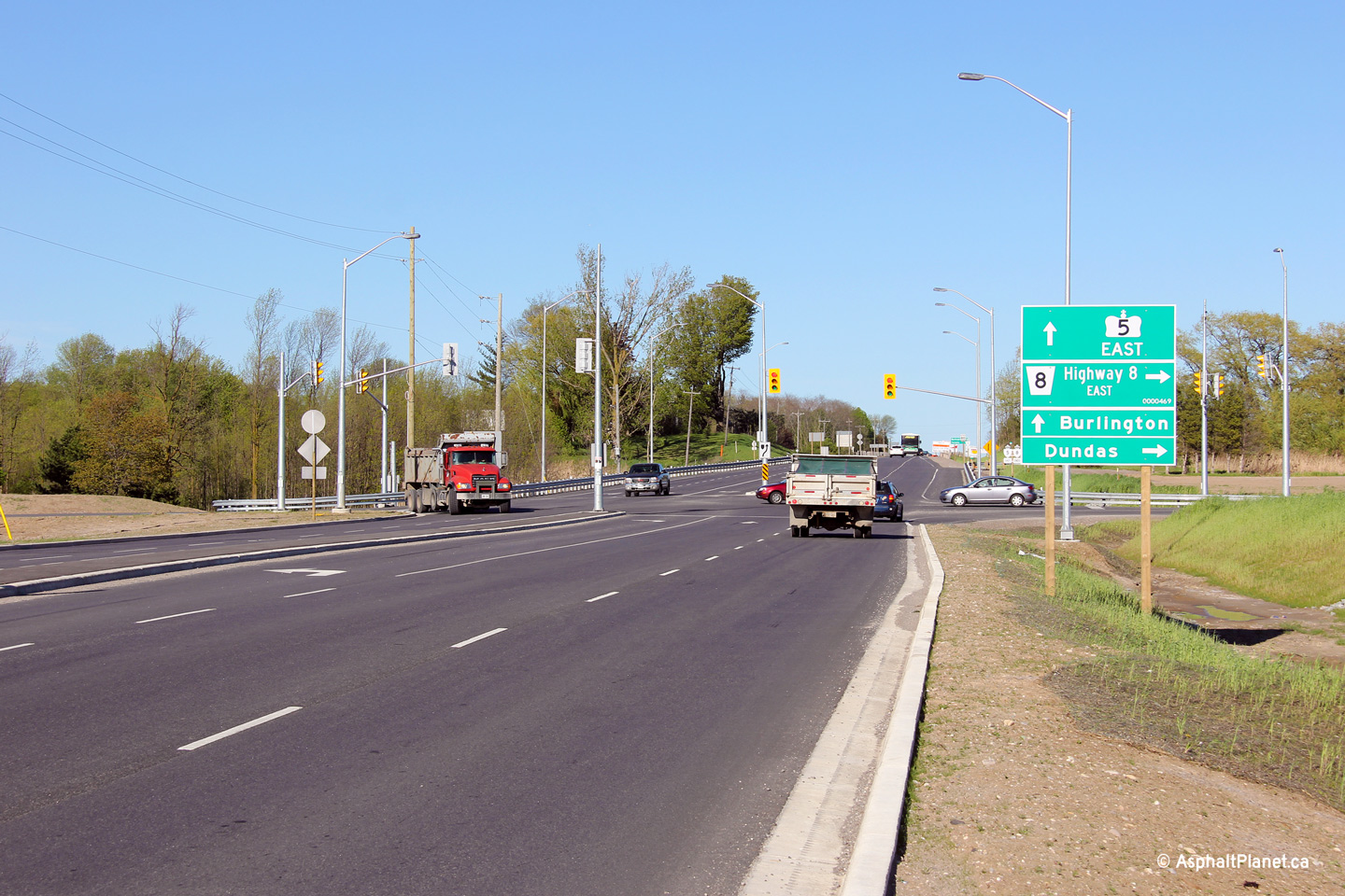
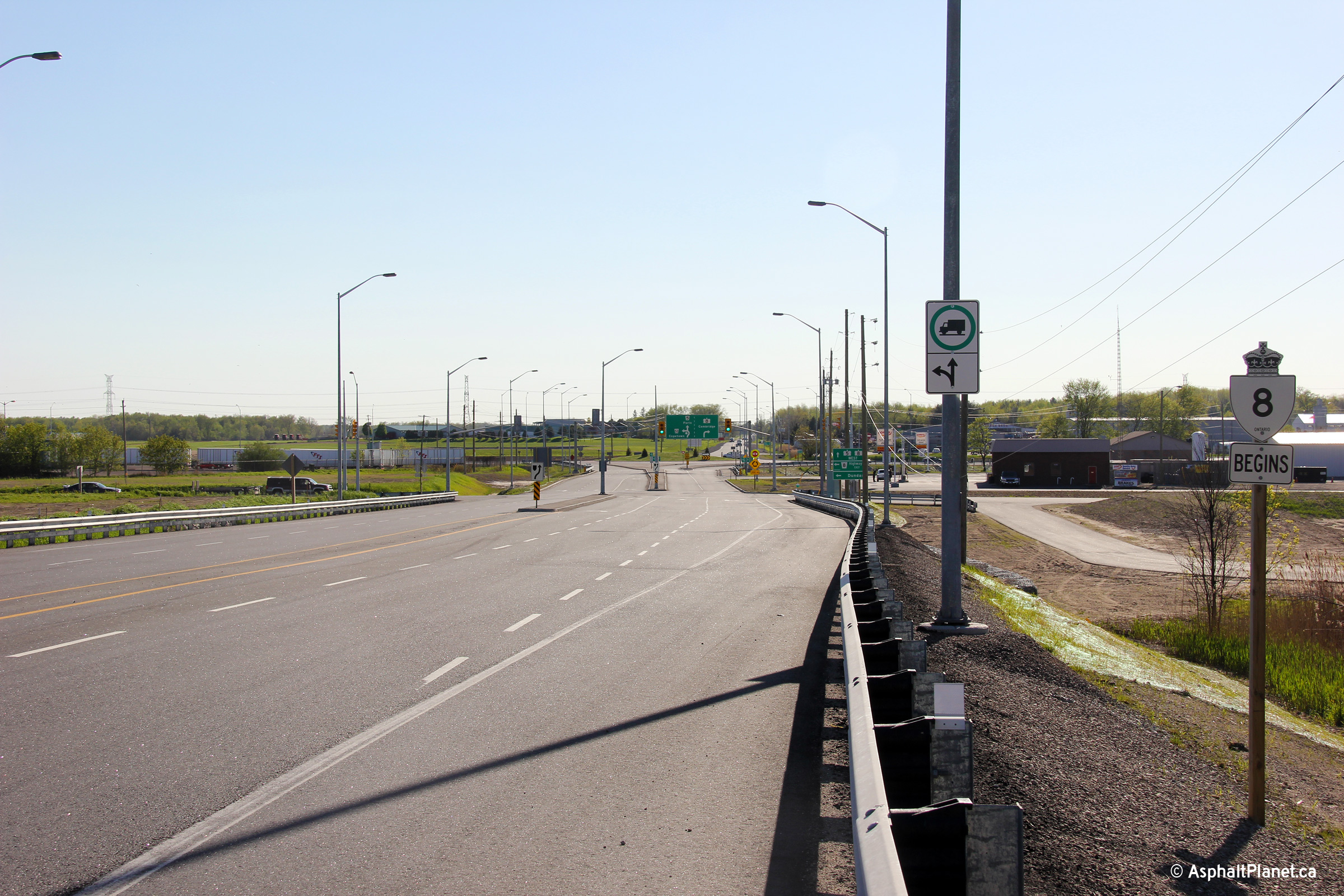
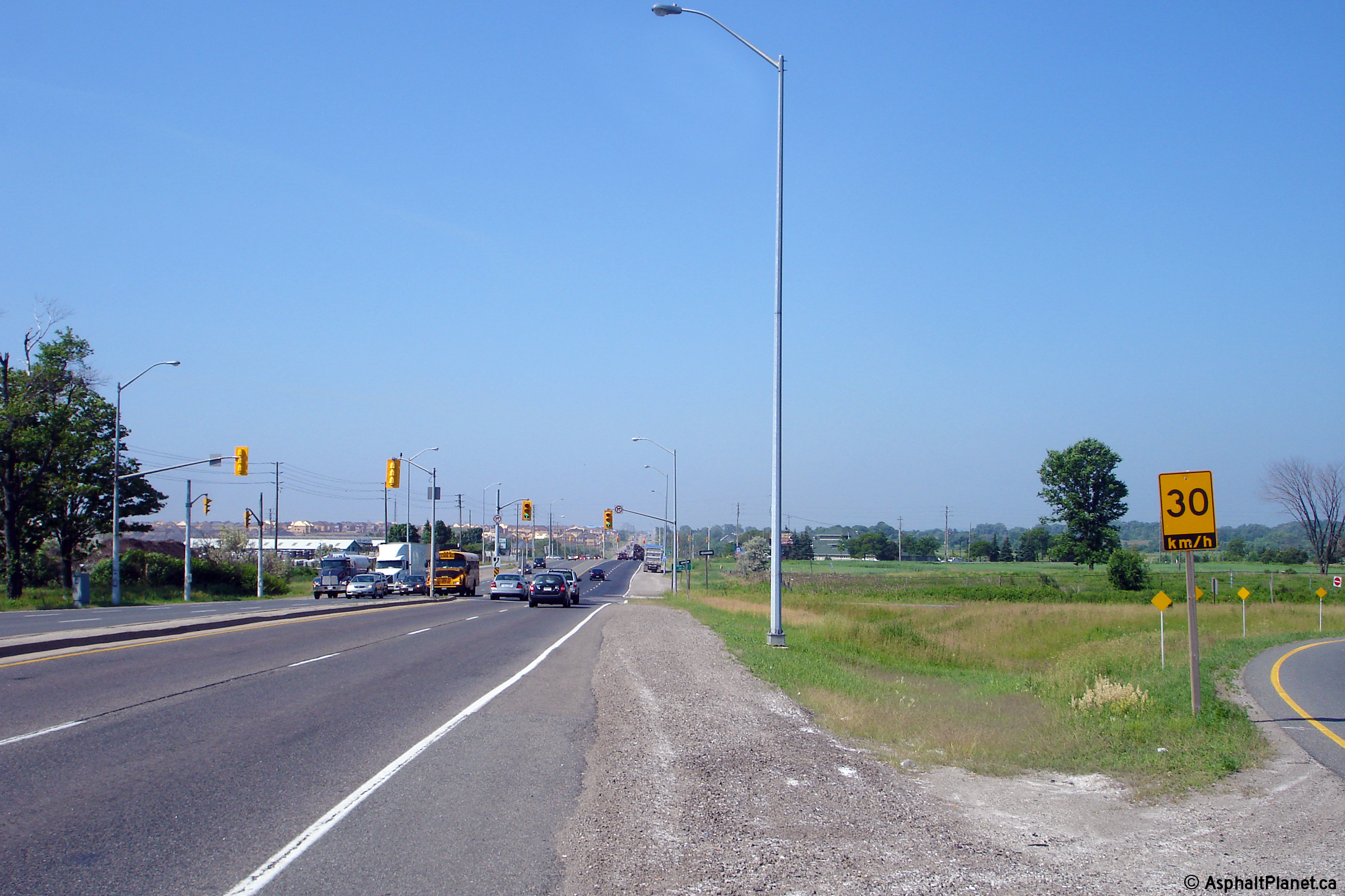
| City of Hamilton |
Distance signage facing westbound motorists along Highway 5 west of the
Highway 6 junction. Given the highways that remain in provincial
jurisdiction in this portion of south-central Ontario, this sign should list
Cambridge as a control city.
Photo taken: August 3rd, 2009. |
 (720x480) (720x480)
(1440x960) |
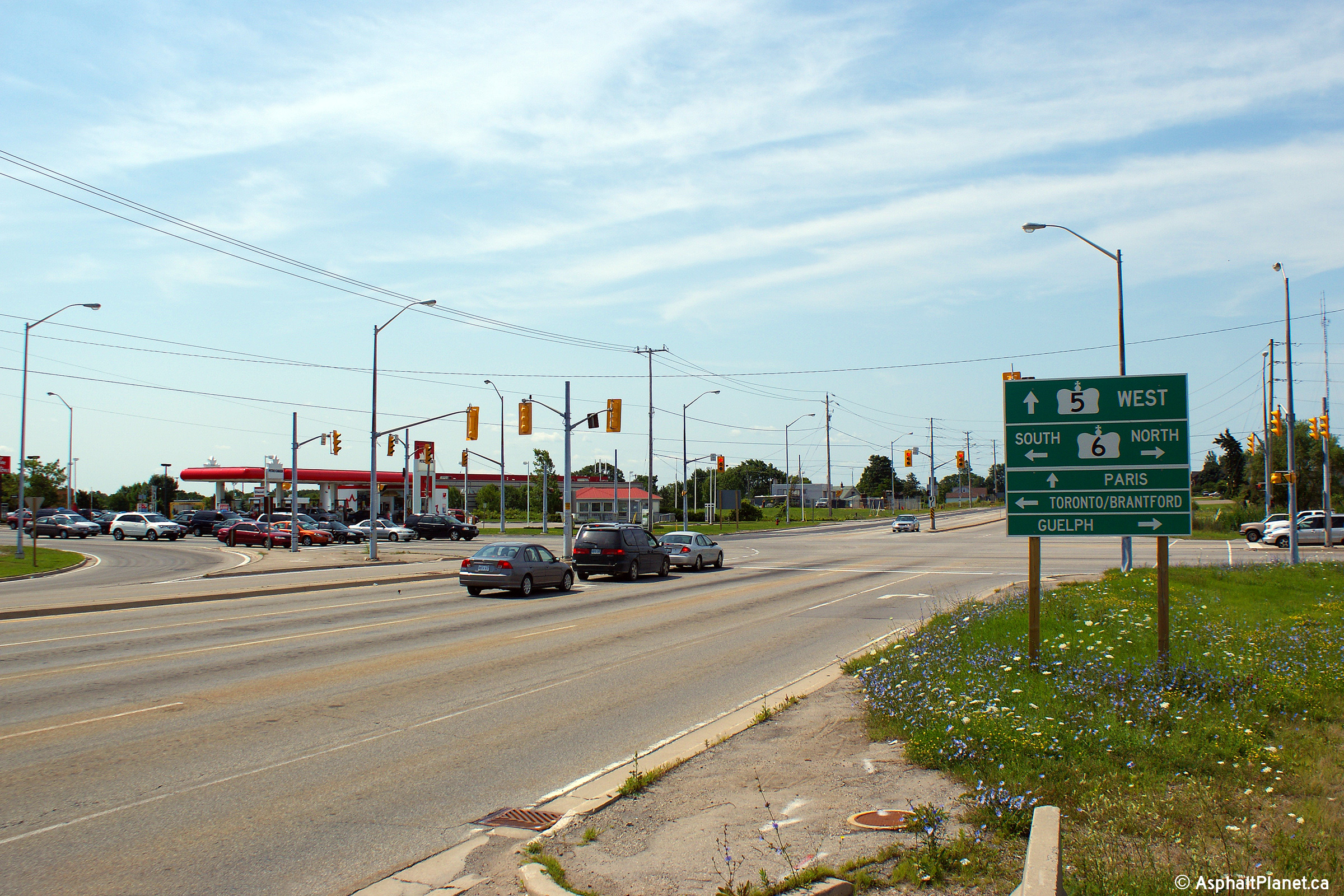
| City of Hamilton |
View looking easterly approaching the Highway 6 junction from Highway 5.
From this junction westerly, with the exception of a short segment within
the village of Waterdown itself, the former Highway 5 is no less than a four-lane
arterial highway easterly all the way to the Kingston Road interchange in Scarborough,
which is
some 50km away.
Photo taken: August 3rd, 2009. |
(720x480)
(1440x960)
(2400x1600) |
| City of Hamilton |
This green sign in a roundabout way denotes the present eastern terminus of Highway
5. Old Highway 5 as Dundas Street continues to carry eastbound traffic
through to Waterdown and beyond. Photo taken: August 3rd, 2009. |
 (720x480) (720x480)
(1440x960) |
|
Highway 6 crosses Highway 5 at Clappison's Corner;
Highway 5 is bound for Waterdown and Peters Corners.
Click here for Highway 6 images. |
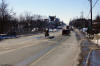
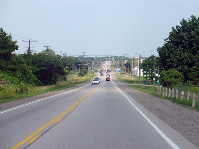
| City of Hamilton |
Westerly view at Clappinsons Corners. At one time this busy intersection
was home to numerous businesses catering to the weary traveler. During the
past decade these old buildings have been purchased and raised by the
Ontario Government in preparation for the construction of an interchange to
replace
this intersection. It is expected, though not official, that a new
partial cloverleaf interchange favouring Highway 6 will be constructed at
this location within the decade (text written in 2010).
Photo taken: August 3rd, 2009. |
(720x480)
(1440x960)
(2400x1600) |
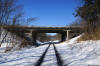
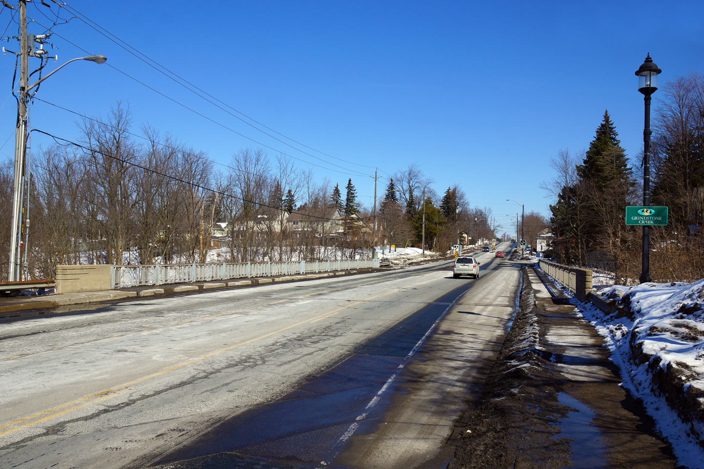
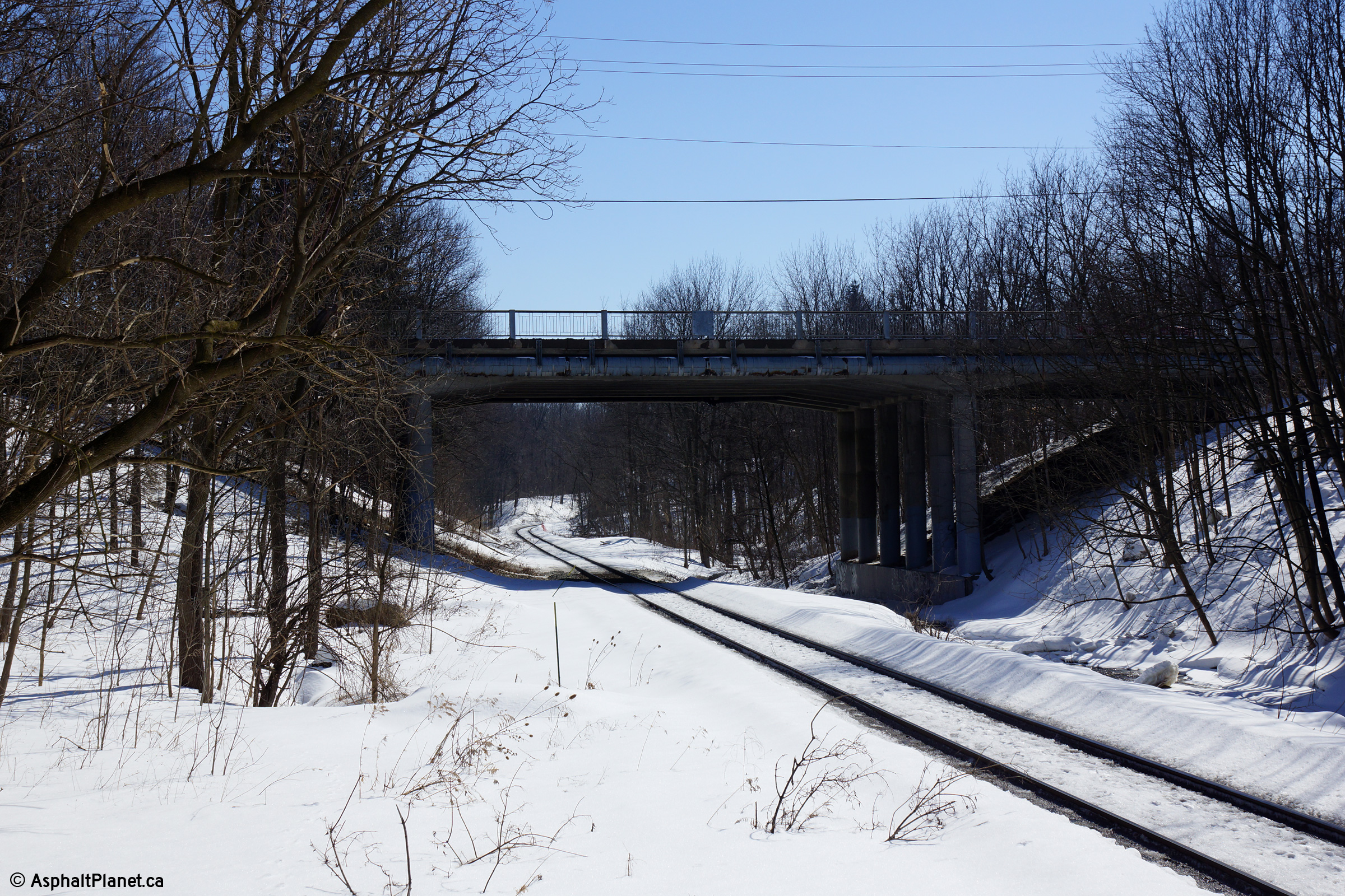
| City of Hamilton |
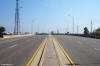
Easterly view as Highway 5 passes over the Grindstone Creek bridge in
Downtown Waterdown.
Photo taken: March 7th, 2014. |
(720x480)
(1440x960)
(2400x1600) |
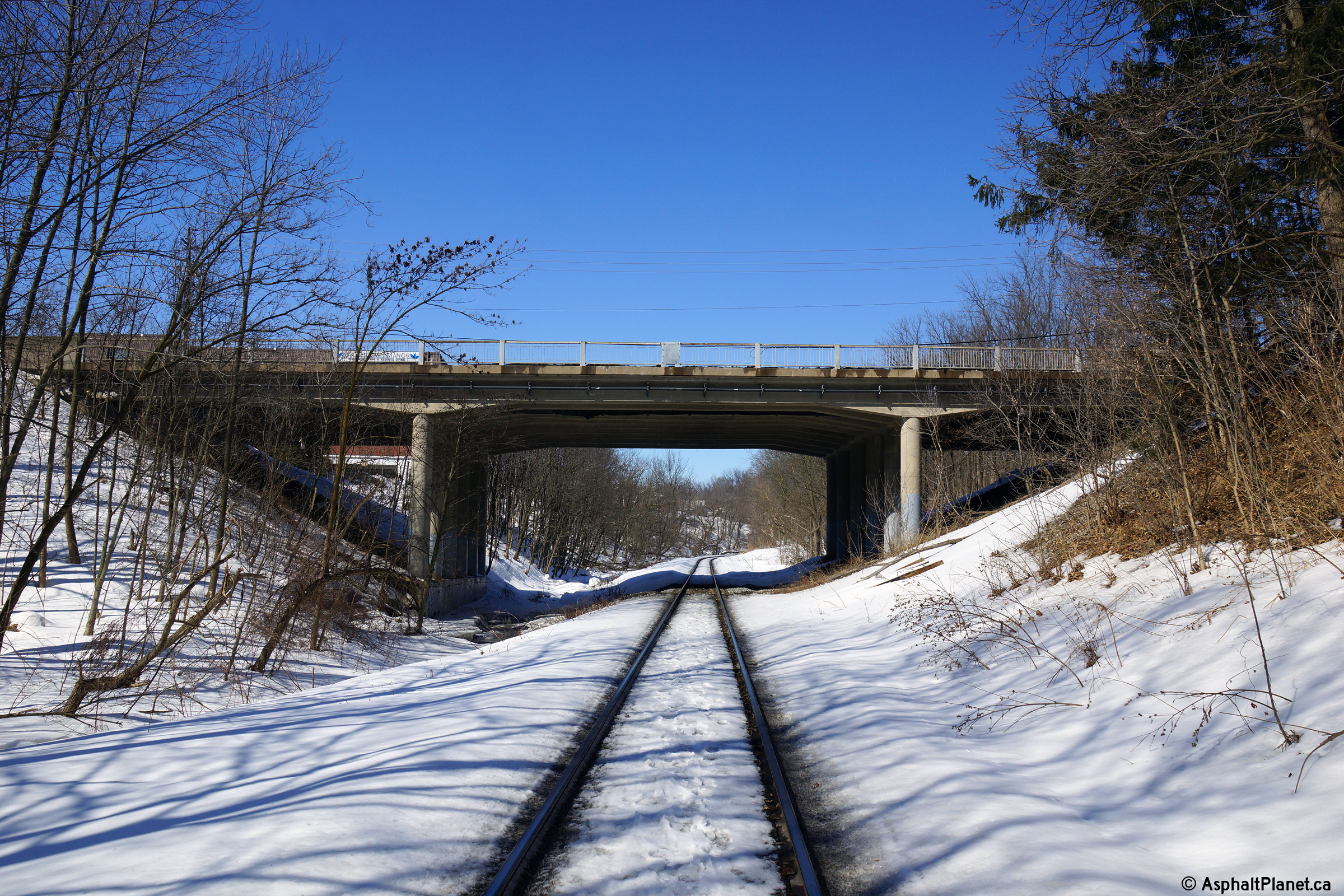
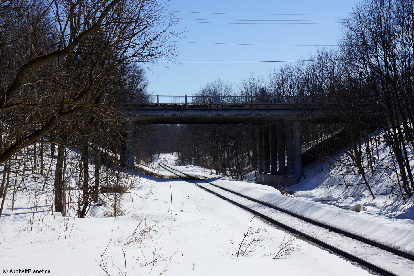
| City of Hamilton |
Views looking both towards the north and south of the structure that carries
Highway 5 overtop of Grindstone Creek. In addition to passing overtop
of Grindstone Creek, Highway 5 also passes over CP`s Hamilton Subdivision.
Photos taken: March 7th, 2014. |
(720x480)
(1440x960)
(2400x1600)

(720x480)
(1440x960)
(2400x1600) |
| City of Hamilton |
Westerly view looking overtop of the Grindstone Creek structure towards
Downtown Waterdown.
Photo taken: March 7th, 2014. |
(720x480)
(1440x960)
(2400x1600) |
City of Burlington
Regional Municipality of Halton |
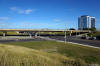
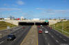
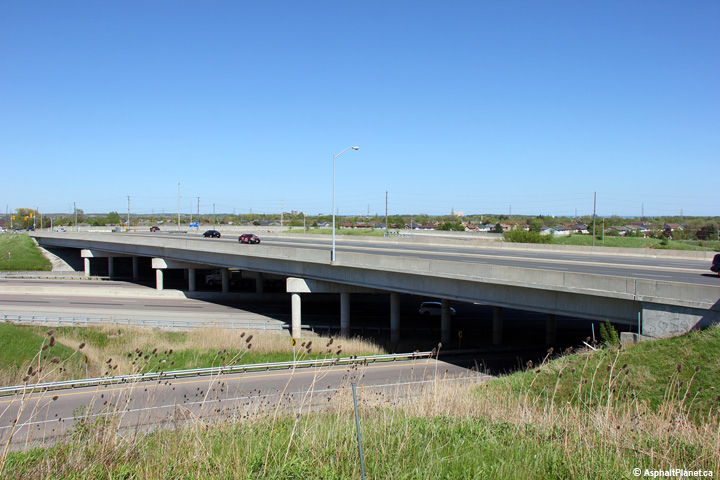
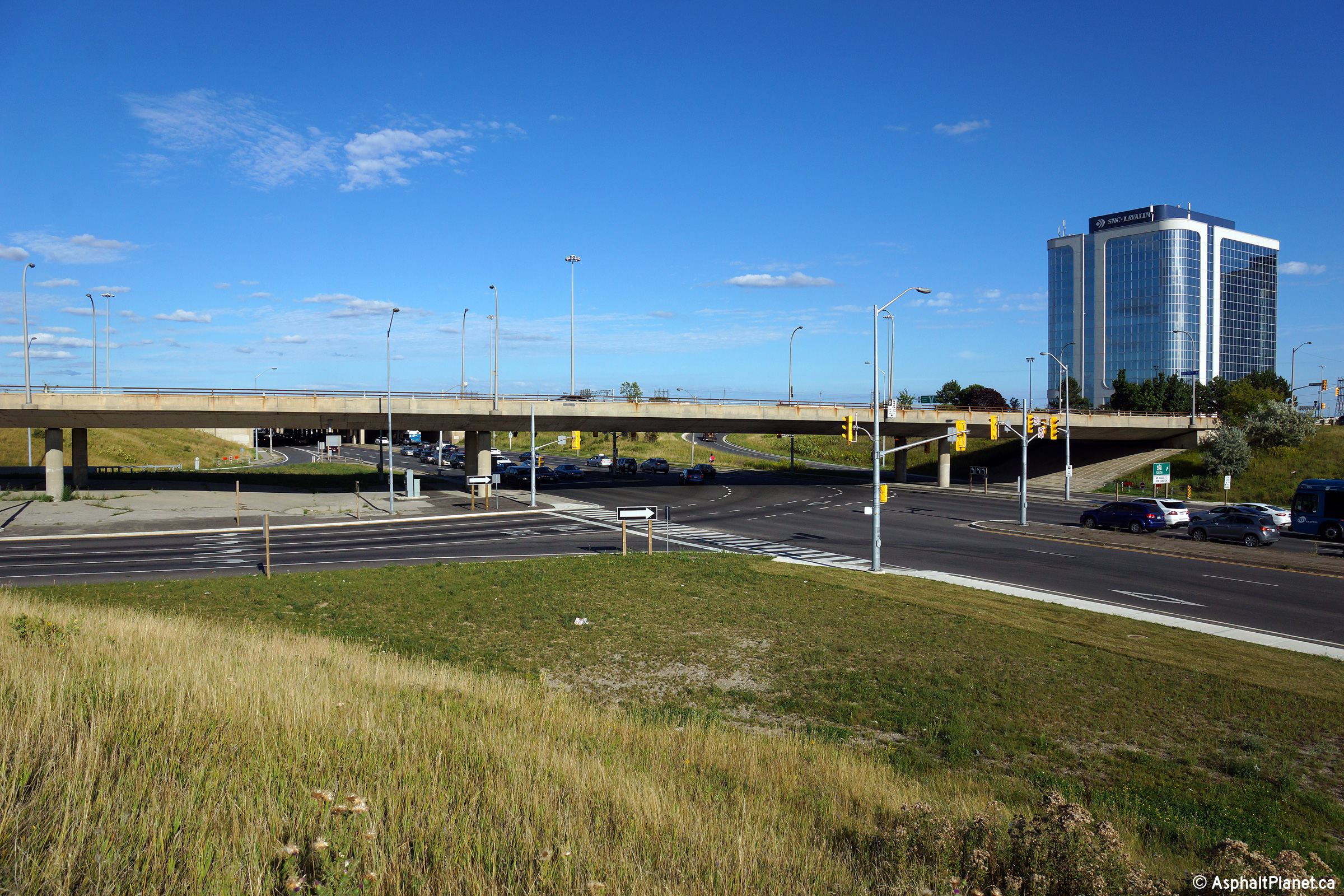
This view looks southeasterly towards the structure that carries Highway 5
overtop of Highway 407. Highway 5 crosses Highway 407 on a large four
span structure due to the significant skew that the two highways intersect
at.
Photo taken: May 16th, 2013. |

(720x480)
(1440x960)
(2400x1600) |
Oakville / Mississauga Boundary
Halton / Peel Boundary |
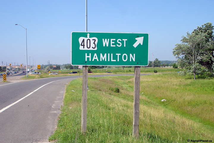
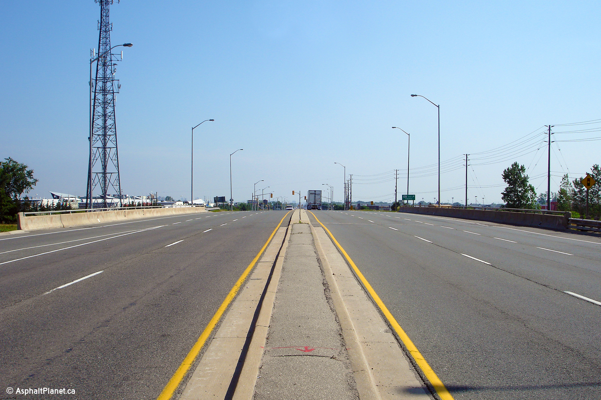
Westerly view along Highway 5 from the Highway 403 interchange in
Mississauga.
Photo taken: June 16th, 2007. |

(720x480)
(1440x960)
(2400x1600) |
Oakville / Mississauga Boundary
Halton / Peel Boundary |
Westbound signage for the loop ramp to the westbound Highway 403. This
older style signage likely dates back to the original construction of
Highway 403 in 1981.
Photo taken: June 16th, 2007. |
 (720x480) (720x480)
(1440x960) |
Oakville / Mississauga Boundary
Halton / Peel Boundary |
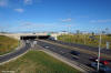
Easterly deck view of the structure that carries Highway 5 overtop of
Highway 403 in Mississauga.
Photo taken: June 16th, 2007. |
(720x480)
(1440x960)
(2400x1600) |
|
Highway 403 is a major east-west
freeway running through central Mississauga.
Click here for Highway 403 images. |
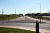
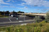
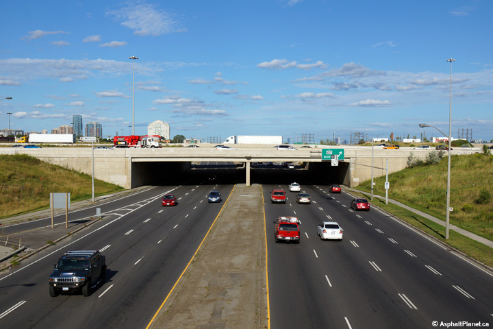
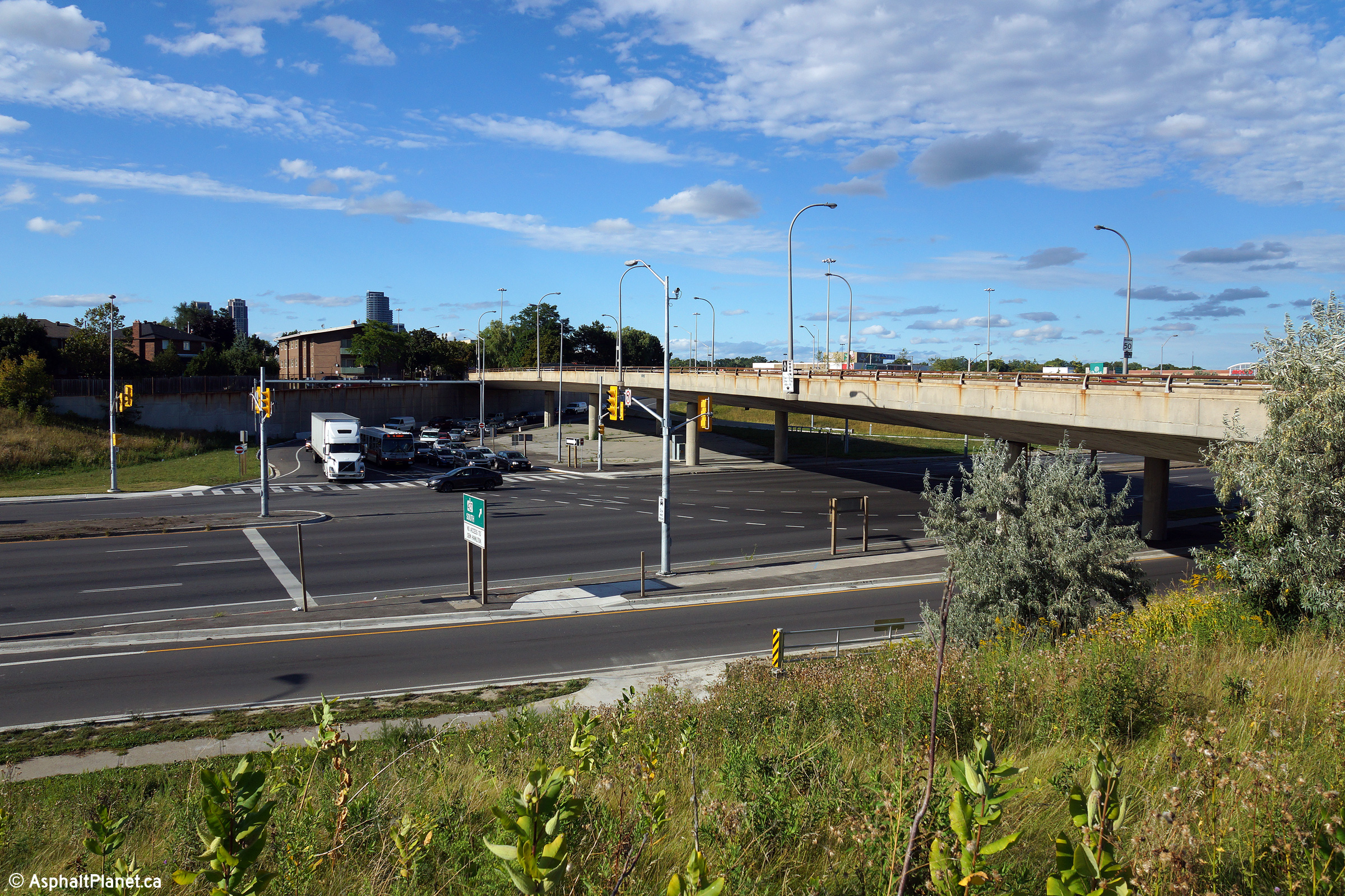
| City of Toronto |
View looking northeasterly towards both the West Mall Road grade separation
and the southbound Highway 427 ramp terminal.
Photos taken: August 27th, 2014. |
(720x480)
(1440x960)
(2400x1600)
(720x480)
(1440x960)
(2400x1600) |
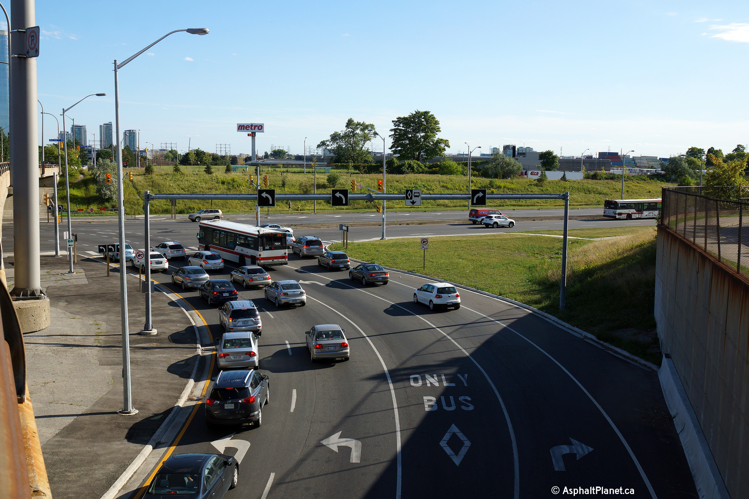
| City of Toronto |
As part of a project to rehabilitate the southbound collector lanes of
Highway 427, the terminal of the southbound off-ramp to Highway 5 was
widened to include a three lane left turn onto eastbound Highway 5.
This was done to add a dedicated left turn lane to transit vehicles in order
to facilitate their movement into the diamond lane along Highway 5.
During this work, the channelized right turn onto Highway 5 West was also
removed.
Photo taken: August 27th, 2014. |

(720x480)
(1440x960)
(2400x1600) |
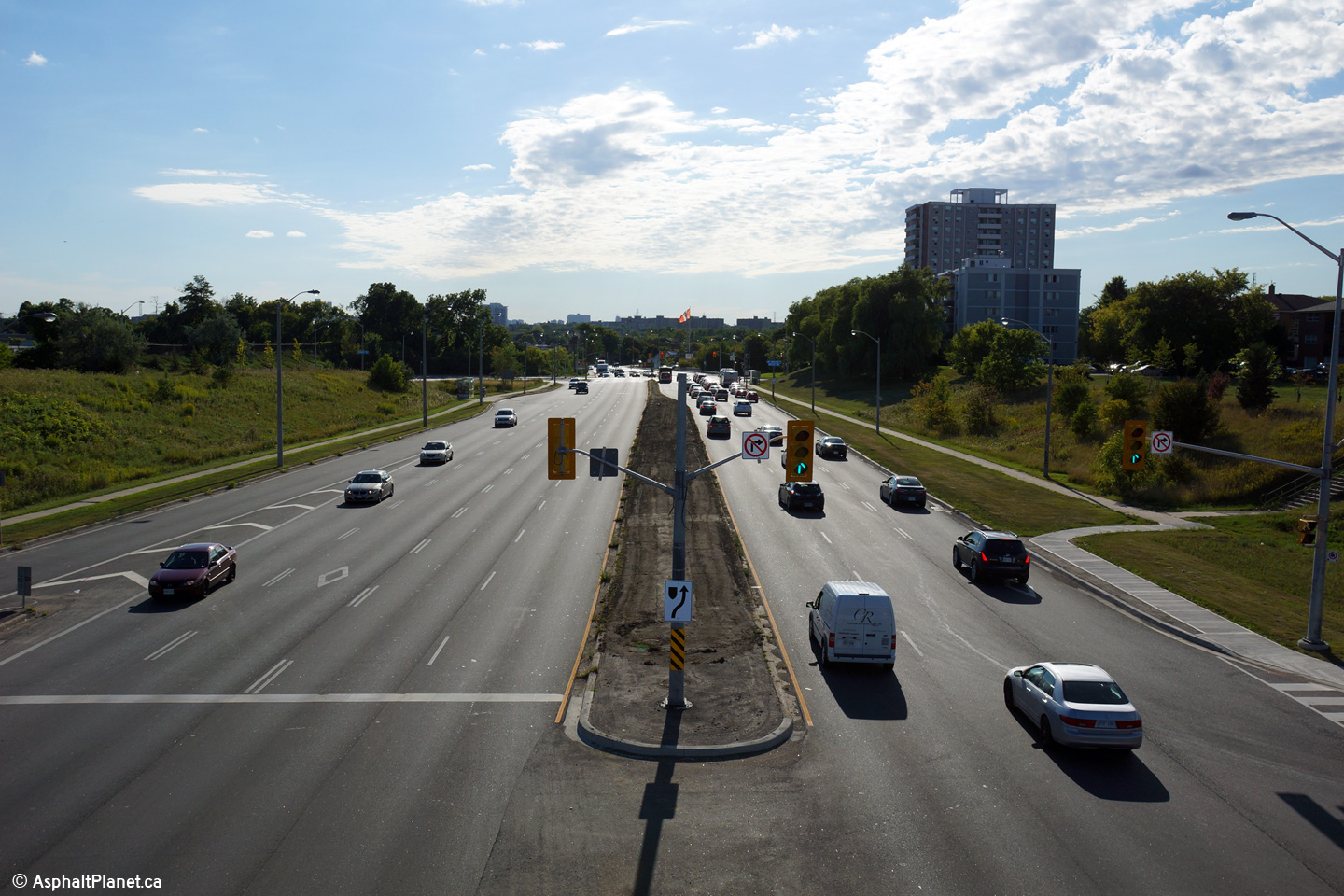
| City of Toronto |
Westerly view along Highway 5 from the West Mall overpass.
Photo taken: August 27th, 2014. |
(720x480)
(1440x960)
(2400x1600) |
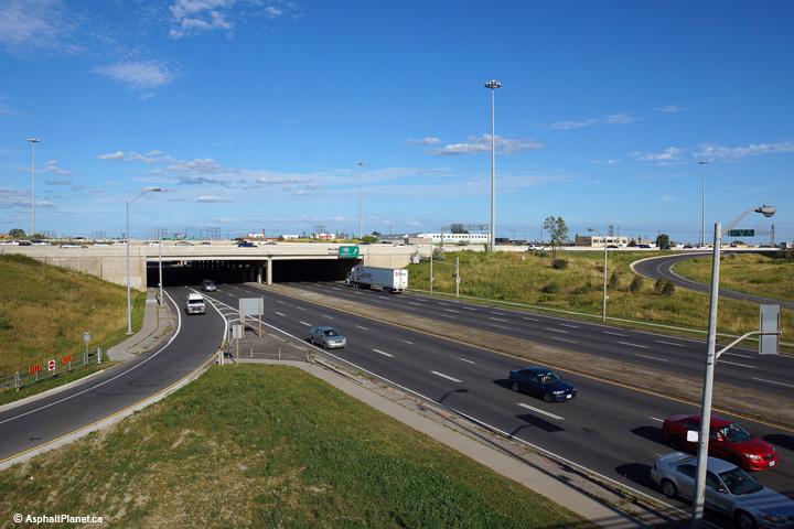
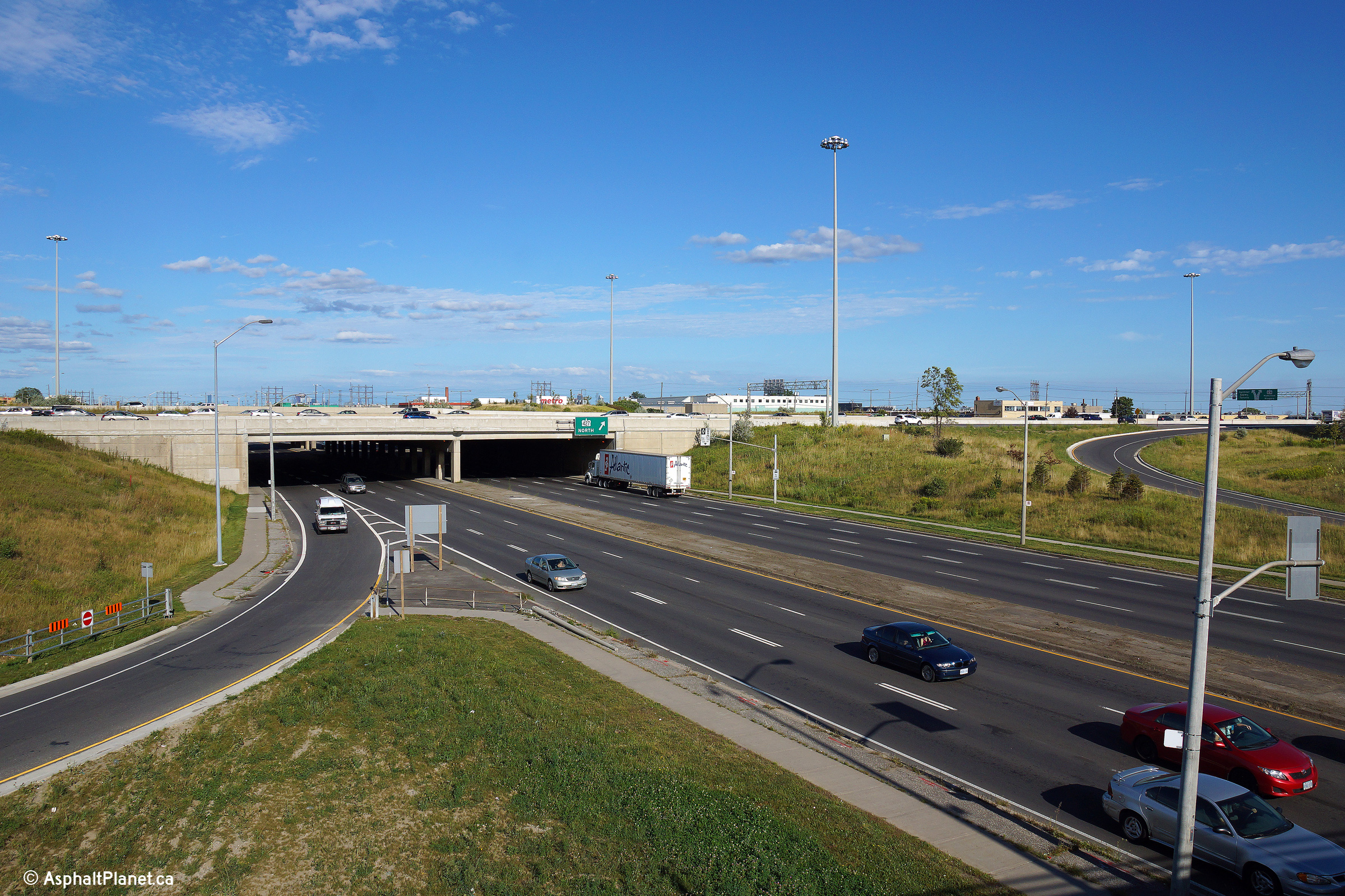
| City of Toronto |
Two easterly views towards the Highway 427 grade separation from the West
Mall overpass. Highway 5 meets Highway 427 at a standard partial
cloverleaf interchange.
Photos taken: August 27th, 2014. |
(720x480)
(1440x960)
(2400x1600)
(720x480)
(1440x960)
(2400x1600) |
|
Highway 427 is a north-south
freeway that runs through western Toronto near the Mississauga border.
Click here for Highway 427 images. |


 (720x480)
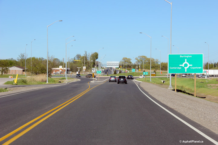 (720x480)
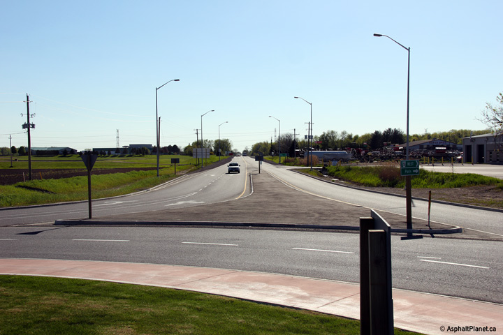


 (720x960)
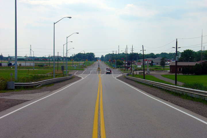


 (720x480)
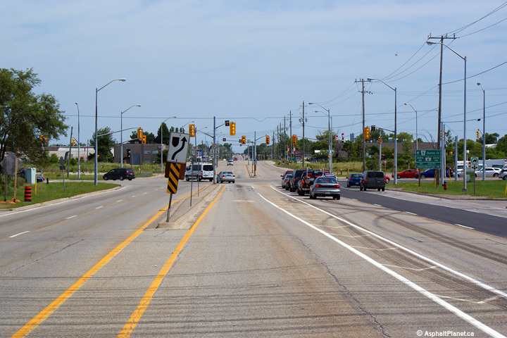
 (720x480)


 (720x480)
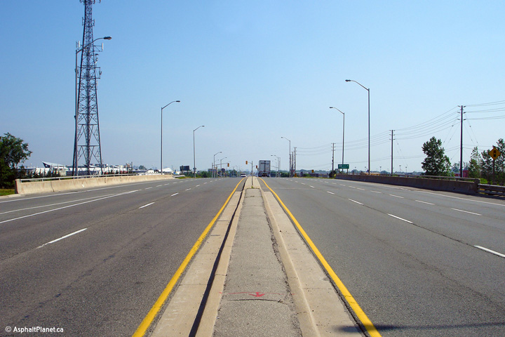


