|
Proper Municipality Name |
Photo Description |
Photo |
|
Pictures taken
from driver's perspective appear offset from centre-line pictures: |
North-
Bound |
South-
Bound |
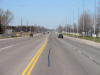
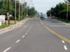
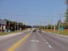
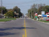
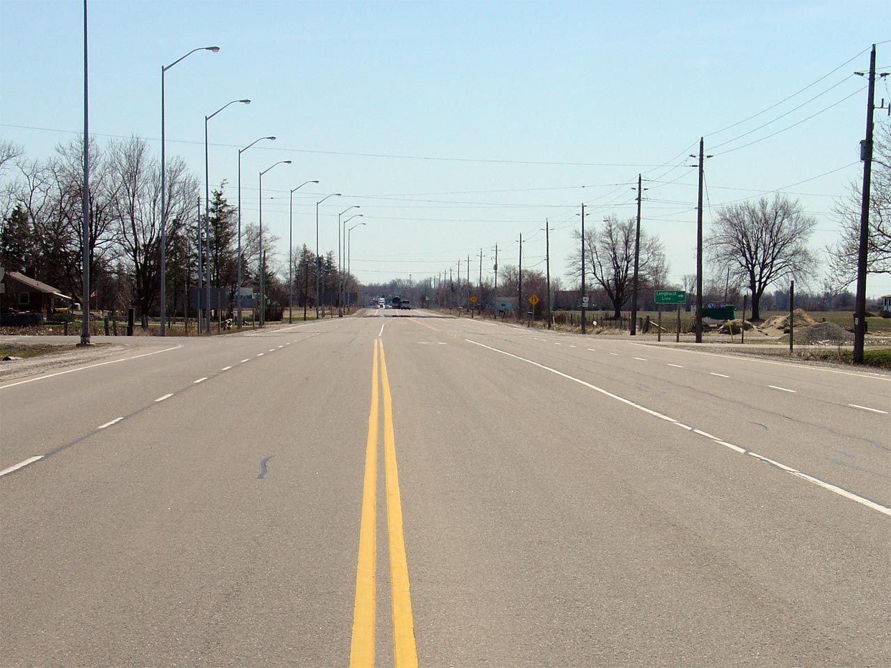
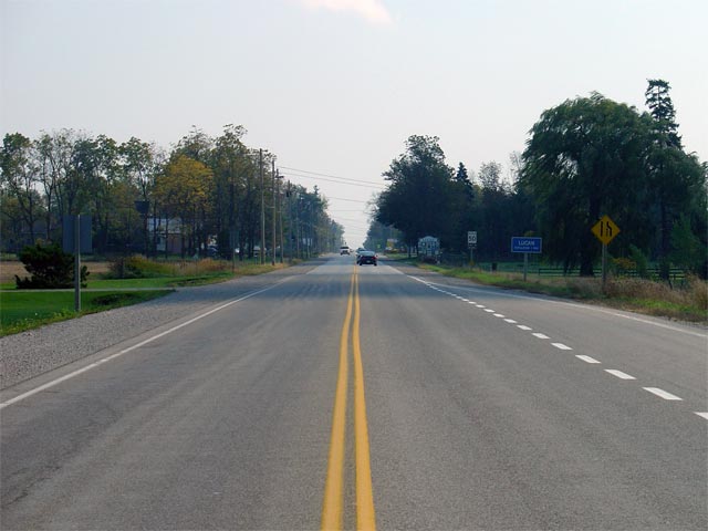
| City of St. Thomas |
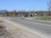
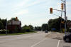
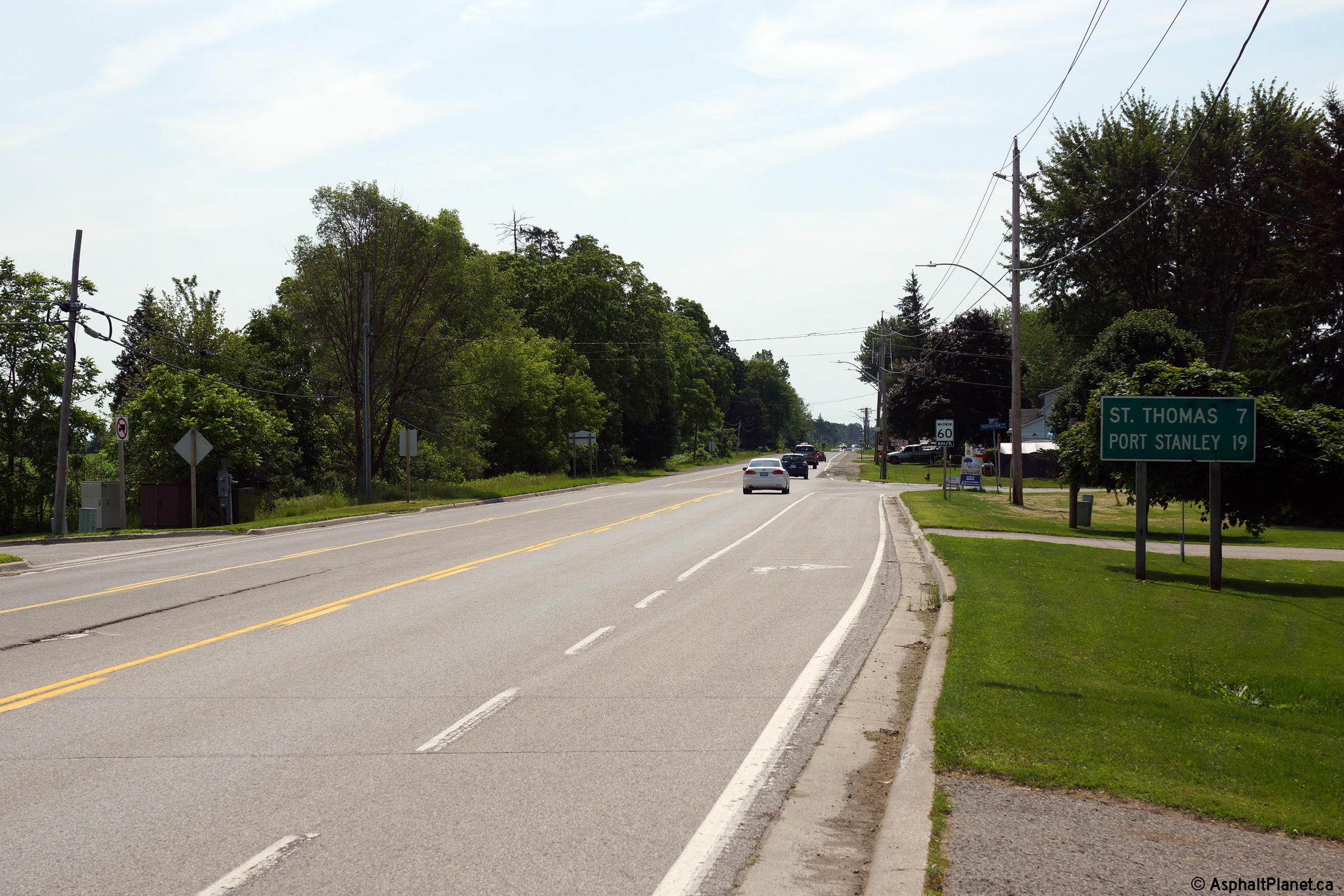
This picture is looking north along Highway 4
towards the Talbot Street intersection. At this junction travelers
wishing to stay on Highway 4 must turn left towards Talbotville.
Straight ahead is Wellington Road, which eventually becomes one of the main
arteries in London. A right turn leads travelers onto Talbot Street
and into downtown St. Thomas.
Picture taken: April 11th, 2005. Size: 50kb. |
 |
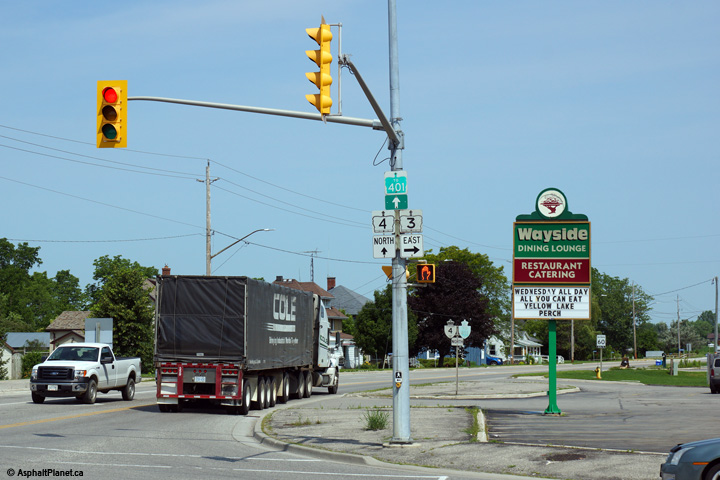
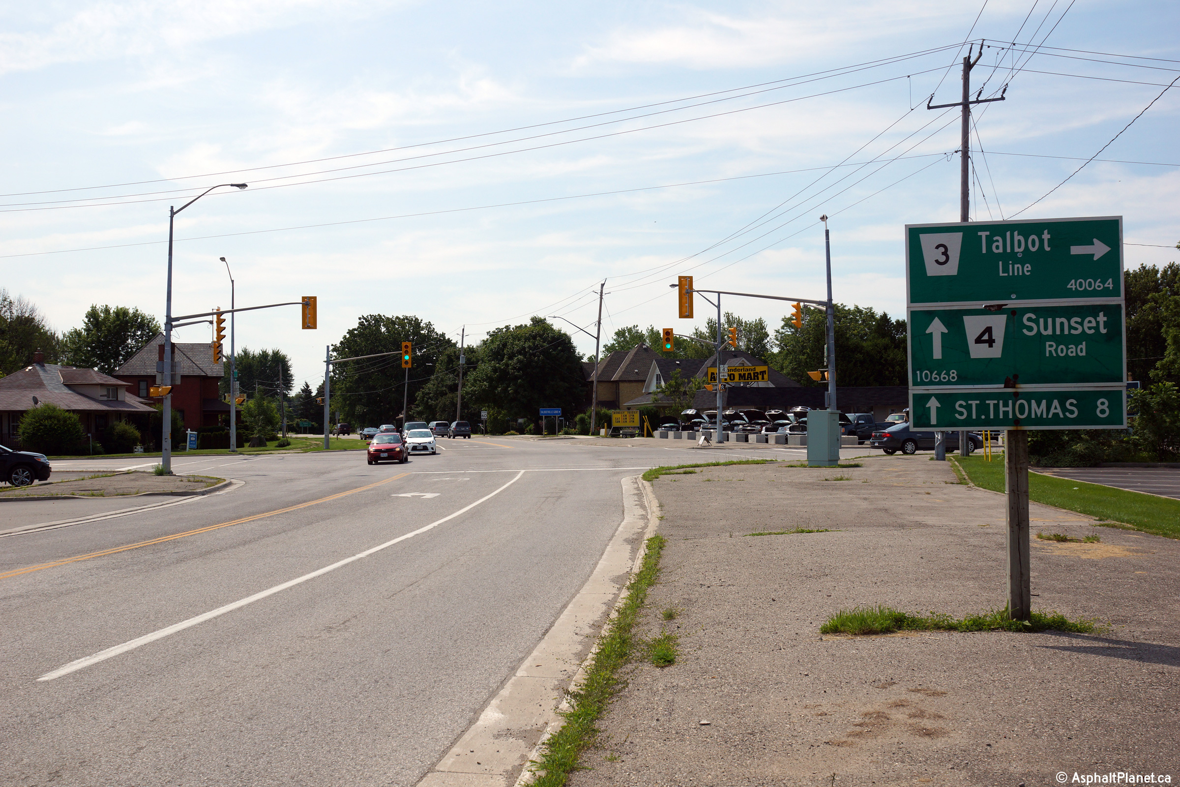
| City of St. Thomas |
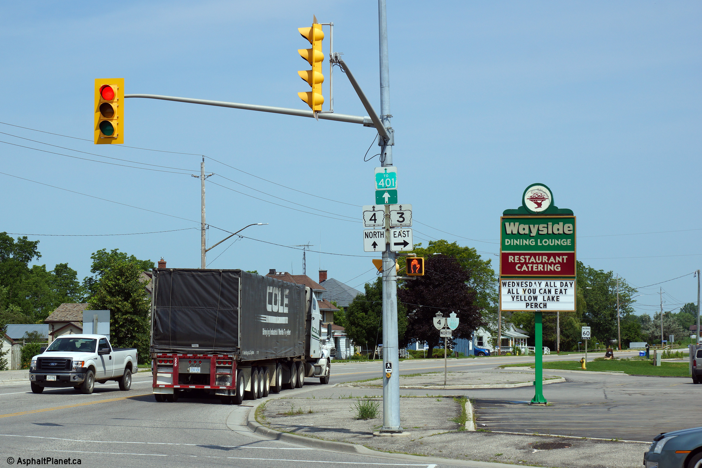
Butterfly gantry at the Talbot Street
intersection along Highway 4. This gantry has likely stood at this
same location since Talbot Street (then Highway 3)
was first widened to 4-lanes. Signage such as this was very common
during the 1960s.
Picture taken: November 11th, 2005. Size: 50kb. |
 (720x960) (720x960)
(1440x960) |
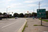
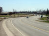
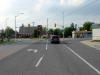
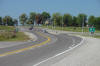
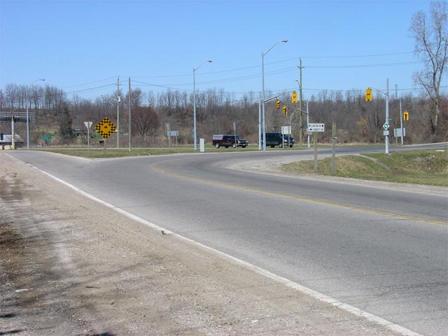
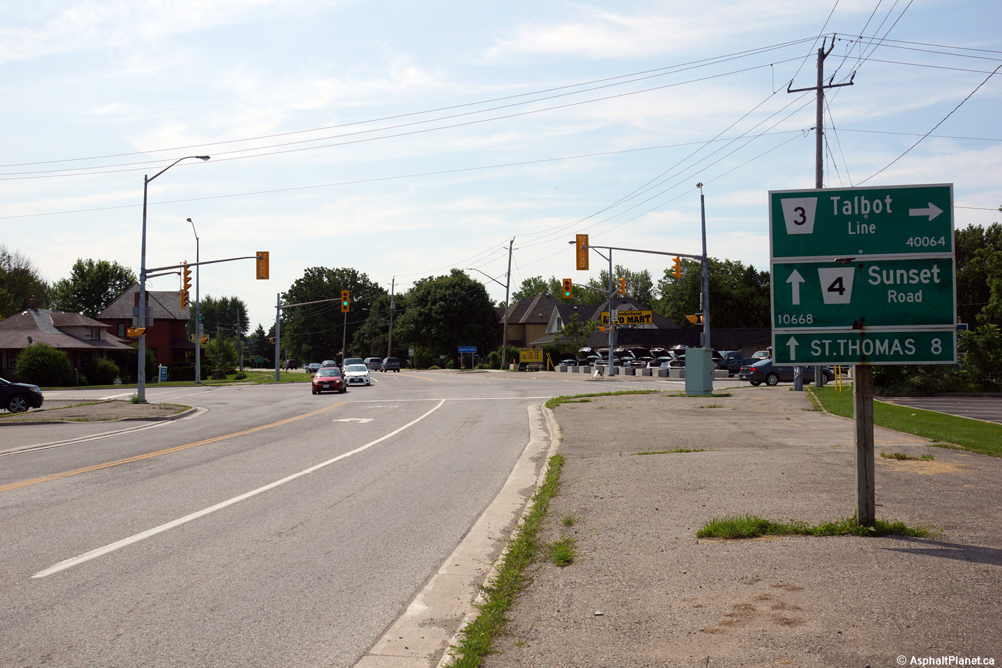
| City of St. Thomas |
View looking southerly towards the Talbot Street
intersection just northwest of St. Thomas. Talbot Street is the former
alignment of Highway 3 through St. Thomas
before the St. Thomas Expressway opened in the early 1980s. The MTO
had jurisdiction over the approaches to St. Thomas on Talbot Street until
1997 as Highway 7180.
Picture taken: November 11th, 2005. Size: 50kb. |
 |
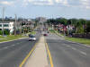
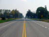
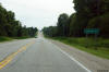
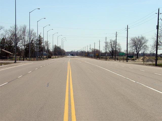
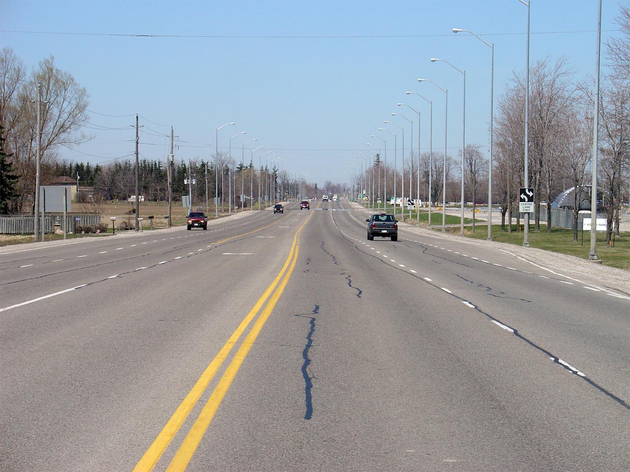
| City of St. Thomas |
Highway 4 looking north from about 500m north of
the Talbot Street junction in St. Thomas. Much of Highway 4 through
St. Thomas follows the large Kettle Creek Valley. In this picture,
Highway 4 begins its climb out of the valley towards Talbotville.
Picture taken: April 11th, 2005. Size: 60kb. |
 |
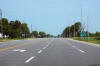
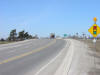
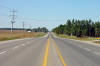
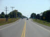
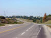
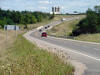
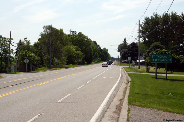
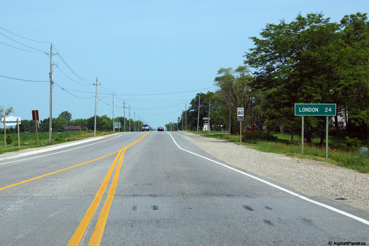
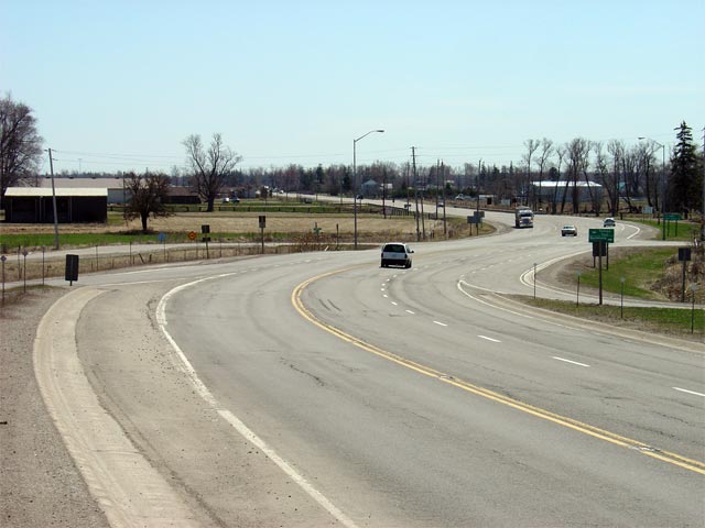
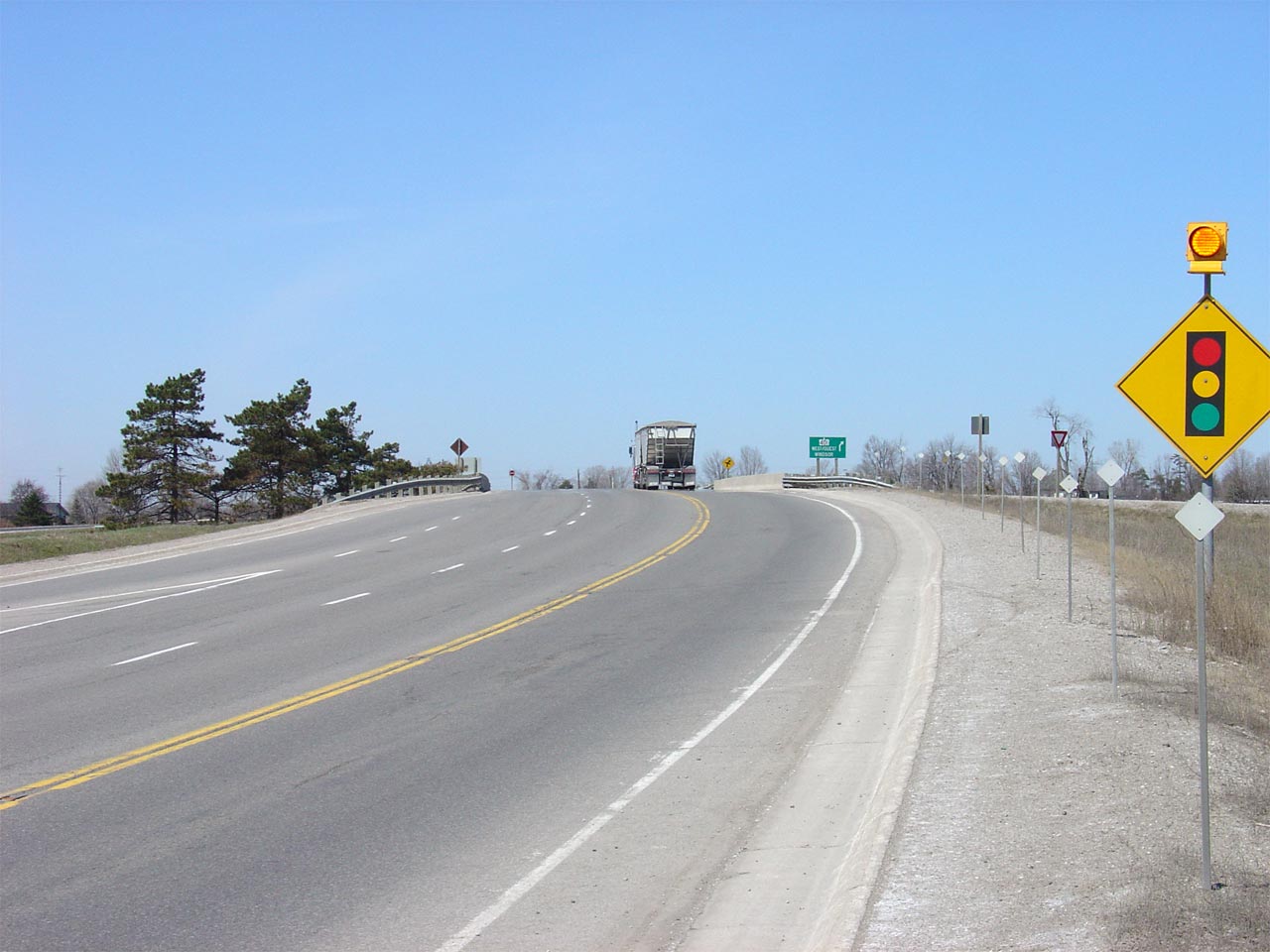
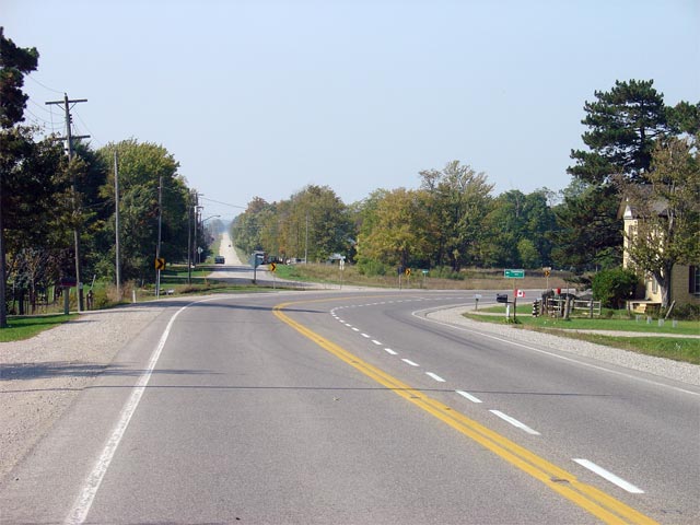
| Township of Southwold County of
Elgin |
Southerly view along Highway 4 from just south
of the Talbotville Junction with Highway 3.
Photo taken: July 3rd, 2015. |

(720x480)
(1440x960)
(2400x1600) |
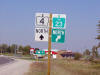
| Township of Southwold County of
Elgin |
Northbound signage at the Highway 3 junction in
Talbotville.
Photo taken: July 3rd, 2015. |
 (720x480) (720x480)
(1440x960)
(2400x1600) |
|
Currently Highway 3 leads only east
of Highway 4, however before 1998, it continued to the west terminating in
Windsor.
Click here for Highway 3 Images. |
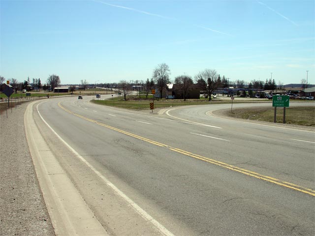
| Township of Southwold County of
Elgin |
This sign assembly (which happens to be missing
a '3' square and a left tab) is located in Talbotville and denotes the 1998
southern terminus of Highway 4. Prior to provincial downloading in
1998, Highway 4 continued southerly to Port Stanley.
Picture
Size: 25kb. |
 (720x480) (720x480)
(1440x960)
(2400x1600) |
| Township of Southwold County of
Elgin |
This view looks southerly approaching the
Talbotville junction with Highway 3.
Photo taken: July 3rd, 2015. |
(720x480)
(1440x960)
(2400x1600) |
| Township of Southwold County of
Elgin |
Northbound view along Highway 4 from north of
Talbotville.
Photo taken: July 3rd, 2015. |

(720x480)
(1440x960)
(2400x1600) |
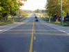
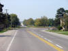
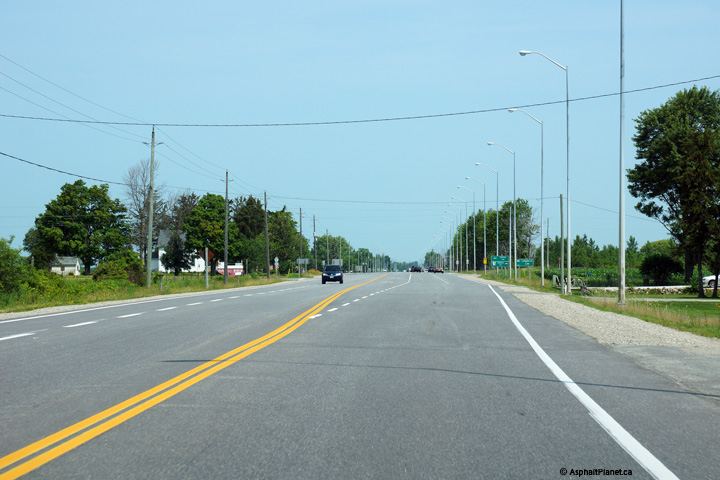
| Township of Southwold County of
Elgin |
Two views looking northerly approaching the
Clinton Line intersection. Highway 4 widens to a four lane road at the
Clinton Line intersection.
Photos taken: July 3rd, 2015. |

(720x480)
(1440x960)
(2400x1600)
(720x480)
(1440x960)
(2400x1600) |
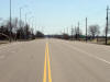
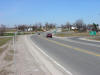
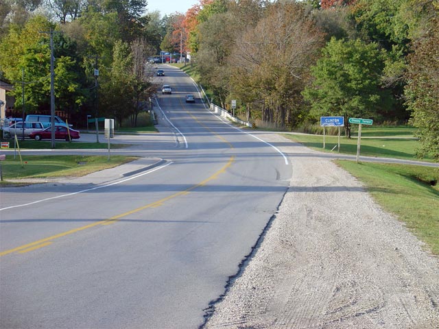
| Township of Southwold County of
Elgin |
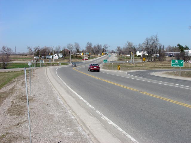
View looking southerly towards the Clinton Road
intersection. South of Clinton Line Highway 4 narrows to a
conventional 2-lane configuration. The
Highway 3 junction is located about 2km south of Clinton Line. Picture
taken: April 11th, 2005. Low-res: 50kb. High-res: 190kb. |
Low-res
High-res |
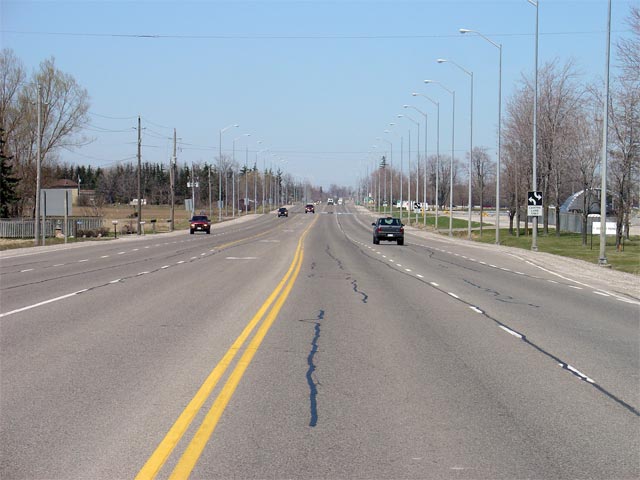
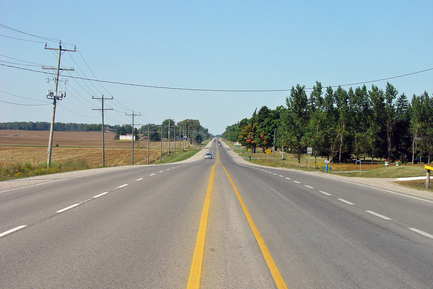
| Township of Southwold County of
Elgin |
View looking northerly along Highway 4 from the
Clinton Road intersection. Between Clinton Line and
Highway 401,
Highway 4 has a minimum 4-lane cross-section where it passes beside Ford's
St. Thomas Assembly Plant.
Picture
taken: April 11th, 2005. Low-res: 50kb. High-res: 215kb. |
Low-res
High-res |
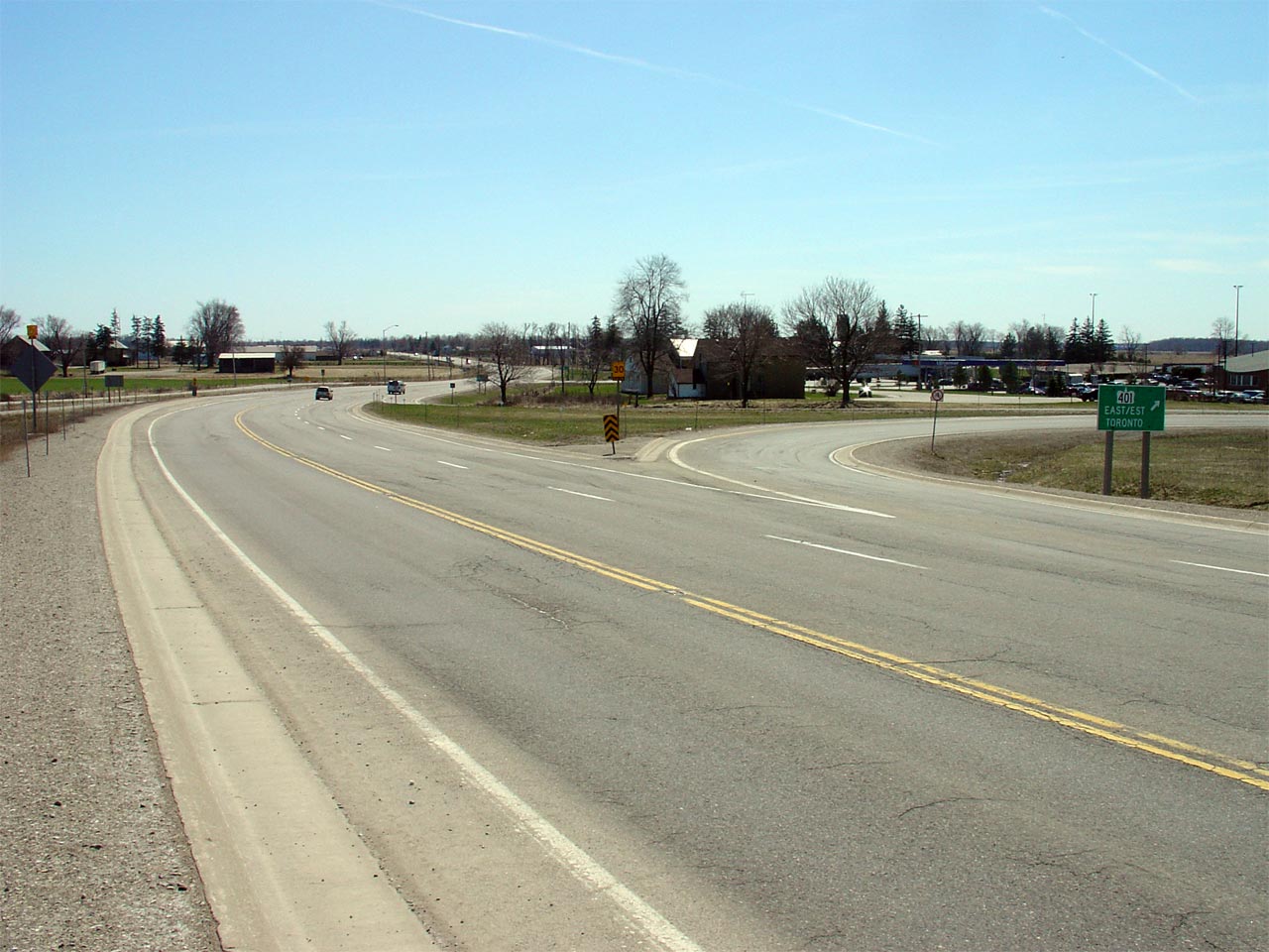
| City of London |
Looking southerly along Highway 4 from the south
edge of the Highway 401 interchange. Picture taken: April 11th, 2005.
Low-res: 45kb. High-res: 185kb. |
Low-res
High-res |
| City of London |
View looking northerly along Highway 4 as it
crosses the Highway 401 overpass in
Southwest London. Picture taken: April 11th, 2005.
Low-res: 35kb. High-res: 135kb. |
Low-res
High-res |
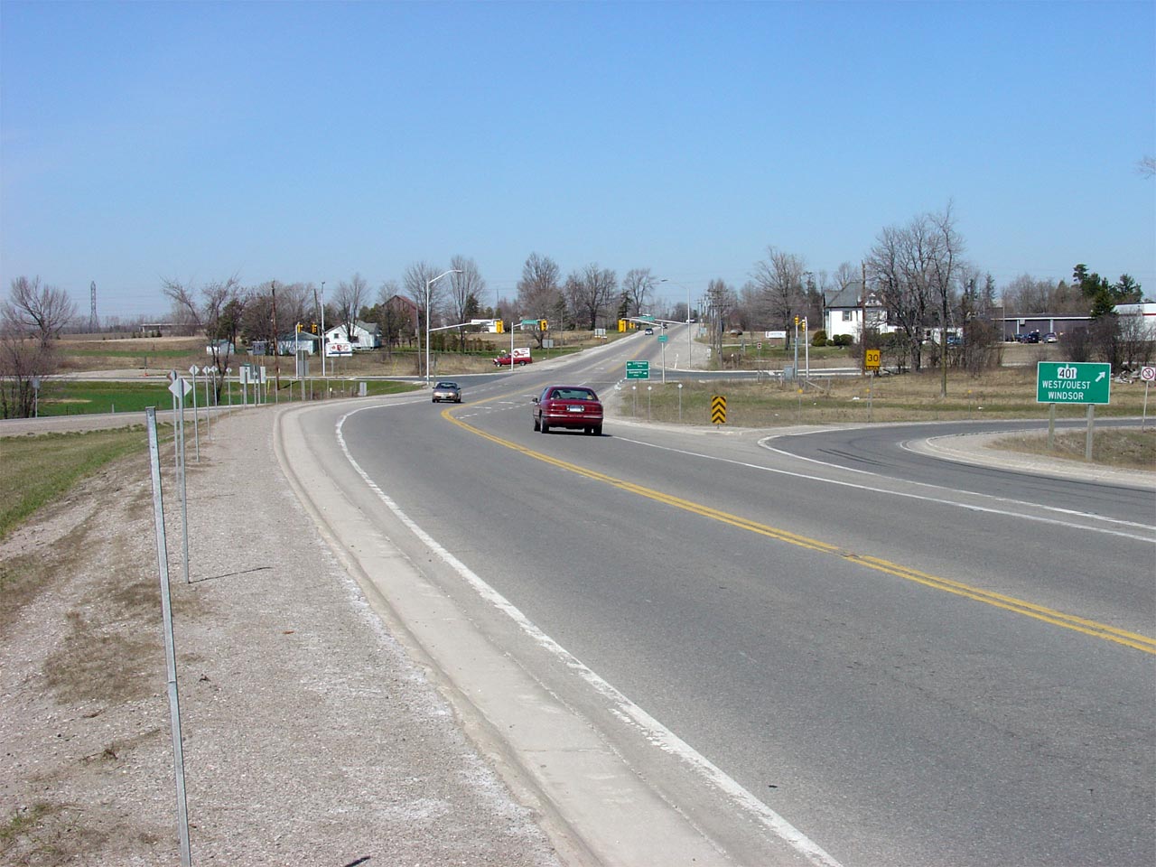
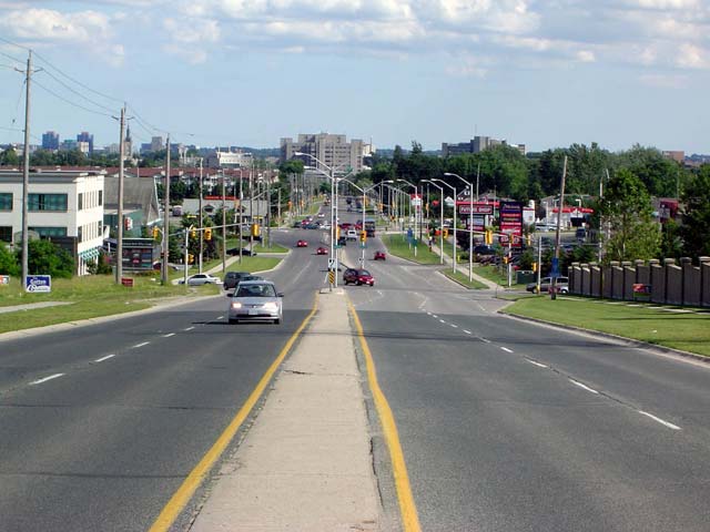
| City of London |
Looking south along Highway 4 from the
Highway 401 overpass. Highway 4 meets Highway 401 at a rather tight cloverleaf
interchange. Because of the oblique angle that Highway 4 crosses
Highway 401 at, some of the loop ramps at this interchange are quite sharp.
Picture taken: April 11th, 2005. Low-res: 45kb. High-res: 180kb. |

Low-res
High-res |
|
Highway 401 of course leads both
directions from Highway 4 between Windsor and Quebec.
Click here for Highway 401 images |
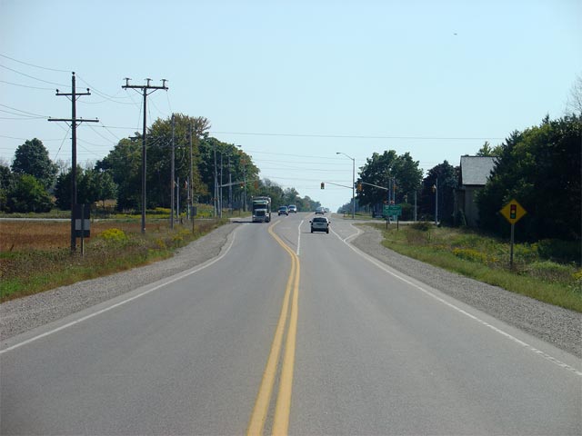
| City of London |
Highway 4 looking north from the
Highway 401 overpass towards Lambeth.
Cloverleaf's are quickly becoming a thing of the past on Ontario Highways,
(understandably so, considering their operational deficiencies), however I
have a certain affinity for them, especially considering how revolutionary
they were at the time when Ontario was first building its divided super
highways.
Picture taken: April
11th, 2005. Low-res: 50kb. High-res: 185kb. |
Low-res
High-res |
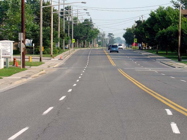
| City of London |
Highway 4 looking south through Lambeth,
(Lambeth is a small suburb of London). Since 1998, the City of London is now
responsible for the maintenance of this section of Highway 4, as in 1998 the
connecting link agreement between the MTO and London was expanded to
included the section of Highway 4 between Highway 401 and Southdale Road.
Picture taken: July 31st, 2004. Size: 50kb. |
 |
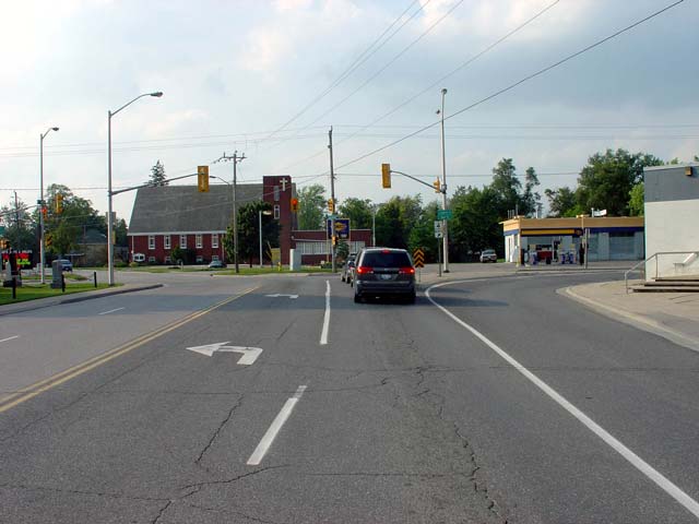
| City of London |
This picture shows the western junction of
Highway's 2 and 4. To continue northbound towards downtown London
along 4, travelers must take the ramp to the right. A left turn on
Highway 2 will lead to Deleware and all points west. Straight ahead is
Colonel Talbot Road, which is a local connector road in London.
Picture taken: July 31st, 2004. Size: 40kb. |
 |
|
City of London |
This picture shows Highway 4 looking from
Uplands Drive south
towards the heart of the Masonville Commercial area. This picture also showcases a
remaining example of a ridged concrete
centre divider. In the 1960s, these dividers were extremely common along
these type of semi-divided 4-lane highways. In recent years these
dividers have almost entirely disappeared from
Ontario's highways.
Picture taken: June 26th, 2004. Size: 45kb. |
 |
|
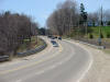
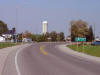
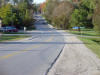
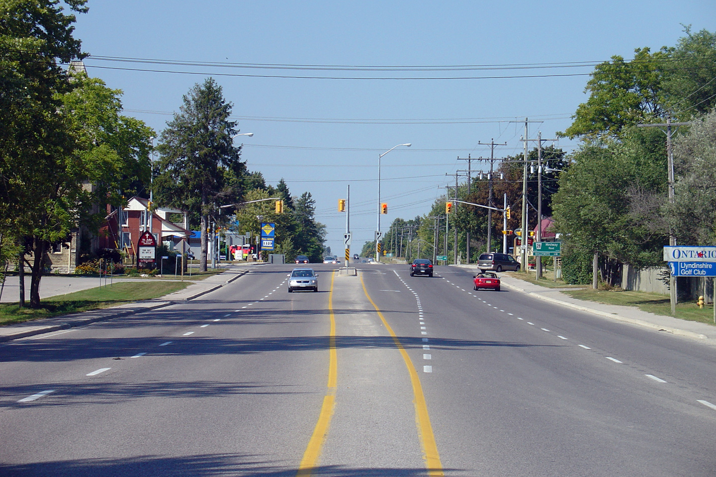
Township of Middlesex Centre County of Middlesex |
Looking north towards the signalized
intersection with Medway Road in the community of Arva. Medway Road is
located about 600m north of London's northern city limits. Picture taken:
September 11th, 2005. Size: 60kb. |

Low-res
High-res |
|
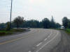
Township of Middlesex Centre County of Middlesex |
Looking south through Arva across the Medway
Creek bridge towards the signalized intersection with Medway Road.
This portion of Highway 4 was last reconstructed in the year 2000, having
originally been 4-laned in the mid 1960s.
Picture taken: September 11th, 2005. Size: 75kb. |

Low-res
High-res |
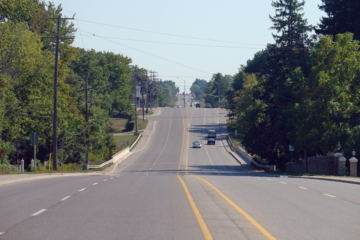
| Township of Middlesex Centre
County of Middlesex |
Looking north towards the end of the multilane section of Highway 4 just
north of Arva. Highway 4 narrows from four to two lanes about 500m
north of the intersection with Medway Drive. Picture taken: September
11th, 2005. Size: 75kb. |
Low-res
High-res |
| Township of Middlesex Centre
County of Middlesex |
Looking north along Highway 4 towards the signalized intersection with
Ilderton Road. Traffic signals were installed at this intersection in
the year 2000, as part of a larger rehabilitation project for much of
Highway 4 north of London.
Picture taken: September 11th, 2005. Size: 45kb. |
 |
| Township of Middlesex Centre
County of Middlesex |
Looking south towards the intersection with Ilderton Road. Ilderton
Road is located roughly 6km north of London's northern city limit. Picture
taken: September 11th, 2005. Size: 40kb. |
 |
| Township of Middlesex Centre
County of Middlesex |
Highway 4 looking south through the small community of Birr. Birr is
located about halfway between Arva and Elginfield, north of London.
Picture taken: October 6th, 2004. Size: 70kb. |
 |
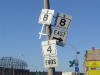
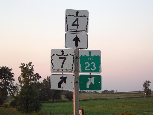
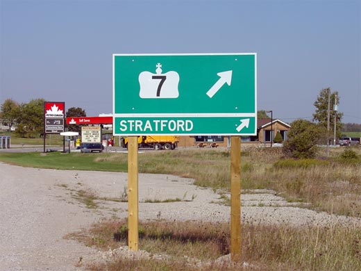
| Township of Middlesex Centre
County of Middlesex |
Junction assembly approaching the
Highway 7 intersection. This
intersection was entirely resigned in early October 2005.
Unfortunately, this resigning often involved removing key signage from these
junction assemblies. Notice that no reference is made to
Highway 7 on this junction assembly.
Compare this with the former assembly shot a few years earlier
here.
Picture size: 30kb. |
 |
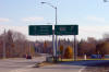
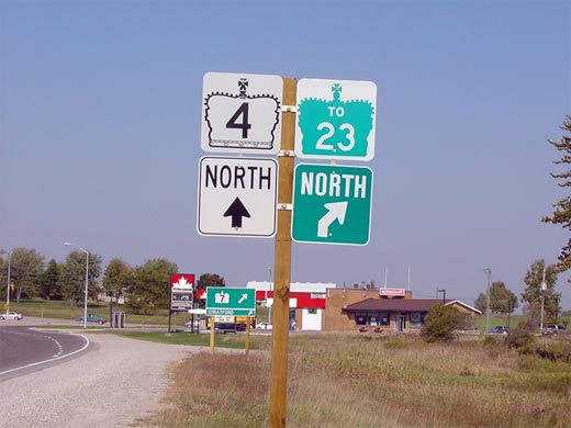
| Township of Middlesex Centre
County of Middlesex |
New sign for Highway
7 heading northbound along Highway 4.
Highway 7 is very well signed in both directions along Highway 4 with
these types of signs. Before 1998, Highway
7 continued west of Highway 4, bound for Parkhill and eventually Sarnia.
Since then Highway 4 has marked the western terminus for the route.
Picture size: 40kb. |
 |
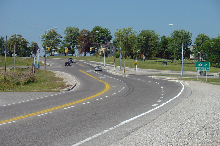
| Township of Middlesex Centre
County of Middlesex |
Looking north along Highway 4 approaching the
Highway 7 junction.
Highway 7 is located roughly 14 km north of
the northern London city limit. Picture taken: September 11th, 2005.
Size: 65kb. |
Low-res
High-res |
|
Like Highway 3, Highway 7 currently only leads east
of Highway 4, having continued to the west before 1997. Click
here to
continue west along Highway 7 and
here to
continue east. |
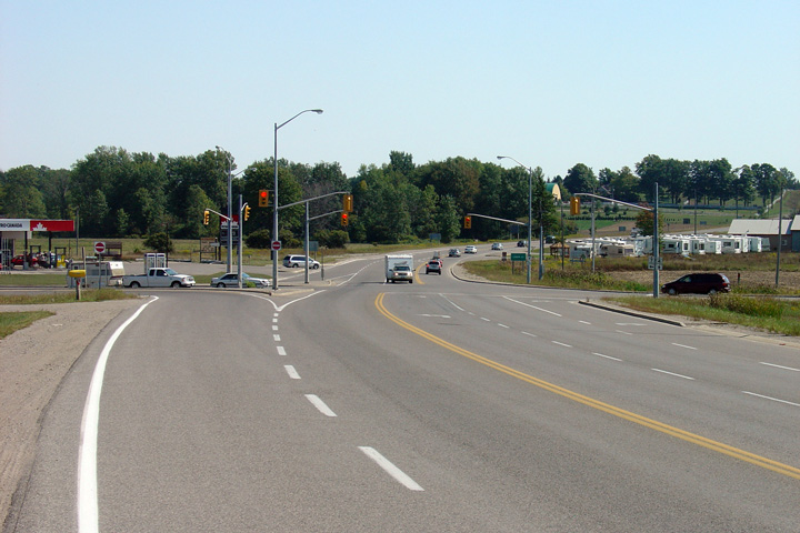
| Township of Lucan Biddulph
County of Middlesex |
Looking south towards the
Highway 7 junction along Highway 4.
South of Highway 7, Highway 4 is nearly
perfectly straight for the entire distance to London. Picture taken:
September 11th, 2005. Size: 50kb. |

Low-res
High-res |
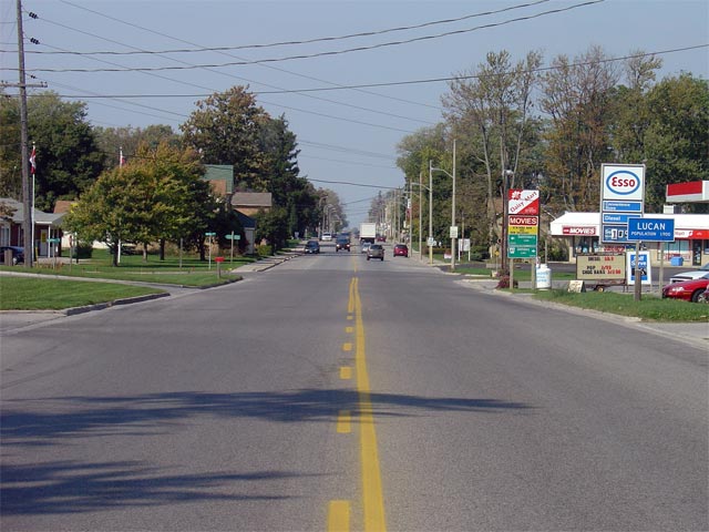
| Township of Lucan Biddulph
County of Middlesex |
View looking northerly towards the the small community of Lucan from just
south of the southern start of the connecting link agreement. Lucan
was its own incorporated municipality until the late 1990s when it was
amalgamated with the neighbouring township.
Picture taken: October 6th, 2005. Size: 60kb. |
 |
| Township of Lucan Biddulph
County of Middlesex |
View looking south towards the northern start of the connecting link
agreement in Lucan. As is visible in the photo, the southbound passing
lane ends immediately south of Lucan's urban boundary. Ending a
passing lane just before a community is generally frowned upon by traffic
engineers today.
Picture taken: October 6th, 2005. Size: 40kb. |
 |
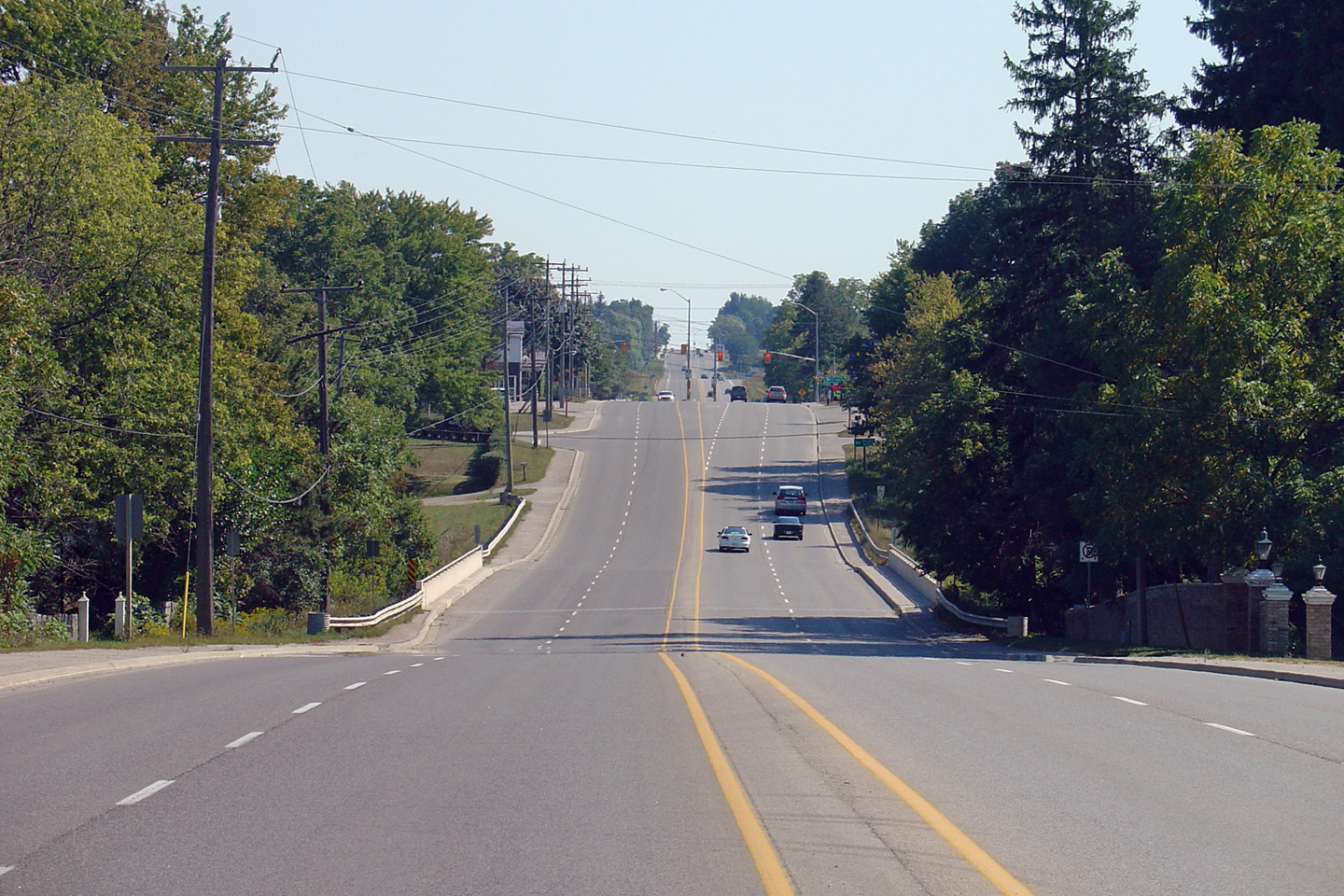
| Township of Lucan Biddulph
County of Middlesex |
Looking northerly across an Ausable River tributary. Highway 4 curves
westerly at this structure leading almost due west before turning north
again at Clandeboyle. Notice the dual passing lanes leading out of
the valley; the descent and subsequent climb out of this valley is one of
the more notable landscape features along Highway 4 north of Elginfield.
Picture taken: October 6th, 2005. Size: 40kb. |
 |
| Township of Lucan Biddulph
County of Middlesex |
Highway 4 looking South over an Ausable River tributary. This picture
is taken from the St. James Road intersection which is just to the north of
Lucan. St. James Road actually follows an old alignment of Highway 4
for most of its length. In this picture you can see that there is a
small grey area just the the left of the current structure, which represents
the former southern approach to the old structure. This Highway 4
diversion was completed in 1970.
Picture taken: September 7th, 2004. Size: 85kb. |
 |
| Township of Lucan Biddulph
County of Middlesex |
View looking northerly towards the Clandeboyle
Drive intersection. After traversing several kilometres westerly,
Highway 4 again (and rather abruptly) turns northerly at this junction.
Picture taken: October 6th, 2005. Size: 55kb. |
 |
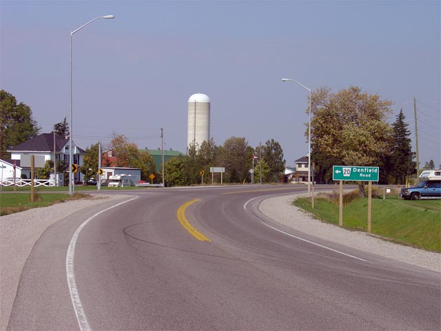
| Township of Lucan Biddulph
County of Middlesex |
View looking northerly around the Clandeboyle
curve towards the Denfield Road intersection. While Denfield Road is
presently designated as Middlesex Road 20, the road had been designate as
Middlesex Road 22 until Highway 22 was downloaded to the county of Middlesex
in 1998.
Picture taken: October 6th, 2005. Size: 45kb. |
 |
| Lucan Biddulph - North Middlesex
Boundary County of Middlesex |
View looking southerly along Highway 4 at the
Denfield Road junction, and the start of the Clandeboyle curve. The
curve at Clandeboyle is the first notable curve that southbound motorists
will encounter after departing Clinton.
Picture taken: October 6th, 2005. Size: 40kb. |
 |
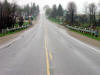
| Bluewater - Huron East Boundary
County of Huron |
Highway 4 looking south from the
Highway 84 (now Huron Road 84) intersection
in Hensall. As is evident in the photo, Highway 4 north of Exeter is
excellent for examples of old lighting practices. In some communities
there are even working examples of fluorescent lighting, a lighting style
that has become very rare on provincial highways.
Picture taken: September 7th, 2004. Size: 40kb. |

|
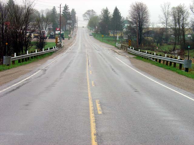
| Bluewater - Huron East Boundary
County of Huron |
Highway 4 looking north from Daisley Terrace
into Clinton. The Clinton connecting link agreement starts just
at the other side of the Bayfield Road structure. Picture taken: October
6th, 2004. Size: 80kb. |
 |
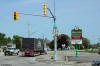
| Municipality of Central Huron
County of Huron |
The current Highway 4 ends assembly located just
south of the intersection with Highway 8 in Clinton. Apparently bolt
theft is a major problem in Clinton. This is the 1998 terminus of
Highway 4. Prior to January 1st, 1998, Highway 4 continued north to Singhamham, via Walkerton, and Durham.
Picture size: 30kb |
 |
| Township of North Huron County
of Huron |
This picture showcases the northern approach
into the the small community of Blyth. The bridge in the picture is
crossing the Blyth Brook, and is an original 1932 structure. The
embossed concrete railings were very common on structures from this era, and
personally I think they are very elegant. Picture taken: May 2nd, 2004.
Size: 50kb. |
 |
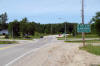
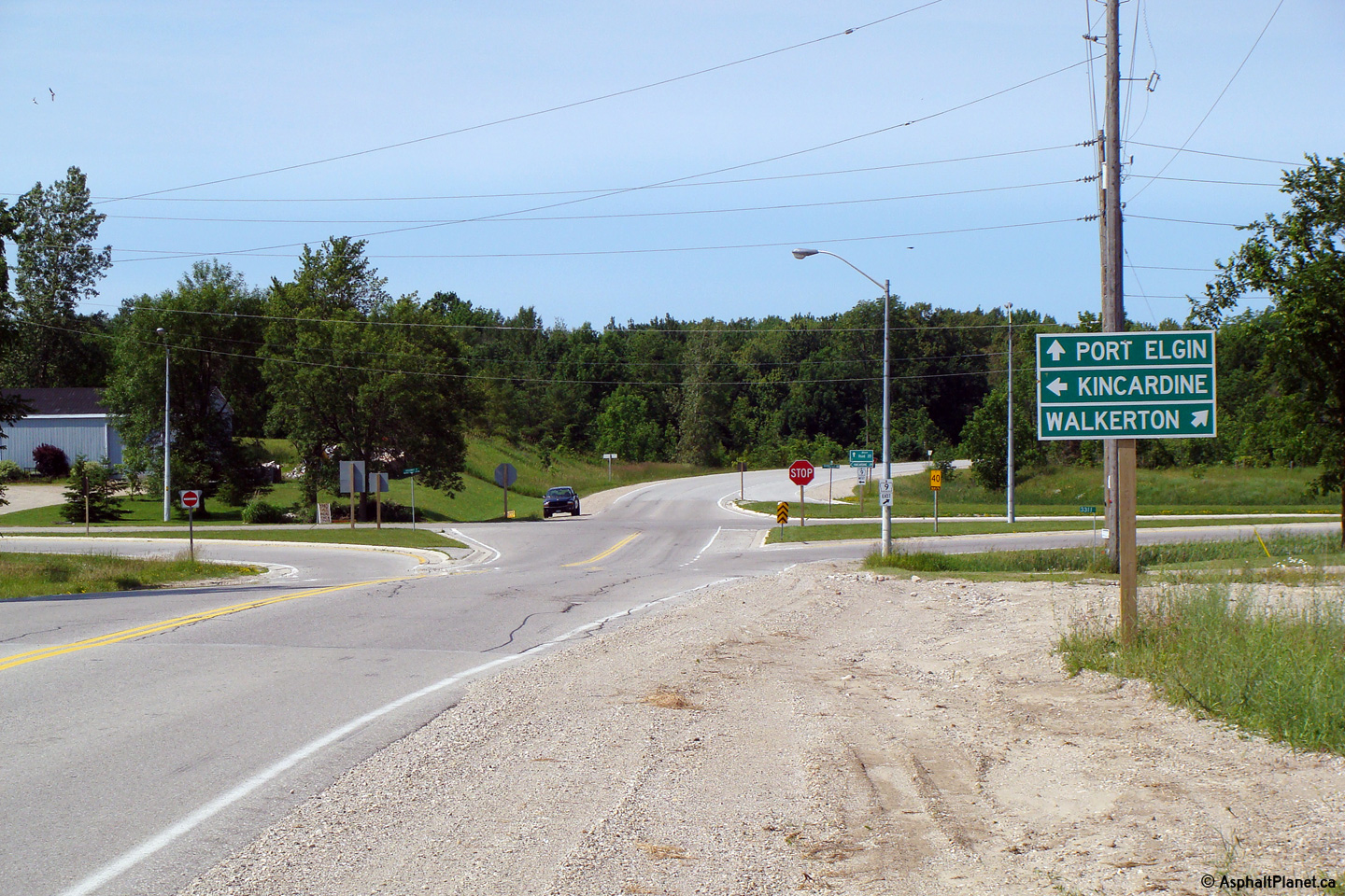
Municipality of Brocton
County of Bruce |
View looking southerly along Highway 4 from just
south of the western Highway 9 junction.
Photo taken: July 1st, 2008. |

(720x480)
(1440x960)
(2400x1600) |
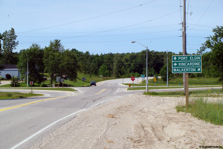
Municipality of Brocton
County of Bruce |
This view looks northerly along Highway 4 at the
western Highway 9 junction. Traffic bound for Walkerton must follow
the ramp to the right at this intersection.
Photo taken: July 1st, 2008. |
(720x480)
(1440x960)
(2400x1600) |
|
Highway 4 ran concurrently with
Highway 9 for several kilometres west of Walkerton.
Click here for Highway 9 images |
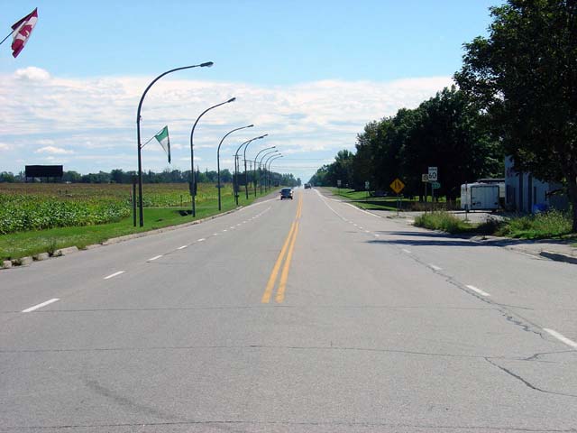
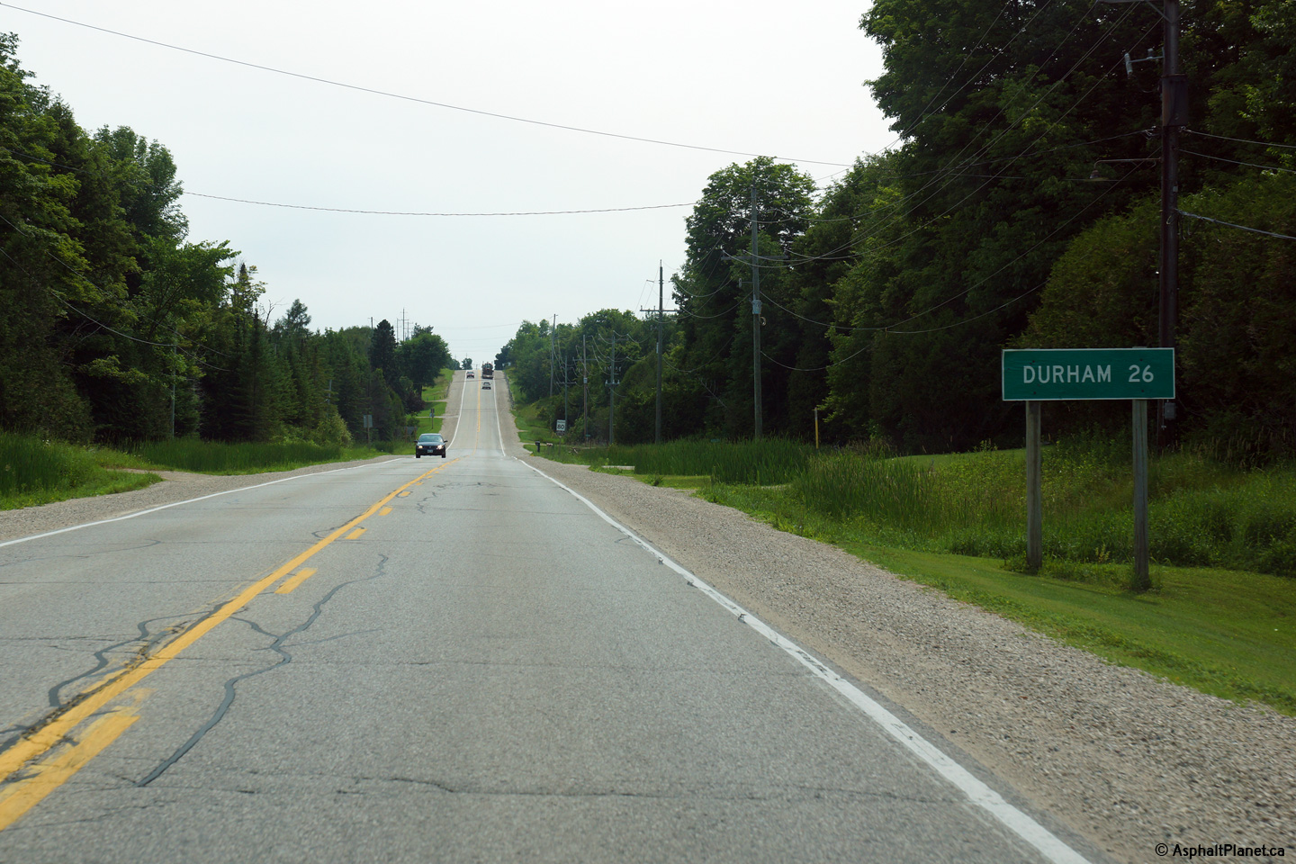
Municipality of Grey Highlands
County of Grey. |
Distance signage for Durham along Highway 4 west
of Flesherton.
Photo taken: July 3rd, 2015. |
(720x480)
(1440x960)
(2400x1600) |
 (720x960)
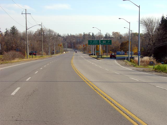

 (720x480)
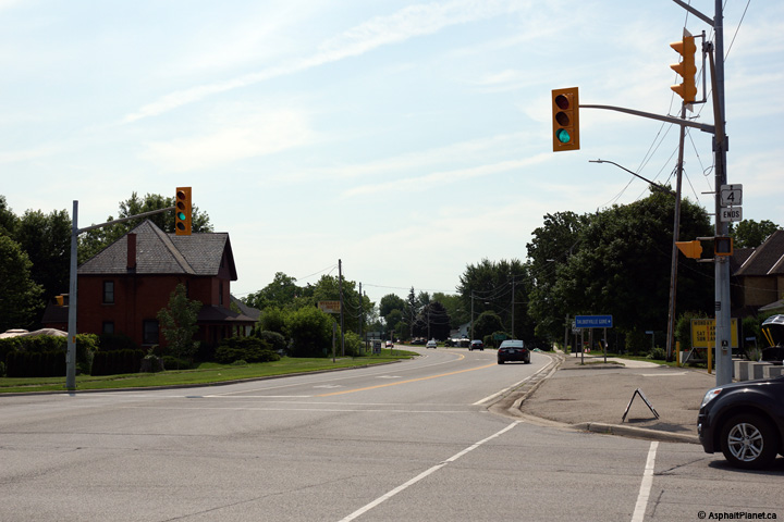


