King's Highway 401 - Images
<- Page 3 Page 4 - London Page 5->
Scroll Down for Aerial Photos
Photos shown in this table are arranged from West to East:
| Proper Municipality Name | Photo Description | Photo | ||
|
Photos taken from driver's perspective appear offset from centre-line Photos: |
East- bound |
West- bound |
||
| Continued from Ridgetown to London Images | ||||
| City of London |
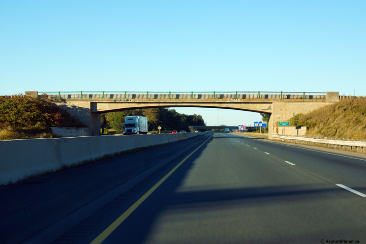
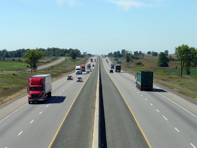
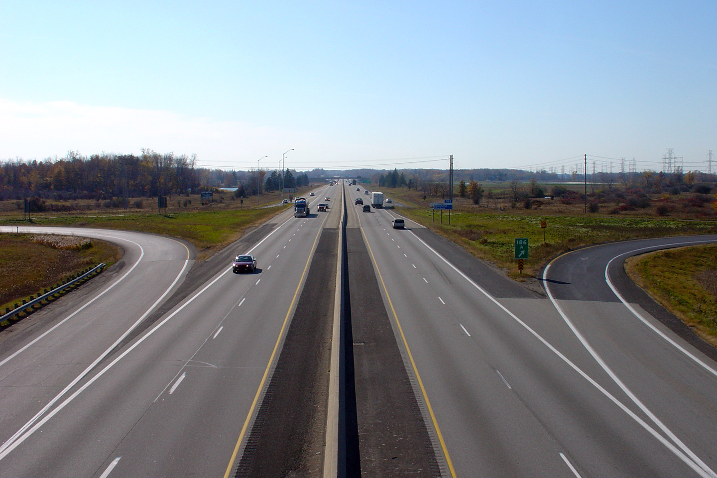
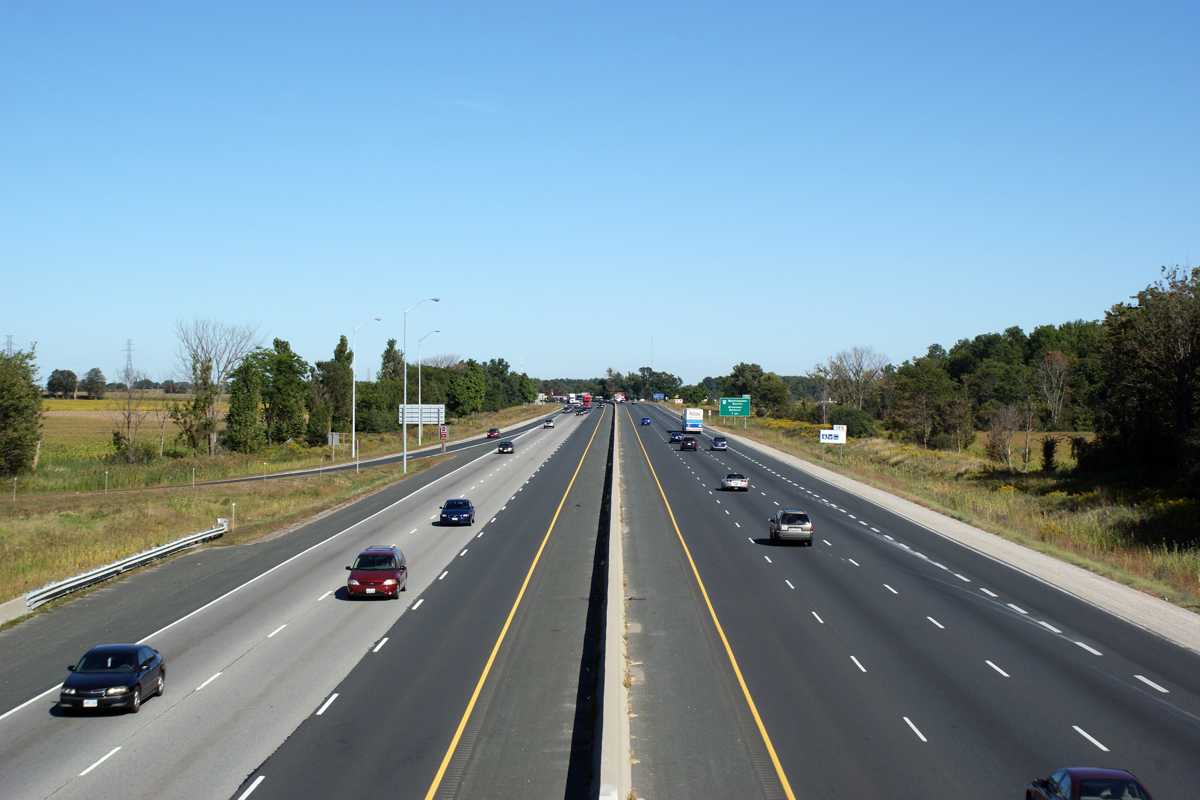
Highway 401 looking east from the Southminster Bourne overpass in the southwest end of London. Around the curve in the distance, the central median narrows and the former grassed median has been replaced by a much safer tallwall style barrier. Click here for an additional view from this vantage point, taken September, 2005. Click here to jump to the view looking west from the Southminster Drive overpass.
Photos taken: September 17th, 2013. |
(720x480) (1440x960) (2400x1600)
|
||
| City of London |
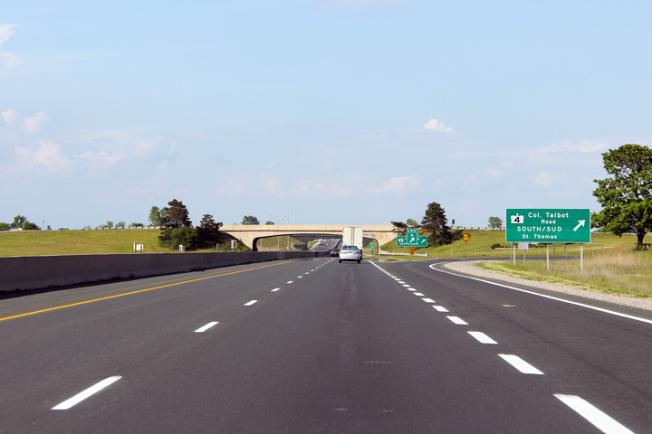
Advanced signage for the Highway 4 interchange along Highway 401 east. Photo taken: May 21st, 2012. |
 (720x480) (720x480)(1440x960) (2400x1600) |
||
| City of London |
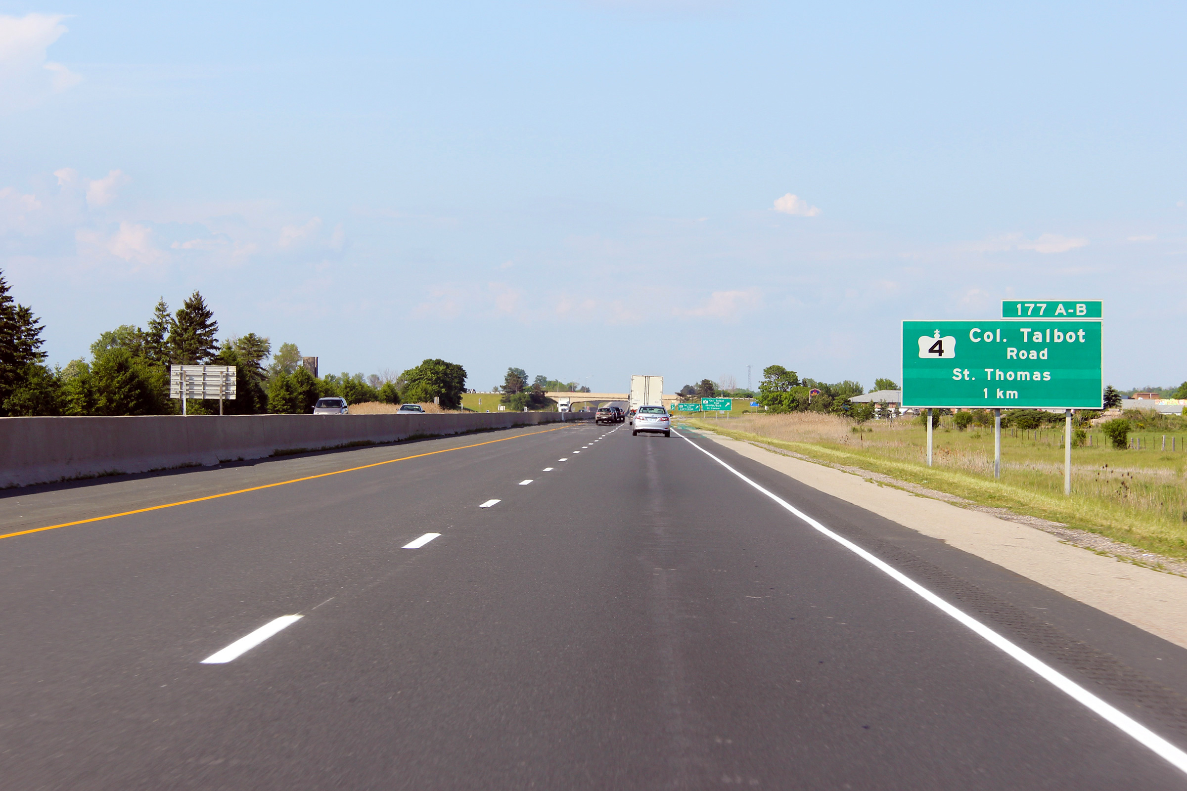
Ground mounted signage for the ramp to Highway 4-South. Highway 4
crosses Highway 401 at one of the few remaining cloverleaf interchanges
along Highway 401. Photo taken: May 21st, 2012. |
 (720x480) (720x480)(1440x960) (2400x1600) |
||
| City of London |
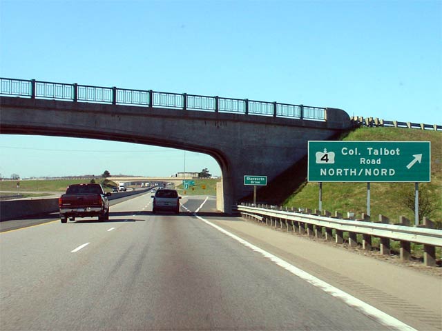
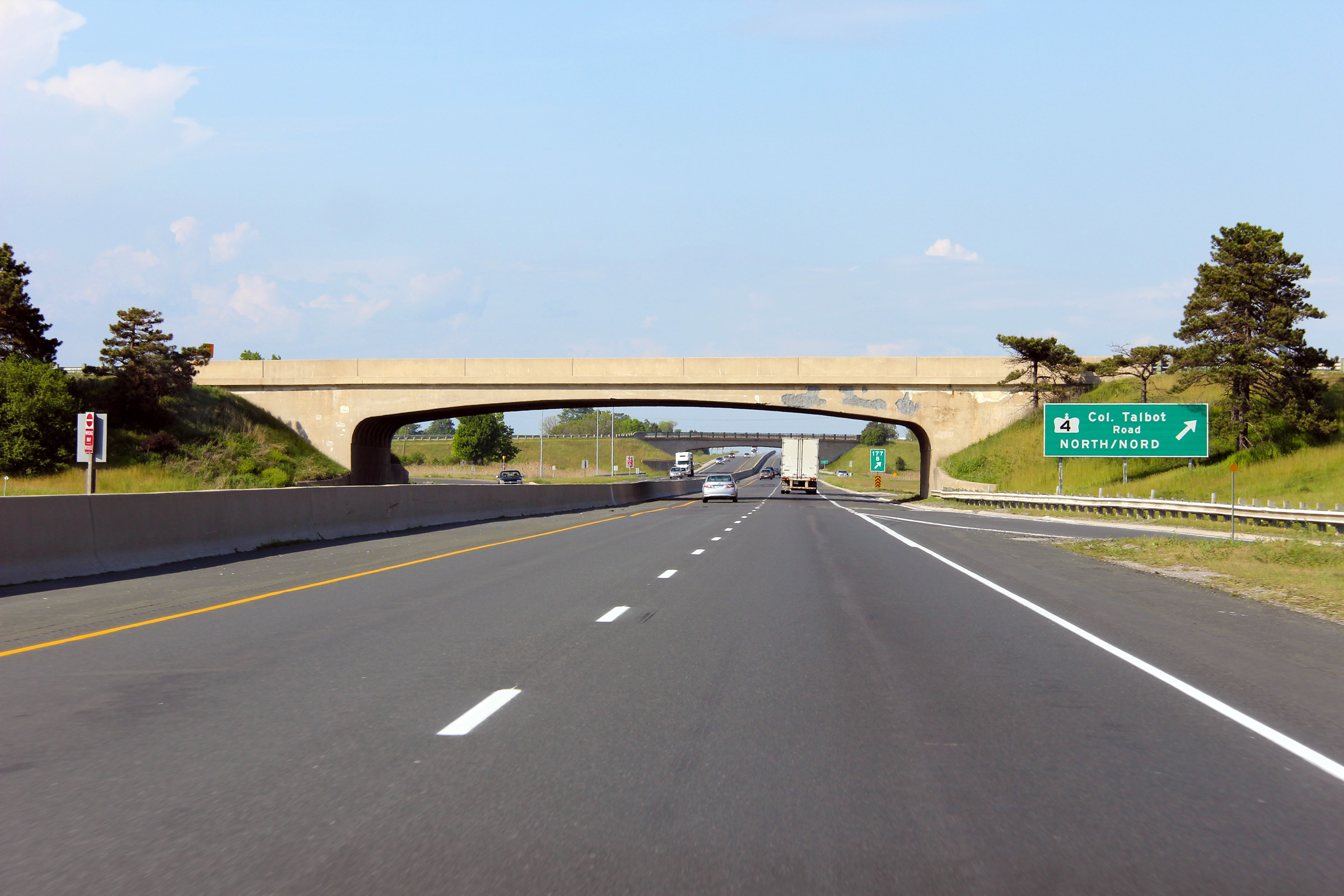
Ground mounted signage for the ramp to Highway 4-North. The speed
change lane between the on-ramp from Highway 4-South and the off-ramp to
Highway 4-North is very short. Photo taken: May 21st, 2012. |
 (720x480) (720x480)(1440x960) (2400x1600) |
||
| City of London |
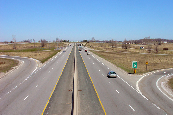
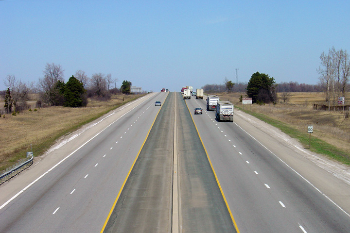
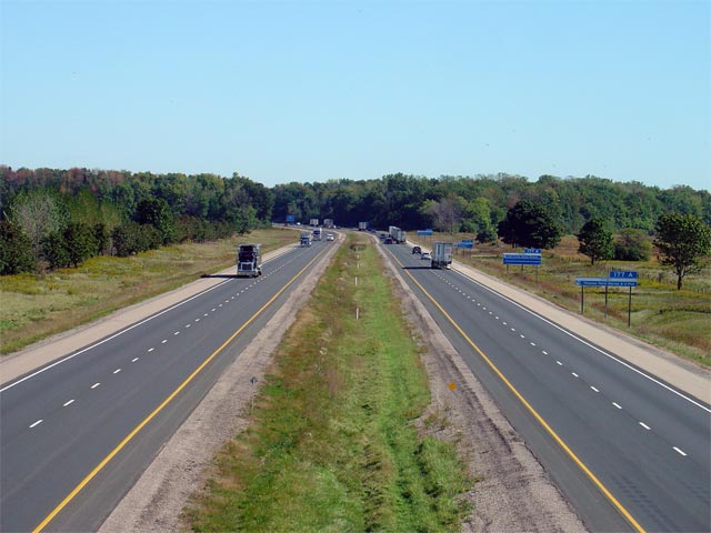
View looking west from the Highway 4
overpass. Between 1957 and 1963 the western terminus of Highway 401 was
located at this junction. Photo taken: April 11th, 2005. |
 (720x480) (1440x960) |
||
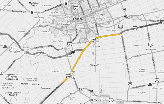
| Highway 401 meets Highway 4 at a cloverleaf interchange in the very Southwest of the City of London. Click here for Highway 4 images. | ||||
| City of London |
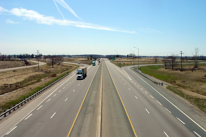
View looking easterly from the Highway 401 overpass. The Highway
4/401
interchange is a very tight interchange due to the large skew that Highway
4
and 401 intersect at. Photo taken: April 11th, 2005. |
 (720x480) (1440x960) |
||
| City of London |
Highway 401 looking west from the Glanworth Drive overpass in the southwest of the City of London. The interchange shown in the photo is with Highway 4. This interchange is one of the last full cloverleaf's left in the province (ignoring a small ramp modification in the NE quadrant). Photo taken: April 24th, 2004. |
 (720x480) (1440x960) |
||
| City of London |
Looking east from the Glanworth Drive overpass. Glanworth Drive is
located about 500m east of the Highway 4 interchange. Photo taken: April 14th, 2005. |
 (720x480) (1440x960) |
||
| City of London |
Signage along Highway 401 denoting the exit to northbound
Highway 4. Photo taken: April 28th, 2006. |
 |
||
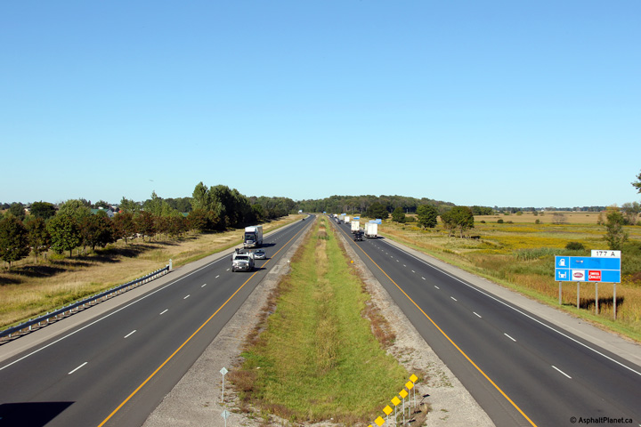
| City of London |
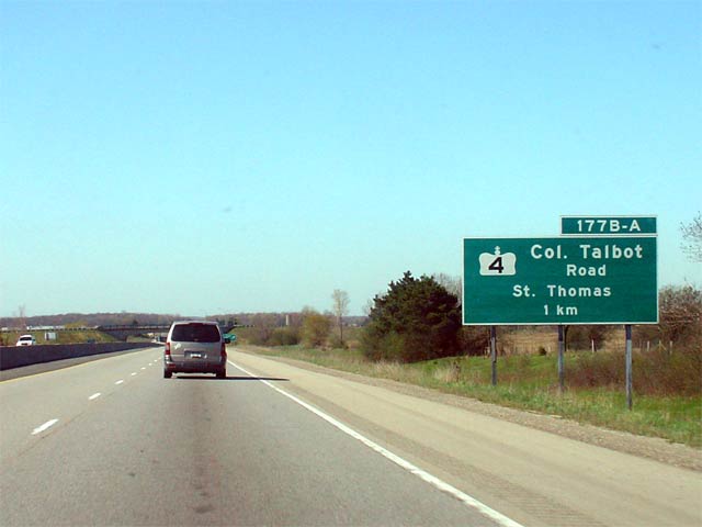
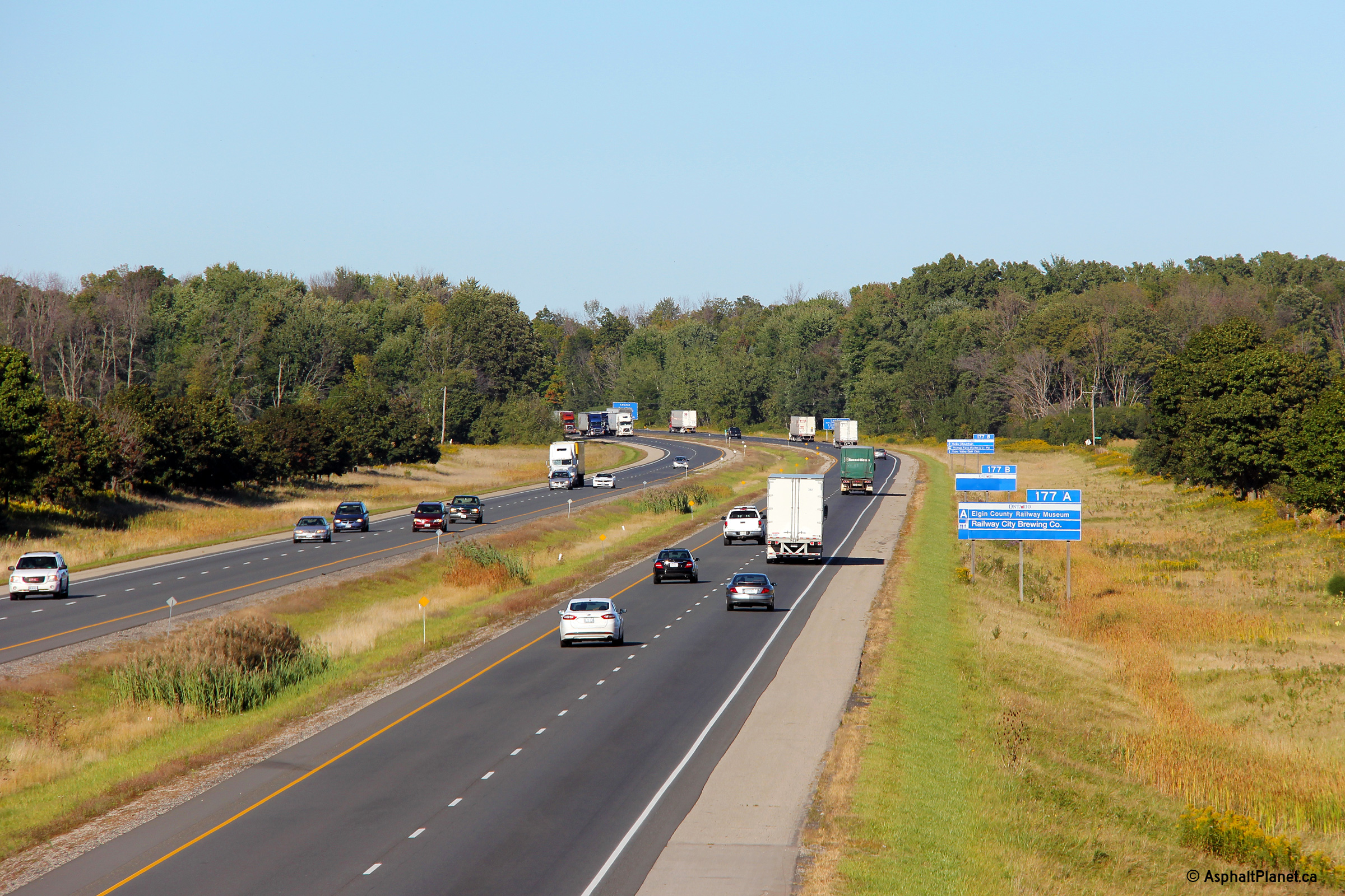
Advance signage for the upcoming Highway 4
interchange. Notice that because Highway 4
meets the 401 at a cloverleaf interchange, exit 177 is subdivided into 177A
and 177B. Photo taken: April 28th, 2006. |
 |
||
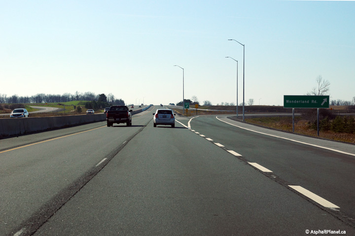
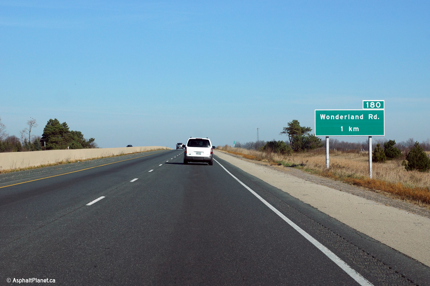
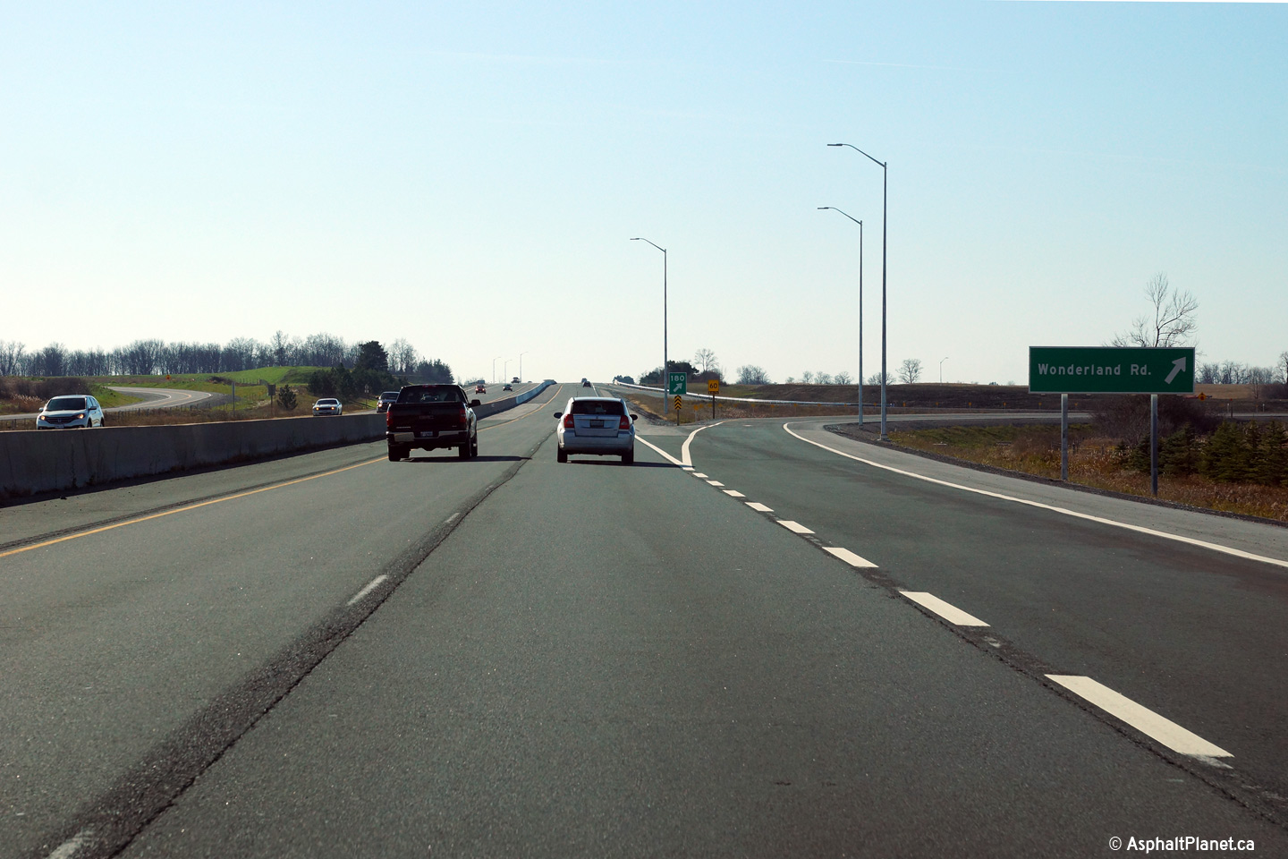
| City of London |
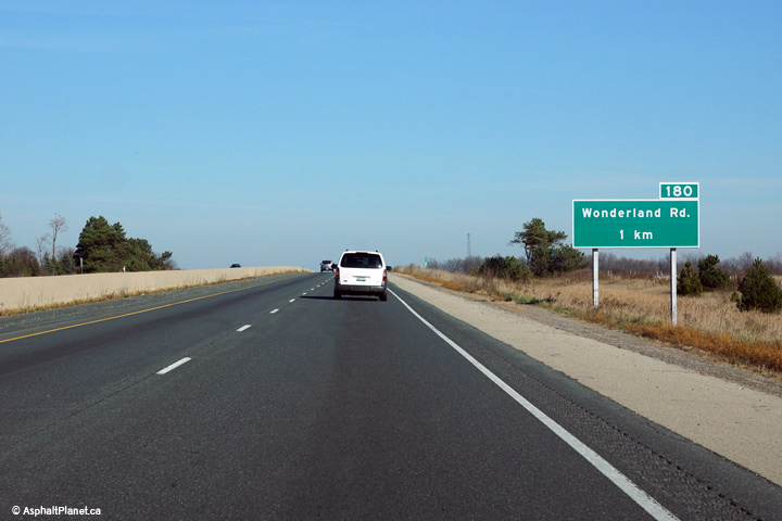
Advanced signage for the Wonderland Road interchange. Photo taken: November 15th, 2015. |
 (720x480) (720x480)(1440x960) (2400x1600) |
||
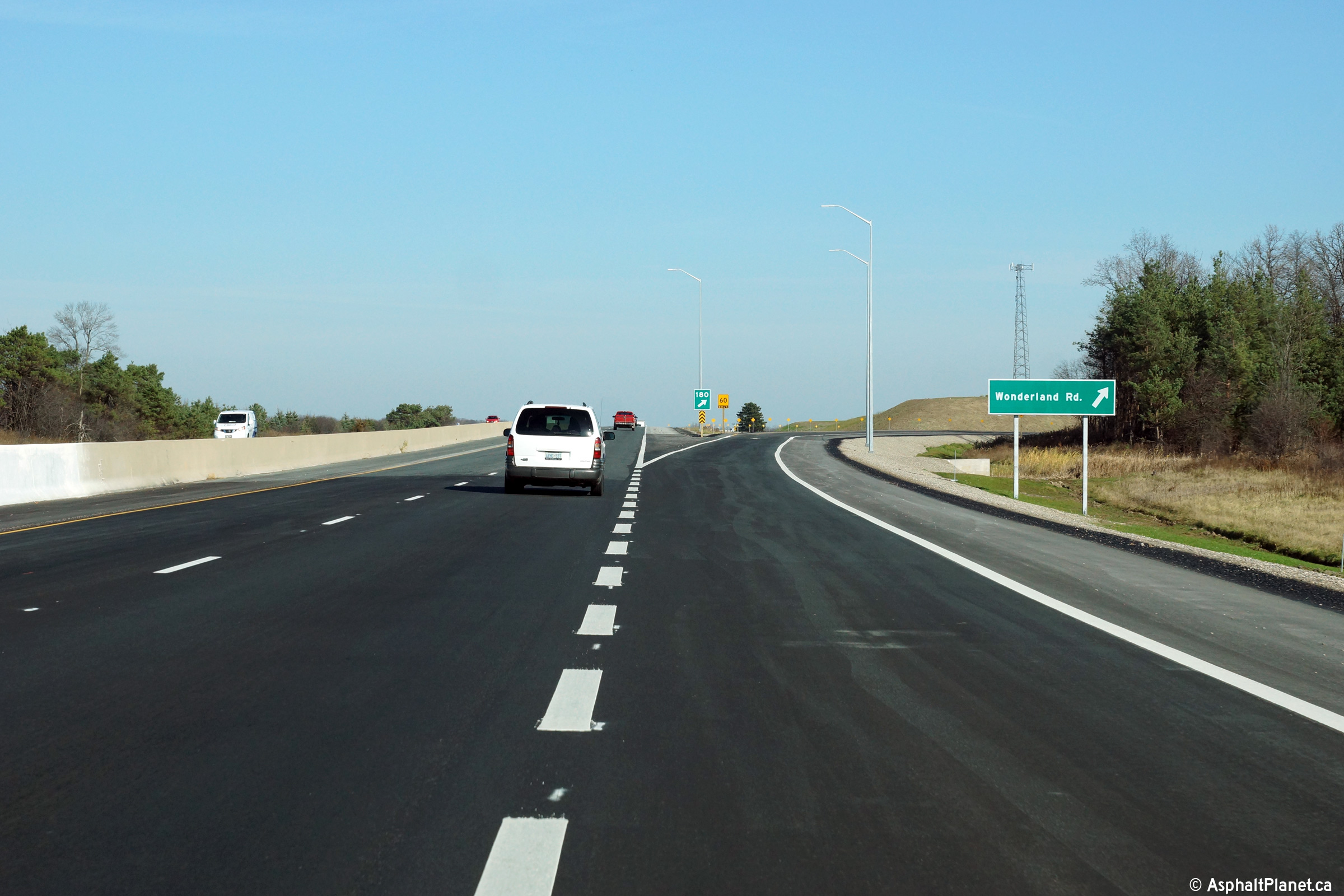
| City of London |
Eastbound signage at the off-ramp to Wonderland Road. Photo taken: November 15th, 2015. |
 (720x480) (720x480)(1440x960) (2400x1600) |
||
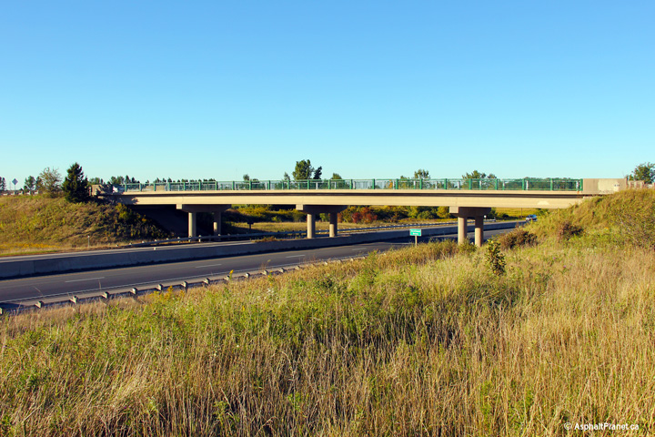
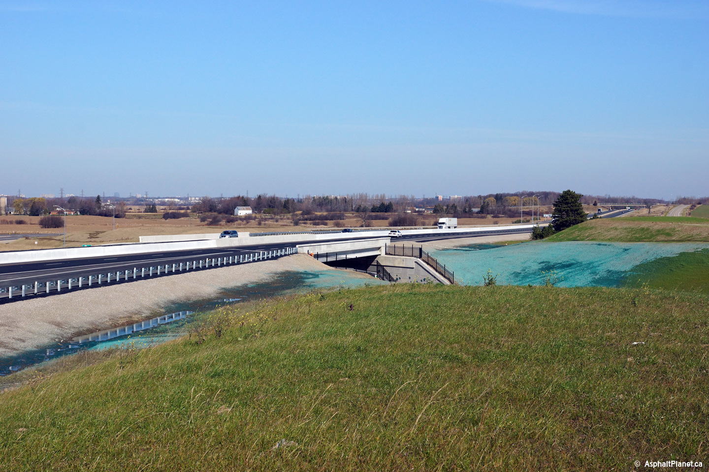
| City of London |
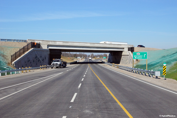
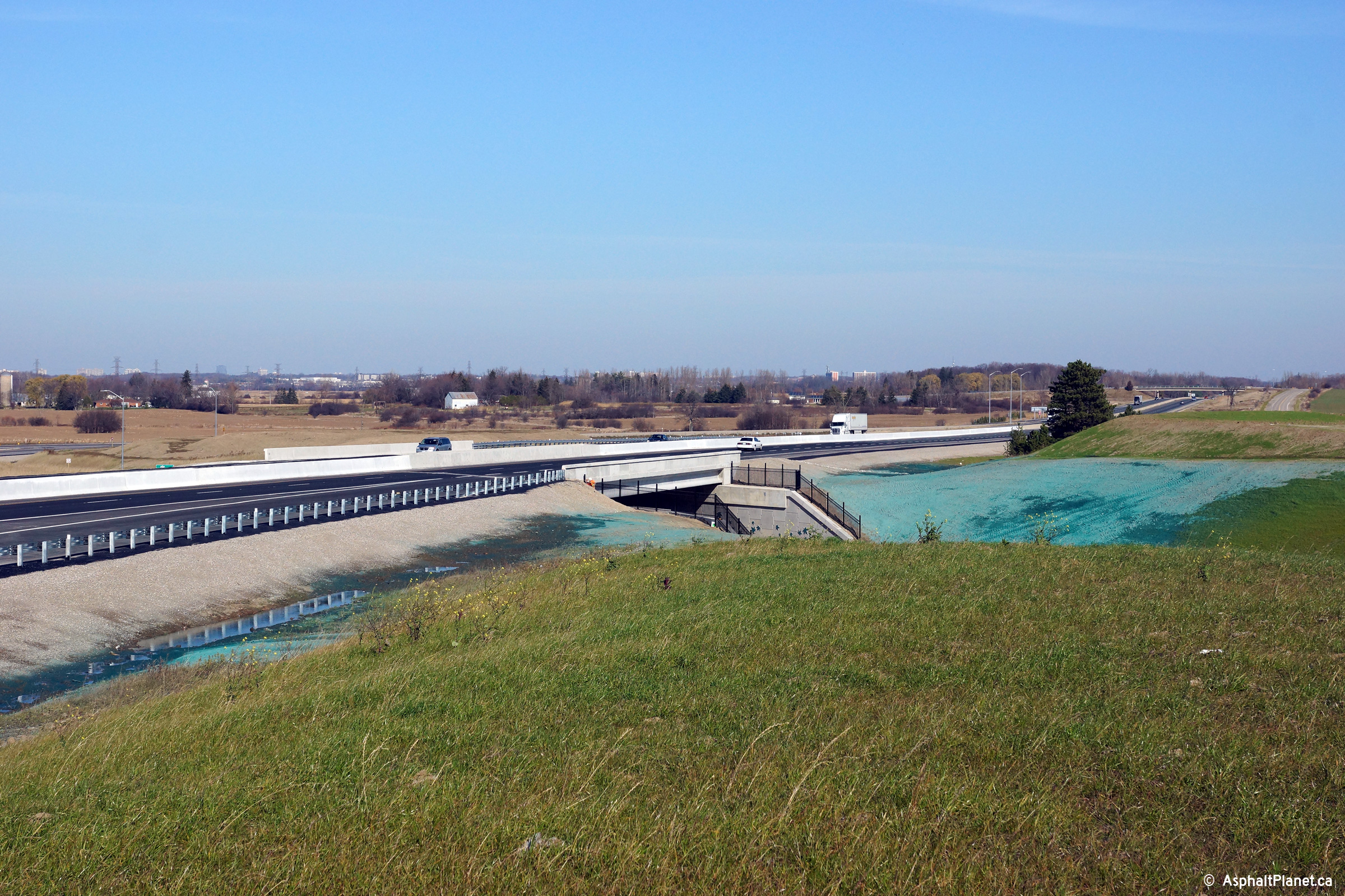
View looking easterly towards the Wonderland Road underpass along Highway
401. The Highway 401 interchange opened to traffic on November 11th,
2015. Photo taken: November 15th, 2015. |
 (720x480) (1440x960) (2400x1600) |
||
| City of London |
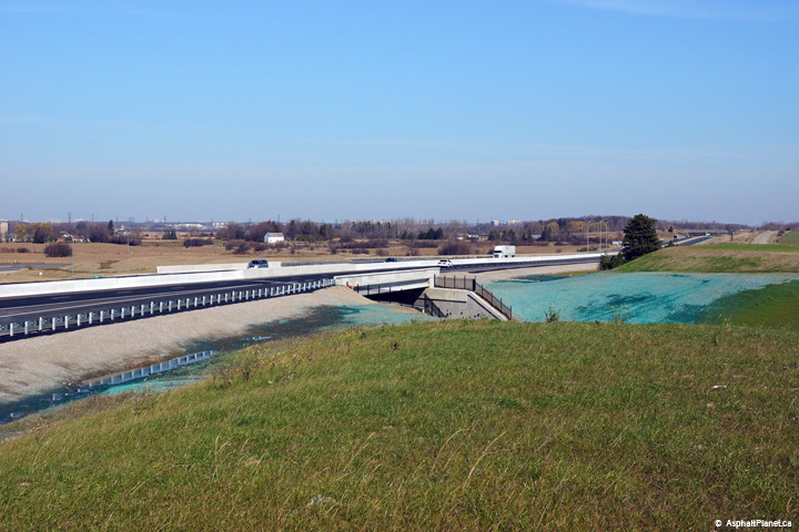
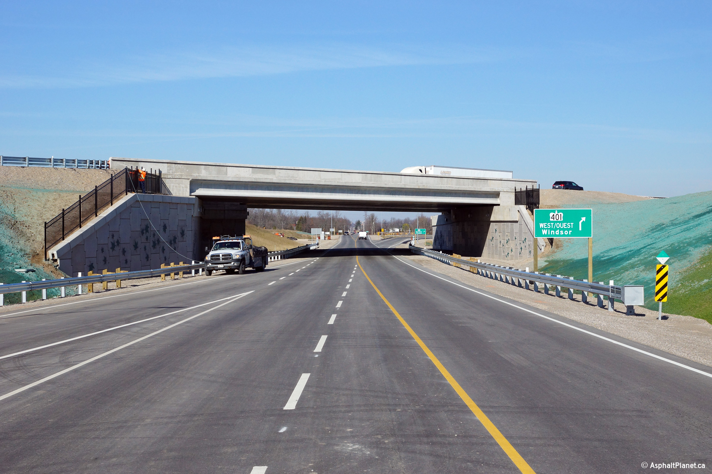
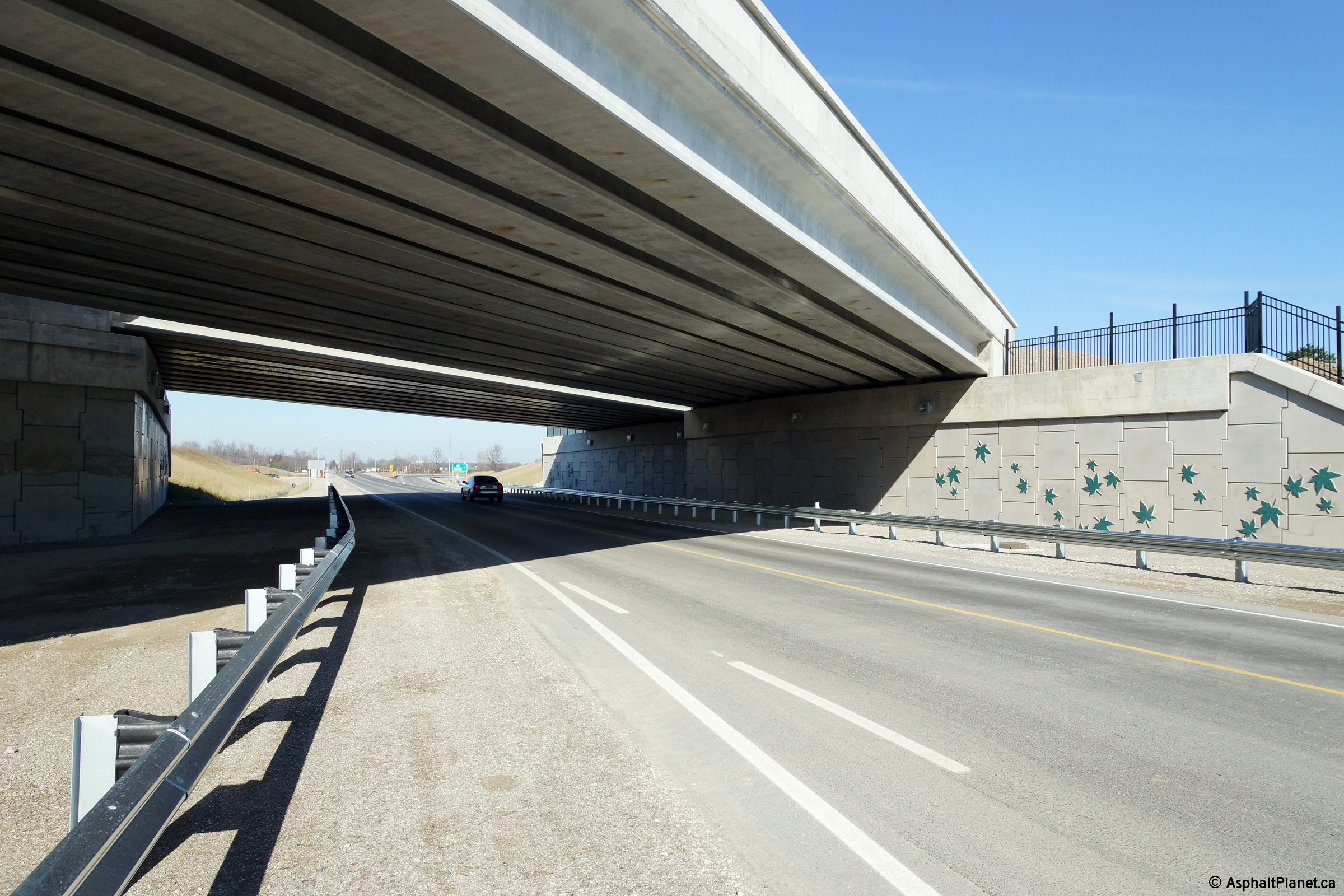
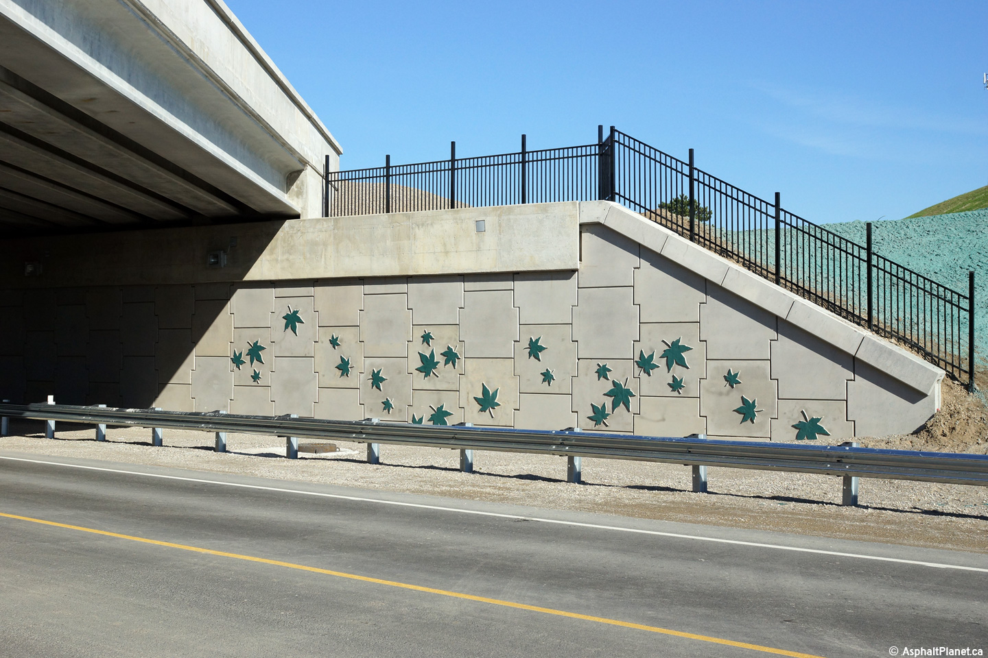
A series of views approaching the Highway 401 grade separation along
Wonderland Road. The Wonderland Road grade separation has been
constructed with NU girder beams. NU girders are an alternative to the
standard concrete I-beam. There use typically offers moderate cost
savings compared to the more typical CPCI design. Also of note at the
Wonderland Road interchange are the decorative maple leafs that have been
embossed into the wingwalls of the Wonderland Road grade separation.
Such treatments are common in several US states, including
Texas. Photos taken: November 15th, 2015. |
 (720x480) (1440x960) (2400x1600)  (720x480) (1440x960) (2400x1600) 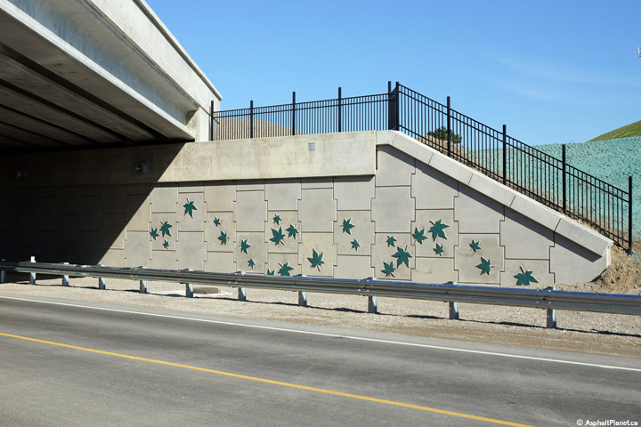 (720x480) (1440x960) (2400x1600) |
||
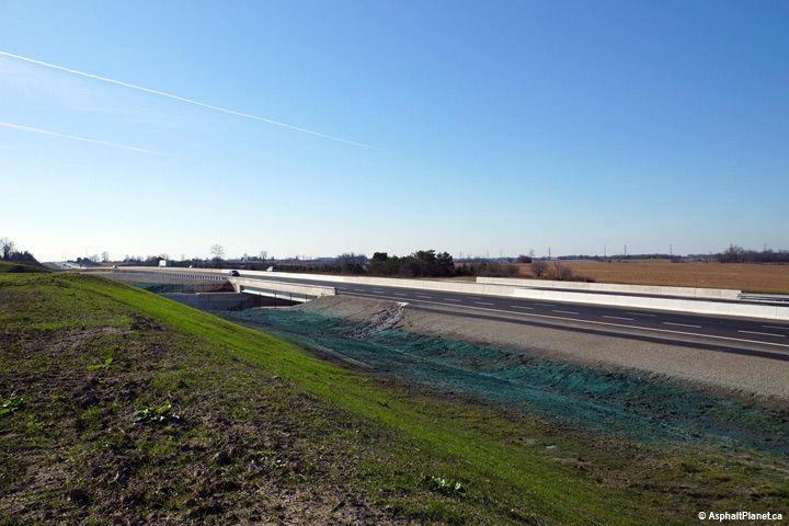
| City of London |
View looking westerly at the Wonderland Road underpass. Photo taken: November 15th, 2015. |
 (720x480) (1440x960) (2400x1600) |
||
| City of London |
View looking westerly as the off-ramp to Wonderland Road departs from the
freeway mainline. Photo taken: November 15th, 2015. |
 (720x480) (720x480)(1440x960) (2400x1600) |
||
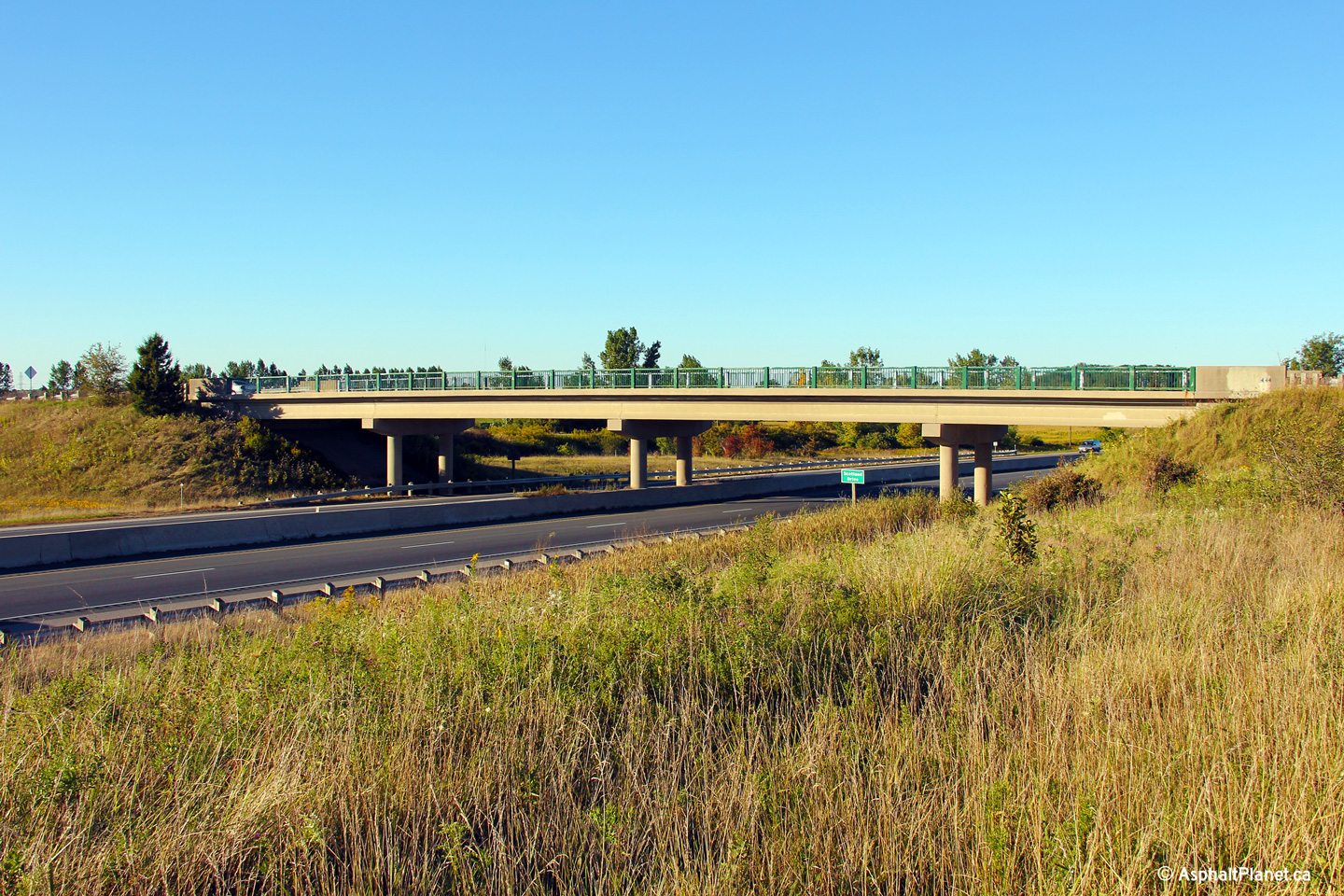
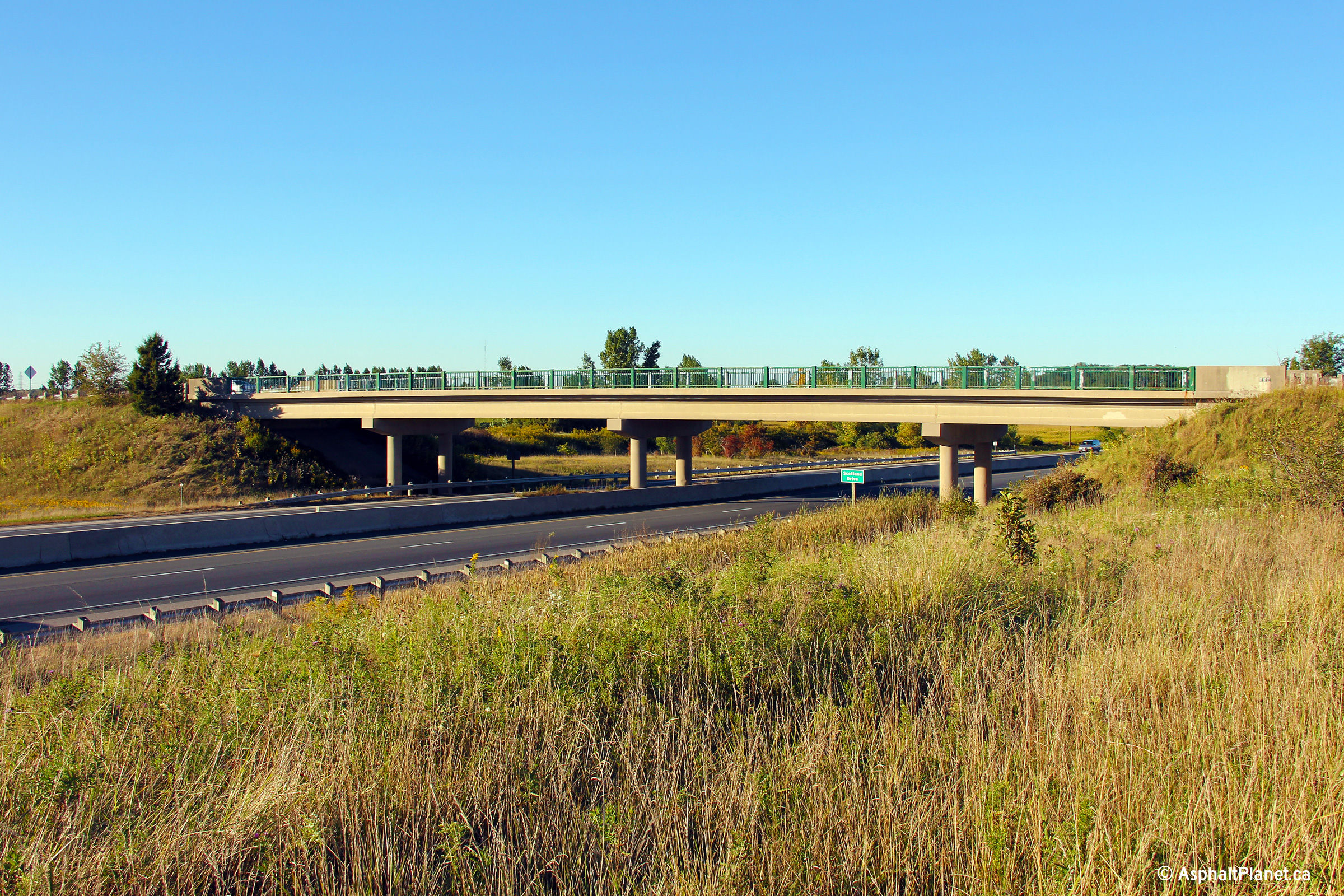
| City of London |
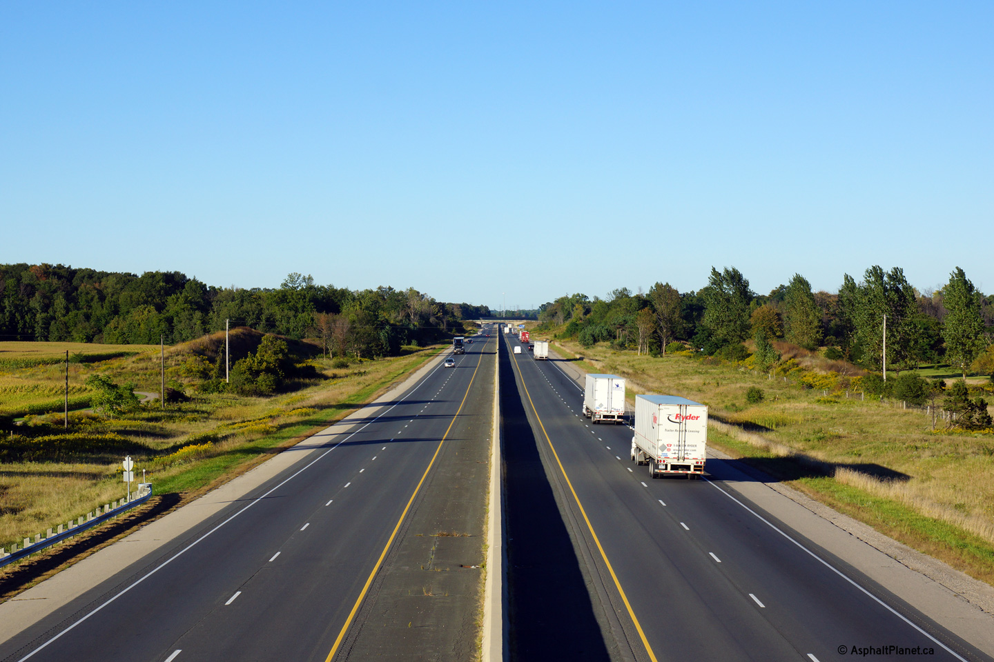
Easterly view of the Scotland Drive overpass. The Scotland Drive overpass
was constructed during the late 1960s, several years after Highway 401
opened to traffic. Photo taken: September 17th, 2013. |
 (720x480) (720x480)(1440x960) (2400x1600) |
||
| City of London |
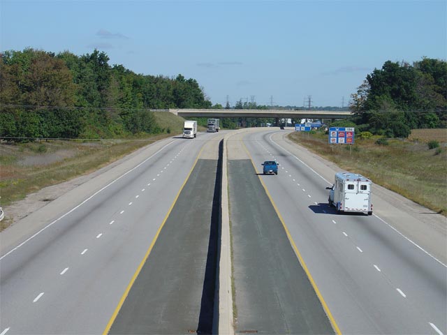
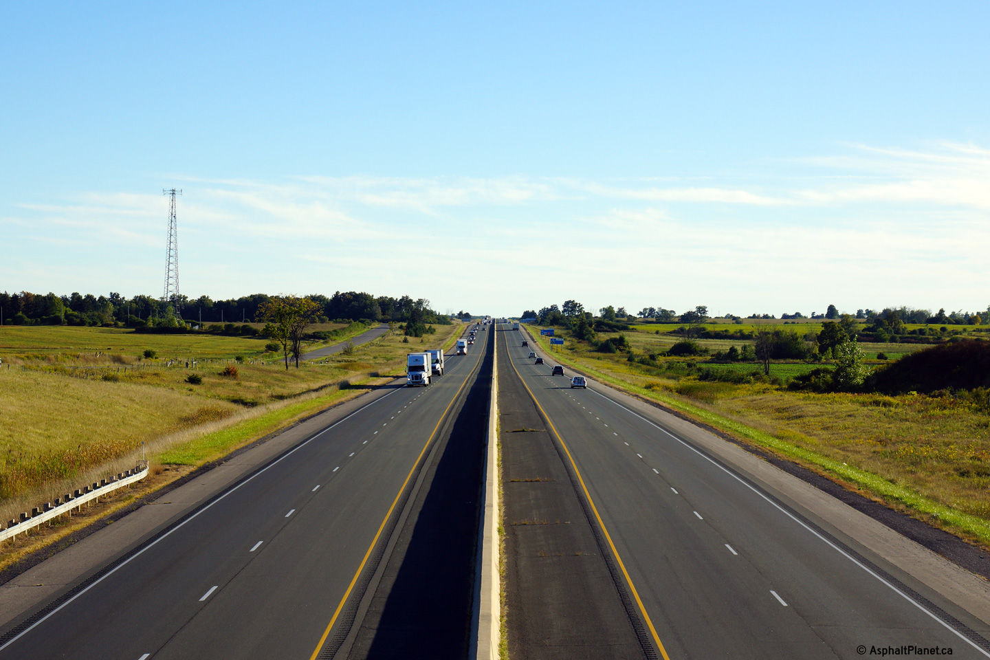
Looking west from the Scotland Drive overpass. The upper photo was
taken prior to the commencement of construction for the Wonderland Road
interchange, while the lower photo was taken a few days after the Wonderland
Road interchange opened to traffic.. Click
here for an
additional view from this vantage point, taken September, 2005. Upper photo taken: September 17th, 2013. Lower photo taken: November 15th, 2015. |
 (720x480) (1440x960) (2400x1600) |
||
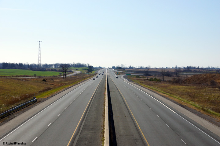
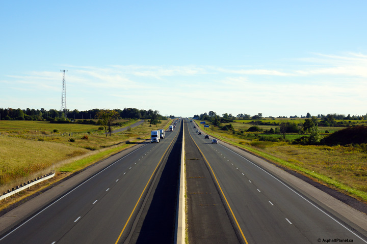
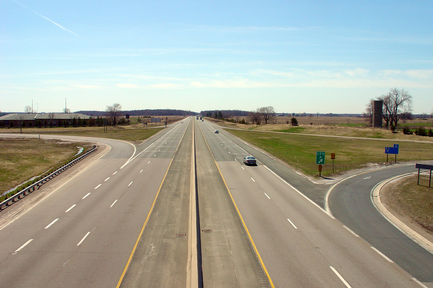
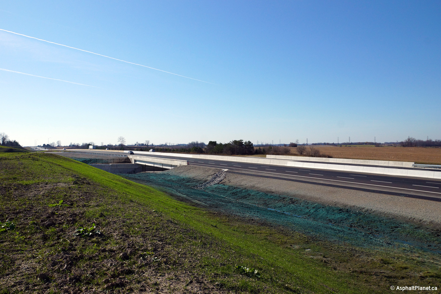
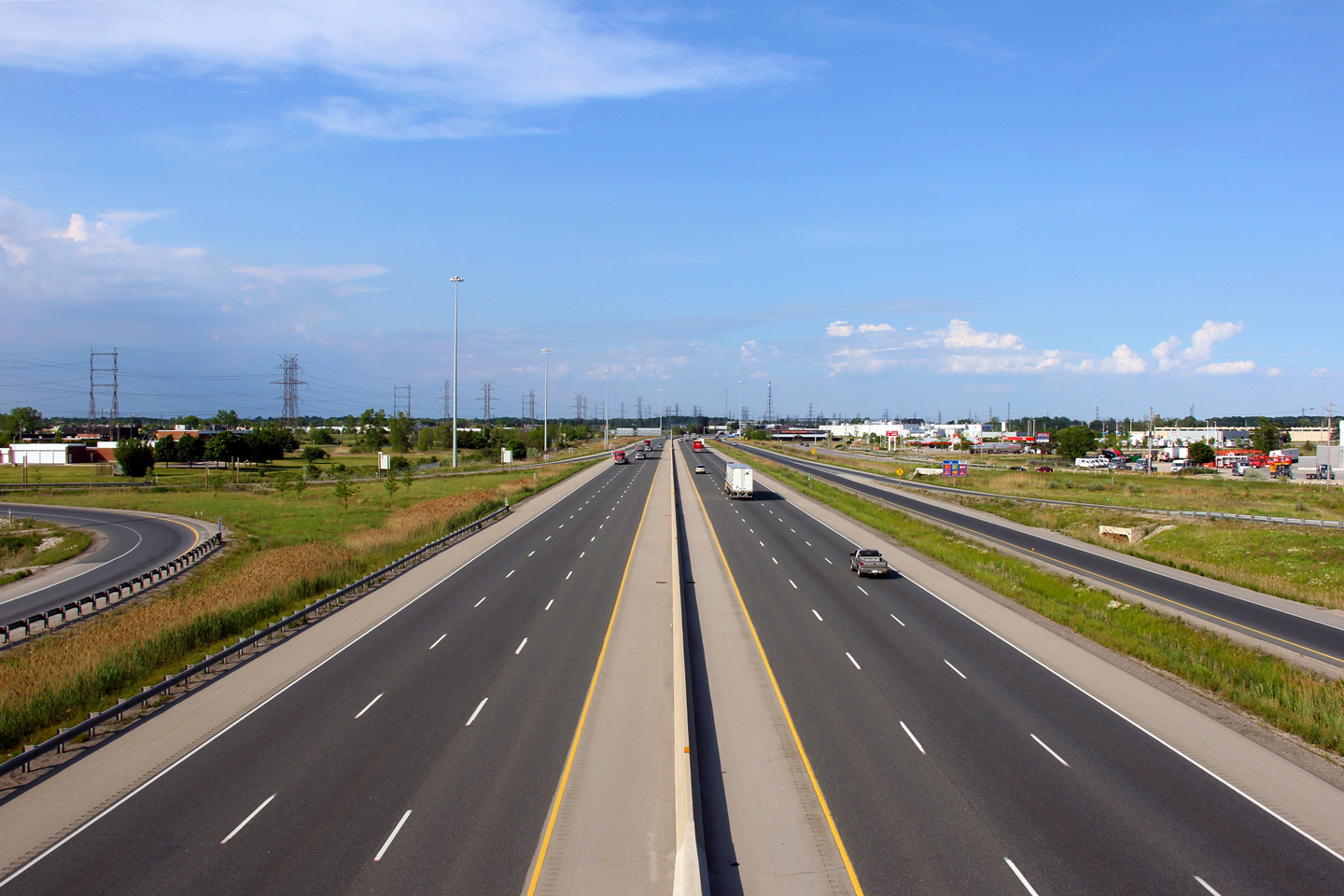
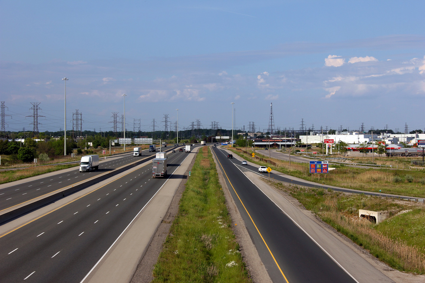
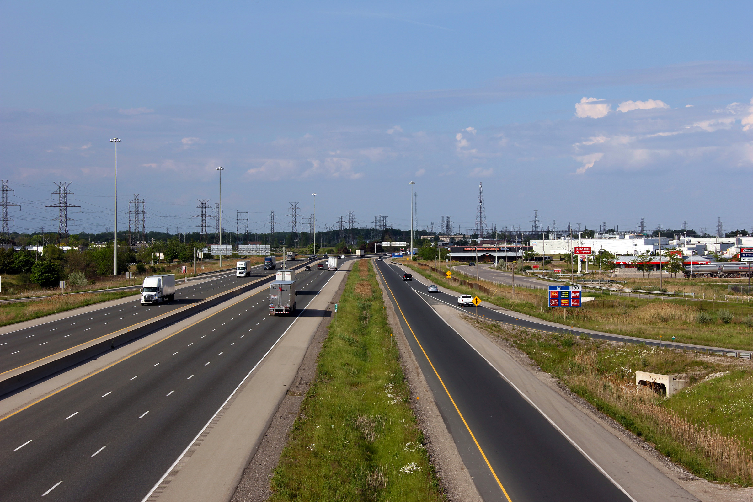
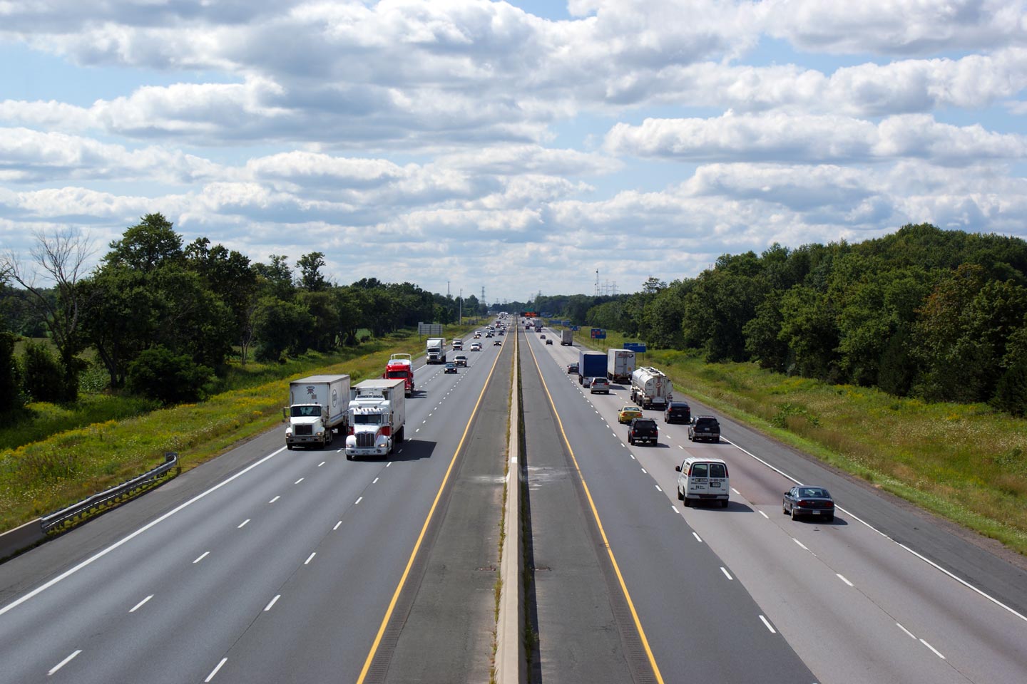
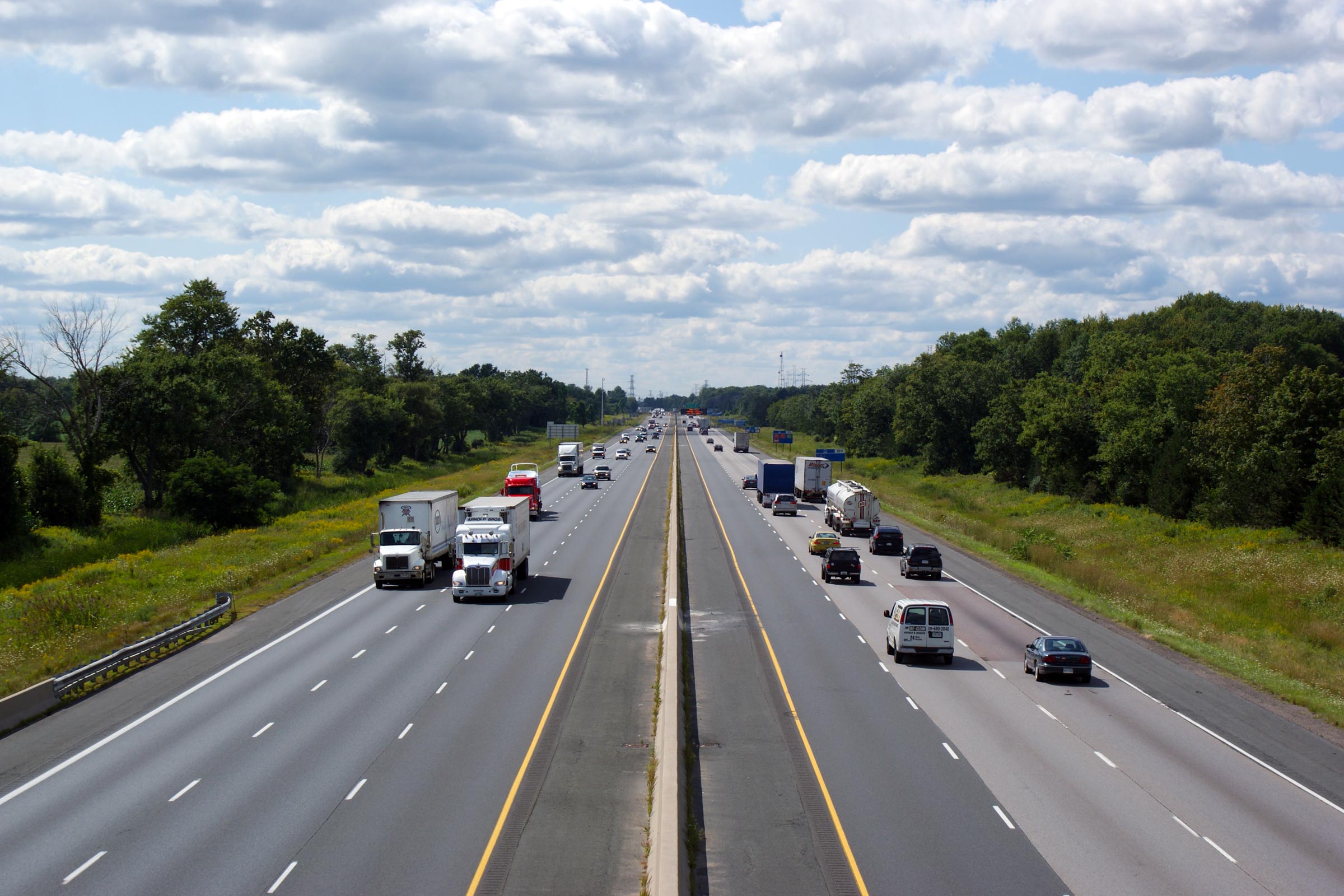
| City of London |
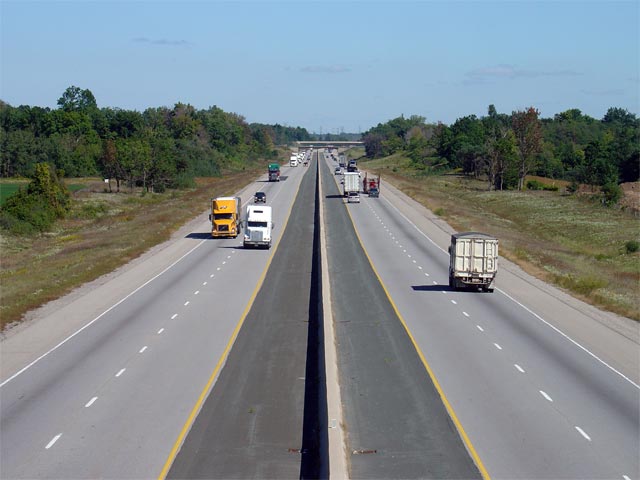
Looking east along Highway 401 from the Scotland Drive overpass in
southwestern London. Scotland Drive is located roughly at kilometre
marker 180. Click here for an
additional view from this vantage point, taken September, 2005. Photo taken: September 17th, 2013. |
 (720x480) (1440x960) (2400x1600) |
||
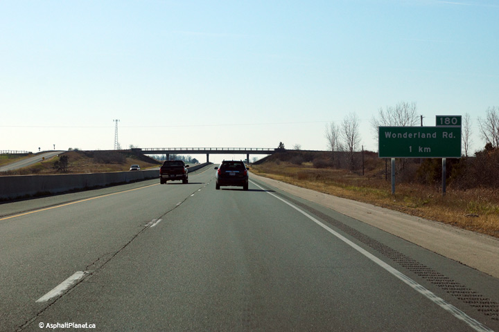
| City of London |
Advanced signage for westbound motorists approaching the Wonderland Road
interchange. Photo taken: November 15th, 2015. |
 (720x480) (720x480)(1440x960) (2400x1600) |
||
| City of London |
View looking easterly through the Westminster Drive overpass. The
Westminster Drive overpass uses an attractive concrete rigid frame girder
design. The original Wellington Road structure that was demolished in
2008 used a similar design. Photo taken: September 17th, 2013. |
 (720x480) (720x480)(1440x960) (2400x1600) |
||
| City of London |
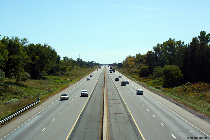
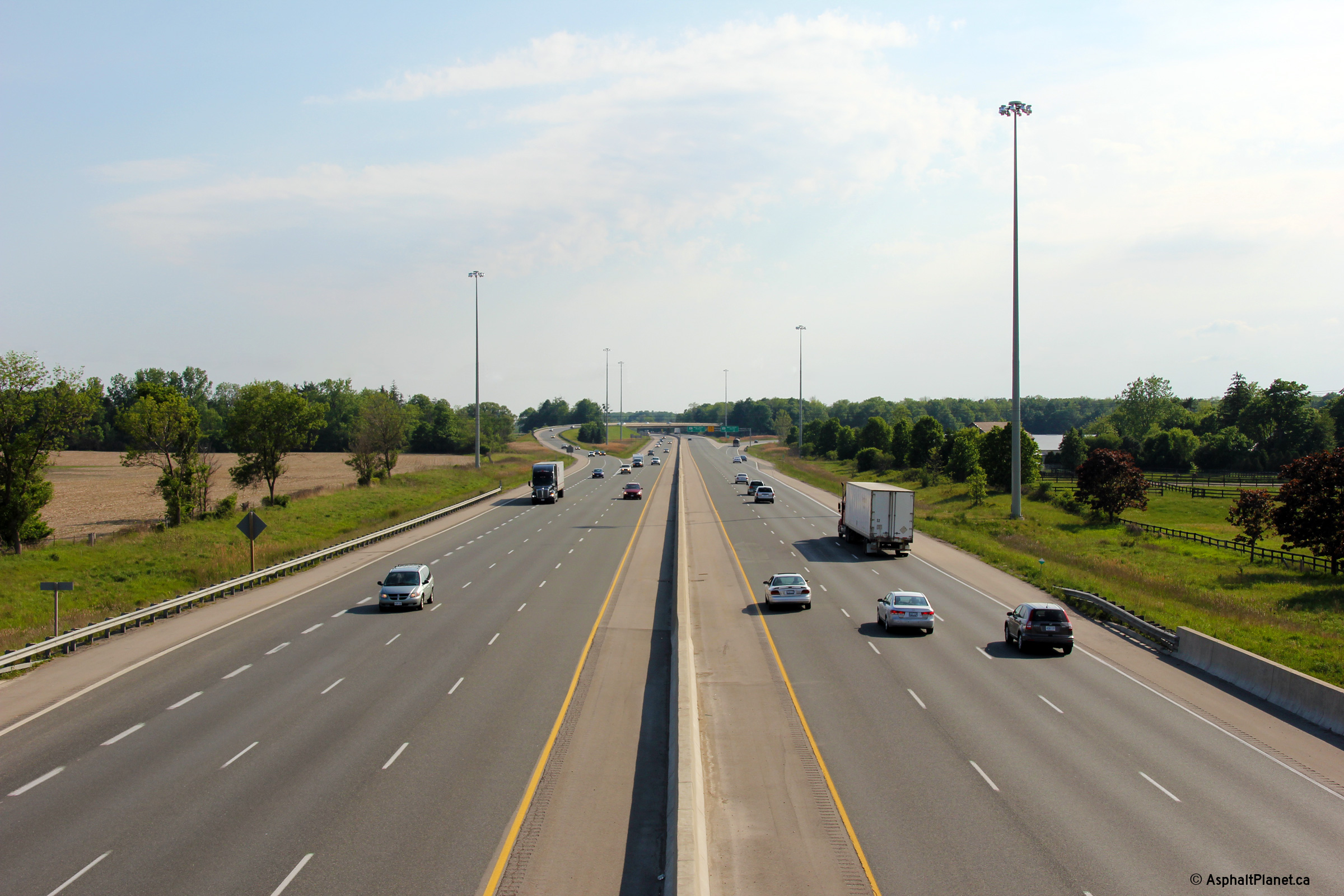
Looking west from the White Oak Road overpass in southwestern London.
White Oak Road is located roughly at kilometre marker 182.
Click here for an
additional view from this vantage point, taken September, 2005. Photo taken: September 19th, 2009. |
 (720x480) (1440x960) (2400x1600) |
||
| City of London |
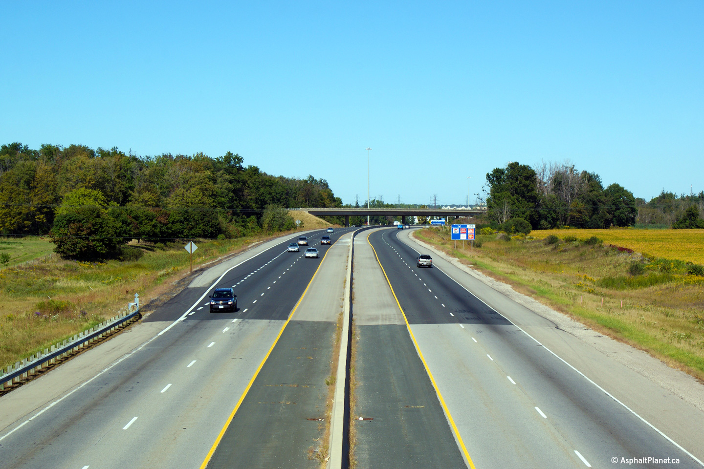
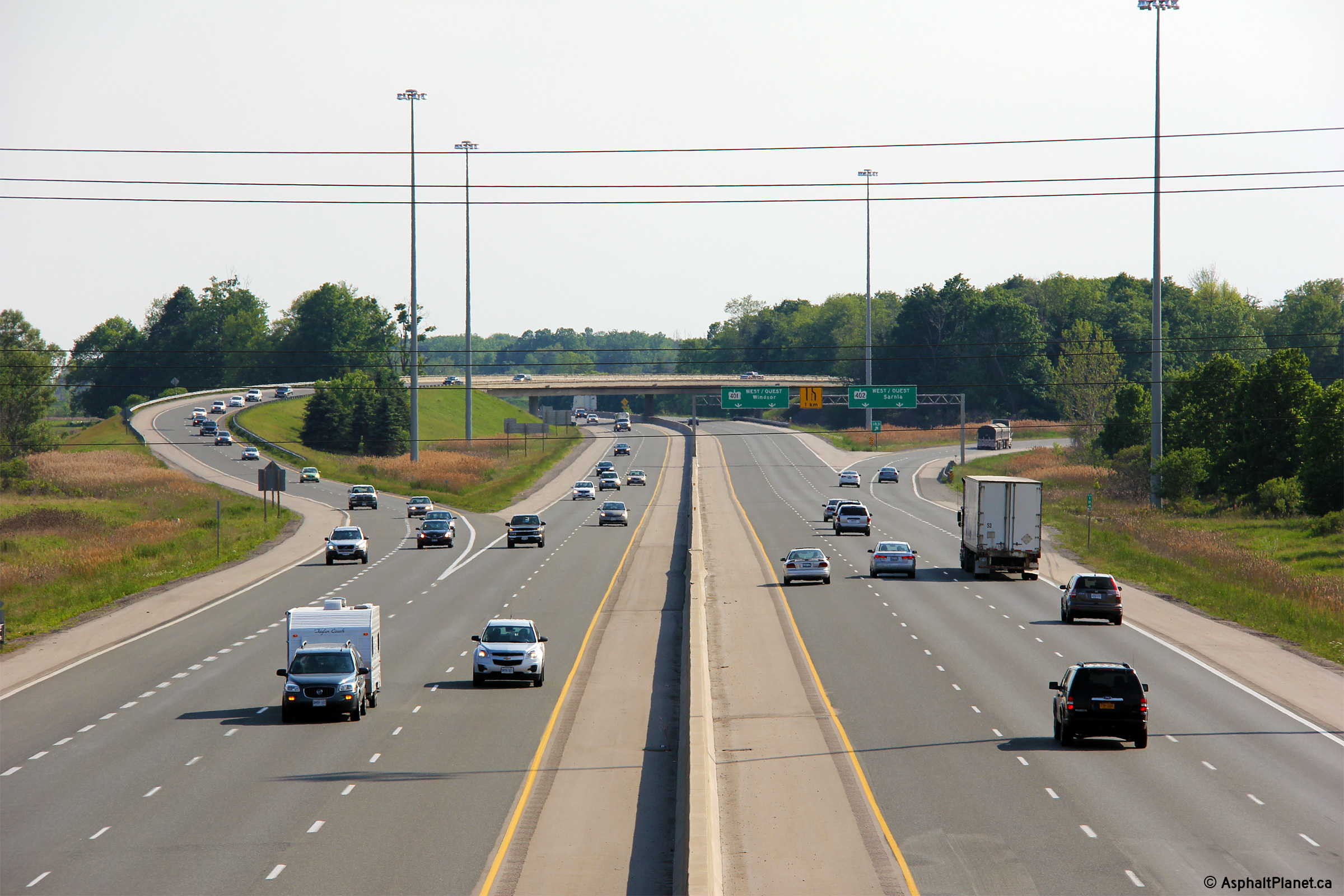
Highway 401 looking east from the White Oak Road overpass. The White
Oak Road overpass is located just west of the Highway 402
flyover. Notice the high-speed flyover running overtop of the mainline
Highway 401 lanes in the photo. Upper photo taken: September 23rd, 2005. Lower photo taken: September 19th, 2009. |
 (720x480) (1440x960) (2400x1600) |
||
| Highway 402 departs westerly from the 401 bound for Sarnia, the Bluewater Bridge and the United States of America. Click here for Highway 402 images. | ||||
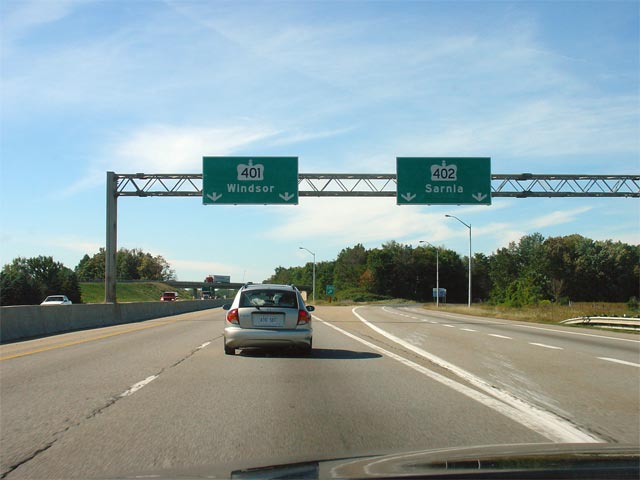
| City of London |
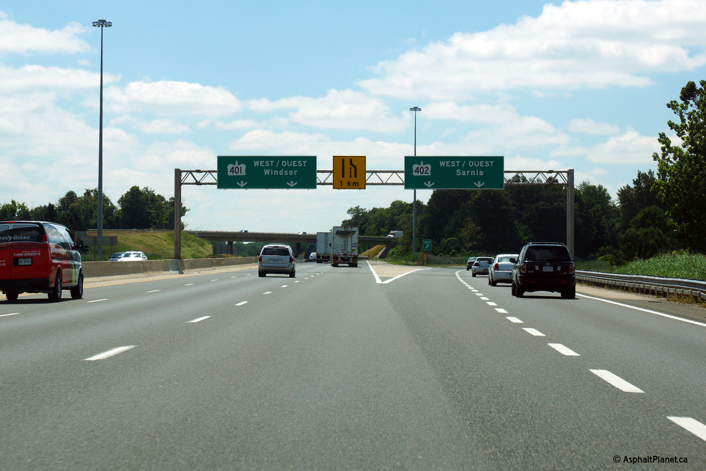
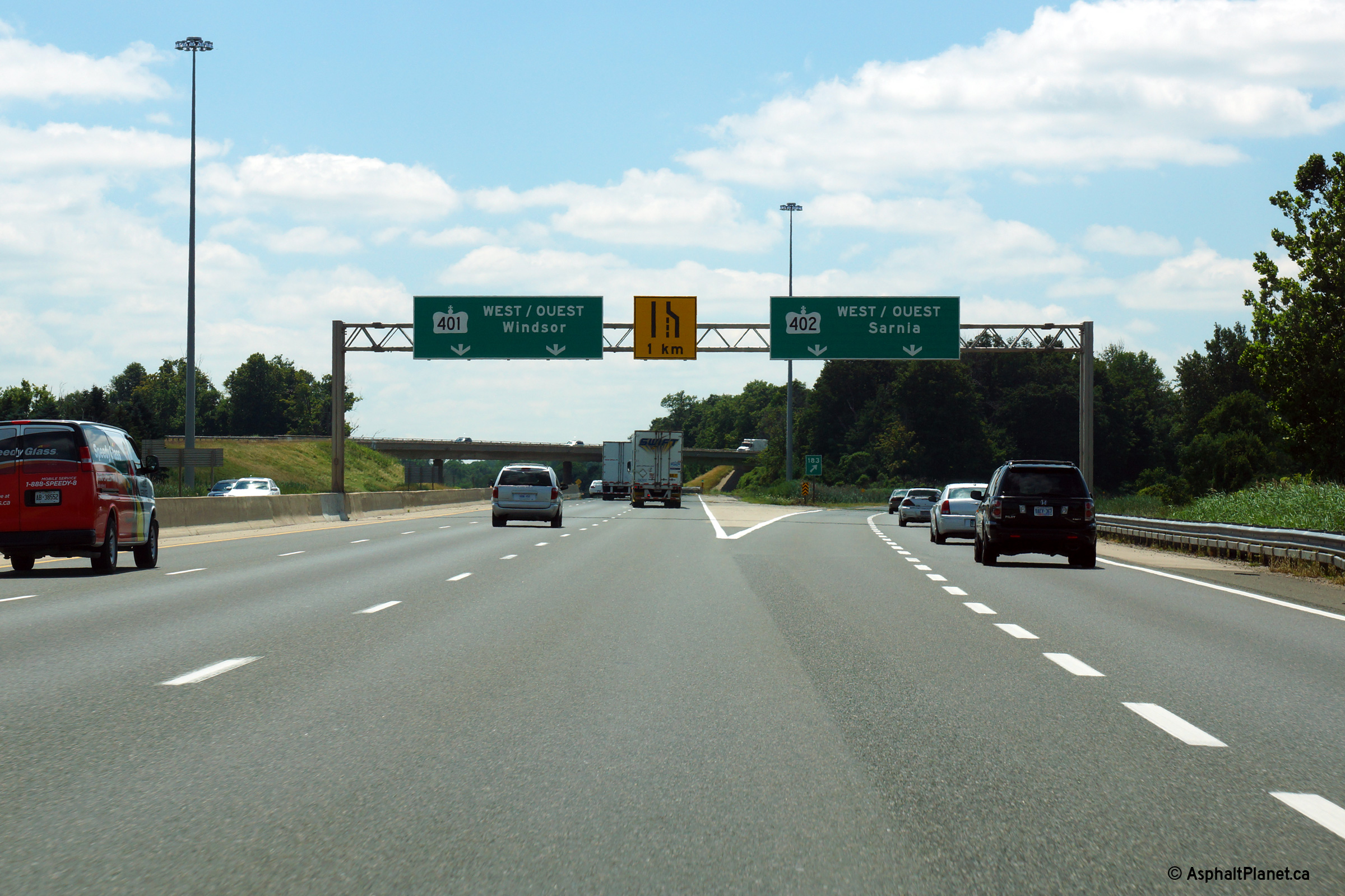
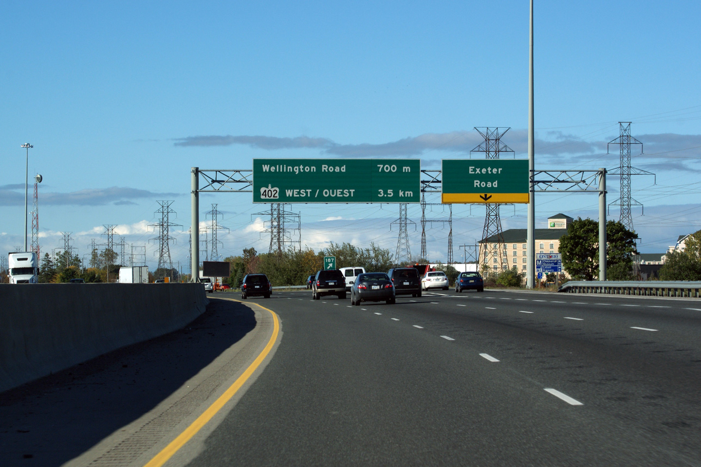
Old and new westbound signs for the Highway 402 interchange west of London.
Since the 2008 widening project along Highway 401 through the Wellington
Road interchange, the third westbound lane has ended just beyond the
off-ramp to Highway 402. Upper photo taken: September 23rd, 2005. Lower photo taken: July 24th, 2013. |
 (720x480) (720x480)(1440x960) (2400x1600) |
||
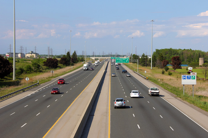
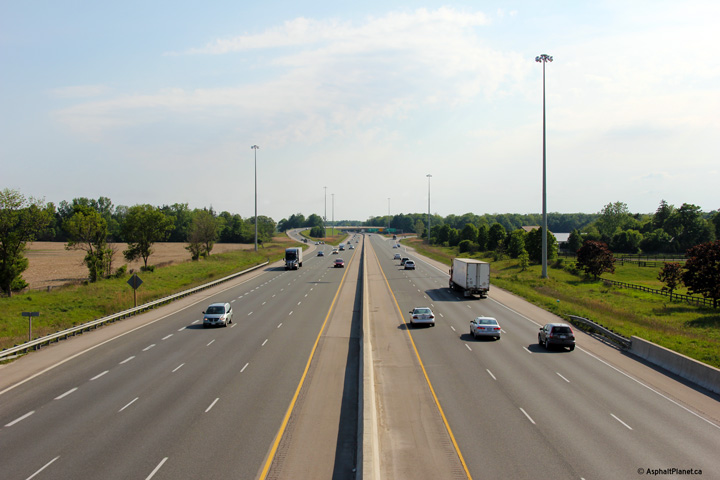
| City of London |
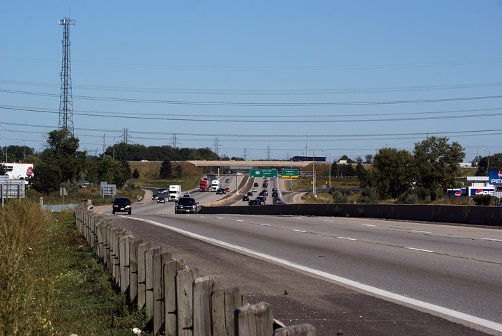
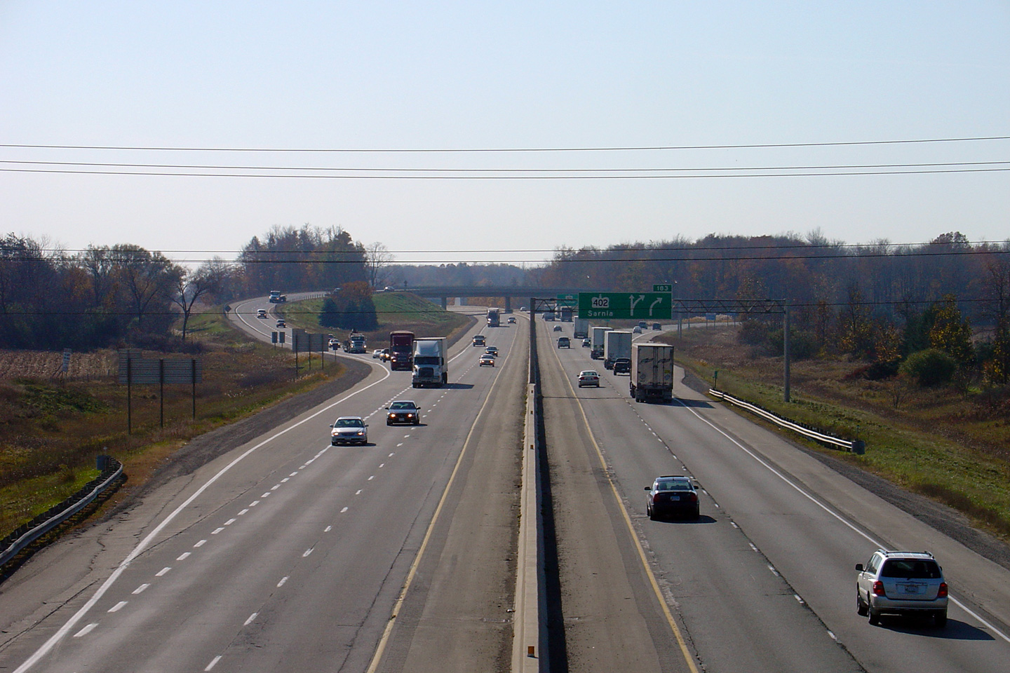
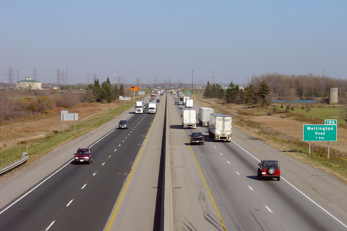
Highway 401 looking west from Dingman Drive. Dingman Drive is located approximately 1km east of the Highway 401/402 interchange. Notice that the ramp from Highway 402 to the 401 no longer narrows to a single lane before joining the 401. This was arguably the biggest improvement during the recent widening project.
Upper photo taken: November 4th, 2005.
Lower photos taken: May 21st, 2012. |
(720x480) (1440x960) (2400x1600)
|
||
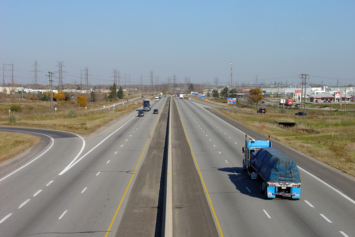
| City of London |
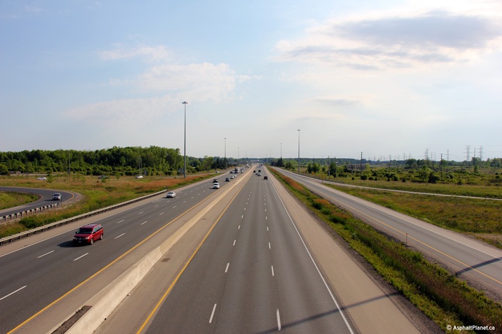
Looking east from the Dingman Road overpass towards the Wellington Road
interchange. Upper photo taken: November 4th, 2005. Lower photo taken: May 21st, 2012. |
 (720x480) (1440x960) (2400x1600) |
||
| City of London |
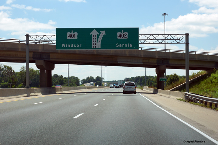
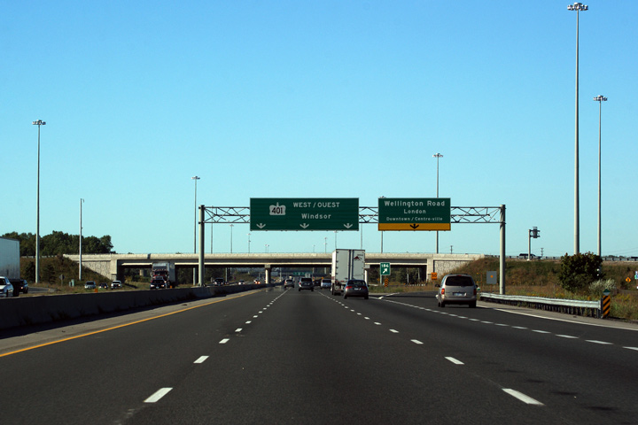
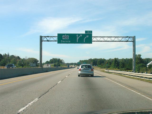
Old and new advanced signage for the Highway 402 interchange. Despite
the overhead sign support being widen enough for a three lane carriageway
beneath it, the sign and gantry in the upper photo was completely removed
and replaced with the diagram sign that is now located immediately east of
the Dingman Drive overpass. Upper photo taken: September 23rd, 2005. Lower photo taken: July 24th, 2013. |
 (720x480) (720x480)(1440x960) (2400x1600) |
||
| City of London |
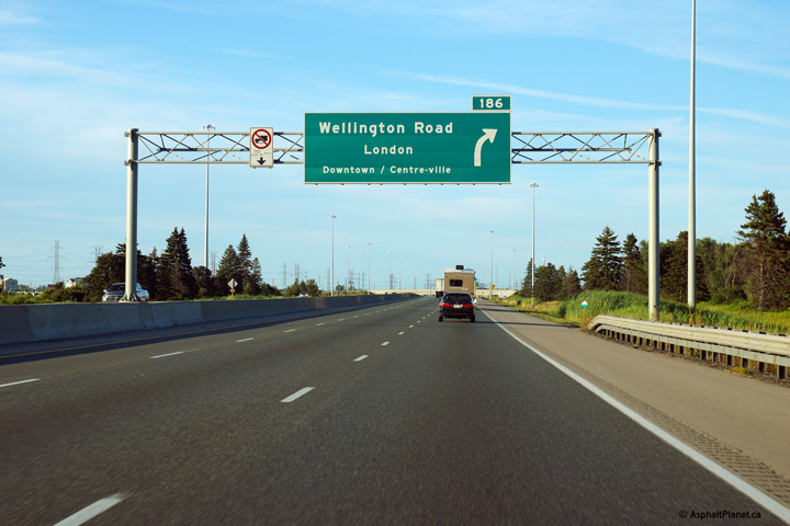
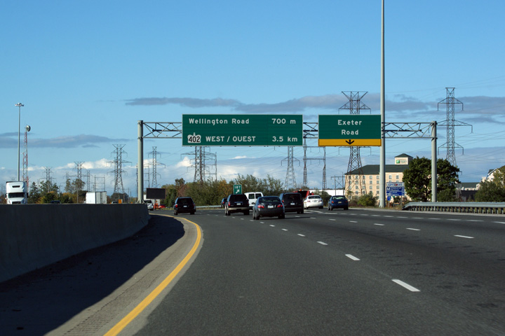
Eastbound advanced signage for the ramp to Wellington Road in London.
Traffic bound for Downtown London is directed to use this interchange. Photo taken: July 24th, 2013. |
 (720x480) (720x480)(1440x960) (2400x1600) |
||
| City of London |
The eastbound off-ramp to Wellington Road. Photo taken: July 24th, 2013. |
 (720x480) (720x480)(1440x960) (2400x1600) |
||
| City of London |
Looking west from the Wellington Road overpass in
London. The upper photo shows Wellington Road intersecting the 401 at
a three-quarter cloverleaf interchange. This interchange was replaced
with the modern parclo A4 configuration during a multiyear construction
project that was completed in 2008. The lower photo shows the
reconfigured interchange. Upper photo taken: November 4th, 2005. Lower photo taken: May 21st, 2012. |
 (720x480) (1440x960) (2400x1600) |
||
| City of London |
Before and after views of the Macdonald Cartier Freeway taken looking
easterly from the Wellington Road overpass in London. As evident from
the photos, the reconstruction was quite substantial. Upper photo taken: November 4th, 2005 Lower photos taken: May 21st, 2012. |
 (720x480) (1440x960) (2400x1600) 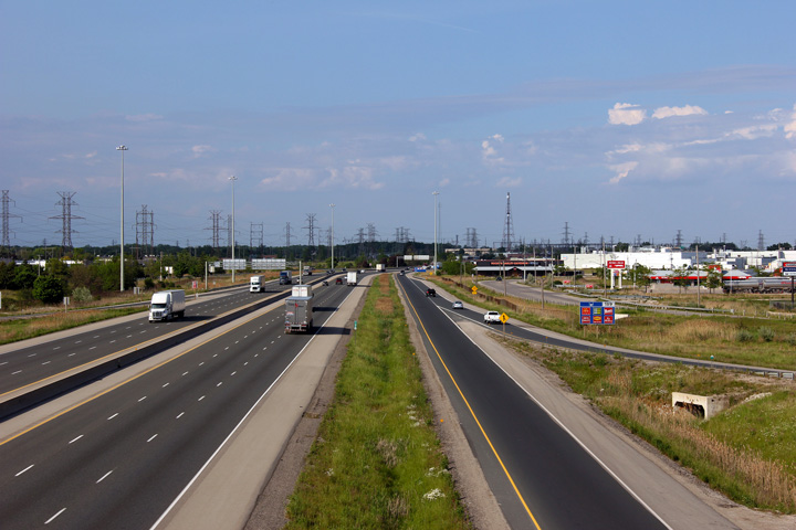 (720x480) (1440x960) (2400x1600) |
||
| City of London |
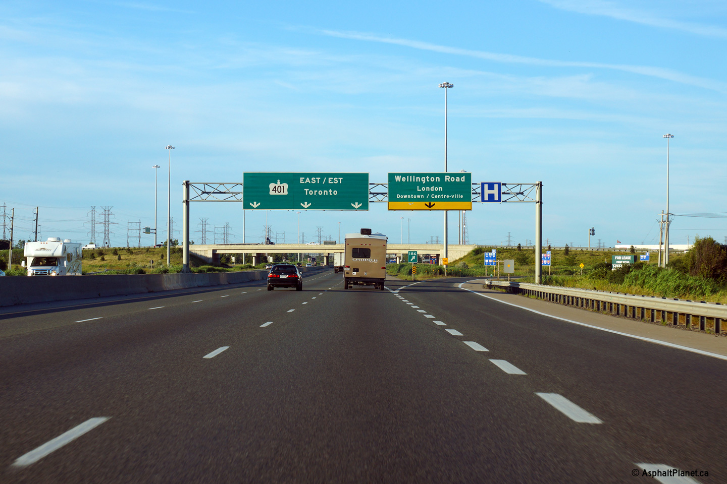
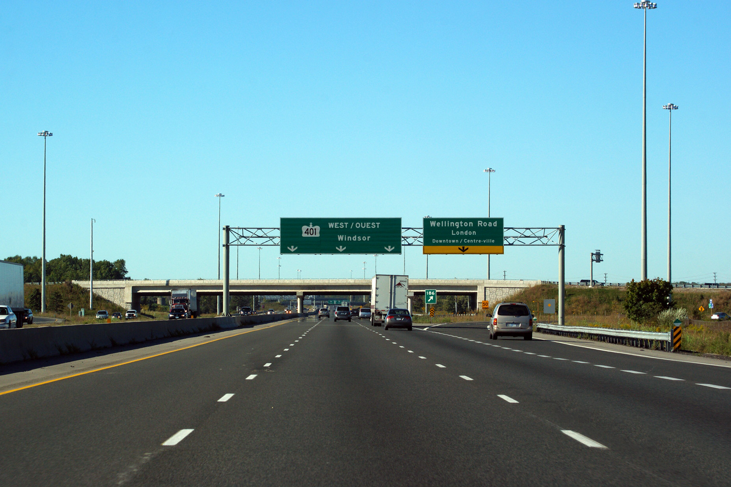
New signage heading westbound for Wellington Road in London.
Wellington Road is the principal access from Highway 401 into Downtown
London. The text marking Wellington Road as the access into
Downtown/Centre-Ville is a nice touch, and was not found on the previous
incarnation of this signage. Photo taken: September 19th, 2009. |
 (720x480) (720x480)(1440x960) (2400x1600) |
||
| City of London |
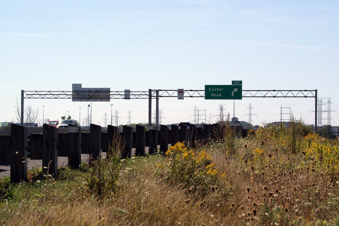
Eastbound signage at the off-ramp to Exeter Road. The off-ramp to Exeter
Road was moved a considerable distance to the west during the highway
widening through the Wellington Road interchange. The former configuration
had the ramp to Exeter Road depart the highway just overtop the crest of a
hill. Photo taken: October 1st, 2010. |
 (720x480) (720x480)(1440x960) (2400x1600) |
||
| City of London |
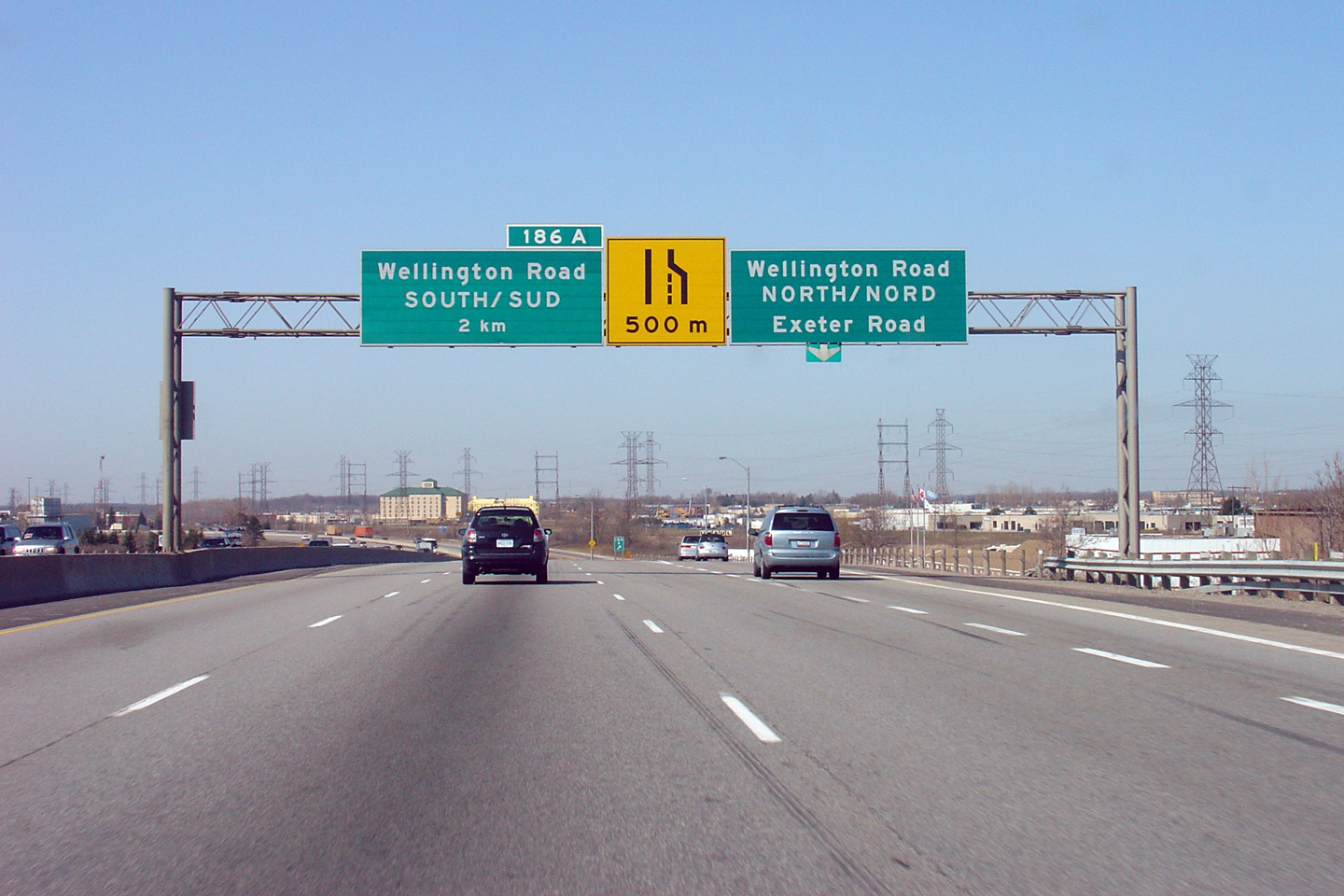
The upper sign no longer stands; it is from the days when Highway 401
narrowed to 4-lanes at the Wellington Road interchange, and when the ramps
to Wellington Road North and Exeter Road shared a common exit from the
westbound 401. The lower photo is of the same sign truss, shot after
the Wellington Road interchange was reconstructed, and the ramp to Exeter
Road was separated from the ramp to Wellington Road. Upper photo taken: April 16th, 2005. Lower photo taken: September 19, 2009. |
 (720x480) (720x480)(1440x960) (2400x1600) |
||
| City of London |
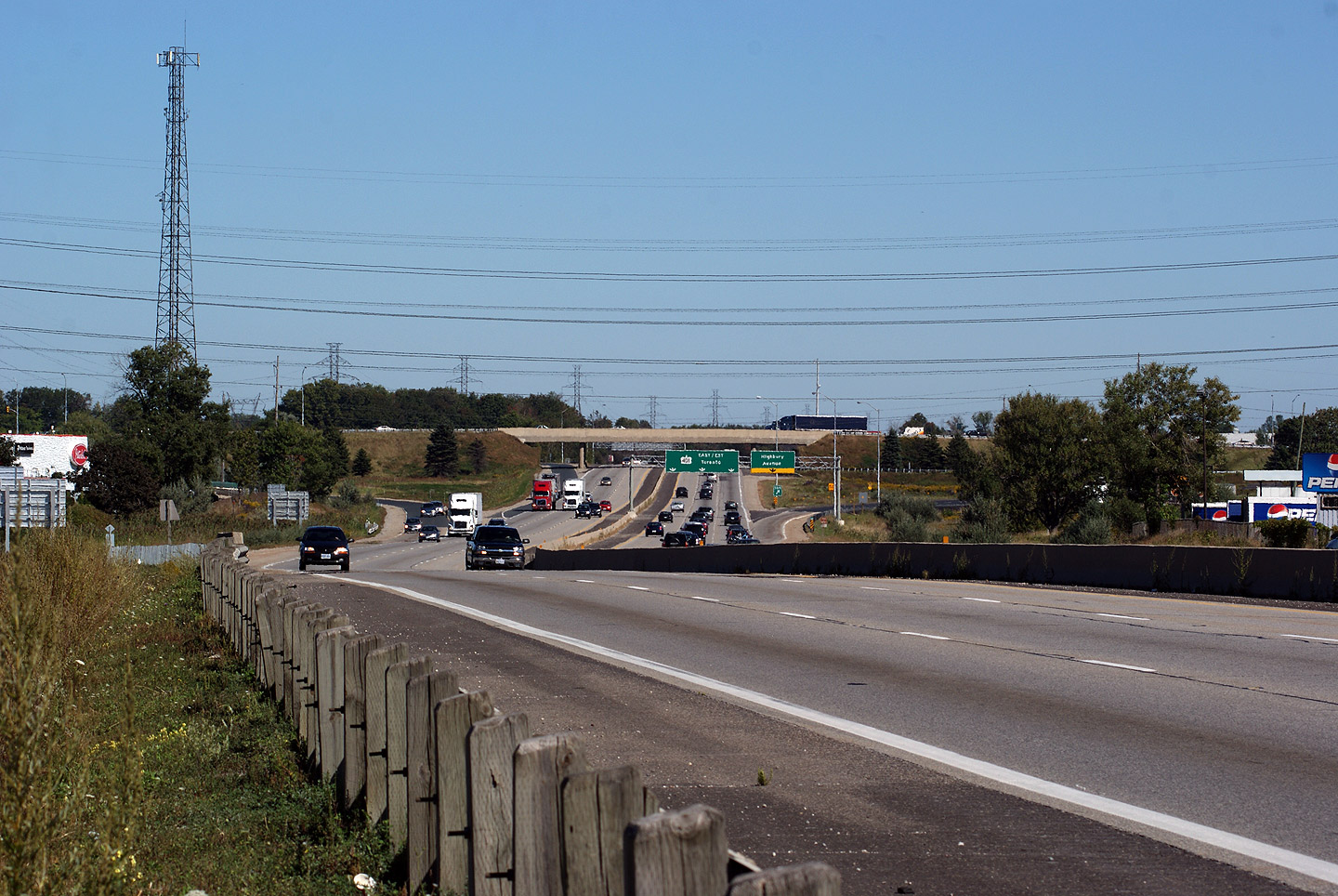
View looking easterly from the Adelaide Street South underpass towards the
Highbury Avenue interchange. Overhead signs were installed at the
Highbury Avenue interchange as part of the upgrade of the Wellington Road
interchange. Photo taken: September 19th, 2009. |
 (720x480) (1440x960) |
||
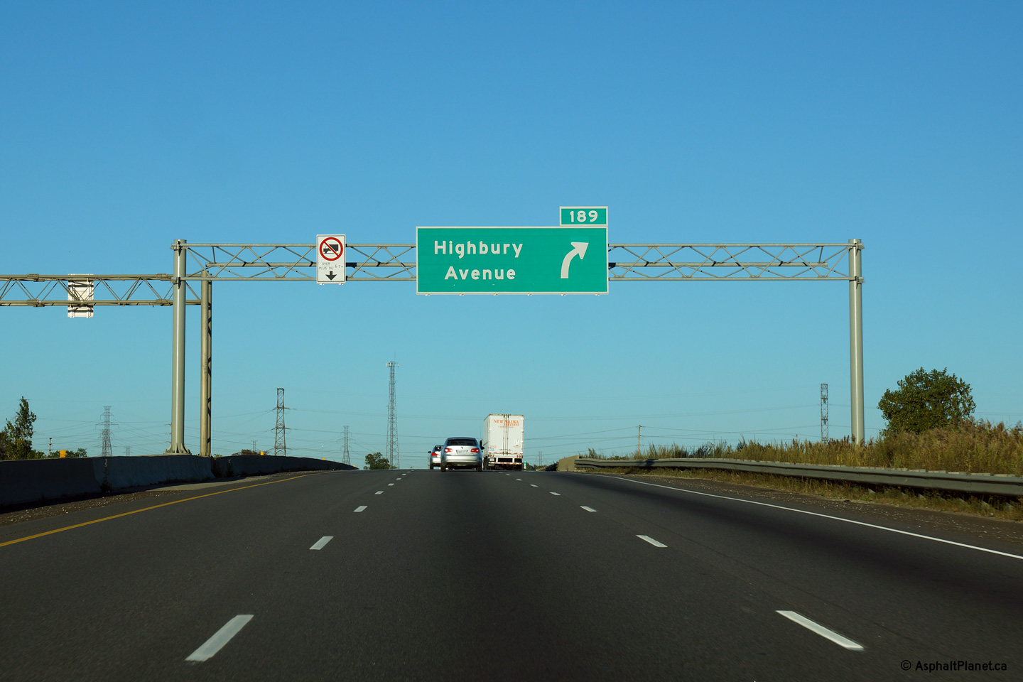
| City of London |
Advanced signage for the eastbound off-ramp to Highbury Avenue. Photo taken: September 17th, 2013. |
 (720x480) (720x480)(1440x960) (2400x1600) |
||
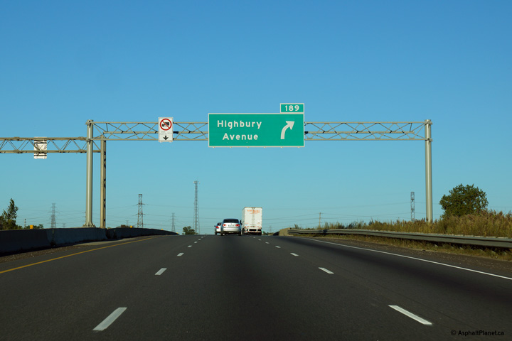
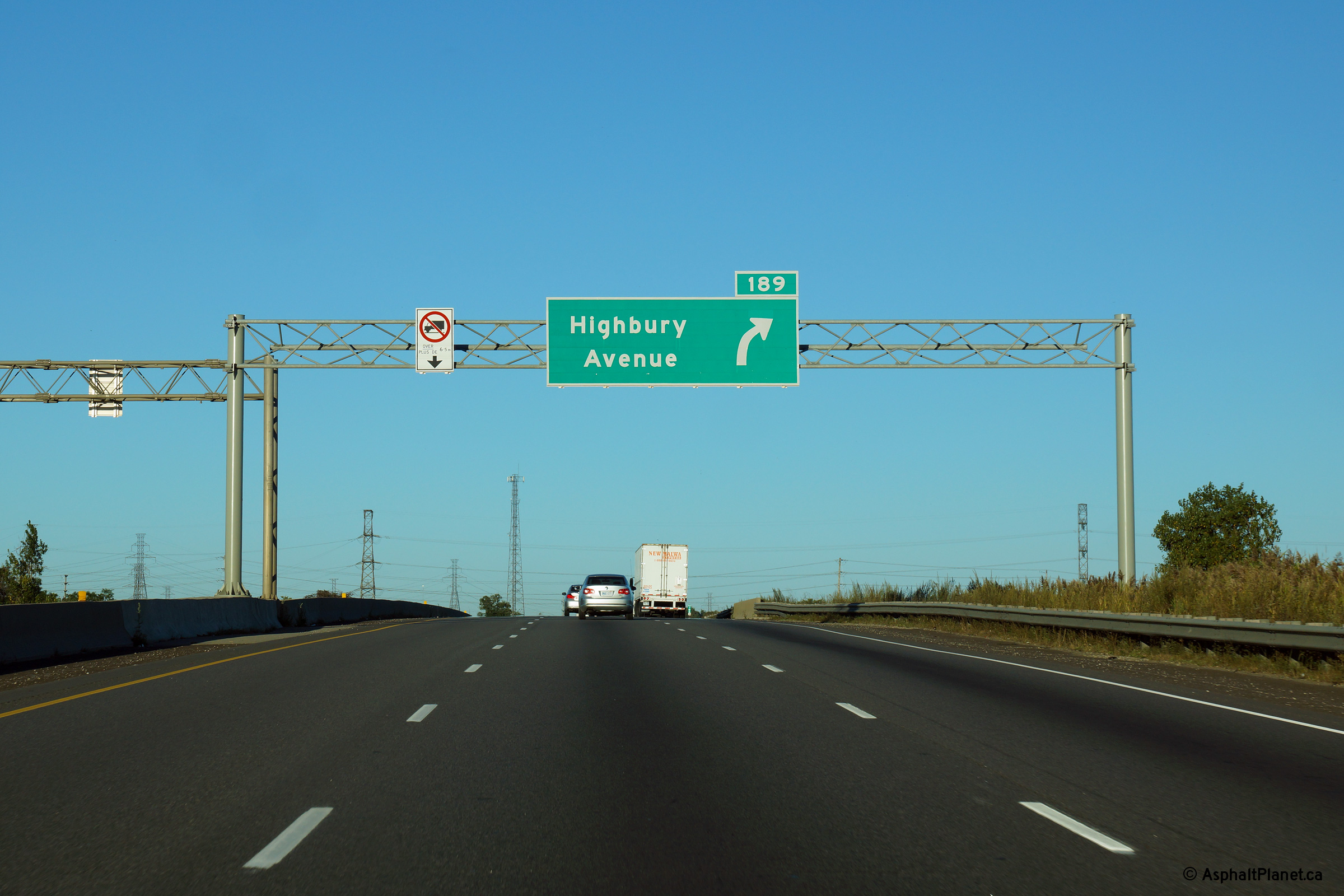
| City of London |
Eastbound signage at the ramp to Highbury Avenue. Photo taken: September 17th, 2013. |
 (720x480) (720x480)(1440x960) (2400x1600) |
||
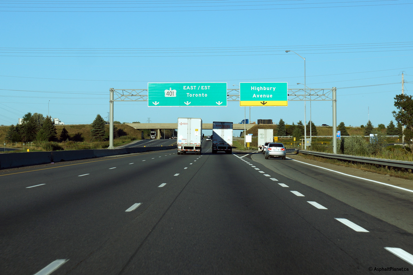
| City of London |
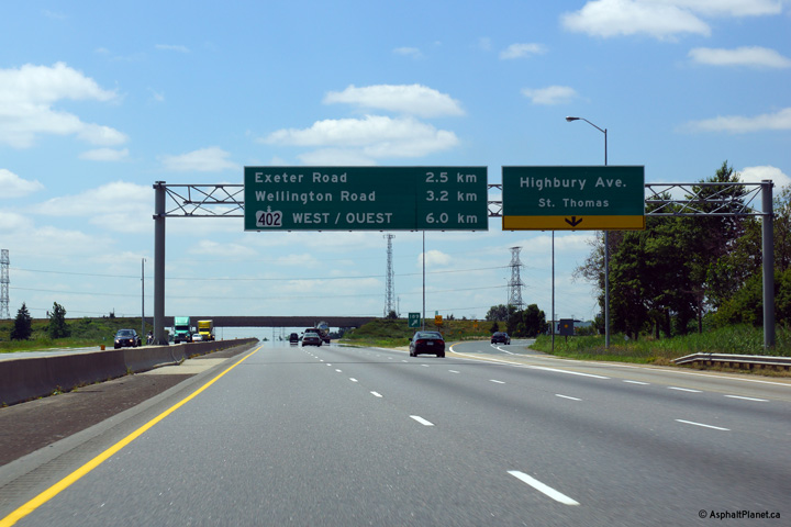
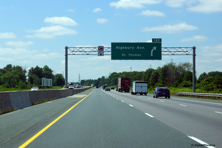
Westbound signage at the off-ramp to Highbury Avenue. Westbound
traffic bound for St. Thomas is directed to exit at Highbury Avenue.
Eastbound traffic bound for St. Thomas is directed to use Highway 4, several
kilometres to the west. Photo taken: July 24th, 2013. |
 (720x480) (720x480)(1440x960) (2400x1600) |
||
| City of London |
Westbound advanced signage for the Highbury Avenue off-ramp. Photo taken: July 24th, 2013. |
 (720x480) (720x480)(1440x960) (2400x1600) |
||
| City of London |
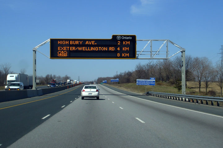
A
changeable message sign greets drivers approaching the Highbury Avenue
interchange in London. Photo taken: April 20th, 2007. |
 (720x480) (720x480)(1440x960) |
||
| City of London |
Looking west along Highway 401 from the Old Victoria Road overpass.
Old Victoria Road is located roughly at kilometre marker 193. This is
a fairly typical looking view of Highway 401 through London. Photo taken: August 31st, 2009. |
 (720x480) (1440x960) (2400x1600) |
||
| City of London |
Highway 401 looking east from the Old Victoria Road overpass in London.
Photo taken: August 31st, 2009. |
|
||
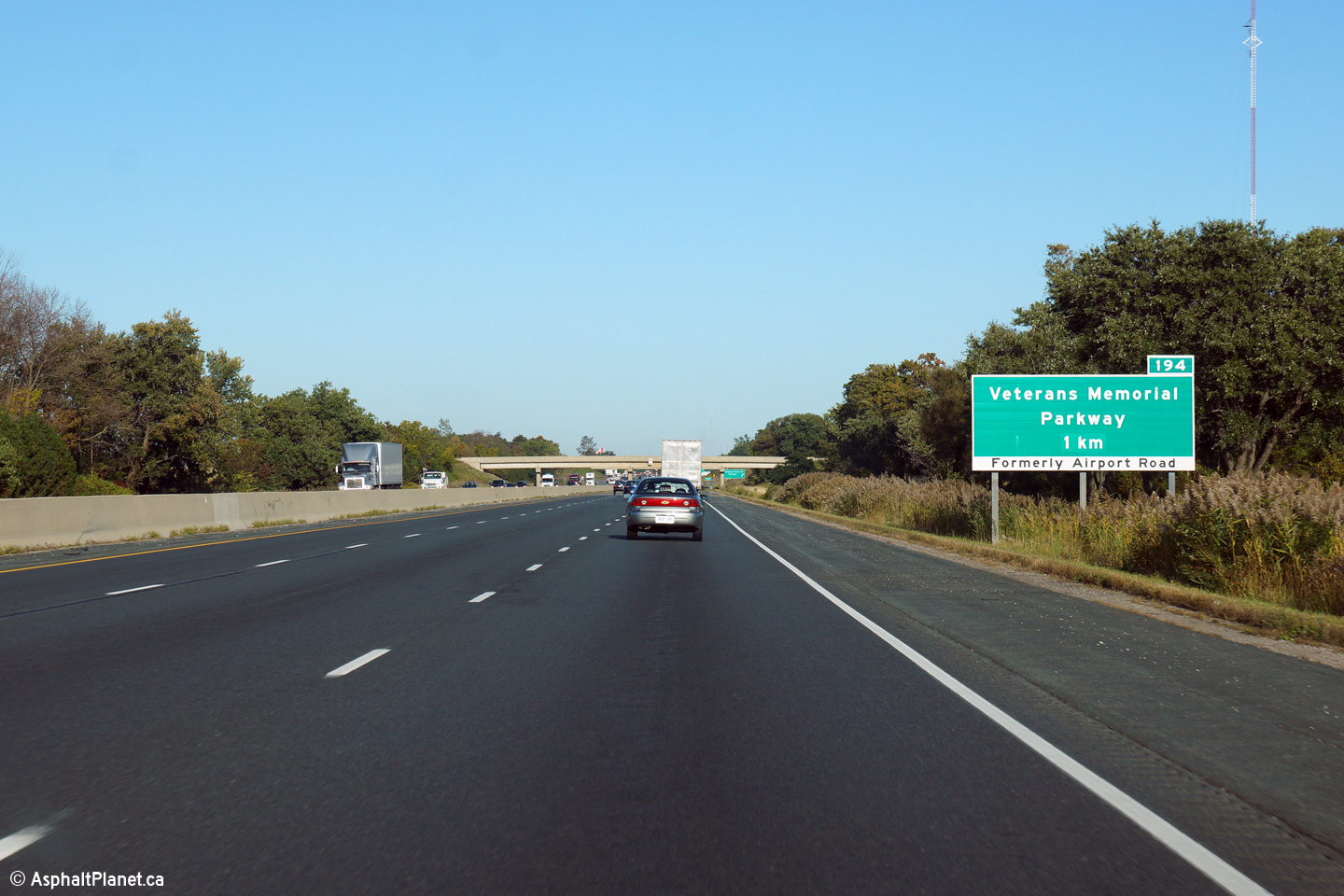
| City of London |
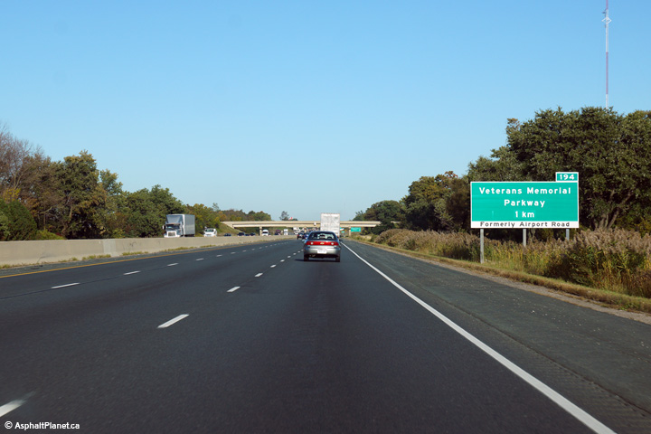
Eastbound advanced signage for the Veterans Memorial Parkway interchange in
London. Photo taken: September 25th, 2014. |
 (720x480) (720x480)(1440x960) (2400x1600) |
||
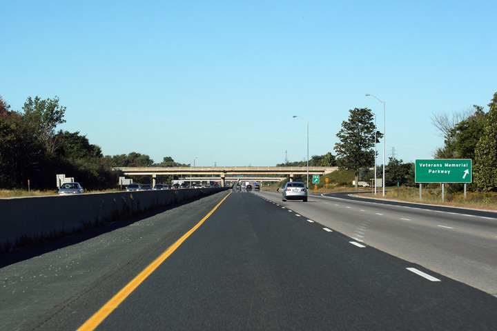
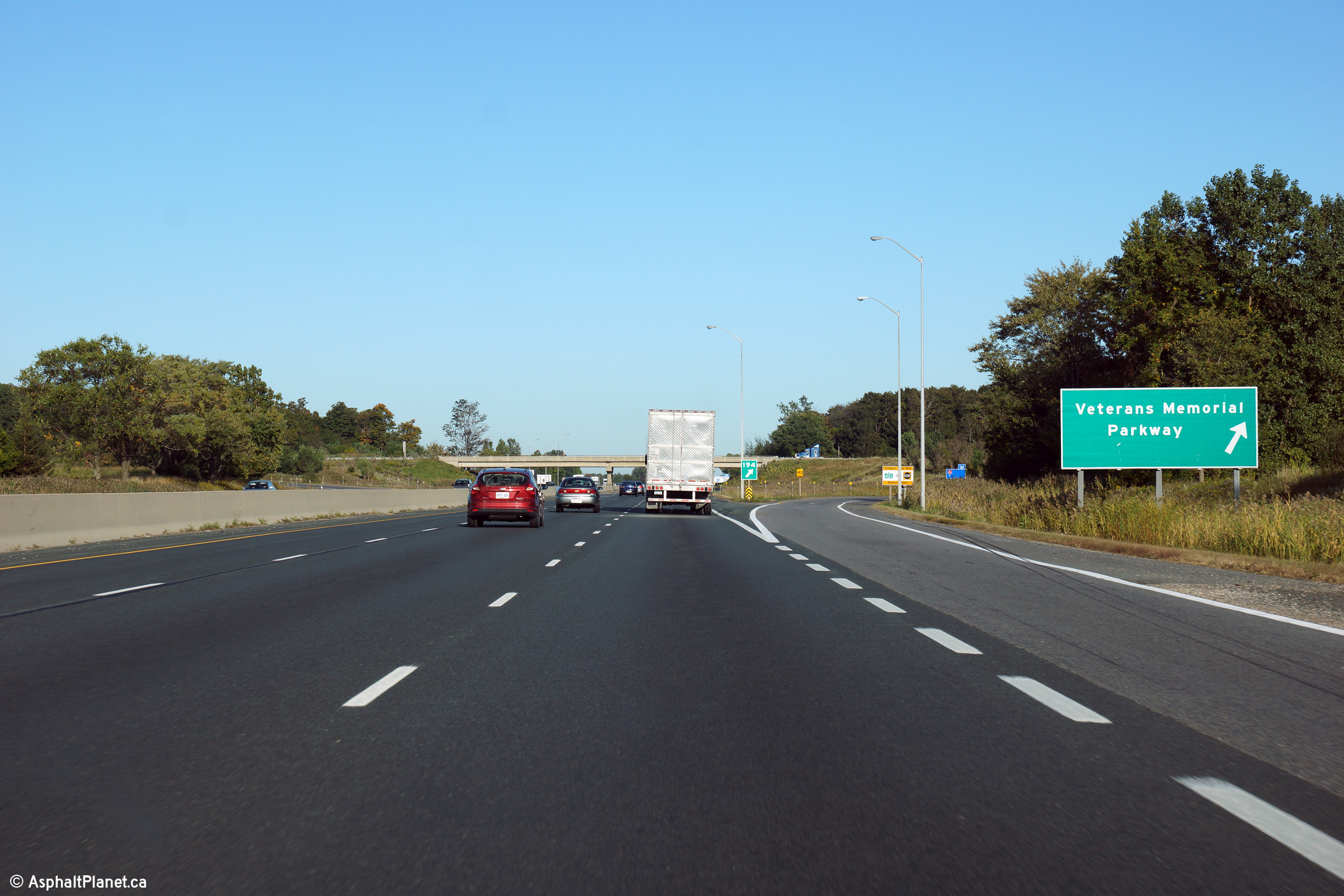
| City of London |
Signage at the eastbound off-ramp to Veterans Memorial Parkway. Photo taken: September 25th, 2014. |
 (720x480) (720x480)(1440x960) (2400x1600) |
||
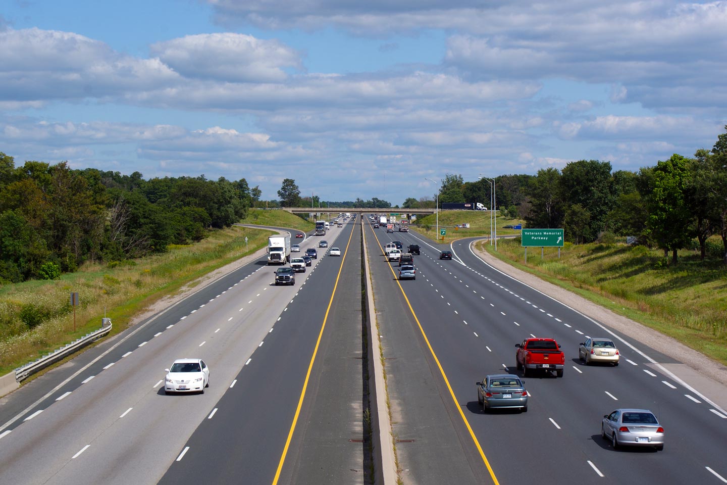
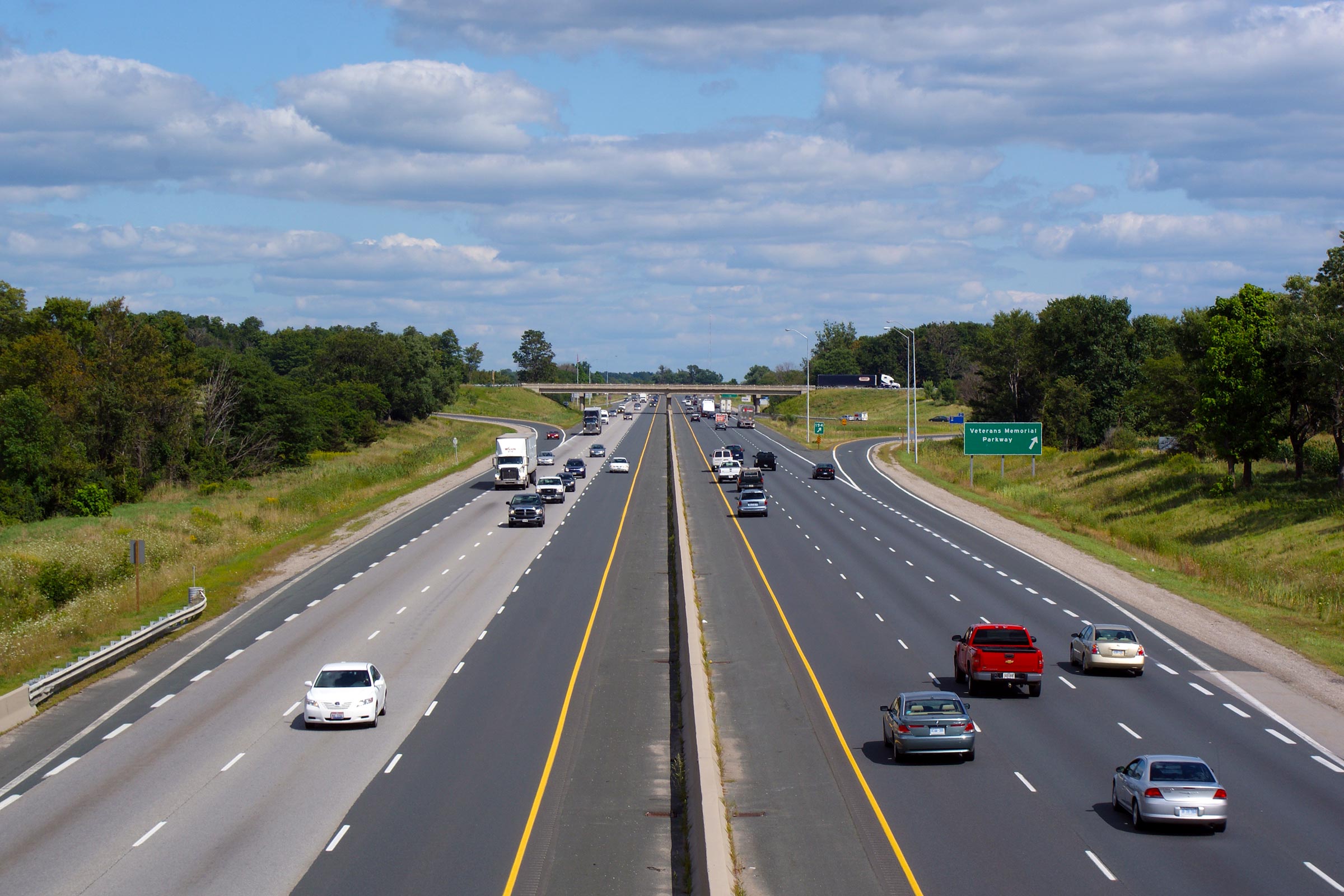
| City of London |
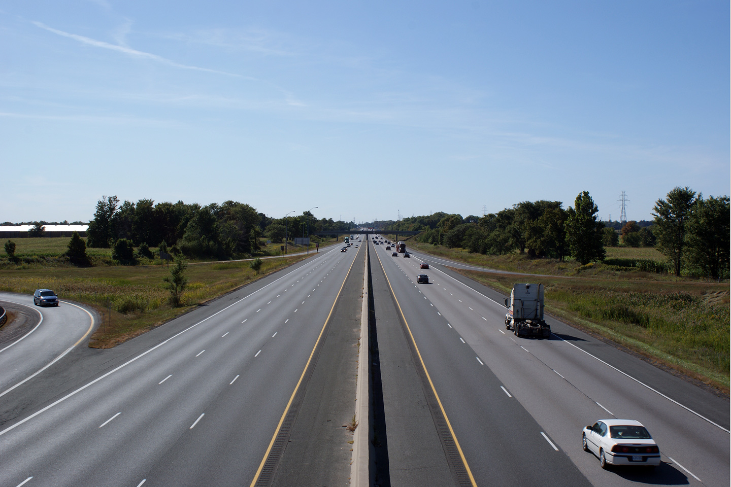
View looking west from the Veterans Memorial Parkway overpass in eastern
London. The Old Victoria Road overpass is visible in this photo.
Old Victoria Road was at one point considered as the eastern part of the
London Ring Road. Instead the city and province chose to route the
eastern leg a few kilometres to the east, at what is now Veterans Memorial
Parkway (formerly Highway 100). Photo taken: September 19th, 2009. |
 (720x480) (1440x960) (2400x1600) |
||
| Veteran's Memorial Parkway was formerly Highway 100, and leads northerly along the eastern edge of London. Click here for Highway 100 images. | ||||
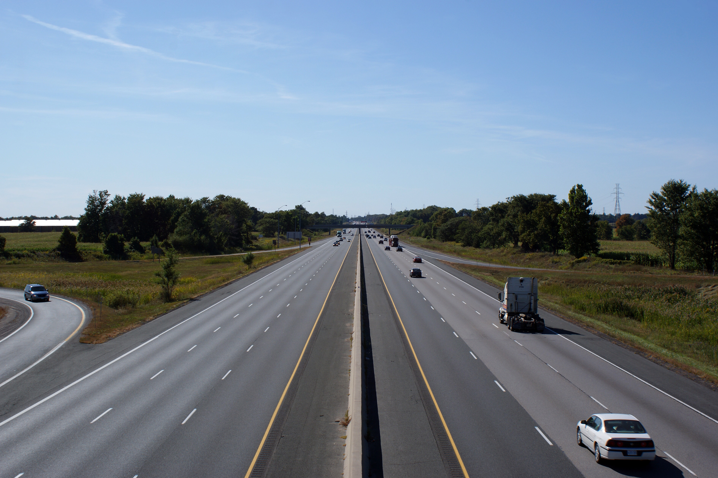
| City of London |
Looking east from the Veterans Memorial Parkway. Veterans Memorial Parkway
is located at kilometre marker 194. Photo taken: September 19th, 2009. |
 (720x480) (1440x960) (2400x1600) |
||
| City of London |
Westbound signage for Veterans Memorial Parkway Veterans Memorial
Parkway was formerly known as Airport Road. Airport Road was formerly
known as Highway 100. Photo taken: September 19th, 2009. |
 (720x480) (720x480)(1440x960) |
||
| Click here for London to Woodstock Images | ||||
Page 4 - Aerials
Photos shown in this table are arranged from West to East:
| Proper Municipality Name | Photo Description | Photo |
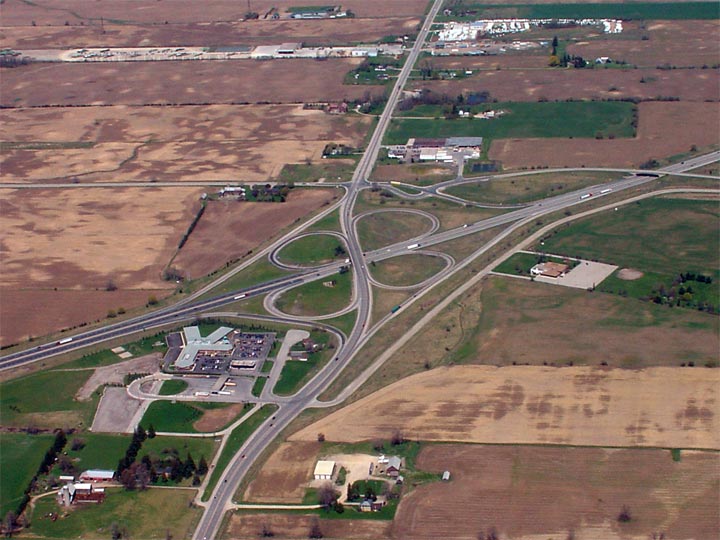
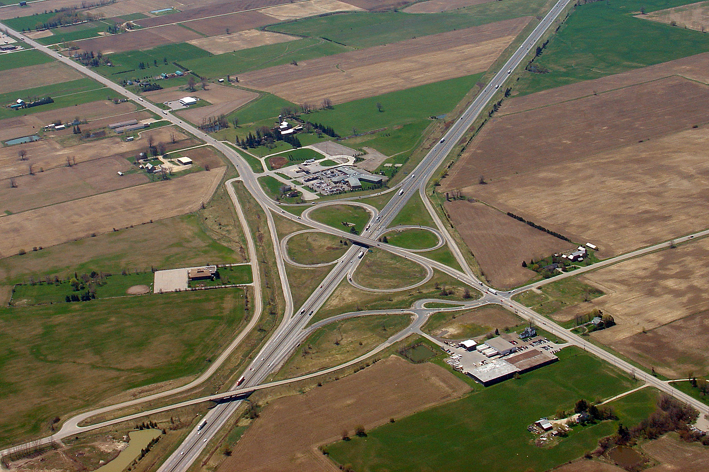
| City of London |
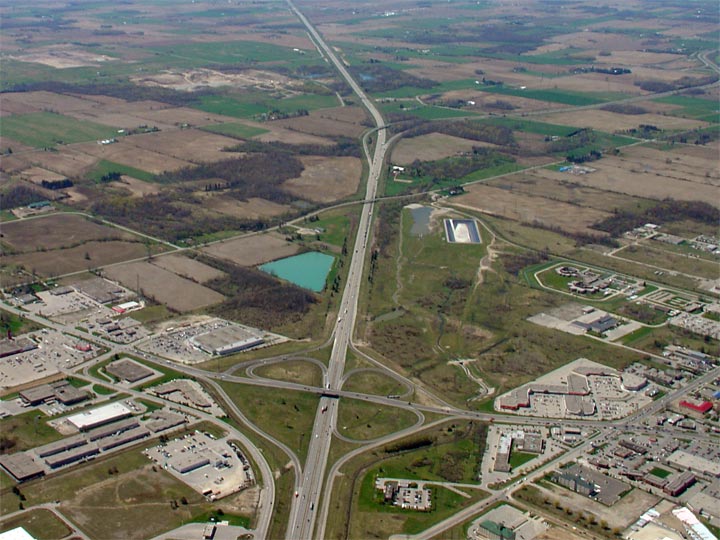
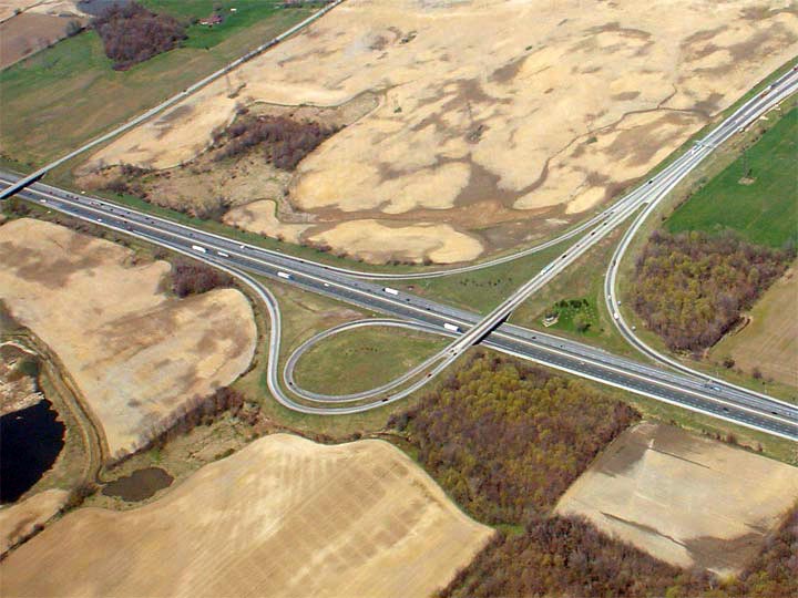
View looking northerly at the Highway 4/401 cloverleaf interchange in the
southwestern portion of the city of London. Photo taken: April 28th, 2006. Size: 85kb. |
 |
| City of London |
A wide angle photo looking northwesterly towards London at the Highway
4/401
cloverleaf. Photo taken: April 28th, 2006. Size: 70kb. |
 |
| City of London |
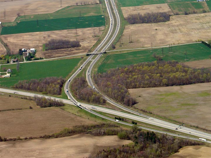
This view looks south towards St Thomas at the Highway
4/401 cloverleaf interchange. Photo taken: April 28th, 2006. Size: 60kb. |
 |
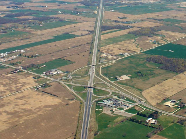
| City of London |
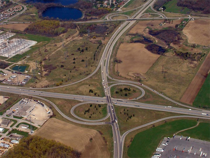
View looking northeasterly towards the Highway 4/401 cloverleaf interchange.
The Highway 4/401 cloverleaf was a textbook
example of a cloverleaf until very recently when the westbound to northbound off-ramp
was realigned to meet Glanworth Road instead of meeting directly with
Highway 4. Photo taken: April 28th, 2006. Size: 85kb. |
 (720x480) (1440x960) |
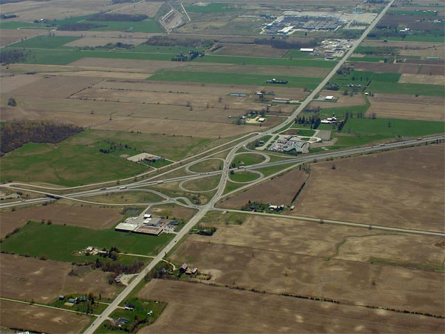
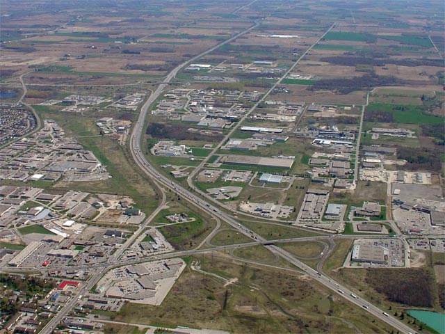
| City of London |
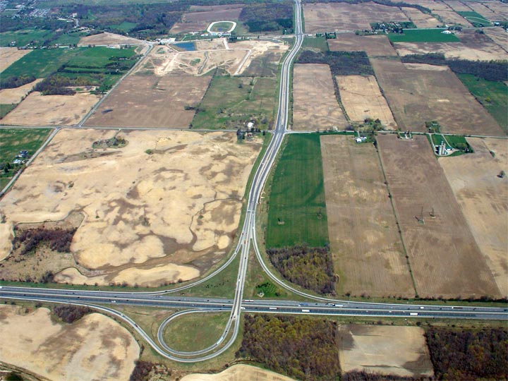
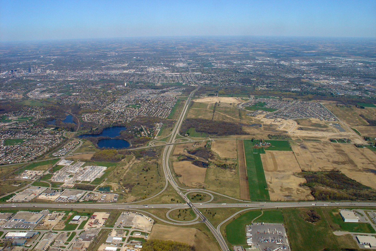
Wide angle view of the Highway 401/402 semi-directional-'Y' interchange
looking westerly. At the top of this photo the Wonderland Road/402
interchange is visible. This interchange was constructed in 1997 and is the newest interchange on
Highway 402. Photo taken: April 28th, 2006. Size: 85kb. |
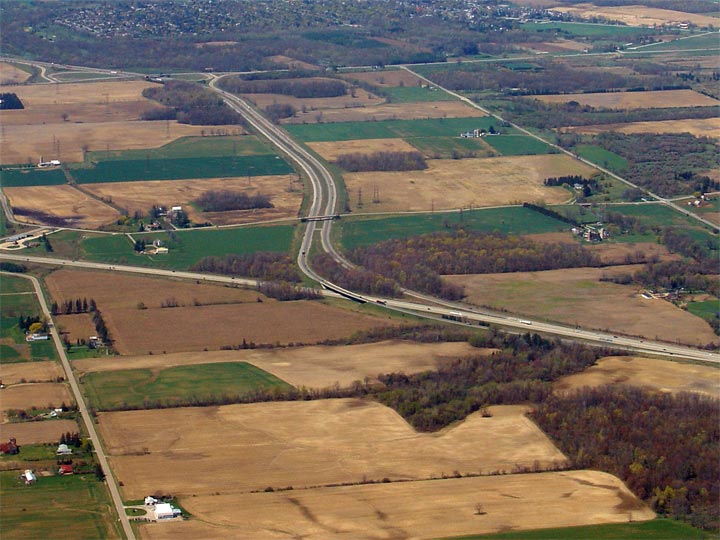 |
| City of London |
A more close-up view of the Highway 401/402 interchange. Because both
Highways 401 and 402 are east-west
freeways, this interchange is not full access. Photo taken: April 28th, 2006. Size: 80kb. |
 |
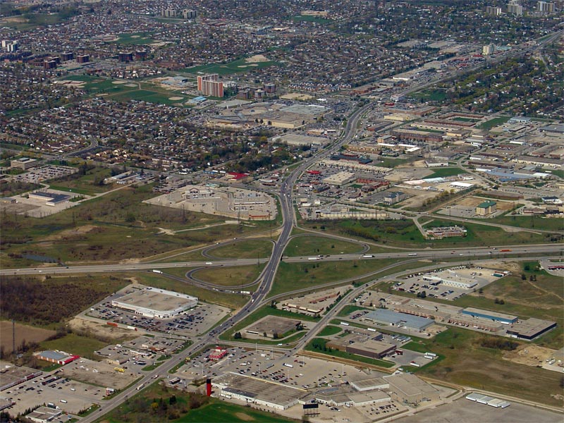
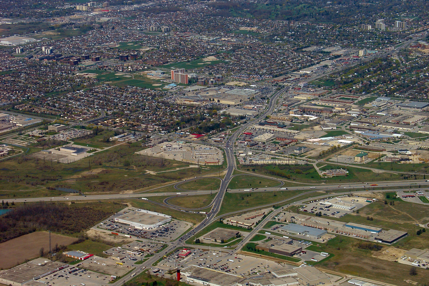
| City of London |
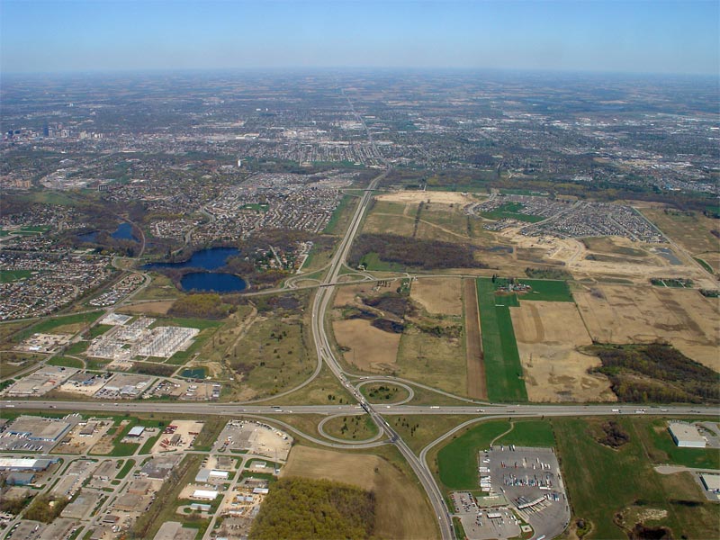
View looking easterly towards the Wellington Road and Highbury Avenue
interchanges along Highway 401 in London. The 401 passes a
considerable distance south of most of the City of London. It is only
between Wellington Road and Highbury Avenue that development has surrounded
the Highway 401 corridor. Photo taken: April 28th, 2006. Size: 85kb. |
 |
| City of London | Looking north towards the Wellington Road
interchange. Starting in the summer of 2006 the Wellington Road
interchange will be reconstructed as a 'parclo' A-4 as part of a project to
widen Highway 401 to 6-lanes between Wellington Road and Highway 402. Photo taken: April 28th, 2006. Size: 150kb. |
 (720x480) (1440x960) |
| City of London |
A more zoomed in view of the Wellington Road interchange. Originally,
Wellington Road met Highway 401 at a full cloverleaf interchange. The
eastbound to northbound loop was removed in the late 1980s when Highway 401
was first 6-laned between Wellington Road and Highbury Avenue. Photo taken: April 28th, 2006. Size: 90kb. |
 |
| City of London |
Looking southwesterly towards the Wellington Road interchange. In this
photo virtually the entire project limits of the contract to widen Highway
401 to six lanes through western London is shown.
Click here for more
pre-construction photos between Wellington Road and Highway 402. Photo taken: April 28th, 2006. Size: 90kb. |
 |
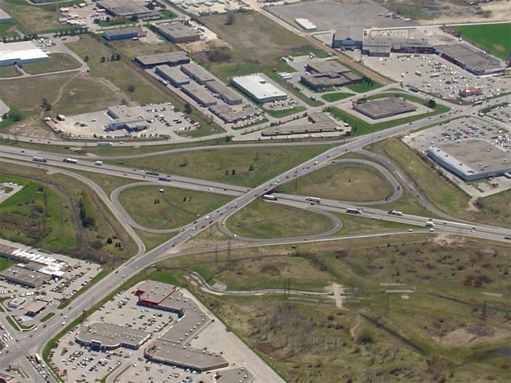
| City of London |
View looking northerly at the Highbury Avenue interchange along Highway 401.
In addition to showing the Highway 401 interchange, this photo showcases the
entire length of Highbury Avenues short freeway section in London.
Before 1991 Highbury Avenue was part of the provincial highway network as
Highway 126. Photo taken: April 28th, 2006. Size: 110kb. |
 (720x480) (1440x960) |
| City of London |
The Highbury Avenue interchange in more detail. When originally opened
in 1963, Highbury Avenue (Highway 126) met Highway 401 at a cloverleaf
interchange. This interchange was reconstructed to its current
configuration in the early 1990s when Highway 401 was widened to six lanes
through Eastern London. Photo taken: April 28th, 2006. Size: 85kb. |
 |
| City of London |
View looking north at the Highway 401/Veterans Memorial Parkway interchange.
Veterans Memorial Parkway (formerly Airport Road) was widened to 4-lanes
for much of its length during the 2005 construction season. Photo taken: April 28th, 2006. Size: 95kb. |
 |
| City of London |
Another view of the Highway 401/Veterans Memorial Parkway interchange, this
time looking northwest. The trumpet interchange at Veterans Memorial
Parkway is quite similar to the trumpet interchange at the Hanlon Parkway in
Guelph. Photo taken: April 28th, 2006. Size: 75kb. |
 |
<- Page 3 Images Highway 401 Images Index Page 5 Images ->
<- Highway 400 Images Back to Highway 401 Highway 402 Images ->
Copyright (c) 2004-2015, AsphaltPlanet.ca AsphaltPlanet@asphaltplanet.ca


