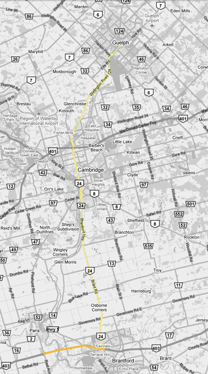
King's Highway 24 - Images
<- Page 1 Page 2 - Highway 403 to Guelph Page 3->
Photos shown in this table are arranged from South to North:
| Proper Municipality Name | Photo Description | Photo | |
|
Photos taken from driver's perspective appear offset from centre-line Photos: |
North- Bound |
South- Bound |
|
| Continued from Highway 59 to Highway 403 Images | |||
| Highway 403 continues westerly from Highway 24 towards Highway 401 at Woodstock. Click here for Highway 403-West images. | |||
| City of Brant County |
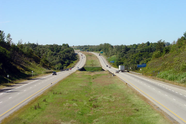
Easterly view from the Rest Acres Road overpass. Highway 24 piggybacks
along the 403 for 9km between this interchange and King George Road in
Brantford. Photo taken: September 24th, 2005. |
 |
|
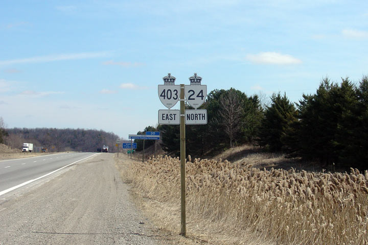
| City of Brant County |
Signage denoting the Highway 24/403 multiplex. Highway 24 shields were
added along the 403 in early March of 2006. Photo taken: March 21st, 2006. |
 |
|
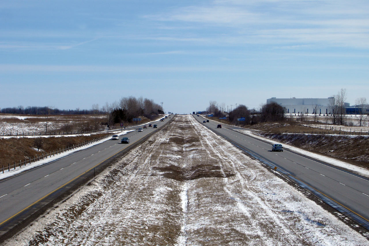
| City of Brant County |
This view looks west from an abandoned rail overpass towards the Grand River
Valley. Considerable grading was carried out to carry the 403 over the
Grand River watercourse. Photo taken: September 24th, 2005. |
 |
|
| City of Brant County |
Opposing view, looking east towards the Oak Park Road interchange. Photo taken: September 24th, 2005. |
 |
|
| City of Brant County |
Looking west from Oak Park Road. Photo taken: March 17th, 2007. |
 |
|
| City of Brant County |
View towards Brantford. Photo taken: March 17th, 2007. |
 |
|
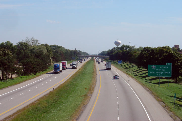
| City of Brant County |
View looking west from the CN mainline overpass in western Brantford. Photo taken: March 9th, 2007. |
 |
|
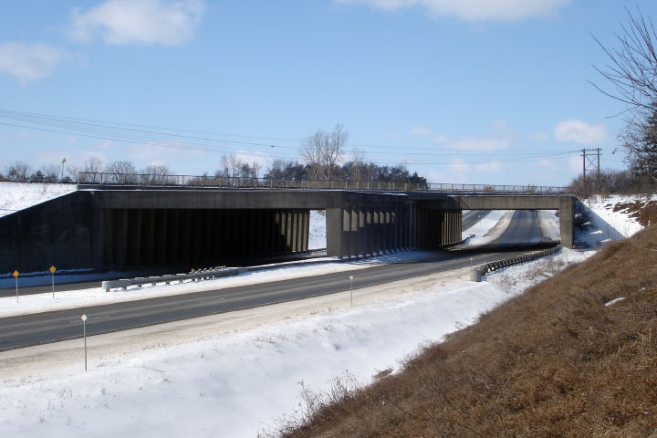
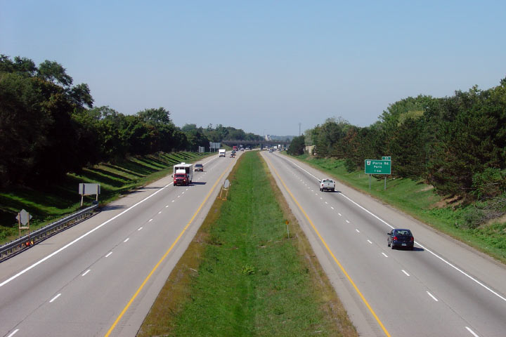
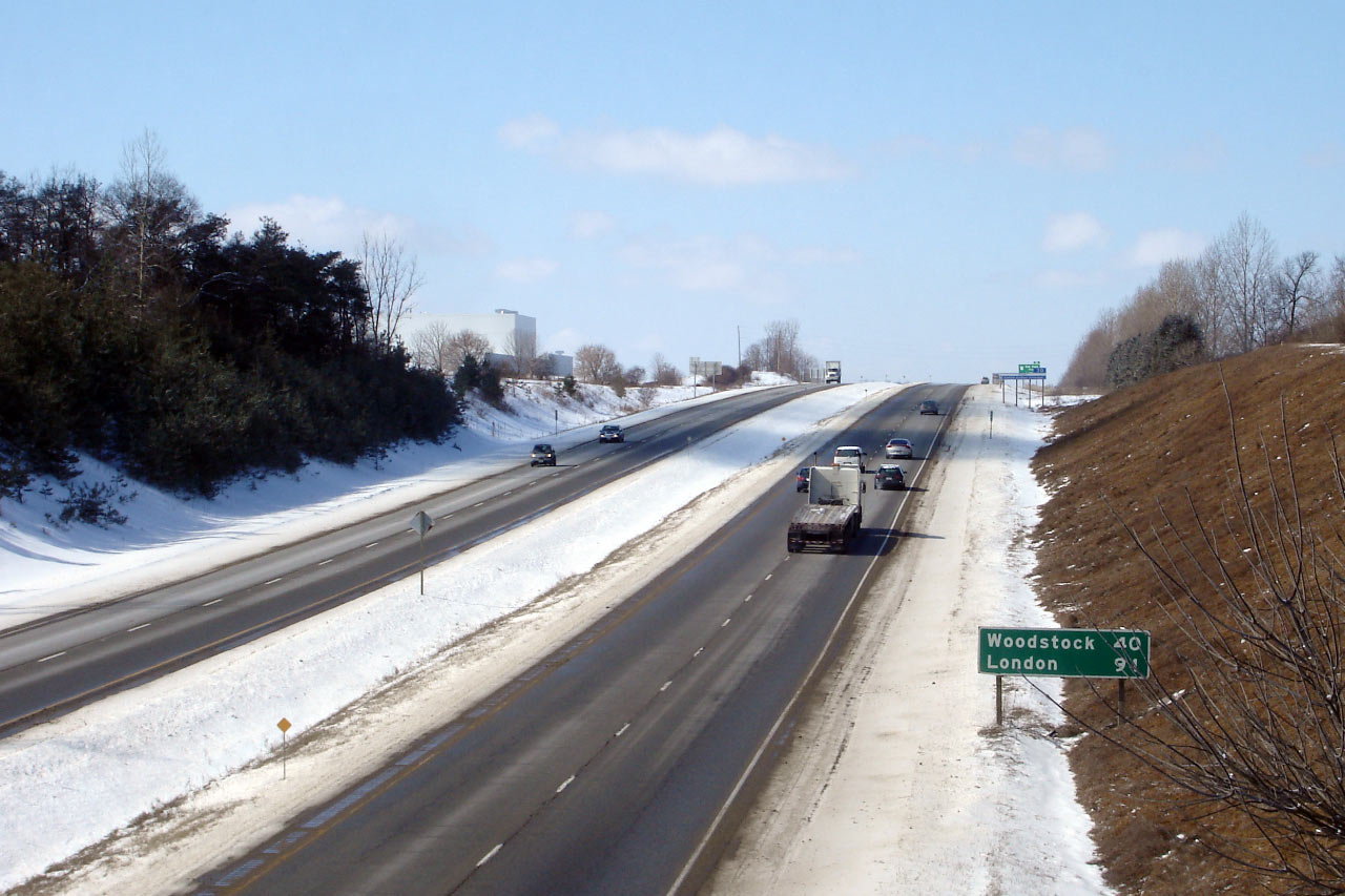
| City of Brant County |
Wintery view looking east towards the Paris Road interchange in Brantford
from the CN mainline crossing. Photo taken: March 9th, 2007. |
 |
|
| City of Brant County |
The CN bridge is of a unique design. This view looks west. Photo taken: March 9th, 2007. |
 |
|
| Paris Road is part of the former Highway 2, and is a b-line between Brantford and Paris at this interchange. Click here for Highway 2 images. | |||
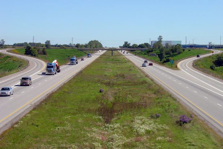
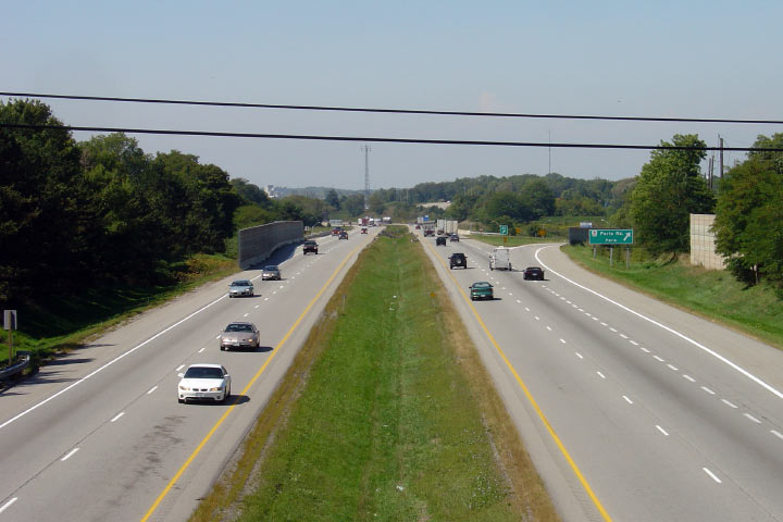
| City of Brantford |
Looking west towards the Paris Road (Highway 2) interchange from Ewing
Drive. Photo taken: September 14th, 2007. |
 |
|
| City of Brantford |
Looking east from Ewing Drive in Brantford. Photo taken: September 14th, 2007. |
 |
|
| City of Brantford |
Westerly view from the Toll Gate Road overpass. Photo taken: September 14th, 2007. |
 |
|
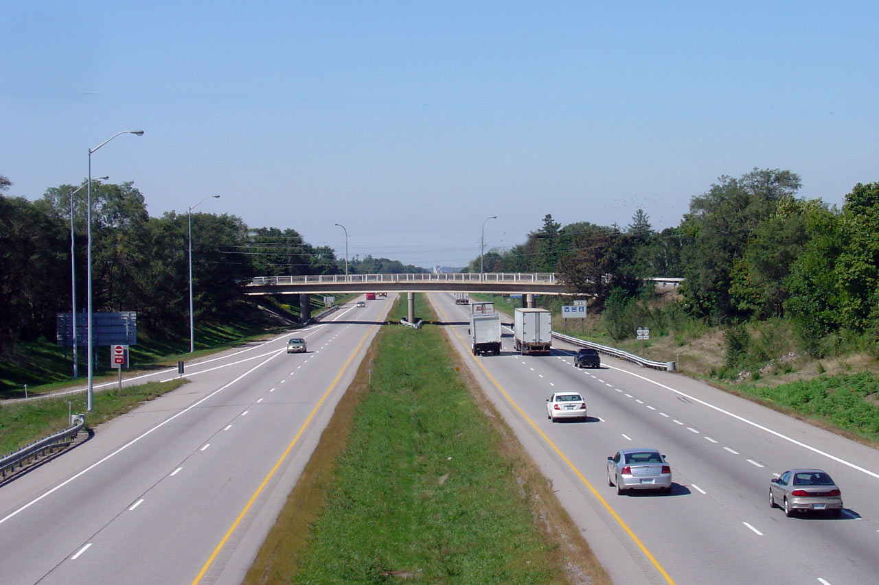
| City of Brantford |
Looking east towards the King George Road interchange from Toll Gate Road. Photo taken: September 14th, 2007. |
 |
|
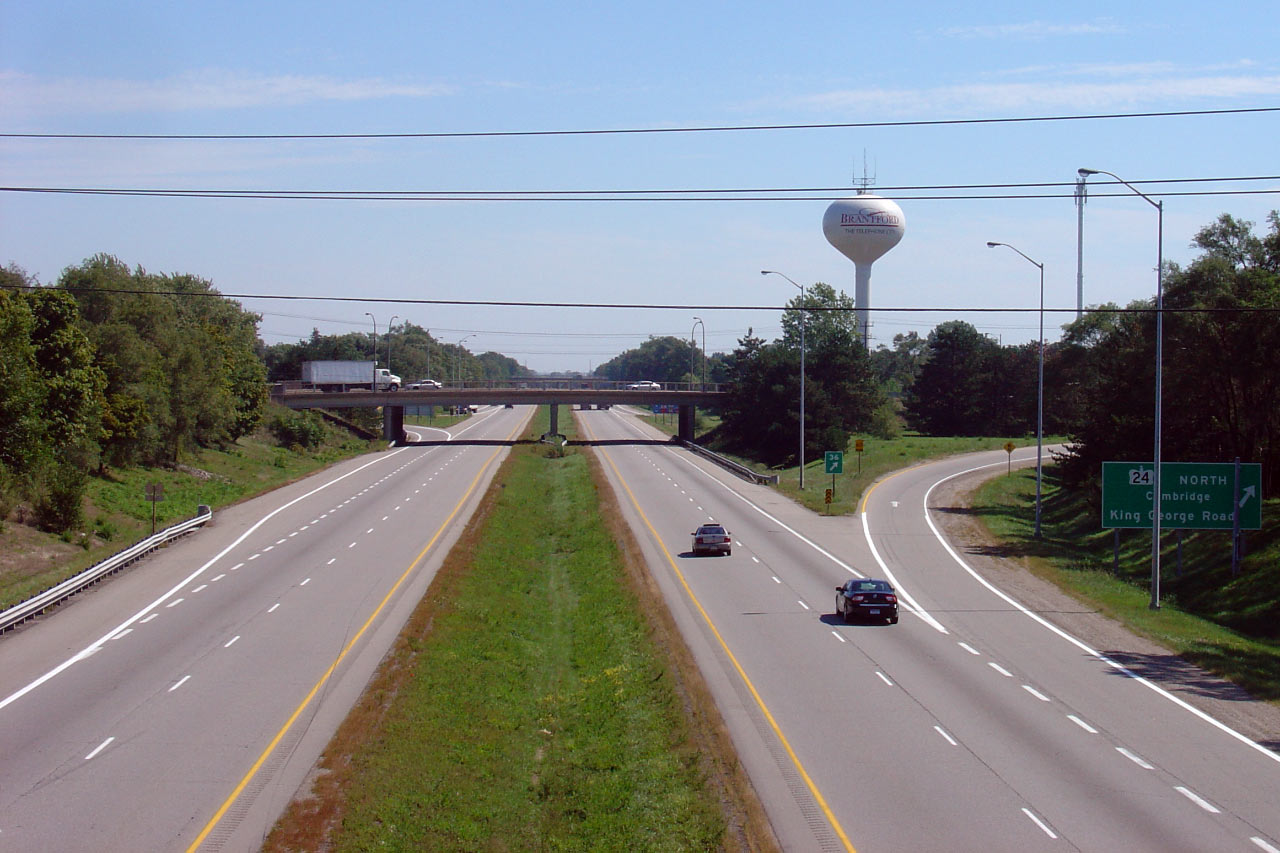
| City of Brantford |
View looking west from King George Road. King George Road is the main
artery into Historic Downtown Brantford from the north; it also carries the
Highway 24 designation. Photo taken: September 14th, 2007. |
 |
|
| Highway 403 continues easterly east of Brantford, to Hamilton, Burlington and finally Mississauga. Click here for Highway 403-East images. | |||
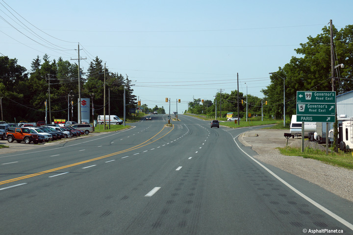
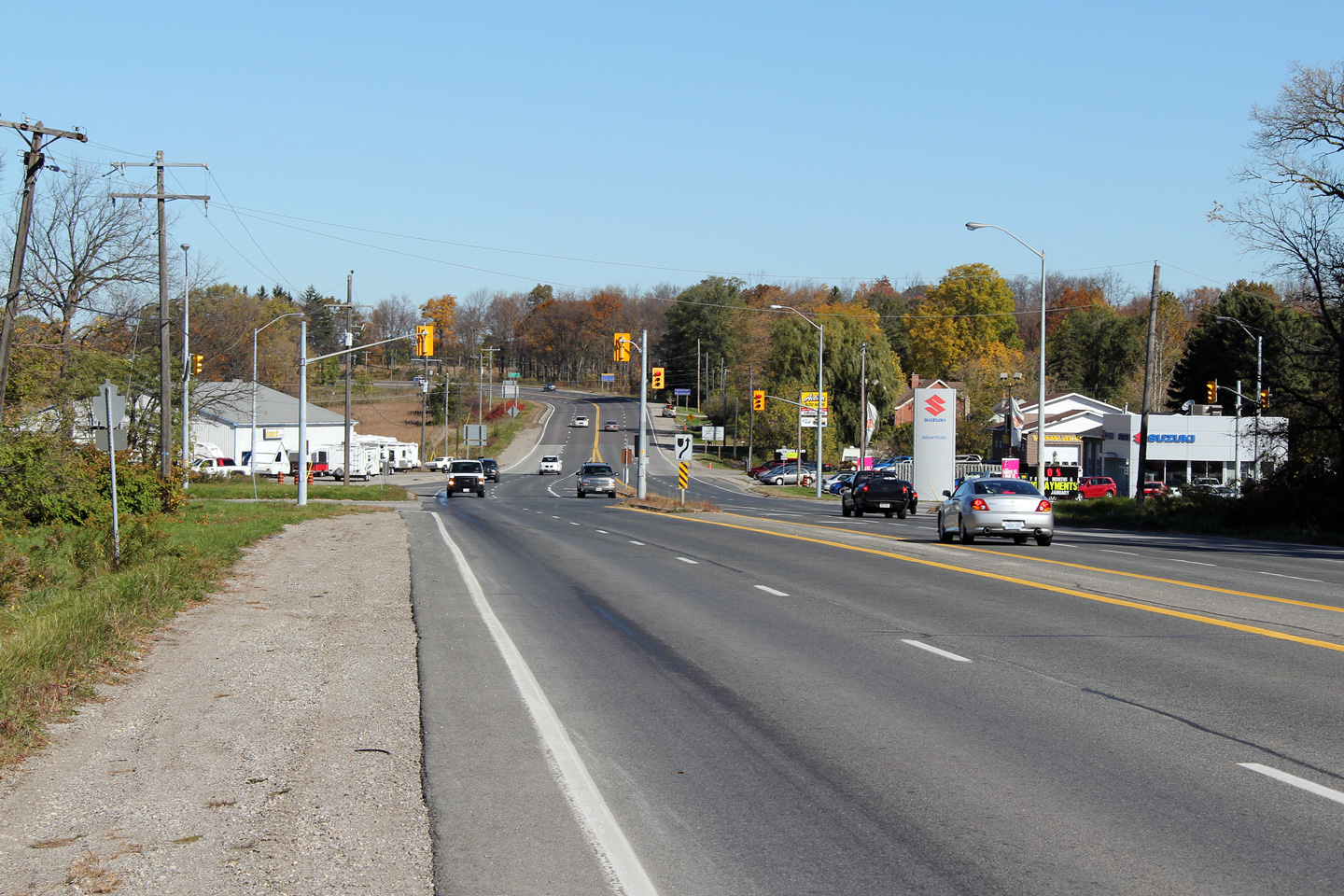
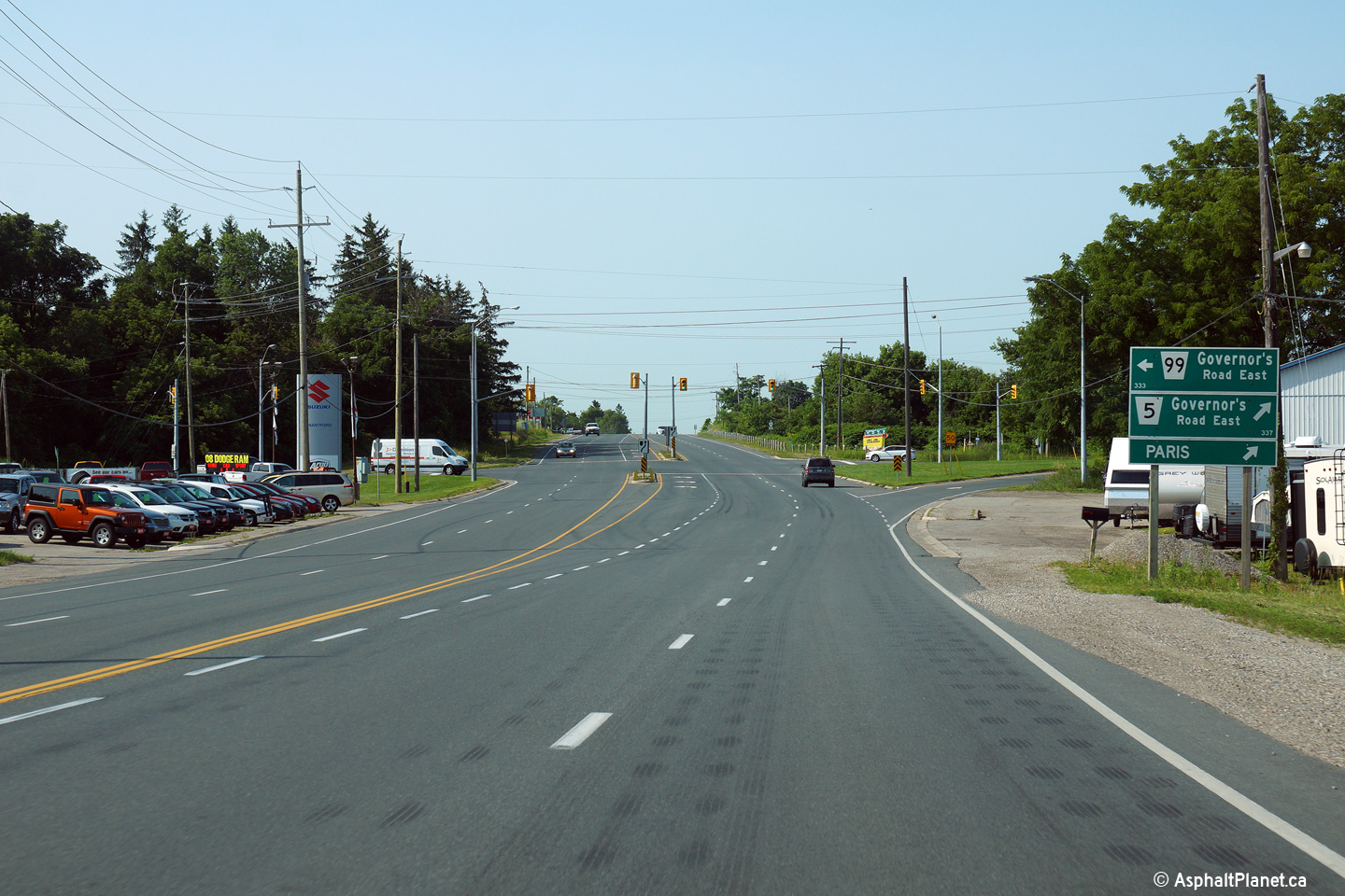
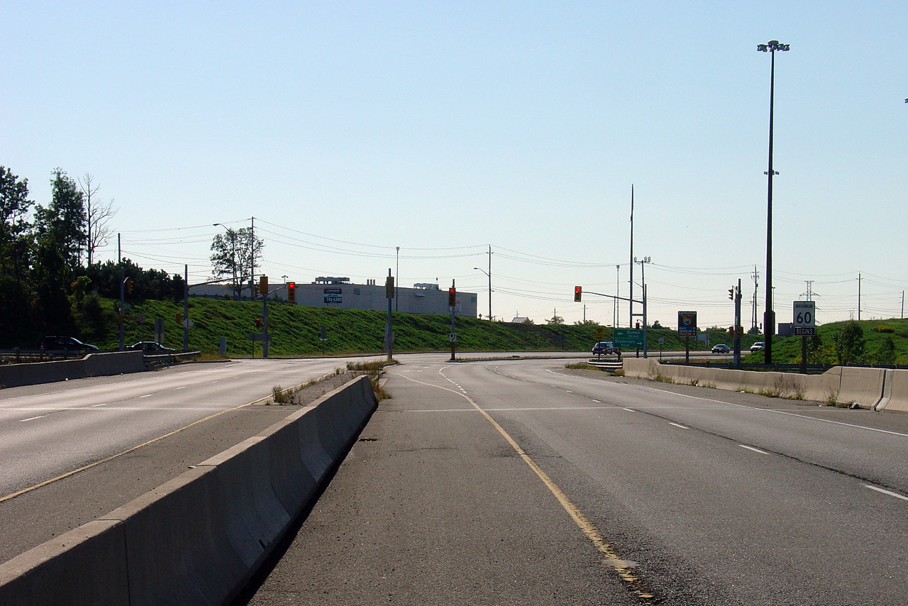
| City of Brant County | This view looks northerly approaching the
Highway 5-West and Highway 99 intersection along Highway 24. Photo taken: October 16th, 2010. |
 |
|
| Highway 5 heads west of Highway 24 en route to Paris and Highway 2. Click here for Highway 5-West images. | |||
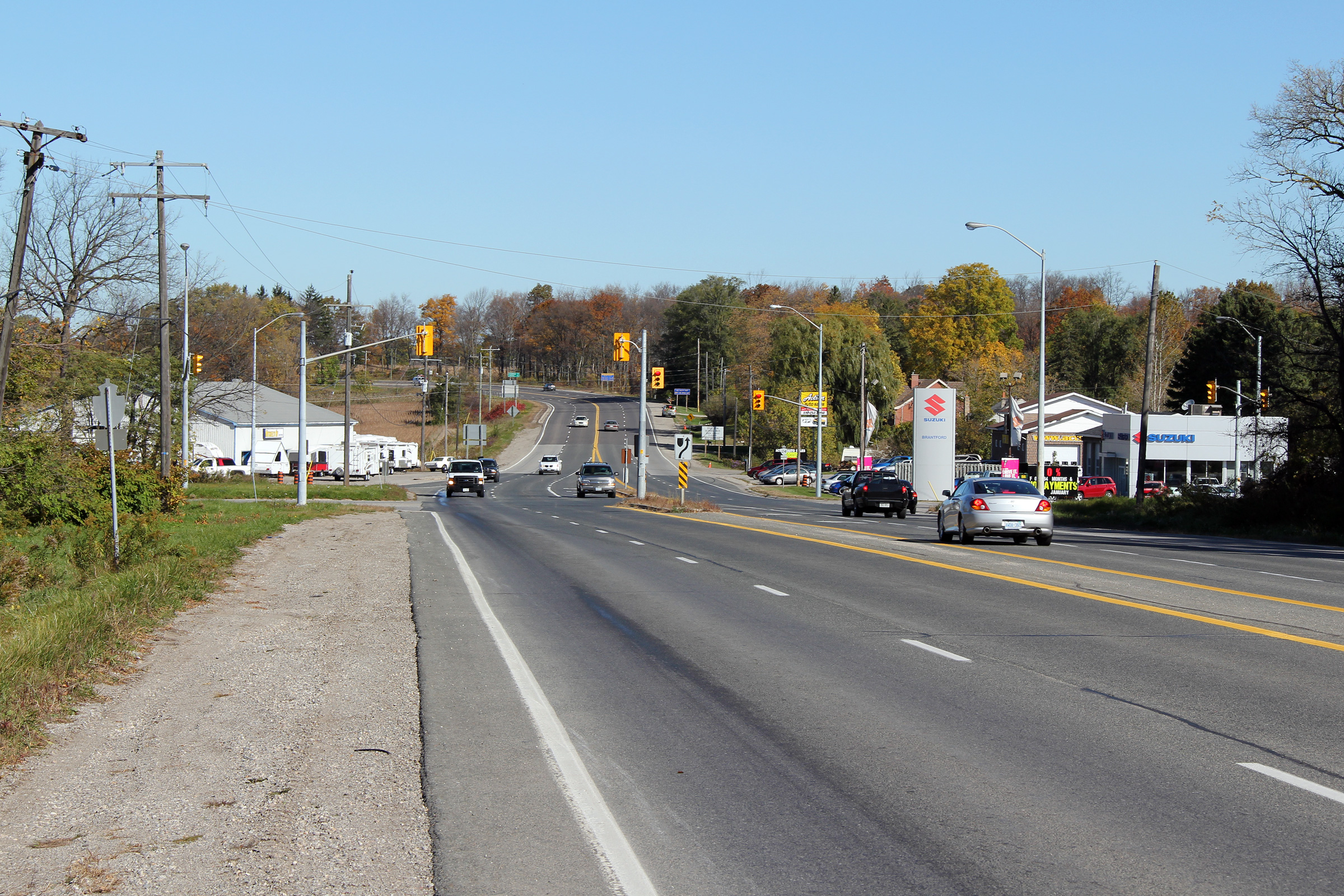
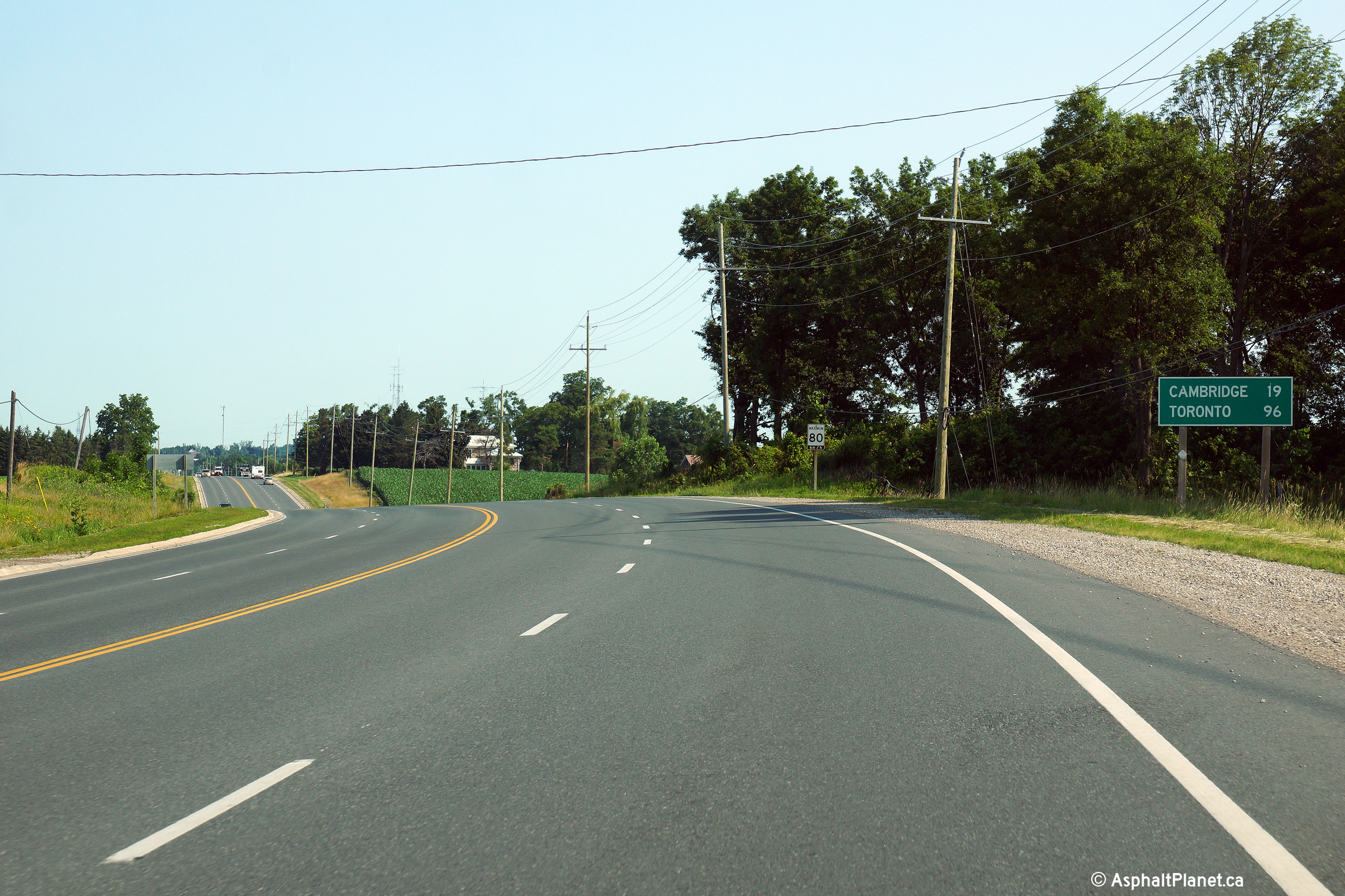
| City of Brant County | Southerly view approaching the southern Highway
5junction at Osborne Corners. Photo taken: July 18th, 2014. |
 (720x480) (1440x960) (2400x1600) |
|
| City of Brant County | Northerly view from just north of the southern
Highway 5 junction. Note the distance sign along Highway 24 still
includes Toronto, which was Highway 5's eastern control city. Photo taken: July 18th, 2014. |
 (720x480) (1440x960) (2400x1600) |
|
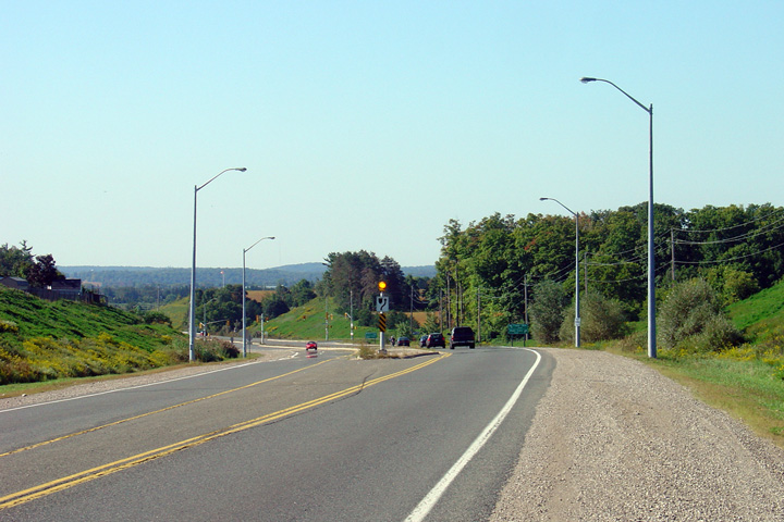
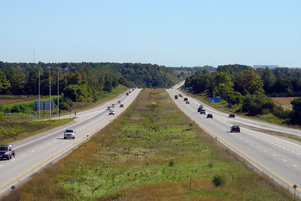
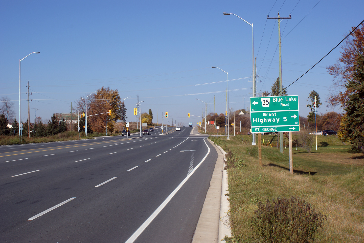
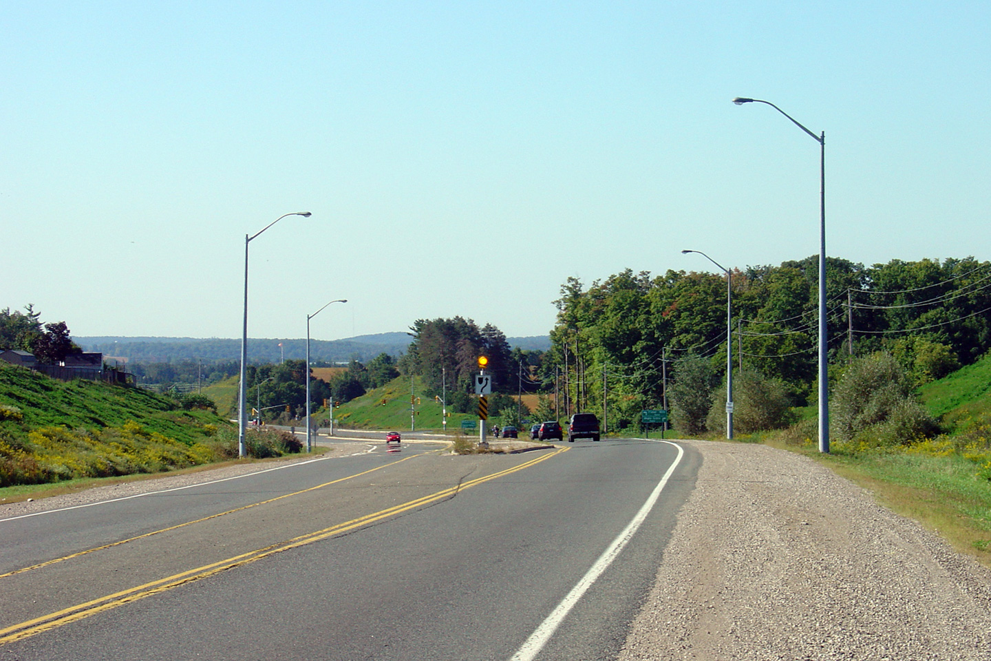
| City of Brant County | This view looks northerly along Highway 24 where
Highway 5 ran concurrent with Highway 24. Note the rather odd
four-lane cross-section. Few rural highways in Ontario were ever built
to a four lane cross-section without a flush median to separate opposing
traffic
flows. Photo taken: October 16th, 2010. |
 |
|
| City of Brant County | This view looks northerly along Highway 24, from
just north of the German School Concession Road. Photo taken: October 16th, 2010. |
 |
|
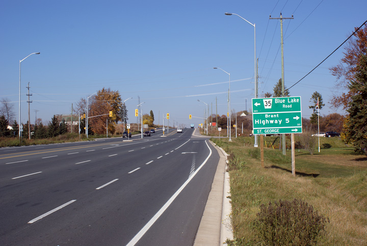
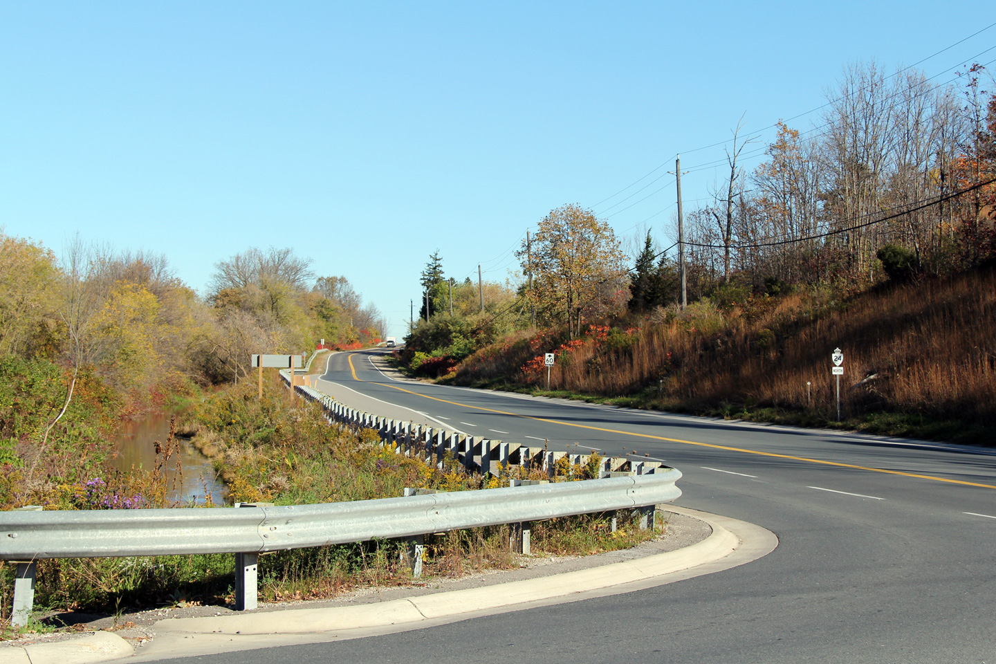
| City of Brant County | This view looks northerly approaching the
eastern Highway 5 junction. This junction was extensively reconstructed in
2007. A reconstruction activity that included the removal of two rather
substantial channels that formerly facilitated direct right turn movements
between Highway 5 and 24. Photo taken: November 15th, 2008. |
 |
|
| Highway 5 becomes Toronto's Bloor Street, a considerable distance east of Highway 24. Click here for Highway 5-East images. | |||
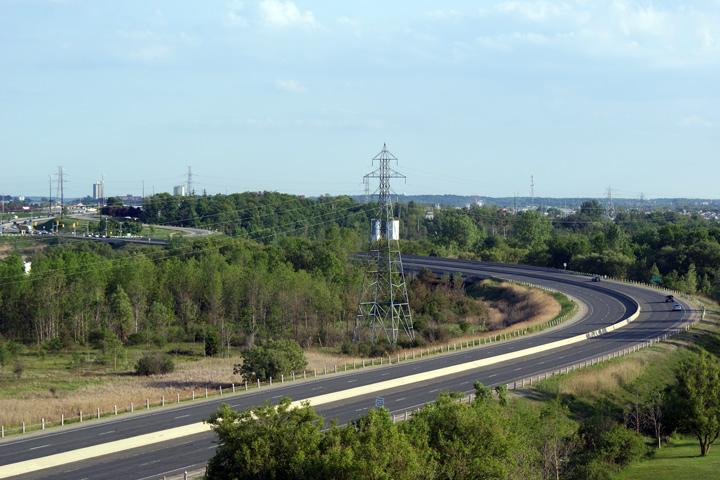
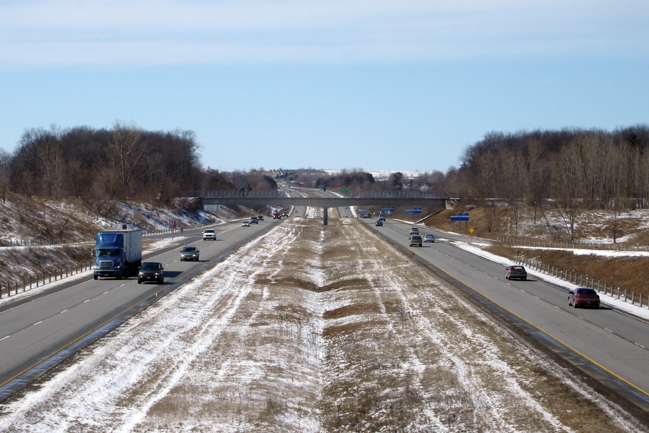
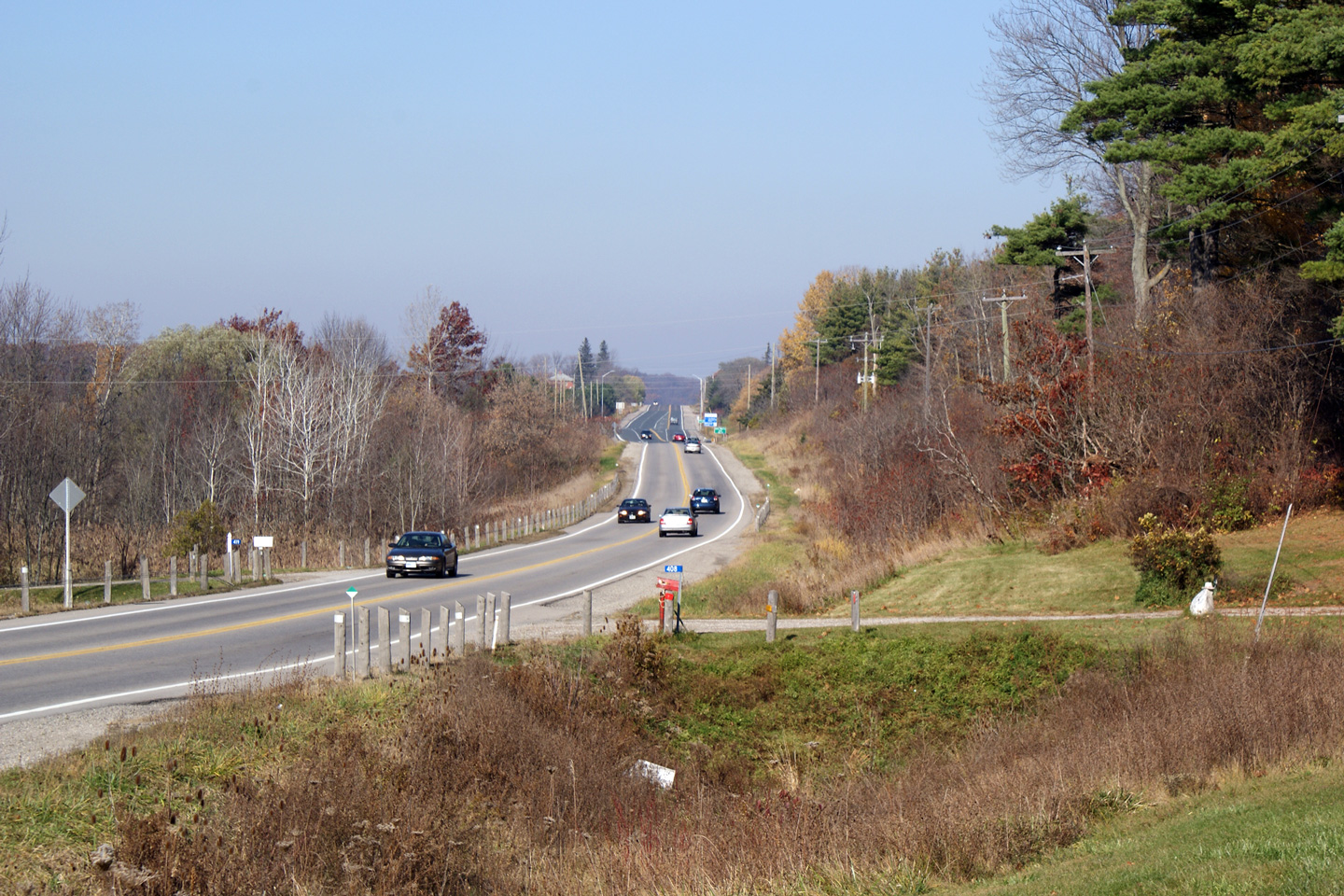
| City of Brant County | This view looks northerly approaching the Glen
Morris Road intersection. Photo taken: November 15th, 2008. |
 (720x480) (1440x960) |
|
| City of Brant County | This view looks northerly along Highway 24 as
the highway descends into the Grand River Valley. Photo taken: October 16th, 2010. |
 |
|
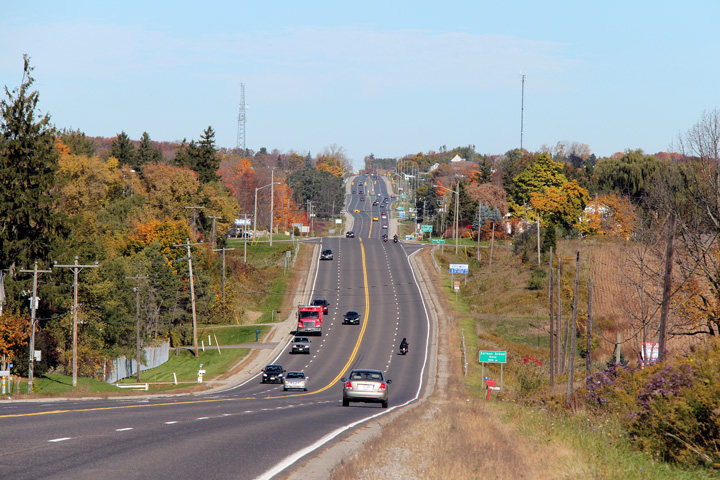
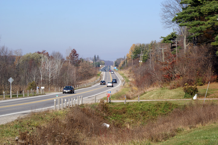
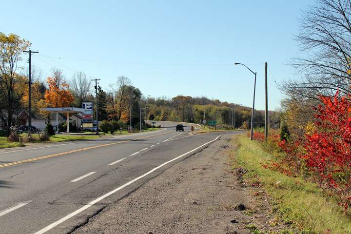
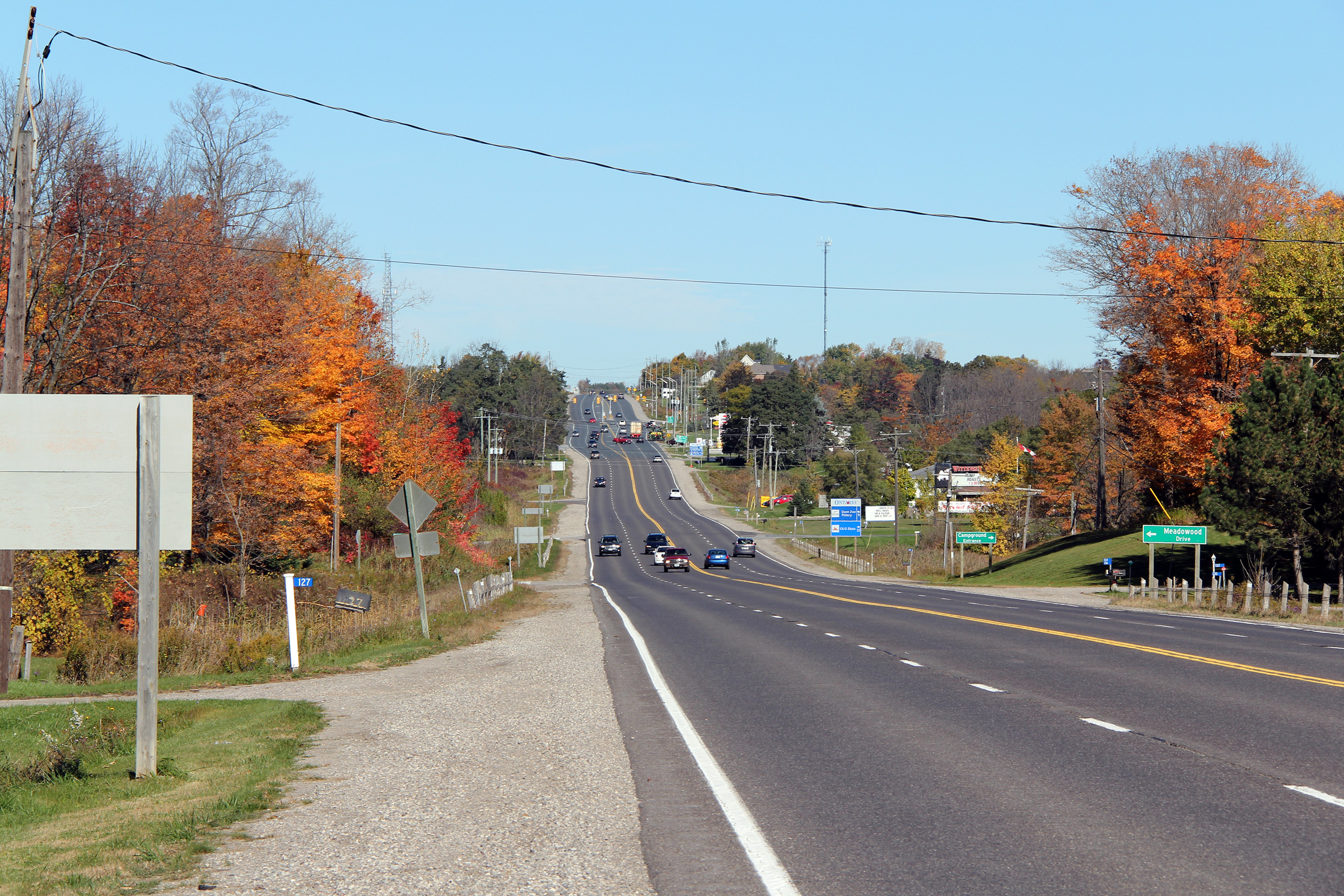
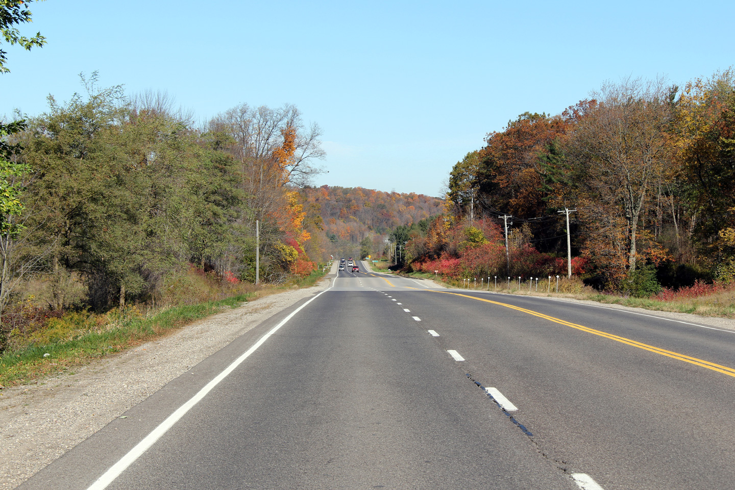
| Township of North Dumfries Regional Municipality of Waterloo |
This photo looks northerly at the Lockie Road
intersection. The 2010 fall colours were just past peak at the time
this photo was taken. The two weeks of early October are far and away
the best time of year to explore Southern Ontario. Photo taken: October 16th, 2010. |
 |
|
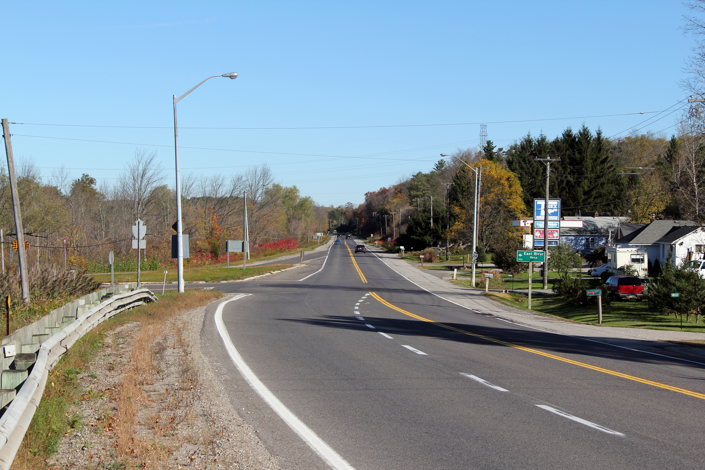
| Township of North Dumfries Regional Municipality of Waterloo |
Northerly view along Highway 24 from the East
River Road intersection. As is visible in the photo, there is a
considerable amount of roadside development along Highway 24 south of
Cambridge. Photo taken: October 16th, 2010. |
 |
|
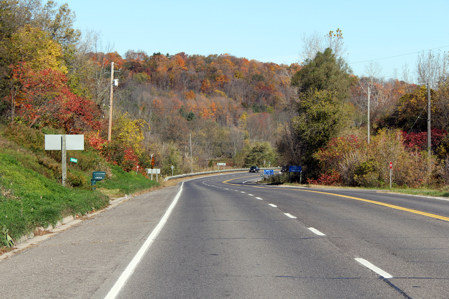
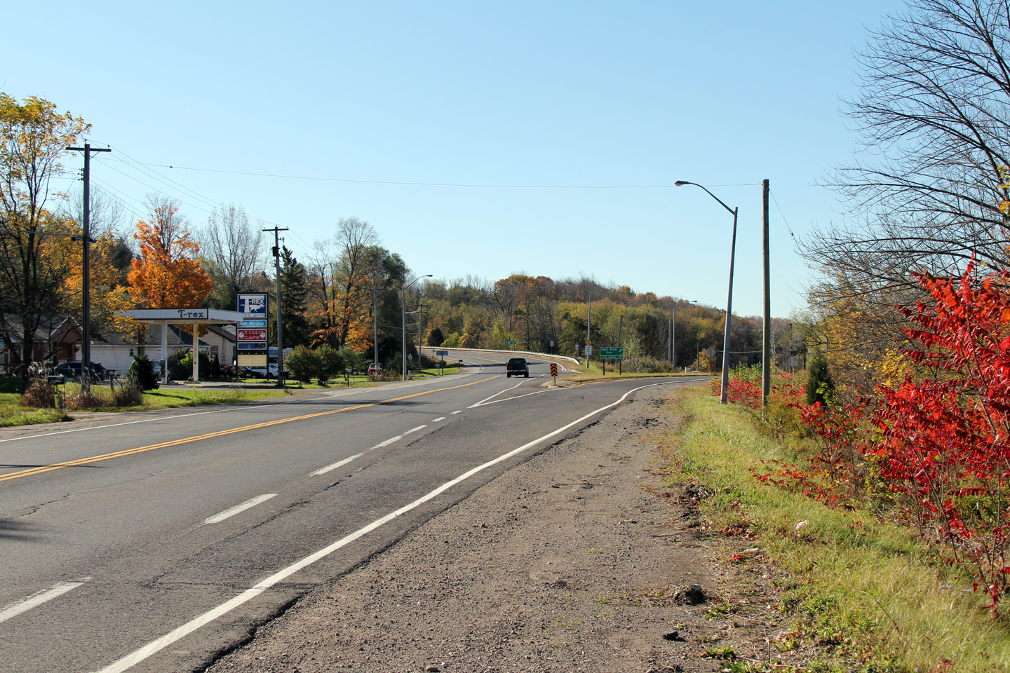
| Township of North Dumfries Regional Municipality of Waterloo |
This view looks southerly as Highway 24
disembarks from East River Road. Though not officially designated as
such, Highway 24 follows the East River Road alignment through virtually all
of the Township of North Dumfries northerly into Downtown Galt. Photo taken: October 16th, 2010. |
 |
|
| Township of North Dumfries Regional Municipality of Waterloo |
Southerly view of Highway 24 from the Footbridge
Road intersection. The Footbridge Road intersection with Highway 24
was extensively rebuilt in 2007. Photo taken: October 16th, 2010. |
 |
|
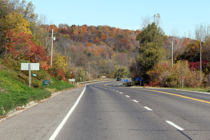
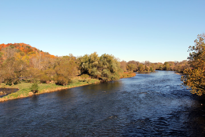
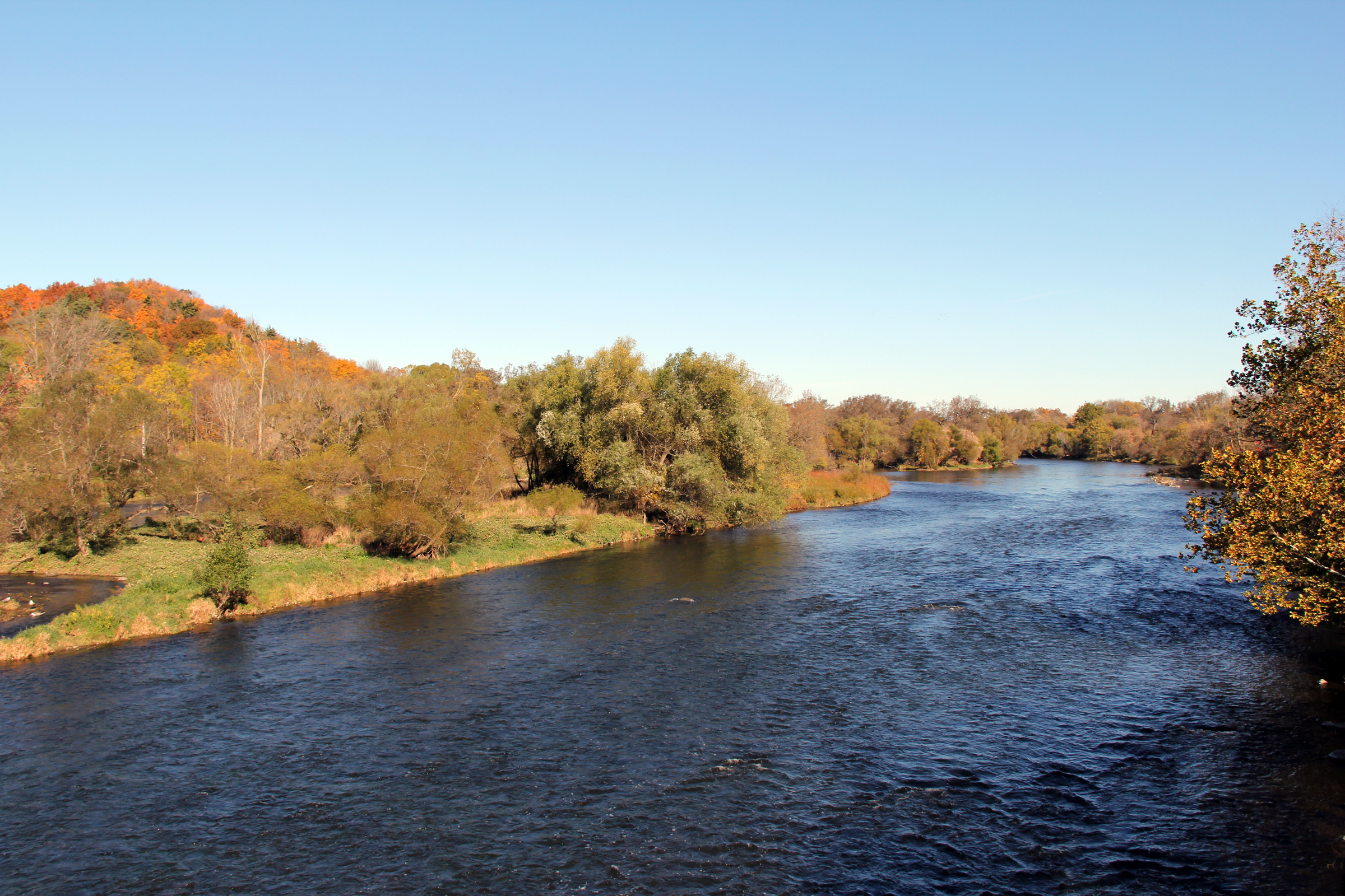
| Township of North Dumfries Regional Municipality of Waterloo |
This view looks north along the
Grand River from the Footbridge. While Highway 24 runs in very close
proximity to the Grand River through Cambridge and North Dumfries, travelers
are seldom offered a vista of the scenic river. The Grand River is
Southwestern Ontario's most predominant waterway, and serves as the
lifeblood, and major source of drinking water for hundreds of thousands of
people across Southwestern Ontario. Photo taken: October 16th, 2010. |
 |
|
| Township of North Dumfries Regional Municipality of Waterloo |
Northerly view along Highway 24 from the
Footbridge Road intersection towards Cambridge. Photo taken: October 16th, 2010. |
 |
|
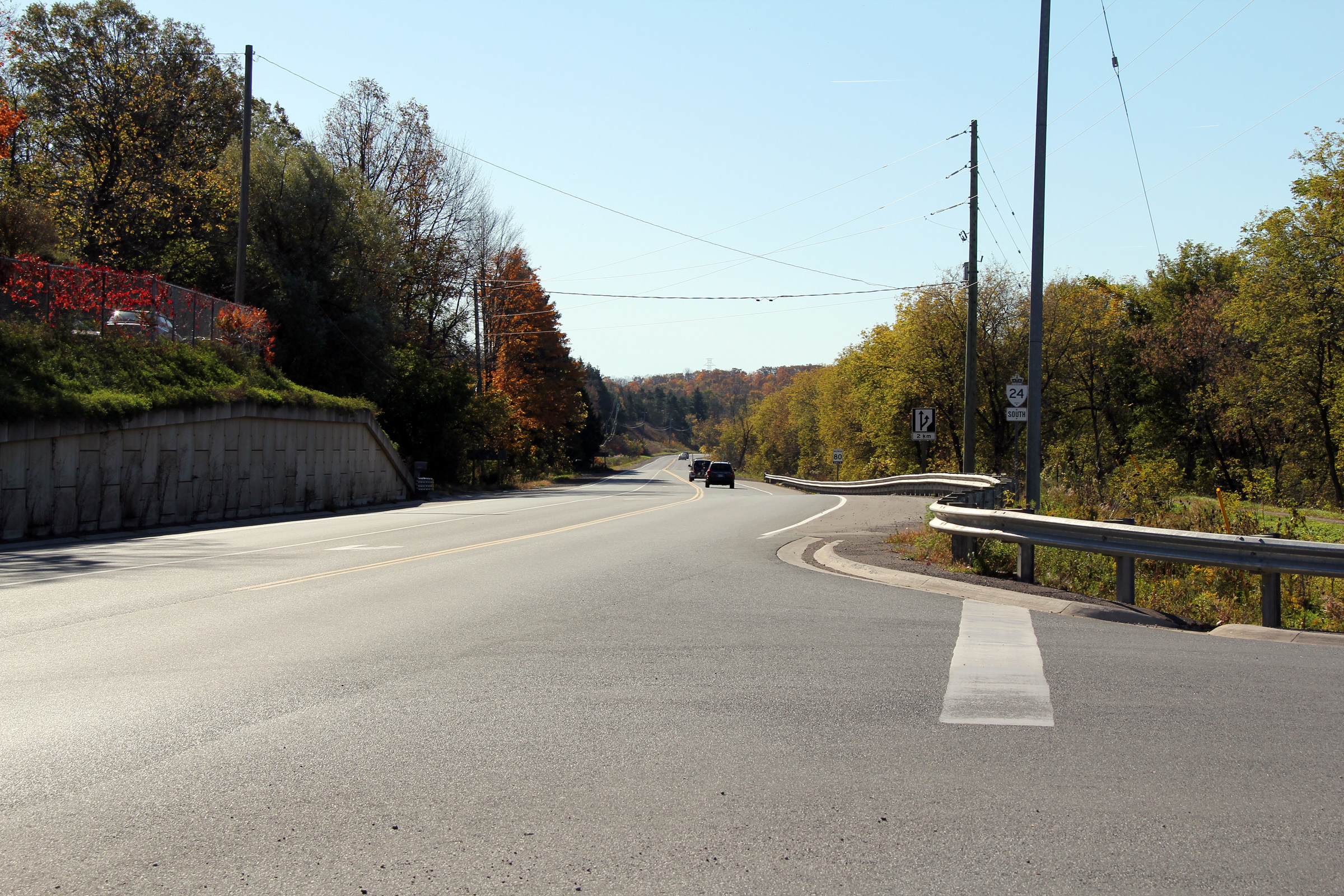
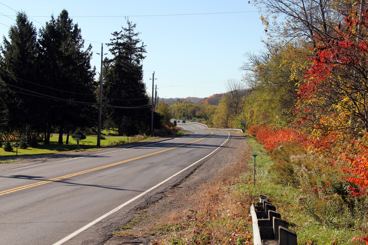
| Township of North Dumfries Regional Municipality of Waterloo |
Southerly view along Highway 24 showing the
broken-back alignment of the highway as it parallels the Grand River in its
narrow valley. Photo taken: October 16th, 2010. |
 |
|
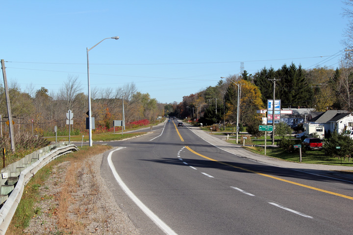
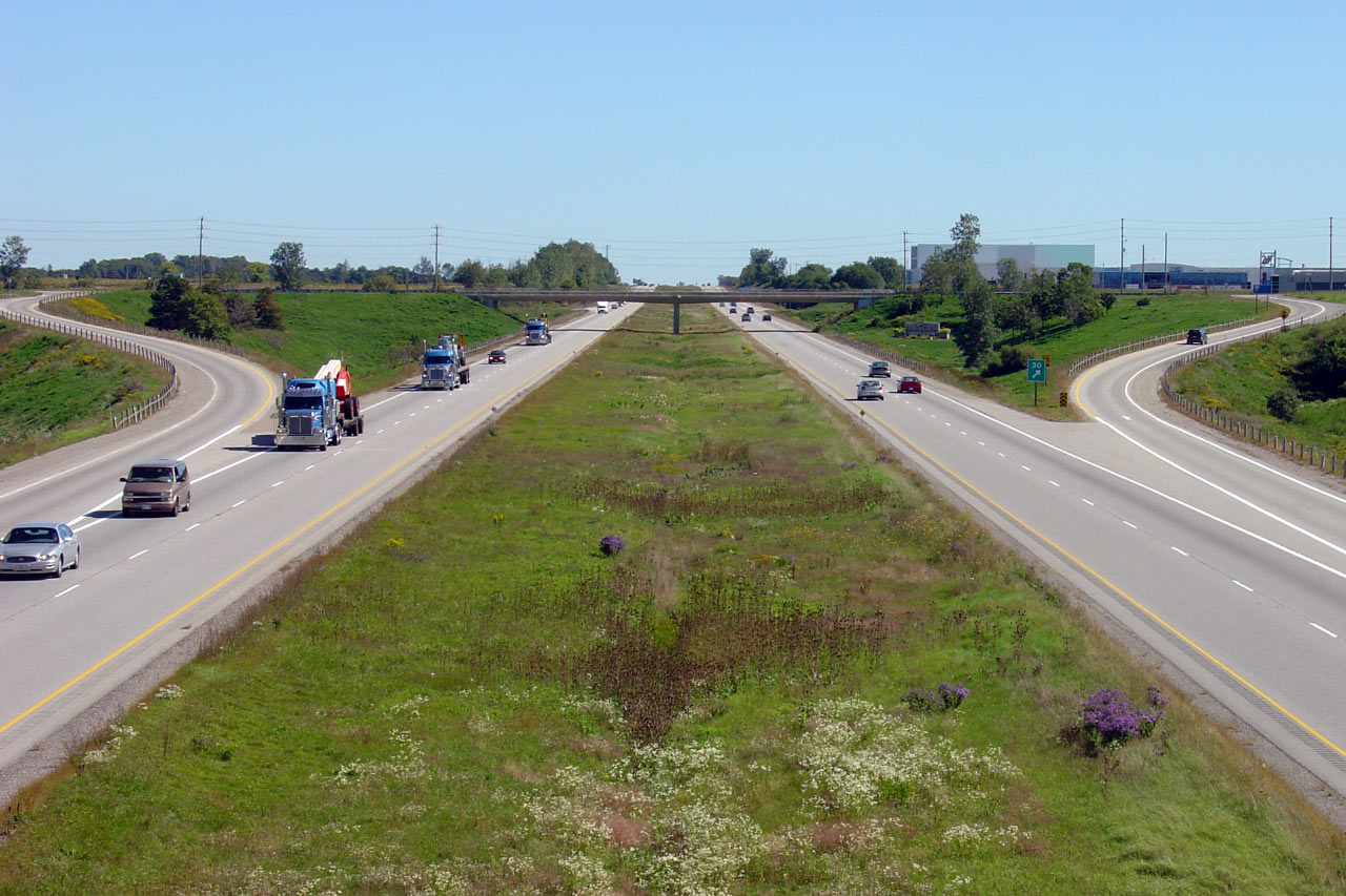
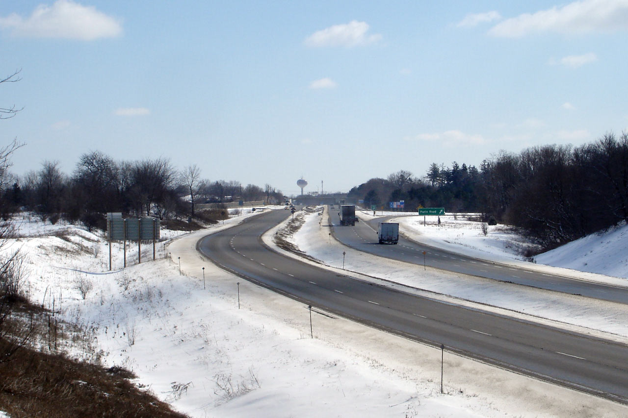
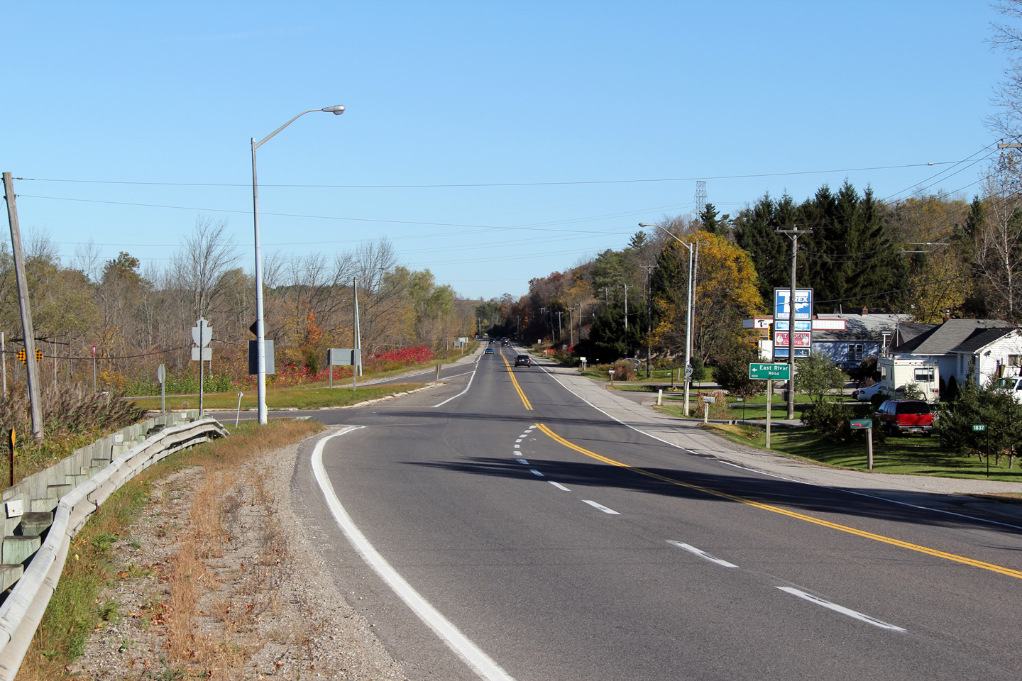
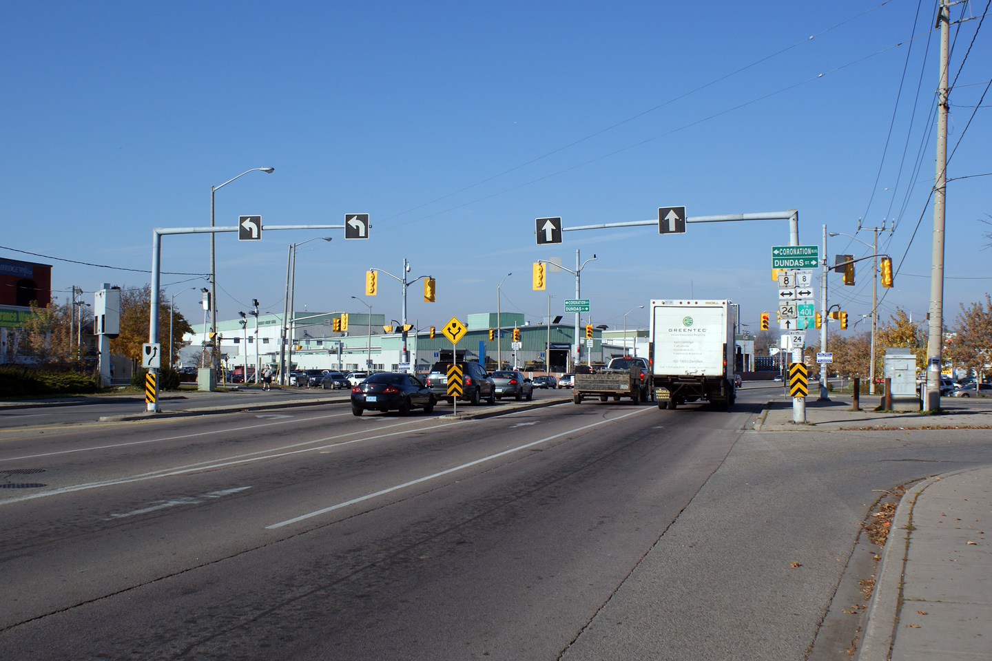
| City of Cambridge Regional Municipality of Waterloo |
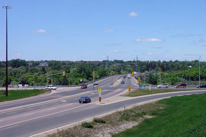
This view looks northerly along Highway 24
approaching the Highway 8 intersection. The
Highway 8 and 24 intersection is the largest intersection in the City of
Cambridge; it is locally known as the Delta because of the large skew that
the two highways intersect at. Photo taken: November 15th, 2008. |
 (720x480) (1440x960) |
|
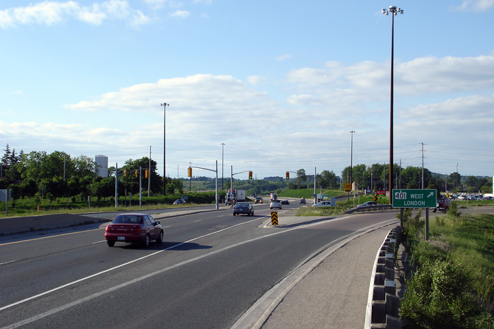
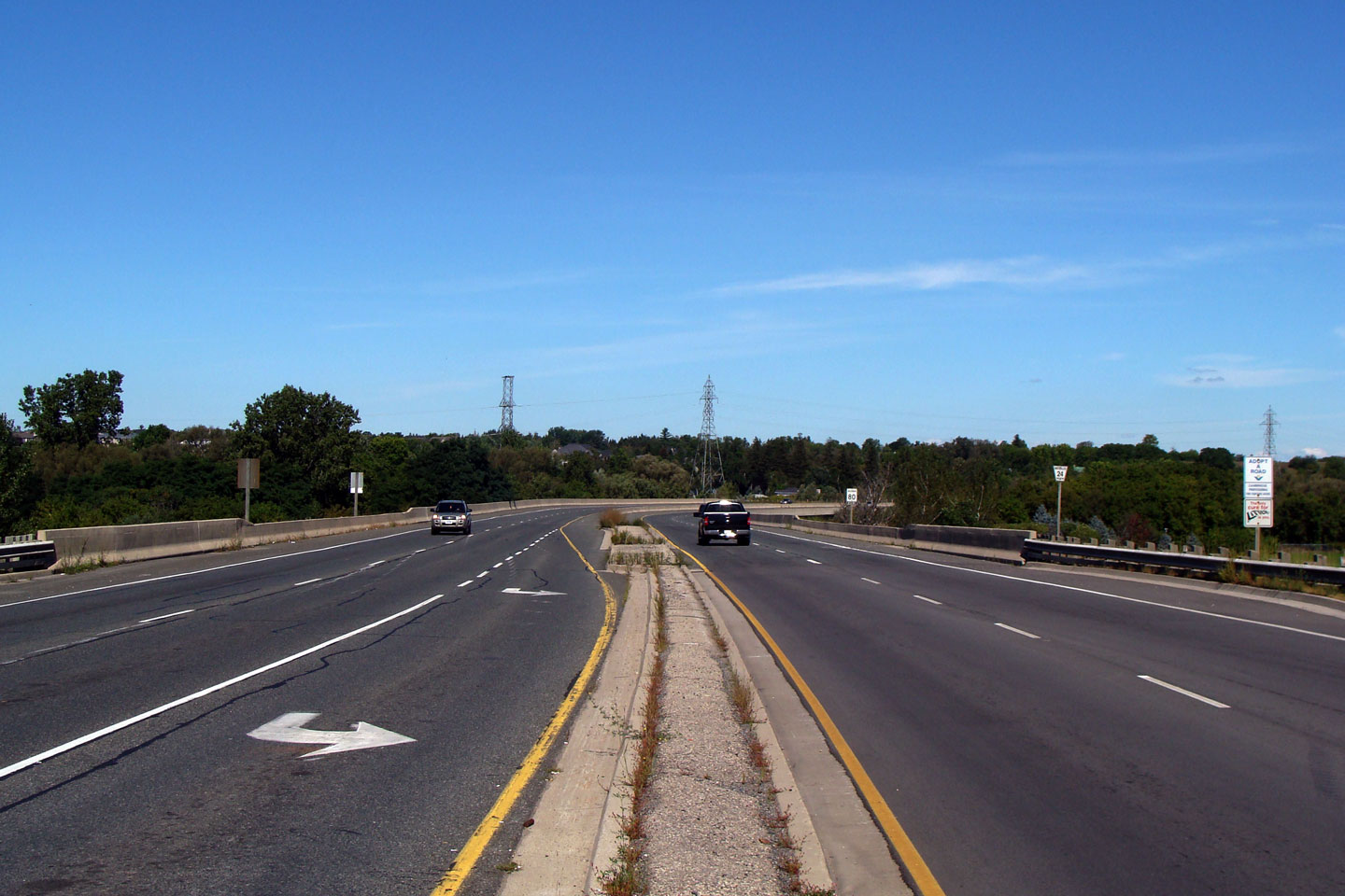
| City of Cambridge Regional Municipality of Waterloo |
Southerly view along Highway 24 from the Highway
401 overpass. Photo taken: June 11th, 2006. |
 (720x480) (1440x960) |
|
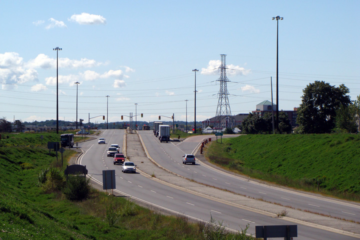
| City of Cambridge Regional Municipality of Waterloo |
Southerly view as Highway 24 crosses overtop of
Highway 401. During the Fall of 2010, Highway 24 was widened by an
extra-northbound lane from Pinebush Road to the westbound freeway off-ramp
-- so this photo is slightly out of date. Photo taken: June 11th, 2006. |
 (720x480) (1440x960) |
|
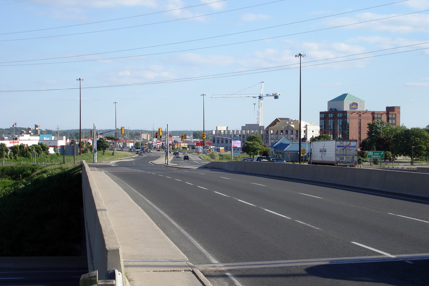
| Highway 24 crosses Highway 401 just north of the urbanized section of Cambridge. Click here for Highway 401-West images and here for Highway 401-East images | |||
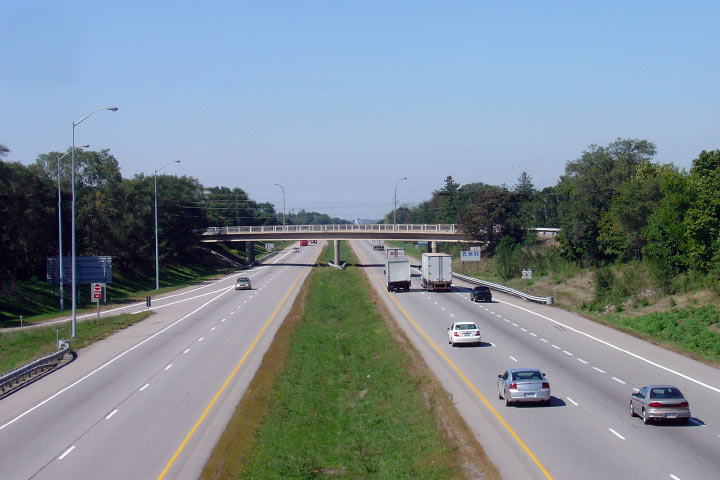
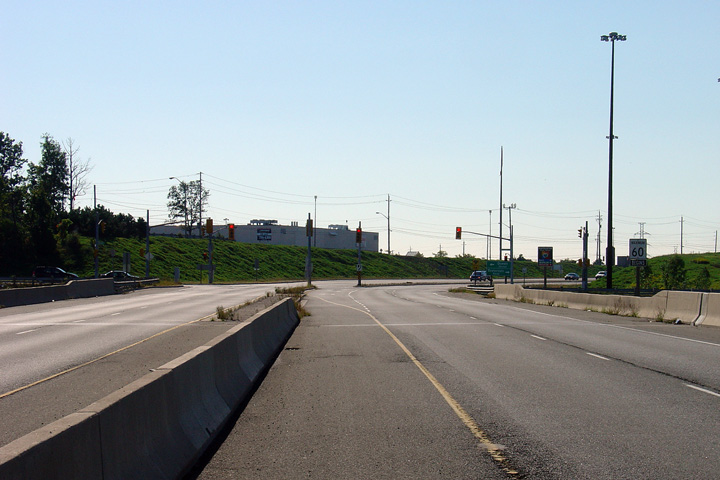
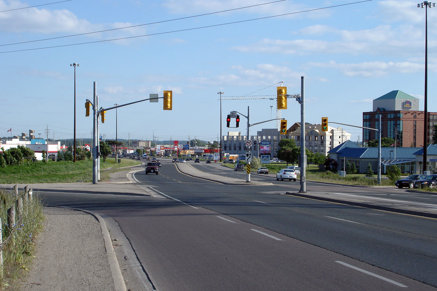
| City of Cambridge Regional Municipality of Waterloo |
This view looks northerly along Highway 24
approaching the westbound off-ramp from the freeway. Note that Highway
24 is lit continuously with high-mast lighting for some distance north of
Highway 401. This section of Highway 24 is one of two at-grade
highways in Ontario to be lit with High Mast Lighting. (The other
being the Thunder Bay
Expressway). Photo taken: June 11th, 2006. |
 (720x480) (1440x960) |
|
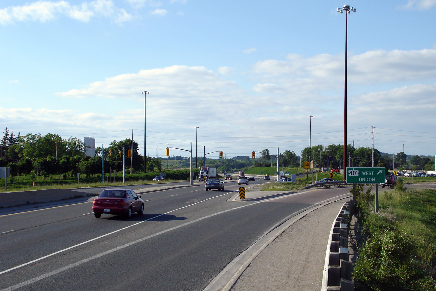
| City of Cambridge Regional Municipality of Waterloo |
Looking south along Highway 24 approaching the
Highway 401 interchange. Highway 24
meets Highway 401 at a standard parclo A4
interchange. Photo taken: September 10th, 2008. |
 (720x480) (1440x960) |
|
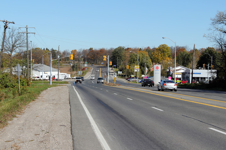
| City of Cambridge Regional Municipality of Waterloo |
Looking northerly along Highway 24 approaching
the Beaverdams Road and Queen Street intersection. Before 1991,
Highway 24 followed Queen Street into the community of Hespeler. Photo taken: June 11th, 2006. |
 (720x480) (1440x960) |
|
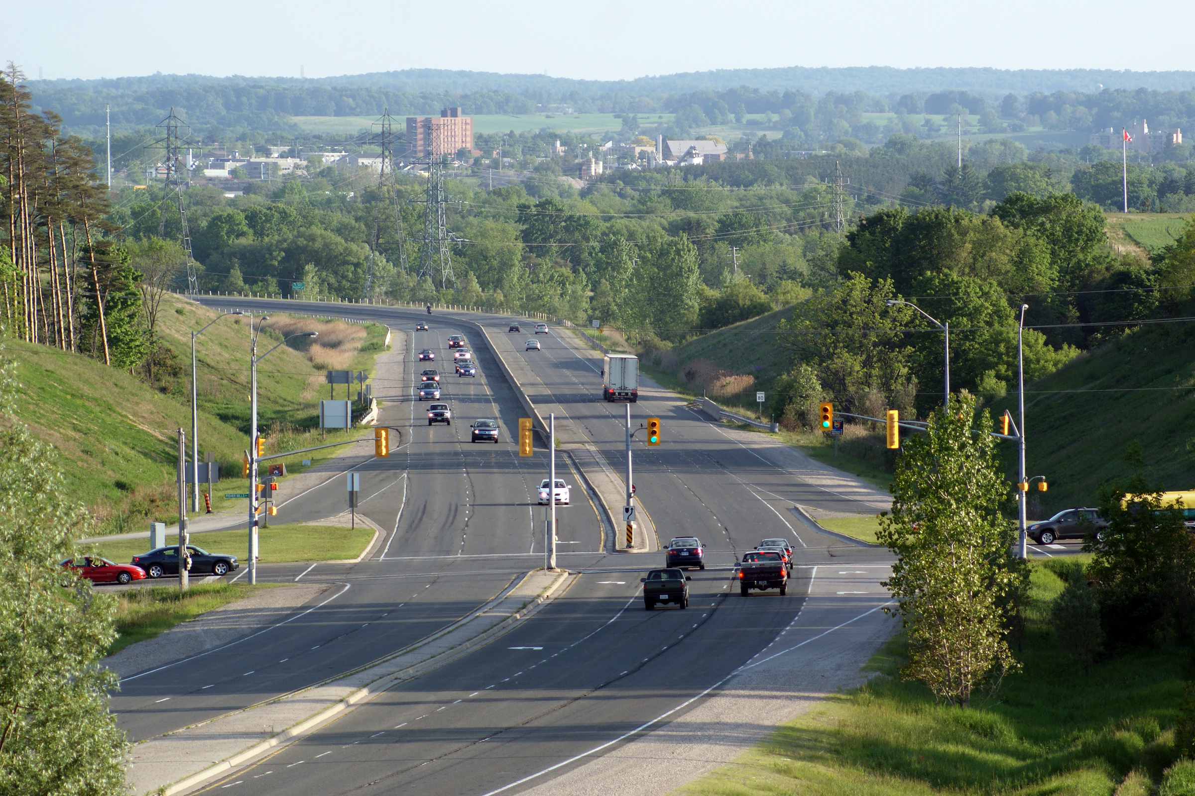
| City of Cambridge Regional Municipality of Waterloo |
This view looks northerly along Highway 24 from
the central median from just north of the Queen Street intersection.
Highway 24 crosses overtop of the CN railway line that runs between
Cambridge and Guelph, as well as the Speed River in this photo. Photo taken: September 10th, 2008. |
 |
|
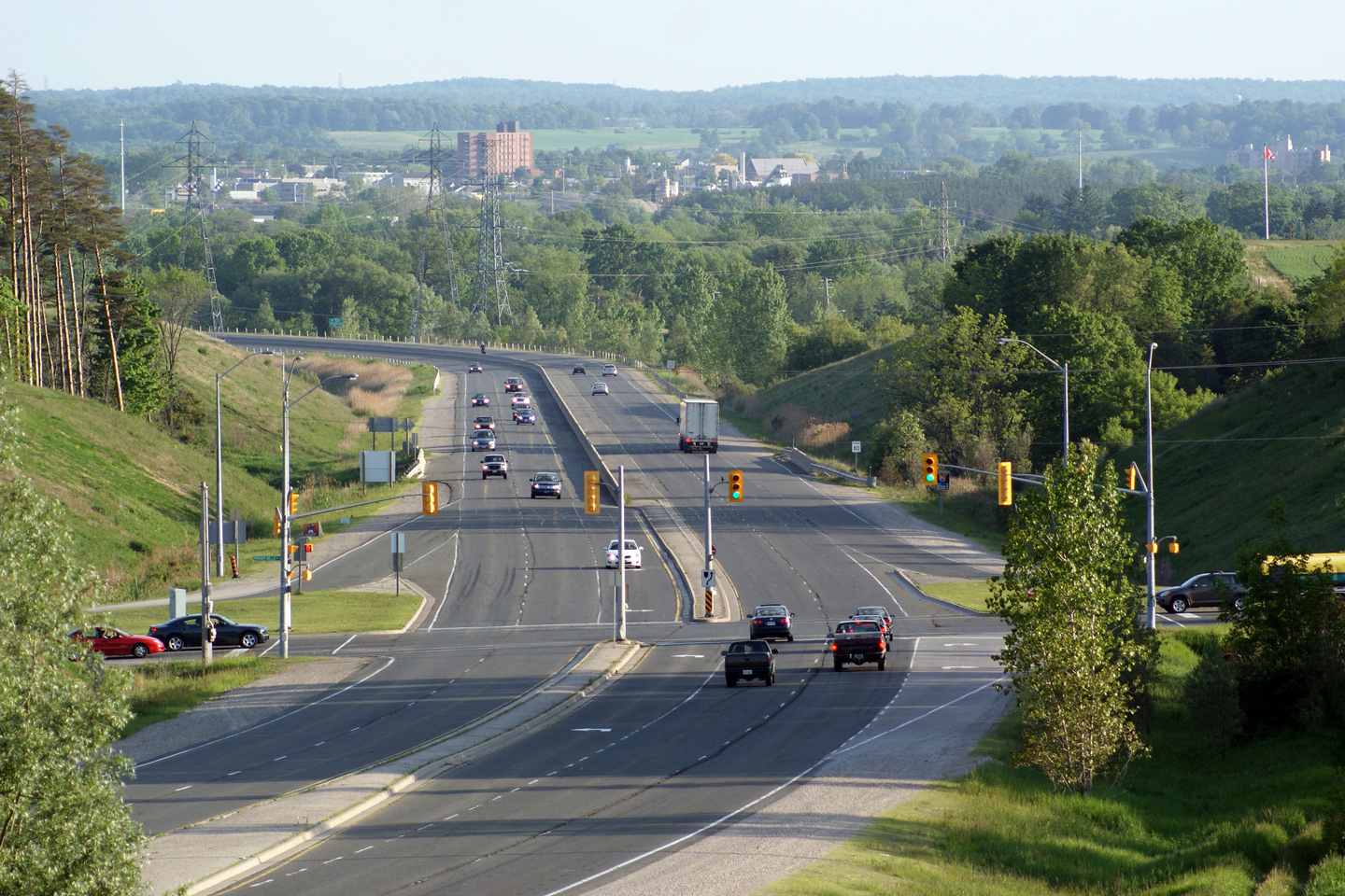
| City of Cambridge Regional Municipality of Waterloo |
Looking south from the Speed River bridge to the
Queen Street intersection. Between Queen Street and Maple Grove Road a
concrete jersey barrier separates opposing flows of traffic. Photo taken: September 18th, 2005. |
 |
|
| City of Cambridge Regional Municipality of Waterloo |
Southerly view along Highway 24 as the highway
crosses overtop of both the Speed River and CN rail line in magnificent
fashion. The Hespeler By-pass opened in the early 1990s. Photo taken: May 6th, 2009. |
 |
|
| City of Cambridge Regional Municipality of Waterloo |
Northerly view towards the Maple Grove Road
intersection. Photo taken: May 6th, 2009. |
 (720x480) (1440x960) |
|
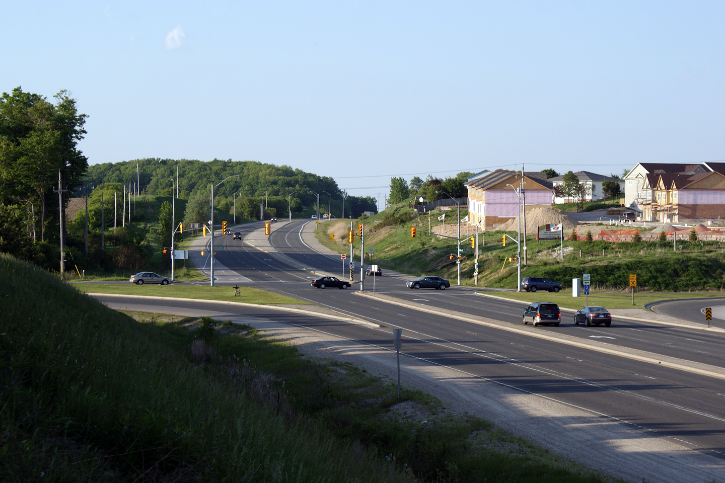
| City of Cambridge Regional Municipality of Waterloo |
Looking north along Highway 24 towards Maple
Grove Road. Photo taken: September 18th, 2005. |
 (720x480) (1440x960) |
|
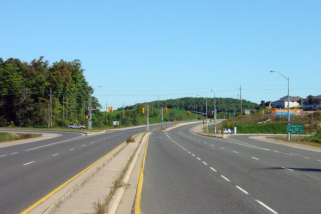
| City of Cambridge Regional Municipality of Waterloo |
Two views looking southerly towards the Maple
Grove Road intersection. The upper photo was shot perched from a small roadside embankment.
The lower photo was shot from highway level. Upper photo taken: May 6th, 2009. Lower photo taken: September 18th, 2005. |
 (720x480) (1440x960) (2400x1600)
|
|
| City of Cambridge Regional Municipality of Waterloo |
The northern end of the divided highway along
Highway 24. The northern 1km of the Hespeler By-pass was only
constructed as a conventional 2-lane highway. Photo taken: September 18th, 2005. |
 |
|
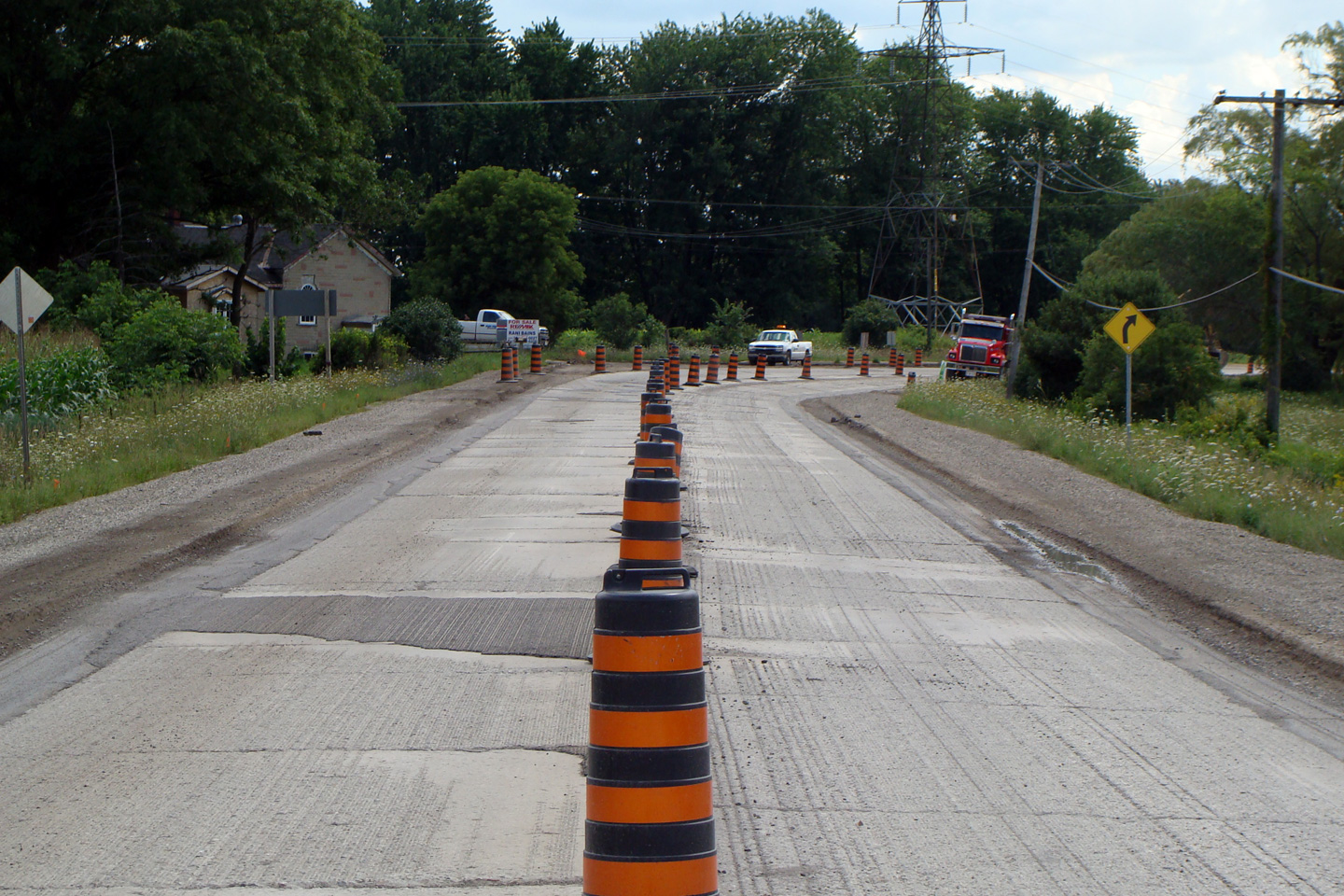
| City of Cambridge Regional Municipality of Waterloo |
This view looks southerly from just south of the
Kossuth Road intersection. During the Summer of 2008, the Region of
Waterloo reconstructed a small portion of Highway 24, removing all of the
historic concrete pavement that was first laid in the 1930s. Photo taken: August 14th, 2008. |
 |
|
| Highway 6 and Highway 7 follow what is colloquially known as the Hanlon Parkway through Guelph. Click here for Highway 6 images and here for Highway 7-West images | |||
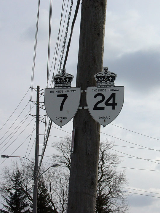
| City of Guelph | Former signage for Highway 24 and 7 along
westbound Wellington Street. The Highway 7 shield remains at this location,
however the Highway 24 shield was removed several years ago. This sign
stood just west of the Gordon Street intersection. Photo taken: February 24th, 2004. |
 |
|
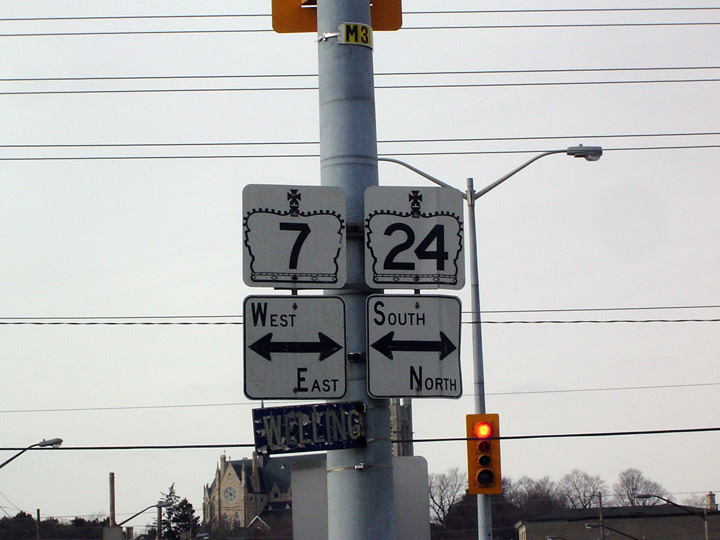
| City of Guelph | Junction assembly for Highway 7
and 24 along Gordon Street Northbound in Guelph. This sign has long been
removed. Photo taken: February 24th, 2004. |
 |
|
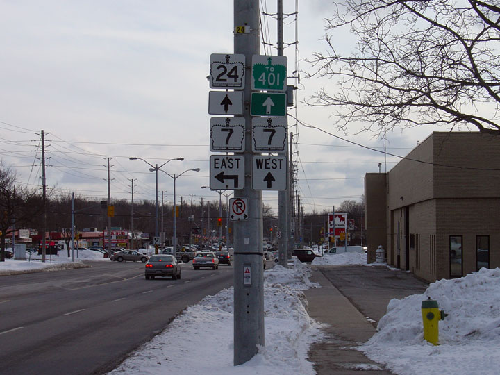
| City of Guelph | Advanced junction assembly in advance of the
Highway 7 intersection to the south of Downtown Guelph. The reference to
Highway 24 has been removed from this assembly, though the other signs
still stand. Photo taken: February 24th, 2004. |
 |
|
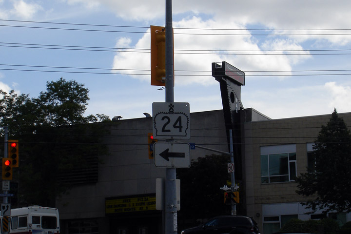
| City of Guelph | Oversized Highway 24 sign at the intersection of
Eramosa Street and Wyndham Road. Highway 24 turns left to follow Wyndham
Road around downtown Guelph. Photo taken: April 16th, 2009. |
 |
|
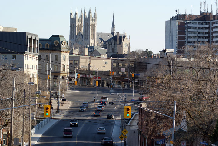
| City of Guelph | View looking southerly along Highway 24 on
approach to Downtown Guelph. Note the Church of Our Lady Immaculate that
dominates the Guelph skyline. The Church is designated a National Historic
Site, and is protected in the City of Guelph's by-law ensuring the structure
can be seen clearly from strategic points across the City. Photo taken: April 16th, 2009. |
 |
|
<- Page 1 Images Highway 24 Images Index Page 3 Images ->
<- Highway 23 Images Back to Highway 24 Highway 24A Images ->
Copyright (c) 2004-2014, Scott Steeves (Webmaster) AsphaltPlanet@asphaltplanet.ca
