AsphaltPlanet.ca > OntHighways >
Highway 407 > Images
> Page 3
Highway 407 ETR - Images
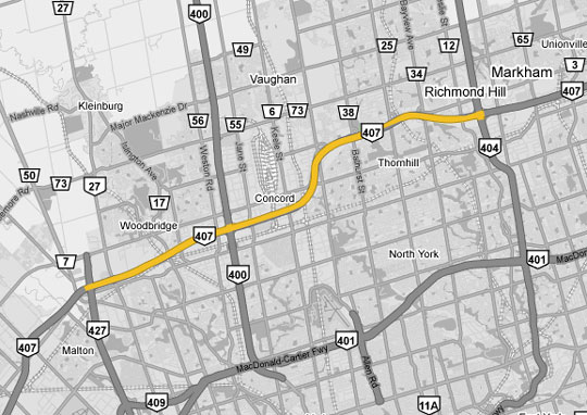
<- Page 2 Page 3 - Vaughan to Markham Page 4 - >
Photos shown in this table are arranged from West to East:
| Proper Municipality Name | Photo Description | Photo | ||||
|
Pictures taken from driver's perspective appear offset from centre-line pictures: |
East- Bound |
West- Bound |
||||
| Continued from Page 2 Images Click here for Page 2 images | ||||||
| Highway 427 is a short, but very important highway that runs along the western side of the City of Toronto. Click here for Highway 427 images. | ||||||
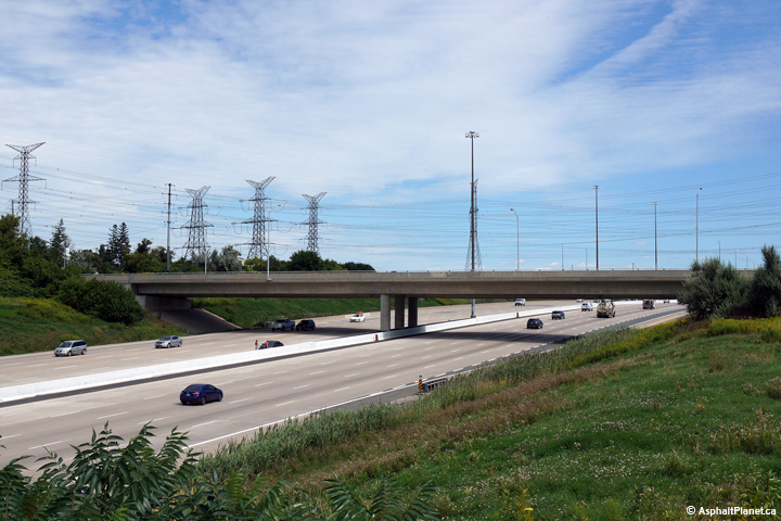
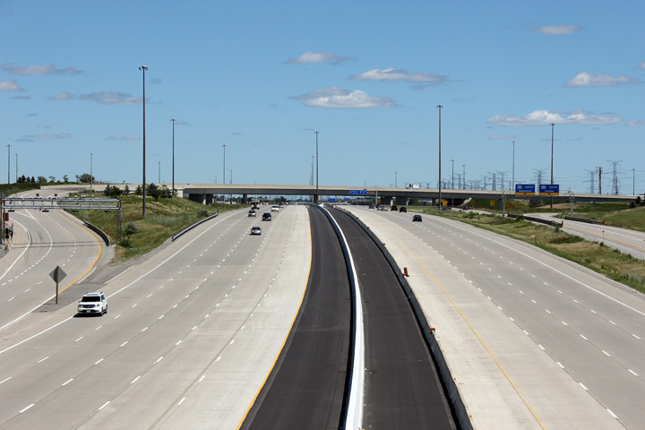
City of Vaughan Regional Municipality of York |
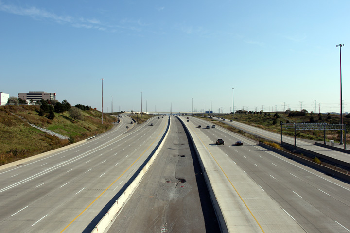
View looking westerly along Highway 407 towards the four-level Highway 427
stack interchange. Click for an
offset view, and a centred view both taken in
May 2009. Upper photo taken: August 1st, 2004. Middle two photos taken: September 31st, 2012. Lower two photos taken: August 27th, 2014. |
 (720x480) (1440x960) (2400x1600)  (720x480) (1440x960) (2400x1600) |
||||
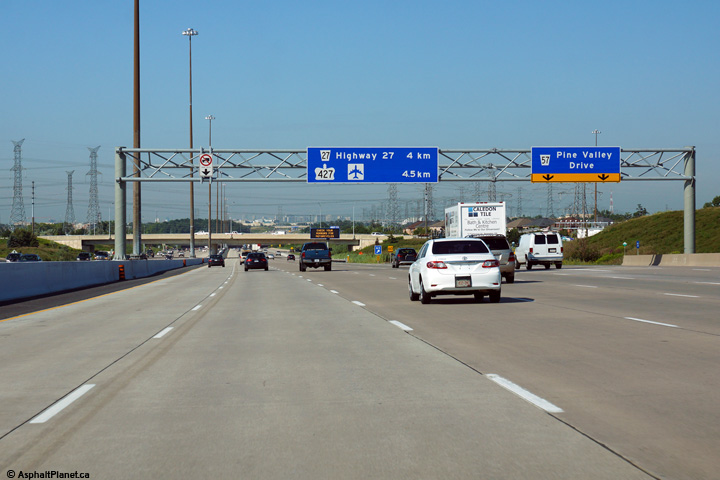
| Highway 27 is a major arterial highway that links Highway 401 in Etobicoke to Barrie and Penetanguishene. Click here for Highway 27 images | ||||||
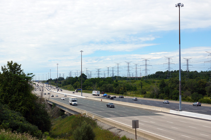
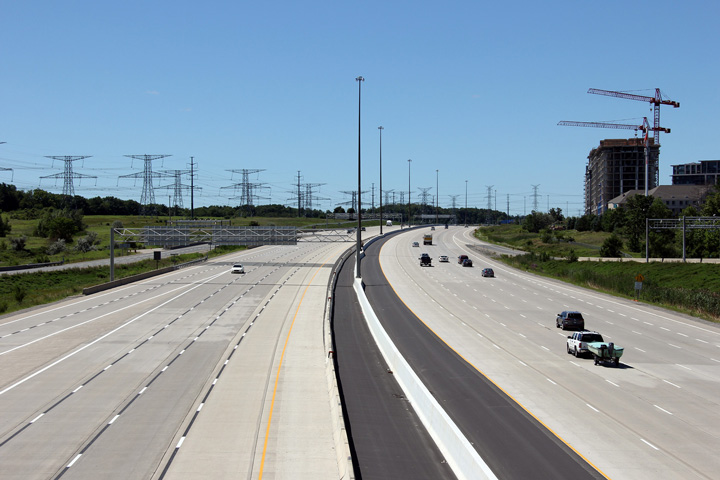
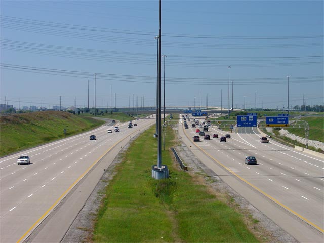
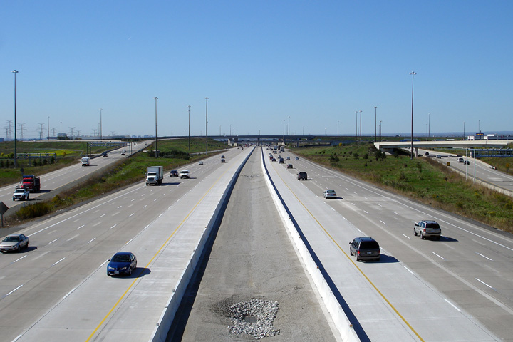
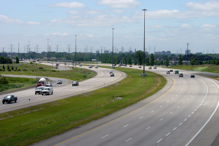
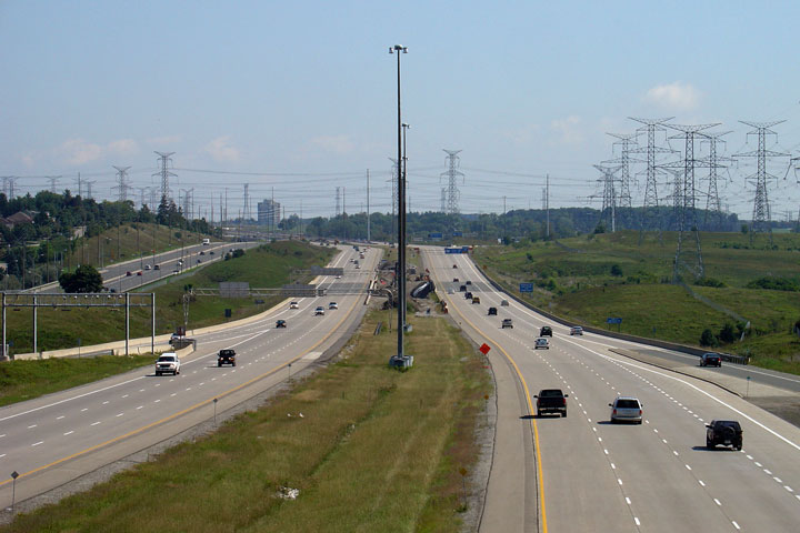
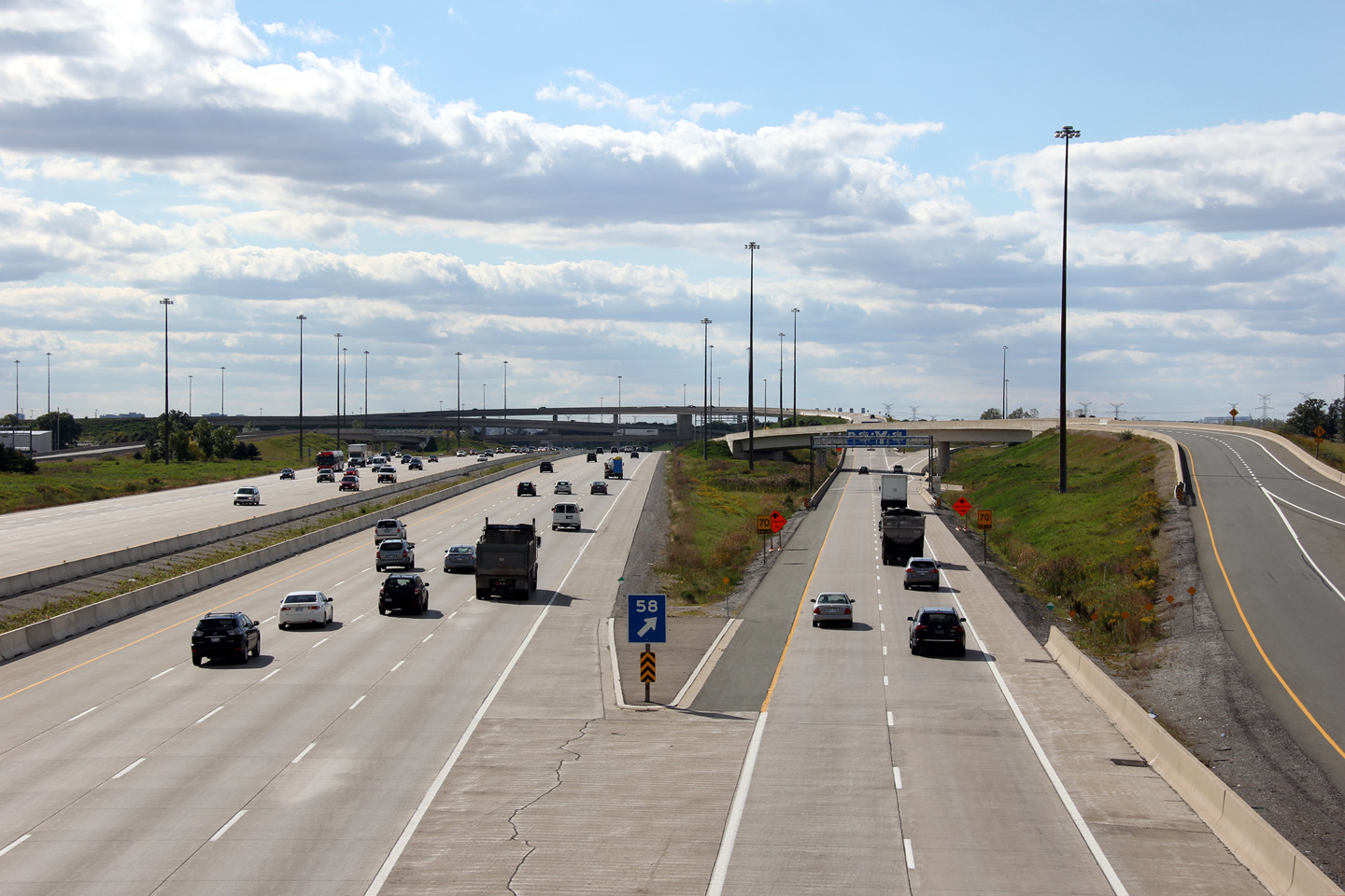
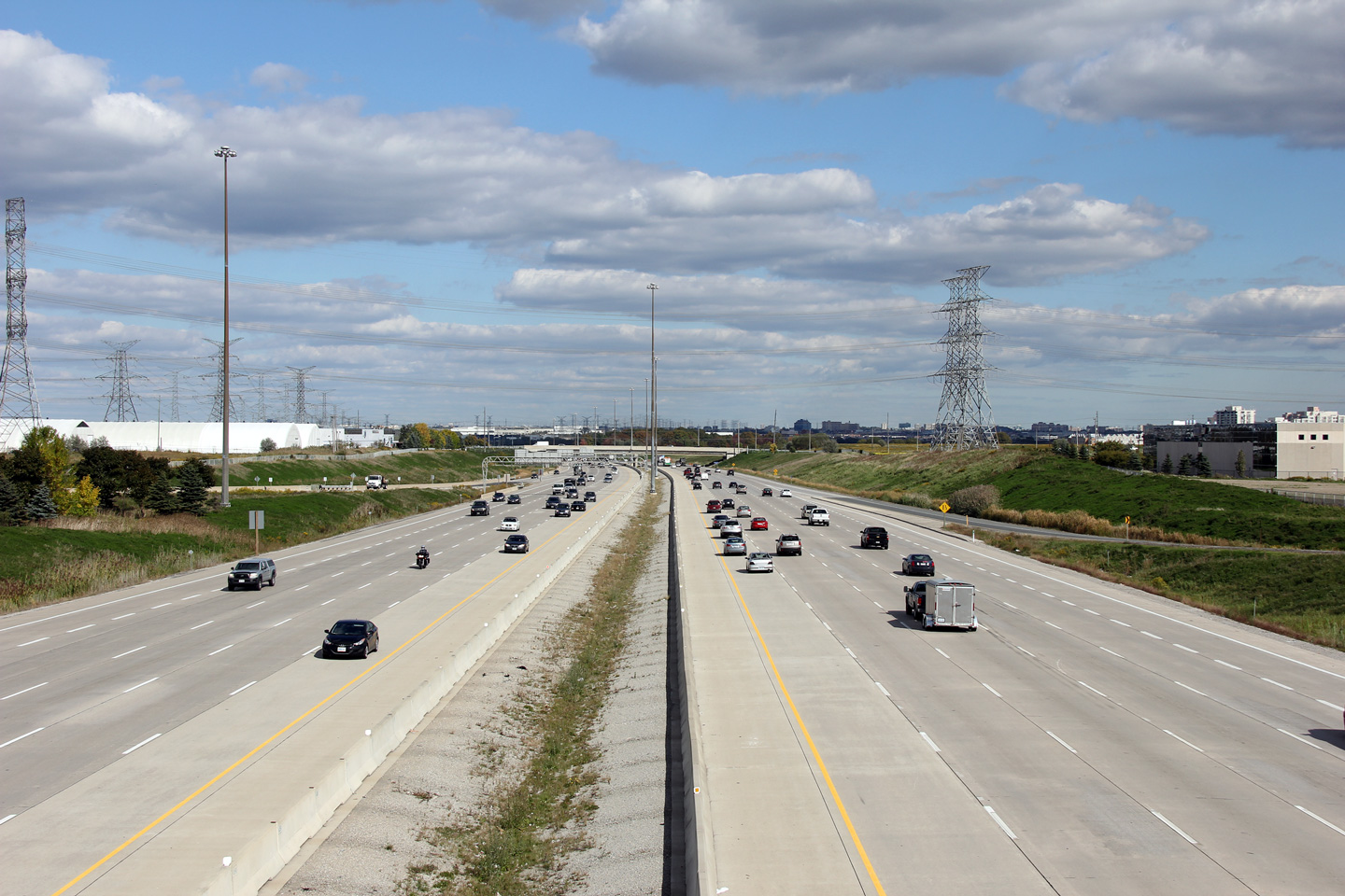
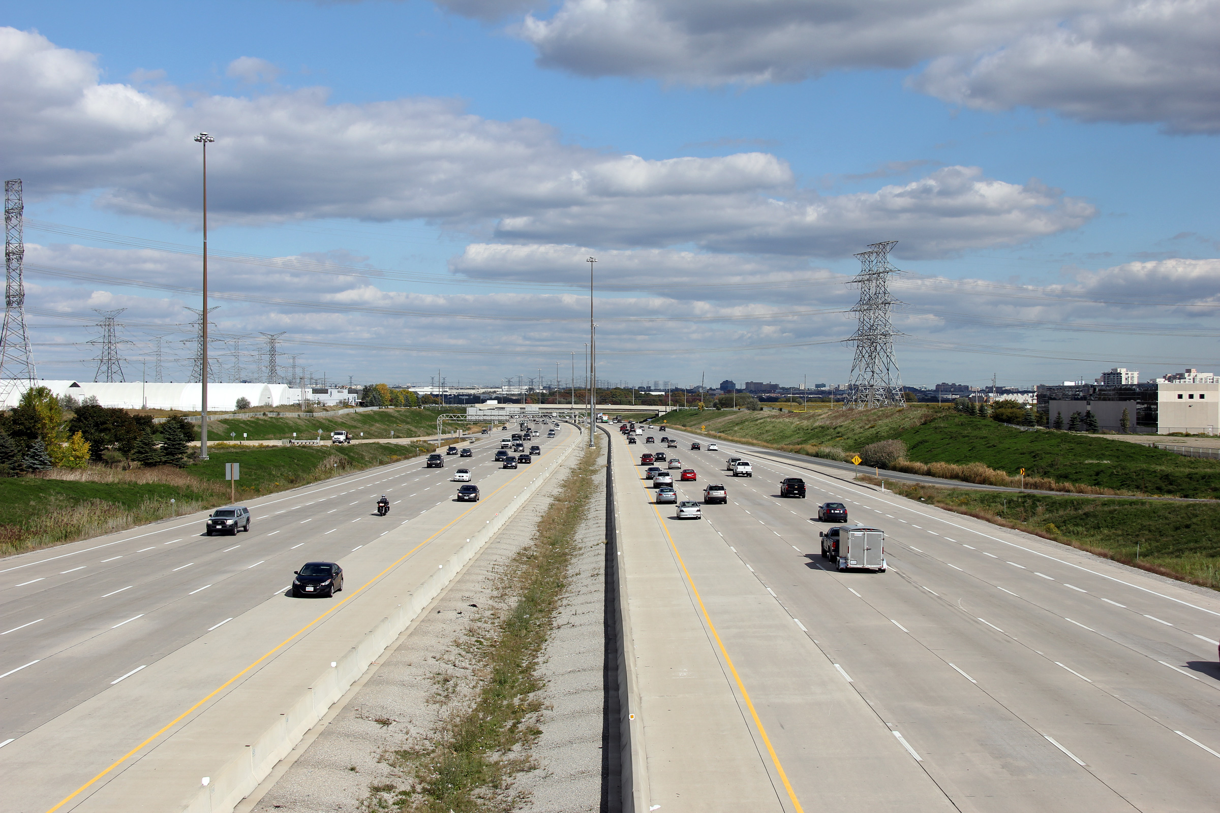
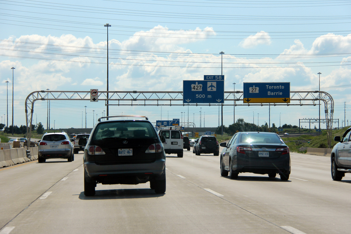
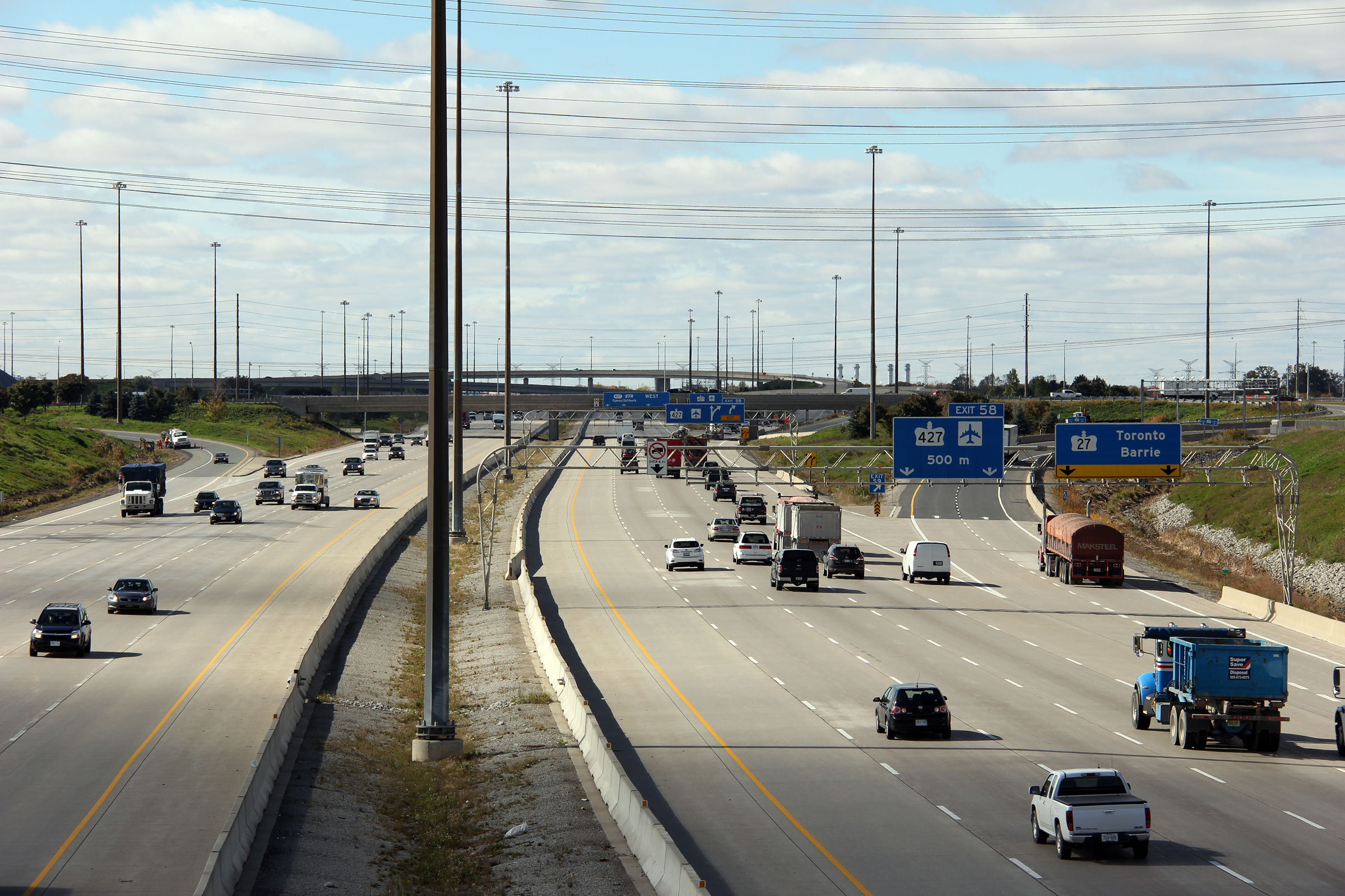
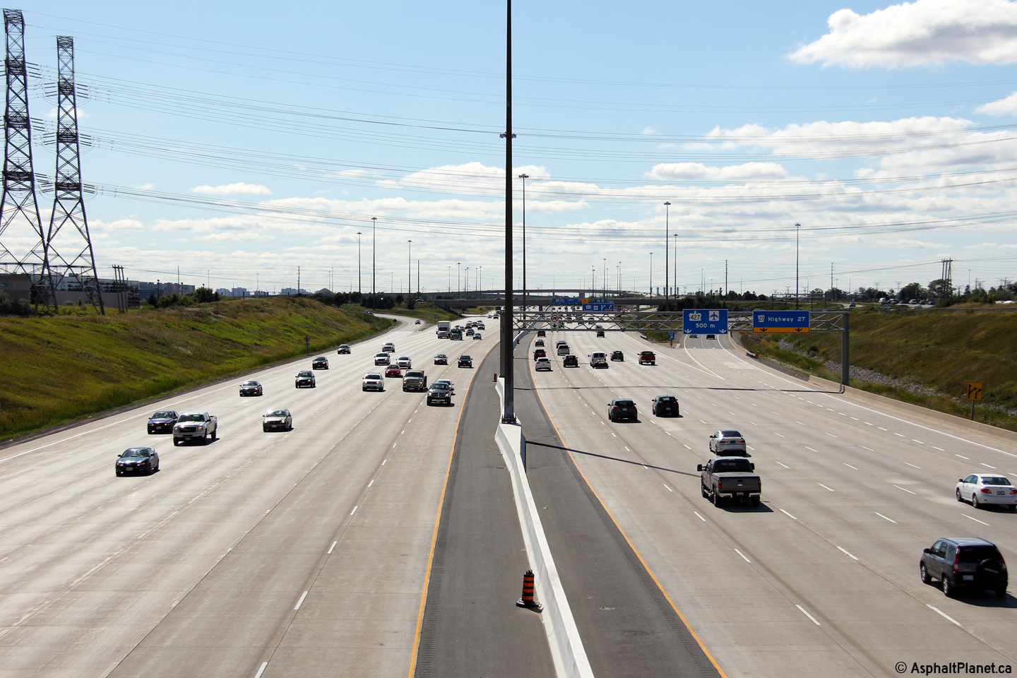
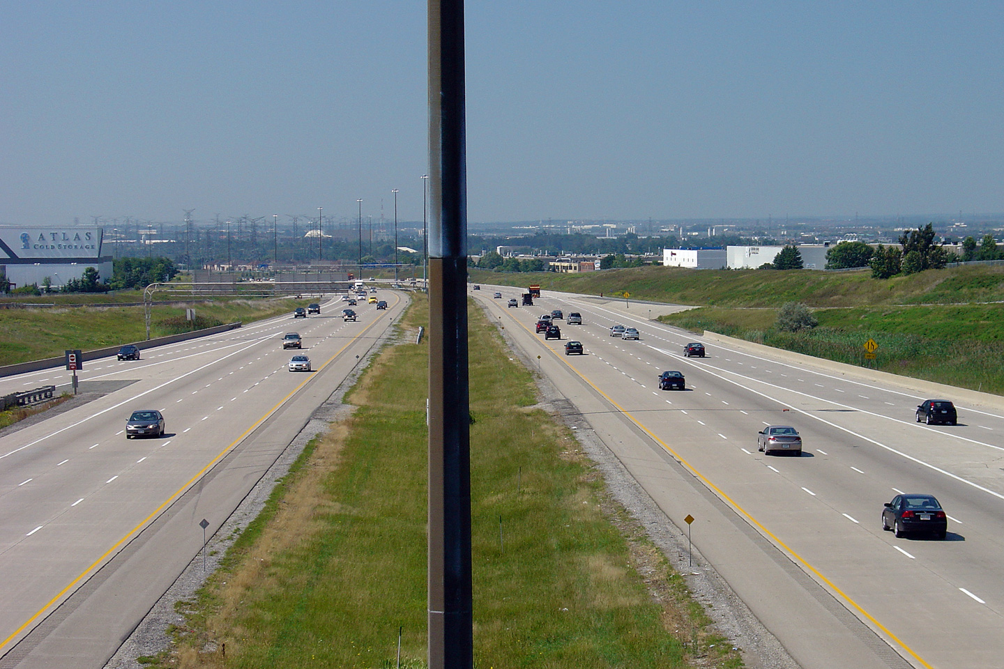
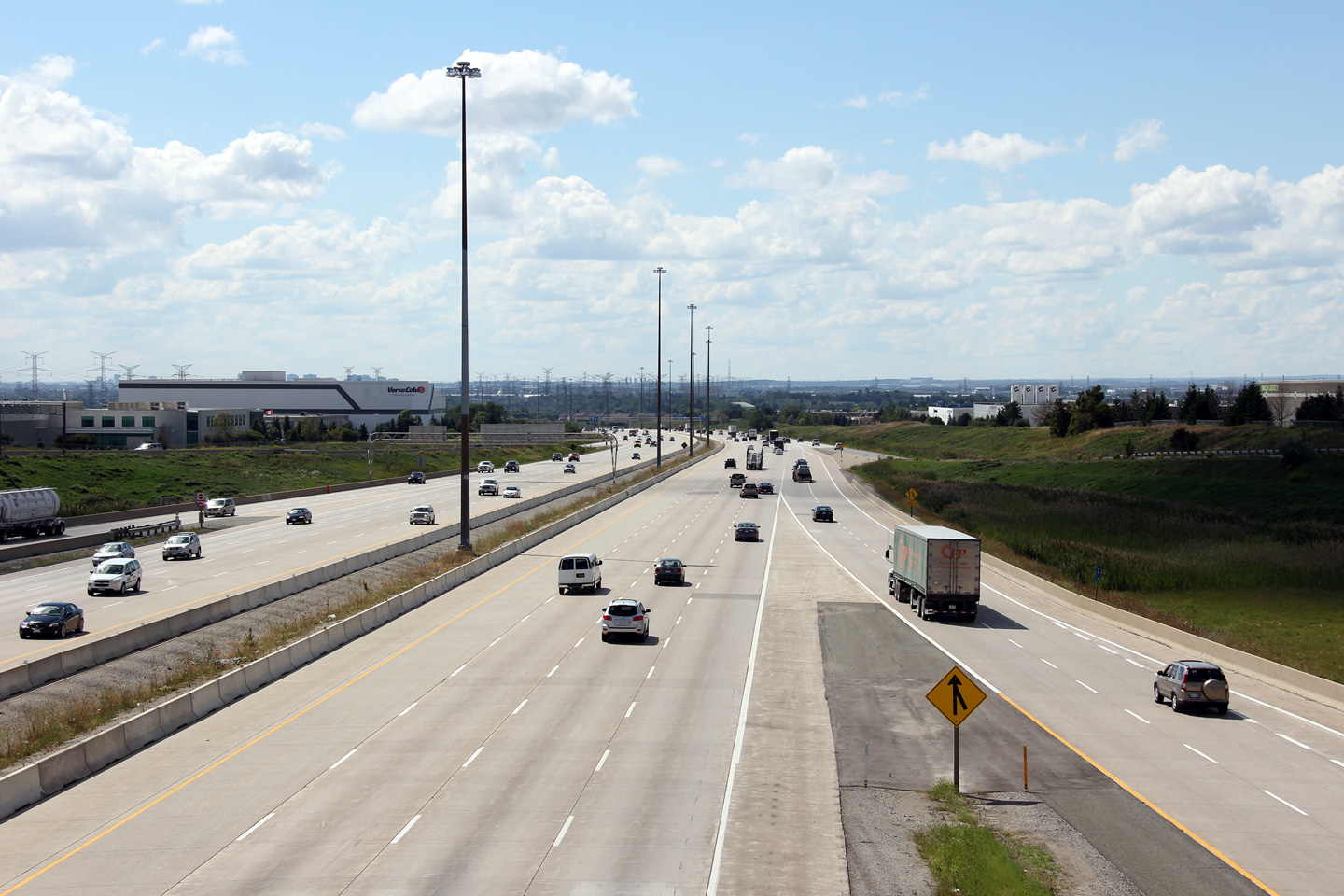
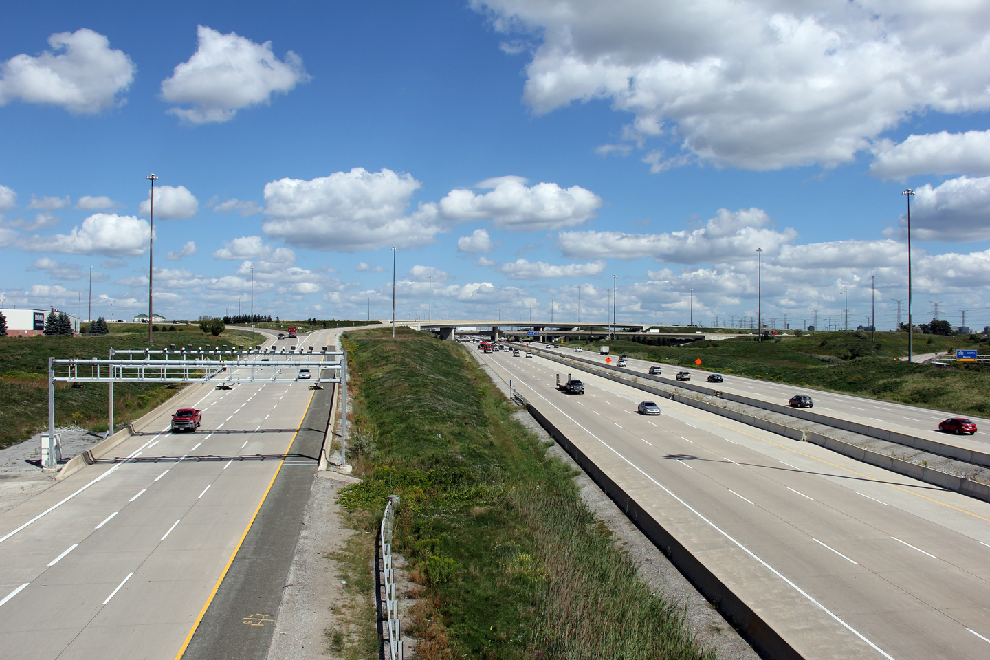
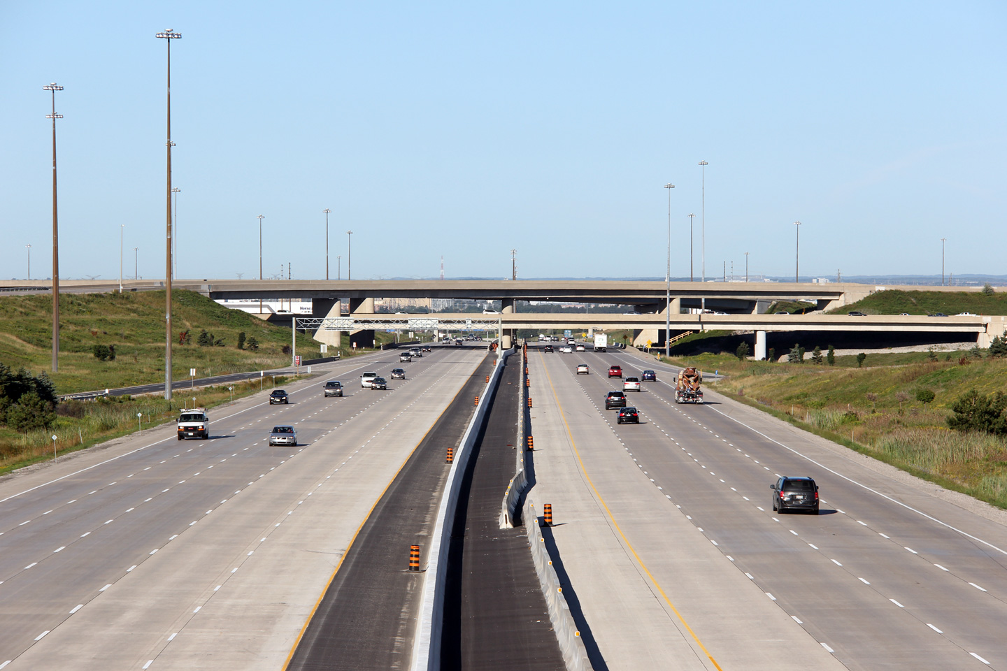
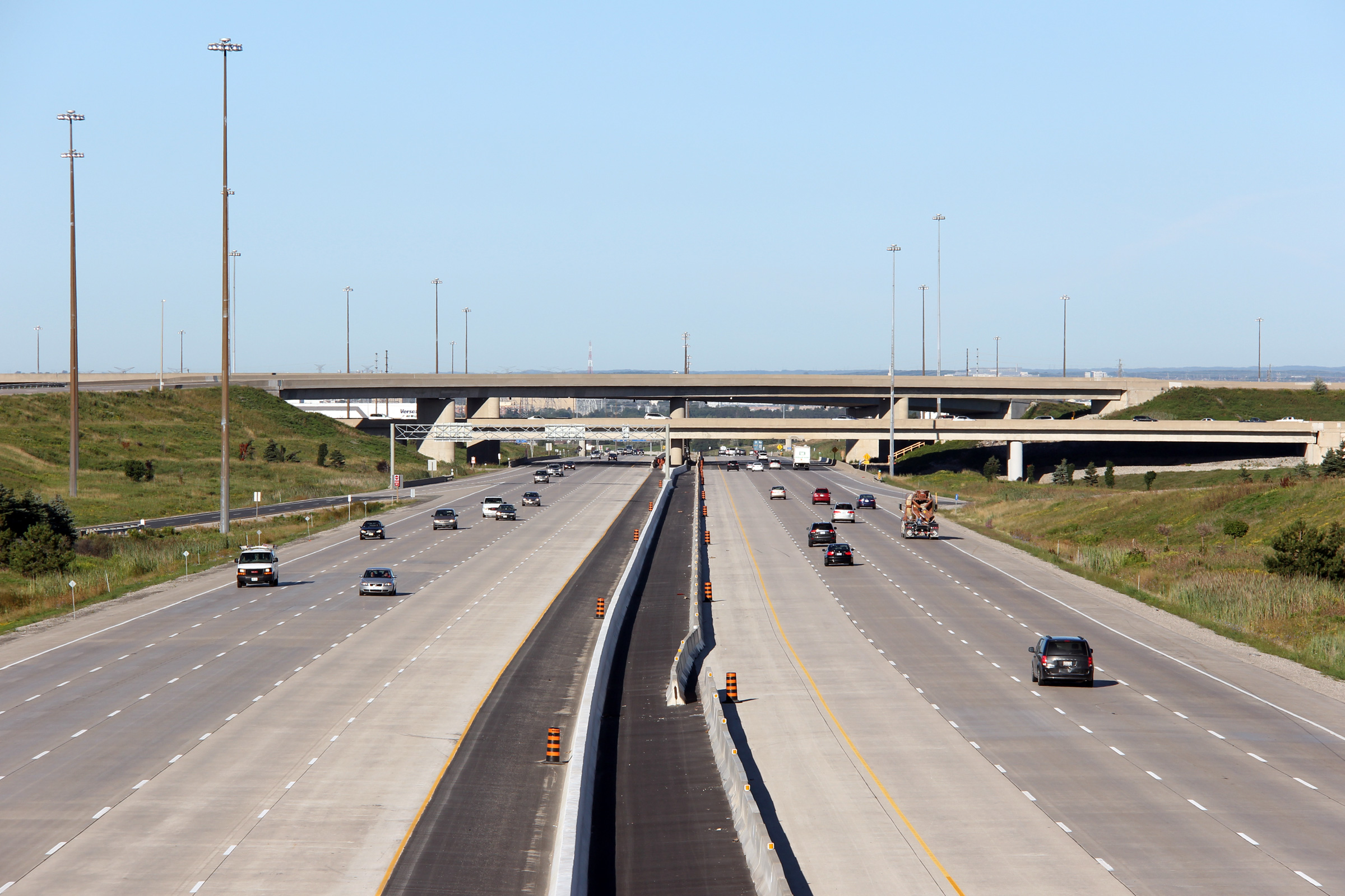
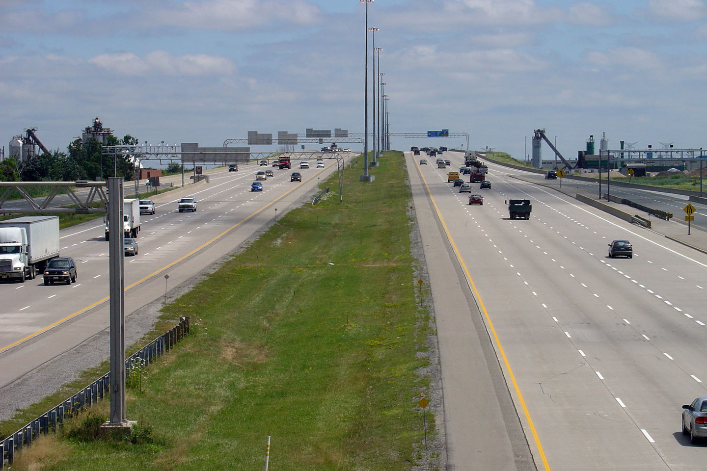
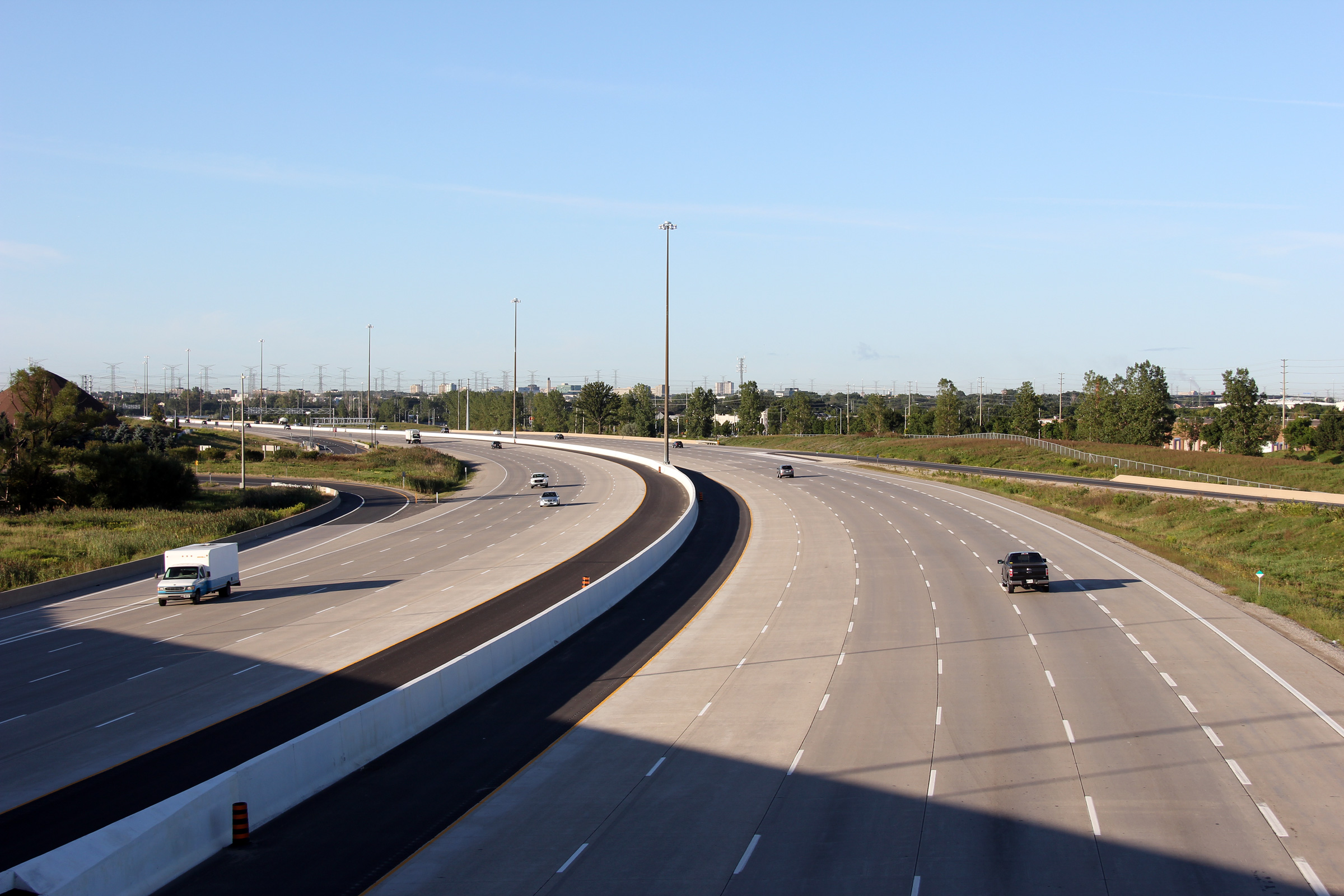
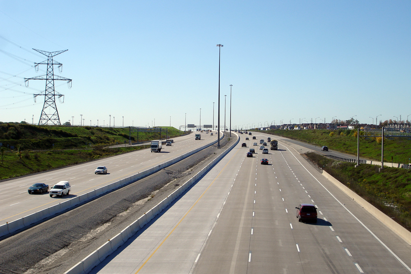
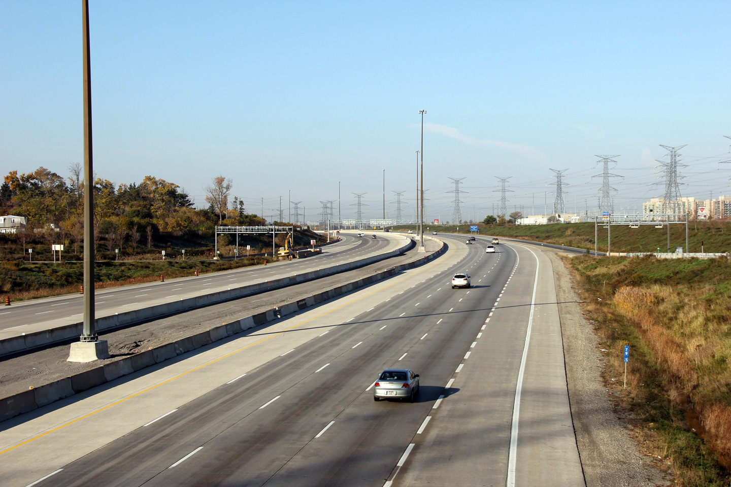
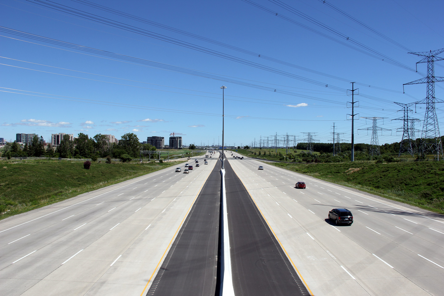
| City of Vaughan Regional Municipality of York |
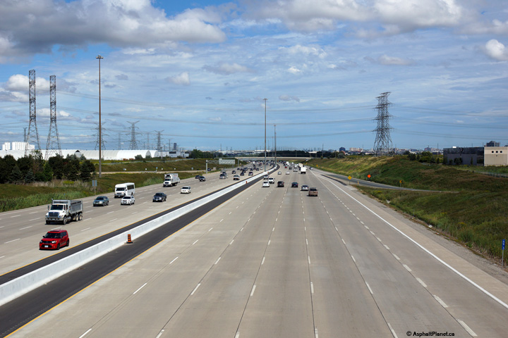
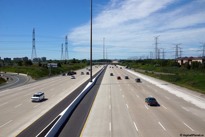
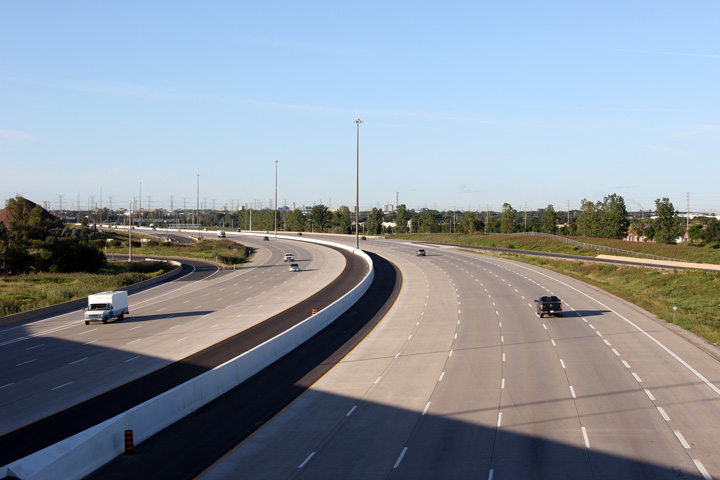
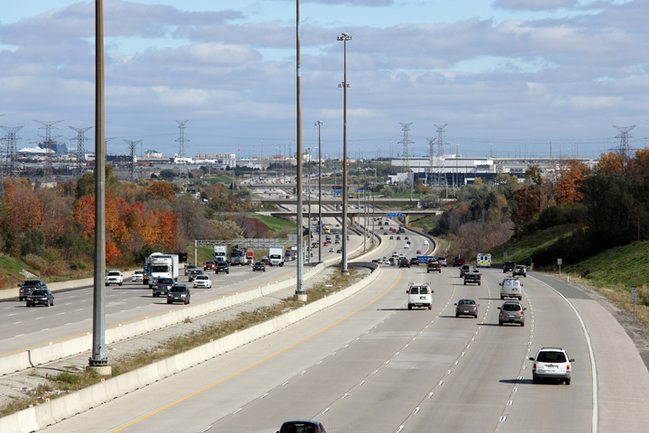
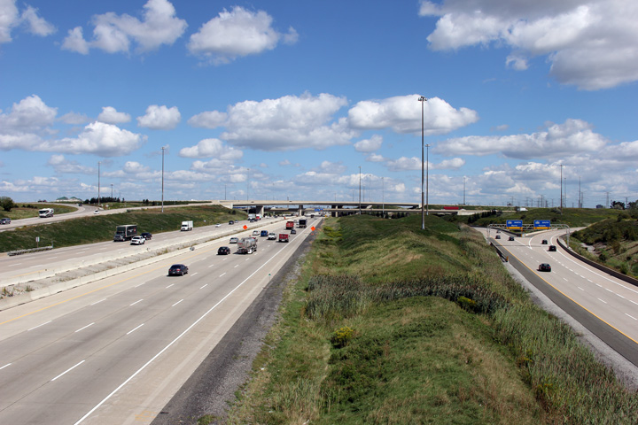
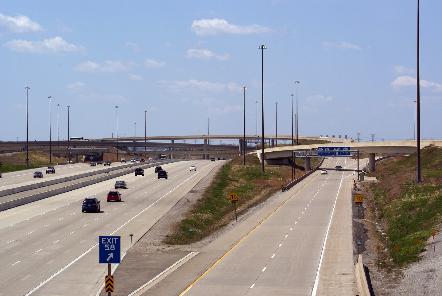
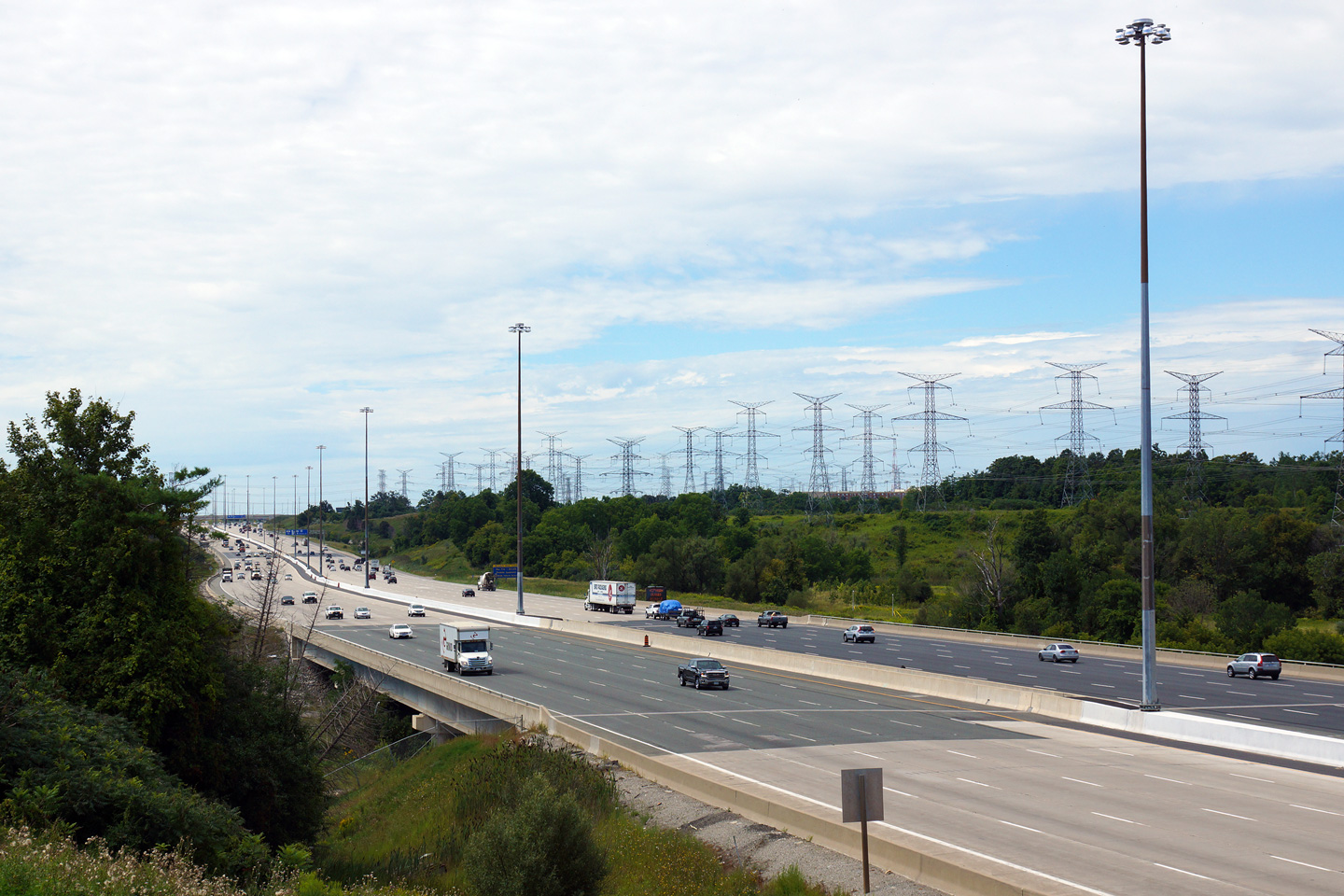
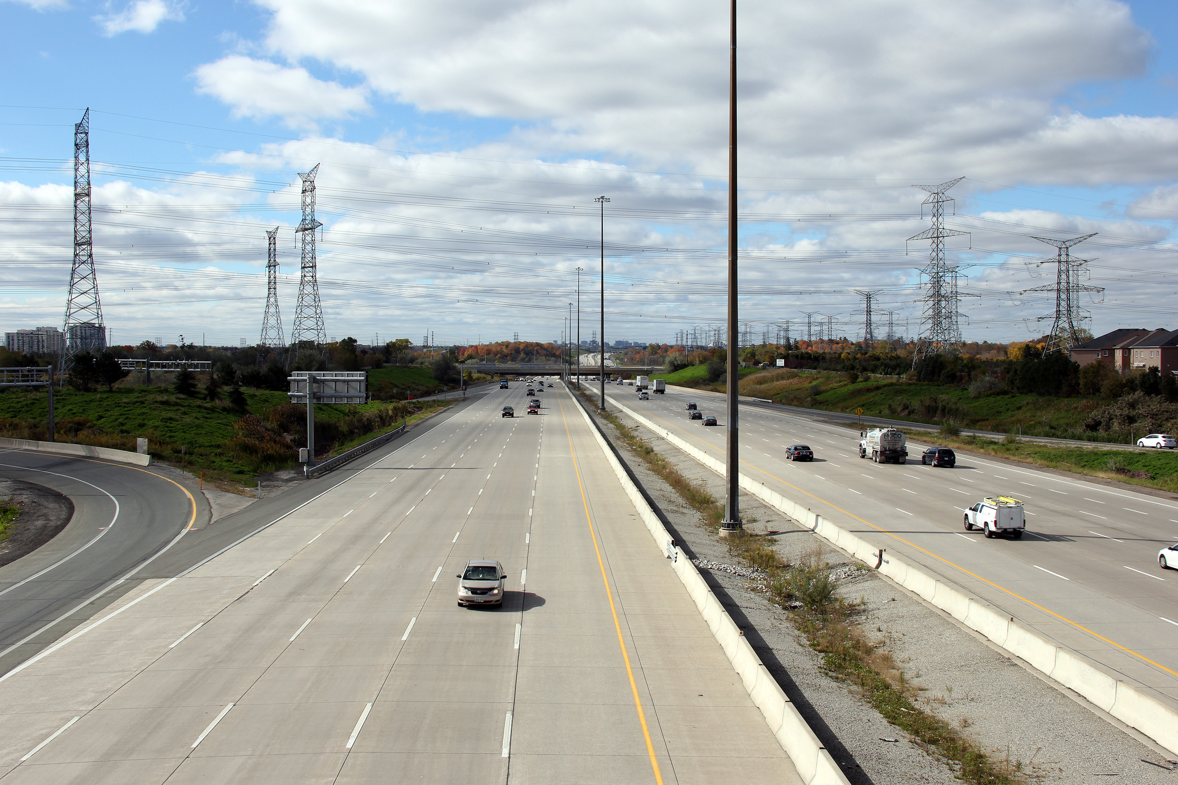
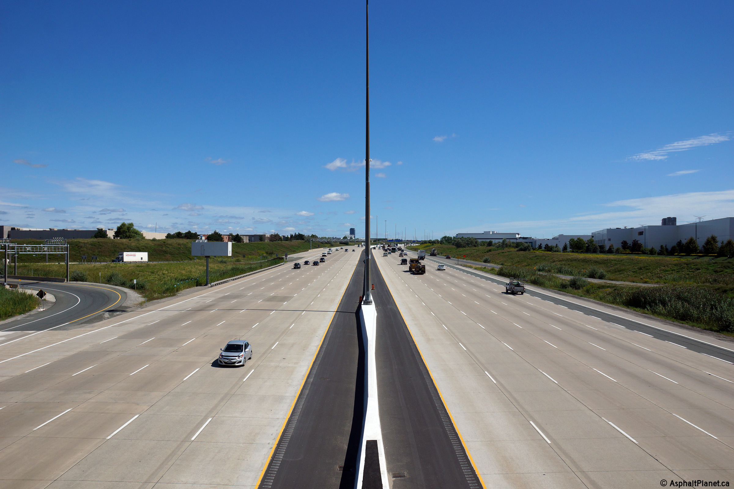
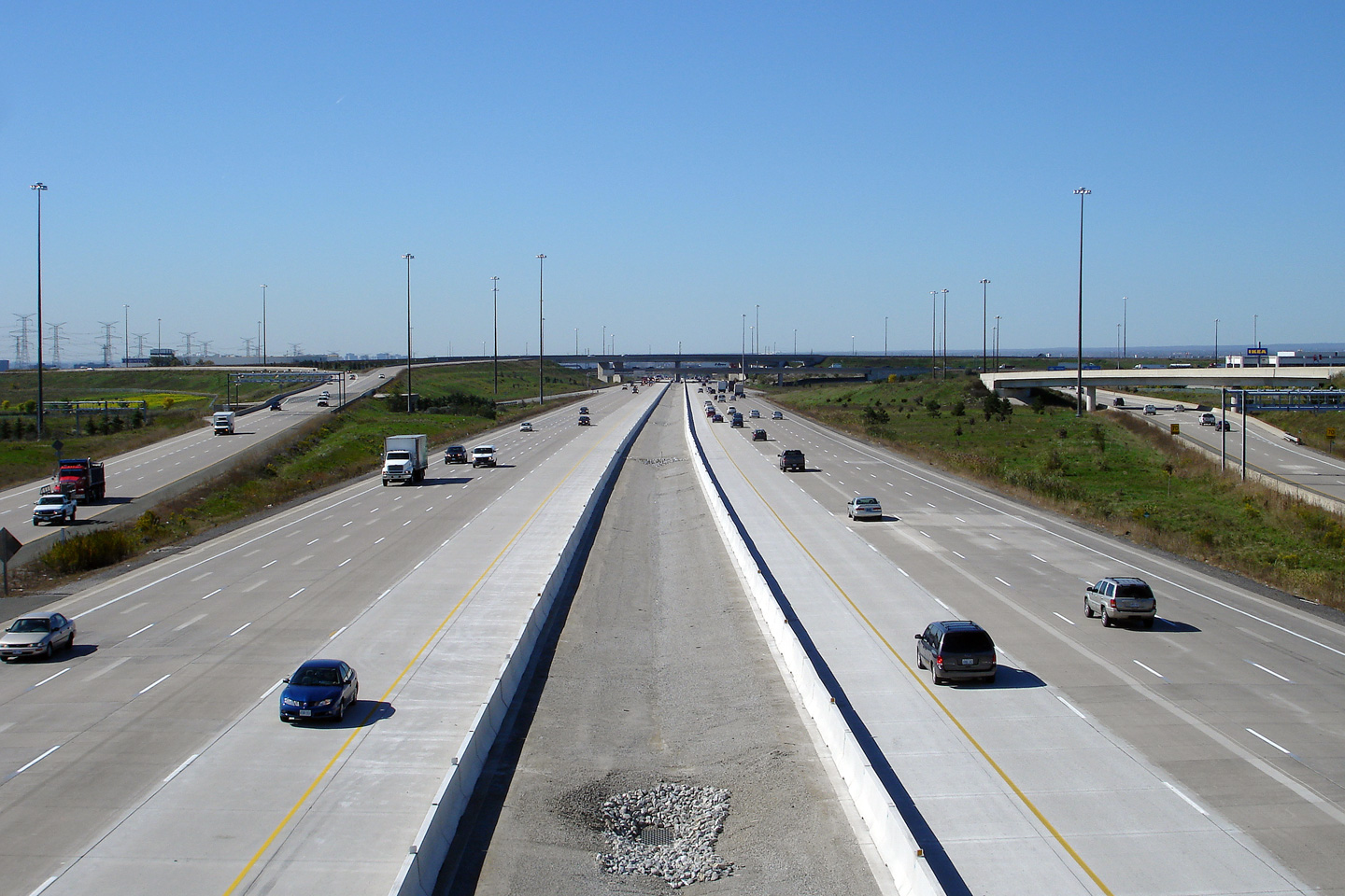
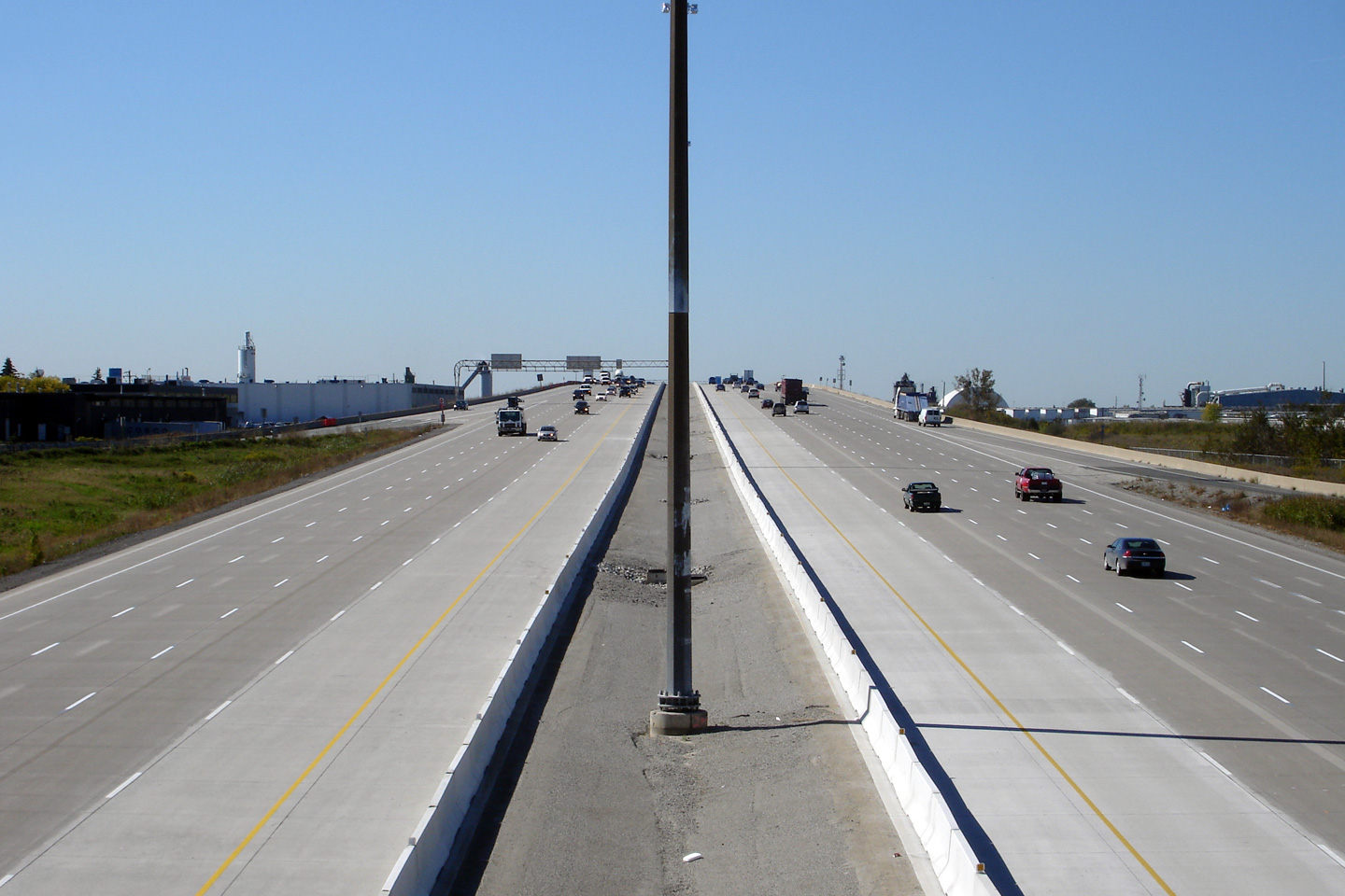
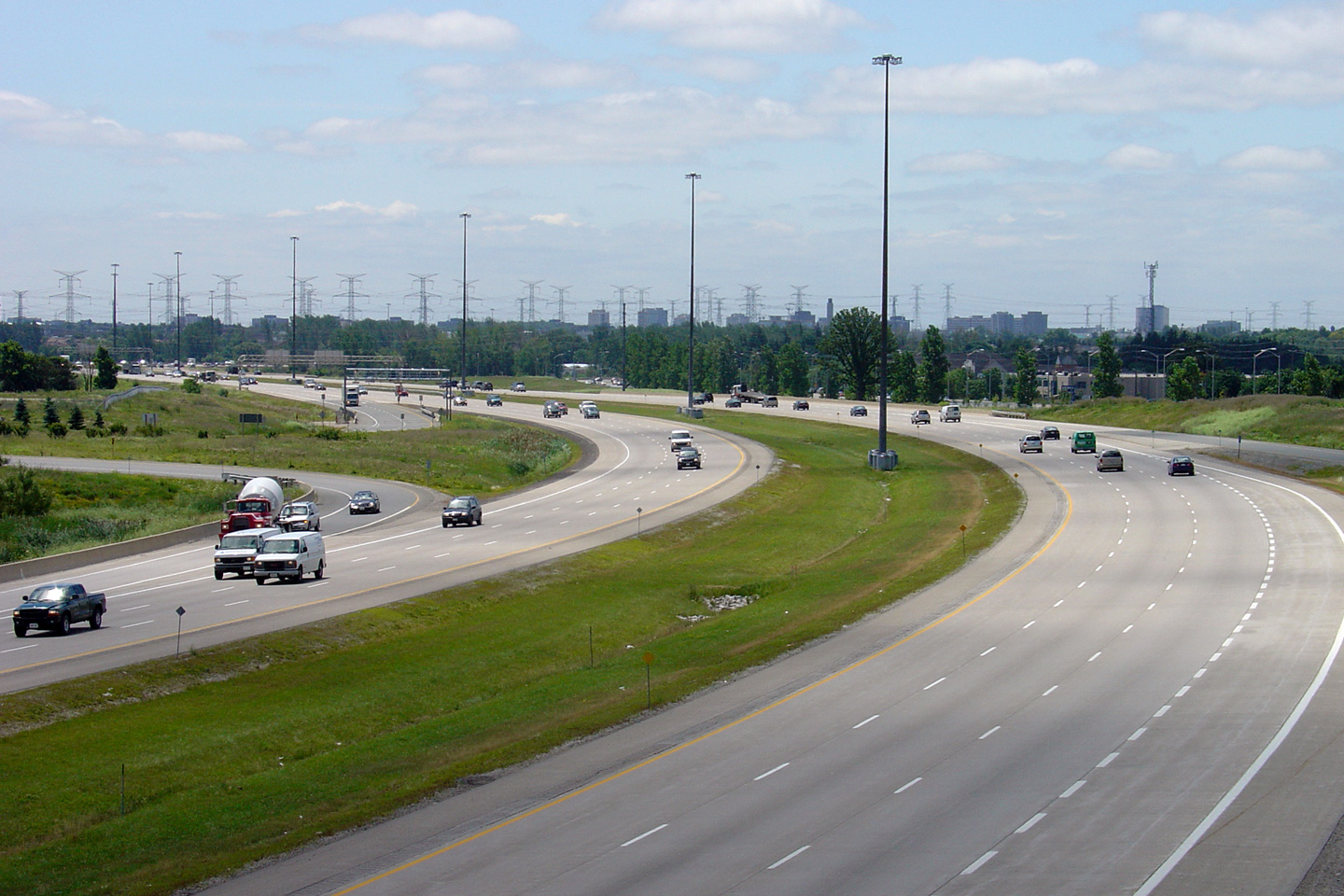
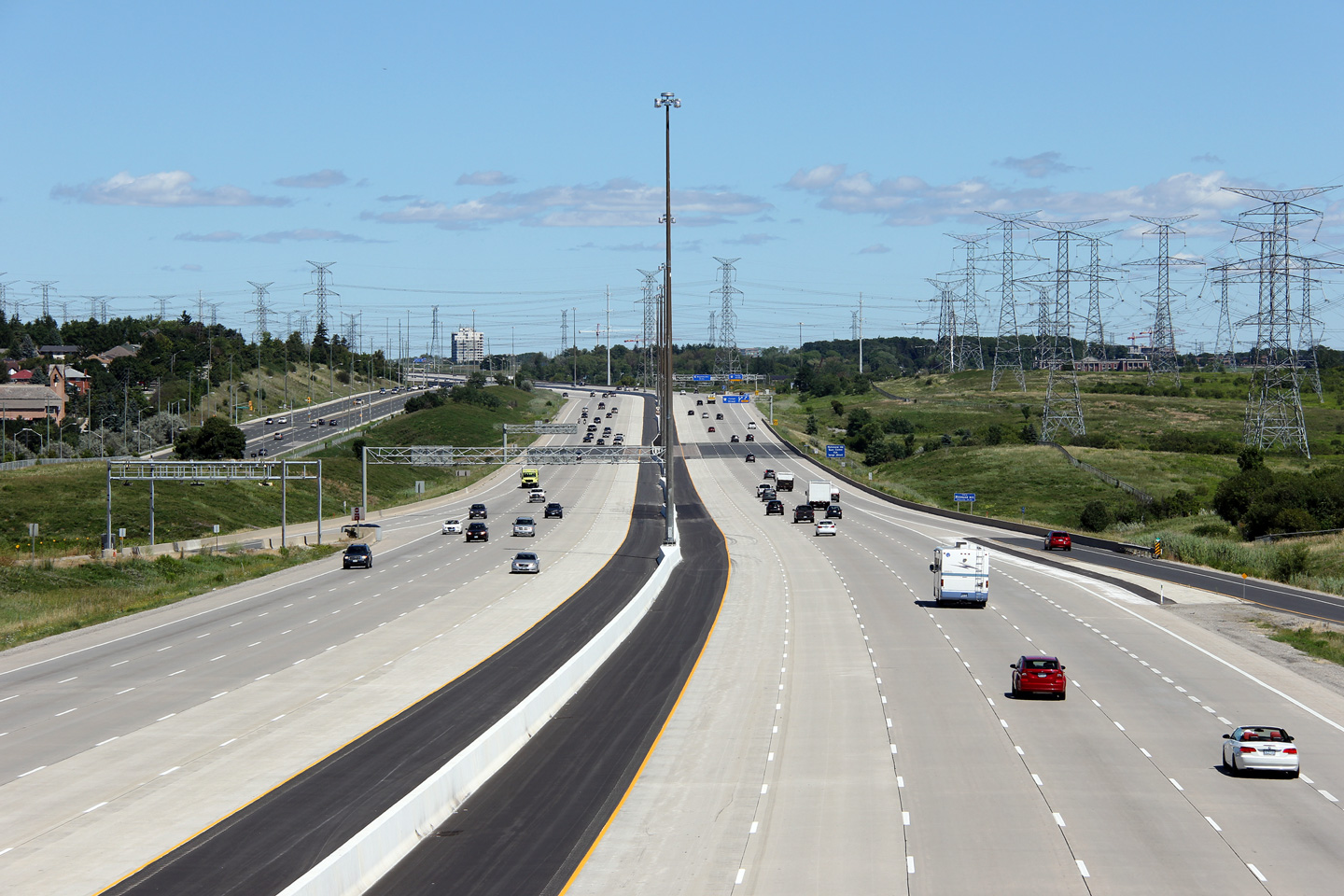
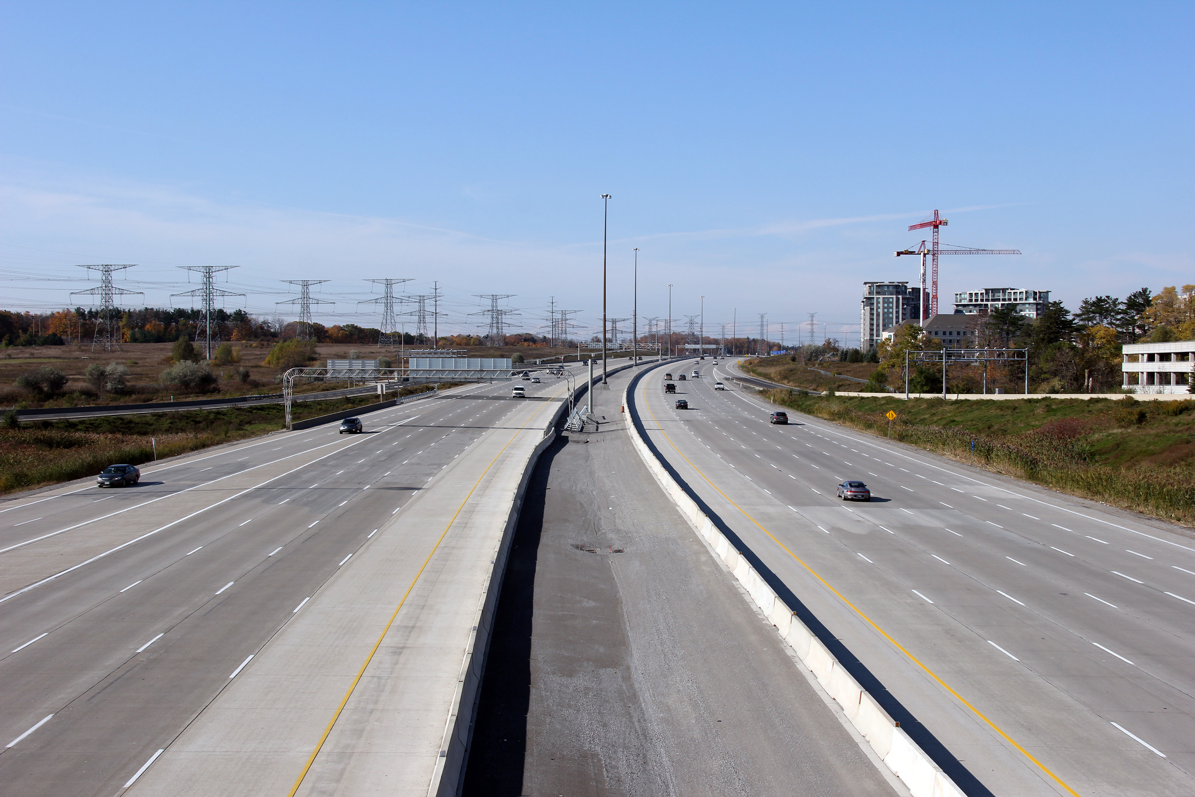
View looking easterly along the 407 from the Highway 27 overpass.
Following a series of multi-year widening projects, Highway 407 has a twelve
lane cross-section between the Highway 427 and Highway 400 interchanges.
The central portion of Highway 407 was generally designed to have a ten lane
cross-section. Between Highways 427 and 400, an extra lane was added
to the outside of the highway by linking two once discontinuous sections of
auxiliary lanes. Upper photo taken: September 31st, 2012. Lower photo taken: August 27th, 2014. |
 (720x480) (1440x960) (2400x1600) |
||||
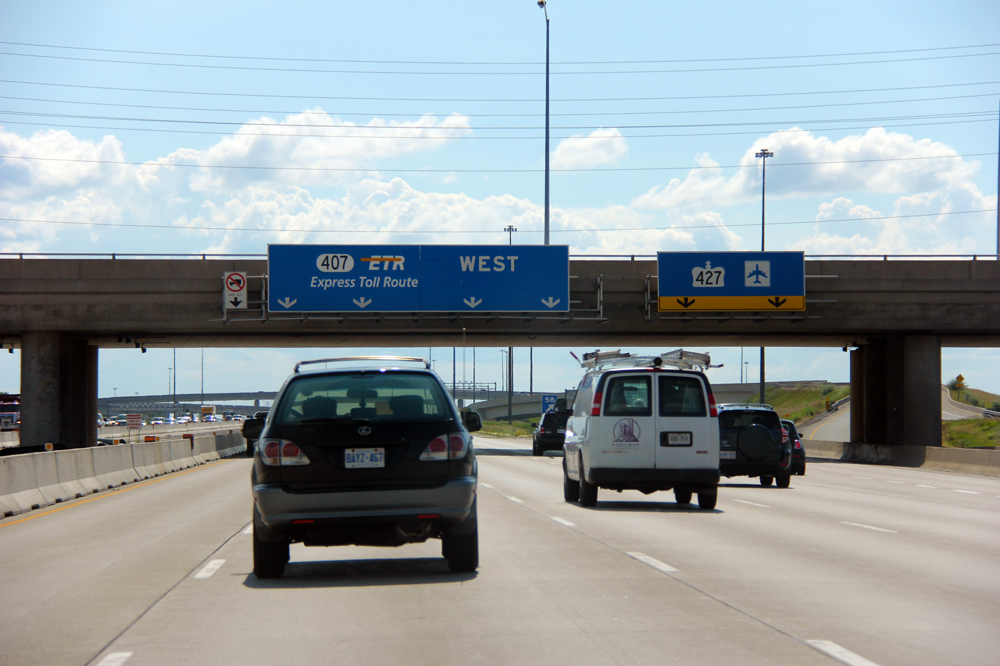
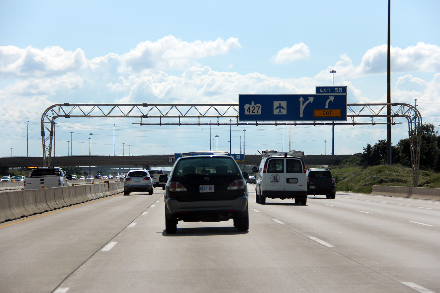
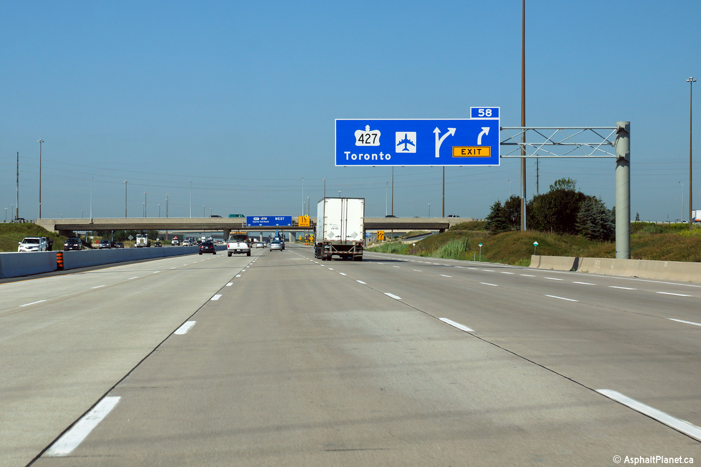
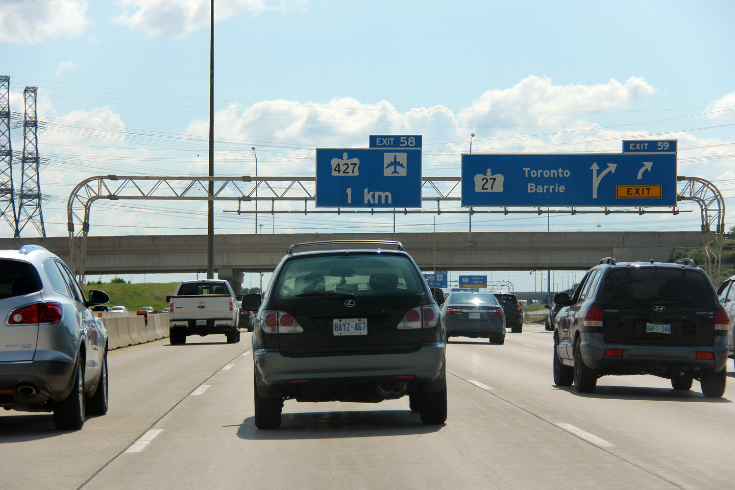
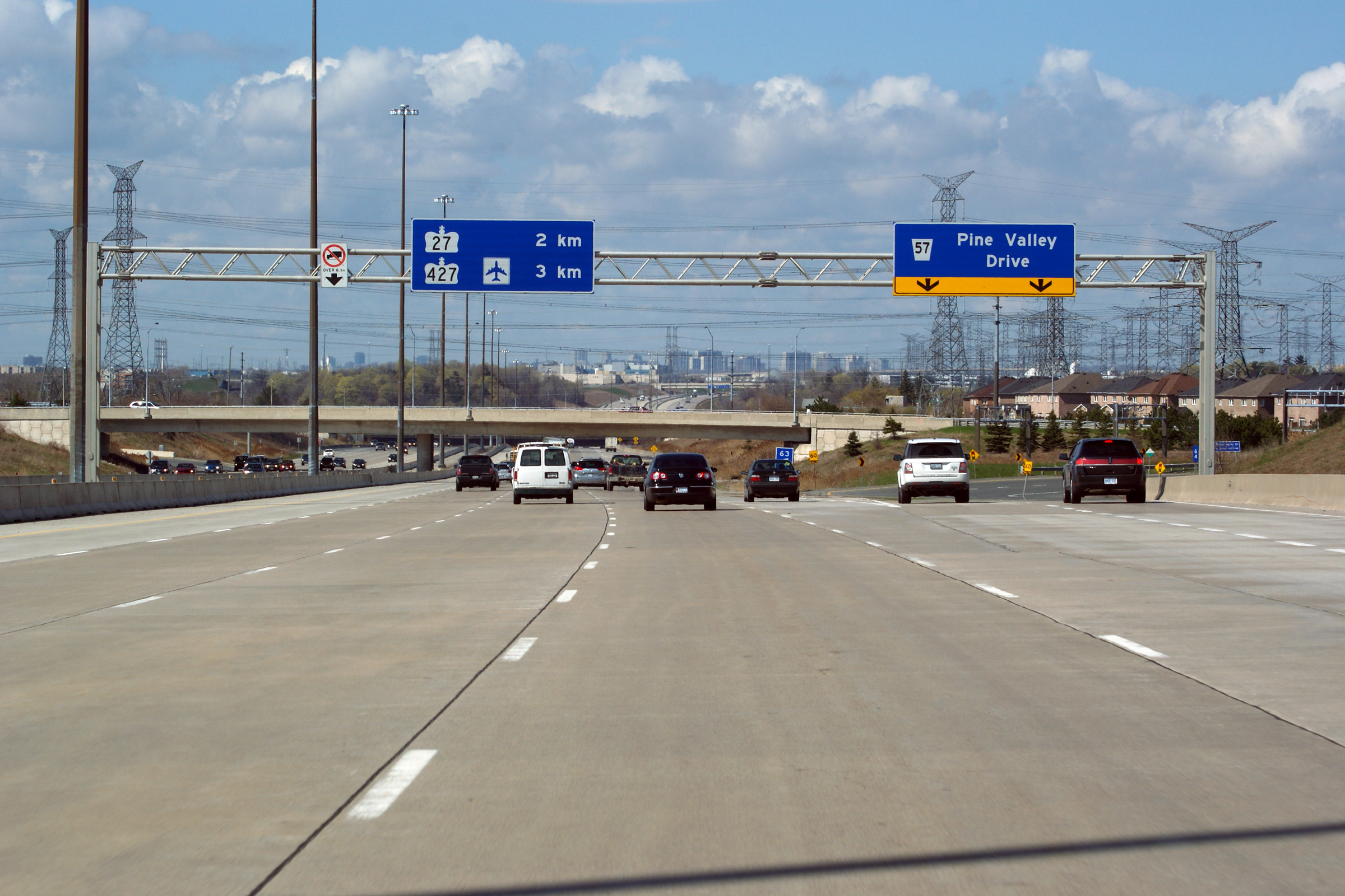
| City of Vaughan Regional Municipality of York |
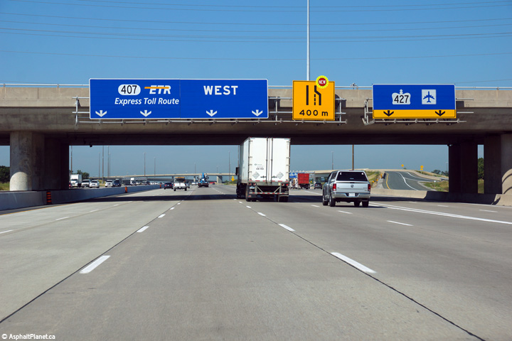
Westbound signage at the off-ramp to Highway 427. Click here
to see the former signage at this location, taken in July, 2013. Photo taken: August 19th, 2014. |
 (720x480) (720x480)(1440x960) (2400x1600) |
||||
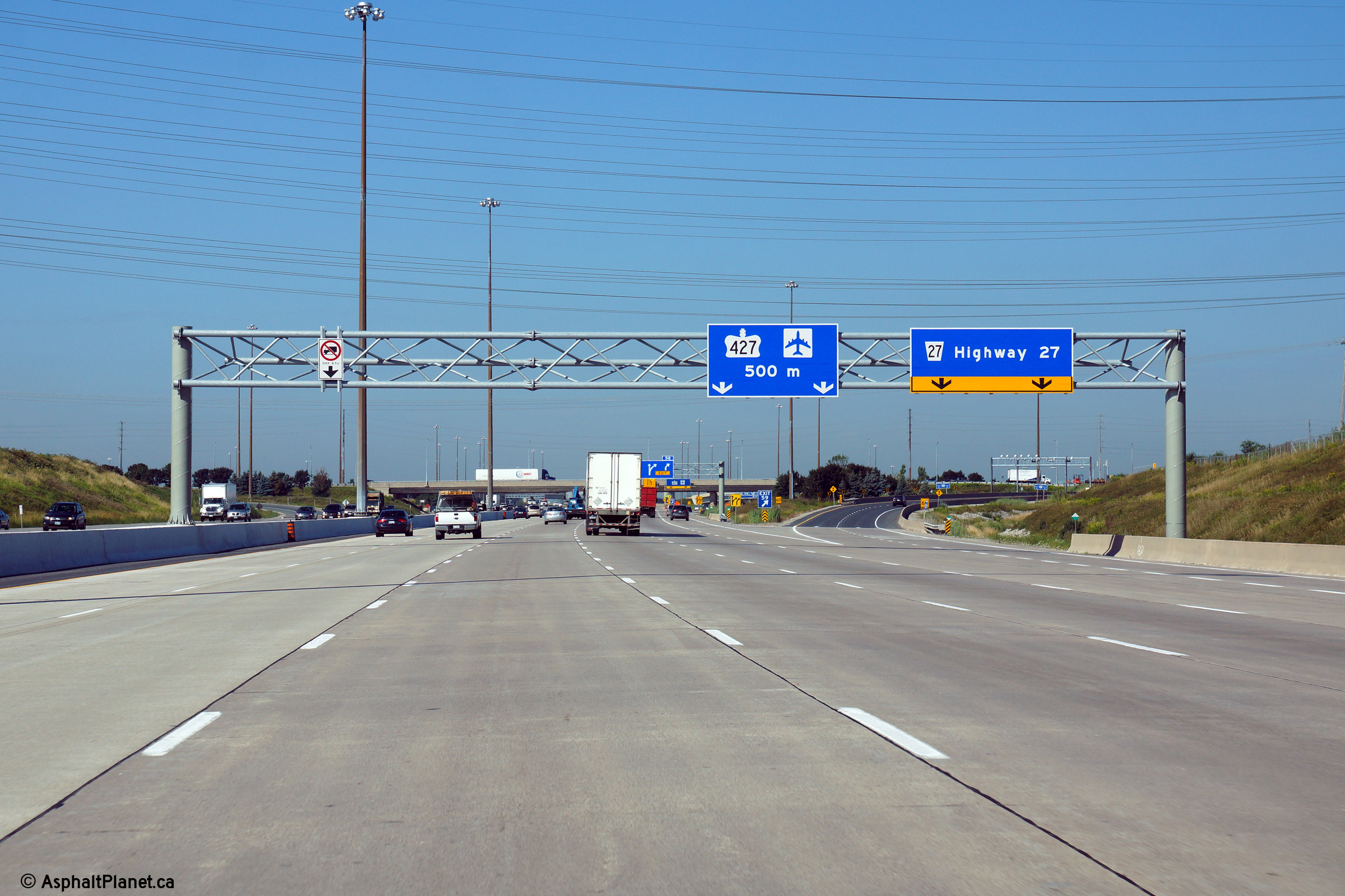
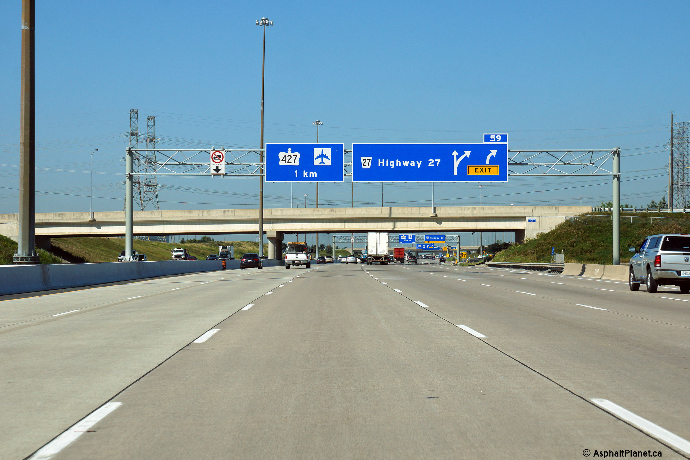
| City of Vaughan Regional Municipality of York |
Westbound advanced signage for the ramp to Highway 427. Click here
to see the former signage at this location, taken in July, 2013. Photo taken: August 19th, 2014. |
 (720x480) (720x480)(1440x960) (2400x1600) |
||||
| City of Vaughan Regional Municipality of York |
Drivers view looking westerly at the off-ramp to Highway 27. Highway
27 is no longer signed as a long-distance through highway between Toronto
and Barrie along Highway 27.
Click here to see the former
signage at this location, taken in July, 2013. Photo taken: August 19th, 2014. |
 (720x480) (720x480)(1440x960) (2400x1600) |
||||
| City of Vaughan Regional Municipality of York |
View looking westerly along the 407 from the Martin Grove Road overpass. Upper photo taken: August 28th, 2005. Middle photos taken: October 16th, 2012. Lower photo taken: August 27th, 2014. |
 (720x480) (1440x960) (2400x1600) |
||||
| City of Vaughan Regional Municipality of York |
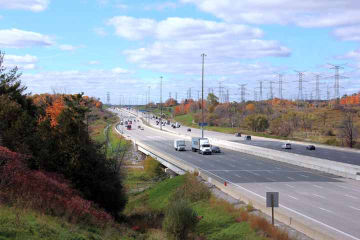
Easterly view along the Highway 407 from the Martin Grove Road overpass.
Highway 407 passes through the industrial heart of the City of Vaughan. Upper photo taken: August 28th, 2005. Middle photos taken: October 16th, 2012. Lower photo taken: August 27th, 2014. |
 (720x480) (1440x960) (2400x1600) 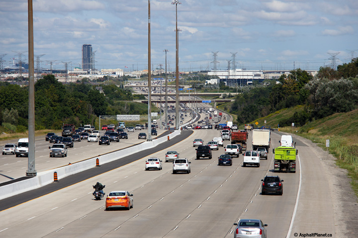 (720x480) (1440x960) (2400x1600) |
||||
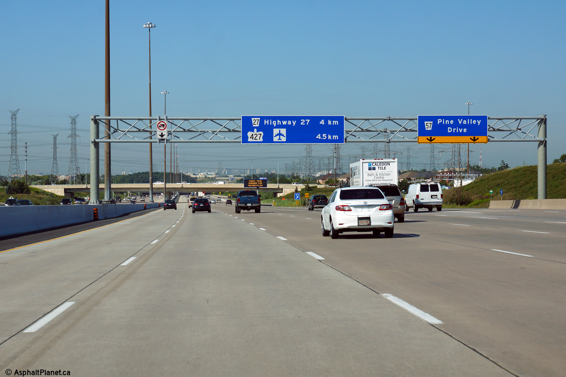
| City of Vaughan Regional Municipality of York |
Advanced signage approaching the Highway 27 interchange.
Click here to see the former
signage at this location, taken in July, 2013. Photo taken: August 14th, 2014. |
 (720x480) (720x480)(1440x960) (2400x1600) |
||||
| City of Vaughan Regional Municipality of York |
A diagram sign stands just beyond Rainbow Creek to advise westbound
motorists of the upcoming Highway 27 and 427 interchanges.
Click here to see the former signage at
this location, taken in May, 2011. Photo taken: August 14th, 2014. |
 (720x480) (720x480)(1440x960) (2400x1600) |
||||
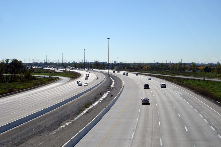
| City of Vaughan Regional Municipality of York |
Three views looking westerly from the CP Railway overhead towards the Humber
River. Highway 407 meanders rather gracefully through the Humber River
valley. Upper photos taken: October 16th, 2012. Lower photo taken: August 27th, 2014. |
 (720x480) (1440x960) (2400x1600) |
||||
| City of Vaughan Regional Municipality of York |
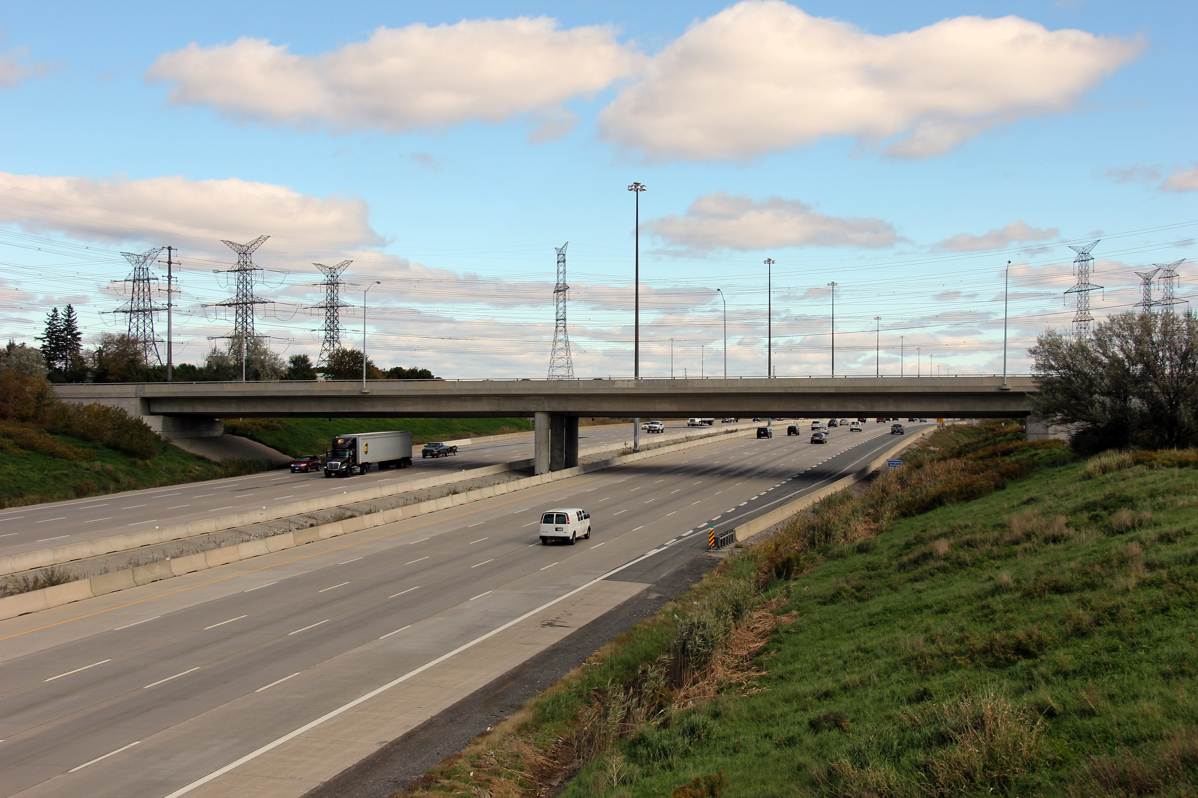
Easterly view from the CP Railway overhead towards the Islington Avenue
overpass. The Islington Avenue overpass was constructed in the early 1990s
and appears to have been designed for a cross-section wider than the twelve
lanes that are currently envisioned for the 407 between Highways 427 and
400. Upper photo taken: October 16th, 2012. Lower photo taken: August 27th, 2014. |
 (720x480) (1440x960) (2400x1600) |
||||
| City of Vaughan Regional Municipality of York |
Westerly view from the Islington Avenue overpass. Notice the railway
overhead that carries the MacTier subdivision of the Canadian Pacific
Railway. The MacTier subdivision is one of the principal railways from
Toronto to northern Ontario and western Canada. Upper photo taken: August 28th, 2005. Middle photo taken: October 16th, 2012. Lower photo taken: August 27th, 2014. |
 (720x480) (1440x960) (2400x1600) |
||||
| City of Vaughan Regional Municipality of York |
Easterly view from the Islington Avenue overpass. Upper photo taken: October 16th, 2012. Lower photo taken: August 27th, 2014. |
 (720x480) (1440x960) (2400x1600) |
||||
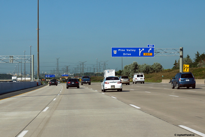
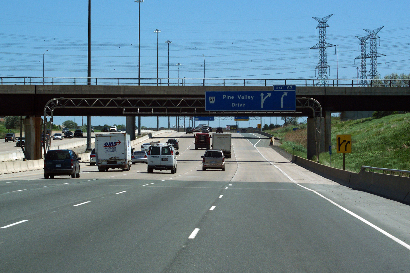
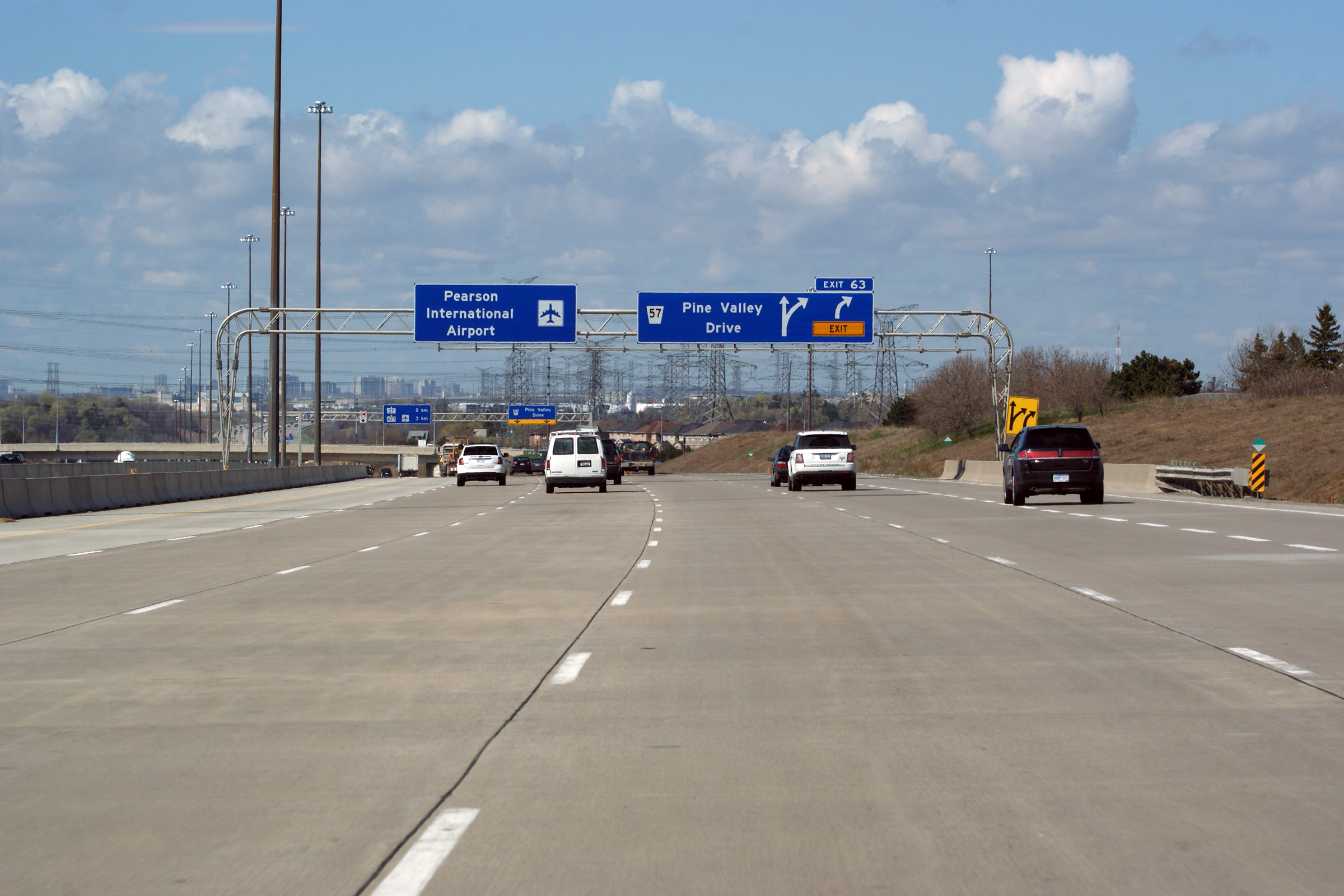
| City of Vaughan Regional Municipality of York |
Easterly view approaching the Pine Valley Drive interchange. Click
here to see the former signage at this location, taken in June, 2011. Photo taken: August 27th, 2014. |
 (720x480) (720x480)(1440x960) (2400x1600) |
||||
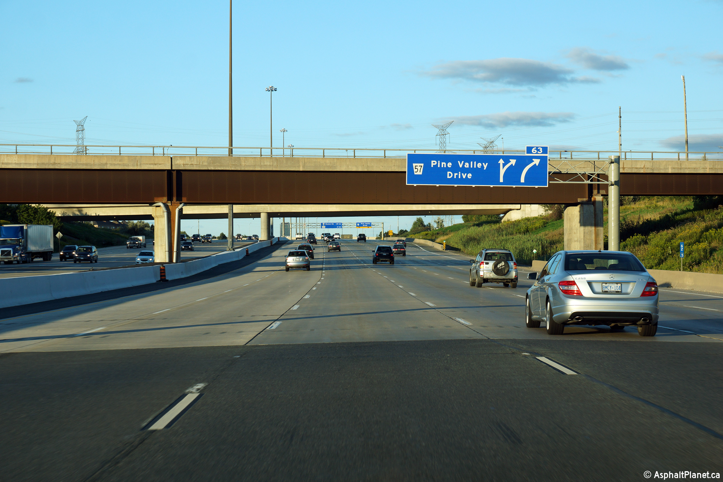
| City of Vaughan Regional Municipality of York |
Signage at the eastbound off-ramp to Pine Valley Drive. Click
here to see the former signage at this location, taken in June, 2011. Photo taken: August 27th, 2014. |
 (720x480) (720x480)(1440x960) (2400x1600) |
||||
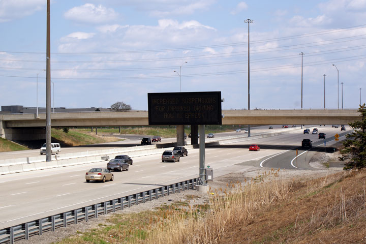
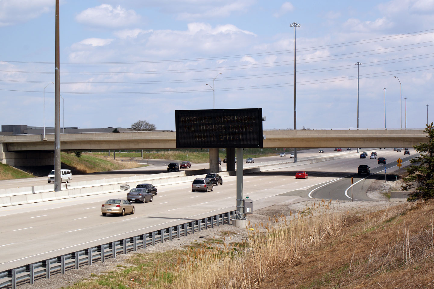
| City of Vaughan Regional Municipality of York |
View looking easterly towards the Pine Valley Drive overpass and the 407's
first generation changeable message sign (CMS). This was the first CMS to be
erected along Highway 407, and while it is full colour, it lacks both the
brightness and resolution of the newer changeable message signs that have
since been installed. Photo taken: May 3rd, 2009. |
 (720x480) (720x480)(1440x960) |
||||
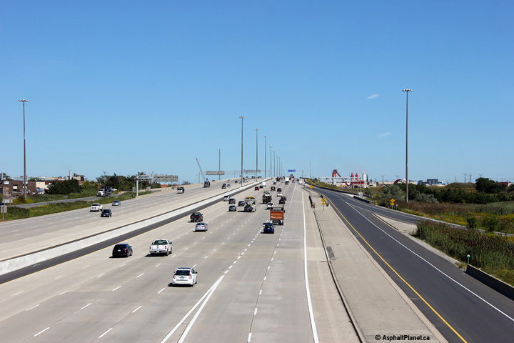
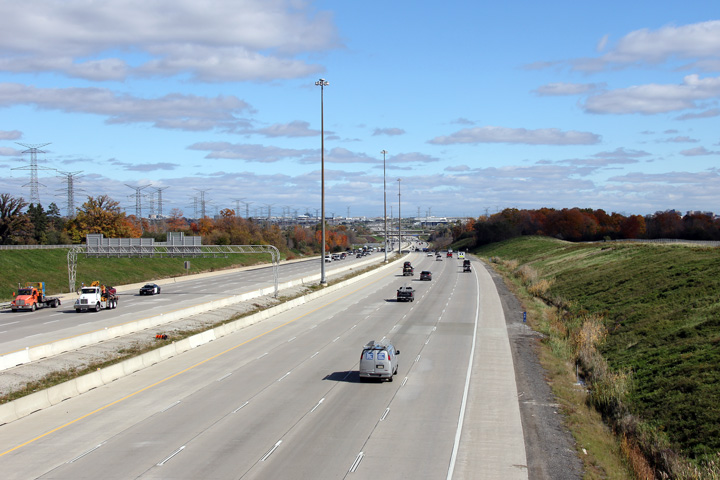
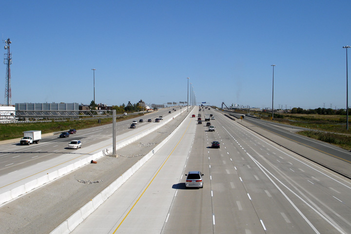
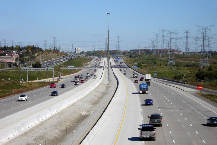
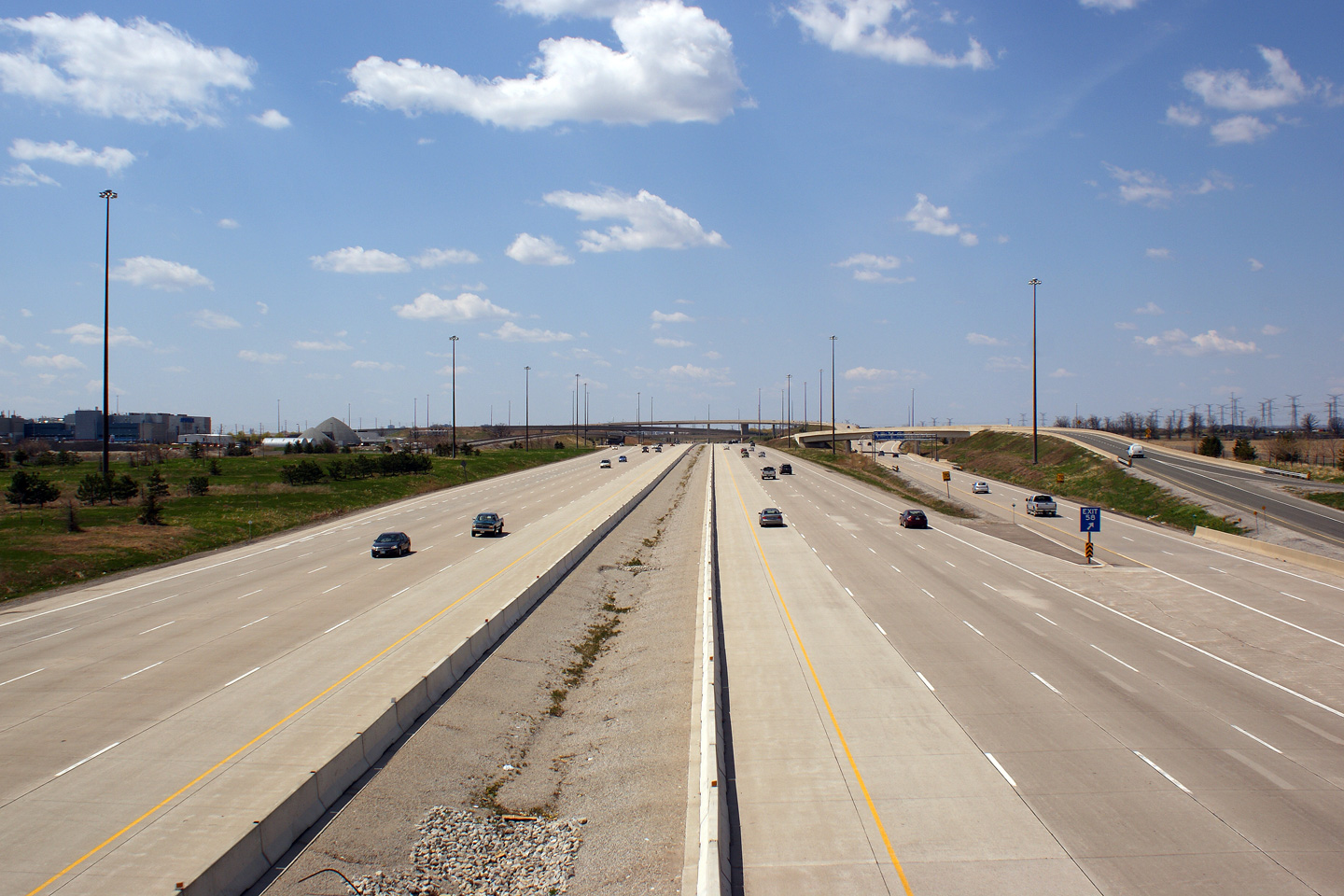
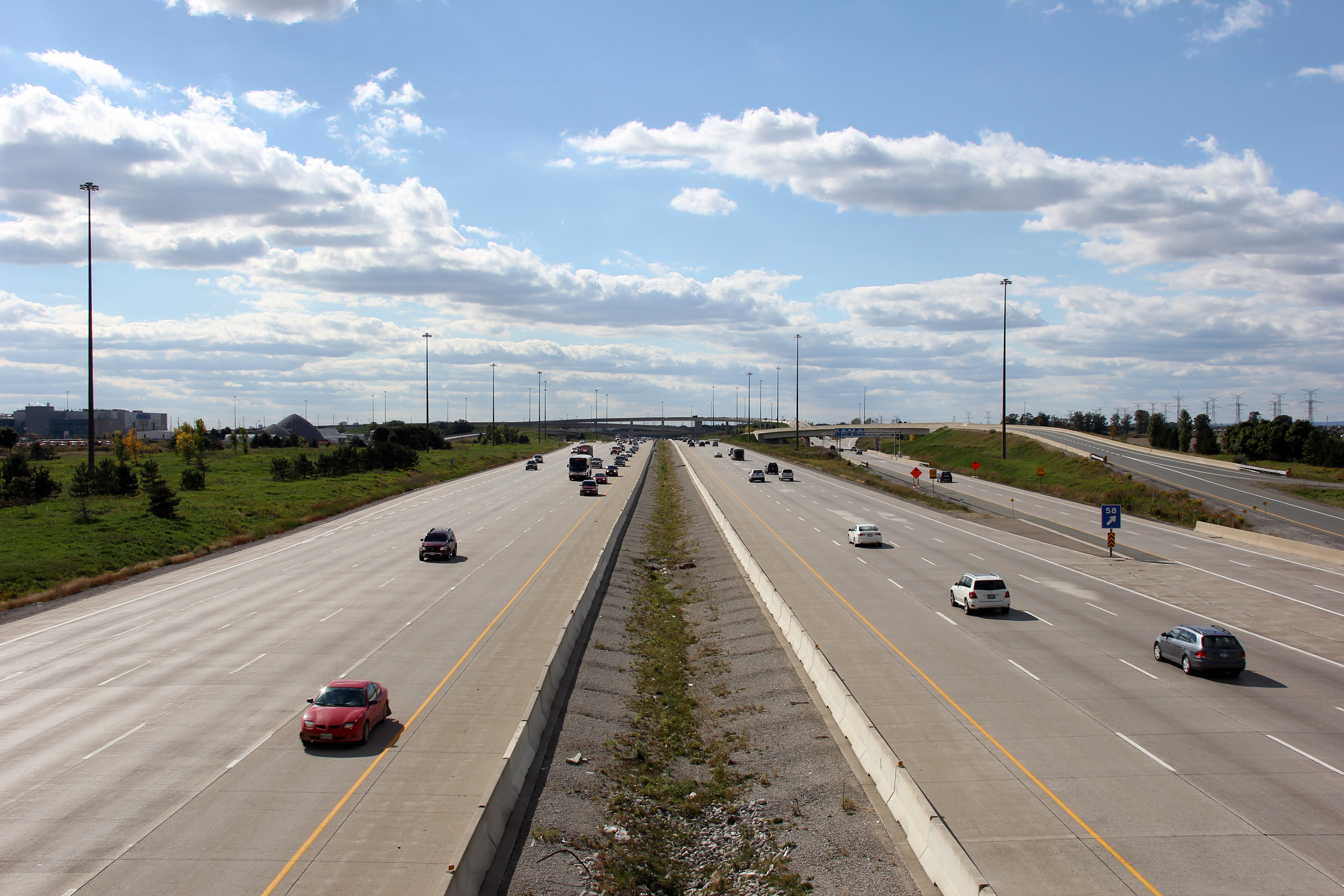
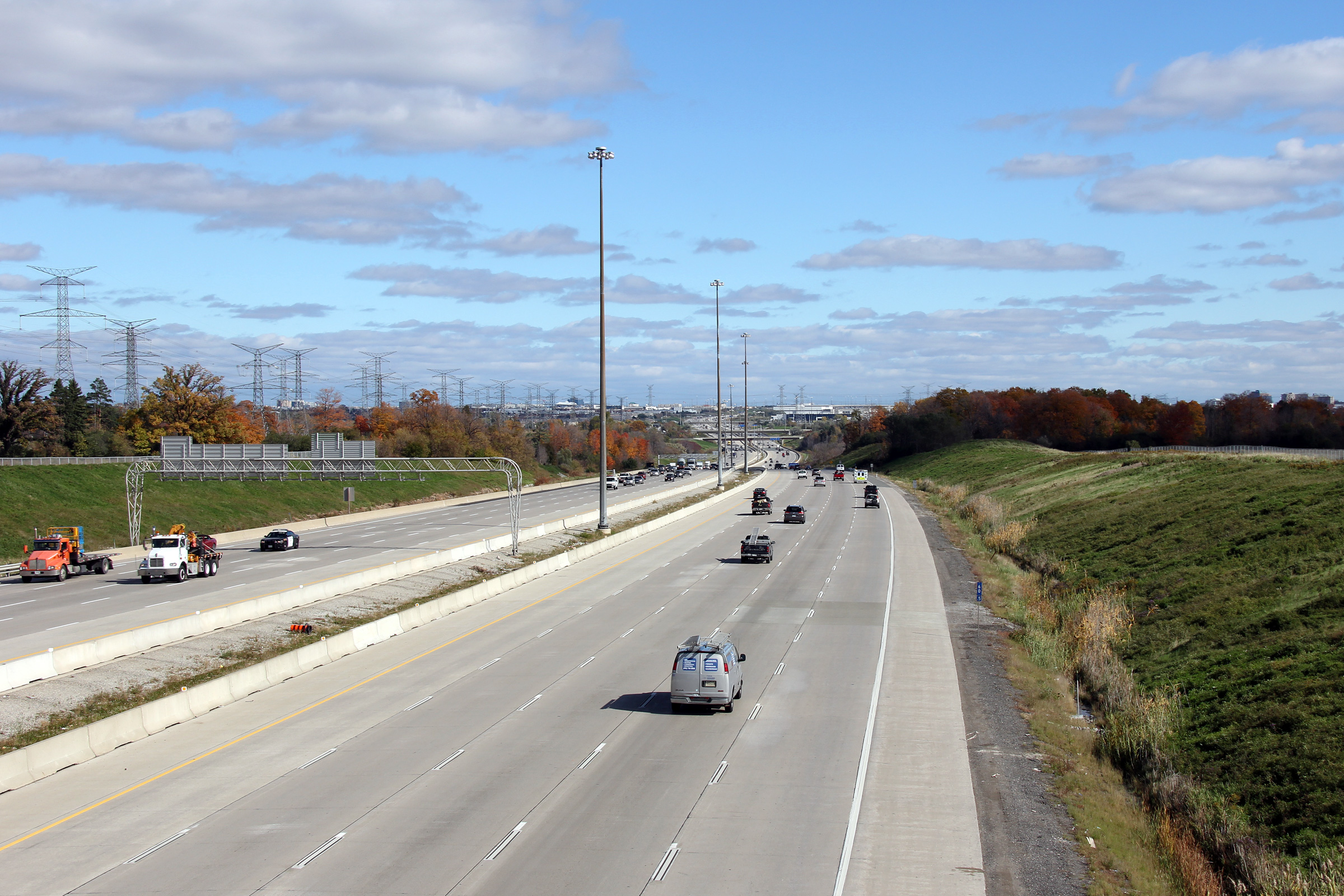
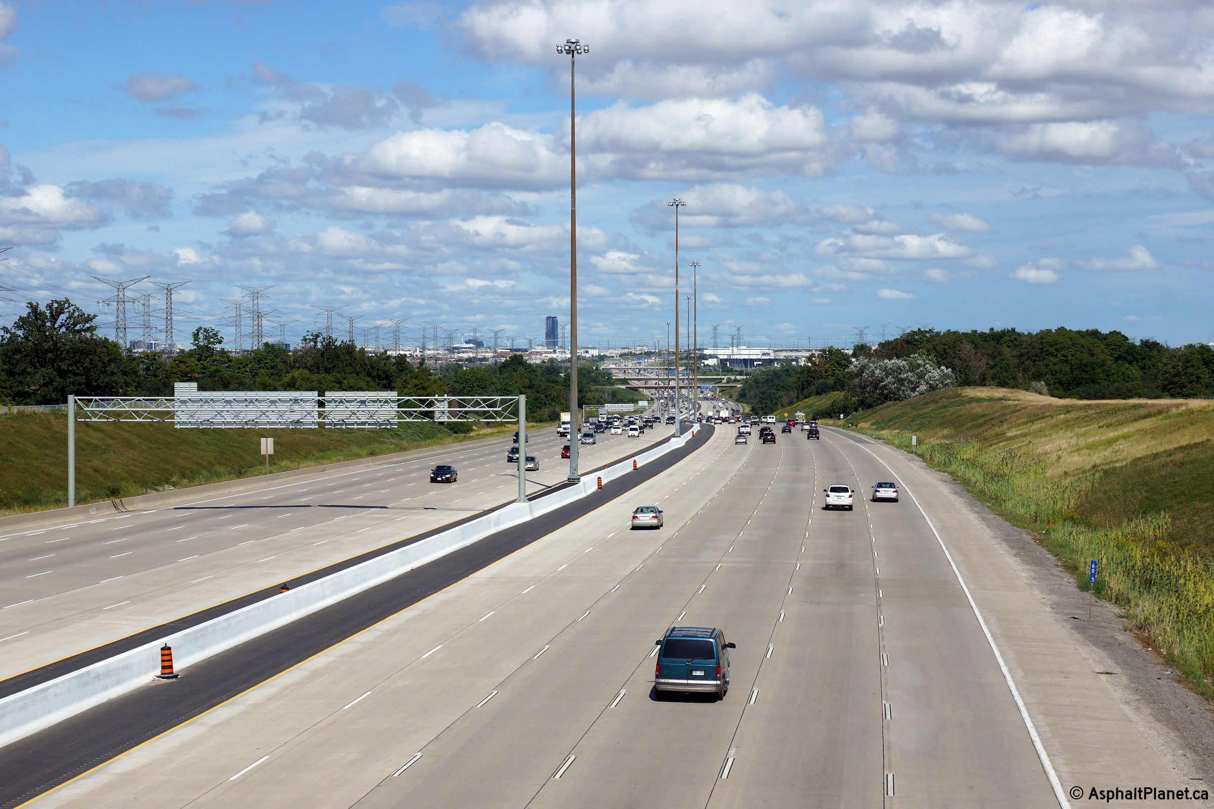
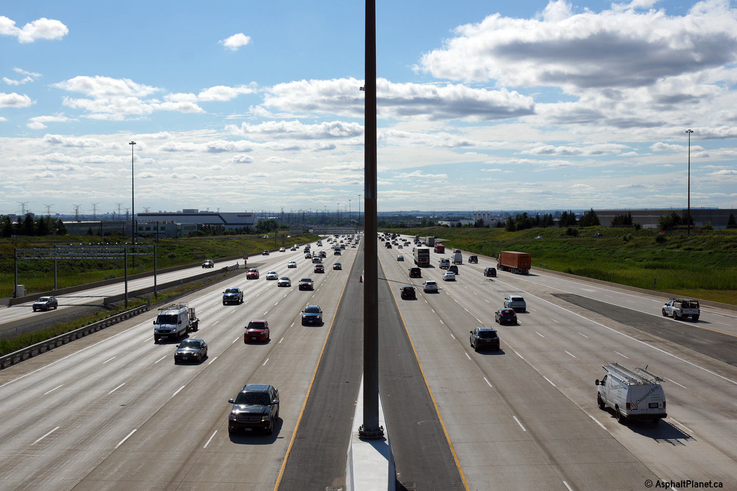
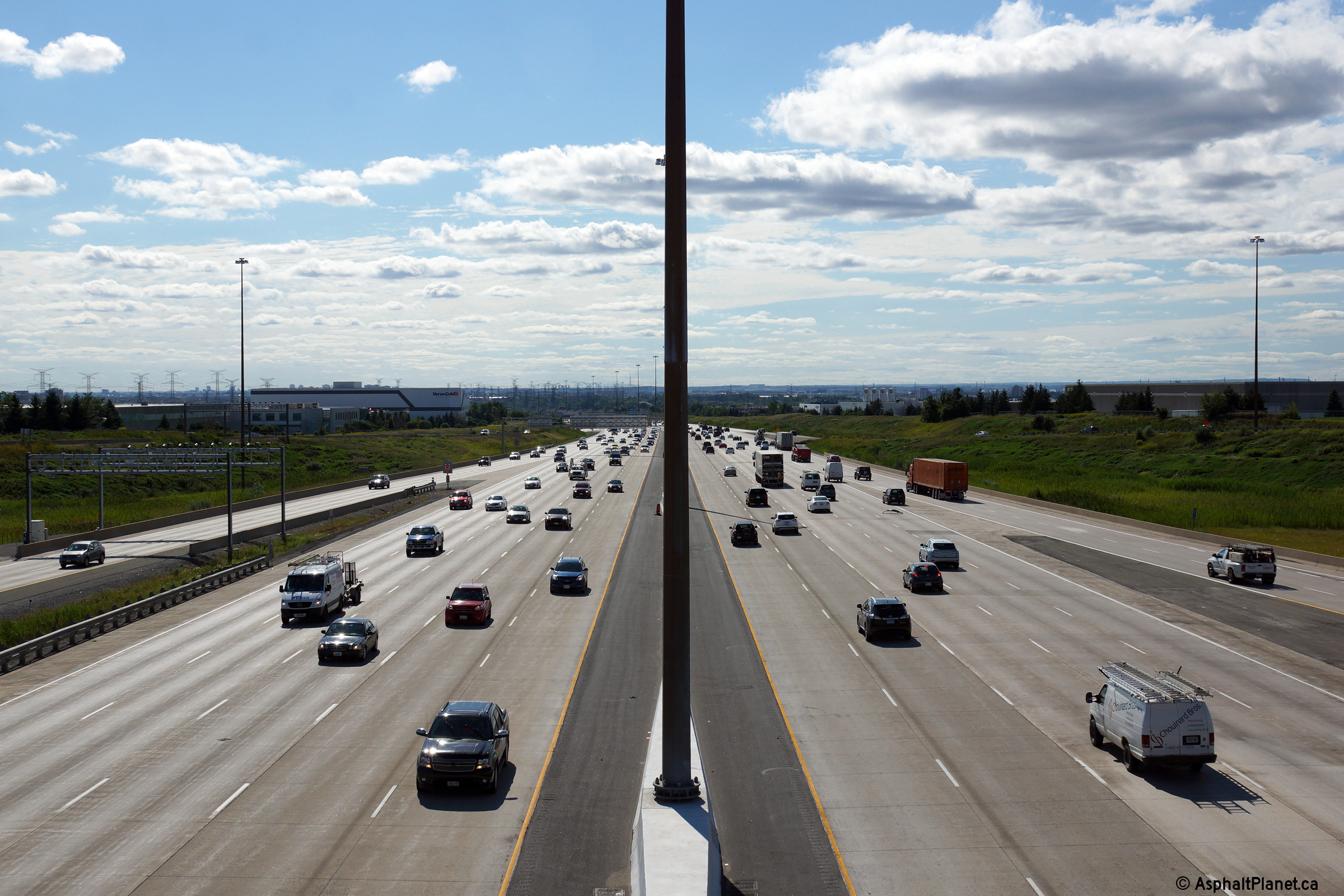
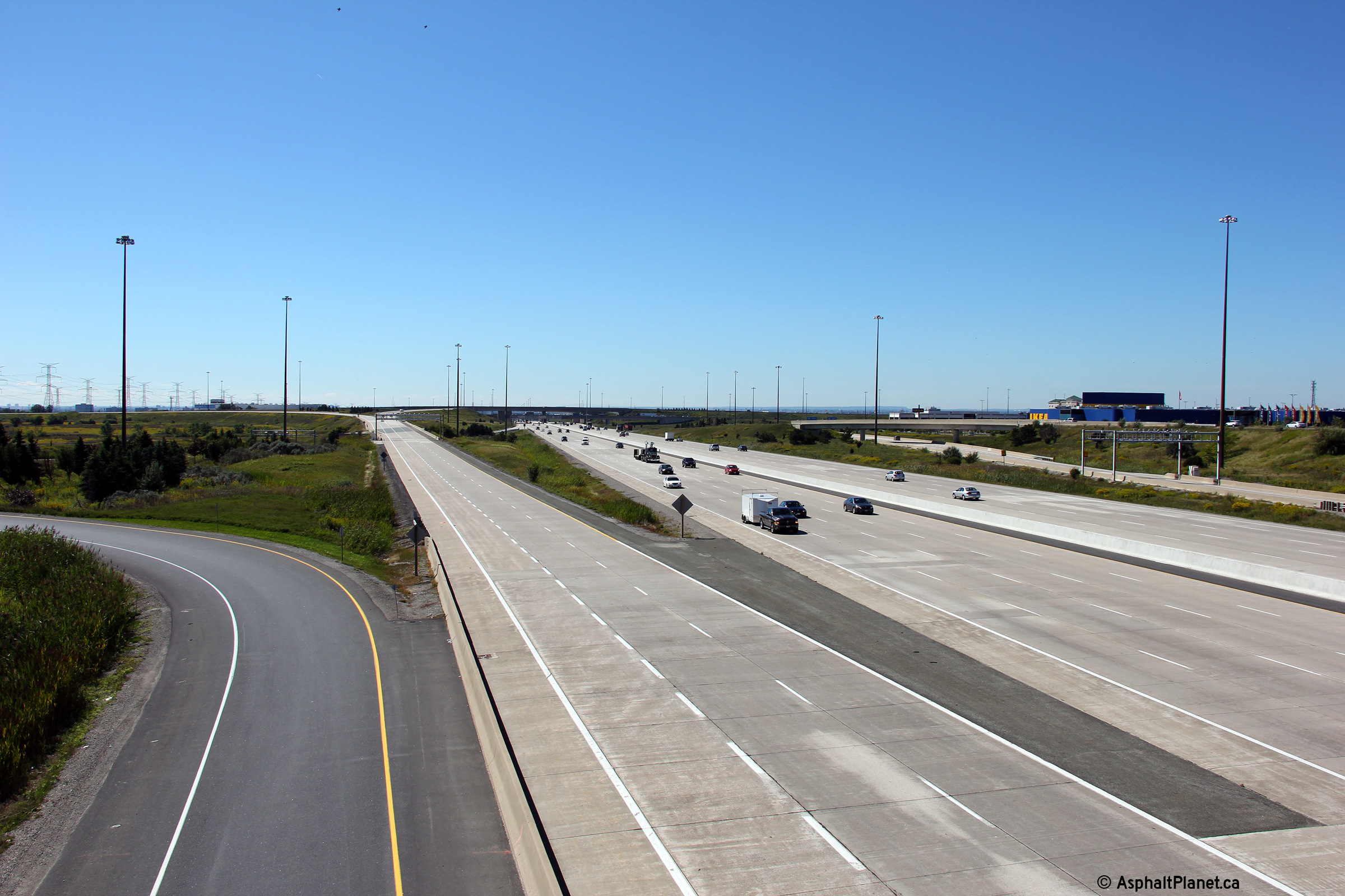
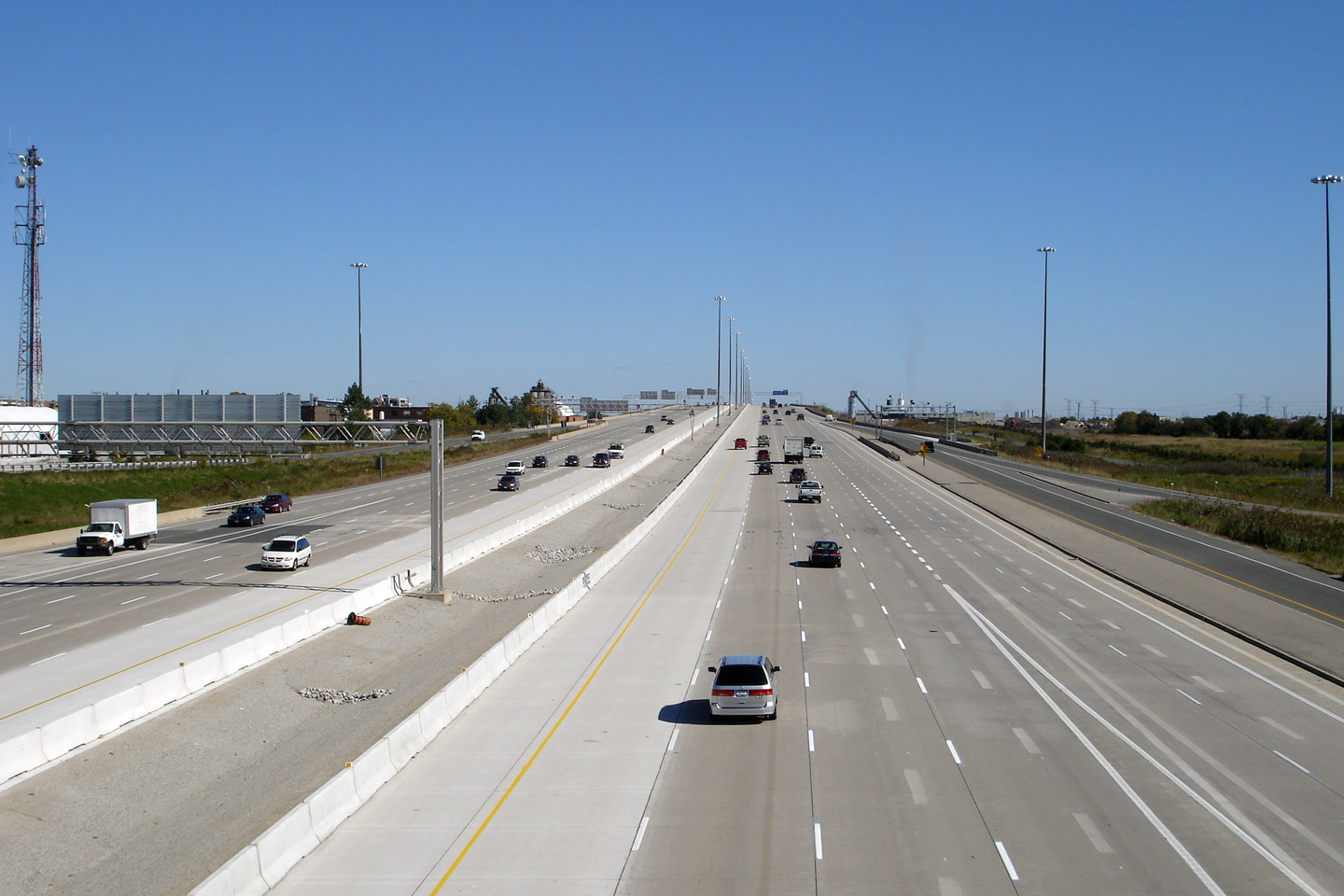
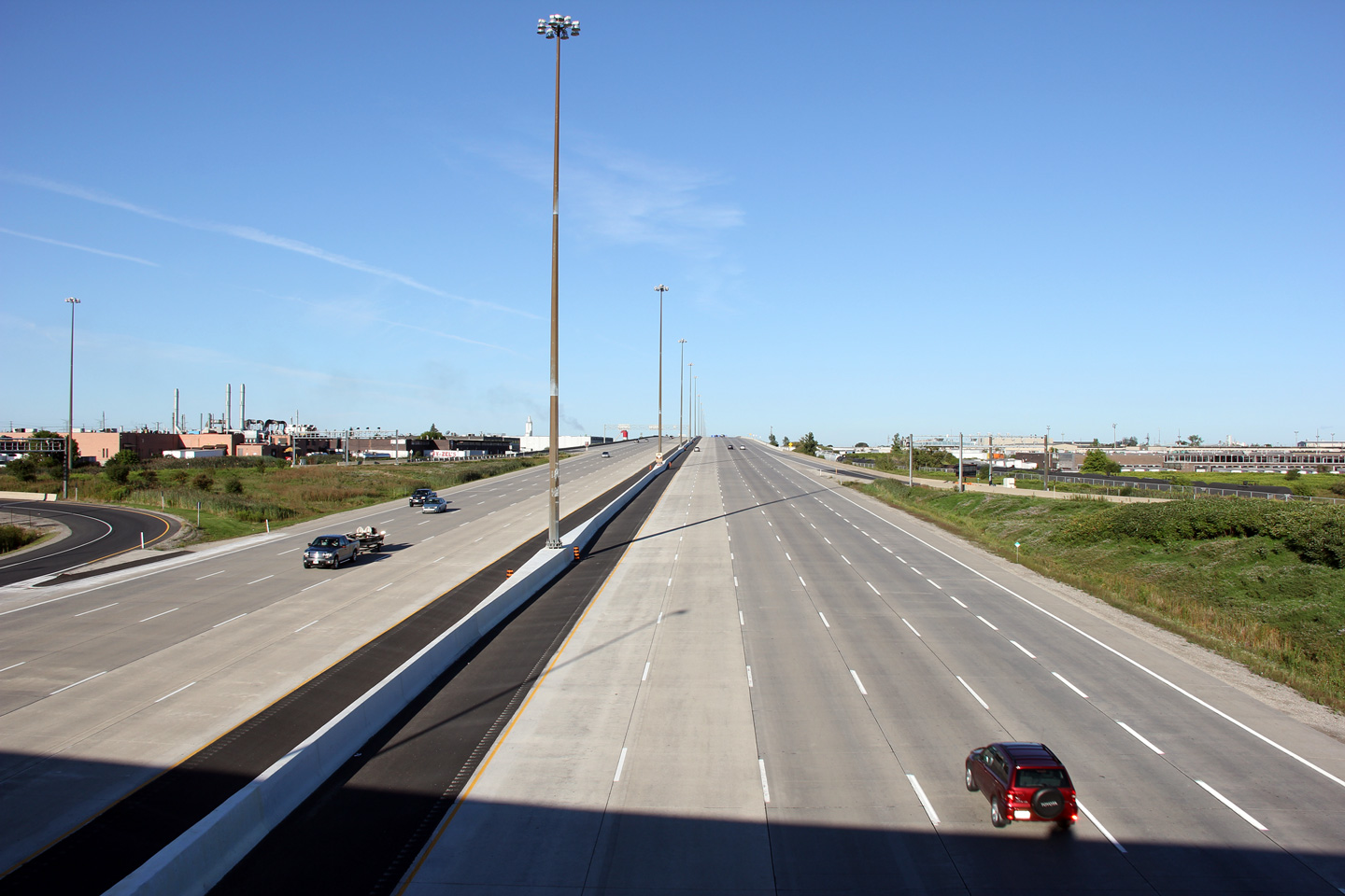
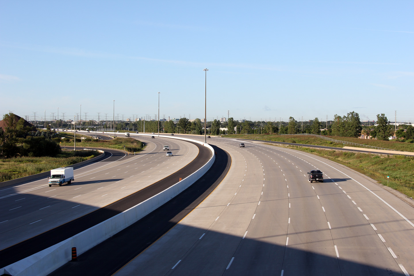
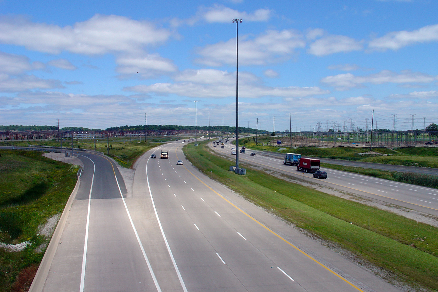
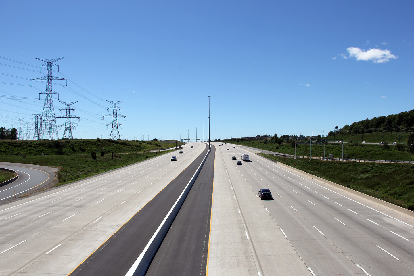
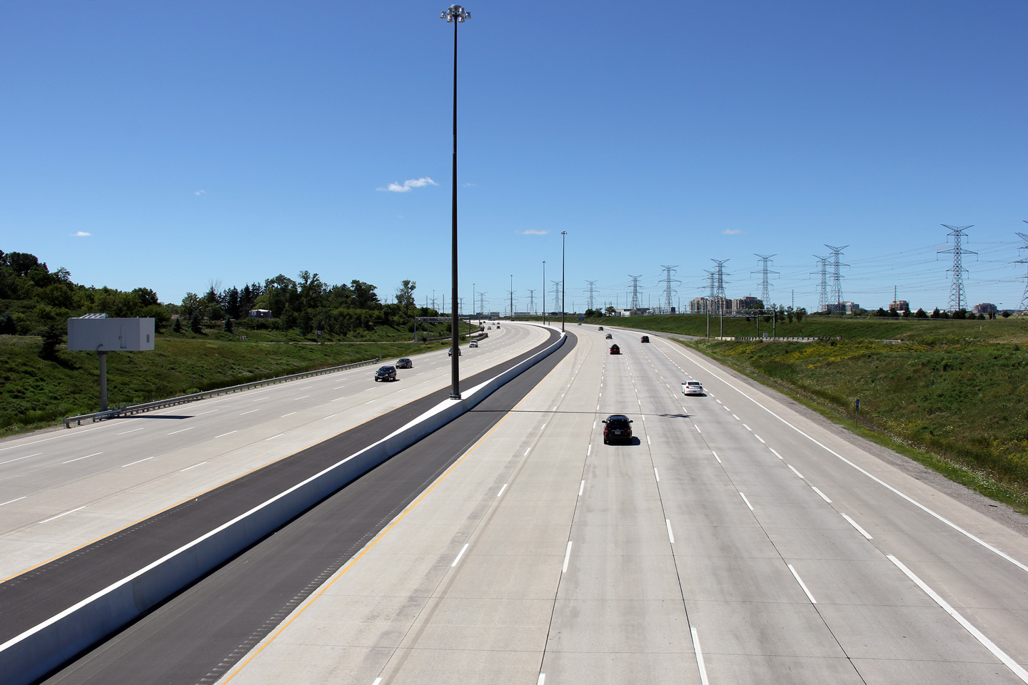
| City of Vaughan Regional Municipality of York |
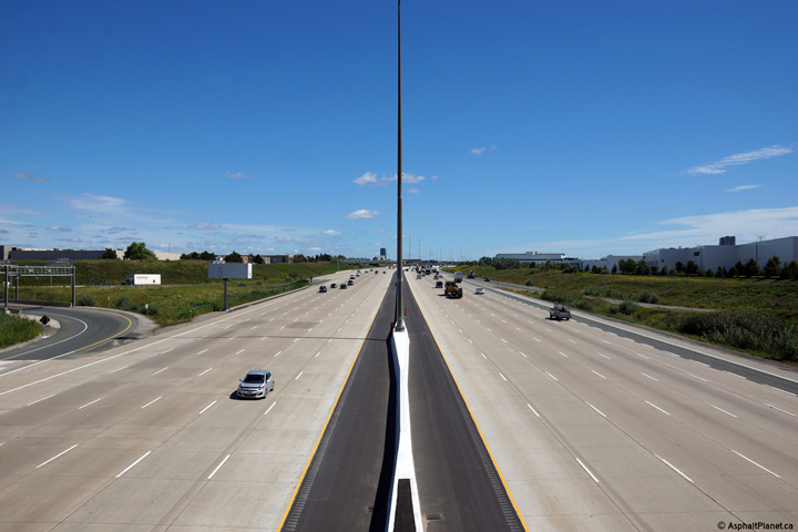
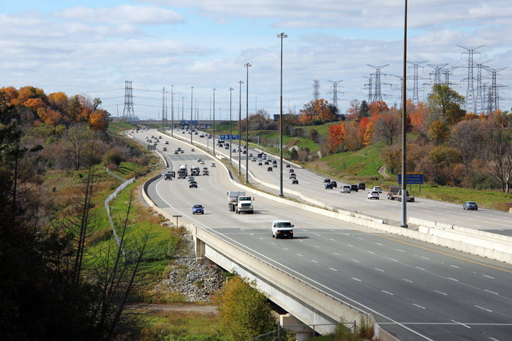
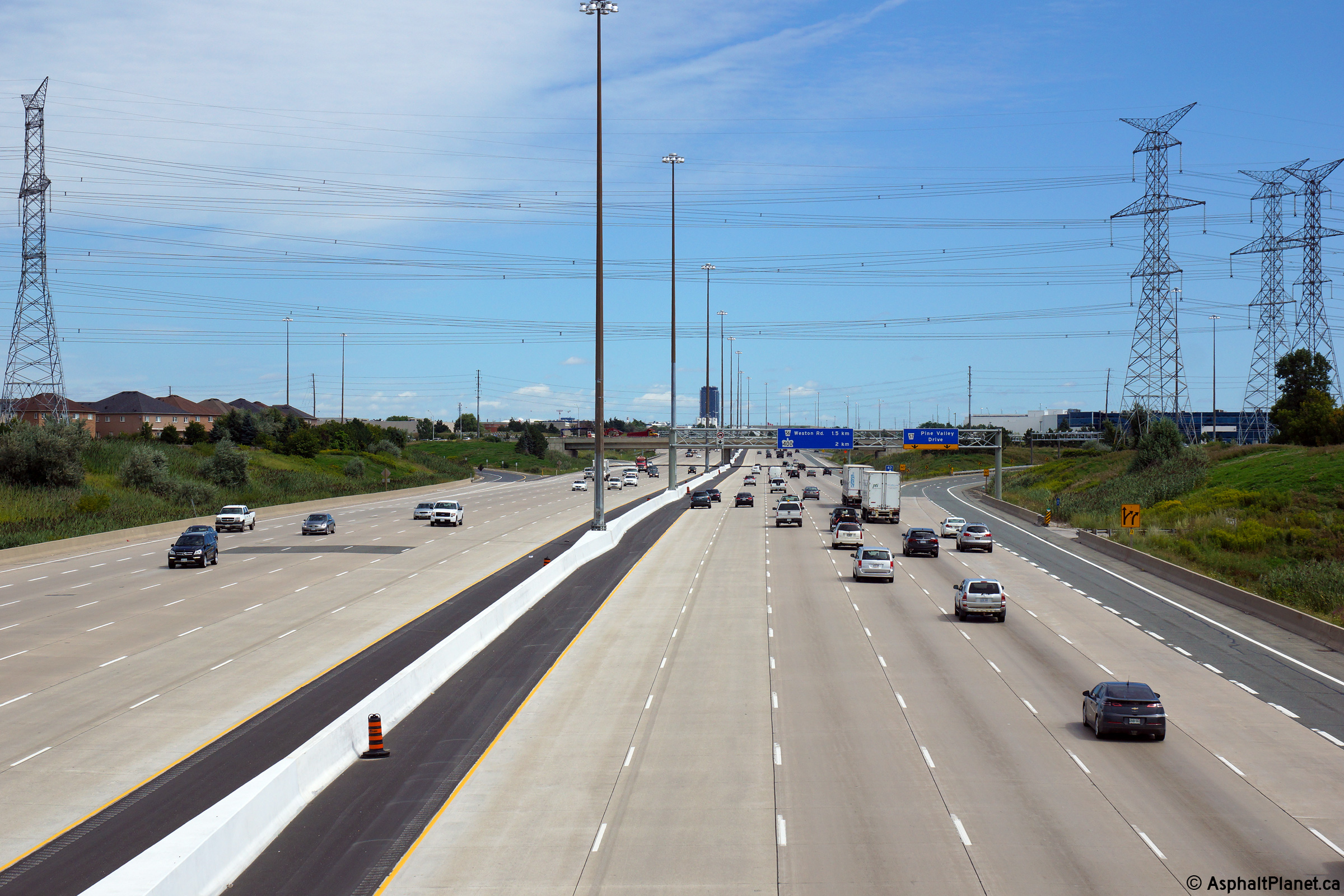
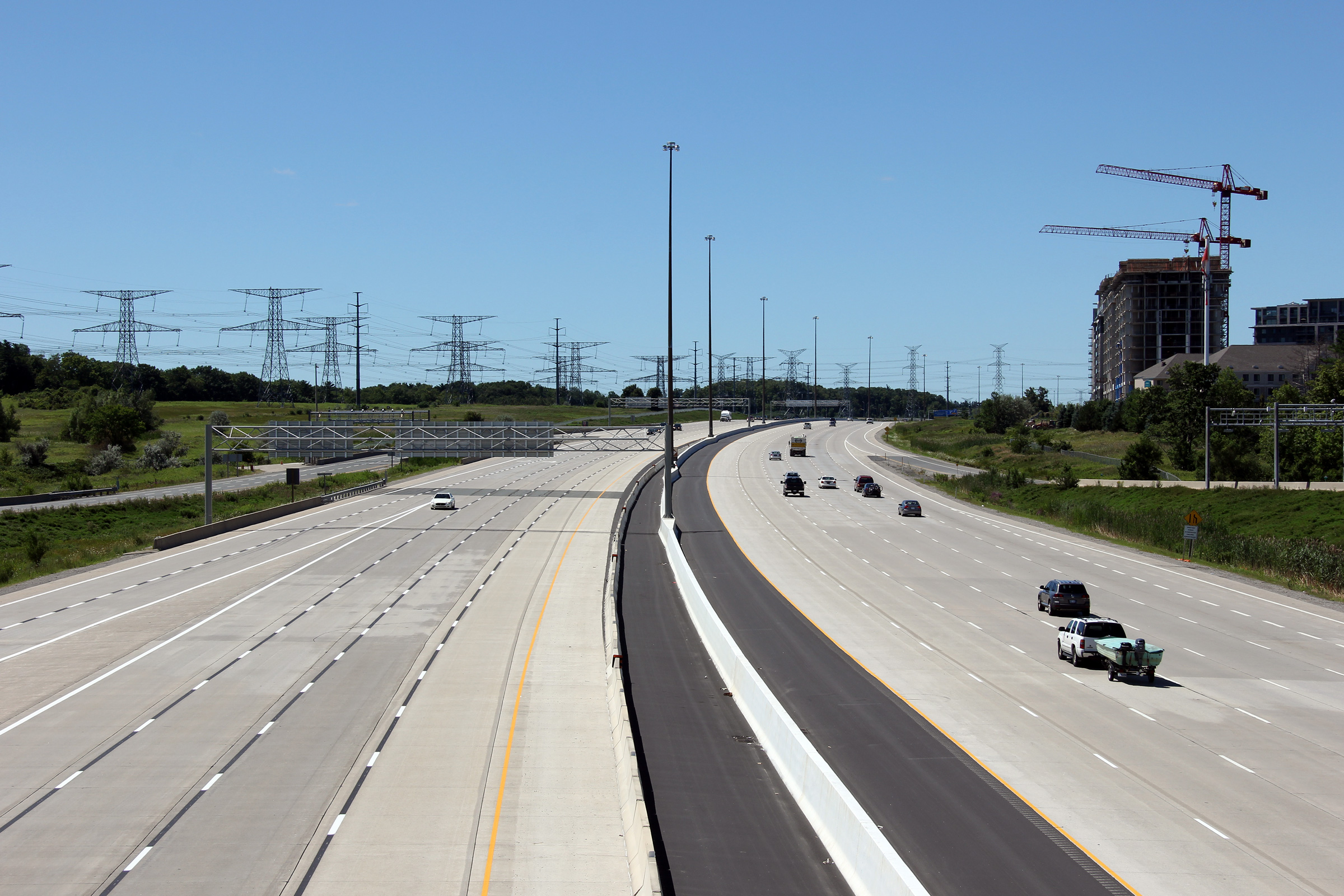
Westerly view from the Pine Valley Road overpass. The 407 has been widened
considerably through Pine Valley Drive. The 407 first opened wit six basic
lanes between the 400 and 427 in 1997. An extra lane was pushed through in
2004 along the outside of the highway. Later, in 2006, an additional lane
was added into the median. Highway 407 was once again widened between
2013-2014 and now has a twelve lane cross-section between Highways 427 and
400. Upper photo taken: October 16th, 2012. Lower photo taken: August 27th, 2014. |
 (720x480) (1440x960) (2400x1600) |
||||
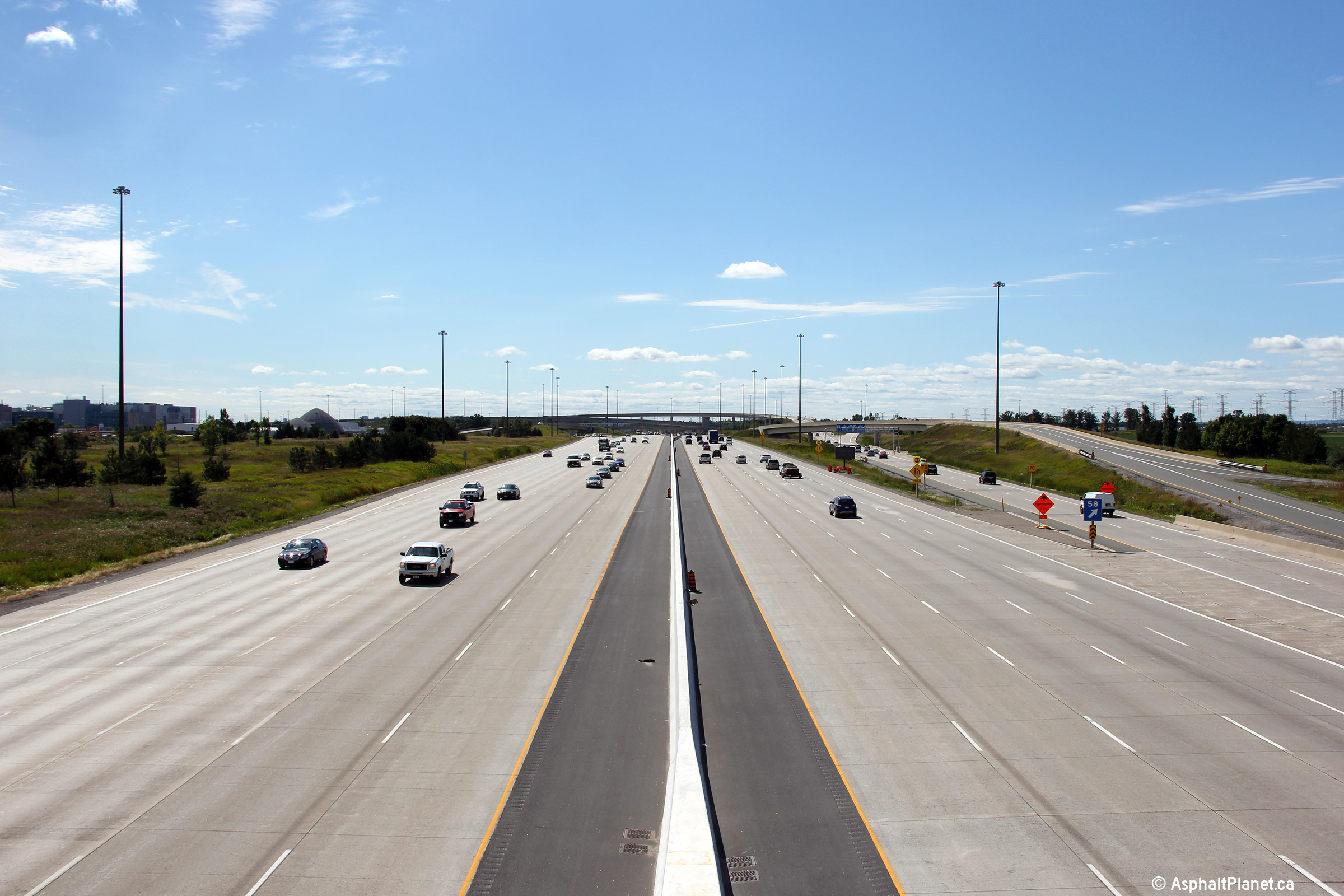
| City of Vaughan Regional Municipality of York |
Easterly view along Highway 407 from Pine Valley Drive. Upper photo taken: October 16th, 2012. Lower photo taken: August 27th, 2014. |
 (720x480) (1440x960) (2400x1600) |
||||
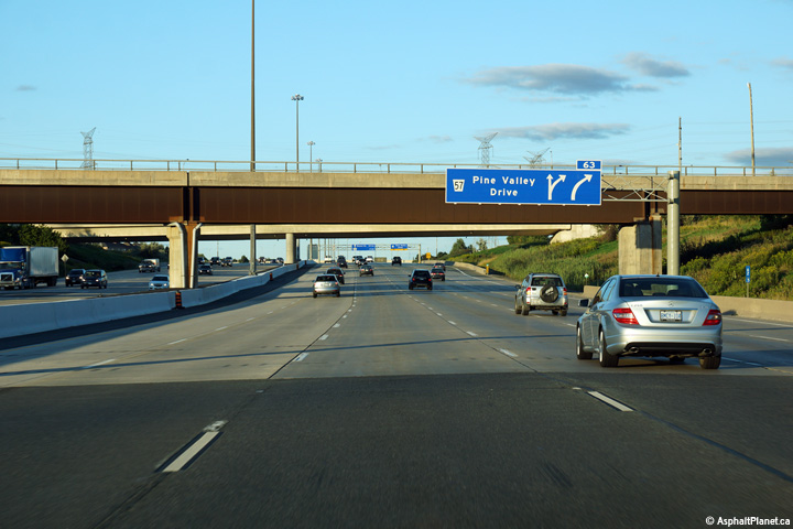
| City of Vaughan Regional Municipality of York |
Westbound signage at the ramp to Pine Valley Drive. Upper photo taken: May 7th, 2011. Lower photo taken: August 14th, 2014. |
 (720x480) (720x480)(1440x960) (2400x1600) |
||||
| City of Vaughan Regional Municipality of York |
Westbound advanced signage for the ramp to Pine Valley Drive. The new
signage no longer provides drivers any guidance to Pearson International
Airport. Upper photo taken: May 7th, 2011. Lower photo taken: August 14th, 2014. |
 (720x480) (720x480)(1440x960) (2400x1600) |
||||
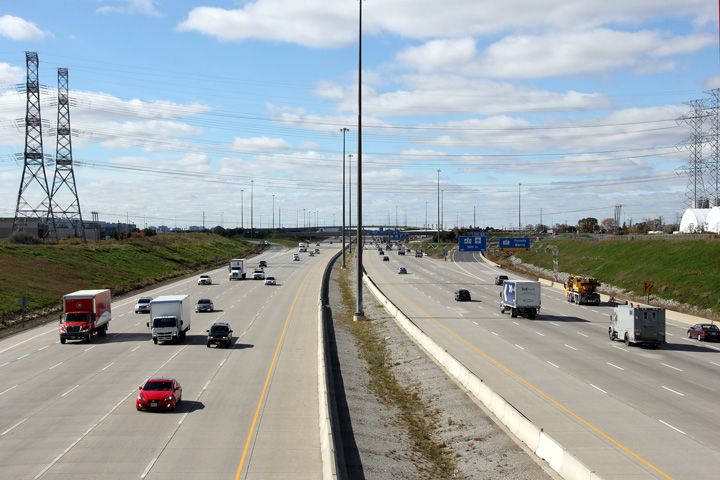
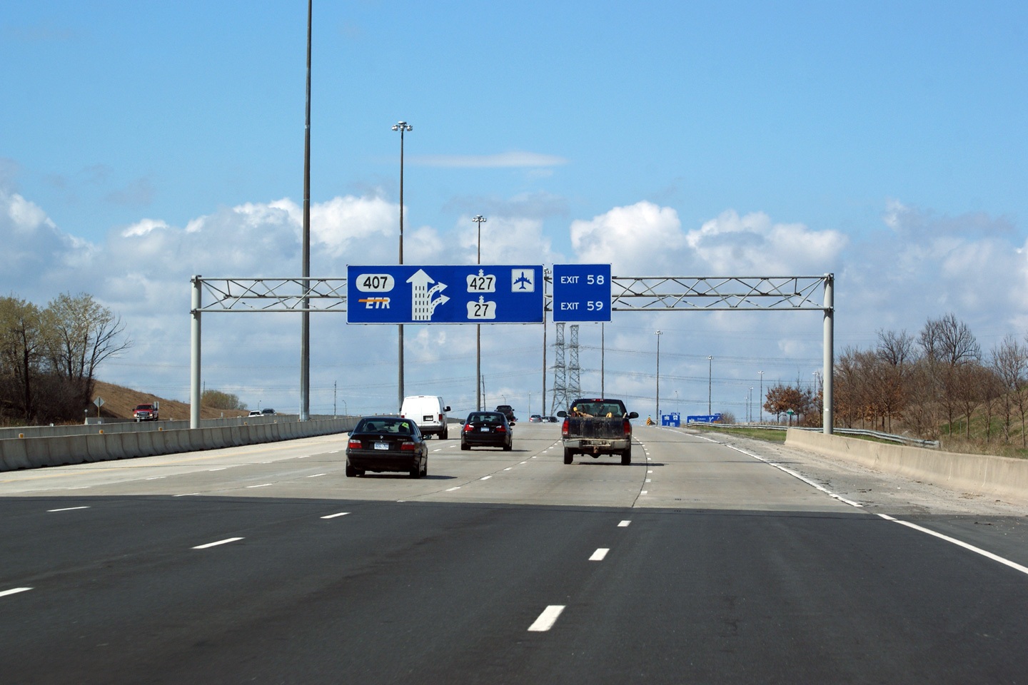
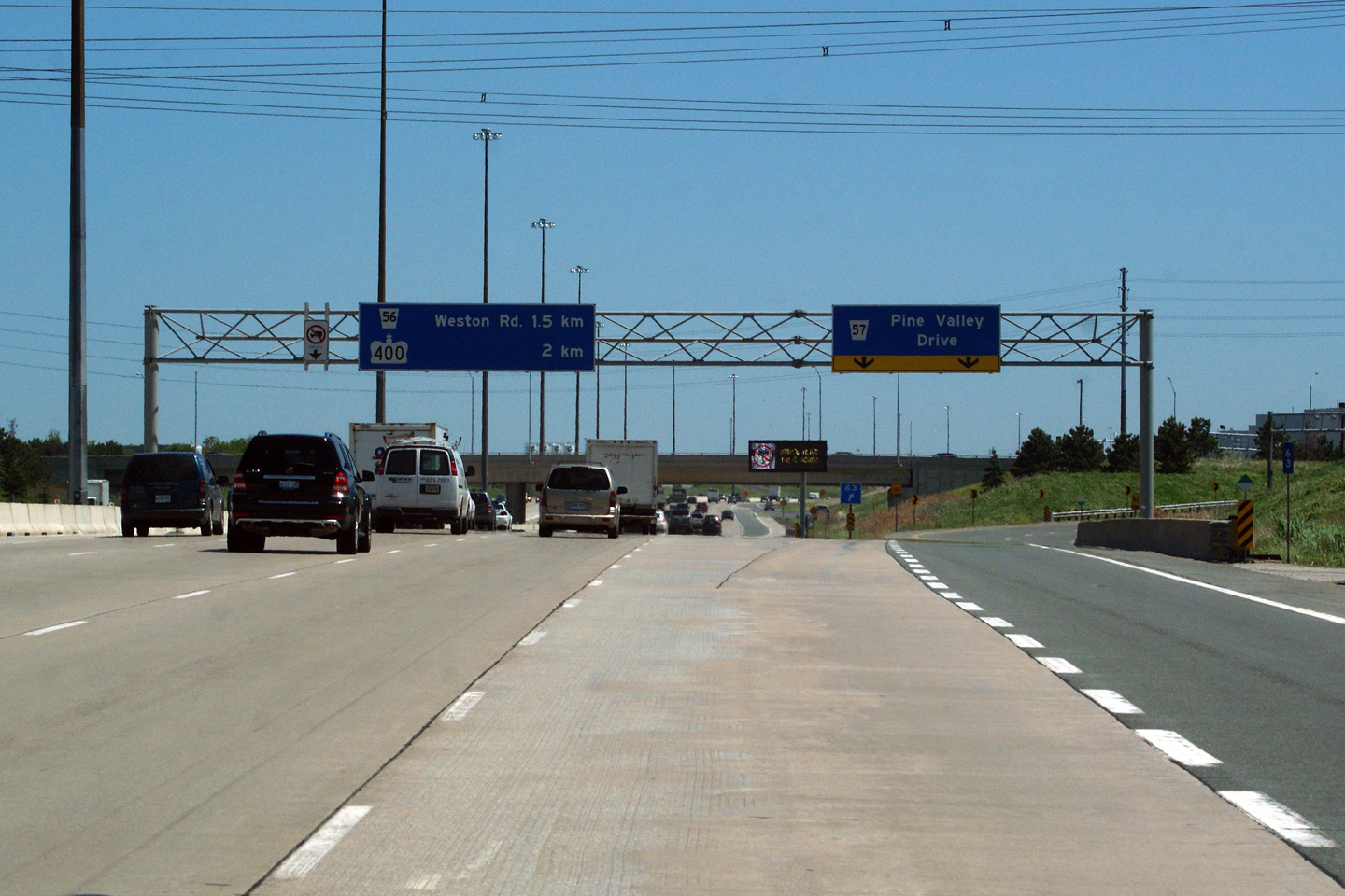
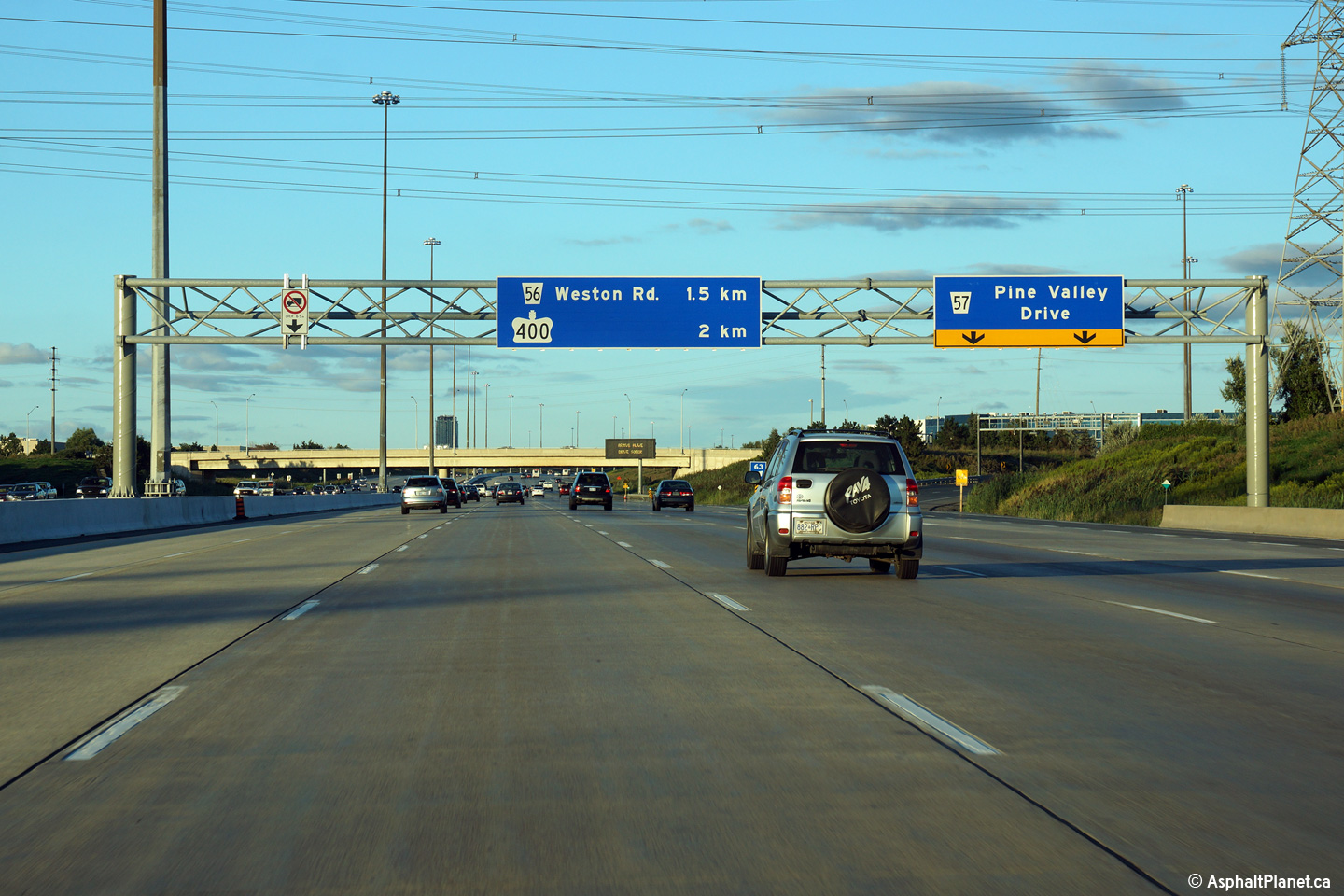
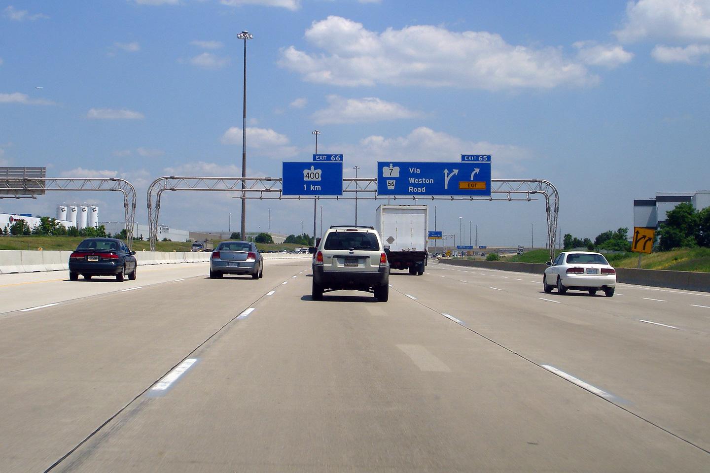
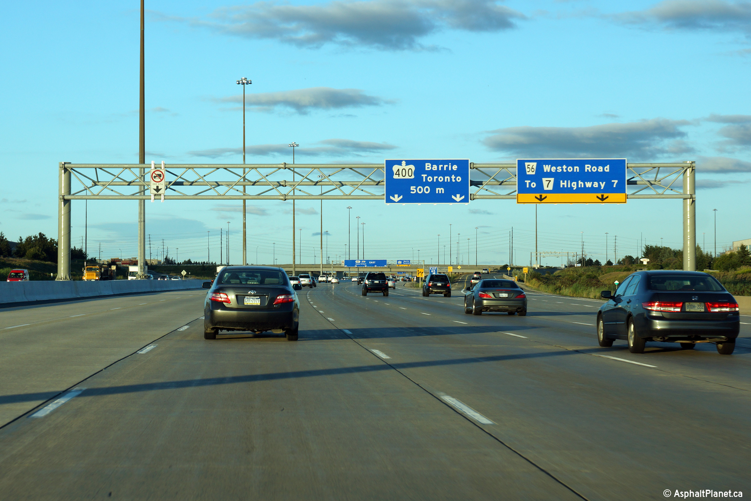
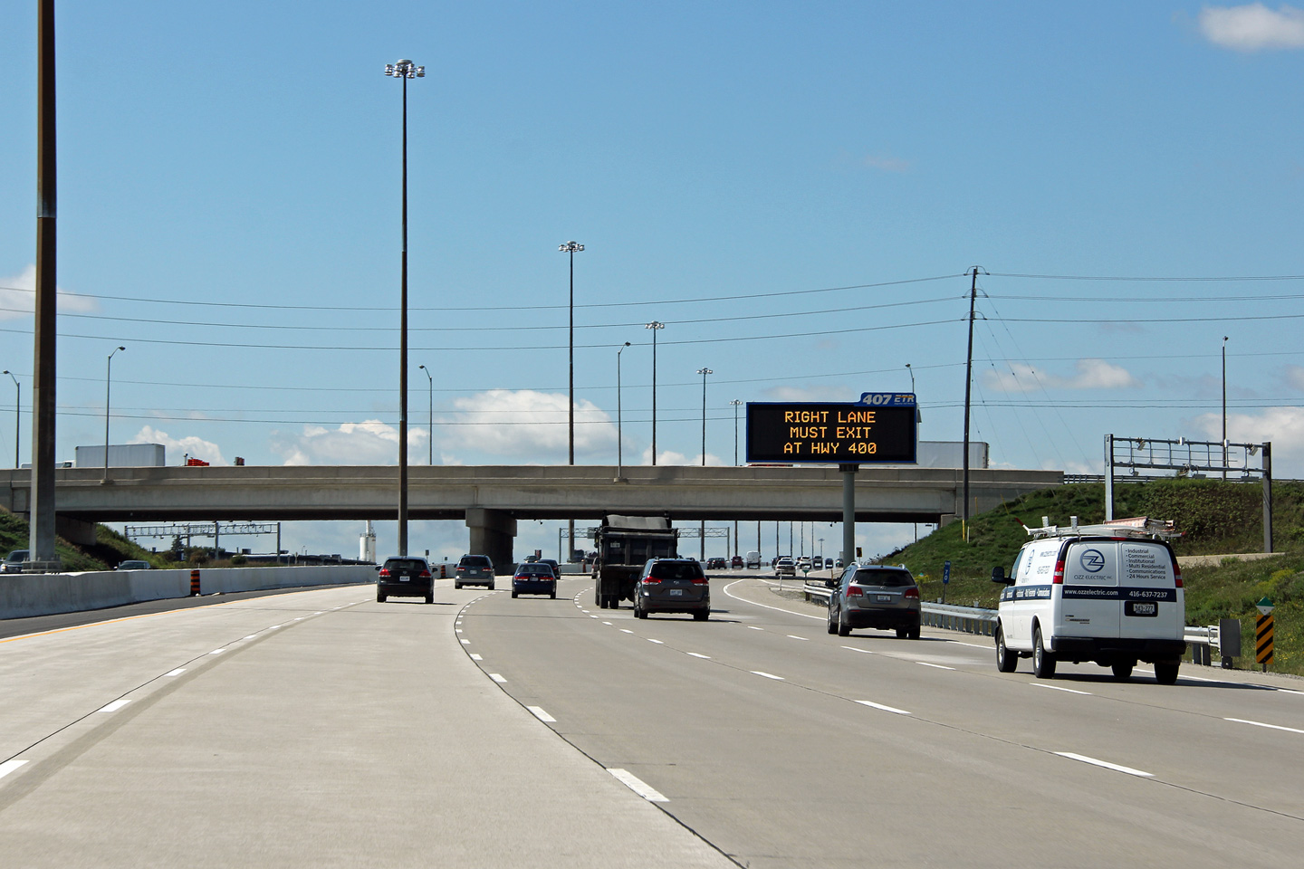
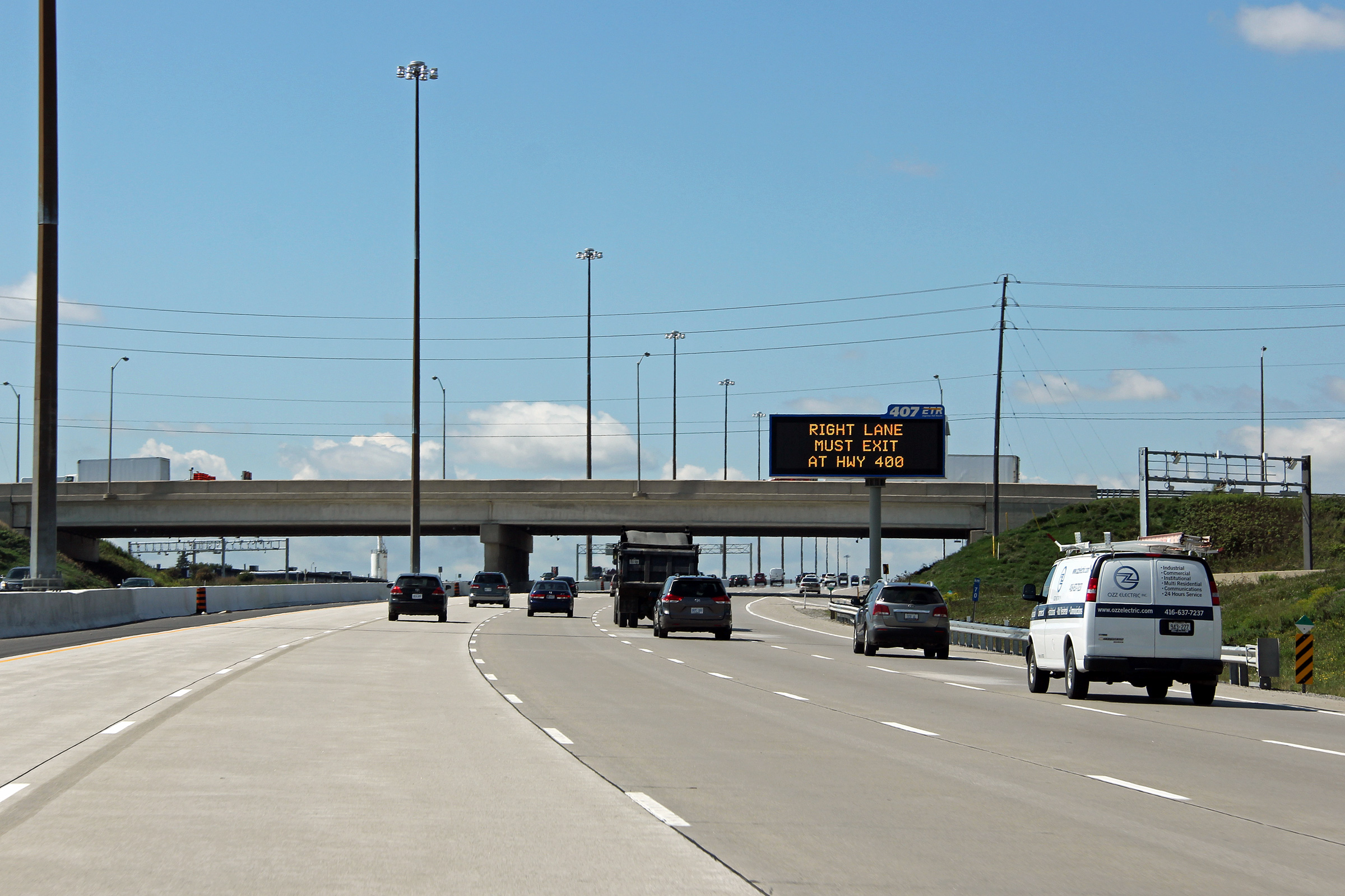
| City of Vaughan Regional Municipality of York |
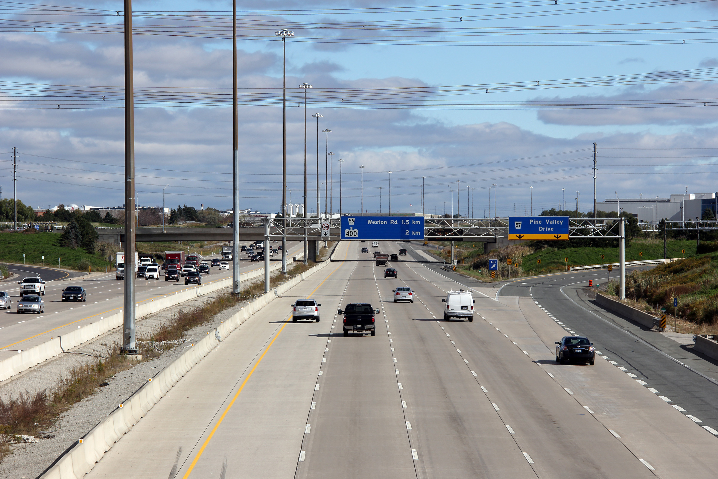
Advanced signage for both the Weston Road and Highway 400 interchanges along
Highway 407 East. Click here to see the former signage at this location, taken in June, 2011. Photo taken: August 27th, 2014. |
|||||
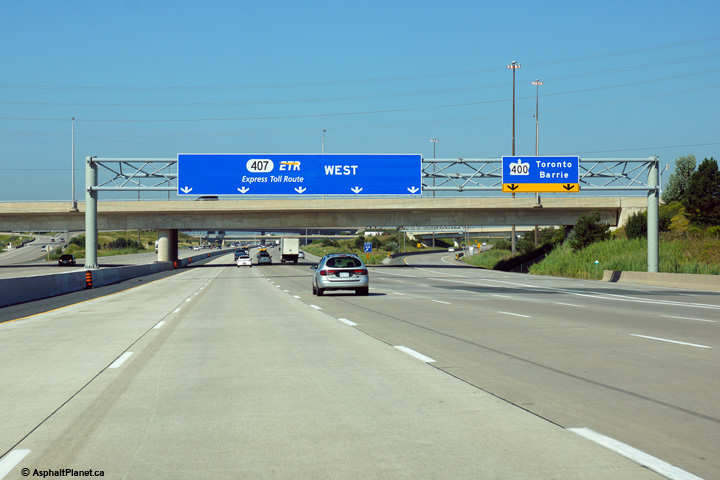
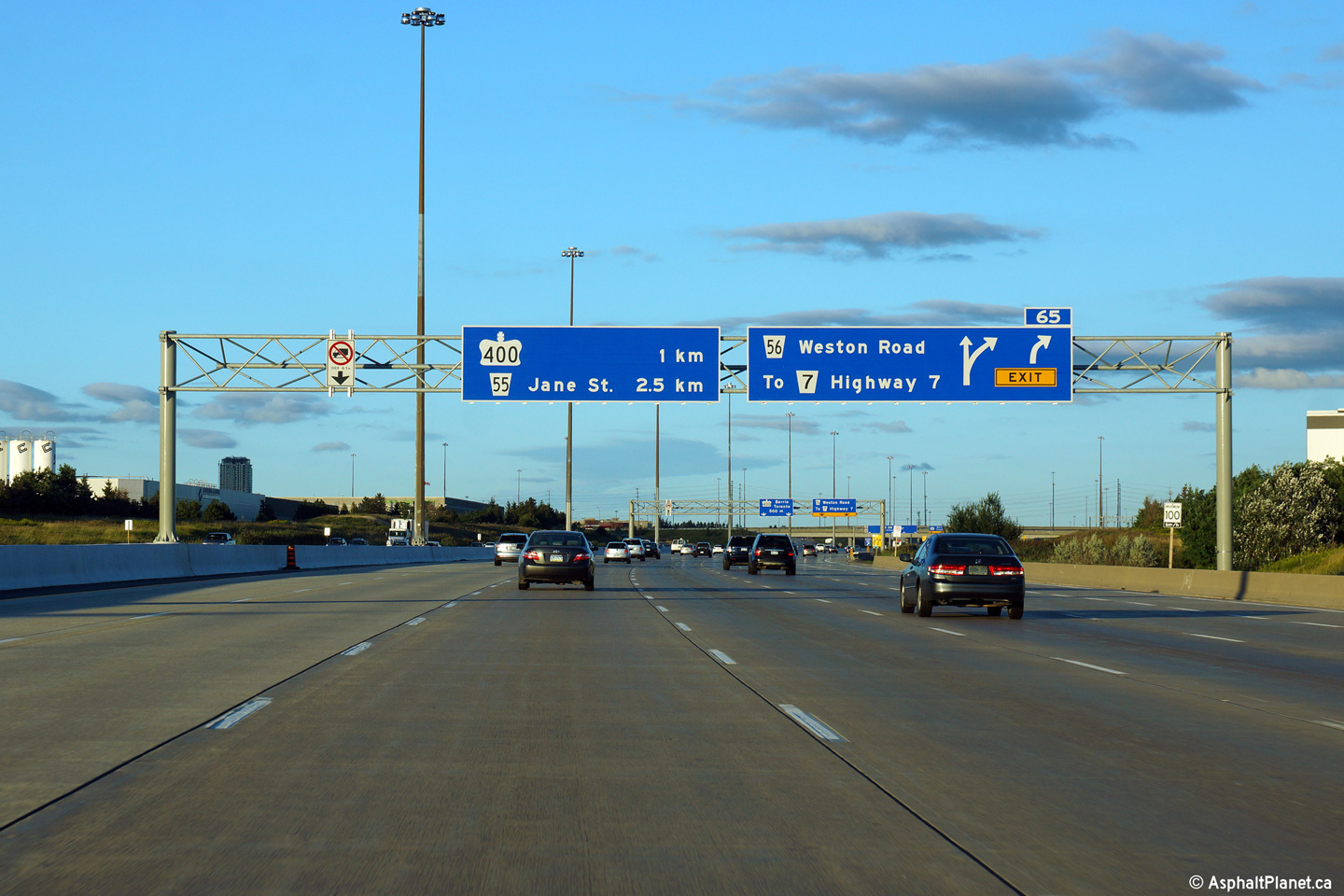
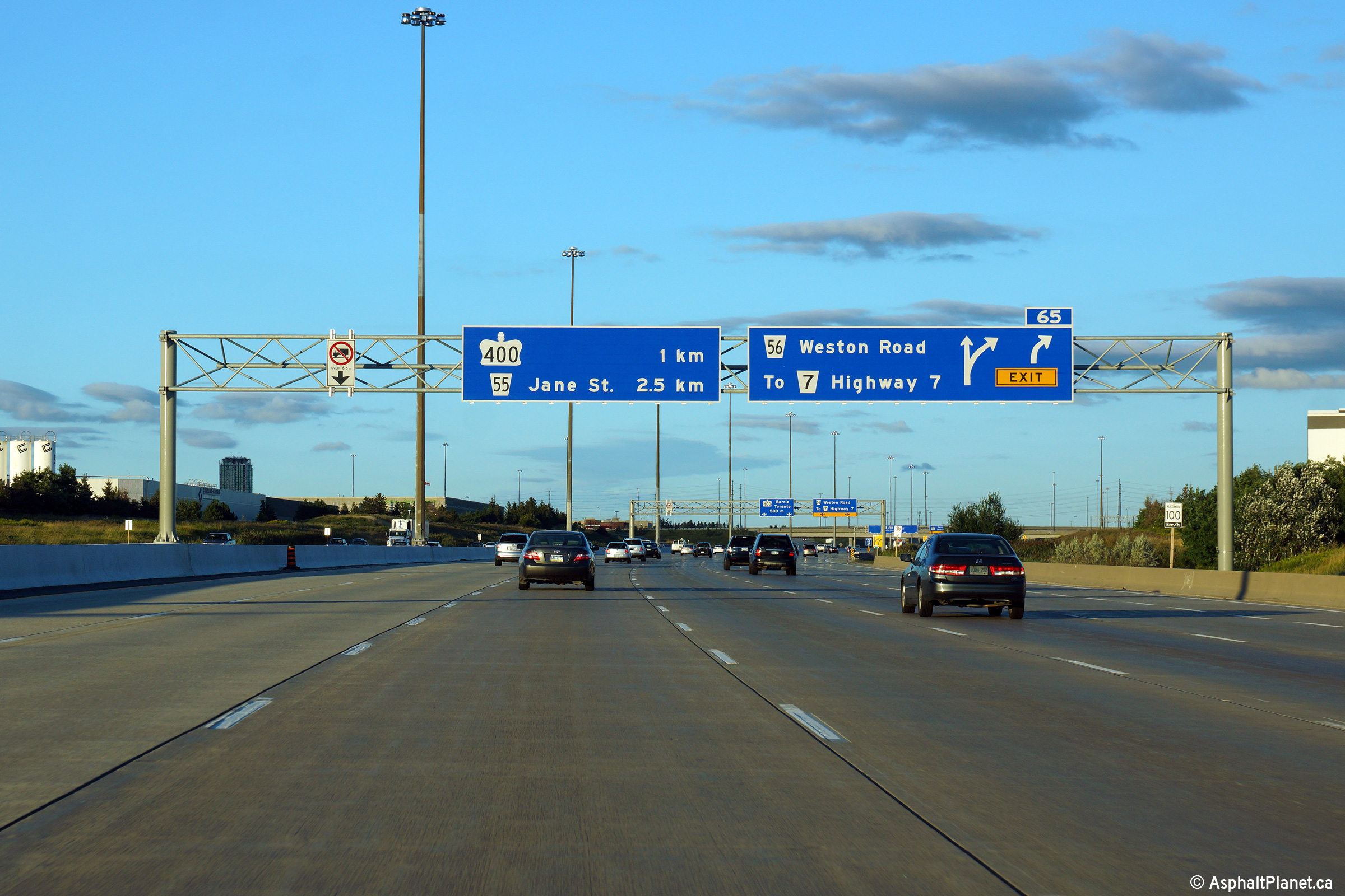
| City of Vaughan Regional Municipality of York |
Signage at the ramp to Weston Road from Highway 407. On the older
signage, notice the pull-through sign for Highway 400 is of
a slightly different design than the signage for Weston Road. Like many
other new Highway 407 signs, this sign was made by an independent contractor
after the 407 was completed. Upper photo taken: June 11th, 2011. Lower photo taken: August 27th, 2014. |
|
||||
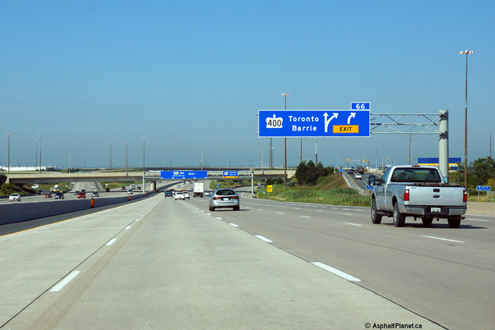
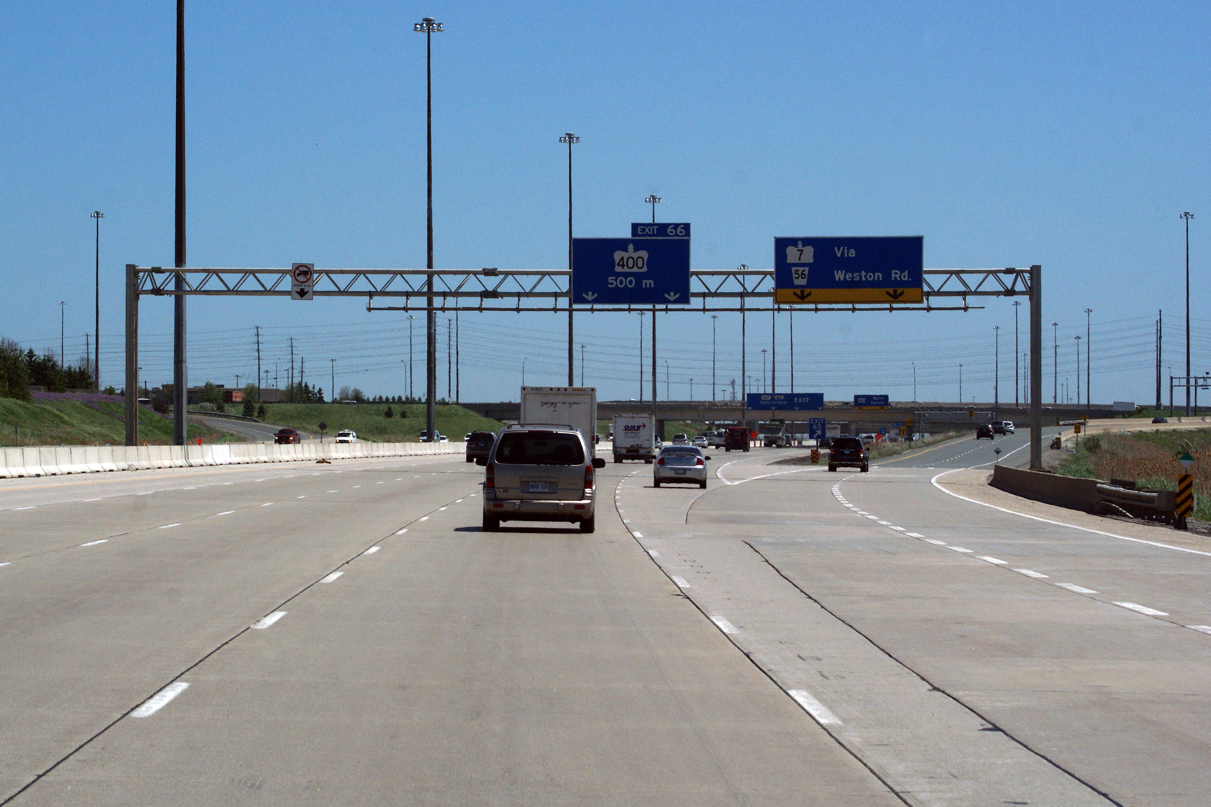
| City of Vaughan Regional Municipality of York |
Signage at the Highway 400 off-ramp from
Highway 407 east. Upper photo taken: June 11th, 2011. |
|
||||
| City of Vaughan Regional Municipality of York |
Westerly views from the Weston Road overpass towards Vaughan. Upper photo taken: August 28th, 2005. Middle photo taken: August 28th, 2012. Lower photo taken: August 27th, 2014. |
 (720x480) (1440x960) (2400x1600) |
||||
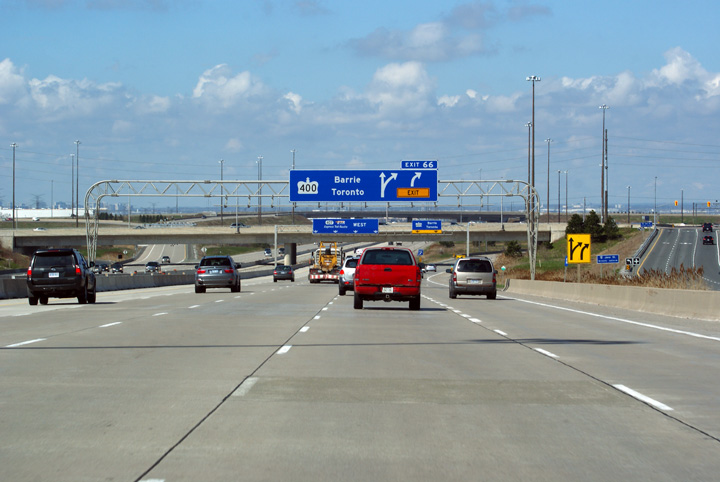
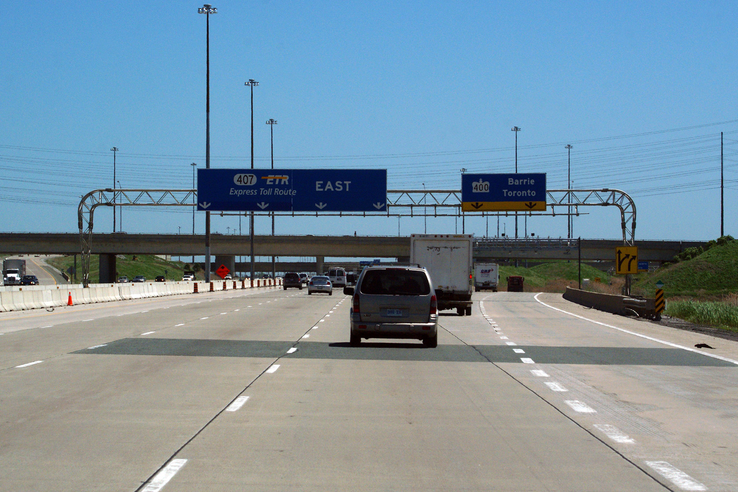
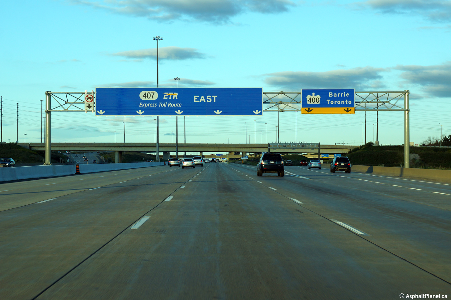
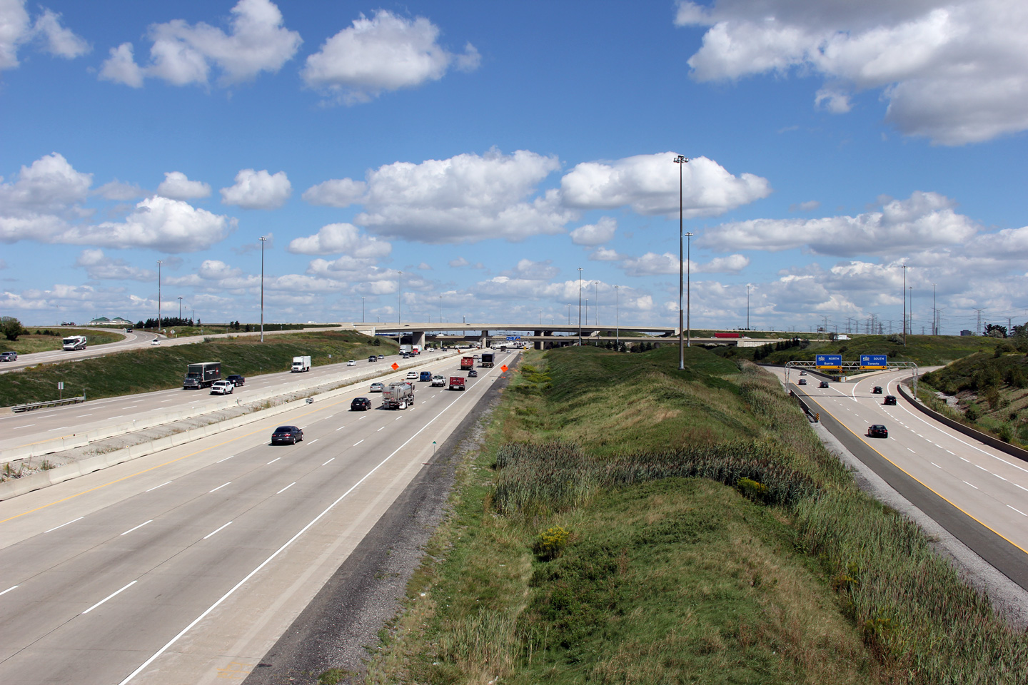
| City of Vaughan Regional Municipality of York |
Easterly view towards the 4-level Highway 400 interchange. This is the
only diamond stack interchange in all of Canada. Upper photo taken: August 28th, 2005. Middle photos taken: August 28th, 2012. Lower photo taken: August 27th, 2014. |
 (720x480) (1440x960) (2400x1600) |
||||
| Highway 400 is Ontario's major north-south freeway running from Toronto north to Parry Sound. Click here for Highway 400 images | ||||||
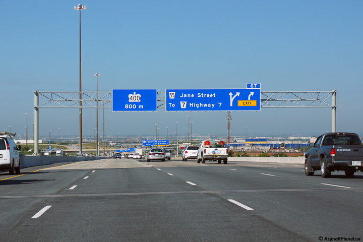
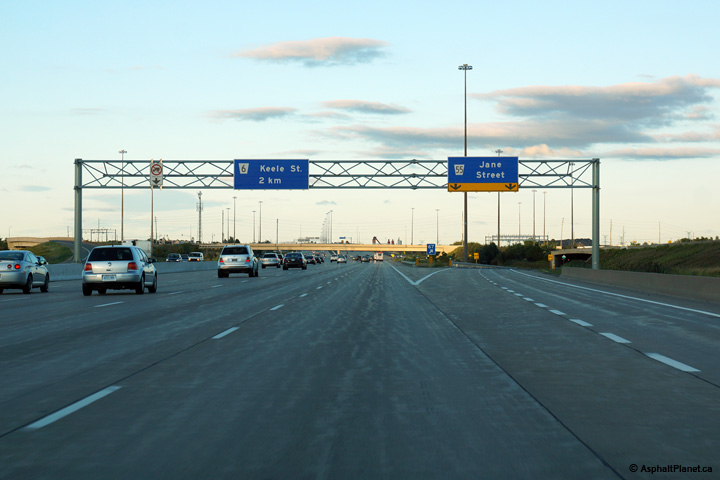
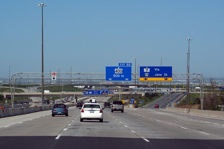
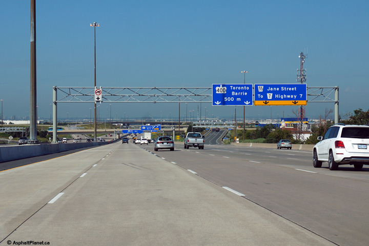
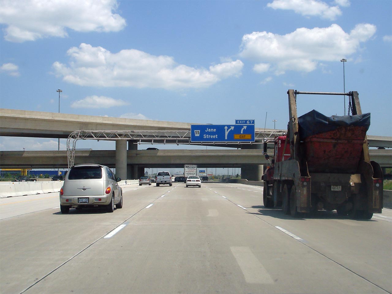
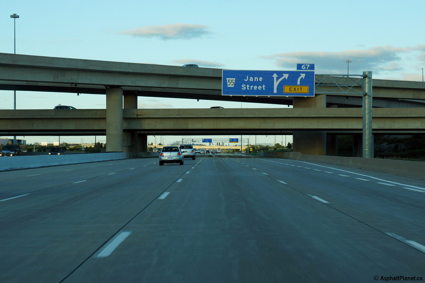
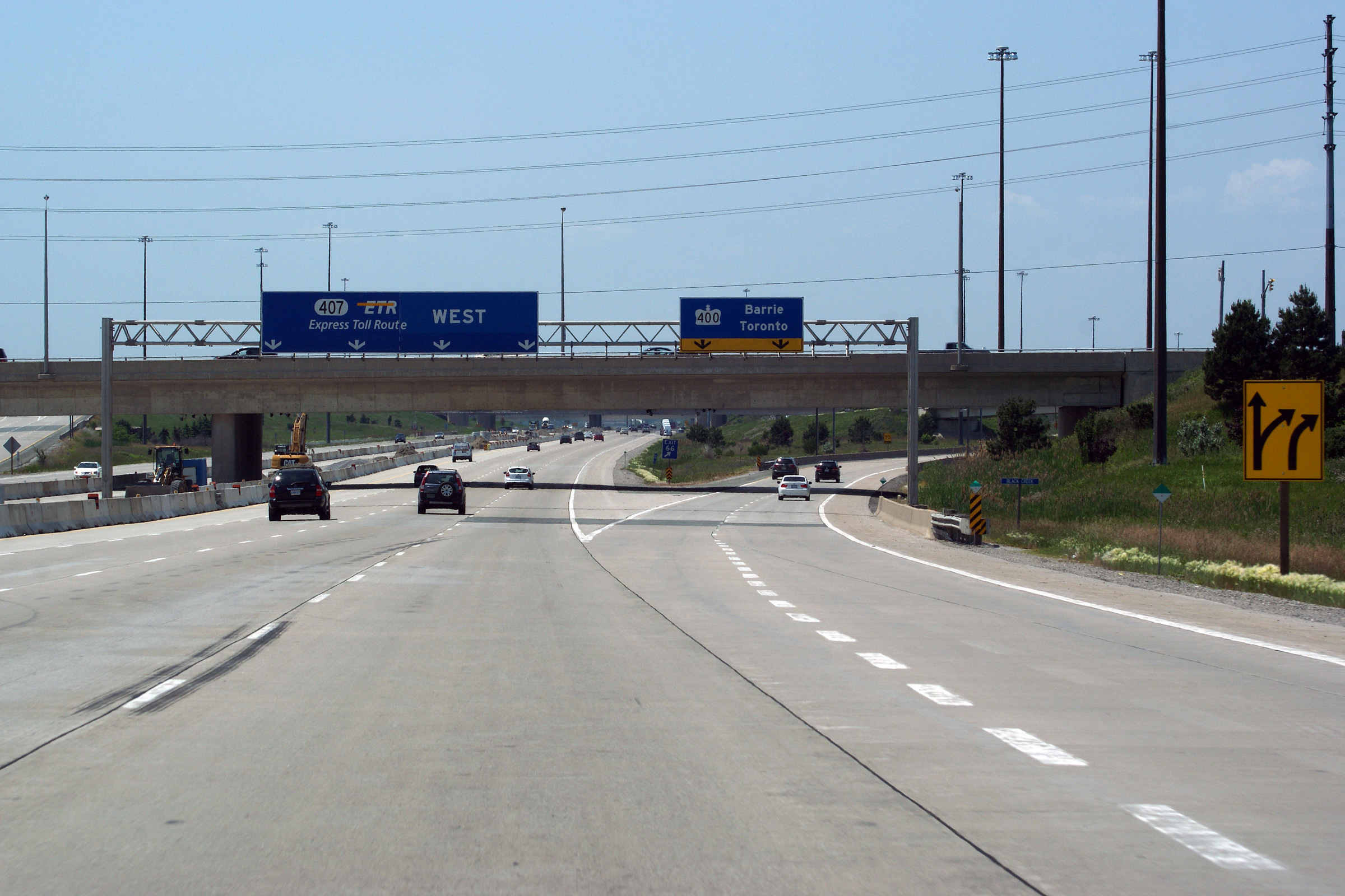
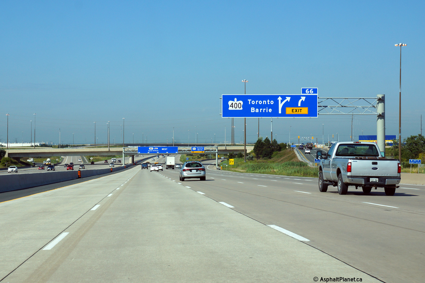
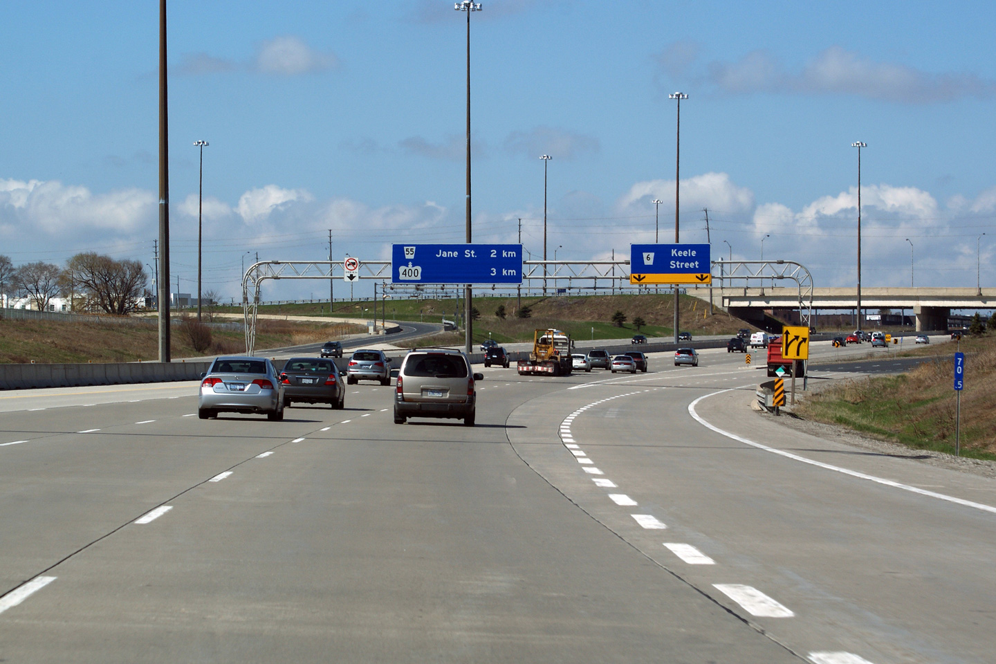
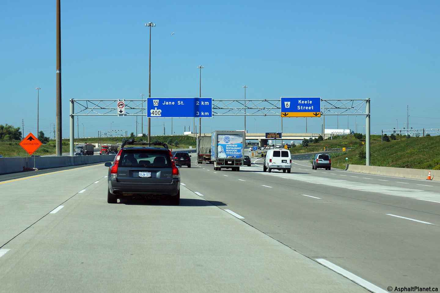
| City of Vaughan Regional Municipality of York |
Advanced signage for the Jane Street interchange along Highway 407.
The overhead sign is dwarfed by the high-level ramps of the
Highway 400
interchange in the background. Click
here to see the former signage at this location, taken in June, 2007. Photo taken: August 27th, 2014. |
|||||
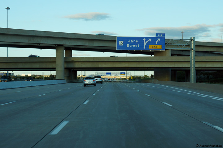
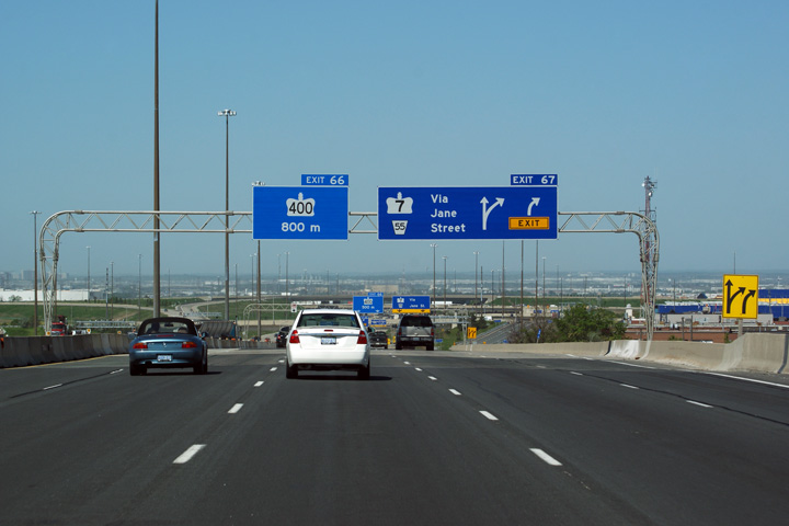
| City of Vaughan Regional Municipality of York |
View looking easterly at the Jane Street signage and off-ramp. The
ramp to Jane Street leads under the incoming ramp from
Highway 400 before
meeting Jane Street at a signalized intersection. Click
here to see the former signage at this
location, taken in June, 2007. Photo taken: August 27th, 2014. |
|||||
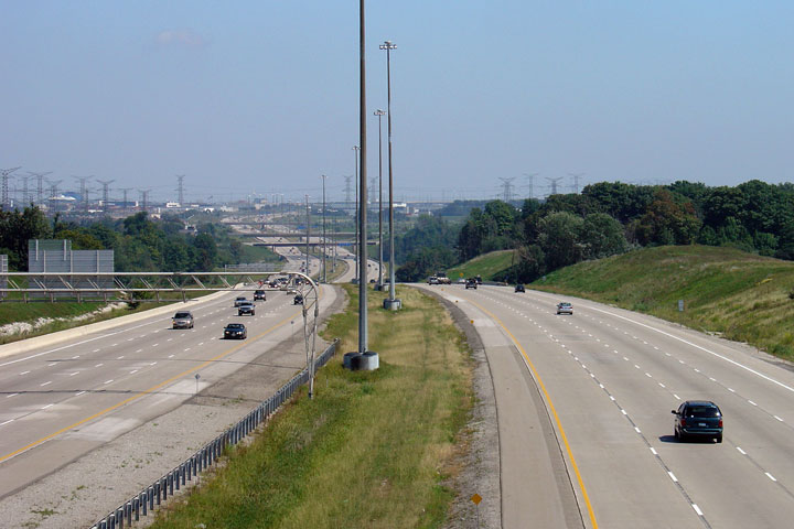
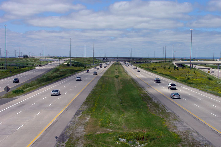
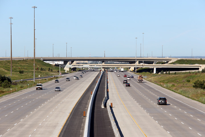
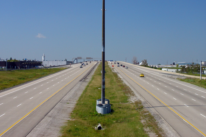
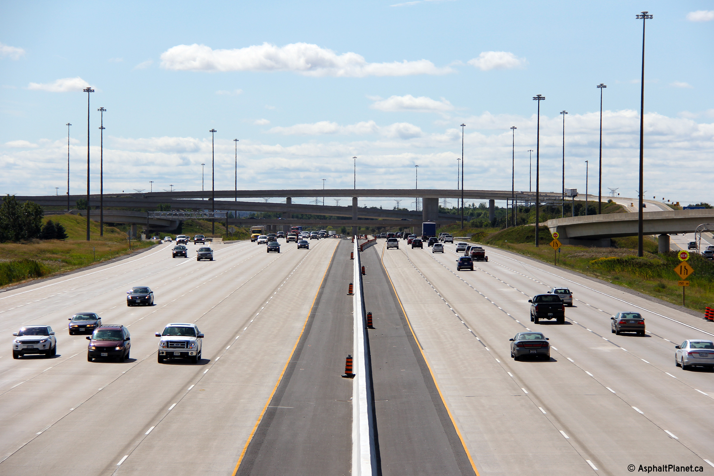
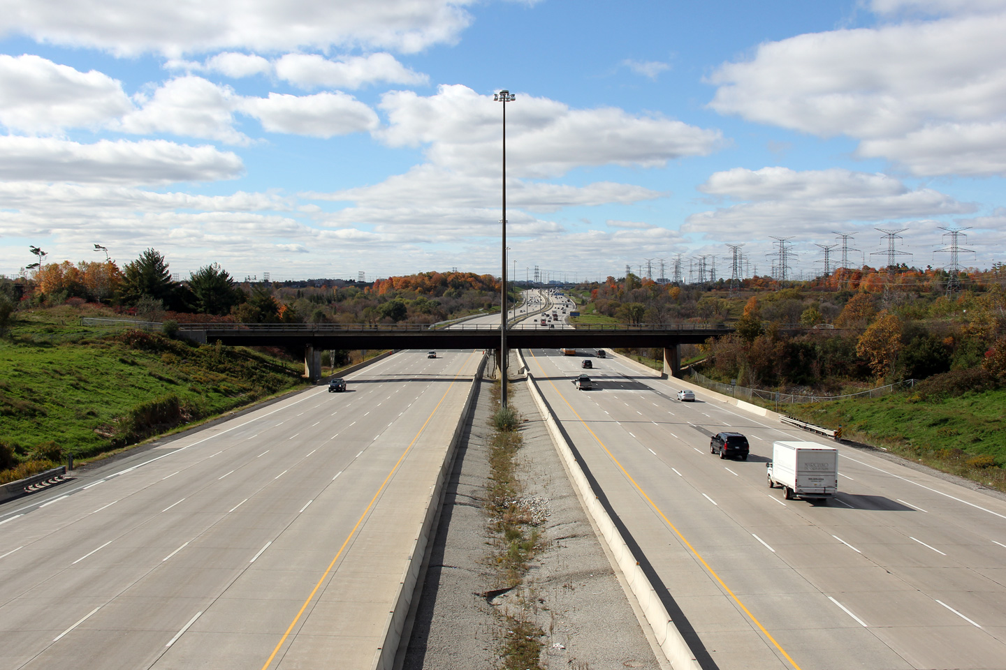
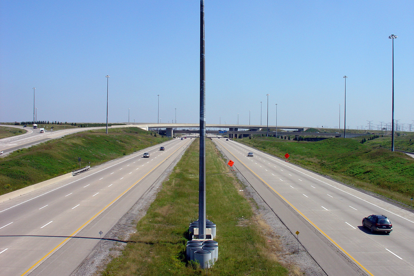
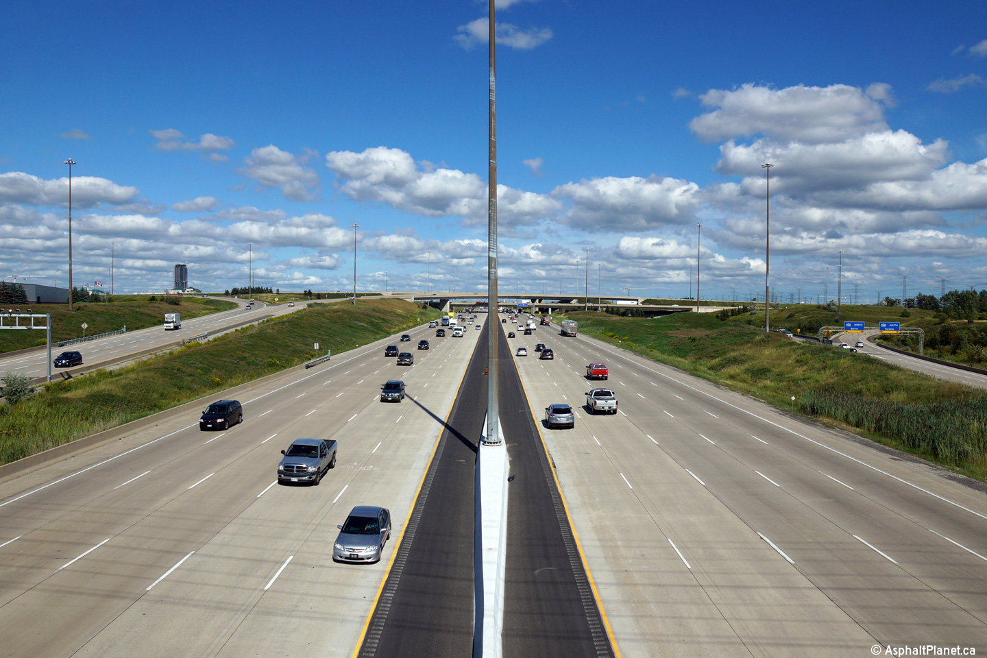
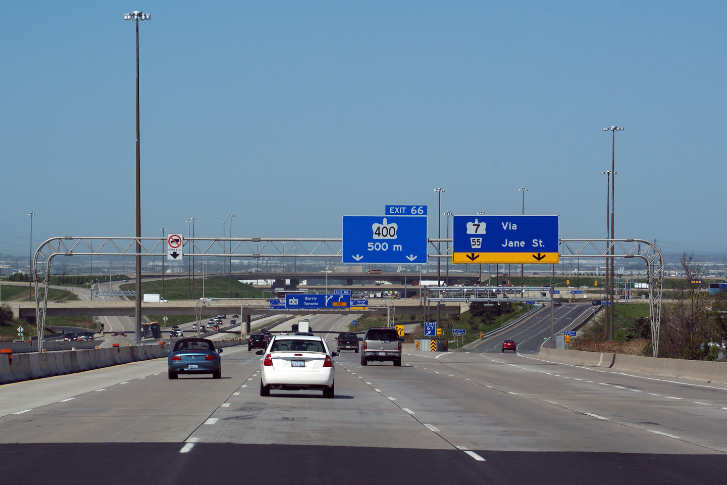
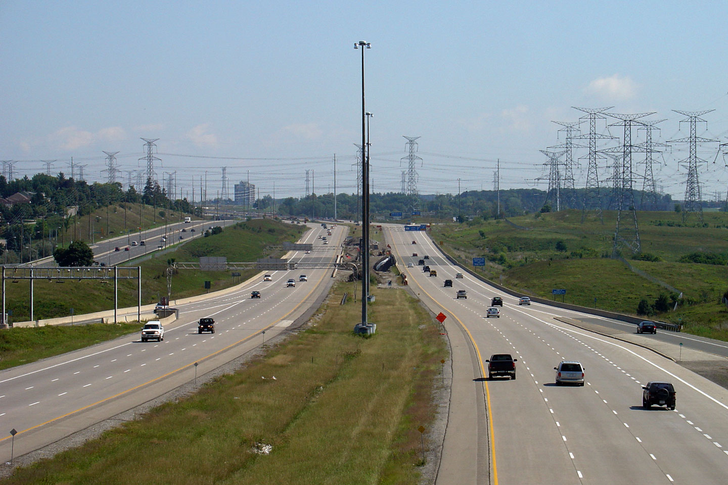
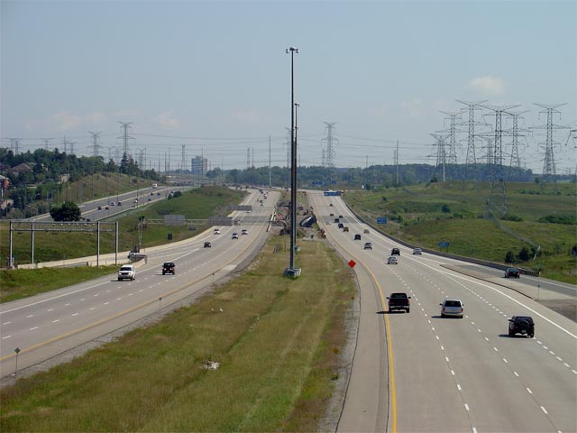
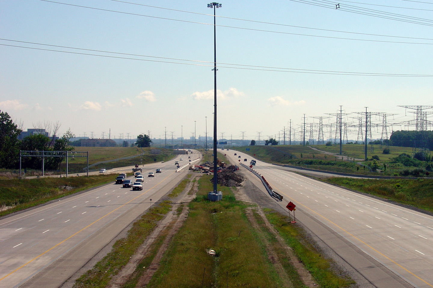
| City of Vaughan Regional Municipality of York |
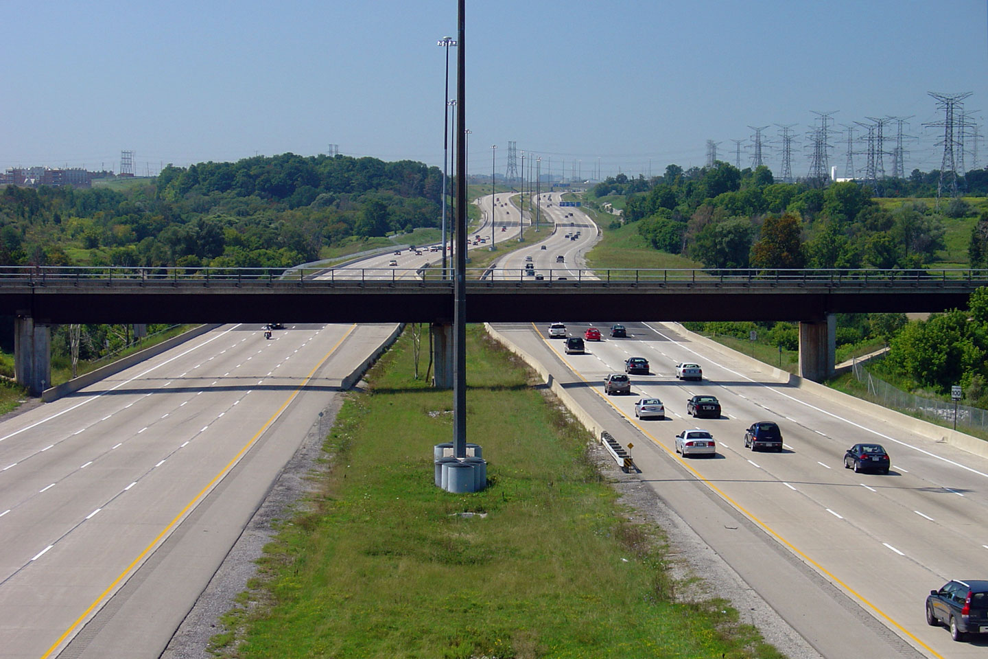
Looking west from the Jane Street overpass towards the
Highway 400 stack interchange. While the additional lanes that have been
added to the 407 since it was first opened as a six lane highway have
allowed the highway to keep up with increasing travel demand, the former
grassy median was quite aesthetically pleasing. Photo #1 taken: July 25th, 2004. Photo #2 taken: October 6th, 2006. Photo #3 taken: August 18th, 2012. Photos #4 and #5 taken: September 8th, 2014. |
 (720x480) (1440x960) (2400x1600)  (720x480) (1440x960) (2400x1600) |
||||
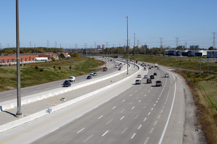
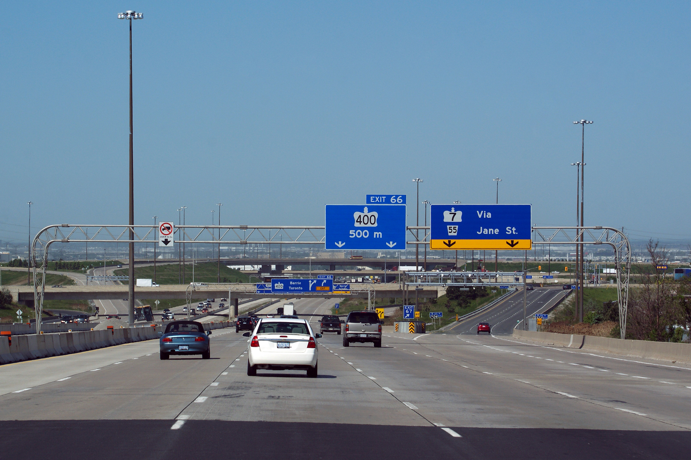
| City of Vaughan Regional Municipality of York |
Looking east at a rather substantial cross-section of Highway 400 through
Jane Street. In this photo set, the ramps to and from the 400 are seen entering
the mainline lanes of the 407. The ramps to and from the 400 are surrounded by the
the ramps to and from
Jane Street. Upper photo taken: July 25th, 2004. Middle photo taken: October 6th, 2006. Lower photo taken: August 18th, 2012. |
 (720x480) (1440x960) (2400x1600) |
||||
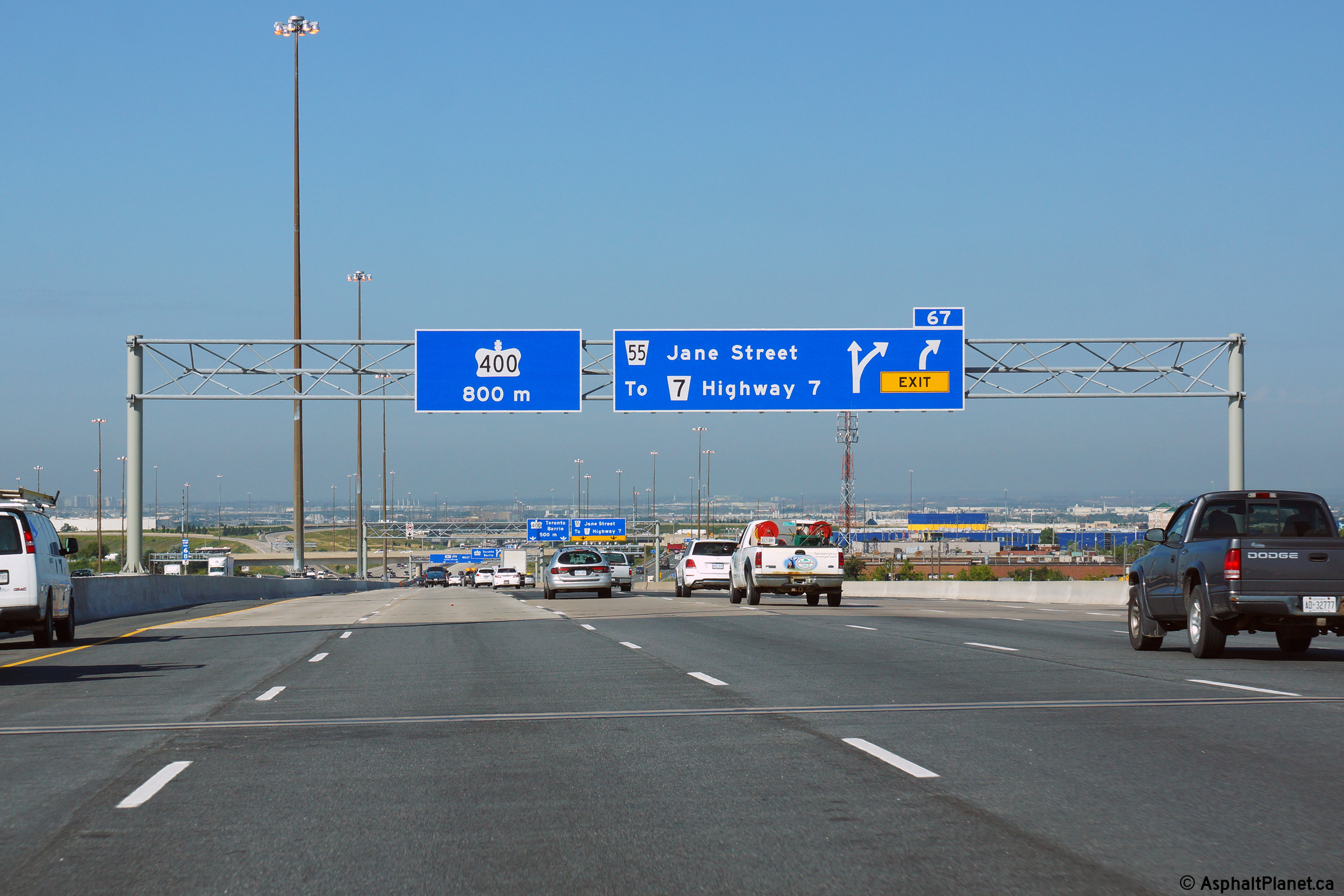
| City of Vaughan Regional Municipality of York |
Westerly view at the ramp to Highway 400. Upper photo taken: June 18th, 2011. Lower photo taken: August 19th, 2014. |
|
||||
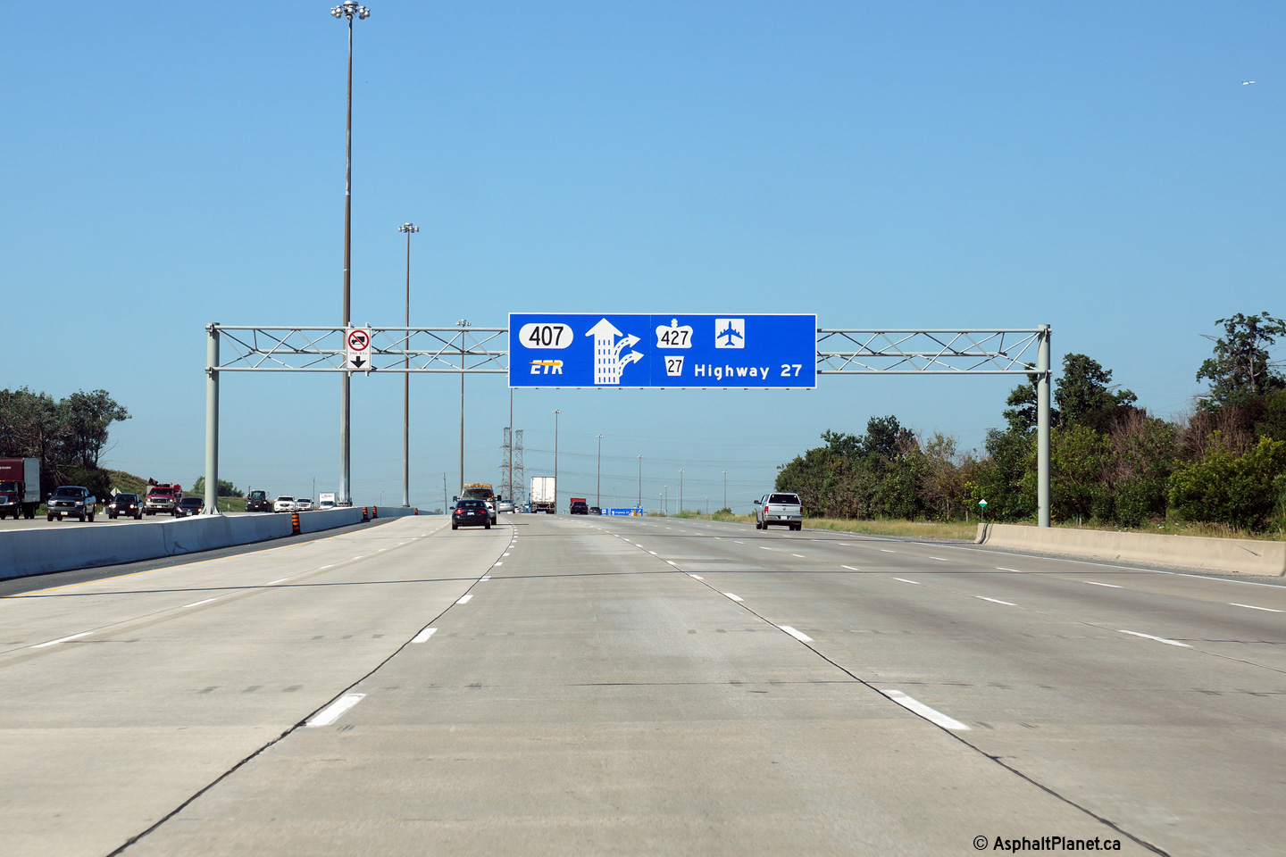
| City of Vaughan Regional Municipality of York |
Old and new views of the advanced arrow signage for Highway 400 along
Highway 407 West. The new partial gantries that have been erected along
Highway 407 are a clever design -- unfortunately, however, the partial
overhead gantries limit new freeway signage to a slightly smaller size than
normal. Upper photo taken: May 7th, 2011. Lower photo taken: August 19th, 2014. |
|
||||
| City of Vaughan Regional Municipality of York |
Old and new signage at the ramp to Jane Street. Upper photo taken: June 1st, 2011. Lower photo taken: August 19th, 2014. |
|
||||
| City of Vaughan Regional Municipality of York |
Two incarnations of the advanced signage for the Jane Street off-ramp.
The pre-advanced sign for the Highway 400 off-ramp is improved in the 2011
signage, however, this sign should include a reference to the Pine Valley
Drive interchange, which (as of the writing of this commentary) lacks a
pre-advanced sign. Upper photo taken: June 1st, 2011. Lower photo taken: August 19th, 2014. |
 (720x480) (720x480)(1440x960) (2400x1600) |
||||
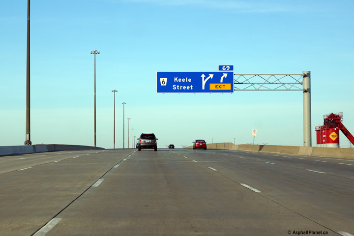
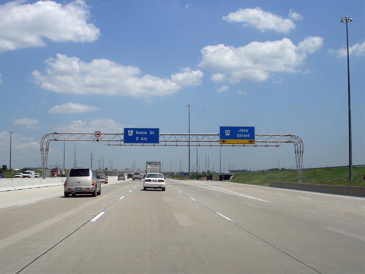
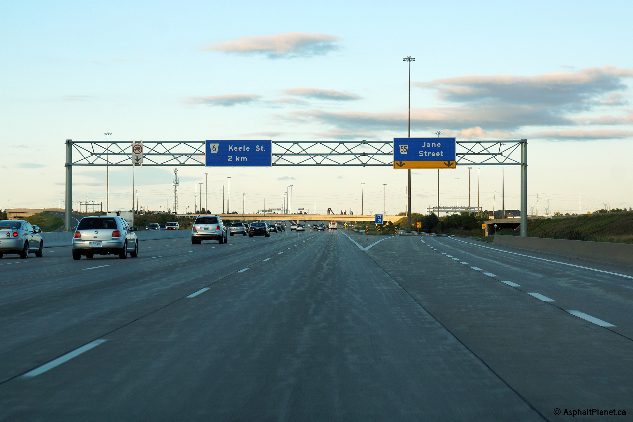
| City of Vaughan Regional Municipality of York |
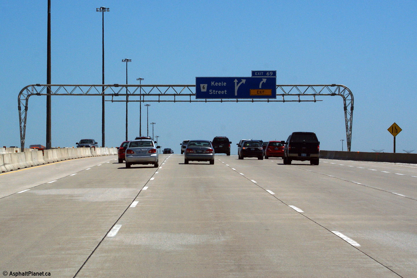
Eastbound advanced signage for the exit to Keele Street. The sixth
eastbound lane that joined Highway 407 from the Highway 400 off-ramp exits
at Keele Street. Click here to see the former signage at this location, taken in June, 2011. Photo taken: June 7th, 2014. |
 (720x480) (720x480)(1440x960) (2400x1600) |
||||
| City of Vaughan Regional Municipality of York |
View looking easterly as the ramp to Keele Street departs from the mainline
lanes of Highway 407. Click here to see the former signage at this location, taken in June, 2011. Photo taken: June 7th, 2014. |
 (720x480) (720x480)(1440x960) (2400x1600) |
||||
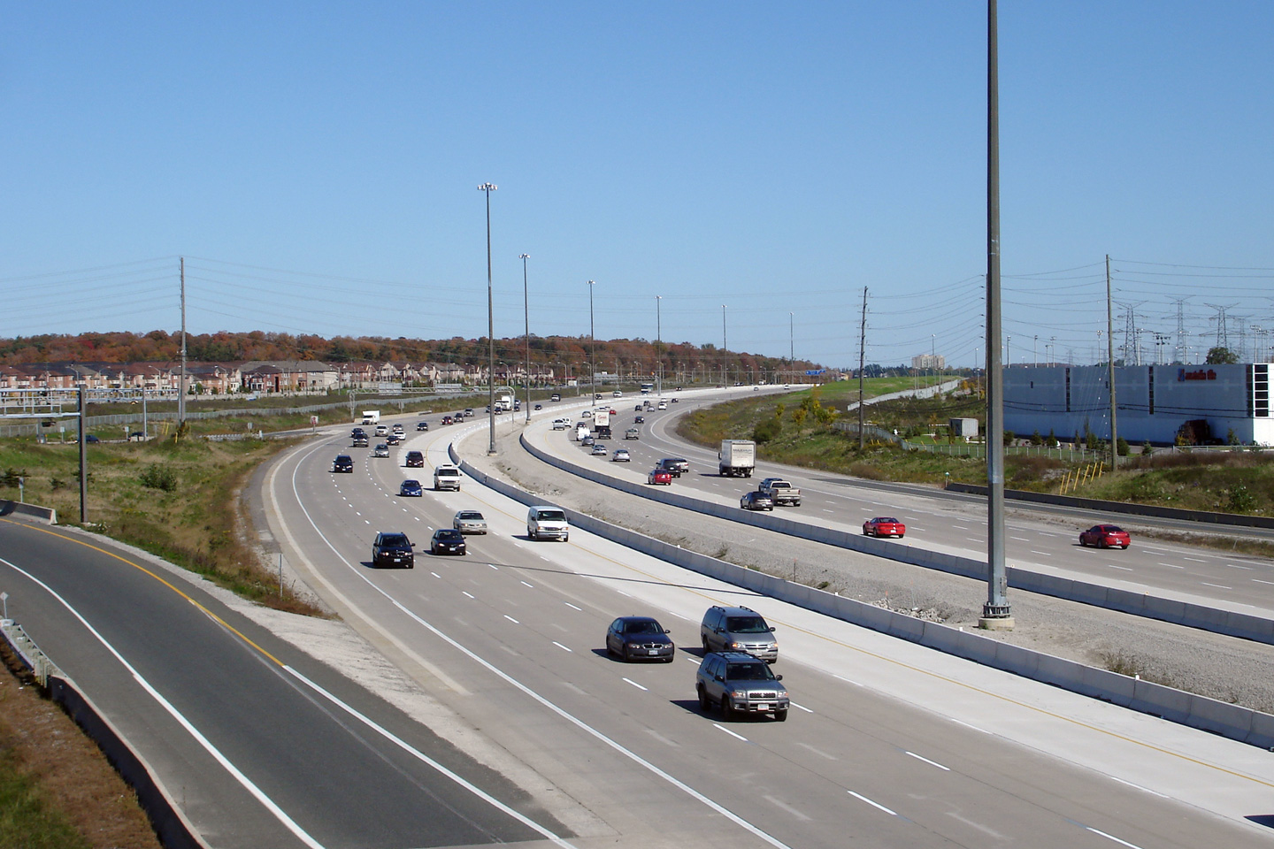
| City of Vaughan Regional Municipality of York |
Views looking west from the Keele Street overpass. Highway 407 crosses
overtop a massive CN Intermodal facility between Jane Street and Keele
Street. Upper photo taken: August 28th, 2005. Middle photo taken: October 6th, 2006. Lower photo taken: August 18th, 2012. |
 (720x480) (1440x960) (2400x1600) |
||||
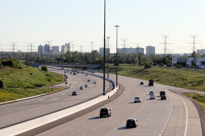
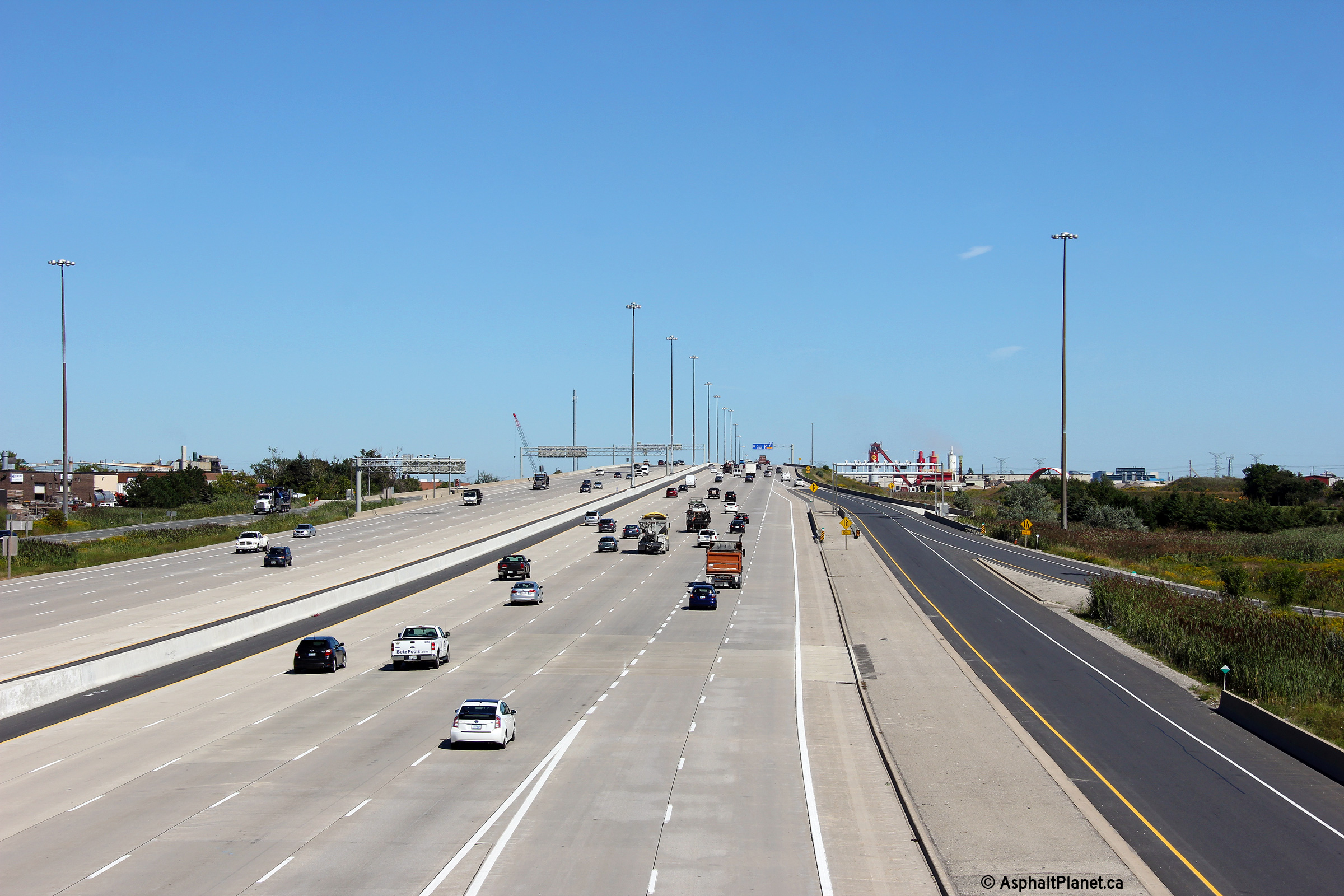
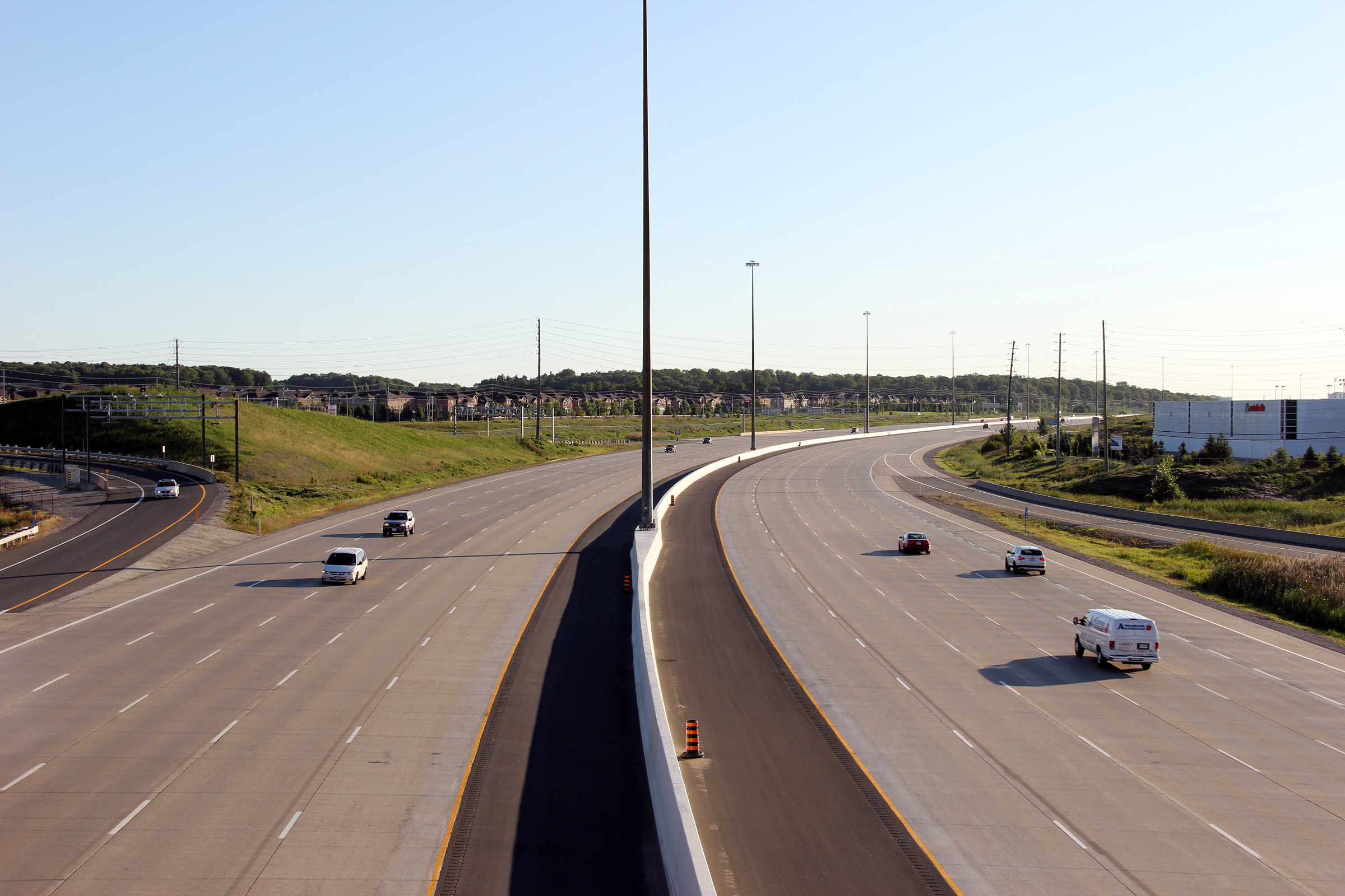
| City of Vaughan Regional Municipality of York |
Views of the 407 as it curves northerly at Keele Street. The six lane
highway looks so small in comparison the the ten lane monster that was
created with the widening in 2012. Upper photo taken: August 28th, 2005. Middle photo taken: October 6th, 2006. Lower photo taken: August 18th, 2012. |
 (720x480) (1440x960) (2400x1600) |
||||
| City of Vaughan Regional Municipality of York |
View driving westerly approaching the Keele Street overpass. The pictured
changeable message sign was erected during the summer of 2012. Photo taken: August 28th, 2012. |
 (720x480) (720x480)(1440x960) (2400x1600) |
||||
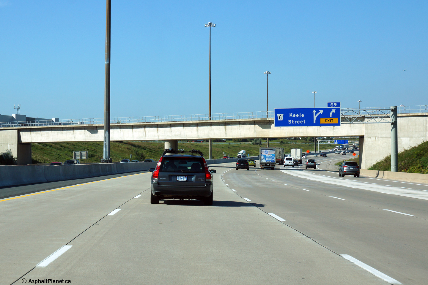
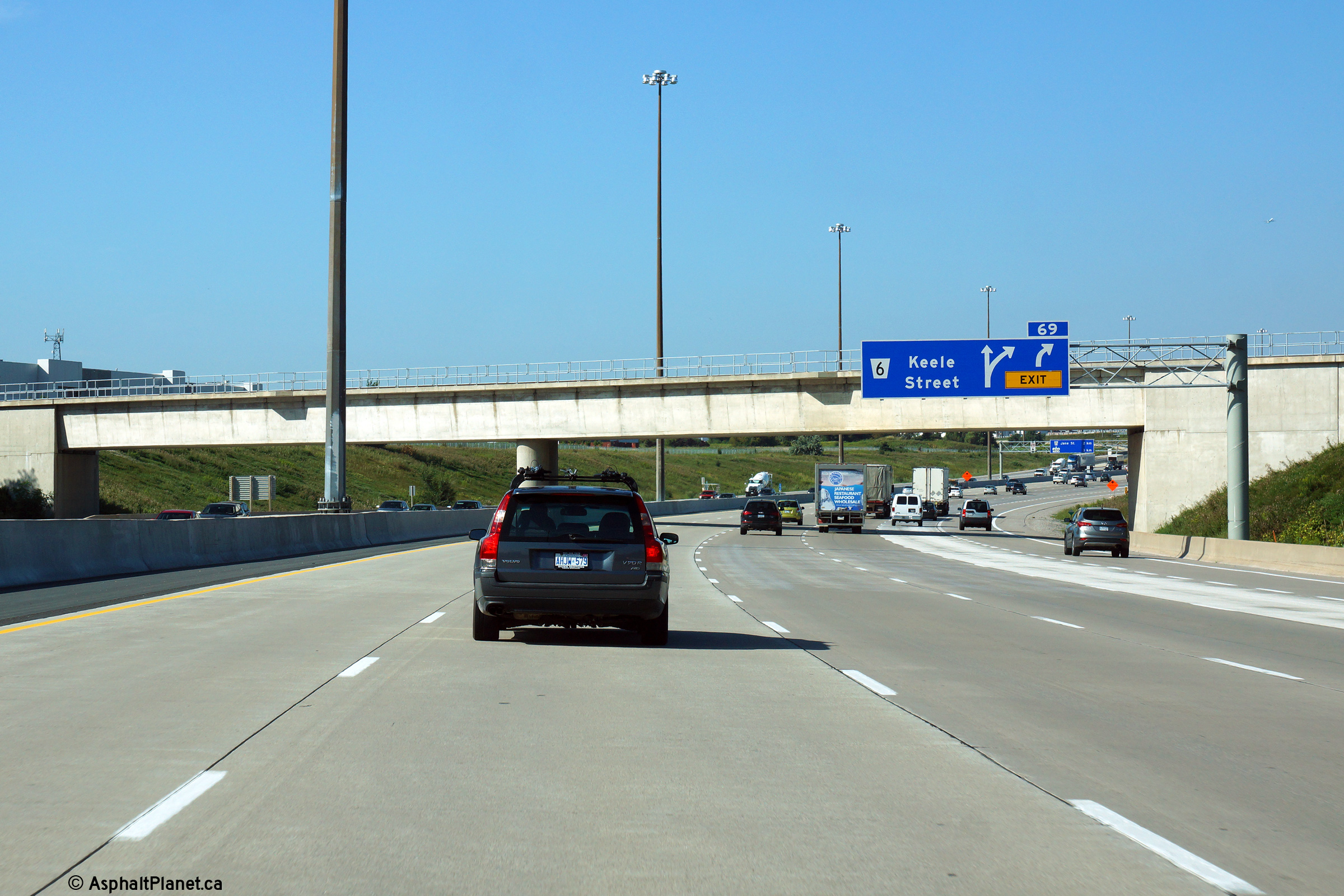
| City of Vaughan Regional Municipality of York |
View driving westerly at the off-ramp to Keele Street. Click
here to see the former signage at this location, taken in June, 2011. Photo taken: August 19th, 2014. |
 (720x480) (720x480)(1440x960) (2400x1600) |
||||
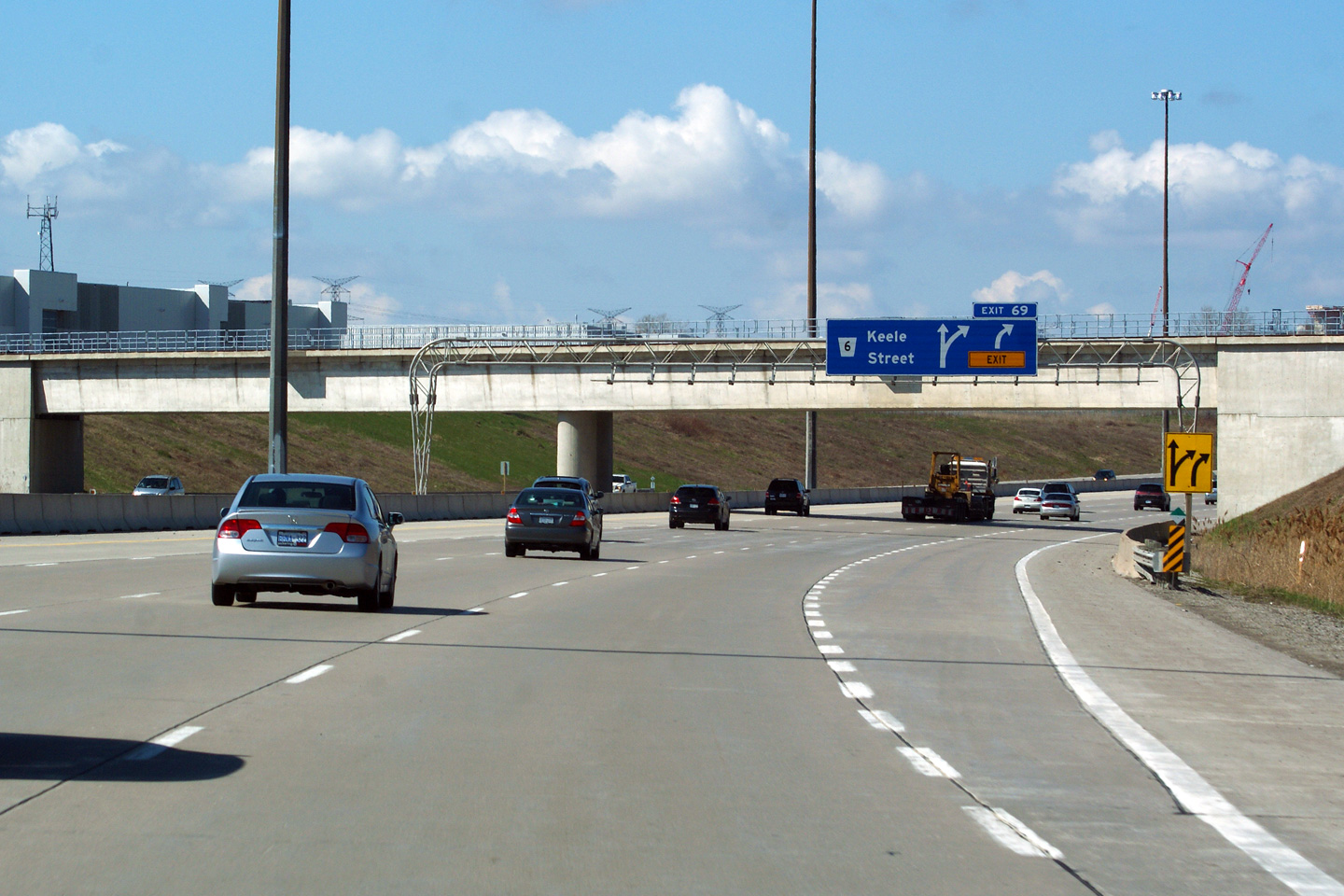
| City of Vaughan Regional Municipality of York |
Westbound advanced signage for the off-ramp to Keele Street. Click
here to see the former signage at this location, taken in June, 2011. Photo taken: August 19th, 2014. |
 (720x480) (720x480)(1440x960) (2400x1600) |
||||
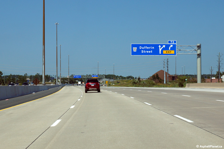
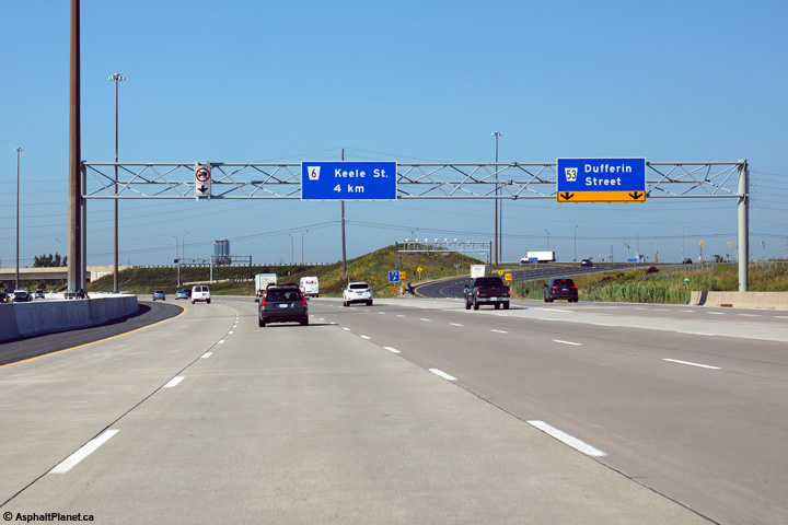
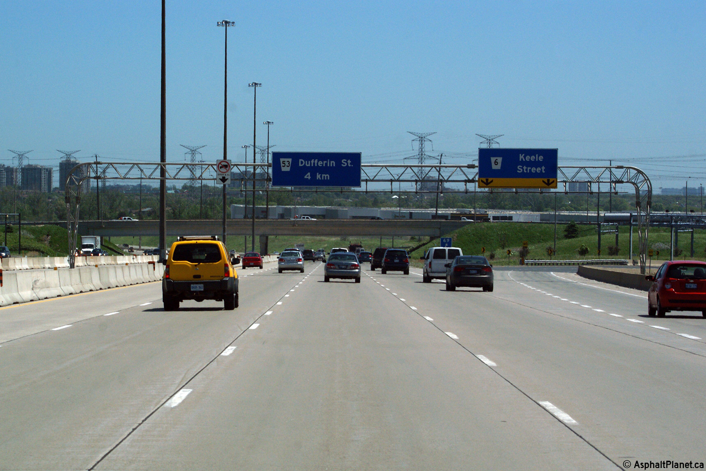
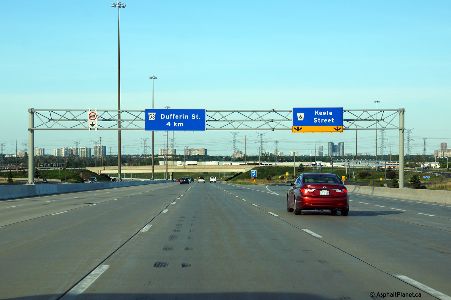
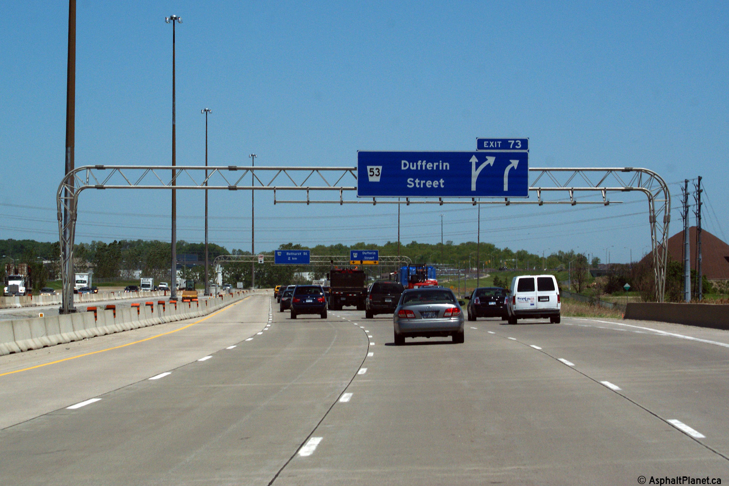
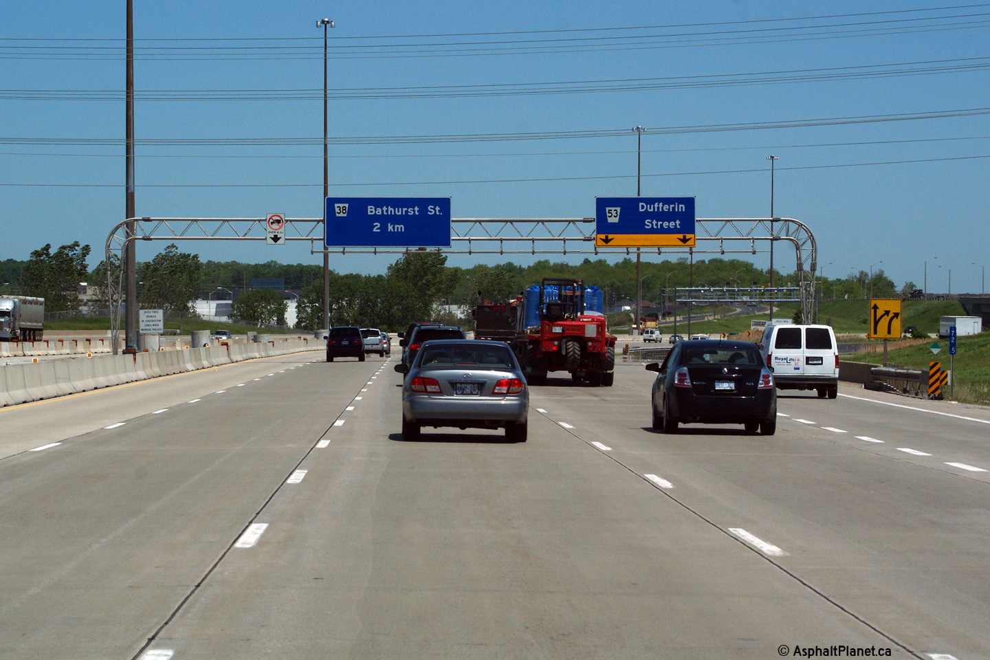
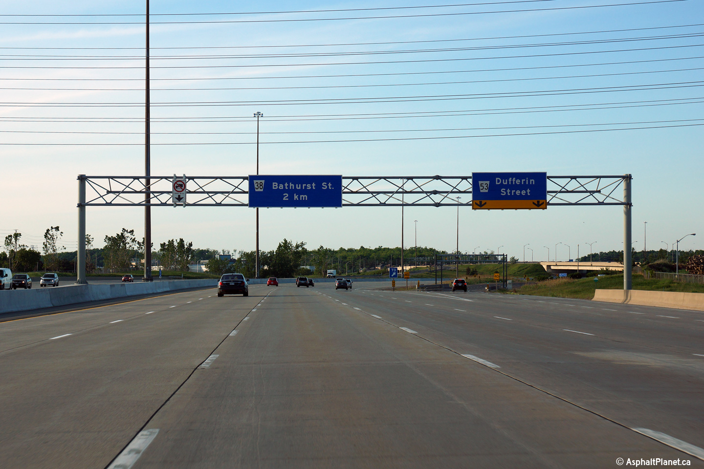
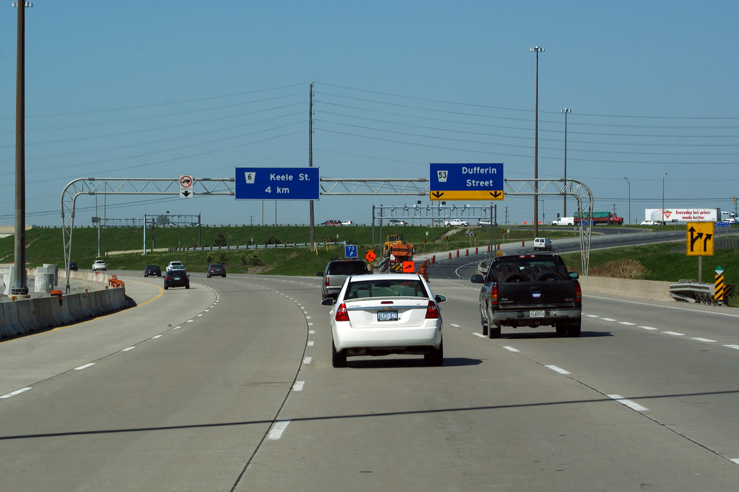
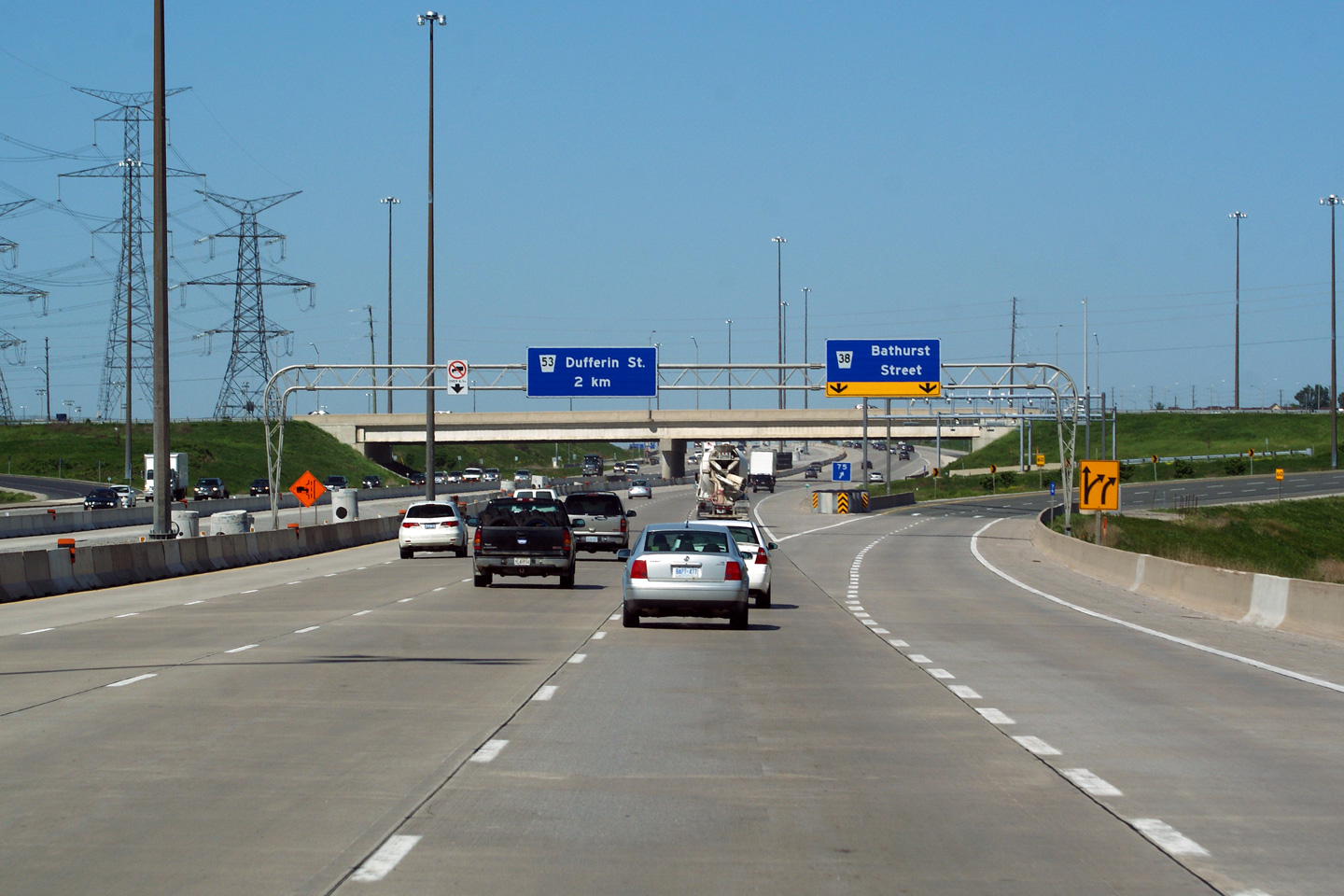
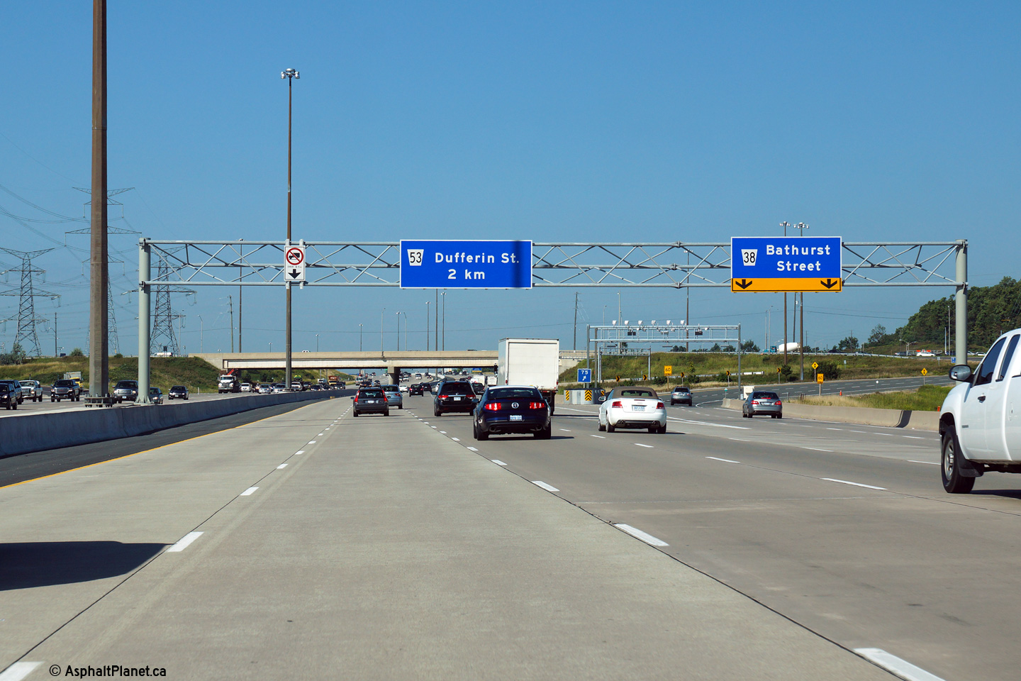
| City of Vaughan Regional Municipality of York |
Eastbound advanced signage for the ramp to Dufferin Street. Click here to see the former signage at this location, taken in June, 2011. Photo taken: August 19th, 2014. |
 (720x480) (720x480)(1440x960) (2400x1600) |
||||
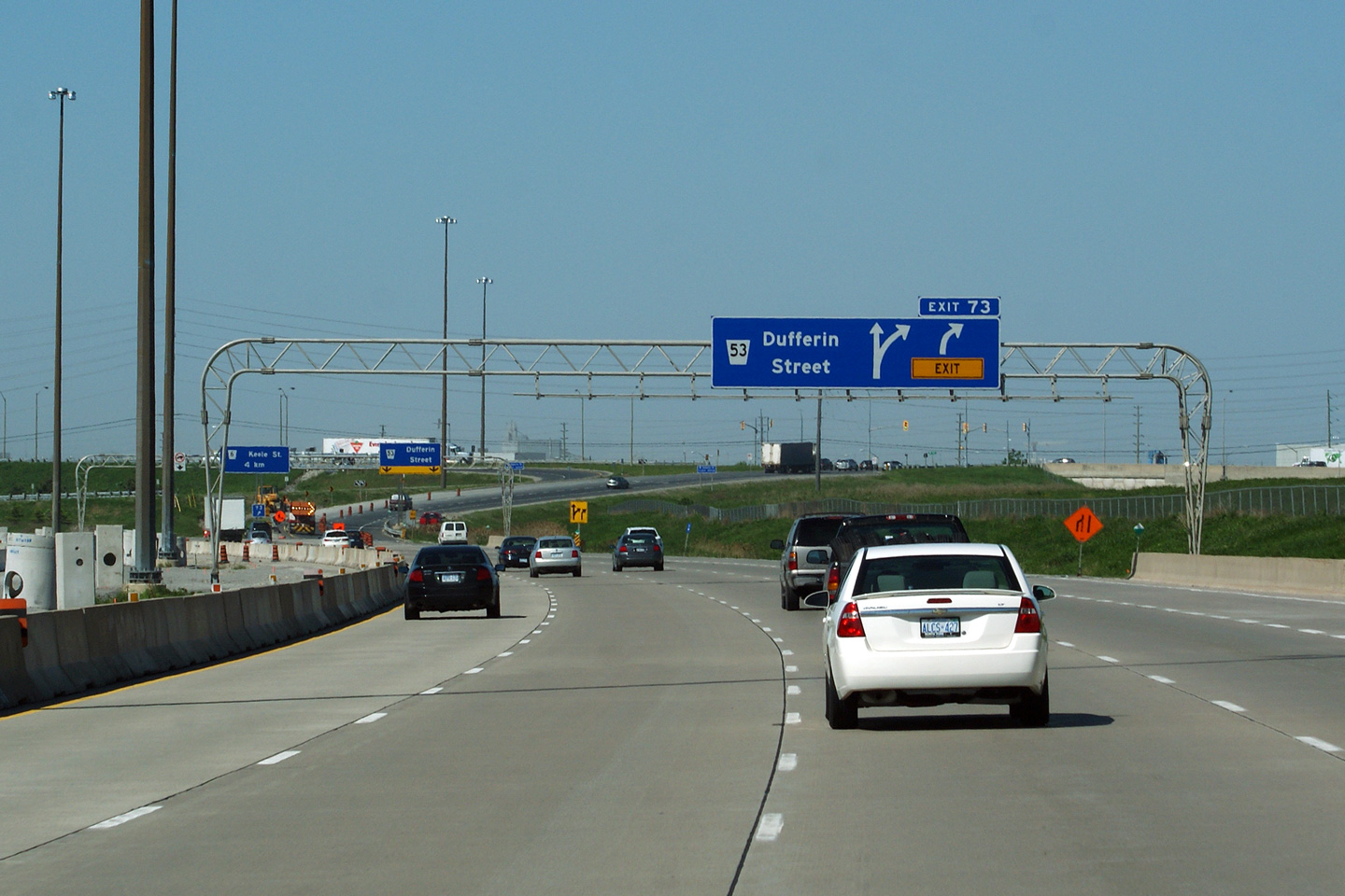
| City of Vaughan Regional Municipality of York |
Easterly view at the off-ramp Dufferin Street. Click here
to see the former signage at this location, taken in June, 2011. Photo taken: June 7th, 2014. |
 (720x480) (720x480)(1440x960) (2400x1600) |
||||
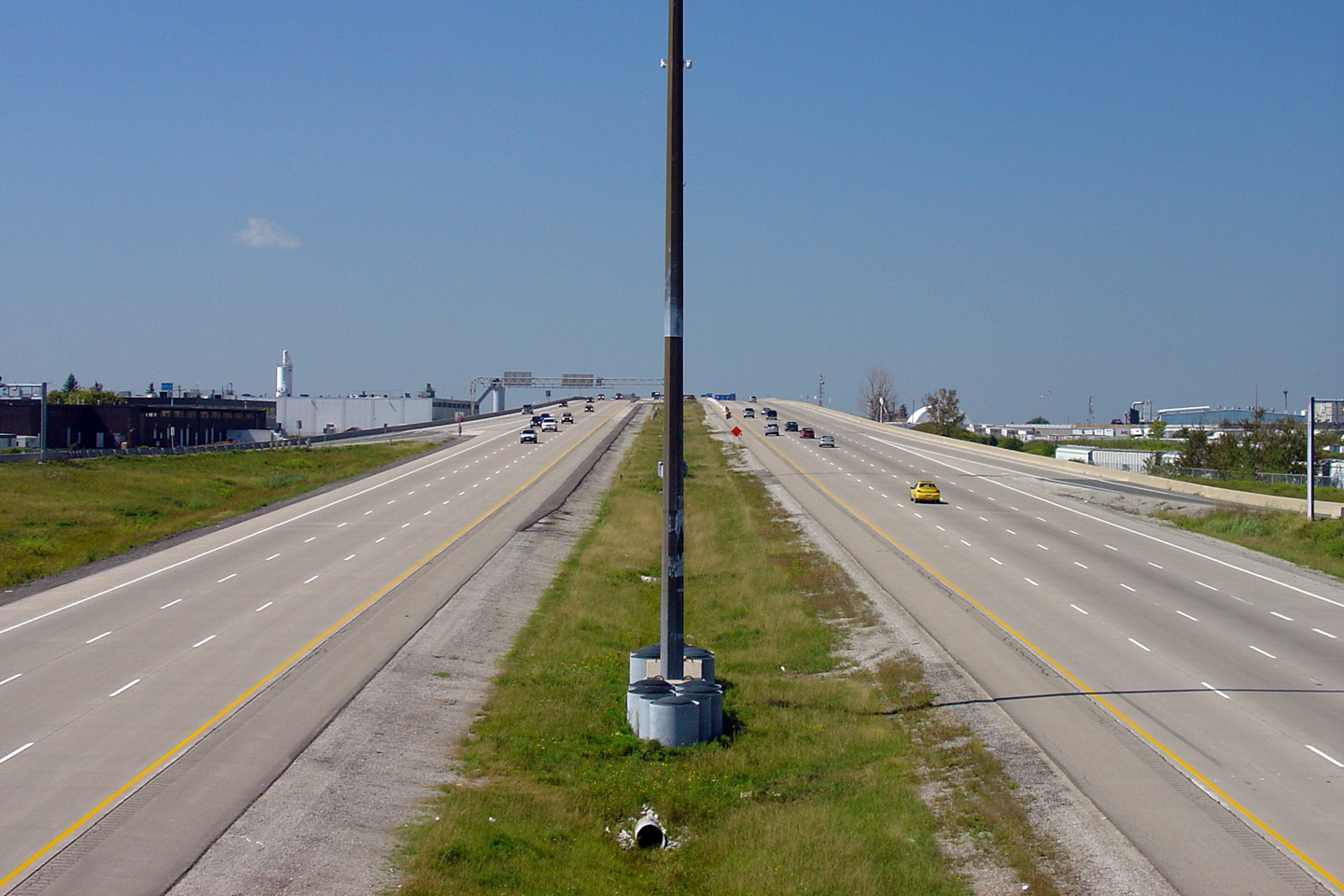
| City of Vaughan Regional Municipality of York |
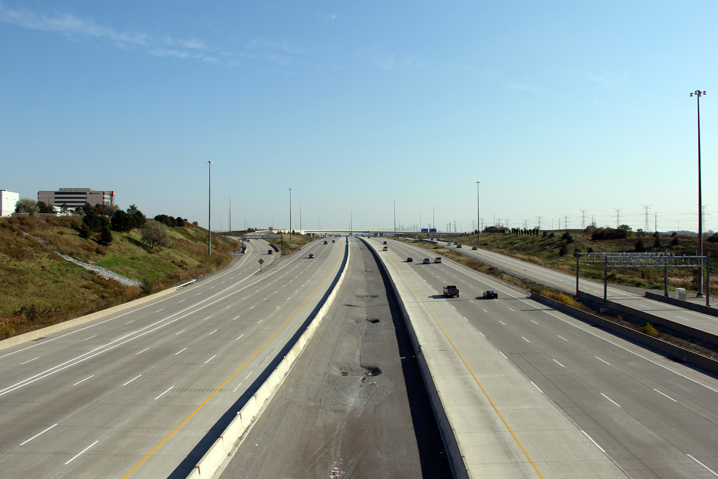
These views looks west from the Dufferin Street overpass. The 407 advances about 2km
north-south between Dufferin and Keele. Upper photo taken: July 25th, 2004. Middle photo taken: October 6th, 2006. Lower photo taken: August 18th, 2012. |
 (720x480) (1440x960) (2400x1600) |
||||
| City of Vaughan Regional Municipality of York |
Easterly views from Dufferin Street. Note the house farm in the
distance -- these have popped up all over the Highway 7 corridor since the
407 was opened. Upper photo taken: July 25th, 2004. Middle photo taken: October 6th, 2006. Lower photo taken: August 18th, 2012. |
 (720x480) (1440x960) (2400x1600) |
||||
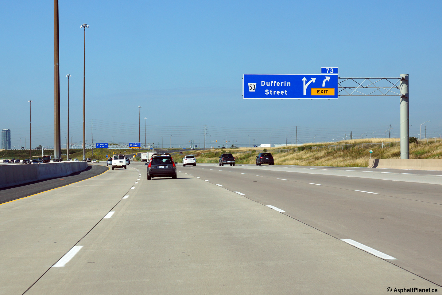
| City of Vaughan Regional Municipality of York |
Westerly view at the off-ramp to Dufferin Street. Click here
to see the former signage at this location, taken in June, 2011. Photo taken: August 19th, 2014. |
 (720x480) (720x480)(1440x960) (2400x1600) |
||||
| City of Vaughan Regional Municipality of York |
Advanced signage for the off-ramp to Dufferin Street. Click
here
to see the former signage at this location, taken in June, 2011. Photo taken: August 19th, 2014. |
 (720x480) (720x480)(1440x960) (2400x1600) |
||||
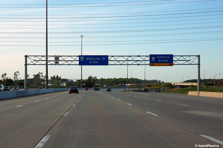
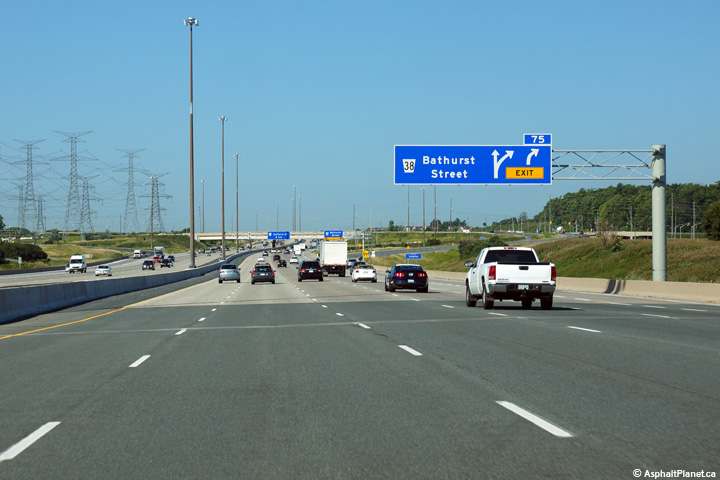
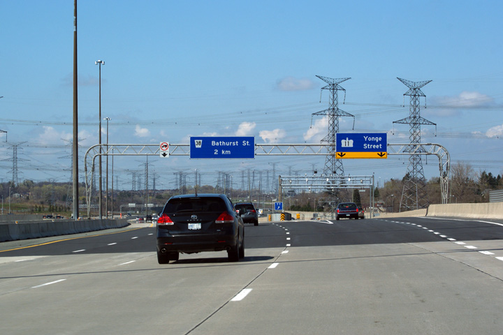
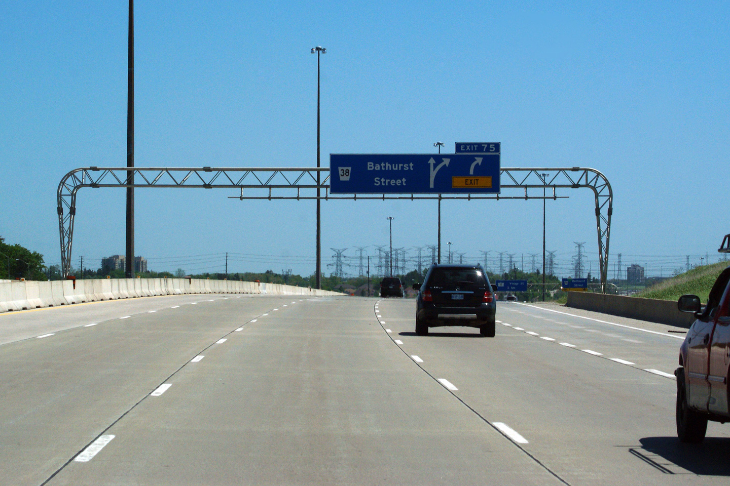
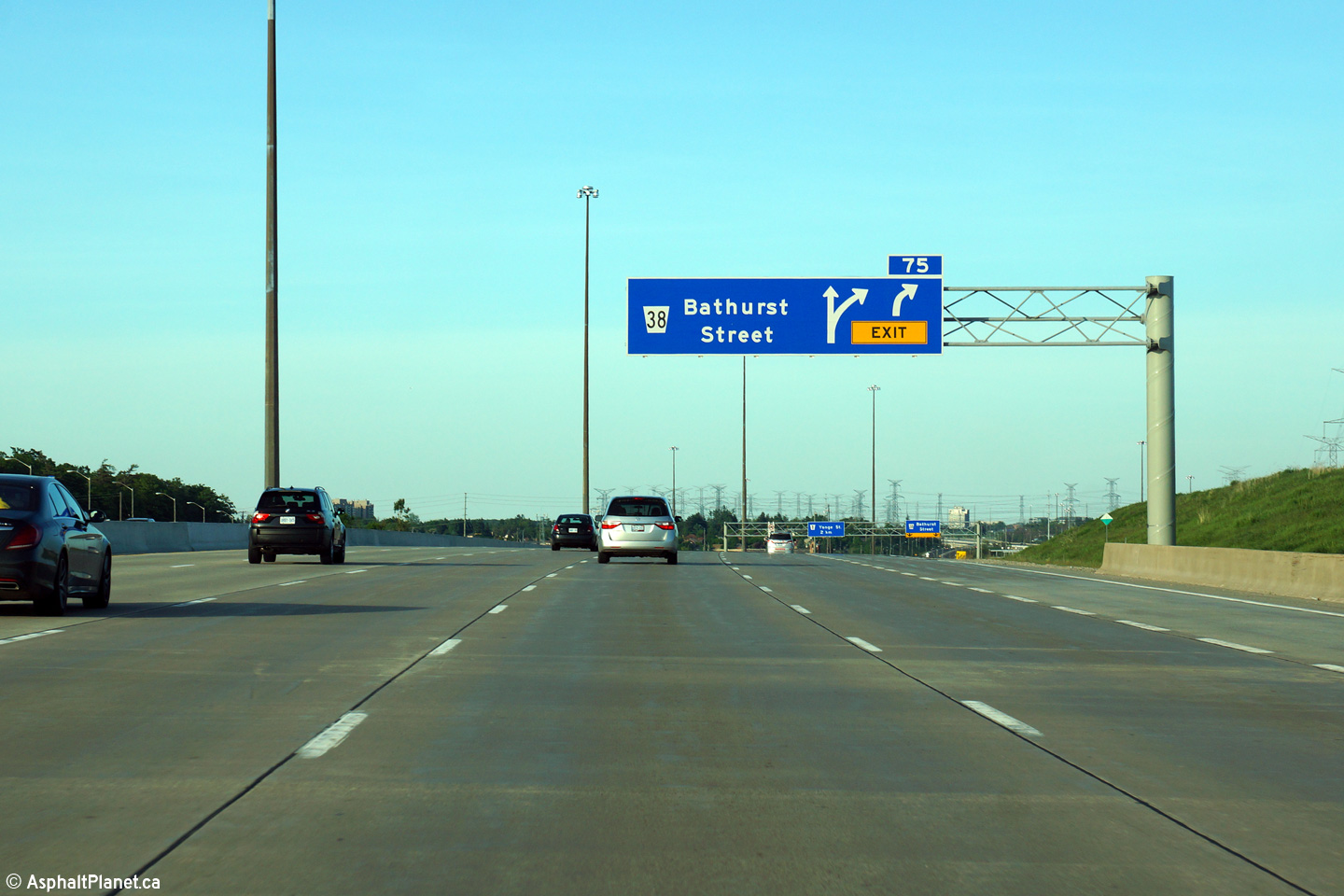
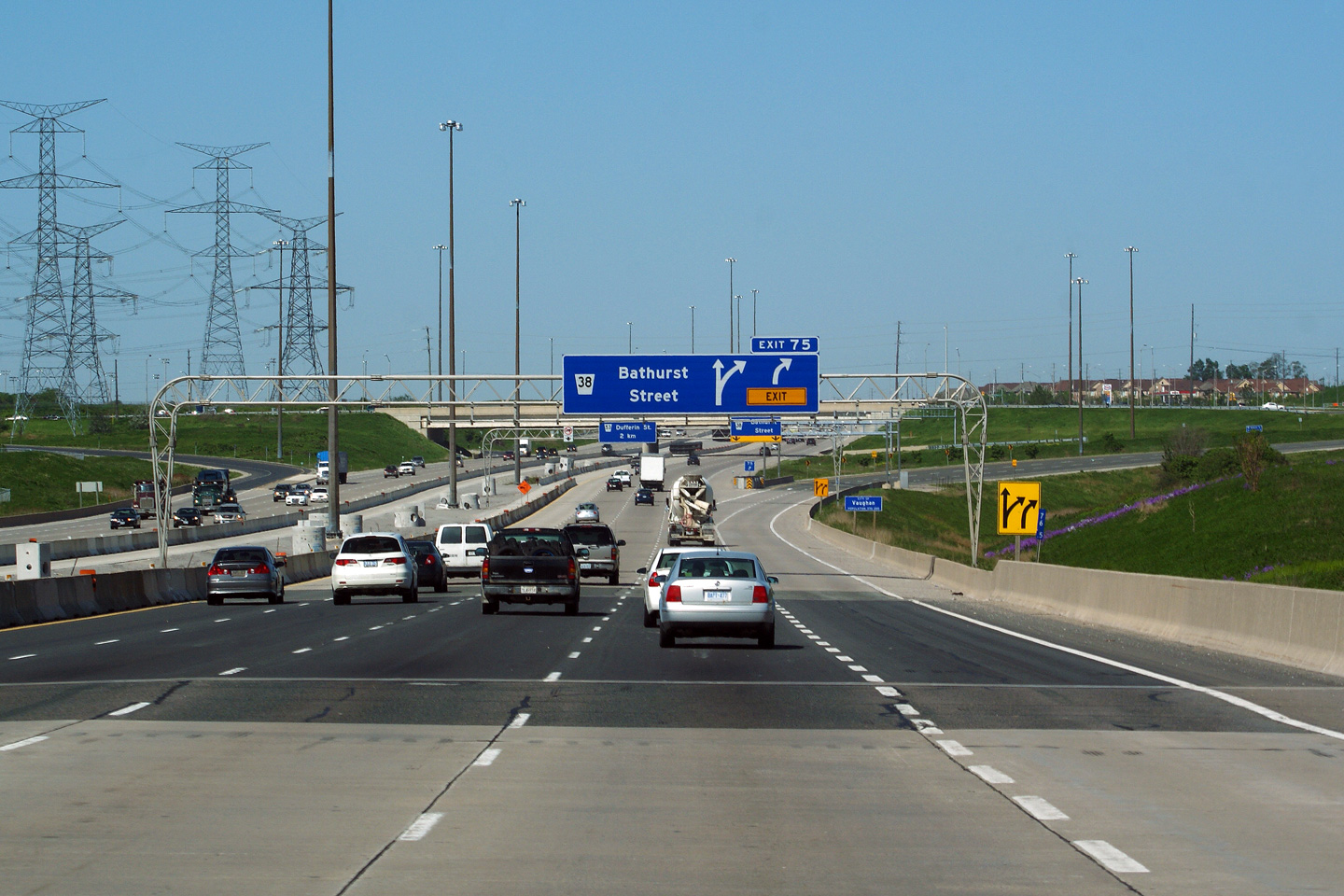
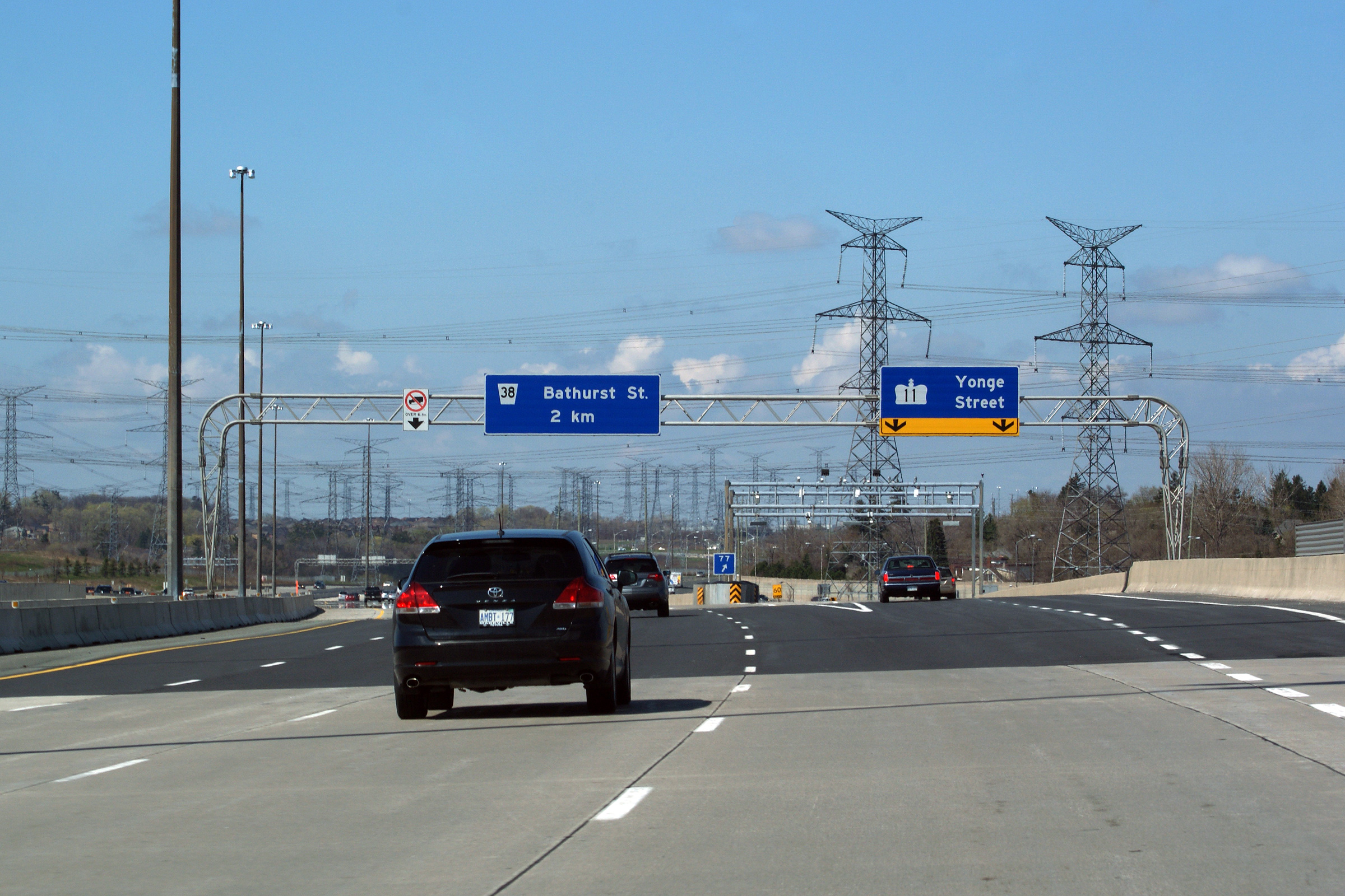
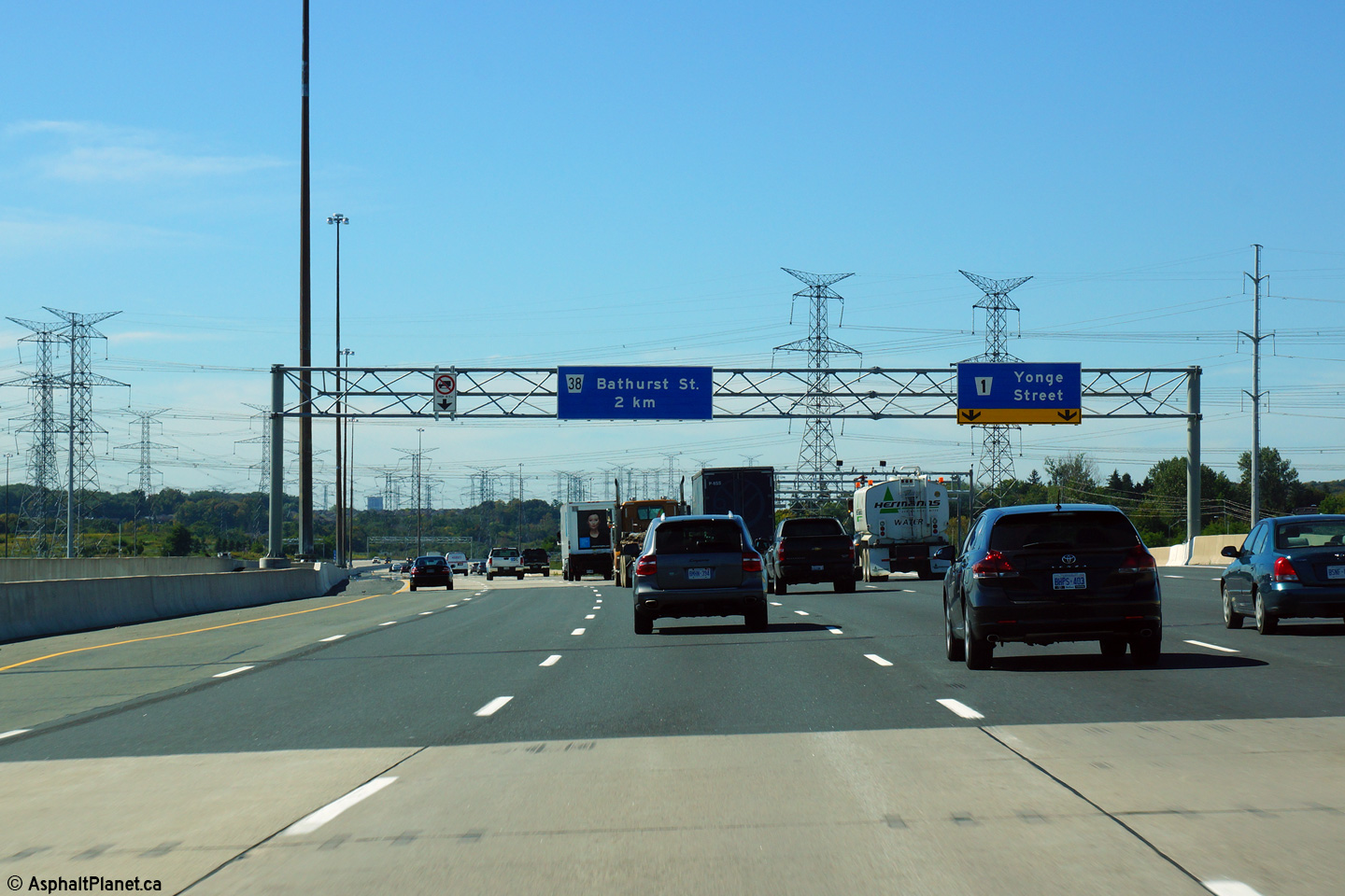
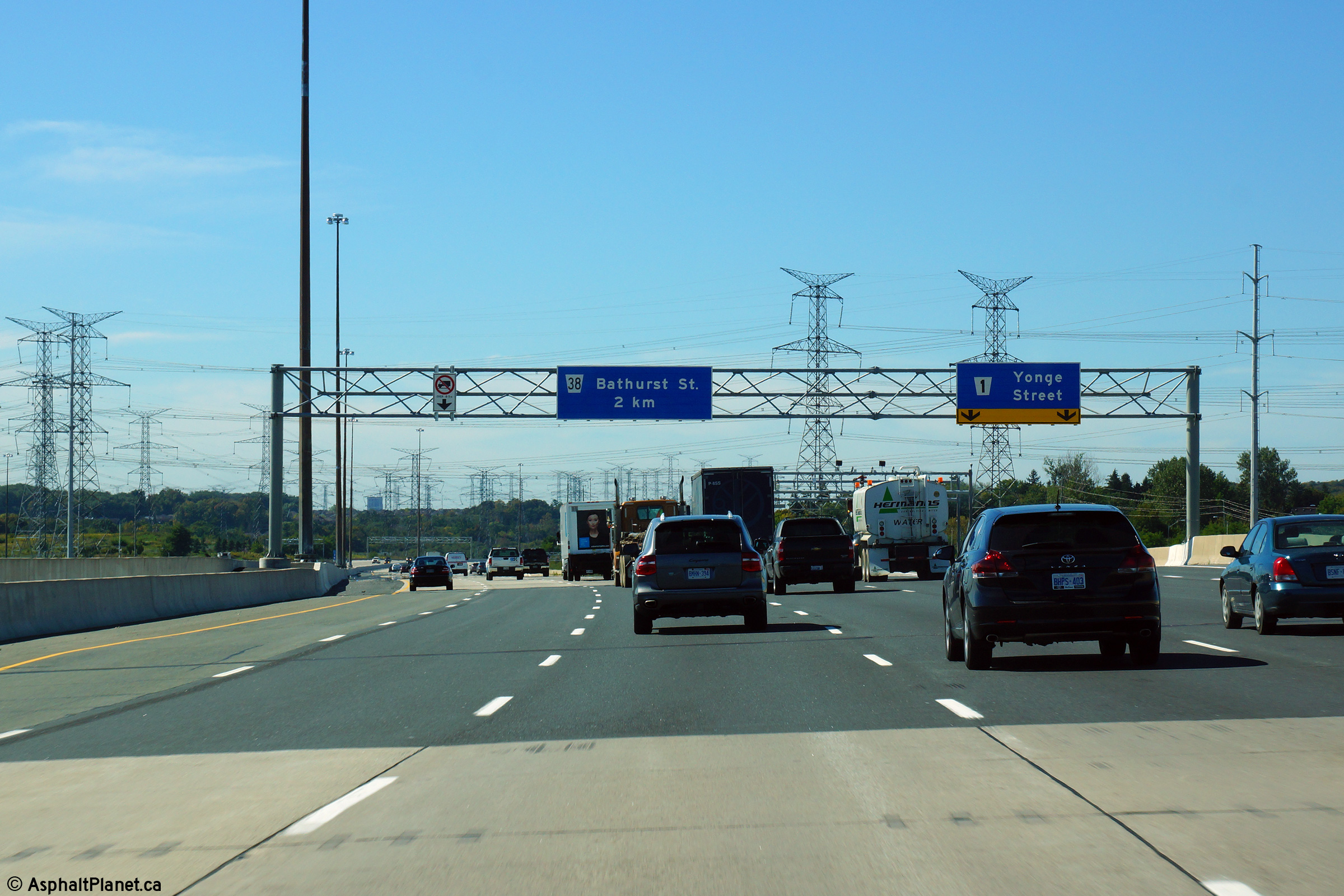
| City of Vaughan Regional Municipality of York |
Eastbound advanced signage for the ramp to Bathurst Street. Click here to see the former signage at this location, taken in June, 2011. Photo taken: June 7th, 2014. |
 (720x480) (720x480)(1440x960) (2400x1600) |
||||
| City of Vaughan R Regional Municipality of York |
Easterly view at the eastbound off-ramp to Bathurst Street. Click here to see the former signage at this location, taken in June, 2011. Photo taken: June 7th, 2014. |
 (720x480) (720x480)(1440x960) (2400x1600) |
||||
| City of Vaughan Regional Municipality of York |
View looking west from the Bathurst Street overpass. Upper photo taken: August 28th, 2005. Middle photo taken: October 6th, 2006. Lower photo taken: August 6th, 2012. |
 (720x480) (1440x960) (2400x1600) |
||||
| City of Vaughan Regional Municipality of York |
Looking east along Highway 407 from the Bathurst Street overpass in
Thornhill. Bathurst Street is located roughly at kilometre marker 75.
Notice Highway 7 running through the
left-side of this photo. Between Dufferin Street and Bayview Avenue,
Highway 407 parallels Highway 7 very closely. Upper photo taken: August 28th, 2005. Middle photo taken: October 6th, 2006. Lower photo taken: August 6th, 2012. |
 (720x480) (1440x960) (2400x1600) |
||||
| City of Vaughan Regional Municipality of York |
Overhead signage at the westbound off-ramp to Bathurst Street. Click here
to see the former signage at this location, taken in June, 2011. Photo taken: August 19th, 2014. |
 (720x480) (720x480)(1440x960) (2400x1600) |
||||
| City of Vaughan Regional Municipality of York |
Westbound advanced signage for the off-ramp to Bathurst Street. Click here
to see the former signage at this location, taken in June, 2011. Photo taken: August 19th, 2014. |
 (720x480) (720x480)(1440x960) (2400x1600) |
||||
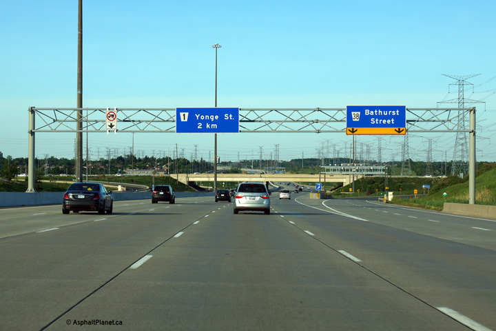
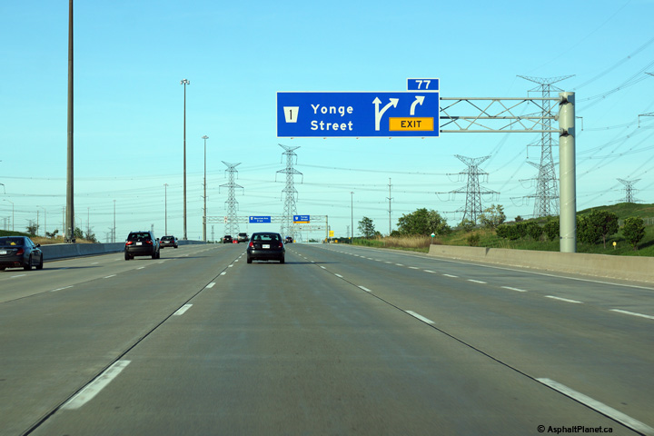
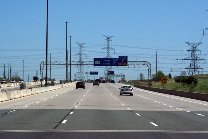
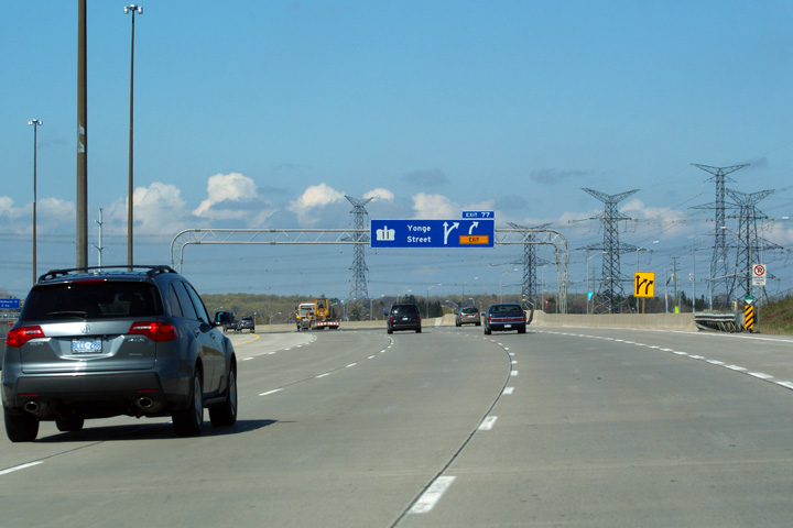
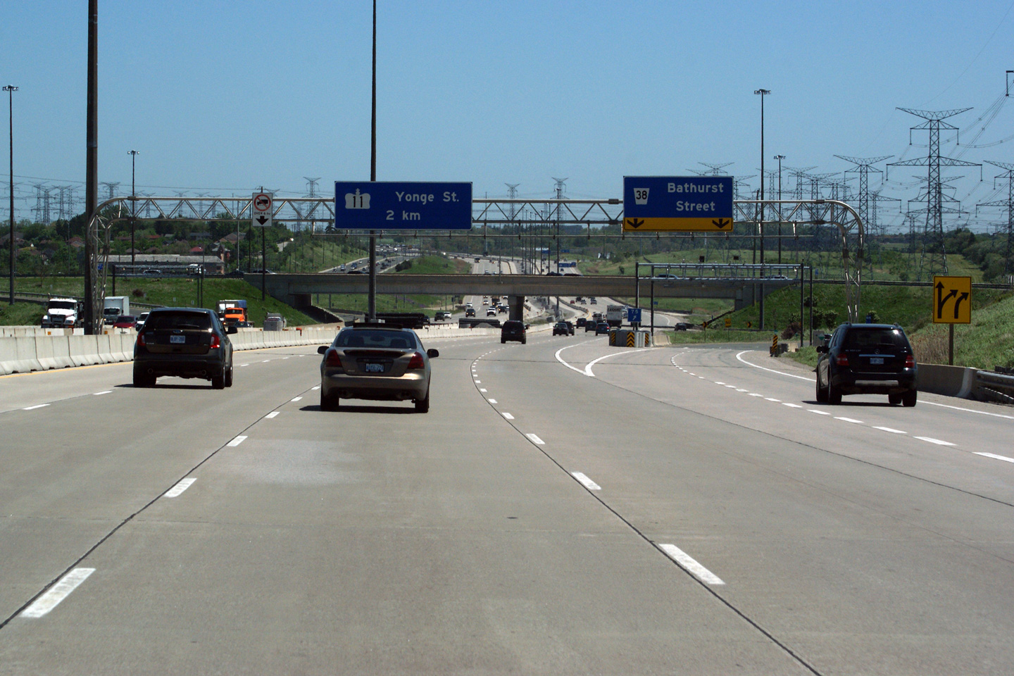
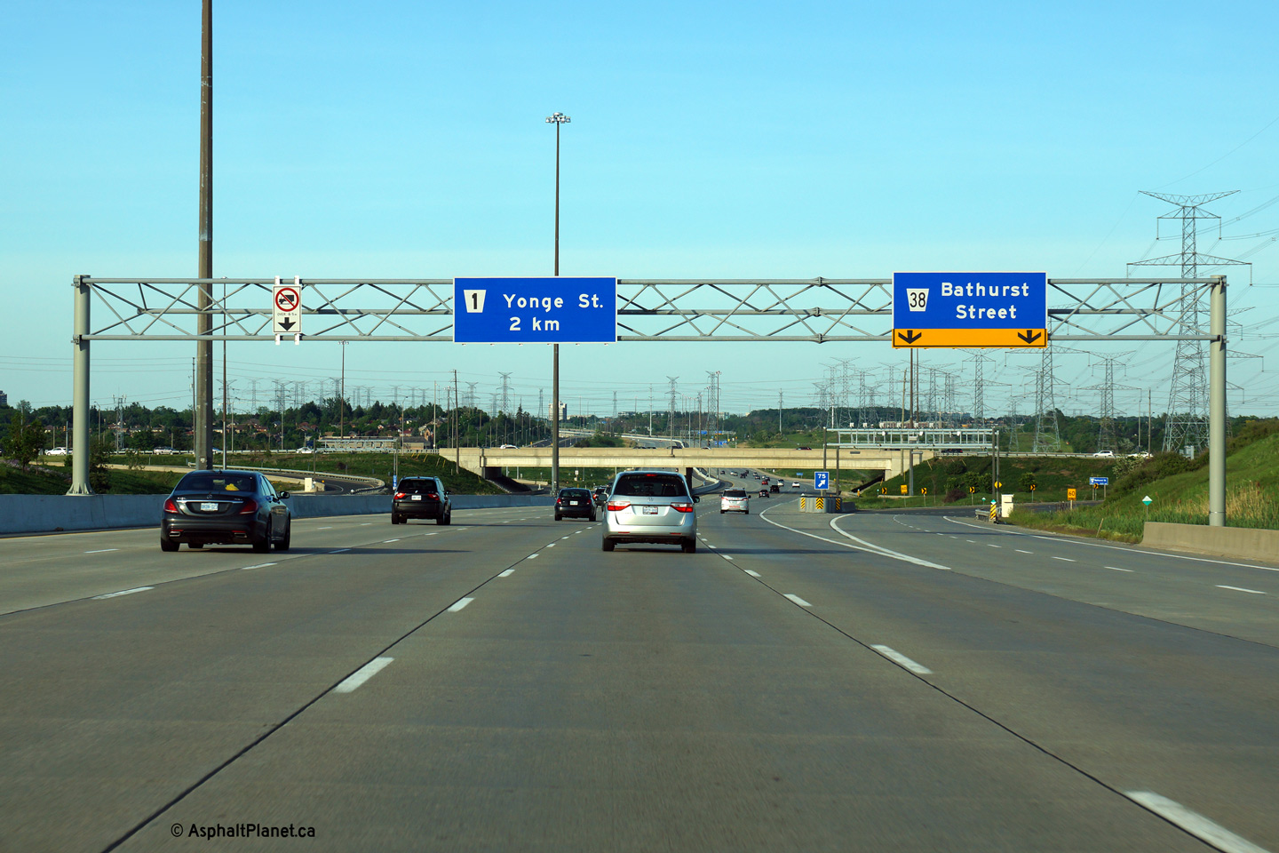
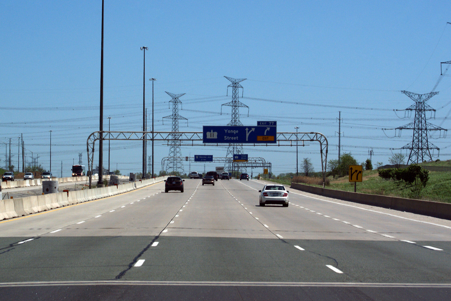
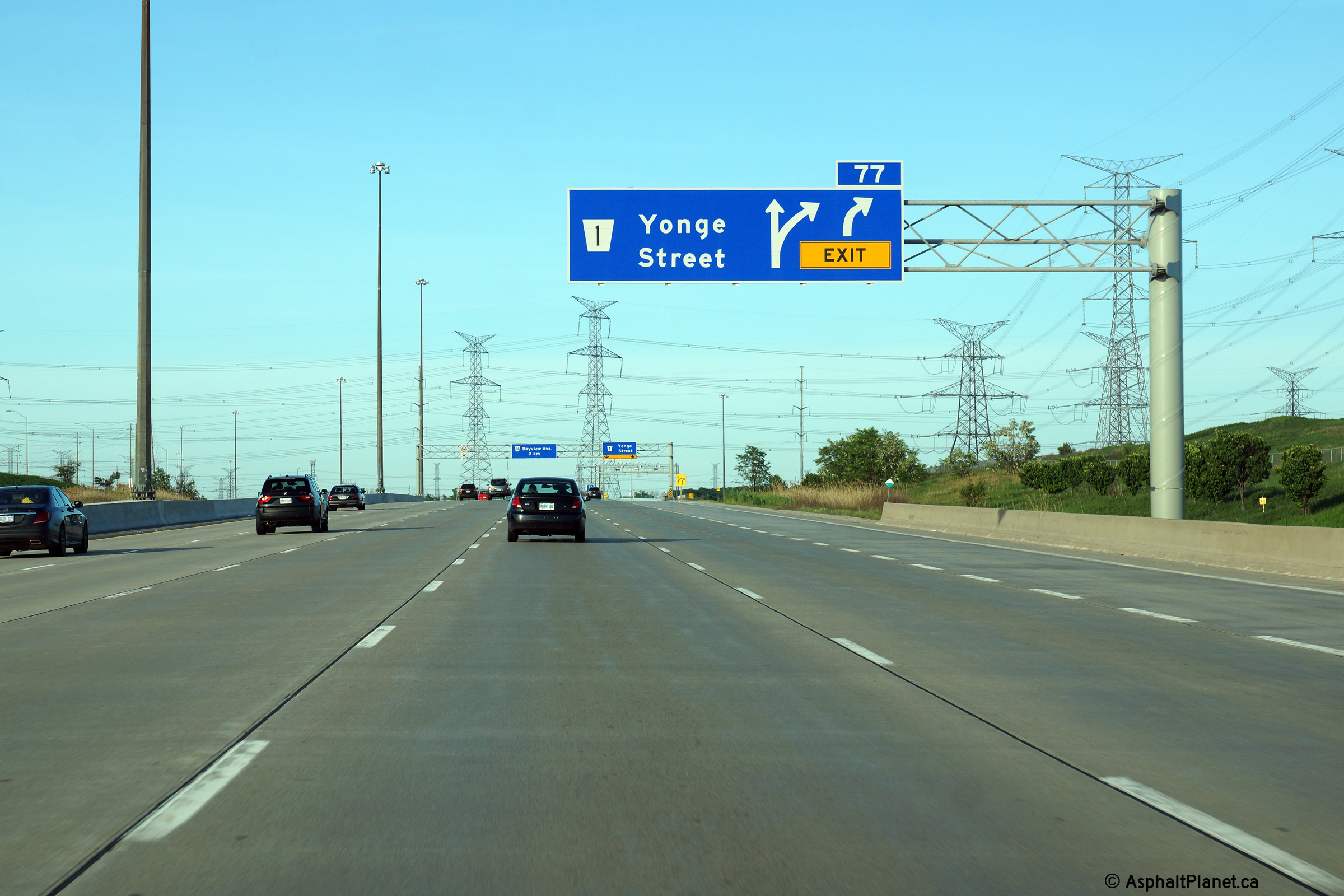
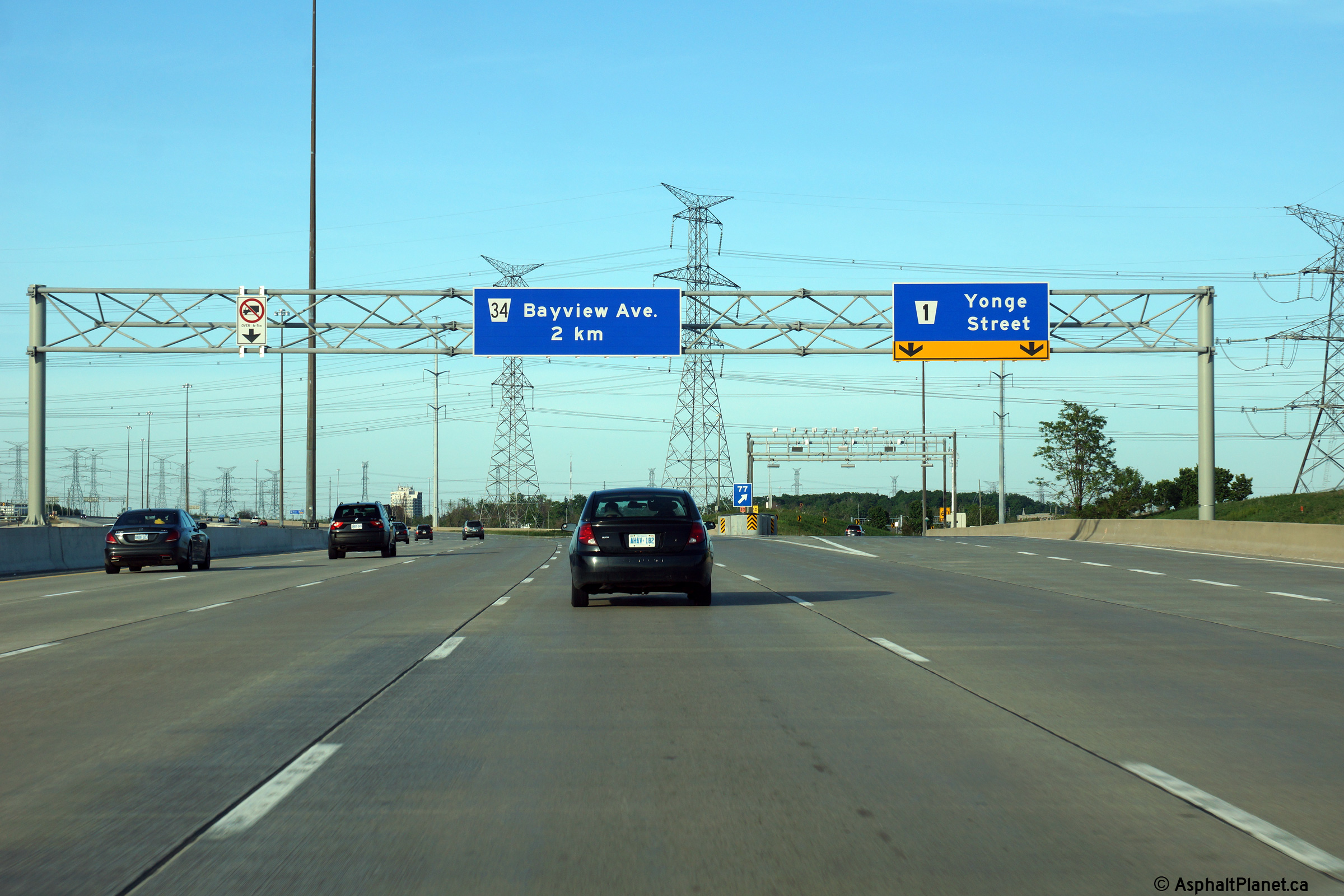
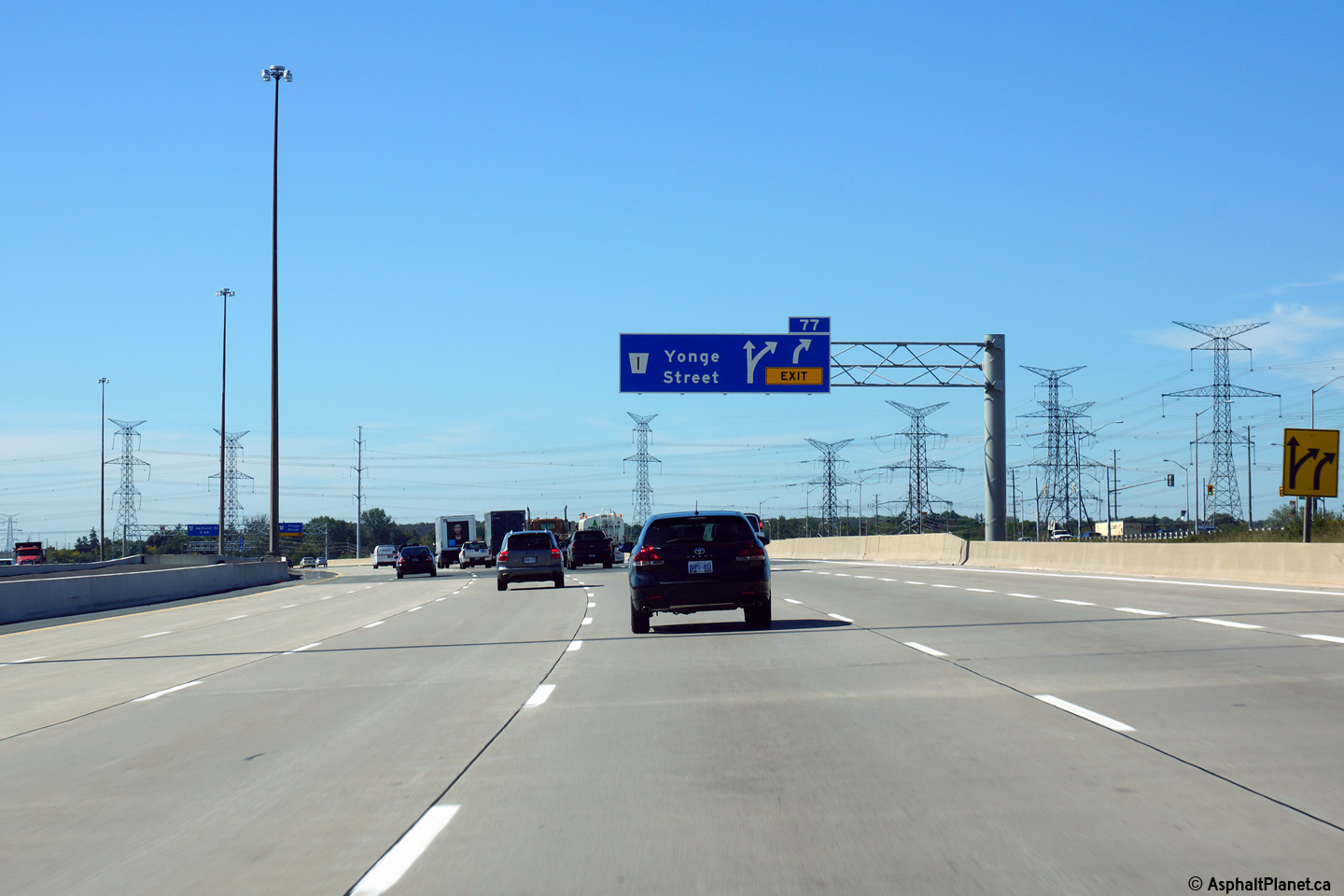
| City of Vaughan Regional Municipality of York |
Old and new incarnations of the eastbound advanced signage for the Yonge
Street interchange. The Highway 11 route markers were removed from the
signage during a project which saw all of the overhead signage replaced
between Highway's 400 and 404. Upper photo taken: June 1st, 2011. Lower photo taken: September 30th, 2012. |
 (720x480) (720x480)(1440x960) (2400x1600) |
||||
| City of Vaughan Regional Municipality of York |
Signage at the eastbound off-ramp to Yonge Street. All of the overhead
signage gantries (and associated signage) were replaced along Highway 407
between Highways 400 and 404 as part of a project to ready the central
median for a poured concrete tall wall barrier. Upper photo taken: June 1st, 2011. Lower photo taken: September 30th, 2012. |
 (720x480) (720x480)(1440x960) (2400x1600) |
||||
| Yonge Street is formerly the most famous stretch of Ontario's Highway 11. Click here for Highway 11 images | ||||||
| Town of Richmond Hill Regional Municipality of York |
Much like the eastbound photos, these photos are both the old and new signs
for Yonge Street along Highway 407. The signs for Yonge Street along
Highway 407 stood with Highway 11 crowns for more than a decade after Highway
11 was transferred to the Regional Municipality of York. In many ways
the transfer of (specifically) Highway 11 to the local municipality made
sense -- after all it is the local municipality who maintains the bulk of
the other arterial streets in York Region. It is, however, a shame
that some signage couldn`t have been erected in lieu of the Highway 11
moniker to remind motorists of the history that Yonge Street had in early
highway transportation. Upper photo taken: May 7th, 2011. Lower photo taken: September 25th, 2013. |
|
||||
| Town of Richmond Hill Regional Municipality of York |
Two views again of both vintage and current signage for Yonge Street in
Richmond Hill. Upper photo taken: May 7th, 2011. Lower photo taken: September 25th, 2013. |
|
||||
| Town of Richmond Hill Regional Municipality of York |
Eastbound signage in advance of the off-ramp to Bathurst Street.
Click here to see the former signage at this location, taken in June, 2011. Photo taken: June 7th, 2014. |
 (720x480) (720x480)(1440x960) (2400x1600) |
||||
| Town of Richmond Hill Regional Municipality of York |
Easterly view at the off-ramp to Keele Street. Click
here to see the former signage at this location, taken in June, 2011. Photo taken: June 7th, 2014. |
 (720x480) (720x480)(1440x960) (2400x1600) |
||||
| Town of Richmond Hill Regional Municipality of York |
These views looks west from Bayview Avenue. The 407 isn't particularly
inspired through Richmond Hill. Upper photo taken: August 28th, 2005. Middle photo taken: October 30th, 2011. Lower photo taken: August 6th, 2012. |
 (720x480) (1440x960) (2400x1600) |
||||
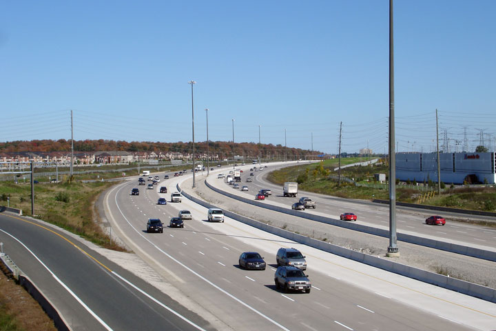
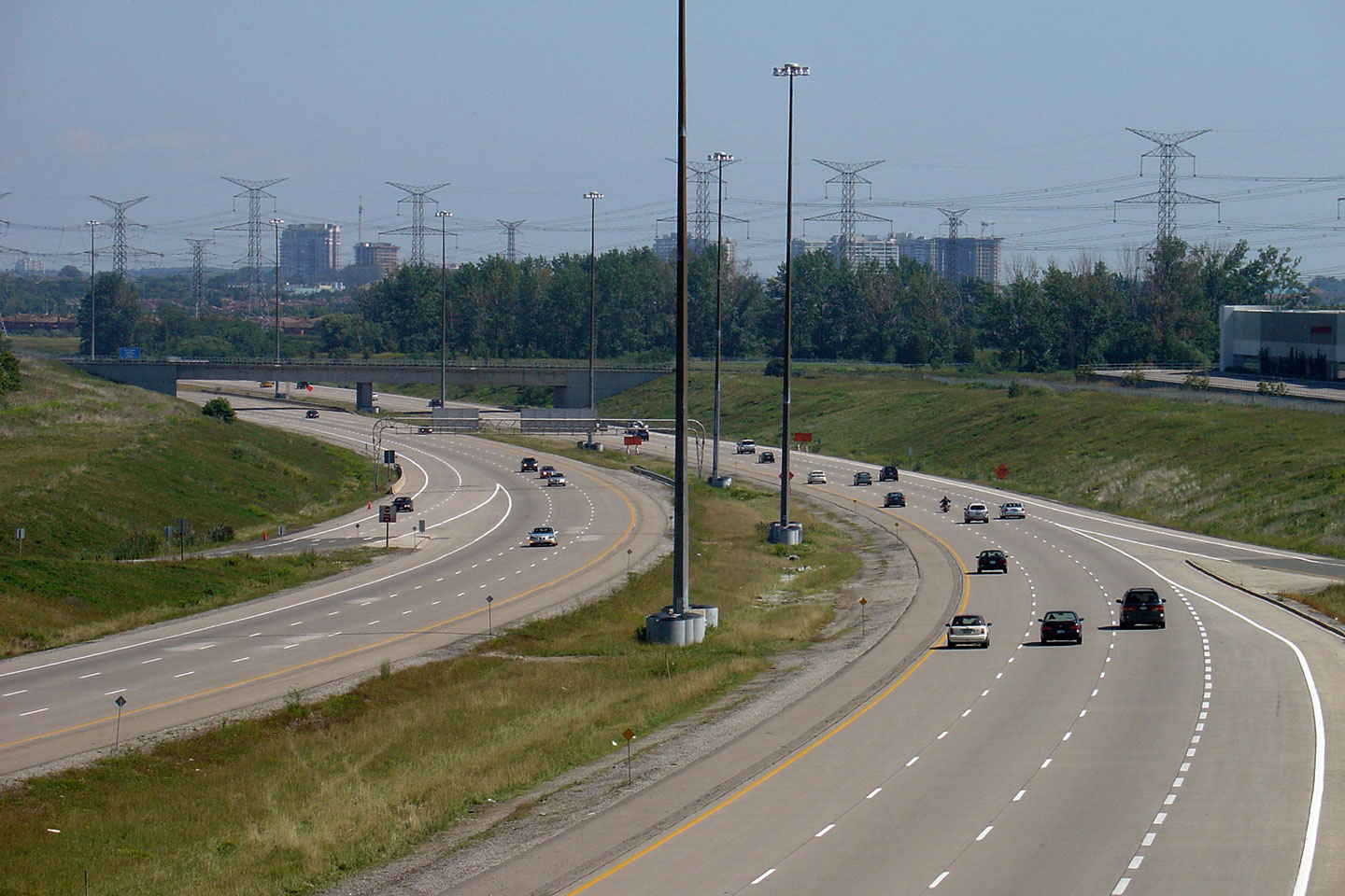
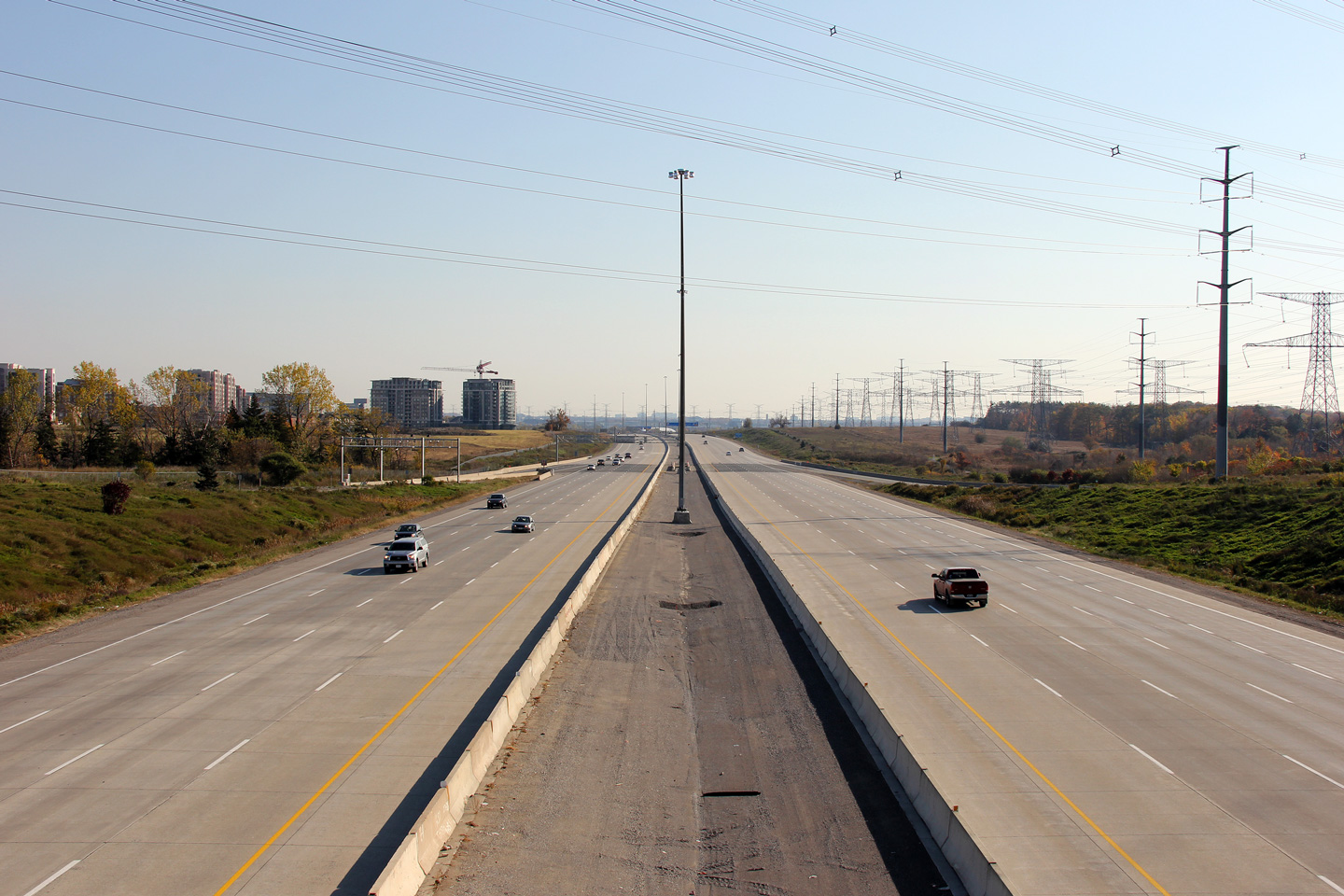
| City of Markham Regional Municipality of York |
View looking easterly from the Bayview Avenue interchange. The cluster
of midrise buildings to the left of the lower photo is the Beaver Creek
Business Park area that surrounds Highway 7 and Leslie Street. The
numerous midrise commercial buildings that line both Beaver Creek Road and
Commerce Valley Road have recently been offset by a range of new condominium
buildings to the west of Beaver Creek. Upper photo taken: August 28th, 2005. Middle photo taken: October 30th, 2011. Lower photo taken: August 6th, 2012. |
 (720x480) (1440x960) (2400x1600) |
||||
| City of Markham Regional Municipality of York |
Westerly view at the off-ramp to Bayview Avenue. Click
here to see the former signage at
this location, taken in June, 2011. Photo taken: August 19th, 2014. |
 (720x480) (720x480)(1440x960) (2400x1600) |
||||
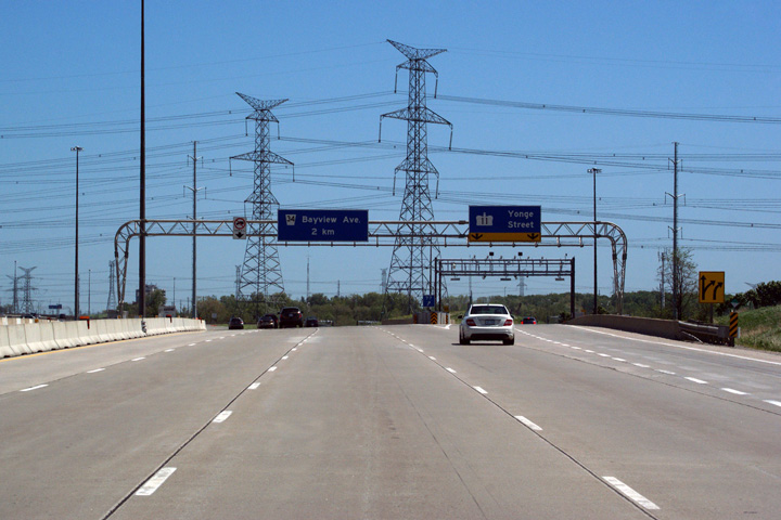
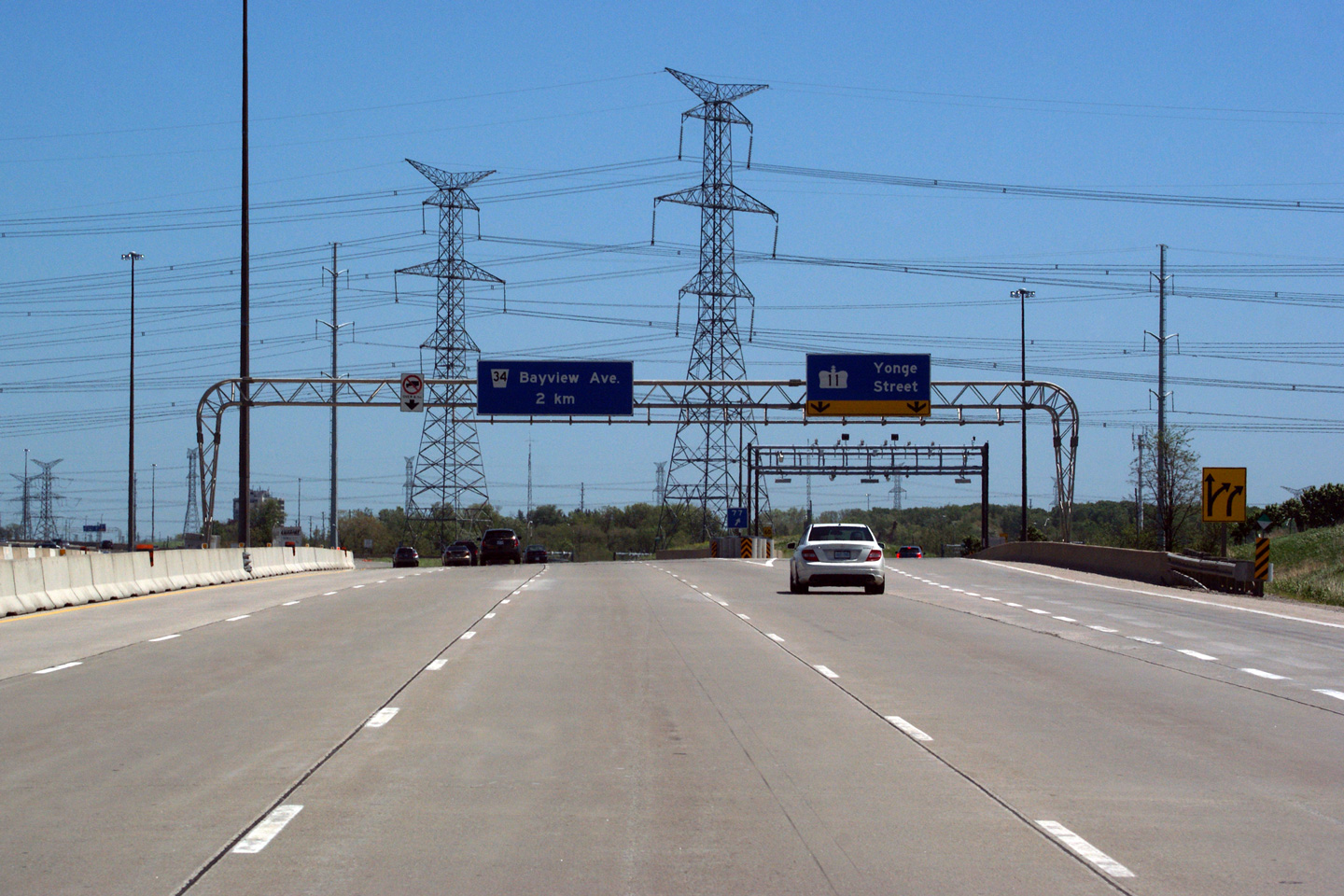
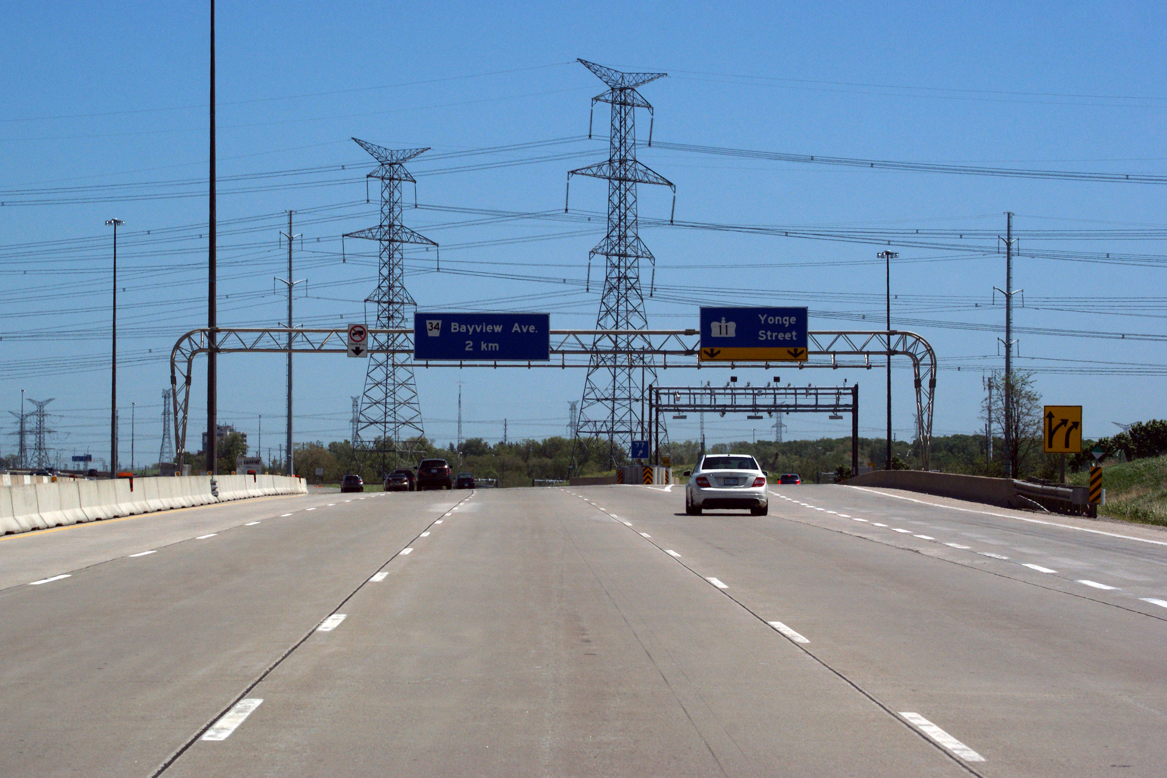
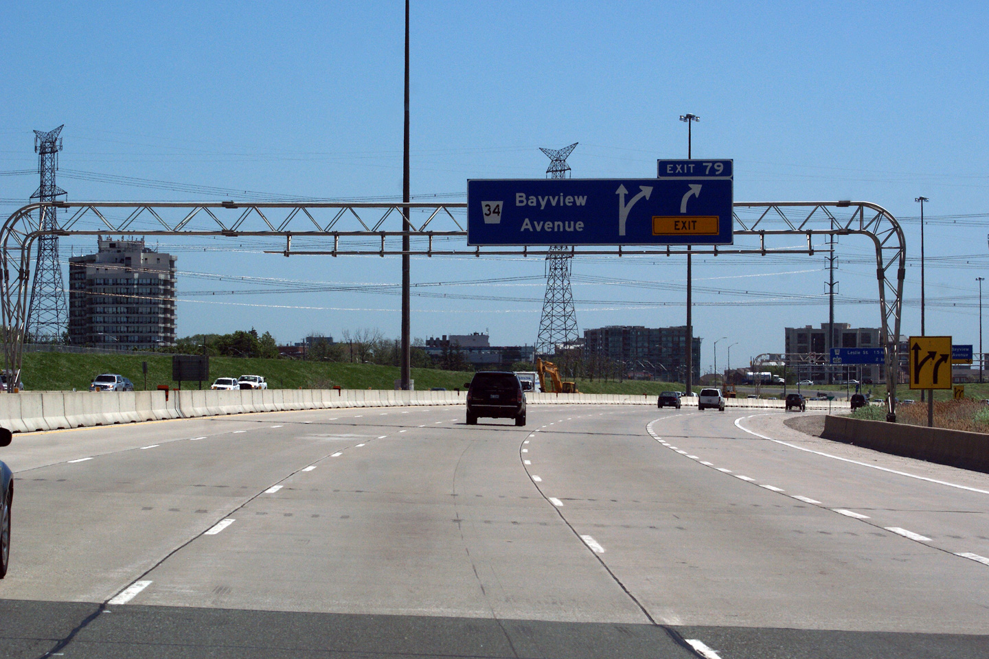
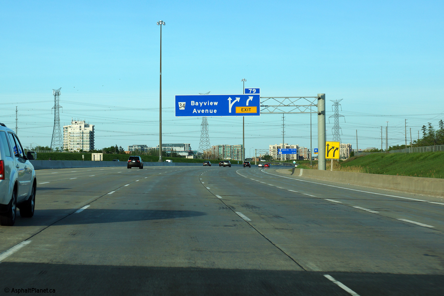
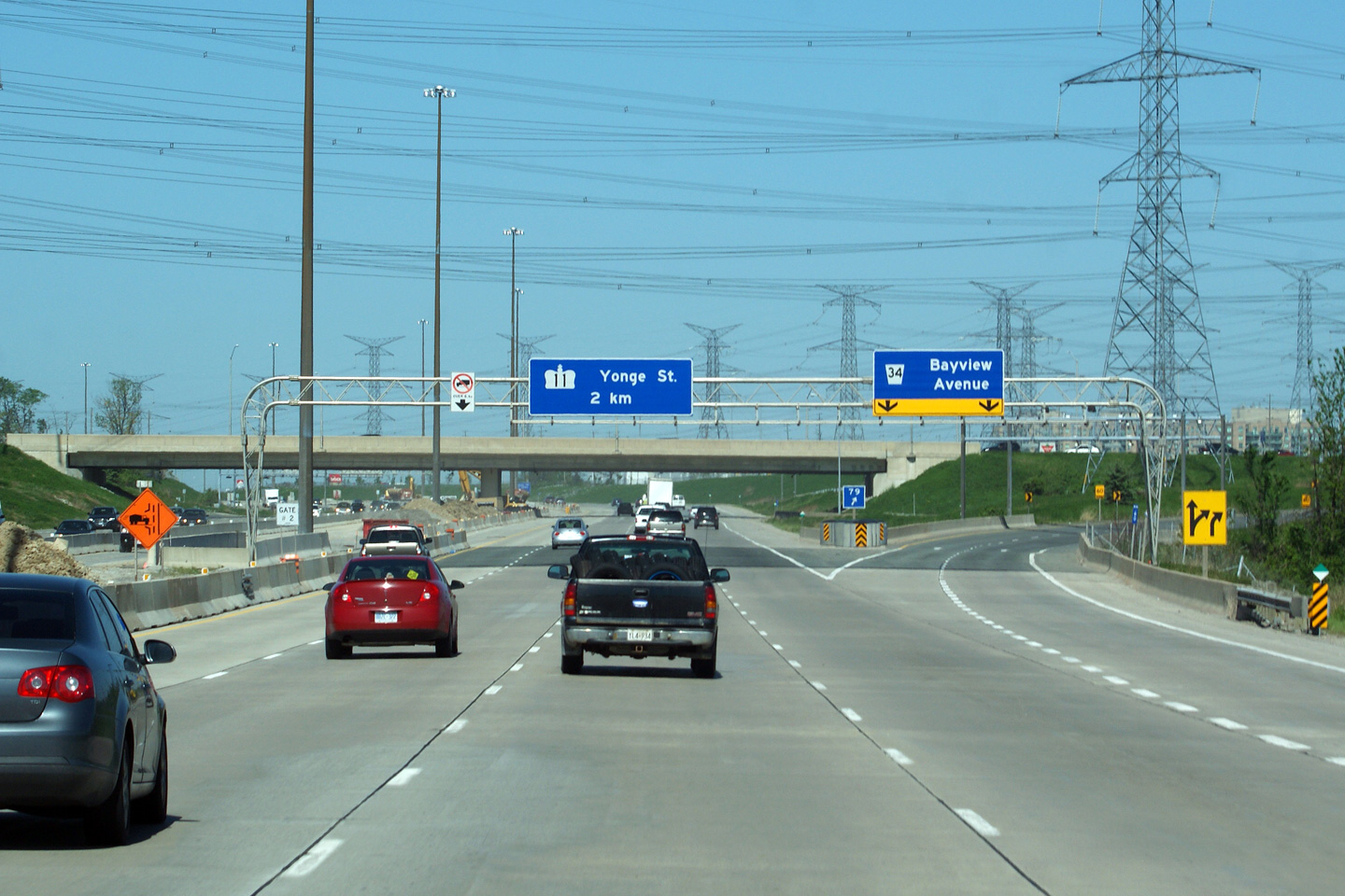
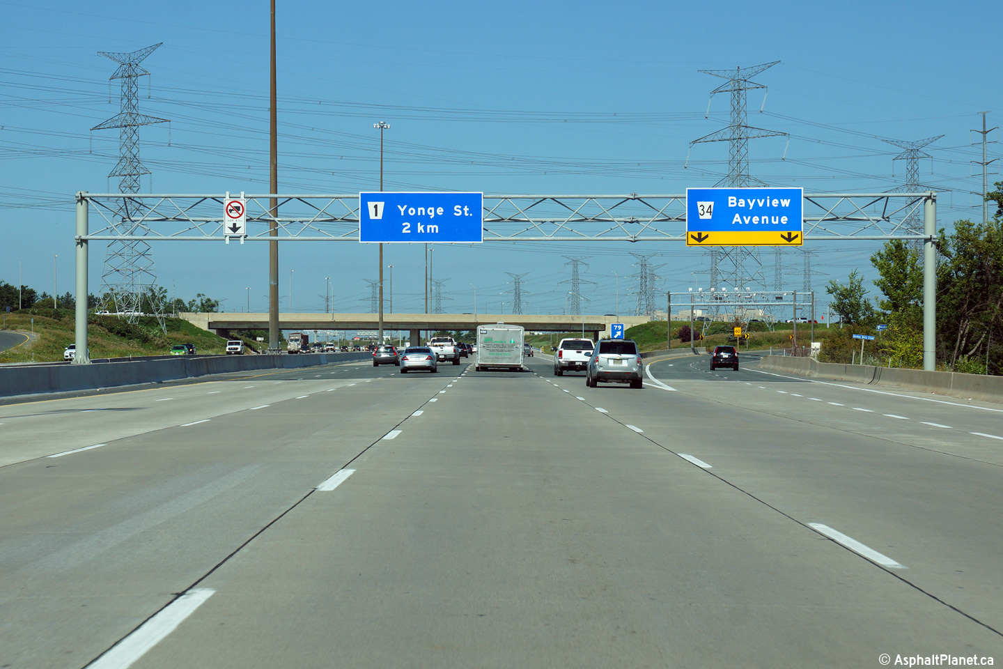
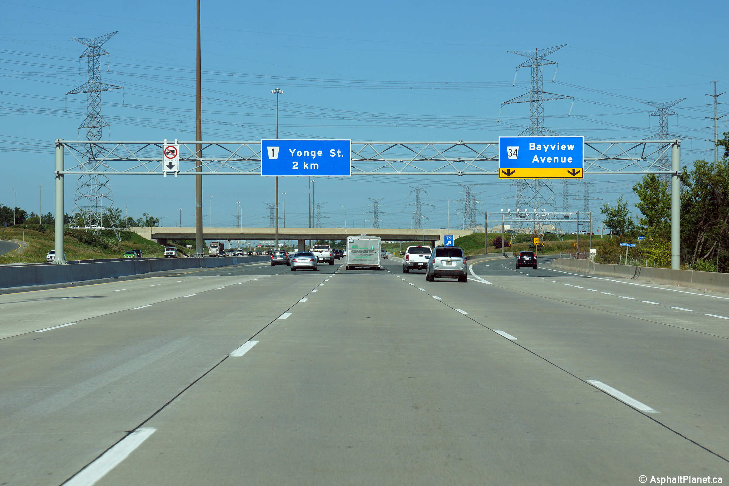
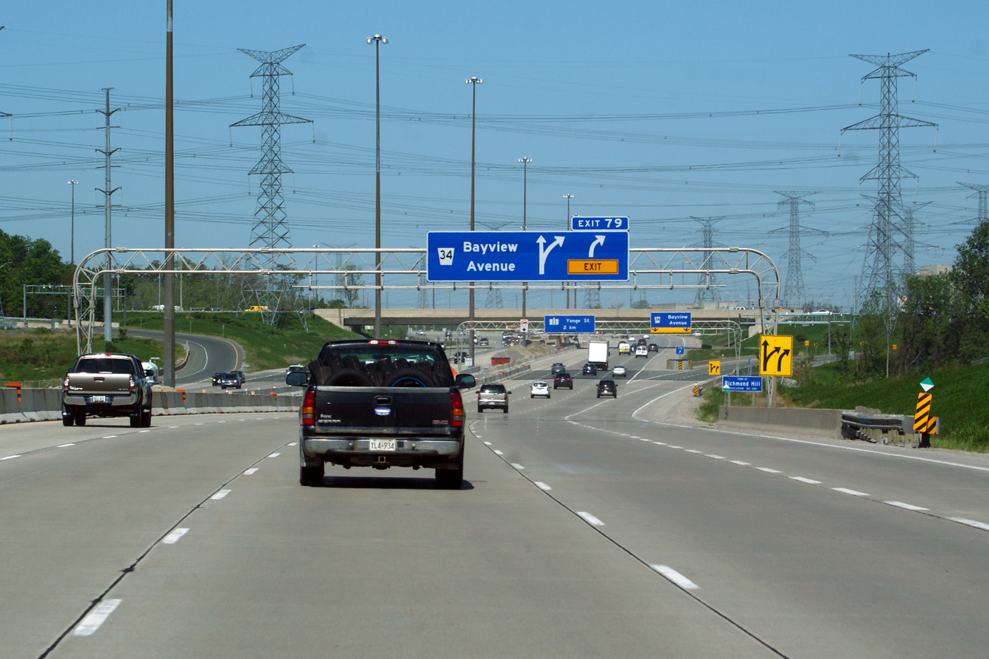
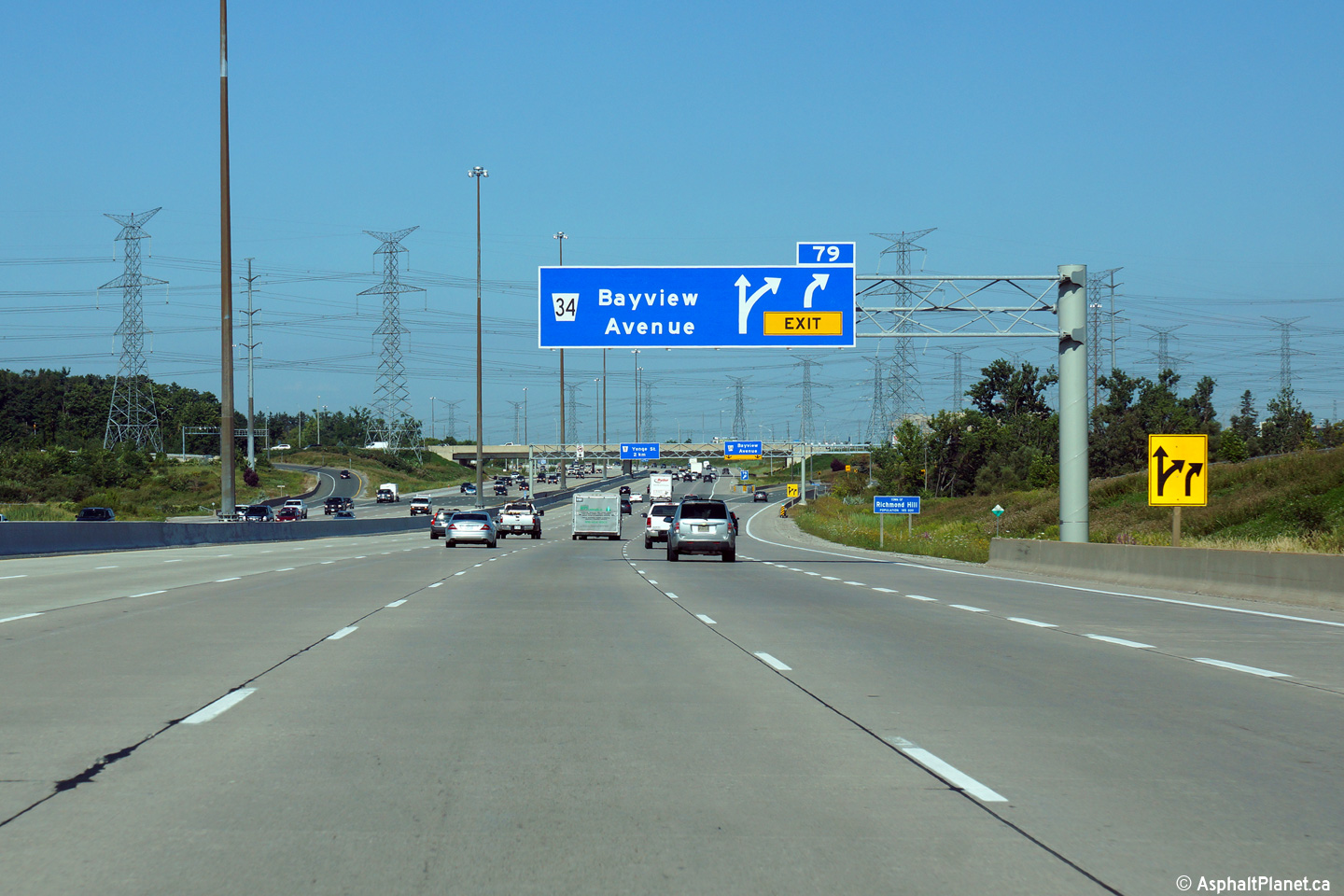
| City of Markham Regional Municipality of York |
Westbound advanced signage for the off-ramp to Bayview Avenue. The
sixth westbound lane that entered the 407 from the 404 interchange exits the
tollway at Bayview Avenue. Click
here to see the former signage
at this location, taken in June, 2011. Photo taken: August 19th, 2014. |
 (720x480) (720x480)(1440x960) (2400x1600) |
||||
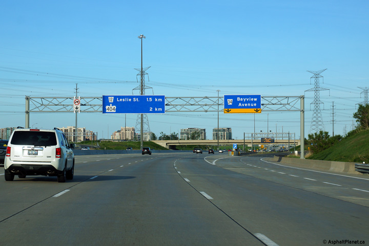
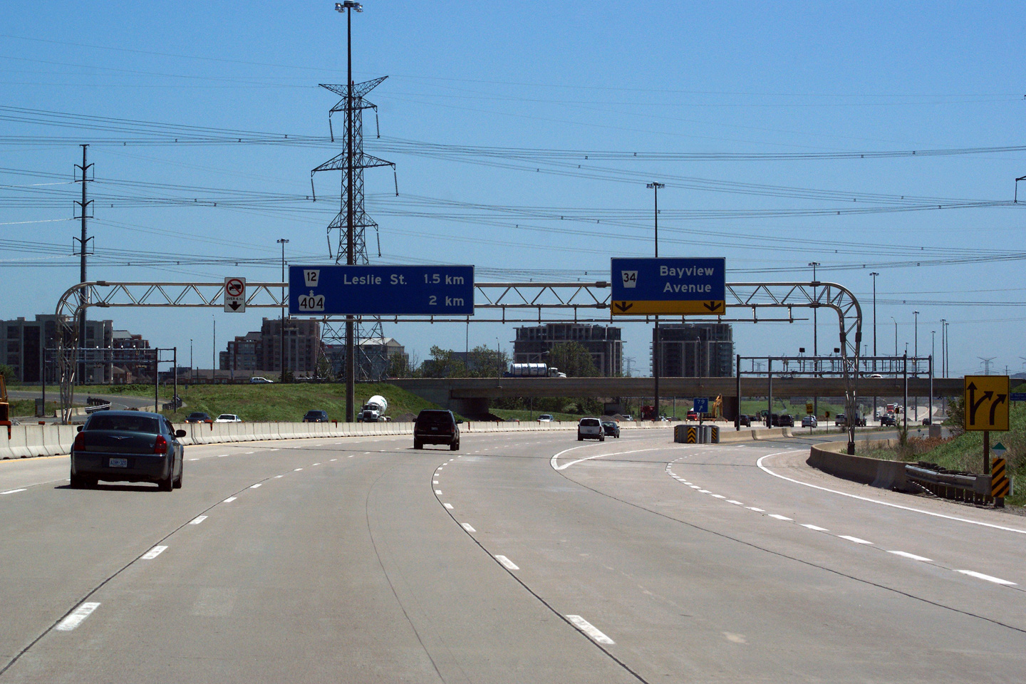
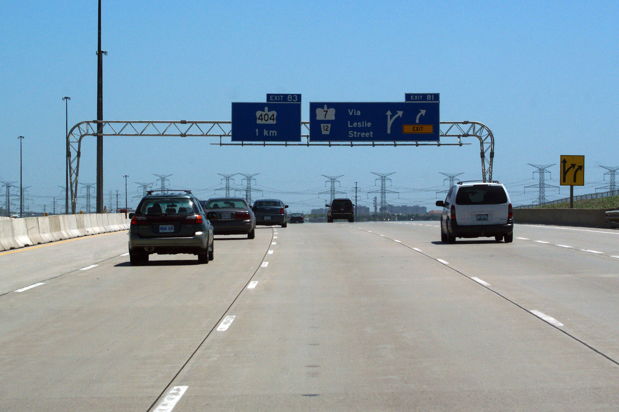
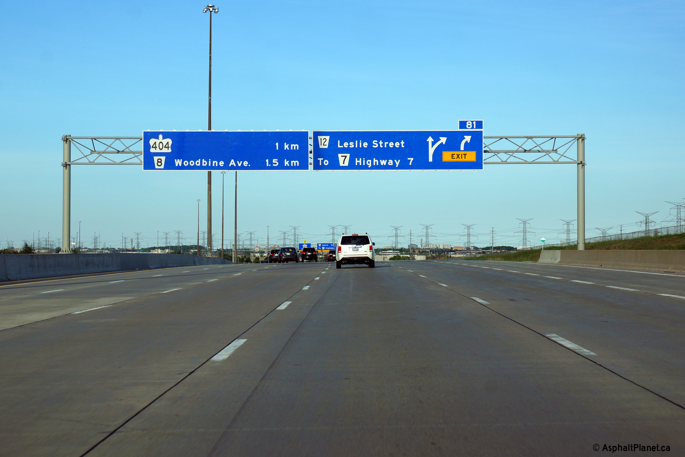
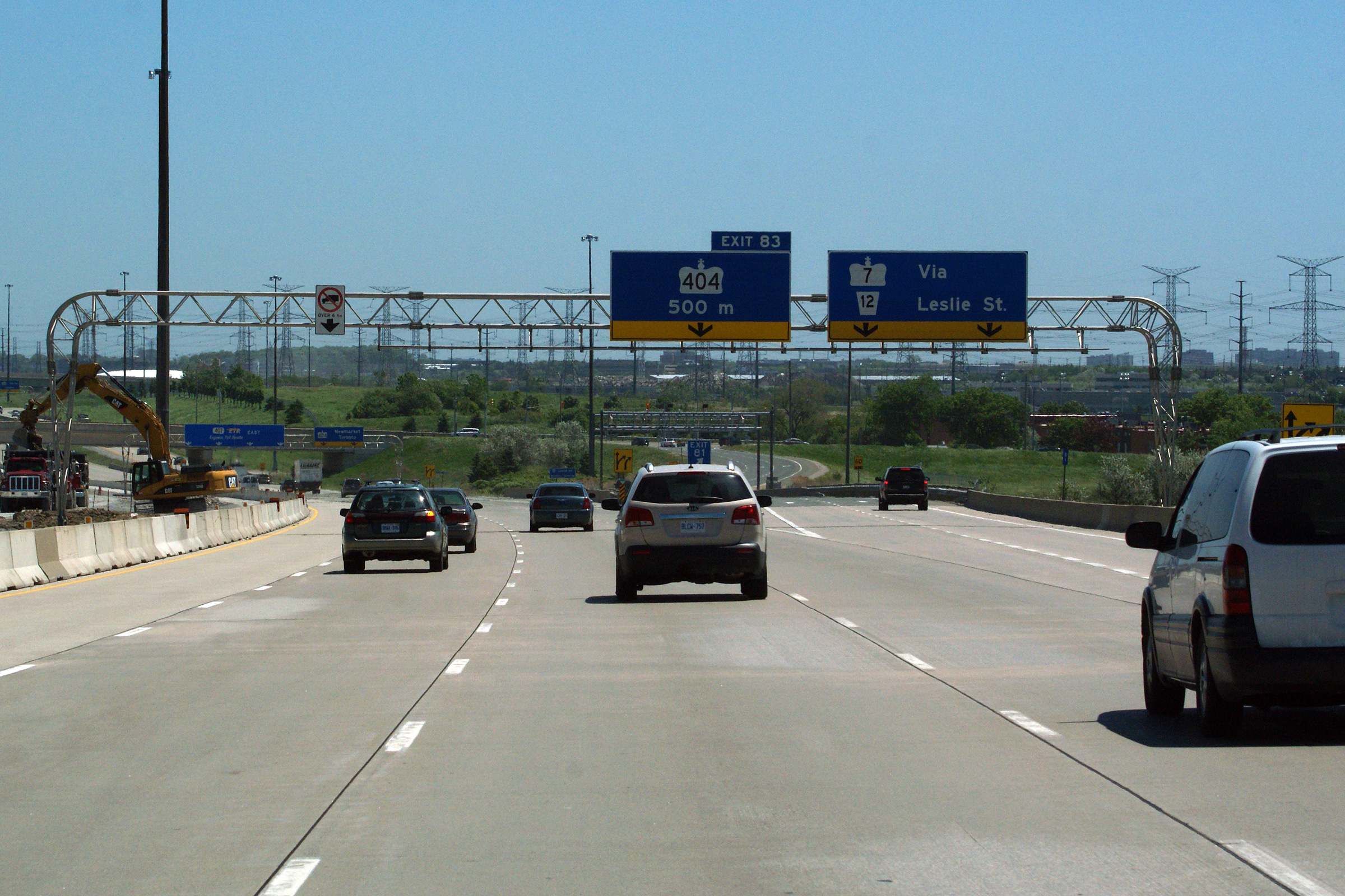
| City of Markham Regional Municipality of York |
Overhead advanced signage for the ramps to Leslie and Highway 404. Upper photo taken: June 1st, 2011. Lower photo taken: June 7th, 2014. |
 (720x480) (720x480)(1440x960) (2400x1600) |
||||
| City of Markham Regional Municipality of York |
Signage at the Leslie Street interchange. Leslie Street meets the 407
at westbound partial diamond interchange. Much like the Weston Road and
Highway 407 interchange. Upper photo taken: June 15th, 2007. Lower photo taken: September 3rd, 2012. |
 (720x480) (720x480)(1440x960) (2400x1600) |
||||
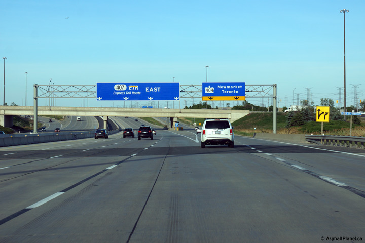
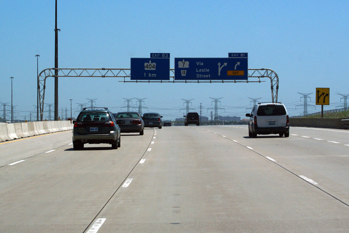
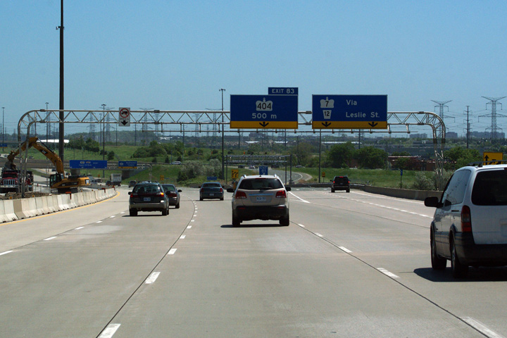
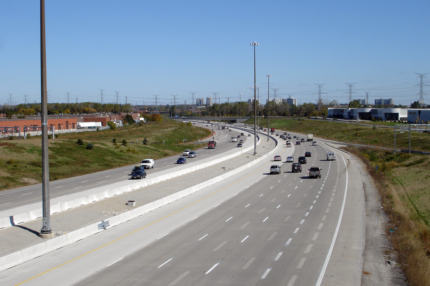
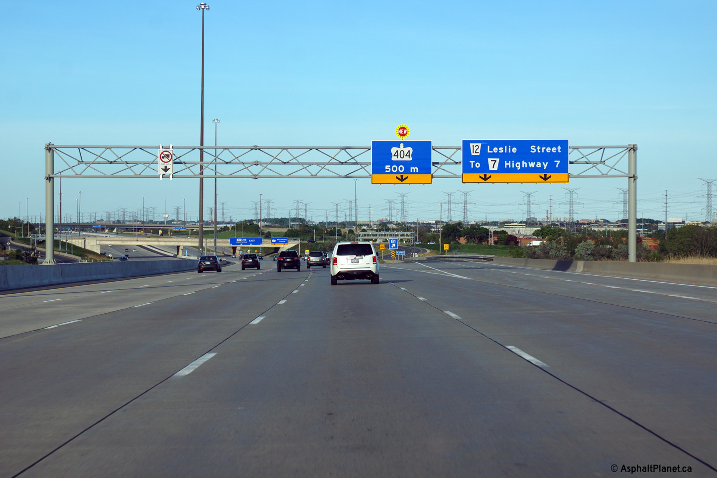
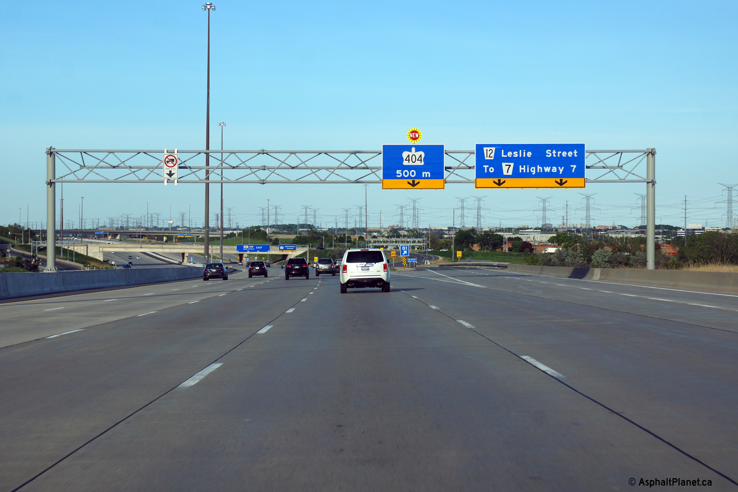
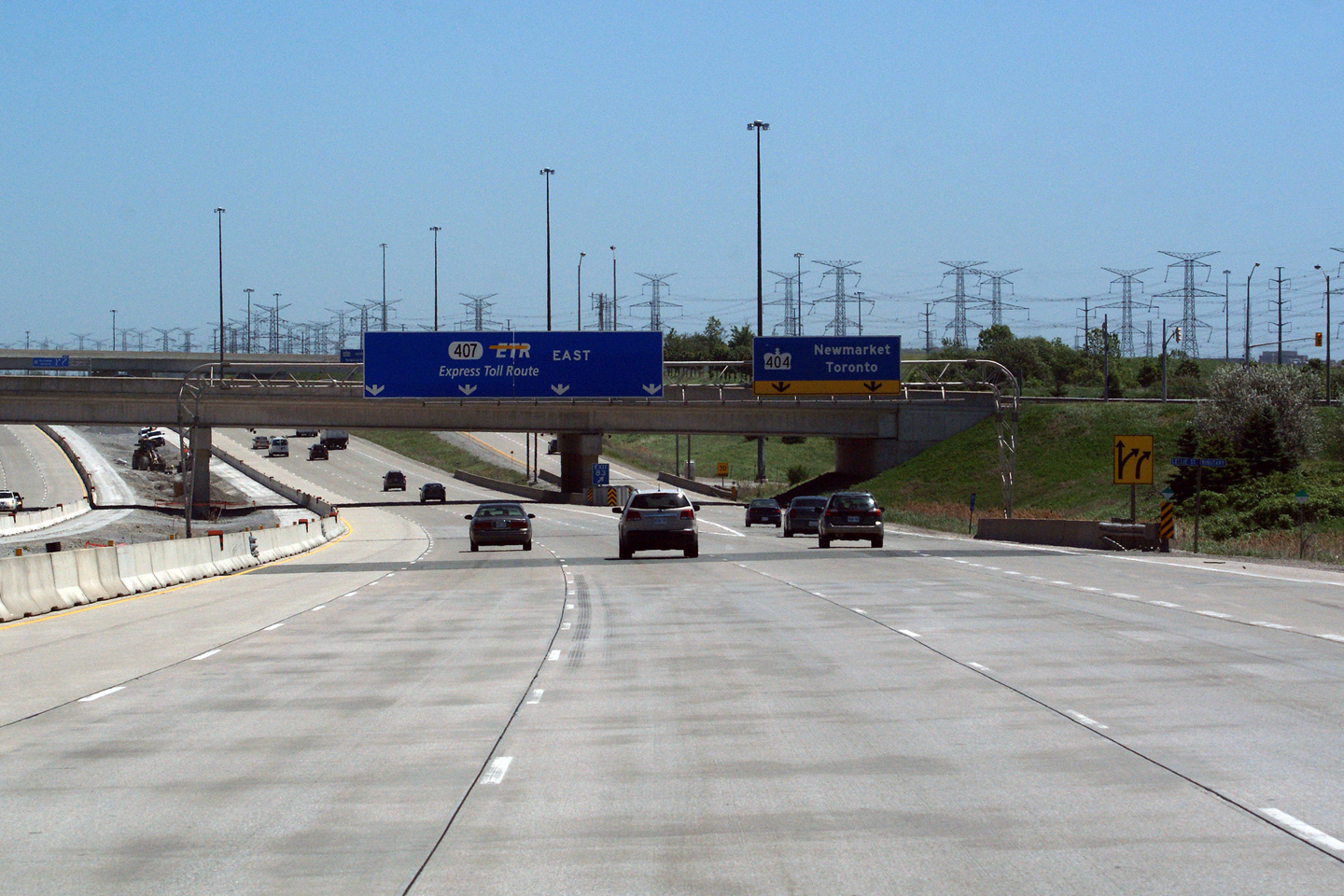
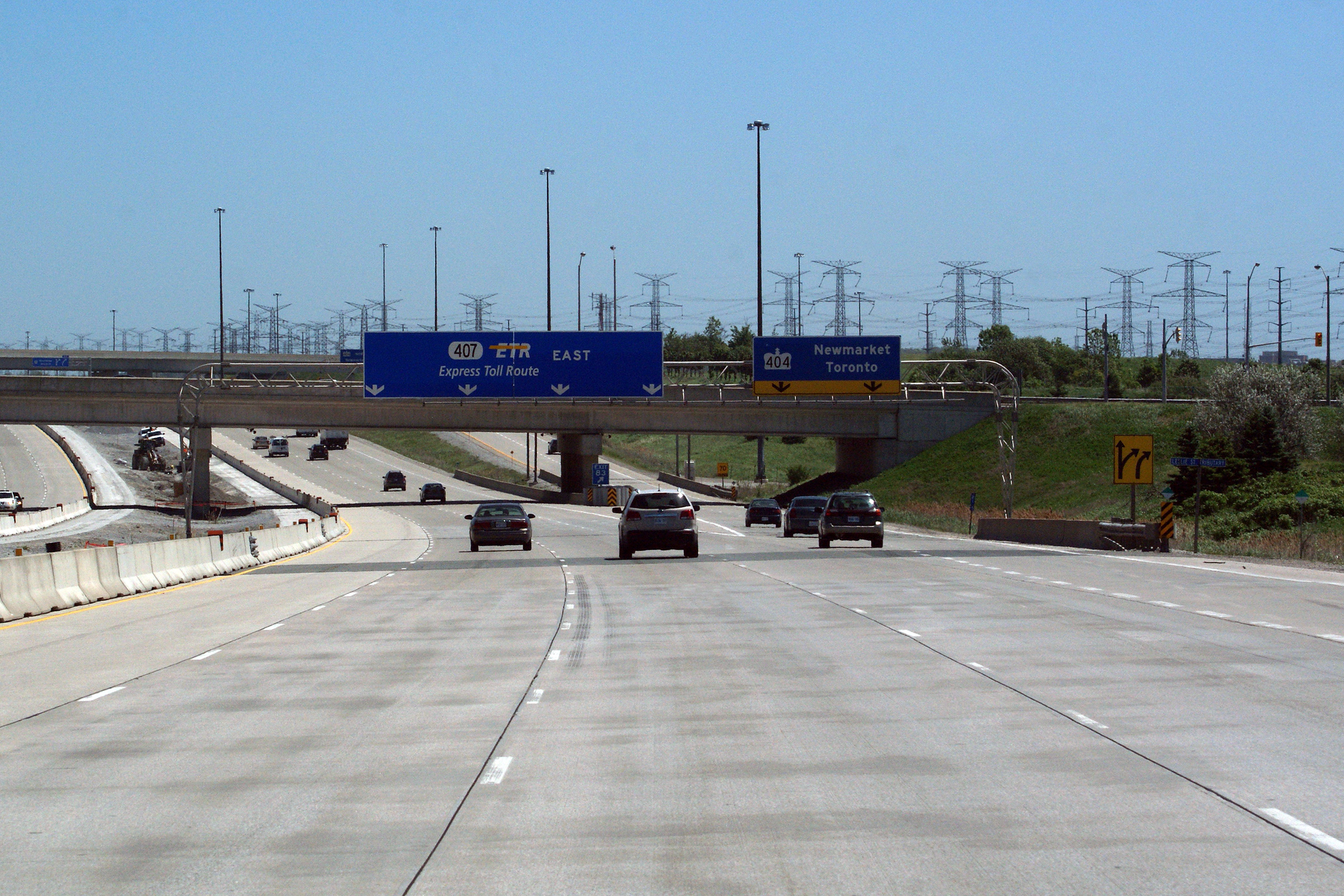
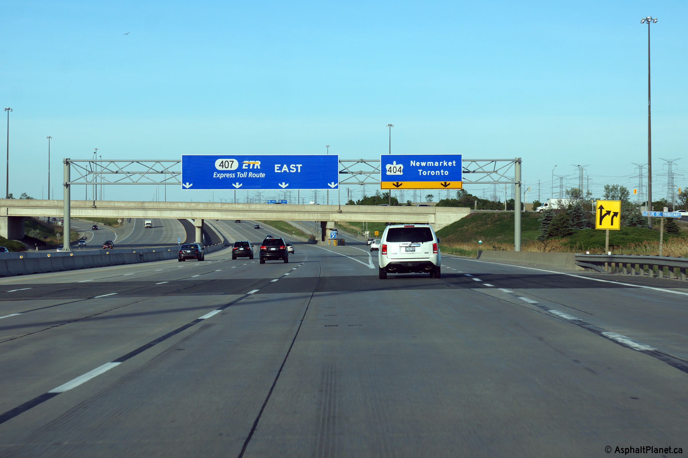
| City of Markham Regional Municipality of York |
The right most lane along Highway 407 exits at the Highway 404 interchange.
Click here for an additional view
taken from this location before Highway 407 was widened to eight lanes east
of Highway 404. Upper photo taken: June 1st, 2011. Lower photo taken: June 7th, 2014. |
 (720x480) (720x480)(1440x960) (2400x1600) |
||||
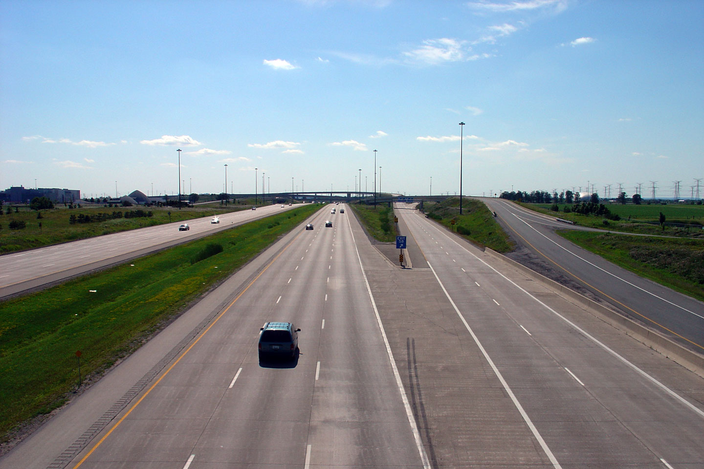
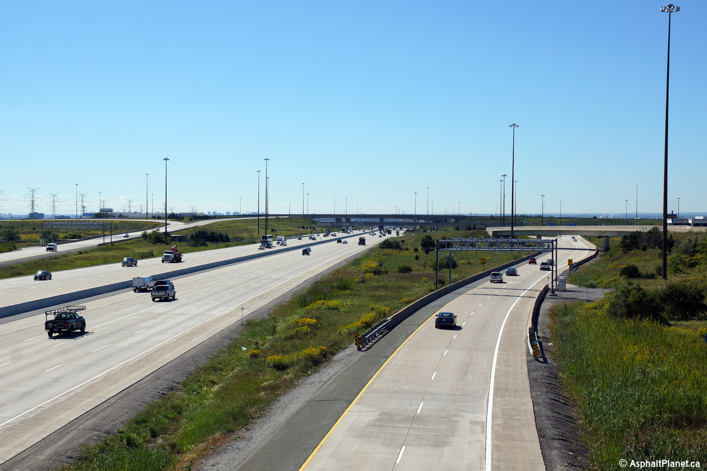
| City of Markham Regional Municipality of York |
Westerly view from Leslie Street along the 407. Upper photo taken: July 25th, 2004. Middle photo taken: October 30th, 2011. Lower photo taken: August 6th, 2012. |
 (720x480) (1440x960) (2400x1600) |
||||
| City of Markham Regional Municipality of York |
Two views looking east towards the Highway 404 interchange from Leslie Street.
Notice the black line paint that has supplements the lane delineation
stripes. Two unique applications of black paint were tried along
Highway 407 as a method of improving striping contrast during the early
2000s. Upper photo taken: July 25th, 2004. Middle photo taken: October 30th, 2011. Lower photo taken: August 6th, 2012. |
 (720x480) (1440x960) (2400x1600) |
||||
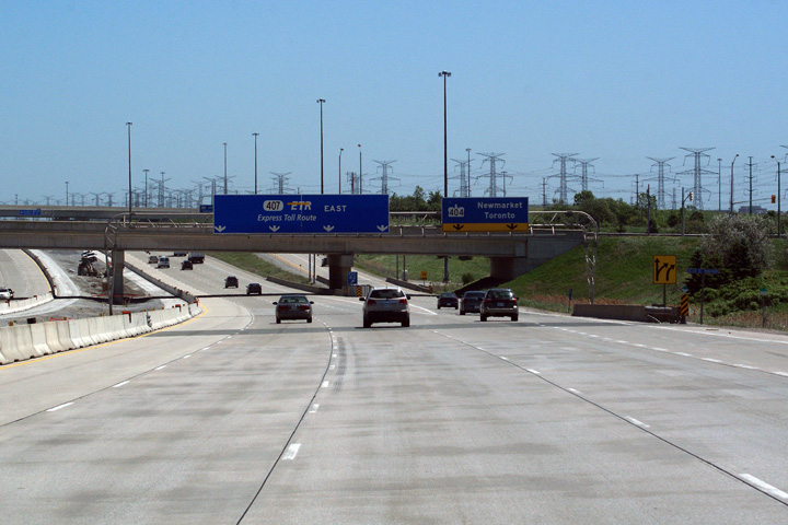
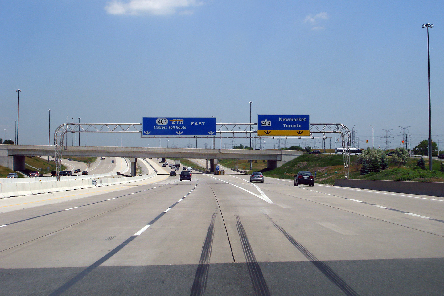
| Highway 404 is a short commuter road linking Toronto to Newmarket. Click here for Highway 404 images | ||||||
| Click here for more Highway 407 images |
<- Page 2 Images Highway 407 Images Index Page 4 Images ->
<- Highway 406 Images Back to Highway 407 Highway 409 Images ->
Copyright (c) 2004-2015, AsphaltPlanet.ca scott@asphaltplanet.ca/a>


