AsphaltPlanet.ca > OntHighways > Highway 7 > Images > Page 1C
King's Highway 7 - Images
<- Page 1B Page 1C - Stratford to Kitchener Page 1D - >
Photos shown in this table are arranged from West to East:
| Proper Municipality Name | Photo Description | Photo | ||
|
Pictures taken from driver's perspective appear offset from centre-line pictures: |
East- Bound |
West- Bound |
||
| Elginfield to Stratford Images available here | ||||
| West of Stratford, Highway 8 continues bound for Mitchell and eventually Goderich. Click here for Highway 8-West Images. | ||||
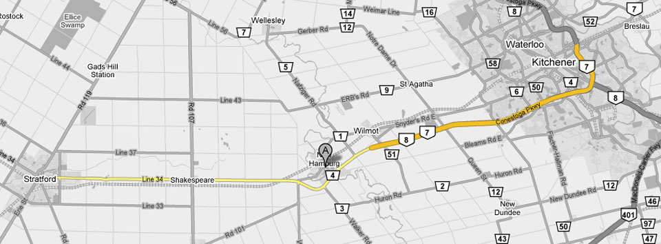
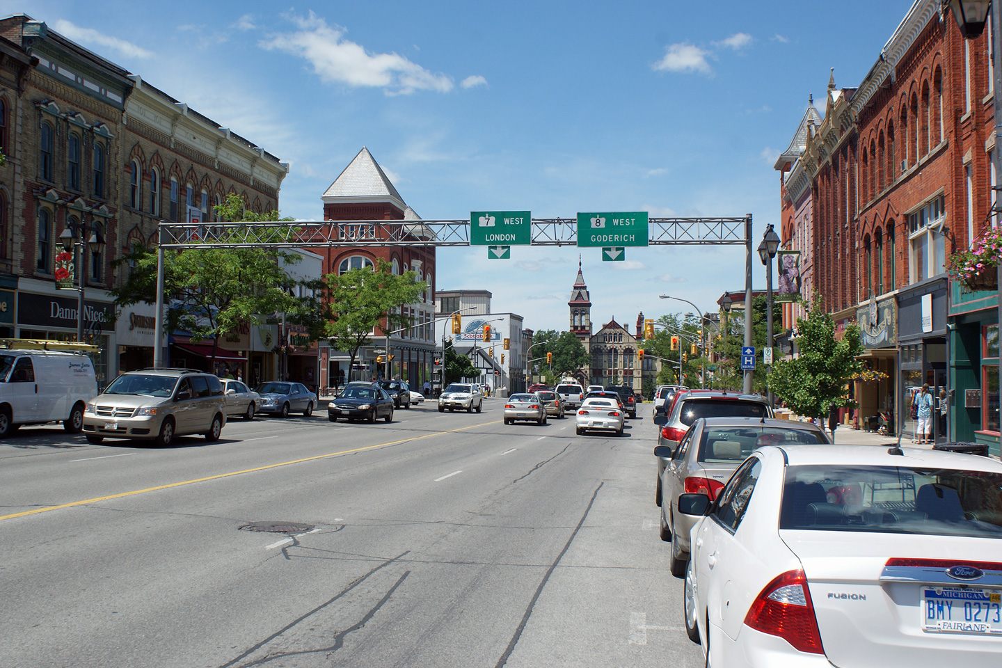
| City of Stratford | View looking
westerly along Highway 7/8 through Downtown Stratford. Photo taken: June 8th, 2010. |
 (720x480) (1440x960) (2400x1600) |
||
| Waterloo Street in Stratford carried the Highway 19 designation until 1998. Click here for Highway 19-North Images. | ||||
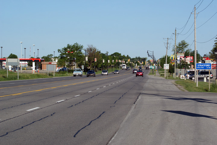
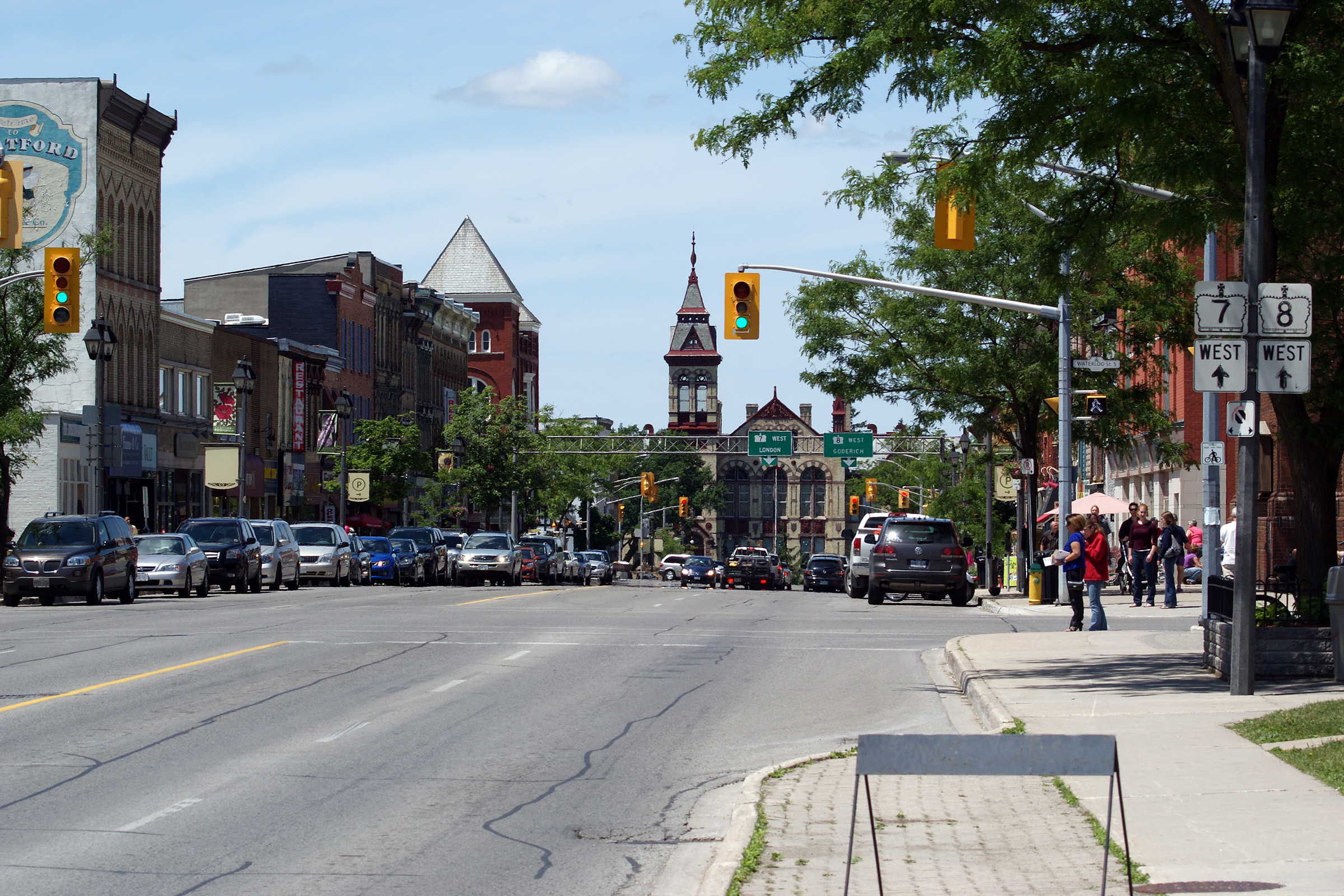
| City of Stratford | View looking westerly along
Highway 7/8 approaching Downtown Stratford. Before Highway 19 was
transferred to local municipalities, Highway 19 continued north from this
traffic light towards Tralee. Photo taken: June 8th, 2010. |
 (720x480) (1440x960) (2400x1600) |
||
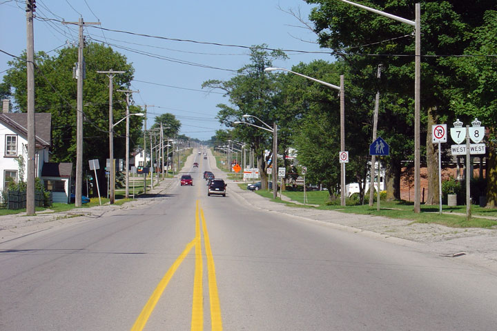
|
Township of Perth East County of Perth |
View looking westerly into
Stratford from the eastern city limits. Photo taken: June 8th, 2010. |
 (720x480) (1440x960) (2400x1600) |
||
|
Township of Perth East County of Perth |
Looking east from the east
limits of Stratford. Photo taken: June 10th, 2005. |
 |
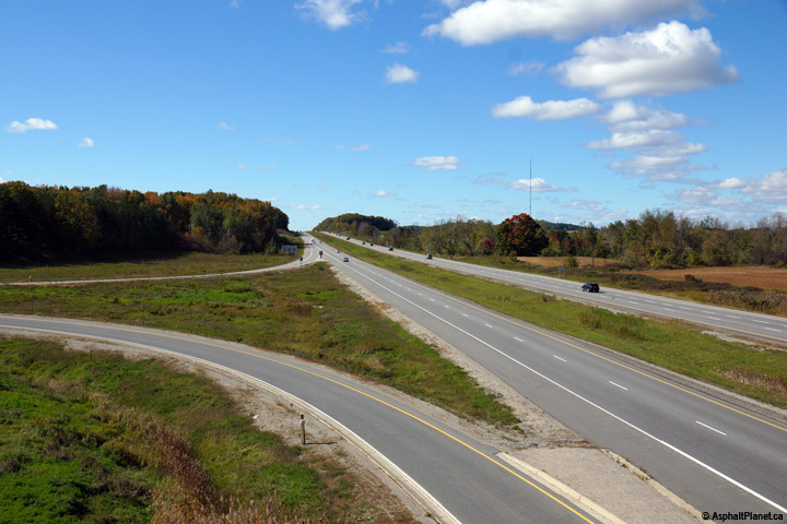
||
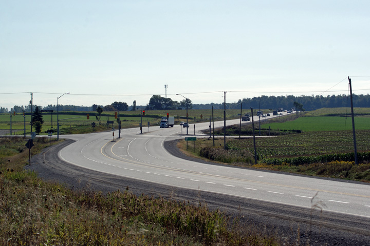
|
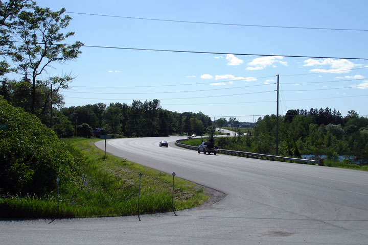
Township of Perth East County of Perth |
Highway 7/8 curves around a
small lake to create this very pleasant scene. Photo taken: June 10th, 2005. |
 |
||
|
Township of Perth East County of Perth |
View looking
west from Highway 59 in Shakespear. Photo taken: August 1st, 2004 |
 |
||
|
Township of Perth East County of Perth |
Easterly view
from Highway 59 along Highway 7/8. Photo taken: August 1st, 2004. |
 |
||
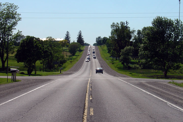
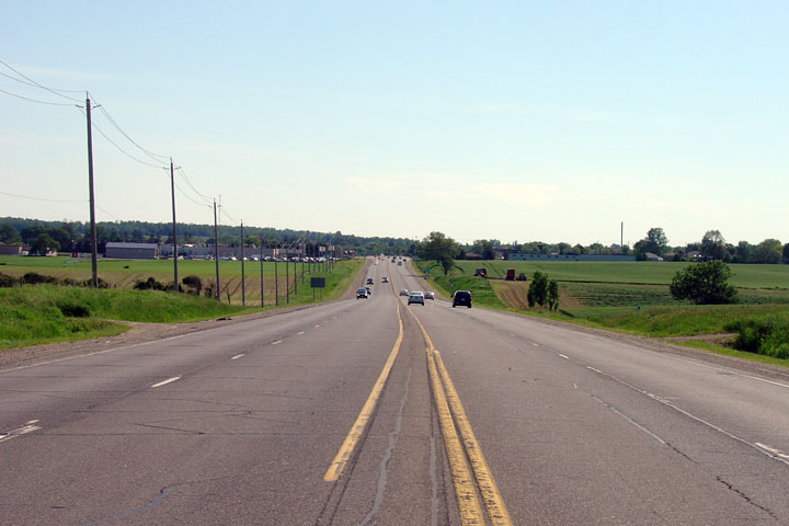
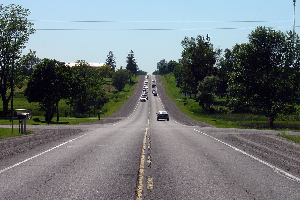
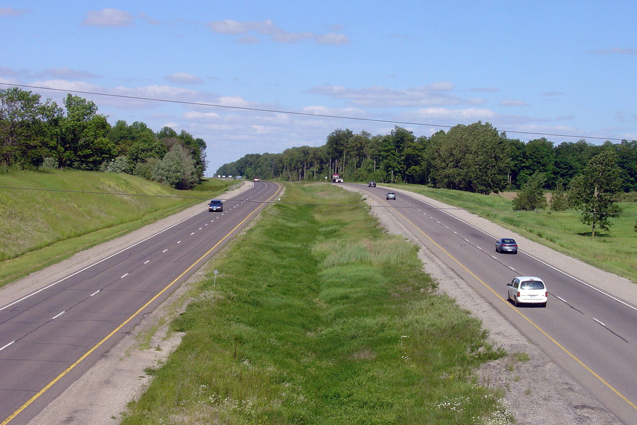
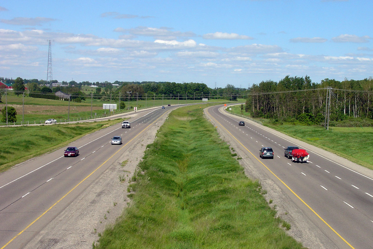
|
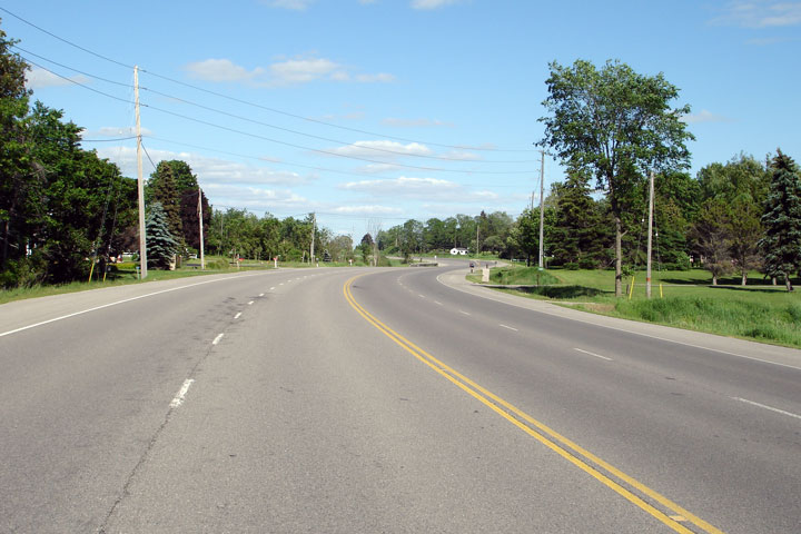
Township of Perth East County of Perth |
The drive from New Hamburg to
Stratford is very pleasant, despite the long lines of traffic that drivers
inevitably encounter. Photo taken: June 10th, 2005. |
 |
||
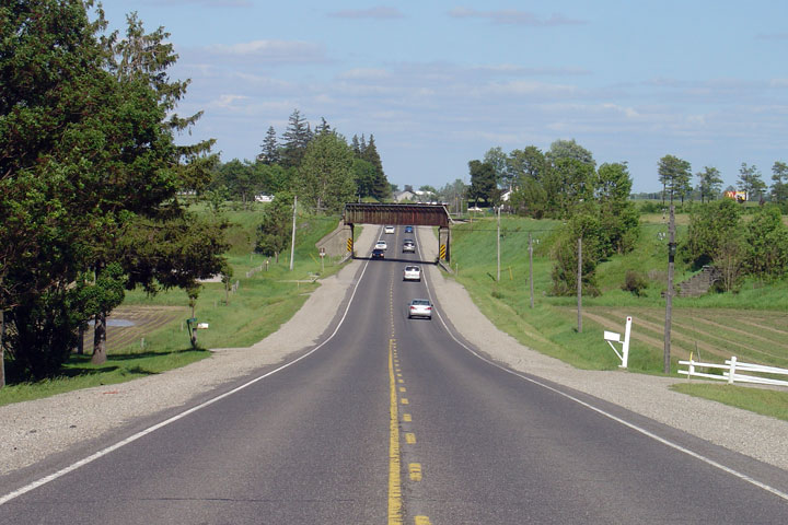
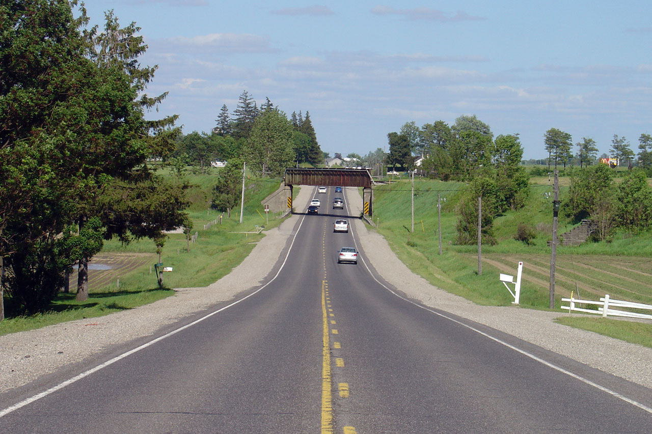
|
Township of Perth East County of Perth |
View of the New Hamburg CPR
overhead -- looking east. Photo taken: June 10th, 2005. |
 |
||
|
Township of Perth East County of Perth |
Westerly view along Highway 7/8
from the New Hamburg Overhead. Photo taken: September 17th, 2009. |
 (720x480) (1440x960) (2400x1600) |
||
|
Township of Perth East County of Perth |
View looking easterly from the
New Hamburg Overhead. Highway 7/8 widens to a four-lane cross section
just beyond the pictured curve. Photo taken: September 17th, 2009. |
 (720x480) (1440x960) (2400x1600) |
||
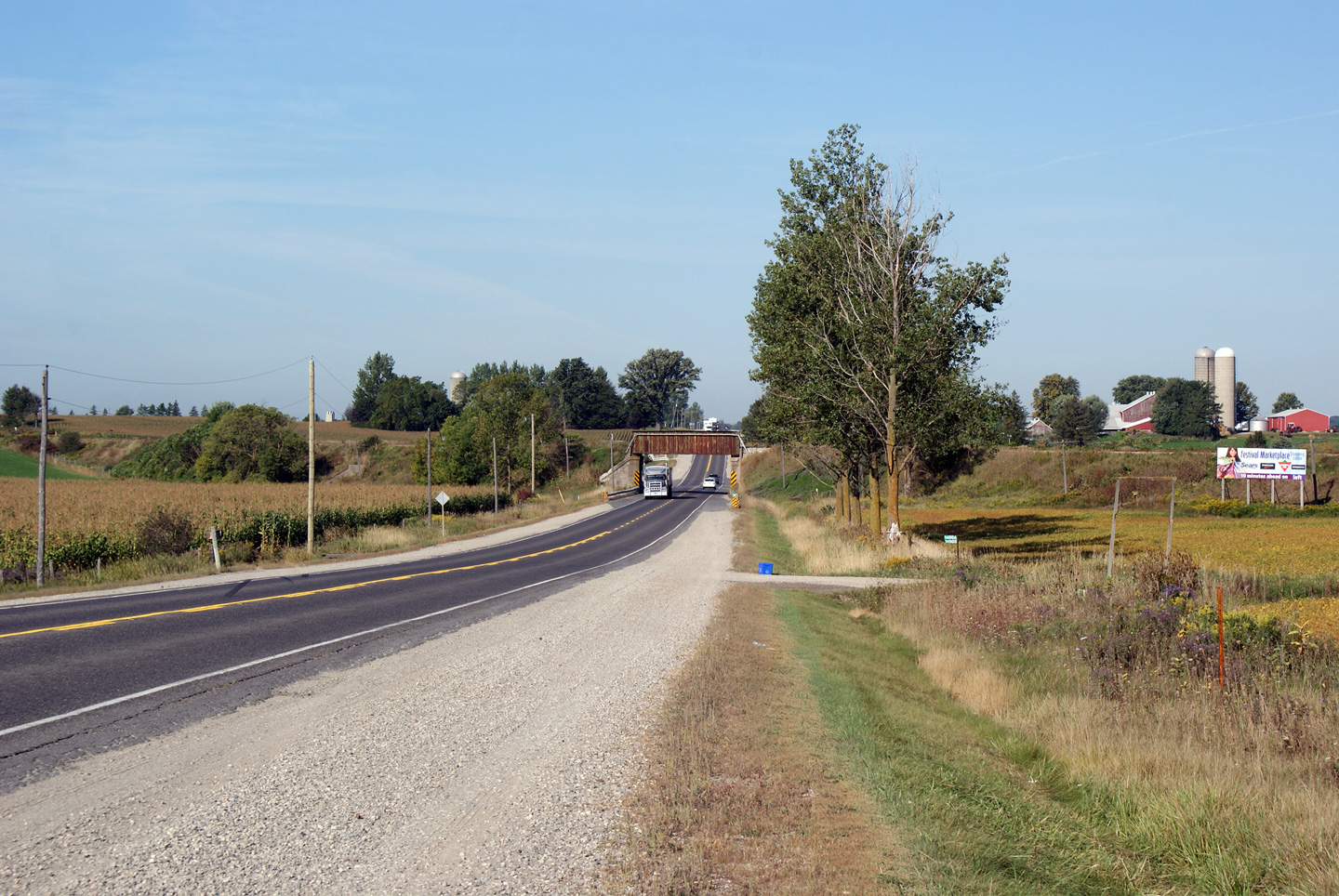
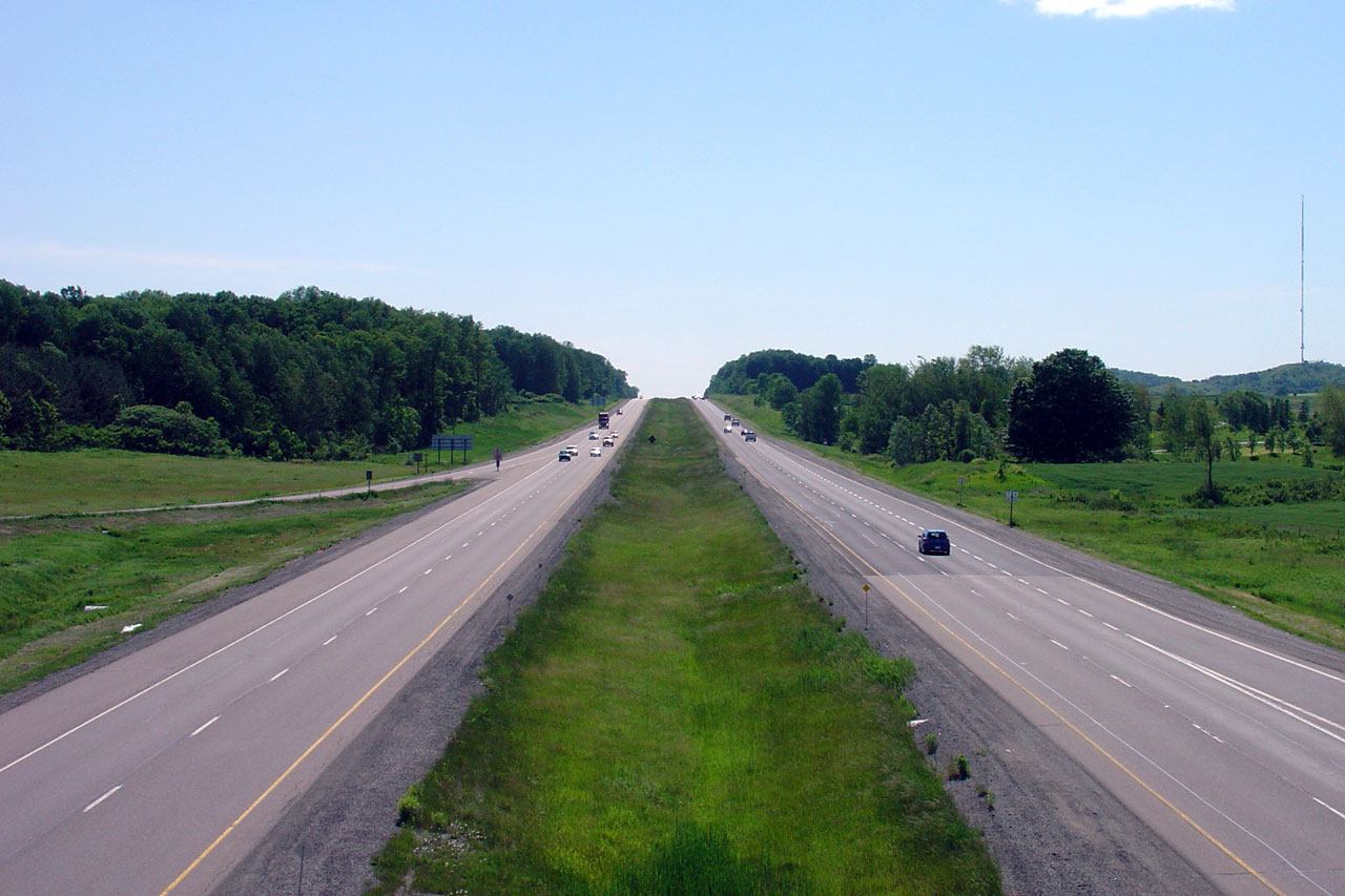
|
Township of Perth East County of Perth |
This view looks easterly towards
the New Hamburg Overhead from just east of the Wilmot-Easthope Road. Photo taken: September 17th, 2009. |
 (720x480) (1440x960) (2400x1600) |
||
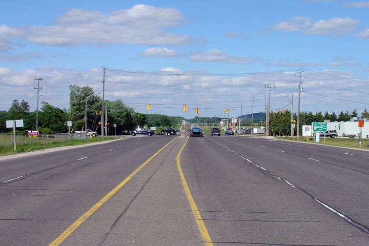
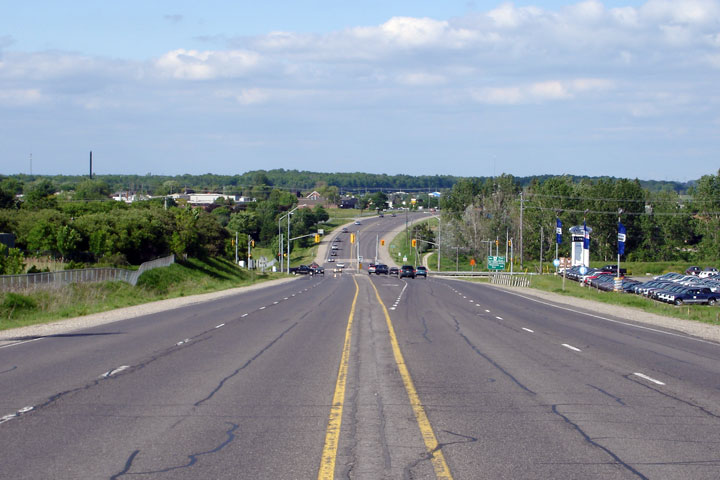
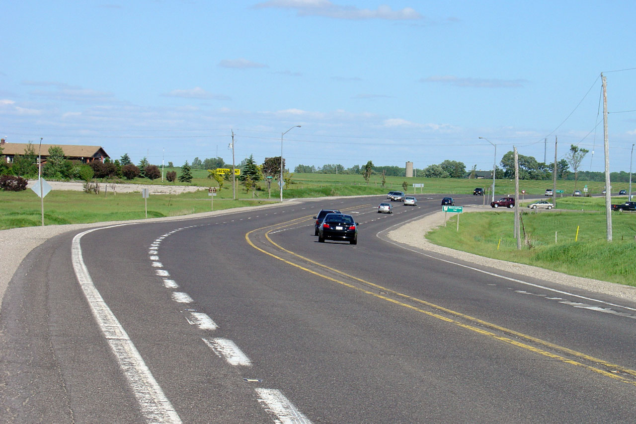
|
Township of Wilmot Regional Municipality of Waterloo |
Easterly view at the western
start of the New Hamburg By-pass. Traffic signals were added to this
intersection in 2007. Upper photo taken: June 10th, 2005. Lower photo taken: September 17th, 2009. |
 (720x480) (1440x960) (2400x1600) |
||
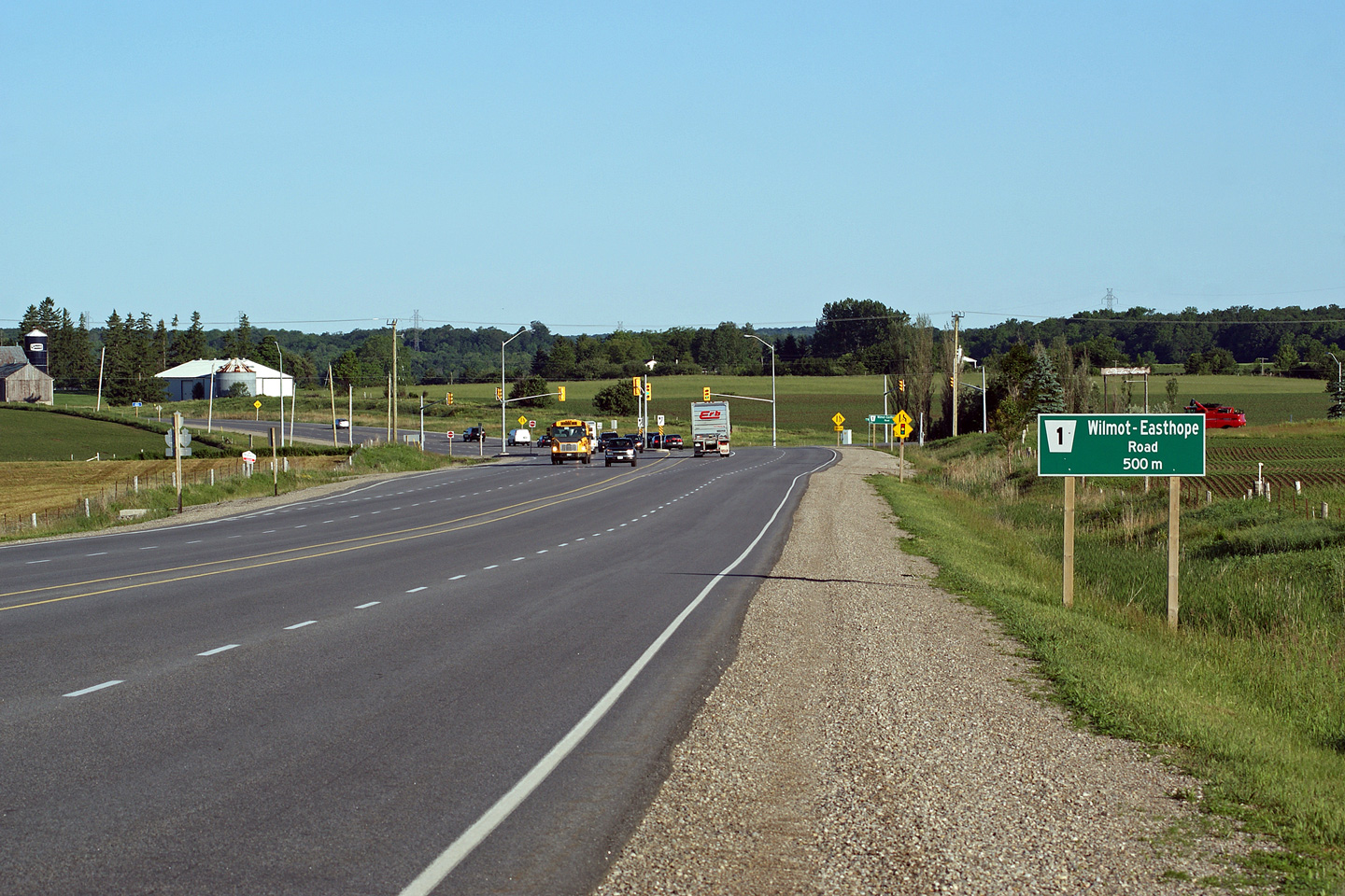
|
Township of Wilmot Regional Municipality of Waterloo |
View looking westerly towards the
Wilmot-Easthope Road intersection. The Wilmot-Easthope Road is a
popular short-cut route for traffic bound to Highway 7 West of Stratford. Photo taken: June 8th, 2010. |
 (720x480) (1440x960) (2400x1600) |
||
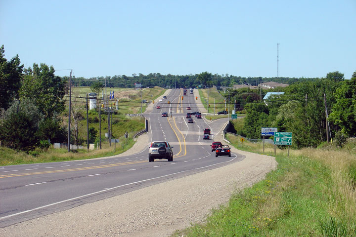
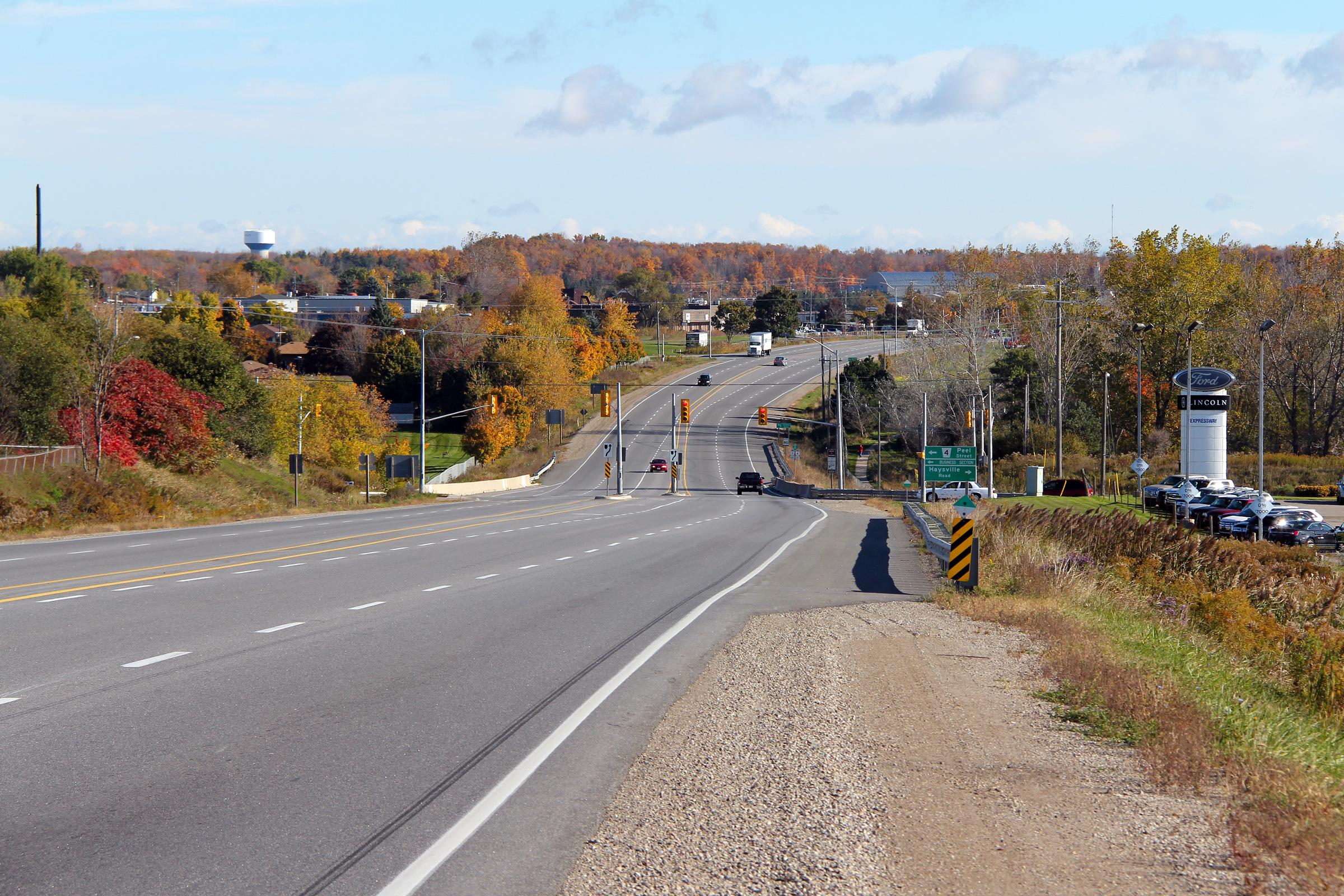
|
Township of Wilmot Regional Municipality of Waterloo |
View looking easterly
approaching the Peel Street intersection. The New Hamburg By-pass was
reconstructed during 2006 and 2007 to improve the pavement condition along
the road as well as
intersection geometry at several intersections. Upper photo taken: June 10th, 2005. Lower photo taken: October 15th, 2010. |
|
||
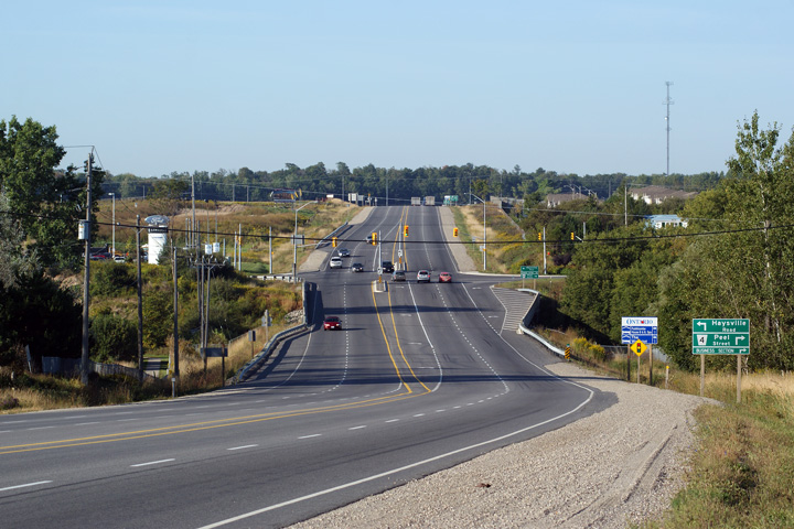
|
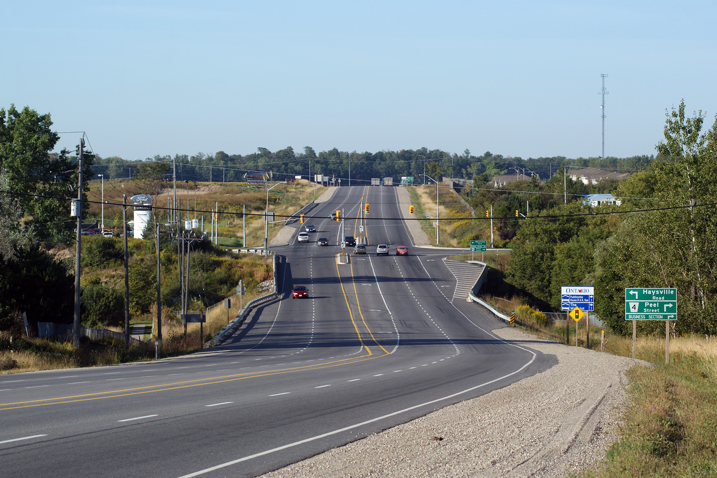
Township of Wilmot Regional Municipality of Waterloo |
View looking
west towards Peel Street. The right turn channel from Highway 7/8 to
Peel Street was removed during the 2006/07 reconstruction. There are
several residential driveways immediately north of Highway 7/8 along Peel
Street that conflicted with the ramp. Upper photo taken: August 1st, 2004. Lower photo taken: September 17th, 2009. |
|
||
|
Township of Wilmot Regional Municipality of Waterloo |
Temporarily mounted traffic
signals at the Bleams Road interchange. Unlike neighbouring
Michigan, traffic signals are
very seldom mounted on overhead wires. Photo taken: June 10th, 2005. |
 |
||
|
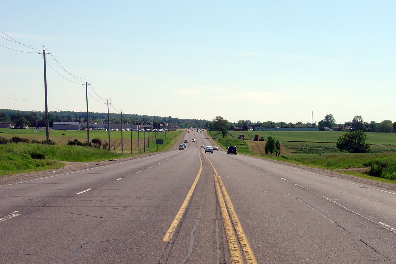
Township of Wilmot Regional Municipality of Waterloo |
View looking westerly from
Waterloo Road 5. The New Hamburg By-pass was completed in 1957 to
avoid a very awkward routing through the town. Photo taken: June 10th, 2005. |
 |
||
|
Township of Wilmot Regional Municipality of Waterloo |
View looking easterly at the
west end of the divided highway at the eastern end of the New Hamburg
By-pass. Photo taken: June 10th, 2005. |
 |
||
|
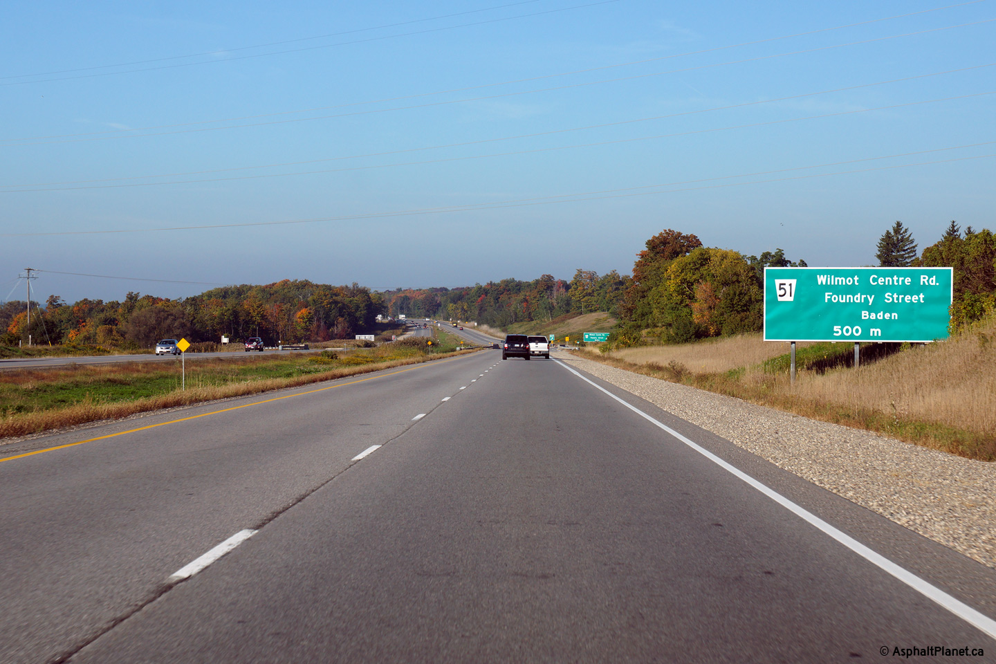
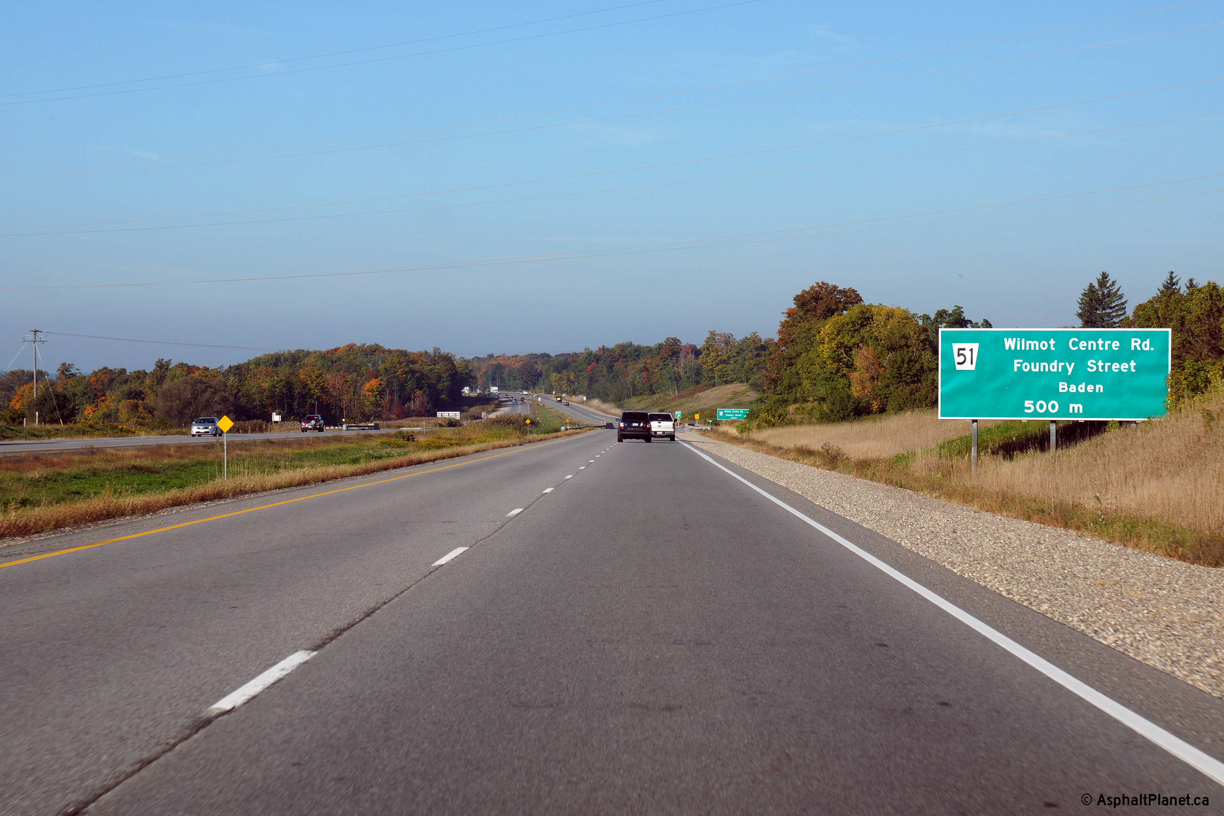
Township of Wilmot Regional Municipality of Waterloo |
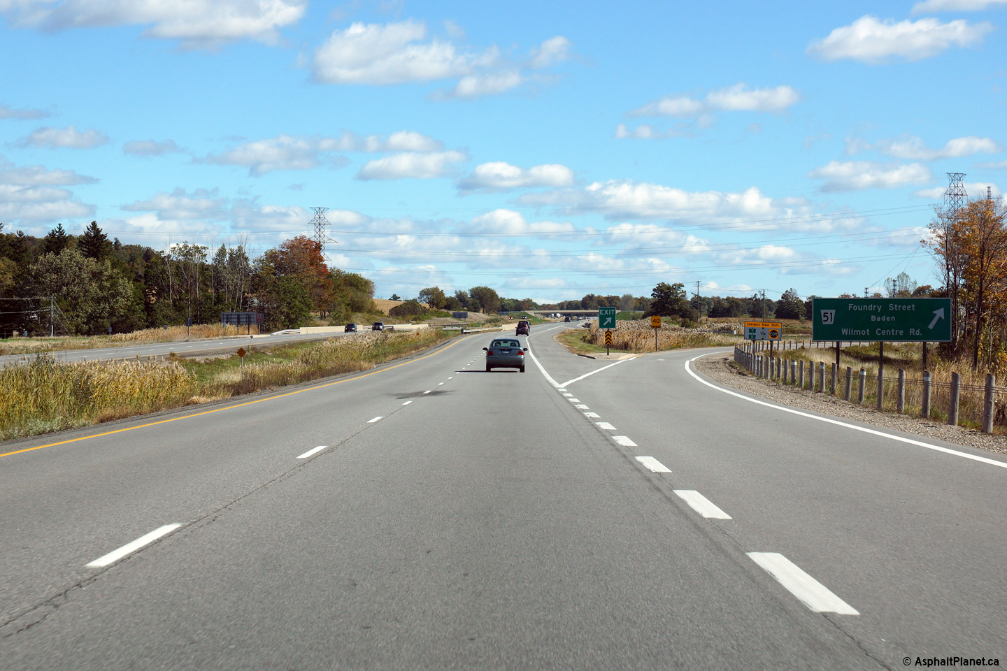
Eastbound advanced signage for
the ramp to Waterloo Road 51. Photo taken: October 9th, 2014. |
 (720x480) (720x480)(1440x960) (2400x1600) |
||
|
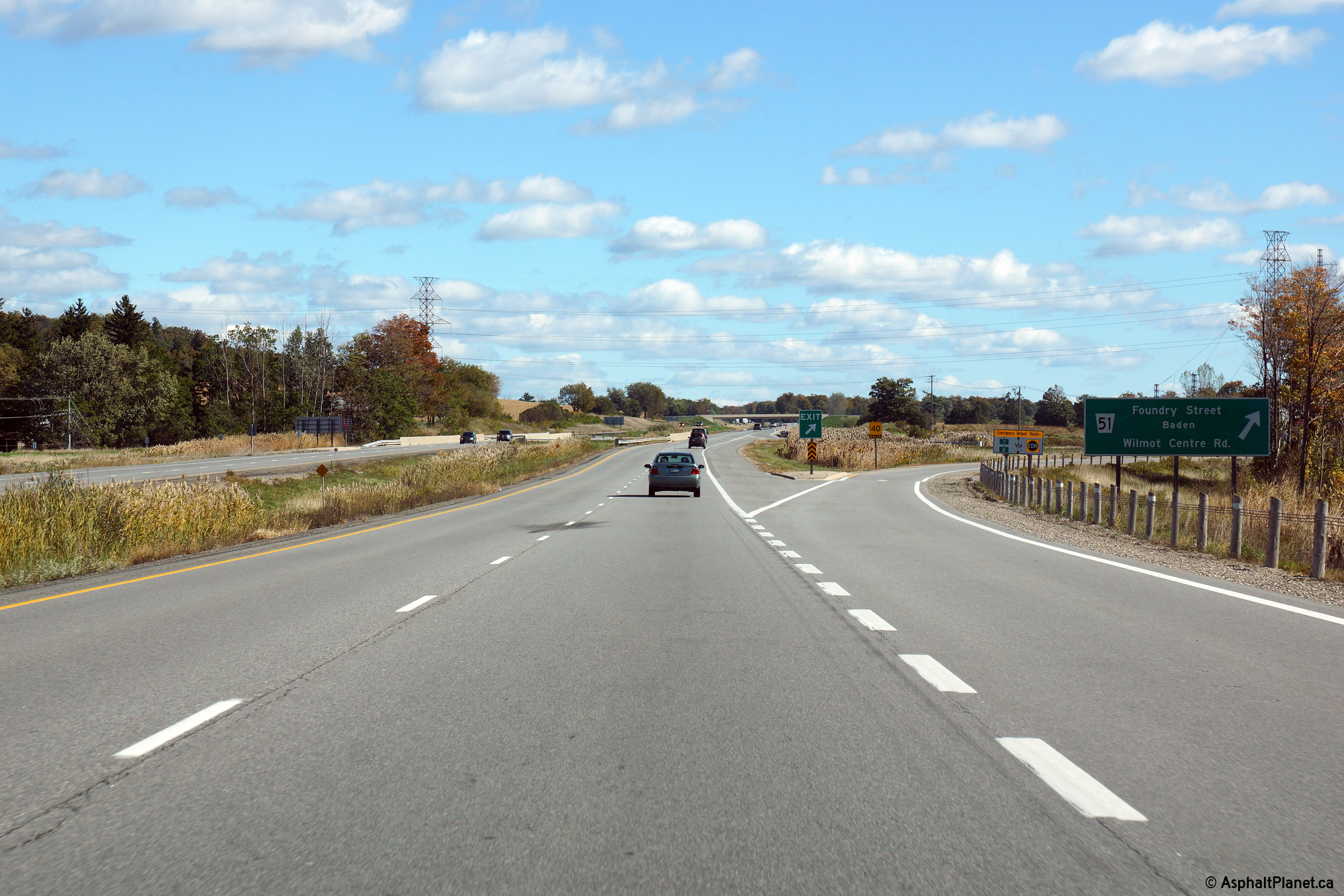
Township of Wilmot Regional Municipality of Waterloo |
Easterly view at the off-ramp to
Waterloo Road 51 east of New Hamburg. Photo taken: October 9th, 2014. |
 (720x480) (720x480)(1440x960) (2400x1600) |
||
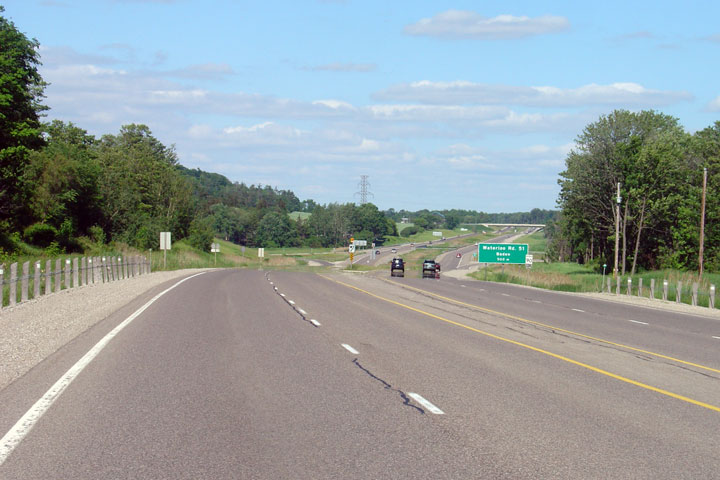
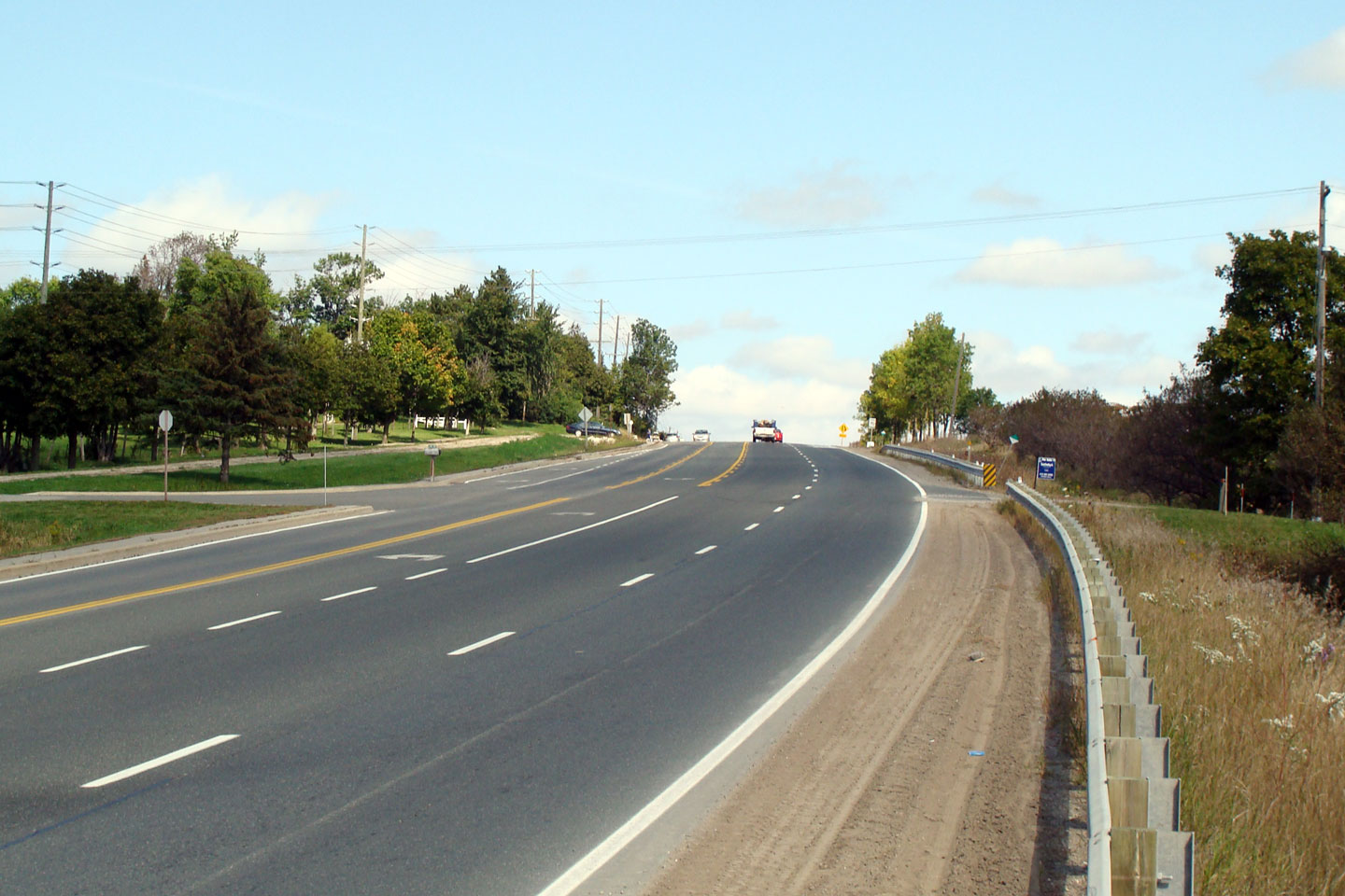
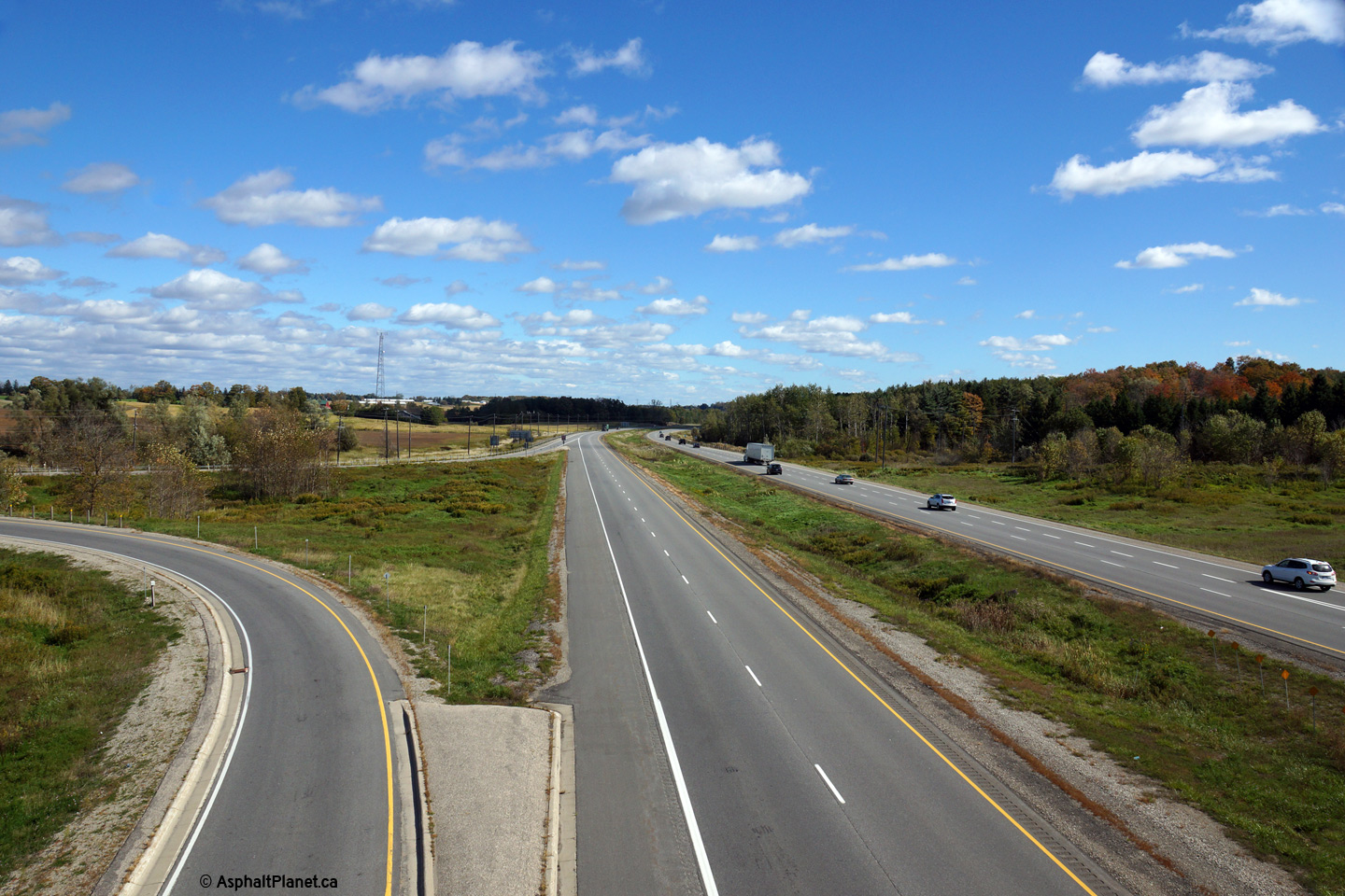
|
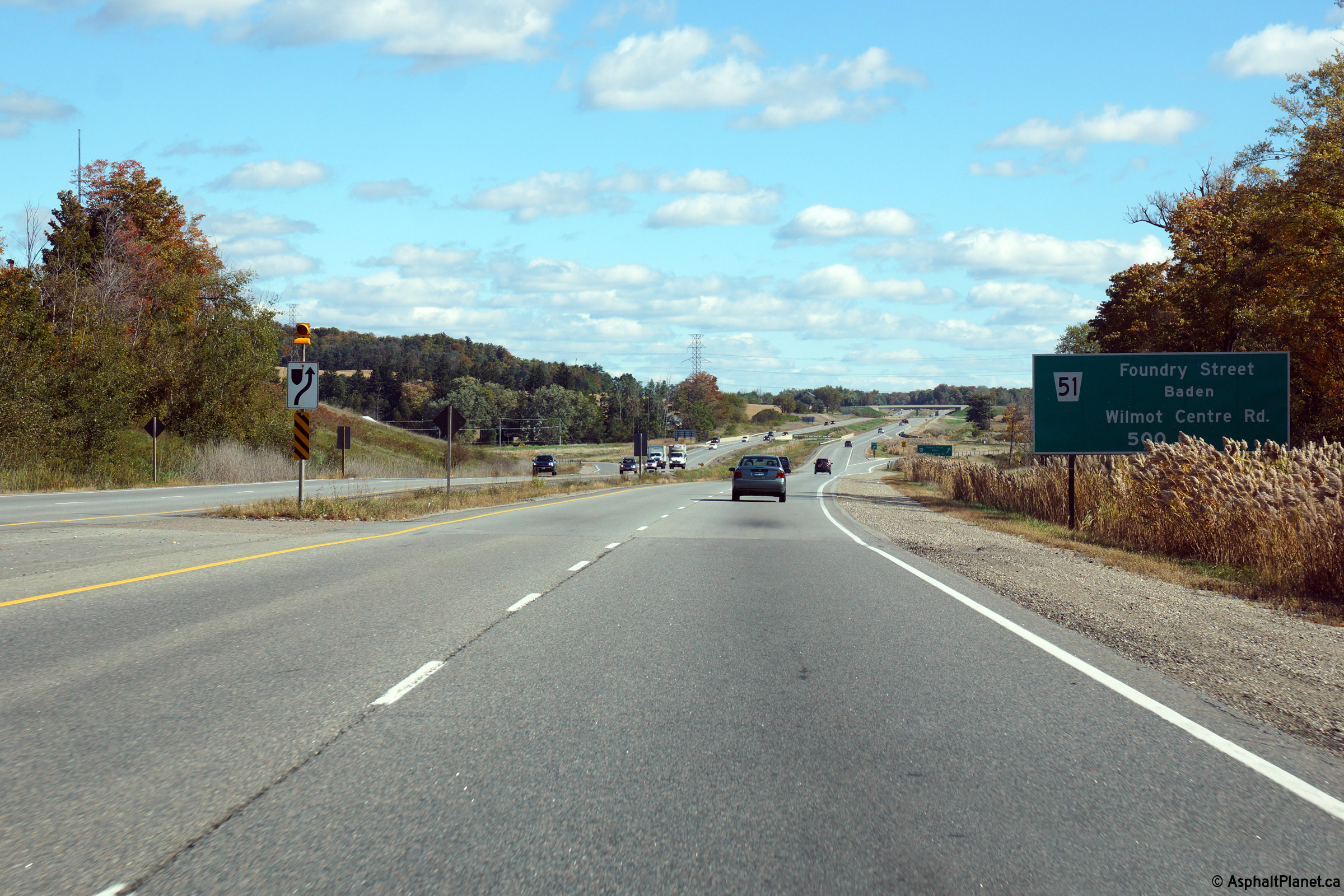
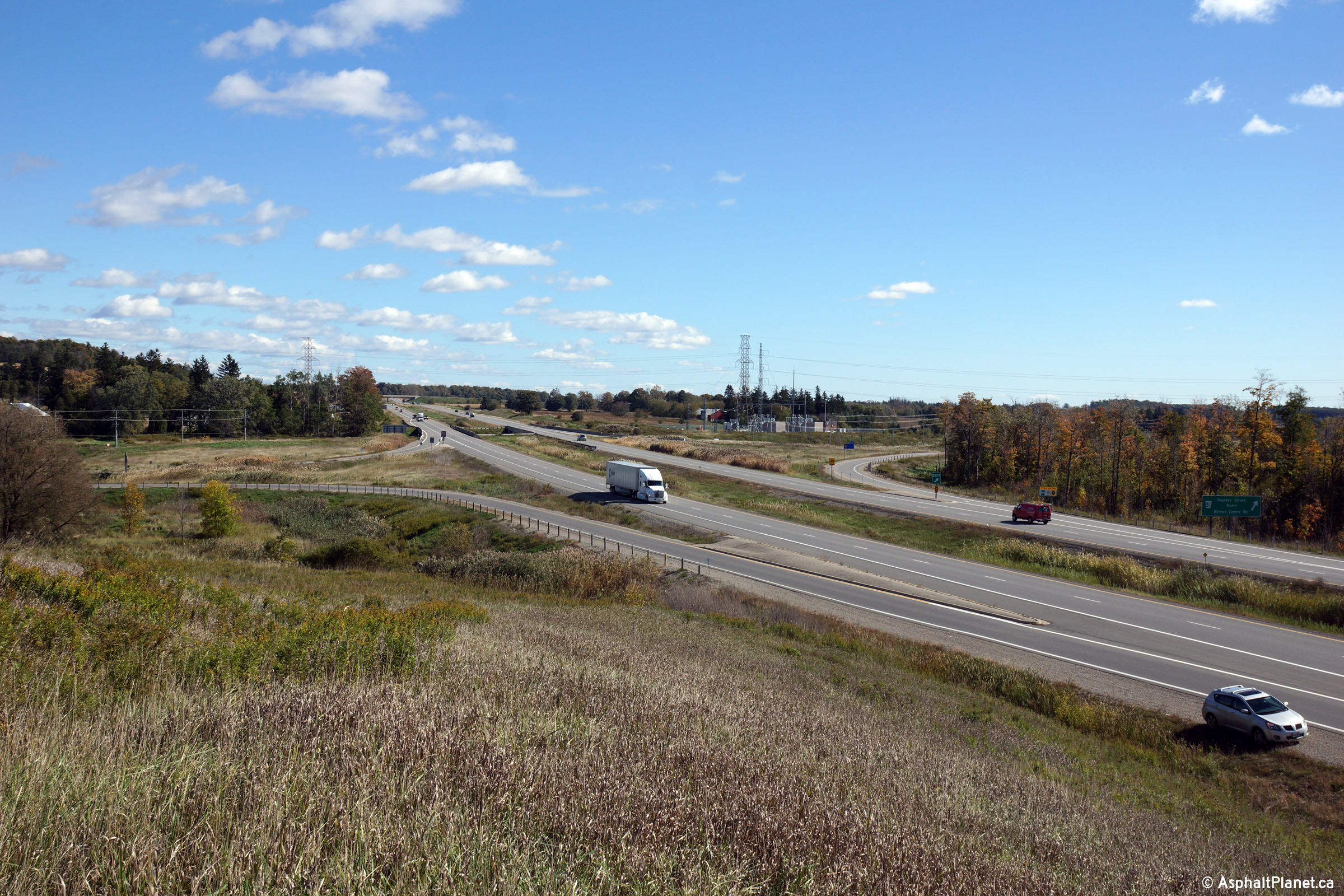
Township of Wilmot Regional Municipality of Waterloo |
Highway 7/8 meets Waterloo Road
51 at a partial cloverleaf interchange with all ramps on the western side of
Waterloo Road 51. Photo taken: October 9th, 2014. |
 |
||
|
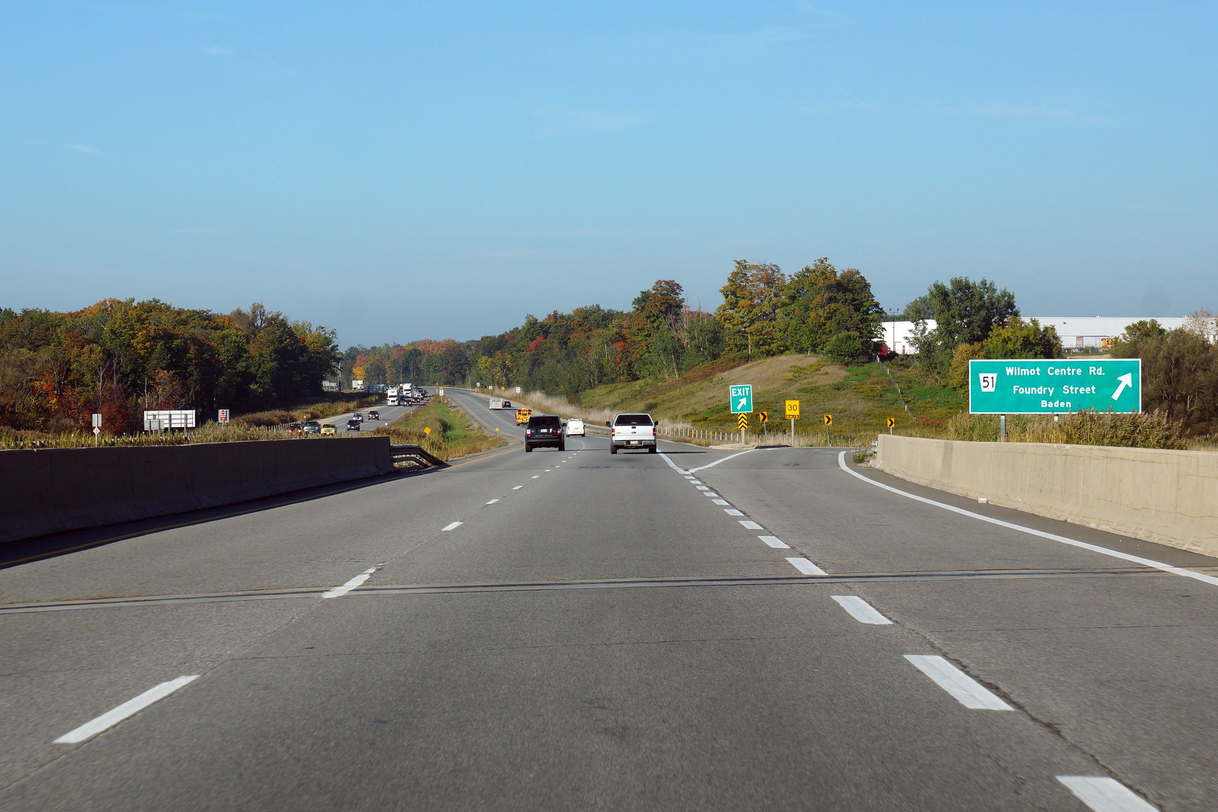
Township of Wilmot Regional Municipality of Waterloo |
This view looks westerly at the
Waterloo Road 51 interchange. Waterloo Road 15 passes beneath Highway 7/8
under the pictured structure. Photo taken: September 25th, 2014. |
 (720x480) (720x480)(1440x960) (2400x1600) |
||
|
Township of Wilmot Regional Municipality of Waterloo |
Westbound advanced signage for
the off-ramp to Waterloo Road 51. Photo taken: September 25th, 2014. |
 (720x480) (720x480)(1440x960) (2400x1600) |
||
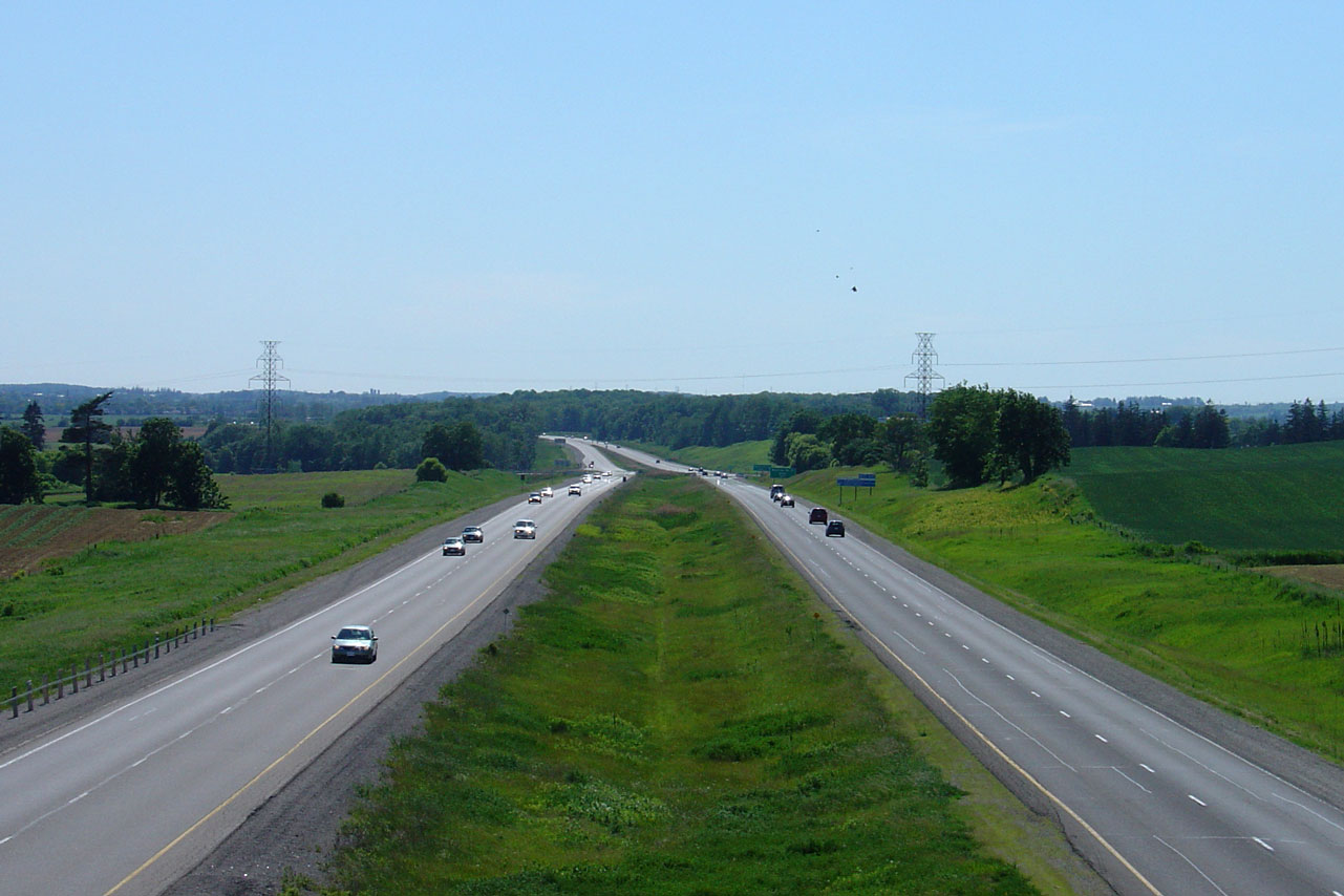
|
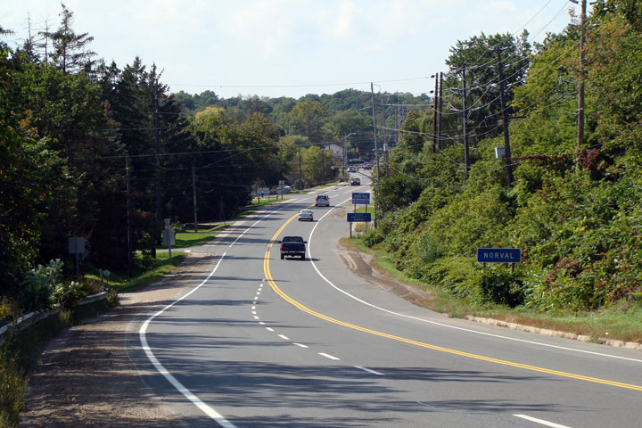
Township of Wilmot Regional Municipality of Waterloo |
View looking westerly from
Sandhills Road towards New Hamburg and Waterloo Road 51. Click
here for this same view taken in
June, 2005. Photo taken: October 9th, 2014. |
|
||
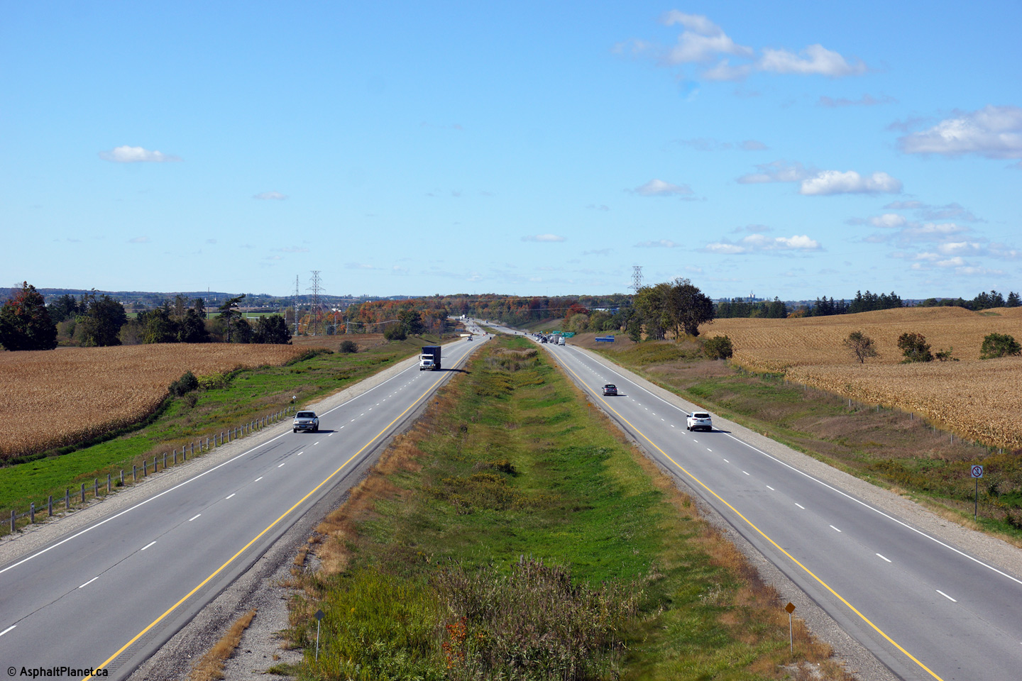
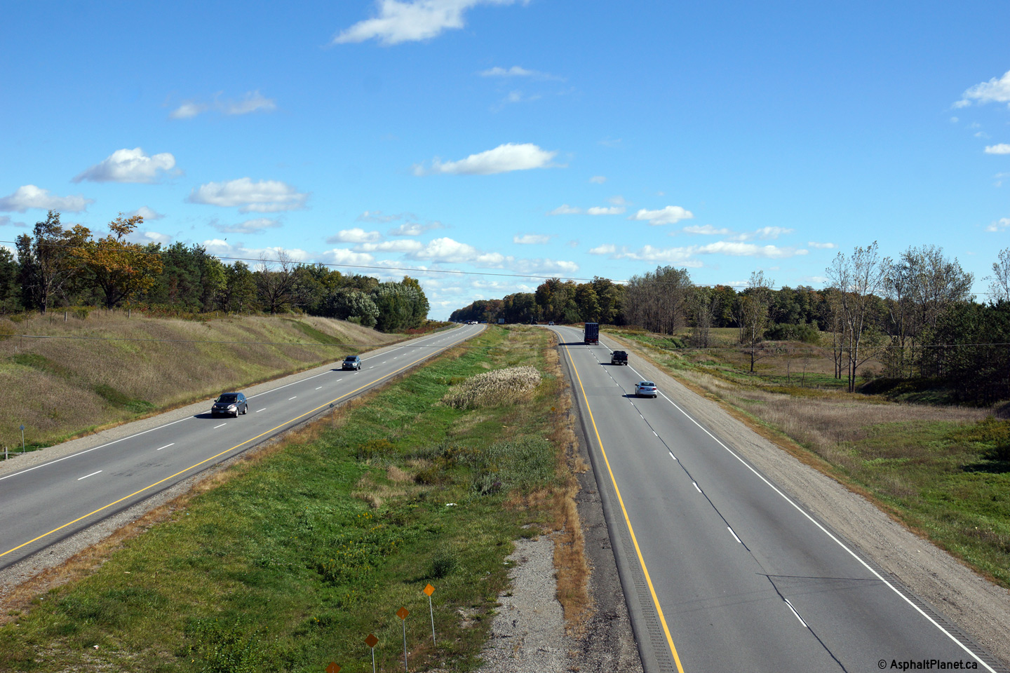
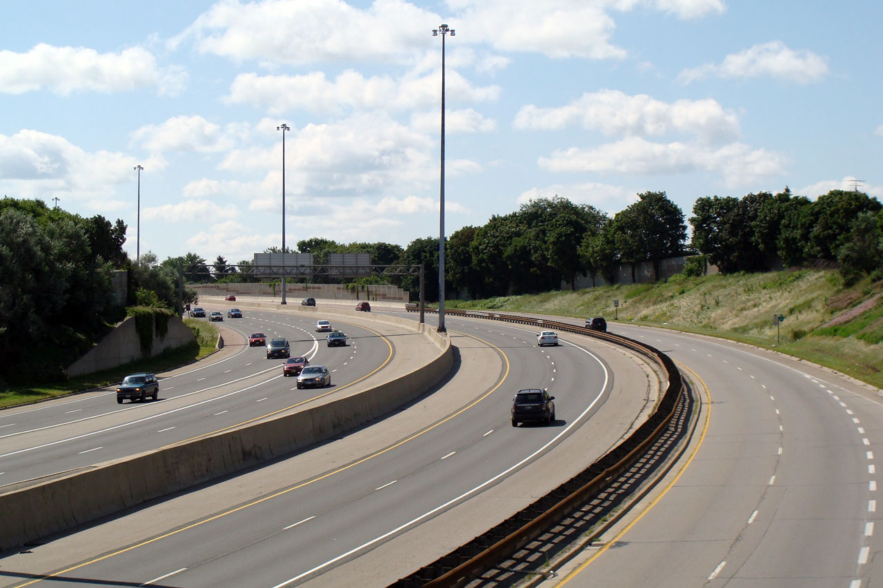
| Township of Wilmot Regional Municipality of Waterloo |
View looking easterly from
Sandhills Road. Despite the high design standard, Highway 7/8 is only
posted at 90km/h. Click here for this same view taken in
June, 2005. Photo taken: October 9th, 2014. |
|||
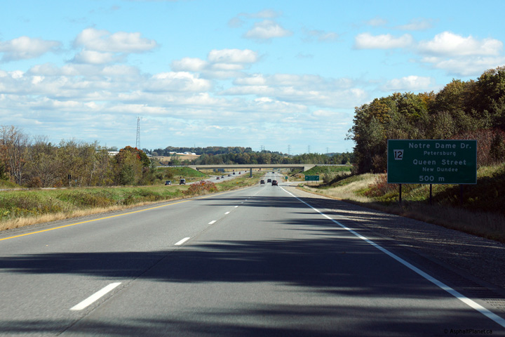
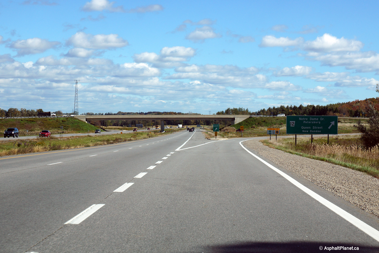
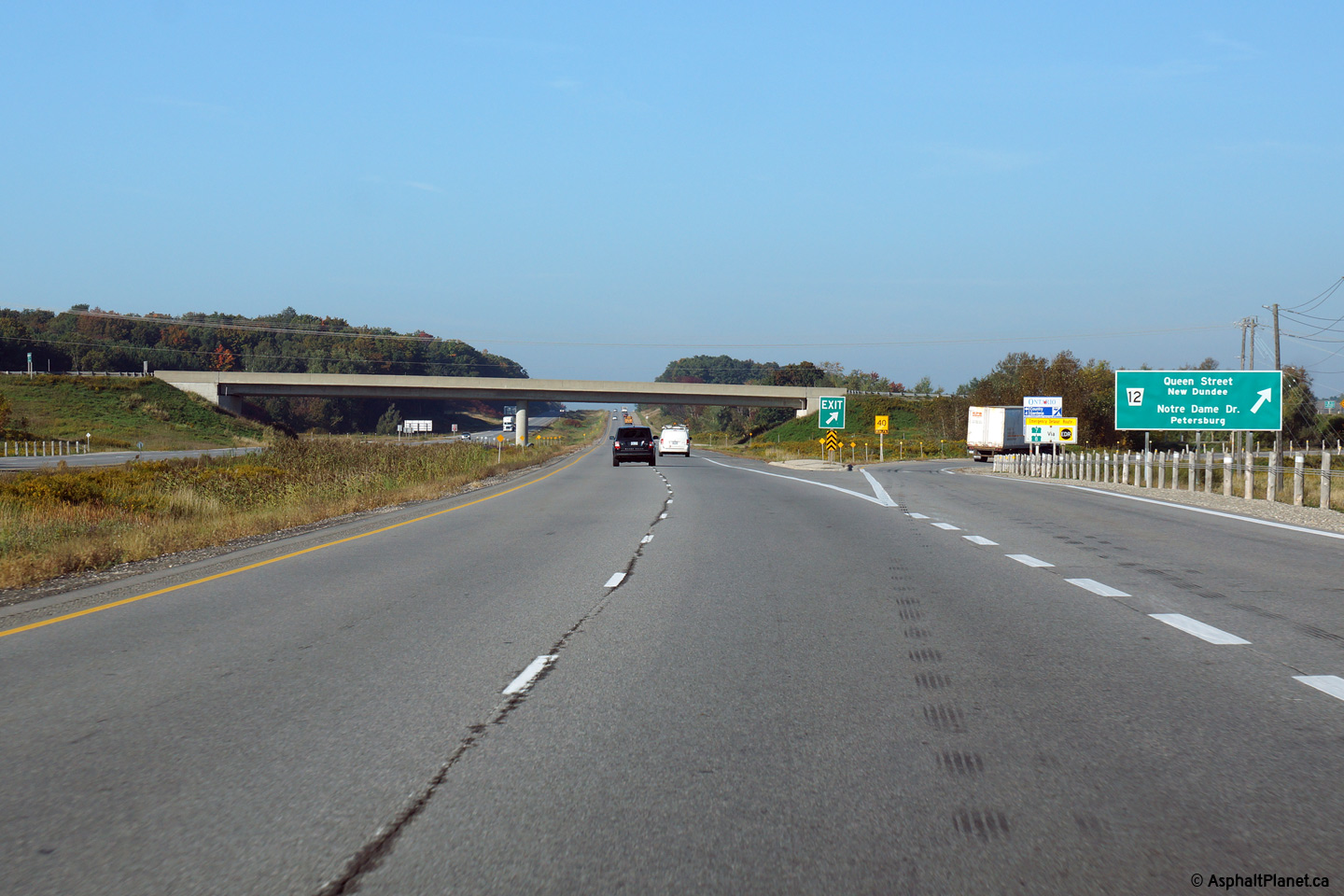
| Township of Wilmot Regional Municipality of Waterloo |
Eastbound advanced signage for
the Waterloo Road 12 interchange. Photo taken: October 9th, 2014. |
 (720x480) (720x480)(1440x960) (2400x1600) |
||
| Township of Wilmot Regional Municipality of Waterloo |
View looking easterly approaching
the Waterloo Road 12 interchange. Photo taken: October 9th, 2014. |
 (720x480) (720x480)(1440x960) (2400x1600) |
||
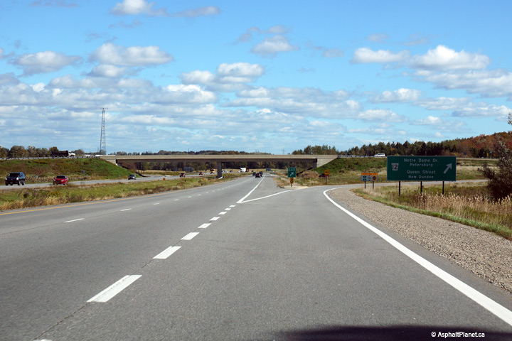
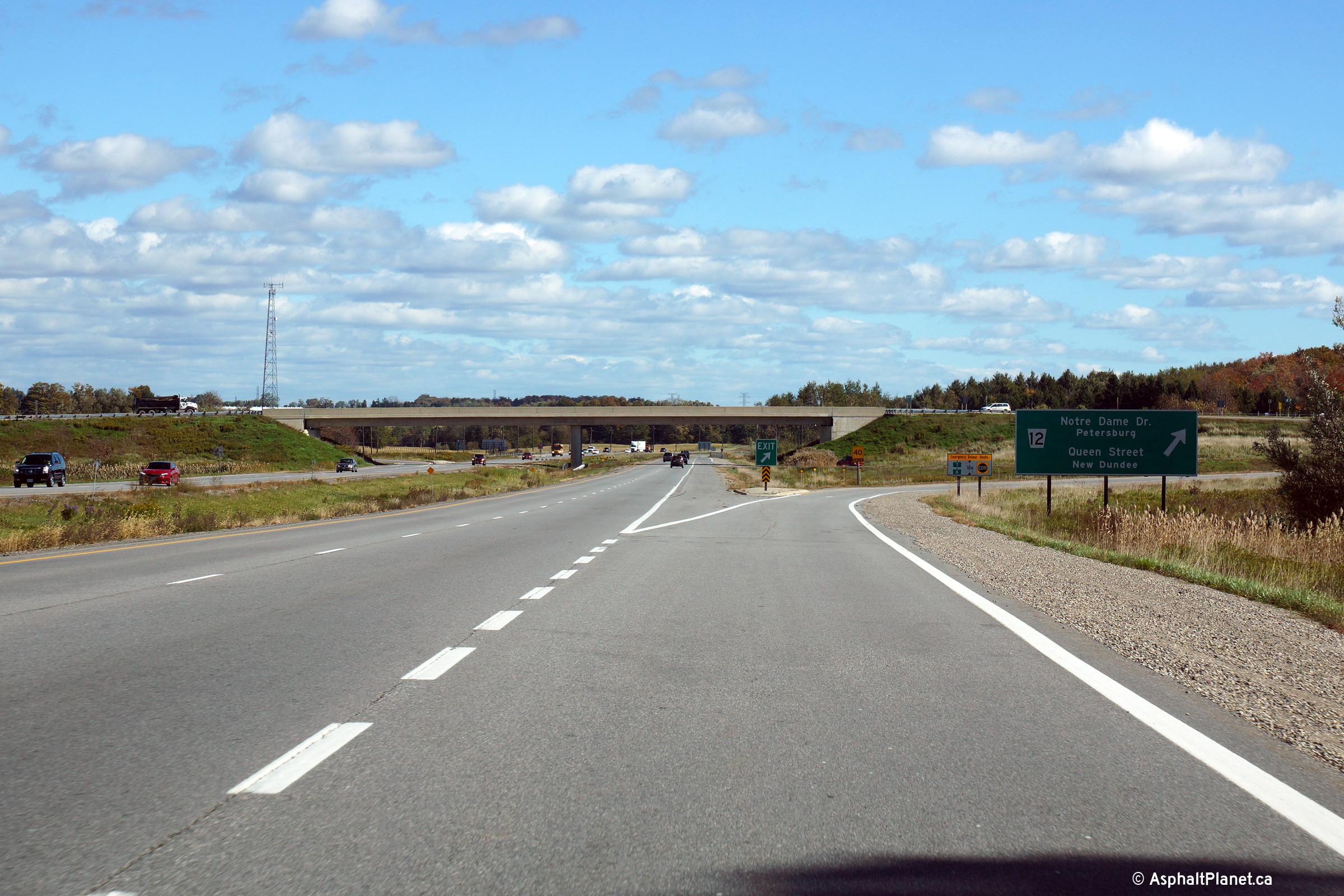
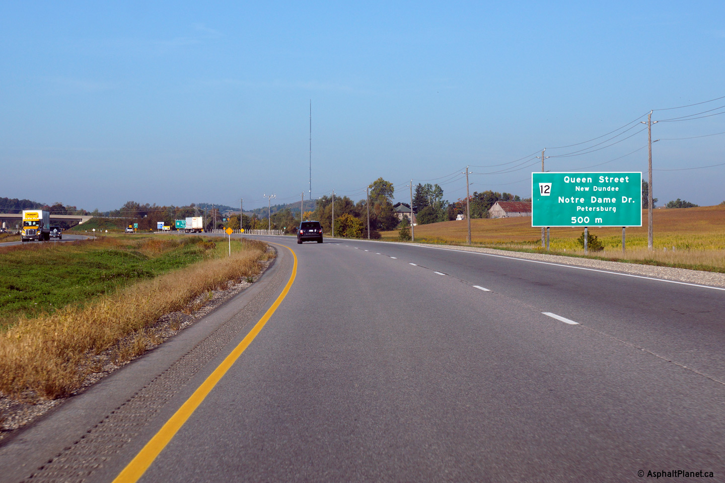
| Township of Wilmot Regional Municipality of Waterloo |
This picture is looking west off
of the Waterloo Road 12 overpass west of the city of Kitchener.
Click here for this same view taken in
June, 2005. Photo taken: October 9th, 2014. |
|
||
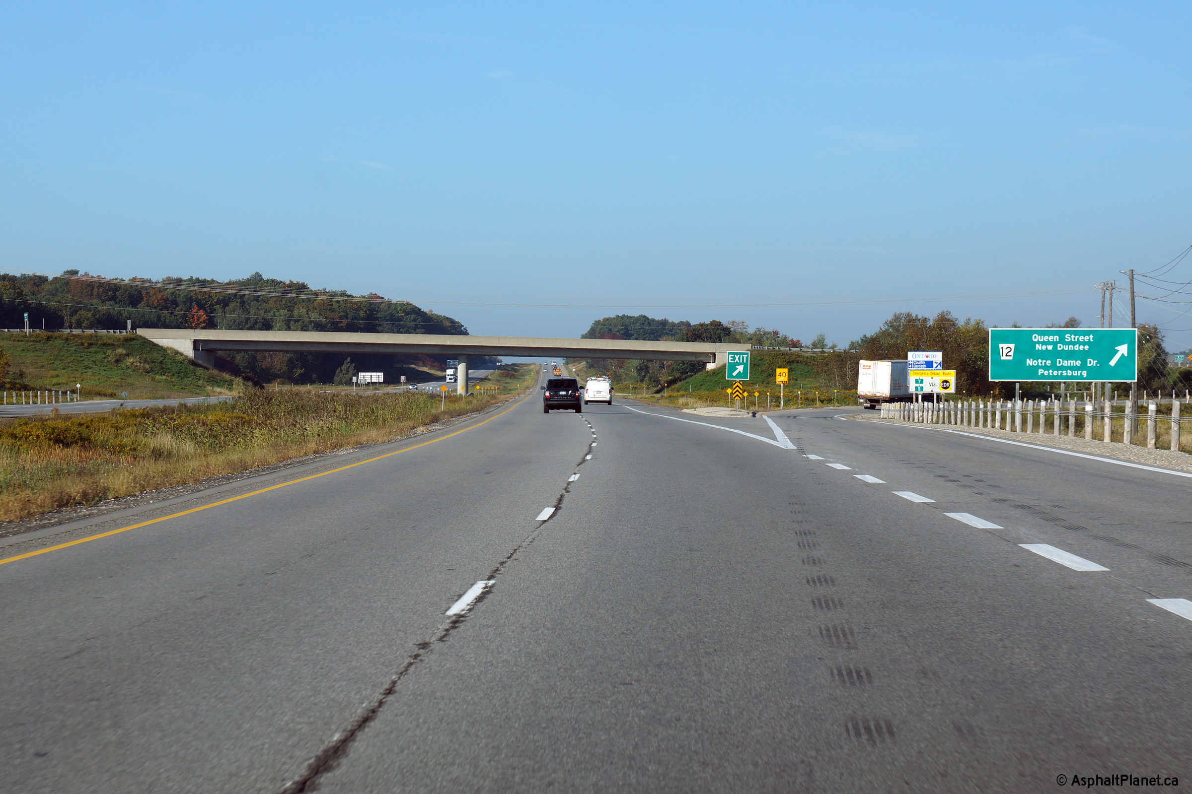
| Township of Wilmot Regional Municipality of Waterloo |
View looking easterly from
the Waterloo Road 12 interchange. Click here for this same view taken in
June, 2005. Photo taken: October 9th, 2014. |
|
||
| Township of Wilmot Regional Municipality of Waterloo |
View looking westerly at the
off-ramp to Waterloo Road 12. Photo taken: September 25th, 2014. |
 (720x480) (720x480)(1440x960) (2400x1600) |
||
| Township of Wilmot Regional Municipality of Waterloo |
Westbound advanced signage for
the off-ramp to Waterloo Road 12. Photo taken: September 25th, 2014. |
 (720x480) (720x480)(1440x960) (2400x1600) |
||
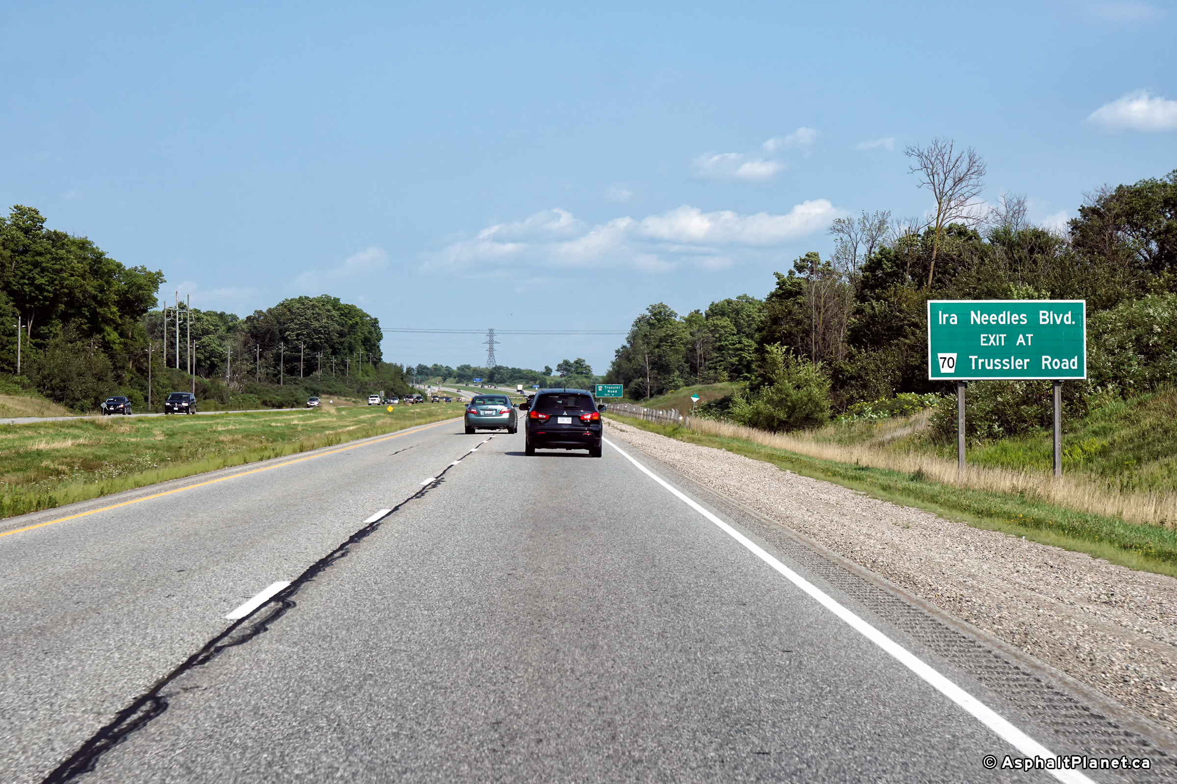
|
City of Kitchener Regional Municipality of Waterloo |
Eastbound advanced signage
directing traffic bound for Ira Needles Boulevard to follow the Trussler
Road interchange. Photo taken: August 23rd, 2018. |
 (720x480) (720x480)(1440x960) (2400x1600) |
||
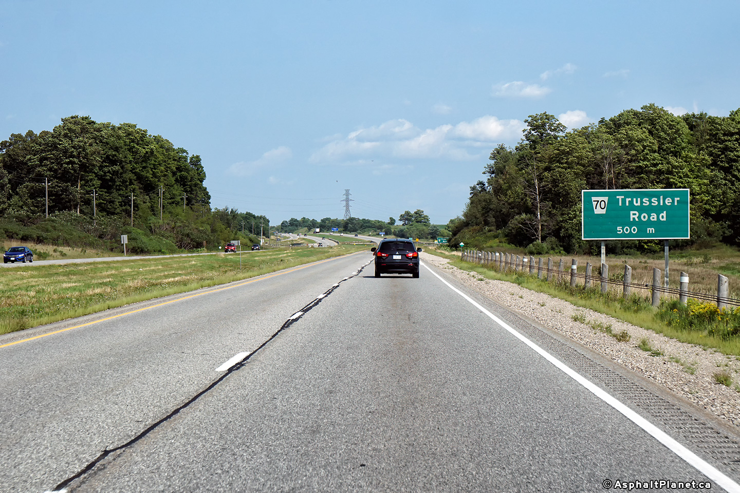
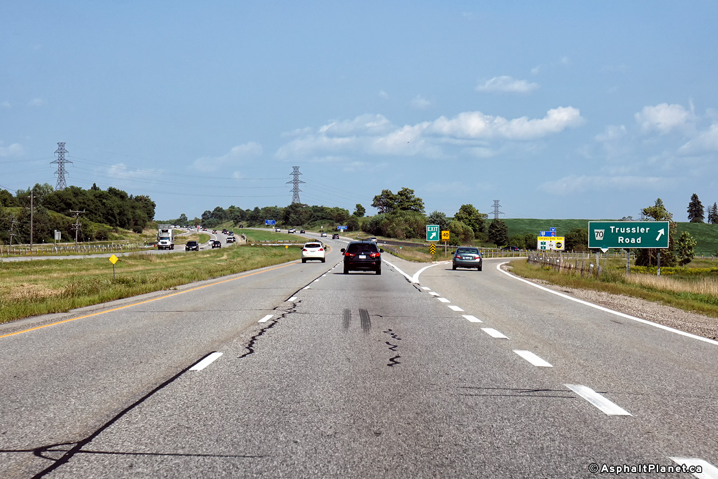
|
City of Kitchener Regional Municipality of Waterloo |
Eastbound advanced signage for
the Trussler Road interchange. Photo taken: August 23rd, 2018. |
 (720x480) (720x480)(1440x960) (2400x1600) |
||
|
City of Kitchener Regional Municipality of Waterloo |
View looking easterly at the
off-ramp to Trussler Road interchange. Photo taken: August 23rd, 2018. |
 (720x480) (720x480)(1440x960) (2400x1600) |
||
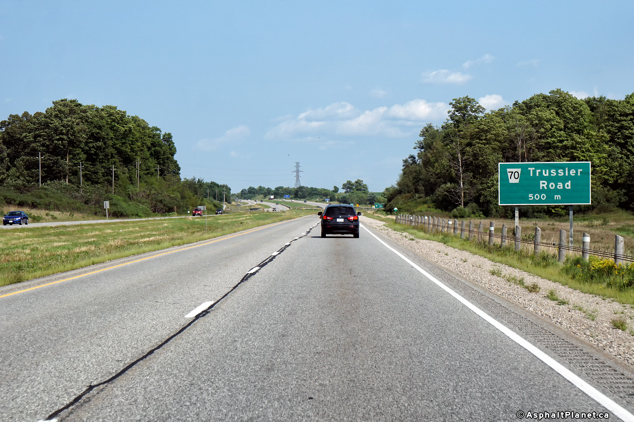
| City of Kitchener Regional Municipality of Waterloo |
This view looks west towards
the Trussler Road interchange along Highway 7/8. Photo taken: June 10th, 2005. |
 |
||
| City of Kitchener Regional Municipality of Waterloo |
Easterly view of Highway 7/8
towards the Fischer Hallman Road interchange. Photo taken: June 10th, 2005. |
 |
||
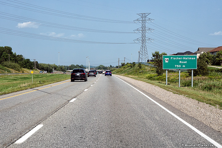
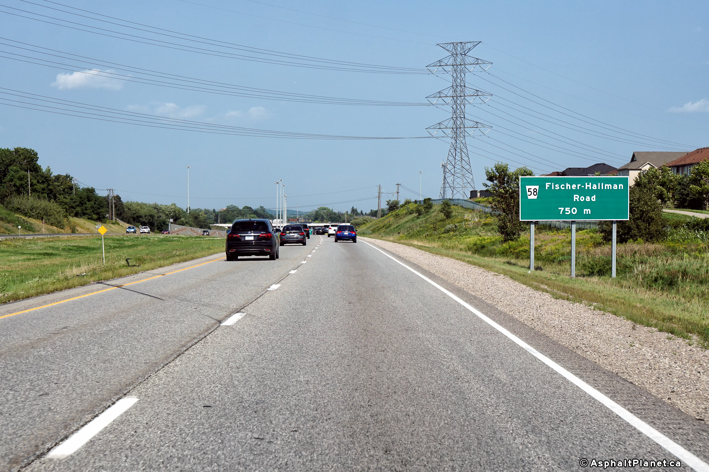
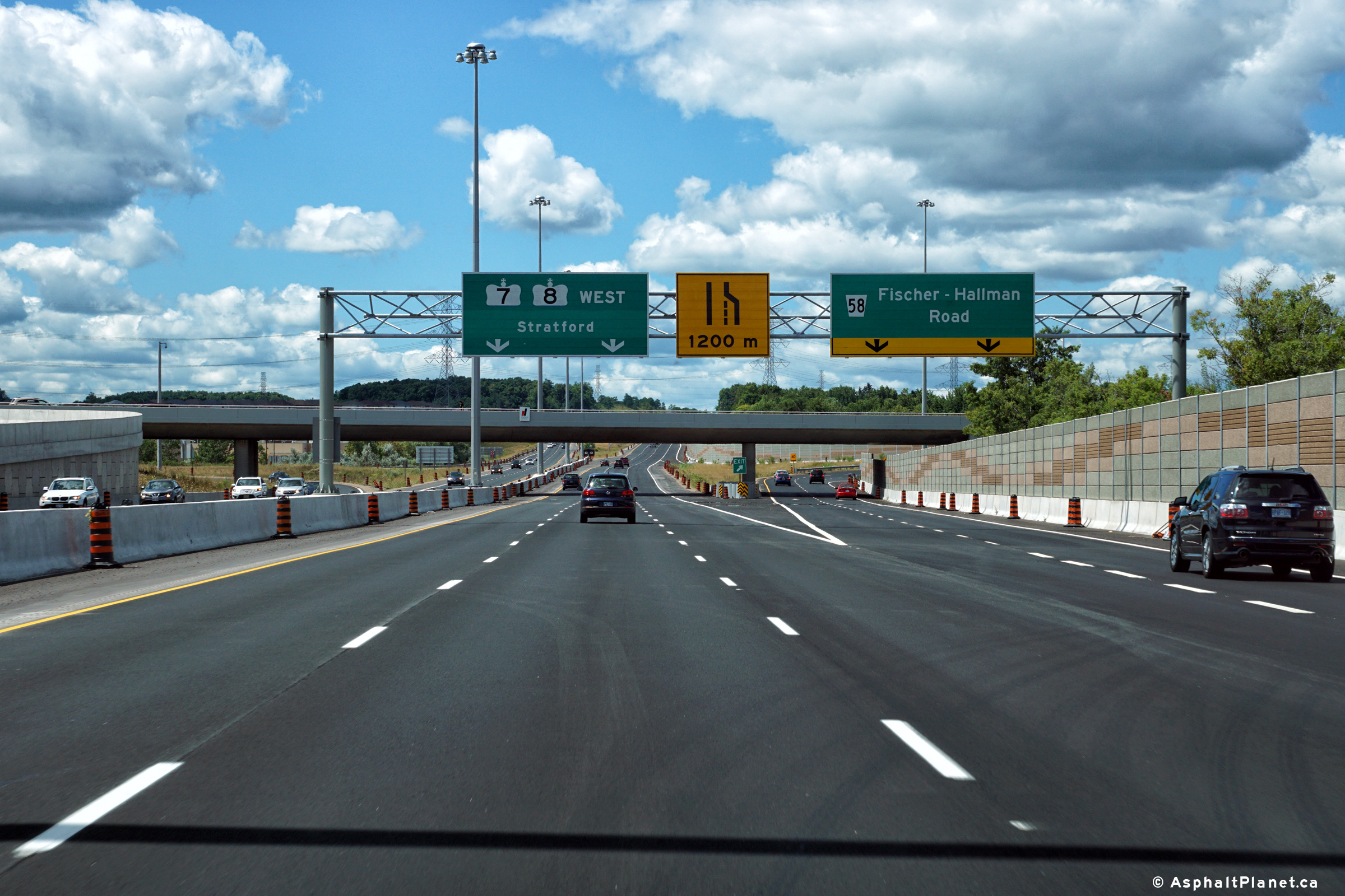
|
City of Kitchener Regional Municipality of Waterloo |
Eastbound advanced signage for
the Fischer Hallman Road interchange. Photo taken: August 23rd, 2018. |
 (720x480) (720x480)(1440x960) (2400x1600) |
||
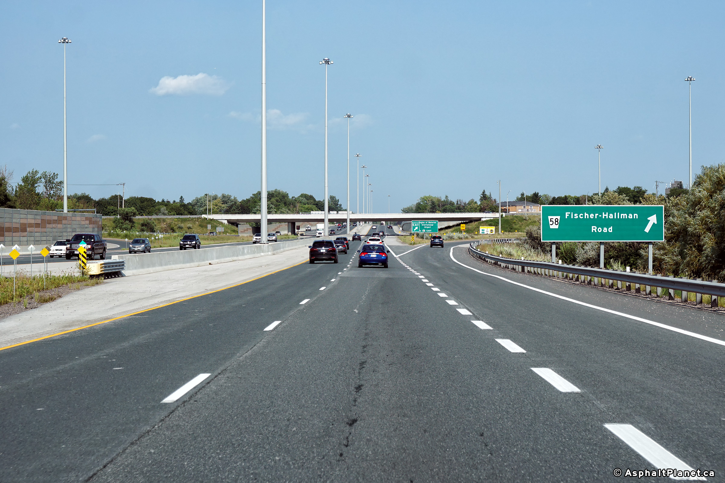
|
City of Kitchener Regional Municipality of Waterloo |
Sigange at the eastbound off-ramp
to Fischer Hallman Road. Photo taken: August 23rd, 2018. |
 (720x480) (720x480)(1440x960) (2400x1600) |
||
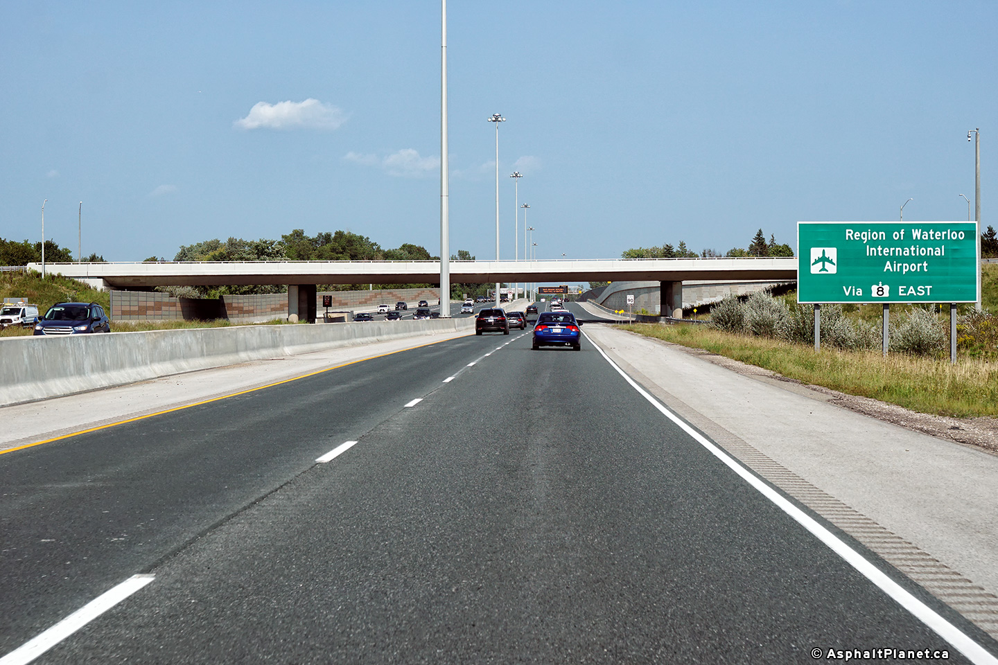
|
City of Kitchener Regional Municipality of Waterloo |
Signage directing eastbound
motorists bound for Waterloo Airport to follow Highway 8 East. Photo taken: August 23rd, 2018. |
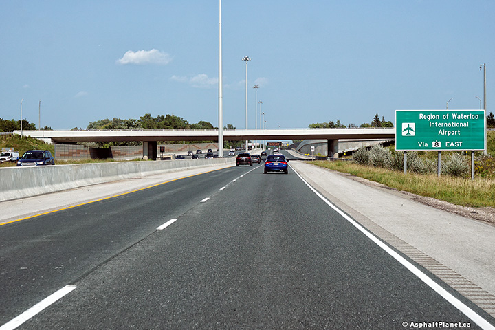 (720x480) (720x480)(1440x960) (2400x1600) |
||
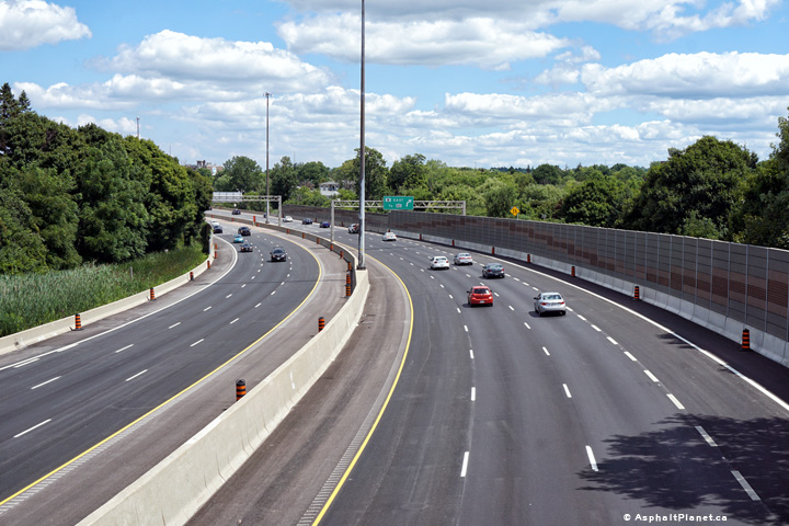
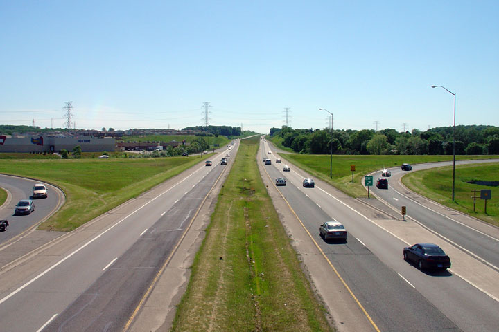
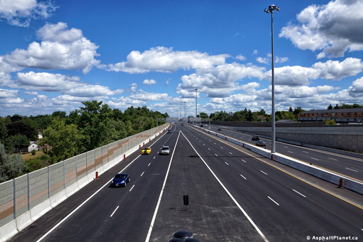
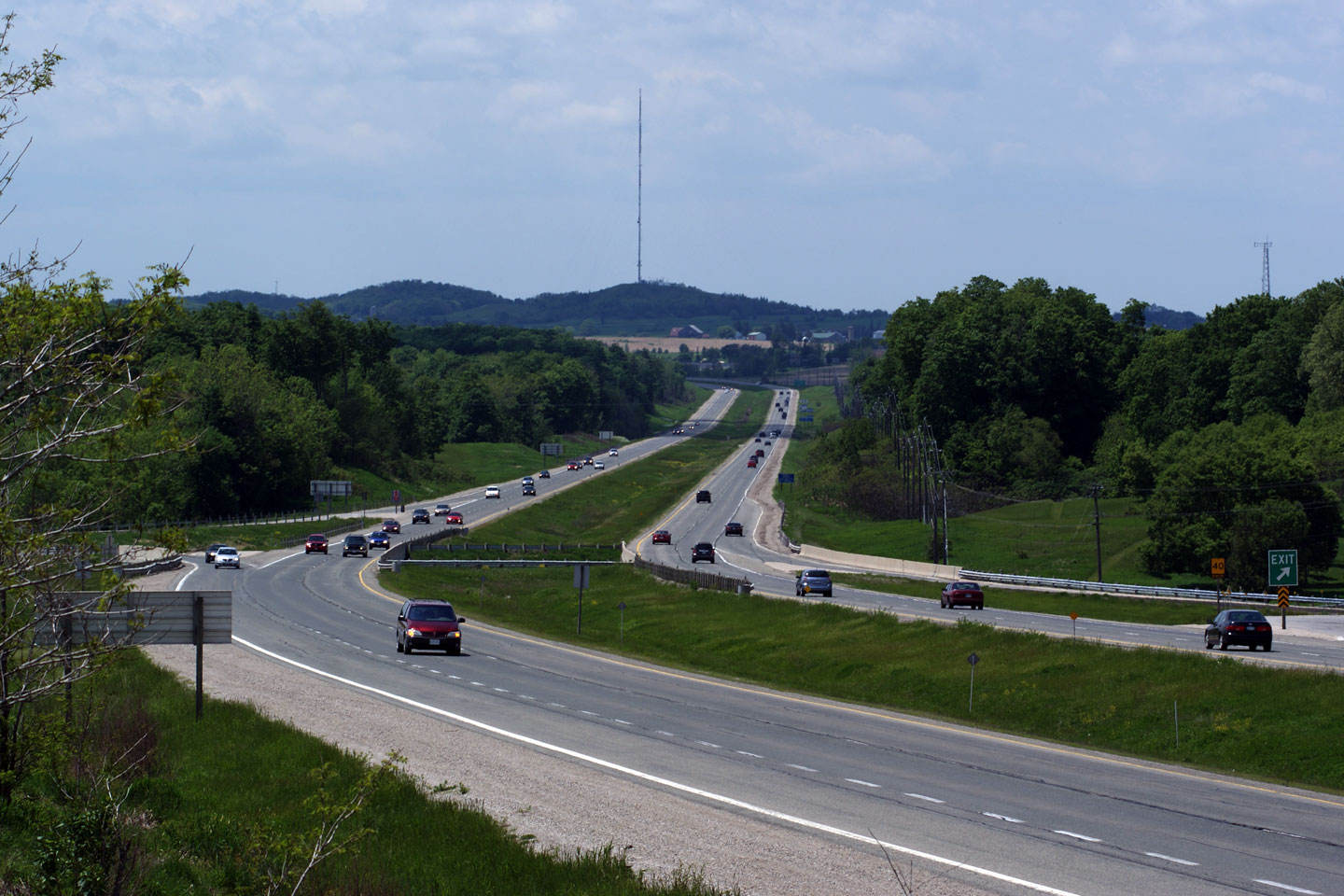
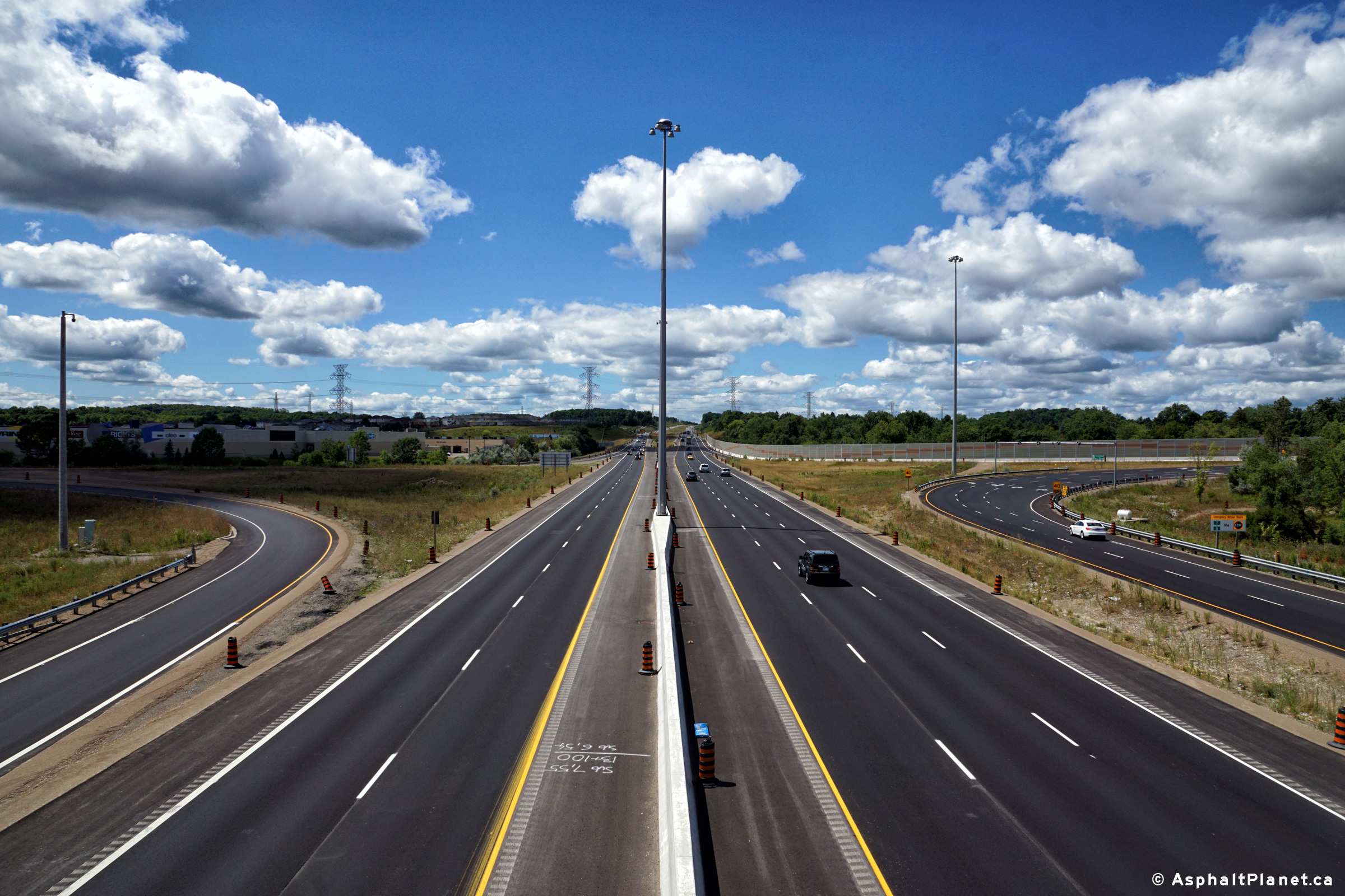
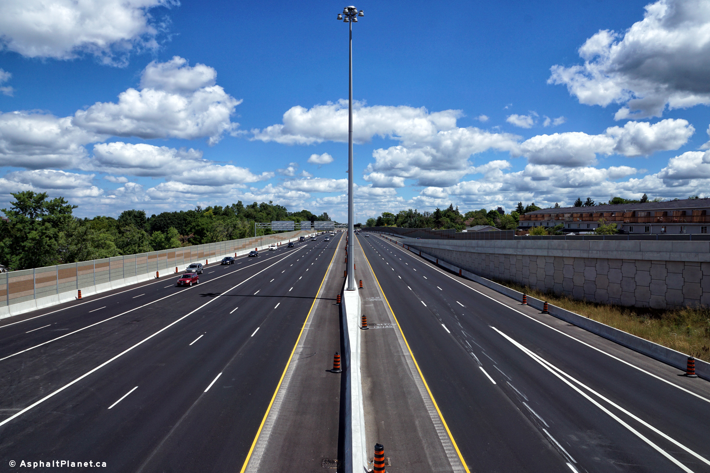
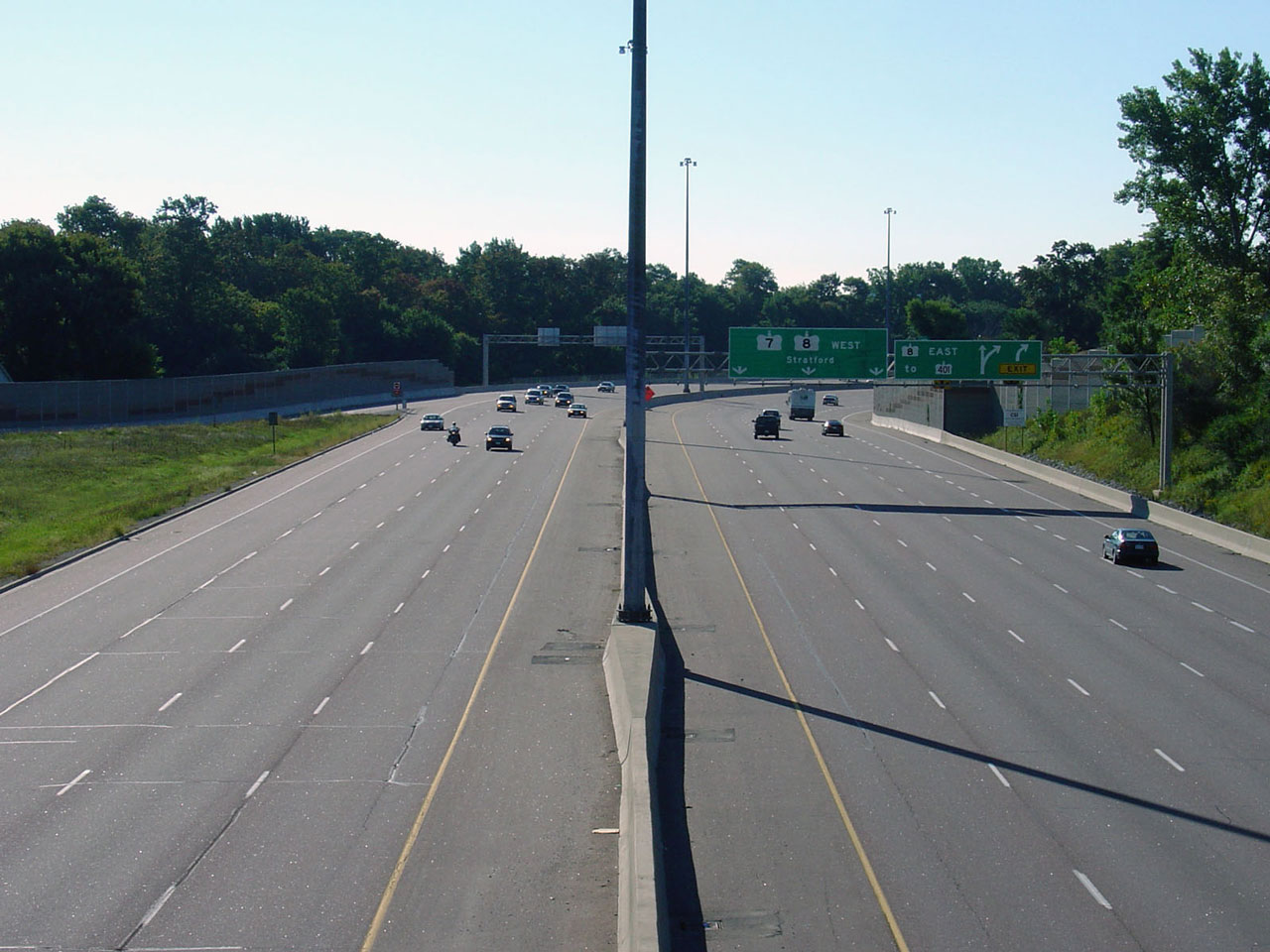
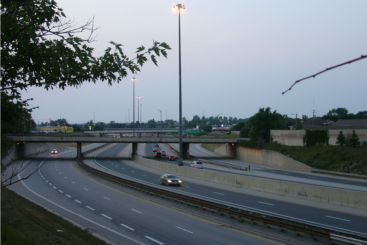
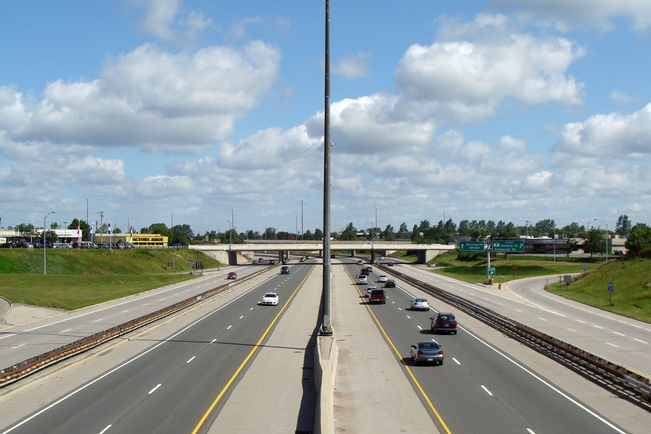
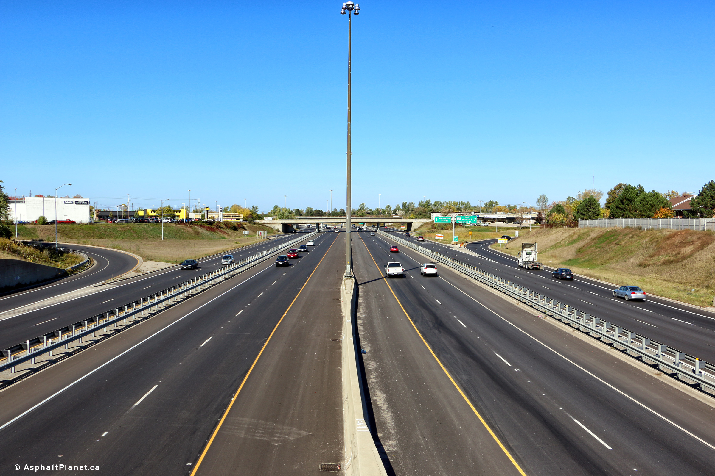
| City of Kitchener Regional Municipality of Waterloo |
These photos show Highway 7/8
looking west from the Fisher-Hallman Road overpass in Kitchener. The
highway's median widens considerably for a short distance
west of the Fischer-Hallman Road interchange. It would seem that
highway designers envisioned a considerably wider rural cross-section when
the initial portion of the highway was opened in the 1970s than what was
actually built later in the 1990s. Upper photo taken: June 10th, 2005. Lower photos taken: August 11th, 2016. |
|
||
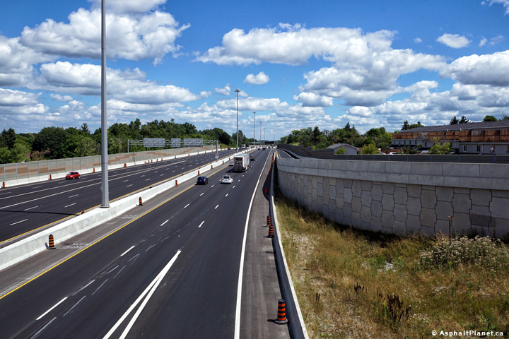
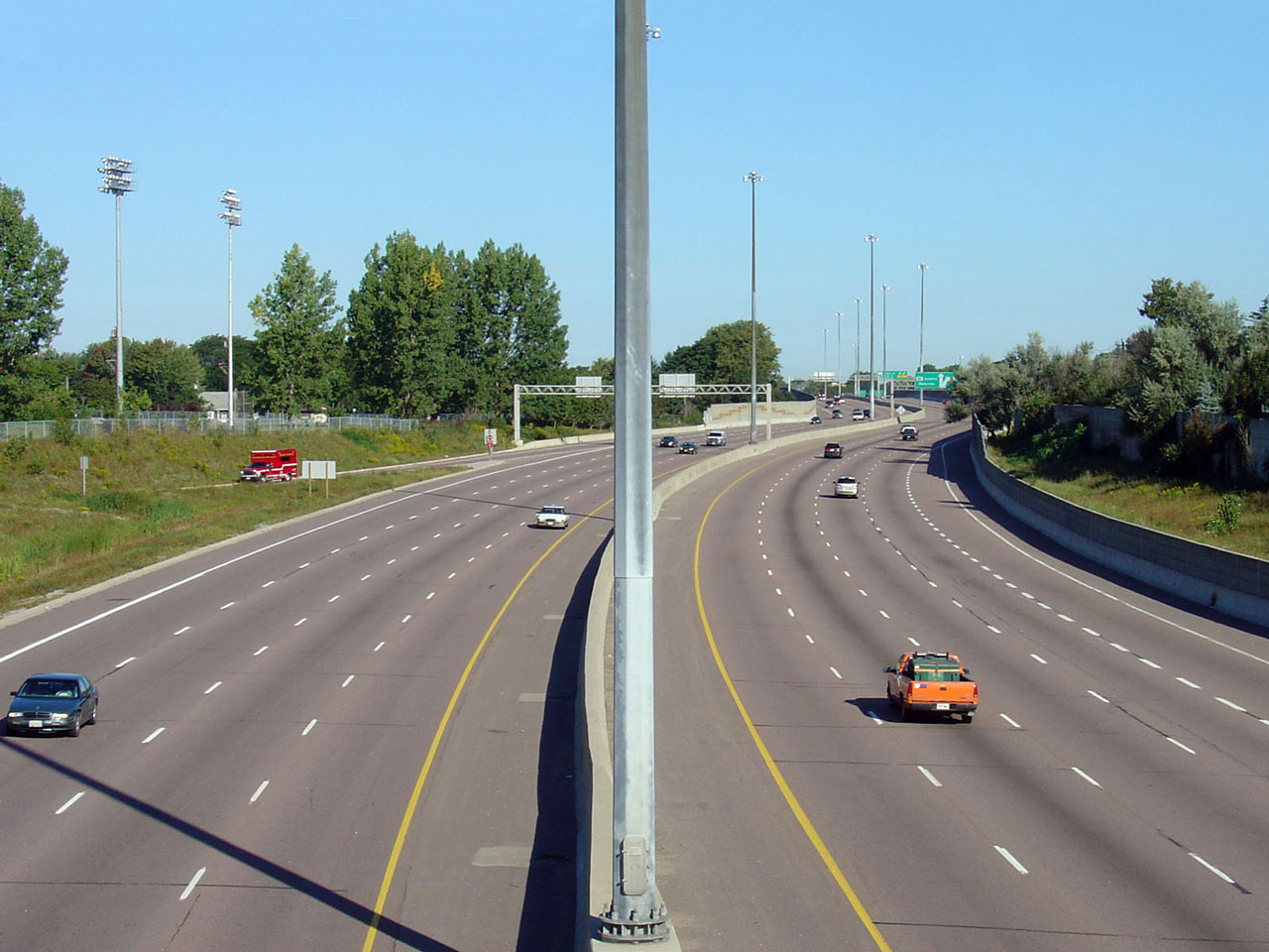
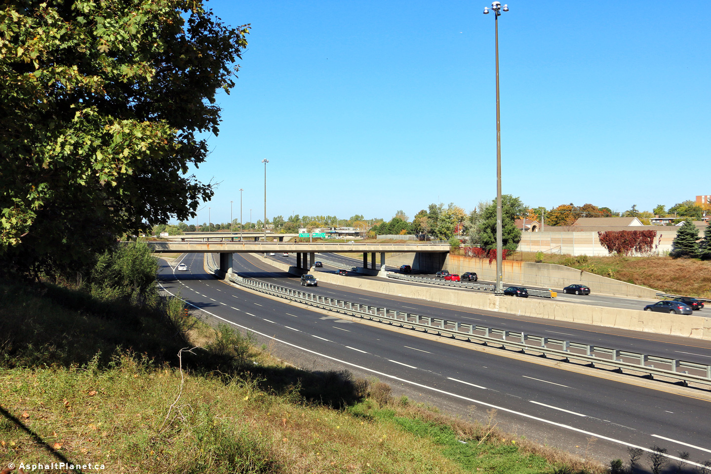
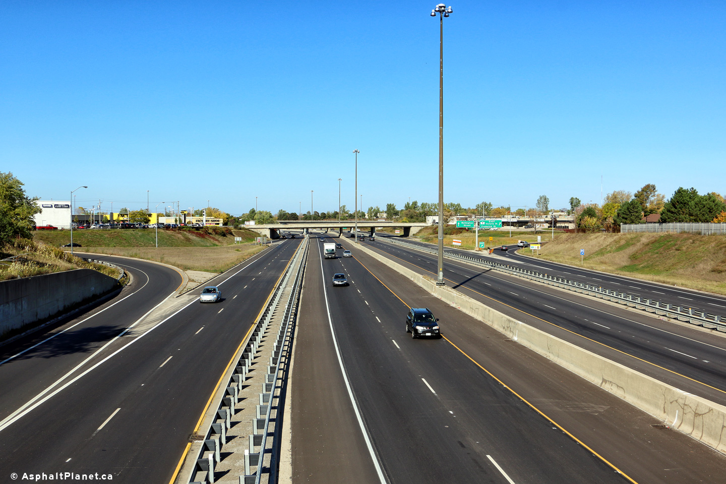
|
City of Kitchener Regional Municipality of Waterloo |
Easterly view of the
Conestoga Parkway from Fischer Hallman Road. The MTO is in preliminary
design to widen the Parkway from Fischer Hallman Road easterly to Courtland
Road. Upper photo taken: June 10th, 2005. Lower photos taken: August 11th, 2016. |
 (720x480) (1440x960) (2400x1600)
|
||
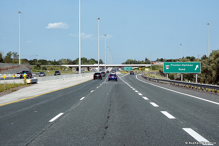
|
City of Kitchener Regional Municipality of Waterloo |
View looking westerly at the
off-ramp to Fischer-Hallman Road. Photo taken: August 11th, 2016. |
 (720x480) (720x480)(1440x960) (2400x1600) |
||
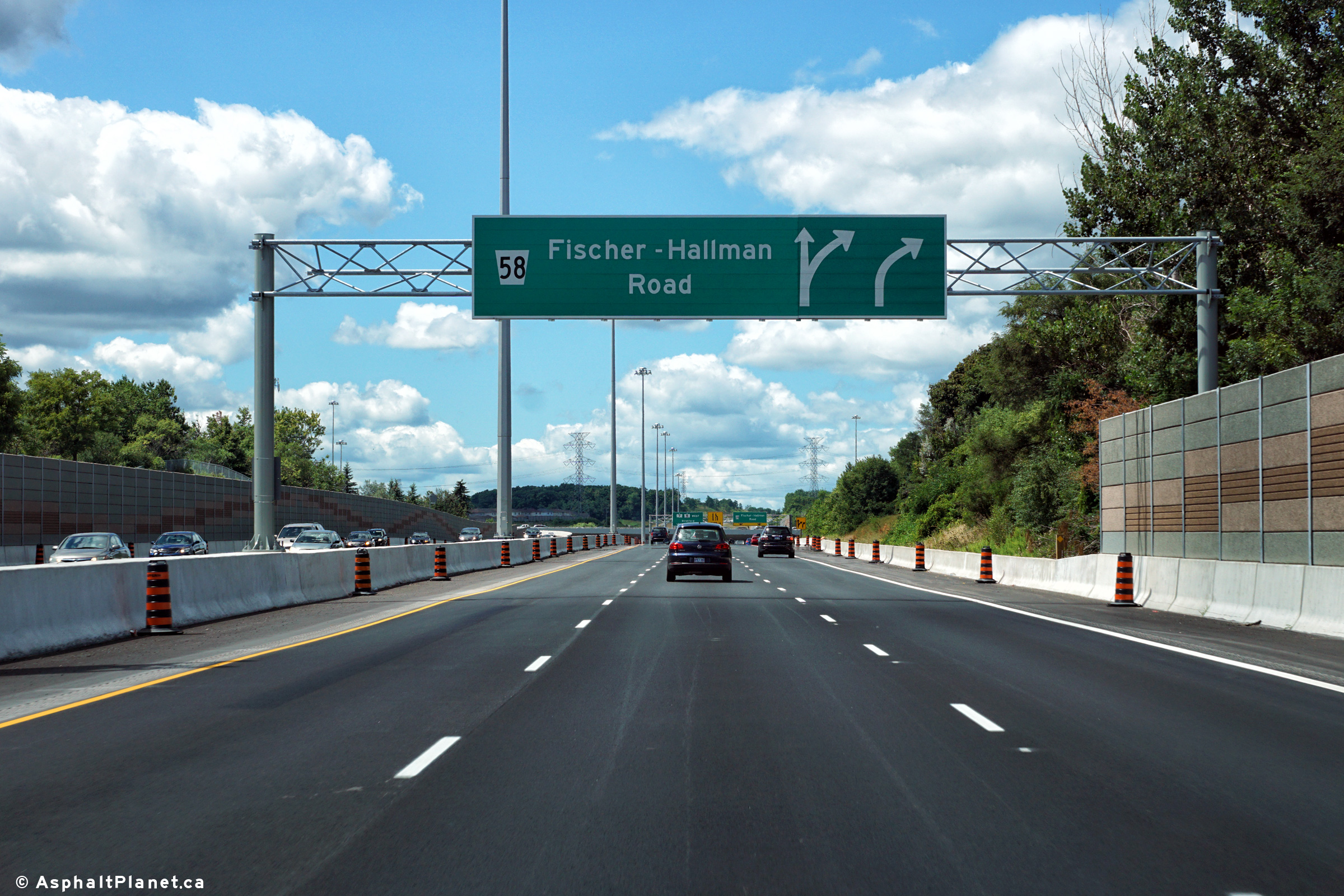
|
City of Kitchener Regional Municipality of Waterloo |
Westbound signage in advance of
the Fischer-Hallman Road interchange. Photo taken: August 11th, 2016. |
 (720x480) (720x480)(1440x960) (2400x1600) |
||
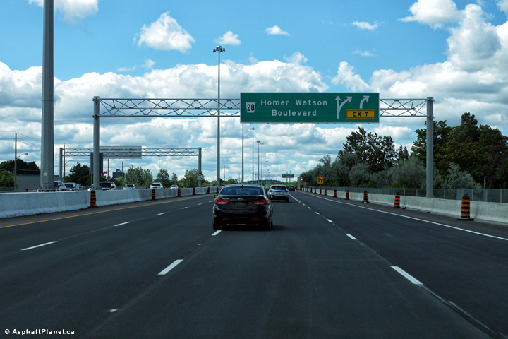
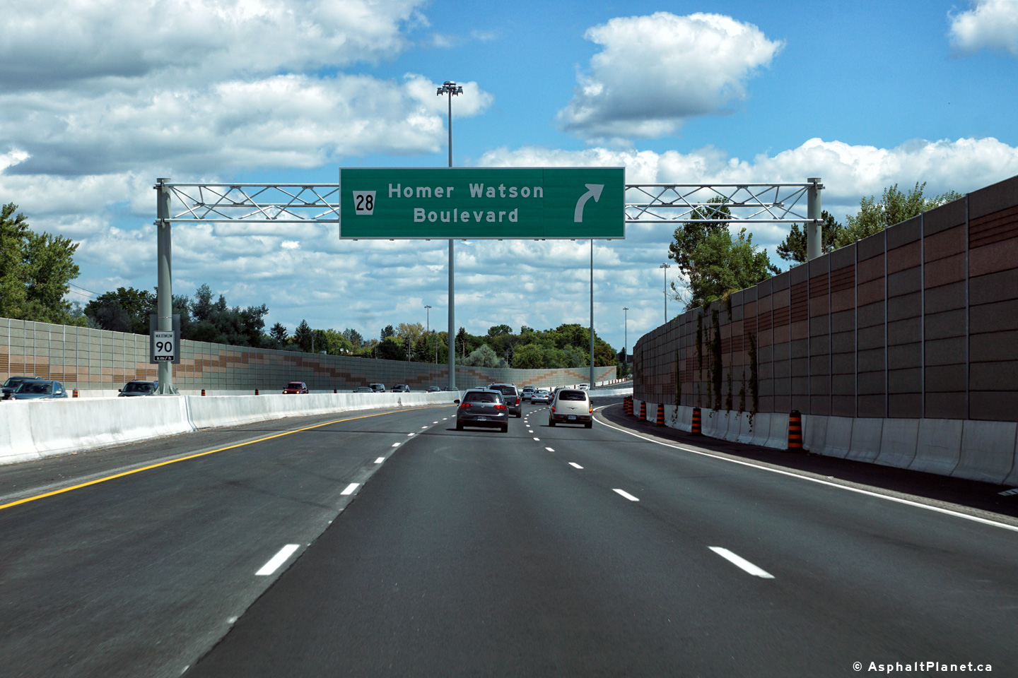
|
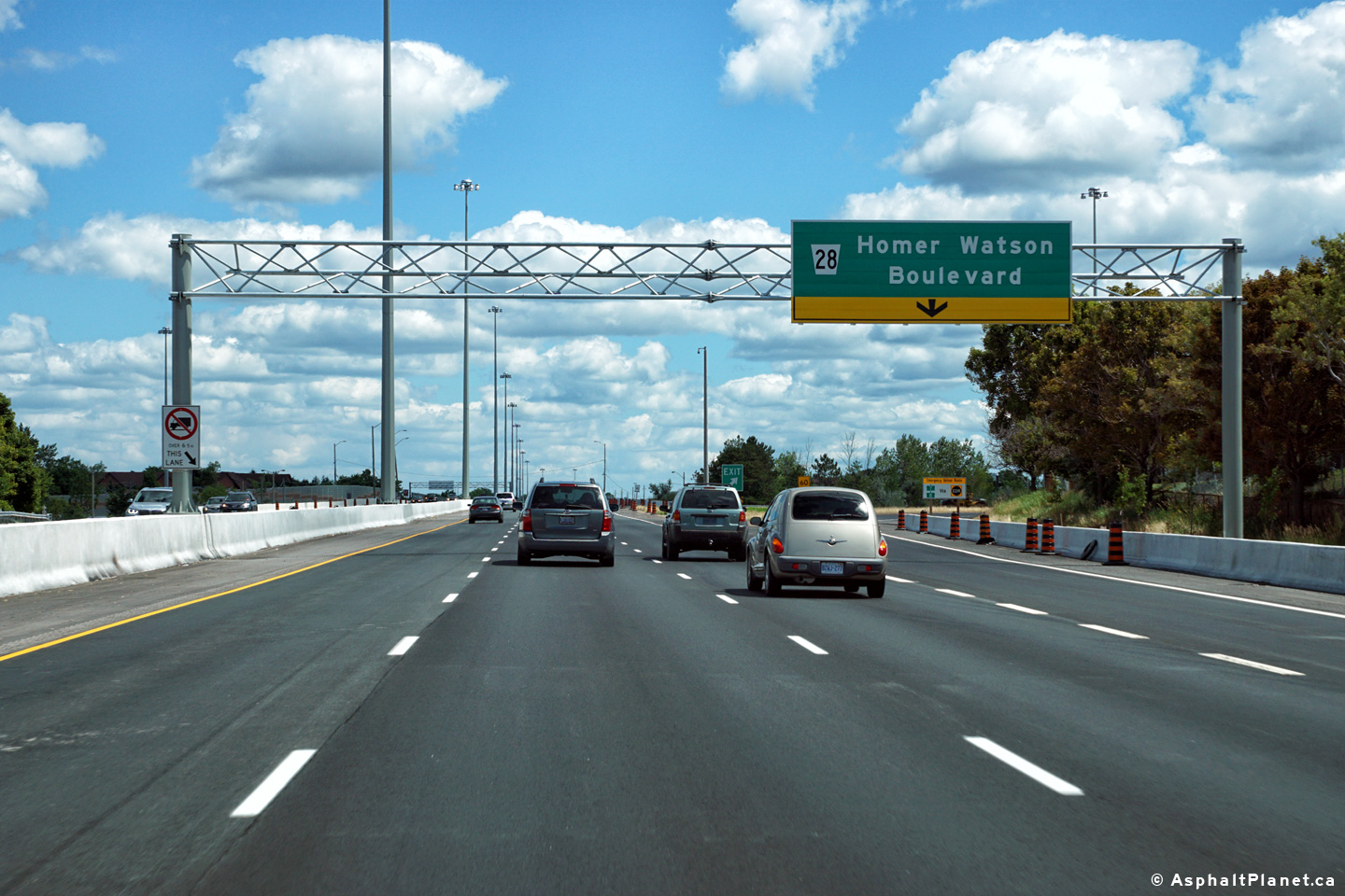
City of Kitchener Regional Municipality of Waterloo |
Eastbound advanced signage for
the Homer Watson Boulevard interchange. Photo taken: August 11th, 2016. |
 (720x480) (720x480)(1440x960) (2400x1600) |
||
|
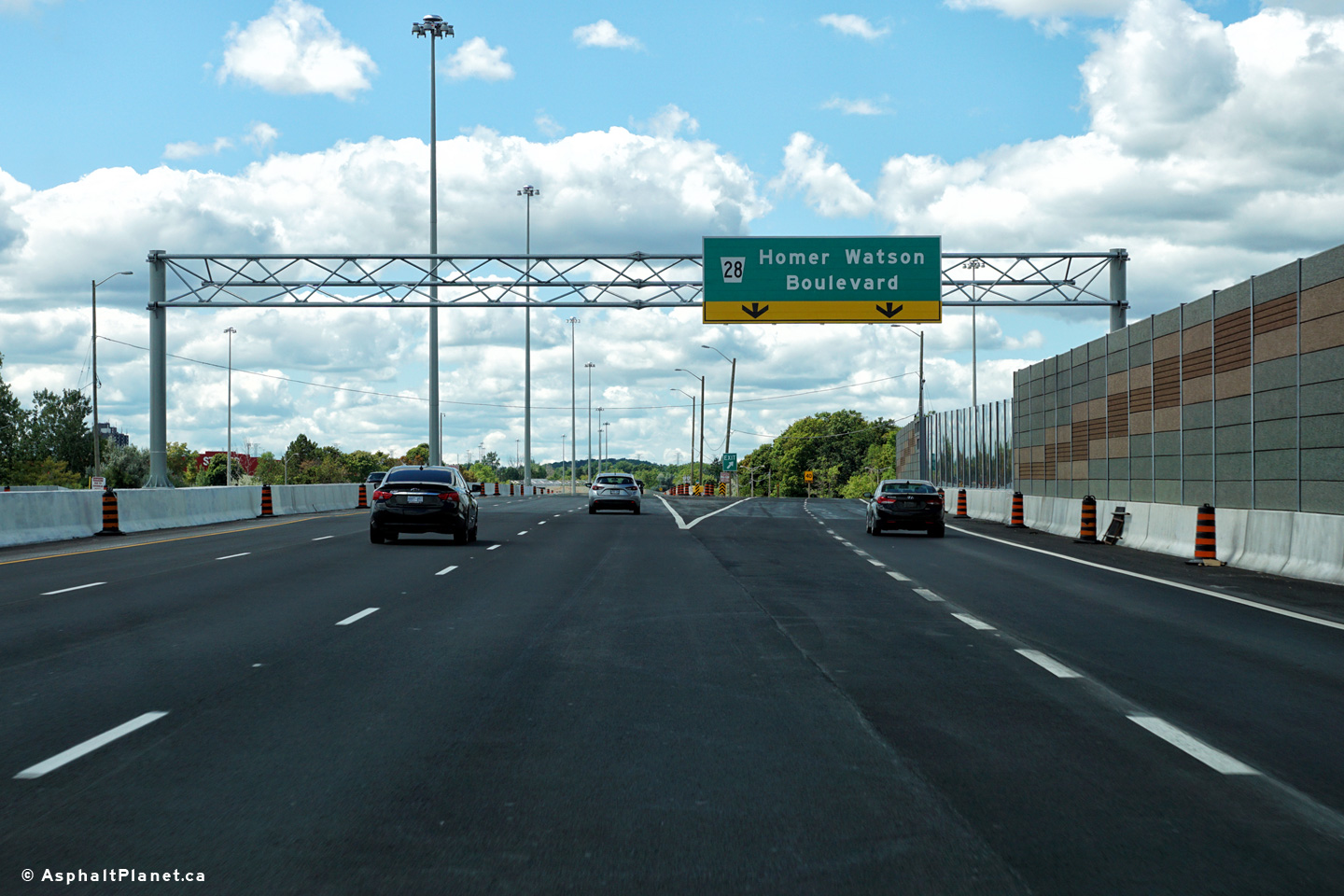
City of Kitchener Regional Municipality of Waterloo |
View looking easterly at the
off-ramp to Homer Watson Boulevard interchange. Photo taken: August 11th, 2016. |
 (720x480) (720x480)(1440x960) (2400x1600) |
||
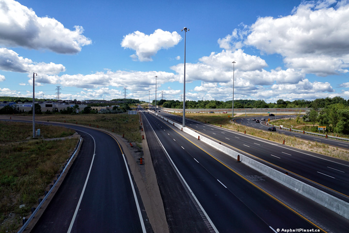
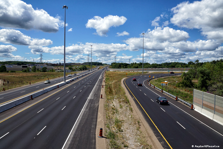
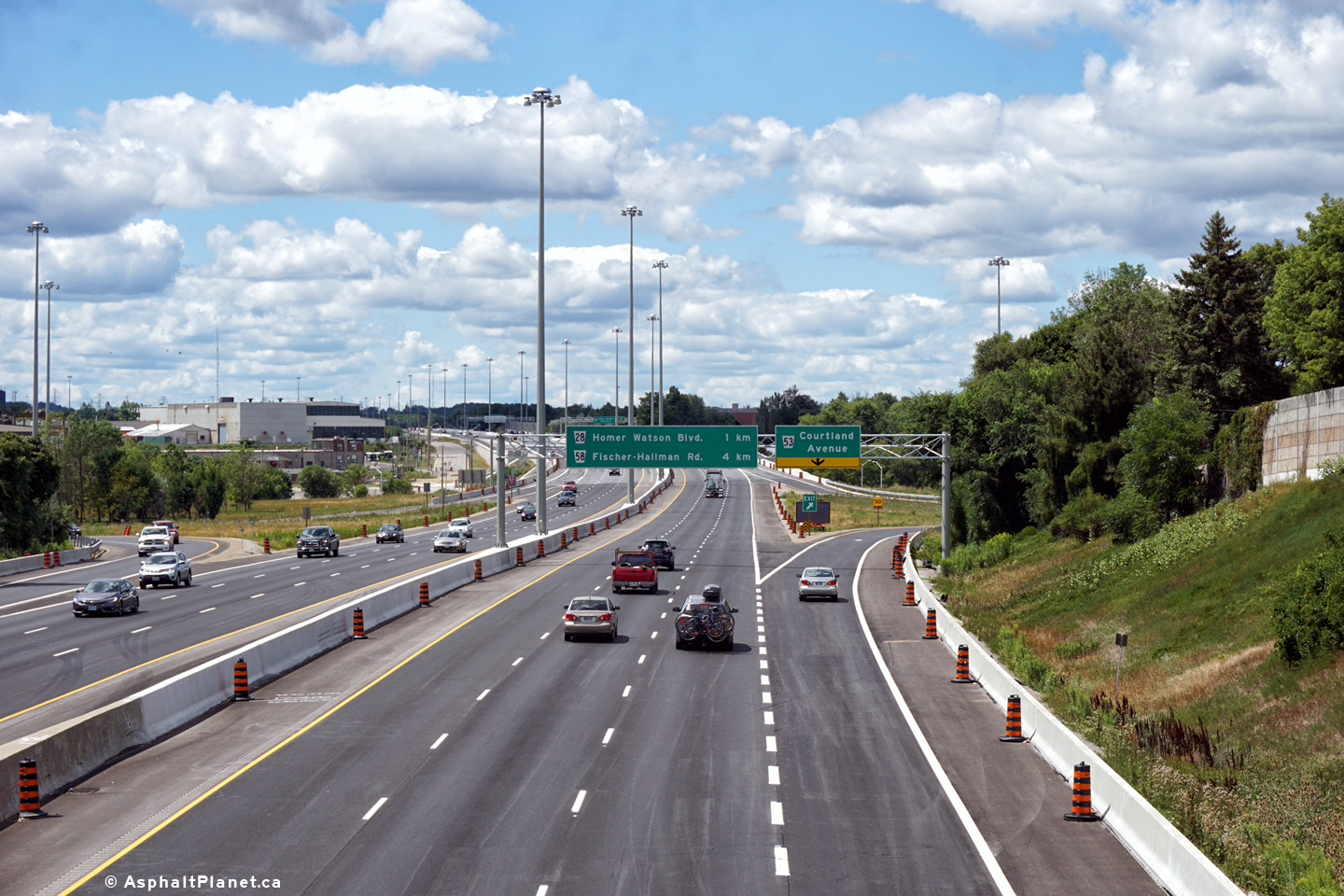
|
A multi-year construction project to widen Highway 7/8 to six lanes between Fischer Hallman Road and Courtland Avenue was completed in 2016. For photos of this construction project, click here. |
||||
|
City of Kitchener Regional Municipality of Waterloo |
View looking westerly at the
off-ramp to Homer Watson Boulevard. This off-ramp was widened from one
to two lanes during a construction project that was completed in 2016. Photo taken: August 11th, 2016. |
 (720x480) (720x480)(1440x960) (2400x1600) |
||
|
City of Kitchener Regional Municipality of Waterloo |
Westbound advanced signage for
the Homer Watson Boulevard interchange. Photo taken: August 11th, 2016. |
 (720x480) (720x480)(1440x960) (2400x1600) |
||
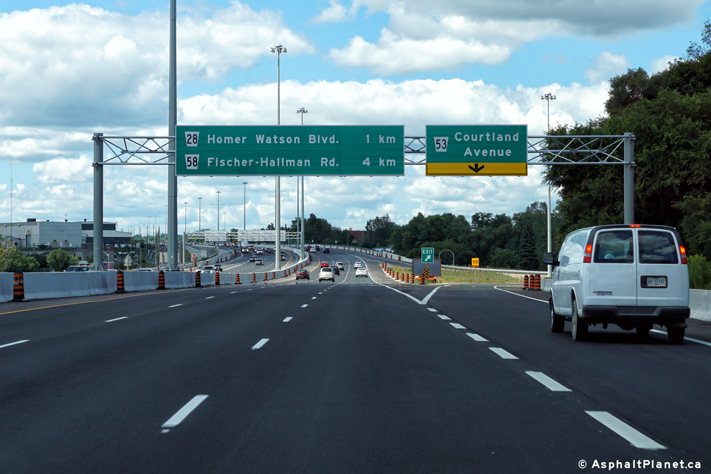
|
City of Kitchener Regional Municipality of Waterloo |
Eastbound advanced signage for
the Courtland Avenue interchange. Photo taken: August 11th, 2016. |
 (720x480) (720x480)(1440x960) (2400x1600) |
||
|
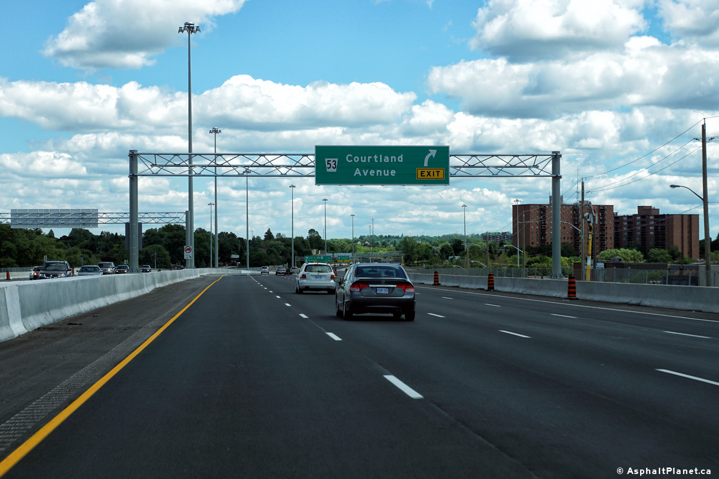
City of Kitchener Regional Municipality of Waterloo |
View looking easterly at the
off-ramp to Courland Avenue. The fourth lane that joined the highway
at the Homer Watson Boulevard interchange exits at Courtland Avenue. Photo taken: August 11th, 2016. |
 (720x480) (720x480)(1440x960) (2400x1600) |
||
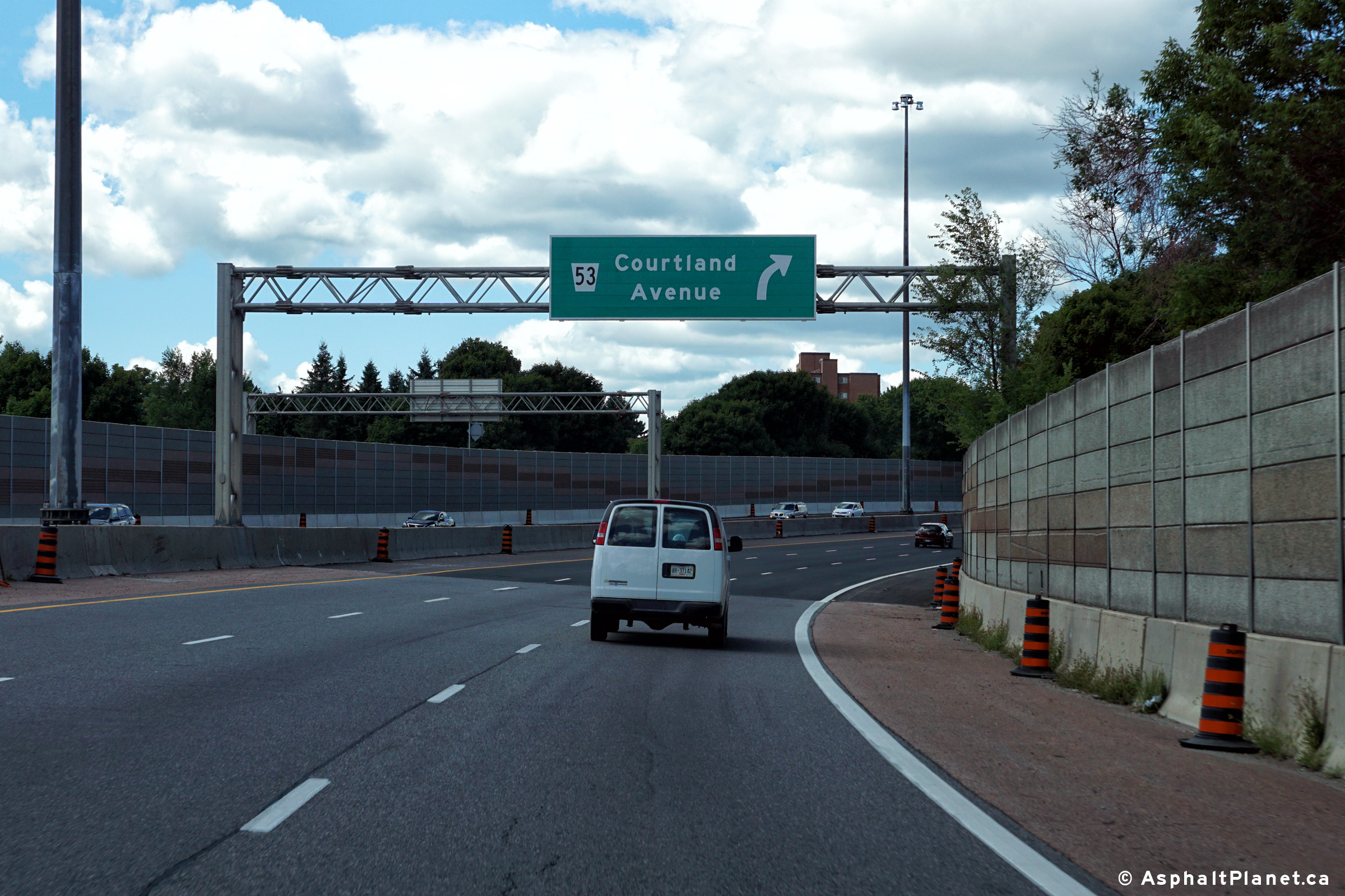
|
City of Kitchener Regional Municipality of Waterloo |
View looking westerly at the
off-ramp to Courland Avenue. Photo taken: August 11th, 2016. |
 (720x480) (720x480)(1440x960) (2400x1600) |
||
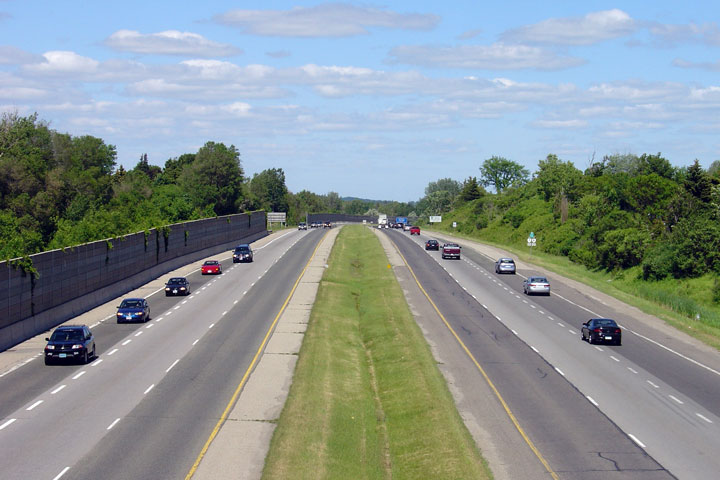
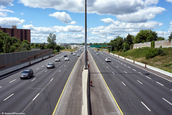
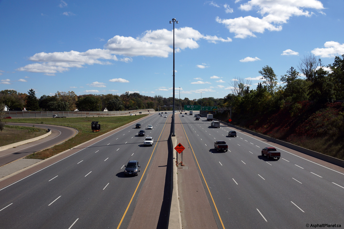
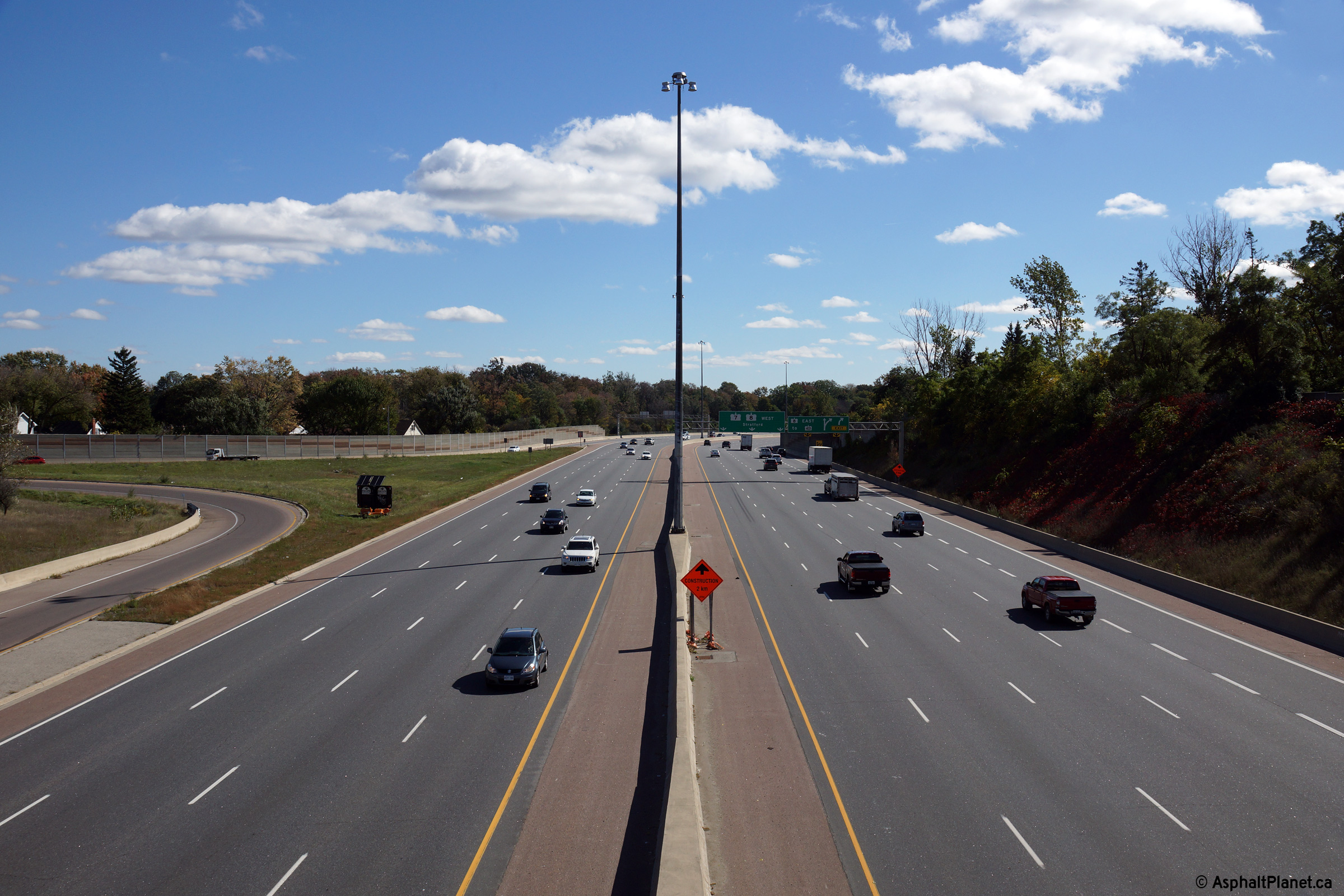
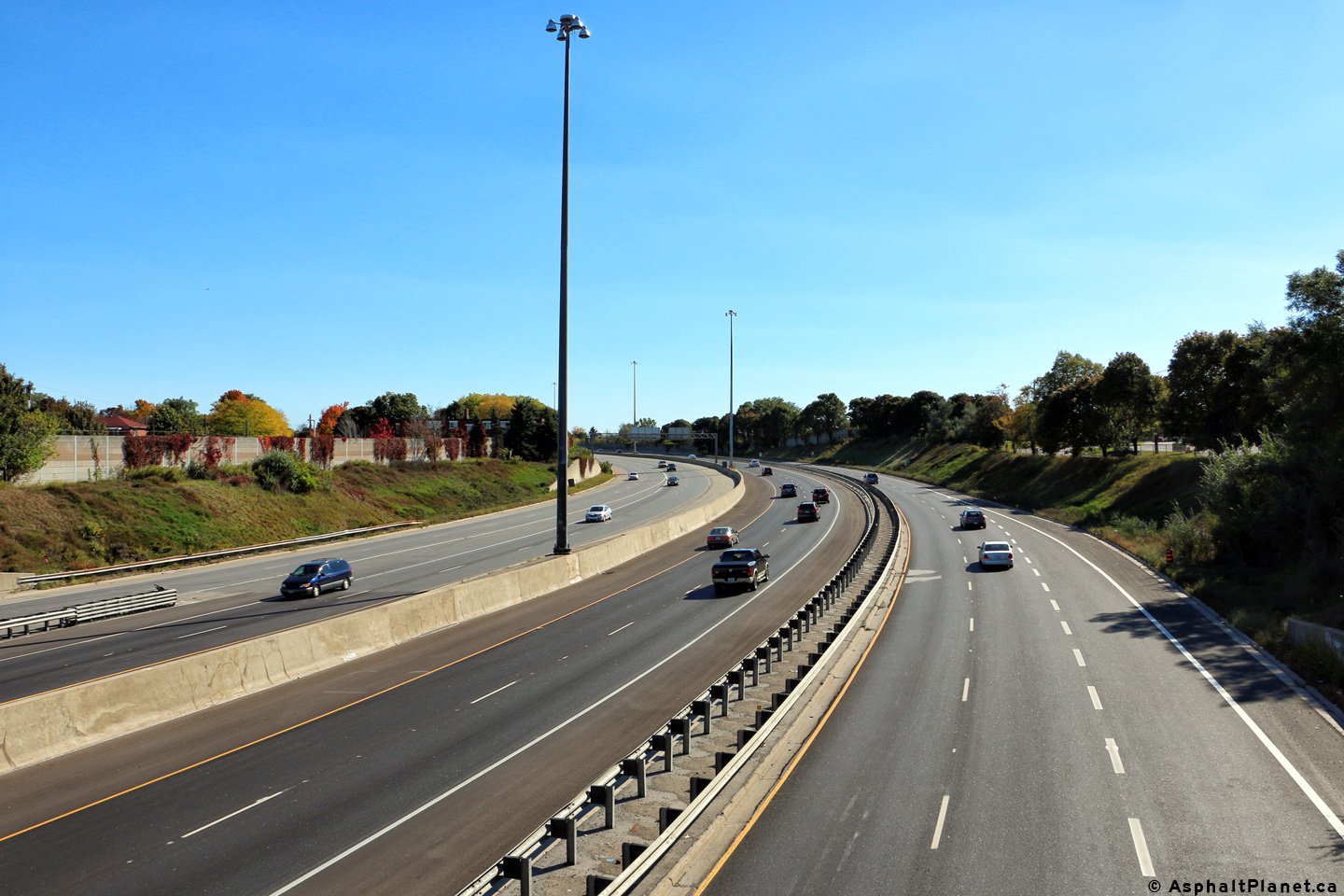
|
City of Kitchener Regional Municipality of Waterloo |
Highway 7/8 looking west towards
the Courtland Avenue. interchange from the pedestrian overpass just east of
Courtland Avenue. Before, 2016, Highway 7/8 had a four lane
cross-section from Courtland Avenue westerly to New Hamburg. Upper photo taken: September 18th, 2005. Lower photos taken: August 11th, 2016. |
(720x480) (1440x960) (2400x1600)
|
||
|
City of Kitchener Regional Municipality of Waterloo |
Highway 7/8 looking east
from the same pedestrian overpass as the previous picture. The Highway 7/8
interchange is located about 500m east of this overpass. Upper photo taken: September 18th, 2005. Lower photo taken: August 11th, 2016. |
 |
||
|
City of Kitchener Regional Municipality of Waterloo |
Westbound advanced signage for
the Courtland Avenue interchange. Photo taken: August 11th, 2016. |
 (720x480) (720x480)(1440x960) (2400x1600) |
||
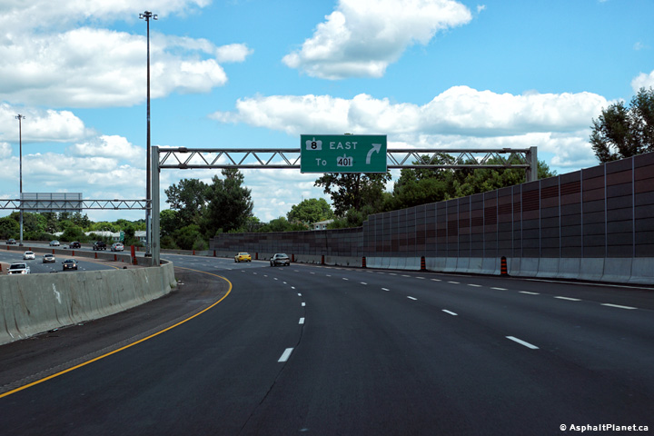
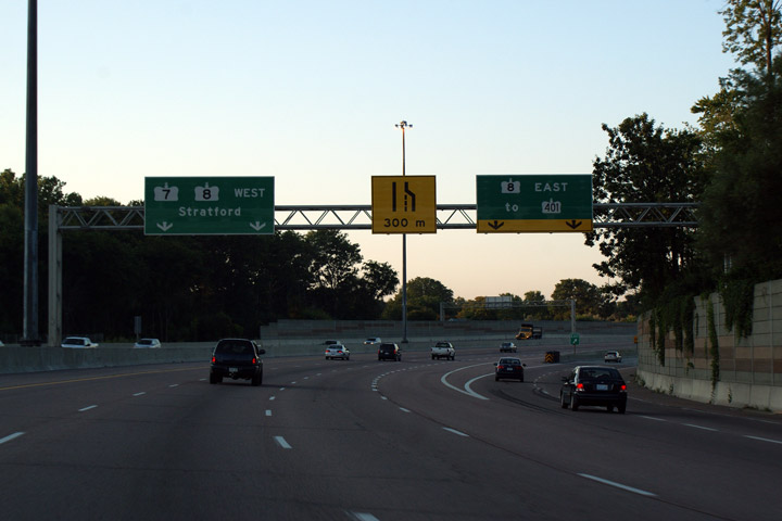
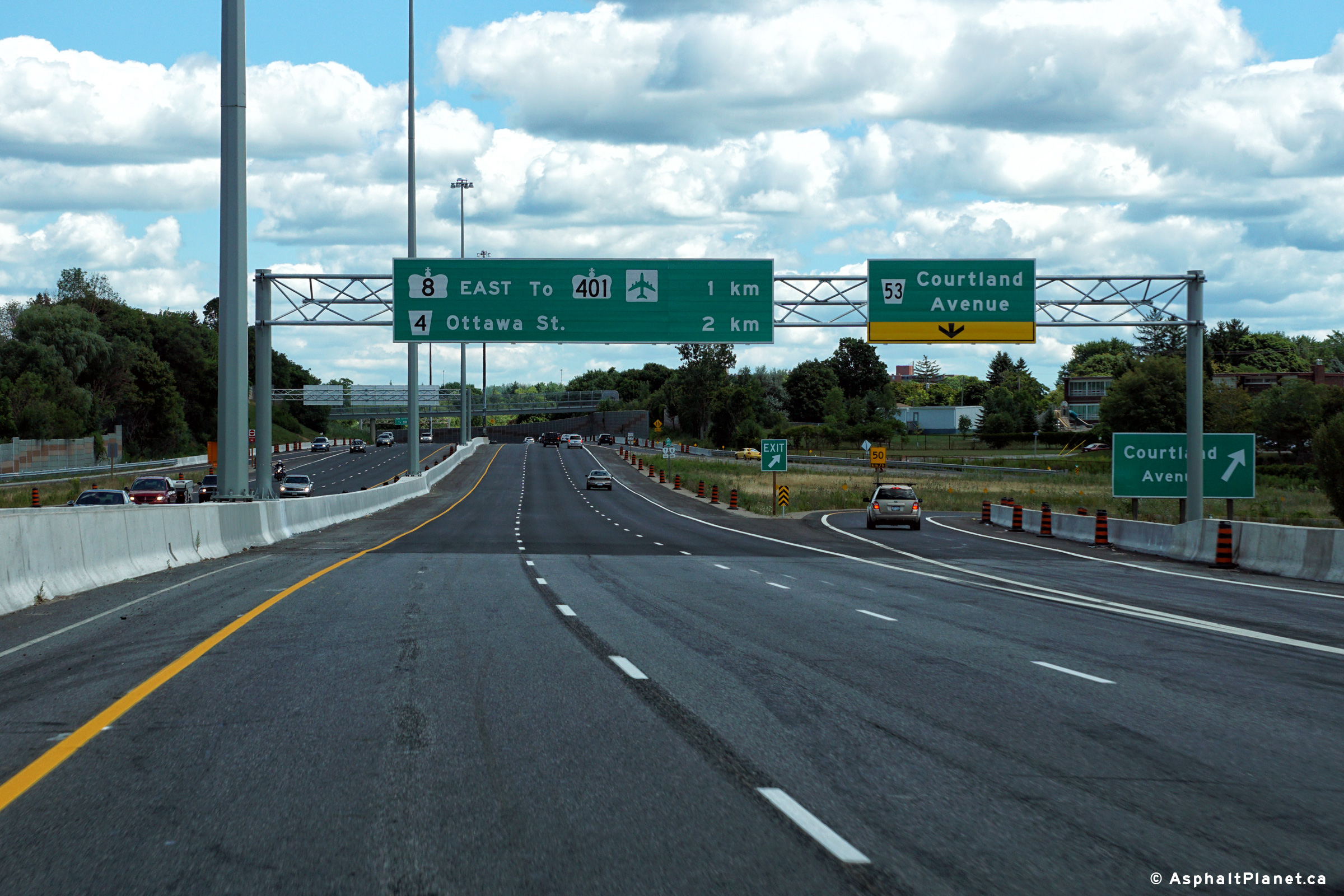
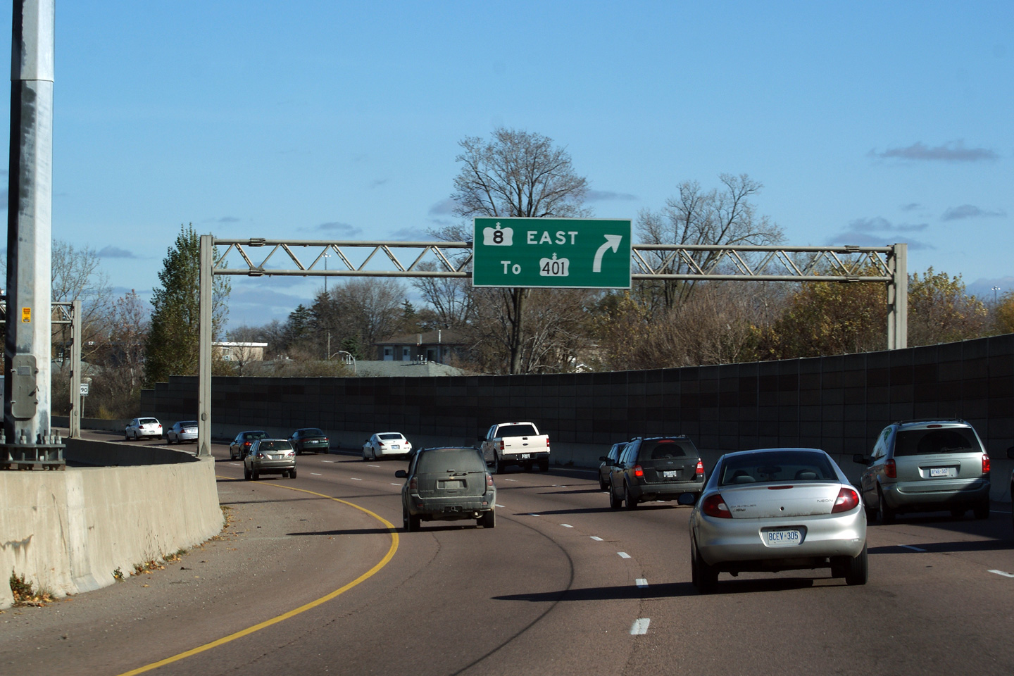
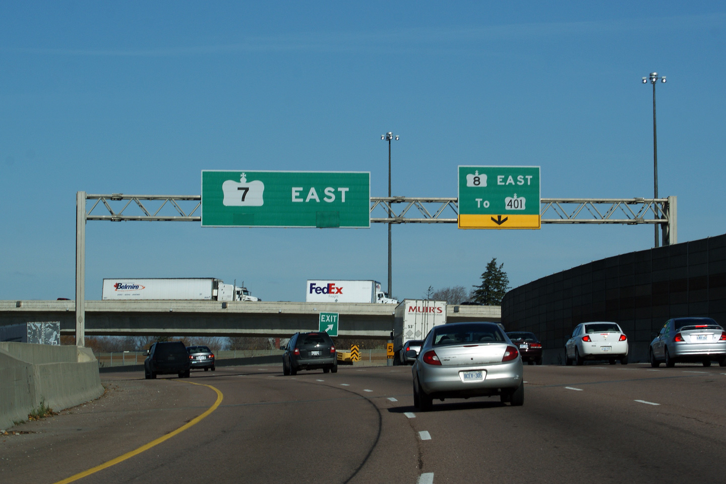
|
City of Kitchener Regional Municipality of Waterloo |
The advanced signage for the
Highway 8 split from the eastbound lanes of
the Conestoga Parkway. Traffic bound towards Highway 401 is directed
to follow Highway 8. Click here
for an alternate photo of this signage taken in August, 2004. Photo taken: August 11th, 2016. |
 (720x480) (720x480)(1440x960) (2400x1600) |
||
|
City of Kitchener Regional Municipality of Waterloo |
Three lanes
continue easterly along Highway 7, while the right lane departs for Highway
8. Click here for an alternate
photo of this signage taken in August, 2004. Photo taken: August 11th, 2016. |
|||
| Highway 8 heads east from Kitchener to Highway 401, Cambridge and finally Hamilton. Click here for Highway 8 images. | ||||
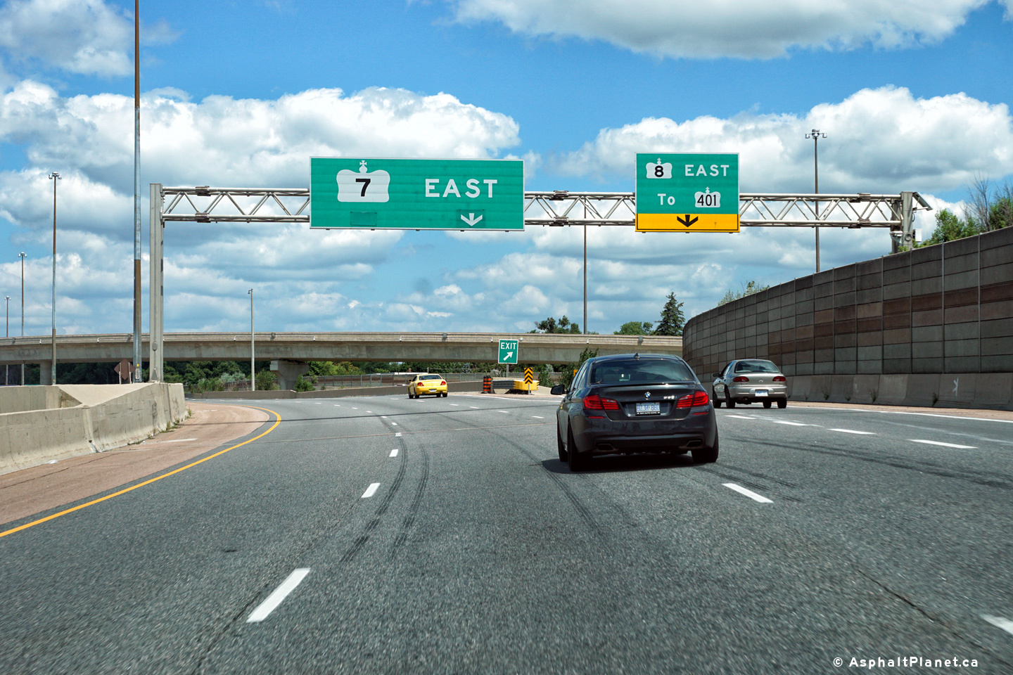
|
City of Kitchener Regional Municipality of Waterloo |
Overhead signage denoting the split for Highway 8
eastbound, from Westbound Highway 7. This interchange was recently
reconstructed, with a new flyover replacing the former loop-ramp for this
movement. Picture taken: September 24th, 2005. Size: 50kb. |
 Low
Res Low
ResHigh Res |
||
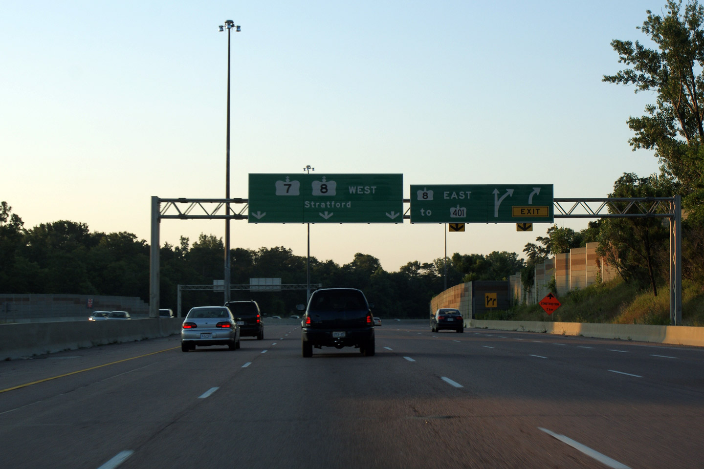
|
City of Kitchener Regional Municipality of Waterloo |
Advanced signage for the upcoming Highway 8
split from Westbound Highway 7. Picture taken: September 24th, 2005. Size: 45kb. |
 Low
Res Low
ResHigh Res |
||
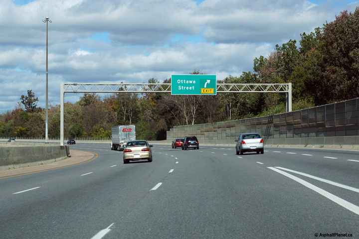
|
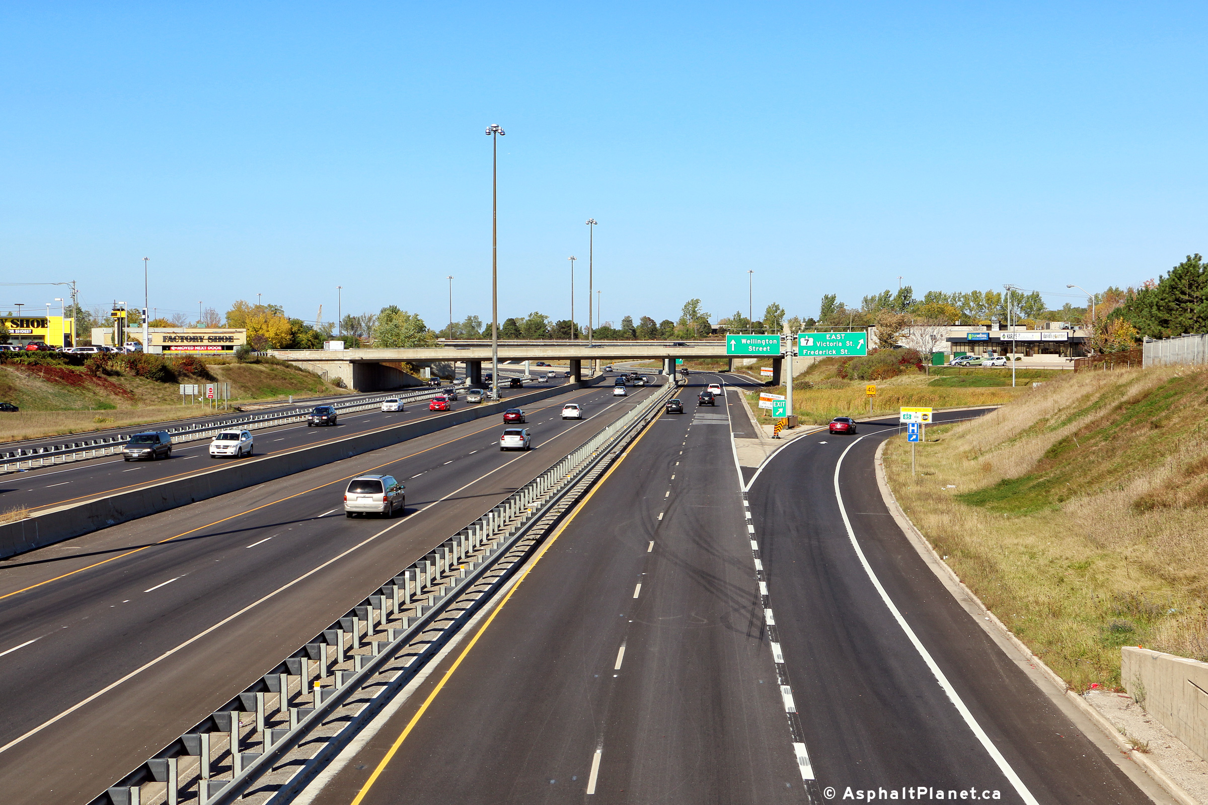
City of Kitchener Regional Municipality of Waterloo |
Eastbound advanced signage for
the off-ramp to Ottawa Street. The fifth eastbound lane that joins
Highway 7 from the Highway 8 on-ramp quickly departs the freeway at Ottawa
Street. Photo taken: October 9th, 2014. |
 (720x480) (720x480)(1440x960) (2400x1600) |
||
|
City of Kitchener Regional Municipality of Waterloo |
Overhead signage at the eastbound
off-ramp to Ottawa Street. Photo taken: October 9th, 2014. |
 (720x480) (720x480)(1440x960) (2400x1600) |
||
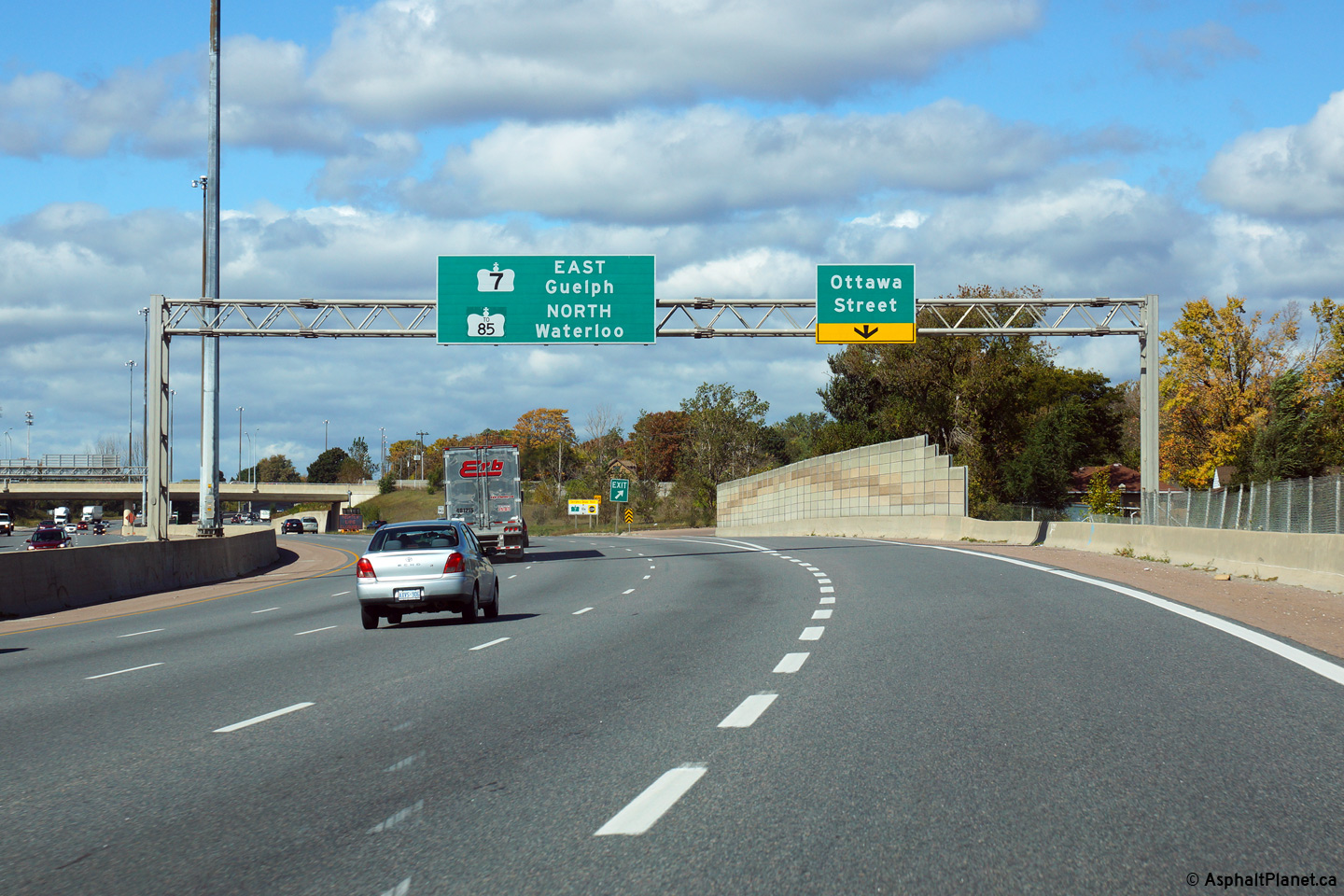
|
City of Kitchener Regional Municipality of Waterloo |
Looking west along Highway 7 from the Ottawa
Street overpass in Kitchener. Ottawa Street is the only interchange
along Highway 7 between Highways 8 and
85. Click here for this same view taken in
September, 2005. Picture taken: October 9th, 2014. |
|
||
|
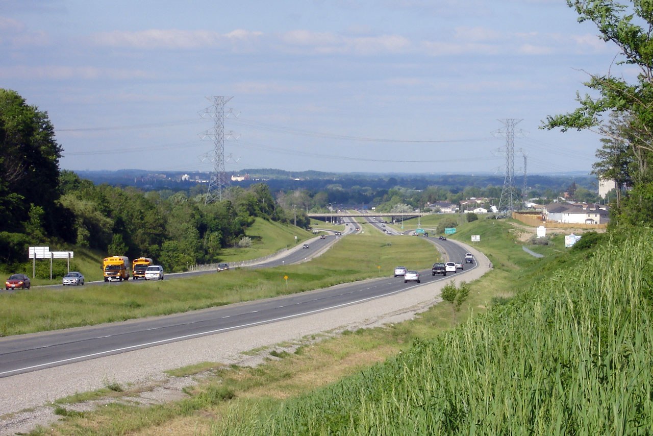
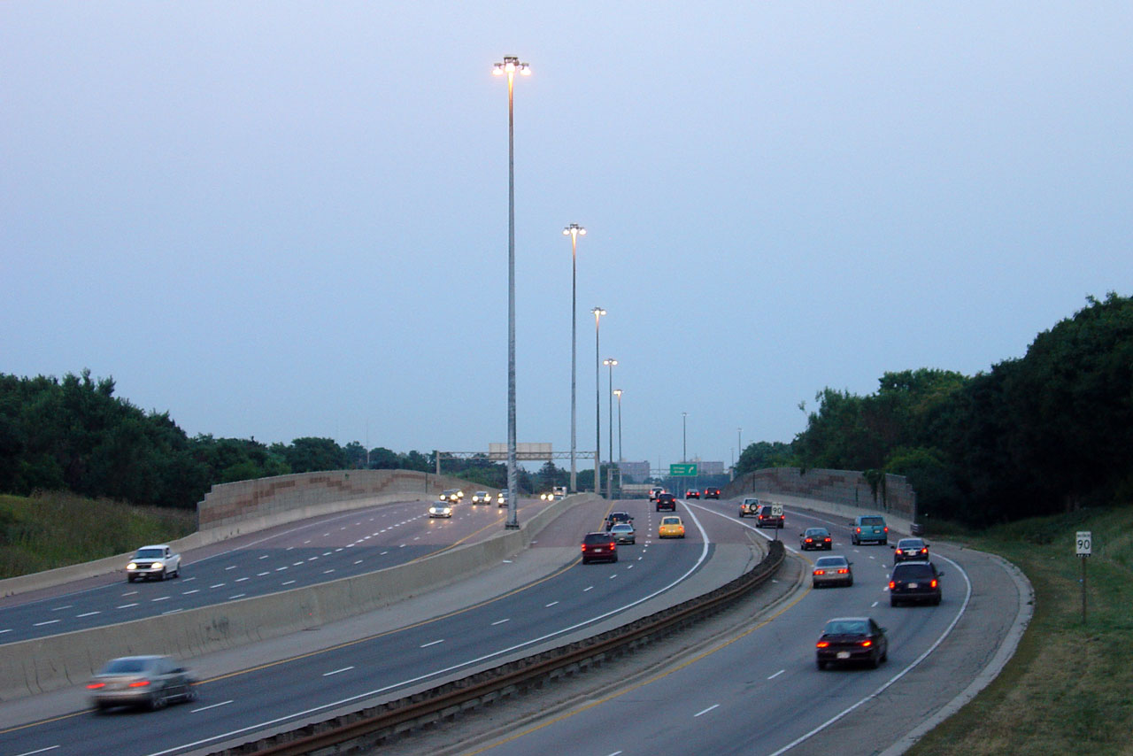
City of Kitchener Regional Municipality of Waterloo |
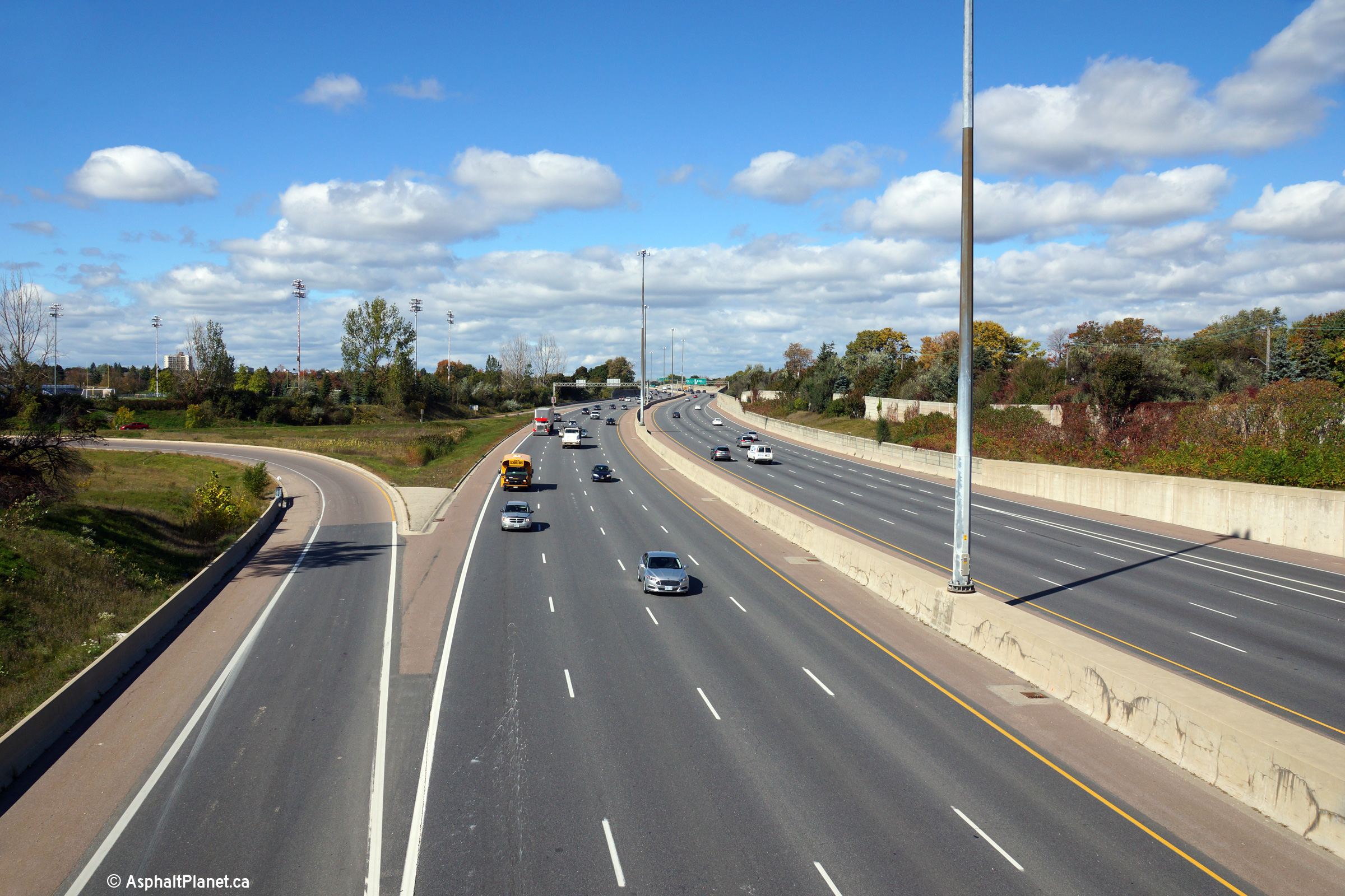
Highway 7 looking north from the Ottawa Street
overpass. Highway 7 has an eight-lane cross-section between Highways 8
and 85. This portion of the Conestoga Expressway was widened from
four- to eight-lanes in 2000. Click
here for this same view taken in
September, 2005. Picture taken: October 9th, 2014. |
|
||
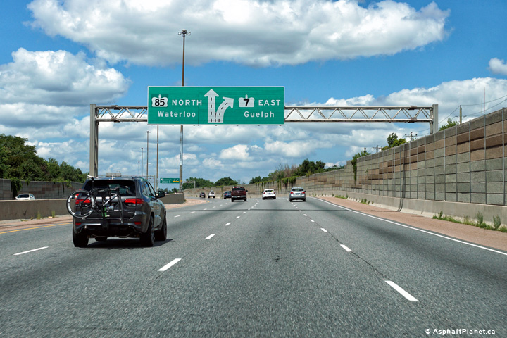
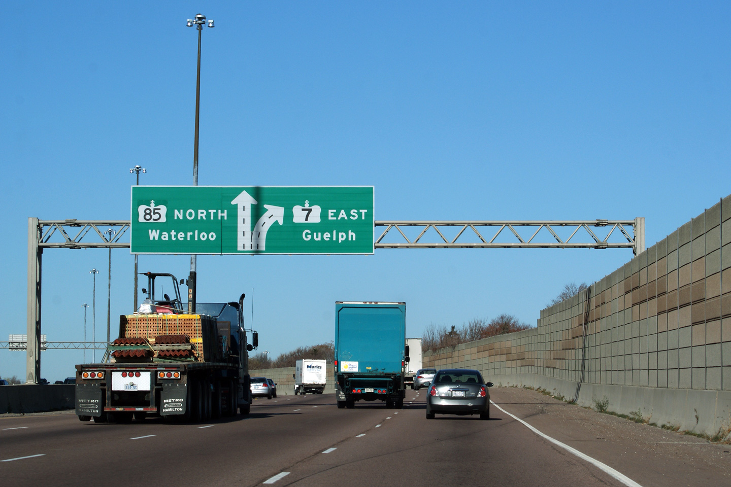
|
City of Kitchener Regional Municipality of Waterloo |
Advanced signage for the Highway
7/85 split north of Ottawa Street. Click
here for an alternate photo of this
signage taken in April, 2009. Photo taken: August 11th, 2016. |
 (720x480) (720x480)(1440x960) (2400x1600) |
||
| City of Kitchener Regional Municipality of Waterloo |
The right two lanes split from
the mainline ahead to form a short core-collector setup. Traffic
continuing east along Highway 7 must use the collector lanes. Click
here for an alternate photo of this
signage taken in April, 2009. Photo taken: August 11th, 2016. |
|||
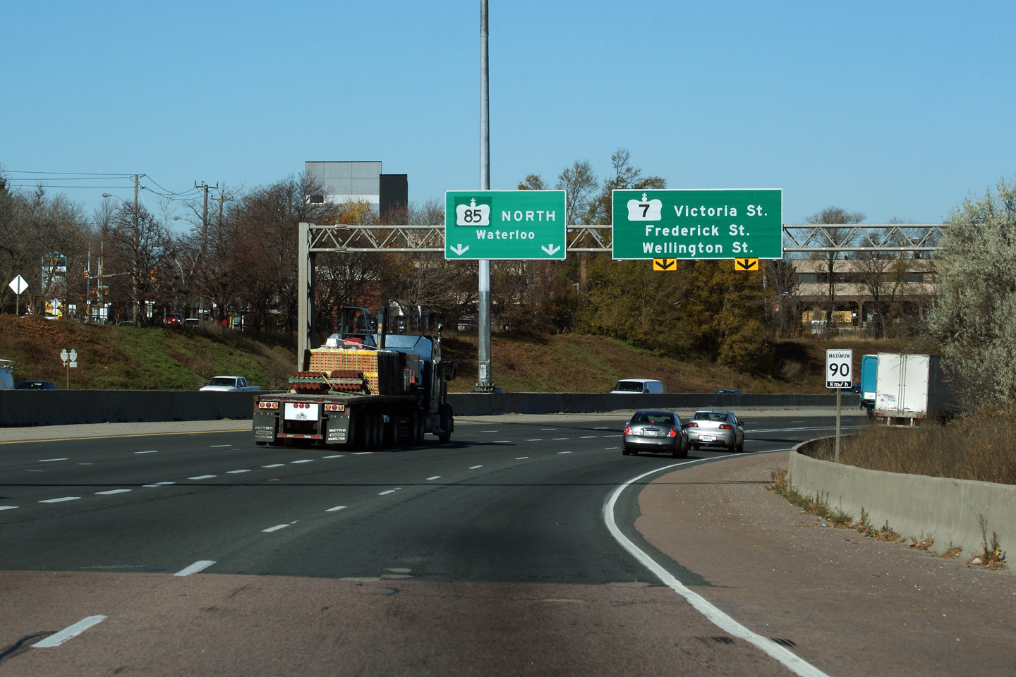
| City of Kitchener Regional Municipality of Waterloo |
Signage at the development of the
core-collector lanes. Click here for an alternate photo of this
signage taken in April, 2009. Photo taken: August 11th, 2016. |
|||
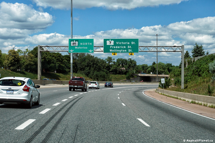
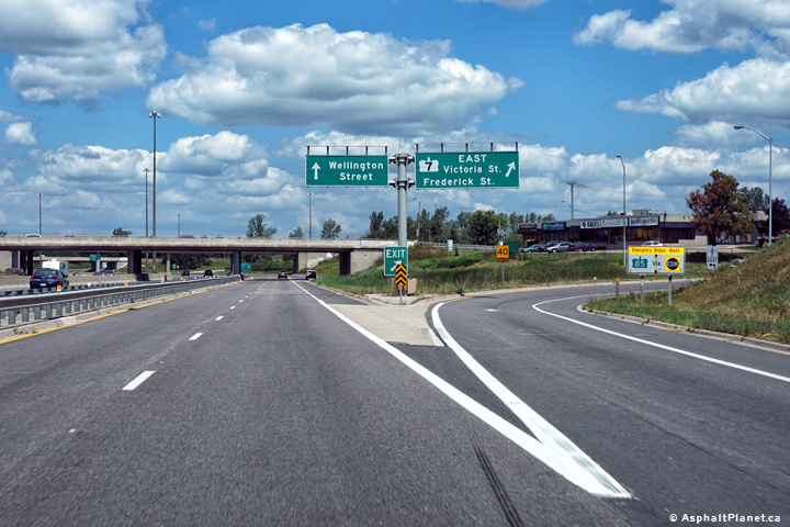
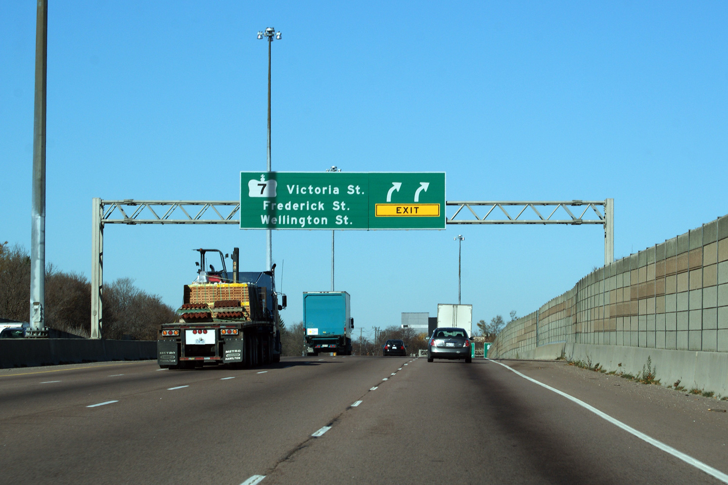
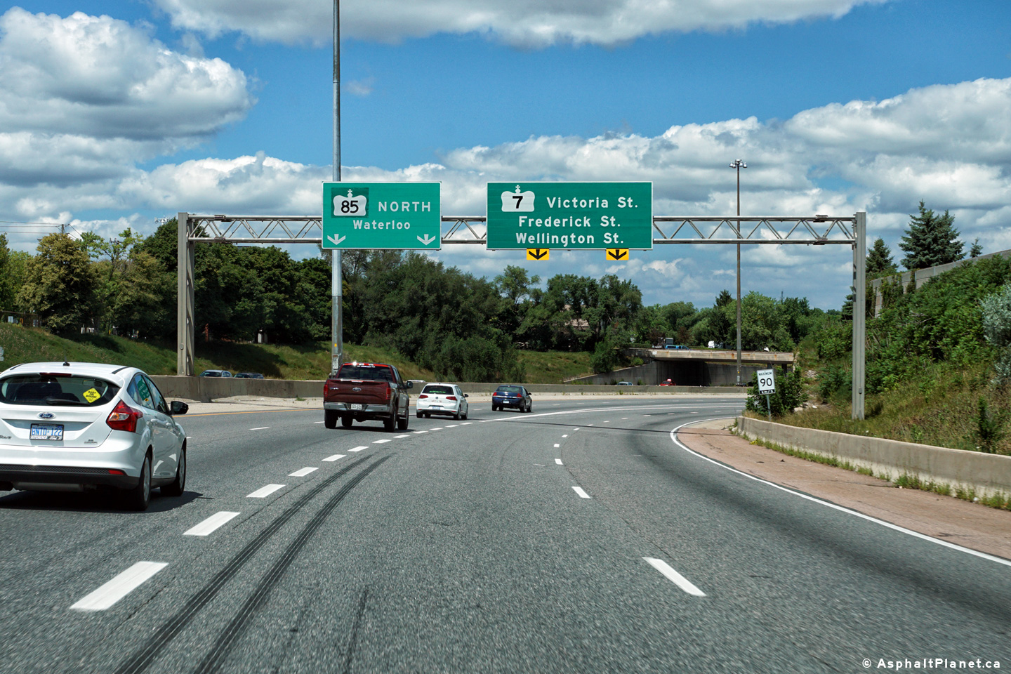
| City of Kitchener Regional Municipality of Waterloo |
View looking
westerly towards the collapse of the complex freeway west of Frederick
Street. Click here for an
alternate photo from this vantage point, taken in August, 2007. Photo taken: October 11th, 2016. |
|
||
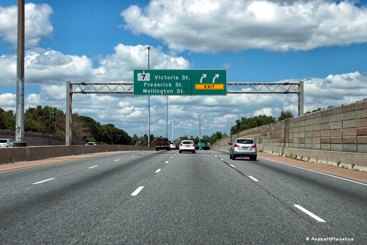
| City of Kitchener Regional Municipality of Waterloo |
Easterly view towards
Fredrick Street at dusk. Click here
for an alternate photo from this vantage point, taken in August, 2007. Photo taken: October 11th, 2016. |
|
||
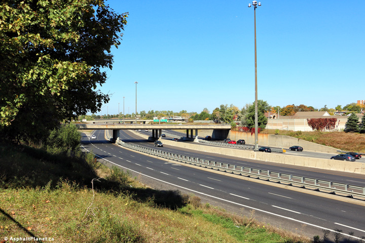
| City of Kitchener Regional Municipality of Waterloo |
Highway 7 looking easterly from
the Frederick Street overpass. Click
here for an alternate photo from this
vantage point, taken in August, 2007. Photo taken: October 11th, 2016. |
|
||
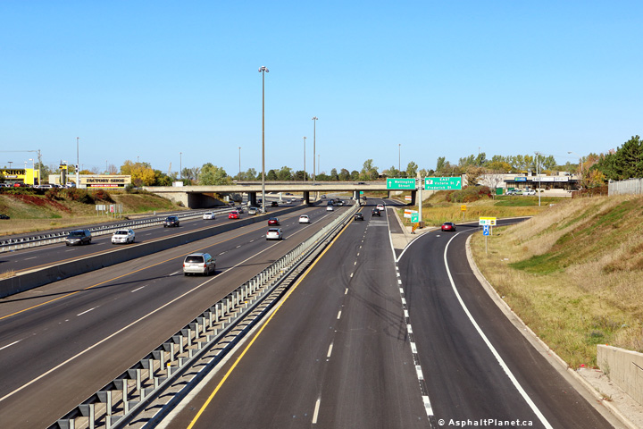
| City of Kitchener Regional Municipality of Waterloo |
This picture is looking west from
Fredrick Street down upon Highway 7. Highway 7 exits the freeway at
the interchange pictured in these photos. Click
here for an alternate photo from this
vantage point, taken in August, 2007. Photos taken: October 11th, 2016. |
(720x480) (1440x960) (2400x1600)
(720x480) (1440x960) (2400x1600)
|
||
| City of Kitchener Regional Municipality of Waterloo |
Highway 7 exits from the Conestoga Expressway at
this interchange. At the end of this ramp, to stay on Highway 7, turn
left on Bruce Street, and then right on Victoria Street. Highway 7 heads east out of Kitchener on Victoria
Street, which is a busy conventional city street through eastern Kitchener. Photo taken: August 11th, 2016. |
|||
| City of Kitchener Regional Municipality of Waterloo |
An interesting view of the
ramps connecting Highway 7 (Victoria Street) to the Parkway. The ramps
before the freeway carry Stratford-bound traffic onto the freeway, while the
ramps on the other side of the freeway carry traffic bound for Guelph
towards Victoria Street. Photo taken: August 2nd, 2007. |
 |
||
| Highway 85 continues northerly along the Parkway from Highway 7 to the north end of Waterloo. Click here for Highway 85 images. | ||||
| Guelph to Thornhill Images available here | ||||
<- Page 1B Images Highway 7 Images Index Page 1D Images ->
<- Highway 6 Images Back to Highway 7 Highway 7A Images ->
Copyright (c) 2004-2019, AsphaltPlanet.ca AsphaltPlanet@asphaltplanet.ca


