|
Proper
Municipality Name |
Community Name |
Distance |
Intersecting Road |
|
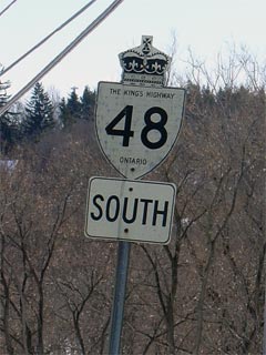
In Toronto, Highway 48 is known
only as Markham Road |
| City of Toronto |
Scarborough |
0 km / 129.2 km |
King's Highway 401 (Autoroute
Macdonald-Cartier Freeway) |
| City of Toronto |
Scarborough |
1.0 km / 128.2 km |
Sheppard Avenue |
| City of Toronto |
Scarborough |
--- |
Finch Avenue |
| Toronto - Markham Boundary |
Scarborough |
5.9 km / 123.3 km |
Steeles Avenue |
|
Toronto - York Boundary. In
York Region, Highway 48 is known as Markham Road and York Road 68. In
Toronto, Highway 48 is known only as Markham Road |
| Town of Markham |
Markham |
--- |
Fourteenth Avenue (York Road 71) |
| Town of Markham |
Markham (Vinegar Hill) |
--- |
Highway 407 ETR |
|
Current Southern (1998) Terminus
of Highway 48 is located at Vinegar Hill, just south of Highway 7 |
|
South of Vinegar Hill Highway 48
is known as Markham Road and York Road 68. |
| Town of Markham |
Markham |
10.1 km / 119.1 km |
York Road 7 (Highway 7 East) |
| Town of Markham |
Markham |
--- |
Sixteenth Avenue (York Road 73) |
| Town of Markham |
----- |
14.2 km / 114.0 km |
Major Mackenzie Drive (York Road 25) |
| Town of Whitchurch Stouffville |
Ringwood |
20.3 km / 108.9 km |
Stouffville Road (York Road 14) (Old Highway 47) |
| Town of Whitchurch Stouffville |
----- |
24.5 km / 104.7 km |
Highway 47 (Bloomington Road, York Road 40) &
Bloomington Road (York Road 40) |
| Town of Whitchurch Stouffville |
Ballantrae |
28.7 km / 100.5 km |
Aurora Road (York Road 15) |
| Town of Whitchurch Stouffville |
Vivian |
32.9 km / 96.3 km |
Vivian Road (York Road 74) |
| Whitchurch Stouffville - East Gwillimbury
Boundary |
----- |
34.9 km / 94.2 km |
Davis Drive (York Road 31) |
| Town of East Gwillimbury |
Mount Albert |
38.9 km / 90.2 km |
Mount Albert Road (York Road 31) |
| East Gwillimbury - Georgina Boundary |
----- |
49.4 km / 80.0 km |
Ravenshoe Road (York Road 32) |
| Town of Georgina |
Baldwin |
--- |
----- |
| Town of Georgina |
----- |
55.4 km / 73.8 km |
Old Homestead Road (York Road 79) |
| Town of Georgina |
Sutton |
58.2 km / 71.0 km |
High Street (York Road 9) |
| Town of Georgina |
----- |
60.8 km / 68.3 km |
Park Road (York Road 18) |
| Town of Georgina |
Virginia |
--- |
----- |
| Town of Georgina |
----- |
--- |
Weir's Sideroad (York Road 81) |
| Town of Georgina |
----- |
69.3 km / 59.9 km |
Pefferlaw Road (York Road 21) |
| Georgina - Brock Boundary |
----- |
71.9 km / 57.3 km |
Lake Ridge Road (Durham Road 23) |
| Township of Brock |
----- |
93.2 km / 48.7 km |
King's Highway 12-South |
|
Highway 12 marks the current northern terminus of Highway
48. |
|
At Highway 12-South: NB: To
continue east on downloaded Highway 48, turn left at the traffic lights.
SB: Take the ramp to the right towards Sutton. |
| Township of Brock |
----- |
86.6 km / 42.6 km |
Simcoe Street (Durham Road 15) |
| Township of Brock |
----- |
90.7 km / 38.5 km |
Mara Road (Durham Road 23) |
|
At Highway 12-North: NB:
Take the ramp to the right towards Bolsover onto Durham Highway 48. SB: Turn Left at traffic
lights towards Toronto. |
| Township of Brock |
----- |
80.5 km / 35.9 km |
King's Highway 12-North |
| Township of Brock |
Ball Subdivision |
97.6 km / 31.6 km |
Simcoe Road 50 |
|
Durham - Kawartha Boundary:
In Kawartha Lakes, Highway 48 is known as Kawartha Lakes Road 48. In
Durham, it is known as Durham Highway 48. |
| City of Kawartha Lakes |
Bolsover |
--- |
----- |
| City of Kawartha Lakes |
----- |
102.9 km / 29.3 km |
Highway 46 |
| City of Kawartha Lakes |
----- |
104.6 km / 24.6 km |
Centennial Park Road (Kawartha Lakes Road 33) |
| City of Kawartha Lakes |
Kirkfield |
110.2 km / 19.0 km |
Highway 503 (Kawartha Lakes Road 6) & Kirkfield
Road (Kawartha Lakes Road 6) |
| City of Kawartha Lakes |
----- |
110.2 km / 17.0 km |
Hartley Road (Formerly Victoria Road 3) |
| City of Kawartha Lakes |
----- |
114.7 km / 14.5 km |
Highway 505 (Kawartha Lakes Road 35) & Fenel
Road (Kawartha Lakes Road 35) |
| City of Kawartha Lakes |
----- |
--- |
Kawartha Lakes Road 41 |
| City of Kawartha Lakes |
----- |
129.2 km / 0 km |
King's Highway 35 |
|
Highway 48 ENDS |