AsphaltPlanet.ca > OntHighways > Highway 12 > Images > Page 2
King's Highway 12 - Images
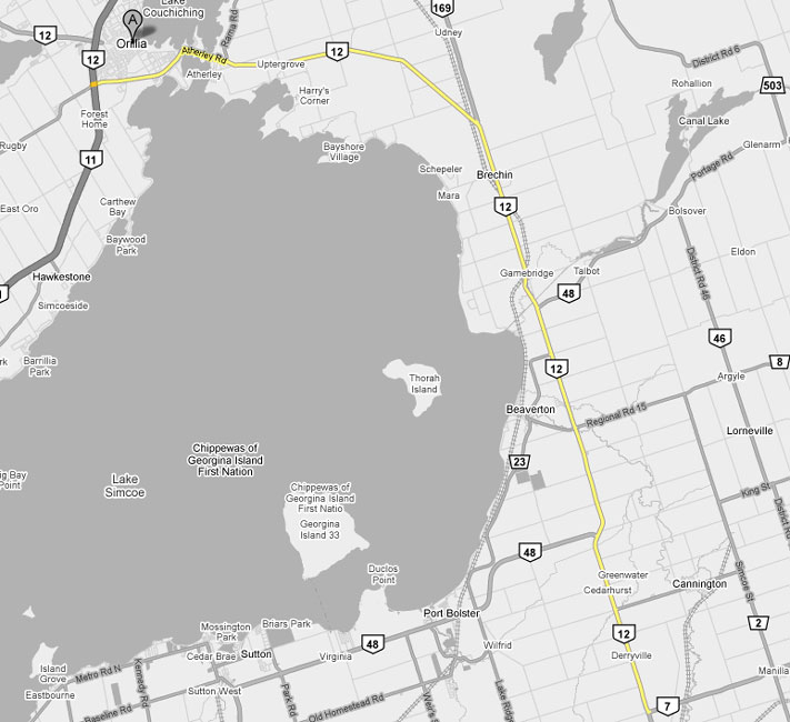
<-Page 1 Page 2 - Sunderland to Orillia Page 3 ->
Photos shown in this table are arranged from South to North:
| Proper Municipality Name | Photo Description | Photo | ||
|
Photos taken from driver's perspective appear offset from centre-line photos: |
North- Bound |
South- Bound |
||
| Click here for Highway 12 images between Whitby and Sunderland. | ||||
| Highway 7 heads to Lindsay and Peterborough east of the Highway 12 junction. Click here for Highway 7 East. | ||||
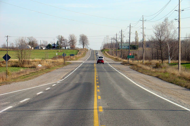
| Township of Brock Regional Municipality of Durham |
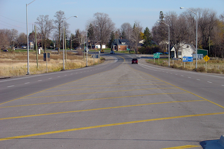
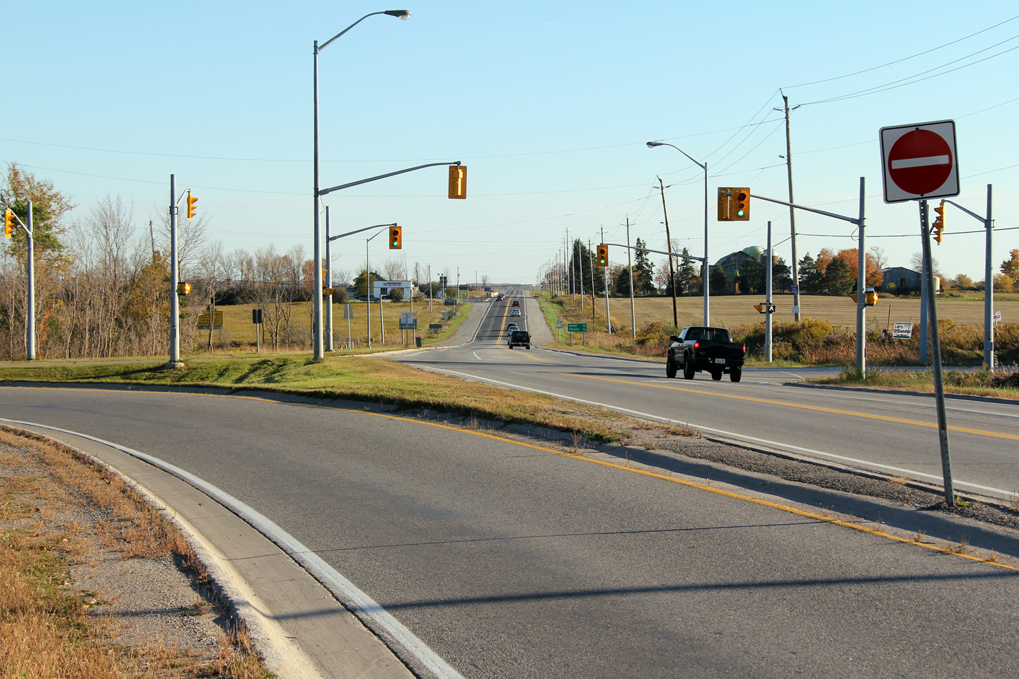
Southerly view looking through the
Highway 7
intersection towards Sunderland. Photo taken: October 10th, 2012. |
 (720x480) (1440x960) (2400x1600) |
||
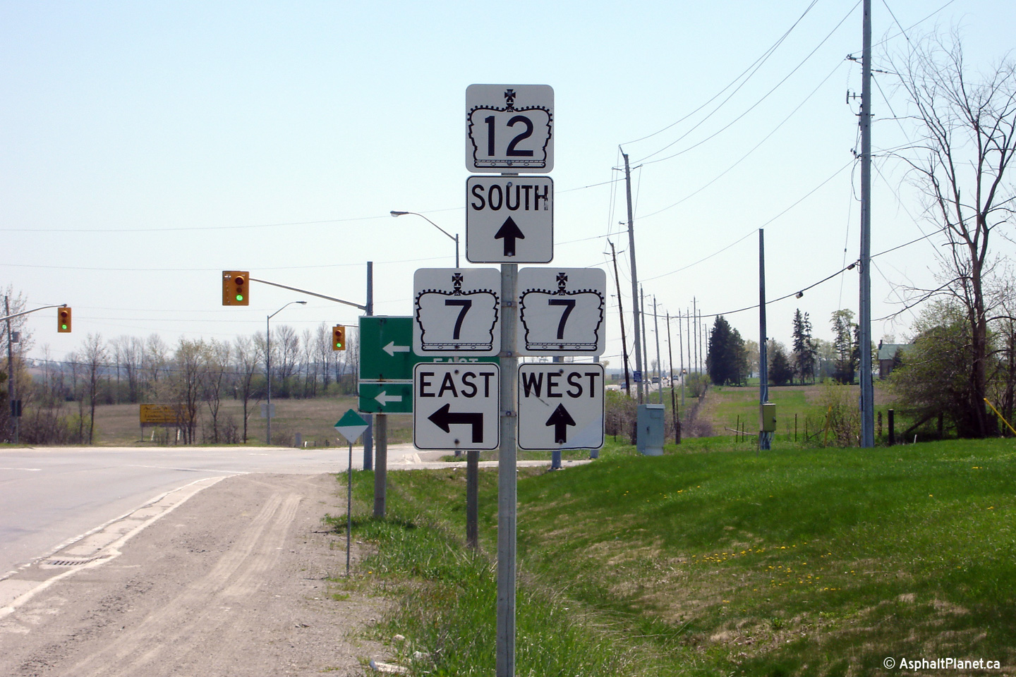
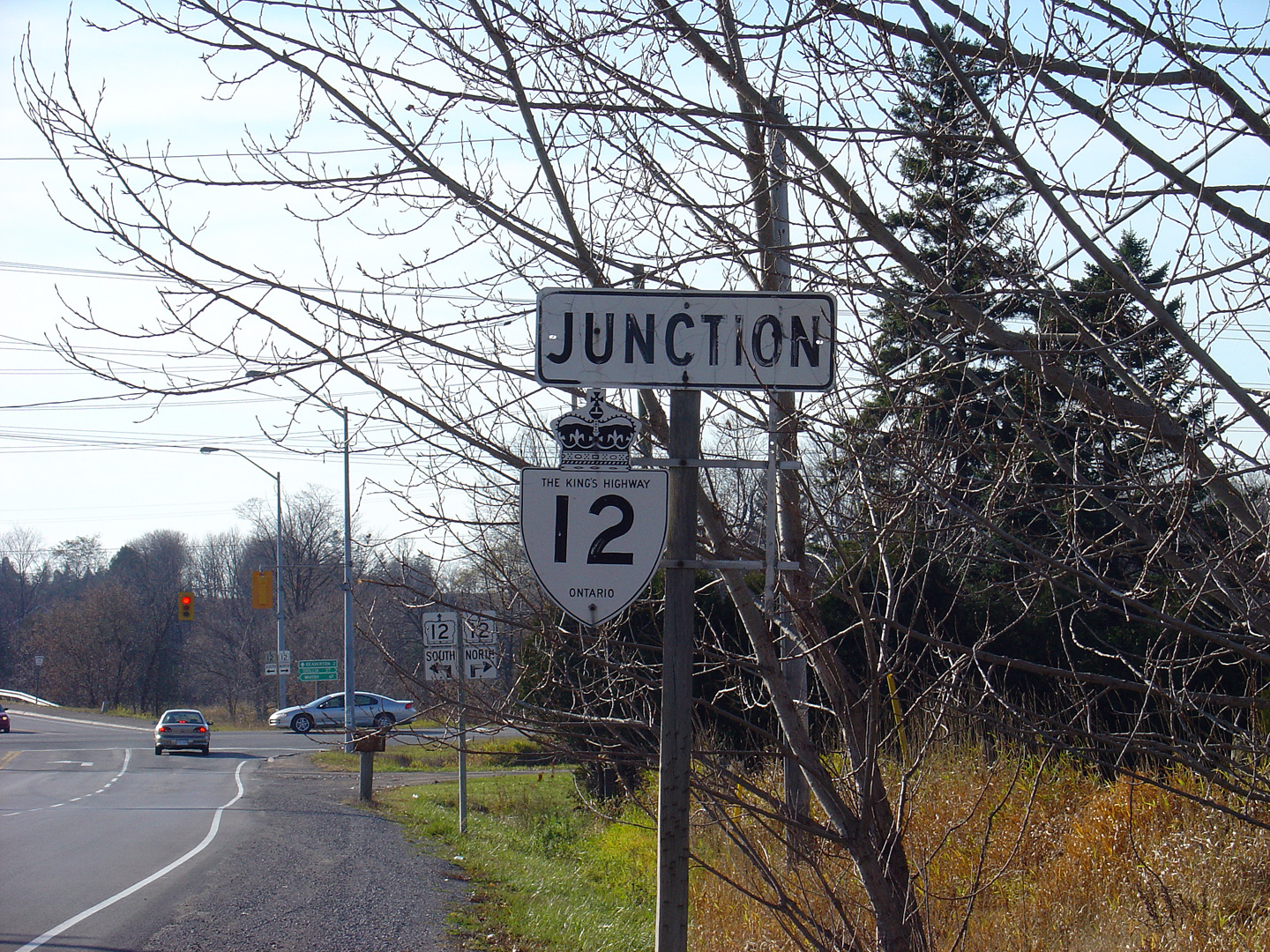
| Township of Brock Regional Municipality of Durham |
Southbound junction assembly at the eastern
Highway 7 junction. The Central Ontario Route of the Trans-Canada
Highway departs Highway 12 at this junction. This is not reflected by
the junction signage. Photo taken: July 13th, 2006 |
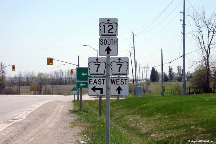 (720x480) (720x480)(1440x960) |
||
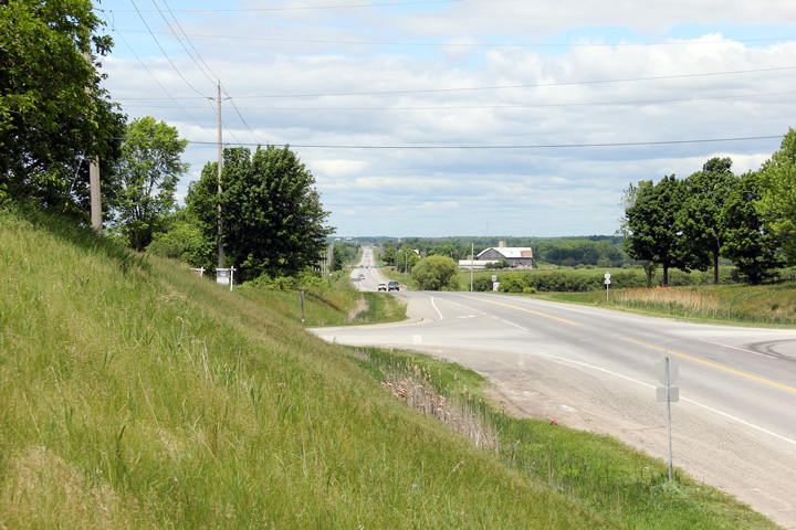
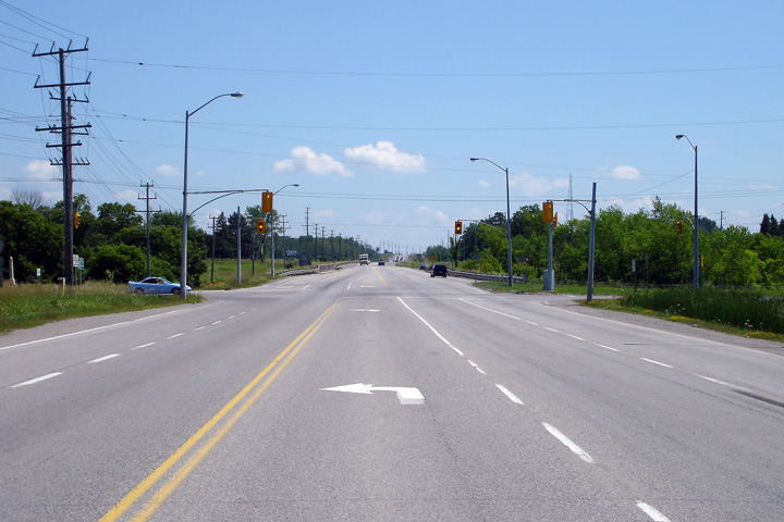
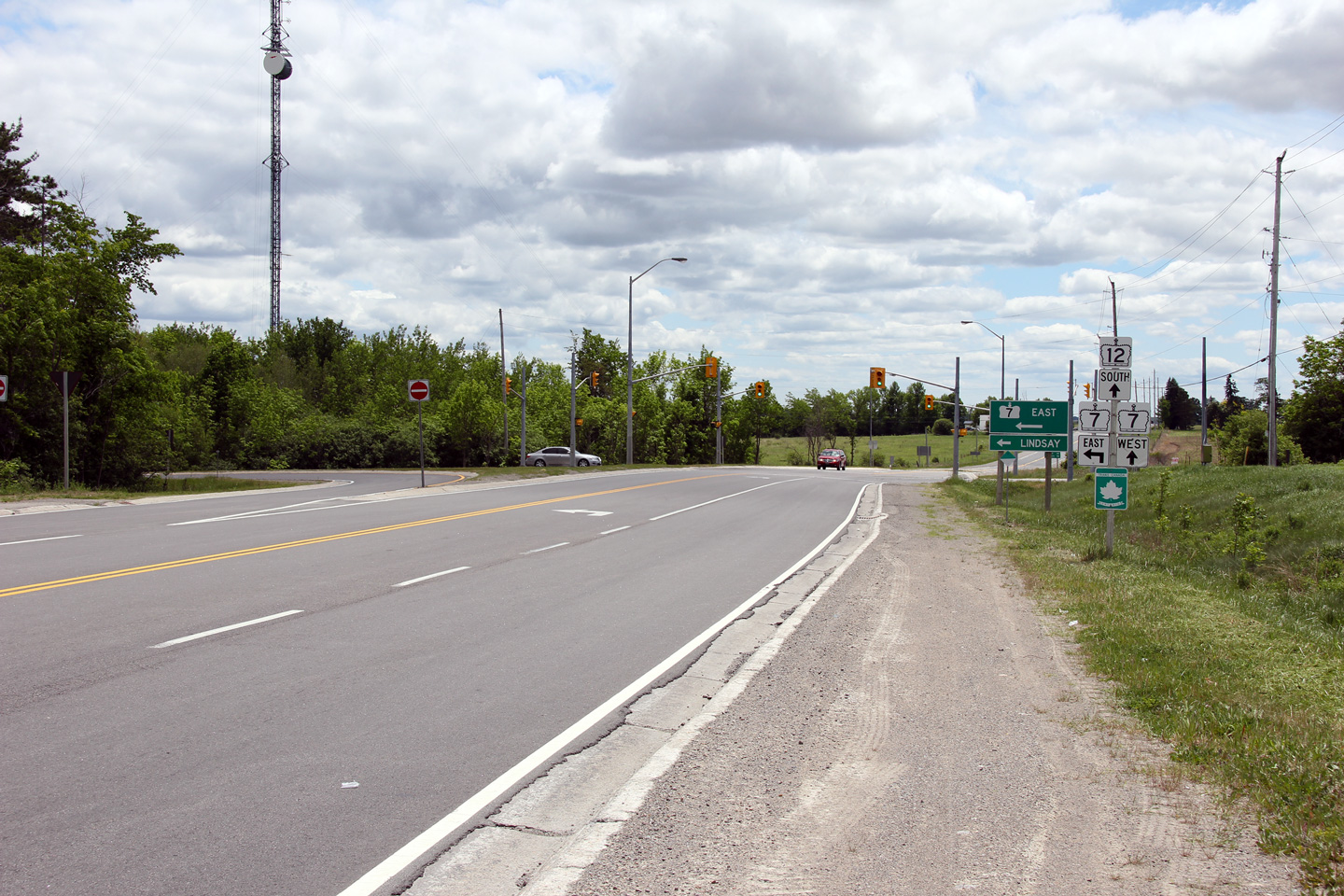
| Township of Brock Regional Municipality of Durham |
View looking south along Highway 12 approaching
the Highway 7 junction. Notice, that since the preceding photo was
taken, in 2006, a Trans-Canada Highway marker has been ambiguously affixed
to the pictured junction assembly. Placing the Trans-Canada Highway
marker in this fashion provides no indication that the Trans-Canada Highway
turns left from Highway 12 to Highway 7 at this intersection. This is
very poorly signed. Photo taken: May 31st, 2012. |
 (720x480) (1440x960) (2400x1600) |
||
| Township of Brock Regional Municipality of Durham |
View looking northerly from the Highway 7 East
junction. Photo taken: October 10th, 2010. |
 (720x480) (1440x960) (2400x1600) |
||
| Township of Brock Regional Municipality of Durham |
Northerly view along Highway 12 from just south
of the Brock Concession 11 intersection. Photo taken: May 31st, 2012. |
 (720x480) (1440x960) (2400x1600) |
||
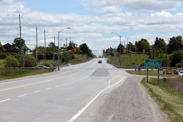
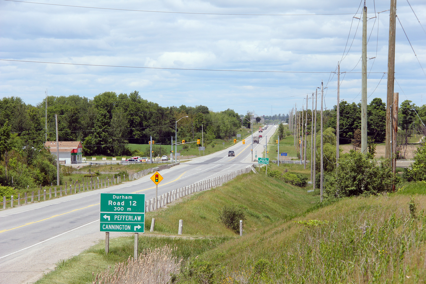
| Township of Brock Regional Municipality of Durham |
This view looks northerly approaching the
signalized intersection with Durham Road 12. Highway 12 crosses
Vrooman Creek a
tributary to the Beaver River just south of its intersection with Durham
Road 12. Photo taken: May 31st, 2012. |
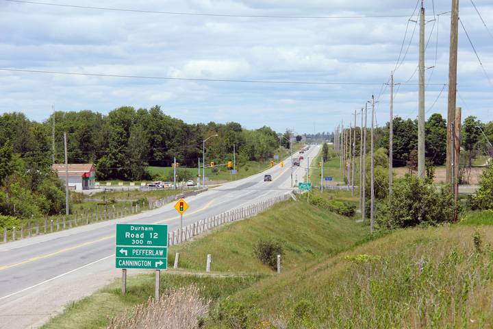 (720x480) (1440x960) (2400x1600) |
||
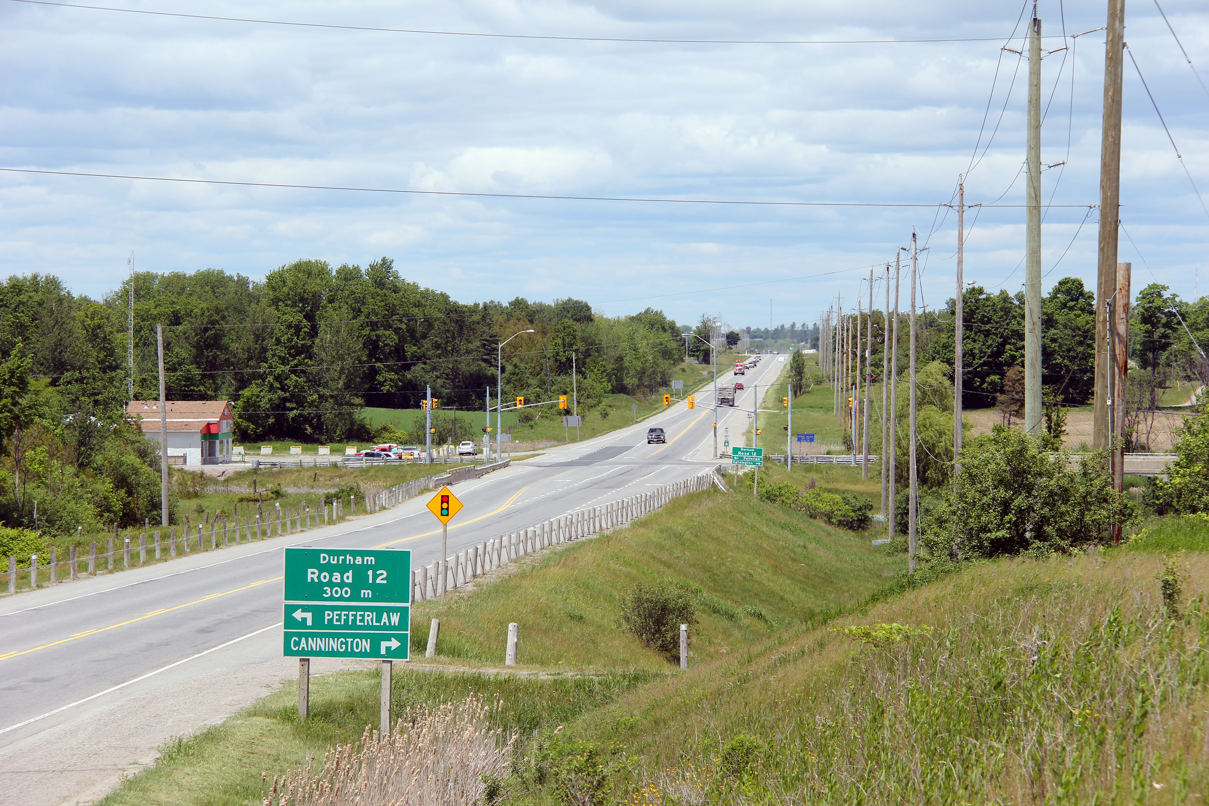
| Township of Brock Regional Municipality of Durham |
Southerly view approaching the Durham Road 12
intersection. Photo taken: May 31st, 2012. |
 (720x480) (1440x960) (2400x1600) |
||
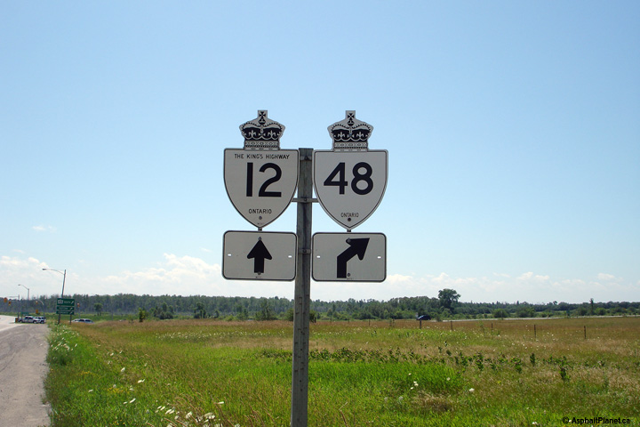
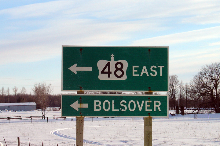
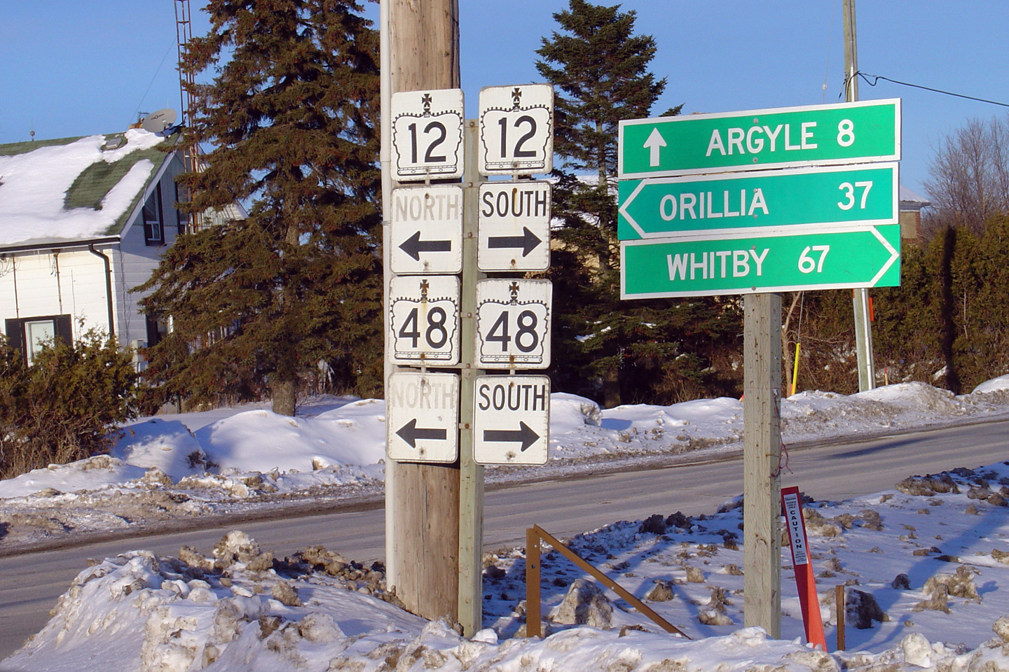
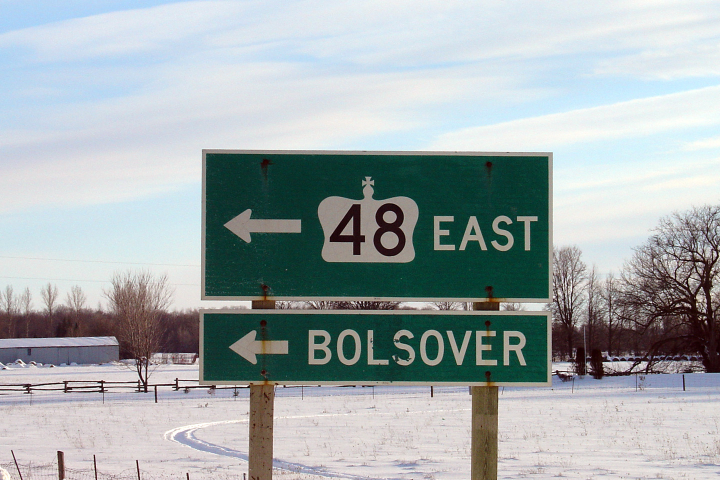
| Township of Brock Regional Municipality of Durham |
Northbound junction assembly for Highway 48.
Straight through references to Highway 48 were removed from this assembly in
2004. Photo taken: July 15th, 2006. |
 (720x480) (720x480)(1440x960) |
||
| Township of Brock Regional Municipality of Durham |
Looking north towards the southern Highway 48
junction along Highway 12. Photo taken: July 13th, 2006. |
 (720x480) (1440x960) |
||
| Highway 48 continues south from Highway 12 in Beaverton. Click here for Highway 48 images. | ||||
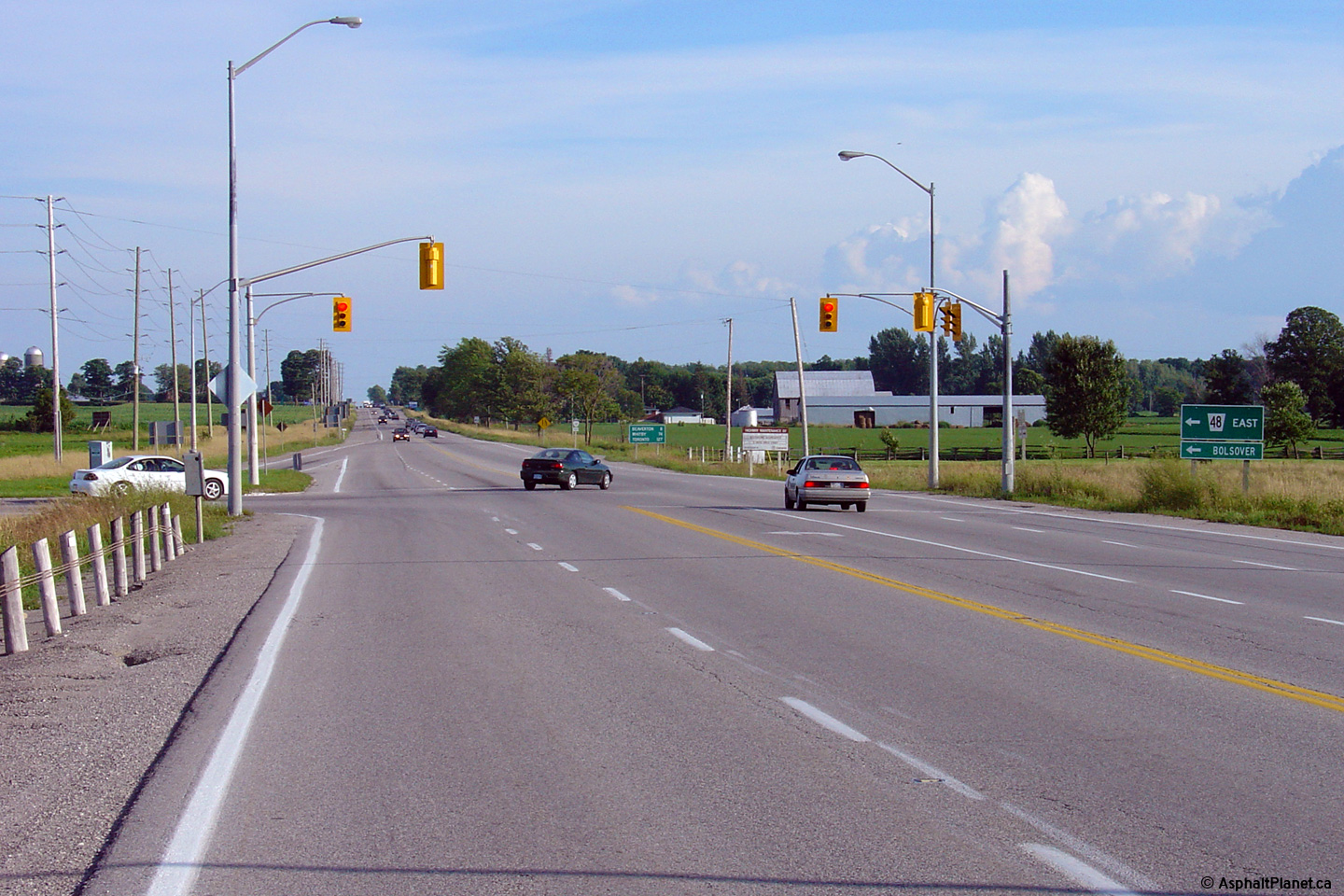
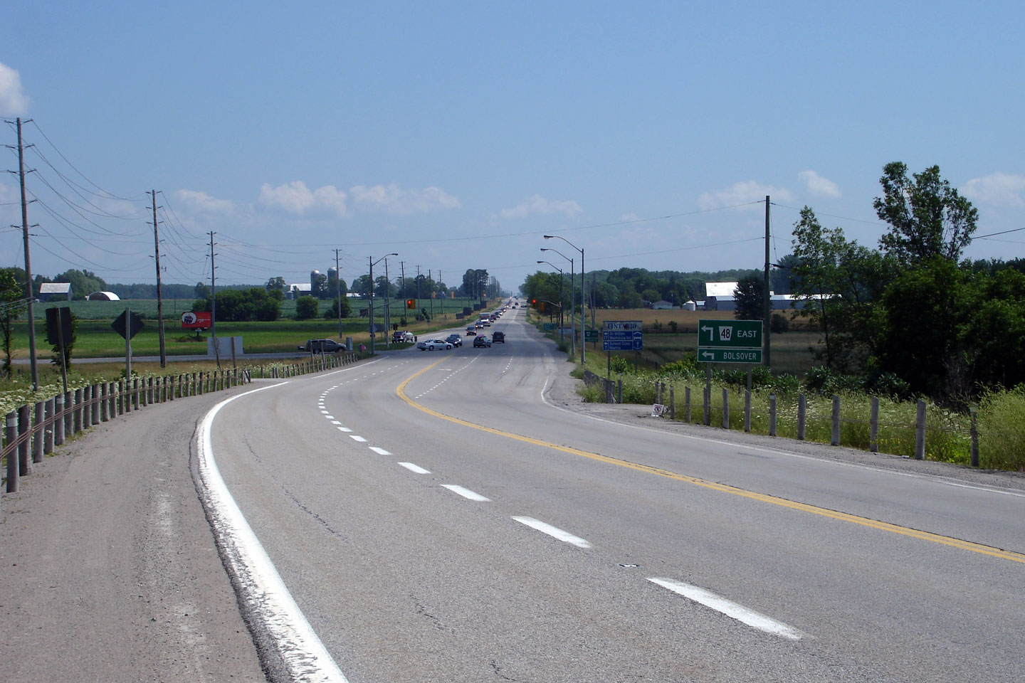
| Township of Brock Regional Municipality of Durham |
View looking south towards the Highway 48-South
junction along Highway 12. Photo taken: July 13th, 2006. |
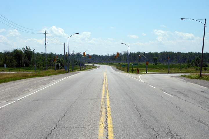 (720x480) (1440x960) |
||
| Township of Brock Regional Municipality of Durham |
Green sign for Highway 48 sitting in front of a
very dated light fixture. Photo taken: July 13th, 2006. |
 (720x480) (720x480)(1440x960) |
||
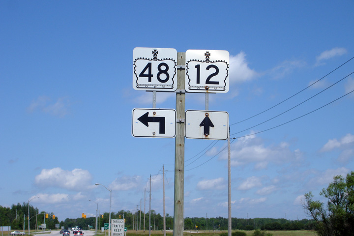
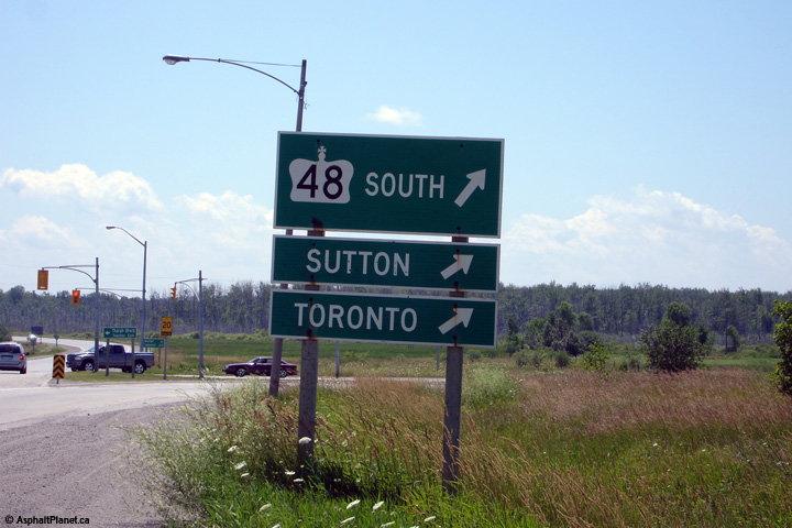
| Township of Brock Regional Municipality of Durham |
The shield assembly on Highway 12 for the
southern split of Highway 12/48. Highway 48
leads southbound travelers towards Sutton and eventually Markham and
Toronto. Photo taken: July 13th, 2006. |
 (720x480) (720x480)(1440x960) |
||
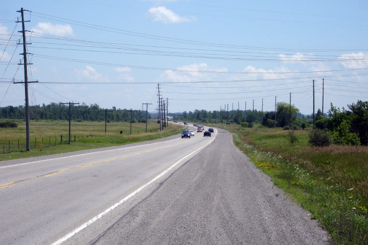
| Township of Brock Regional Municipality of Durham |
Looking south from Thorah Concession 3.
The Beaverton By-pass was completed during the mid 1960s as part of a series
of projects to improve the Central Ontario Route of the Trans-Canada
Highway. Photo taken: July 13th, 2006 |
 |
||
| Township of Brock Regional Municipality of Durham |
Looking north along Highway 12 from Concession
Road 4. Photo taken: July 13th, 2006 |
 (720x480) (1440x960) |
||
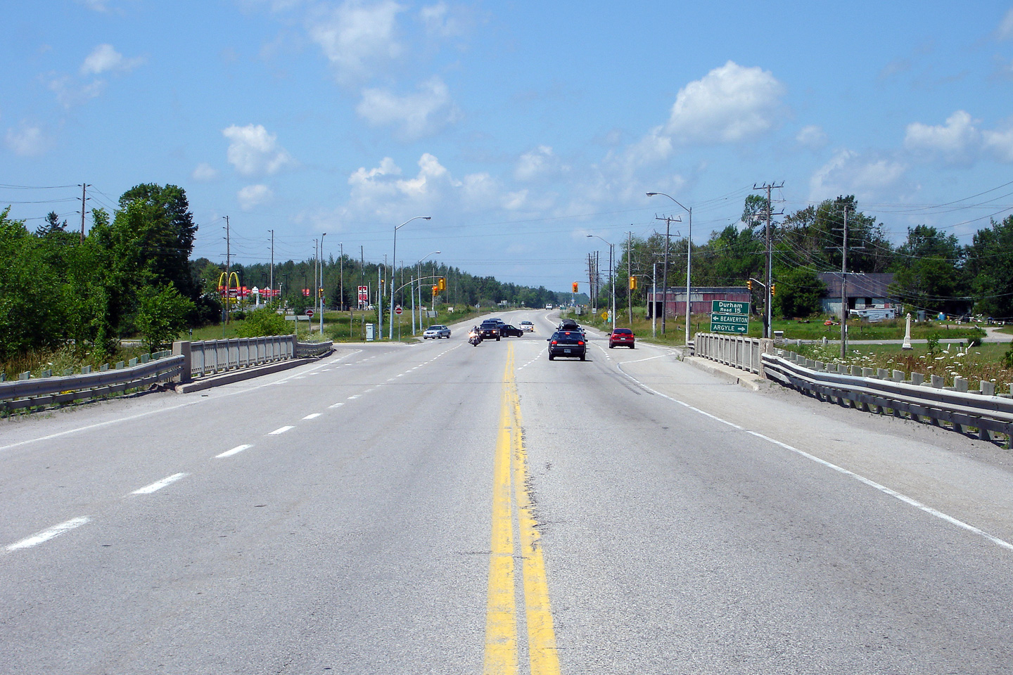
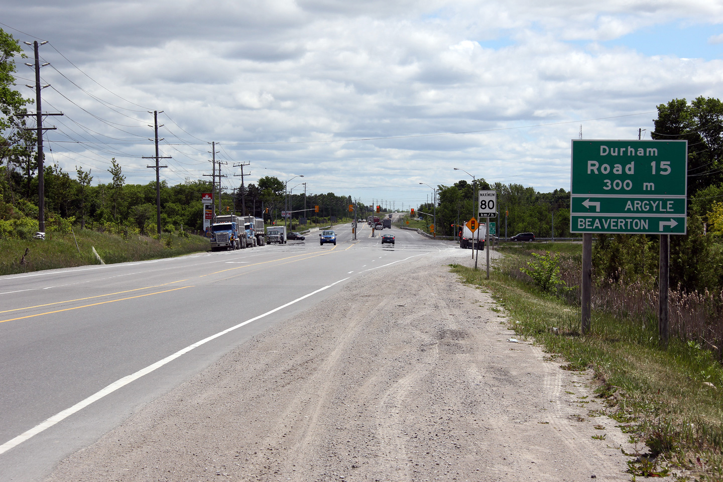
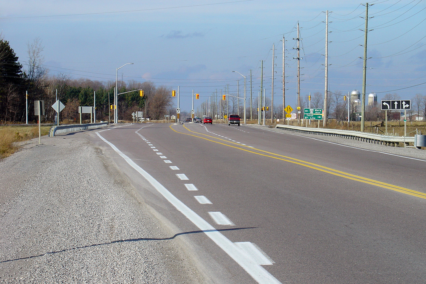
| Township of Brock Regional Municipality of Durham |
Northerly view along Highway 12(/48) as the
highway nears the Durham Road 15 junction. As is pictured in the photo
comparison, work started in 2006 to widen Highway 12 to four lanes in the
vicinity of the Durham Road 15 intersection. This brief four lane
section has greatly improved traffic operations along this busy stretch of
highway. Upper photo taken: July 13th, 2006. Lower photos taken: May 31st, 2012. |
|
||
| Township of Brock Regional Municipality of Durham |
Old junction tab in advance of
the Highway 12(/48) junction on Durham Road 15 approaching Beaverton.
This sign no longer stands. Photo taken: November 6th, 2004. |
 |
||
| Township of Brock Regional Municipality of Durham |
This former Highway 12/48
junction assembly stood at the intersection of Durham Road 15. It was
removed sometime in 2004. Photo taken: February 8th, 2004. |
|
||
| Township of Brock Regional Municipality of Durham |
Former northbound assembly for Highway 12/48
that was located just north of the Durham Road 15 intersection. As
with the preceding sign assembly. the Highway 48 reassurance marker was
removed from this signage assembly early in 2004. Photo taken: February 8th, 2004. |
|
||
| Township of Brock Regional Municipality of Durham |
View looking south towards Durham Road 15.
The upper photo shows an excellent example of a 1960s era traffic signal.
For example, notice the vintage traffic signal mast arms at the
intersection. Photo taken: July 13th, 2006 |
|
||
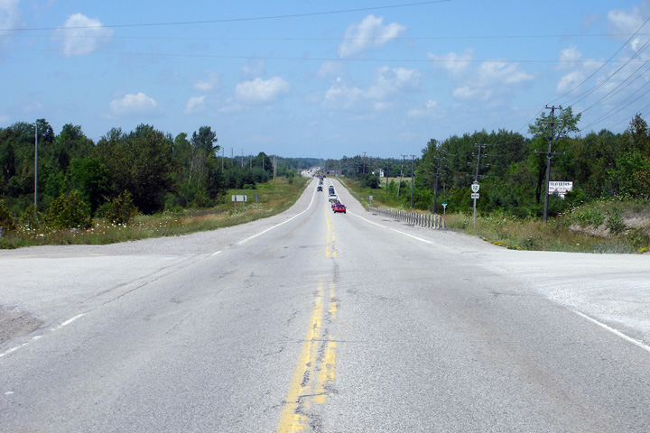
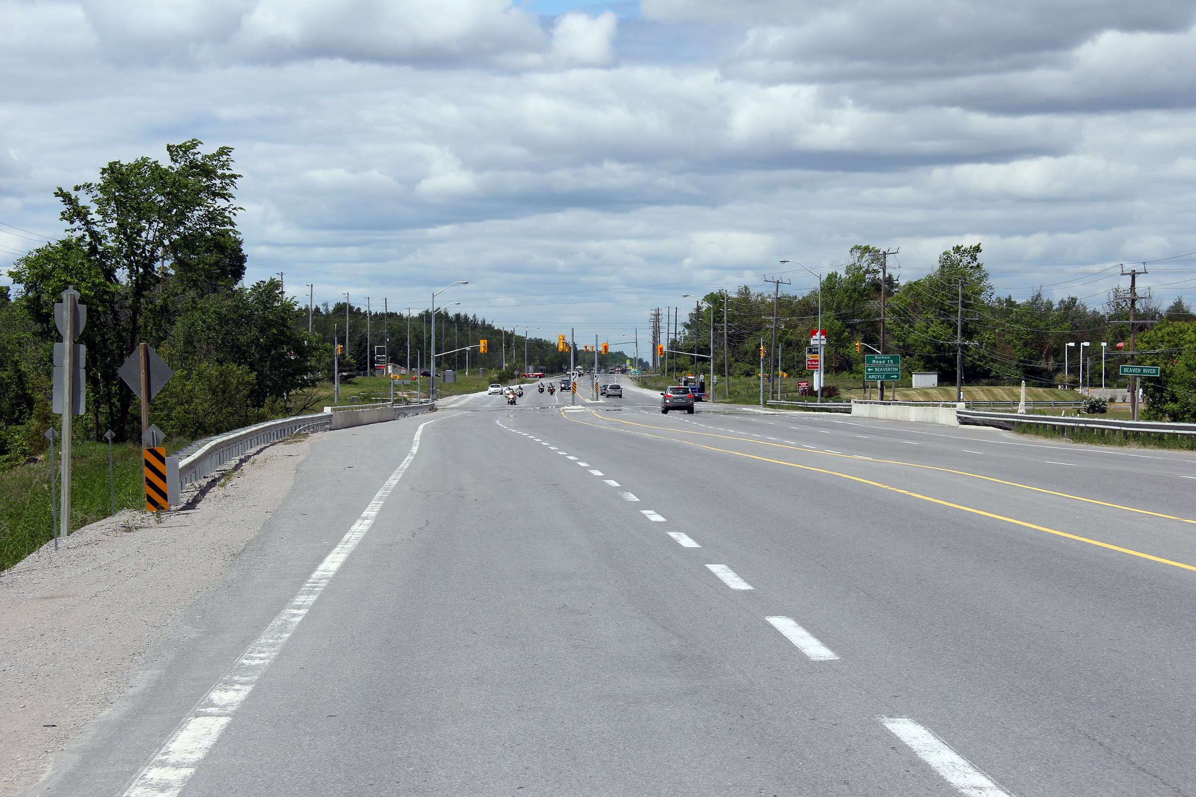
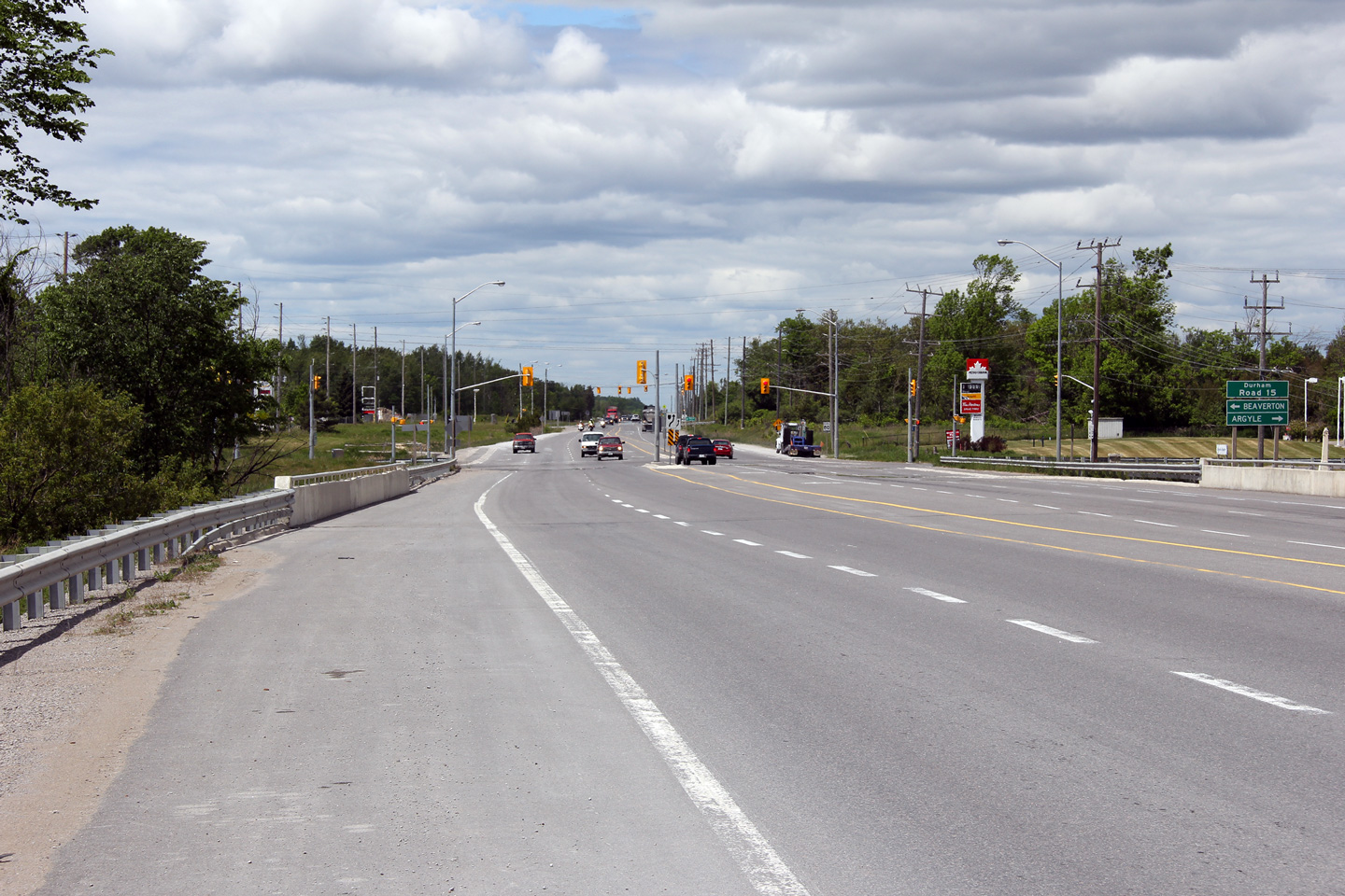
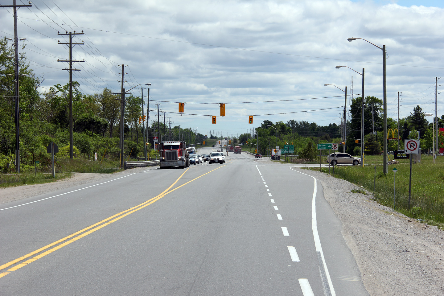
| Township of Brock Regional Municipality of Durham |
Southbound signage approaching the signalized
intersection with Durham Road 15. The gravel shoulders of Highway 12
have become popular with truckers parking to use one of the adjacent fast
food restaurants. Highway 12 sees a high volume of trucks. Photo taken: May 31st, 2012. |
 (720x480) (1440x960) (2400x1600) |
||
| Township of Brock Regional Municipality of Durham |
This view looks southerly towards the
intersection with Beaver Avenue. Several fast food restaurants and gas
stations have been constructed adjacent to Highway 12 along the Beaverton
By-pass. Instead of directly fronting along Highway 12, access to several businesses is provided via Beaver Avenue. Photo taken: May 31st, 2012. |
 |
||
| Township of Brock Regional Municipality of Durham |
View looking northerly along Highway 12 as it
crosses White Creek. Photo taken: May 31st, 2012. |
 |
||
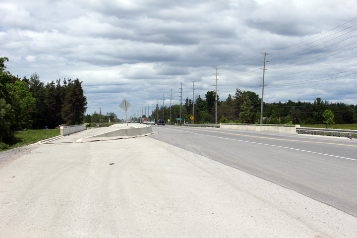
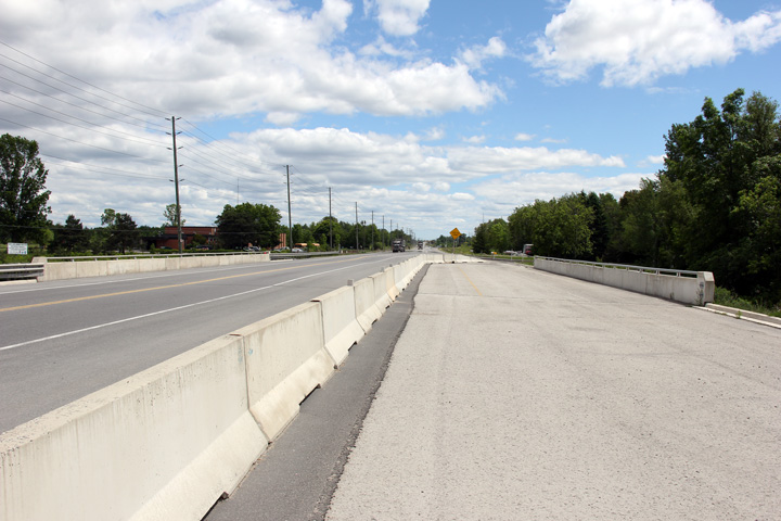
| Township of Brock Regional Municipality of Durham |
Two views southerly across the White Creek
bridge. The White Creek bridge was widened in 2006 in advance of
Highway 12 being widened to four lanes around Beaverton. Obviously (as
of 2012), the four lane highway has yet to come to fruition. Photos taken: May 31st, 2012. |
 (720x480) (1440x960) (2400x1600)
|
||
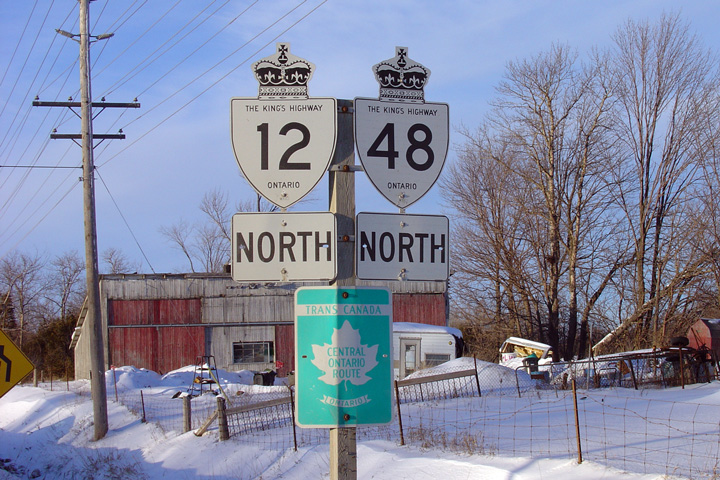
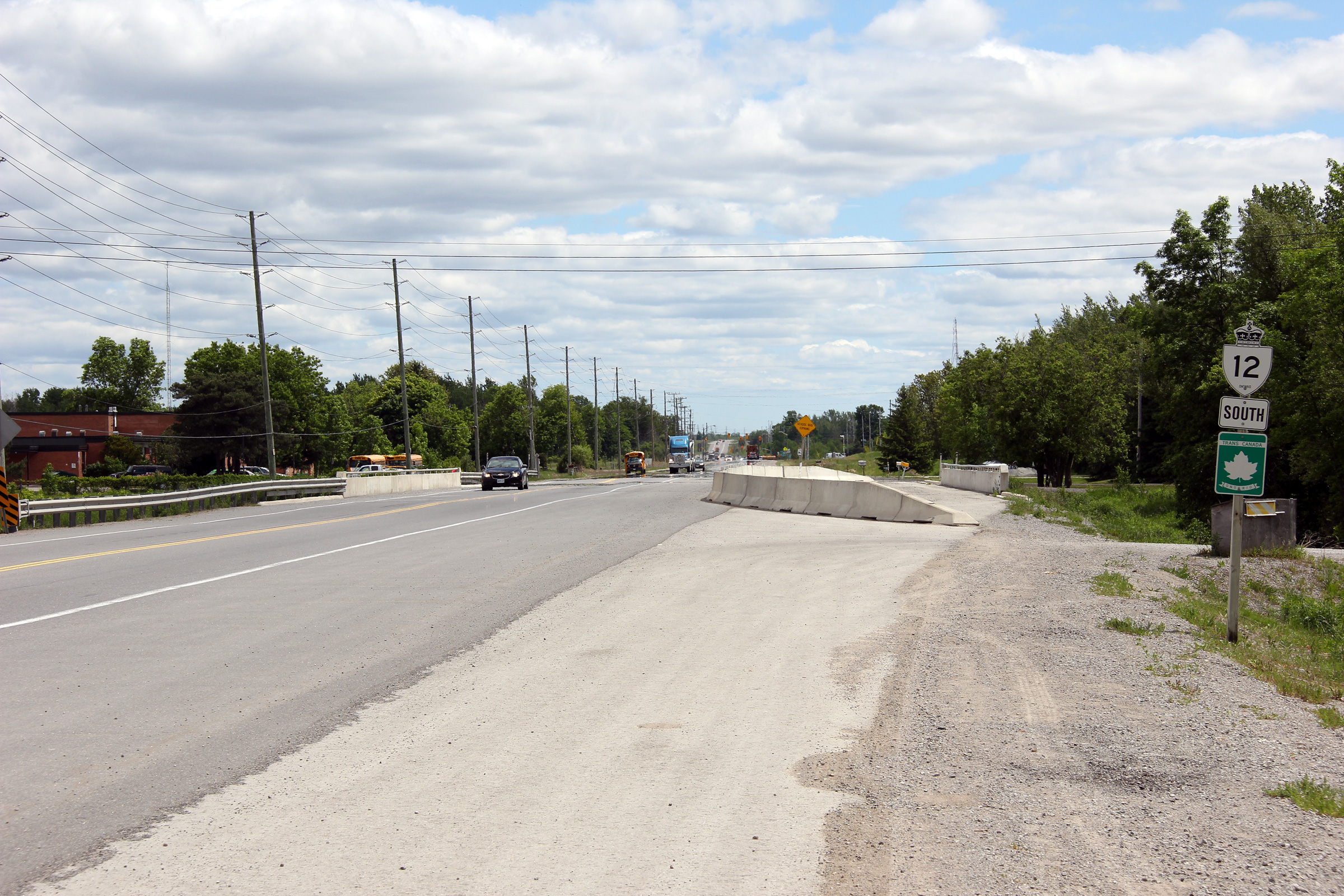
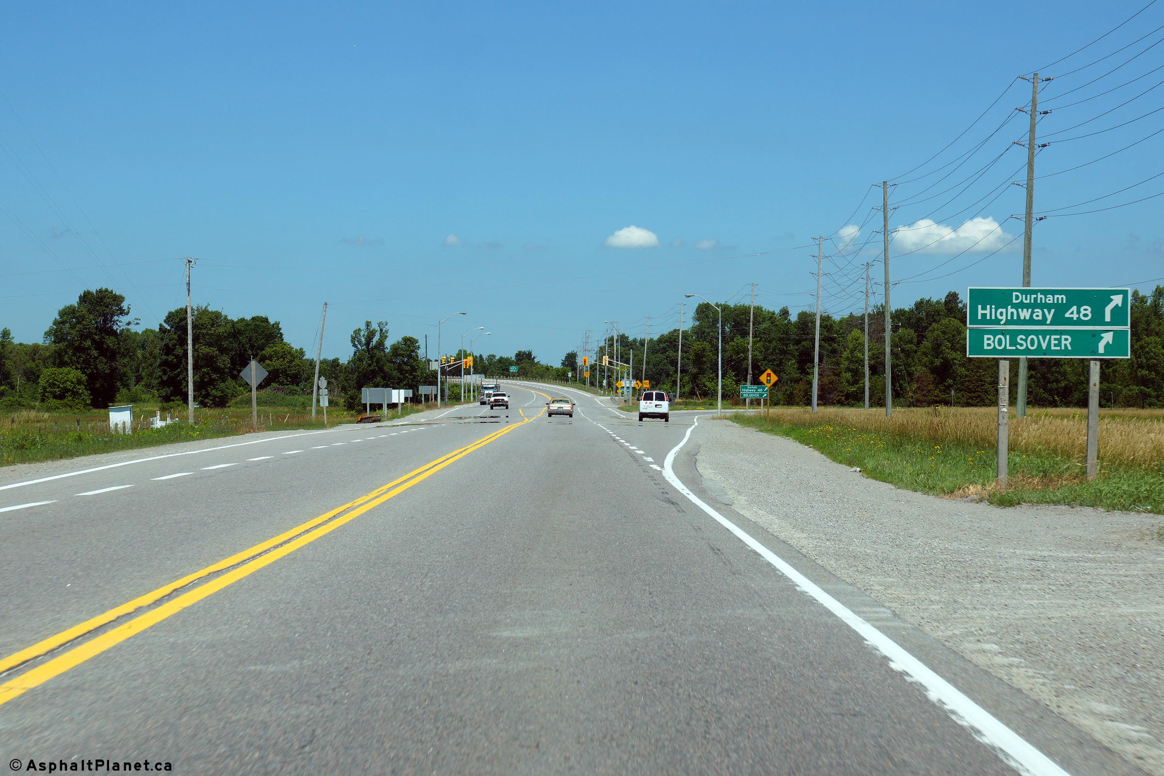
| Township of Brock Regional Municipality of Durham |
Looking south along Highway 12/48
from just south of the Durham Road 23 intersection. From Durham Road
23 southerly to the south Highway 48
junction Highway 12/48 by-passes Beaverton
to the east. The Beaverton Bypass was first opened to traffic in
November 1966. Photo taken: November 6th, 2004. |
 (720x480) (1440x960) |
||
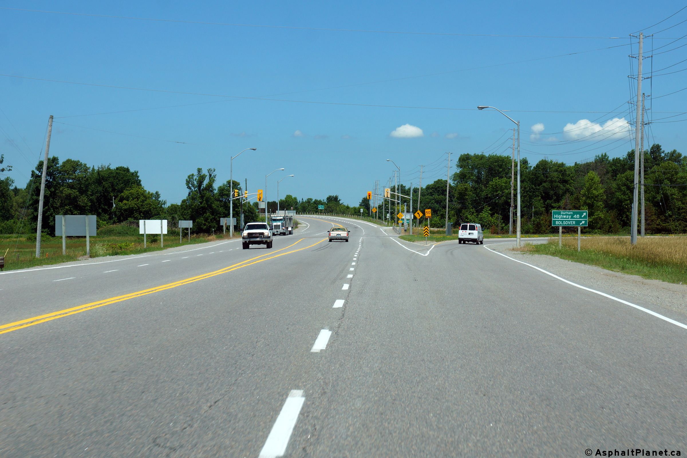
| Township of Brock Regional Municipality of Durham |
View looking north towards the Durham Road 23
intersection. Intersection improvements were completed at this
intersection in 2002 which included the widening to 4-lanes and traffic
signal installation. Photo taken: November 6th, 2004. |
 (720x480) (1440x960) |
||
| Township of Brock Regional Municipality of Durham |
Looking north from the central median of the
Durham Road 23 intersection towards Orillia. Photo taken: November 6th, 2004. |
 (720x480) (1440x960) |
||
| Township of Brock Regional Municipality of Durham |
Two northerly views approaching the eastern leg
of Highway 48 north of Beaverton. The Regional Municipality of Durham
designated all of the former highway mileage that it inherited from the
province during the 1990s as Regional Highways. The highways were
numbered as such, in an effort to maintain
continuity within Durham's existing regional numbering scheme. With
the exception of Highway 48, all other highways transferred to the Region of
Durham during the 1990s already had duplicate numbers in the pre-existing
regional road network. Numbering the inherited highways as Regional
Highways proved to be a fairly ingenious solution to maintaining the former
highway numbers without having to renumber existing regional roads. Photos taken: July 11th, 2014. |
 (720x480) (1440x960) (2400x1600) 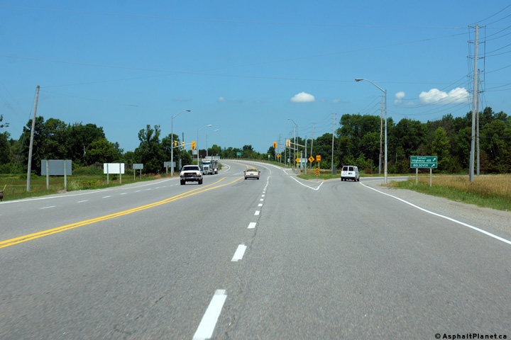 (720x480) (1440x960) (2400x1600) |
||
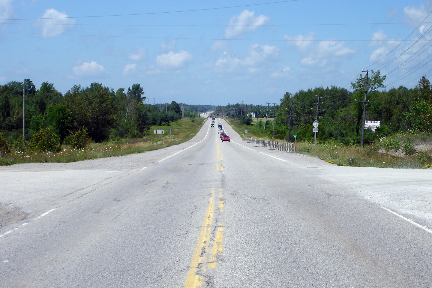
| Township of Brock Regional Municipality of Durham |
Former green signage at the northern Highway 48
intersection. This signage was removed in early in 2004. Photo taken: February 8th, 2004. |
|
||
| Township of Brock Regional Municipality of Durham |
Two southerly view approaching the Highway 48-East
junction. Upper photo taken: August 8th, 2004. Lower photo taken: July 13th, 2006. |
 (720x480) (1440x960) 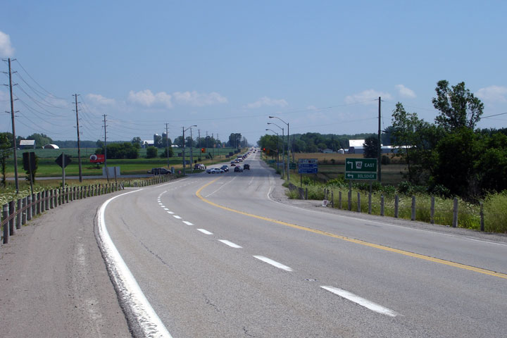 |
||
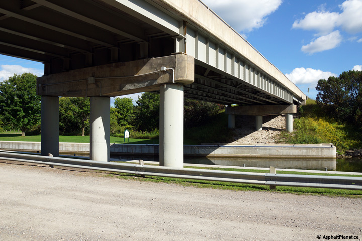
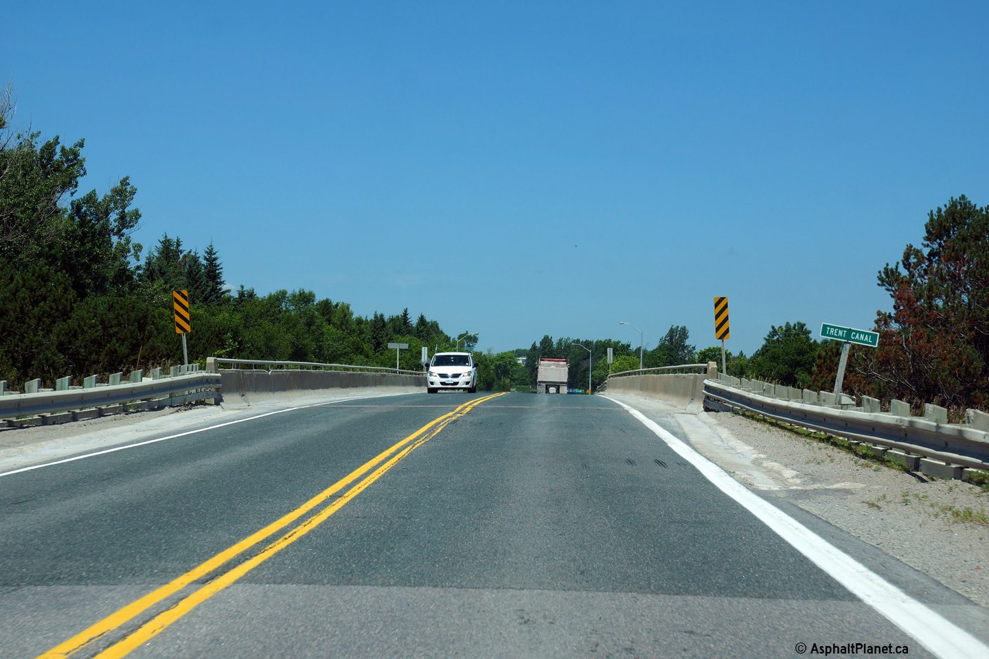
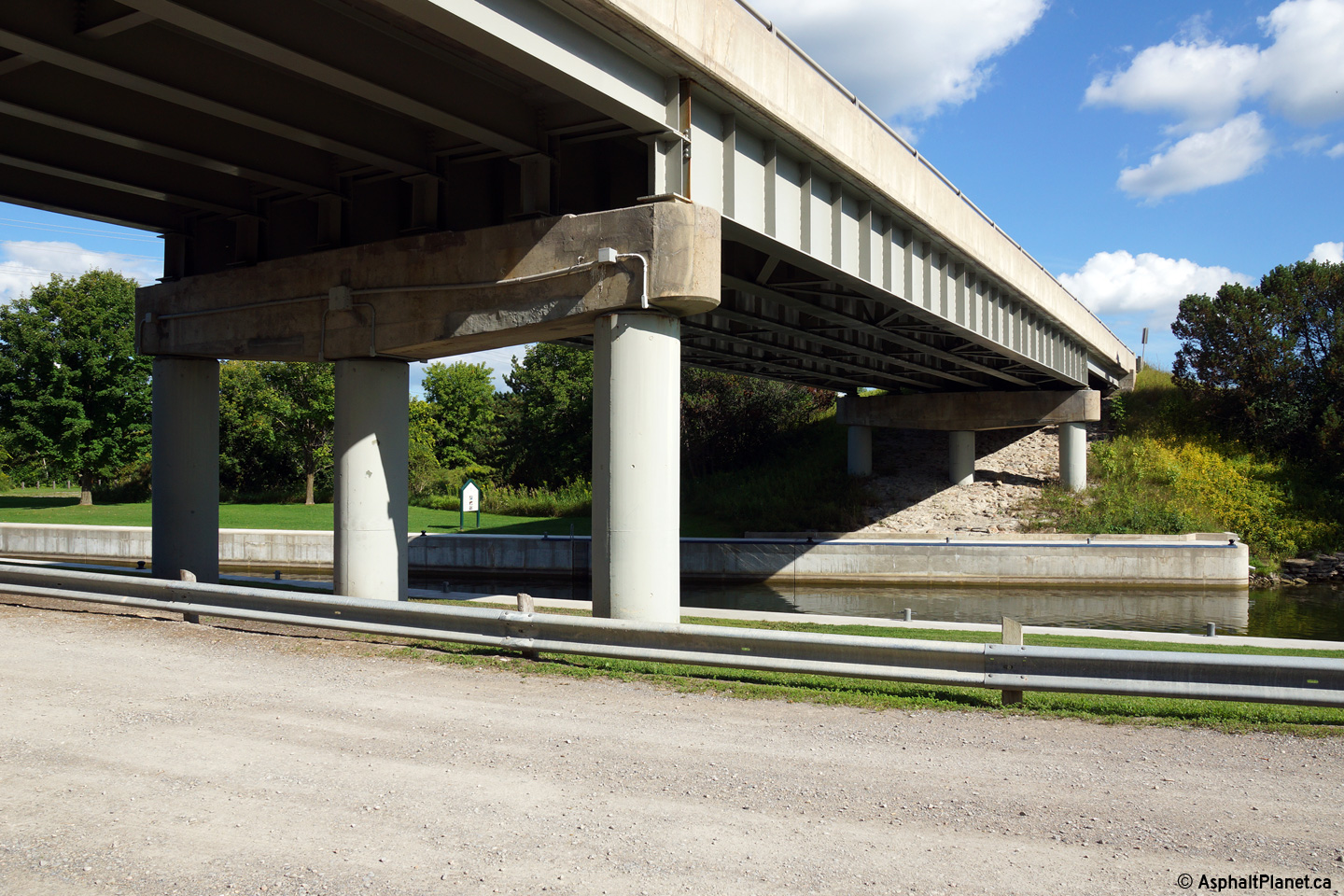
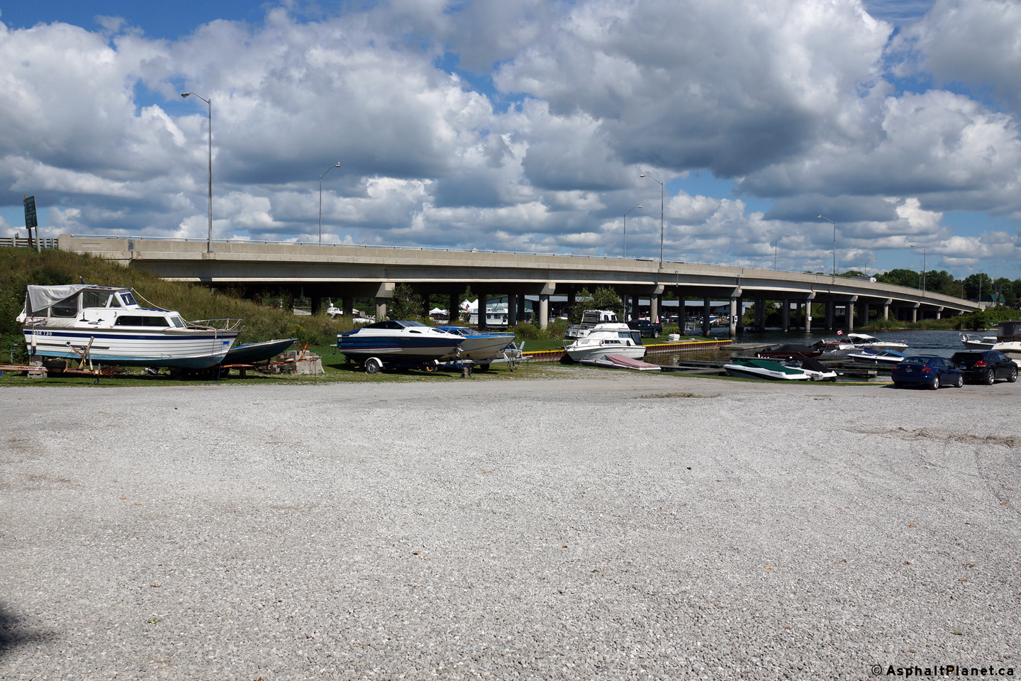
| Township of Brock Regional Municipality of Durham |
Deck view looking northerly as Highway 12
crosses overtop of the Trent-Severn Waterway. Photo taken: July 11th, 2014. |
 (720x480) (1440x960) (2400x1600) |
||
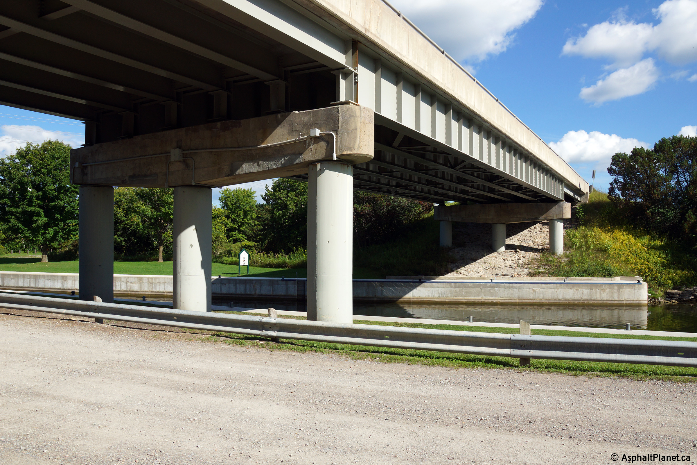
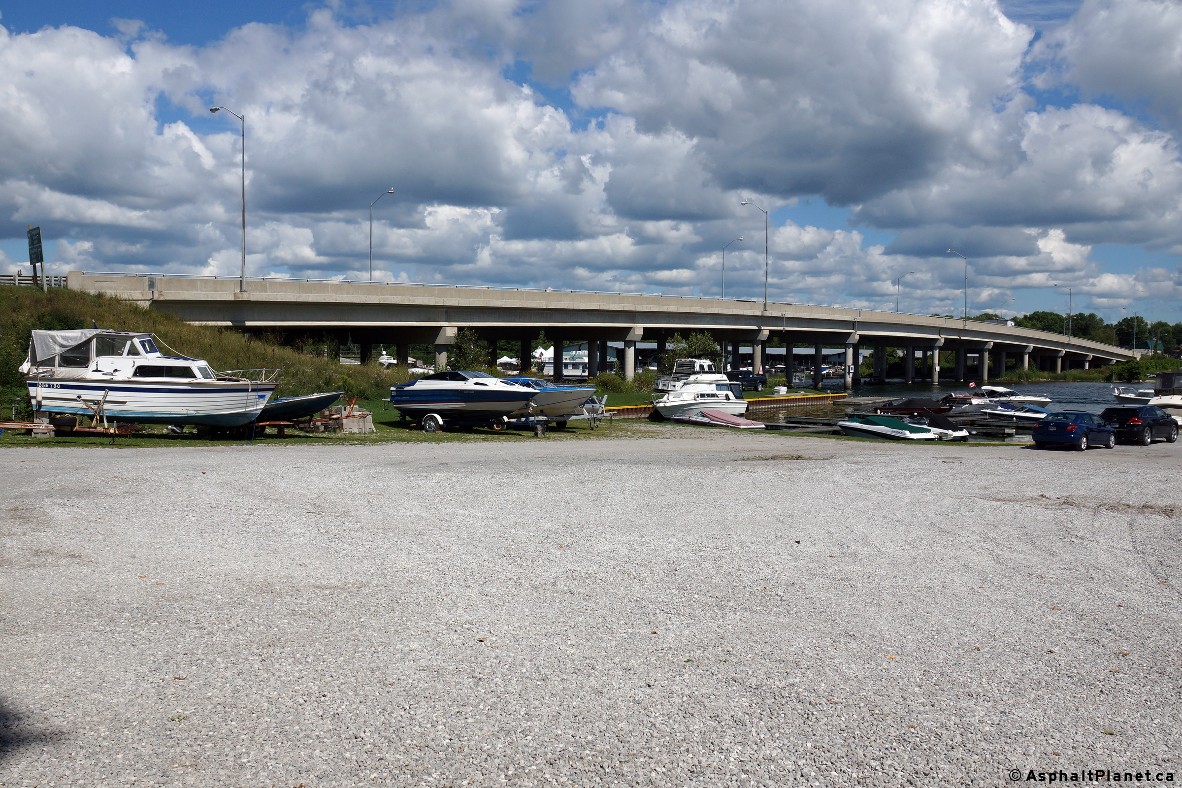
| Township of Brock Regional Municipality of Durham |
View looking southeasterly as Highway 12 passes
overtop of the Trent-Severn Waterway. Between Balsam Lake and Lake
Simcoe, the Trent Severn Waterway flows largely in a canal that runs
parallel to the Talbot River. Photo taken: August 24th, 2014. |
 (720x480) (1440x960) (2400x1600) |
||
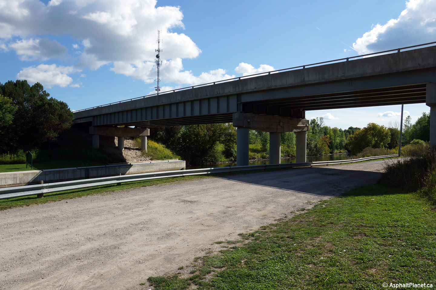
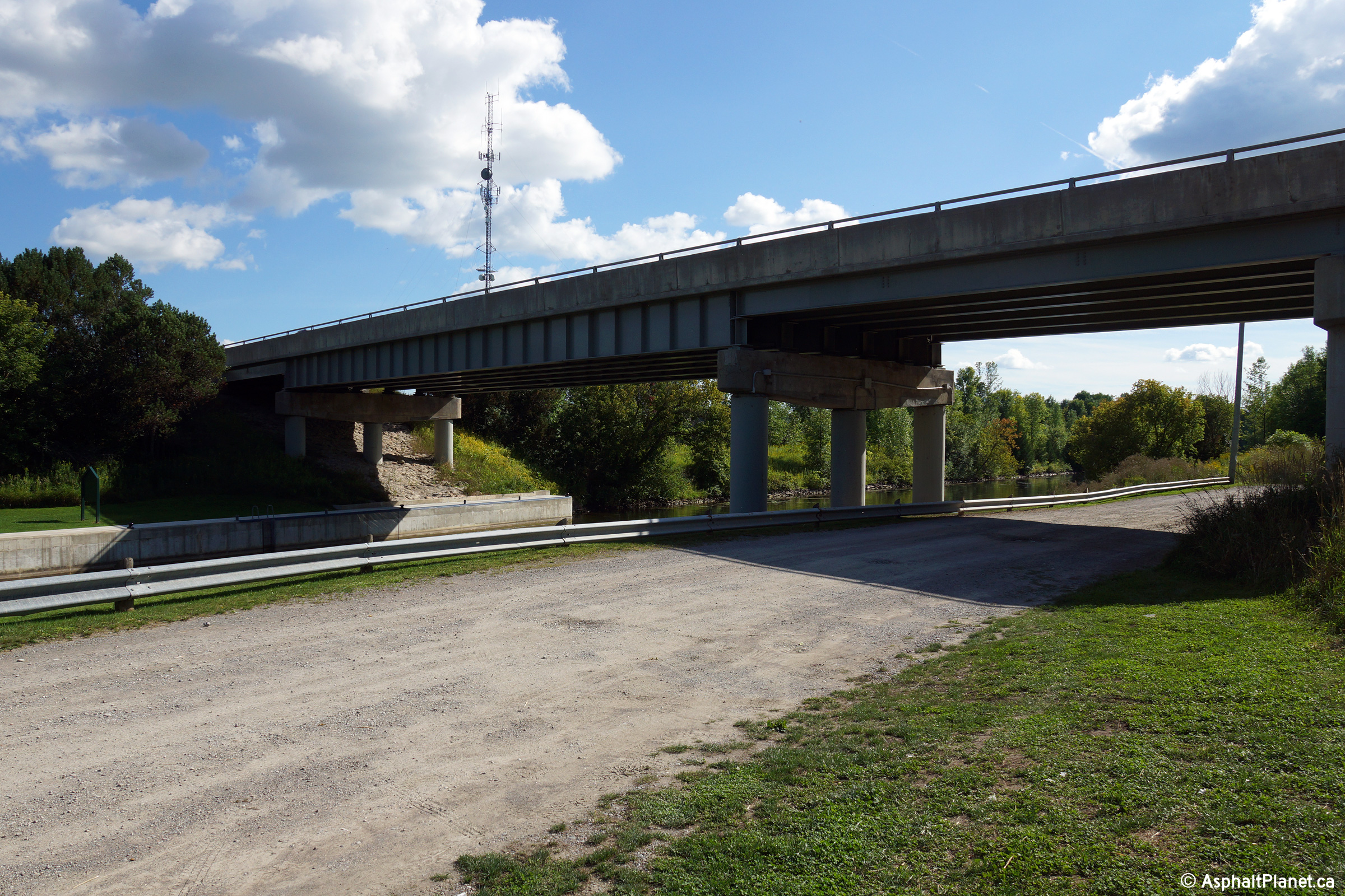
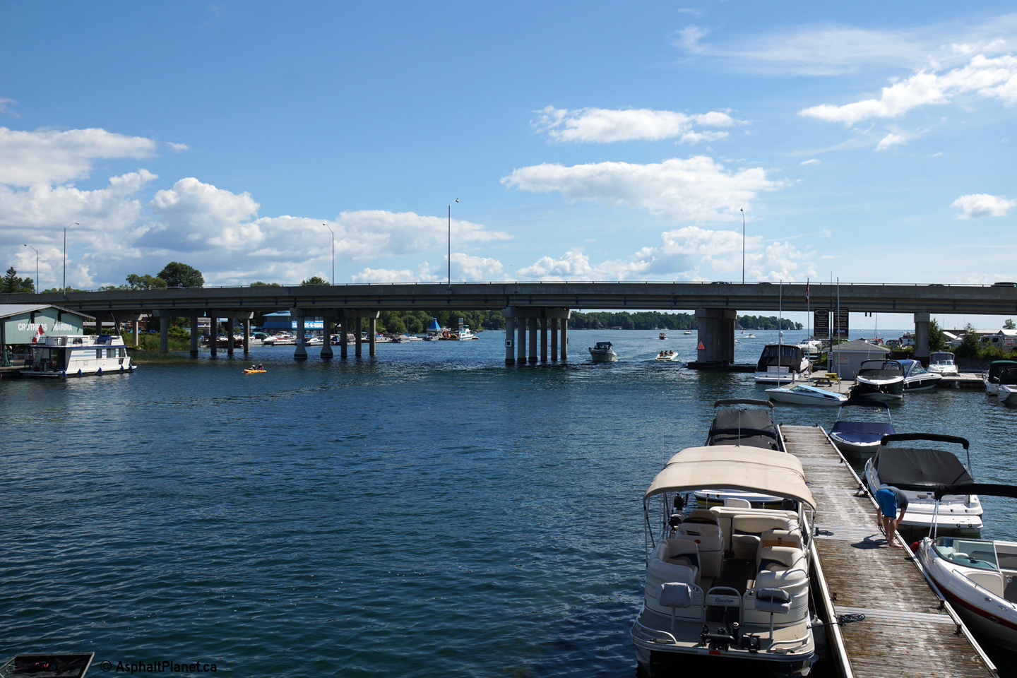
| Township of Brock Regional Municipality of Durham |
View looking southwesterly towards the
Trent-Severn Waterway bridge. The gravel road in the foreground is a
haul road that runs along the northern side of the canal. Photo taken: August 24th, 2014. |
 (720x480) (1440x960) (2400x1600) |
||
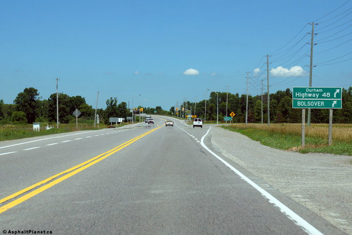
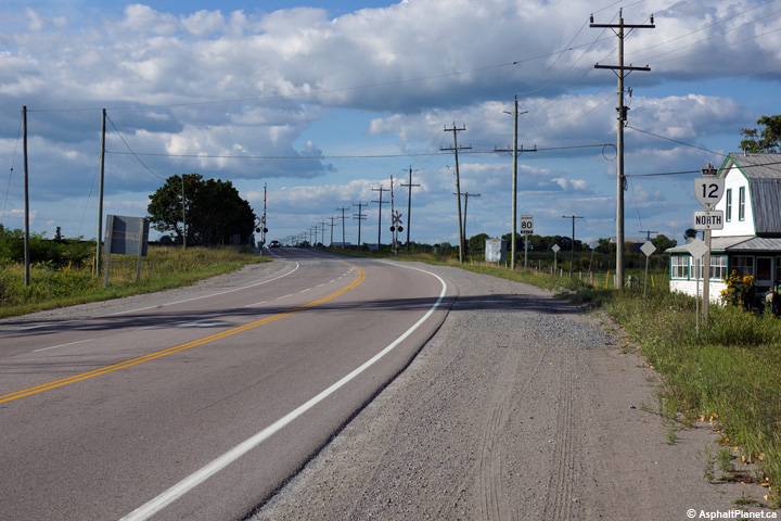
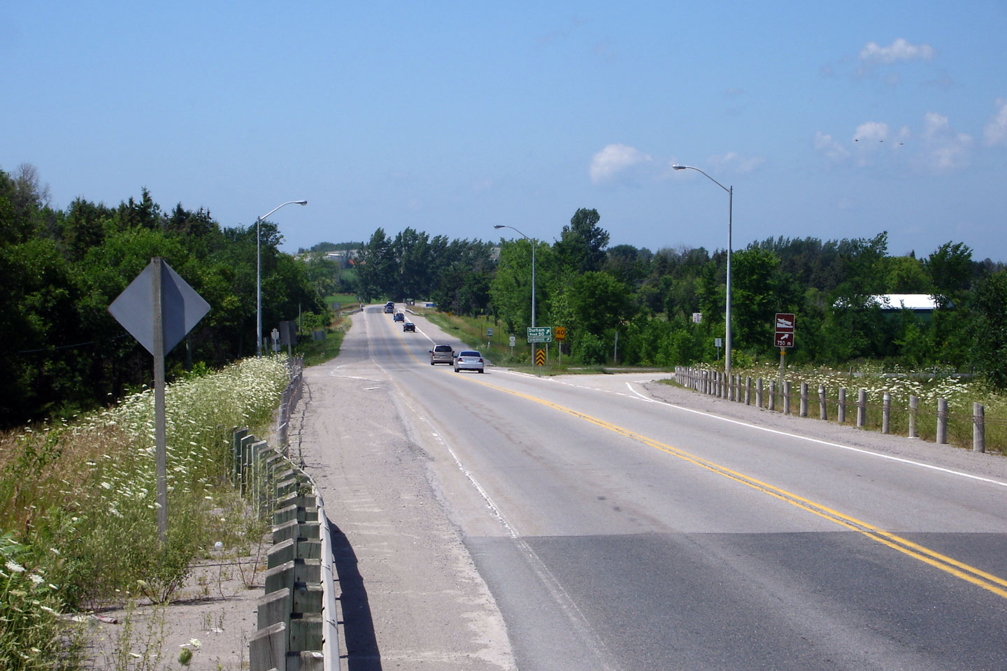
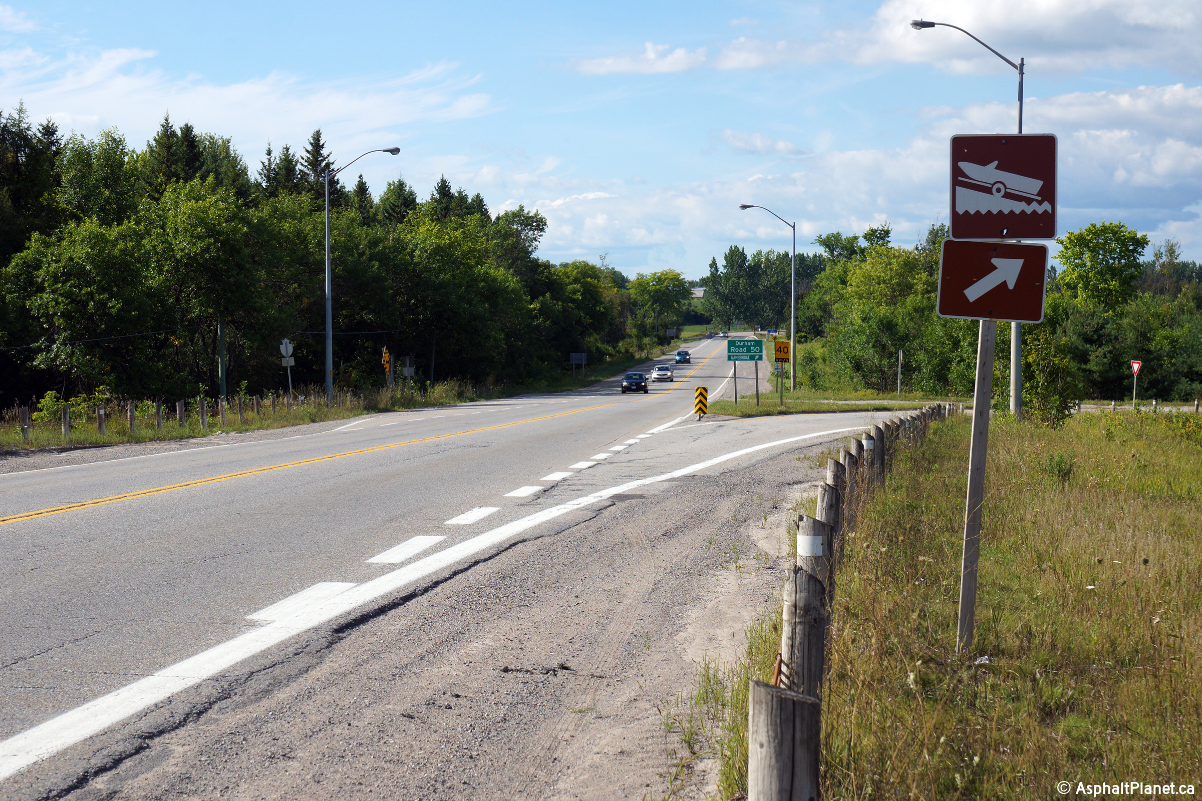
| Township of Brock Regional Municipality of Durham |
View looking northerly approaching the Durham
Road 50 junction. Durham Road 50 is a short route running along
Highway 12's former alignment through Gamebridge. Click
here for an additional image from this
vantage point taken in July, 2006. Photo taken: August 24th, 2014. |
|||
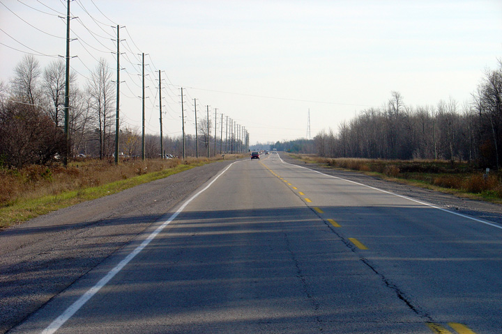
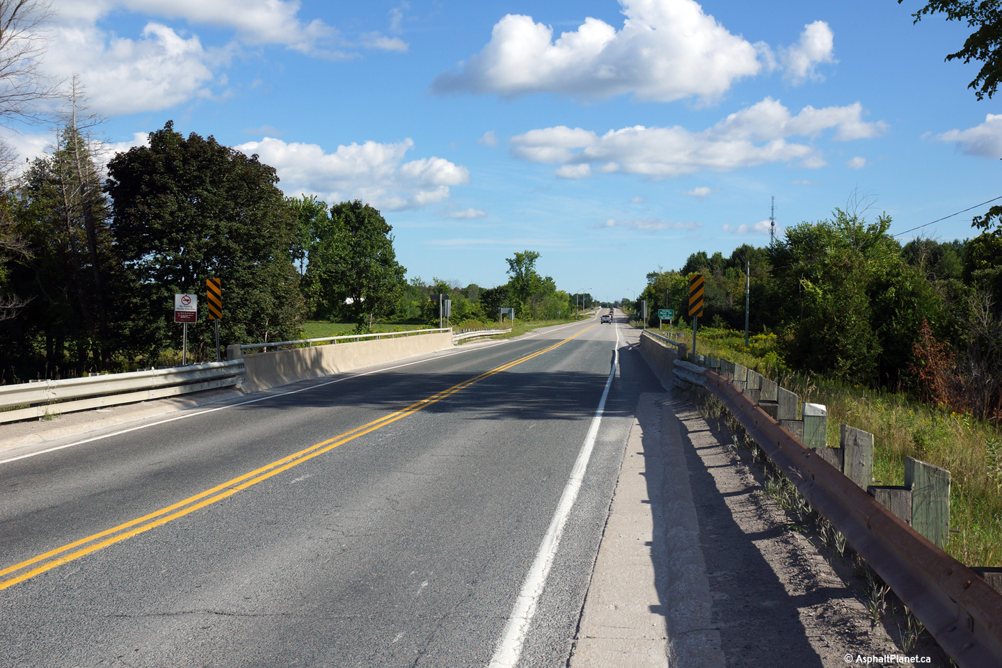
| Township of Ramara County of Simcoe |
Southerly view across the Talbot River bridge
along the Gamebridge by-pass. The Talbot River is the boundary between
the Regional Municipality of Durham and the County of Simcoe. Photo taken: August 24th, 2014. |
 (720x480) (1440x960) (2400x1600) |
||
| Township of Ramara County of Simcoe |
Northerly view at the northern end of the
Gamebridge by-pass. Photo taken: August 24th, 2014. |
 (720x480) (1440x960) (2400x1600) |
||
| Township of Ramara County of Simcoe |
Southerly view at the northern end of the
Gamebridge by-pass. Highway 12 curves around the eastern side of the
small community of Gamebridge. Photo taken: August 24th, 2014. |
 (720x480) (1440x960) (2400x1600) |
||
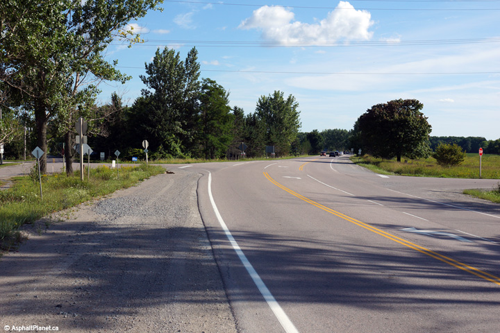
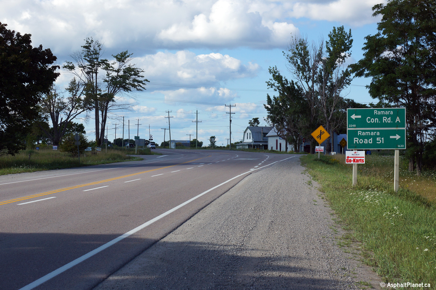
| Township of Ramara County of Simcoe |
Northerly view just north of the Rama Road 51
intersection north of Gamebridge. Highway 12 crosses CN's Bala
Subdivision at-grade just north of Gamebridge. Photo taken: August 24th, 2014. |
 (720x480) (1440x960) (2400x1600) |
||
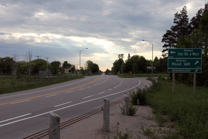
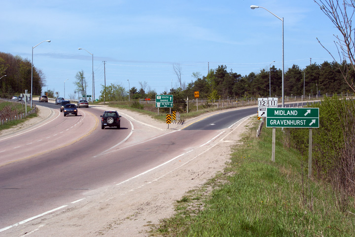
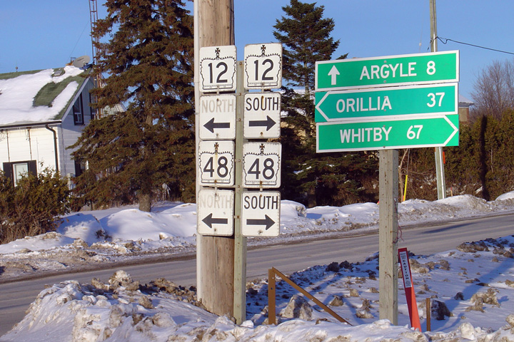
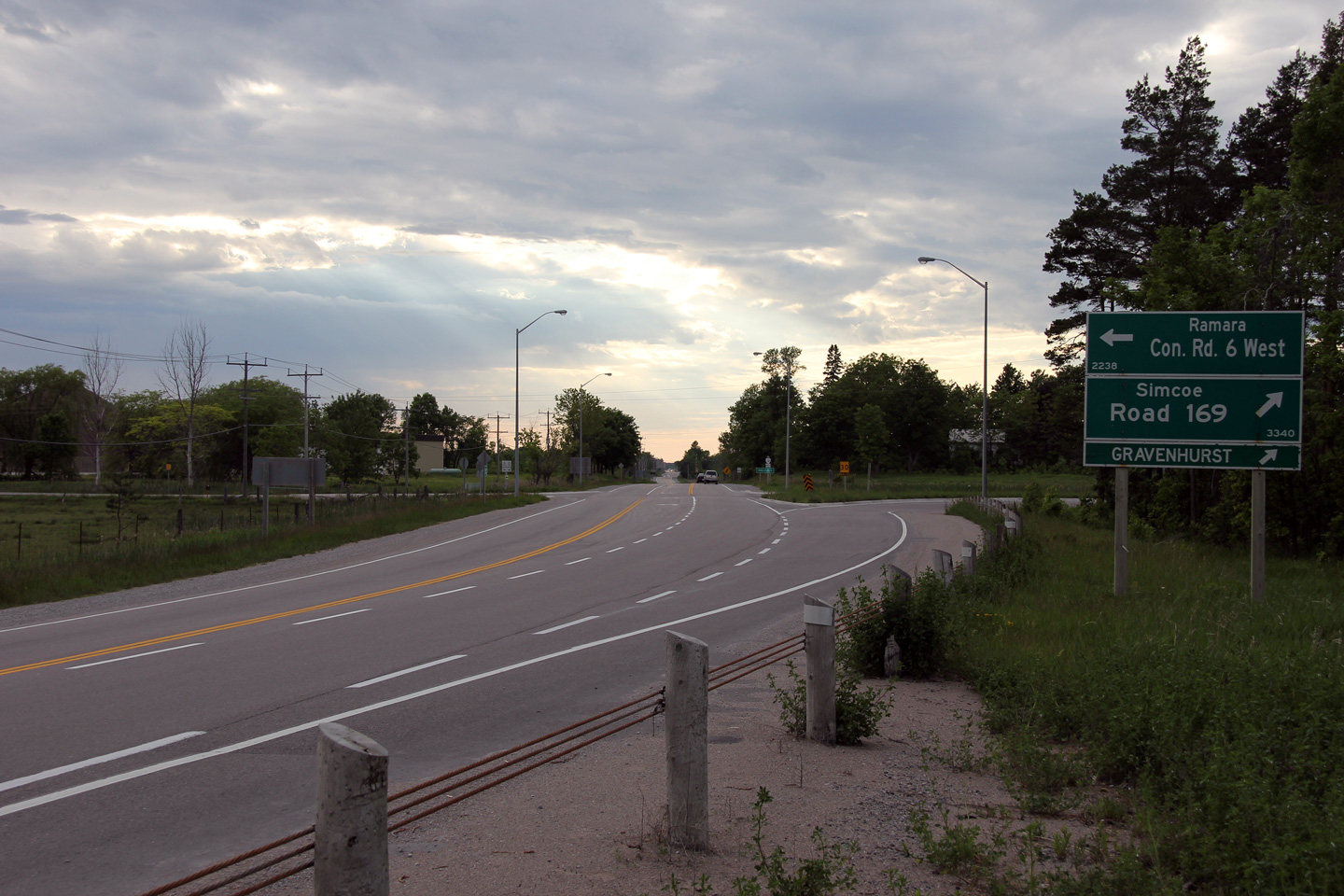
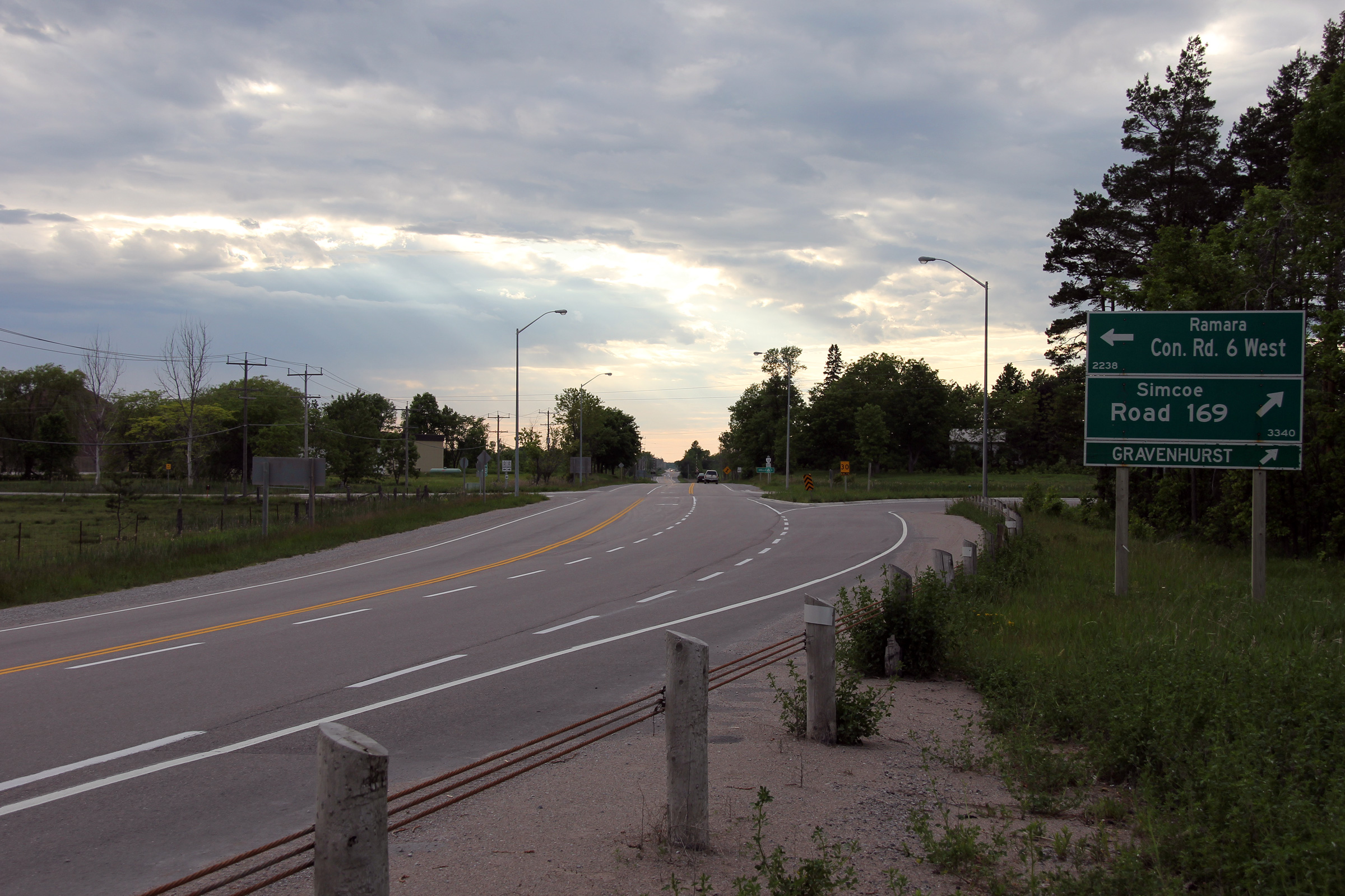
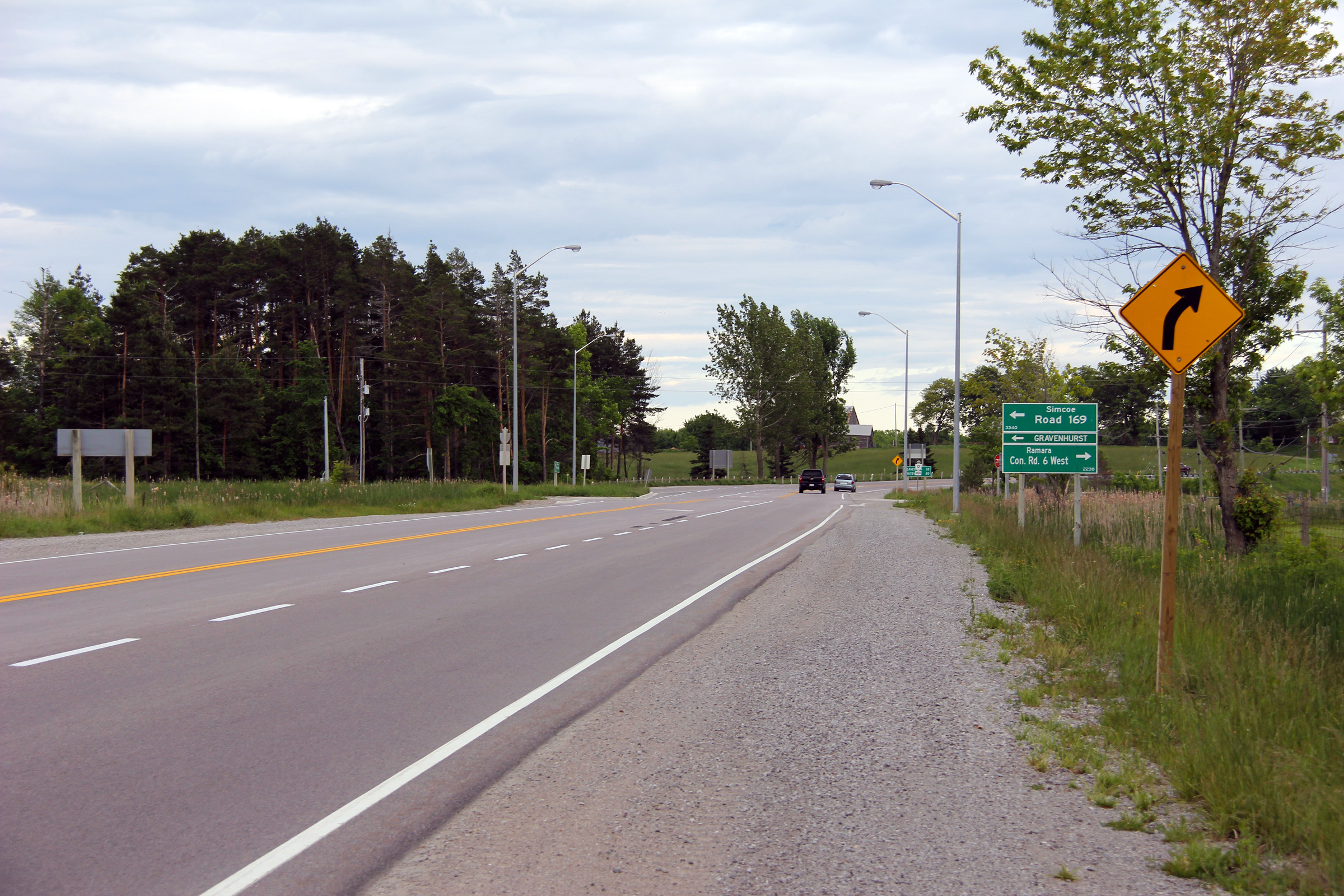
| Township of Ramara County of Simcoe |
Northerly view approaching the
Highway 169
junction. Immediately south of the Highway 169 junction, Highway 12
curves to the west, following an alignment inland of the northern shore of
Lake Simcoe. Highway 169 continues northerly on what had been Highway
12's trajectory. Photo taken: June 5th, 2012. |
 (720x480) (1440x960) (2400x1600) |
||
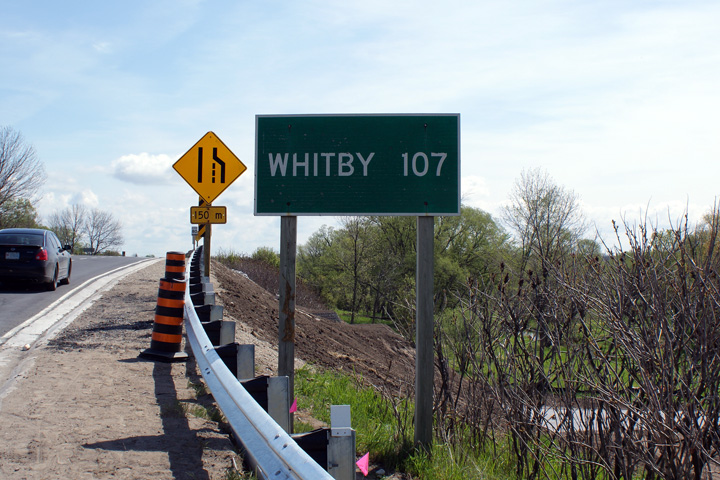
| Township of Ramara County of Simcoe |
Southerly view towards Whitby from the Highway
169 intersection. Photo taken: June 5th, 2012. |
 (720x480) (1440x960) (2400x1600) |
||
| Highway 169 leads traffic northerly from Highway 12 towards Washago, Gravenhurst and beyond. Click here for Highway 169 images. | ||||
| Township of Ramara County of Simcoe |
This view looks northerly along Highway 12 from
the Highway 169 intersection. Photo taken: June 5th, 2012. |
 (720x480) (1440x960) (2400x1600) |
||
| Township of Ramara County of Simcoe |
This view looks southerly approaching the
Highway 169 intersection. Photo taken: June 5th, 2012. |
 (720x480) (1440x960) (2400x1600) |
||
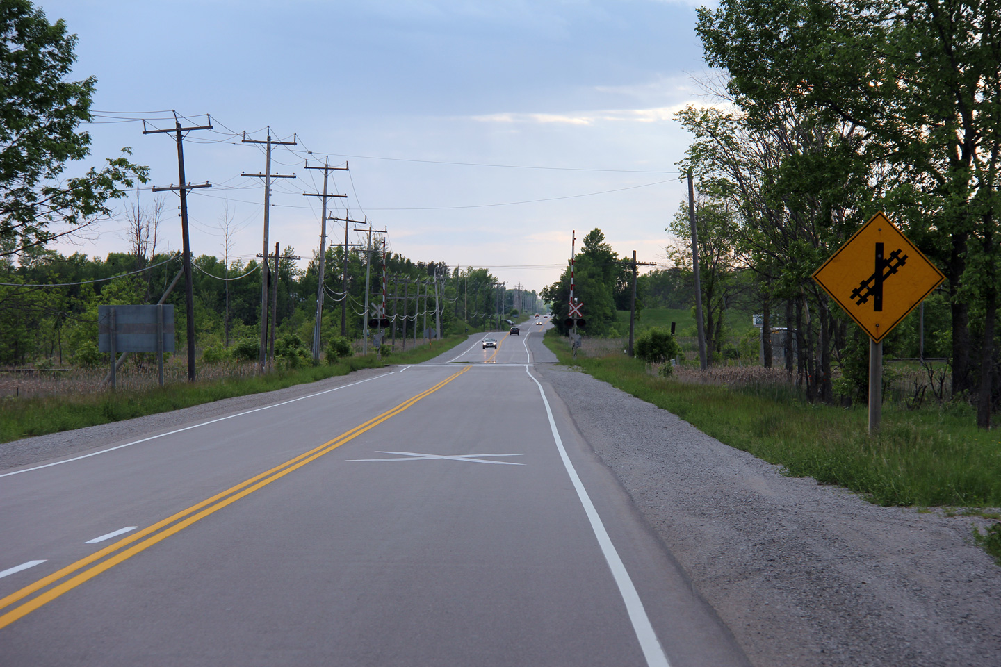
| Township of Ramara County of Simcoe |
View looking northerly from just north of the
Highway 169 junction towards a level railway crossing between Highway 12 and
CN's Bala Subdivision. Highway 12 crosses this railway line three
times in a span of less than 10km north of Beaverton. The Bala
Subdivision is CN's mainline between Toronto and Western Canada. Photo taken: June 5th, 2012. |
 (720x480) (1440x960) (2400x1600) |
||
| Township of Ramara County of Simcoe |
Looking south along Highway 12 from the Sideroad
15 junction. Photo taken: November 6th, 2004. |
 (720x480) (1440x960) |
||
| Township of Ramara County of Simcoe |
Northerly view from the Balsam Road intersection
towards the intersection with Rama Road. Photo taken: August 24th, 2014. |
 (720x480) (1440x960) (2400x1600) |
||
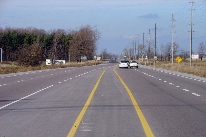
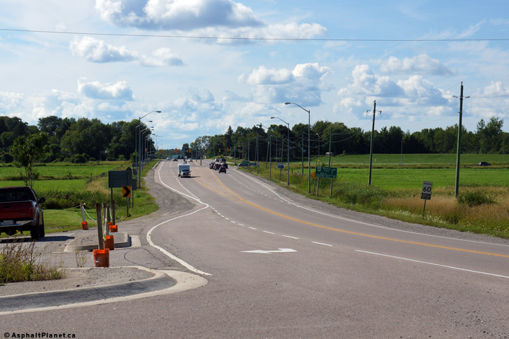
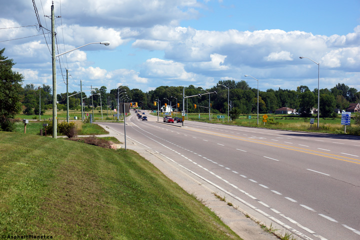
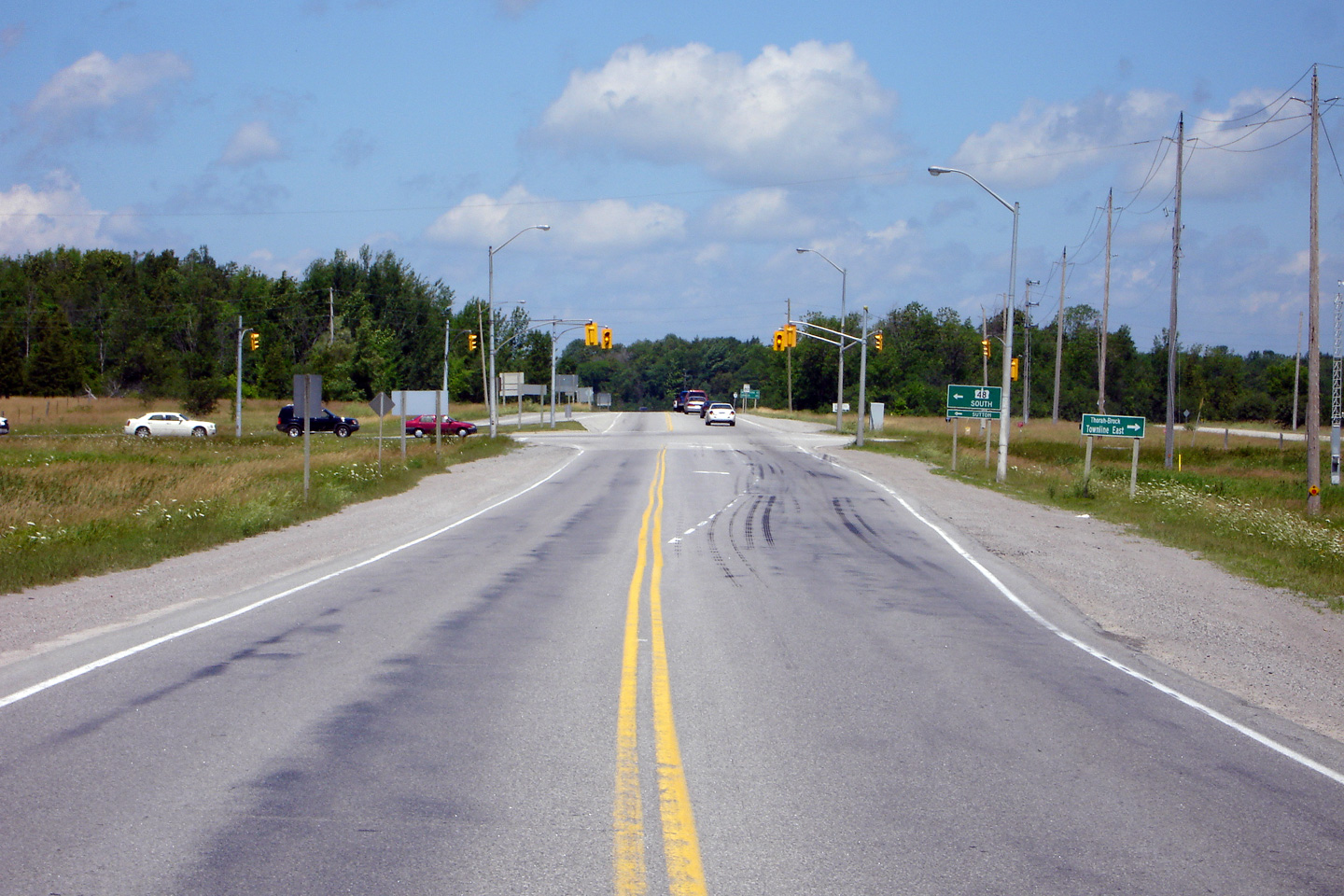
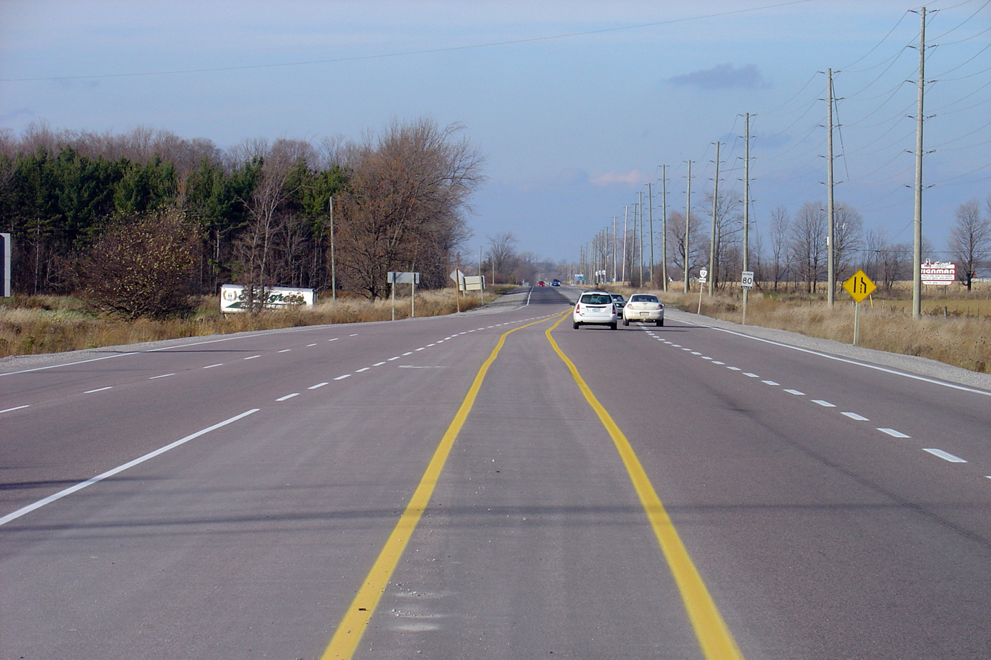
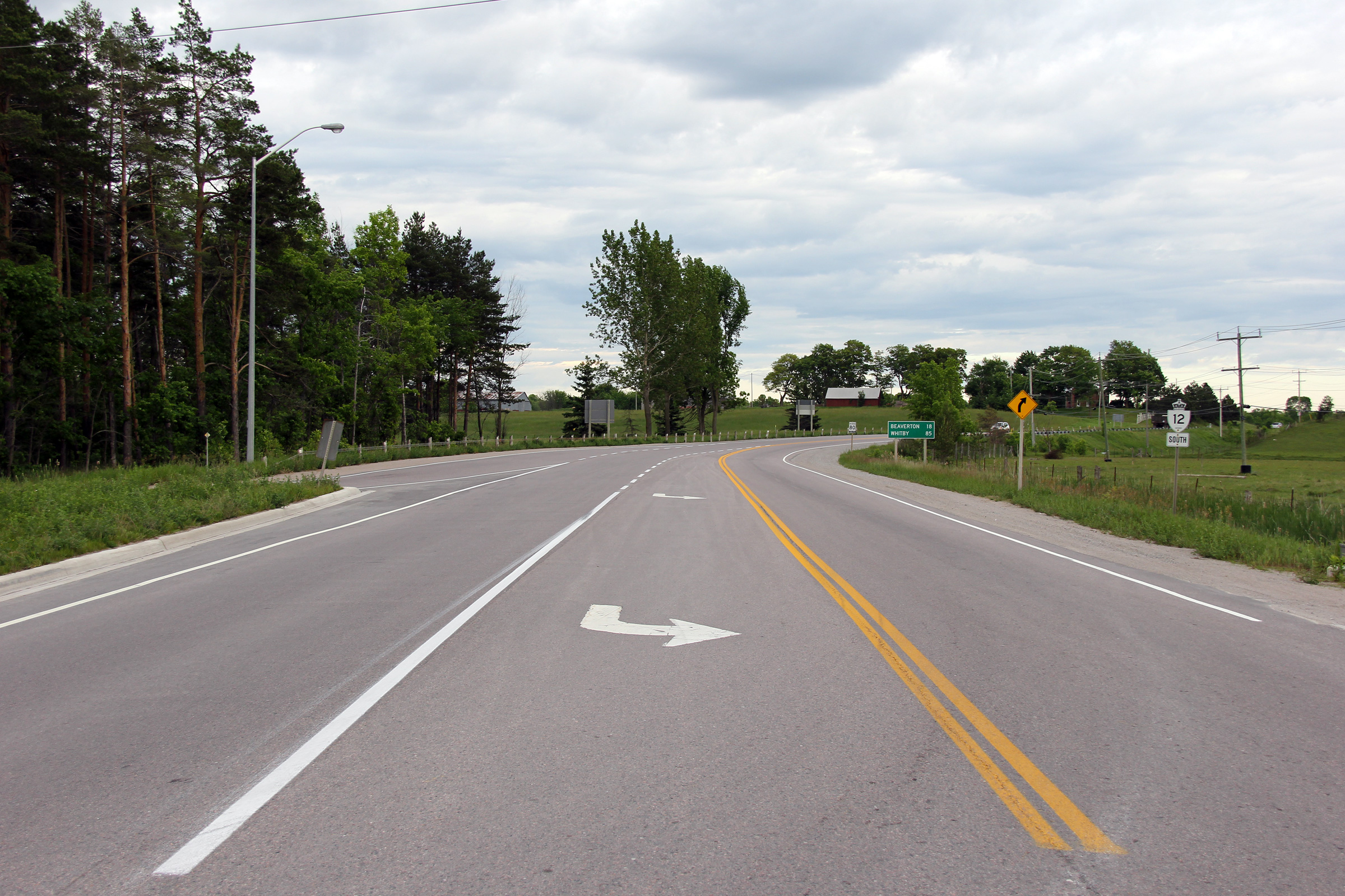
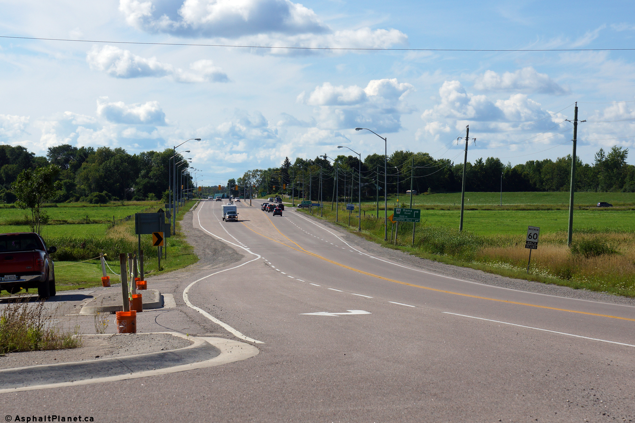
| Township of Ramara County of Simcoe |
Looking south from the Simcoe Road 44 junction.
South of Simcoe Road 44, Highway 12 narrows from 4- to 2-lanes. Photo taken: November 6th, 2004. |
 (720x480) (1440x960) |
||
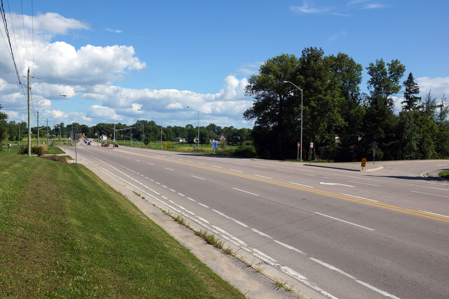
| Township of Ramara County of Simcoe |
Looking north through the Simcoe Road 44
intersection. This intersection is quite busy, as Simcoe Road 44
serves as the main route to Casino Rama. Before 2004, Highway 12 met
Simcoe Road 44 in Atherley at what is now Creighton Street North. Photo taken: November 6th, 2004. |
 (720x480) (1440x960) |
||
| Township of Ramara County of Simcoe |
Two views looking southerly approaching the
Simcoe Road 44 intersection. Photos taken: August 24th, 2004. |
 (720x480) (1440x960) (2400x1600)  (720x480) (1440x960) (2400x1600) |
||
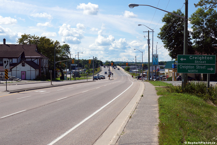
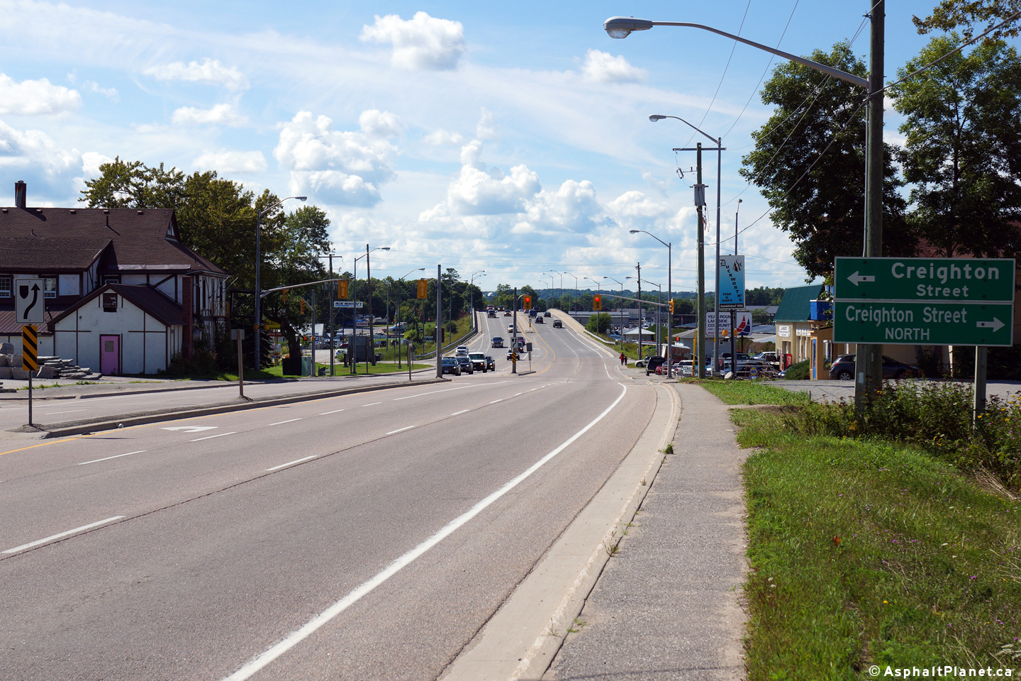
| Township of Ramara County of Simcoe |
This view looks northerly through the Creighton
Street intersection. Photo taken: August 24th, 2014. |
 (720x480) (1440x960) (2400x1600) |
||
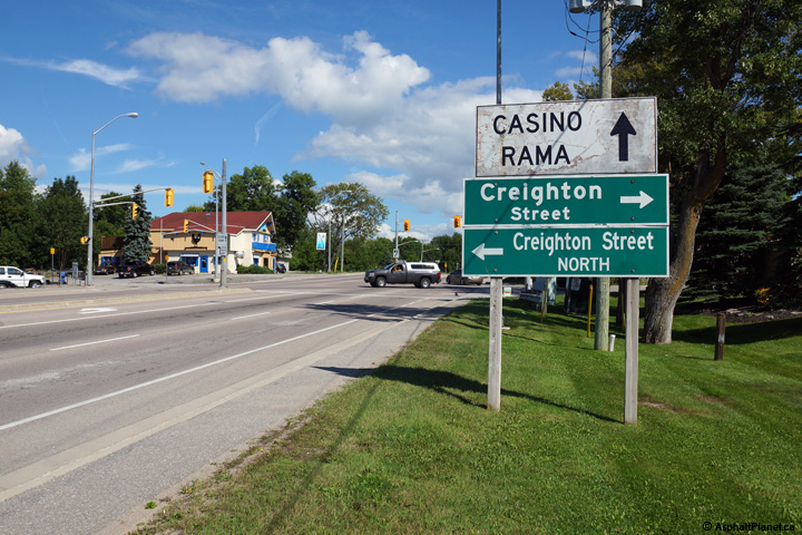
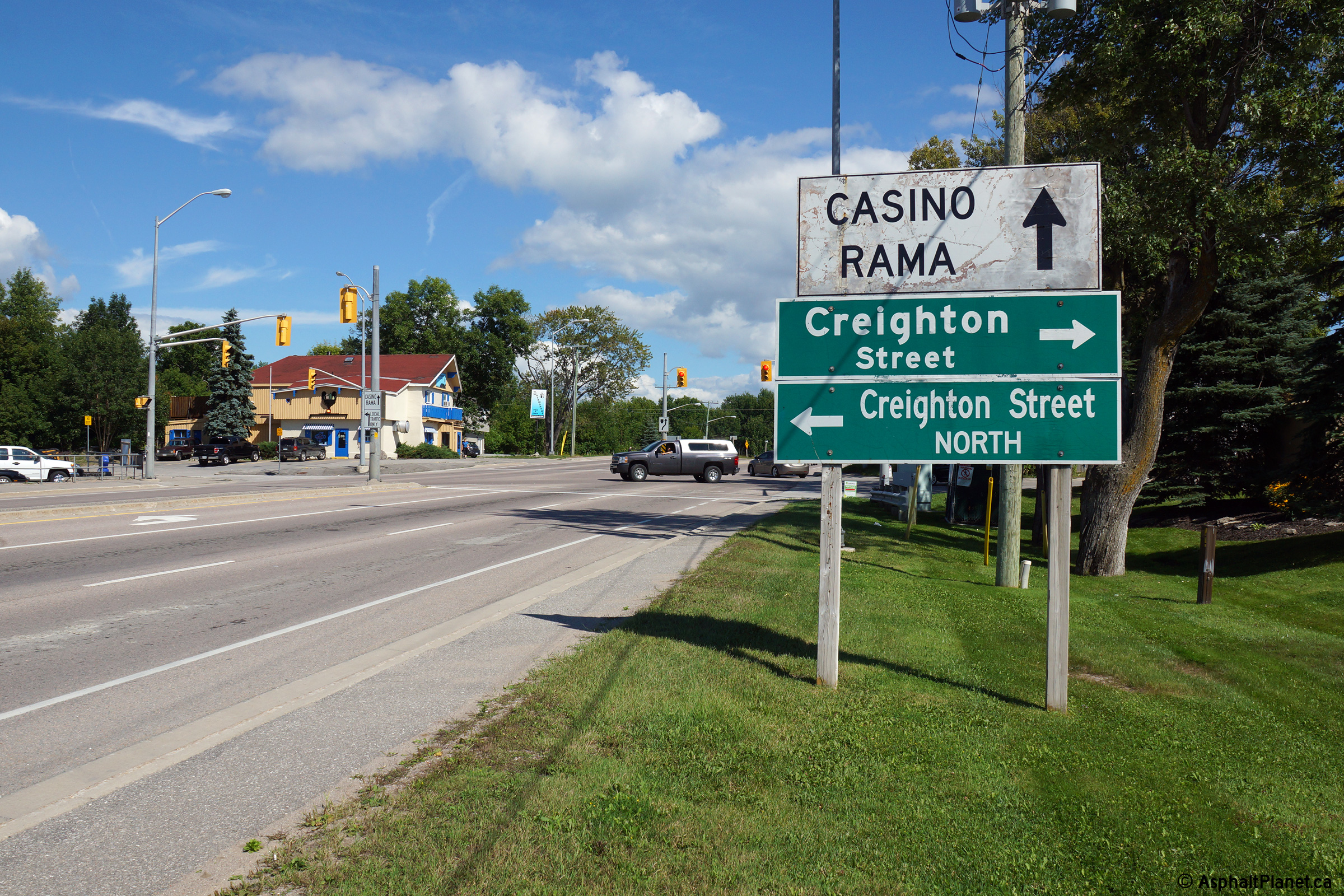
| Township of Ramara County of Simcoe |
Southbound signage at the Creighton Street
intersection. Note the supplementary signage directing traffic to
continue along Highway 12 to access Casino Rama. Before the Simcoe
County constructed the Atherley by-pass, Creighton Street was part of Simcoe
Road 44, and was the access road to Casino Rama. Due to significantly
increased traffic volumes due to the Casino, Simcoe County by-passed
Creighton Street with a new alignment to the east early in the 2000s. Photo taken: August 24th, 2014. |
 (720x480) (720x480)(1440x960) (2400x1600) |
||
| Township of Ramara County of Simcoe |
View looking south from the Atherley Narrows
Bridge towards the Creighton Street intersection. Decades ago, before
the current alignment inland alignment was constructed, Highway 69 (today's
Highway 169) followed Creighton Street north from Atherley. Click
here for an additional photo taken
from this vantage point, taken in November, 2004. Photo taken: November 6th, 2004. |
 (720x480) (1440x960) (2400x1600) |
||
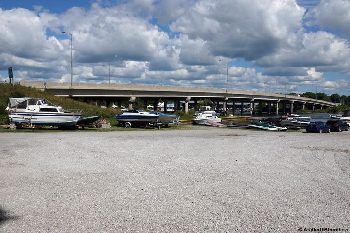
| Township of Ramara County of Simcoe |
View looking northeasterly from the Atherley
shore towards the Atherley Narrows Bridge. This four-lane bridge was
constructed in 1998 and replaced a similar two lane structure that had been
completed during the 1960s. Photo taken: August 24th, 2014. |
 (720x480) (1440x960) (2400x1600) |
||
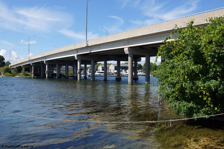
| Township of Ramara County of Simcoe |
View from the Orillia Shore looking southerly
towards Atherley towards the Atherley Narrows Bridge. The southbound
(closest) span retains only the piers of the earlier 1960s span. The
bridge girders and concrete deck were fully replaced during the 1998
twinning project. Photo taken: August 24th, 2014. |
 (720x480) (1440x960) (2400x1600) |
||
| City of Orillia | Westerly view towards the Atherley Narrows
Bridge from the adjacent former CNR Bridge. The Atherley Narrows
Bridge was widened in 1998 after a significant increase in traffic volumes
that were caused by the opening of Casino Rama. Congestion on the old
two lane bridge was such an issue that Casino Rama launched a television ad
campaign advising Toronto and area television viewers that the four lane
structure had finally opened. Photo taken: August 24th, 2014. |
 (720x480) (1440x960) (2400x1600) |
||
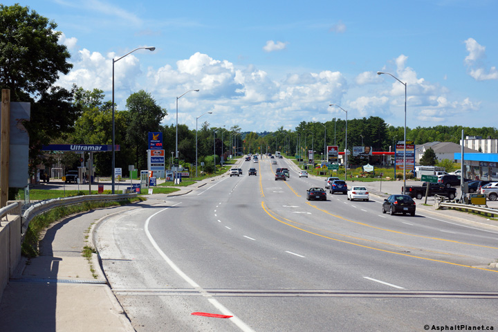
| City of Orillia | Looking north from the Atherley Narrows Bridge
towards Orillia. Highway 12 is constructed to this cross-section
northerly to the junction of Atherley Road at the beginning of the Orillia
By-pass. Click here for an
additional photo taken from this vantage point, taken in November, 2004. Photo taken: August 24th, 2014. |
 (720x480) (1440x960) (2400x1600) |
||
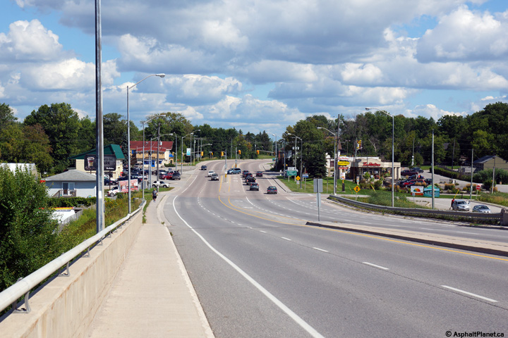
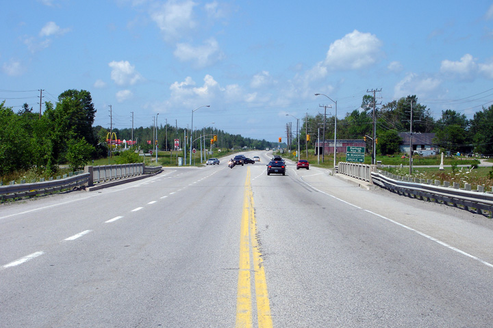
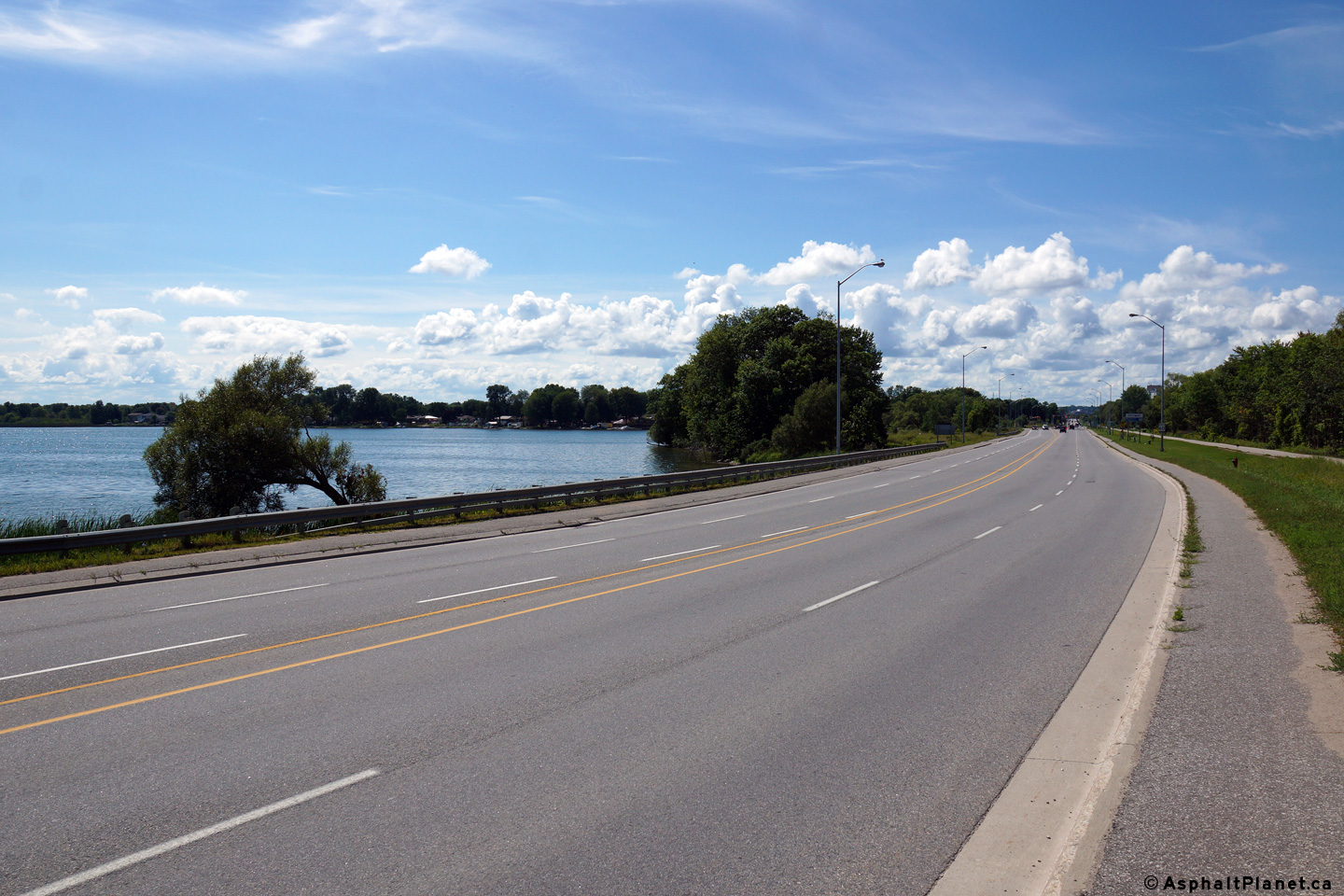
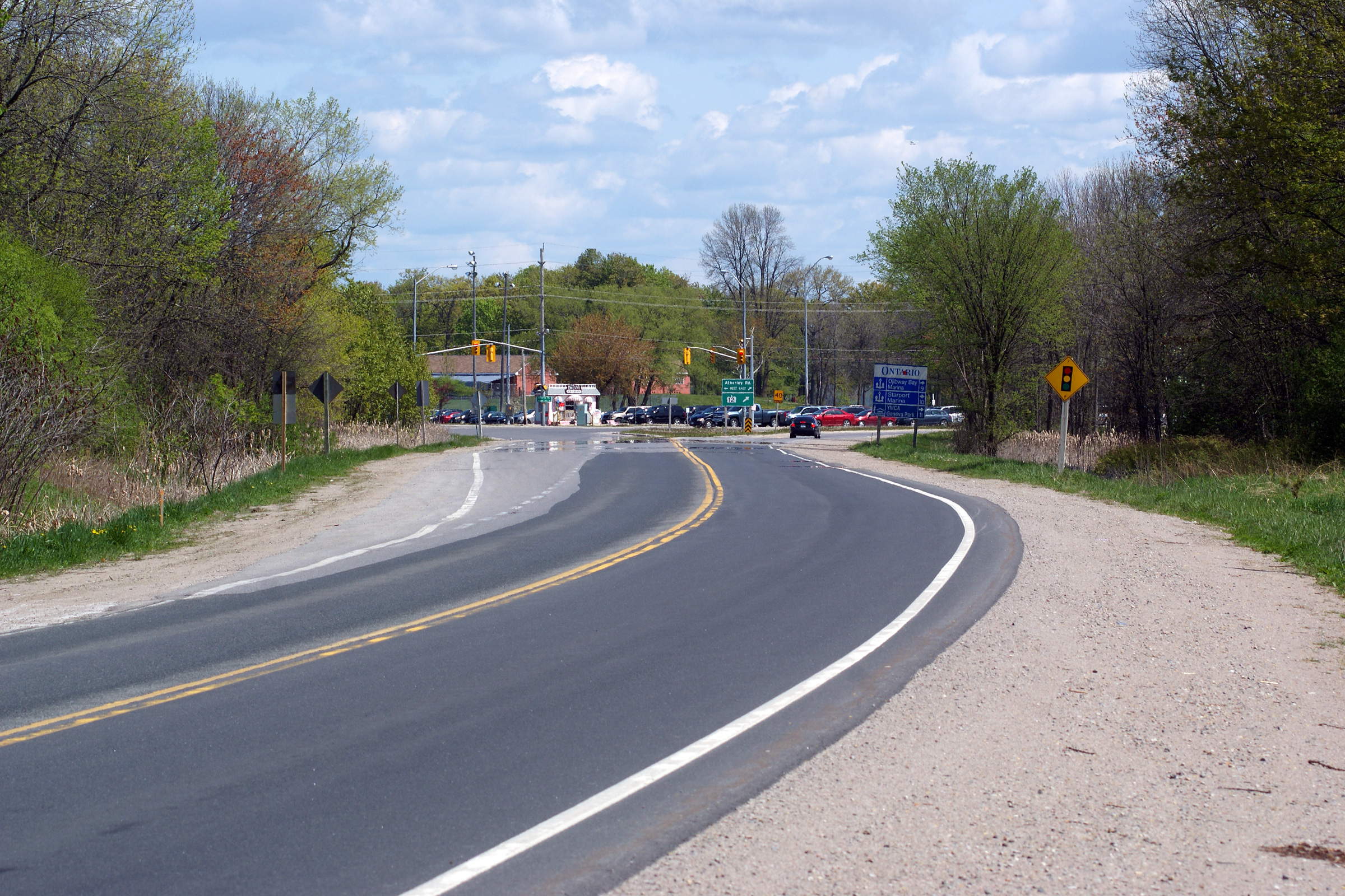
| City of Orillia | This view looks southerly along Highway 12 as it
passes through Atherley Narrows. Between Orillia and Atherley, Highway
12 runs across a narrow spit of land that separates Lake Simcoe from Lake
Couchiching. Photo taken: May 13th, 2012. |
 |
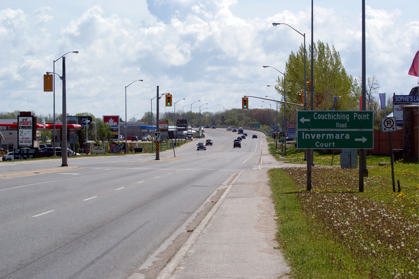
||
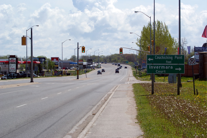
| City of Orillia | View looking northerly from about 100m north of
Couchiching Point Road towards the Orillia By-pass intersection. Upper photo taken: August 24th, 2014 Lower photo taken: May 13th, 2012. |
 (720x480) (1440x960) (2400x1600) 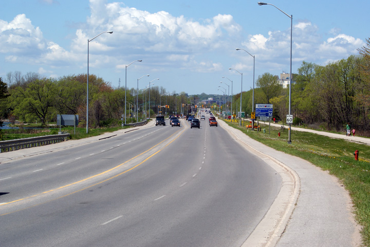 |
||
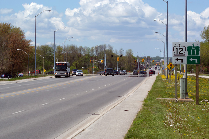
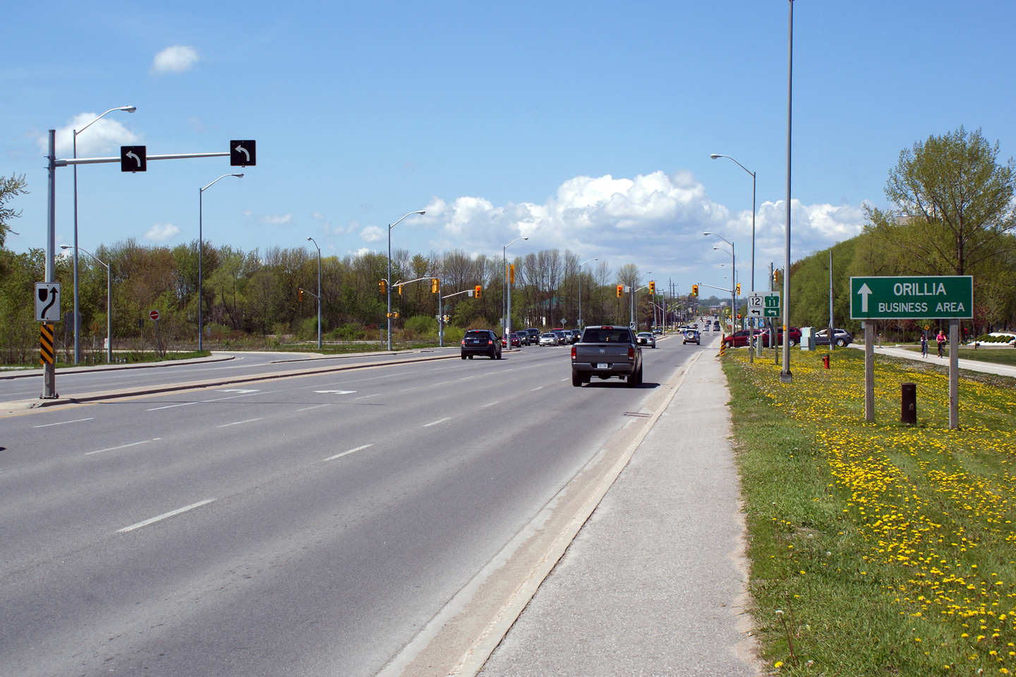
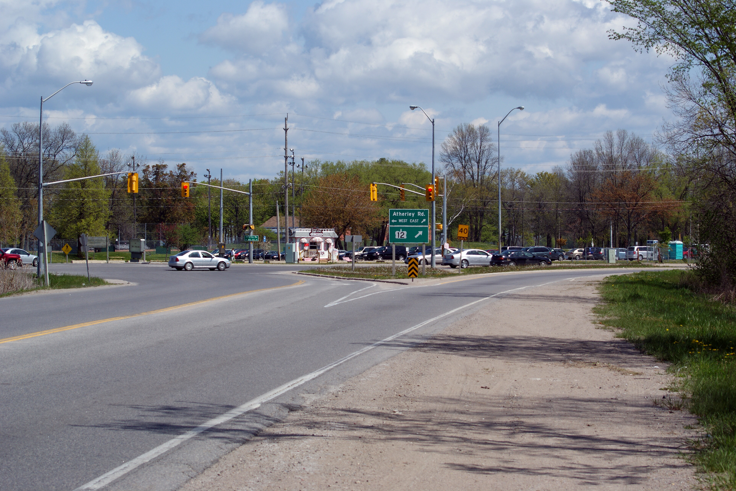
| City of Orillia | Two views looking northerly towards the Orillia
By-pass intersection. Through traffic continuing northerly along
Highway 12 must turn left at this intersection. Once carrying the
Highway 12B designation, Atherley Road continues straight ahead from this
intersection, bound for Downtown Orillia. Photos taken: May 13th, 2012. |
 (720x480) (1440x960) (2400x1600) 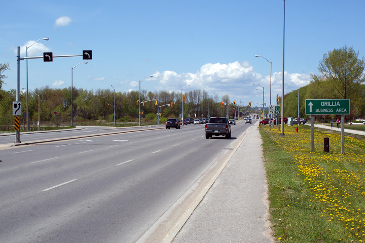 (720x480) (1440x960) (2400x1600) |
||
| City of Orillia | Northbound signage approaching the Atherley Road
intersection along Highway 12. Wayfinding signage was added indicating
the route of the Trans-Canada Highway through this junction during the Summer of 2014. Photo taken: August 24th, 2014. |
 (720x480) (720x480)(1440x960) (2400x1600) |
||
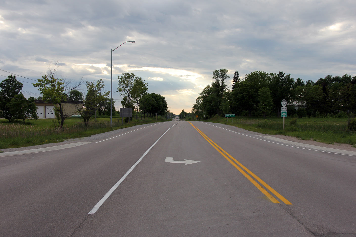
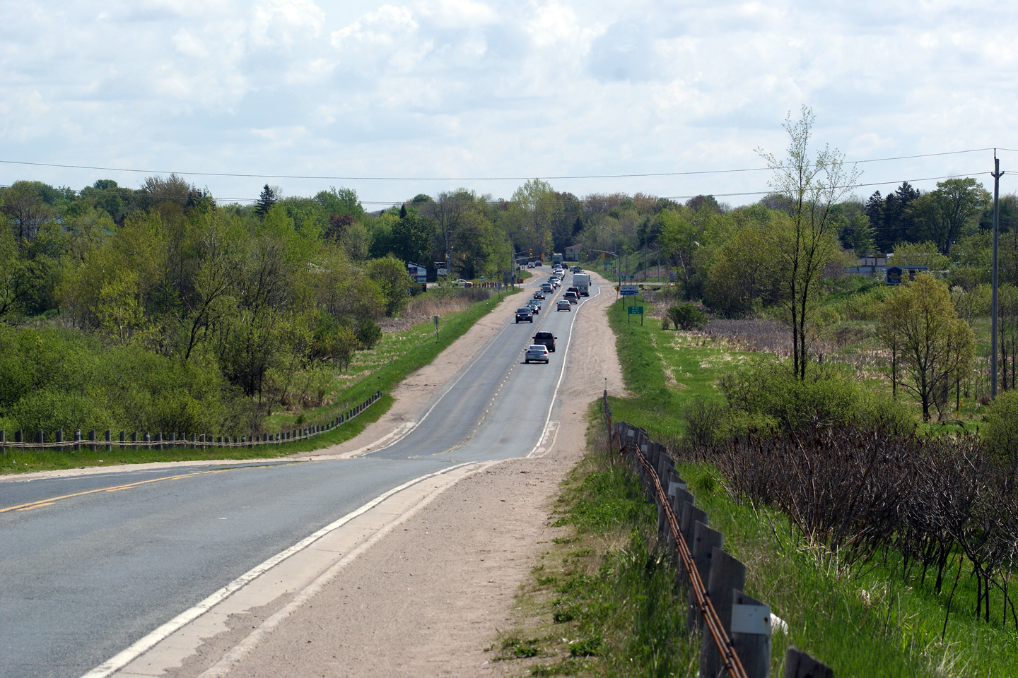
| City of Orillia | Southerly view approaching the southern end of
Highway 12's portion of the Orillia By-pass. Southbound traffic must
turn right at this intersection in order to follow Highway 12 South towards
Whitby. Photo taken: May 13th, 2012. |
 |
||
| City of Orillia | Easterly view from just east of the intersection
with Forest Road towards the Atherley Road intersection and the end of the
Orillia By-pass. Photo taken: May 13th, 2012. |
 |
||
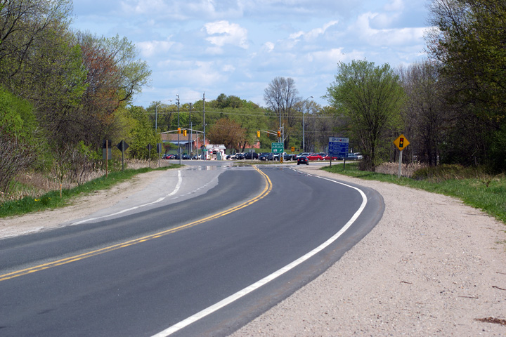
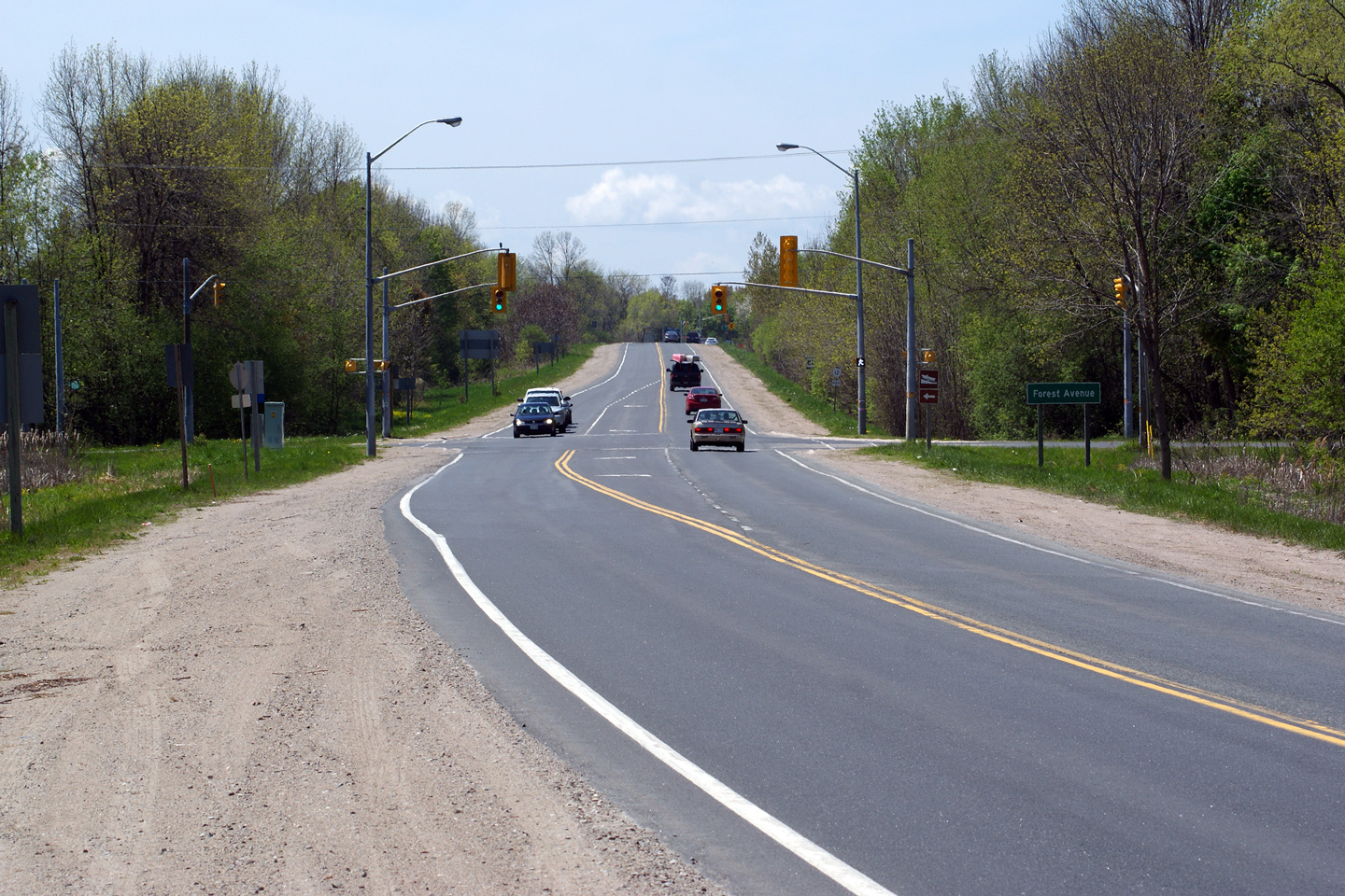
| City of Orillia | This view looks northerly along Highway 12
approaching the signalized intersection with Forest Road. Photo taken: May 13th, 2012. |
 |
||
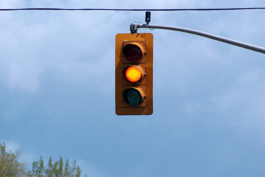
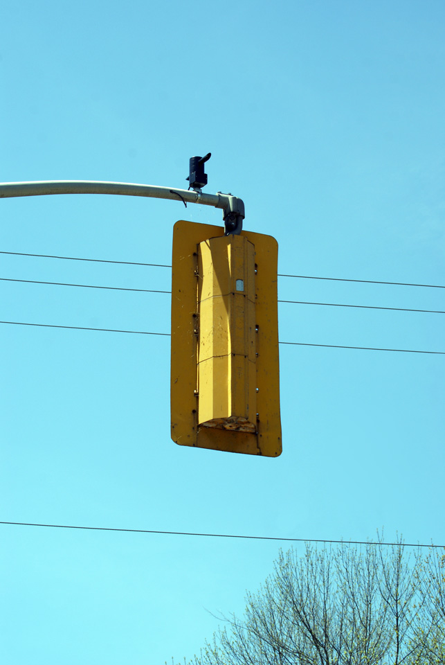
| City of Orillia | Close-up of the primary southbound signal head
along Highway 12 at the Forest Road intersection. It is unusual to see
a traffic signal of this vintage with full 30cm signal heads for all three phases. Until recently, the standard traffic signal installed along
provincial highways in Ontario had a 30cm signal head for the red phase with
20cm signal heads for the yellow and green phases. Click here for a
close-up view of the front and
back of this signal. Photo taken: May 13th, 2012. |
 |
||
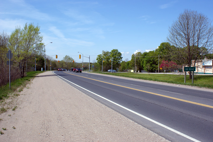
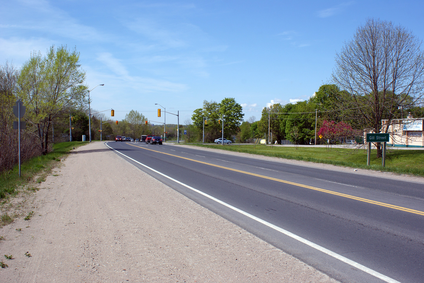
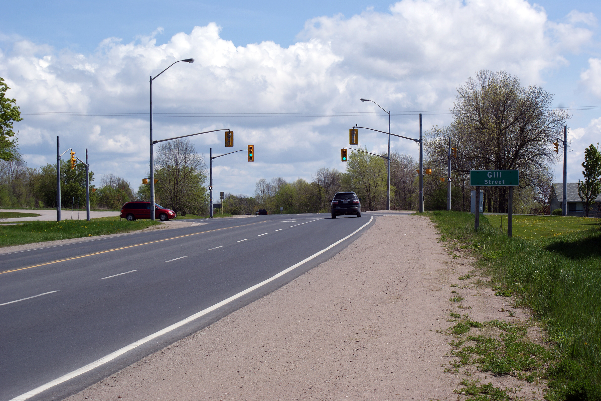
| City of Orillia | Northerly view approaching the Gill Street
intersection. Photo taken: May 13th, 2012. |
 |
||
| City of Orillia | Southerly view approaching the signalized
intersection with Gill Street. Photo taken: May 13th, 2012. |
 |
||
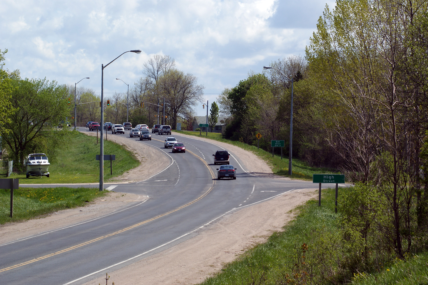
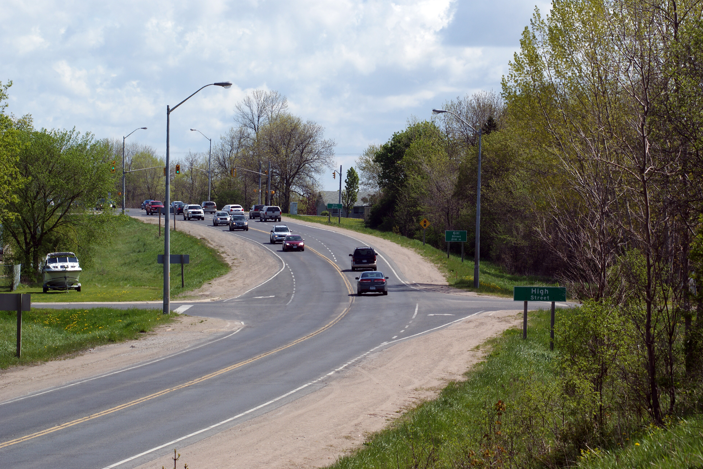
| City of Orillia | Southerly view approaching the High Street
intersection. This is the only unsignalized intersection along Highway
12's segment of the Orillia By-pass. Photo taken: May 13th, 2012. |
 |
||
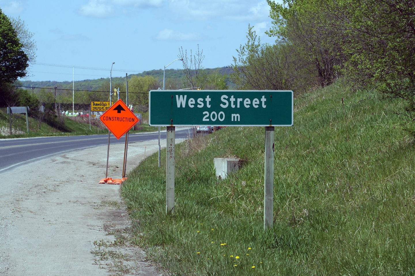
| City of Orillia | Close-up view of the advanced signage for the
West Street intersection. Many of the road signs along the Orillia By-pass
are quite dated. The vintage of this sign is evident by its rounded white
border. The border is angular on modern signs. Photo taken: May 13th, 2012. |
 (720x480) (720x480)(1440x960) |
||
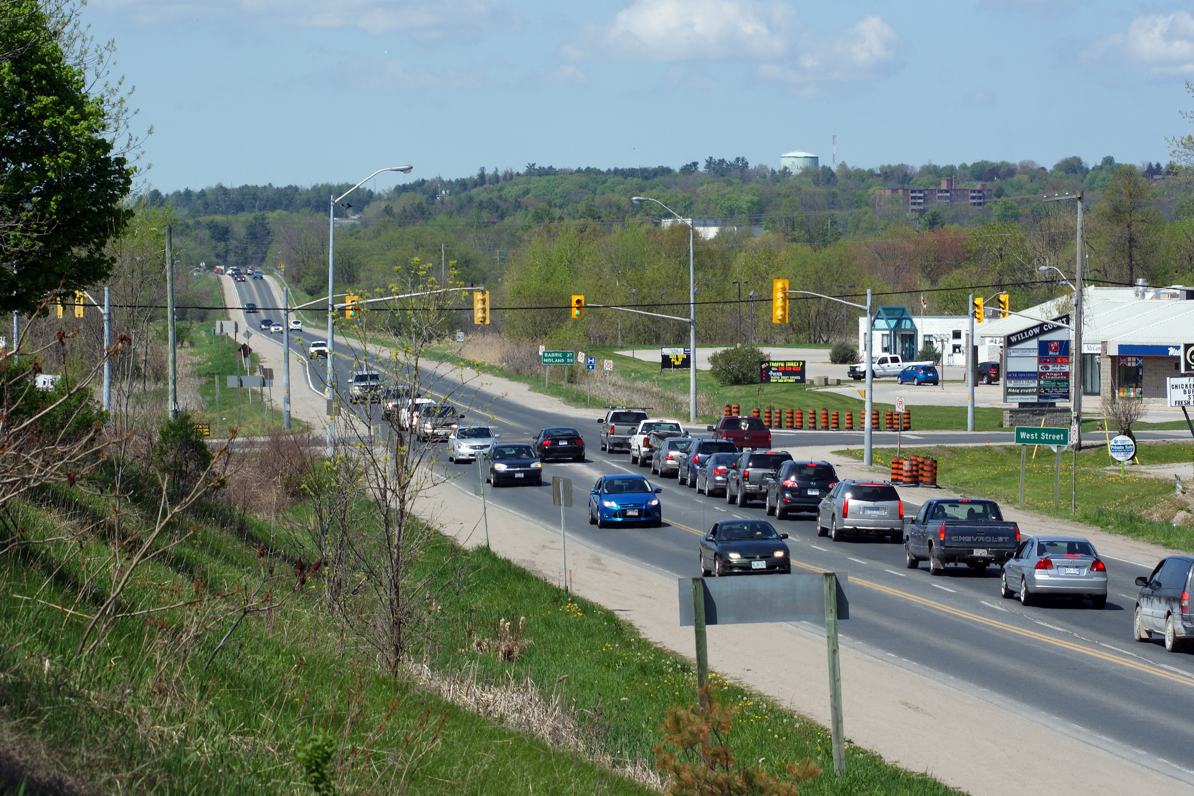
| City of Orillia | Two views looking northerly towards the West
Street intersection. Photos taken: May 13th, 2012. |
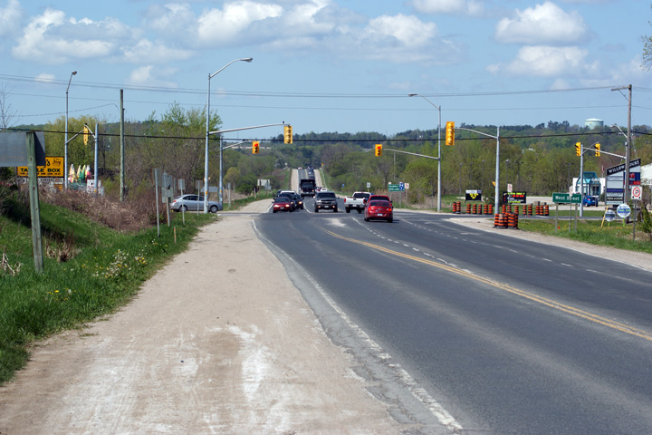 (720x480) (1440x960) (2400x1600)  (720x480) (1440x960) (2400x1600) |
||
| City of Orillia | Southerly view towards the West Street
intersection from the former CN Rail underpass. The former CN Railway
line that ran through Orillia from Barrie was abandoned in 1996, with the
tracks lifted later. The former alignment has since been turned into a
walking and cycling trail. Photo taken: May 13th, 2012. |
 |
||
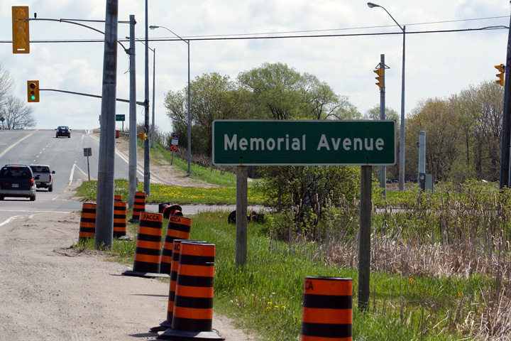
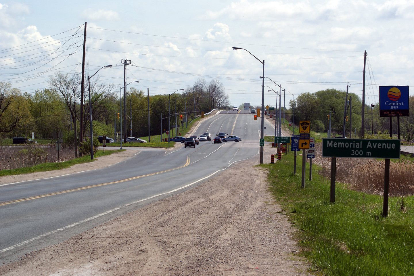
| City of Orillia | Advanced signage for the Memorial Avenue
intersection. Photo taken: May 13th, 2012. |
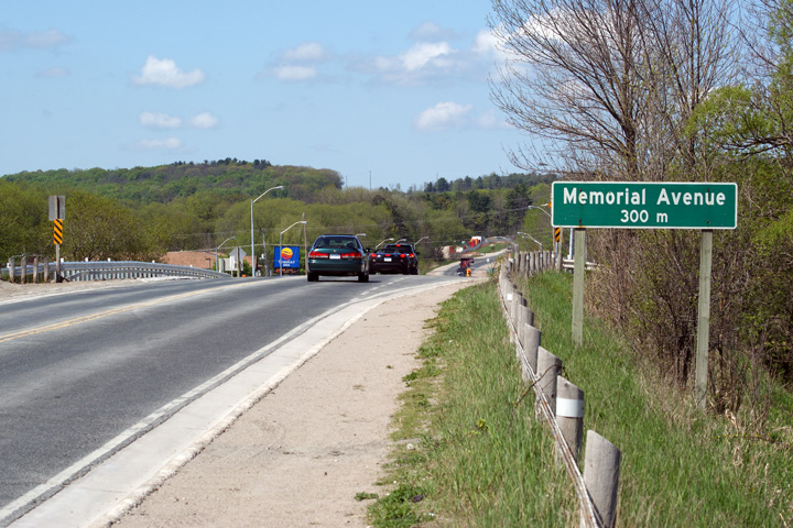 (720x480) (720x480)(1440x960) (2400x1600) |
||
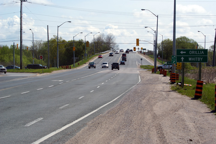
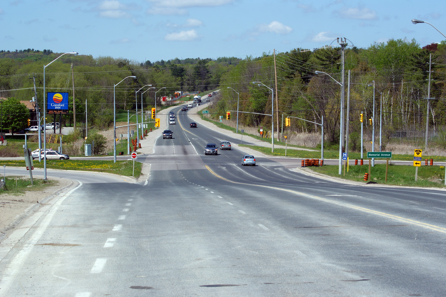
| City of Orillia | Northerly view towards the Memorial Avenue
intersection. Memorial Avenue is the former alignment of Highway 11 into
Downtown Orillia before the current freeway by-pass was constructed in the
1950s. Between 1959 and 1982, Memorial Avenue was signed as Highway 11B
through Orillia. Photo taken: May 13th, 2012. |
 |
||
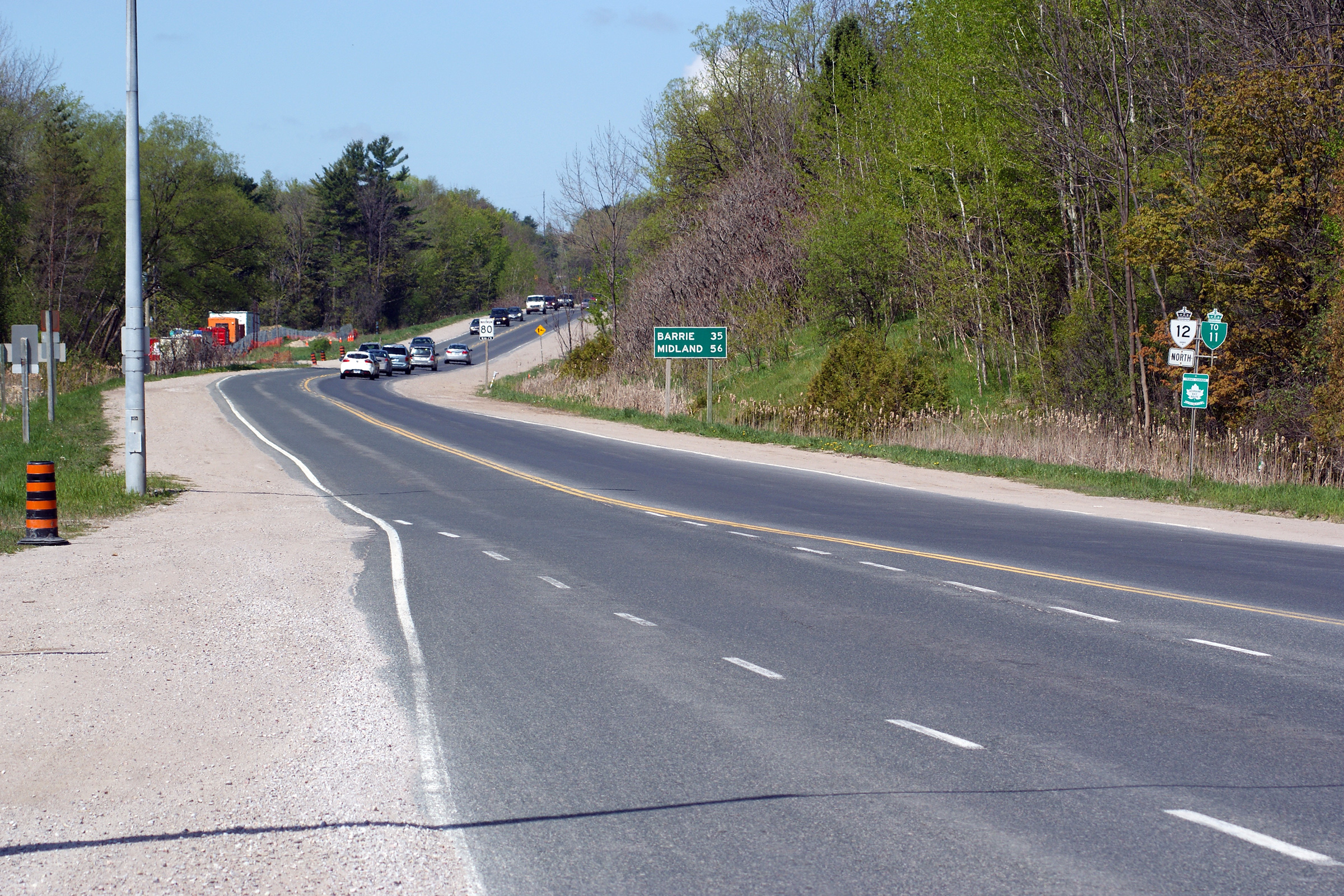
| City of Orillia | Southbound distance signage located just south
of the Memorial Avenue intersection. Photo taken: May 13th, 2012. |
 (720x480) (720x480)(1440x960) |
||
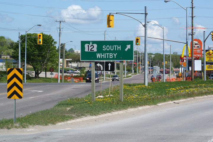
| City of Orillia | Northbound green signage
directing motorists to the ramp to Highway 12 South. Situated behind
the signage is a set of obsolete traffic signal mast arms. Photo taken: May 13th, 2012. |
 (720x480) (1440x960) |
||
| City of Orillia | Green signage, southbound, at the Memorial
Avenue intersection. Photo taken: May 13th, 2012. |
 (720x480) (720x480)(1440x960) |
||
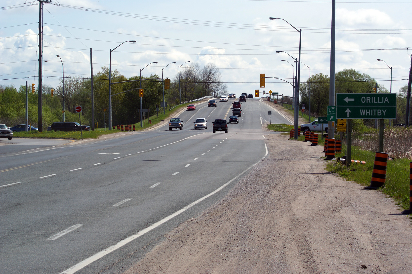
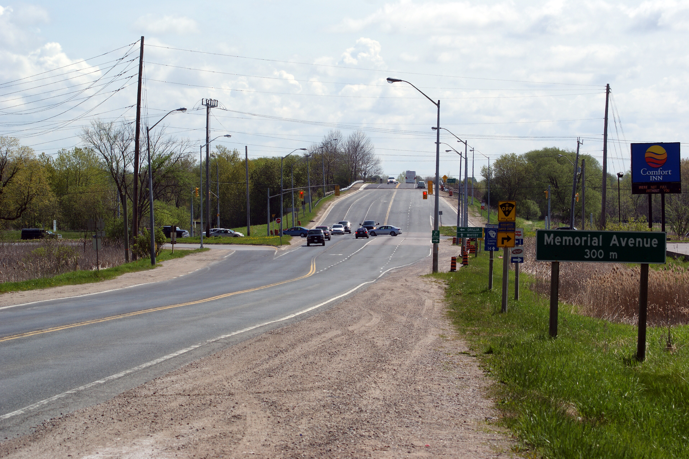
| City of Orillia | Two views looking southerly approaching the
Memorial Avenue intersection. Memorial Avenue is a busy commercial
strip through Southern Orillia. As such, the Memorial Avenue
intersection is the busiest along Highway 12's segment of the Orillia
By-pass. Photos taken: May 13th, 2012. |
 (720x480) (1440x960) (2400x1600) 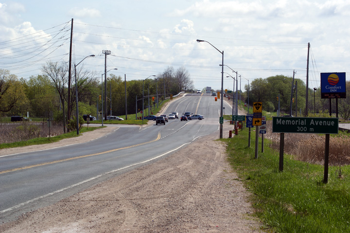 (720x480) (1440x960) (2400x1600) |
||
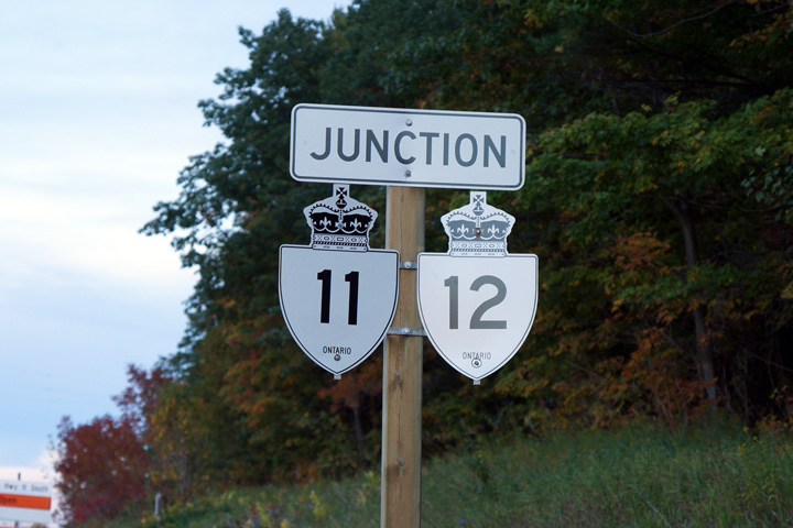
| City of Orillia | Northerly view towards the Highway 11
interchange from just north of the Memorial Avenue intersection. Photo taken: May 13th, 2012. |
 |
||
| City of Orillia | Old style highway signage for Highway 12 located
just west of the Memorial Avenue intersection. This signage has long
been replaced. Photo taken: November 4th, 2004. |
|
||
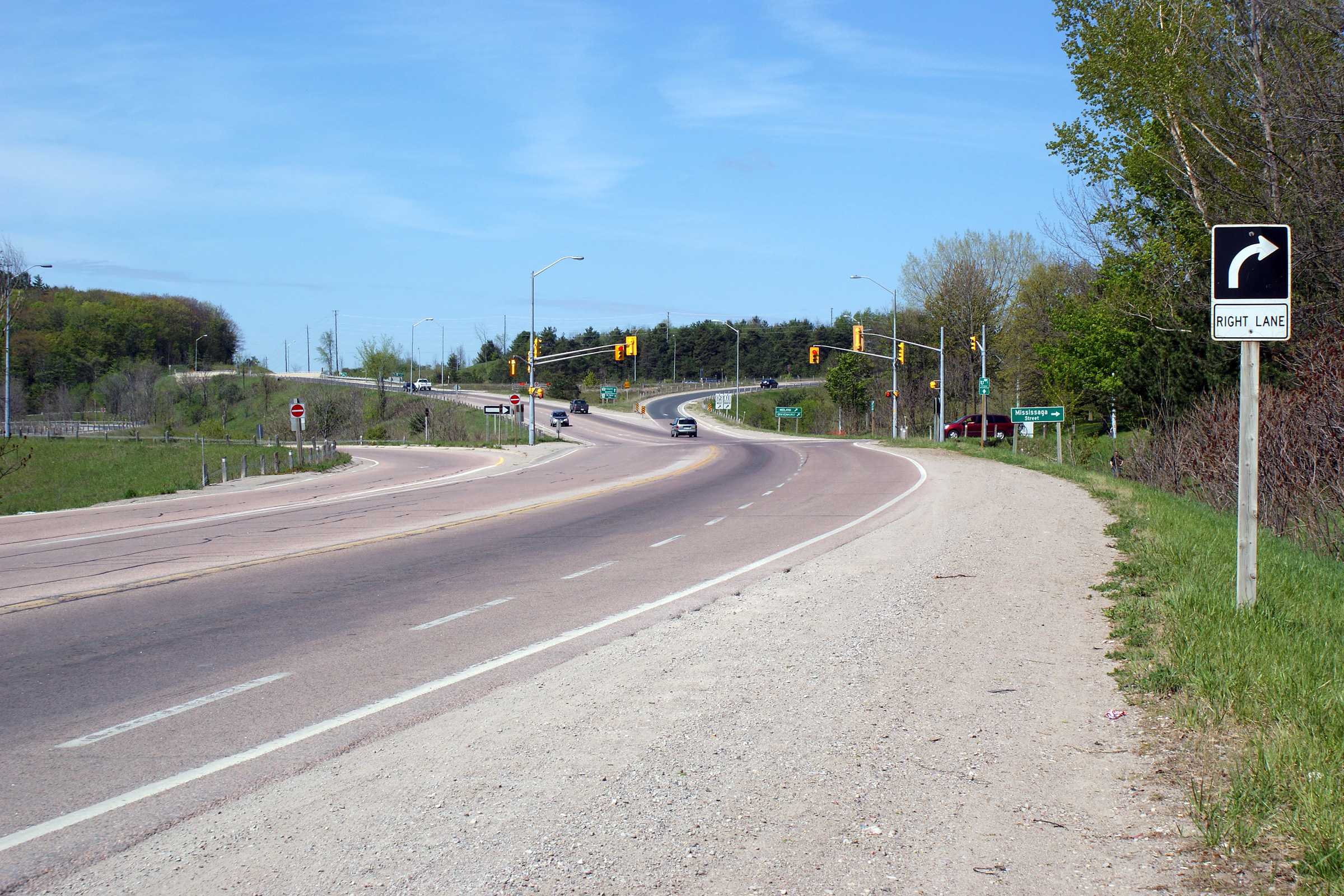
| City of Orillia | View looking towards the north towards the
Mississauga Street intersection. The Highway 11 interchange lies just
beyond the signalized intersection with Mississauga Street. Photo taken: May 13th, 2012. |
 |
||
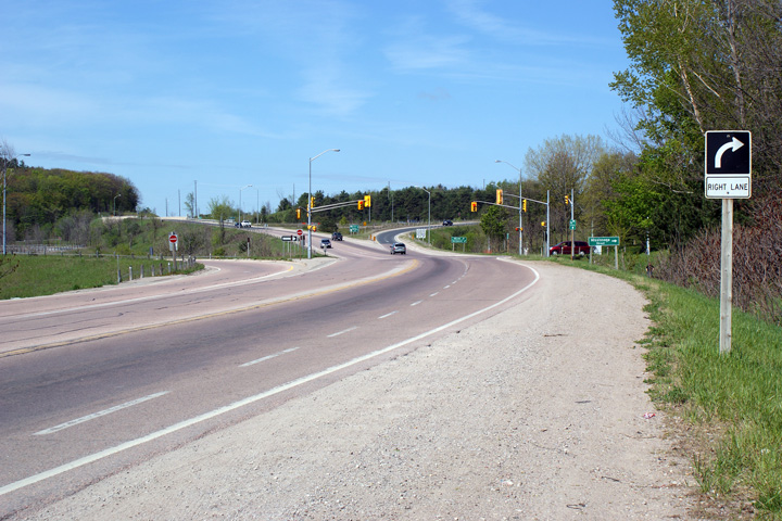
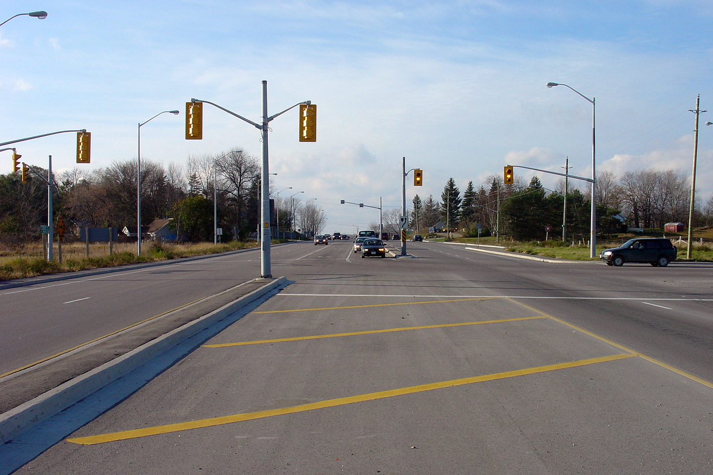
| City of Orillia | View looking northbound approaching the Highway
11 interchange. At this interchange, traffic continuing northerly
along Highway 12 must follow the ramp to the right. Photo taken: May 13th, 2012. |
 (720x480) (720x480)(1440x960) (2400x1600) |
||
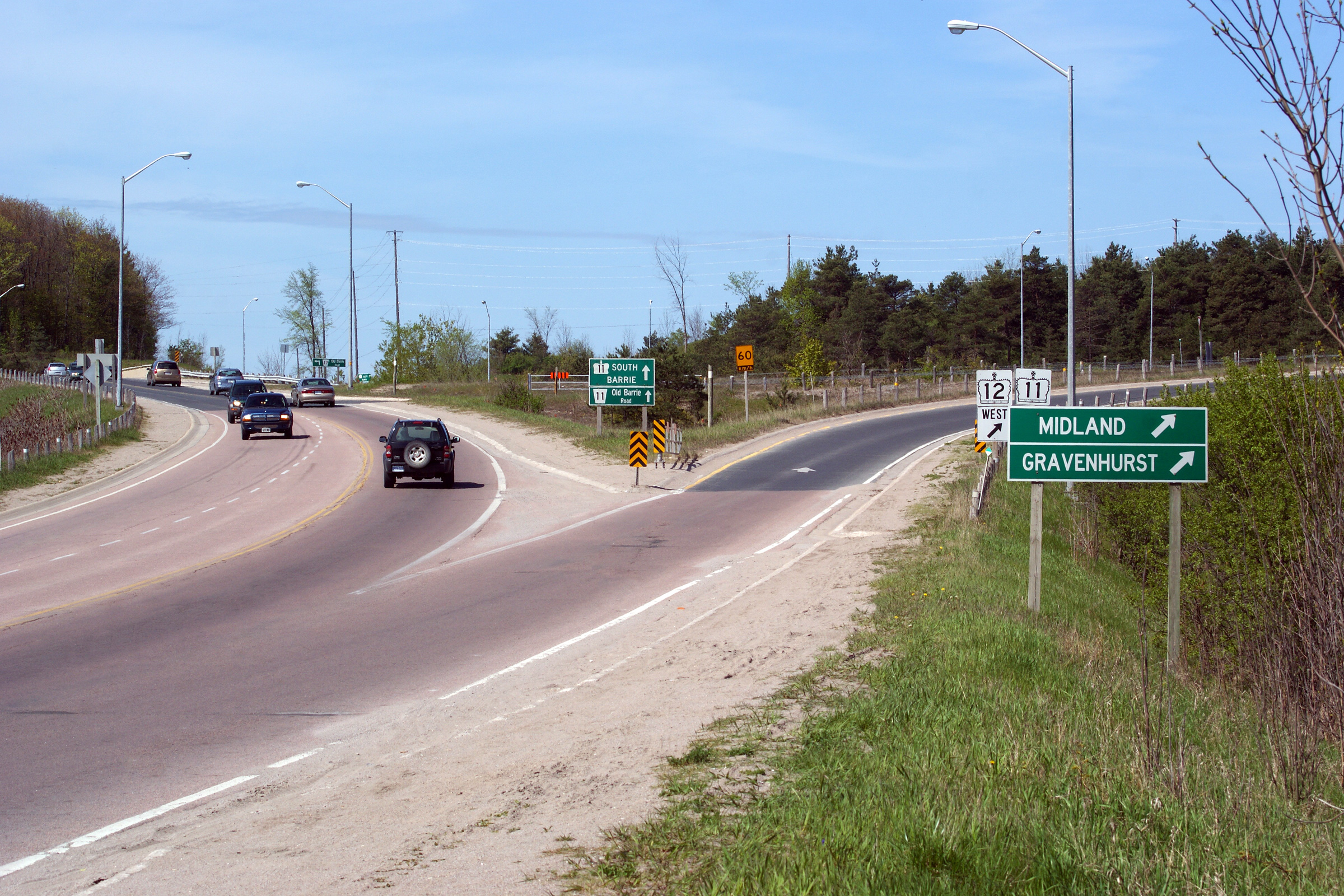
| City of Orillia | The junction assembly for the ramp from Highway
12 southbound to Highway 11 northbound. This ramp is really only there
for traffic from Simcoe Road 11 (Old Barrie Road) to access
Highway 11
Northbound. Despite being numbered Simcoe Road 11, and called the Old
Barrie Road, the road was never part of Highway 11
nor did it ever go directly to Barrie. Photo taken: February 8th, 2004. |
|
||
| City of Orillia | Junction assembly facing
motorists bound for either Highways 11 or 12 from the Old Barrie Road
intersection. This non-standard junction assembly has replaced with
new signs with a more typical sign layout. Photo taken: February 8th, 2004. |
 (720x480) (1440x960) |
||
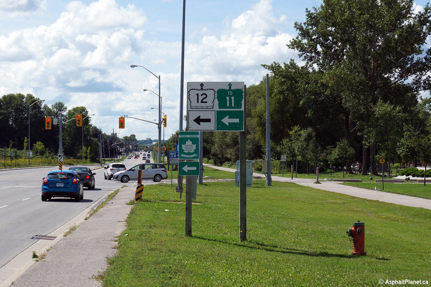
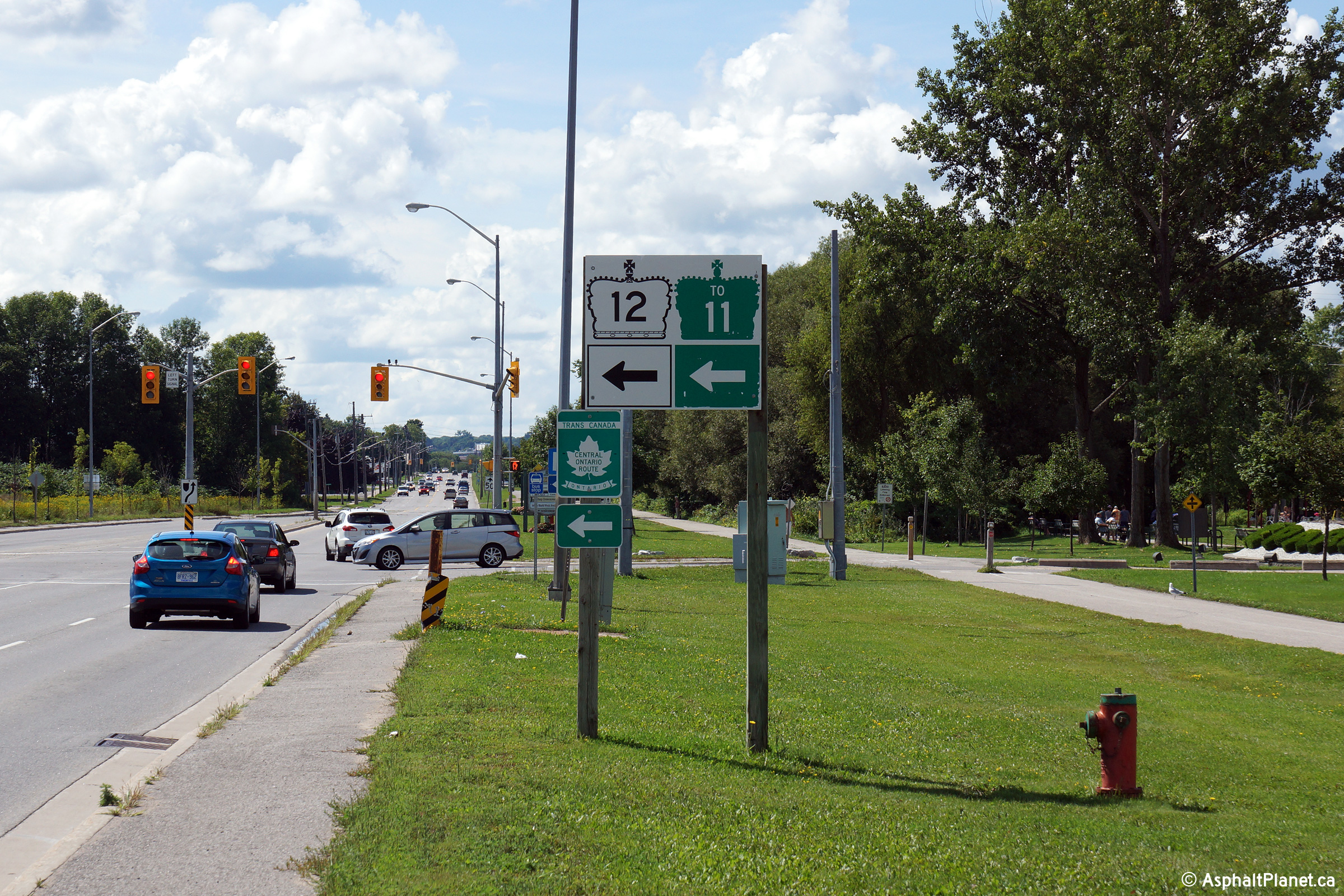
| City of Orillia | This interesting junction
assembly was erected during 2014 and serves as a pre-advanced sign for the
upcoming Highway 11/12 interchange. Photo taken: September 28th, 2014. |
 (720x480) (1440x960) |
||
| Highway 12 meets Highway 11 at an interchange along the Orillia By-pass. Click here for Highway 11-South. | ||||
| Click here for Highway 12 images between Orillia and Midland. |
<- Page 1 Images Highway 12 Images Index Page 3 Images ->
<- Highway 11B (Atikoka) Images Back to Highway 12 Highway 14 Images ->
Copyright (c) 2004-2015, Scott Steeves (Webmaster) AsphaltPlanet@asphaltplanet.ca


