AsphaltPlanet.ca > OntHighways > Highway 7 > Images > Page 3A
King's Highway 7 - Images
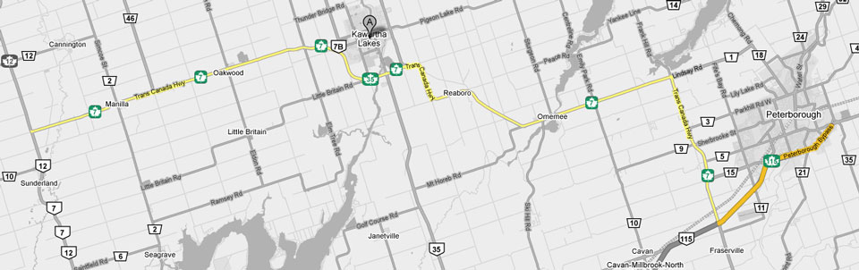
<- Page 2D Page 3A - Sunderland to Peterborough Page 3B - >
Photos shown in this table are arranged from West to East:
| Proper Municipality Name | Photo Description | Photo | ||
|
Photos taken from driver's perspective appear offset from centre-line Photos: |
East- Bound |
West- Bound |
||
| Pickering to Sunderland Photos available here | ||||
| Highway 12 runs from Whitby northerly to Orillia and then westerly to Midland. Click here for Highway 12 images. | ||||
| Township of Brock Regional Municipality of Durham |
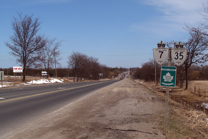
Easterly view of Highway 7 as it departs from
the Highway 12 junction. This is the beginning of Highway 7's section
of the Trans-Canada Highway's Central Ontario Route. Photo taken: October 10th, 2010. |
 |
||
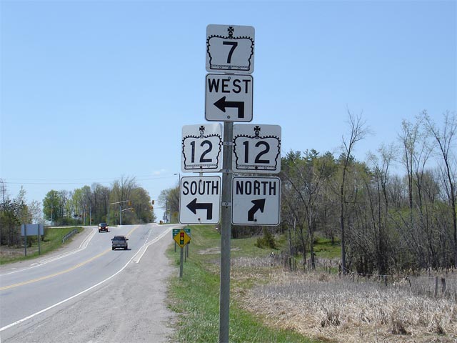
| Township of Brock Regional Municipality of Durham |
Junction assembly for the northern Highway 12
junction. As evident by the photo, Highway 7 turns left at this
junction, following Highway 12 for roughly 40km south to Brooklin. Click here to Continue
westerly along Highway 7. Photo taken: May 9th, 2006. |
 |
||
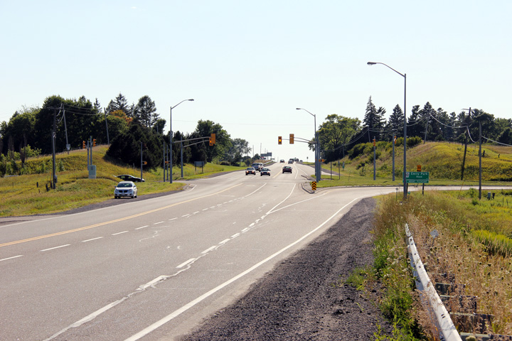
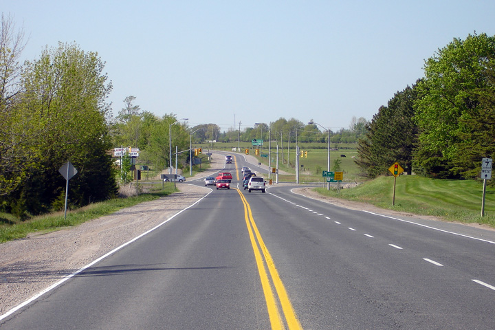
| Township of Brock Regional Municipality of Durham |
Looking west from just west of Ridge Road
towards the Highway 12 junction. This
photo highlights the Highway 12 junction.
As evident from the photo Highway 7 features a brief 4-lane section where
both an eastbound and westbound passing lane have been constructed. Photo taken: May 9th, 2006. |
 (720x480) (1440x960) |
||
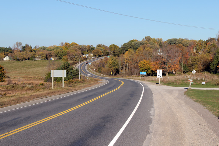
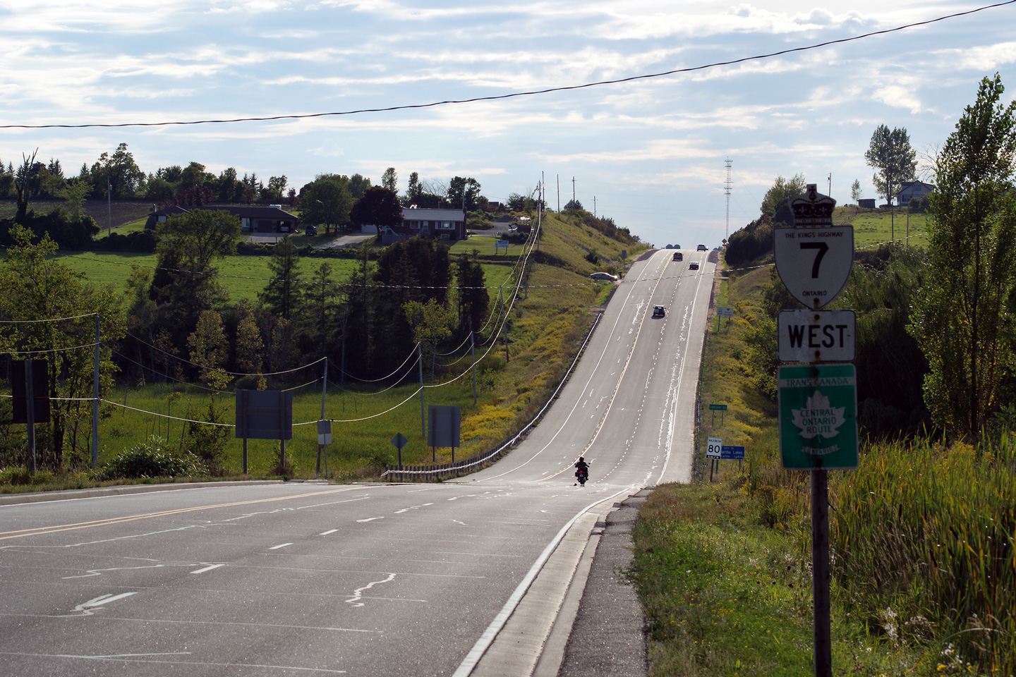
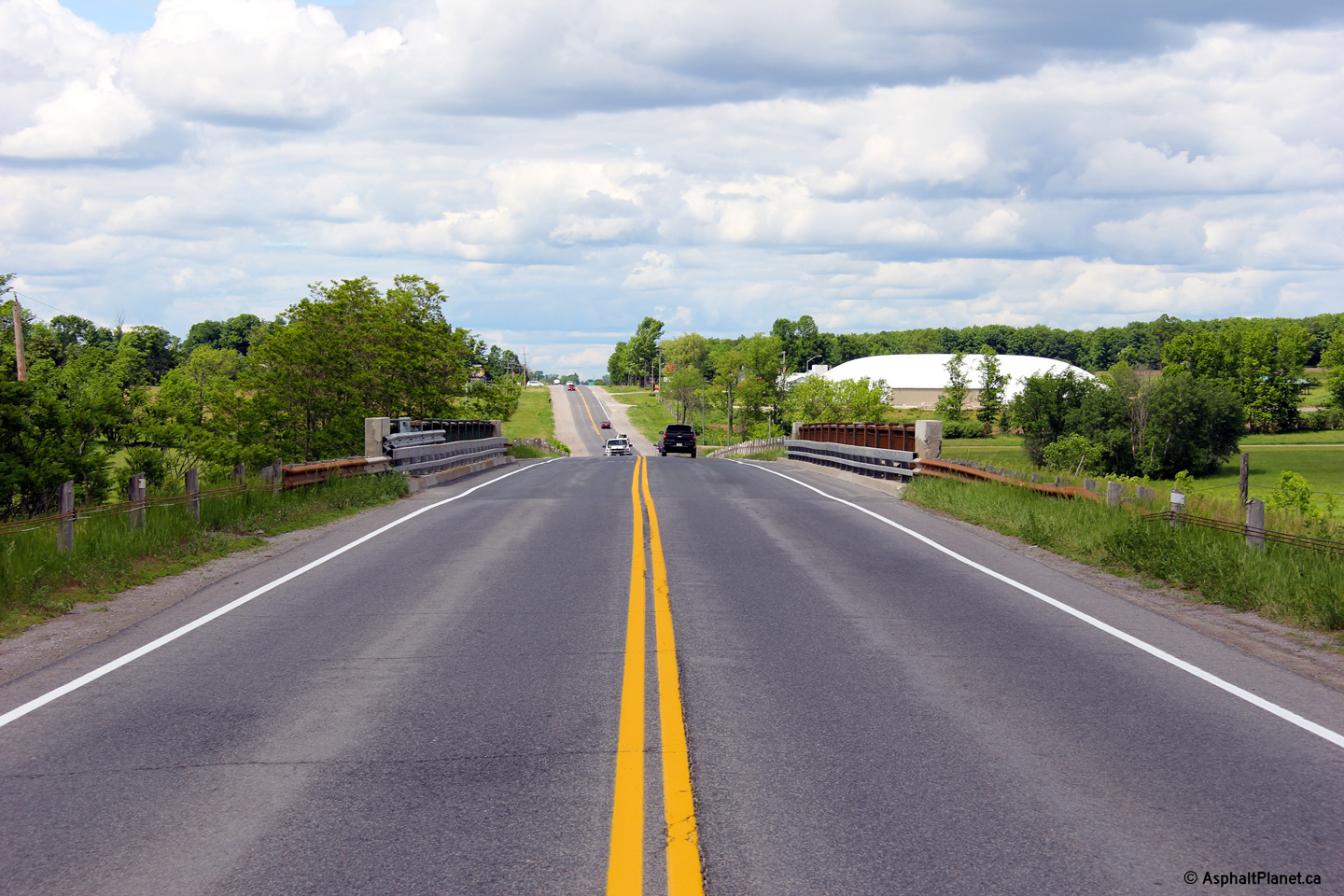
| Township of Brock Regional Municipality of Durham |
Highway 7 looking east from Ridge Road, which is
located roughly 1km east of Highway 12 in Brock Township.
Notice the old alignment of Highway 7 visible to the left of the current
highway in the distance of this photo. This alignment was bypassed
because of a steep grade and the close proximity of a cemetery. Photo taken: May 9th, 2006. |
 (720x480) (1440x960) |
||
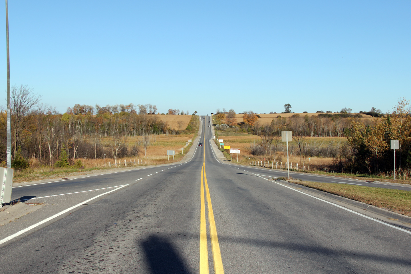
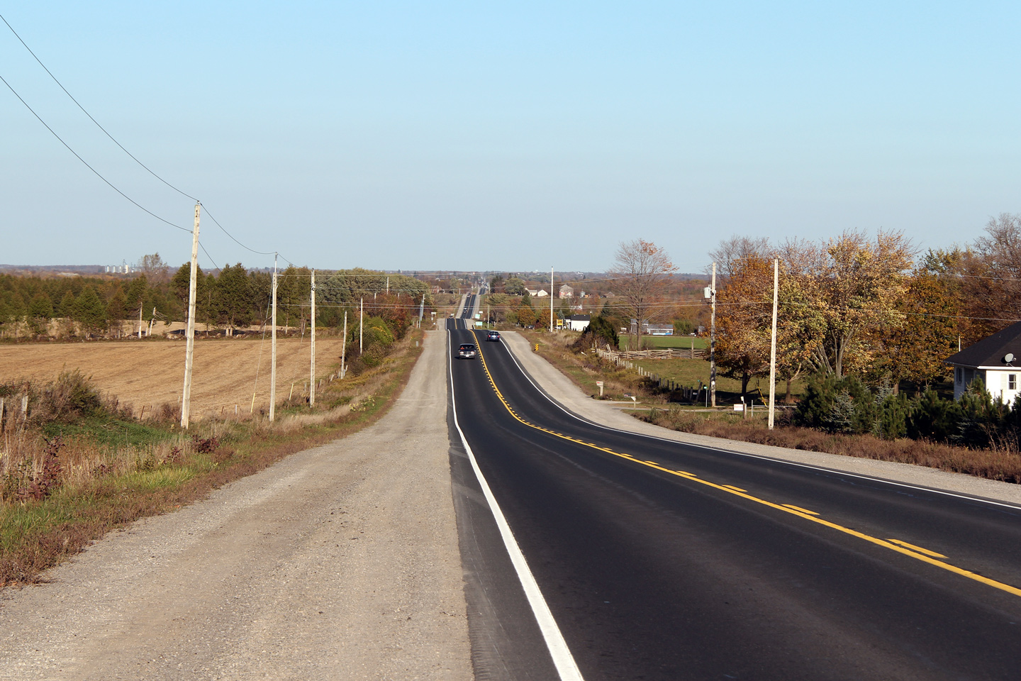
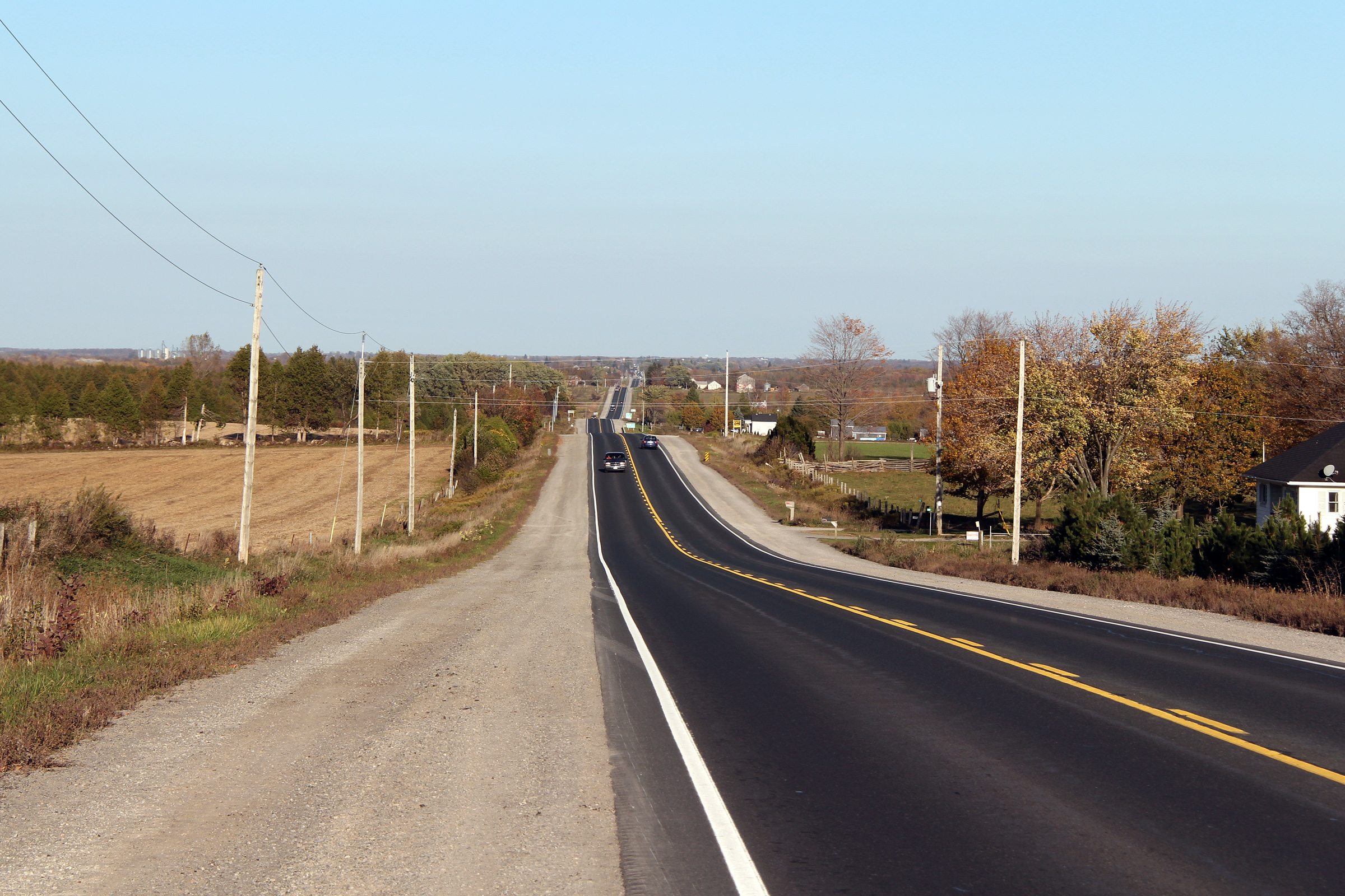
| Township of Brock Regional Municipality of Durham |
Highway 7 just west of Manilla looking East.
This Photo showcases both the original and current west entrances of Manilla. The original highway 7 would have continued straight through
the gully and had a much steeper hill then the current highway. Atop
the hill the old highway (now known as Brock Street) veered northeast at
Edward Street. Old Highway 7 would have met the current highway at
Simcoe Street, at what was likely a very dangerous intersection. Photo taken: October 10th, 2010. |
 (720x480) (1440x960) (2400x1600) |
||
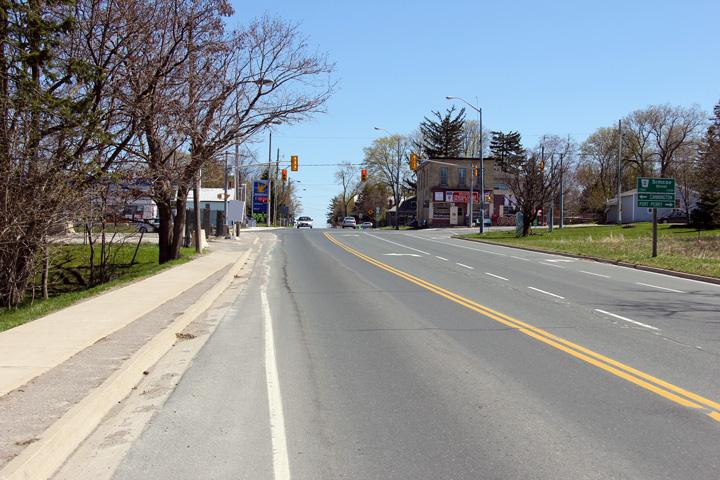
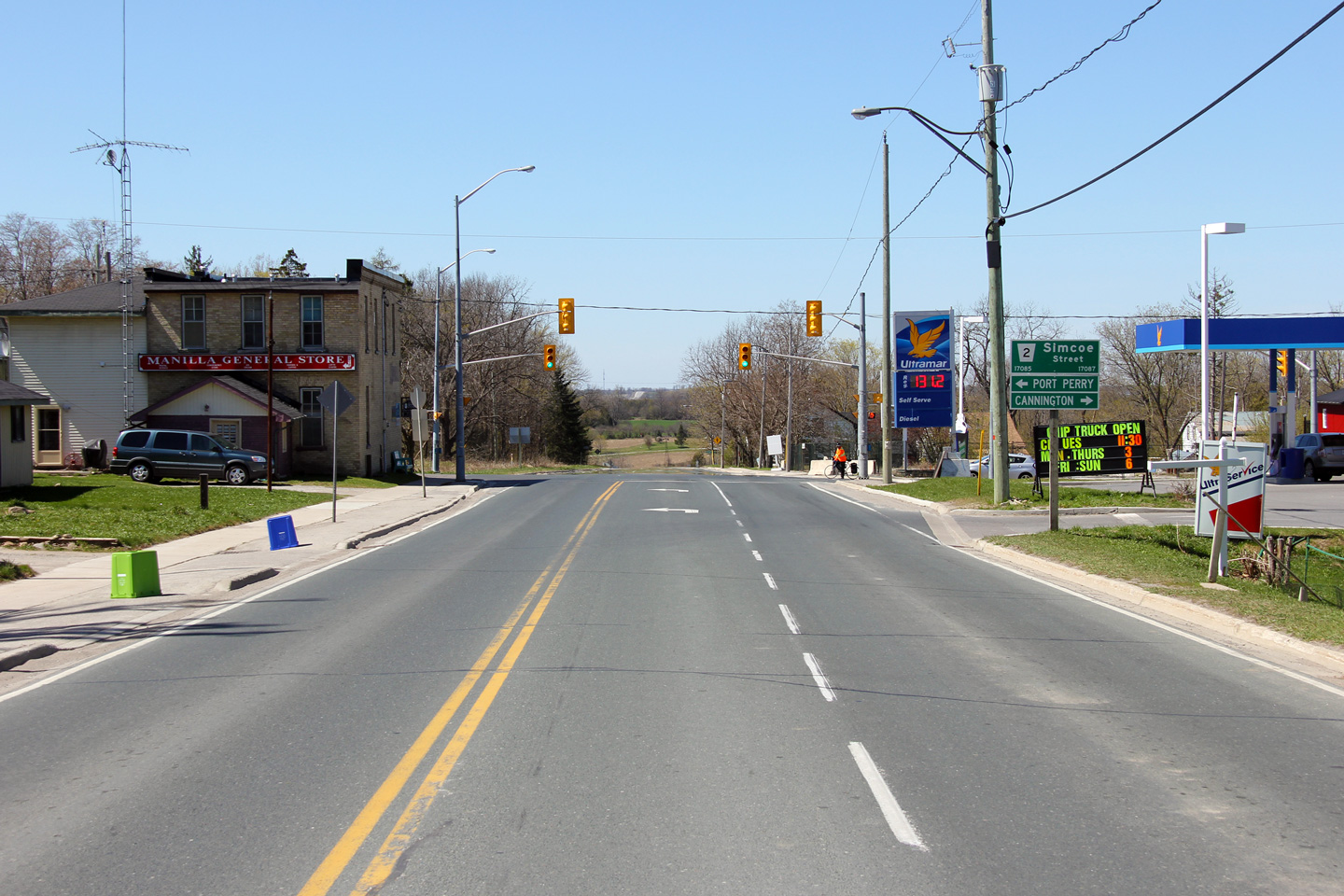
| Township of Brock Regional Municipality of Durham |
Looking east through Manilla along Highway 7
towards the Simcoe Street junction. Manilla straddles the border
between Durham Region and the City of Kawartha Lakes. Click
here for this same view taken
in October, 2005. (In the 2005, photo, note the price of gas compared
to the 2012 photo). Photo taken: October 18th, 2012. |
 (720x480) (1440x960) (2400x1600) |
||
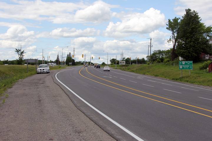
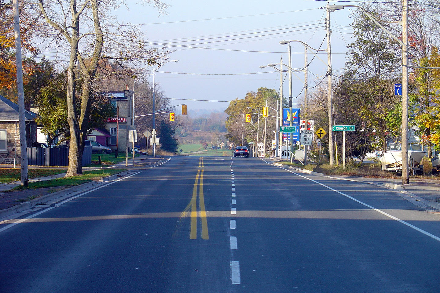
| City of Kawartha Lakes | Looking west towards the Simcoe Street
intersection in Manilla. Traffic signals were added to this
intersection late in 2004 to improve traffic operations along Simcoe Street.
Click here for the same view
taken in October, 2005. Photo taken: October 18th, 2012. |
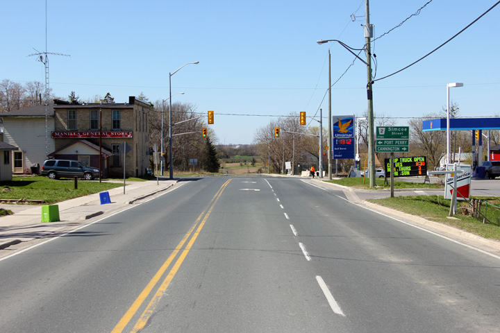 (720x480) (1440x960) (2400x1600) |
||
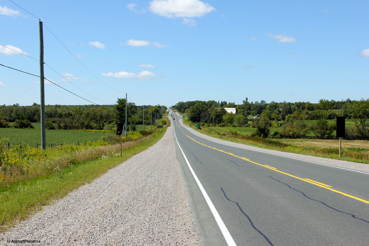
| City of Kawartha Lakes | Easterly view as Highway 7 rolls through Western
Victoria County (Kawartha Lakes), just east of Manilla. Photo taken: October 10th, 2010. |
 (720x480) (1440x960) (2400x1600) |
||
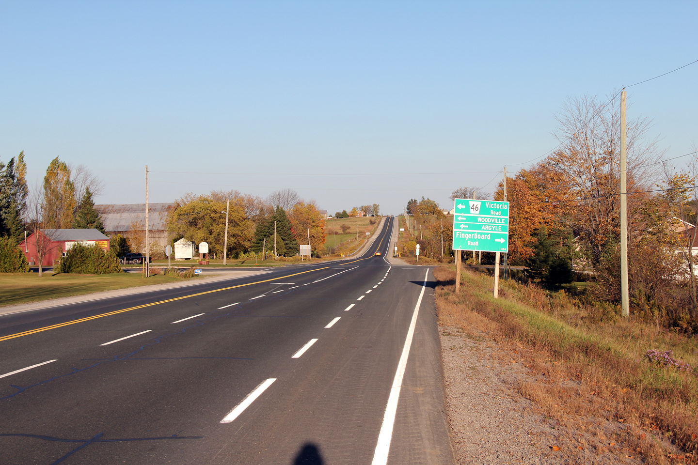
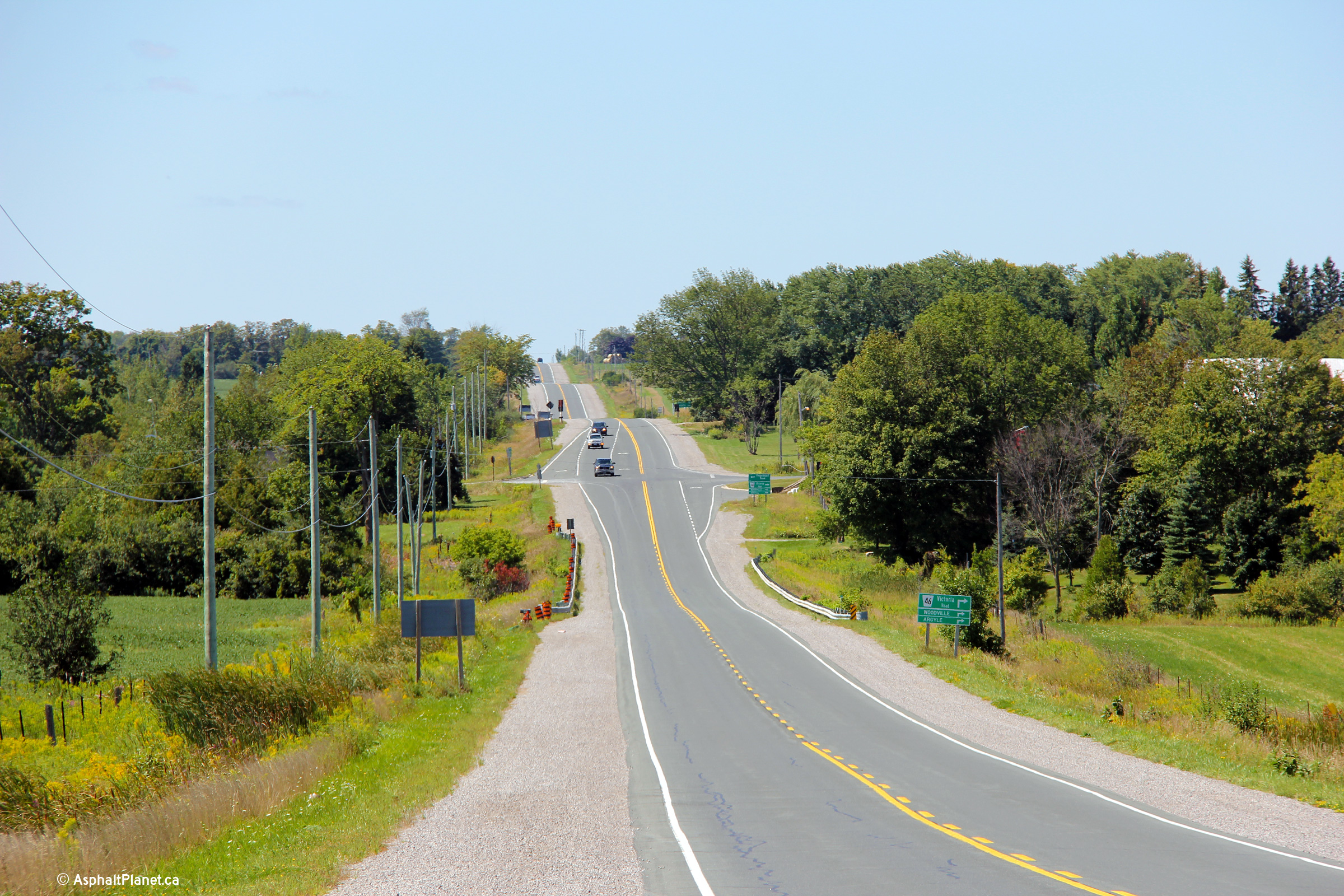
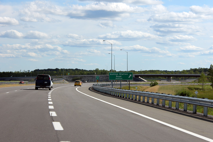
| City of Kawartha Lakes | Easterly view approaching the Highway 46
intersection. Note that Highway 46 has been renamed as Victoria Road.
This has less to do with the former monarch then it does the fact that the
City of Kawartha Lakes was once Victoria County, and Highway 46 was
designated Victoria Road 46. Really this sign is out of date, since
Highway 46 is technically known as Kawartha Lakes Road 46. Photo taken: October 10th, 2010. |
 (720x480) (1440x960) (2400x1600) |
||
| Highway 46 ran northerly from Highway 7 through Woodville to Highway 48 at Bolsover. Click here for Highway 46 images. | ||||
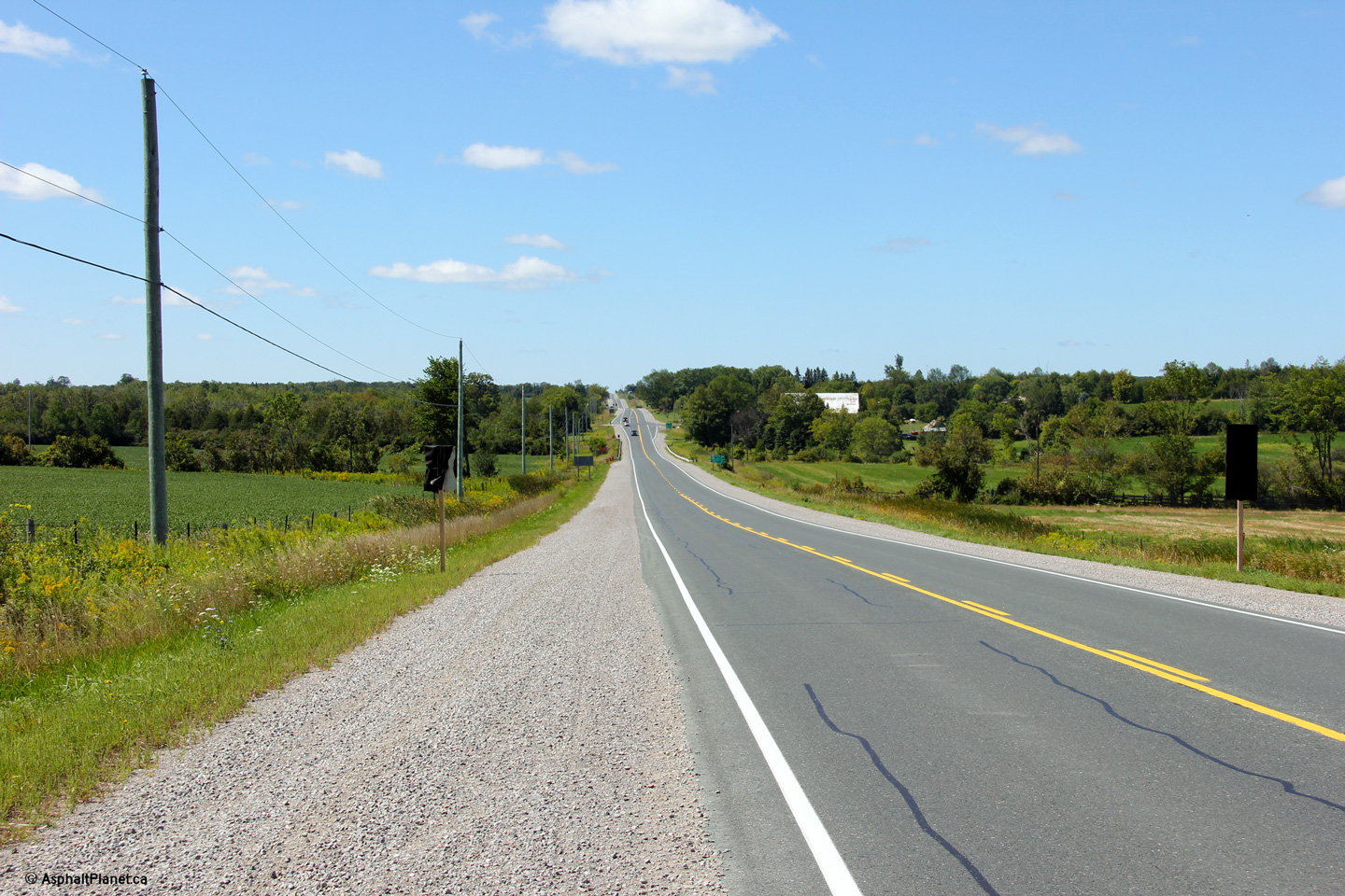
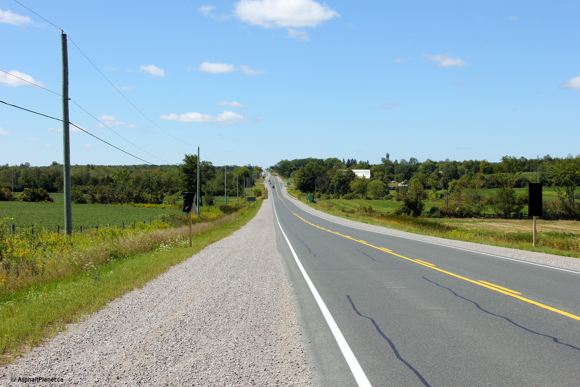
| City of Kawartha Lakes | Two views along Highway 7 looking west from just west of Barry's
Road. The intersection shown the distance is the junction of Highway 7
and Former Highway 46 (now Kawartha Lakes Road 46).
Highway 46 was once an
important highway between Highway 7 and Bolsover. In 1962,
Highway 48
was extended easterly from Beaverton through Bolsover which replaced Highway
46 as the dominant through route. Photos taken: August 23rd, 2013. |
 (720x480) (1440x960) (2400x1600)  (720x480) (1440x960) (2400x1600) |
||
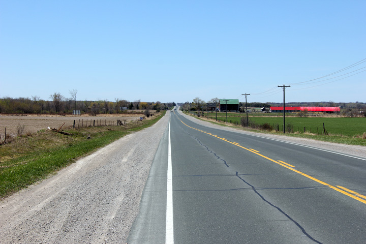
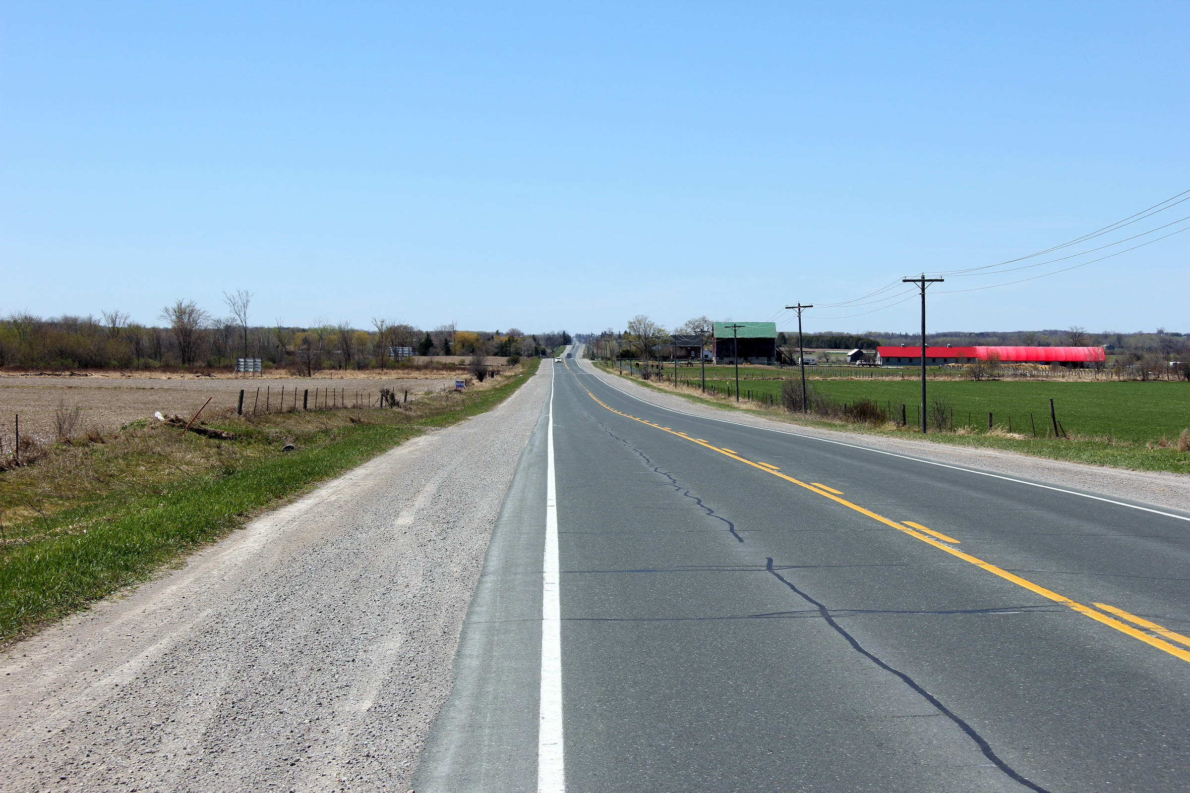
| City of Kawartha Lakes | View looking westerly from just west of the
village of Oakwood. Photo taken: April 18th, 2012. |
 (720x480) (1440x960) (2400x1600) |
||
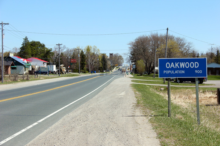
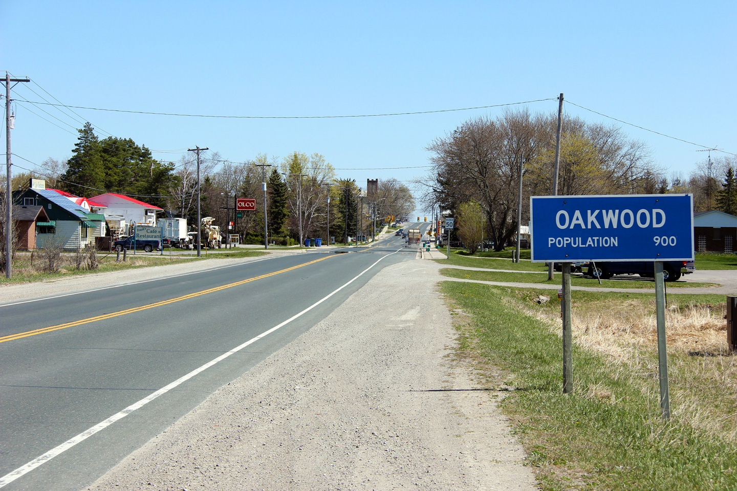
| City of Kawartha Lakes | Easterly view entering Oakwood. Despite
Oakwood's population being included on its sign, Oakwood was not its own
municipality prior to the formation of the City of Kawartha Lakes in 2001.
Before the creation of the City of Kawartha Lakes, Oakwood was part of
Mariposa Township. Photo taken: April 18th, 2012. |
 (720x480) (1440x960) (2400x1600) |
||
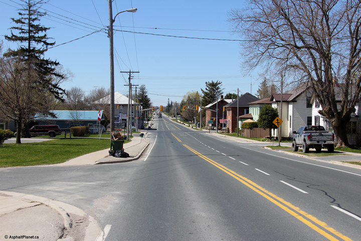
| City of Kawartha Lakes | Looking west through the town of Oakwood towards
the signalized intersection with Eldon Road. Photo taken: April 18th, 2012. |
 (720x480) (1440x960) (2400x1600) |
||
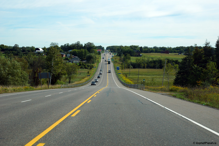
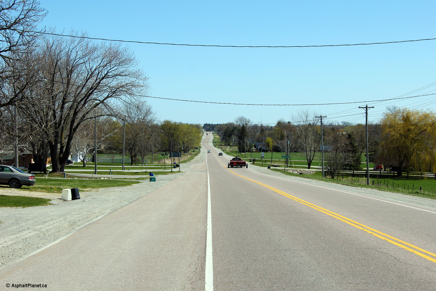
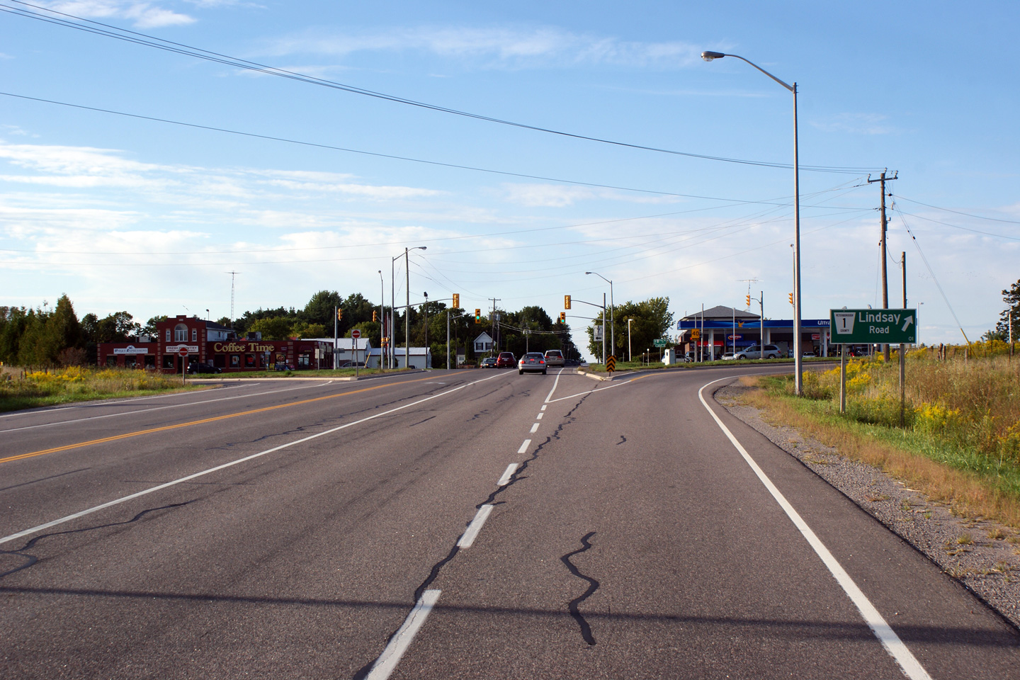
| City of Kawartha Lakes | Highway 7 looking east from Oakwood.
Highway 7 had been newly resurfaced from Oakwood to just west of
Lindsay at the time this Photo was taken. This was a very large improvement over
the pre-existing pavement. Oakwood is located roughly 16km east of
Highway 12. Photo taken: April 18th, 2012. |
 (720x480) (1440x960) (2400x1600) |
||
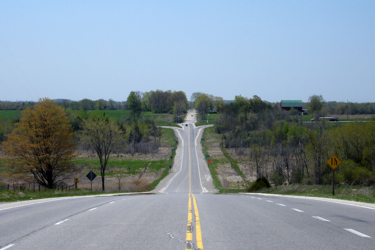
| City of Kawartha Lakes | Two views looking easterly along Highway 7
approaching the Kent Street intersection to the west of Lindsay.
Before the construction of the Lindsay By-pass in the 1950s, Highway 7
passed through Downtown Lindsay following Kent Street. Today, Highway
7 (and 35) skirt to the west and south of Lindsay along the two lane access
controlled Lindsay By-pass. Photo taken: April 18th, 2012. |
 (720x480) (1440x960) (2400x1600) 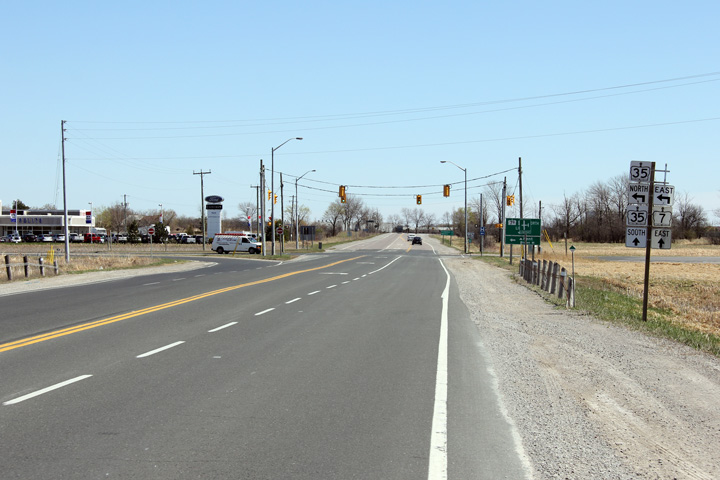 (720x480) (1440x960) (2400x1600) |
||
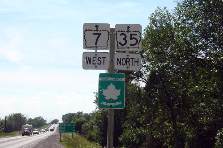
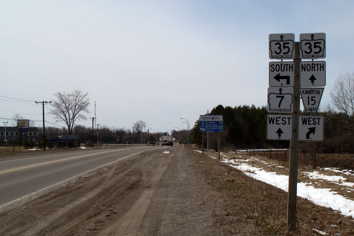
| Highway 35 departs Highway 7 along Kent Street bound for Fenelon Falls and Minden. Click here for Highway 35-North images. | ||||
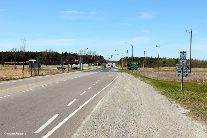
| City of Kawartha Lakes | Highway 7 looking west towards the western
junction of Highway 35 on the Lindsay Bypass. North of Highway 7, Highway 35 heads northwards towards Fenelon
Falls and Minden. Click here
for the same view taken in August, 2004, and
here for the same view taken in April,
2009. Photo taken: April 18th, 2012. |
 |
||
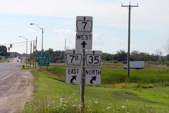
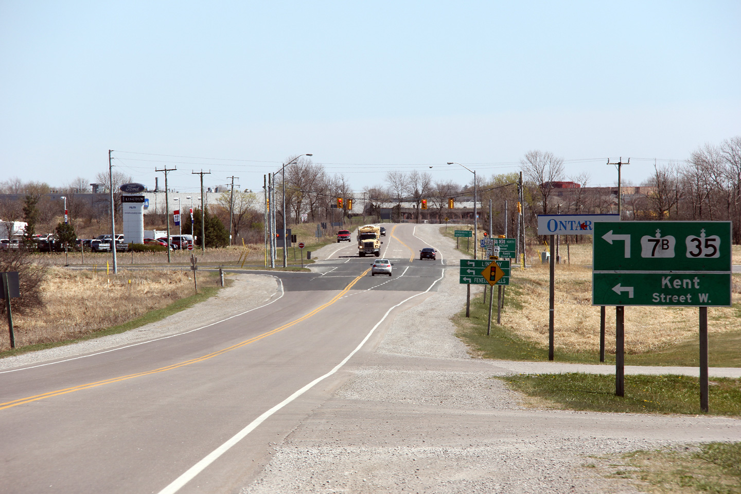
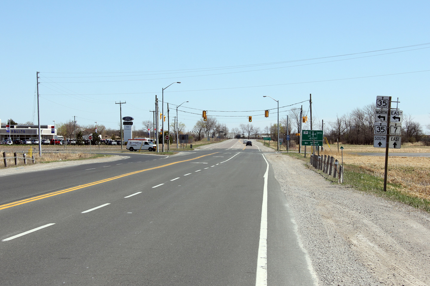
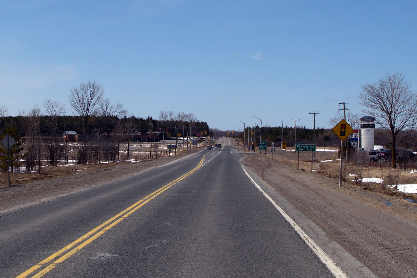
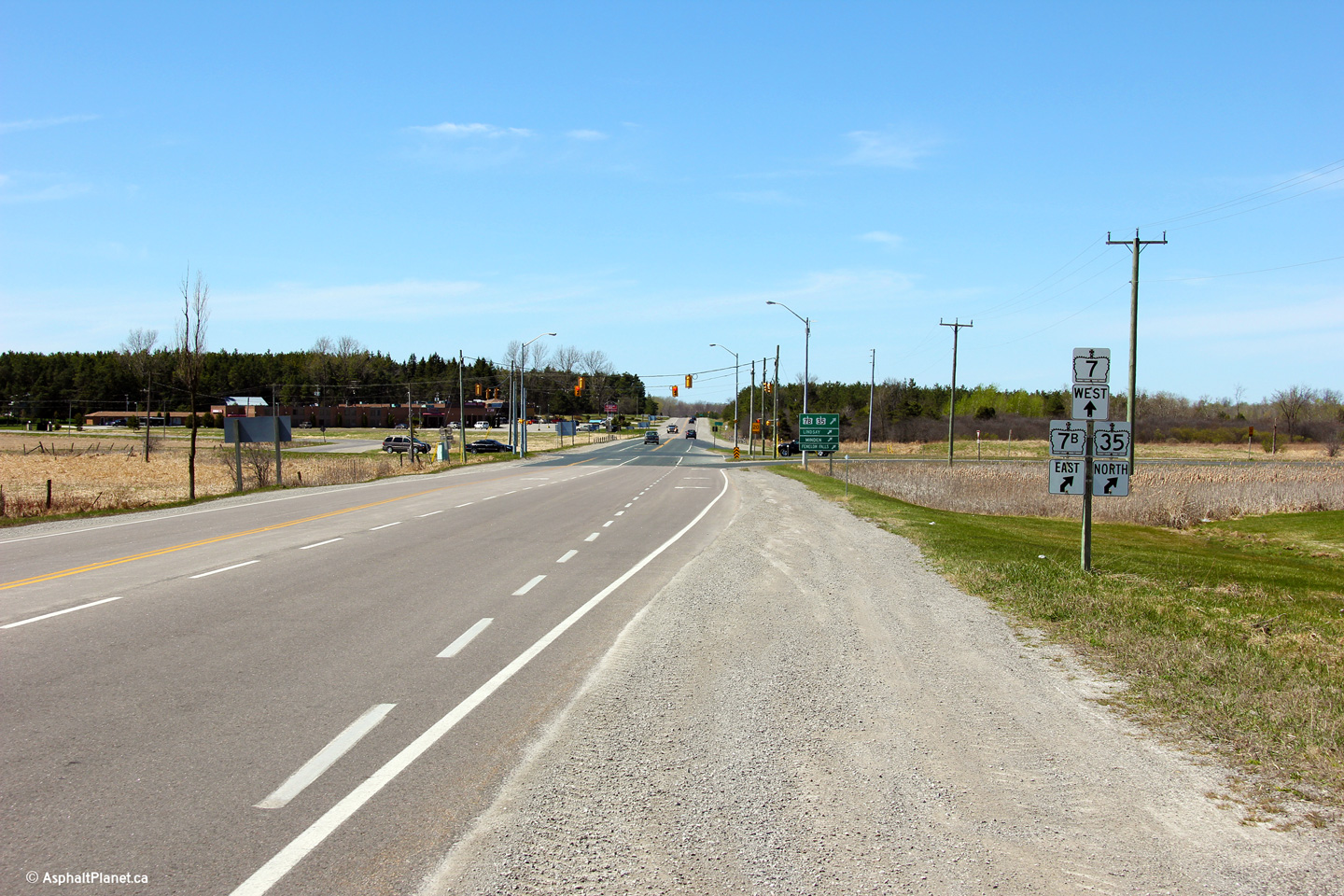
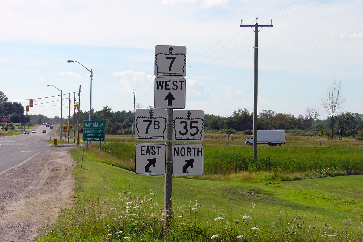
| City of Kawartha Lakes | Junction assembly for the western Highway 7/7B/35
junction. At this junction, Highway 35 departs the Lindsay Bypass
heading towards Lindsay before traffic must again turn to head further north. Photo taken: August 8th, 2004. |
 (720x480) (720x480)(1440x960) |
||
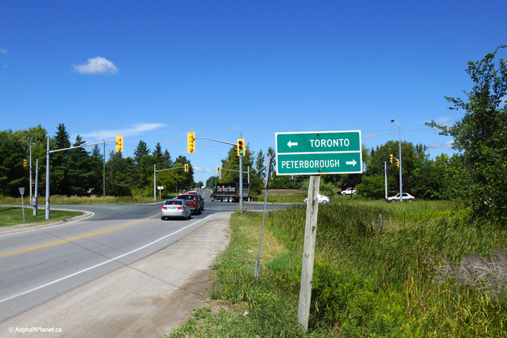
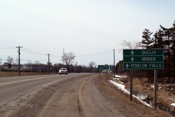
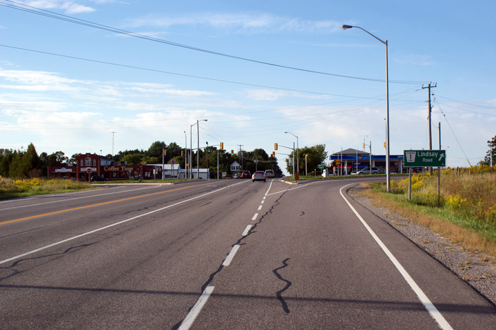
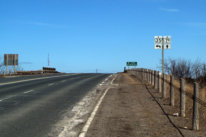
| City of Kawartha Lakes |
Green signs in advance of the north Highway
7B/35 intersection. Click here
for the same view taken in April, 2009. Photo taken: April 18th, 2012. |
|||
| City of Kawartha Lakes |
View looking westerly along Highway 7/35 about halfway between Victoria Road
4 and Kent Street. Click
here for a similar
photograph taken in April, 2009. Photo taken: August 23rd, 2013. |
 (720x480) (1440x960) (2400x1600) |
||
| City of Kawartha Lakes |
Easterly view along Highway 7/35 across the former CN Railway overhead. Photo taken: August 23rd, 2013. |
 (720x480) (1440x960) (2400x1600) |
||
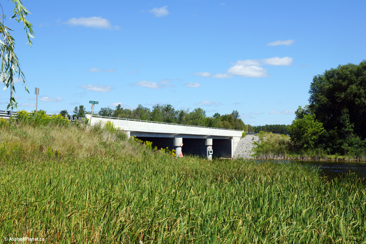
| City of Kawartha Lakes |
Two views looking beneath Highway 7/35 from the former railway. This
structure was completed in 1958 and was rehabilitated in 2012. Photos taken: August 23rd, 2013. |
 (720x480) (1440x960) (2400x1600)  (720x480) (1440x960) (2400x1600) |
||
| City of Kawartha Lakes |
Westerly view as Highway 7/35 nears the structure that carries the highway
over the former alignment of CN's railway alignment between Lindsay and
Toronto (via Uxbridge). The railway was abandoned in 1991 and is now a
rail trail. Photo taken: August 23rd, 2013. |
 (720x480) (1440x960) (2400x1600) |
||
| City of Kawartha Lakes |
This view looks easterly along Highway 7/35 approaching the Kawartha Lakes
Road 4 intersection. Photo taken: August 23rd, 2013. |
 (720x480) (1440x960) (2400x1600) |
||
| City of Kawartha Lakes |
Destination signage approaching the Highway 7/35 intersection along Kawartha
Lakes Road 4. Photo taken: August 23rd, 2013. |
 (720x480) (1440x960) |
||
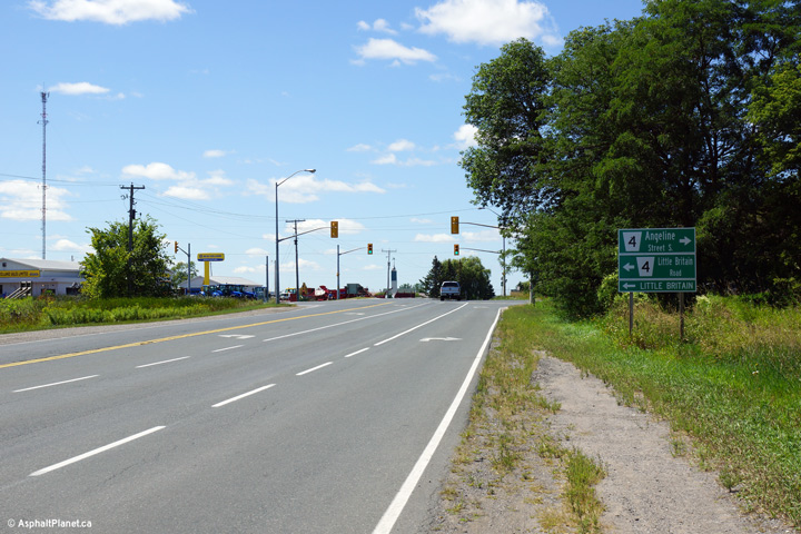
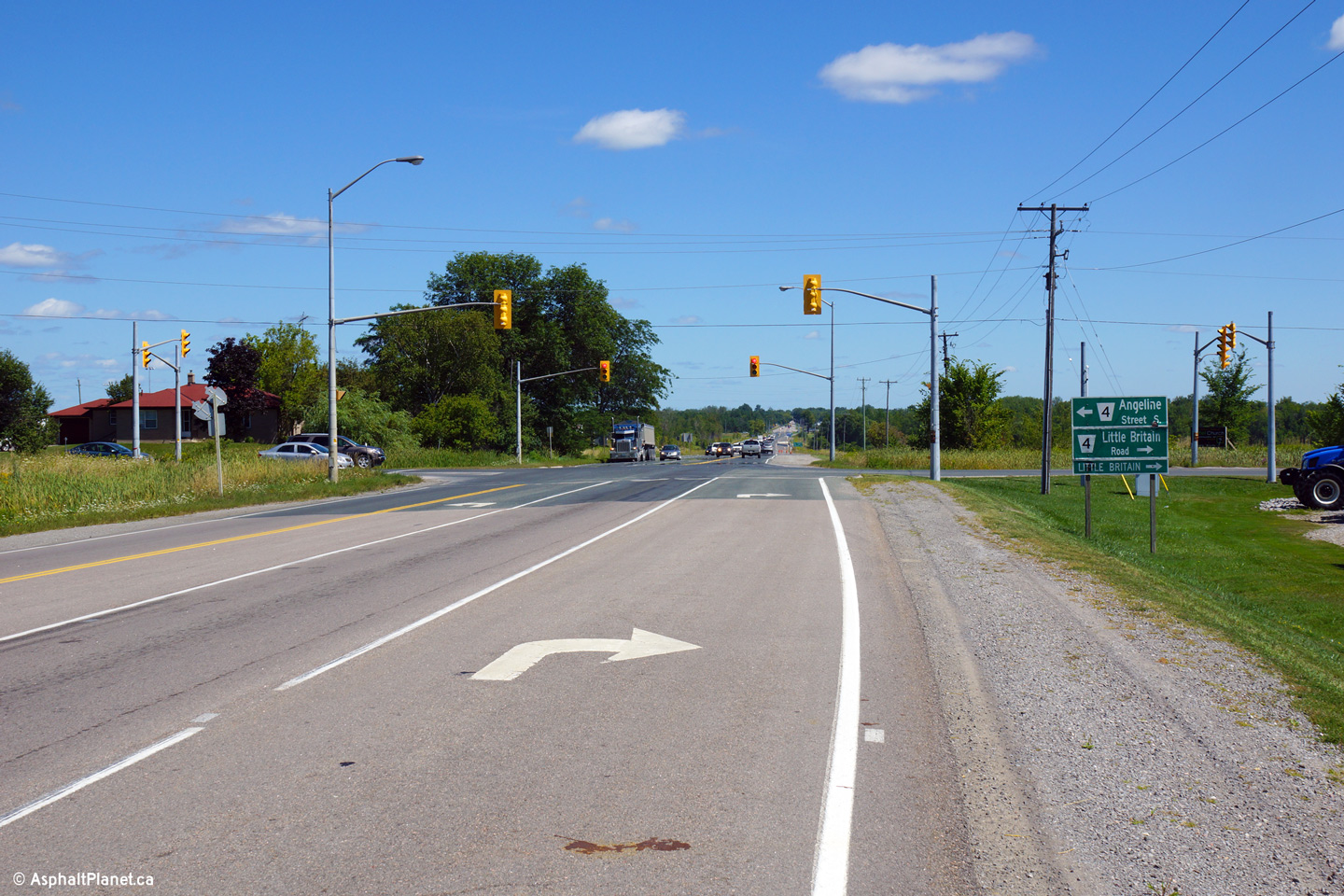
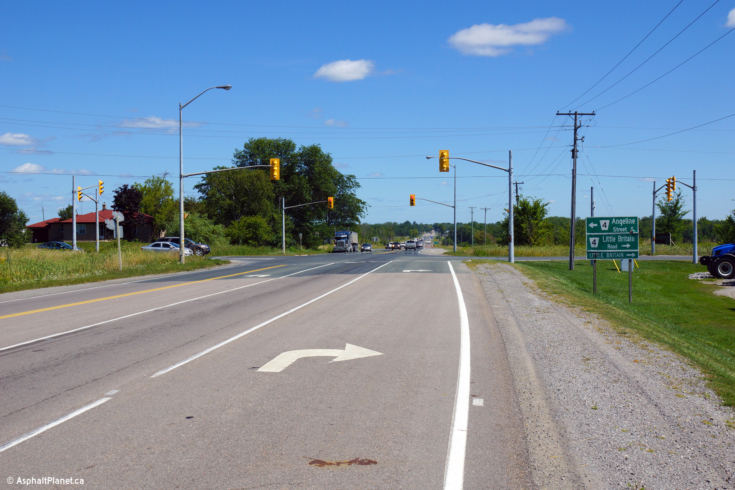
| City of Kawartha Lakes |
Westerly view approaching the Kawartha Lakes Road 4 intersection.
Traffic signals were added to this intersection in 1982. Angeline
Street is one of Lindsay's principle north-south arterial streets. Photo taken: August 23rd, 2013. |
 (720x480) (1440x960) (2400x1600) |
||
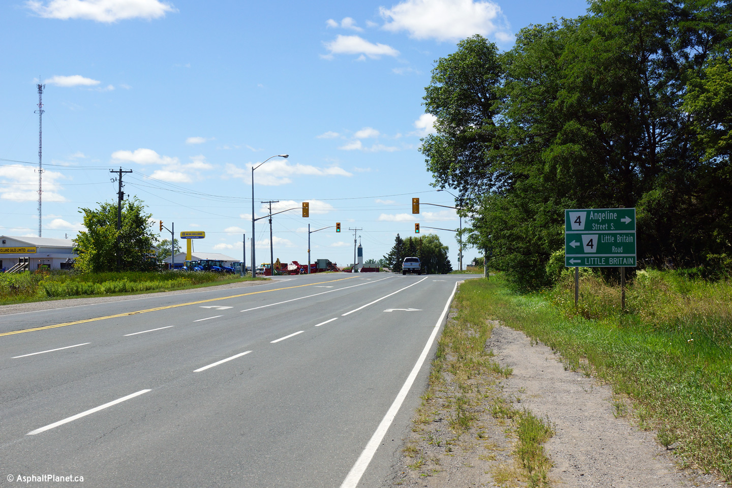
| City of Kawartha Lakes |
Easterly view along Highway 7/35 from the
Victoria Road 4 junction. Photo taken: April 10th, 2009. |
 (720x480) (1440x960) |
||
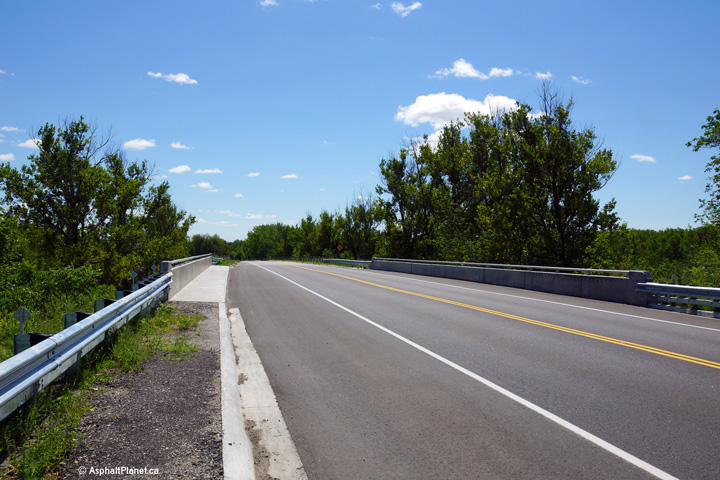
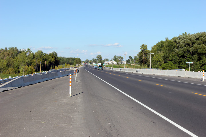
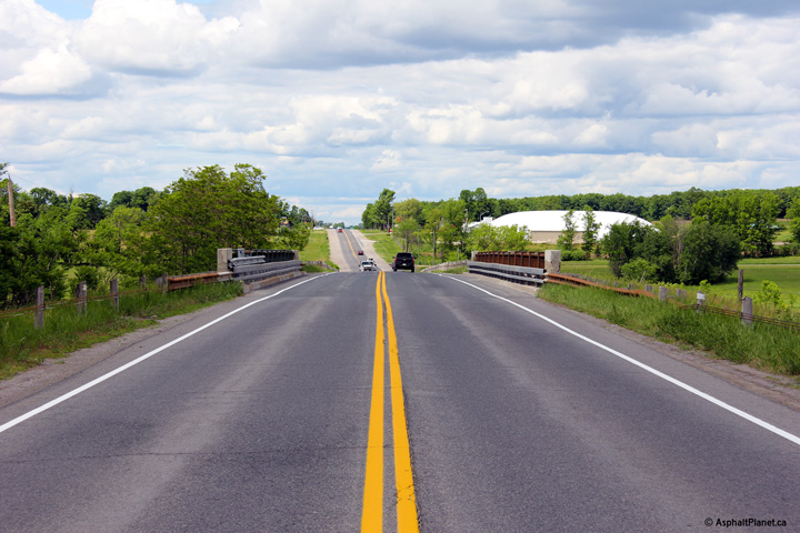
| City of Kawartha Lakes |
Looking south along the Lindsay By-pass across the Scugog River Bridge.
In 2010, the Scugog River Bridge was reconstructed and widened to support a
four-lane cross-section. Construction is tentatively scheduled to
start in 2012 on a project that will see Highway 7 widened to four lanes
along the Lindsay By-pass between County Road 4 and Highway 36. Upper photo taken: August 8th, 2004. Lower photos taken: August 19th, 2011. |
 (720x480) (1440x960) (2400x1600)
|
||
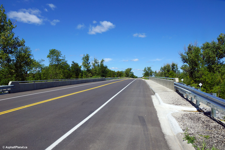
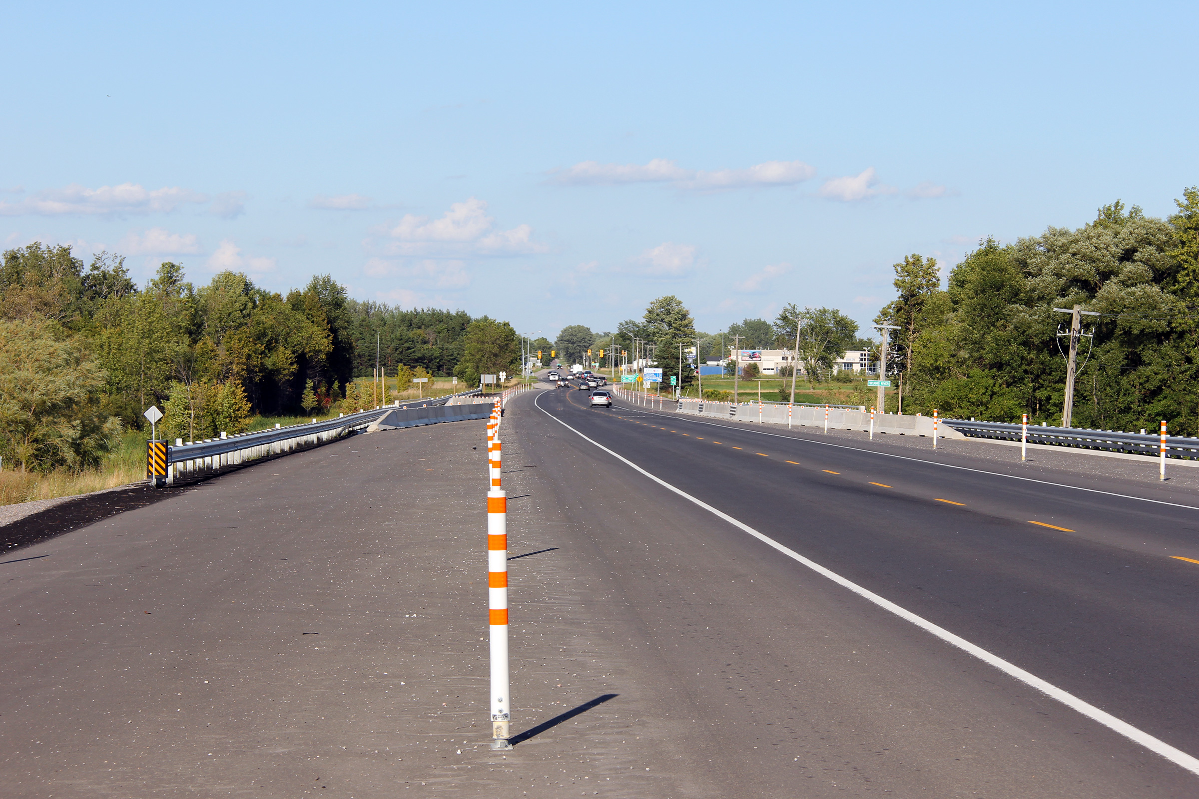
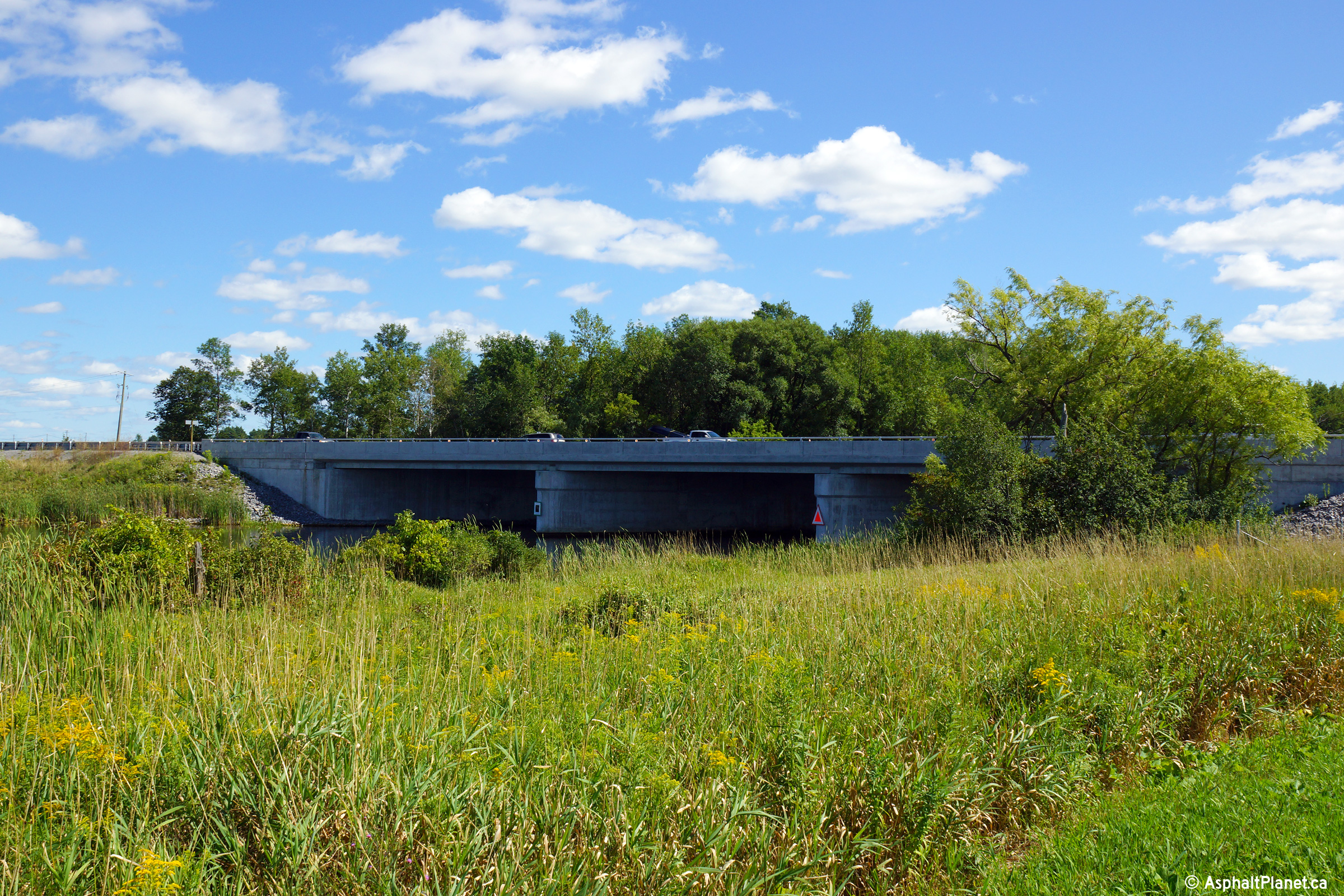
| City of Kawartha Lakes |
Northerly view towards the Scugog River bridge. The Scugog River
Bridge was widened in 2010 to its current four lane cross-section. The
1950s era bridge deck was completely replaced as part of this construction. Photo taken: August 23rd, 2013. |
 (720x480) (1440x960) (2400x1600) |
||
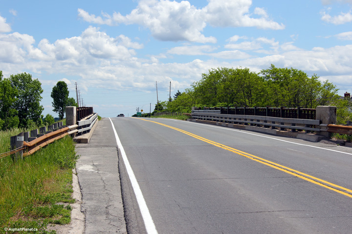
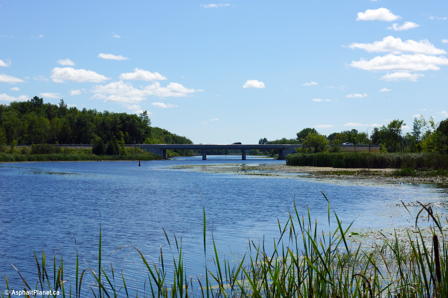
| City of Kawartha Lakes |
Two views of the northern side of the Scugog River bridge. The Scugog
River is a navigable waterway that links Lake Scugog to the Trent-Severn
Waterway by way of a single lock in Lindsay. Photo taken: August 23rd, 2013. |
 (720x480) (1440x960) (2400x1600)  (720x480) (1440x960) (2400x1600) |
||
| City of Kawartha Lakes |
Westbound reassurance markers along the Lindsay By-pass. Photo taken: August 8th, 2004. |
 |
||
| City of Kawartha Lakes |
Westerly view along Highway 7/35 from just west of the Highway 35 junction. Photo taken: August 23rd, 2013. |
 (720x480) (1440x960) (2400x1600) |
||
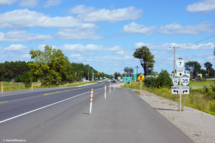
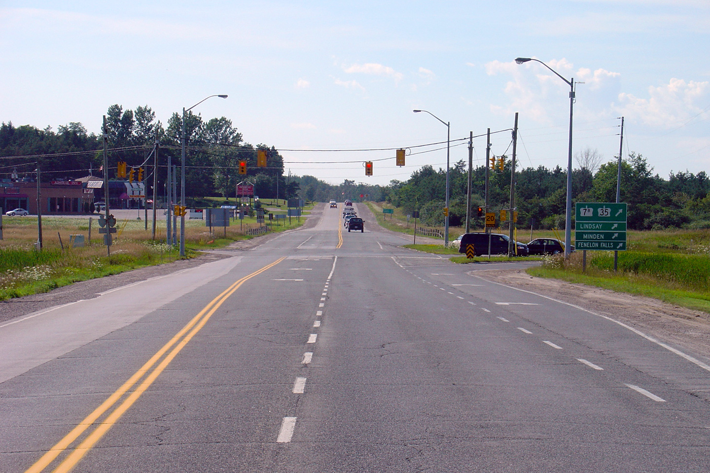
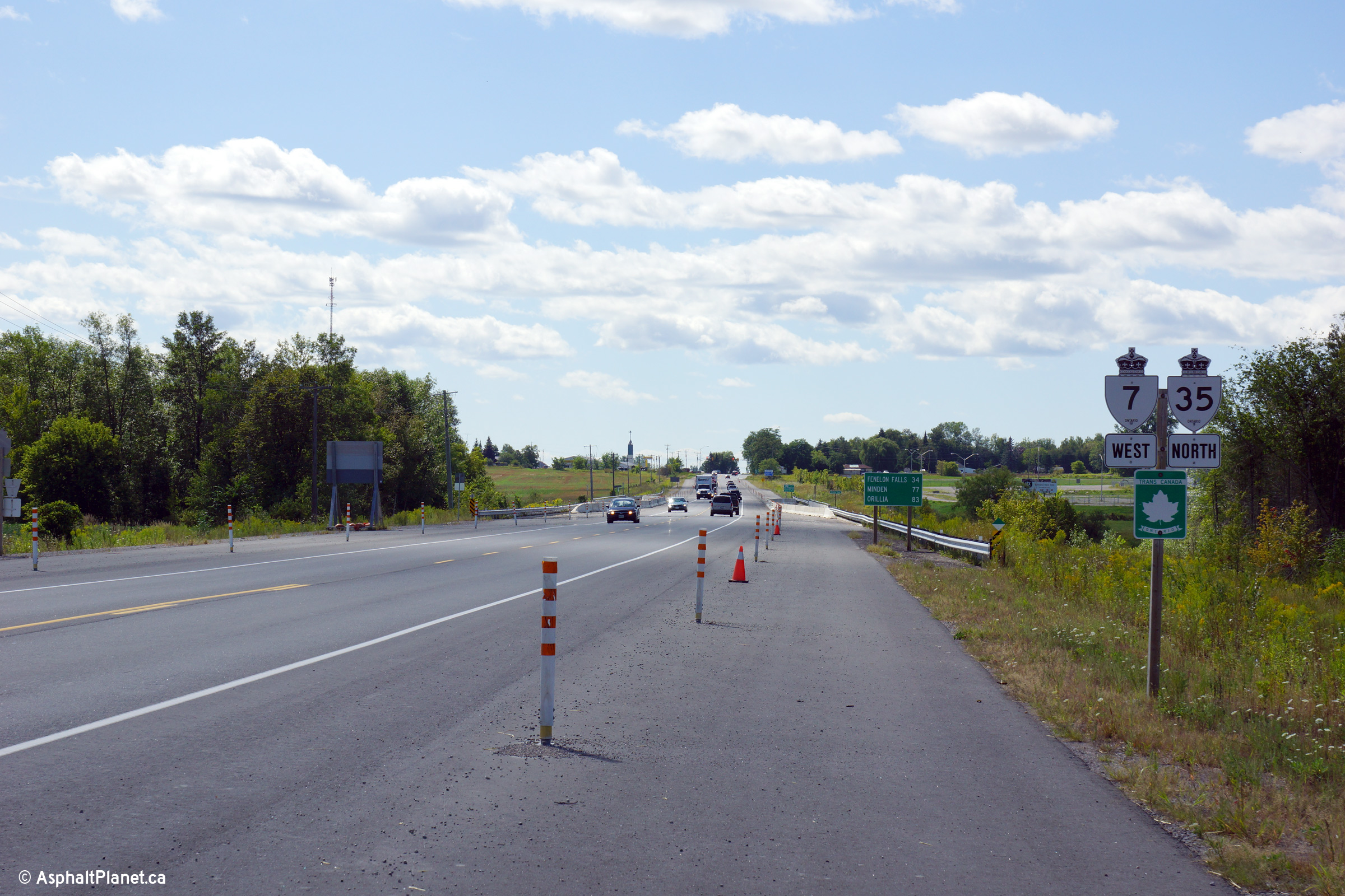
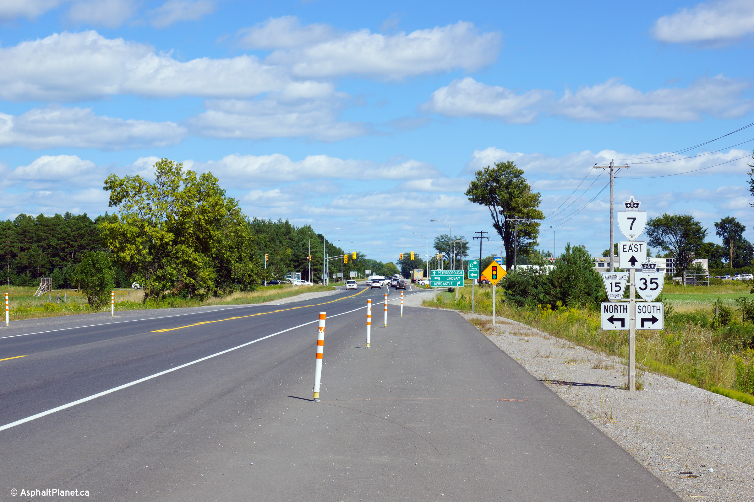
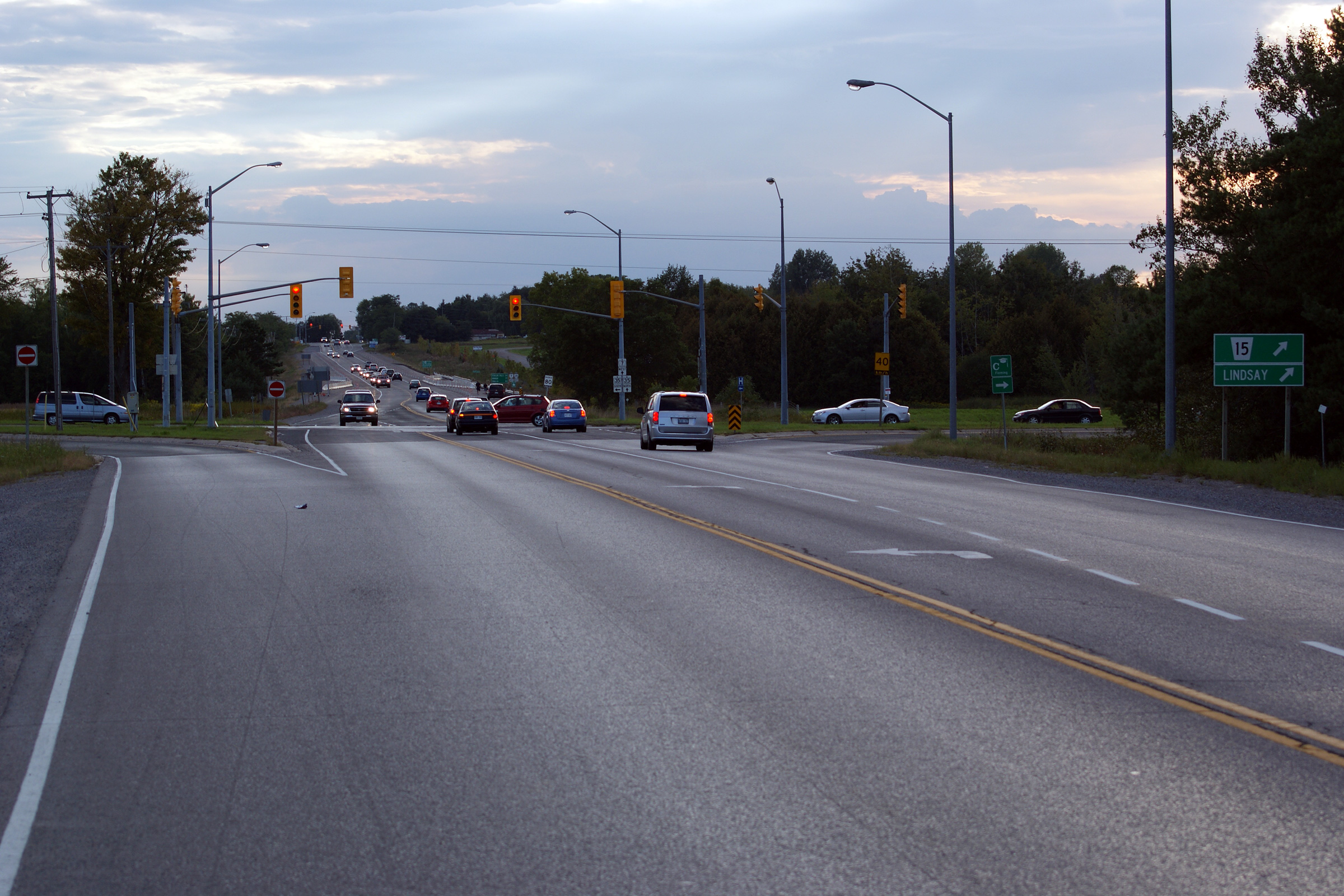
| City of Kawartha Lakes |
Junction assembly for the eastern Highway 7/35
junction. Photo taken: August 23rd, 2013. |
 (720x480) (720x480)(1440x960) (2400x1600) |
||
| City of Kawartha Lakes |
Two views of the eastern Highway 7/35 junction. Click
here for an
additional photo, similar to the lower photo, taken August, 2004. Upper photo taken: September 11th, 2011. Lower photo taken: August 23rd, 2013. |
 (720x480) (1440x960) (2400x1600) 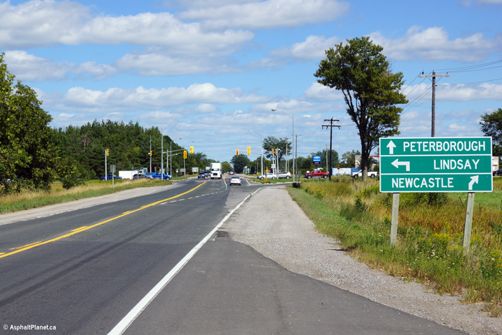 (720x480) (1440x960) (2400x1600) |
||
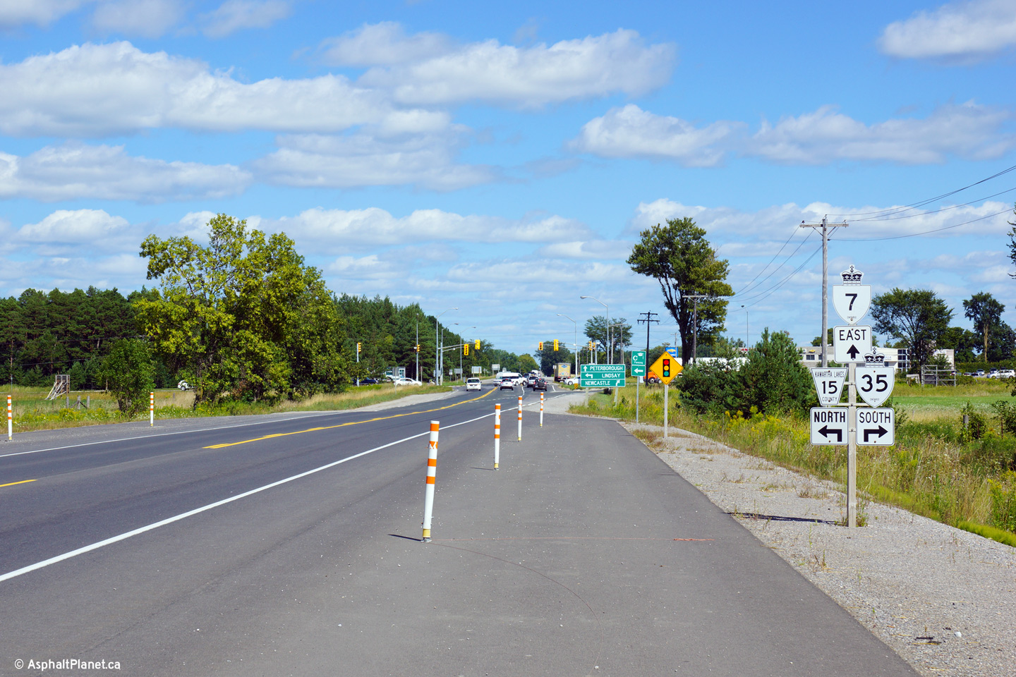
| Highway 7 meets Highway 35-South, Highway 7B and Highway 35B at this intersection. Click here for Highway 35-South images, here for Highway 7B images, and here for Highway 35B images. | ||||
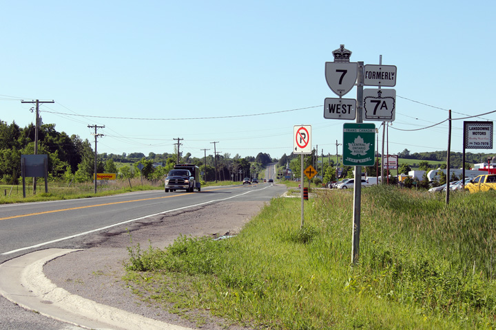
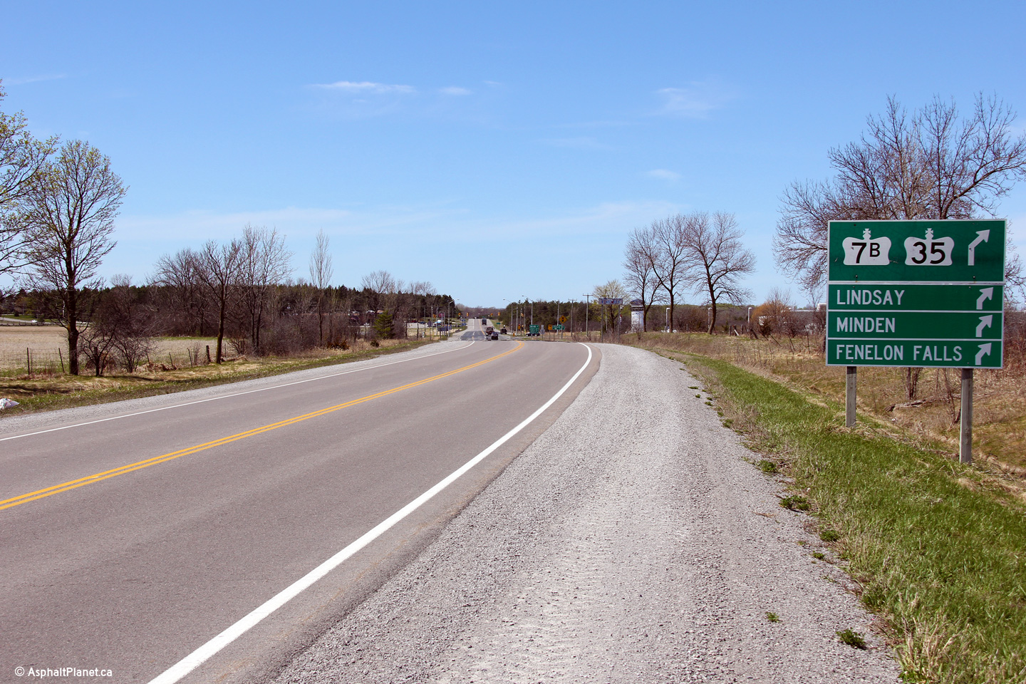
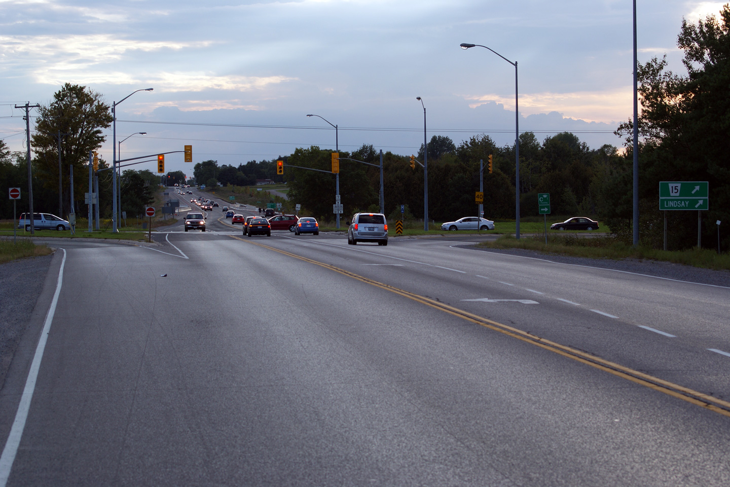
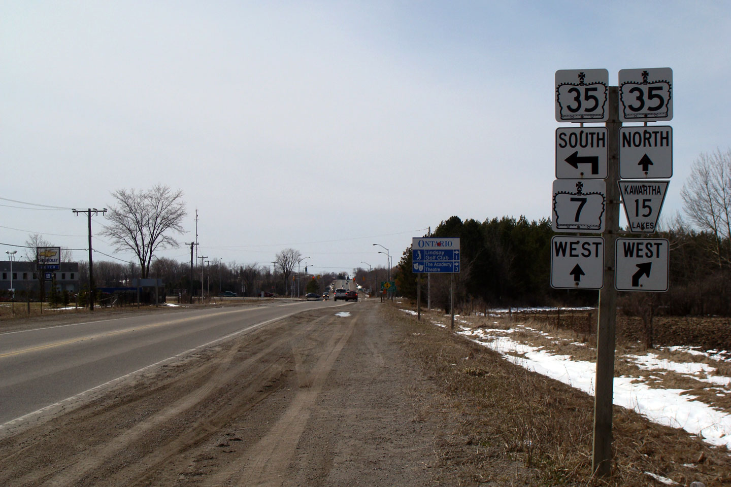
| City of Kawartha Lakes |
Green sign for the former Highway 7B-East
intersection. The southern-most hundred metres of Highway 7B/35B was
designated as Victoria Road (now Kawartha Lakes Road) 15. This is
dumb. Aside from the short section of Kawartha Lakes Road 15, the rest
of the highway is still fully signed. Dumb. Photo taken: April 10th, 2009. |
 |
||
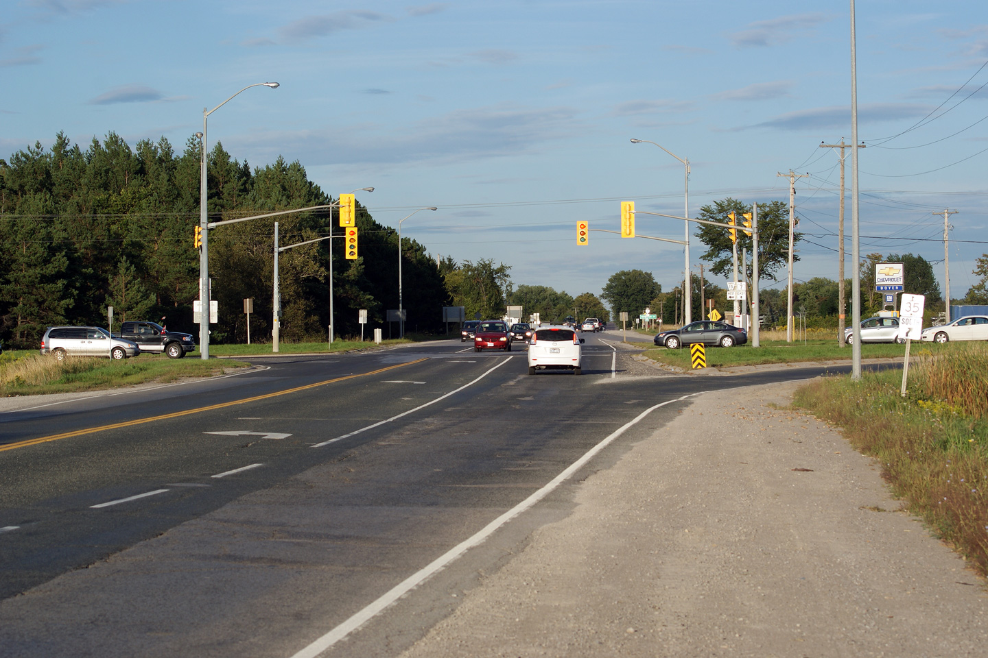
| City of Kawartha Lakes |
Westbound junction assembly in advance of the
Highway 35-South and Highway 7B intersection. Photo taken: April 10th, 2009. |
 |
||
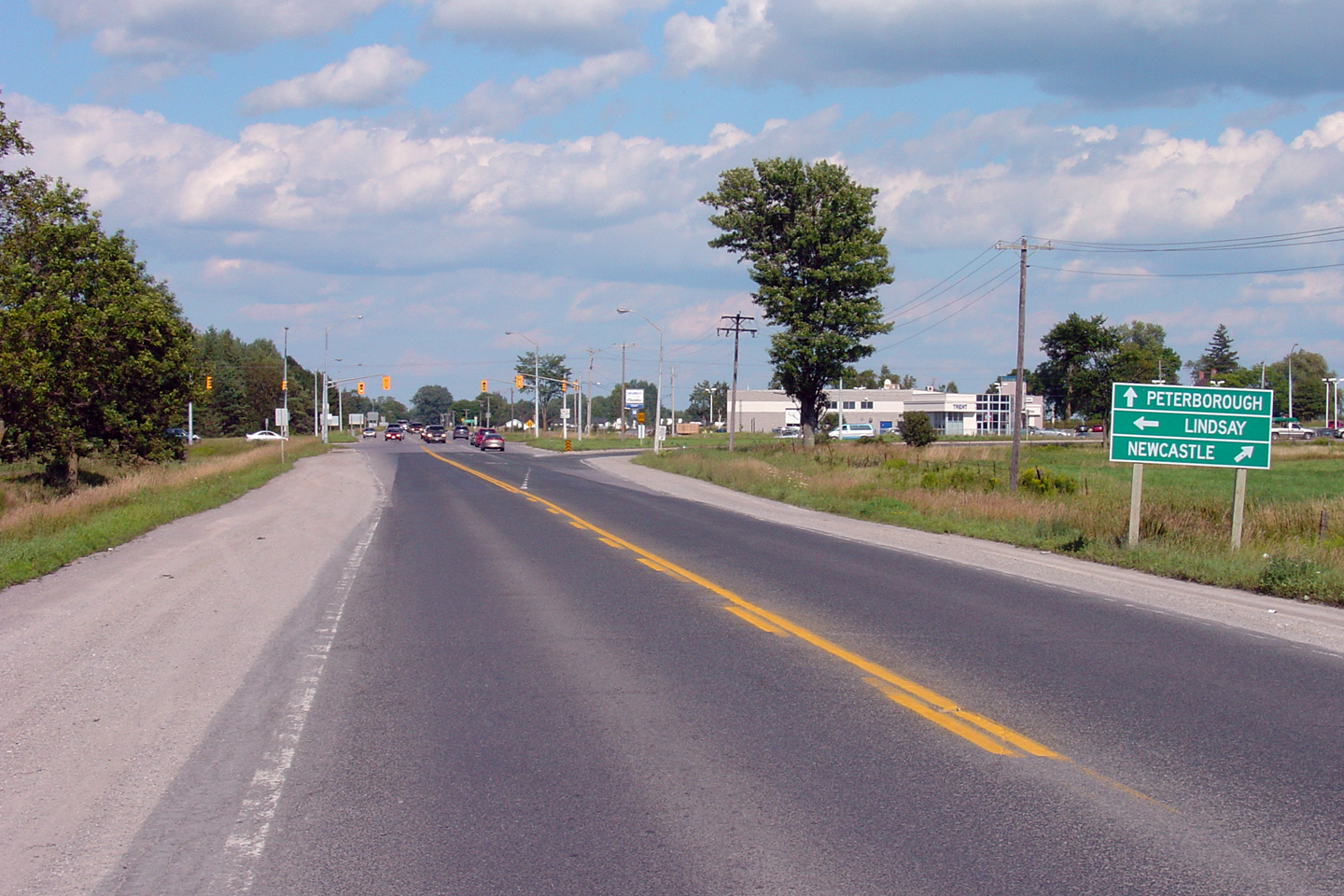
| City of Kawartha Lakes |
Green directional signs advising travelers of
their options. A lot of destinations can be reached from the Lindsay
area. Photo taken: April 10th, 2009. |
 |
||
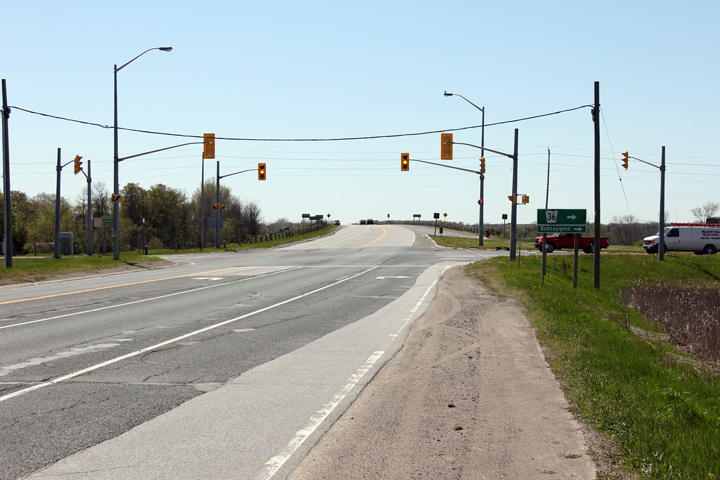
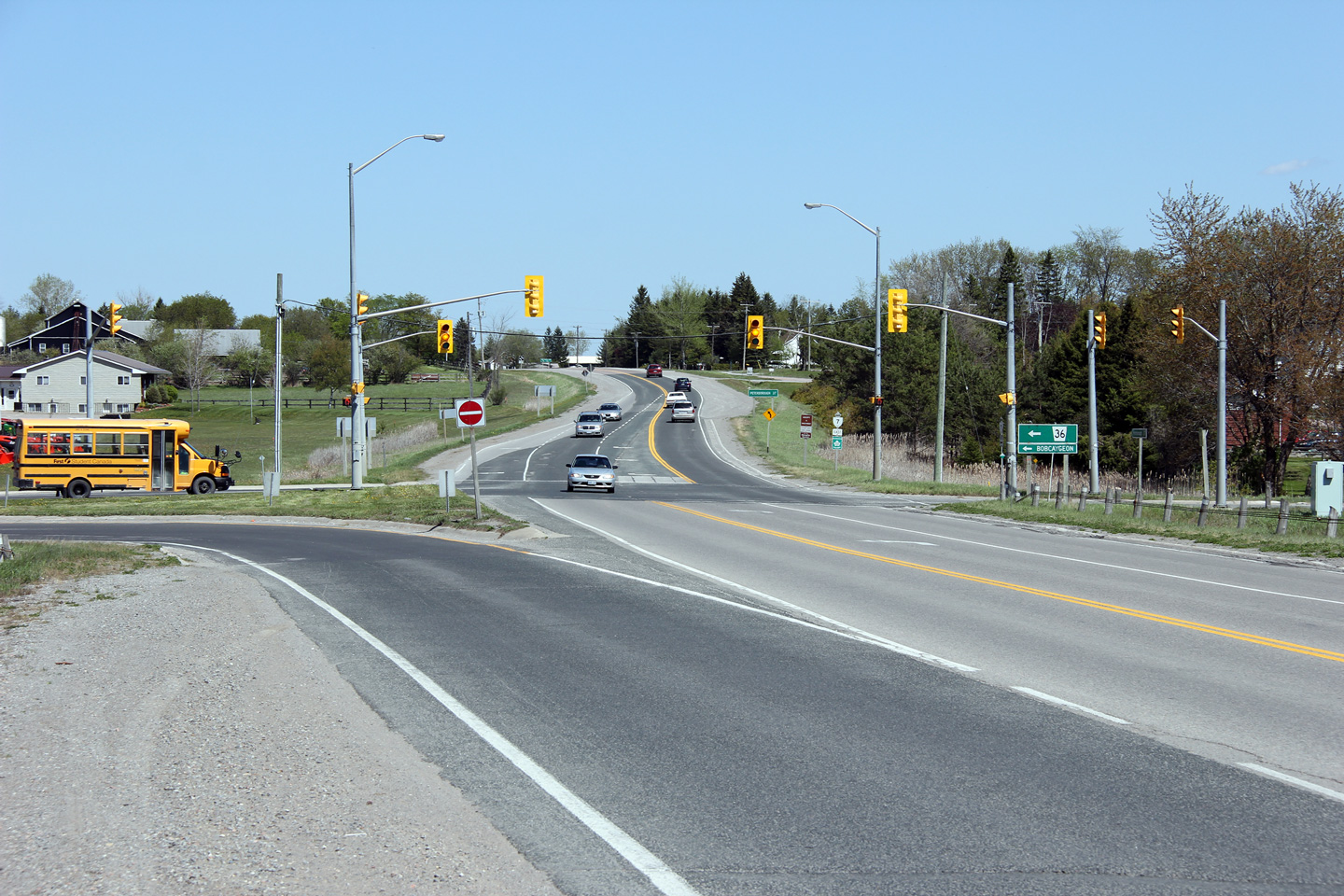
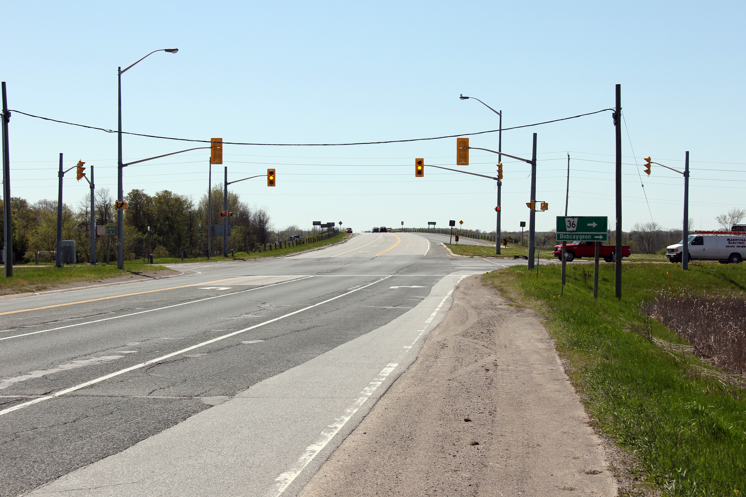
| City of Kawartha Lakes |
Easterly view approaching the Highway 36
junction. Highway 36 (now Kawartha Lakes Road 36) leads northerly to
the small community of Bobcaygeon. Bobcaygeon is primarily a tourist
community, famously immortalized by the Tragically Hip. Photo taken: April 10th, 2009. |
 (720x480) (1440x960) (2400x1600) |
||
| Highway 36 is a long highway running north from Highway 7 to Bobcaygeon, the easterly to Highway 28 at Burleigh Falls. Click here for Highway 36 images. | ||||
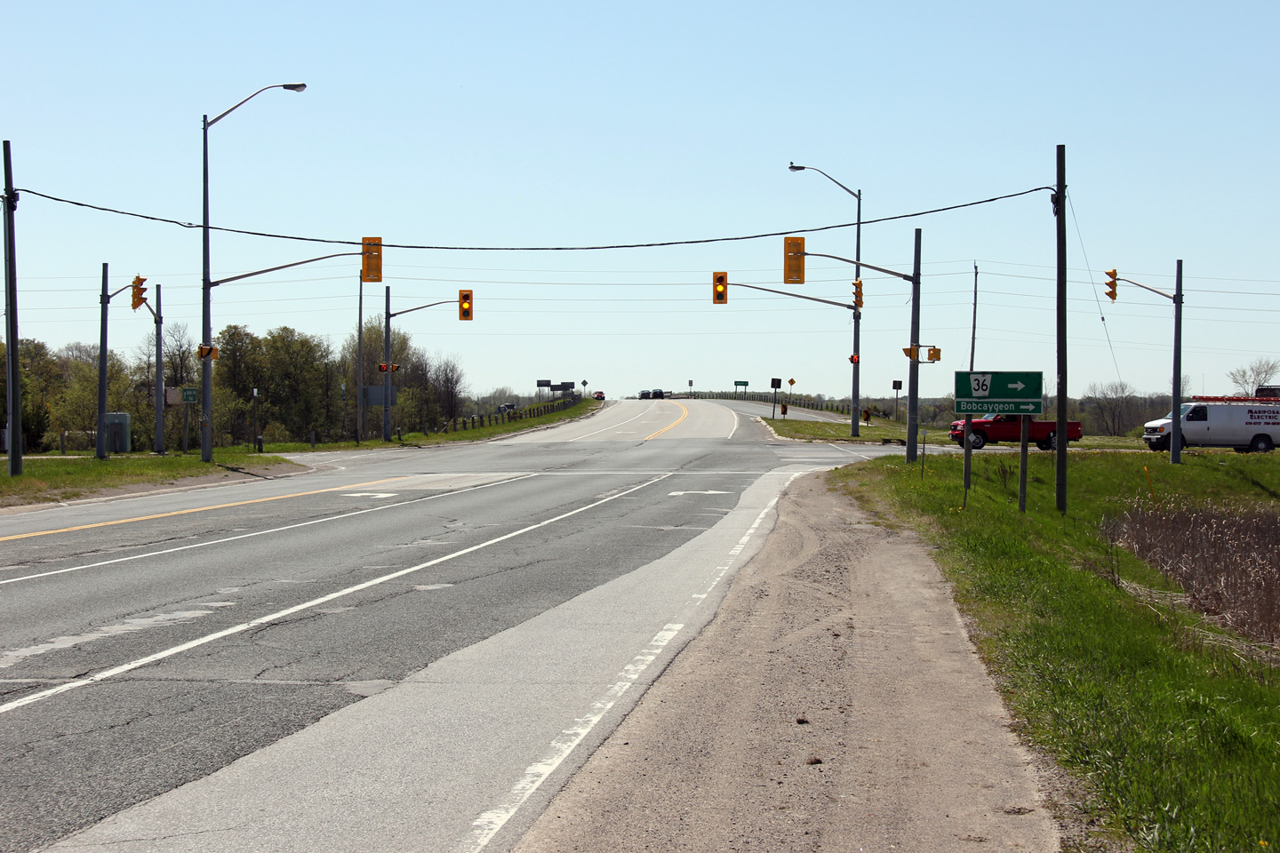
| City of Kawartha Lakes |
Westerly view along Highway 7 approaching the
Highway 36 intersection. Photo taken: April 10th, 2009. |
 (720x480) (1440x960) (2400x1600) |
||
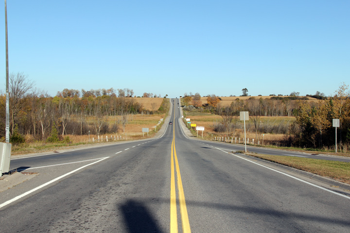
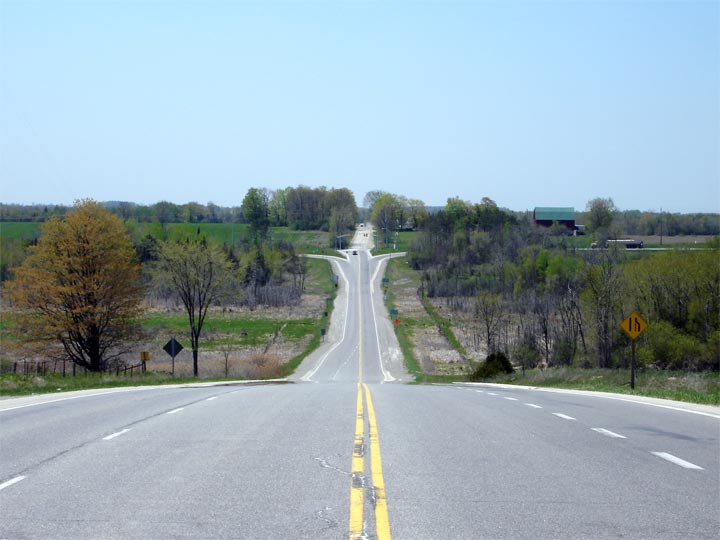
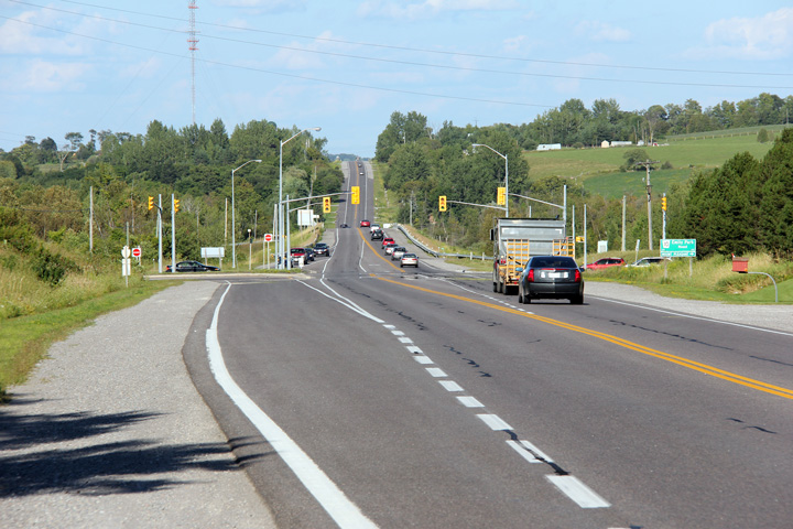
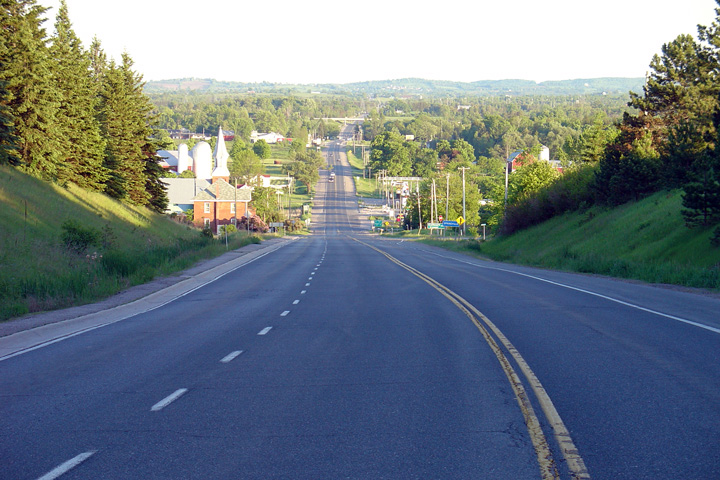
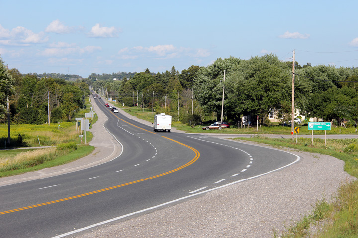
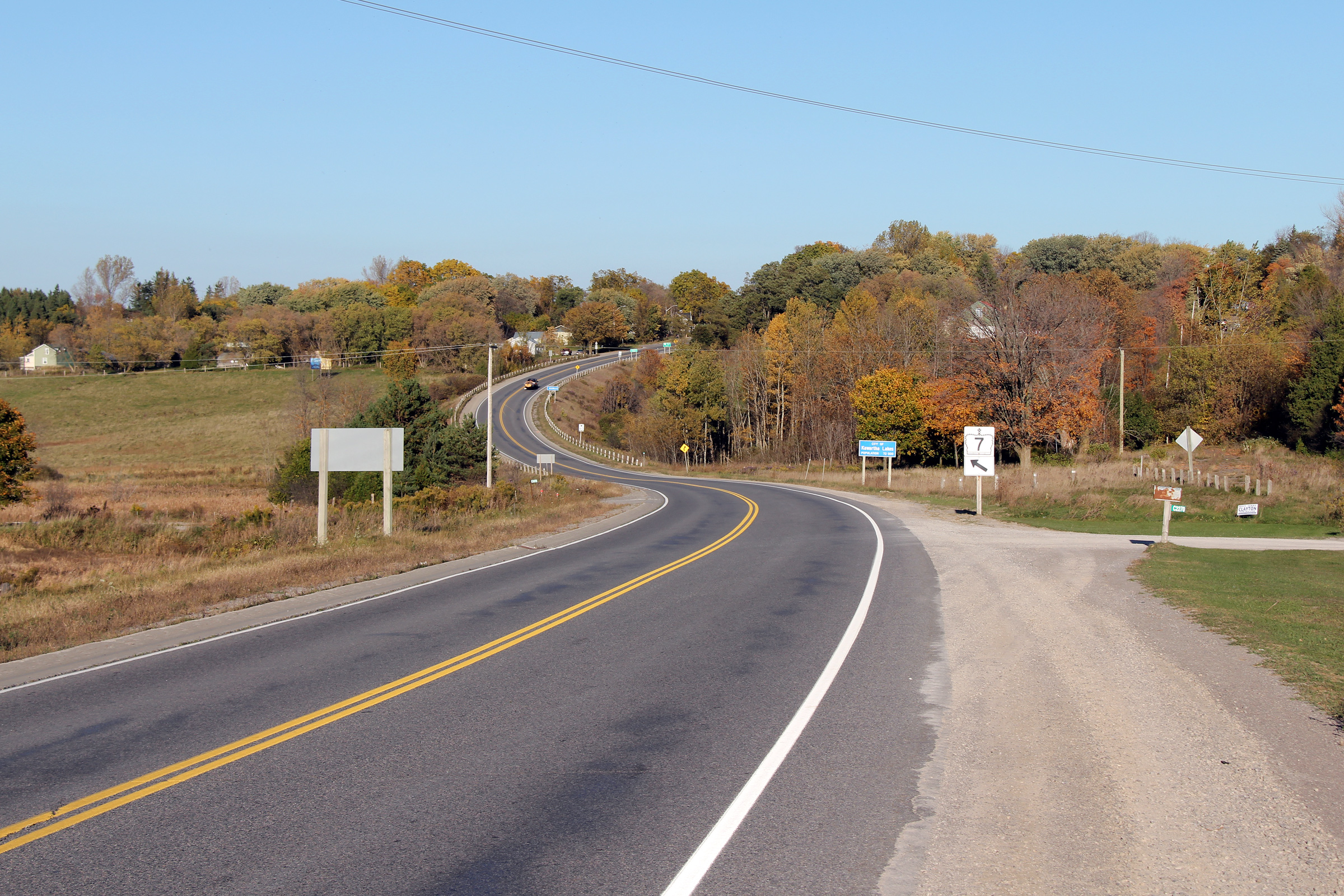
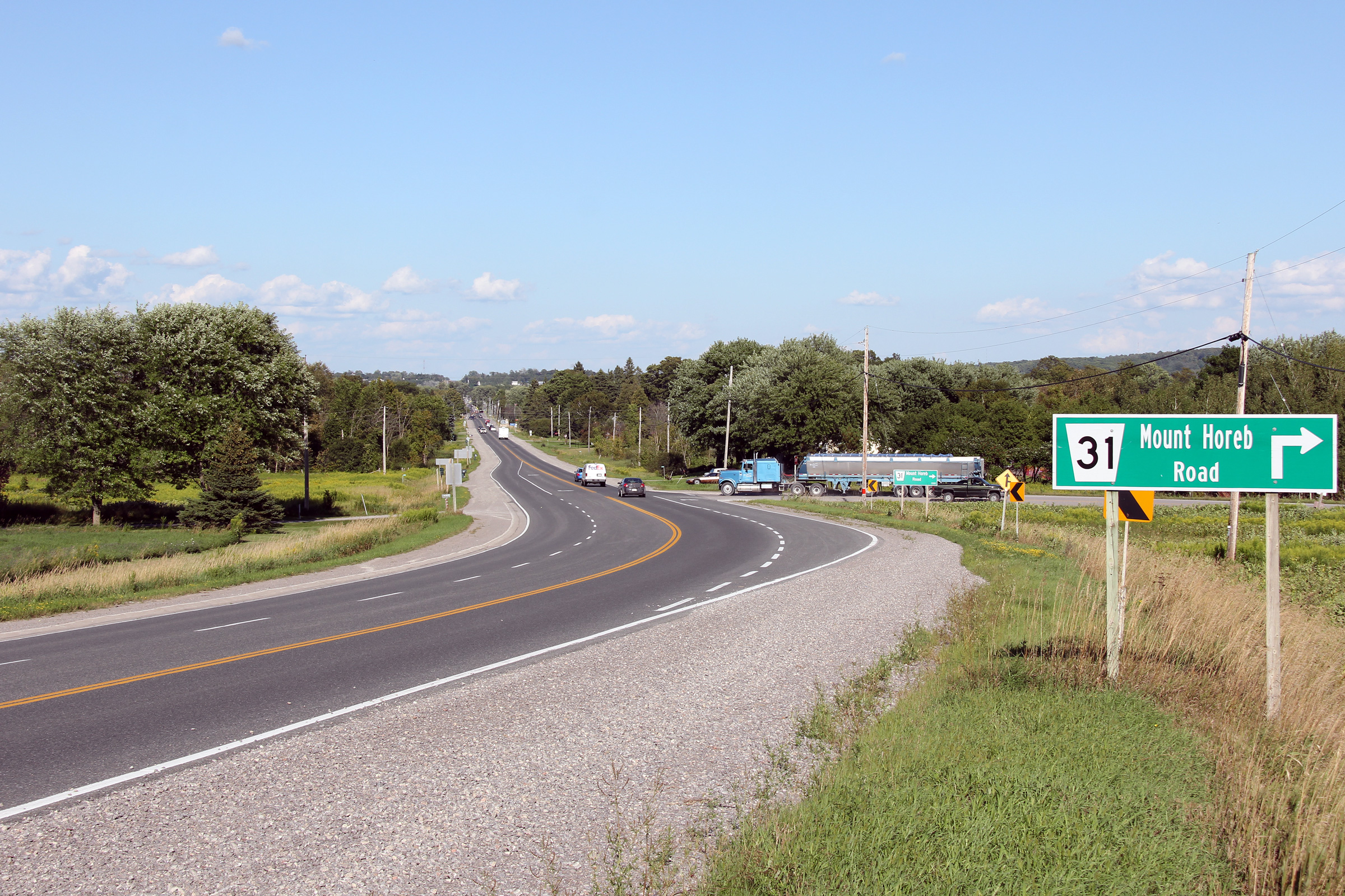
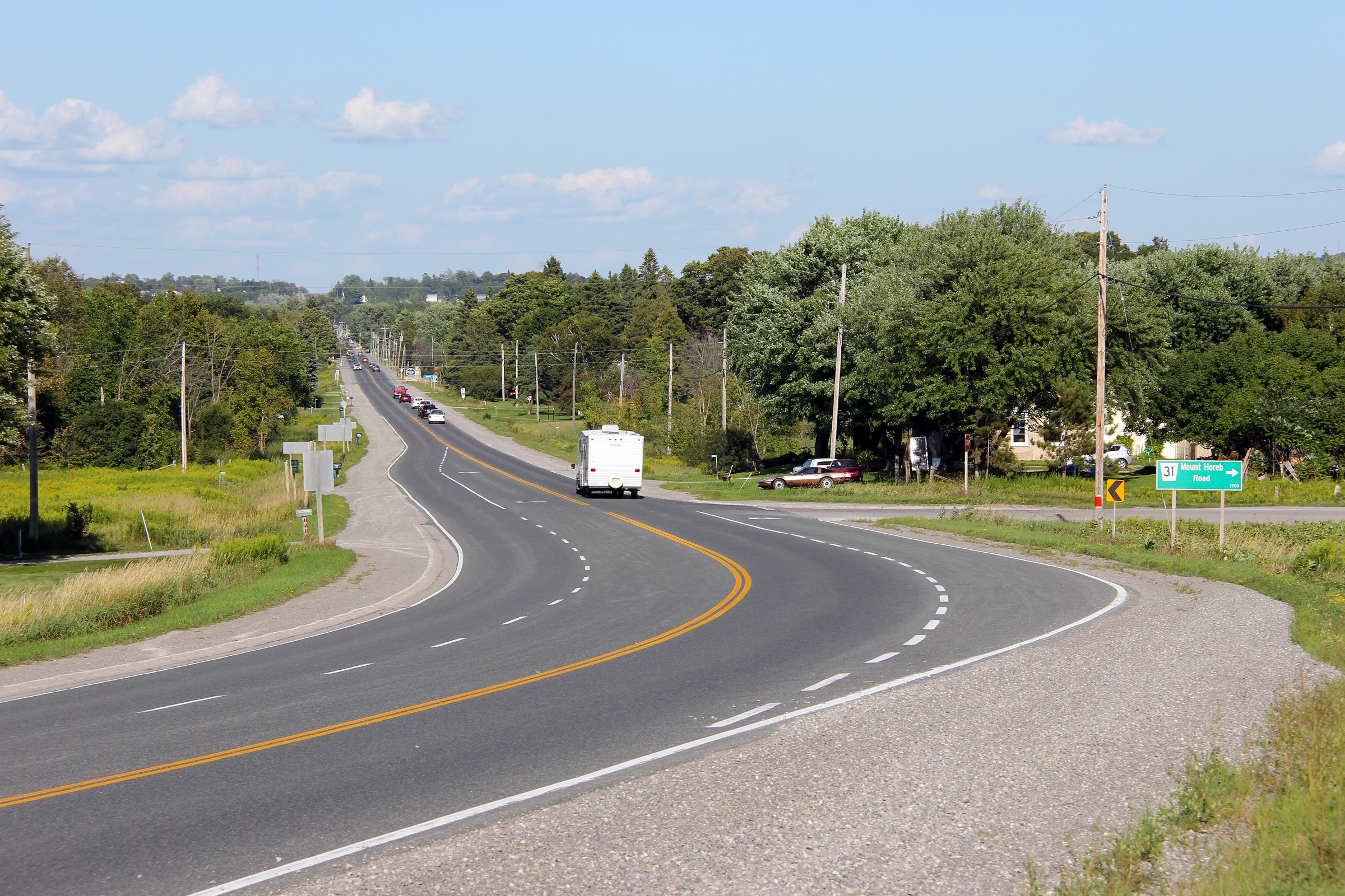
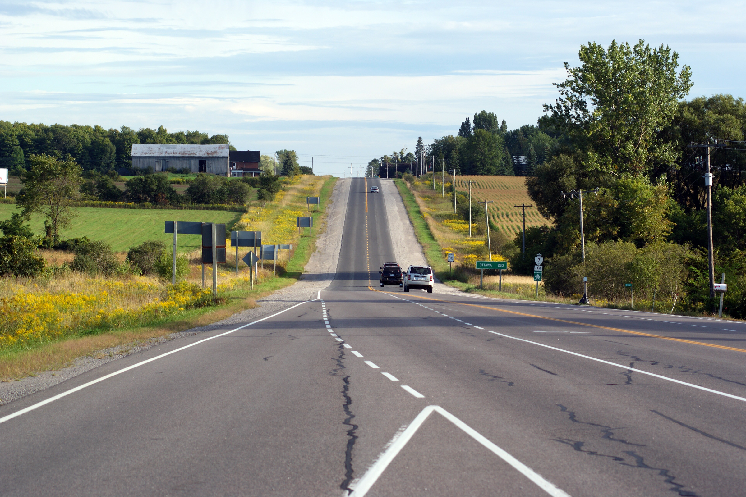
| City of Kawartha Lakes | Two views looking easterly towards Omemee from
just west of the Mount Horeb Road intersection. A short climbing lane
extends in the westbound lane beyond the Mount Horeb Road intersection. Photos taken: August 19th, 2011. |

(720x480)
(1440x960)
(2400x1600) |
||
| City of Kawartha Lakes | Highway 7 looking east from the eastern limits
of Omemee. East of Omemee to Fowlers Corners, Highway 7 climbs and
descends several long hills as it passes through a drumlin field. Photo taken: August 19th, 2011. |
 |
||
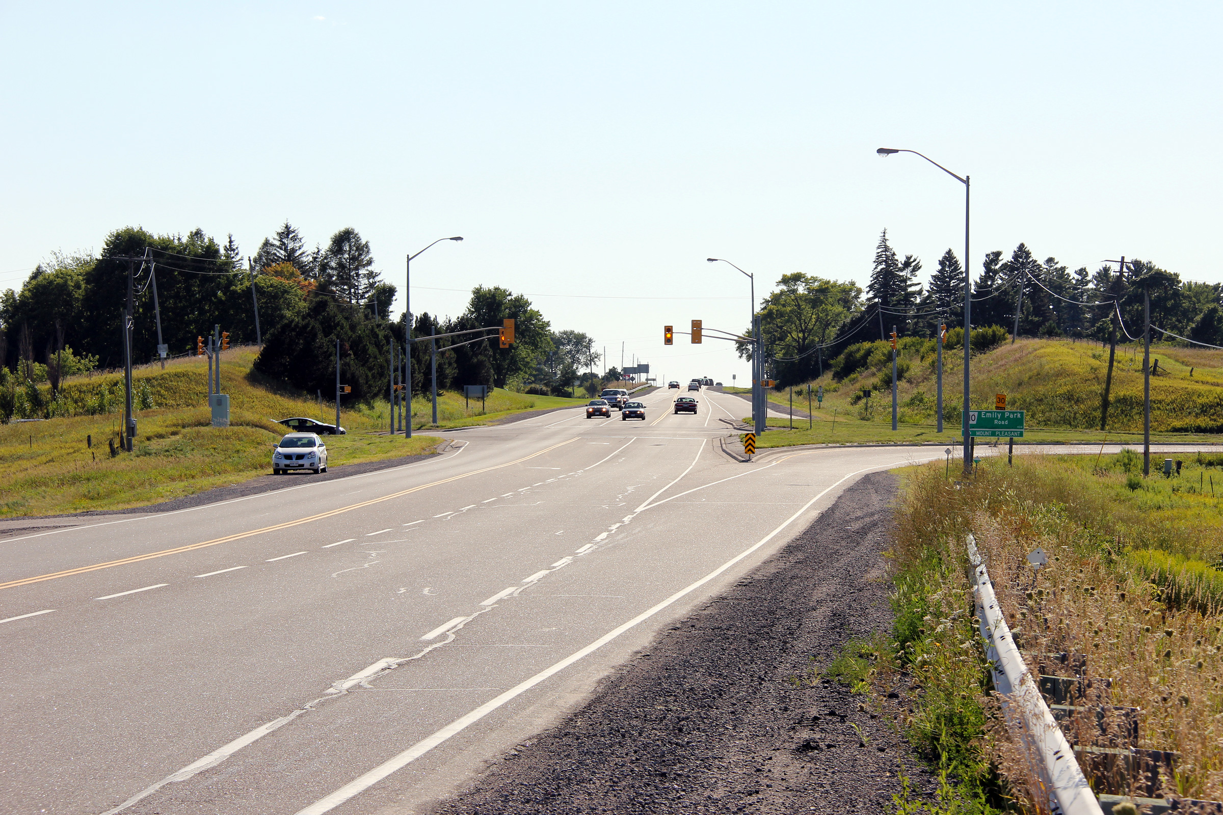
| City of Kawartha Lakes | Easterly view along Highway 7 at the
Emily Park Road intersection. Photo taken: August 19th, 2011. |
 |
||
| City of Kawartha Lakes | Reverse view, looking westerly towards
the Emily Park Road intersection. It is somewhat rare for an
intersection between a provincial highway and a county road to have two
turning channels as the Emily Park Road intersection has with Highway 7. Photo taken: August 19th, 2011. |
 |
||
| City of Kawartha Lakes | Easterly view along Highway 7 from the railway bridge
that that spans the now abandoned CN railway tracks between Lindsay and Peterborough.
Several railway lines once extended in all directions from both Lindsay and
Peterborough. All of the railway lines have since been lifted from
Lindsay. Peterborough is still served by CP's Havelock Subdivision. Photo taken: August 19th, 2011. |
 |
||
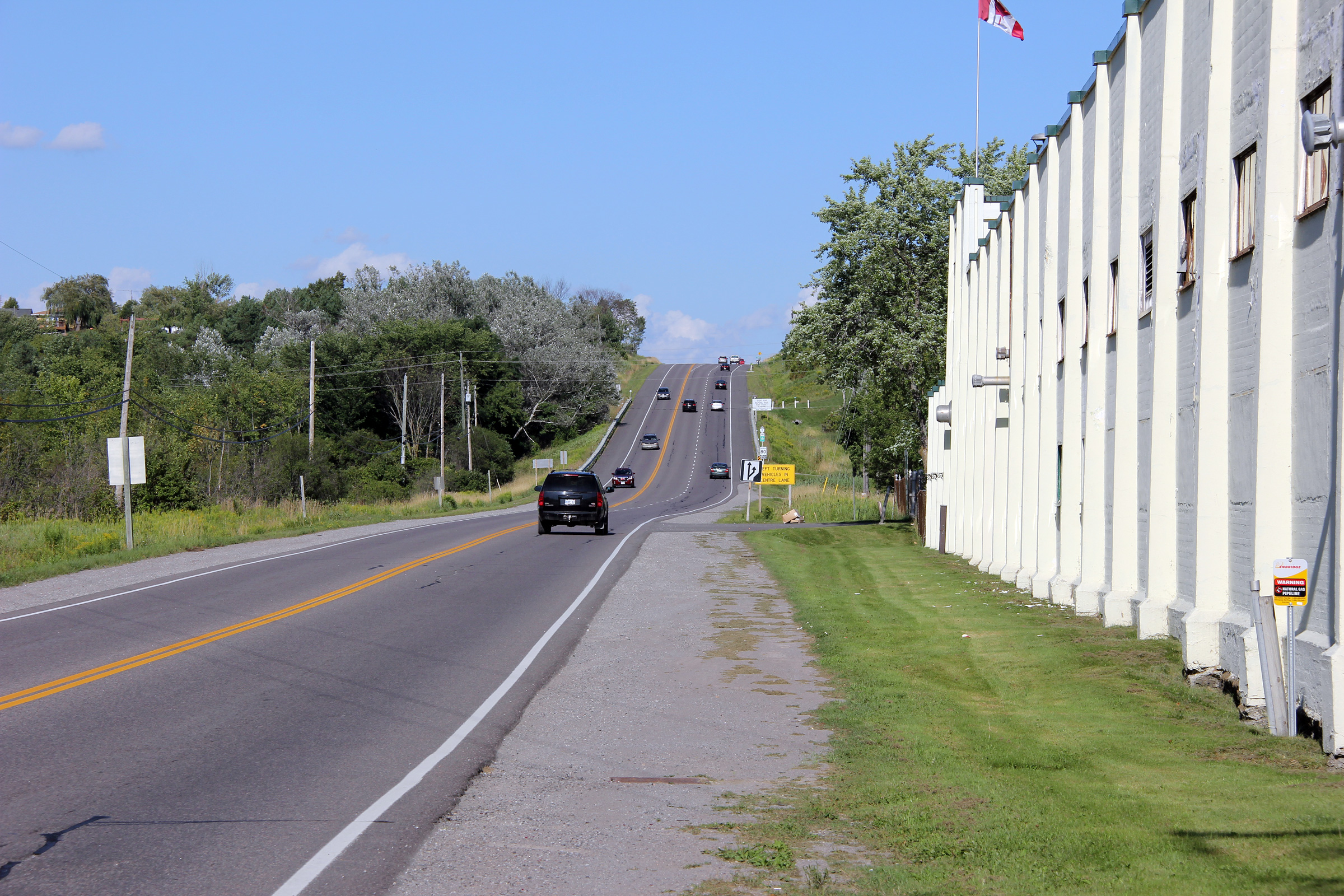
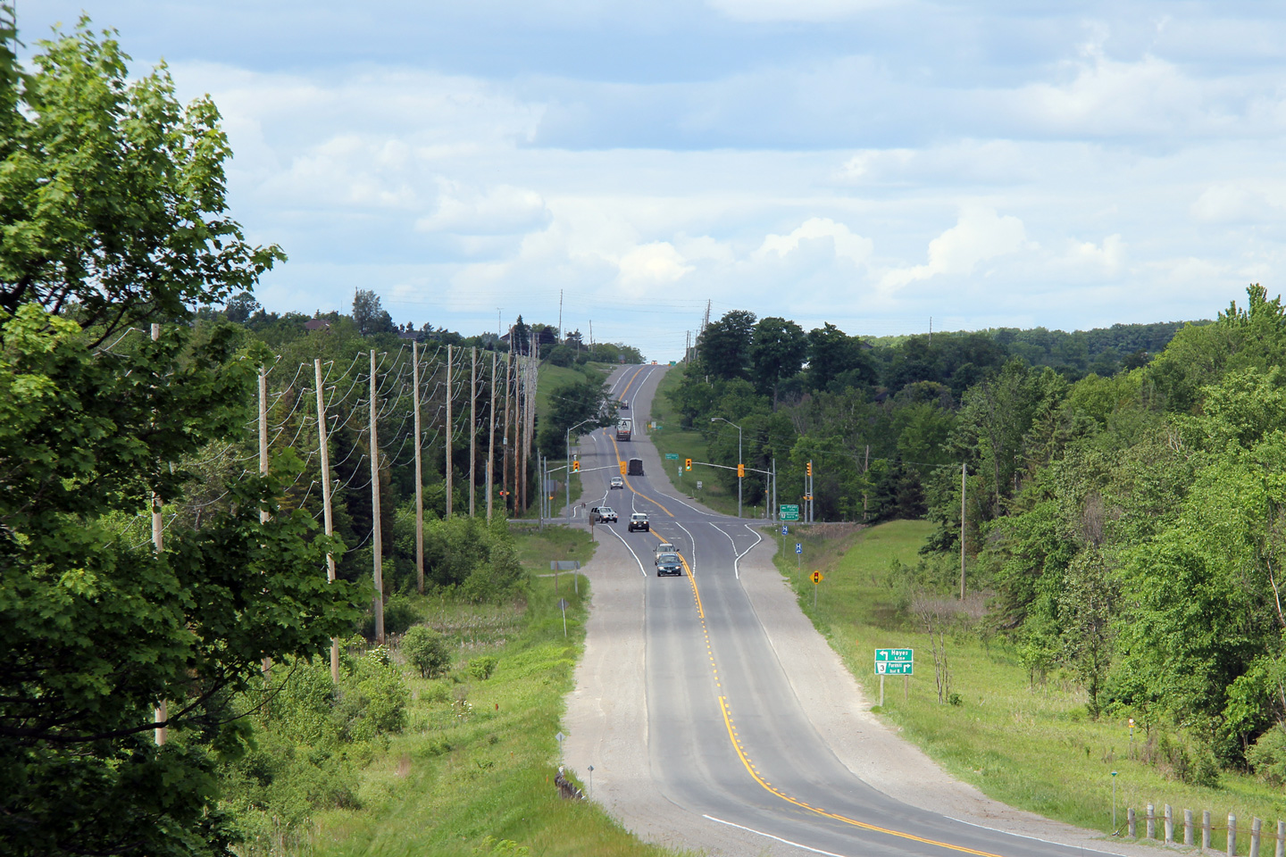
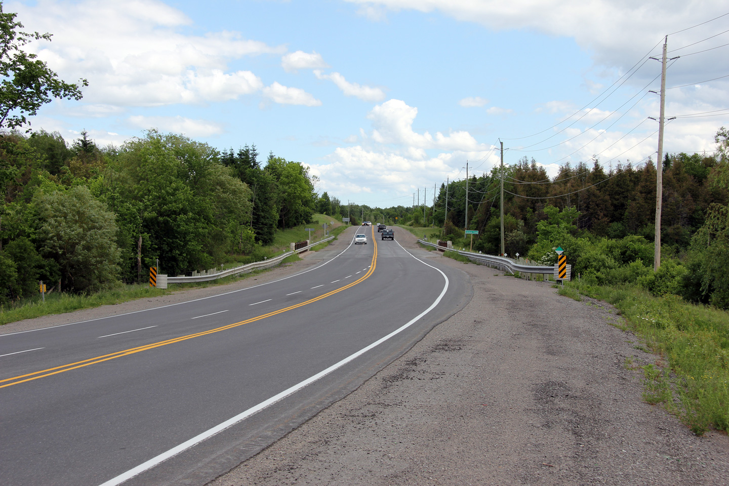
| City of Kawartha Lakes | Easterly view between Omemee and
Fowlers Corners as the highway descends a large hill into the Potash
Creek valley. Photo taken: September 11th, 2011. |
 |
||
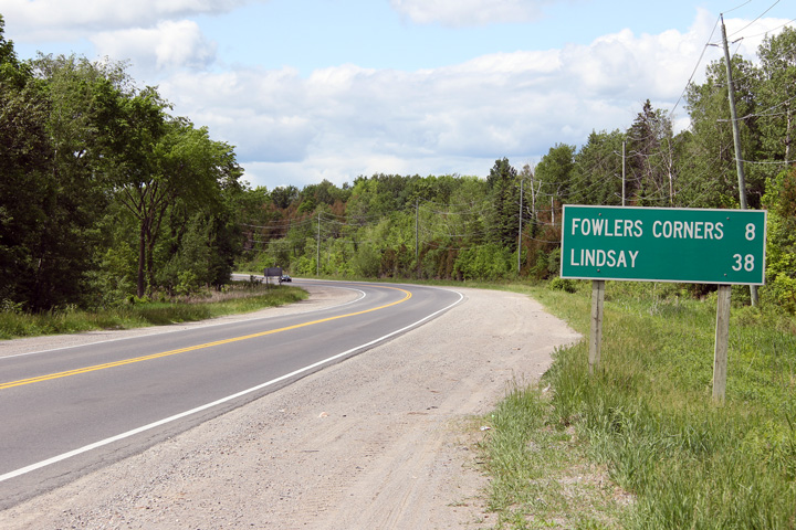
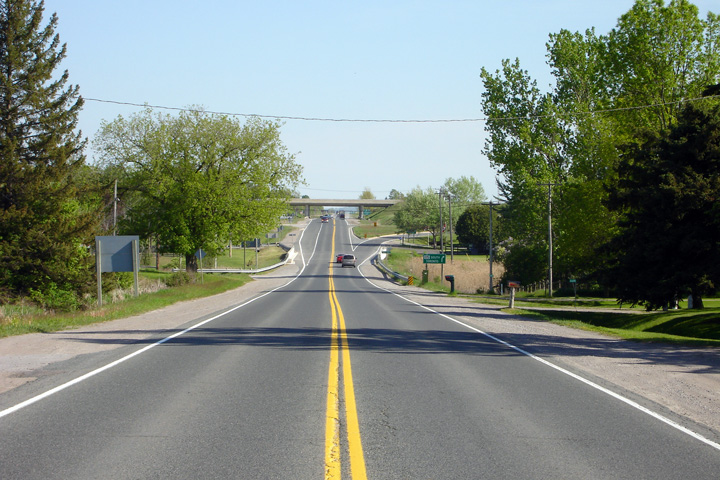
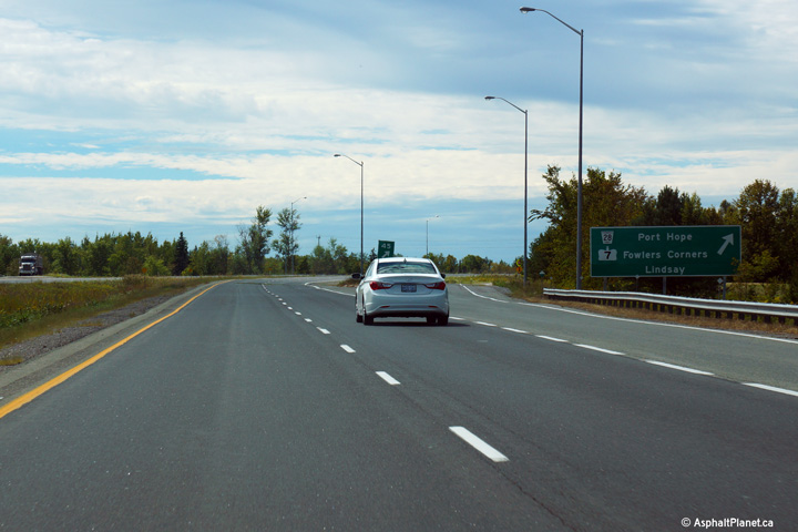
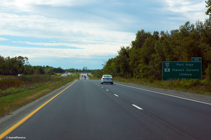
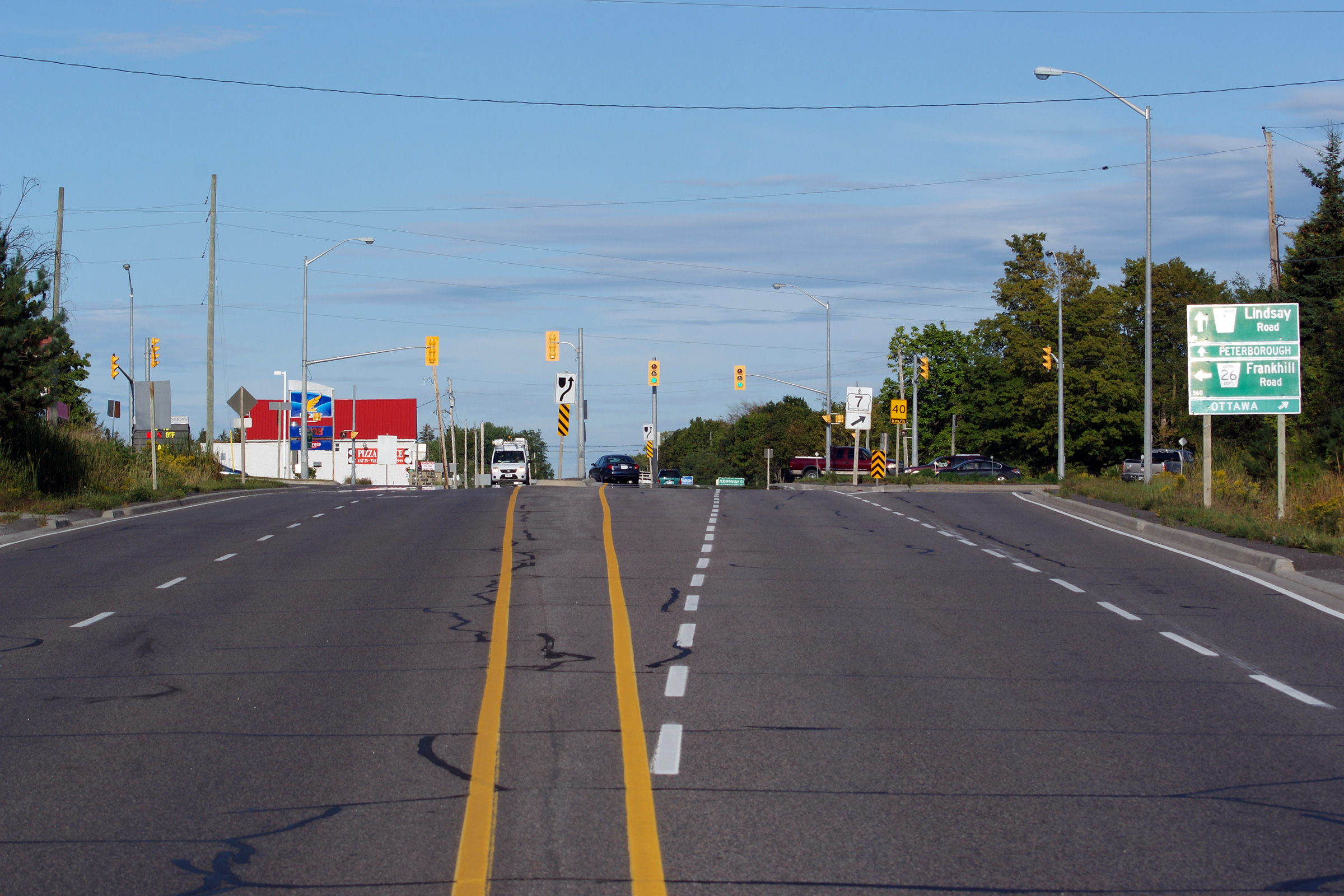
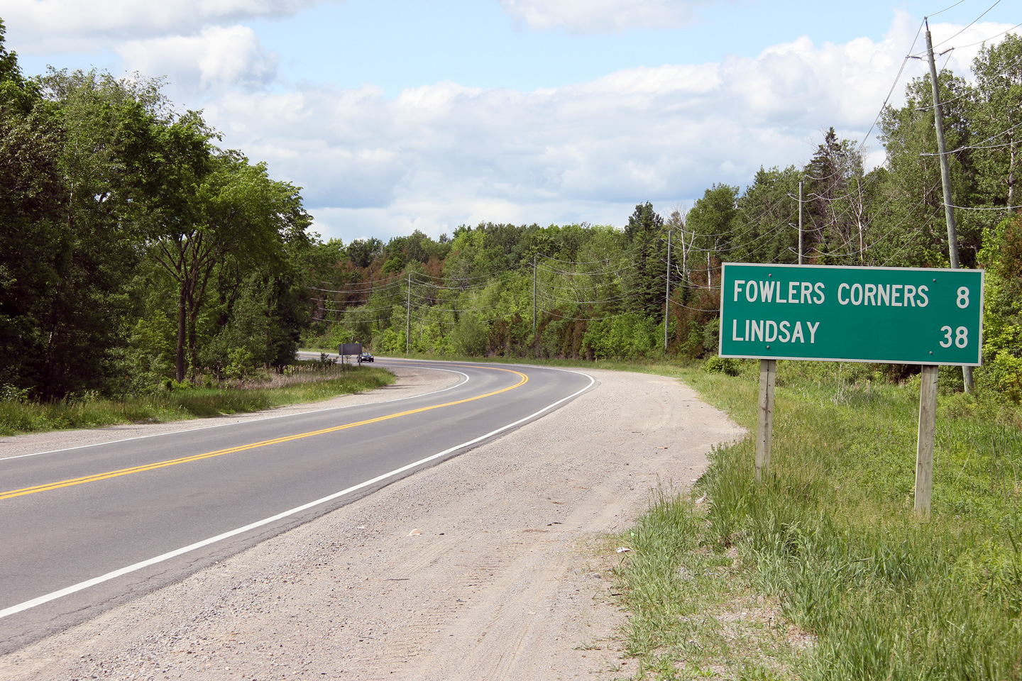
| City of Kawartha Lakes | Highway 7 looking east towards Fowlers Corners.
At Fowlers Corners Highway 7 East turns South (via the ramp shown in the
Photo). South of Fowlers Corners, Highway 7 follows the former
alignment of Highway 133 on the
Western Peterborough Bypass Road. Continuing east from Fowlers Corners
takes drivers on the former Highway 7B (now Peterborough Road 1) along the
original Highway 7 alignment, and through the city of Peterborough.
Click here for the same view
taken in October, 2004, before the passing lane was constructed. Photo taken: September 9th, 2013. |
 |
||
| City of Kawartha Lakes | This view looks westerly along Highway 7 from
the former Highway 7B (now Peterborough Road 1) junction at Fowlers Corners.
The pictured westbound passing lane was added during a 2005 construction
project. Photo taken: September 11th, 2011. |
 |
||
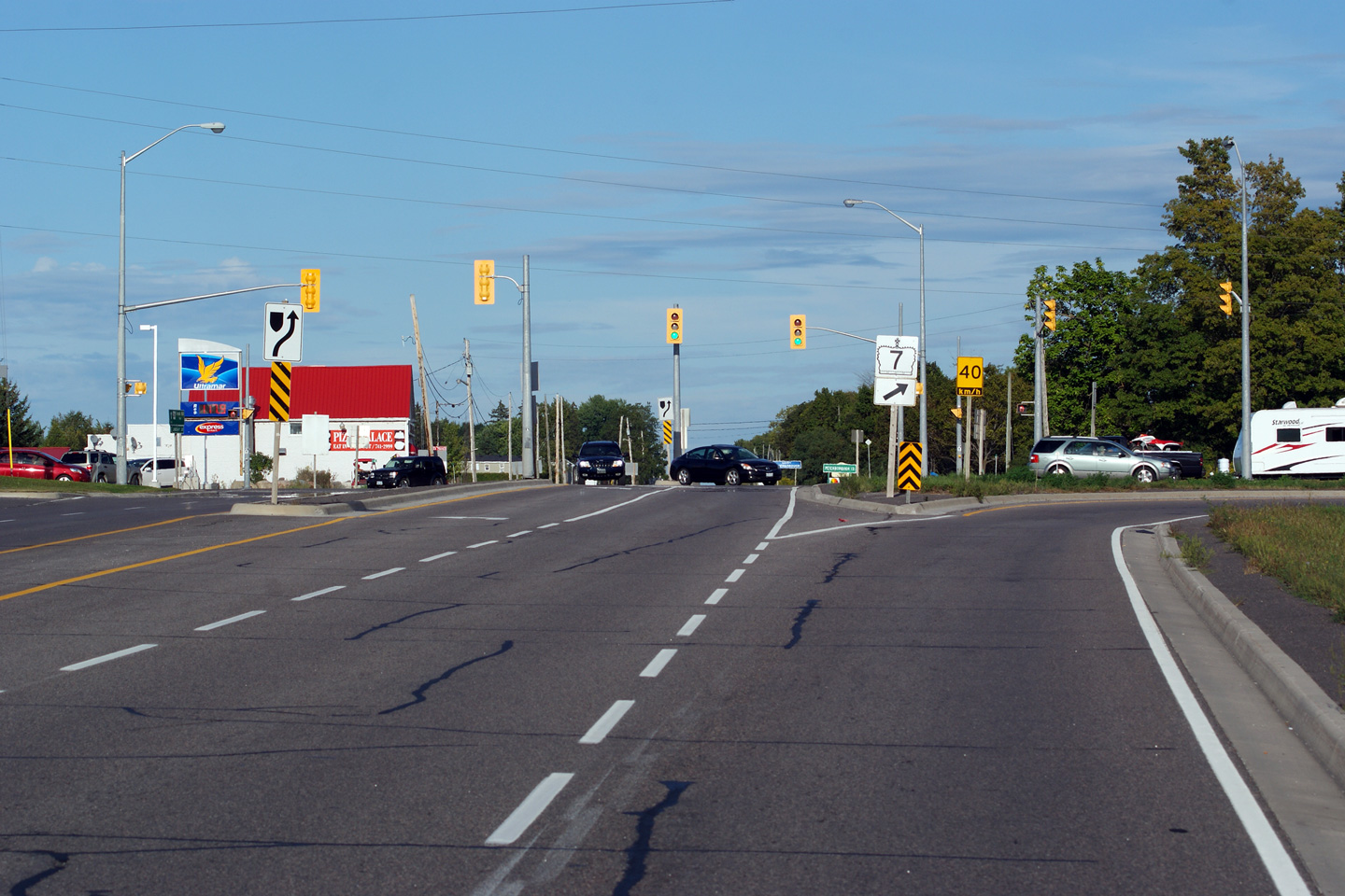
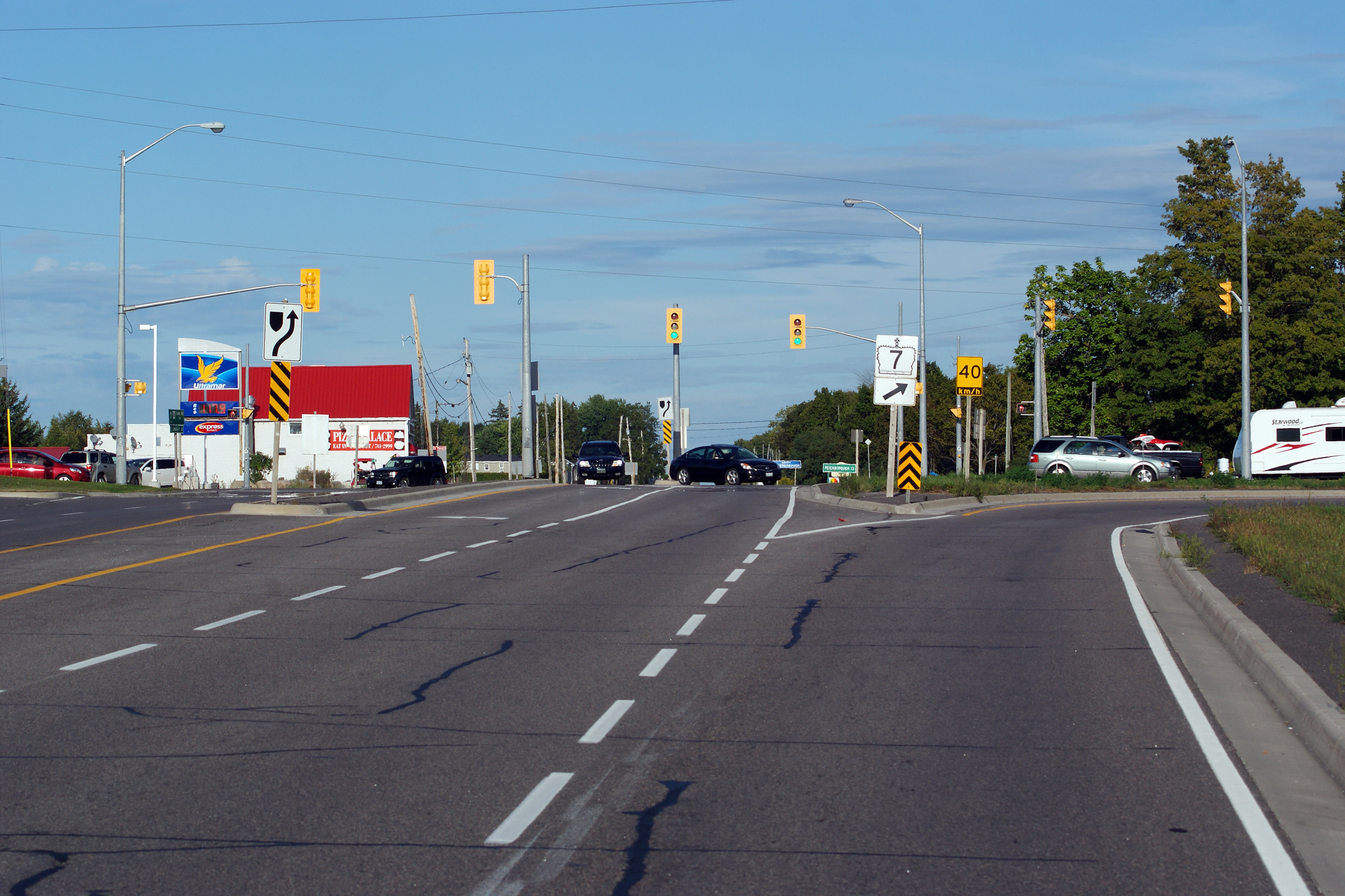
| City of Kawartha Lakes | Two easterly views at Fowlers Corners along
Highway 7. To continue easterly along Highway 7, traffic must follow
the ramp to the right. Straight ahead is Peterborough's former Highway
7B, now Peterborough County Road 1. Photos taken: September 11th, 2011. |
 (720x480) (1440x960) (2400x1600)  (720x480) (1440x960) (2400x1600) |
||
| Kawartha Lakes / Smith-Ennismore-Lakefiled
Boundary Kawartha Lakes / Peterborough Boundary |
Westerly view approaching the intersection at
Fowlers Corners. Westbound Highway 7 traffic must turn left to
continue towards Lindsay. Photo taken: September 11th, 2011. |
 |
||
| Kawartha Lakes / Smith-Ennismore-Lakefiled
Boundary Kawartha Lakes / Peterborough Boundary |
Easterly view (looking southerly on the compass)
along Highway 7 as it departs Fowlers Corners along the western Peterborough
By-pass. The western Peterborough By-pass was formerly a standalone
highway designated as
Highway 133. Photo taken: September 11th, 2011. |
 |
||
| Kawartha Lakes / Smith-Ennismore-Lakefiled
Boundary Kawartha Lakes / Peterborough Boundary |
Easterly view overtop of the Fowlers
Corners overhead. Photo taken: May 30th, 2012. |
 (720x480) (1440x960) (2400x1600) |
||
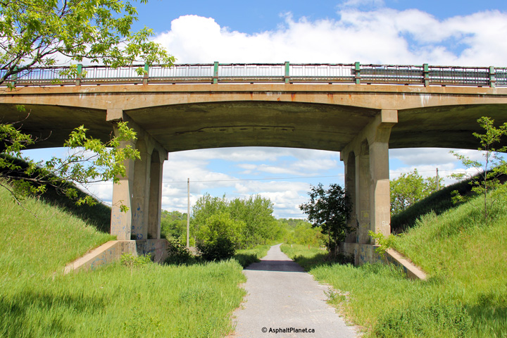
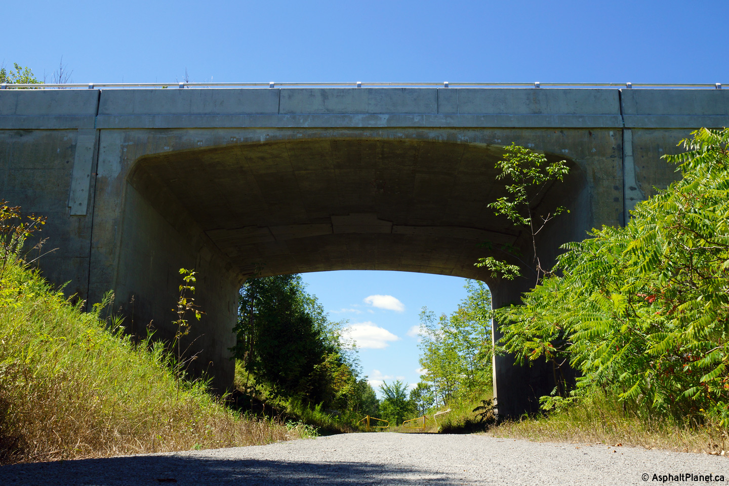
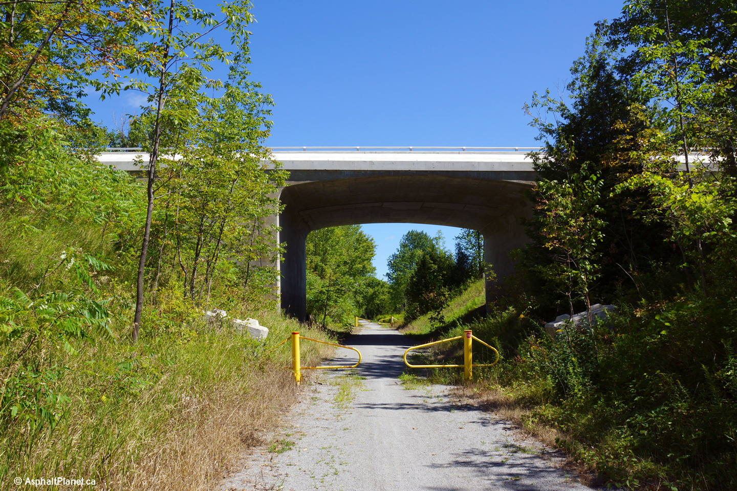
| Kawartha Lakes / Smith-Ennismore-Lakefiled
Boundary Kawartha Lakes / Peterborough Boundary |
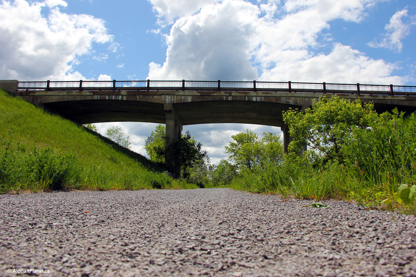
View of both the eastern and western side of the
Fowlers Corners overhead along Highway 7. This overhead once carried
Highway 7 traffic overtop of a CN Rail's mainline between Lindsay and
Peterborough. The CNR between Lindsay and Peterborough was abandoned
in 1989. Highway 7 crossed this railway twice between Lindsay and
Peterborough. The other structure was located just east of the Emily
Park Road intersection east of Omemee. That structure has since been
replaced with an oversized culvert to continue to provide a grade separation
between Highway 7 and the multi-use trail that has since replaced the
railway. Photos taken: May 30th, 2012. |
 (720x480) (1440x960) (2400x1600)  (720x480) (1440x960) (2400x1600) |
||
| Kawartha Lakes / Smith-Ennismore-Lakefiled
Boundary Kawartha Lakes / Peterborough Boundary |
This view looks westerly overtop of the Fowlers
Corners overhead. Photo taken: May 30th, 2012. |
 (720x480) (1440x960) (2400x1600) |
||
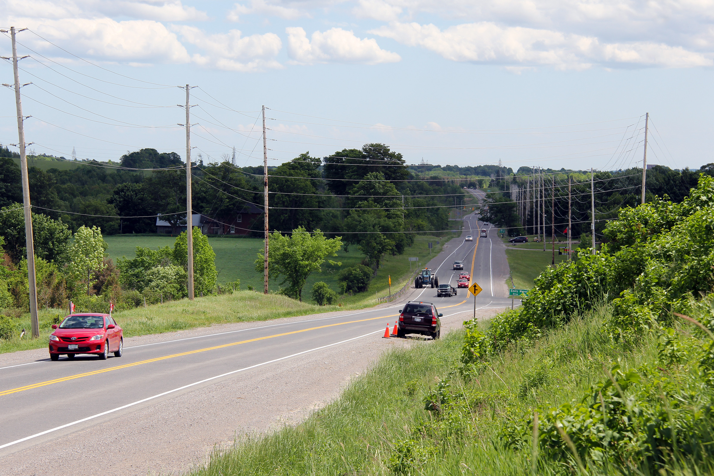
| Kawartha Lakes / Smith-Ennismore-Lakefiled
Boundary Kawartha Lakes / Peterborough Boundary |
This view looks easterly at the Emily Manor Road
intersection, which is located just east of the Fowlers Corners overhead. Photo taken: May 30th, 2012. |
 |
||
| Kawartha Lakes / Smith-Ennismore-Lakefiled
Boundary Kawartha Lakes / Peterborough Boundary |
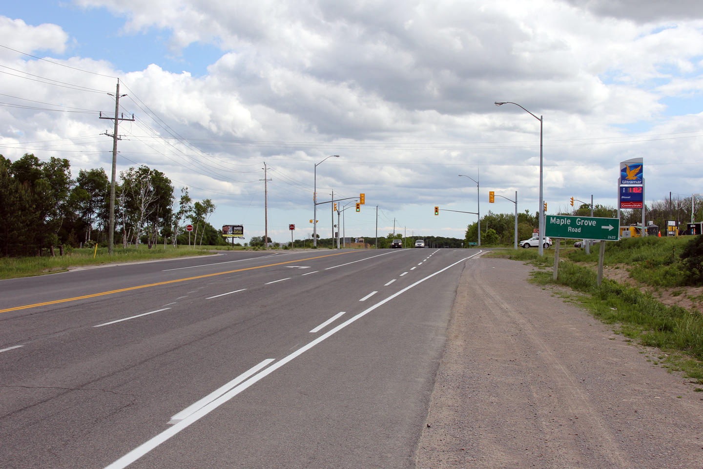
View looking westerly (north on the compass)
approaching the Parkhill Road intersection. There are several
signalized intersections along this section of Highway as the highway runs
just to the west of the City of Peterborough. Photo taken: May 30th, 2012. |
 |
||
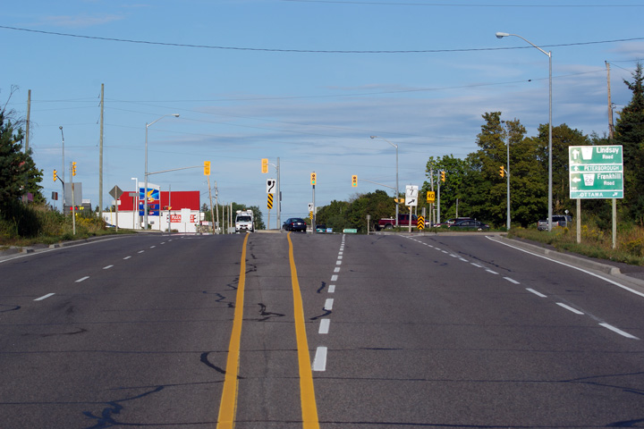
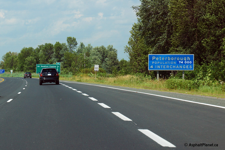
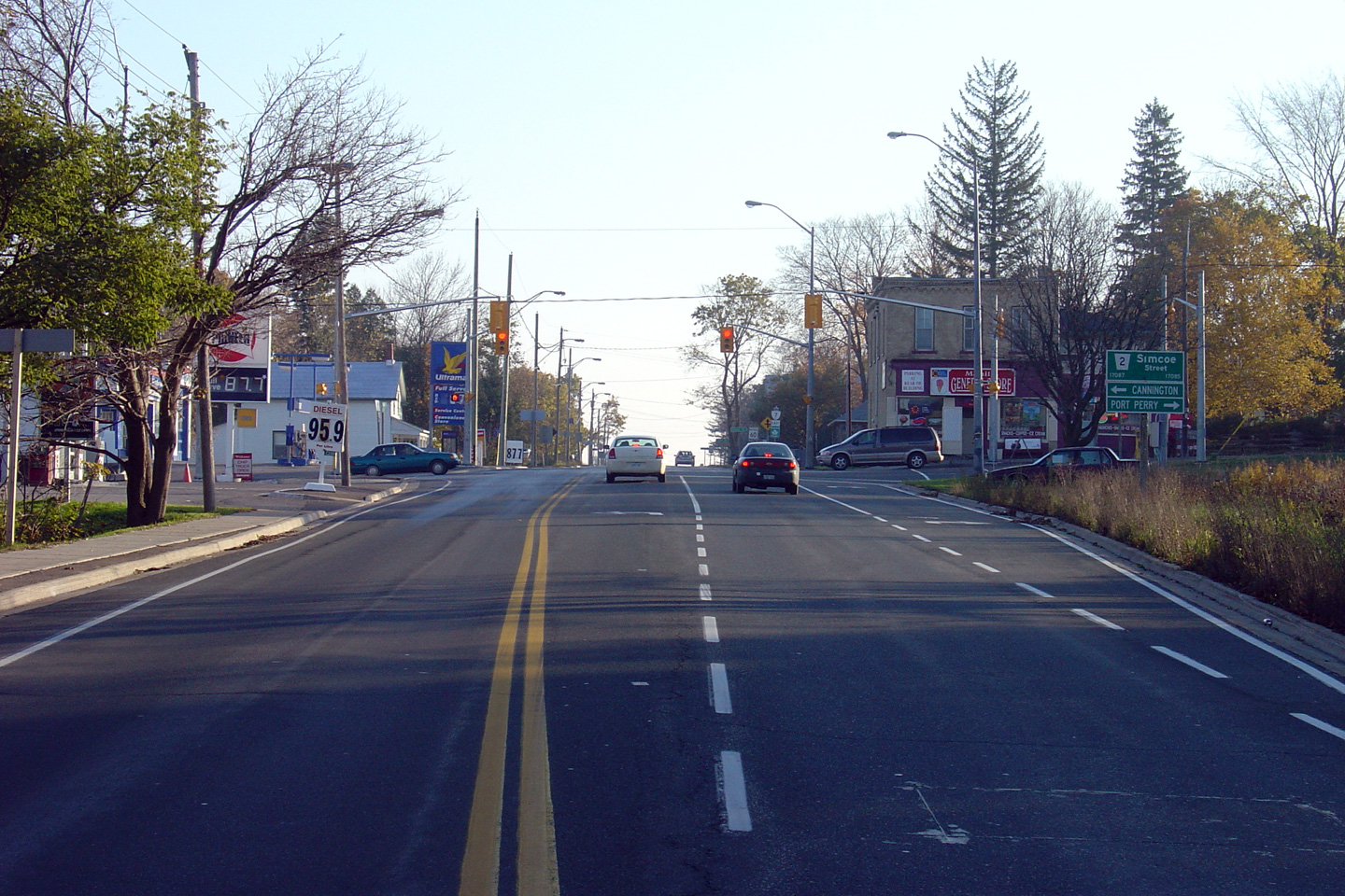
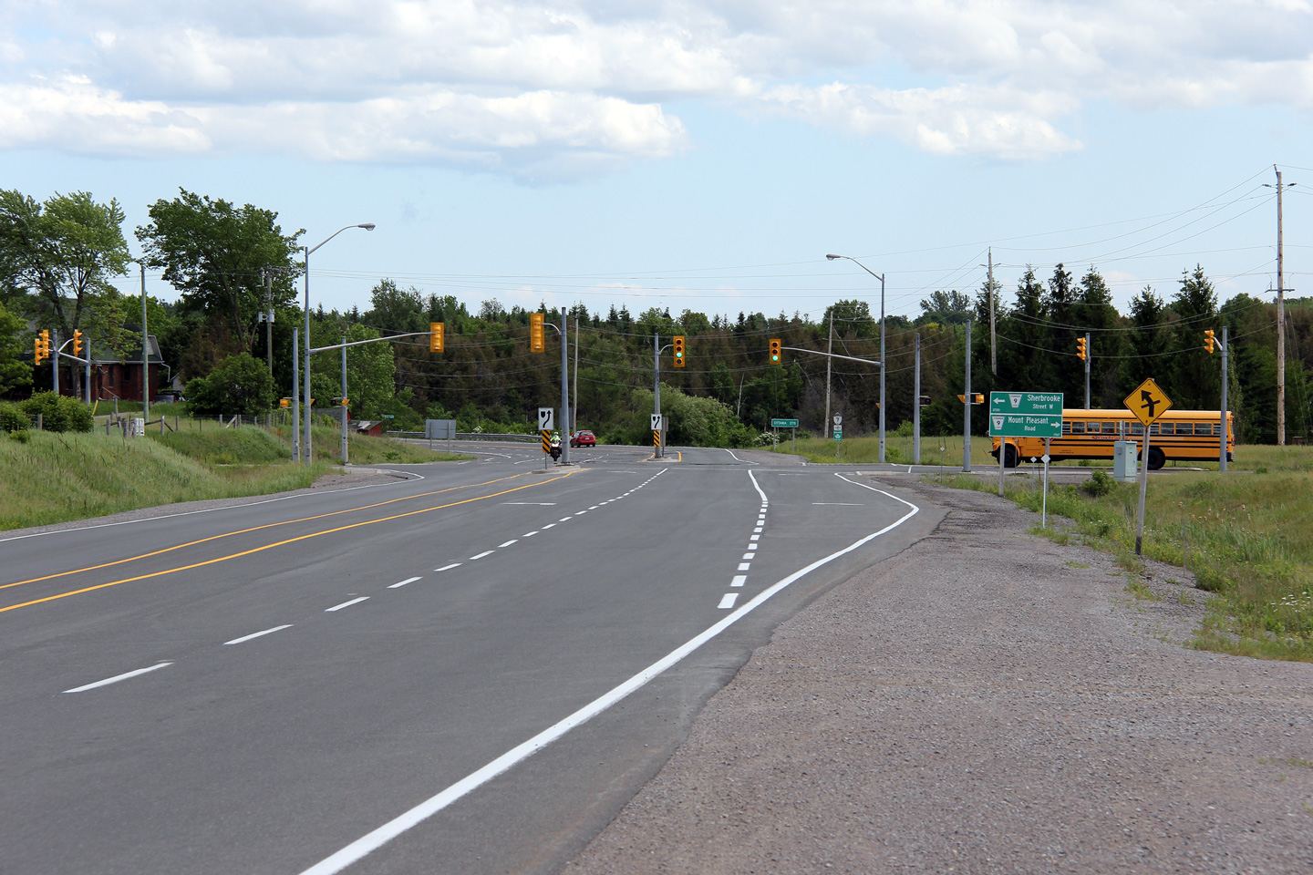
| Township of Cavan- Millbrook- North Monaghan County of Peterborough |
Easterly view approaching the Sherbrooke Street
intersection. Photo taken: May 30th, 2012. |
 |
||
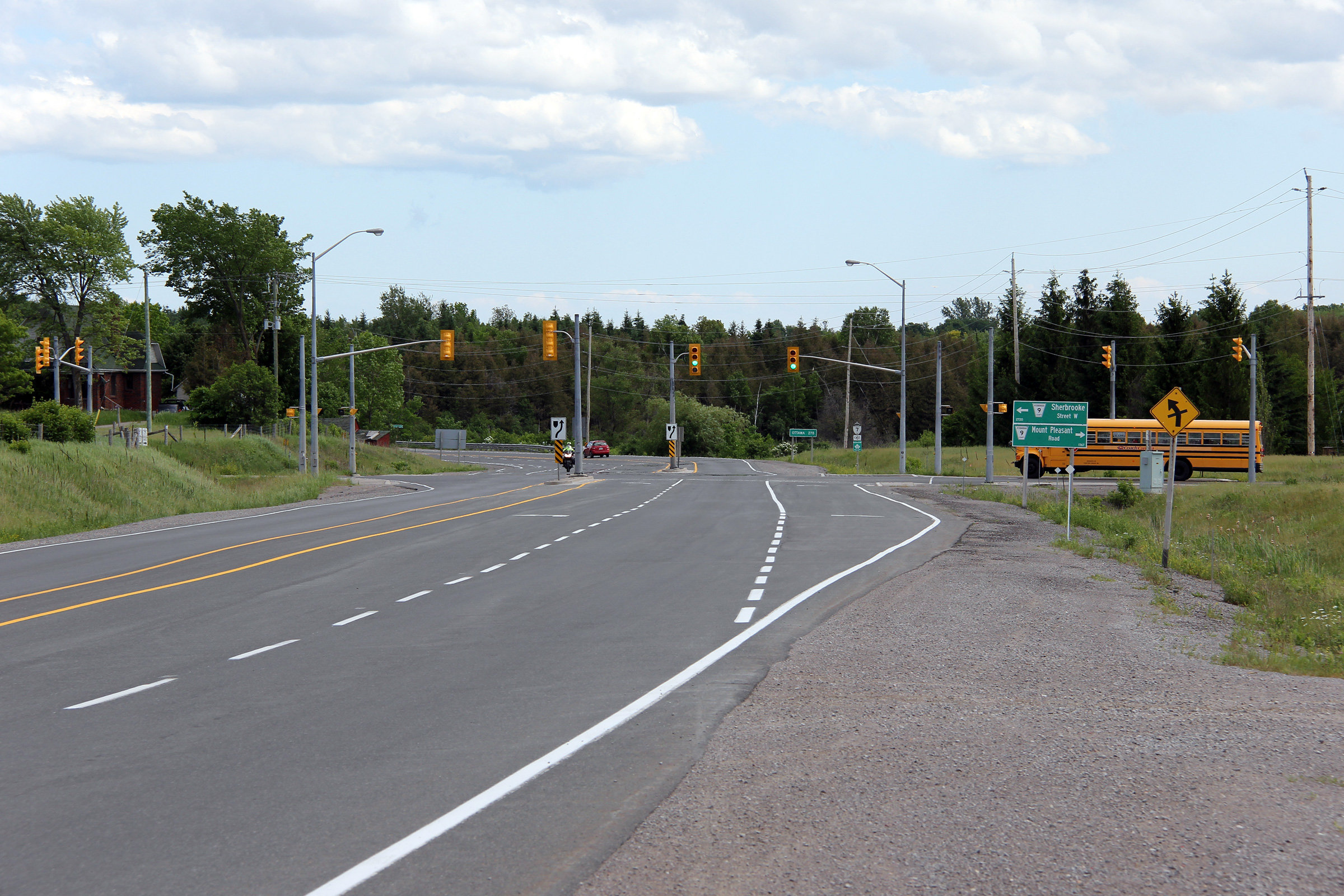
| Township of Cavan- Millbrook- North Monaghan County of Peterborough |
View looking westerly at the Sherbrooke Street
intersection. Sherbrooke Street is an important east-west arterial road
within the city of Peterborough just to the east. Photo taken: May 30th, 2012. |
 |
||
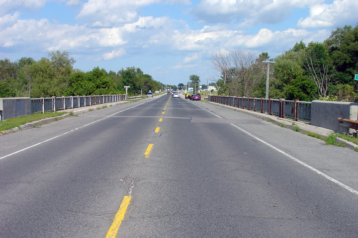
| Township of Cavan- Millbrook- North Monaghan County of Peterborough |
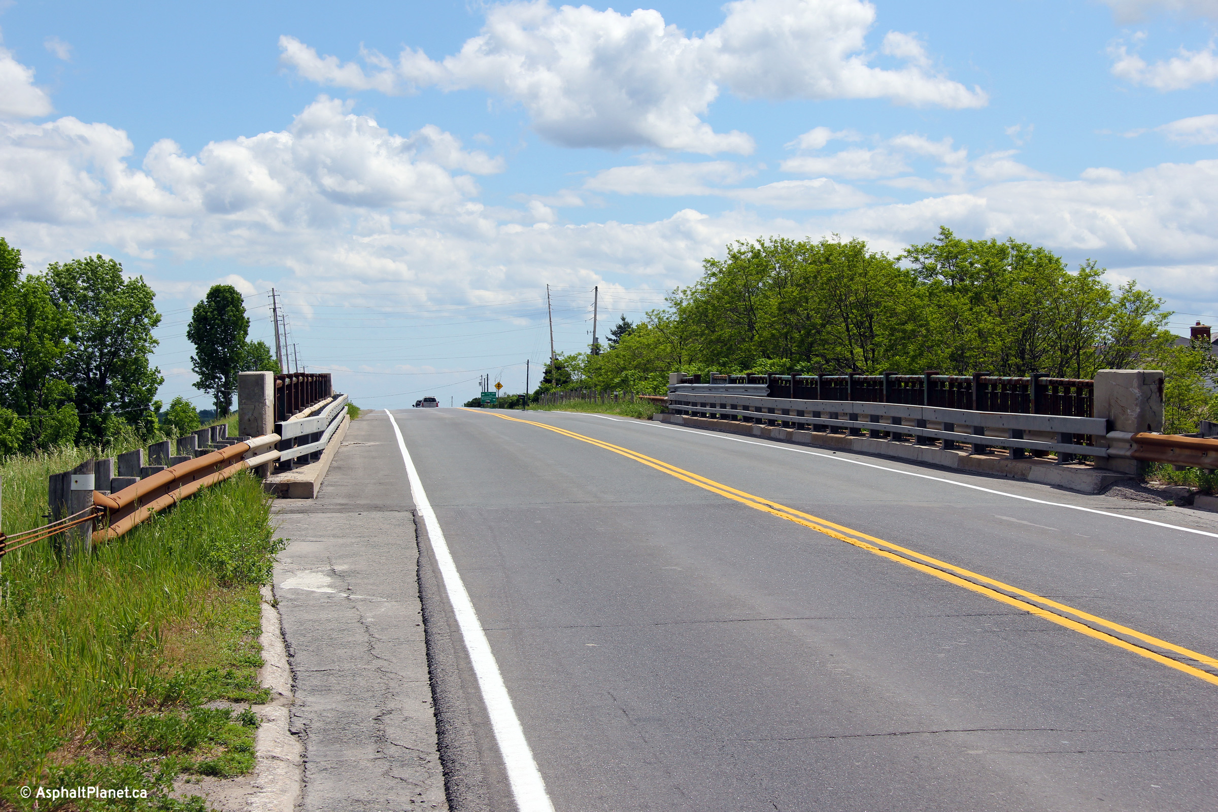
Immediately east of the Sherbrooke Street Street
intersection, Highway 7 crosses Jackson Creek. The Jackson Creek bridge
deck is quite wide, suggesting that even in the 1950s (when this highway was
commissioned) that this was an important road. Photo taken: May 30th, 2012. |
 |
||
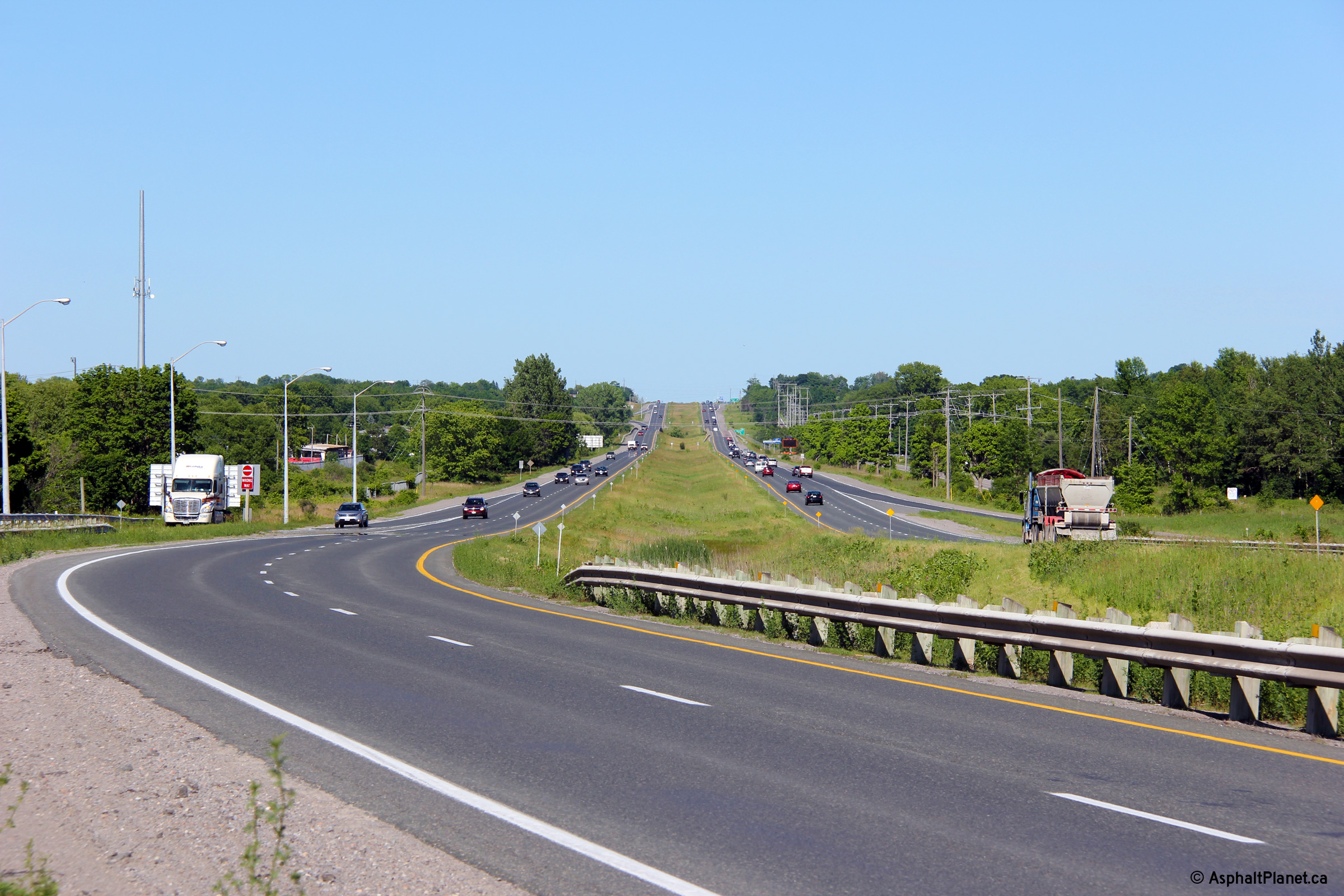
| Township of Cavan- Millbrook- North Monaghan County of Peterborough |
Consisting of not much more than a gas station
and a restaurant, Fowlers Corners may be the most insignificant control city
to be used on the entire provincial highway network. Photo taken: May 30th, 2012. |
 (720x480) (720x480)(1440x960) |
||
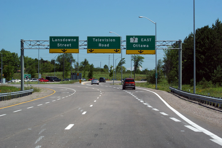
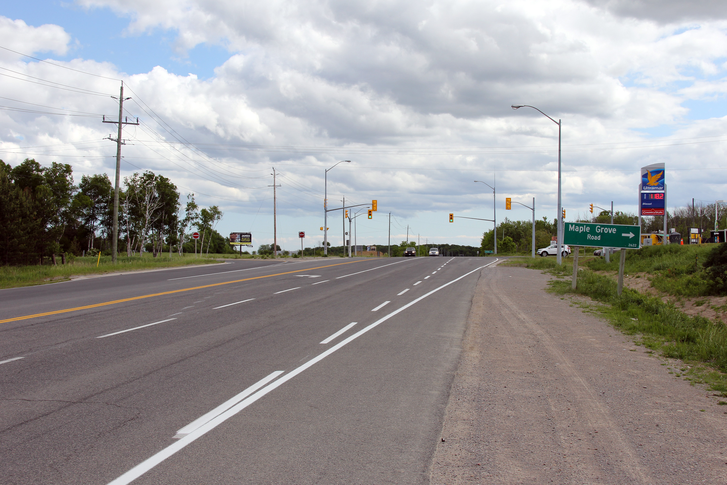
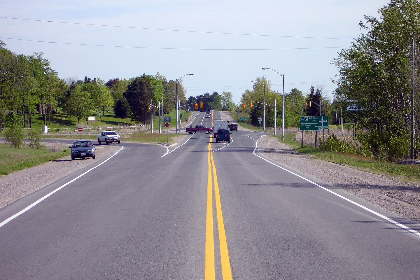
| Township of Cavan- Millbrook- North Monaghan County of Peterborough |
Easterly view along Highway 7 approaching the
Lansdowne Street intersection. Lansdowne Street is one of the principle
arterial roads through southern Peterborough. Photo taken: May 30th, 2012 |
 |
||
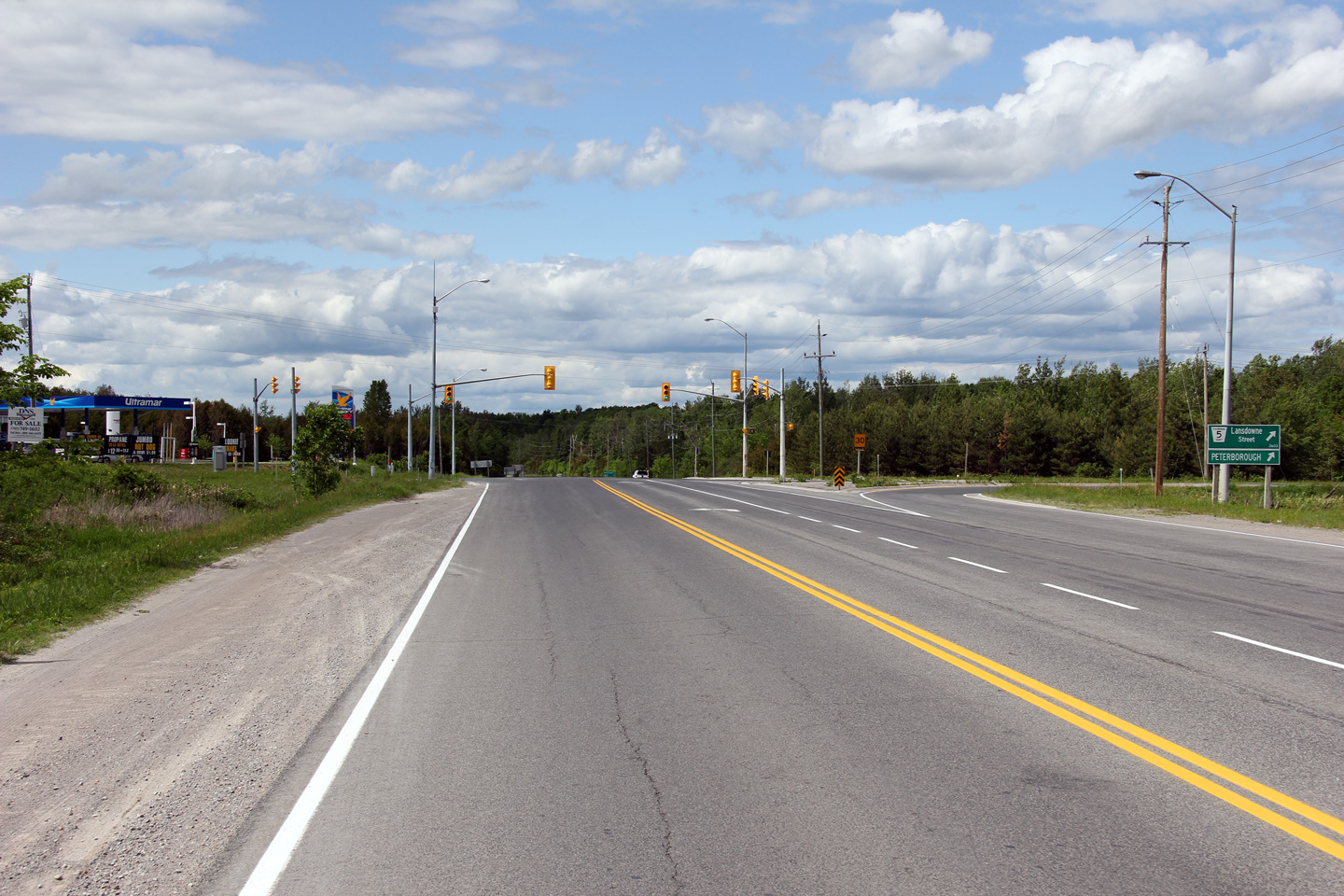
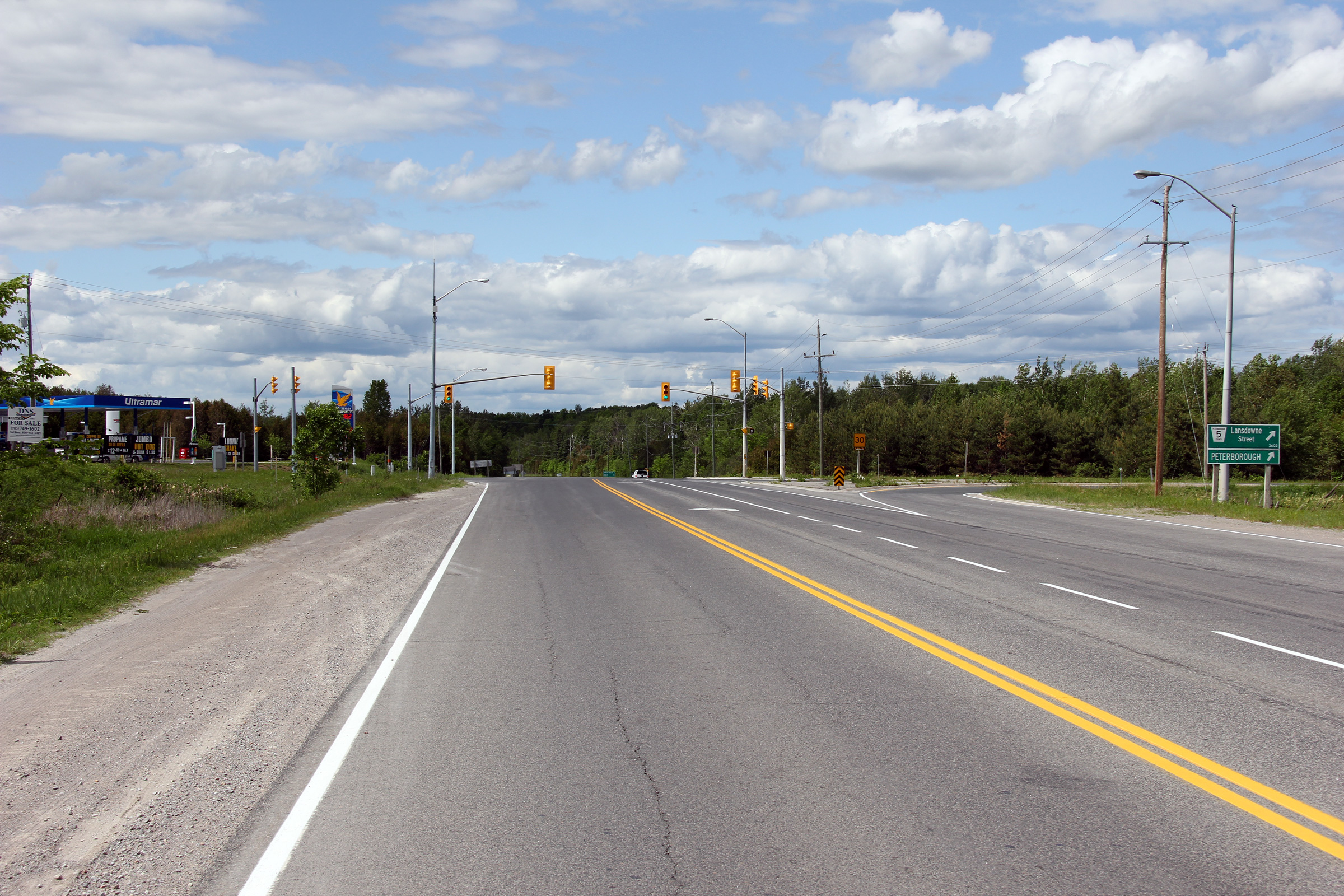
| Township of Cavan- Millbrook- North Monaghan County of Peterborough |
View looking westerly at the Lansdowne Street
intersection. For several decades, Lansdowne Street was a provincial
highway at times carrying the Highway 7A and 28 designation. Photo taken: May 30th, 2012. |
 |
||
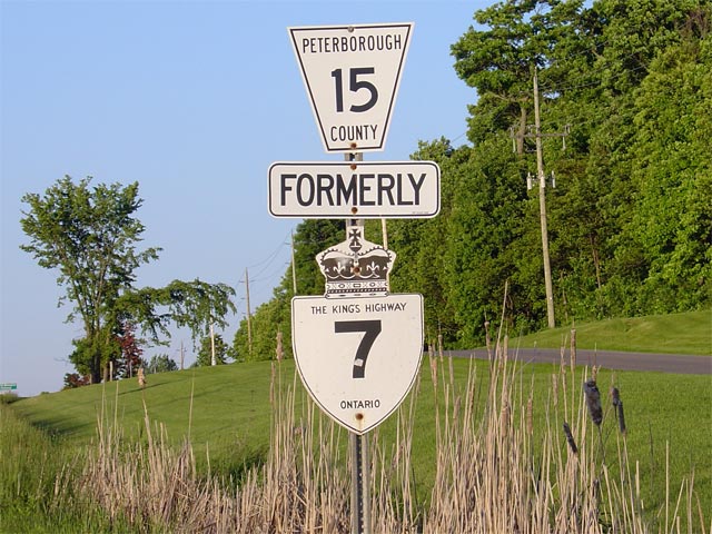
| Township of Cavan- Millbrook- North Monaghan County of Peterborough |
Looking southerly along Highway 7 towards the
Peterborough Road 15 junction at Scott's Corners. Prior to 1998, Highway 7 followed Peterborough Road 15
easterly into Peterborough. From 1998 to 2003, this
intersection actually represented the eastern terminus of the central
segment of
Highway 7. Since 2003, from this junction, Highway 7 continues southerly
(along a former segment of Highway 7A)
to meet Highway 115. Photo taken: May 24th, 2006. |
 (720x480) (1440x960) |
||
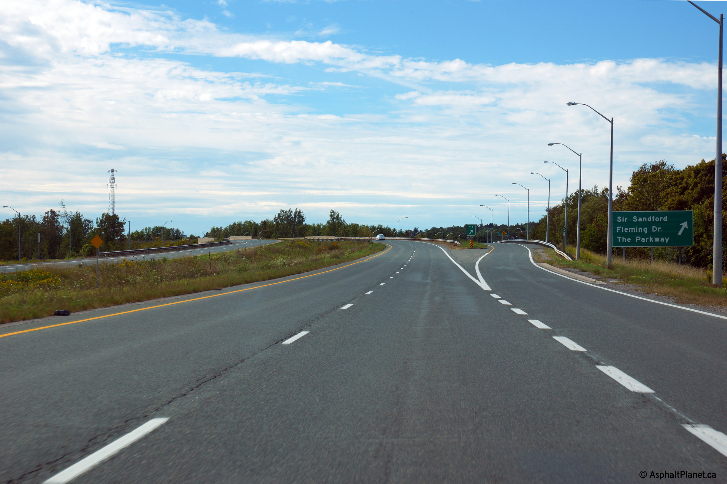
| Township of Cavan- Millbrook- North Monaghan County of Peterborough |
January 1st, 1998 saw Highway 7 downloaded
between the Highway 7A junction at Scott's Corners and the Highway
28/115
interchange. This lone formerly 7 sign is the last
reference to the now defunct section of Highway 7 southwest of Peterborough.
The old alignment now has two names, outside of the City of Peterborough it
is known as Peterborough County Road 15, while inside the city limits the
route is known as Sir Sandford Fleming Drive. Photo taken: June 3rd, 2004. |
 |
||
| Township of Cavan- Millbrook- North Monaghan County of Peterborough |
Looking north along Highway 7 towards the
Peterborough Road 15 intersection at Scott's Corners. Before 2003, this portion of
Highway 7 was designated as part of Highway 7A. This intersection
represented the northern (eastern) terminus of Highway 7A. Highway 7A
now ends 8km southwest of this junction at the western
Highway 115
interchange. Photo taken: May 24th, 2006. |
 (720x480) (1440x960) |
||
| Township of Cavan- Millbrook- North Monaghan County of Peterborough |
Highway 7 looking south towards Springville and
Highway 115 from just south of the
Peterborough Road 15 intersection. Photo taken: June 3rd, 2004. |
 (720x480) (1440x960) |
||
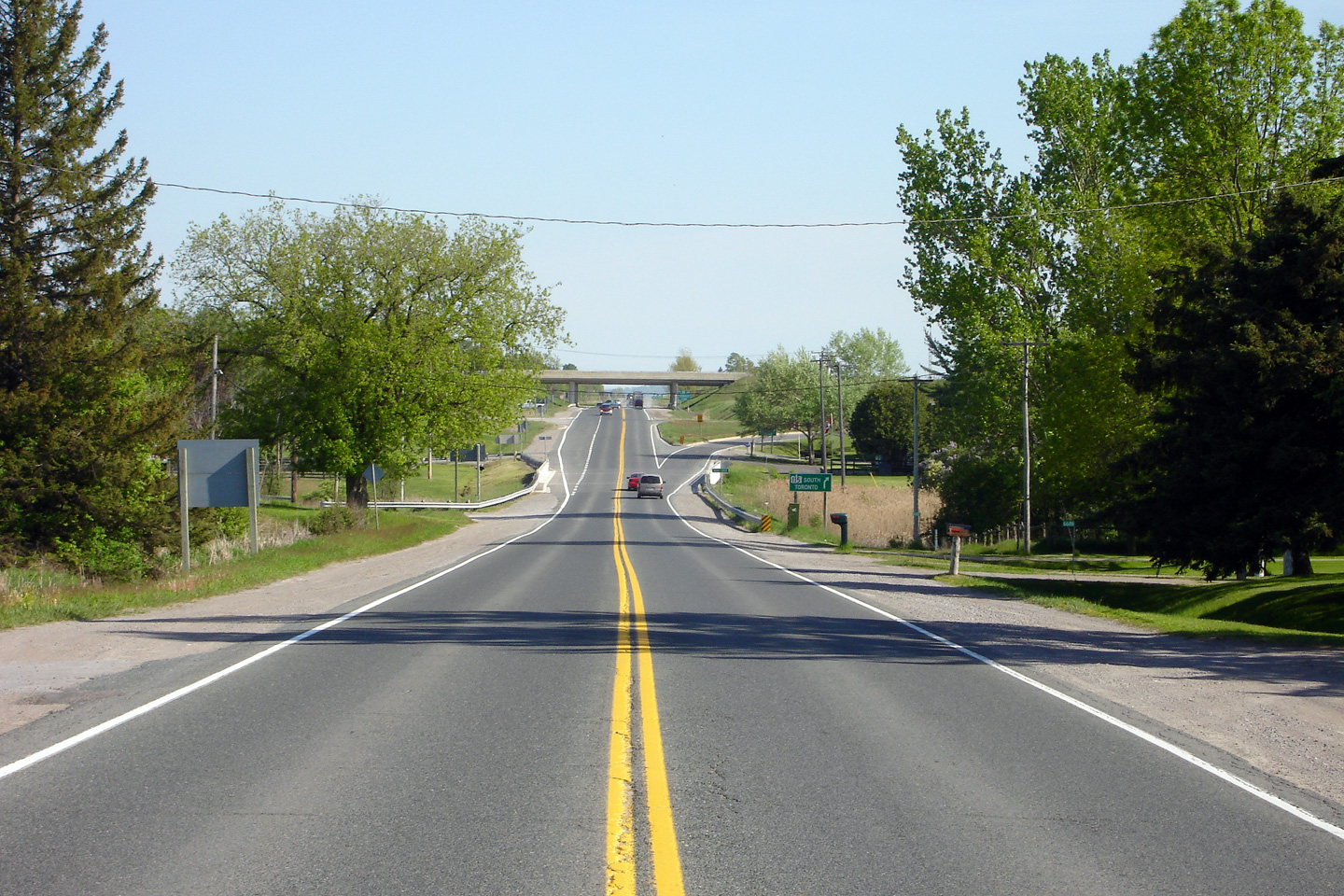
| Township of Cavan- Millbrook- North Monaghan County of Peterborough |
Signage assembly along Highway 7 west of the
Highway 115. Before a 2003 renumbering, the leg of Highway 7 through
Springville was included in Highway 7A's alignment. Before 2003,
Highway 7 followed Peterborough Road 15 to access Highway 115. Photo taken: June 14th, 2012. |
 (720x480) (720x480)(1440x960) |
||
| Township of Cavan- Millbrook- North Monaghan County of Peterborough |
Looking southerly towards the
Highway 115 interchange from just south of
Springville. Photo taken: May 24th, 2006. |
 (720x480) (1440x960) |
||
| Township of Cavan- Millbrook- North Monaghan County of Peterborough |
Green sign denoting the southbound
Highway 115
ramp. Before 2003, southbound Highway 7A
traffic was also directed to use this ramp. At this point, Highway 7A's
cardinal direction changed from North-South to East-West. Photo size: 60kb. |
 |
||
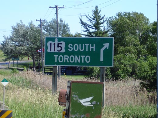
| Township of Cavan- Millbrook- North Monaghan County of Peterborough |
Green sign denoting the ramp to the northbound
115. Highway 7 also turns left at this ramp as it follows the
expressway to the eastern end of the 115.
Notice, as is typical in Ontario, no Trans-Canada Highway signage has been
erected to guide TCH traffic through this junction. Photo size: 50kb. |
 |
||
| Township of Cavan- Millbrook- North Monaghan County of Peterborough |
View of Highway 7 looking south under the
Highway 115 underpass. Straight
ahead, the former Highway 28 carries traffic
southerly to Port Hope. Unfortunately, no signs have been erected at
this junction denoting Highway 28. Photo taken: June 20th, 2006. |
 (720x480) (720x480)(1440x960) |
||
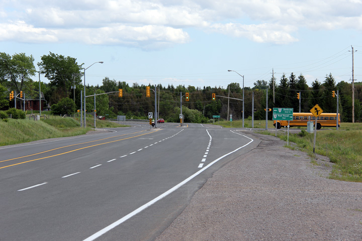
| Highway 7 meets Highway 115 and Highway 28 at an interchange southwest of Peterborough. Click here for Highway 28 images and here for Highway 115 images. | ||||
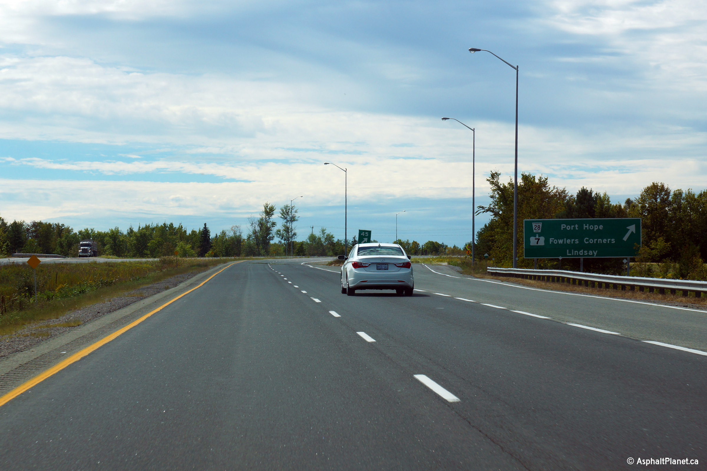
| Township of Cavan- Millbrook- North Monaghan County of Peterborough |
Turn-off signage for the Highway 7/28 interchange. Photo taken: September 9th, 2013. |
 (720x480) (720x480)(1440x960) (2400x1600) |
||
| Township of Cavan- Millbrook- North Monaghan County of Peterborough |
Westbound advanced signage for the Highway 7/28 interchange. Photo taken: September 9th, 2013. |
 (720x480) (720x480)(1440x960) (2400x1600) |
||
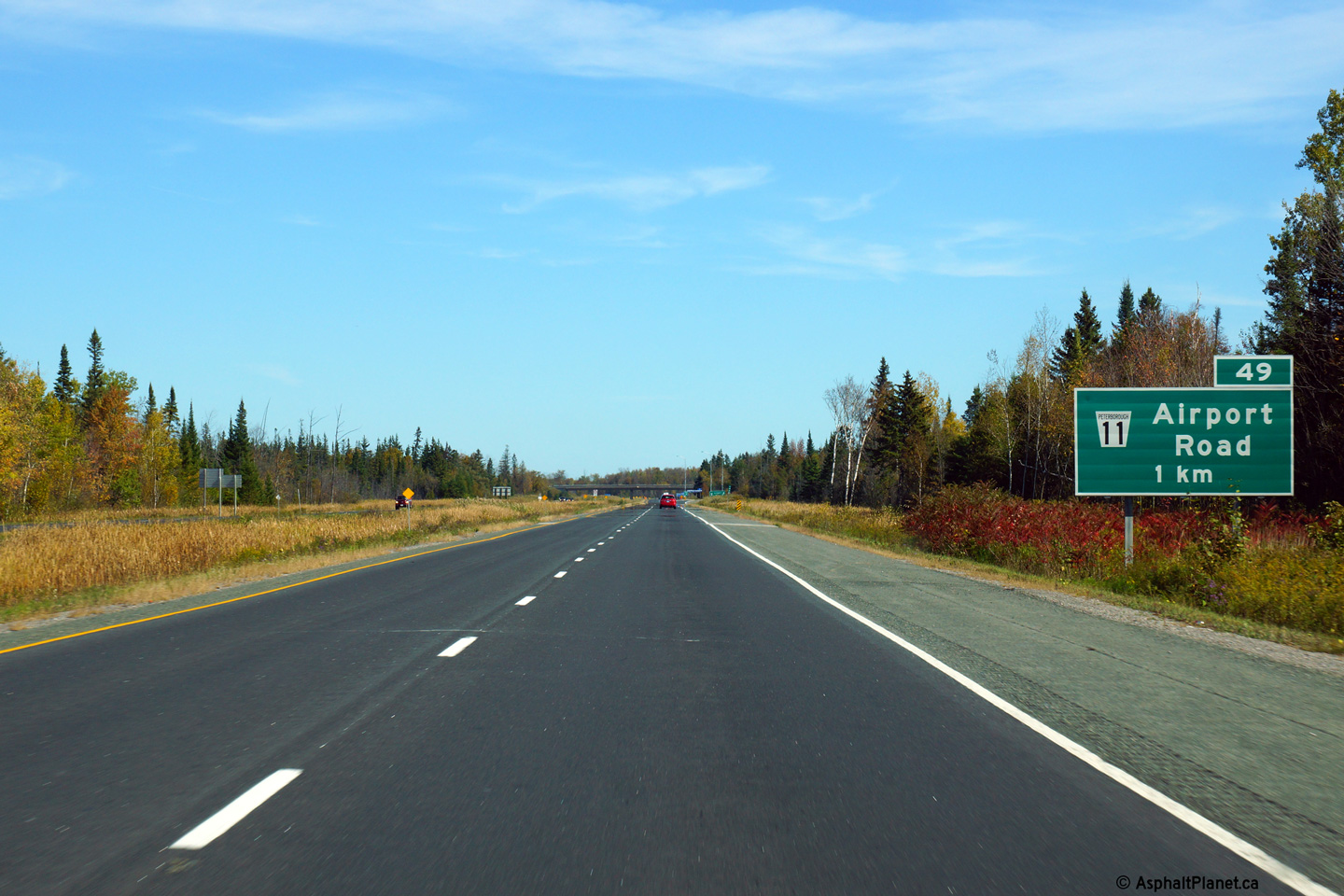
| Township of Cavan- Millbrook- North Monaghan County of Peterborough |
Advanced signage for the north/east-bound off-ramp to Airport Road. Photo taken: October 3rd, 2013. |
 (720x480) (720x480)(1440x960) (2400x1600) |
||
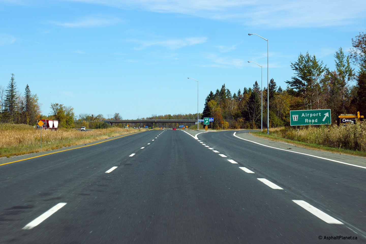
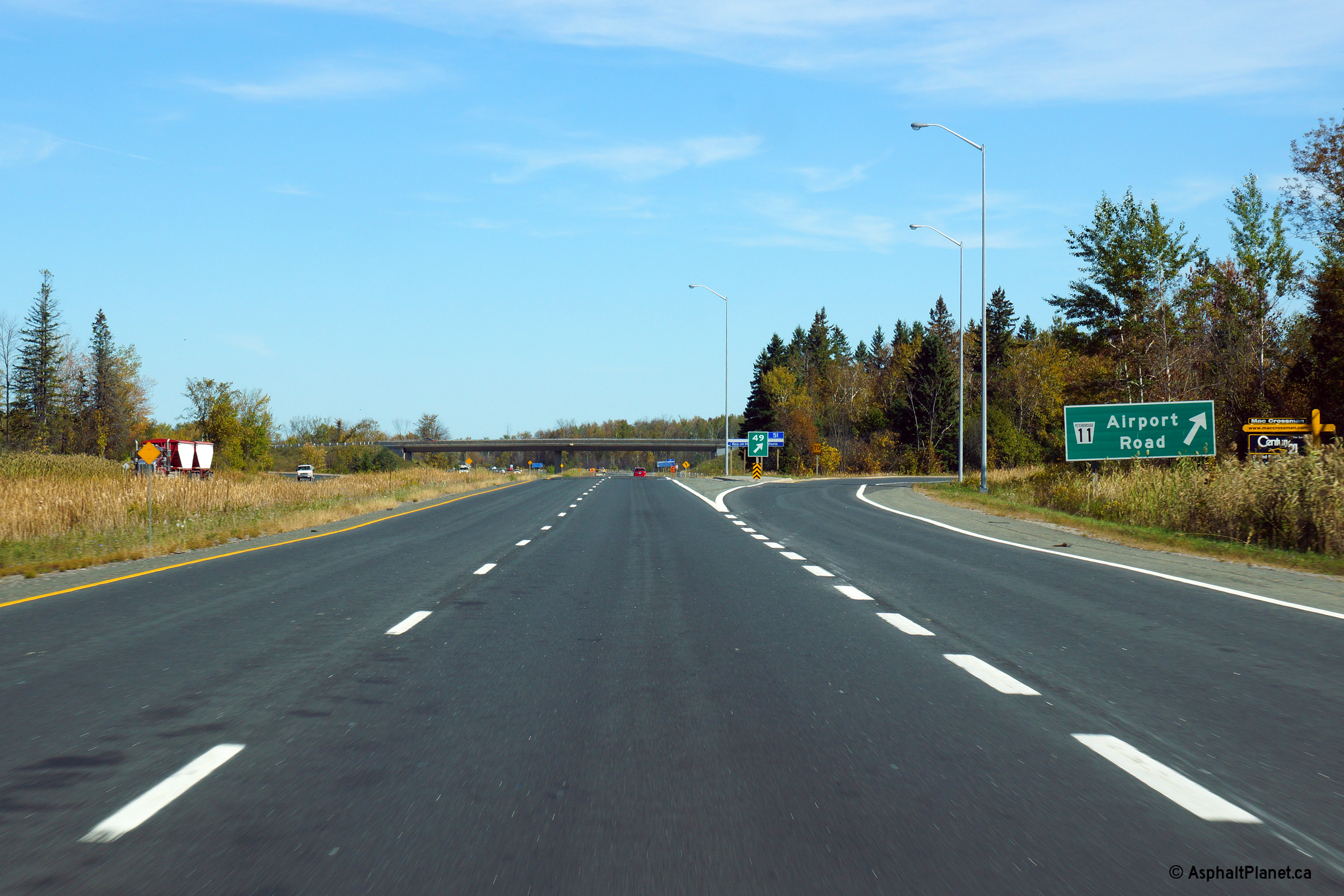
| Township of Cavan- Millbrook- North Monaghan County of Peterborough |
Turn-off signage at the north/east-bound ramp to Airport Road. Photo taken: October 3rd, 2013. |
 (720x480) (720x480)(1440x960) (2400x1600) |
||
| Township of Cavan- Millbrook- North Monaghan County of Peterborough |
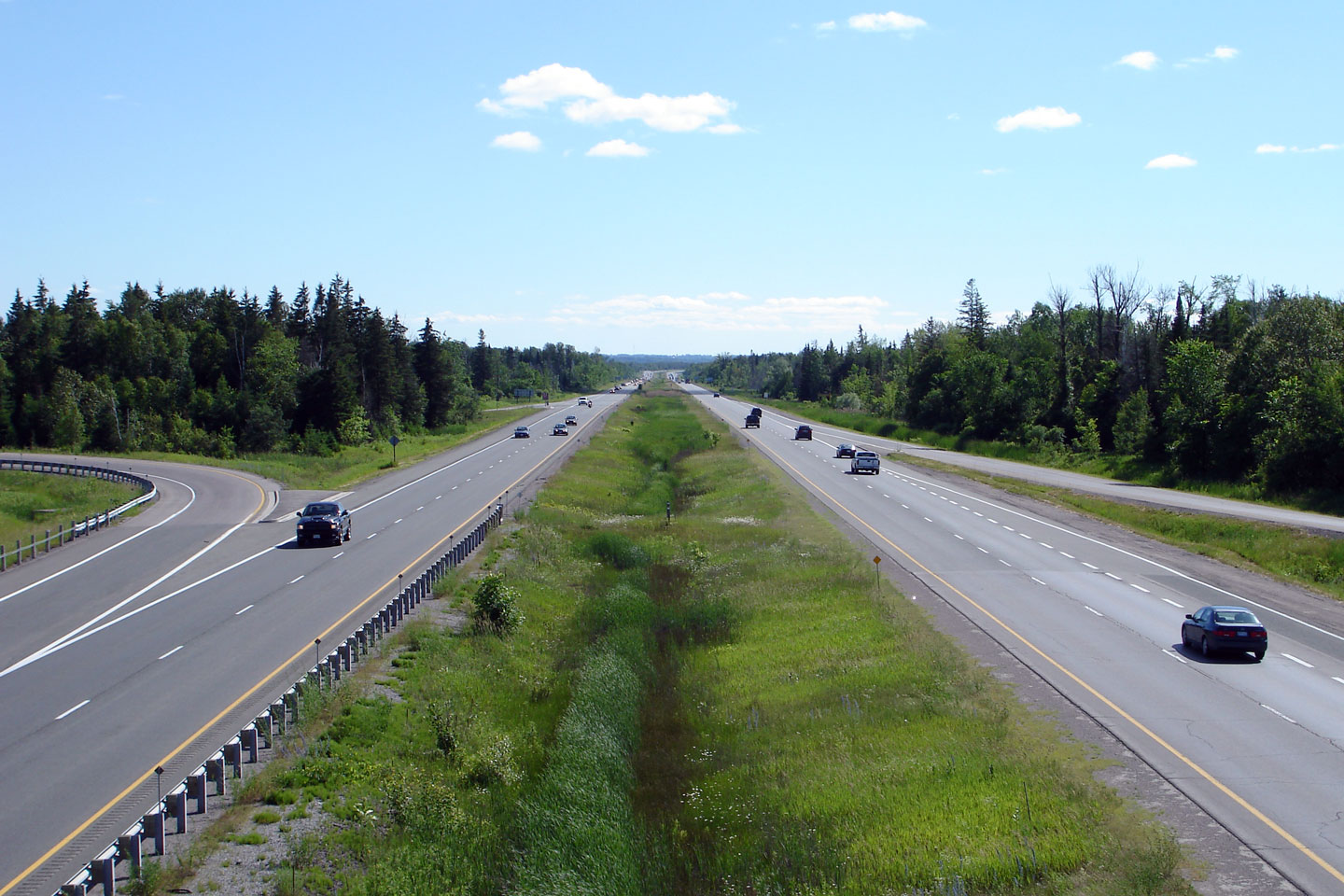
This Photo shows Highway 7/115 looking south/west bound from the Airport Road overpass. Airport Road is the only standard 'Parclo A4' interchange to be located along Highway 115; this is notable as the Parclo A4 is by far Ontario's most common interchange design. Photo taken: June 20th, 2006. |
 |
||
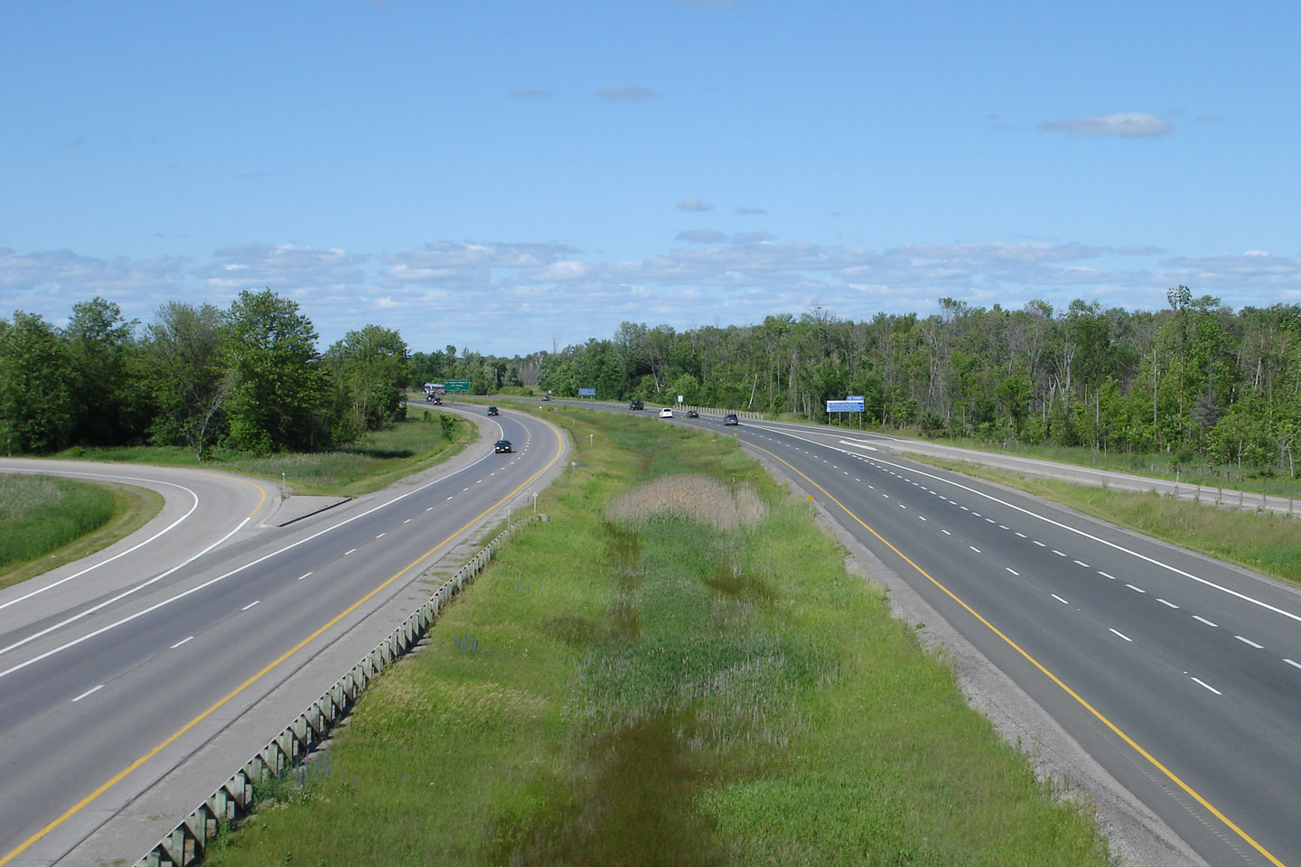
| Township of Cavan- Millbrook- North Monaghan County of Peterborough |
Looking northeast towards Peterborough along
Highway 7/115 from the Airport Road
interchange. Peterborough's southwest city limit is located just
northeast of Airport Road. Photo taken: June 20th, 2006. |
 |
||
| City of Peterborough | City limits signage for the city of
Peterborough. Photo taken: July 19th, 2013. |
 (720x480) (720x480)(1440x960) |
||
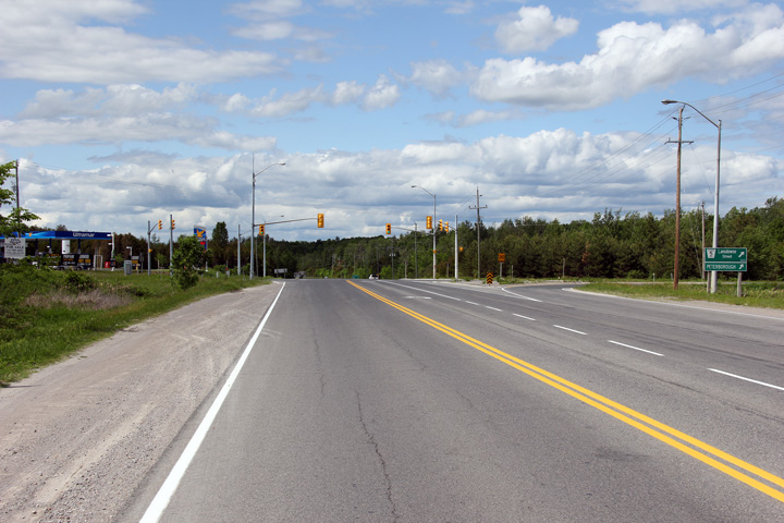
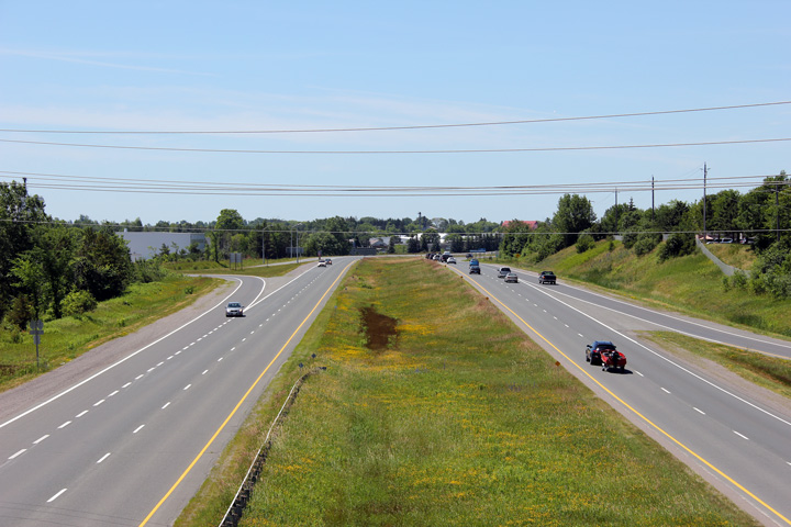
| City of Peterborough | Easterly view along Highway 7/115 from the
Parkway interchange. The high level Otonabee River bridges are visible
in the distance of this photo. Photo taken: June 14th, 2013. |
 |
||
| City of Peterborough | Westbound signage approaching the Sir Sandford
Fleming Drive and Parkway interchanges. Before 1998, Highway 7 exited
the divided highway and followed today's Sir Sandford Fleming Drive
alignment. Highway 28 was signed through Peterborough following the
Parkway, and continued concurrent with Highway 115 south of this
interchange. Photo taken: September 9th, 2013. |
 (720x480) (720x480)(1440x960) (2400x1600) |
||
| City of Peterborough | Advanced signage for the Sir Sandford Fleming
Drive and Parkway interchanges. Photo taken: September 9th, 2013. |
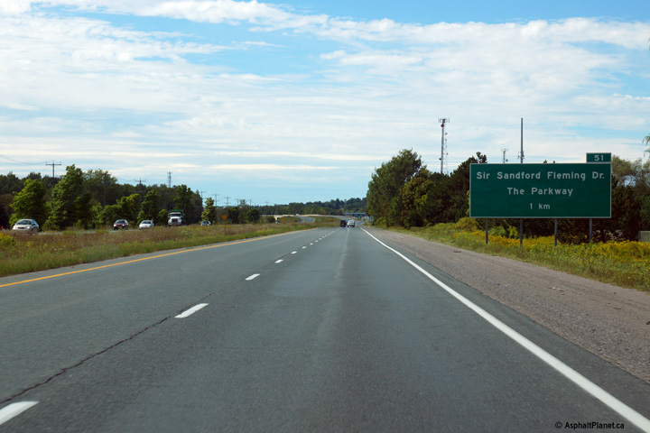 (720x480) (720x480)(1440x960) (2400x1600) |
||
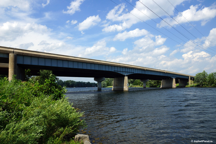
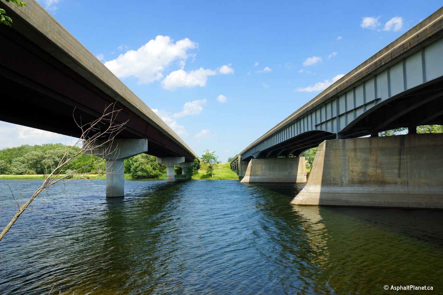
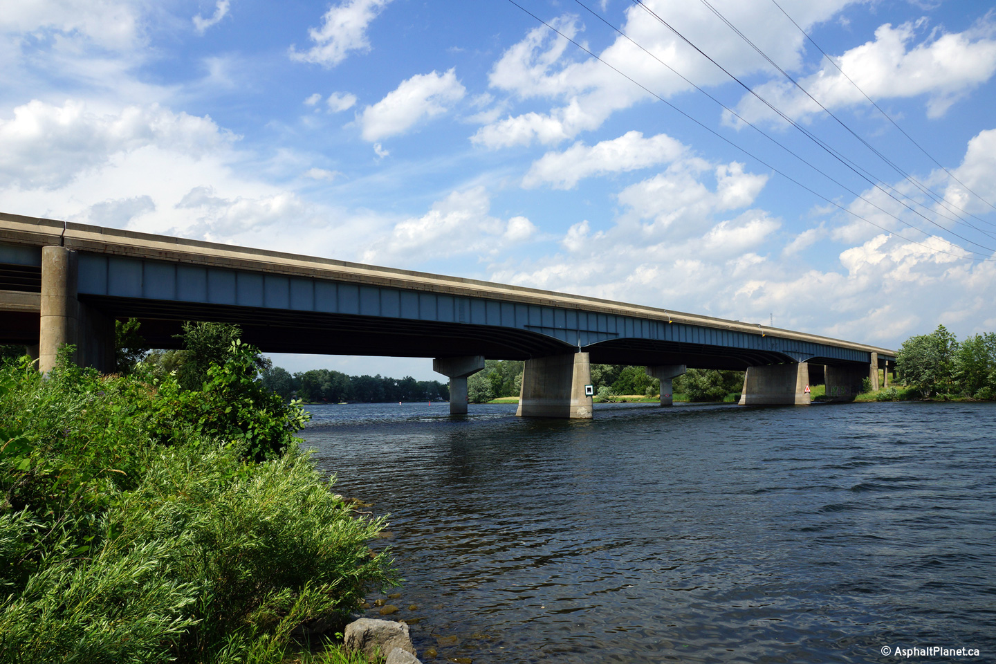
| City of Peterborough | Easterly view beneath the Otonabee River
bridges. The right hand structure (today's eastbound lanes) was completed
during the mid-1950s. The left hand structure (today's westbound lanes) was
later added during a twinning project in the early 1980s. Photo taken: July 19th, 2013. |
 |
||
| City of Peterborough | View looking northerly towards the Otonabee
River bridges. Steel bridge designs advanced considerably during
the 30 years between the construction of the eastbound structure and newer
structure. Photo taken: July 19th, 2013. |
 |
||
| City of Peterborough | Westerly view along Highway 7/115 from the
Ashburnham Road overpass. Photo taken: July 3rd, 2011. |
|||
| City of Peterborough | Easterly view from the Ashburnham Road
overpass. Immediately east of the Ashburnham Road overpass, Highway 7/115
crosses overtop of a railway spur that is formerly the mainline of a railway that stretched
easterly from Peterborough to Belleville. Photo taken: July 3rd, 2011. |
 (720x480) (1440x960) (2400x1600) |
||
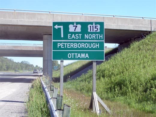
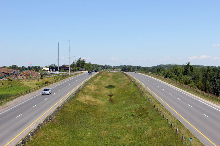
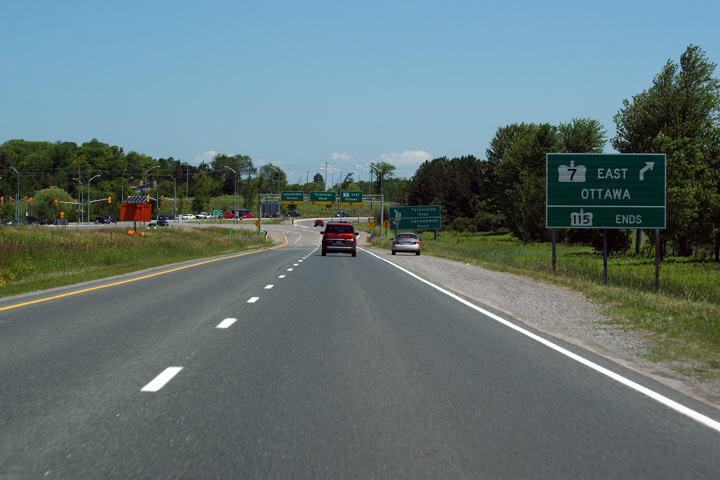
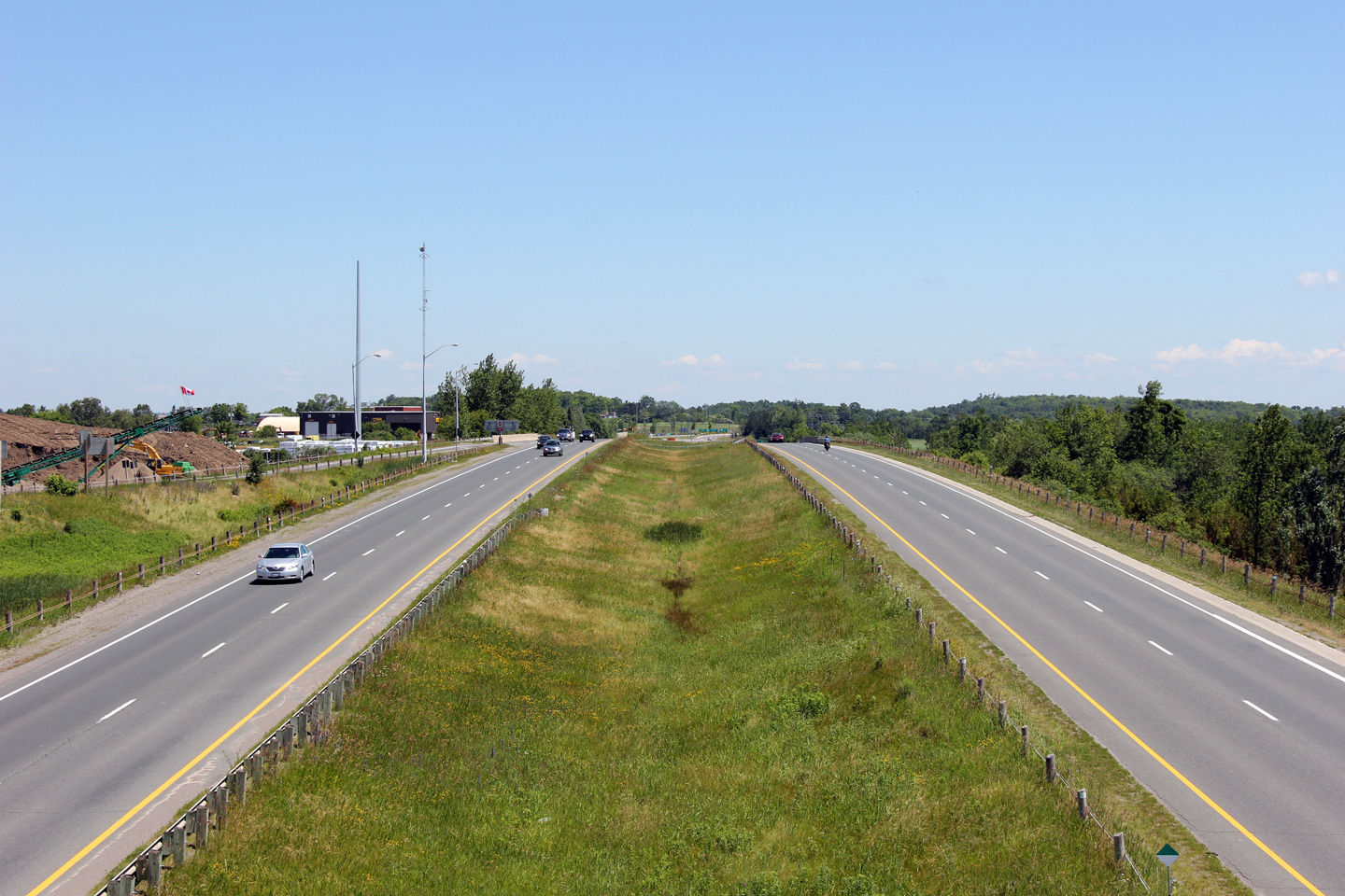
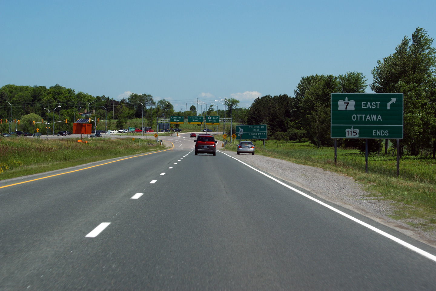
| City of Peterborough | Easterly view approaching the end of the Highway
7 freeway, and the end of Highway 115. Photo taken: July 3rd, 2011. |
 (720x480) (720x480)(1440x960) (2400x1600) |
||
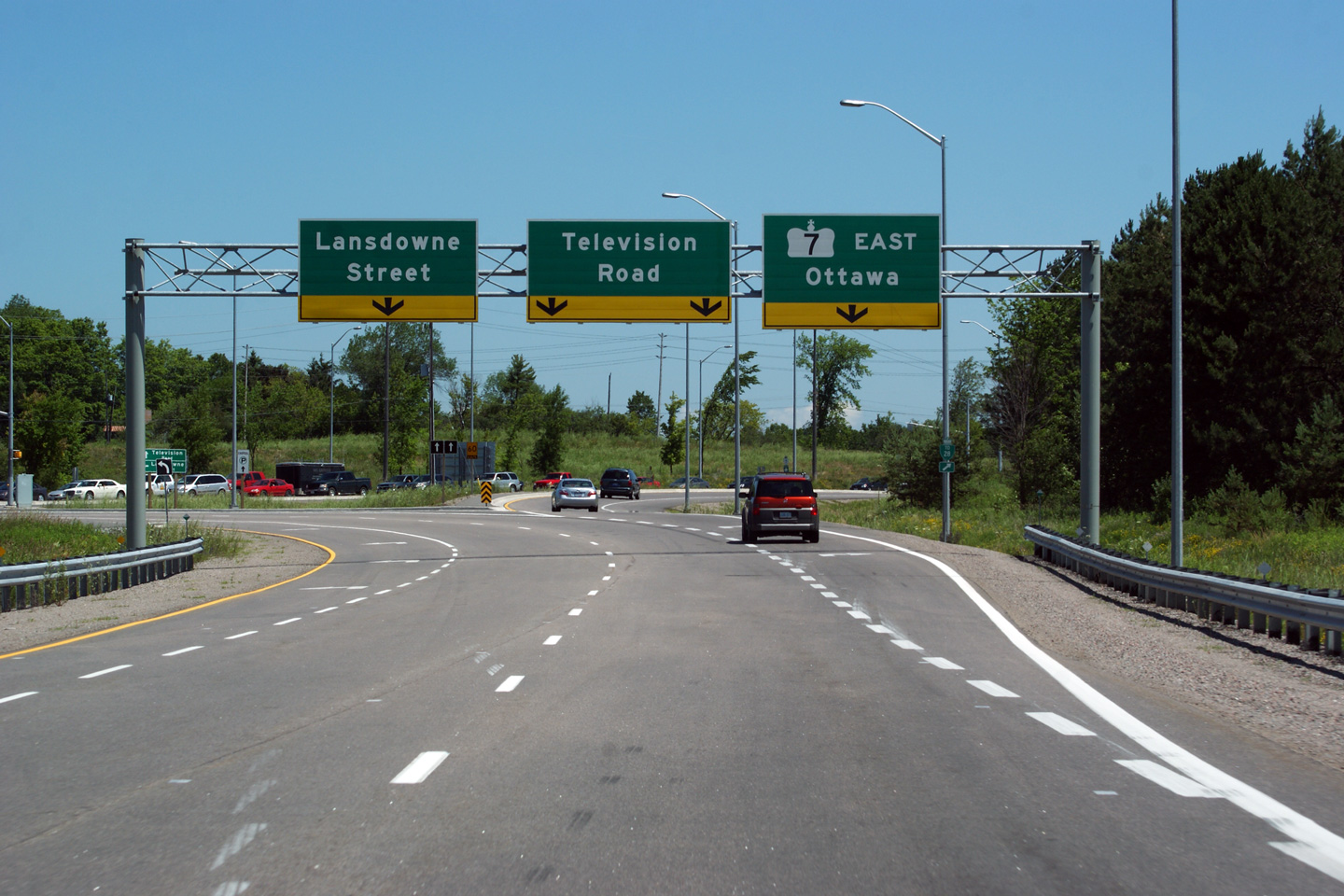
| City of Peterborough | Highway 7 exits to the right at this final
intersection along Highway 115. Lansdowne Street is the former
alignment of Peterborough's Highway 7B. Photo taken: July 3rd, 2011. |
 (720x480) (720x480)(1440x960) (2400x1600) |
||
| Peterborough to Ottawa Images available here | ||||
<- Page 2D Images Highway 7 Images Index Page 3B Images ->
<- Highway 6 Images Back to Highway 7 - Page 3 Highway 7A Images ->
Copyright (c) 2004-2014, Scott Steeves (Webmaster) AsphaltPlanet@asphaltplanet.ca

