|
|
Virtual Tour of Highway 115 - See Below
|
AsphaltPlanet.ca > OntHighways >
Highway 1115 > Images
King's Highway 115 - Images
|
|
Virtual Tour of Highway 115 - See Below
|
Virtual Tour of Highway 115:
Photos shown in this table are arranged from South to North:
| Proper Municipality Name | Photo Description | Photo | |
|
Photos taken from driver's perspective appear offset from centre-line Photos: |
North- bound |
South- bound |
|
| Highway 401 is Southern Ontario's major east-west freeway. Click here for Highway 401 images. | |||
| Municipality of Clarington Regional Municipality of Durham |
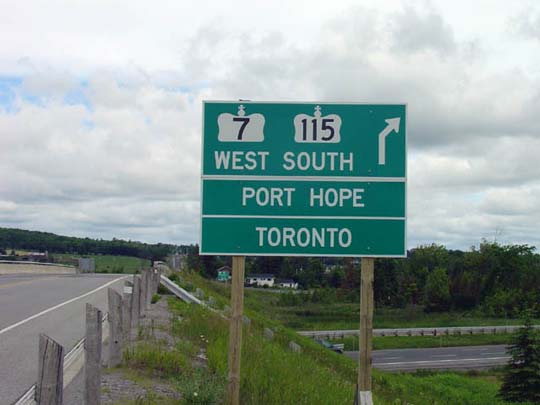
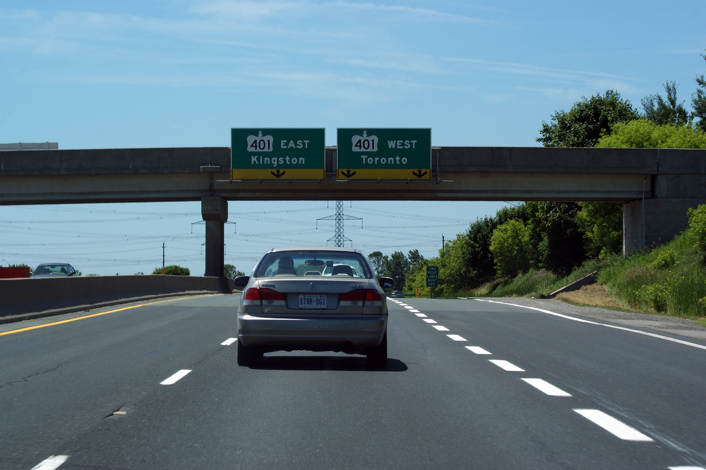
This Photo shows the southern terminus of Both Highway 35 and 115. This section of 35/115 was part of the original Highway 401 for a brief period; when the 401 was extended eastwards towards Port Hope, this section of 401 became incorporated at first into a Highway 35 extension, and later a Highway 35/115 extension. Photo taken: July 3rd, 2011. |
|
|
| Municipality of Clarington Regional Municipality of Durham |
Driving south on the 35/115 at the Lovkin
Road overpass. Lovkin Road is located about 800m north of the Highway 401 interchange. As visible in the
photo, the overhead signage for
the upcoming Highway 401 interchange is affixed to the Lovkin Road overpass. Photo taken: July 3rd, 2011. |
 (720x480) (720x480)(1440x960) (2400x1600) |
|
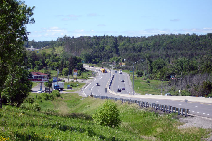
| Municipality of Clarington Regional Municipality of Durham |
Highway 35/115 looking north from the Lovkin Road overpass. This photo showcases the rather substandard Lovkin Road RIRO interchange.
Photo taken: July 3rd, 2011. |
|
|
|
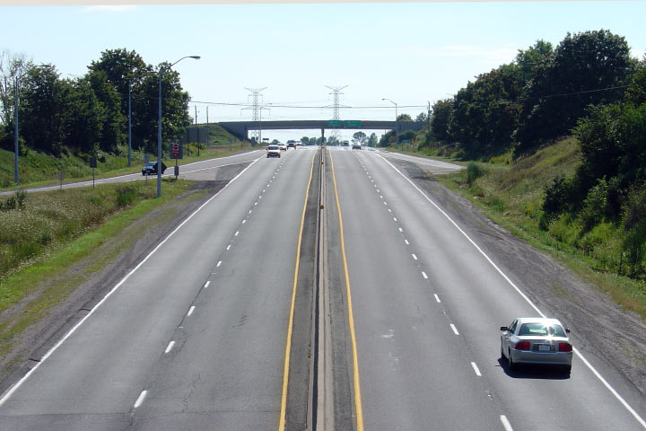
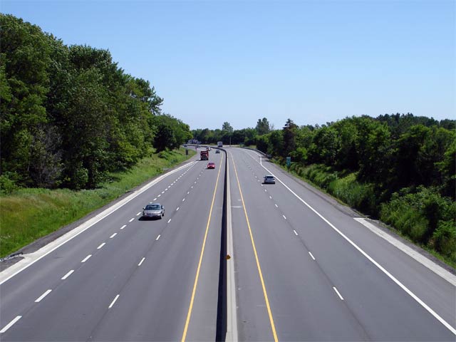
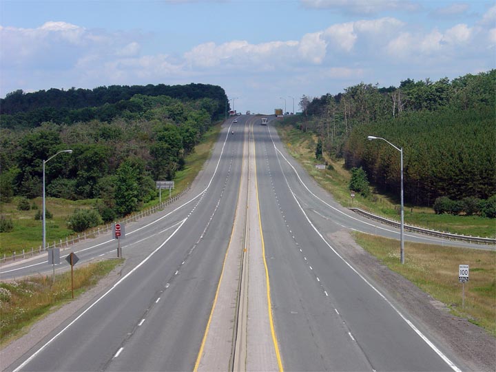
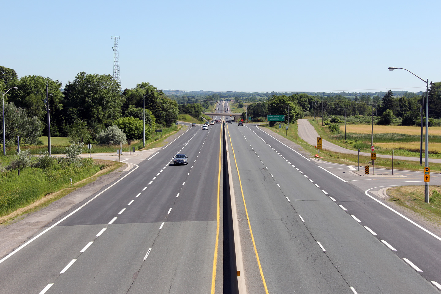
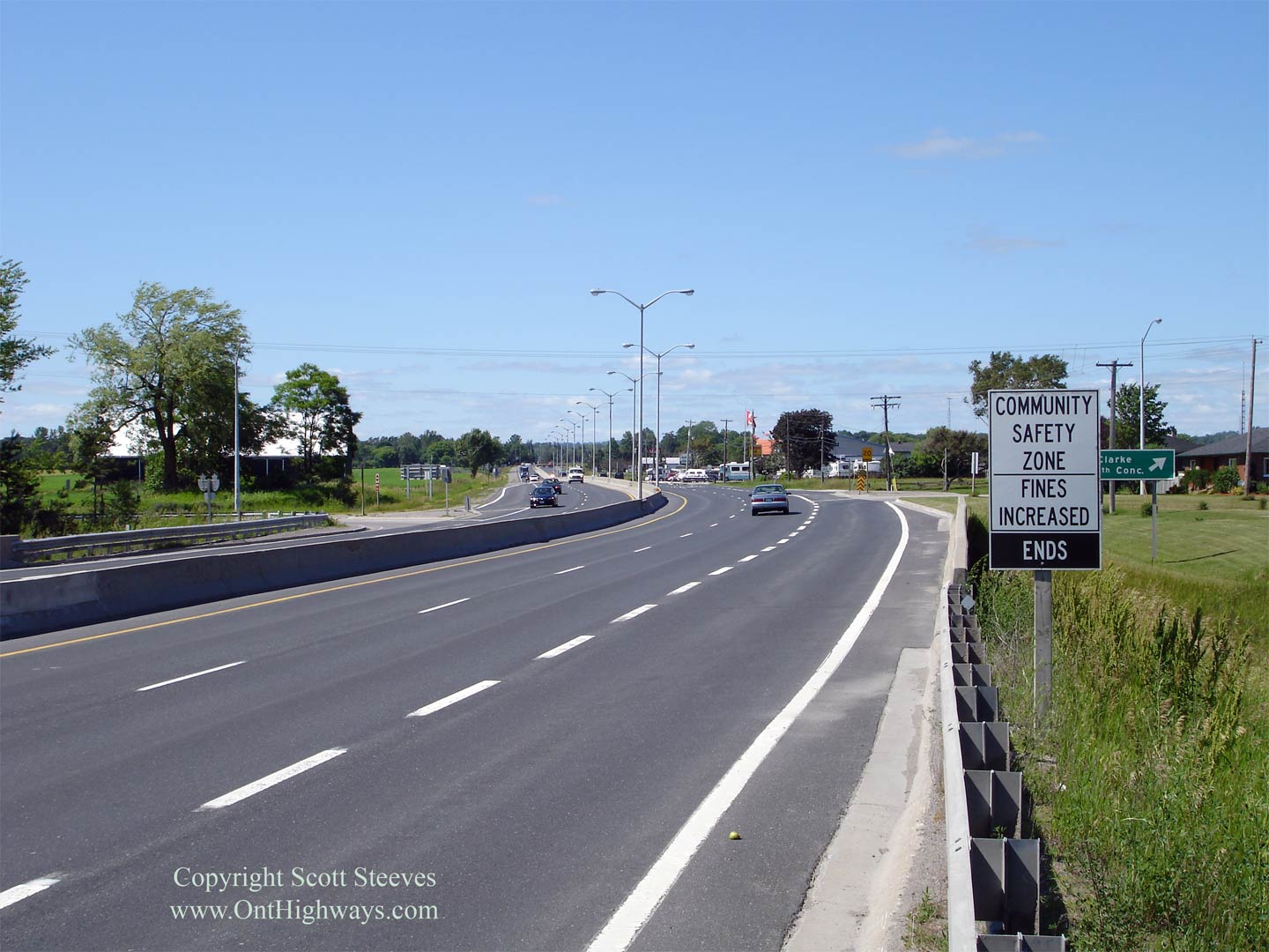
Municipality of Clarington Regional Municipality of Durham |
Looking south towards Highway 401 from the
Highway 2 overpass. The
Highway 2 overpass was constructed in 1952 with a very narrow span. Photo taken: September 1st, 2004. Low-res: 50kb. |
 |
|
| Highway 2 follows the 401 in close proximity through Durham and Northumberland. Click here for Highway 2 images. | |||
|
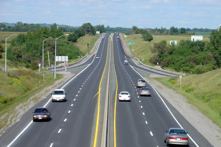
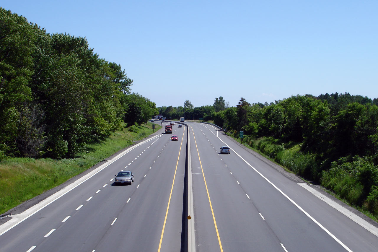
Municipality of Clarington Regional Municipality of Durham |
Looking north along Highway 35/115 from the
Highway 2 overpass. Before Highway 401 was extended to just west of
Newcastle, Highway 35 ended in Downtown Newcastle following today's Mill
Street south from Orono. The diversion from Concession Road 3 to Highway 2 opened in 1956, as a limited access two-lane highway that was
later 4-laned in the 1980s. Photo taken: September 1st, 2004. Low-res: 60kb. |
 |
|
|
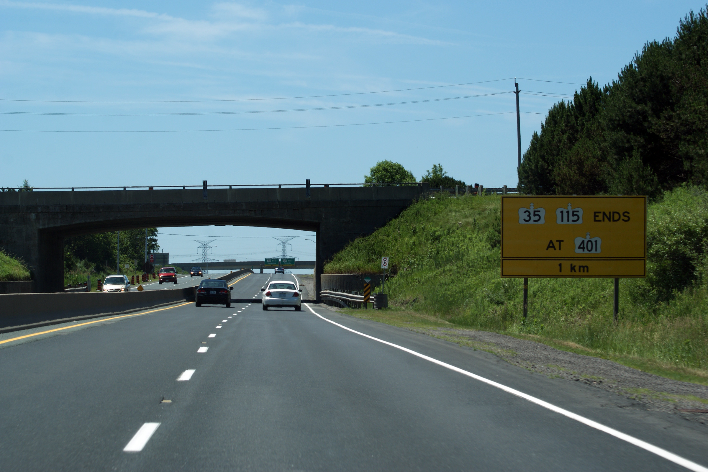
Municipality of Clarington Regional Municipality of Durham |
This photo shows the sign that denotes the southern terminus of both Highway 35/115. This sign is located just south of the Highway 2 overpass (which is also shown in the photo).
Photo taken: July 3rd, 2011. |
||
|
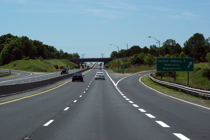
Municipality of Clarington Regional Municipality of Durham |
Southbound view as the ramp to (Durham) Highway 2 leaves the RIRO expressway. The 35/115 meets Highway 2 at a diamond interchange. A careful observation of the interchange from ground level reveals the historical footprint of a four-ramp parclo A2 interchange, that was likely re-incarnated into its current diamond configuration when Highway 35/115 was widened to four lanes in the 1980s. Photo taken: July 3rd, 2011. |
 |
|
|
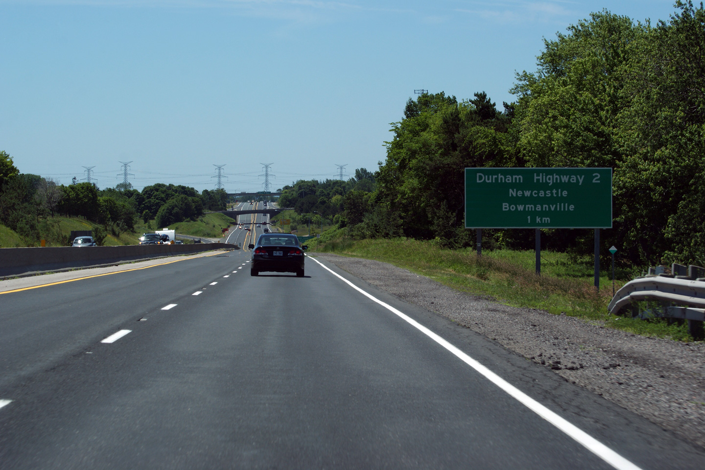
Municipality of Clarington Regional Municipality of Durham |
Southbound view of Highway 35/115 at the one kilometre advanced sign for Durham Highway 2.
Photo taken: July 3rd, 2011. |
 (720x480) (720x480)(1440x960) (2400x1600) |
|
|
Municipality of Clarington Regional Municipality of Durham |
Northerly view from the Concession 4 interchange. Photo taken: June 20th, 2006. Low-res: 45kb. High-res: 195kb. |
 |
|
|
Municipality of Clarington Regional Municipality of Durham |
Southbound view from Clark Road 5. Photo taken: June 20th, 2006. Low-res: 65kb. High-res: 185kb. |
 |
|
|
Municipality of Clarington Regional Municipality of Durham |
Highway 35/115 looking north from the Clarke Road 5 overpass. Orono was bypassed years before Highway 35/115 was 4-laned. Photo taken: June 20th, 2006. Low-res: 45kb. High-res: 185kb. |
 |
|
|
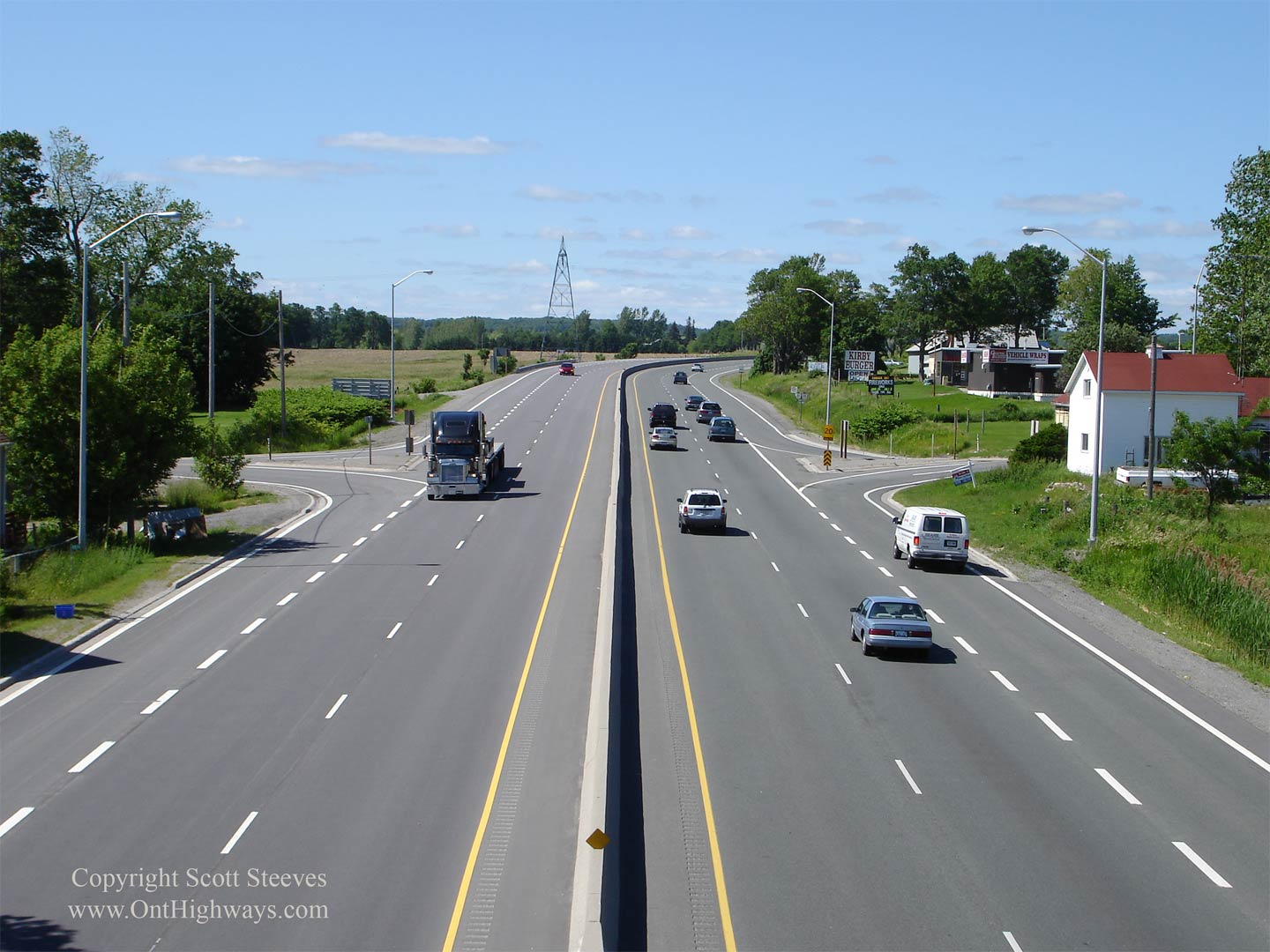
Municipality of Clarington Regional Municipality of Durham |
Southerly view from the Ganaraska Road overpass in Kirby Photo taken: June 20th, 2006. Low-res: 55kb. High-res: 165kb. |
 |
|
|
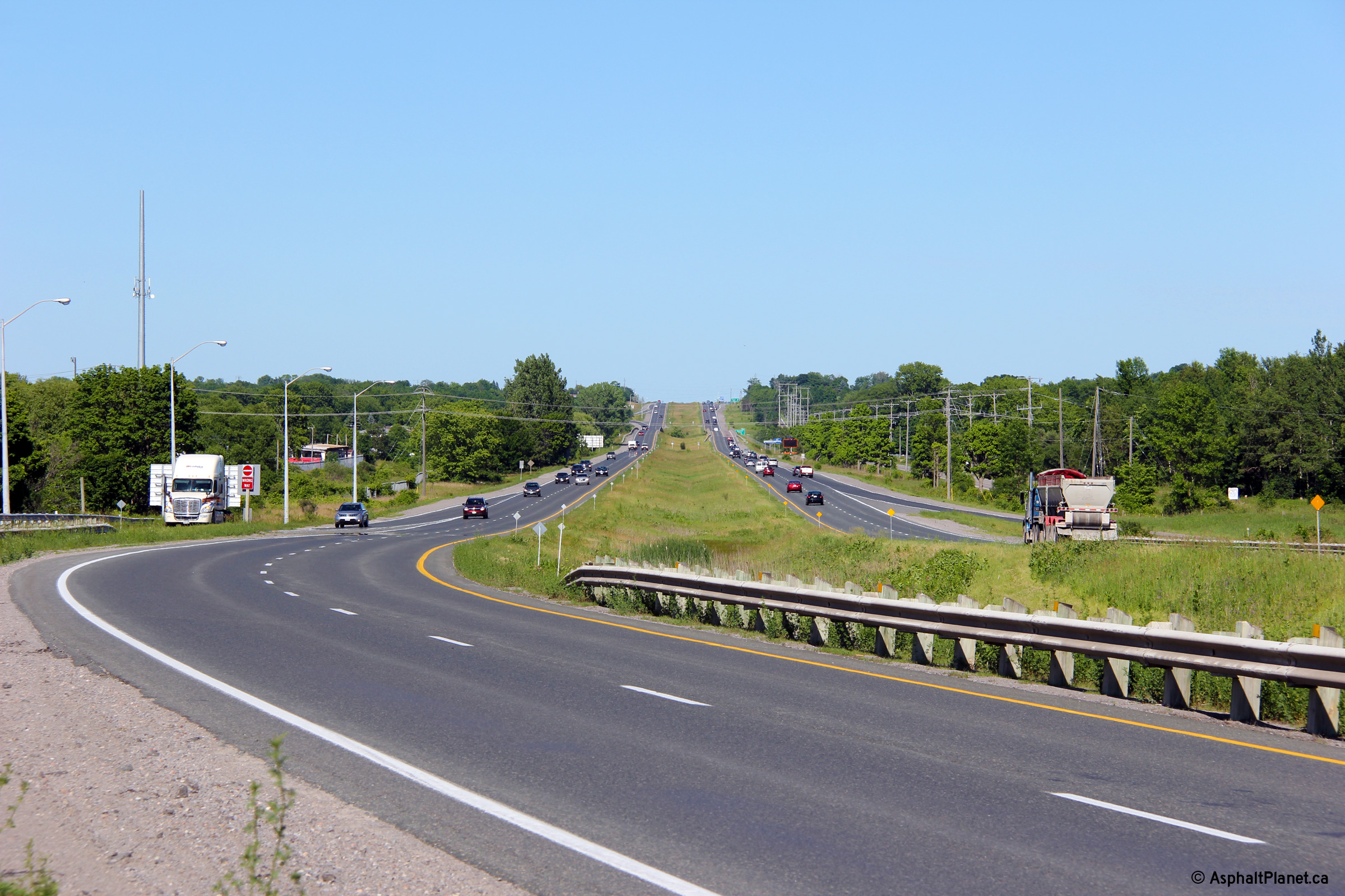
Municipality of Clarington Regional Municipality of Durham |
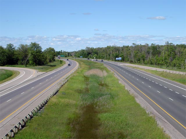
This Photo shows Highway 35/115 looking north from the Ganaraska Road overpass in Kirby. This Photo shows a good example of the shortcomings of a RIRO-type expressway. As you can see from the photo, the actual 'interchanges' are very low standard, typically having ramp speeds of 20km/h. Photo taken: June 20th, 2006. Low-res: 40kb. High-res: 190kb. |
|
|
| Municipality of Clarington Regional Municipality of Durham |
Looking south from the Concession Road 8 overpass. Photo taken: June 20th, 2006. Low-res: 55kb. High-res: 165kb. |
 |
|
| Municipality of Clarington Regional Municipality of Durham |
Looking north from Concession Road 8. Photo taken: June 20th, 2006. Low-res: 65kb. High-res: 180kb. |
 |
|
| Municipality of Clarington Regional Municipality of Durham |
Northbound view approaching Enterprise Hill. Photo taken: June 20th, 2006. Low-res: 100kb. High-res: 300kb. |
 |
|
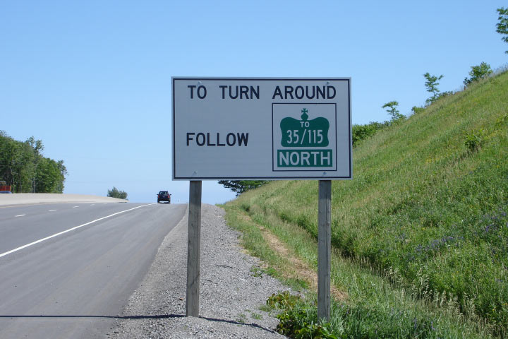
| Municipality of Clarington Regional Municipality of Durham |
White signage directing traffic to turnarounds along the expressway. Photo taken: June 20th, 2006. Low-res: 70kb. |
 |
|
| Municipality of Clarington Regional Municipality of Durham |
Signage for the upcoming Highway 35 split
from the northbound 35/115 approaching
Enterprise Hill. Photo taken: June 20th, 2006. Low-res: 50kb. |
 |
|
| Municipality of Clarington Regional Municipality of Durham |
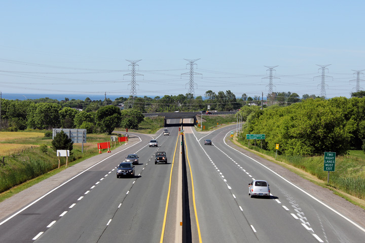
Looking south from the top of Enterprise Hill along the expressway. Photo taken: June 20th, 2006. Low-res: 85kb. High-res: 260kb. |
 |
|
| Municipality of Clarington Regional Municipality of Durham |
This Photo shows Highway 35/115 looking south from the Highway 35 overpass. Traffic heading SB on Highway 35 enters the expressway from the slip ramp shown on the right.
Photo taken: June 20th, 2006. Low-res: 50kb. High-res: 135kb. |
|
|
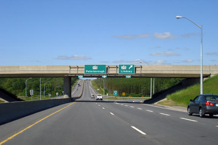
| Municipality of Clarington Regional Municipality of Durham |
Highway 35/115 at the Enterprise Hill split. At this trumpet, Peterborough-bound traffic stays in the through freeway lanes, where Lindsay-bound departs around the loop ramp northwards. Unfortunately, due to the terrain near the interchange, traffic heading NB on Highway 35 must slow to 30km/h to navigate the loop ramp. Photo taken: June 20th, 2006. Low-res: 40kb. High-res: 190kb. |
 |
|
| Highway 35 departs the freeway at this interchange bound for Lindsay. Click here for Highway 35 images. | |||
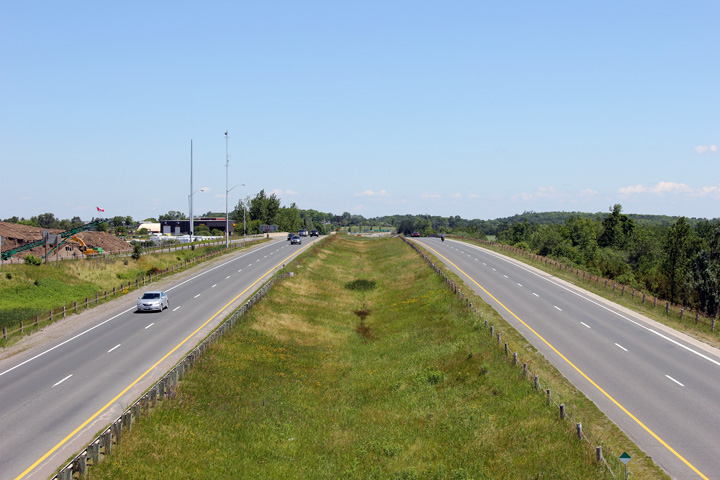
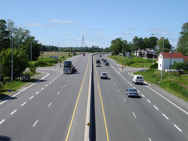
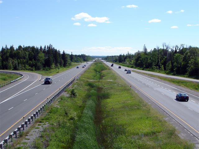
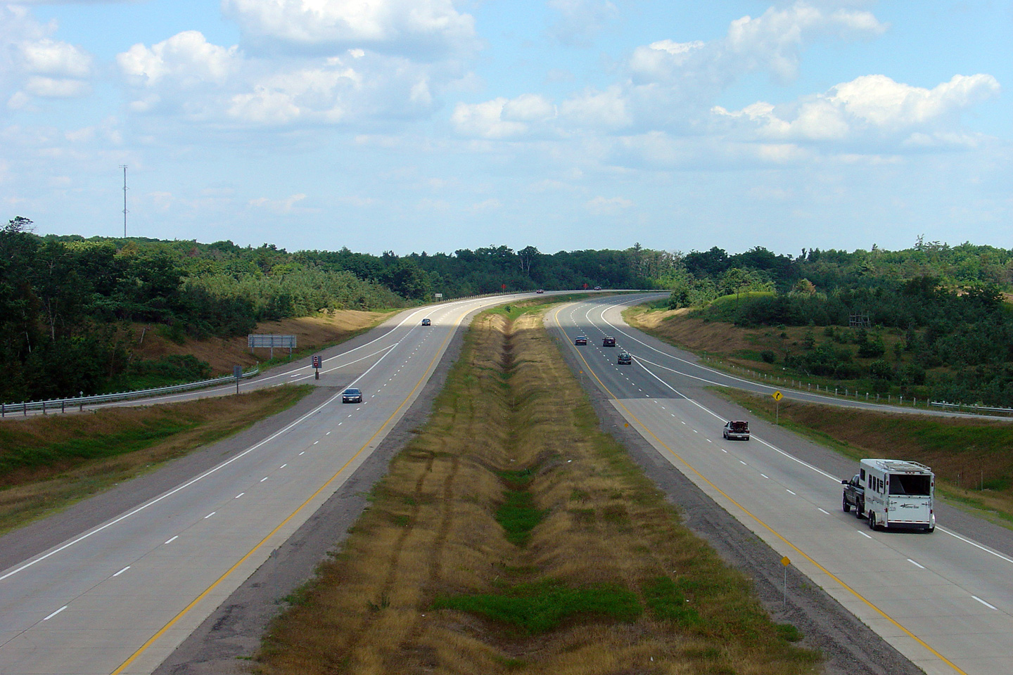
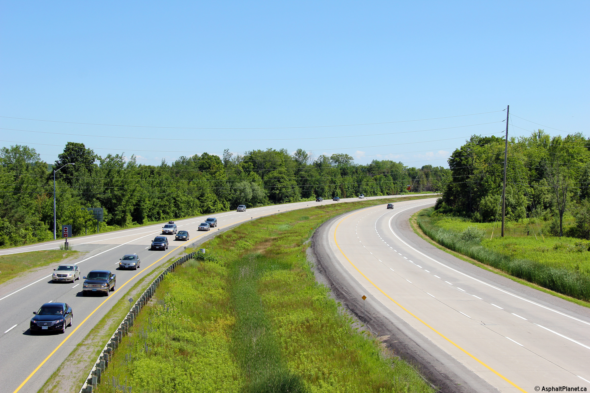
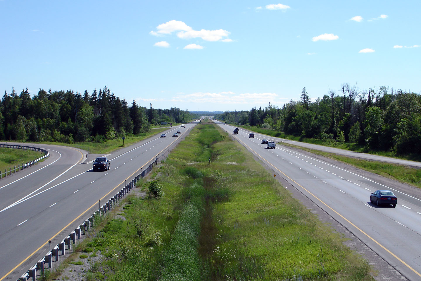
| Municipality of Clarington Regional Municipality of Durham |
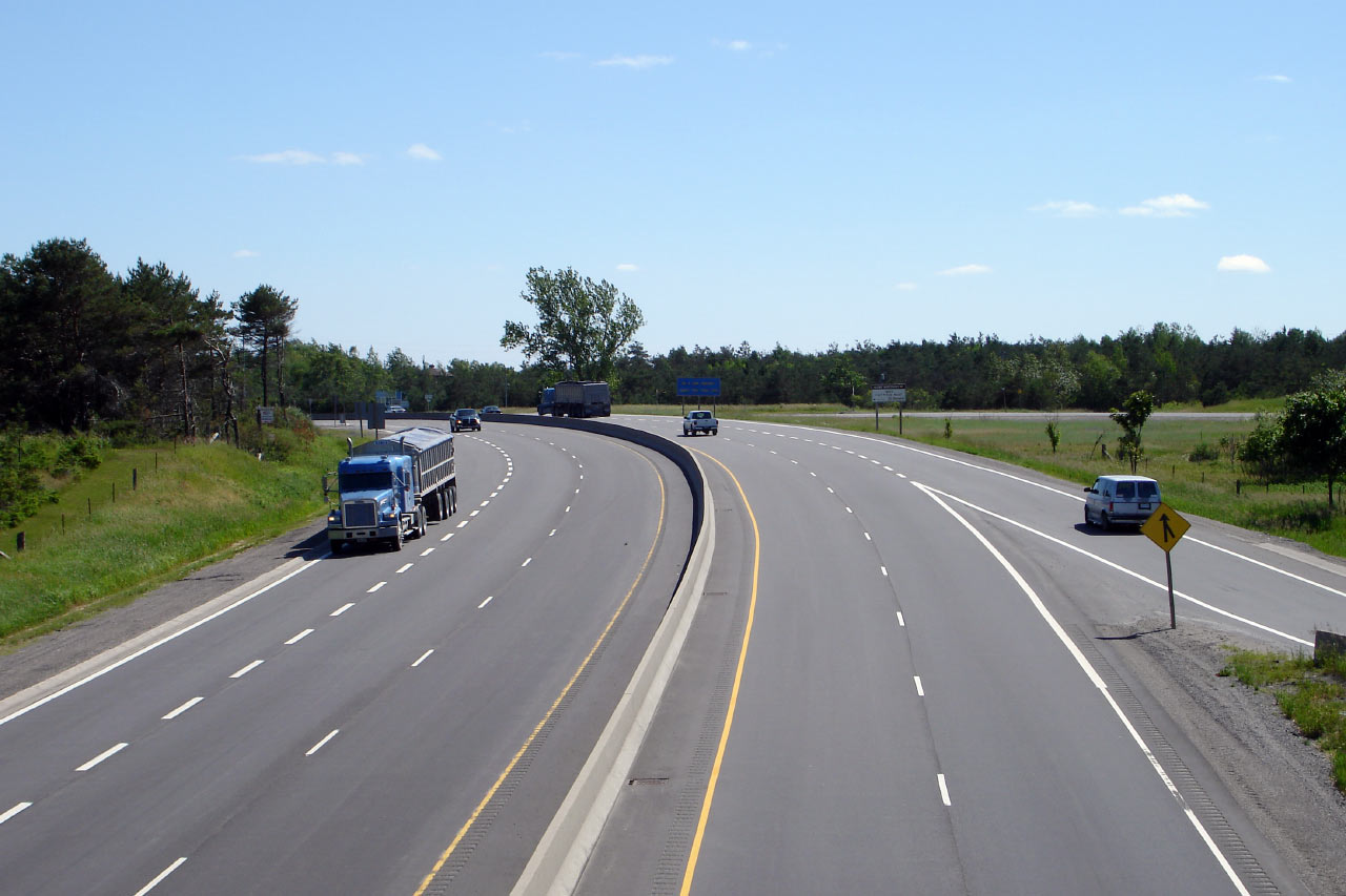
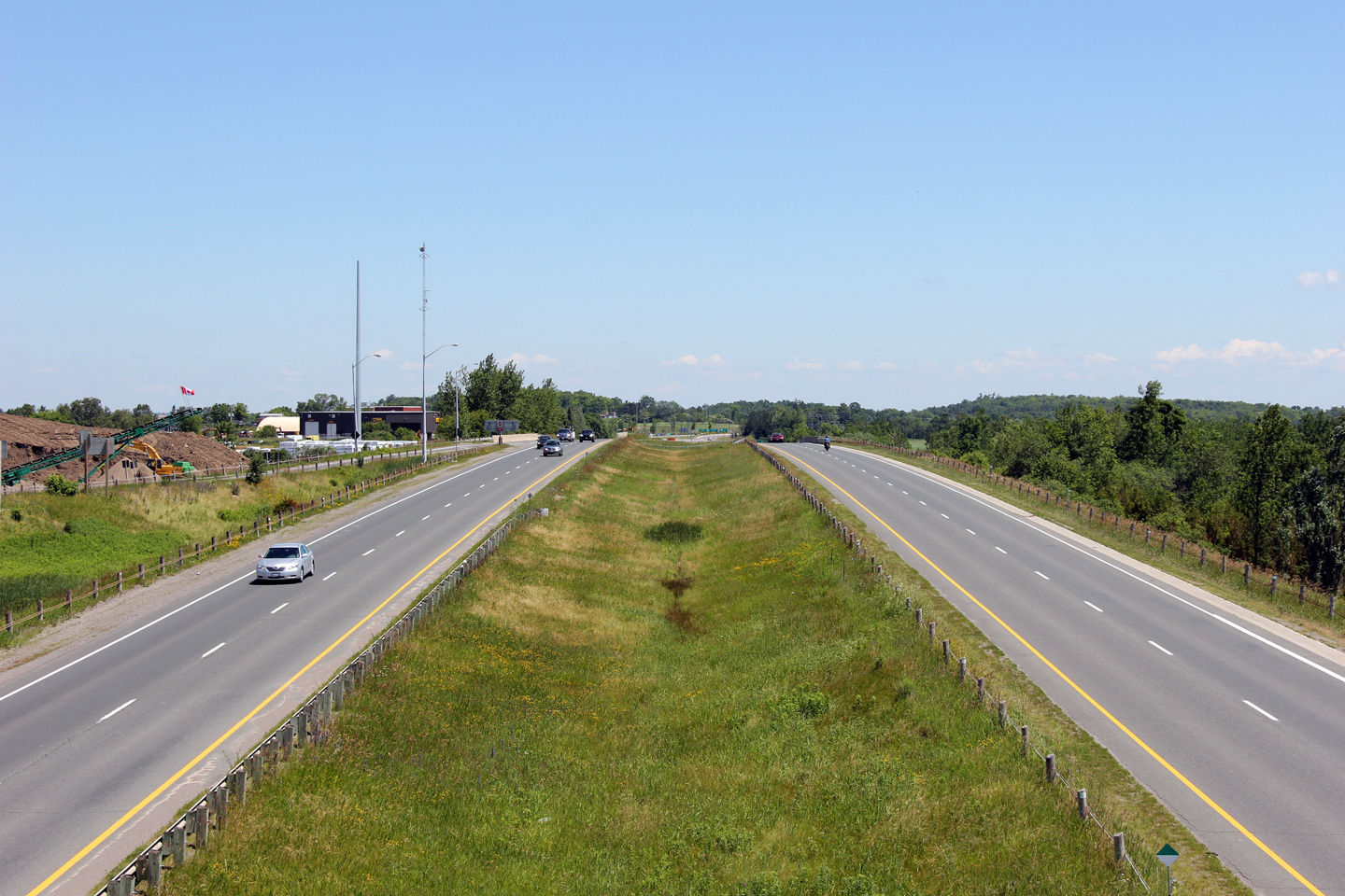
Highway 115 looking north from the Highway 35 overpass at Enterprise Hill. Until the early 1990s the divided expressway ended at the top of the pictured hill. Though envisioned as a divided highway when constructed in the early 1950s, between Enterprise Hill and Highway 28, Highway 115 sat as a two-lane expressway into the early 1990s. Picture taken: July 19th, 2005. Size: 70kb |
|
|
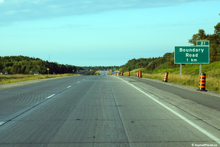
| Municipality of Clarington Regional Municipality of Durham |
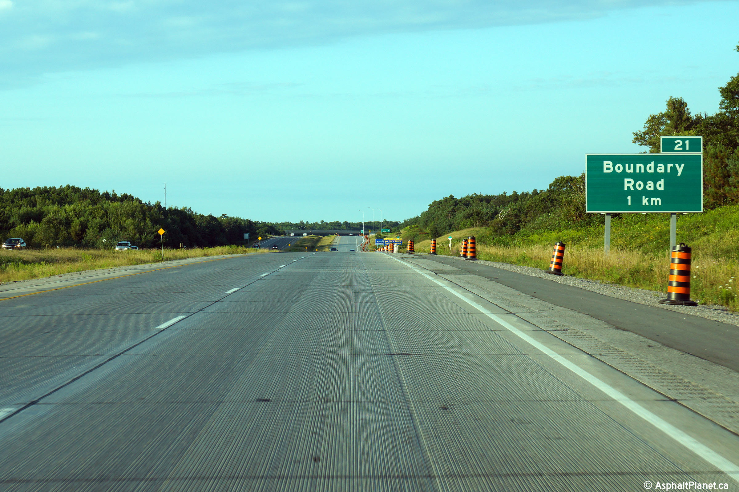
Northbound advanced signage for the Boundary Road interchange. Photo taken: August 19th, 2014. |
 (720x480) (720x480)(1440x960) (2400x1600) |
|
| Municipality of Clarington Regional Municipality of Durham |
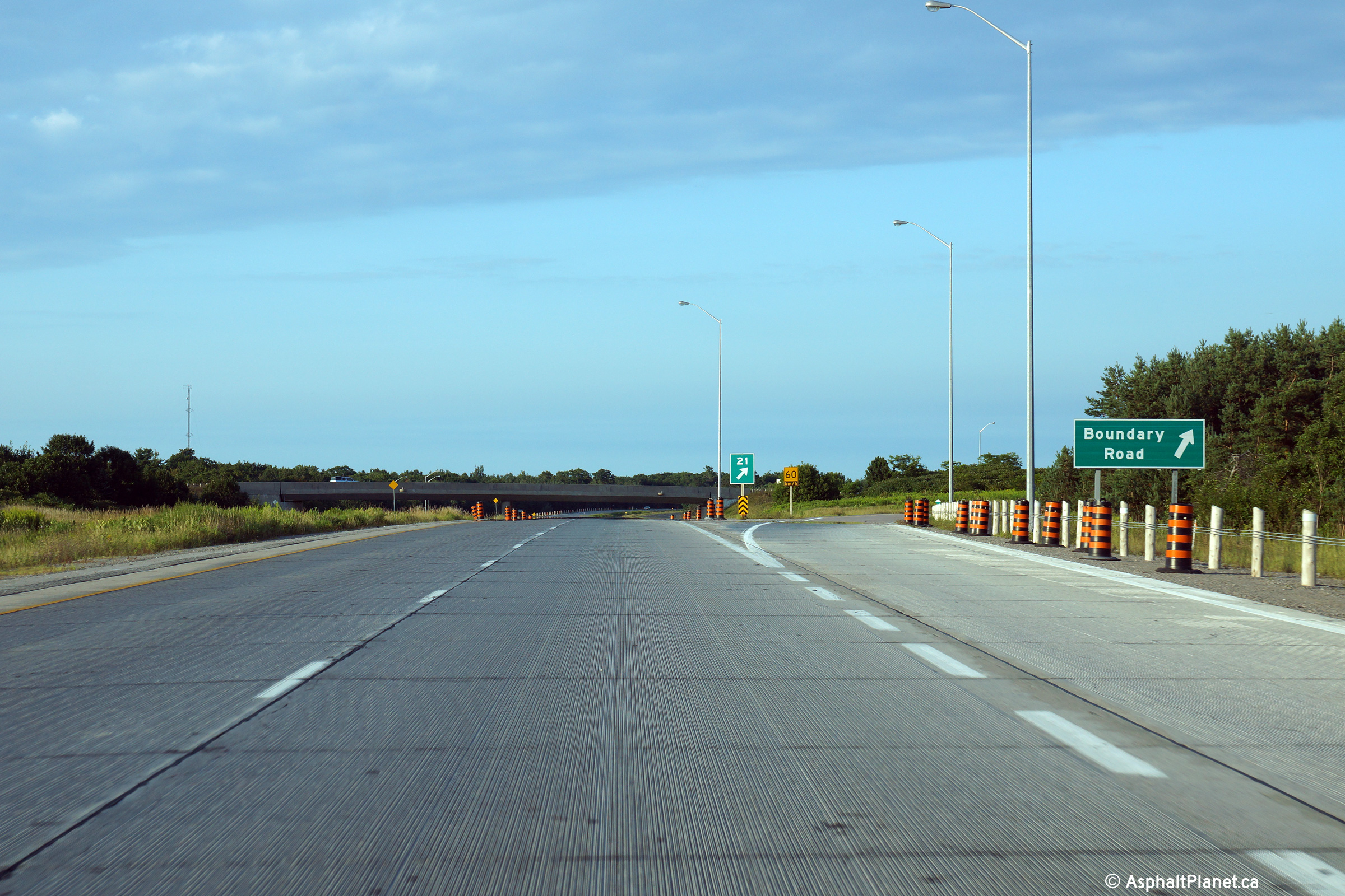
Signage at the northbound off-ramp to Boundary Road. Photo taken: August 19th, 2014. |
 (720x480) (720x480)(1440x960) (2400x1600) |
|
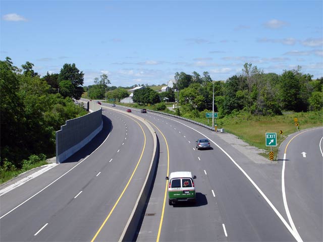
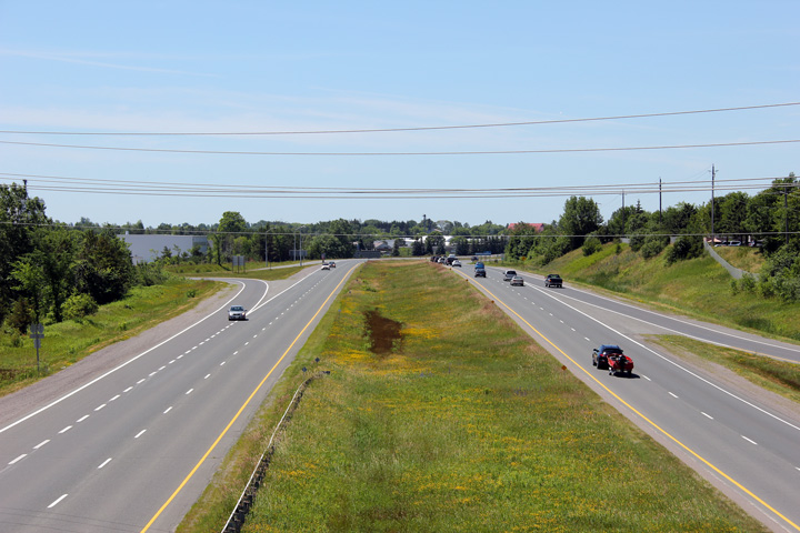
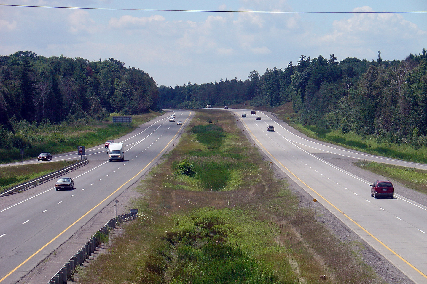
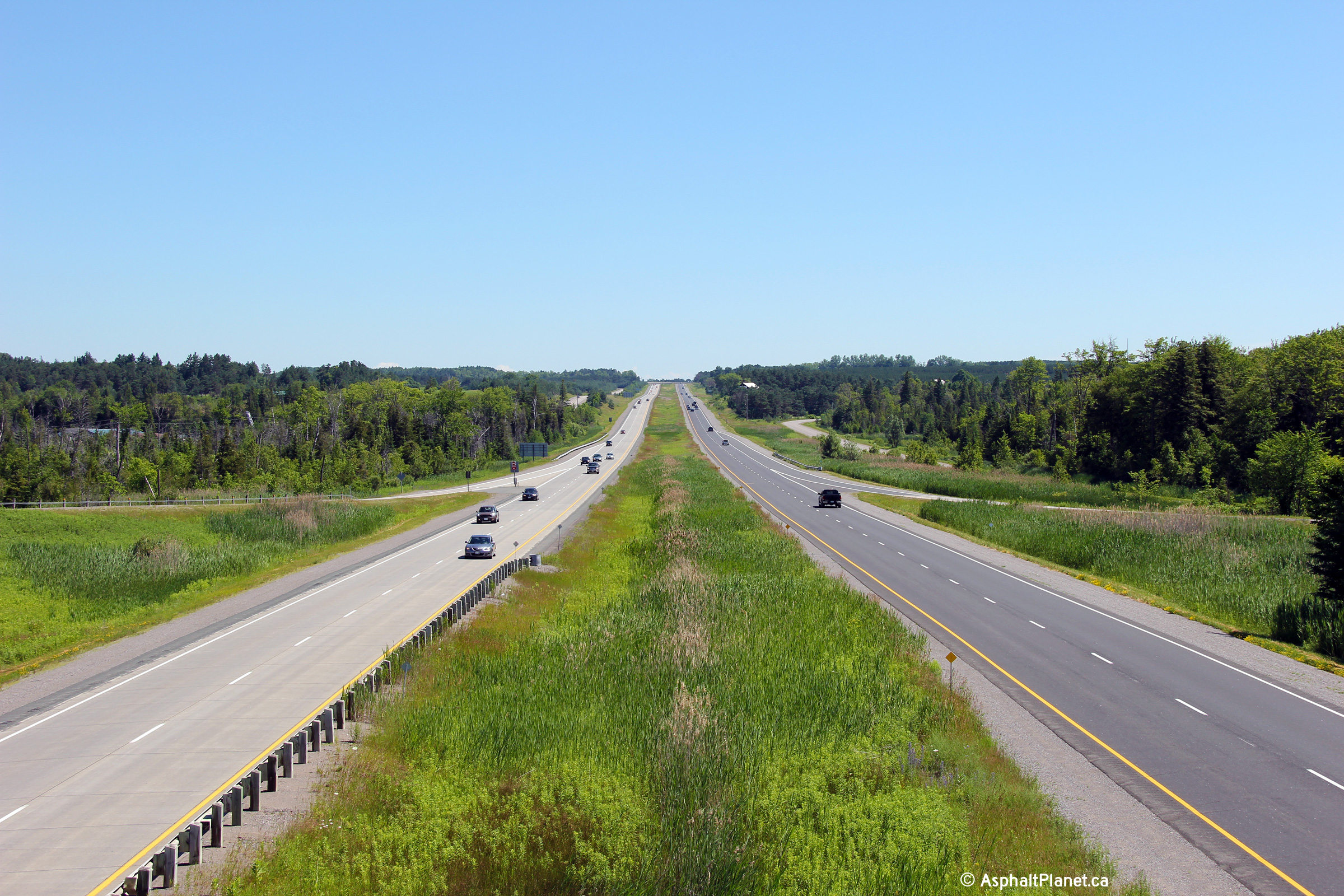
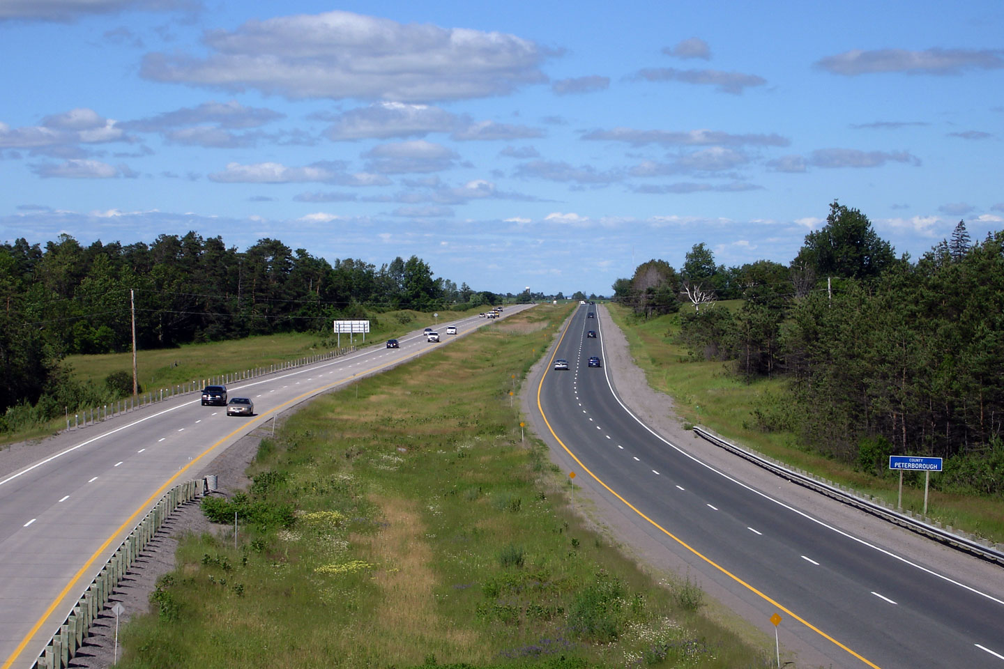
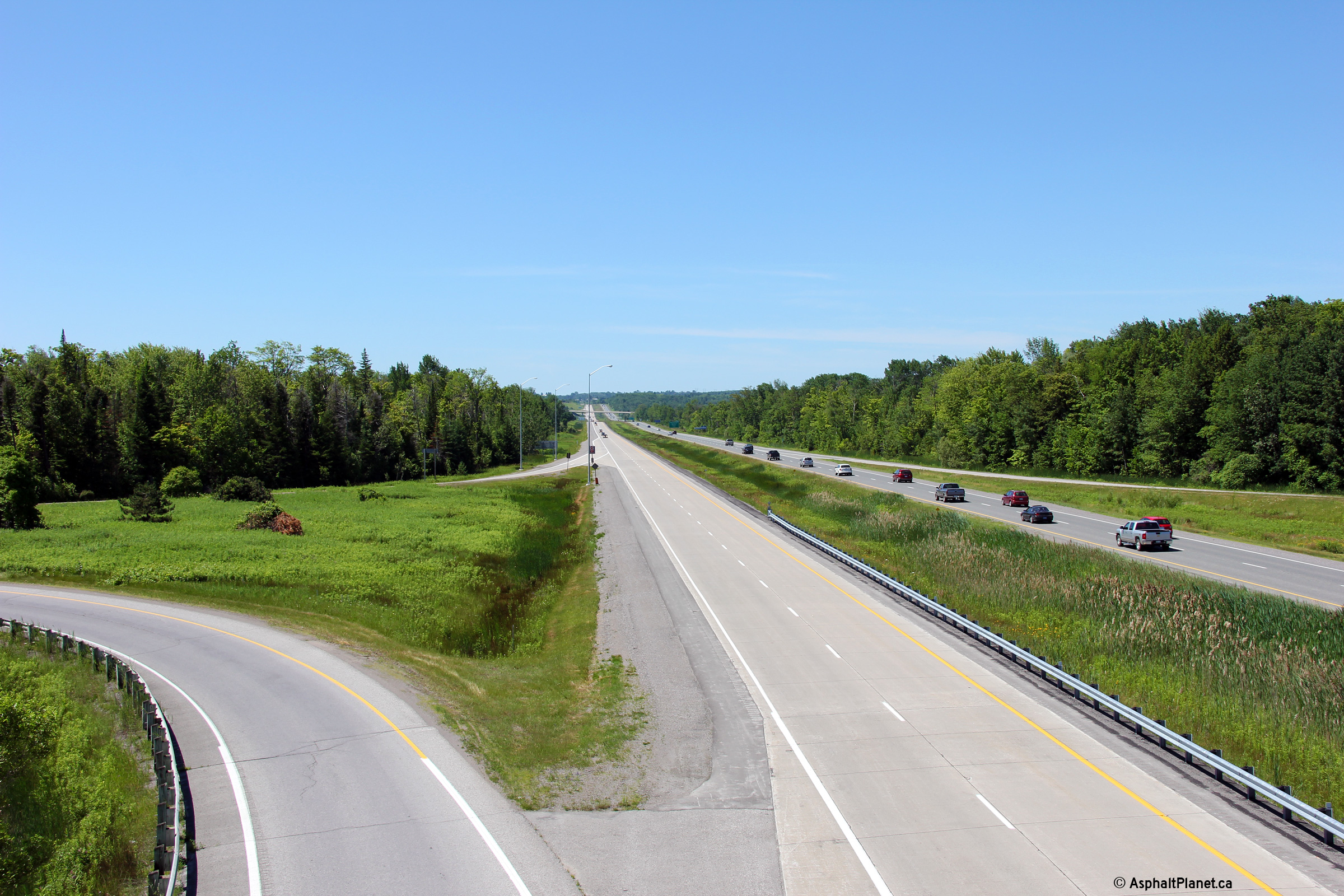
| Durham (Clarington) - Kawartha Lakes Boundary |
Looking south along Highway 115 from the Boundary Road interchange.
Boundary Road is the first interchange north of the Highway 35 split.
Click here for this same view taken in
July, 2005. Photo taken: July 3rd, 2011. |
|
|
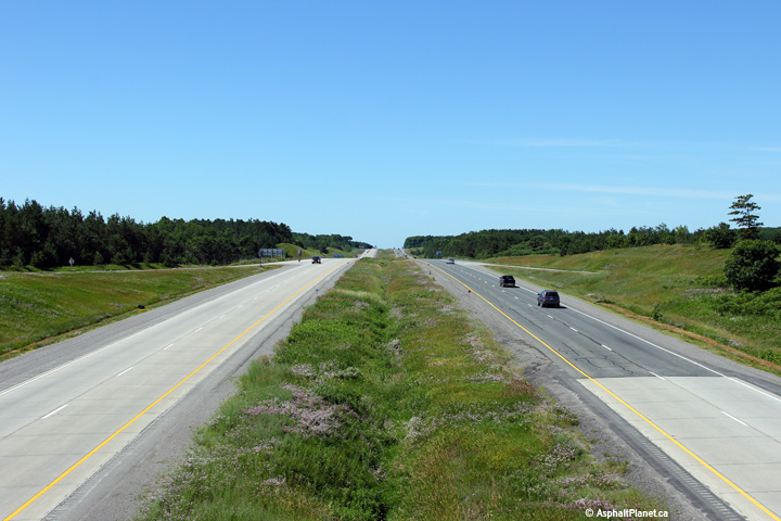
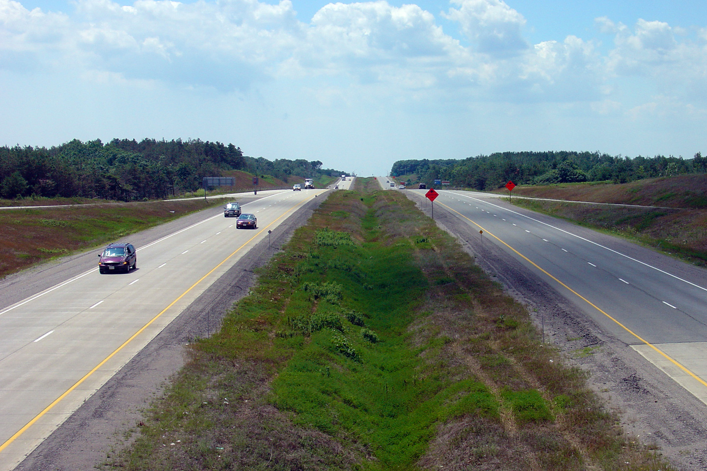
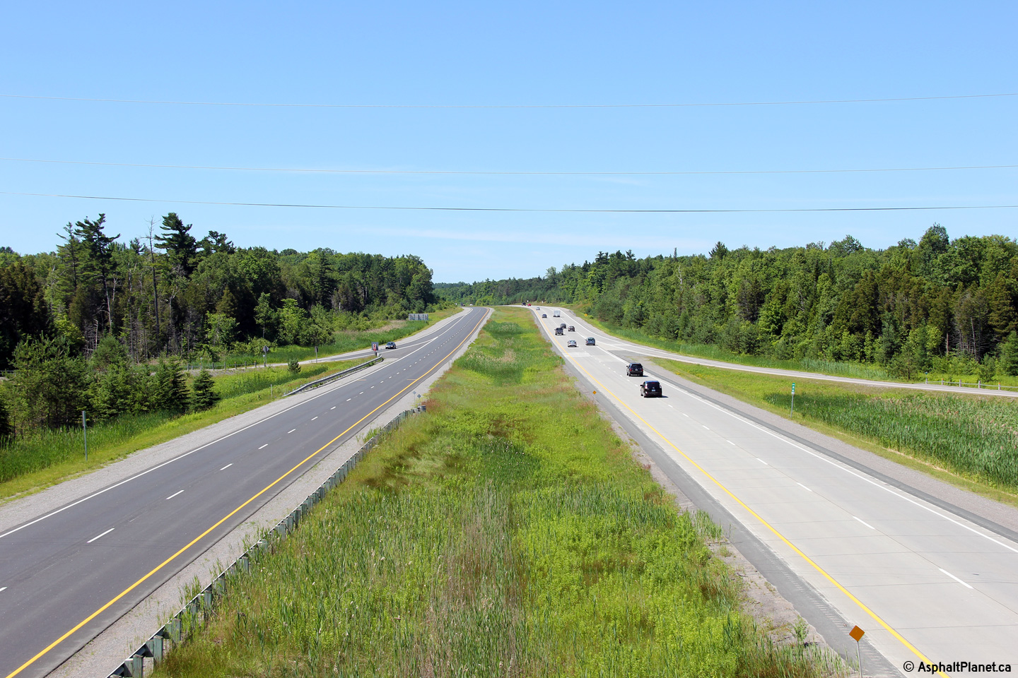
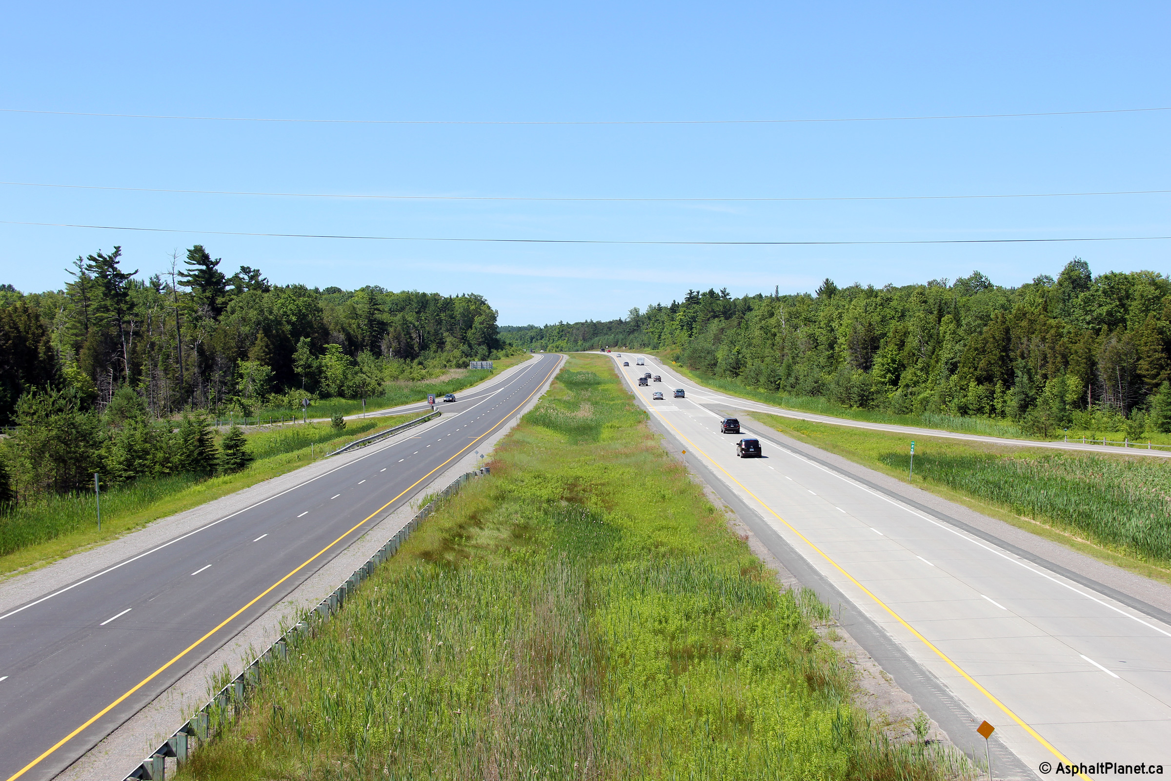
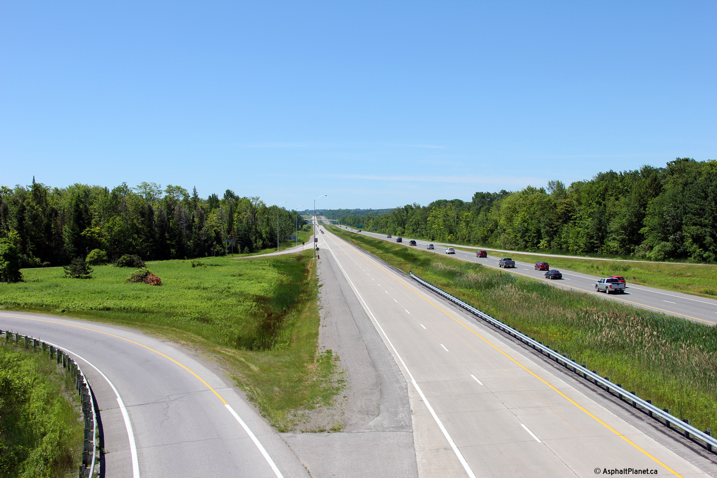
| Durham (Clarington) - Kawartha Lakes Boundary |
Looking north from the Boundary Road overpass. Of interest, at Boundary
Road, the original 2-lane Highway 115 switched from the current southbound
to northbound Carriageway. The sections of Highway 115 paved in concrete
represent the newer carriageway compared to the older asphalt carriageway.
Click here for this same view taken in
July, 2005. Photo taken: July 3rd, 2011. |

|
|
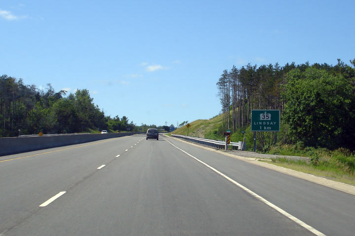
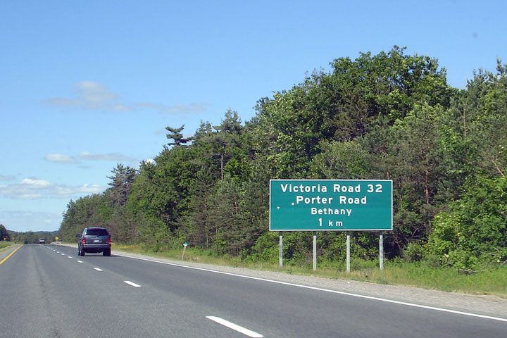
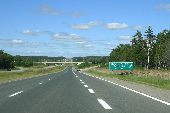
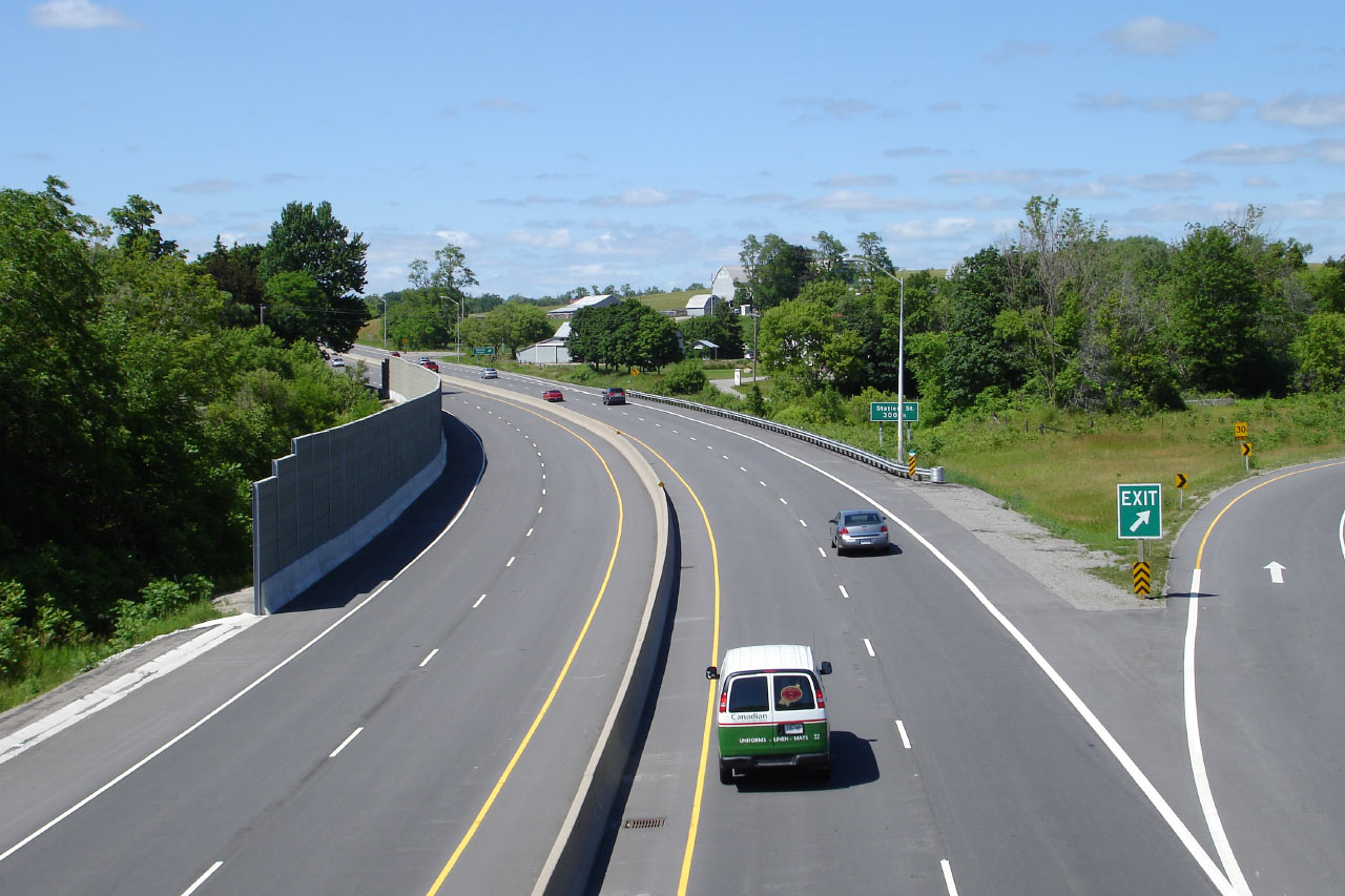
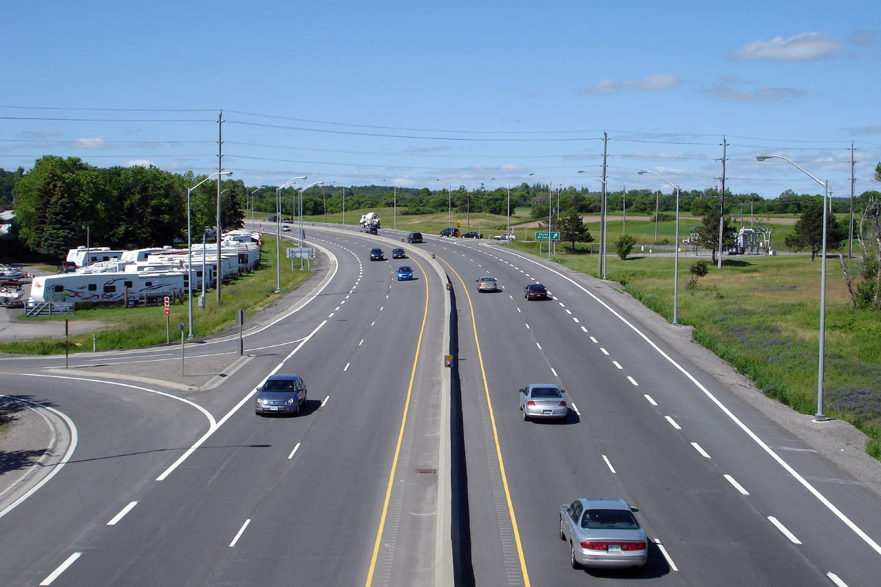
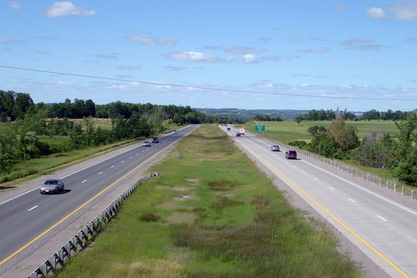
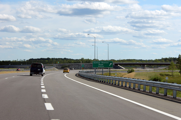
| City of Kawartha Lakes |
Sign for Victoria Road 32. Victoria County was
amalgamated becoming the City of Kawartha Lakes in 2000. Photo taken: June 20th, 2006. |
 |
|
| City of Kawartha Lakes |
Exit and signage for Victoria Road 32. Photo taken: June 20th, 2006. |
 Low
Res Low
ResHigh Res |
|
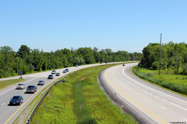
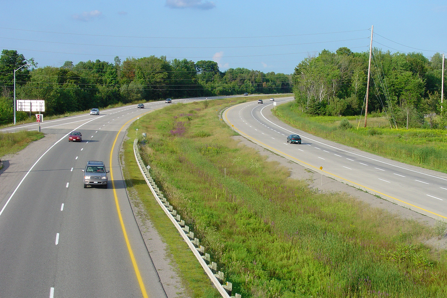
| City of Kawartha Lakes |
Looking south along Highway 115 from the Porter Road overpass. Click
here for this same view taken in
July, 2005. Photo taken: July 3rd, 2011. |

|
|
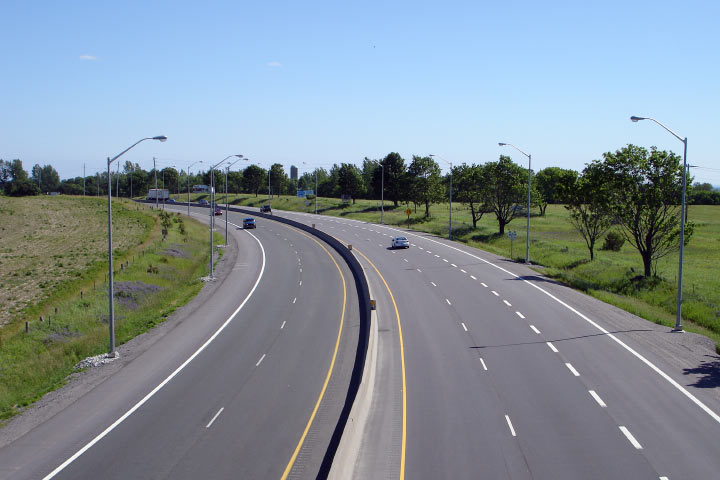
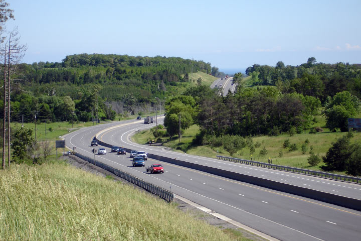
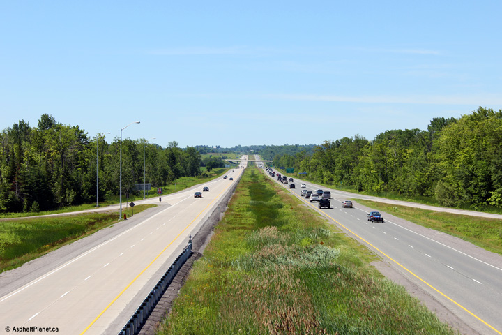
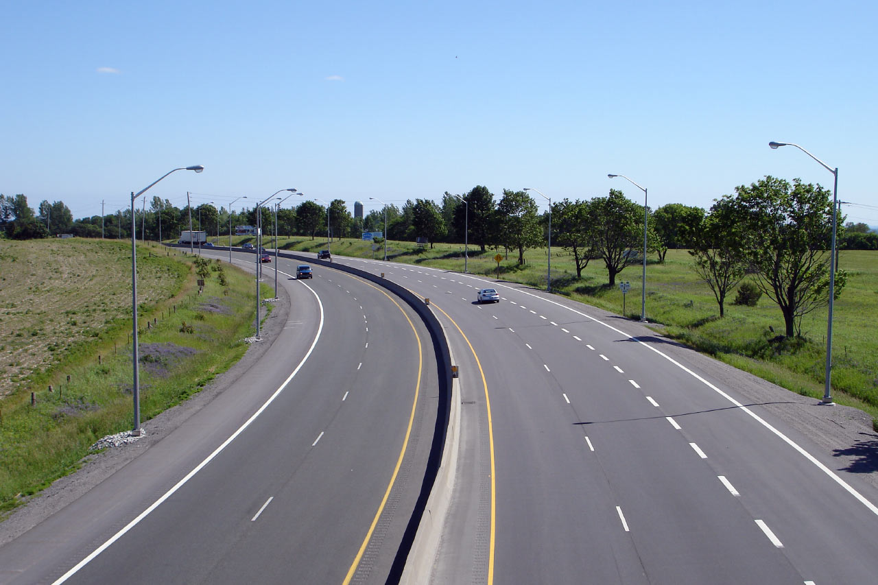
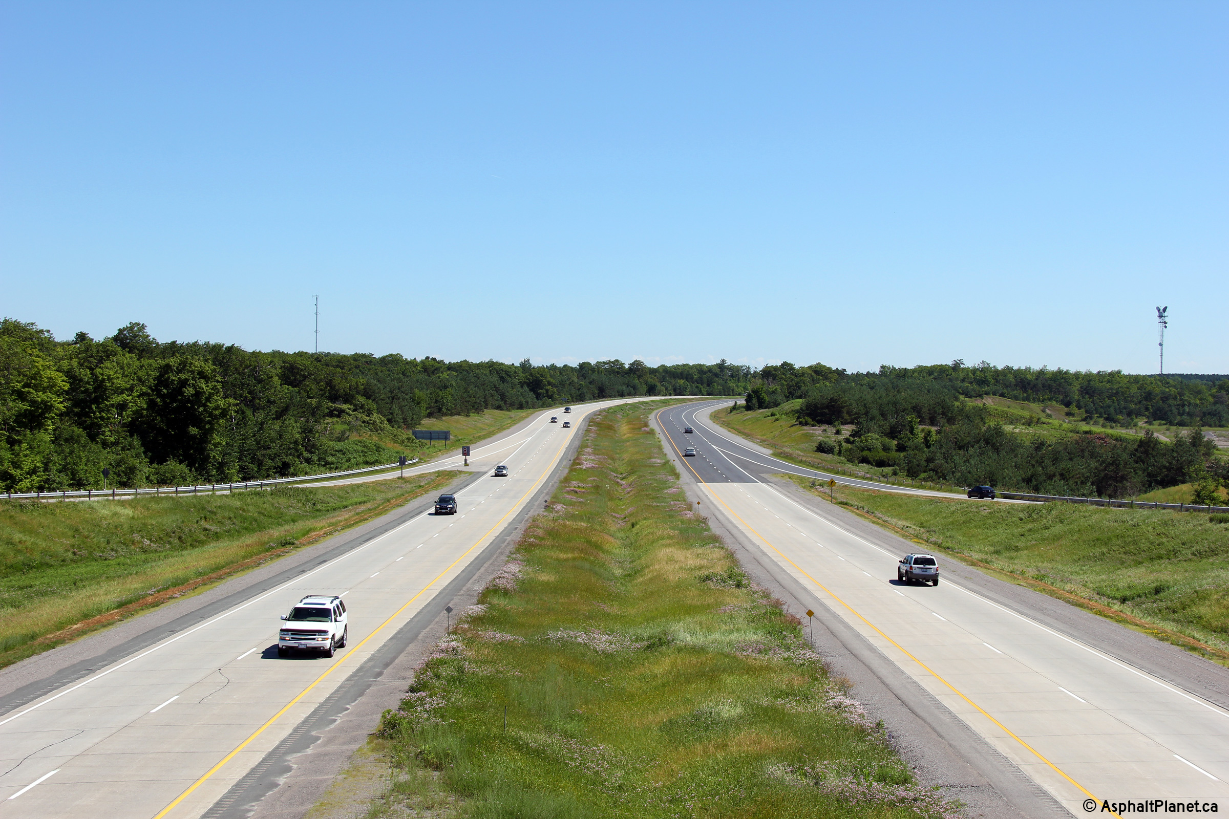
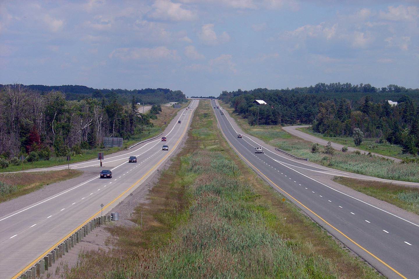
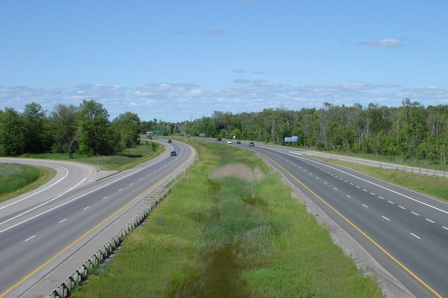
City of Kawartha Lakes |
Highway 115 looking north from
the Porter Road (Kawartha Lakes Road 32) overpass. The Porter Road
interchange was completed in 1991. Highway 115 was widened from a two
lane at-grade highway to a four lane freeway between Highway 35 and Highway
28 during a series of multiyear contracts during the early 1990s.
Click here for this same view taken in
July, 2005. |
||
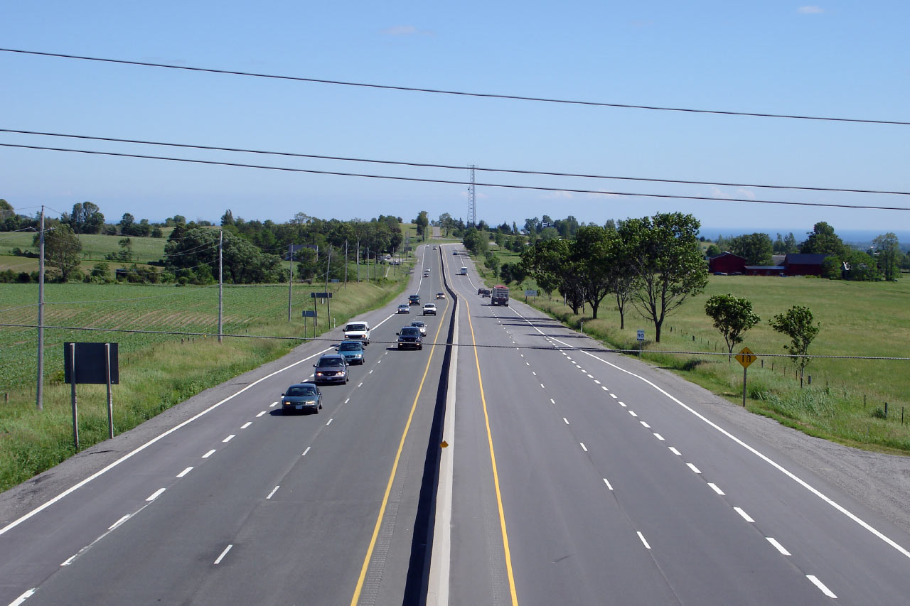
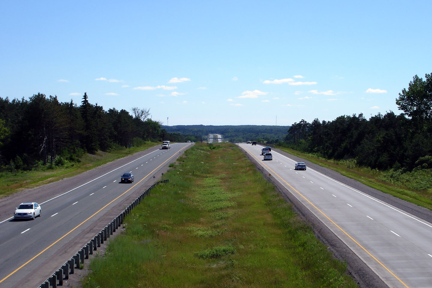
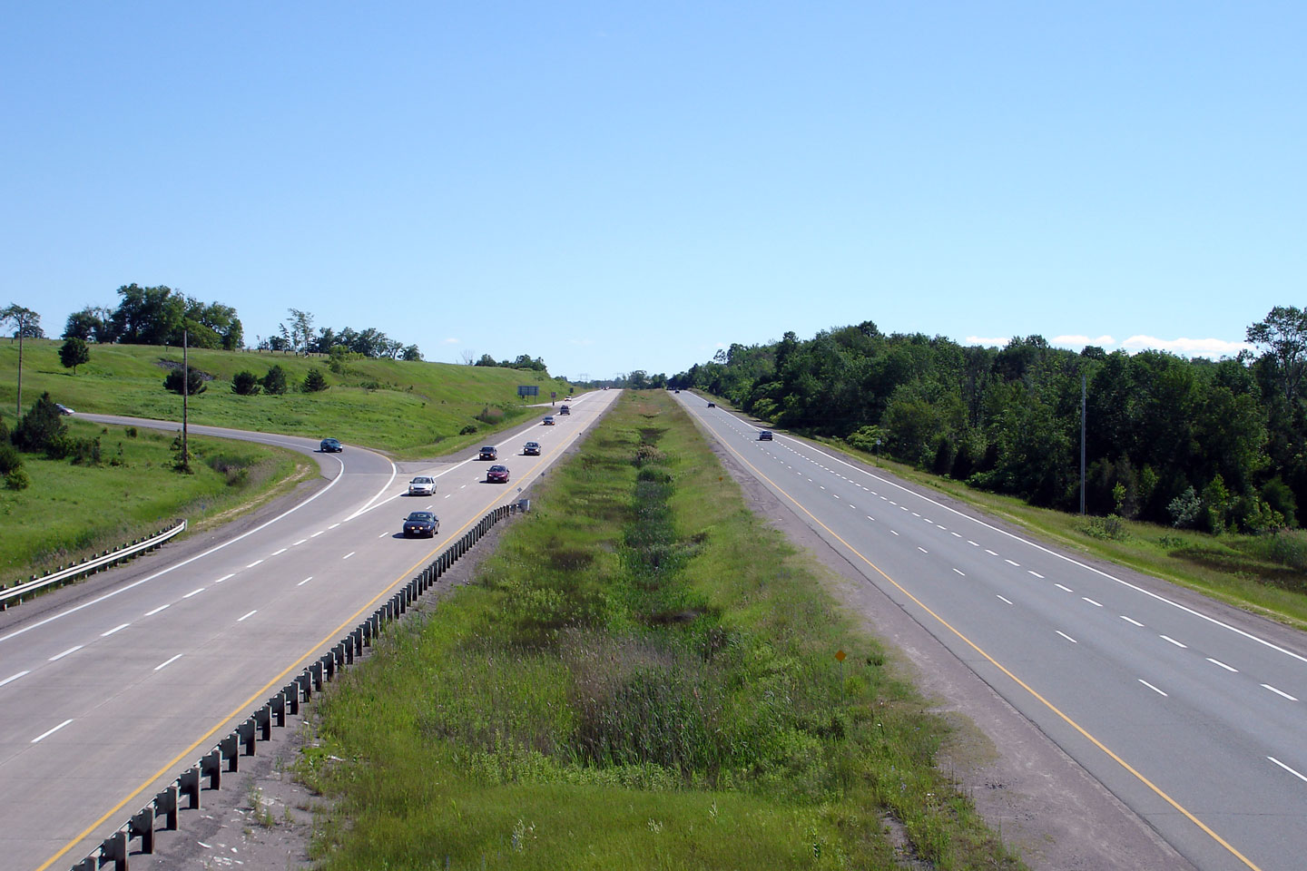
City of Kawartha Lakes |
View looking southerly from the Kawartha Lakes Road 12
overpass. Photo taken: June 20th, 2006. |
 |
|
| Township of Cavan-
Millbrook- North Monaghan County of Peterborough |
Northerly view from the Kawartha Lakes Road 12 overpass
into Peterborough County. Photo taken: June 20th, 2006. |
 |
|
| Township of Cavan-
Millbrook- North Monaghan County of Peterborough |
Southerly view from Larmer Line. Photo taken: June 20th, 2006. |
 |
|
| Township of Cavan-
Millbrook- North Monaghan County of Peterborough |
View looking north from Larmer Line towards Peterborough
Road 10. Photo taken: June 20th, 2006. |
 |
|
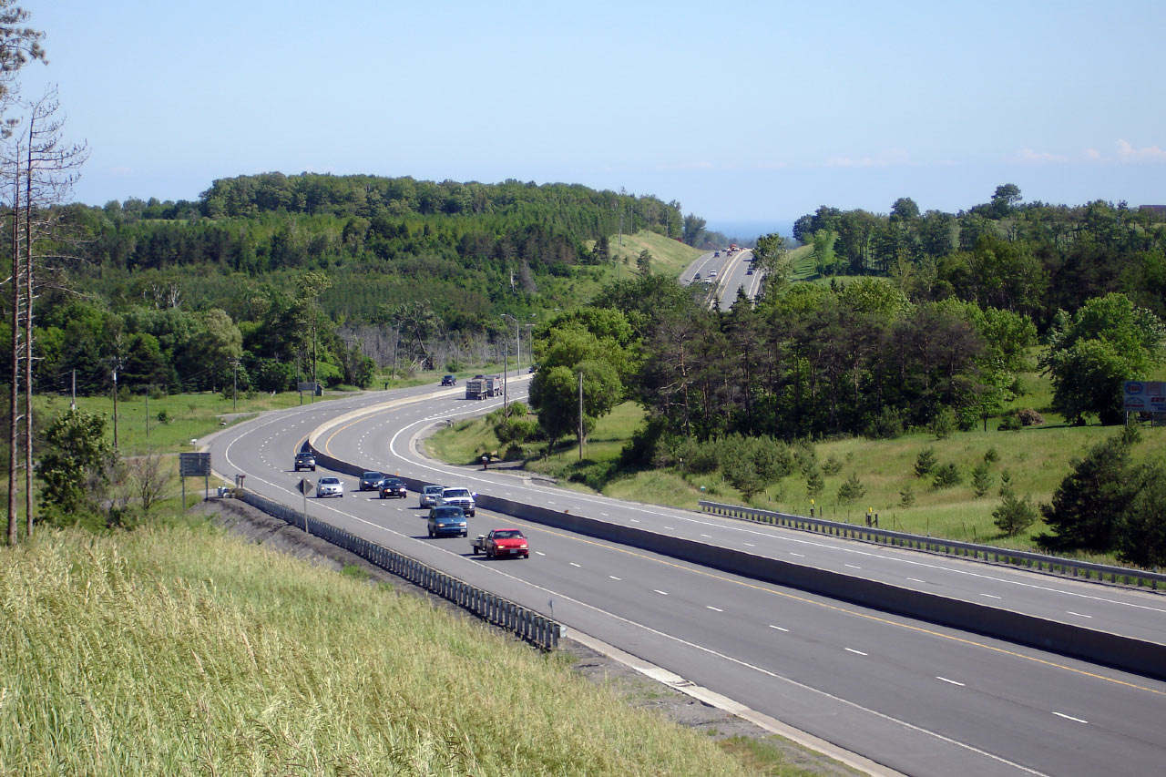
| Township of Cavan-
Millbrook- North Monaghan County of Peterborough |
View looking up the large hill from the Peterborough Road
10 interchange. Photo taken: June 20th, 2006. |
 |
|
| Township of Cavan-
Millbrook- North Monaghan County of Peterborough |
Northerly view from the Peterborough Road 10 overpass. Photo taken: June 20th, 2006. |
 |
|
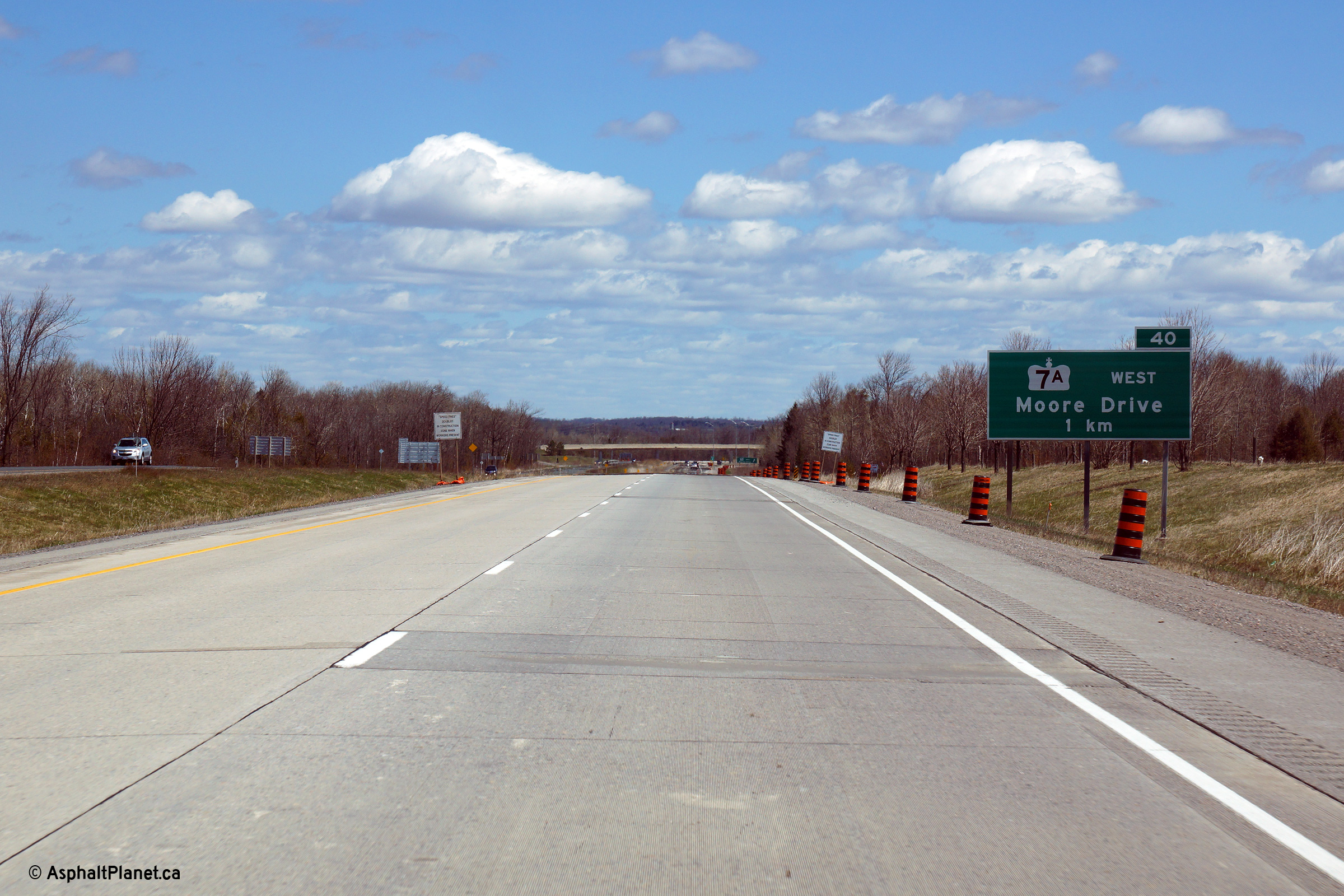
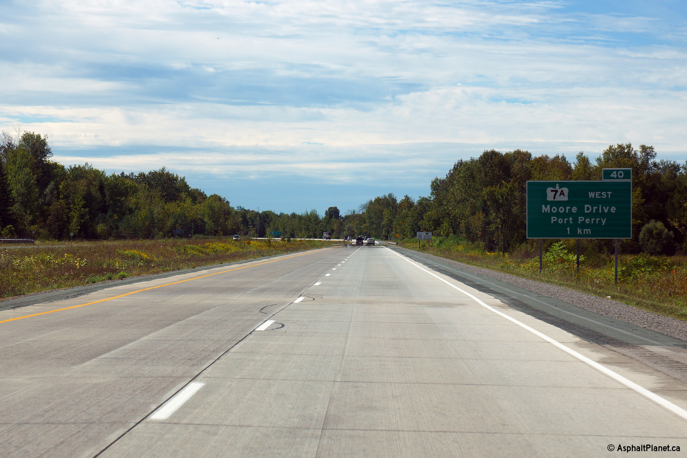
| Township of Cavan-
Millbrook- North Monaghan County of Peterborough |
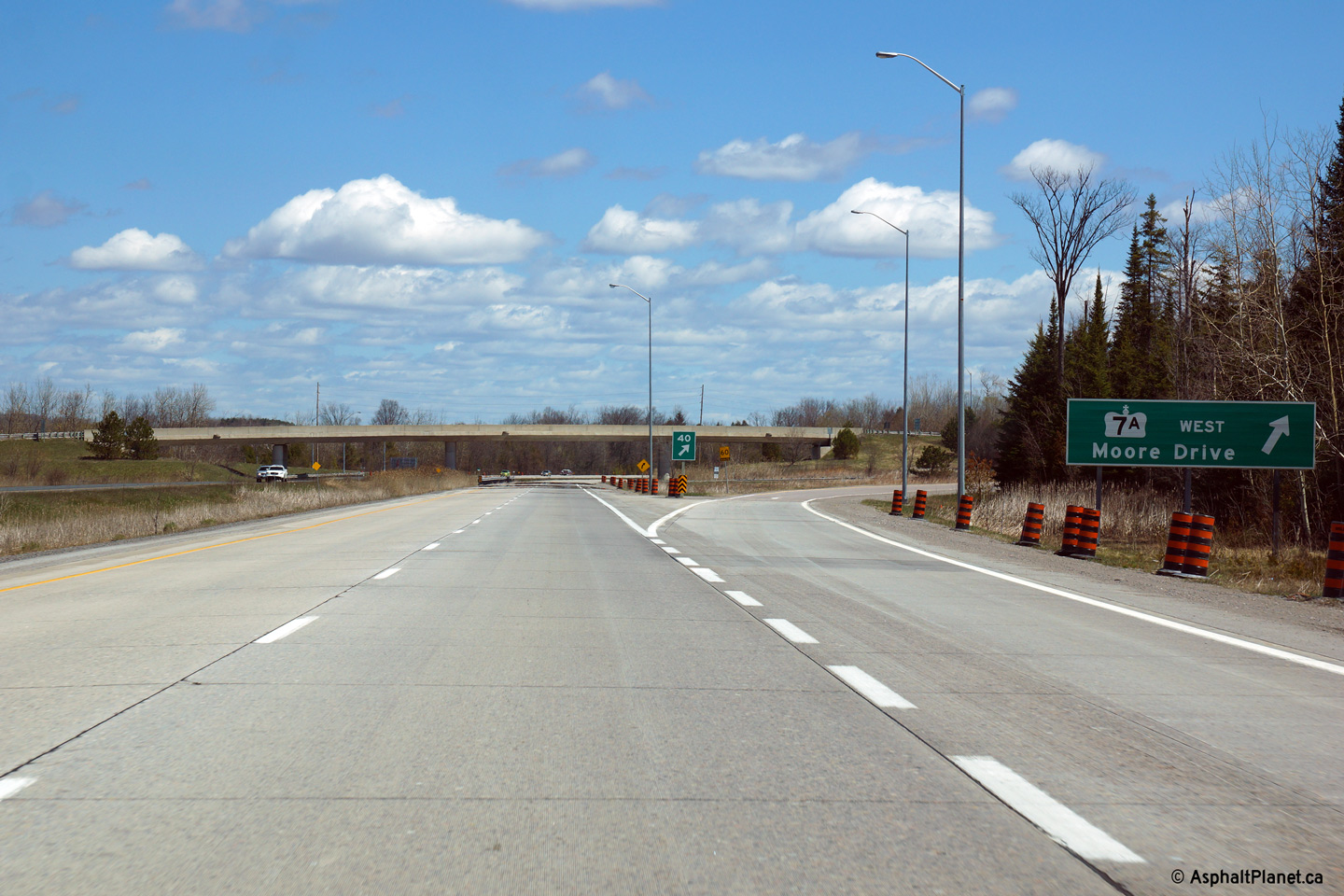
One kilometre eastbound advanced signage for the
Highway 7A interchange. Photo taken: May 6th, 2014. |
 (720x480) (720x480)(1440x960) (2400x1600) |
|
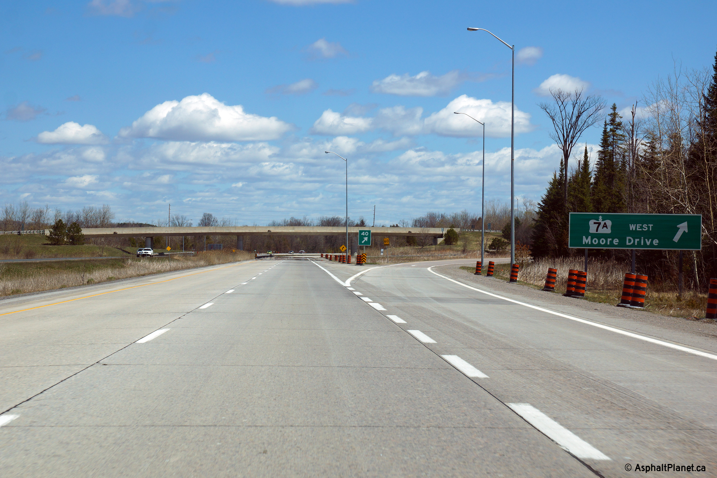
| Township of Cavan-
Millbrook- North Monaghan County of Peterborough |
Highway 7A sign and exit. Photo taken: May 6th, 2014. |
 (720x480) (720x480)(1440x960) (2400x1600) |
|
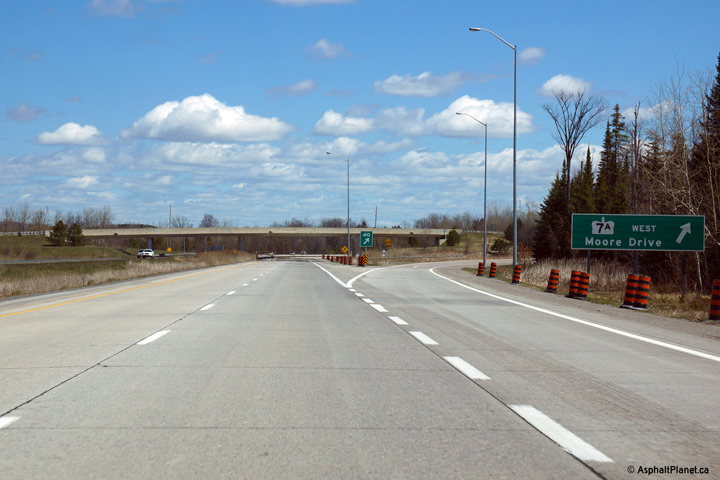
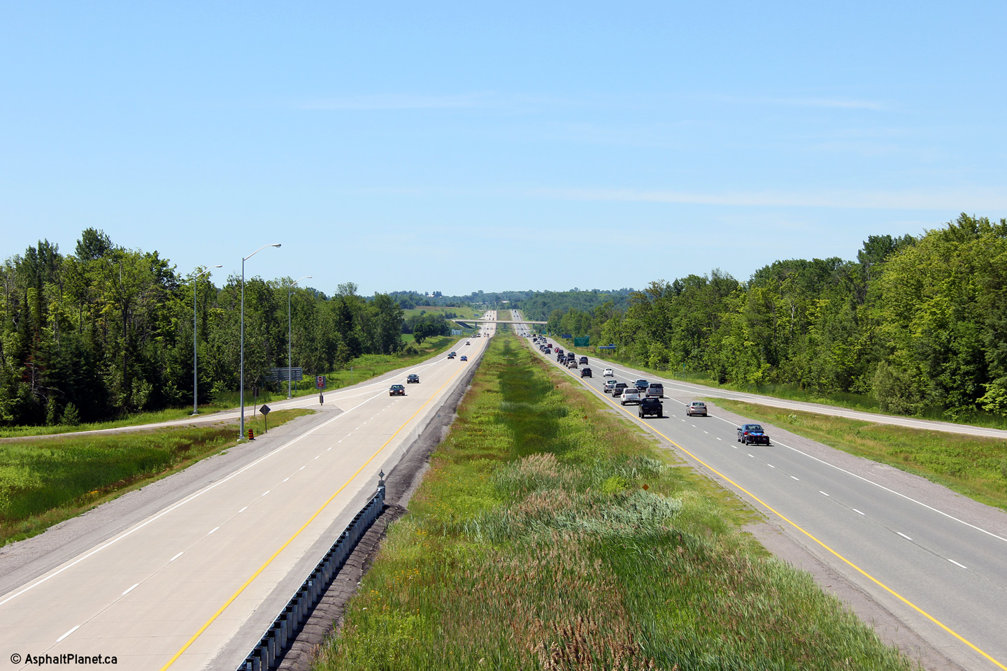
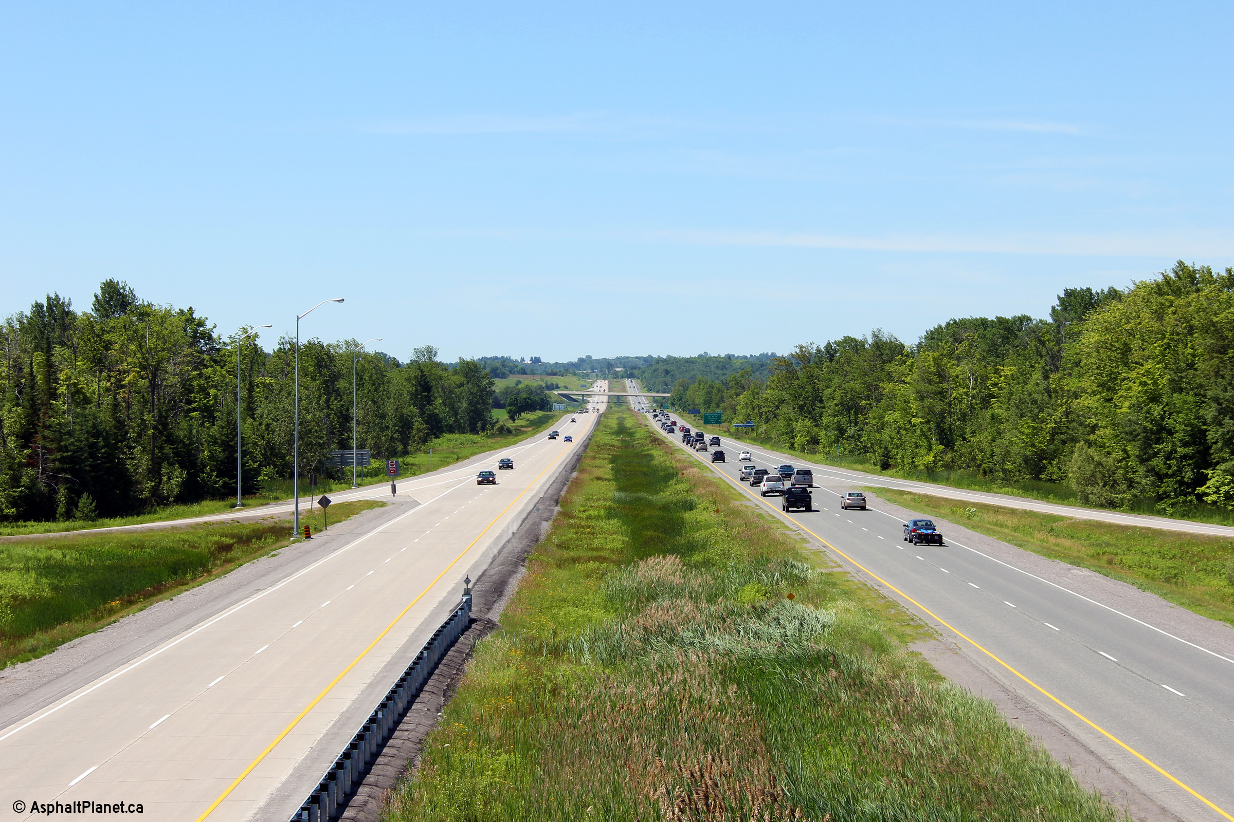
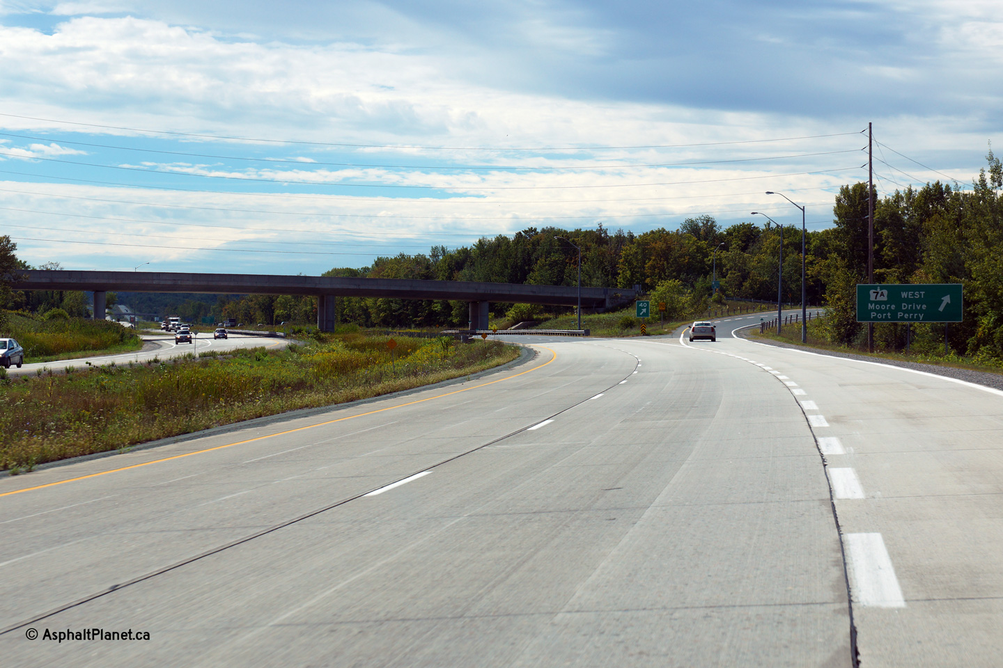
| Township of Cavan-
Millbrook- North Monaghan County of Peterborough |
Two views looking southerly from the Highway 7A interchange. Photos taken: July 3rd, 2011. |
 (720x480) (1440x960) (2400x1600)  (720x480) (1440x960) (2400x1600) |
|
| Highway 7A heads west from the 115 to the lovely community of Port Perry. Click here for Highway 7A images. | |||
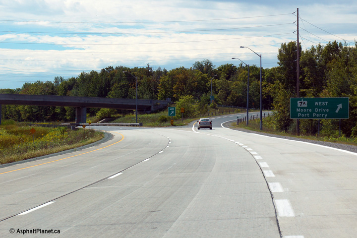
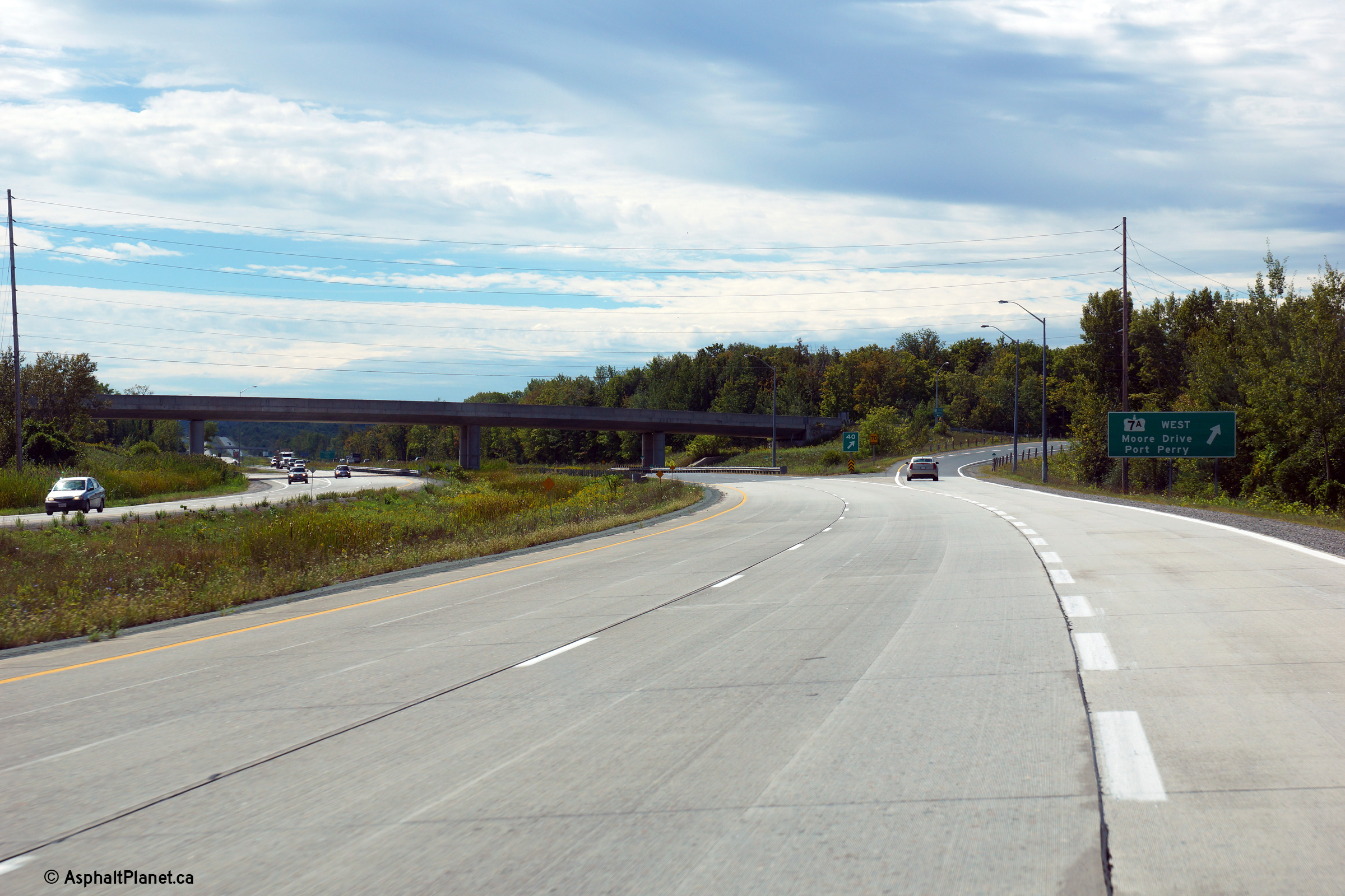
| Township of Cavan-
Millbrook- North Monaghan County of Peterborough |
Looking north along Highway 115 from the Highway
7A
overpass. Click here for this same view taken in
June, 2004. Photo taken: July 3rd, 2011. |
 (720x480) (1440x960) (2400x1600) |
|
| Township of Cavan- Millbrook- North Monaghan County of Peterborough |
Westbound turn-off signage for the Highway 7A interchange. Photo taken: September 9th, 2013. |
 (720x480) (720x480)(1440x960) (2400x1600) |
|
| Township of Cavan- Millbrook- North Monaghan County of Peterborough |
Westbound advanced signage for the Highway 7A interchange. Photo taken: September 9th, 2013. |
 (720x480) (720x480)(1440x960) (2400x1600) |
|
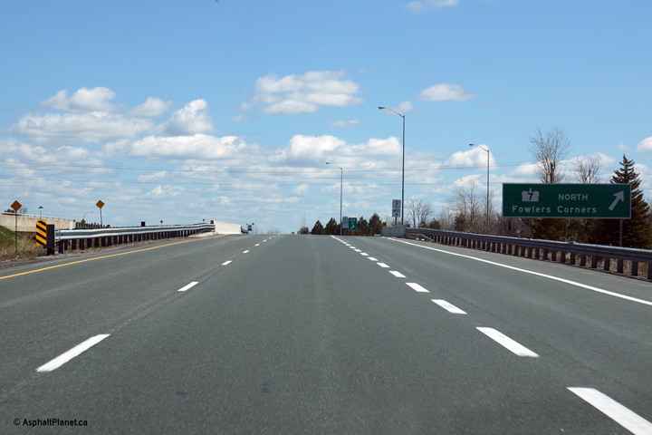
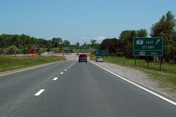
| Township of Cavan-
Millbrook- North Monaghan County of Peterborough |
1km advanced signage for the Highway 7 (formerly Highway 7A North) and
former
Highway 28 interchange. Notice that no
cardinal direction is signed for Highway 7. This is a notable error since
Highway 7 continues east of this interchange along Highway 115's routing. Picture taken: May 6th, 2014. |
 (720x480) (720x480)(1440x960) (2400x1600) |
|
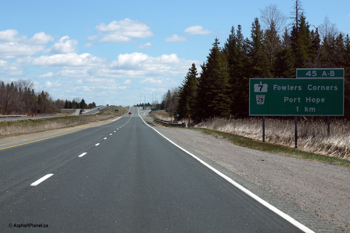
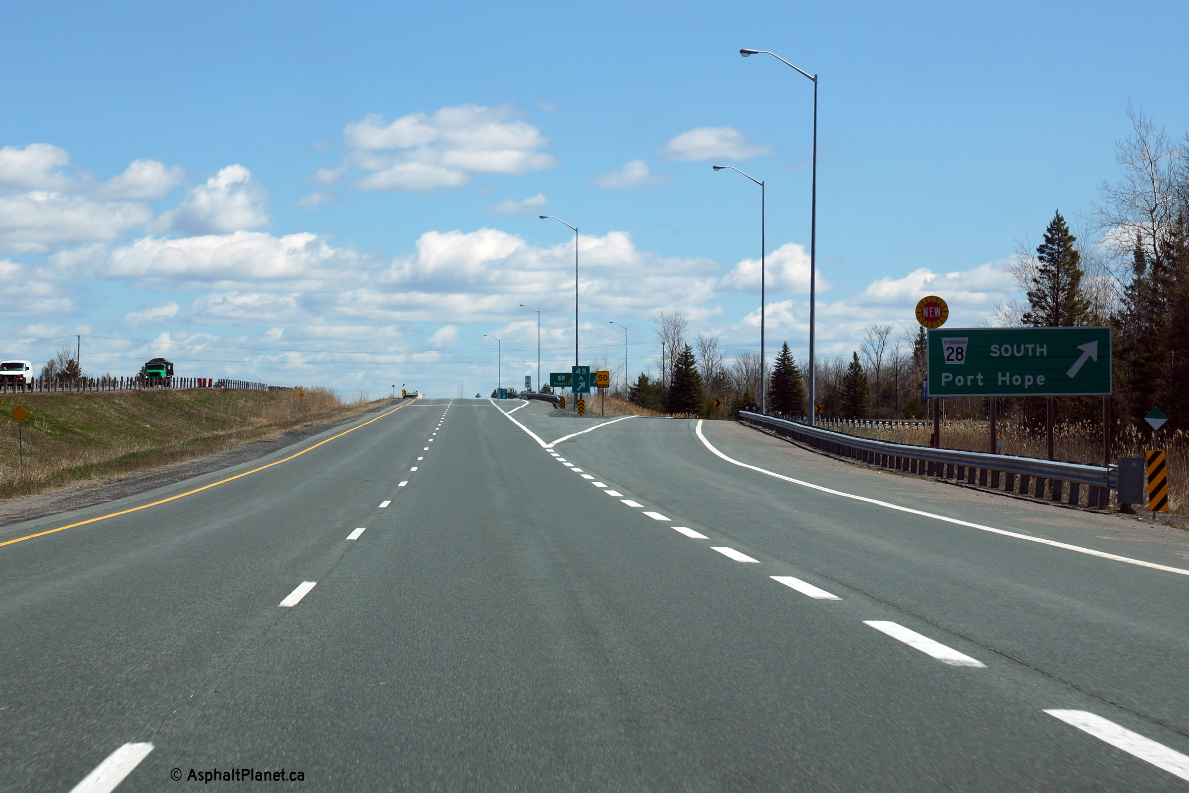
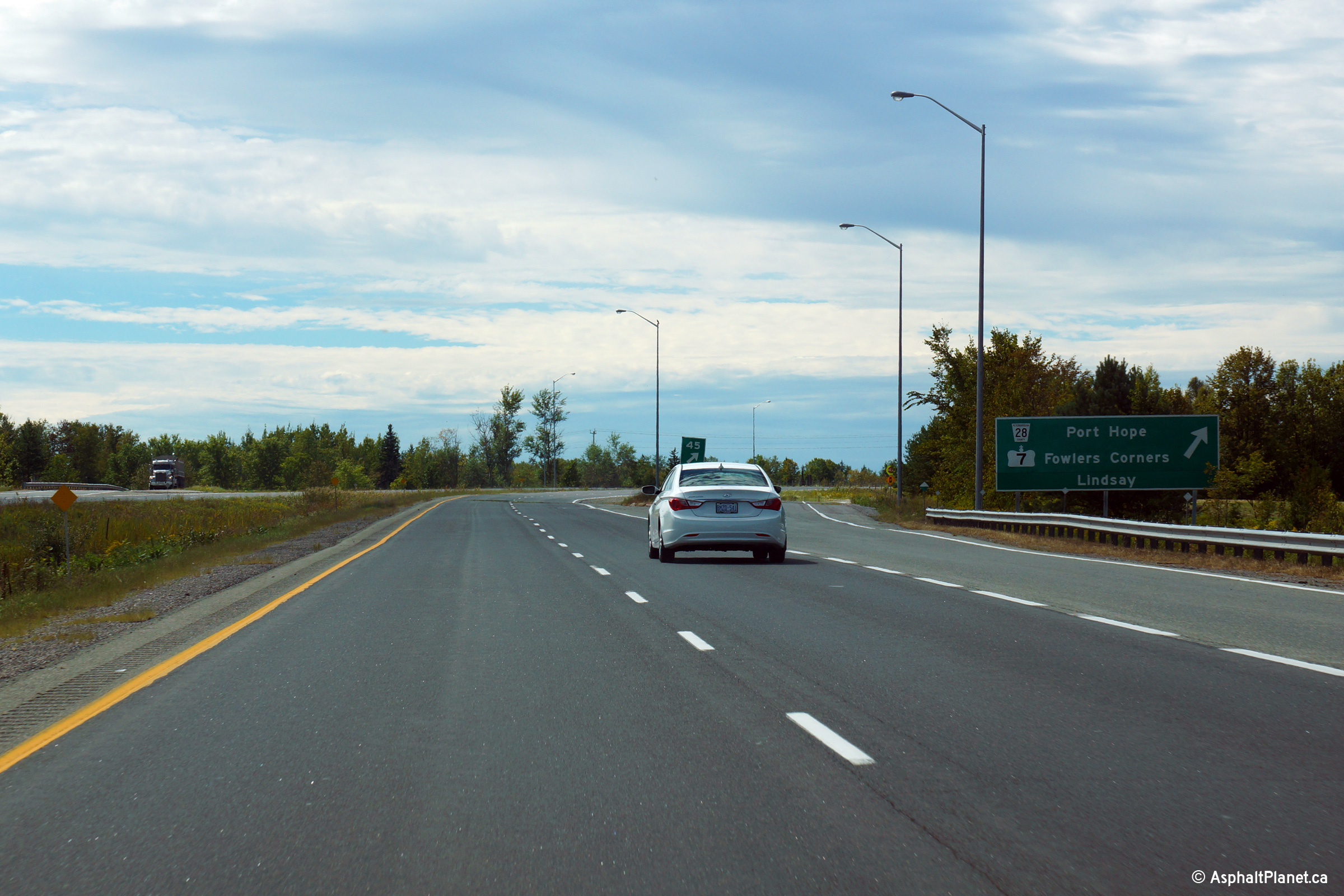
| Township of Cavan-
Millbrook- North Monaghan County of Peterborough |
Signage for the directional ramp to Highway 28 South towards Port Hope. Picture taken: May 6th, 2014. |
 (720x480) (720x480)(1440x960) (2400x1600) |
|
| Township of Cavan-
Millbrook- North Monaghan County of Peterborough |
Signage at the ramp to Highway 7 (formerly Highway 7A) North towards Fowlers
Corners. Picture taken: May 6th, 2014. |
 (720x480) (720x480)(1440x960) (2400x1600) |
|
| The Highway 28 and Highway 7 Interchange is one of the most predominant along Highway 115 south of Peterborough. Click here for Highway 7 images and here Highway 28 images. | |||
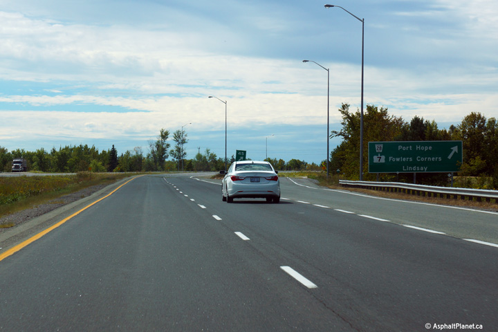
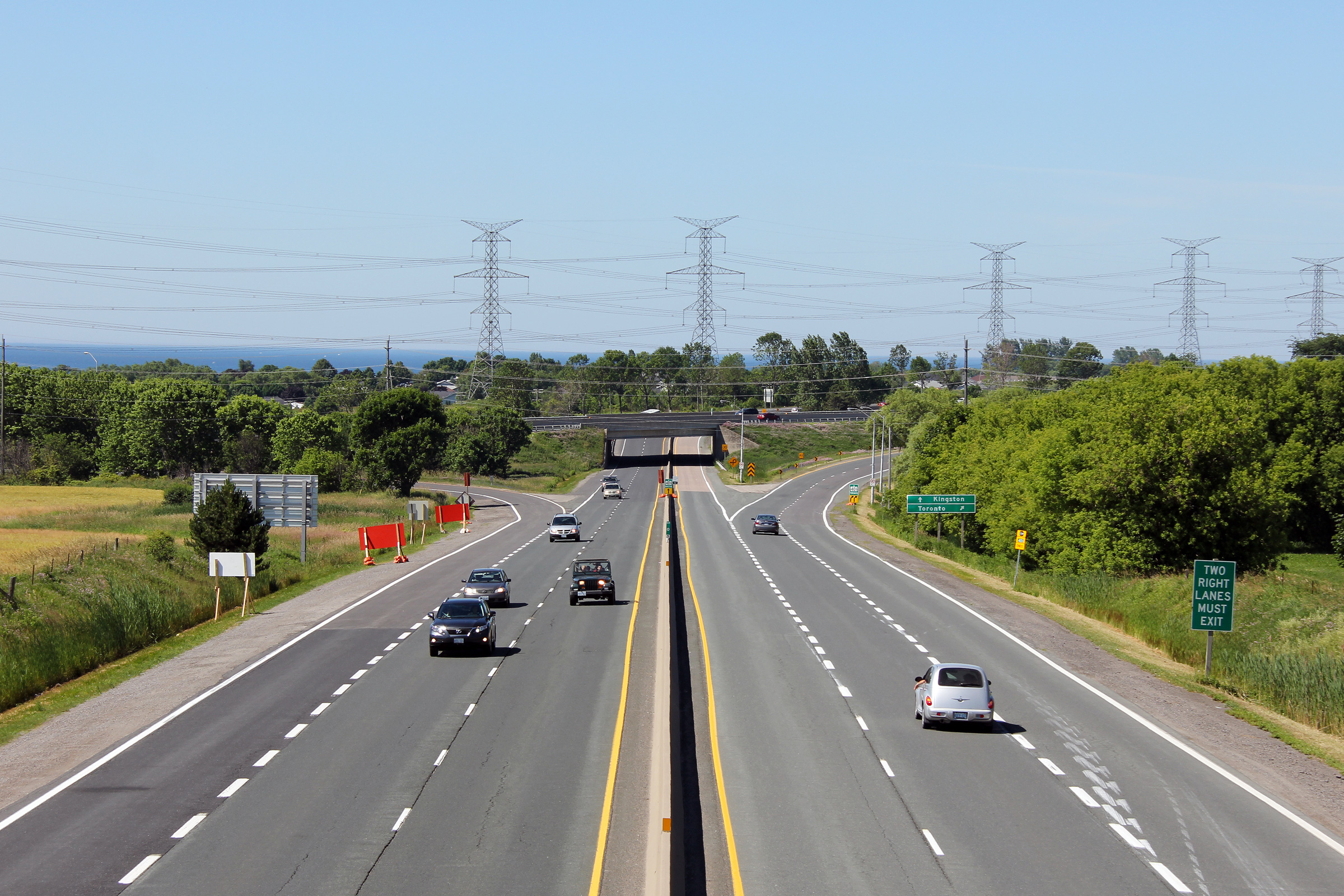
| Township of Cavan- Millbrook- North Monaghan County of Peterborough |
Turn-off signage for the Highway 7/28 interchange. Photo taken: September 9th, 2013. |
 (720x480) (720x480)(1440x960) (2400x1600) |
|
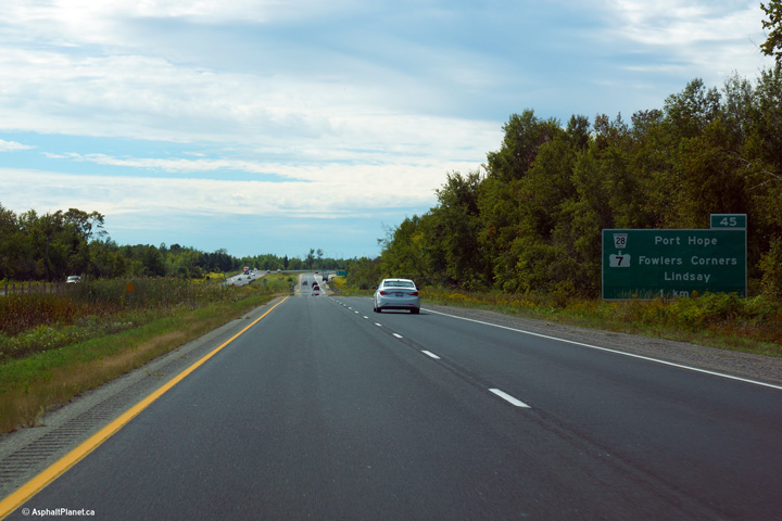
| Township of Cavan- Millbrook- North Monaghan County of Peterborough |
Westbound advanced signage for the Highway 7/28 interchange. Photo taken: September 9th, 2013. |
 (720x480) (720x480)(1440x960) (2400x1600) |
|
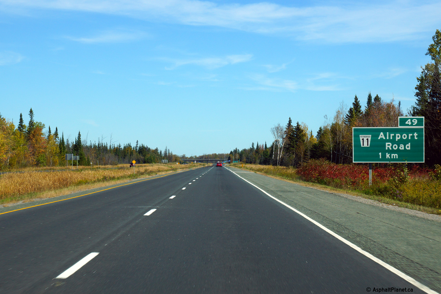
| Township of Cavan- Millbrook- North Monaghan County of Peterborough |
Advanced signage for the north/east-bound off-ramp to Airport Road. Photo taken: October 3rd, 2013. |
 (720x480) (720x480)(1440x960) (2400x1600) |
|
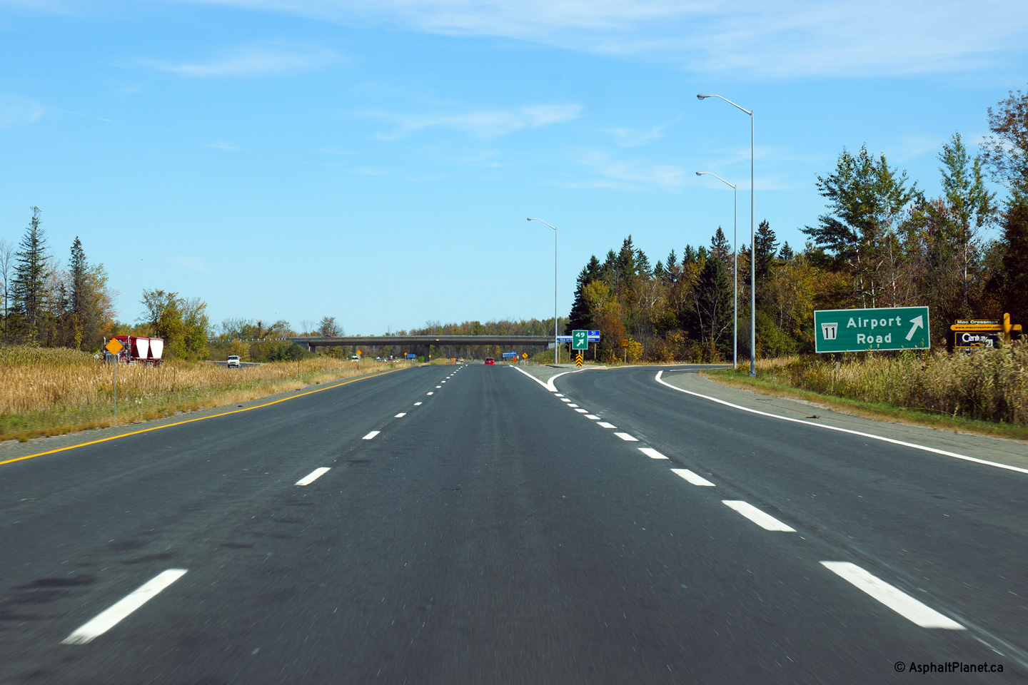
| Township of Cavan- Millbrook- North Monaghan County of Peterborough |
Turn-off signage at the north/east-bound ramp to Airport Road. Photo taken: October 3rd, 2013. |
 (720x480) (720x480)(1440x960) (2400x1600) |
|
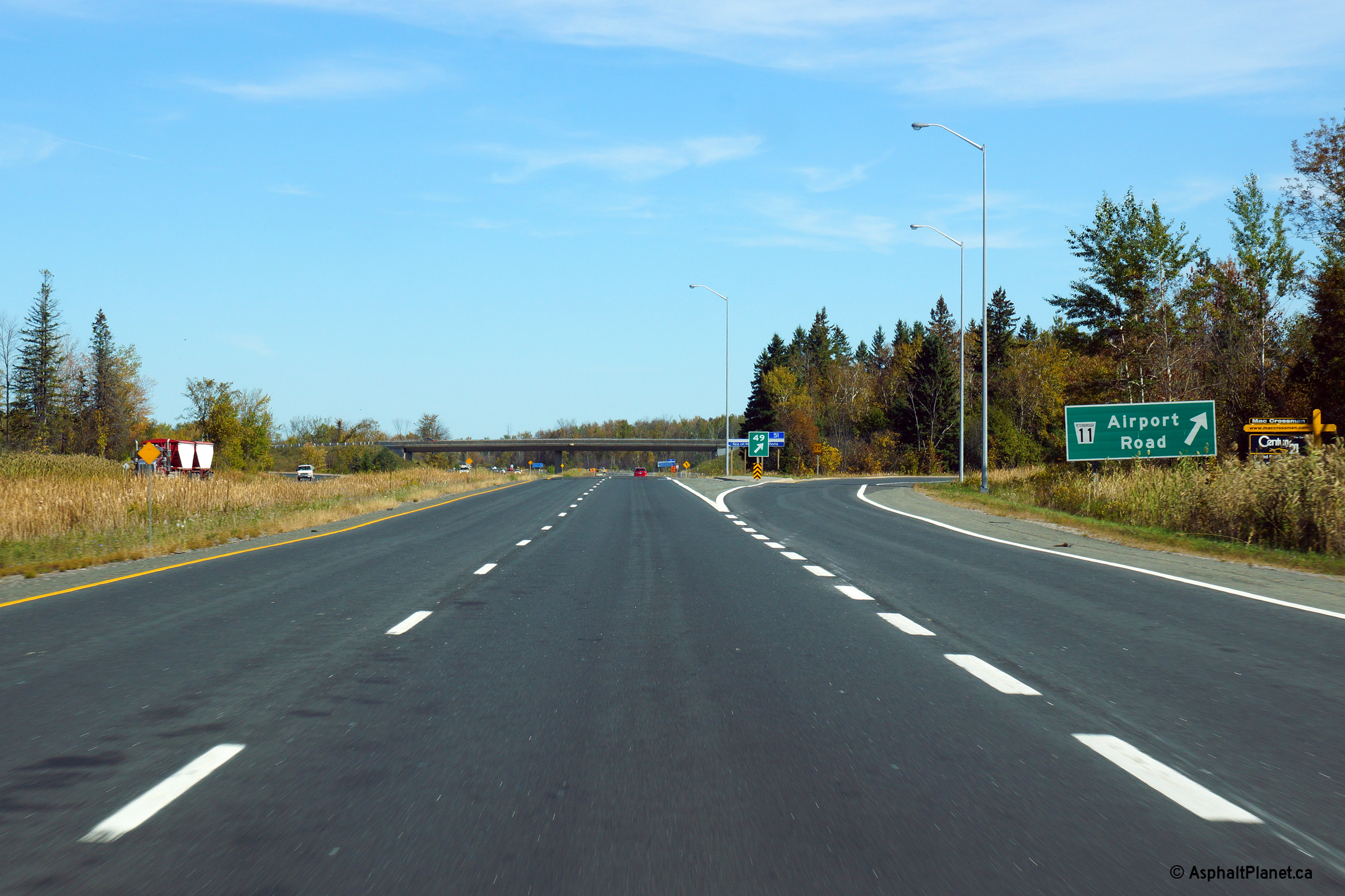
| Township of Cavan-
Millbrook- North Monaghan County of Peterborough |
This picture shows Highway 7/115 looking south/west bound from the Airport Road overpass. Airport Road is the only standard 'Parclo A4' interchange to be located along Highway 115; this is notable as the Parclo A4 is by far Ontario's most common interchange design. Picture taken: June 20th, 2006. |
|
|
| Township of Cavan-
Millbrook- North Monaghan County of Peterborough |
Looking northeast towards Peterborough along Highway 7/115 from the Airport
Road interchange. Peterborough's southwest city limit is located just
northeast of Airport Road. Picture taken: June 20th, 2006. |
 |
|
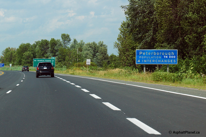
| City of Peterborough | City limits signage for the city of
Peterborough. Photo taken: July 19th, 2013. |
 (720x480) (720x480)(1440x960) |
|
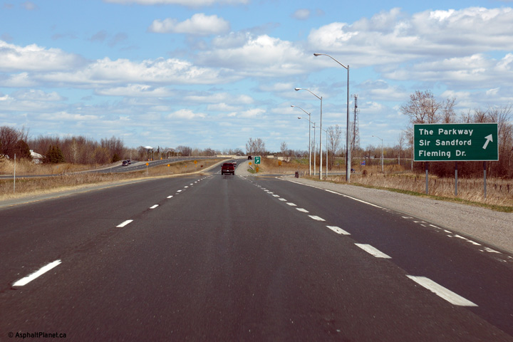
| City of Peterborough | Advanced signage for the Parkway interchange.
The Parkway is the principal route into Downtown Peterborough from Highway
115. Picture taken: May 6th, 2014. |
 (720x480) (720x480)(1440x960) (2400x1600) |
|
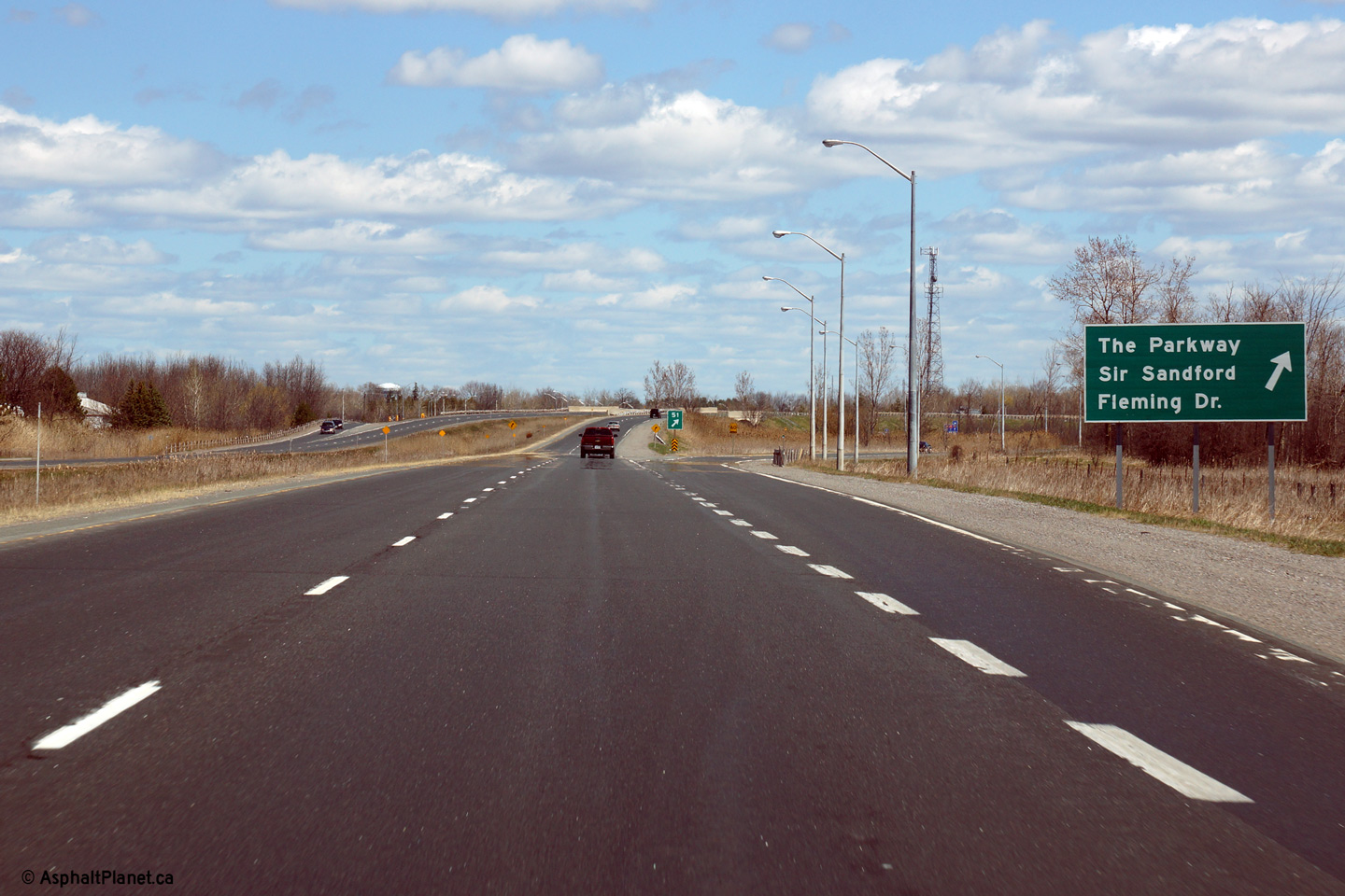
| City of Peterborough | Signage at the northbound off-ramp to the
Parkway. Both Highway 115 and 28 formerly followed the Parkway from
this interchange northerly into Peterborough before 1998. Picture taken: May 6th, 2014. |
 (720x480) (720x480)(1440x960) (2400x1600) |
|
| City of Peterborough | Easterly view along Highway 7/115 from the
Parkway interchange. The high level Otonabee River bridges are visible
in the distance of this photo. Photo taken: June 14th, 2013. |
 |
|
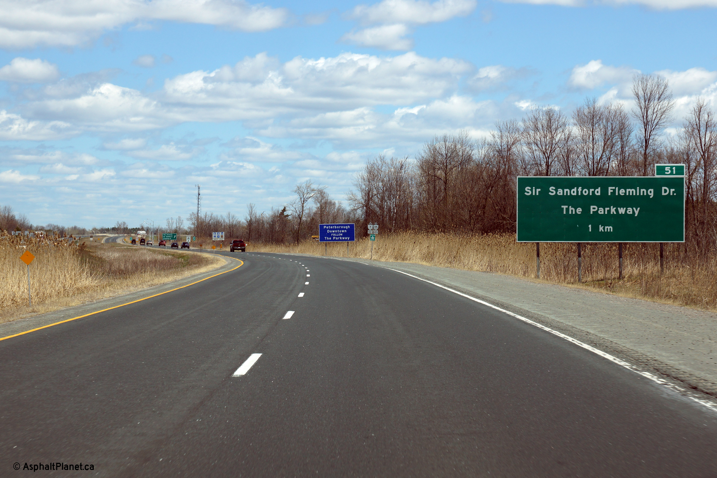
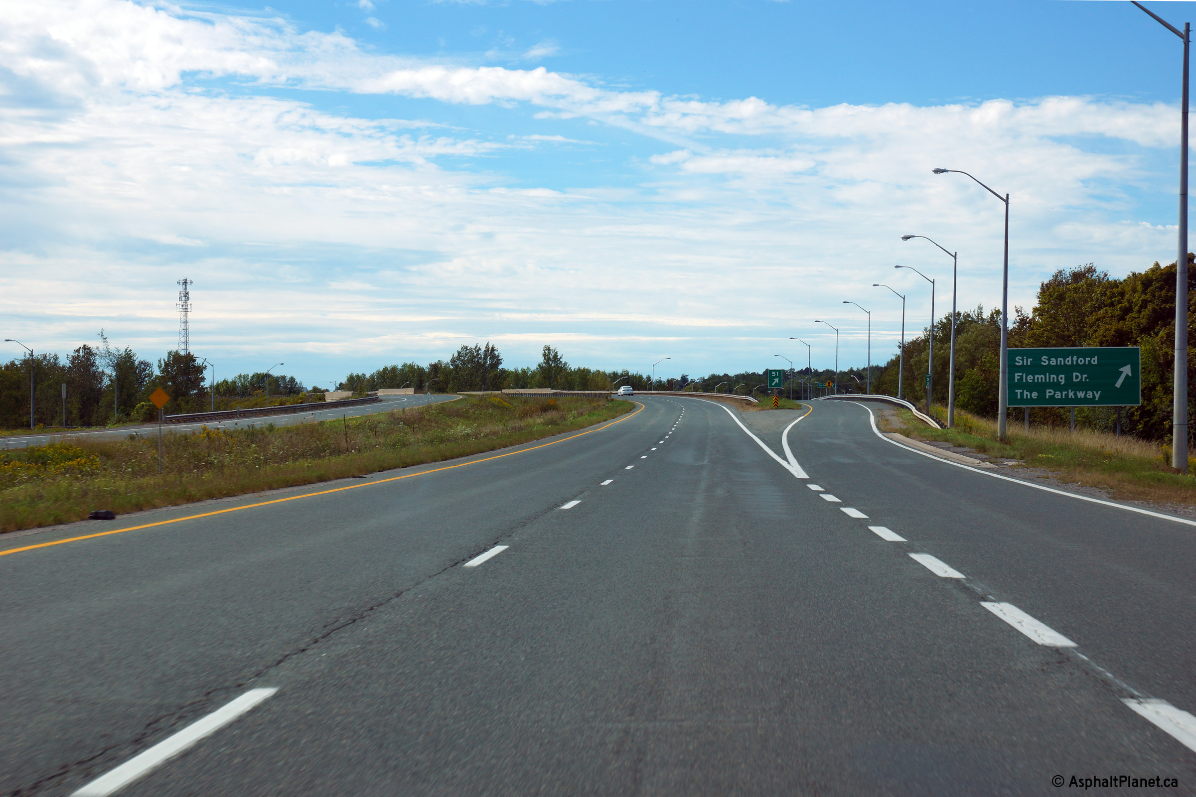
| City of Peterborough | Westbound signage approaching the Sir Sandford
Fleming Drive and Parkway interchanges. Before 1998, Highway 7 exited
the divided highway and followed today's Sir Sandford Fleming Drive
alignment. Highway 28 was signed through Peterborough following the
Parkway, and continued concurrent with Highway 115 south of this
interchange. Photo taken: September 9th, 2013. |
 (720x480) (720x480)(1440x960) (2400x1600) |
|
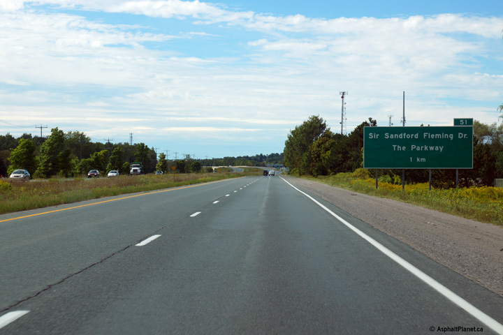
| City of Peterborough | Advanced signage for the Sir Sandford Fleming
Drive and Parkway interchanges. Photo taken: September 9th, 2013. |
 (720x480) (720x480)(1440x960) (2400x1600) |
|
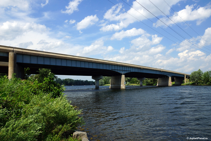
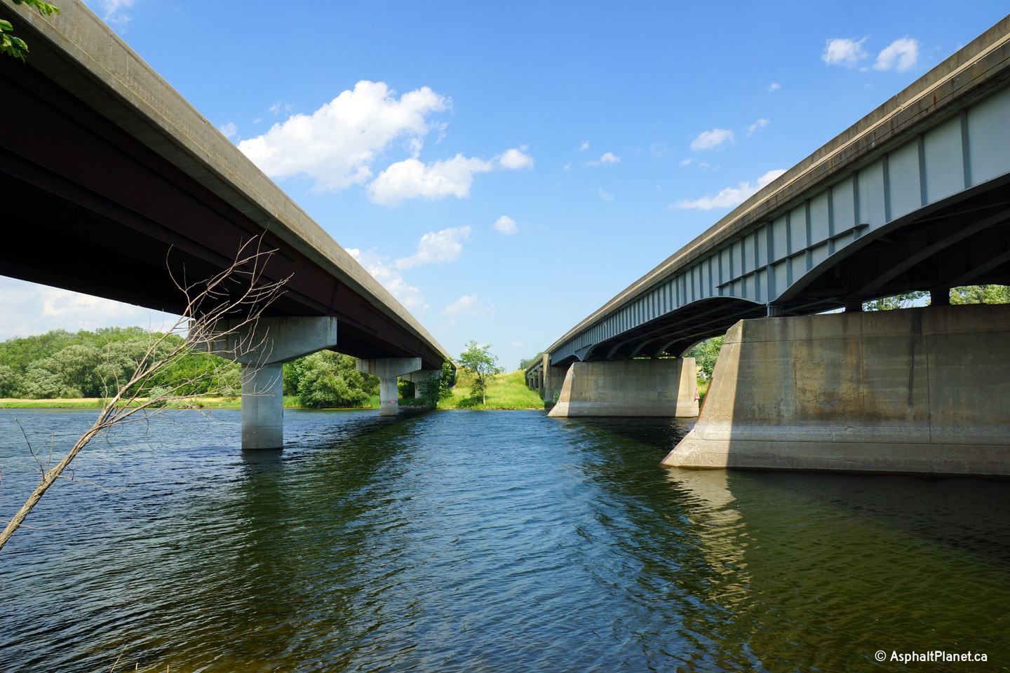
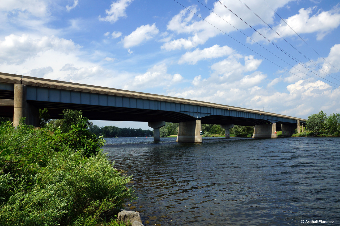
| City of Peterborough | Easterly view beneath the Otonabee River
bridges. The right hand structure (today's eastbound lanes) was completed
during the mid-1950s. The left hand structure (today's westbound lanes) was
later added during a twinning project in the early 1980s. Photo taken: July 19th, 2013. |
 |
|
| City of Peterborough | View looking northerly towards the Otonabee
River bridges. Steel bridge designs advanced considerably during
the 30 years between the construction of the eastbound structure and newer
structure. Photo taken: July 19th, 2013. |
 |
|
| City of Peterborough | Westerly view along Highway 7/115 from the
Ashburnham Road overpass. Photo taken: July 3rd, 2011. |
||
| City of Peterborough | Easterly view from the Ashburnham Road
overpass. Immediately east of the Ashburnham Road overpass, Highway 7/115
crosses overtop of a railway spur that is formerly the mainline of a railway that stretched
easterly from Peterborough to Belleville. Photo taken: July 3rd, 2011. |
 (720x480) (1440x960) (2400x1600) |
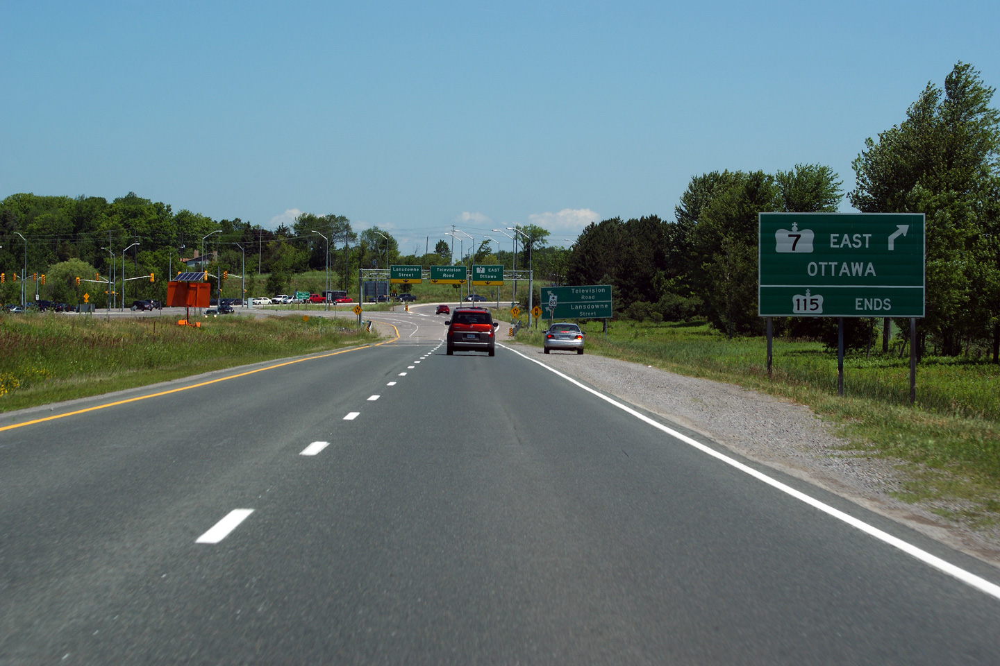
|
| City of Peterborough | Easterly view approaching the end of the Highway
7 freeway, and the end of Highway 115. Photo taken: July 3rd, 2011. |
 (720x480) (720x480)(1440x960) (2400x1600) |
|
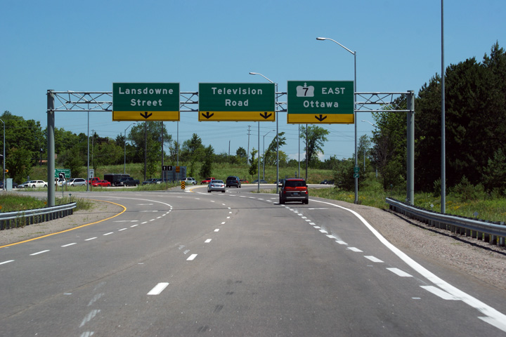
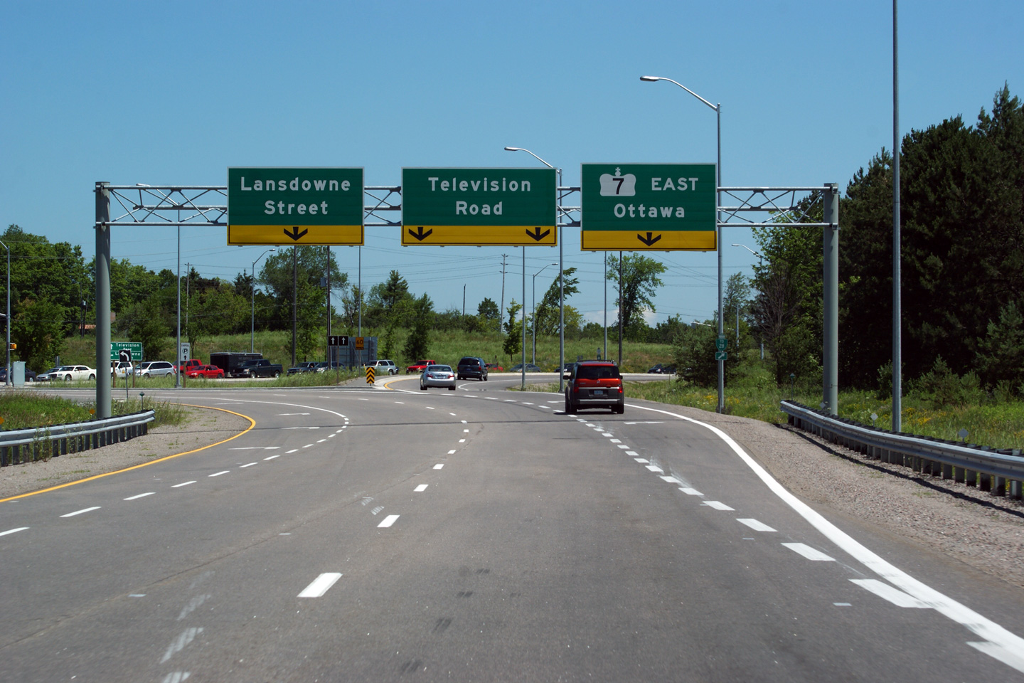
| City of Peterborough | Highway 7 exits to the right at this final
intersection along Highway 115. Lansdowne Street is the former
alignment of Peterborough's Highway 7B. Photo taken: July 3rd, 2011. |
 (720x480) (720x480)(1440x960) (2400x1600) |
|
| Highway 115 ends with the freeway at Lansdowne Street. Click here to continue easterly along Highway 7. |
Other Images Related to Highway 115:
| Proper Municipality Name | Photo Description | Photo |
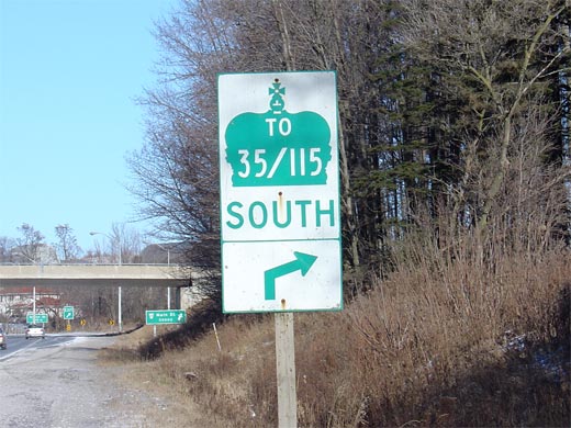
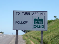
| Municipality of Clarington Regional Municipality of Durham |
This picture shows an old style turnaround sign along Highway
35/115 near Orono. Because not all
accesses to a RIRO expressway have an overpass to facilitate a median
crossing, signs are erected at exits with overpasses directing traffic
towards the opposite direction. This sign is fairly old, and is of an
outdated design. Modern signs look more like conventional
trailblazers. Picture taken: 55kb. |
 |
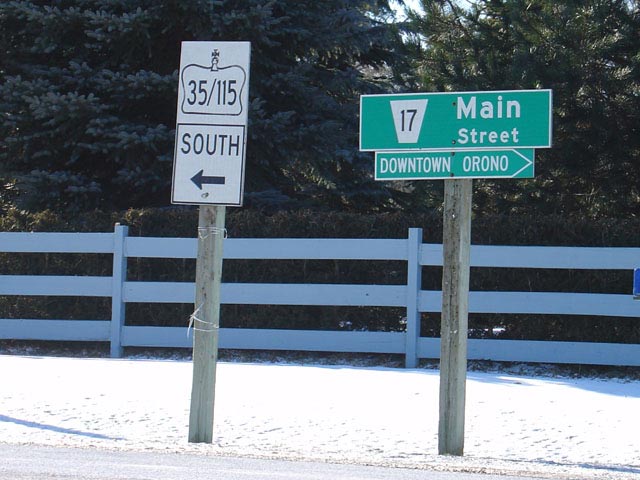
| Municipality of Clarington Regional Municipality of Durham |
This is a fairly atypical square for Ontario's Highway's. Highway 35/115 is the only highway that I have seen where two highway numbers are shown in one shield or trailblazer.
Picture size: 60kb |
 |
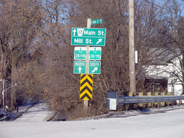
| Municipality of Clarington Regional Municipality of Durham |
This picture shows a trailblazer assembly in Downtown Orono.
Interestingly, Mill Street represents the old alignment of
Highway 35 before the Orono by-pass was
completed in 1956. Picture size: 95kb. |
 |
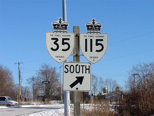
| Municipality of Clarington Regional Municipality of Durham |
Old Style Highway 35/115 signage located at
a RIRO intersection near Orono. Older style shields like this are
quickly disappearing across Ontario. Picture size: 45kb. |
 |
| City of Peterborough |
This picture is taken looking north along Airport Road at the Highway 7/115 overpass. It is interesting to note that the control cities on this signage were never updated when Highway 7 was realigned concurrent with the 115 in 2003. Despite that this is a fairly new sign, the control cities marked on it are relics from the time when Highway 28 ran concurrent with the 115 though this area. Picture taken: June 19th, 2004. Size: 25kb |
 |
<- Highway 112 Images
Back to Highway 115
Highway 117 Images ->
Copyright (c) 2004-2014, Scott Steeves (Webmaster) scott@asphaltplanet.ca


