AsphaltPlanet.ca > OntHighways > Highway 45 > Images
< Hwy 44    Hwy 46 >

King's Highway 45 - www.OntHighways.com

Highway 45 was completely downloaded January 1st, 1998, and surprise, surprise was a totally illogical download.  Highway 45 is another one of those short-cut roads for those travelers who wish to avoid busy Highway 115 or busy Highway 37.  Highway 45 has been renamed Northumberland Road 45 and Peterborough Road 45.


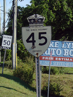
King's Highway 45 Shield

  Southern Terminus:  Highway 45 ended in Downtown Cobourg at the Highway 2 junction.

Northern Terminus:  Junction Highway 7 in Norwood

Length:  54.1 km

Multiplexes:  None

Freeway:  No

AADT (1994):  Highest:  7,600 from Highway 401 northerly to Northumberland Road 74;

                             Lowest:  2,400, from Hastings to Norwood.

Status:  Totally downloaded in 1998.  Now known as Northumberland Road 45 and Peterborough Road 45.

Road Info:  Highway 45 is in pretty good shape for its entire length.  The best maintained section is from Highway 401 northerly to north of Baltimore.  Some sections of Highway 45 have actually been improved by Northumberland county since downloading, but I speculate this was probably as a result of funding some counties got for assuming these downloaded roads.


Highway 45 information:


OntHighways.com  

Detailed Route information available below
Virtual Tour of Highway 45


TheKingsHighway.ca   History of Highway 45
Photographic History of Highway 45

Communities and Major Intersections located Along Highway 45 from South to North:

Proper Municipality Name Community Name Distance Intersection Name

From Cobourg Northerly to North of Hastings Highway 45 is now known as Northumberland Road 45

Town of Cobourg Cobourg 0 km / 54.1 km Highway 2 (King Street)
Town of Cobourg Cobourg --- Elgin Street (Northumberland Road 20)
Town of Cobourg Cobourg 3.2 km / 50.9 km King's Highway 401 (Autoroute Macdonald - Cartier Freeway)
Township of Hamilton Creighton Heights --- -----
Township of Hamilton Baltimore 7.7 km / 46.4 km Dale Road (Northumberland Road 74)
Township of Hamilton ----- --- Harwood Road (Northumberland Road 15)
Township of Alnwick Haldimand ----- 14.5 km / 39.6 km Northumberland Road 22
Township of Alnwick Haldimand ----- 21.4 km / 32.7 km Northumberland Road 9 & Northumberland Road 29
Township of Alnwick Haldimand Fanella --- -----
Township of Alnwick Haldimand Alderville --- -----
Township of Alnwick Haldimand Roseneath 29.2 km / 24.9km Northumberland Road 24
Township of Alnwick Haldimand ----- --- Merrill Road (Northumberland Road 33)
Town of Trent Hills Hastings --- Northumberland Road 25
Town of Trent Hills Hastings 44.4 km / 9.7 km (Concession Road 13)

 NB:  Turn Right at the top of the hill north of the bridge in Hastings, SB: Turn left at well marked intersection towards downtown Hastings to continue on Highway 45

Town of Trent Hills Hastings --- (TO) Peterborough Road  2

North of the Hastings Town Limits Highway 45 is known as Peterborough Road 45

Township of Ashphodel- Norwood Norwood --- Peterborough Road 42
Township of Ashphodel- Norwood Norwood 54.1 km / 0 km King's Highway 7 (TCH Central Ontario Route) & Peterborough Road 40

Highway 45 ENDS


<- Highway 44         www.OntHighways.com - Home         Highway 46 ->


Copyright (c) 2004-2010, AsphaltPlanet.ca  AsphaltPlanet@asphaltplanet.ca

Page last updated:  June 1st, 2010

Page created:  March 12th, 2004