|
Proper Municipality Name |
Photo Description |
Photo |
|
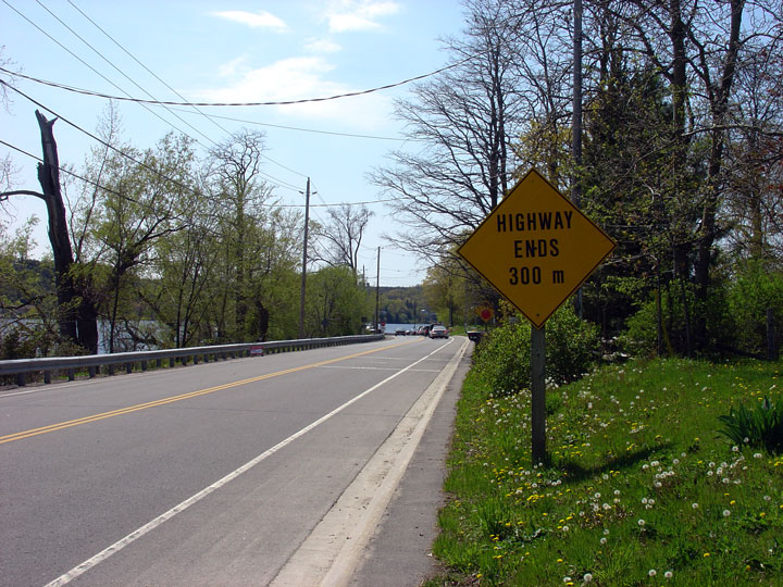
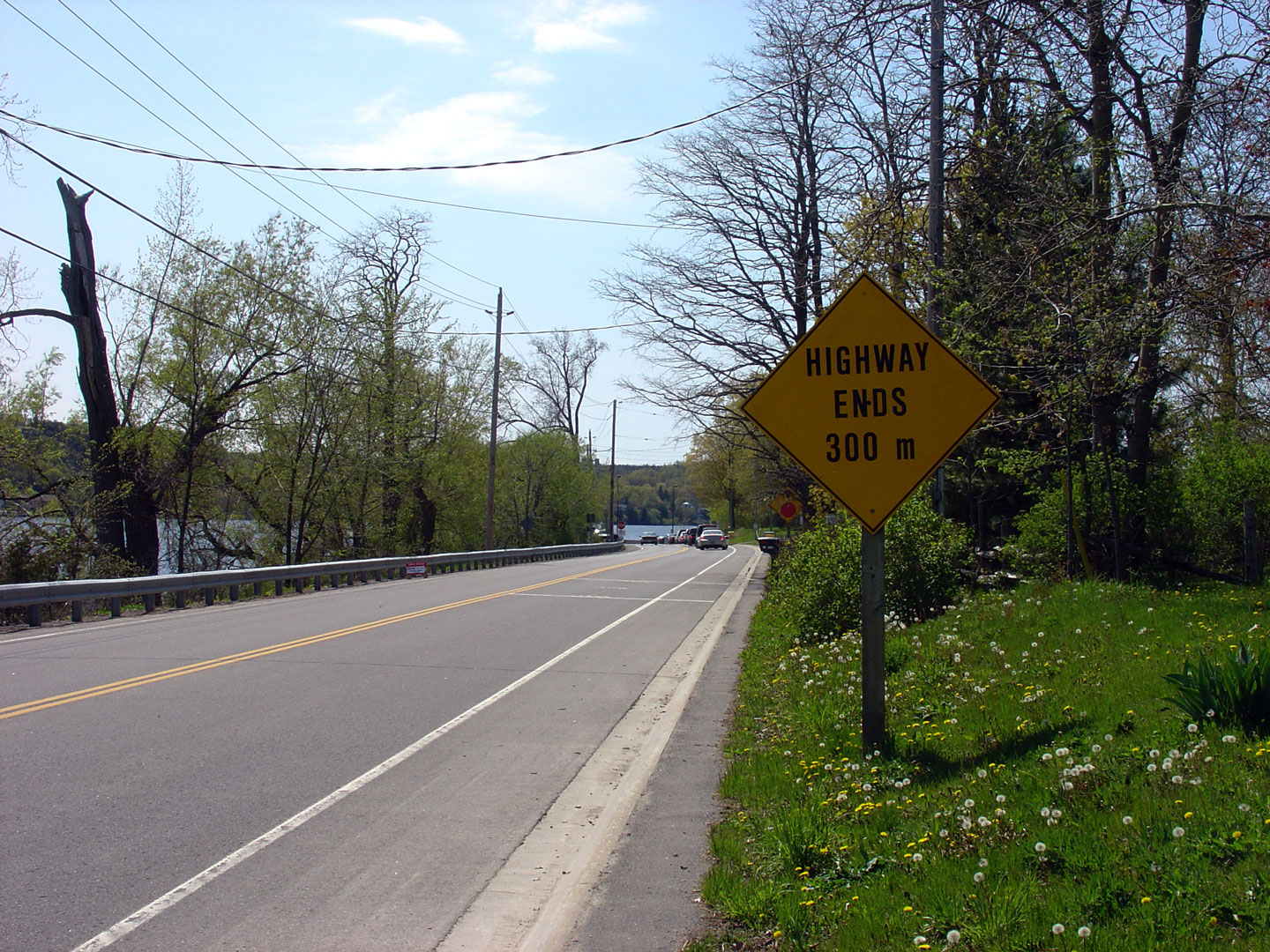
Photos taken
from driver's perspective appear offset from centre-line Photos: |
East-
Bound |
West-
Bound |
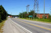
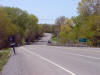
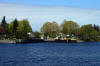
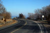
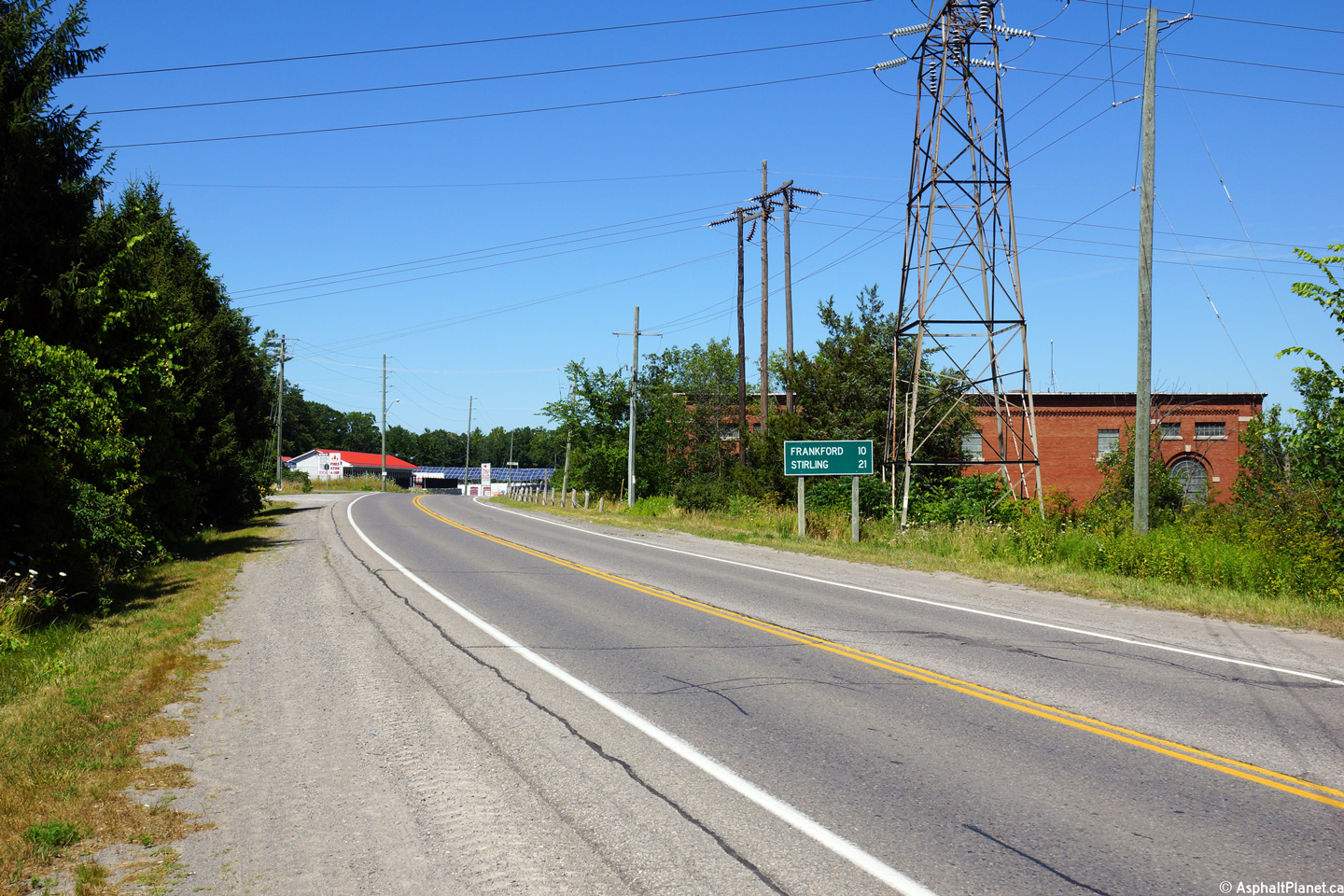
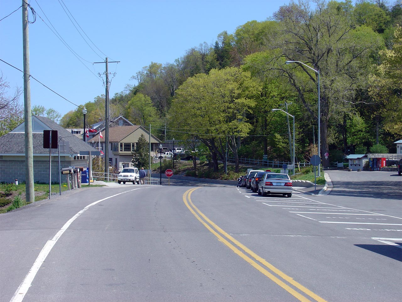
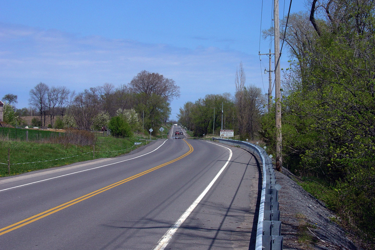
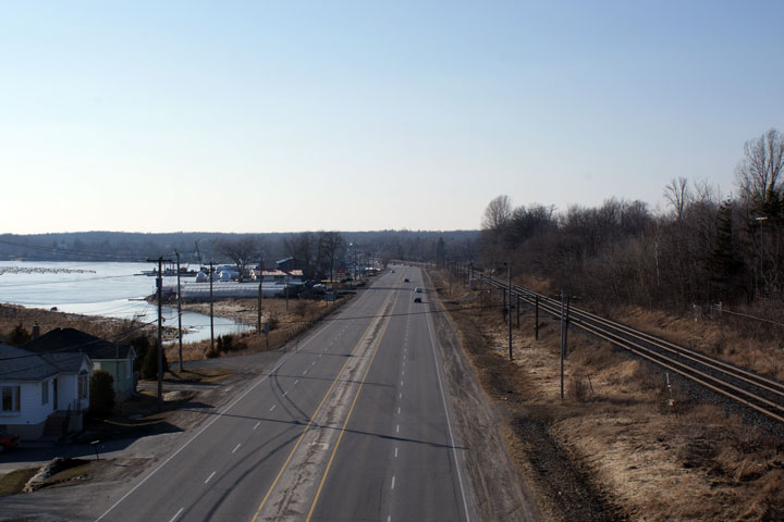
| City of Quinte West |
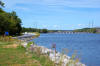
This view looks northerly towards Frankford as Highway 33 passes in close
proximity to the Trent River.
Photo taken: September 11th, 2011. |
(720x480)
(1440x960)
(2400x1600) |
| City of Quinte West |
Highway 33 actually passes between two areas of the Sonoco paper Mill
between Trenton and Frankford.
Photo taken: September 11th, 2011. |
(720x480)
(1440x960)
(2400x1600) |
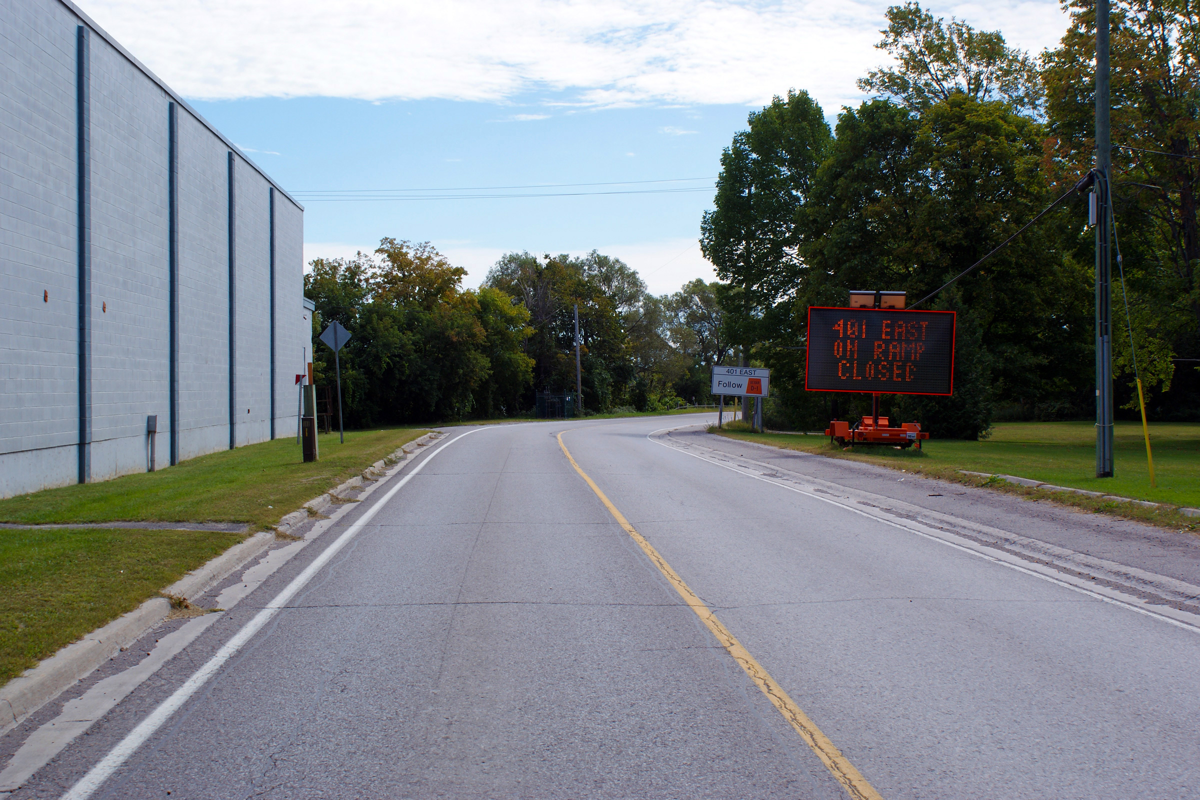
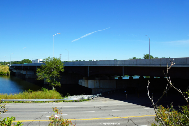
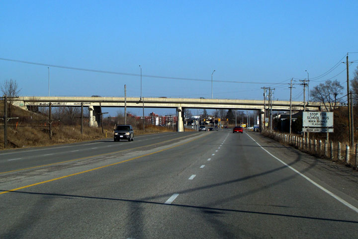
| City of Quinte West |
Another southerly view as Highway 33 passes alongside the Sonoco plant.
When this photo was taken, the ramp to Highway 401 East was closed as part
of a multi-year construction project to widen and rehabilitate the Highway
401 overpass over both Highway 33 and the Trent River bridge.
Photo taken: September 11th, 2011. |
(720x480)
(1440x960)
(2400x1600) |
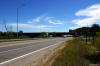
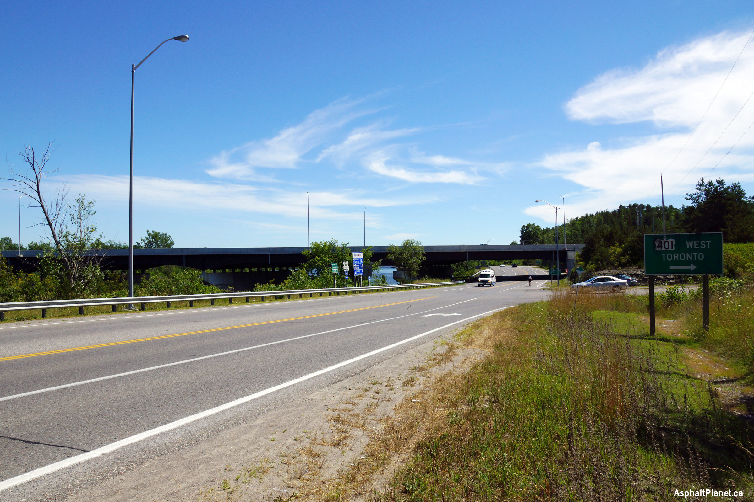
| City of Quinte West |
View looking northerly from north of the Highway 401 interchange as Highway
33 passes by the Sidney Hydro-Electric Generating Station.
Photo taken: July 26th, 2013. |
(720x480)
(1440x960)
(2400x1600) |
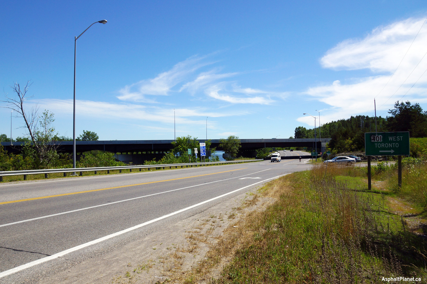
| City of Quinte West |
Southerly view approaching the Highway 401 interchange along Highway 33.
Photo taken: July 26th, 2013. |
(720x480)
(1440x960)
(2400x1600) |
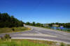
| City of Quinte West |
Westbound ramp terminals located just north of the Highway 401 structure.
Note that the ramps to and from the westbound 401 are bidirectional.
Bidirectional ramps were common on divided highways built during the 1950s
but quickly fell out of favour on newer roads. Few examples of
bidirectional ramps remain in Ontario. The Highway 33 interchange will
be extensively reconfigured when Highway 401 is widened to six lanes in the
future.
Photo taken: July 26th, 2013. |
(720x480)
(1440x960)
(2400x1600) |
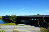
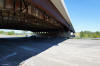
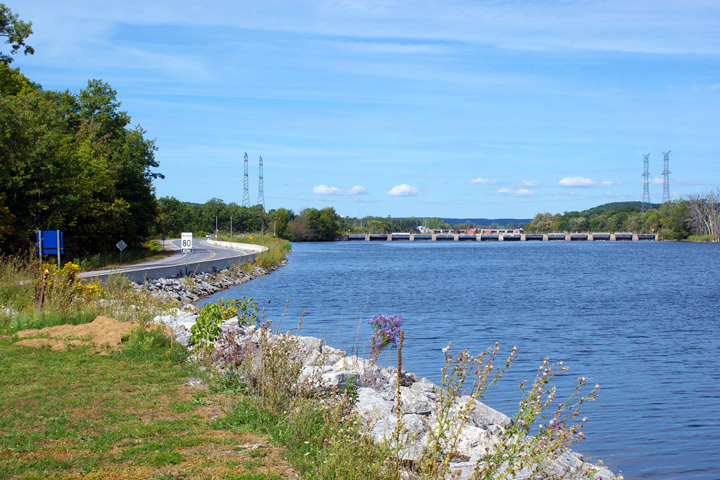
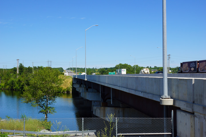
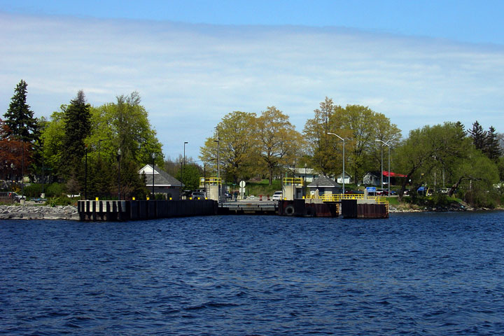
| City of Quinte West |
Two views looking towards the northern side of the structure that carries
Highway 401 overtop of both Highway 33 and the Trent River. The Trent
River bridge was completed in 1956 and is 188.3m long. During a
multi-year construction project, the structure was widened from a
cross-section of 30.582 m to a cross-section of 38.240m. This widened
cross-section allows for a six lane Highway 401 cross-section complete with
speed change lanes for the Highway 33 interchange and compromised left and
right shoulders.
Photos taken: July 26th, 2013. |
(720x480)
(1440x960)
(2400x1600)

(720x480)
(1440x960)
(2400x1600) |
|
Highway 401 is Southern Ontario's principal east-west
highway. Click
here for Highway
401-West images and
here for Highway 401-East images. |
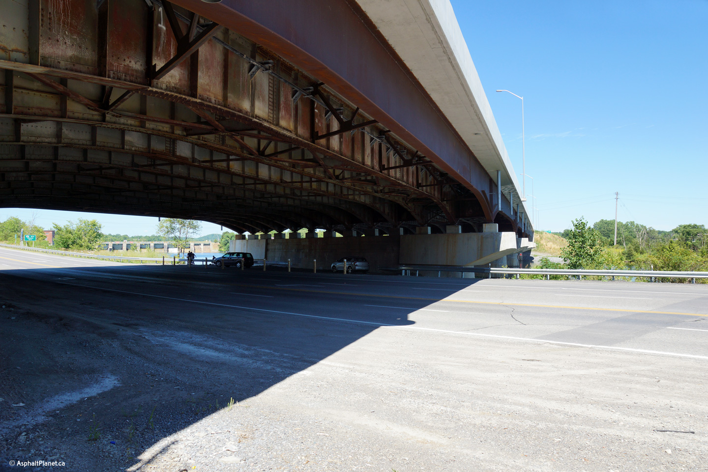
| City of Quinte West |
Highway 33 passes beneath Highway 401 through the same structure that
carries the 401 over the Trent River. A multiyear construction
contract was completed in 2012 to rehabilitate and widen the existing
structure. During this contract, the pier caps were extended out
over the river and an additional haunched steel girder beam was erected on
both sides of the structure. The structure was widened in advance of
Highway 401 being widened to six lanes through the area.
Photo taken: July 26th, 2013. |
(720x480)
(1440x960)
(2400x1600) |
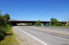
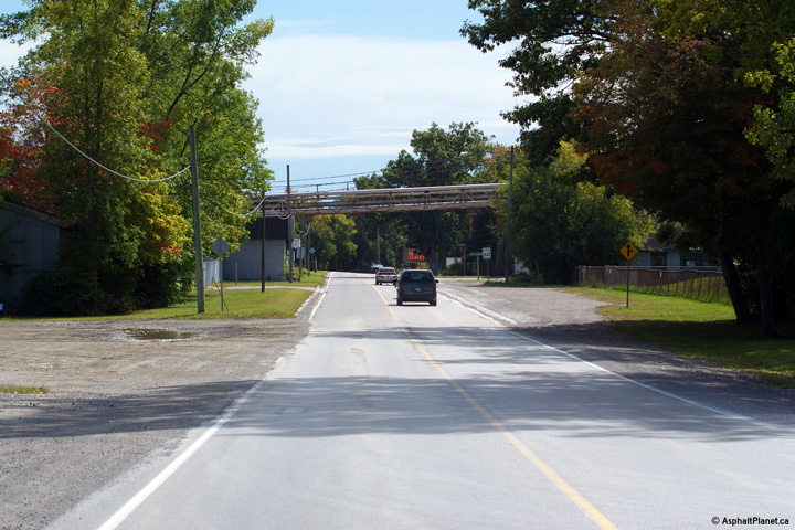
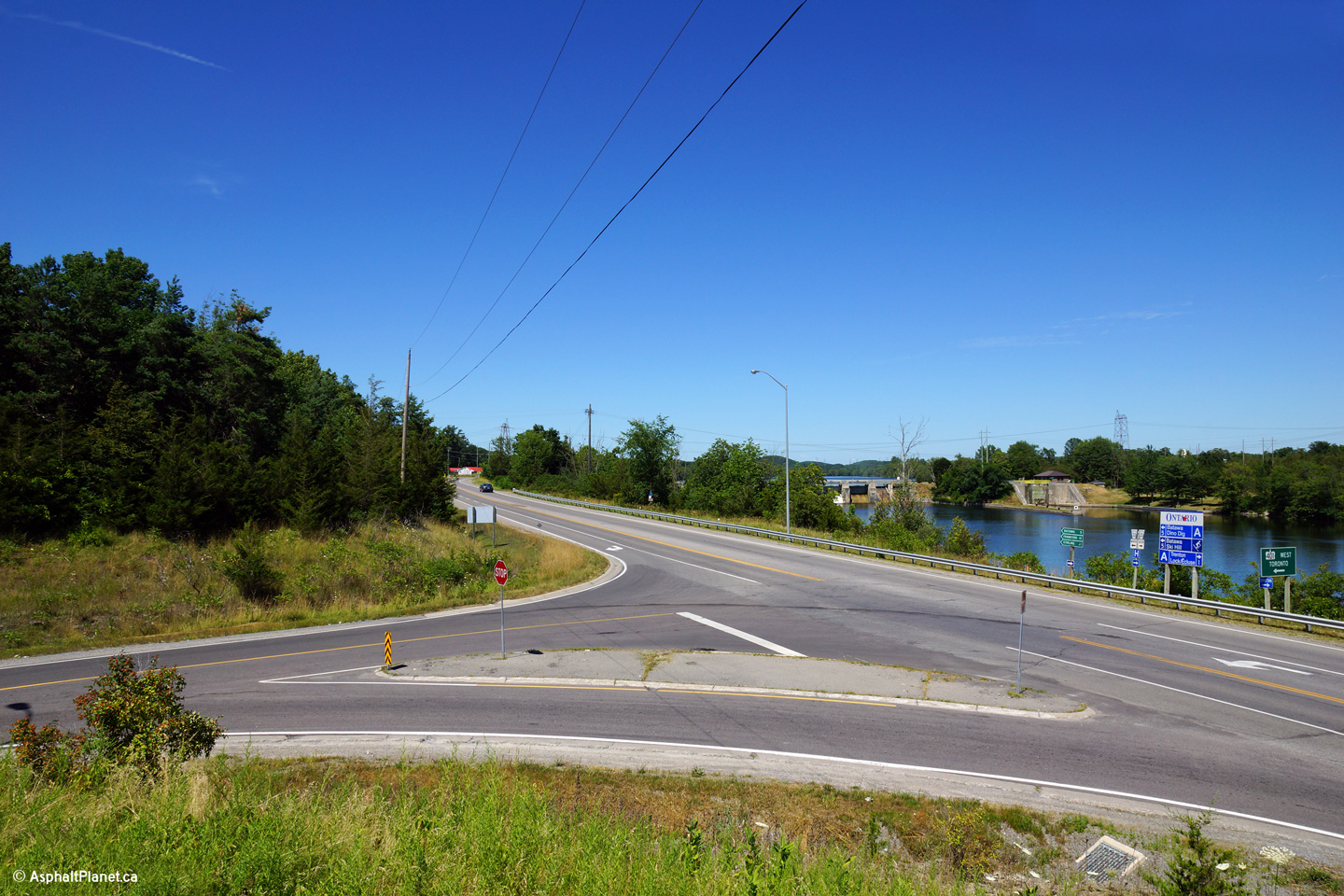
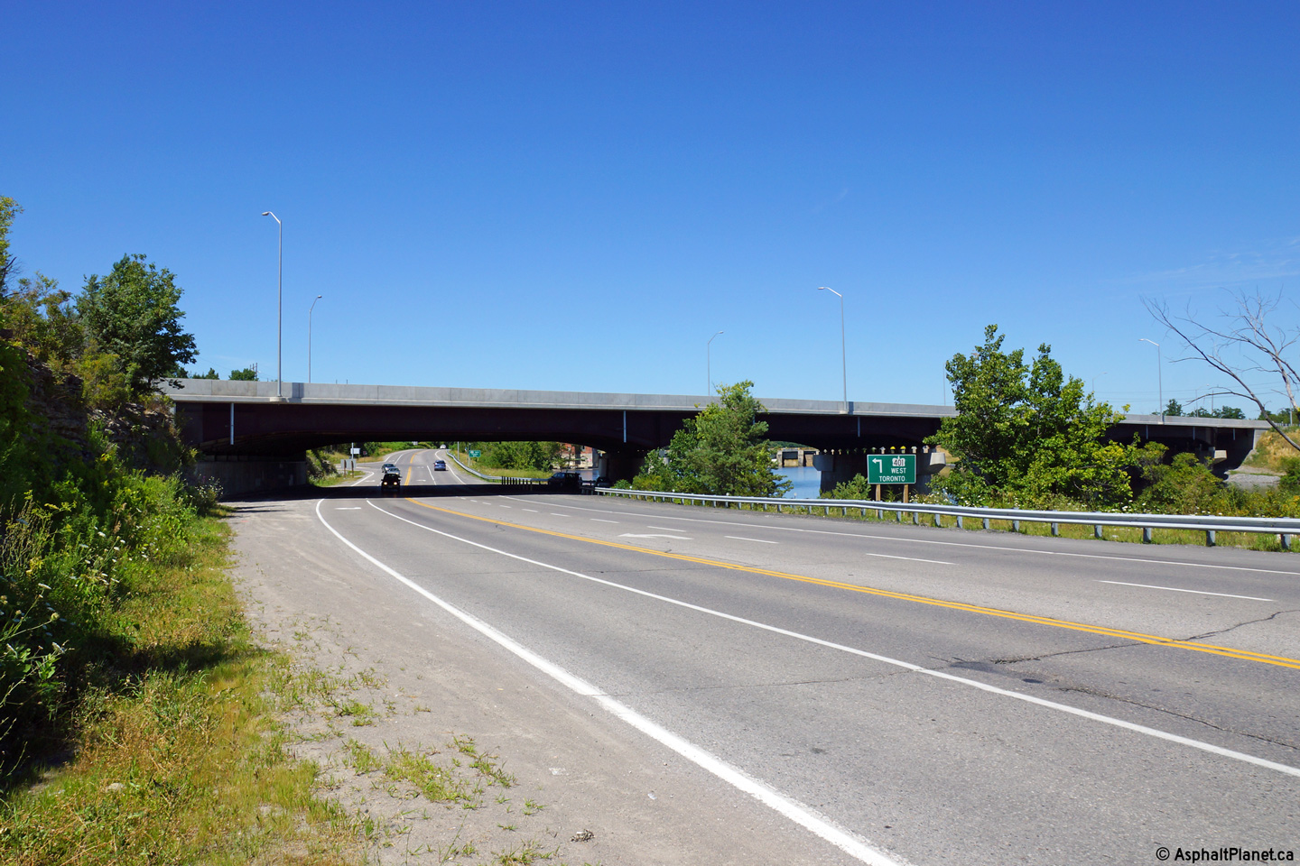
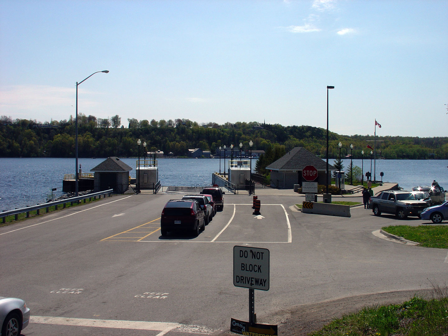
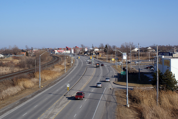
| City of Quinte West |
View looking northerly along Highway 33 towards the Highway 401 overpass.
Additional photos of the Trent River structure before it was widened can be
found
here.
Photo taken:
July 26th, 2013. |
(720x480)
(1440x960)
(2400x1600) |
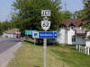
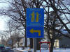
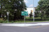
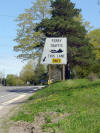
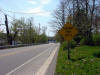
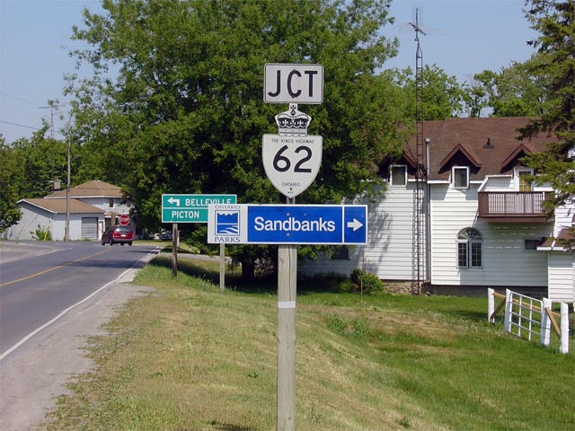
| Municipality of Prince Edward
County |
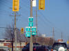
Junction shield denoting the upcoming Highway 62
junction in Bloomfield.
Photo size: 85kb. |
 |
|
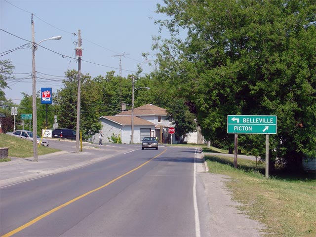
Municipality of Prince Edward County |
Looking east towards Highway 62 in
Bloomfield. At this stop sign, through Highway 33 traffic must turn
right to continue easterly en route to Picton. A left turn leads
travelers north on Highway 62 towards
Belleville.
Photo taken: June 2nd, 2005. |
 |
|
Highway 62 runs north from Highway 33 in Bloomfield through Belleville to
Bancroft and beyond.
Click here for Highway 62 images. |
|
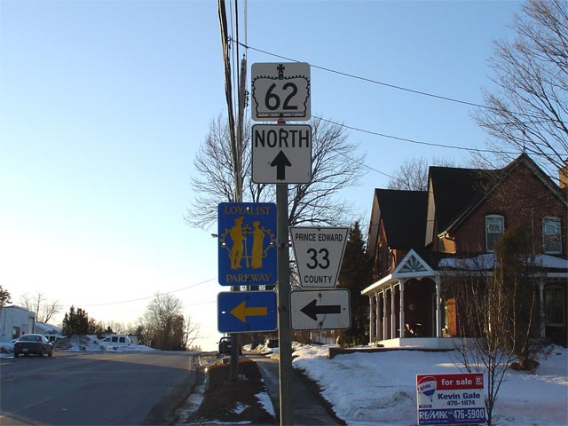
Municipality of Prince Edward County |
Sign assembly for Highway 62 junction along
westbound Highway 33 in Bloomfield. Since 1998 this junction has
represented the western terminus of Highway 33. The downloaded portion of
Highway 33 that leads travelers to Wellington and Trenton has since been
re-designated as Prince Edward Road 33.
Photo size: 55kb. |
 |
|
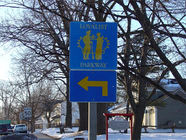
Municipality of Prince Edward County |
Oversized Loyalist Parkway marker located in advance of the
Highway 62 junction in Bloomfield. Photo
size: 110kb. |
 |
|
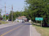
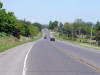
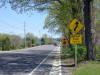
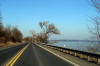
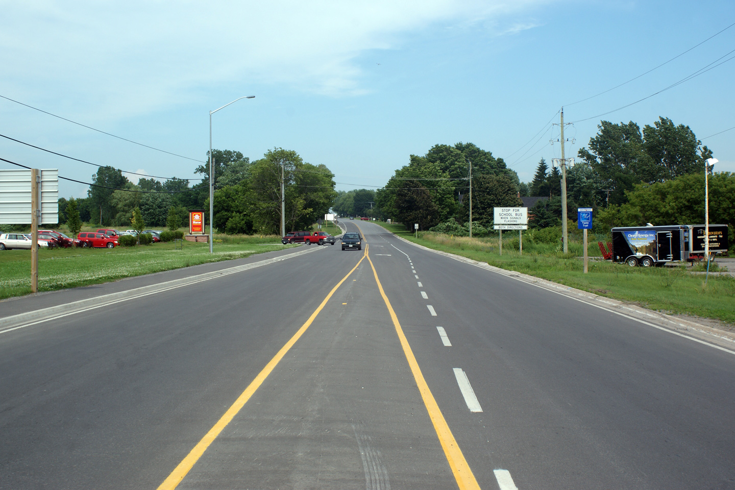
Municipality of Prince Edward County |
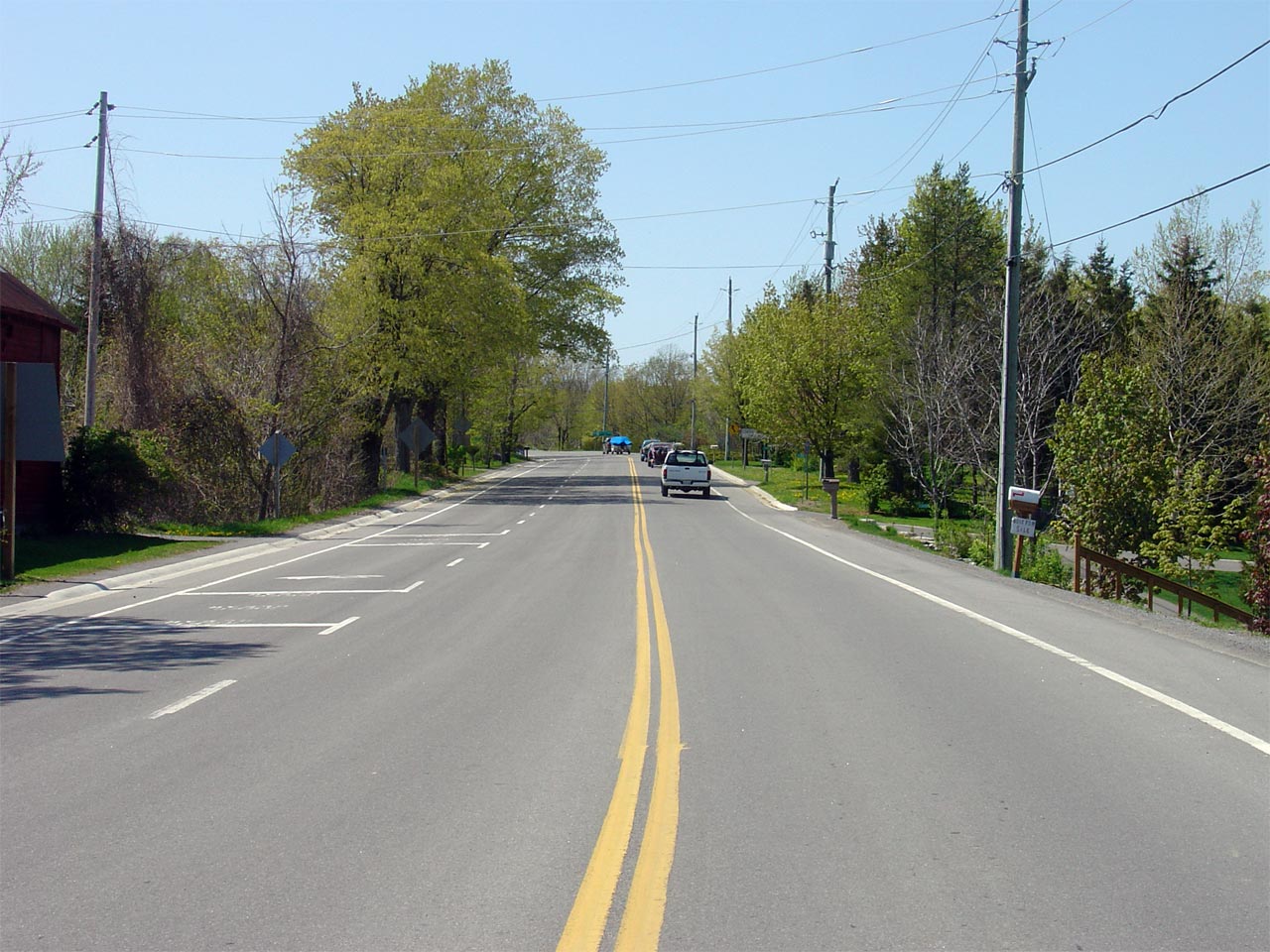
Looking east along Highway 33 from just east of the Bloomfield town limits.
Highway 33 is quite busy with tourist traffic during the summer months
through this area. Photo taken: June 2nd, 2005. Size: 50kb. |
 |
|
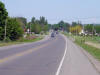
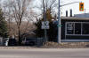
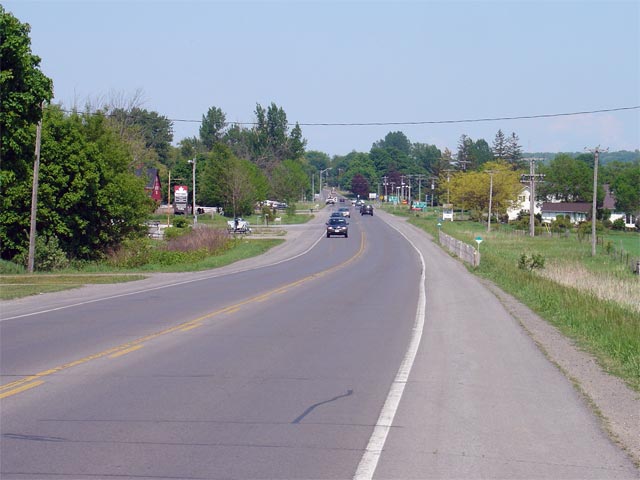
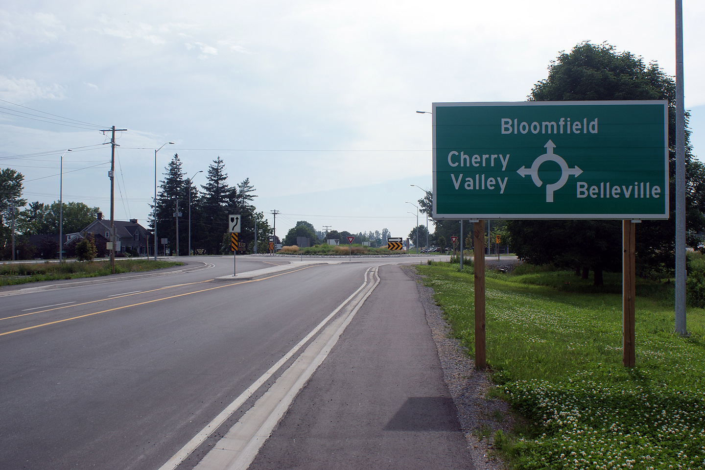
Municipality of Prince Edward County |
Looking east along Highway 33 towards the Prince Edward Road 1 junction
located between Bloomfield and Picton. This photo was taken prior to
the installation of a modern roundabout at the Prince Edward Road 1 junction Photo taken: June 2nd, 2005.
Size: 50kb. |
 |
|
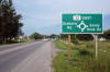
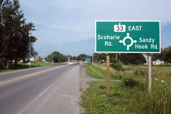
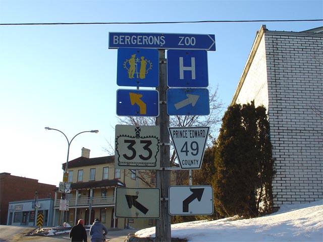
Municipality of Prince Edward County |
Advanced signage for the Prince Edward Road 1 intersection.
Interestingly the signage does not indicate either Scoharie Road or Sandy
Hook Road as Prince Edward County Road 1.
Photo taken: June 28th, 2010. |
 Low
Res Low
Res
High Res |
|
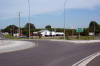
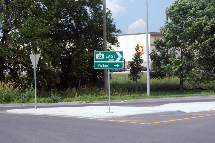
Municipality of Prince Edward County |
Second diagram sign for the roundabout intersection, this sign only
highlighting control cities. This fashion of indicating control city
information on a secondary diagram sign is also used on the
Arthur Street (Old
Highway 86) roundabout near St. Jacob's, in the Region of
Waterloo. MTO worked closely with the Region of Waterloo during the
implementation of the Highway 33 roundabout.
Photo taken: June 28th, 2010. |
 Low
Res Low
Res
High Res |
|
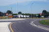
Municipality of Prince Edward County |
Centreline view of the roundabout -- looking easterly. Note that the
landscaping in the centre island hides view of Highway 33 continuing
easterly towards Picton. This is an important example of positive
guidance -- a driver is much less likely to notice the circular roadway
roundabout if they can see oncoming traffic approaching in the distance.
Photo taken: June 28th, 2010. |
(720x480)
(1440x960)
(2400x1600) |
|
Municipality of Prince Edward County |
Eastbound view approaching the stop bar of the Picton Roundabout.
Driver's approaching the circular roadway do not have the right of way, and
must yield to traffic approaching from the left.
Photo taken: June 28th, 2010. |
 Low
Res Low
Res
High Res |
|
Municipality of Prince Edward County |
View looking easterly along the circular roadway of Highway 33 at the south
leg of the roundabout.
Photo taken: June 28th, 2010. |
 Low
Res Low
Res
High Res |
|
Municipality of Prince Edward County |
Closeup of the fingerboard sign for Sandy Hook Road. Several design
elements of the Highway 33 roundabout are atypical of highway design in
Ontario. First, concrete surfaced centre islands are very atypical,
usually MTO specifies asphalt pavement. Also, signs mounted using
square steel post systems mounted on a pedestal base is a departure from the
standard u-channel post sign mount. These design elements appear to be
borrowed from the Region of Waterloo design specifications.
Photo taken: June 28th, 2010. |
 Low
Res Low
Res
High Res |
|
Municipality of Prince Edward County |
View of the Highway 33 fingerboard signage that greets drivers upon exiting
the Highway 33 roundabout.
Photo taken: June 28th, 2010. |
 Low
Res Low
Res
High Res |
|
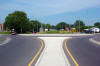
Municipality of Prince Edward County |
Westerly view approaching the County Road 1 Roundabout.
Photo taken: June 28th, 2010. |

Low Res
High Res |
|
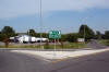
Municipality of Prince Edward County |
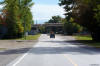
This view looks easterly along Highway 33 from just east of the County
Road 1 roundabout. Highway 33 was narrowed from four lanes to its
current configuration in 2008 to accommodate the single lane roundabout that
was constructed.
Photo taken: June 28th, 2010. |

Low Res
High Res |
|
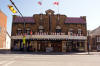
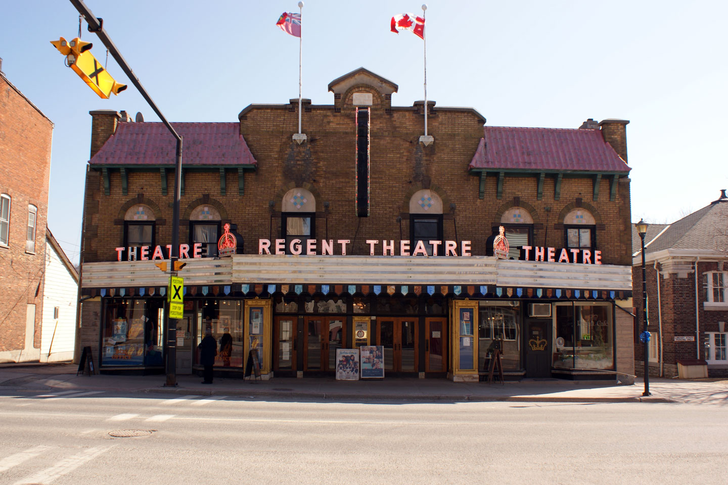
Municipality of Prince Edward County |
View of the Regent Theatre in Downtown Picton. Prince Edward County
draws a lot of tourist traffic, and likewise many of its small towns have
been beautifully kept and feature relic's from days past such as this twin
cinema. Theatre's such as this are quite rare today.
Photo taken: March 14th, 2009. |
Low Res
High Res |
|
Municipality of Prince Edward County |
This sign assembly was obviously missed by the department of Redundancy.
Notice the dual references to Highway 33 progressing through the
Highway 49 intersection. This signage
assembly is located in advance of the Highway 49
(now Prince Edward Road 49) intersection in Downtown Picton.
Photo size: 80kb. |
 |
|
Municipality of Prince Edward County |
Westbound signage assembly for the Highway 49
(now Prince Edward Road 49) junction in Picton. Photo taken: 60kb. |
 |
|
Highway 49 is a short highway that links Picton to The 401
east of Belleville.
Click here for Highway
49 images. |
|
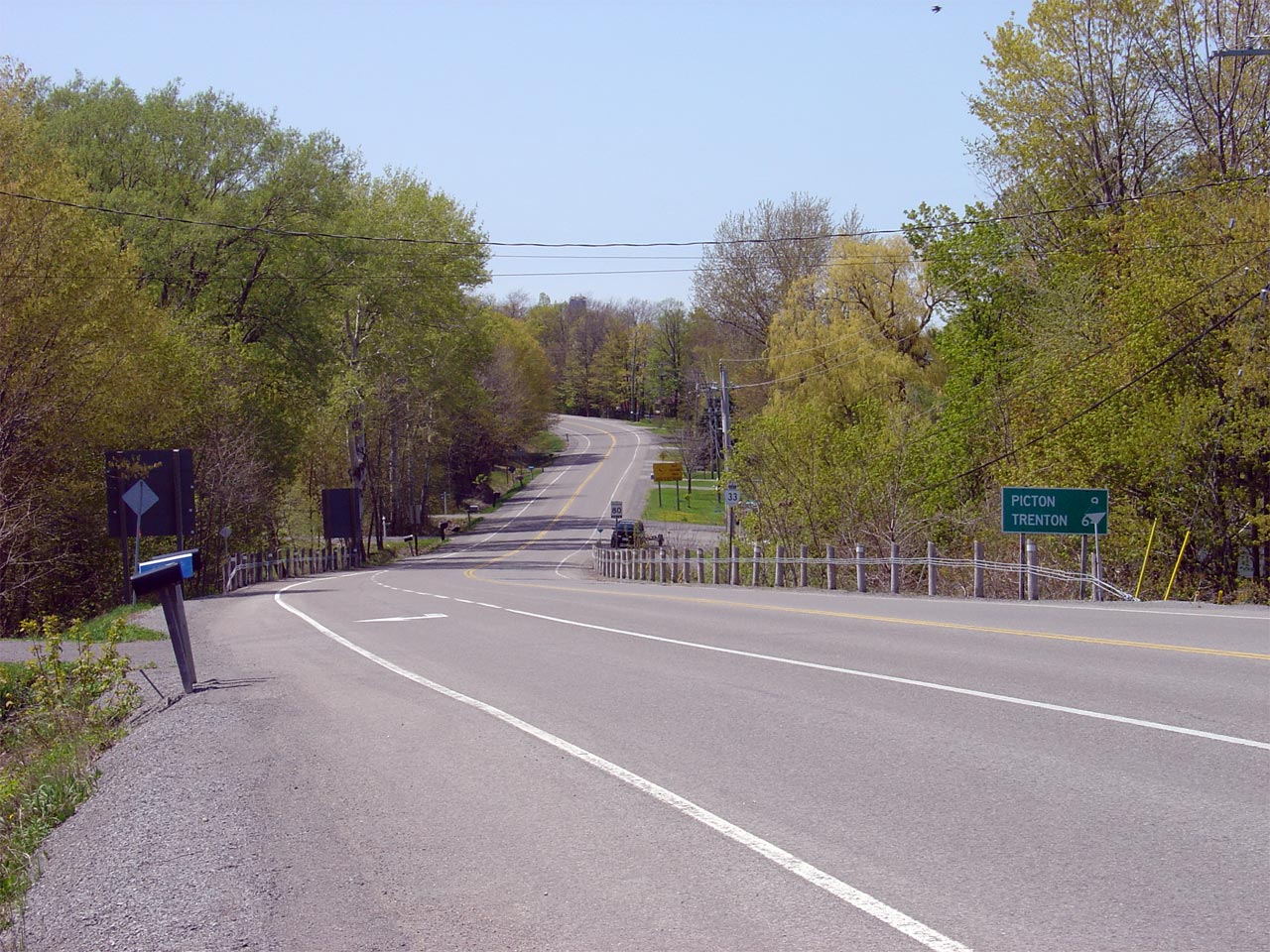
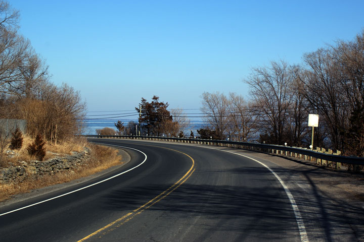
Municipality of Prince Edward County |
View looking westerly along Highway 33 from the Lake-on-the-Mountain Road
intersection. Lake-on-the-Mountain is a popular tourist stop for
motorists visiting Prince Edward County.
Click here
for more information about this unique lake on Prince Edward County's
website.
Photo taken: May 7th, 2006. |
Low Res
High Res |
|
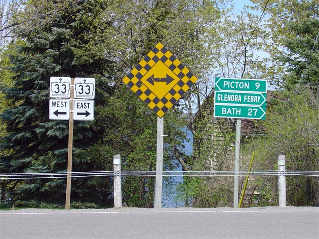
Municipality of Prince Edward County |
Junction assembly where Lake-on-the-Mountain Road intersects with Highway
33. Note the fingerboard sign directing traffic to the Glenora Ferry.
Photo taken: May 7th, 2006. |
 |
|
Municipality of Prince Edward County |
Oversized sign directing ferry bound traffic into the right lane to queue
for the Glenora Ferry. Queuing Ferry traffic is directed into the
right lane -- local traffic is directed into the second eastbound lane.
Photo taken: May 7th, 2006. |
 |
|
Municipality of Prince Edward County |
Unusual highway ends tab adorning a reversing curve sign as Highway 33 nears
the western Glenora Ferry Dock. Photo taken: May 7th, 2006. |
Low Res
High Res |
|
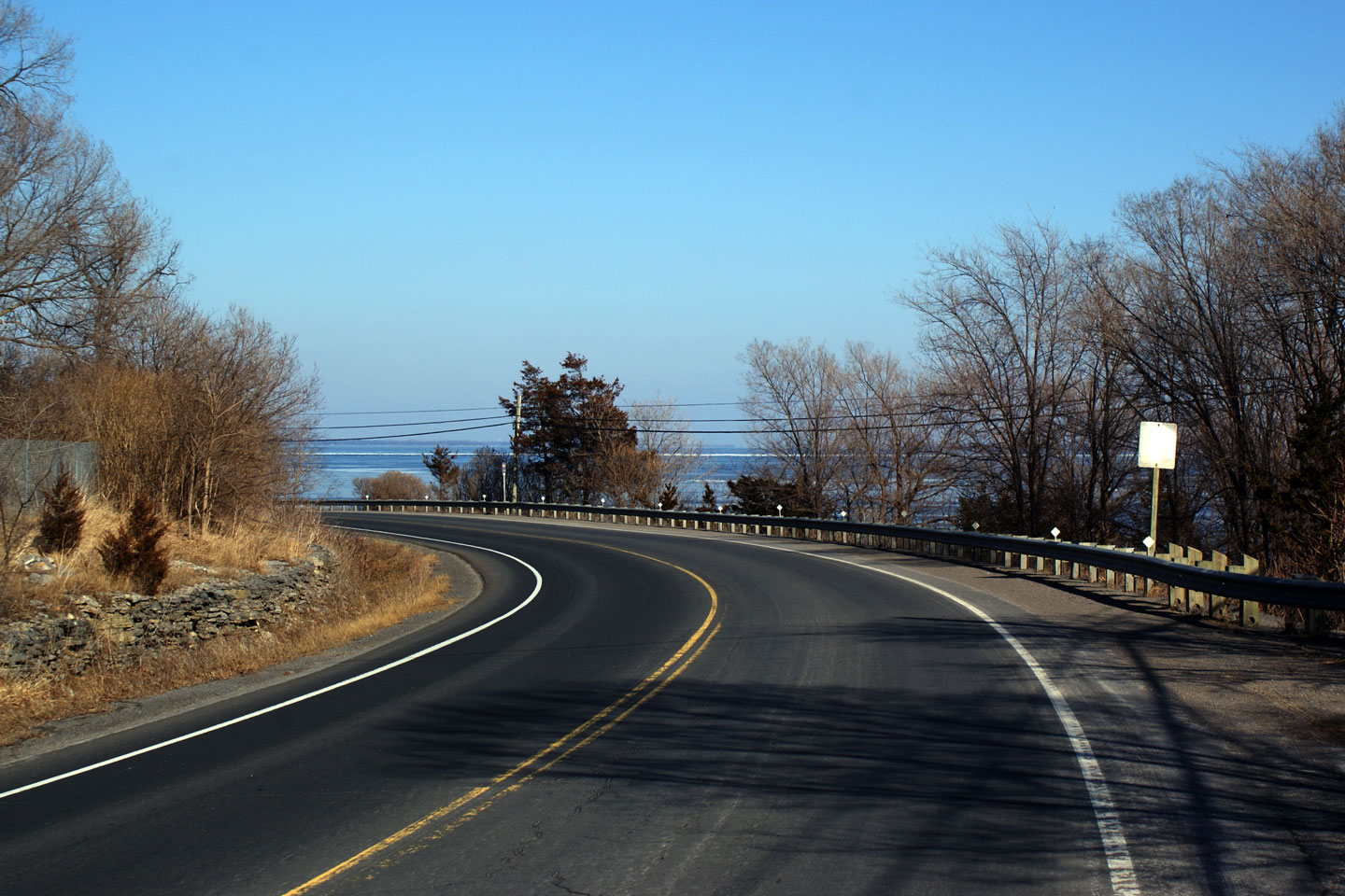
Municipality of Prince Edward County |
View looking west towards Picton from just west of the Glenora Ferry dock.
Photo taken: May 7th, 2006. |

Low Res
High Res |
|
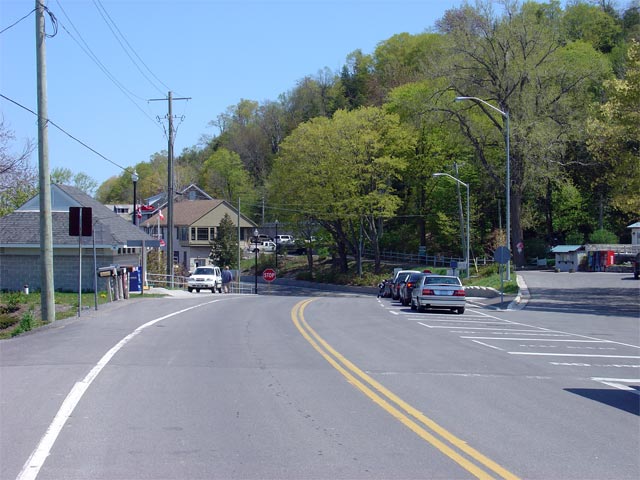
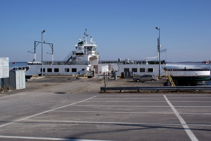
Municipality of Prince Edward County |
Looking easterly through Glenora to the Ferry dock. Motorists are
directed to stop behind the stop line to wait to board the Glenora Ferry.
Photo taken: May 7th, 2006. |

Low Res
High Res |
|
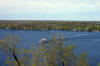
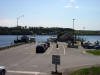
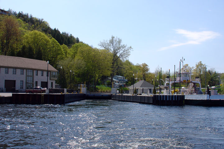
Municipality of Prince Edward County |
View from the Ferry boat to the Ferry Dock in Prince Edward County.
Lake-on-the-mountain is situated high atop the Photod ridge in the left of
the photo.
Photo taken: May 7th, 2006. |

Low Res
High Res |
|
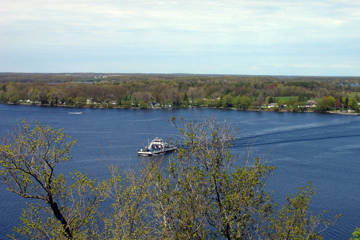
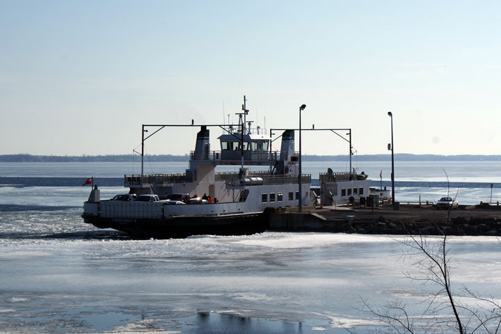
Municipality of Prince Edward County |
The Glenora Ferry traverses the Bay of Quinte every half hour during the
winter, and every 15 minutes during the summer.
Click here for Glenora Ferry Infromation.
Photo taken: May 7th, 2006. |
Low Res
High Res |
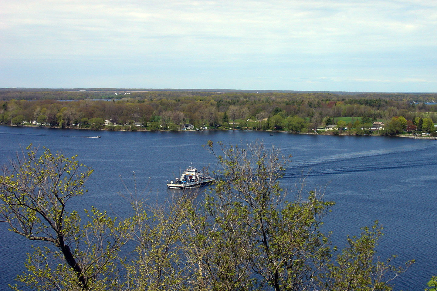
Town of Greater Napanee
County of Lennox & Addington |
The Eastern (mainland) ferry dock as seen from the Bay of Quinte.
Photo taken: May 7th, 2006. |
Low Res
High Res |
Town of Greater Napanee
County of Lennox & Addington |
View looking westerly towards the eastern Glenora Ferry dock.
Photo taken: May 7th, 2006. |
Low Res
High Res |
Town of Greater Napanee
County of Lennox & Addington |
Signage advising traffic of the end of Highway 33 at the eastern Glenora
Ferry dock. This sign is of course a little misleading since Highway
33 continues westerly on Price Edward Island via the Glenora Ferry.
Photo taken: May 7th, 2006 |
Low Res
High Res |
Town of Greater Napanee
County of Lennox & Addington |
Easterly view along Highway 33 from just east of Glenora Ferry dock.
Photo taken: May 7th, 2006. |

Low Res
High Res |
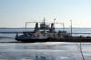
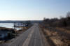
Township of Loyalist
County of Lennox & Addington |
View looking east along Highway 33 approaching the Amherst Island Ferry
Terminal and Milhaven. Notice the clearing in the ice for the Amherst
Island Ferry.
Photo taken: March 14th, 2009. |
Low Res
High Res |
Township of Loyalist
County of Lennox & Addington |
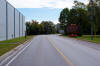
A little bit further easterly towards Milhaven from the previous photo.
Highway 33 hugs the Lake Ontario shoreline between Glenora and Kingston,
making for a very scenic drive.
Photo taken: March 14th, 2009. |
Low Res
High Res |
Township of Loyalist
County of Lennox & Addington |
The Amherst Island Ferry boards adjacent to Highway 33 near the former
Highway 133 junction. The Amherst Island Ferry is operated by Loyalist
Township, and has a capacity of 35 cars.
Click here for Ferry Schedule Information.
Photos taken: March 14th, 2009. |
Low Res
High Res

Low Res
High Res |
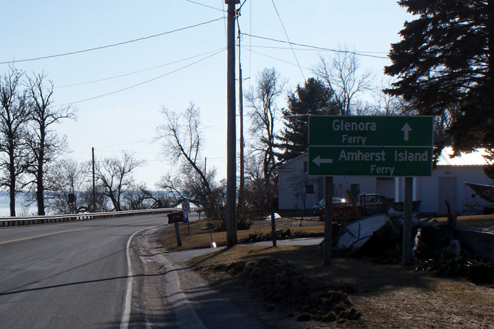
Township of Loyalist
County of Lennox & Addington |
Green signage directing traffic to both the Amherst Island Ferry and the
Glenora Ferry.
Photo taken: March 14th, 2009. |
 |
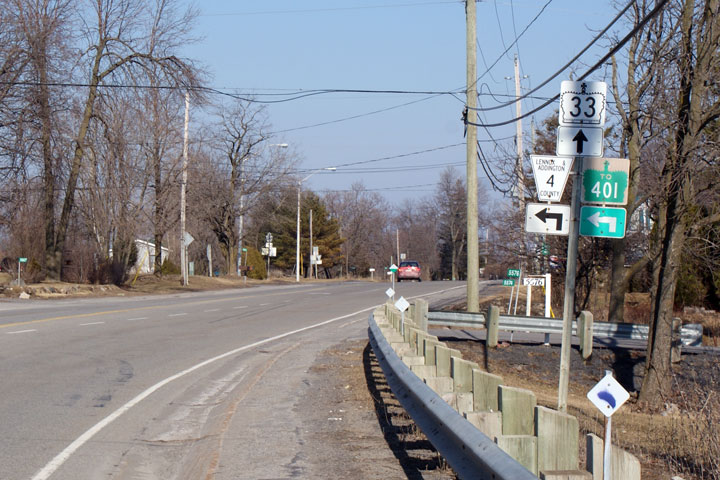
Township of Loyalist
County of Lennox & Addington |
Junction assembly for the Lennox & Addington Road 4 intersection.
Lennox & Addington Road 4 was at one time Highway 133. Highway 133 was
a short highway linking the Amherst Island Ferry to Highway 401.
Photo taken: March 14th, 2009. |
 |
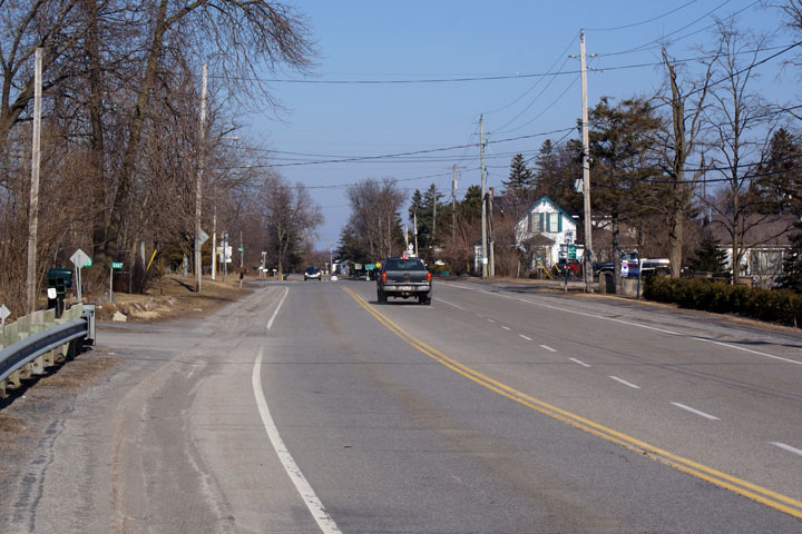
Township of Loyalist
County of Lennox & Addington |
View looking easterly along Highway 33 towards the Highway 133 intersection.
Photo taken: March 14th, 2009. |

Low Res
High Res |
|
Highway 133 was a short connector
highway linking The 401 to the Amherst Island Ferry at Milhaven.
Click here for Highway 133 images |
|
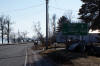
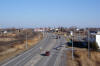
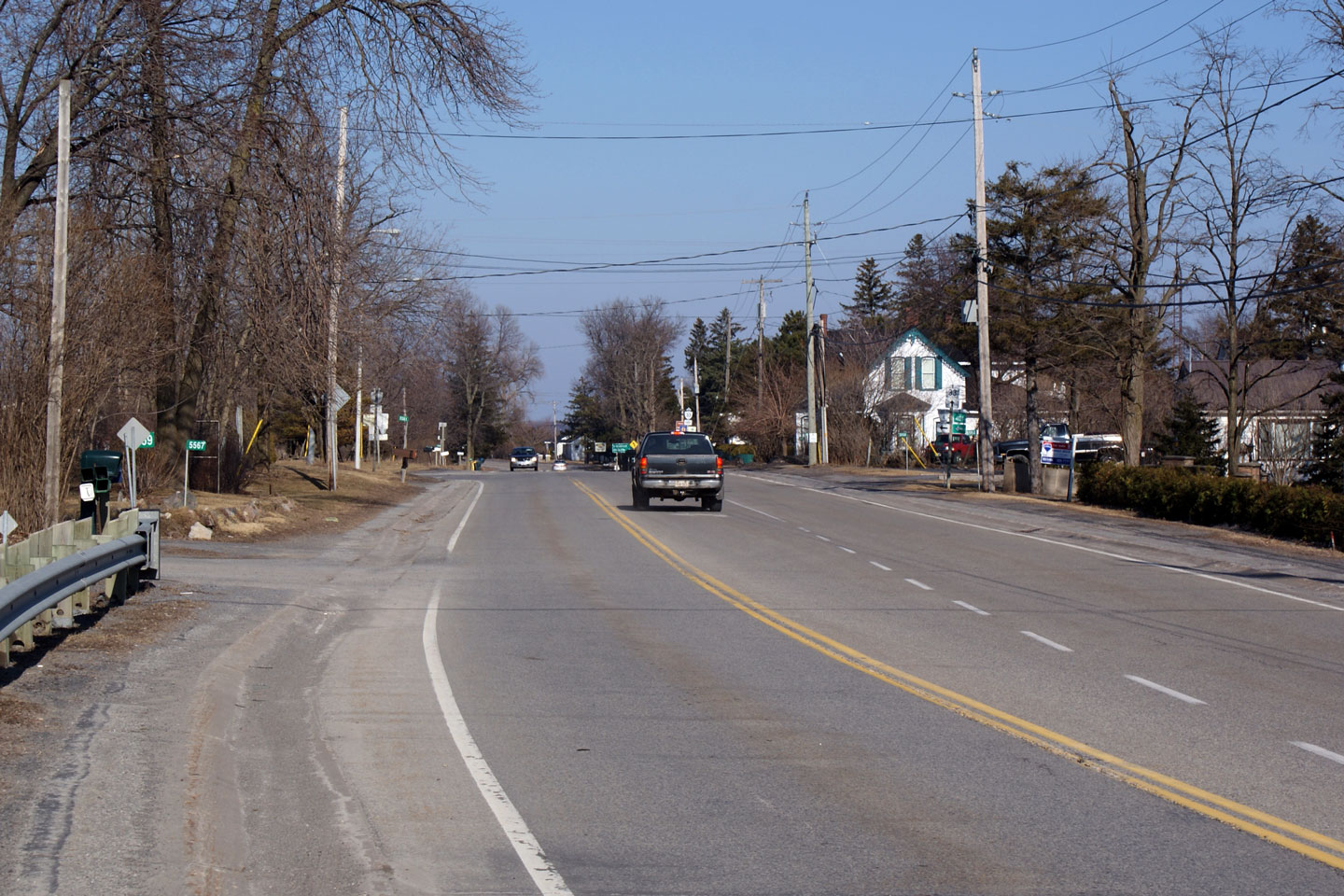
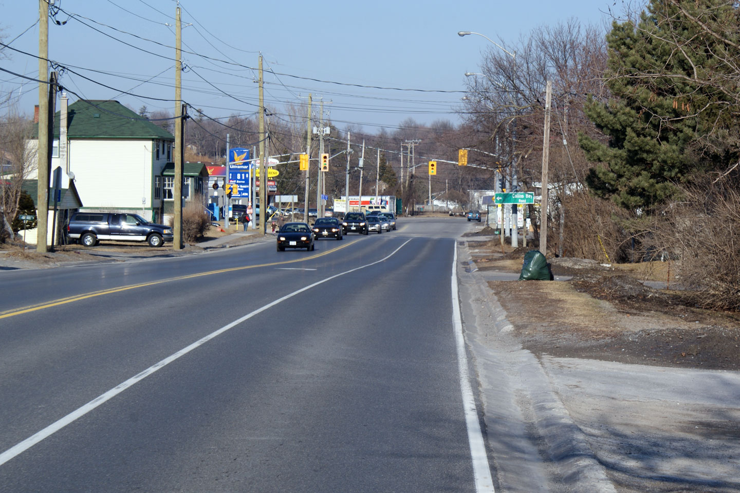
City of Kingston |
Easterly view along Highway 33 towards Collins Bay. Collins Bay is the
current eastern terminus of Highway 33. Sounding like a broken record,
its too bad the MTO couldn't have maintained jurisdiction of the highway
further into Kingston.
Photo taken: March 14th, 2009. |

Low Res
High Res |
|
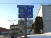
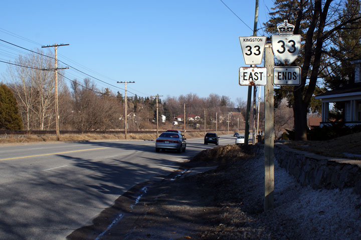
City of Kingston |
Junction assembly for Highway 33 at the south end of Collins Bay Road.
This is the present eastern terminus of Highway 33.
Photo taken: March 14th, 2009. |
 |
|
City of Kingston |
Eastbound ends assembly for Highway 33 located just east of the Collins Bay
Road intersection.
Photo taken: March 14th, 2009 |
 Low
Res Low
Res
High Res |
|
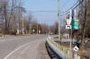
City of Kingston |
Easterly view along Highway 33 approaching the Bayridge Road flyover.
Photo taken: March 14th, 2009. |
 Low
Res Low
Res
High Res |
|
City of Kingston |
Westerly view from Bayridge Road. Highway 33 finds itself in close
proximity to Collins Bay and Lake Ontario not far west from Kingston.
Photo taken: March 14th, 2009. |
Low Res
High Res |
|
City of Kingston |
Easterly view from Bayridge Road. I find this setup very interesting,
it is similar to the intersection configuration along
Highway 7 in York
Region. Movements between Highway 33 and Bayridge Road are provided
via Cloverdale Drive.
Photo taken: March 14th, 2009. |
Low Res
High Res |
|
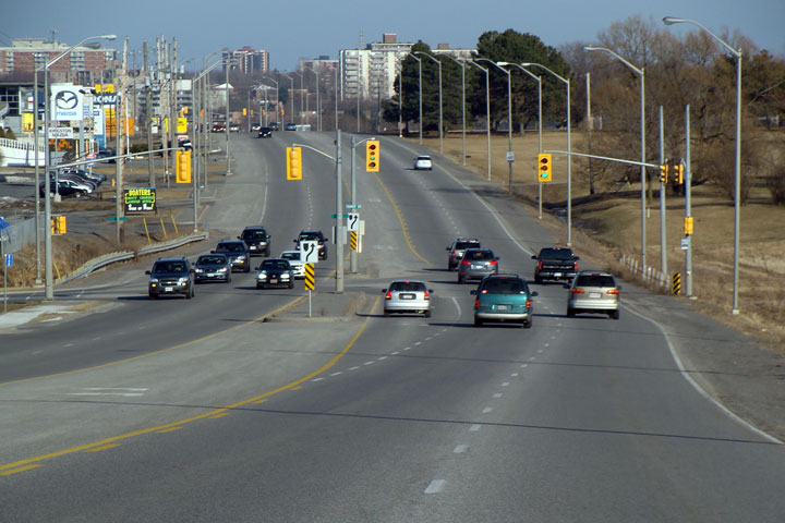
City of Kingston |
The Gardiners Road intersection has considerable scale. This view
looks easterly. Gardiners Road is the southern incarnation of Highway
38. This overhead lane diagram signage seems more fitting at a ramp
terminal along The 401 in Toronto then it does in Suburban Kingston.
Photo taken: March 14th, 2009. |
 Low
Res Low
Res
High Res |
|
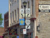
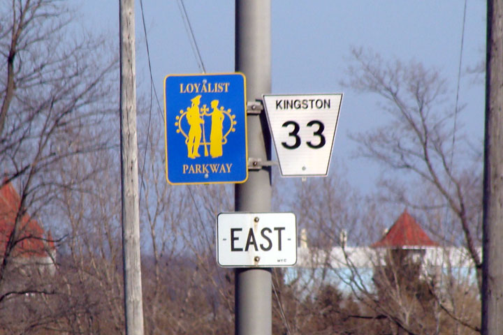
City of Kingston |
Despite being downloaded, Kingston Road 33 is still marked as part of the
Loyalist Parkway.
Photo taken: March 14th, 2009. |
 |
|
City of Kingston |
View looking easterly along Highway 33 from just east of the Gardiners Road
intersection.
Photo taken: March 14th, 2009. |

Low Res
High Res |
|
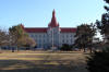
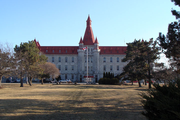
City of Kingston |
Believe it or not, this is the main entrance to Collins Bay Penn. I
think this building is nicer than the University I attended.
Photo taken: March 14th, 2009. |
Low Res
High Res |
|
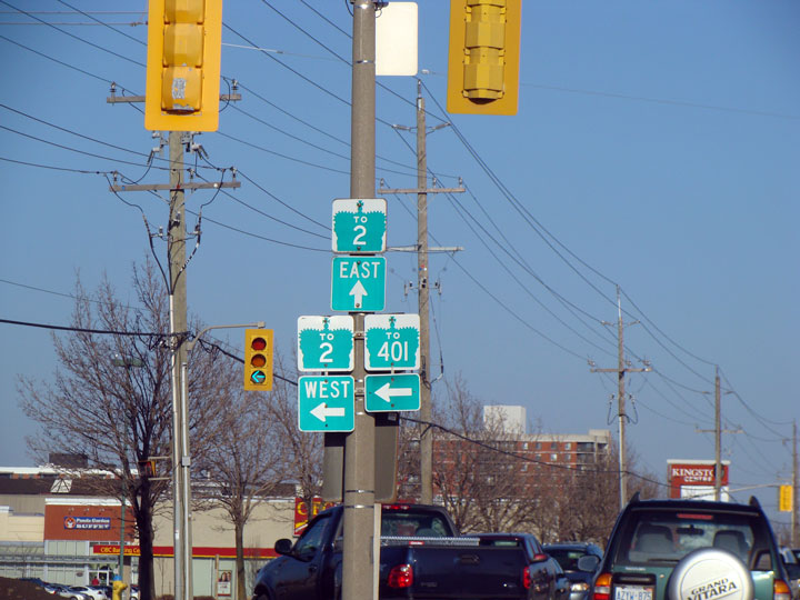
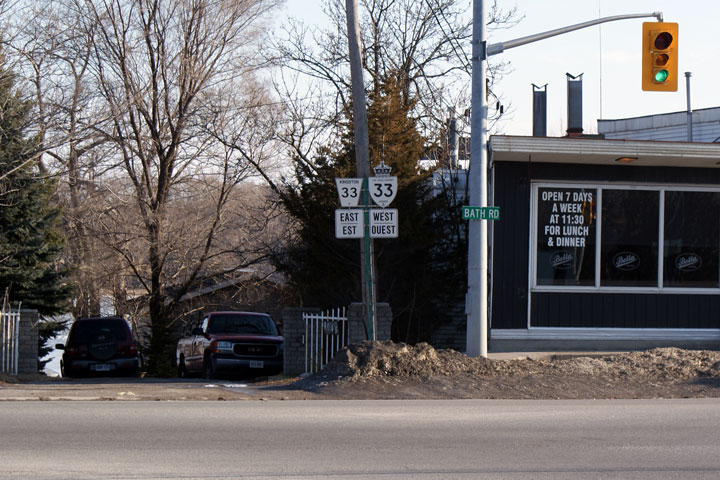
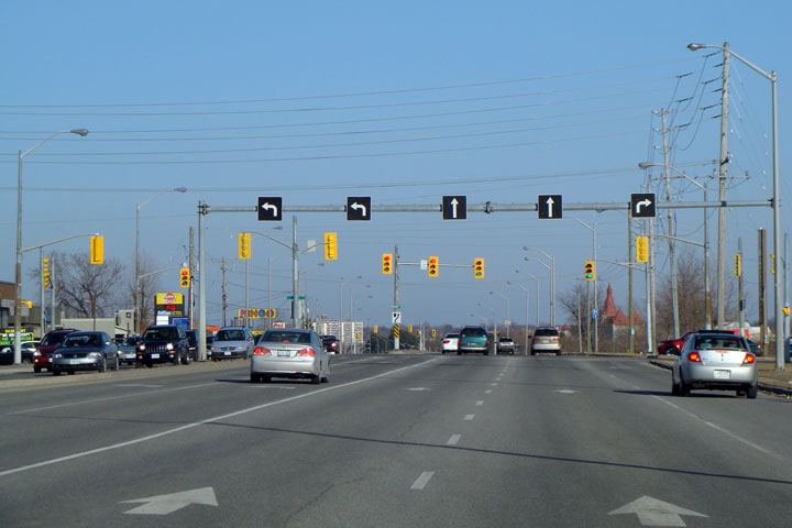
City of Kingston |
Junction assembly signage found in the median of Bath Street at the Sir John
A. Macdonald intersection. Highway 33 meets Highway 2 at a such a skew
that eastbound to westbound movements are disallowed.
Photo taken: March 14th, 2009. |
 |


 Low
Res
Low
Res
 Low
Res
Low
Res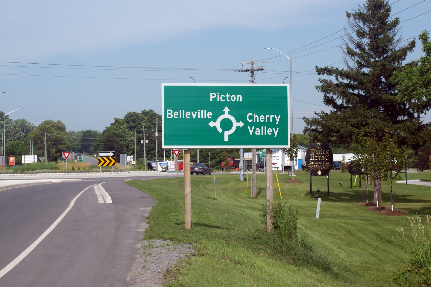

 Low
Res
Low
Res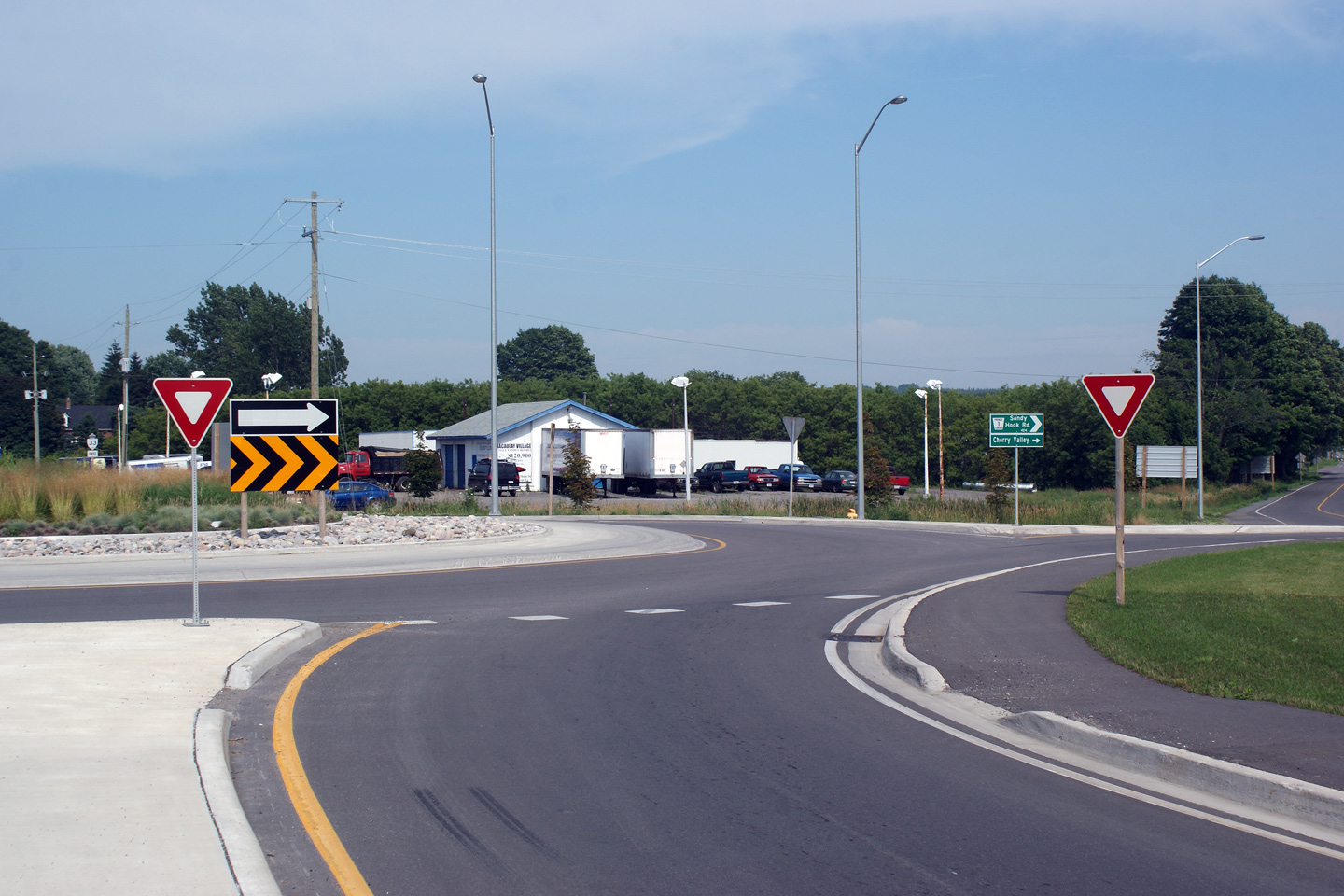
 Low
Res
Low
Res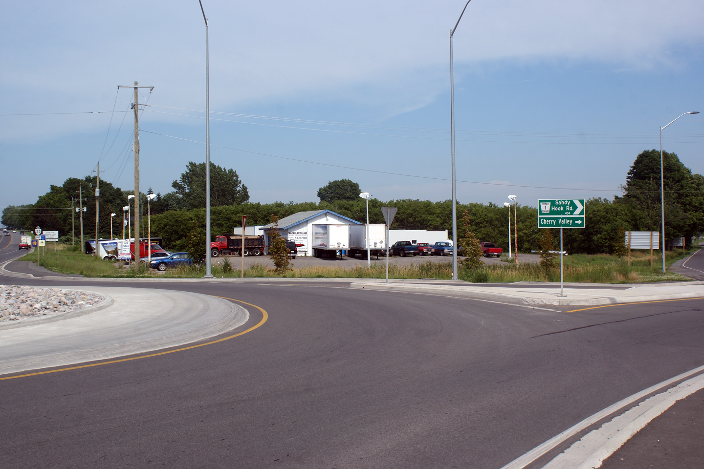
 Low
Res
Low
Res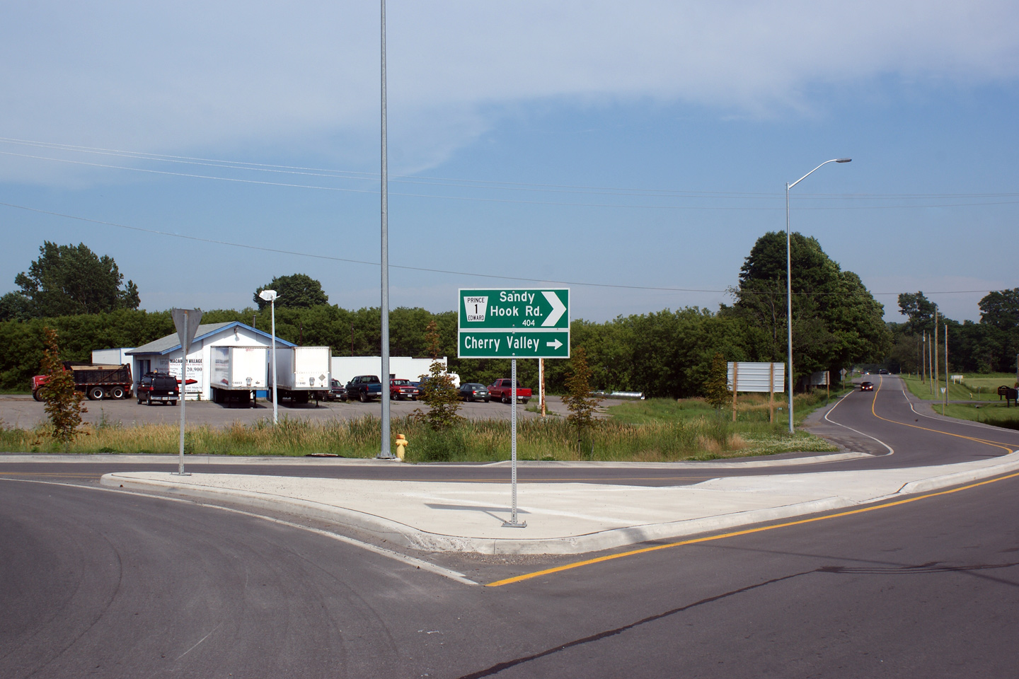
 Low
Res
Low
Res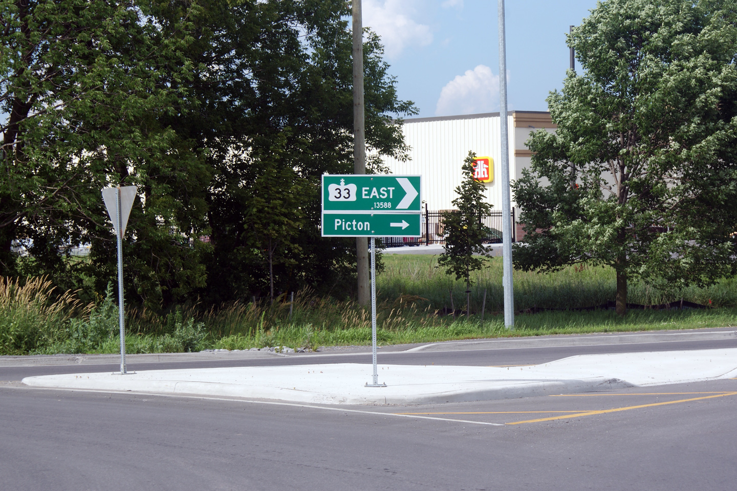


 Low
Res
Low
Res
 Low
Res
Low
Res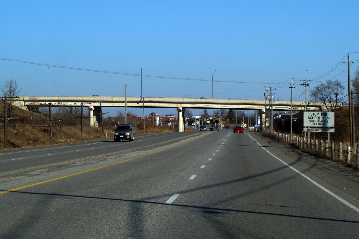
 Low
Res
Low
Res