|
Proper Municipality Name |
Photo Description |
Photo |
|
Pictures taken
from driver's perspective appear offset from centre-line pictures: |
North-
bound |
South-
bound |
| City of Kingston County of
Frontenac |
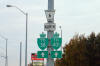
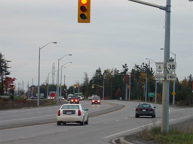
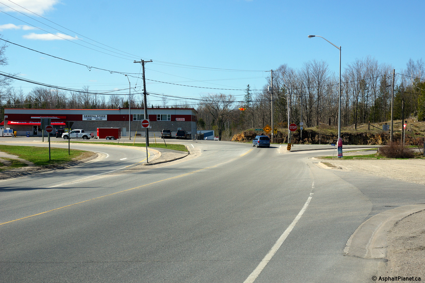
Trailblazers located just north of Highway 2
along Highway 38/Gardiners Road. The southernmost 2.3km of highway was
downloaded earlier then the rest of the highway and is signed as Frontenac
Road 6 rather than Highway 38.
Picture size: 40kb. |
 (720x480) (720x480)
(1440x960) |
| City of Kingston County of
Frontenac |
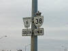
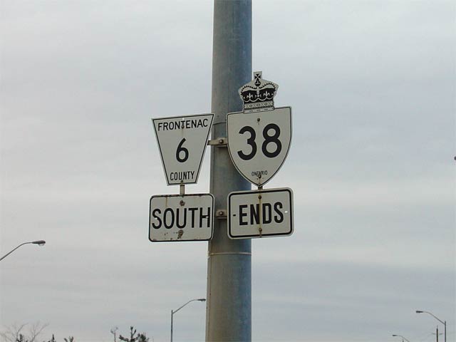
Southbound Highway 38 ends sign just south of Centennial Drive. It is
unclear when Highway 38 was truncated at Centennial Drive. In 1997,
the MTO official mileage logs still note the southern terminus of Highway 38
at Highway 2.
Picture size: 20kb. |
 |
| City of Kingston County of
Frontenac |
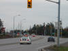
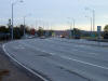
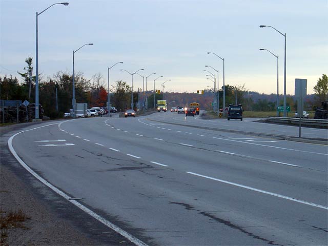
Looking south from the Centennial Drive intersection south to the Macrow
Street intersection. Highway 38 was reconstructed to this modern
4-lane highway in the mid 1990s. Picture taken: October 22nd, 2004.
Size: 35kb. |
 |
| City of Kingston County of
Frontenac |
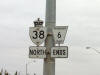
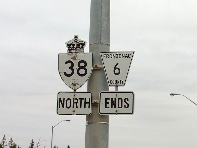
First northbound reassurance marker along Highway 38 cosigned with a
Frontenac Road 6 flowerpot. The southern most section of Highway 38
was redesignated as Frontenac Road 6 to match the numerical designation of
Gardiners Road south of Highway 2
Picture size: 20kb. |
 |
| City of Kingston County of
Frontenac |
Looking northerly along Highway 38 towards the
Highway 401 interchange from the Centennial Drive intersection.
Highway 38 narrows to a conventional two-lane highway just north of the
Highway 401 interchange.
Picture taken: October 22nd, 2004. Size: 35kb. |
 |
| City of Kingston County of
Frontenac |
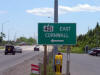
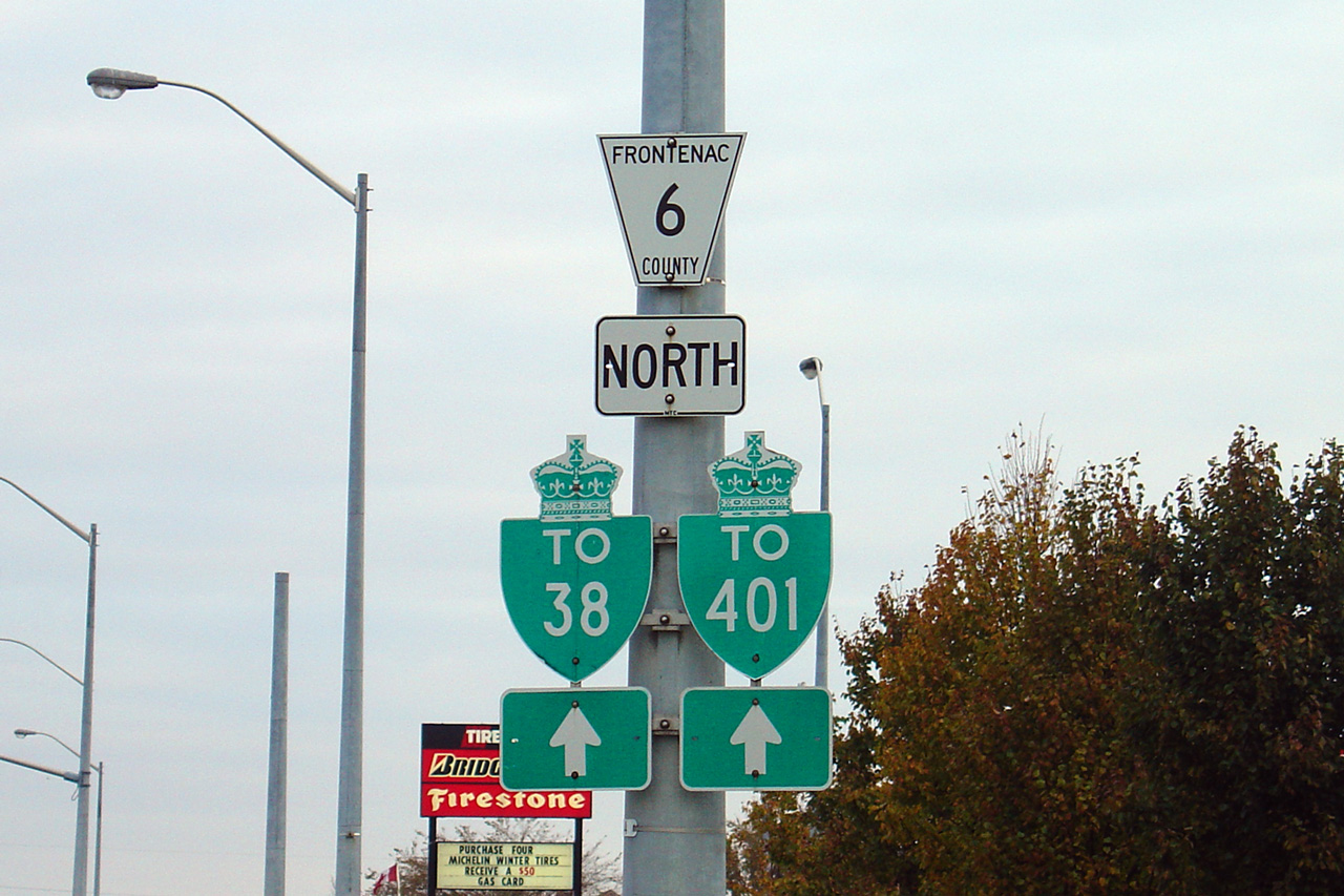
Southbound green signage for the ramp to
Highway 401 East. Highway 38 is the western most interchange that
Cornwall is used as a control city. Picture size: 40kb. |
 |
|
Highway 401 is the southern
Ontario's principal east-west freeway.
Click here for Highway 401 images. |
| City of Kingston County of
Frontenac |
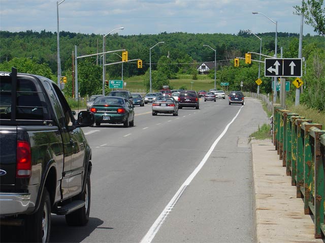
Looking northerly across the Highway 401
overpass towards the northern ramp terminals at Highway 38. Since this
photo was taken, this overpass has been extensively rehabilitated, and the
green steel railings that once adorned this overpass were replaced by a
modern concrete barrier.
Picture taken: June 19th, 2004. Size: 55kb. |
 |
Township of South Frontenac
County of Frontenac |
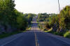
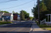
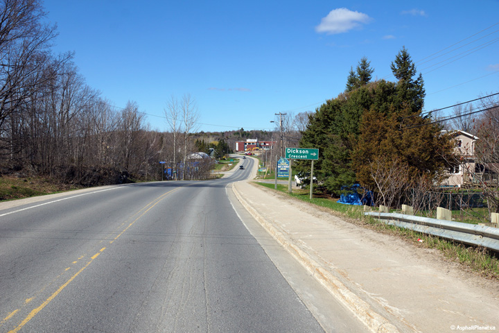
Looking northerly along Highway 38 from just north of Harrowsmith.
Photo taken: May 24th, 2010. |
(720x480)
(1440x960)
(2400x1600) |
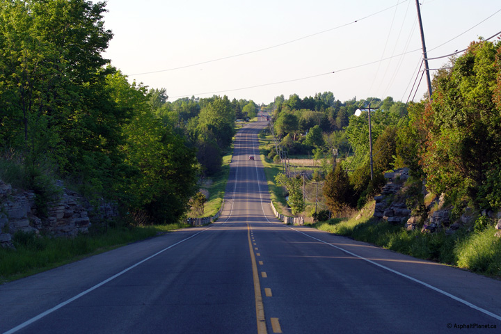
Township of South Frontenac
County of Frontenac |
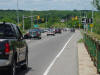
Northerly view approaching the Bell Rock Road intersection south of Verona.
Photo taken: May 24th, 2010. |

(720x480)
(1440x960)
(2400x1600) |
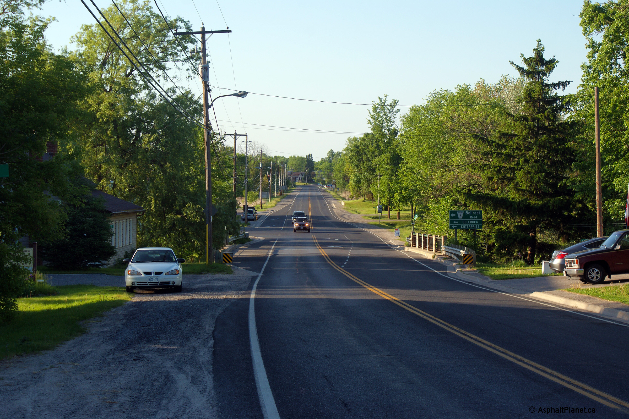
Township of South Frontenac
County of Frontenac |
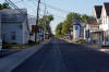
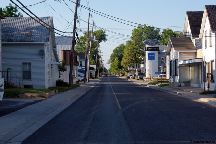
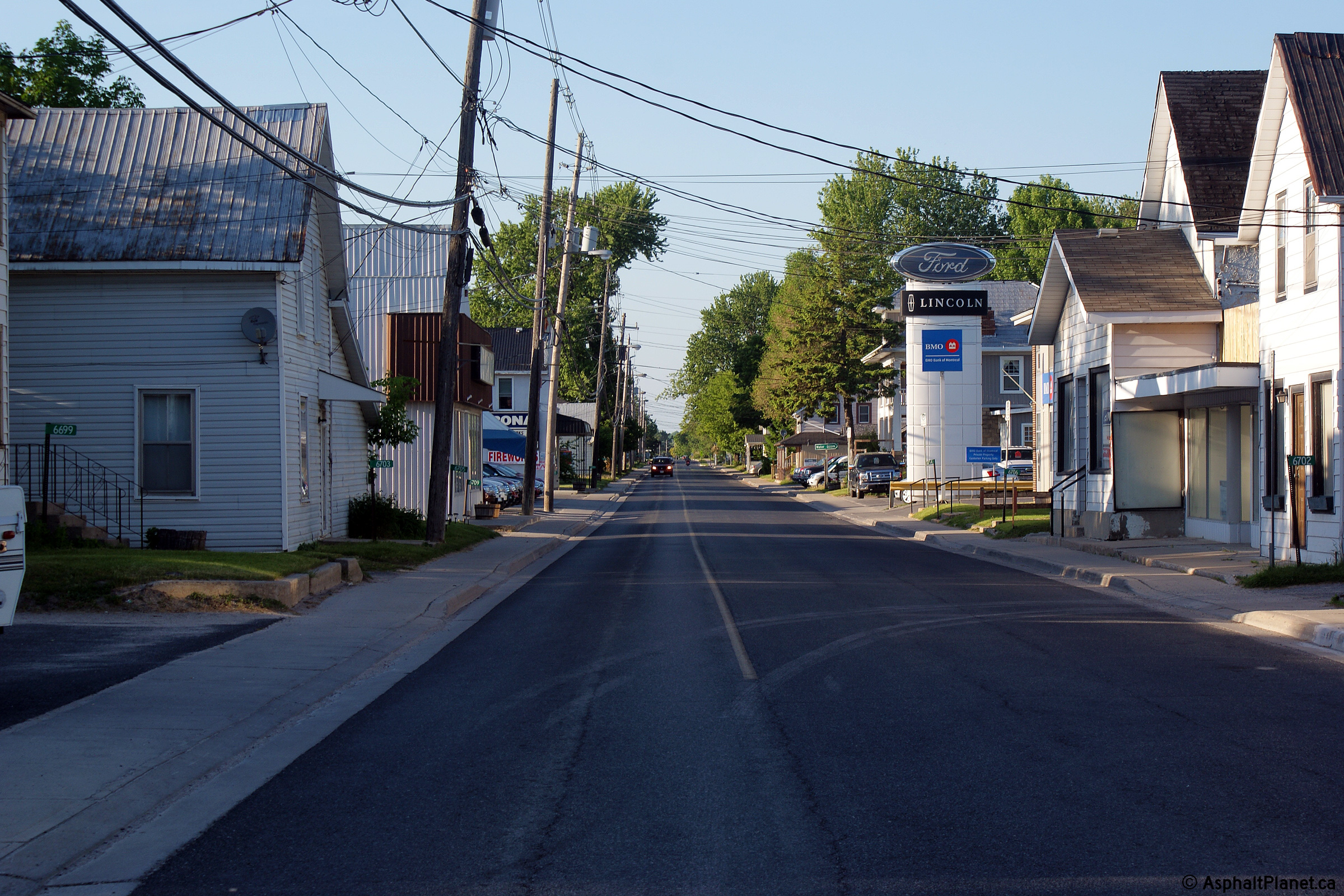
Southerly view looking through the narrow streets of Verona.
Photo taken: May 24th, 2010. |
(720x480)
(1440x960)
(2400x1600) |
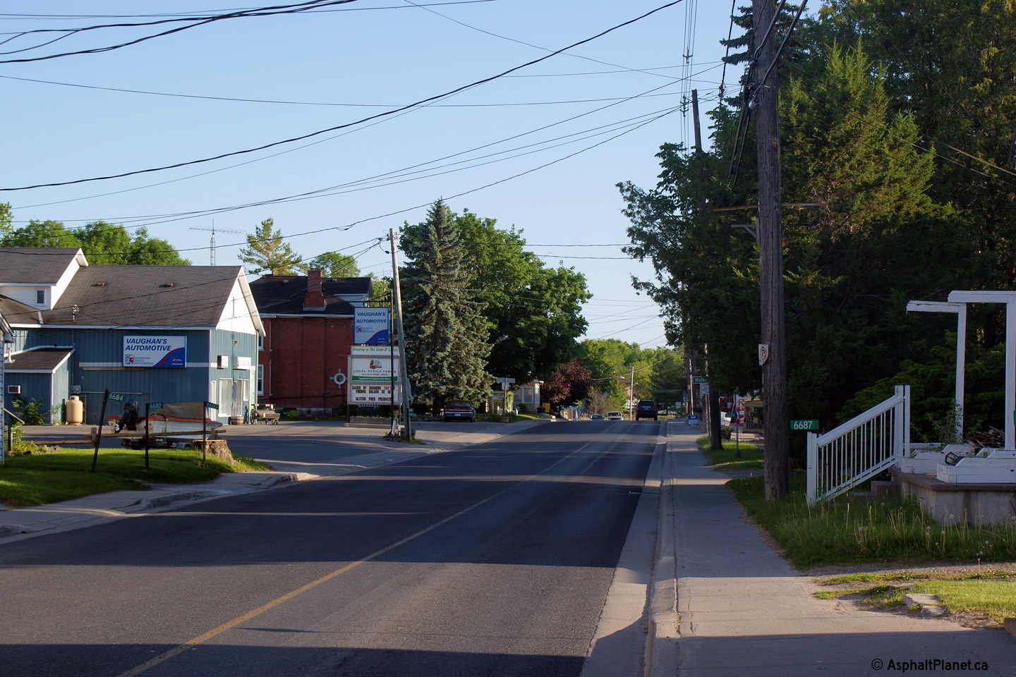
Township of South Frontenac
County of Frontenac |
This view looks northerly through Verona. Few communities in Ontario have
such a narrow main street. Narrow streets like this are common in Quebec,
but unusual in Ontario.
Photo taken: May 24th, 2010. |
(720x480)
(1440x960)
(2400x1600) |
| Township of Central Frontenac
County of Frontenac |
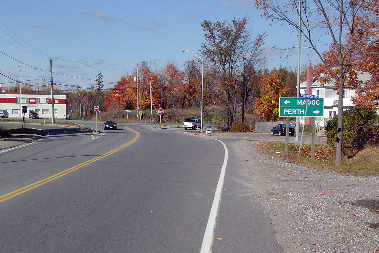
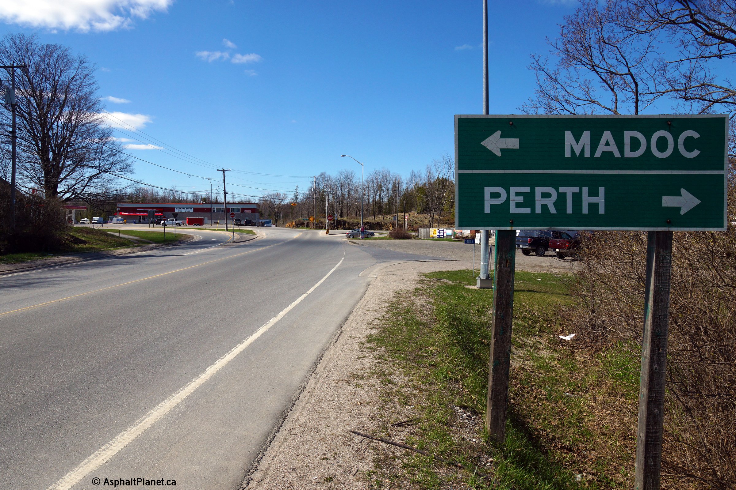
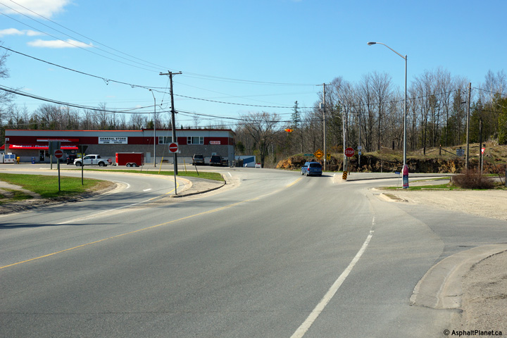
Oversized Highway 38 marker that formerly denoted the left turn that was
required to follow Highway 38's alignment through Parham.
Photo taken: February 22nd, 2004. |
|
| Township of Central Frontenac
County of Frontenac |
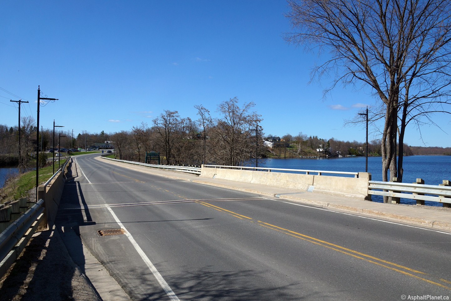
View looking northerly along Highway 38 at the Sharbot Lake Narrows bridge.
Sharbot Lake is a large lake with two lobes that is roughly bisected by both
Highway 38 and a former railway grade.
Photo taken: May 6th, 2014. |

(720x480)
(1440x960)
(2400x1600) |
| Township of Central Frontenac
County of Frontenac |
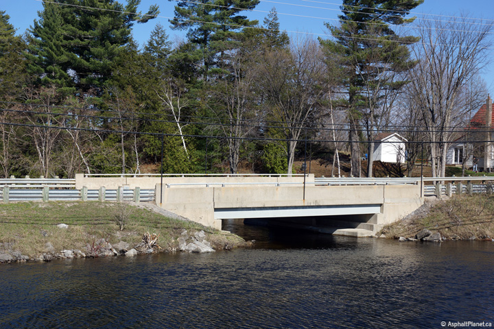
View looking easterly towards the Sharbot Lake Narrows bridge.
Photo taken: May 6th, 2014. |

(720x480)
(1440x960)
(2400x1600) |
| Township of Central Frontenac
County of Frontenac |
View looking southerly along the Sharbot Lake Causeway towards the Sharbot
Lake Narrows bridge.
Photo taken: May 6th, 2014. |

(720x480)
(1440x960)
(2400x1600) |
| Township of Central Frontenac
County of Frontenac |
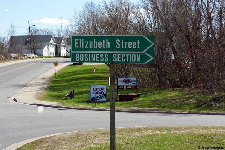
Fingerboard signage for Elizabeth Street in Sharbot Lake.
Photo taken: May 6th, 2014. |
 (720x480) (720x480)
(1440x960) |
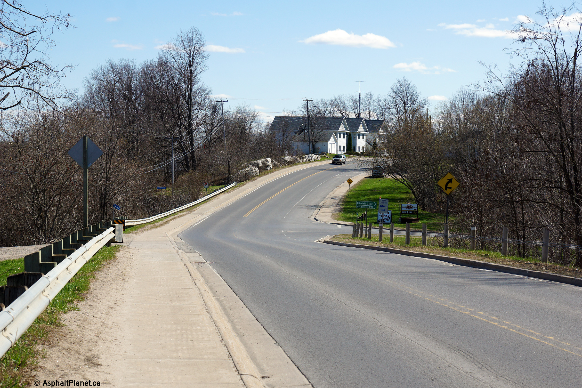
| Township of Central Frontenac
County of Frontenac |
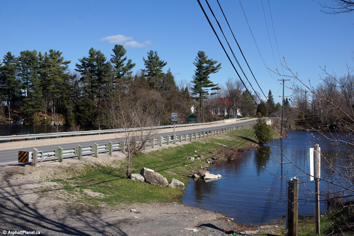
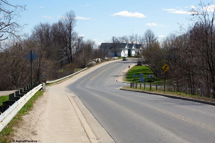
Southerly view from the Sharbot Lake overhead towards the Elizabeth Street
intersection in Sharbot Lake.
Photo taken: May 6th, 2014. |

(720x480)
(1440x960)
(2400x1600) |
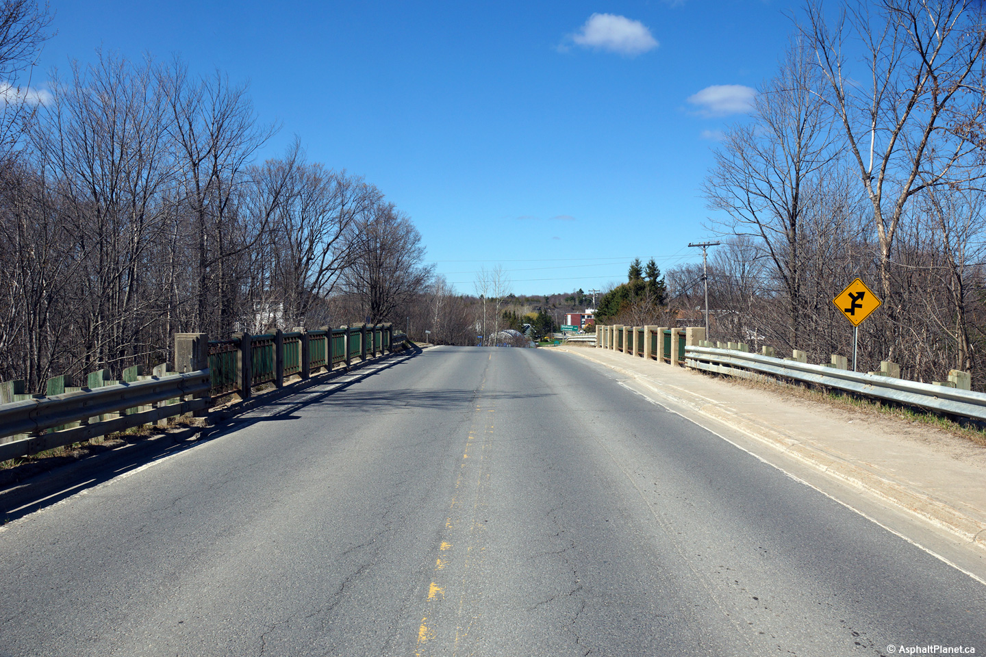
| Township of Central Frontenac
County of Frontenac |
Deck view looking northerly across the Sharbot Lake Overhead. This
structure carries Highway 38 overtop of the long abandoned Ontario and
Quebec Railway grade, which was at one point the CP's mainline between
Toronto and Ottawa.
Photo taken: May 6th, 2014. |

(720x480)
(1440x960)
(2400x1600) |
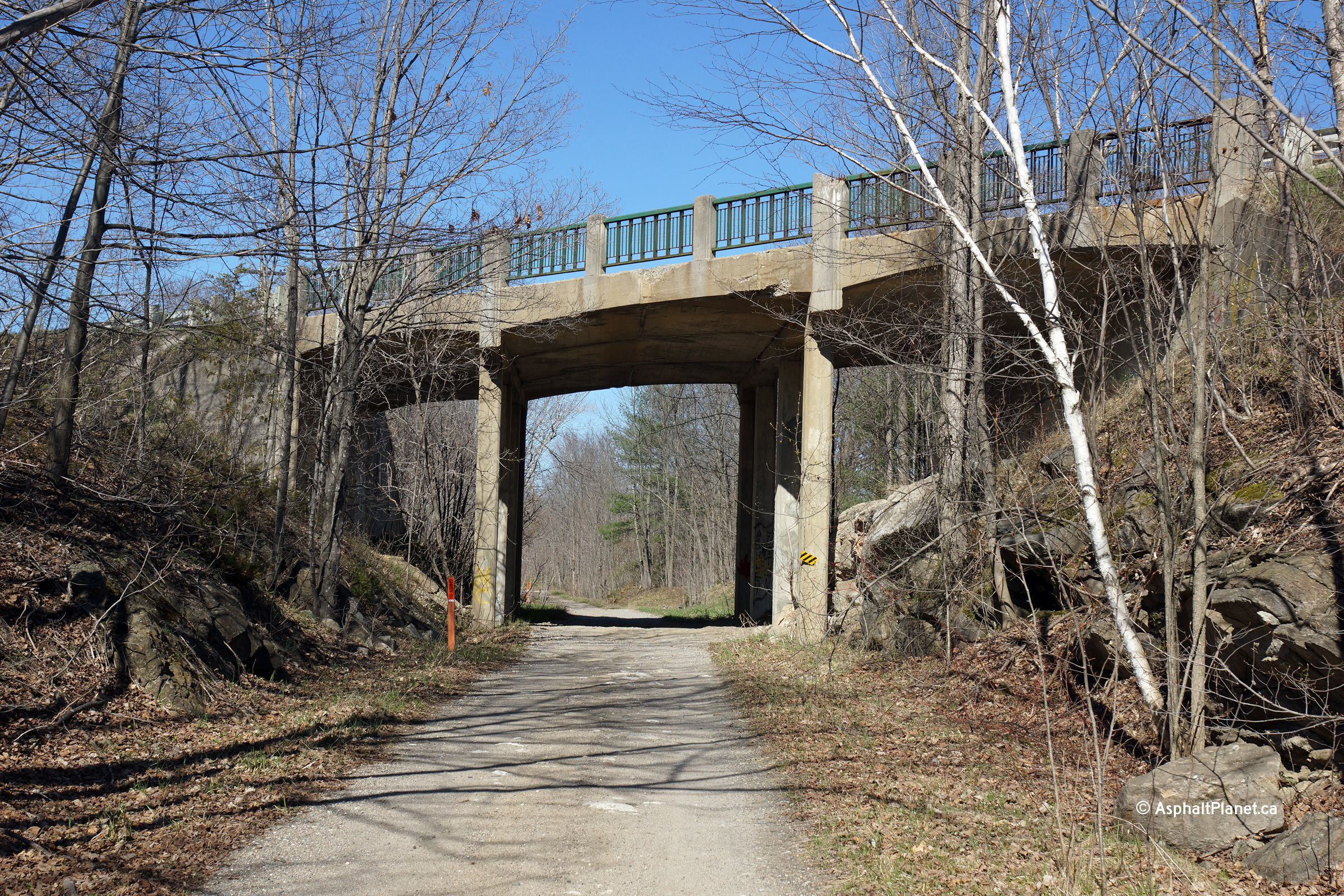
| Township of Central Frontenac
County of Frontenac |
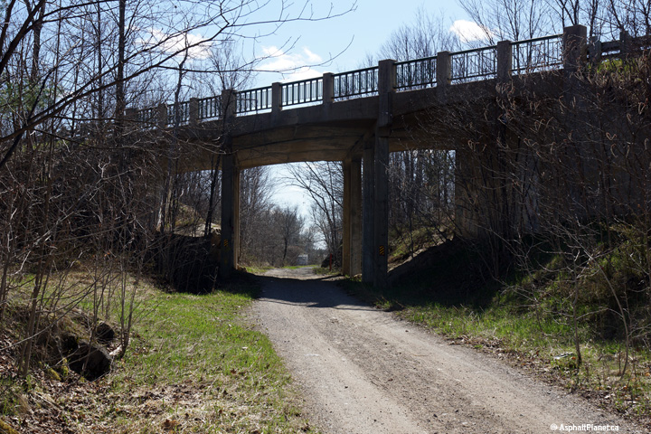
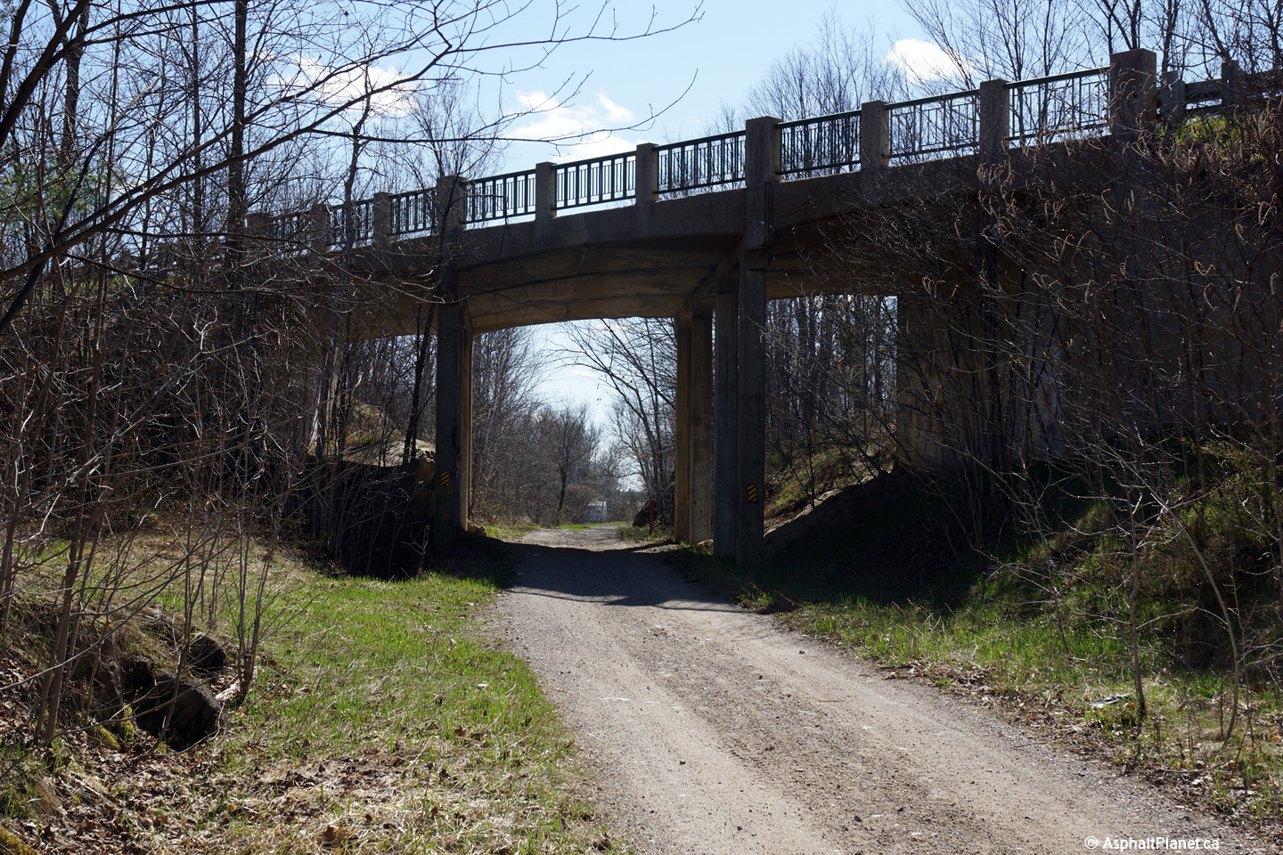
Two views looking easterly approaching the Sharbot Lake overhead that
carries Highway 38 overtop of the abandoned railway alignment. It is
hard to believe that railway traffic on what is today only a recreational
trail, was once heavy enough to warrant the construction of grade separation
for a highway with such light traffic volumes. The rails were lifted
on this former alignment of CP trackage between Glen Tay and Tweed in 1971.
Today, CP's Belleville Subdivision is CP's only rail line between Toronto
and Eastern Canada.
Photos taken: May 6th, 2014. |

(720x480)
(1440x960)
(2400x1600)

(720x480)
(1440x960)
(2400x1600) |
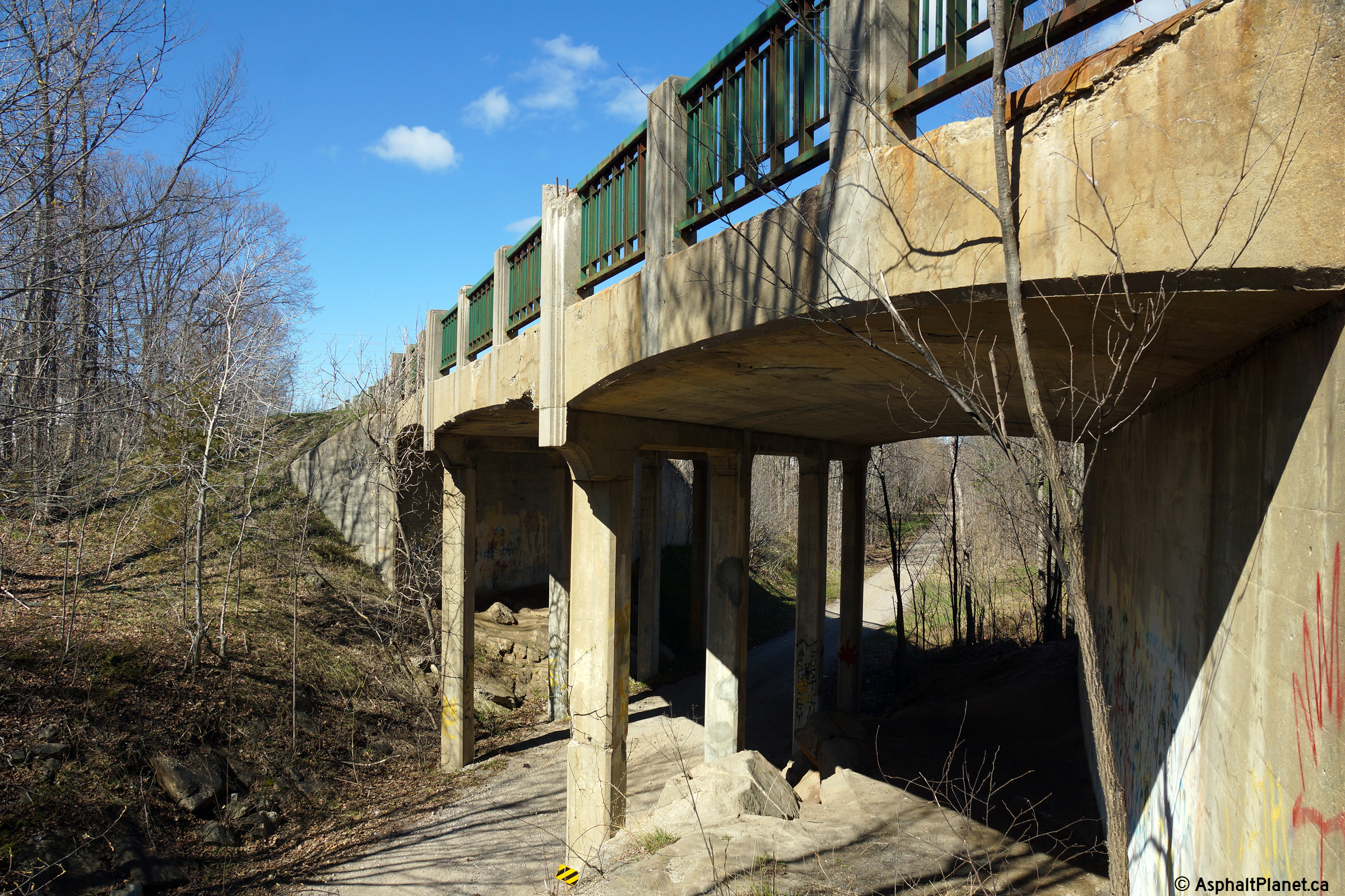
| Township of Central Frontenac
County of Frontenac |
Westerly view towards the Sharbot Lake overhead. The Sharbot Lake
overhead was constructed during the mid 1930s, and still retains its
original ornamental steel railings.
Photo taken: May 6th, 2014. |

(720x480)
(1440x960)
(2400x1600) |
| Township of Central Frontenac
County of Frontenac |
Southerly deck view across the Sharbot Lake overhead.
Photo taken: May 6th, 2014. |

(720x480)
(1440x960)
(2400x1600) |
| Township of Central Frontenac
County of Frontenac |
Northerly view from overtop of the Sharbot Lake overhead.
Photo taken: May 6th, 2014. |

(720x480)
(1440x960)
(2400x1600) |
| Township of Central Frontenac
County of Frontenac |
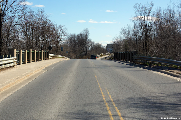
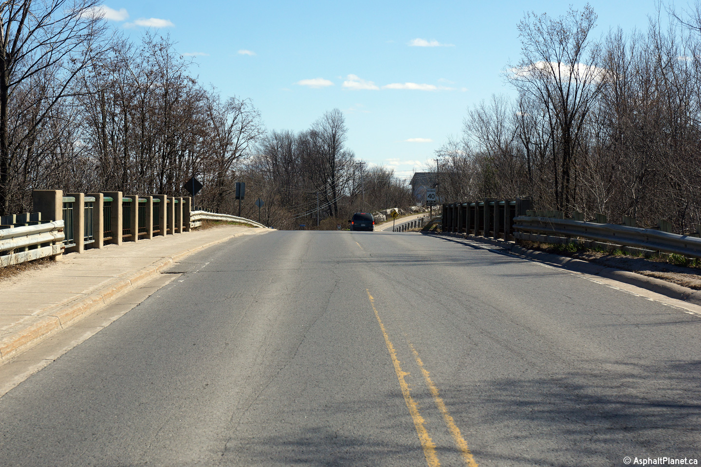
Two views looking northerly towards the northern terminus of Highway 38 at
Highway 7 just north of Sharbot Lake.
Click here for an additional view
of the northern terminus of Highway 7 taken in October, 2004.
Photos taken: May 6th, 2014. |

(720x480)
(1440x960)
(2400x1600)

(720x480)
(1440x960)
(2400x1600) |
|
Highway 38 ends at Highway 7, the
Central Ontario Route of the Trans-Canada Highway.
Click here for Highway 7 images. |


 (720x480)
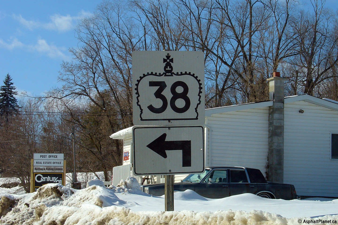

 (720x480)
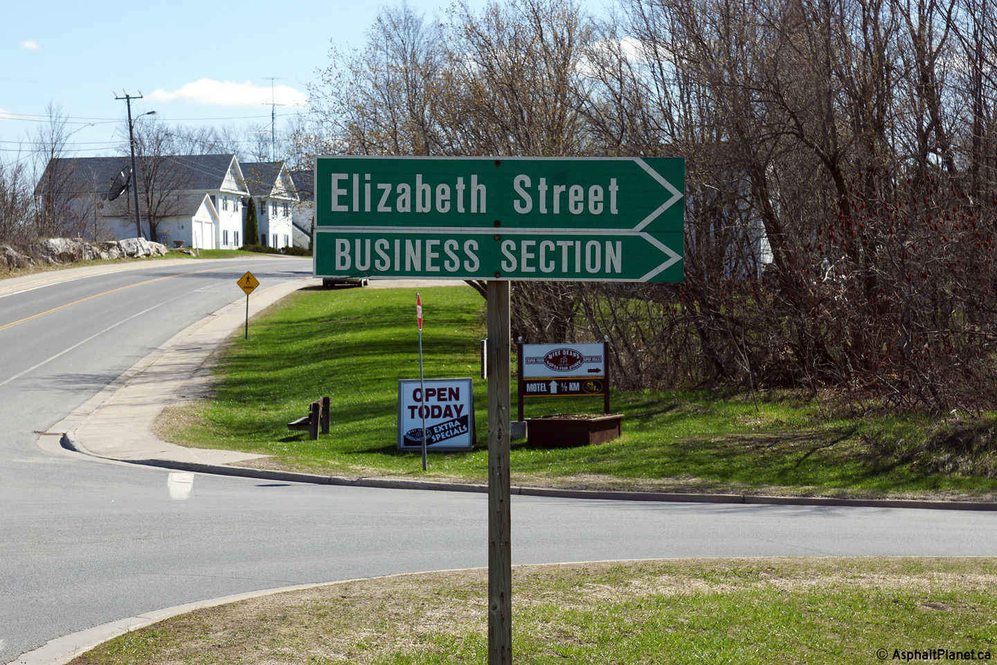


