AsphaltPlanet.ca > OntHighways >
Highway 401 > Images
> Page 15
King's Highway 401 - Images
<- Page 14 Page 15 - Napanee to Gananoque Page 16 ->
Photos shown in this table are arranged from West to East:
| Proper Municipality Name | Photo Description | Photo | ||
|
Photos taken from driver's perspective appear offset from centre-line Photos: |
East- |
West- |
||
| Continued from Trenton to Napanee Images | ||||
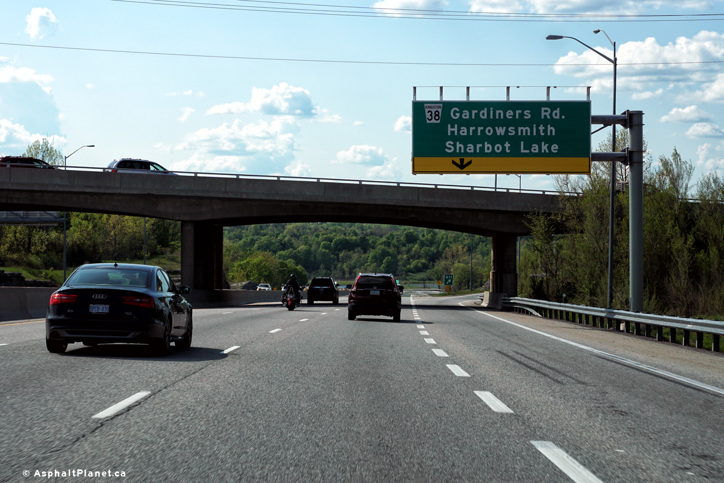
| Highway 41 is a long highway that heads north from Napanee through to Pembroke. Click here for Highway 41 images. | ||||
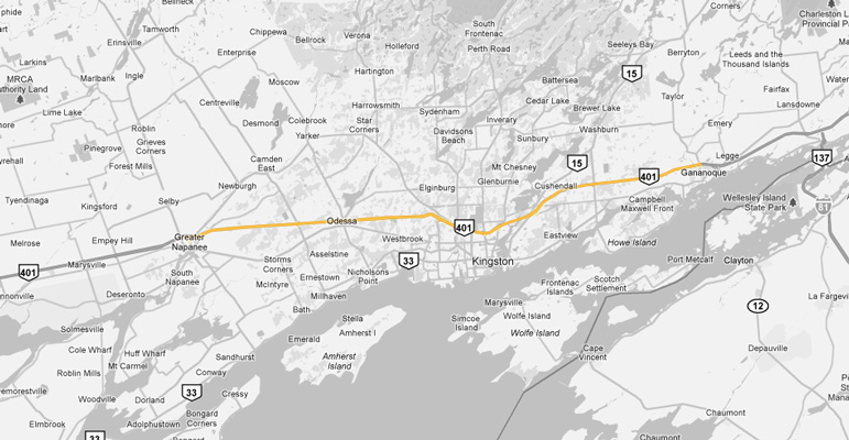
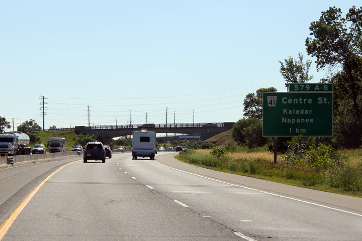
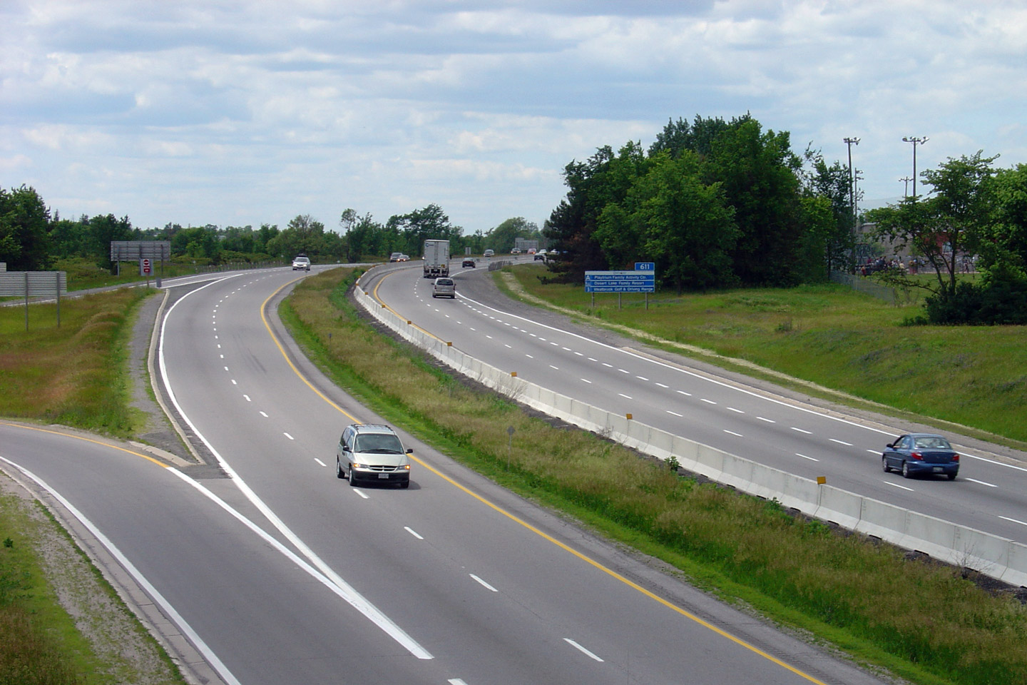
| Town of Greater Napanee County of Lennox & Addington |
Signage for the ramp to Highway 41 South. Photo taken: June 29th, 2012. |
 (720x480) (720x480)(1440x960) (2400x1600) |
||
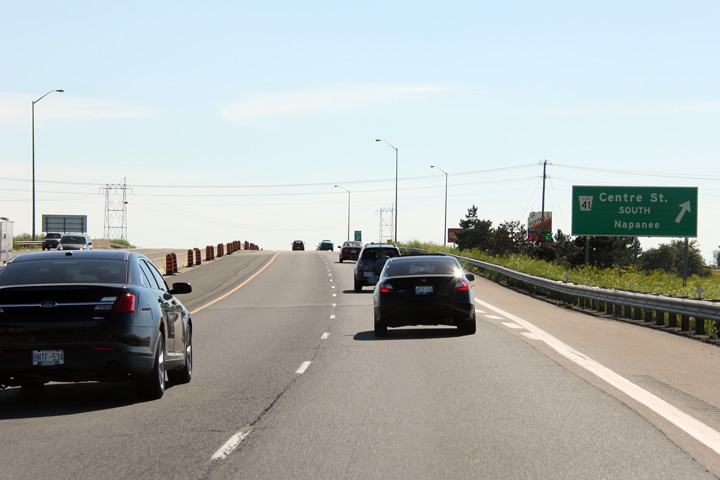
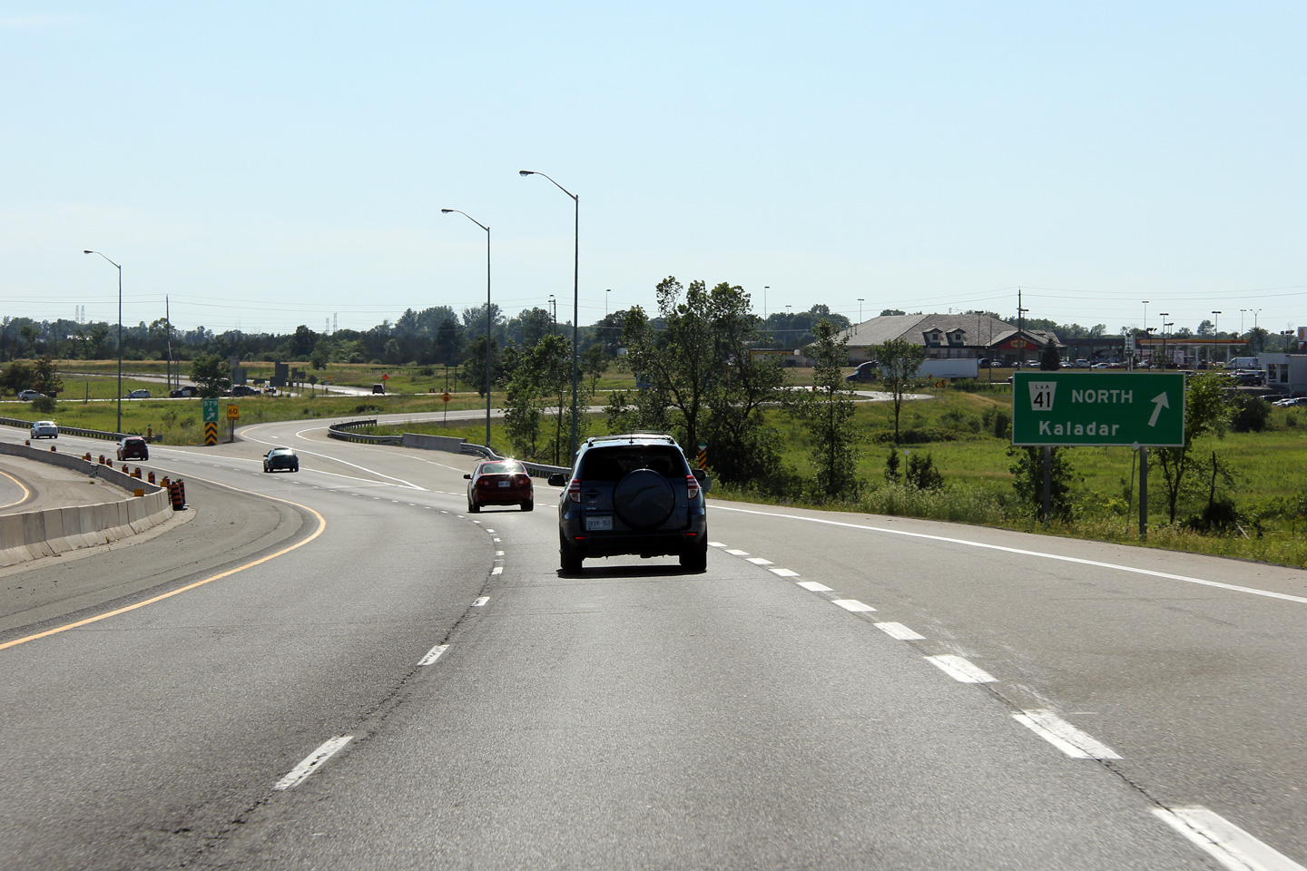
| Town of Greater Napanee County of Lennox & Addington |
View looking westerly towards the off-ramp to Highway 41 North. This
off-ramp was added in the mid-2000s in response to the development of a
large truck stop along Highway 41 immediately north of Highway 401. Photo taken: June 29th, 2012. |
 (720x480) (720x480)(1440x960) (2400x1600) |
||
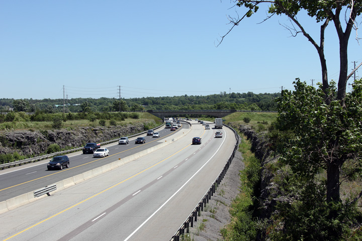
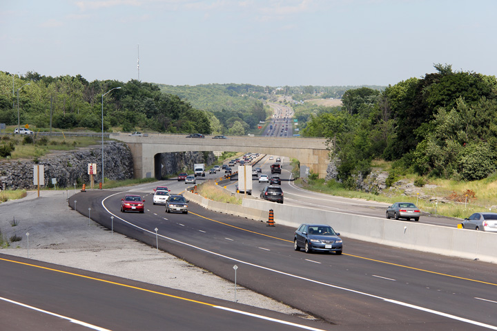
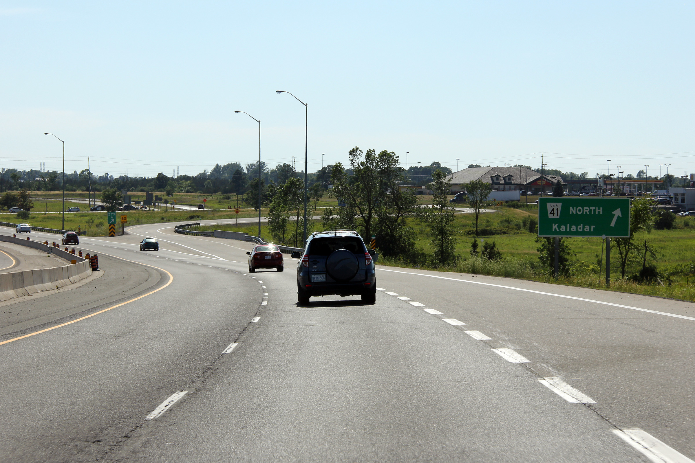
| Town of Greater Napanee County of Lennox & Addington |
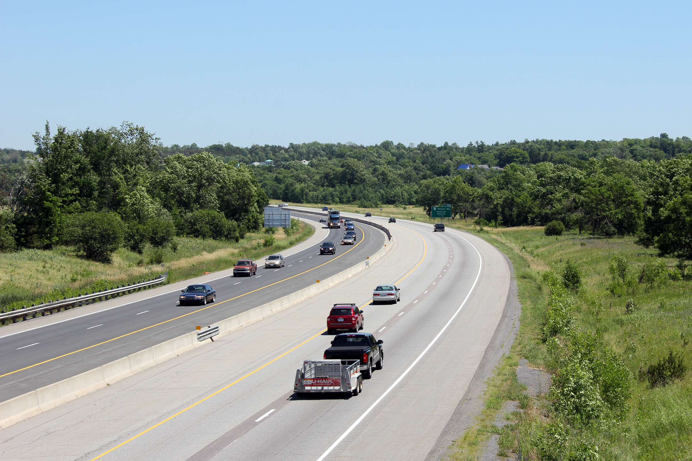
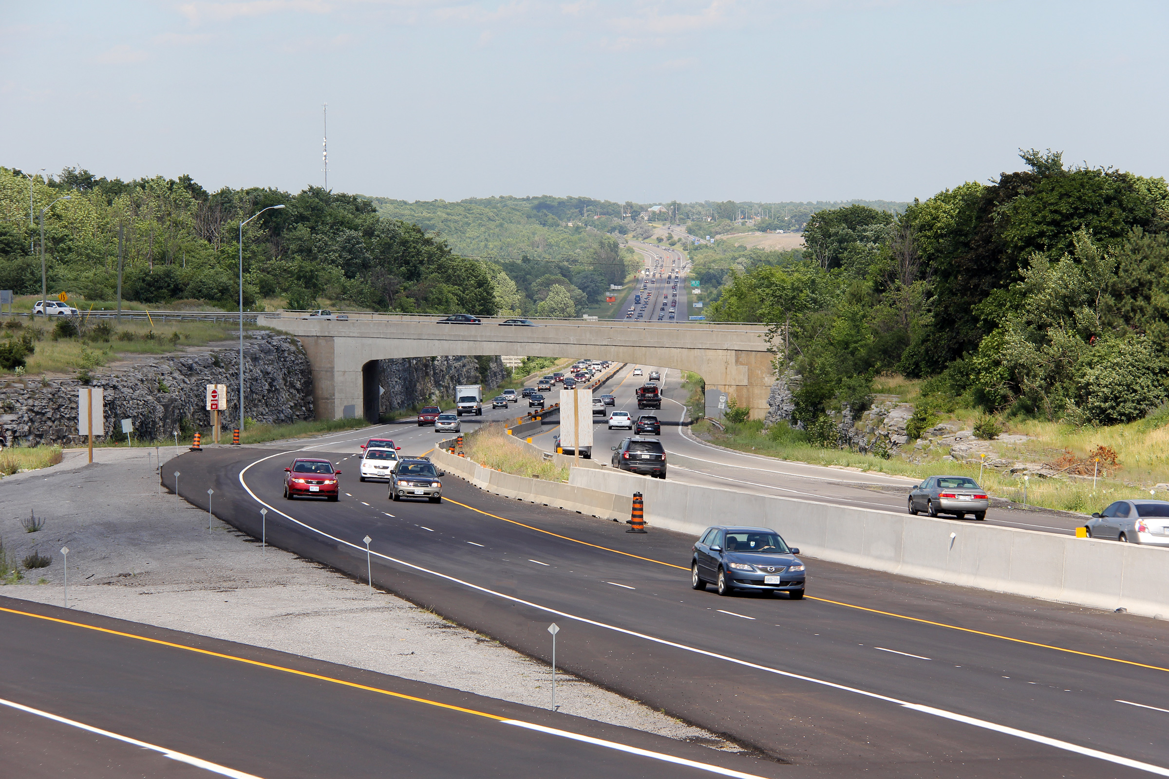
View looking westerly from the CNR spur overpass towards the Highway 41
interchange in Napanee. Photo taken: June 29th, 2012. |
 (720x480) (1440x960) (2400x1600) |
||
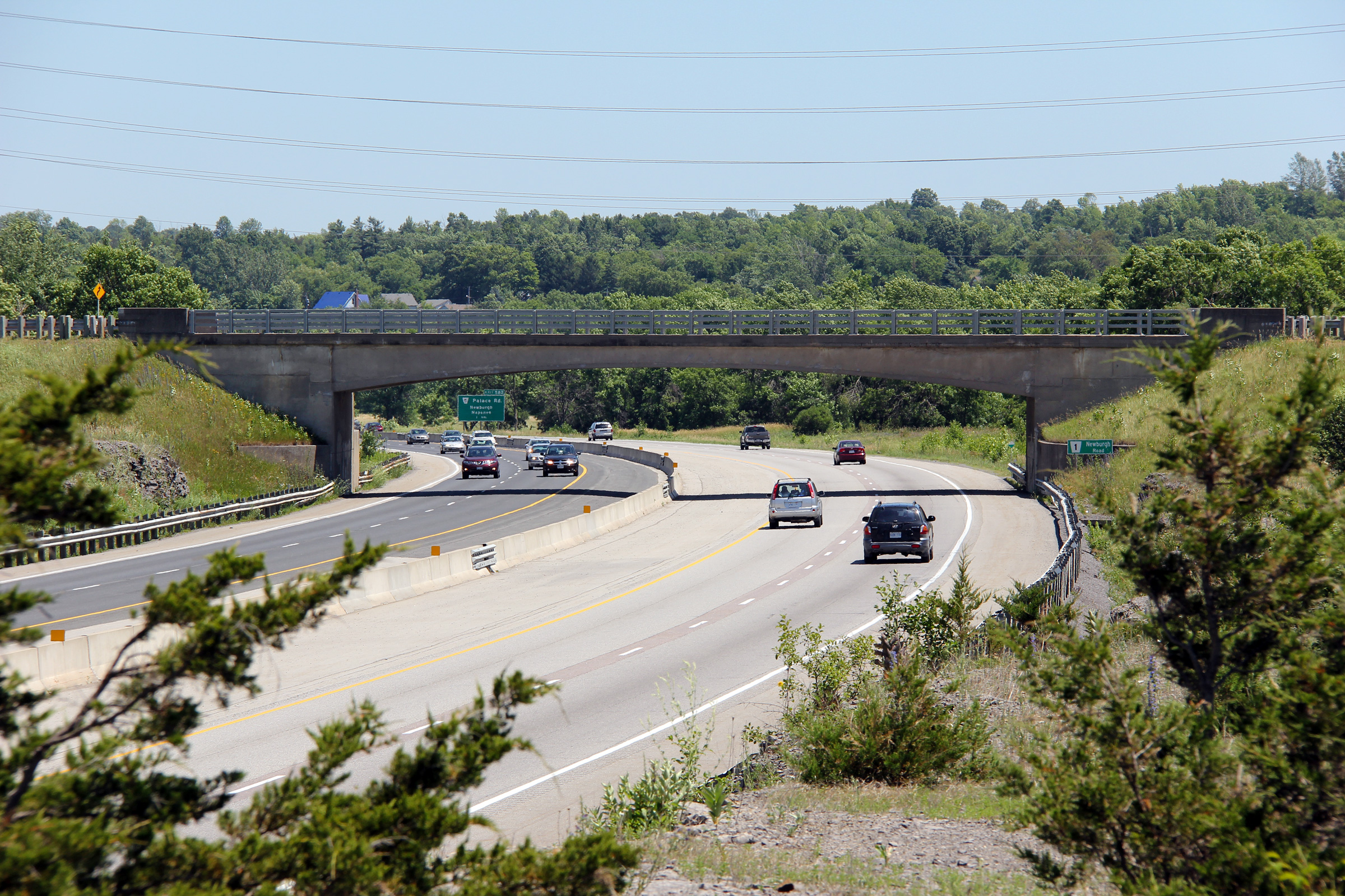
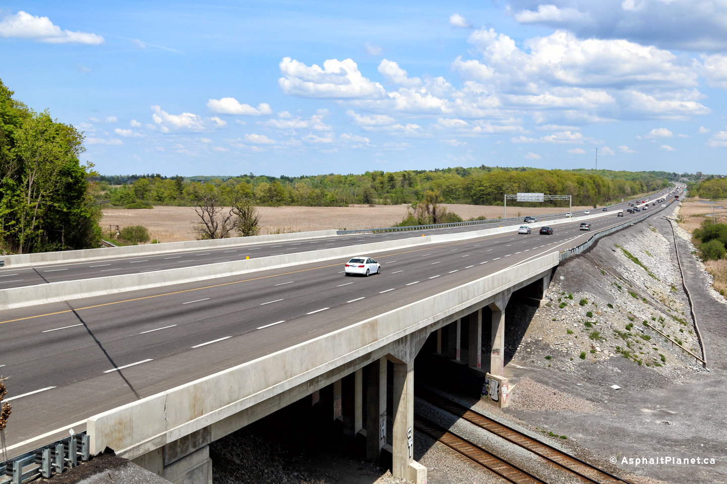
| Town of Greater Napanee County of Lennox & Addington |
Views looking easterly towards Newburgh Road from the CNR spur line.
The steel railings pictured on the Newburgh Road structure are atypical of
what is normally present on freeway structures in Ontario. These steel
railings replaced an older design when this structure was rehabilitated in
the 2000s. Photos taken: June 29th, 2012. |
 (720x480) (1440x960) (2400x1600)  (720x480) (1440x960) (2400x1600) |
||
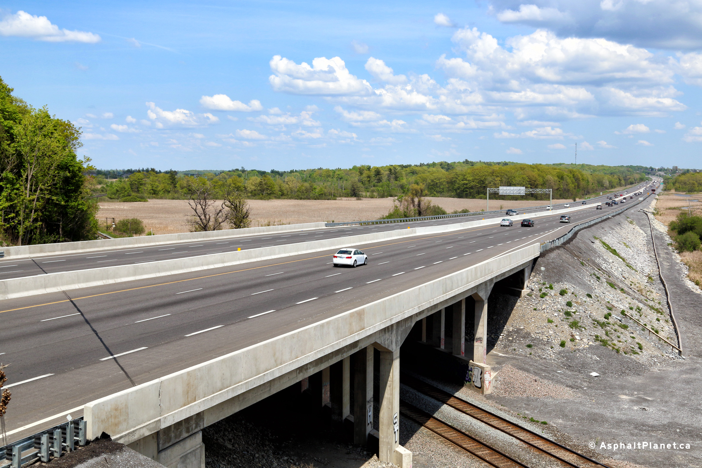
| Town of Greater Napanee County of Lennox & Addington |
Westerly view from the Newburgh Road overpass towards the CN Railway
overpass. Photo taken: June 29th, 2012. |
 (720x480) (1440x960) (2400x1600) |
||
| Town of Greater Napanee County of Lennox & Addington |
Easterly view from Newburgh Road, looking towards the Camden East Road
interchange. Though no longer relevant since it has long been
replaced, through the 1990s, a unique three cable guiderail barrier
separated opposing traffic along the 401 through the Napanee. Photo taken: June 29th, 2012. |
 (720x480) (1440x960) (2400x1600) |
||
| Town of Greater Napanee County of Lennox & Addington |
Westbound advanced signage for the Highway 41 interchange. Photo taken: June 29th, 2012. |
 (720x480) (720x480)(1440x960) (2400x1600) |
||
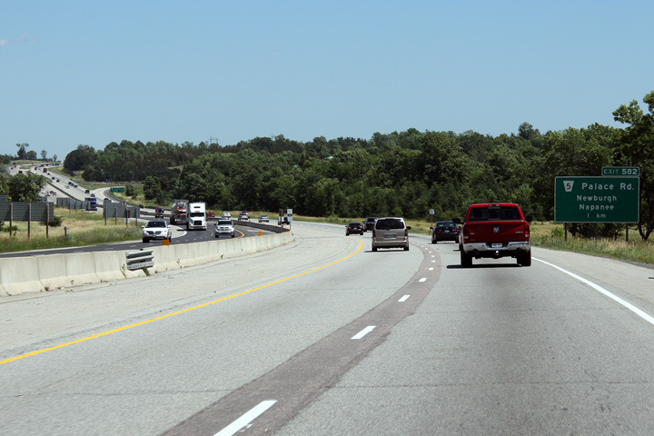
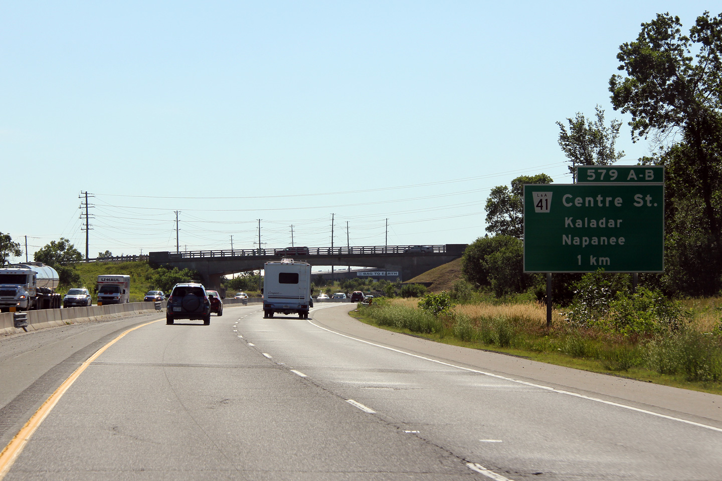
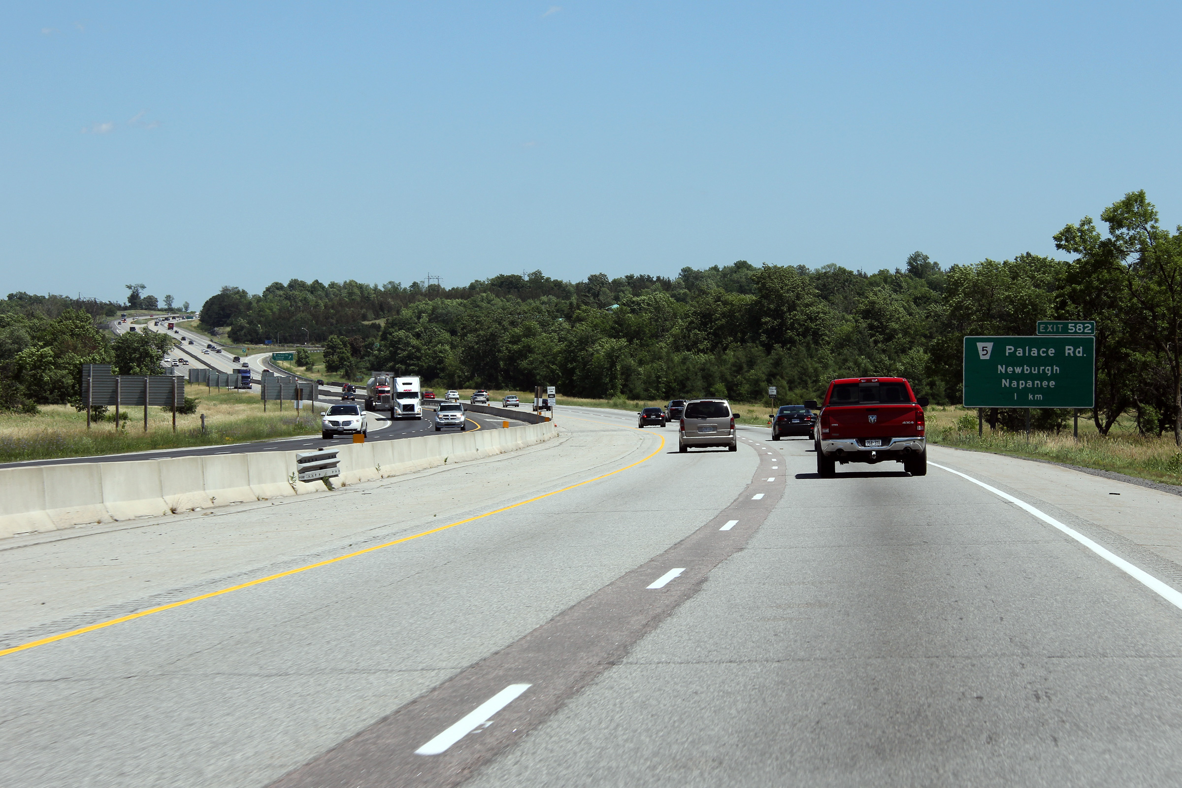
| Town of Greater Napanee County of Lennox & Addington |
Advanced signage for the Palace Road interchange. Palace Road crosses
Highway 401 at a considerable skew, therefore the interchange has very tight
geometry. Photo taken: June 29th, 2012. |
 (720x480) (720x480)(1440x960) (2400x1600) |
||
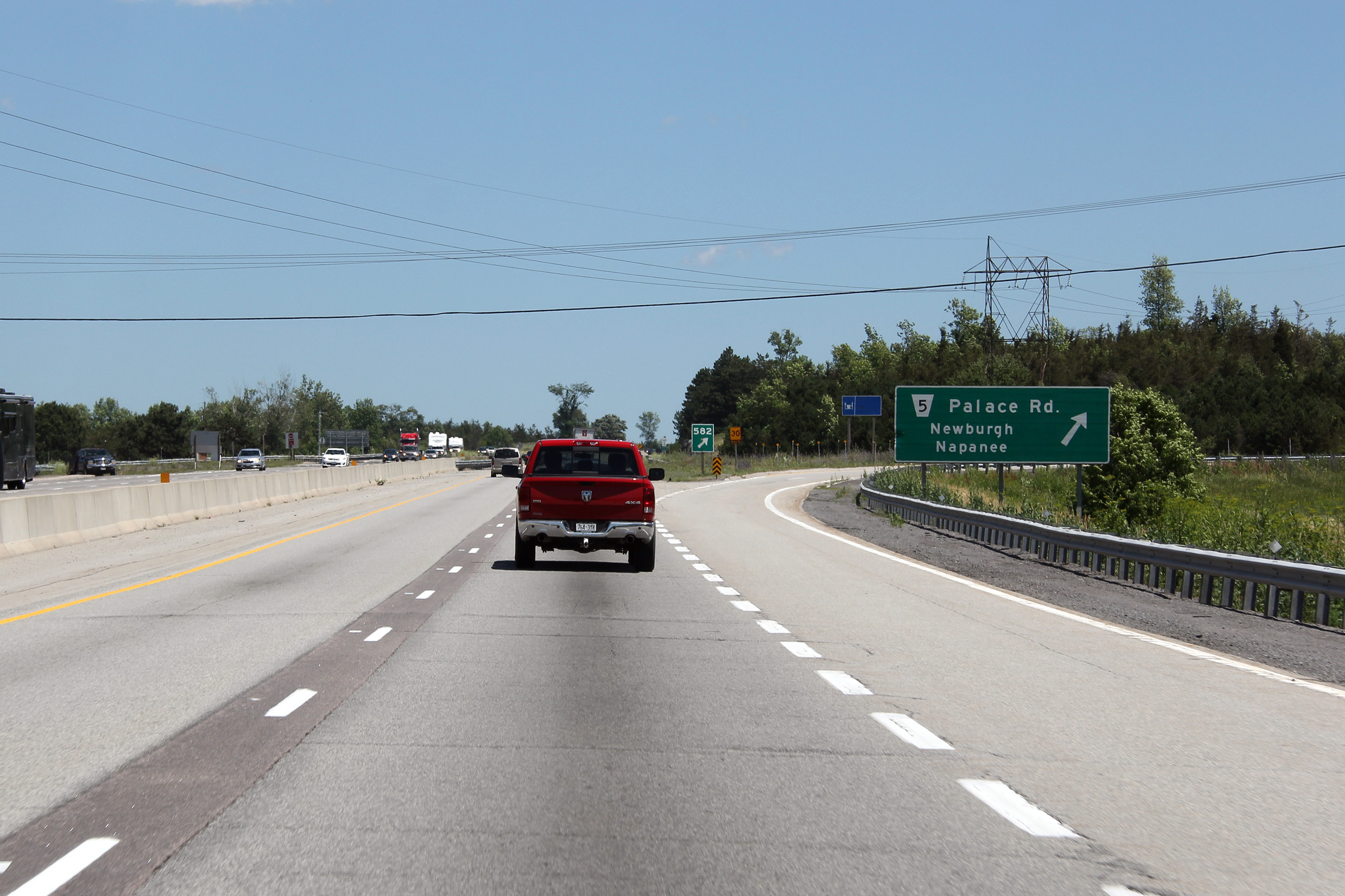
| Town of Greater Napanee County of Lennox & Addington |
Eastbound signage at the off-ramp to Palace Road. Photo taken: June 29th, 2012. |
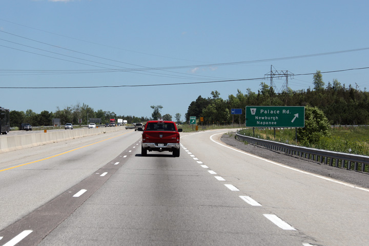 (720x480) (720x480)(1440x960) (2400x1600) |
||
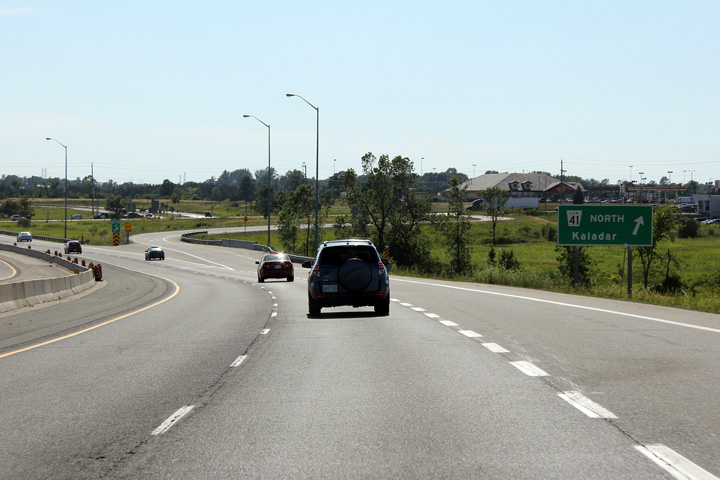
| Town of Greater Napanee County of Lennox & Addington |
The western side of the Switzerville Road overpass. The Switzerville
Road structure has not seen any major modifications since its construction
in the early 1960s. Photo taken: June 29th, 2012. |
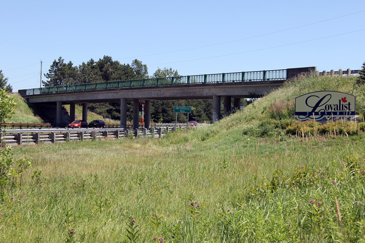 (720x480) (1440x960) (2400x1600) |
||
| Town of Greater Napanee County of Lennox & Addington |
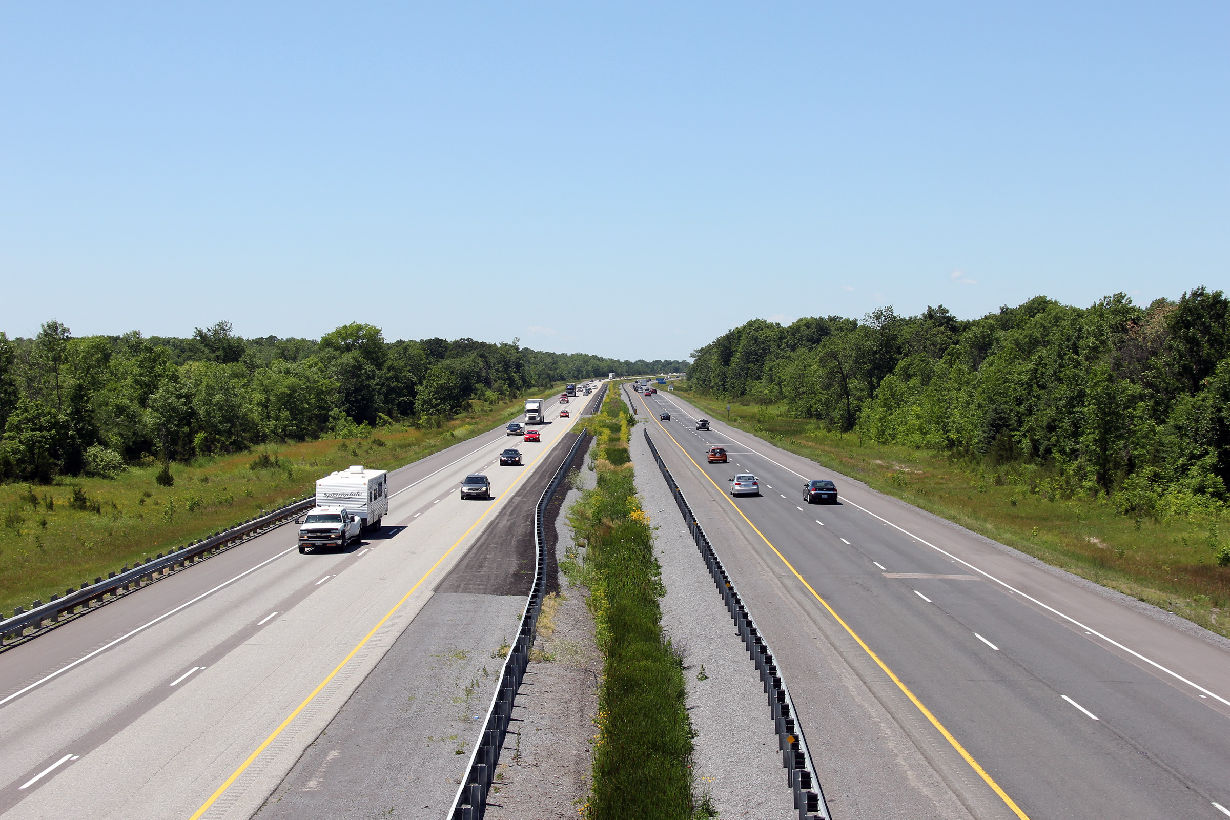
Views looking west from the Switzerville Road overpass, just east of Napanee. Photos taken: June 29th, 2012. |
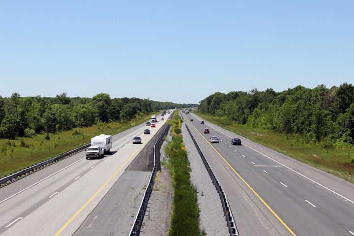 (720x480) (1440x960) (2400x1600) 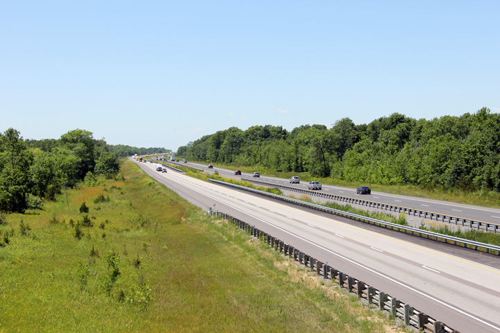 (720x480) (1440x960) (2400x1600) |
||
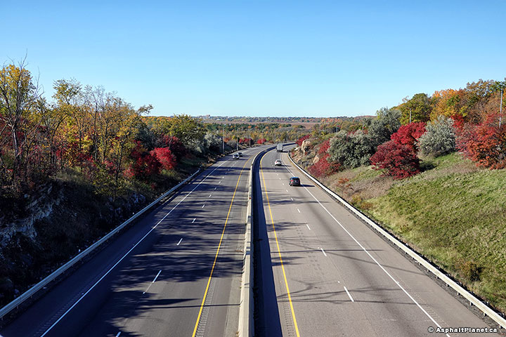
| Town of Greater Napanee County of Lennox & Addington |
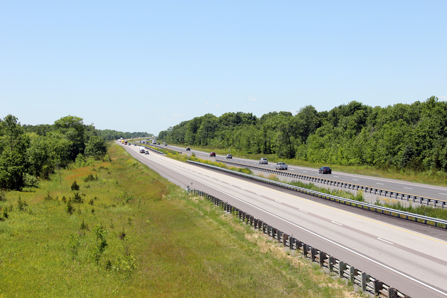
Easterly view from the Switzerville Road overpass towards Kingston. Photo taken: June 29th, 2012. |
 (720x480) (1440x960) (2400x1600) |
||
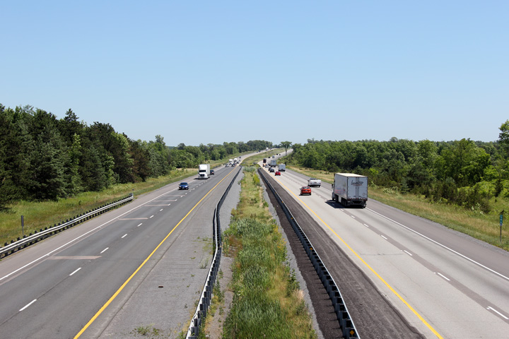
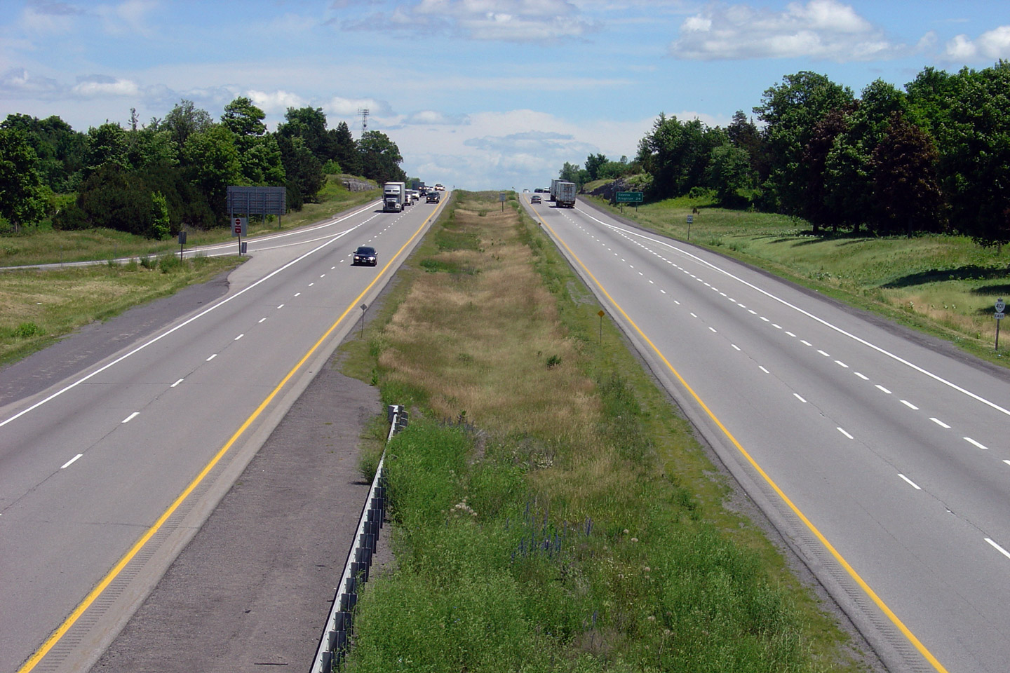
| Township of Loyalist County of Lennox & Addington |
Highway 401 looking west from the Old Highway
133 overpass.
Highway 133 (now Lennox & Addington Road 4)
is located roughly at kilometre marker 593. Photo taken: June 19th, 2004. |
 |
||
| Highway 133 was a short Highway linking the Amherst Island Ferry to Highway 401. Click here for Highway 133 images. | ||||
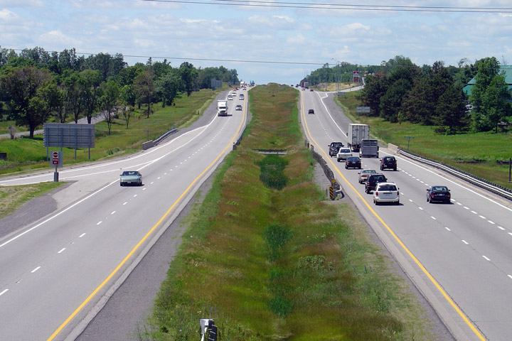
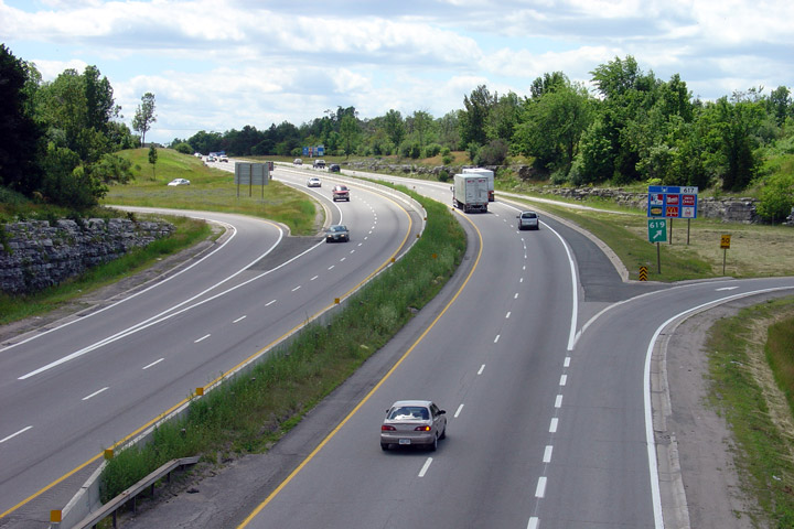
| Township of Loyalist County of Lennox & Addington |
View looking easterly from the Highway 133 overpass towards Kingston.
Between Napanee and Kingston, it is typical for the highway median to
narrow slightly where the freeway passes through structures. Photo taken: June 19th, 2004. |
 |
||
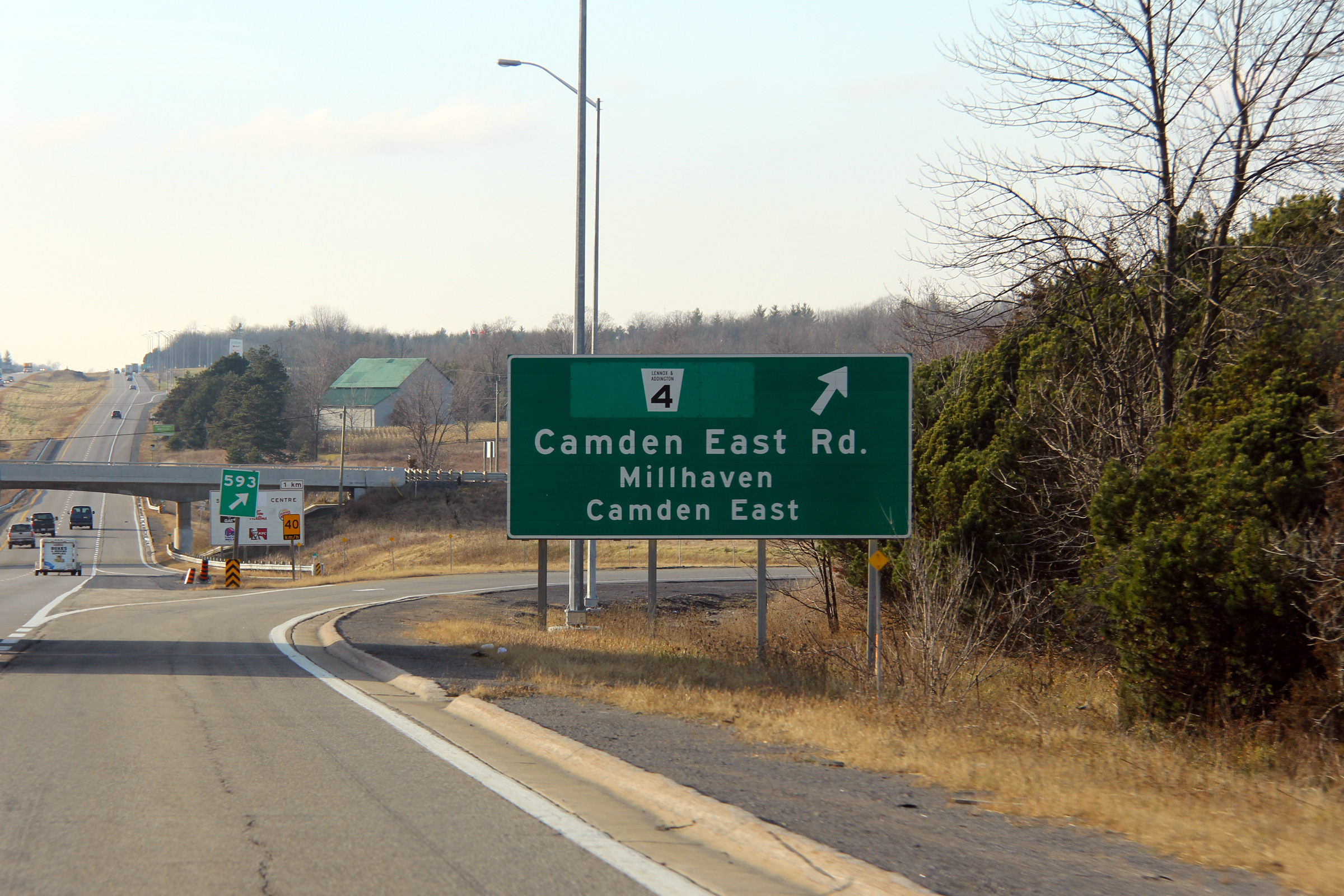
| Township of Loyalist County of Lennox & Addington |
Westbound guide signage for the Camden East Road interchange. Prior to
1997, south of Highway 401, the Camden East Road was designated as Highway
133, hence the overlay on the signage. Photo taken: December 3rd, 2011. |
 (720x480) (720x480)(1440x960) (2400x1600) |
||
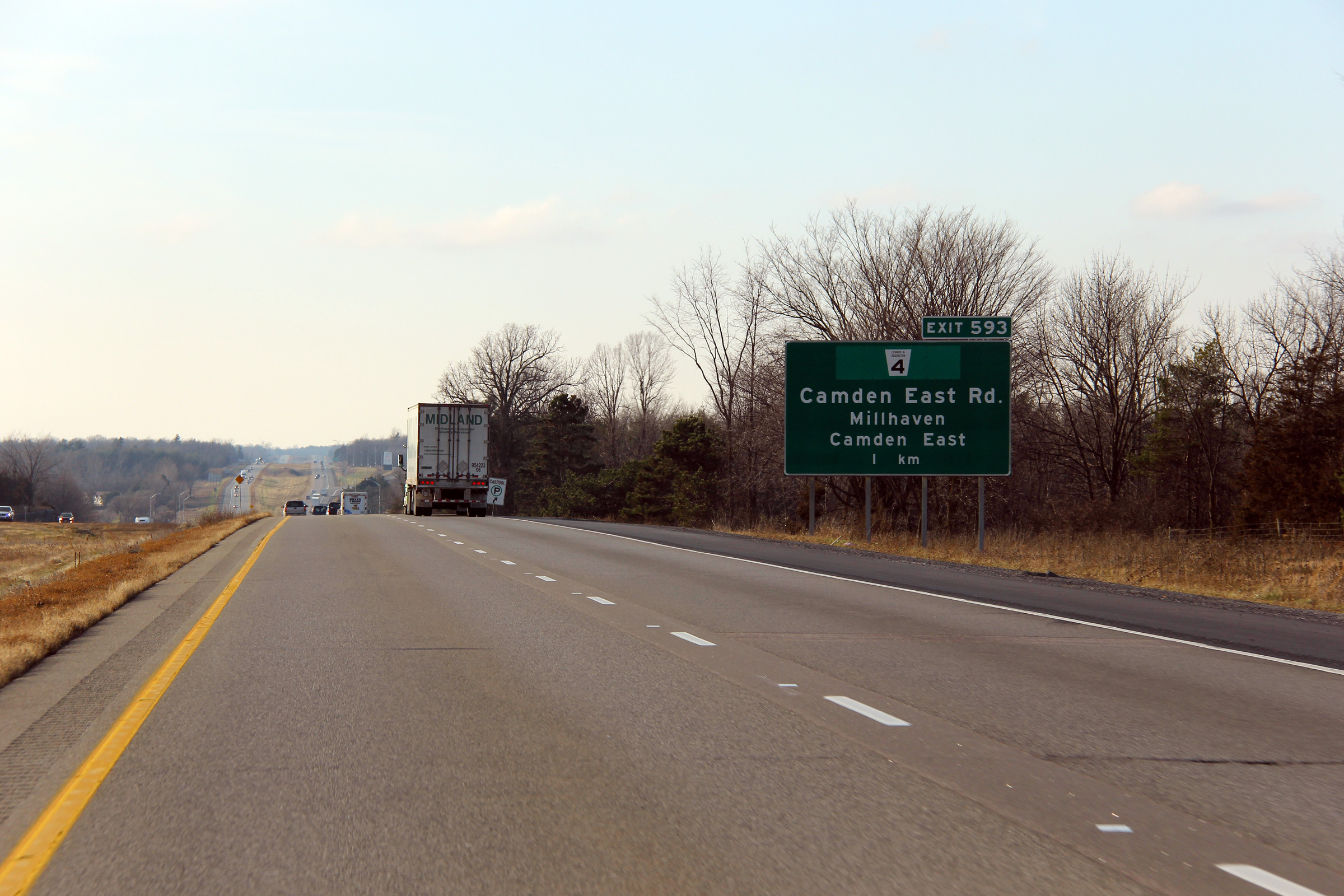
| Township of Loyalist County of Lennox & Addington |
Westbound advanced signage for the Camden East Road interchange. Photo taken: December 3rd, 2011. |
 (720x480) (720x480)(1440x960) (2400x1600) |
||
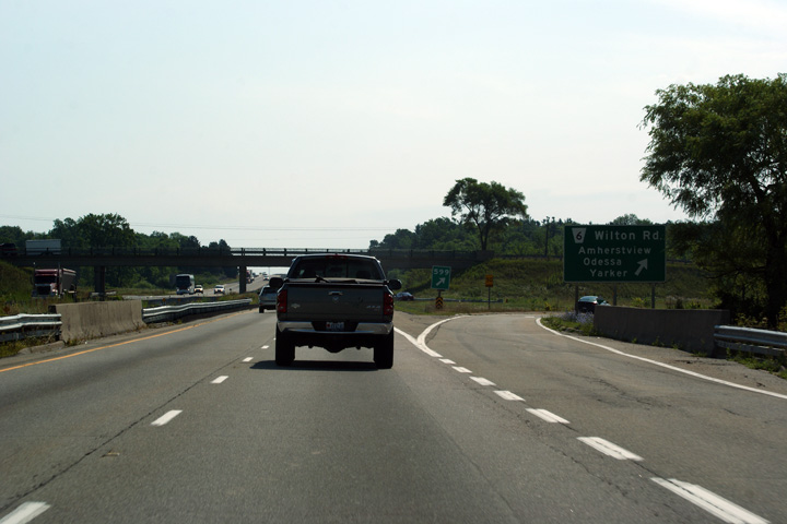
| Township of Loyalist County of Lennox & Addington |
Advanced signage for the Yarker Road interchange. Photo taken: June 29th, 2012. |
 (720x480) (720x480)(1440x960) (2400x1600) |
||
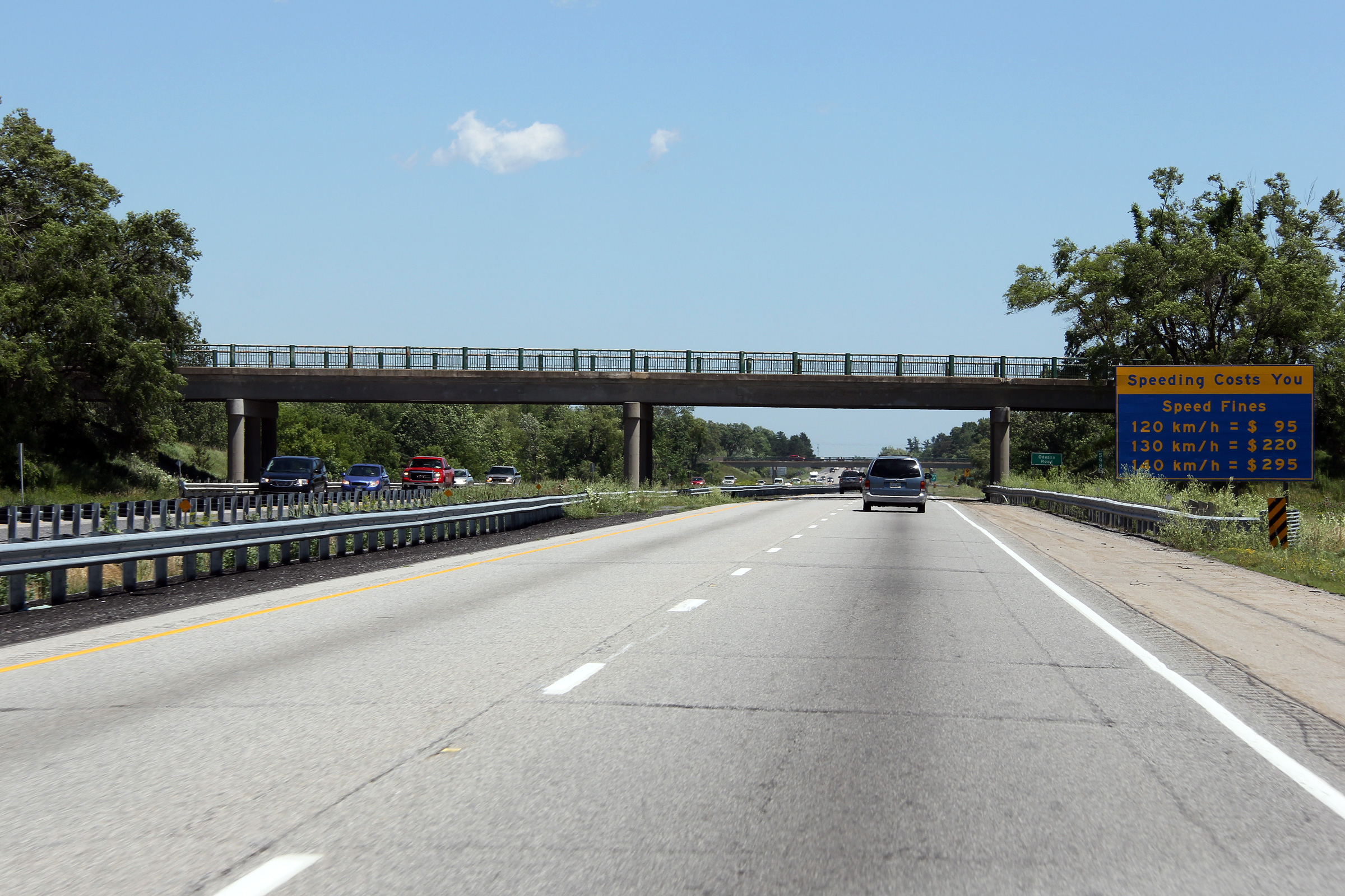
| Township of Loyalist County of Lennox & Addington |
Large signs have been placed along Highway 401 in the Napanee and Kingston
areas in an effort to deter motorists from speeding Photo taken: June 29th, 2012. |
 (720x480) (720x480)(1440x960) (2400x1600) |
||
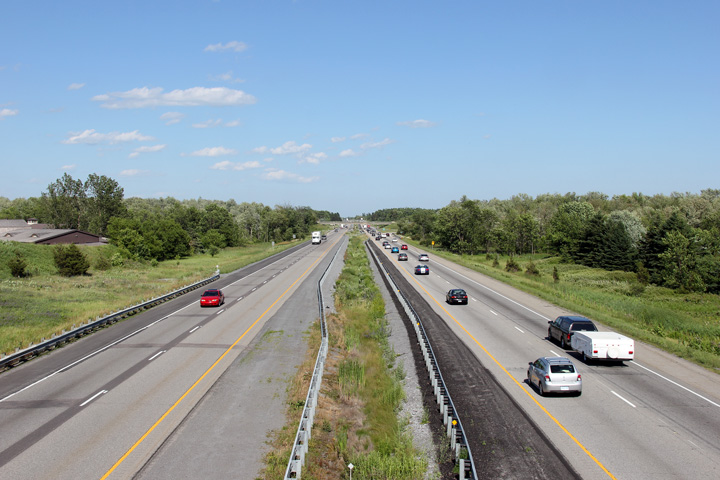
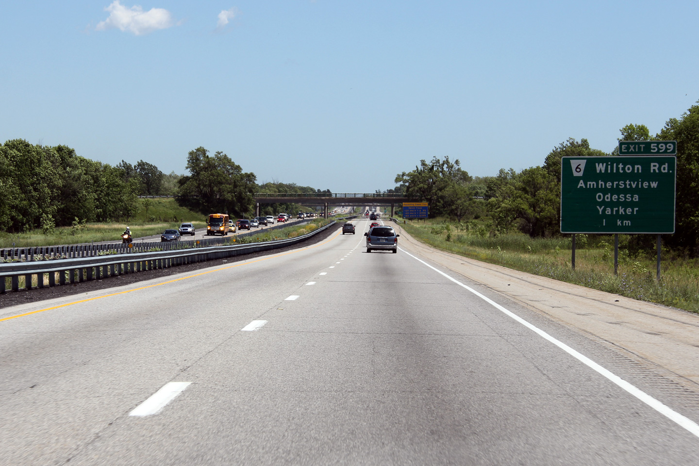
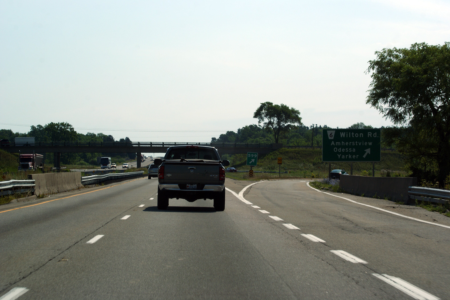
| Township of Loyalist County of Lennox & Addington |
View looking westerly from the Wilton Road overpass. Photo taken: June 29th, 2012. |
 |
||
| Township of Loyalist County of Lennox & Addington |
Easterly view from the Wilton Road overpass, towards the Yarker
Road interchange. Photo taken: June 29th, 2012. |
 |
||
| Township of Loyalist County of Lennox & Addington |
Eastbound signage at the exit to Yarker Road. This signage was
replaced in the winter of 2012. Photo taken: July 23rd, 2011. |
 (720x480) (720x480)(1440x960) (2400x1600) |
||
| Township of Loyalist County of Lennox & Addington |
View looking westerly towards the Wilton Road overpass from Yarker Road. Photo taken: June 29th, 2012. |
 |
||
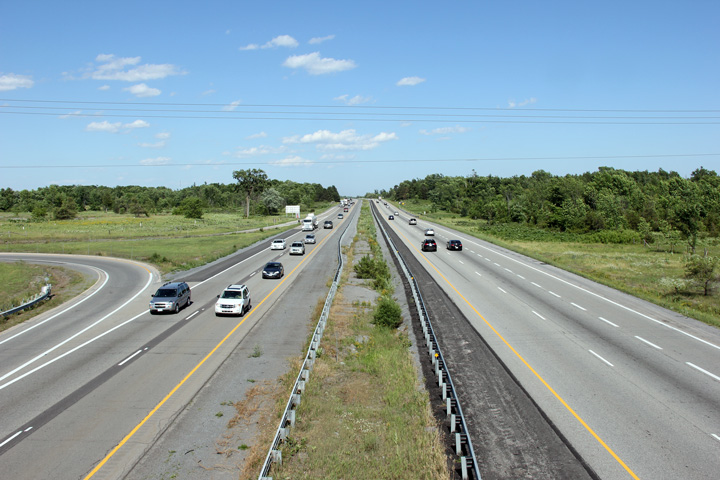
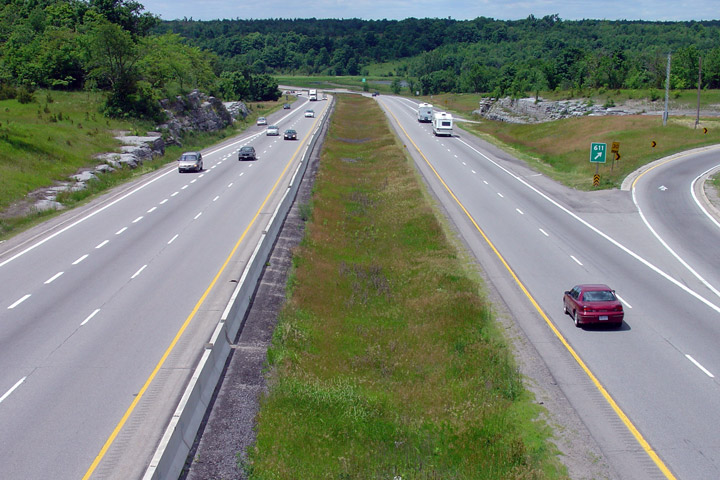
| Township of Loyalist County of Lennox & Addington |
Easterly view from the Yarker Road overpass. Yarker Road meets Highway
401 at a 4-ramp parclo A2 interchange. Of note, Mud Lake Road used to
pass directly through the interchange site. Mud Lake Road now
intersects directly with the interchange ramps, halfway between Yarker Road
and Highway 401. Photo taken: June 29th, 2012. |
 |
||
| Township of Loyalist County of Lennox & Addington |
Easterly view looking towards the Westbrook Road overpass. Westbrook Road
crosses the 401 across a very attractive concrete rigid frame bridge.
Attention to bridge aesthetics is seldom seen on newer highways such as the 407
or 416. Photo taken: June 29th, 2012. |
 (720x480) (720x480)(1440x960) (2400x1600) |
||
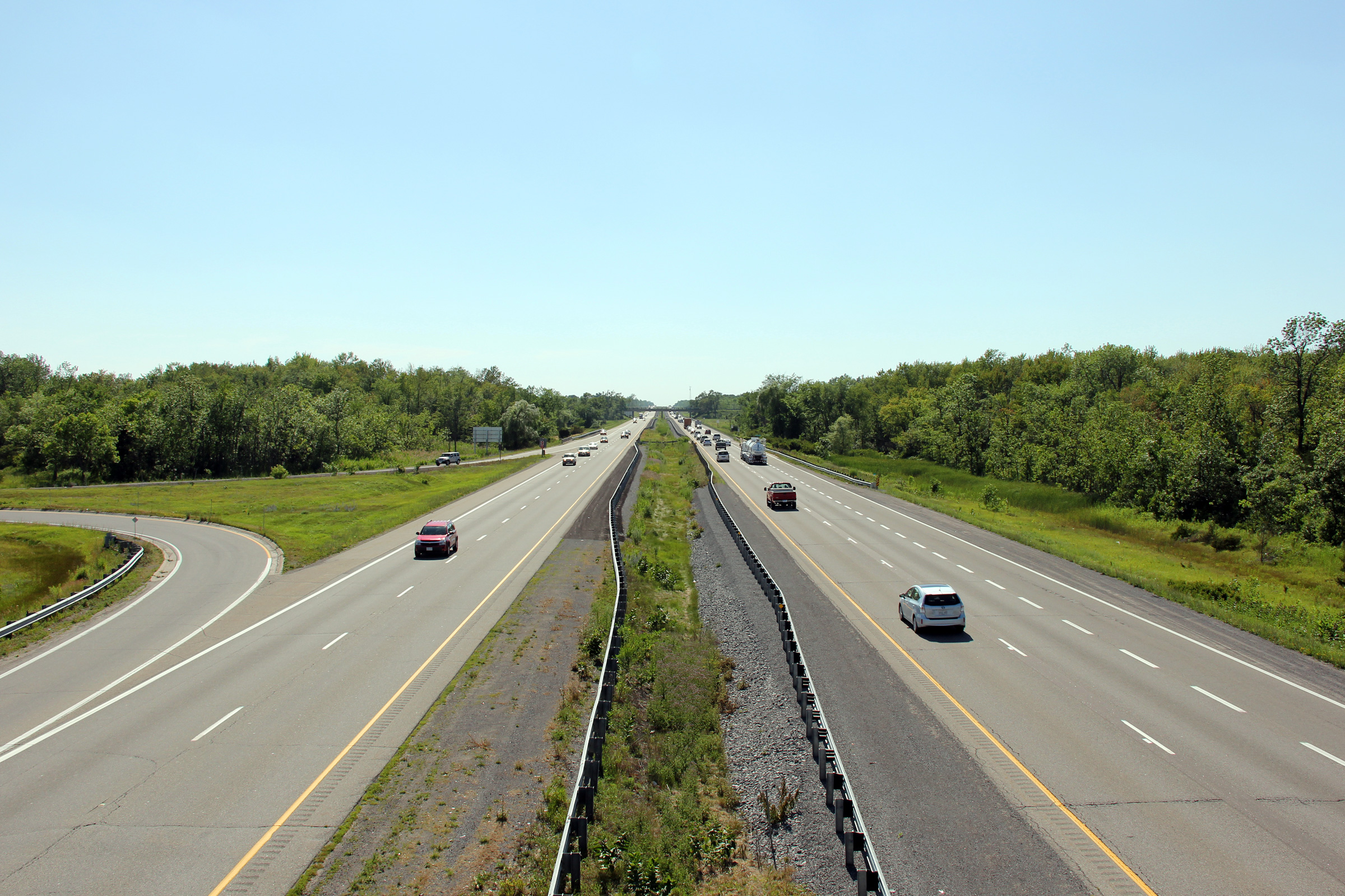
| Township of Loyalist County of Lennox & Addington |
Two views looking westerly from the Westbrook Road overpass. Photo taken: June 29th, 2012. |
 (720x480) (1440x960) (2400x1600) 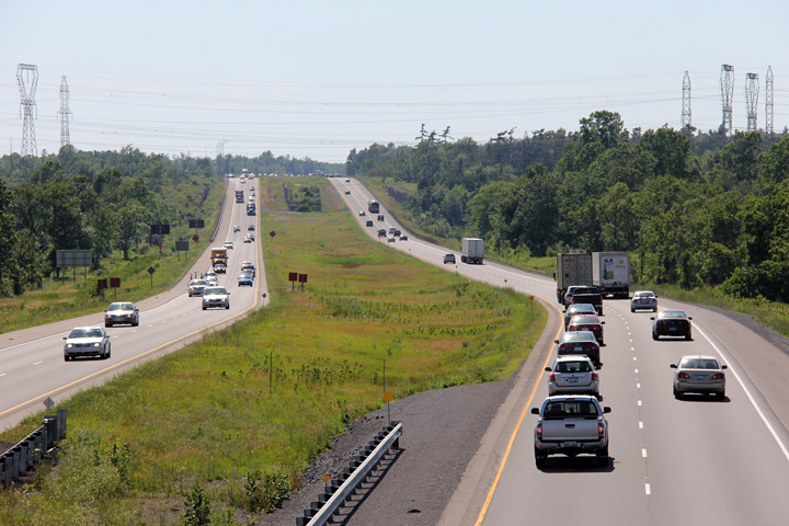 (720x480) (1440x960) (2400x1600) |
||
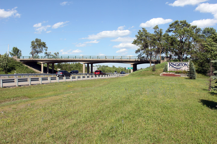
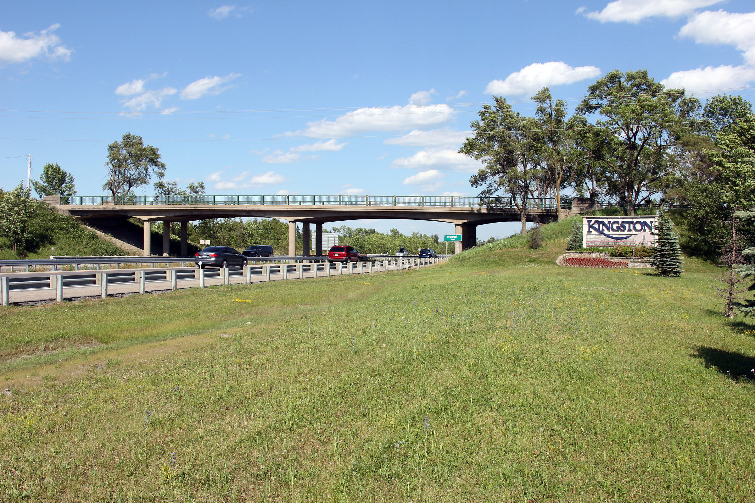
| City of Kingston |
Easterly view from Westbrook Road. Westbrook Road marks the western limits
of the City of Kingston. The City of Kingston had its boundary extended to
beyond
Westbrook Road in 1998, when the City was amalgamated with Kingston Township. Photo taken: June 29th, 2012. |
 |
||
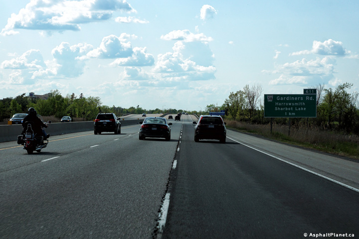
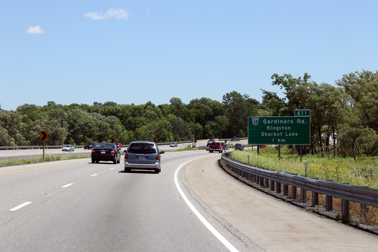
| City of Kingston |
At the bottom of Gibsons Hill, the freeway passes overtop of Collins Creek,
where this advanced sign for the Highway 38 interchange is situated. Photo taken: June 29th, 2012. |
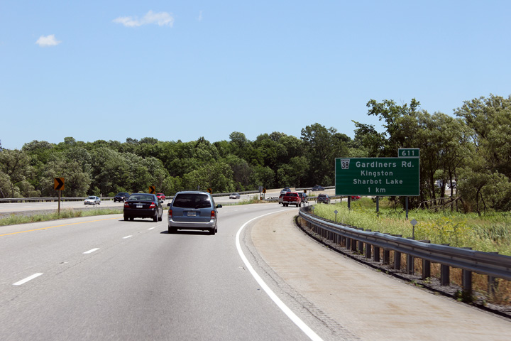 (720x480) (720x480)(1440x960) (2400x1600) |
||
| City of Kingston |
Easterly view from Westbrook Road. Westbrook Road marks the western limits
of the City of Kingston. The City of Kingston had its boundary extended to
Westbrook Road in 1998, when the city was amalgamated with Kingston Township. Photo taken: June 29th, 2012. |
|||
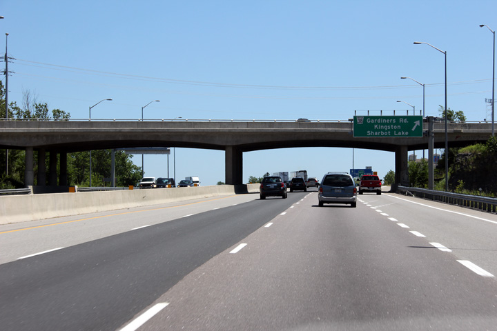
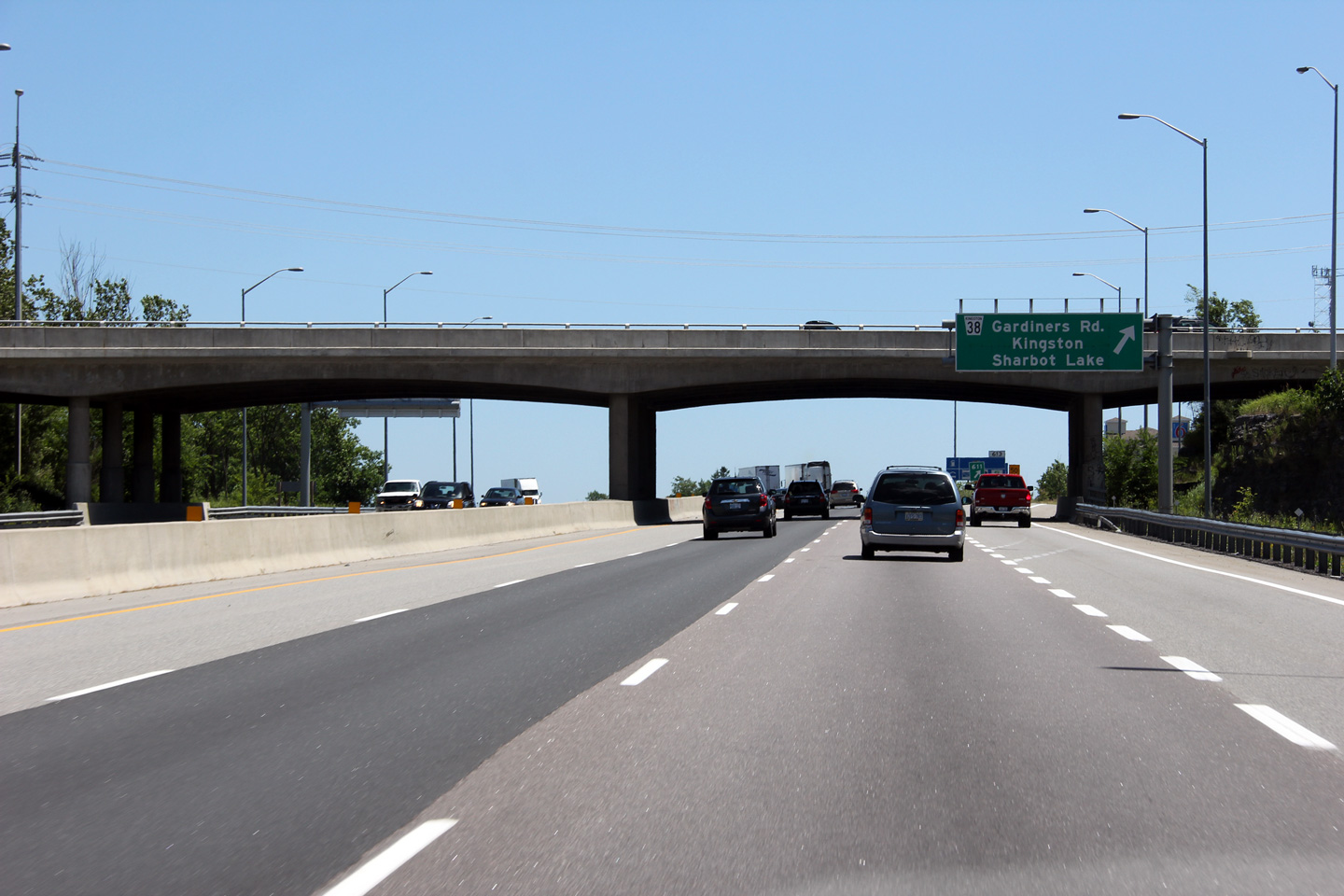
| City of Kingston |
Overhead sign and structure for the Highway 38 interchange. This was the
only overhead sign erected in the first phase of the six-lane widening
through Kingston. The MTO's Eastern Region adopted the standard of placing
full overhead signage on highways of three or more lanes per direction
several years after Southwestern Region did.. Photo taken: June 29th, 2012. |
 (720x480) (720x480)(1440x960) (2400x1600) |
||
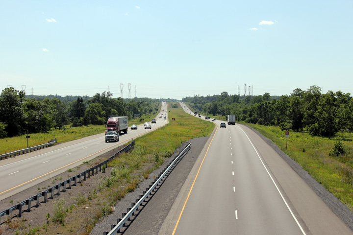
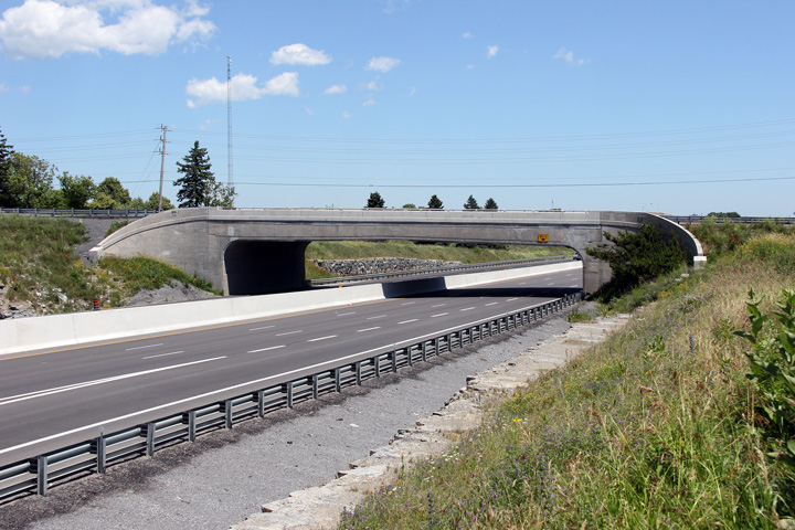
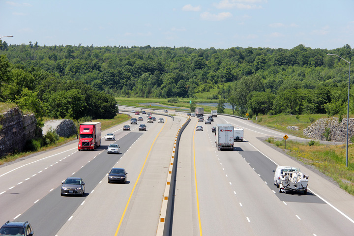
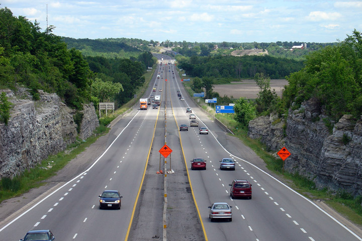
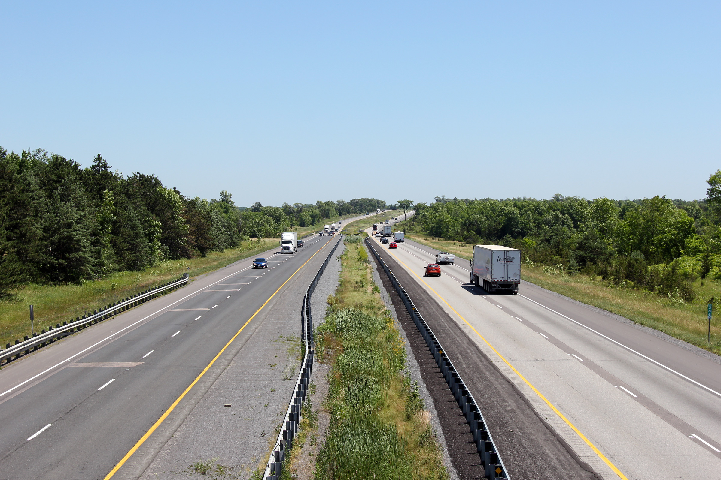
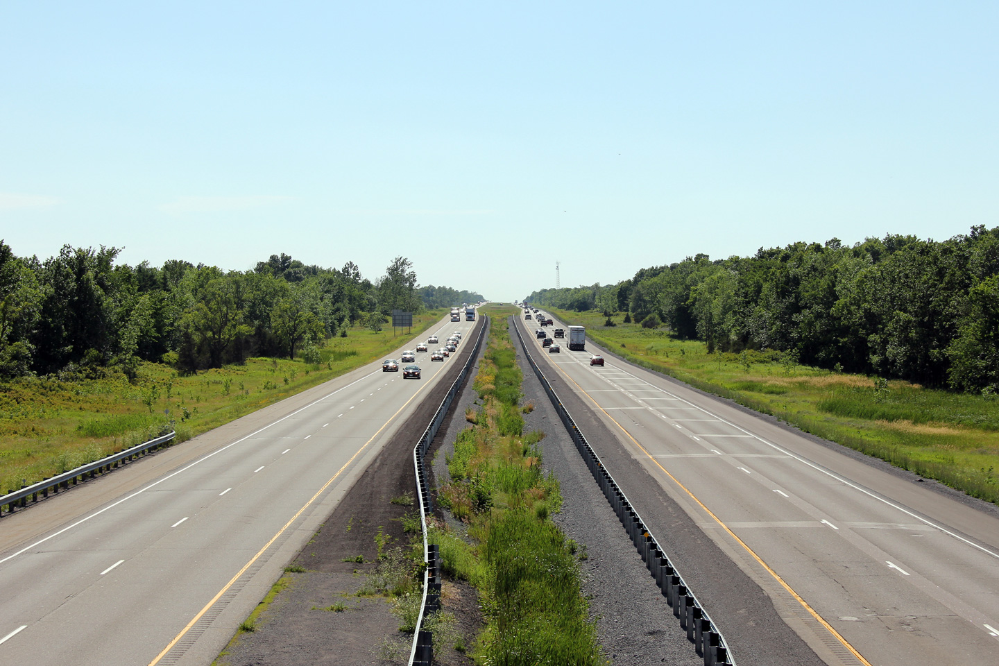
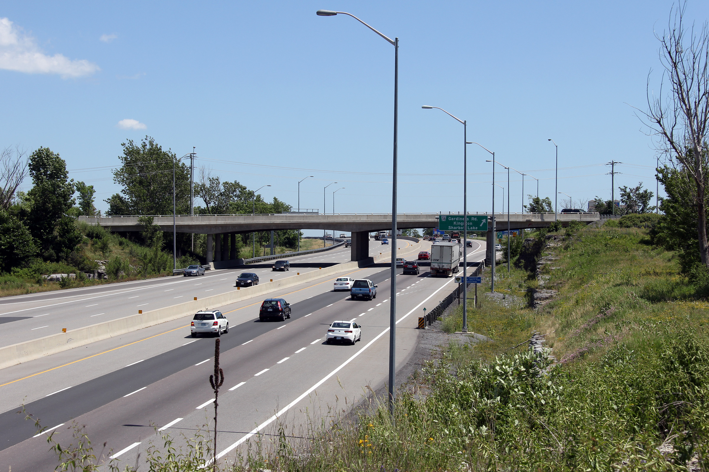
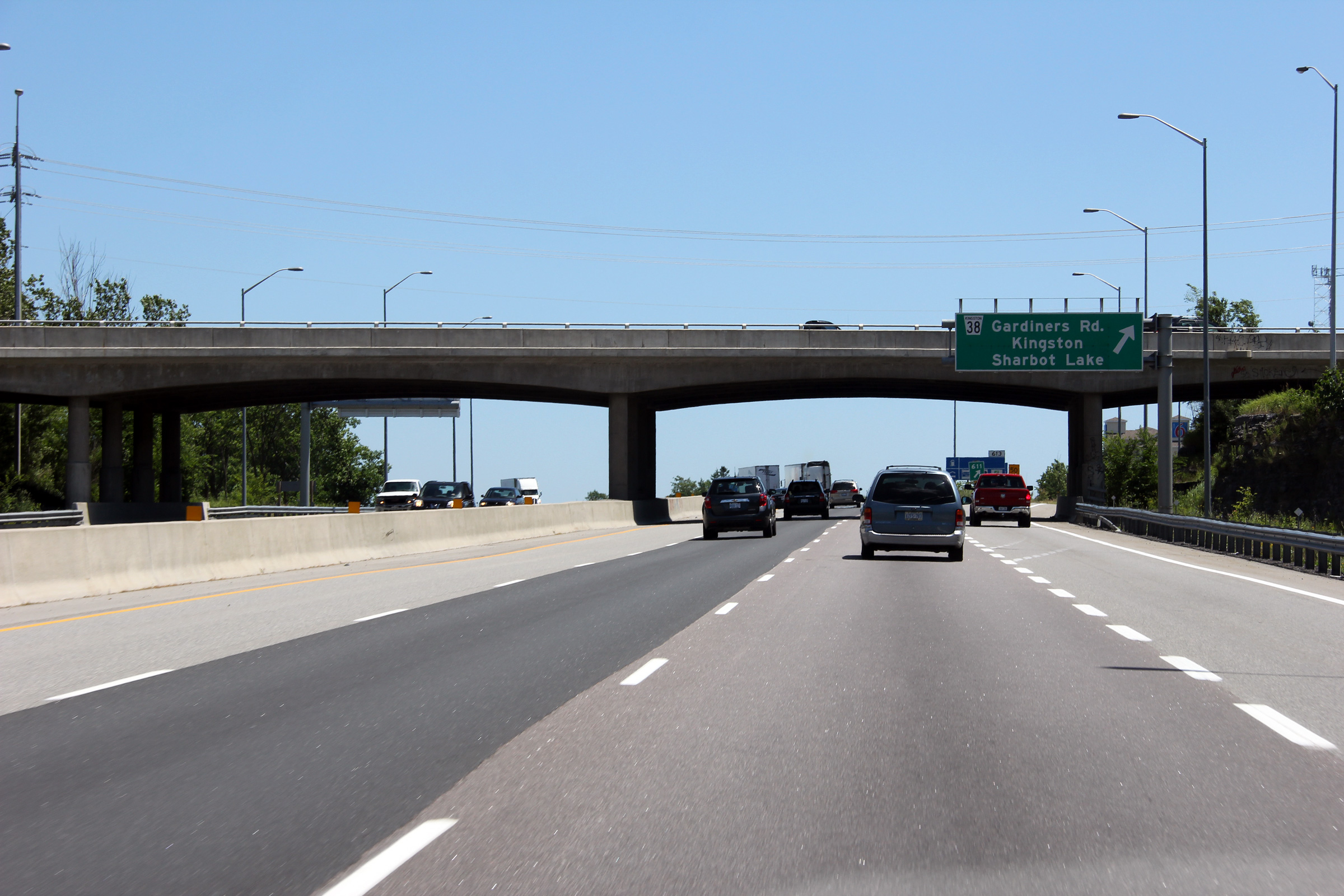
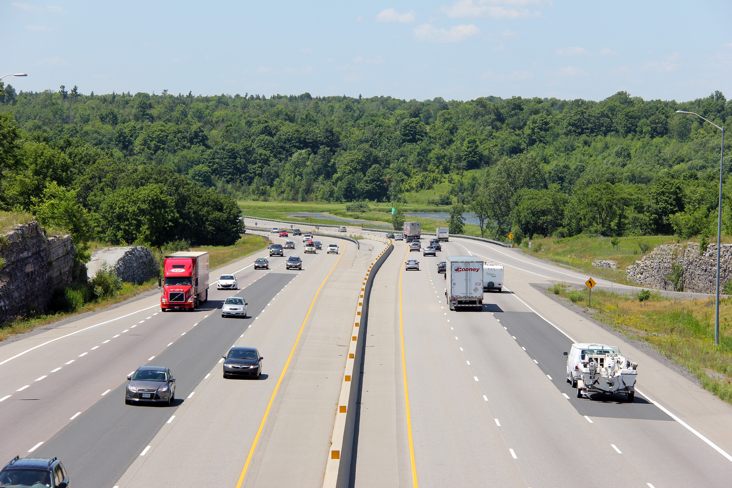
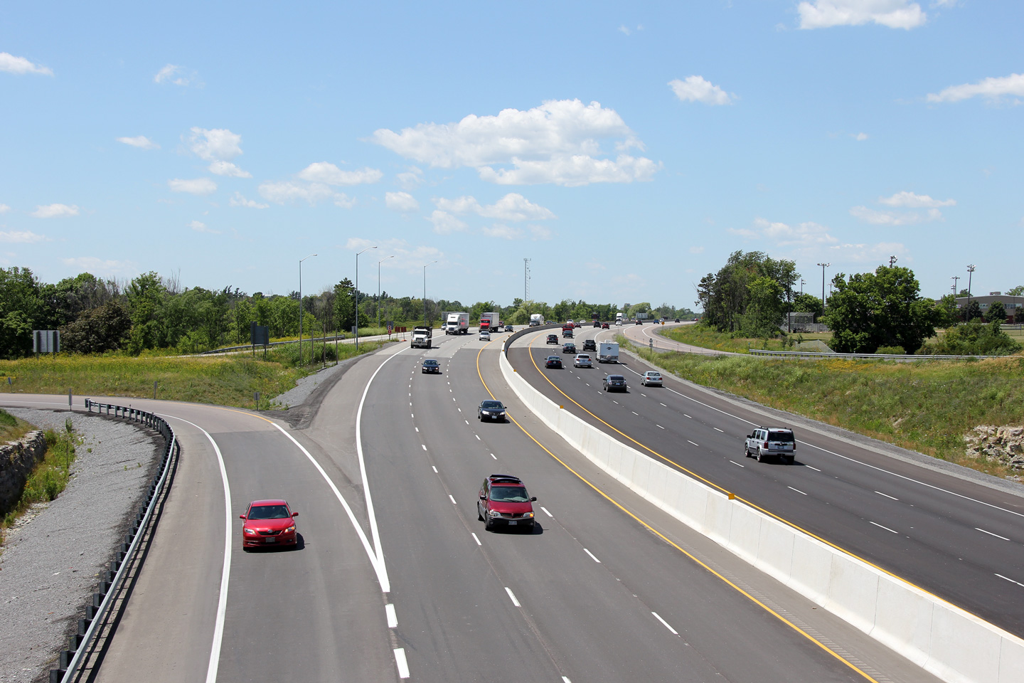
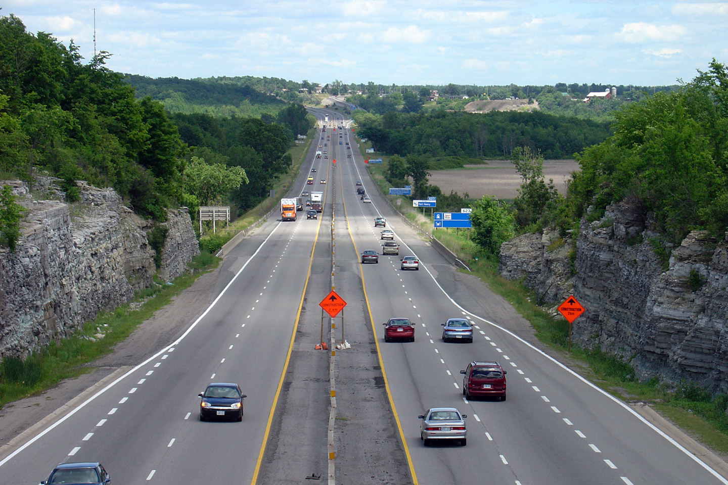
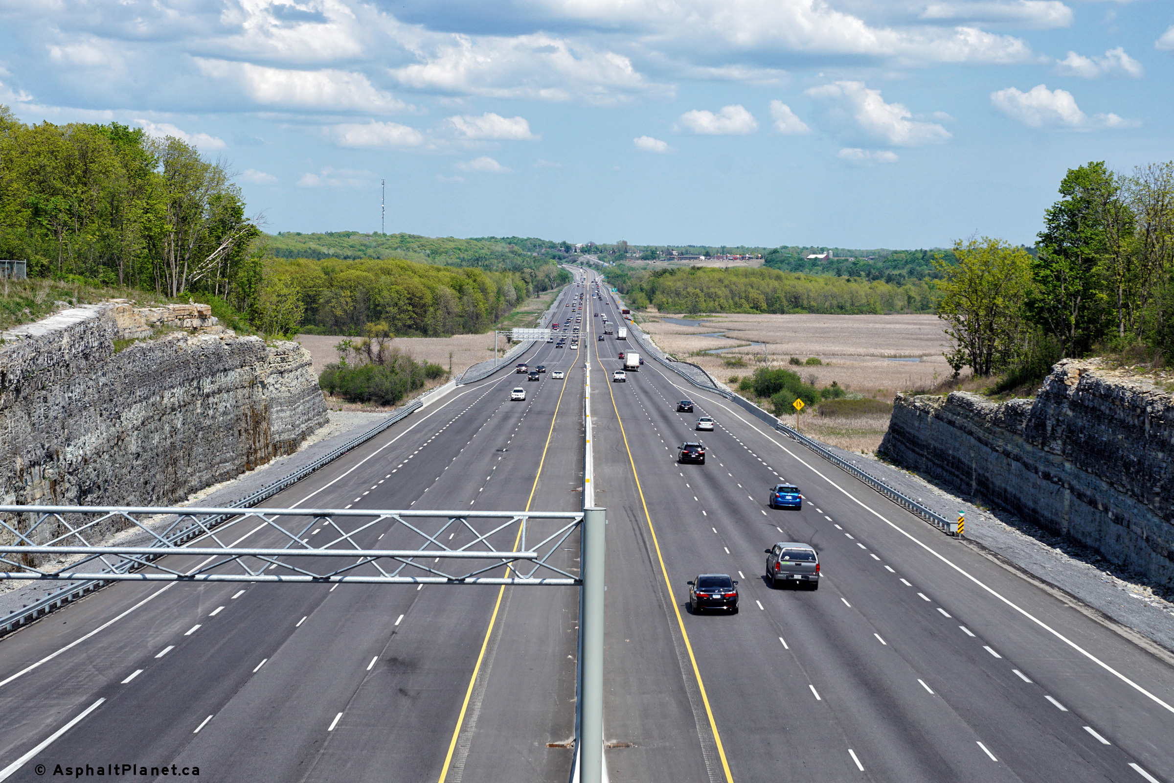
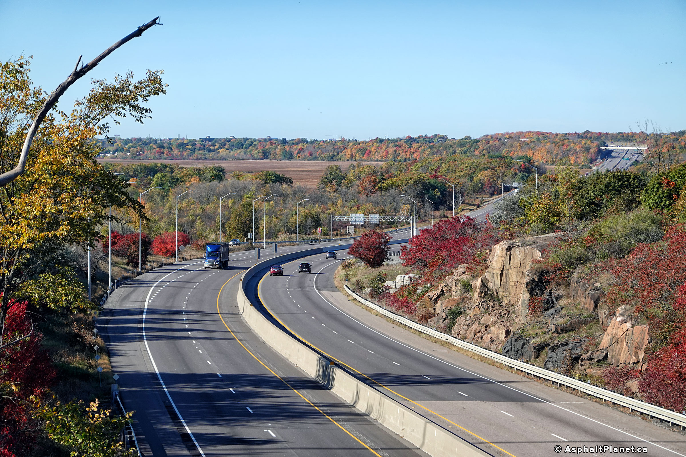
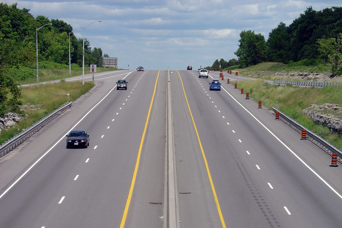
| City of Kingston |
Highway 401 looking west from the Highway 38 overpass in the west end of Kingston. Just west of Highway 38, Highway 401 descends into a large valley where it crosses Collins Creek. Through the valley, there are several sharp curves, which unfortunately were not realigned during the recent widening contract.
Upper photo taken: June 19th, 2004.
Lower photos taken: June 29th, 2012. |
(720x480) (1440x960) (2400x1600)
|
||
| Highway 38 leads north from Kingston into the Frontenac Lakes Region of the province. Click here for Highway 38 images. | ||||
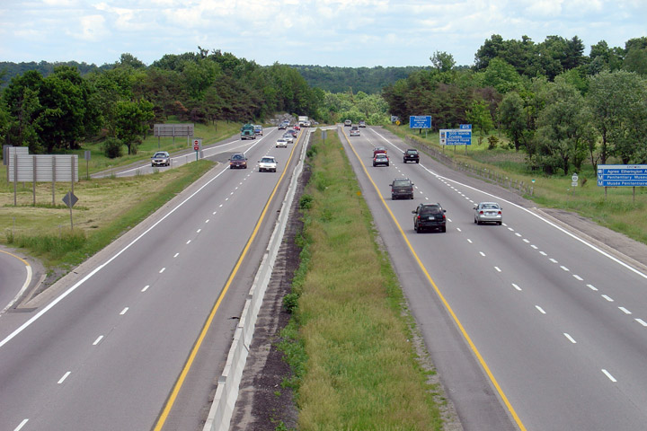
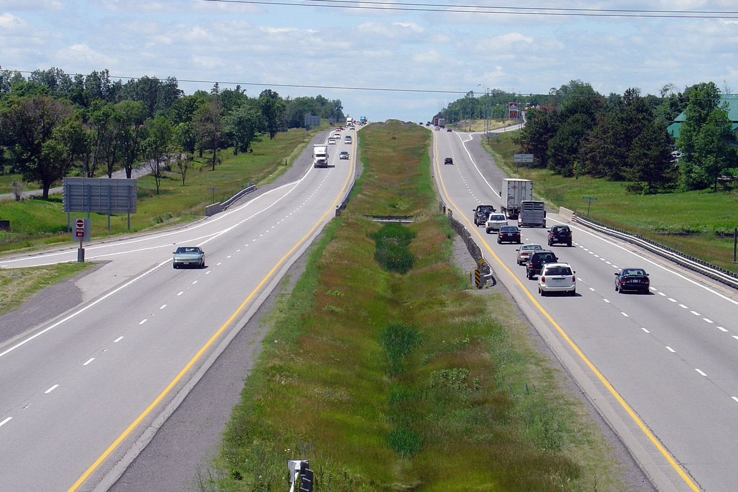
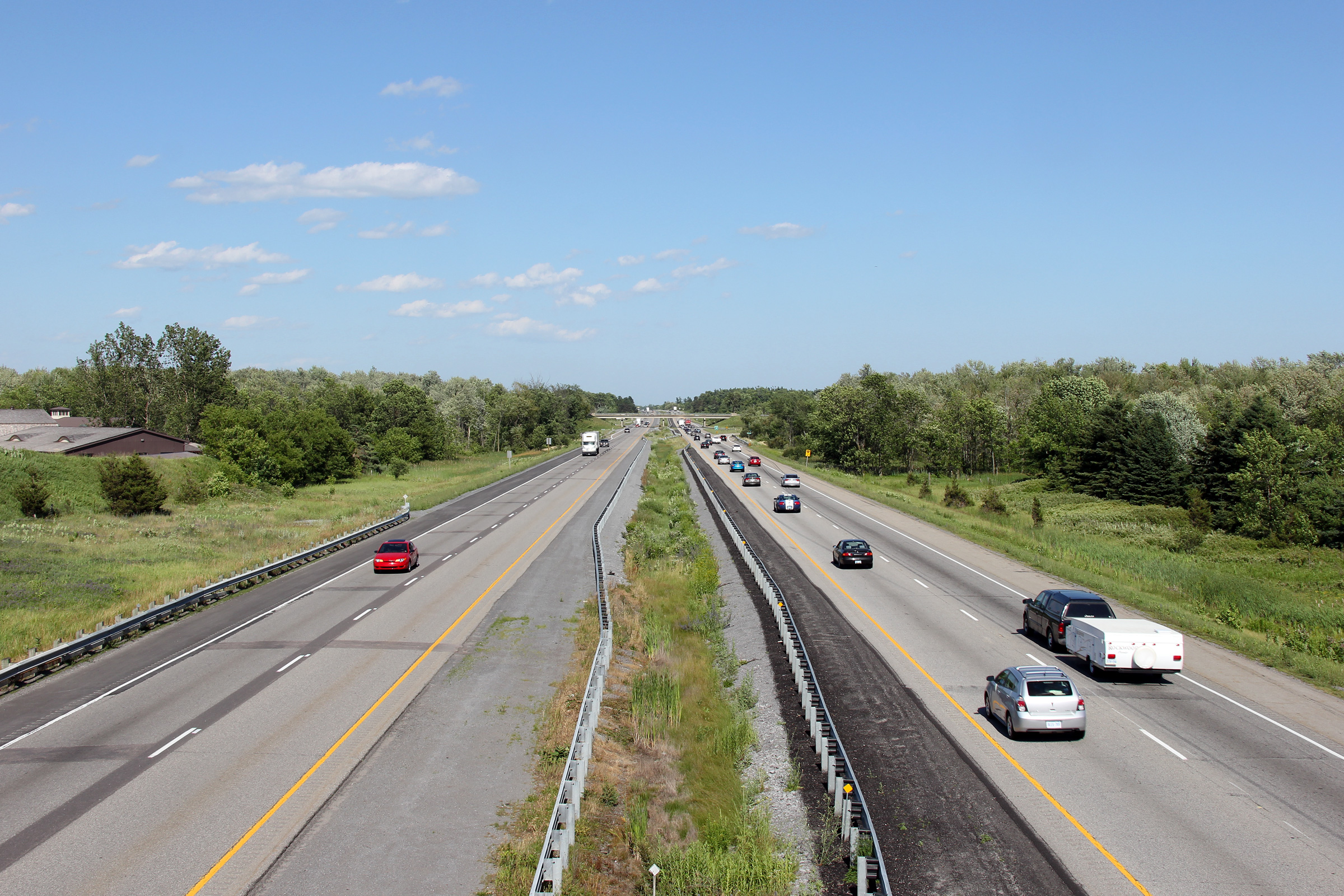
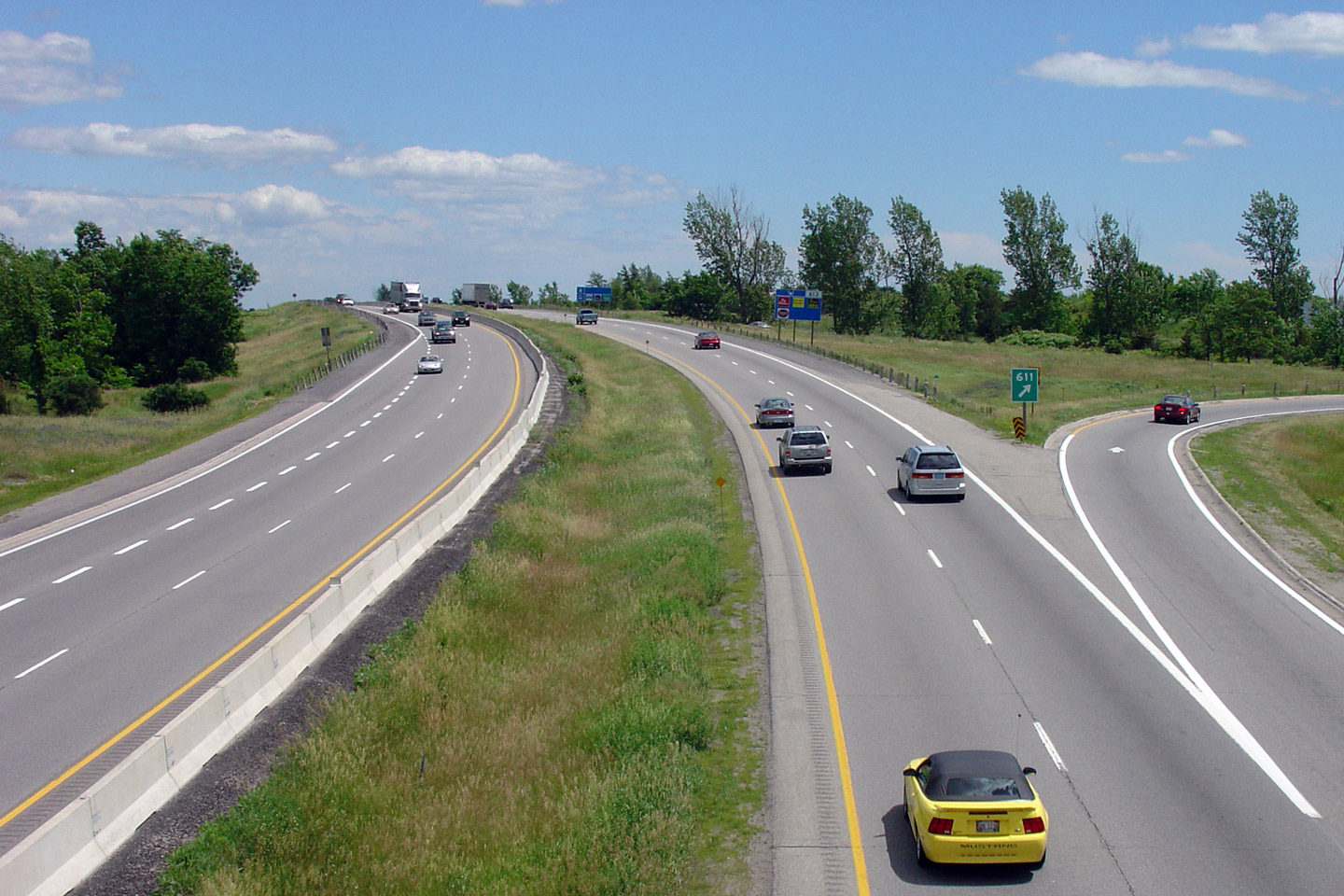
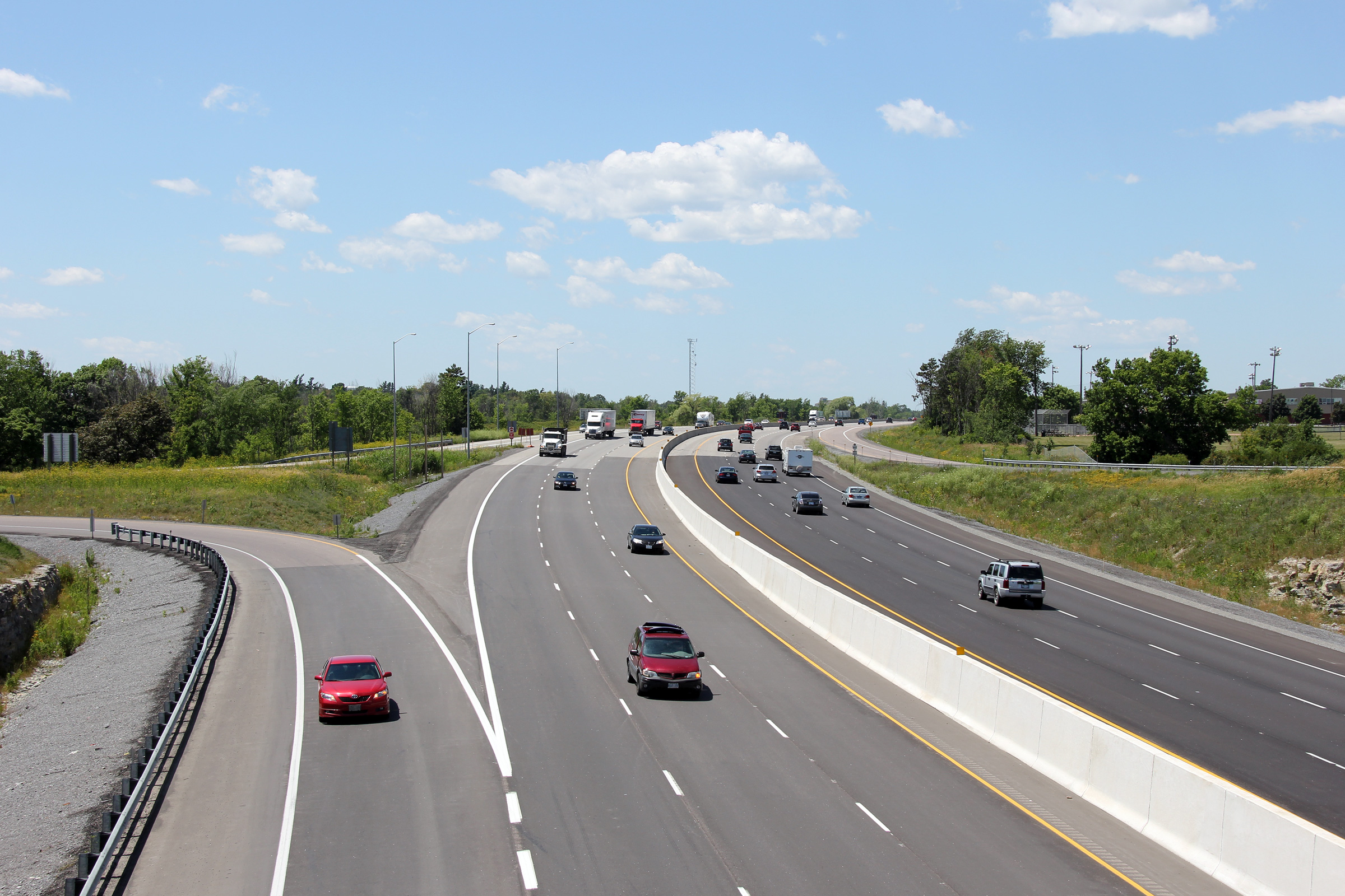
| City of Kingston |
Highway 401 looking east from the Highway 38 overpass in Kingston. In the 1950s, when the Kingston Bypass portion of Highway 401 first opened, the western end of the bypass ended here at Highway 38.
Upper photo taken: July 19th, 2004.
Lower photo taken: June 29th, 2012. |
|
||
| City of Kingston |
Westbound signage for the off-ramp to Highway 38. The off-set down
arrow is unique to two signs on the 401 in Kingston. Photo taken: May 22nd, 2016. |
 (720x480) (720x480)(1440x960) (2400x1600) |
||
| City of Kingston |
Ground mounted advanced signage for the Highway 38 interchange. Photo taken: May 22nd, 2016. |
 (720x480) (720x480)(1440x960) (2400x1600) |
||
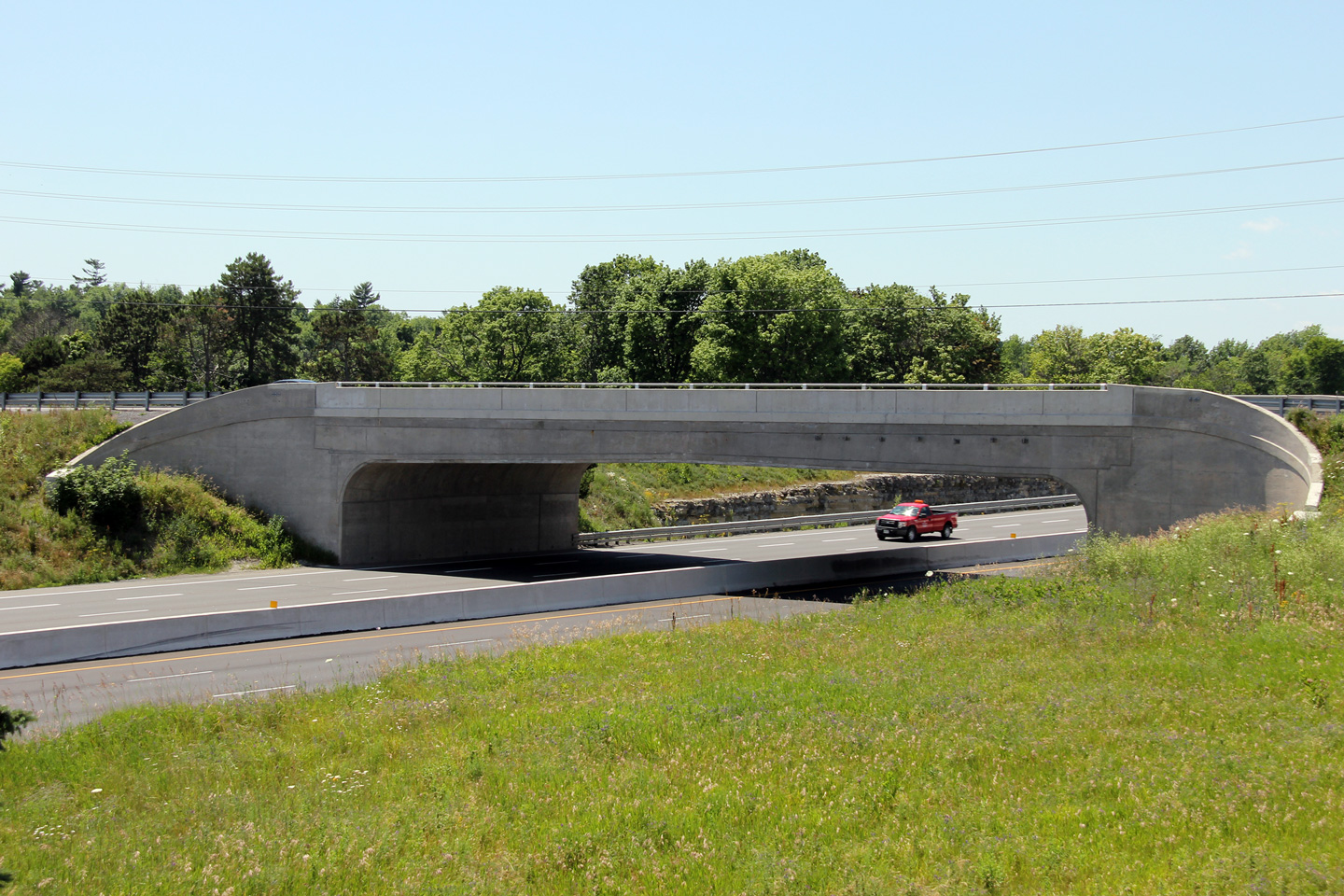
| City of Kingston |
View looking easterly through the Sydenham Road overpass in Kingston.
To my knowledge, there were only two structures of this unique design built
over Highway 401. The other example is located at
Highway 32 in Gananoque. Photo taken: June 29th, 2012. |
 (720x480) (1440x960) (2400x1600) |
||
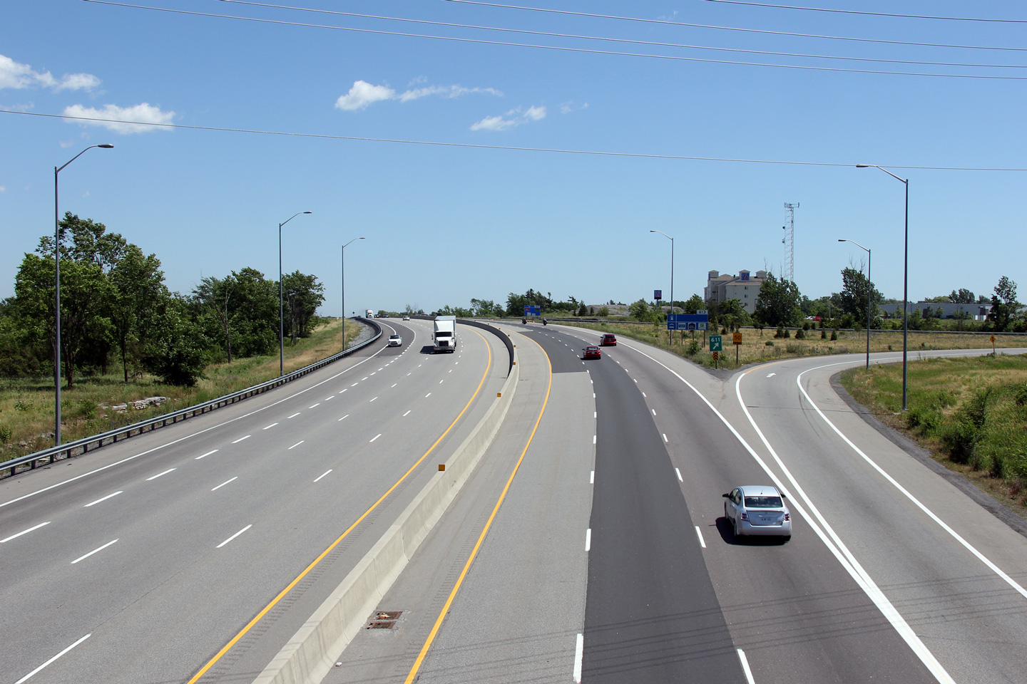
| City of Kingston |
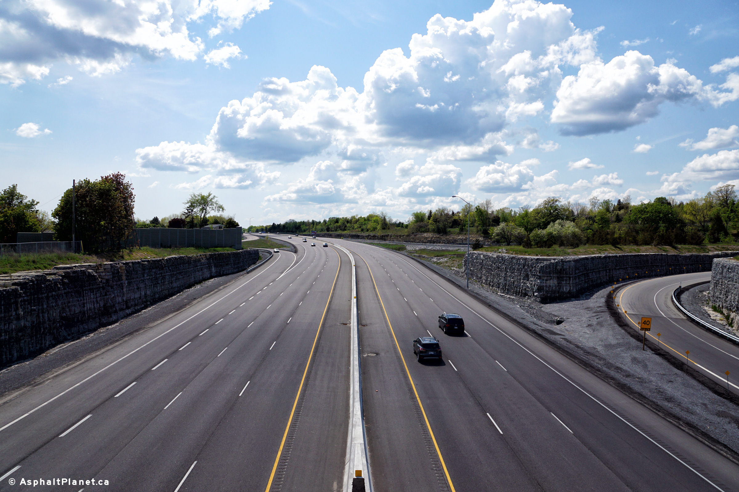
Looking west from the Sydenham Road overpass in Kingston. A
construction contract completed in 2006 saw Highway 401 widened to six lanes
from Sydenham Road westerly to beyond Highway 38. An additional
contract, completed in 2012 saw the 401 widened east of Sydenham Road to
Montreal Street. Upper photo taken: June 19th, 2004. Lower photo taken: June 29th, 2012. |
 (720x480) (1440x960) (2400x1600) |
||
| City of Kingston |
Looking east from the Sydenham Road overpass. Upper photo taken: June 19th, 2004. Lower photo taken: June 29th, 2012. |
 (720x480) (1440x960) (2400x1600) |
||
| City of Kingston |
This is the eastern side of the Sydenham Road overpass. Photo taken: June 29th, 2012. |
 (720x480) (1440x960) (2400x1600) |
||
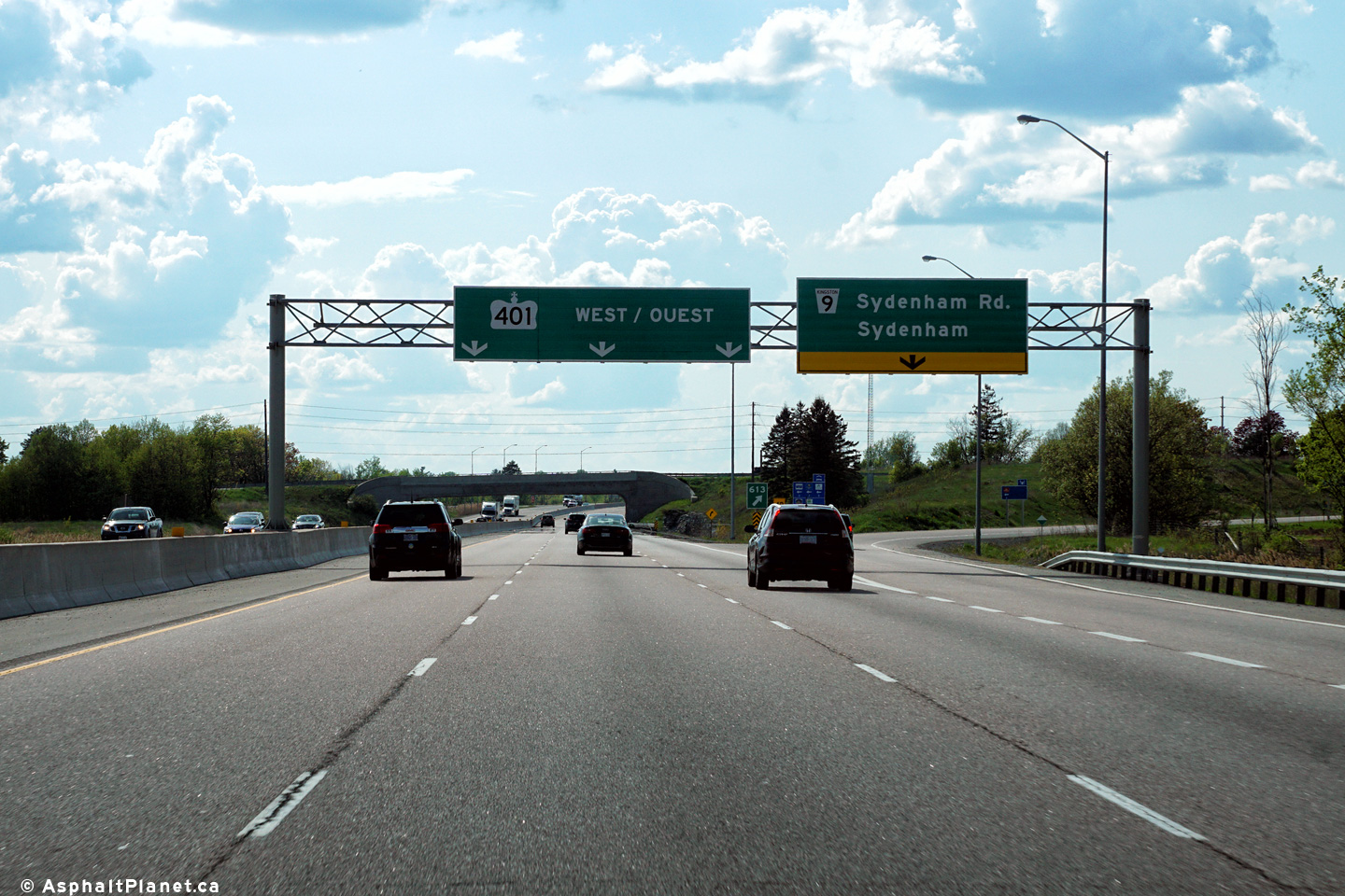
| City of Kingston |
Westbound signage at the off-ramp to Sydenham Road. The westbound
off-ramp to Sydenham Road was signed with a pull through reassurance sign
for Highway 401 west rather than a pre-advanced sign for the Highway 38
interchange. Photo taken: May 22nd, 2016. |
 (720x480) (720x480)(1440x960) (2400x1600) |
||
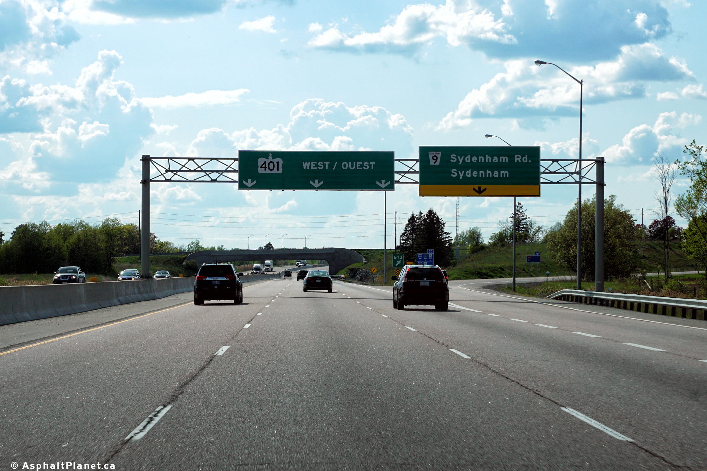
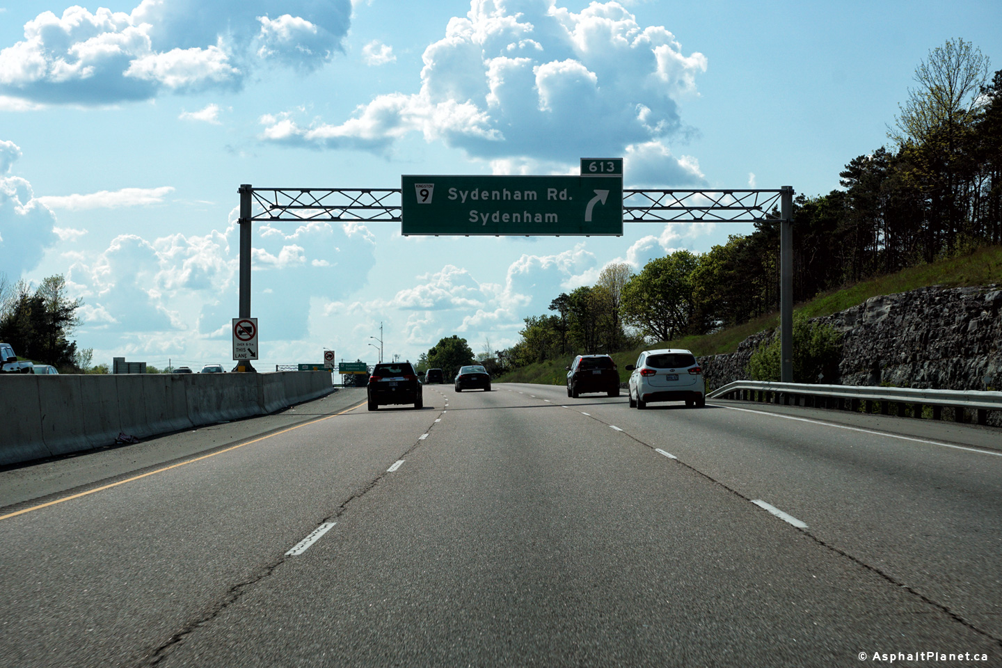
| City of Kingston |
Westbound advanced signage approaching the Sydenham Road interchange. Photo taken: May 22nd, 2016. |
 (720x480) (720x480)(1440x960) (2400x1600) |
||
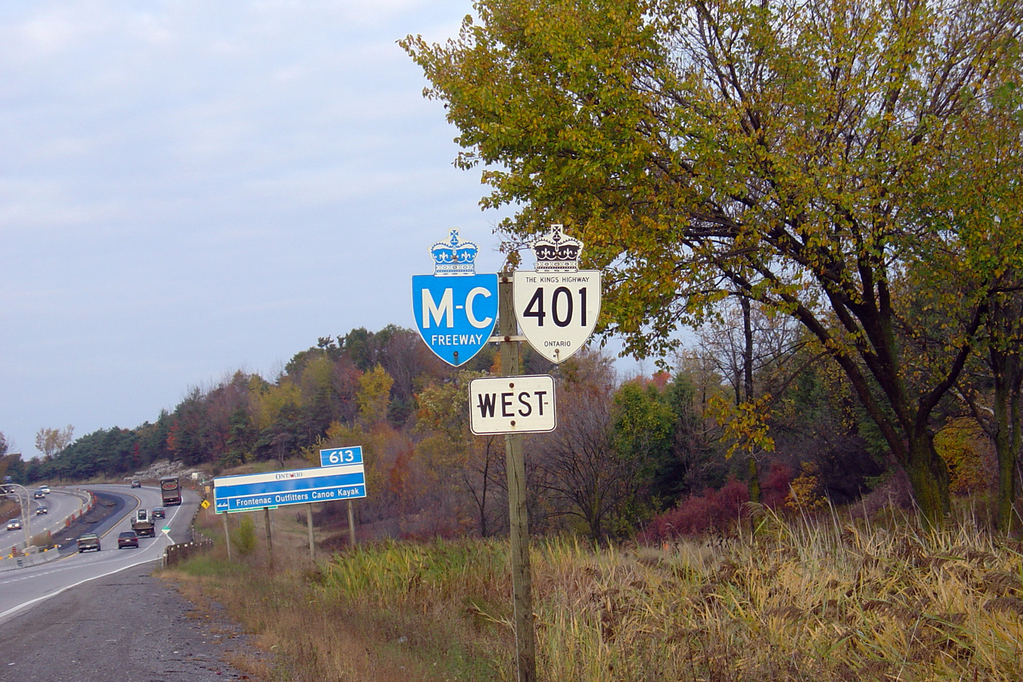
| City of Kingston |
An older Macdonald-Cartier Freeway sign that was formerly situated just west
of the Sir John A. Macdonald Blvd. interchange in Kingston. When this
photo was taken in 2004, a dozen or so of these M-C Freeway signs remained
along Highway 401 in Eastern Ontario. As of December, 2011, save for a
single sign in the GTA, all of the remaining M-C Freeway signs had been removed along
the entire length of Highway 401. Photo taken: October 22nd, 2004. |
|
||
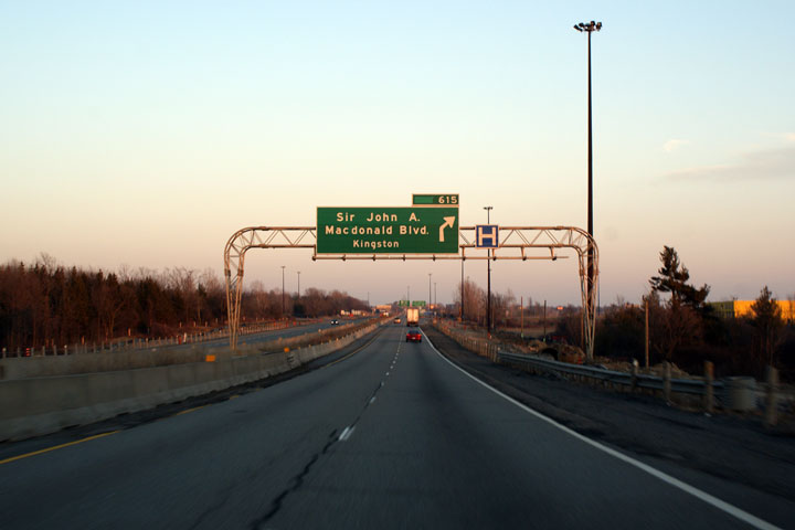
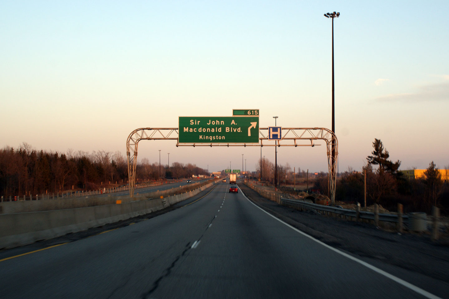
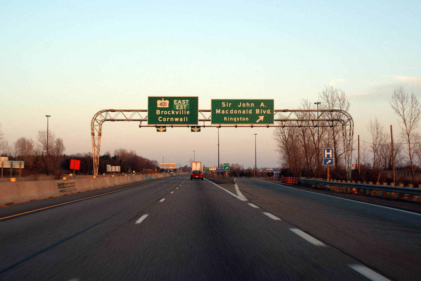
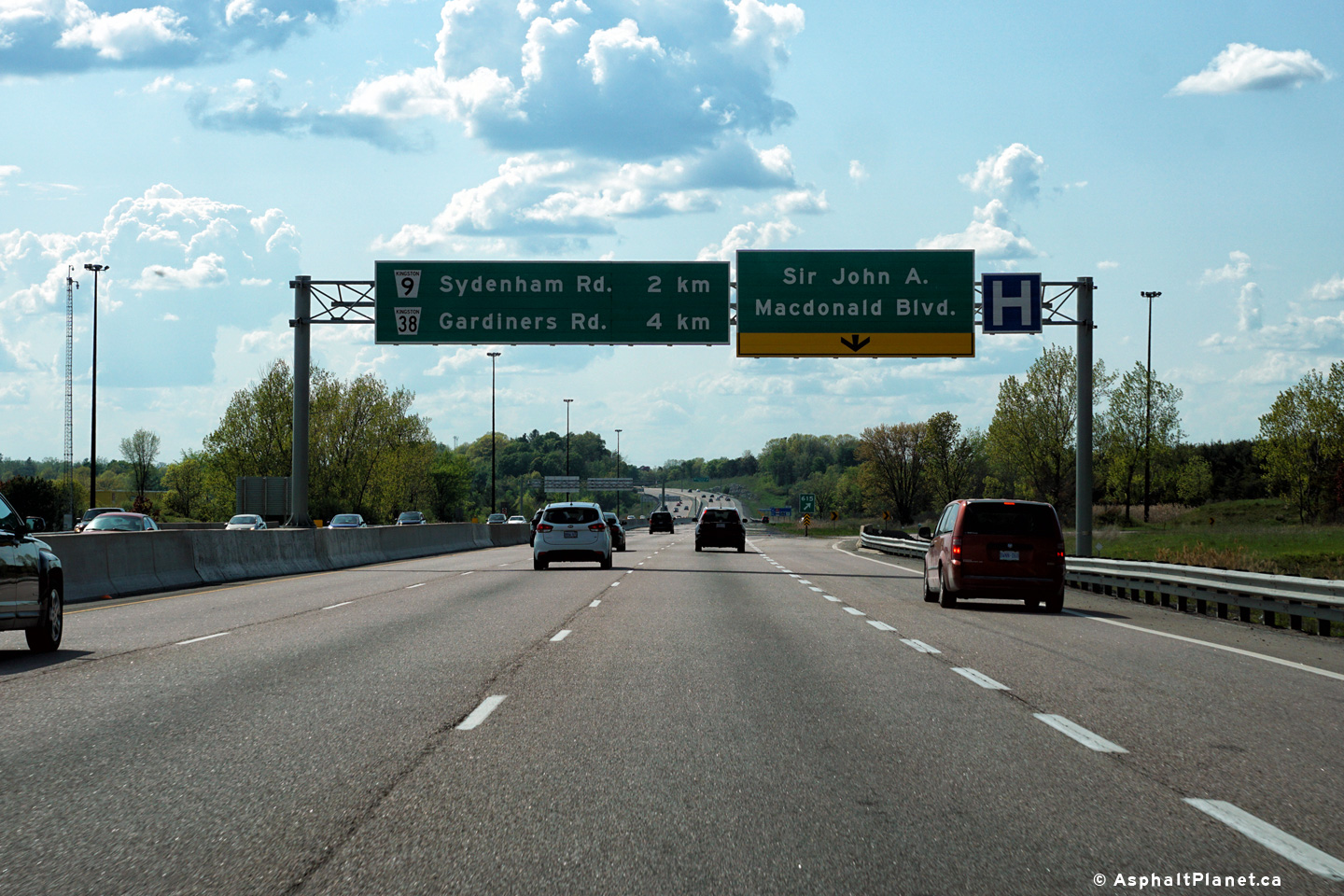
| City of Kingston |
View looking easterly at the advanced overhead sign for the eastbound Sir
John A. Macdonald Boulevard interchange in Kingston. This interchange was
completed in 1992, and prior to the widening of Highway 401 to six lanes through
Kingston, was the only interchange in Kingston to be signed with overhead
signs. It is still the only interchange in Kingston to be lit with high-mast lighting. Upper photo taken: March 14th, 2009. Lower photo taken: June 29th, 2012. |
 (720x480) (720x480)(1440x960) (2400x1600) |
||
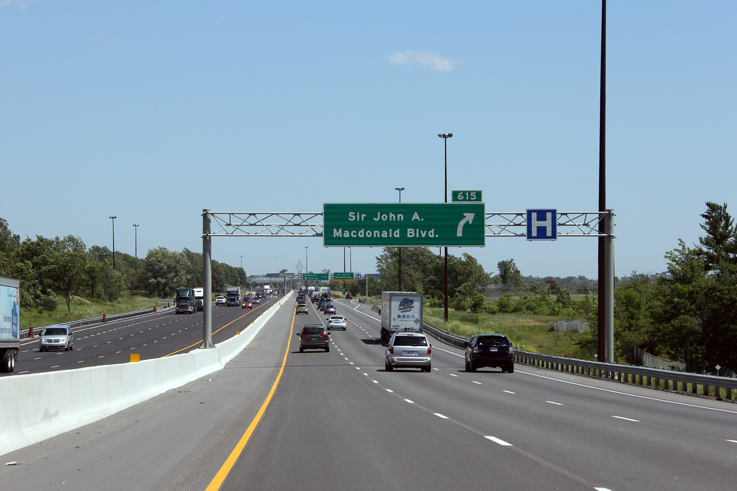
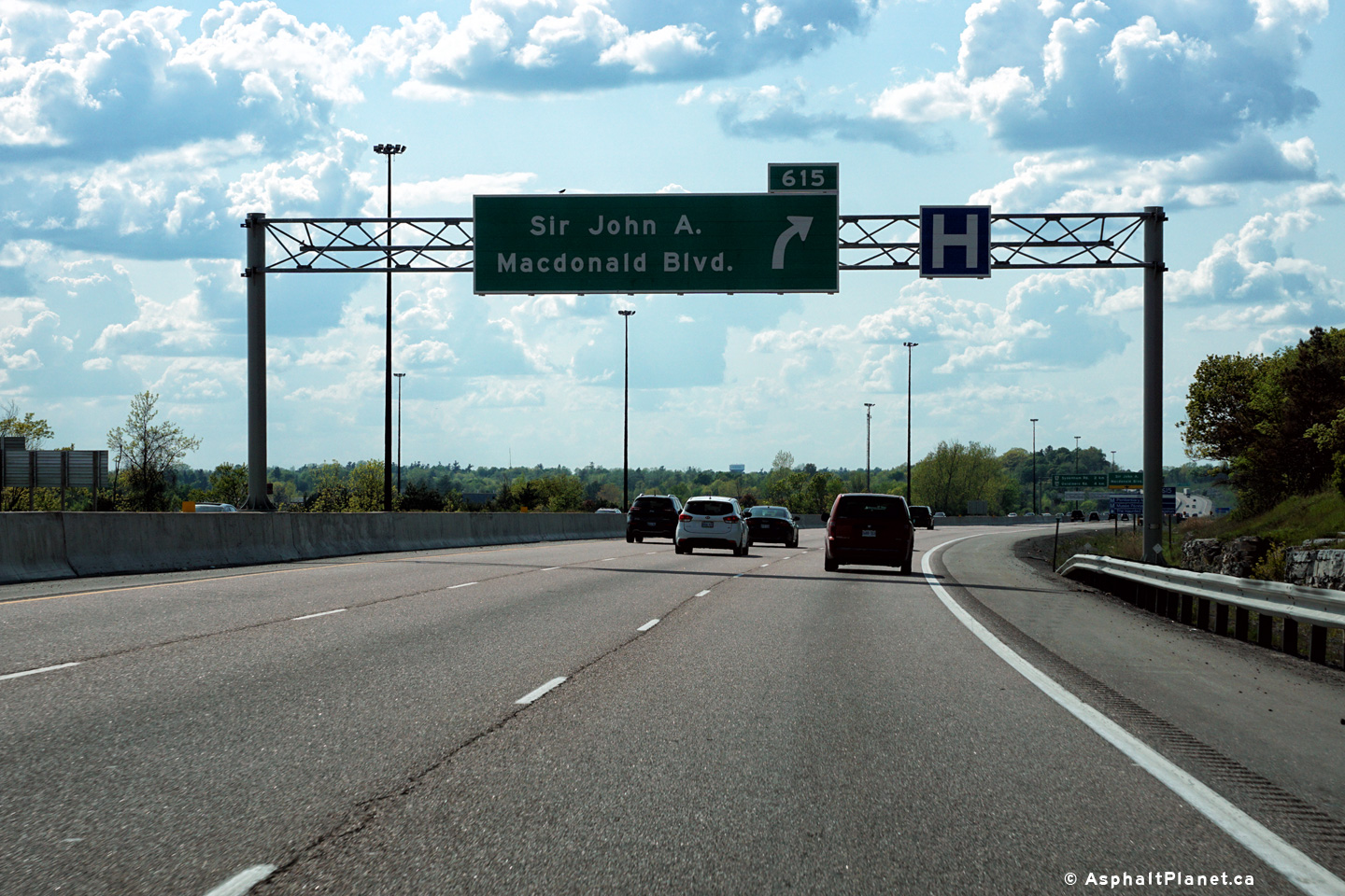
| City of Kingston |
View looking easterly as the eastbound ramp to Sir John A. Macdonald
Boulevard departs the freeway. When it was constructed, the Sir John
A. Macdonald interchange replaced Division Street as
the principal interchange into Kingston from Highway 401. Upper photo taken: March 14th, 2009. Lower photo taken: December 3rd, 2011. |
 (720x480) (720x480)(1440x960) (2400x1600) |
||
| City of Kingston |
View at the westbound off-ramp to Sir John A. Macdonald Boulevard. Sir
John A. Macdonald Boulevard meets Highway 401 at a "B" style trumpet
interchange. Photo taken: May 22nd, 2016. |
 (720x480) (720x480)(1440x960) (2400x1600) |
||
| City of Kingston |
Westbound signage in advance of the Sir John A. Macdonald Boulevard
interchange. Photo taken: May 22nd, 2016. |
 (720x480) (720x480)(1440x960) (2400x1600) |
||
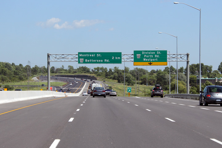
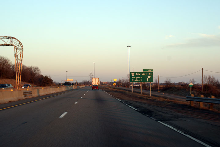
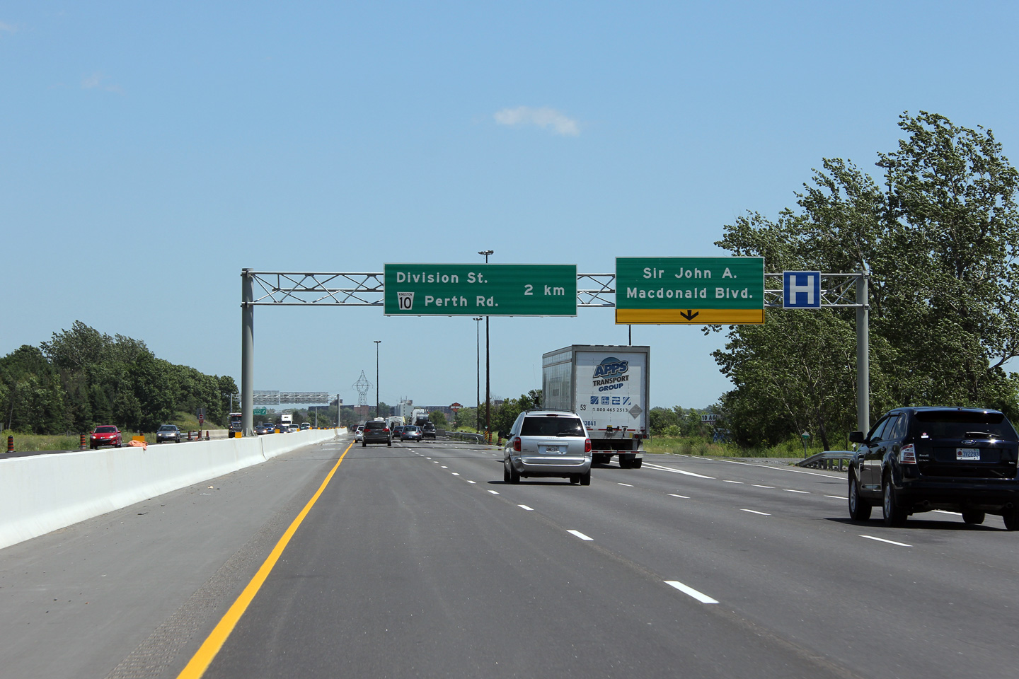
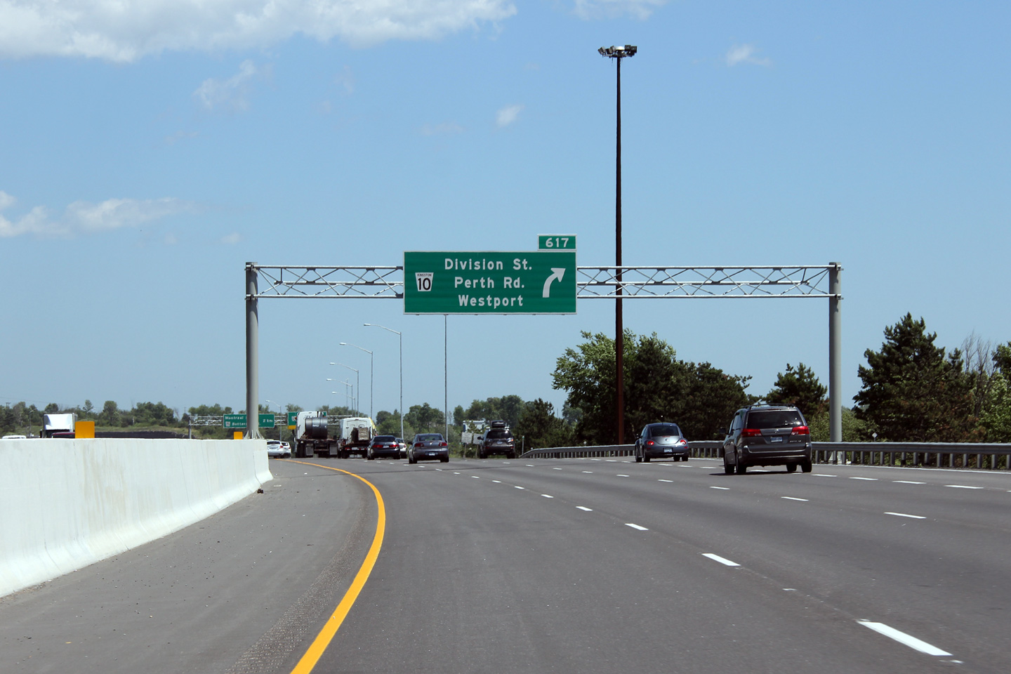
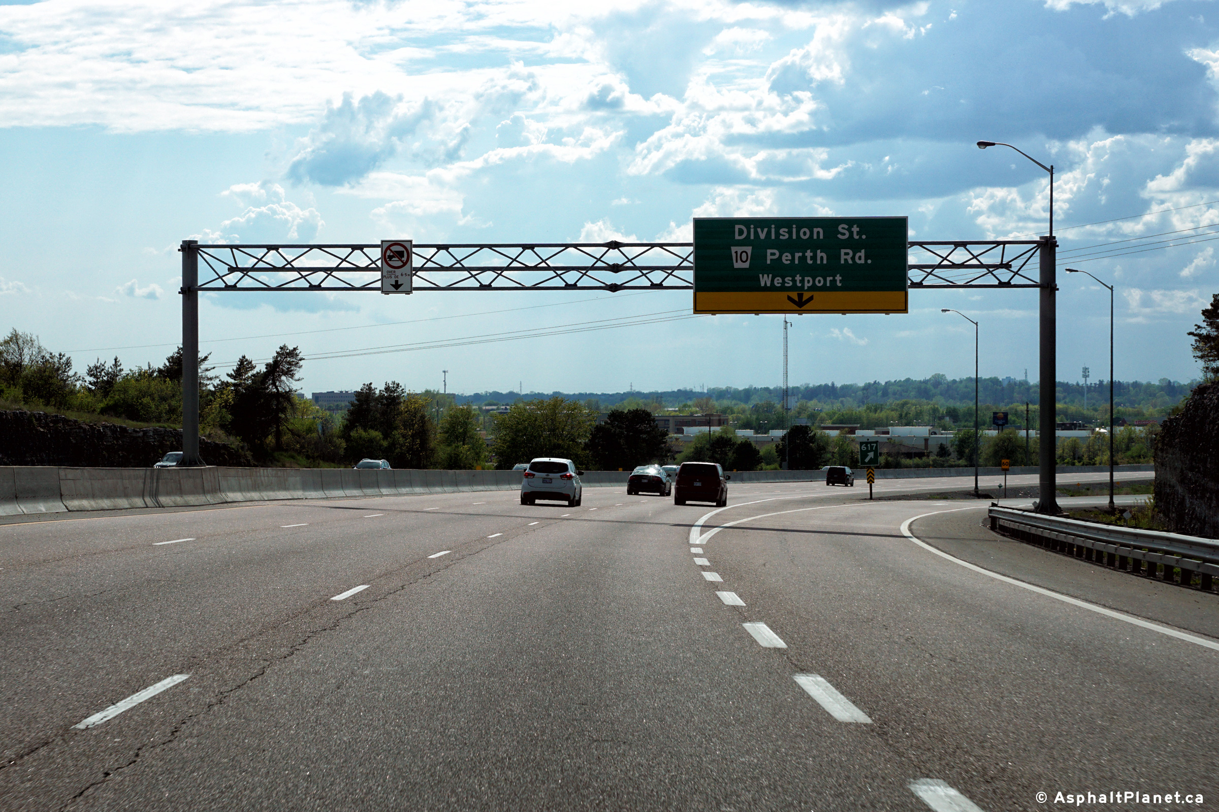
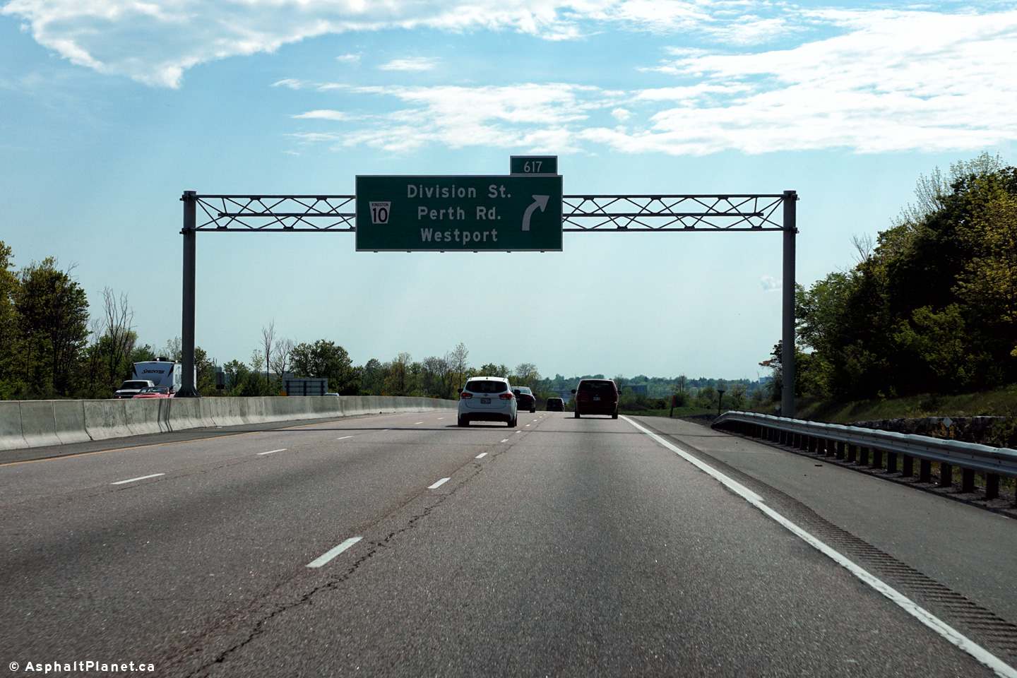
| City of Kingston |
Green advanced signage for Division Street. On the older signage, notice
the odd use of an advanced arrow instead of a distance to the ramp.
This arrow type was typically reserved for overhead signs. This ground
mounted sign likely once stood overhead before the Sir John A. Macdonald
Blvd. interchange was constructed. The newer (2012) signage omits the
'exit bar' which should be included underneath of the advanced arrow since
the exiting lane has developed before the sign. Upper photo taken: March 14th, 2009. Lower photo taken: December 3rd, 2011. |
 (720x480) (720x480)(1440x960) (2400x1600) |
||
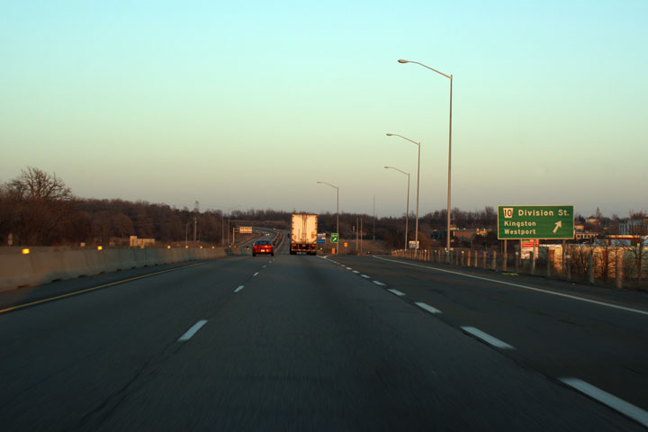
| City of Kingston |
Green signage for the ramp to Division Street. Oddly enough, before
the Sir John A. Macdonald interchange was completed, the Division Street
interchange was signed with overhead gantries. Judging by the signage,
it would appear that the Division Street overhead signs were moved to the
Sir John A. Macdonald Boulevard interchange when it opened. You can check out
pictures of these signs at the
VintageKingHighway website. Upper photo taken: March 14th, 2009. Lower photo taken: December 3rd, 2011. |
 (720x480) (720x480)(1440x960) (2400x1600) |
||
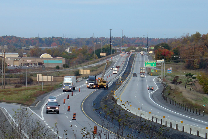
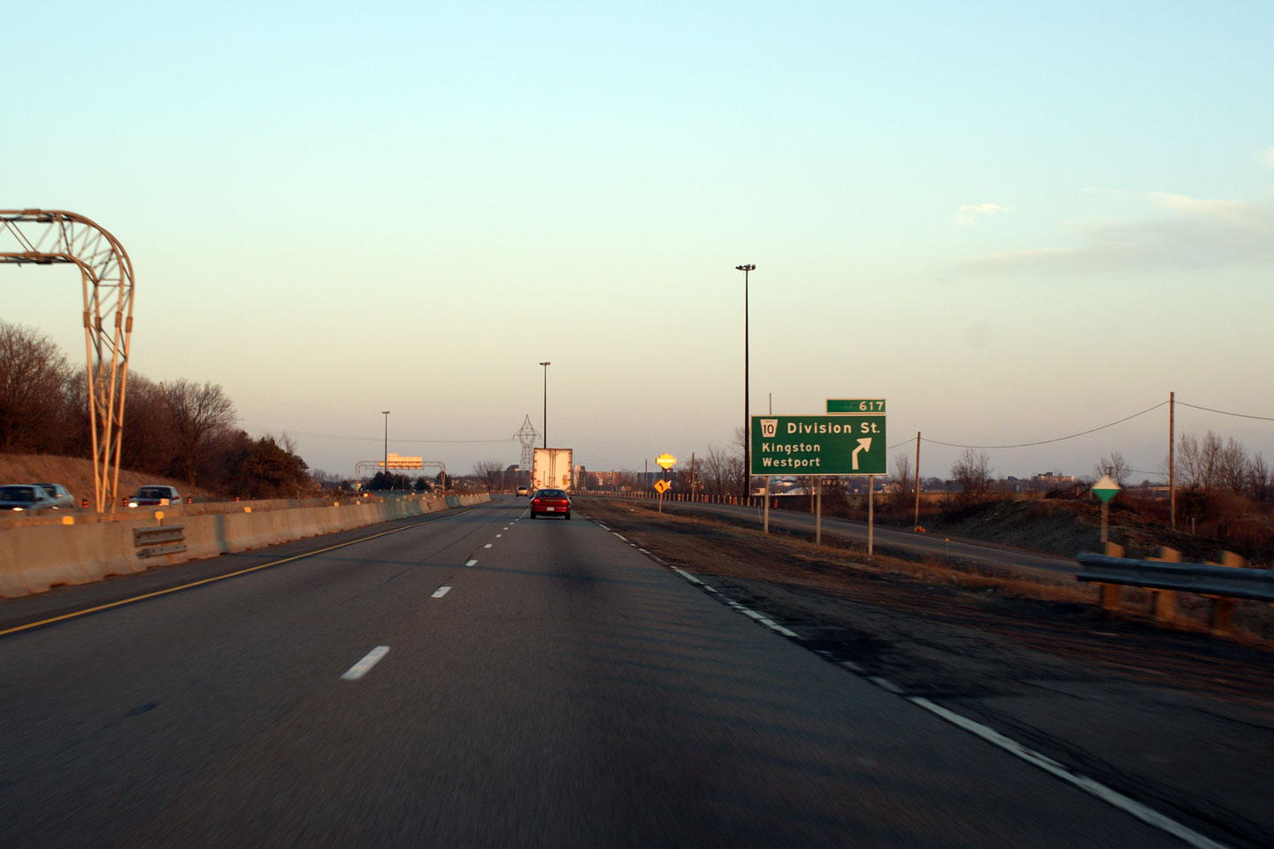
| City of Kingston |
Westerly view of the Highway 401 at the Division Street interchange in
Kingston. Photo taken: October 22nd, 2004. |
|
||
| City of Kingston |
Westbound signage at the off-ramp to Division Street in Kingston. This
overhead signage lacks a pre-advanced sign for the upcoming Sir John A.
Macdonald Boulevard interchange. Photo taken: May 22nd, 2016. |
 (720x480) (720x480)(1440x960) (2400x1600) |
||
| City of Kingston |
Westbound advanced signage for the ramp to Division Street. Photo taken: May 22nd, 2016. |
 (720x480) (720x480)(1440x960) (2400x1600) |
||
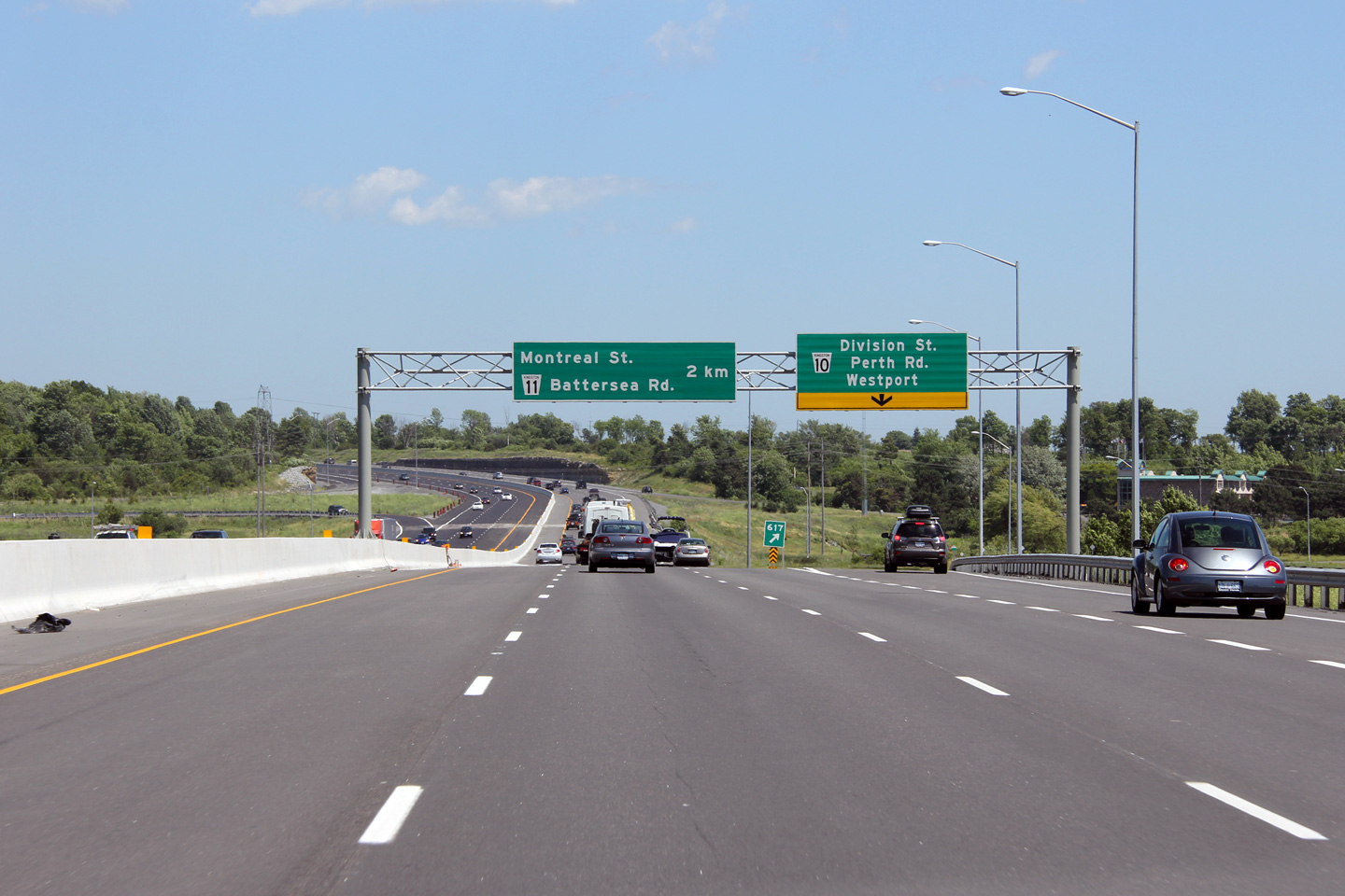
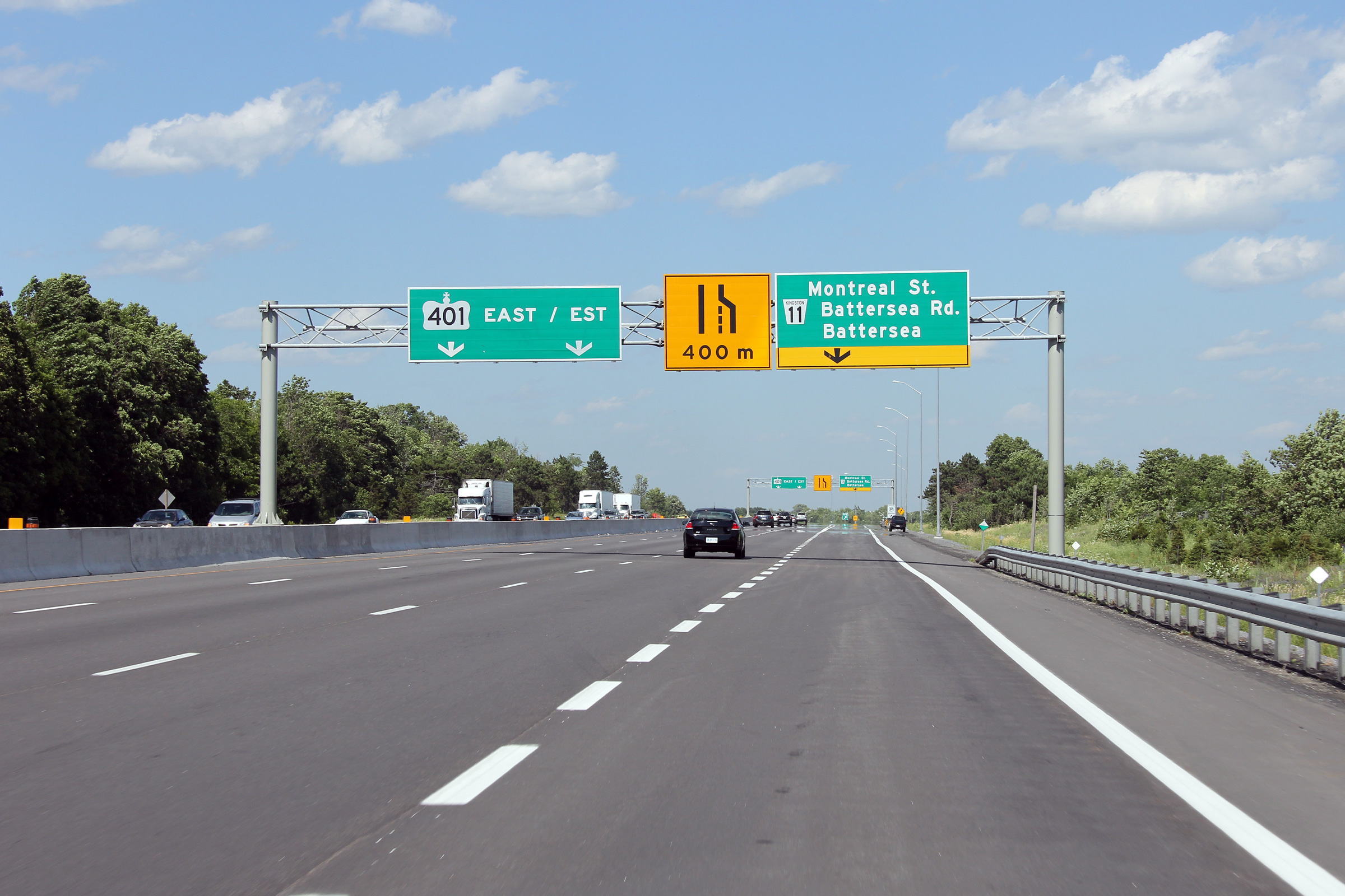
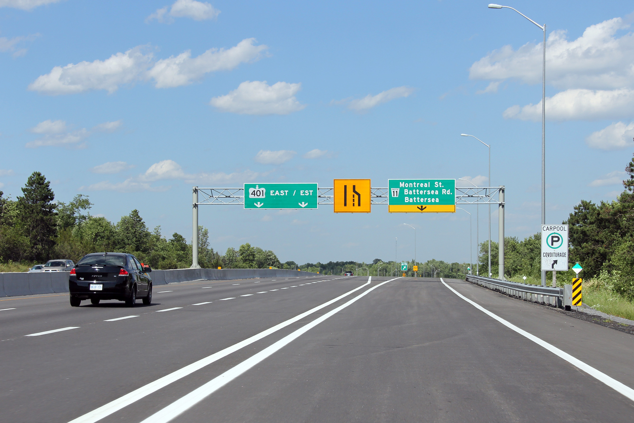
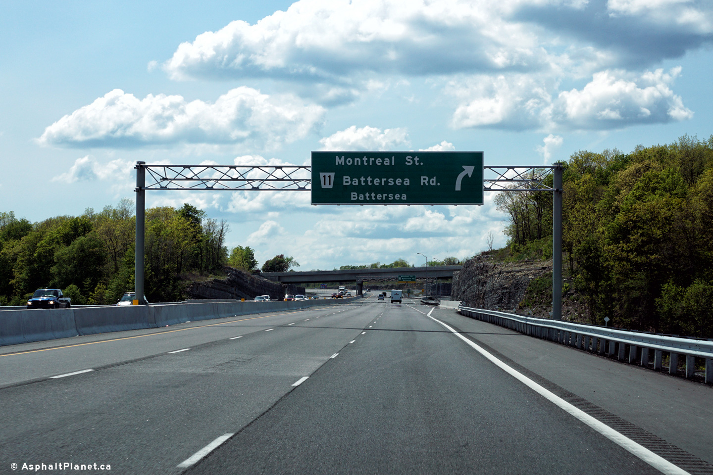
| City of Kingston |
Eastbound advanced signage for the Montreal Street interchange. Photo taken: May 22nd, 2016. |
 (720x480) (720x480)(1440x960) (2400x1600) |
||
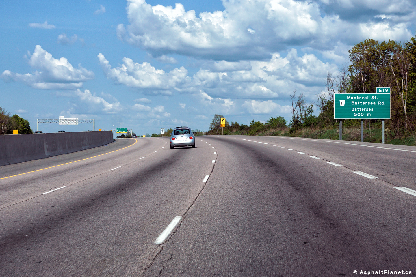
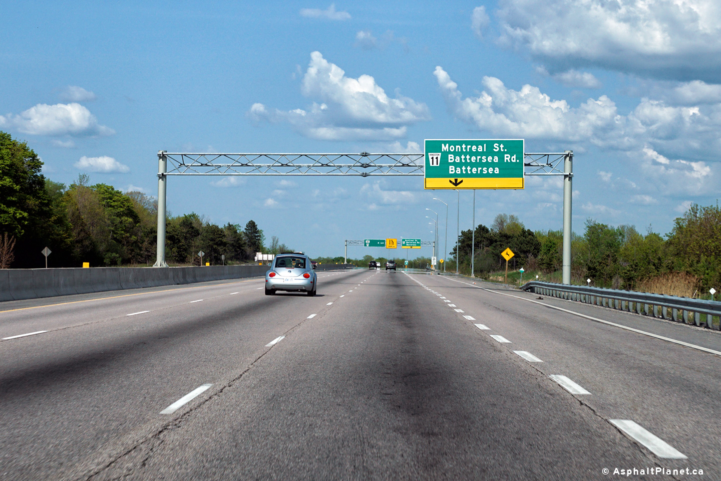
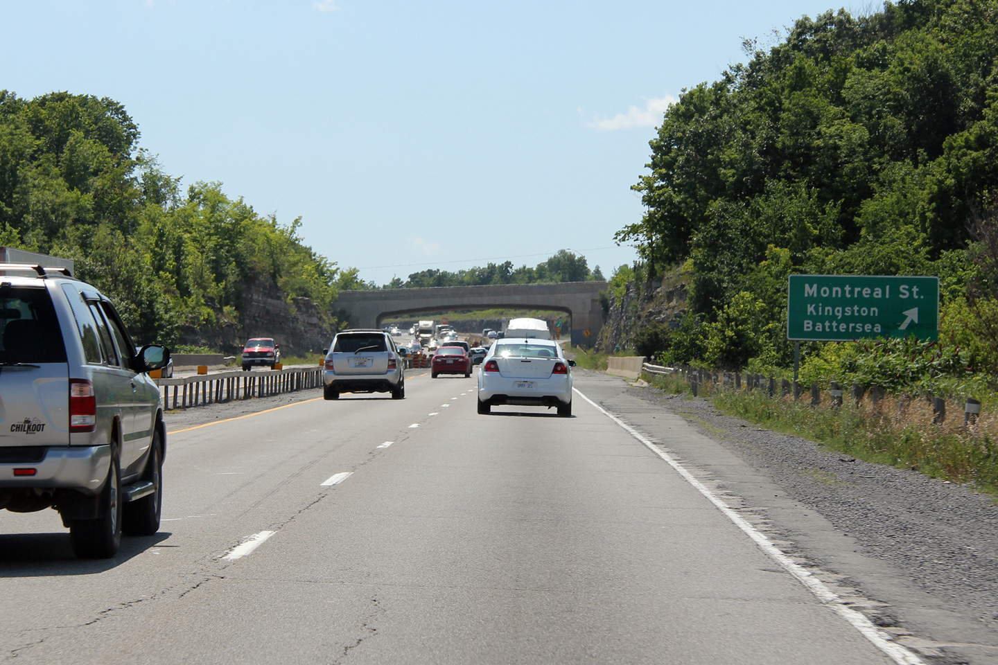
| City of Kingston |
Advanced signage for the off-ramp to Montreal Street. There is an
auxiliary lane between the Division and Montreal Street interchanges. Upper photo taken: December 3rd, 2011. Lower photo taken: May 22nd, 2016. |
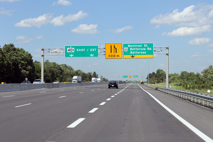 (720x480) (720x480)(1440x960) (2400x1600)  (720x480) (720x480)(1440x960) (2400x1600) |
||
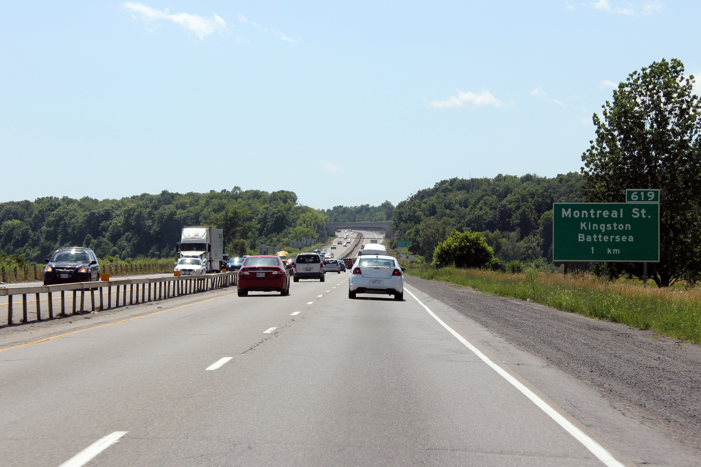
| City of Kingston |
Drivers view eastbound at the Montreal Street off-ramp. The third
eastbound lane opened through the Montreal Street interchange late in 2015. Upper photo taken: December 3rd, 2011. Lower photo taken: May 22nd, 2016. |
 (720x480) (720x480)(1440x960) (2400x1600) |
||
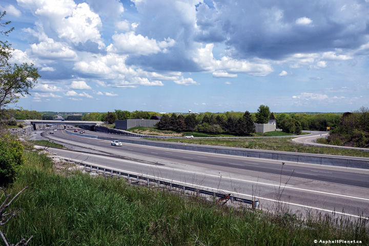
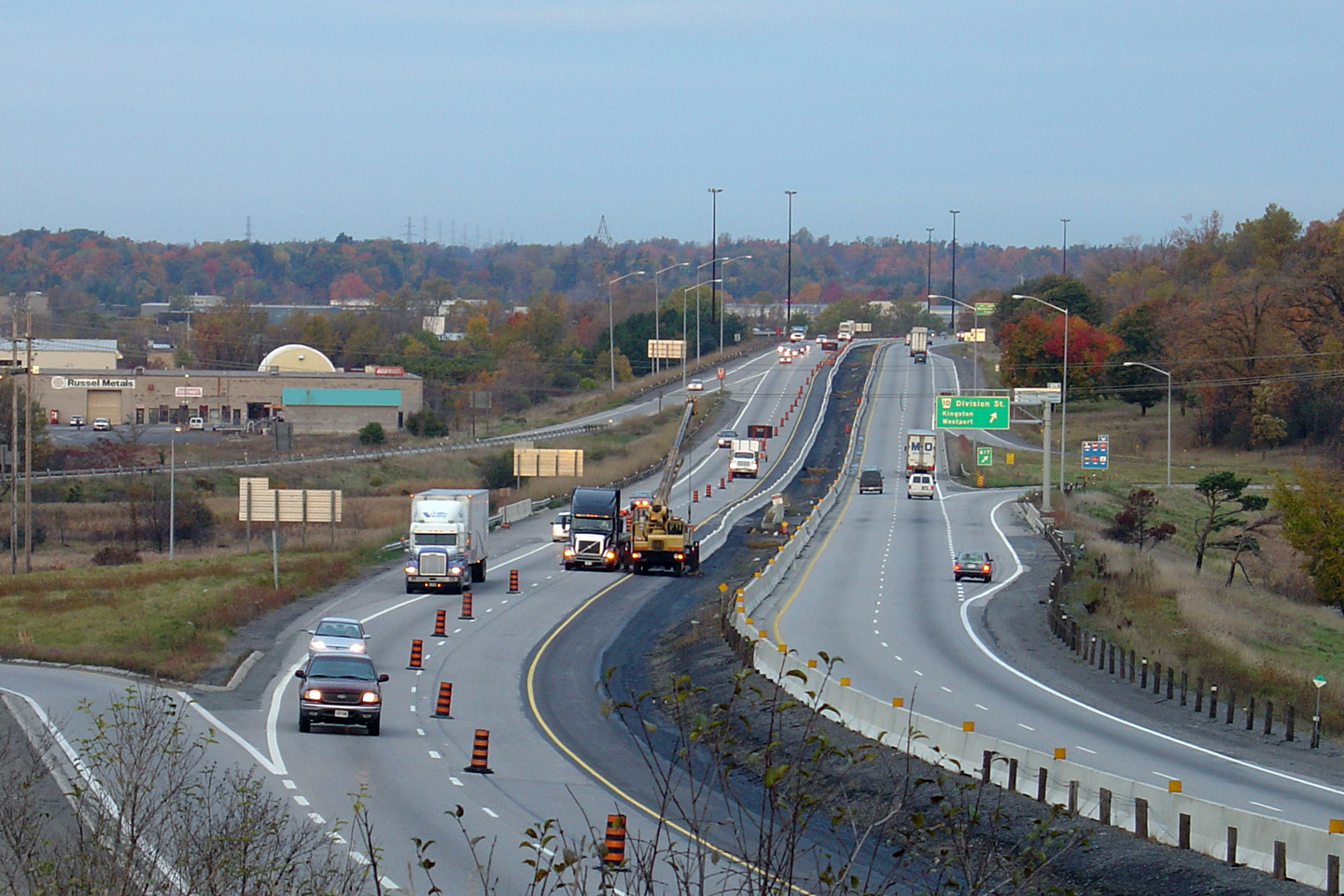
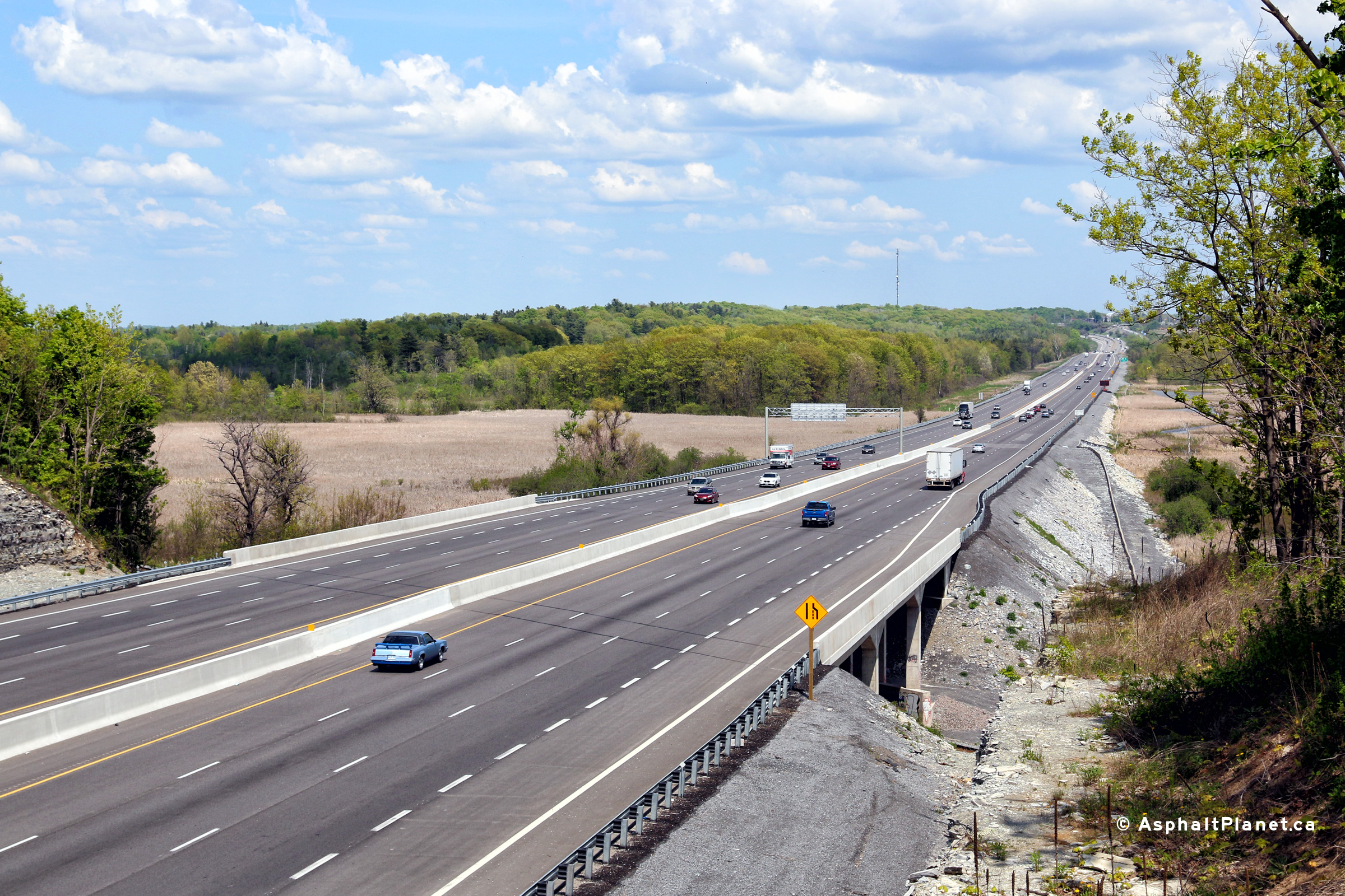
| City of Kingston |
Two views looking easterly along Highway 401 approaching the Montreal Street
interchange. The eastern contract limits of the widening contract that
was completed in 2012 to widen Highway 401 through Kingston is visible in
both of the upper photos. The lower photos were taken after an additional widening contract is
was completed that commenced in 2014 that extended the six lane highway easterly from
this interchange easterly to the Cataraqui River Bridge. Upper photos taken: June 29th, 2012. Lower photos taken: May 22nd, 2016. |
 (720x480) (1440x960) (2400x1600) 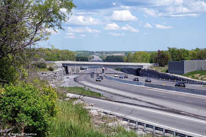 (720x480) (1440x960) (2400x1600) |
||
| City of Kingston |
This view looks westerly from the Montreal Street overpass. Montreal
Street was indeed the original road to Montreal from Kingston before the
LaSalle Causeway was completed for the modern
Highway 2. Upper photo taken: June 19th, 2004. Lower photos taken: May 22nd, 2016. |
(720x480) (1440x960) (2400x1600)
|
||
| City of Kingston |
This view looks easterly from the Montreal Street overpass in Kingston.
The upper photo showed the longest lasting example of box-beam median guiderail that remained in
place along the 401. Box-beam median barrier was a common median
treatment on freeways built in the early 1970s in Ontario. It has
fallen out of favour due to the continued development of improved highway
median technologies. Box-beam is however still commonly used in new
construction in neighbouring New York. Upper photo taken: June 19th, 2004. Lower photos taken: May 22nd, 2016. |
 |
||
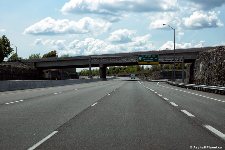
| City of Kingston |
This view looks westerly approaching the Montreal Street interchange. Photo taken: June 29th, 2012. |
 (720x480) (720x480)(1440x960) (2400x1600) |
||
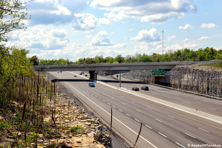
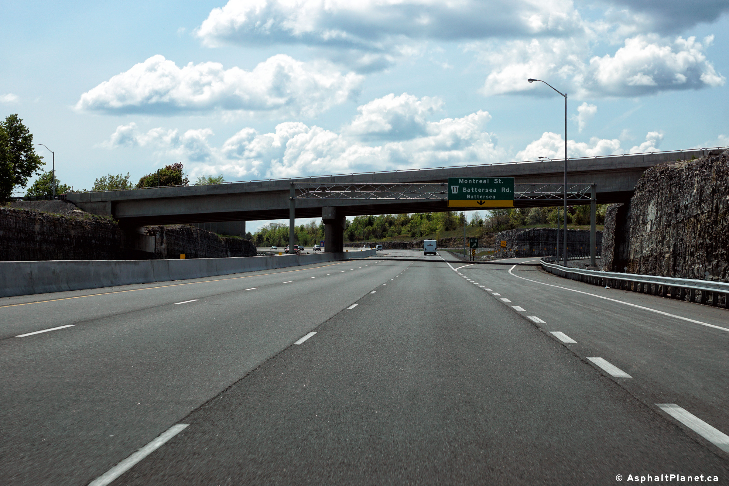
| City of Kingston |
View looking westerly towards the recently completed Montreal Street
overpass. Photo taken: May 22nd, 2016. |
 |
||
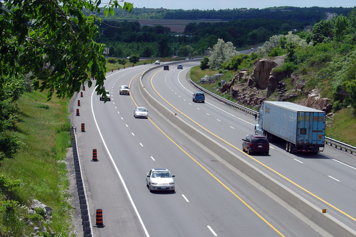
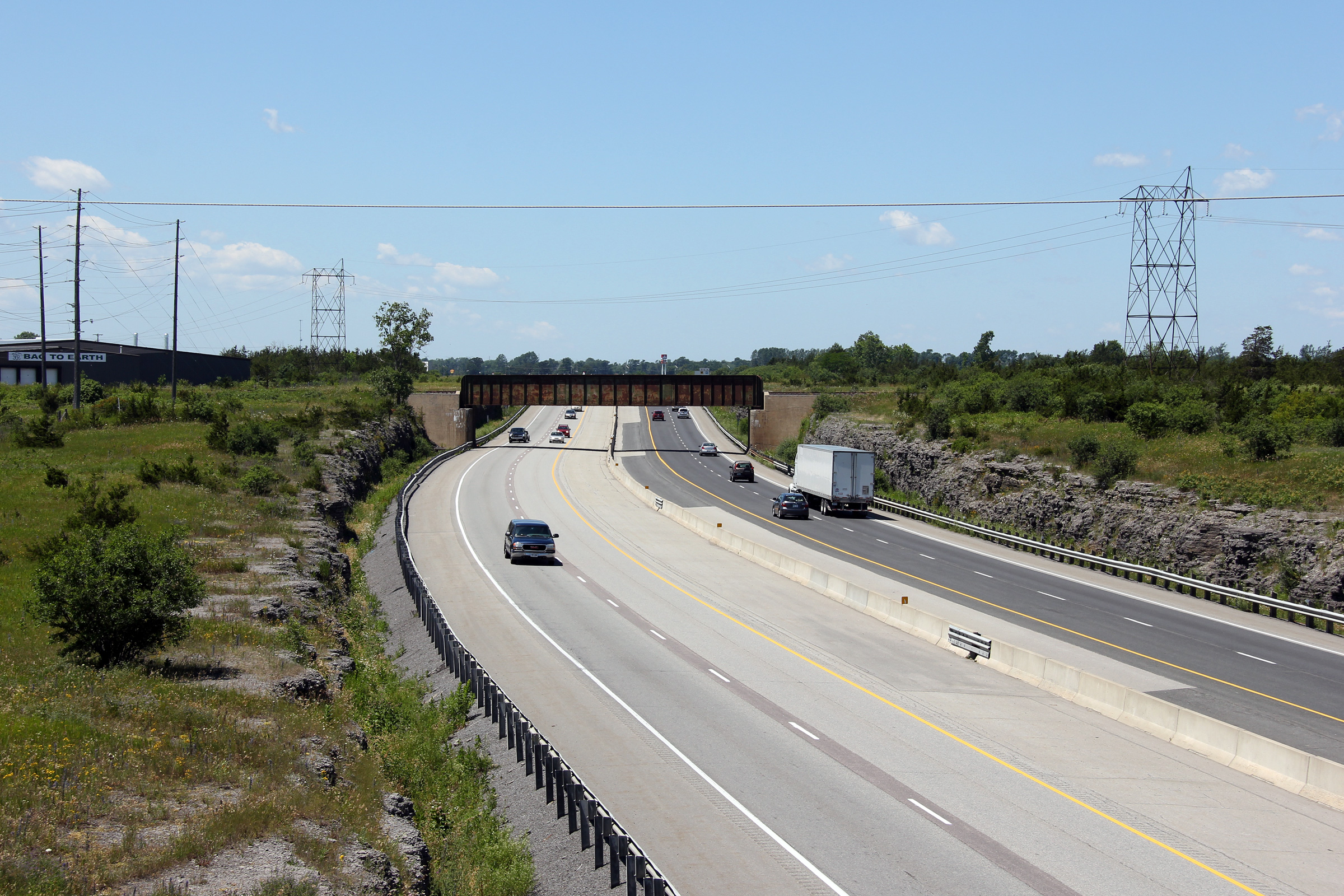
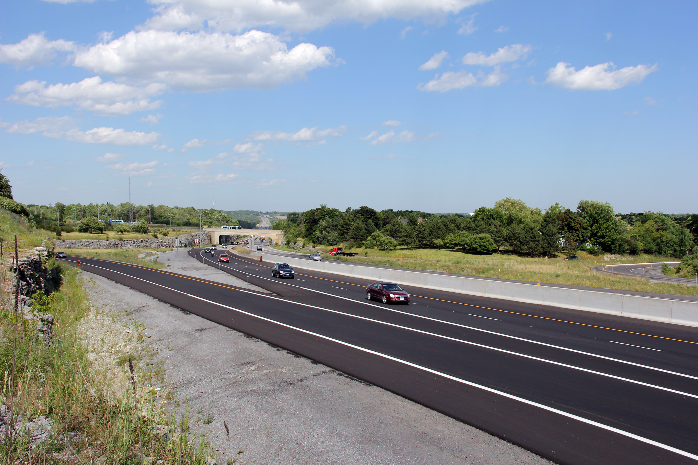
| City of Kingston |
A series of views looking easterly as Highway 401 passes over the CN
Railway underpass. During the recent construction work, the
outside of both the eastbound and westbound underpass were widened.
The design of the widened underpass almost identically matches the
pre-existing 1950s vintage structure that was built during the initial
construction of Highway 401. Photos taken: May 22nd, 2016. |

(720x480)
(1440x960)
(2400x1600) |
||
| City of Kingston |
Westbound advanced signage for the Montreal Street interchange. Upper photo taken: June 29th, 2012. Lower photo taken: May 22n, 2016. |
 (720x480) (720x480)(1440x960) (2400x1600) |
||
| City of Kingston |
View looking southerly towards the Cataraqui River bridge that carries
Highway 401 overtop of the southern-most portion of the Rideau Canal system. Photo taken: May 22nd, 2016. |
 |
||
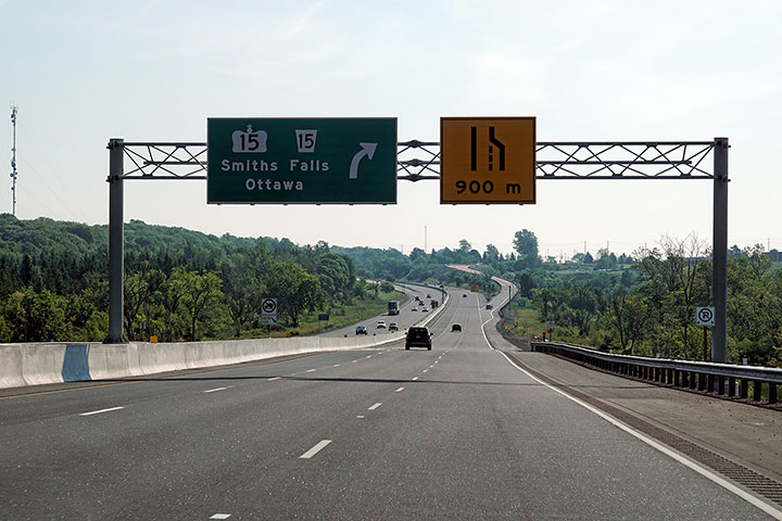
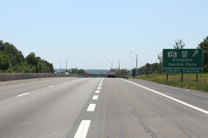
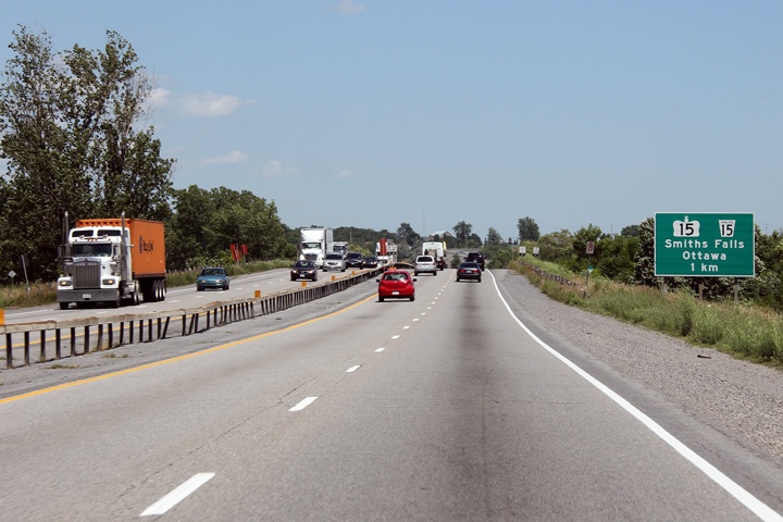
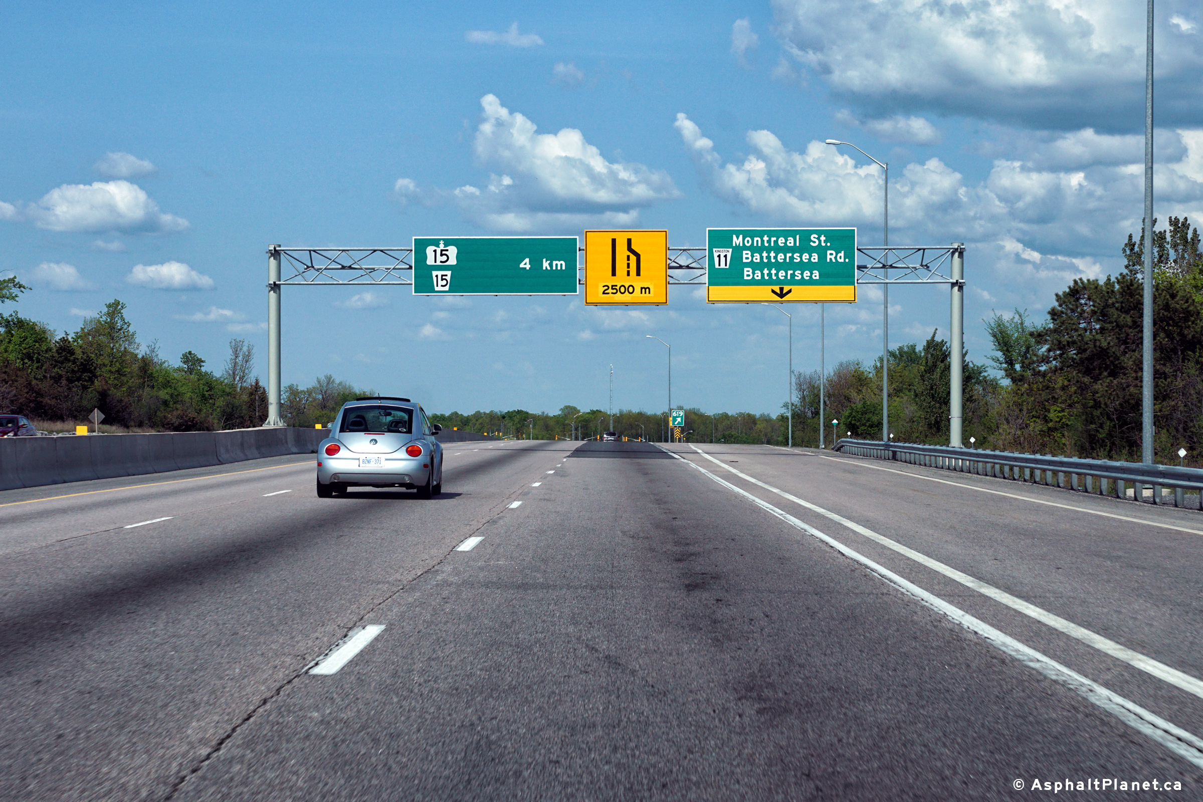
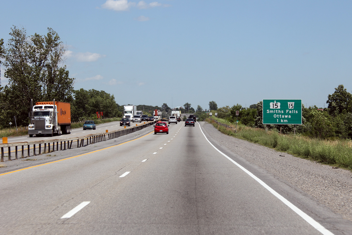
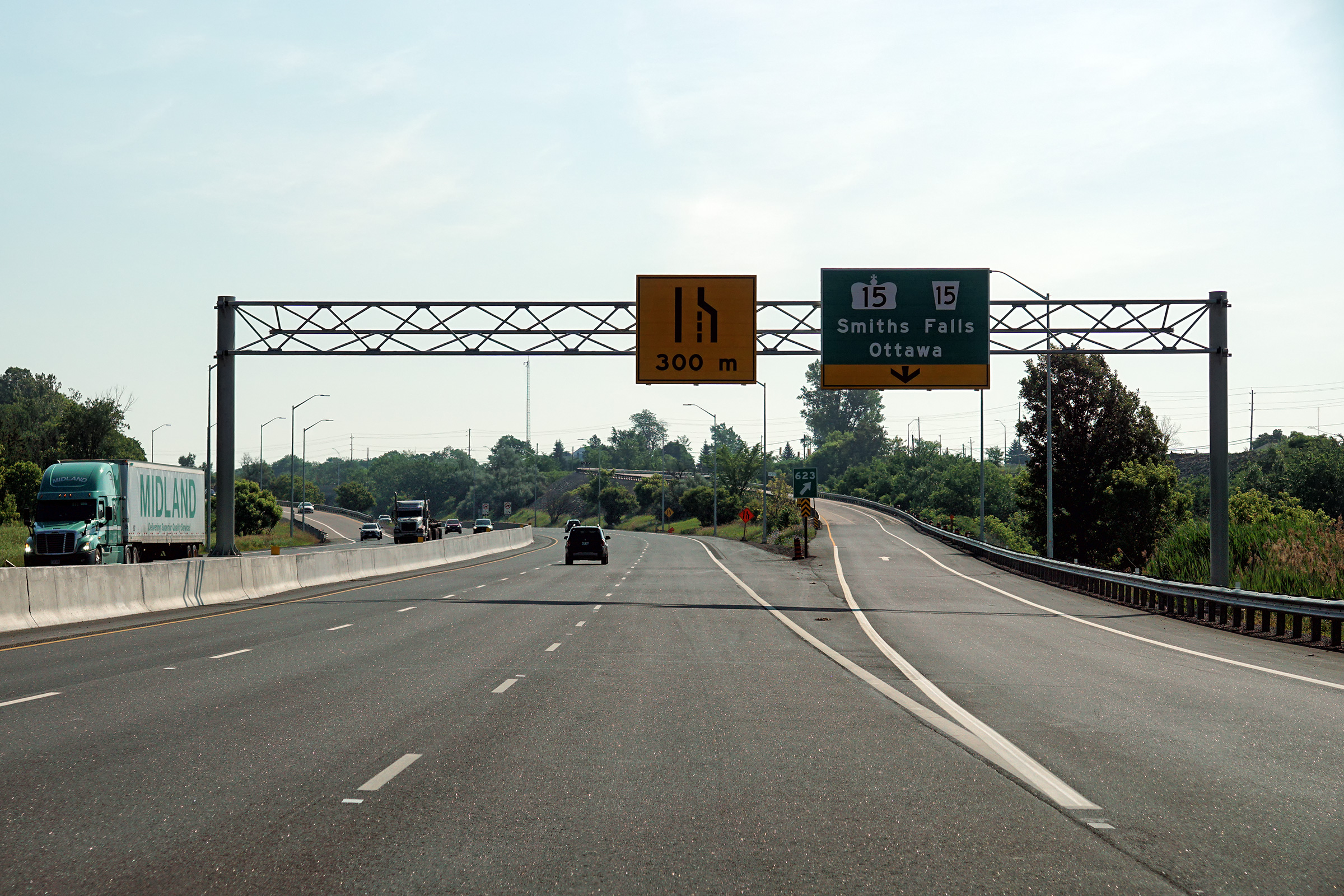
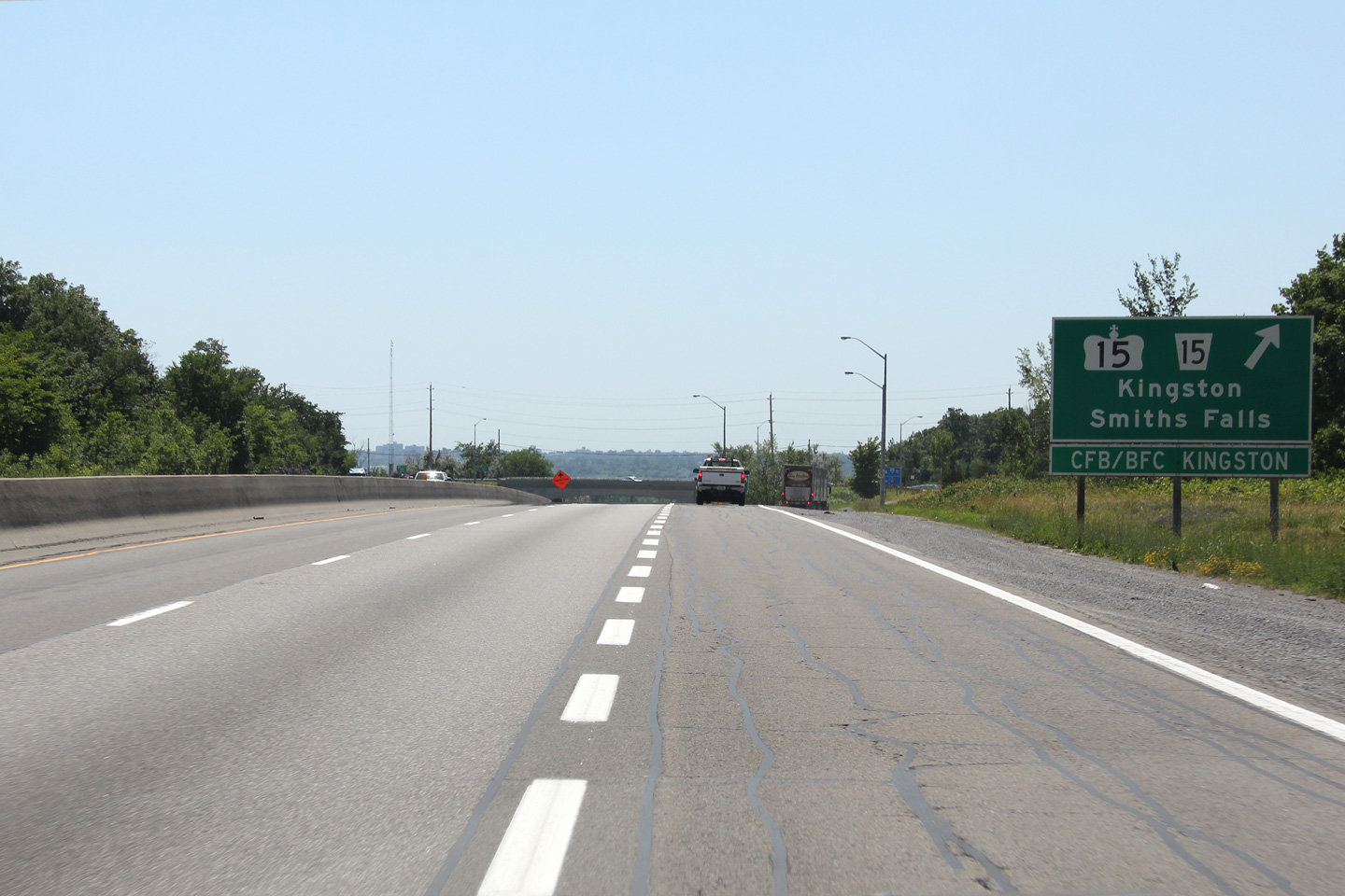
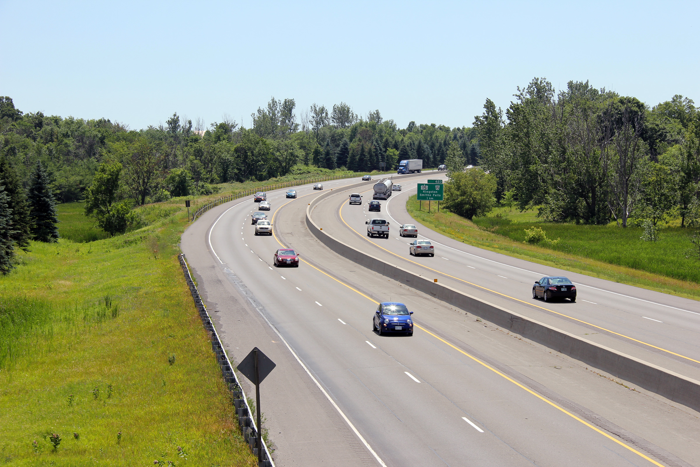
| City of Kingston |
Eastbound advanced signage for the Highway 15
interchange. Upper photo taken: June 29th, 2012. Lower photo taken: July 11th, 2020. |
 (720x480) (720x480)(1440x960) (2400x1600) |
||
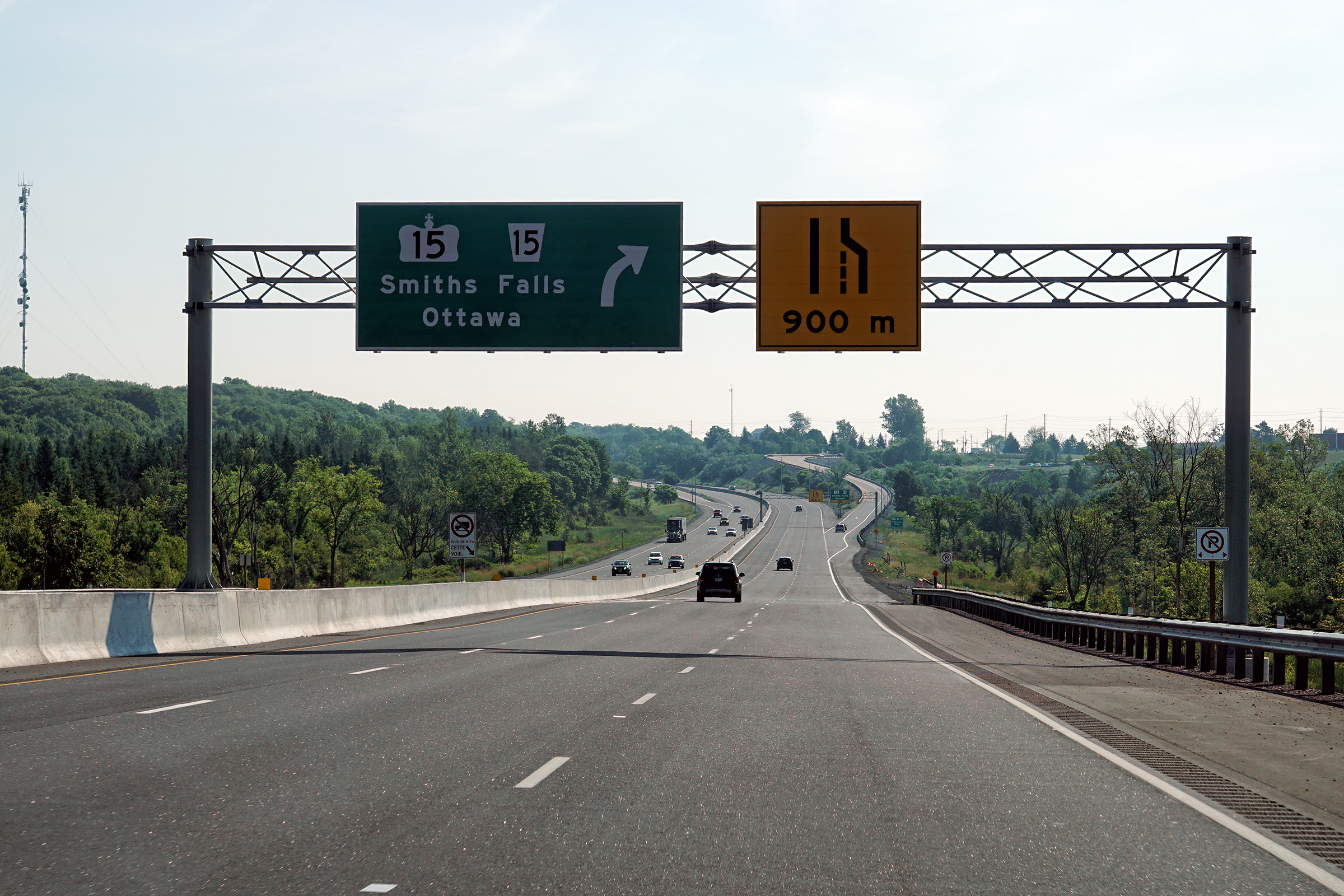
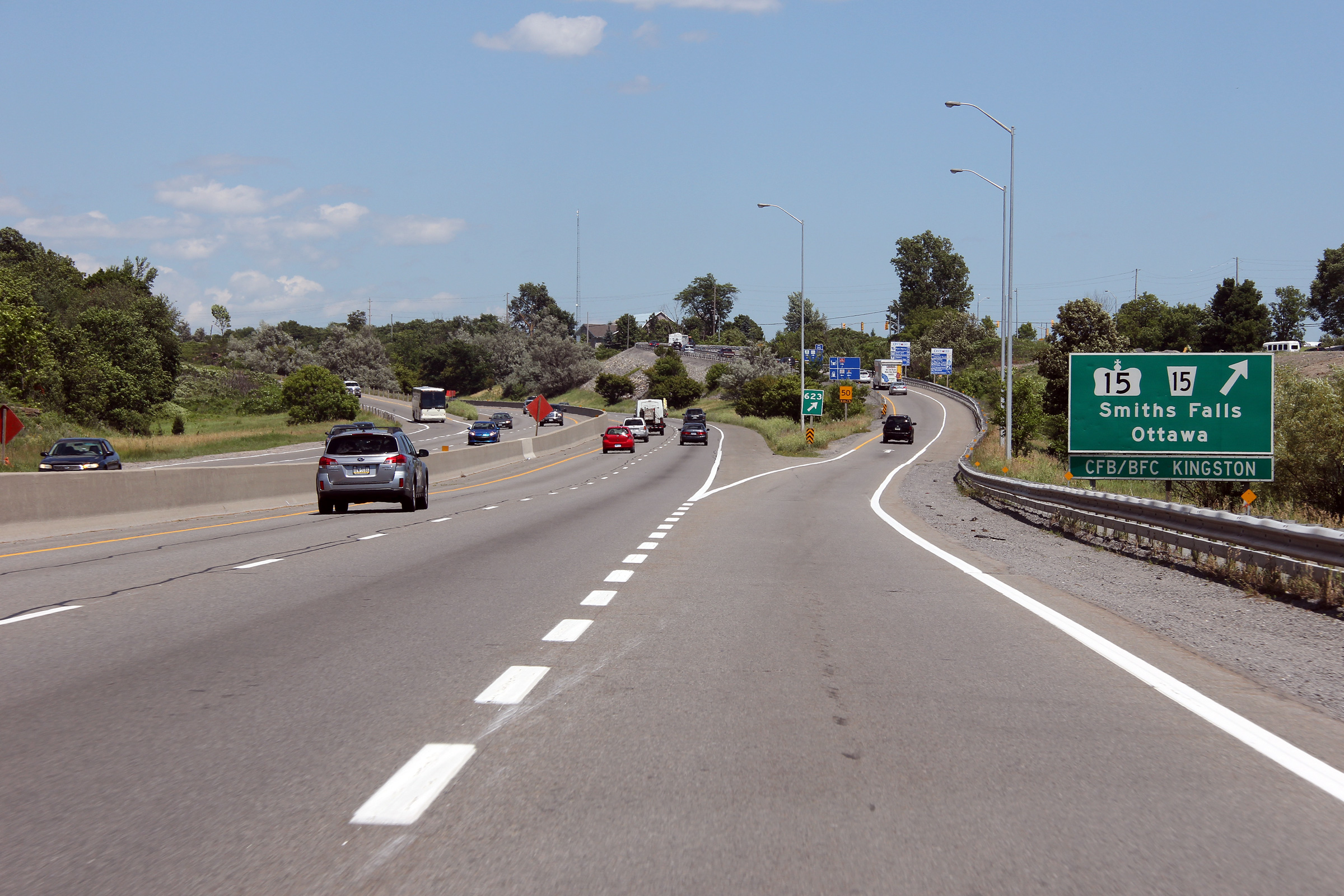
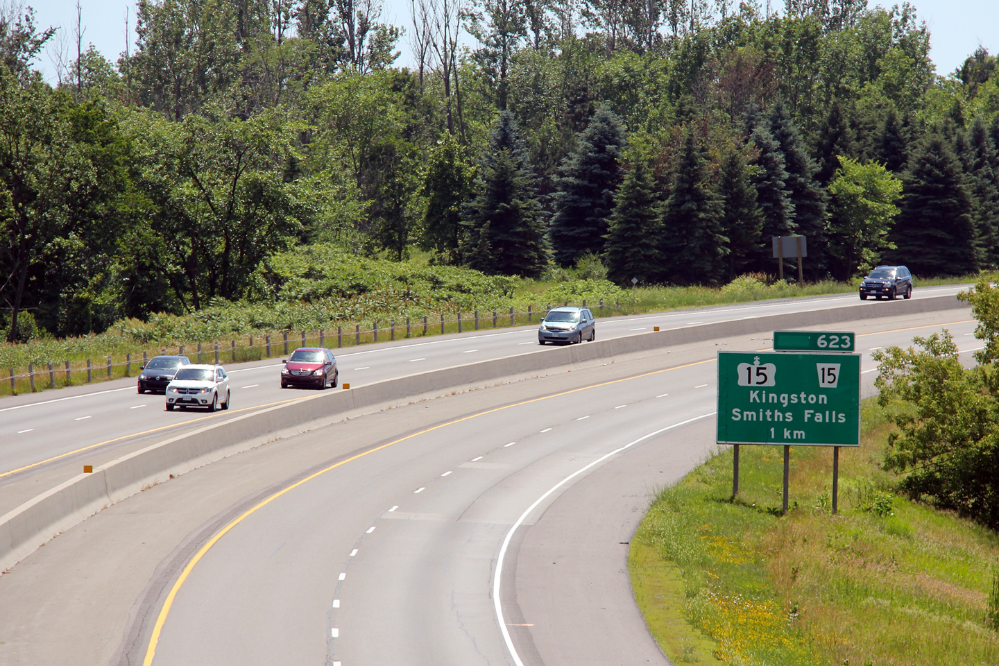
| City of Kingston |
View looking easterly at the Highway 15 interchange. Upper photo taken: June 29th, 2012. Lower photo taken: July 11th, 2020. |
 (720x480) (720x480)(1440x960) (2400x1600) |
||
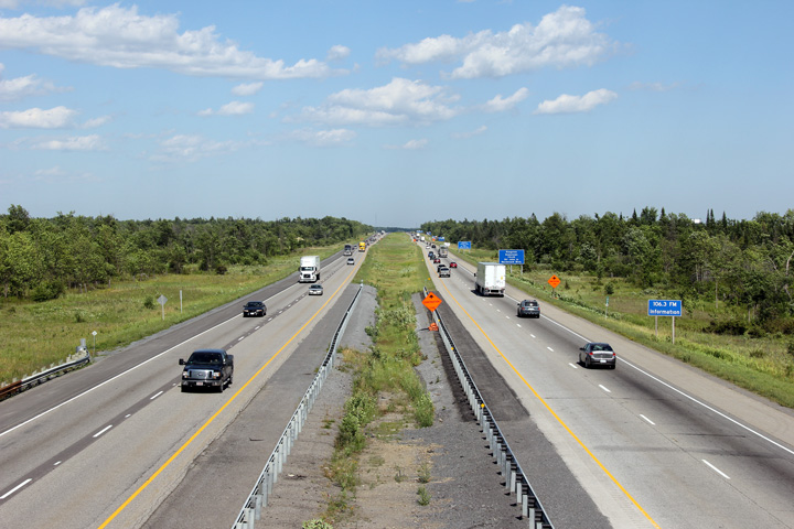
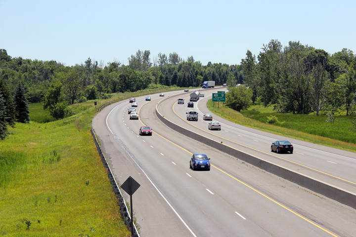
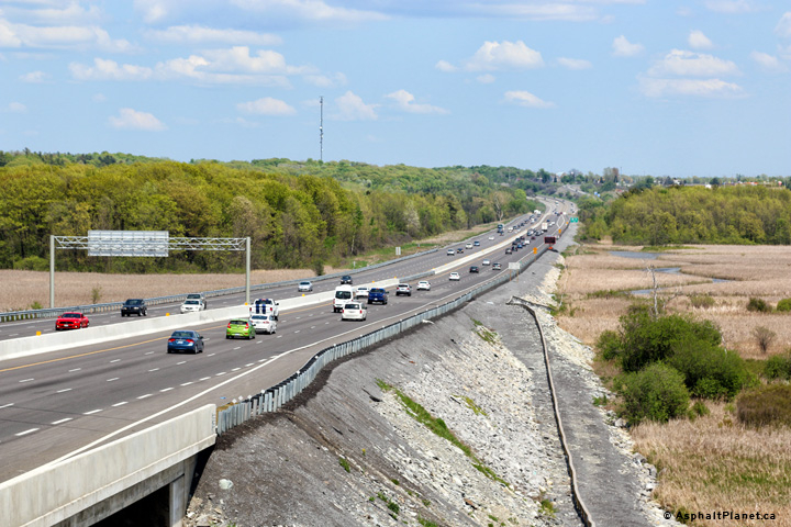
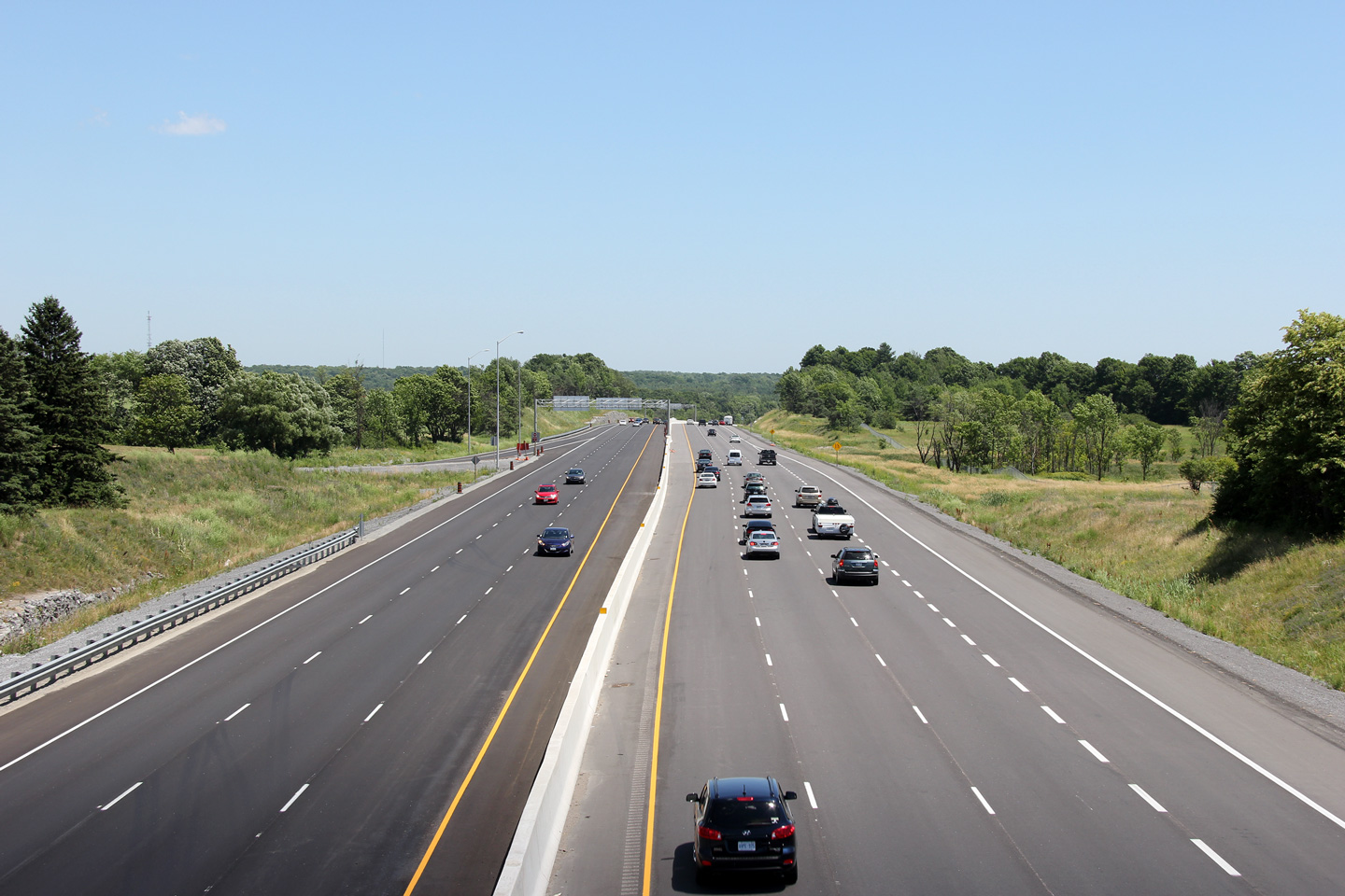
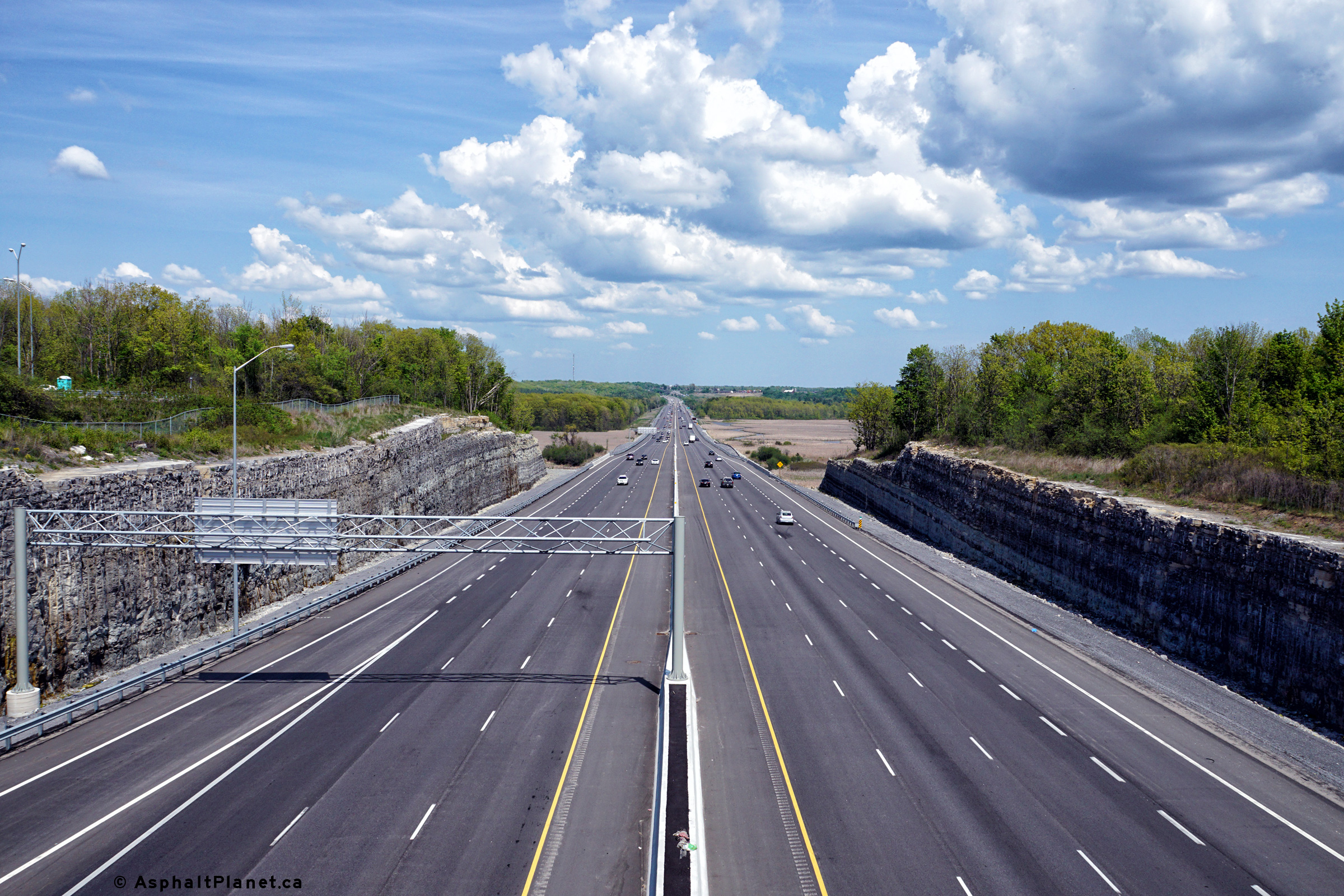
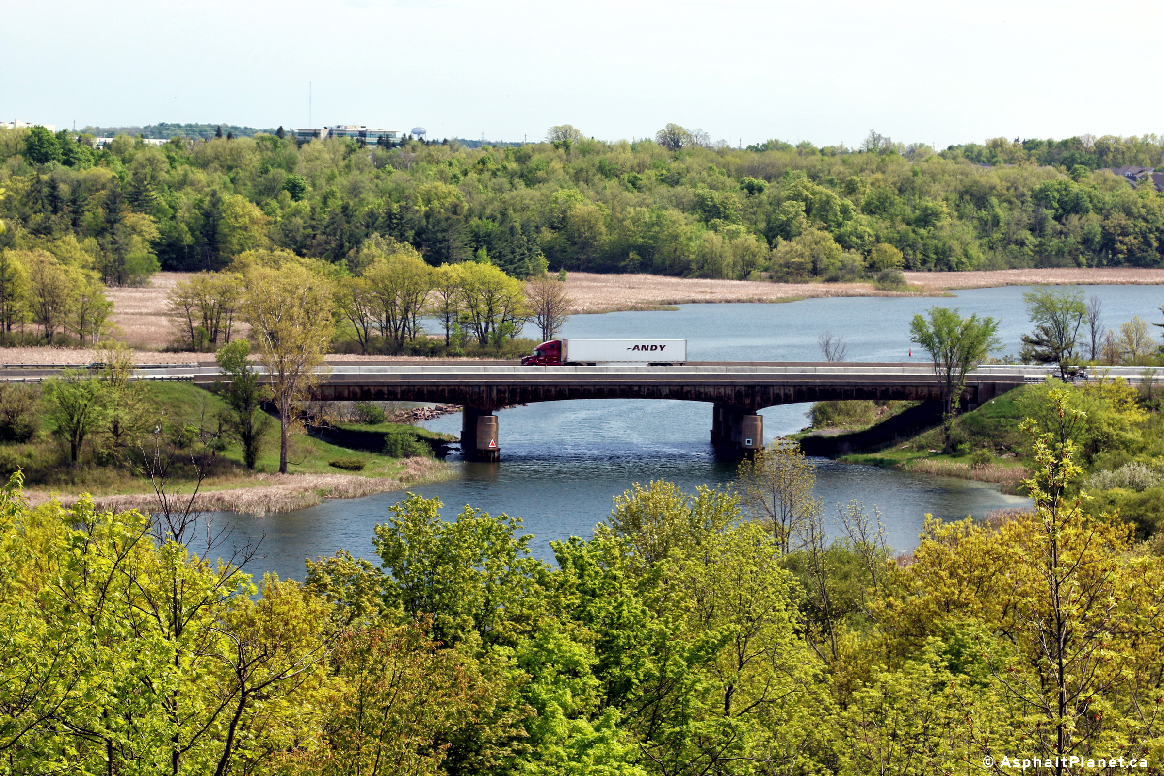
| City of Kingston |
Highway 401 looking west from just west of the Highway 15 overpass. This view shows Highway 401 as it crosses the Great Cataraqui River and Marsh. The Cataraqui River is a navigable waterway and is part of the Rideau Canal system that links Kingston and Ottawa.
Photos #1 and #2 taken: June 19th, 2004.
Photos #3 and #4 taken: October 17th, 2020. |
 (720x480) (1440x960) (2400x1600) 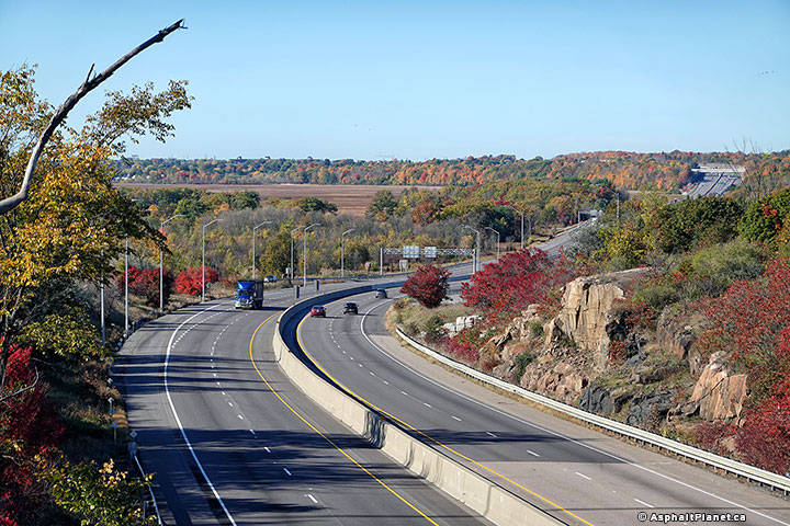 (720x480) (1440x960) (2400x1600) |
||
| Highway 15 leads northeasterly from Kingston into Smith's Falls and serves as a good alternate route to Ottawa. Click here for Highway 15 images. | ||||
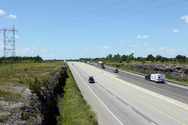
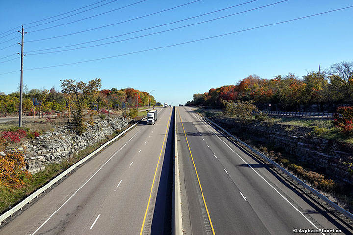
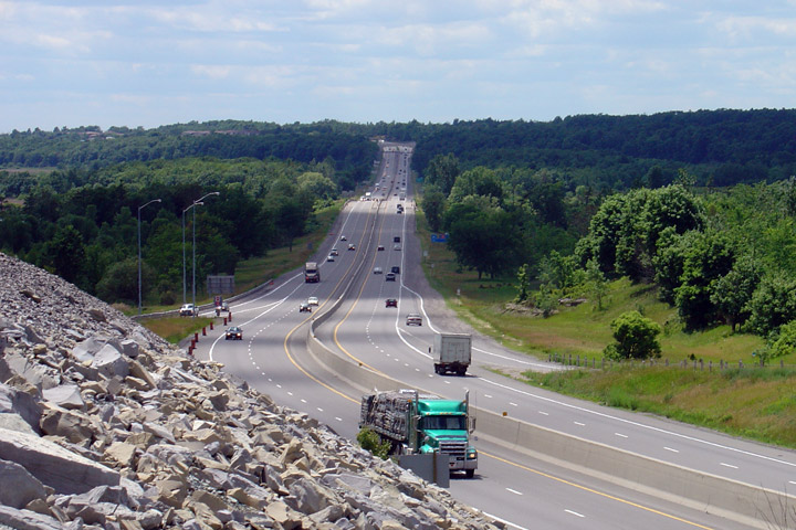
| City of Kingston |
Easterly view of Highway 401 from Highway 15. This isn't that
exciting of a view, but does emphasize just how much rock had to be moved
to build this highway. Photo #1 taken: June 19th, 2004. Photo #2 taken: October 17th, 2020. |
 (720x480) (1440x960) (2400x1600) |
||
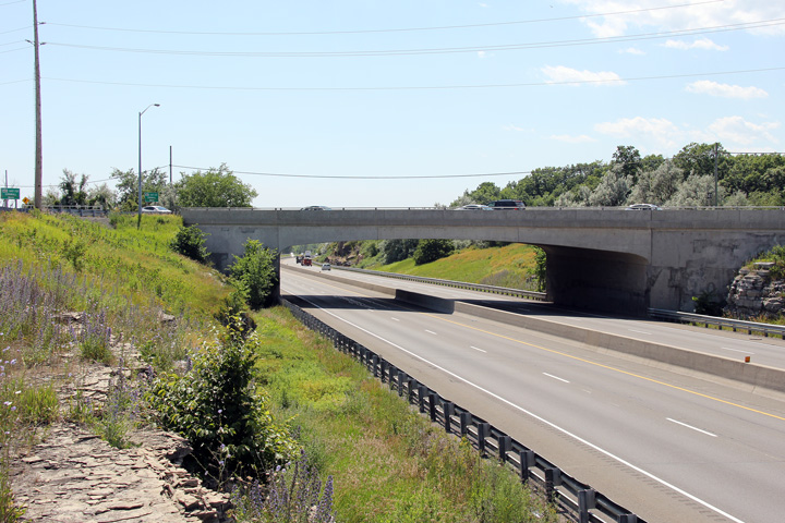
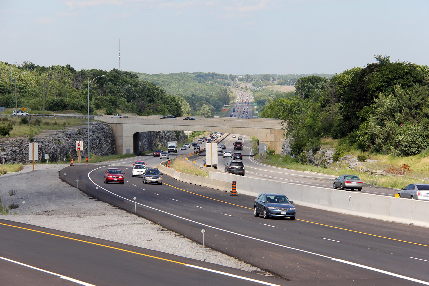
| City of Kingston |
This concrete rigid frame bridge carries Highway 15 overtop of Highway
401. This narrow structure was certainly not built with a six-lane
Highway 401 cross-section in mind. Photo taken: June 29th, 2012. |
 (720x480) (1440x960) (2400x1600) |
||
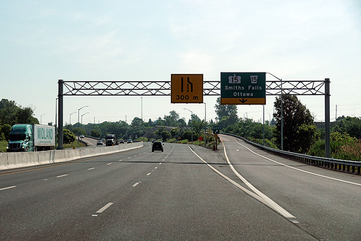
| City of Kingston |
Westbound signage for the Highway 15 interchange. Photo taken: June 29th, 2012. |
 (720x480) (720x480)(1440x960) (2400x1600) |
||
| City of Kingston |
Advanced signage in the westbound direction for the Highway 15
interchange. Notice that the word 'exit' has been blanked out in the
exit tab. The French Languages Services Act was expanded to include
Kingston during the 2000s. Photo taken: June 29th, 2012. |
 (720x480) (720x480)(1440x960) (2400x1600) |
||
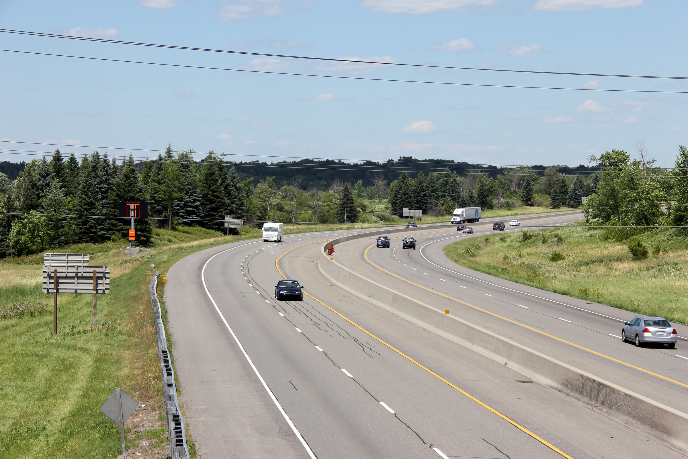
| City of Kingston |
View looking westerly from the John F. Scott Road overpass just east of
Highway 15 in Kingston. Note the large green sign advising westbound
travelers of the Highway 15 interchange. Photo taken: June 29th, 2012. |
 (720x480) (1440x960) (2400x1600) |
||
| City of Kingston |
Easterly view from John F. Scott Road towards Ganonoque. Photo taken: June 29th, 2012. |
 (720x480) (1440x960) (2400x1600) |
||
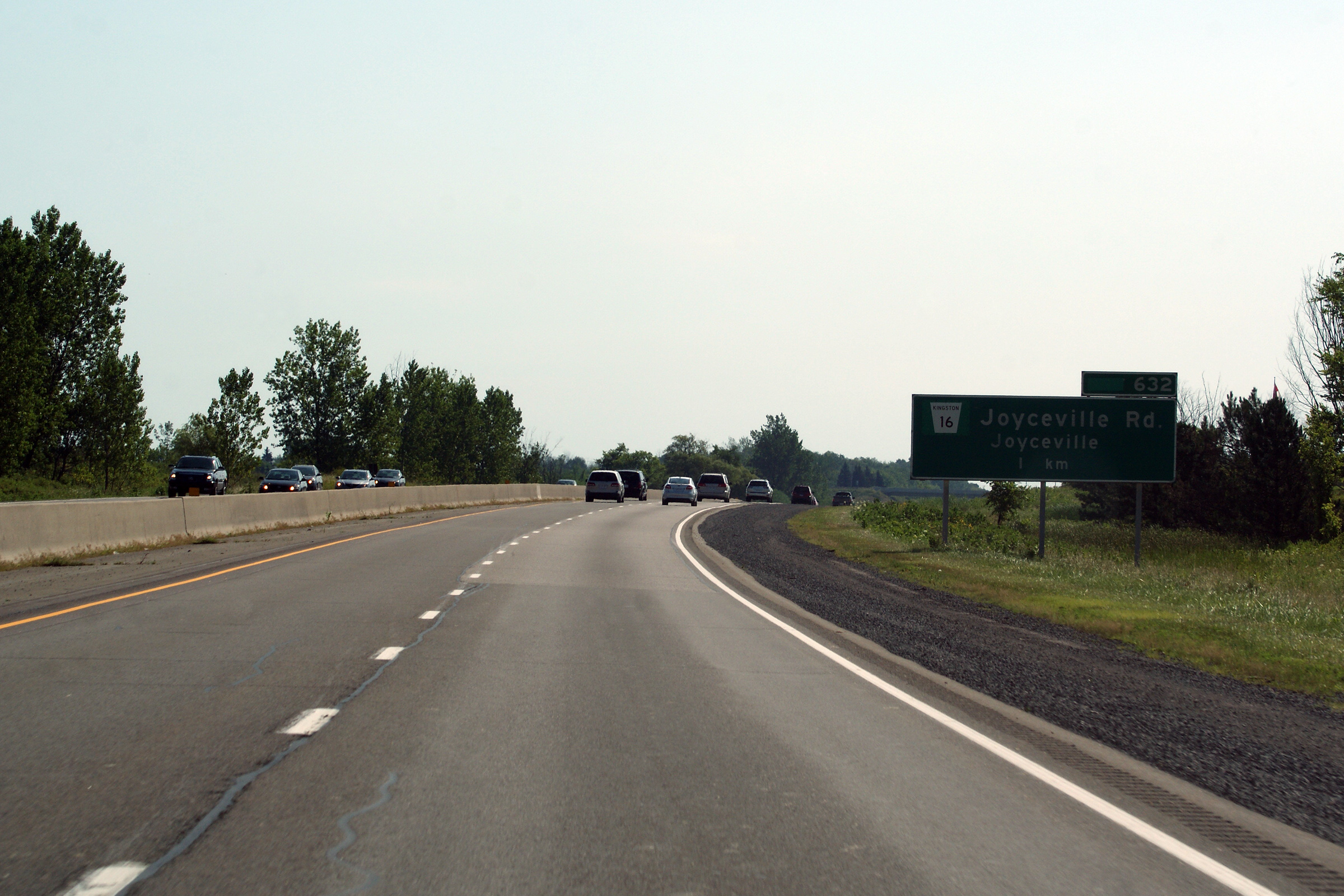
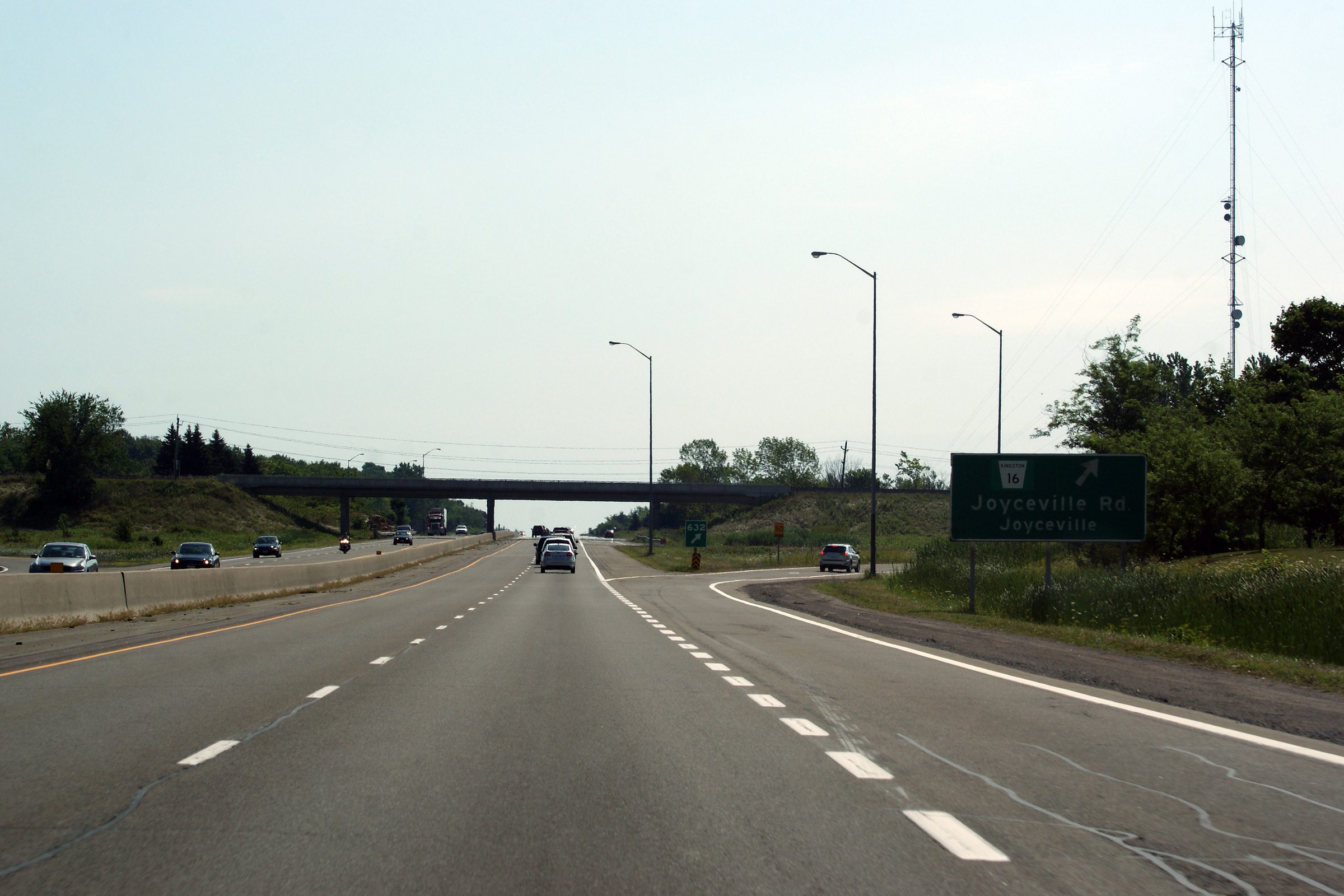
| City of Kingston |
Eastbound advanced signage for the Joyceville Road intercahnge. Photo taken: July 23rd, 2011. |
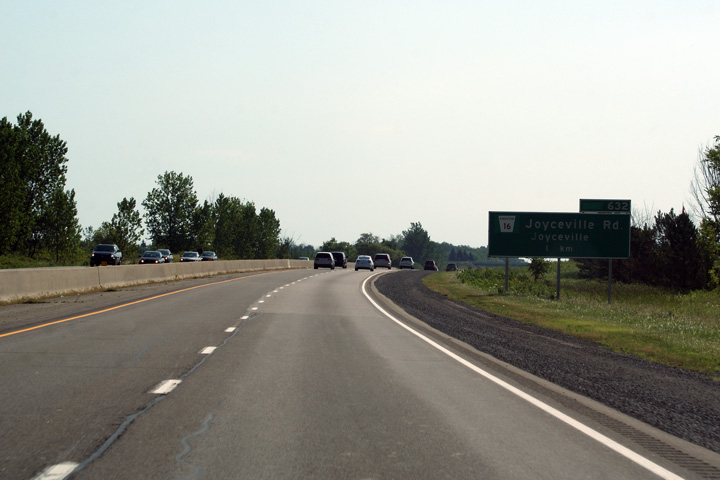 (720x480) (720x480)(1440x960) (2400x1600) |
||
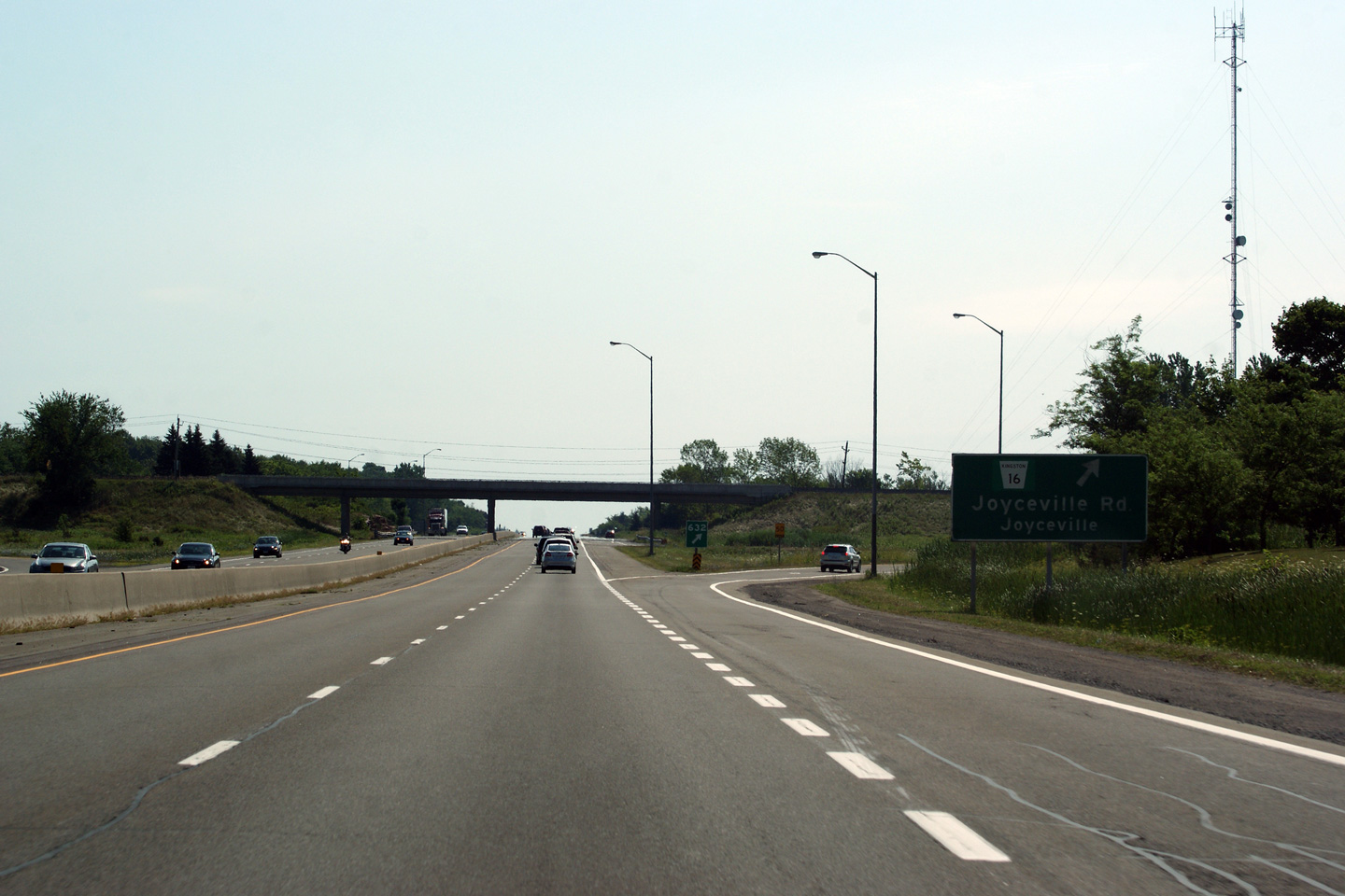
| City of Kingston |
View looking eastbound towards Joyceville Road. Photo taken: July 23rd, 2011. |
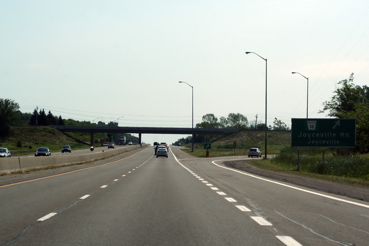 (720x480) (720x480)(1440x960) (2400x1600) |
||
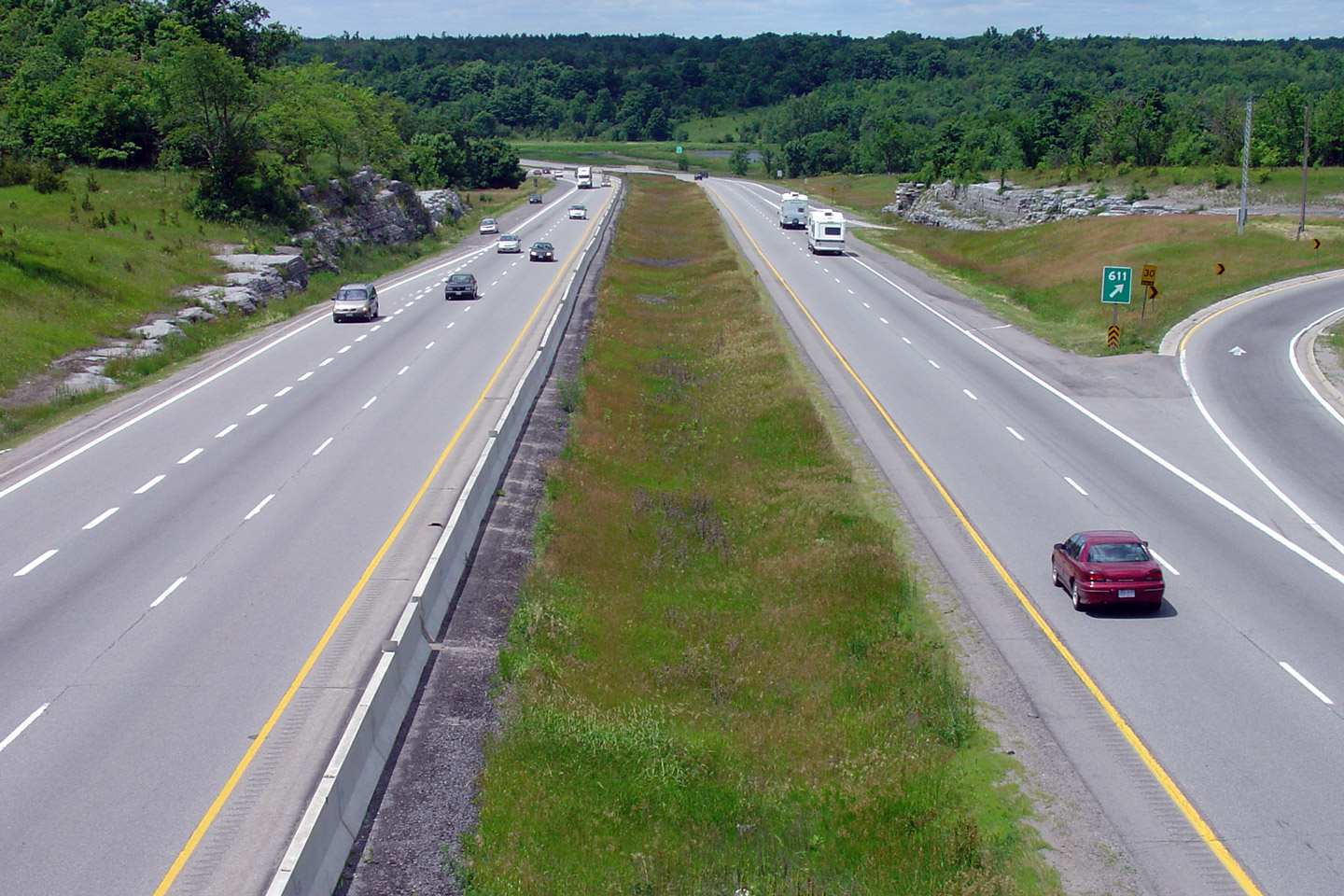
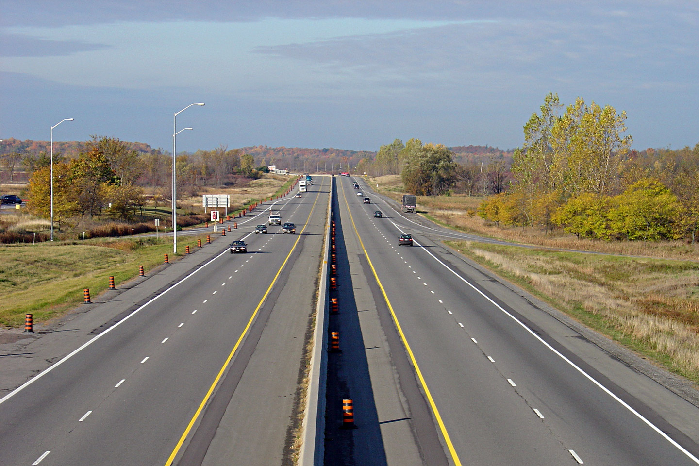
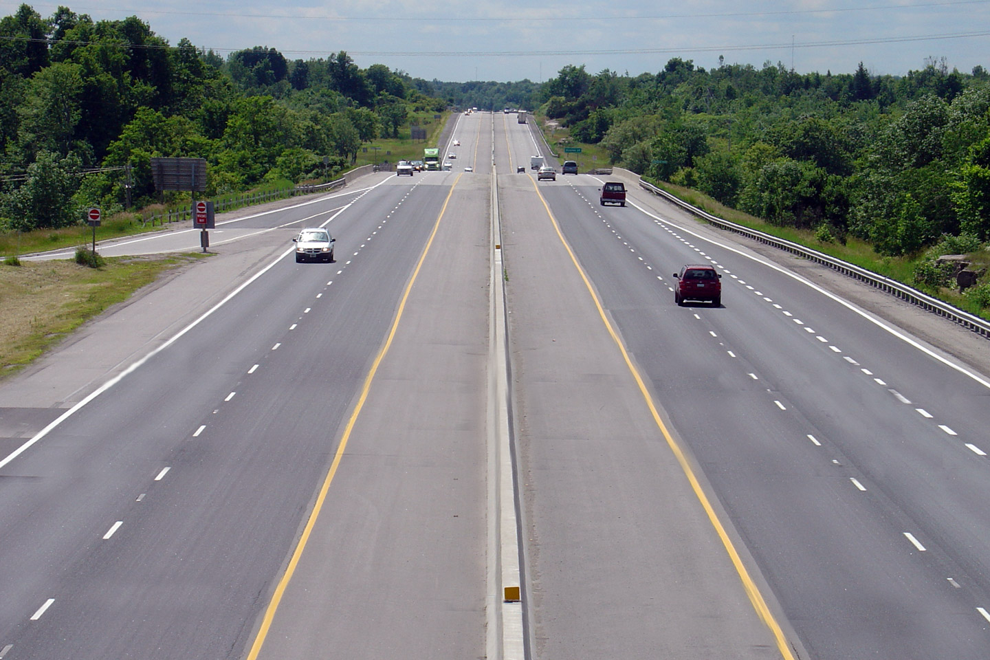
| City of Kingston |
Highway 401 looking west from the Joyceville Road overpass, located just east of Kingston. Joyceville Road is located at kilometre #632. This is a fairly typical looking section of Highway 401 between Kingston and Gananoque.
Photo taken: October 22nd, 2004. |
 |
||
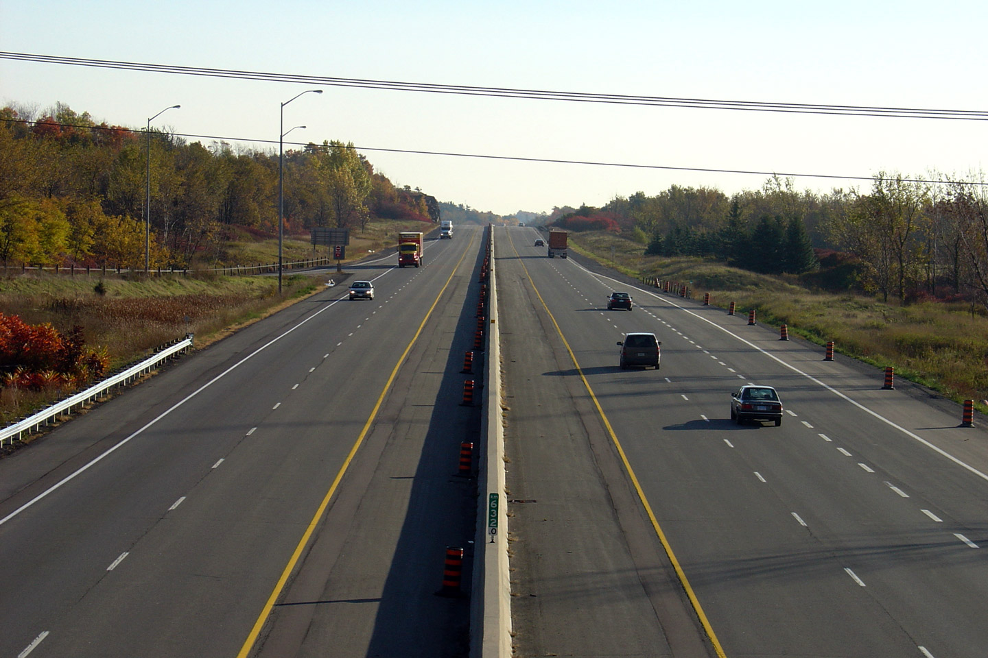
| Town of Gananoque County of Leeds & Grenville |
Easterly view from the Joyceville Road overpass. It is kind of a
shame that so much of the 401 has such a narrow median and requires a
tallwall barrier. The scenery is so much nicer when it is not
viewed overtop of a three and a half foot concrete wall. Photo taken: October 22nd, 2004. |
 |
||
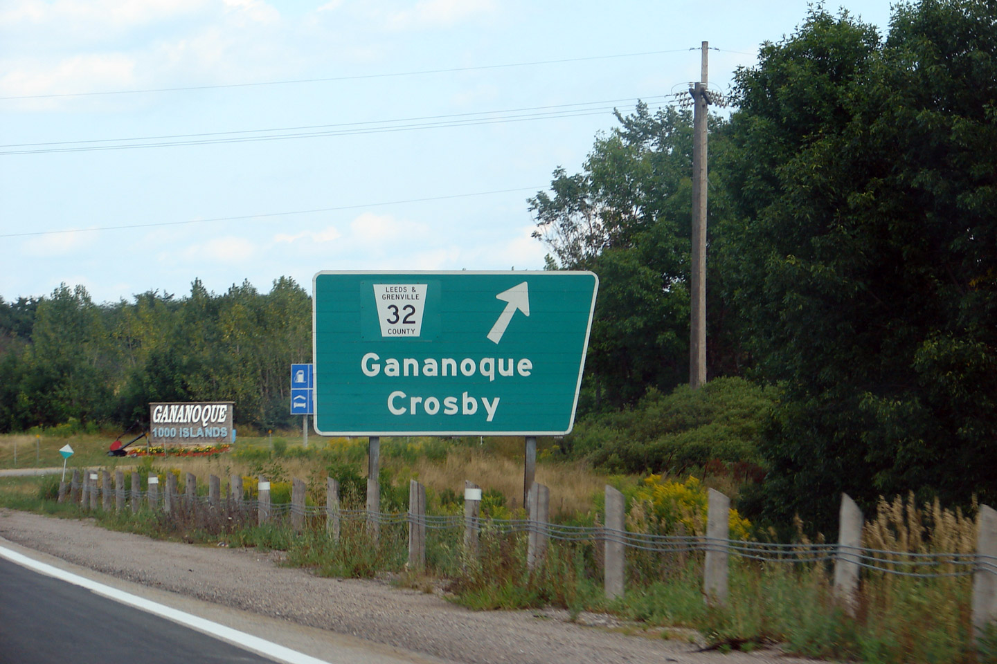
| Town of Gananoque County of Leeds & Grenville |
Old style exit sign for the former Highway 32 interchange. They do
not make signs like this anymore (unfortunately). Thanks to Josh
for providing me with photos of several angular signs in Eastern Ontario. Photographer: Josh Anderchek. Photo taken: August 11th, 2007. |
 (720x480) (720x480)(1440x960) |
||
| Town of Gananoque County of Leeds & Grenville |
View looking westerly from the Highway 32 overpass, towards the
Gananoque River. This part of Ontario is beautiful. Photo taken: June 19th, 2004. |
 |
||
| Highway 32 is a short highway leading between Gananoque and Highway 15 at Seeleys Bay. Click here for Highway 32 images. | ||||
| Continue east via Gananoque to Brockville Images | ||||
<- Page 14 Images Highway 401 Images Index Page 16 Images ->
<- Highway 400 Images Back to Highway 401 Highway 402 Images ->
Copyright (c) 2004-2016, Scott Steeves (Webmaster) AsphaltPlanet@asphaltplanet.ca


