King's Highway 401 - Images
<- Page 15 Page 16 - Gananoque to Brockville Page 17 ->
Photos shown in this table are arranged from West to East:
| Proper Municipality Name | Photo Description | Photo | |
|
Pictures taken from driver's perspective appear offset from centre-line pictures: |
East- bound |
West- bound |
|
| Click here for Napanee to Gananoque Images | |||
| Township of Leeds and the
Thousand Islands County of Leeds & Grenville |
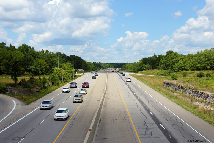
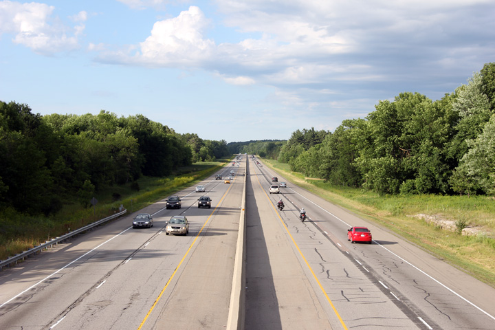
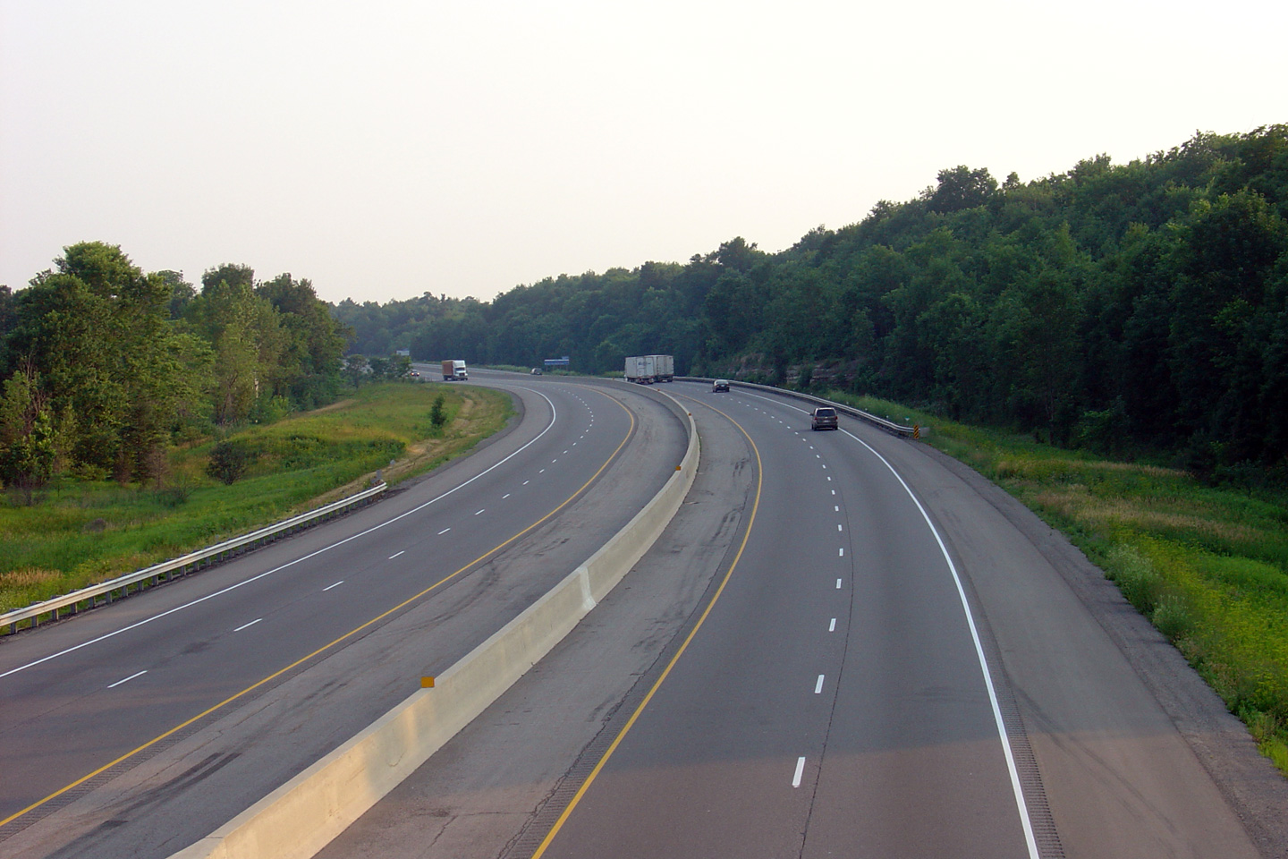
View looking easterly along Highway 401 from the Highway 32 overpass.
Click here to jump to the view looking
westerly from the Highway 32 overpass. Photo taken: June 19th, 2004. |
 (720x480) (1440x960) |
|
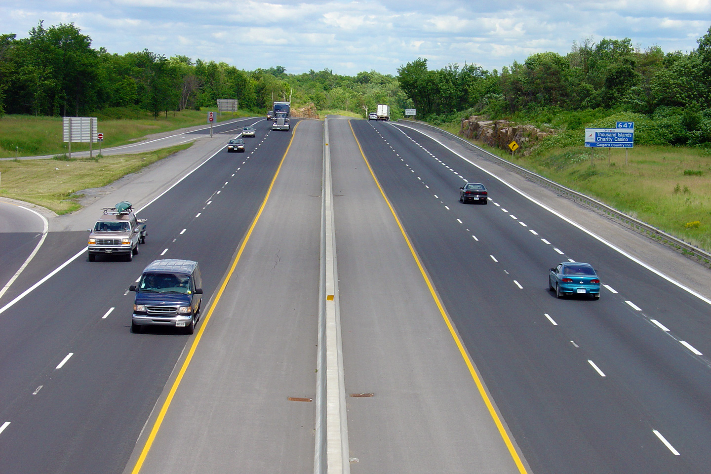
| Township of Leeds and the
Thousand Islands County of Leeds & Grenville |
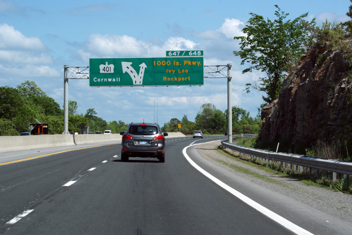
Overhead diagram signage in advance of the 1000 Islands Parkway
interchange. The Thousand Islands Parkway is a two-lane scenic
alternate to Highway 401. It is a beautiful road, and well worth
the few extra minutes that it takes to traverse. A drive during
the fall is the ideal time to drive the parkway. Photo taken: May 23rd, 2010. |
 Low
Res Low
ResHigh Res |
|
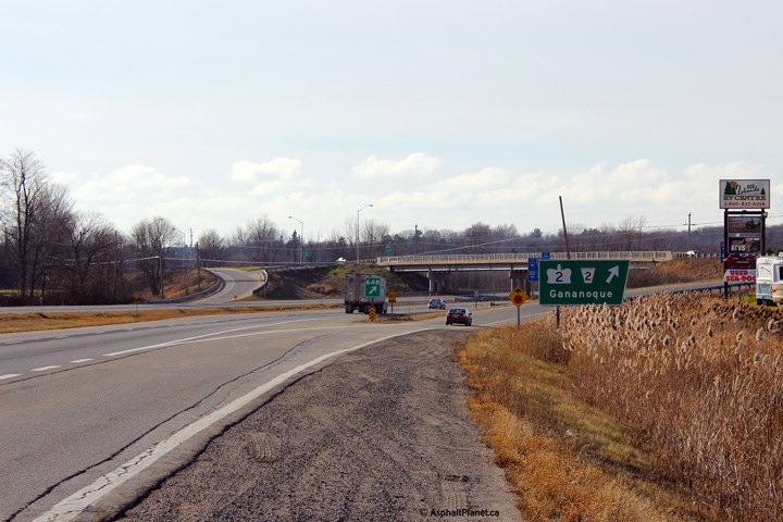
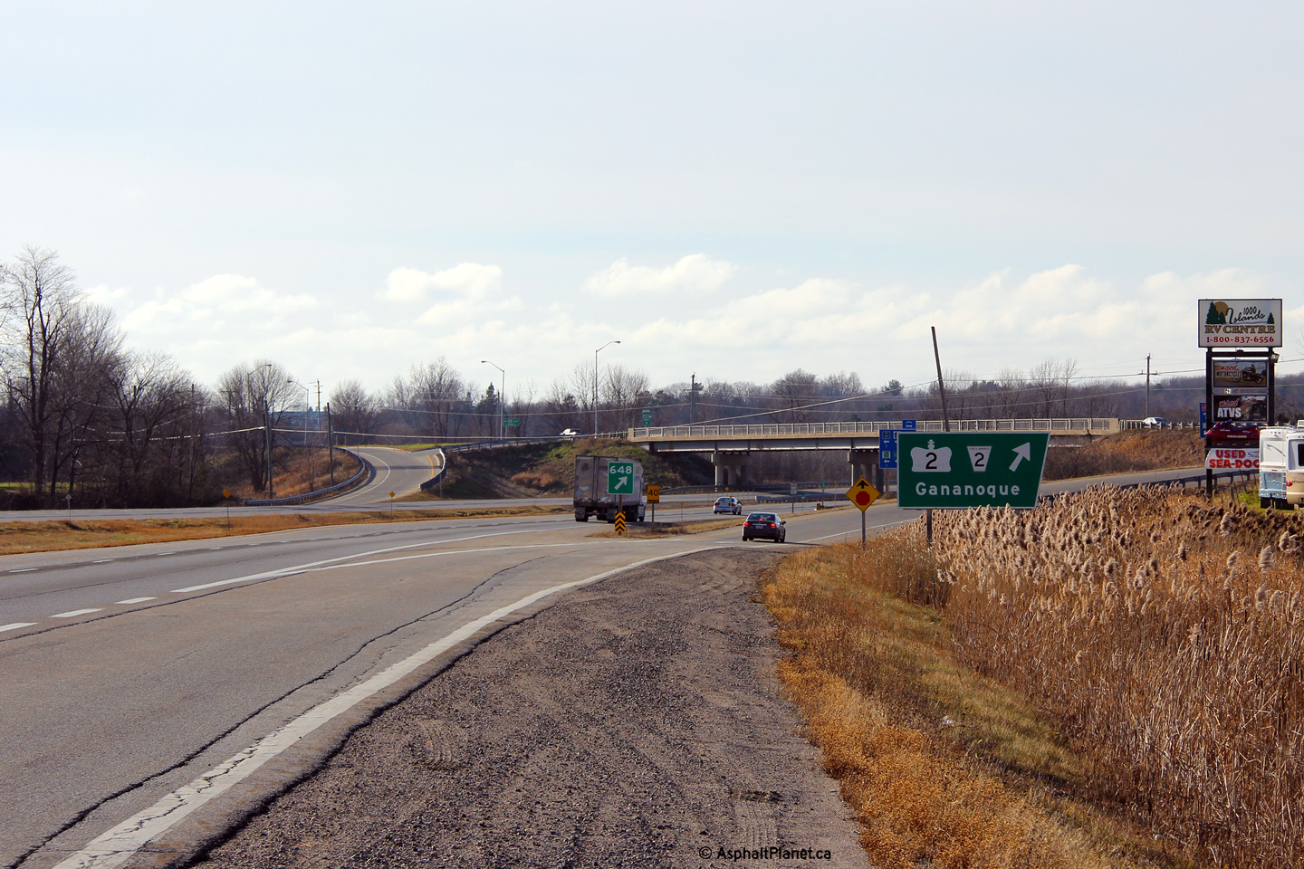
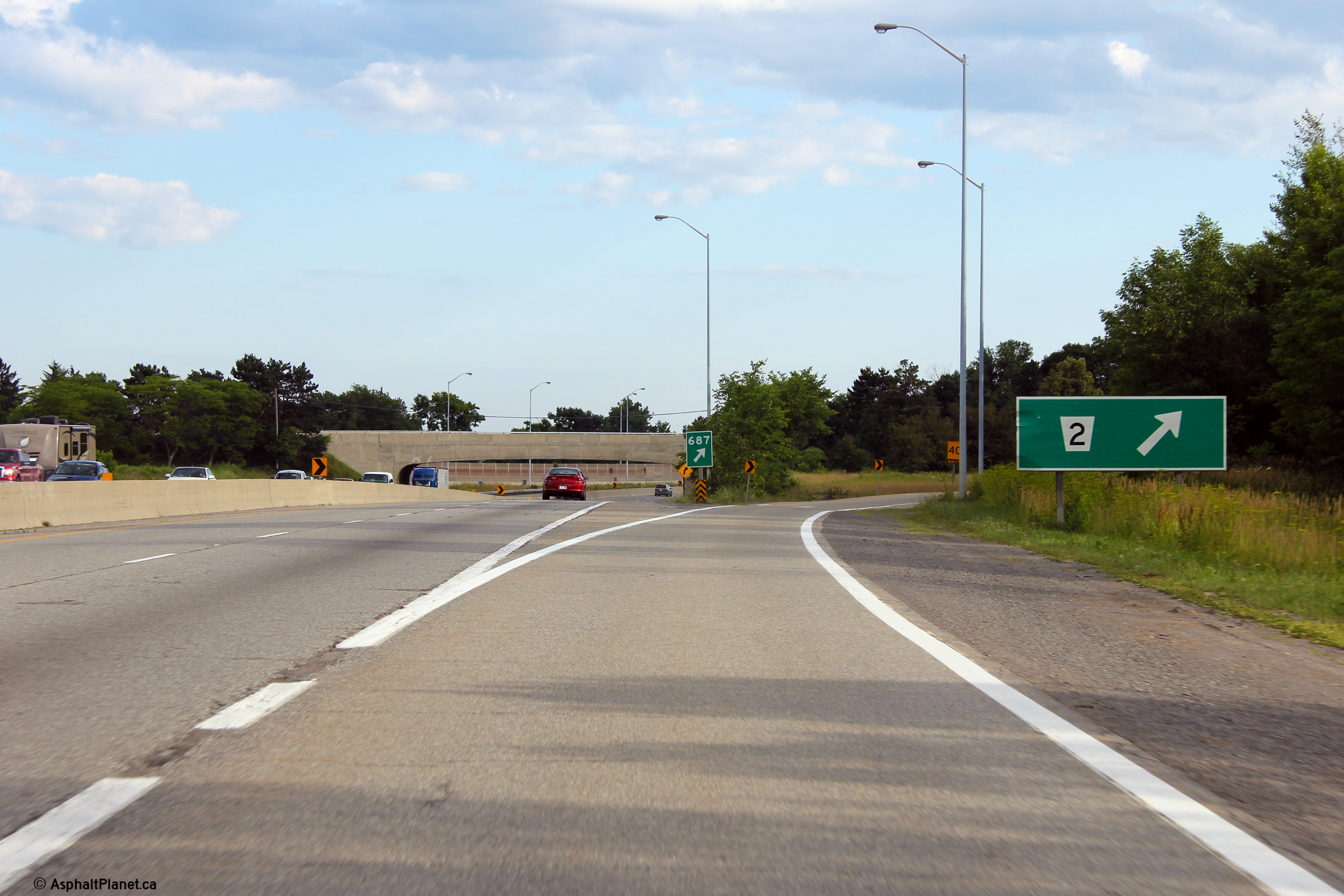
| Township of Leeds and the
Thousand Islands County of Leeds & Grenville |
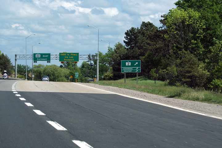
Though it is not indicated on the overhead signage, Highway 2 is
accessible from a diamond interchange located a few hundred meters
beyond Highway 401 along the 1000 Islands Parkway. Photo taken: May 23rd, 2010. |
 Low
Res Low
ResHigh Res |
|
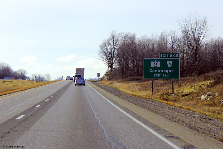
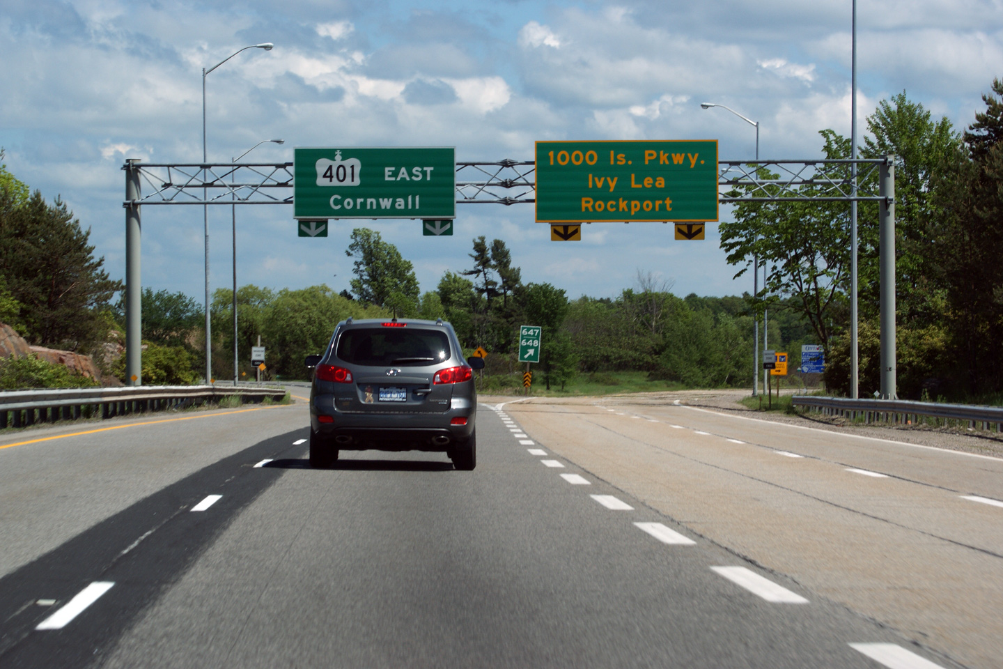
| Township of Leeds and the
Thousand Islands County of Leeds & Grenville |
Overhead signage for the split to the 1000 Islands Parkway. Note
the gore signage that indicates this exit as both 646 and 647. The
Highway 2 interchange is numbered exit #647, despite the fact that the
interchange is actually on the Thousand Islands Parkway. Photo taken: May 23rd, 2010. |
 Low
Res Low
ResHigh Res |
|
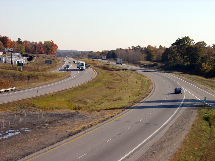
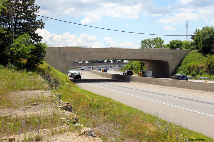
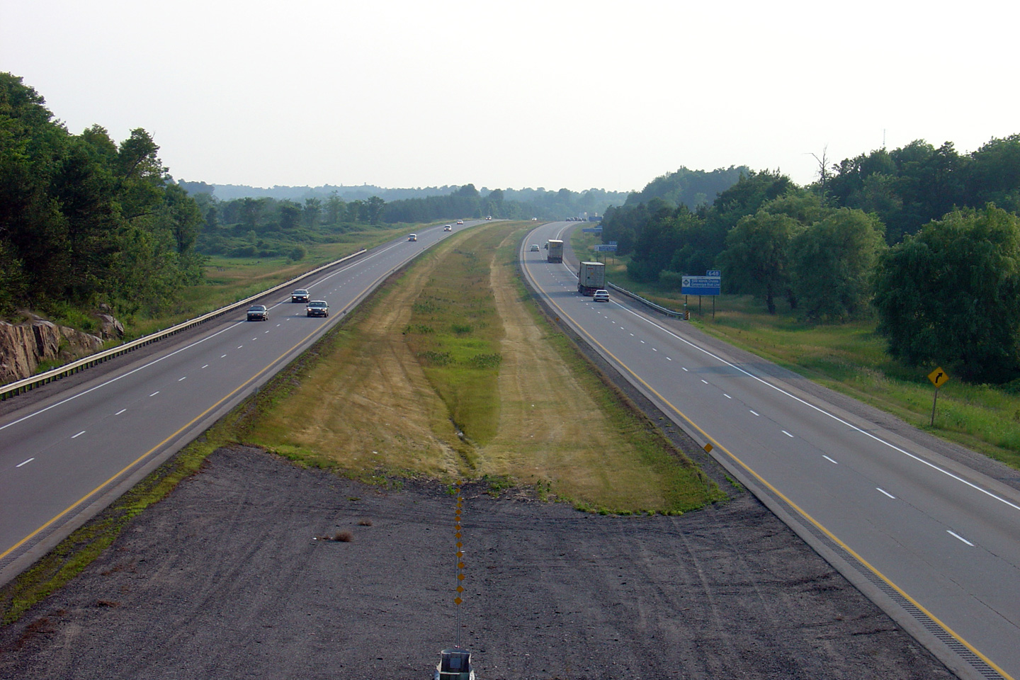
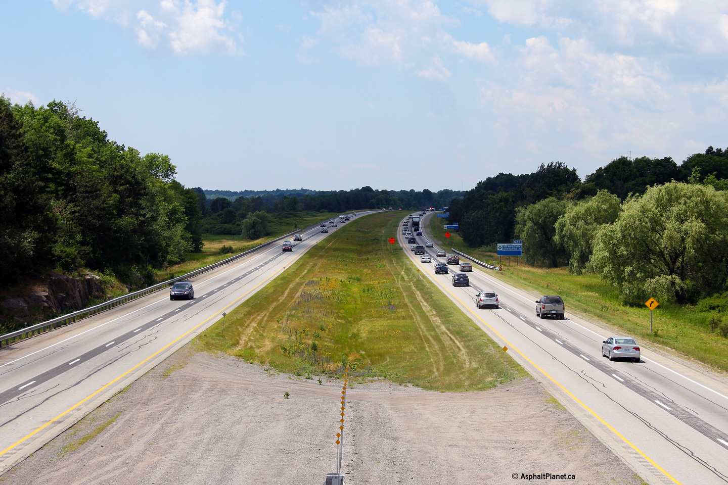
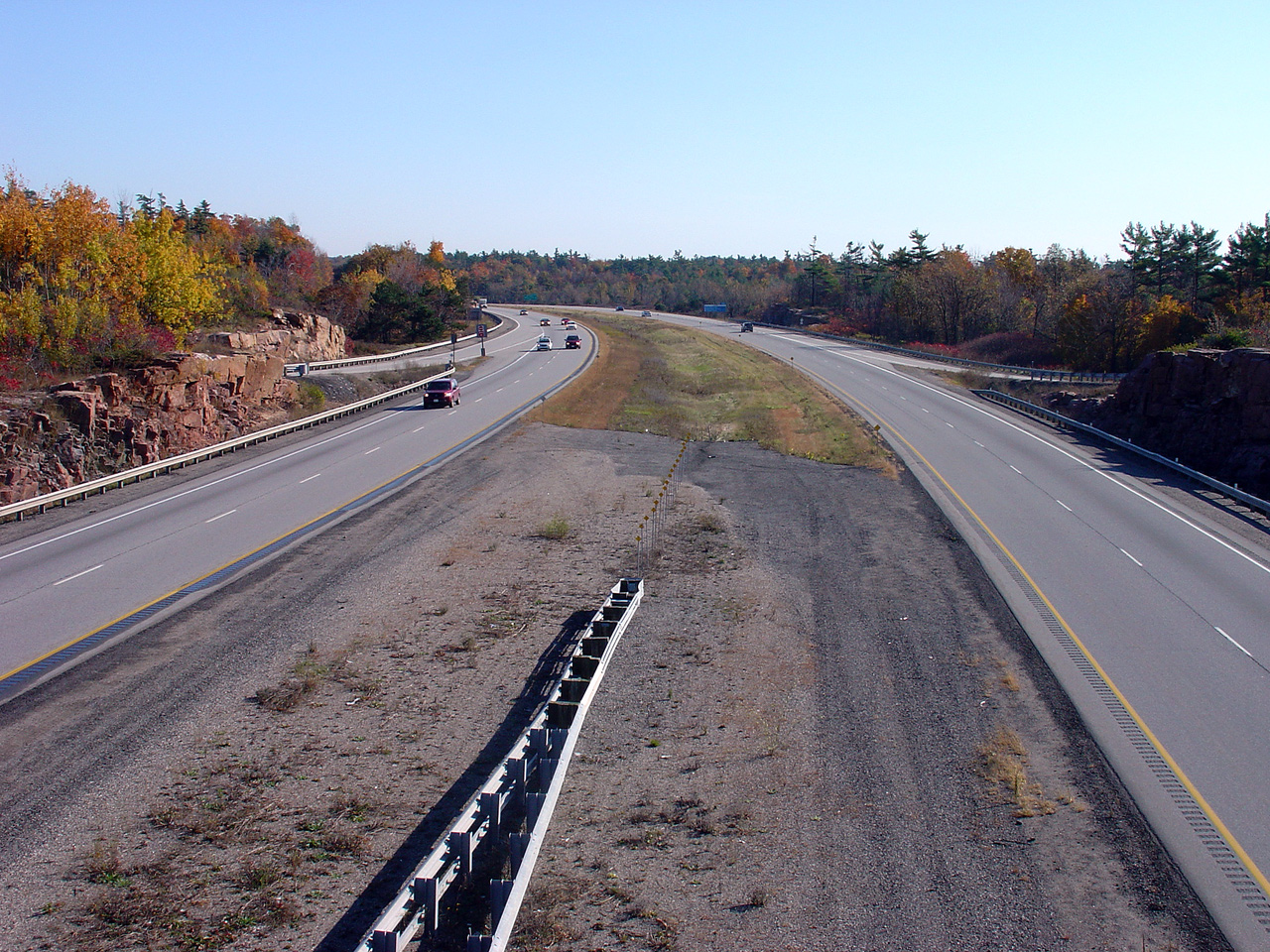
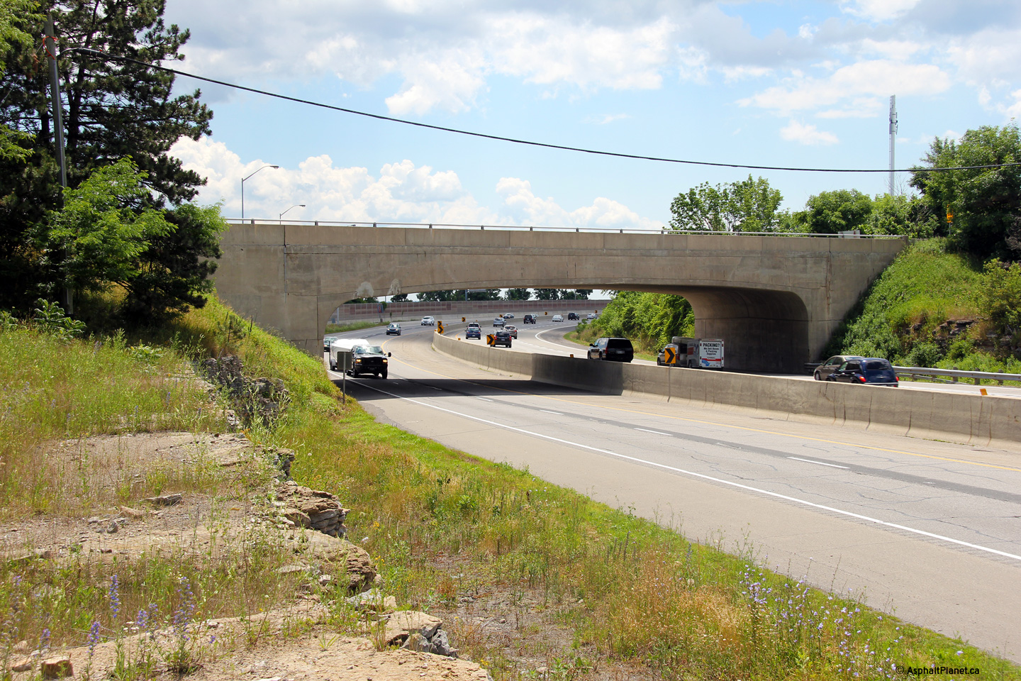
| Township of Leeds and the
Thousand Islands County of Leeds & Grenville |
Highway 401 looking west from the Highway 2 overpass located just east of Gananoque (exit #648). The interchange and structure located in the background of this photo, is that of the 401 and the Thousand Islands Parkway. Highway 401 followed the Thousand Islands Parkway until public pressure forced the province to build the present alignment. The present alignment was completed in 1968. Picture taken: October 22nd, 2004. Size: 60kb. |
 Low-res High-res |
|
| Township of Leeds and the
Thousand Islands County of Leeds & Grenville |
View looking easterly from the Highway 2 overpass along Highway 401. Picture taken: October 22nd, 2004. Size: 55kb. |
 Low-res High-res |
|
| Township of Leeds and the
Thousand Islands County of Leeds & Grenville |
Angled edge signage for the Highway 2 interchange east of Gananoque. This
sign was replaced shortly after this photo was taken. Photo taken: December 3rd, 2011. |
 (720x480) (720x480)(1440x960) (2400x1600) |
|
| Township of Leeds and the
Thousand Islands County of Leeds & Grenville |
Advanced signage for the westbound off-ramp to Highway 2. This sign has
since been replaced. Photo taken: December 3rd, 2011. |
 (720x480) (720x480)(1440x960) (2400x1600) |
|
| Township of Leeds and the
Thousand Islands County of Leeds & Grenville |
View looking west from the Cliff Road overpass towards Gananoque along
Highway 401. Click here for this same view taken in
July, 2005. Photo taken: July 2nd, 2012. |
 (720x480) (1440x960) (2400x1600) |
|
| Township of Leeds and the
Thousand Islands County of Leeds & Grenville |
Looking east from Cliff Road overtop of Highway 401. Cliff Road is
located in the vicinity of kilometre marker 651. Click
here for this same view taken in
July, 2005. Photo taken: July 2nd, 2012. |
 (720x480) (1440x960) (2400x1600) |
|
| Township of Leeds and the
Thousand Islands County of Leeds & Grenville |
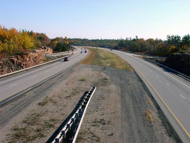
Looking westerly from the Reynolds Road overpass. Reynolds Road is
exit number 659. Picture taken: October 22nd, 2004. Low Res: 65kb. High Res: 260kb. |
 Low-res High-res |
|
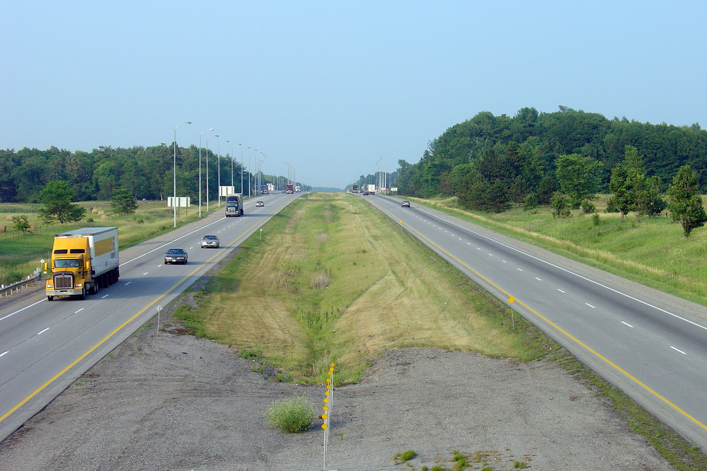
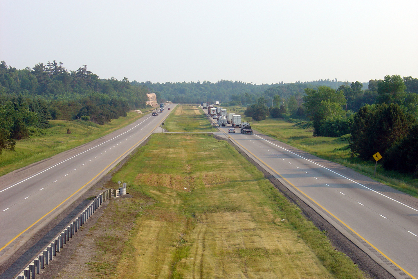
| Township of Leeds and the
Thousand Islands County of Leeds & Grenville |
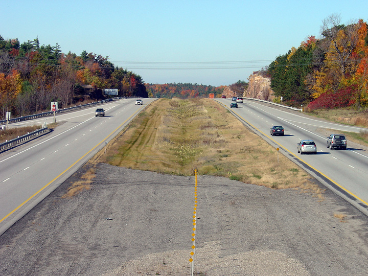
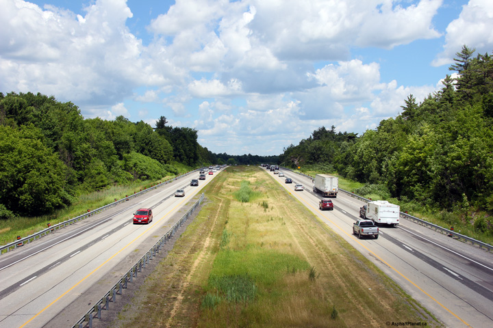
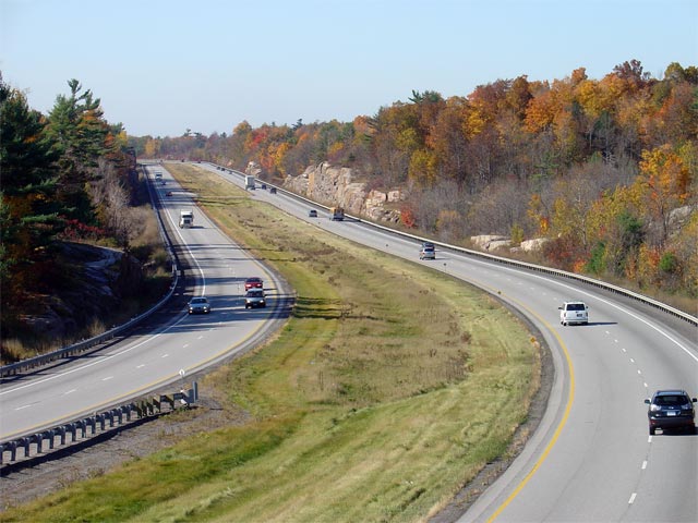
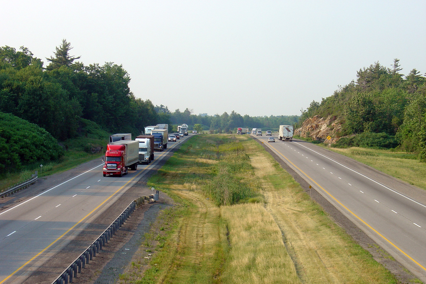
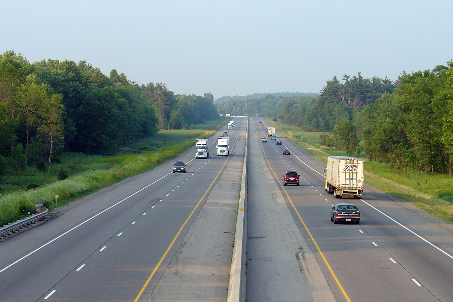
Highway 401 looking east from the Reynolds Road overpass located south of Lansdowne. Since this portion of Highway 401 was designed and built later then most other sections of the highway, it is designed with more modern design standards, including a wide grassed central median. Picture taken: October 22nd, 2004. Size: 65kb. |
 Low-res High-res |
|
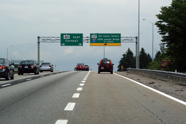
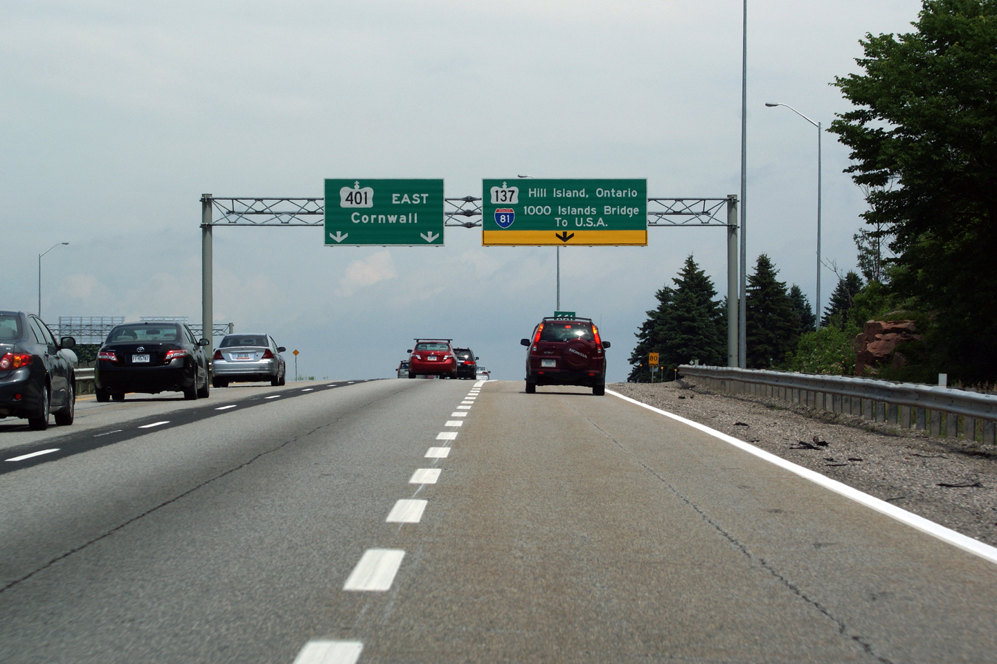
| Township of Leeds and the
Thousand Islands County of Leeds & Grenville |
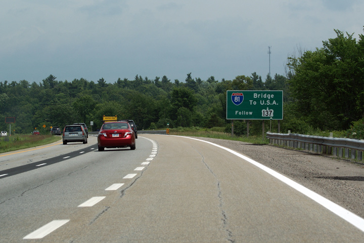
First of three signs informing eastbound travelers of the impending
Highway
137 interchange. This is now the only eastbound signage for the bridge
to USA and I-81 (the US continuation of Highway 137) at this interchange. Picture taken: June 28th, 2010. |
 Low
Res Low
ResHigh Res |
|
| Township of Leeds and the
Thousand Islands County of Leeds & Grenville |
1km advanced signage for the exit to Highway
137. Before 2006, Highway
137 was not a signed highway, instead southbound was indicated with I-81
trailblazers, while northbound traffic was directed to Highway 401. Picture taken: June 28th, 2010. |
 Low
Res Low
ResHigh Res |
|
| Township of Leeds and the
Thousand Islands County of Leeds & Grenville |
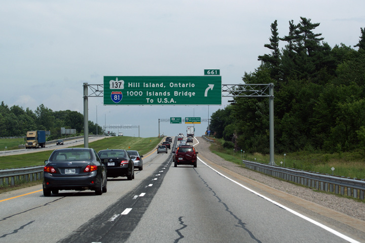
Signage at the ramp to Highway
137. Note that consistent with typical Ontario sign standards, Hill Island
is listed as the control city; Ontario very rarely uses out of province
control cities. Picture taken: June 28th, 2010. |
 Low
Res Low
ResHigh Res |
|
| Highway 137 is a very short highway that links the 401 to Hill Island and to Interstate 81 in New York State. Click here for Highway 137 images. | |||
| Township of Leeds and the
Thousand Islands County of Leeds & Grenville |
View looking westerly from the La Rue Mills Road overpass. Click
here for this same view taken in
July, 2005. Photo taken: July 2nd, 2012. |
 (720x480) (1440x960) (2400x1600) |
|
| Township of Leeds and the
Thousand Islands County of Leeds & Grenville |
Looking east towards Brockville along Highway 401 from the La Rue Mills Road
overpass. Click here for this same view taken in
July, 2005. Photo taken: July 2nd, 2012. |
 (720x480) (1440x960) (2400x1600) |
|
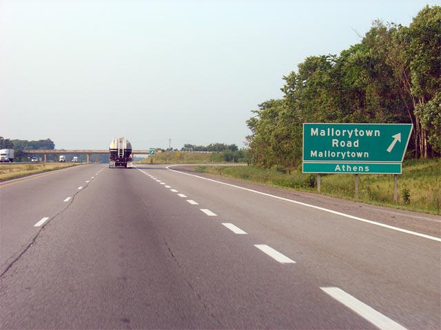
| Township of Front of Yonge County of Leeds & Grenville. |
Old style angled signage for the Mallorytown Road exit along Highway 401
eastbound. Very few of these old style signs remain on Ontario's
freeways. Picture taken: July 5th, 2005. Size: 45kb. |
 |
|
| Township of Front of Yonge County of Leeds & Grenville. |
View looking westerly from the Mallorytown Road overpass along Highway 401.
Notice the M-C shield cosigned with the Highway 401 marker in the extreme
right hand side of the photo. There are very few M-C shields left in
Ontario, most having been removed in recent years as part of increasingly
thoughtless cost-cutting initiatives. Picture taken: October 22nd, 2004. Low-res: 55kb. Low-res: 250kb. |
 Low-res High-res |
|
| Township of Front of Yonge County of Leeds & Grenville. |
View looking easterly from the Mallorytown Road overpass towards a pair of
service centres at Mallorytown. Picture taken: October 22nd, 2004. Size: 50kb. |
 (720x480) (1440x960) |
|
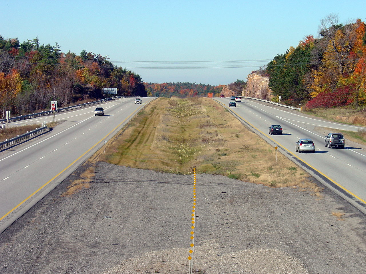
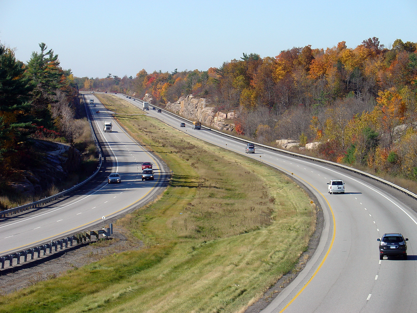
| Township of Front of Yonge County of Leeds & Grenville. |
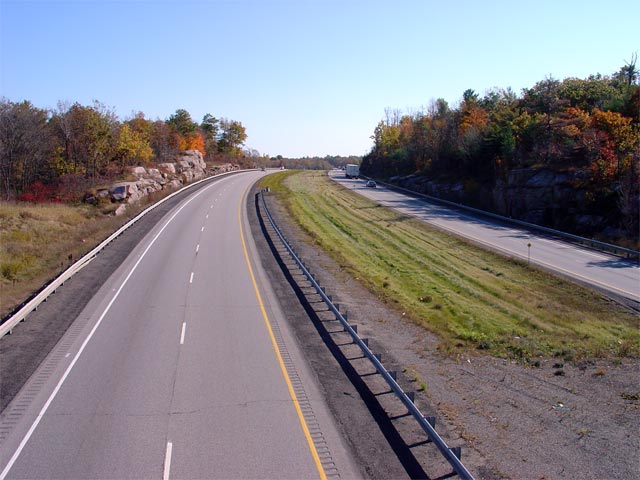
Looking west from the Sherwood Springs Road overpass. Substantial rock
work had to be carried out to blast Highway 401 through a narrow portion of
the Canadian Shield in the Thousand Islands Region. Picture taken: October 22nd, 2004. Low-res: 65kb. High-res: 295kb. |
 Low-res High-res |
|
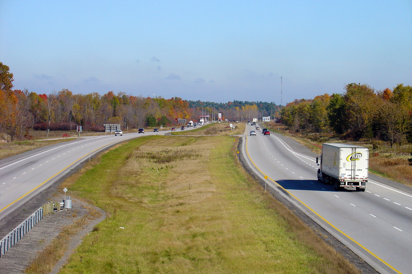
| Township of Front of Yonge County of Leeds & Grenville. |
View looking easterly towards Brockville from the Sherwood Springs Road
overpass. Highway 401 meets the Thousand Islands Parkway about 1km
east of this overpass. Picture taken: October 22nd, 2004. Size: 60kb. |
 Low-res High-res |
|
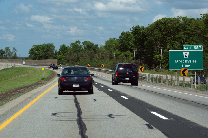
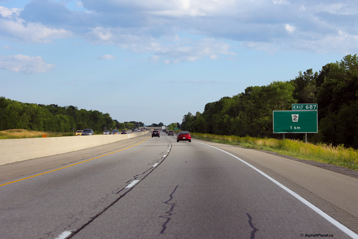
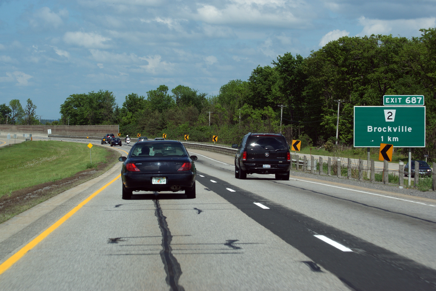
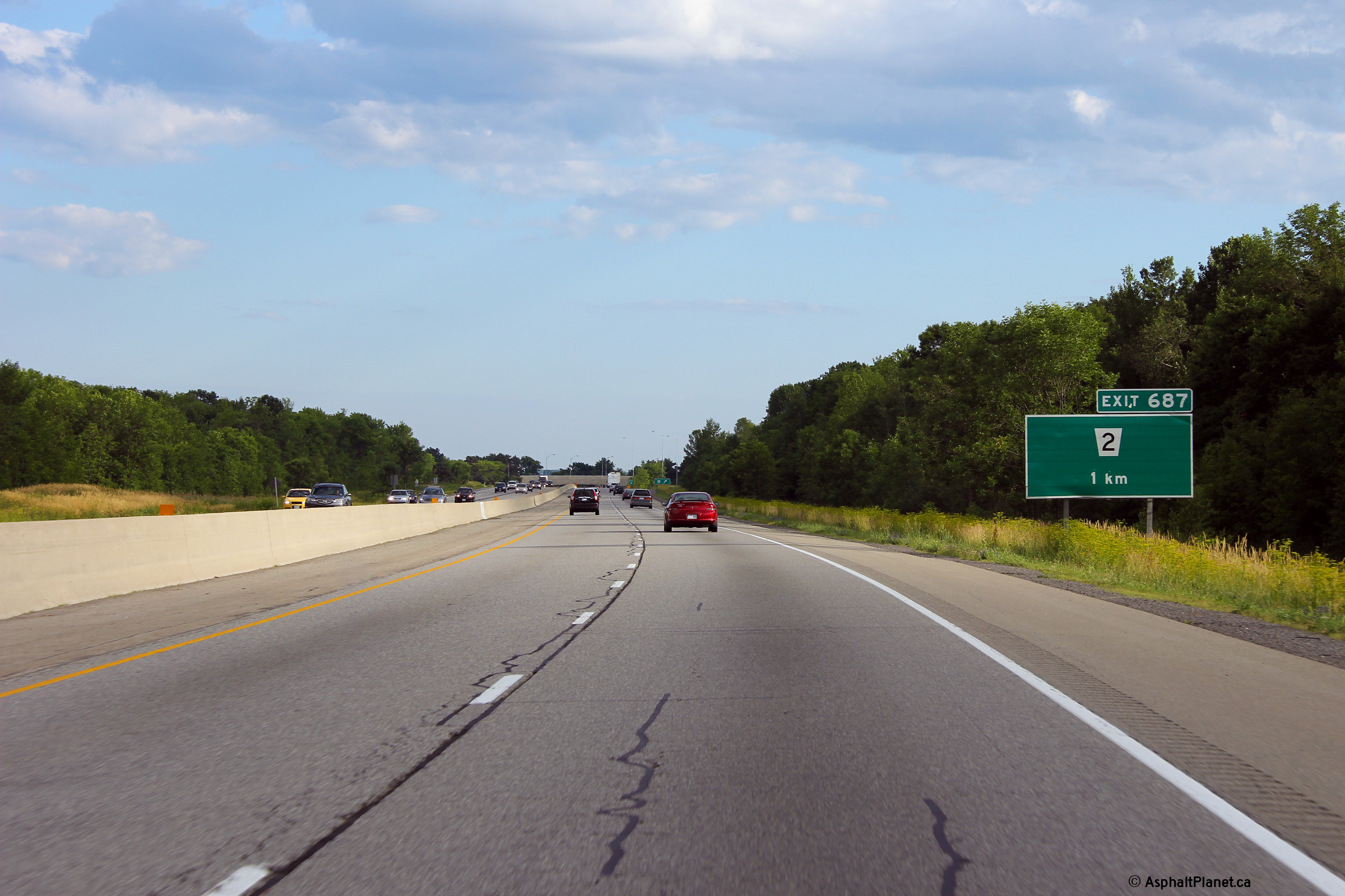
| Township or Elizabethtown- Kitley County of Leeds & Grenville |
Advanced signage for the Highway 2 interchange near Brockville. Photo taken: May 23rd, 2010. |
 Low
Res Low
ResHigh Res |
|
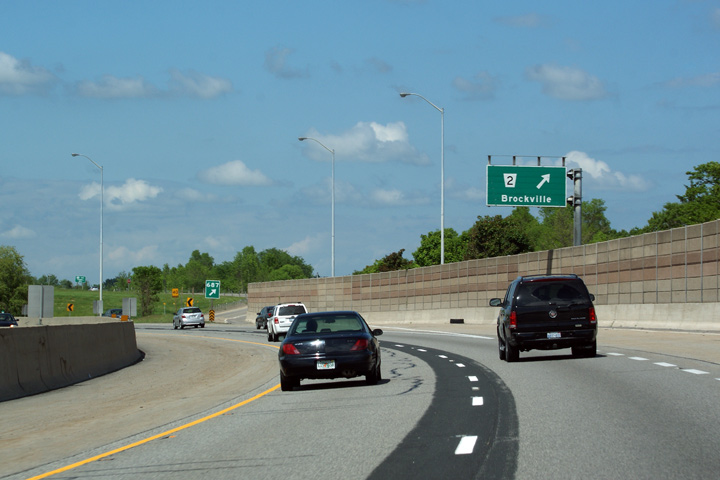
| Township or Elizabethtown- Kitley County of Leeds & Grenville |
Partial overhead guide signage for the Highway 2 interchange just west of
Brockville. The noise wall at this interchange abates road noise from
homes that are located just south of Highway 401 along the Old River Road.
The noise wall gives an otherwise rural highway a distinctly urban flavour. Photo taken: May 23rd, 2010. |
 Low
Res Low
ResHigh Res |
|
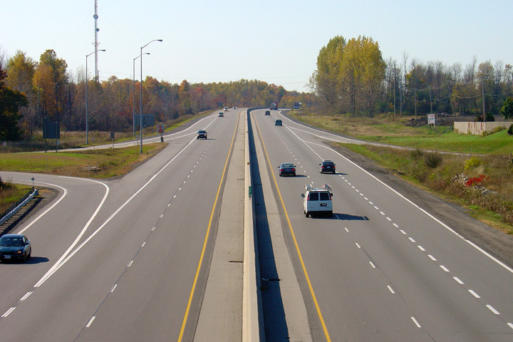
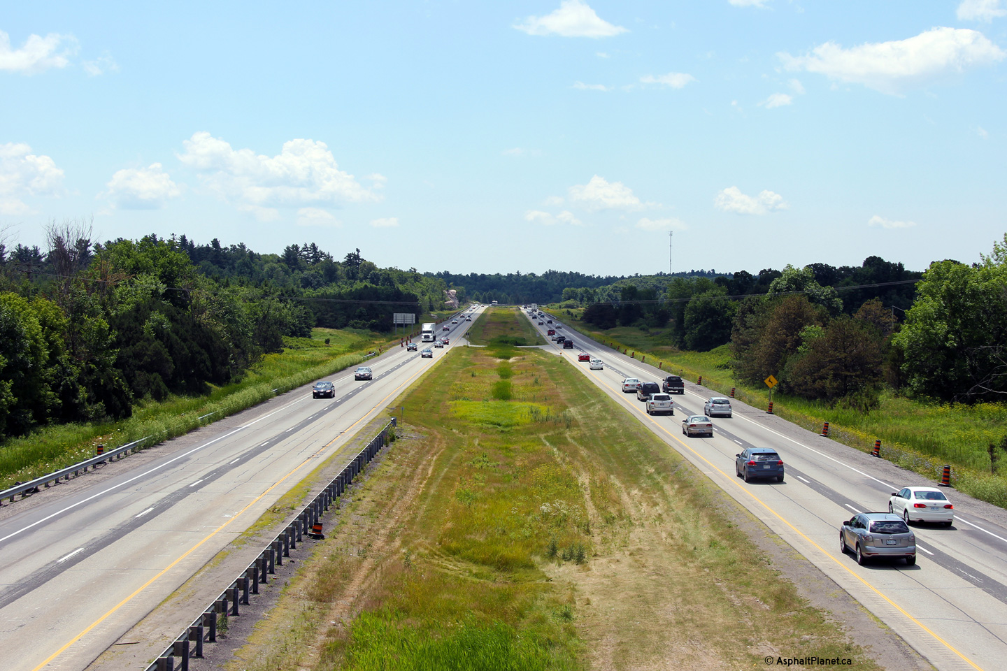
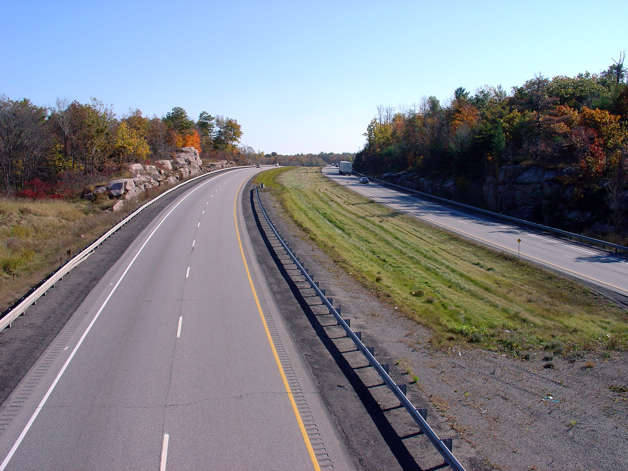
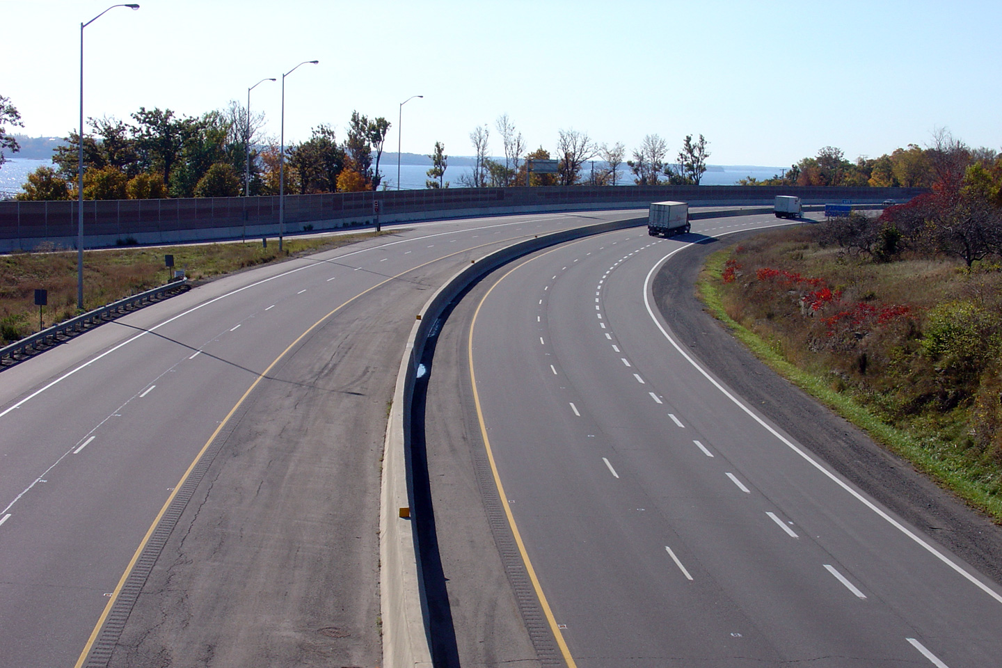
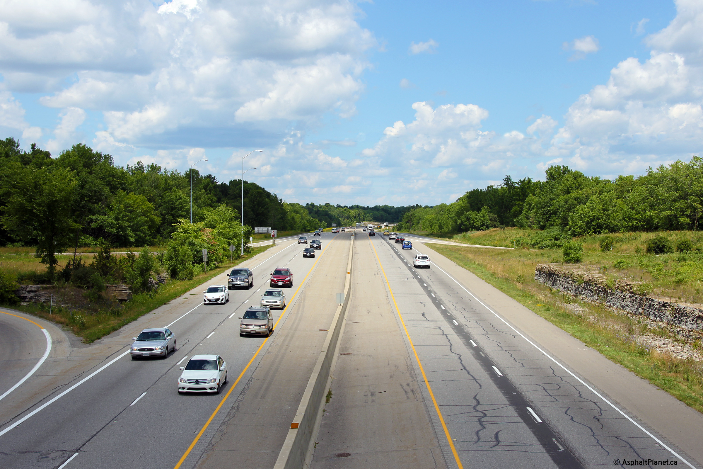
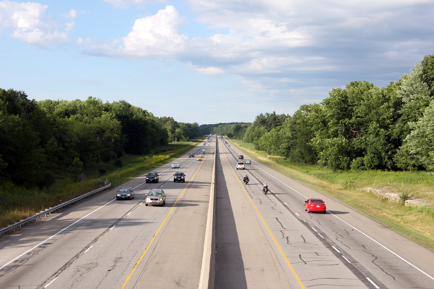
| Township or Elizabethtown- Kitley County of Leeds & Grenville |
View looking westerly from the Highway 2 overpass west of Brockville.
From Highway 2 to the Thousands Islands Parkway Highway 401 follows the St.
Lawrence River in very close proximity, utilizing half of the former Highway
2S right of way. Click here for this same view taken in
October, 2004. Photo taken: July 2nd, 2012. |
 (720x480) (1440x960) (2400x1600) |
|
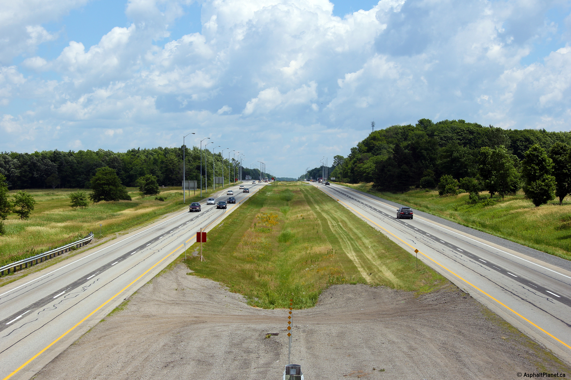
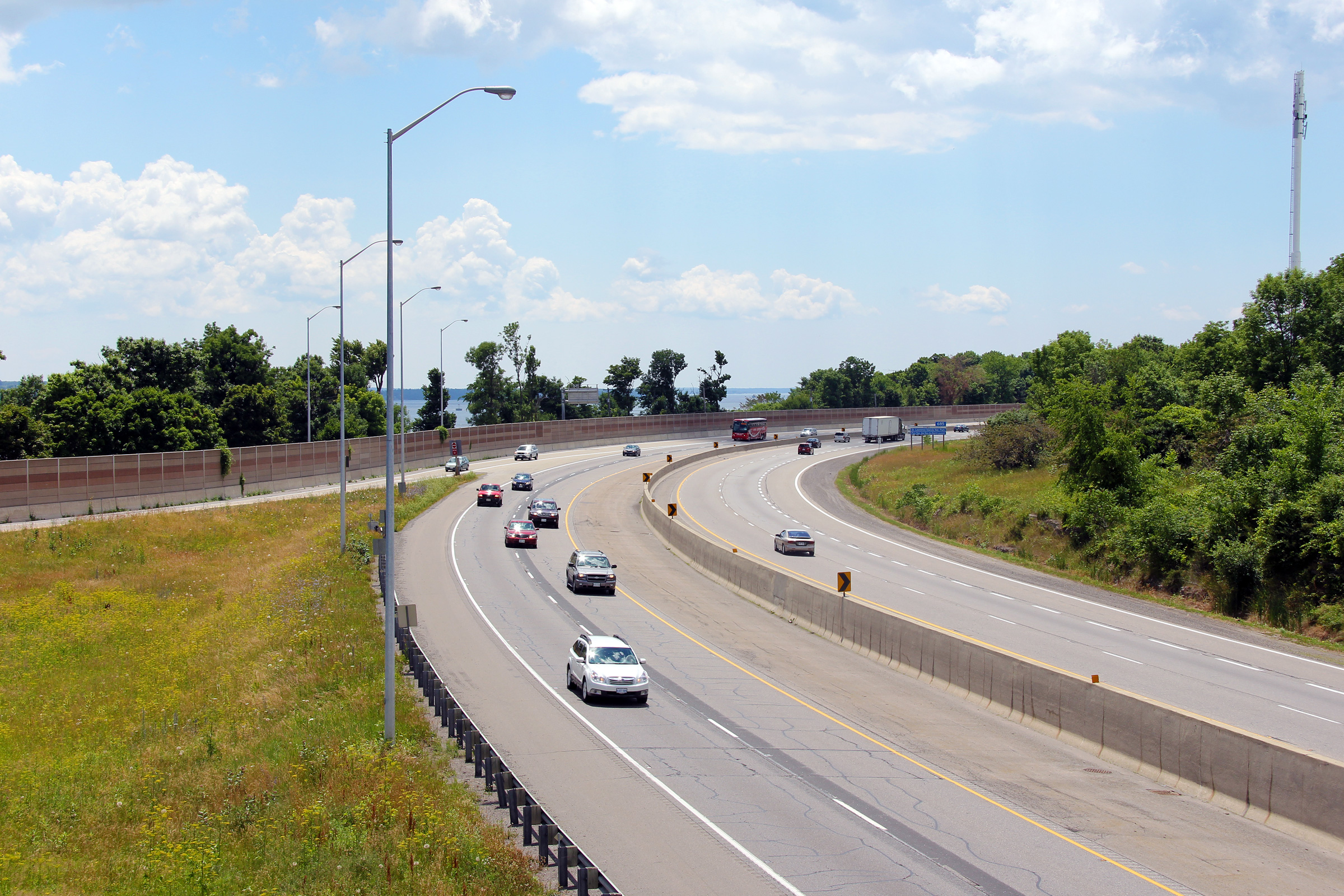
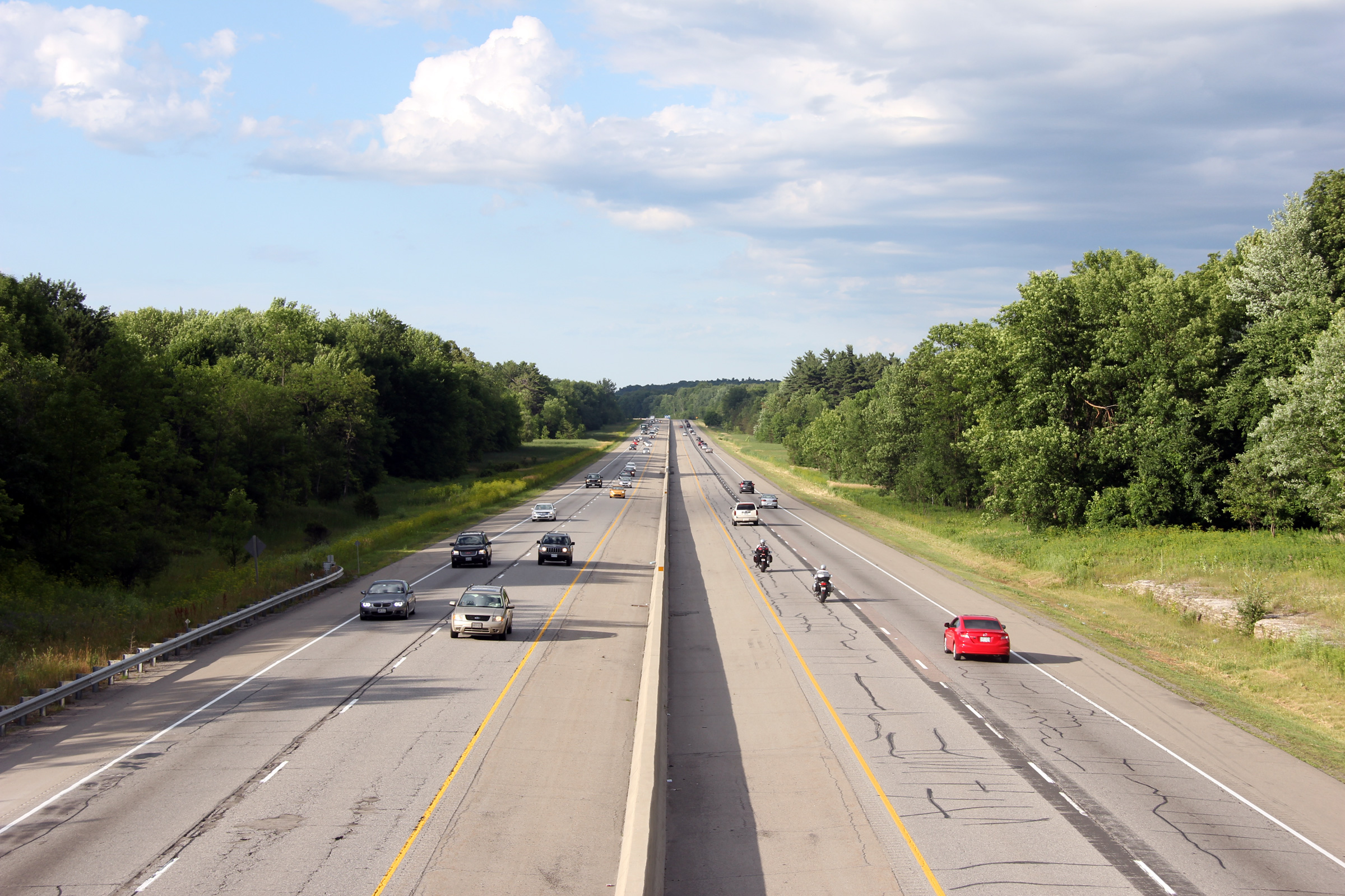
| Township or Elizabethtown- Kitley County of Leeds & Grenville |
View looking easterly along Highway 401 from the Highway 2
overpass. The median on this stretch of Highway 401 is once again
quite narrow, typical of freeways designed in the early 1950s.
Click here for this same view taken in
October, 2004. Photo taken: July 2nd, 2012. |
 (720x480) (1440x960) (2400x1600) |
|
| Township or Elizabethtown- Kitley County of Leeds & Grenville |
View looking westerly towards the Highway 2 overpass. Photo taken: July 2nd, 2012. |
 (720x480) (1440x960) (2400x1600) |
|
| Township or Elizabethtown- Kitley County of Leeds & Grenville |
Westbound guide signage for the Highway 2 (now County Road 2) interchange.
Unlike the eastbound signage, a control city is not indicated on the
westbound signage. Photo taken: July 2nd, 2012. |
 (720x480) (720x480)(1440x960) (2400x1600) |
|
| Township or Elizabethtown- Kitley County of Leeds & Grenville |
Advanced signage for the Highway 2 interchange. Photo taken: July 2nd, 2012. |
 (720x480) (720x480)(1440x960) (2400x1600) |
|
| Township or Elizabethtown- Kitley County of Leeds & Grenville |
A pleasant evening view of Highway 401 looking west from the Hallecks Road
overpass west of Brockville. Click
here for this same view taken in
July, 2005. Photo taken: July 2nd, 2012. |
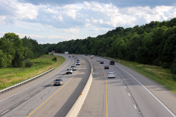 (720x480) (1440x960) (2400x1600) |
|
| Township or Elizabethtown- Kitley County of Leeds & Grenville |
View looking easterly from Hallecks Road along Highway 401. From
Hallencks Road its only about 7km easterly to Brockville. Click
here for this same view taken in
July, 2005. Photo taken: July 2nd, 2012. |
 (720x480) (1440x960) (2400x1600) |
|
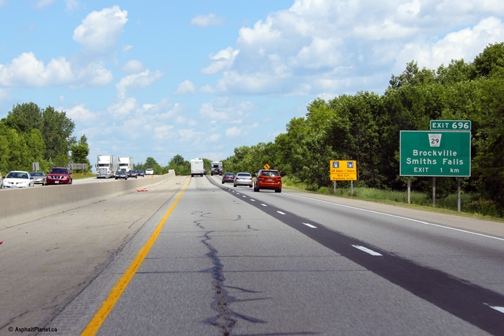
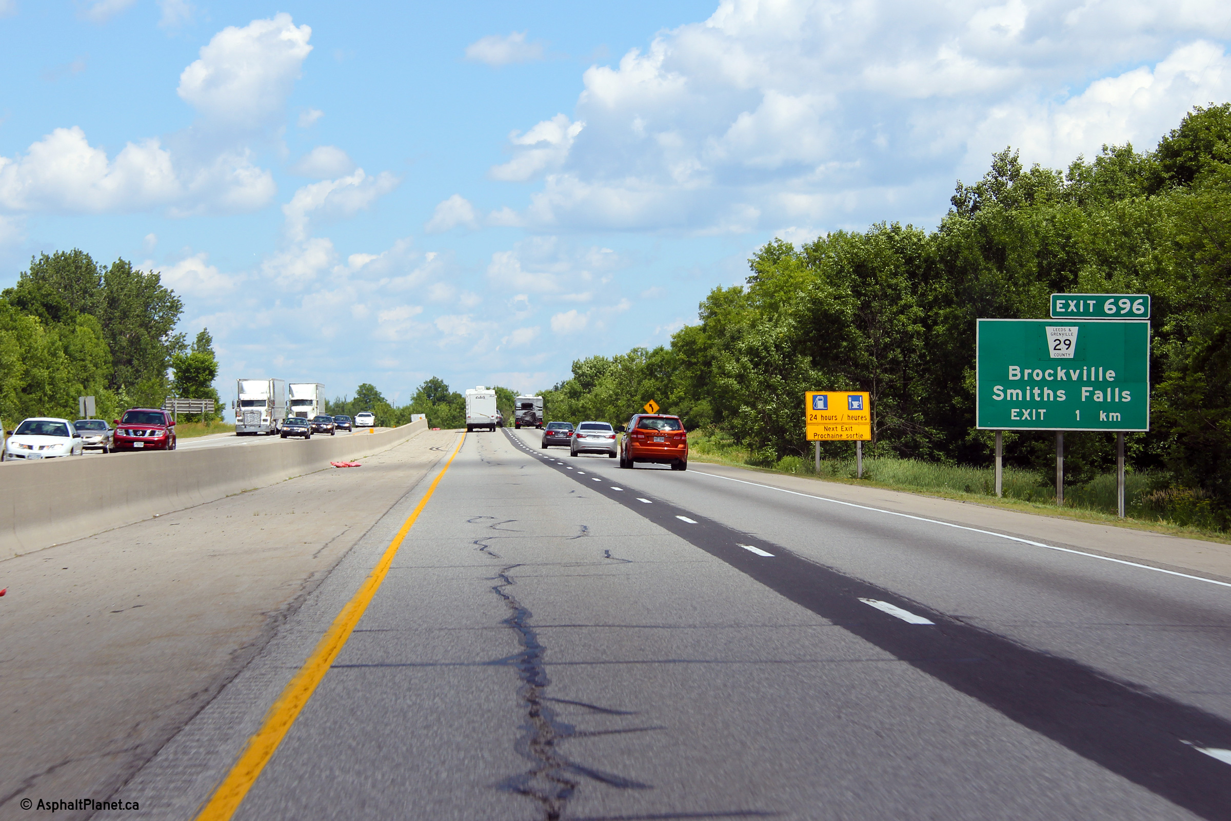
| City of Brockville |
Advanced signage for the Highway 29 interchange in Brockville. Photo taken: July 2nd, 2012. |
 (720x480) (720x480)(1440x960) (2400x1600) |
|
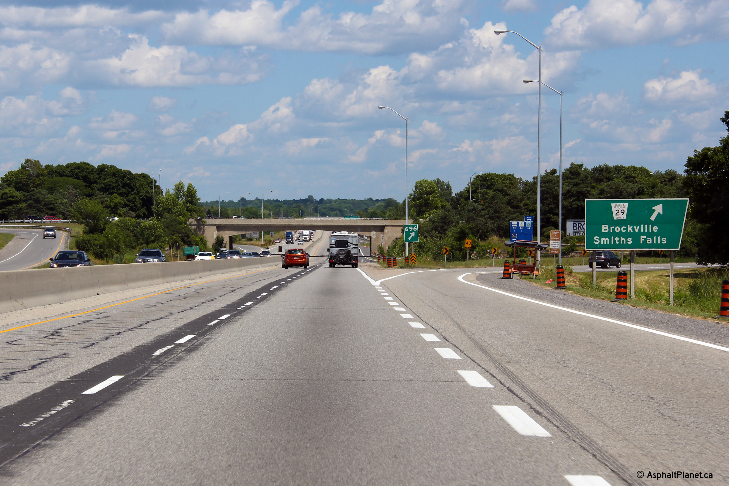
| City of Brockville |
Exit signage for the Former Highway 29 interchange in Brockville.
Highway 29 was downloaded in 1998,
and has since been designated as Leeds & Grenville Road 29. Photo taken: July 2nd, 2012. |
 (720x480) (720x480)(1440x960) (2400x1600) |
|
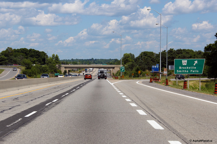
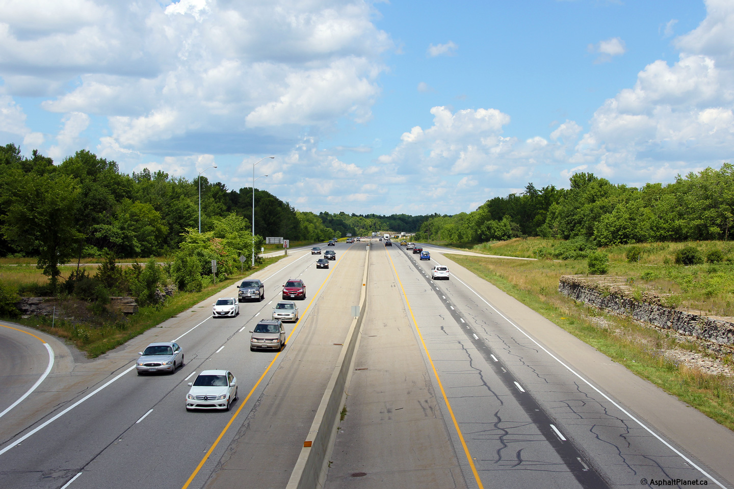
| City of Brockville |
View looking westerly along Highway 401 from the Highway 29 overpass in
Brockville. Take note of the narrow gap between
opposing carriageways, it is incredible to think for many years no central
barrier was present through the City of Brockville.
Click here to jump to the view looking
westerly from the Highway 29 overpass. Photo taken: October 22nd, 2004. |
 (720x480) (1440x960) |
|
| Highway 29 (now defunct) ran northerly from Brockville to Highway 15 at Smiths Falls. Click here for Highway 29 images. | |||
| Click here for Brockville to Cornwall Images | |||
<- Page 15 Images Highway 401 Images Index Page 17 Images ->
<- Highway 400 Images Back to Highway 401 Highway 402 Images ->
Copyright (c) 2004-2014, AsphaltPlanet.ca AsphaltPlanet@asphaltplanet.ca