|
Proper Municipality Name |
Photo Description |
Photo |
|
Pictures taken
from driver's perspective appear offset from centre-line pictures: |
North-
Bound |
South-
Bound |
|
Highway 401 carries
trans-provincial traffic between Windsor and the Quebec Border.
Click here for Highway 401 images. |
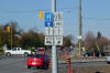
| City of Kingston |
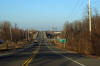
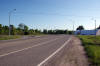
Highway 15 looking northerly from just north of the
Highway 401 underpass
towards the CN Railway underpass. It is a long 162km to Ottawa along
Highway 15 from Kingston.
Photo taken: March 14th, 2009 |
(720x480)
(1440x960) |
| City of Kingston |
This view looks north towards the John F. Scott Road and Kingston Mills Road
intersection. Before the of the current completion of the
Lasalle Causeway that links the old City of Kingston with the former
Township of Pittsburgh on the west and east side of the Cataraque River,
Kingston Mills Road was the main overland route linking Kingston to
Montreal.
Photo taken: March 14th, 2009. |
(720x480)
(1440x960) |
|
Highway 32 progressed south from
Highway 15 to Highway 401 and 2 in Gananoque.
Click here for Highway 32 images. |
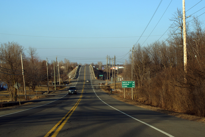
Township of Leeds and the
Thousand Islands
United Counties of Leeds & Grenville |
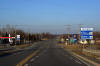
Southbound view approaching the Highway 32 junction. Note the warning
sign for the low subway along Highway 32. The CN Railway overpass
north of Gananoque has a maximum overhead clearance of just 4.0m.
Photo taken: June 19th, 2004. |
(720x480)
(1440x960) |
| |
View looking southerly towards the western side of the Crosby Creek Bridge.
This structure was completed in 2015 on a new alignment by-passing the
former Crosby Creek Bridge. The old Crosby Creek Bridge dated back
onto 1931. |

(720x480)
(1440x960)
(2400x1600) |
| |
|
|
| |
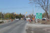
Distance signage situated southbound along Highway 15 from just south of the
Highway 42 intersection. |

(720x480)
(1440x960)
(2400x1600) |
| |
Northbound advanced signage in advance of the Highway 42 intersection. |
 (720x480) (720x480)
(1440x960) |
| |
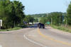
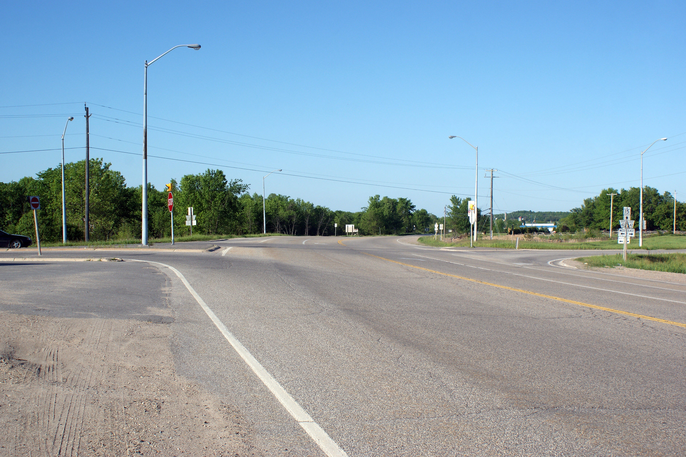
This view looks northerly approaching the Highway 42 interchange.
Highway 15 intersects Highway 42 on a considerable curve. In recent
years, the MTO has been studying various options to improve the alignment of
the highways through this intersection. |

(720x480)
(1440x960)
(2400x1600) |
| |
|
|
| Township of Rideau Lakes United
Counties of Leeds & Grenville |
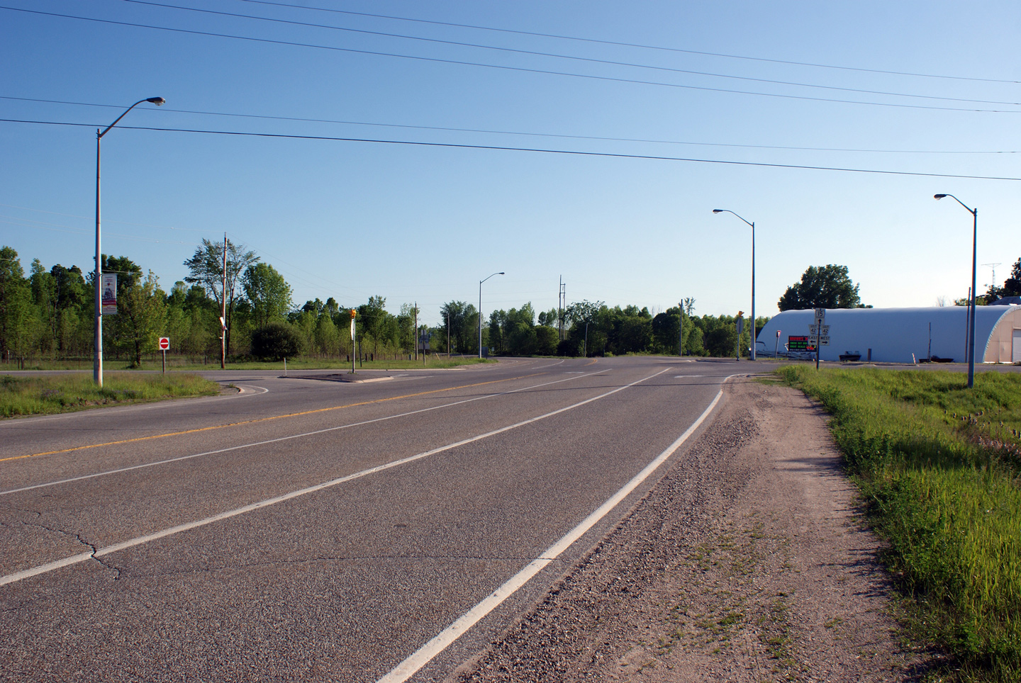
This view looks northerly at the Highway 42 intersection along Highway 15.
Upper photo taken: May 24th, 2010. |
(720x480)
(1440x960)
(2400x1600)

(720x480)
(1440x960)
(2400x1600) |
|
Highway 42 was a minor highway
that linked Westport on the Rideau Lakes to Highway 29 north-west of
Brockville.
Click here for Highway 42 images. |
| Township of Rideau Lakes United
Counties of Leeds & Grenville |
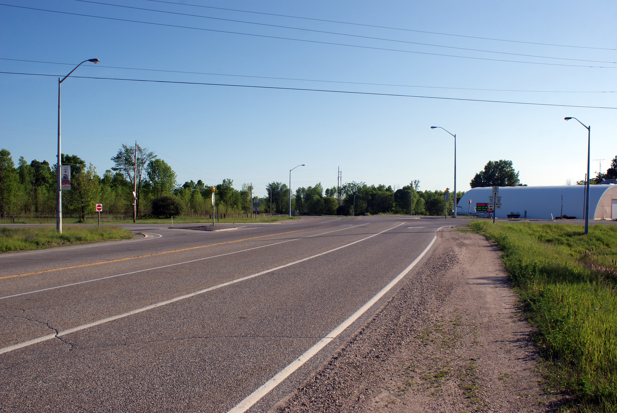
Southerly view as Highway 15 approaches the
Highway 42 intersection.
Photo taken: May 24th, 2010. |
(720x480)
(1440x960)
(2400x1600) |
| |
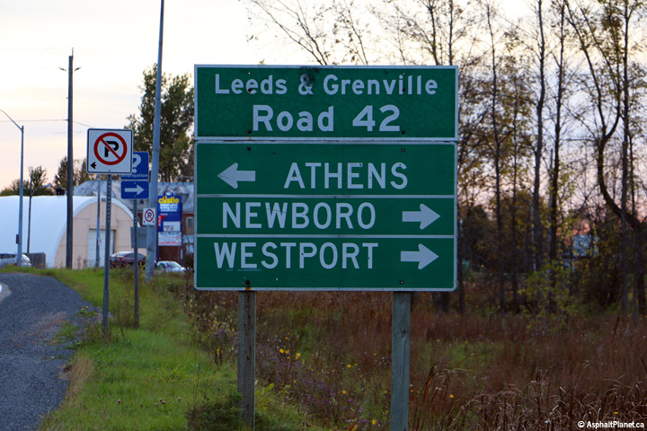
Southbound signage for the Highway 42
intersection. The signage for L & G Road 41 is quite new, however the
signage for |
 (720x480) (720x480)
(1440x960) |
| Township of Rideau Lakes United
Counties of Leeds & Grenville |
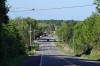
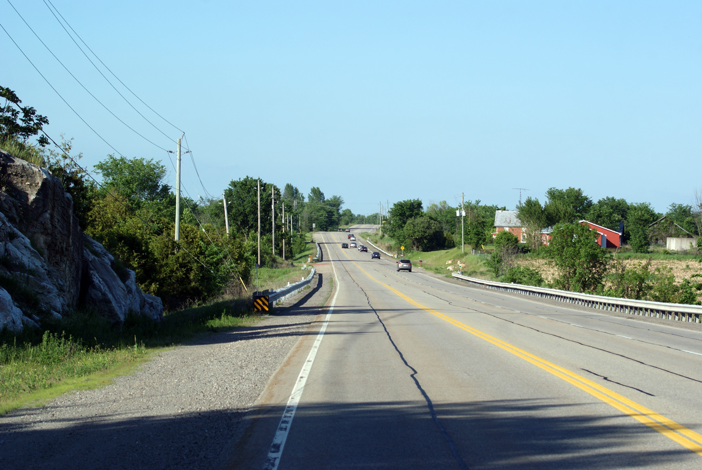
This view looks northerly from the Highway 42
intersection. Much of Highway 15 is a fairly pleasant route between
Kingston and Arnprior. Drivers are treated to views of rolling farmland,
picturesque lakes, and the Frontenac arm of the Canadian Shield.
Photo taken: May 24th, 2010. |
(720x480)
(1440x960)
(2400x1600)
|
| |
Northbound reassurance signage for Highway 15
north of the Highway 42 intersection. This Highway 15 sign is signed
adjacent to a very old sign directing travelers to the Rideau Canal Museum in
Smiths Falls.
|
 (720x480) (720x480)
(1440x960) |
| |
|

(720x480)
(1440x960)
(2400x1600) |
| Township of Rideau Lakes United
Counties of Leeds & Grenville |
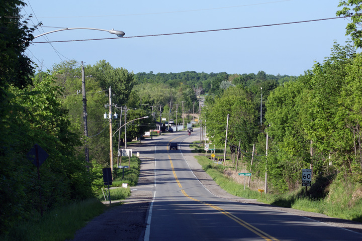
This view looks northerly as Highway 15 passes
through the small community of Portland. Portland is a small lakeside
community found on the southeast shores of Big Rideau Lake -- which as the
name entails is one of the largest lakes in the Rideau Canal system.
Photo taken: May 24th, 2010. |
(720x480)
(1440x960)
(2400x1600) |
| Township of Rideau Lakes United
Counties of Leeds & Grenville |
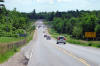
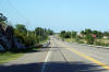
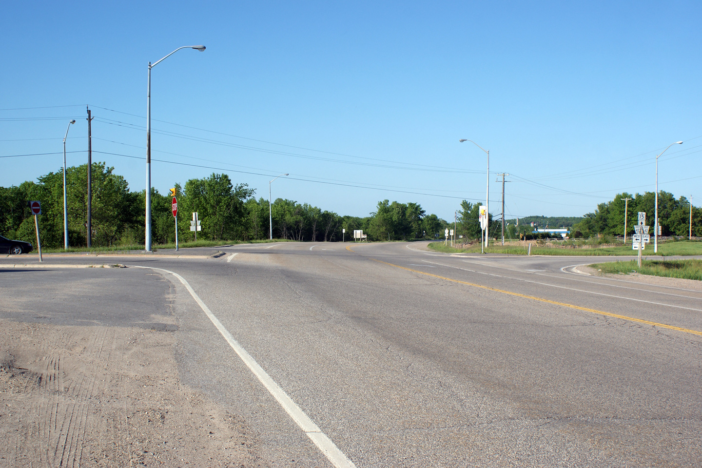
This northbound passing lane is located between
Portland and County Road 5. While Highway 15 is not a particularly
congested highway, several passing lanes have been added during recent years
(written as of 2011) to improve passing opportunities along Highway 15.
Photo taken: May 24th, 2010. |
(720x480)
(1440x960)
(2400x1600) |
|
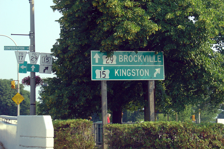
Highway 29 departed south from
Highway 15 in Smiths Falls bound for Highway 401 and 2 in Brockville.
Click here for Highway 29 images. |
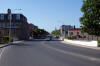
Town of Smiths Falls
County of Lanark |
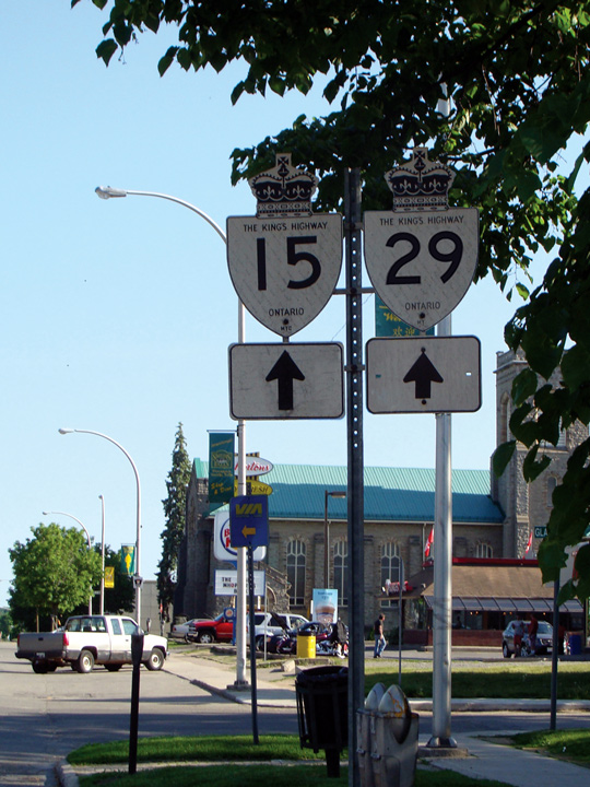
Southbound directional sign in Smiths Falls
directing Kingston bound traffic to Highway 15 and Brockville bound traffic
to Highway 29. Highway 29 was decommissioned on January 1, 1998 in
it's entirety.
Photo taken: August 12th, 2006. |
 |
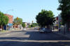
Town of Smiths Falls
County of Lanark |
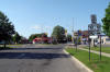
Northerly view along Highway 15 from the Rideau
Canal bridge through Downtown Smiths Falls. Smiths Falls is a a very
picturesque community, and is worthy of a stop on any trip between Kingston
and Ottawa.
Photo taken: May 24th, 2010. |
(720x480)
(1440x960)
(2400x1600) |
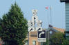
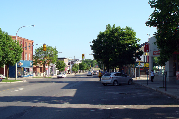
Town of Smiths Falls
County of Lanark |
This view looks southerly along Highway 15,
where it is the main street in Smiths Falls. Early town planners
thankfully laid out a very wide main street for Smiths Falls.
Photo taken: May 24th, 2010. |
(720x480)
(1440x960) |
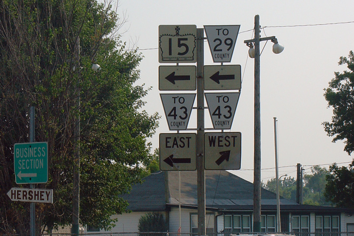
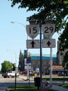
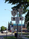
Town of Smiths Falls
County of Lanark |
Two versions of a signage assembly located
southbound along Highway 15 through Carleton Place. The left version
of the image is the authentic version, shot on May 24, 2010. The right
version, is an altered version that has been carefully, and accurately altered by Josh Anderchek, to show what this signage assembly would have looked like prior
to Highway 29's decommissioning. Photo taken: May
24th, 2010. Alterations copyright: Josh Anderchek. |
 |
Town of Smiths Falls
County of Lanark |
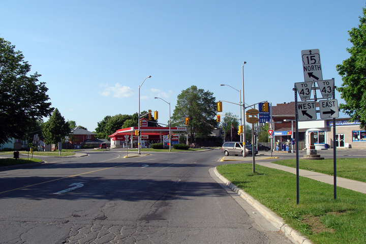
Northbound view along Highway 15 approaching the
Highway 43-East junction. Northbound Highway 15 traffic must turn left
at this intersection to continue towards Highway 7 and Carleton Place.
Photo taken: May 24th, 2010. |
 (720x480) (720x480)
(1440x960) |
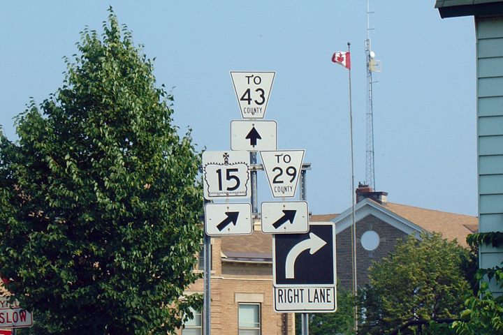
Town of Smiths Falls
County of Lanark |
Southbound junction assembly at the Highway
43-East intersection. Photo taken: July 4th, 2005 |
 |
Town of Smiths Falls
County of Lanark |
Southbound junction assembly along Highway 15 at
the Highway 43-East junction. Note the small municipally made
fingerboard sign directing traffic to the Hershey Factory. Hershey
operated a factory, with a tour facility and a retail store in Smiths Falls
from 1963 until the
factory closed in December of 2008. Hersey now
operates a store flagship retail store in Niagara Falls Ontario.
Photo taken: July 4th, 2005. |
 |
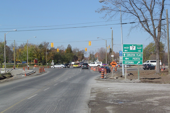
Town of Carleton Place
County of Lanark |
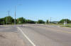
Northerly view as Highway 15 approaches the
Highway 7 junction in Carleton Place. Highway 15 was being
reconstructed from Carleton Place southerly at the time that this photo was
taken. Photo taken: October 23rd, 2004. |
 |
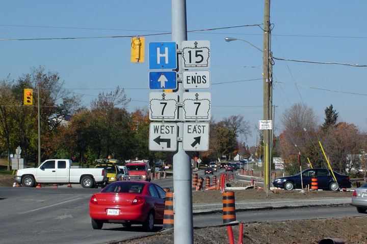
Town of Carleton Place
County of Lanark |
Northbound junction assembly at what has become
the northern terminus of Highway 15 at Highway 7 in Carleton Place. On
December 31, 1997 and earlier, Highway 15 continued northerly from Highway 7
at Carleton Place to Highway 17 at Arnprior.
Photo taken: October 23rd, 2004. |
 |
|
Highway 7 continues both east and
west of Highway 15, this leg of the highway bound for either Peterborough of
Ottawa.
Click here for Highway 7 images. |


 (720x480)


 (720x480)
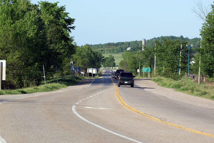
 (720x480)


