AsphaltPlanet.ca > OntHighways > Highway 7 > Images > Page 3D
King's Highway 7 - Images
<- Page 3C Page 3D - Perth to Ottawa
Photos shown in this table are arranged from West to East:
| Proper Municipality Name | Photo Description | Photo | |||
|
Photos taken from driver's perspective appear offset from centre-line Photos: |
East- Bound |
West- Bound |
|||
| Madoc to Perth Images available here | |||||
| Highway 43 carries traffic easterly south of the Capital Region bound for Smith's Falls, Kemptville and Alexandria. Click here for Highway 43 images. | |||||
| Township of Drummond / North
Elmsley County of Lanark |
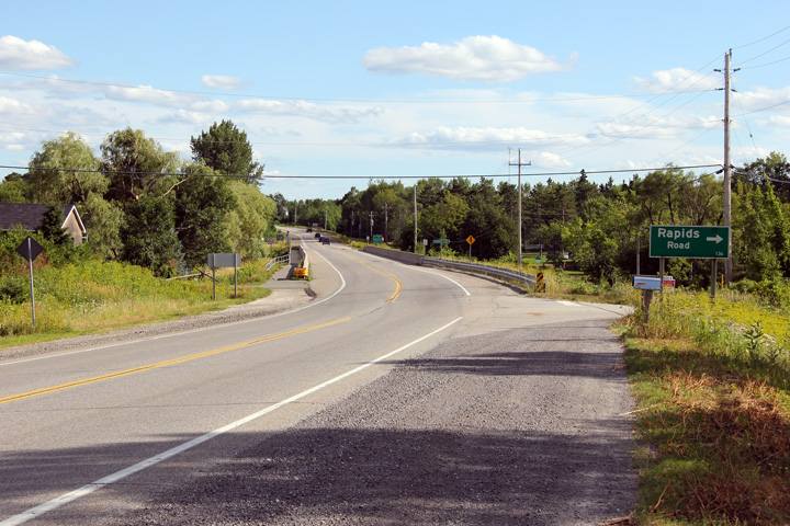
Driving west along a three-lane section of Highway 7 approaching Drummond
Concession 9A. Photo taken: July 24th, 2011. |
 |
|||
| Township of Drummond / North
Elmsley County of Lanark |
Westerly view as Highway 7 crosses the Mississippi River at Innisville. Photo taken: July 24th, 2011. |
 |
|||
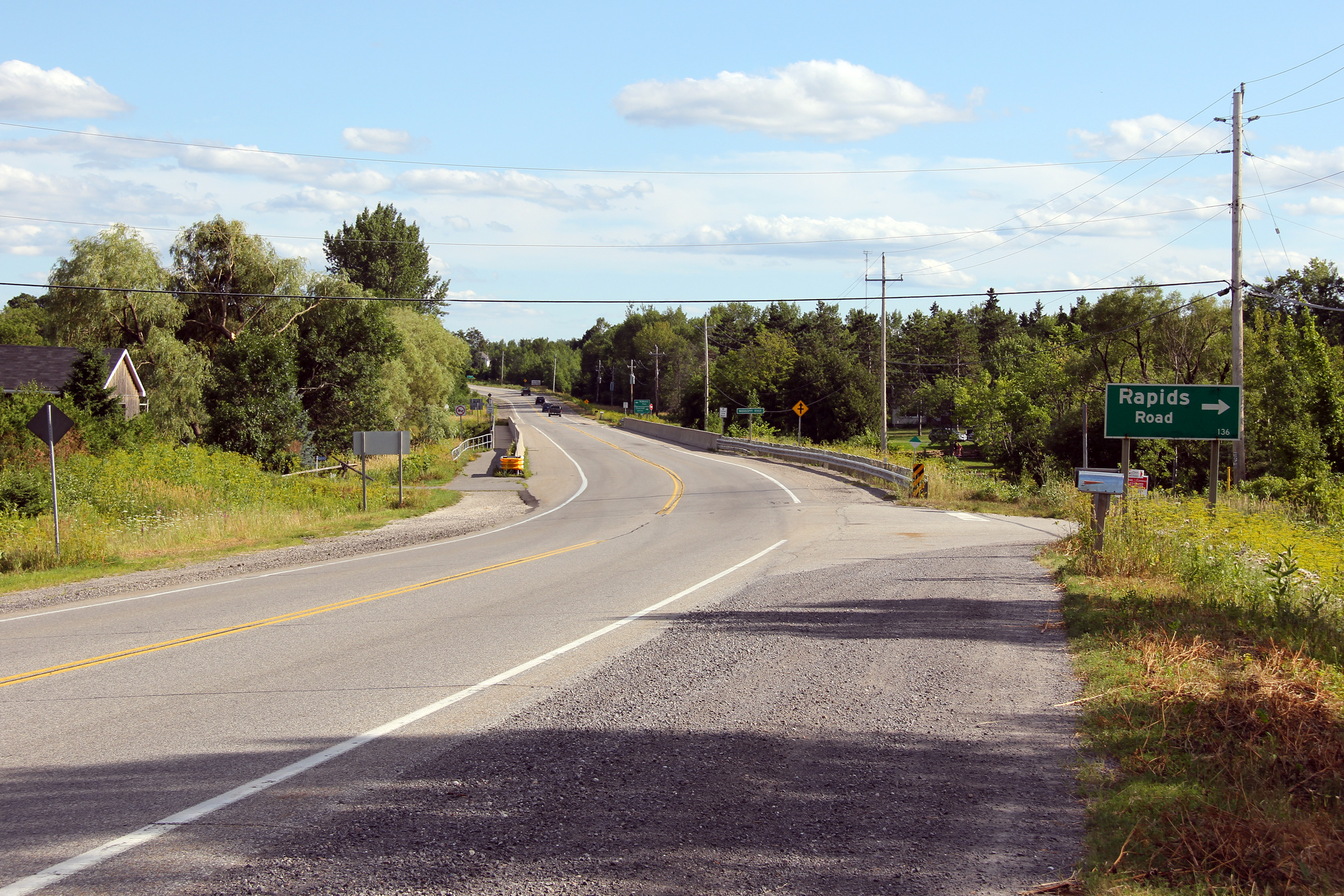
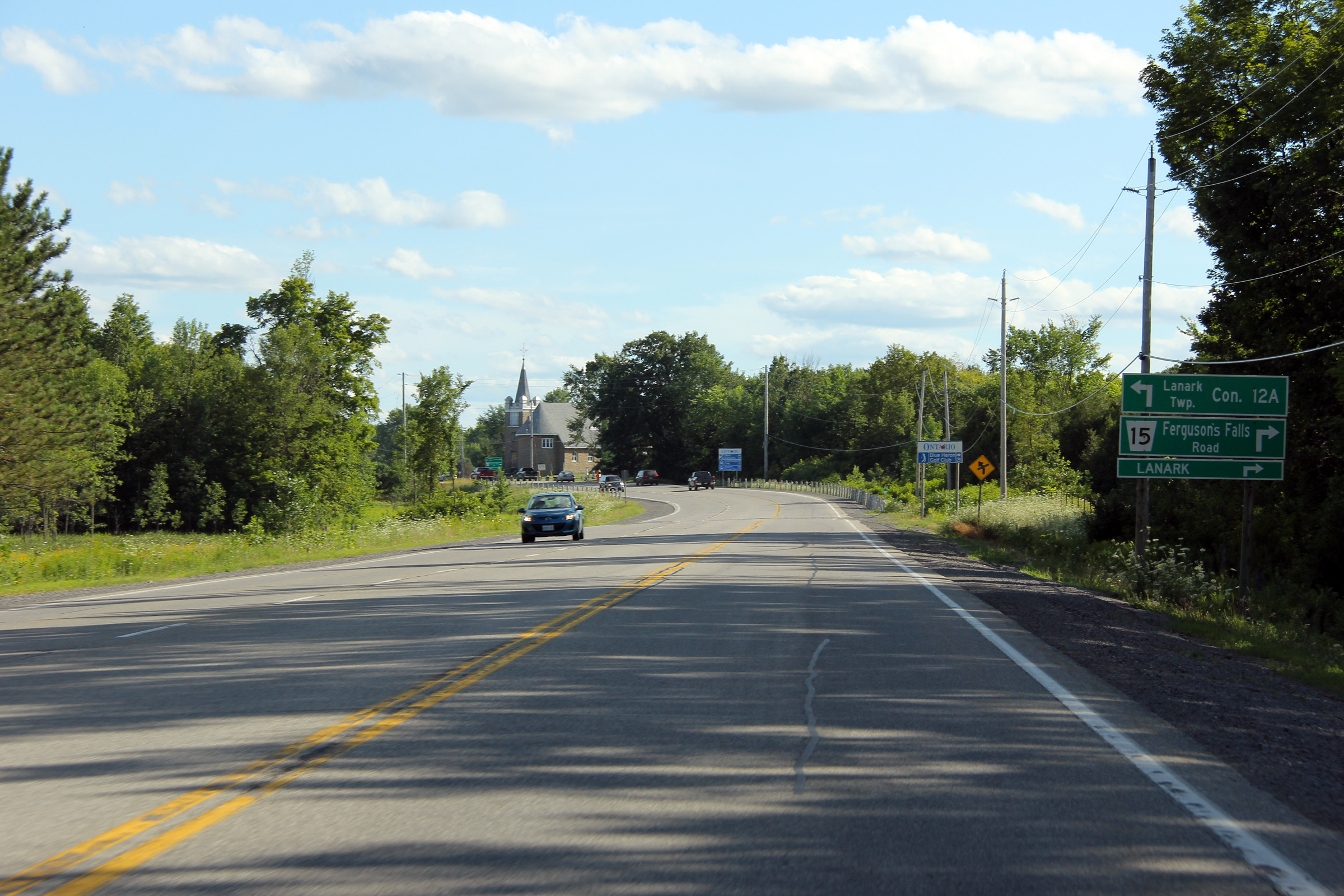
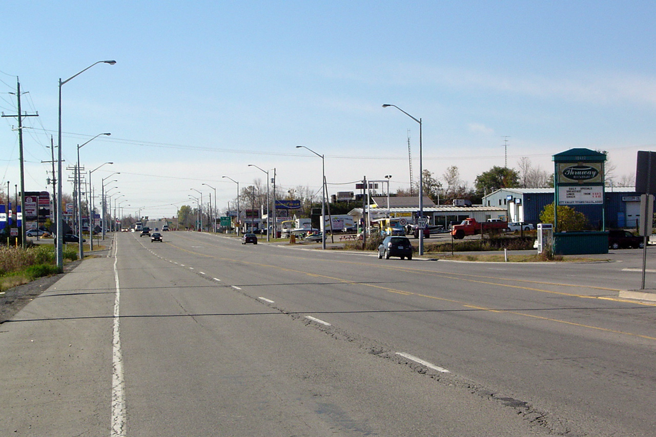
| Township of Lanark Highlands County of Lanark |
View looking westerly along Highway 7 approaching the Lanark Road 15
intersection. Photo taken: July 24th, 2011. |
 |
|||
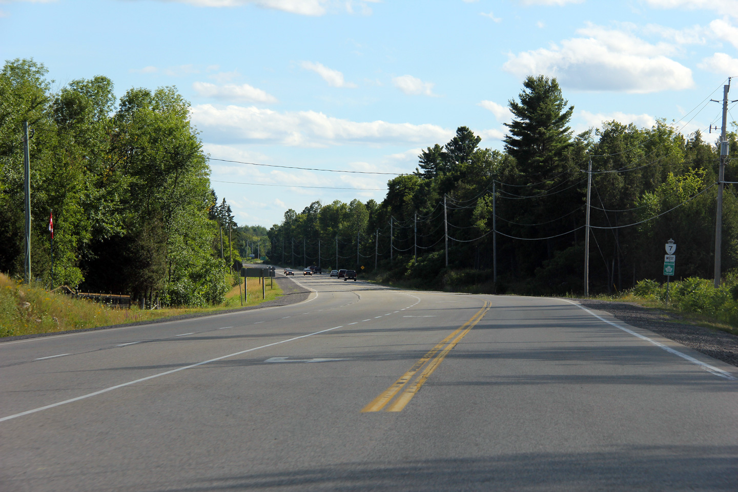
| Township of Lanark Highlands County of Lanark |
Westerly view from Ramsay Concession 1. Photo taken: July 24th, 2011. |
 |
|||
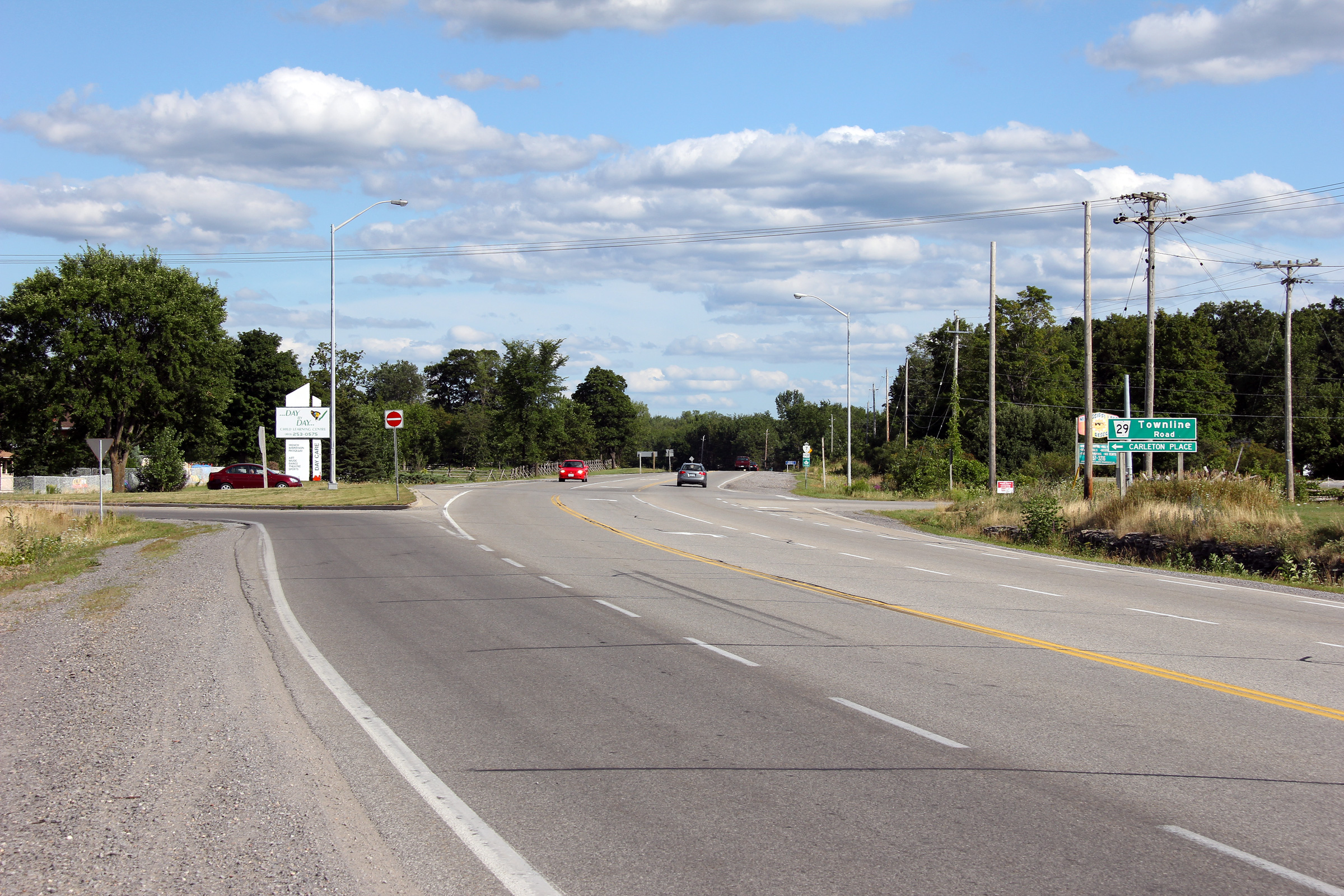
| Township of Mississippi Mills County of Lanark |
Easterly view along Highway 7 approaching the former Highway 7B junction
leading into Carlton Place. While the green sign indicates the former
Highway 7B has been redesignated as County Road 29, Lanark County has posted
a County Road 7B reassurance
marker immediately east of the Highway 7 junction. Photo taken: July 24th, 2011. |
 |
|||
| Highway 7B follows the former alignment of Highway 7 via Townline Road into Downtown Carleton Place. Click here for Highway 7B images. | |||||
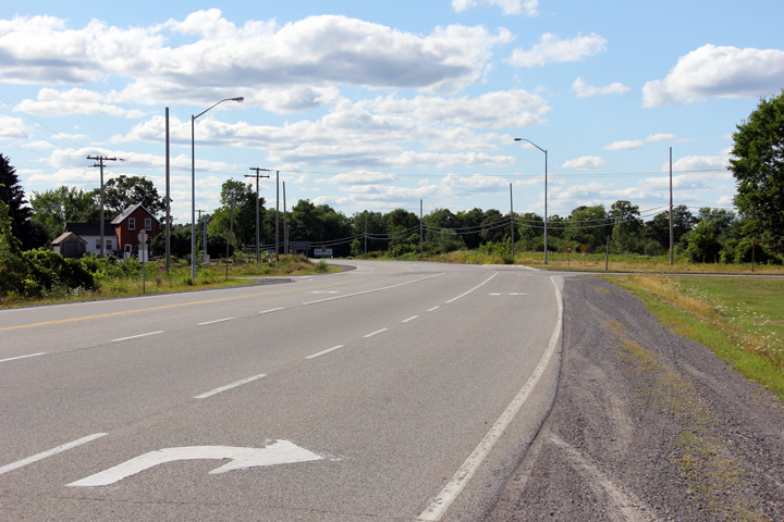
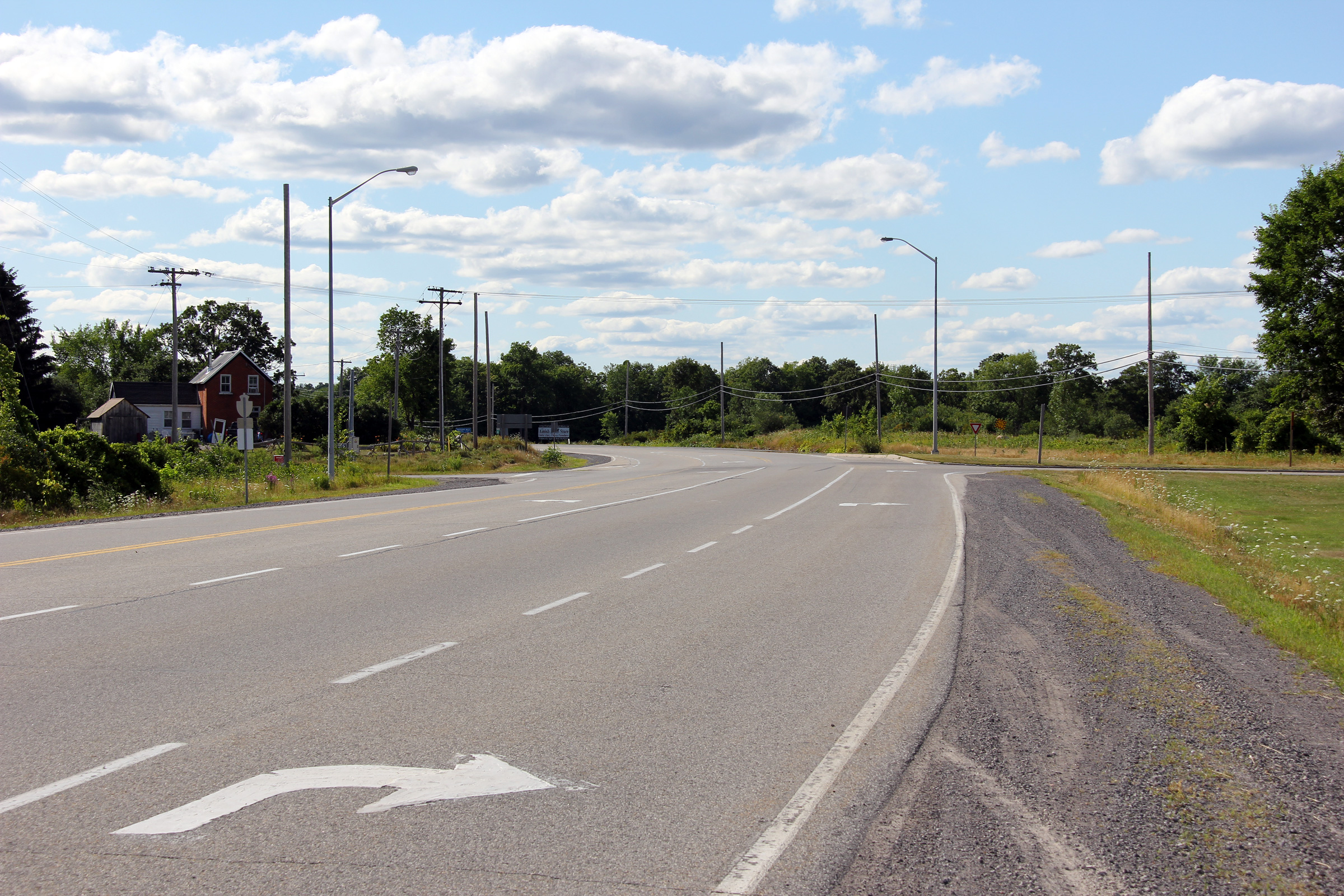
| Township of Beckwith County of Lanark |
This view looks westerly at the former Highway 7B junction. Photo taken: July 24th, 2011. |
 |
|||
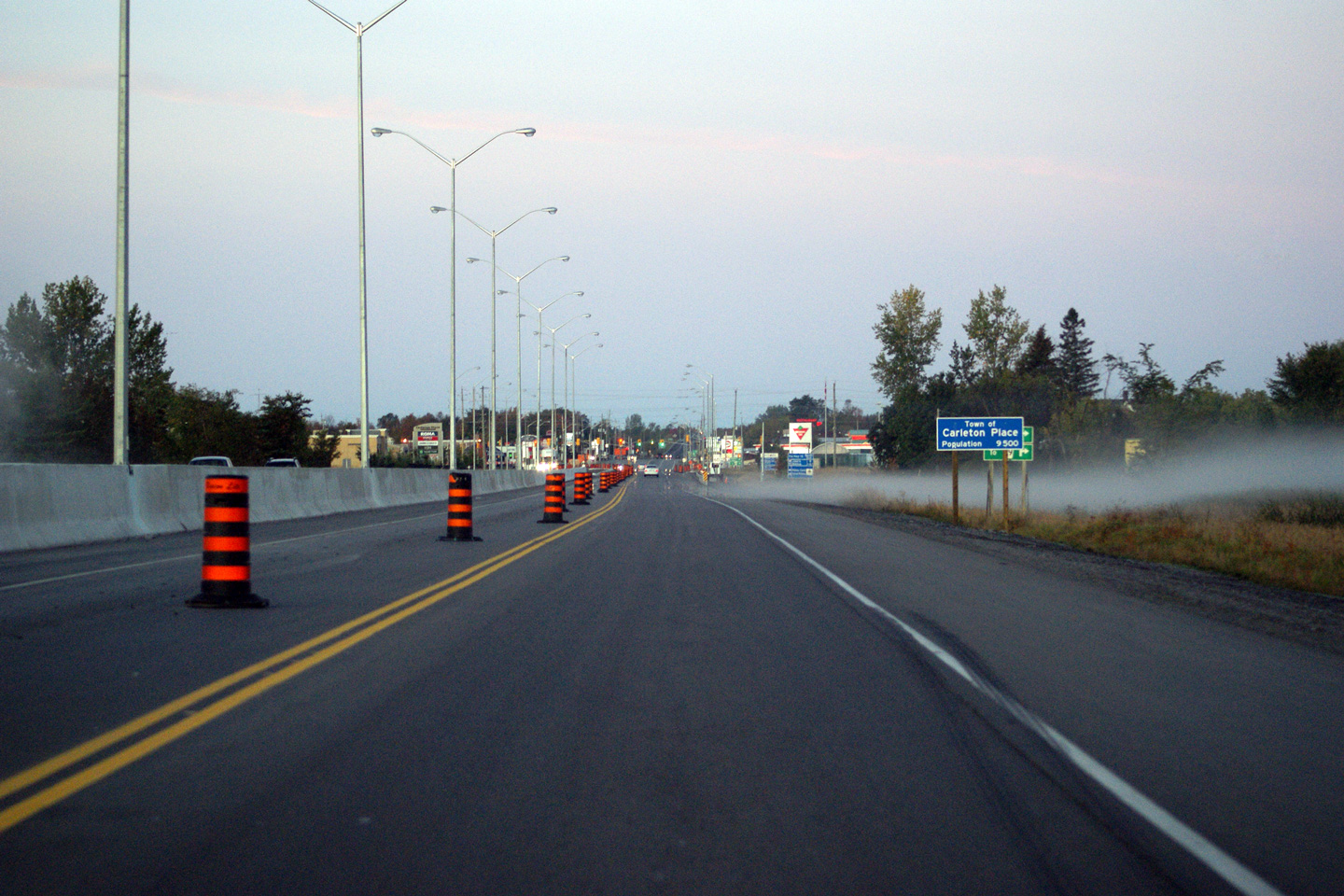
| Town of Carleton Place |
This view looks easterly overtop of the CP Railway overhead that is just
west of the Highway 15 South junction. The railway line underneath
this overpass was abandoned in the fall of 2011. Photo taken: July 1st, 2012. |
 |
|||
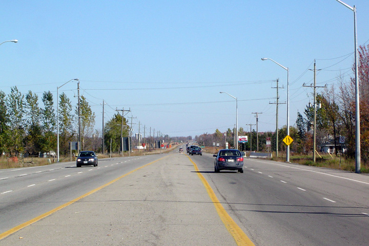
| Town of Carleton Place |
View looking easterly through Carleton Place from just west of the Highway
15 South junction. Highway 7 by-passes most of Carleton Place with the
exception of the small highway commercial zone featured in this photo.
When this photo was taken, work had yet to begin to convert Highway 7 to a
divided highway east of Carleton Place Photo taken: September 12th, 2009. |
 |
|||
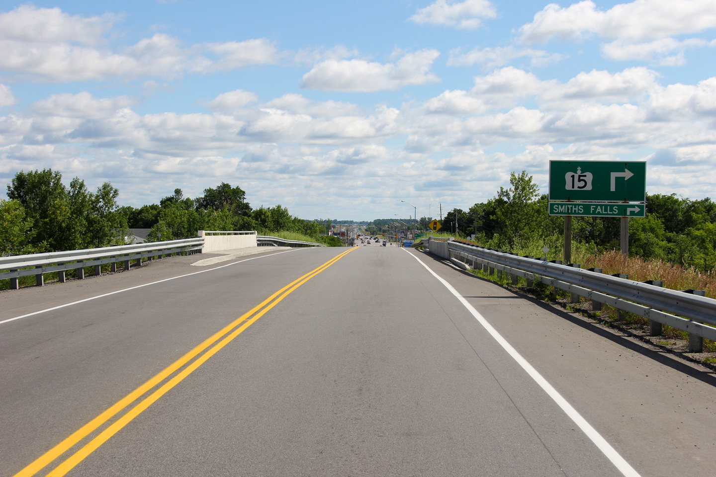
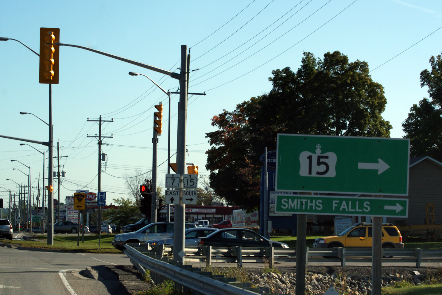
| Town of Carleton Place |
Green signage for Highway 15-South located directly ahead of a junction assembly
for Highway 15-South. Photo taken: September 12th, 2009. |
 (720x480) (720x480)(1440x960) |
|||
| Highway 15 is a long highway that runs diagonally through Eastern Ontario from Kingston to Carleton Place (and formerly to Arnprior). Click here for Highway 15-South images. | |||||
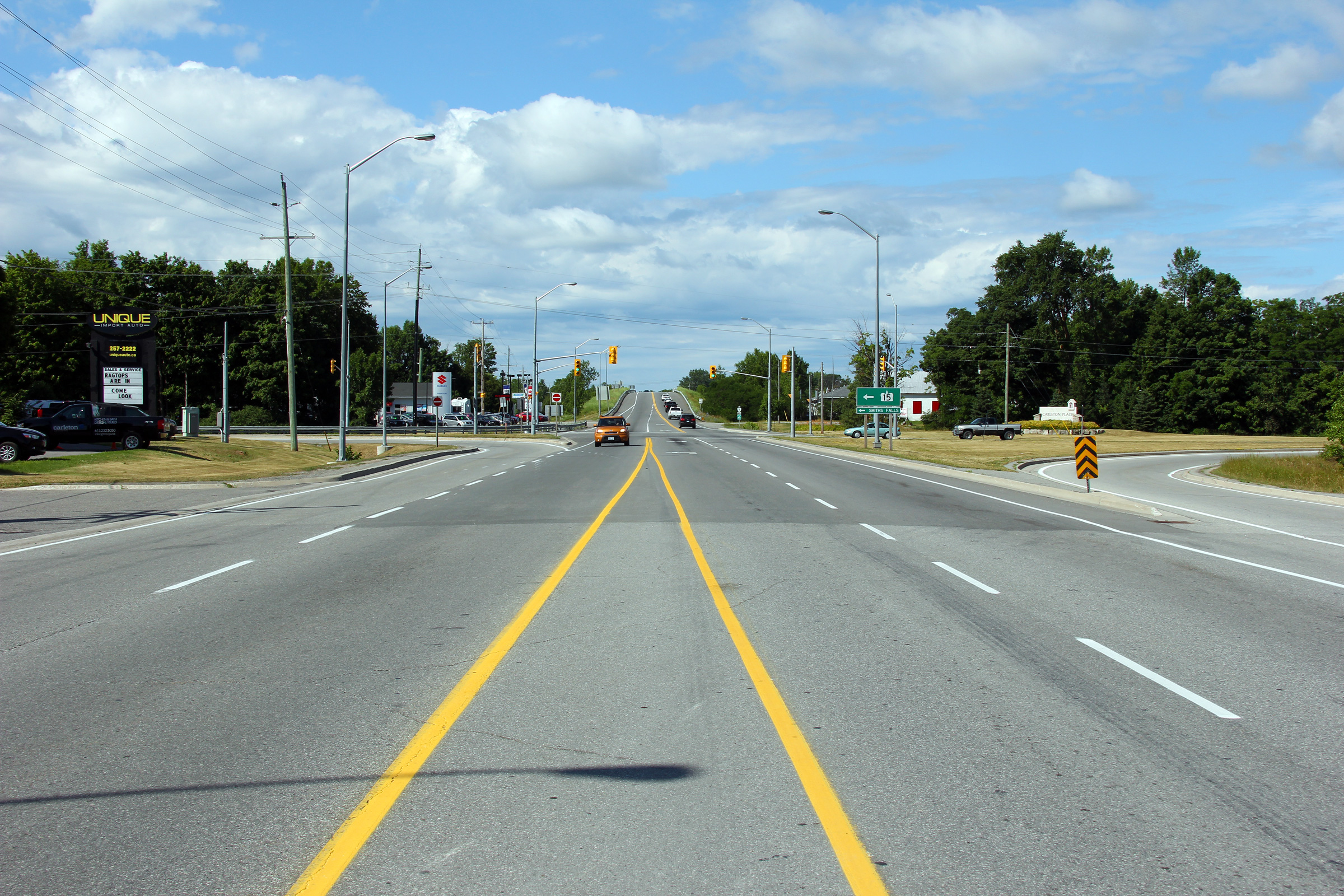
| Town of Carleton Place |
Westerly view through the Highway 15 South intersection. Highway 7 quickly
narrows to a two lane cross-section at the western Highway 15 junction. Photo taken: July 1st, 2012. |
 |
|||
| Town of Carleton Place |
View looking westerly through Carleton Place along Highway 7. Photo taken: October 23rd, 2004. |
 |
|||
| Town of Carleton Place |
This view looks easterly at the McNeely Avenue intersection. McNeely
Avenue is the eastern by-pass of Downtown Carleton Place. Highway 15
briefly followed McNeely Avenue before the highway was transferred to the
County of Lanark and City of Ottawa north of Carleton Place in 1998. Photo taken: June 30th, 2012. |
 |
|||
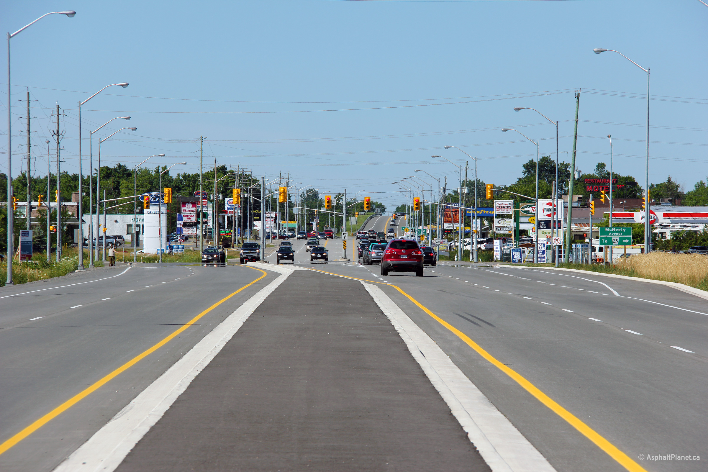
| Town of Carleton Place |
Two views looking westerly towards the Signalized intersection with McNeely
Avenue. Depending upon your perspective, this intersection marks
either the
end or beginning of the Highway 7 freeway between Carleton Place and Ottawa. Photos taken: June 30th, 2012. |
 (720x480) (1440x960) (2400x1600)  (720x480) (1440x960) (2400x1600) |
|||
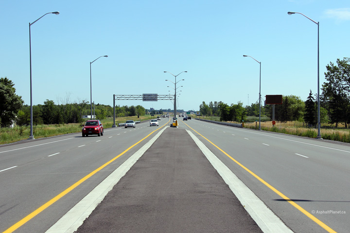
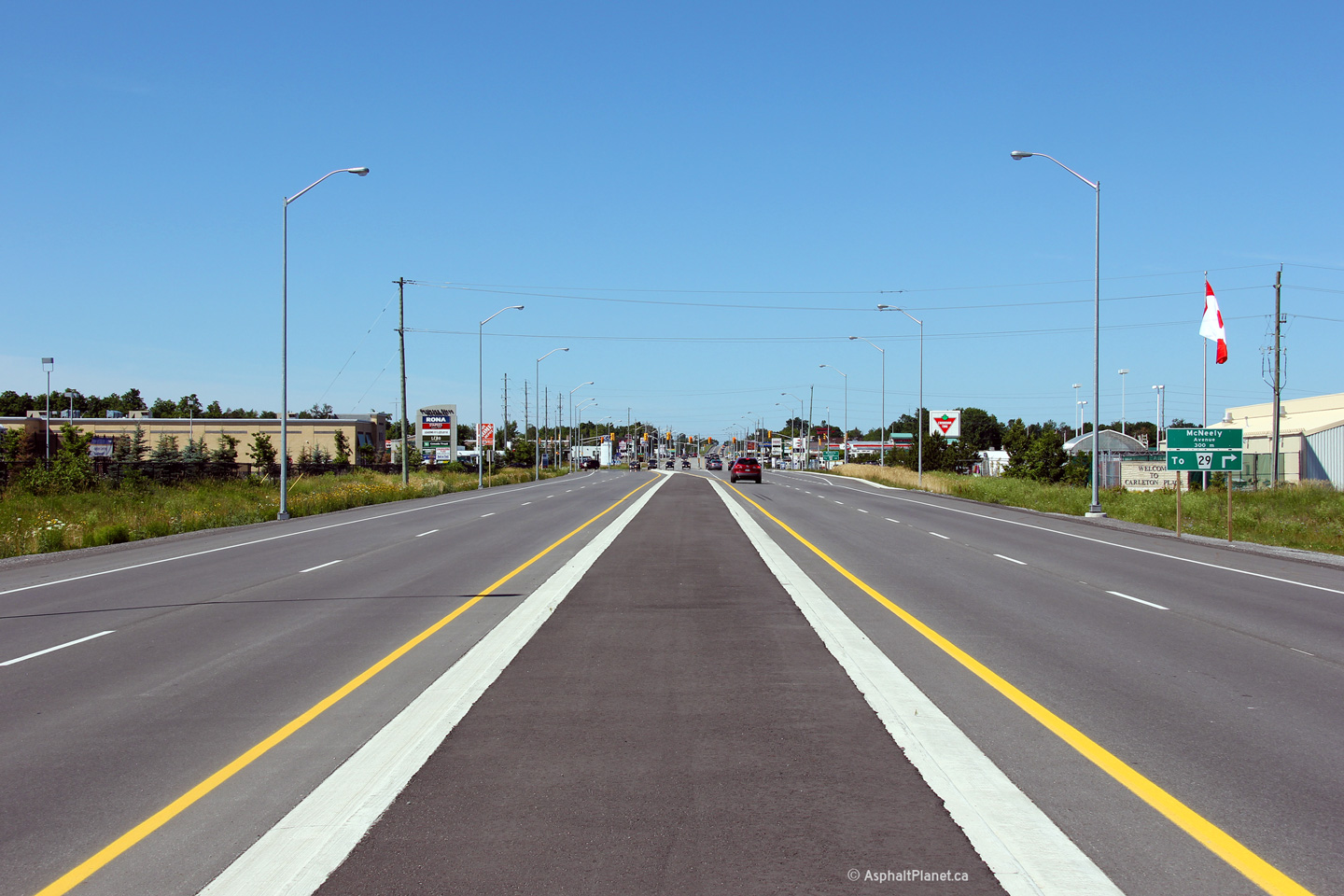
| Town of Carleton Place |
Two views of
Highway 7 as seen from just east of the McNeely Avenue (old Highway
15-North) intersection in Carleton Place. The upper photo shows
Highway 7 narrowing into a single carriageway, while the lower photos show
the transition from Highway 7's urban cross-section within Carleton Place to
a four-lane freeway. Upper photo taken: October 23rd, 2004. Middle photo taken: September 19th, 2011. Lower photo taken: June 30th, 2012. |
|
|||
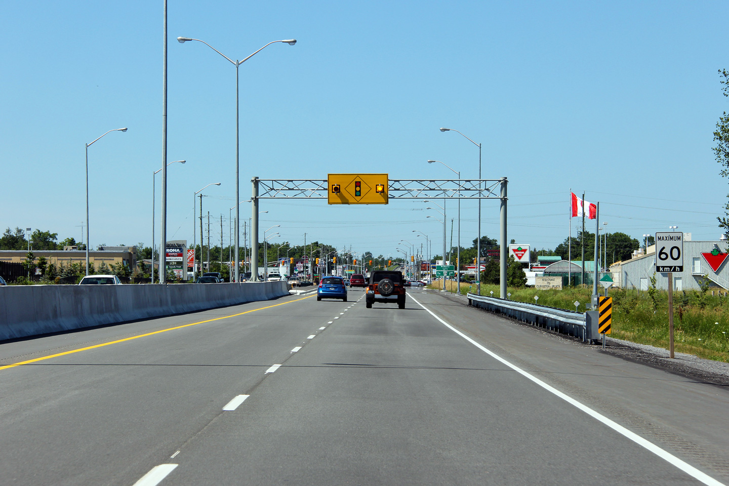
| Town of Carleton Place |
Overhead signage in advance of the traffic signal at McNeely Avenue. Photo taken: June 30th, 2012. |
 (720x480) (720x480)(1440x960) (2400x1600) |
|||
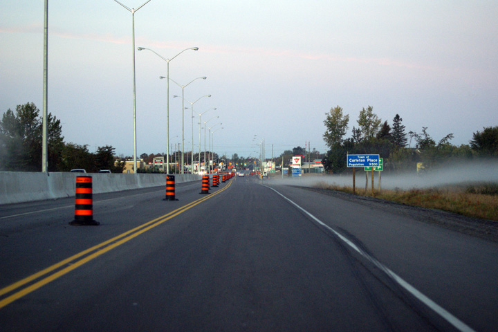
| Township of Beckwith County of Lanark |
Westbound view approaching the end of the divided highway at Carleton Place.
The westbound carriageway (the pictured carriageway) carried two way traffic
during most of the 2011 construction season while the existing (eastbound)
carriageway was being reconstructed. At the time that this photo was
taken, the reconstruction of the eastbound carriageway had been completed,
with the westbound carriageway carrying unidirectional traffic, however the
westbound lanes had not been re-striped accordingly. Photo taken: September 19th, 2011. |
|
|||
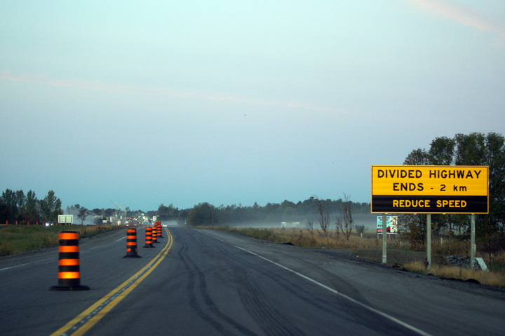
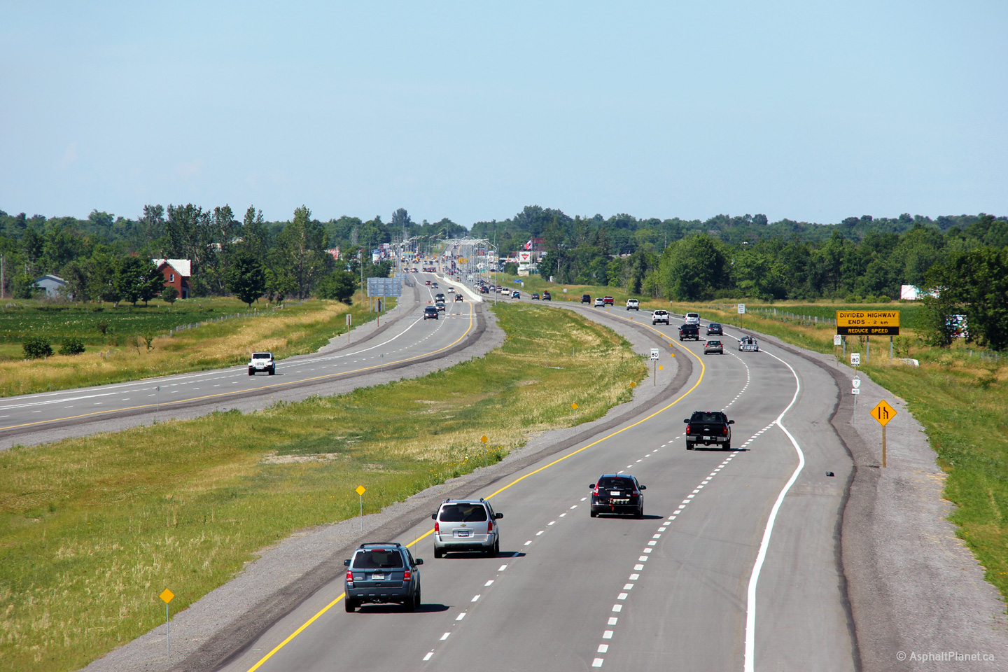
| Township of Beckwith County of Lanark |
Large warning sign announcing the end of the divided highway in Carleton
Place. Of course, because the westbound carriageway had yet to receive
its final coat of asphalt and final striping when this photo was taken, it would appear that the
highway is not divided at all. Photo taken: September 19th, 2011. |
|
|||
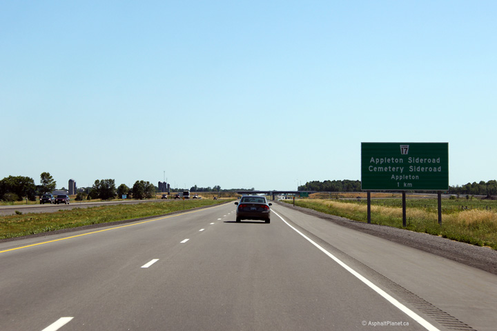
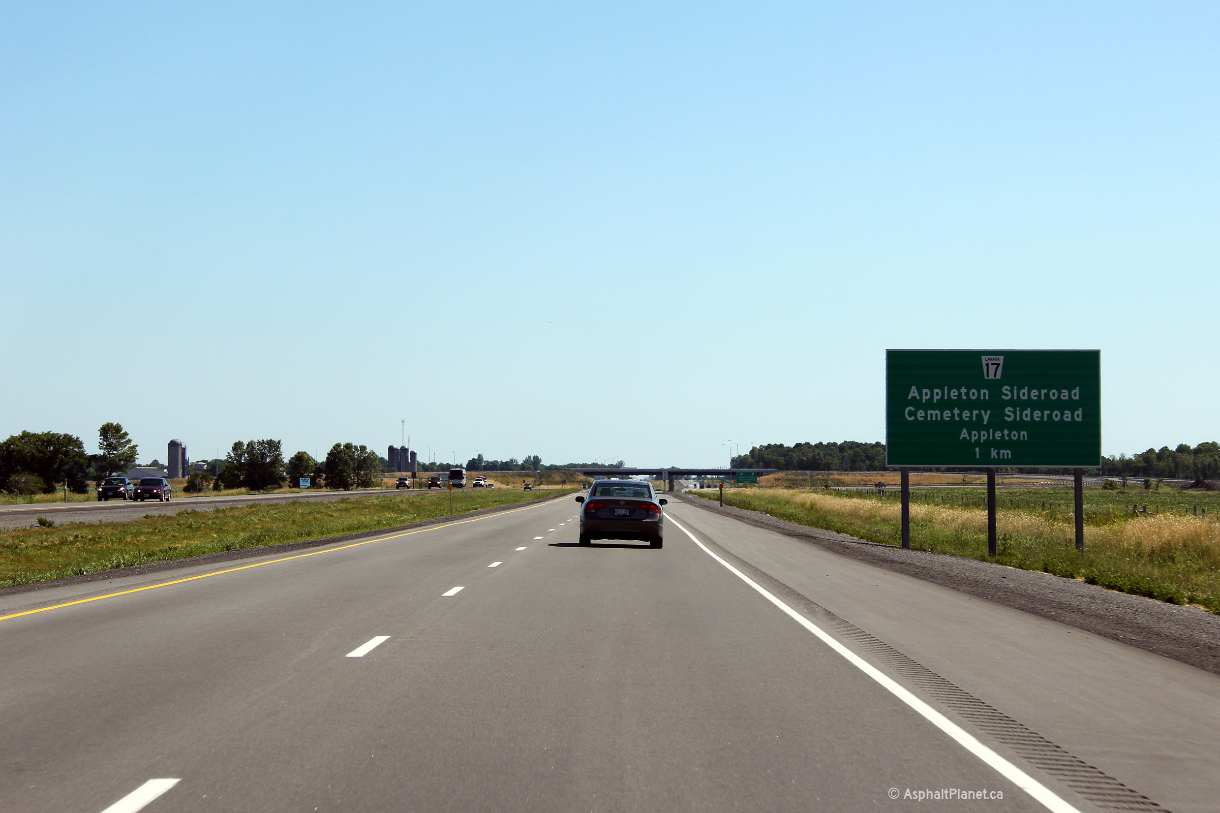
| Township of Beckwith County of Lanark |
Eastbound advanced signage for the Appleton and Cemetery Sideroad
interchange. Photo taken: June 30th, 2012. |
 (720x480) (720x480)(1440x960) (2400x1600) |
|||
| Township of Beckwith County of Lanark |
Eastbound view at the off-ramp to Appleton and Cemetery Sideroads. Photo taken: June 30th, 2012. |
 (720x480) (720x480)(1440x960) (2400x1600) |
|||
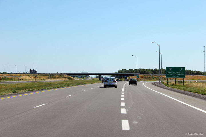
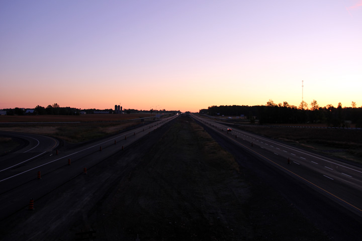
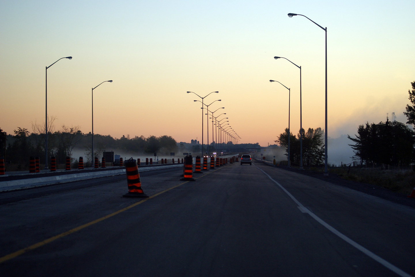
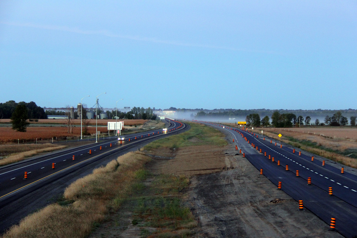
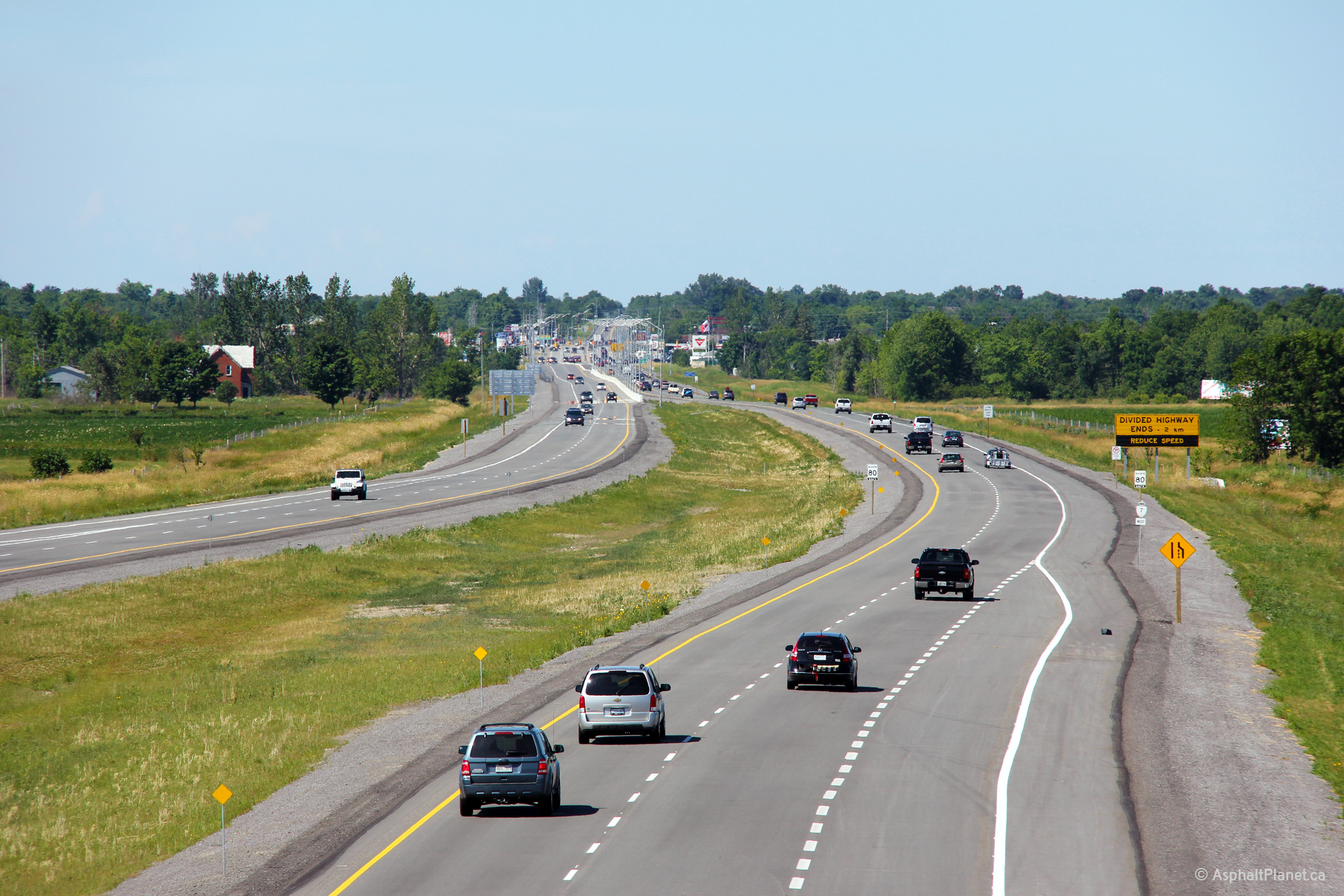
| Township of Beckwith County of Lanark |
A series of views looking westerly from the Cemetery Sideroad overpass. The
upper photo shows a very early morning view of the
newly divided section of highway before construction had been completed. The upper photo was taken
very soon after eastbound and westbound traffic were separated onto their own separate
carriageways. The lower photos were the following summer once construction activities
had been completed. Upper photo taken: September 19th, 2011. Lower photos taken: June 30th, 2012. |
 (720x480) (1440x960) (2400x1600)  |
|||
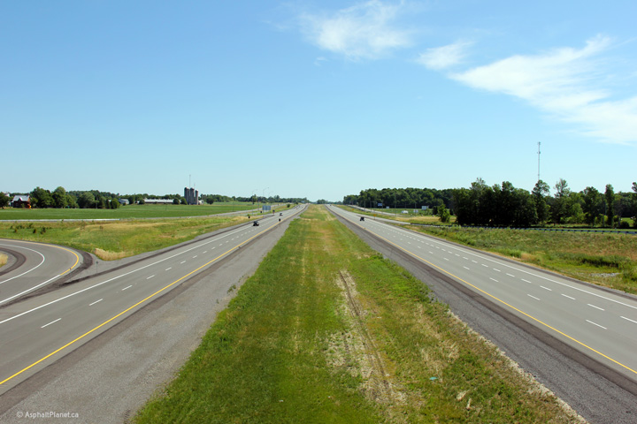
| Township of Beckwith County of Lanark |
Two views from the Cemetery Sideroad overpass. The upper photo looks into the early morning sky along
the recently divided highway. While the low light levels of the early morning sky
amplify the morning sky, the low contrast doesn't show the newly divided
highway in particularly great detail. The lower photo shows the
completed highway. Upper photo taken: September 19th, 2011. Lower photo taken: June 30th, 2012. |
|
|||
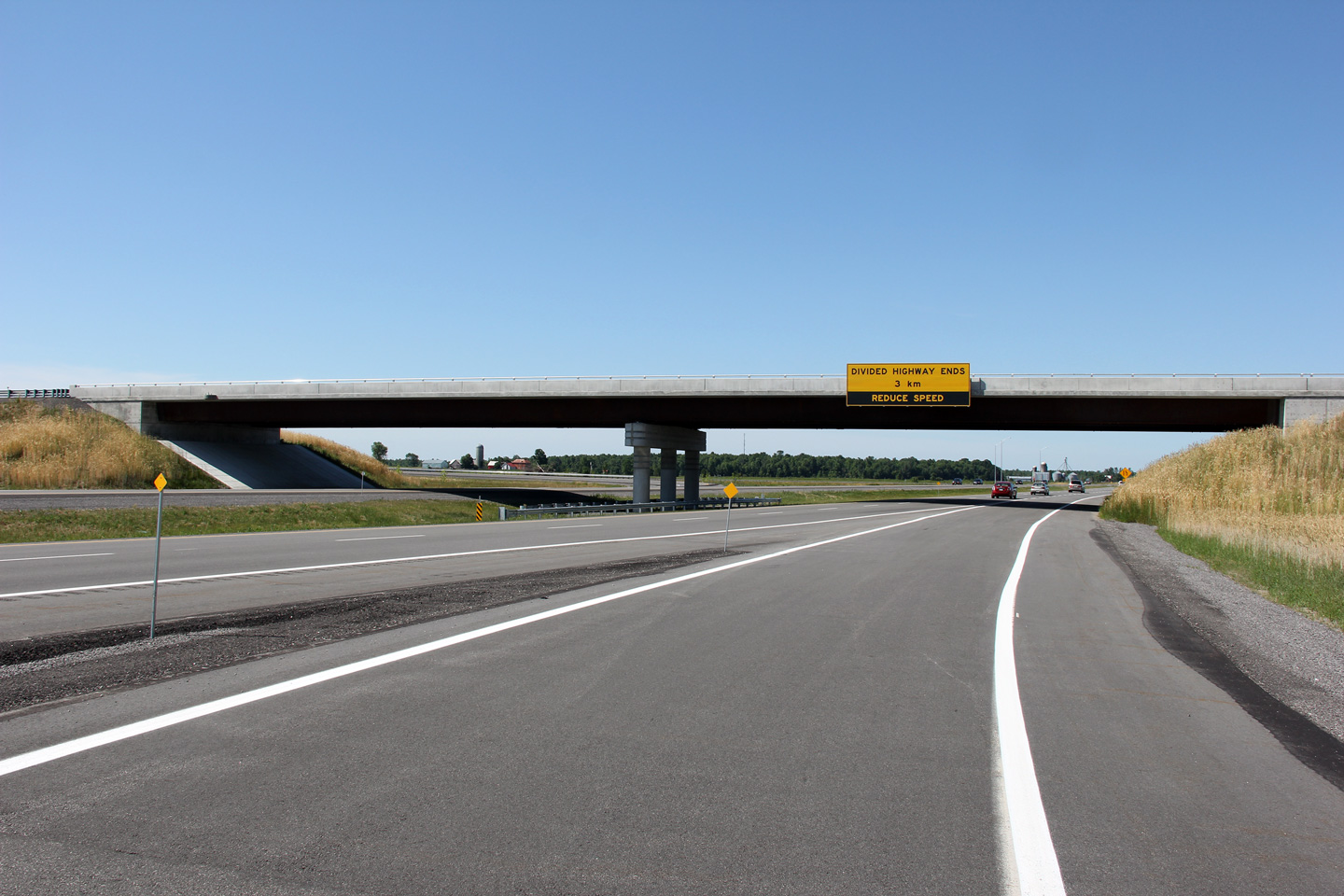
| Township of Beckwith County of Lanark |
View looking westerly at the Cemetery Road overpass. Note the decorative
design on the pier cap of the centre bridge pier. Photo taken: June 30th, 2012. |
 |
|||
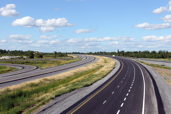
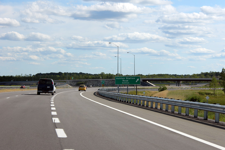
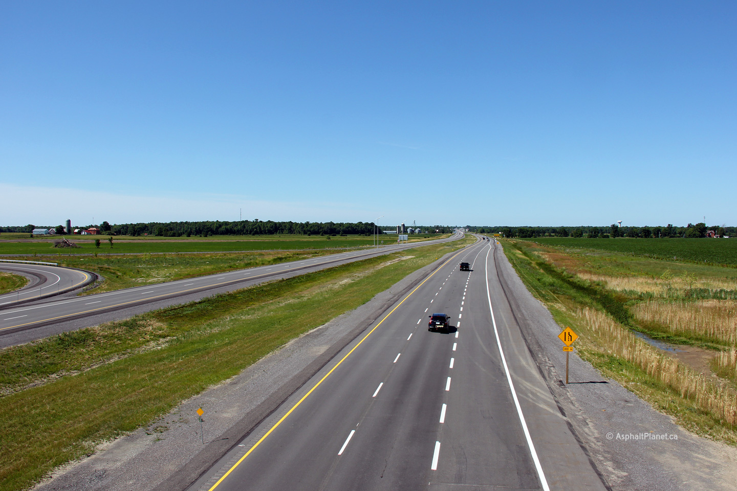
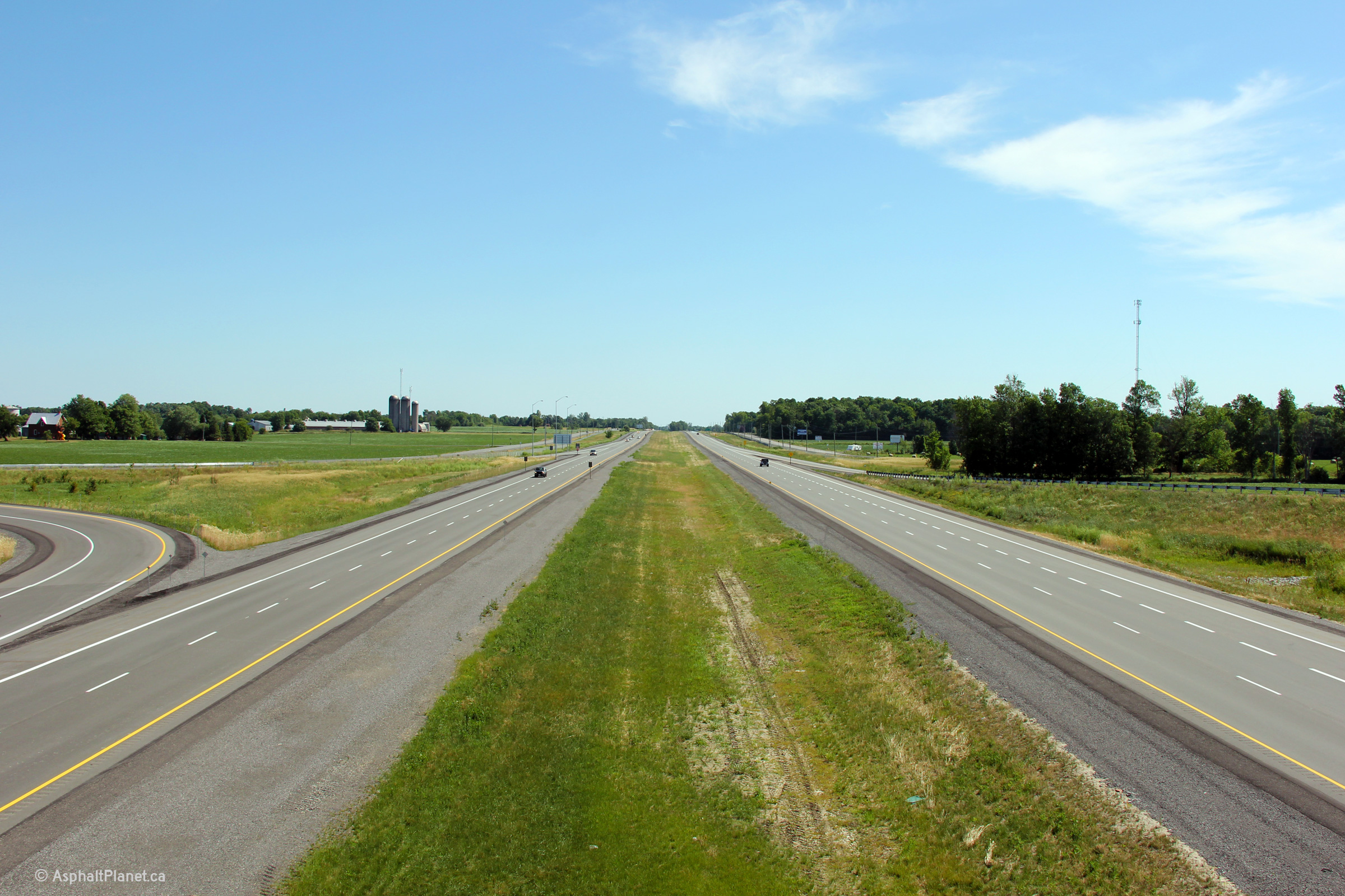
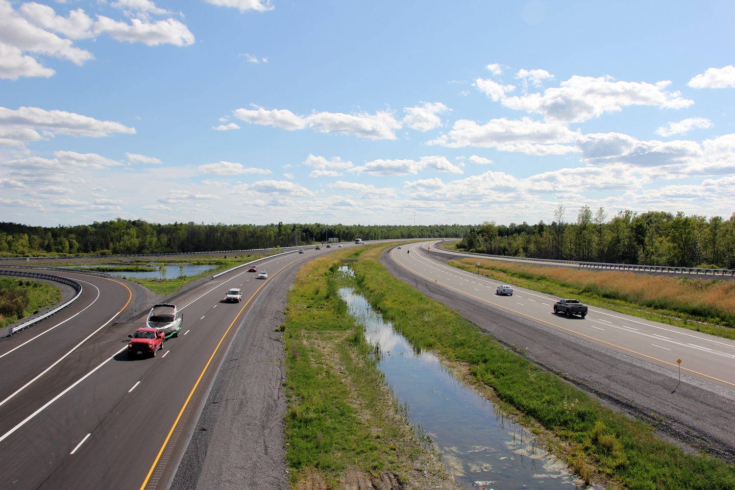
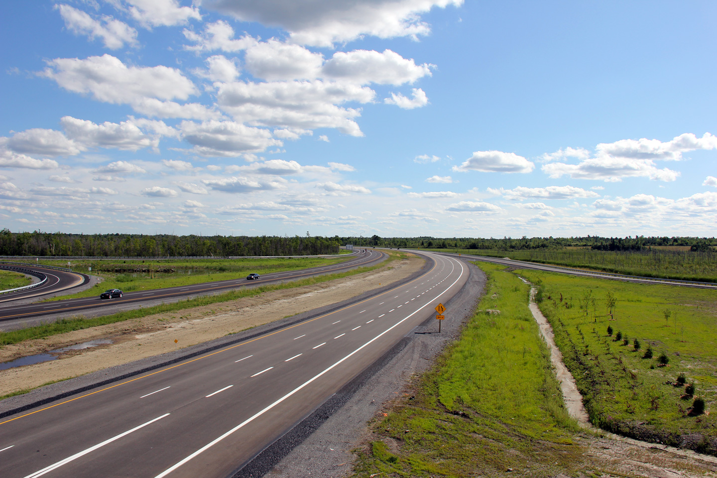
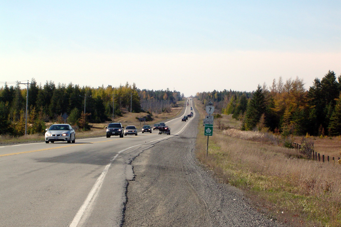
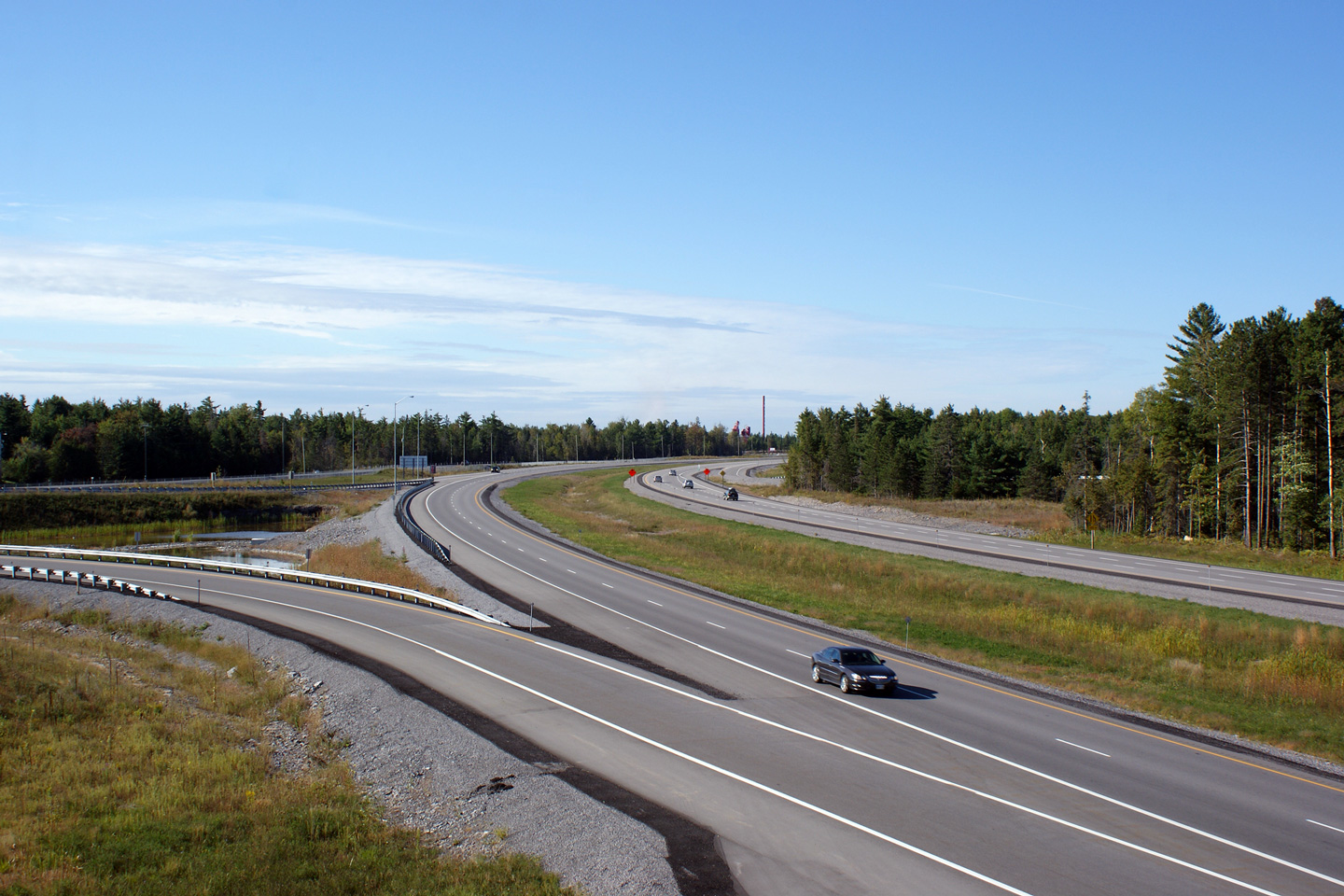
| Township of Beckwith County of Lanark |
Westerly view along Highway 7 from the Ashton Station Road overpass.
This particular portion of the Highway 7 freeway (from this interchange
easterly to Jinkinson Sideroad) opened in the autumn of 2010. Photo taken: July 24th, 2011. |
 |
|||
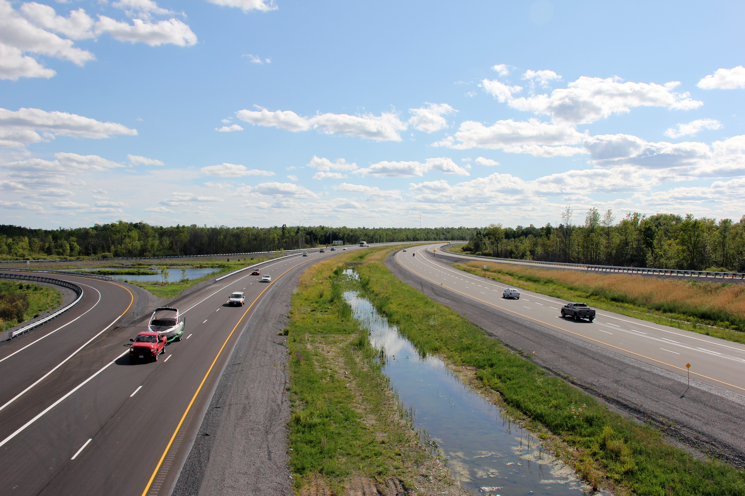
| City of Ottawa |
Easterly view from the Ashton Station Sideroad overpass. Photo taken: July 24th, 2011. |
 |
|||
| City of Ottawa |
Westbound signage for the Ashton Station Road off-ramp along Highway 7. Photo taken: July 24th, 2011. |
 (720x480) (720x480)(1440x960) (2400x1600) |
|||
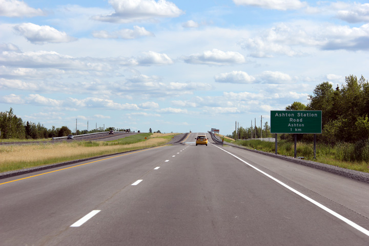
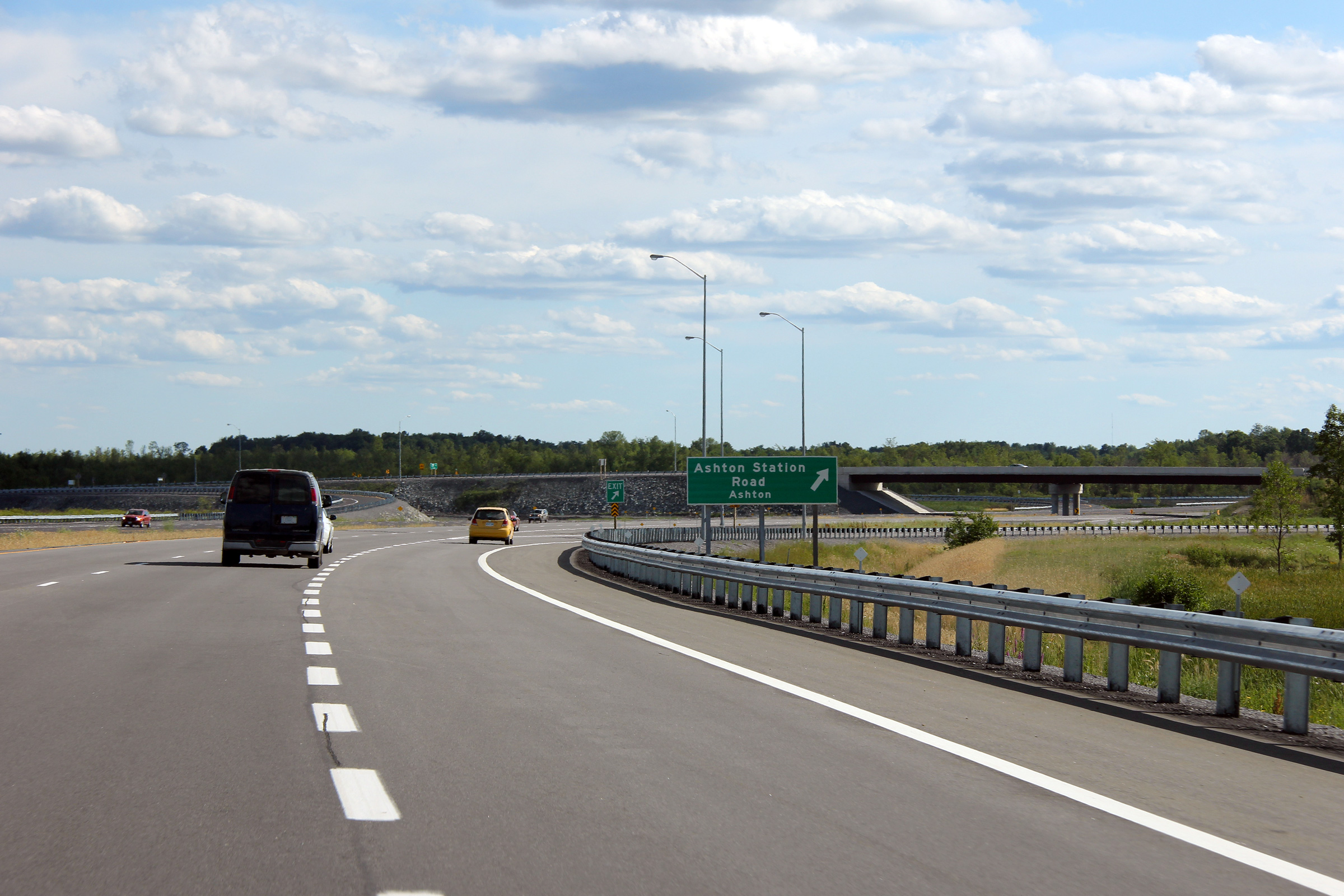
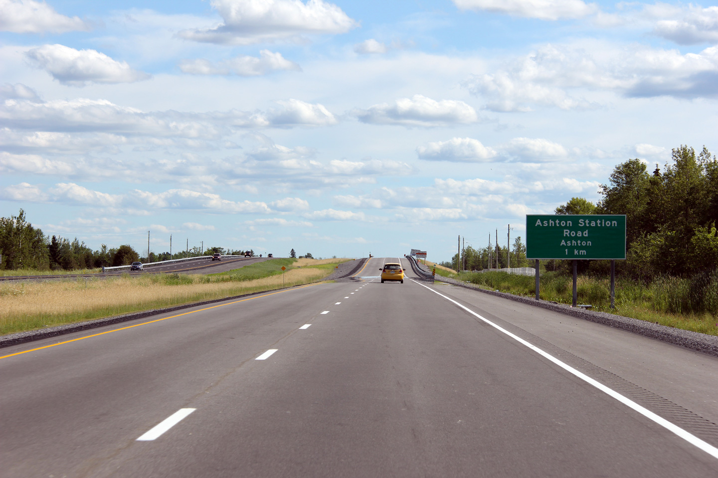
| City of Ottawa |
Advanced signage for the Ashton Station Road interchange. Photo taken: July 24th, 2011. |
 (720x480) (720x480)(1440x960) (2400x1600) |
|||
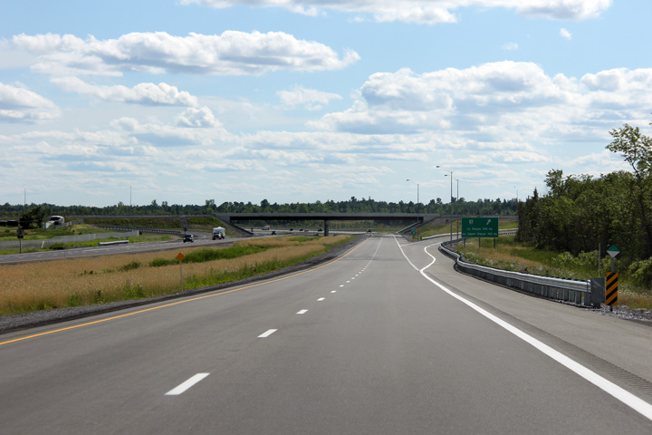
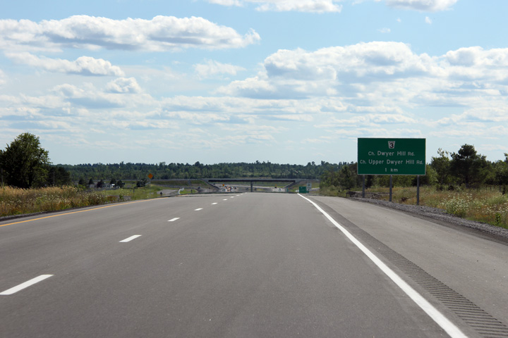
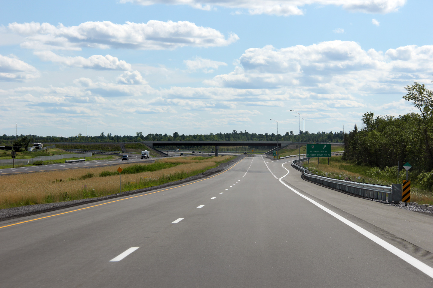
| City of Ottawa |
Westerly view from the Upper Dwyer Hill Road overpass along Highway 7. Photo taken: July 24th, 2011. |
 |
|||
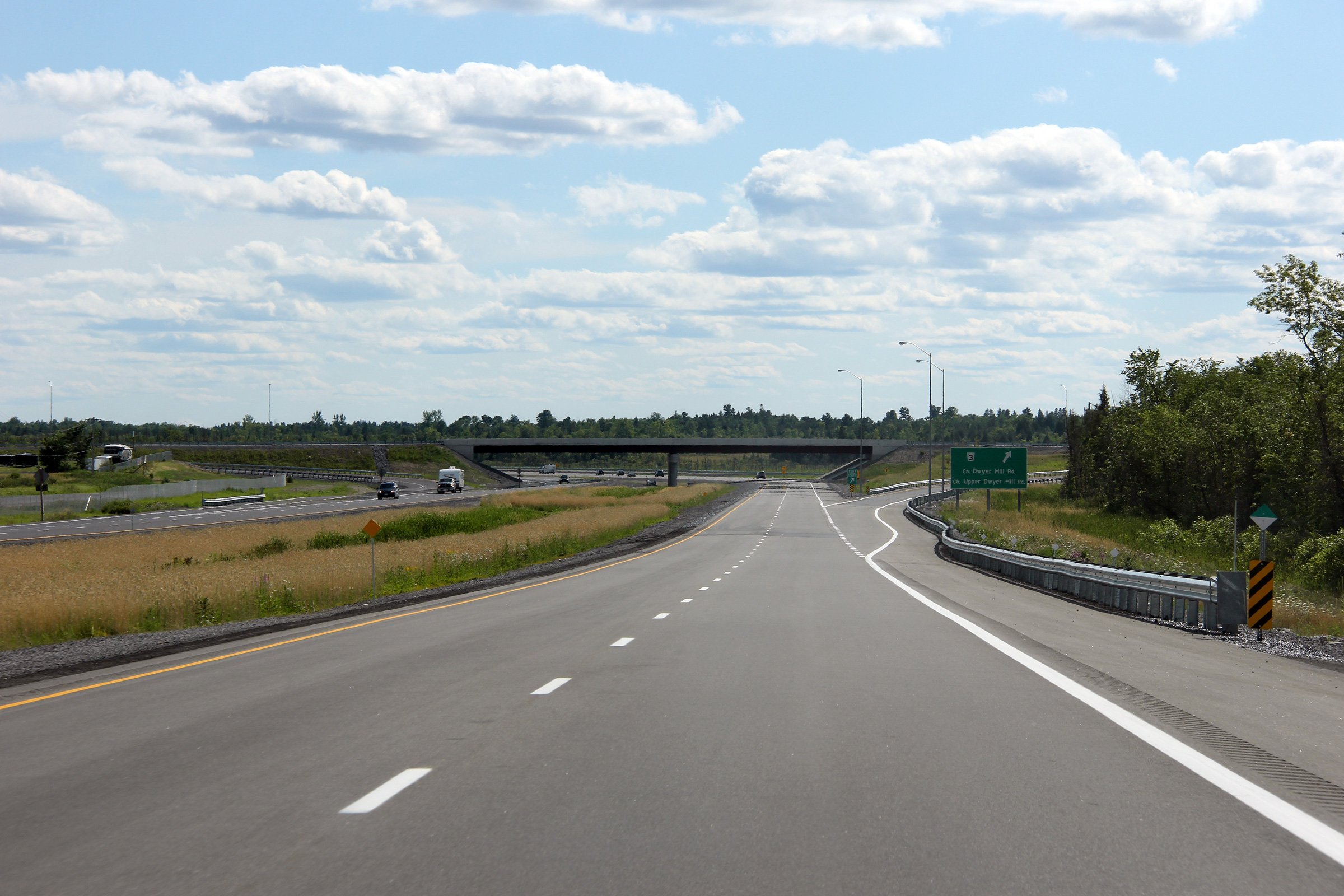
| City of Ottawa |
Reverse view from the previous photo along Highway 7. Photo taken: July 24th, 2011. |
 |
|||
| City of Ottawa |
Westbound signage at the Upper Dwyer Hill Road interchange. Photo taken: July 24th, 2011. |
 (720x480) (720x480)(1440x960) (2400x1600) |
|||
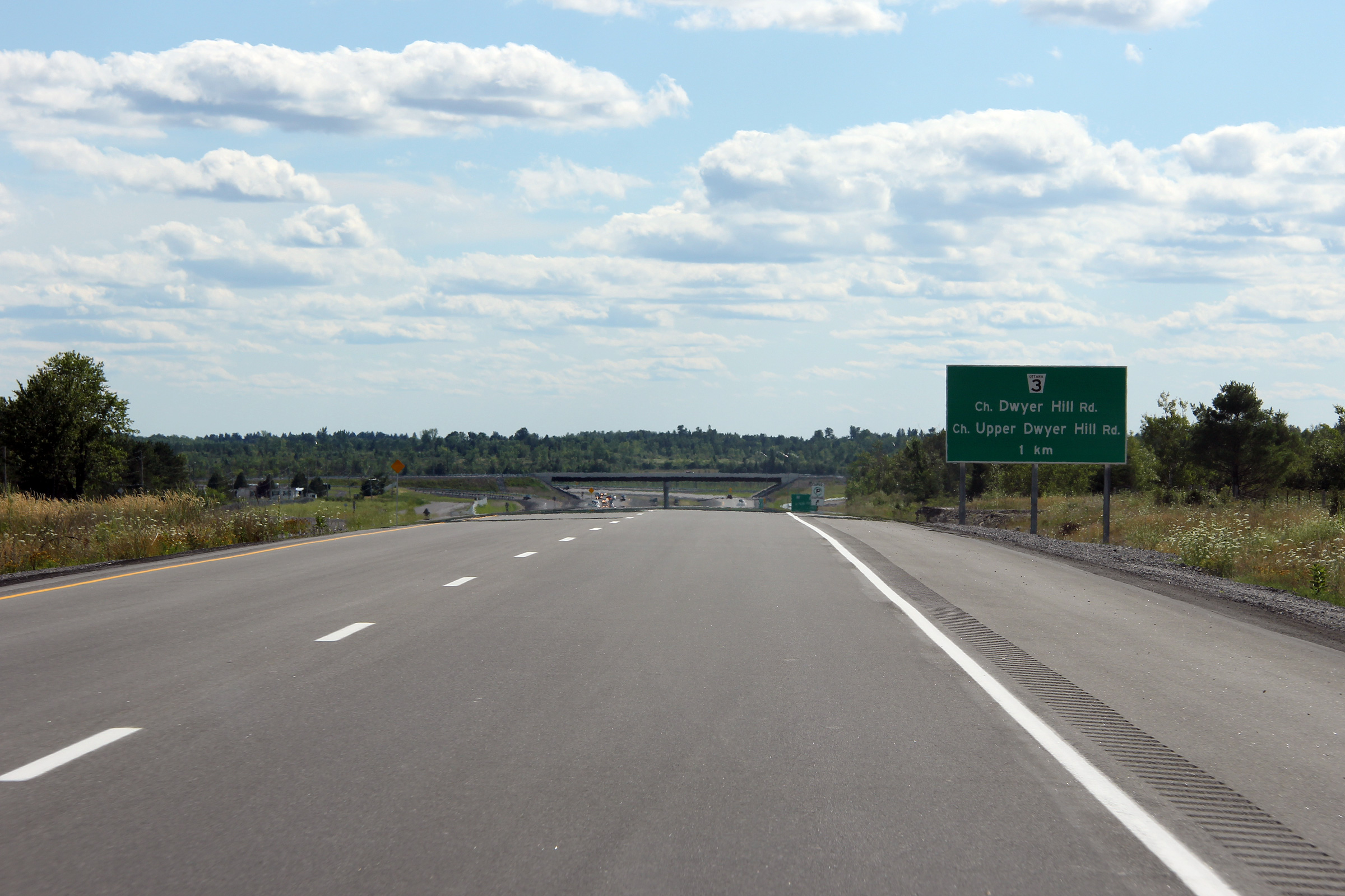
| City of Ottawa |
Advanced signage for the Upper Dwyer Hill Road interchange. Photo taken: July 24th, 2011. |
 (720x480) (720x480)(1440x960) (2400x1600) |
|||
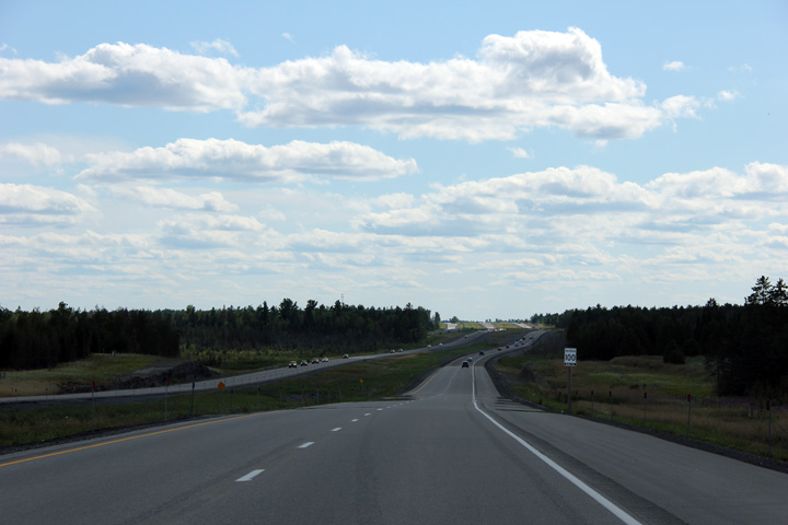
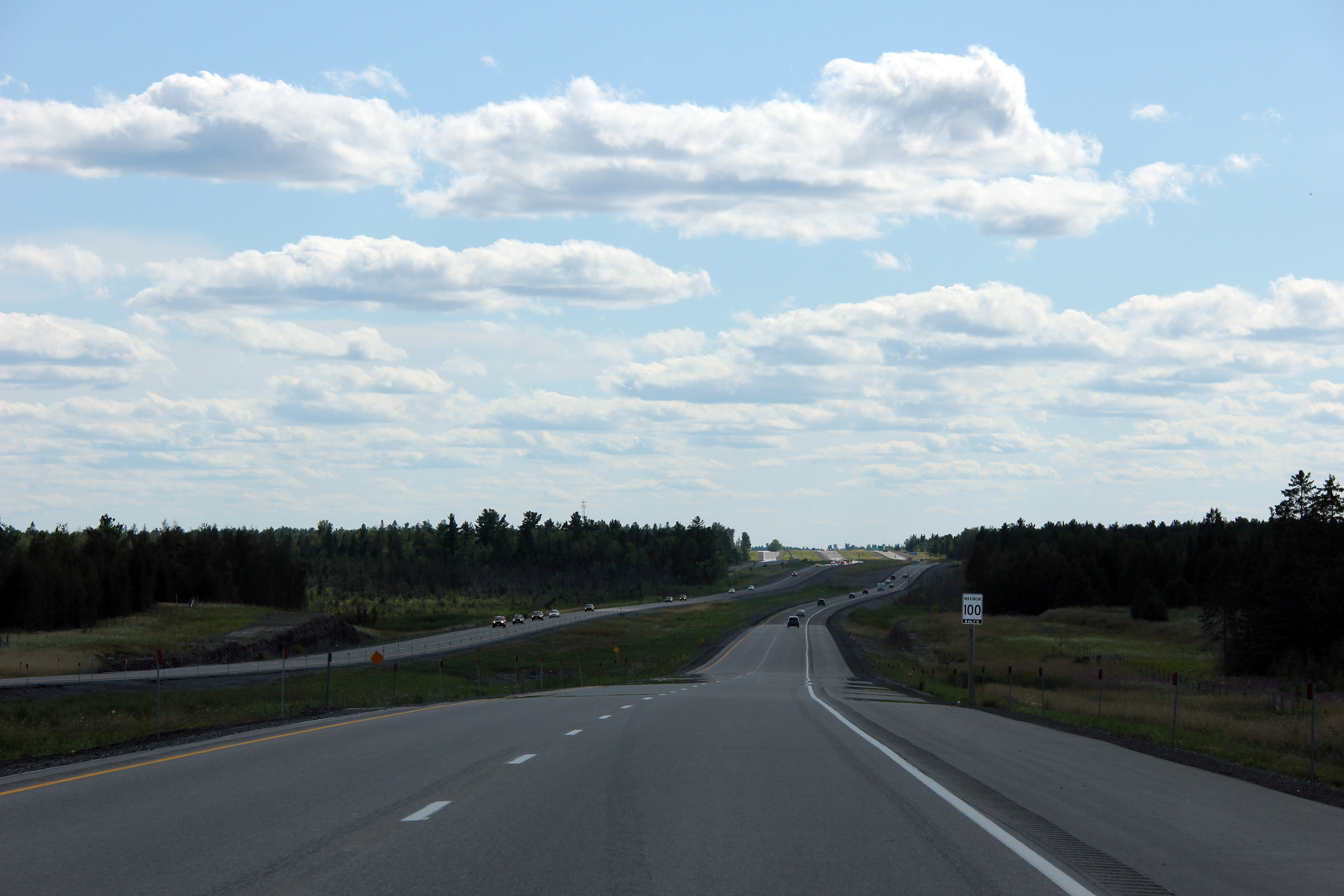
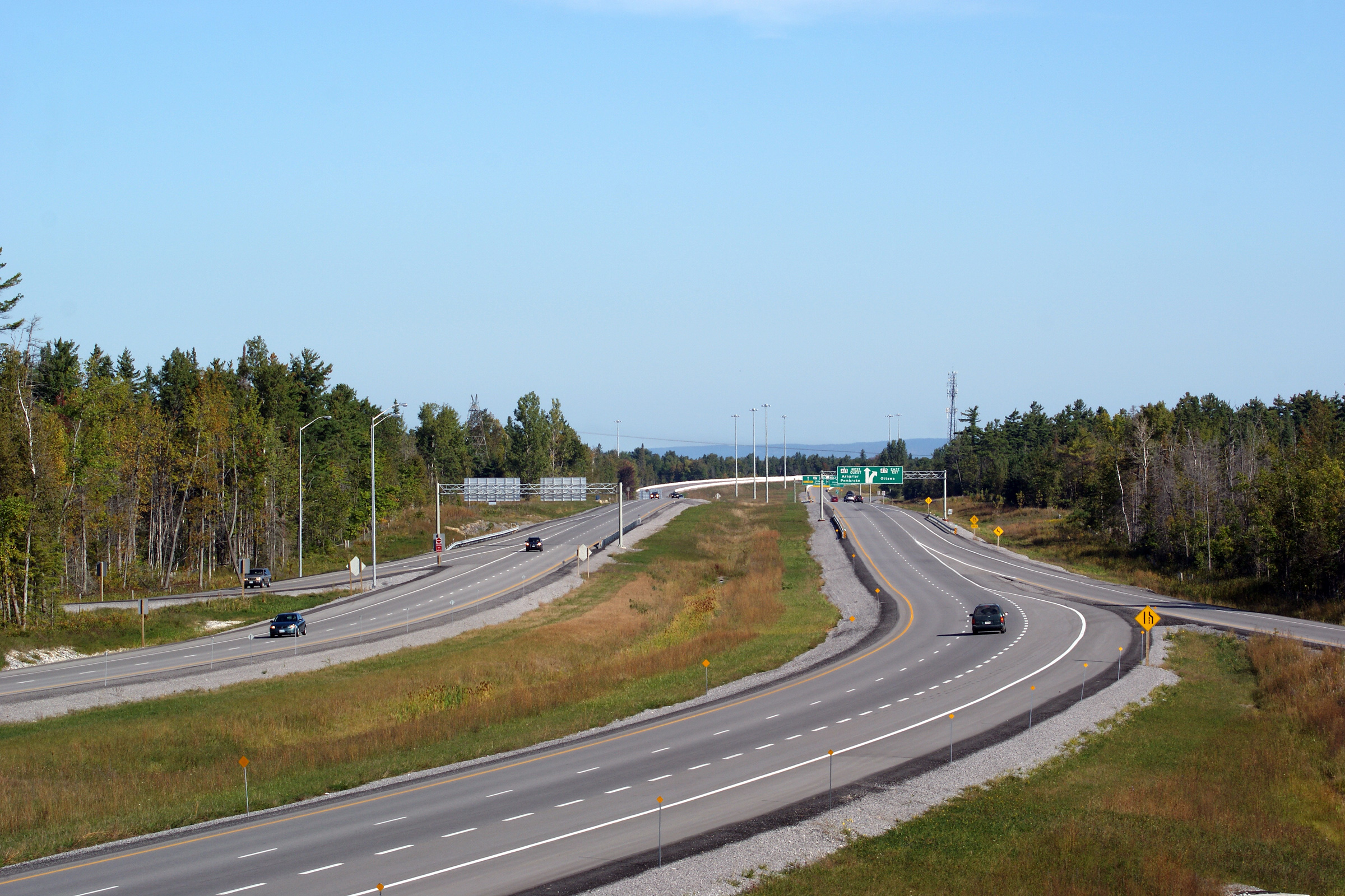
| City of Ottawa |
Two views looking west along
Highway 7 looking from Jinkinson Road. The upper photo shows the
two-lane incarnation of Highway 7 before the highway was twinned. The
lower photo shows a divided Highway 7 from a nearly identical vantage. Upper photo taken: October 23rd, 2004. Lower photo taken: July 24th, 2011. |
 |
|||
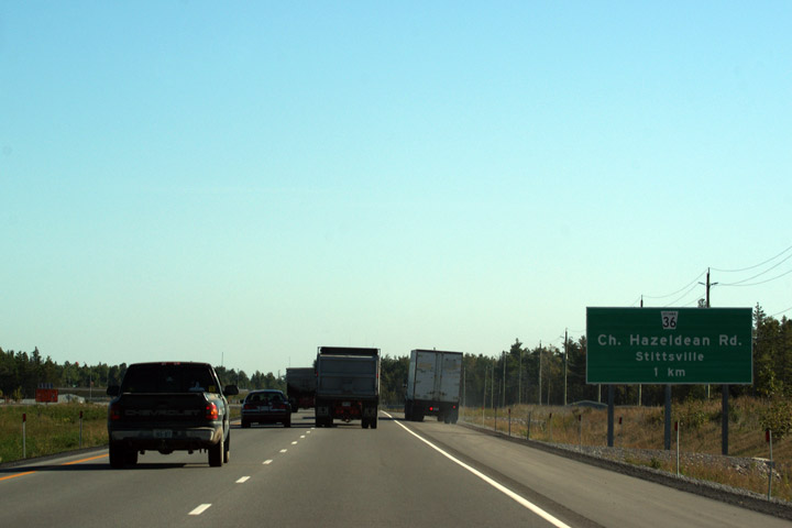
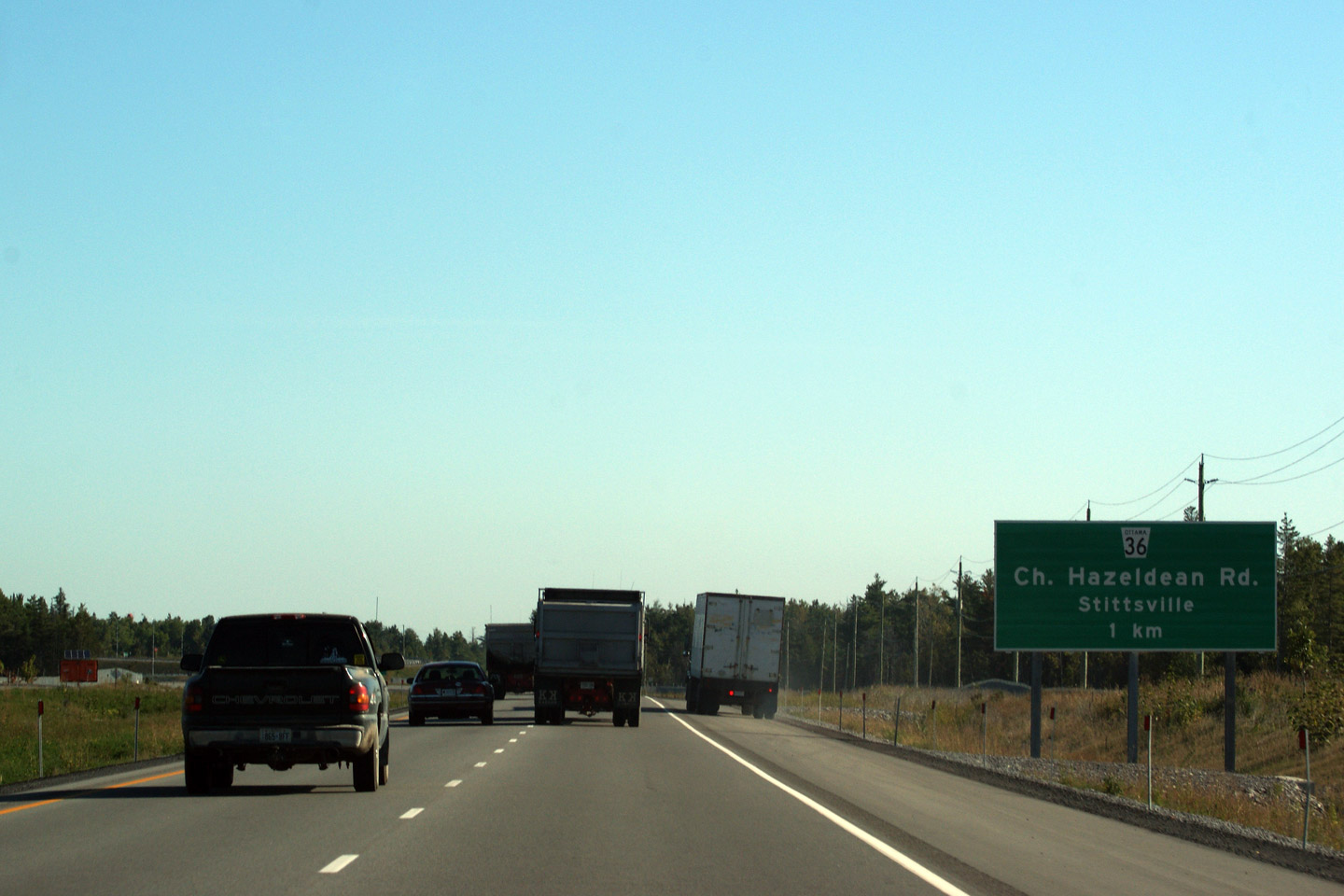
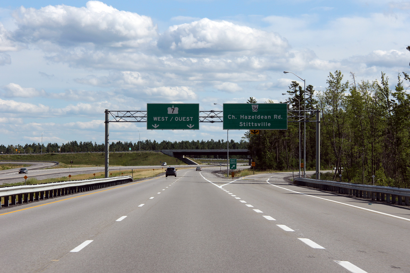
| City of Ottawa |
Advanced signage for the Hazeldean Road interchange. Photo taken: September 12th, 2009. |
 (720x480) (720x480)(1440x960) |
|||
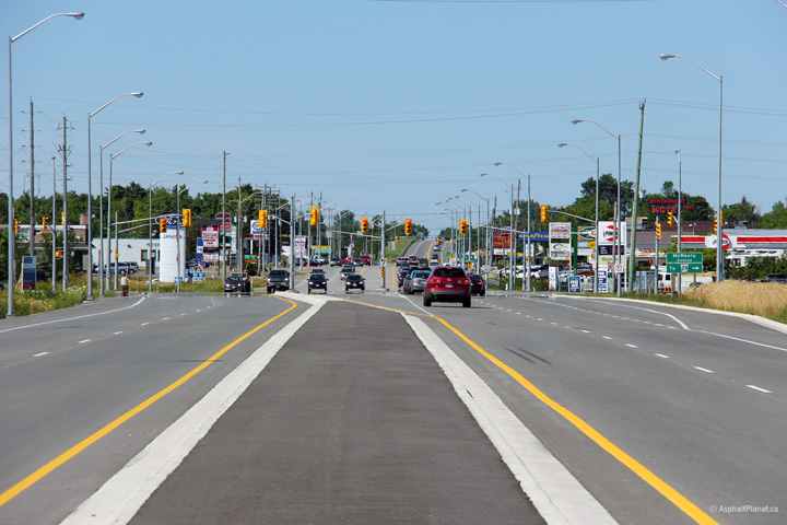
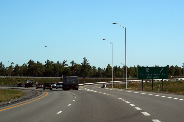
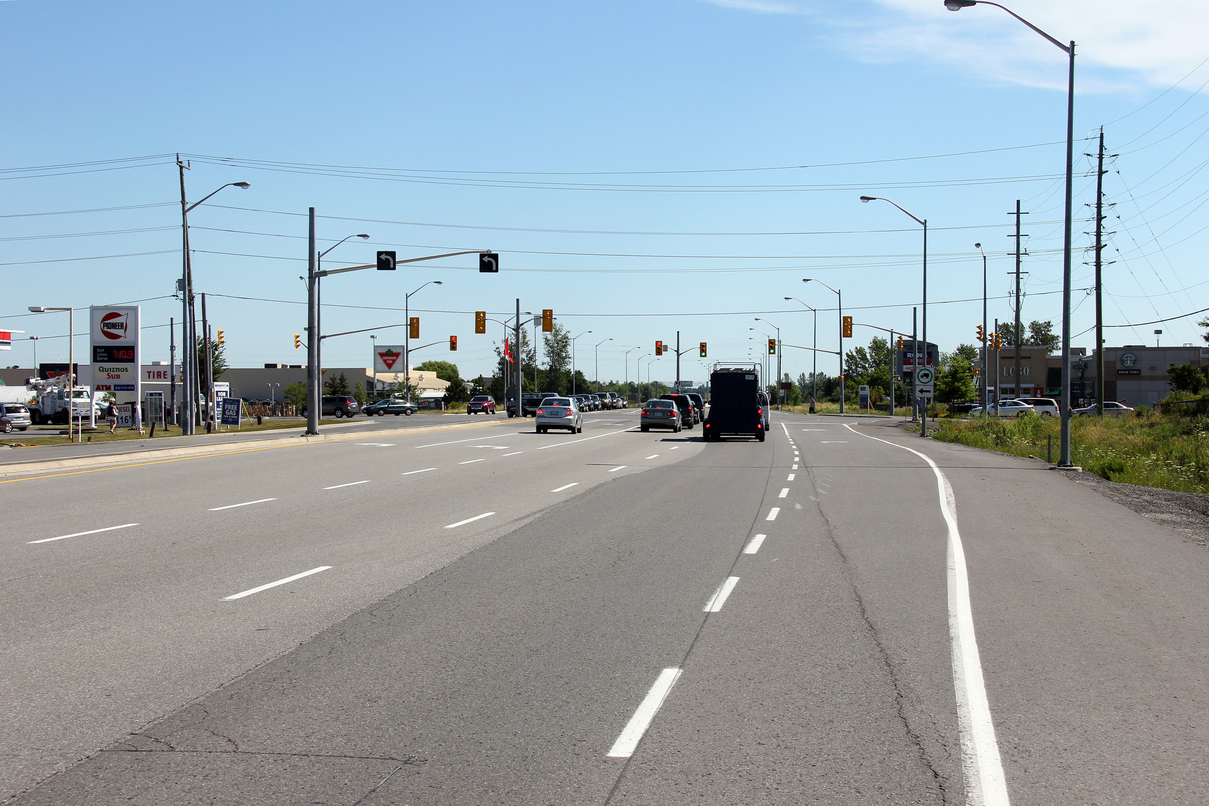
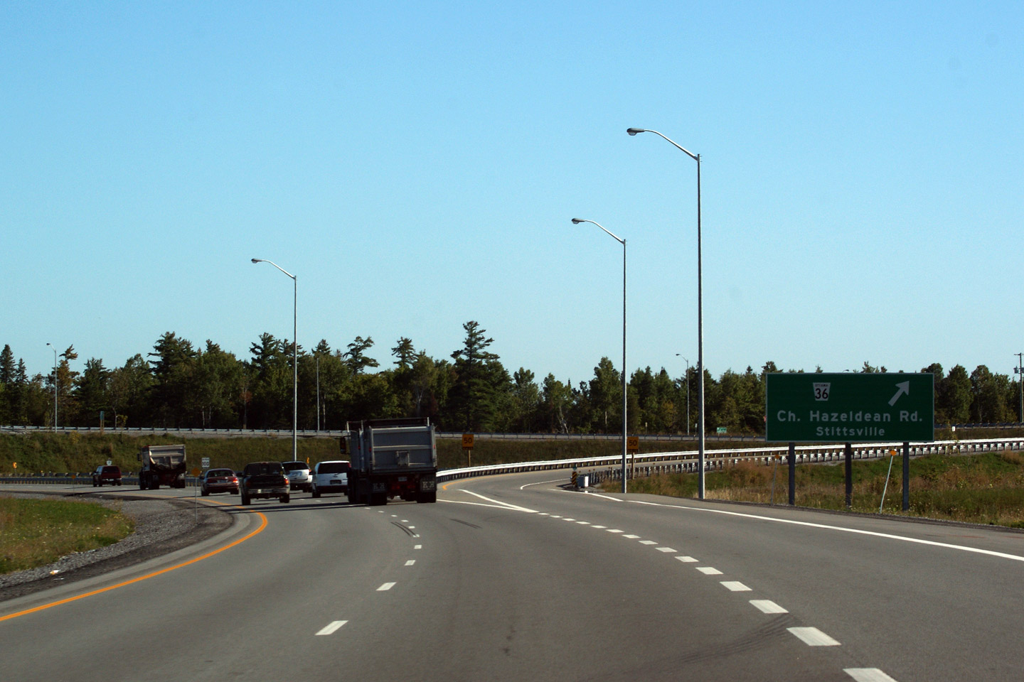
| City of Ottawa |
Highway 7 meets Hazeldean Road at a full six-ramp partial cloverleaf interchange.
Eastern Region seems quite keen on building six ramp interchanges even in
rural areas. Several of the new interchanges along the 2004 opened 417
extension featured six ramp interchanges as well. Photo taken: September 12th, 2009. |
 (720x480) (720x480)(1440x960) |
|||
| City of Ottawa |
View looking westerly from Hazeldean Road.
Hazeldean Road (and its eastern extension, Richmond Road) carried Highway 7
into Ottawa before Highway 417 was extended westerly through Kanata. Photo taken: September 12th, 2009. |
 |
|||
| City of Ottawa |
Easterly view from the Hazeldean Road.
The Gatineau Hills can be seen opposite
the Ottawa River on approach to Highway 417. Photo taken: September 12th, 2009. |
||||
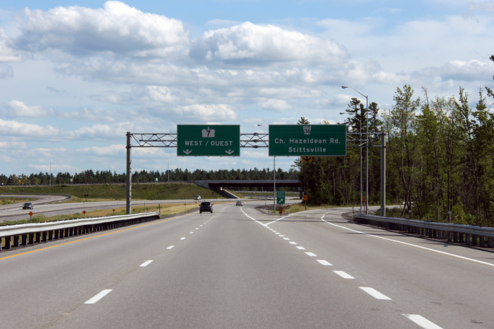
| City of Ottawa |
Overhead signage for the westbound Hazeldean Road interchange. Note the
lack of control city used on the pull-through signage for Highway 7. Photo taken: July 24th, 2011. |
 (720x480) (720x480)(1440x960) (2400x1600) |
|||
| City of Ottawa |
Westbound advanced signage for the Hazeldean Road interchange. Photo taken: July 24th, 2011. |
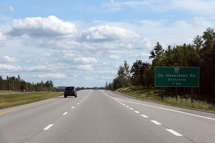 (720x480) (720x480)(1440x960) (2400x1600) |
|||
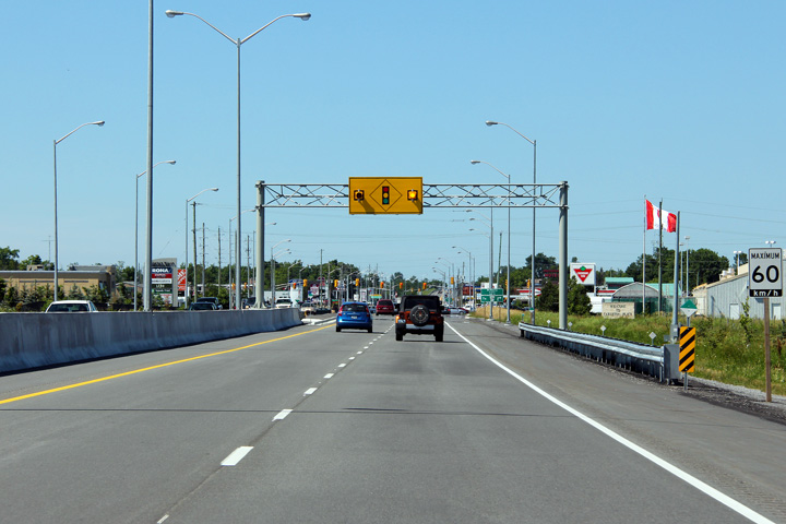
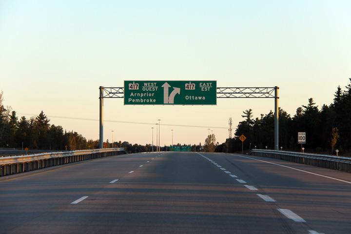
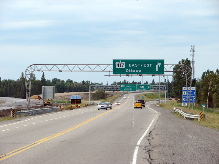
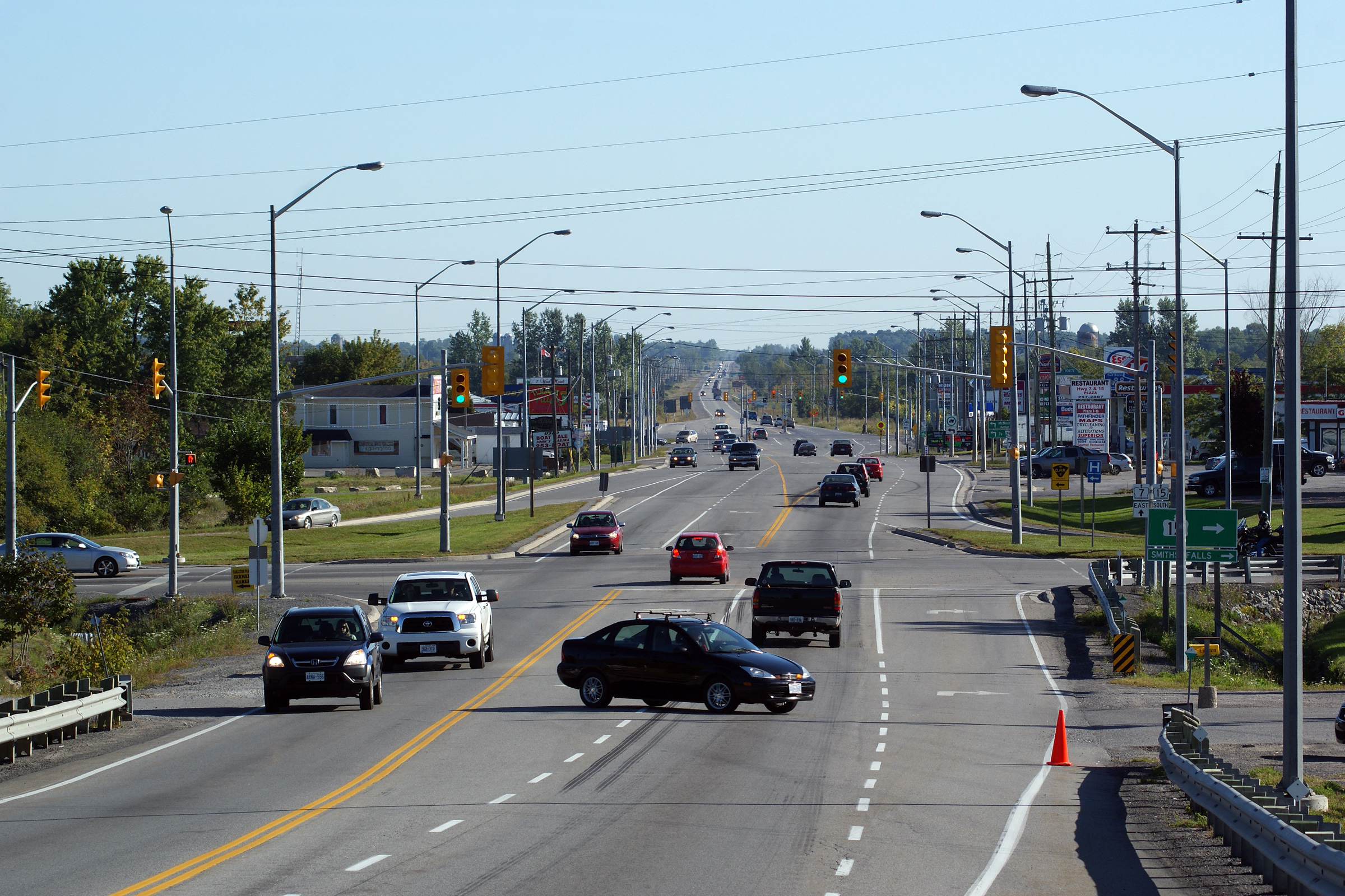
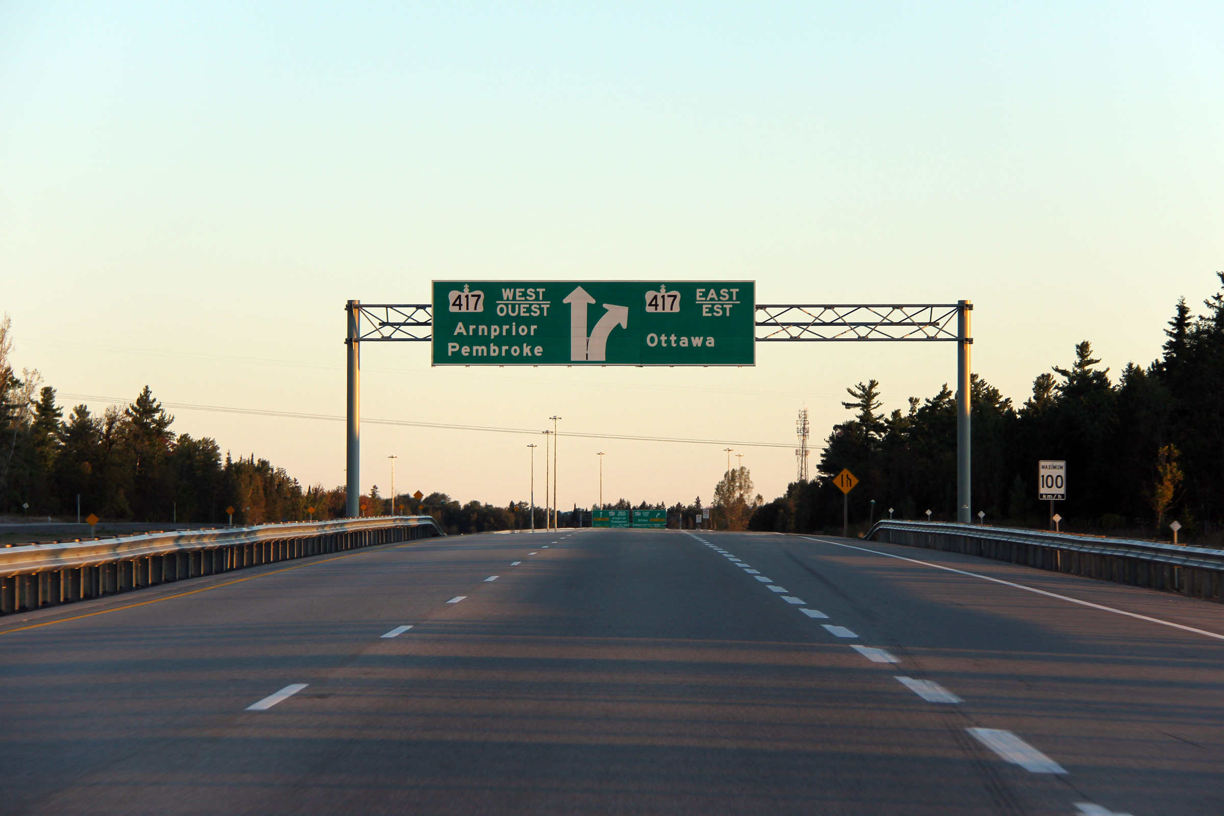
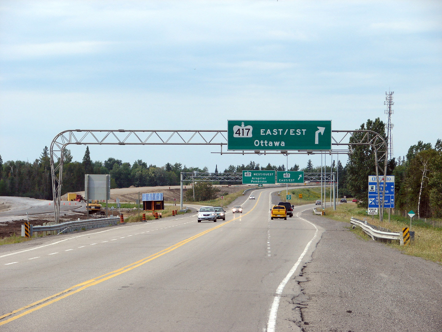
| City of Ottawa |
Diagram signage in advance of the Highway 417 interchange. The
left-lane defaults westerly along the 417 towards Arnprior. The
right-most lane follows Highway 417-East towards Ottawa. Photo taken: September 19th, 2011. |
 (720x480) (720x480)(1440x960) (2400x1600) |
|||
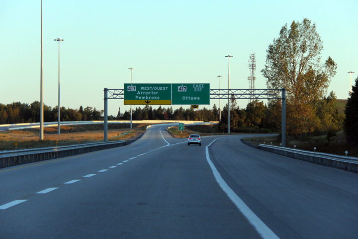
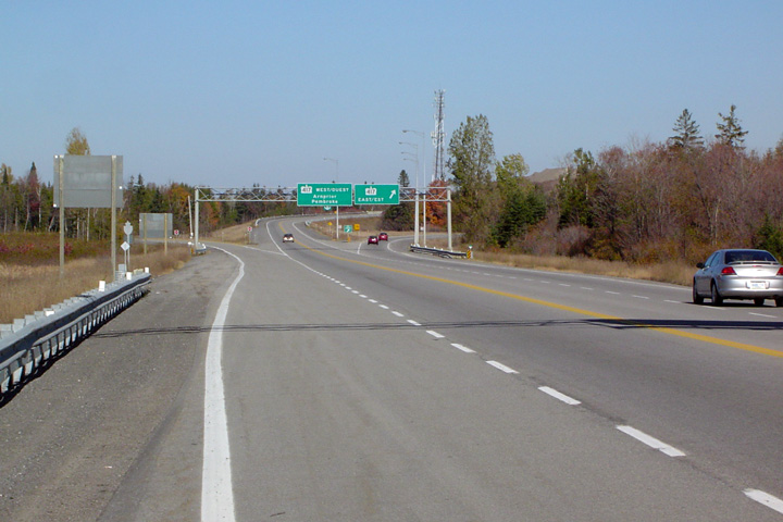
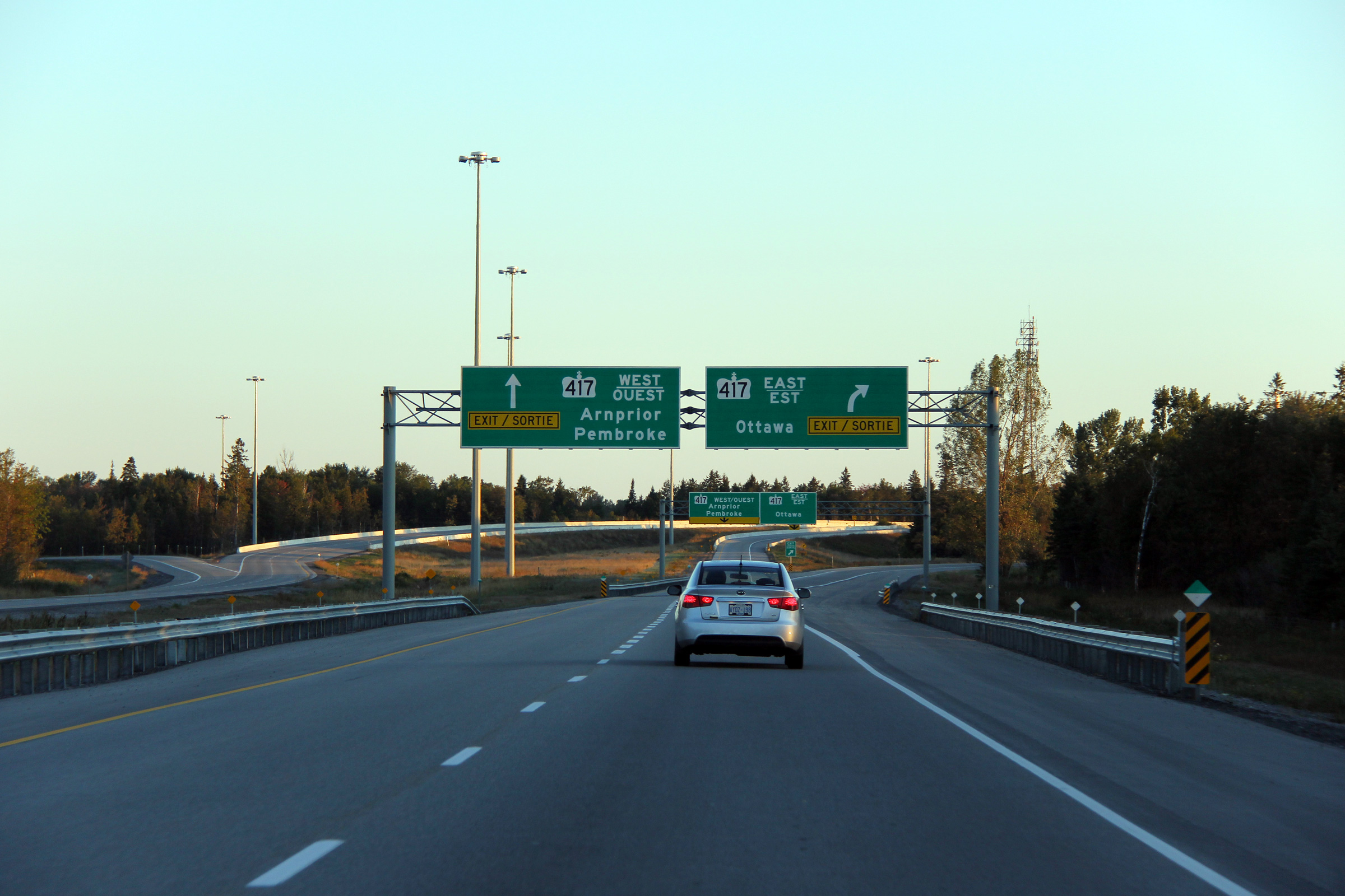
| City of Ottawa |
Second round of advanced signage for the Highway 417 interchange.
Highway 416 used to have an overhead assembly similar to this, this use of
the advanced arrow appears unique to the Ottawa area. I have included
a great shot from Josh Anderchek showing the previous advanced signage for
Highway 417-East taken before Highway 7 was four-laned. Upper photo taken by: Josh Anderchek, on August 8th, 2007. Lower photo taken: September 19th, 2011. |
 (720x480) (720x480)(1440x960) (2400x1600) |
|||
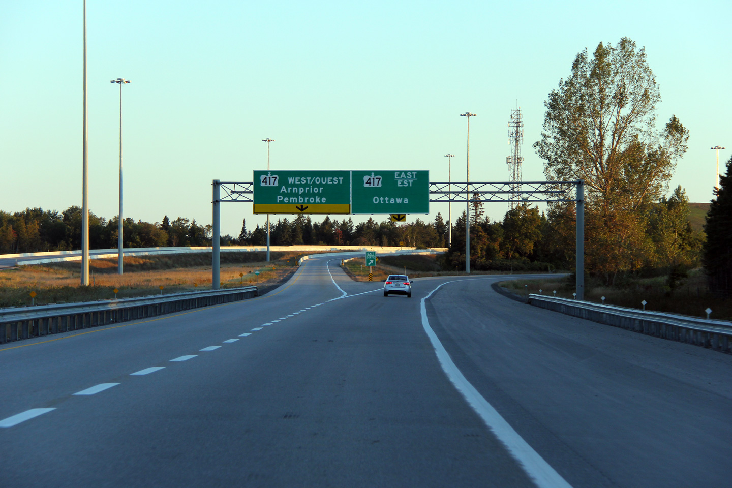
| City of Ottawa |
Gore signage at the split. The
new signage has been very nice to this
point, though I can't say the same about this overhead. The ramp to
Highway 417-East will be widened to two lanes in the future once Highway 417
is widened all the way through Kanata, presumably this is why the decision
was made to not match the sign designs here. Upper photo taken: October 23rd, 2004. Lower photo taken: September 19th, 2011. |
 (720x480) (720x480)(1440x960) (2400x1600) |
|||
| Highway 417 is the primary east-west route through the Lower Ottawa Valley, and serves as the important link between Ottawa and Montreal. Click here for Highway 417-West images and here for Highway 417-East images. | |||||
<- Page 3C Images Highway 7 Images Index
<- Highway 6 Images Back to Highway 7 - Page 3 Highway 7A Images ->
Copyright (c) 2004-2013, Scott Steeves (Webmaster) scott@asphaltplanet.ca


 (720x480)
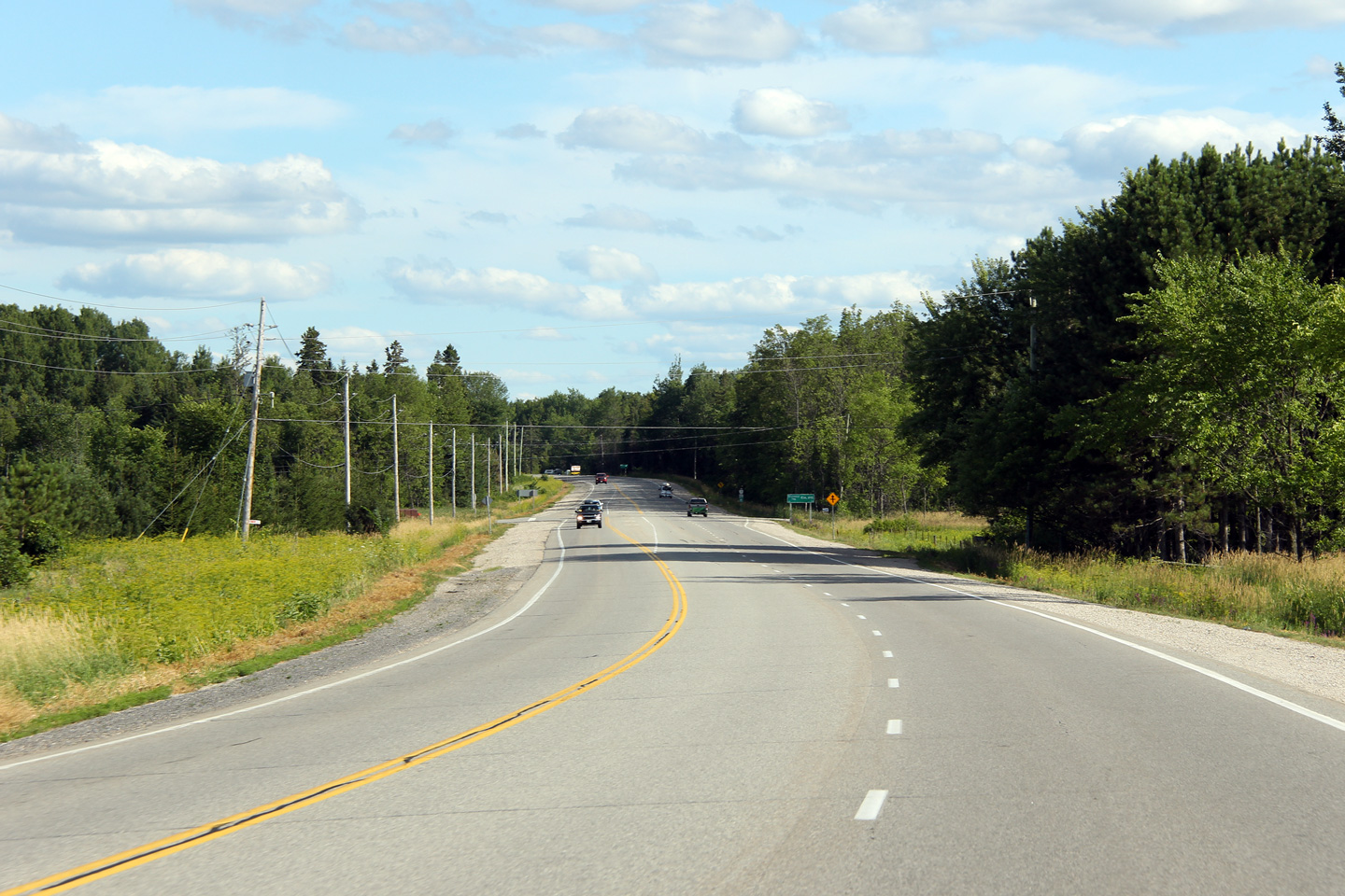