AsphaltPlanet.ca >
OntHighways >
Highway 417 >
Images
> Page 5A
King's Highway 417 - Images
<- Page 4F Page 5A - Kanata Page 5B ->
Photos shown in this table are arranged from West to East:
| Proper Municipality Name | Photo Description | Photo | ||
|
Photos taken from driver's perspective appear offset from centre-line Photos: |
East- bound |
West- bound |
||
| Images continued from the the west via Page 4F Images. | ||||
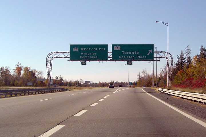
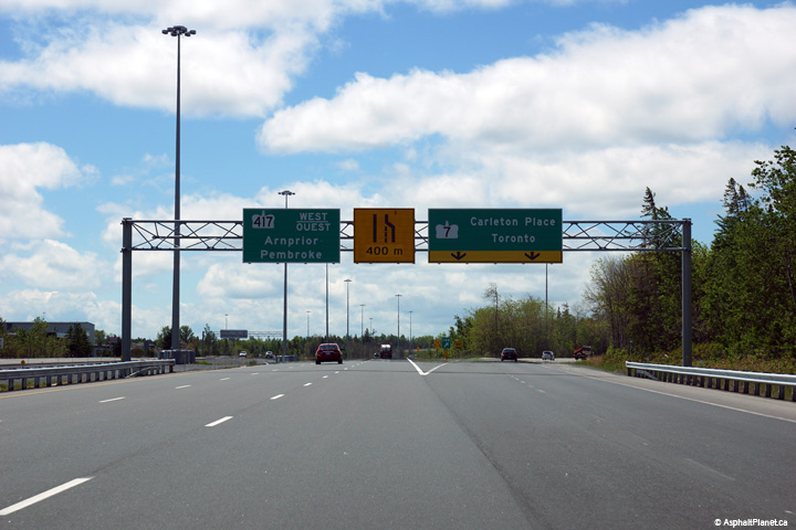
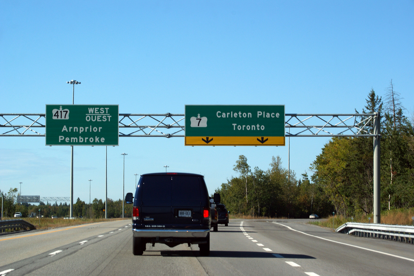
| Highway 7 begins its trek easterly through Peterborough, north of Toronto, and eventually to Sarnia at this interchange. Click here for Highway 7 images. | ||||
| City of Ottawa |
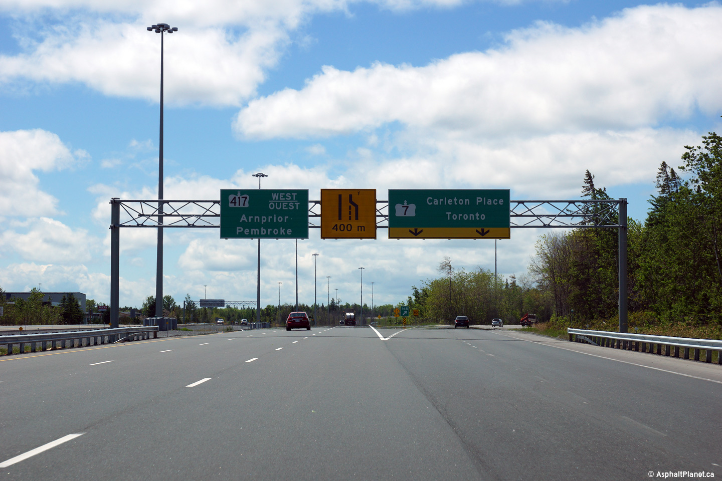
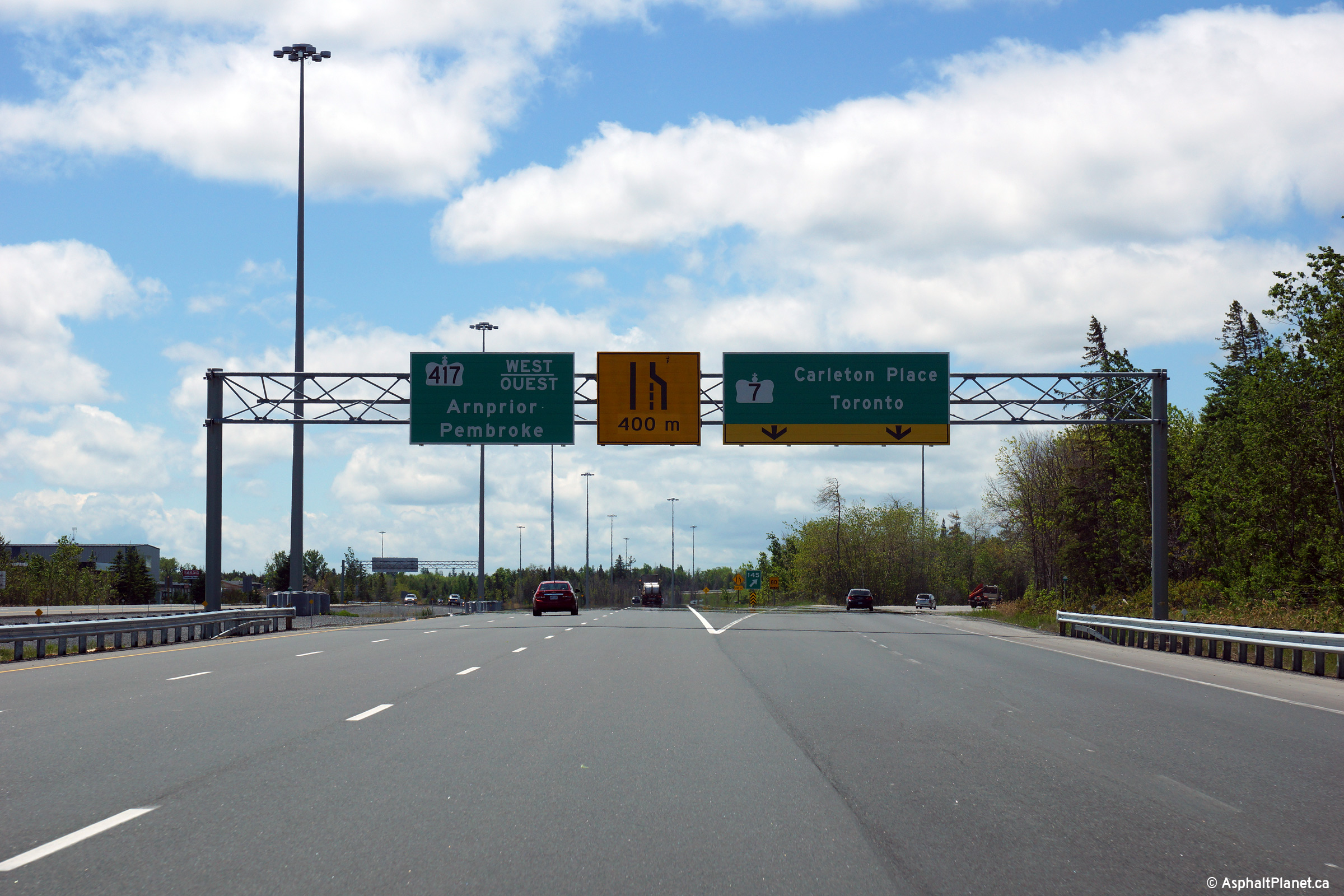
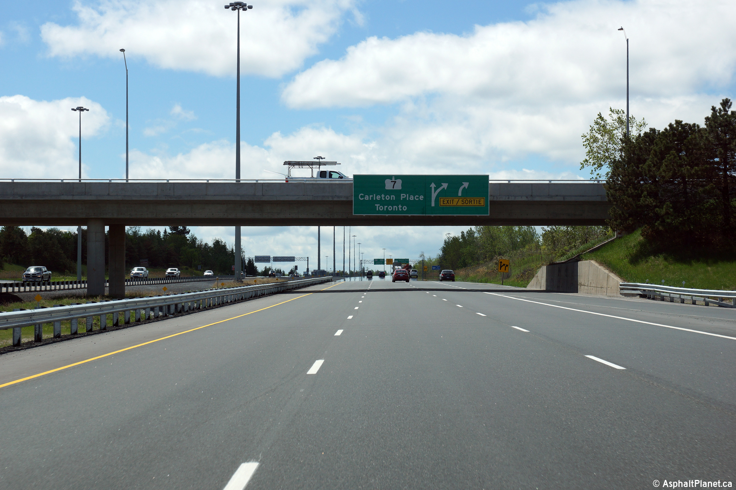
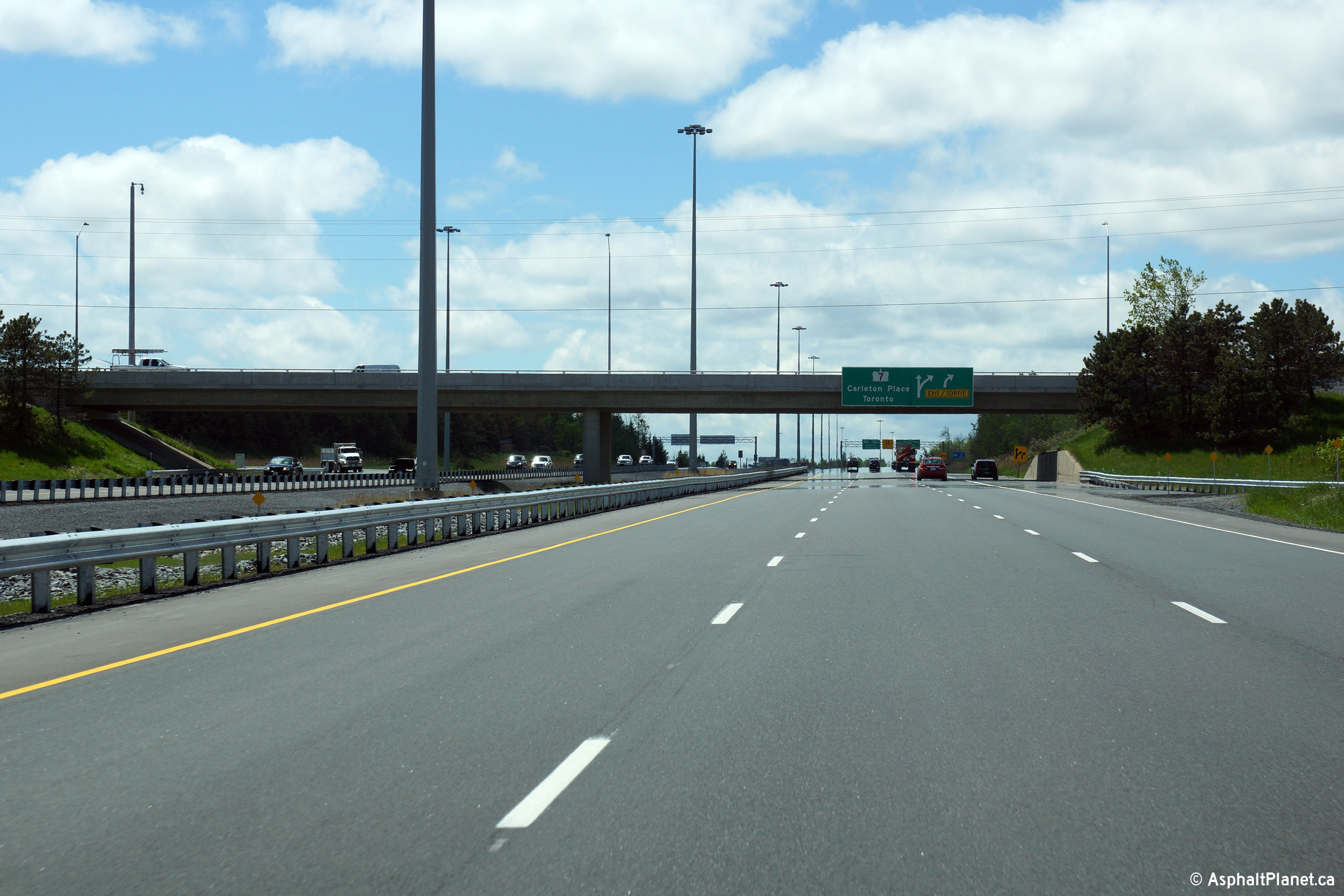
Two incarnations of the overhead signage at the westbound exit to Highway 7. The upper photo shows an older style of signage and gantry. The lower photo is a much more recently installed signage assembly. Click here for a photo of this signage taken in September, 2009 before Highway 417 was widened to six lanes.
Upper photo taken: October 23rd, 2004.
Lower photo taken: May 22nd, 2015. |
|
||
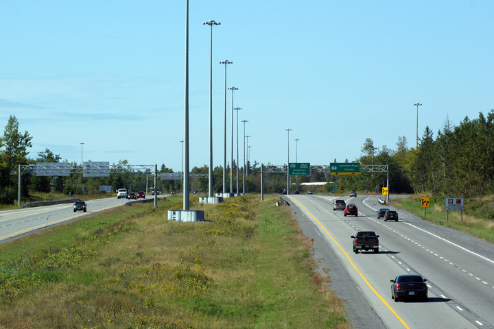
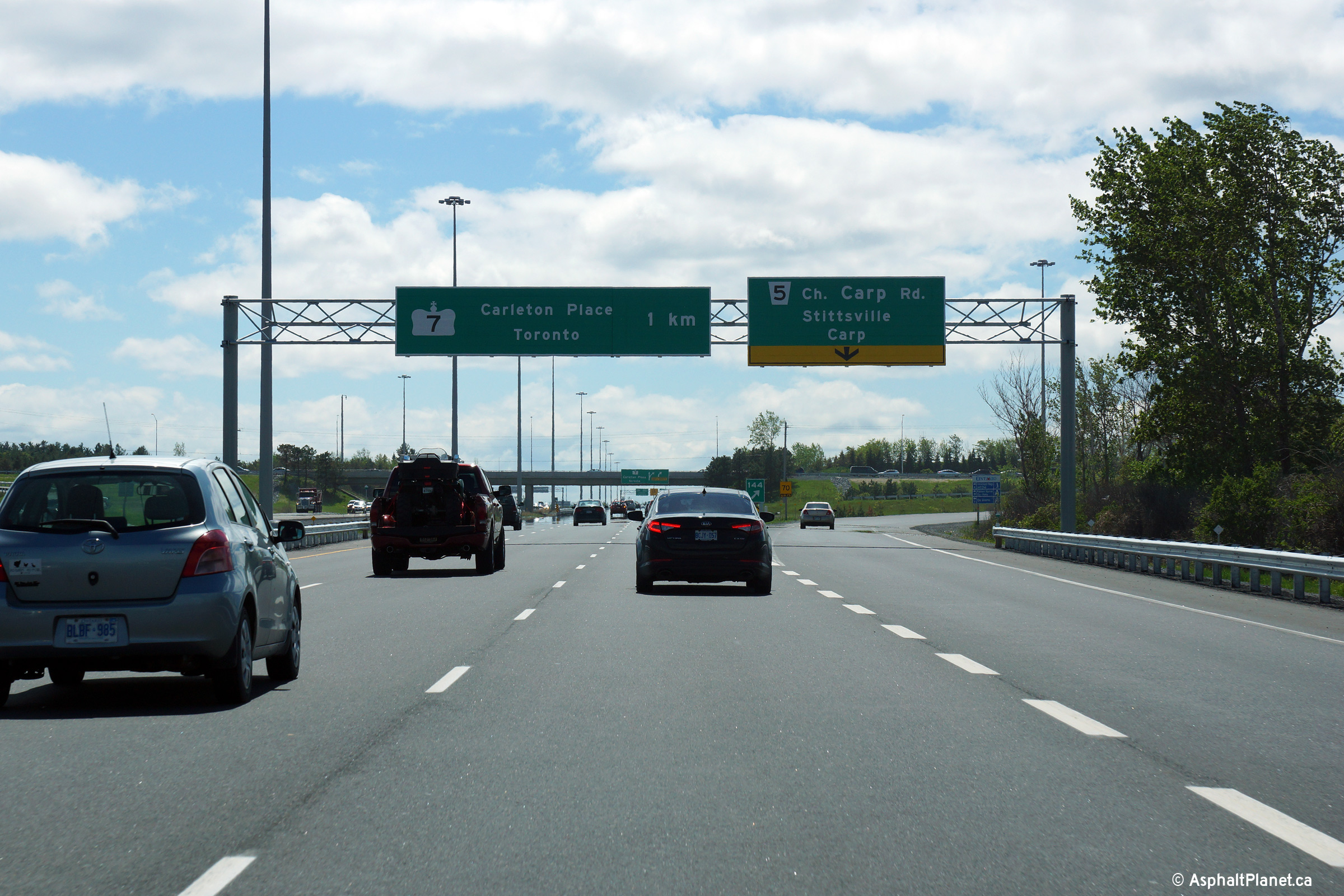
| City of Ottawa |
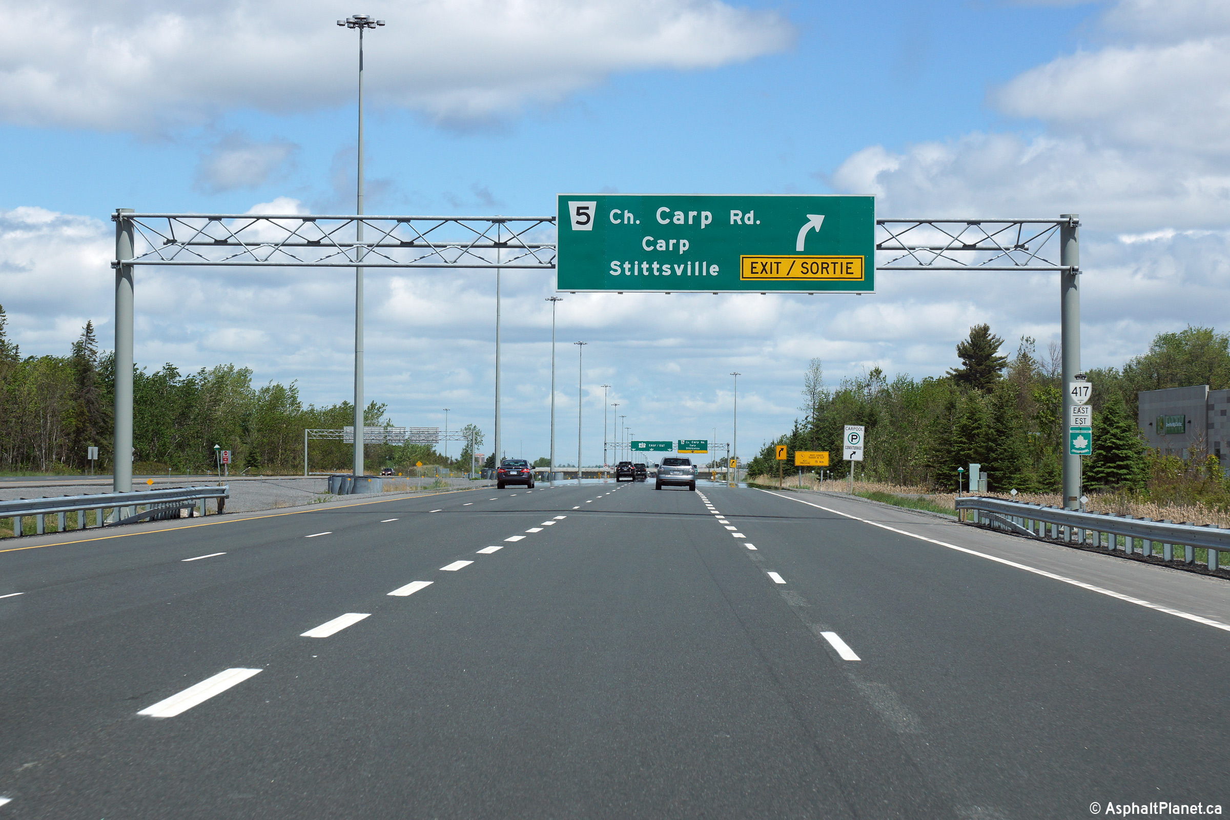
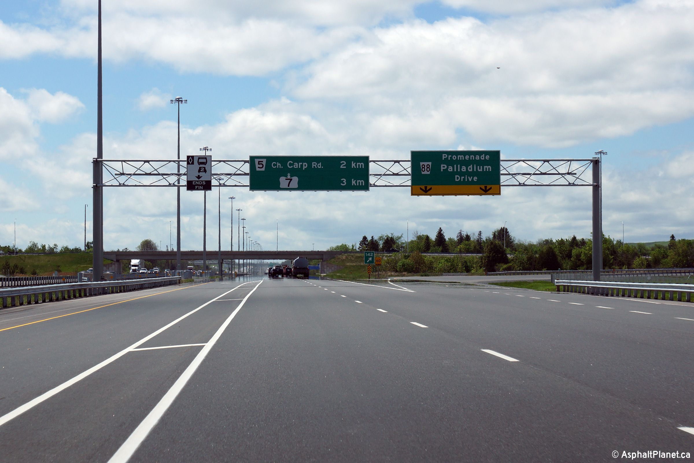
Eastbound advanced signage at the off-ramp to Carp Road. The
right-most freeway lane exits the freeway at this interchange. Beyond
Carp Road, Highway 417 has three eastbound general purpose lanes. Photo taken: May 22nd, 2015. |
 (720x480) (720x480)(1440x960) (2400x1600) |
||
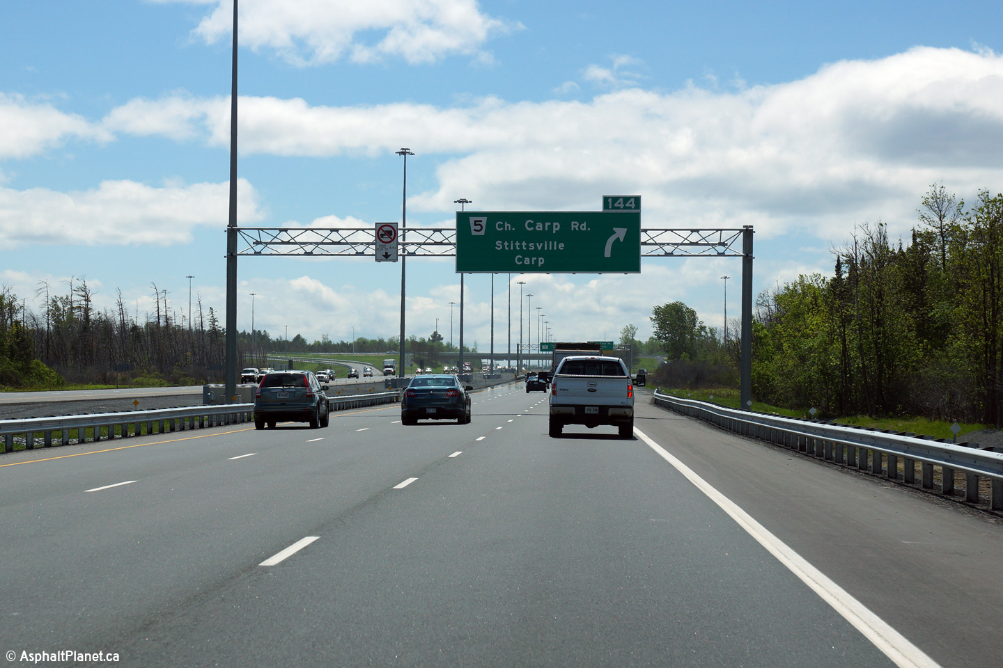
| City of Ottawa |
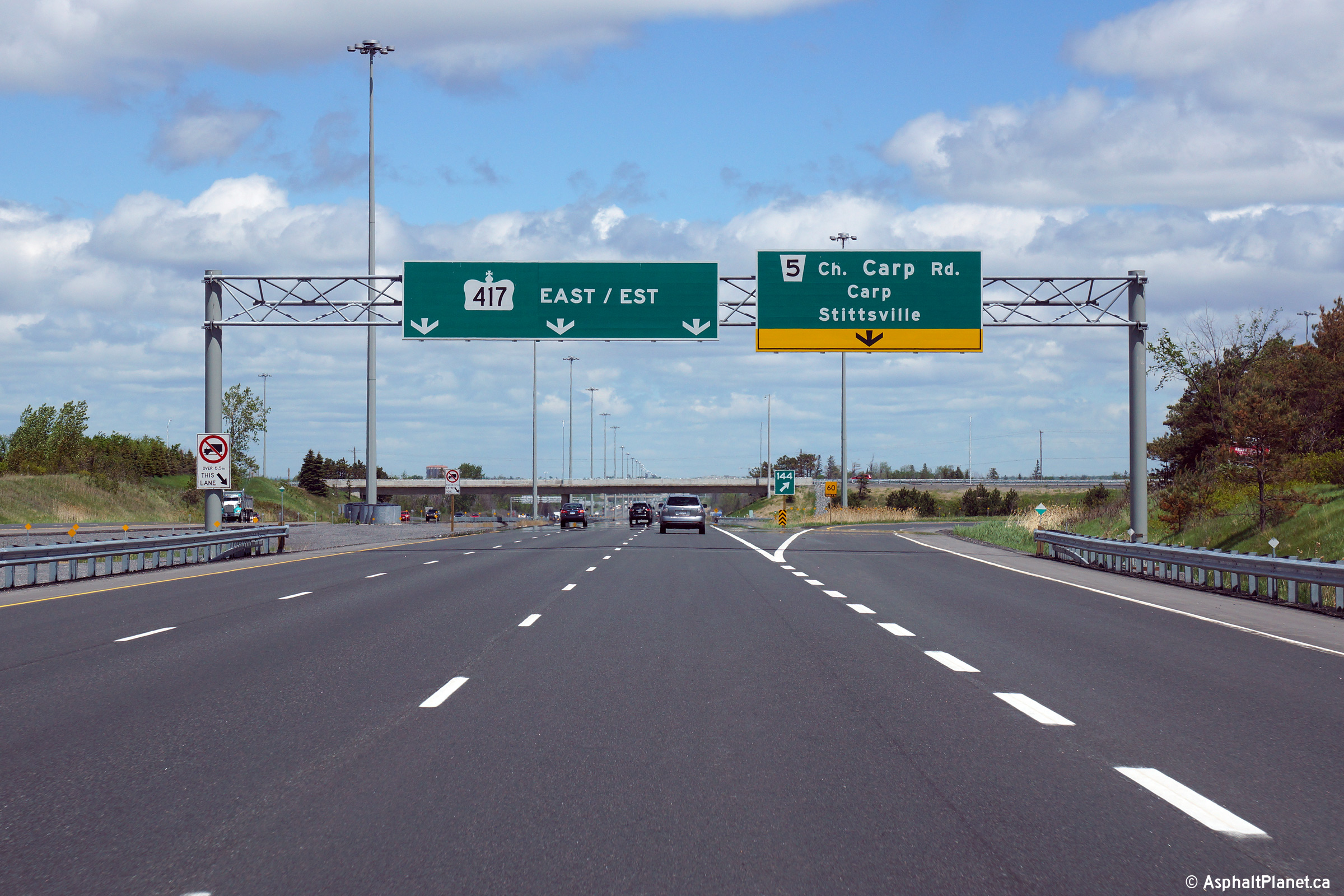
Easterly view at the off-ramp to Carp Road. Photo taken: May 22nd, 2015. |
 (720x480) (720x480)(1440x960) (2400x1600) |
||
| City of Ottawa |
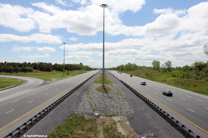
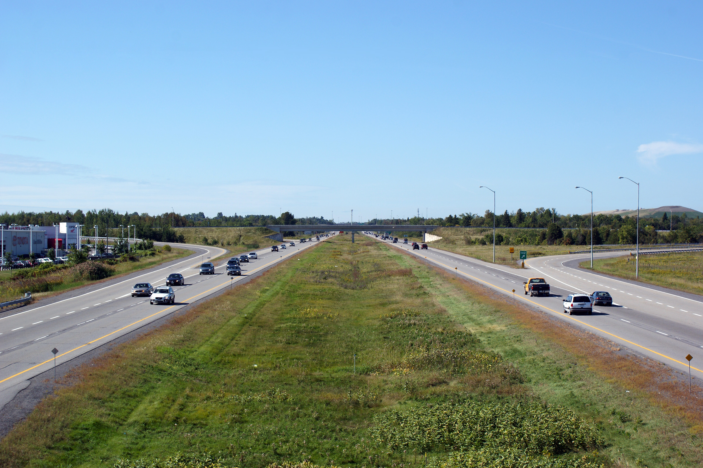
View looking westerly from the Carp Road overpass in western Kanata. Upper photo taken: September 12th, 2009. Lower photo taken: May 22nd, 2015. |
 (720x480) (1440x960) (2400x1600) 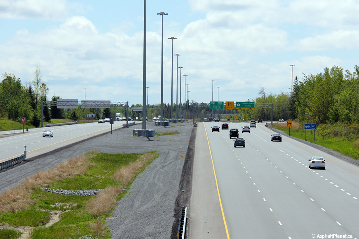 (720x480) (1440x960) (2400x1600) |
||
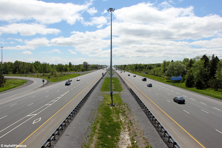
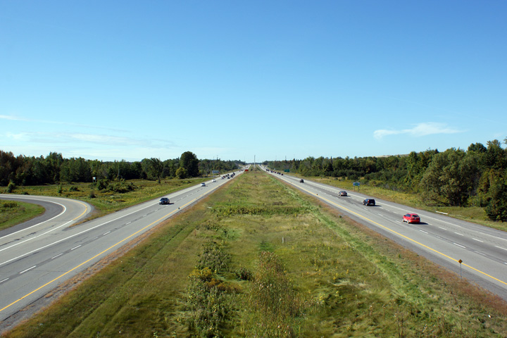
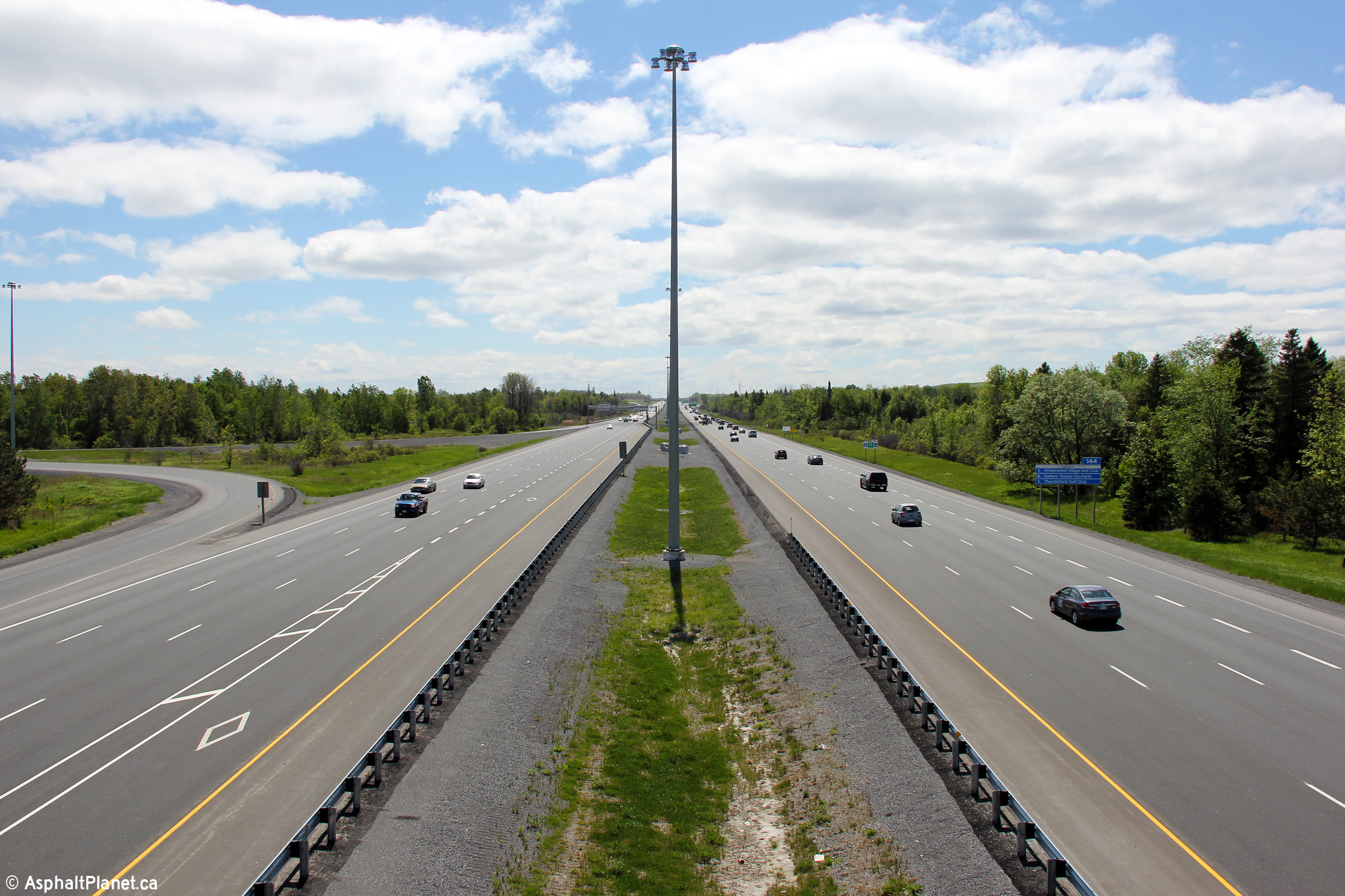
| City of Ottawa |
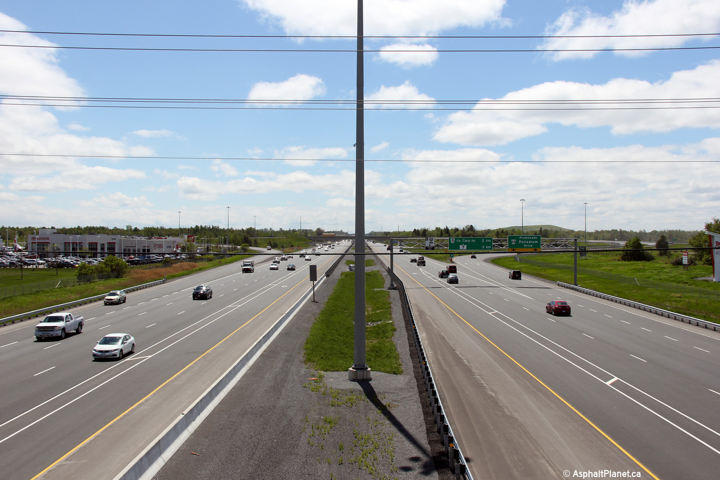
View looking easterly from the Carp road overpass. The high-mast lighting
was added through this interchange when the first stage of the Highway 7
freeway was opened en route to Carleton Place. Upper photo taken: September 12th, 2009. Lower photo taken: May 22nd, 2015. |
 (720x480) (1440x960) (2400x1600) 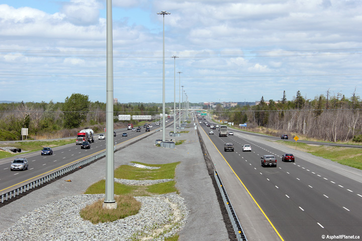 (720x480) (1440x960) (2400x1600) |
||
| City of Ottawa |
Overhead sign gantry for the Highway 7 interchange affixed to the Carp Road
overpass. Click here for a photo
of this signage taken before Highway 417 was widened to six lanes, taken in
September, 2009. Photos taken: May 22nd, 2015. |
 (720x480) (720x480)(1440x960) (2400x1600)  (720x480) (720x480)(1440x960) (2400x1600) |
||
| City of Ottawa |
Westerly view at the off-ramp to Carp Road. Photo taken: May 22nd, 2015. |
 (720x480) (720x480)(1440x960) (2400x1600) |
||
| City of Ottawa |
Westbound advanced signage for the Carp Road interchange. Photo taken: May 22nd, 2015. |
 (720x480) (720x480)(1440x960) (2400x1600) |
||
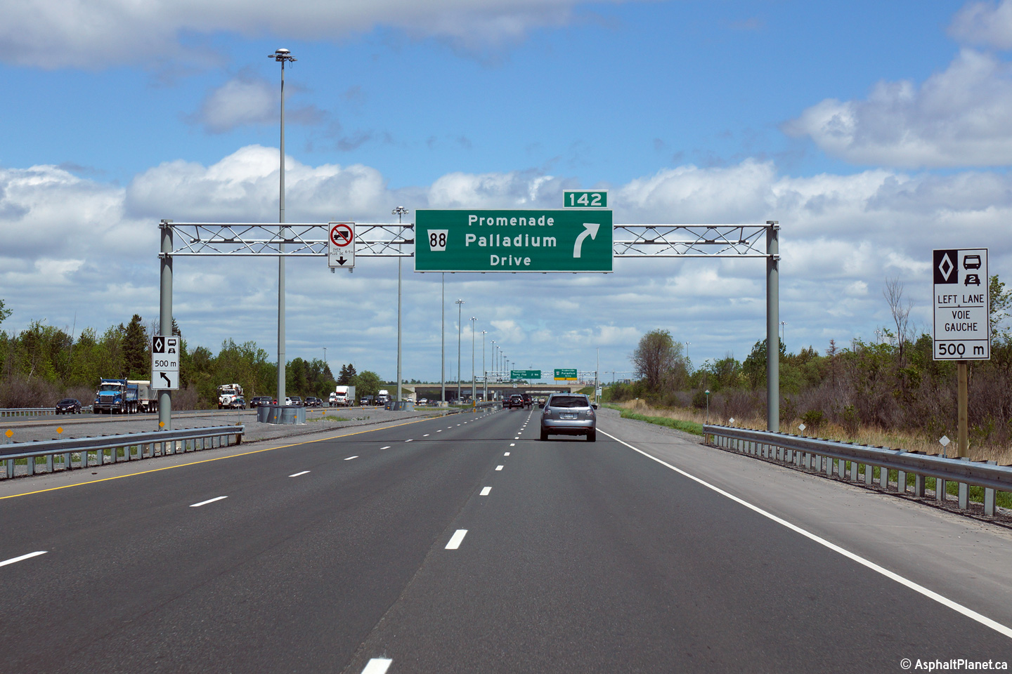
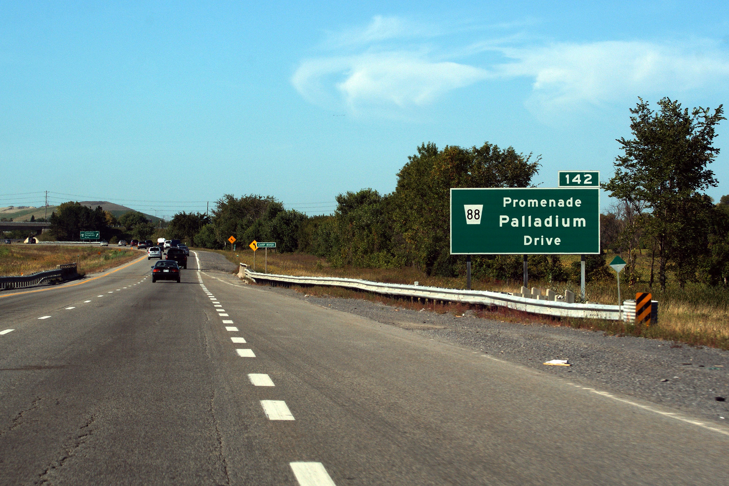
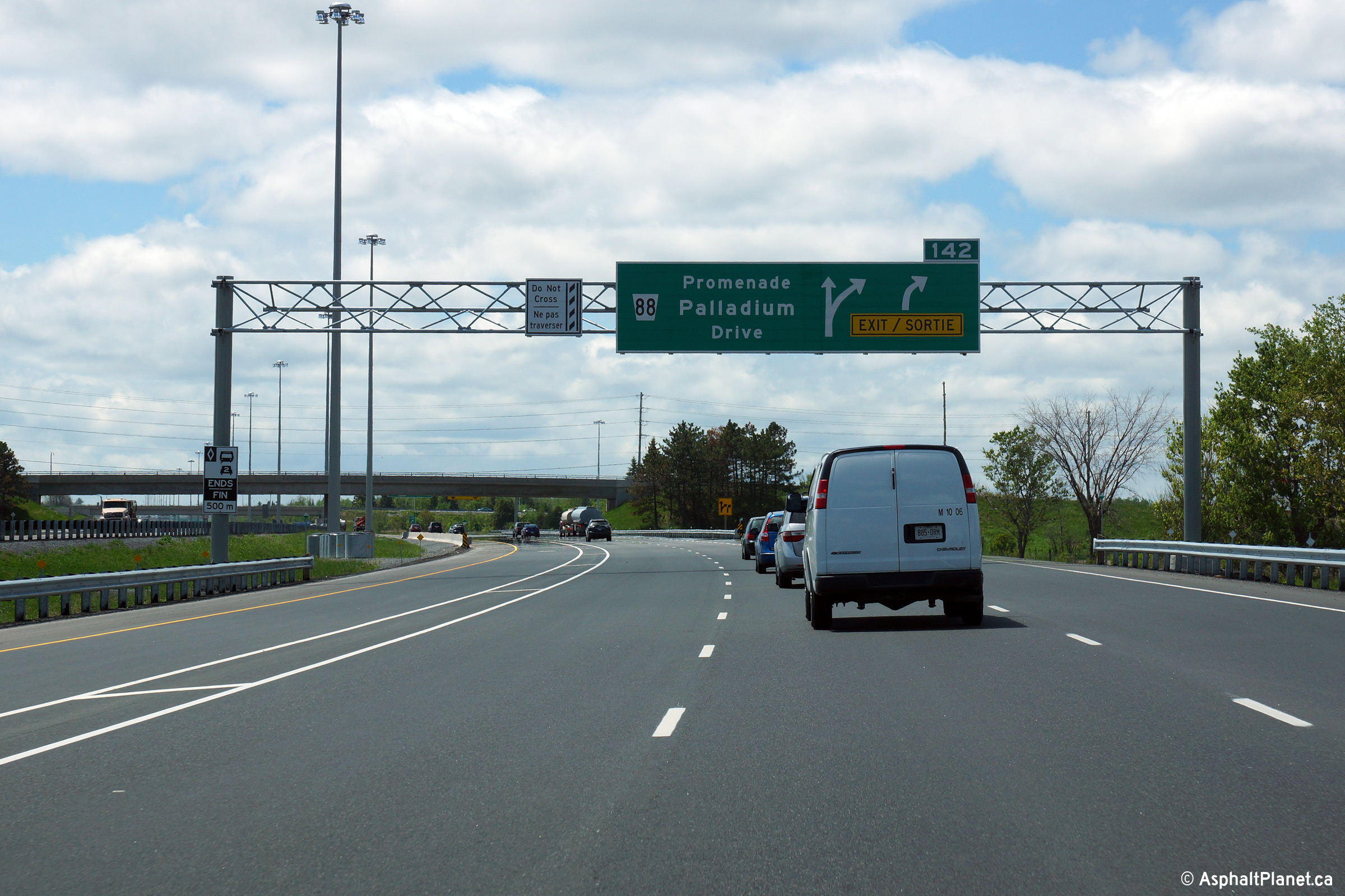
| City of Ottawa |
Eastbound advanced signage for the ramp to Palladium Drive. Photo taken: May 22nd, 2015. |
 (720x480) (720x480)(1440x960) (2400x1600) |
||
| City of Ottawa |
Easterly view at the off-ramp to Palladium Drive. The eastbound HOV
lane begins just east of the off-ramp to Palladium Drive. Photo taken: May 22nd, 2015. |
 (720x480) (720x480)(1440x960) (2400x1600) |
||
| City of Ottawa |
View looking easterly as Highway 417 passes beneath the Palladium Drive
overpass. Photo taken: May 22nd, 2015. |
 (720x480) (720x480)(1440x960) (2400x1600) |
||
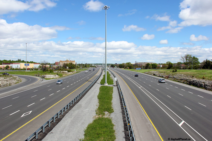
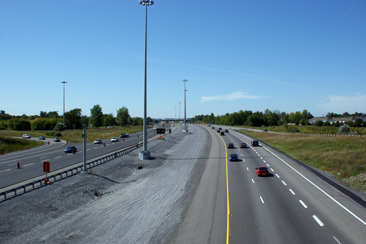
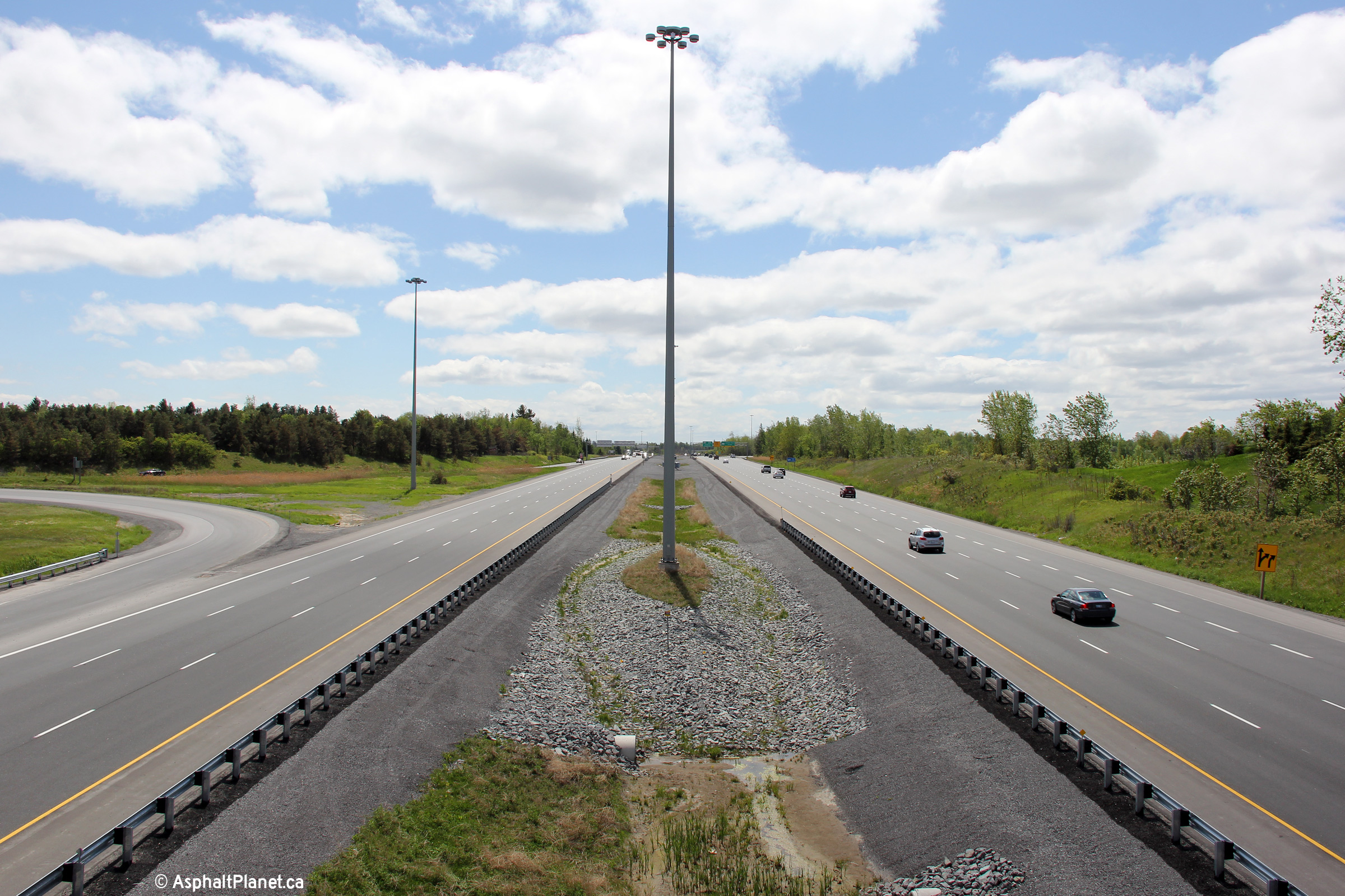
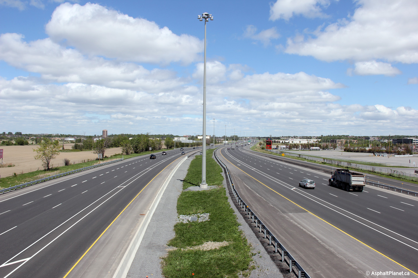
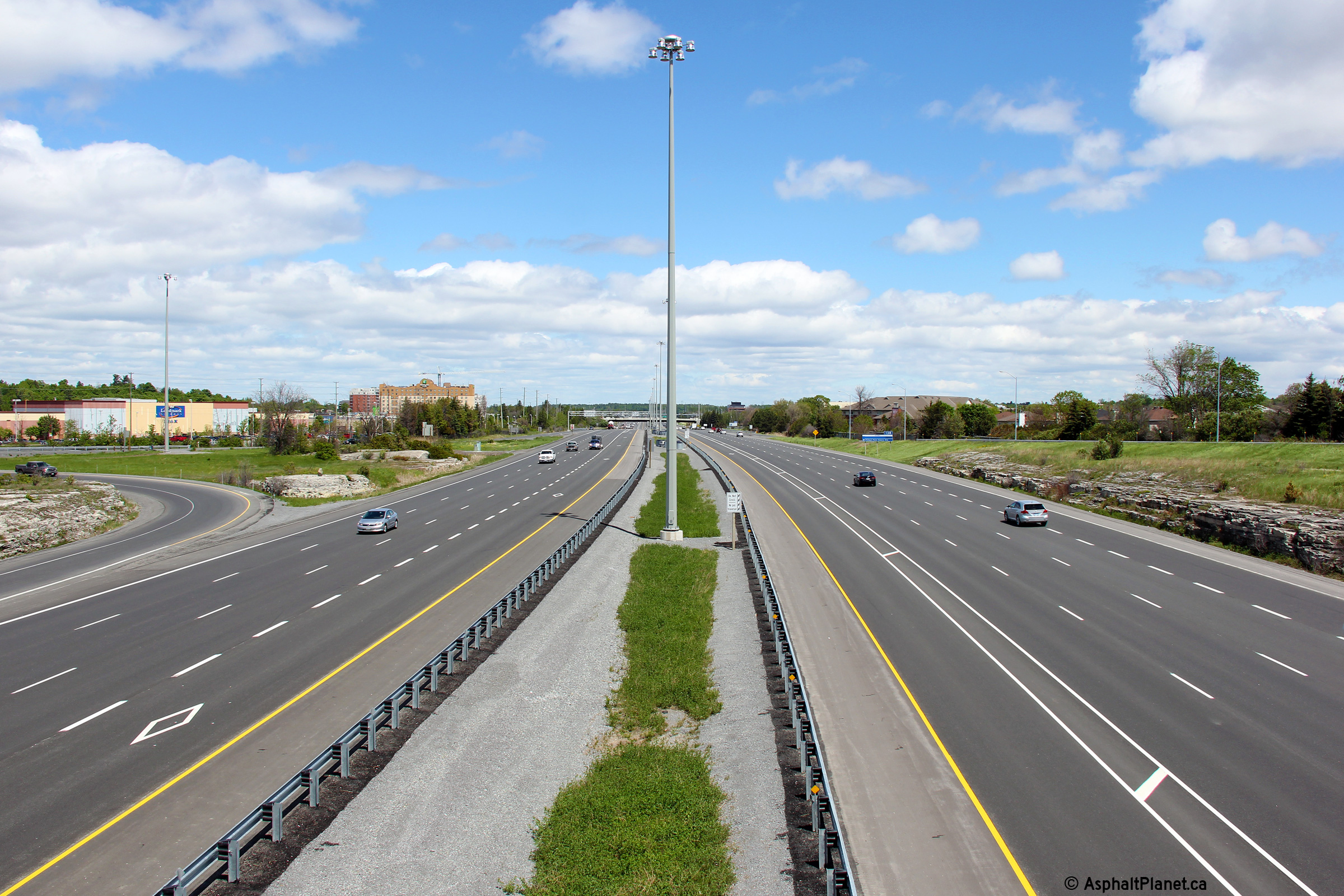
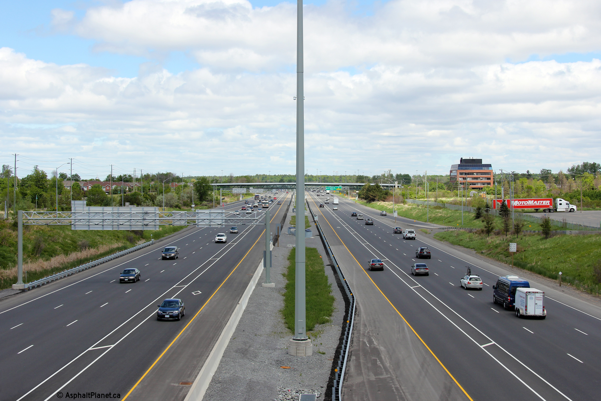
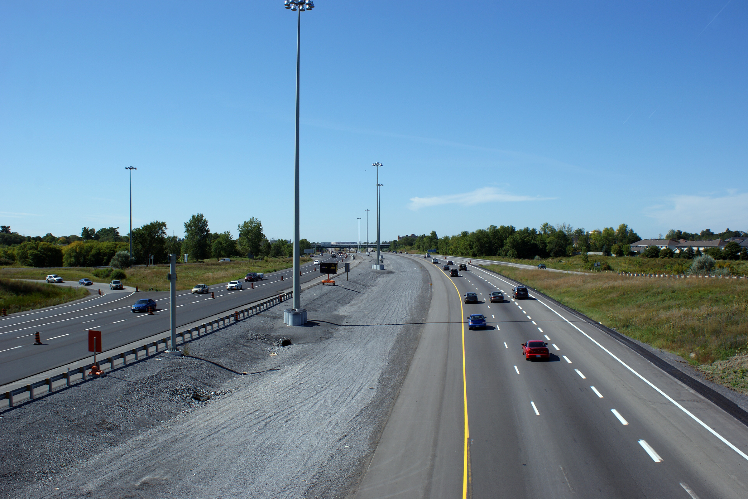
| City of Ottawa |
Two views looking westerly from the Palladium Drive overpass. The
post-widening (lower) photo shows Highway 417 as having an asymmetrical
cross-section due the different start and stop locations of the newly
constructed HOV lane. Upper photo taken: September 12th, 2009. Lower photo taken: May 22nd, 2015. |
 (720x480) (1440x960) (2400x1600) |
||
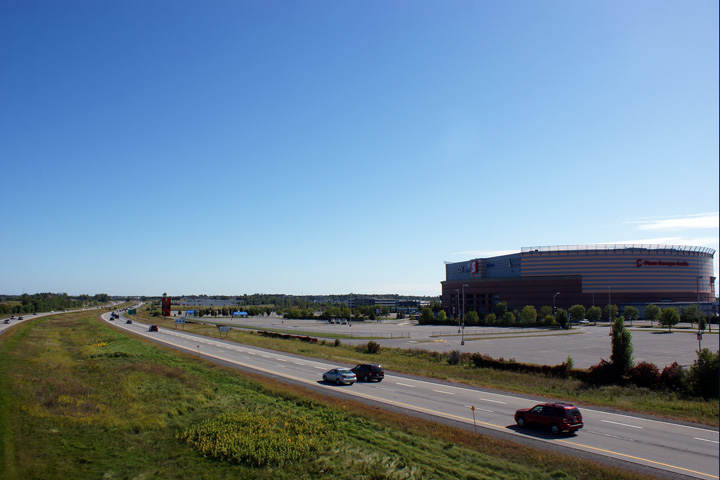
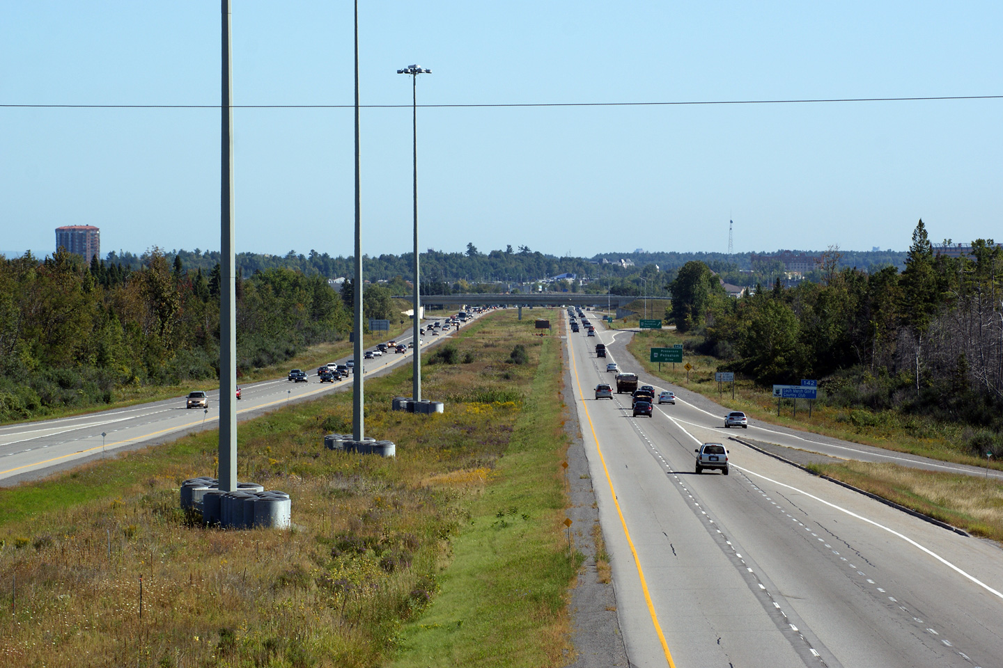
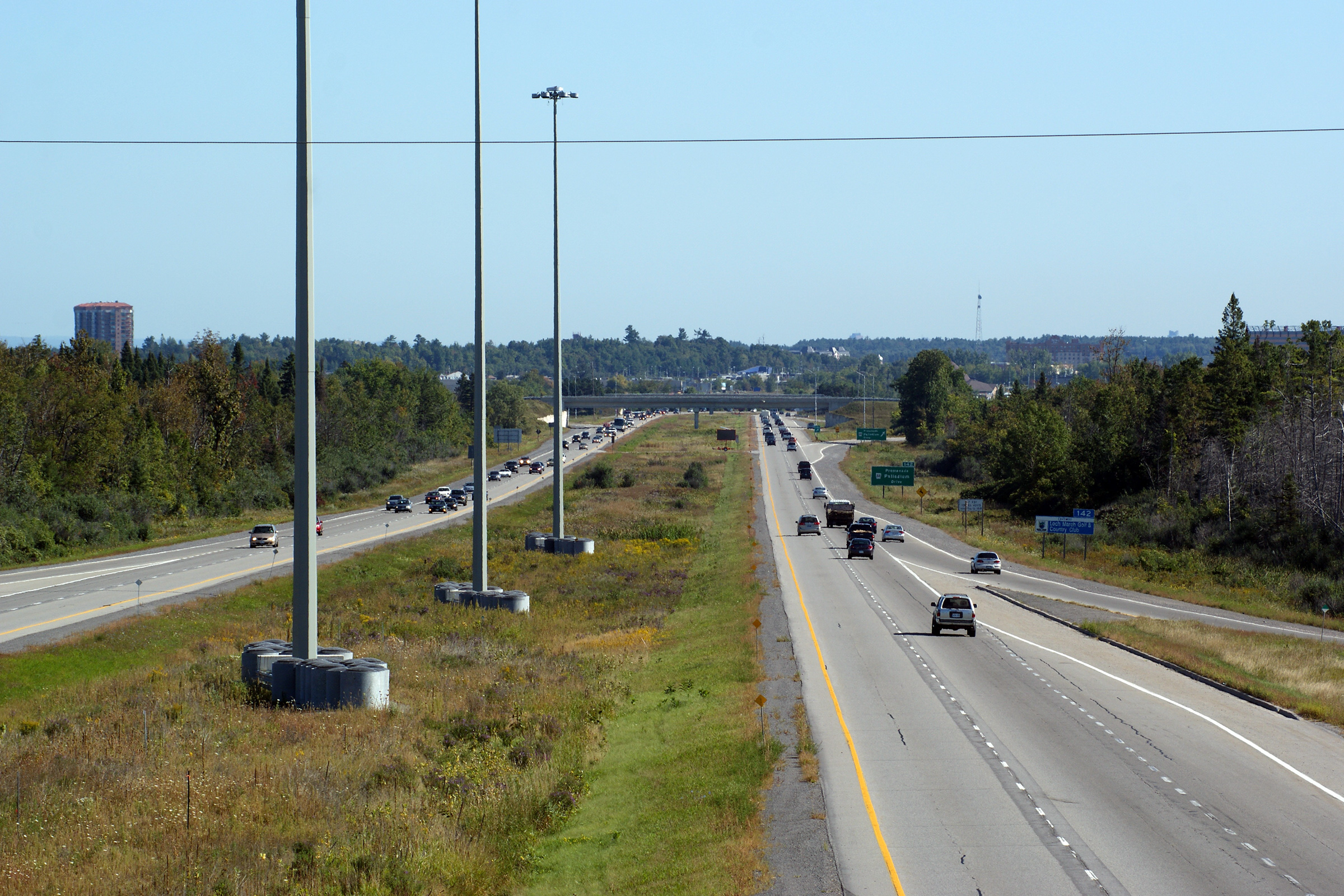
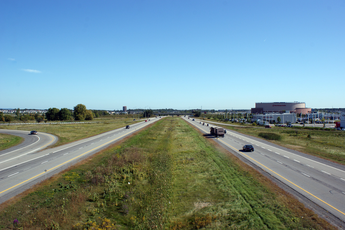
| City of Ottawa |
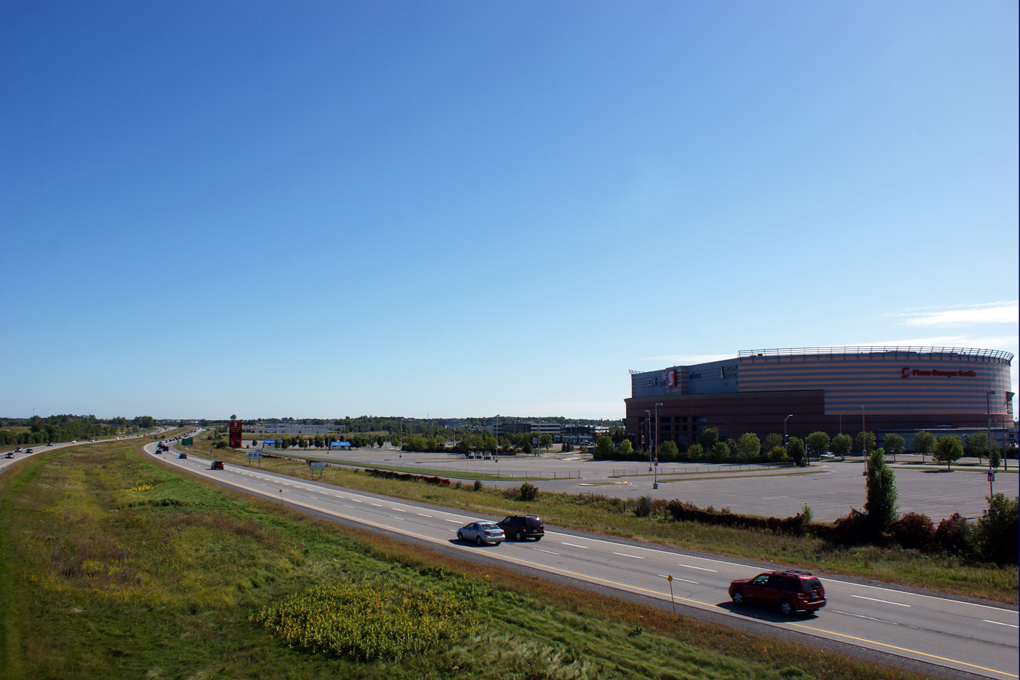
Easterly view from the Palladium Drive overpass. The Palladium was the
original name of today's (as of 2015) Canadian Tire Centre, home of the
Ottawa Sentators NHL franchise. Upper photo taken: September 12th, 2009. Lower photo taken: May 22nd, 2015. |
 (720x480) (1440x960) (2400x1600) |
||
| City of Ottawa |
View looking westerly at the off-ramp to Palladium Drive. The third
general purpose lane exits the freeway at Palladium Drive. Immediately
beyond the bullnose for the Palladium Drive interchange, the high occupancy
restriction of the HOV lane ends and the lane continues as a new general
purpose lane. Photo taken: May 22nd, 2015. |
 (720x480) (720x480)(1440x960) (2400x1600) |
||
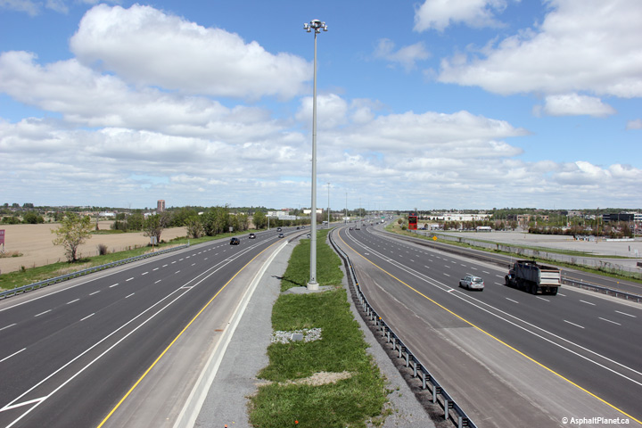
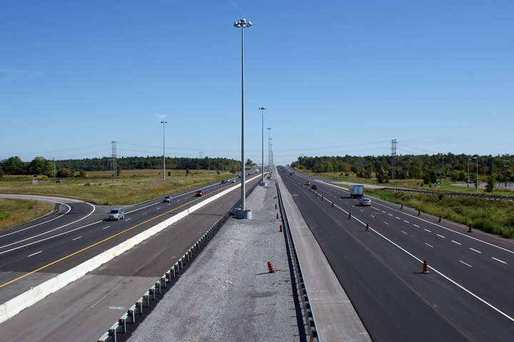
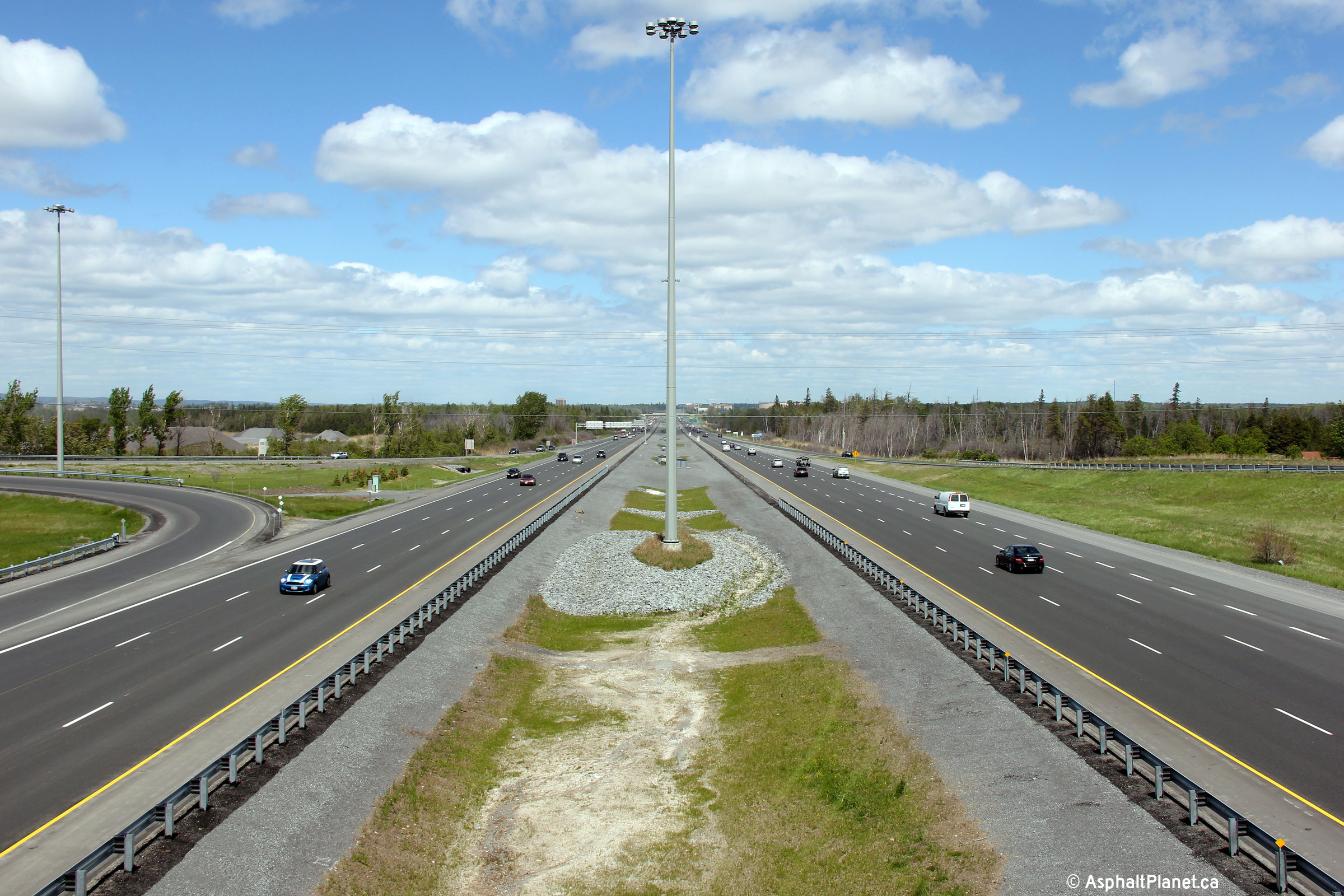
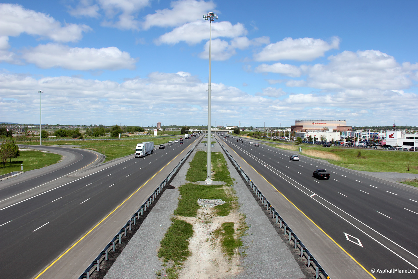
| City of Ottawa |
Westerly views from the Hunter Drive overpass towards the Palladium Drive
interchange. Upper photo taken: September 12th, 2009. Lower photo taken: May 22nd, 2015. |
 (720x480) (1440x960) (2400x1600) |
||
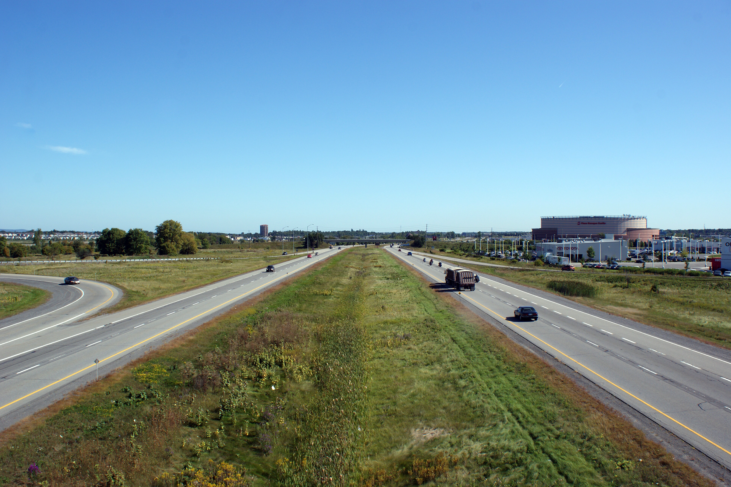
| City of Ottawa |
Two views looking easterly from the Hunter Drive overpass. In the
upper photo, the Canadian Tire Centre (then Scotiabank Place) is visible to
the south of the highway. Upper photo taken: September 12th, 2009. Lower photo taken: May 22nd, 2015. |
 (720x480) (1440x960) (2400x1600) |
||
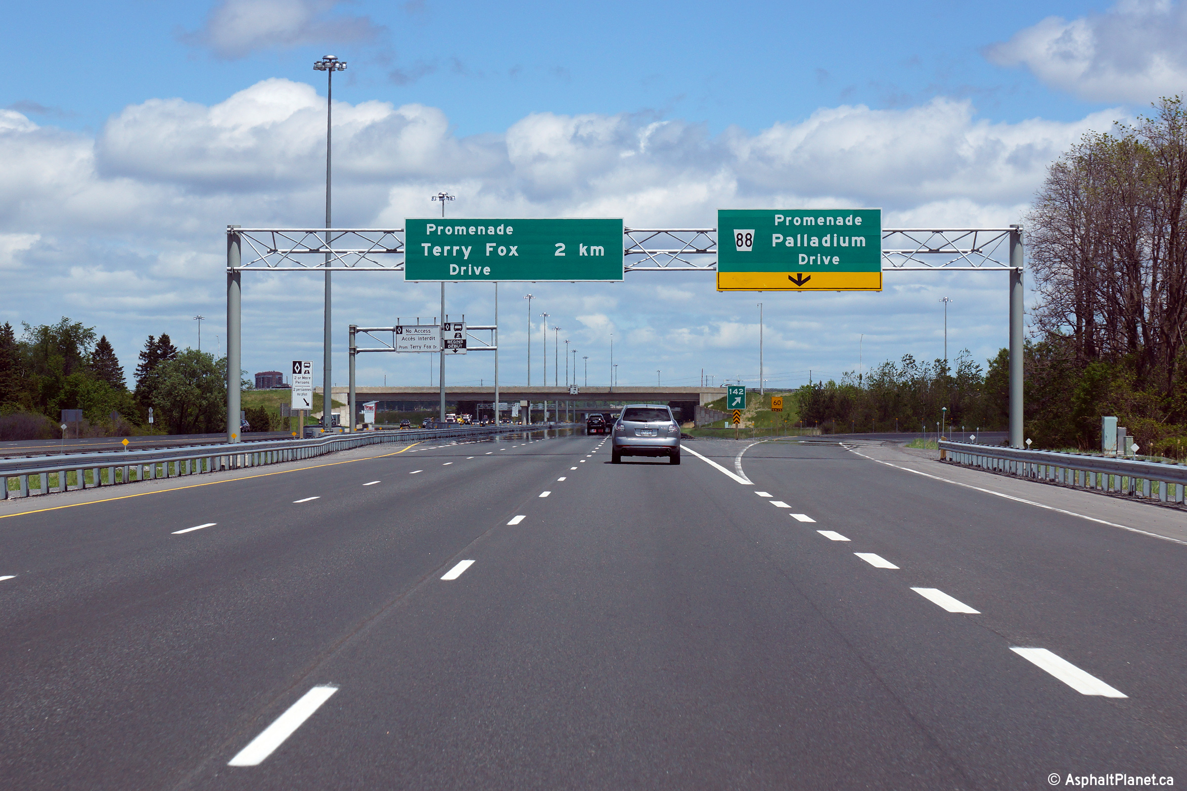
| City of Ottawa |
Advanced signage for Palladium Drive. Click
here for an image of the former ground
mounted signage that stood at this location, taken in September, 2009. Photo taken: May 22nd, 2015. |
|||
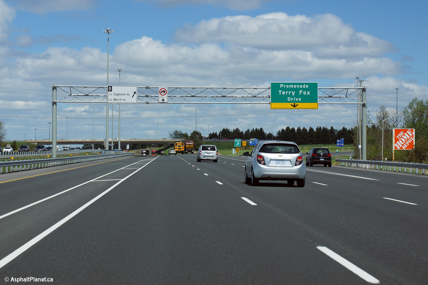
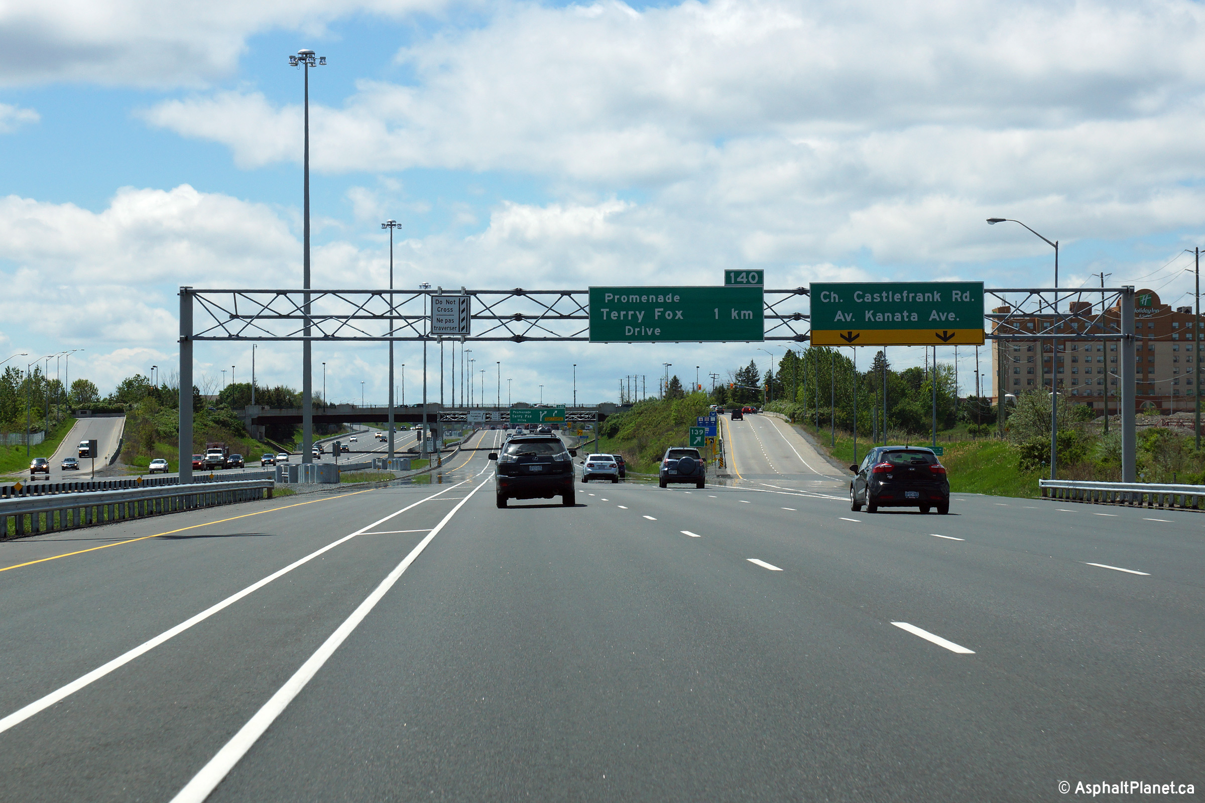
| City of Ottawa |
Eastbound advanced signage for the off-ramp to Terry Fox Drive. Photo taken: May 22nd, 2015. |
 (720x480) (720x480)(1440x960) (2400x1600) |
||
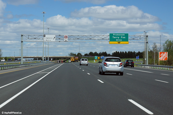
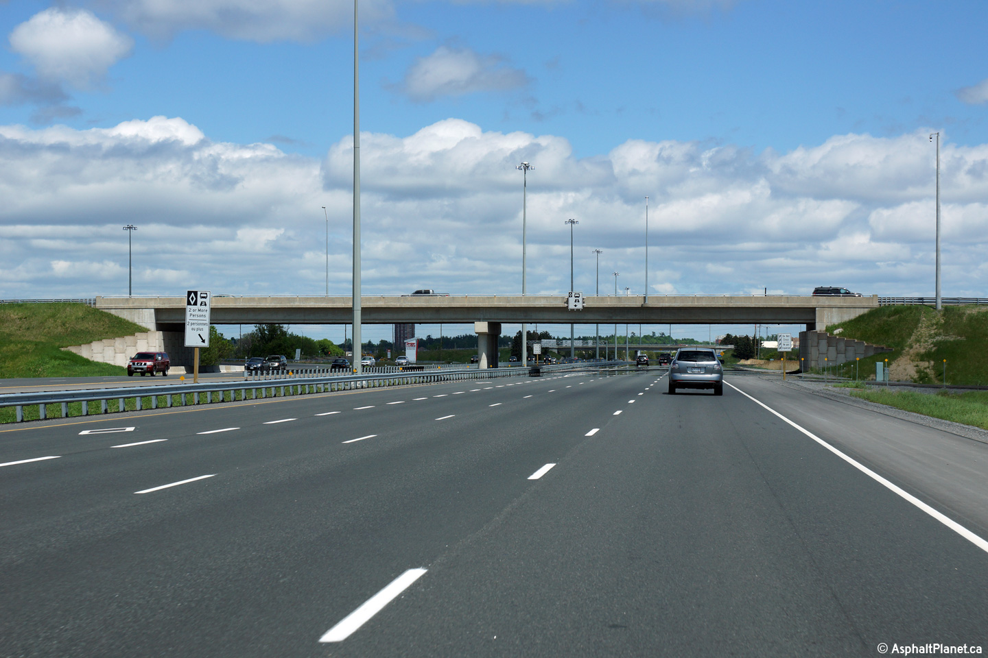
| City of Ottawa |
View as the ramp to Terry Fox Drive departs from the freeway mainline.
Note that a pre-advanced sign was not installed on this overhead sign
support in advance of the Eagleson Road interchange. Although MTO's
Book 8 is not exactly specific on when a pre-advanced sign is warranted on
an overhead sign support, the lack of a pre-advanced sign in this location
is not consistent with how other suburban freeways are signed in other
regions of the province. Photo taken: May 22nd, 2015. |
 (720x480) (720x480)(1440x960) (2400x1600) |
||
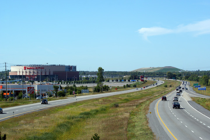
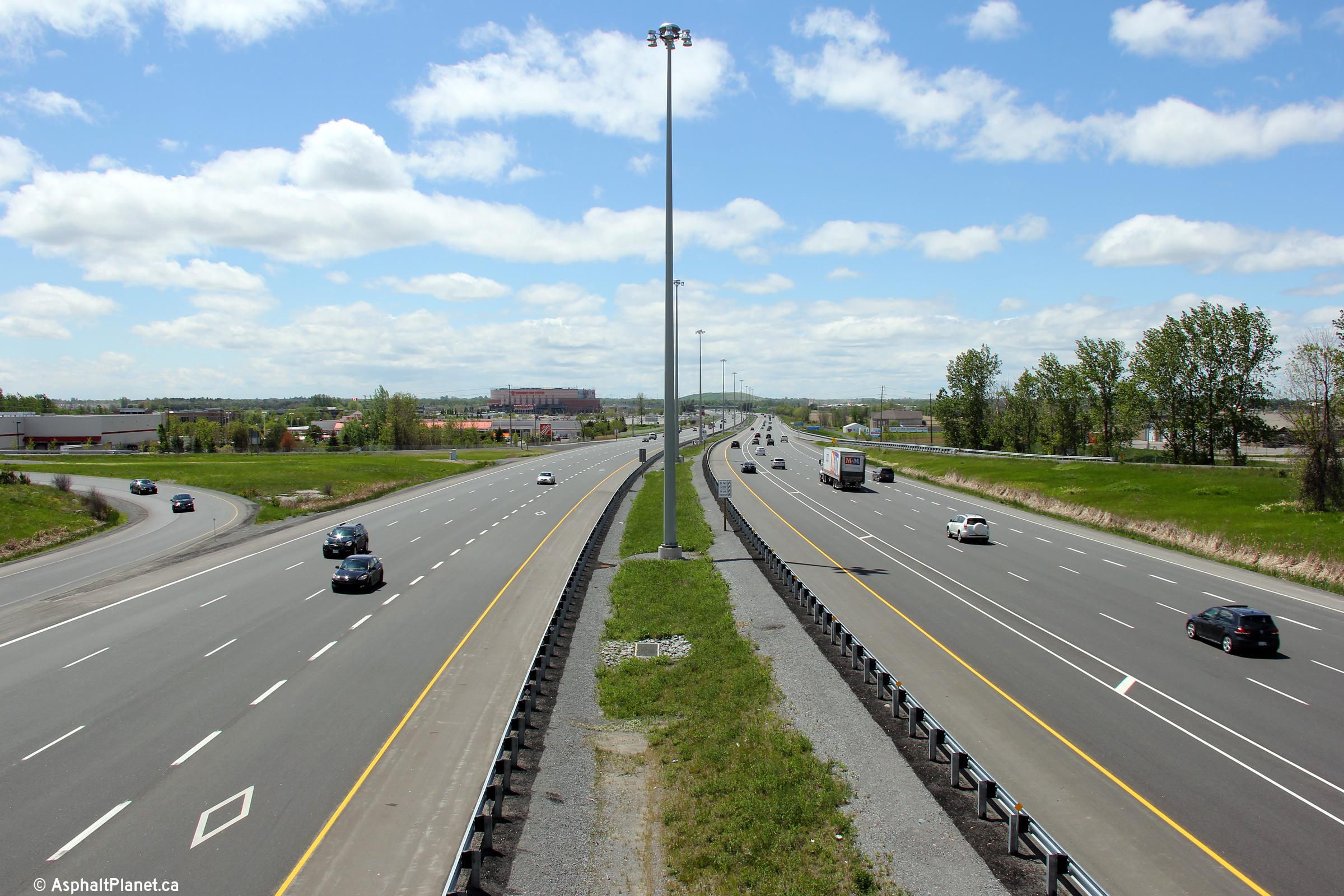
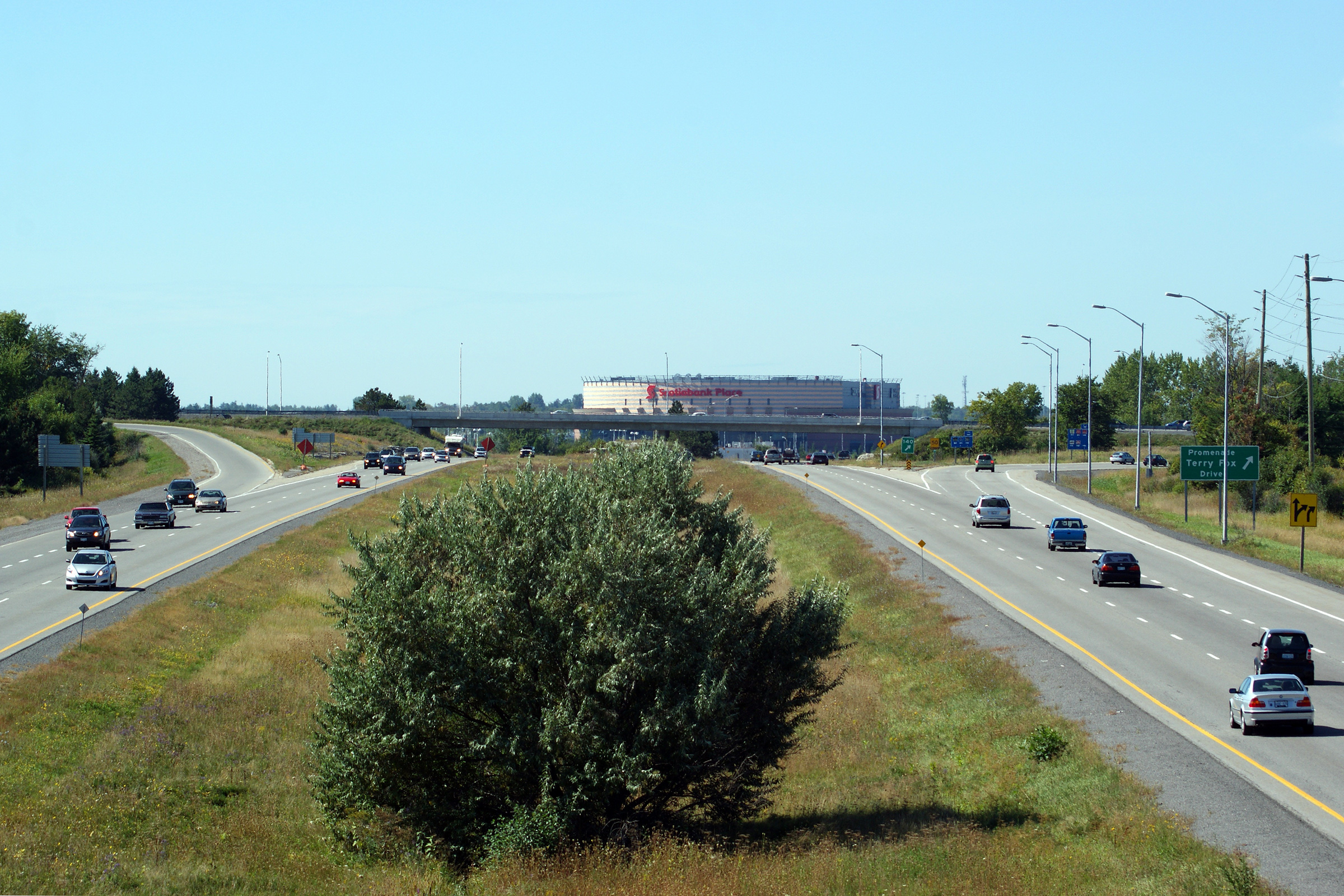
| City of Ottawa |
Westerly views from Terry Fox Drive as the 417 gently curves around the north
side of the Canadian Tire Centre Upper photo taken: September 12th, 2009. Lower photo taken: May 22nd, 2015. |
 (720x480) (1440x960) (2400x1600) |
||
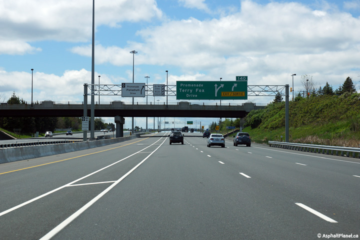
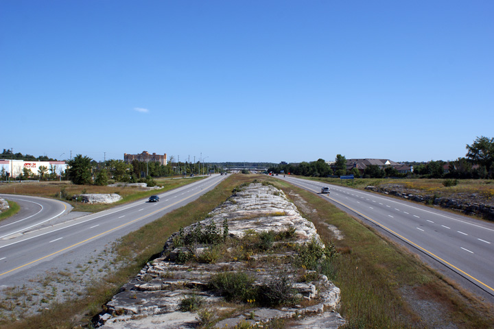
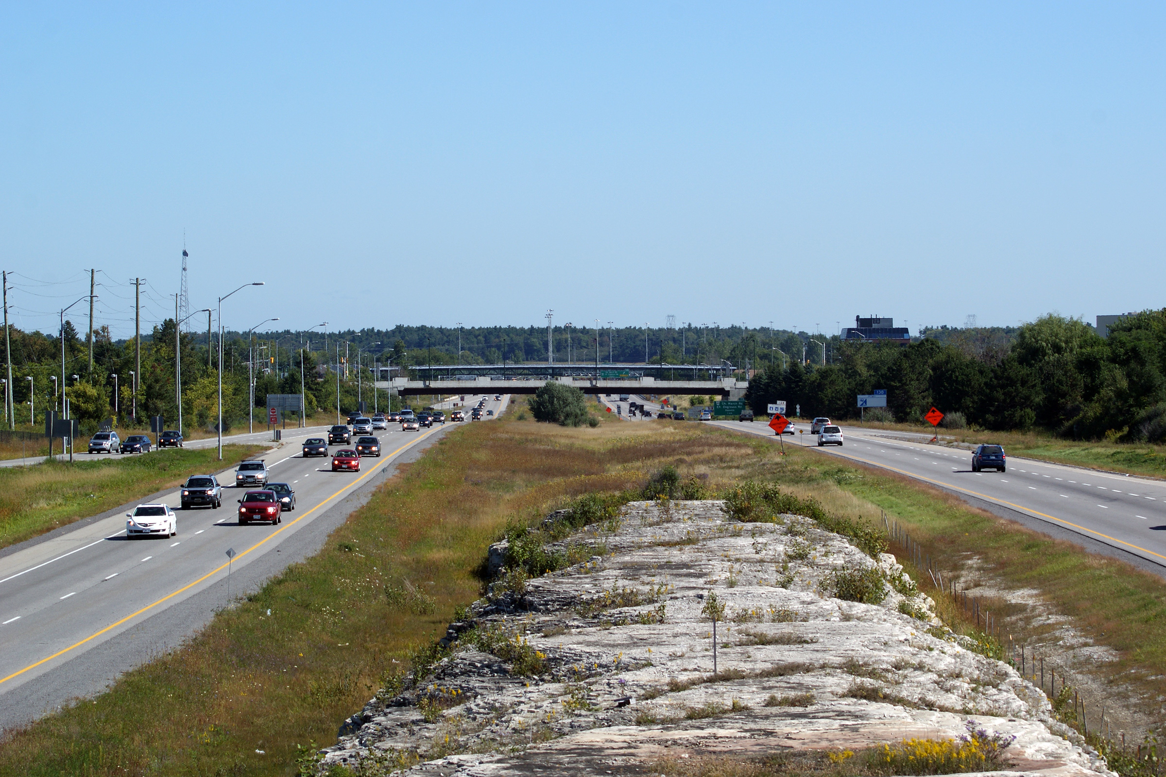
| City of Ottawa |
A series of three easterly views from the Terry Fox Drive overpass.
Note that the large outcropping
of rock that separated the eastbound and westbound carriageways east of the
Terry Fox Drive overpass was removed as part of the highway widening
project. Upper photos taken: September 12th, 2009. Lower photo taken: May 22nd, 2015. |
 (720x480) (1440x960) (2400x1600) |
||
| City of Ottawa |
View looking westerly at the off-ramp to Terry Fox Drive. Photo taken: May 22nd, 2015. |
 (720x480) (720x480)(1440x960) (2400x1600) |
||
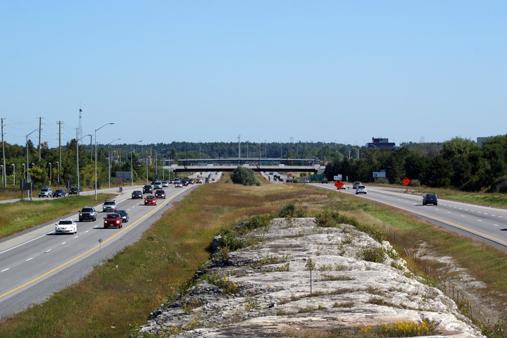
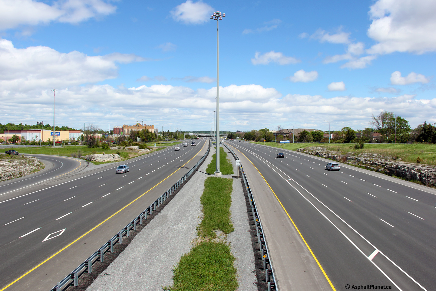
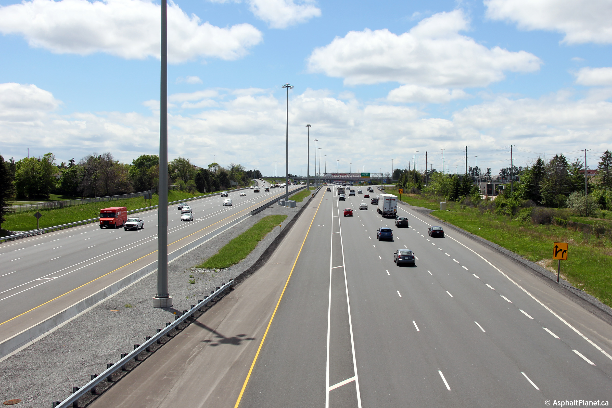
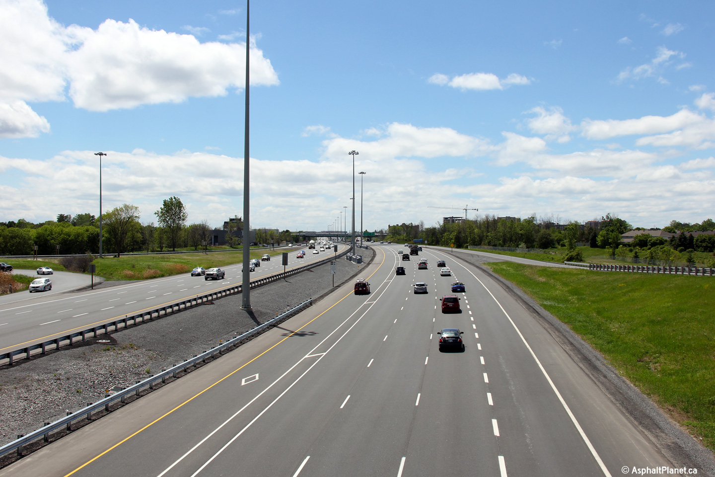
| City of Ottawa |
Two views looking westerly towards the Terry Fox Drive interchange from the Kanata Avenue
overpass. MTO's Eastern Region has painted the striped HOV buffer
slightly differently than the MTO's Central Region has striped the HOV
buffer on GTA freeways. Upper photo taken: September 24th, 2009. Lower photo taken: May 22nd, 2015. |
 (720x480) (1440x960) (2400x1600) |
||
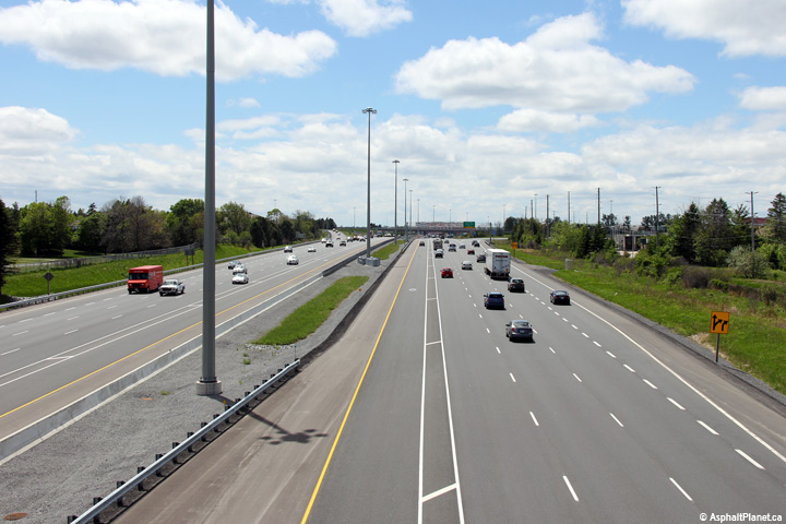
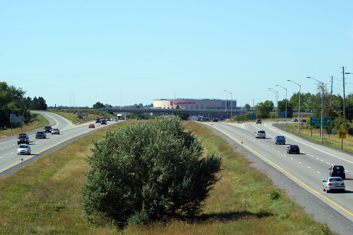
| City of Ottawa |
Easterly view from the Kanata Avenue overpass. Upper photo taken: September 12th, 2009. Lower photo taken: May 22nd, 2015. |
 (720x480) (1440x960) (2400x1600) |
||
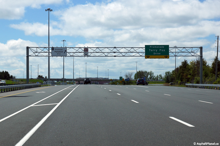
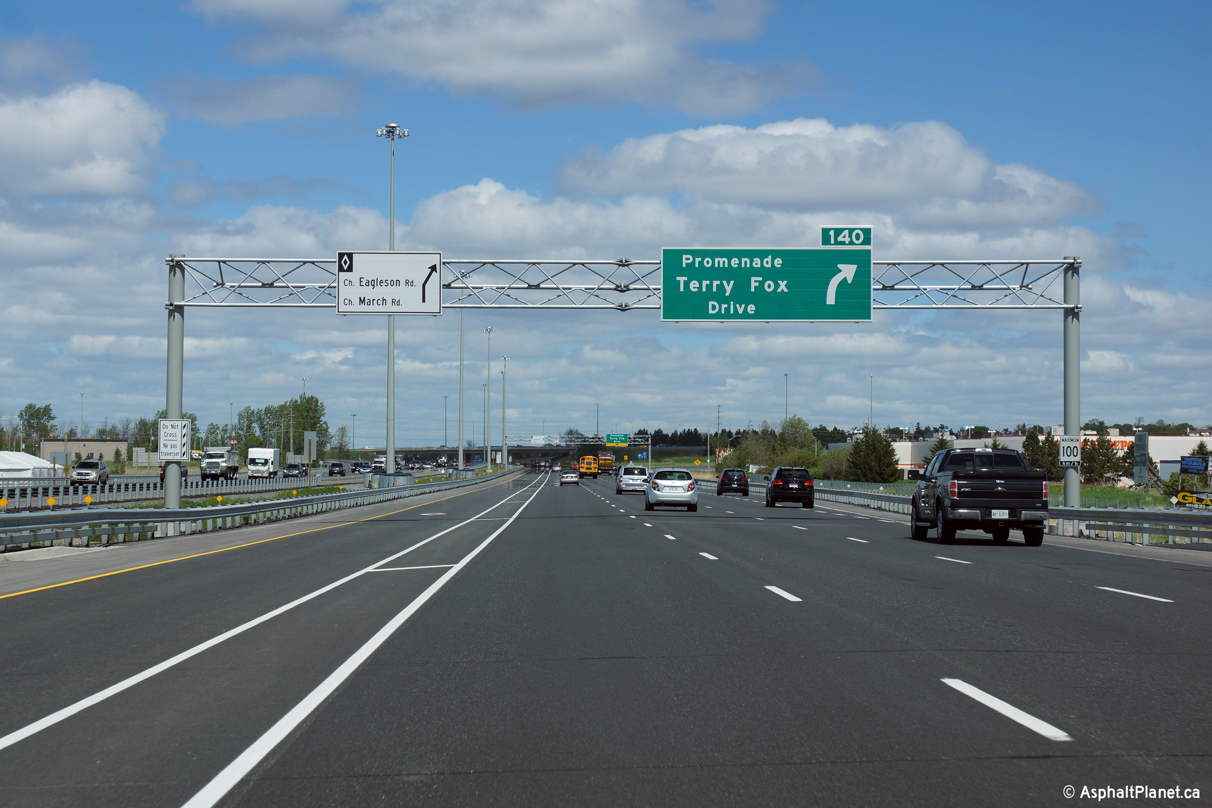
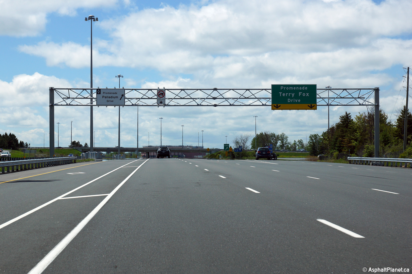
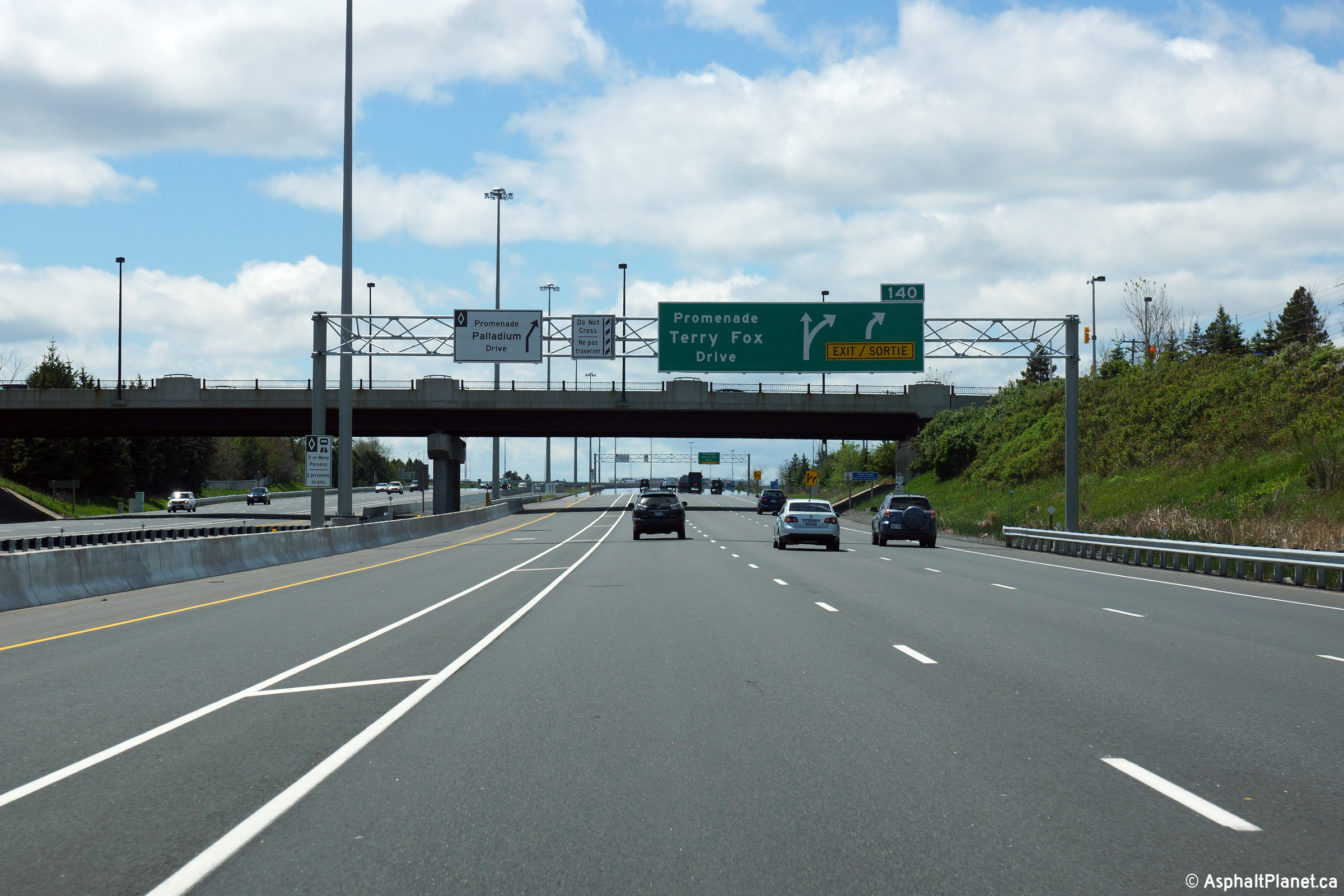
| City of Ottawa |
The westbound advanced signage for Terry Fox Drive uses the incorrect
advanced arrow sign. A yellow "exit/sortie" bar should not be used on
this signage because the right hand lane of the freeway is not forced as an
exiting lane at the Terry Fox Drive interchange. Instead, a new speed
change lane develops downstream of this overhead signage for the exit. Photo taken: May 22nd, 2015. |
 (720x480) (720x480)(1440x960) (2400x1600) |
||
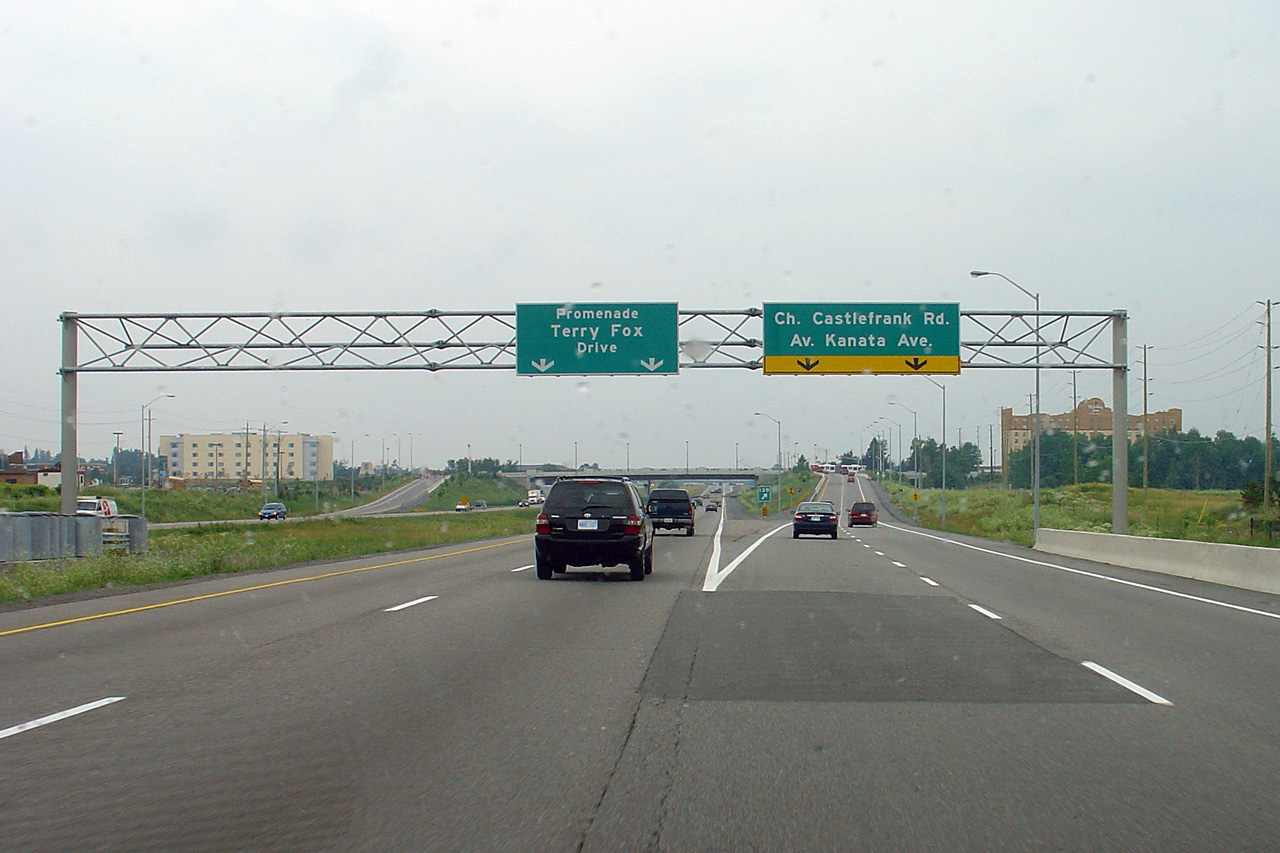
| City of Ottawa |
Westerly view as the off-ramp to Castlefrank Road departs the freeway
mainline. Click here for an
image of the signage that stood at this location before the 417 was widened
in July, 2005. Photo taken: May 22nd, 2015. |
 (720x480) (720x480)(1440x960) (2400x1600) |
||
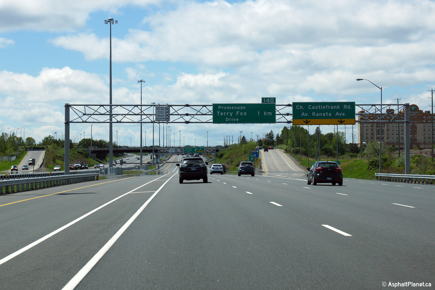
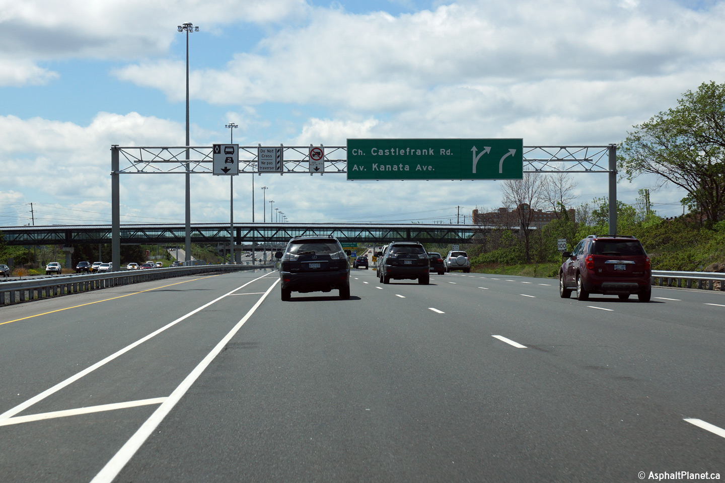
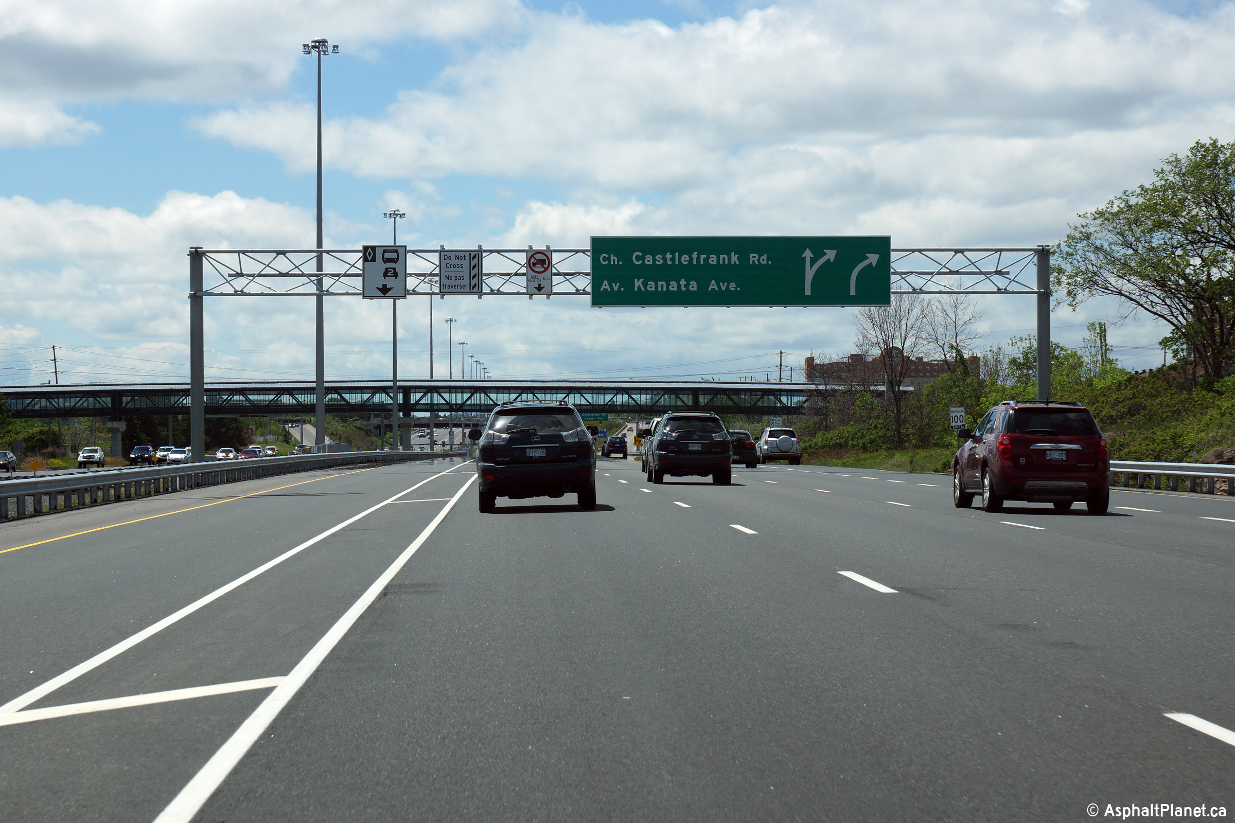
| City of Ottawa |
Westbound advanced signage for the off-ramp to Castlefrank Road. The
wrong advanced arrow sign was used on this signage. A yellow
"exit/sortie" bar should have been used beneath the arrows, as the
right-most freeway lane exits the freeway at this interchange. Photo taken: May 22nd, 2015. |
 (720x480) (720x480)(1440x960) (2400x1600) |
||
| City of Ottawa |
Eastbound advanced signage for the off-ramp to Eagleson Road. Photo taken: May 22nd, 2015. |
 (720x480) (720x480)(1440x960) (2400x1600) |
||
| City of Ottawa |
Signage at the eastbound off-ramp to Eagleson Road. Photo taken: May 22nd, 2015. |
 (720x480) (720x480)(1440x960) (2400x1600) |
||
| City of Ottawa |
Two westerly views from the Eagleson Road overpass. Upper photo taken: September 12th, 2009. Lower photo taken: May 22nd, 2015. |
 |
||
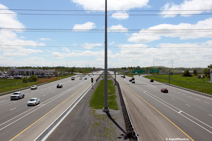
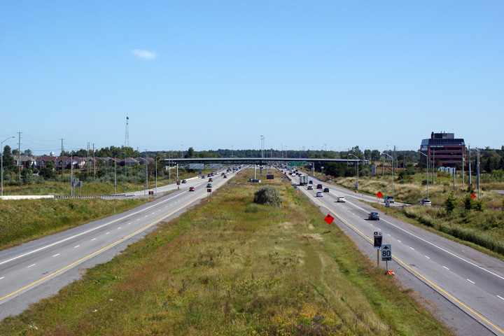
| City of Ottawa |
Two views looking easterly from the Eagleson Road overpass. When the upper
photos were taken in September of 2009, the Eagleson Road interchange marked
the temporary western terminus of a multi-stage widening project that saw
Highway 417 widened to six and eight lanes between Highway 7 and Highway
416. The lower photo was taken shortly after the second and final
stage of the project had been completed in 2014. Upper photos taken: September 12th, 2009. Lower photos taken: May 22nd, 2015. |
 (720x480) (1440x960) (2400x1600) |
||
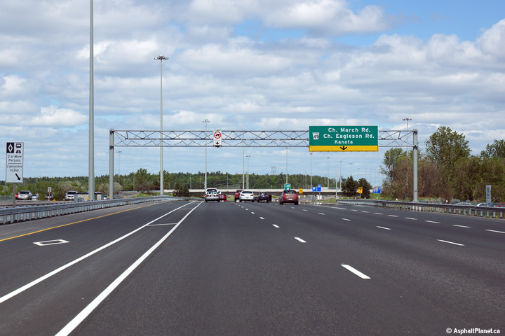
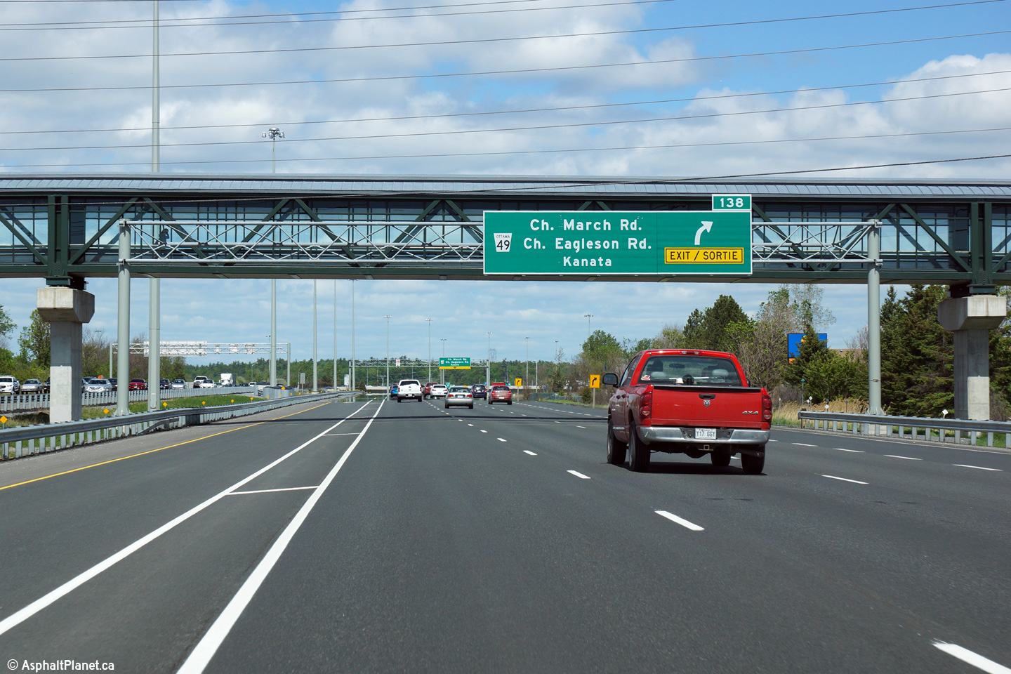
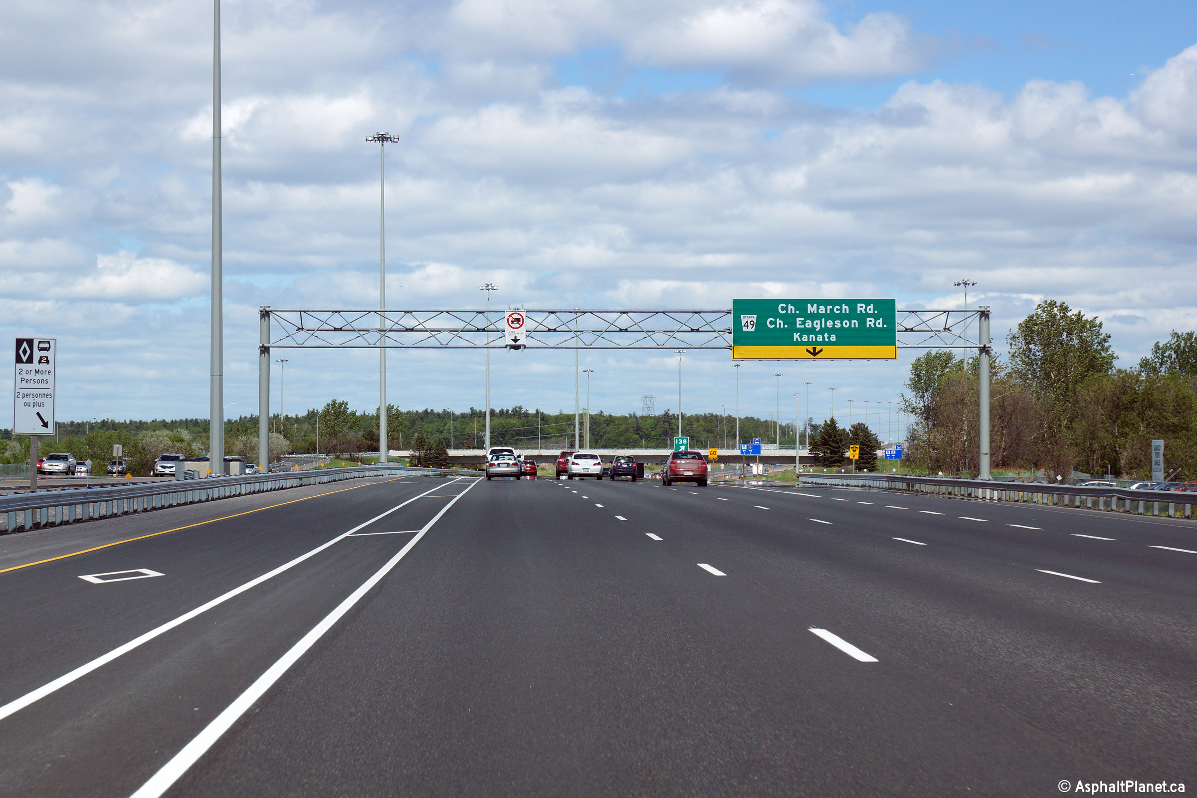
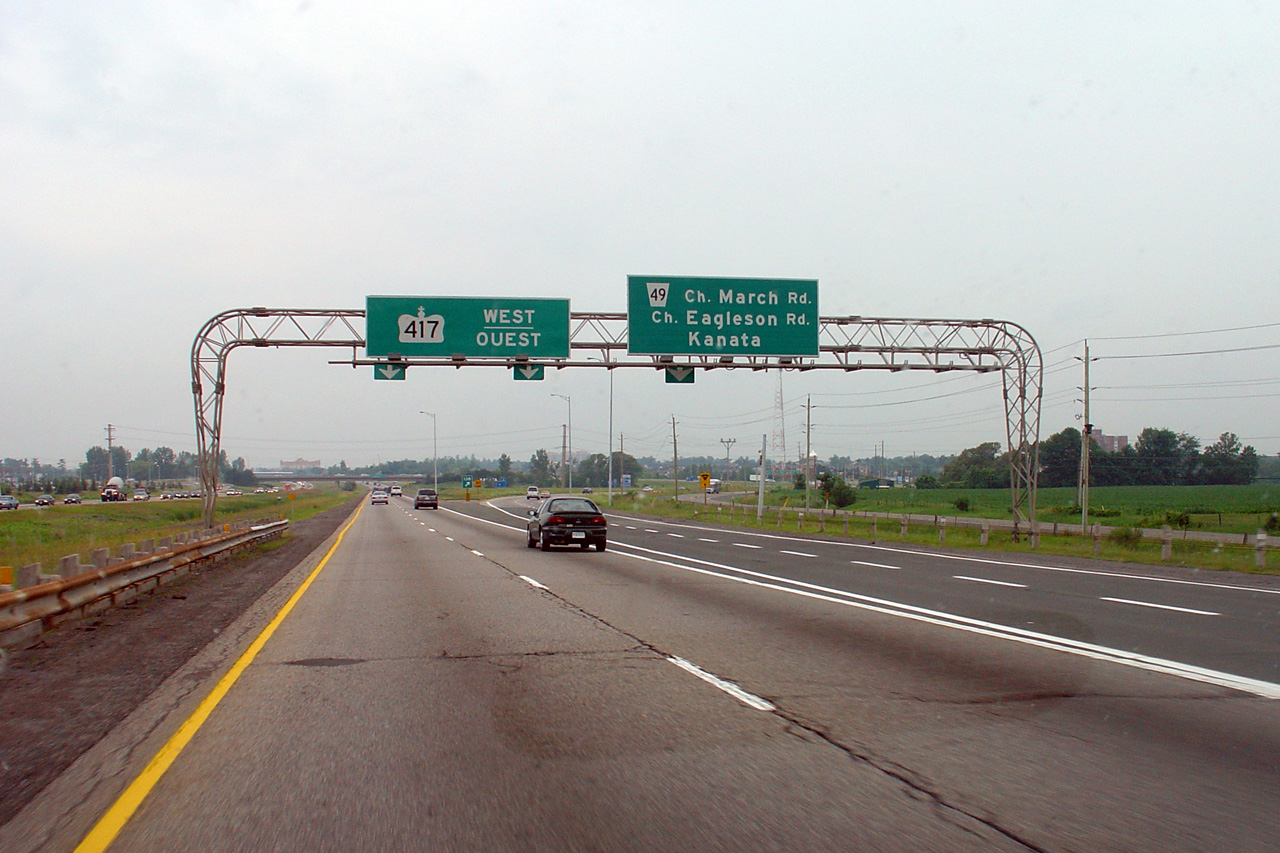
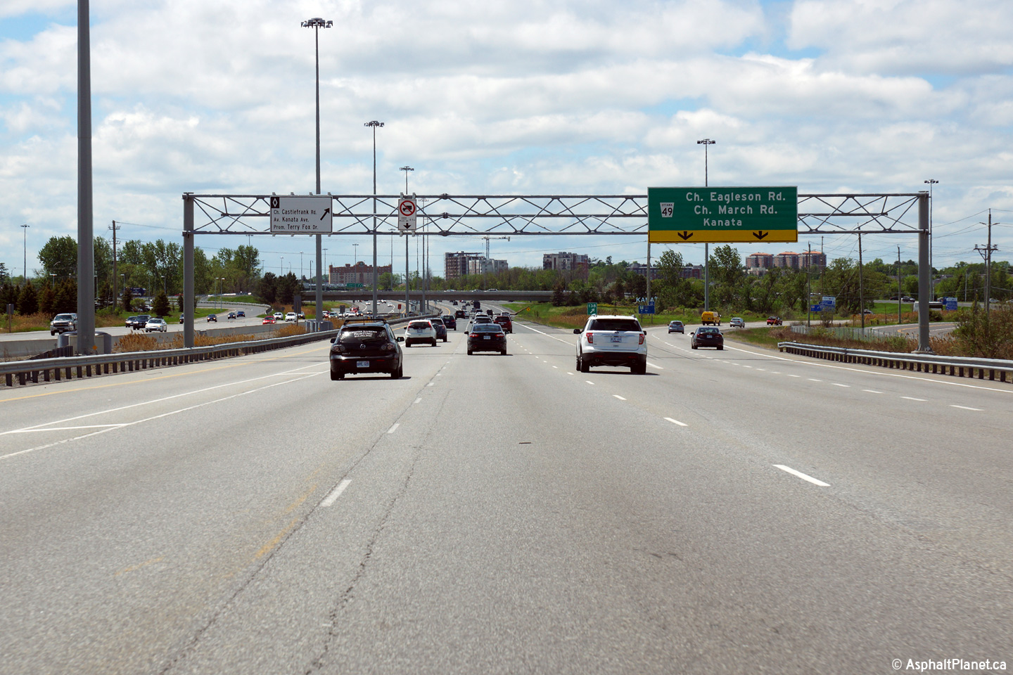
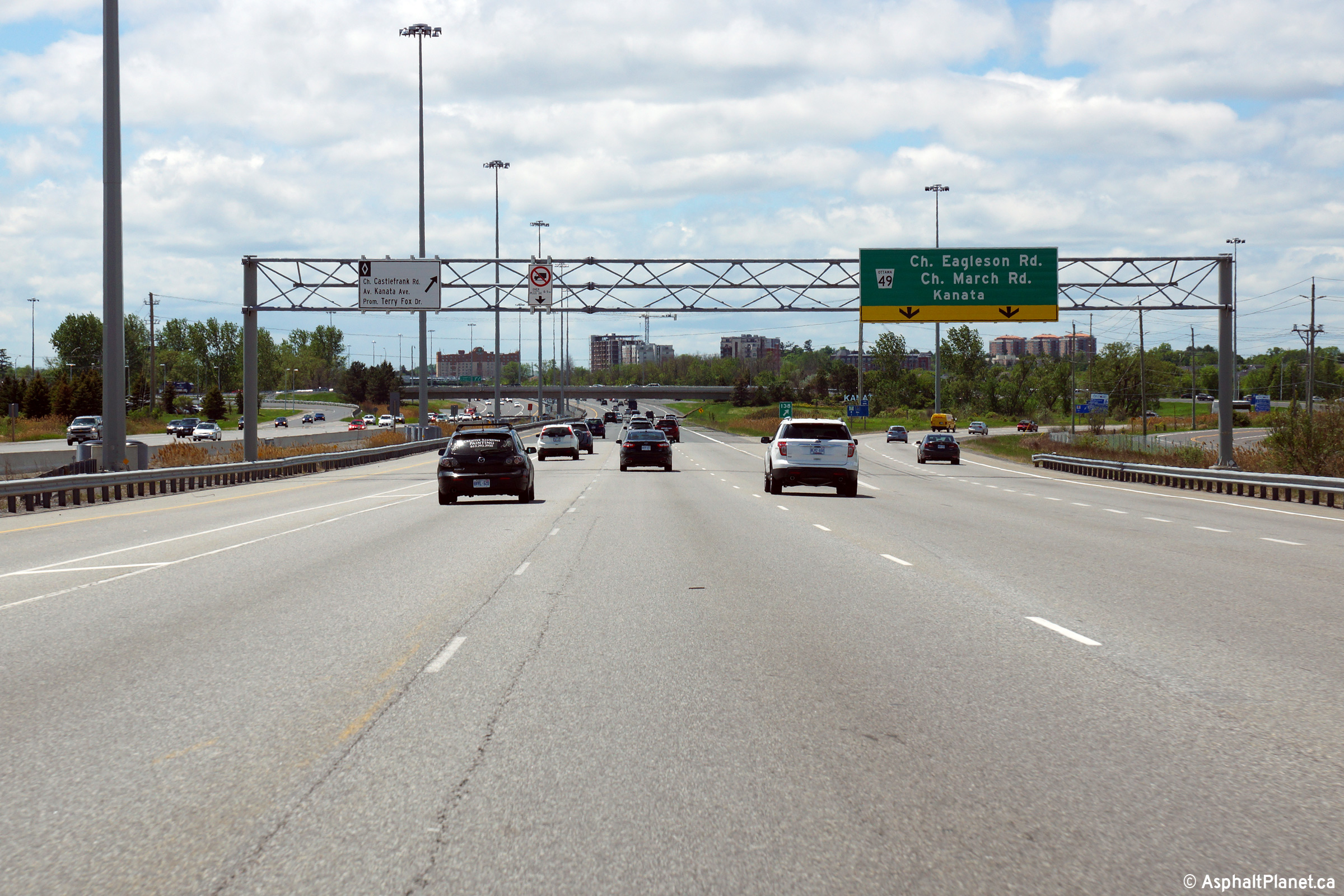
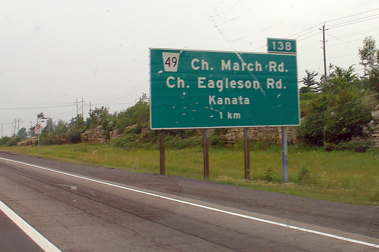
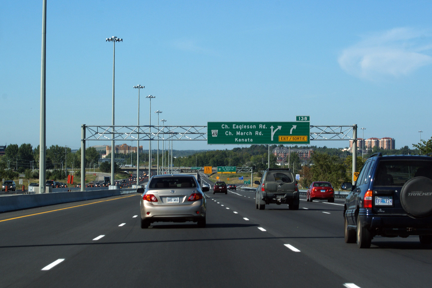
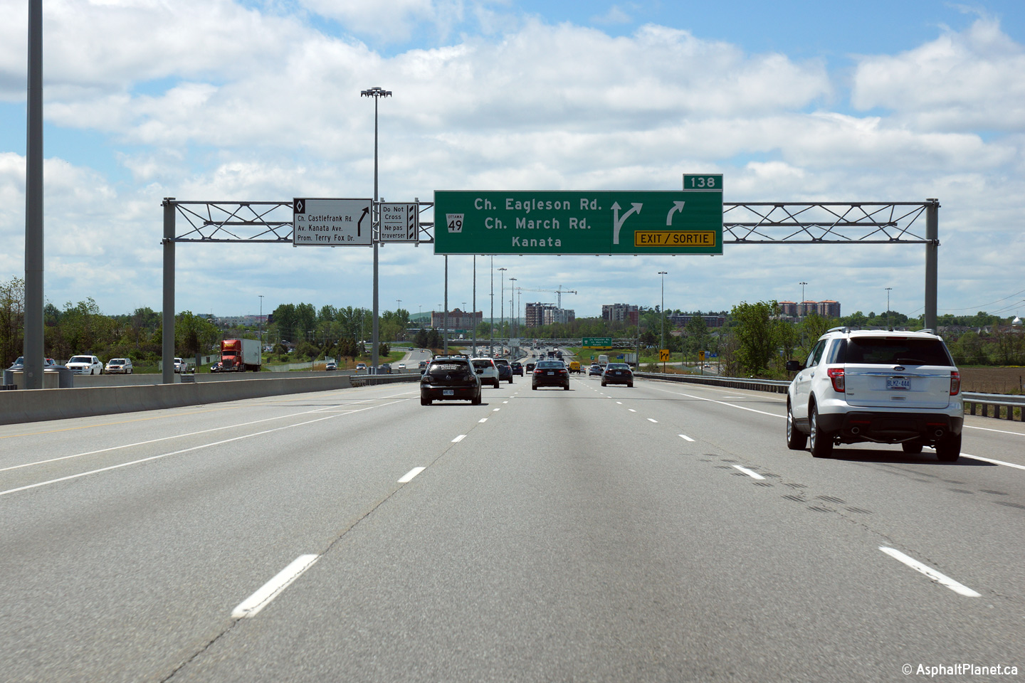
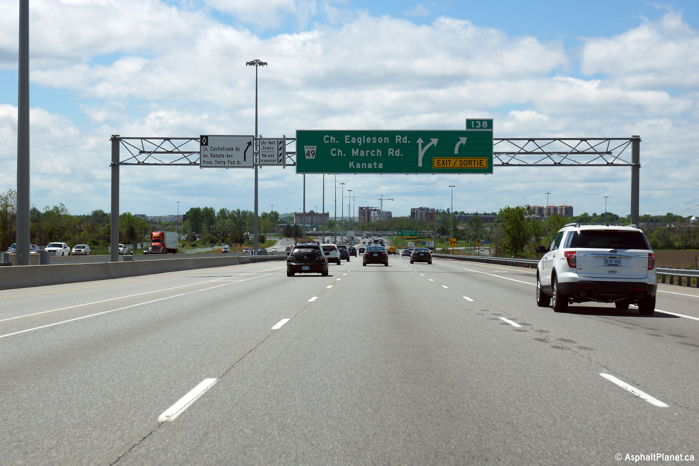
| City of Ottawa |
Westbound exit signage for the ramp to Eagleson Road, and March Road in
Kanata. Notice that Kanata is still used as a control city despite the
amalgamation of Ottawa into a single-tier 'mega-city' in 2001. The
identities of the former cities that made up Metropolitan Toronto are not
similarly signed in this fashion. Click
here for the former signage at
this location taken before Highway 417 was widened in July, 2005, and
here for the interim signage taken in
September, 2009. Photo taken: May 22nd, 2015. |
|||
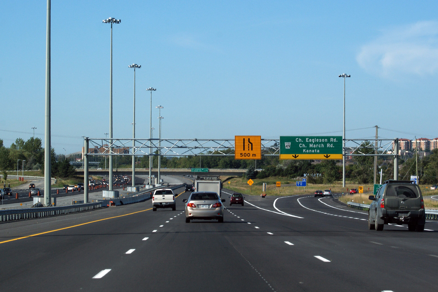
| City of Ottawa |
Westbound advanced signage for the ramp to Eagleson and March Road.
Click here for a photo of the
former ground-mounted signage that stood in this location, taken in July,
2005, before the highway was widened from four lanes, and
here for a September, 2009 photo
taken shortly before the first phase of the highway widening through Kanata
was completed. Photo taken: May 22nd, 2015. |
|||
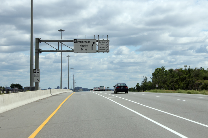
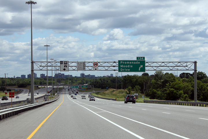
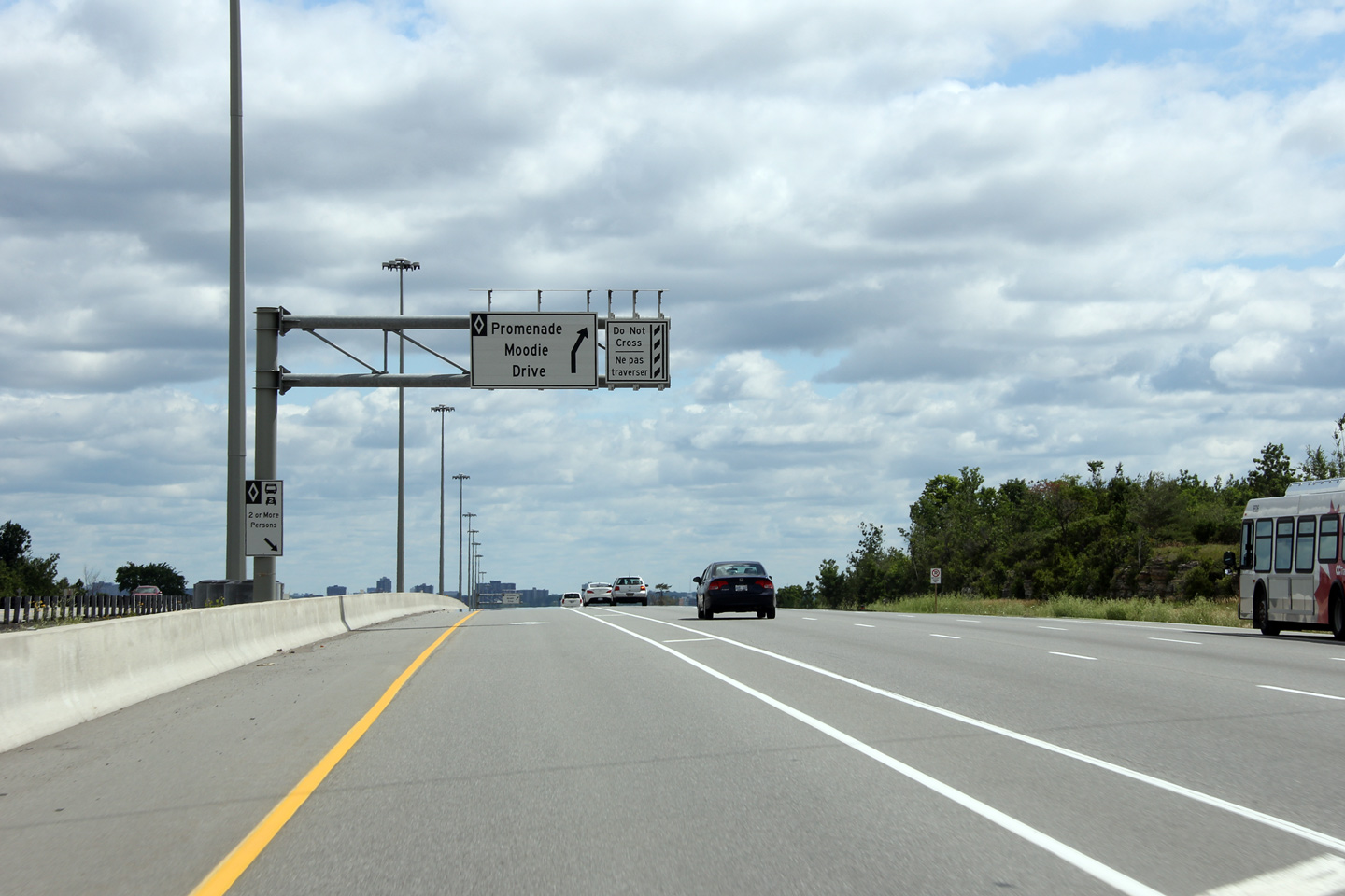
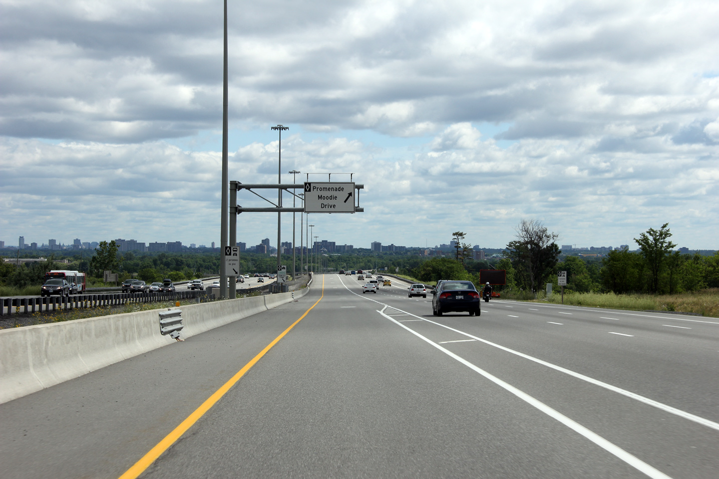
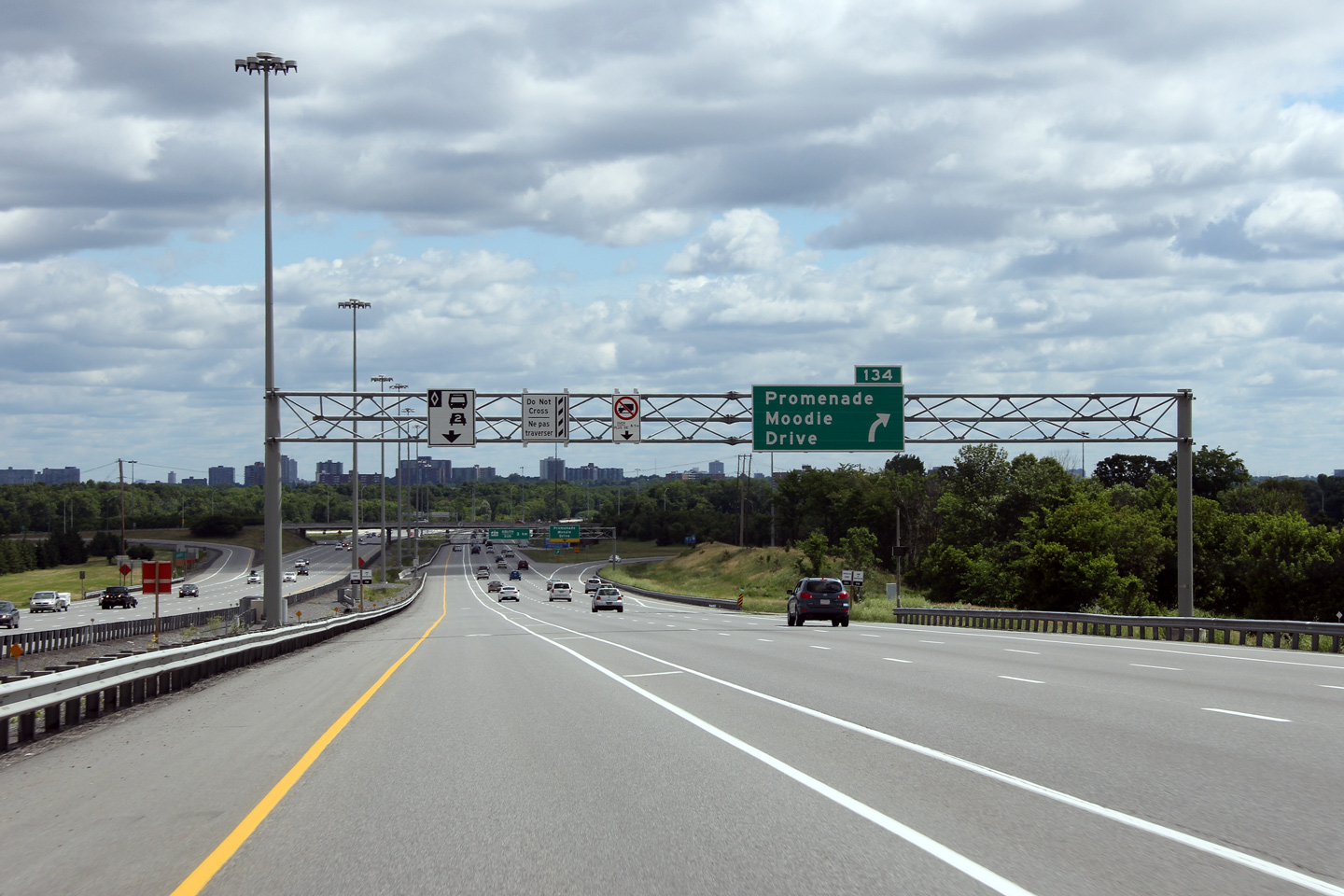
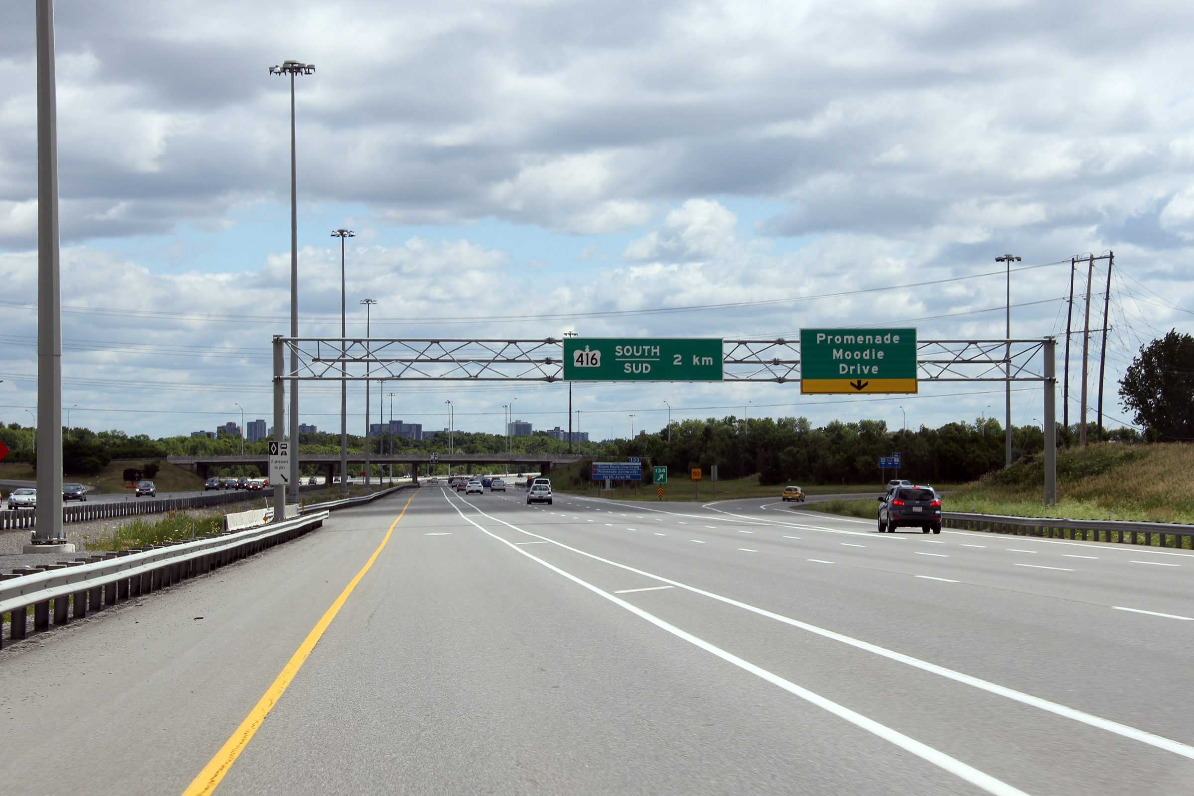
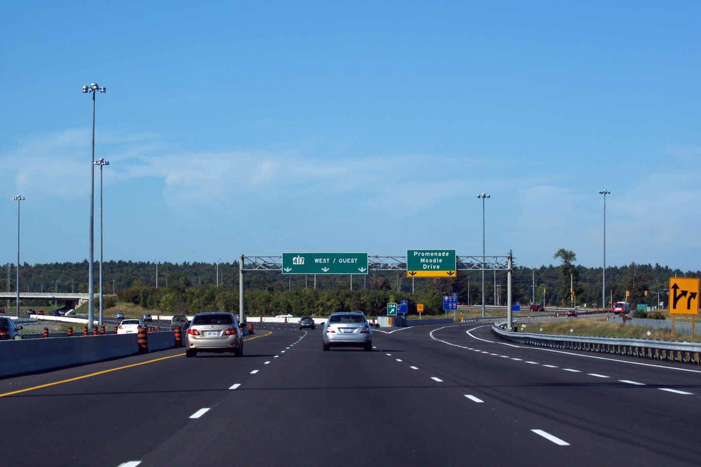
| City of Ottawa |
Advanced signage for the egress-point for the Moodie Drive interchange.
Ottawa's first HOV lane opened to eastbound traffic between Eagleson Road
and Moodie Drive during the fall of 2009. Photo taken: July 1st, 2012. |
 (720x480) (720x480)(1440x960) (2400x1600) |
||
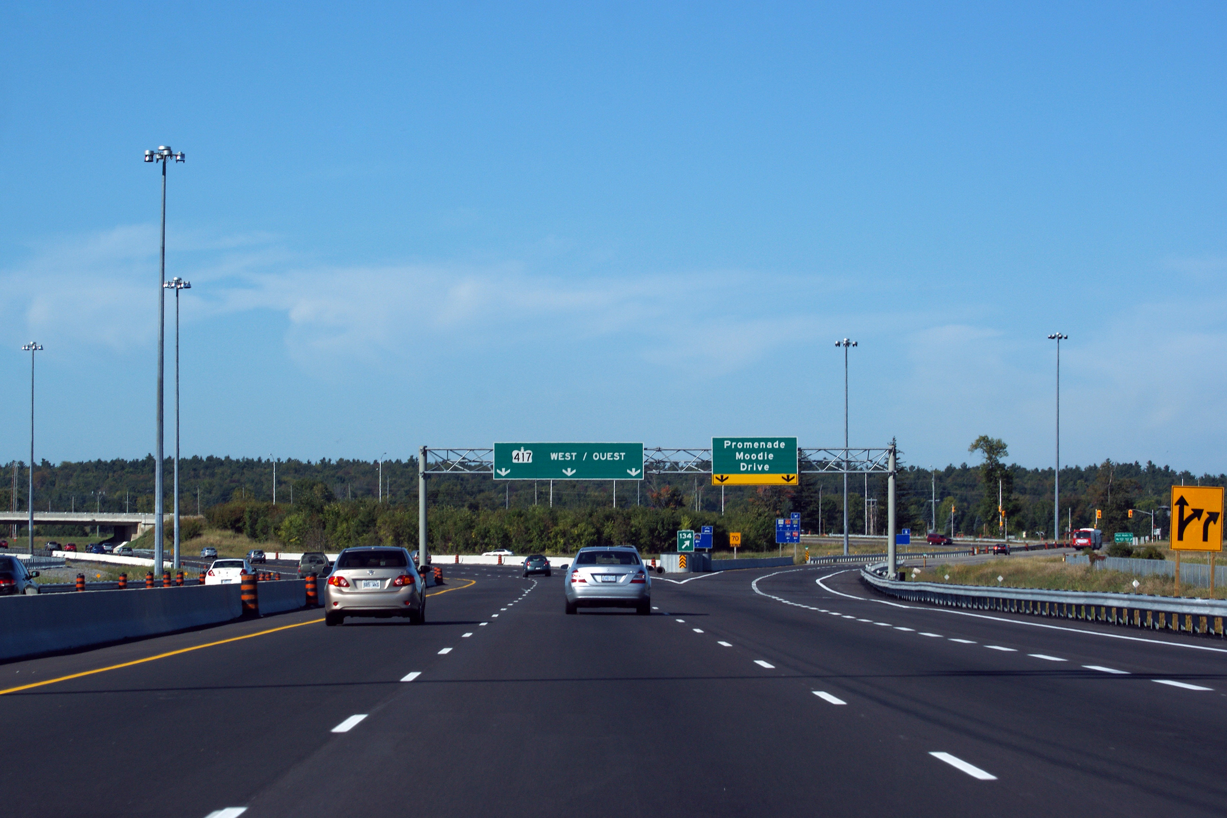
| City of Ottawa |
Partial overhead signage over the eastbound lanes of Highway 417 denoting
the designated egress-point for the Moodie Drive interchange from the HOV
lane. Photo taken: July 1st, 2012. |
 (720x480) (720x480)(1440x960) (2400x1600) |
||
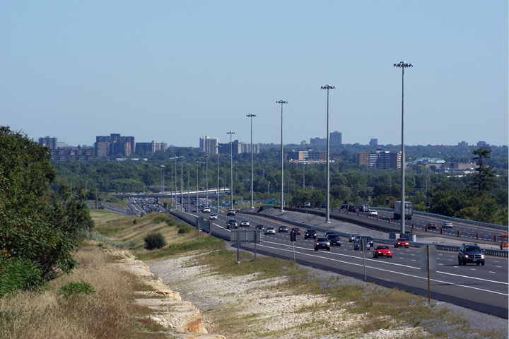
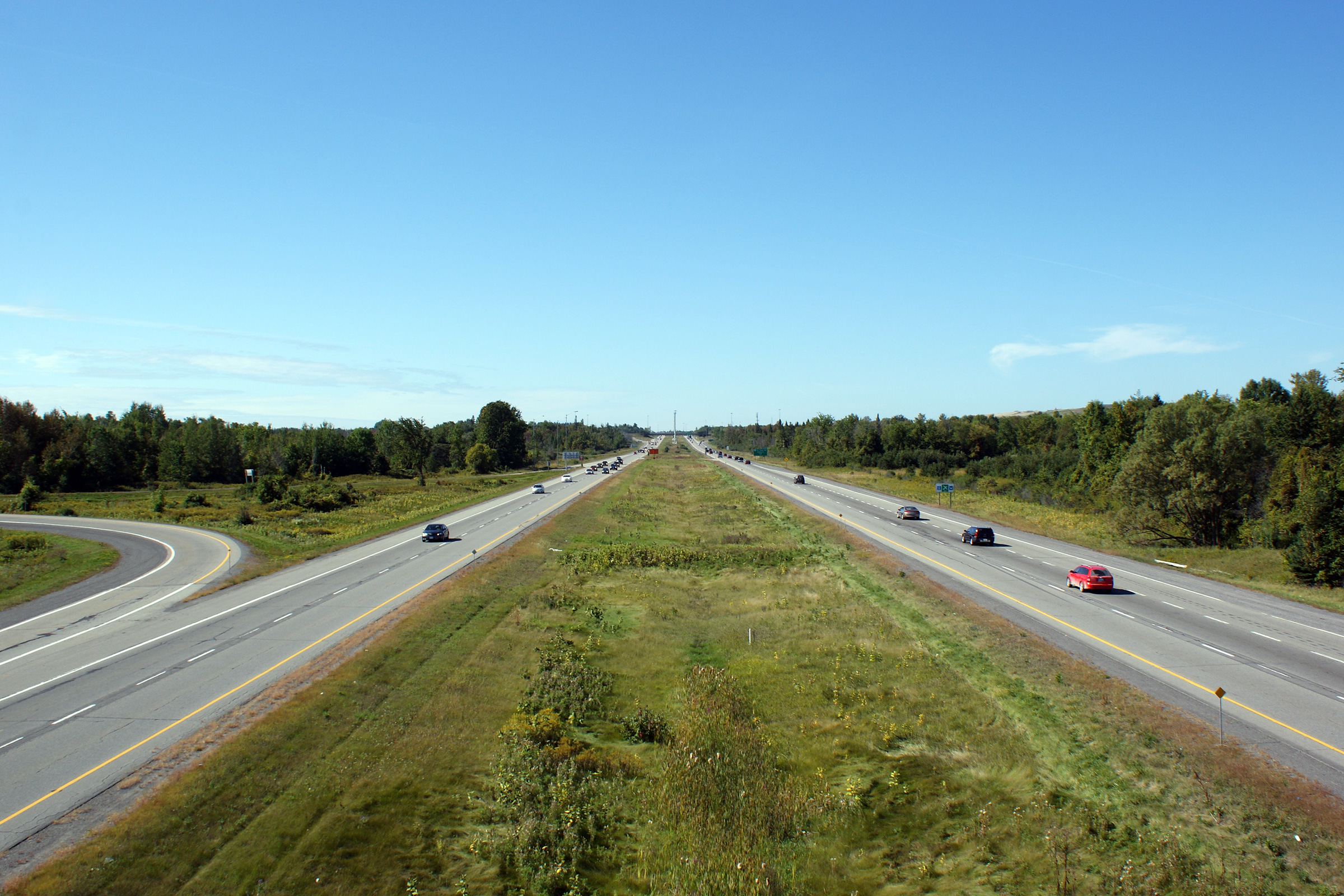
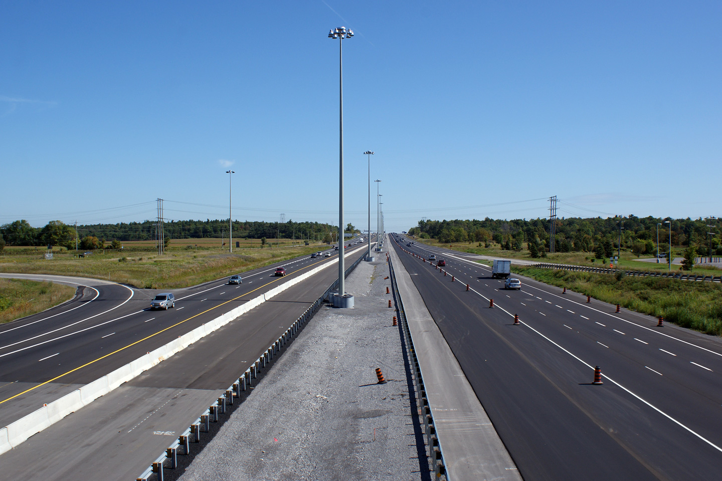
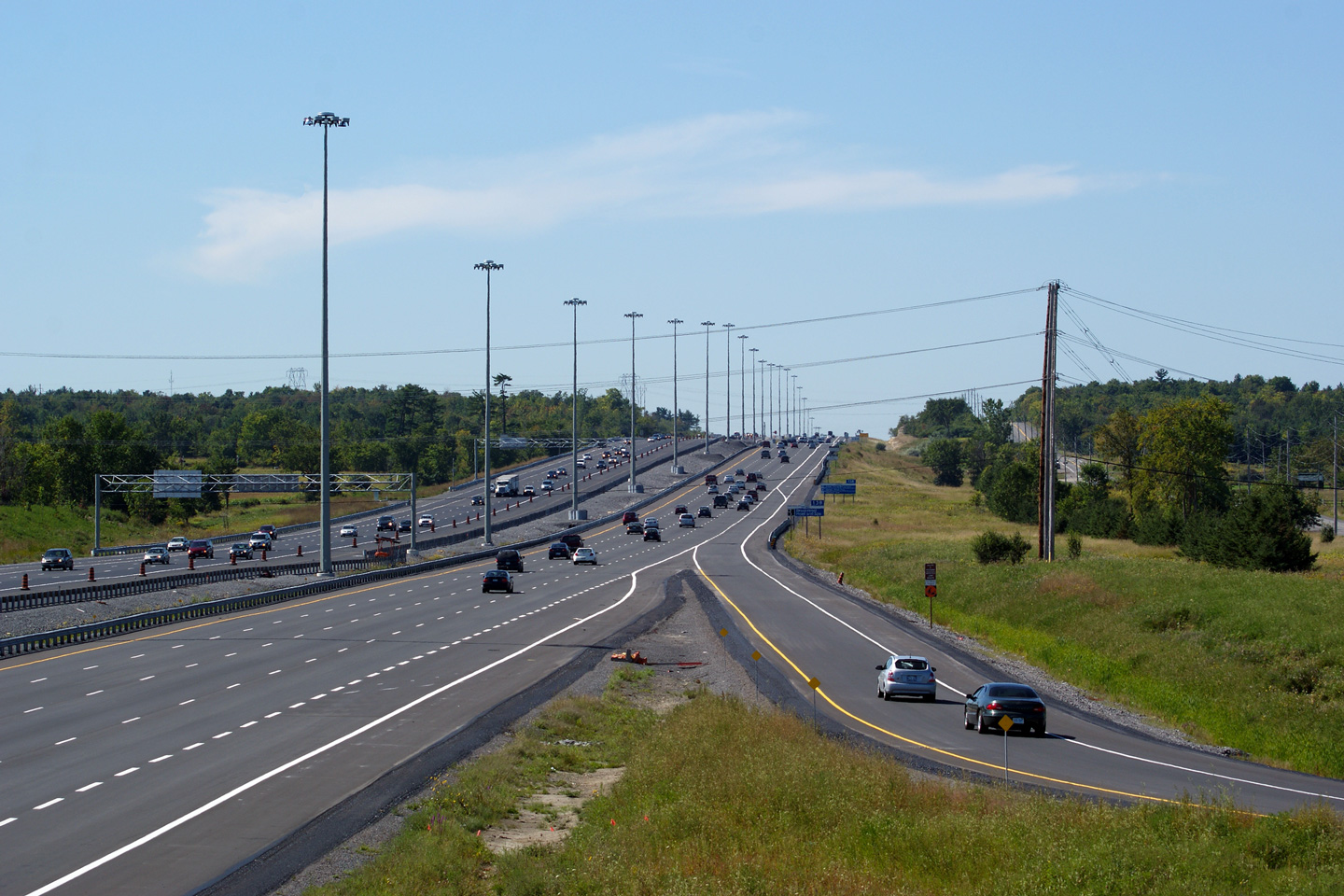
| City of Ottawa |
Easterly view from Corkstown Road along Highway 417 as the freeway passes
through the greenbelt that separates Ottawa and Nepean from Kanata. Photo taken: September 12th, 2009. |
 (720x480) (1440x960) (2400x1600) |
||
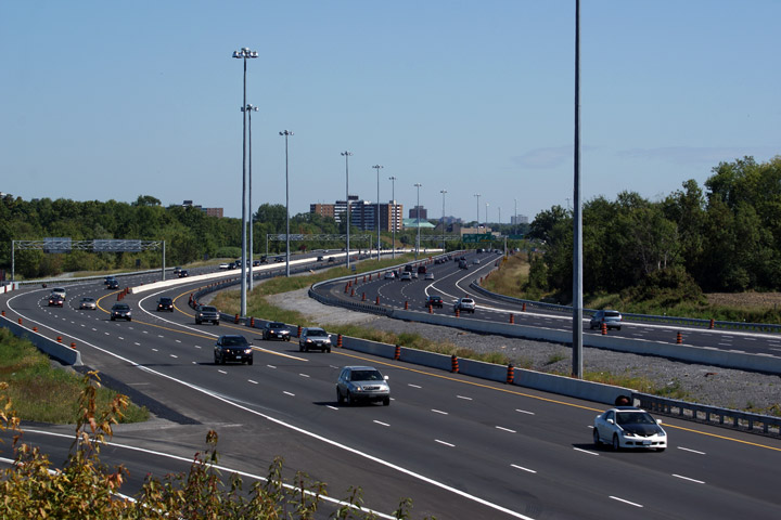
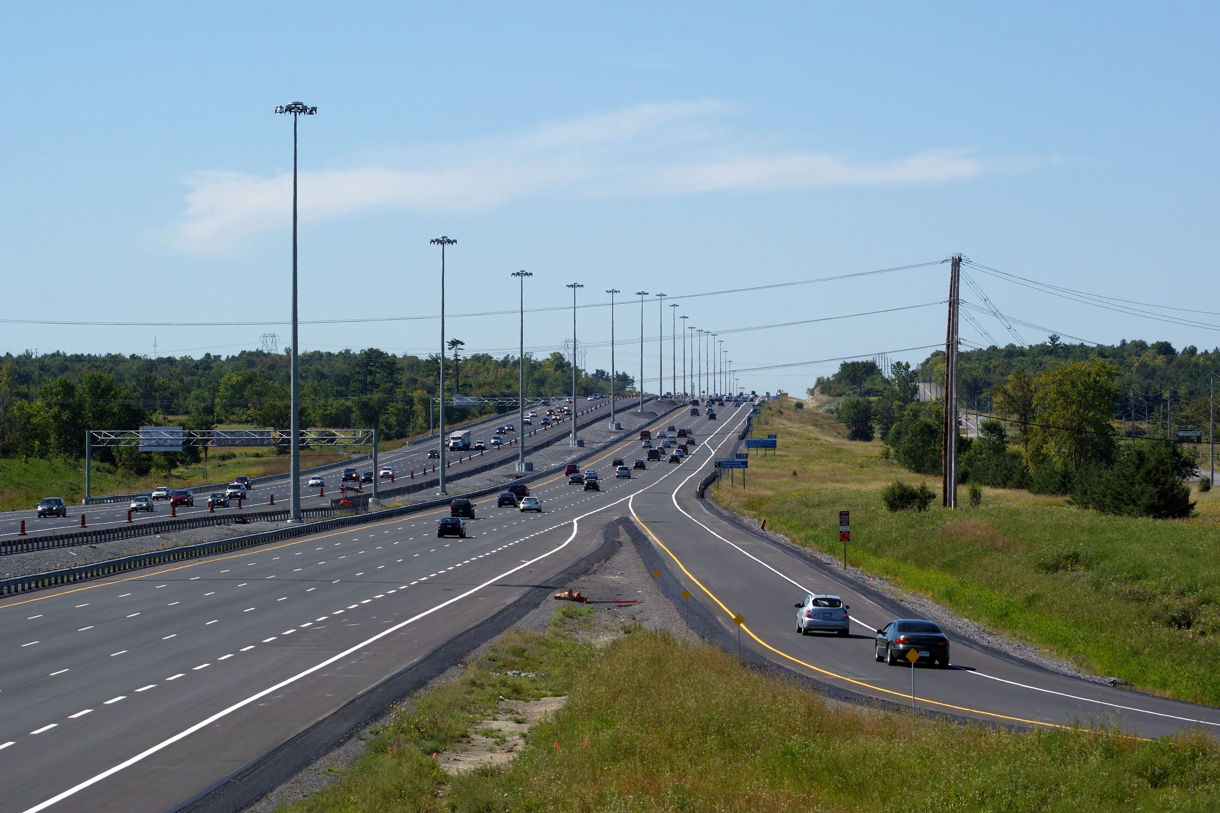
| City of Ottawa |
Two views from the median of Highway 417 looking easterly towards the Moodie
Drive interchange. Photos taken: September 12th, 2009. |
 (720x480) (1440x960) (2400x1600)  (720x480) (1440x960) (2400x1600) |
||
| City of Ottawa |
Eastbound advanced signage for the ramp to Moodie Drive. Photo taken: July 1st, 2012. |
 (720x480) (720x480)(1440x960) (2400x1600) |
||
| City of Ottawa |
Eastbound overhead signage at the Moodie Drive interchange. This signage
was shot prior to the commissioning of the new eastbound HOV lane. Photo taken: July 1st, 2012. |
 (720x480) (720x480)(1440x960) (2400x1600) |
||
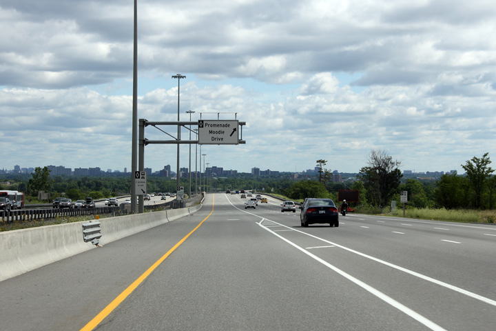
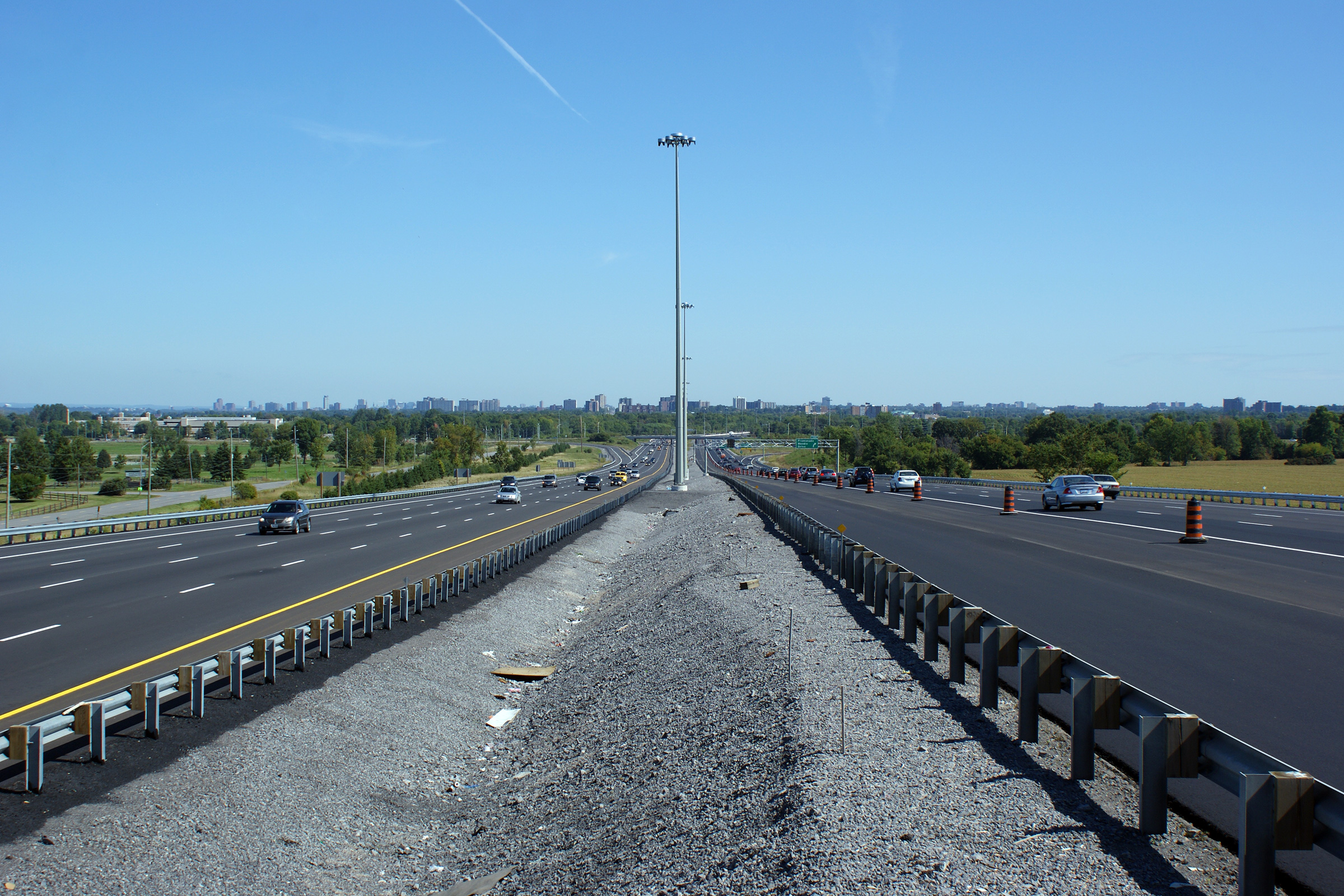
| City of Ottawa |
This view looks westerly from the Moodie Drive overpass. Since this photo
was taken, an eastbound HOV lane has opened to traffic. Photo taken: September 12th, 2009. |
 |
||
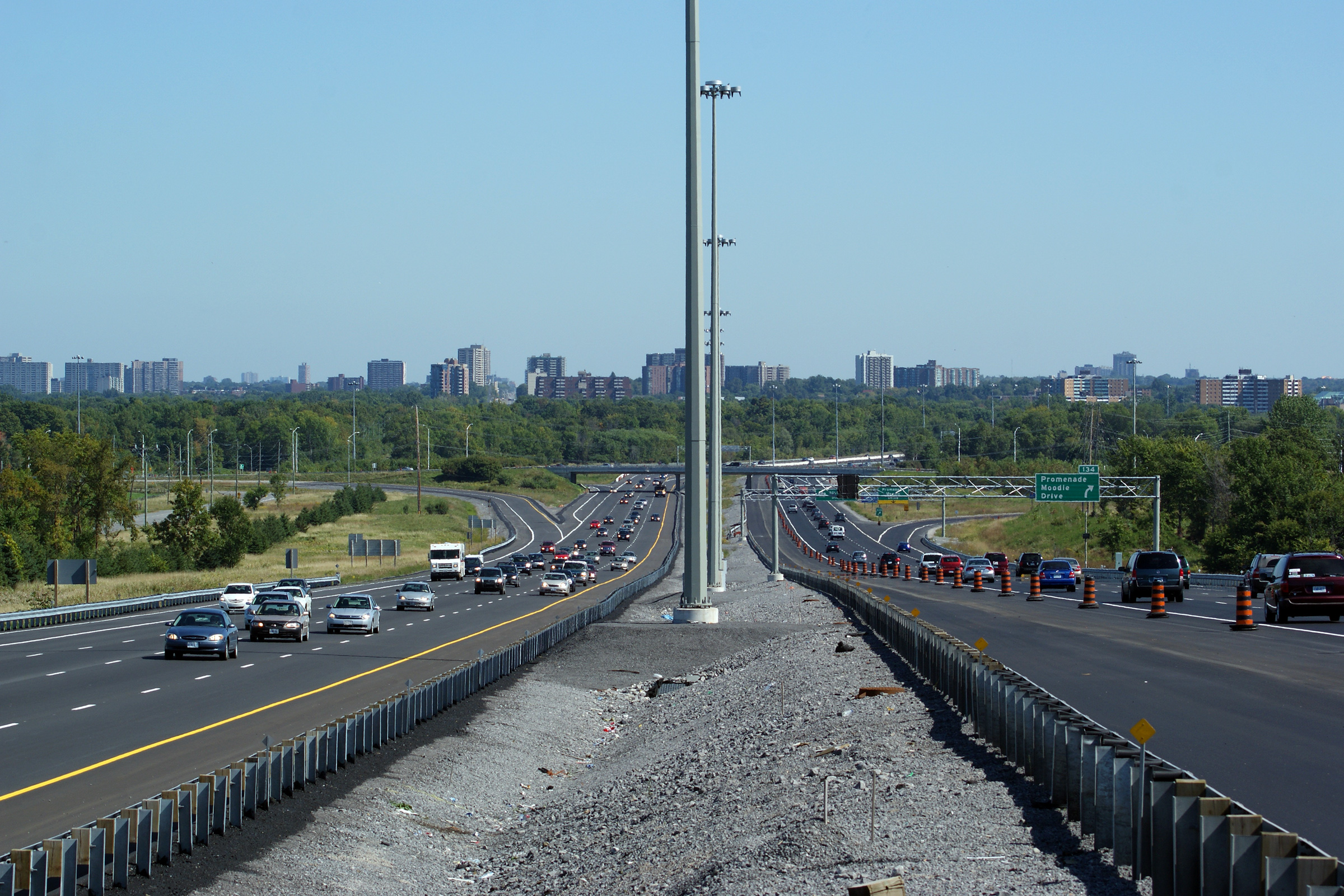
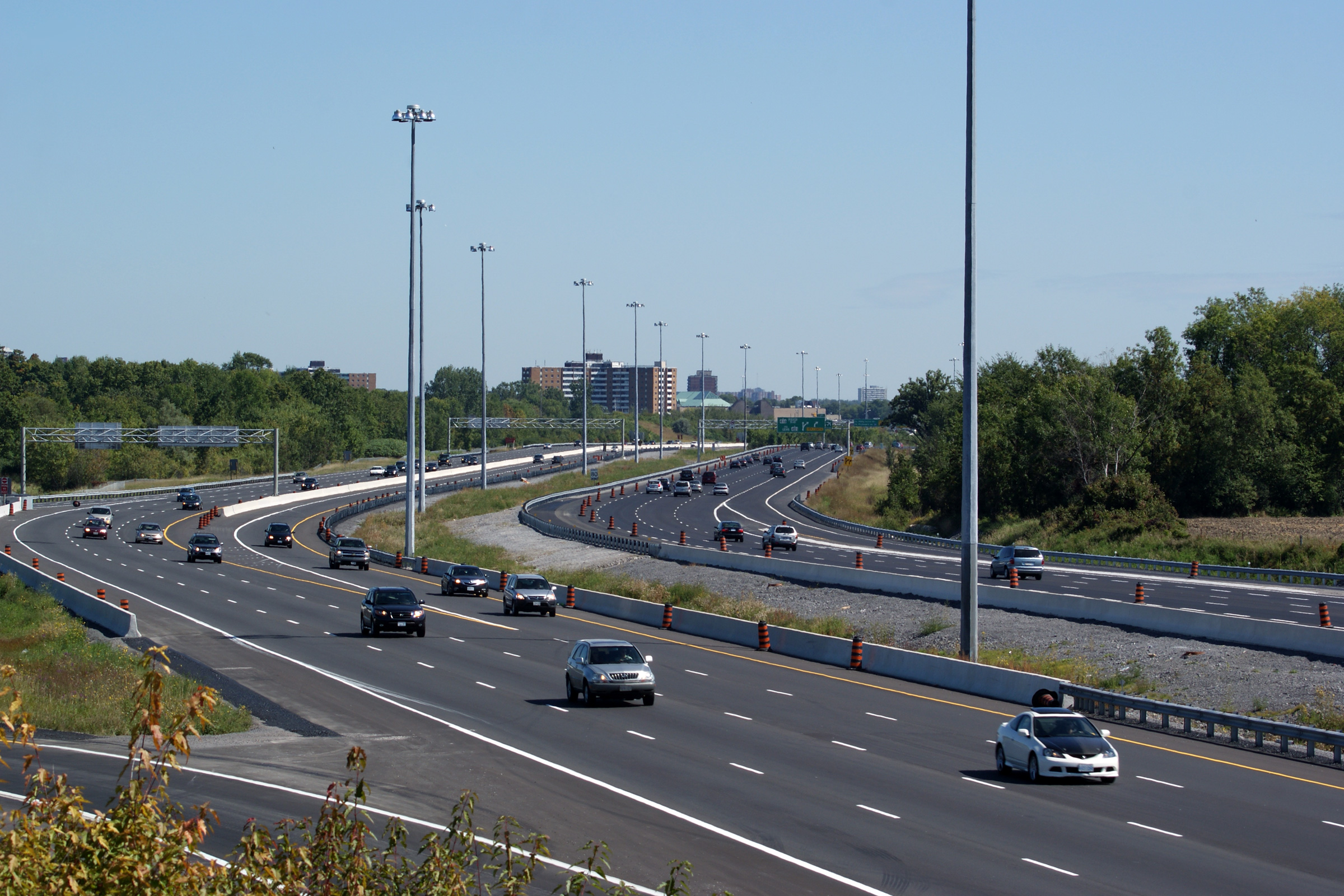
| City of Ottawa |
View looking easterly from the Moodie Drive overpass. Note the long ramp
extension from Highway 416 to Highway 417 Westbound that prevents traffic
entering from Highway 416 from exiting at Moodie Drive. Photo taken: September 12th, 2009. |
 |
||
| City of Ottawa |
Westbound signage at the Moodie Drive interchange. Photo taken: September 12th, 2009. |
 (720x480) (720x480)(1440x960) (2400x1600) |
||
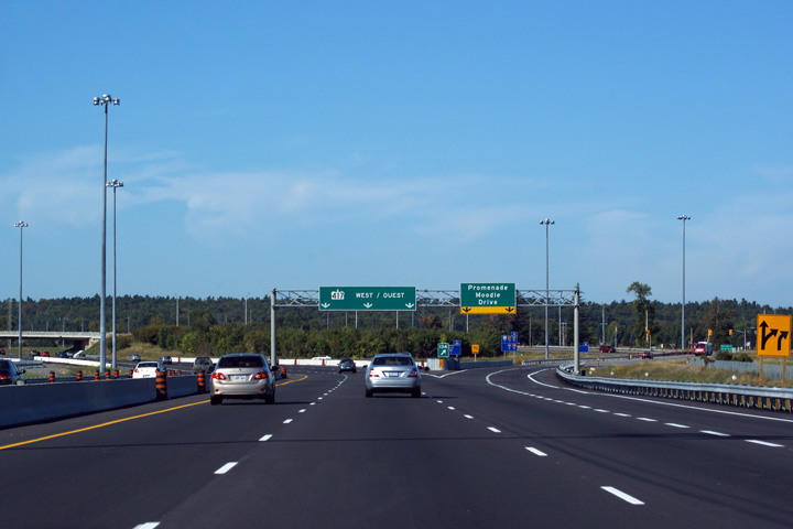
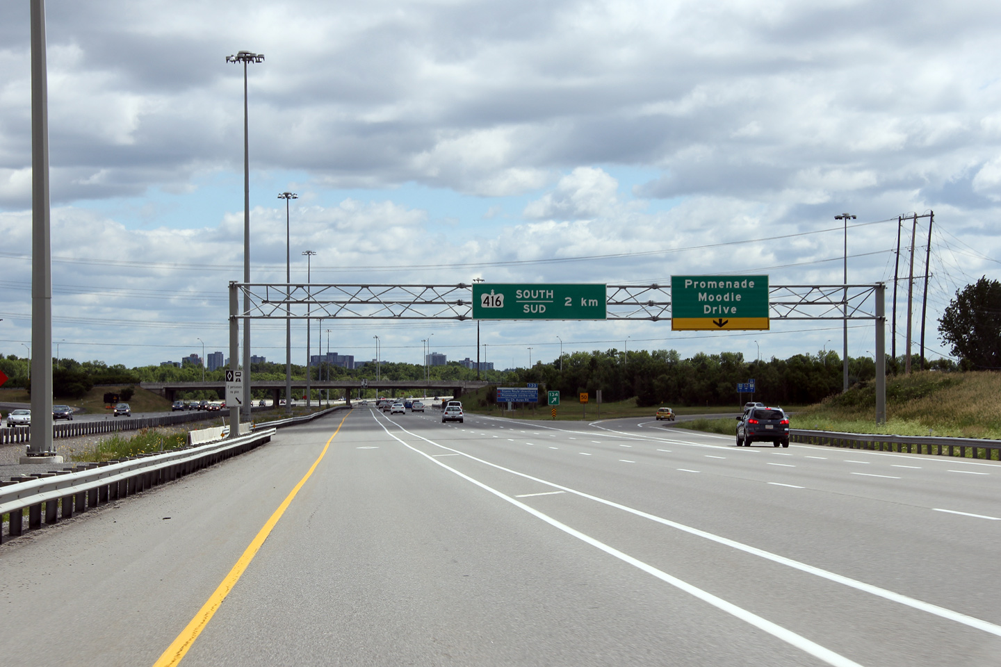
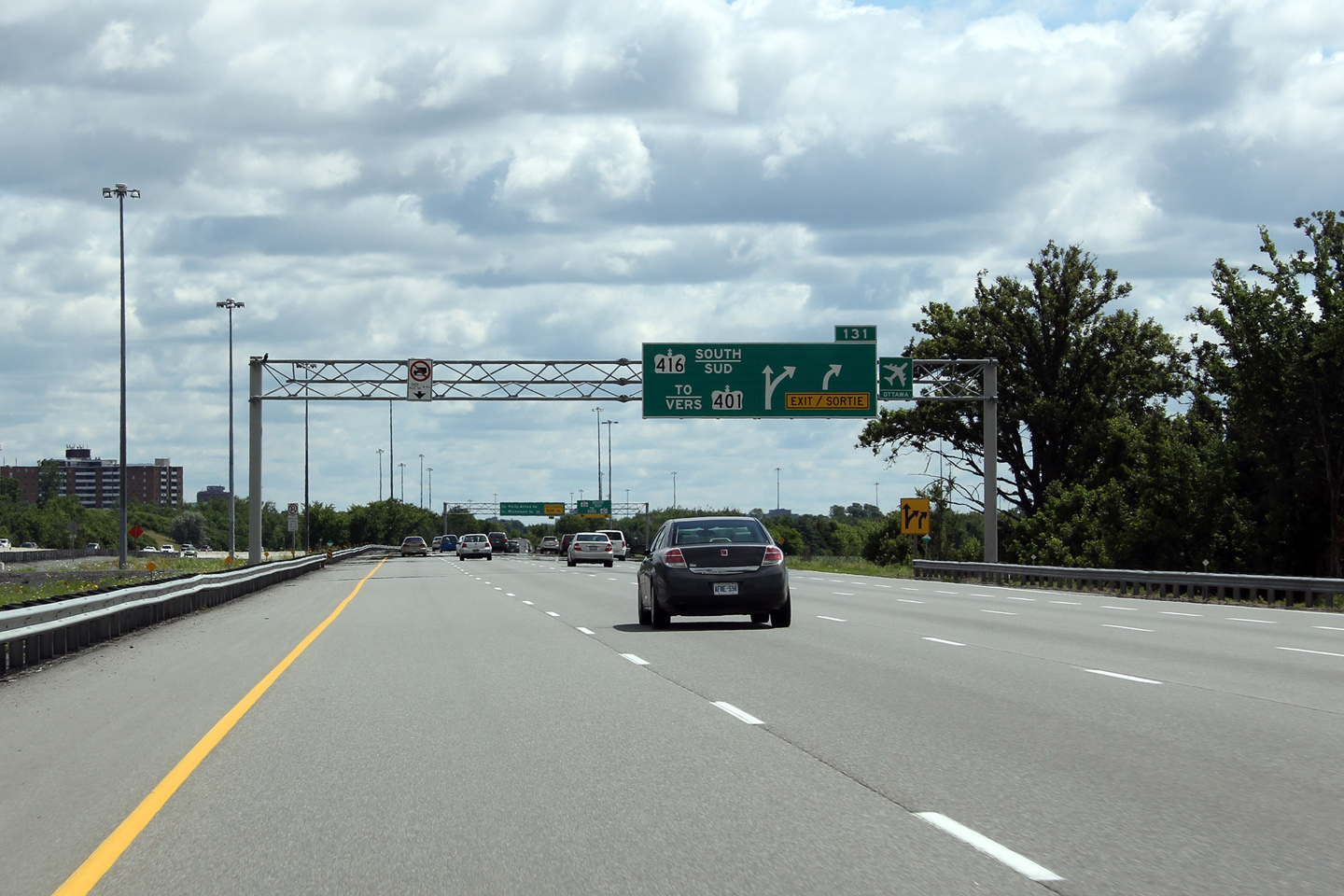
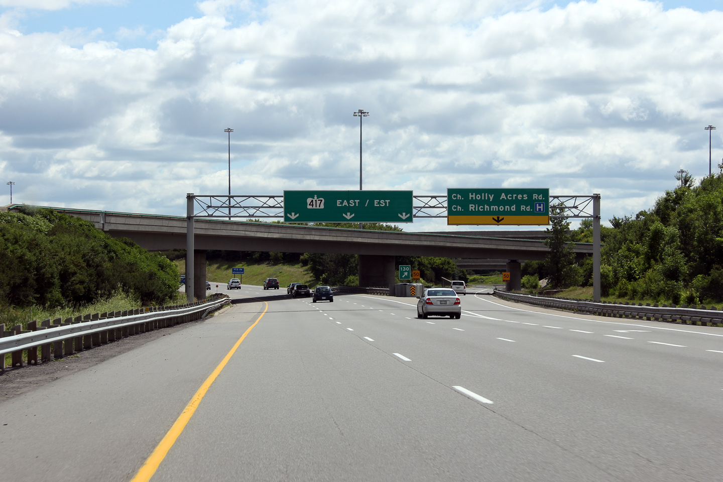
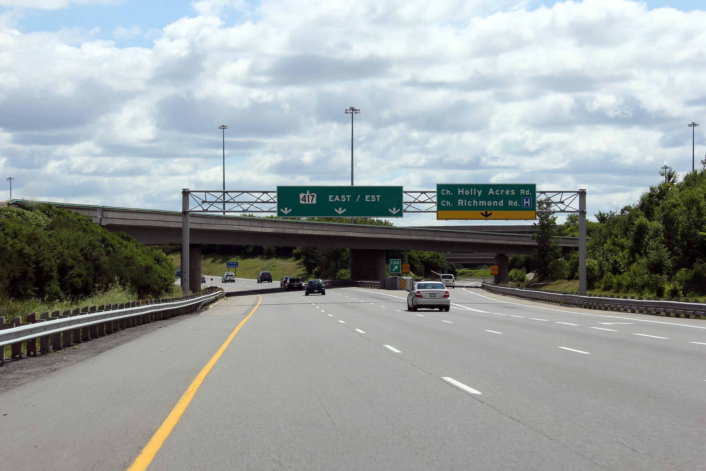
| City of Ottawa |
Advanced arrow signage for Highway 416. Highway 401 is often used in lieu
of a control city on Highway 416. The 416 ends near the small town of
Prescott. Photo taken: July 1st, 2012. |
 (720x480) (720x480)(1440x960) (2400x1600) |
||
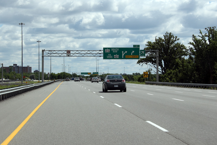
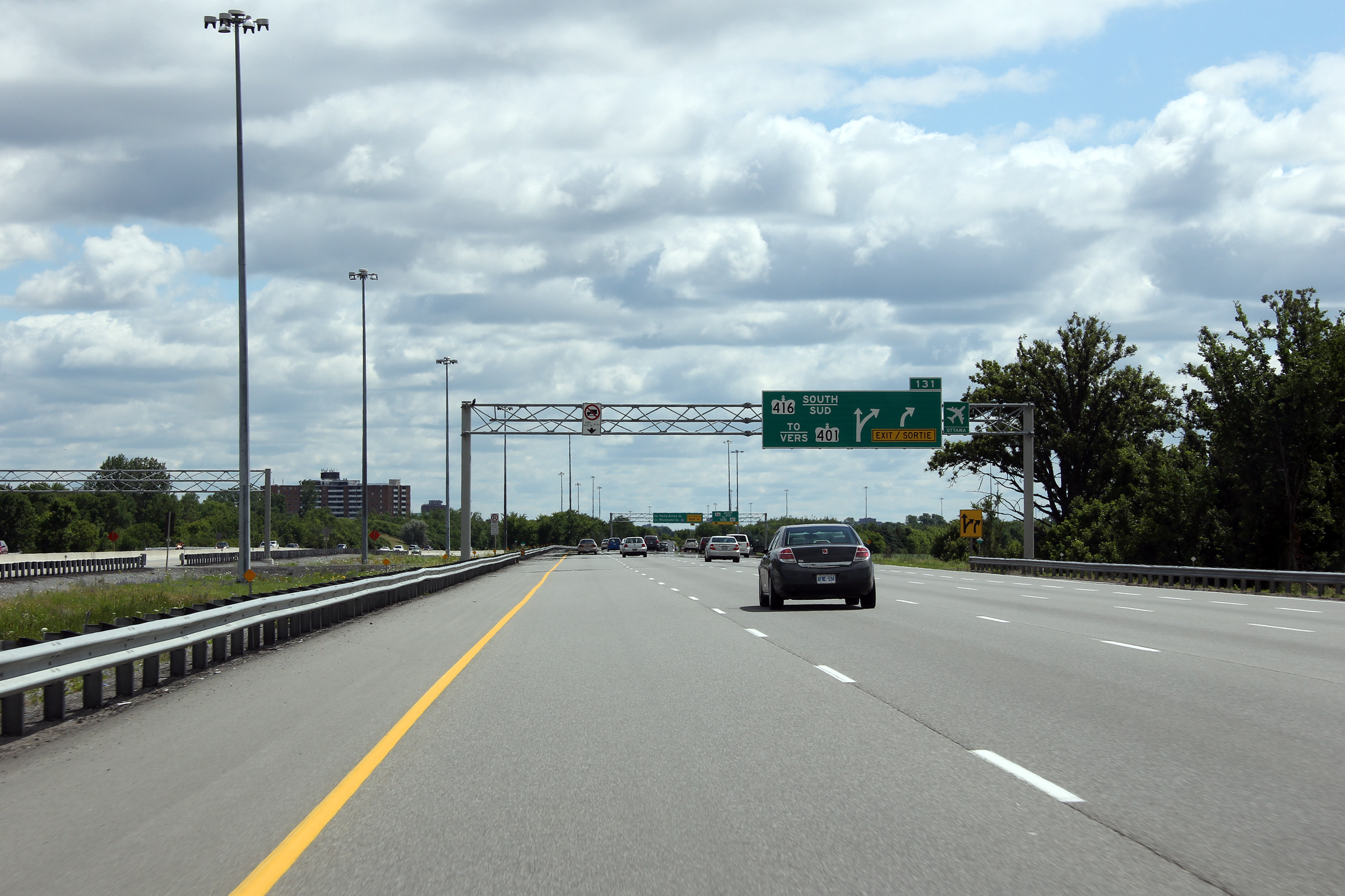
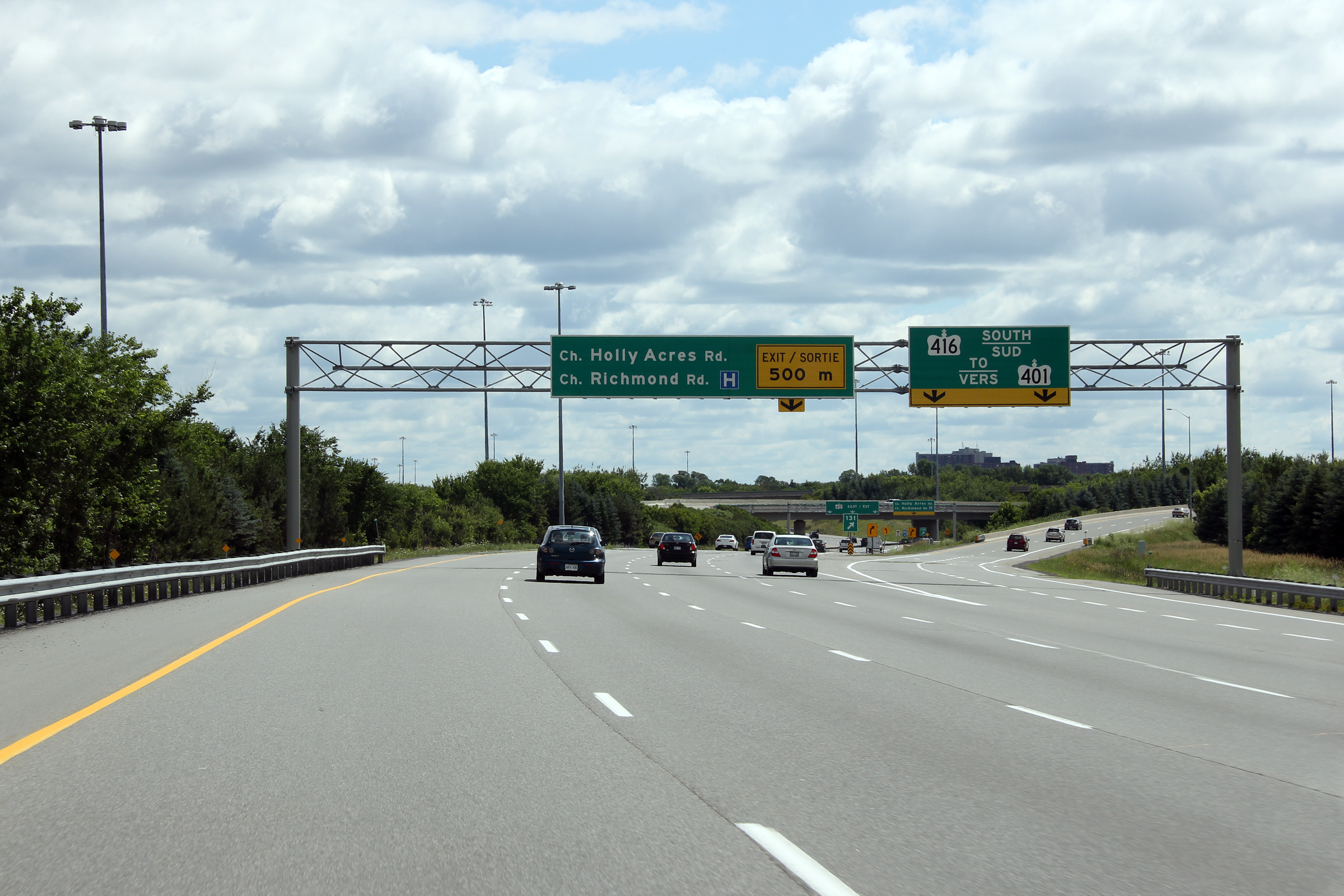
| City of Ottawa |
Signage at the ramp to Highway 416. Notice the rather unconventional
signage for the ramp to Holly Acres and Richmond Roads -- this is the only
sign like this in the province -- typically advanced signage is marked with
curved arrows. Photo taken: July 1st, 2012. |
 (720x480) (720x480)(1440x960) (2400x1600) |
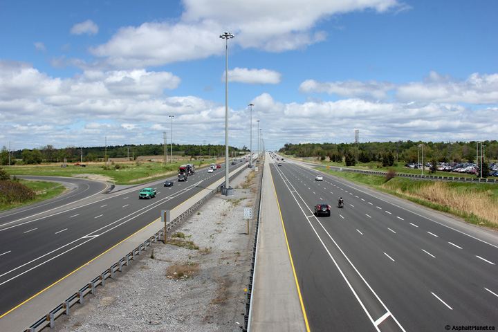
||
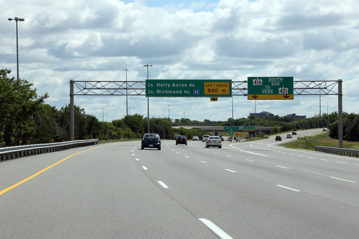
| City of Ottawa |
The ramp to Holly Acres and Richmond Roads departs the Queensway from the
right-most lane from the freeway. Through Kanata the highway has six lanes
plus an HOV lane in each direction. East of Highway 416, the Queensway has
only six basic lanes with sporadic auxiliary lanes between interchanges. Photo taken: July 1st, 2012. |
 (720x480) (720x480)(1440x960) (2400x1600) |
||
| Highway 416 carries traffic southerly from Highway 417 bound for Highway 401. Click here for Highway 416 images. | ||||
| Continue easterly through Ottawa along Highway 417 via Page 5B Images. | ||||
<- Page 4F Images Highway 417 Images Index Page 5B Images ->
<- Highway 416 Images Back to Highway 417 Highway 420 Images ->
Copyright (c) 2004-2015, Scott Steeves (Webmaster) AsphaltPlanet@asphaltplanet.ca


