|
Proper Municipality Name |
Photo Description |
Photo |
|
Pictures taken
from driver's perspective appear offset from centre-line pictures: |
|
North-
bound |
South-
bound |
| City of Belleville |
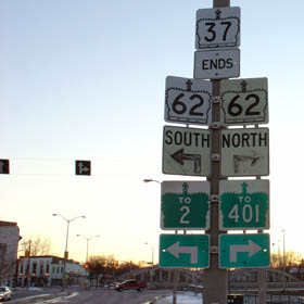
The junction assembly for Highway
37 at its southern terminus with Highway 62 in Belleville. This
assembly denotes the former southern terminus of Highway 37. In 1998,
the connecting link agreement for Highway 37 in Belleville was repealed.
Highway 37 now ends at the 401.
Picture size: 35kb |
 |
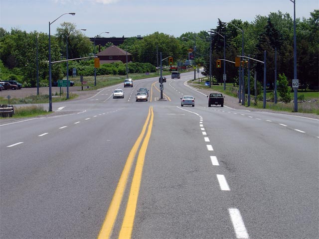
| City of Belleville |
Highway 37 looking south from the Highway 401
overpass towards the southern ramp terminals of the 401 interchange.
This intersection marks the current southern terminus of Highway 37.
Before 1998, Highway 37 continued southerly to meet
Highway 62 near Downtown Belleville.
Picture taken: June 19th, 2004. Size: 60kb. |
 |
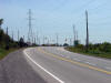
| City of Belleville |
Highway 37 looking south towards the junction with Tank Farm Road. Picture
taken: September 2nd, 2005. Size: 50kb. |
 |
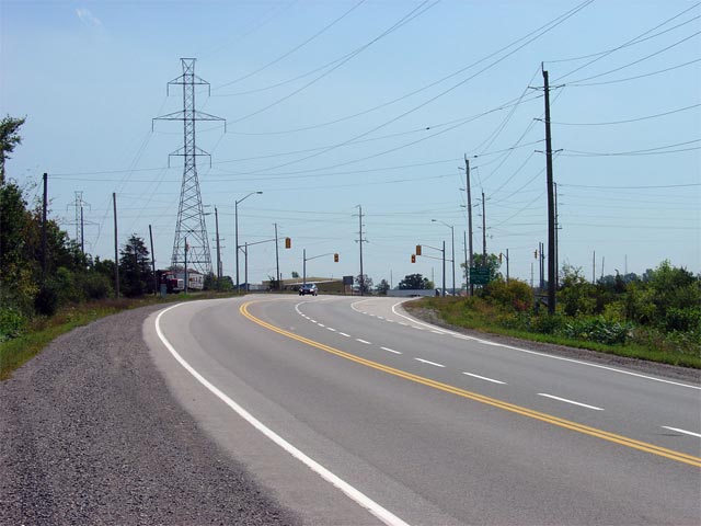
| City of Belleville |
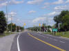
Highway 37 looking north towards the signalized intersection with Harmony
Road. This busy intersection was reconstructed and signalized during
the summer of 2005. Picture taken: September 2nd, 2005. Size: 55kb. |
 |
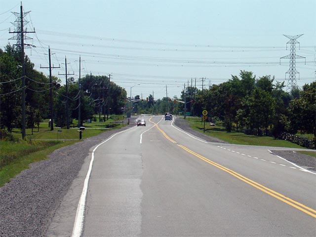
| City of Belleville |
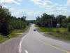
Looking south along Highway 37 towards the Harmony Road intersection in
Honeywell Corners. Harmony Road is the first signalized intersection
along Highway 37 south of Tweed, and is located about 8km north of
Highway 401.
Picture taken: September 2nd, 2005. Size: 55kb. |
 |
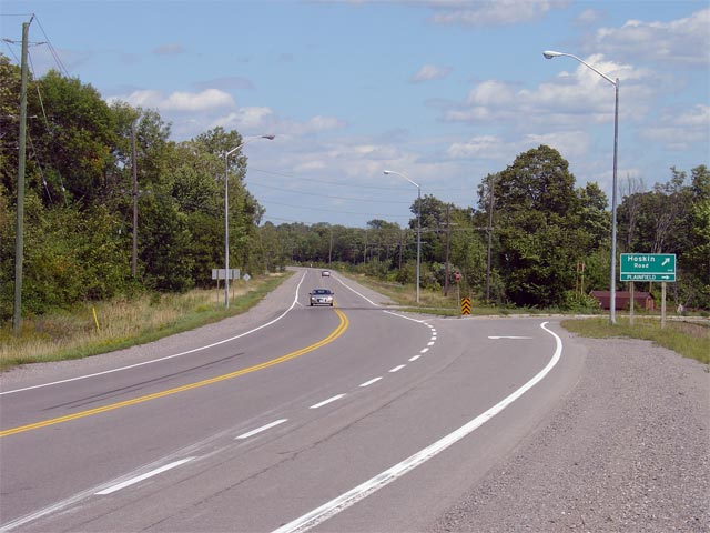
| City of Belleville |
View looking northerly along Highway 37 towards the Hoskin Road intersection
at the start of the Plainfield By-pass. Hoskin Road is a former
alignment of Highway 37. Picture taken: September 2nd, 2005. Size:
55kb. |
 |
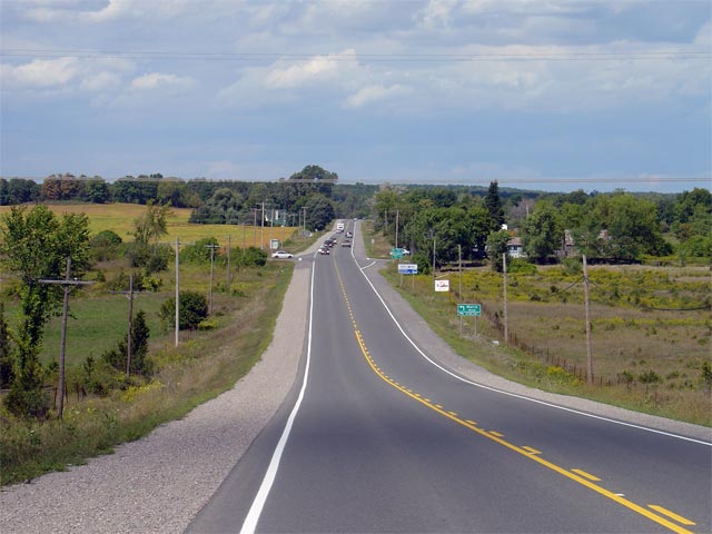
| Centre Hastings - Tweed Boundary
County of Hastings |
View looking south towards the rural Moira Road junction. Picture taken:
September 2nd, 2005. Size: 50kb |
 |
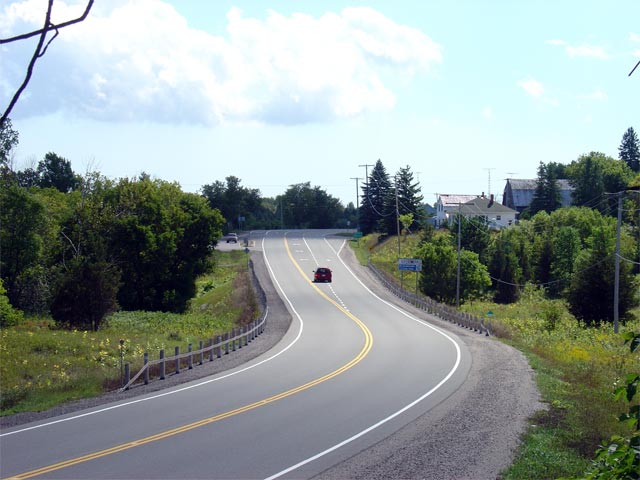
| Municipality of Tweed County of
Hastings |
Looking south along the Thomasburg By-pass towards the Thomas Street/Vanderwater
Road intersection. When Highway 37 was first commissioned it ran
through the hamlet of Thomasburg. Picture taken: September 2nd, 2005.
Size: 55kb. |
 |
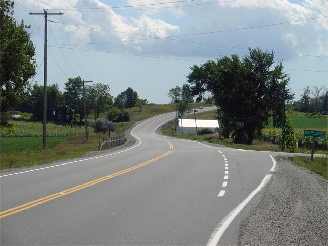
| Municipality of Tweed County of
Hastings |
Looking south through a gentle reversing curve and the Martin Road
intersection. Martin Road is located about 5km south of Tweed.
Picture taken: September 2nd, 2005. Size: 55kb. |
 |
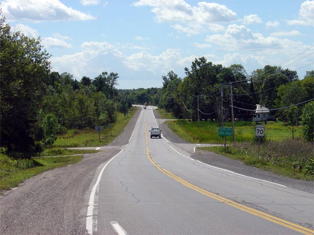
| Municipality of Tweed County of
Hastings |
View looking south along Highway 37 as it passes through the small community
of Actinolite located about 400m south of Highway 7.
Picture taken: September 2nd, 2005. Size: 60kb. |
 |
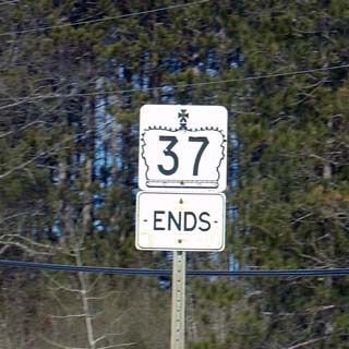
| Municipality of Tweed County of
Hastings |
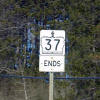
The rather lonely looking sign
denoting the northern terminus of Highway 37.
Click here for Highway 7
Images
Picture size: 45kb |
 |
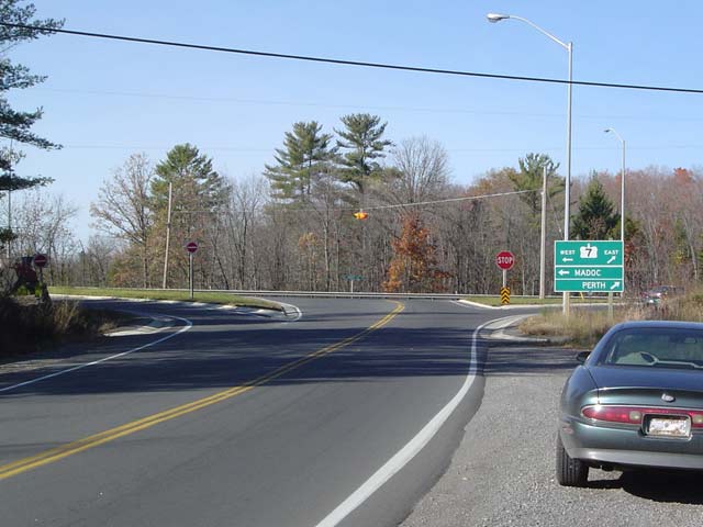
| Municipality of Tweed County of
Hastings |
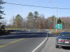
Highway 37 at its northern
terminus at Highway 7.
Picture taken: October 23rd,
2004. Size: 40kb |
 |