King's Highway 37 - www.OntHighways.com

Highway 37 connects Belleville and Highway 401 to Highway 7 to the north.  The route's main purpose is as a shortcut route between the cities of Ottawa and Toronto.  The southern 3km of Highway 37 was transferred to the city of Belleville in 1998, however, the downloaded portion is still fully signed.


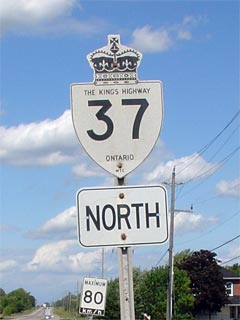
Old Style King's Highway 37 Shield


Southern Terminus:  Pre-1998: Junction Highway 62 in downtown Belleville.

                                          Current: Highway 37 now ends at the Highway 401 interchange.

Northern Terminus:  Junction Highway 7 north of Actinolite.

Length:  Pre-1998: 47.0 km.  Current: 44.0 km

Multiplexes:  None

Freeway:  No

AADT (2002):  Highest: 8,400, from Highway 401 to Black Diamond Road;

                             Lowest:  3,750, from Holdcroft Street to Highway 7 (North end of Highway).

Road Info:  Highway 37 is a very well maintained Highway.  Traffic volumes are light to moderate for the entire length of the highway.  Most of Highway 37's routing is quite rural, with a posted speed limit of 80km/h.  The largest, and most-notable, community between Belleville and Highway 7 is Tweed.


Highway 37 information:


OntHighways.com  

Detailed Route information available below
Virtual Tour of Highway 37


TheKingsHighway.ca   History of Highway 37
Photographic History of Highway 37

Communities and Major Intersections along Highway 37 from South to North:

Proper Municipality Name Community Name Distance Intersection Name

In Belleville (south of Highway 401) Highway 37 has been downloaded, though it is still fully signed as Highway 37.

City of Belleville Belleville 0 km / 47.0km King's Highway 62 &  Front Street

Heading NB on 37 turn left at Cannifton Road, SB turn right onto Station Street to continue along Highway 37

City of Belleville Belleville 1.3 km / 45.7 km College Street (Hastings Road 18)

Current Southern Terminus of Highway 37 is located at Highway 401.

City of Belleville Belleville 3.0 km / 44.0 km King's Highway 401 (Autoroute Macdonald - Cartier Freeway)
City of Belleville Belleville --- Cannifton Road
City of Belleville ----- --- Tank Farm Road
City of Belleville ----- 6.5 km / 40.5 km Blessington Road (Hastings Road 6)
City of Belleville Honeywell Corners --- Harmony Road
City of Belleville Thrasher's Corners --- -----
City of Belleville ----- 15.0 km / 32.0 km Phillipston Road (Hastings Road 41)
City of Belleville Plainfield --- -----
Belleville - Centre Hastings Boundary Roslin 22.4 km / 24.6 km Shannonville Road (Hastings Road 7)
Centre Hastings - Tweed Boundary ----- 25.6 km / 21.6 km Moira Road (Hastings Road 8)
Centre Hastings - Tweed Boundary Thomasburg --- -----
Municipality of Tweed ----- 36.8 km / 10.2 km Marlbank Road (Hastings Road 13)
Municipality of Tweed Tweed South Limits 37.1 km / 9.9 km -----
Municipality of Tweed Tweed 37.8 km / 9.2 km Crookston Road (Hastings Road 38)
Municipality of Tweed Tweed North Limits 39.2 km / 7.8 km Sulphide Road (Hastings Road 39)
Municipality of Tweed Actinolite --- -----
Municipality of Tweed ----- 47.0 km / 0 km King's Highway 7

Highway 37 ENDS

<- Highway 36         www.OntHighways.com - Home         Highway 38 ->


Copyright (c) 2004-2010, AsphaltPlanet.ca  AsphaltPlanet@asphaltplanet.ca

Page last updated:  March 5th, 2007

Page created:  March 12th, 2004