|
Proper Municipality Name |
Photo Description |
Photo |
|
Photos taken
from driver's perspective appear offset from centre-line Photos: |
North-
Bound |
South-
Bound |
|
Click here for Highway 69 Images between
Highway 559 and
Highway 522. |
|
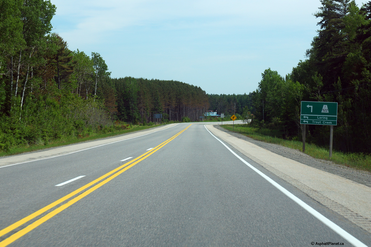
Highway 522 leads motorists east
of Highway 69 for Loring and eventually Highway 11 at Trout Creek.
Click here for Highway
522
images. |
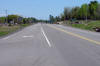
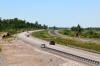
District of Parry Sound
(Geographical Township of Mowat) |
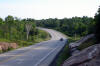
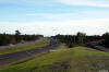
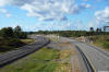
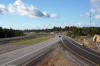
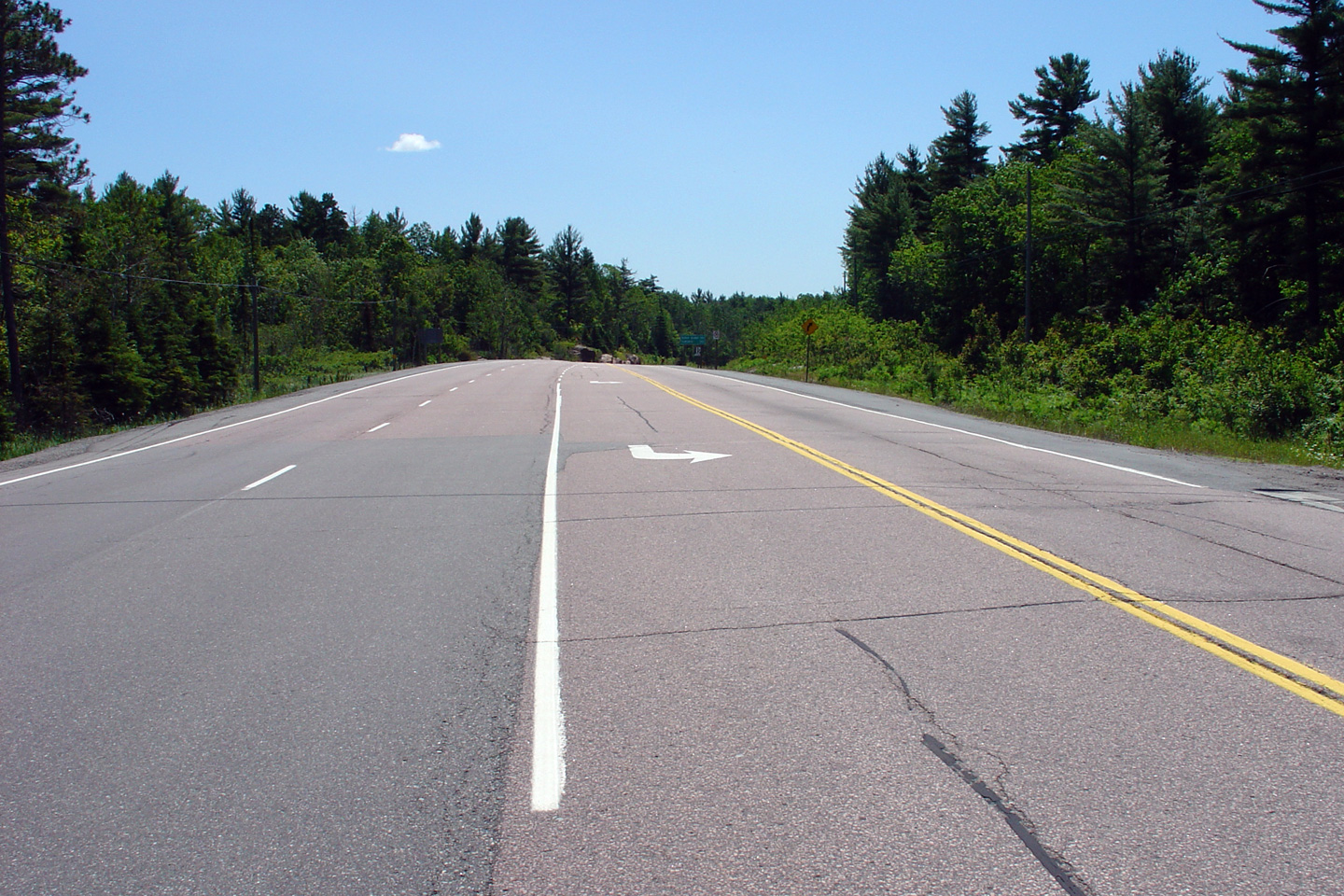
View looking southerly approaching the Highway 522 intersection at
Cranberry.
Photo taken: June 13th, 2015. |

(720x480)
(1440x960)
(2400x1600) |
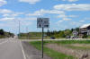
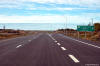
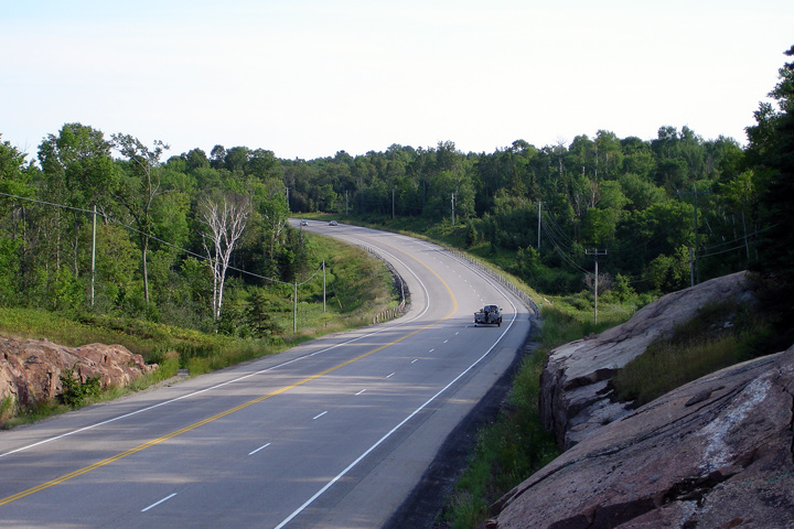
District of Parry Sound
(Geographical Township of Mowat) |
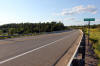
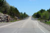
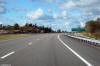
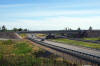
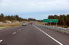
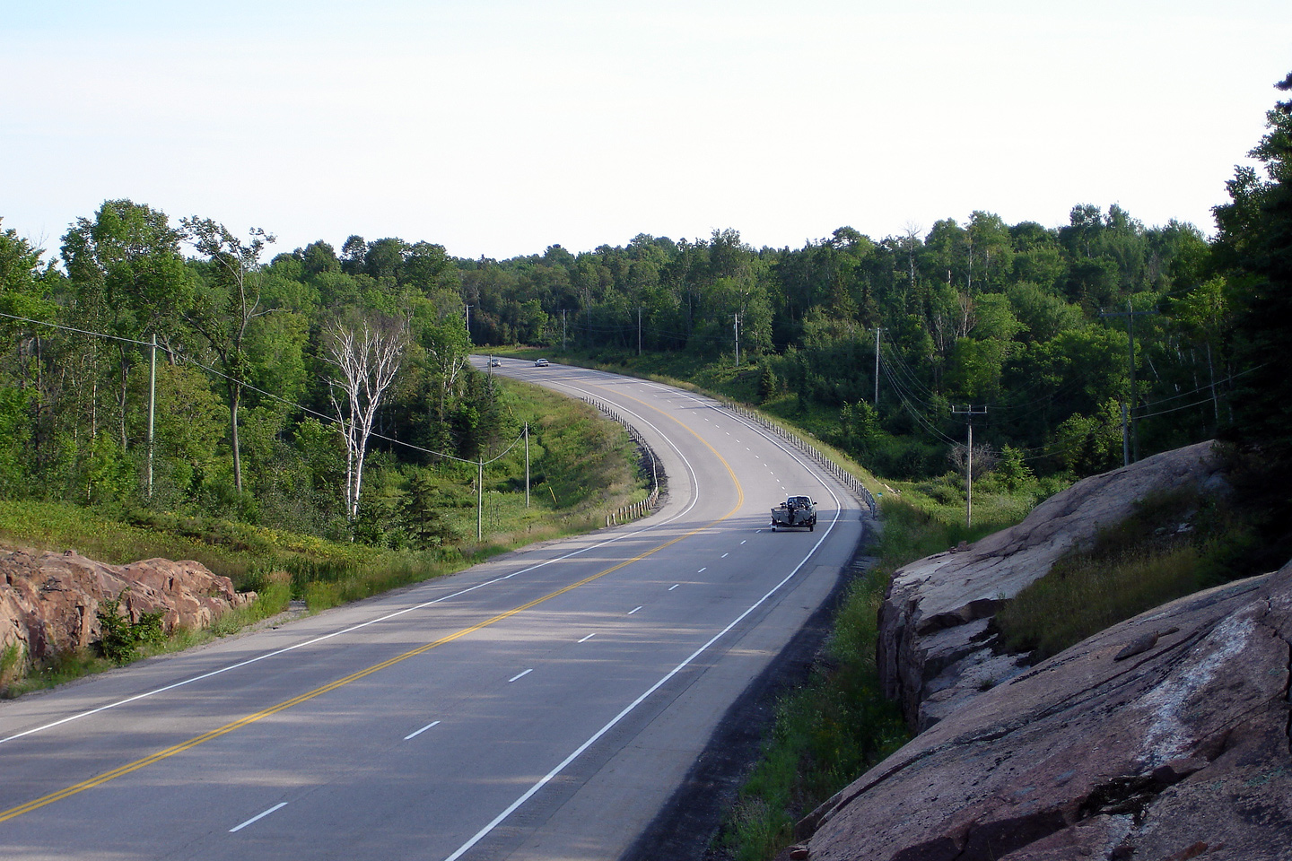
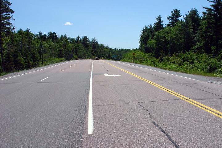
This view looks southerly along Highway 69 about 3km north of Highway 522.
Photo taken: August 5th, 2006. |
(720x480)
(1440x960) |
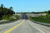
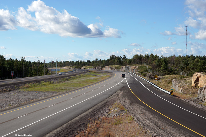
District of Parry Sound
(Geographical Township of Mowat) |
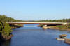
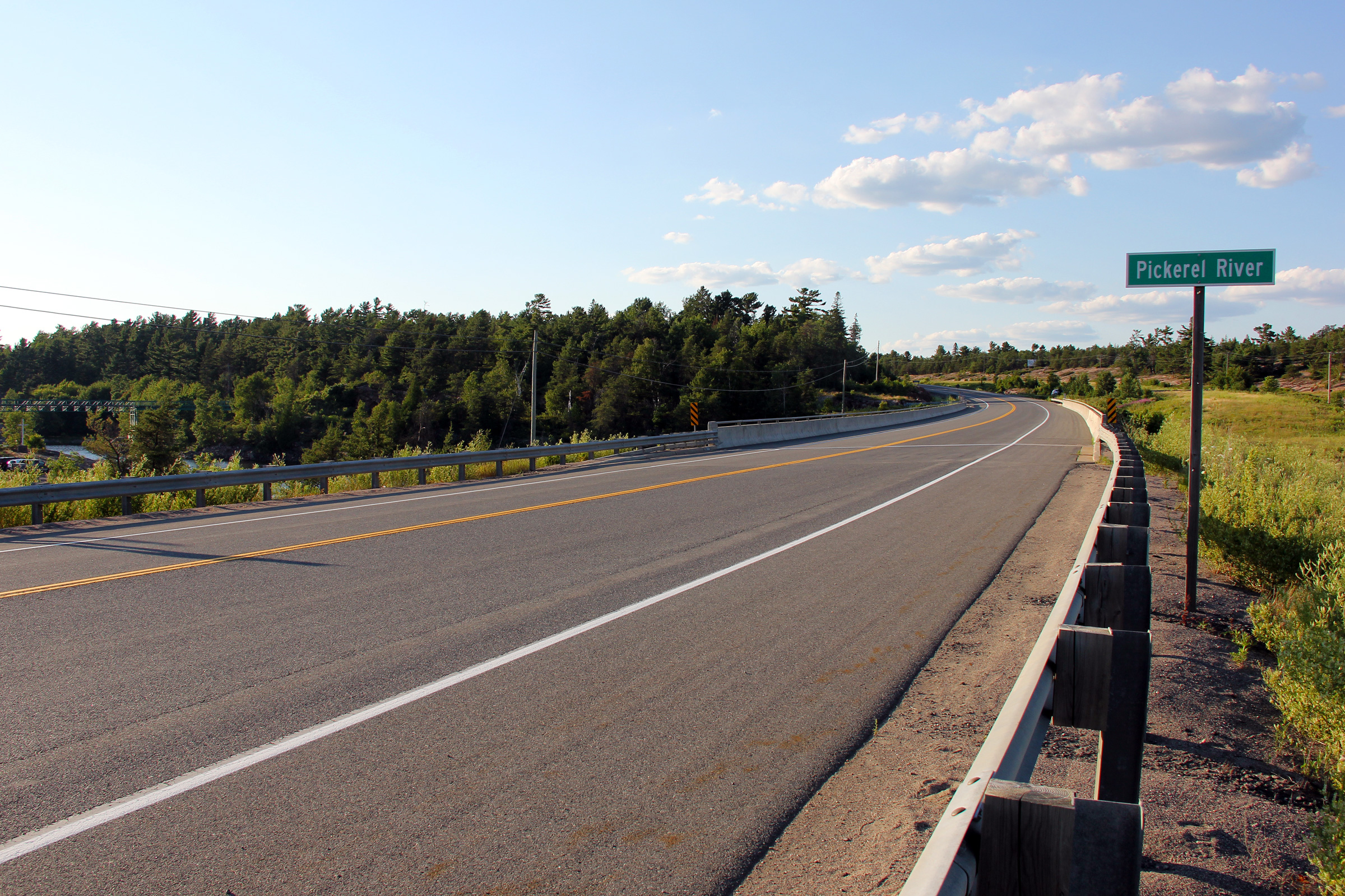
View looking northerly across the Pickerel River bridge along Highway 69.
Photo taken: July 10th, 2012. |
(720x480)
(1440x960)
(2400x1600) |
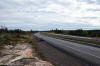
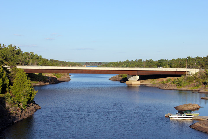
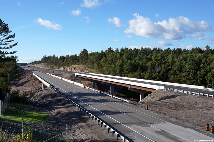
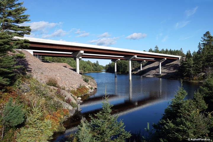
District of Parry Sound
(Geographical Township of Mowat) |
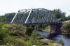
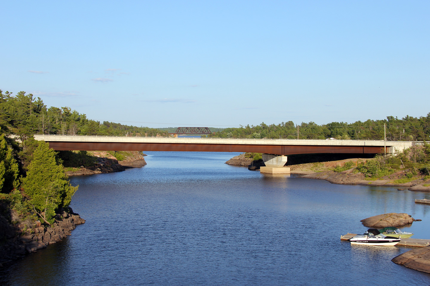
Side view of the Pickerel River bridge. The current Pickerel River
bridge was opened to traffic early in the 2000s, reportedly replacing a steel
truss bridge that was similar to the French River bridge that is situated a few kilometres to the
north (and pictured below).
Photo taken: July 10th, 2012. |
(720x480)
(1440x960)
(2400x1600) |
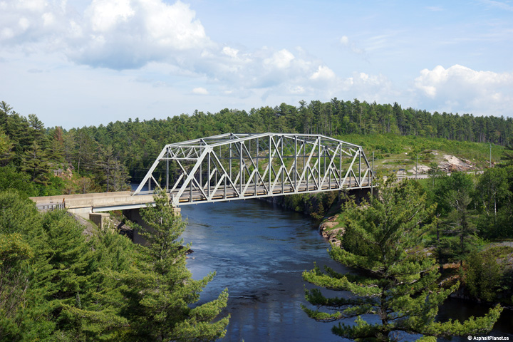
District of Parry Sound
(Geographical Township of Mowat) |
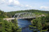
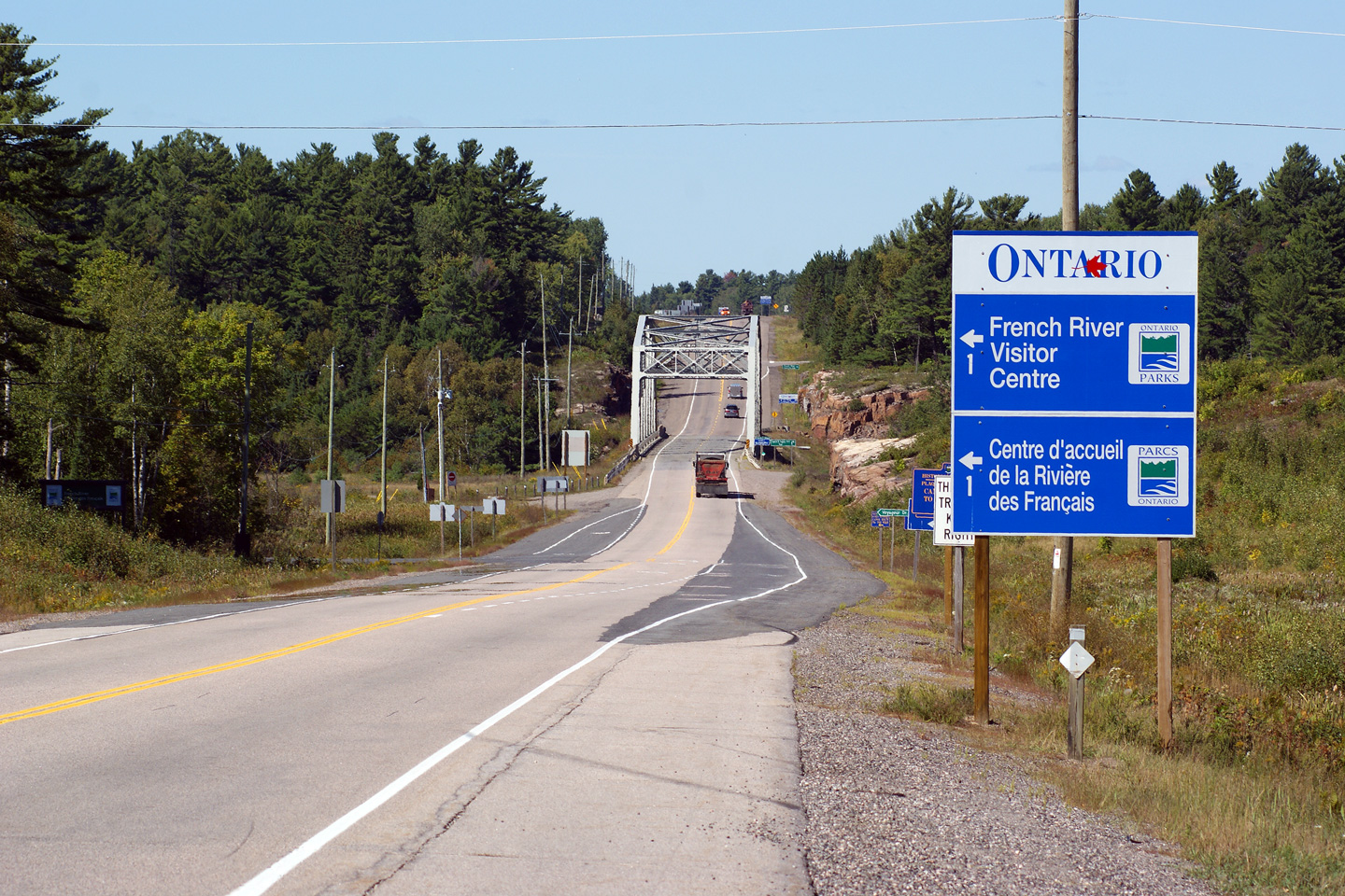
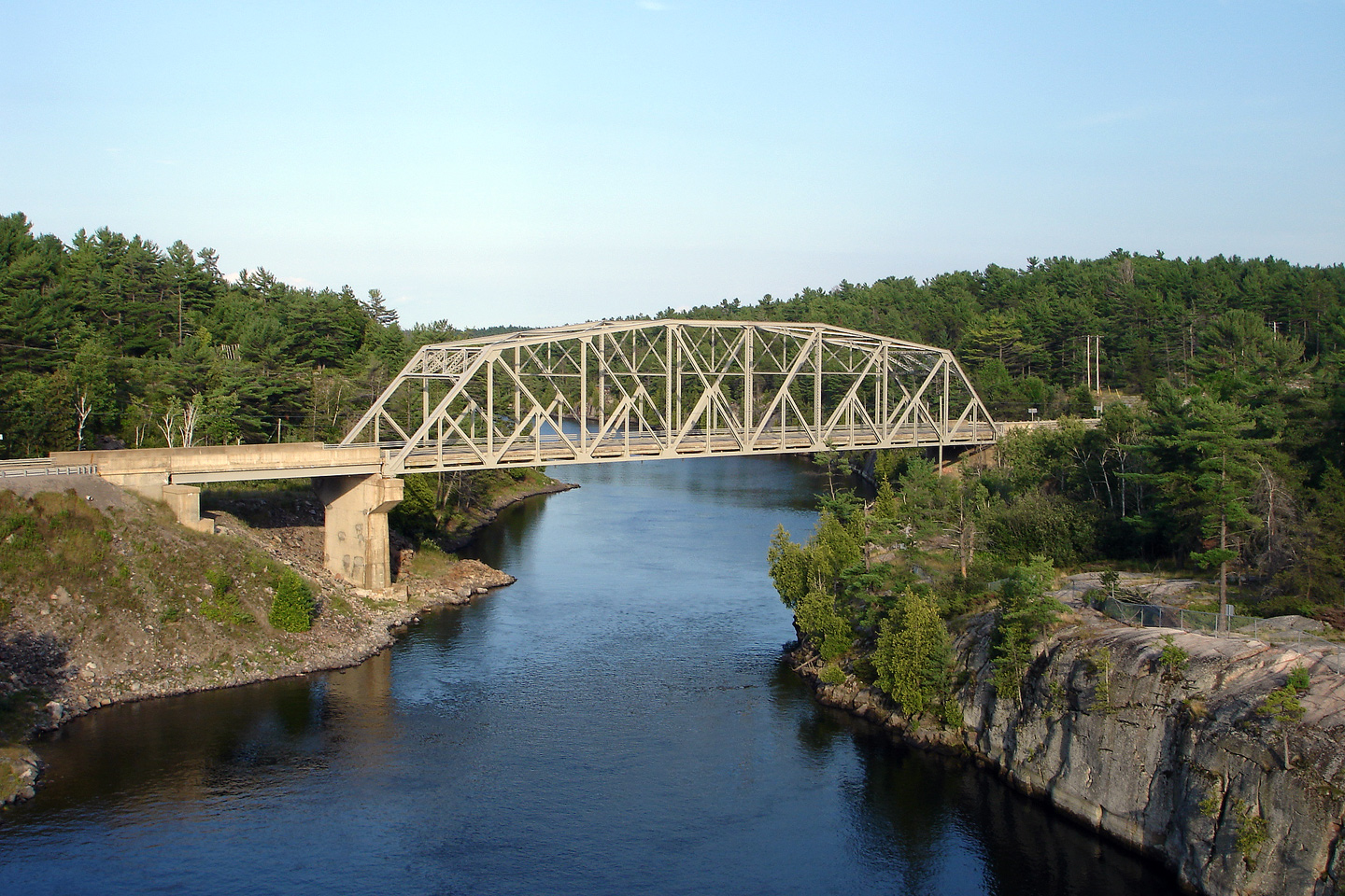
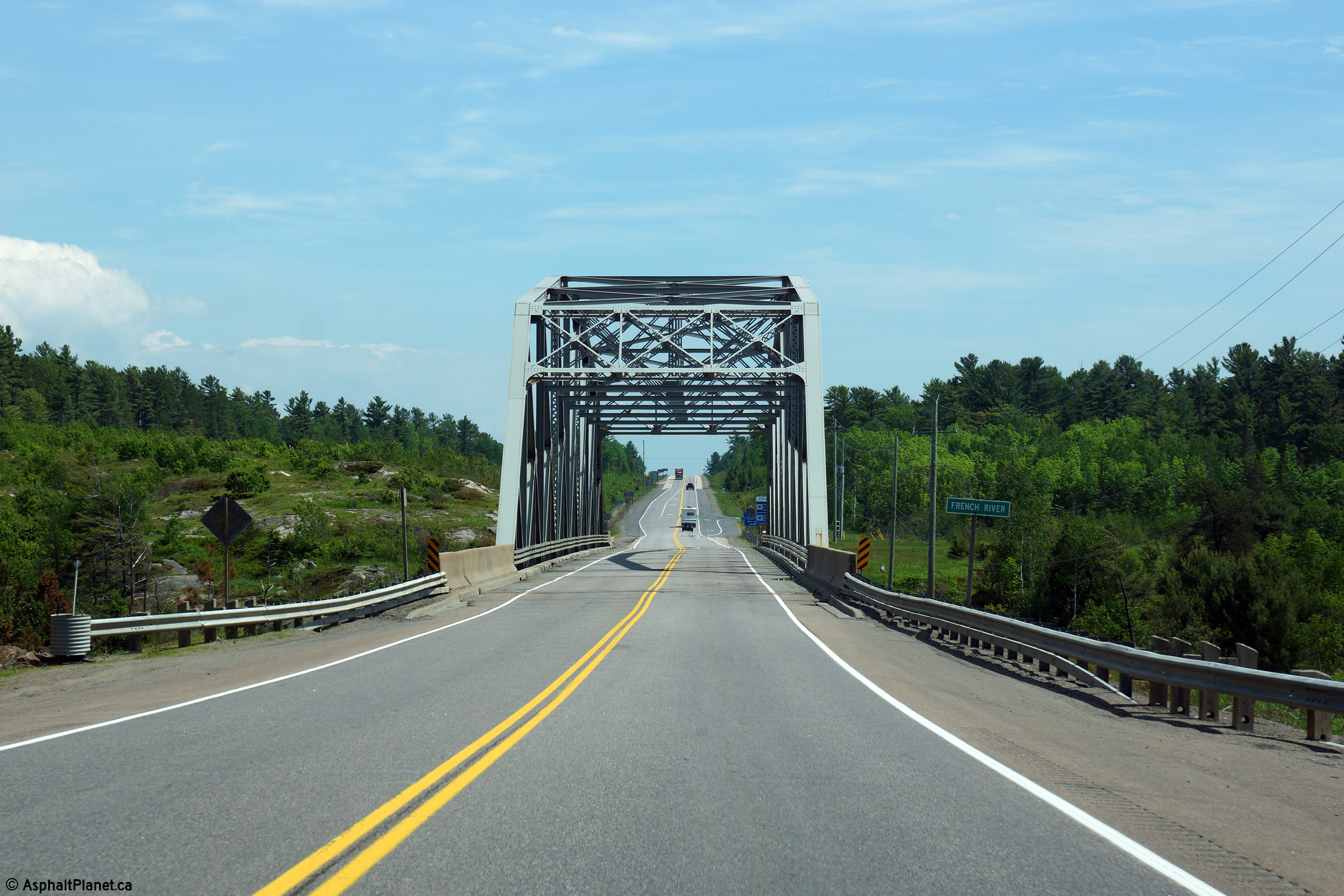
View looking northerly approaching the French River bridge, from just south
of the French River Visitors Centre.
Photo taken: September 10th, 2012. |

(720x480)
(1440x960)
(2400x1600) |
District of Parry Sound
(Geographical Township of Mowat) |
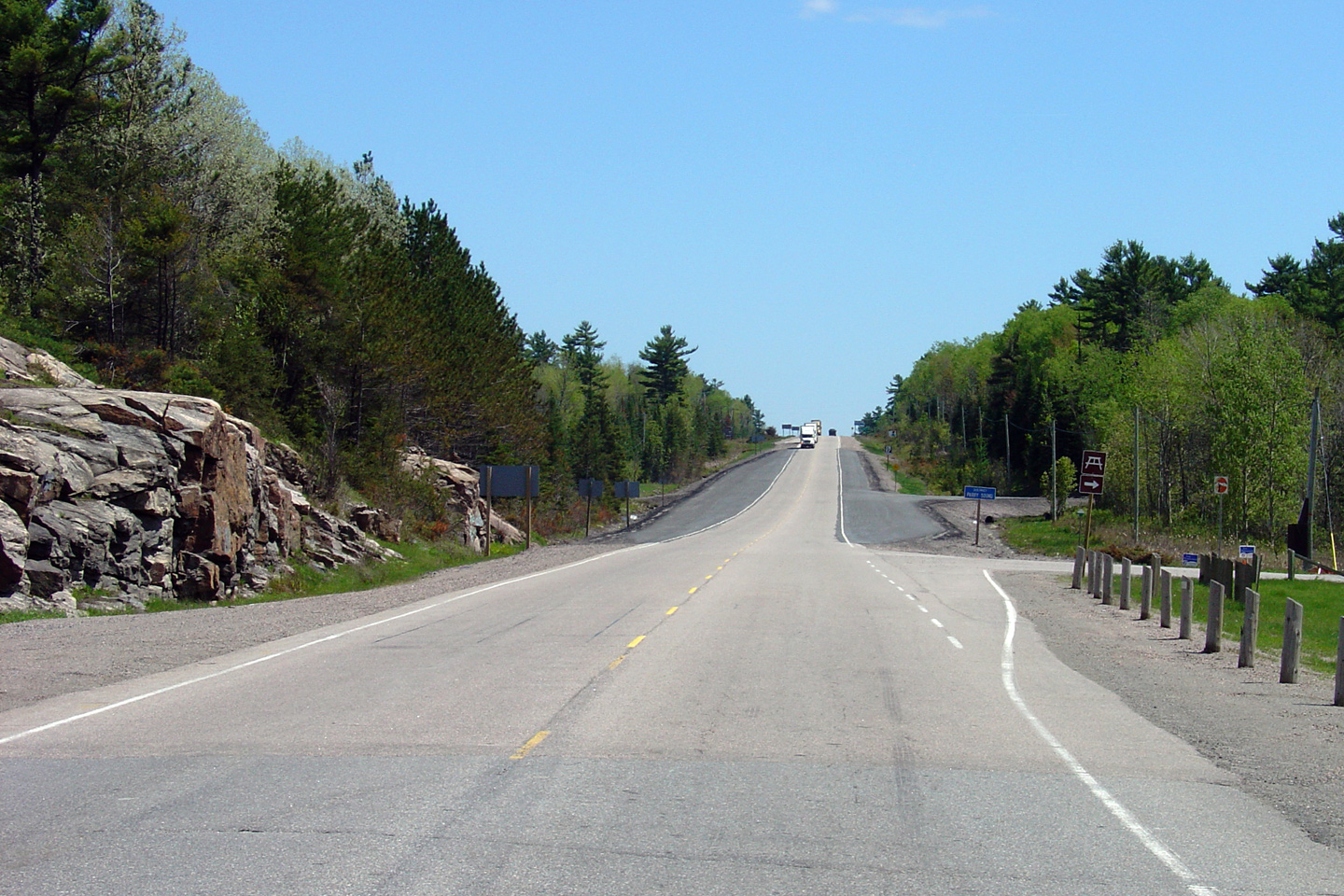
View looking south from the French River bridge towards the French River
picnic area. During the summer of 2006 the old picnic site was closed (the
entrance of which is visible in the foreground of this photo), and was replaced by the new, much
larger facility located just to the south of the existing picnic area.
Photo taken: May 29th, 2004. |
(720x480)
(1440x960) |
District of Parry Sound
(Geographical Township of Mowat) |
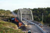
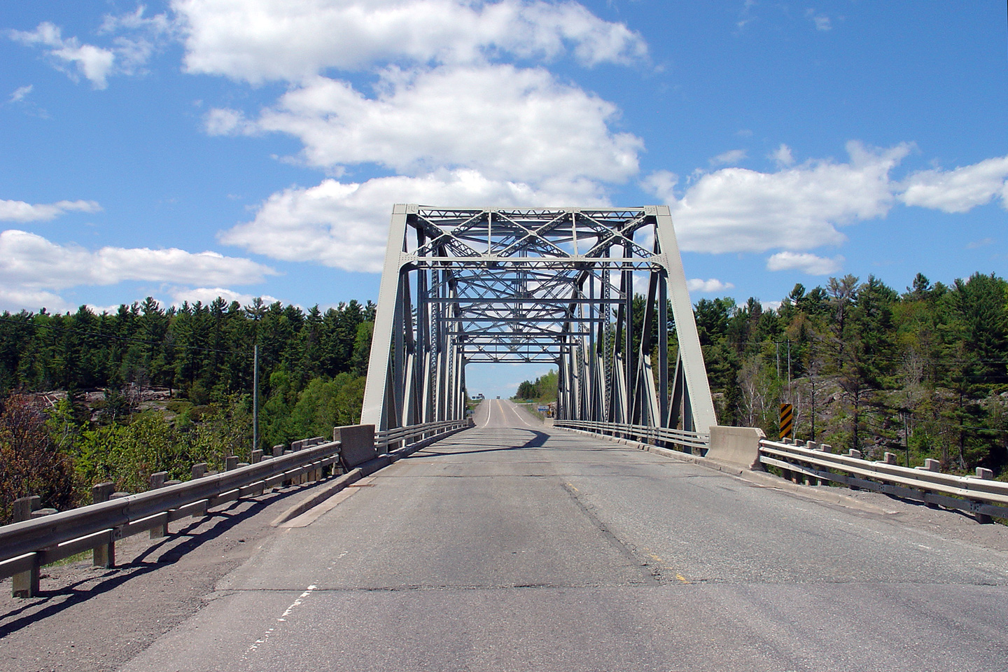
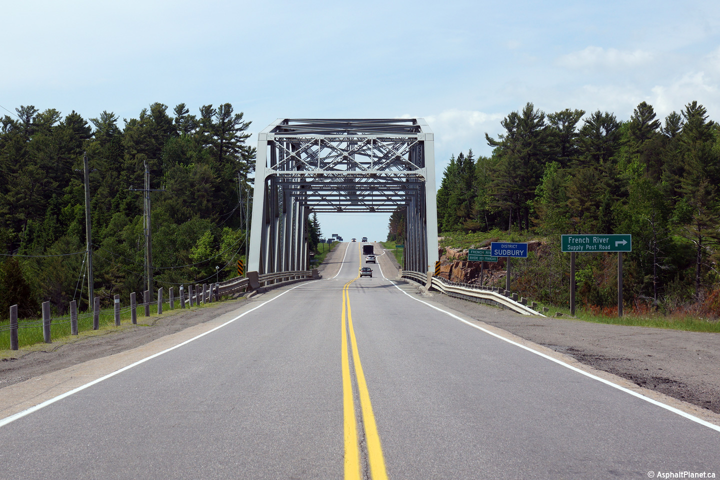
Highway 69 looking south through the French River steel-through-truss
bridge. The French River bridge is located only a short distance south
of Highway 607.
Upper photo taken: May 29th, 2004.
Lower photo taken: June 13th, 2015. |

(720x480)
(1440x960)

(720x480)
(1440x960)
(2400x1600) |
Municipality of French River
District of Sudbury |
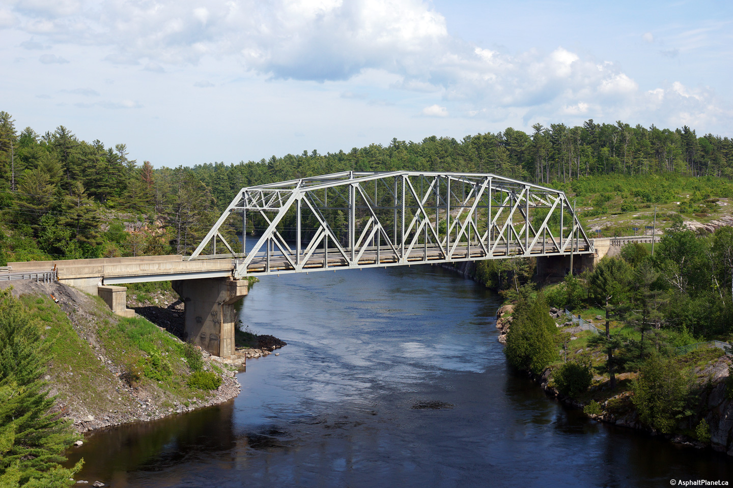
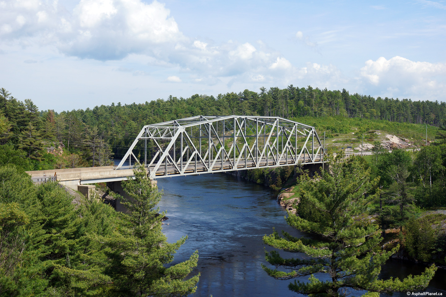
Side views of the French River Bridge. In my
humble opinion, the French River Bridge along Highway 69 is far and
away Ontario's most photogenic highway bridge. For an additional view,
taken August, 2006, click here.
Photos taken: June 13th, 2015. |

(720x480)
(1440x960)
(2400x1600)
(720x480)
(1440x960)
(2400x1600) |
Municipality of French River
District of Sudbury |
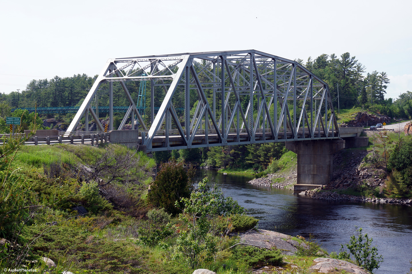
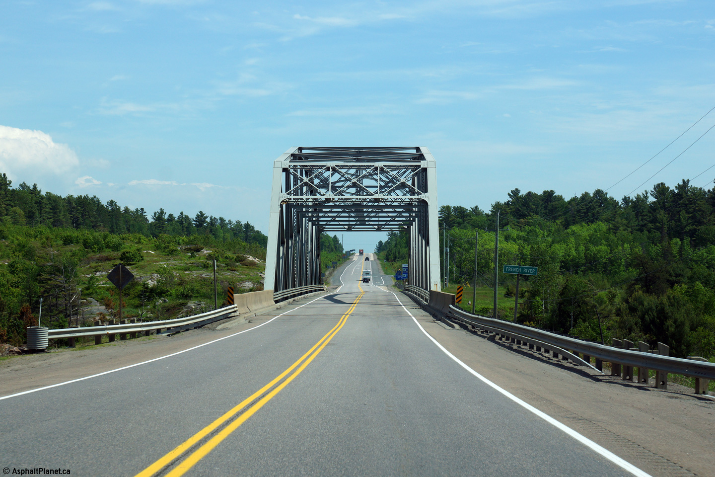
View looking westerly towards the French River Bridge. Starting in
2016, construction will commence on two new twin bridges that will carry a
new four
lane highway overtop of the French River immediately to the east of the
existing bridge. The current truss bridge will be retained as a
service road. For more information about future realignments of
Highway 69, check the website
Highway69.ca
Photo taken June 13th, 2015. |
(720x480)
(1440x960)
(2400x1600) |
Municipality of French River
District of Sudbury |
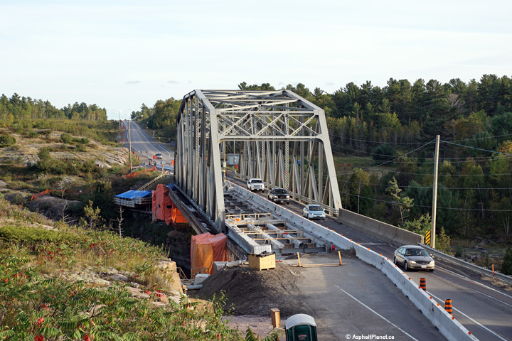
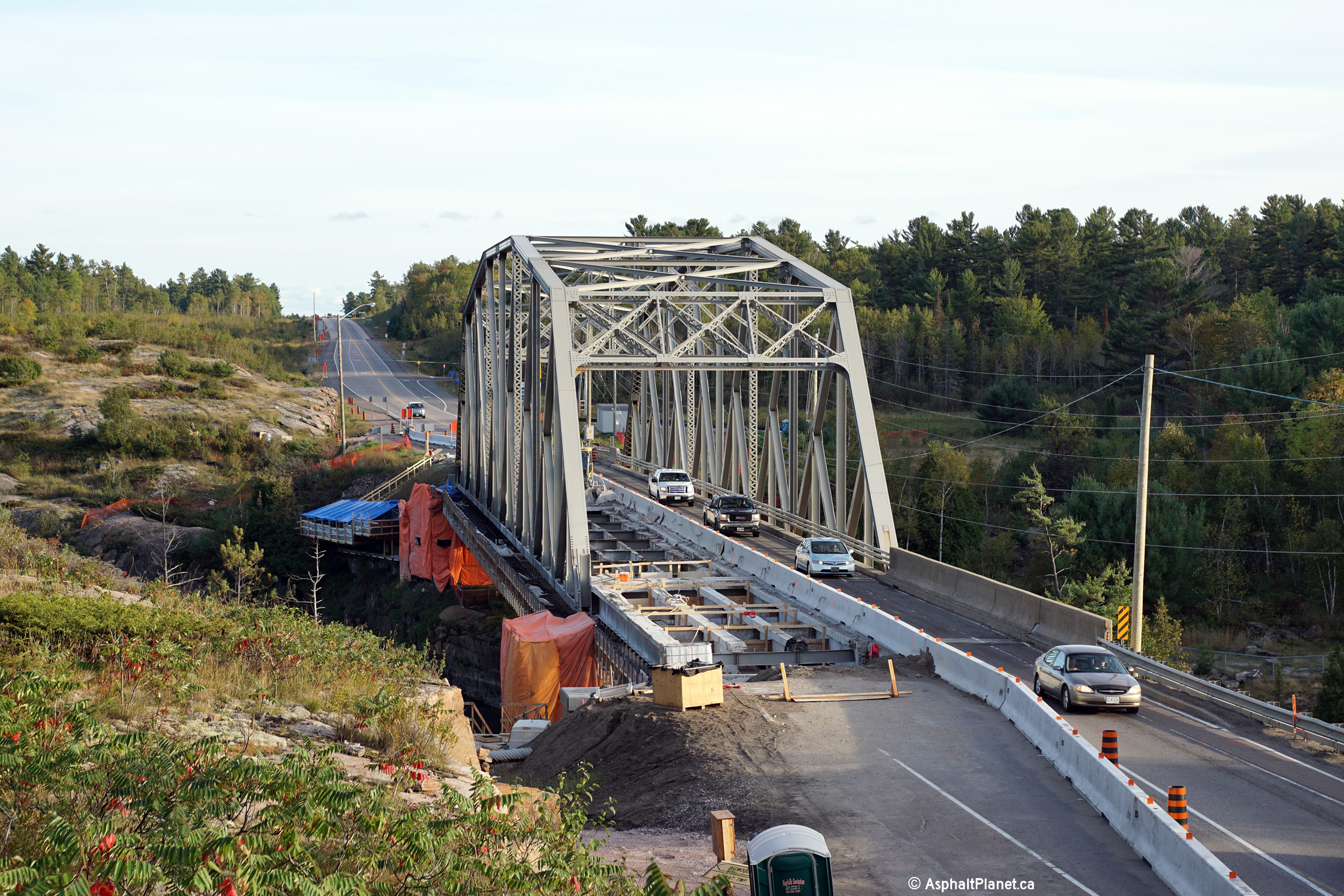
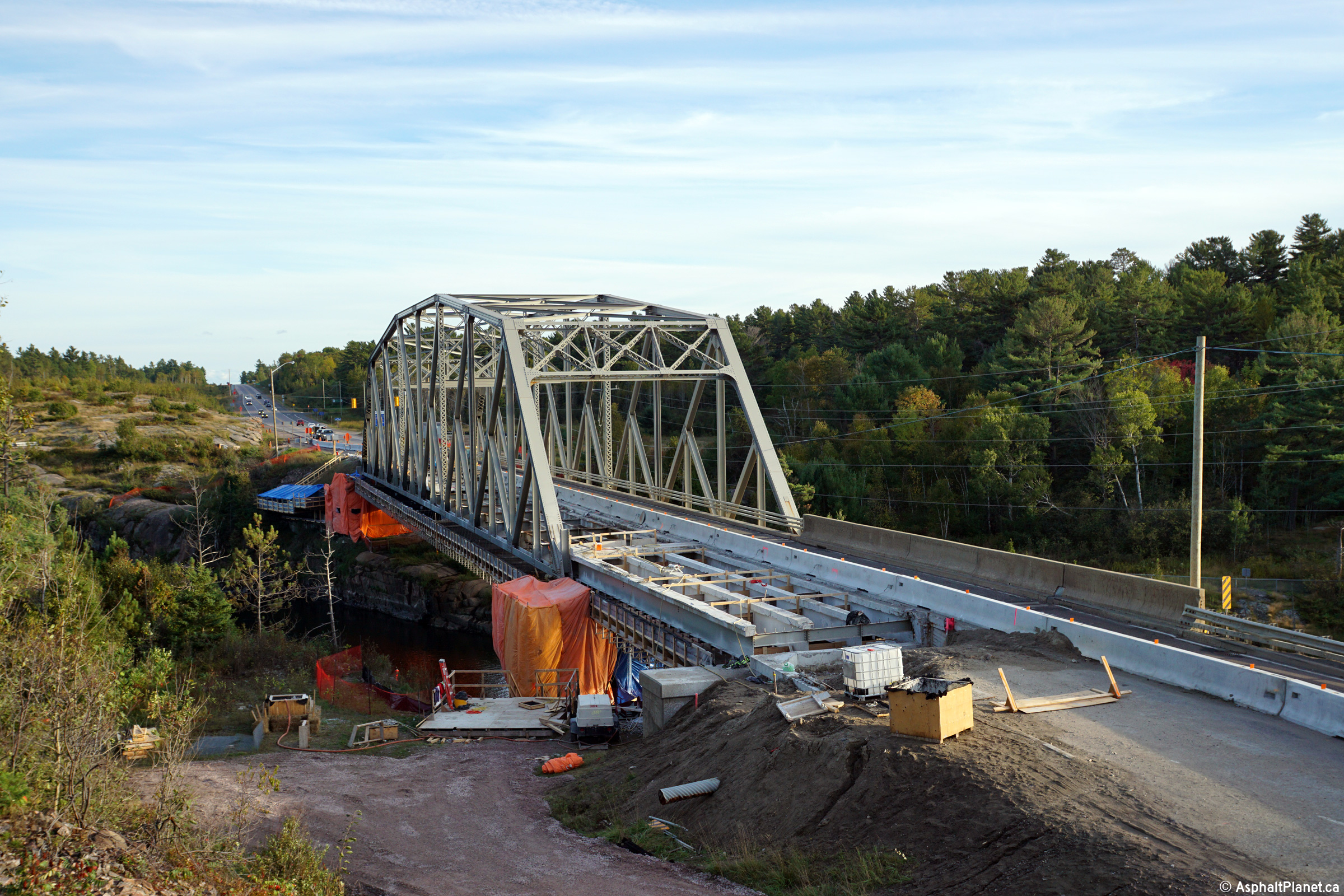
Two views looking southerly across the French River Bridge. In the
summer of 2015, the MTO commenced a multi-year rehabilitation project to
replace the concrete deck of the French River Bridge. Because the
replacement of the bridge deck requires the bridge to be reduced to a single
lane with alternating traffic flow, motorists should anticipate long delays
at this bridge, particularly during peak periods in the summer.
Photos taken: September 20th, 2015. |
(720x480)
(1440x960)
(2400x1600)

(720x480)
(1440x960)
(2400x1600) |
Municipality of French River
District of Sudbury |
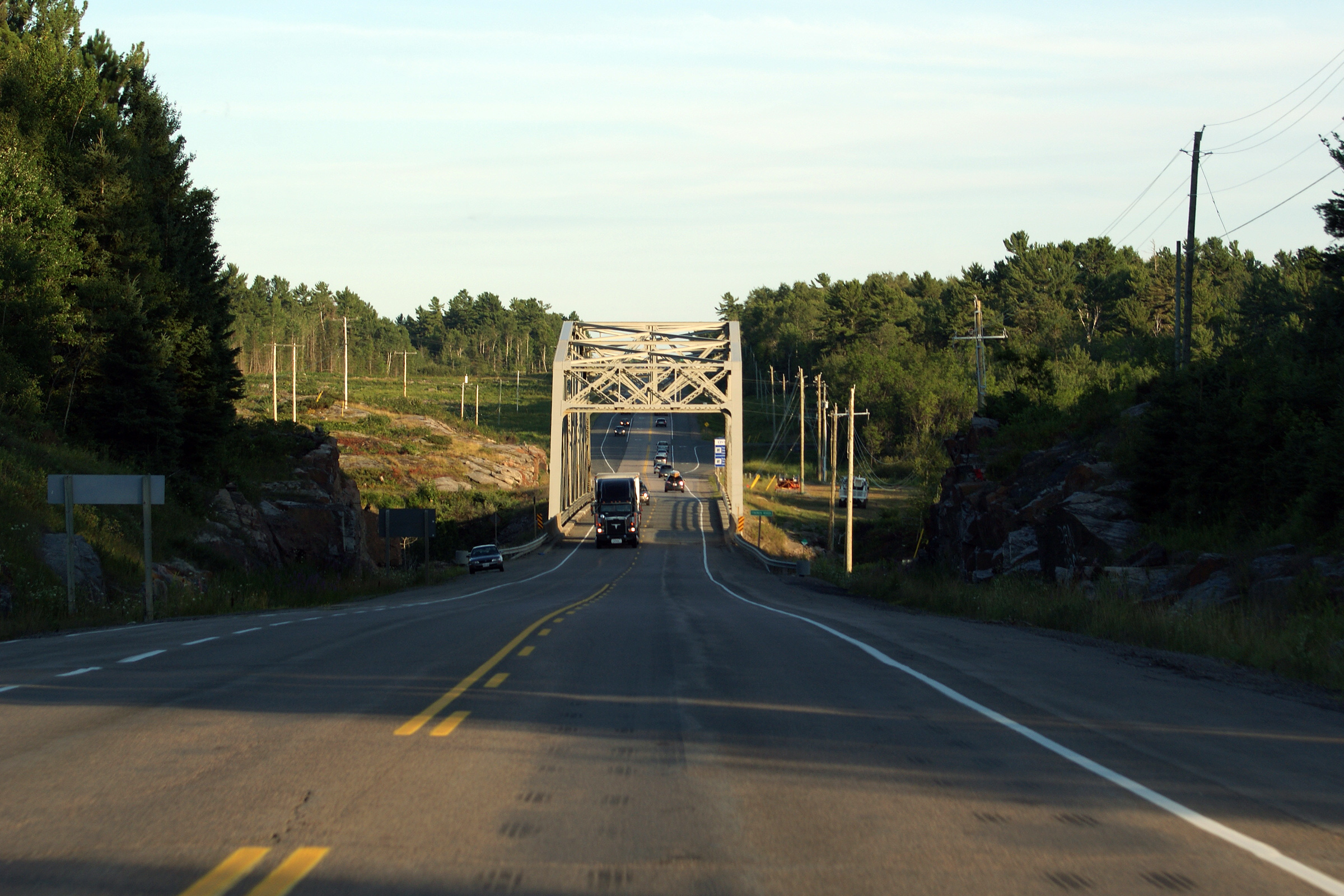
Southbound approach to the French River steel truss bridge. An
additional view of the French River Bridge, taken July, 2010 can be found
here.
Photo taken: June 13th, 2015. |

(720x480)
(1440x960)
(2400x1600)
(720x480)
(1440x960)
(2400x1600) |
Municipality of French River
District of Sudbury |
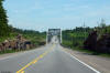
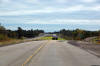
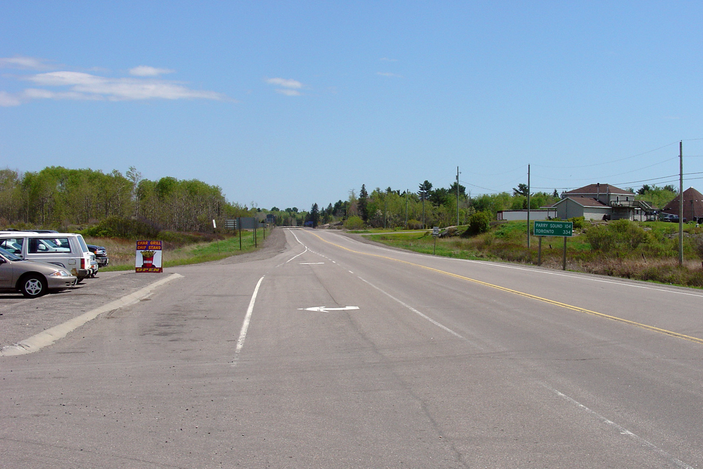
This view looks southerly along Highway 69 from the Highway 607 junction.
Photo taken: May 29th, 2004. |
(720x480)
(1440x960) |
Municipality of French River
District of Sudbury |
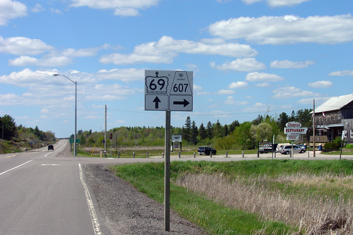
Signage assembly for the Highway 69/607
junction. Highway 607
leads northeast from Highway 69 and serves as a shortcut route to
Highway 64. Photo taken: May 29th, 2004. |
 (720x480) (720x480)
(1440x960) |
|
Highway 64 starts at Highway 69,
leading Easterly to Noelville, Sturgeon Falls, and finally Highway 11 at
Marten River.
Click here for Highway
607
images. |
Municipality of French River
District of Sudbury |
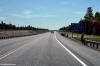
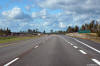
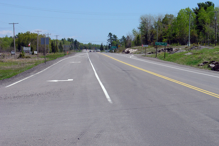
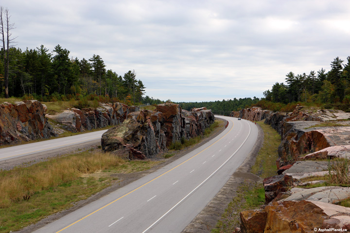
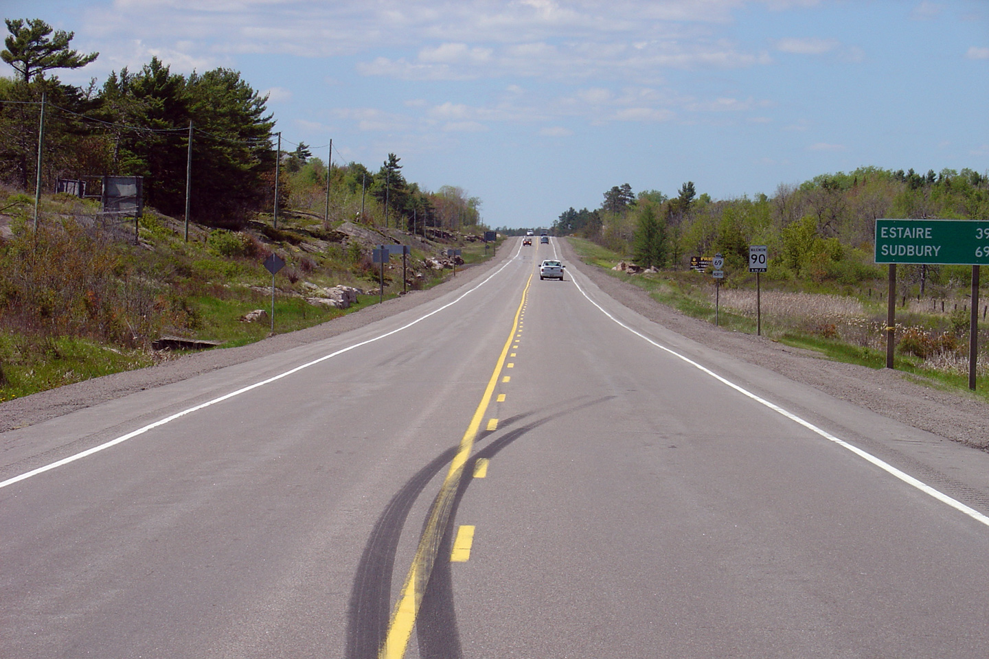
Highway 69 looking north from
Highway 607.
The pictured section of Highway 69 was reconstructed early in the 2000s, and
was the first portion of Highway 69 north of Parry Sound to be completed
with extra-wide shoulders and outer rumble strips. Later, in the mid-2000s
the gravel shoulders on all the remaining stretches of Highway 69 were paved,
with
rumble strips added also.
Photo taken: May 29th, 2004. |

(720x480)
(1440x960) |
Municipality of French River
District of Sudbury |
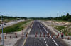
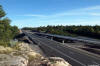
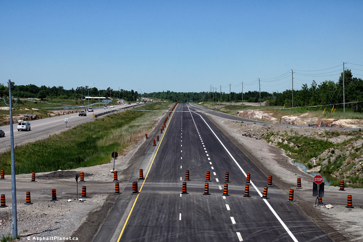
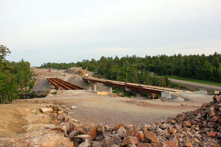
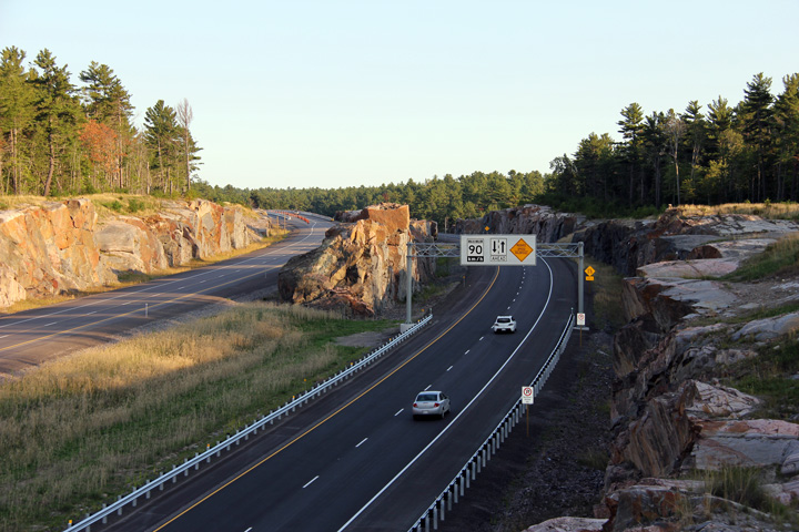
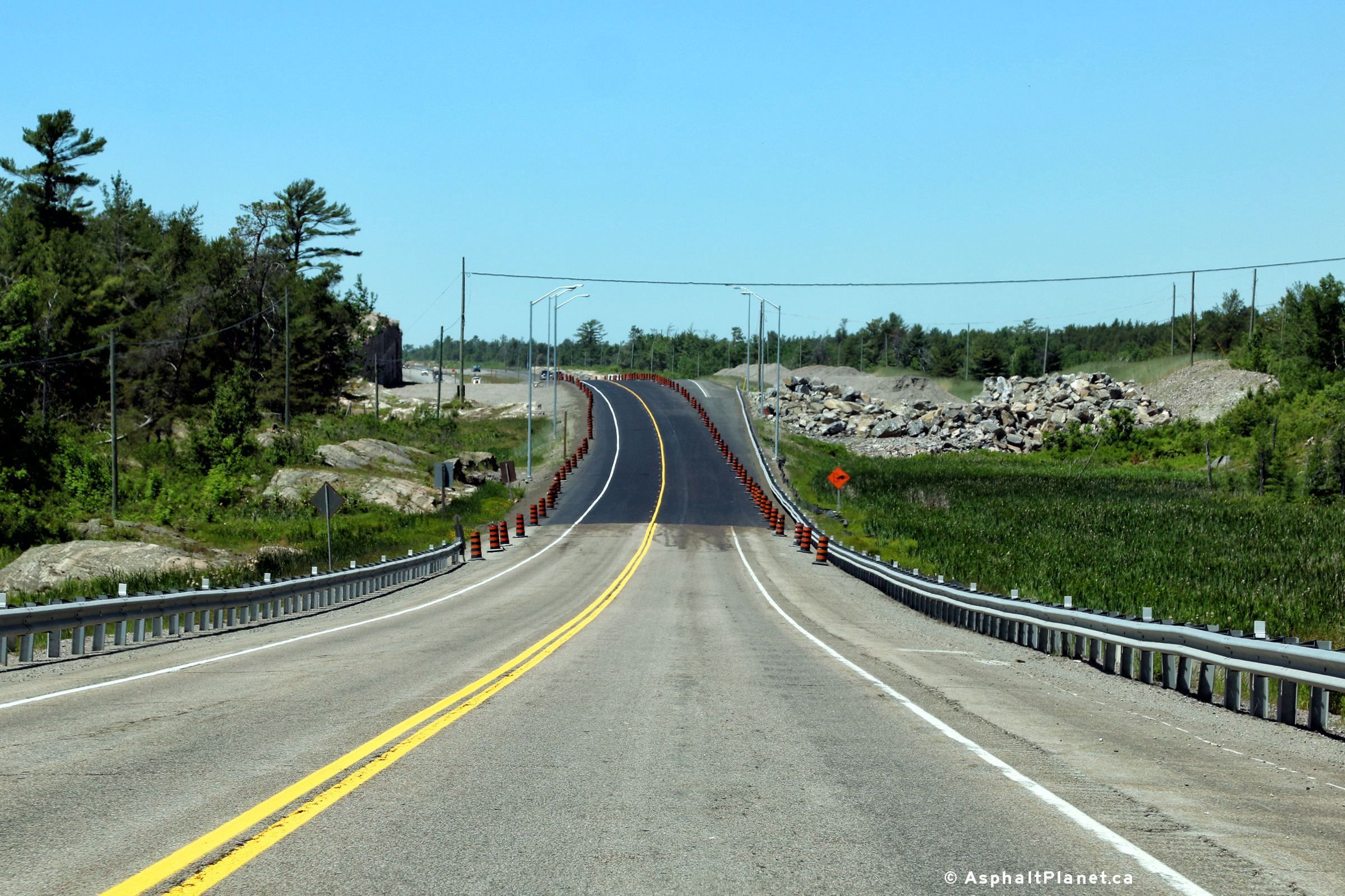
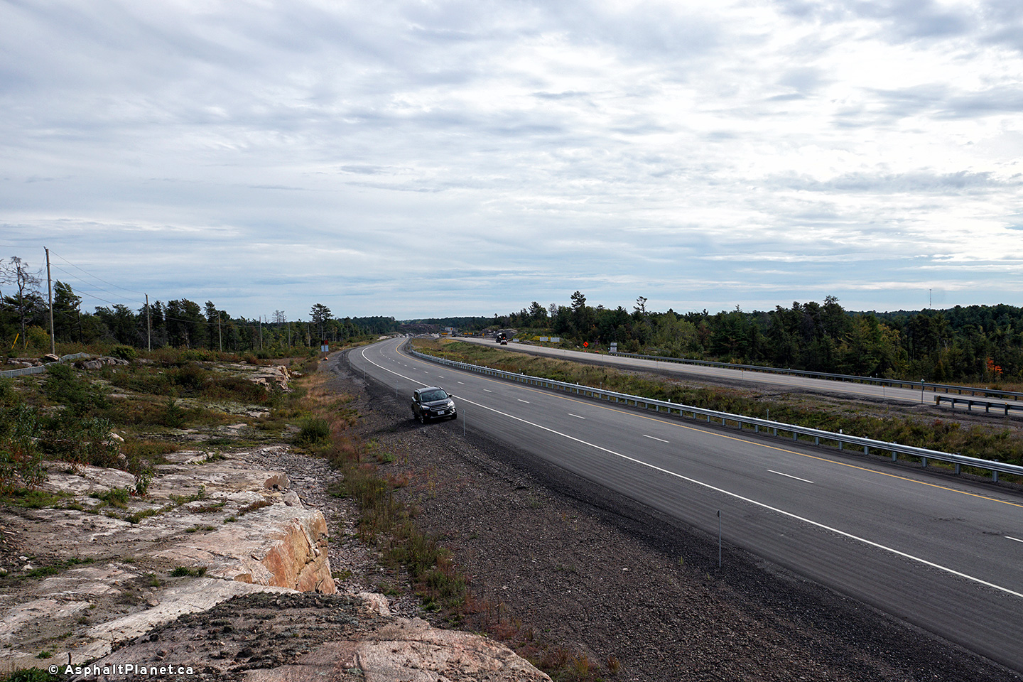
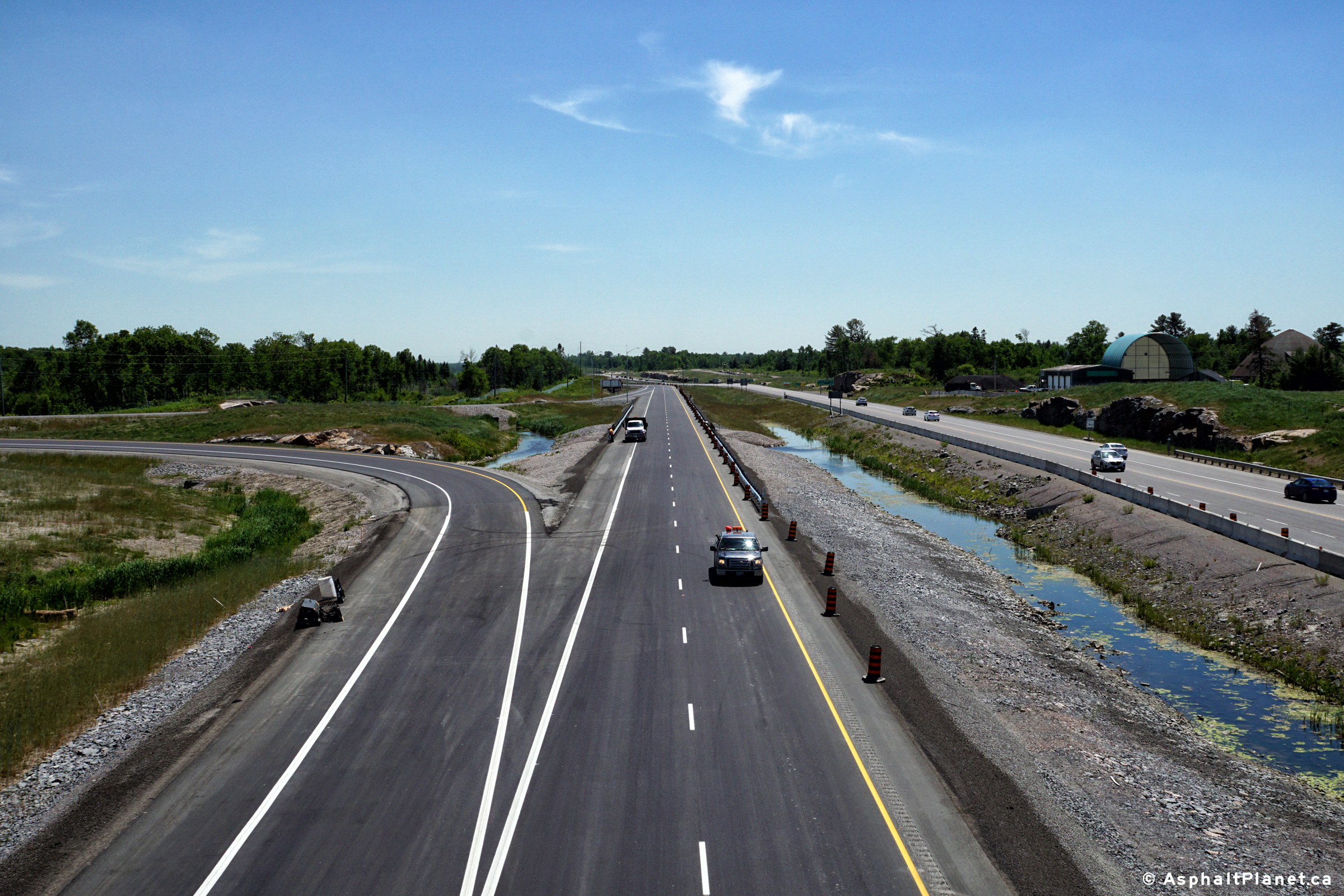
View looking northerly at what will be the start of the divided highway when
the four-lane highway opens to traffic later in 2016.
Photo taken: June 17th, 2016. |
(720x480)
(1440x960)
(2400x1600) |
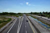
Municipality of French River
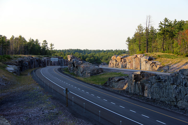
District of Sudbury |
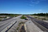
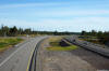
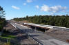
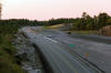
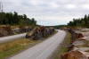
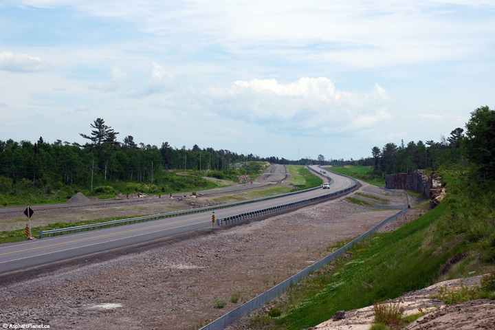
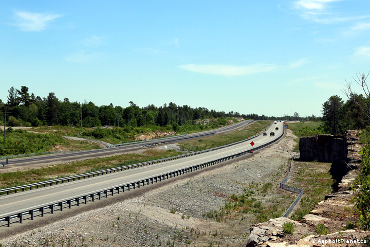
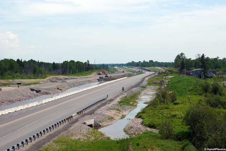
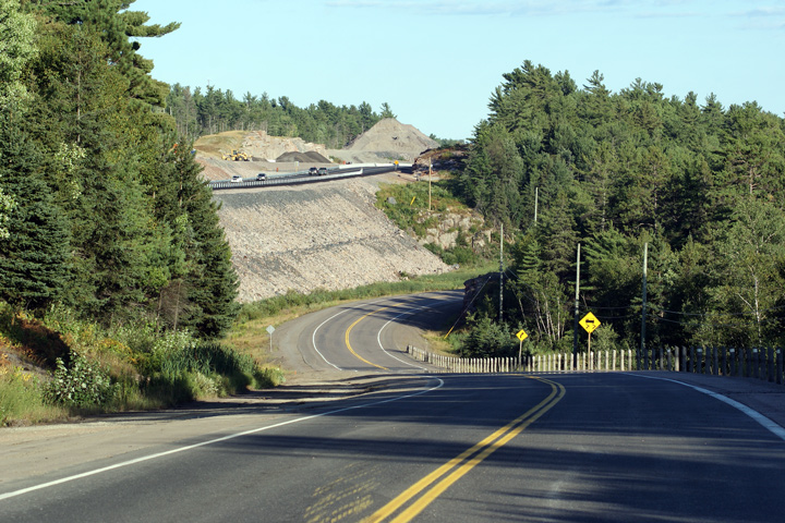
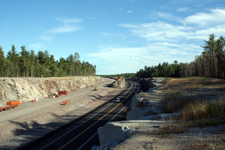
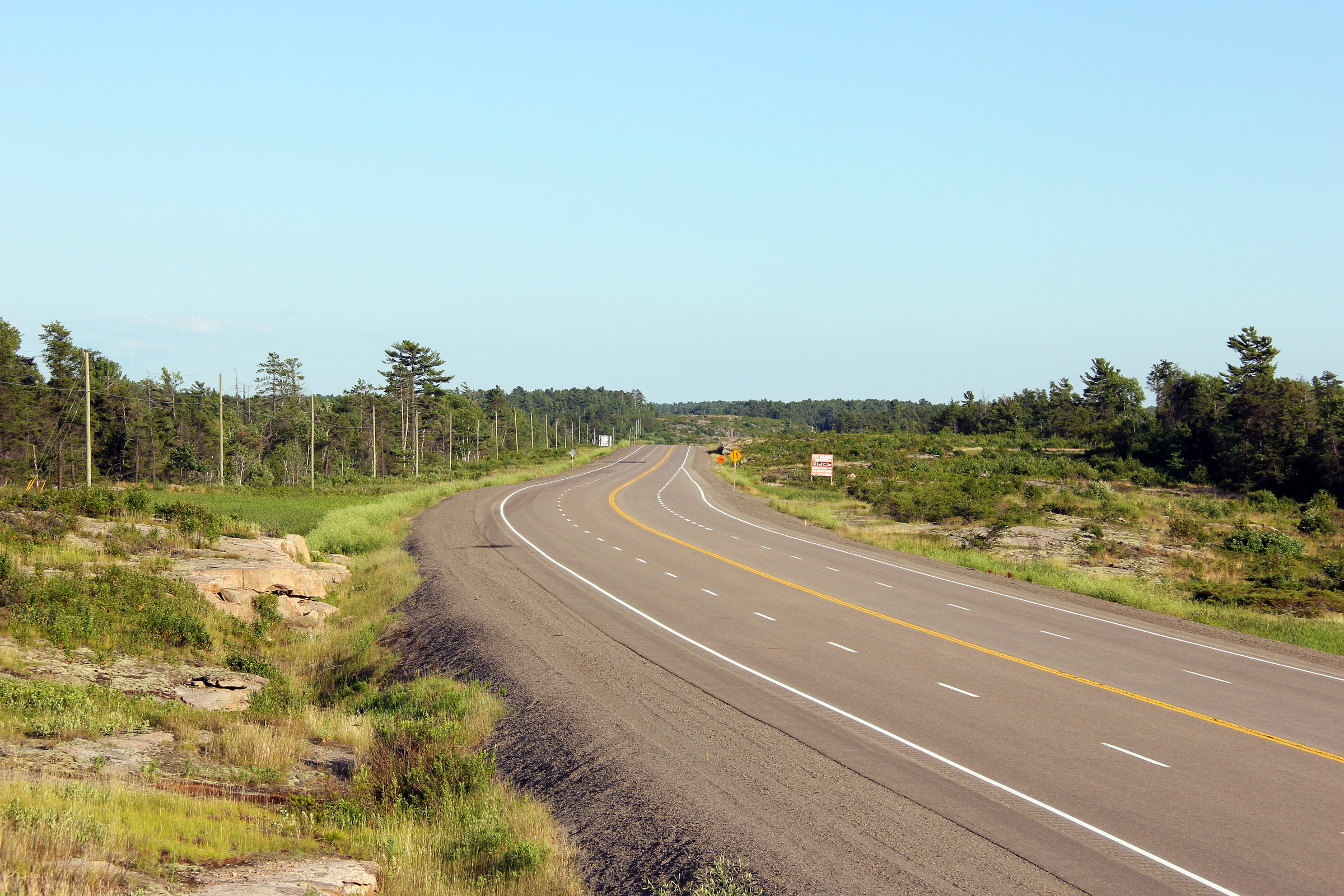
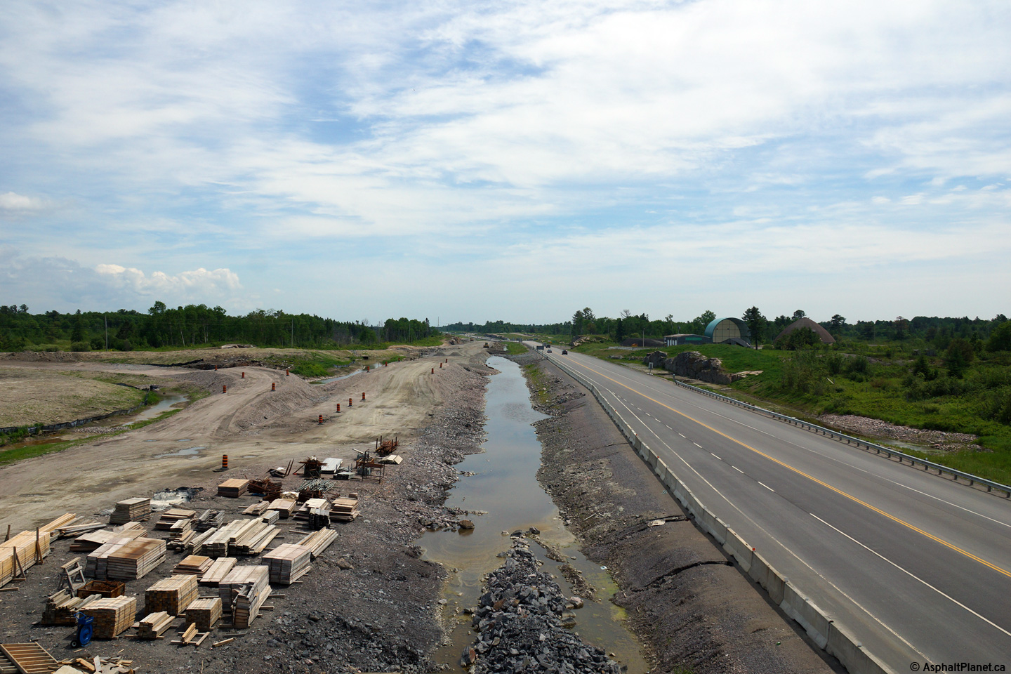
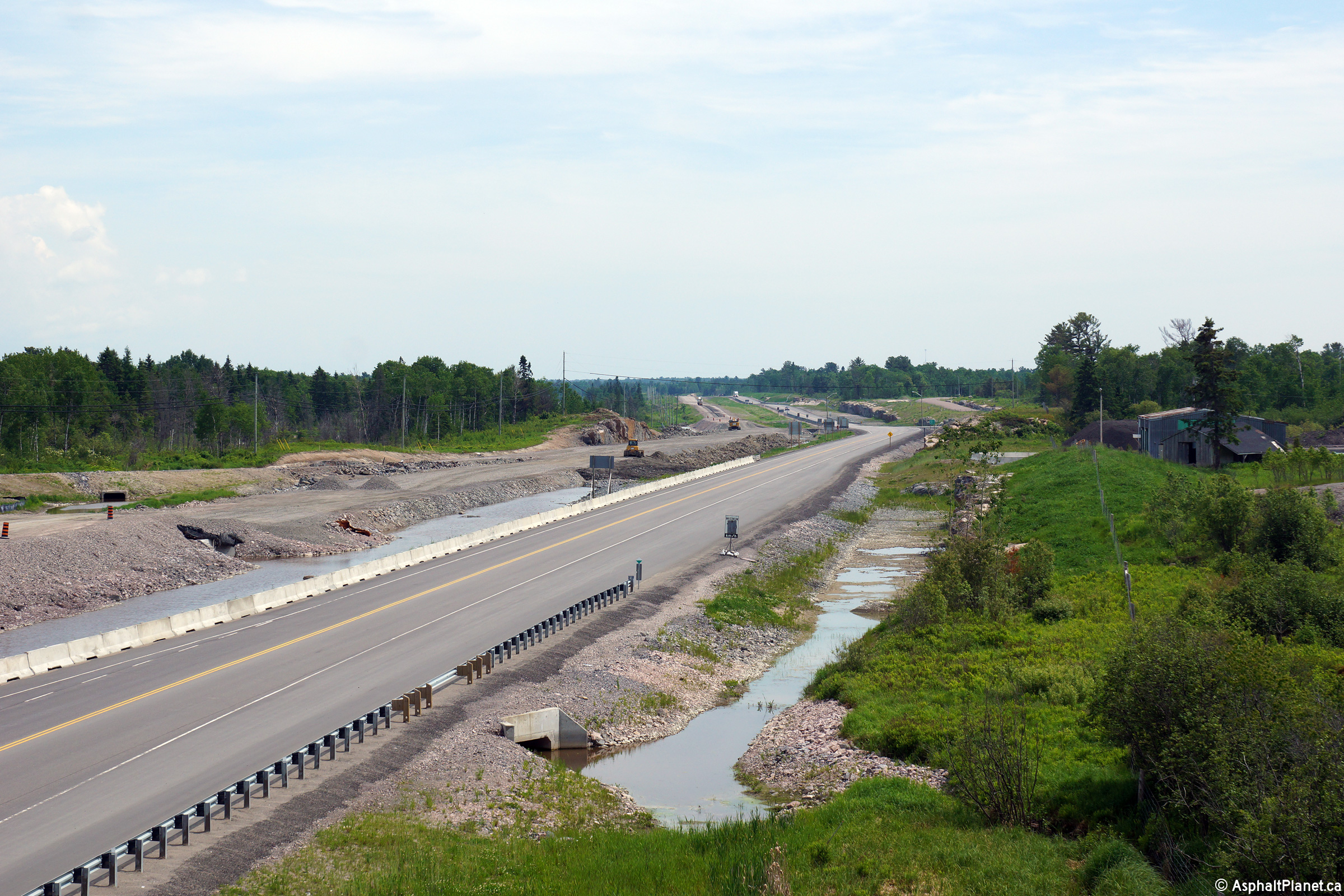
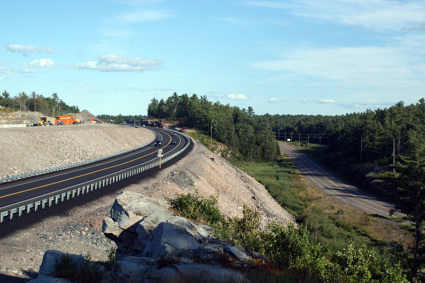
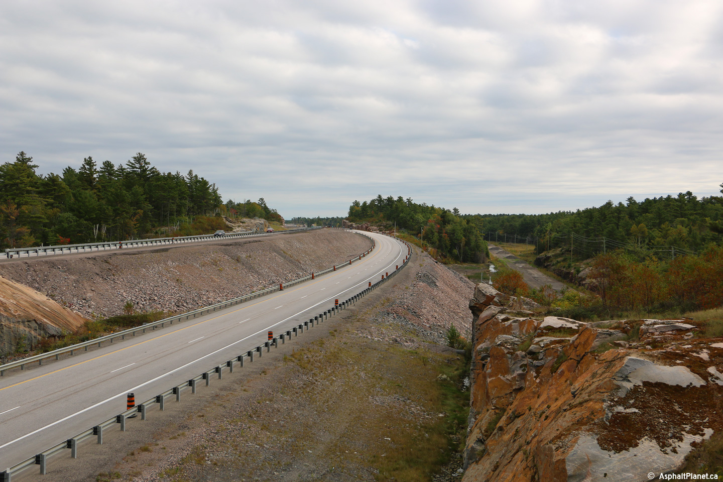
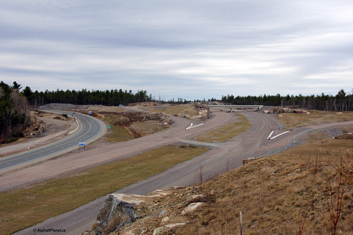
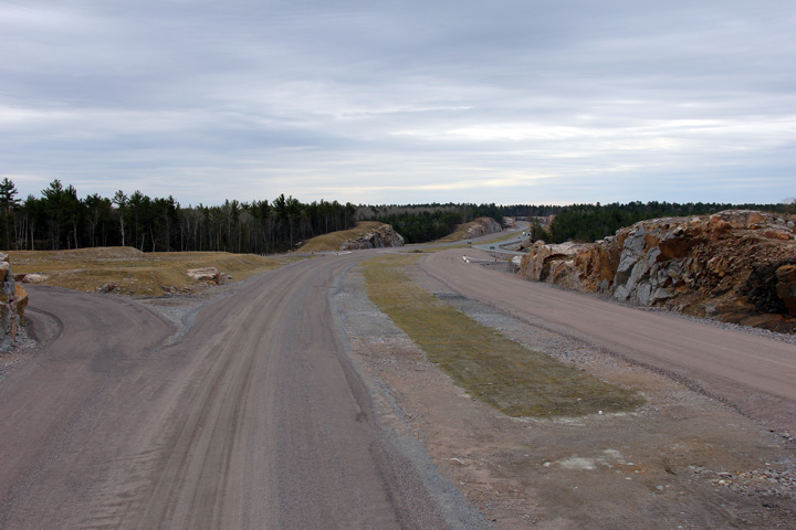
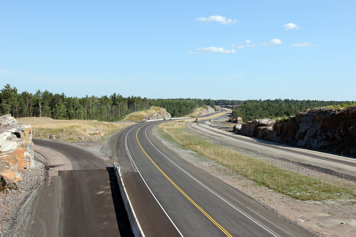
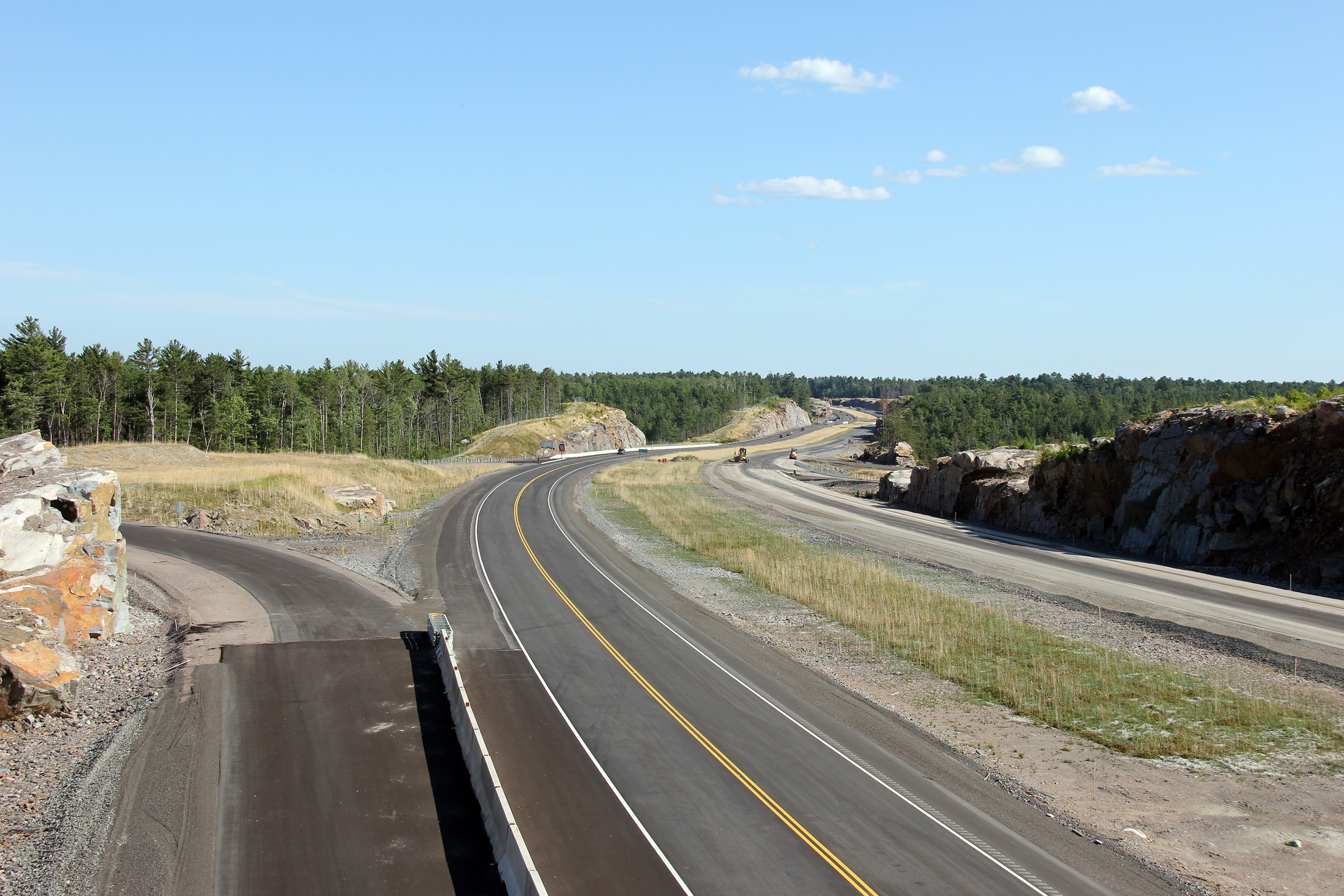
Southerly view from north of the Highway 607 intersection. The
alignment of the new four lane Highway 69 will be considerably straightened
through the pictured valley once completed.
Photo taken: August 29th, 2012. |
|
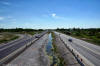
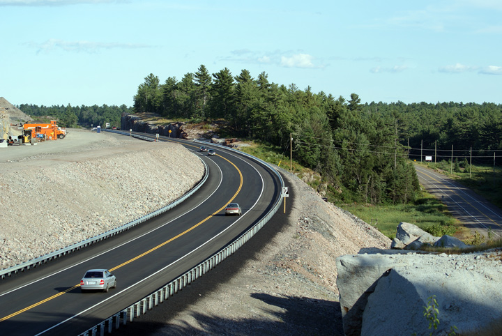
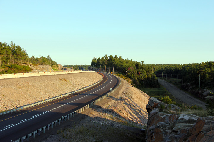
Municipality of French River
District of Sudbury |
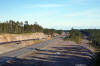
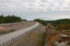
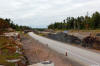
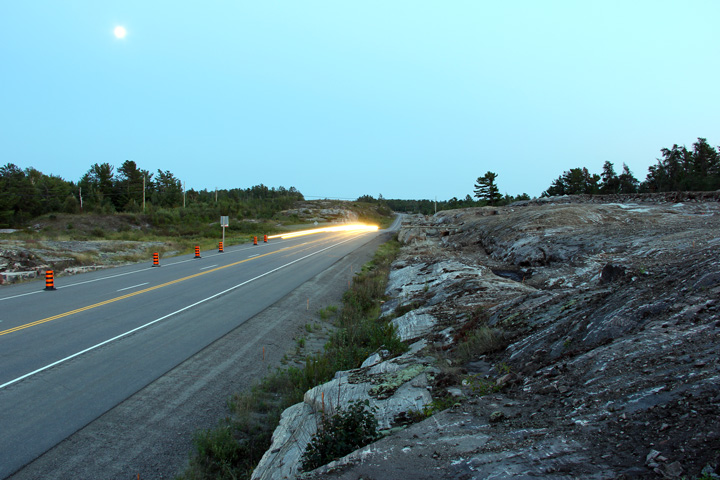
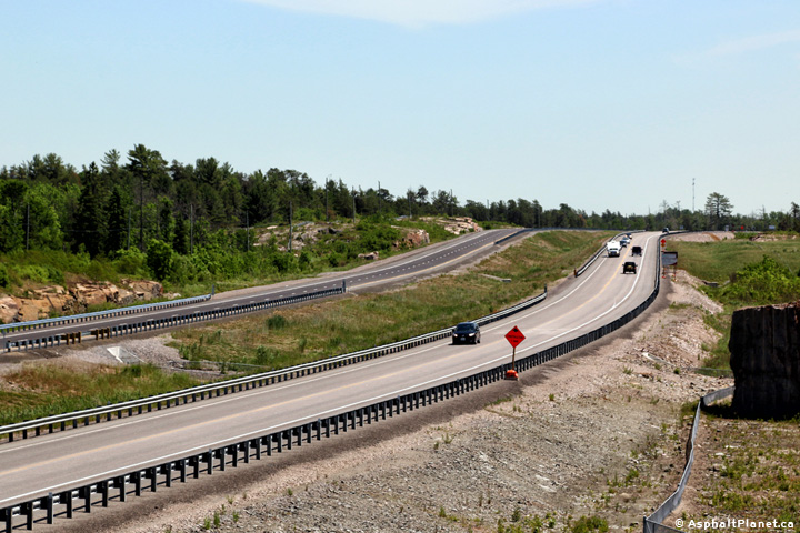
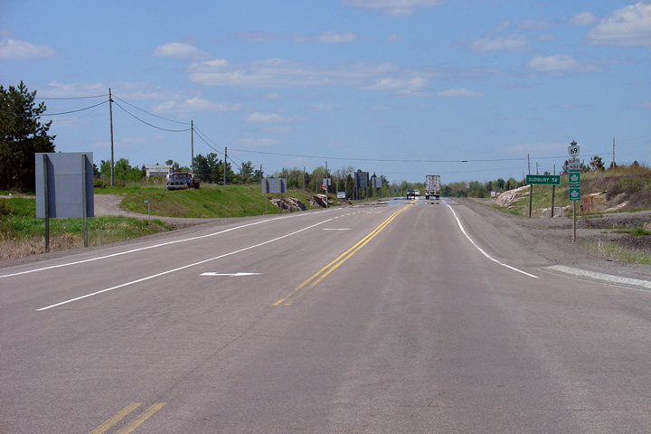
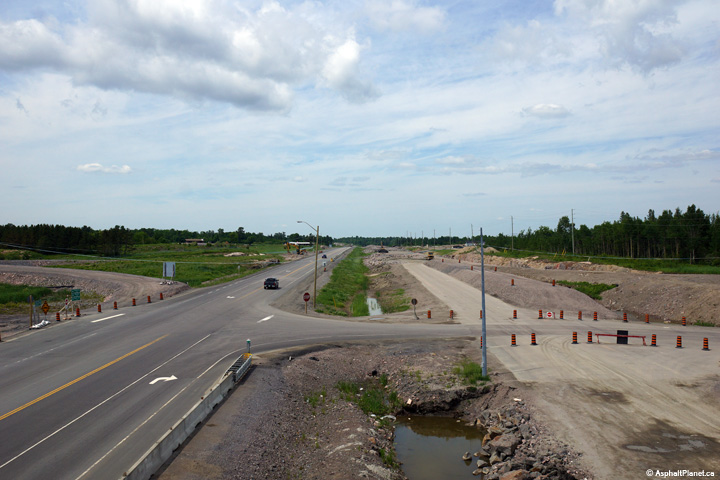
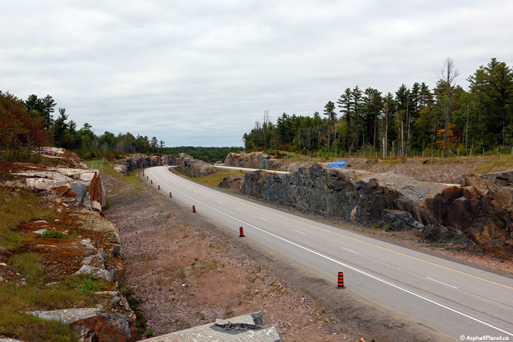
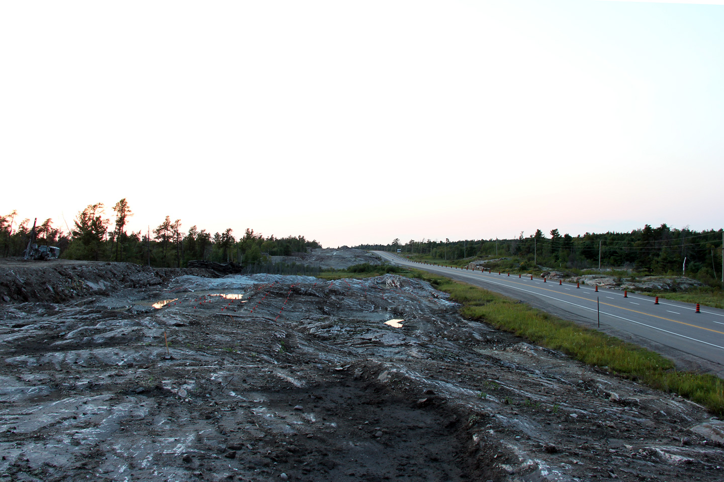
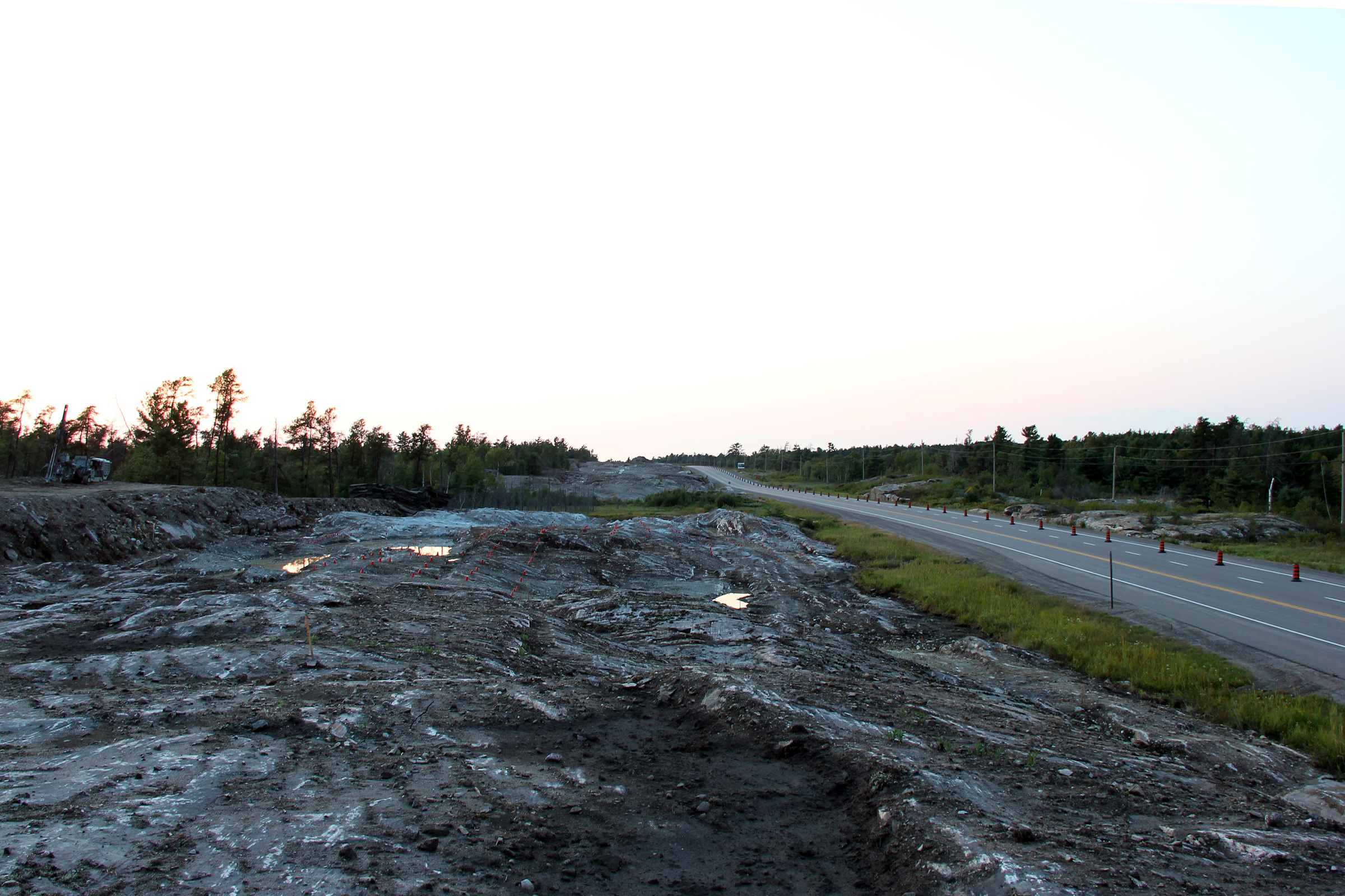
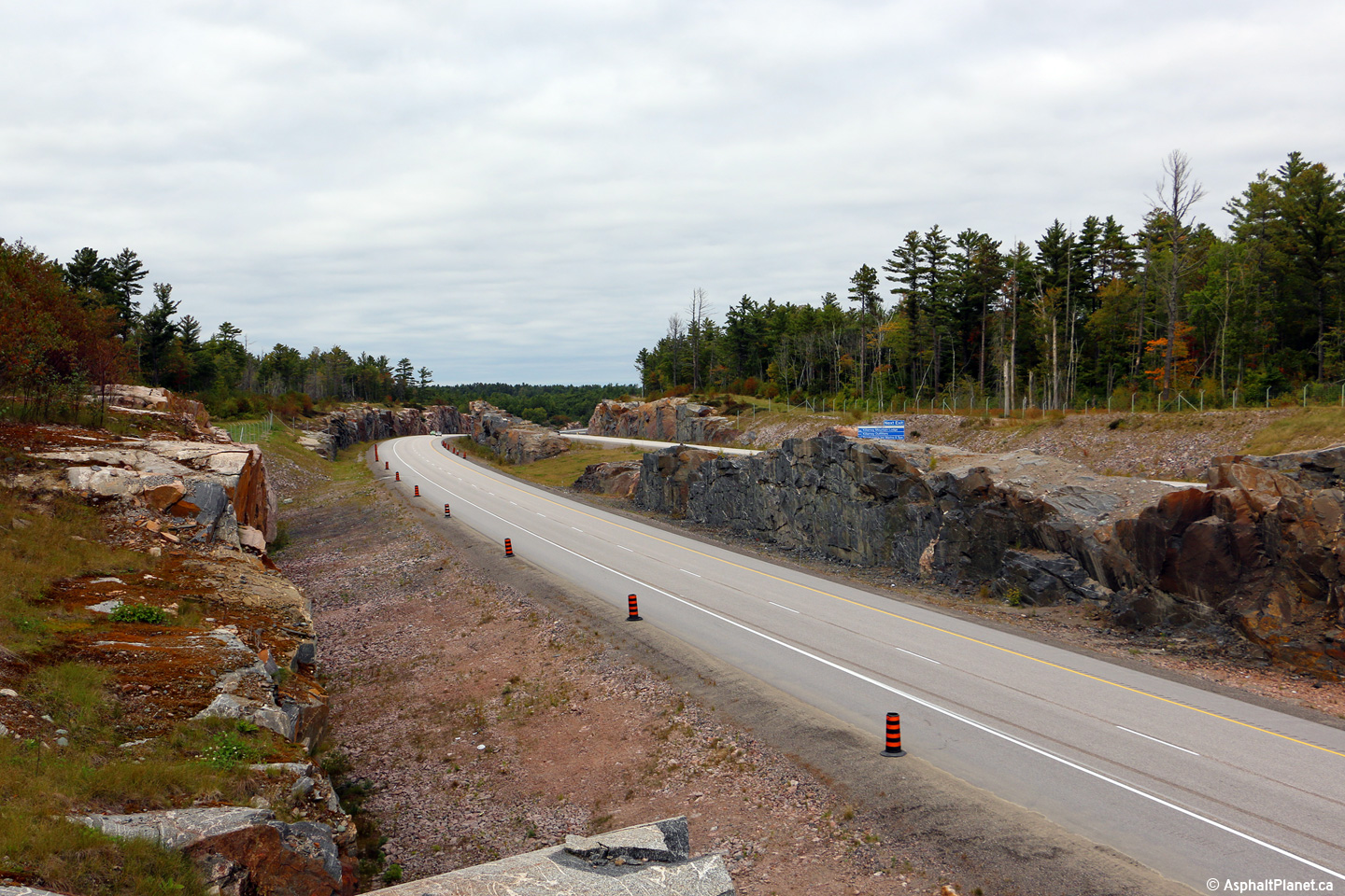
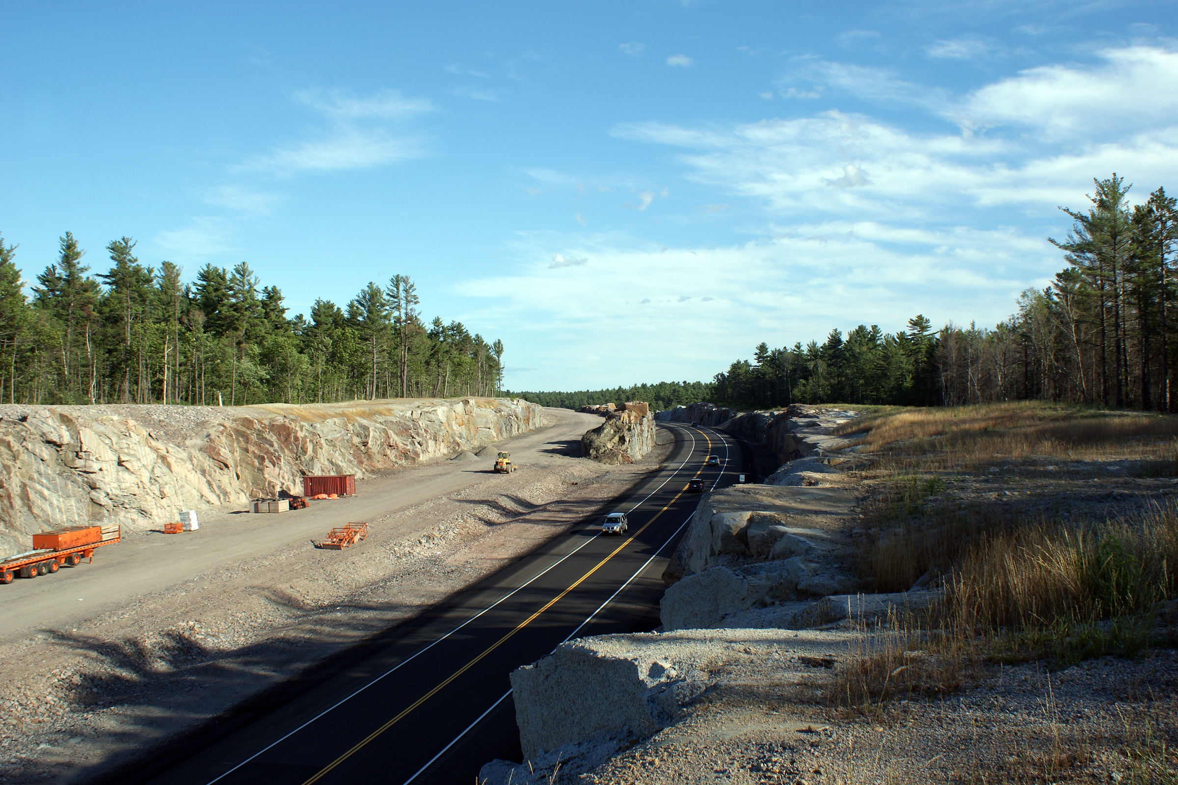
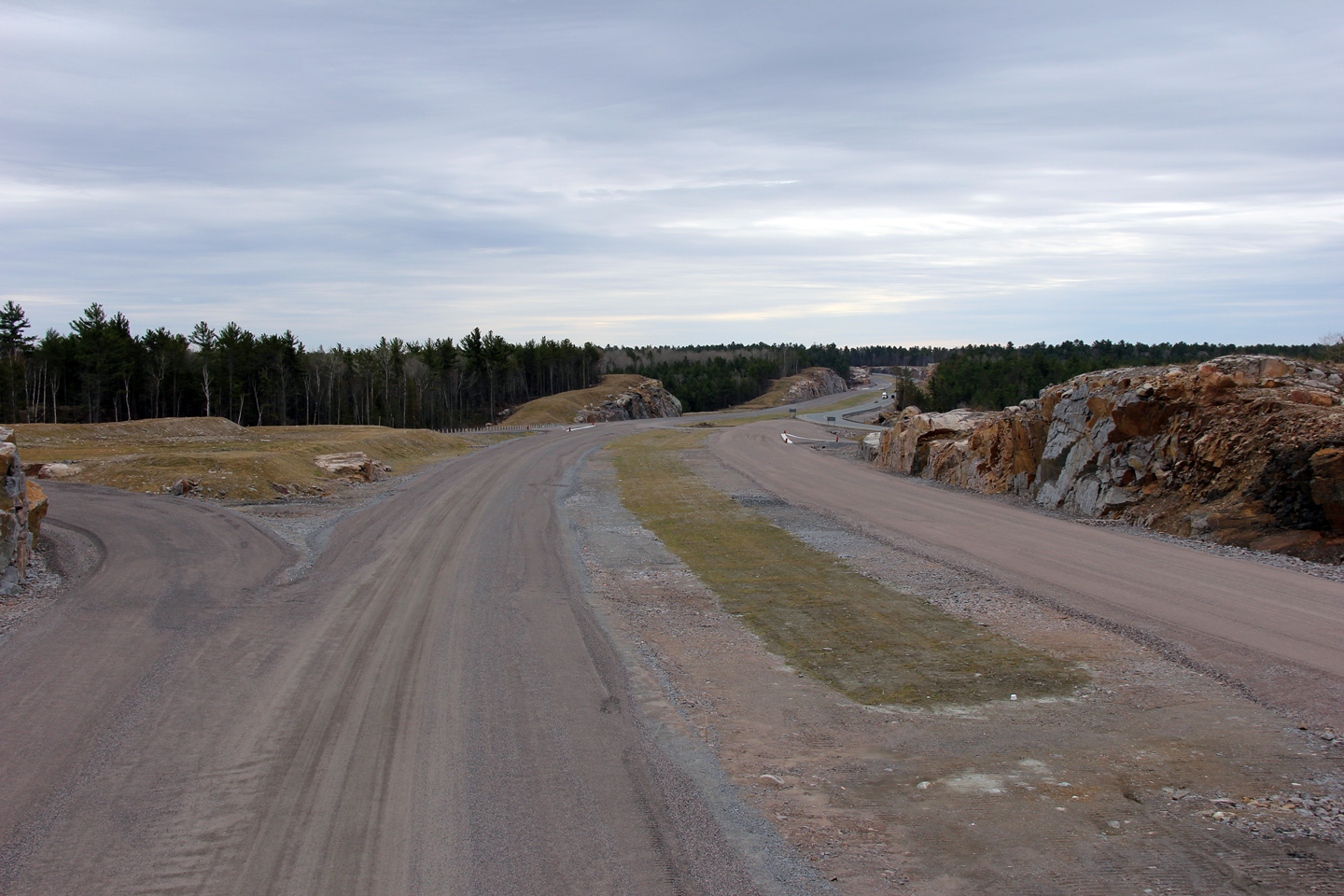
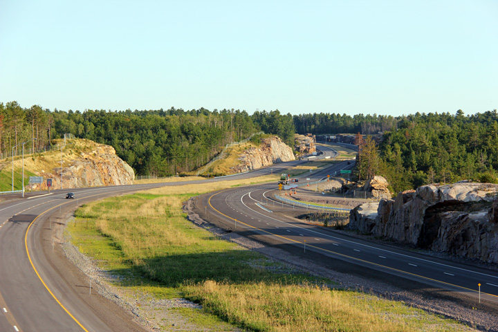
Northerly view from the previous vantage point. The bedrock has been
stripped of all topsoil and vegetation in advance of blasting to four lane
Highway 69 between Alban and Burwash. Work began to twin the highway
in the summer of 2012 and is scheduled to be completed by the fall of 2016.
Photo taken: August 29th, 2012. |
|
Municipality of French River
District of Sudbury |
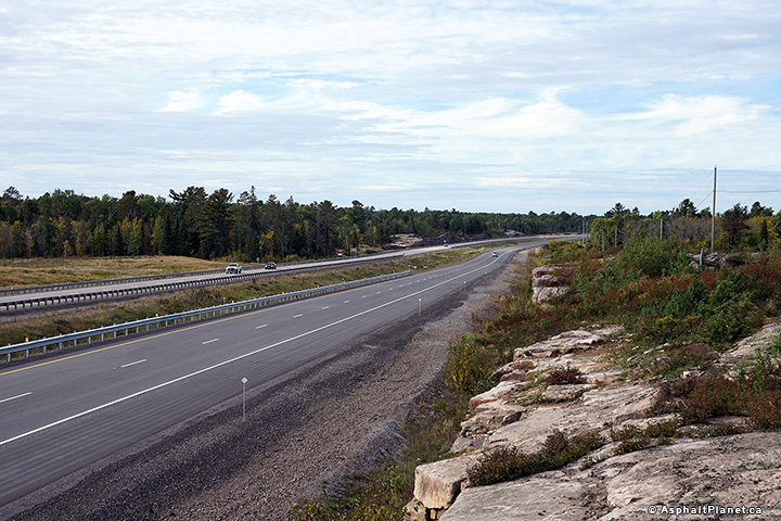
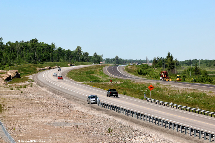
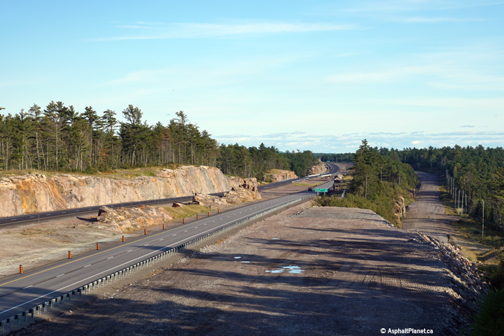
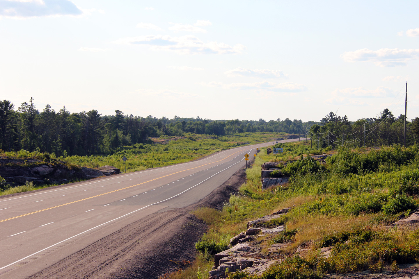
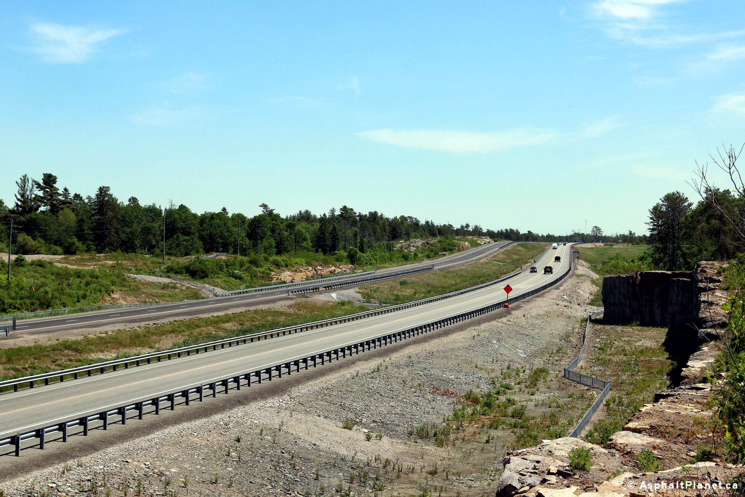
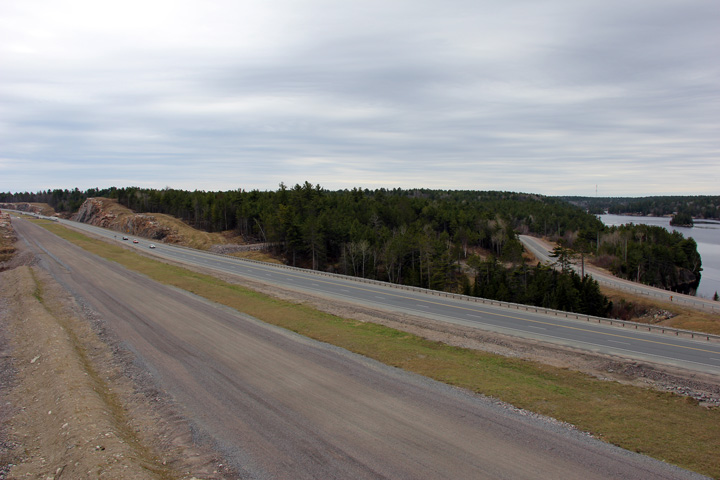
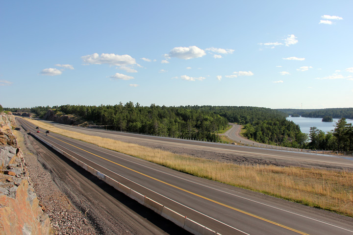
Between Highways 607 and 64, two concurrent passing lanes give Highway 69
the appearance of having a four-lane cross-section. The upper photo
was taken before construction had commenced to four lane the highway through
this area, while the lower photo was taken shortly after constructed had
been completed.
Upper photo taken: July 10th, 2012.
Lower photo taken: September 30th, 2016. |
(720x480)
(1440x960)
(2400x1600) |
Municipality of French River
District of Sudbury |
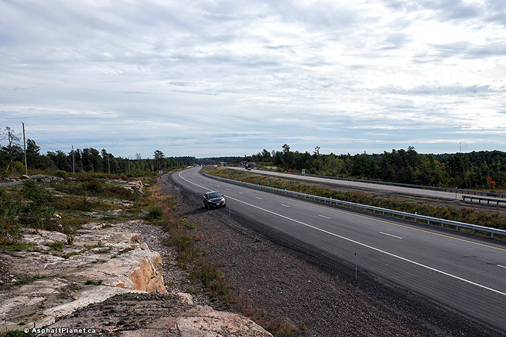
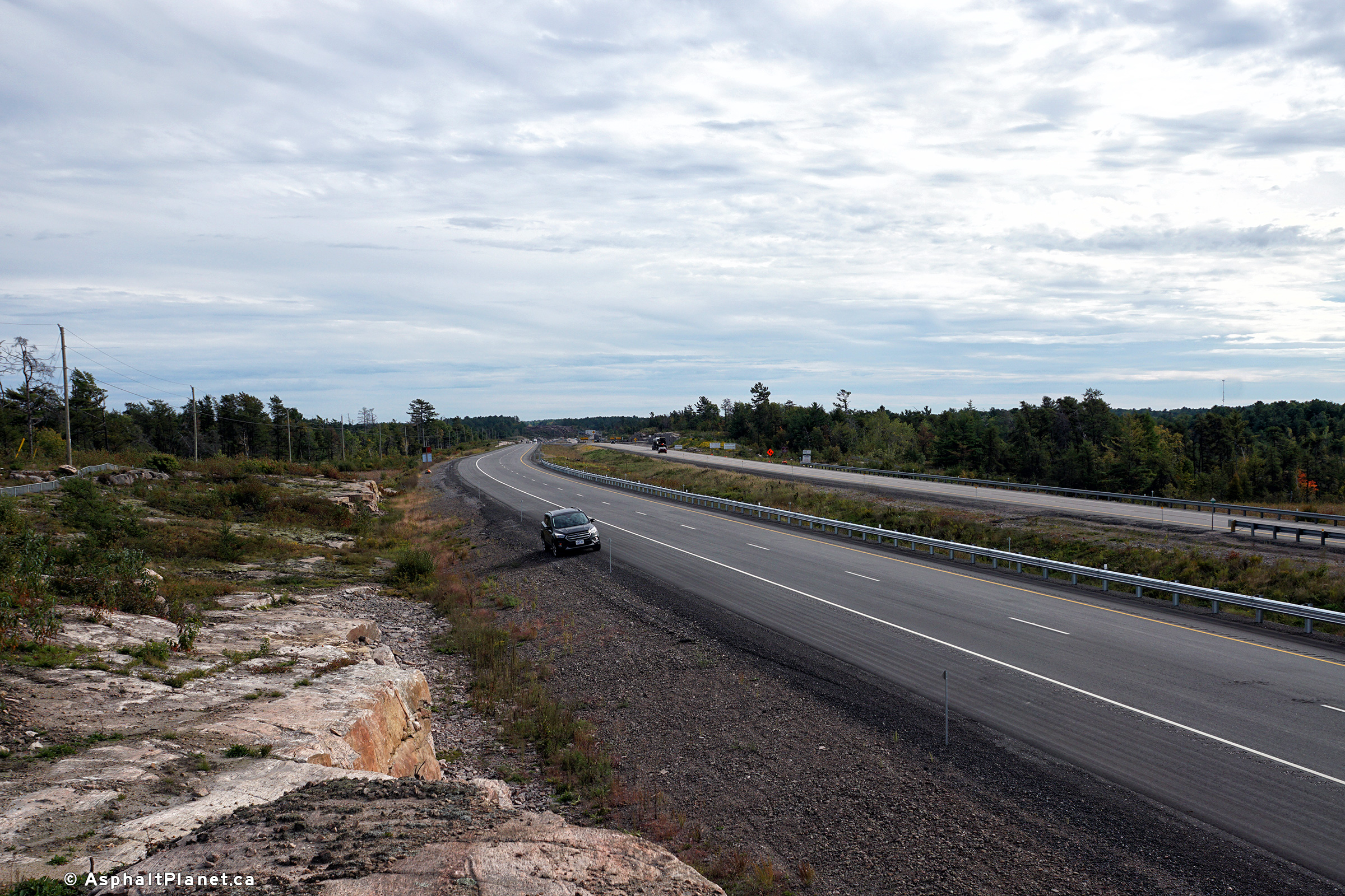
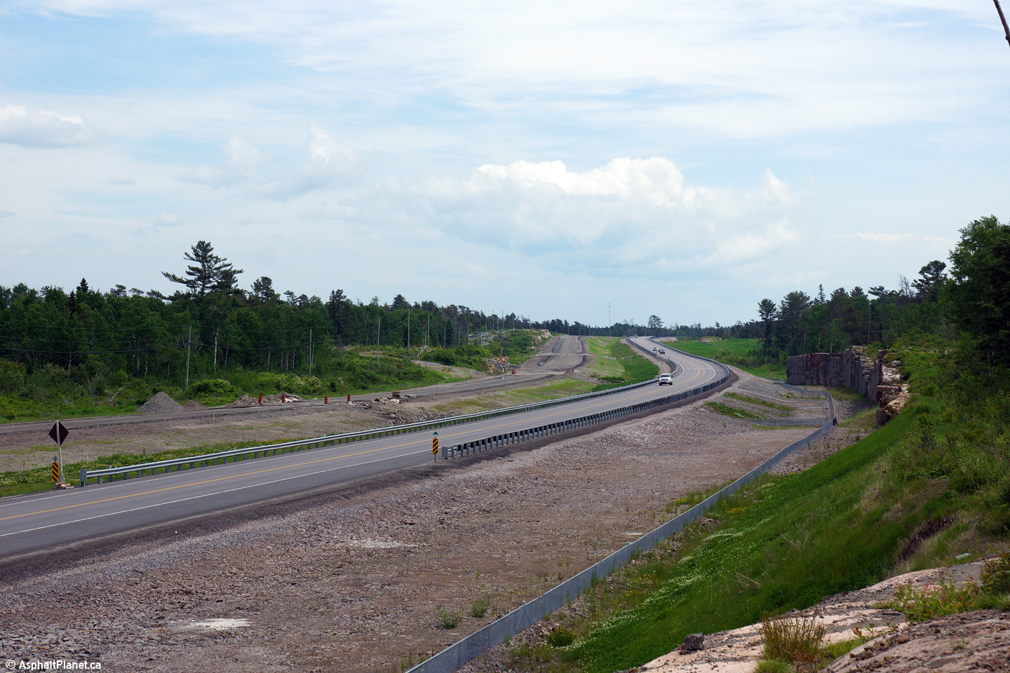
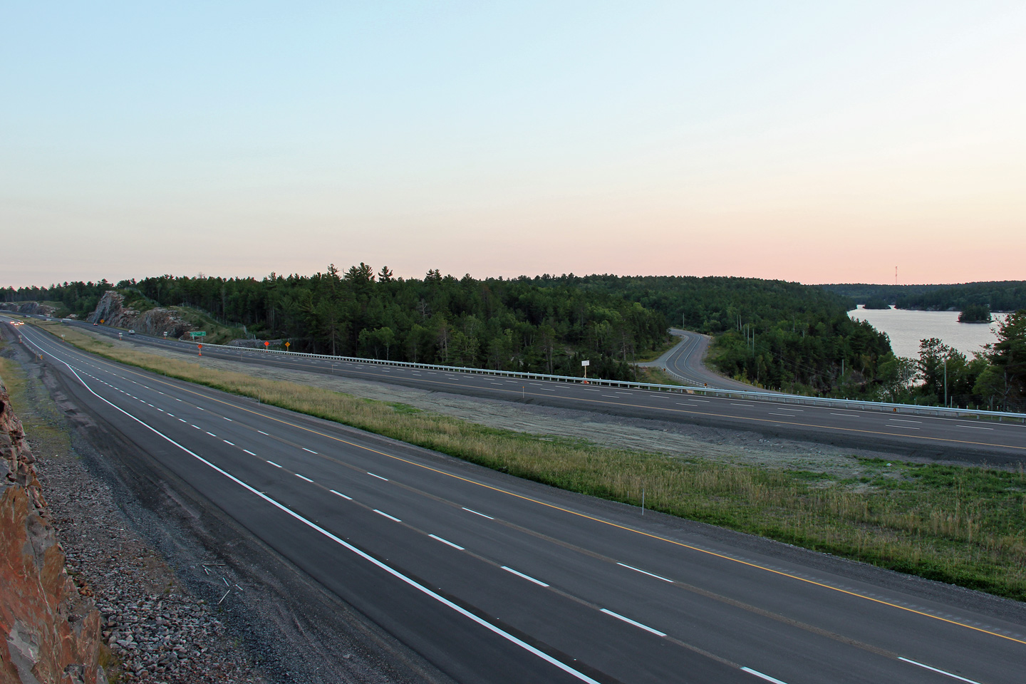
View looking northerly from the previous vantage point. Shortly after
the photo was taken, the pictured passing lanes were closed to traffic in
order to facilitate the construction of the four lane highway between Alban and Estaire.
Construction to widen the highway was finished in the lower photo.
Upper photo taken: July 10th, 2012.
Lower photo taken: September 30th, 2016. |
(720x480)
(1440x960)
(2400x1600) |
Municipality of French River
District of Sudbury |
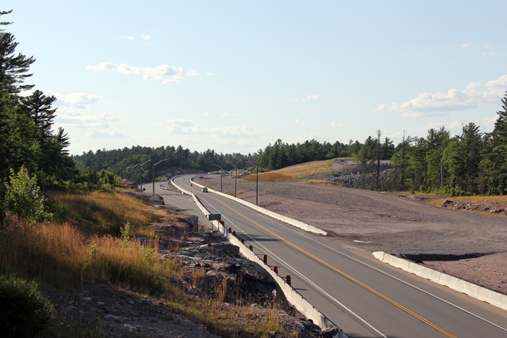
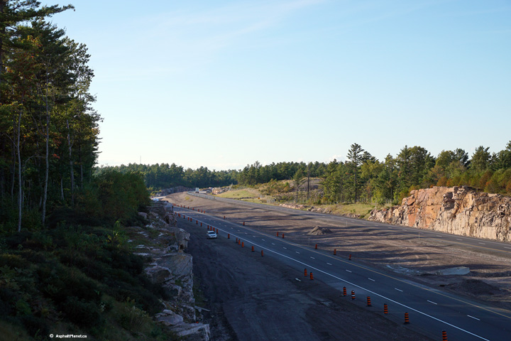
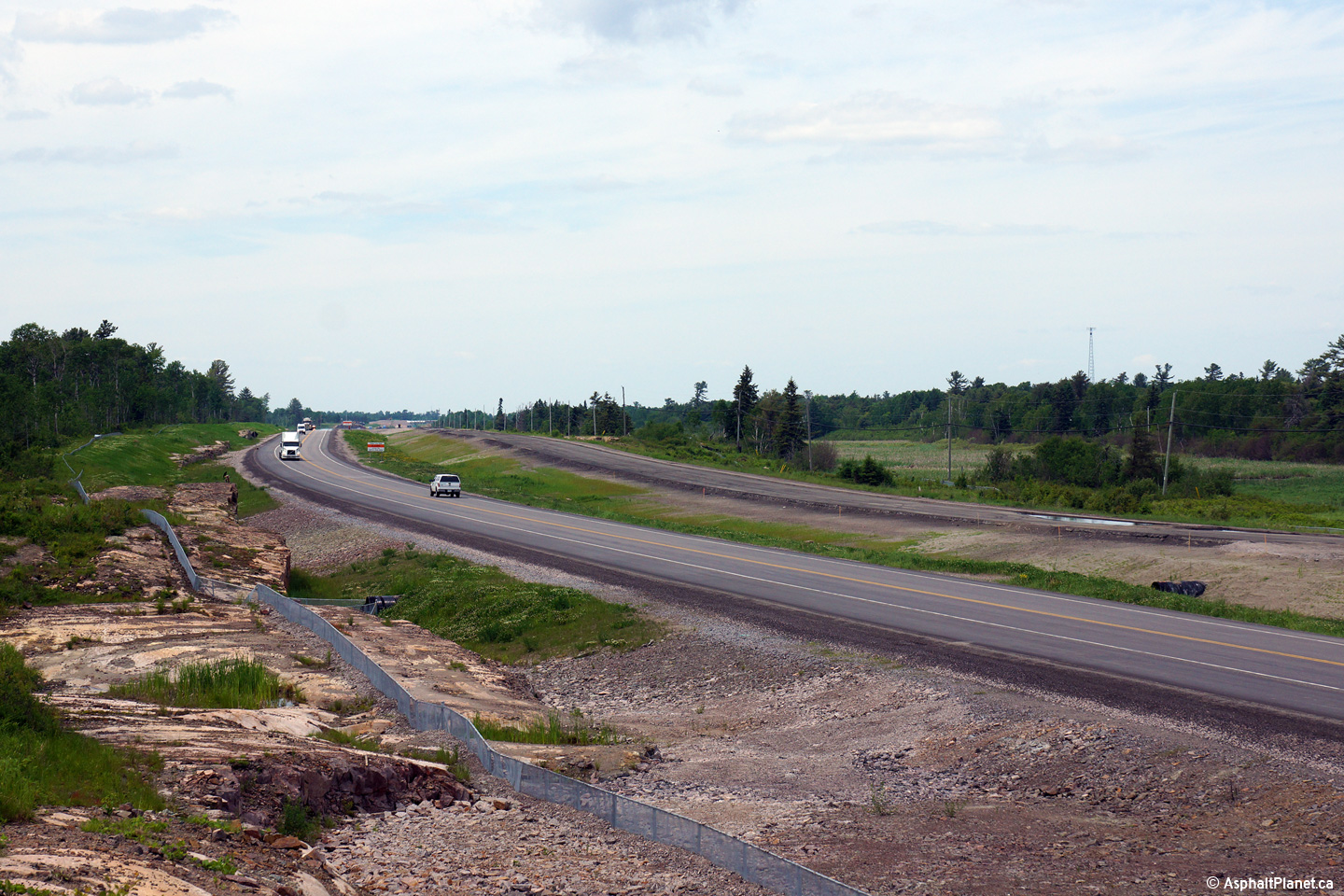
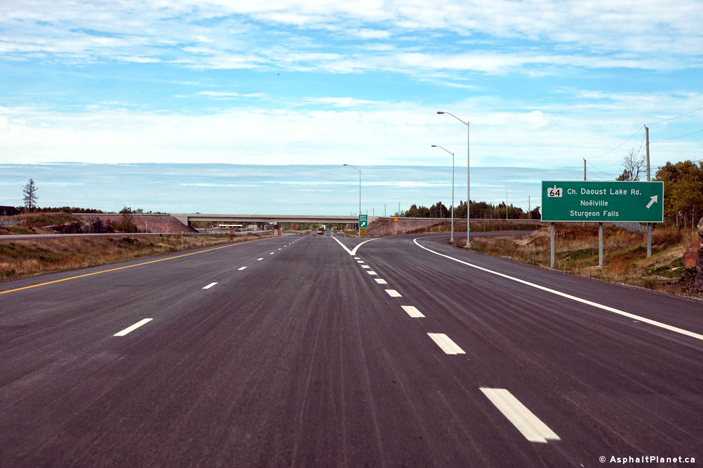
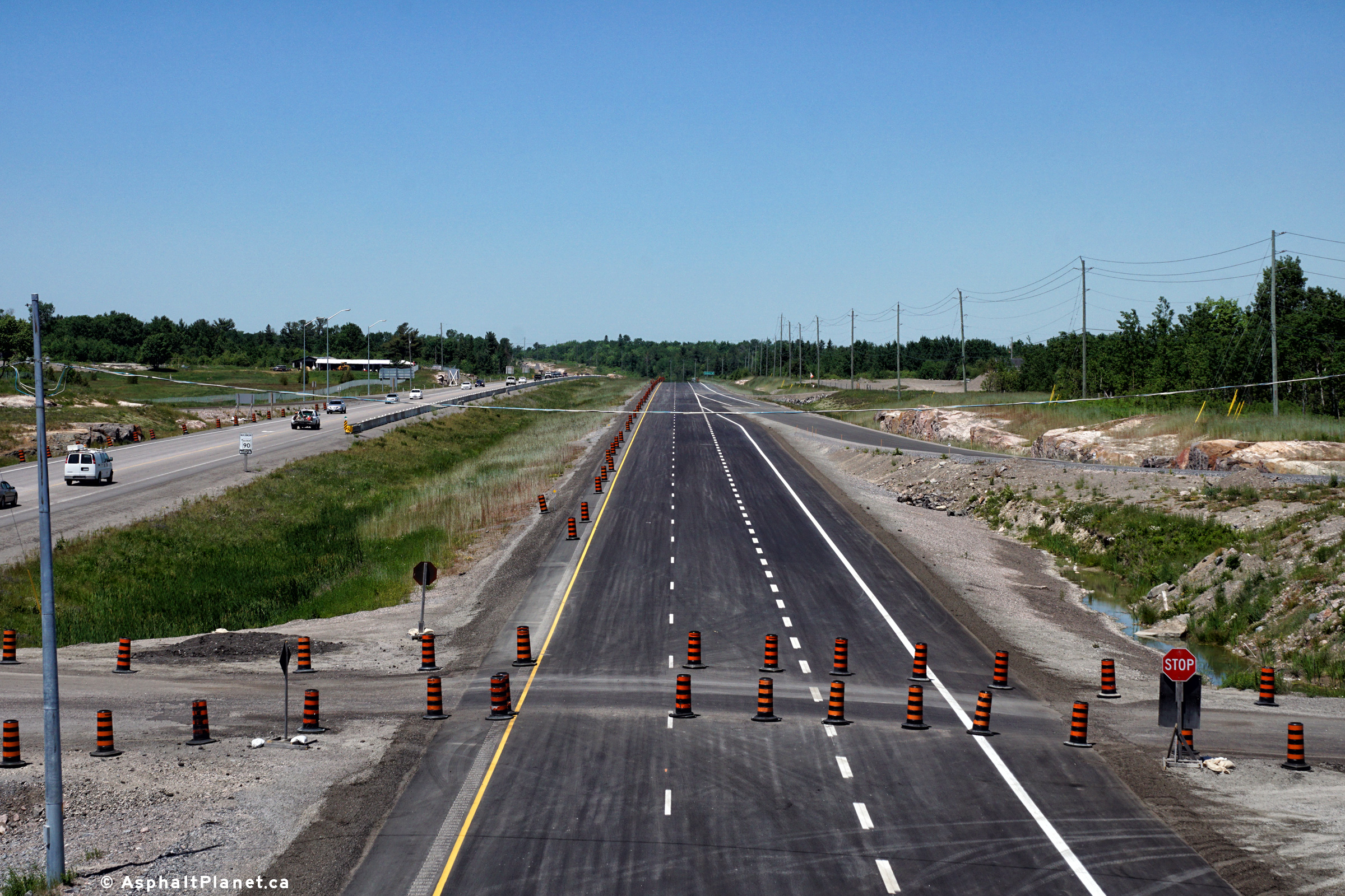
Southerly view along Highway 69 from about 3km south of the Highway 64
interchange.
Upper photo taken: June 13th, 2015.
Lower photos taken: June 17th, 2016. |
(720x480)
(1440x960)
(2400x1600)
(720x480)
(1440x960)
(2400x1600) |
Municipality of French River
District of Sudbury |
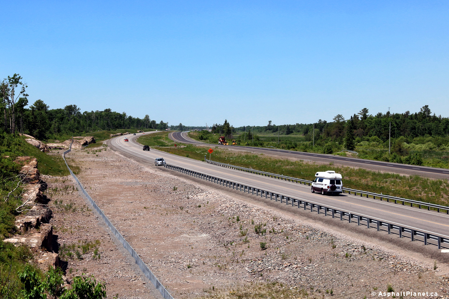
Northerly view along Highway 69 from about 3km south of the Highway 64
interchange.
Upper photo taken: June 13th, 2015.
Lower photo taken: June 17th, 2016. |
(720x480)
(1440x960)
(2400x1600)
(720x480)
(1440x960)
(2400x1600)
|
Municipality of French River
District of Sudbury |
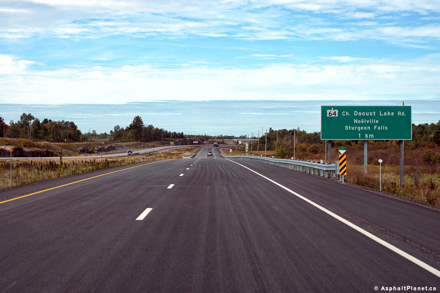
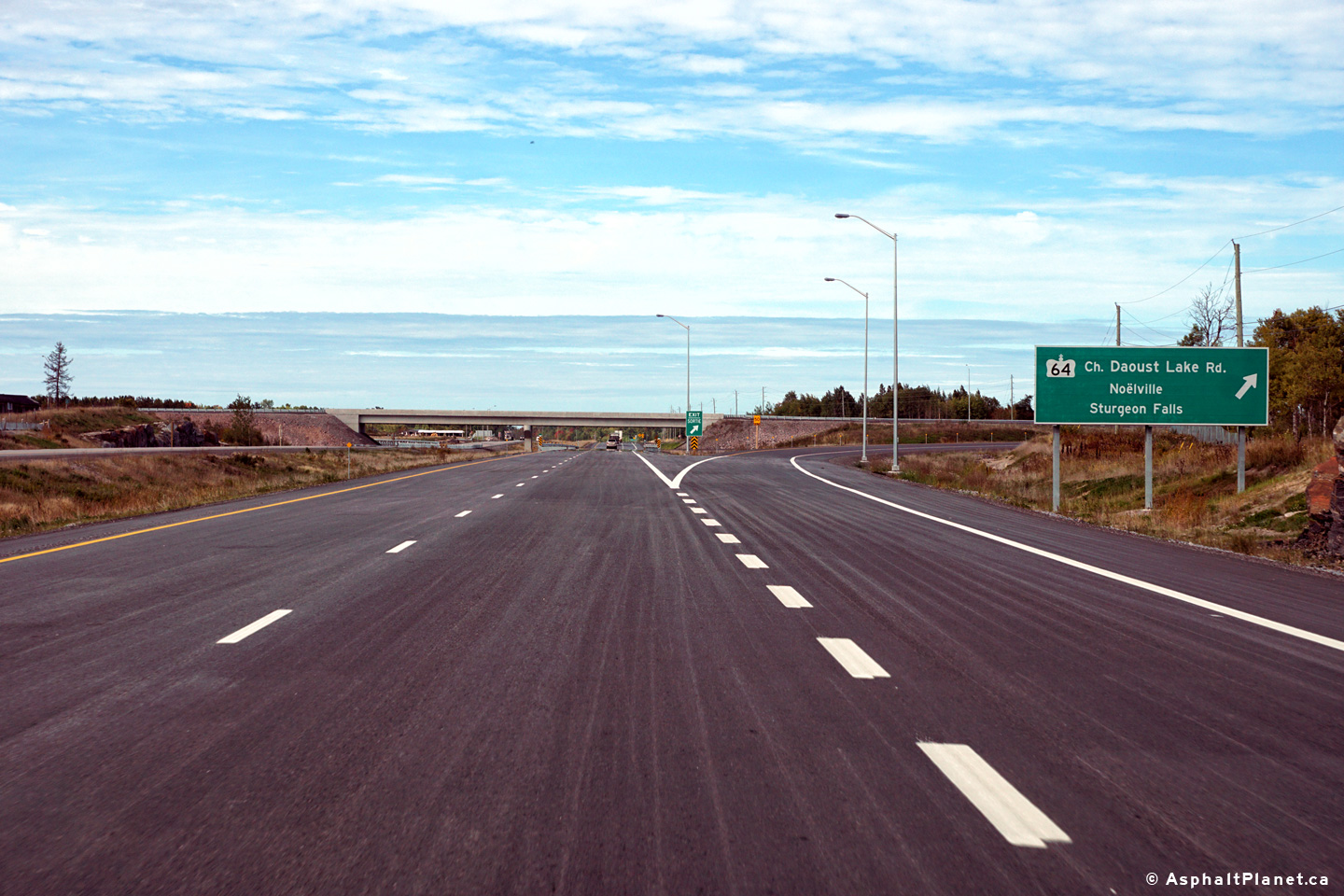
Northbound advanced signage for the Highway 64 interchange from the Highway
69 freeway.
Photo taken: September 30th, 2016. |
 (720x480) (720x480)
(1440x960)
(2400x1600) |
Municipality of French River
District of Sudbury |
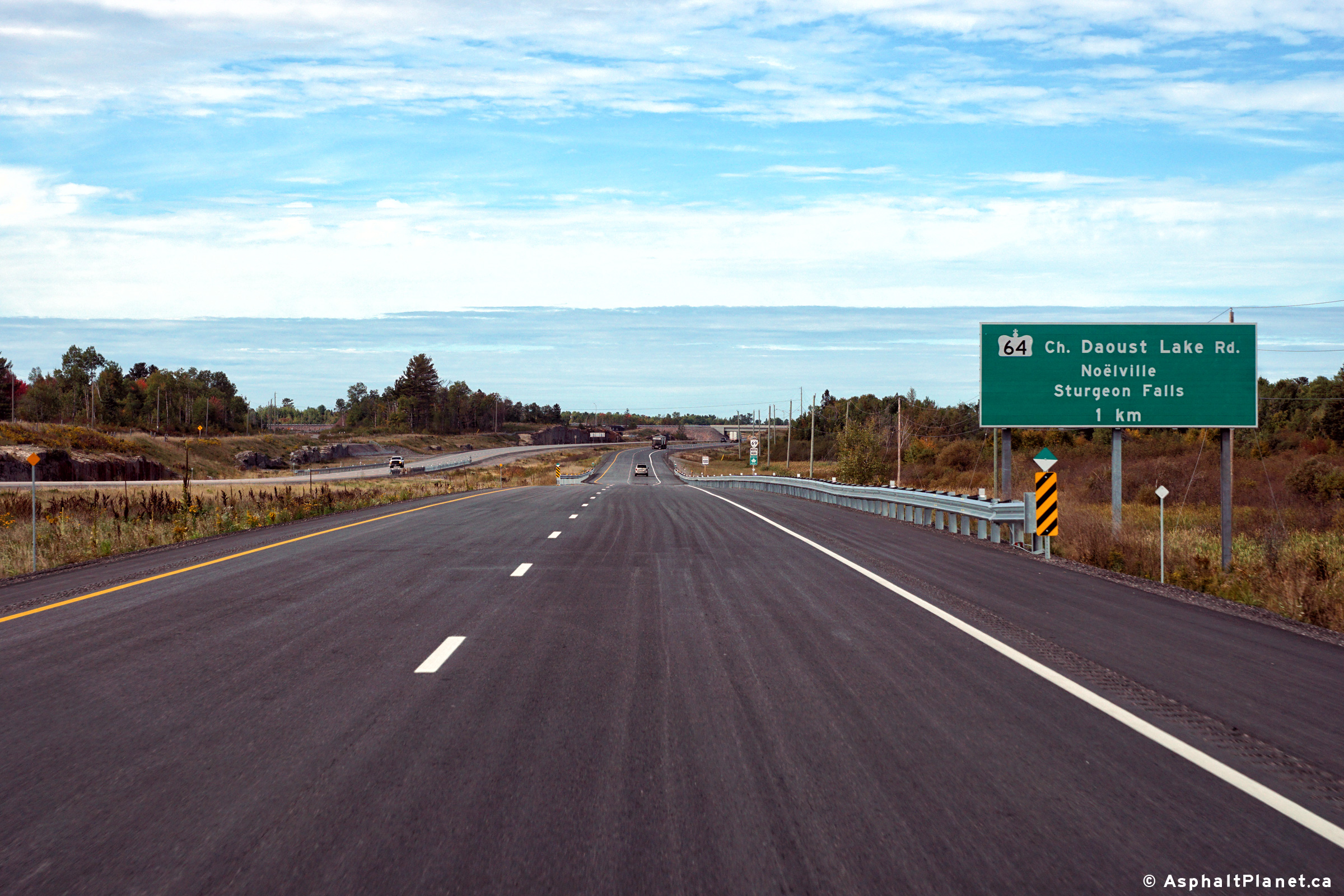
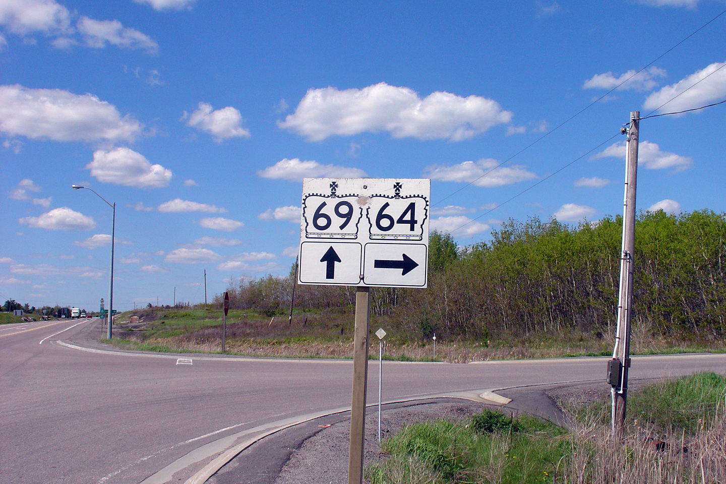
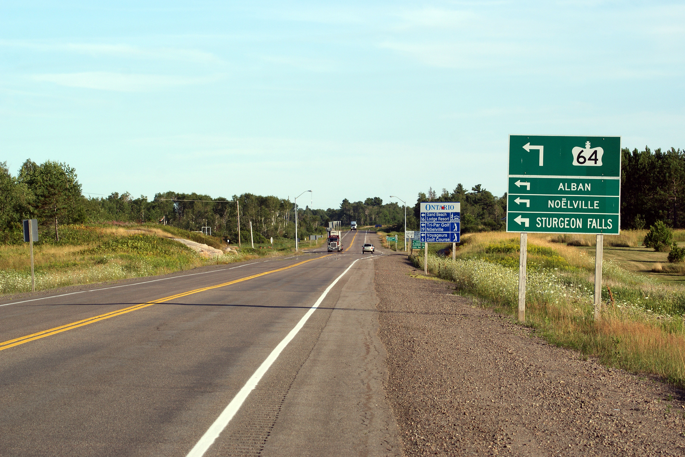
This photo showcases a Highway
64/69 junction assembly as seen from northbound Highway 69.
Highway 64
leads motorists to Verner and Sturgeon Falls, heading through the scenic,
rural French River
Valley.
Photo #1 taken: May 29th, 2004.
Photo #2 taken: June 10th,
2014.
Photo #3 taken: June 13th,
2015.
Photo #4 taken: September 30th,
2016.
|
 (720x480) (720x480)
(1440x960)
(2400x1600) |
Municipality of French River
District of Sudbury |
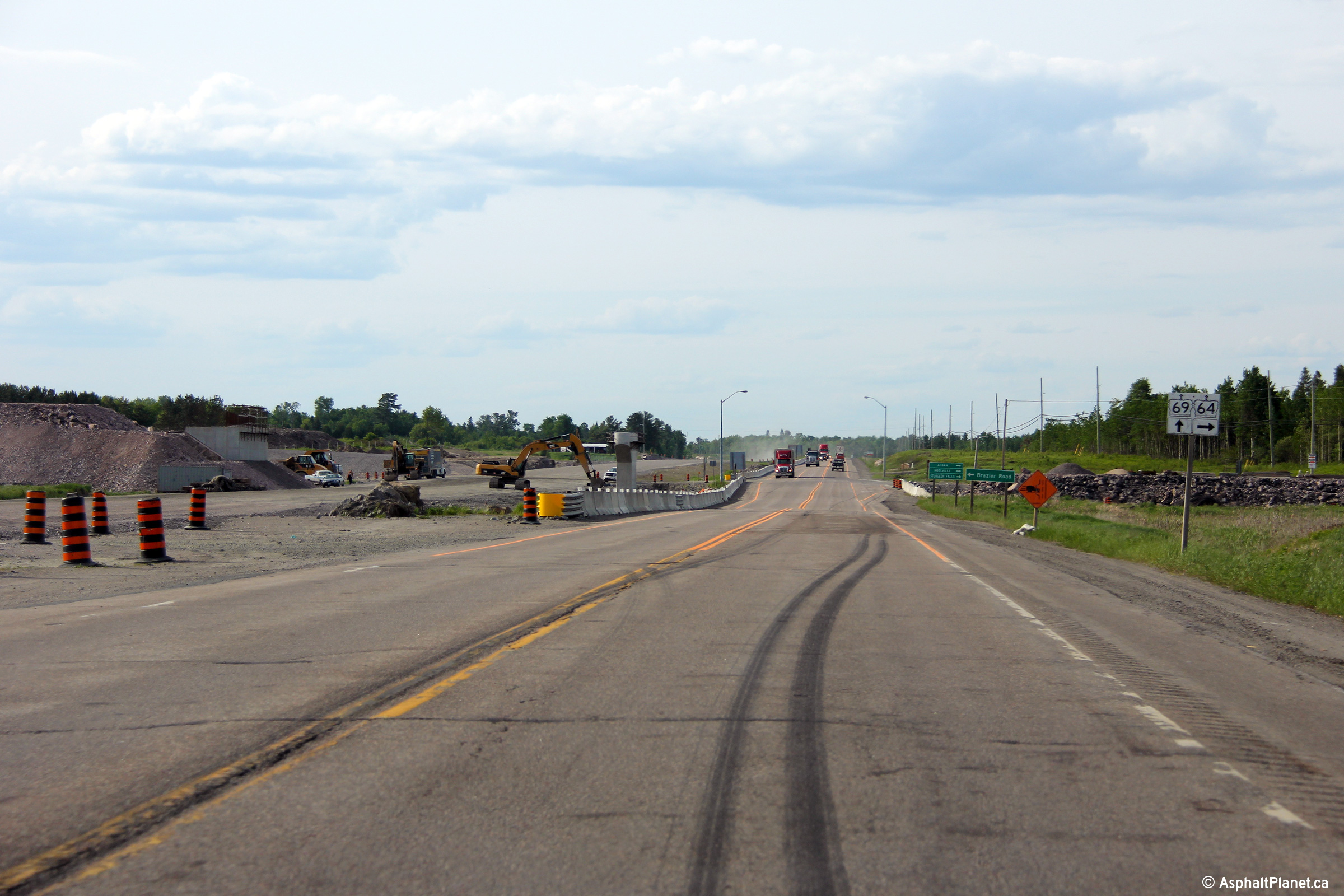
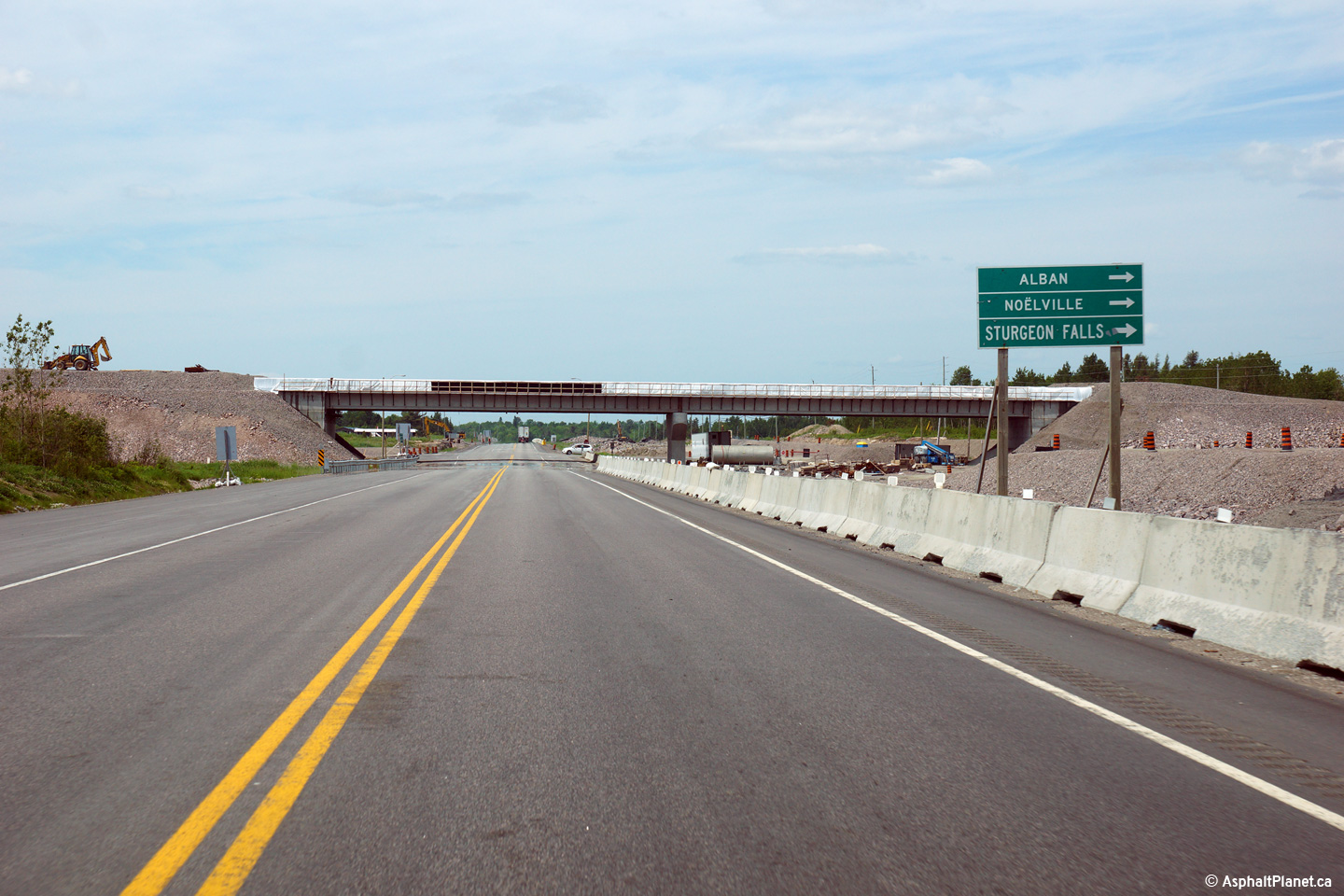
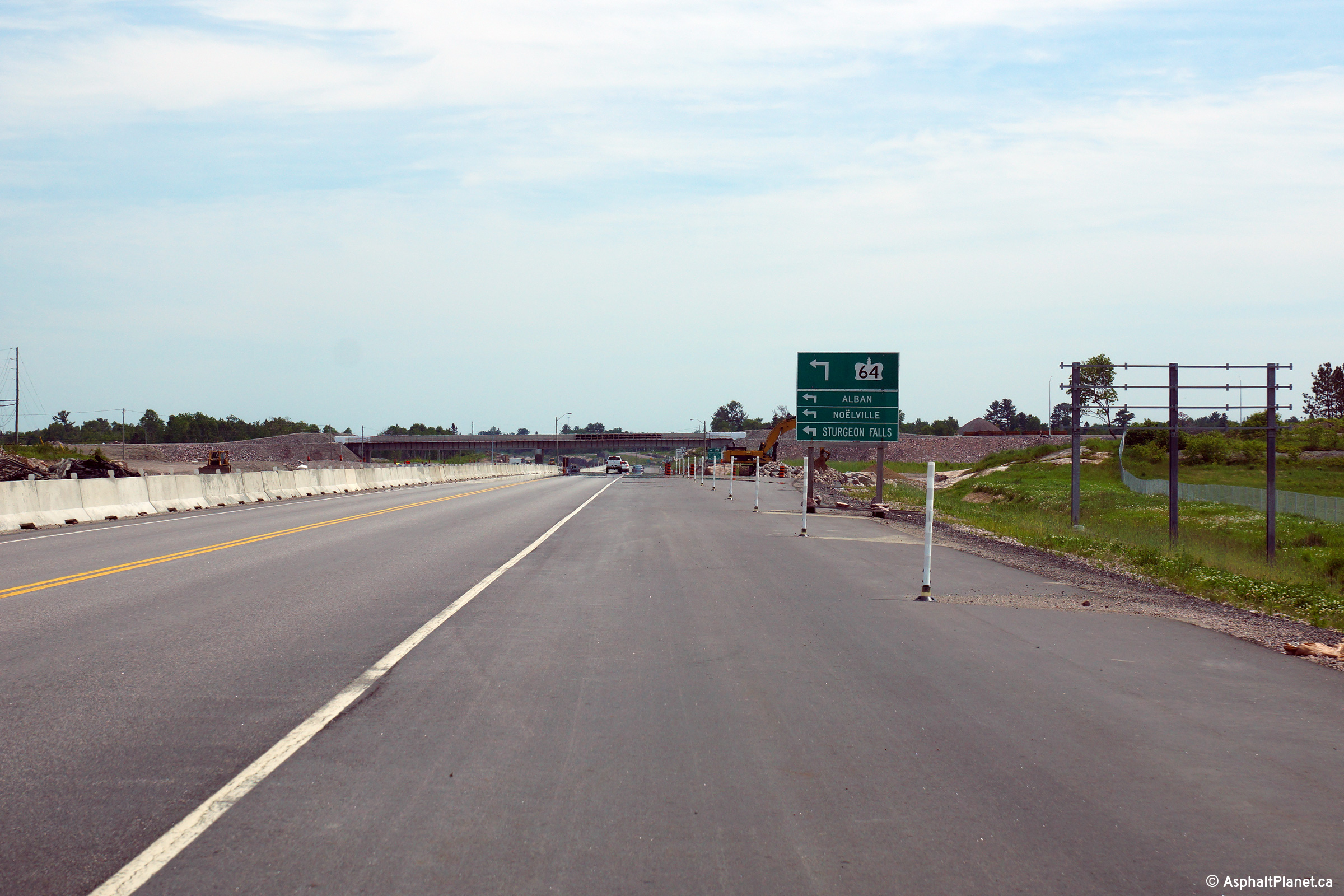
View looking south from the
Highway 64 intersection along Highway 69.
Photo #1 taken: May 29th, 2004.
Photos #2 and #3 taken: June 13th, 2015.
Photos #4 and #5 taken: June 17th, 2016. |
(720x480)
(1440x960)
(2400x1600)
(720x480)
(1440x960)
(2400x1600)
|
|
Highway 64 starts at Highway 69,
leading Easterly to Noelville, Sturgeon Falls, and finally Highway 11 at
Marten River.
Click here for Highway
64
images. |
| Municipality of French River
District of Sudbury |
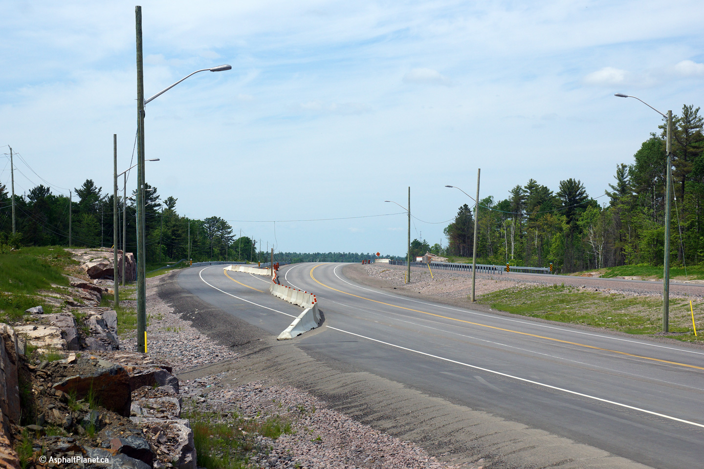
View looking north from the
Highway 64 junction. Photo # 1 taken: May
29th, 2004. Photo # 2 taken: June 13th, 2015. Photos #3 and #4 taken:
June 17th, 2016. |
(720x480)
(1440x960)
(2400x1600)
(720x480)
(1440x960)
(2400x1600) |
| Municipality of French River
District of Sudbury |
Southerly view approaching the Highway 64
intersection.
Upper photo taken: July 30th, 2010.
Lower photos taken: June 13th, 2015. |
|
| Municipality of French River
District of Sudbury |
Southbound signage welcoming motorists into the
municipality of French River.
Photo taken: June 17th, 2016. |
 (720x480) (720x480)
(1440x960)
(2400x1600) |
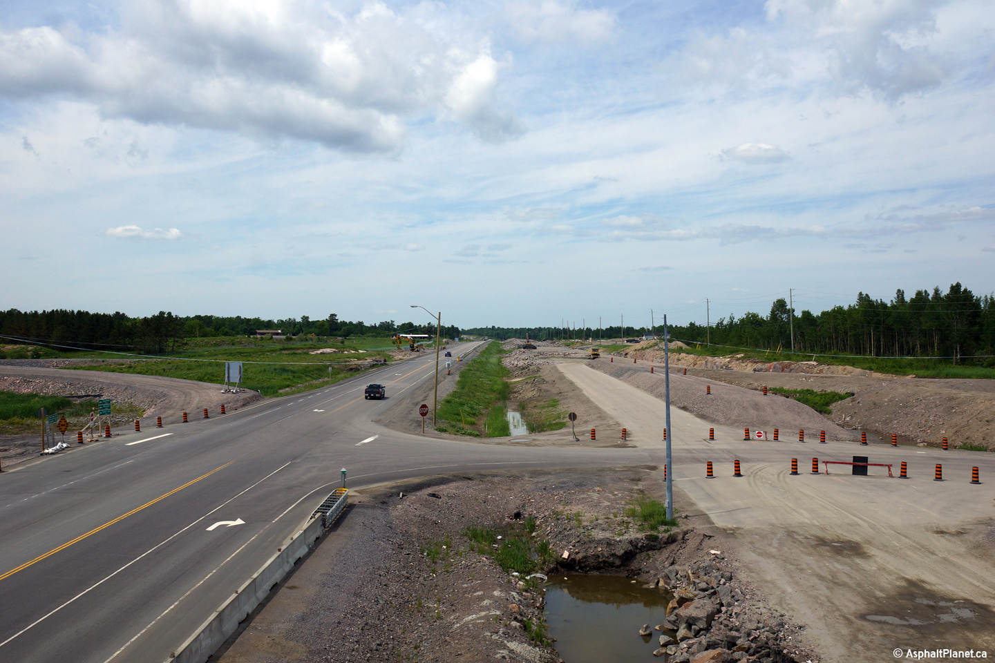
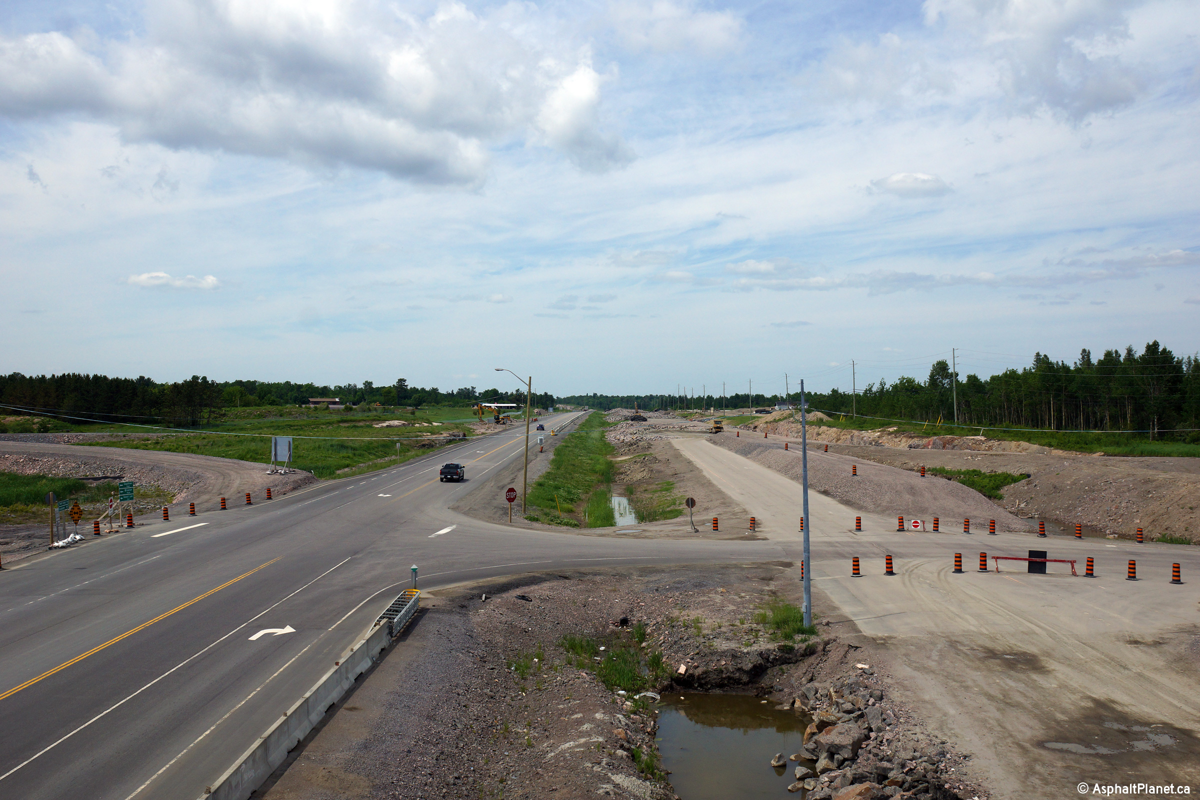
| Municipality of French River
District of Sudbury |
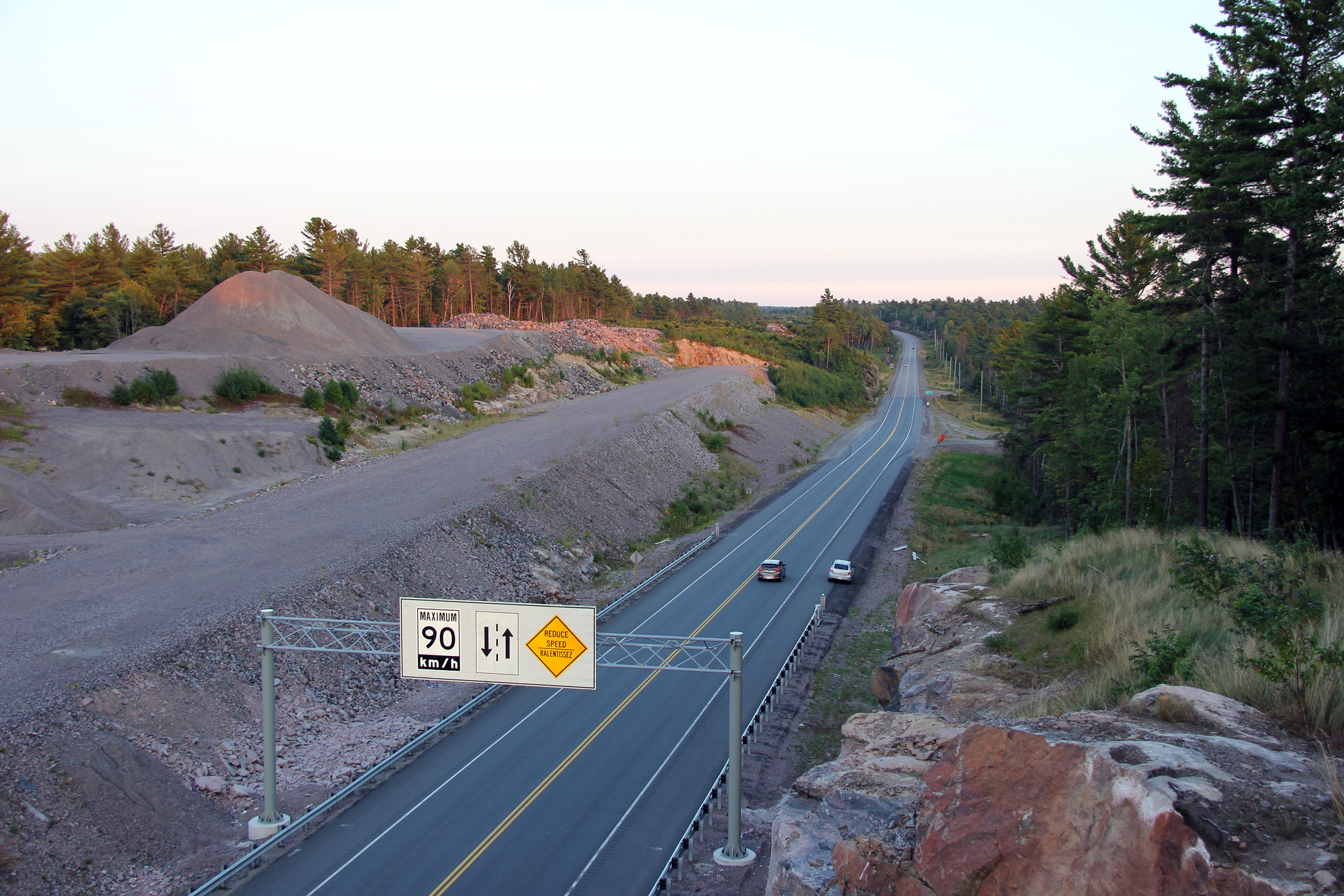
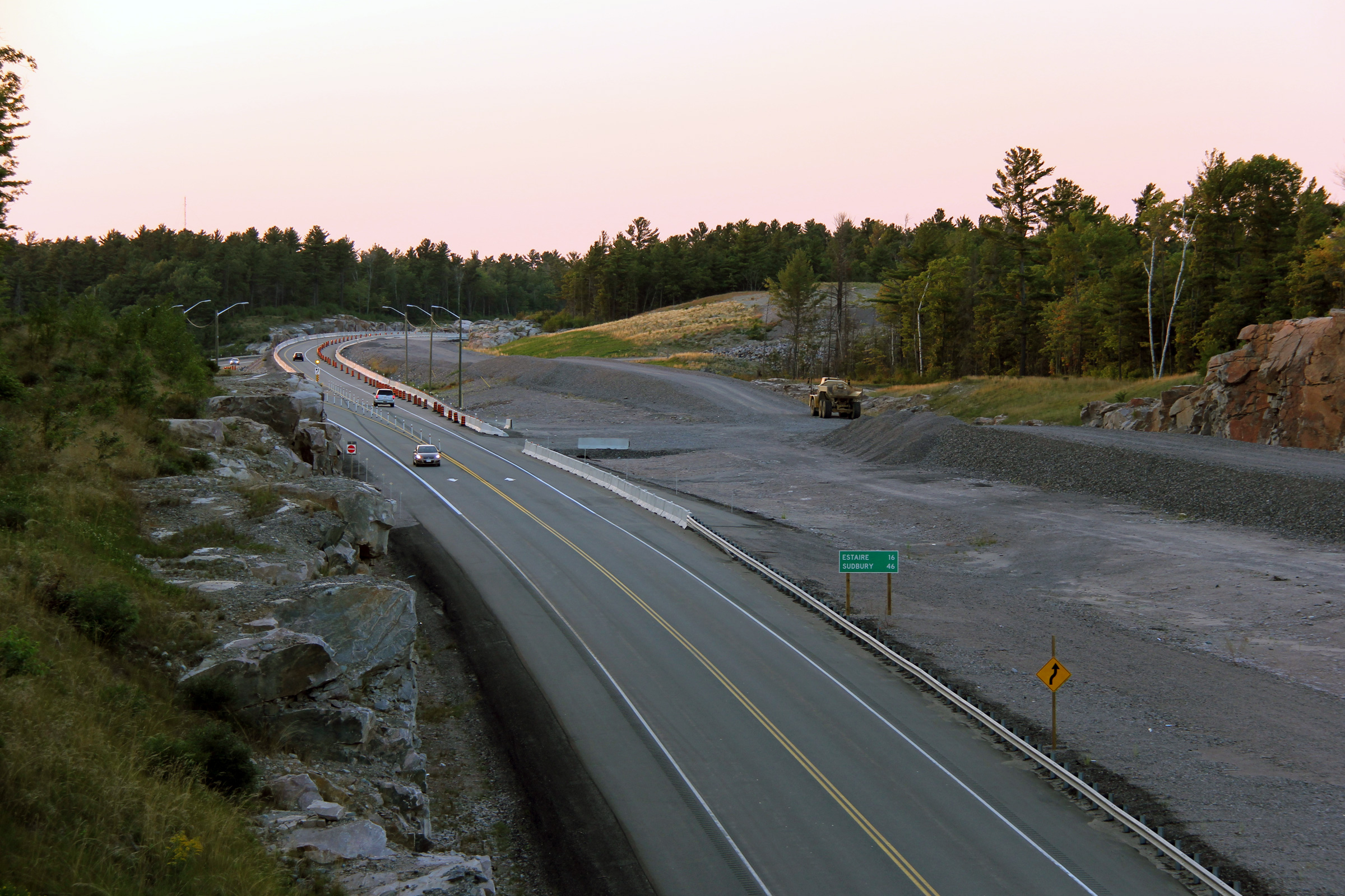
Two views looking southerly from just south of the
current (as of 2015) end of the divided highway south from Sudbury.
Upper photo taken: June 10th, 2014.
Lower photo taken: June 13th, 2015. |
|
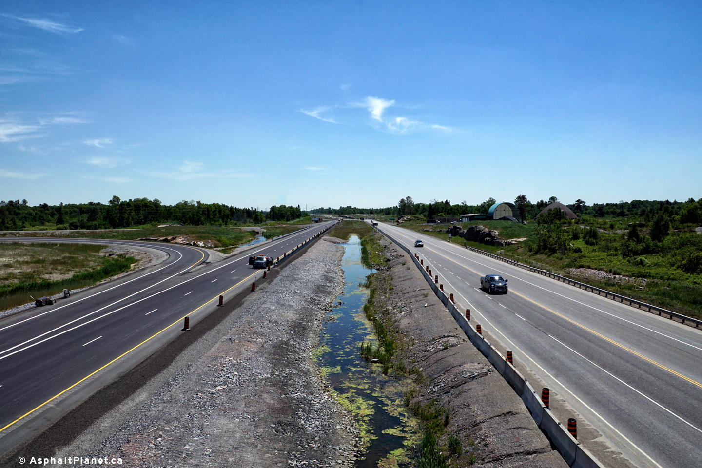
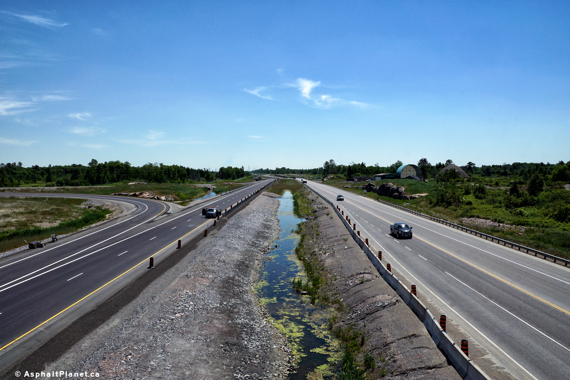
| Municipality of French River
District of Sudbury |
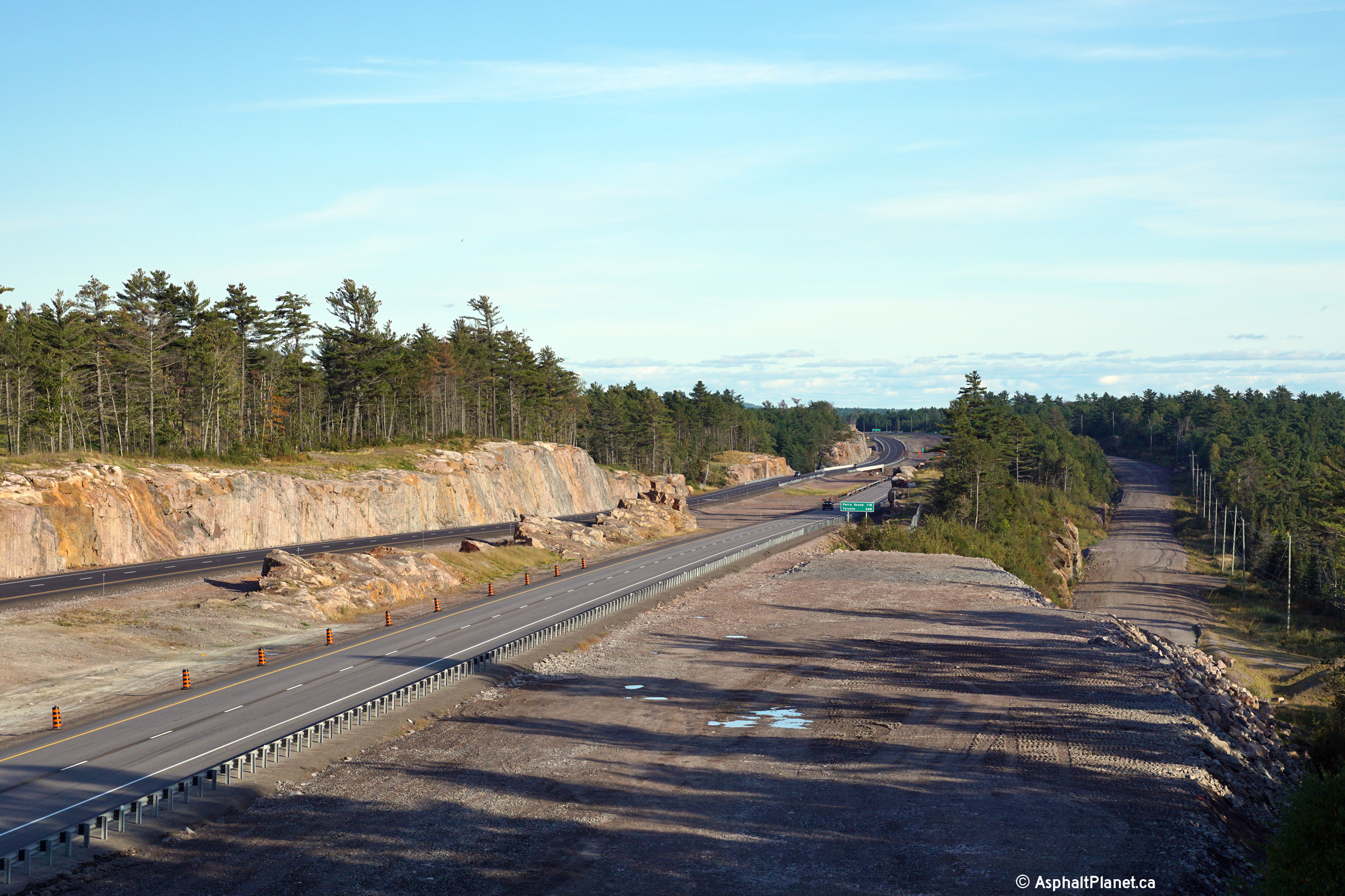
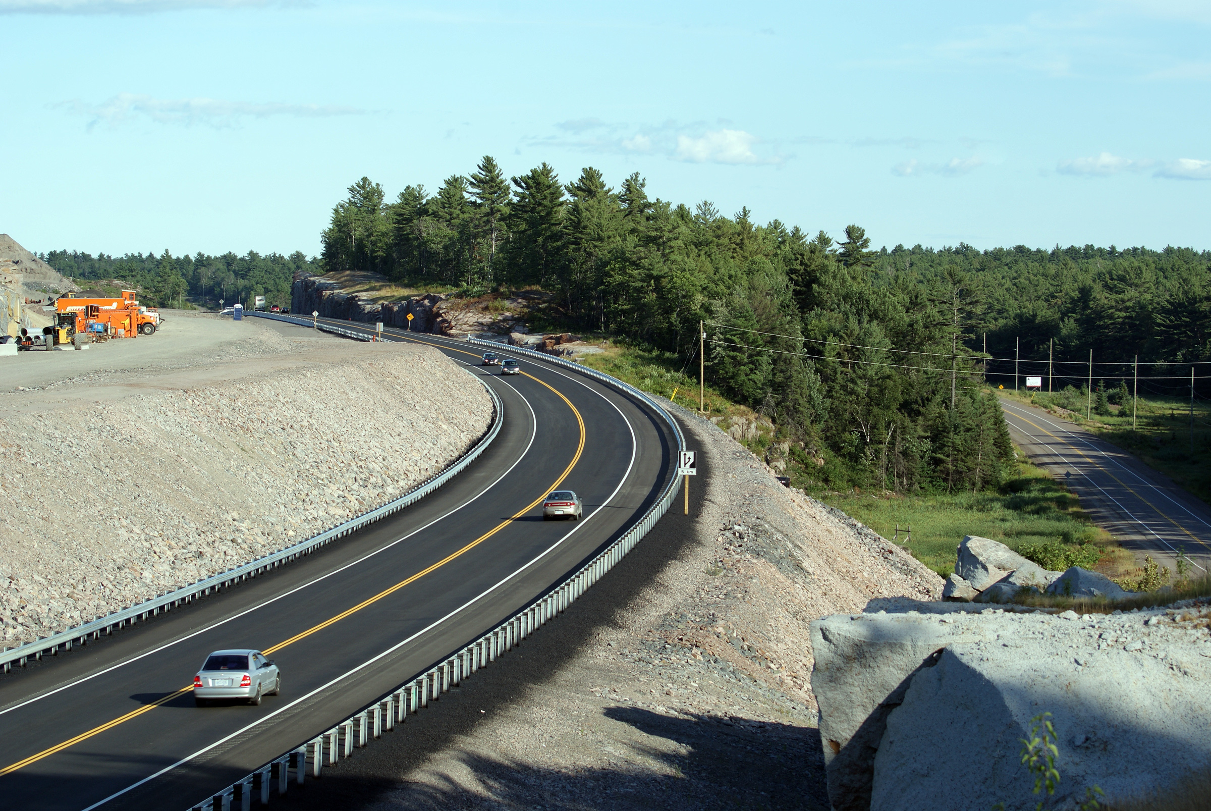
Two views at the current (as of 2015) start of
the divided highway south of Sudbury. The next extension of the
divided highway southerly to south of Highway 64 will open in 2016.
Upper photo taken: June 13th, 2015.
Lower photo taken: September 20th, 2015. |

(720x480)
(1440x960)
(2400x1600) |
District of Sudbury
(Geographical Township of Cox) |
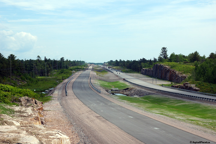
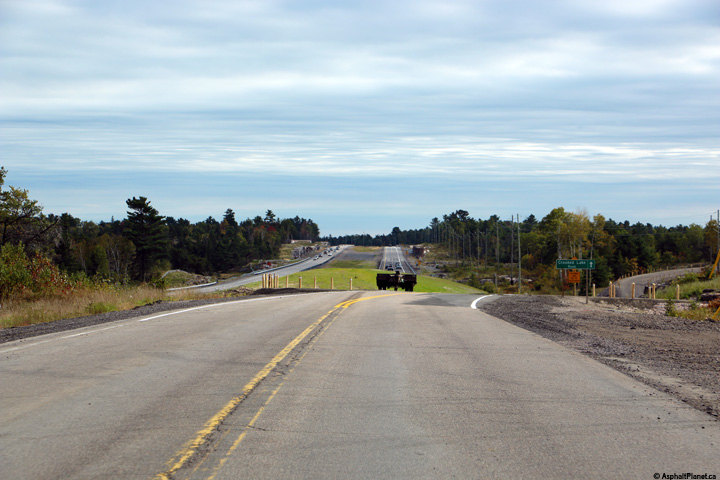
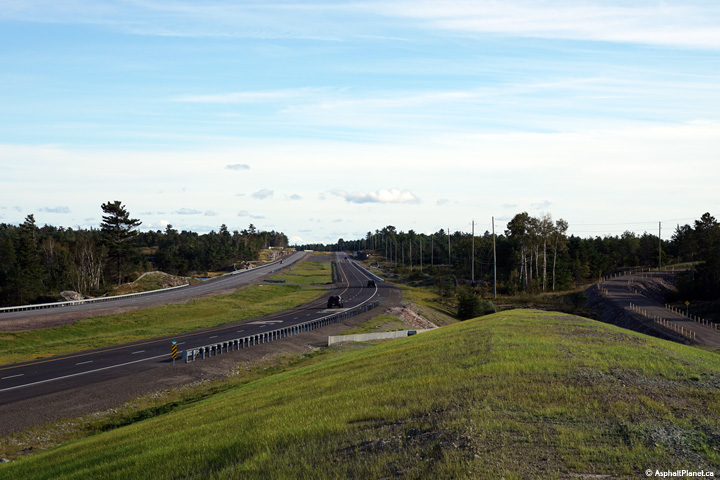
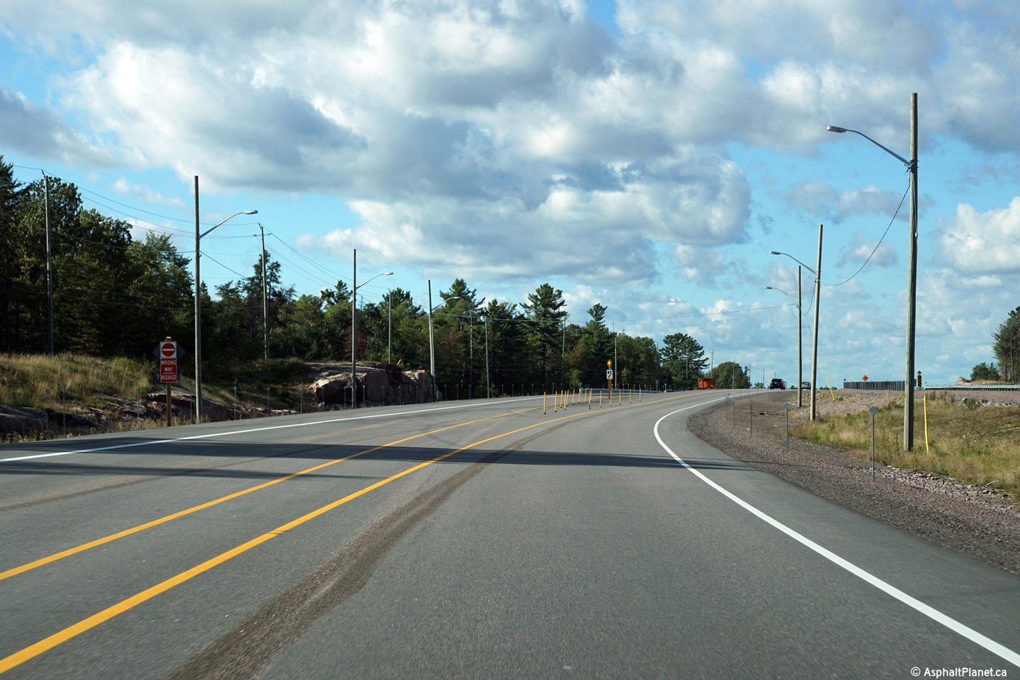
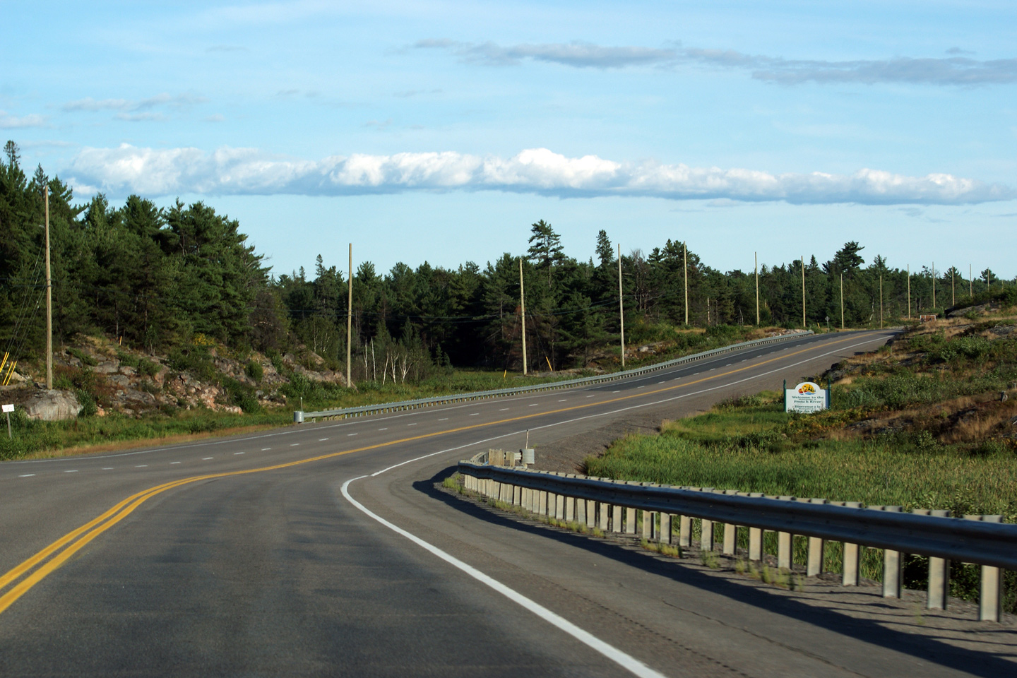
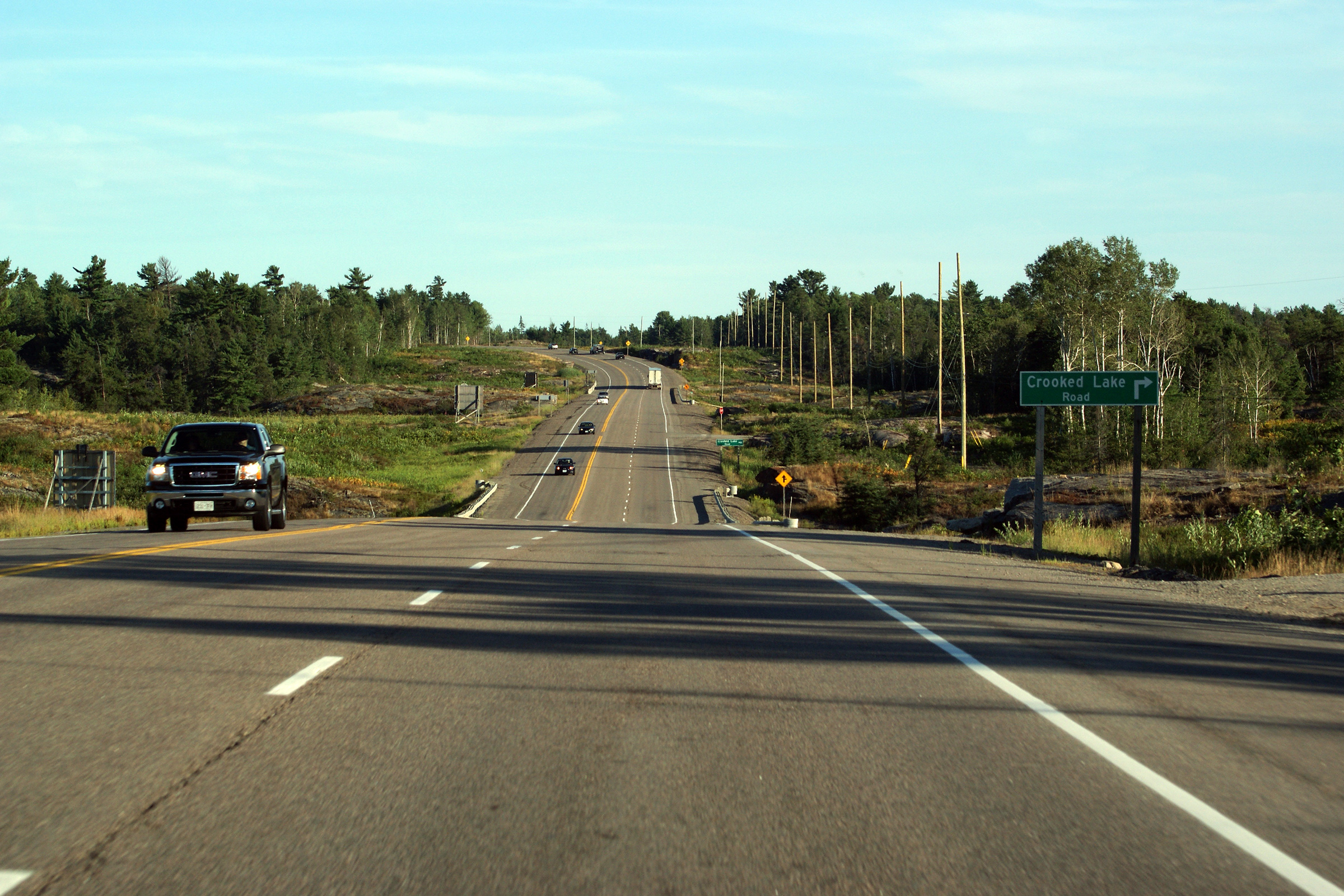
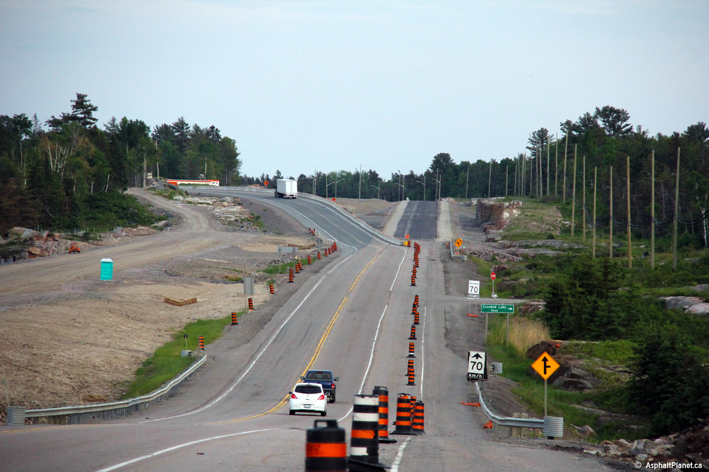
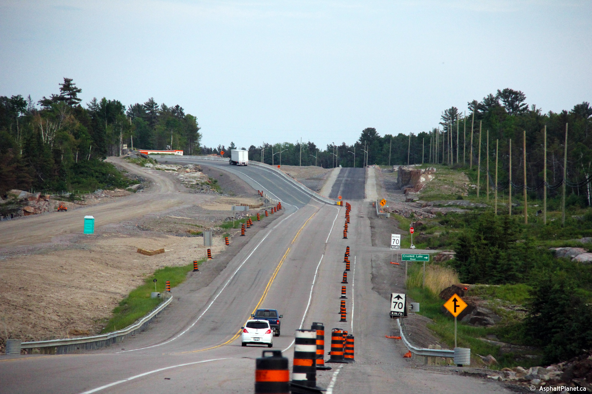
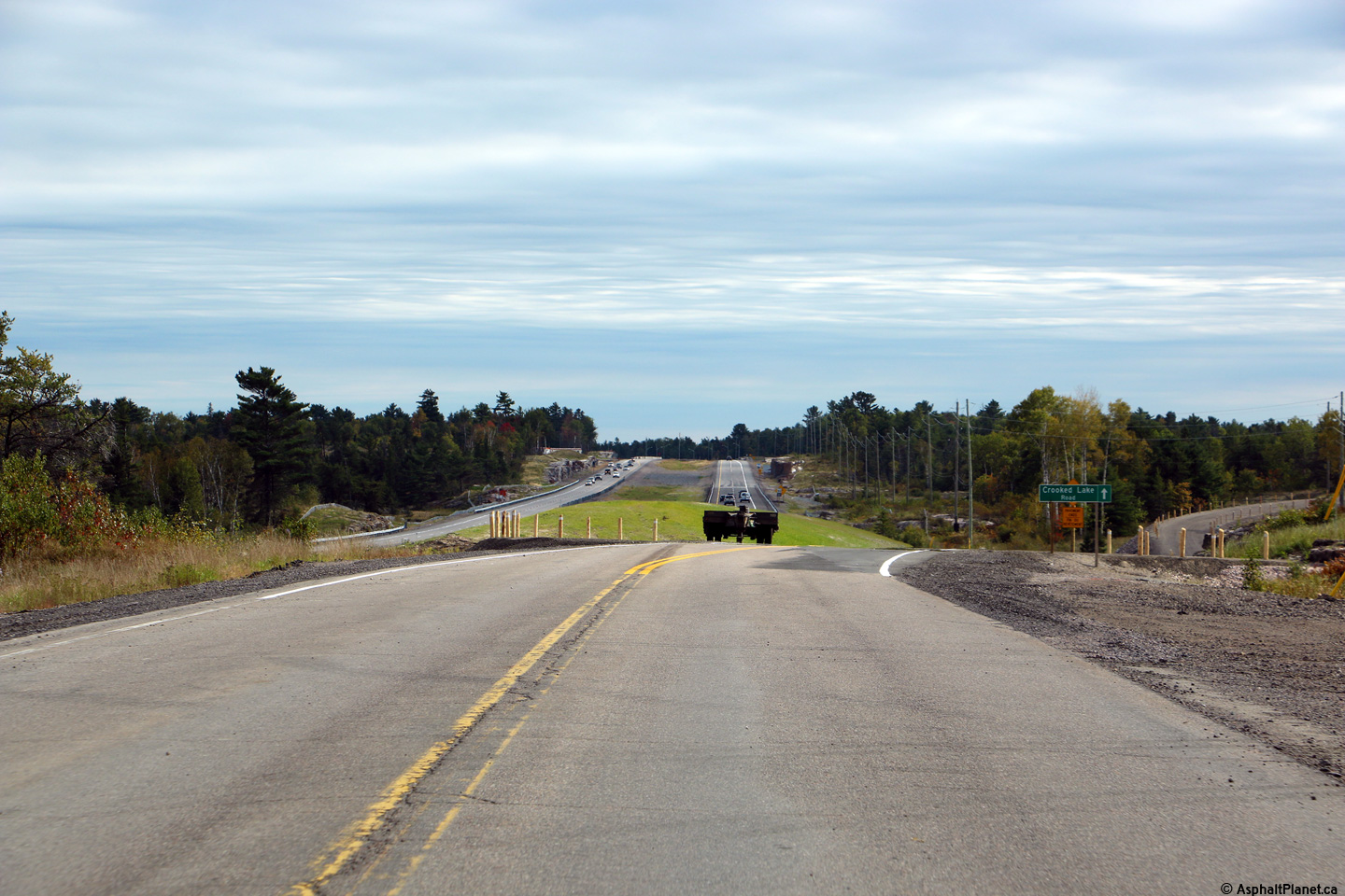
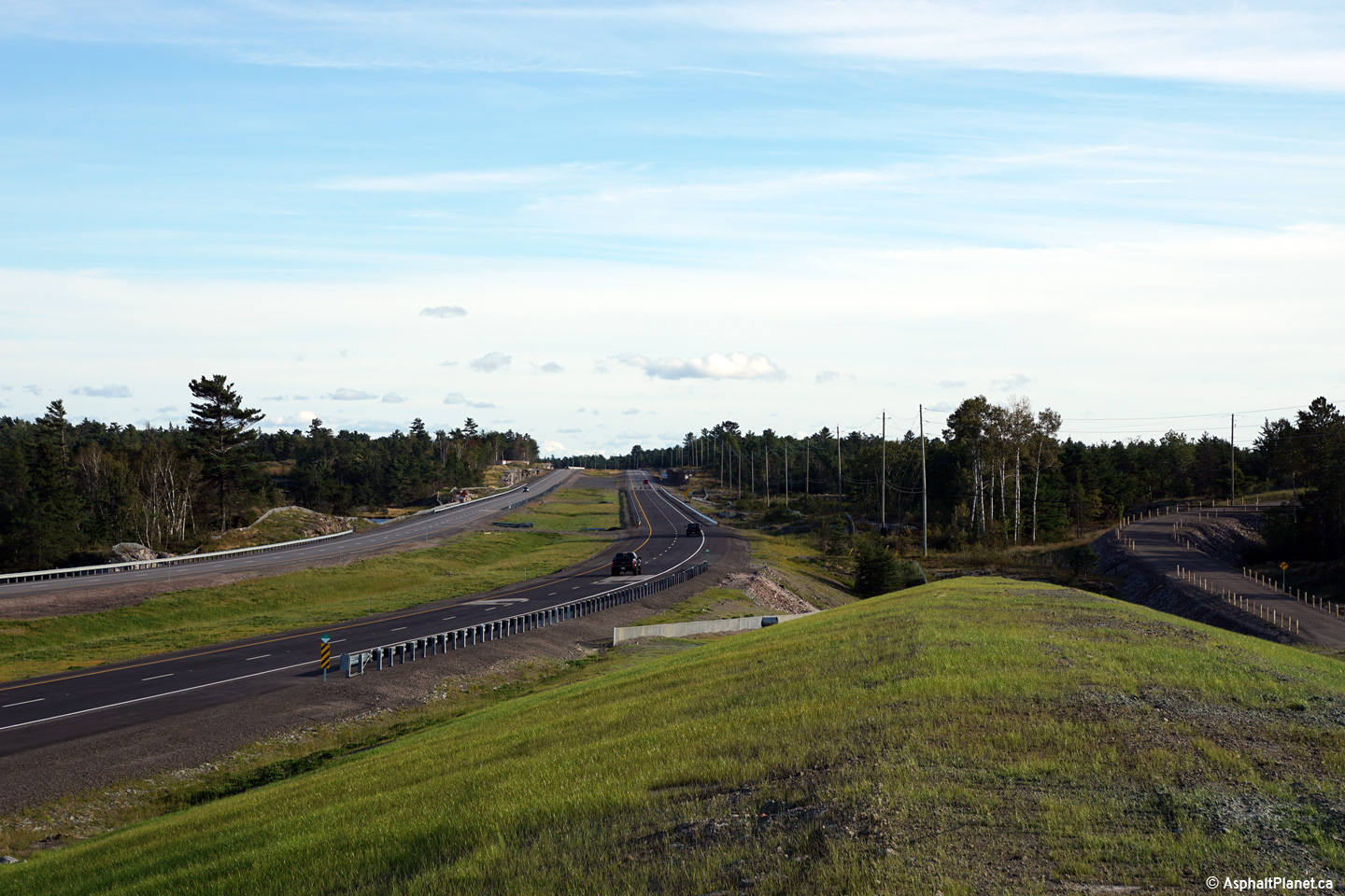
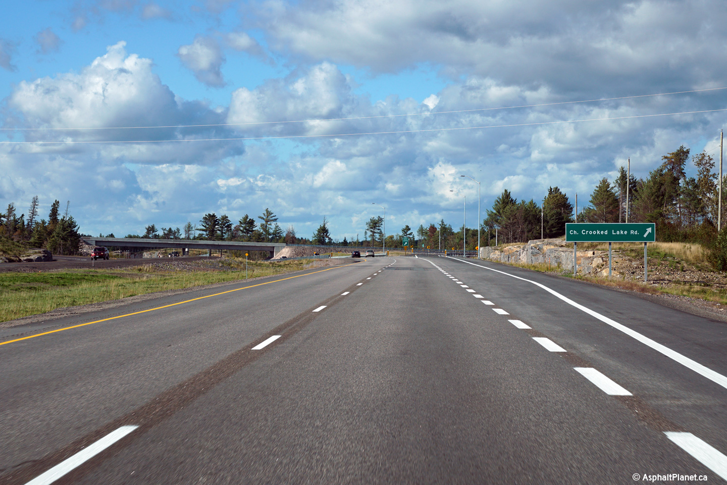
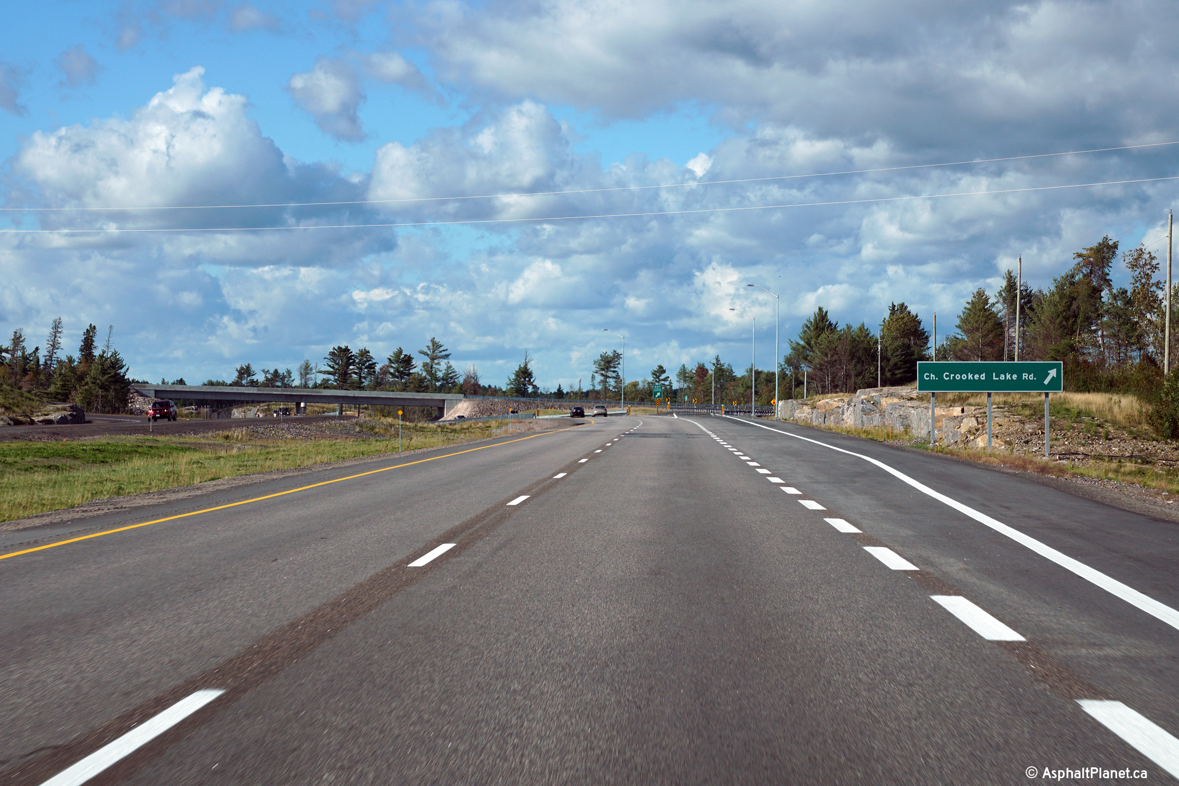
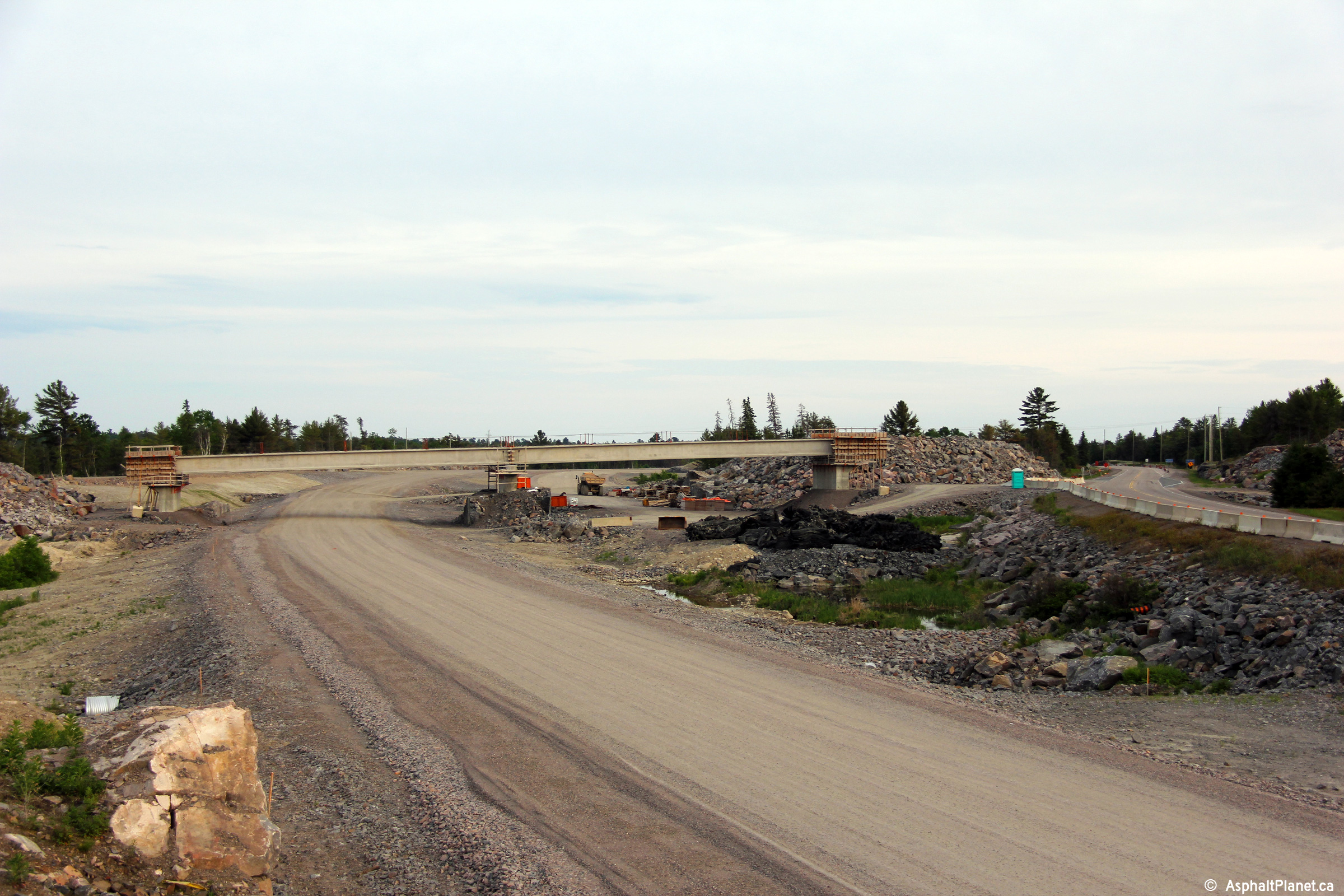
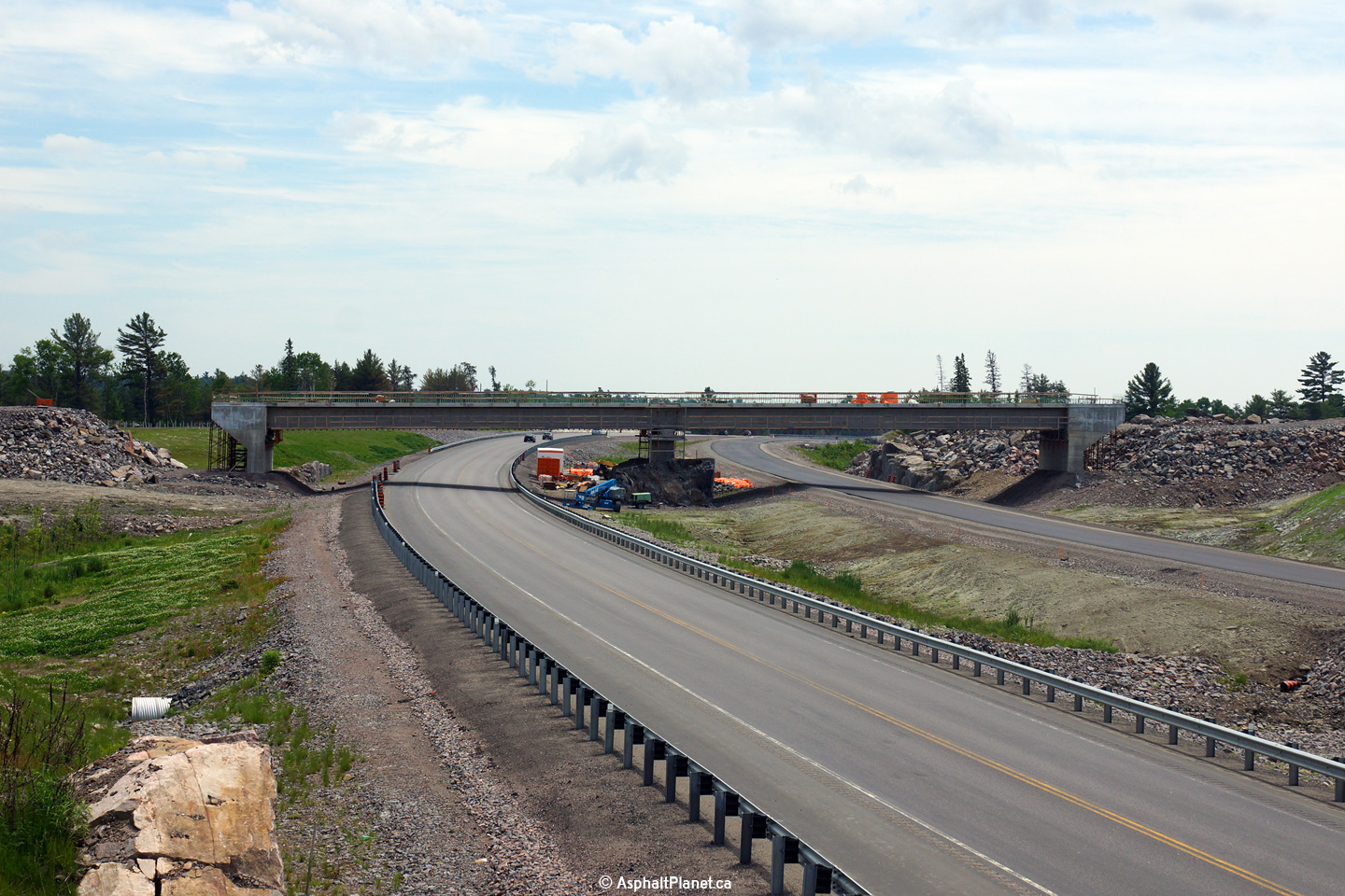
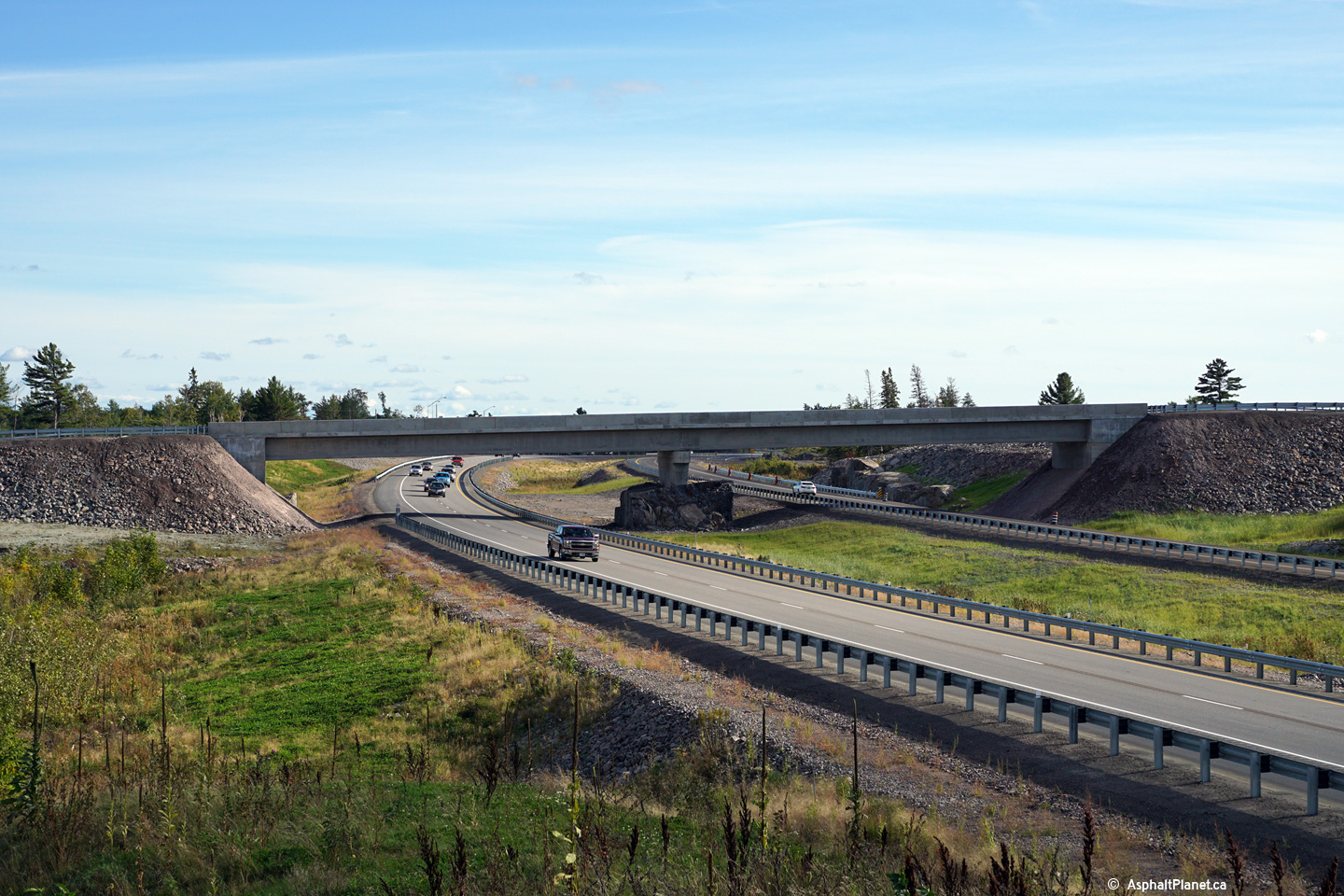
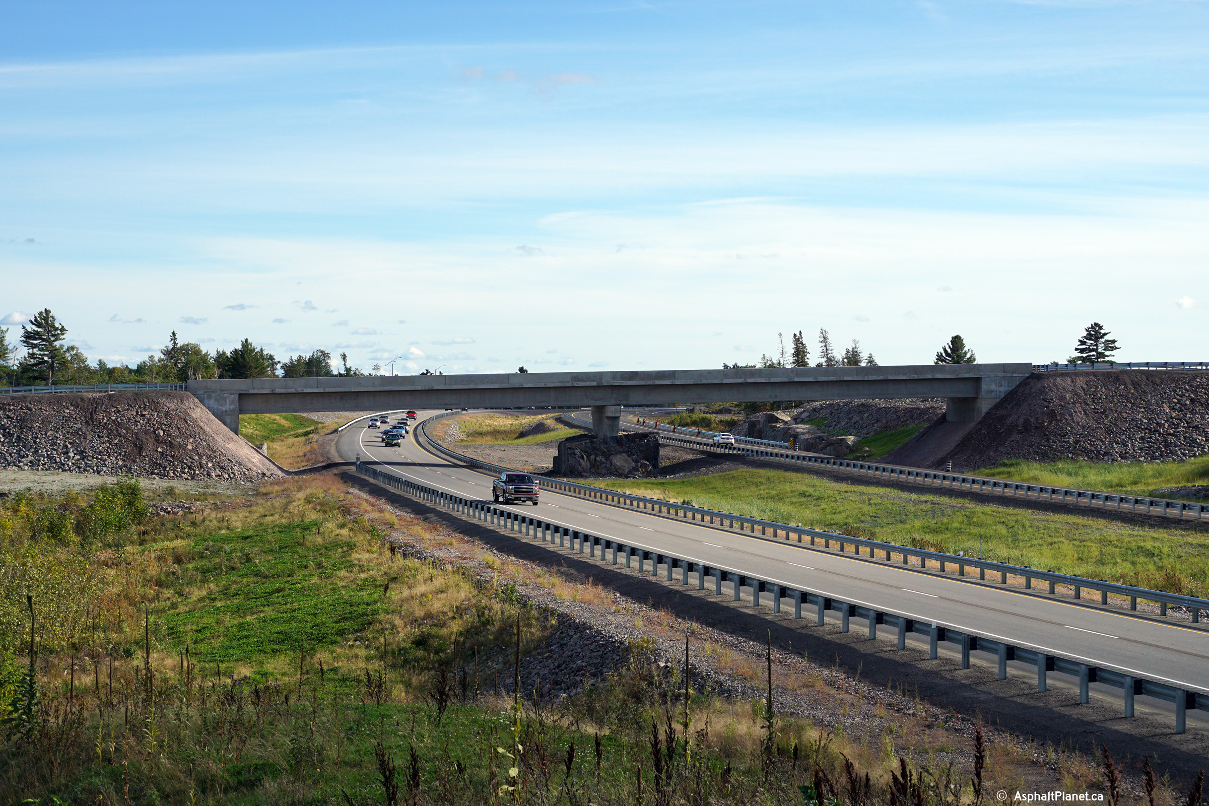
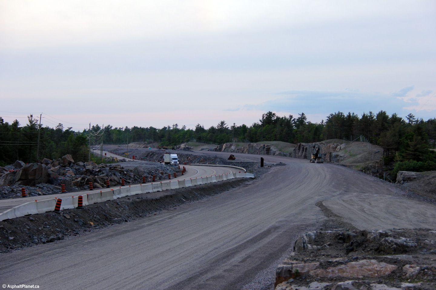
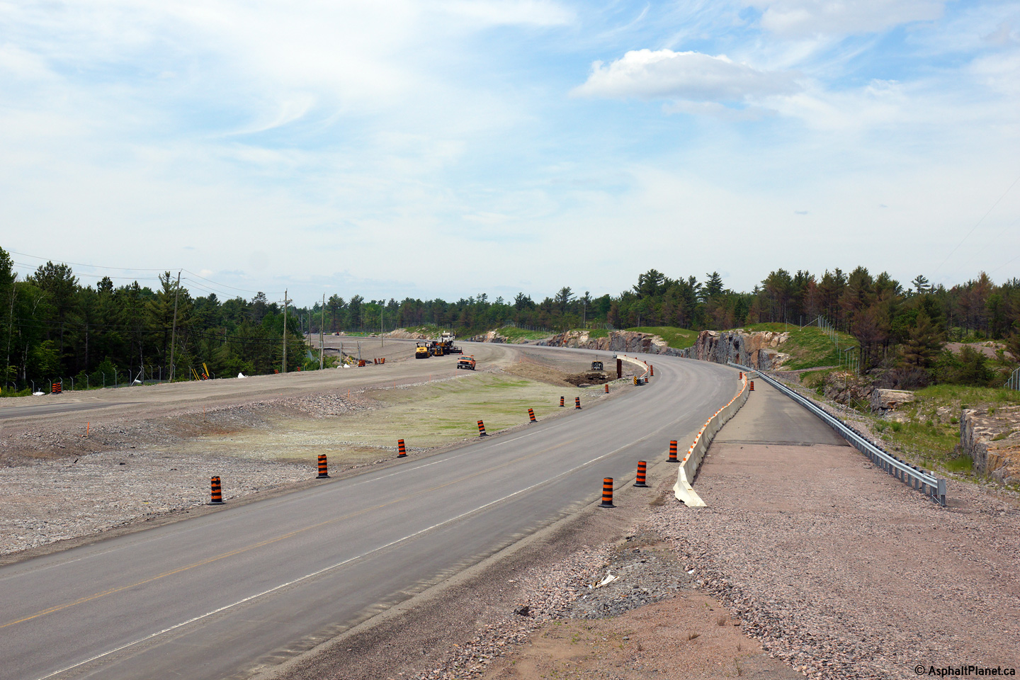
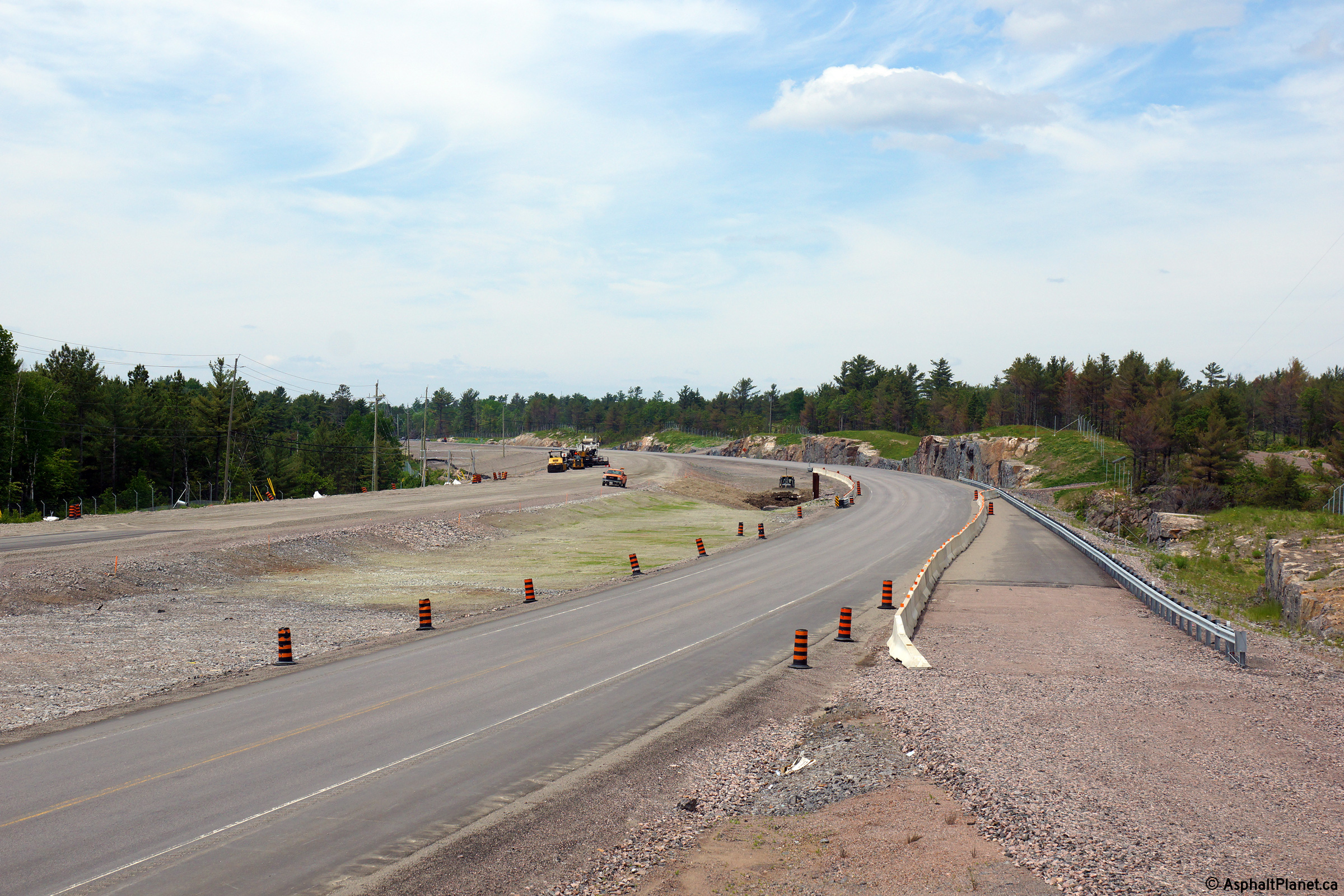
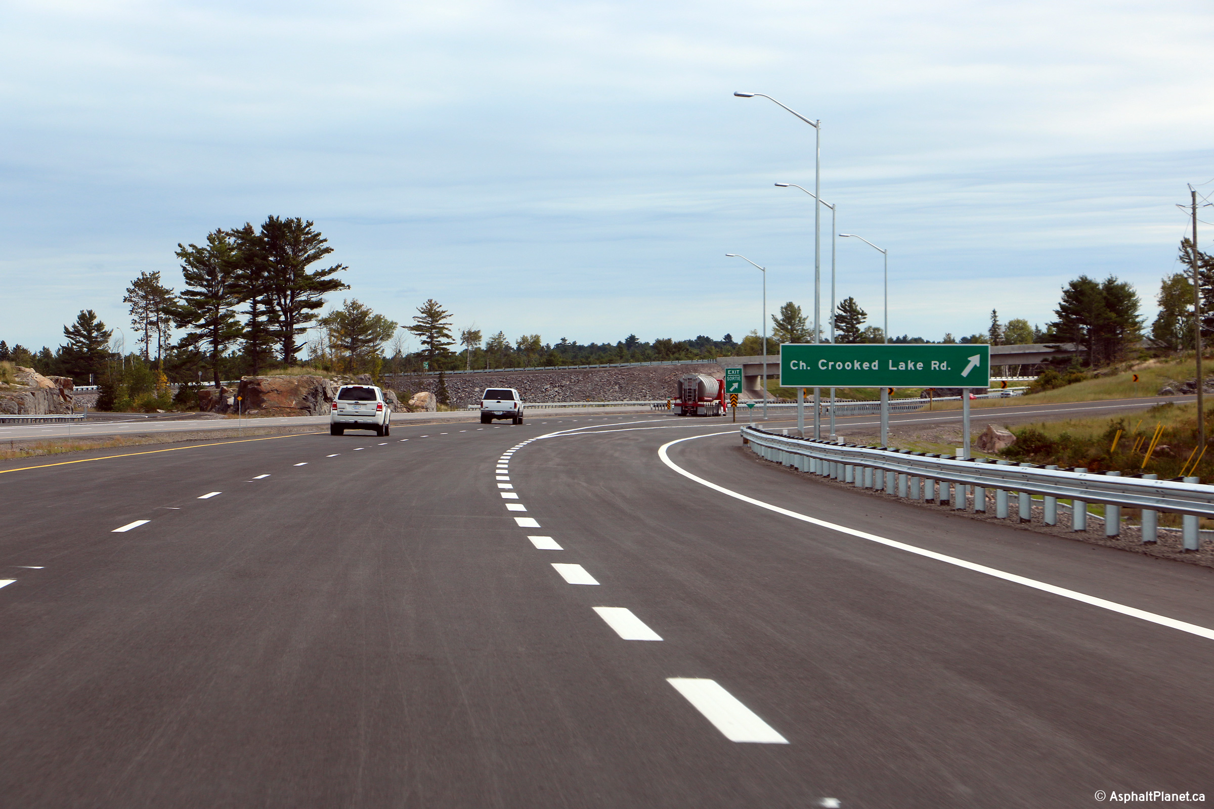
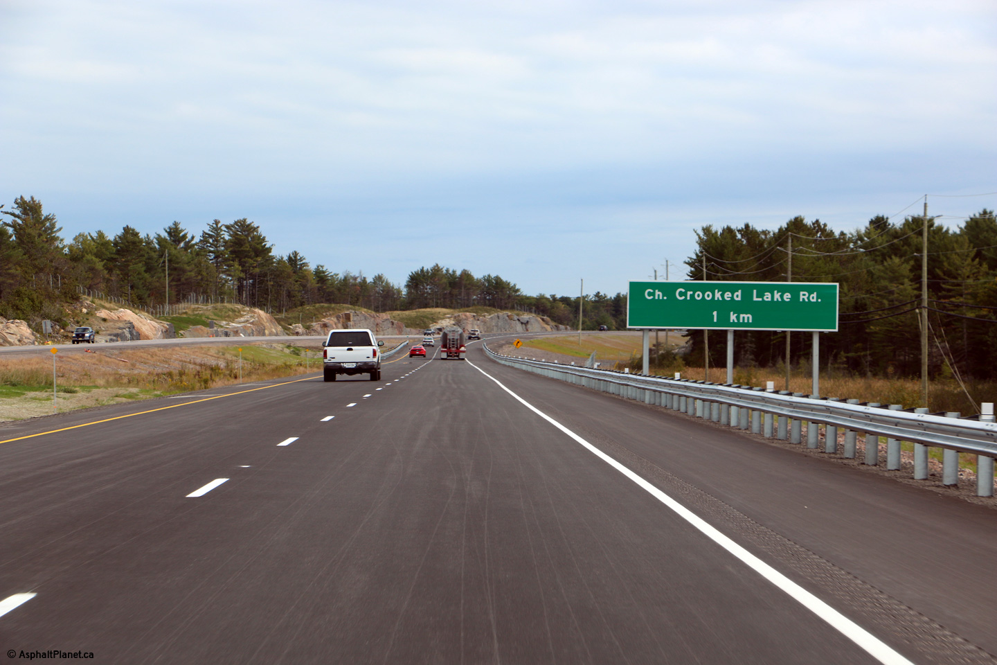
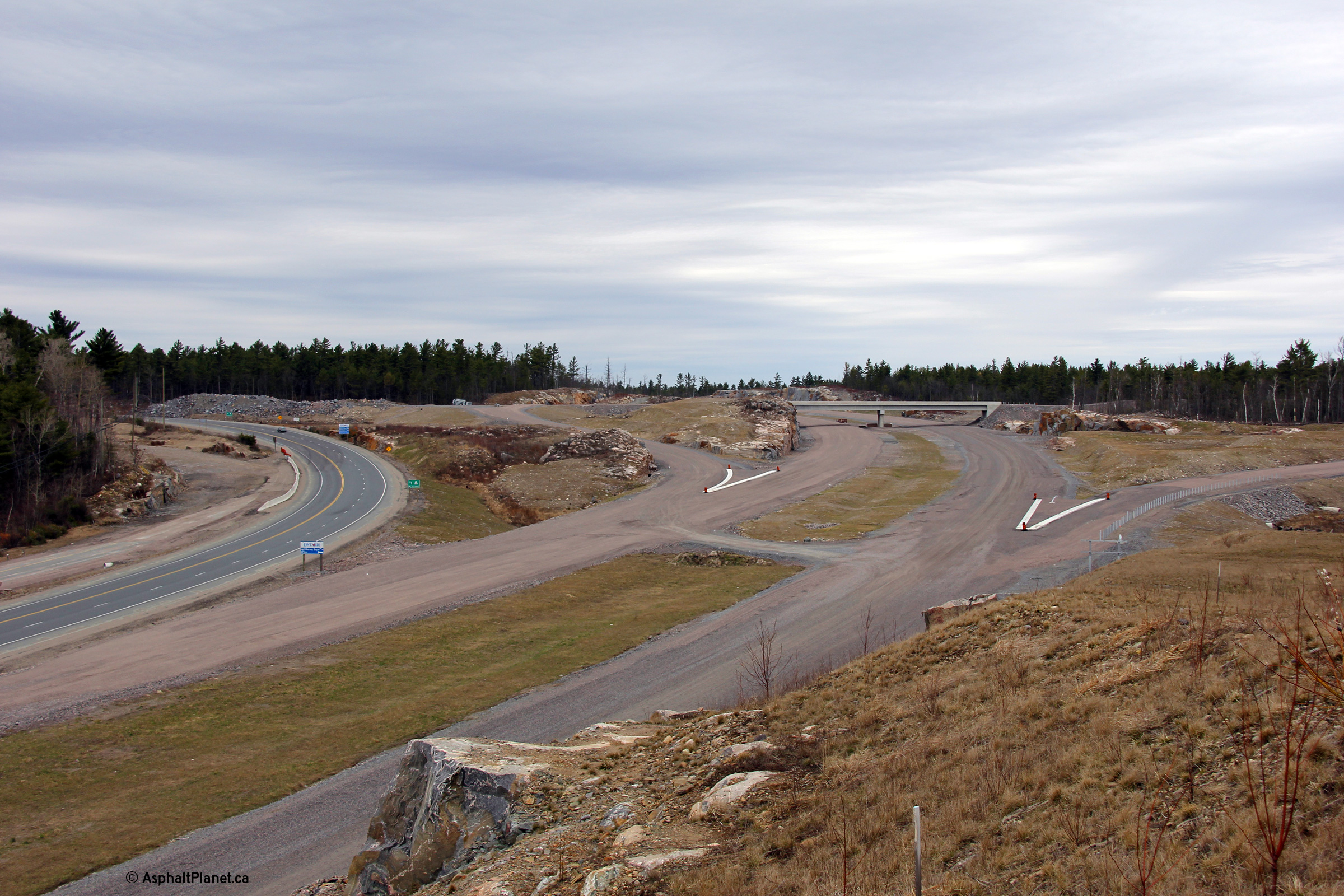
This series of views looks southerly approaching the the Crooked Lake Road intersection. Photo #1 was
taken several years before construction had started to widen Highway 69
through the Crooked Lake Road interchange. Photo #2 was taken during
an early phase of the construction that saw Highway 69 widened to four lanes
through this area. As is evident in Photo #2, the highway alignment
was considerably straightened through the interchange. Photo #3 shows
a perspective of the new four-lane highway from the former alignment of
Highway 69, now Crooked Lake Road. Photo #4 shows the completed four
lane highway at left with Crooked Lake Road to the right. The
alignment of Highway 69 was considerably straightened south of Crooked Lake
Road -- click here for a photo of the
former meandering alignment taken in July, 2010.
Photo #1 taken: July 30th, 2010.
Photo #2 taken: June 10th, 2014.
Photo #3 taken: September 25th, 2015.
Photo #4 taken: September 20th, 2015. |
(720x480)
(1440x960)
(2400x1600)
(720x480)
(1440x960)
(2400x1600)
|
District of Sudbury
(Geographical Township of Cox) |
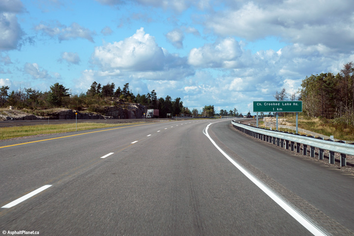
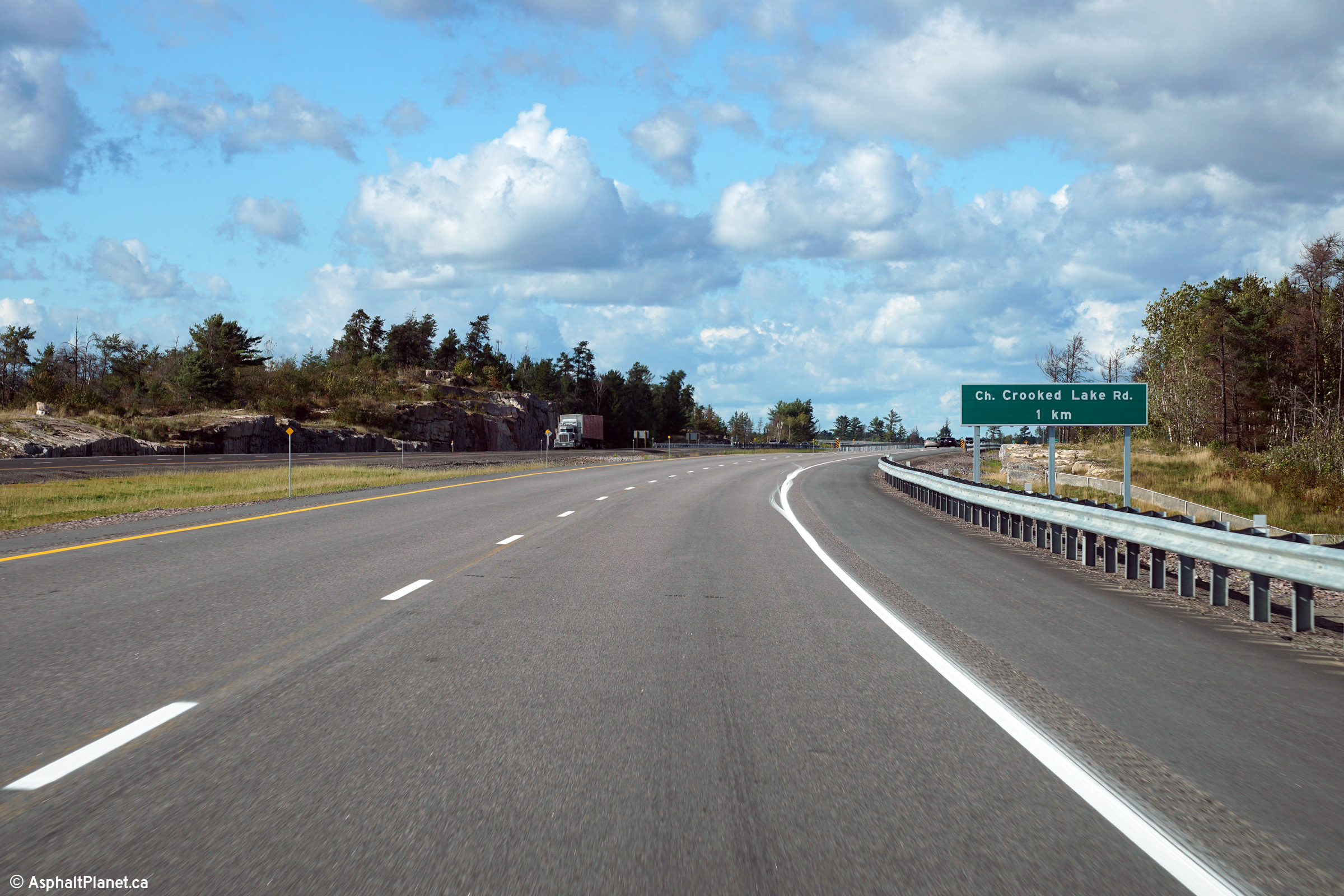
Northbound advanced signage in advance of the
Crooked Lake interchange.
Photo taken: September 20th, 2015. |
 (720x480) (720x480)
(1440x960)
(2400x1600) |
District of Sudbury
(Geographical Township of Cox) |
Northbound advanced signage at the off-ramp to
Crooked Lake Road.
Photo taken: September 20th, 2015. |
 (720x480) (720x480)
(1440x960)
(2400x1600) |
District of Sudbury
(Geographical Township of Cox) |
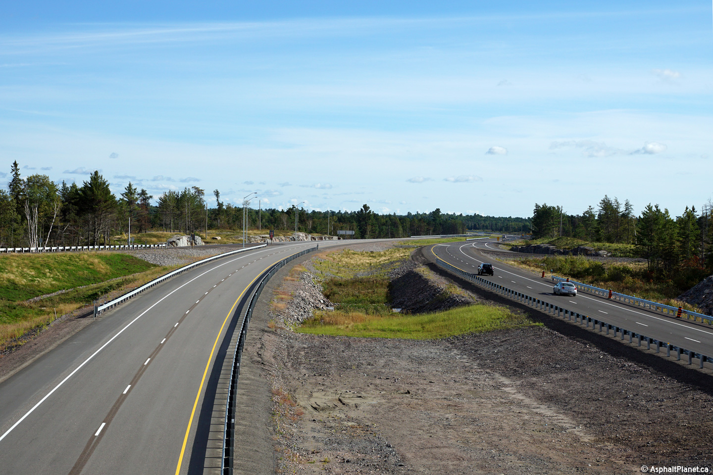
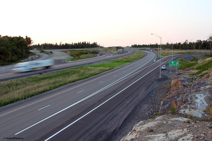
View looking southerly from the Crooked Lake
Road overpass.
Photo taken: September 20th, 2015. |
(720x480)
(1440x960)
(2400x1600) |
District of Sudbury
(Geographical Township of Cox) |
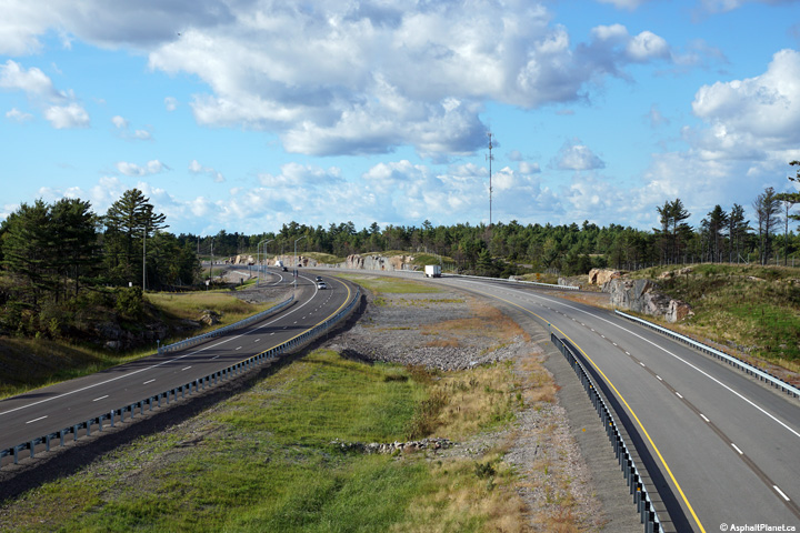
Northerly view from the Crooked Lake Road
overpass along Highway 69.
Photo taken: September 20th, 2015. |
(720x480)
(1440x960)
(2400x1600) |
District of Sudbury
(Geographical Township of Cox) |
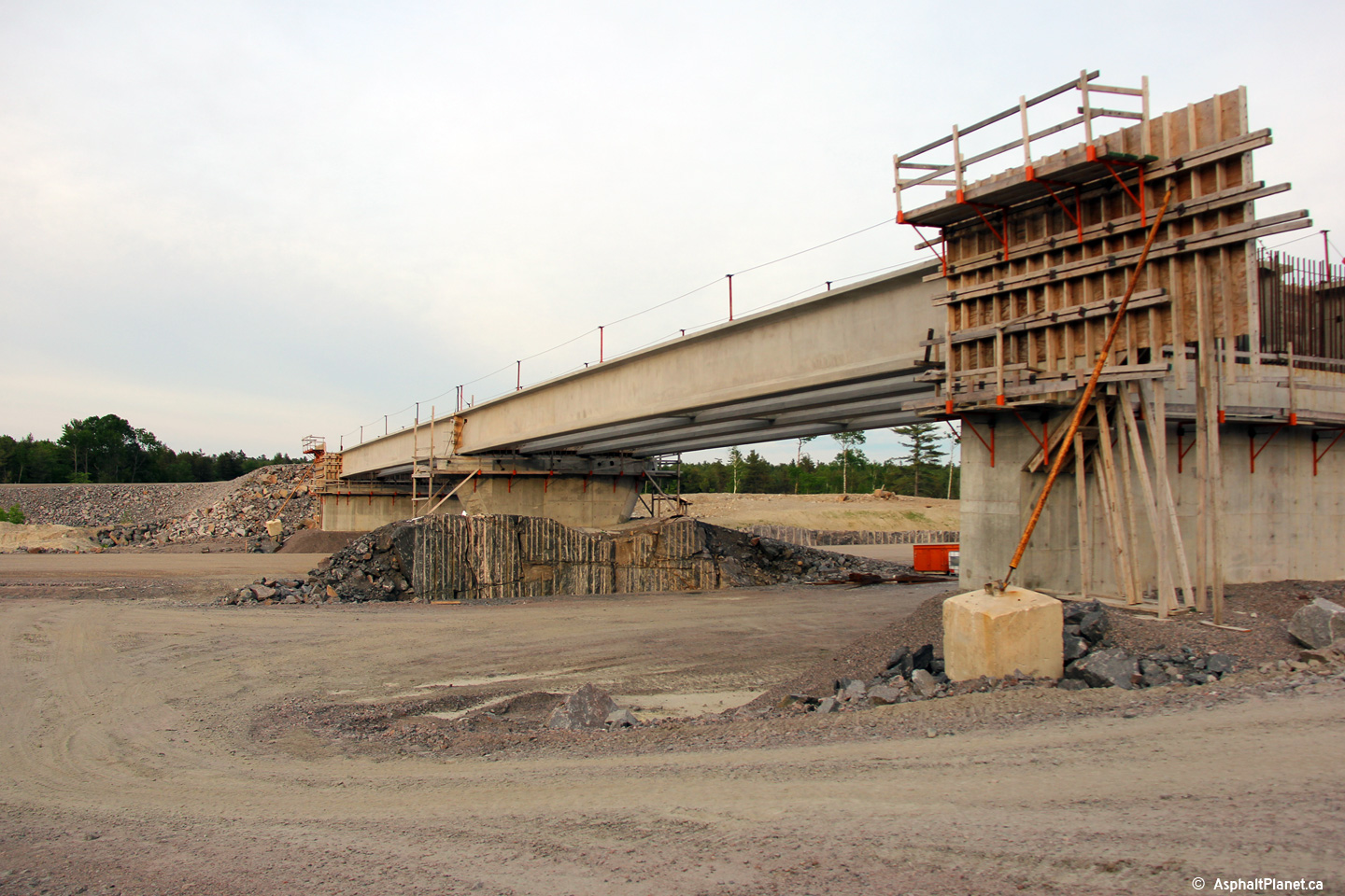
View looking easterly towards the Crooked Lake
Road overpass before it had been completed and opened to traffic.
Photo taken: June 10th, 2014. |
|
District of Sudbury
(Geographical Township of Cox) |
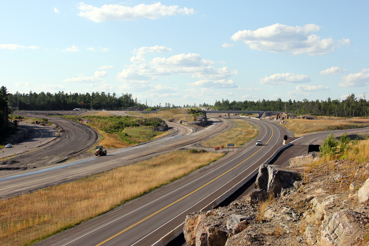
A series of three views looking southerly
towards the new Crooked Lake Road interchange. Before being widened to
four lanes Highway 69 veered to the west following a different alignment
than the now current four lane highway. A small portion of the old
alignment of Highway 69 has been incorporated into the new Crooked Lake Road
alignment to the west of the interchange.
Photo #1 taken: June 10th, 2014.
Photo #2 taken: June 13th, 2015.
Photo #3 taken: September 20th, 2015. |
(720x480)
(1440x960)
(2400x1600)
|
District of Sudbury
(Geographical Township of Cox) |
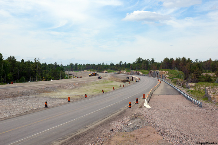
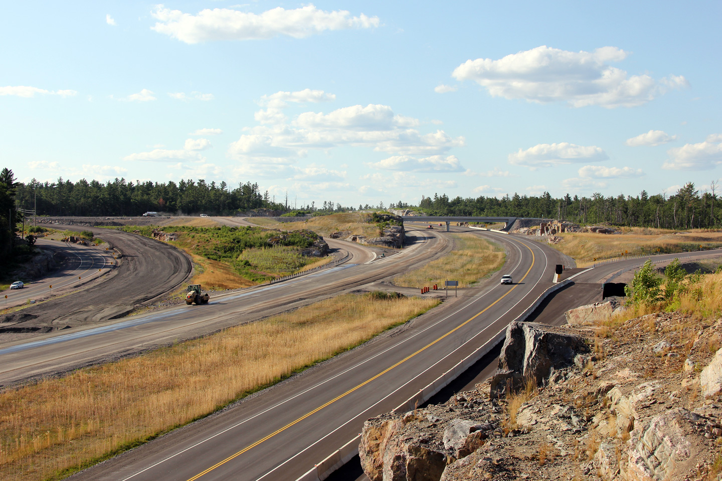
A series of three views from just north of the
Crooked Lake interchange. In the upper photo, construction had just
commenced to grade a new set of southbound lanes adjacent to the
pre-existing lanes. When looking at the upper photo, the geometric
deficiencies of the pre-existing alignment of Highway 69 become very
apparent. In the middle photo, bidirectional traffic has been moved to
the future northbound lanes in order to construct the future northbound
lanes. The lower photo shows the completed highway configuration.
Photo #1 taken: June 10th, 2014.
Photo #2 taken: June 13th, 2015.
Photo #3 taken: September 20th, 2015. |
(720x480)
(1440x960)
(2400x1600) |
District of Sudbury
(Geographical Township of Cox) |
Southbound signage at the off-ramp to Crooked
Lake Road.
Photo taken: September 25th, 2015. |
 (720x480) (720x480)
(1440x960)
(2400x1600) |
District of Sudbury
(Geographical Township of Cox) |
Southbound advanced signage for the off-ramp to
Crooked Lake Road.
Photo taken: September 25th, 2015. |
 (720x480) (720x480)
(1440x960)
(2400x1600) |
District of Sudbury
(Geographical Township of Servos) |
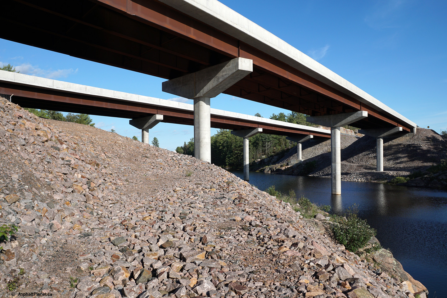
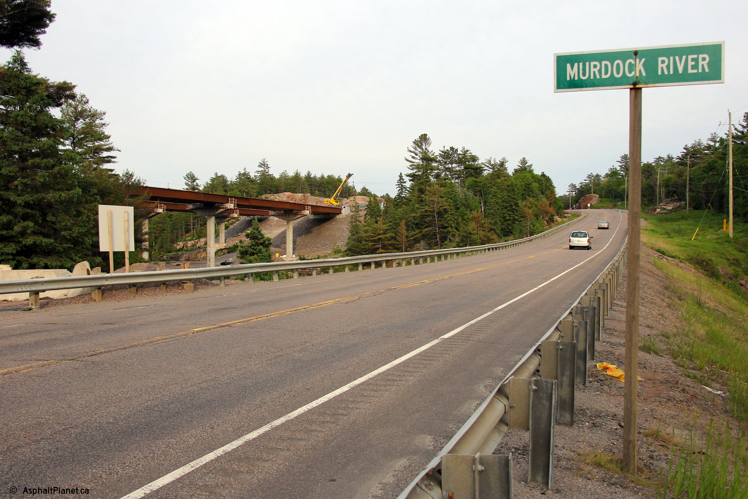
A view of the former alignment overtop of the
Murdock River, taken in July, 2010 can be seen here. Before the
high-level bridges that carry the current four lane alignment overtop of the
Murdock River were constructed, Highway 69 crossed the Murdock River via a
causeway with a small culvert.
Click here for a view looking
northerly on the former alignment of Highway 69 at the Murdock River.
Photo #1 taken: June 10th, 2014.
Photo #2 taken: June 13th, 2015.
Photo #3 taken: September 20th, 2015. |
(720x480)
(1440x960)
(2400x1600) |
District of Sudbury
(Geographical Township of Servos) |
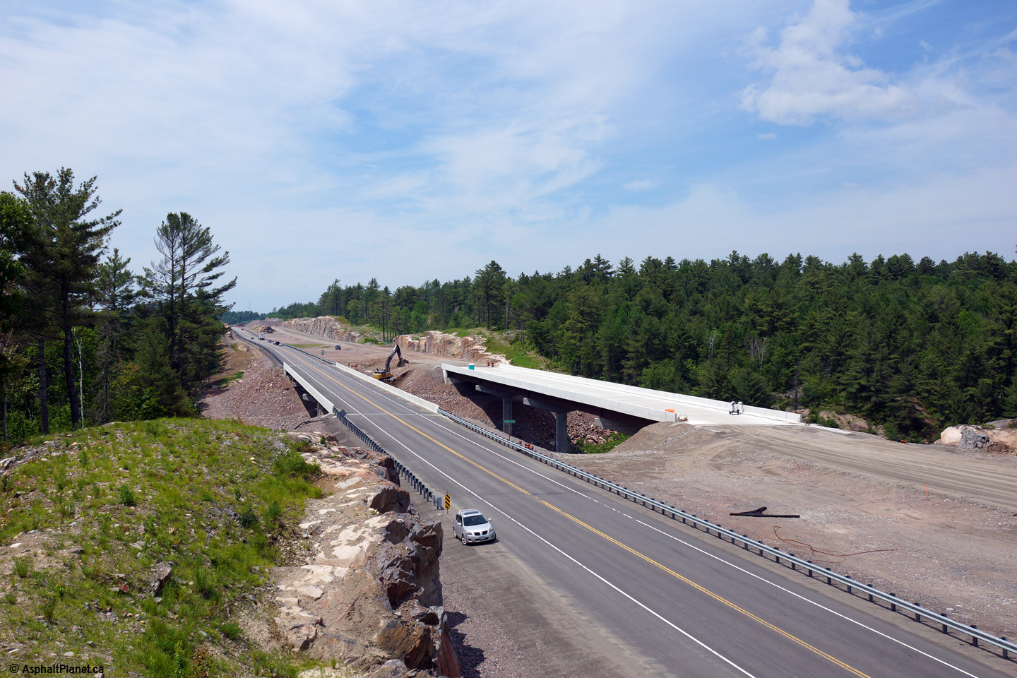
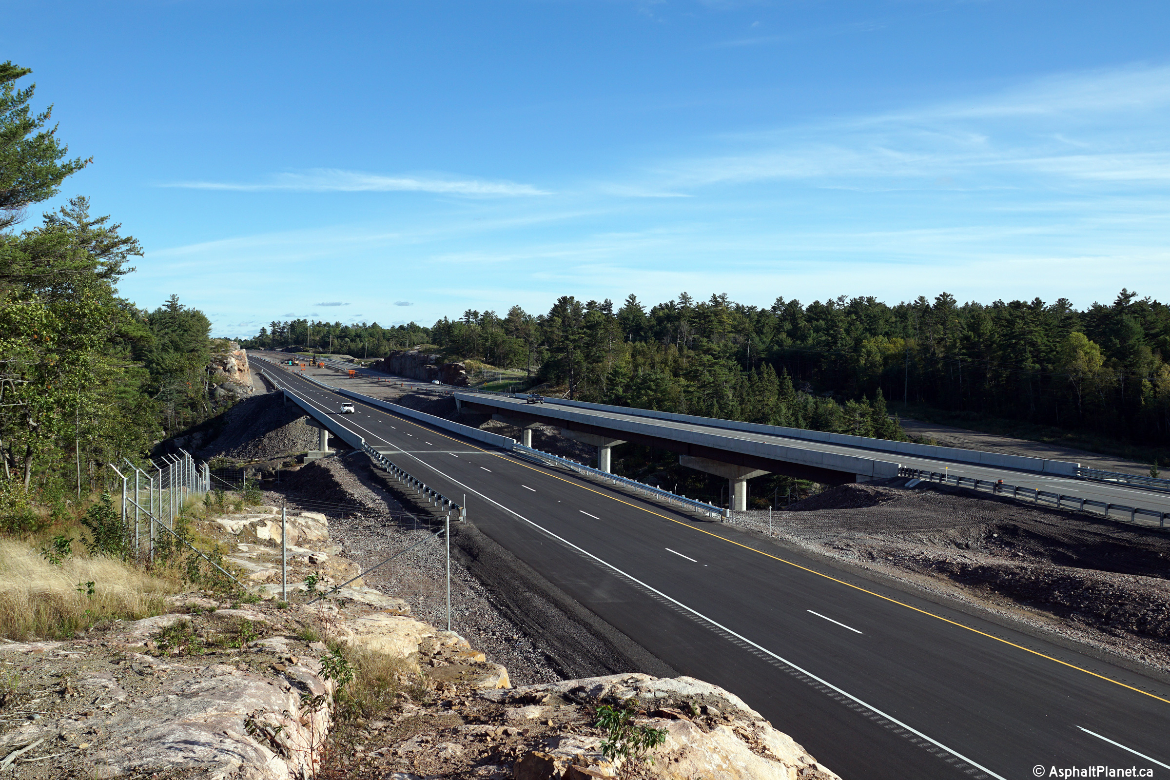
A series of two views at the newly opened twin
Murdock River bridges along Highway 69.
Photos taken: September 20th, 2015. |

(720x480)
(1440x960)
(2400x1600)

(720x480)
(1440x960)
(2400x1600) |
District of Sudbury
(Geographical Township of Servos) |
View looking southerly along the
former alignment of Highway 69 over the Murdock River.
Photo taken: June 10th, 2014. |
|
District of Sudbury
(Geographical Township of Servos) |
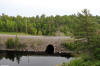
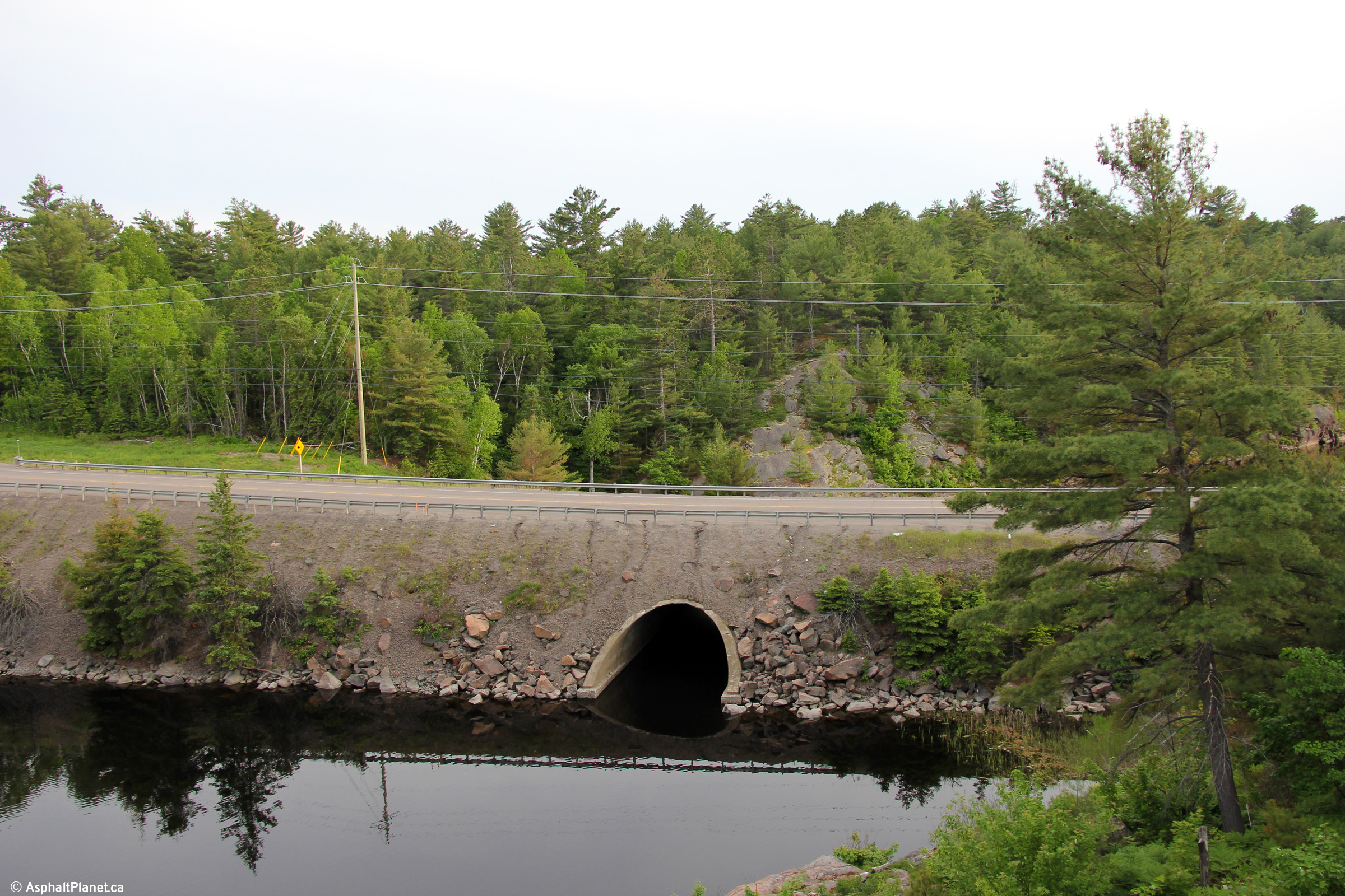
View of the barrel arch culver
that carried the former alignment of Highway 69 over the Murdock River.
This small narrow culvert is quite the contrast from the twin high-level
bridges that the modern four-lane highway uses to cross the Murdock River.
Photo taken: June 10th, 2014. |
(720x480)
(1440x960)
(2400x1600) |
District of Sudbury
(Geographical Township of Servos) |
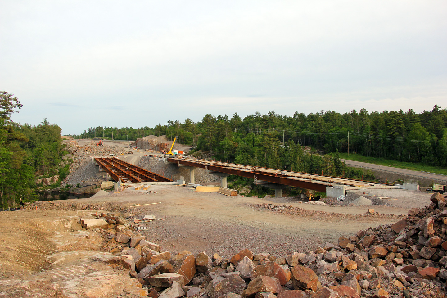
Two views of the twin Murdock River Bridges both
under constructed and completed.
Upper photo taken: June 10th, 2014.
Lower photo taken: September 20th, 2015. |
(720x480)
(1440x960)
(2400x1600) |
District of Sudbury
(Geographical Township of Servos) |
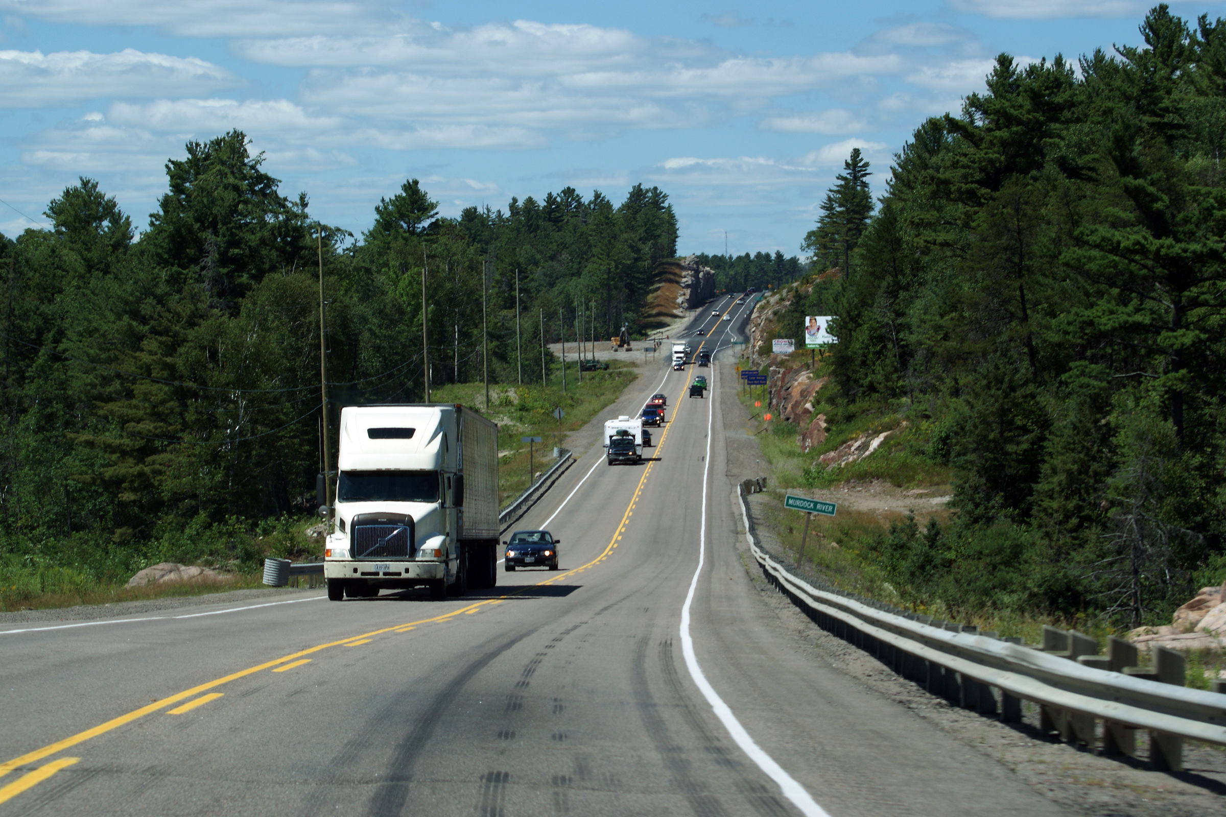
View looking southerly from the end of the "S"
curve diversion. From the fall of 2012, until late in the summer of
2015, Highway 69 was a two lane highway
(one lane each direction), from this point southerly for approximately 100km
to Nobel. In 2015, the four lane highway was extended southerly for
approximately 9km until south of the Crooked Lake Road interchange.
Upper photo taken: August 29th, 2012.
Lower photo taken: September 20th, 2015. |
(720x480)
(1440x960)
(2400x1600)
|
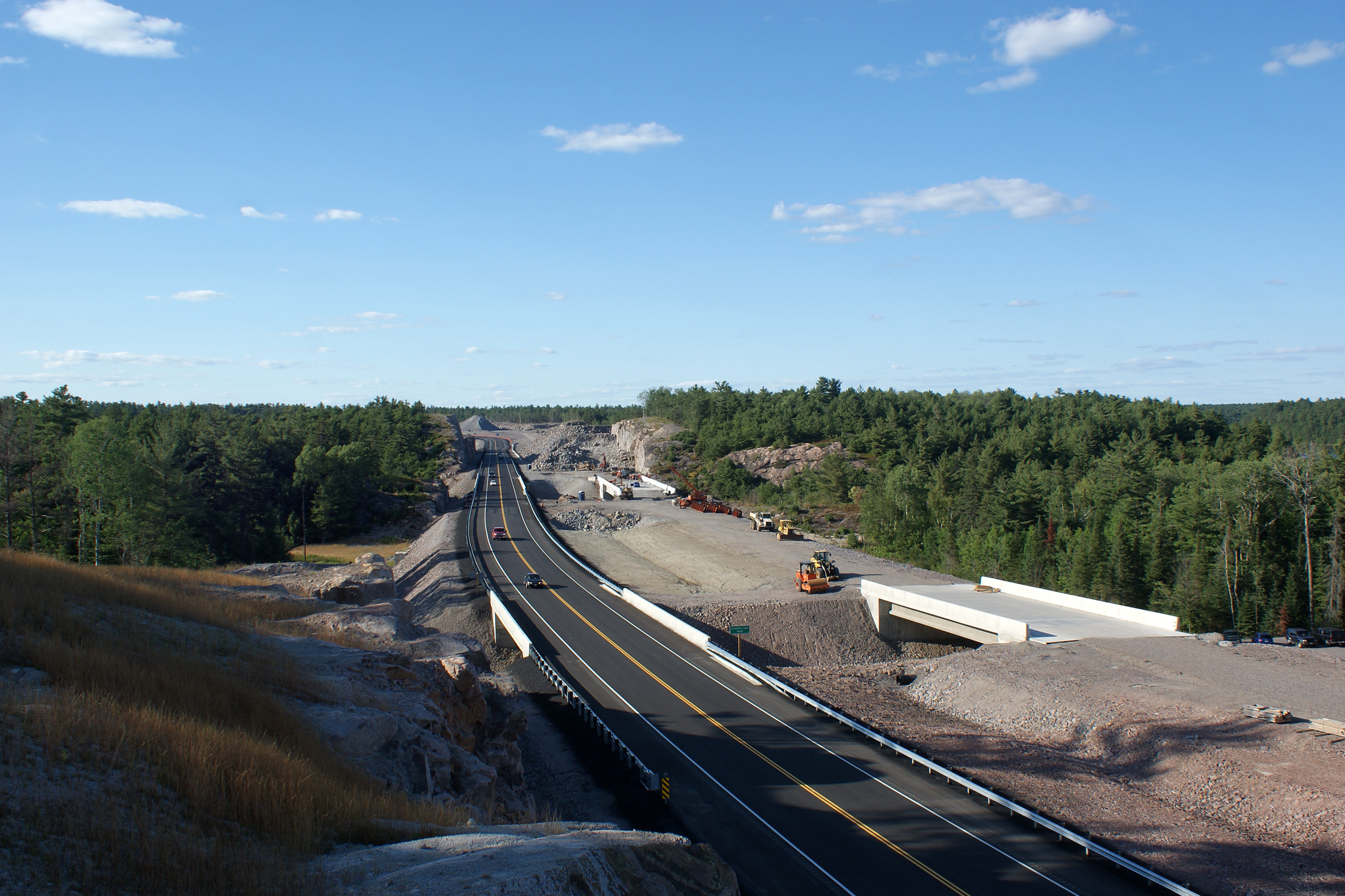
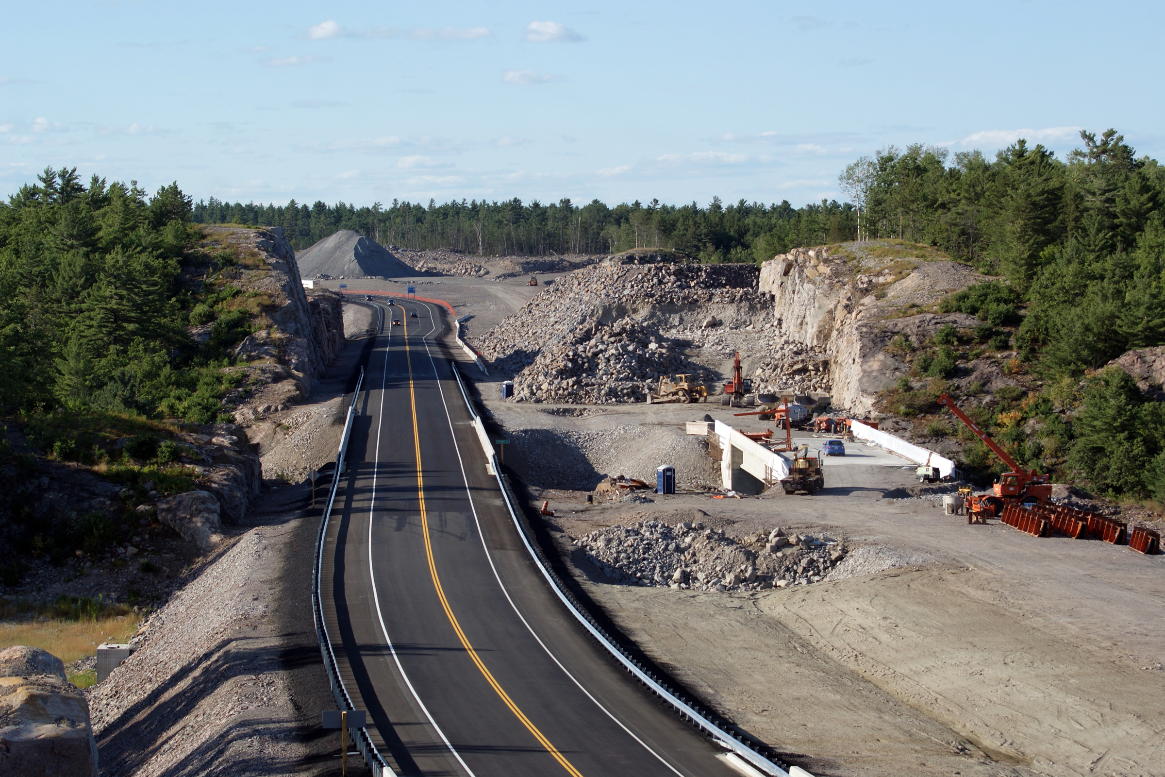
District of Sudbury
(Geographical Township of Servos) |
Two views looking northerly towards the southern
end of the divided highway south of the Highway 637 interchange. For
much of the summer of 2012, two way traffic utilized the future northbound
carriageway of the Highway 69 freeway. In the final weeks of August,
2012, construction on the four lane highway was completed and traffic was
moved into its final four-lane configuration. This section of Highway
69 was opened in 2010 by-passing the rather notorious 'S' Curve. Prior
to July 28, 2010, Highway 69 followed an alignment that snaked between the
Murdock River and Lovering Lake. This
twisting alignment had claimed the lives of several motorists over the years
and was the most notoriously dangerous section of Highway 69 before it was
by-passed.
Photo #1 taken: July 10th, 2012.
Photo #2 taken: August 29th, 2012.
Photo #3 taken: September 20th, 2015. |
(720x480)
(1440x960)
(2400x1600)

(720x480)
(1440x960)
(2400x1600) |
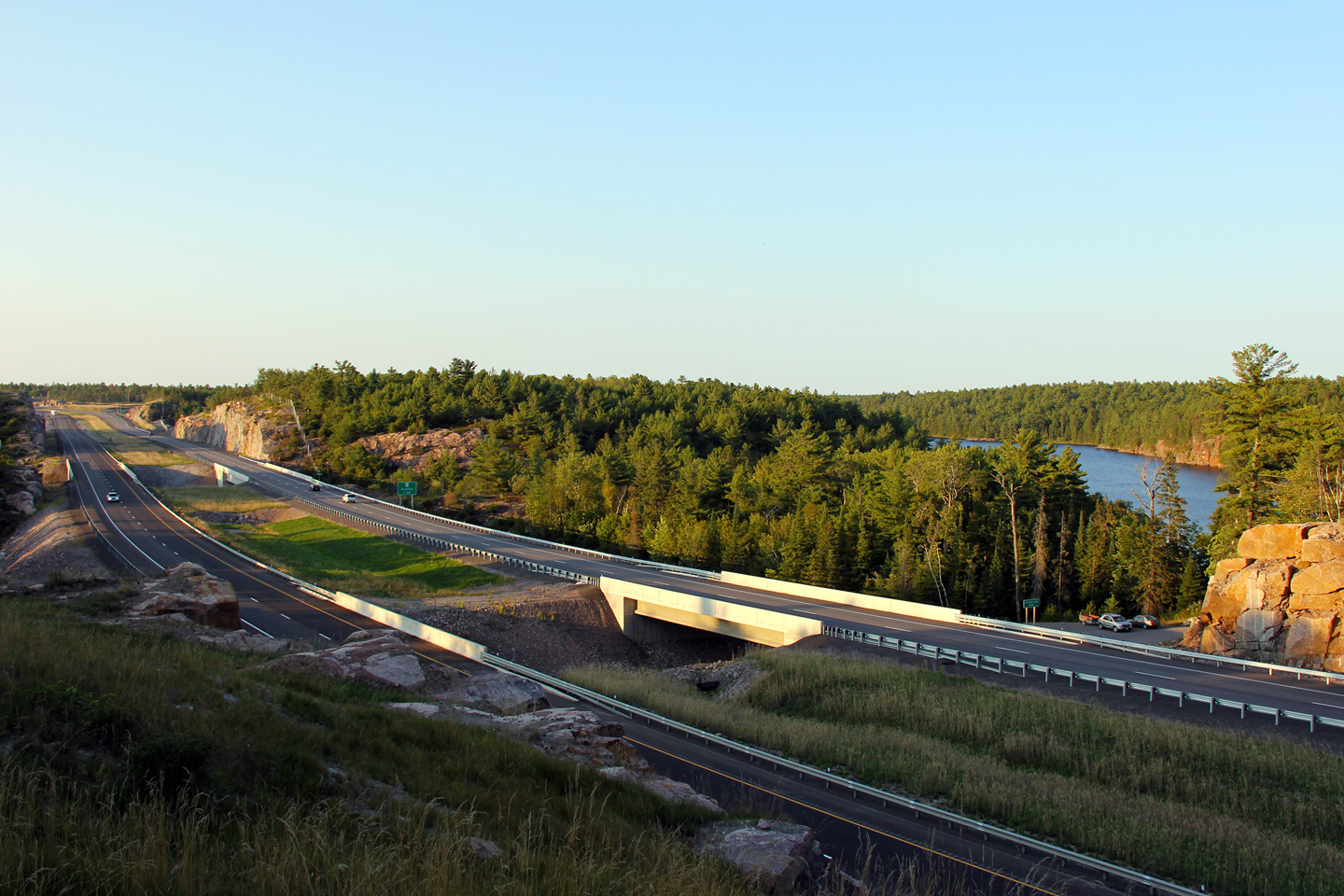
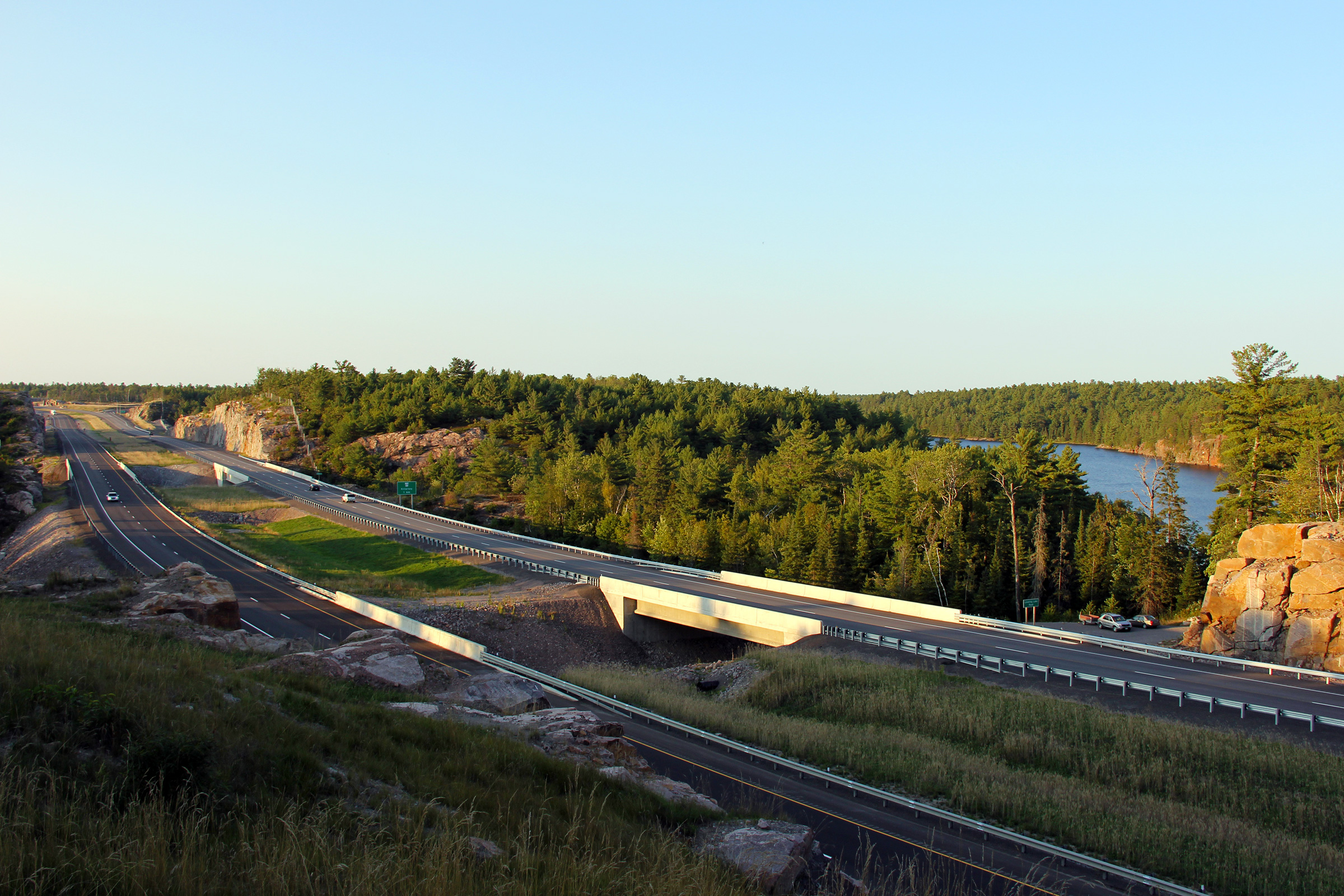
District of Sudbury
(Geographical Township of Servos) |
Four views that look southerly along the 2010
opened
Highway 69 diversion, as the new highway passes overtop of a huge blast-rock
fill embankment.
With the completion of the 'S'
curve diversion in 2012, and the completion of the four-lane Nobel By-pass in 2010,
the most dangerous and most congested sections of Highway 69 between Parry Sound
and Sudbury will have been reconstructed as a freeway. The pavement on
the former alignment of Highway 69 has been obliterated in the 2012 photo,
but was still intact and open to traffic in the 2010 photos.
Photos #1 and #2 taken: July 30th, 2010.
Photo #3 taken: August 29th, 2012.
Photo #4 taken: September 25th, 2015. |
(720x480)
(1440x960)
(2400x1600) |
District of Sudbury
(Geographical Township of Servos) |
This view looks southerly from the former
alignment of Highway 69. More photos of Highway 69's former
alignment's will be added to the website in future updates. I included this photo to try and show
the magnitude of the rock fill that was placed in order to bypass the former
'S' curve where Highway 69 twisted between the Murdock River and Lovering Lake.
Photo taken: July 30th, 2010. |
|
District of Sudbury
(Geographical Township of Servos) |
Northerly view from just north of the
pre-2015 end of the divided highway. The lower photo shows the
completed highway configuration.
Upper photo taken: August 29th, 2012.
Lower photo taken: September 25th, 2015. |
(720x480)
(1440x960)
(2400x1600) |
District of Sudbury
(Geographical Township of Servos) |
Two southbound views approaching the southern
end of widening contract # 2009-5131. Where the new highway
wasn't built on an enormous fill, it was build through an enormous rock cut.
Photo #1 taken: July 30th, 2010.
Photo #2 taken: August 29th, 2012.
Photo #3 taken: September 25th, 2015. |
(720x480)
(1440x960)
(2400x1600) |
District of Sudbury
(Geographical Township of Servos) |
Three views looking northerly as Highway 69 passes
overtop of both the Lovering Lake Road, and Lovering Lake itself. Note
the two enormous piles of crushed rock that are visible in the future
northbound lanes in the upper photos. Likely, all of this rock will be reused on future
construction projects to twin Highway 69. Engineers spend considerable time
and effort to balance cut and fill quantities during new highway construction. Without balancing cut and fill
quantities, construction costs grow exponentially since fill would either
need to be imported to site by truck, or exported off site by truck at considerable
expense to
the taxpayer.
Upper photos taken: July 30th, 2010.
Lower photos taken: August 29th, 2012. |

(720x480)
(1440x960)
(2400x1600) |
District of Sudbury
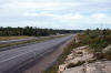
(Geographical Township of Servos) |
A series of three views looking southerly from
just south of the Highway 637 interchange. The former alignment of
Highway 69 snaking around Kakakiwaganda Lake (the Murdock River) can be seen on
the right hand side of all of the photos.
Photo #1 taken: April 3rd. 2012.
Photo #2 taken: July 10th, 2012.
Photo #3 taken: August 29th, 2012. |

(720x480)
(1440x960)
(2400x1600) |
District of Sudbury
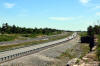
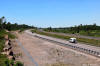
(Geographical Township of Servos) |
Three views looking northerly approaching the
Highway 637 interchange. The upper photo was taken just prior to the start
of the 2012 construction season. It shows grading and structural work
complete for the new interchange. In spring 2012, Highway 69 still
veered off the new four lane alignment at the northern end of the "S" curve
diversion. The old alignment of Highway 69 has been renamed Burwash Farm
Road. While it has since been truncated at the four lane highway, the
Burwash Farm Road alignment formerly rejoined the divided highway just south
of the truck inspection stations at Estaire. The middle photo was taken
during the middle of the 2012 construction season when two way traffic had
been diverted onto the future northbound lanes of the Highway 69 freeway.
The lower photo was taken once construction had been completed.
Photo #1 taken: April 3rd. 2012.
Photo #2 taken: July 10th, 2012.
Photo #3 taken: August 29th, 2012. |
(720x480)
(1440x960)
(2400x1600) |
District of Sudbury
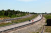
(Geographical Township of Servos) |
Series of views looking southerly from Highway
637. The upper photo shows the pre-construction alignment of Highway
69 looking south from the Highway 637 interchange towards the infamous 'S'
curve. Prior to a 2010 realignment that was a precursor to the
completion of a new four lane highway Highway 69
navigated a narrow spit of lane between Lovering Lake and the Murdoch River
south of Highway 637.
This section of Highway 69 was notoriously dangerous as there were several
serious accidents caused by drivers failing to negotiate the reverse curve.
Photo #2 was taken during the spring of 2012. When this photo was
taken, virtually all of the grading work for the Highway 637 interchange had
been completed and Highway 69 traffic was occupying the future southbound
lanes of the freeway. Photo #3 shows the highway during the middle of
the 2012 construction season. The northbound carriageway had been
completed and was now carrying two way traffic in order for crews to
complete the future southbound lanes. Photo #4 shows the final
configuration of the Highway 637 interchange. Click here to continue northerly along
Highway 69.
Photo #1 taken: July 2nd, 2004.
Photo #2 taken: April 3rd. 2012.
Photo #3 taken: July 10th, 2012.
Photo #4 taken: August 29th, 2012. |

(720x480)
(1440x960)
(2400x1600) |
|
Highway 637 leads westerly from
Highway 69 to the small village of Killarney.
Click here
for Highway 637 images. |
|
Click here for Highway 69 -
Highway 637 and Sudbury
Images section. |


 (720x480)
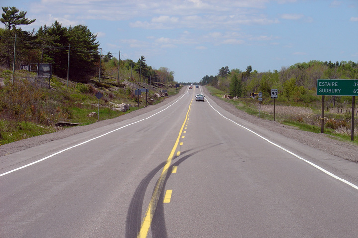


 (720x480)
 (720x480)
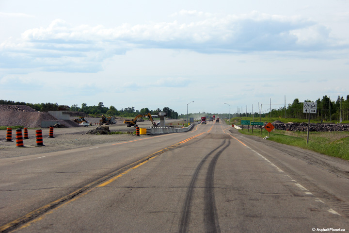 (720x480)
 (720x480)
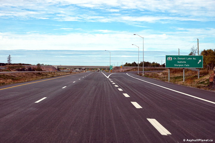 (720x480)


 (720x480)
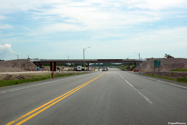 (720x480)
 (720x480)
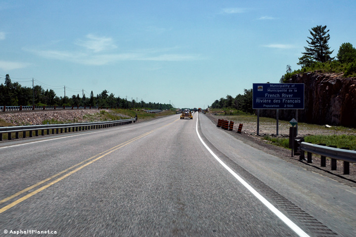 (720x480)
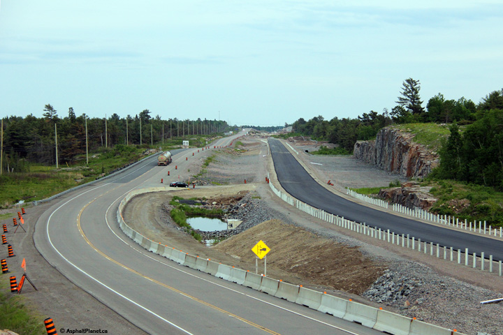


 (720x480)
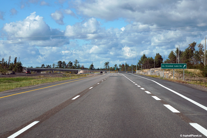 (720x480)
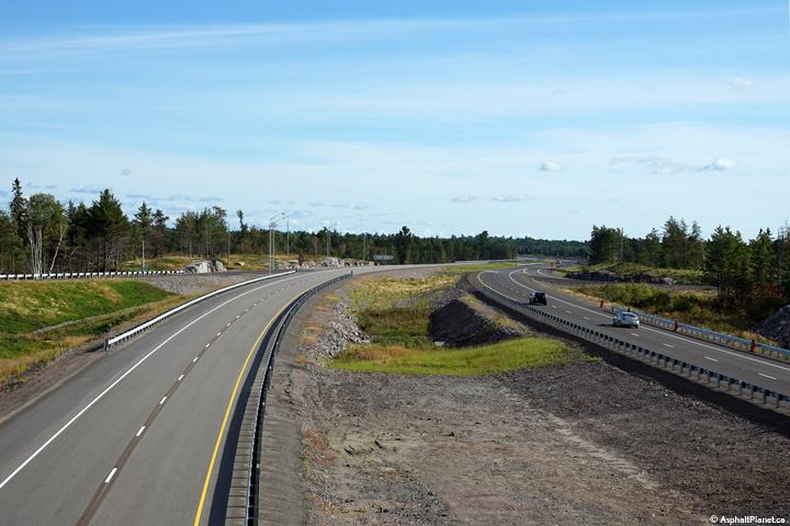


 (720x480)
 (720x480)
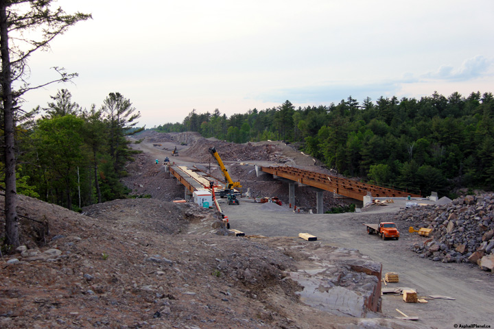


