|
Proper Municipality Name |
Photo Description |
Photo |
|
Photos taken
from driver's perspective appear offset from centre-line Photos: |
North-
Bound |
South-
Bound |
|
Click here for Highway 69 Images between
Highway 522 and Highway 637. |
District of Sudbury
(Geographical Township of Servos) |
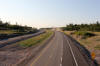
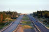
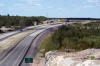
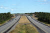
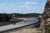
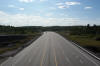
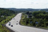
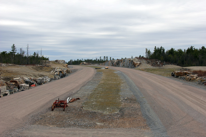
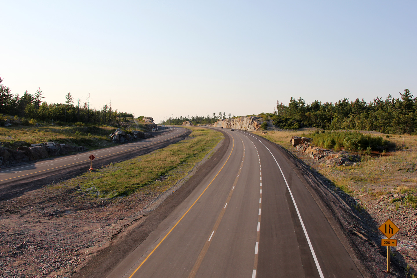
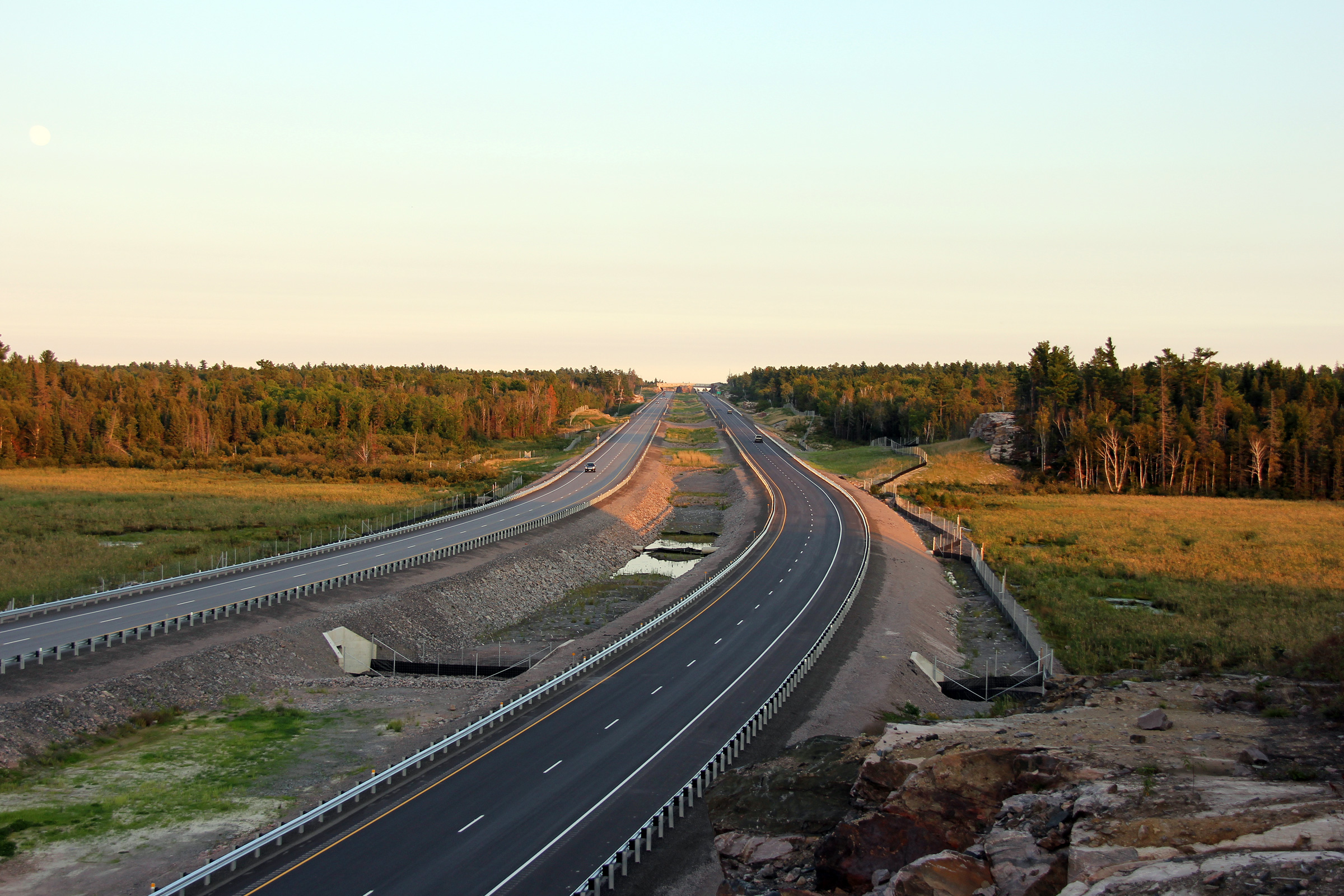
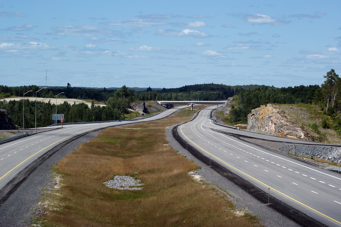
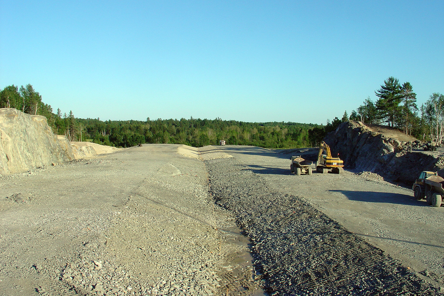
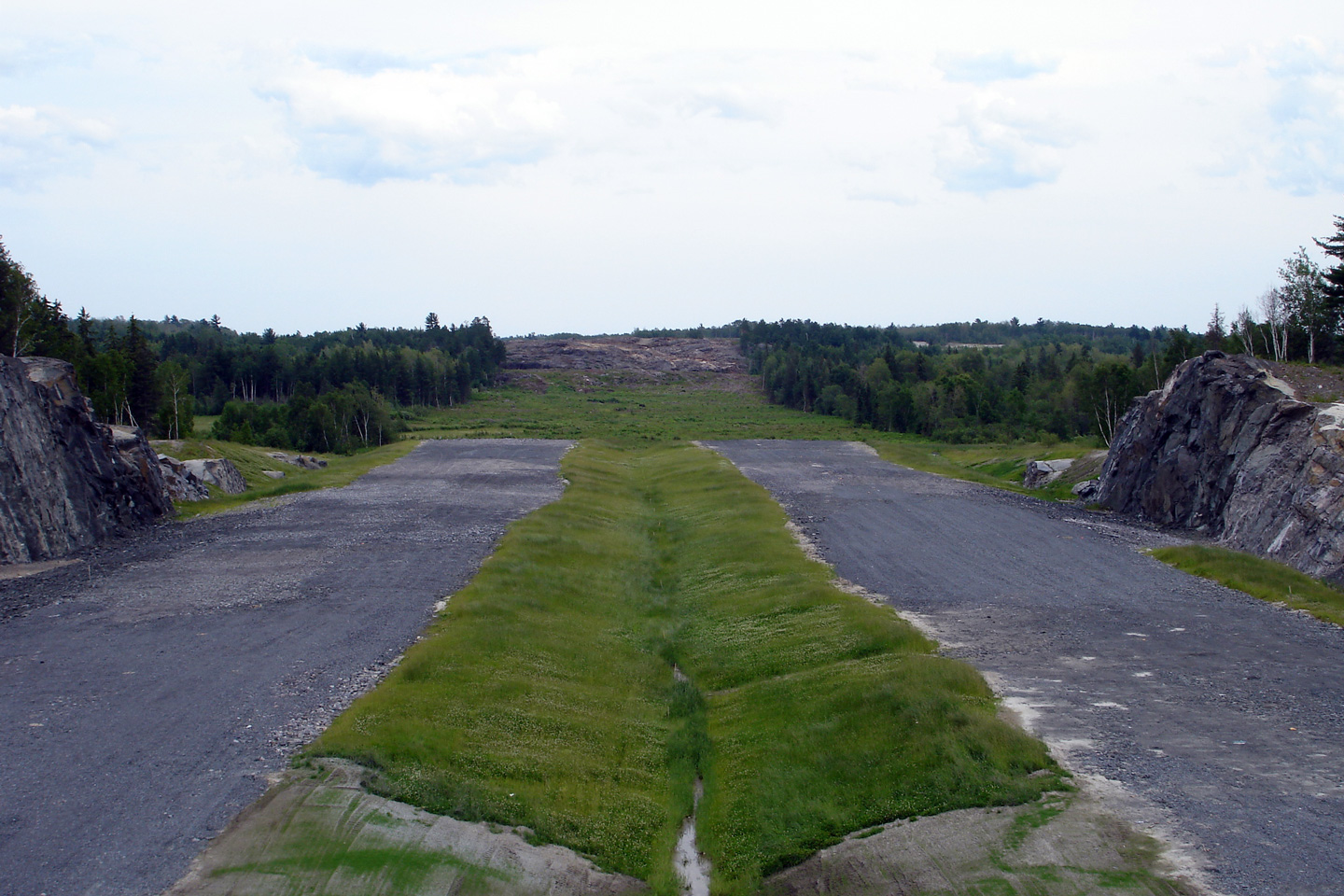
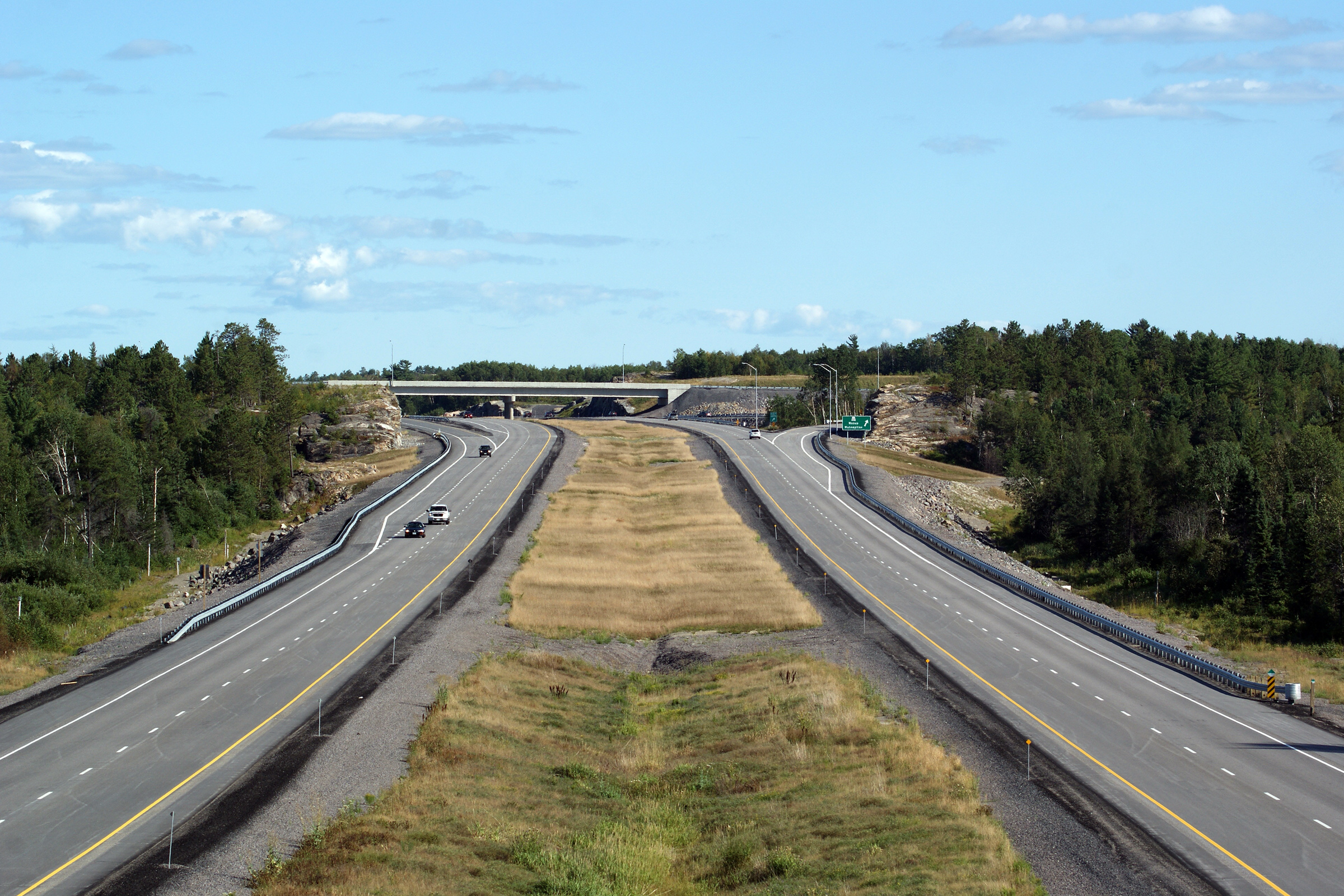
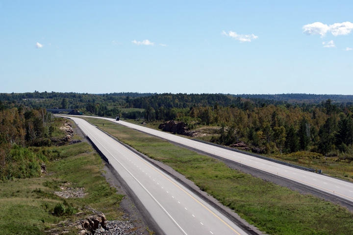
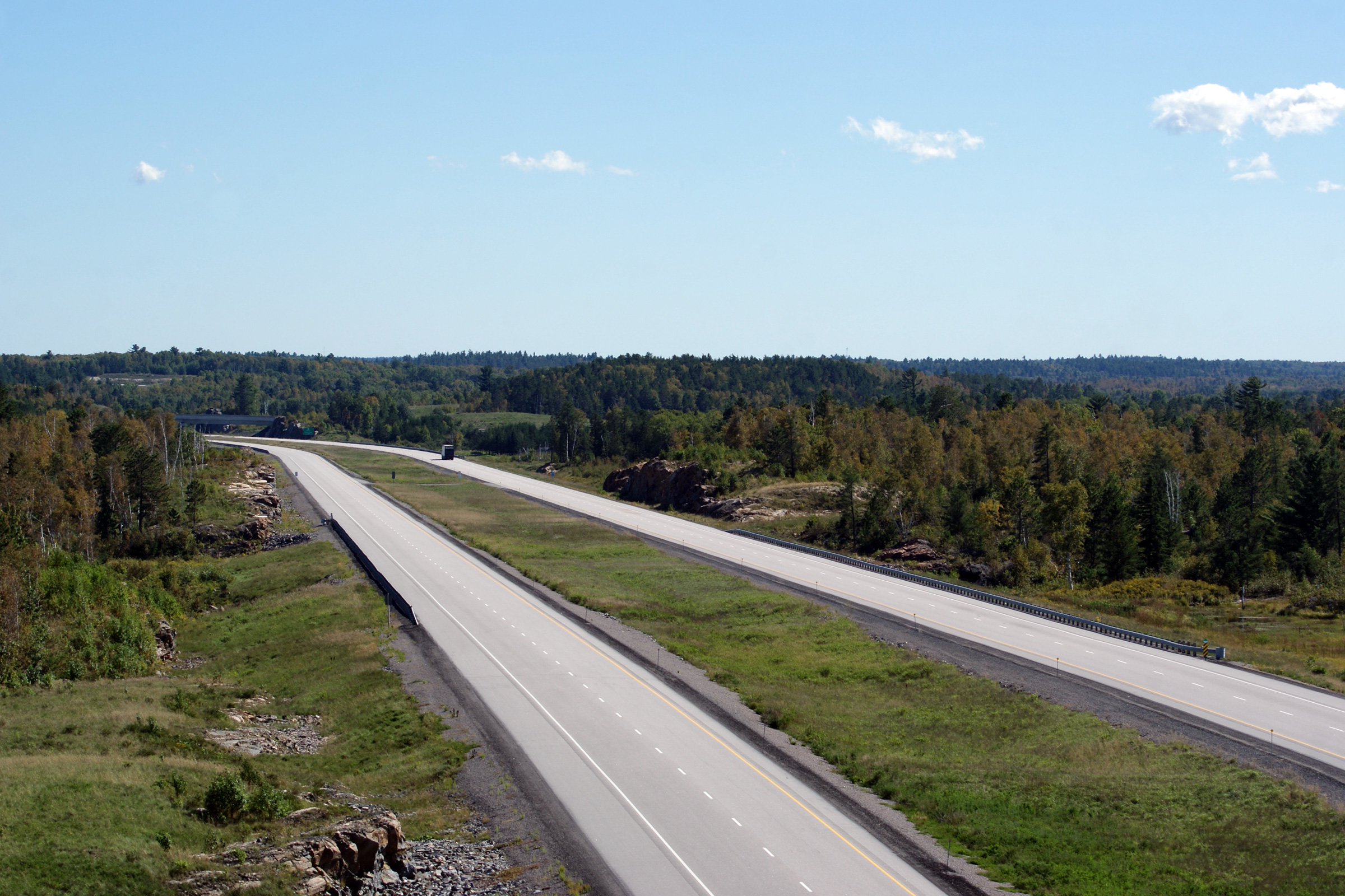
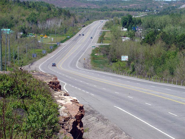
A series of views looking northerly along
Highway 69 from Highway 637. The upper photo shows the former two lane
alignment of Highway 69 that has since been by-passed. The new four lane highway was built
approximately 150m to the east of this alignment; the former alignment of
Highway 69 has become known as Burwash Farm Road. The second photo was
taken in April, 2012 and shows the graded alignment of the four lane
highway. The third photo shows the four lane alignment once two-way
traffic had been shifted to the northbound carriagway of the four-lane
highway. The final photo shows the four-lane highway shortly after
completion. Click here to
continue southerly along Highway 69. Photo #1 taken: July 2nd, 2004.
Photo #2 taken: April 3rd, 2012. Photo #3 taken: July 10th, 2012. Photo
#4 taken: August 29th, 2012. |
(720x480)
(1440x960)
(2400x1600)
|
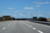
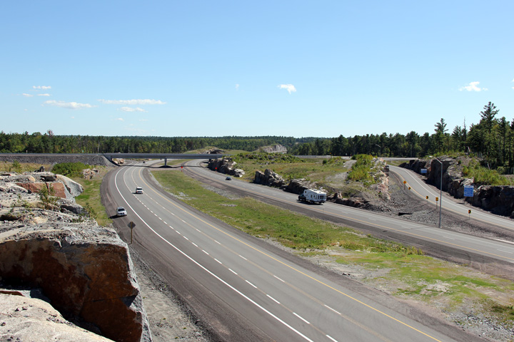
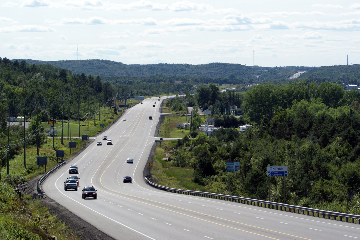
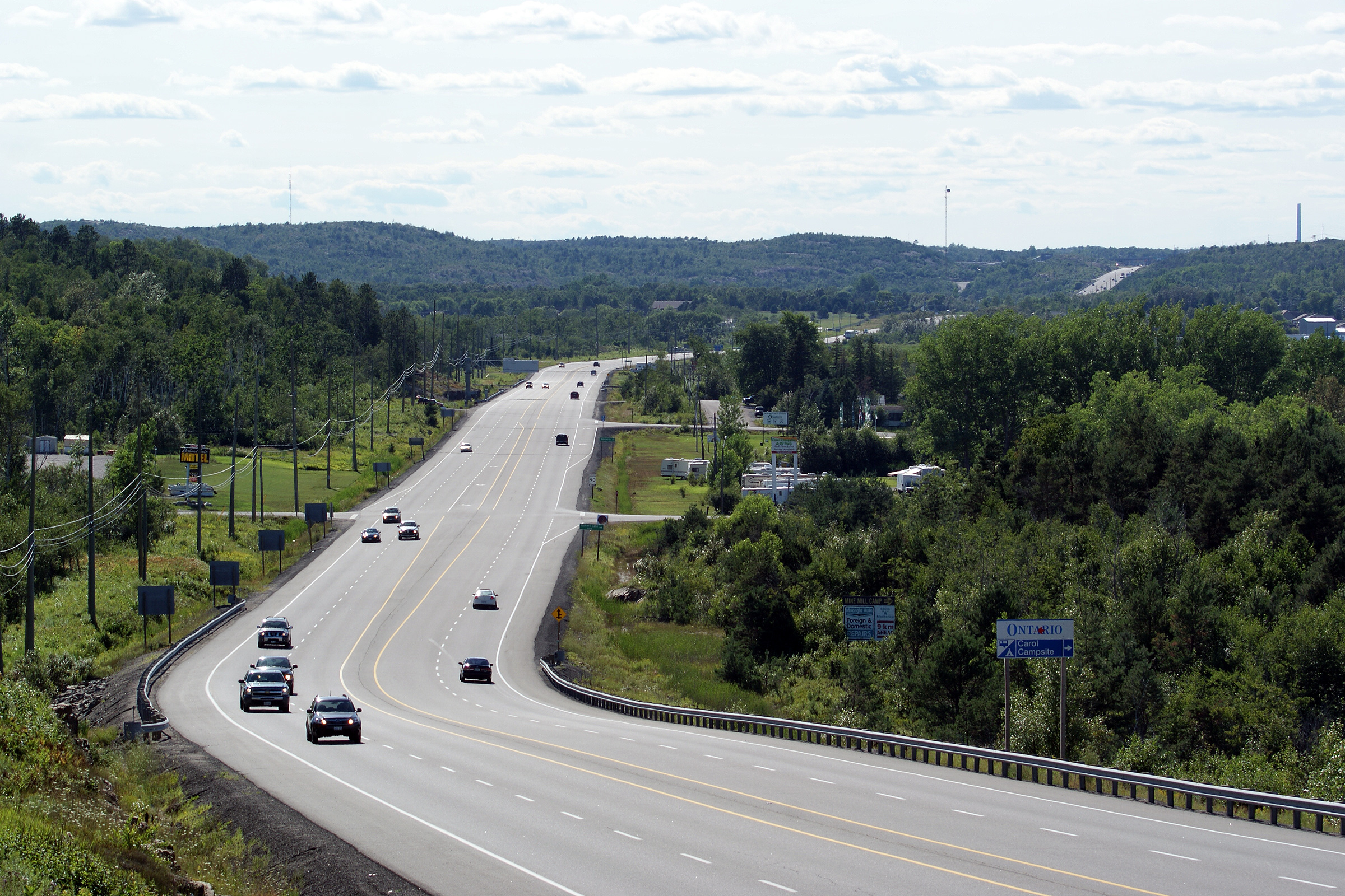
District of Sudbury
(Geographical Township of Servos) |
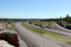
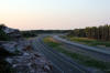
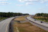
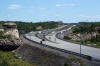
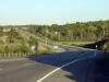
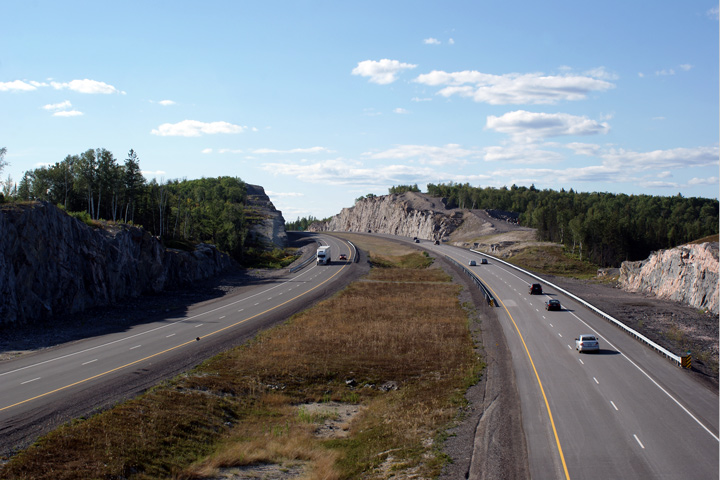
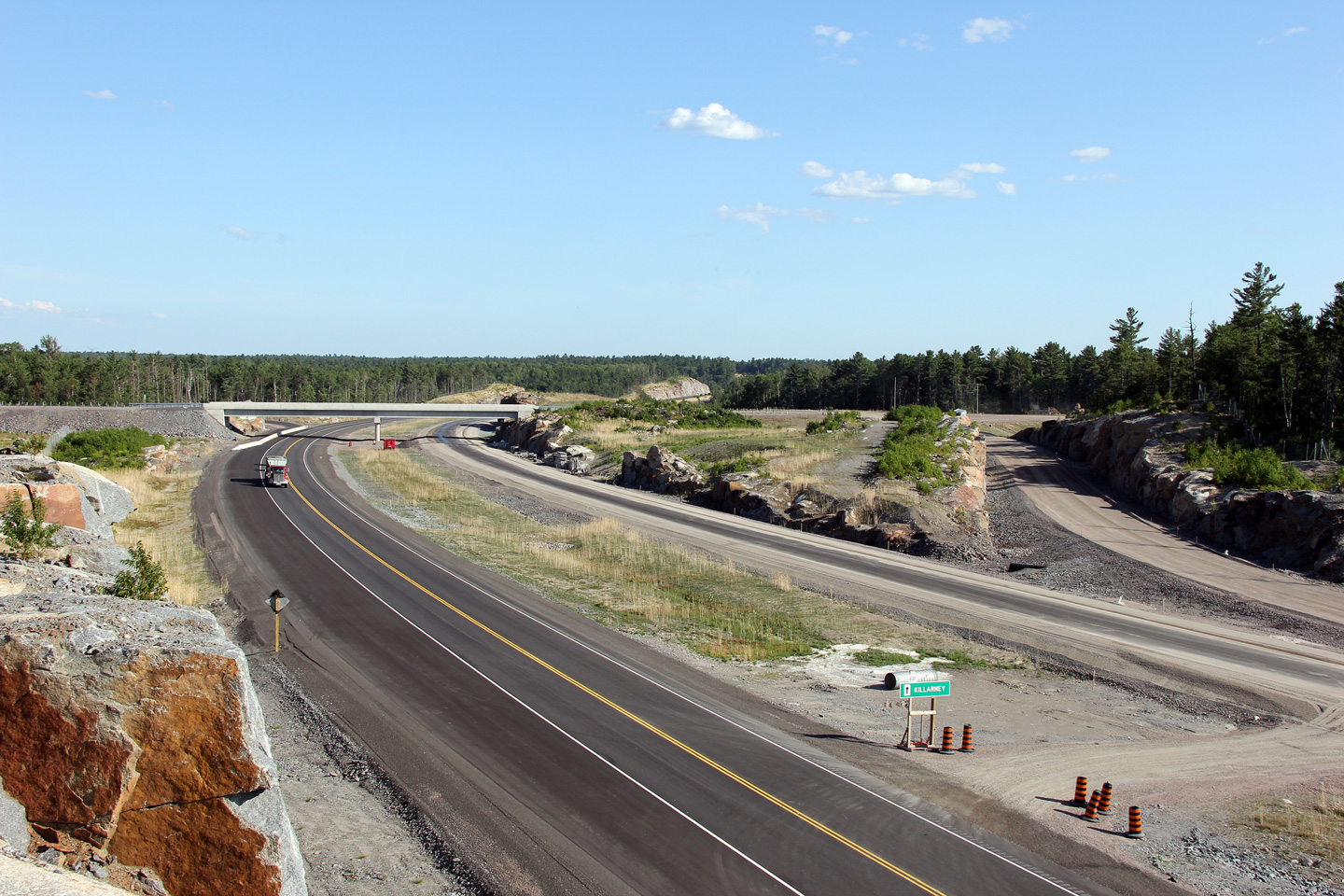
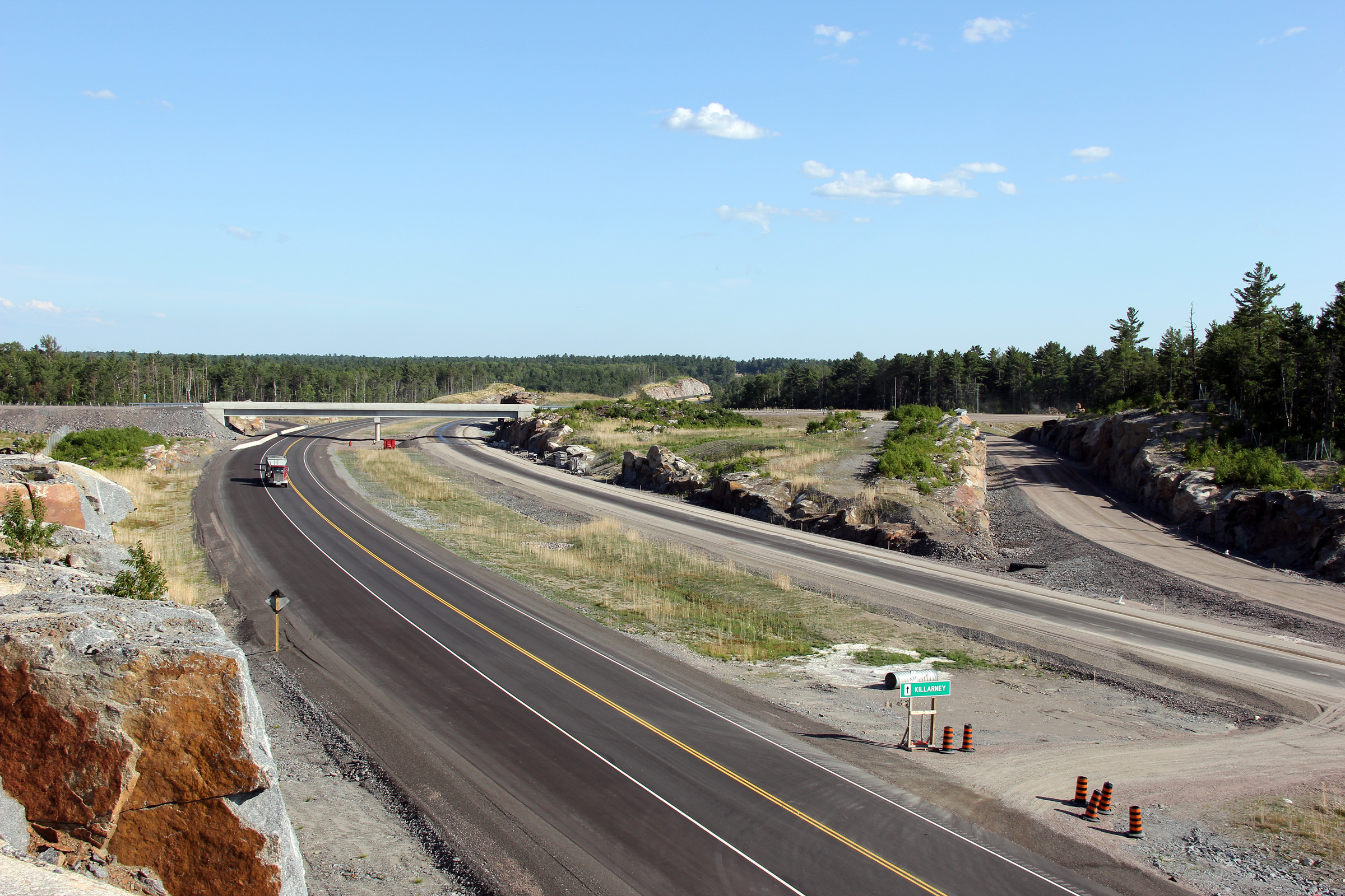
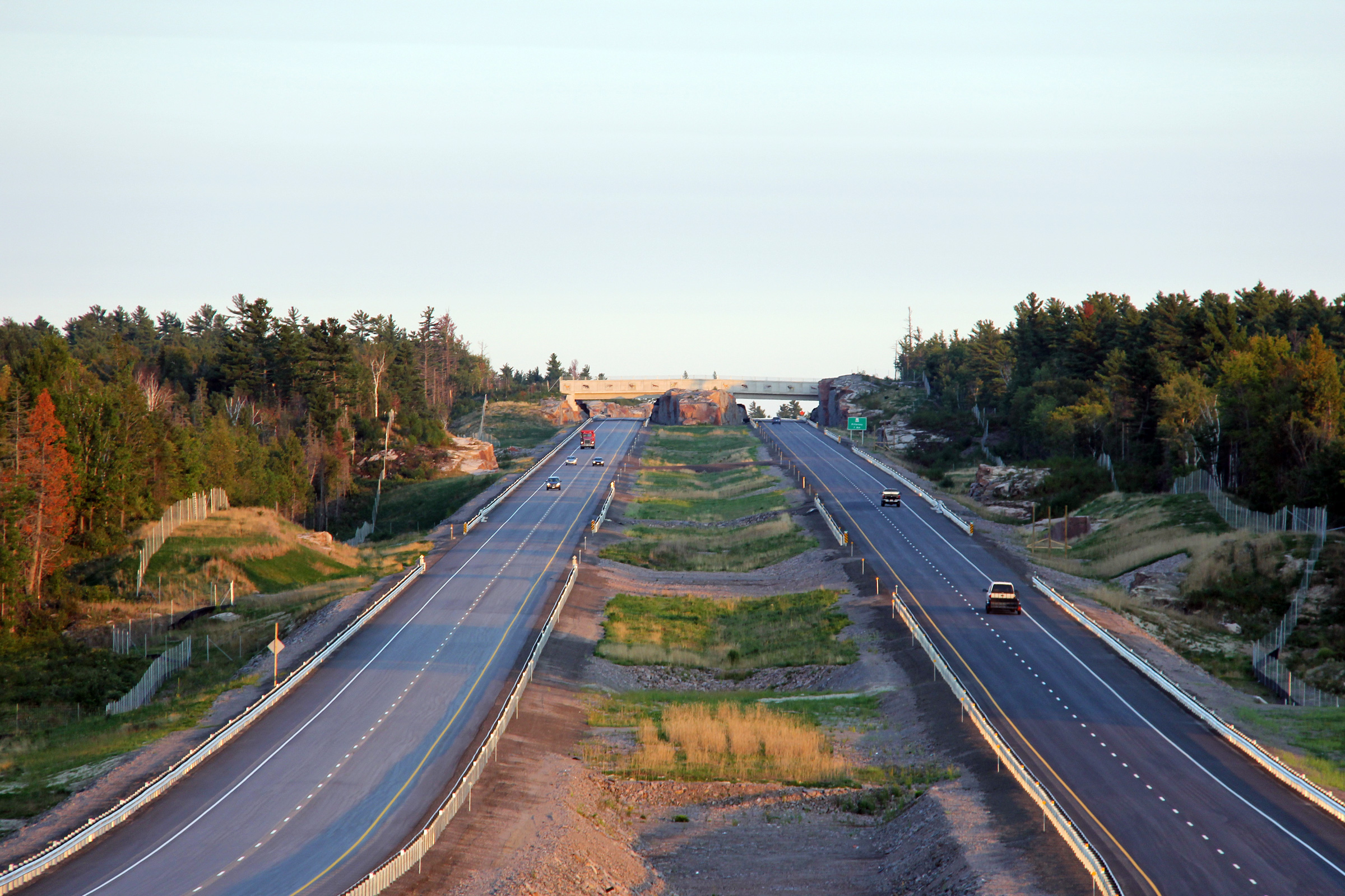
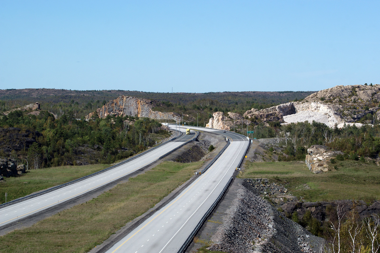
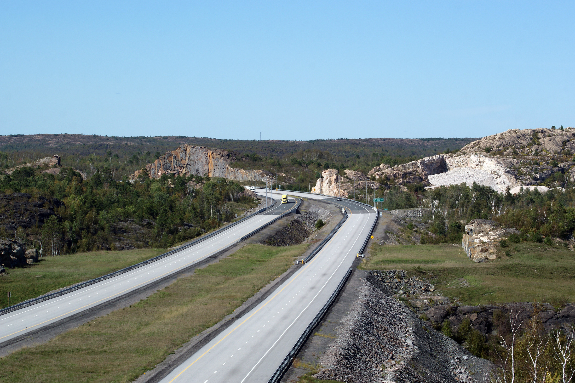
Two views looking southerly towards the Highway 637 interchange.
During the summer of 2012, after Highway 69 traffic had been moved from the
former alignment through Burwash to the northbound carriageway of the
freeway, all traffic bound to and from Killarney was forced to use the old
alignment of Highway 69 around the 'S' curves to meet Highway 69 at the
southern limits of this contract. The Highway 637 interchange was
opened with the completion of the four lane highway.
Upper photo taken: July 10th, 2012.
Lower photo taken: September 10th, 2012. |
(720x480)
(1440x960)
(2400x1600) |
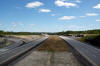
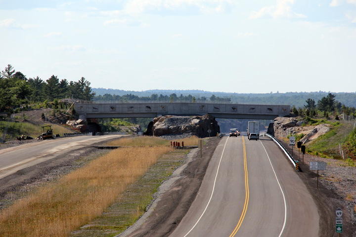
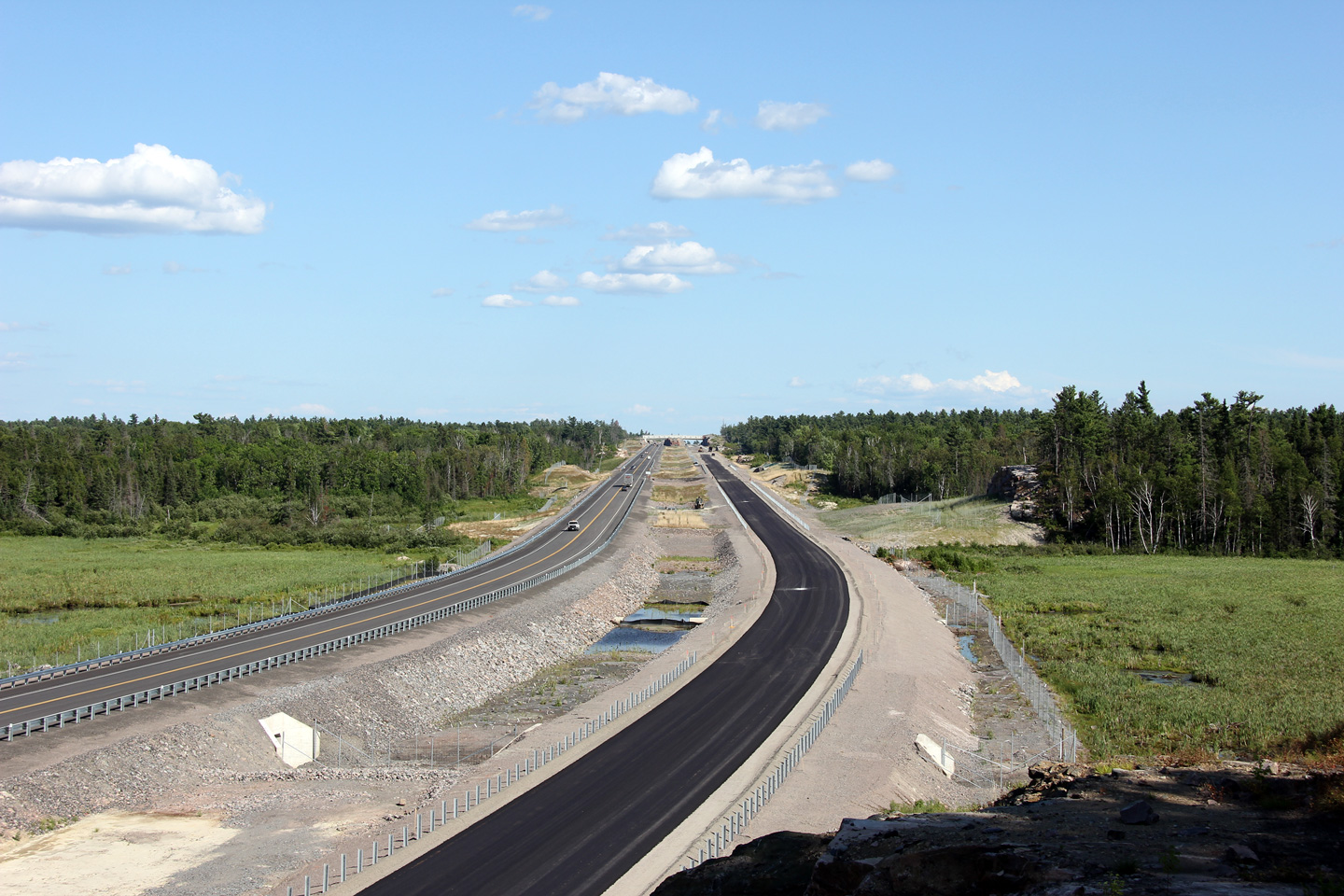
District of Sudbury
(Geographical Township of Servos) |
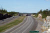
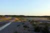
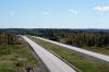
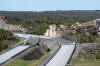
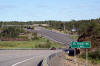
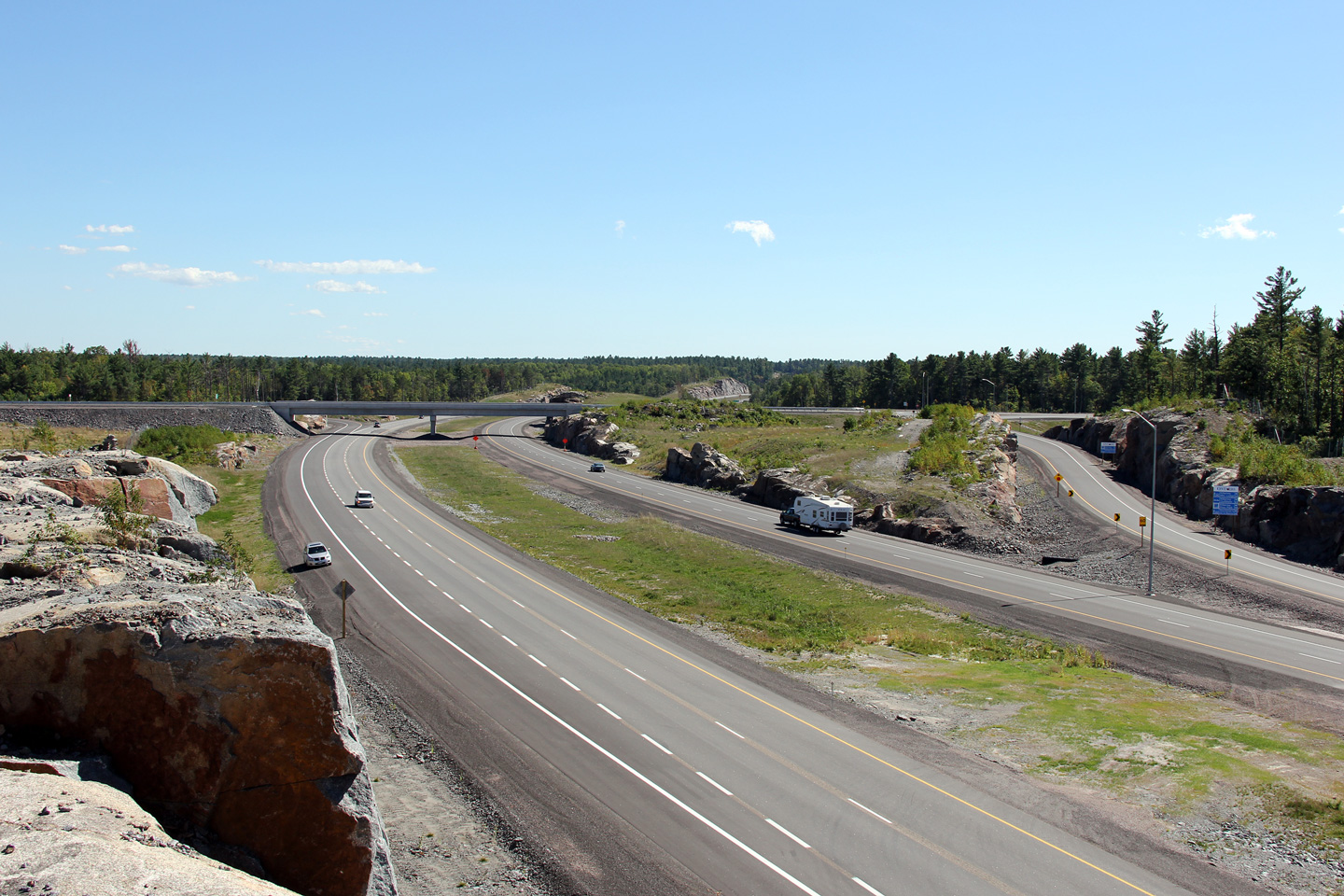
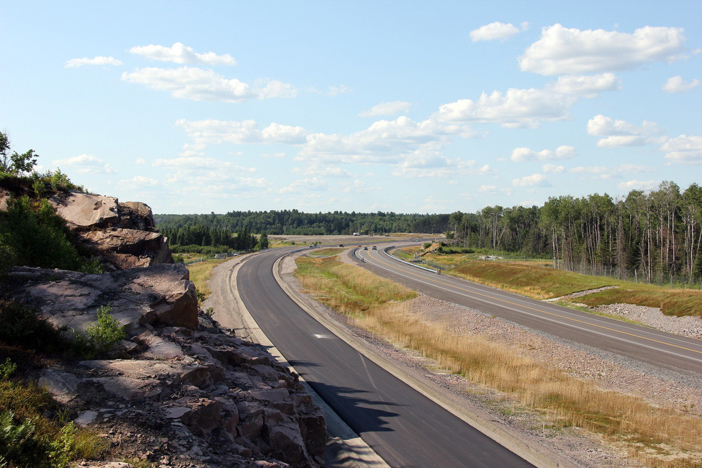
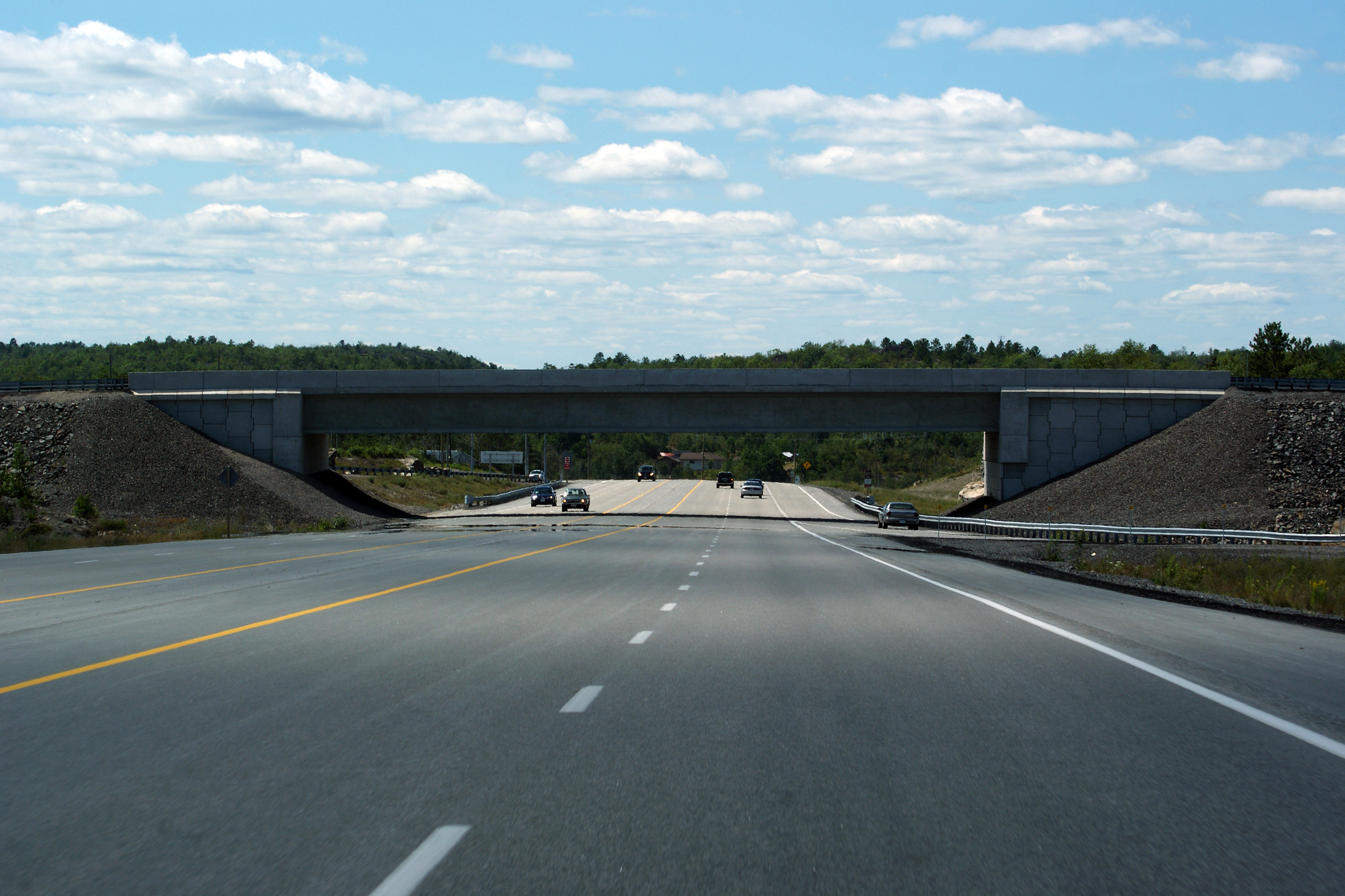
Two views looking northerly from north of the Highway 637 interchange. A
wildlife overpass was constructed over the new freeway to the north of the
Highway 637 interchange. This is the first time that a wildlife interchange
has been constructed over a freeway in Ontario.
Upper photo taken: July 10th, 2012.
Lower photo taken: September 10th, 2012. |
(720x480)
(1440x960)
(2400x1600) |
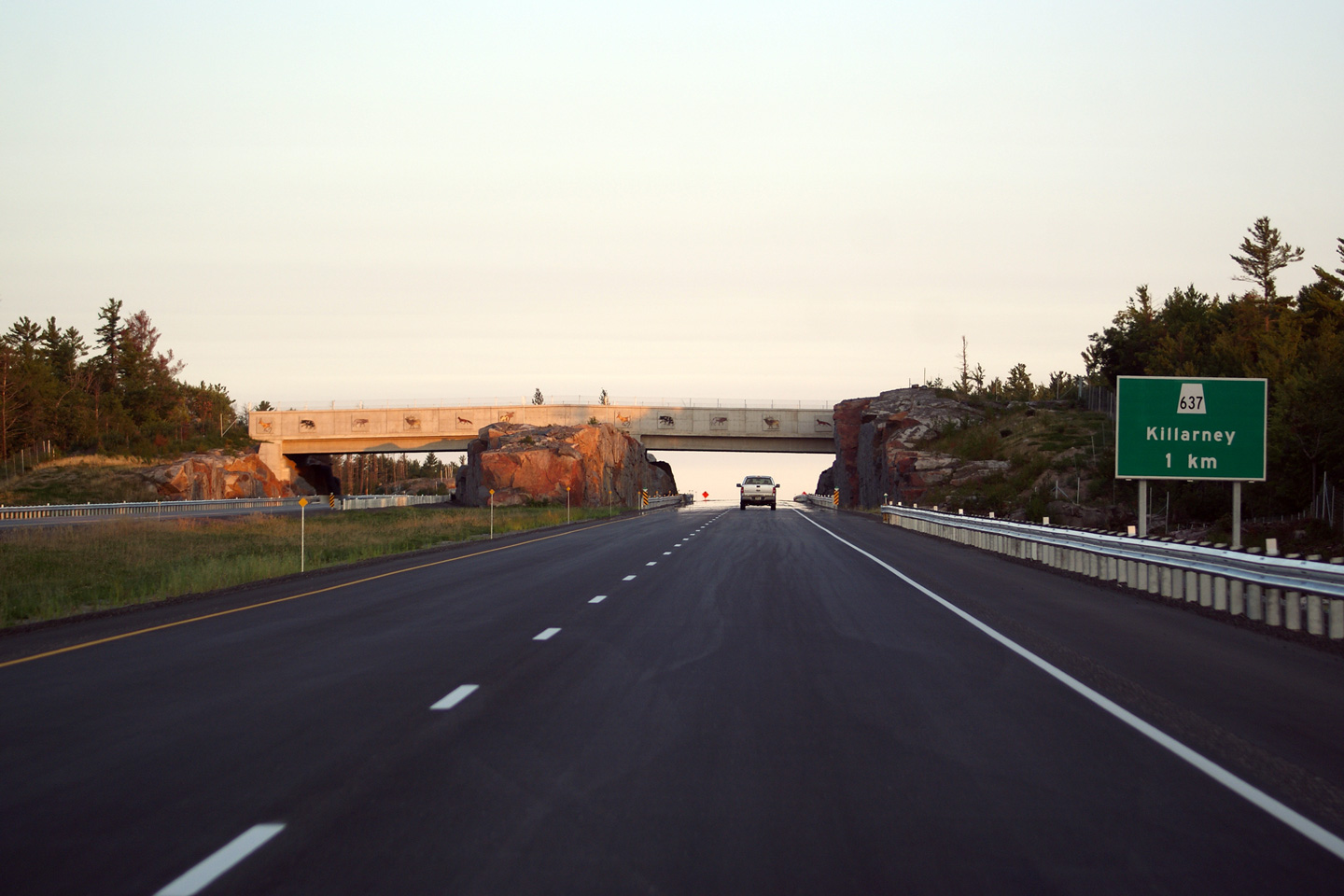
District of Sudbury
(Geographical Township of Servos) |
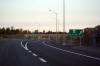
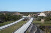
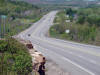
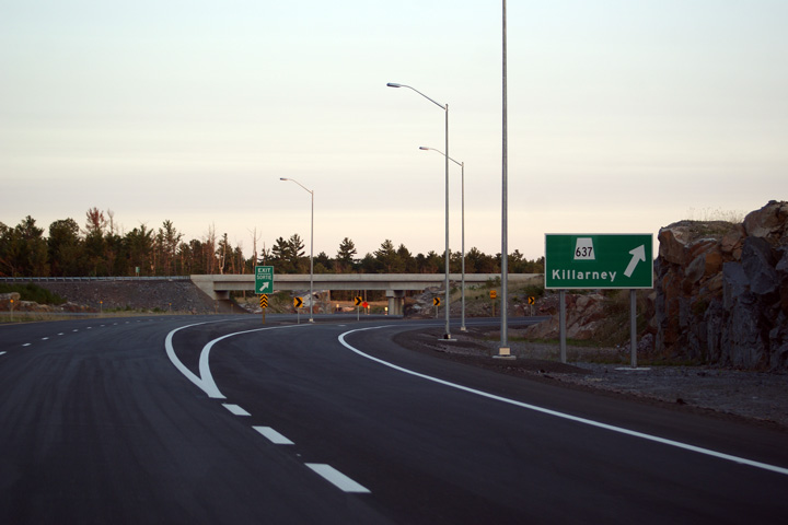
Southbound signage at the exit to Highway 637. Upon close inspection of the
sign, an overlay of the 637 shield is visible.
Photo taken: August 29th, 2012. |
 (720x480) (720x480)
(1440x960)
(2400x1600) |
District of Sudbury
(Geographical Township of Servos) |
Southerly view of the signage for the Highway 637 interchange. The signage
stands in advance of the wildlife overpass.
Photo taken: August 29th, 2012. |
 (720x480) (720x480)
(1440x960)
(2400x1600) |
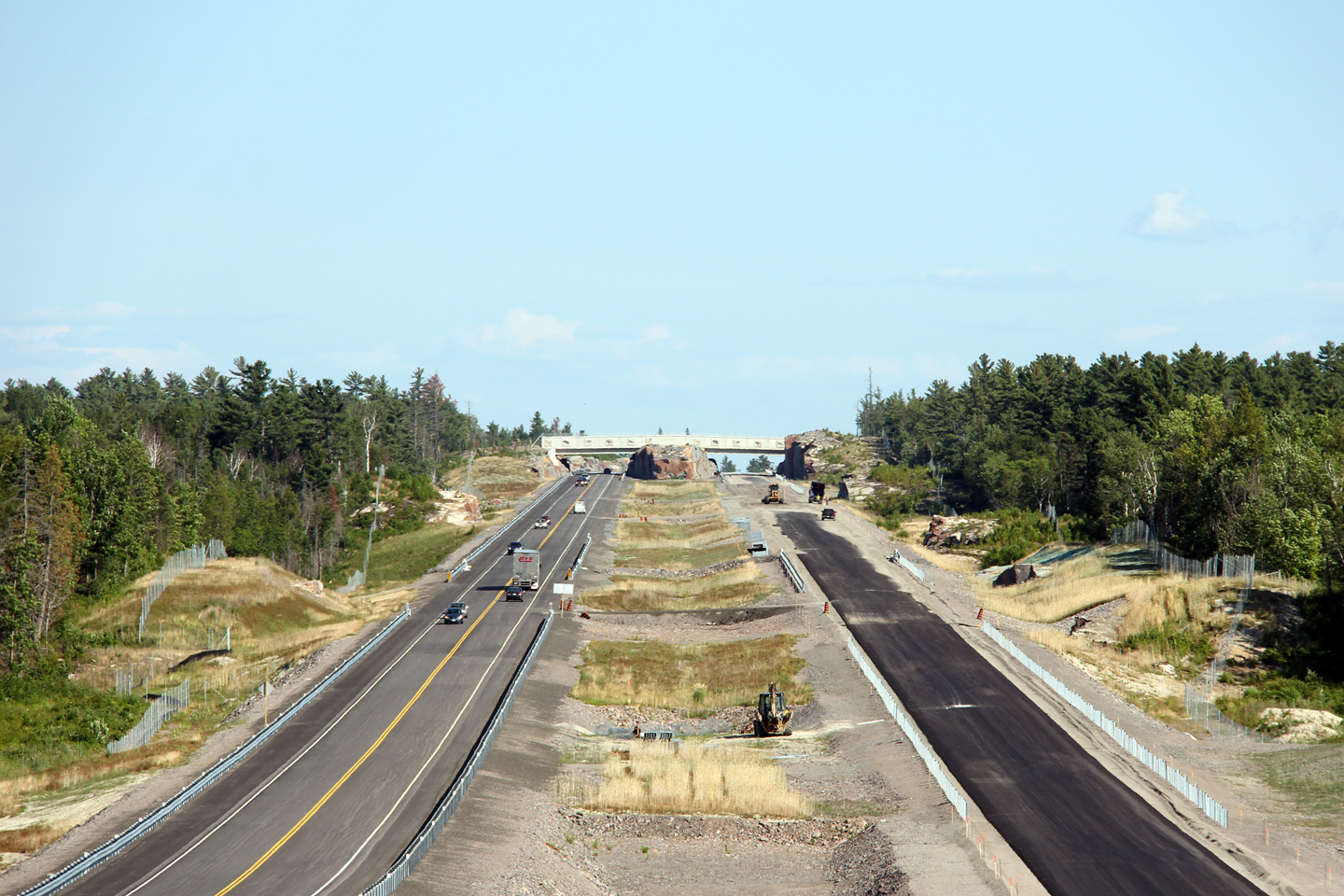
District of Sudbury
(Geographical Township of Servos) |
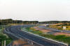
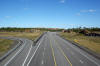
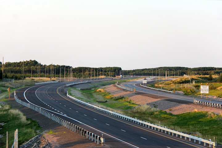
A series of views looking southerly towards the wildlife overpass and the
Highway 637 interchange.
Upper photos taken: July 10th, 2012.
Lower photo taken: August 29th, 2012. |

(720x480)
(1440x960)
(2400x1600)
(720x480)
(1440x960)
(2400x1600) |
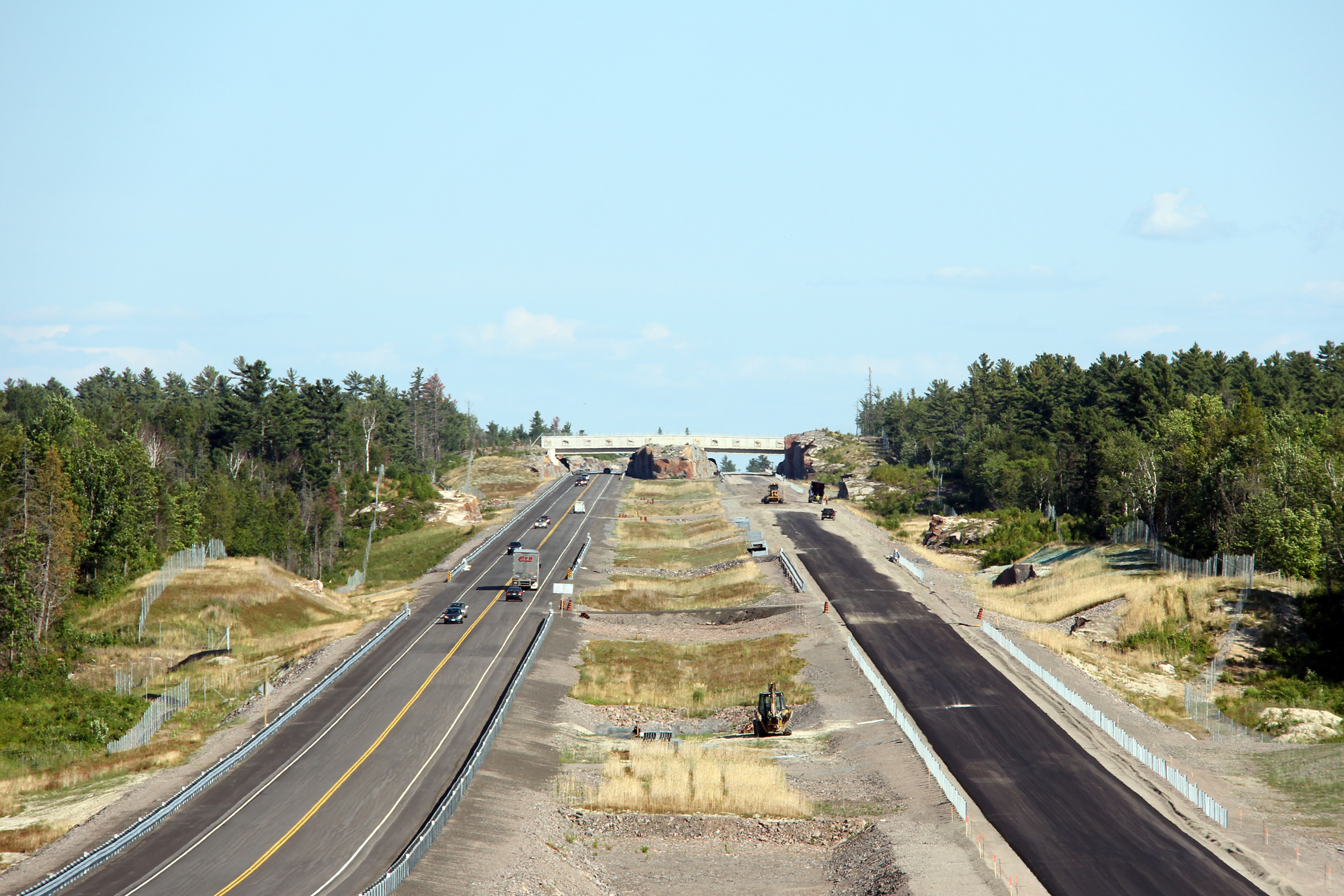
District of Sudbury
(Geographical Township of Servos) |
Opposing view from the previous vantage point towards the Burwash Truck
Inspection stations.
Upper photo taken: July 10th, 2012.
Lower photo taken: August 29th, 2012.
|
(720x480)
(1440x960)
(2400x1600) |
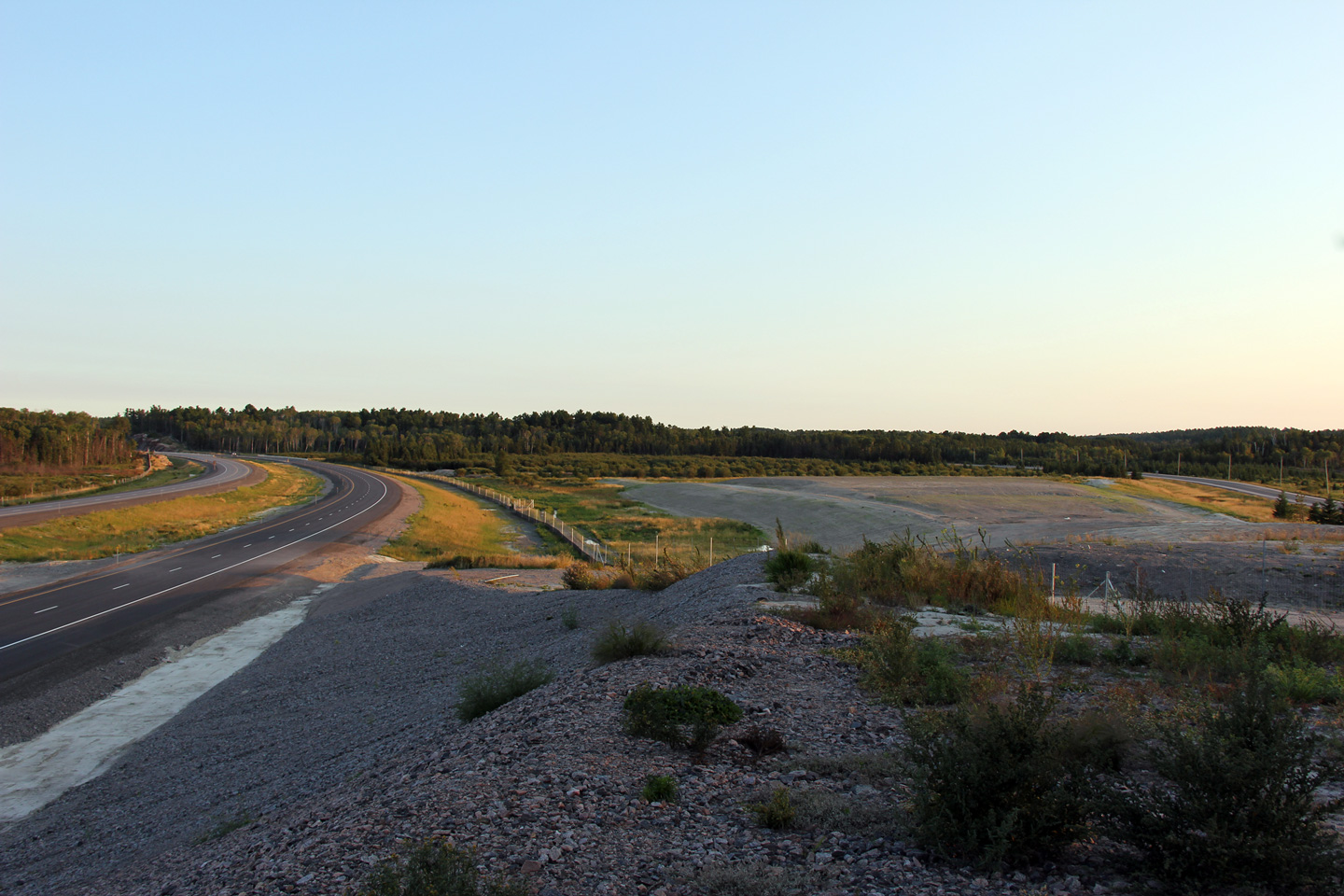
District of Sudbury
(Geographical Township of Servos) |
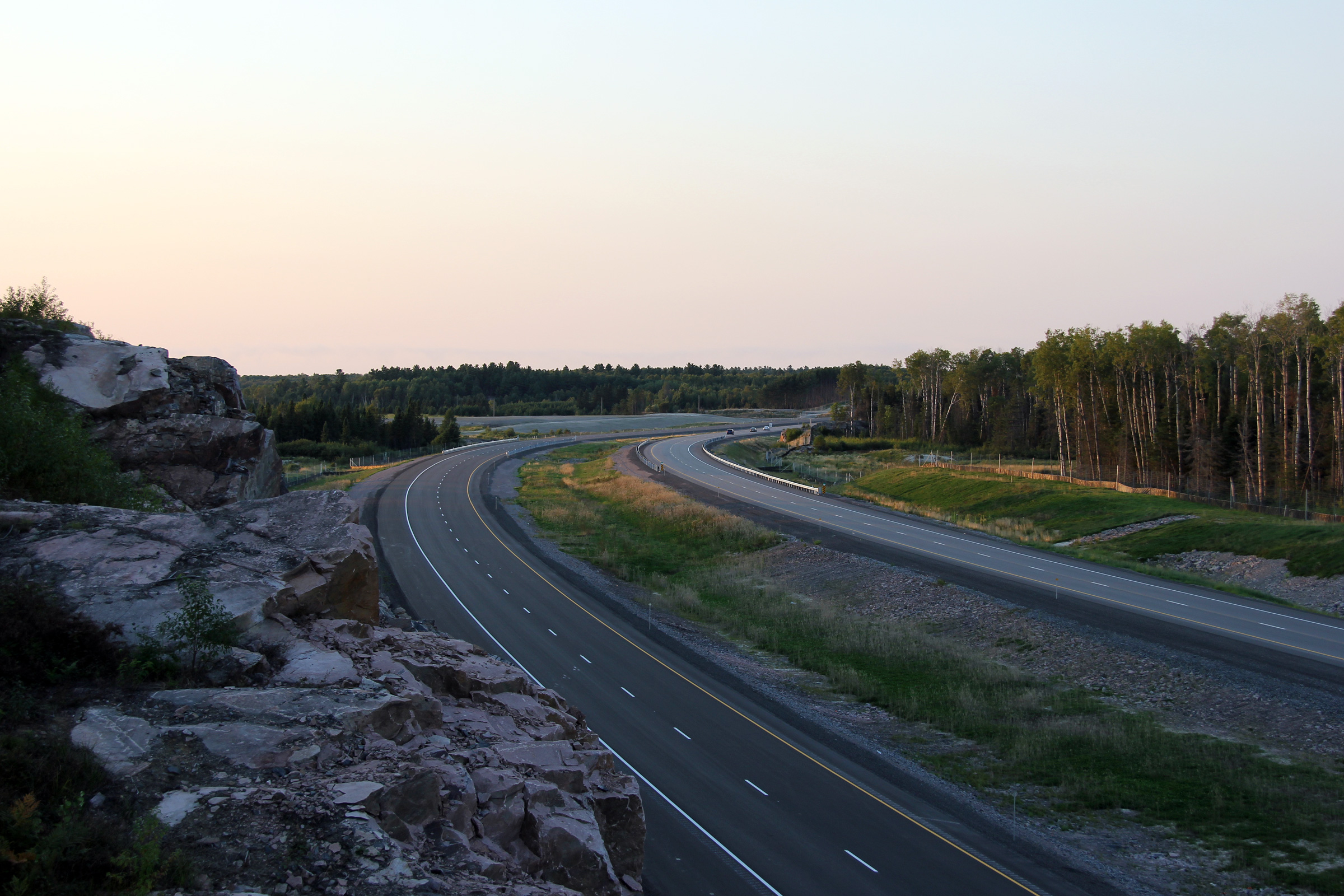
This view looks southerly from just south of the Burwash Truck Inspection
stations. The old alignment of Highway 69, now Burwash Farm Road, can
be seen at the far right of the photo.
Photo taken: August 29th, 2012. |
(720x480)
(1440x960)
(2400x1600) |
District of Sudbury
(Geographical Township of Servos) |
Northerly view along Highway 69 approaching the Burwash Truck Inspection
station.
Photo taken: August 29th, 2012. |
(720x480)
(1440x960)
(2400x1600) |
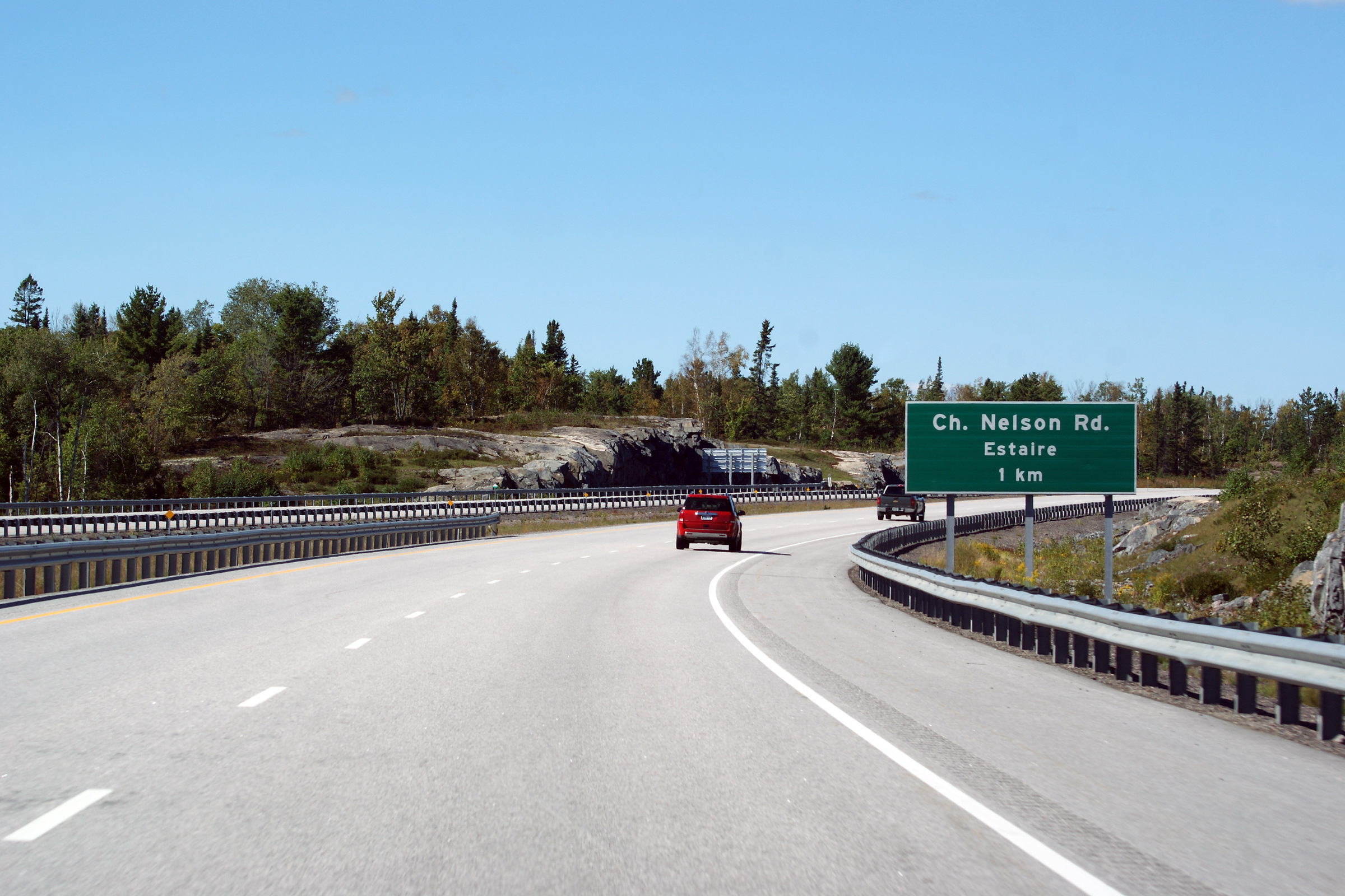
District of Sudbury
(Geographical Township of Burwash) |
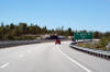
Northbound signage approaching the Nelson Road interchange.
Photo taken: September 10th, 2012. |
 (720x480) (720x480)
(1440x960)
(2400x1600) |
District of Sudbury
(Geographical Township of Burwash) |
Guide signage for the northbound off-ramp to Nelson Road.
Photo taken: September 10th, 2012. |
 (720x480) (720x480)
(1440x960)
(2400x1600) |
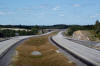
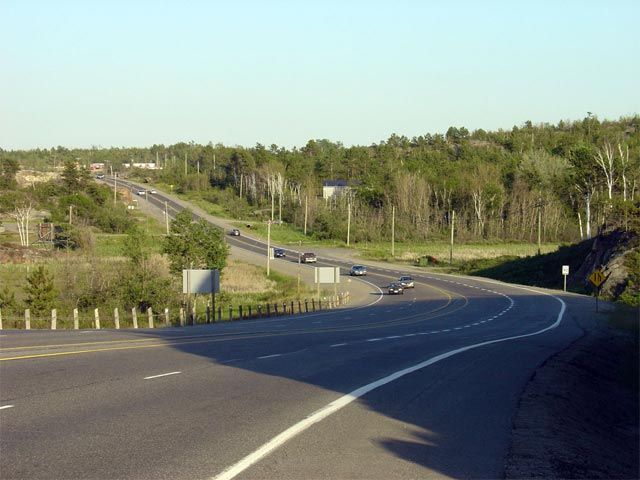
District of Sudbury
(Geographical Township of Burwash) |
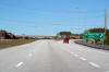
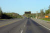
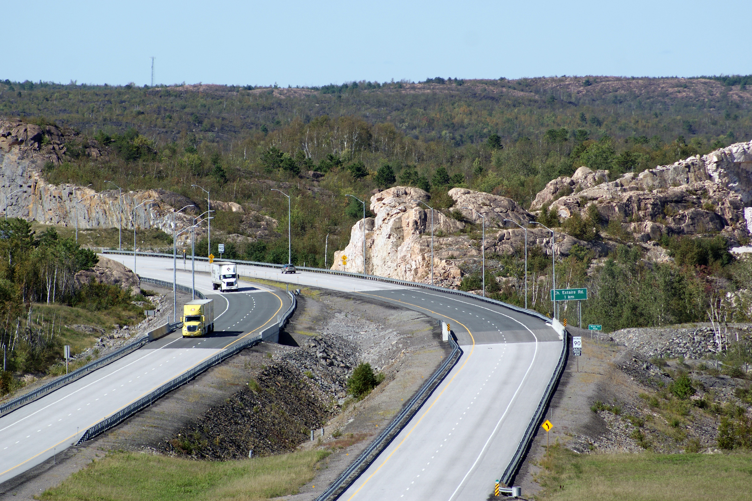
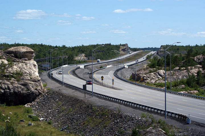
Southbound view of the new divided highway from Estaire's Nelson Road.
South of the Nelson Road interchange the new divided highway converges on
the old Highway 69 alignment. The
old Highway 69 alignment (now Estaire Road) is, however, not directly accessible from the
new freeway -- traffic
bound to Estaire Road must use the Nelson Road interchange.
Photo taken: July 30th, 2010. |
(720x480)
(1440x960)
(2400x1600) |
District of Sudbury
(Geographical Township of Burwash) |
This view looks northerly along Highway 69 from Nelson Road.
Photo taken: July 30th, 2010. |

(720x480)
(1440x960)
(2400x1600) |
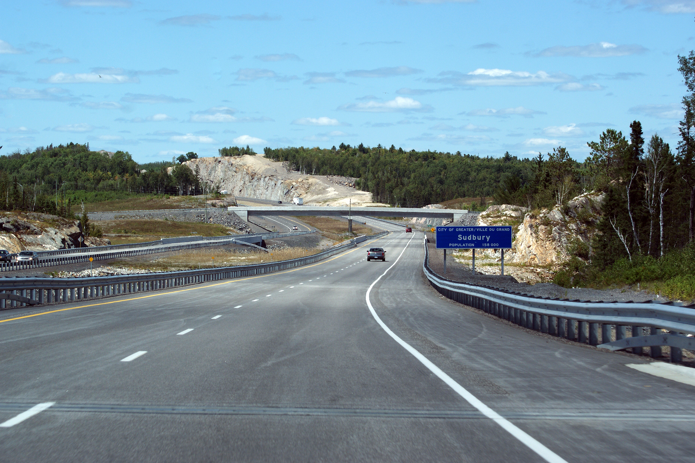
District of Sudbury
(Geographical Township of Burwash) |
This view is taken from the drivers seat as Highway 69 enters the City of
Greater Sudbury. Greater Sudbury was formed in 2001 when the province
amalgamated the Region of Sudbury and all component municipal governments
into a single tier entity.
Photo taken: July 30th, 2010. |
 (720x480) (720x480)
(1440x960)
(2400x1600) |
| City of Greater Sudbury |
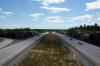
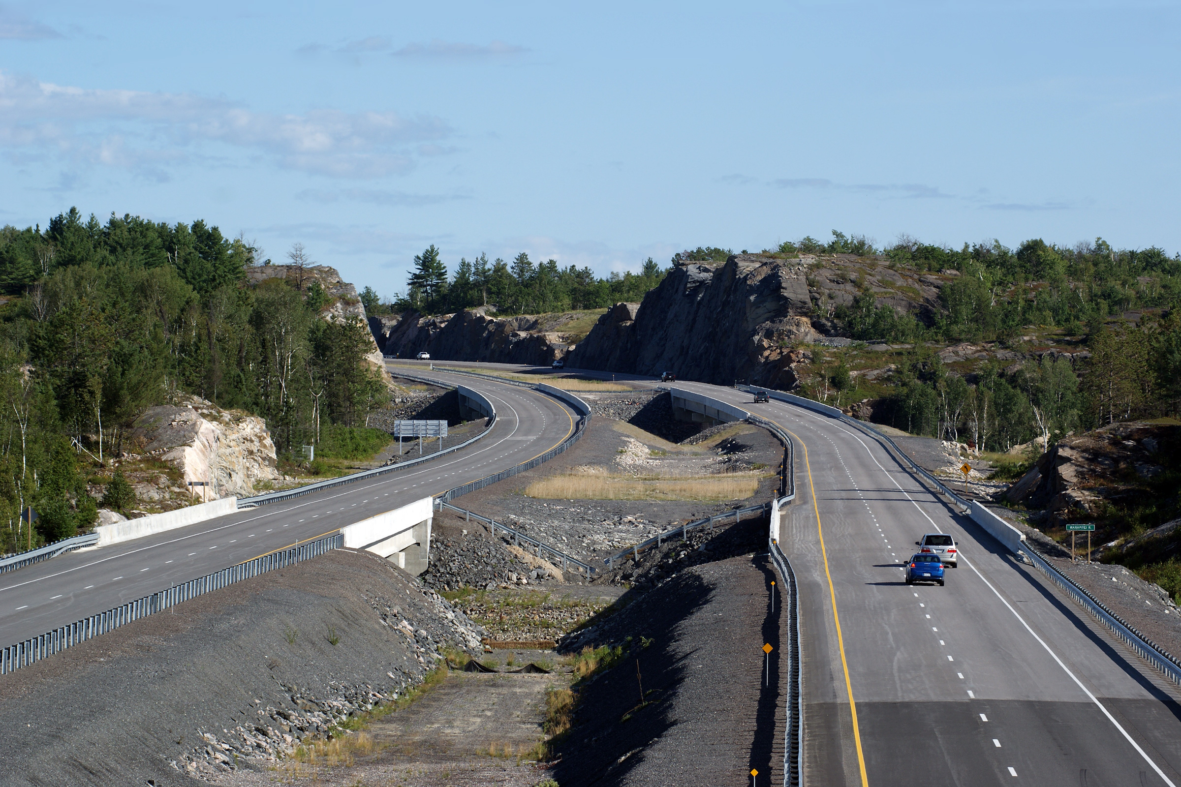
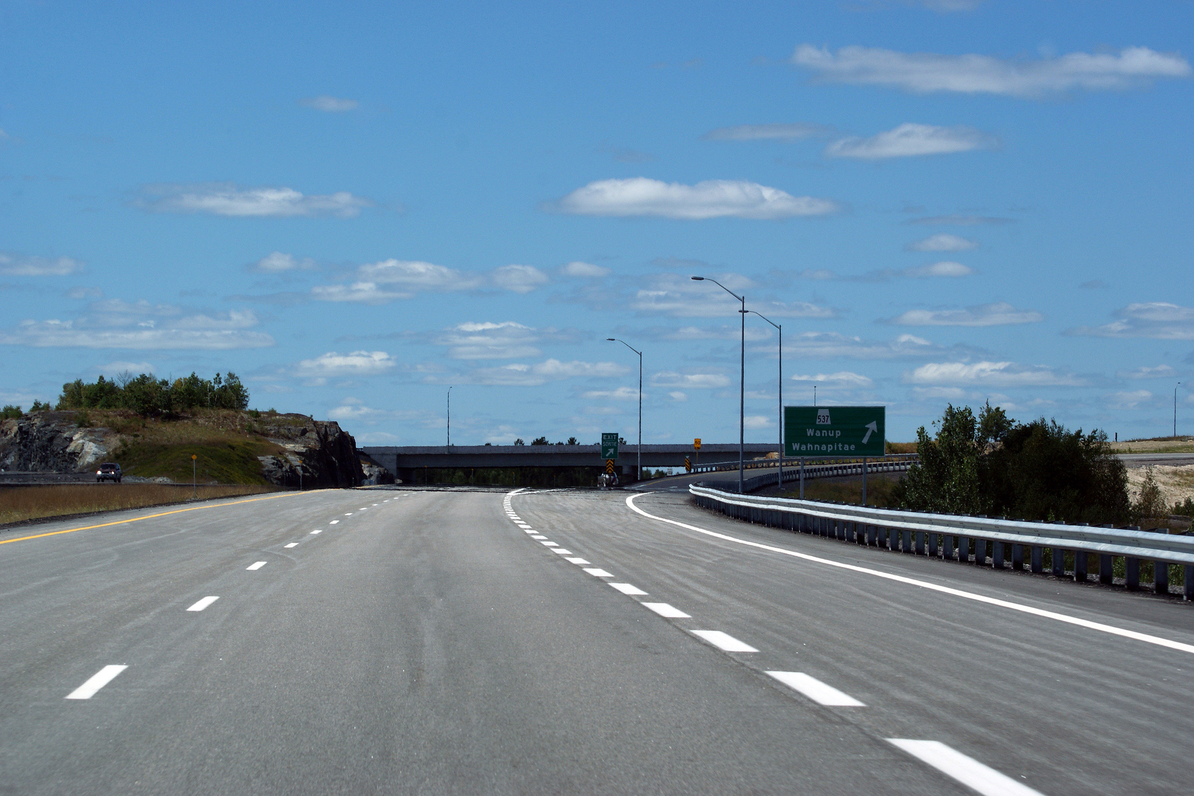
View looking southerly from the Old Highway 537 Road overpass. Highway
69 passes overtop of both the CN Railway, and the Wanapitei River before
squeezing between the large rock cut pictured.
Photo taken: July 30th, 2010. |
(720x480)
(1440x960)
(2400x1600) |
| City of Greater Sudbury |
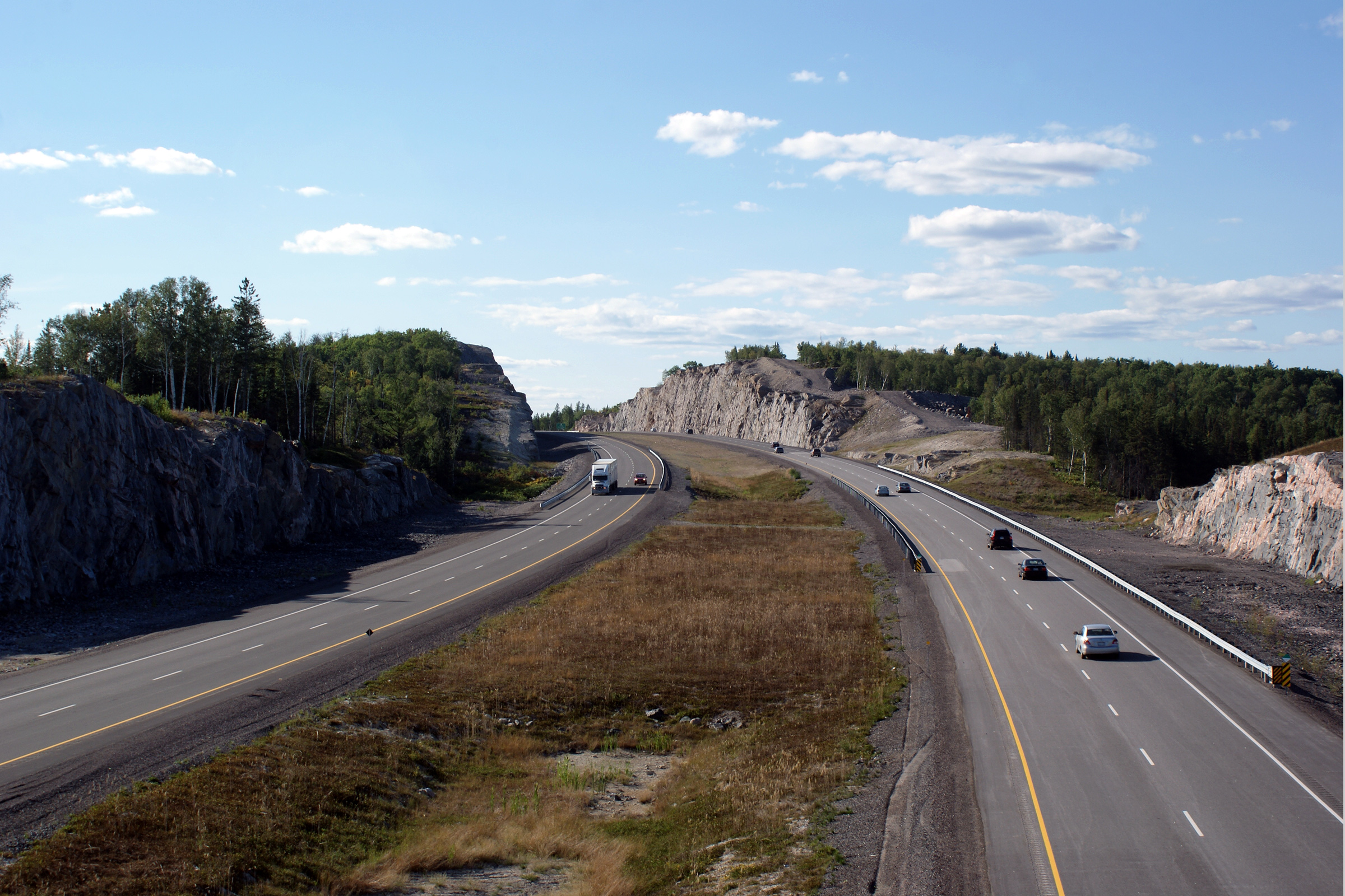
Two views looking northerly from the Old Highway 537 Road overpass towards a
rather substantial rock cut. The former winding
alignment of Highway 537 was by-passed by a new highway that directly links the
new Highway 69 freeway to the small community of Wanup without deviation.
The new Highway 537 alignment meets the new Highway 69 freeway very strategically, almost midway
between Old Highway 537 and the Old Wanup Road.
Photos taken: July 30th, 2010. |

(720x480)
(1440x960)
(2400x1600)

(720x480)
(1440x960)
(2400x1600) |
| City of Greater Sudbury |
This view looks southerly towards the Old Highway 537 Road overpass.
Notice Estaire Road, which is visible to the right of the four lane freeway
curving around the rock cut. Estaire Road is the pre-2009 alignment of
Highway 69, and is still maintained by the provincial government as an
unnumbered, unposted 7000-series highway.
Photo taken: July 30th, 2010. |

(720x480)
(1440x960)
(2400x1600) |
| City of Greater Sudbury |
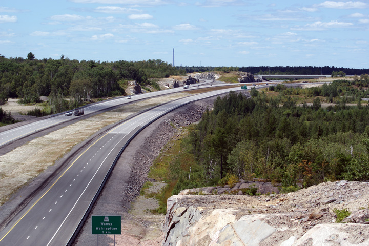
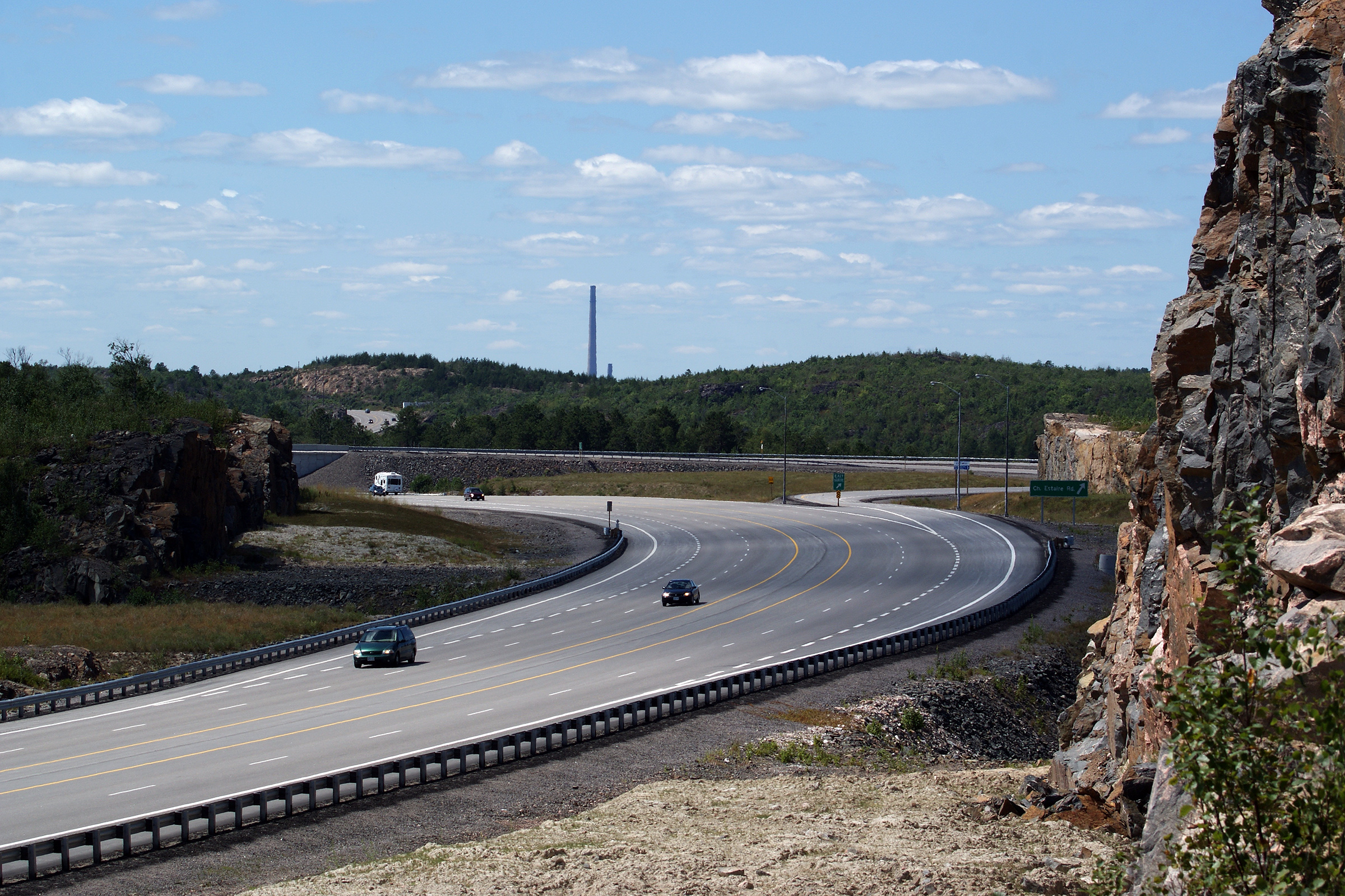
This is the opposing view from the same rock-cut, this time looking
northerly towards the Highway 537 interchange. Notice Inco's
Superstack, the only structure yet visible in Sudbury's approaching skyline. Inco's Superstack is
by far the most
predominant feature of the Sudbury skyline.
Photo taken: July 30th, 2010. |
(720x480)
(1440x960)
(2400x1600) |
| City of Greater Sudbury |
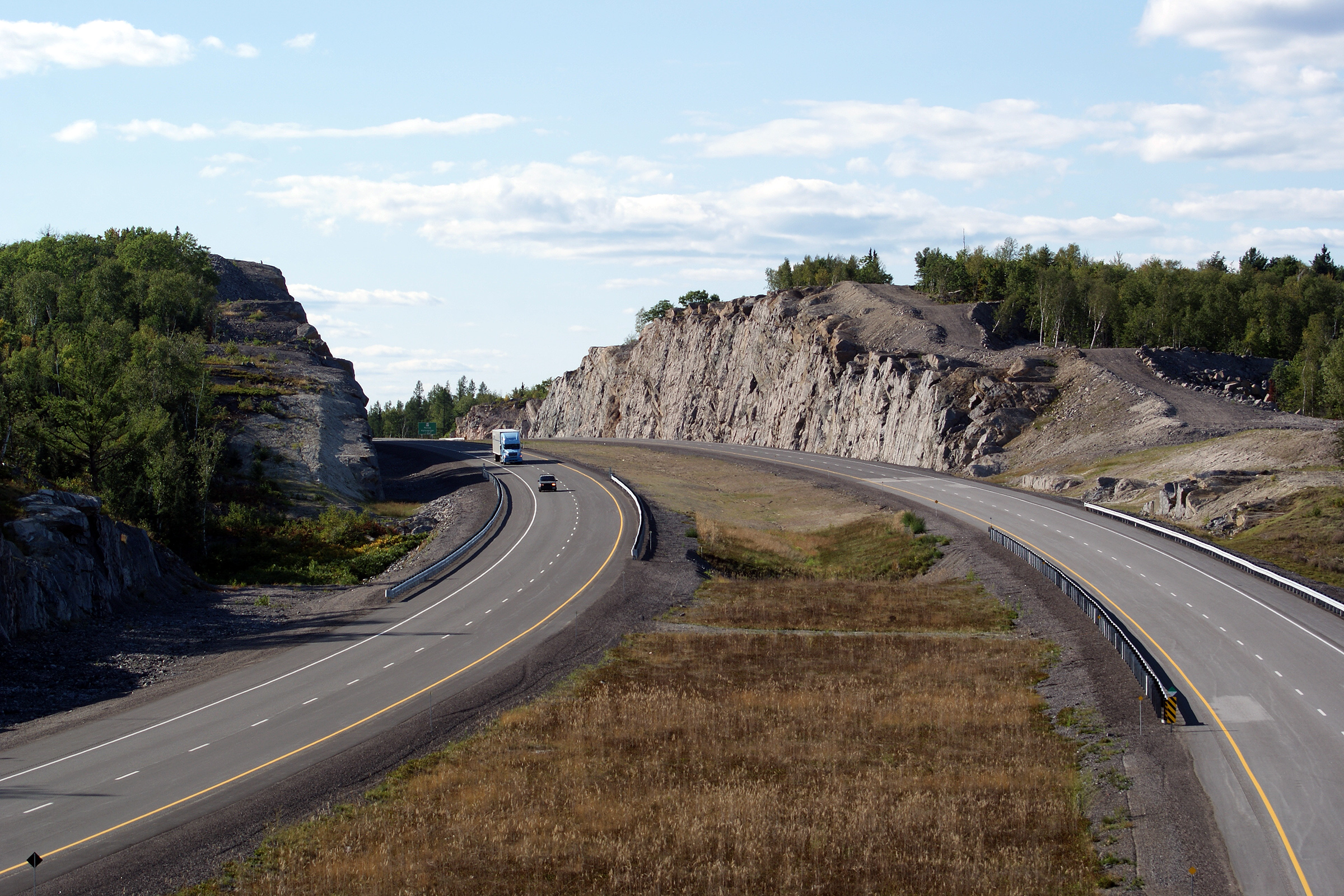
This view looks northerly approaching the Highway 537 interchange.
Photo taken: July 30th, 2010. |
 (720x480) (720x480)
(1440x960)
(2400x1600) |
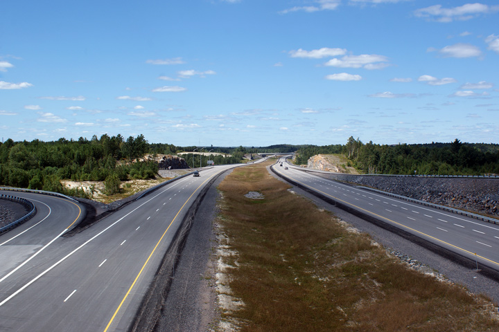
| City of Greater Sudbury |
This view looks southerly from the Highway 537 overpass along Highway 69.
I had a near perfect day when I shot these photos of Highway 69. This
new section of Highway 69 freeway opened to traffic late in 2009, just a few
months before I took these photos.
Photo taken: July 30th, 2010. |
(720x480)
(1440x960)
(2400x1600) |
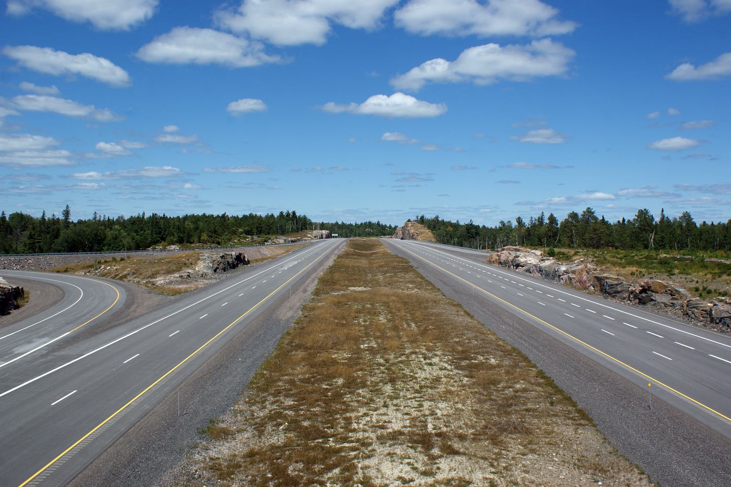
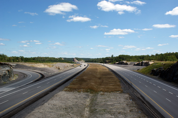
| City of Greater Sudbury |
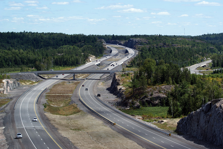
These views look northerly along Highway 69 from the Highway 537 overpass.
Both the Nelson Road and Highway 537 interchanges were constructed as
six-ramp parclo A4 interchanges. This is an extensive interchange
design, typically reserved only for high volume urban or suburban
applications. The Ontario Government spared no expense with the
construction of Highway 69-New.
Photos taken: July 30th, 2010. |

(720x480)
(1440x960)
(2400x1600)
(720x480)
(1440x960)
(2400x1600) |
| City of Greater Sudbury |
Three views that look southerly from the Old Wanup Road overpass towards the
Highway 537 interchange along Highway 69-New. The Overpass at Old
Wanup Road was the first structure completed for the new Highway 69.
The overpass was finished way back in 2005, yet the new dual highway was not
finished and opened to traffic until the Fall of 2009.
Upper photo taken: July 3rd, 2005.
Middle photo taken: July 3rd, 2006.
Lower photo taken: July 30th, 2010. |
(720x480)
(1440x960)
(2400x1600) |
| City of Greater Sudbury |
This view is taken from the Old Wanup Road overpass, but looking in the
opposing direction. (Looking north).
Photo taken: July 30th, 2010. |
(720x480)
(1440x960)
(2400x1600) |
| City of Greater Sudbury |
Southerly view towards the Old Wanup Road overpass.
Photo taken: September 10th, 2012. |
(720x480)
(1440x960)
(2400x1600) |
| City of Greater Sudbury |
Two views looking northerly approaching the end of the divided highway at
the Estaire Road interchange.
Photos taken: September 10th, 2012. |
(720x480)
(1440x960)
(2400x1600)
(720x480)
(1440x960)
(2400x1600) |
| City of Greater Sudbury |
This view looks southerly as Highway 69 transitions from a divided to an
undivided highway.
Photo taken: July 30th, 2010. |
(720x480)
(1440x960)
(2400x1600) |
| City of Greater Sudbury |
Opposing view from the same rock cut, looking northerly along the undivided
section of Highway 69 approaching the Estaire Road interchange. In the
future, this four-lane undivided alignment of Highway 69 will be by-passed
by a new freeway alignment that will link what will then be Highway 400 to
the Sudbury Southeast By-pass.
Photo taken: July 30th, 2010. |
(720x480)
(1440x960)
(2400x1600) |
| City of Greater Sudbury |
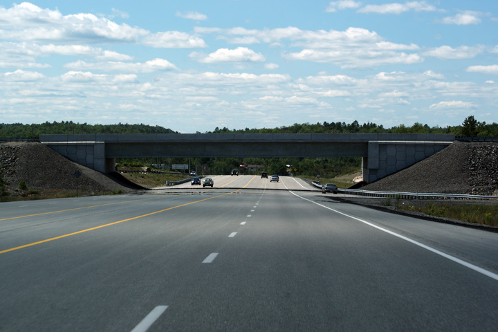
View looking northerly underneath of the Estaire Road overpass. This
is such an interesting and unique cross-section.
Photo taken: July 30th, 2010. |

(720x480)
(1440x960)
(2400x1600) |
| City of Greater Sudbury |
This view looks northerly along Highway 69 from the Estaire Road overpass. This short
section of undivided expressway would be an excellent candidate for a modern
installation of box-beam guiderail.
Photo taken: July 30th, 2010. |
(720x480)
(1440x960)
(2400x1600) |
| City of Greater Sudbury |
View looking northerly from the Estaire Road overpass. Beyond the
Estaire Road interchange, Highway 69 follows an established highway
alignment that has
at-grade intersections and driveway accesses.
Photo taken: July 30th, 2010. |
(720x480)
(1440x960)
(2400x1600) |
| City of Greater Sudbury |
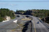
Two vies looking northerly from Crown Ridge. The upper photo shows
Highway 69 narrowing from four-to-two lanes. The lower and more recent
photo shows the four lane highway continuing to the south with a new
interchange constructed for Estaire Road. Estaire Road is the pre-2009
alignment of Highway 69.
Upper photo taken: July 3rd, 2005.
Lower photo taken: July 30th, 2010. |
(720x480)
(1440x960)
(2400x1600) |
| City of Greater Sudbury |
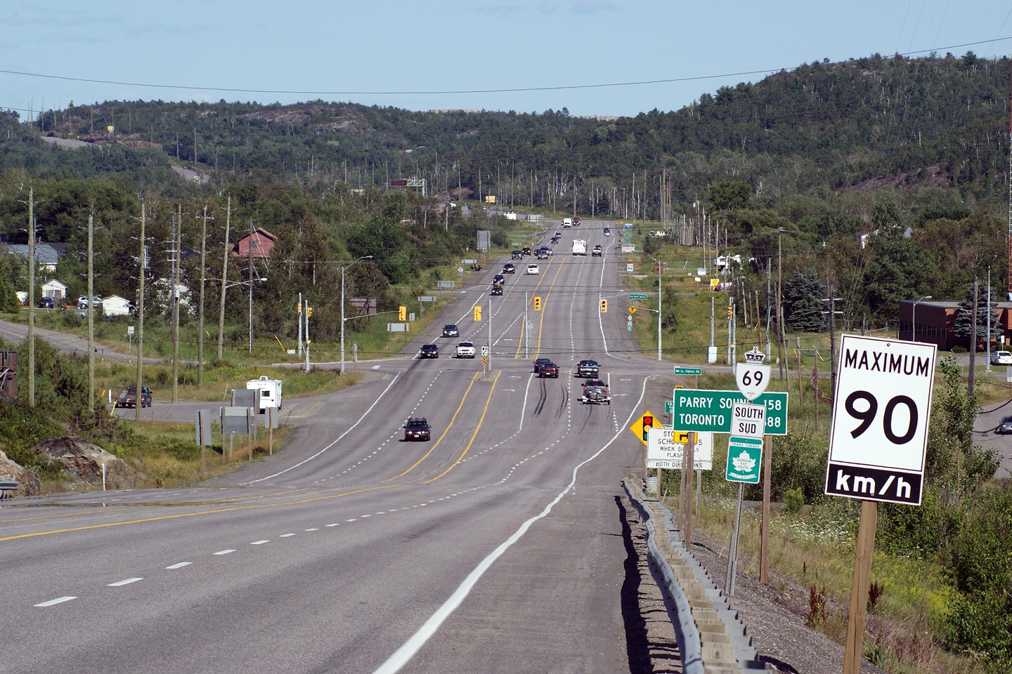
Highway 69 looking north (west) from the Richard Lake Road intersection.
Highway 69 has a semi-urban 4.5 lane cross section from the
Highway 17 interchange southerly for roughly
5km. The
Highway 17 interchange is located only a few
kilometres north (west) of this Photo.
Upper photo taken: July 2nd, 2004.
Lower photo taken: July 3rd, 2010. |
(720x480)
(1440x960)
(2400x1600) |
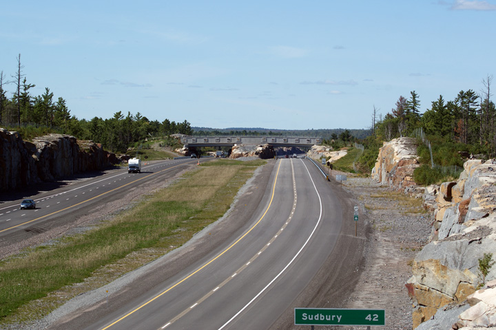
| City of Greater Sudbury |
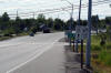
COMPASS sign for southbound traffic located about 3km south of
Highway 17 in Sudbury. This is one of four COMPASS signs that were
installed early in 2005. These signs typically convey safe driving
messages, but also alert drivers of upcoming road construction or closures
if required.
Photo taken: July 3rd, 2005. |
 (720x480) (720x480)
(1440x960) |
| City of Greater Sudbury |
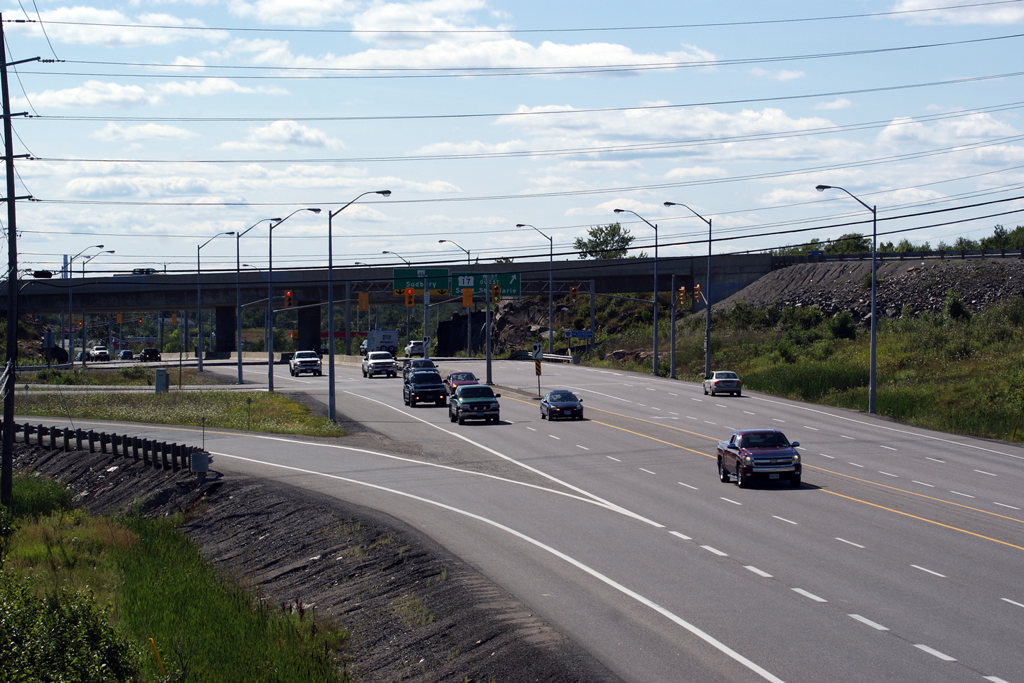
View looking southerly from just south of the Highway 17 interchange.
Aside from the two traffic signals at the Highway 17 ramp terminals, the
traffic signal at the bottom of this long hill is the only traffic signal on
Highway 69.
Photo taken: July 30th, 2010. |

(720x480)
(1440x960)
(2400x1600) |
| City of Greater Sudbury |
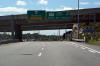
Northbound view of the Highway 17/69 interchange. Highway 69 meets
Highway 17 at a parclo A2 interchange that favours through movements along
Highway 17.
Photo taken: July 30th, 2010. |

(720x480)
(1440x960)
(2400x1600) |
| City of Greater Sudbury |
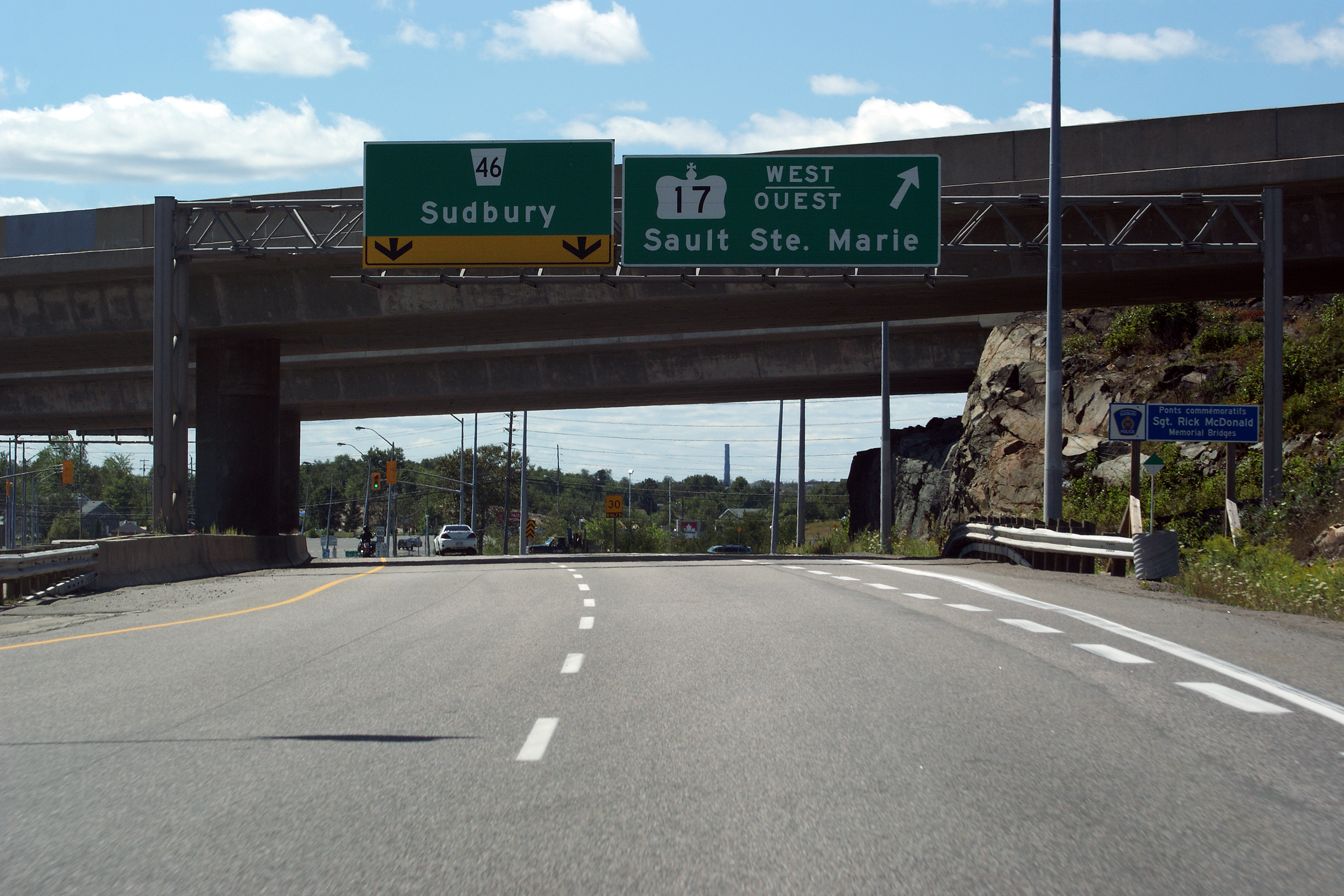
This view looks northerly approaching the Highway 17 interchange along
Highway 69. Highway 69 ends almost immediately north of Highway 17, becoming
Sudbury's Regent Street.
Photo taken: July 30th, 2010. |
 (720x480) (720x480)
(1440x960)
(2400x1600) |
| City of Greater Sudbury |
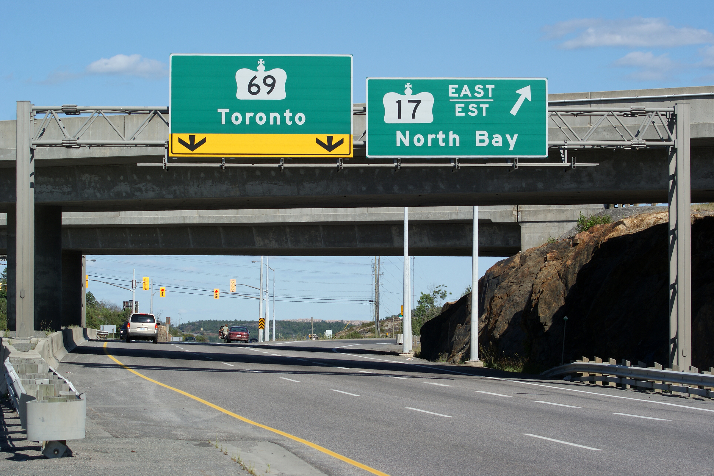
Southbound overhead signage at the ramp to Highway 17 East. This is
the southbound beginning of Highway 69.
Photo taken: July 30th, 2010. |
 (720x480) (720x480)
(1440x960)
(2400x1600) |
| City of Greater Sudbury |
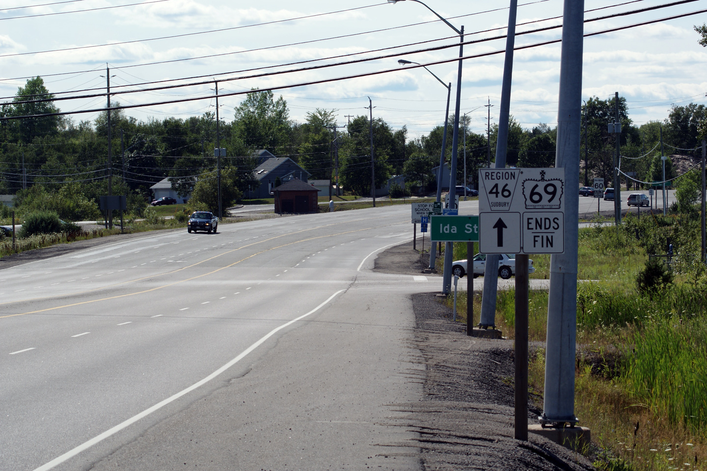
The highway 69 ends signage is found just north of the Westbound Highway 17
ramp terminal. Legally speaking, Highway 69 extends just over 300m
north of the centreline of Highway 17 to the Ida Street intersection.
Photo taken: July 30th, 2010. |
(720x480)
(1440x960) |


 (720x480)
 (720x480)
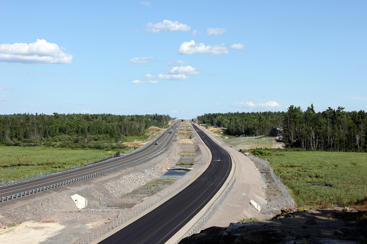


 (720x480)
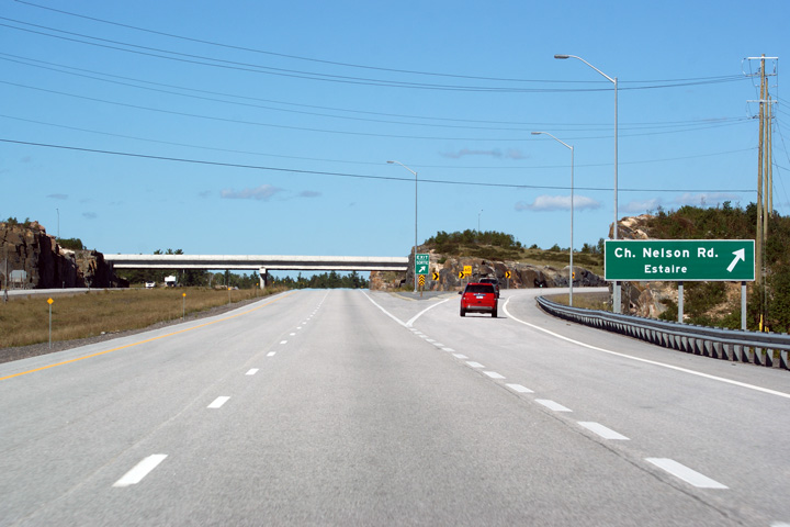 (720x480)
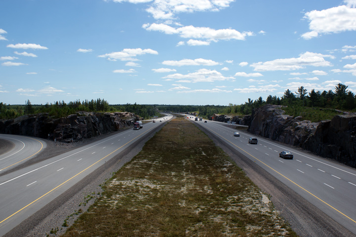

 (720x480)

 (720x480)


 (720x480)
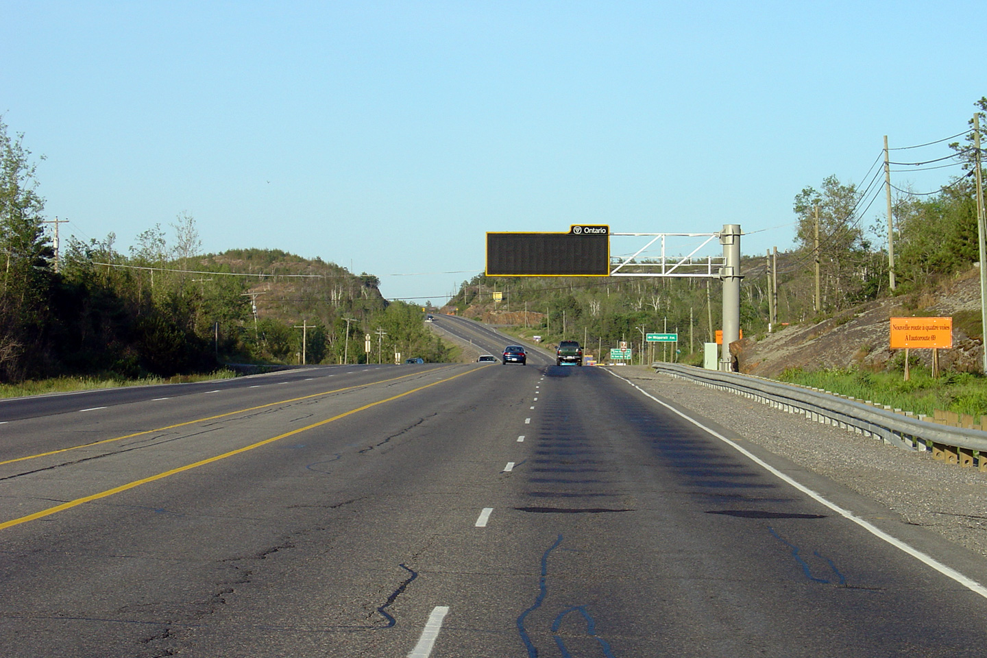


 (720x480)
 (720x480)
