Secondary Highway
607 - www.OntHighways.com
Highway 607 is a shortcut route
from Highway 69 to Highway 64, shaving roughly 5 km of the route.
Originally, Highway 607 was only a spur highway south from Highway 64, not
connecting to Highway 69 west of Bigwood. In the mid 1960s Highway 607 was
rerouted away from French River to connect to Highway 69. Old Highway 607
from Bigwood to French River was re-designated to Highway 607A.
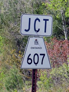 JCT Secondary Highway 607
|
|
Southern Terminus: Junction Highway 69
just west of Bigwood.
Northern Terminus: Junction Highway 64 in between Alban and Jamot
Length: 9.5 km
Multiplexes: None
Freeway: No
AADT (2002):
Highest: 540, from Highway 607A at Bigwood to Highway 64;
Lowest: 360, from Highway 69 Highway 607A at Bigwood.
Road Info: Highway 607 is in
reasonable shape for its entire length. The highway is paved, and has
a yellow centre line for its entire length. |
Communities and Intersections along and Highway 607 from South to
North:
|
Proper
Municipality Name |
Community Name |
Distance |
Intersecting
Road |
| Municipality of Killarney |
----- |
0 km / 9.5 |
King's
Highway 69 |
| Municipality of Killarney |
Bigwood |
0.6 km / 8.9 km |
Secondary Highway 607A |
| Municipality of French River |
----- |
9.5 km / 0 km |
King's Highway 64 |
|
Highway 607 Ends |
<- Highway 605
www.OntHighways.com - Home
Highway 607A ->
Copyright (c) 2004-2011, Scott Steeves (Webmaster)
scott@asphaltplanet.ca
Page last updated: January 29th, 2005
Page created: December 14th, 2004