|
Proper Municipality Name |
Photo Description |
Photo |
|
Pictures taken
from driver's perspective appear offset from centre-line pictures: |
North-
bound |
South-
bound |
| City of Haldimand County |
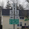
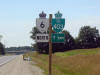
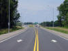
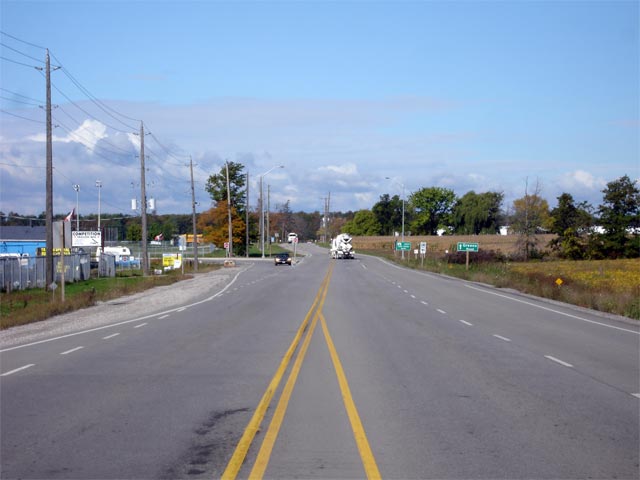
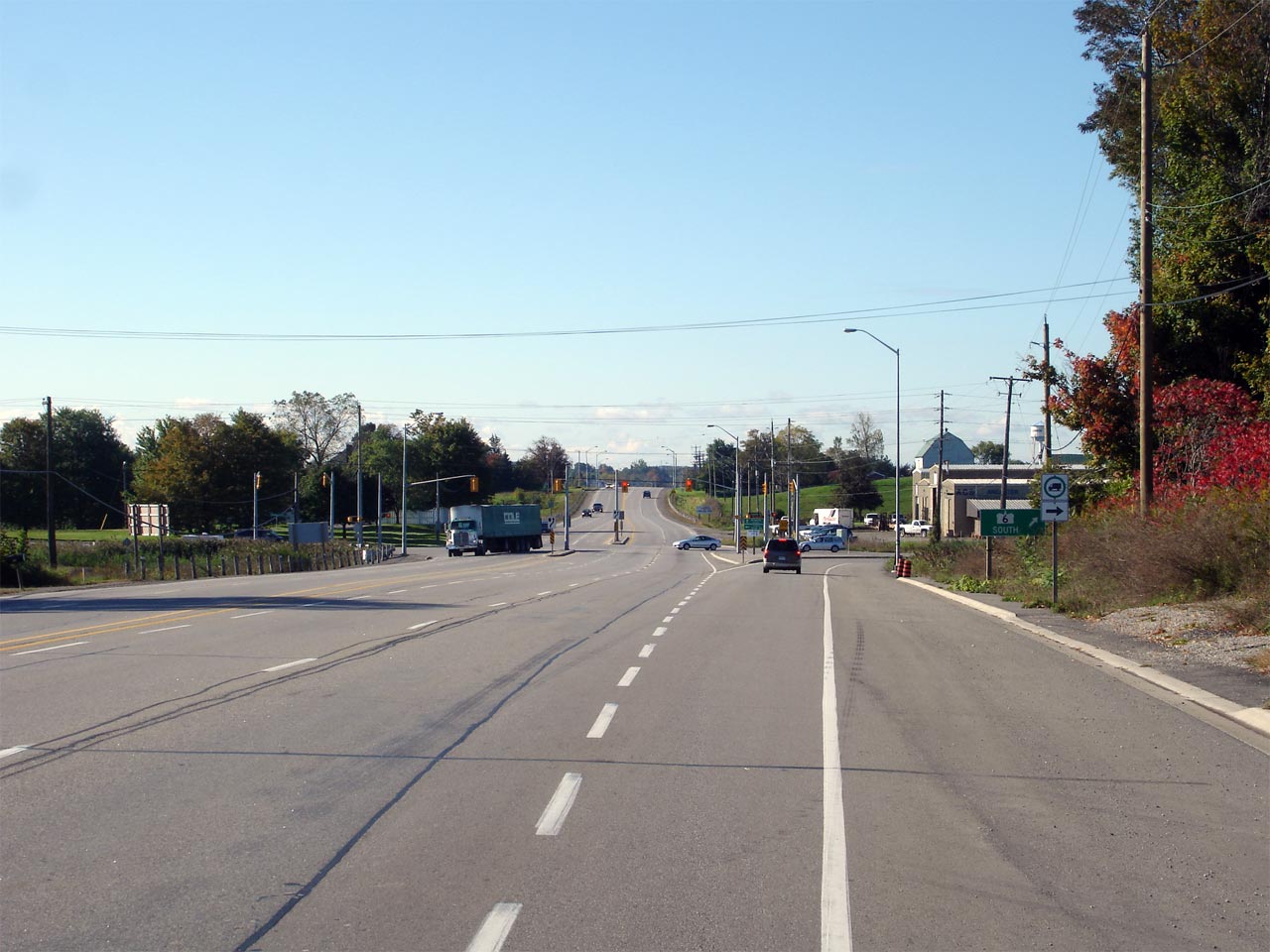
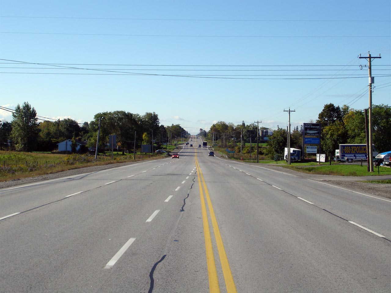
The junction assembly between Highway's 6 and
3
in Jarvis. This picture was taken looking southbound on Highway 6.
Click here for Highway 3 Images Picture size: 45kb |
|
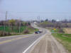
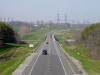
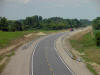
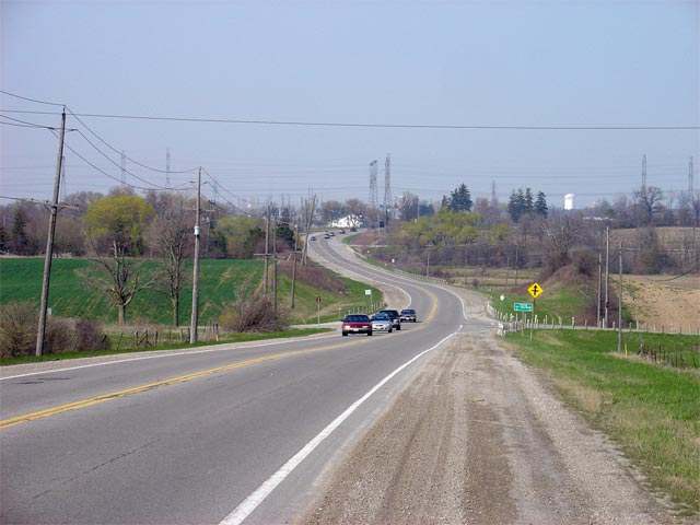
| City of Haldimand County |
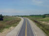
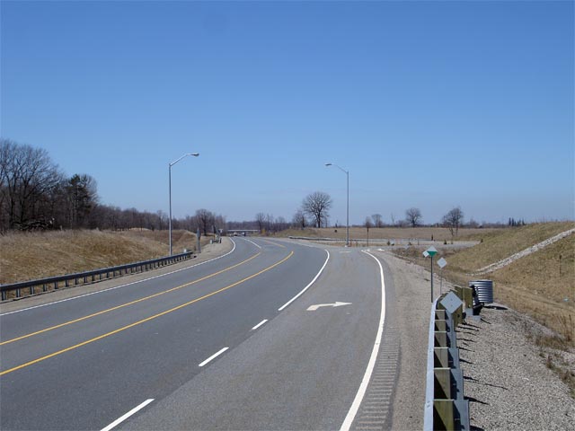
Highway 6 looking north from just south of the Haldimand 5th Line Road.
At the bottom of this valley, Highway 6 crosses the McKenzie Creek.
Approximately 1km to the north of this photo is the southern end of the
Caledonia Bypass.
Picture taken: May 7th, 2005. Size: 50kb. |
 |
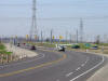
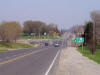
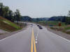
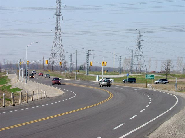
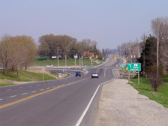
| City of Haldimand County |
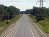
Highway 6 looking north towards the south Argyle Street junction. This
broad curve represents the southern beginning of the Caledonia Bypass.
The Caledonia Bypass swings around the western side of Caledonia, bypassing
the communities bustling Downtown, and a very historic 9-span Concrete
Bowstring Bridge.
Picture taken: May 7th, 2005. Size: 50kb. |
 |
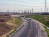
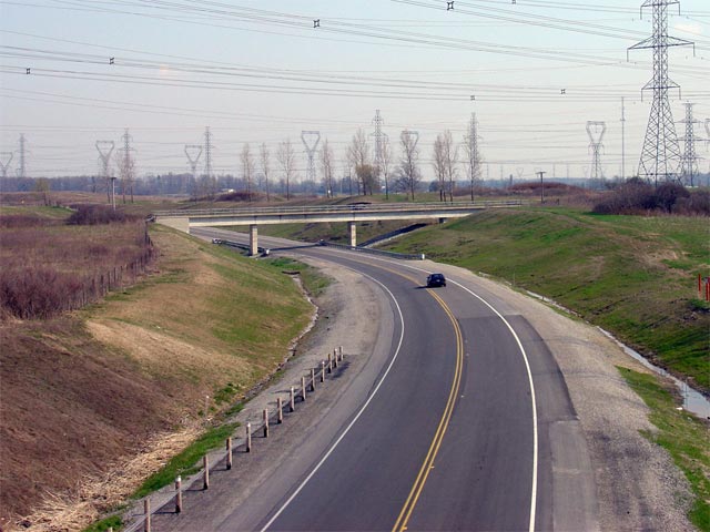
| City of Haldimand County |
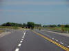
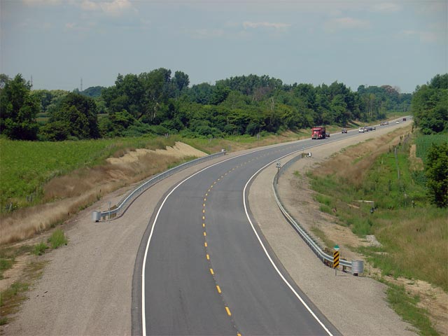
Highway 6 looking south from the Haldimand 6th Line overpass. Notice
that the pictured railway overhead is wide enough for dual-carriageways.
This is because the Caledonia Bypass is a staged freeway, and will one day
be twinned when traffic volumes warrant.
Picture taken: May 7th, 2005. Size: 60kb. |
 |
| |
Northerly view from the Haldimand 6th Line overpass. |

(720x480)
(1440x960)
(2400x1600) |
| |
|

(720x480)
(1440x960)
(2400x1600) |
| |
|

(720x480)
(1440x960)
(2400x1600) |
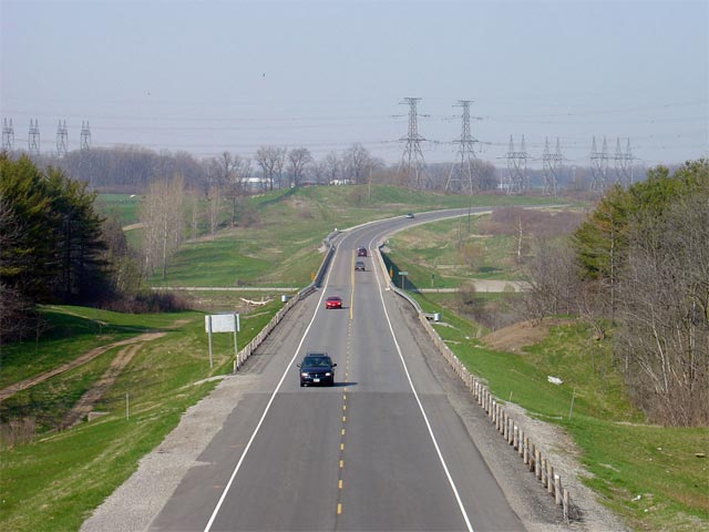
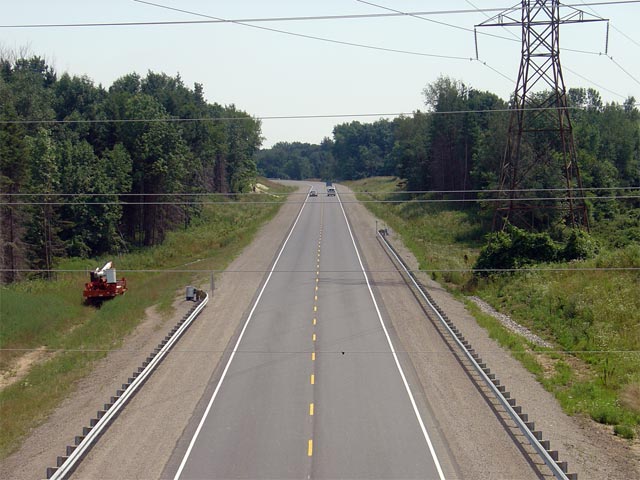
| City of Haldimand County |
Highway 6 looking north from the Haldimand 7th Line overpass. This
picture showcases Highway 6's long, high-level crossing of the Grand River.
The Grand River Bridge also carries Highway 6 over Highway 54. There
is no direct connection between Highway 54 and Highway 6. Traffic must
use a series of local streets between the two highways.
Picture taken: May 7th, 2005. Size: 50kb. |

(720x480)
(1440x960)
(2400x1600) |
| |
|

(720x480)
(1440x960)
(2400x1600) |
| |
|

(720x480)
(1440x960)
(2400x1600) |
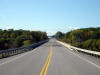
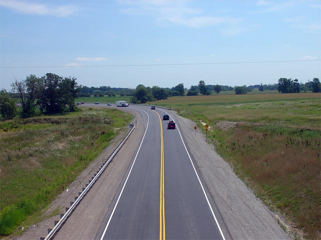
| City of Haldimand County |
Looking south as Highway 6 crosses the Grand River on the Caledonia By-pass.
Picture taken: September 29th, 2006. Low-res: 40kb. High-res:
140kb. |
Low-res
High-res |
| City of Haldimand County |
Highway 6 looking north towards the junction of Greens Road. Greens
Road marks the end of the Caledonia Bypass. A new route is currently
being considered that would continue straight north of this intersection.
This route would link the Caledonia Bypass to the Hamilton Bypass. To
stay northbound along Highway 6, traffic must turn right at this junction.
Picture taken: May 7th, 2005. Size: 45kb. |
 |
| City of Haldimand County |
View looking southerly (westerly) towards the Greens Road intersection.
Greens Road is signed as an an access route between Highway 6 and Highway
54. Picture taken: September 29th, 2006. Low-res: 40kb.
High-res: 125kb. |

Low-res
High-res |
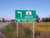
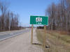
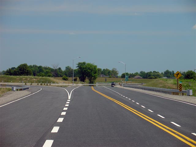
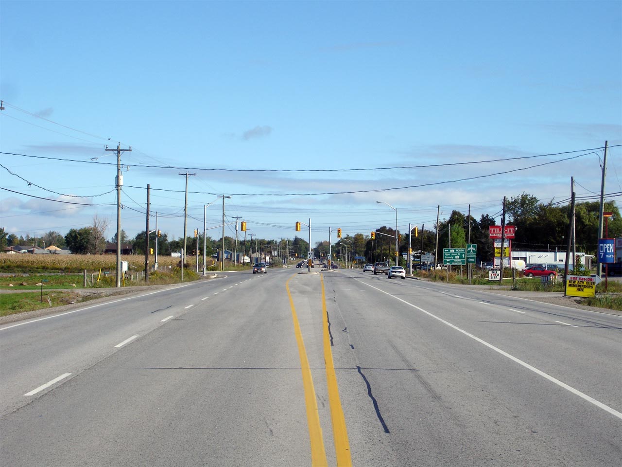
| City of Haldimand County |
Highway 6-South Green sign with Port Dover as a control city in advance of
the Greens Road intersection. Picture taken: September 29th, 2006.
Size: 60kb. |
 |
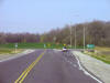
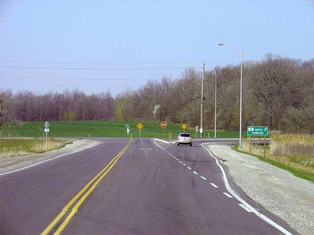
| City of Haldimand County |
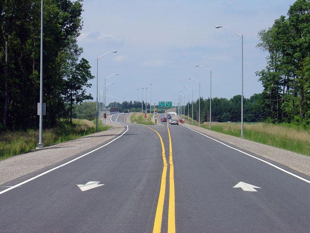
This picture shows highway 6
approaching the Argyle Road intersection looking northbound. To
continue north along Highway 6 a left turn is required at this intersection.
Before the Caledonia Bypass opened, Highway 6 used to follow Argyle Street
through Downtown Caledonia.
Picture taken: May 7th, 2005. Size: 50kb. |
 |
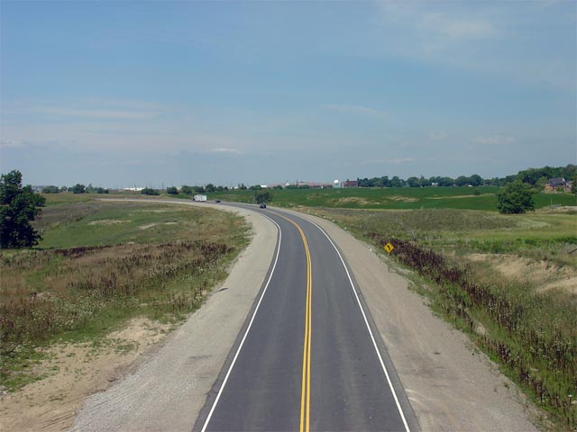
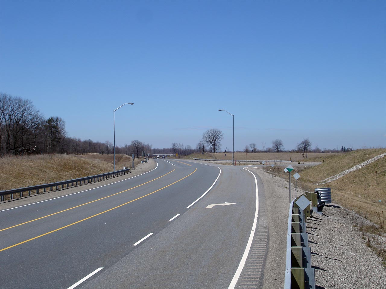
| City of Haldimand County |
View looking southerly at the north end of the Caledonia By-pass.
Straight ahead is Argyle Street which is Highway 6's former alignment
through Downtown Caledonia. Argyle Street was a 7000-series highway
(with connecting links) until everything but the Caledonia Bowstring Bridge
was transferred to local jurisdiction in the 1990s.
Picture taken: September 29th, 2006. Low-res: 40kb. High-res:
170kb. |
Low-res
High-res |
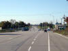
| City of Hamilton |
View looking southerly along Highway 6 from just south of the Upper James
Street intersection. Highway 6 maintains this 4-lane cross-section
southerly from this point into Caledonia. Picture taken: September 29th,
2006. Low-res: 40kb. High-res: 155kb. |
Low-res
High-res |
| City of Hamilton |
View looking northerly towards the Highway 6/Upper James Street
intersection. Picture taken: September 29th, 2006. Low-res: 40kb.
High-res: 160kb. |

Low-res
High-res |
| City of Hamilton |
The signage denoting the new Highway 6 bypass
leading around the south side of Hamilton. Upper James Street is the
former route of Highway 6, which leads traffic towards the Lincoln M.
Alexander Parkway and Downtown Hamilton.
Photo taken: May 7th, 2005. |
 (720x480) (720x480)
(1440x960) |
| City of Hamilton |
Sign denoting the recently transferred section of Highway 6. In
November, 2004 the old stretch of Highway 6 north of the Hamilton Bypass was
renamed Upper James Street and incorporated into Highway 7273.
Picture size: 60kb. |
 (720x480) (720x480)
(1440x960) |
|
Pictures of the Highway 6-Hamilton Bypass taken
before the highway opened are available
here. |
|
Before the Hamilton By-pass was completed in 2004,
Highway 6 followed Upper James Street into Hamilton.
Click here for Upper
James Street Images |
| |
|
 (720x480) (720x480)
(1440x960) |
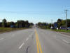
| City of Hamilton |
Highway 6 looking south (east) towards the southern end of the recently
opened (November, 2004) Hamilton Bypass. At this junction, to stay
southbound on Highway 6, travelers must turn right. The old route of
Highway 6 that lead travelers north to the Lincoln M. Alexander Parkway is
now known as Upper James Street.
Picture taken: May 7th, 2005. Size: 60kb. |
 |
| City of Hamilton |
Looking South along the newly opened Highway 6 from the White Church Road
overpass. South of White Church Road Highway 6 rounds a sharp bend
curving towards the old Highway 6 alignment (Upper James Street).
Because this curve is only temporary, it has an advisory speed of 60km/h.
Picture taken: July 31st, 2005. Size: 50kb. |


(720x480)
(1440x960)
(2400x1600) |
| City of Hamilton |
Highway 6 looking north from the White Church Road overpass. Just
north of this long gentle curve, Highway 6 meets the Hamilton Airport Access
Road. Picture taken: July 31st, 2005. Size: 45kb. |

(720x480)
(1440x960)
(2400x1600) |
| City of Hamilton |
View looking northerly along Highway 6 as it approaches Hamilton's Airport
Access Road. This Airport Access Road is maintained by the MTO and was
given an internal 7000-series number (Highway 7274) for inventory purposes.
Picture taken: April 19th, 2007. Low-res: 40kb. High-res: 150kb. |

Low-res
High-res |
| City of Hamilton |
Highway 6 looking south towards the at-grade intersection with the Hamilton
Airport Access Road. Hamilton Airport's passenger terminal is located
roughly 1km north of Highway 6 along the Airport Access Road.
Picture taken: July 31st, 2005. Size: 35kb. |
 |
| City of Hamilton |
A rather odd reassurance marker located northbound along Highway 6 just
north of the Hamilton Airport Access Road. It is very uncommon to see
a distance marked on a directional tab. Picture size: 35kb. |
 |
| City of Hamilton |
Highway 6 looking south from the Glancaster Road overpass. Just beyond
view in this photo is the at-grade intersection with the Hamilton Airport
Access Road Picture taken: July 31st, 2005. Size: 50kb. |

(720x480)
(1440x960)

(720x480)
(1440x960)
(2400x1600) |
| City of Hamilton |
Looking north along Highway 6 from the Glancaster Road overpass. The
Glancaster Road overpass underwent a major reconstruction in the fall of
2005, only a few short years after being constructed. Unfortunately,
the northern overpass abutment sunk causing a major crack in the abutments
concrete. (Click here for
pictures).
Picture taken: July 31st, 2005. Size: 50kb. |

(720x480)
(1440x960) |
| City of Hamilton |
Highway 6 looking south from the Butter Road overpass. Though not
always evident in the photos, Highway 6 is intended to be freewayalized in
the future. Currently, only the northbound carriageway had been
constructed, however, sufficient right of way has been allotted for a future
southbound carriageway.
Picture taken: July 31st, 2005. Size: 65kb. |
 |
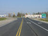
| City of Hamilton |
Highway 6 looking north from the Butter Road overpass. The at-grade
intersection with Book Road is located roughly 1.5km north of the Butter
Road overpass. Picture taken: July 31st, 2005. Size: 50kb. |

(720x480)
(1440x960)
(2400x1600) |
| City of Hamilton |
Highway 6 looking north approaching the
signalized at-grade intersection with Book Road. Book Road is the only
major cross road that allows access to the new Highway 6 routing. All
other cross-streets are grade separated, with the exception of the short new
route leading to the Hamilton airport.
Picture taken: July 31st, 2005. Size: 55kb. |

(720x480)
(1440x960) |
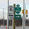
| City of Hamilton |
The junction assembly located heading WB on Book
Road for Highway 6. It is clear that the new routing for Highway 6 is
designed to better connect traffic to Highway 403, every northbound shield
along Highway 6 is cosigned with a 403 trailblazer.
Picture size: 30kb. |
 |
| City of Hamilton |
Highway 6 looking south towards the signalized at-grade intersection with
Book Road. Picture taken: July 31st, 2005. Size: 50kb. |
 |
| City of Hamilton |
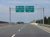
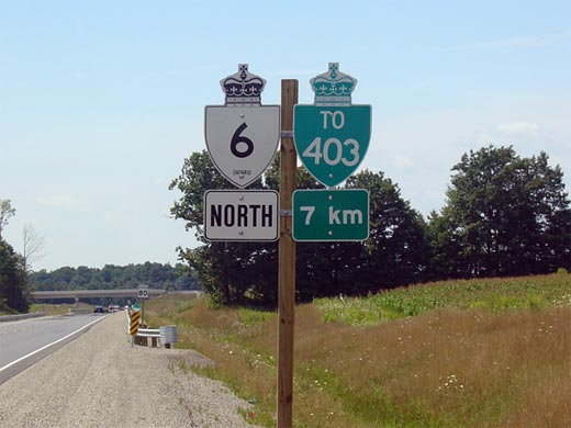
Advanced sign denoting the Highway 403 interchange. It is unusual to
see this kind of 1km advanced signage for a freeway. Picture taken: April
19th, 2007. Size: 70kb. |
 (720x480) (720x480)
(1440x960)
(2400x1600) |
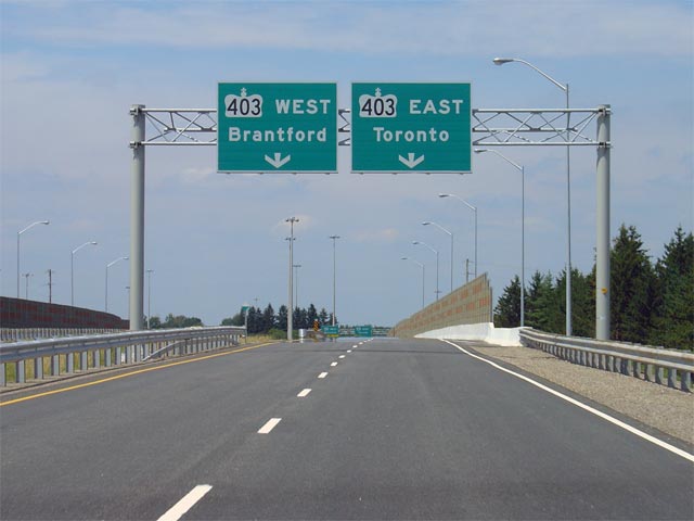
| City of Hamilton |
Highway 6 driving north approaching the
Highway 403 interchange. Highway 6 separates into two bi-directional
carriageways for the interchange with the 403.
Picture taken: July
31st, 2005. Size: 60kb |
 |
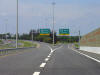
| City of Hamilton |
This is the advanced signage for
the interchange with Highway 403 heading north.
Notice that there are no references to Highway 6 continuing north of
Hamilton towards Guelph at this interchange.
Picture taken: July 31st, 2005. Size: 40kb. |
 (720x480) (720x480)
(1440x960)
(2400x1600) |
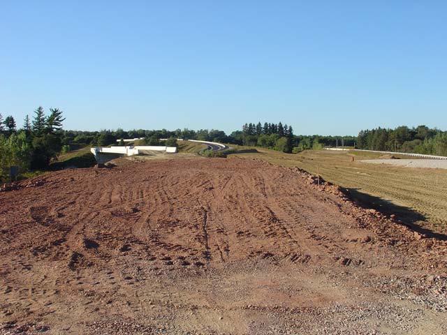
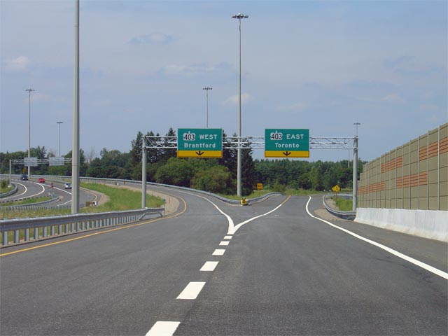
| City of Hamilton |
This picture shows
the interchange between Highway 6 and Highway 403. This picture is
taken while driving north. Compare this image to the one of the
unfinished highway (click here) taken in
September of 2004. Click
here for Highway 403
Images
Picture taken:
July 31st, 2005. Size: 40kb |
 (720x480) (720x480)
(1440x960)
(2400x1600) |
| City of Haldimand County |
Highway 6-South Green sign with Port Dover as a control city in advance of
the Greens Road intersection. Picture taken: September 29th, 2006.
Size: 60kb. |
 (720x480) (720x480)
(1440x960)
(2400x1600)
 (720x480) (720x480)
(1440x960)
(2400x1600) |
|
Highway 6 pictures continue via
Highway 403 Images and Highway 6 (Page 2) Images (Coming Soon) |


 (720x480)
 (720x480)
 (720x480)


 (720x480)
 (720x480)
 (720x480)
 (720x480)
 (720x480)