|
Proper Municipality Name |
Photo Description |
Photo |
|
Pictures taken
from driver's perspective appear offset from centre-line pictures: |
North-
bound |
South-
bound |
| City of Hamilton |
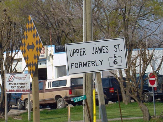
Sign denoting the recently transferred section of Highway 6. In
November 2004, the Highway 6 designation was moved to the new Hamilton
By-pass. Highway 6 was named Upper James Street at this time, and
became a 7000-series highway.
Picture size: 60kb. |
 |
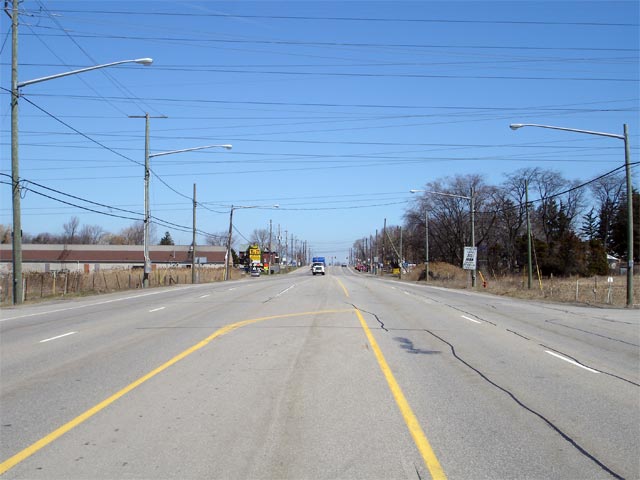
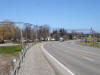
| City of Hamilton |
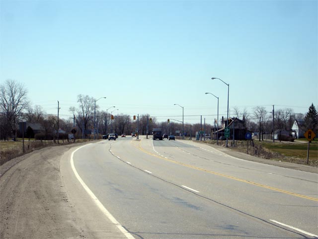
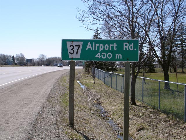
View looking southerly along Upper James Street
(Formerly Highway 6) towards the Airport Road intersection. Airport
Road meets Upper James Street about halfway along the Mount Hope By-pass.
Picture taken: April 19th, 2007. Low-res: 35kb. High-res: 130kb. |
Low-res
High-res |
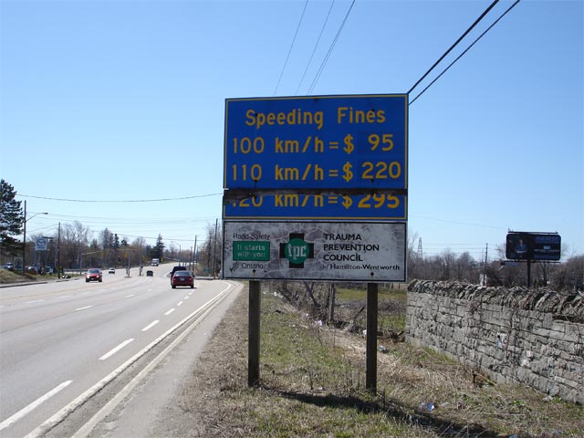
| City of Hamilton |
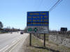
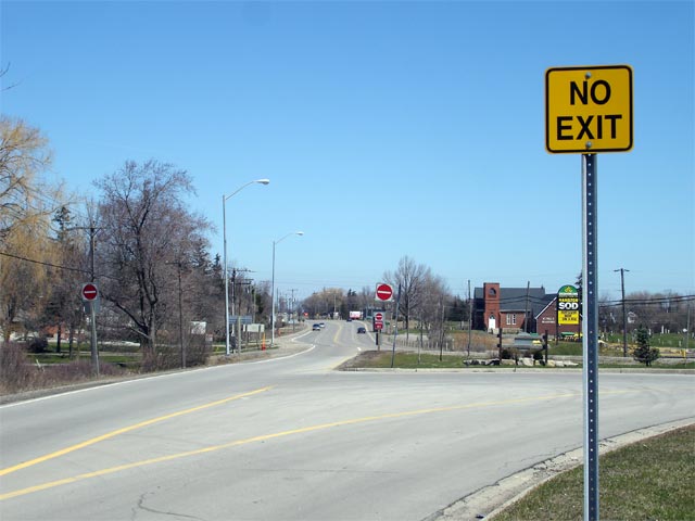
Advanced signage for Airport Road along Upper James Street. Airport
Road lost its road number as part of Hamilton's new 'Regional' Road numbers.
Hamilton has been slow to remove the old flowerpot signs, and likewise the
MTO has yet to cover over the former numbers on its green signs.
Picture taken: April 19th, 2007. Size: 90kb. |
 |
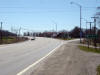
| City of Hamilton |
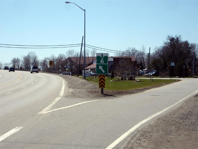
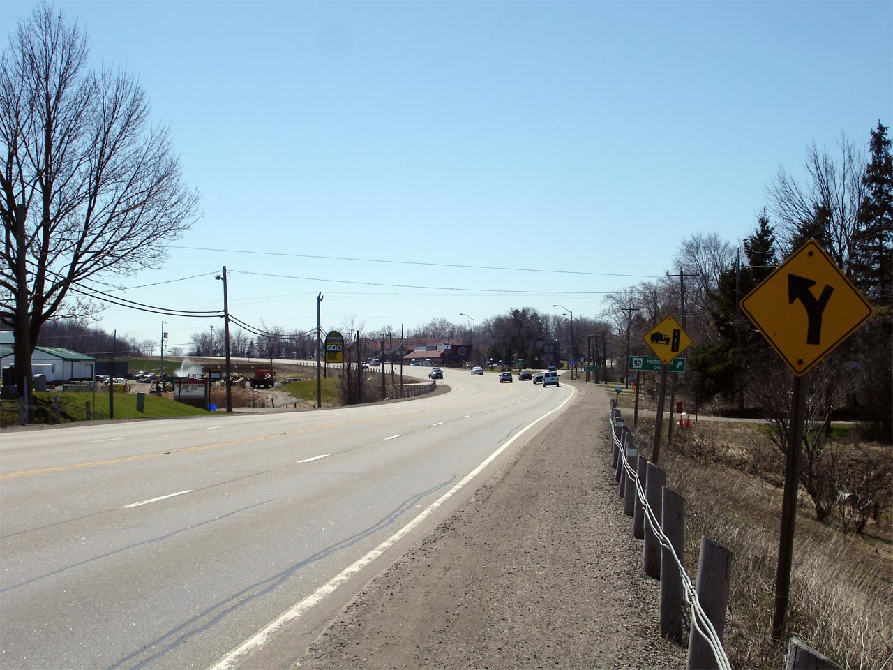
Looking southerly along Upper James Street at the north end of the Mount
Hope By-pass. The southern end of Homestead Road can be seen in the
left side of the photo. Picture taken: April 19th, 2007. Size: 55kb. |
 |
| City of Hamilton |
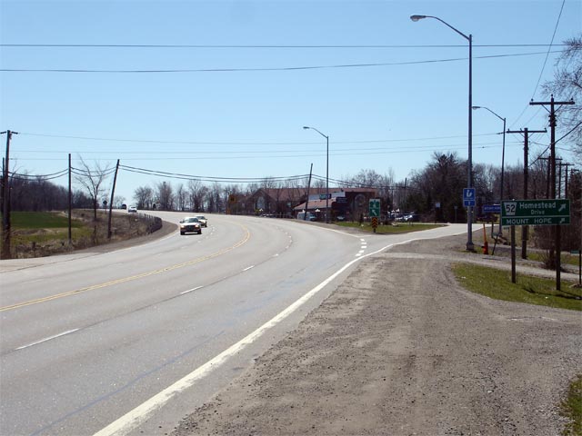
View looking north from the north end of the Mount Hope By-pass. Take
note of the southbound ramp from Upper James Street onto Homestead Road.
Traffic from Mount Hope destined northbound on Upper James Street must use
the signalized intersection at Airport Road.
Picture taken: April 19th, 2007. Low-res: 45kb. High-res: 160kb. |

Low-res
High-res |
| City of Hamilton |
Highway 6 trailblazer located in the bull-nose of the ramp to Homestead
Road. Picture taken: April 19th, 2007. Size: 45kb. |
 |
| City of Hamilton |
Looking south at the ramp from Upper James Street to Homestead Road at the
north end of the Mount Hope By-pass. Short little ramps like this were
very common on Ontario highways constructed in the 1950s, but are generally
discouraged by the MTO today.
Picture taken: April 19th, 2007. Low-res: 50kb. High-res: 190kb. |
Low-res
High-res |
| City of Hamilton |
Looking at the ramp to Homestead Road from Upper James Street.
Homestead Road is the original alignment of Highway 6 before the Mount Hope
By-pass was completed in the 1950s. Picture taken: April 19th, 2007.
Low-res: 55kb. High-res: 215kb. |
Low-res
High-res |
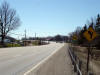
| City of Hamilton |
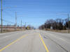
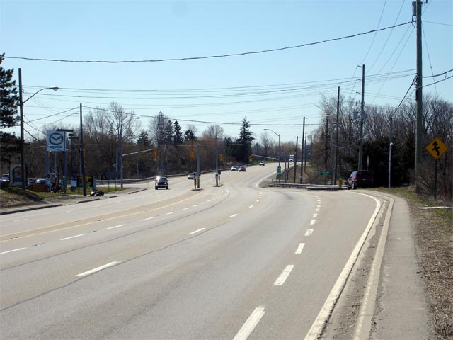
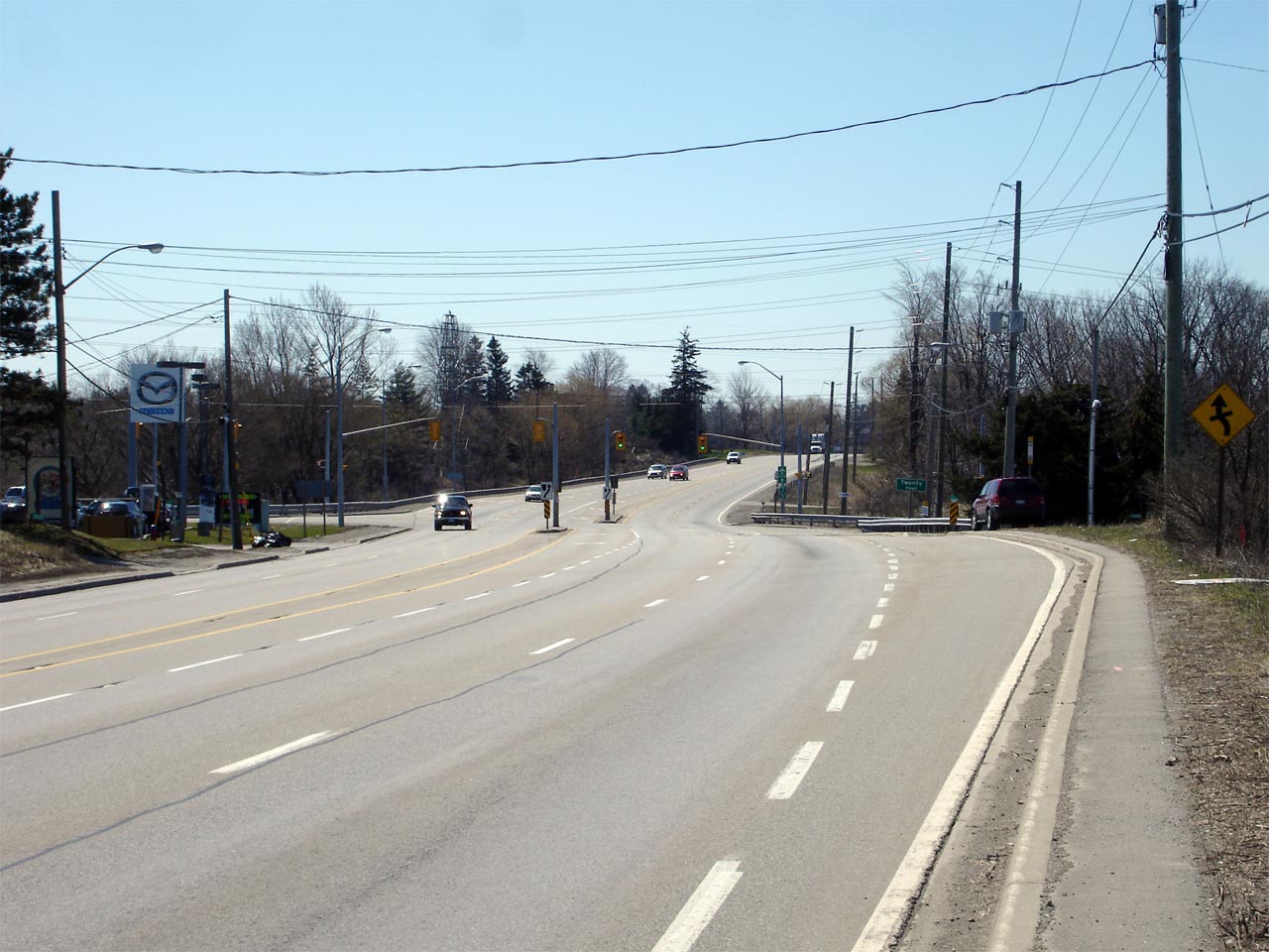
Looking south at the Twenty Road intersection along Upper James Street.
Picture taken: April 19th, 2007. Low-res: 50kb. High-res: 180kb. |
Low-res
High-res |
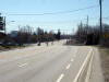
| City of Hamilton |
Beat up speed limit sign on Upper James Street just south of the Alderlea
Avenue intersection. Highway 6 was widened to 4-lanes very early
compared to most rural 4-lane highways, and is built to a slightly tighter
geometry then most other 4-lane highways.
Picture taken: April 19th, 2007. Size: 55kb. |
 |
| City of Hamilton |
Looking northerly at the Alderlea Avenue intersection along Upper James
Street. Highway 7273 ends at the Alderlea Avenue intersection.
Alderlea Avenue formerly marked the start of the connecting link agreement
with Hamilton for Highway 6 and was the pre-amalgamation southern City
Limit.
Picture taken: April 19th, 2007. Size: 50kb. |
 |

