|
Proper Municipality Name |
Photo Description |
Photo |
|
Pictures taken
from driver's perspective appear offset from centre-line pictures: |
East-
bound |
West-
bound |
|
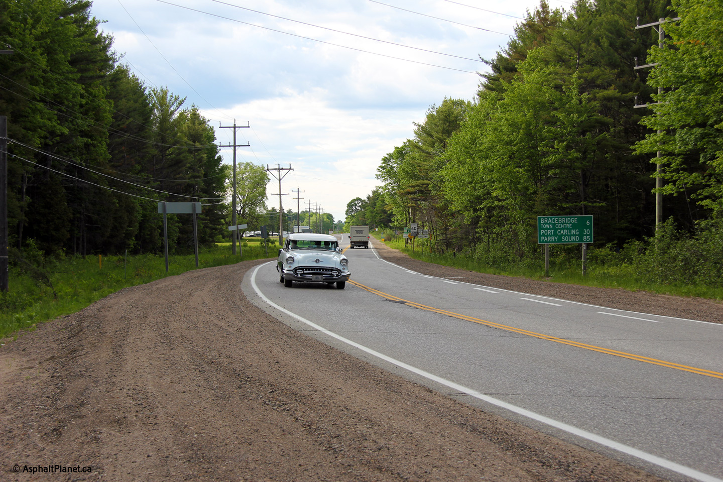
Highway 169 is a former highway
that ran from Highway 12 in Simcoe County to Highway 69 in Muskoka
District.
Click here for Highway 169 images. |
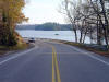
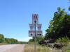
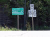
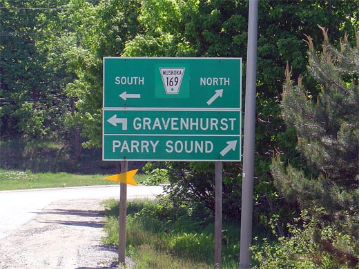
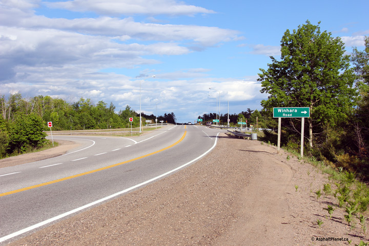
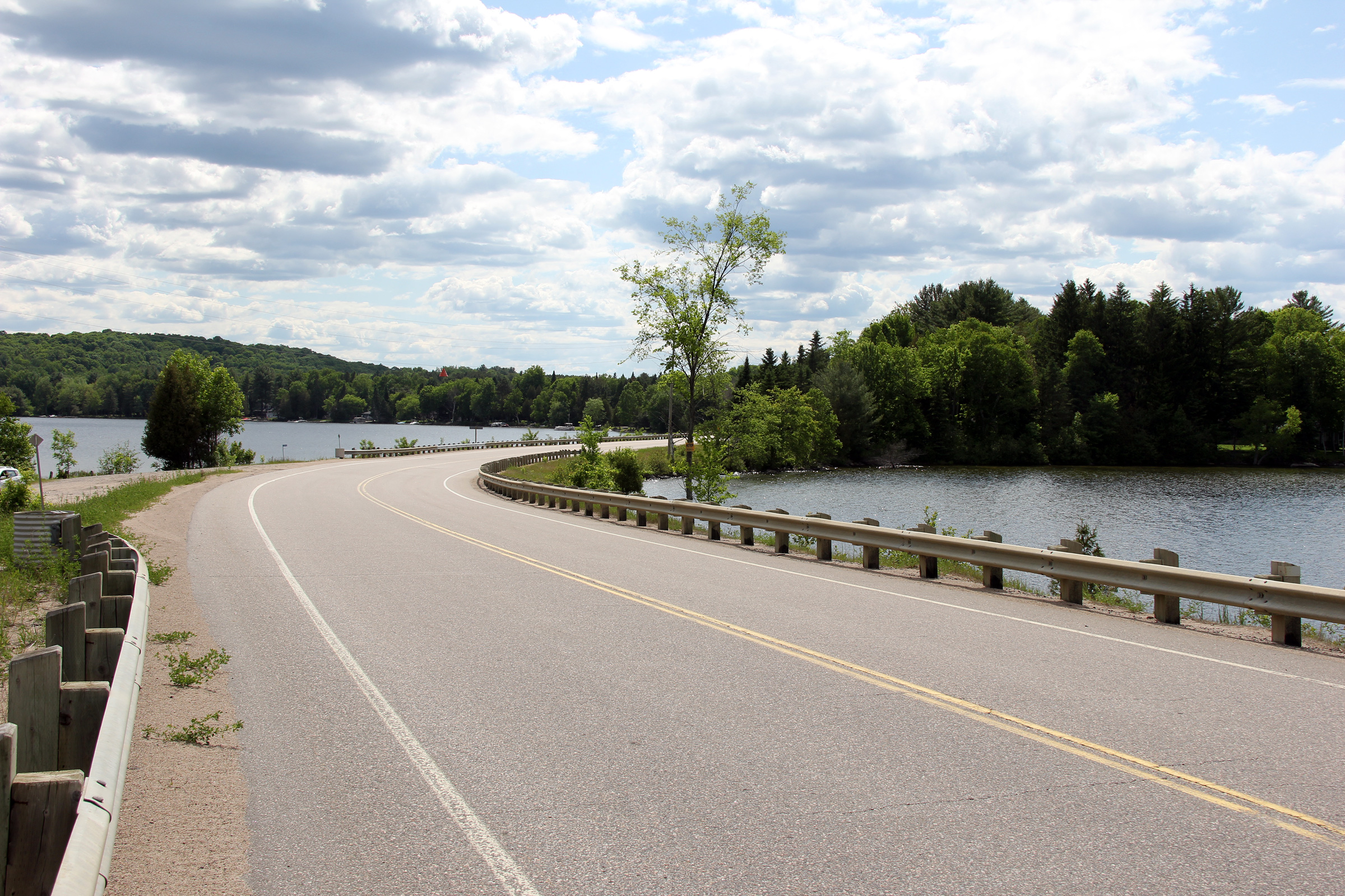
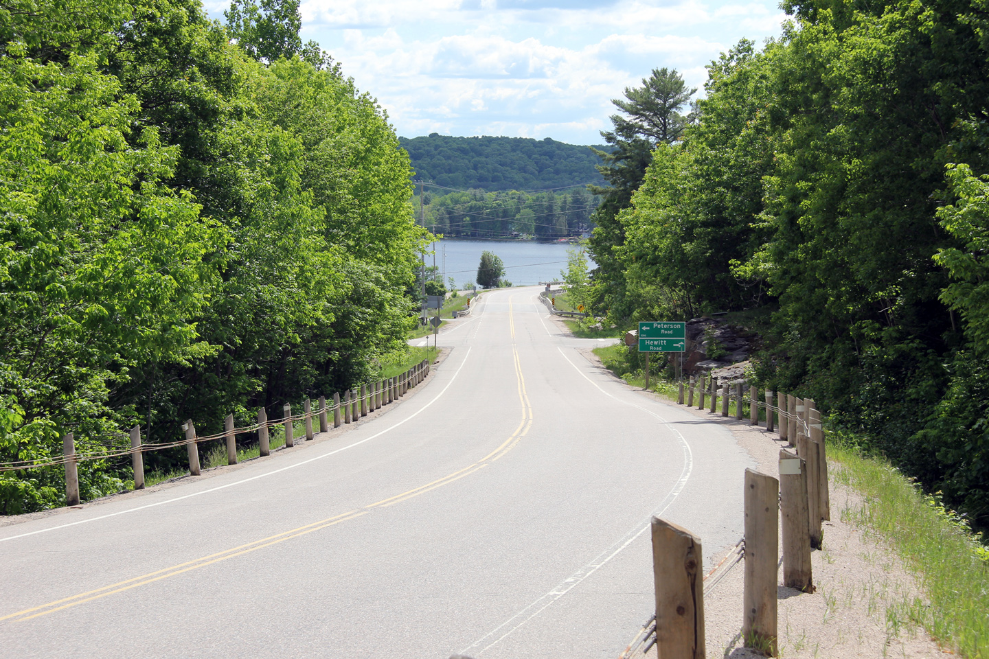
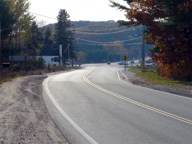
| Township of Muskoka Lakes
District Municipality of Muskoka |
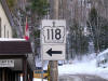
View of the western terminus of Highway 118 at Highway 169 in Glen Orchard.
Picture taken: June 1st, 2005. Size: 60kb. |
 |
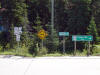
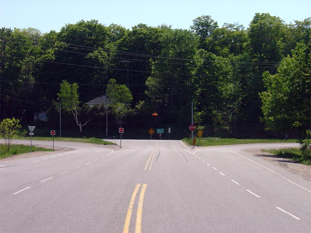
| Township of Muskoka Lakes
District Municipality of Muskoka |
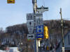
Green signage at the Highway 169 intersection along Highway 118. Since
Highway 169 was also decommissioned in 1998, the District of Muskoka has
(obviously) replaced the former crown graphic with that of a flowerpot.
Picture size: 65kb. |
 |
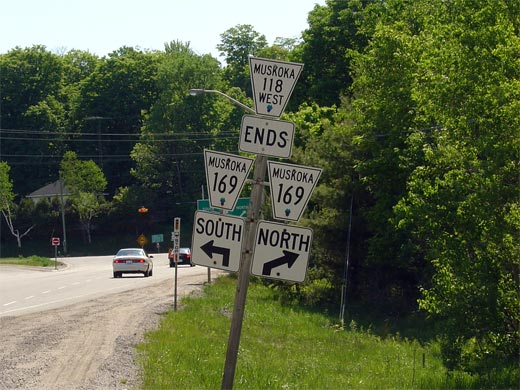
| Township of Muskoka Lakes
District Municipality of Muskoka |
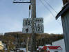
Signage denoting the end of Muskoka Road 118. Before Highway 118 was
transferred to Muskoka in 1998, this junction assembly would have shown
Highway 118 ending at Highway 169.
Picture size: 60kb |
 |
|
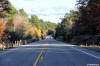
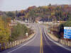
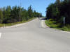
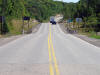
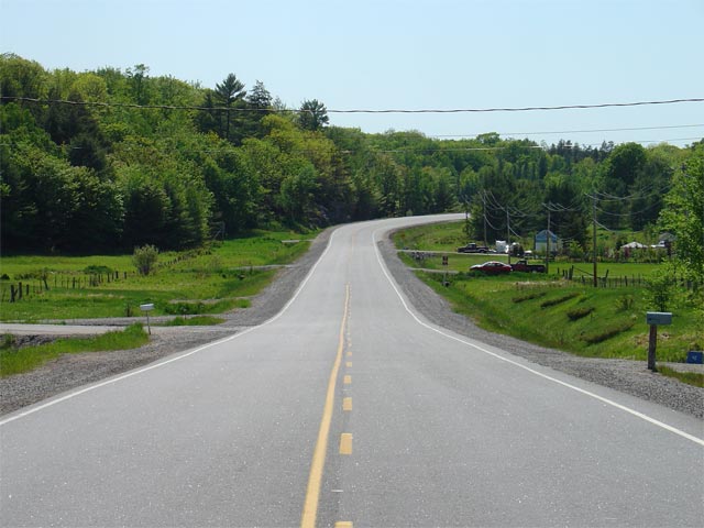
Township of Muskoka Lakes District Municipality of Muskoka |
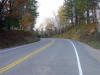
View looking easterly towards Port Carling along Highway 118. This
picture is taken from the Pine Glen Road intersection. Picture taken: June
1st, 2005. Size: 55kb. |
 |
|
Township of Muskoka Lakes District Municipality of Muskoka |
View looking east towards Port Carling along Highway 118. Before
downloading, the connecting link agreement for Port Carling began at the
pictured junction with Forman Road. The Port Carling Connecting link
covered 3.8km of highway between Forman and Omineca Road.
Picture taken: June 1st, 2005. Size: 85kb. |
 |
|
Township of Muskoka Lakes District Municipality of Muskoka |
View looking westerly towards Port Carling along Highway 118. This
picture is taken roughly 4km east of Port Carling. Picture taken: June
1st, 2005. Size: 50kb. |
 |
|
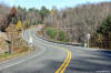
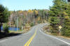
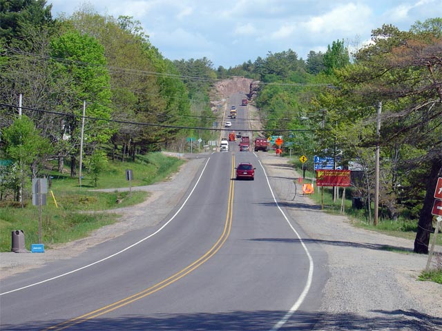
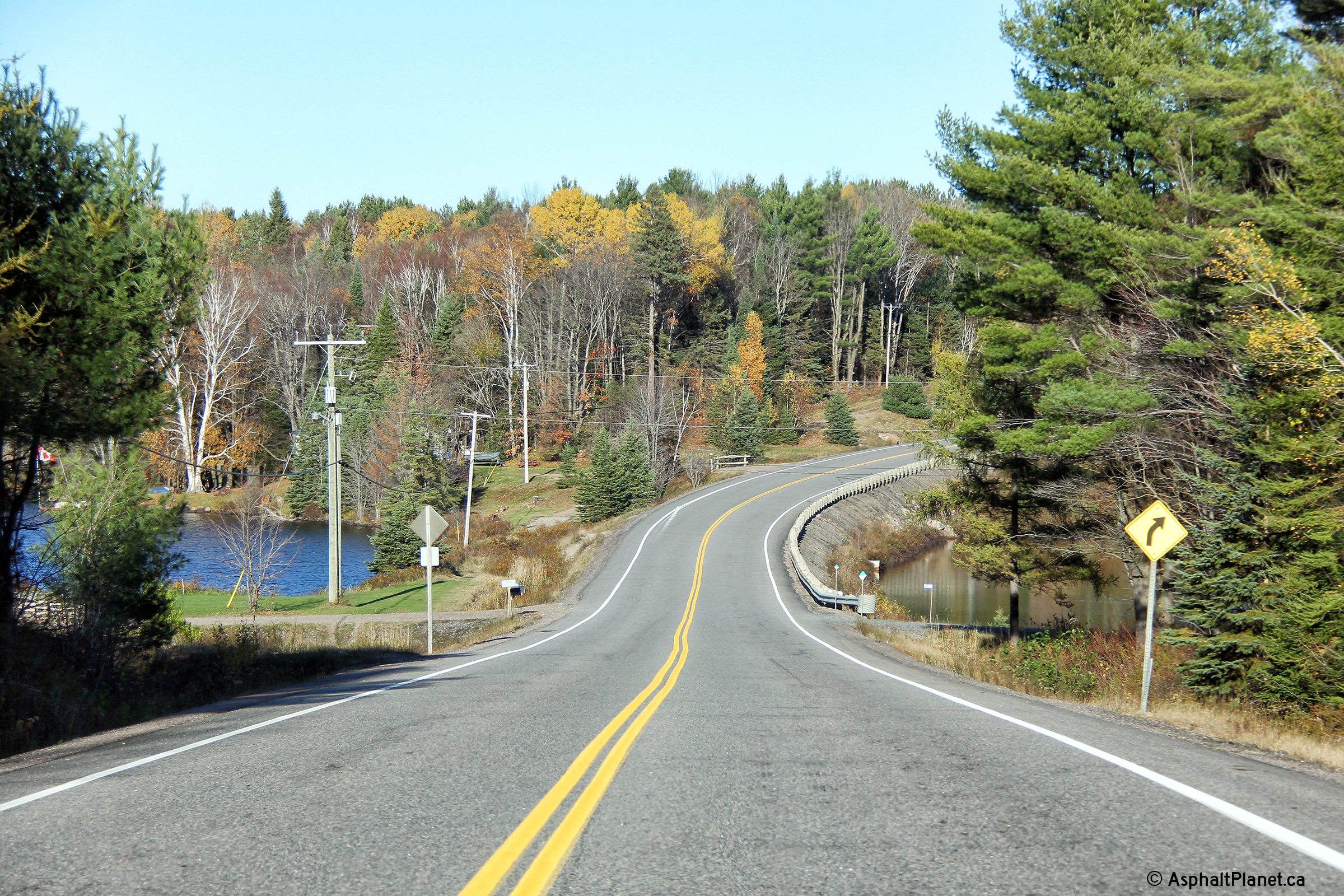
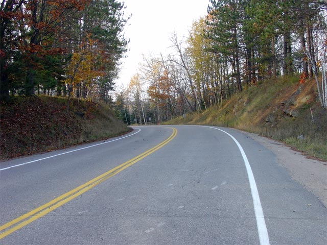
Township of Muskoka Lakes District Municipality of Muskoka |
View looking easterly towards the Milford Bay rock-cut on Highway 118.
The Milford Bay rock-cut is one of Ontario's longest and most dramatic rock-cuts. Picture taken: June 1st, 2005. Size: 80kb. |
 |
|
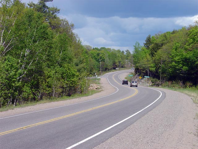
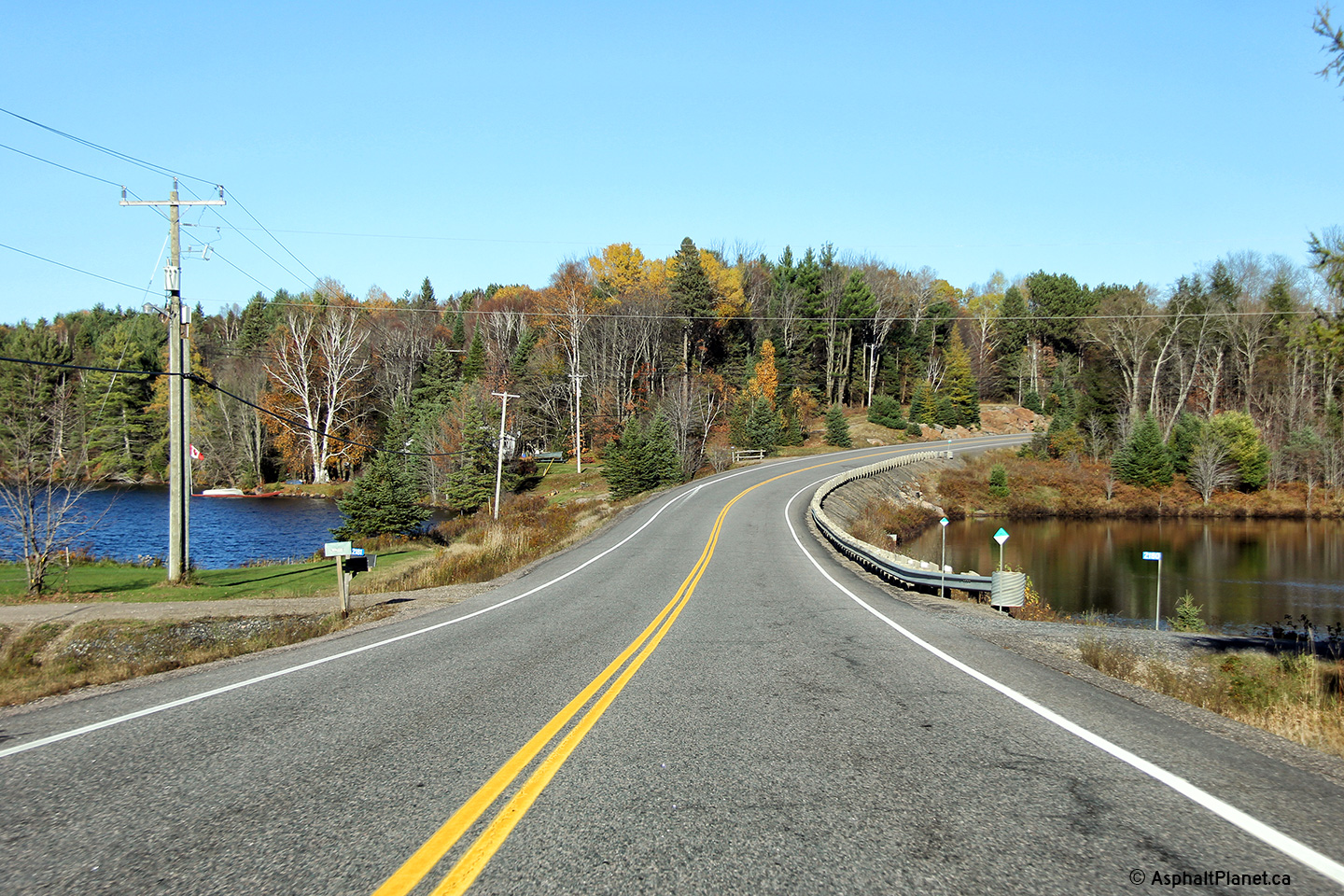
Township of Muskoka Lakes District Municipality of Muskoka |
Reversing curve on Highway 118 east of Milford Bay. This picture is
taken roughly 1km east of the Milford Bay rock-cut. Picture taken: June
1st, 2005. Size: 75kb. |
 |
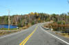
| Township of Muskoka Lakes
District Municipality of Muskoka |
View of Highway 118 passing through a typical looking Northern Ontario
meadow. This portion of highway is located roughly 4km west of the
west limits of Bracebridge. Picture taken: June 1st, 2005. Size:
65kb. |
 |
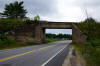
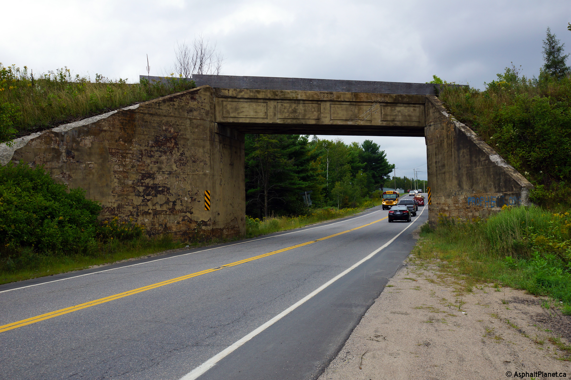
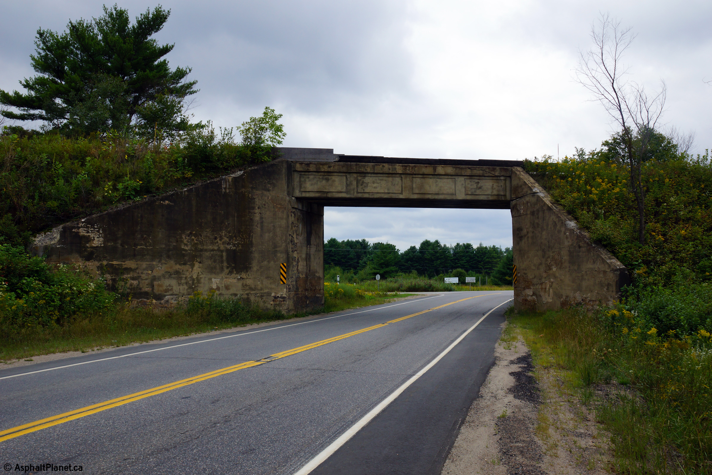
Town of Bracebridge
District Municipality of Muskoka |
Easterly view looking through the Ontario Northland Railway (ONR) overhead.
This railway overhead carries train traffic between Toronto and Moosenee on
the Arctic Ocean. The recessed date stamp in the centre of the span
indicates this structures completion date of 1930.
Photo taken: September 3rd, 2013. |

(720x480)
(1440x960)
(2400x1600) |
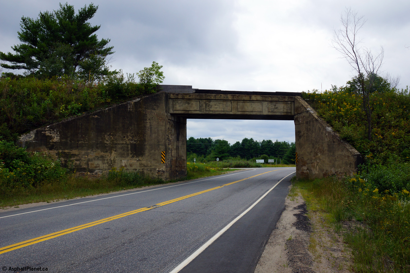
Town of Bracebridge
District Municipality of Muskoka |
Westerly view towards Bracebridge through the ONR overhead.
Photo taken: September 3rd, 2013. |
(720x480)
(1440x960)
(2400x1600) |
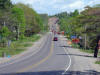
Town of Bracebridge
District Municipality of Muskoka |
Looking westerly towards Bracebridge from just west of the Highway 11
interchange.
Photo taken: June 5th, 2012. |

(720x480)
(1440x960)
(2400x1600) |
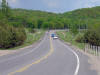
Town of Bracebridge
District Municipality of Muskoka |
This view looks easterly approaching the Highway 11 interchange.
Photo taken: June 5th, 2012. |

(720x480)
(1440x960)
(2400x1600) |
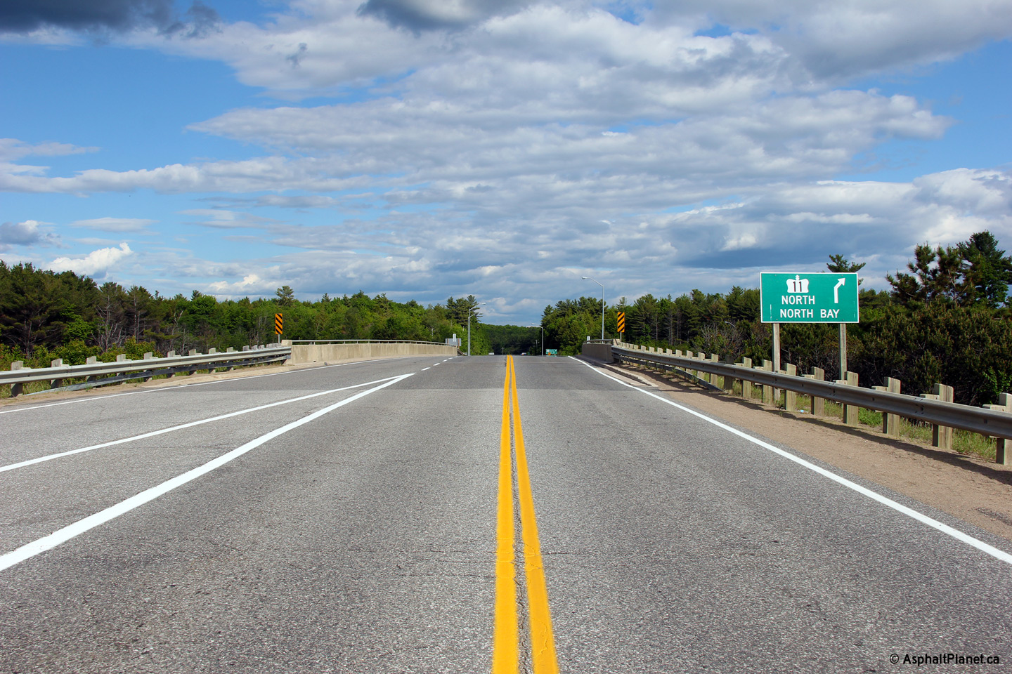
Town of Bracebridge
District Municipality of Muskoka |
Easterly view overtop of the Highway 11 overpass. The structure
carrying Highway 118 overtop of Highway 11 is fairly narrow considering its
traffic volumes and lacks a proper pedestrian sidewalk.
Photo taken: June 5th, 2012. |
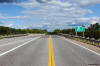
(720x480)
(1440x960)
(2400x1600) |
|
Highway 118 crosses Highway 11
just southeast of the town of Bracebridge.
Click
here for Highway 11 images. |
Town of Bracebridge
District Municipality of Muskoka |
Westerly view across the Highway 11 grade separation.
Photo taken: June 5th, 2012. |
(720x480)
(1440x960)
(2400x1600) |
Town of Bracebridge
District Municipality of Muskoka |
This view looks westerly approaching the Highway 11 interchange along
Highway 118.
Photo taken: June 5th, 2012. |
(720x480)
(1440x960)
(2400x1600) |
Town of Bracebridge
District Municipality of Muskoka |
View looking easterly along Highway 118 as the highway approaches the
Uffington Road intersection.
Photo taken: October 22nd, 2014. |
(720x480)
(1440x960)
(2400x1600) |
Town of Bracebridge
District Municipality of Muskoka |
View looking easterly along Highway 118 from just east of the Uffington Road
intersection.
Photo taken: October 22nd, 2014. |
(720x480)
(1440x960)
(2400x1600) |
Town of Bracebridge
District Municipality of Muskoka |
Two views looking easterly along Highway 118 as the highway passes adjacent
to the South Branch of the Muskoka River.
Photos taken: October 22nd, 2014. |
(720x480)
(1440x960)
(2400x1600)
(720x480)
(1440x960)
(2400x1600) |
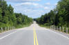
Town of Bracebridge
District Municipality of Muskoka |
View looking easterly along Highway 118 as it passes over a long tangential
section.
Photo taken: October 22nd, 2014. |
(720x480)
(1440x960)
(2400x1600) |
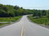
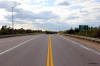
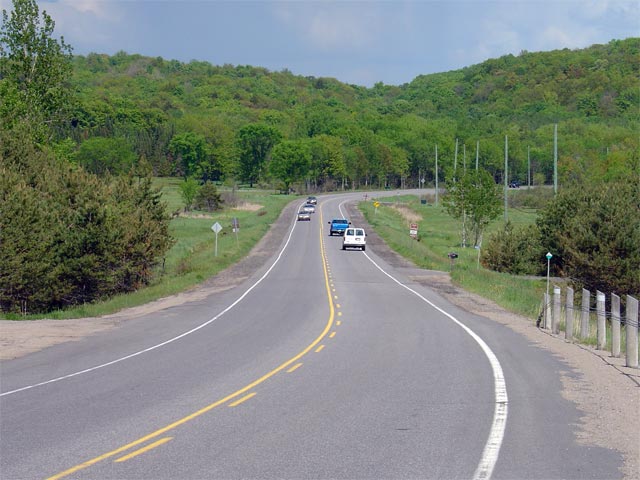
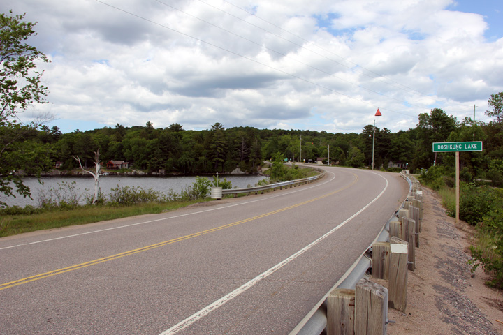
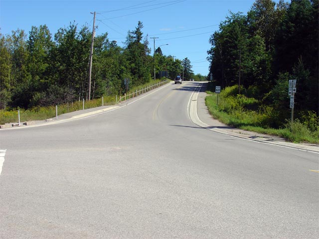
Township of Minden Hlls
County of Haliburton |
View looking easterly along Highway 118 between Vankoughnet and Boshkung
Lake. Because this section of Highway 118 is such a new road (it was
cut through the forest in the early 1980s), it features several long
tangential segments similar to that pictured, where the road follows an
undulating path through the forest.
Photo taken: June 5th, 2012. |
(720x480)
(1440x960)
(2400x1600) |
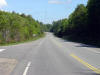
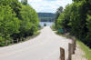
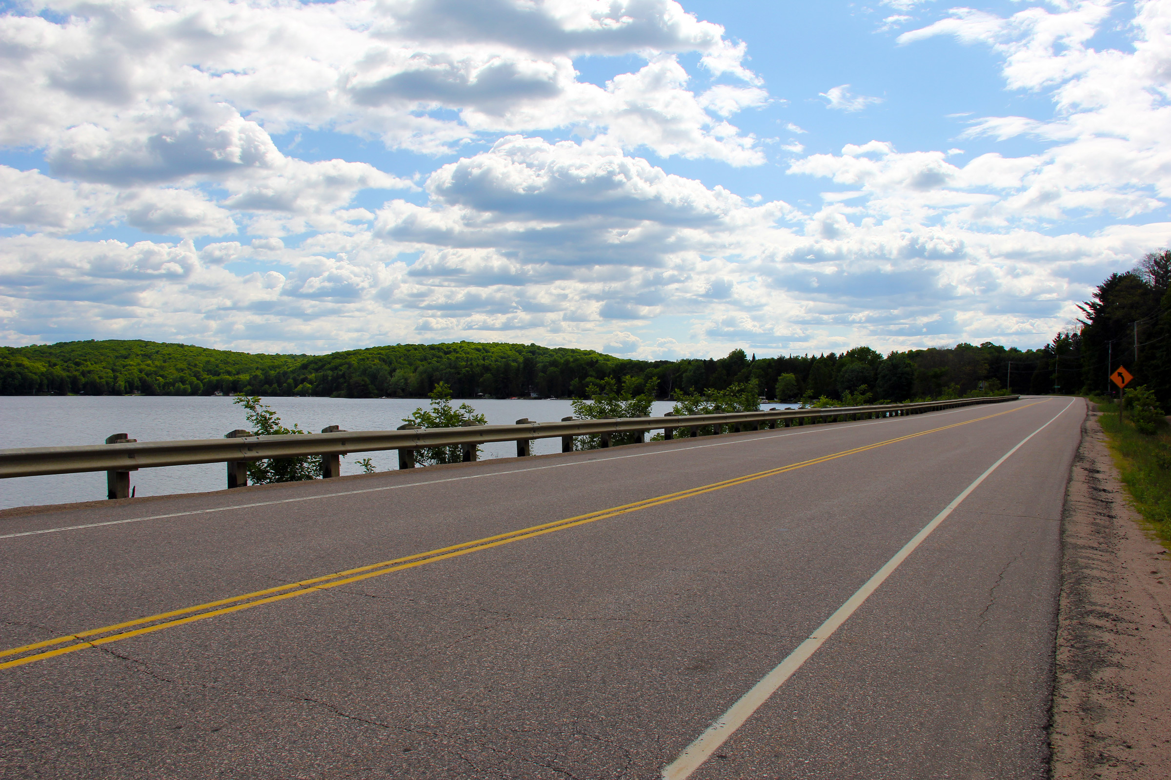
Township of Algonquin Highlands
County of Haliburton |
View looking westerly along Highway 118 as it runs along the shore of
Boshkung Lake west of Highway 35.
Photo taken: June 5th, 2012. |
(720x480)
(1440x960)
(2400x1600) |
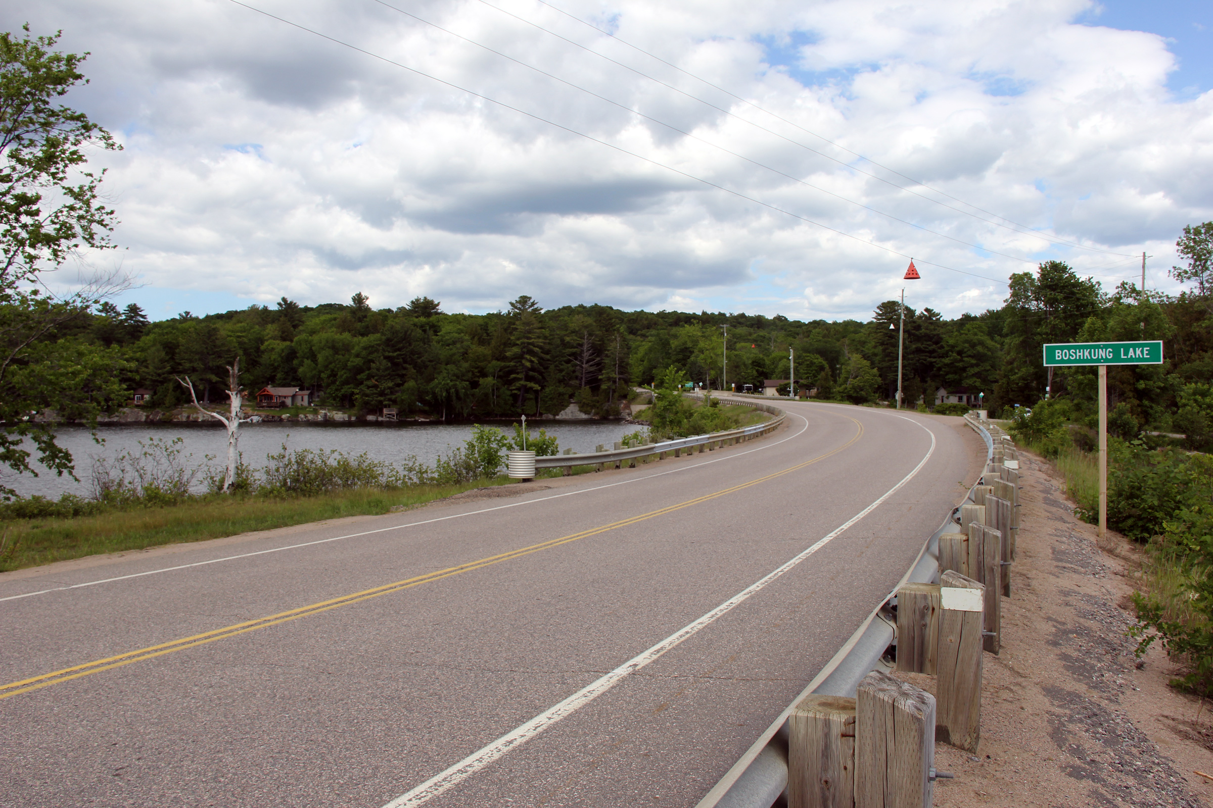
Township of Algonquin Highlands
County of Haliburton |
Easterly view along Highway 35 along the causeway that carries Highway 118
over Boshking Lake.
Photo taken: June 5th, 2012. |

(720x480)
(1440x960)
(2400x1600) |
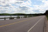
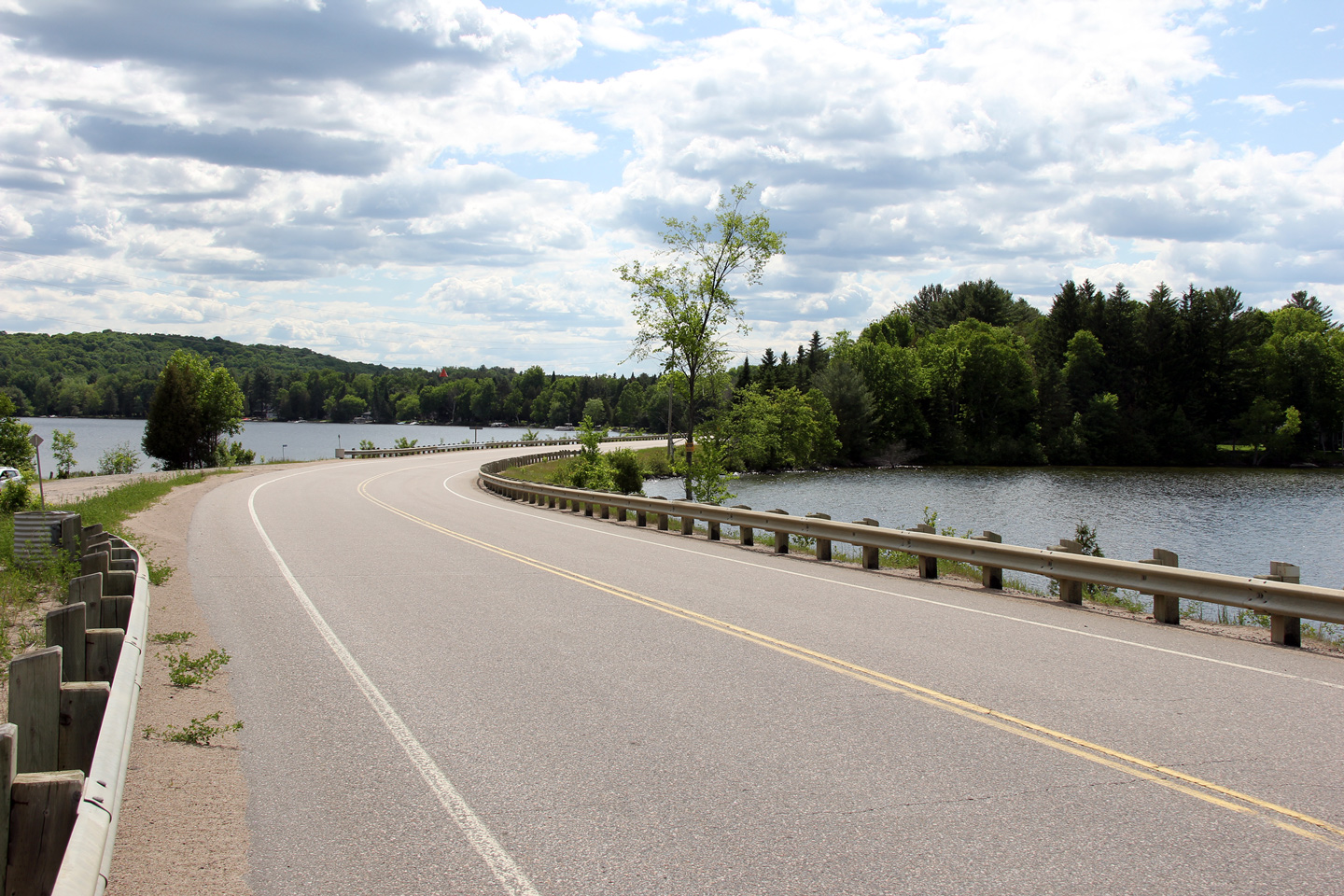
Township of Algonquin Highlands
County of Haliburton |
View looking westerly along the Boshkung Lake causeway.
Photo taken: June 5th, 2012. |
(720x480)
(1440x960)
(2400x1600) |
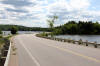
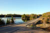
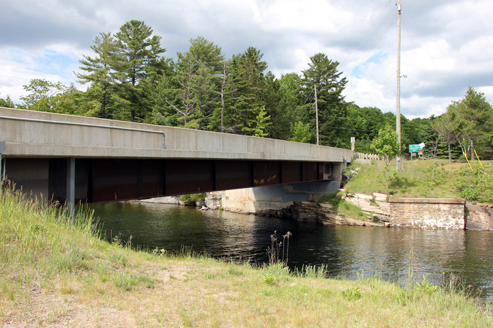
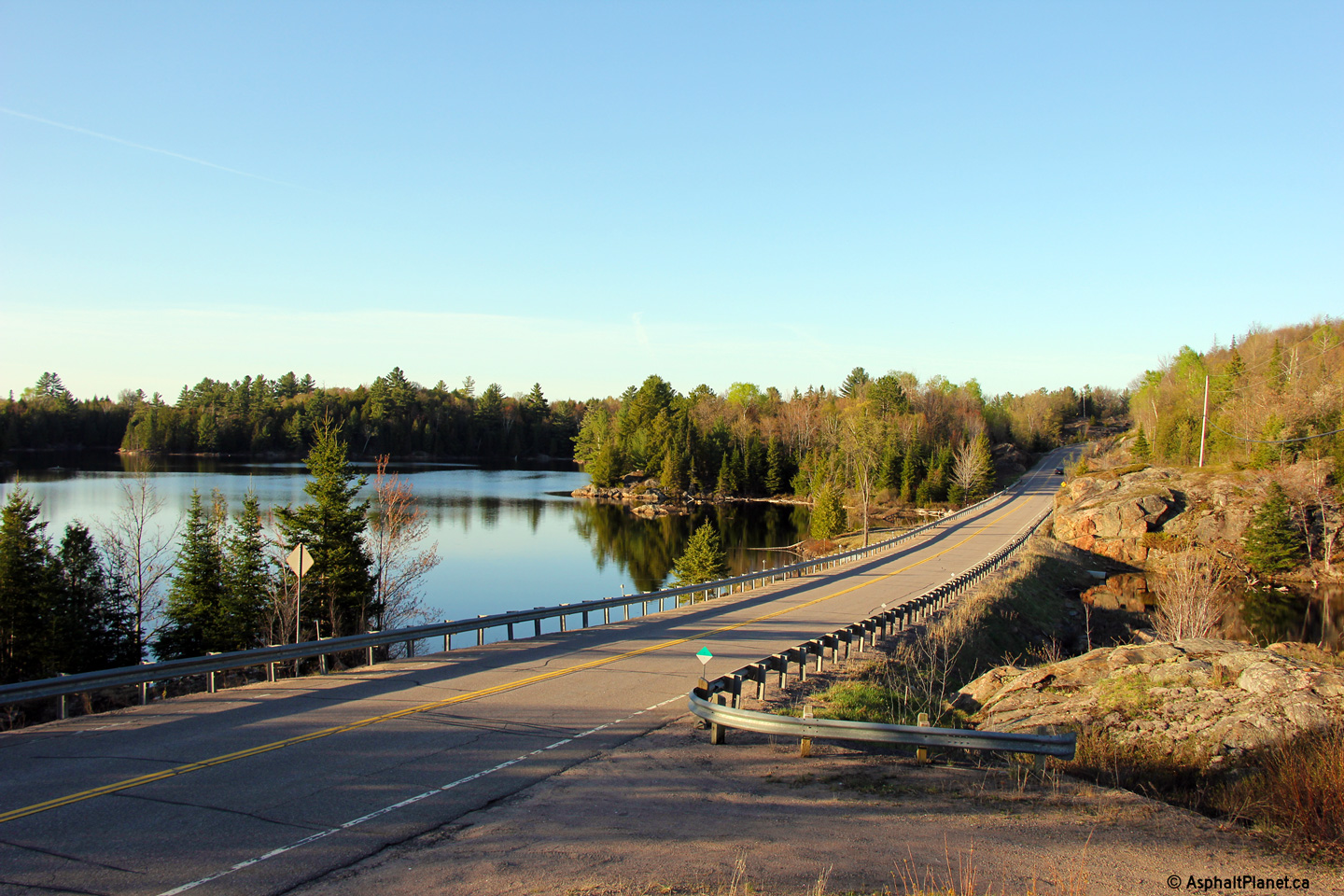
Township of Algonquin Highlands
County of Haliburton |
Easterly view at the Boshkung Lake Structure. An abutment for a former
single lane bridge is visible on the opposite side of the river.
Likely a short truss bridge carried the precursor to Highway 118 over the
lake prior to the construction of the current steel bridge.
Photo taken: June 5th, 2012. |
(720x480)
(1440x960)
(2400x1600) |
Township of Algonquin Highlands
County of Haliburton |
This view looks westerly as Highway 118 crosses Boshkung Lake.
Photo taken: June 5th, 2012. |

(720x480)
(1440x960)
(2400x1600) |
Township of Algonquin Highlands
County of Haliburton |
View looking westerly along Highway 118 approaching the Boshkung Lake
crossing from the high hill that separates Boshkung Lake from Highway 35.
Photo taken: June 5th, 2012 |
(720x480)
(1440x960)
(2400x1600) |
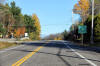
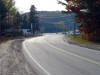
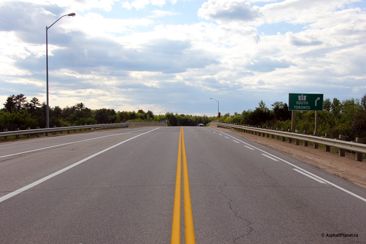
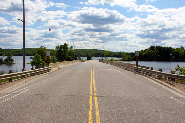
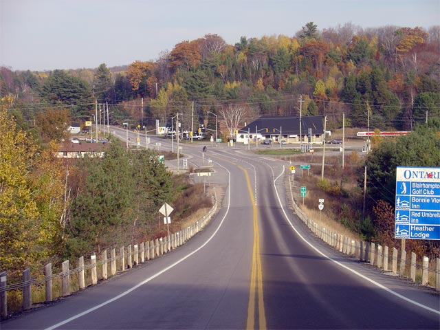
| Township of Minden Mills County
of Haliburton |
View looking east towards the Highway 35 junction at Carnavon
along Highway 118.
Picture taken: October 30th, 2005. |
 |
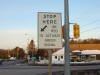
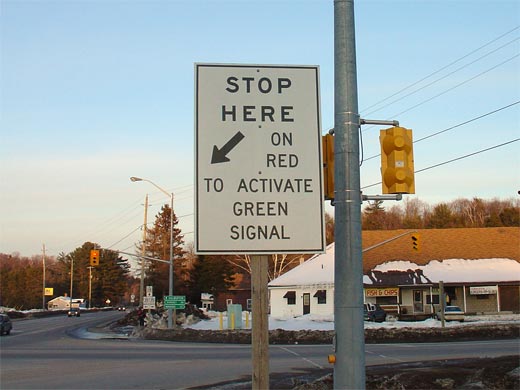
| Township of Minden Mills County
of Haliburton |
Signage at the Highway 35 intersection informing Highway 118 travelers that
they must stop at the sensor to activate the green signal at the traffic
signals. Signs like this are very uncommon in Ontario. Picture size:
35kb. |
 |
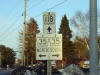
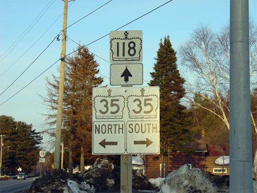
| Township of Minden Mills County
of Haliburton |
Junction signage at Highway 35 for eastbound
Highway 118 travelers. Picture size: 50kb. |
 |
|
Highway 35 runs between Newcastle
and Highway 60 at Dwight. Click
here for Highway
35-South images and
here for Highway
35-North images. |
| Township of Minden Mills County
of Haliburton |
Looking westerly along Highway 118 towards the signalized intersection with
Highway 35 at Carnavon. Picture taken: October 30th, 2005. Size:
70kb. |
 |
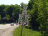
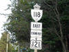
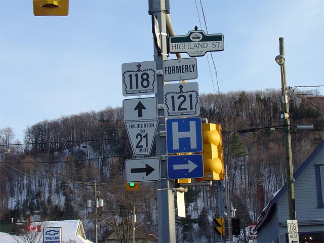
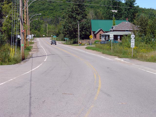
| Township of Dysart et al. County of
Haliburton |
Junction assembly for the now defunct Highway
121 junction in Downtown Haliburton. Before 1998 Highway 118
actually ended at this junction as Highway 121
continued both straight ahead and to the right. Since then, the
portion south of Haliburton was downloaded and the easterly portion of
Highway 121 was incorporated into Highway
118.
Picture size: 65kb. |
 |
| Township of Dysart et al. County of
Haliburton |
Photo of Highway 118 signage located in Haliburton. This is the first
eastbound reassurance marker on the former portion of
Highway 121
that was re-designated as Highway 118 in 2003. Picture size: 35kb. |
 |
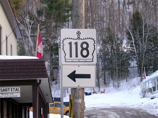
| Township of Dysart et al. County of
Haliburton |
Oversized Highway 118 crown marker directing traffic through a turn in
Haliburton. Picture size: 50kb. |
 |
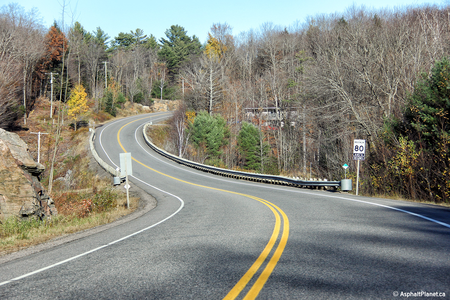
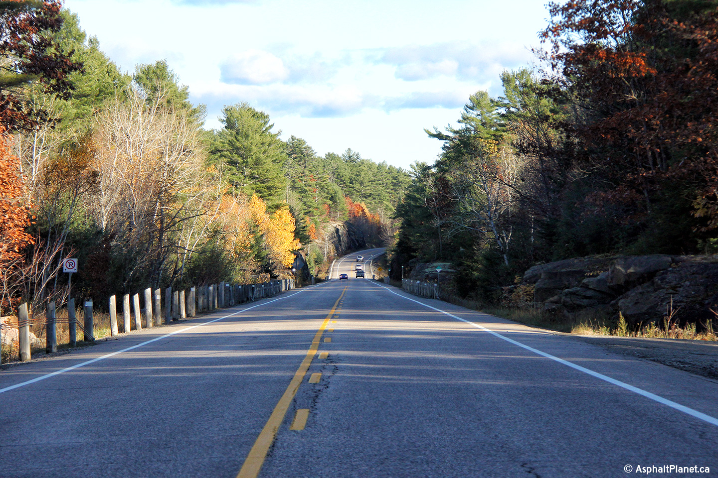
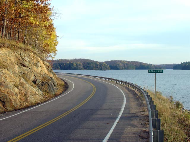
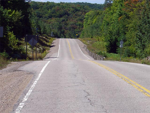
| Township of Dysart et al. County of
Haliburton |
View looking west from just west of Loon Lake. Notice the lack of
shoulders and narrow cleared right of way in this area. Much of
Highway 118 is fairly substandard between Haliburton and Tory Hill.
Picture taken: October 30th, 2005. |
 |
| Township of Dysart et al. County of
Haliburton |
View looking eastbound towards Loon Lake along Highway 118. Picture taken:
October 30th, 2005. |
 |
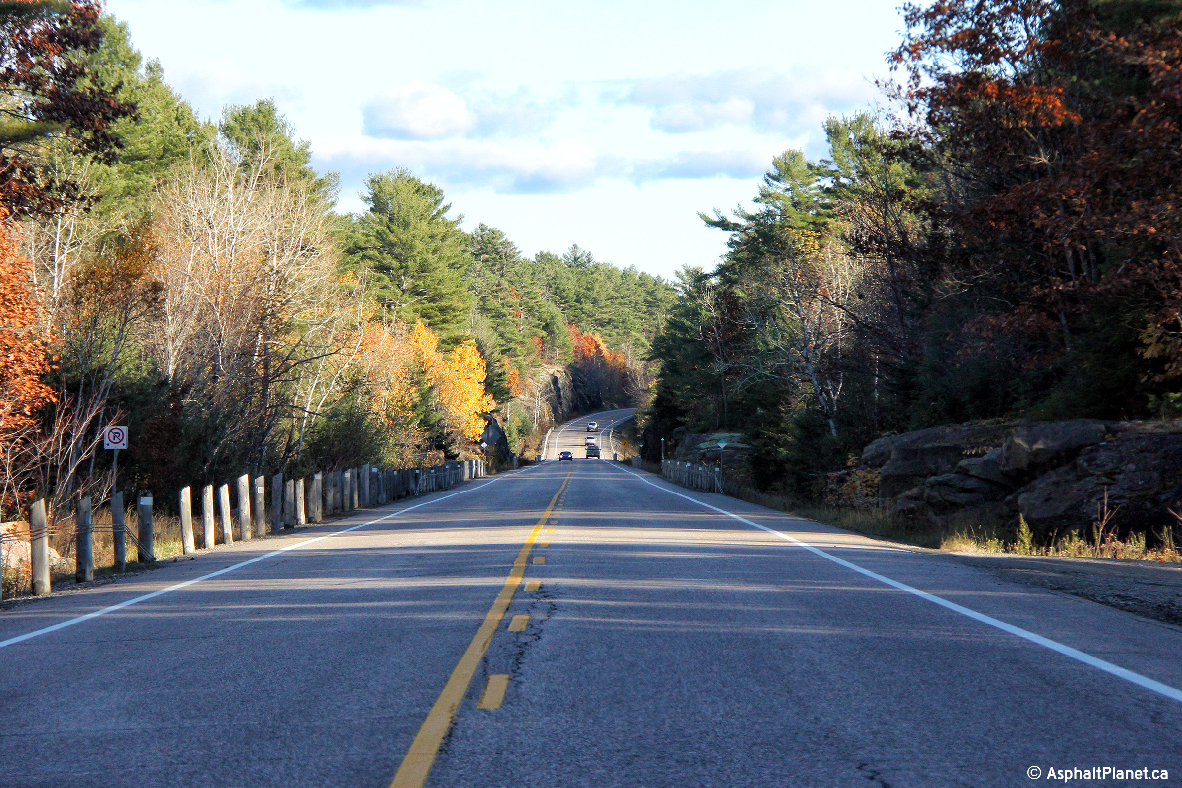
| Township of Dysart et al. County of
Haliburton |
View looking east again towards Loon Lake. This photo showcases the
rather substandard corner that is located at Loon Lake. Notice the
proximity of the inner rock-cut at the curve. Typically rock-cuts
would be cut back from the roadway around curves to provide for better
sightlines.
Picture taken: October 30th, 2005. |
 |
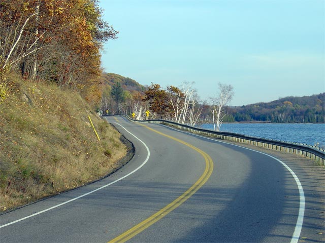
| Township of Dysart et al. County of
Haliburton |
Scenic fall view looking east at Loon Lake. The
Haliburton region of Ontario is dotted with small scenic lakes such as this
one. Picture taken: October 30th, 2005. |
 |
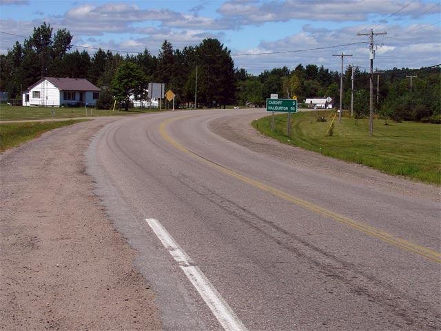
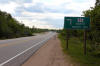
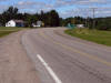
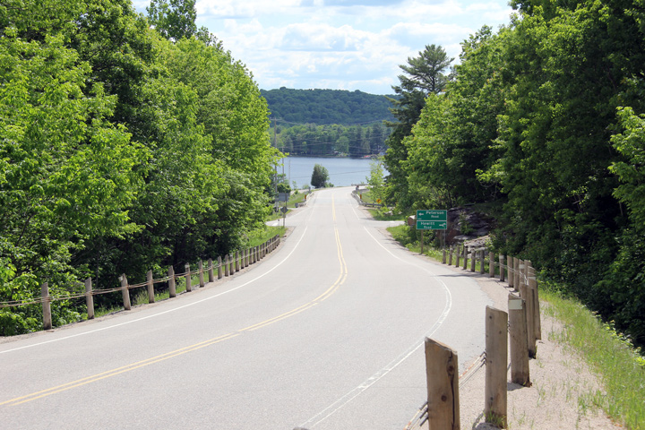
| Municipality of Highlands East
County of Haliburton |
View looking west from the Highway 503 junction at Tory Hill towards
Haliburton. Picture taken: August 21st, 2004. |
 |
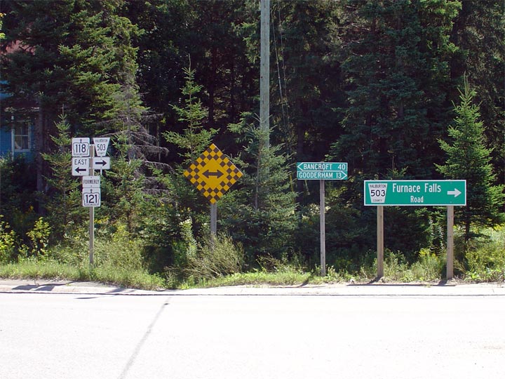
| Municipality of Highlands East
County of Haliburton |
Signage directing eastbound travelers through the Highway 118 (former
Highway 121) and Highway 503 junction.
At this junction, eastbound traffic must turn left to continue easterly
towards Bancroft. A right turn leads towards Kinmount on Highway 503.
Photo taken: August 21st, 2004. |
 |
| Municipality of Highlands East
County of Haliburton |
View looking westerly along Highway 118 (former
Highway 121) from the Highway 503 junction at Tory Hill. Photo
taken: August 21st, 2004. |
 |
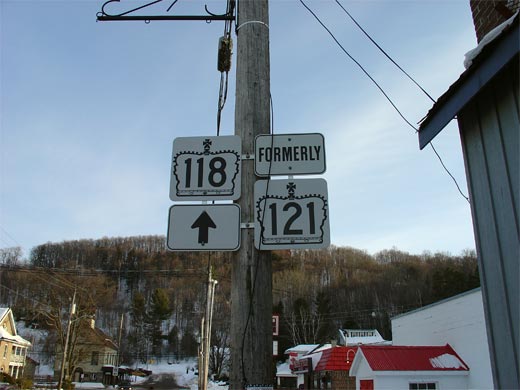
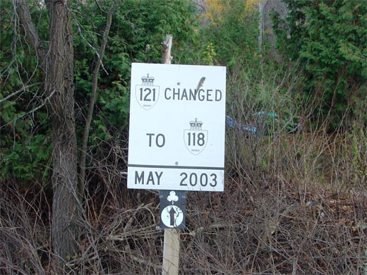
| Township of Dysart et al. County of
Haliburton |
Sign informing travelers that Highway 121
was re-designated as Highway 118 in May 2003. Picture size: 65kb. |
 |
| Township of Dysart et al. County of
Haliburton |
Highway 118 signage with Formerly Highway 121
signage. This is the more typical way the former
Highway 121
portion of Highway 118 is signed, unlike the above example in Haliburton.
Picture size: 65kb. |
 |
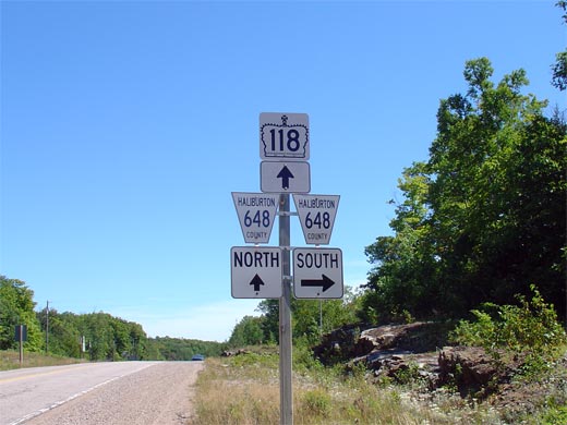
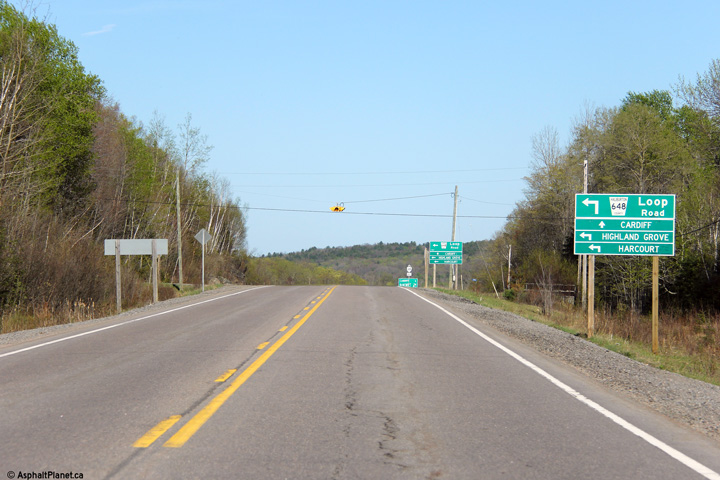
| Municipality of Highlands East
County of Haliburton |
Looking west from the central Highway 648 junction along Highway 118.
This section of Highway 118 passes through a series of quick (though
sometimes rather large) hills. Photo taken: August 21st, 2004. |
 |
| Municipality of Highlands East
County of Haliburton |
Junction signage for the central Highway 648 junction. Highway 648 has
a particularly odd routing. It is a loop highway and actually
intersected Highway 121 (now Highway 118)
three times, complete with a short multiplex easterly from this junction.
Photo taken: August 21st, 2004. |
 |
| Municipality of Highlands East
County of Haliburton |
View looking east along Highway 118 (former Highway
121/648). Highway 648 was multiplexed
with Highway 121 for 1.8km. Picture
taken: August 21st, 2004. |
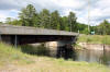
 |
| Township of Faraday County of
Hastings |
View looking easterly approaching the eastern Highway 648 intersection.
Photo taken: May 7th, 2013. |

(720x480)
(1440x960)
(2400x1600) |
| Township of Faraday County of
Hastings |
Easterly view as Highway 118 passes by Centre Lake.
Photo taken: May 7th, 2013. |
(720x480)
(1440x960)
(2400x1600) |
| Township of Faraday County of
Hastings |
View looking west along Highway 118 towards Haliburton from the eastern
terminus of the highway at Paudash. Photo taken: August 21st, 2004. |
 |
| Township of Faraday County of
Hastings |
Junction assembly at the east end of Highway 118 denoting the Highway 28
junction. This junction is located about 10km west of Bancroft. Photo
taken: August 21st, 2004. |
 |
|
Highway 28 leads through Central
Ontario from Peterborough through to Highway 41 at Denbigh.
Click
here for Highway 28 images. |


